A Day Trip to
Mt. Galbraith By Bette Erickson
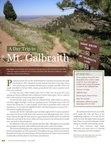
Easy choice: The sometimes steep, sometimes rocky and narrow trail encircling Mt. Galbraith’s 7,200-foot summit overlooks the City of Golden and North Table Mountain in Jefferson County Open Space. Photo by Bette Erickson.
P
rospectors from all over the world flocked to Colorado’s mountains after gold was found in 1858. Historical records indicate that three years later mines were producing an estimated 150,000 ounces of gold annually. When the supply dwindled in the late 1860s, miners gradually left the state or opted to mine silver, zinc, and lead. At what was once called Golden Gate City in 1859, now sits some 871 acres making up Mount Galbraith Park in Jefferson County Open Space. The 4.7 miles of hiker-only trails lure visitors back again and again. To start the hike, grab a map from the trailhead kiosk. Walk south on a narrow trail that wiggles through a forest on a gradual ascent. You’ll gain most of the 525 vertical feet along this 1.3-mile footpath. You’ll then be presented with a four-way intersection. Do not take the Nightbird Gulch Trail that drops down on your left — that leads to neighborhood access. Instead, take the Mt. Galbraith Loop Trail either right or left. It circles around the mountain, but doesn’t really lead to the actual summit, although pretty close. At one point, halfway through the loop, look for a good spot just off the trail to sit under the shade trees and take in the views. Follow the loop around to the intersection to make your way back to the parking area. It’s sufficient to only carry a day-pack for this short hike. Although be sure to include the essentials in your pack: water, sunblock, first aid, snacks, and an extra jacket. The flora found along the route range from the bizarre to the beautiful, and woody and flowering plants are well represented. Throughout the area visitors are treated to the distinctive pink and purple plumes of flowering fireweed. Native Americans have traditionally used this plant to treat bruises and infection.
44
Our Broomfield™ Magazine | May 2022
IF YOU GO … To the trailhead: From SH 128 in Broomfield, drive south 11 miles on SH 93. Turn west (right) on Golden Gate Canyon Road about 1.5 miles to Mt. Galbriath Park. Distance: 2.9 miles Difficulty: Easy Elevation gain: About 525 feet Dogs: Yes, on leash Information: Jefferson County Open Space 303-271-5925
It’s a pleasant trail, however, you really don’t escape the rush and hum of the neighboring highways (I-70 and SH 93) until you reach the highest point along the loop. There, you can enjoy the quiet, maybe sitting on a boulder and enjoying a snack. A clean restroom, large kiosk, brochures, and maps next to a chirping little creek greet you at the trailhead. Bette Erickson writes about people, places and events. Contact her at bette_erickson@hotmail.com.


