


Geospatial data is everywhere. It underpins our buildings, infrastructure and our increasingly connected and location-dependent world. The value of geospatial data lies in its ability to reveal patterns, trends, and relationships that can lead to more efficient and effective decisions.
We help you to collate, govern and use your project’s geospatial data to its full potential. We manage risk, reduce cost, simplify complexity, and lead our industry as the standard makers and the recognised mark of quality. Combining our knowledge and expertise with integrated cutting-edge technology, we want to drive a sustainable future that puts data at the heart of informed decision-making, by unlocking the true value of geospatial data.
Our vision is to be the partner of choice for geospatial certainty.


27,000+ projects delivered across Ireland, the UK, and Europe

Through strong principles and professionalism, we have built a reputation that people can trust. We always give honest advice and make considered and authentic decisions that uphold our ethics and integrity.


6 dynamic sectors served
400+
A team of over 400 experts

10+
We’ve worked in over 10 countries


We are an organisation committed to creating an open and supportive environment that inspires and motivates our staff to reach their full potential. We also look to the wider community to actively support local companies and charities.
We are relentless in our pursuit of progress and are passionate advocates for the surveying industry. We are fearless in breaking new ground by embracing emerging technologies and different ways of thinking.

We support and encourage diversity and celebrate the achievements of others. As well as being mindful of the people we engage with, we aim to respect the environment by trying to always work sustainably for future generations.
For more than 40 years, Murphy Geospatial has been providing geospatial certainty to our clients in Ireland, the UK, Europe, and globally. Our expertise and tech-enabled solutions support our clients to make informed decisions using verified geospatial data and consultancy.
We operate in six distinct sectors and multiple subsectors:
UTILITIES
PROPERTY ENERGY

MANUFACTURING NATURAL ENVIRONMENT
INFRASTRUCTURE
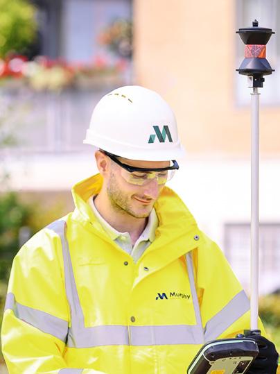
Our experts come together to understand the unique needs of your project and recommend the services that will help you to meet your end goal. We are technology agnostic, so you will always get the recommendations that are right for your project.
Our experts collect, collate, govern, and verify your geospatial data to support you to make informed decisions about your project.
The solutions we recommend are designed to keep your project on programme, on budget, to the highest health and safety standards, and with minimal disruption.
The geospatial data we gather will be essential to the digitalisation of the built environment, the development of smart infrastructure, robotics, automation, and the creation of digital twins.
Our geospatial solutions can be engaged throughout your project’s lifecycle. By consistently gathering geospatial data, you can ensure alignment with original design, detect issues early on, and act to avoid delay, disruption, and unplanned costs.
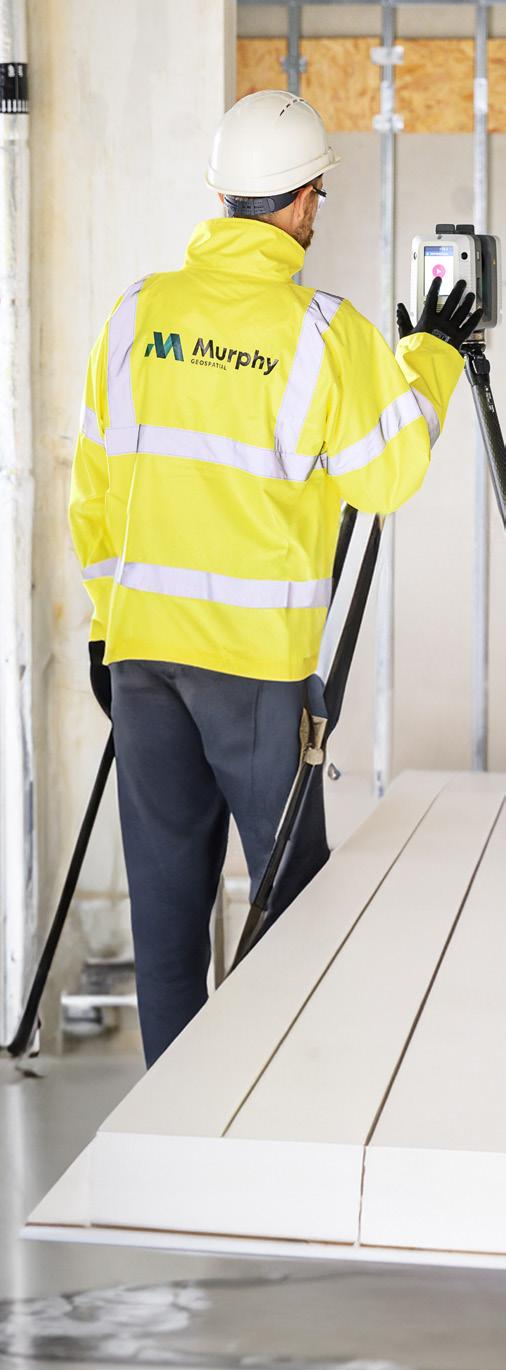

Our vision is to be the first-choice partner for geospatial certainty, and we are putting geospatial to work on increasing efficiency, quality, and reducing costs across the industries we operate in.
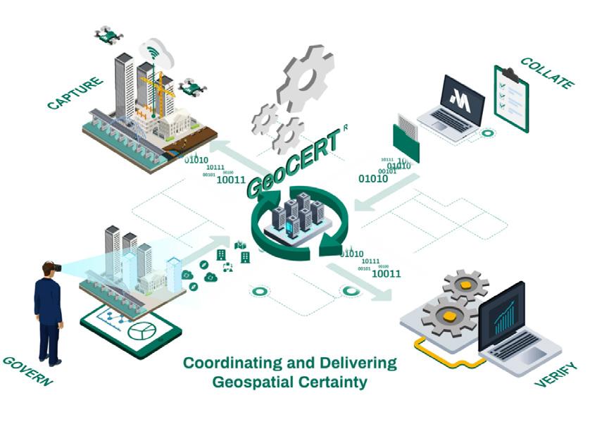
We understand the importance of geospatial certainty which is why we developed an industry performance standard GeoCERT®. GeoCERT® integrates people, processes, and technology to provide geospatial certainty when managing geospatial data and its primary goal is to deliver accurate and reliable geospatial information. Maintaining the GeoCERT® standard sets industry up for a future where a centralised portal manages geospatial data. This approach recognises that data capture methods have evolved, including the ability to collect information using everyday devices like smartphones. The next iterations of GeoCERT® will leverage AI to extract quick insights from data, addressing the need for real-time updates.
In the construction, maintenance, and monitoring of infrastructure projects it’s essential to provide accurate data to minimise delays and disruption to the public. Taking these actions reduces the likelihood of project overspend.
Geospatial data provides a digital representation of reality which supports digital project workflows. With real-time digital insights, you can undertake predictive maintenance, streamline
Our team of experts work with clients to create bespoke geospatial management plans. Our solutions for infrastructure projects include:
Investigation - Accessible asset data reviewing component conditions for informed decisions making.
Geospatial mapping - We capture geospatial data to provide comprehensive records and information of your asset.
Asset monitoring - Our remote monitoring tracks structural changes without wider disruption.
Geospatial engineeringWe offer end-to-end project support, bridging the gap between digital design and real-world implementation.

Read more about our infrastructure projects here.
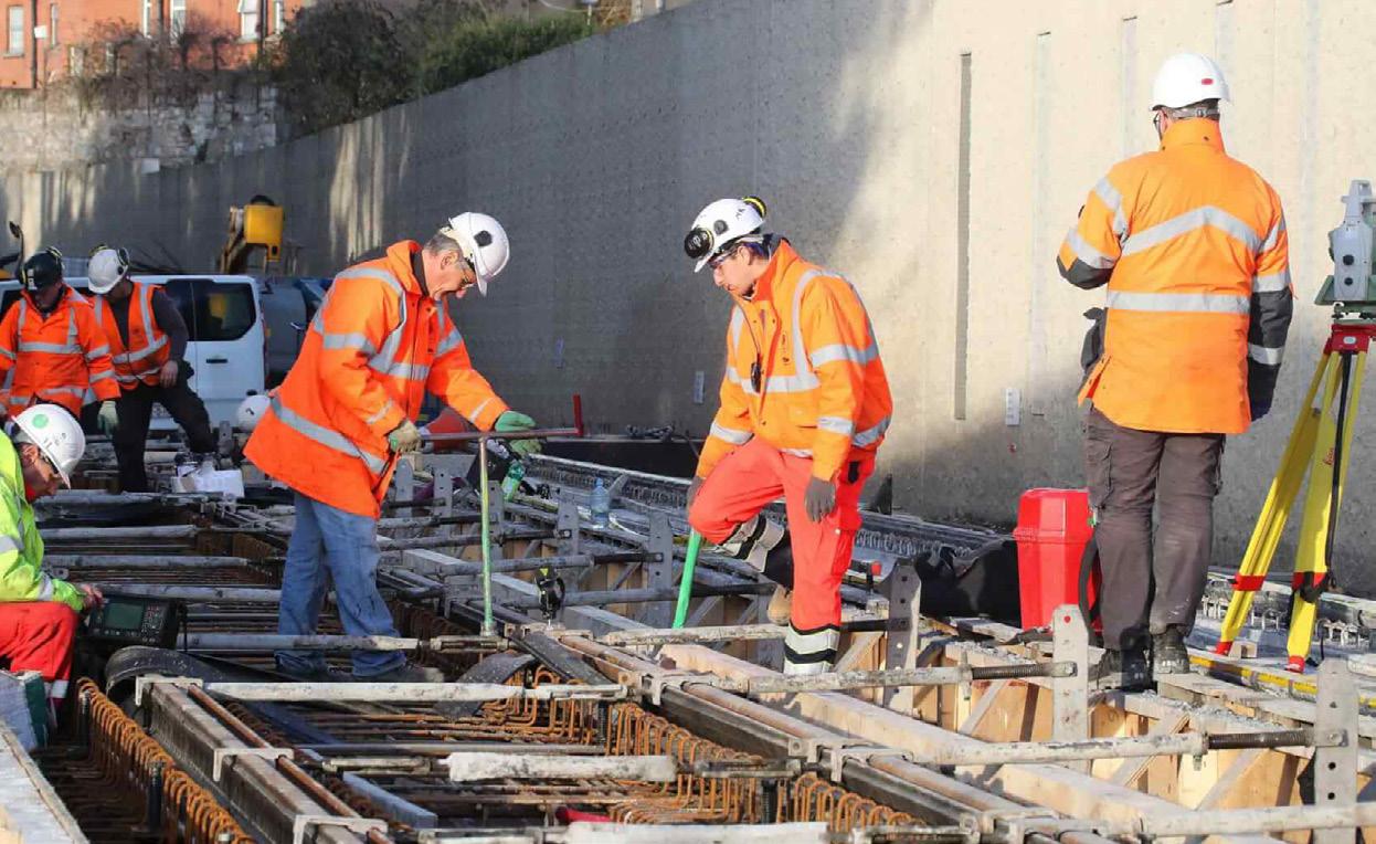
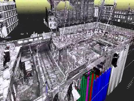
We delivered a detailed 3D topographical and subsurface model for the HS2 high-speed rail line, for client Skanska Costain STRABAG JV (SCS JV). Navigating through the complexities of a 26.4km stretch from West Ruislip to Euston in London, this project will boost rail capacity and transform connectivity across the UK.
We engaged with the community and stakeholders to shape a responsive work plan. This ensured minimal disruptions and increased safety.
The collaboration between Murphy Geospatial, SCS JV, and the supply chain resulted in successful delivery on time and on budget.
‘‘ ‘‘
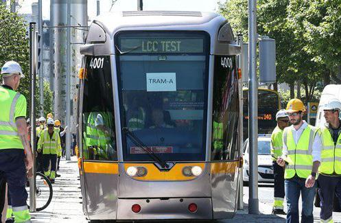
We engaged the services of Murphy Geospatial to undertake live monitoring of the Luas Line on a project in Dublin City Centre. Due to the proximity of the Luas lines to the double basement excavation, a detailed methodology and monitoring proposal was required. Shane and his team developed a methodology and carried out AMS track monitoring, precise level surveying, inclinometer readings and vibration monitoring during our works. Murphy Geospatial completed this work to a high standard from start to finish and we look forward to working with them again in the future.
Project Manager, Walls Construction
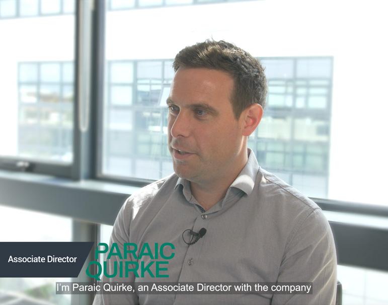
Contact our infrastructure sector lead Paraic Quirke at pquirke@murphygs.ie to find out more.
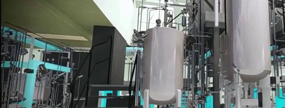
In manufacturing, it’s imperative to stay on schedule during shutdowns, upgrades, or construction activities. Our geospatial solutions ensure that you can reduce the risk of clashes and costly delays even in the most complex and time sensitive environments.
We have extensive experience working in pharmaceuticals, advanced technology facilities, and food and beverage production sites.

Our solutions
Geospatial consulting - We can leverage precise locationbased data through advanced technologies and processes, alongside ensuring data accuracy and compliance.
Geospatial mapping - We capture geospatial data to provide comprehensive records and information on your asset.
Asset monitoring - Our remote monitoring tracks structural changes without wider disruption.
Geospatial engineering - We offer end-to-end project support, bridging the gap between digital design and real-world implementation.

Read more about our manufacturing projects here.
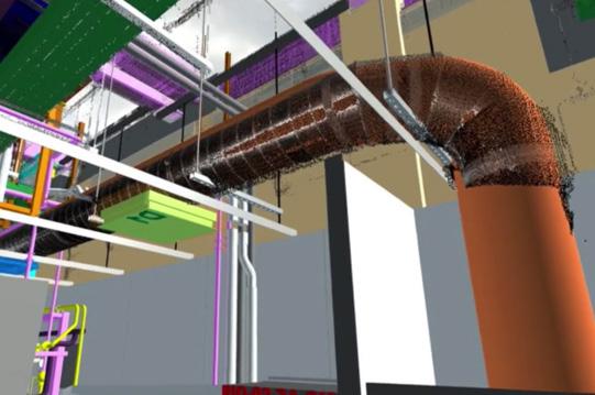
In collaboration with Jacobs Engineering, we played a vital role in the €150 million Merck Sharp & Dohme pharmaceutical facility project. The complexity of the low-density build, involving multiple stakeholders and various supply chain disciplines, posed unique challenges. We integrated into the digital delivery and quality teams and introduced geospatial management to instil a “right first time” culture.
By meticulously managing geospatial activities on-site, we took control of datums and baselines, reducing liability risks and ensuring adherence to the geospatial management plan. Proactive identification of issues, daily reporting, and a weekly quality report facilitated constant improvement in build accuracy, preventing safety risks and rework in the field.
The project, initiated in Q2 2021, has seen a remarkable improvement in the quality of installation, with estimated cost avoidance of €500k-€750k, showcasing the substantial impact of our precision and proactive approach.
The use of Geospatial Management in the life sciences sector delivers significant benefits during the construction phase of facilities. The high complexity of these facilities, often involving specialised equipment, makes it crucial to identify and address issues early on to prevent them from escalating into larger problems.
We have seen improved coordination and more effective decision-making by leveraging geospatial management. Geospatial management has supported greater efficiency, accuracy, and cost-effectiveness during construction which leads to a top-quality facility and better overall project outcomes.
Manager of Construction Quality, Jacobs Engineering
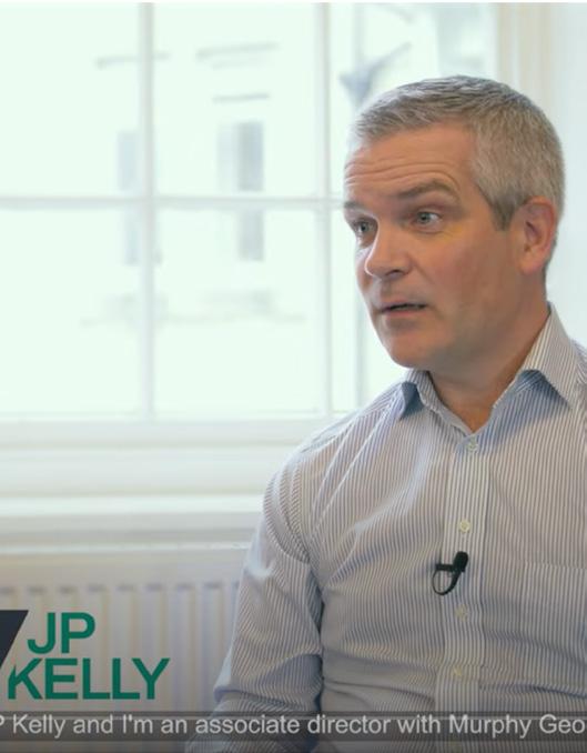
Contact our manufacturing sector lead JP Kelly at jpkelly@murphygs.ie to find out more.
It’s fundamental to ensure that design, construction, maintenance, retrofitting and asset management of utilities can be carried out without any adverse effects on essential services.
Accurate geospatial survey data and expert interpretation is integral to the safe and efficient construction and continued distribution of power and utilities, whilst minimising disruption.
Read more about our utilities projects here.
Our solutions
Geospatial consulting - We can leverage precise location-based data through advanced technologies and processes, alongside ensuring data accuracy and compliance.
Geospatial mapping - We capture geospatial data to provide comprehensive records and information on your asset.
Geospatial management - Your custom geospatial management plan is delivered by our experienced geospatial managers to ensure consistency and accuracy to BEP and AIM criteria for all spatial data.
Geospatial engineering - We offer end-to-end project support, bridging the gap between digital design and real-world implementation.

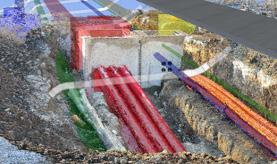


We provided a digital asset of the proposed route for the Metrolink project in Dublin, Ireland, during the planning and design phase. The project covered both urban and suburban areas. Our multi-disciplinary team utilised UAV technology, control, topographical, and hydrographic survey methods to gather geospatial data.
Early engagement in the project allowed the team to understand technical and social requirements, with a focus on minimising public disruption. Planning involved installing control networks, obtaining necessary permissions, and dividing the topographical survey into five zones. Executing the project involved diverse survey techniques and processing the collected data using various software packages. A key lesson learned was the importance of early integration of data from different platforms for an accurate 3D model.
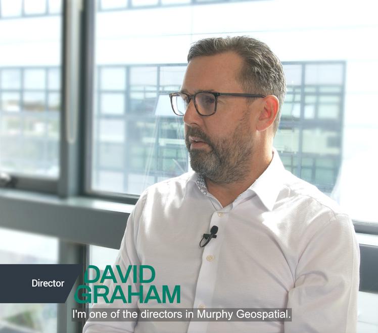
Contact our utilities sector lead David Graham at dgraham@murphygs.ie to find out more.
Geospatial data is integral to the construction, maintenance and retrofitting of energy facilities which needs to be carried out without causing damage or disruption to vital services. The sector is also under immense pressure to actively engage in the energy transition to meet the future demands on energy and data consumption.
We have extensive experience working in oil and gas, renewables, hydrogen, hydro and nuclear facilities.

Our solutions
Geospatial consultingWe leverage precise location-based data through advanced technologies and processes, alongside ensuring data accuracy and compliance.
Geospatial mappingWe capture geospatial data to provide comprehensive records and information of your asset.
Geospatial managementOur remote monitoring tracks structural changes without wider disruption.
Geospatial engineeringWe offer end-to-end project support, bridging the gap between digital design and real-world implementation.
Read more about our energy projects here.
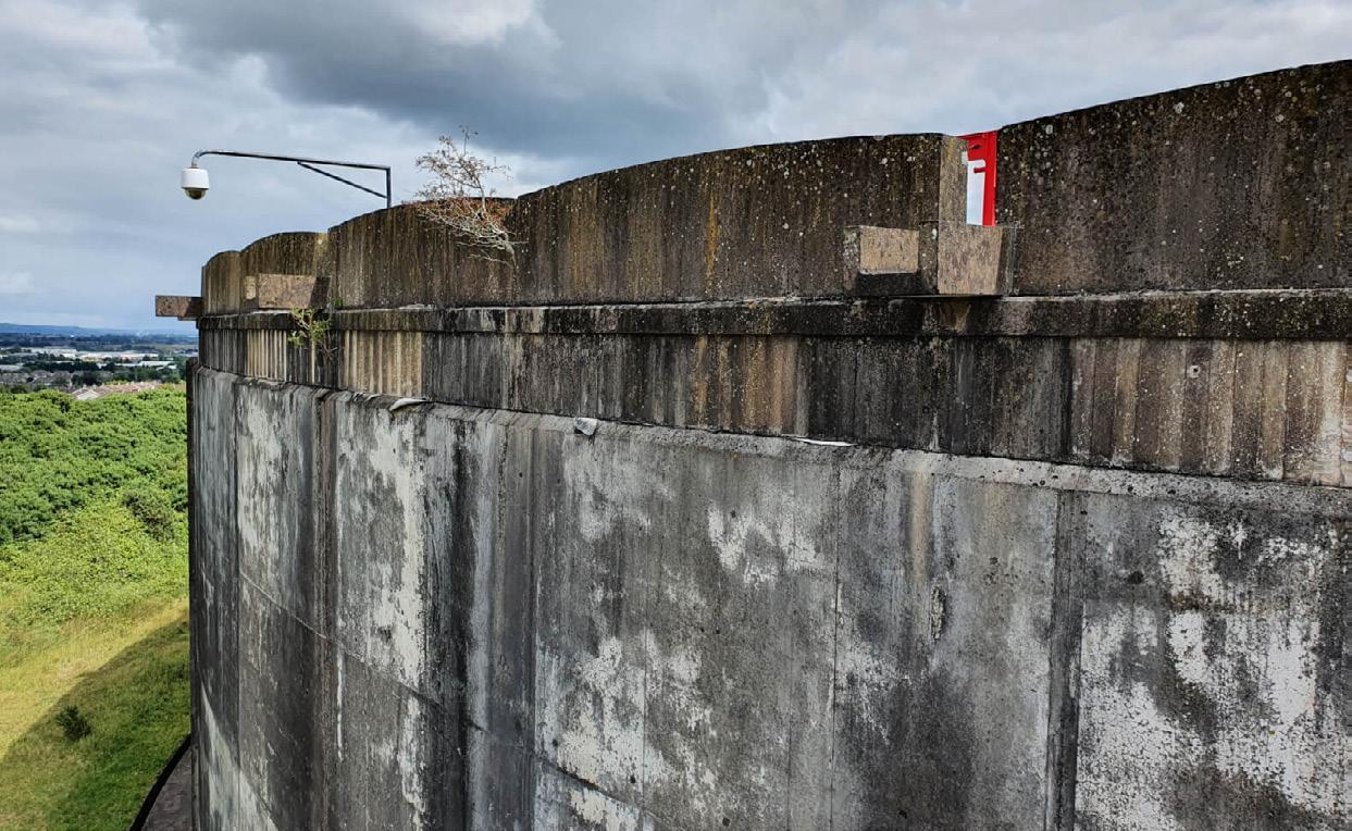
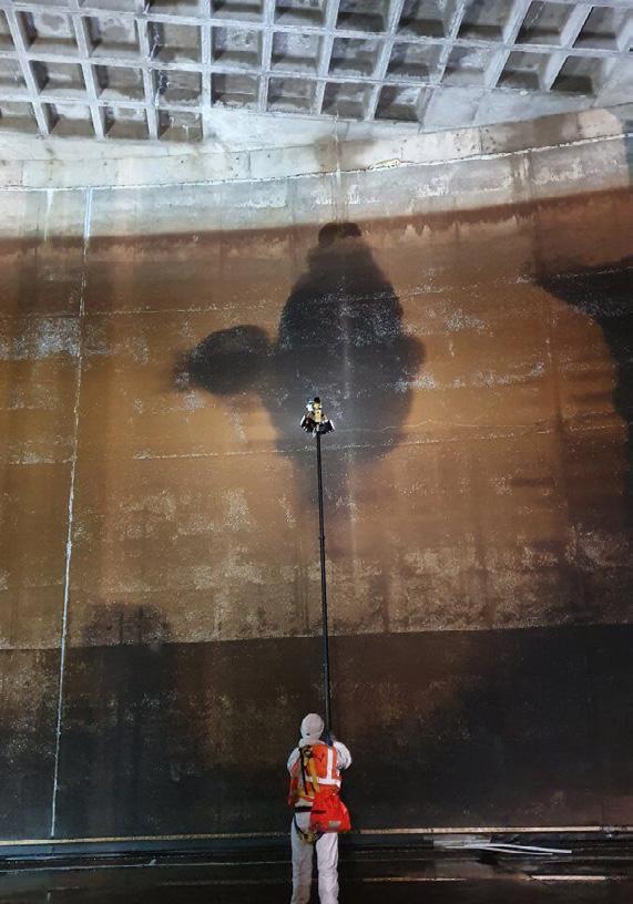
We worked with Malachy Walsh & Partners to inspect the Chetwynd water reservoir in Cork City’s water supply infrastructure. The inspection focused on post-tensioned concrete structures, requiring specialised skills in confined space working. To address this, we proposed a unique solution using remotely operated high-definition cameras and LED lights attached to a telescopic pole. Our specialist engineering services team, trained in rope access and confined space working, executed the project, ensuring high-quality, repeatable geospatial data.
Coordination with stakeholders was crucial as the project included emptying the reservoir. we delivered a set of high-quality photographs for an engineering assessment, contributing to the security of Cork City’s water supply. This approach eliminated the need for mobile elevating work platforms or scaffolding during inspections, saving the client time and money.
The built environment is the world’s most valuable asset class. We bring your property portfolio assets online to bridge the gap between the physical and digital world. Geospatial data can reveal your asset’s potential, identify any structural risks, and enable enhanced facilities management with a data-enabled digital twin.
Our solutions
Measured building survey (mbs)Measured building surveys minimise risk, optimise efficiency, and creating an digital version of the asset.
Portfolio measurementDigitising a portfolio accelerates datadriven decision-making, reducing site visits, informing stakeholders, and ensuring compliance.
Retrofit - Create a digital roadmap to upgrade your property.
Compliance - Ensure compliance with building and fire safety regulations that changes how you digitally interact with your asset.

Read more about our property projects here.
Case Studies
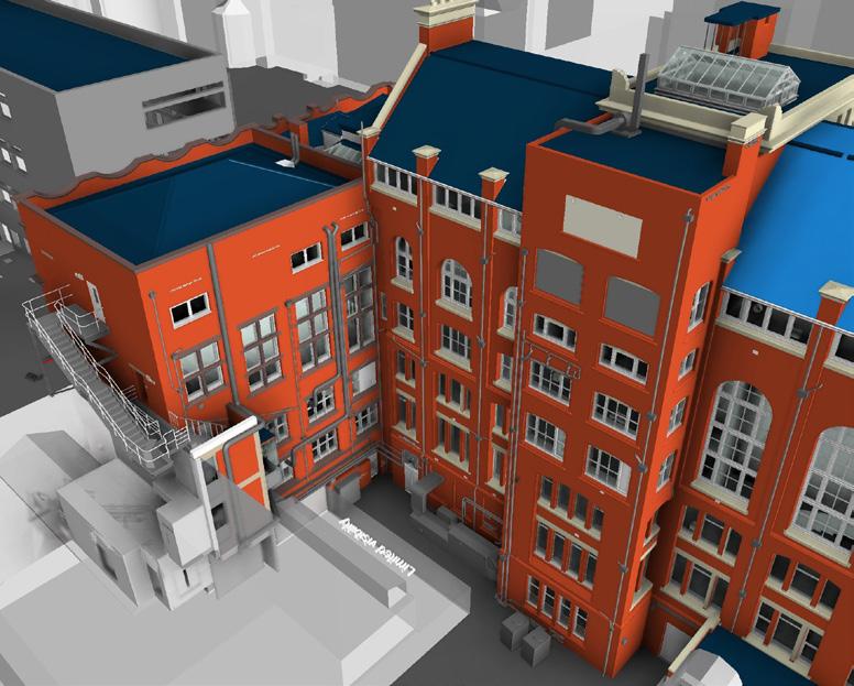
The Old War Office, in Westminster, UK was a project in collaboration with Westminster Development Services Ltd. The project involved the refurbishment and demolition of parts of the Grade II listed property that was going to be converted into a luxury hotel. We were engaged at multiple stages of the project, including covering design, strip-out, demolition, refurbishment, and construction.
Our services provided include initial scan-to-BIM models, panoramic imagery surveys, progressive BIM model upgrades, topographical and utility surveys, photographic dilapidation surveys, and as-built CAD drawings.


We used Murphy Geospatial at The OWO (Old War Office) for numerous surveys across several years of the development, and I have been impressed by their reliability and accuracy. Their wide range of services has been particularly beneficial, including BIM modelling, construction validation, photographic surveys, and utilities, and they have always delivered highquality results. I appreciate their quick turn-around time, especially during the construction and final fit-out stages when time is of the essence, and highly recommend this company for a dependable survey service
Westminster Development Services Ltd
Contact our property sector lead Diarmuid Murphy at dmurphy@murphygs.ie to find out more.
A better understanding of our natural environment using geospatial data, enables us to predict its future behaviour, allowing us to limit the impacts of flooding, coastal erosion, and deforestation.
Verified geospatial data is key to understanding these complex systems. Data-driven decision making helps protect society in a changing

Our solutions
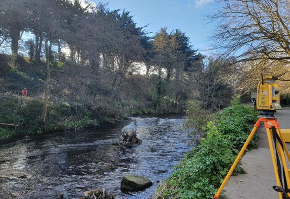
Hydrographic surveys - (Currently Ireland only) - Hydrographic surveys are vital for environmental planning, and our expertise ensures clients receive well-prepared data that seamlessly integrates with modelling software.
Bathymetric surveys - These surveys provide 3D visuals to aid navigation upkeep, while pre and post dredging surveys verify quantities, payment claims, and environmental license adherence.
Aerial surveys - Aerial surveys help clients capture data non-intrusively in protected areas, protecting sensitive habitats.
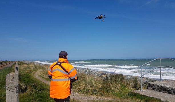
Embankment surveysOur embankment surveys and geospatial analysis ensure flood protection by pinpointing design deviations and defects for proactive maintenance.


We were a key part of the OPW Lot 1 Framework for Surveying Services and our team has successfully delivered 20+ projects for critical flood relief initiatives in Ireland. Our expertise in various surveying aspects, including survey control, topographic surveys, and post-flood recording surveys, inform and construct flood models for predicting the impact of future weather events.
The hydrographic surveying teams, equipped with diverse skills, ensured precise project delivery. The systematic process involved engaging clients through SRFT (supplementary requests for tender), clear communication, meticulous planning, execution by experienced crews, and accurate data processing. We employed robust surveying equipment, including GNSS technology and sonar methods, for accurate data capture in challenging environments.
Murphy Geospatial has undertaken 3 major CFRAMS survey contracts for us, various infill survey contracts and completed defence surveys on our behalf. I wouldn’t have been happy unless Murphy Geospatial were undertaking this work as I know the levels of planning from there management team always ensure the projects run smoothly no matter how big or small. Furthermore, the survey crews on the ground collecting the data are second to none, they are not only extremely well trained, but knowledgeable as well, which gives us confidence in the survey data we receive.
RPS Group
Contact our infrastructure sector lead Paraic Quirke at pquirke@murphygs.ie to find out more.


Our key fundamental pillars of success
Our team are a critical part of our success. We recruit the best staff and invest in their development, creating an environment where the team is engaged and committed to bringing our values to life, leading to consistently high staff and client satisfaction levels.
Using and developing the latest technology and processes is vital to the success and growth of both our clients and us. Our investment ensures we can provide a wide range of services – and train our people to use the equipment to its full potential.
Our excellent support network of employees and management demonstrates a shared passion for delivering high-quality work. They liaise closely to plan and implement our projects, sharing potential challenges and agreeing solutions at an early stage.
We are dedicated to supporting and developing our staff of over 400 professionals to enhance their technical and personal skills. The Murphy Geospatial Career Path initiative creates opportunities to help them achieve their personal and professional ambitions.
Details of our sector heads can be found in the earlier pages of this brochure and our full team biographies and contact details are available on our website here. murphygs.com

Our Group Directors are the leadership team behind Murphy Geospatial fostering the culture of innovation and ambition.

Niall Murphy Chief Executive Officer (CEO) Founder

Colin Murphy Chief Business Development Officer (CBDO) Founder

Ray Murphy Chief Strategy Officer (CSO) Founder

Billy Roche Chief Operating Officer (COO)







Global House
Kilcullen Business Campus
Kilcullen R56 K376
Ireland
T: +353 (0)45 484 040
E: info@murphygs.ie
9 Millfield House Croxley Park
Woodshots Meadow Watford
WD18 8YX
United Kingdom
T: +44 (0)192 362 4800 E: info@murphygs.com
Ireland
T: +353 (0)21 489 5704
E: cork@murphygs.ie
SK9 3HW
United Kingdom
T: +44 (0)160 626 3019
E: info@murphygs.com
DY4 7HN
United
T: +44 (0)121 630 3074 E: info@murphygs.com
Westpoint Court Business Park
JFK Drive, Naas Road
Dublin D12 E138
Ireland
T: +353 (0)1 690 9799
E: info@murphygs.ie
Ireland Head Office
T: +353 (0)45 484 040
E: info@murphygs.ie
UK Head Office
T: +44 (0)192 362 4800
E: info@murphygs.com
Website murphygs.com
