

For more than 40 years, Murphy Geospatial has been providing geospatial certainty to our clients in Ireland, the UK, Europe and globally. Our expertise and tech-enabled solutions support our clients to make informed decisions using verified geospatial data and consultancy.
We operate in six distinct sectors and multiple subsectors:


Geospatial Engineering uses advanced technologies to capture and interpret locational data about the built environment. Deploying state-of-the-art tools such as drones, GPS, satellite imagery, robotic instruments, and laser scanners we produce precise, interconnected data that forms the basis of enhanced geospatial modelling.
This real-time, high-quality information enables informed decision-making across engineering disciplines, supporting sustainable development and optimising resource allocation.
Geospatial data is indispensable because it reduces the risk of redesign and rework, which in turn helps keep a project on schedule and within budget.


Our Geospatial Engineering solutions are used by a broad range of industries by providing precision data that drives success at every stage of the project lifecycle.


INFRASTRUCTURE
A successful manufacturing project includes increasing operational efficiency, improving collaboration, and enhancing quality control. Our Geospatial Engineering solutions help advanced technology facilities and industrial plants achieve optimal performance, whilst ensuring safety and reducing running costs.
PROPERTY
MANUFACTURING
ENERGY
Geospatial Engineering delivers accurate land surveying and mapping paired with real-time data analysis. This robust information base supports efficient planning, development, and management of commercial, residential, and logistics projects, ensuring that every decision is grounded in reliable, actionable insights.
When it comes to infrastructure projects - ranging from roads and rail networks to ports and tunnels – downtime can be costly to asset owners. We enable infrastructure projects to benefit from cost-effective and efficient data collection. Our approach facilitates accurate mapping, continuous monitoring, and detailed inspections of structures, ensuring that these critical networks remain resilient and safe without disruption.
Geospatial data is critical for optimising energy infrastructure and boosting efficiency. Whether supporting traditional oil and gas projects or the dynamic needs of renewable energy development and management, our precision measurements help avoid risks while promoting sustainable practices.
Across the utilities sector, our solutions enhance the planning, design, and management of essential infrastructures such as data centres, telecommunications, and water systems. By improving asset management and operational efficiency, we help lower costs and ensure that utility networks are robust and future ready.
UTILITIES
Geospatial Engineering transforms the most critical challenges in engineering projects into clear, actionable solutions that enhance resilience and efficiency.
With a combination of advanced technology and industry expertise, we address every phase of the project lifecycle. From initial design to final construction, with precision and reliability.
Our approach ensures that each challenge is met head-on, enabling projects to stay on schedule, within budget, and built to the highest standards.
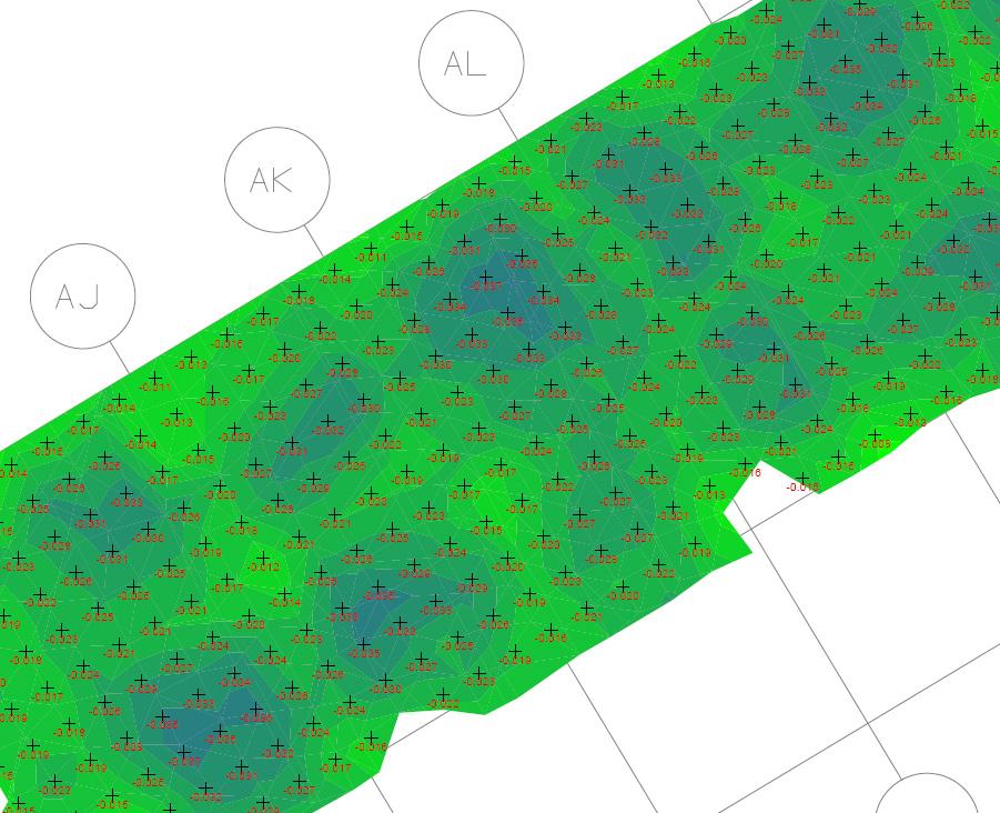
Accurate positioning: Translating design drawings into precise, real-world coordinates.
Data collection and management: Employing advanced technologies for real-time monitoring and robust analysis.
Control networks: Establishing dependable reference points to maintain alignment across all project activities.
Construction efficiency: Streamlining processes to minimise errors and reduce costly rework.
Compliance: Ensuring adherence to design specifications and regulatory standards for seamless project delivery.

Geospatial Engineering brings significant value to projects by providing highly accurate, real-time data to optimise resource management and enhance the efficiency of project planning and execution.

By using advanced technologies, Geospatial Engineers ensure that all aspects of a project are backed by precise data. This not only helps in avoiding costly errors but also accelerates project timelines, allowing for a smoother workflow.
To find out more about the role of a Geospatial Engineer, read our insight:
Geospatial Engineering improves collaboration by visualising complex spatial data in easy-to-understand formats, encouraging better communication among stakeholders and ensuring compliance with regulatory standards.
Our Geospatial Engineering services are driven by a suite of advanced technologies that set the benchmark for both precision and speed. Our approach ensures every measurement is accurate and every project benefits from rapid data collection. By leveraging a diverse array of tools and methods, we consistently deliver detailed, actionable insights that drive project success.
Our Geospatial Engineering technologies include:
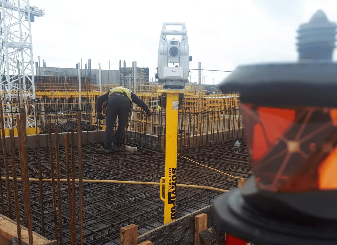
Robotic total stations: These devices deliver precise angle and distance measurements, enabling us to establish accurate control points and capture critical spatial data with millimetre-level precision.

Global Navigation Satellite Systems (GNSS): Using GPS technology along with multiple satellite constellations, our GNSS solutions provide pinpoint location accuracy.
3D laser scanners: With the ability to capture intricate, three-dimensional models of the environment, our 3D laser scanners enable detailed visualisations that are essential for complex engineering projects.
UAV surveys: Equipped with high-resolution cameras and advanced sensors, our drones perform rapid aerial surveys, capturing expansive areas quickly and providing high-quality imagery and data from perspectives that ground-based methods cannot achieve.

3D modelling software: Our teams use industry-leading software such as AutoCAD, 12d Model, and Revit, to transform raw survey data into intricate visualisations. These digital models help stakeholders understand spatial relationships and support comprehensive project planning.
Augmented reality (AR): Our AR tools enhance real-world visualisation by overlaying digital data onto physical environments. This technology not only improves accuracy during on-site assessments but also provides an intuitive understanding of spatial layouts for project teams.


Global House
Kilcullen Business Campus
Kilcullen R56 K376
Ireland
T: +353 (0)45 484 040
E: info@murphygs.ie
9 Millfield House Croxley Park
Woodshots Meadow Watford
WD18 8YX
United Kingdom
T: +44 (0)192 362 4800 E: info@murphygs.com
T12 T256
Ireland
T: +353 (0)21 489 5704
E: cork@murphygs.ie
SK9 3HW
United Kingdom
T: +44 (0)160 626 3019
E: info@murphygs.com
DY4 7HN
United
T: +44 (0)121 630 3074 E: info@murphygs.com
Block
Westpoint Court Business Park
JFK Drive, Naas Road
Dublin D12 E138
Ireland
T: +353 (0)1 690 9799
E: info@murphygs.ie
Ireland Head Office
T: +353 (0)45 484 040
E: info@murphygs.ie
UK Head Office
T: +44 (0)192 362 4800
E: info@murphygs.com
Website murphygs.com
