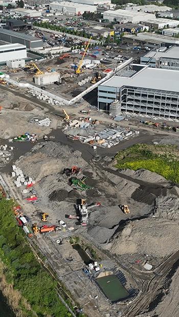
For over 40 years, Murphy Geospatial has been a leader in providing the information that underpins successful construction projects across Europe. We’re recognised for our experience, innovation, and commitment to delivering better results - proven by metrics and benefiting all stakeholders. We partner closely with our clients, driving forward a better way of working together.
Our approach
We achieve superior outcomes by focusing on four key areas: risk reduction, ‘build right first time’ execution, faster project delivery, and informed decision-making. We accomplish this through:
Consultancy
Our expert team provides strategic insight and project management, guiding client decisions at every stage.
Advanced modelling and construction validation
We create precise models of existing assets and continually validate as-built conditions during construction against the design, minimising risks and providing actionable insights.
Comprehensive management and expertise
Our team handles everything from detailed surveys and project oversight to setting out, construction validation, and the management of your supply chain’s geospatial activities, both on and off-site.
Measurement and visualisation
Using cutting-edge equipment and processes, we deliver high-accuracy, consistent, validated information and the best tools to foster seamless collaboration among stakeholders, reducing confusion and rework.
Quantifiable value
This translates to significant value for your project:
• Schedule optimisation: Minimise delays and reworks. Improve project delivery speed.
• Cost savings: Reduce claims, conflicts, and on-site costs by solving issues digitally and implementing build-right-first-time practices.
• Resource optimisation: Earned Value Management (EVM) aids progress tracking, issue identification, and resource allocation.
• Efficient change management: We support a structured process for evaluating and implementing changes with minimal disruption.
• Proactive risk mitigation: Identify, evaluate, and mitigate risks early, preventing costly issues.
Murphy Geospatial provides a collaborative, results-driven approach to geospatial management. Let’s discuss your project and how our expertise can help you achieve superior outcomes -on time, within budget, and exceeding expectations.
Services and solutions by construction stage
STAGE SOLUTION
TENDER
• UAV/Drone surveys with design and survey integration
• Augmented reality (AR) integration – site walks and approach
• Earthworks calculations and earthwork management
• Digitisation and modelling of design from PDFs and CAD
• 4D Synchro plans
• Consultancy on approach – geospatial management, monitoring, BIM, digital delivery
• Cost and tender documentation support and collaboration
PRE-CONSTRUCTION
CONSTRUCTION
• Topographic surveys and UAV/Drone surveys with design and survey integration
• Utility, GPR, and geotechnical surveys
• Design grid verification: ground control installation and validation
• Earthworks calculations and optimised earthwork management
• Digitisation and modelling of design from PDFs and CAD
• 4D Synchro plans
• Consultancy and documentation on approach – geospatial management, monitoring, BIM, digital delivery
• Instrumentation and monitoring – environmental, geotechnical, and ground movement
• Augmented reality (AR) integration – site planning above and below ground
• Geospatial management – oversight of all measurement and reporting activities on-site
• Geospatial engineering – setting out, drones, imagery/360° capture, as-built surveys
• Topographical land surveys for redesign and problem areas
• Maintenance of control network and design grid
• Construction validation – design comparison to asbuilt conditions on-site, redlining
• Site visualisation – UAV/Drone surveys, 360° camera, etc., through web-based solutions
• Augmented reality (AR) integration – QA and site planning above and below ground
• Laser scanning
• NDT – rebar detection in situ precast slabs
• Machine control and earthwork volume management
• Environmental, geotechnical, and ground movement monitoring
• BIM management, coordination, and analytics
Ireland Head Office
GlobalHouse
KilcullenBusinessCampusKilcullen R56 K376
Ireland
T: +353(0)45 484 040
E:info@murphygs.ie
Manchester Unit16a
DeanwayTrading EstateWilmslowRoad
Handforth
SK9 3HW
UnitedKingdom
T: +44 (0)160626 3019
E:info@murphygs.com
Cologne
Aachener Straße621
50933 Köln
Germany
E:info@murphygs.com
UK Head Office
9 MillfieldHouse Croxley Park Woodshots Meadow Watford
WD188YX
UnitedKingdom
T: +44 (0)192362 4800
E:info@murphygs.com
Birmingham Unit7
Amphion Court,Lower ChurchLane Tipton WestMidlands
DY4 7HN
UnitedKingdom
T: +44 (0)121630 3074
E:info@murphygs.com
Cork Unit21
Airport EastBusinessPark FarmersCross, Cork T12 T256
Ireland
T: +353(0)21 489 5704
E:cork@murphygs.ie
Dublin Block 2
Westpoint Court BusinessPark
JFK Drive, NaasRoad
Dublin D12 E138
Ireland
T: +353(0)1690 9799
E:info@murphygs.ie


