

Established in 1983, Murphy Geospatial has been providing geospatial certainty to our clients in Ireland, the UK, Europe and globally. Our expertise and tech-enabled solutions support our clients to make informed decisions using verified geospatial data and consultancy.
We operate in six distinct sectors and multiple subsectors across the group, mirroring the Architecture, Engineering and Construction (AEC) market.

Murphy Geospatial is a proven expert in topographical and subsurface surveys. We have been delivering the best quality above and below-the-ground surveys for infrastructure, utilities, property, and manufacturing projects for more than 40 years.
Our multi-disciplinary team deliver a range of surveys, creating bespoke packages for projects throughout Ireland, the UK and Europe.
We provide you with a reliable service where accurate survey data is delivered at the right times. Our surveys hold critical implementation information which supports you to avoid unnecessary costs associated with delays and disruption.
Our surveys allow you to make informed decisions on your infrastructure, utilities, property, or manufacturing projects. Accurate and timely surveys avoid costly risks associated with not having a full picture of geographical features.
We deliver different types of surveys from the same team of experts, helping you with workflow efficiencies and supporting you to avoid incidents of inaccuracies. We can also help you navigate complex and time-sensitive procurement processes through the timely delivery of surveys.
Our rigorous processes developed over the last 40 years, including our GeoCERT® standard, means you get high-quality geospatial information you can rely on. These assurances also support any project-related insurance claims.
Our surveys can pick up details that need further investigation. Our scale means that we can deploy different experts from Murphy Geospatial when plans need to change quickly.
We believe that a topographical survey is fundamental to all property and land management, whether it be for design, development or even maintenance of assets.
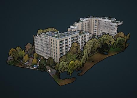
Topographical surveys capture and illustrate ground features and conditions which frequently inform the design and planning stages of projects. This data can also be used throughout the project lifecycle for verification once a project is complete and form the basis of all legacy data for facility maintenance.
Whether you’re trying to understand the surface geography of a greenfield site ahead of detailed design on a construction project, understand the future position of a high-speed railway line, or establish control points for the installation of a new sewer or bridge, our surveyors can give you the confidence you require to proceed with your development.
We employ the latest and most cost-efficient technologies to deliver your scheme data, including:
Our fleet of remote piloted aircraft provide rapid, affordable, non-intrusive and efficient routes to topographical data in environments where traditional tripod-based techniques would not be possible, cost-effective or accessible. Depending on the size, environment, and ecology of the site, we have several aircraft and sensors to employ, to ensure the data is delivered as expected during our technical workshops with the client.


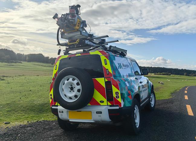
Our Geo Drive Mobile Mapping service is a rapid capture technology designed to enhance efficiency, by taking workers off the road network, dramatically reducing cost to the client and disruption to the public, without the need for closures. Geo Drive can cost-effectively capture up to 100 kilometers of LIDAR (Light Detection and Ranging) survey data in a single day.
Find out more about
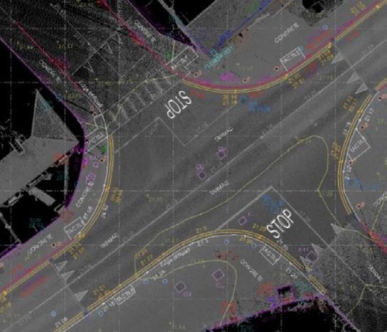


We conduct subsurface surveys based on bespoke client requirements. These surveys capture and illustrate underground features and conditions which frequently inform the design and planning stages of projects. These surveys can also be used throughout the project lifecycle for verification once a project is complete.
We select the best survey solution based on your project’s needs, including:
Our underground utility surveys identify and verify the location and depth of buried services, features, materials, and voids, providing clients with the geospatial certainty needed to plan, design and construct with confidence.
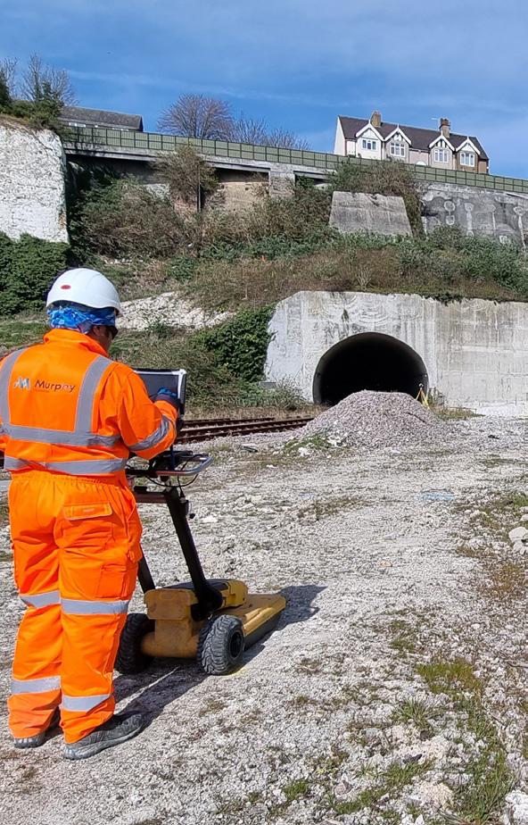
Our GPR surveys provide non-invasive detection of buried objects, utilities, and structures in the subsurface, providing valuable information for archaeological studies, construction projects, and environmental assessments.
Our desktop surveys provide a cost-effective and efficient way to gather preliminary data, plan field investigations, and identify potential risks, ultimately saving time and resources during the project.
Our geophysical surveys provide information about subsurface geology, helping to identify potential hazards, locate natural resources, and plan construction projects.
Our CCTV surveys provide detailed visual information about the condition of underground pipes, sewers, and utilities without the need for costly excavation or disruption.
BIM offers multiple benefits including improved visualisation, clash detection and coordination for better project planning.
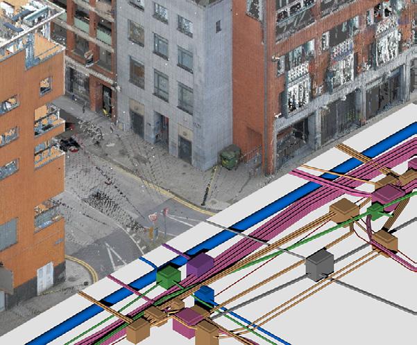
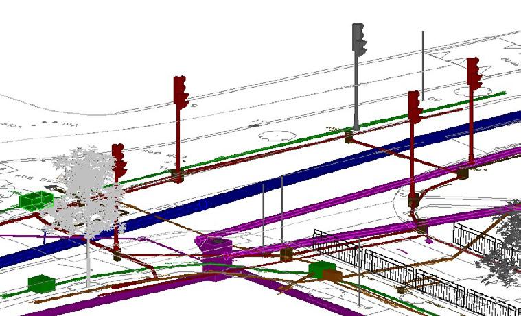
We’ll bring together the most suitable expertise and technologies from across our survey departments and teams within Murphy Geospatial.
We work with you to fully understand your project’s unique output requirements, obstacles, timescales and considerations, prior to offering our recommended approach.

We spend time with you to define your needs, evaluate the options and present the best solution to meet your project’s data specification.
Our team of industry experts is drawing on 40 years of experience to provide the right solution to get the best outcome, at the best cost.
We support clients to harness new technologies, techniques and efficiencies. From ecology aerial lidar to cloud-hosted data visualisation to aid in asset management, we’re your partner in embracing new technology.
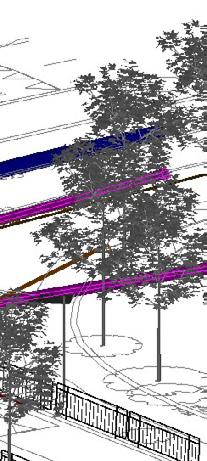


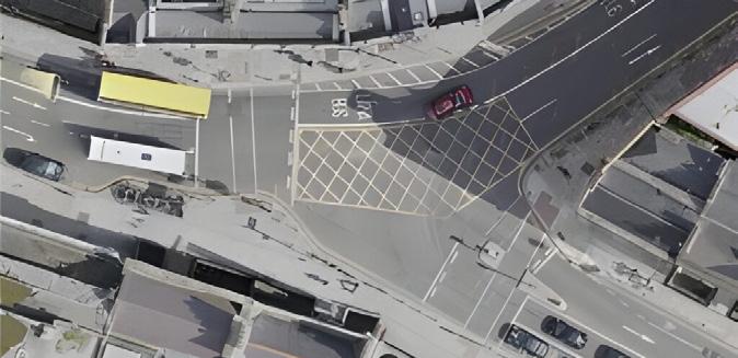
The Metrolink Project, connecting Charlemont station on the Luas Greenline through Dublin city centre to Dublin Airport and Lissenhall, required a comprehensive digital representation of its proposed route. The Murphy Geospatial team was engaged in the planning and design stage to provide this crucial digital survey. The survey covered 320 hectares of city centre and urban environments, as well as 42 hectares of rural and suburban areas. Utilising advanced surveying techniques, Murphy Geospatial delivered precise data to support the project’s development. This digital representation facilitated informed decision-making and planning for the Metrolink Project, ensuring accurate and detailed insights into both urban and rural sections of the proposed route.
Read this project case study in full
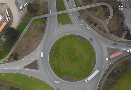

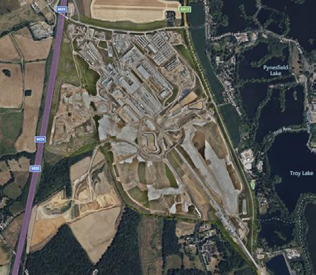
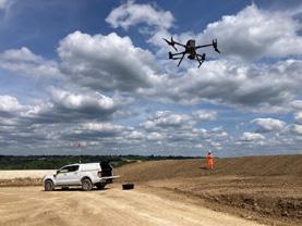
The HS2 C1 project in Denham, Buckinghamshire, involves surveying approximately 3,200,000m2 over nearly 6km along the viaduct route. Murphy Geospatial’s role was to conduct comprehensive aerial surveys providing 2D and 3D data outputs. These surveys help monitor project progress over time, ensuring safety and efficiency without halting active work. By capturing data consistently, sometimes twice a month, the surveys offer valuable insights into the project’s development. To achieve the highest accuracy, we utilised a network of over 200 ground control points. This innovative approach ensured precise and reliable data collection, supporting the HS2 C1 project’s infrastructure goals while maintaining operational continuity and safety.


Minerva Ave required detailed information about a mystery set of cables within a building basement covered by durasteel to proceed with their proposed design. Murphy Geospatial was engaged to investigate and identify this unknown infrastructure. By obtaining records from various asset owners and conducting a comprehensive utility survey, Murphy Geospatial determined that the cables belonged to British Telecoms (BT) but were unrecorded in BT’s asset records. This crucial information allowed Minerva Ave to progress confidently with their design and build works, avoiding the costs and disruptions associated with further invasive exploratory work.

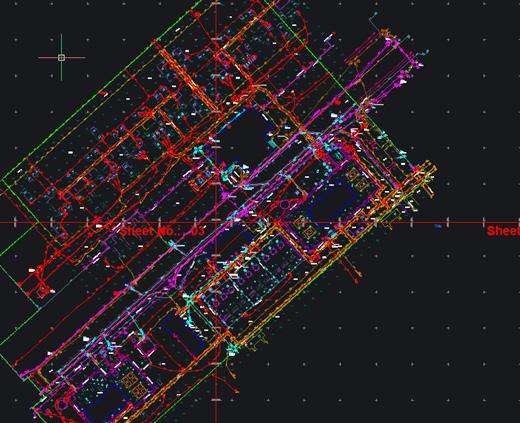
As the UK rolls out its energy transition, we have created several underground and above ground models of substations to enable ever-increasing power delivery demands to be met. These surveys allow for planning and design to position new transformers within the larger substations and ensure any existing underground infrastructure is not damaged during upgrade works.

The major redevelopment of the North and South Aprons at Dublin Airport required comprehensive surveying across extensive areas, including various buildings on the campus. Murphy Geospatial was engaged as the main survey consultant at the planning and design stage. Their role included installing a new control network, conducting underground utility surveys, topographical surveys, laser scanning surveys, and bathymetric surveys. Designed in collaboration with the client, the control network ensured all surveys were aligned for future projects. Murphy Geospatial delivered GeoBIM models of underground utilities and buildings, and CAD models for topographical and bathymetric surveys. Their efficient work allowed Dublin Airport to quickly proceed to the design stage after reviewing the survey outputs.







Global House
Kilcullen Business Campus Kilcullen R56 K376
Ireland
T: +353 (0)45 484 040
E: info@murphygs.ie
9 Millfield House Croxley Park
Woodshots Meadow Watford
WD18 8YX
United
T: +44 (0)192 362 4800 E: info@murphygs.com
Ireland
T: +353 (0)21 489 5704
E: cork@murphygs.ie
SK9 3HW
United Kingdom
T: +44 (0)160 626 3019 E: info@murphygs.com
7HN
United
T: +44 (0)121 630 3074
E: info@murphygs.com
Block 2
Westpoint Court Business Park
JFK Drive, Naas Road
Dublin D12 E138
Ireland
T: +353 (0)1 690 9799
E: info@murphygs.ie
Ireland Head Office
T: +353 (0)45 484 040
E: info@murphygs.ie
UK Head Office
T: +44 (0)192 362 4800
E: info@murphygs.com
Website murphygs.com
