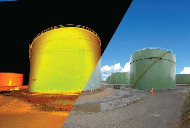
HIGH DEFINITION TANK SURVEYS


Established in 1983, Murphy Geospatial is committed to providing world class survey solutions cost-effectively, through a combination of highly qualified personnel and the most cutting-edge technological equipment available.
With our substantial experience and client-centered approach, we thoroughly understand the challenges faced by our clientele, and currently offer more than thirty varieties of survey that are customisable to meet any requirement. We understand the importance of keeping costs to a minimum; our ongoing investments in the latest technologies allow us to provide the most efficient surveying solutions that cut costs and risks for clients across a vast range of industries.
As a result, we are widely recognised as one of the most experienced, professional, innovative and technically proficient surveying companies in Ireland and the UK today.


30+ specialised survey services
40+ years in business
100% accident free
25,000+ surveys completed
7 offices in UK & Ireland
1st for laser scanning in Ireland


10 million + turnover
10 million Professional Indemnity Cover
350+ experienced & highly trained staff
500+ BIM models produced
250,000+ man-hours completed


3D HD Laser Scanning
Aerial LIDAR Surveys
Aerial Photographic Surveys
Area Measurement Surveys
As Built Surveys
Building Information Modelling
Conservation & Heritage
Close Range Laser Scanning
Electrical Resistivity Imaging
Electromagnetic Surveys
Elevated Photography
Energy Assessments
Expert Witness
Facades & Elevations
Flood Surveys
Geographic Information Systems
Geophysics / Utility Mapping
Ground Penetrating Radar (GPR)
Hydrographic Surveys
Legal Mapping
Measured Building Surveys
Microgravity Surveys
Monitoring Solutions
NDT Surveys
Pipeline Surveys
Rectified Photography
Setting Out
Site Control
Topographic Surveys
Verified Views & Rights to Light

As a dynamic and flexible company, we can apply tailored solutions to meet the unique needs of clients in any sector. We have proven experience in the following sectors:


Accreditations & Associations


Clients


Murphy Geospatial are leaders in the provision of high-definition as-built and engineering surveys of storage tanks. Our clients include Phillips 66, Exxon Mobil, Vopak, Zenith Energy Management, Rhyal Engineering, Dimoin Calderería S.A & the National Oil Reserves Agency (NORA).
Our highly qualified and innovative personnel, continual investment in the latest equipment and cutting-edge technologies and the most efficient solutions cut costs and risks for our clients, while meeting the highest standards in accuracy and detail.

This technological approach and laser scanning expertise paves a way for a fully collaborative process leading to richer, more accurate and comprehensive maintenance reports and 3D models ready for a multitude of downstream uses in a project life-cycle.
The dense point cloud data which is generated from laser scanning enables our surveyors to create mm accurate 3D CAD models of storage tanks.
Murphy Geospatial can provide detailed CAD models of all tank elements from the shell and floor deformations, to the roof structure, and the internal & external pipework in a variety of formats, such as AutoCAD and Revit.

These CAD models can be used for asset management, design purposes and for use with Finite Element Analysis (FEA) software, when assessing the lifespan of a storage tank.
ABAQUS software is used to assess the resistance of tanks with exceeded dimensional tolerances and to provide an answer as to whether such tanks are suitable for normal use or not.
In the FEM analysis the measured imperfections provided and elasto-plastic material properties will be accounted for by Murphy Geospatial. Is your tank Fit for service even if dimensional tolerances are exceeded?

