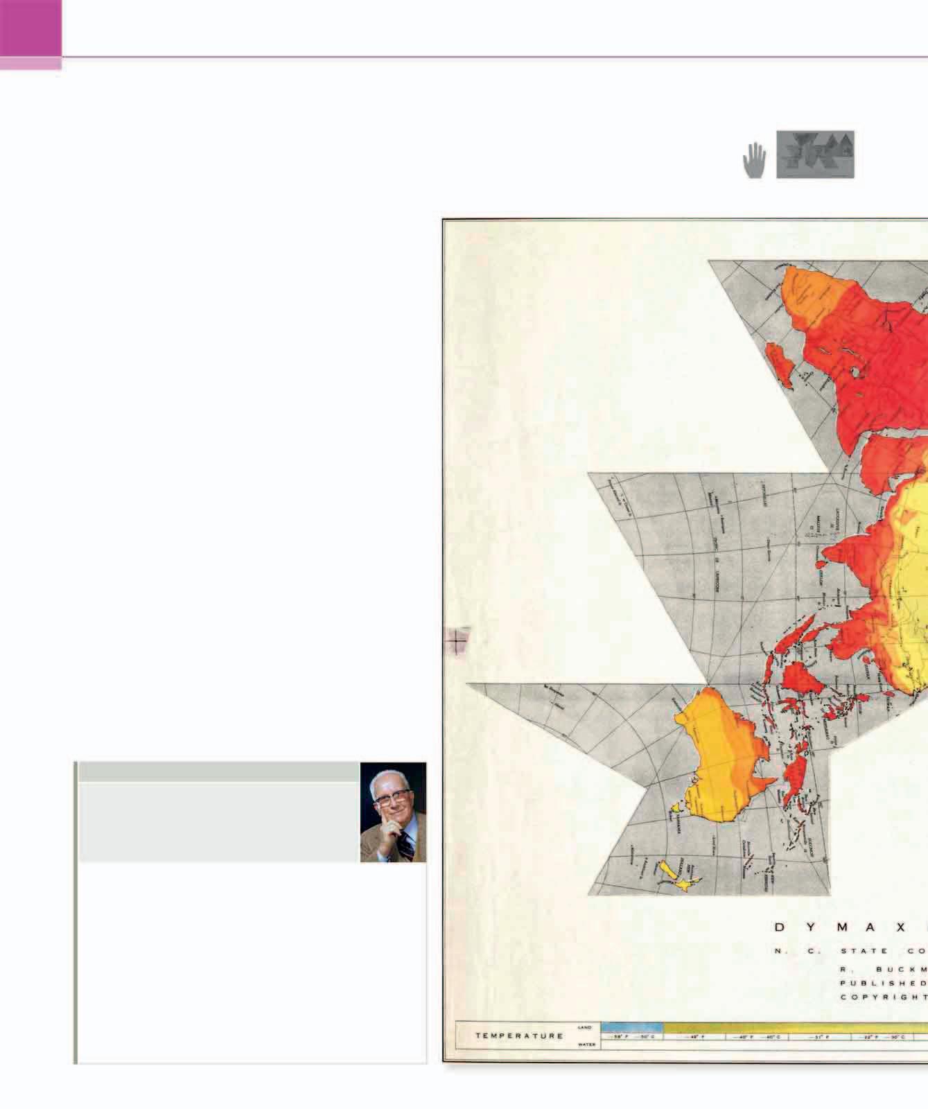
4 minute read
Equal Area World Map

1973 PRINT 1 FT 8¾ IN × 2 FT 8½ in (53 CM × 82.5 CM) ODT MAPS, MASSACHUSETTS, USA
ARNO PETERS
Advertisement
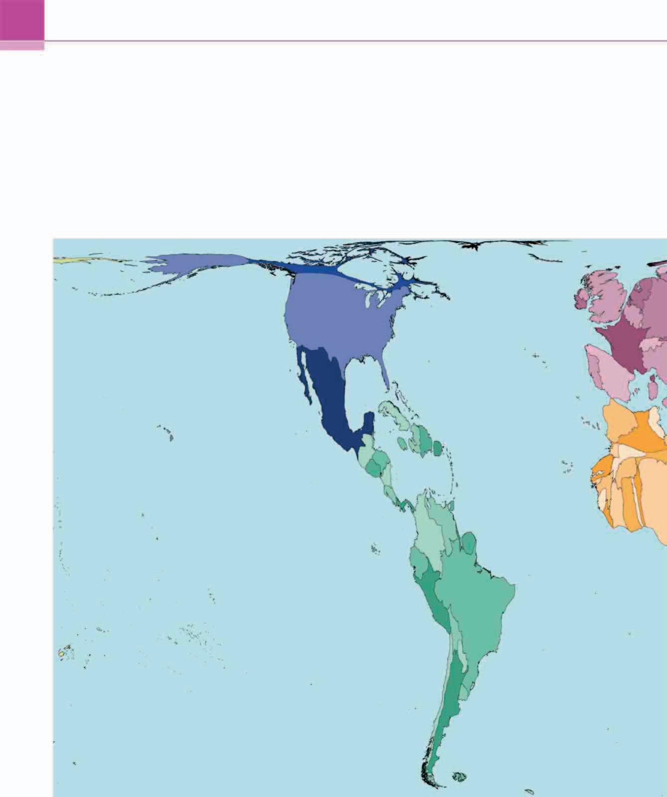
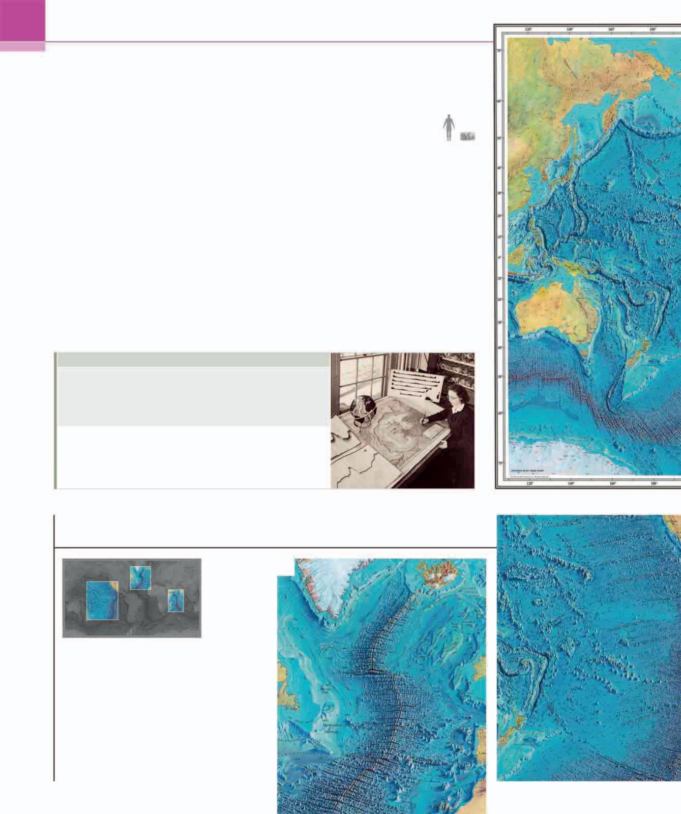
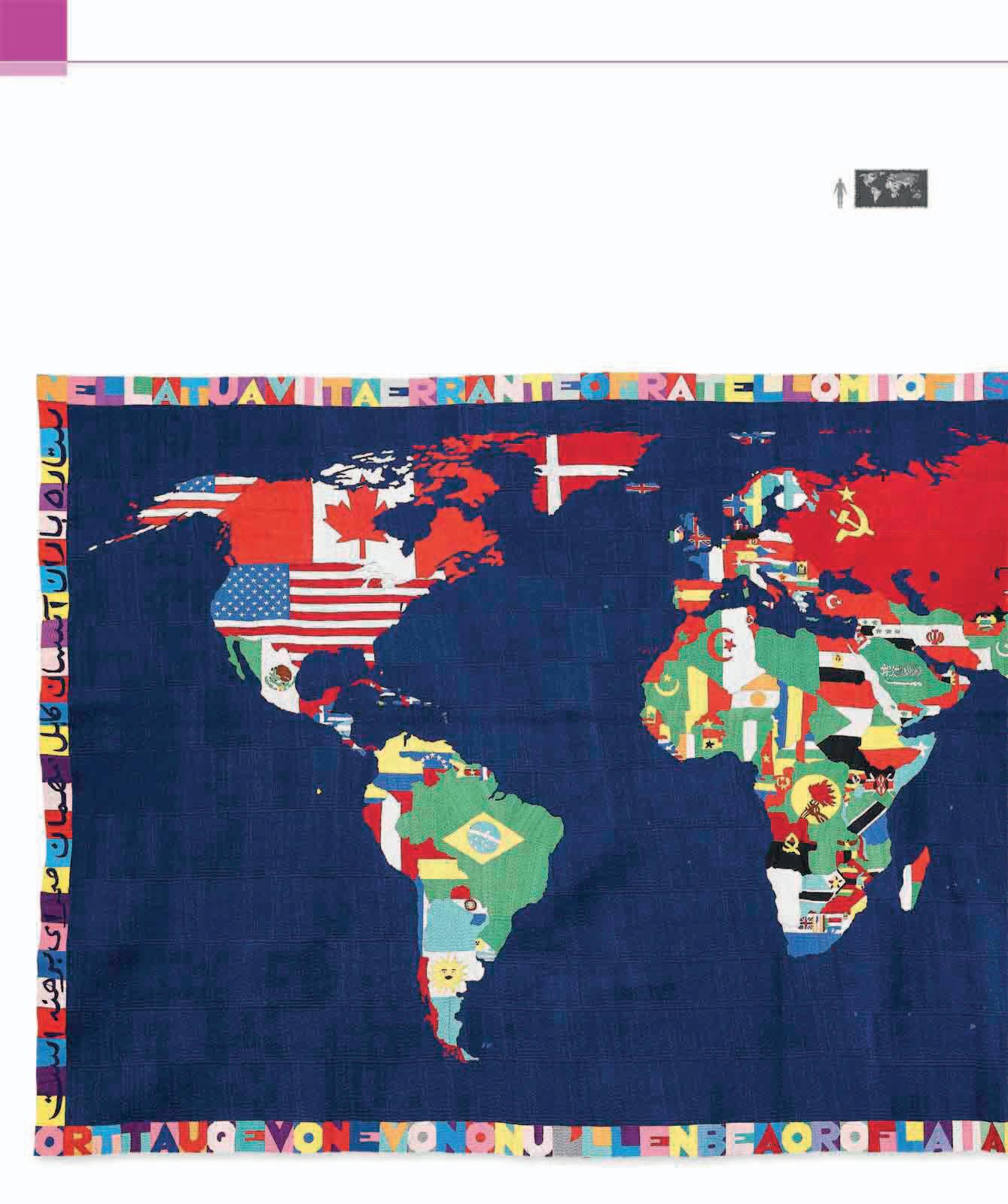
In 1973, Arno Peters, a German historian turned mapmaker, unveiled a remarkable new world map at a press conference in Bonn, then in West Germany. Peters claimed that his map offered equality to the world’s colonized countries and to people living in what he called the southern “developing world.” This included most of Africa, South America, and Southeast Asia, covering 24 million sq miles (62 million sq km), in contrast to the countries of the dominant “developed” Northern Hemisphere, which cover just 11½ million sq miles (30 million sq km). Peters blamed Gerard Mercator’s 400-year-old projection (see pp.110–13) for dominating world mapmaking from a Eurocentric perspective, which, he argued, “presents a fully false picture particularly regarding the non-white-peopled lands.”
An advocate of social equality, Peters used an “equal-area” method, which prioritized fidelity to surface area. The result, he argued, was a map that was more accurate than Mercator’s and that restored the size and position of developing countries. However, professional cartographers argued that the distortion of distances in Peters’ map was more of a problem than the distortions in areas of other projections, and pointed out that no flat, rectangular world map could reproduce a spherical Earth without distortion. Initially, many religious, aid, and political organizations adopted Peters’ map, distributing more than 80 million copies worldwide, and it has gone through various updated editions, including this one from 2014. However, it is rarely actually used today.
ARNO PETERS
1916–2002
Committed to issues of equality and social justice throughout his life, German historian and mapmaker Arno Peters caused controversy but raised important issues through his work.
Born in Berlin into a family of left-wing activists, Peters trained in film production techniques in the 1930s, before turning to history and writing a dissertation on film as propaganda. Witnessing the horrors of World War II and his country’s division afterward profoundly affected his political views, and led him to work in East Germany as an independent scholar. In 1952, Peters published an innovative but controversial “synchronoptic” world history, which gave equal weight to non-Western history, and which he called “a map of time.” This work inspired him to apply his interests to geography, and begin work on his world map. Following its publication in 1973, Peters also published a manifesto, The New Cartography (1983), and the best-selling Peters Atlas of the World (1989). Peters regularly revised his famous map and today, more than a decade since his death, it is still kept up to date. SCALE
The landmasses are somewhat reminiscent of wet, ragged, long winter underwear hung out to dry on the Arctic Circle
ARTHUR ROBINSON, AMERICAN CARTOGRAPHER

Visual tour
2
5
3
4
1
KEY
1 6
3 GREENLAND Peters pointed out that Mercator’s projection distorted the sizes of landmasses. Greenland covered 811,000sq miles (2.1 million sq km), but on Mercator maps it dwarfed China’s 3¾ million sq miles (9.5 million sq km). Peters’ projection corrected this, although the distortion on the map’s northern and southern extremities gave the country a strangely flat shape.
2
4 SOUTH AMERICA Covering nearly 7 million sq miles (17.8 million sq km), South America had traditionally always seemed much smaller than other continents, including Europe. One of the most striking aspects of the Peters map was the way it elongated the American and African continents, much to the consternation and amusement of many professional cartographers.
3

1 CENTRAL AFRICA Despite covering 20 percent of the Earth’s land surface, Africa has always been diminished on modern Western maps, and often shown at a smaller scale than Europe and North America. Peters was eager to compensate for this, but he went too far. Critics noted that his map showed Chad and its neighbor Nigeria twice as long as they should be, even according to Peters’ own equal-area formulation.
ON TECHNIQUE

Peters used a technique called an orthographic equal-area projection to construct his map. This involved treating the globe like a cylinder, which was then unrolled to create a rectangle, which, Peters insisted, was the best way to represent the Earth on a flat surface. He took 45 degrees north and south as his two standard parallels—places at which there is minimal distortion— and then calculated the surface area of the landmasses on his map, creating an “equal-area” depiction of countries relative to each other. Peters claimed this was a revolutionary method, unprecedented in its accuracy, although it had actually been invented in 1855 by the Reverend James Gall (1808–95), a Scottish evangelical minister and amateur mapmaker. 4
5
2 INDONESIA As the center of the spice trade, Indonesia has always been of great interest to European mapmakers. Peters saw it as part of the developing world, either marginalized or distorted by Western geography. Unfortunately, his mapping of Indonesia introduced new errors, depicting it at twice its north-south height and half its east-west breadth.
2 EUROPE Peters’ objection to most Western projections was their exaggeration of the size and centrality of Europe. Covering just 3¾ million sq miles (9.7 million sq km) and with the UK taking up only 0.16 percent of the Earth’s land surface, Europe is smaller than any other continent, although Western maps and atlases prior to Peters had not reflected this.
3 ANTARCTIC PENINSULA Despite attacking Mercator’s projection, Peters chose an orientation and rectangular shape that reproduced many of the Flemish mapmaker’s errors and obvious distortions. He depicts the Antarctic Peninsula just like Mercator, stretching it to infinity east to west, because Peters’ projection imagines the Earth as an unrolled cylinder.
6