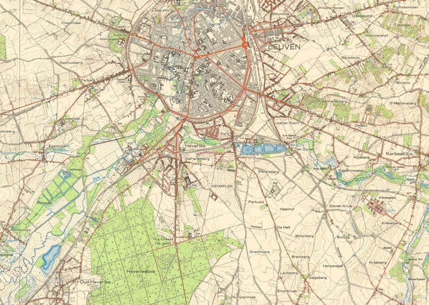
Leuven, Belgium
Master (of Science) Human Settlements & Master (of Science) Urbanism, Landscape and Planning
Faculty of Engineering and Department of Architecture
Promoters:
Mircea Munteanu (Metapolis), Teodora Romanova Stefanova (Gradoscope), Thomas Willemse (Studio Thomas Willemse) with Bruno De Meulder and Kelly Shannon (KU Leuven)

© Copyright KU Leuven
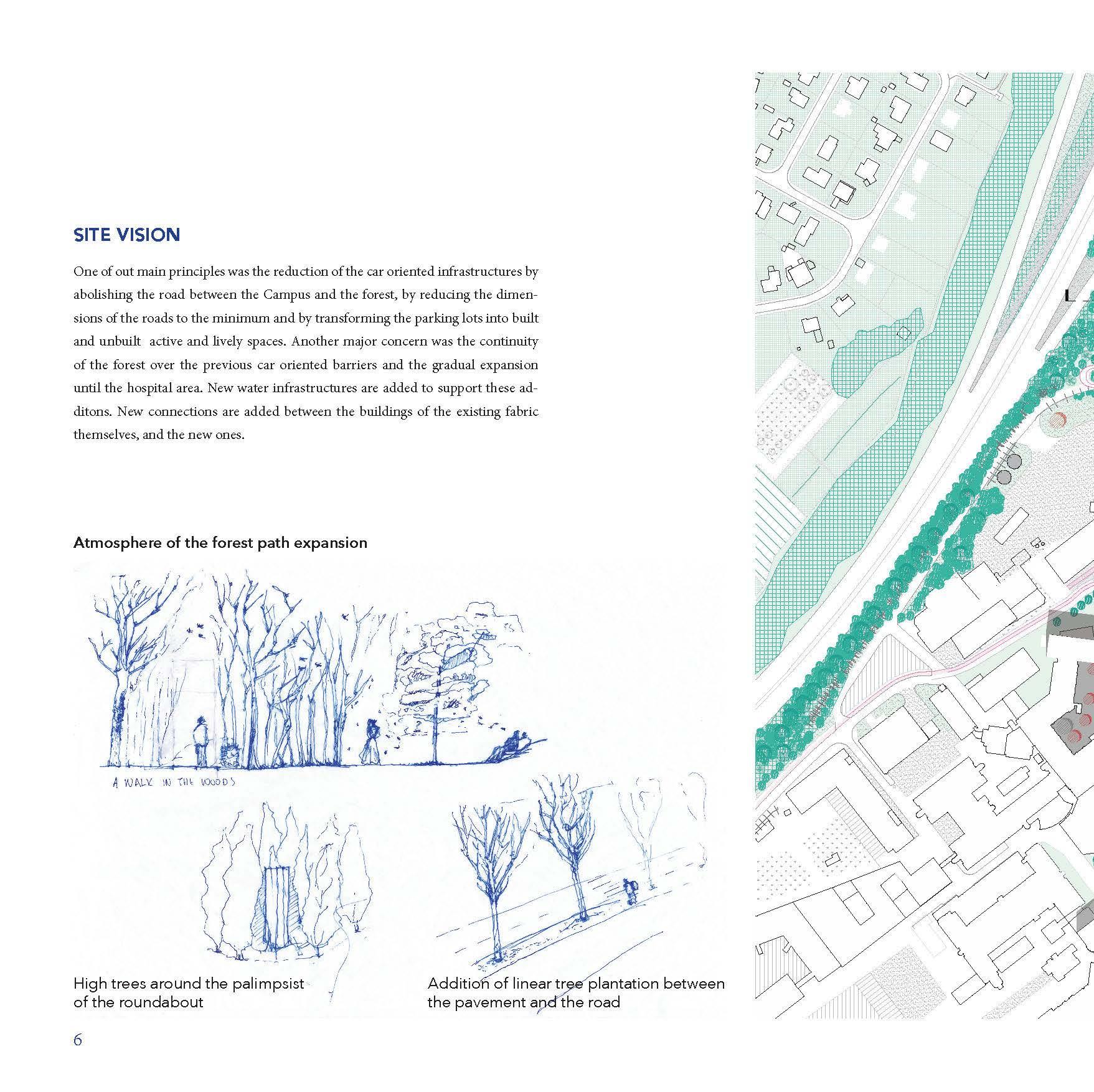
Without written permission of the thesis supervisors and the authors it is forbidden to reproduce or adapt in any form or by any means any part of this publication. Requests for obtaining the right to reproduce or utilize parts of this publication should be addressed to Faculty of Engineering and Department of Architecture, Kasteelpark Arenberg 1 box 2431, B-3001 Heverlee.
A written permission of the thesis supervisors is also required to use the methods, products, schematics and programs described in this work for industrial or commercial use, and for submitting this publication in scientific contests.
03.A
04.A
04.C HOUSING
05 SWEANENBERGH
05.A OVERVIEW, A PHOTOGRAPHIC STORY
05.B INTERPRETATIVE MAPPING
05.C HOUSING ANALYSIS
05.D STRATEGIC PROJECTS
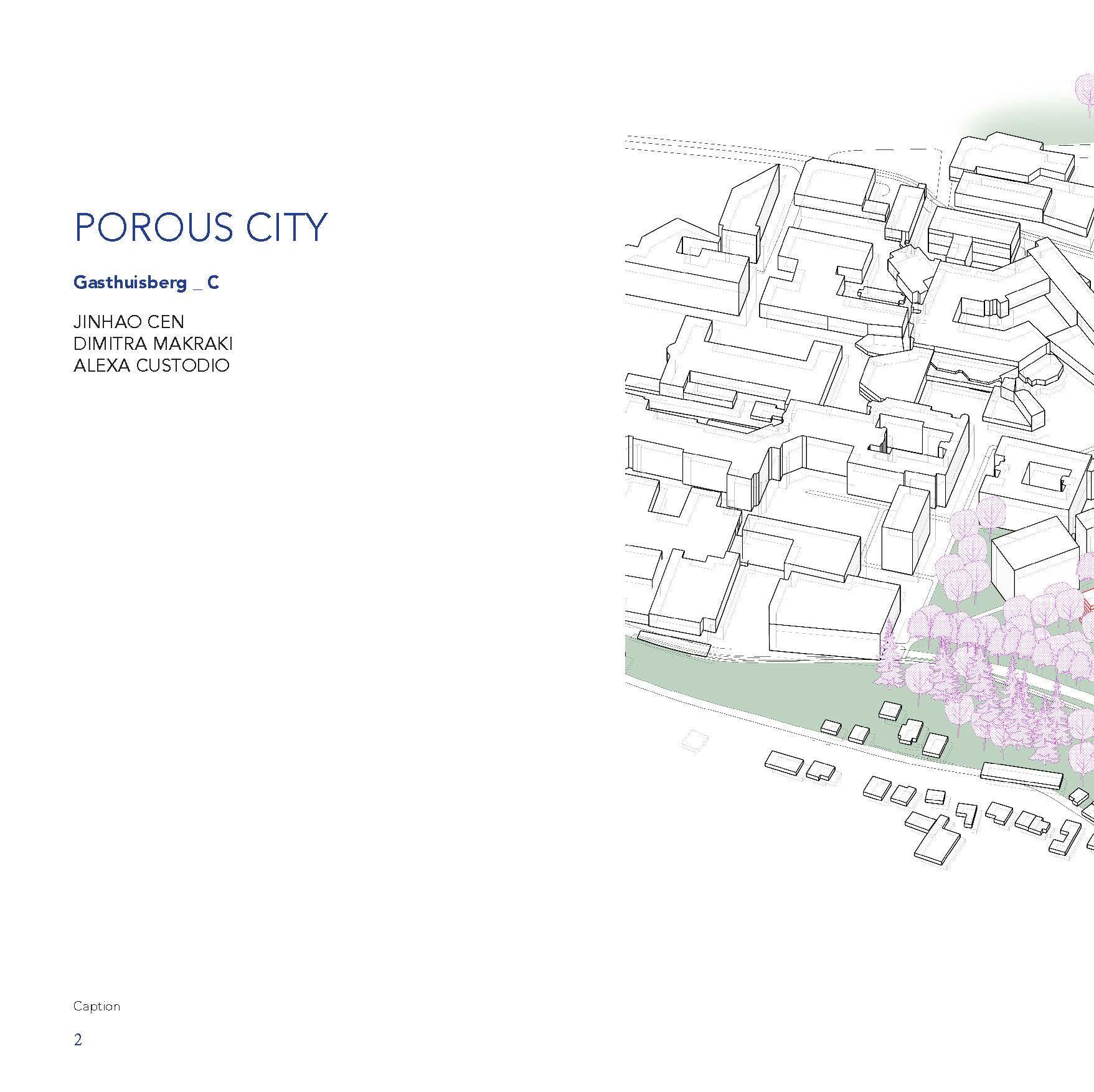
06 GASTHUISBERG
06.A OVERVIEW, A PHOTOGRAPHIC STORY
06.B INTERPRETATIVE MAPPING
06.C HOUSING ANALYSIS
06.D STRATEGIC PROJECTS
07 GALGENBERG
07.A OVERVIEW, A PHOTOGRAPHIC STORY
07.B INTERPRETATIVE MAPPING
07.C HOUSING ANALYSIS
07.D STRATEGIC PROJECTS
08 ACKNOWLEDGEMENTS
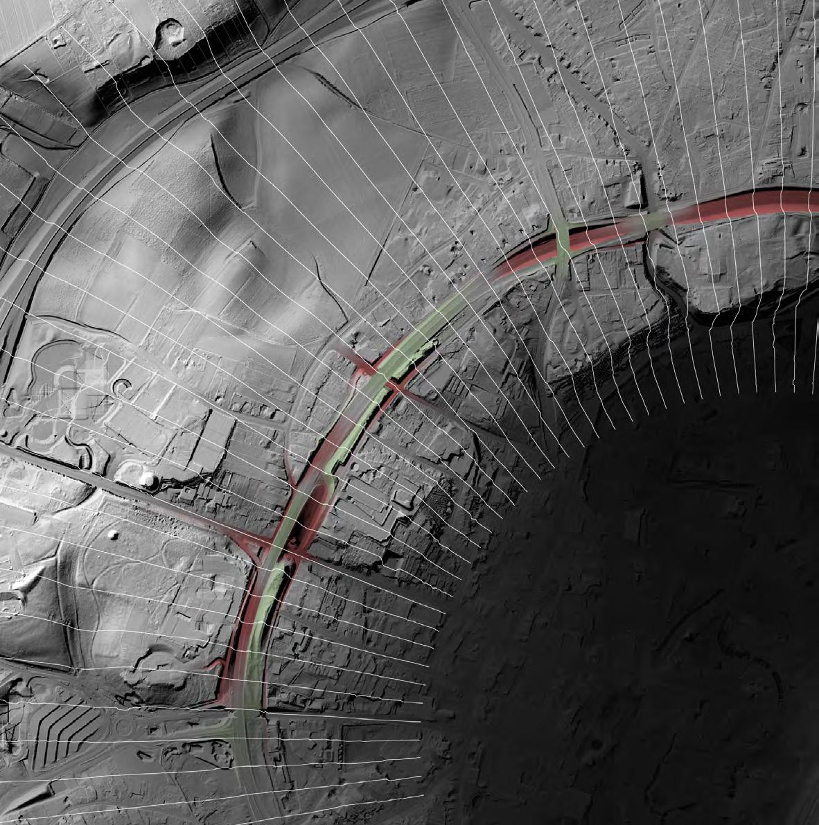
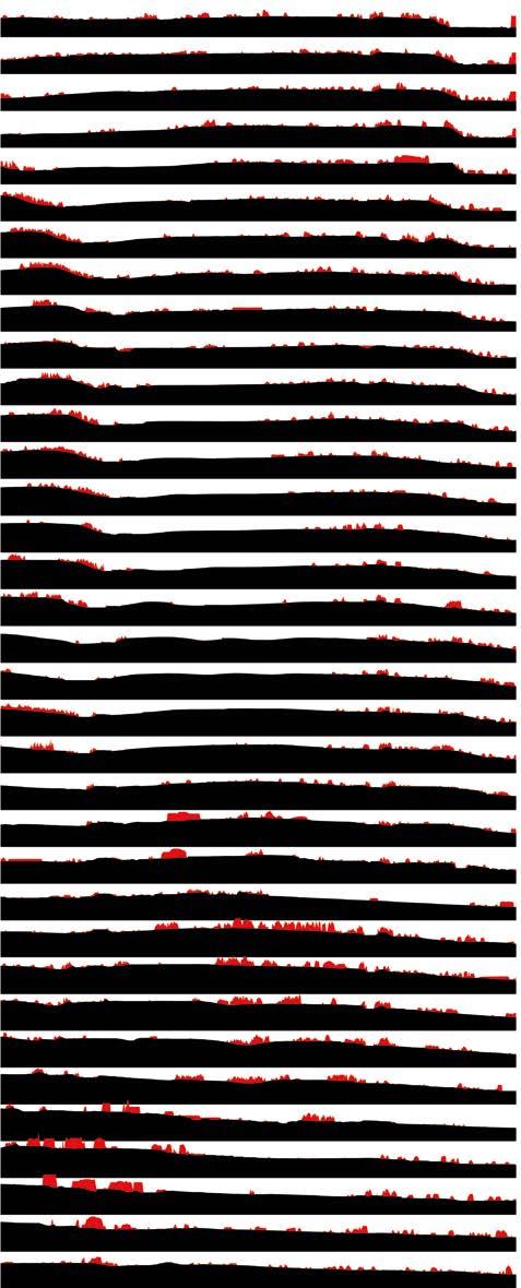
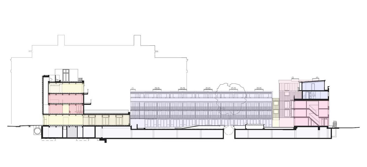
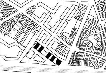
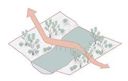
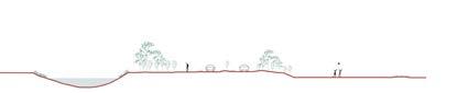
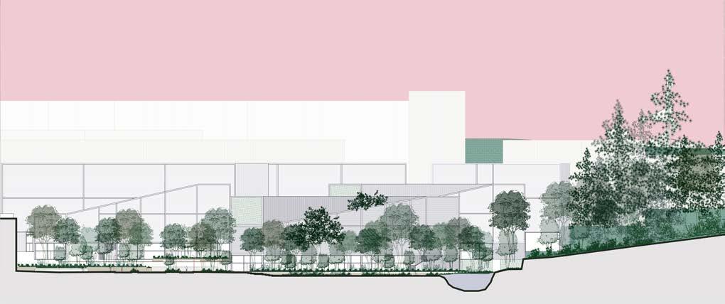
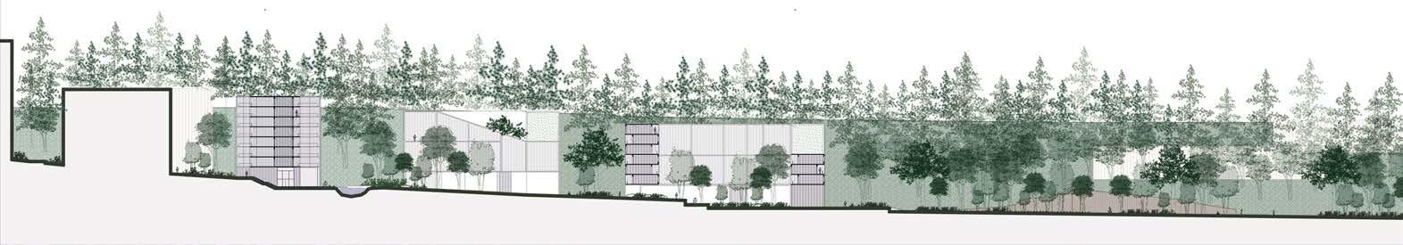
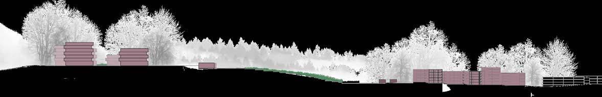
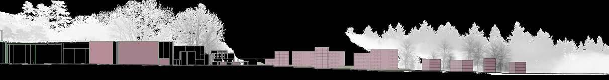
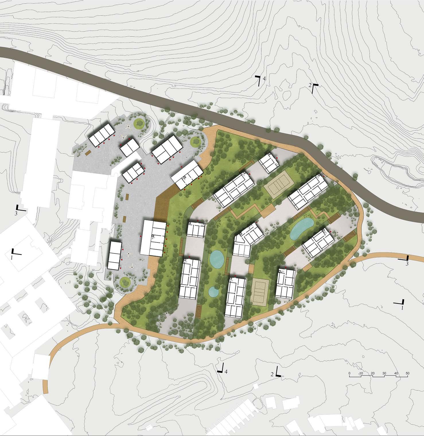
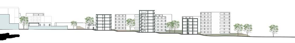
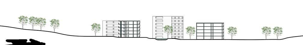
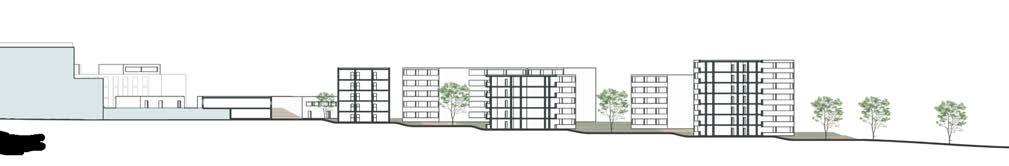
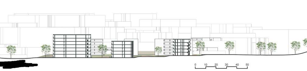
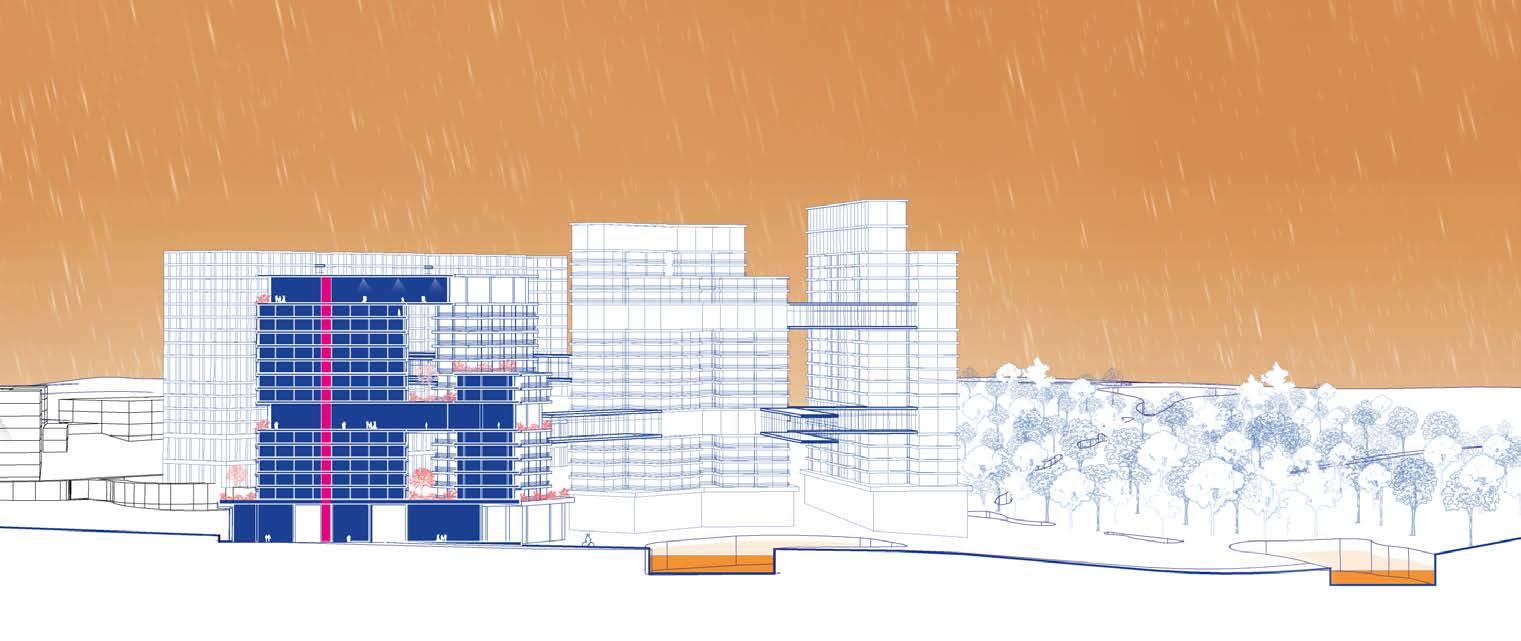
Topography and sections
MIRCEA MUNTEANU
TEODORA
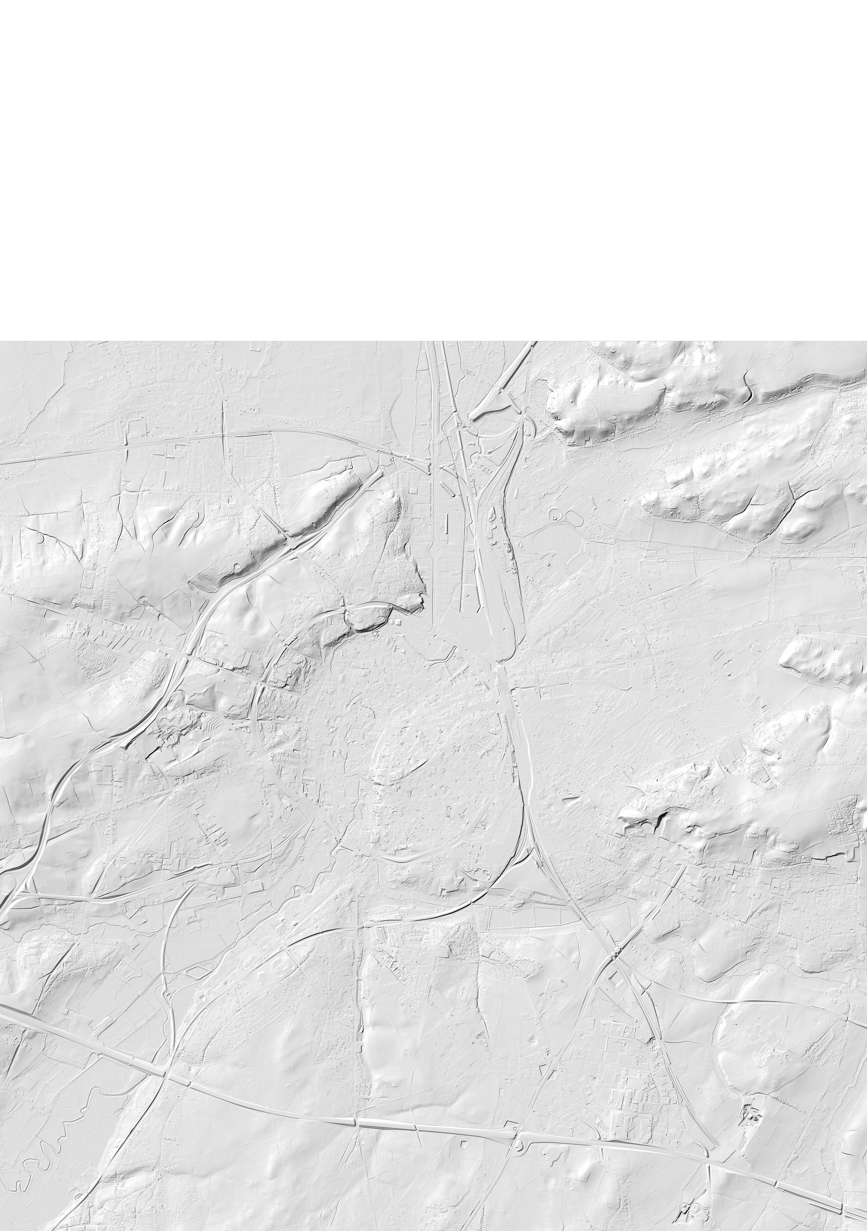
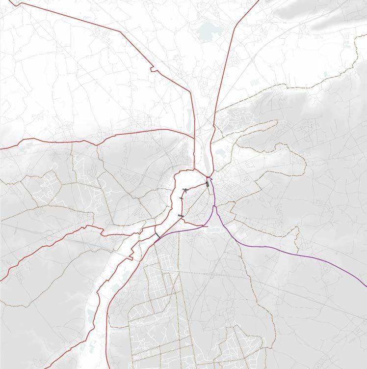
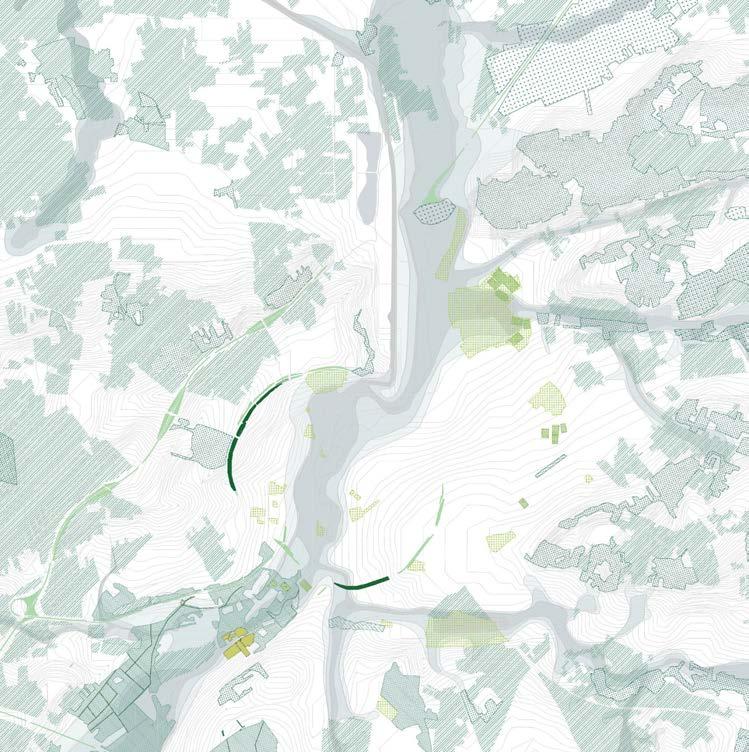
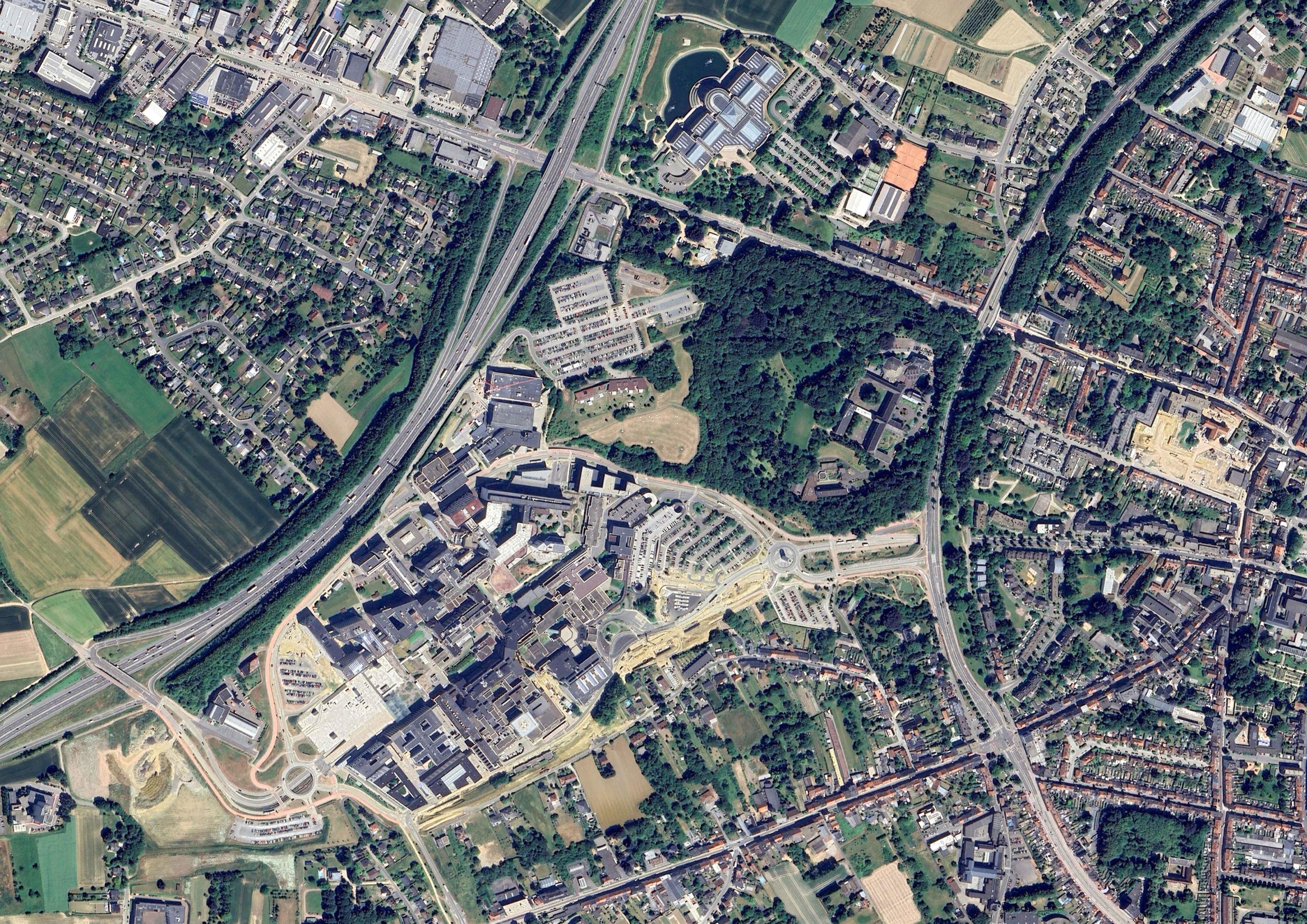
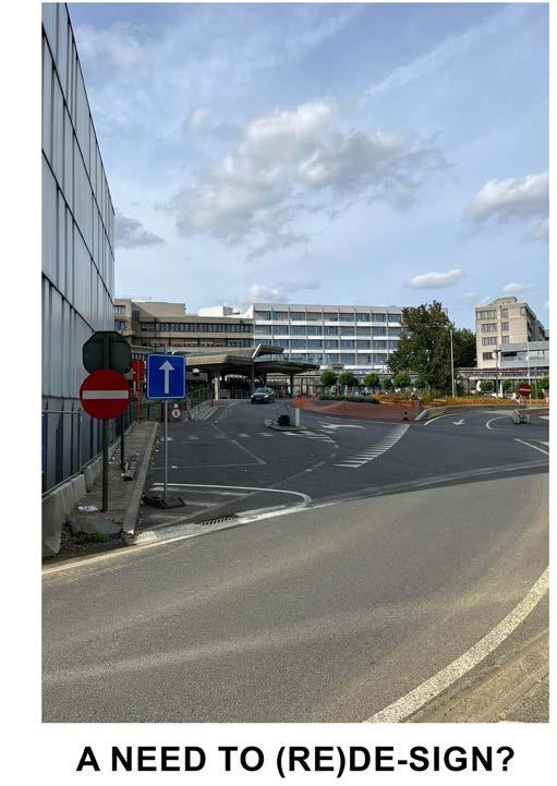
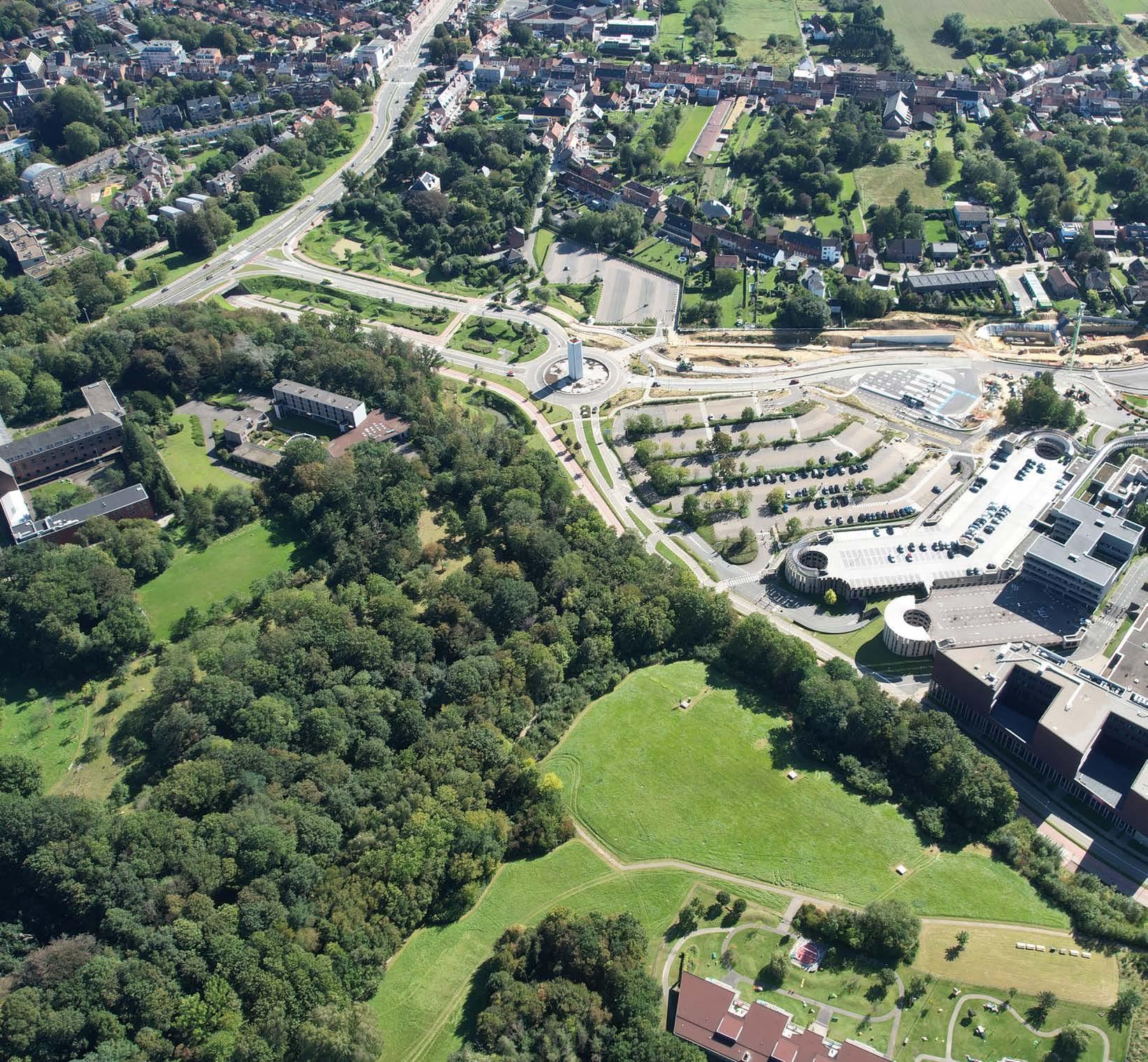
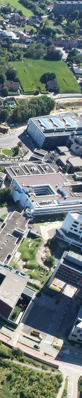
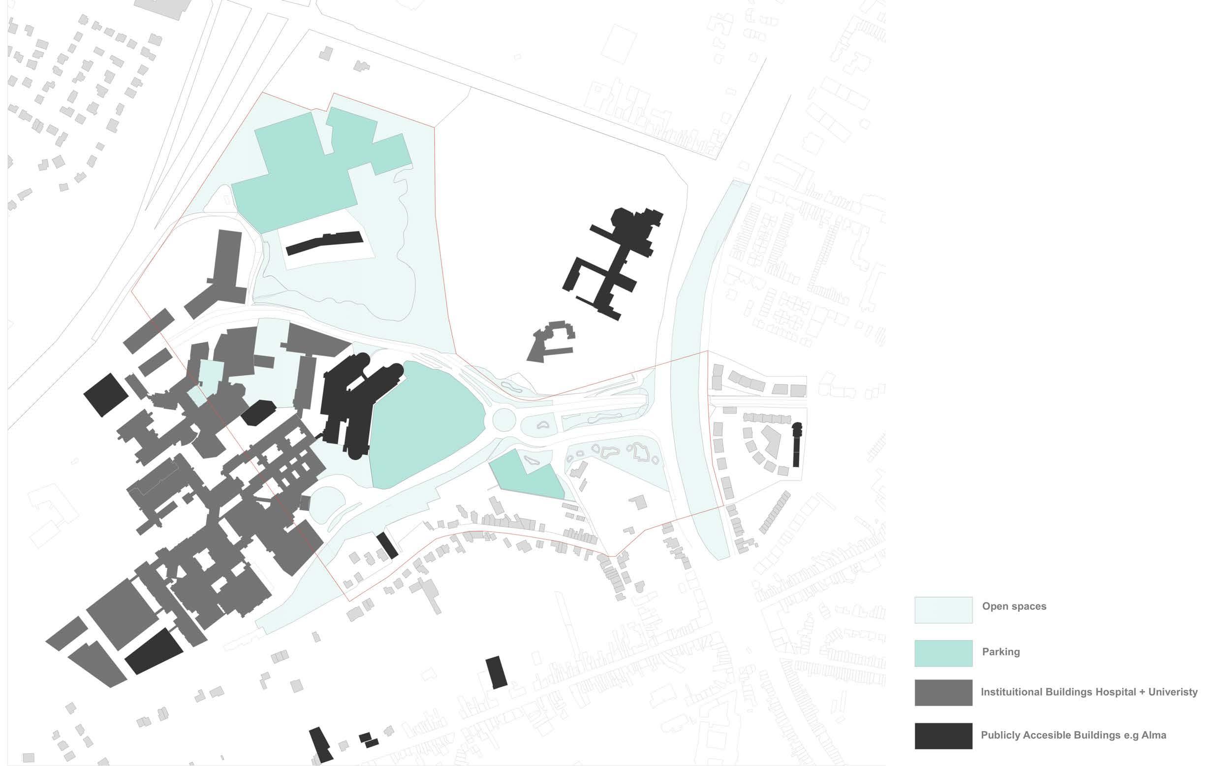
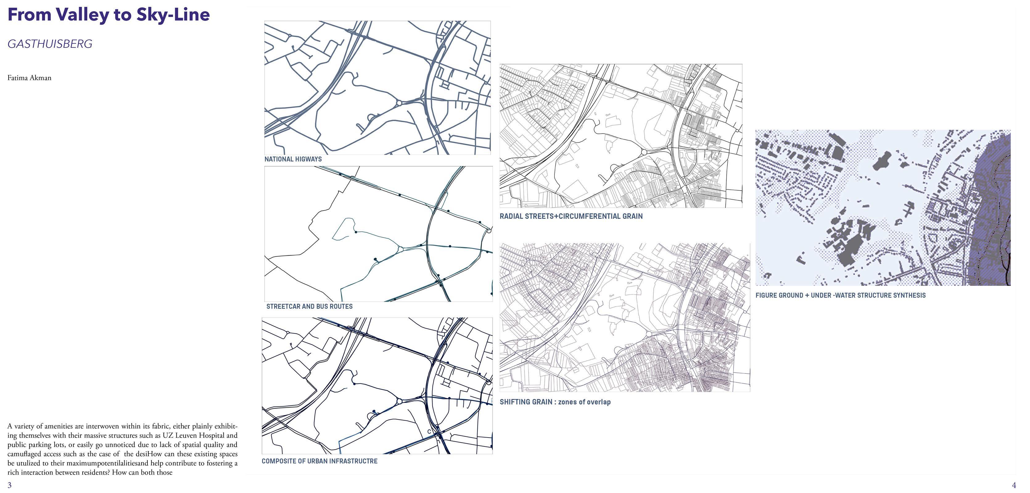
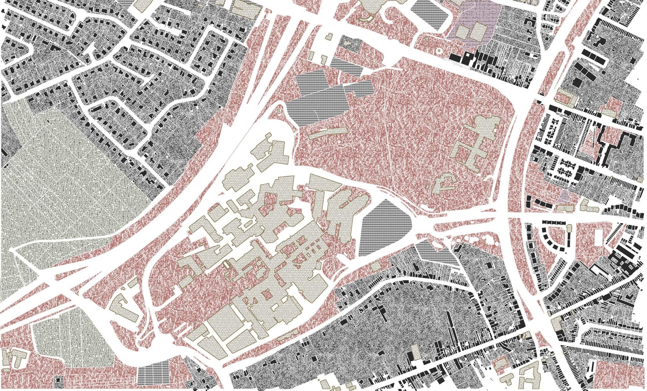
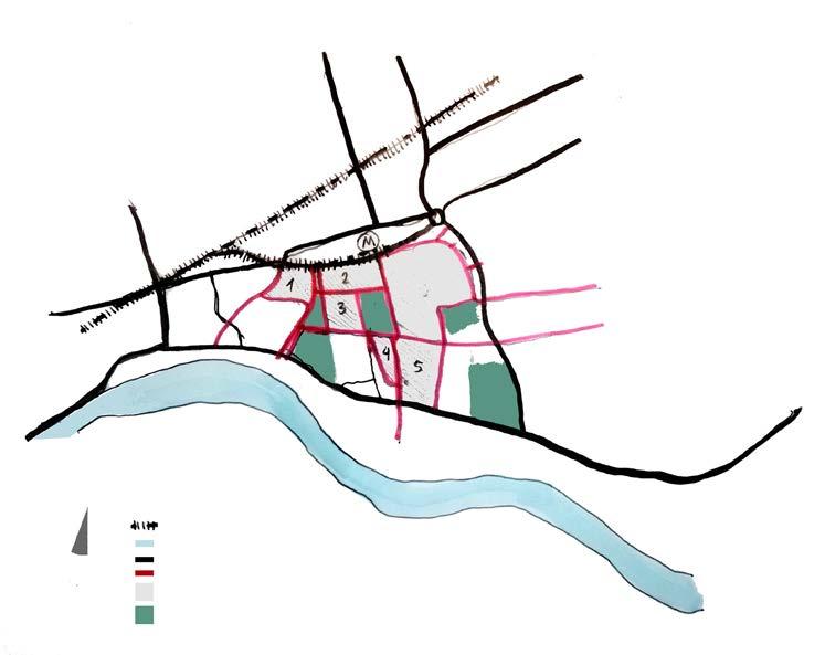
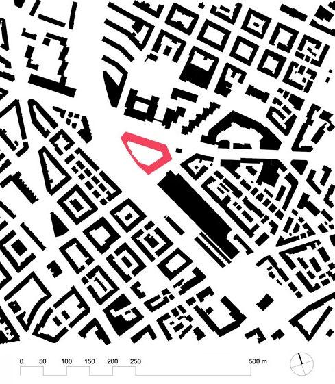
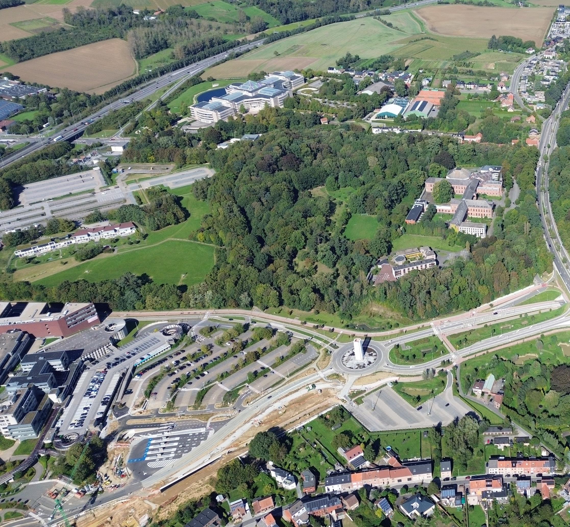
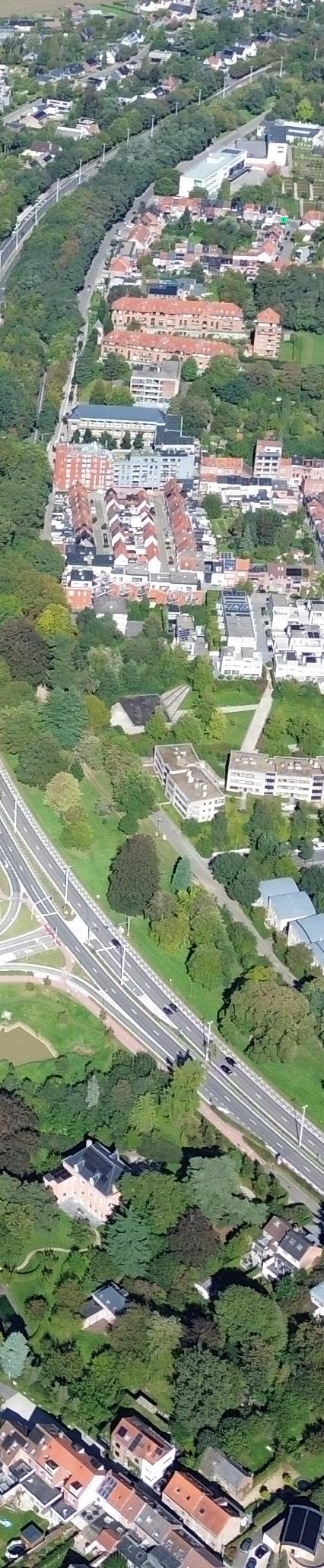
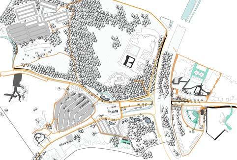
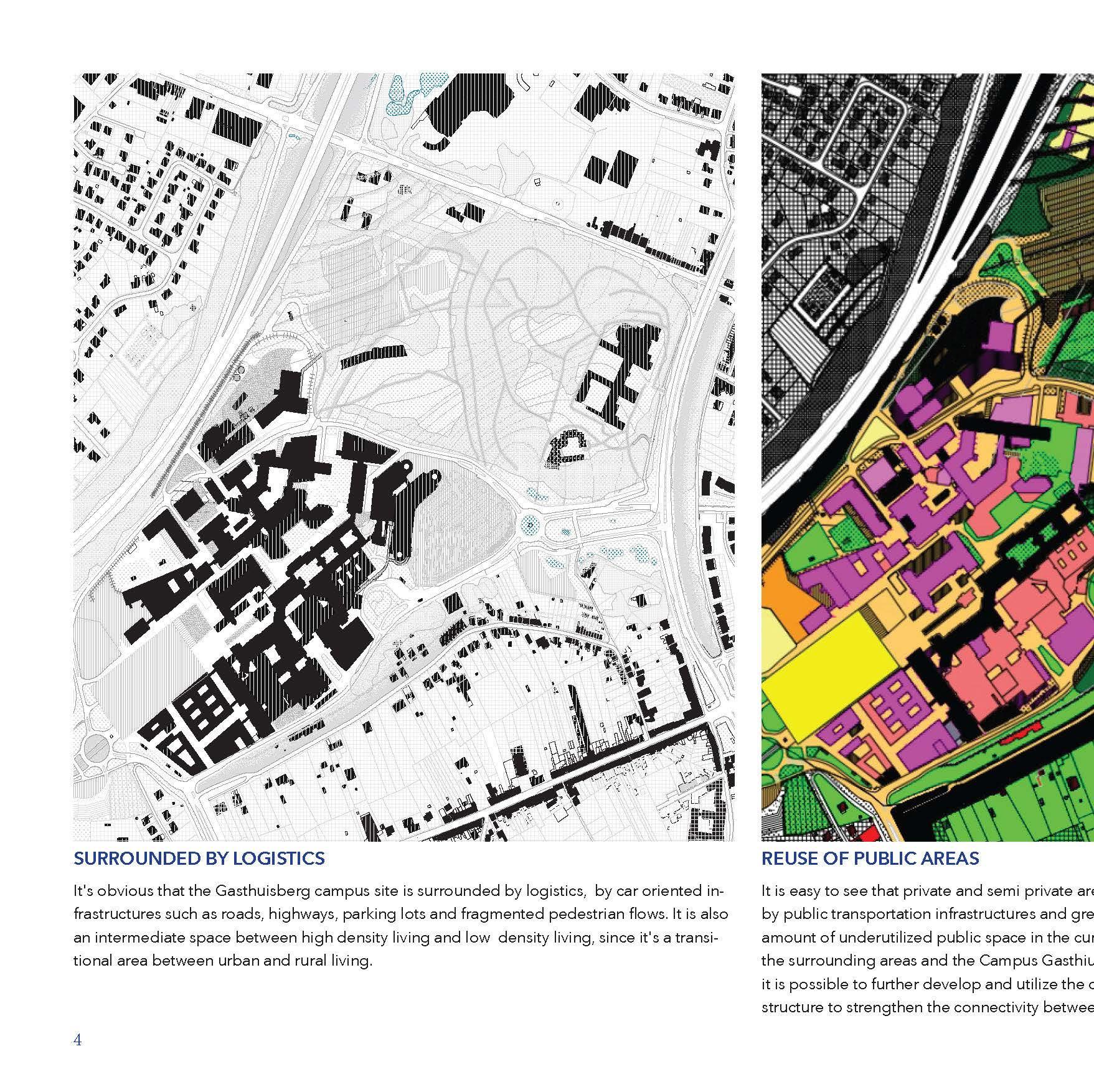
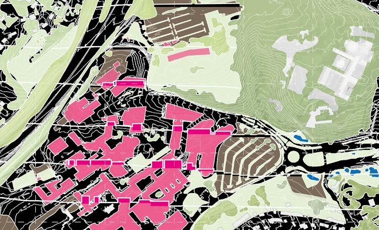
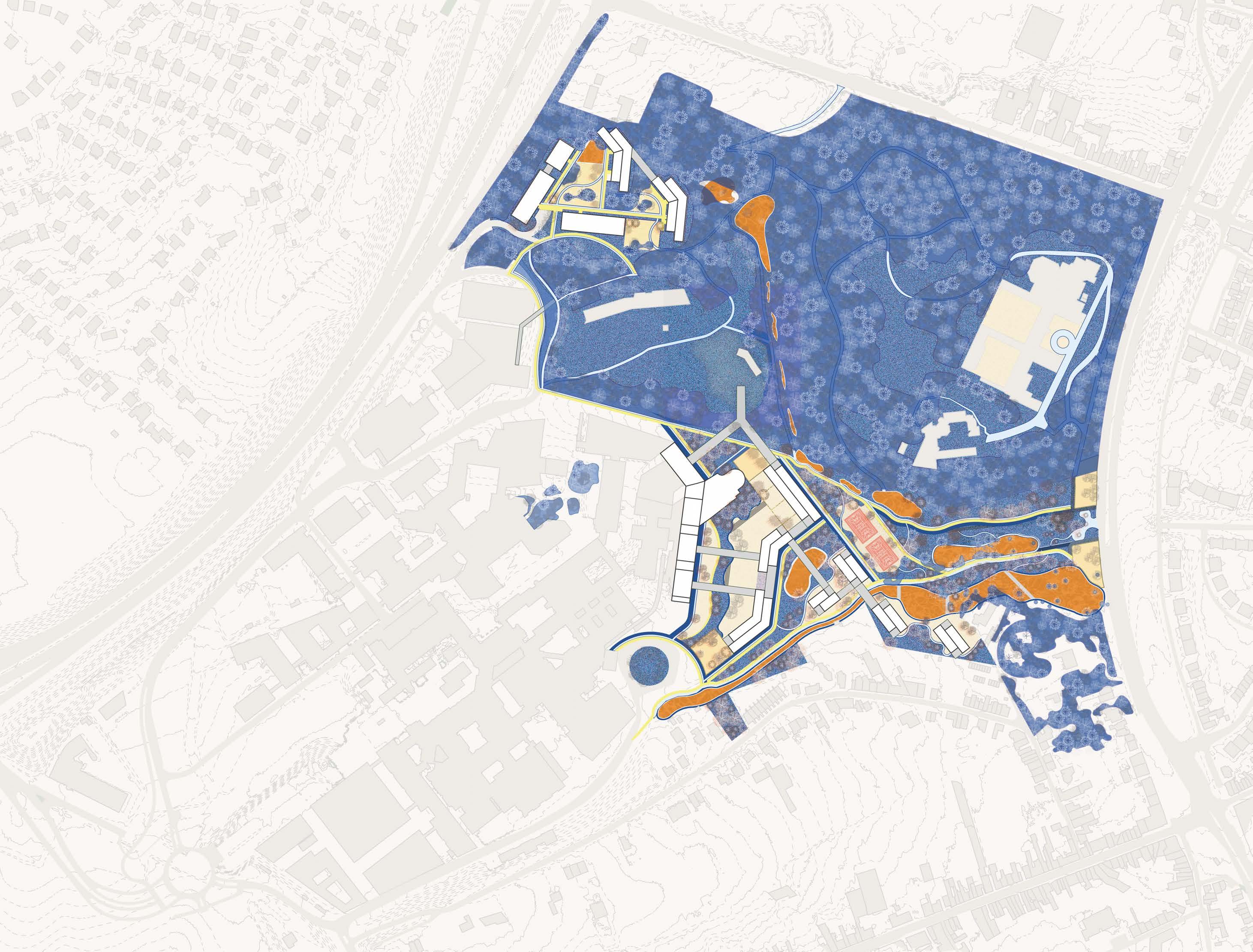
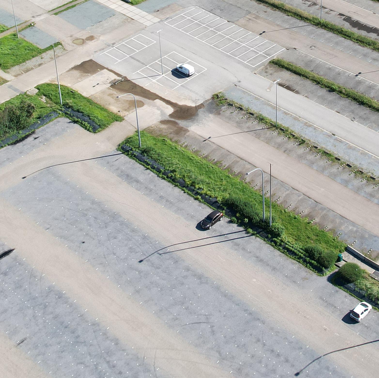
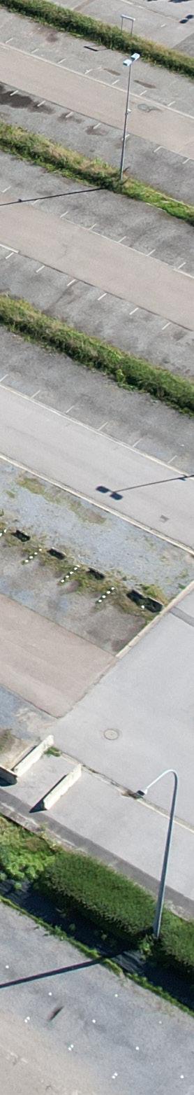
The site is comprised of fragments of urban fabrics on the western side (Witness hills) of Leuven, squeezed between the highway and ‘vesten’ (medieval earthworks) landscape (that was turned into a ring road). Since the 1950s, the area has become a dumping ground for larger institutions (university campus, university hospital, music academy, bank headquarters, big retail, etc.). The area is, in general, overinfrastructured (including large parking lots).
As a monofunctional dumping ground, the site lacks a clear structure (besides the underlying landscape) morphology and, despite its heavy programs, urbanity. The area’s potential identity and value is compromised by the dominant car-orientation and complete lack of (qualitative) public space.
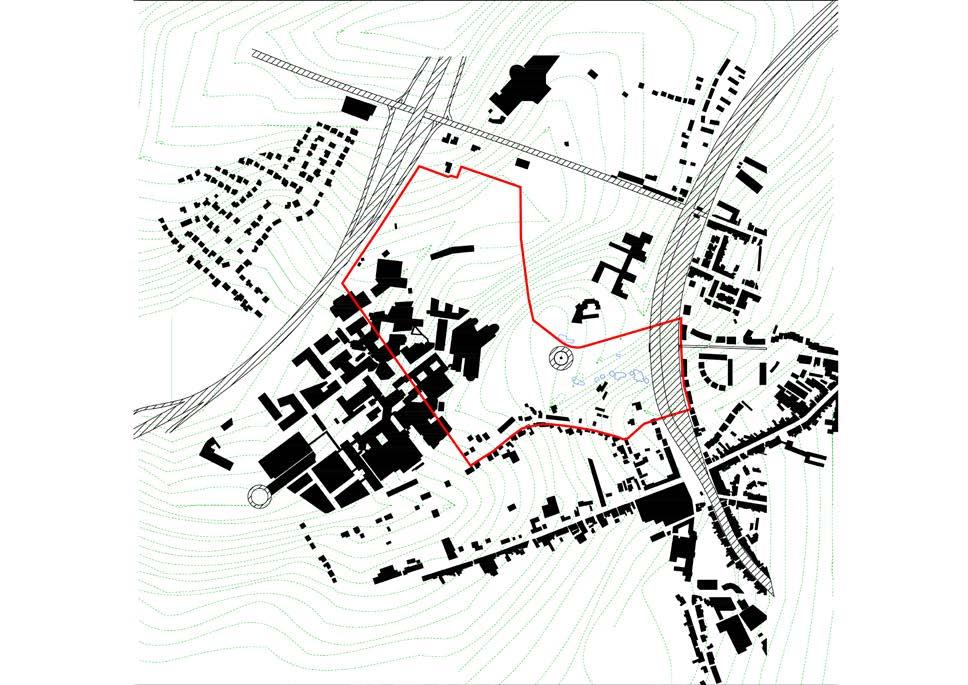
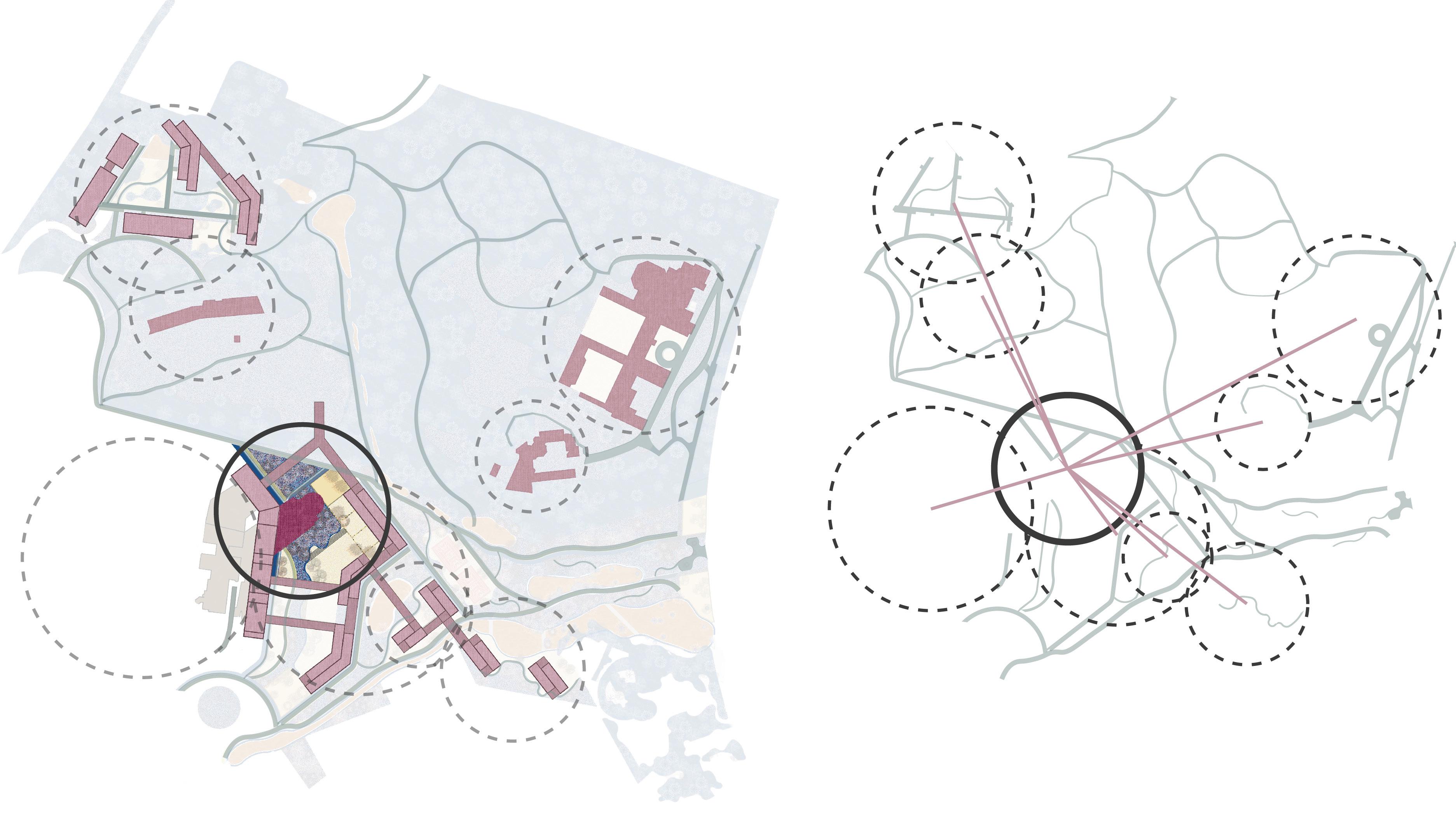
Specific sites for intervention were identified due to their relationship with the university (and a broader discussion of city - (monotonous) university), the gentrifying effect of the university and major shortages in the (student) housing market). All the sites are comprised of fragments of tissues (hospital, school, convent, etc) and the strong topographical relief that characterizes this area of Leuven.
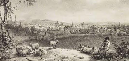
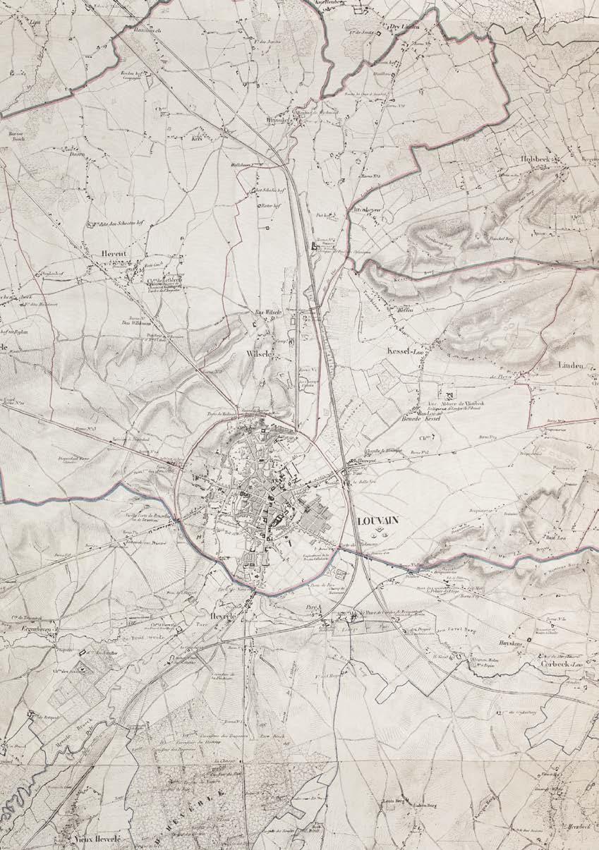
The city walls of Leuven mark a strong new artificial topography around the city. The Ferraris map of 1777 shows the clear distinction between the inner city development and the wide agricultural landscape beyond the walls. The flanks of the witness hills on the west side of the city form a strong agricultural landscape within the city walls with fields and vineyards. The steep slopes in this area explain the hesitant urban growth.
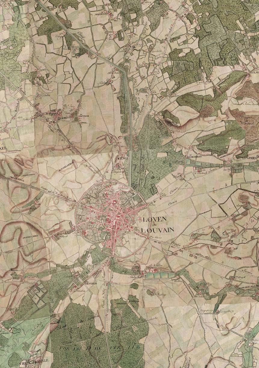
The Vandermaelen map from 1850 highlights the larger institutions that are set within the landscape. The larger estates of these institutions define figures in the landscape and often form the nucleus of car-dominated campuses of the enormous institutions that we find around Leuven today.
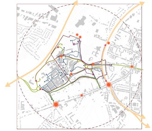
Infrastructure as destruction
Over time the city ramparts have been transformed into a linear park like the Remy boulevard. In the 1970's this landscape was dramatically uprooted. Through highway engineering a ring road is carved into the landscape. The dominance of the car becomes all-present around the city.
Hypotheses
1. Post-car/ post-carbon city
All sites must address the radically downgrading of car-infrastructure (including recuperation of parking lots, downsizing and re-arranging profiles).
2. Adaptive reuse
All sites include the transformation of complexes (and their parking lots) into mixed urban fabrics of (very) high density (mainly housing)
3. No new greenfield development
The consumption of landscape must not continue. On the contrary, projects must re-engage productively/constructively with the surrounding landscape.
4. Tissues of multiplicity
Tissues of multiplicity. The Univer-City is not mono-functional and it should not be segregated. Synergies must emerge from a multiplicity of functions, demographics, typologies, cultures.
Challenges based on hypotheses
Density:
For each site, the design should aim for a density with a Floor Area Ratio of minimum 2.0 in relation to the existing impervious surfaces on site (parking, roads and buildings)
Multiplicity:
The urban tissue should provide a high degree of urbanity, with mixed-use complementary functions, but ensuring that housing represents between 60% and 80% of the Total Floor Area.
Units:
The design should ensure an average floor area per inhabitant of 50 m2/p from the Total Floor Area for Housing.
GROUP A
ELTON KIBET BIRIR
KONSTANTINA
NIKOLETTA
KARASARINI
YUHAN DONG
GROUP B
FATIMA AKMAN
MAHA ABUMARIA
YINGJIE LI
GROUP C
DIMITRA MAKRAKI
ALEXA GOMEZ
CUSTODIO
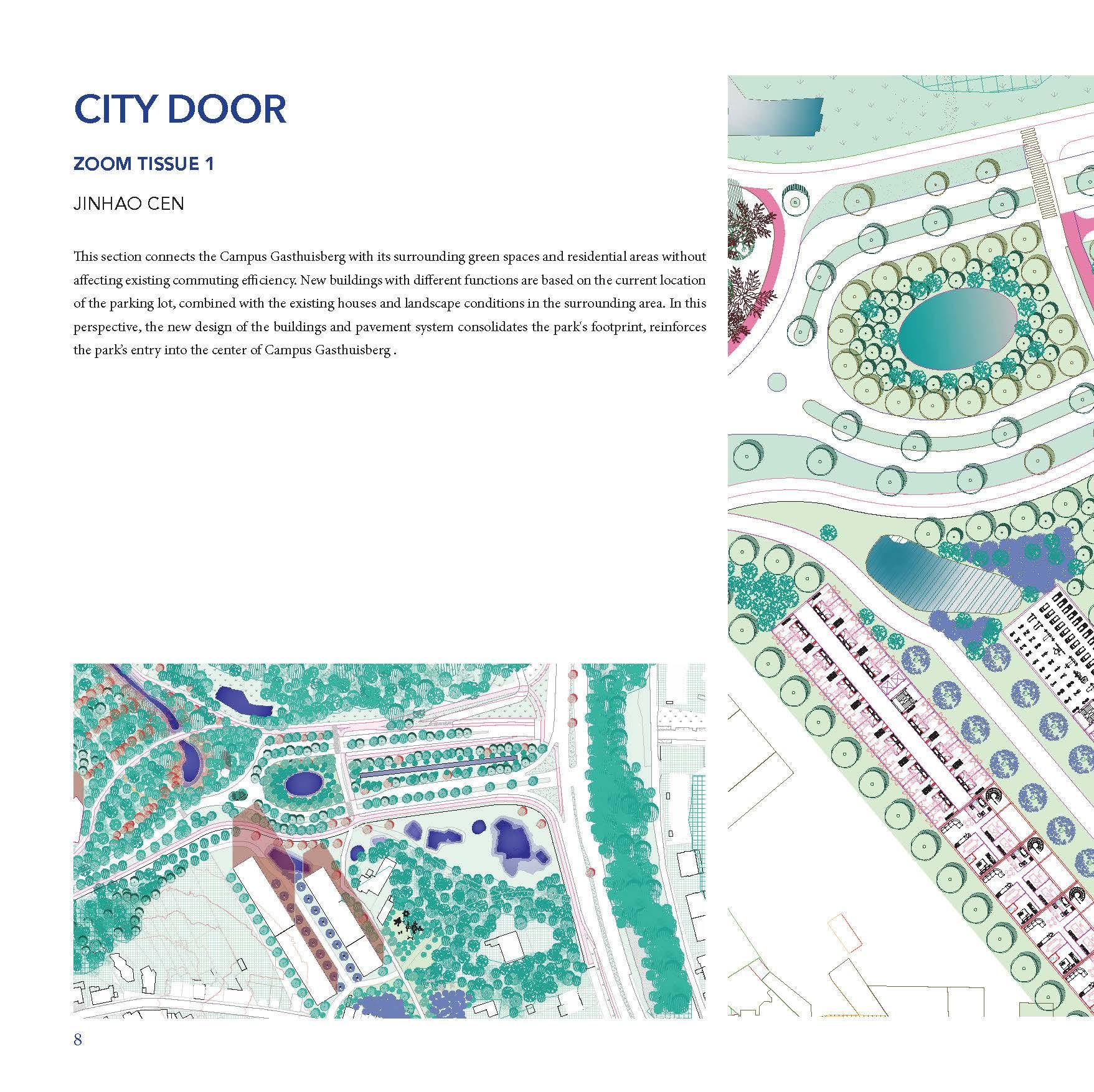
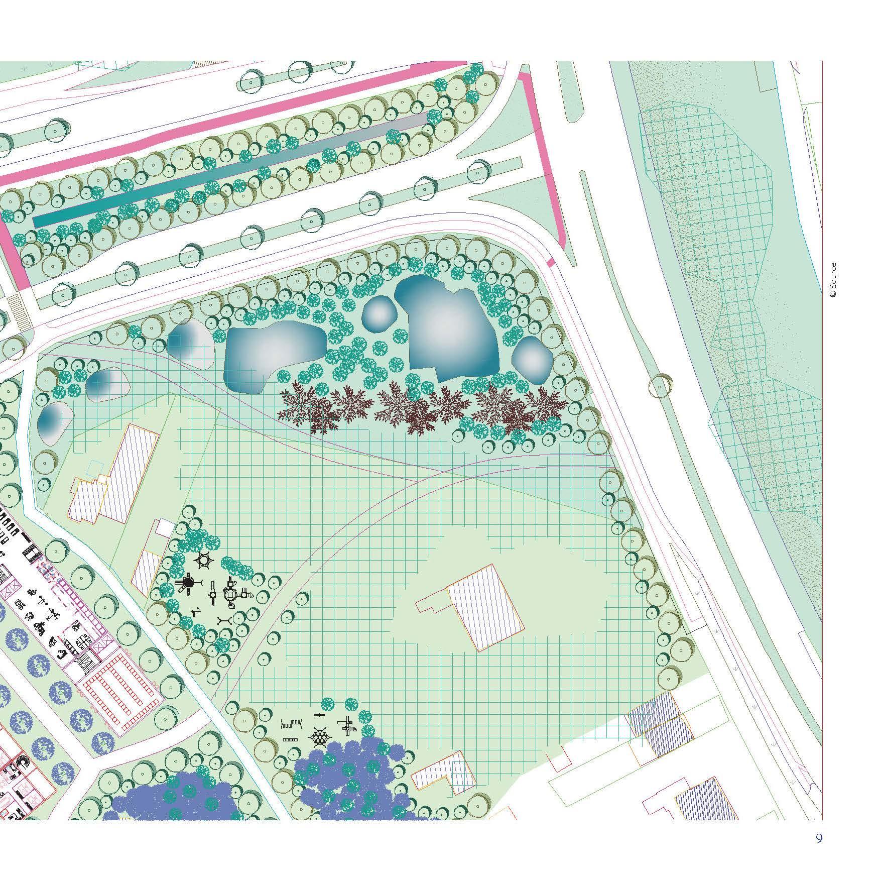
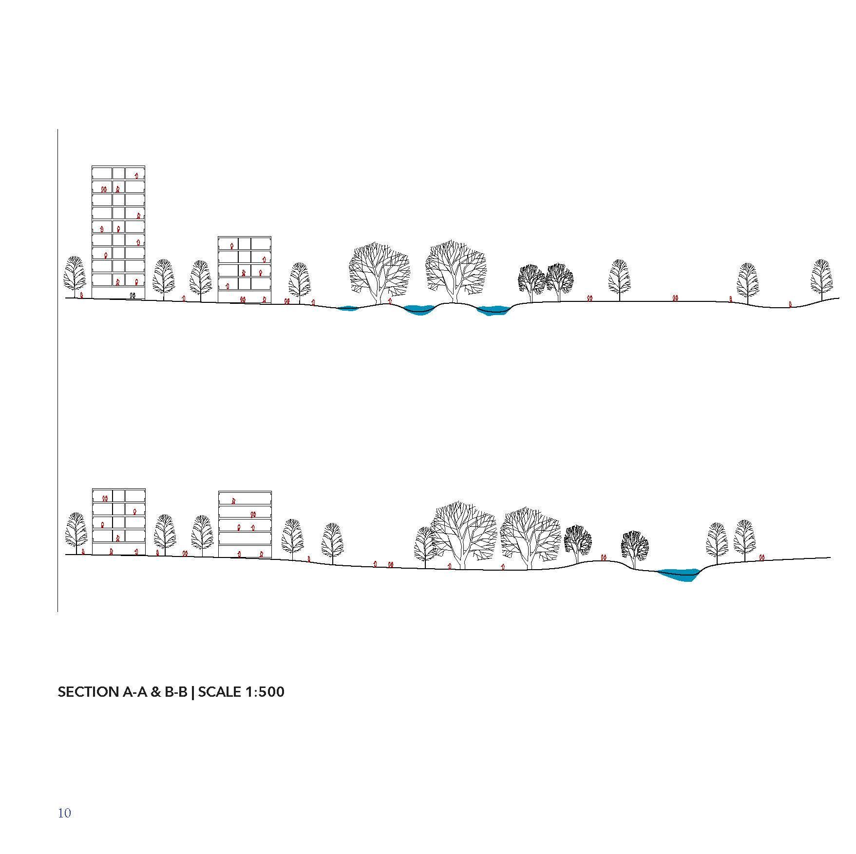
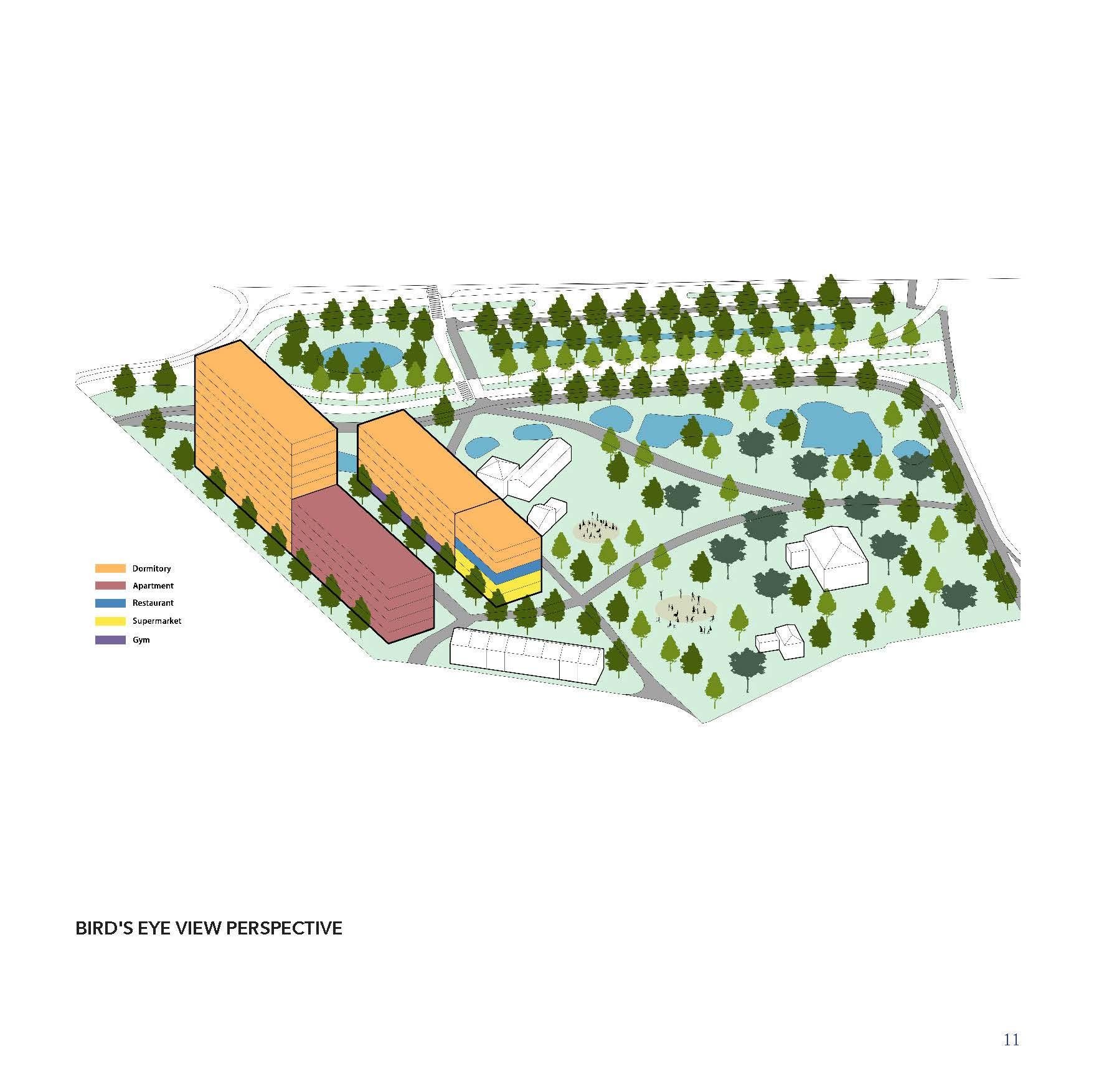
JINHAO CEN
GROUP D
RADHIKA SOMANI
VICTOR HUGO
MARTINEZ PEREZ
IRENE GRACIA ARANDA
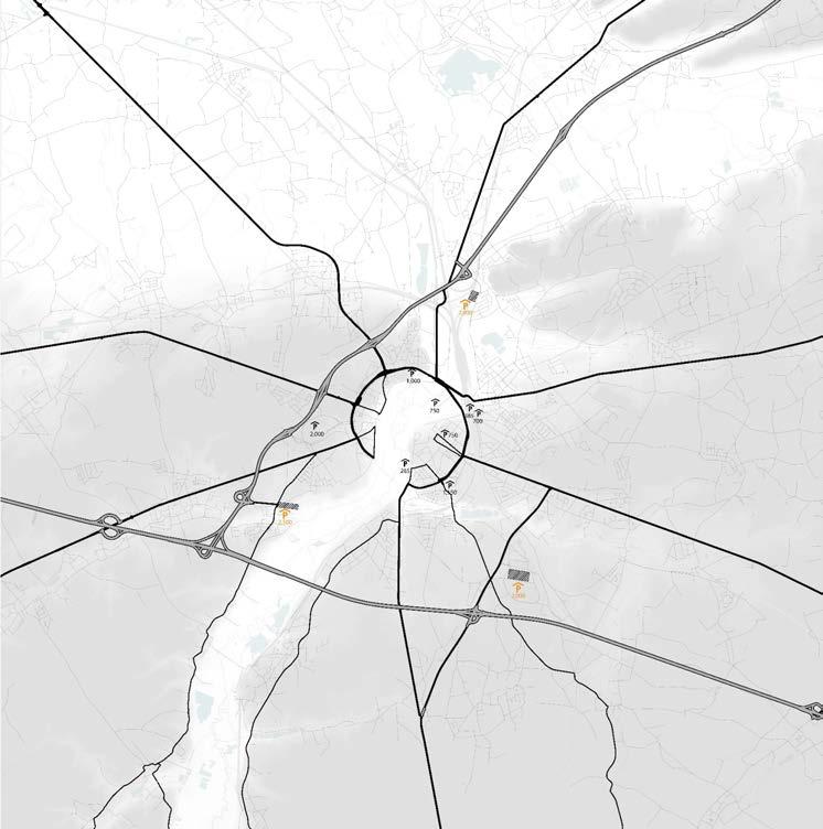
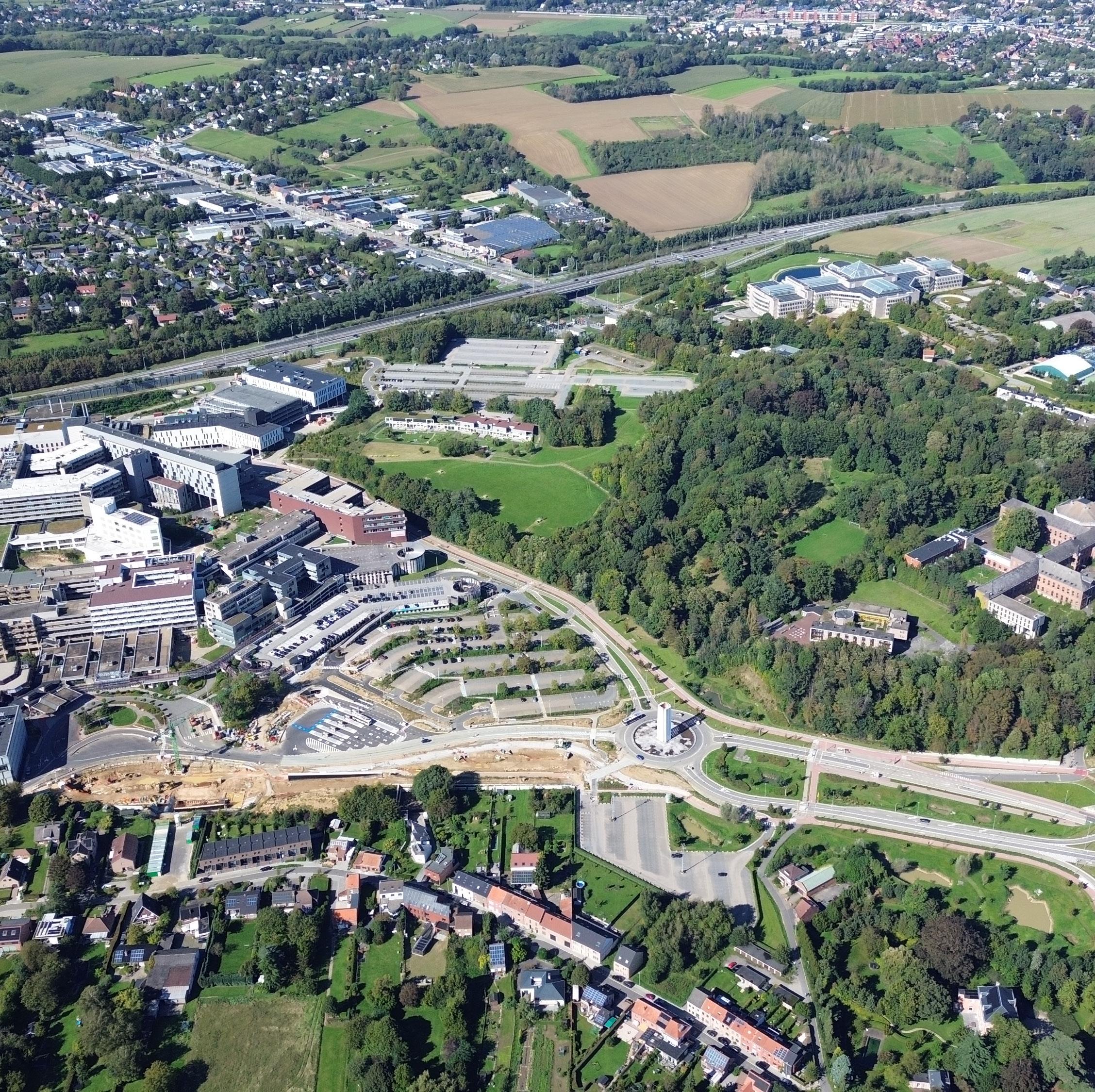
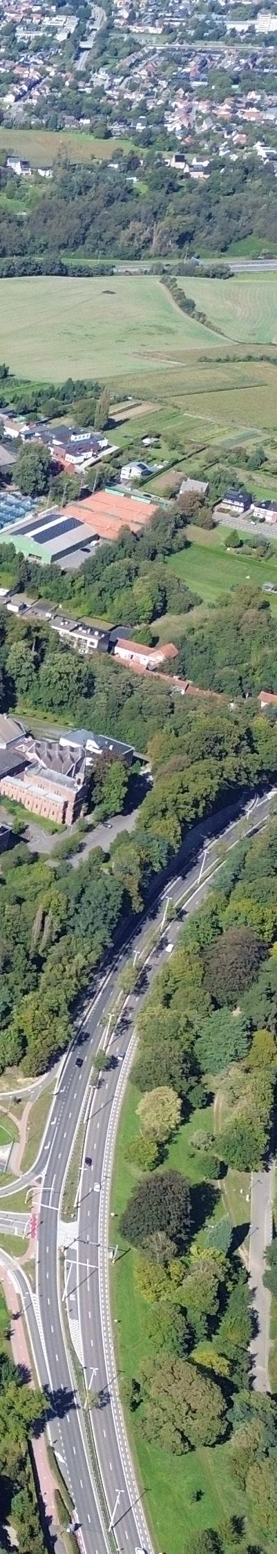
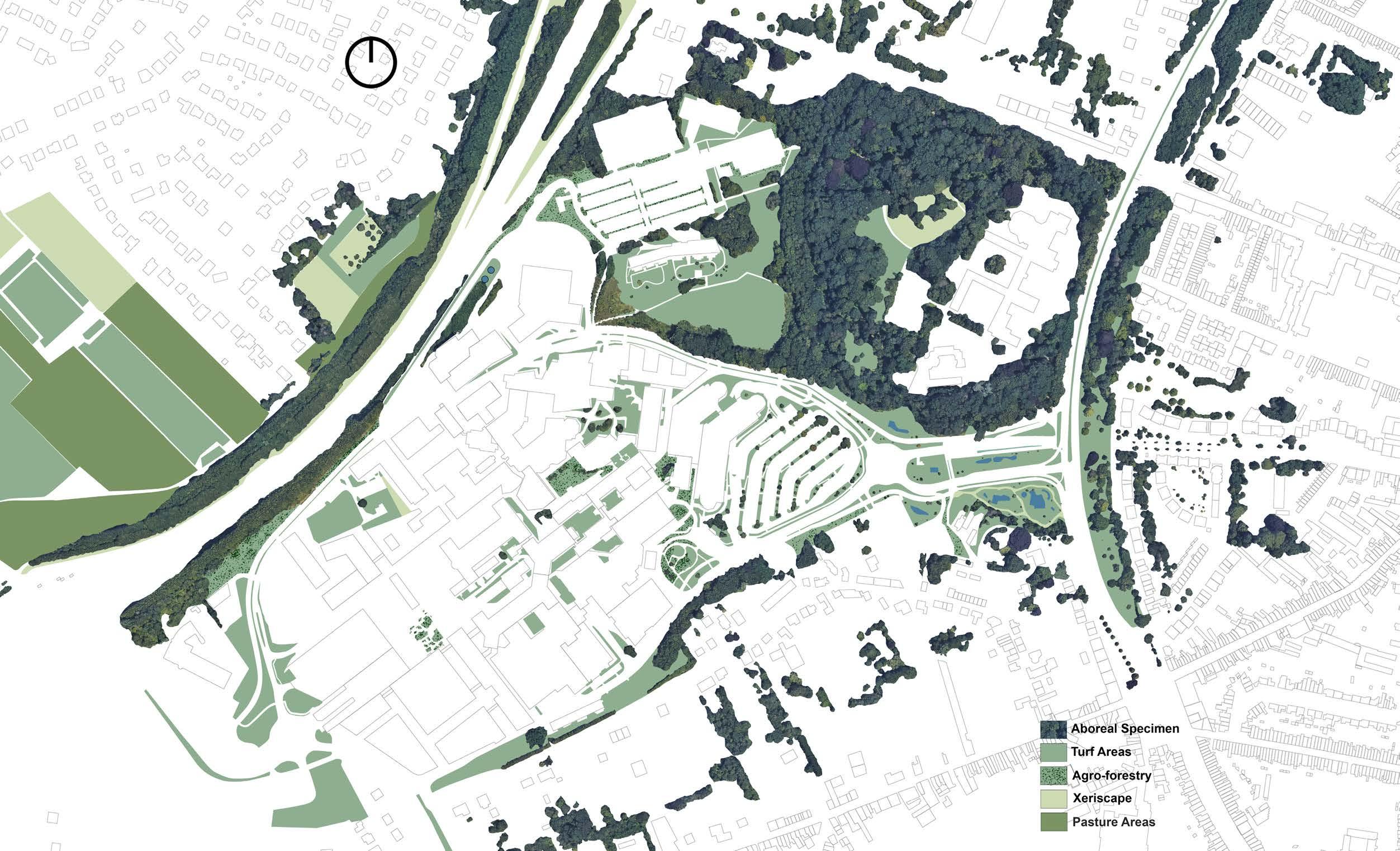
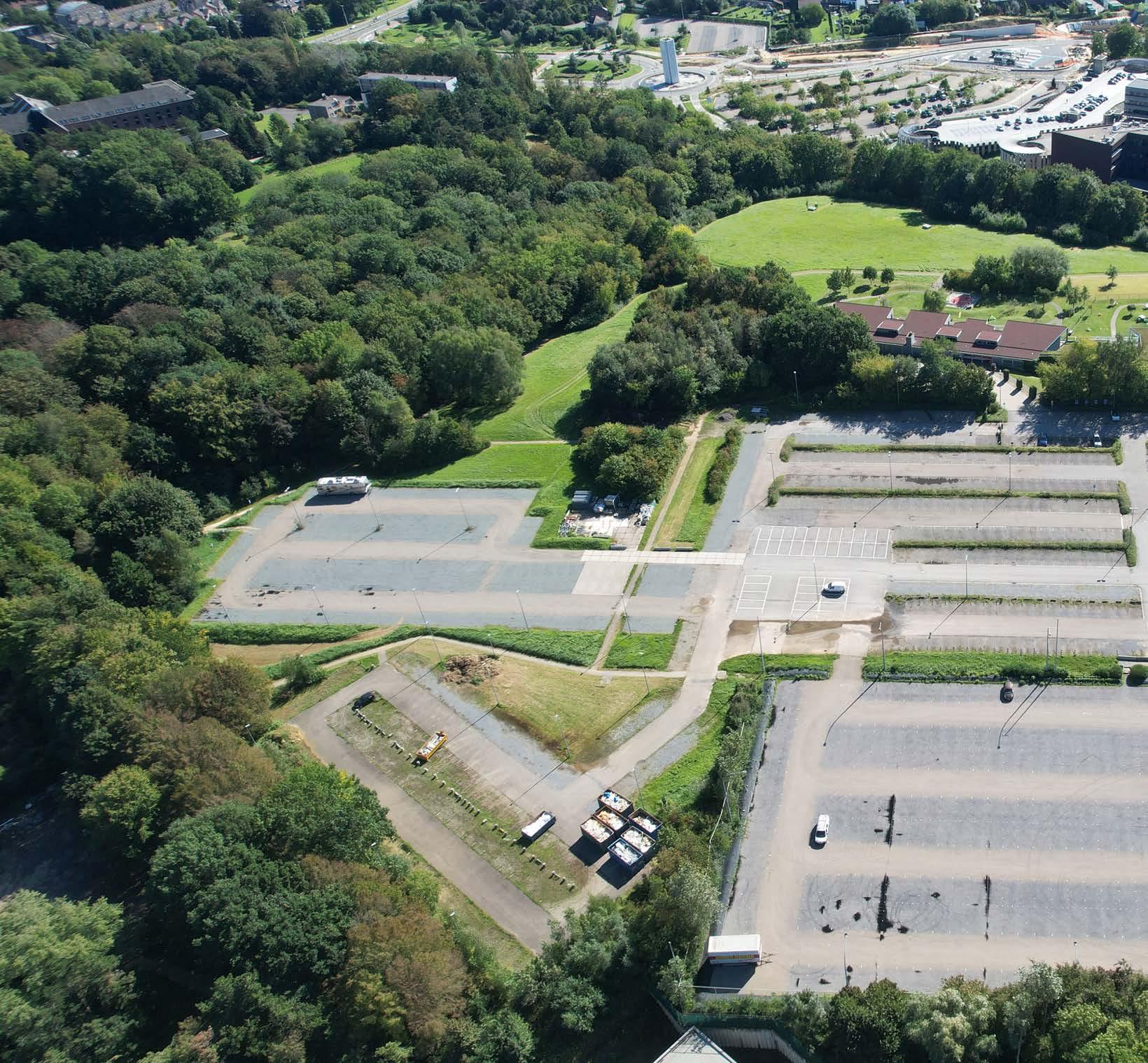
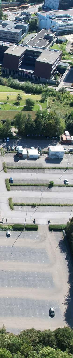
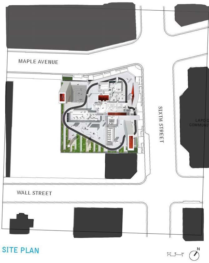
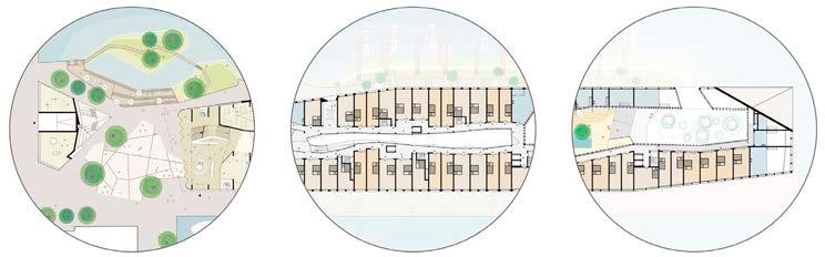
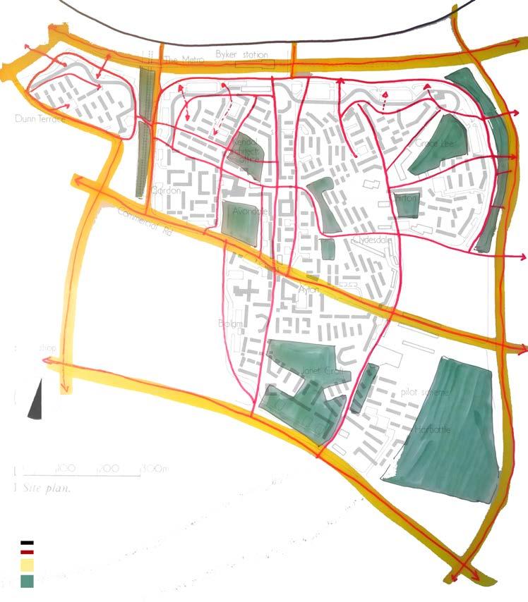
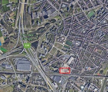
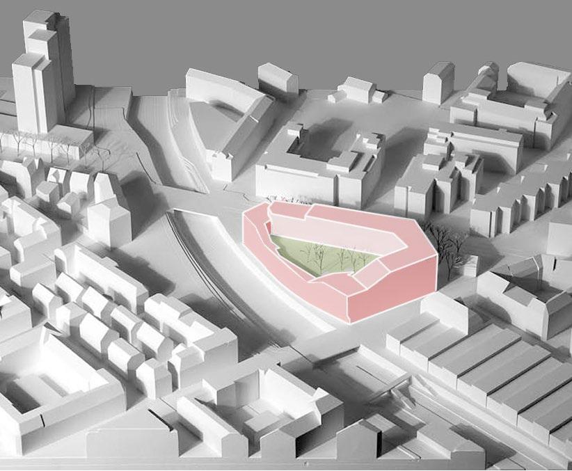
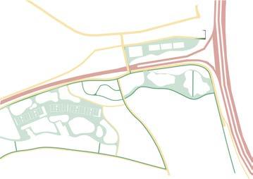
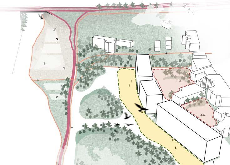
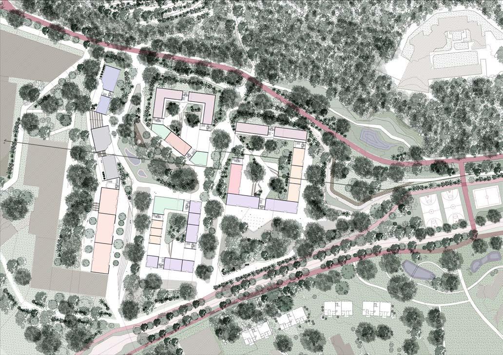
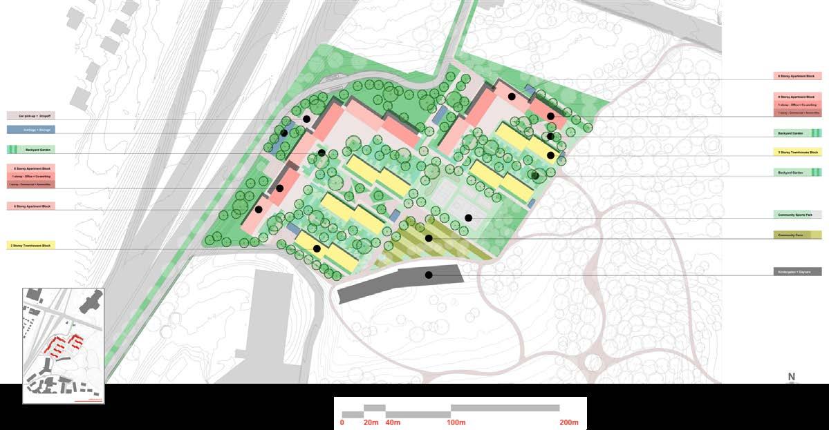
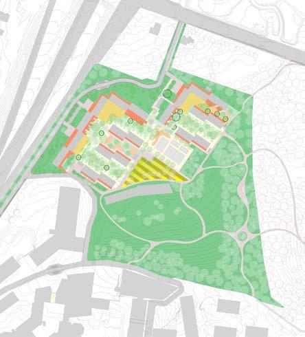
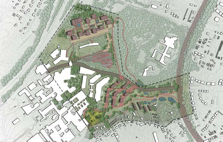
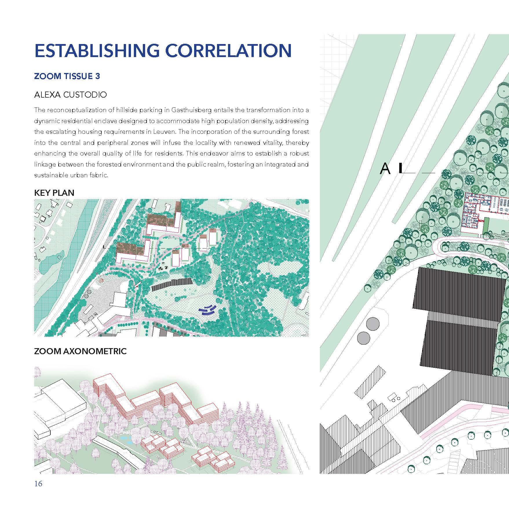
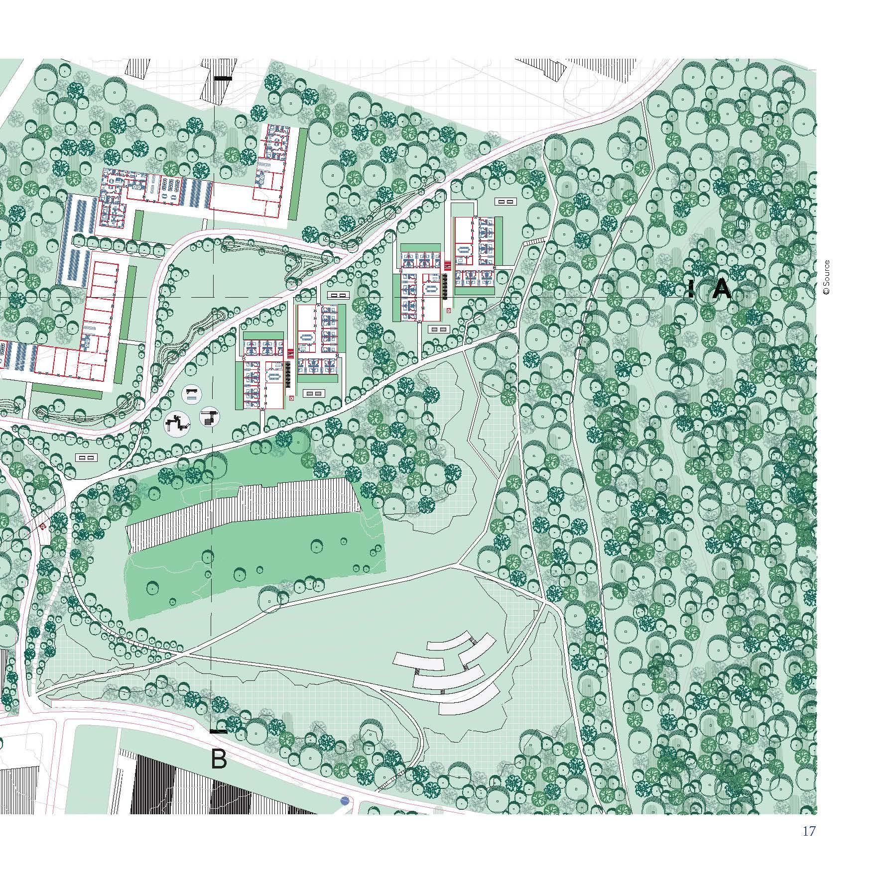
The site's focus is on the (parking lots) tail of Gasthuisberg (Kabouterberg: Parking Villa, Parking UZ Leuven Oost, Parking Het Teken, Admintoren UZ Leuven). The main entrance of the university hospital will be relocated to the highway entrance. The dispersed parking system at the current entrance becomes than redundant and obstructs a constructive relationship with the city as well as with the landscape.
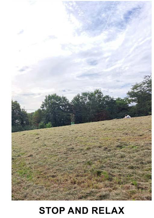
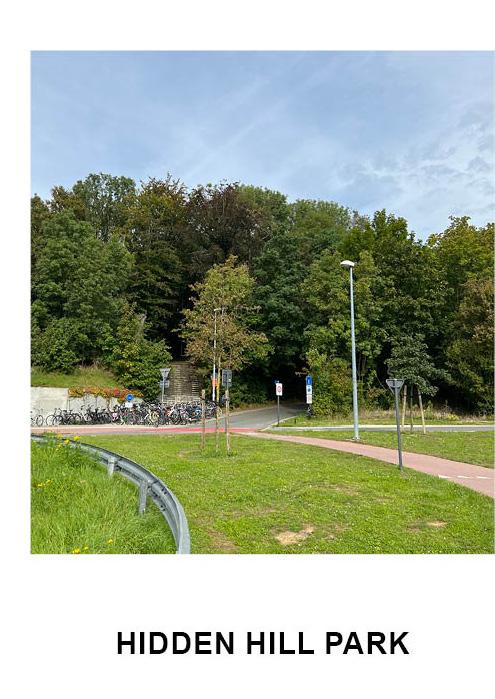
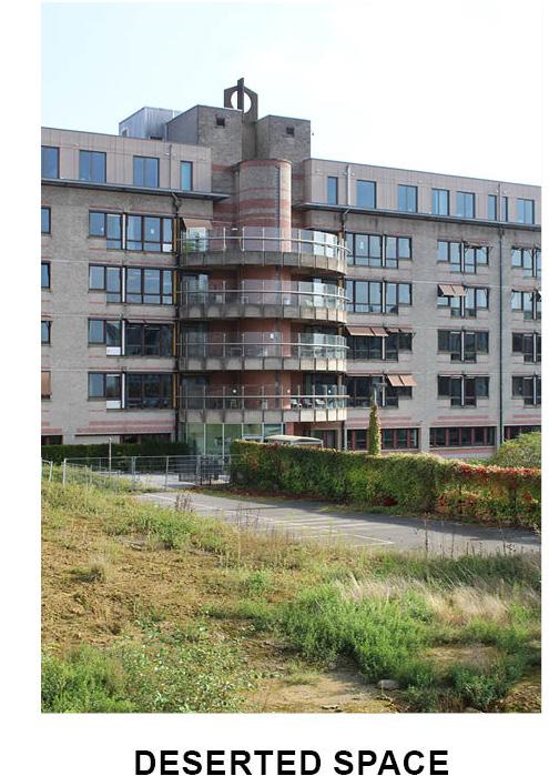
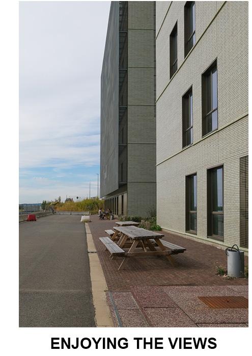
Overview, A Photographic Story
 © Elton Birir
© Konstantina Karasarini
© Yuhan Dong
Maha Abumaria
Gasthuisberg
© Elton Birir
© Konstantina Karasarini
© Yuhan Dong
Maha Abumaria
Gasthuisberg
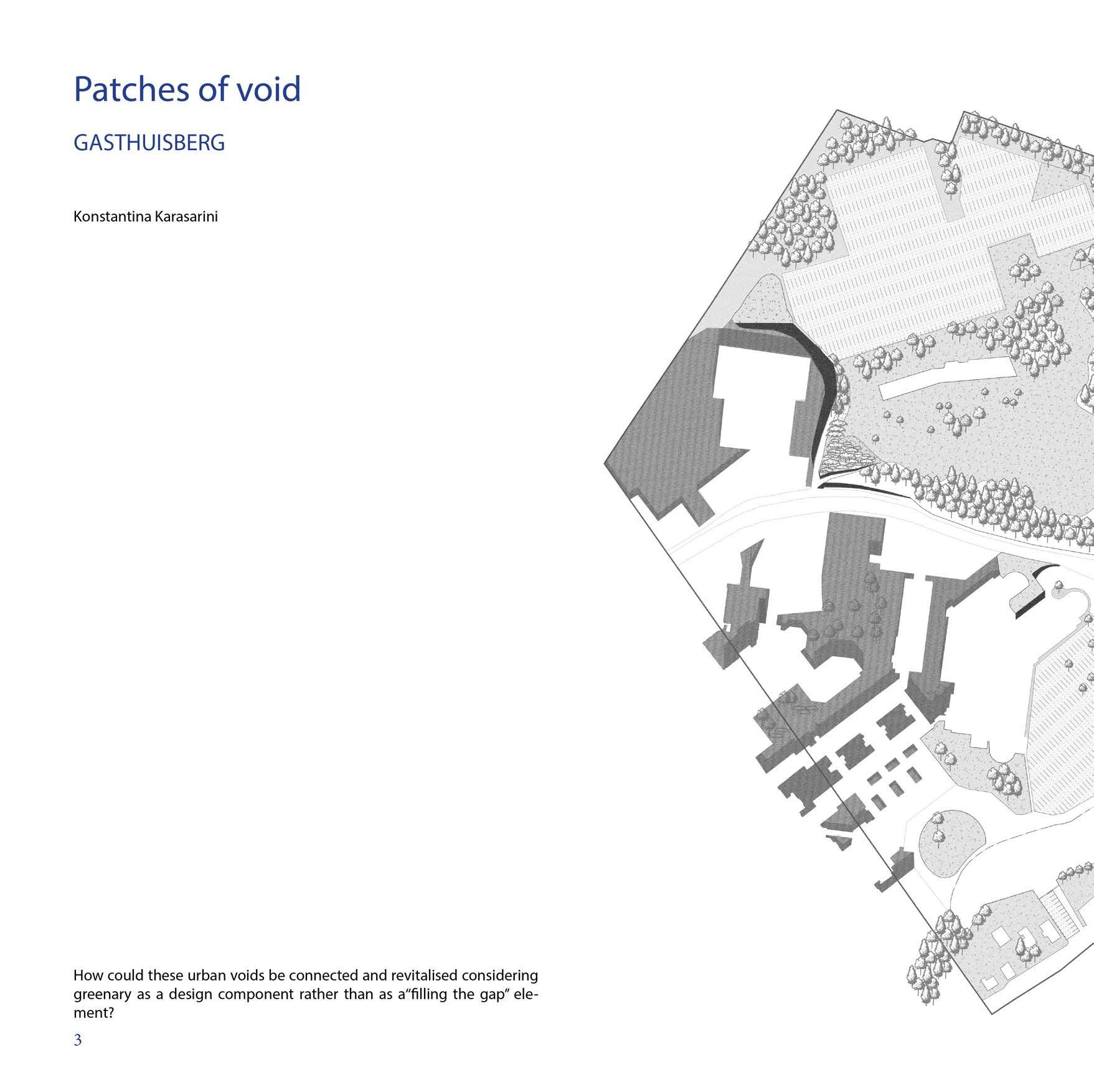
How do we create human scale with scared fabric as a tool?
 Elton Birir
Are the buildings in the site too scattered in arrangement compared to the buildings in the ring?
The high-density complex squeezes out public space. Large public lawns are hidden behind trees. And spaces scattered around the buildings make lingering uncomfortable. High-density buildings are clustered on the valley floor, ripping up the public space. The hillside, on the other hand, is empty and pleasant. The connection between the two is missing.
What steps are being taken to improve the amenities, connectivity, and accessibility of open spaces in Gasthuisberg for the benefit of the public?
PROPERTIES WITH BUILDINGS INSIDE NON PAVED
ASPHAULT AND PARKINGS WATER
1-2 FLOOR BUILDINGS
3 FLOOR BUILDINGS
4 FLOOR BUILDINGS
5 FLOOR BUILDINGS
<5 FLOOR BUILDINGS
LIGHT FENCING
FENCING
BUNCHES OF TREES ( MANY TREES TOGETHER)
It’s about time to be an active part of the urban fabric, and not just logistics, isn’t it?
How could these idle public space resources be connected and revitalised?.
¿Why are people more interactive in semi-closed spaces? ¿Do they feel more vulnerable in total open spaces?
Topography designs buildings
How can we connect the scattered interactive spaces and create more pauses within and outside the building cluster.


MaHS _ Gasthuisberg A
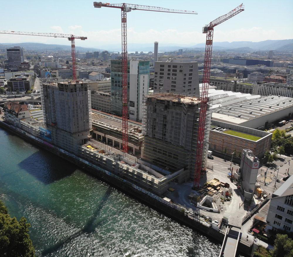
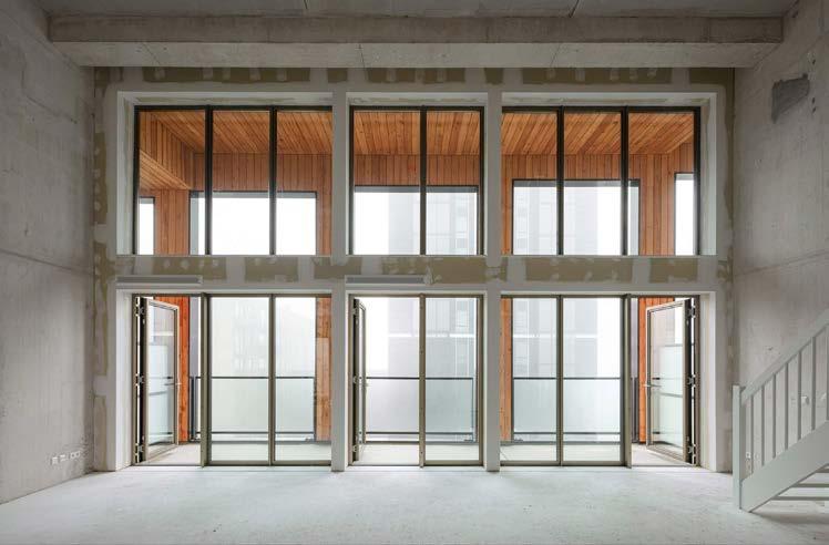
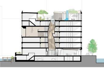
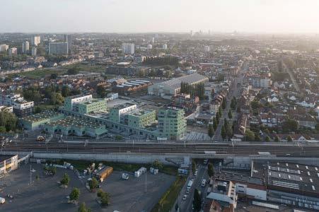
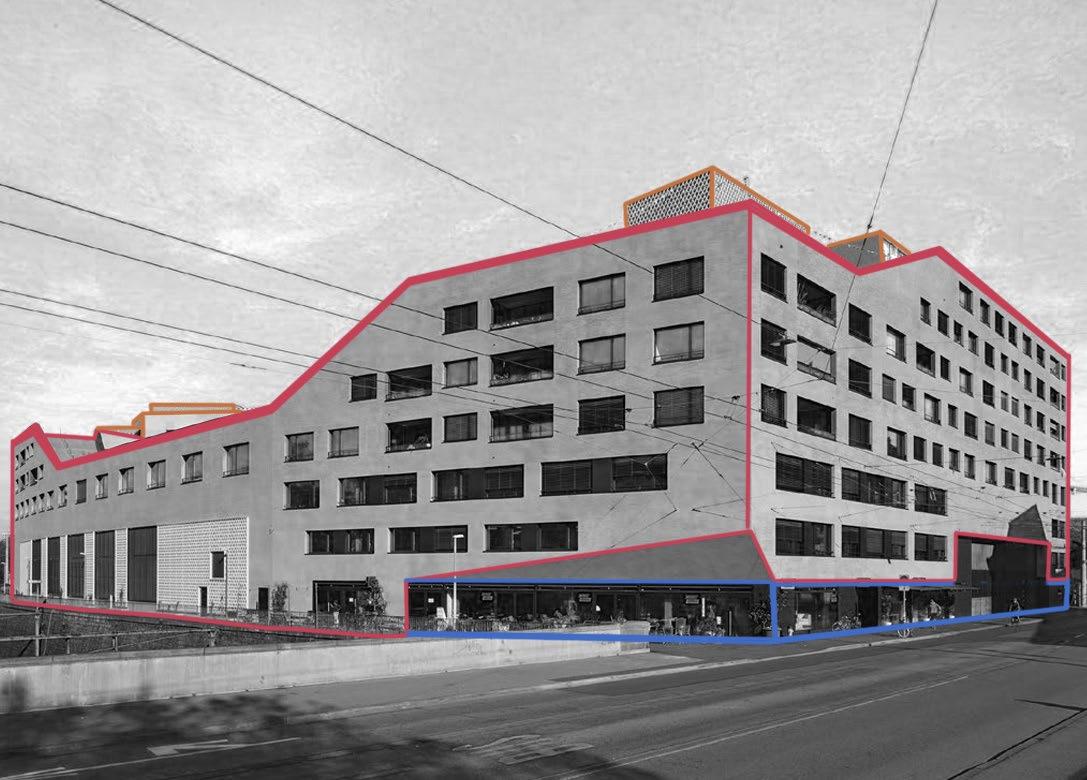
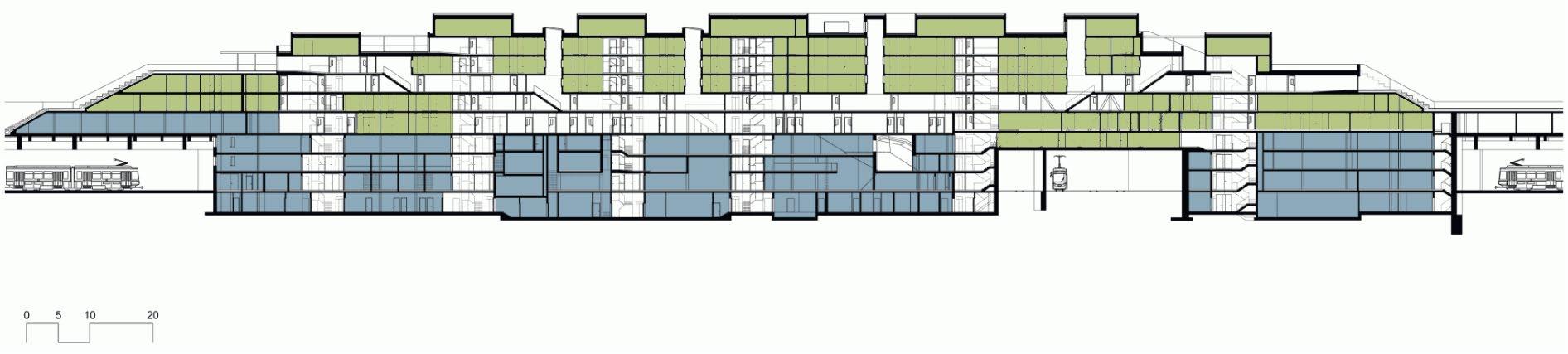
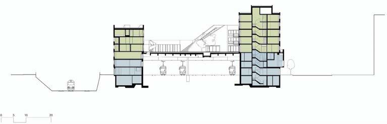
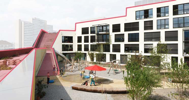
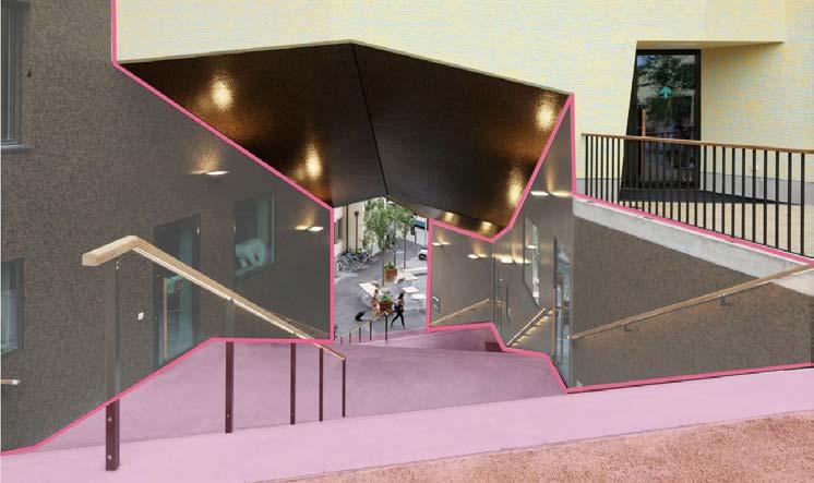
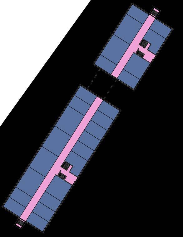
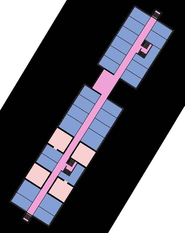
The site of the project, Hard streetcar depot, was partially protected as a historic monument, but no longer met the structural and operational requirements of the city. Therefore, the unprotected part of the depot was set to be replaced by a new building and the protected buildings were to be repaired, according to the city of Zurich. In order to make optimum use of the plot, the construction of a residential development with 193 units was planned above the new depot.
In 2014/15, the Office of Structural Engineering, Zurich held an architectural competition for this purpose, from which Morger und Dettli Architekten from Basel (now Morger Partner Architekten) emerged as the winner.
Two high-rise buildings on a 5-story base, the Swisscom Tower and the Escher Terraces, form an ensemble as a prelude to the Zurich West district. The ground floor houses the tram depot, above which terraced houses are divided into rows along the long sides of the building, which are accessed via a semipublic square level. 193 apartments will be created in the base and in the approximately 70 m high towers.
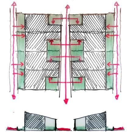
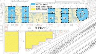
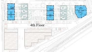
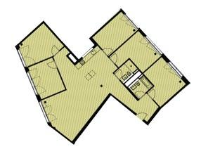
• (Urban tissue) - The building parralel foot print with a courtyard space refrences the exisiting urban fabric both through the height of the building and through its geometry.
• (Building typology) - The apartments are divided into terraced house typologies, multi-story apartments and units for communal living.
• (Individual dwelling) - The design of the individual units consist of 3 types of typologies all of which are duplexe units. The units facing the courtyard have been given priority of balconies giving the community a more introverted interaction.
(Source: https://www.immobilienbusiness.ch/en/regionen/2019-06-11/zuerich-wohnsiedlung-ueber-dem-tramdepot-hard/ https://www.world-architects.com/es/morger-partner-architekten-basel/project/depot-hard-1
(Source: https://references)
(Source: https://www.morgerpartner.ch/en/)
(Source: https://www.morgerpartner.ch/en/) URBAN GATE-WAY CONTEXTUALISED VOLUMETRY
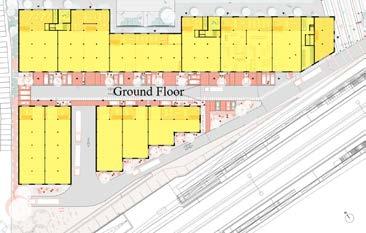
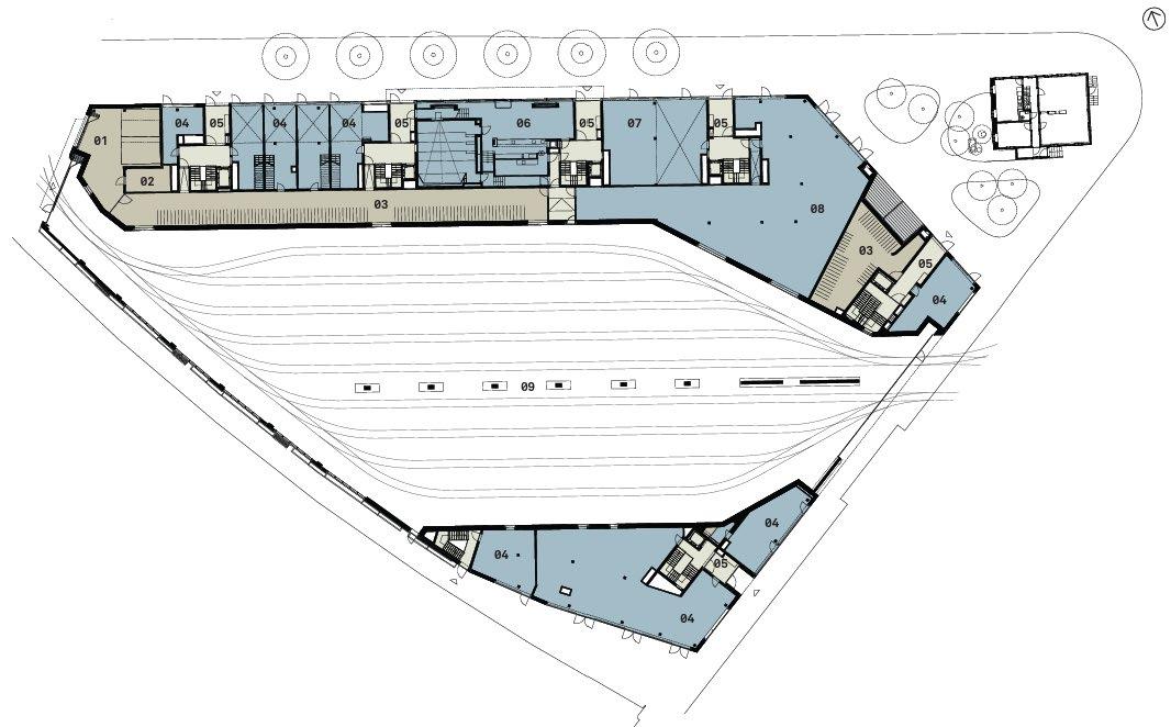
Basement Level - Tram Station
Ground Level - Entry Lobby / Townhouses
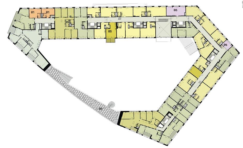
First Floor Level - Town House
Typical FloorLevel - Tower Apartments
(Source: https://www.morgerpartner.ch/en/)
(Source: https://www.morgerpartner.ch/en/)
Tower Apartments
Townhouses + Courtyard
Tram Station
Storage Yards
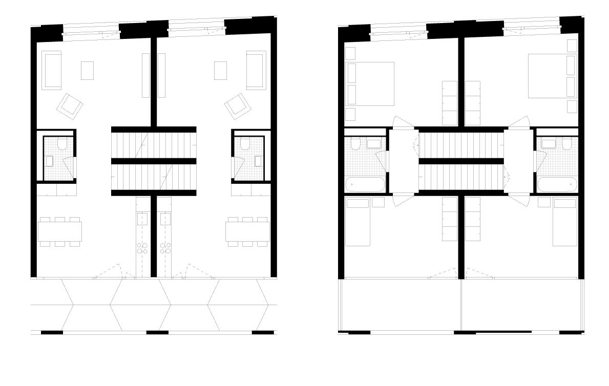
Typical; Townhouse Unit
(Source: https://www.morgerpartner.ch/en/)
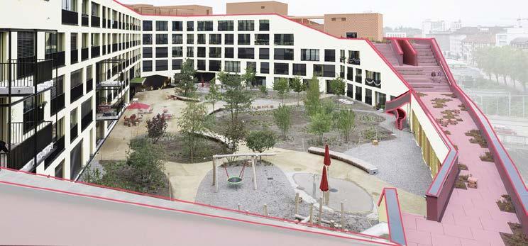
The scheme carefully positions the different functions of the community in delicate layers that seemlessly blends into the urban fabric.
The Tram station, serving as the project historical base, defines the neighborhood direction in layout which evolves into an open courtyard that brings a boulevard connection to the surrounding area . This journey is contained by 2-storey townhouses which then serves as the base and connection of the towers which rise to accomodate the duplex apartments.
A true urban relationship.
(Source: https://www.morgerpartner.ch/en/)
The new Star Apartments transformed an existing one-story commercial building in downtown Los Angeles into a mixed-used complex providing permanent supportive housing within the downtown core of Los Angeles. The building is organized around three principal spatial zones, stacked one upon the other with 102 apartments for formerly homeless individuals.Model of providing permanent supportive housing within the downtown core by incorporating a new type of shared public space within the building.
Star Apartments is the first mixed-use, multi-unit residential project for formerly homeless individuals employing this construction method in Los Angeles. The LEED for Homes Platinum development was constructed with prefabricated modular housing units that are cantilevered on a 2 story concrete superstructure. Priority given to communal activity both at the street and above ground level is now manifest at the apartments.
“Alternate Ground”; basic building blocks as a kind of geometric hill village.
• Surrounded with parking areas
• its unique construction method—the first multi-unit residential building to utilize entirely pre-fabricated construction.
• The development, sets a new model for urbanism and increased density by adding new community spaces and residential levels above. They reconfigured the existing structure as shared or public facilities and stacked prefabricated accomodation units overhead.
MaHS / MaULP_Gasthuisber B SURROUNDED WITH PARKING AREAS IN
(Source:https://www.mmaltzan.com/projects/star-apartments/)
(Source: © modified by author. https://archello.com)
(Source: © modified by author. )
(Source: © modified by author. https://archello.com)
(Source:https://archello.com/project/star-apartments)
(Source:https://archello.com/project/star-apartments)v
Other unique products that contribute to sustainability: Modular prefabricated units.
(Source: © modified by author. https://archello.com)
(Source: © modified by author. https://archello.com)
MaULP_Gasthuisberg A
Jonas is located at the harbor of Amsterdam IJburg and accommodates 190 mid-market rental studios, 83 owner-occupied apartments and a range of supporting facilities. It’s a building with an innovative housing concept and a spectacular spatial interior that received the highest possible sustainability certificate: BREEAM Outstanding. Jonas will enhance social cohesion, in what is still a new city district, by creating a sustainable, inviting heart for the neighborhood.
The name Jonas refers to the story of ‘Jonas and the Whale’. It stands for adventure, but also for protection and comfort inside a ‘big body’. It is a heroic building with a warm heart. But Jonas is also a sustainable and attractive building that stands out from the surrounding buildings in IJburg – if only because of the special site on the headland and the special program it accommodates. The building expresses in a striking manner themes that belong to this location: water, quayside and the craft of shipbuilding. As a result, Jonas feels natural, because the building embraces the ‘soul of the place’ and renders it visible.
• Together with its surroundings, the building forms a ‘living landscape’. At the front of the building a public forecourt is bordered by a timber ‘pavilion’ with steps, which act as a three-dimensional playground. The pavilion also marks the entrance to the car park and serves as a tribune for all kinds of activities, such as a film screening or outdoor events. The green exterior, with trees providing shade, invites people to linger and – in the summer – there is even a city beach on the water’s edge.
• The building with its irregular openings creates the impression that the windows are gently undulating across the facade. That makes Jonas a bit different. It is not covered in stone but faced in dark, pre-patinated zinc. The facade does not touch the ground but is lifted off it. The volume is not rectangular but diamond-shaped. That makes it both familiar and alienating, sculptural yet rational, recognizable yet innovative.
• Surrealism; based on traditional wooden boat construction methods
(Source: https://orangearchitects.nl/projects/jonas/)

(Source: https://orangearchitects.nl/projects/jonas/)
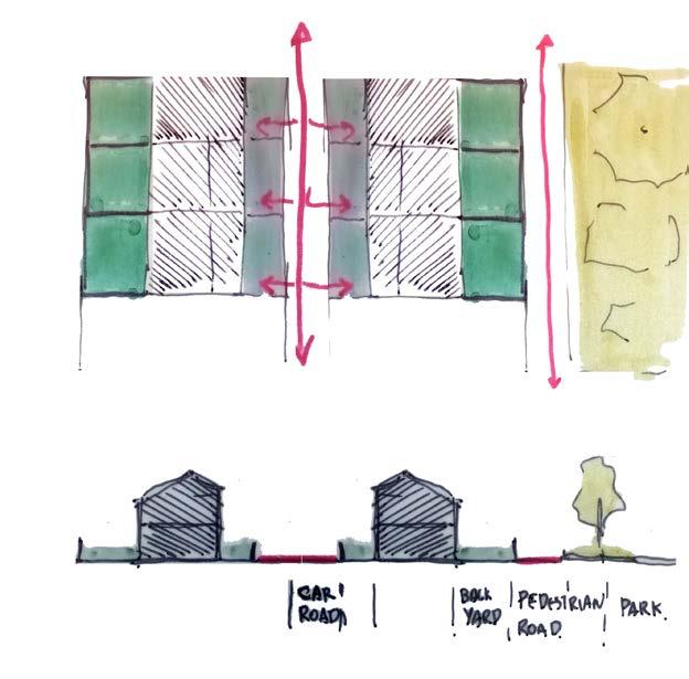
CONCENTRATED PRIVATE AREAS AND SCATTERED PUBLIC GREEN SPACES
PUBLIC-PRIVATE STRUCTURE
(Source: https://orangearchitects.nl/projects/jonas/)
HIGHLY CONCENTRATED BUILDING CONTEXTUALISED VOLUMETRY
(Source: https://orangearchitects.nl/projects/jonas/)
(Source: https://orangearchitects.nl/projects/jonas/)
(Source: https://orangearchitects.nl/projects/jonas/)
studio-S apartment-M
penthouse-XL
(Source: https://orangearchitects.nl/projects/jonas/)

(Source: https://orangearchitects.nl/projects/jonas/)
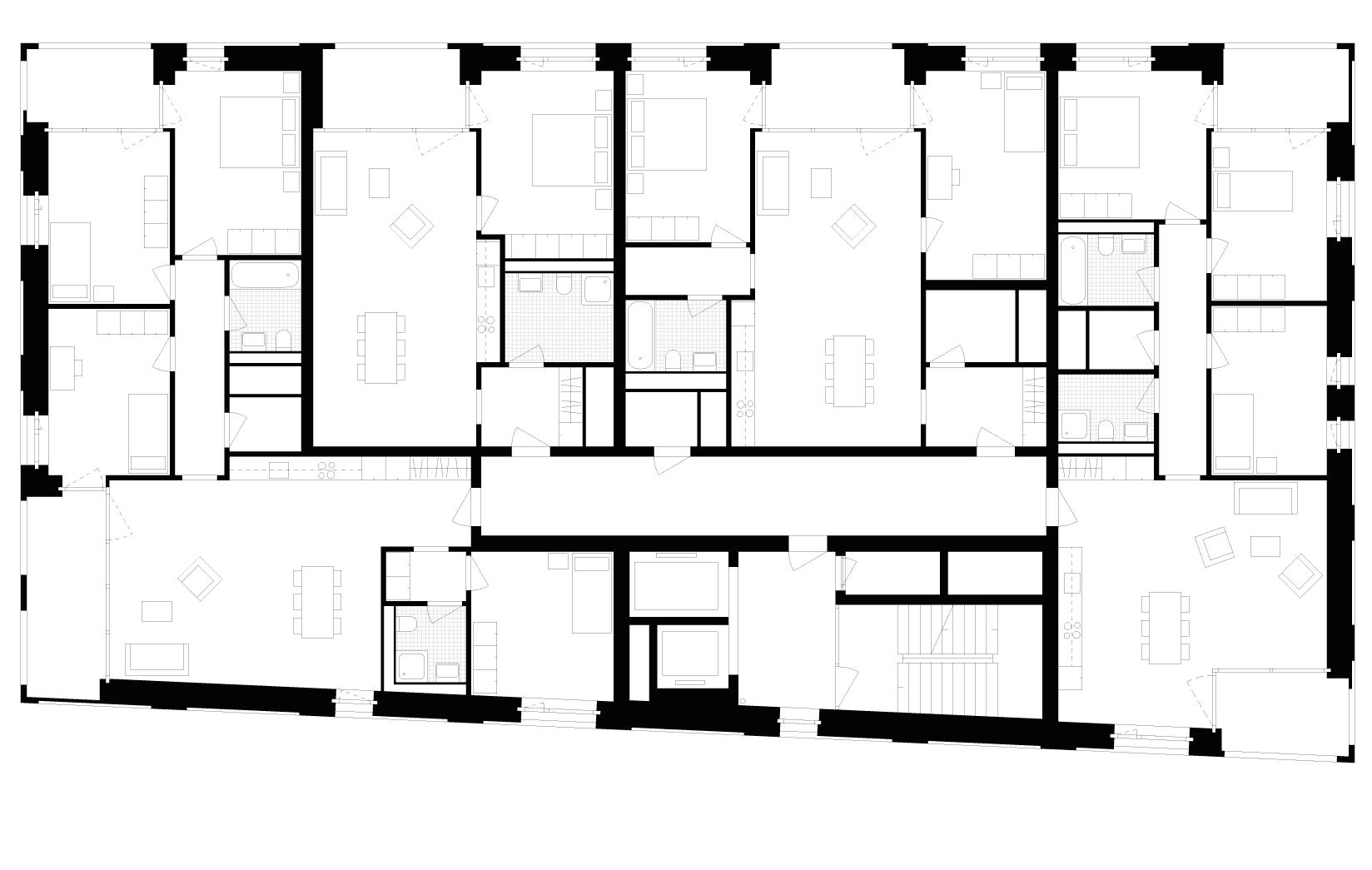
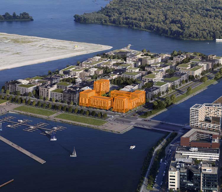
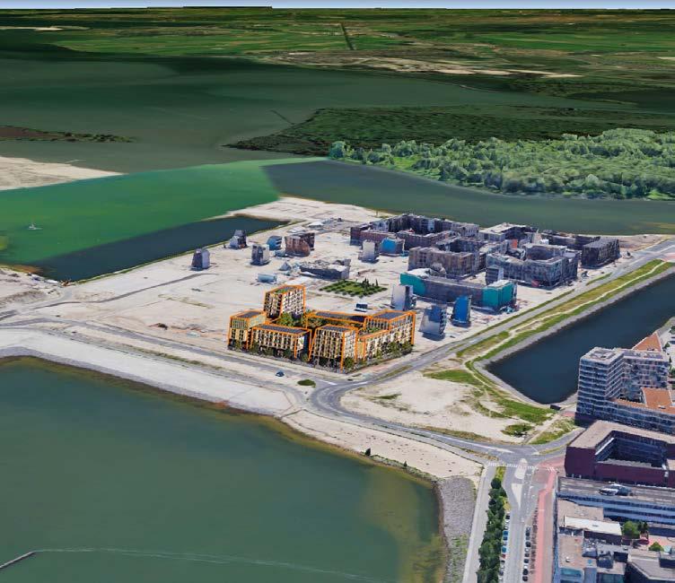
Robin Wood is the winner project in the category ‘Best Future Residential Project of the World Architecture Festival 2022. This project, located in the island of Ijburg, Amsterdam, consists of 6 building blocks, interconnected with galleries and bridges as elevated streets, with 165 dwellings with different varieties, which surround a tiny forest. We can divide these blocks in three levels.
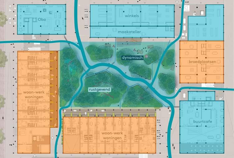
The ground floor houses the public facilities, such as catering, public library, retail, cafe, studio’s for creatives, a residential lobby, flexible workspaces, small-scale offices and social facilities. The middle level hosts the dwellings, which are intended to be for a middle segment rent and they are divisible in a flexible way. All the terraces face the central area, with the tiny forest. In the upper floors, there are spacious terraces with collective installations for the residents of the block. In addition, these terraces have gardens, a sport field and a collective living room with kitchen and roof terrace.
This project is built using a combination of wood-frame prefabricated CLT, with recycled aluminium, which makes it such an awesome sustainable building. The construction is supposed to be completed 2024 with 24.440 m2 of gross floor area; 16.300 m2 residential, 6.700 m2 non-residential.
‘Urban village’. There is a perfect cohesion between the public and the private. The building invites the transients to explore what it offers in its interior, but also allows residents to enjoy their privacy and desconnection of the city-life. This creates an incredible informal interaction between residents with its galleries and bridges, facilities and shared roofs. Residents create their ‘own space’, not only with the flexibility while designing their dwells, but also but also they have voice in the decision of the management of expositions in the galleries. In addition to the ‘urban village’ concept, this project also stands for the eco friendly part, due to its construction materials and the green areas.
• Interaction between street and building. The public spaces along the plinth will enhance the dynamism of the streets and the neighbourhood.
• A building made for and by the residents. The semi-closed city block allows residents to feel their private space in their dwellings feel their privacy without loosing interaction with people.
• All dwellings can be linked creating a wide variety of housing types.
Source 1: “Robin Wood: Making an island together.” ANA. https://ana.nl/en/portfolio-items/robin-wood-making-an-island-together/
Source 2: “Robin Wood: Timber City Block, Built Around a Tiny Forest “ Marc Koehler Architects. https://marckoehler.com/project/robin-wood-making-an-island-together/
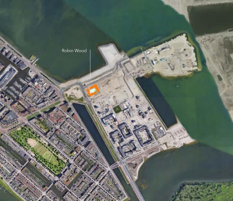
Source: Google Earth, 2023
Source: ANA Architects, Robin Wood, 2020. Robin Wood: making an island together. https://ana. nl/en/portfolio-items/robin-wood-making-an-island-together/
Source: ANA architects, Marc Koehler Architects, 2020. Robin Wood Coutyard. LandLab. https:// landlab.nl/projects/robin-wood-courtyard
Source: ANA architects, Marc Koehler Architects, 2020. Robin Wood Centrumeiland, IJburg. e-architect. https://www.e-architect.com/amsterdam/robin-wood-centrumeiland-ijburg
Source: Google Earth
This area of Ijburg island is nowadays developing. Therefore, there is not a real area to study and compare the volume of Robin Wood’s project. However, with the render found in ANA architect’s web, where we can see how the island would look like, we are able to make an idea of how our project actually would look like.
With the Google Earth perspective, we figure out that the volume of our project is similar to the ones already in development in the other part of the island.
Source: ANA architects, Marc Koehler Architects, 2020 “Robin Wood: Timber City Block, Built Around a Tiny Forest “ Marc Koehler Architects. https://marckoehler.com/project/robin-wood-making-an-island-together/
FLOOR TYPE FOR HOUSING LEVEL
Source: ANA architects, Marc Koehler Architects, 2020 “Robin Wood: Timber City Block, Built Around a Tiny Forest “ Marc Koehler Architects. https://marckoehler.com/project/robin-wood-making-an-island-together/
Source: ANA architects, Marc Koehler Architects, 2020 “Robin Wood: Timber City Block, Built Around a Tiny Forest “ Marc Koehler Architects. https://marckoehler.com/project/robin-wood-making-an-island-together/
(Source: ANA architects, Marc Koehler Architects, 2020. “Robin Wood”. Gailleo. https://www.galleo.co/project/robin-wood
Source: ANA architects, Marc Koehler Architects, 2020 “Robin Wood: Timber City Block, Built Around a Tiny Forest “ Marc Koehler Architects. https://marckoehler.com/project/robin-wood-mak-
MaULP_ Gasthuisberg D
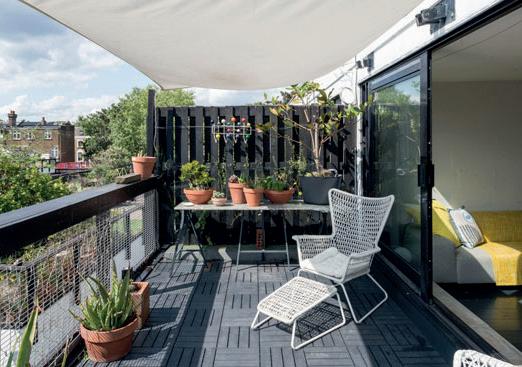
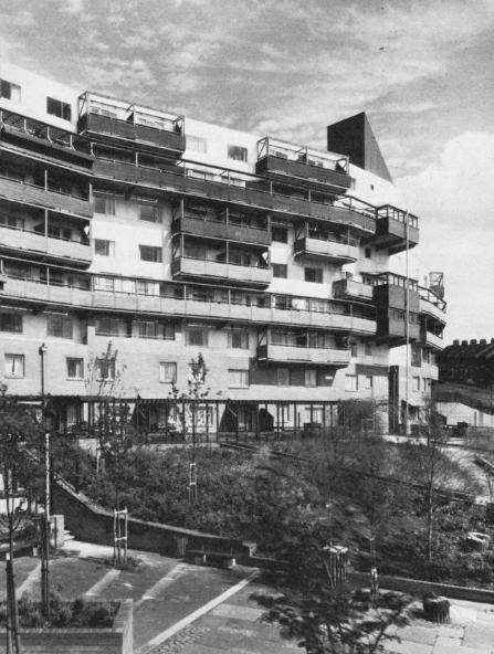
Fleet Road was the first housing project that Neave Brown design, this happens during the period of the encourage of social housing development by the social movement in England during the 70’s. The urban complex focusses on the develop of affordable “working-class housing”, as Brown mention. The project uses the traditional terrace idea and define every dwelling to be identifiable and organized in a way that the private garden of each house in the perimeter create a barrier between the street and the interior of the scheme.
The design of the plan consists of a continues pedestrian system that connect the streets with the housing units that holds their one garden, balcony, fence and living rooms upstairs keeping the clearance of the views, remaining the idea of terrace houses. The parking spaces are underground and focus the interior open spaces as public areas where children can play, and people can meet in groups.
Briefly evaluate
• The neighborhood is primarily a high horizontal housing development, where exist a combination between the private gardens and houses.
• The main building typologies is social housing of one, two and three bedrooms, in two levels with balconies. Also exist recreational and commercial buildings like shops, bars, a church, playgrounds and scout hall.
• The space program in all the dwellings is one paved garden, living room, bathroom, kitchen, one parking spot on the basement and at least one bedroom, some dwellings could hold balcony spaces or additional bedroom spaces.
Fleet Road Housing it´s surrounding by social housing buildings wich mostly of them holds private gardens with the existence of a few of public parks and the passage umderground of the train line. This context cutting by the roads produce that the Fleet Road works as an internal “oasis” of open public space.
1 Mark Swenarton, “Developing a new format for urban housing: Neave Brown and the design of Camden’s Fleet Road estate” The Journal of Architecture (December 2012), 17:6, 973-1007.
2
The public space inside the scheme of Neave it´s made by the underground parking, this strategy creates a public space in between the buildings and allows that each house had their entrance connected with the pedestrian system. The neighborhood keeps some public spaces mainly for public gardens and some recreational spaces.
The density of the project was link it with the similar towers and houses of the estates nearby. The main difference that Brown was looking is that the density could be achieved with smaller buildings from one to four levels, the design was following five parts oriented north south (A-B-A-B-A).
7 https://modernarchitecturelondon.com/buildings/fleet-road.php Víctor Martínez, Dwelling typology. Octuber 2023.
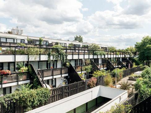
The combination between the underground parking and the scheme of parallel blocks produce gives every unit to have clear views and get private garden spaces. The inclusion of recreational and civic programs around the housing area creates an environment that promotes the formation and full development of families, considering that it was a time of modernization and population growth during the 60’s and 70´s.
8 WowHaushttps://www.wowhaus.co.uk/2019/09/11/neave-brown-maisonette-dunboyne-roadestate/. September 2019
Atelier Martel & Atelier Rita
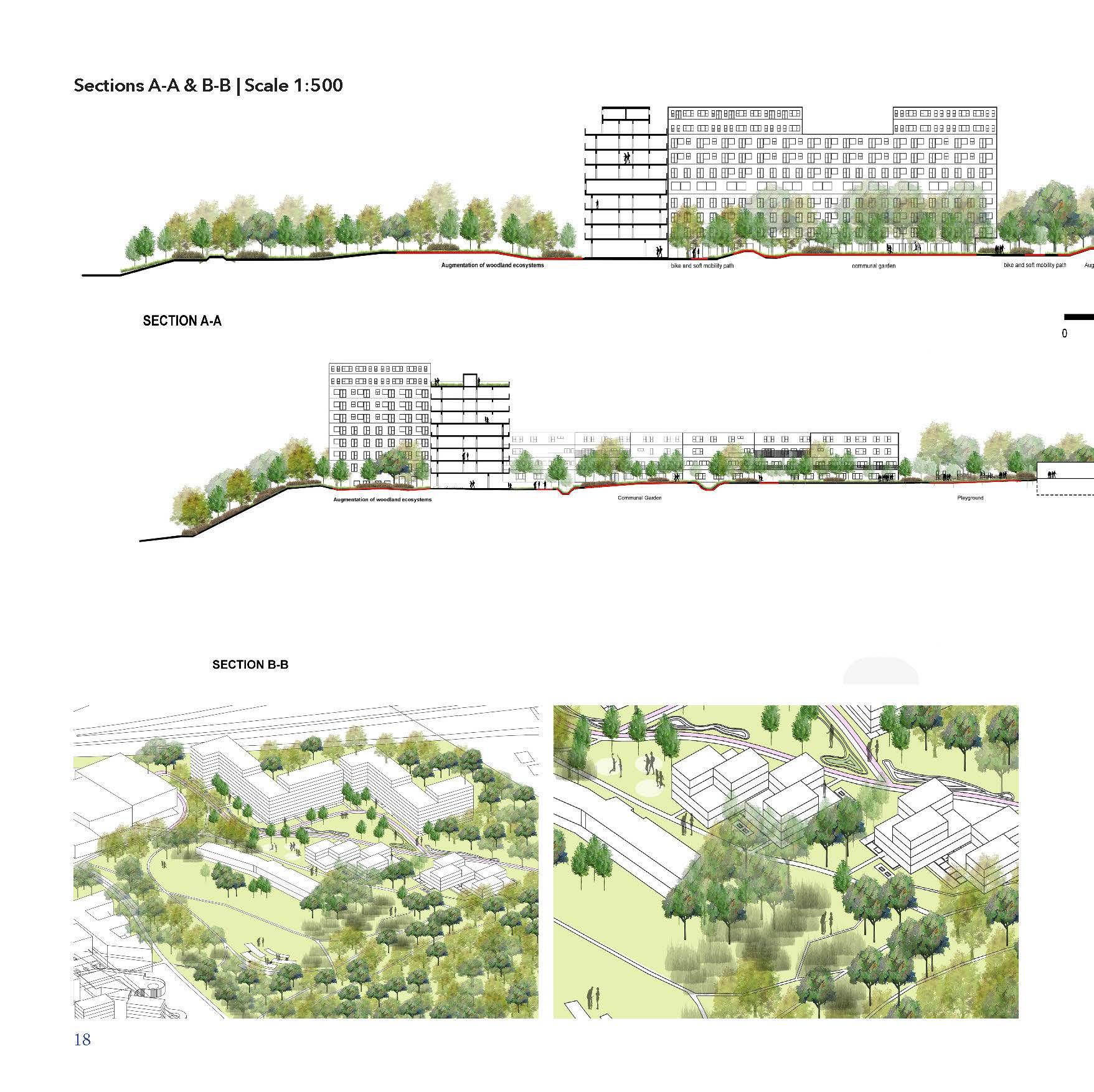
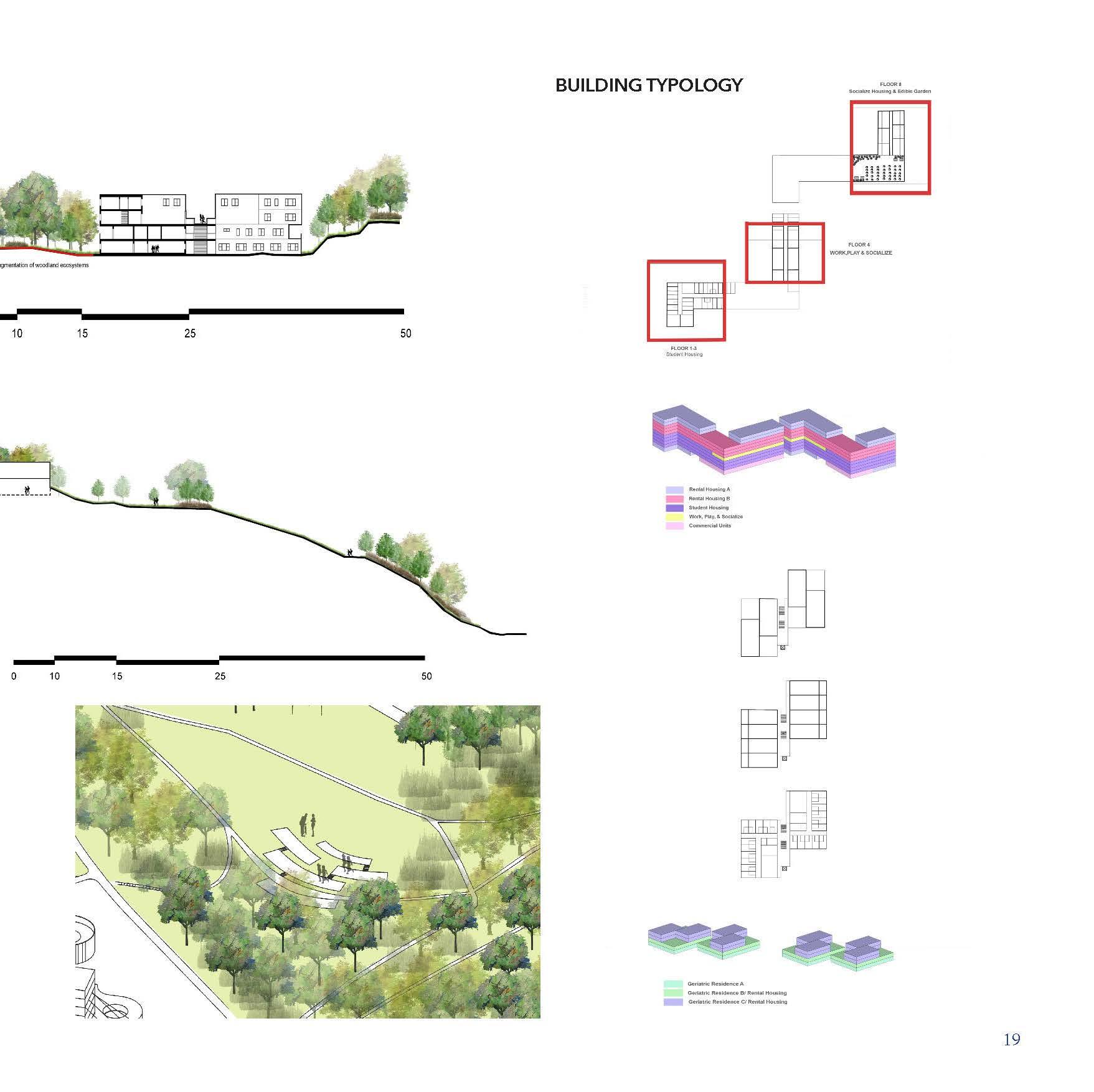
Alexa Custoodio_r0965959
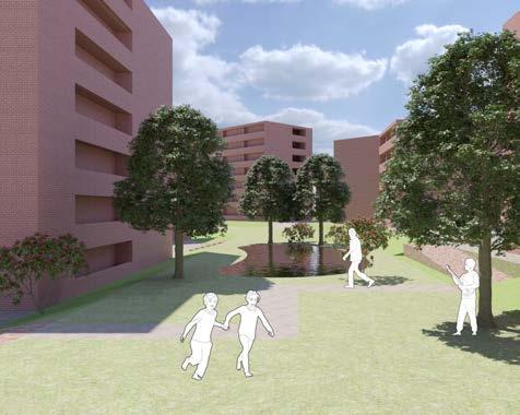
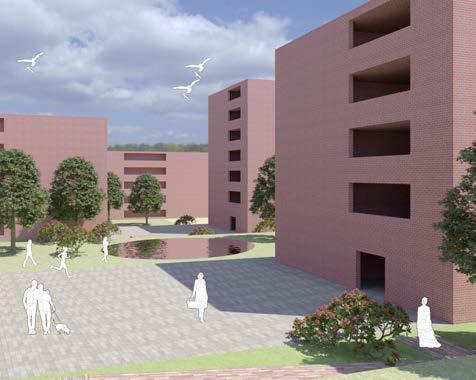
MaHS_Gasthuisberg C
Ile de Nantes, Harmonie Habitat is a collaborative architectural project designed by Atelier Martel and Atelier Rita, located on the picturesque Ile de Nantes in France. This innovative residential development focuses on harmonizing urban living with nature, promoting sustainability, and fostering a sense of community. This ambitious 4,200 m² program includes 39 family social rental housing units, 19 social housing units, and a commercial area.
The central concept of this project revolves around the harmonious integration of social and ecological aspirations within the development of a sustainable urban district on République Island in Nantes. It embodies a synthesis of different design philosophies, with Atelier Martel championing innovative and efficient construction techniques, Atelier Rita emphasizing a spirit of social generosity, and Harmonie Habitat, as the project owner, prioritizing the residents’ well-being through initiatives like physical exercise, improved air quality, and access to nature. Sustainability and ecology are paramount, focusing on utilizing greenery to combat urban heat and enhance psychological comfort. The project fosters inclusivity and community engagement, with shared spaces and resident involvement in decision-making. It also promotes a culture of cycling and walking through thoughtful architectural design while maintaining economic efficiency through a shared and cost-effective construction approach across the district.
(Source: https://www.pss-archi.eu/forum/viewtopic.php?id=34811&p=2 | © Quartier République - Samoa AJOA)
(Source: https://chroniques-architecture.com/sur-lile-de-nantes-avec-atelier-martel-et-atelier-ritasamoa/)
(Source: https://www.pss-archi.eu/forum/viewtopic.php?id=34811&p=2 | © Quartier République - Samoa AJOA)
PUBLIC-PRIVATE STRUCTURE
(Source: https://www.pss-archi.eu/forum/viewtopic.php?id=34811&p=2 | © Quartier République - Samoa AJOA)
(Source: https://chroniques-architecture.com/faire-la-ville-sur-mesure-quartier-republique-nantessamoa/)
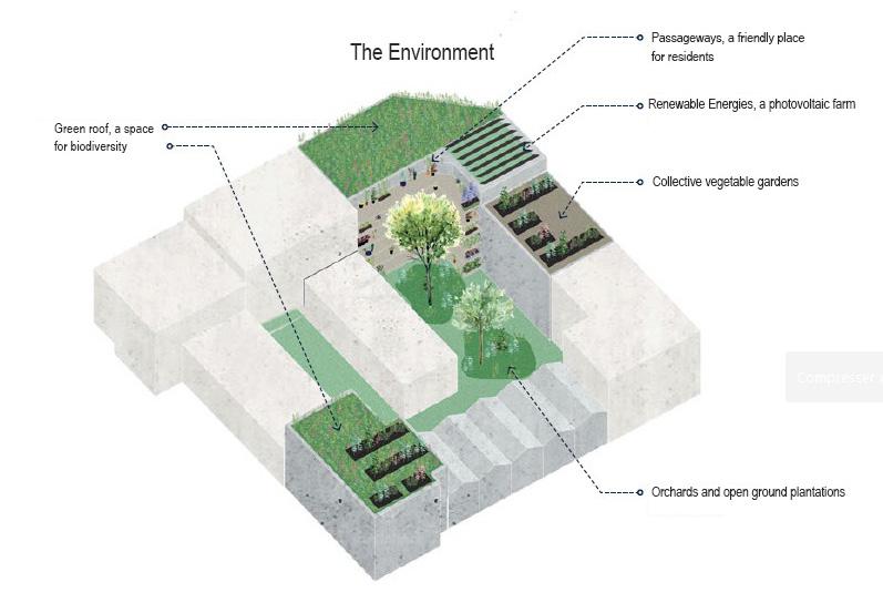
The project is designed to focus on daily practices, social and environmental considerations, and adaptability to the urban space. It employs various building typologies to provide housing options for different lifestyles while maintaining a cost-effective and systematic construction approach. Individual dwelling design is at the forefront, with apartments designed for ample natural light and ventilation, promoting physical activity and well-being. Access to nature is encouraged through opportunities for residents to cultivate plants and vegetables in various shared spaces. Furthermore, the project fosters a cycling culture and incorporates wide passageways. It also places a strong emphasis on involving future residents in defining shared spaces, ensuring their needs and desires are central to the development process. Overall, it reflects a comprehensive approach to urban development that combines architectural innovation with a deep concern for the well-being and active engagement of its future inhabitants.
(Source: https://chroniques-architecture.com/sur-lile-de-nantes-avec-atelier-martel-et-atelier-rita-samoa/)
(Source: https://references)
(Source: https://references)
(Source: https://chroniques-architecture.com/sur-lile-de-nantes-avec-atelier-martel-et-atelier-ritasamoa/)
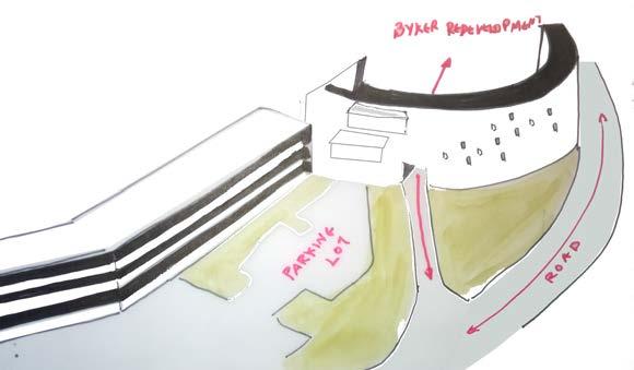
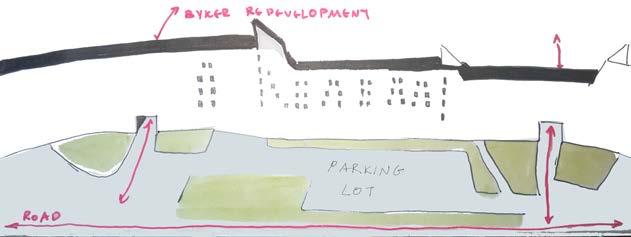
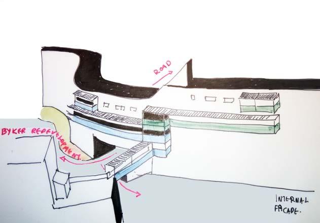
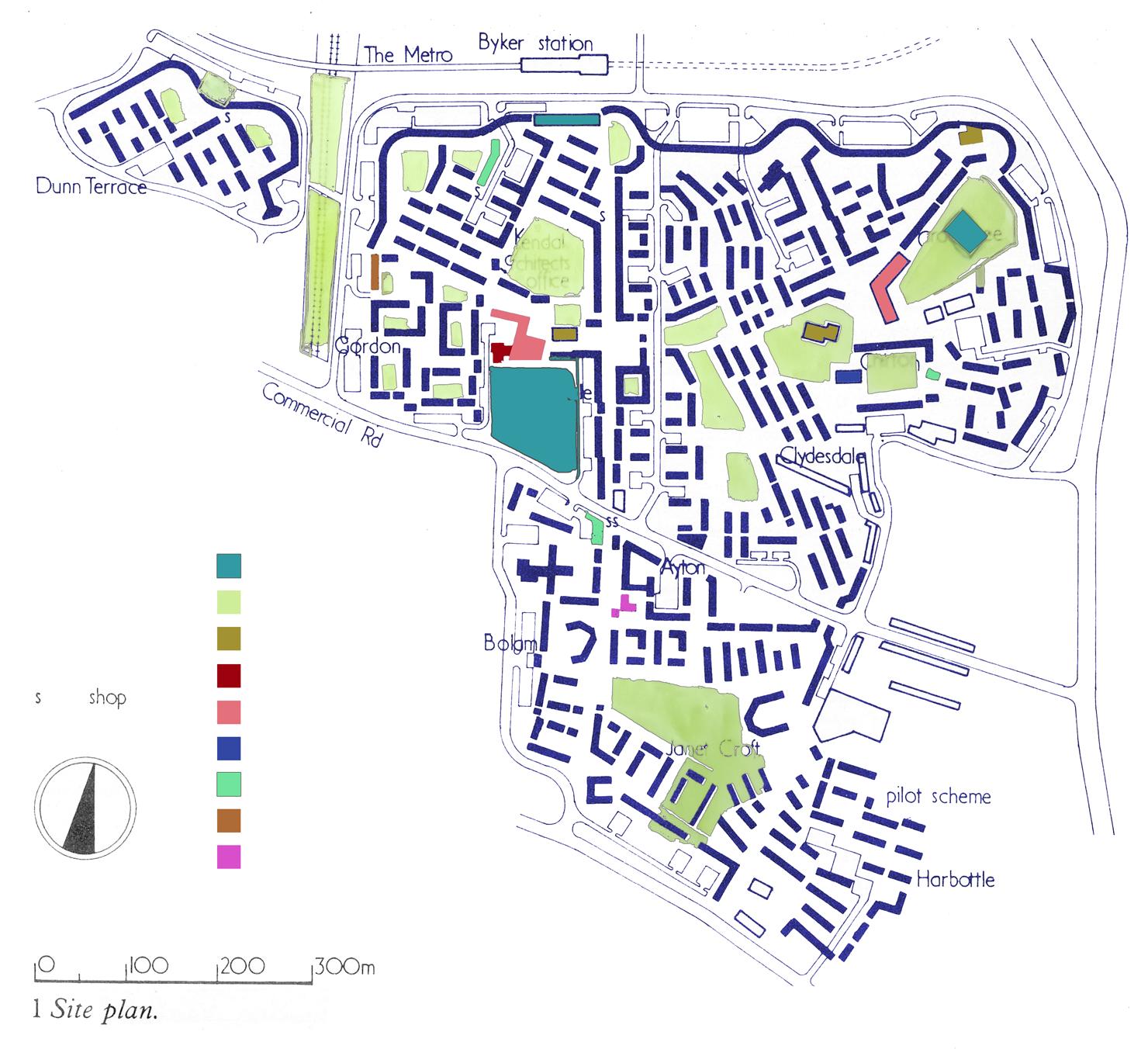
Byker Redevelopment is a located in New Castle, England. Was desing by the Swedish architect Ralph Erskine and is a social housing project which constructed between 1969-1982, replacing the old low- rise Victorian buildings that were in bad condition and aiming to house 9000inhabitants. Some significant buildings such us churches or old industrial buildings remained and were refurbished.
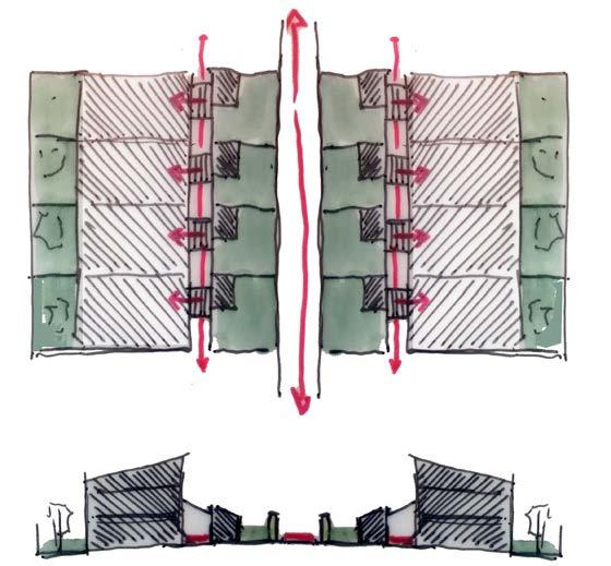
CONCEPT - The main idea is the creation of a “Wall buildibg” in the northen part of the project to create a sound filter with the road and the railway station. The whole community develops behind the “wall building” by distributing particular typologies of housing buildings in order to create private - semi-private and public open spaces. The main function is residences, although old buildings with publc functions were remained and adjusted to the new project (churches, clubs etc).
• Relation with urban tissue - The “wall building” creates a strong limit in the northen part of the existing urban tissue and lets the connection with it in specific points by forming some kind of “gates”. Behind the wall the circulation is achieved by a peripheral movement which connects this part of the project with the urban tissue. The distribution of the buildings behind the wall contributes to a smoother and more fluid connection with the urban tissue, as well as the car roads are limited and mainly connects the regions of the project.
• The building typology - The building typology varies. The “wall building” is one component that organises and defines the limits of the project. The exterior facade refers to a wall, taking into acount the materiality (brick), the small openings and the main entrances in the ground level. The different elevation of the building adjusts its scale to the surroundings, considering that the heght reduces in the side facades while its highest point is in the northern part where the project meets the highway. The interior facade adjusts more compontents, such as the exterior corridors, as well as the materiality varies, in order to reduce the big scale of the construction and adjust better the buildings’ scale. The rest of the buildings are 1,2 or 3- story constructions which are distributed in a way to create private, semi-private and public areas as well as their arrangement organizes the pedestrian’s pathways and the open spaces. There is a common confrontation between the buildings and their relation to the urban tissue, which is the sequence: Frontyard- Entrance- Building - Backyard or EntranceBuilding- Backyard.
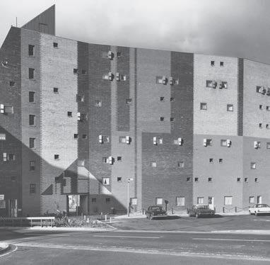
(Source: https://sitelines.newcastle.gov.uk/SMR/16463, https://en.wikipedia.org/wiki/Byker_Wall, https://commons.wikimedia.org/wiki/Category:Byker_Wall)

(Source: based on google maps)

(Source: based on drawings from https://www.ajbuildingslibrary.co.uk/projects/display/id/3004)
CAPTION PUBLIC-PRIVATE STRUCTURE
CAPTION CONTEXTUALISED VOLUMETRY
(Source: based on drawings from https://www.ajbuildingslibrary.co.uk/projects/display/id/3004)
CAPTION CONTEXTUALISED VOLUMETRY
(Source: based on drawings from https://www.ajbuildingslibrary.co.uk/projects/display/id/3004)
(Source: based on google maps)
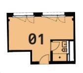
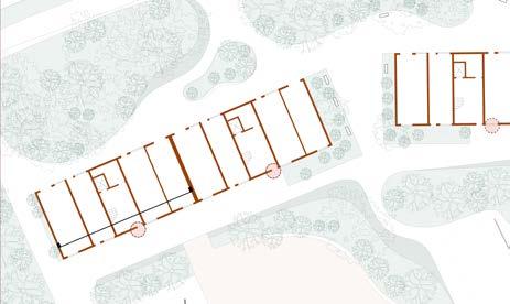
2-STORY RESIDENDES - TYPE B - FLOOR PLANS

(Source: https://www.ajbuildingslibrary.co.uk/projects/display/id/3004)
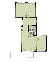
The individual dwelling design - The “wall building” constists by units that are developed in the vertical axes in order to make good use of the vertical expansion of the building. Each unit is a maisonette in which the kitchen and the dining space are in the same level, whereas the bedroom, the living room and the sanitary space are in anohter level. An exterior corridor either create the access to the dwellings or forms private balconies. The 1,2,or 3 story buildings differ in typology according to the number of the inhabitants, although there is a common arrangement between the private and the daytime spaces, namely the daytime spaces (kitchen, dining-room and living-room) are in the ground floor level while the private spaces (bedrooms and sanitary spaces) are in the first level.
2-STORY RESIDENDES - TYPE C - FLOOR PLANS


(Source: https://www.ajbuildingslibrary.co.uk/projects/display/id/3004)
(Source: https://www.ajbuildingslibrary.co.uk/projects/display/id/3004)
(Source: based on drawings from https://www.ajbuildingslibrary.co.uk/projects/display/id/3004)

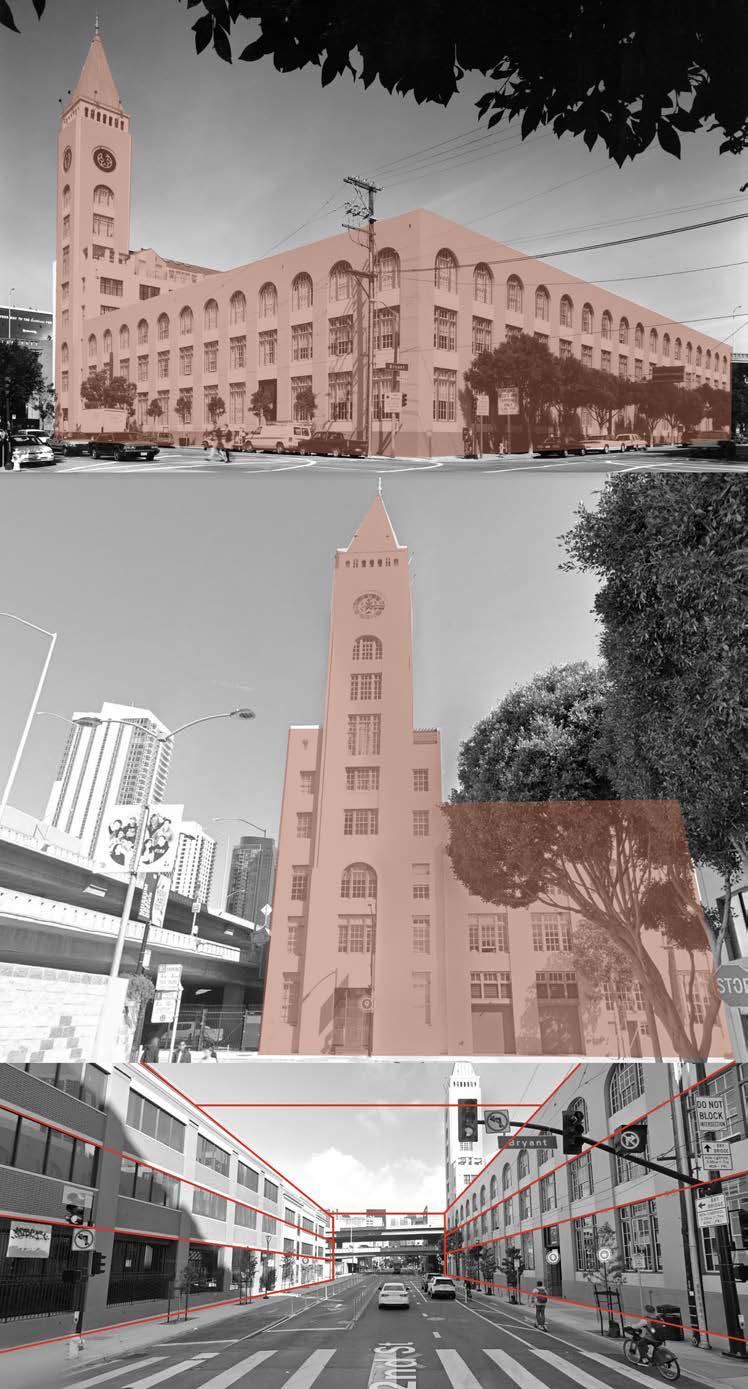
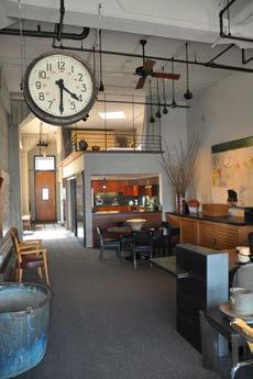
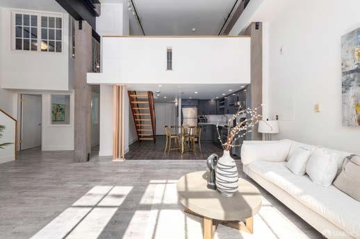
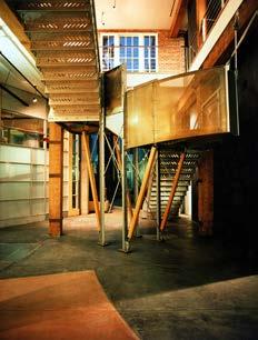
The Clock Tower Building was originally constructed in 1907 for the Max Schmidt Lithograph Corporation, a printing firm that designed and produced the classic California fruit box labels and posters for the Panama Public International Expedition. The concrete, brick, and timber structure was renovated into 127 live/work lofts resulting in a rich variety of unique unit types particularly suited to the emerging lifestyle of home offices and electronic commutes.
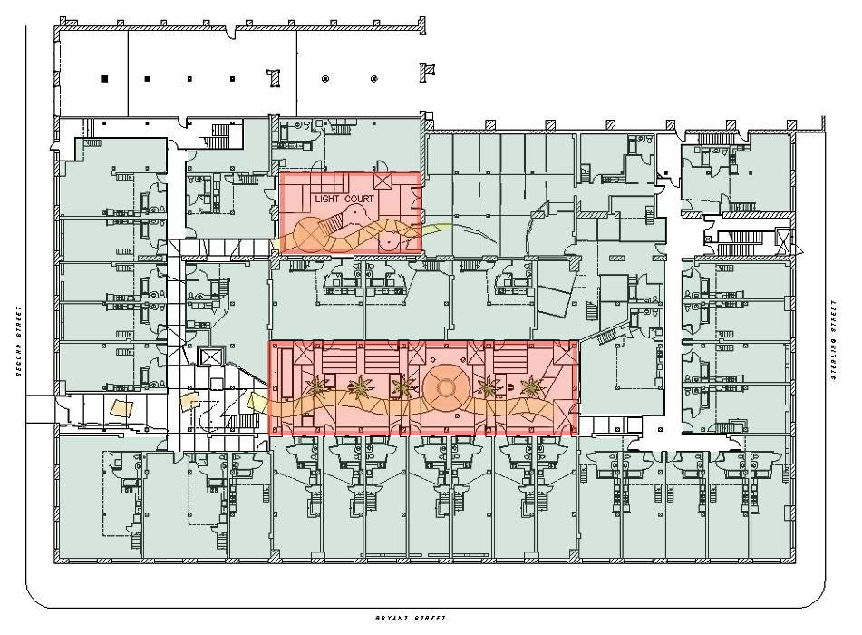
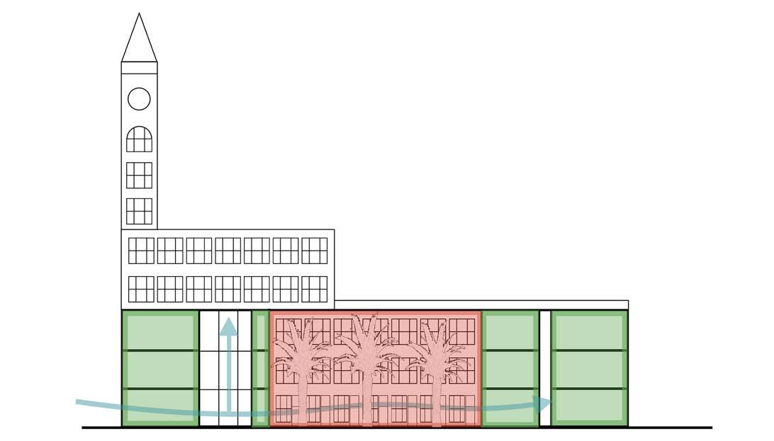
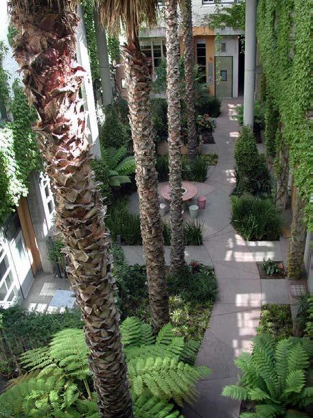
The building provided the opportunity to create the environment of a “district” as opposed to that of an apartment complex, resulting in a rich variety of unique interiors; no two units are alike. The lofts, ranging in size from 55.7to 464.5 square meters, are arranged around three landscaped courtyards which were cut from the volume of the existing building.
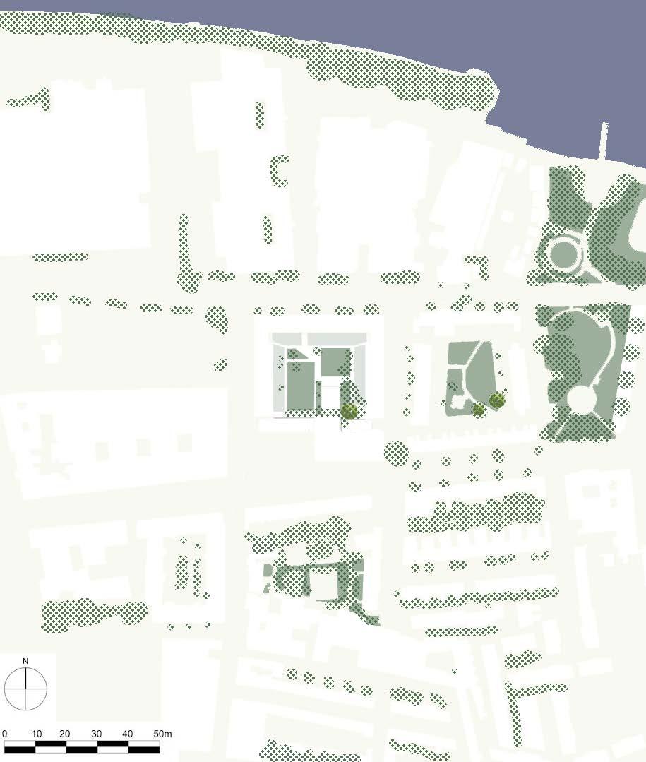
• its relation to the urban tissue: The project is located in the coastal plain adjacent to the commercial building complex and is easily accessible.
• the building typology: The project was converted from a printing plant, so the room divisions are largely similar from unit to unit, with predominantly one-bedroom units. However, the floors are high, which makes loft style available.
• the individual dwelling design: Each unit is presented as a loft. To keep the space as open as possible, there are no additional walls except for the bathrooms. The rooms have exposed plumbing and retain a strong industrial feel.
(Source: https://www.dbarchitect.com/projects/clock-tower-lofts)
(Source: https://www.google.com/maps)
(Source: https://www.google.com/maps, https://www.dbarchitect.com/projects/clock-tower-lofts)
(Source: https://www.google.com/maps, https://www.dbarchitect.com/projects/clock-tower-lofts)
(Source: https://www.dbarchitect.com/projects/clock-tower-lofts)
Each room can be divided into an upper and lower level, with the upper level usually being the bedroom and the kitchen or bathroom under the bedroom. The main living area boasts soaring ceilings and oversized wood-framed windows.
(Source: https://www.dbarchitect.com/projects/clock-tower-lofts, https://www.jacksonfuller.com/ property/461-2nd-street-102-san-francisco-ca-94107/)
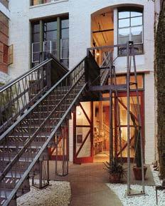
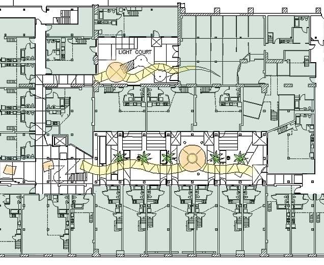
The building function can be divided into 2 parts: one is for private residence, one is for public space. These two parts are connected by three traffic cores. These courtyards as well as other public spaces are augmented by custom stairs, undulating mahogany entry doors, individual entry lighting and signage fixtures, and colored concrete fountains.
(Source: https://www.dbarchitect.com/projects/clock-tower-lofts)
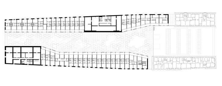
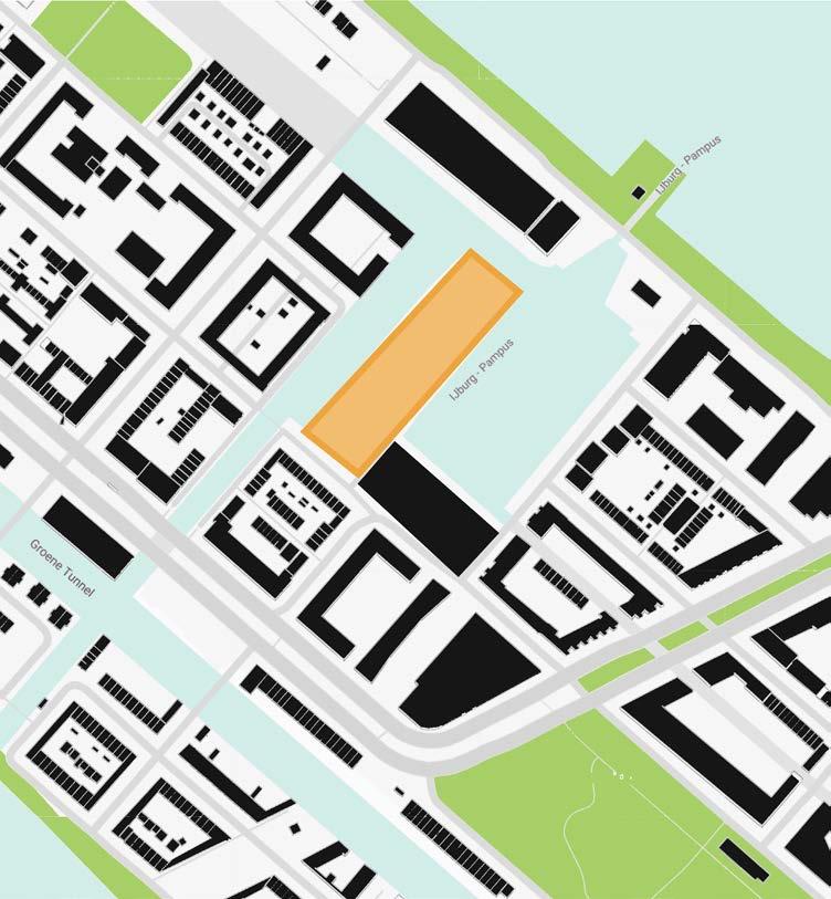
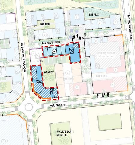
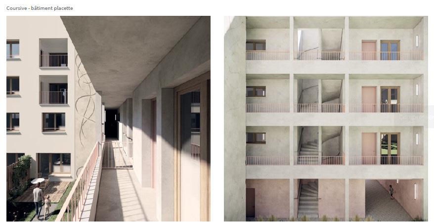
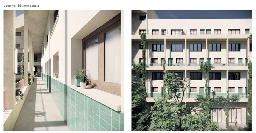
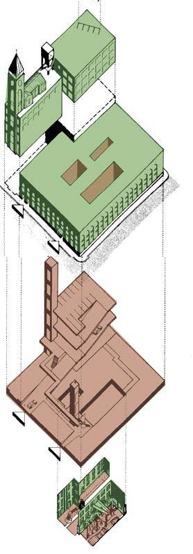
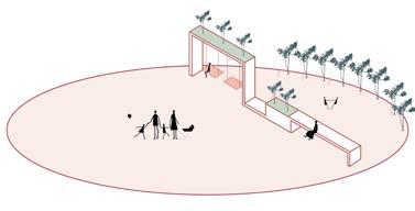
With the use of graphic material describe the positioning of the project and the relation to the open space and the urban tissue.
* You can use original drawings from the project or tour own schemes. If you use the original drawings from the project (plans, sections, axos, visualizations) then work on them to clearly show (make visible) the elements you want to show.
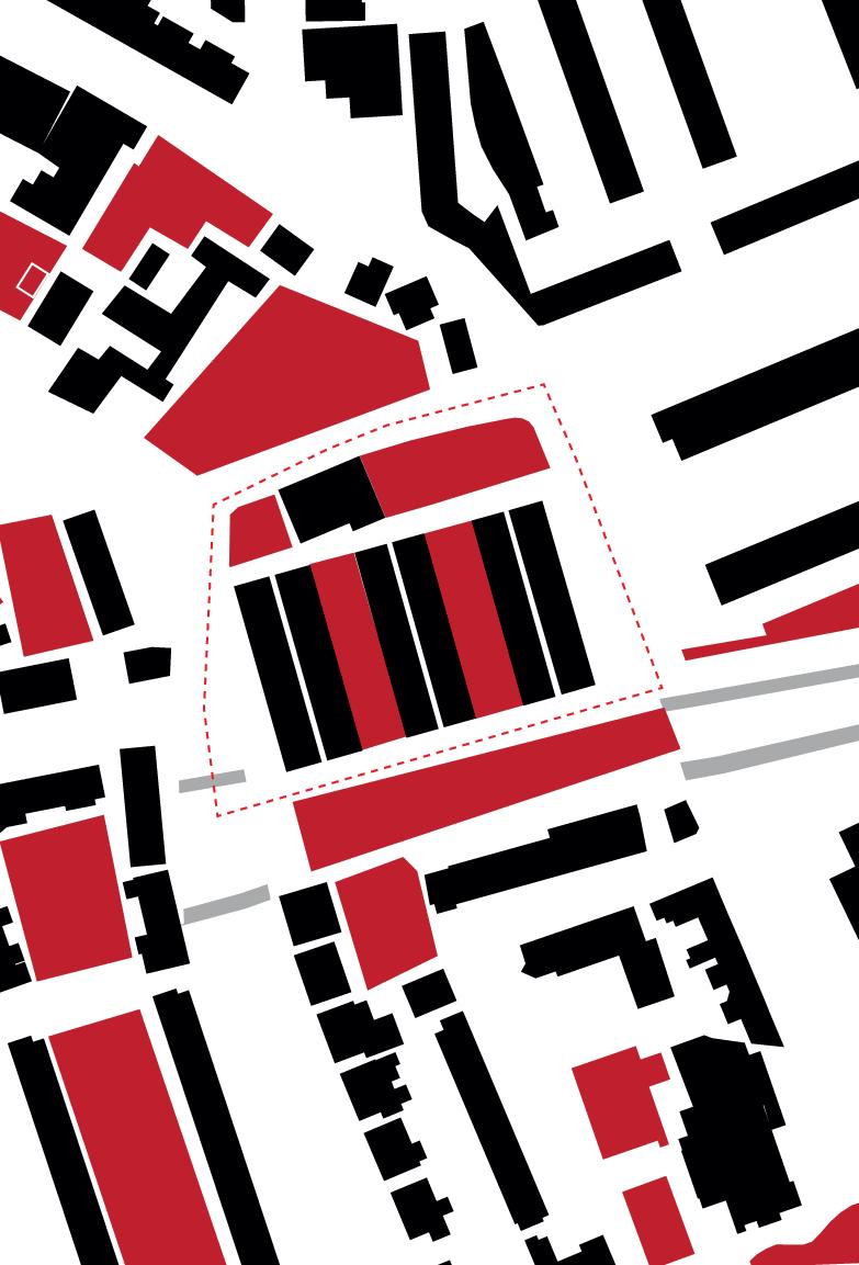
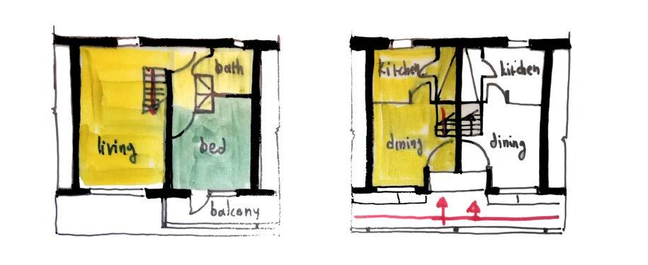
With the use of graphic material describe the publicprivate relations sround/ in the project.
* You can use original drawings from the project or tour own schemes. If you use the original drawings from the project (plans, sections, axos, visualizations) then work on them to clearly show (make visible) the elements you want to show.
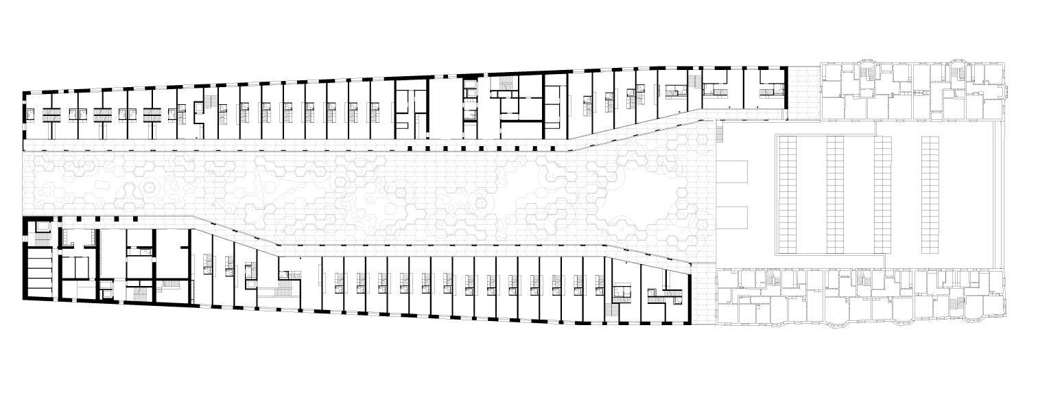
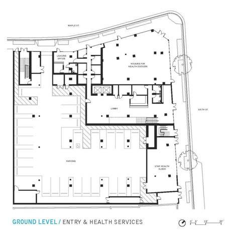
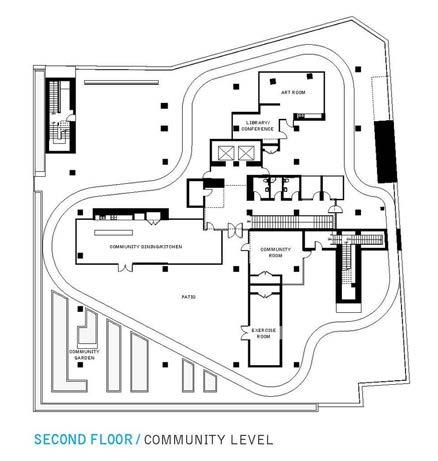
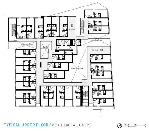
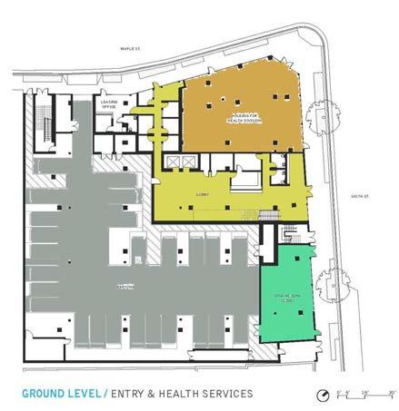
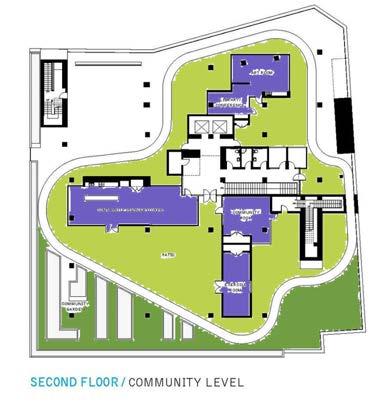
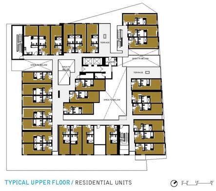
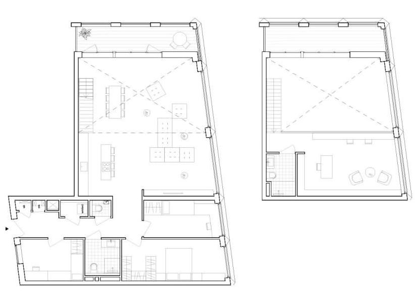
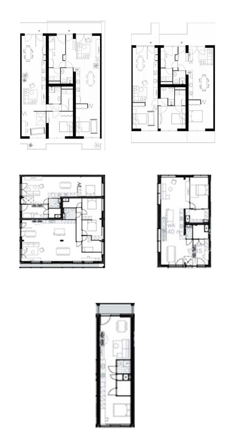
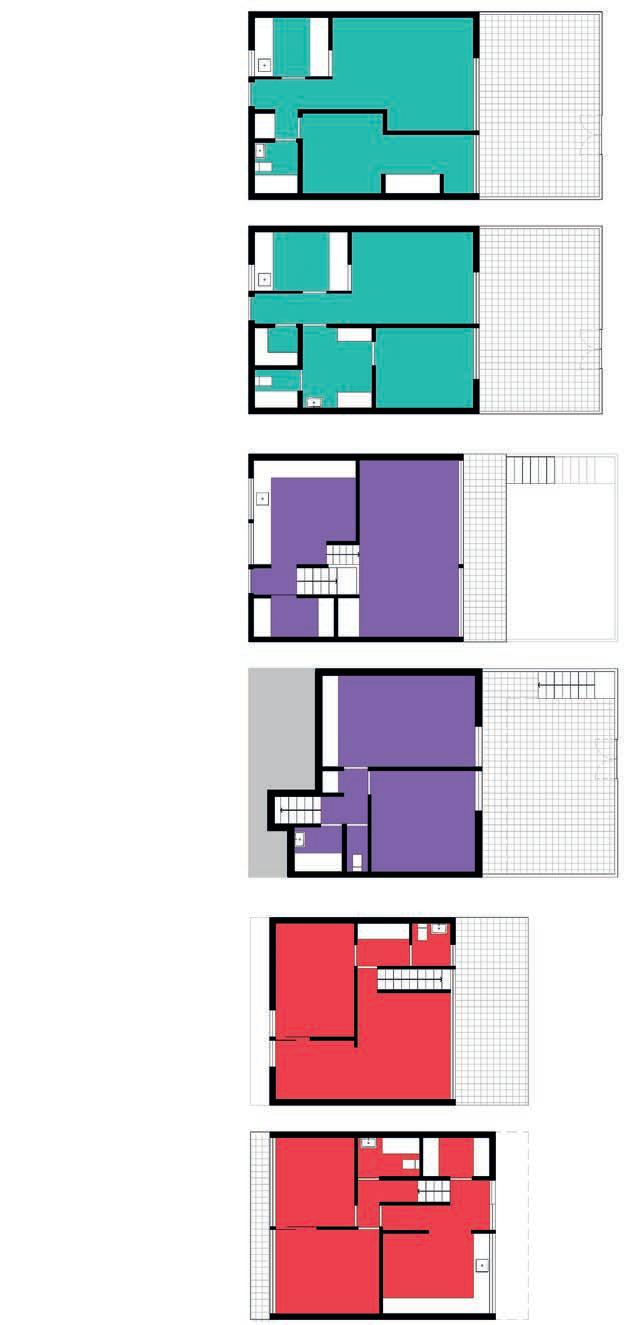
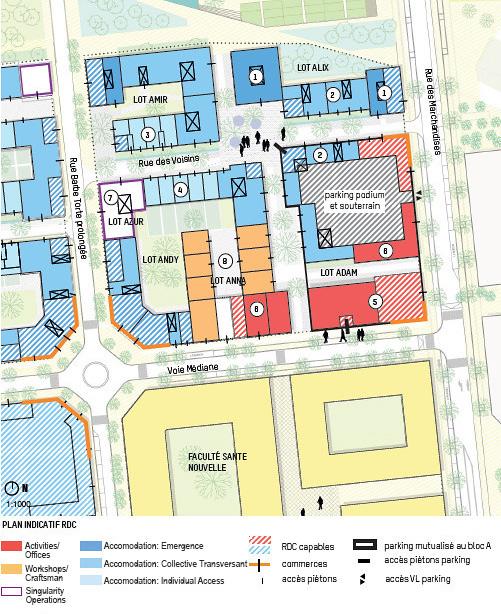
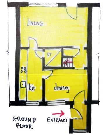
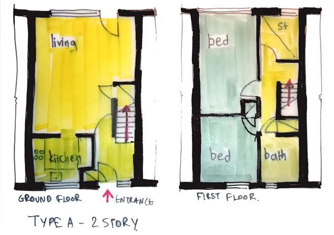
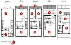
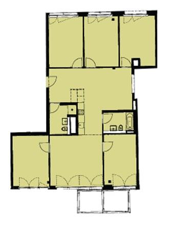
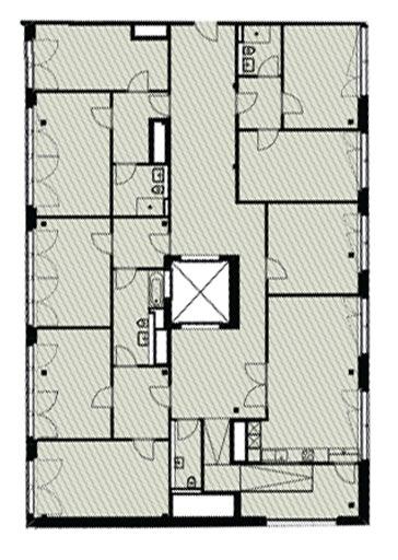
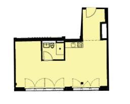
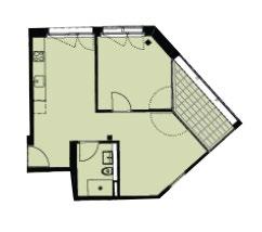
Show minimum 1 floor.
If project is highly mixed use, consider showing 2-3 plans.
* You can use original drawings from the project or tour own schemes. If you use the original drawings from the project (plans, sections, axos, visualizations) then work on them to clearly show (make visible) the elements you want to show.
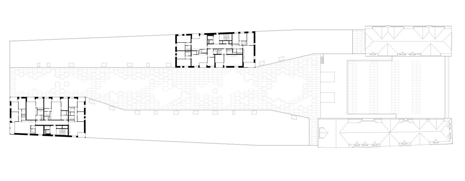
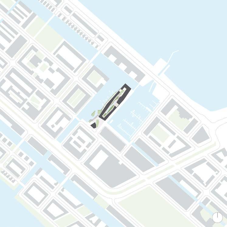
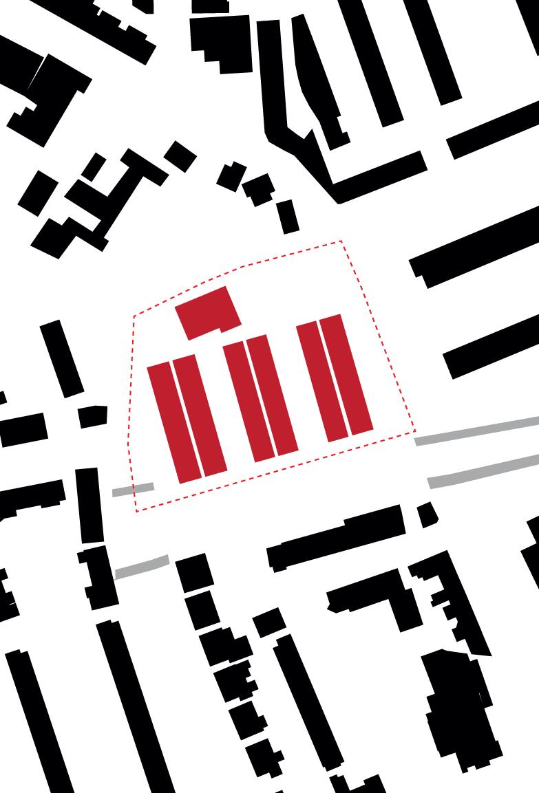
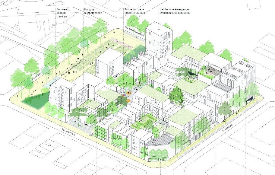
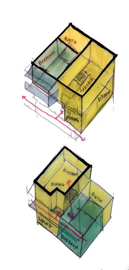
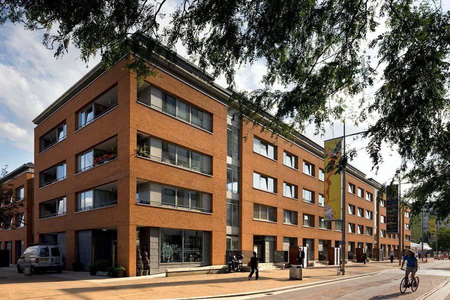
With the use of graphic material describe the integration of the built volumes of the project in the context/ urban tissue.
* You can use original drawings from the project or tour own schemes. If you use the original drawings from the project (plans, sections, axos, visualizations) then work on them to clearly show (make visible) the elements you want to show.
(Source: https://references)
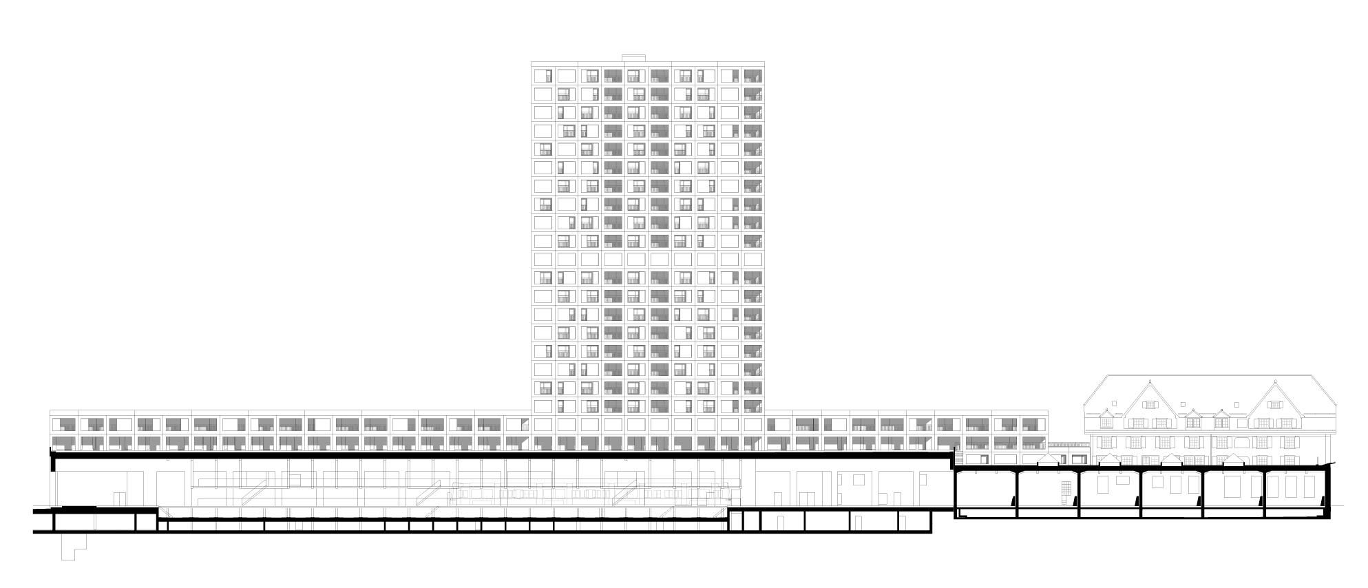
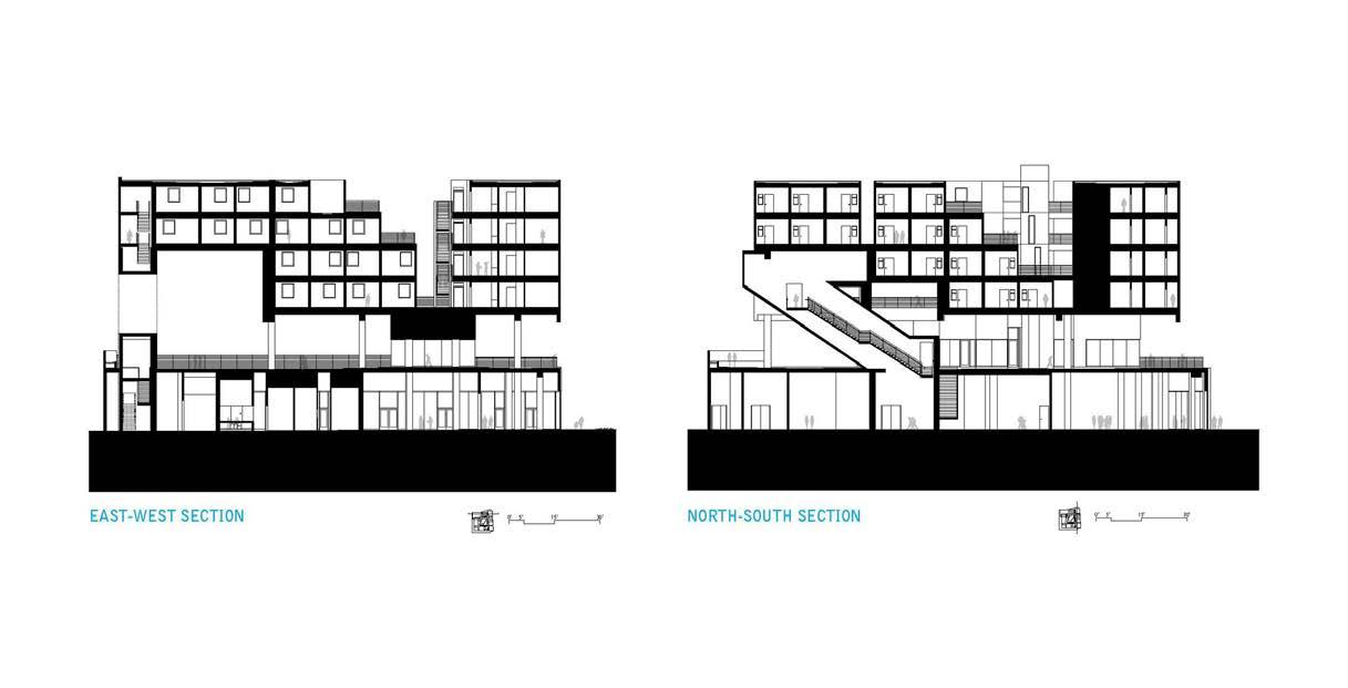
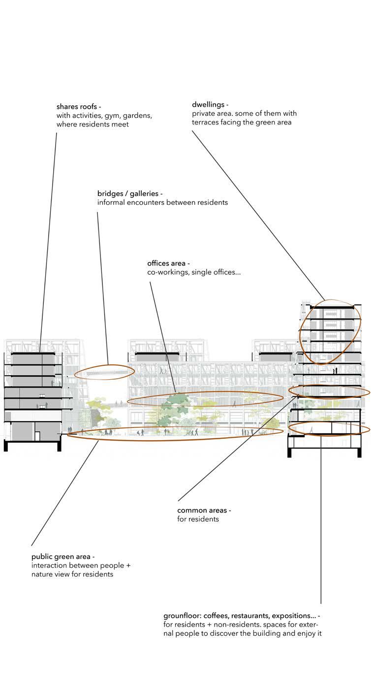
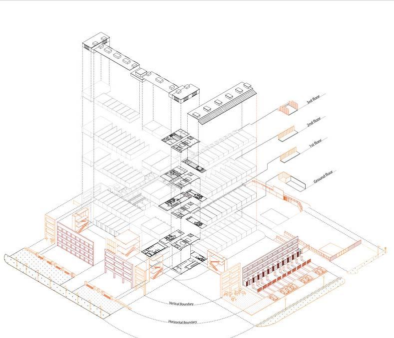
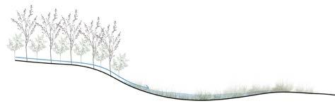
Show minimum 1 long section through the whole project, showing the relationship between the different functions.
* You can use original drawings from the project or tour own schemes. If you use the original drawings from the project (plans, sections, axos, visualizations) then work on them to clearly show (make visible) the elements you want to show.
(Source: https://references)
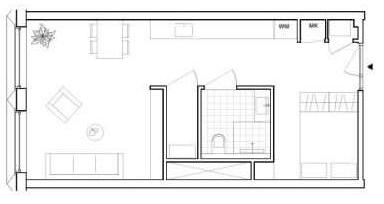
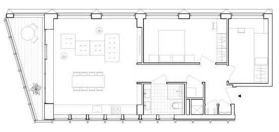
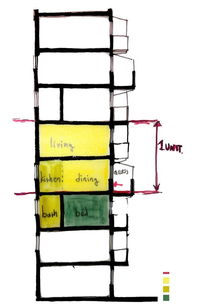
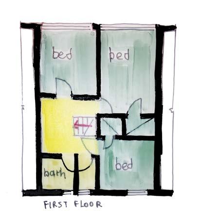
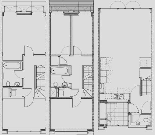
In plan and section describe the dwelling typology.
* You can use original drawings from the project or tour own schemes. If you use the original drawings from the project (plans, sections, axos, visualizations) then work on them to clearly show (make visible) the elements you want to show.
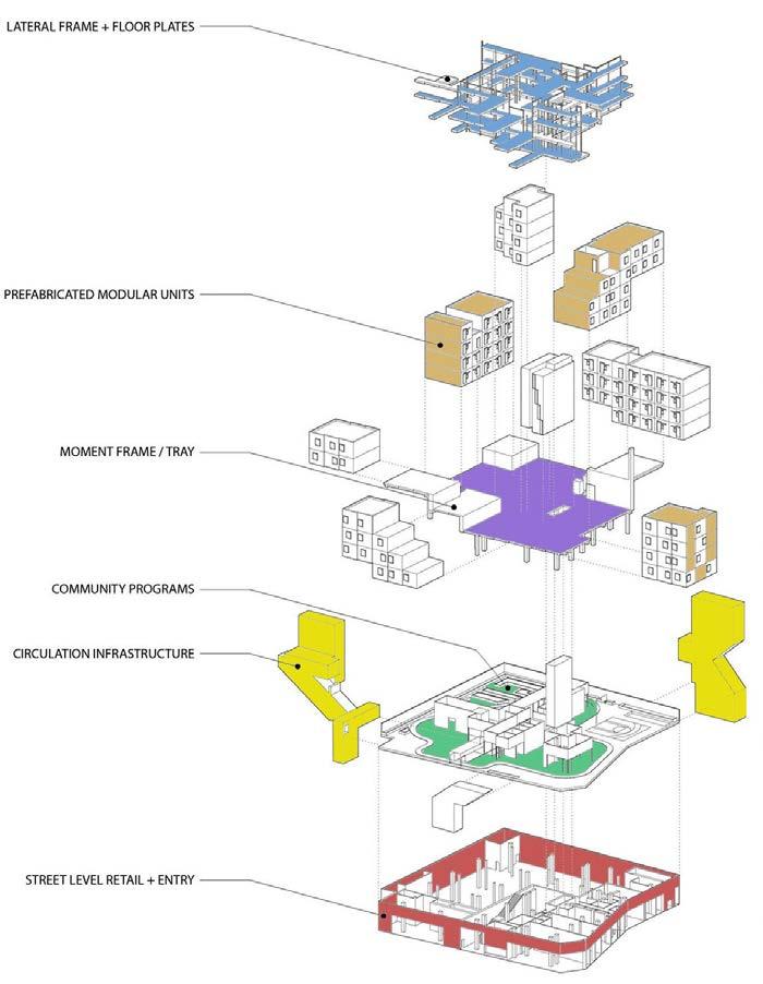
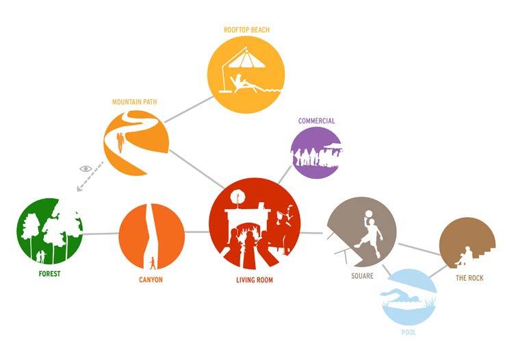
With the use of graphic material explain how “multiplicity” is achieved: what are the different functions present in the project and how do they relate to one another.
* You can use original drawings from the project or tour own schemes. If you use the original drawings from the project (plans, sections, axos, visualizations) then work on them to clearly show (make visible) the elements you want to show.
(Source: https://references)
(Source: https://references)
MaHS_Gasthuisberg C
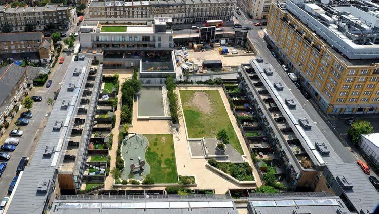
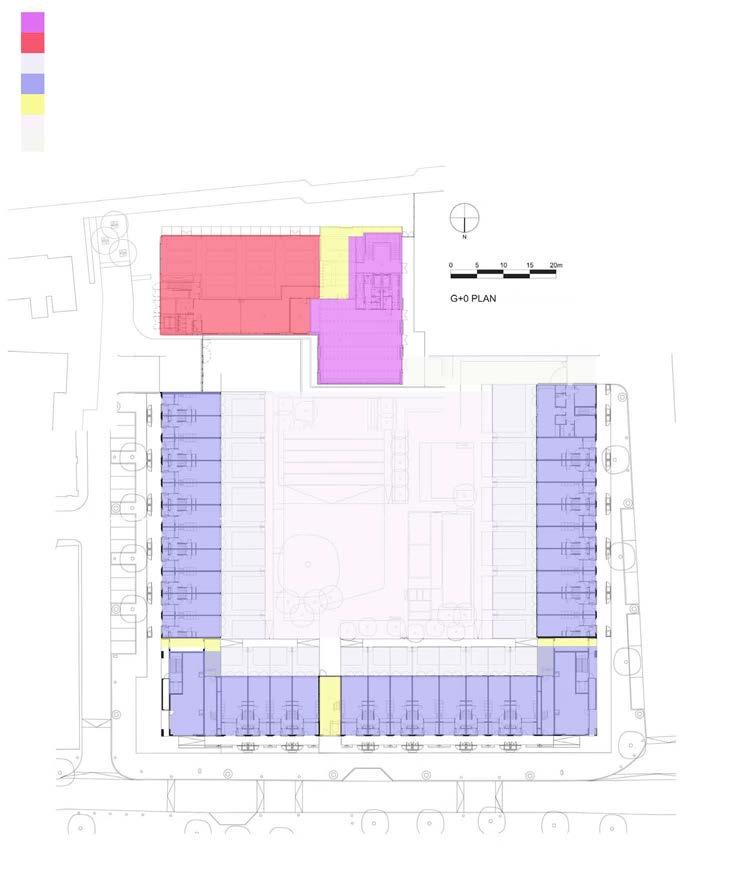
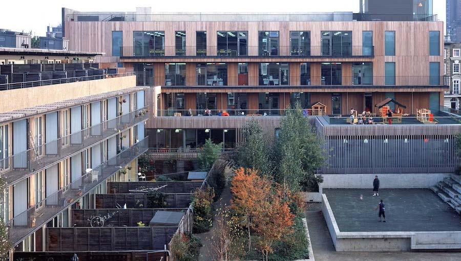
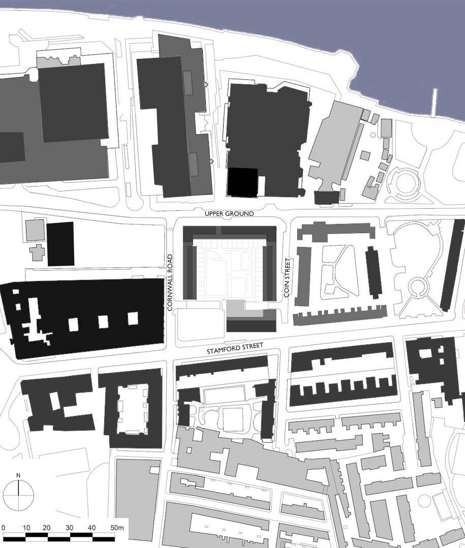
Coin Street Community Centre (2007), located on London’s South Bank, is a lively mixed use community facility that provides adult training and social enterprise support spaces; in addition to offices, conference and social spaces. More precisely, incorporates a number of interlinking components: a 64 place nursery with large external playground; a crèche and baby unit; a space for activities and family support workshops; two floors dedicated to learning and enterprise including meeting rooms and conference spaces for community use and commercial let; a community cafe and function space; a commercial restaurant on the main south street frontage; a landscaped roof terrace and offices. Iroko housing came earlier (2004) and has 59 dwellings, including 32 family houses and a mix of smaller flats and maisonettes over a 200 space car park, together with a neighbourhood centre.The community center in combination with Iroko housing project constist a mixed used block with both public and private open and non-open spaces.
The purpose was to create a simple form which establishes clear signals of public and private, but has sufficient presence to maintain the metropolitan buzz. The dwellings are therefore arranged around an open courtyard, a hollow square. That allows communal space to be maximised in the form of a large landscaped garden. A key aim of the community center project is to explore an ambient urban building, capable of accommodating any number of different uses both now and in the future.
• The buildings adapt to the scale of their surroundings and the block as a unity also follows the scale of its neighboring ones. That’s also visible from the facades that are formed maily by repetitive elements that are linked to the internal uses.
• The introverted courtyard and together with the neighboring complex can be a gradual transition from the Bernie Spain gardens to the built environment.
• The courtyard elevations are a more informal composition of elements.
(Source: https://www.haworthtompkins.com/work/coin-street-neighbourhood-centre), https:// haworthtompkins.com/work/iroko-housing
(Source: https://www.haworthtompkins.com/work/iroko-housing
(Source: https://www.haworthtompkins.com/work/iroko-housing

COMMERCIAL/OFFICE PRIVATE
VERTICAL FLOW
HORIZONTAL FLOW
COMMUNAL ROOMS
COMMUNITY CAFE
PRIVATE RESIDENCES
PRIVATE OPEN SPACE
(Source: https://www.haworthtompkins.com/work/iroko-housing
(Source: https://www.haworthtompkins.com/work/coin-street-neighbourhood-centre), https:// haworthtompkins.com/work/iroko-housing)
1ST/2ND FLOOR 1ST/2ND FLOOR GROUND FLOOR PLAN TYPOLOGIES
(Source: https://hdawards.org/archive/archive/2002/schemes/iroko/iro5.html
(Source: https://www.building.co.uk/cost-study-coin-street-housing/1016354.article )
(Source: http://aaexchange.co.uk/unit_pre_project.php?units_id=33 https://www.haworthtompkins.com/work/iroko-housing)
MaHS_Gasthuisberg C
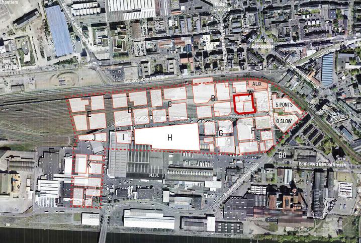
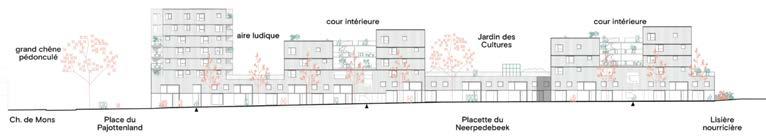
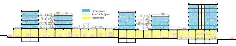
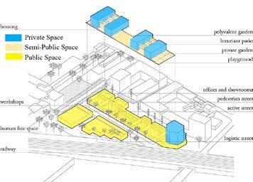
Constructed in 2023, the NovaCity project combining production, housing and public spaces with the aim of restoring an identity and a coherence of scale to a fallow island inserted in a dense and disjointed fabric with heterogeneous uses.
The project considers the overlapping of functions as an opportunity for mixed use. In this new district, the emphasis is placed on exchanges and interactions through an innovative implantation of convivial spaces around the housing units as well as the creation of an internal street at the level of the SMEs.
• Relation to the urban tissue: NovaCity transforms a piece of wasteland in the southwest of Anderlecht into a lively neighborhood. The superimposed programs interact with each other through a porosity of functions and a constellation of collective spaces.
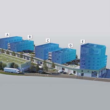
• The building typology: In order to limit the amount of excavation, the project follows the existing slope of the land as much as possible. The project proposes different building typologies - a tower and two pairs of urban blocks - with an architecture and functioning going far beyond the traditional juxtaposition of functions.
• The individual dwelling design: The homes are spread over 5 separate buildings that are connected via galleries and shared spaces.
On an island formed by rue des Trèfles, the Chaussée de Mons and the railway south of Anderlecht, Novacity stands like a microvillage in the city in the middle of an urban fabric made up of industrial zones and residential neighborhoods.
(Source: https://www.citydev.brussels/nl/projects/novacity-0 https://www.sybillebertouille.com/ novacity-brussels)
(Source:https://novacity.be/novacity-i-was-een-van-de-winnaars-van-be-exemplary-2019-in-decategorie-public-buildings/ Google Earth)
PUBLIC-PRIVATE STRUCTURE
CONTEXTUALISED VOLUMETRY
(Source: https://www.dds.plus/projects/novacity)
(Source: https://www.citydev.brussels/nl/projects/novacity-0 https://www.sybillebertouille.com/ novacity-brussels)
(Source: https://www.sybillebertouille.com/novacity-brussels)
(Source: https://www.dds.plus/projects/novacity)
In order to limit the amount of excavation, the project follows the existing slope of the land as much as possible. The housing units are spread across 4 distinct volumes perpendicular to the road. The elevation of a part of the r+4 templates allows to minimize the footprint of these buildings and creates large openings for sunlight to reach public spaces and neighboring dwellings.
The construction of housing units is also progressing. The second floor of Building E located along Chaussée de Mons, which will also be the tallest part of the building, is currently under construction. For the other sections of residential buildings A, B, C and D, the first floor is currently being completed. The metal structure of the stairs and walkways between sections C and D of the building has also been started. The structural work will be ready by the end of the year. Composed of volumes with varying heights, the emerging skyline animates the visual sequence in the new pedestrian street. In order to limit the amount of excavation, the project follows the existing slope of the land as much as possible. The housing units are spread across 4 distinct volumes perpendicular to the road. and neighboring dwellings.
(Source: http://beexemplary.brussels/novacity-actualites/ https://www.dds.plus/projects/novacity)
On the first floor, the SME workshops are distributed on either side of an active street, which constitutes the backbone for daily interactions between various users. Connected to the workshops, a double heighted retail and office space provides a transitive interface with the neighborhood, and shares an address with the residential buildings.
In a highly urbanized area mixing industrial and residential areas, a vacant lot is being transformed into a micro-village with a sophisticated vertical mix: in fact, in addition to an SME park, there will be housing and work spaces. meeting allowing harmonious coexistence between housing, work and production on the border between city and nature.
(Source: http://beexemplary.brussels/novacity-actualites/ https://www.sybillebertouille.com/ novacity-brussels)
MaULP_Gasthuisberg D
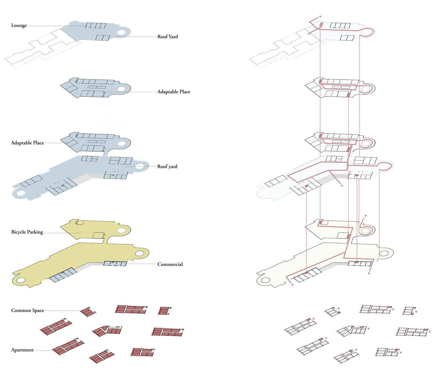
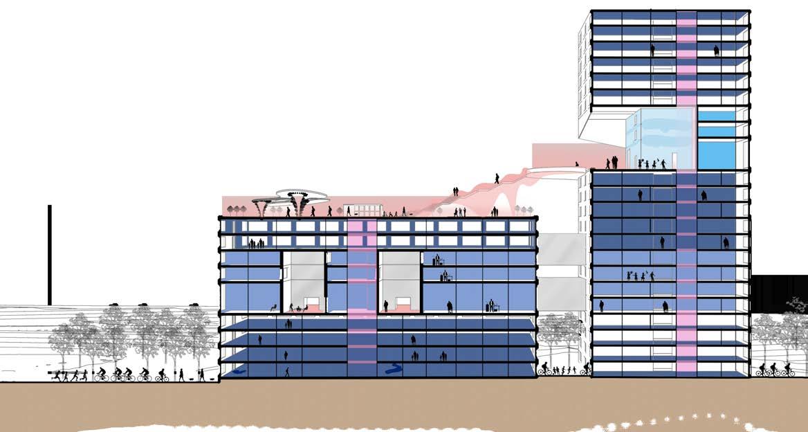
Kalkbreite Complex transformed a tram depot into a affordable housing project along with commercial business and retained transport infrastructure. The large, but compact seven- story building optimizes the organisation of its complex programs into a hybrid block with cafes and shops on the ground floor wraped around the tram hall. The residential blocks above enclose a courtyard built on the roof of tram parking garage which is also publicly accessible.
The polygonal Kalkbreite complex is envisioned as self-sufficient complex that covers the space of an entire city block and incorporates tram parking with a mix of 40 percent commercial and 60 percent residential. The building form optimizes its programs, the building perimeter fosters neighborhood activities while the residential blocks above reduce the noise, protecting the courtyard. Along the southwest, the steps provide access to the roof, ease the load on tram hall and optimise evening sun. The interior organisation optimises social interation.
• Urban Tissue- In relation to the urban tissue, the building complex blends in with the surrounding structures, interacting through its volume and fenestrations. The ground floor invites the streets neighborhood through the commercial activities while the apartment blocks have inward planning with a central courtyard which is a shared vocabulary with the site surroundings.
• Building Typology- The mix-use typology of the complex revitilizes the neighborhood block with its residential, commercial and service spaces. The central courtyard is open to public which makes the building a more vibrant space. The stepped roof breaks the monotony of the building block and creates interesting movement and views.
• Individual dwelling- The 88 residential dwellings with joker spaces that can be added on and other communal spaces that offer flexible forms of living for working, disabled and elderly people, hence a exemplary model for cooperative living.
(Source: https://www.archdaily.com/902295/kalkbreite-complex-muller-sigrist-architekten; Urbanity in a box Kalkbreite Cooperative)
(Source: https://www.archdaily.com/902295/kalkbreite-complex-muller-sigrist-architekten)
(Source: https://www.kalkbreite.net/en/kalkbreite/shared-spaces/general-rooms/; Machine for living, text by Katharina Marchal)
(Source:https://premiobaffarivolta.ordinearchitetti.mi.it/portfolio_page/04_live-work-complex-kalkbreite-muller-sigrist-architekten-ag/)
(Source:chrome-extension://efaidnbmnnnibpcajpcglclefindmkaj/https://ouest-lausannois.ch/ wp-content/uploads/Kalkbreite_revue-de-presse.pdf)
(Source: http://b3a31a34.sitemodify.com/kalkbreite)
(Source:chrome-extension://efaidnbmnnnibpcajpcglclefindmkaj/https://ouest-lausannois.ch/ wp-content/uploads/Kalkbreite_revue-de-presse.pdf)
(Source: https://metropolismag.com/projects/kalkbreite-co-op-zurich-cooperative-renaissance/)
GASTHUISBERG_A
YUHAN DONG 01
KONSTANTINA KARASARINI 02
ELTON BIRIR 03
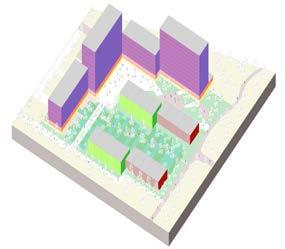
Axonometric
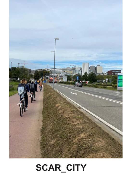
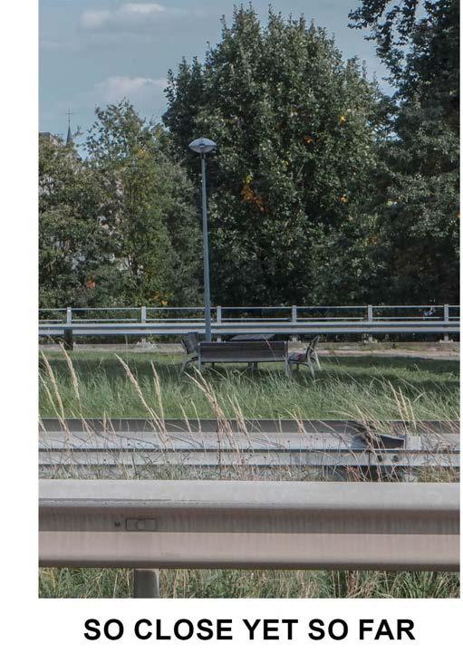
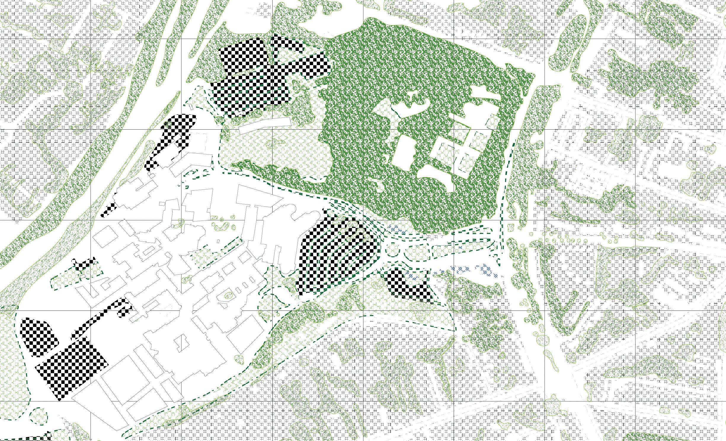
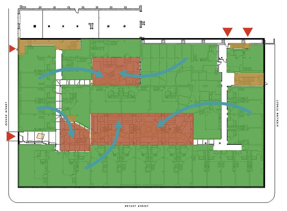
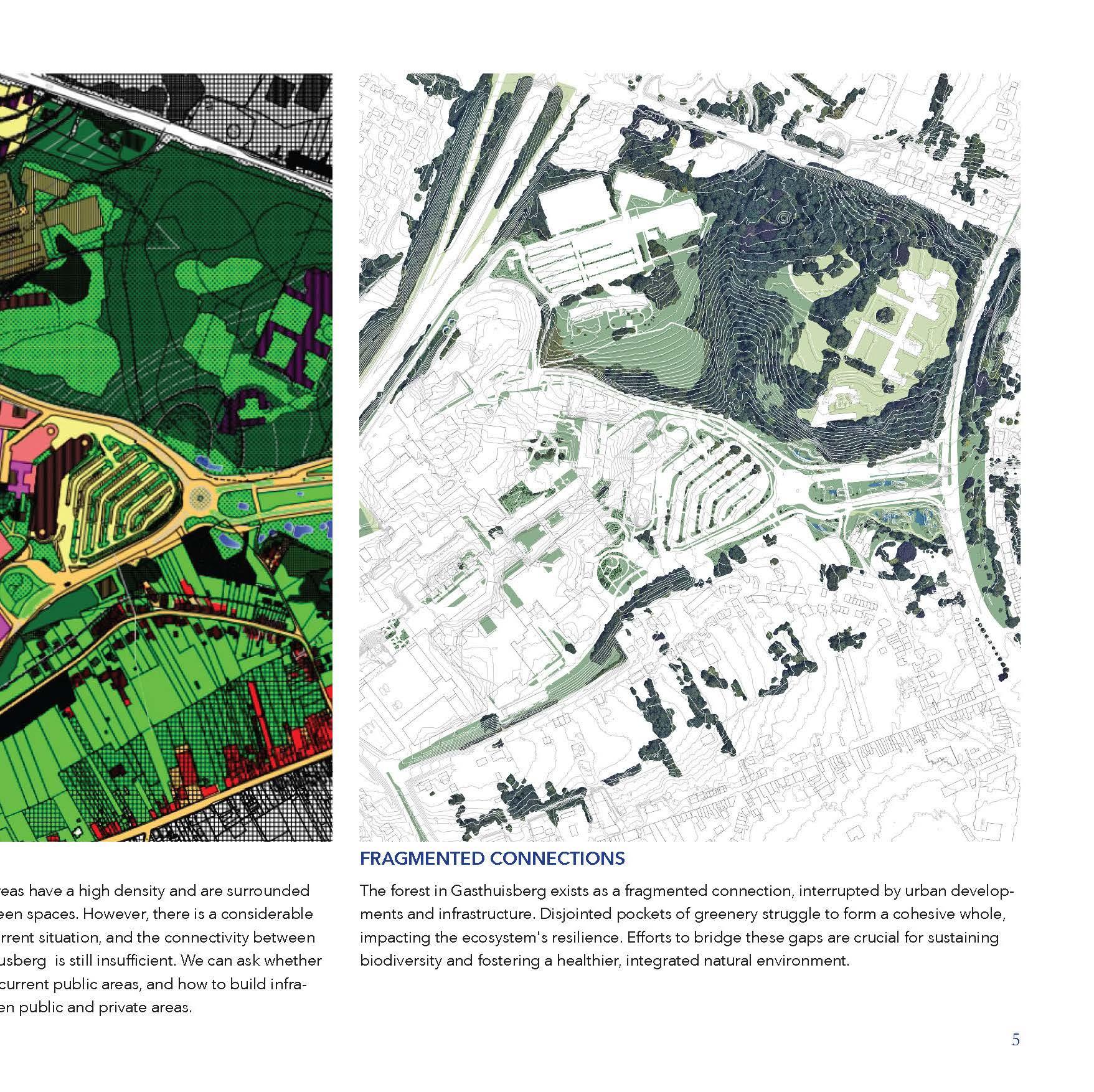
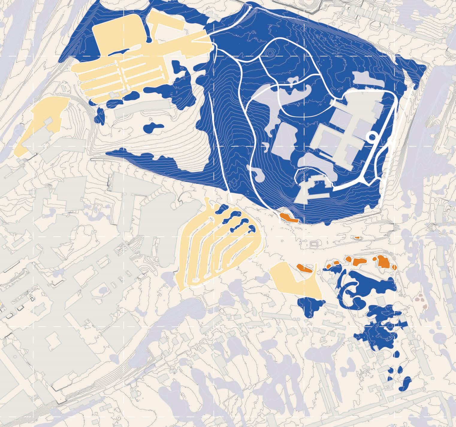
The process seeks to understand the urban fabric in the form of scales of buildings and the open spaces mediating them. The investiga1tion revealed the disparity in the human scale and fragmentation of the said open spaces rendering them as scars in the landscape.
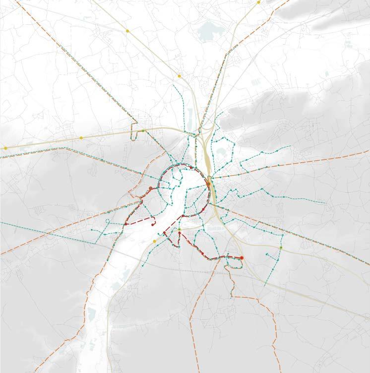
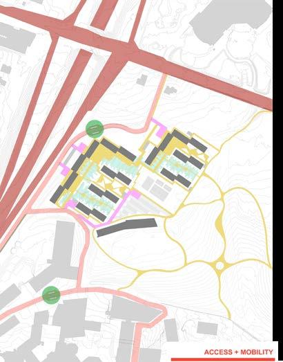
The map analyzes the traffic situation on the site, compares the conditions of bicycle routes, sidewalks and roadways, and emphasizes the location of bus stops, providing an important basis for subsequent route design.
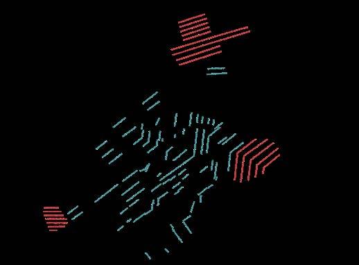
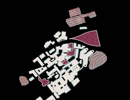
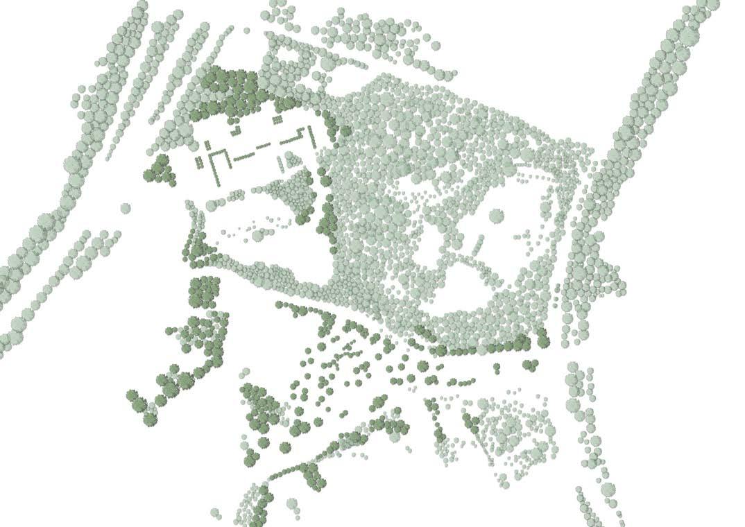
The map depicts the scarcity of the vegetated areas and the discontinuity of the open spaces. Furthermore it illustrates the permeable and non permeable surfaces of the surveyed area.
Pathways
Bike lane
Parking lots
Water
Low vegetation-private backyards
Low vegetation-public space
Hige vegetation

Walking roads
High way
Car roads
Bus stops
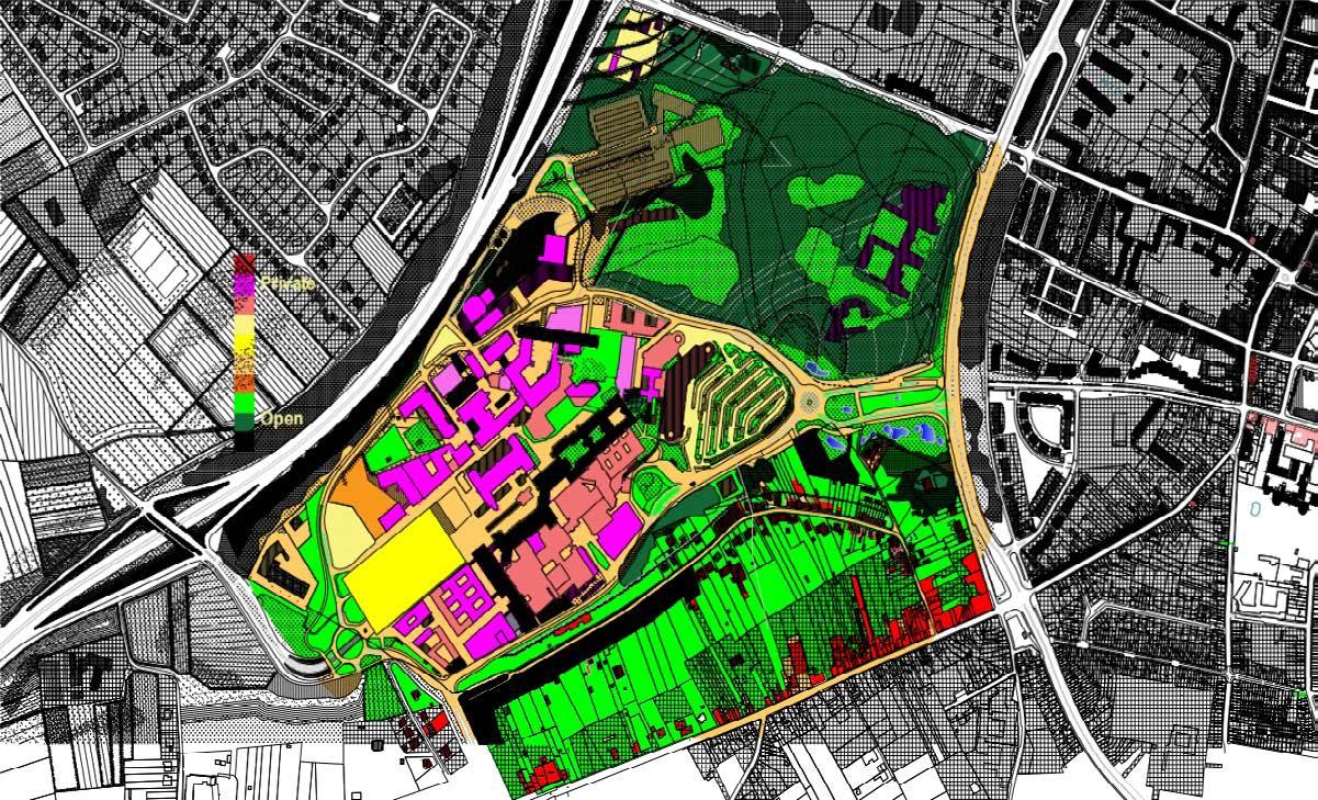
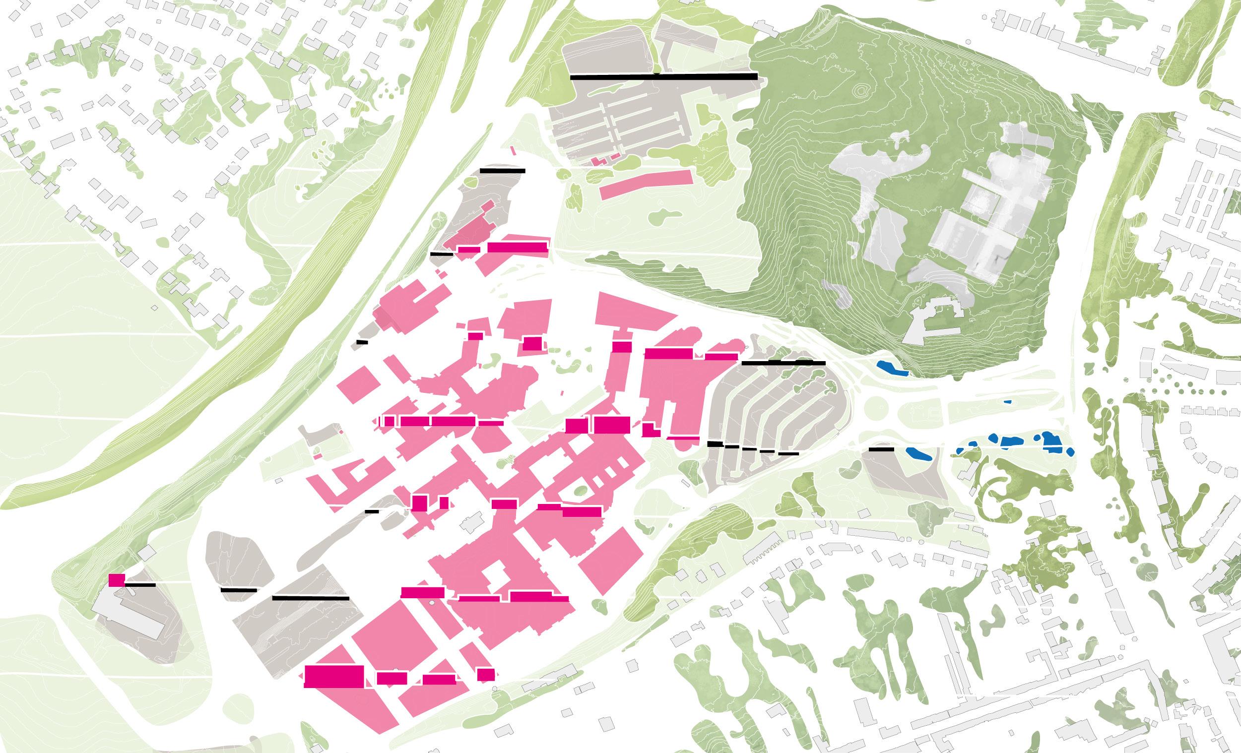
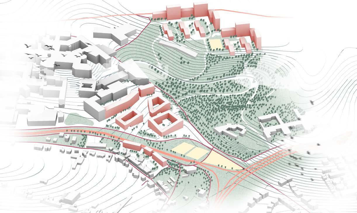
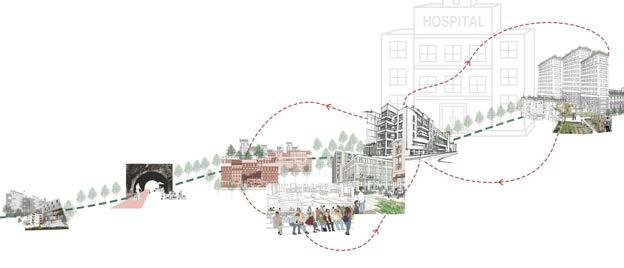
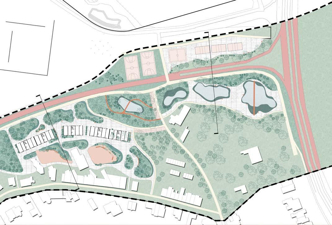
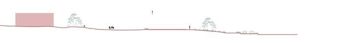
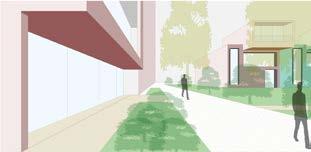
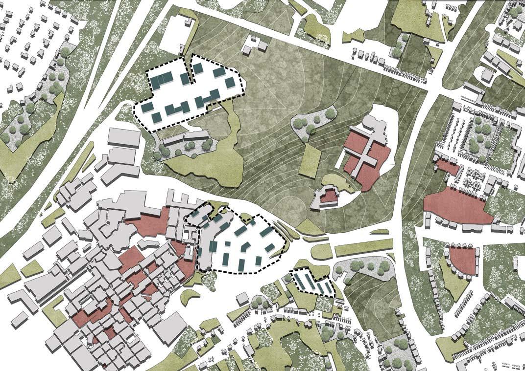
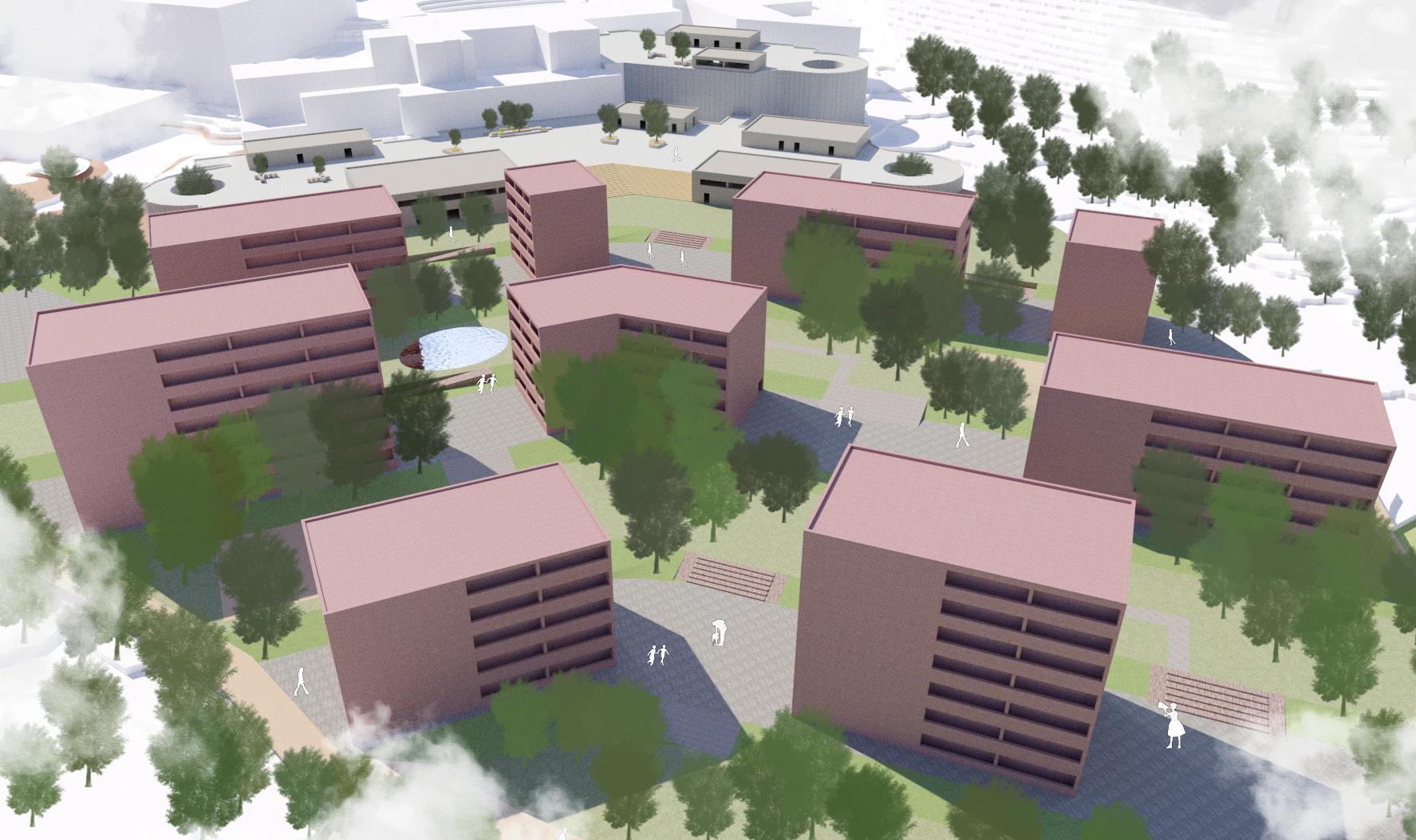
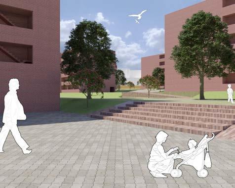
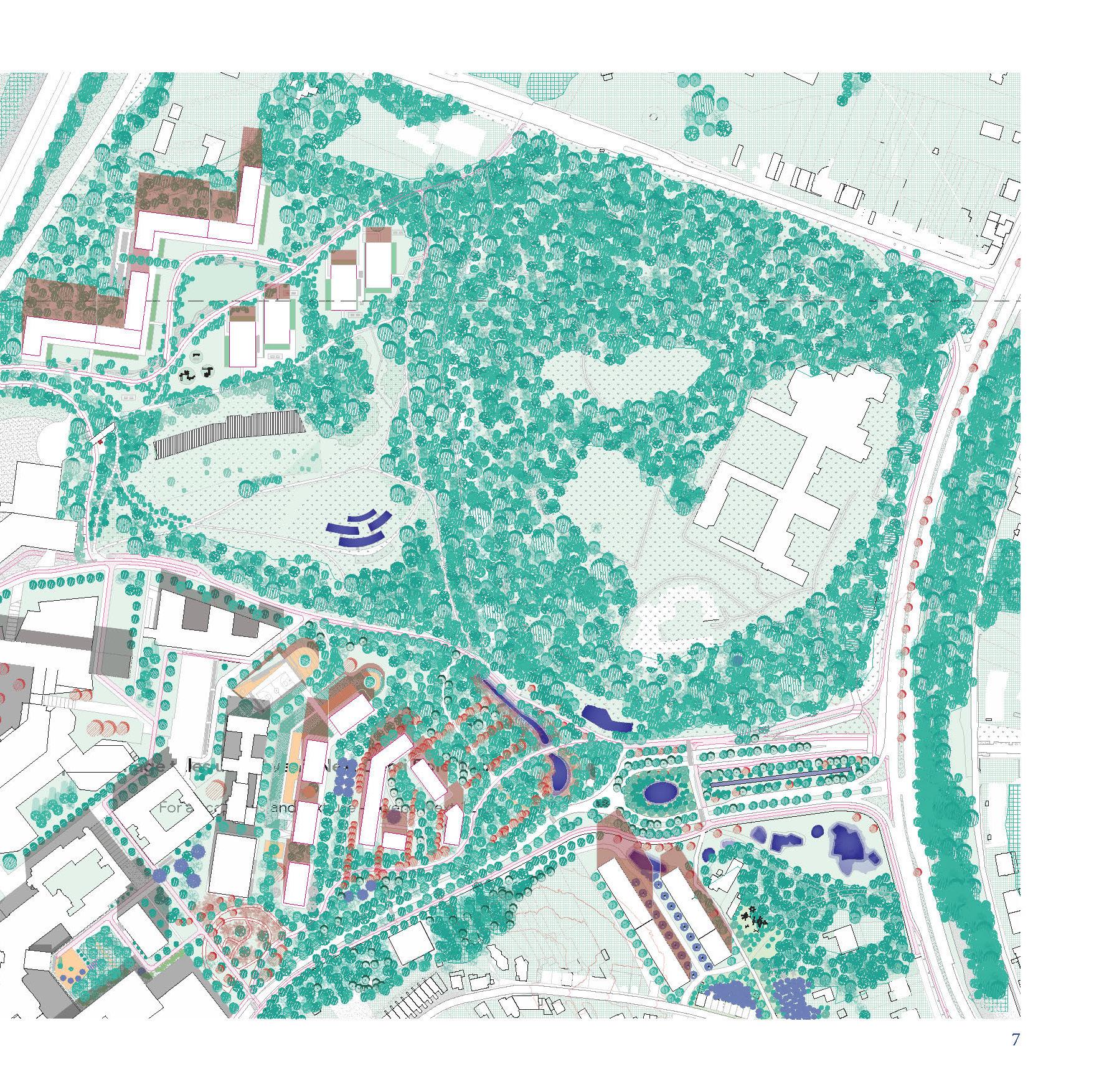
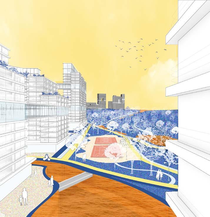
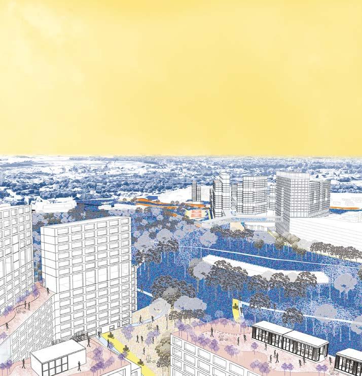
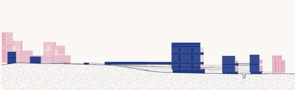
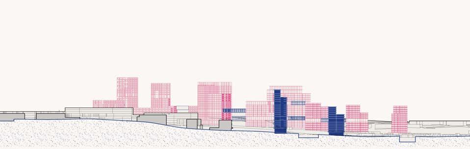
The project sets to address three major issues identified; Scared open landscape, lack of connection between neighborhoods and the site, and within the site itself, and the issue of human scale as brought by the size of the hospital. The solution gave into consideration the aspects of topography and ground water movement as key design drivers. The result is a recreation of a user’s journey from the city center through a repurposed pedestrian friendly tunnel. This leads into a welcoming, active and well vegetated open space that directs movement across the new proposed neighborhoods that transition in scale to the hospital and university site. The journey is then extended up the hill to the new high-density neighborhood.
This journey is graced with a variety of interventions and mixed-use activity scenarios that aim to activate the neighborhood and bring in a new sense of vibrance and life.
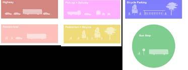
New buildings
Original buildings
Car roads
Bike roads
Bike parking lots
Hard paving
Bus stops
Kindergarden
Campus Hospital
Residential area
This part combines the new buildings with the original residential buildings to form a new community, changing the private green space of the original residential area into a public green space for residents, making it a connection. The community contains complete commercial facilities and energizes the community through surrounding public activity area.
Car roads
Bike roads
Wooden material
Water
Original green space
New green space
Water storage green space
Hard paving
ZOOM TISSUE 2
KONSTANTINA KARASARINI 02
This part consists the part between the hill and the valley, the hospital and the city. The new design aims to connect these elements by using vegetation as a tool to organize the circulation. The housing units define the private, semi – public and public spaces and the suggested functions on the ground floor (commercial, education, culture) aim to activate the urban space and be the intermediate between the city and the hospital.
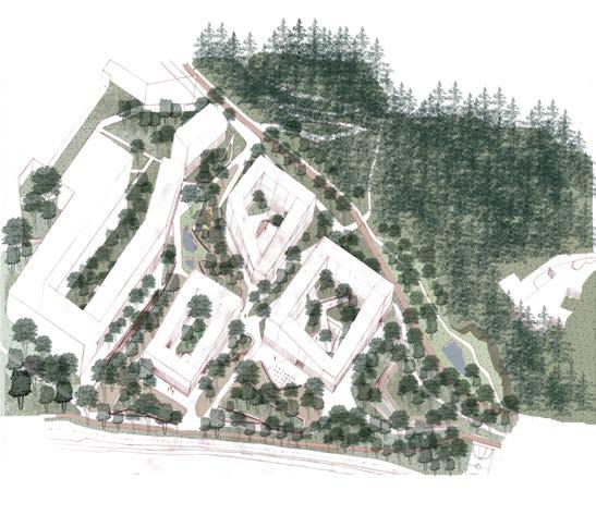
The neighborhood evolves to serve as an edge of the masterplan with the embracing of the urban-wall principle considering its location at the edge of a major mobility corridor. In line with the theme of the overall project: Forest Urbanism; Reclaiming the Hill, the proposal extends the forest fabric deep into the project while attempting an effort into dignified densification.
GASTHUISBERG _ B
MAHA ABUMARIA 01
YINGJIE LI 02
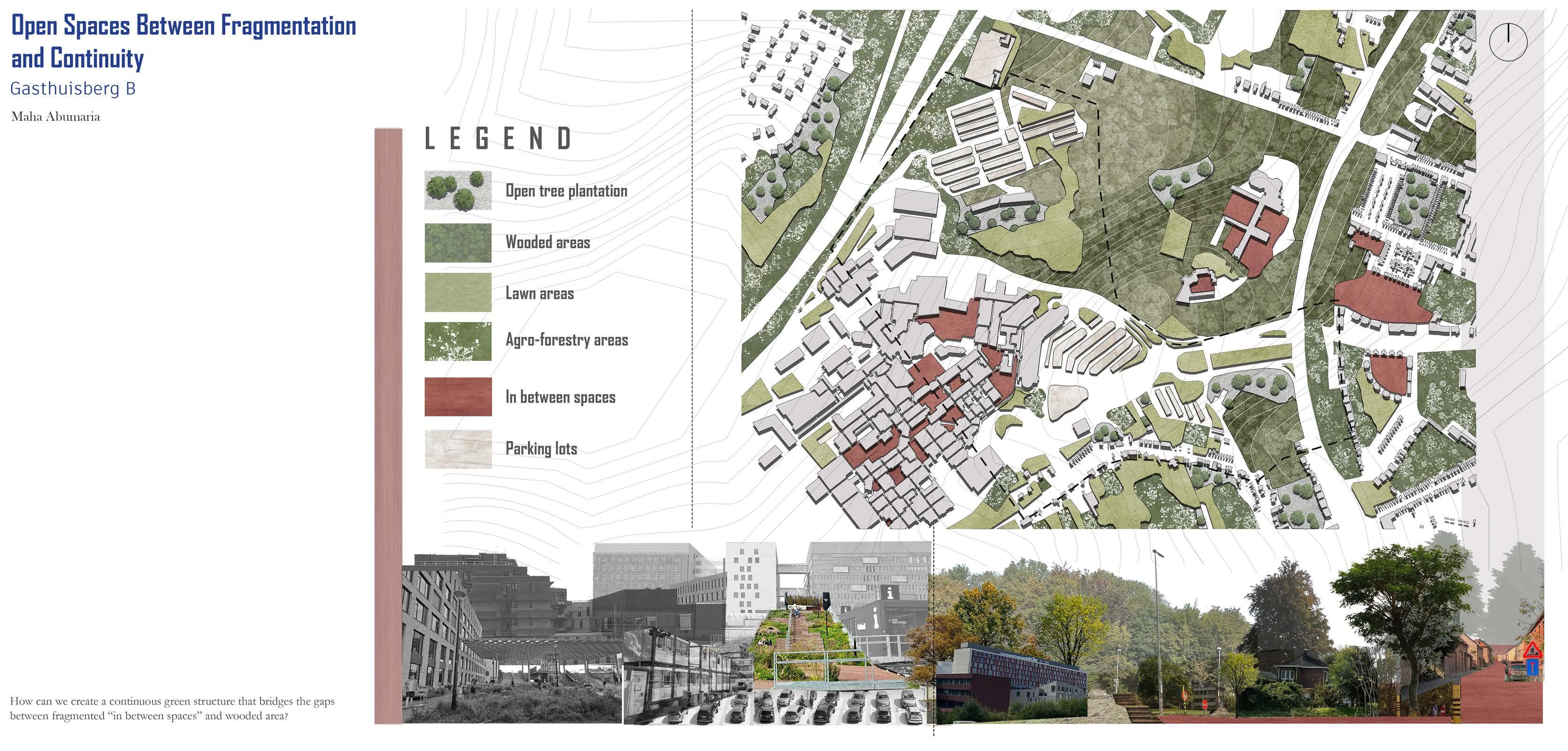
Commencing the analysis of canopy clearing, the objective entails reclaiming nature through filling the trees. The vision prioritizes the facilitation of natural forest ingress into our site, promoting a harmonious integration with the surrounding ecosystem. This method guarantees a seamless integration with the ecological context, additionally establishing a network of connected open spaces.
Examining the map, the functions of canopy clearing and open space typology guide our analysis. Identifying a substantial parking area, the decision is made to repurpose it for housing units. Organizing buildings along existing parking lot axes minimizes the footprint, optimizing spatial utilization with strategic alignment and repurposing for enhanced efficiency.
01| CLEARING AND CANOPY “EXISTING”
02| FILLING THE FOREST “PROPOSED”
03| DISPONIBLE SPACES “EXISTING”
04| NEW URBAN FABRIC “PROPOSED”
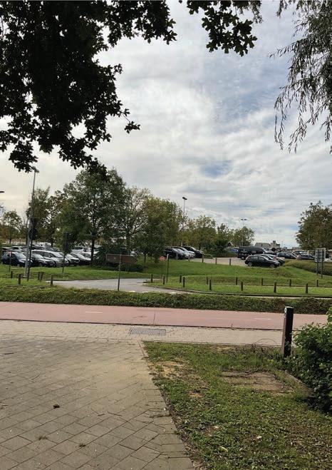
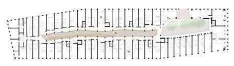
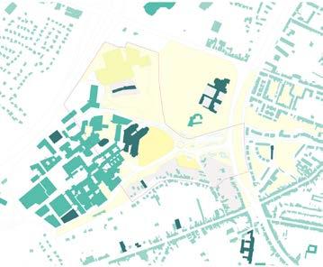
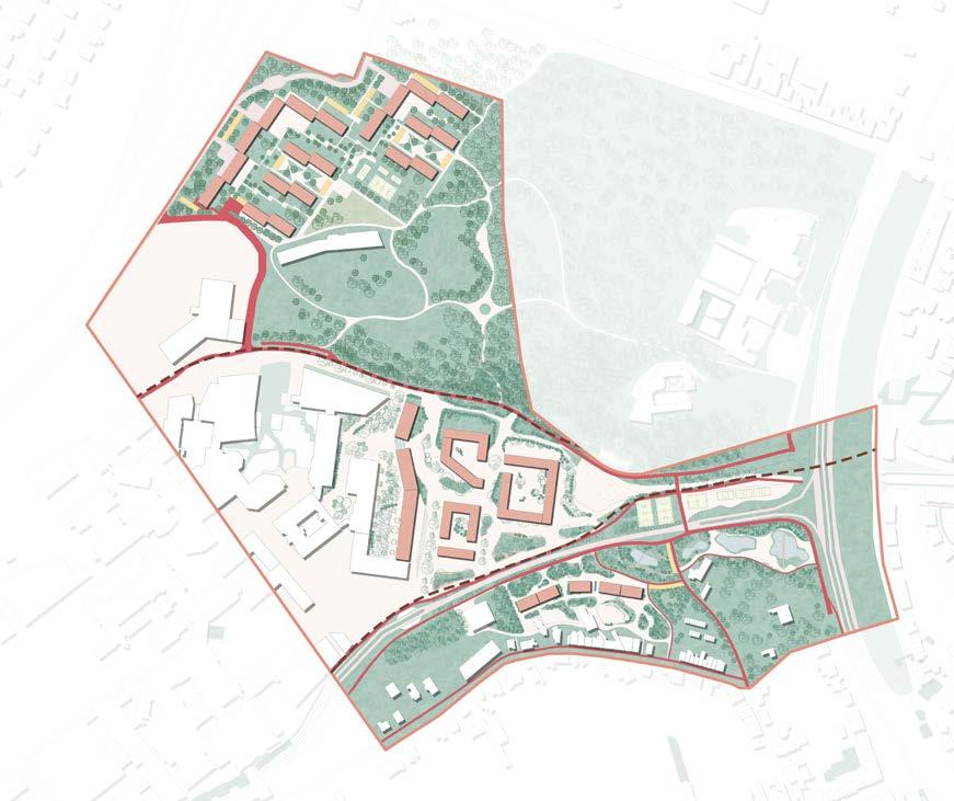
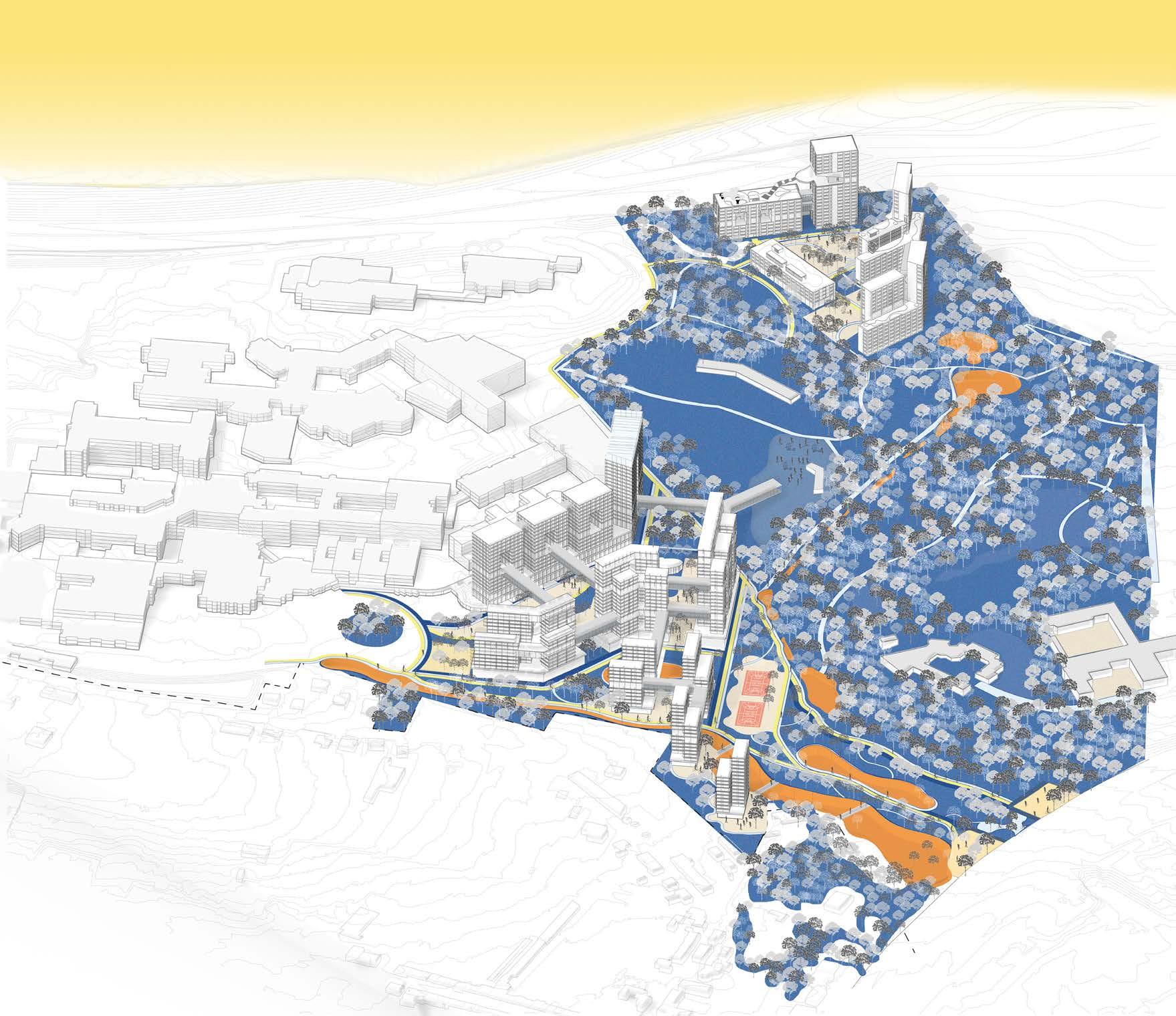
The site is located outside the ring road, next to the hospital and school campus. In terms of the urban fabric, almost all of the open space is concentrated on the northern side of the site. The high slopes on the north side have a large dense forest and a wide wooded lawn. The south side has a large low density residential area. And in the middle is a high-density hospital building and school located in the valley, which is so dense that there are very few good quality public spaces for people to use. The site contains a large number of car parks which will become useless and derelict in the 'post-car era', making it a potential site for regeneration and development.
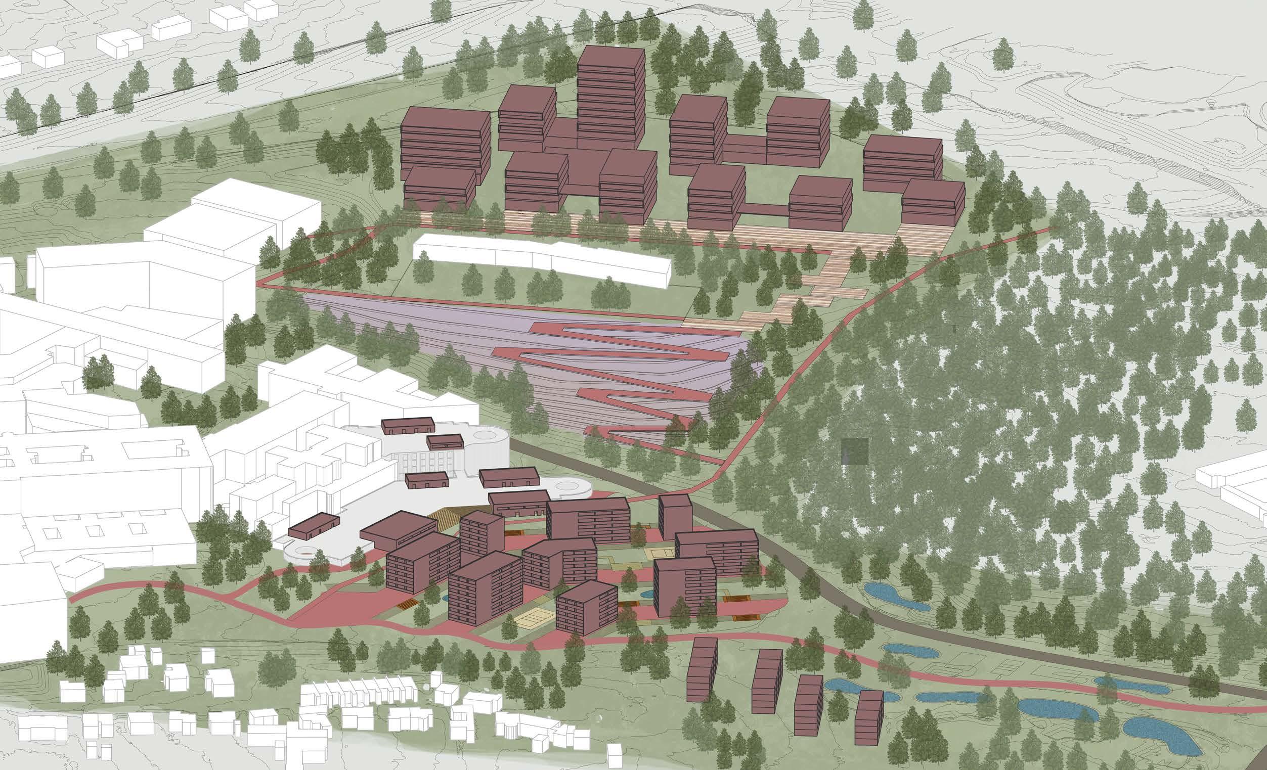
The vision showcases three density characteristics. high density in the top of the hill, central hub that transitioning from big hospital unit to medium housing units. And finally, the urban park with rural units that integrate with the surrounding. The undulating topography offers the different views and opportunities. The high ground part emphasizes on influence of the forest and the city view. The south part take care of the residential. The lowest ground, middle part is affected by mass building and the connection.
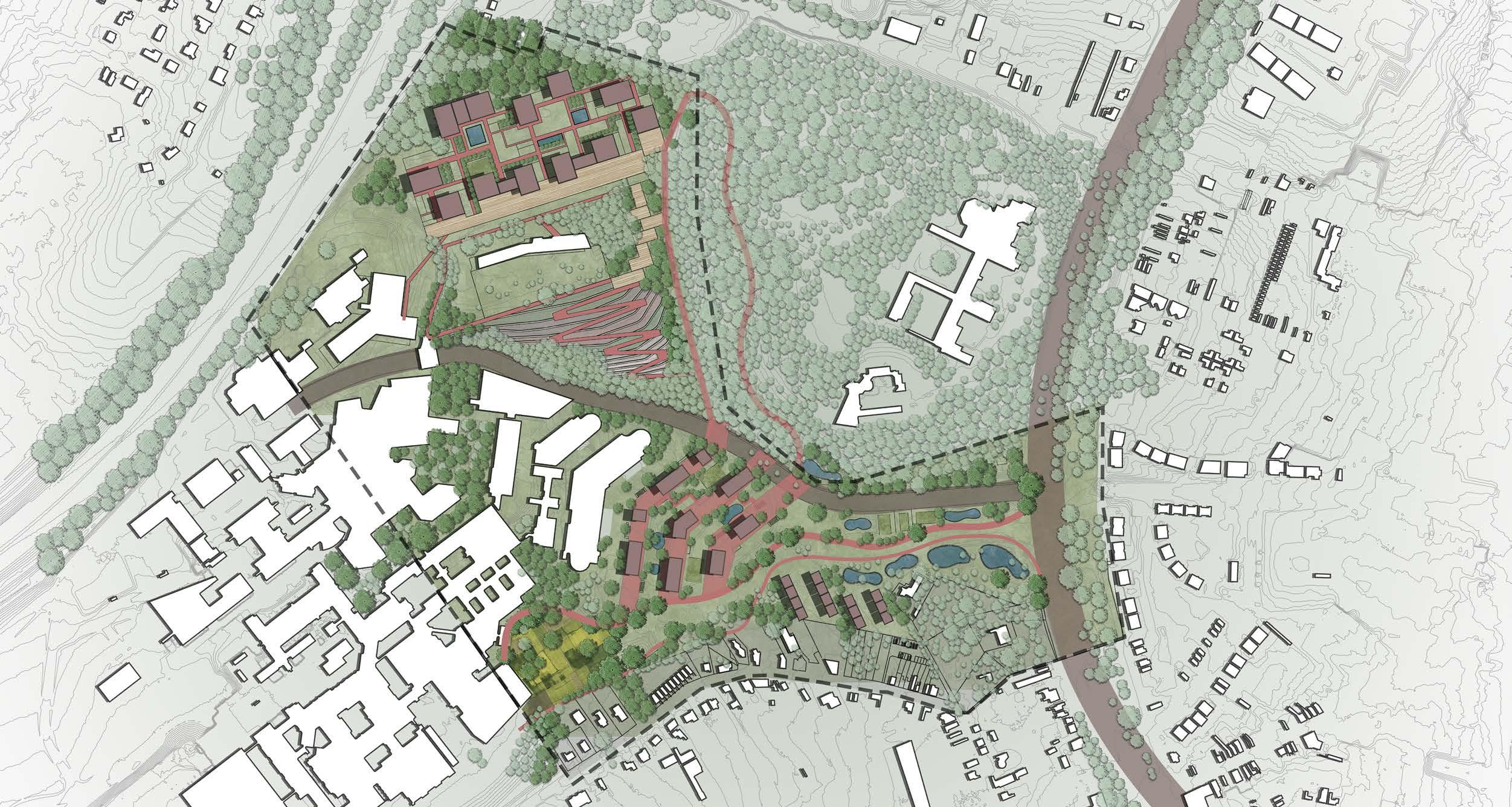
THE MAIN CONCEPT
Beginning at the central path within the botanic garden, attention converges on multifunctional platforms extending towards the forest, culminating in a longitudinal public balcony. Woven with purposeful circulation, the kindergarten seamlessly connects to central play areas, fostering connectivity and functional synergy. The central zone between building unfolds into urban agricultural farms, serving as a transitional interface between the forest and the city, enriching the site's dynamic and inclusive qualities.
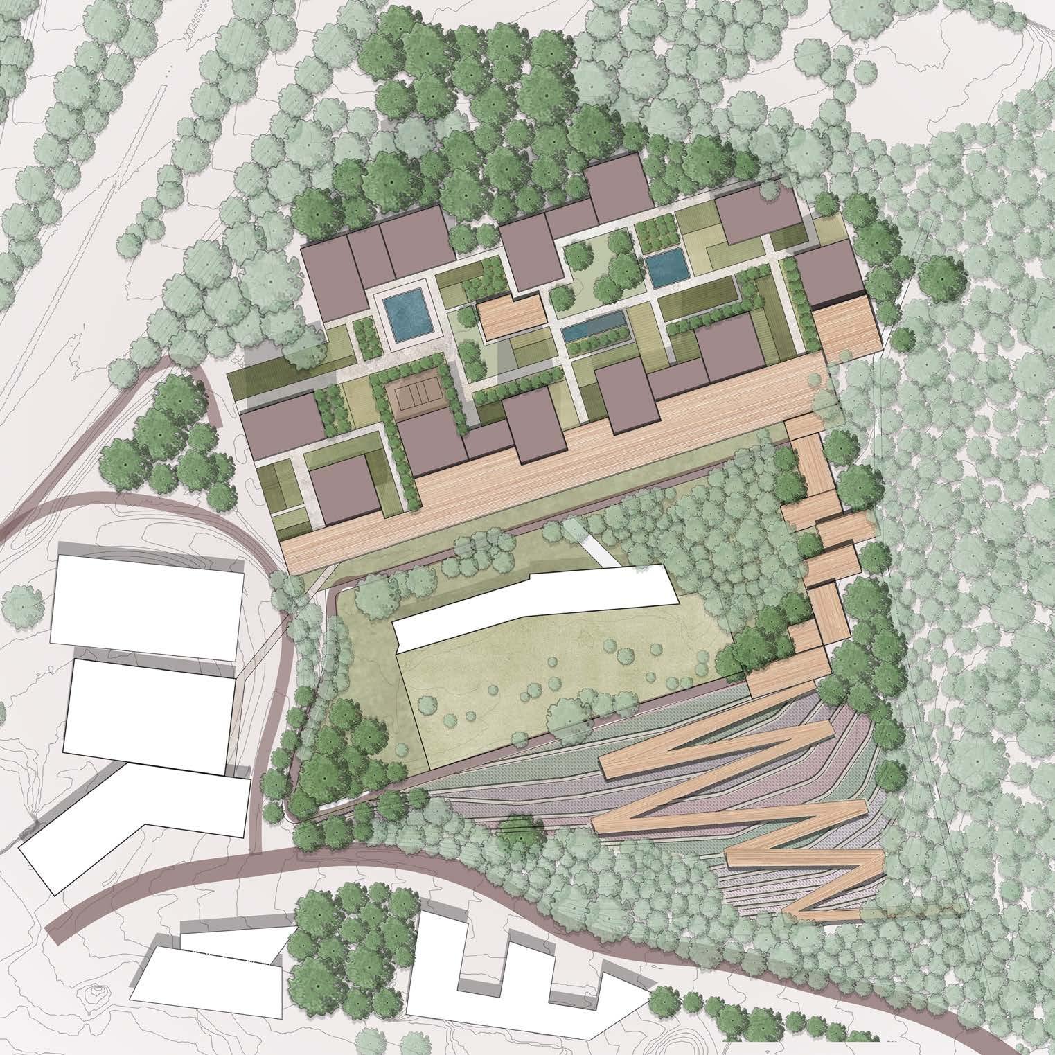
High density housing project using the mixed-use ground floor that connected with the public balcony toward the city view, with urban agricultural farms in the middle as a landscape transition area between the forest and the city working as a communal space.
Axonometric
The higher building organized in the back and the lower ones on the front with a big opinings on southern facades to benefit as much as possible from the view "forest ,city urban and agriculture area" views, in addition to take environmental aspects into the account.
The housing typology adapts to the footprint of existing parking lot, using green and grey band to create multiple layers. From the roof of the parking building, the ground level decreases from one level to another, giving the transition from conmplex to urban park. Along the central axis, large steps provide a deck for people to sit down and enjoy the view. In front of the steps, buildings and trees together frame the view. Four typologies scatter on the grey band. And the old parking building roof turns into a mix use for patients and medical staff as well as residents here.
SECTION 1-1
SECTION 2-2
SECTION 3-3
SECTION 4-4
Function and Circulation
Since 'post-car' era, more bicycle parking is provided. Different functions are installed inside the old building. With orginal slope and additional elevator, hospital can also access the froest here.
Perspective Views
Stairs and slopes are used to connect decreasing level. To echo the flooding area of the site, water elements become part of the green band.
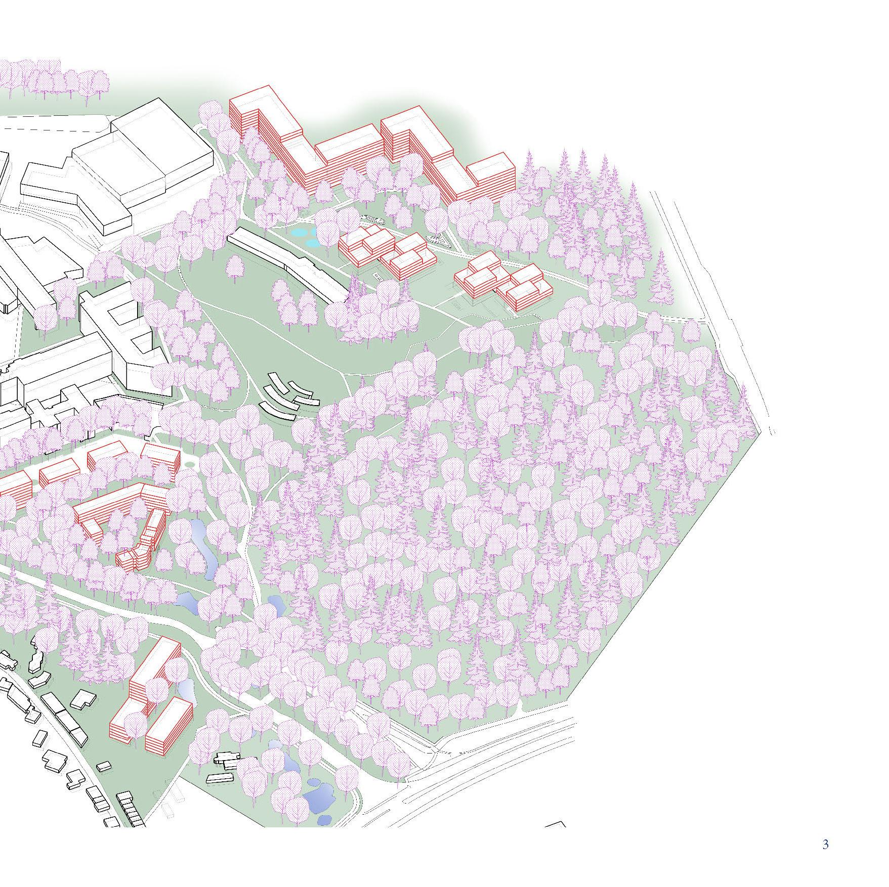
Gasthuisberg _ D
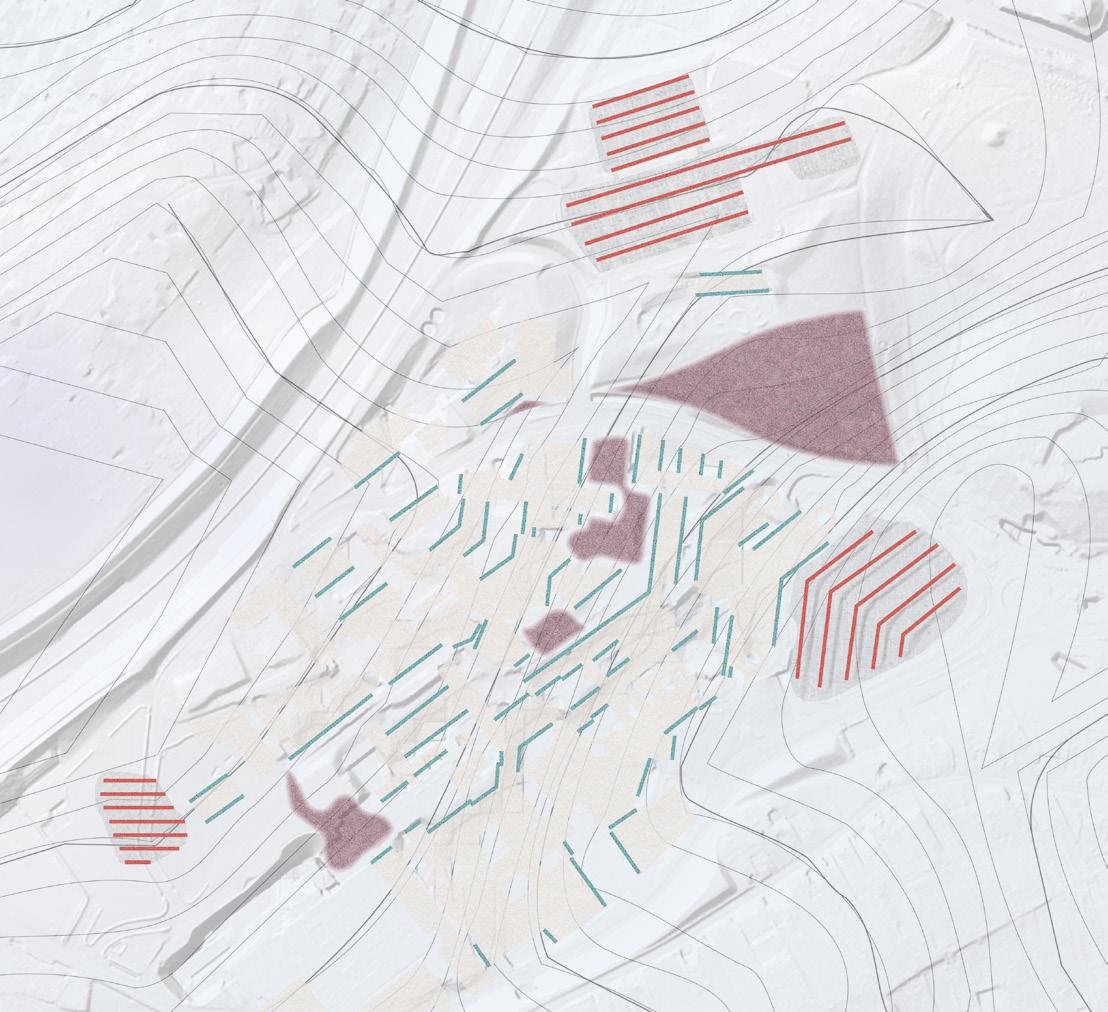
Study of the building profiles of the exiting hospital and educational blocks and the hardscaped parking lots show they follow the site topography that creates these smaller interation spaces in between the buildings which are scattered, not connected and difficult to access from outside.

Mapping the scattered interaction spaces and movement of people outside and around the exiting built fabric to understand a connection between them and how they can be united and expanded to allow more outdoor interactions that bring vibrancy to the space at different times of the day.
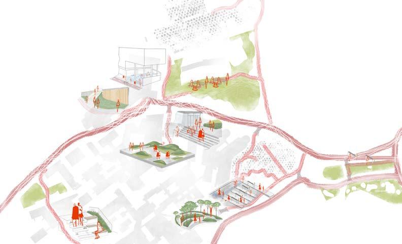
Located the shape and volume of the trees, green areas, and open spaces to understand how it´s the relationship with the buildings of the hospital, KU Leuven and the City, the map and sections show dense and compact the current buildings are and how the green mass stars to reduce.
Mapping the existing hardscape and softscape on the site to understand the topography and connection of spaces. Site
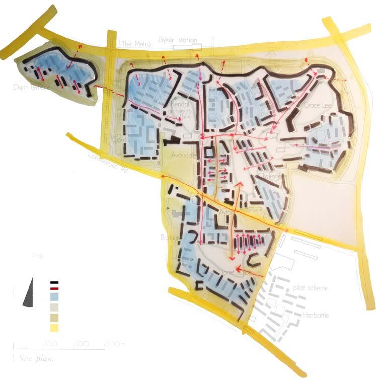
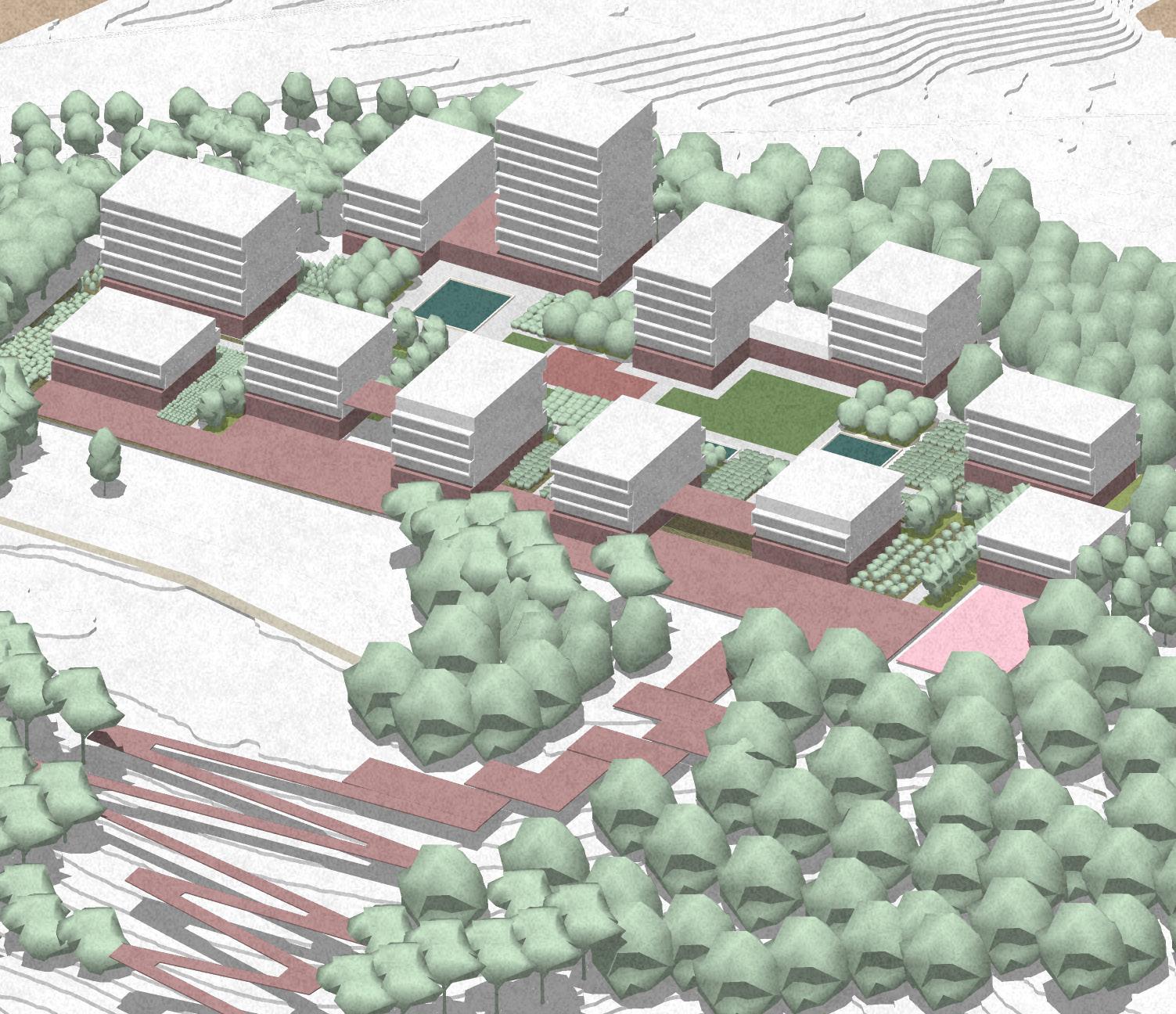
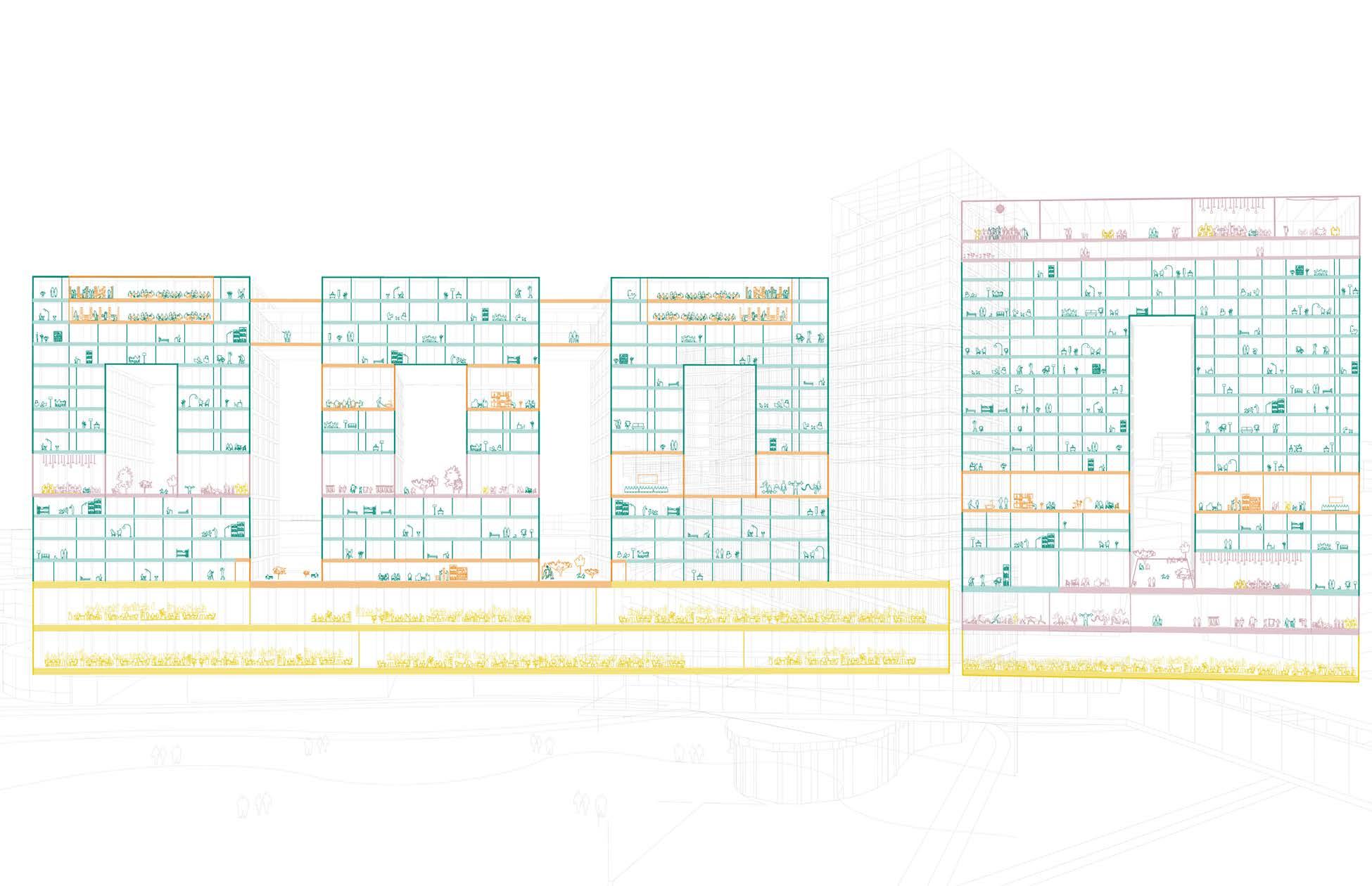
The Master Plan increase the housing density by towers located in strategic places that were parking lots, using primary the topography of the site to orient the facades and the balconies of the buildings the project constantly creates a visual connection with the city of Leuven.
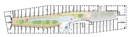
The system of parks works as an extension of the current park on the hill and allow the increase of the area for water canals that protect the site during the rainy seasons.
Currently the profile of the hospital it´s dense and with a lack of enough light, so the project increases the green areas in between the buildings and create new interior spaces. The bridges keep the continuity of the pedestrian network of the site connecting the towers and creating collective spaces with open floors that can be used as business areas or recreational ones.
Area
Area
Creation of a landmark for the area that is a connection between the hospital and the new proposed commercial and residential areas. The tall buildings are defined through its multifuctional aspects reponding to its site surroundings at different levels and creating a connected environment on the inside for people of all age groups.
A new building next to the hospital that creates a core that connects the current programs with new ones.
Design for everyone and the place to be
A diverse program of activities and functions combine it with the housing.
The cluster of buildings on the hill are part of the extended forest and built in the clearings with more quite spaces and views in all directions through the interactive terraces, bridges and large voids of the building blocks. The heights of the buildings follow the topography to connect with overall site.

Commercial
Residential (Families)
Residential(Students)
Circulation
Open Spaces/Terraces
Public squares
Function of spaces and Flow of movement on the ground floor
Axo view of the building cluster and the connection with terraces, bridges and voids in the built form
Commercial
Residential (Families)
Residential(Students)
Circulation
Open Spaces/Terraces
Public squares
An object in the forest
Functionality of the western block and connection of public and private spaces
The main goal of the project its allow the increase of open public spaces by reducing the footprint of the buildings, the towers are design with terraces, balconies and a variety of different programs using the idea of the bridges to increase the connectivity with the hospital and the forest.
Floor plan and Axonometric of the elements of the project.
Shared
Comercial
The water canals works as design guidelines to located the buildings and the open spaces.
Leuven, Belgium
Guests
External Jury Members
Yuri Gerrits, KU Leuven
Guido Geenen, KU Leuven, WIT architecten
Joris Moonen, KU Leuven, MIDI
Sarah Van de Velde, Bureau Bas Smets
Ward Verbakel, KU Leuven, PLUSOFFICE
Annelies De Nijs, Atelier Horizon
Cristian Panaïté, METAPOLIS
Els Van Meerbeek, KU Leuven, Carton123
Pieter Van den Broeck, KU Leuven
Ellen Verbiest, KU Leuven
Guest Lectures
Janina Gosseye, TU Delft
Yuri Gerrits, KU Leuven
Dr. Xiaoxuan Lu, University of Hong Kong
Fadi Masoud, University of Toronto
Mircea Munteanu, METAPOLIS
Thomas Willemse, Studio Thomas Willemse
Projects visits
Korbeek winners - Els Van Meerbeek, Carton123
Centrale Werkplaatsen - Tom Boogaerts, &bogdan
De Drie Kreeften - Roeland Joosten, WIT Architecten
Teaching Team
Mircea Munteanu, affiliation
Teodora Romanova Stefanova, OSA Research Group, KU Leuven
Thomas Willemse, affiliation
Kelly Shannon, KU Leuven
Bruno De Meulder, KU Leuven
Stakeholders Exercise
Pieter Van den Broeck, KU Leuven
Student Groups
FOOTHILL HEVERLEEBOS
- MAHS/MAULP 1
Group A
Alireza Mirshekari
Janno Delissen
Giuliana Paola Palaez Rodriguez
Group B
Bram Vidts
Pham Nguyen Thao
Martin Adriel Purnomo
Group C
Ella Hens
Alfonso Nava Lopez
Unnati Khanduri
Group D
Gautami Manish Kasat
Santos Albeiro Blandino
Ngoc Dieu Tran Hoang
FOOTHILL GROENVELD
- MAHS/MAULP 1
Group A
Tom Van Laer
Praveenkumar Paramagourou
Asmae El Rhazi
Group B
Huijun Liu
Trang Minh Thuy Nguyen
Group C
Gayane Maes
Saba Asir Khan
Bezawit Tekle Gasso
SWAENENBERGH SITE
- MAULP 2
Group A
Verma Harshika
Paola Salvatierra Castro
Saran Maiprasert
Group B
Alexia Chalouli
Sri Keshava Tanguturi
Radhika Rishi
Group C
Eva Clara Atcheson
Tanvi Rajesh Belhekar
Group D
Ria Das
Junyao Su
GASTHUISBERG
- MAHS/MAULP 1
Group A
Elton Kibet Birir
Konstantina Nikoletta Karasarini
Yuhan Dong
Group B
Fatima Akman
Maha Abumaria
Yingjie Li
Group C
Dimitra Makraki
Alexa Gomez Custodio
Jinhao Cen
Group D
Radhika Somani
Victor Hugo Martinez Perez
Irene Gracia Aranda
GALGENBERG
- MAULP 2
Group A
Angelos Chouliaras
Muyleng Heng
Lamia Farhat
Group B
Marie Meurice
Javier Eduardo Lazarte Remisio
Vu Linh Chi Duong
Group C
Kato Belmans
Kshipra Mangesh Deolalkar
Group D
Supanut Udomsilaparsup
Zhang Yalan
Paedar MacCarthy
Booklet Layout & Editing
Mircea Munteanu
Teodora Romanova Stefanova
Thomas Willemse
Khalda El Jack

DEPARTMENT OF ARCHITECTURE
MASTER OF HUMAN SETTLEMENTS
MASTER OF URBANISM LANDSCAPE AND PLANNING