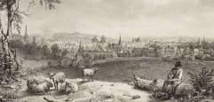
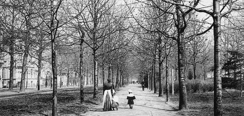
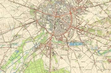
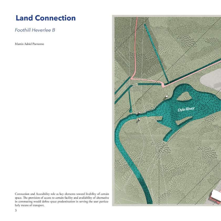
Leuven, Belgium
Master (of Science) Human Settlements & Master (of Science) Urbanism, Landscape and Planning
Faculty of Engineering and Department of Architecture
Promoters:
Mircea Munteanu (Metapolis), Teodora Romanova Stefanova (Gradoscope), Thomas Willemse (Studio Thomas Willemse) with Bruno De Meulder and Kelly Shannon (KU Leuven)

© Copyright KU Leuven
Without written permission of the thesis supervisors and the authors it is forbidden to reproduce or adapt in any form or by any means any part of this publication. Requests for obtaining the right to reproduce or utilize parts of this publication should be addressed to Faculty of Engineering and Department of Architecture, Kasteelpark Arenberg 1 box 2431, B-3001 Heverlee.
A written permission of the thesis supervisors is also required to use the methods, products, schematics and programs described in this work for industrial or commercial use, and for submitting this publication in scientific contests.
05 SWEANENBERGH
05.A OVERVIEW, A PHOTOGRAPHIC STORY
05.B INTERPRETATIVE MAPPING
05.C HOUSING ANALYSIS
05.D STRATEGIC PROJECTS
06 GASTHUISBERG
06.A OVERVIEW, A PHOTOGRAPHIC STORY
06.B INTERPRETATIVE MAPPING
06.C HOUSING ANALYSIS
06.D STRATEGIC PROJECTS
07 GALGENBERG
07.A OVERVIEW, A PHOTOGRAPHIC STORY
07.B INTERPRETATIVE MAPPING
07.C HOUSING ANALYSIS
07.D STRATEGIC PROJECTS
08 ACKNOWLEDGEMENTS
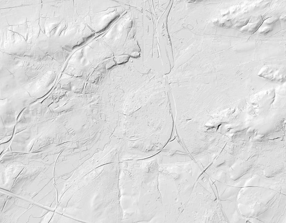
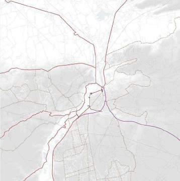
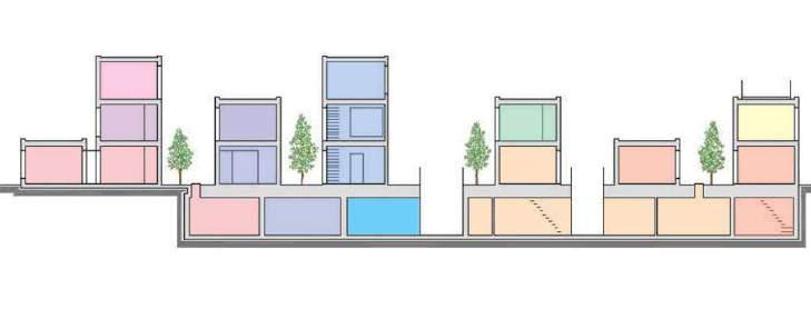
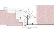
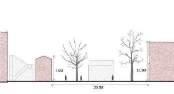
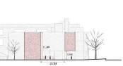
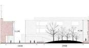
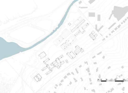
Topography and sections
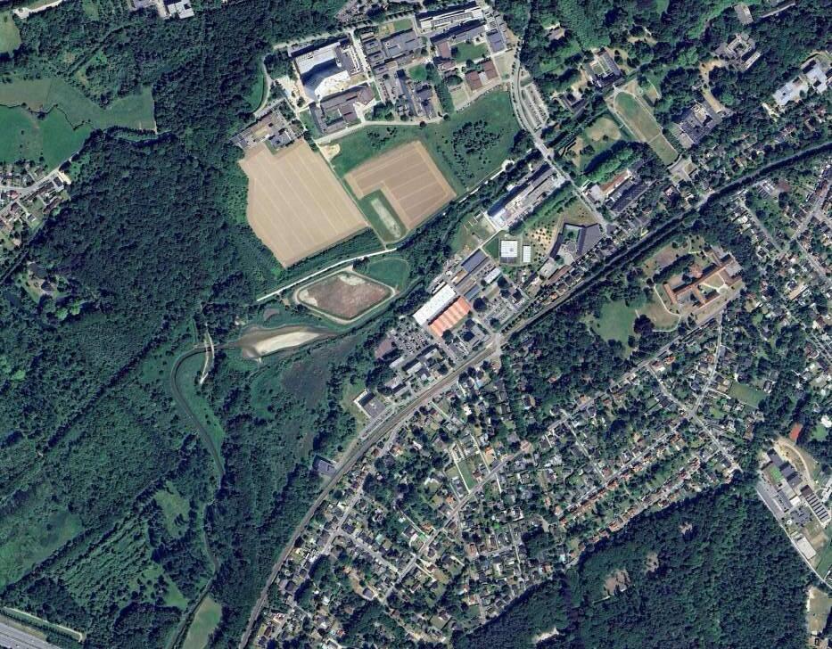
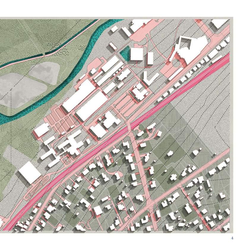
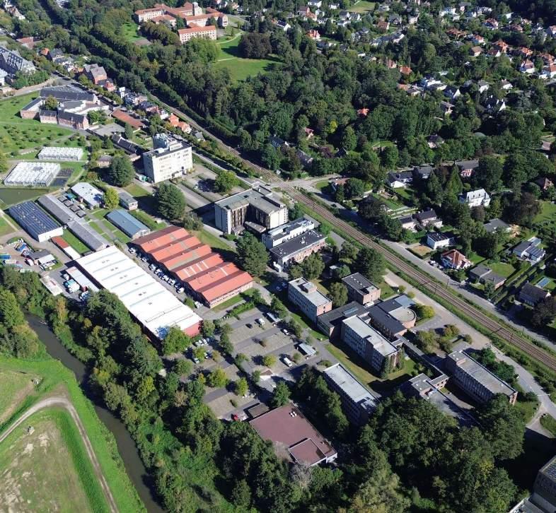
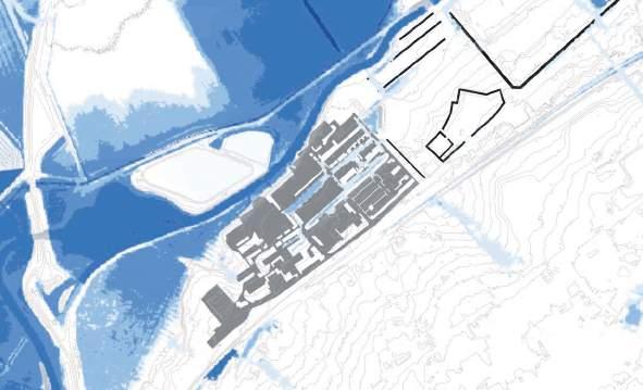
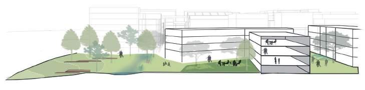
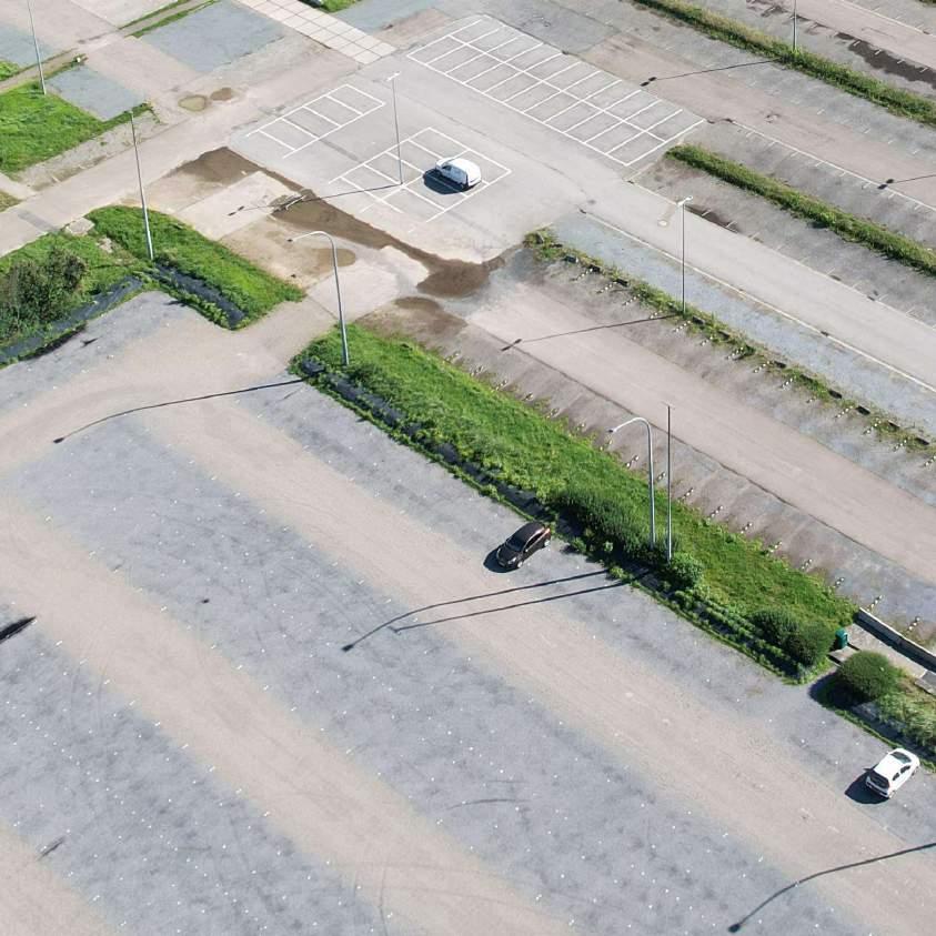
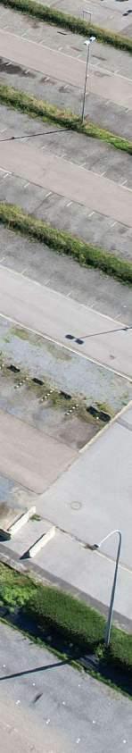
The site is comprised of fragments of urban fabrics on the western side (Witness hills) of Leuven, squeezed between the highway and ‘vesten’ (medieval earthworks) landscape (that was turned into a ring road). Since the 1950s, the area has become a dumping ground for larger institutions (university campus, university hospital, music academy, bank headquarters, big retail, etc.). The area is, in general, overinfrastructured (including large parking lots).
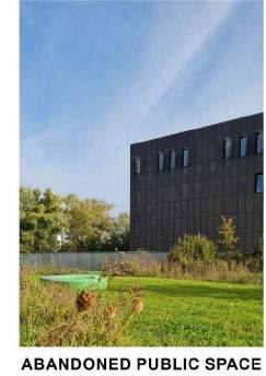
As a monofunctional dumping ground, the site lacks a clear structure (besides the underlying landscape) morphology and, despite its heavy programs, urbanity. The area’s potential identity and value is compromised by the dominant car-orientation and complete lack of (qualitative) public space.
Specific sites for intervention were identified due to their relationship with the university (and a broader discussion of city - (monotonous) university), the gentrifying effect of the university and major shortages in the (student) housing market). All the sites are comprised of fragments of tissues (hospital, school, convent, etc) and the strong topographical relief that characterizes this area of Leuven.
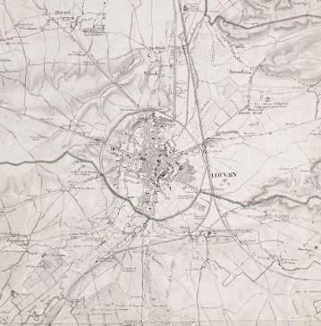
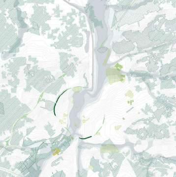
The city walls of Leuven mark a strong new artificial topography around the city. The Ferraris map of 1777 shows the clear distinction between the inner city development and the wide agricultural landscape beyond the walls. The flanks of the witness hills on the west side of the city form a strong agricultural landscape within the city walls with fields and vineyards. The steep slopes in this area explain the hesitant urban growth.
The Vandermaelen map from 1850 highlights the larger institutions that are set within the landscape. The larger estates of these institutions define figures in the landscape and often form the nucleus of car-dominated campuses of the enormous institutions that we find around Leuven today.
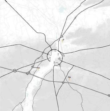
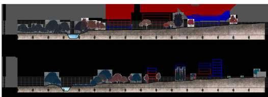
Infrastructure as destruction
Over time the city ramparts have been transformed into a linear park like the Remy boulevard. In the 1970's this landscape was dramatically uprooted. Through highway engineering a ring road is carved into the landscape. The dominance of the car becomes all-present around the city.
Hypotheses
1. Post-car/ post-carbon city
All sites must address the radically downgrading of car-infrastructure (including recuperation of parking lots, downsizing and re-arranging profiles).
2. Adaptive reuse
All sites include the transformation of complexes (and their parking lots) into mixed urban fabrics of (very) high density (mainly housing)
3. No new greenfield development
The consumption of landscape must not continue. On the contrary, projects must re-engage productively/constructively with the surrounding landscape.
4. Tissues of multiplicity
Tissues of multiplicity. The Univer-City is not mono-functional and it should not be segregated. Synergies must emerge from a multiplicity of functions, demographics, typologies, cultures.
Challenges based on hypotheses
Density:
For each site, the design should aim for a density with a Floor Area Ratio of minimum 2.0 in relation to the existing impervious surfaces on site (parking, roads and buildings)
Multiplicity:
The urban tissue should provide a high degree of urbanity, with mixed-use complementary functions, but ensuring that housing represents between 60% and 80% of the Total Floor Area.
Units:
The design should ensure an average floor area per inhabitant of 50 m2/p from the Total Floor Area for Housing.
GROUP A
ALIREZA MIRSHEKARI
JANNO DELISSEN
GIULIANA PAOLA
PALAEZ RODRIGUEZ
GROUP B
BRAM VIDTS
PHAM NGUYEN THAO
MARTIN ADRIEL
PURNOMO
GROUP C
ELLA HENS
ALFONSO NAVA
LOPEZ
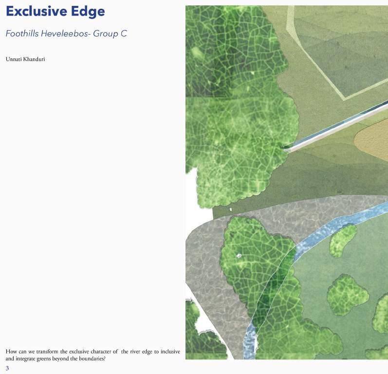
UNNATI KHANDURI
GROUP D
GAUTAMI MANISH KASAT
SANTOS ALBEIRO BLANDINO
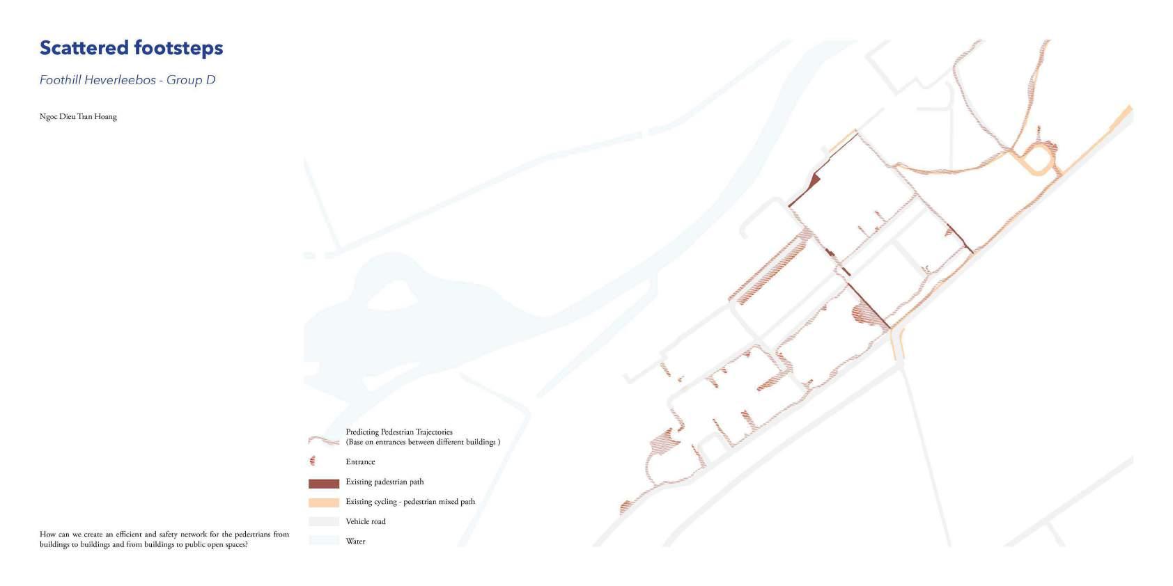
NGOC DIEU TRAN HOANG
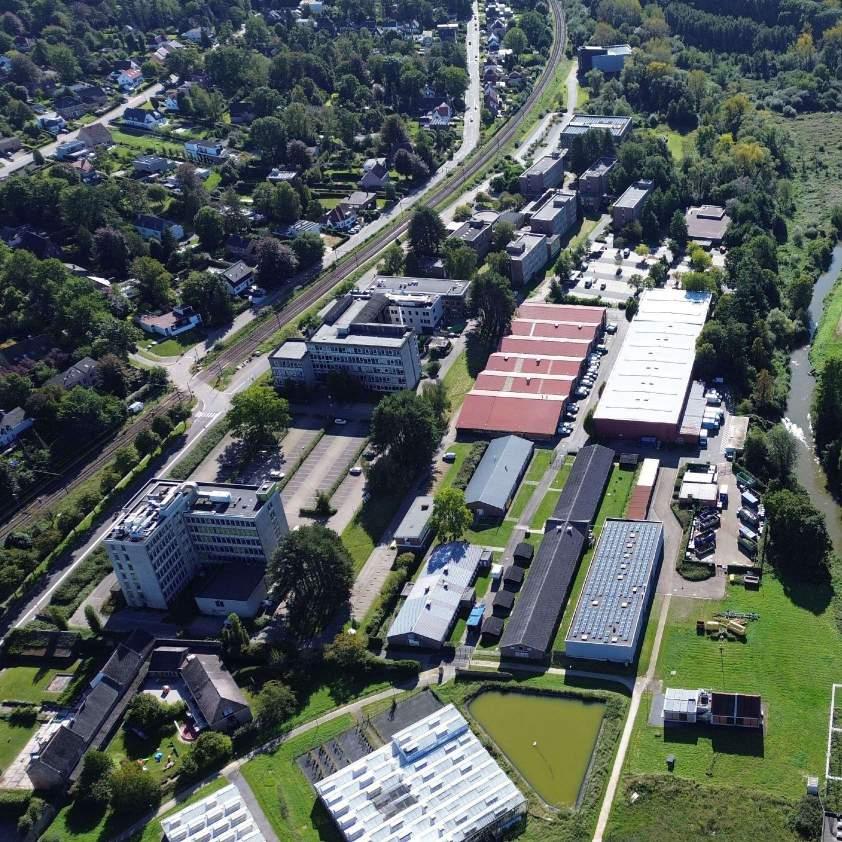
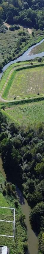
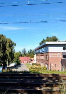
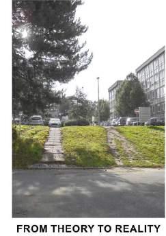
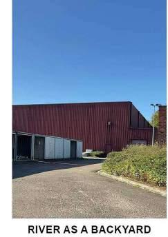
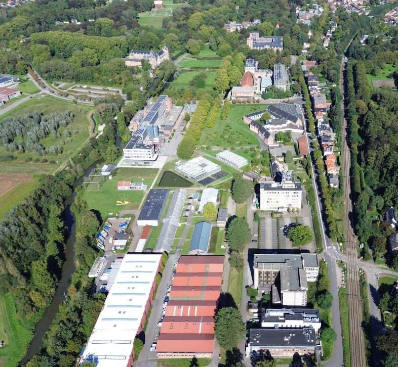
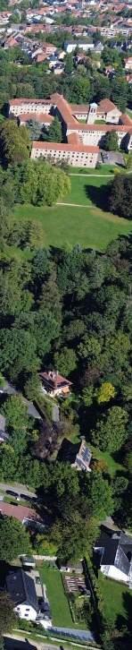
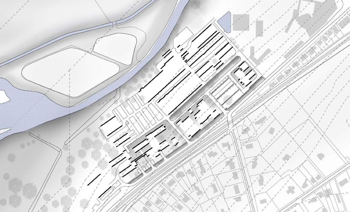
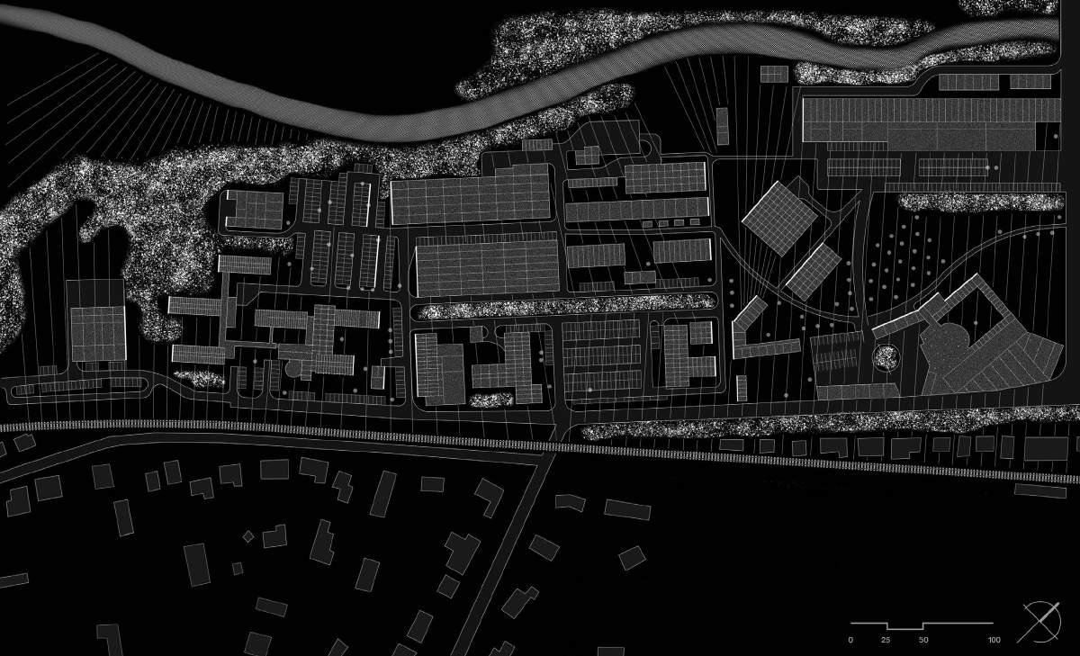
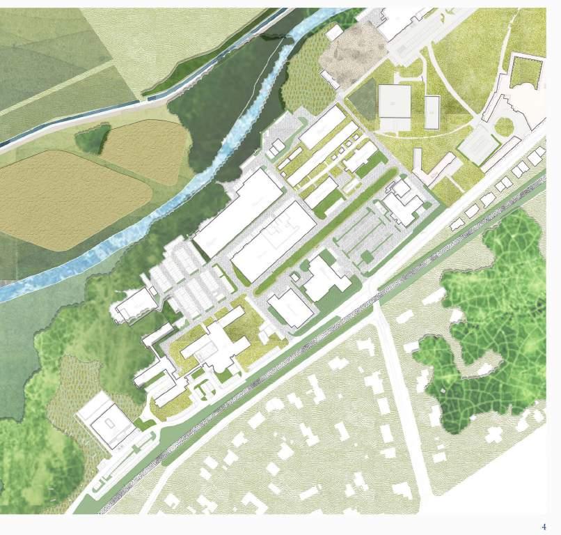
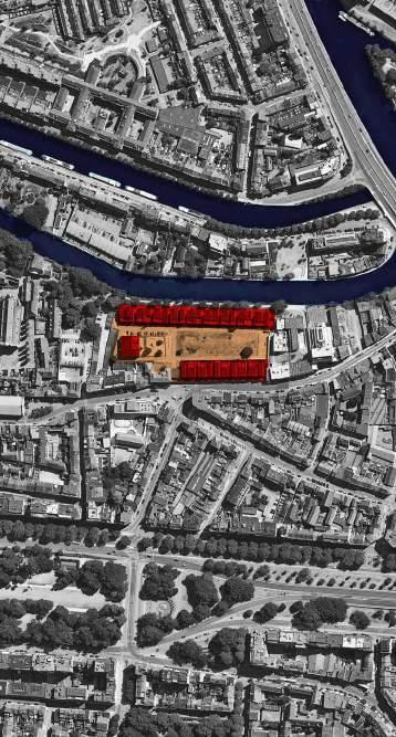
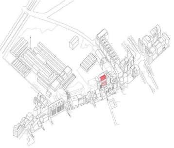
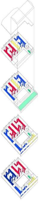
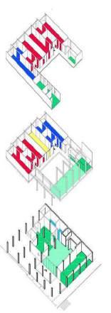
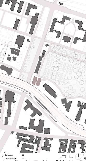
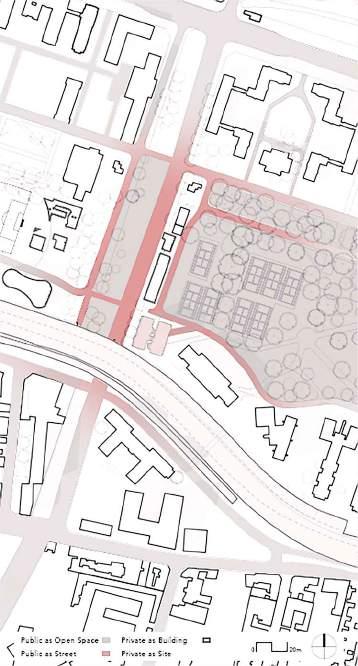
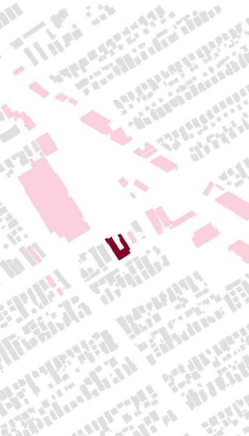
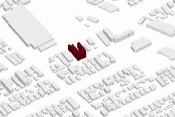
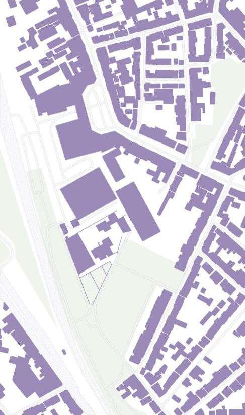
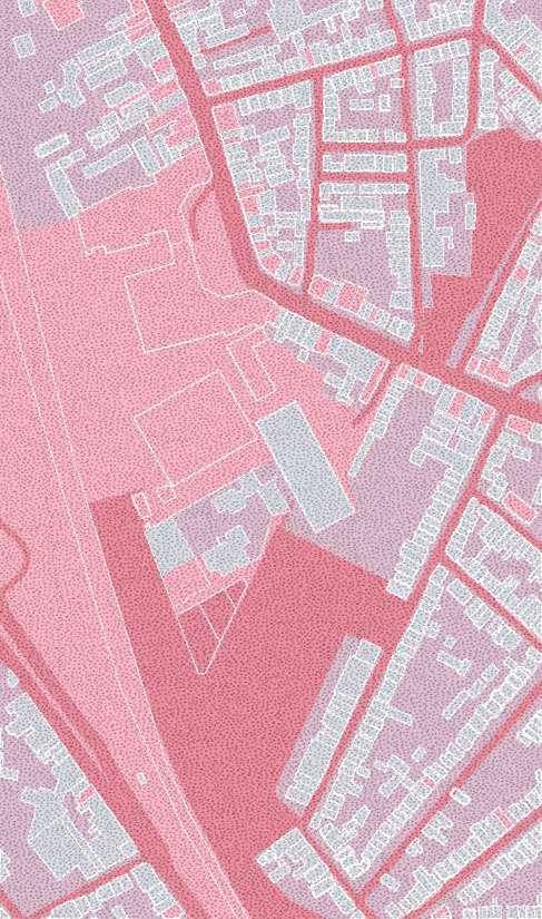
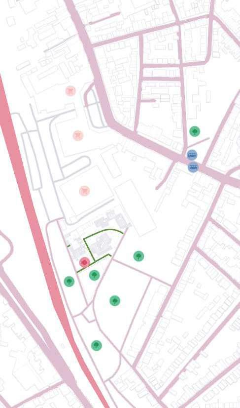
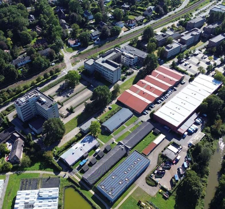
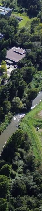
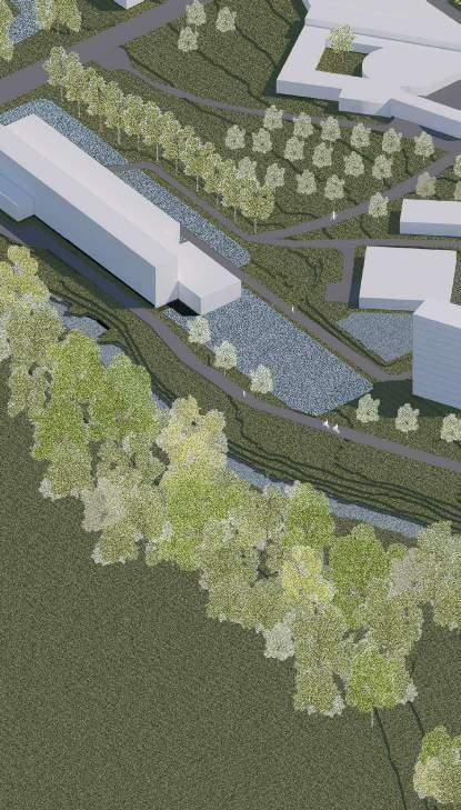
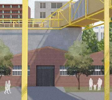
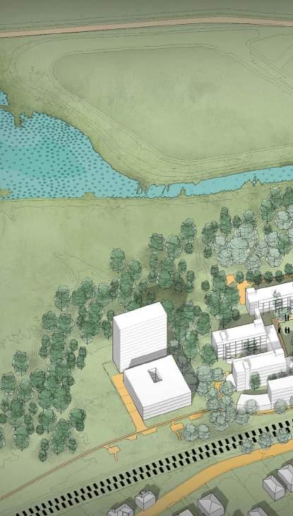
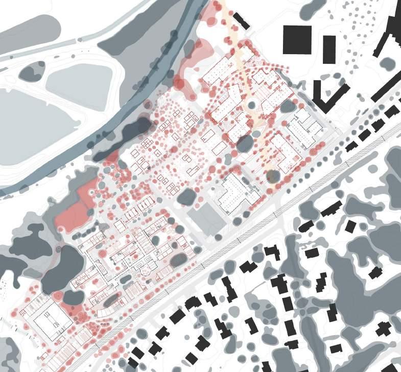
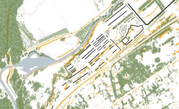
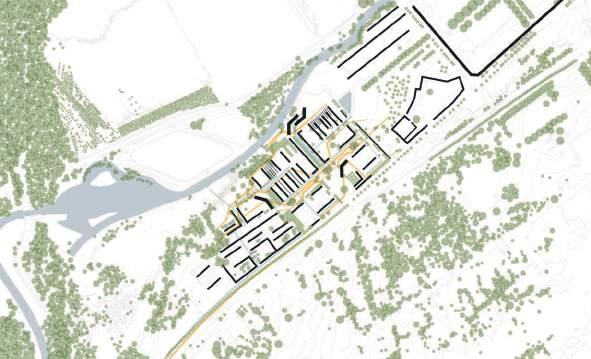
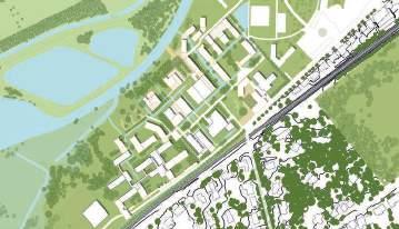
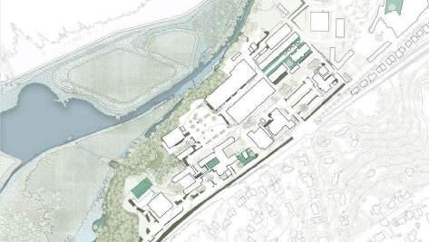
The site is centered on the backside of the modern Arenberg Campus 300: the cluster of Rekencentrum and of the CIT and the adjacent parking lots. The relatively remote 300 Arenberg Campus has 1970 buildings with an adaptive value that all have large, underused parking lots. Its relation with the river is substandard (with cheap warehouses for the logistic services of the university dumped at the riverside).
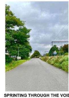
A Photographic Story
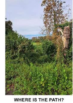
 © Alireza Mirshekari
© Janno Delissen
Paola Pelaez
© Paola Palaez
© Nguyen Thao Pham
© Alfonso Nava
© Alireza Mirshekari
© Janno Delissen
Paola Pelaez
© Paola Palaez
© Nguyen Thao Pham
© Alfonso Nava
How does the relationship between the river and the built environment impact the overall quality of life for residents in terms of aesthetics, recreational opportunities, and a sense of place?
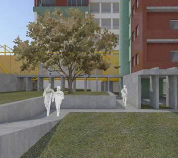
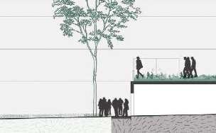
The rigid structure and rational hierarchy of the site is reflected in both the architectural scale and topological scale creating a grid that seems disconnected from its surroundings.
Human interventions are palpable, firmly anchored and strongly present. They are starkly contrasted with the inherent fluidity of the site.
What does this mean for the possible future of this site?
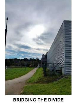
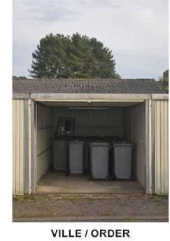
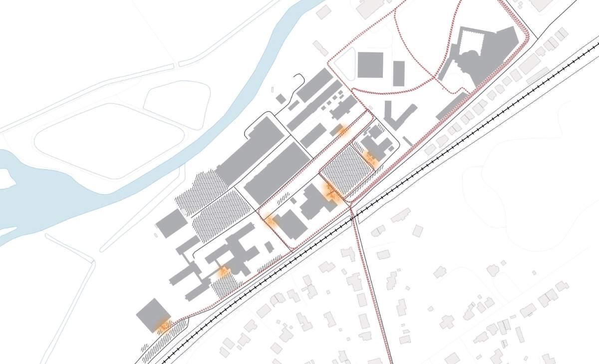
Logistic/Facilities buildings, long walls whitout relation with the street, machines and trash near the educational buildings, big parking areas for cars and bikes, vegetation near the river that blocks the view, and lack of conection between the campuses... How to rethink the relation between the river, the urban context, and the university’s buildings? Activities in the public space:


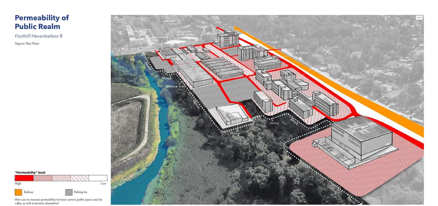
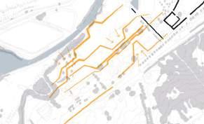
How can we re-think the use of car oriented spaces to expand the public space for more interactions at a human scale?

Geathering points
Bike flows
Car flows
Potential spaces
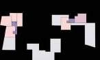
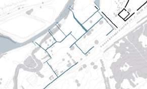
How can the site be perceived when the “walls” or boundaries (meaning ‘things we cannot cross’ in this case) are mapped?
 Ella Hens
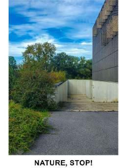
How will the urban fabric transform if we start placing the dynamism of water, vegetation and terrain at the forefront, as opposed to the current practice of designing buildings first and accommodating nature later?
How can green open spaces gain protagonism in a grey dominated area?
Lawn
Natural barrier (Tall grass)
Closed lawn area
Hedge/topography barrier
Closed paved area
Paved area
Replace this box with your interpretative reading.
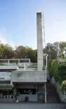
Atelier 5
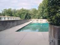
Analysed by Ella Hens (r0760607)MaHS_Foothillheverleebos_C
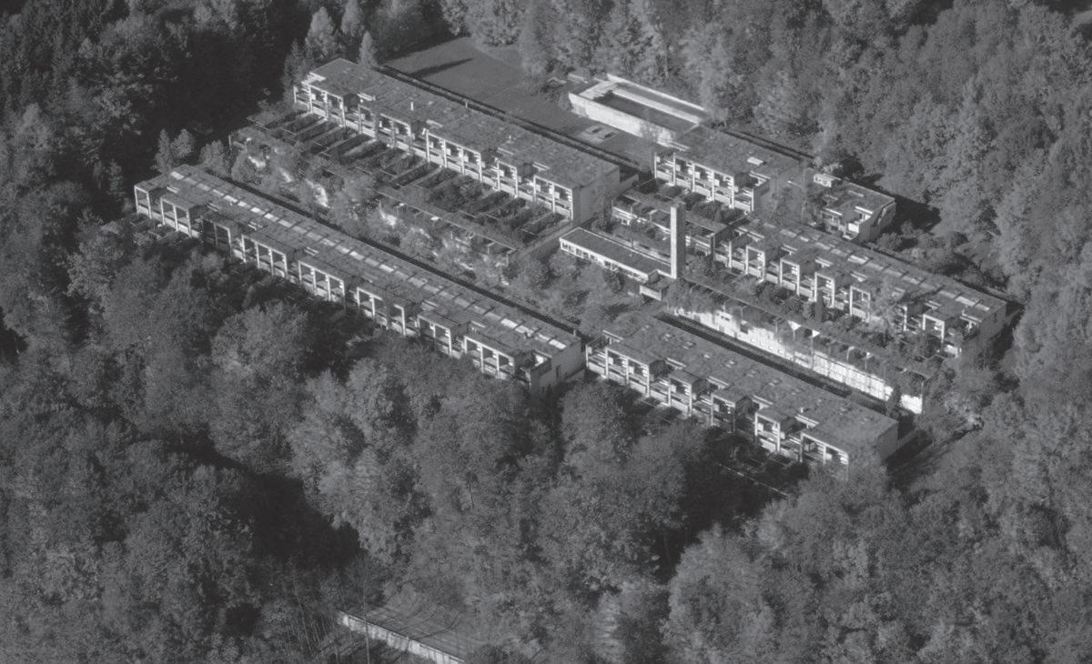
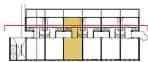
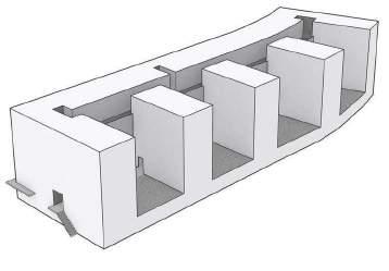
Thalmatt Siedlung Halen, designed by Atelier 5, is a housing project located on a hillside in Bern, Switserland. The Halen estate consists of 3 different stages; Siedlung Halen (1960), Thalmatt 1 (1972) and Thalmatt 2 (1985), which add up to a total of 144 terraced houses. Siedlung Halen determined the site and dwelling design principles, which were later used in Thalmatt 1 and 2. Halen combines the ideas of the modernist program (1920) on community and privacy with notions of the garden city and has become a prototype for low rise, high density housing.
The notions of modernism and the garden city are translated into a suburban housing project with identical, rationalised long and small three story dwellings, which are organised like a village around open spaces to create a collective living environment with shared ownership over the communal spaces (including a swimming pool, playground, shop, garage,…).
(Urban tissue) - All three stages are standing relatively alone, not interacting with the surrounding urban tissue. But they are all embedded on a hillside and the topography is used to structure the design.
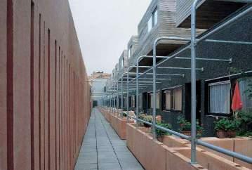
(Building typology) - The Halen stages are car-free designs, where everything can be reached by foot through collective open stair cases and covered walkways. These also connect the collective spaces. The buildings consist of almost identical row houses, but through slight variations, three different typologies are realised: family housing, houses with a workshop and studios.
(Individual dwelling) - The design is characterised by a certain strictness due to the modernist influence. This translates into standardised housing sizes and types, with small rooms and high walls. But the strictness is what makes the design sucessful. Due to the topography and high walls, each garden and balcony of each dwelling gives complete privacy, while being part of a collective living project.
(Source: https://architectuul.com/architecture/halen-estate, https://monocle.com/magazine/issues/65/estate-of-the-art/)
(Source: Google earth 2023)
Public Private
(Source: Google earth 2023, https://atelier5.ch/arbeiten/1961-siedlung-halen-herrenschwanden, https://atelier5.ch/arbeiten/1974-thalmatt-1-herrenschwanden, https://atelier5.ch/arbeiten/1985-siedlung-thalmatt-2-herrenschwanden)
(Source: https://atelier5.ch/arbeiten/1961-siedlung-halen-herrenschwanden, https://atelier5. ch/arbeiten/1974-thalmatt-1-herrenschwanden, https://atelier5.ch/arbeiten/1985-siedlung-thalmatt-2-herrenschwanden)
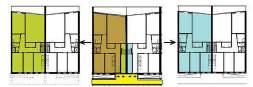
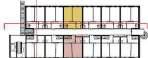
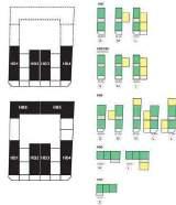
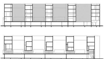
HOUSING TYPES
Type 12
Type 380
Type 380 + Workshop
Studio
Studio + Atelier
Type 380 + Workshop
Type 12
(Source: https://atelier5.ch/arbeiten/1961-siedlung-halen-herrenschwanden)
Space used during day time // night time
(Source: https://atelier5.ch/arbeiten/1961-siedlung-halen-herrenschwanden)
(Source: https://halen360.ch/en/estate, https://monocle.com/magazine/issues/65/estate-of-theart/)
by
MaULP_Foothill Heverleebos D
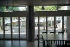
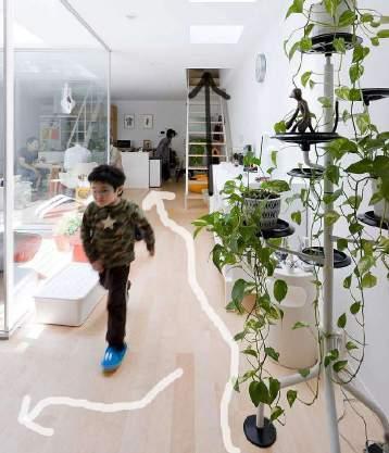
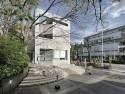
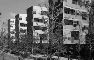
In Tokyo, outer-city housing projects often feature stacked apartments. Seijo Houses present an alternative approach, emphasizing a spatial structure that blurs the boundaries between apartments through the use of courtyards and interior gardens. This design maintains a cohesive and unified image for the complex.
The 20 cubes of varier heights (one to three floors) are arranged in a staggered layout forming a unified unit with flowing exterior spaces. The formation programs single-family homes, atrium buildings, and apartments. This creates a harmonious living environment balancing semi public gardens or spill over spaces and private dwelling spaces within the complex.
Briefly evaluate
• In relation to the urban tissue the site is located in a densly populated compact zone. The complex houses 20 appartment units with garden and shared space. A luxury which is very rare on site.
• The building typology is a staggered arrangement of twenty apartment modules connected diagonally. These apartment modules have dynamic level play ranging from one to three floors creating either a patio or a roof terrace for every unit. This arrangement also opens up the possibility of having various shared spaces serving specific functions.
• Each dwelling unit opens up to a garden space either on the ground floor or the upper terraces. The entry to every unit is a planted courtyard. The module is divided in a set of private and semi private spaces. The level play and staggered stacking gives possibilities of overlap spaces blurring programs and achieving community and shared spaces. Shared spaces become access ways to navigate from one house to the other.
(Source: WIETZORREK, U., Housing +, Berlin: Birkhauser, 2014, pp. 152-57, https://arquitecturaviva.com/works/apartamentos-seijo-9 )
(Source: https://arquitecturaviva.com/works/apartamentos-seijo-9)
(Source: https://seijotownhouse.blogspot.com/p/planimetria.html)
(Source: https://seijotownhouse.blogspot.com/p/planimetria.html)
(Source: WIETZORREK, U., Housing +, Berlin: Birkhauser, 2014, pp. 152-57)
KITCHEN & DINNING LIVING ROOM
MASTER BEDROOM COURTYARD
(Source: https://iwan.com/portfolio/seijo-apartment-sejima-tokyo/)
Analysed by Santos Albeiro Blandino_r0966187
MaHS / MaULP_Foothill Heverleebos D
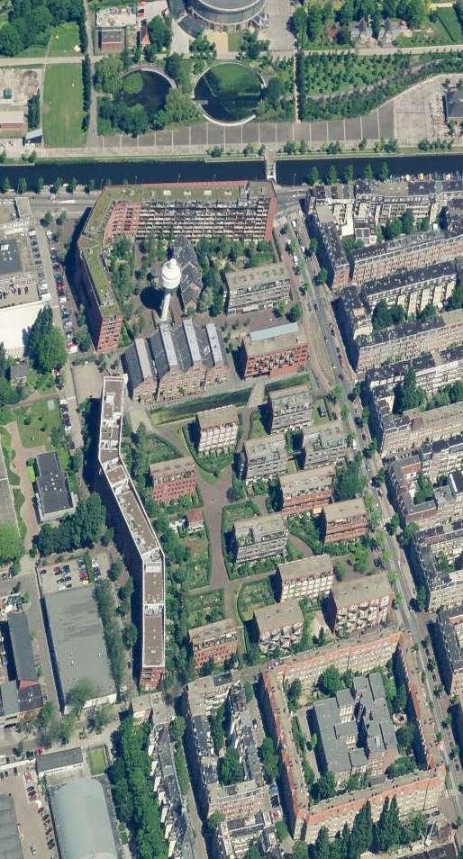
The GWL Terrein in Amsterdam, a car-free, eco-friendly residential area on a former water company site, boasts 600 housing units, leafy spaces, and preserved historical elements, offering a serene escape from urban chaos. It was completed in 1998 with a distinctive cohesive, high-density design.
Car-free design: It promotes alternative transportation modes.
Ecology: Sustainable materials, open spaces, and renewable energy.
Mixed-use development: Includes communal housing, live/work spaces, and traditional apartments seamlessly blending with its surroundings.
EVALUATION
• The site is an open zone with residential blocks amid nature. It serves as a transition between the Staatslieden neighborhood and nearby businesses to the west. It has proximity to public transportation, amenities, and is bordered by two main streets to the north and east.
• Building typology features form different densities from an elongated block that goes from 4 to 9 stories, to 14 blocks of 4 to 5 stories that form a park-like ambiance. All the blocks have red brick facades that blend with the residential surroundings but contrast with the natural areas.
• Dwellings vary from 1 to 2 stories small apartments to family homes, with private gardens or balconies. Housing types include flats, maisonettes, 3 to 5 room houses, group houses, studios, and units for individuals with disabilities and seniors.
Urban grid projections into the site open space
Canal
Built form
(Source: https://gwl-terrein.nl/ https://www.kcap.eu/projects/25/gwl-terrein)
(Source: Adapted from Google Maps (Google, 2023), OpenStreetMap (OpenStreetMap contributors, 2023), and Snazzy Maps (https://snazzymaps.com/)
Semipublic park-like area
Private courtyard
Public bldg
Semiprivate bldg
Private bldg
Staatslieden neighborhood
Business Activities
GWL Terrain
Owner Housing Café-restaurant
Rental Housing
Park-like surroundings
Owner housing, commerce and cultural use
Community center Hotel Park-like environment
Residential (Multi-types housing)
Residential/Commercial/Culture/Education
Commercial (Café-restaurant)
Analysed by Unnati
Khanduri_ r0972046
This housing/commercial facility was built in four different phases spanning 30 years. Over the years, the Daikanyama neighborhood has changed from a quiet farming village to one of the most high-end areas in town. The transformation brought by developments of each site using these patterns; Subdivison of the site, continuity of the site, and integration of the site and cases without redevelopment.
Concept of “Group-Form” applied - based on five categories.
MEDIATING- between interior and exterior, or between public and private.
DEFINING- to mark a differentiation with the surrounding environment.
REPEATING- and underlining the group character.
MAKING SEQUENTIAL PATHS.
SELECTING- the location EVALUATION
The Hillside Terrace project exemplifies Maki’s architectural philosophy, exhibits a careful theoretical thought process that emphasizes the relationship between building and environment in the urban context. Despite aesthetic differences in design, each building of Hillside Terrace relates to each other as parts of a unified whole. Group form grows organically out of the existing whole, adapting to changes over time.
Hillside Terrace functions almost like a small town. There is an art gallery, an exhibition hall, a performance venue, a tea house, a shrine, a club, office space, and, perhaps most importantly, large quantities of housing. There are many shops in the complex as well, but Maki subtly separates them from public spaces by use of steps, ramps, and indirect entries. For good or for ill, one never gets the sense that any of the businesses have ownership over the plazas to which they are adjacent. The presence of public art in the complex adds to the sense of a shared, civic identity.
Source:Shan JIN, Keshi CHEN and De TONG,2012
Source: Lyu, Zhaoyi, 2020, Daniels - University of Toronto DESCRIPTION
PUBLIC-PRIVATE STRUCTURE

(Source: Yasuko KAMEI,2023
Source: Takashi, Ono ,2017
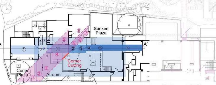
In this section one can observe a series of six spatial layers. The pathway, which makes use of the subtle changes in topography, is an intricate space with a sense of inwardness that is provided through the use of stairs and an atrium entryway.
Source: Shi, Fengyao, 2020, Daniels - University of Toronto
Residential
Restuarants/ Retail
Residential
Restuarants/ Retail
Source: Shi, Fengyao, 2020, Daniels - University of Toronto
MaHS / MaULP_Foothill Heverleebos A
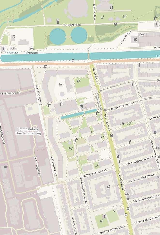
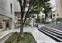
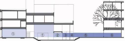
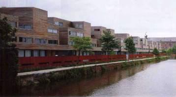
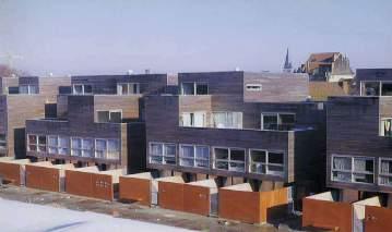
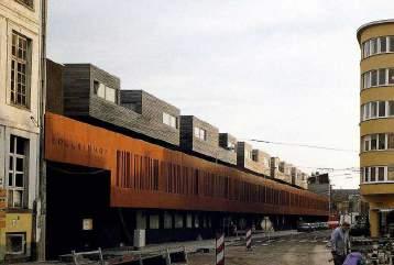
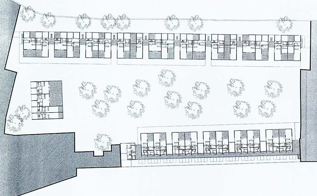
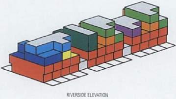
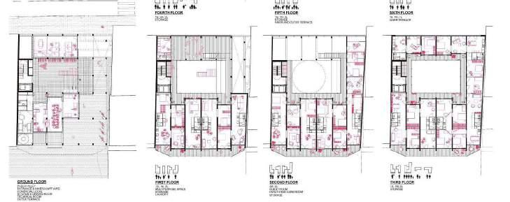
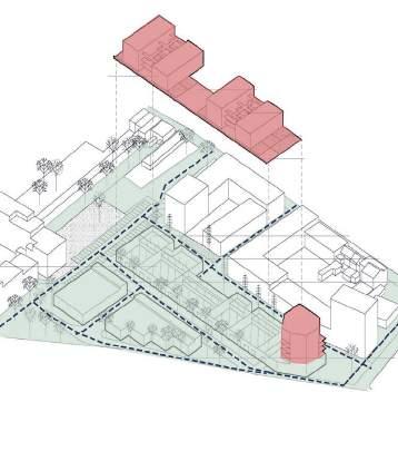
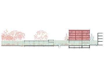
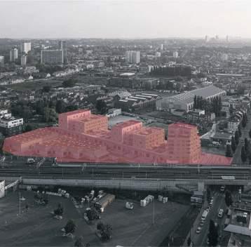
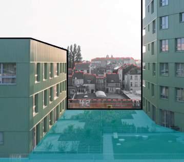
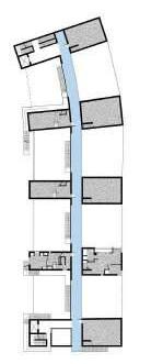
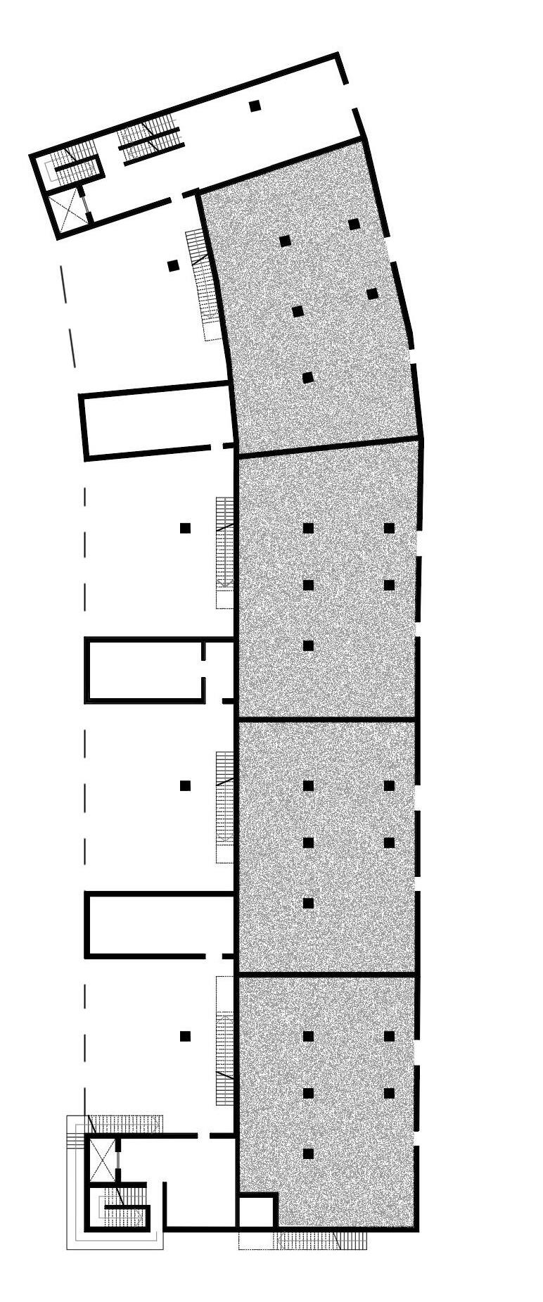
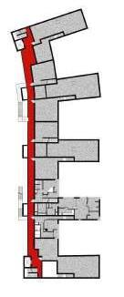
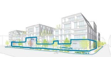
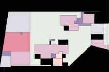
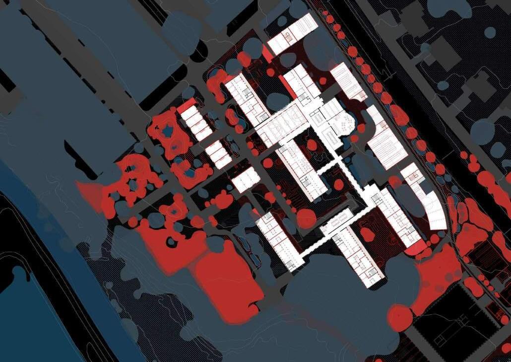
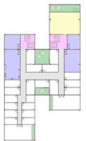
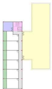
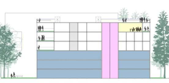
The Hollainhof (1993-1998) is a social housing project located at the center of Ghent (Belgium), between Brusselsepoorstraat and a tributary of the river Scheldt. The Project comprehends a total of 120 dwellings, 90 parking lots, a central courtyard, and a Day Care Center. The dwellings are contained in 15 clusters agruped in 02 main block bars, each one with 04 floors. The first bar is aligned to the street, and second bar is aligned to the river. Both bars are organized arround a semi public coutyard.
The premise of the project is to mix and find the balance between urban (density) and rural scale, the community and the individual (tranquility), the public space and the private space.
• Relation to the urban tissue: The project propose a continuity of the open space trought the creation of a large semi public space: the central coutyard, accesible from the street by a single entrance, where is located the Day Care Center, stablishing a plattaform to build and enjoy living in community. The building has an urban scale next to the street, but a smaller scale in the coutyard and next to the river.
• Building typology: The relation between the public and private defines the typology of the building: the central courtyard with a public-private atmosphere, the front gardens between the courtyard and the dwellings, or the terraces between semipublic circulation and the dwelling on the first floor. These spacial solutions (filters) argument the final composition of the building.
• Individual dwelling design: The project offers a large variety of dwelling typologies, between duplex and flats, optimized in minimum space but preserving the quality of life in the building trough guarantying the privacy of each of the departments and giving most of them a view to the courtyard or to the river.
Source: AA Files No. 37 (1998) pp. 3-11, RACO Revistes Catalanes amb Accés Ober (1999)Source: Own elaboration based on Google Earth (2023)
RIVER SCHELDTPUBLIC-PRIVATE STRUCTURE
RIVER SCHELDT
PUBLIC
COURTYARD
FRONT GARDEN: FILTER PRIVATE/ PUBLIC
DIFFERENT CONTEXT/ VOLUMETRY CONTEXTUALISED VOLUMETRY
Source: http://lamba84.altervista.org/universita/tra/opera.html#foto
 COURTYARD/ DAY CARE CENTER
RIVER
COURTYARD/ DAY CARE CENTER
RIVER
SECOND FLOOR
SECOND FLOOR

GROUND FLOOR
THIRD FLOOR
THIRD FLOOR
FIRST FLOOR
Source: Own elaboration based on A+T, Madrid (1998) ed. 12 pp. 90-103
Source: AA Files No. 37 (1998) pp. 3-11
COURTYARD RIVER PARKINGMaULP_Foothill Heverleebos B
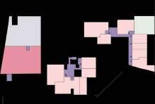
La Borda is a cooperative housing project in Barcelona which has 28 units and community spaces such as kitchen-dining room, laundry, multipurpose space, space for guests, health and care space, storage, exterior and semi-exterior spaces namely the patio and roofs. A central courtyard reminiscing a “corrala” locates at the heart of the building which all other functional spaces articulate around.
La Borda housing cooperative is a development self-organized by its users to access decent, non-speculative housing that places its use value in the center, through a collective structure.
Briefly evaluate
• Relation to the urban tissue: The project locates in La Bordeta residential area which is high density and extremely diverse in use; since this area has various multi-story mixed-use buildings. This adds to the project’s success of becoming a community-centered and affordable place to live. The project also promotes the continuity of Hartzenbusch Street, allowing a direct connection between La Bordeta and Can Batllo park.
• Building typology: The architectural structure is derived from the “corralas”, social housing which is characterized by a courtyard surrounded by large balconies, connected together as breezy corridors on several floors. The “balconies” here are in fact large social spaces which promote circulation, access, interaction and coexistence. The building aims to be sustainable through various design schemes such as the use of wooden material, natural heating and ventilation, water harvesting and recycle technology.
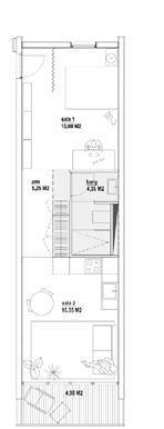
• Individual dwelling design: The project offers a highly flexible apartments which can change its structure and size according to the needs of the inhabitants. The design provided for three sizes of apartments (40, 60 and 75 square meters), composed by adding modules and conceived as compartmentalized spaces thanks to their simple wooden walls.
(Source: https://www.archdaily.com/922184/la-borda-lacol https://jgonzalezfarias.medium.com/la-borda-barcelonas-social-housing-utopia-3883c7157bde https://www.floornature.com/cooperativa-drsquoarquitectes-lacol-la-borda-barcelona-14965/)
(Source: https://pin.it/xaN8mlE || https://www.openstreetmap.org/)
PUBLIC-PRIVATE
Continuity of spaces of interaction
Courtyard, multipurpose space, walkways and roof, continuity of spaces of interaction.
(Source: https://www.detail.de/de_en/la-borda-in-barcelona-von-lacol || https://www.philippmolter.com/filter/flexibility/SHARED-URBAN-FUTURES || https://www.lacol.coop/projectes/ sotrac-habitatge-cooperatiu/)
(Source: https://www.archdaily.com/922184/la-borda-lacol)
Hartzenbusch Street Continuity
Natural heating during Winter:
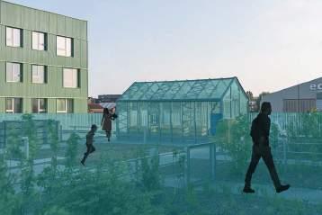
- Greenhouse closes to reduce heat losses (exceptionally open to release CO2)
- Air temperated for air renewal
Natural ventilation during Summer
- Greenhouse opens to dissipate heat + sun protection
- Open gallery + sun protection
- Cross-ventilation
(Source: https://xximagazine.com/c/new-forms-of-conviviality)
(Source: https://arquitecturaviva.com/works/lacol-arquitectura-cooperativa-la-borda-28-en-barcelona-zs6o2-1)
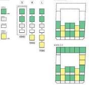
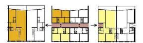
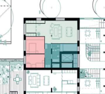
TYPOLOGY S (40m2) MODULES FLOOR 1,2,5,6
TYPOLOGY M (58m2)
L (76m2)
(Source: https://www.archdaily.com/922184/la-borda-lacol http://www.laborda.coop/en/project/architectural-project/)
TYPOLOGY S (SMALL)
TYPOLOGY M (MEDIUM)
TYPOLOGY L+M (EXTRA LARGE)
TYPOLOGY L+M (EXTRA LARGE)
TECHNICAL ROOM
(Source: https://www.floornature.com/cooperativa-drsquoarquitectes-lacol-la-borda-barcelona-14965/)
DDS+, Bogdan & Van Broeck
Analysed by Student Alfonso Nava_r0968707
MaHS / MaULP_Foothill Heverleebos_C
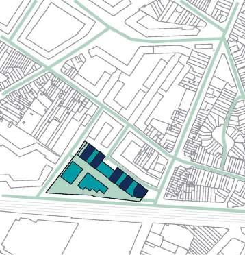
The project is located in between the crossroads of several communication axes such as the railway, the ring and one of the principal road to access the city of Brussels, Chaussée de Mons.
Location of the new construction: Brussels (Anderlecht), Belgium
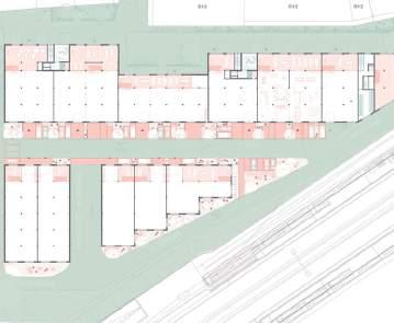
Type: Residential, Equipment (workshops)
Area and number of units: 15.422 m2 (Residential 7.876m2) (7.546m2 SME workshops) with 63 apartments
The project considers the overlapping of various functions to give rise to mixed uses. Under this concept, interactions are developed and exchanged, through innovative spaces of coexistence around the housing units, which allows a relationship of collective spaces, on the ground level. The workshops are connected to these are office spaces and on the first level there are 4 volumes of dwellings and shared circulation spaces with different heights that function as long open spaces so that sunlight reaches the pubic spaces and neighboring dwellings.
• Relation to the urban tissue: The project shares a strong relation with the different functions, the housing units are linked to the productive functions of the first level that function as different levels of interaction, which makes it possible for them to be integrated at the district and city scale, connected with pedestrian spaces and logistics routes for the workshops.
• Building typology: The various heights of the residential towers allow the transition between public and private spaces that share views towards the patios and terraces.
• Individual dwelling design: Is considered to offer maximum flexibility and adaptability over time and use. There are 2 main types of housing: 2-bedroom and 3-bedroom apartments.
(Source: https://www.dds.plus/projects/novacity)
(Source: https://www.bogdan.design/projects/novacity/, https://www.dds.plus/projects/novacity )
PUBLIC-PRIVATE STRUCTURE
(Source: https://www.bogdan.design/projects/novacity/)
(Source: https://www.bogdan.design/projects/novacity/)
(Source: https://www.dds.plus/projects/novacity)
(Source: https://www.dds.plus/projects/novacity)
3 bedrooms apartment
2 bedrooms apartment
(Source: https://www.dds.plus/projects/novacity)
(Source: https://www.bogdan.design/projects/novacity/)
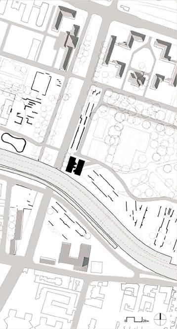
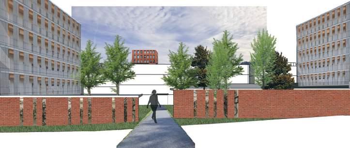
Arenberg edge_A
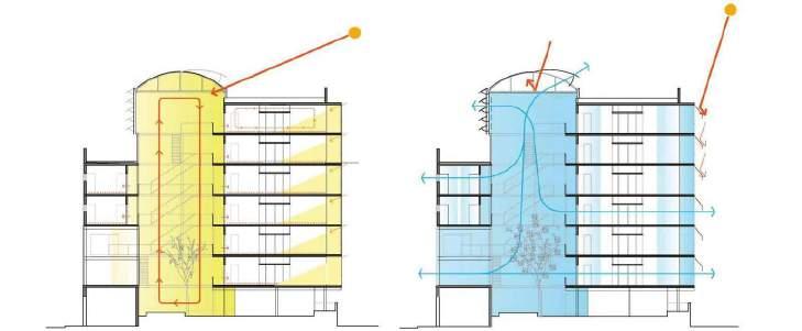
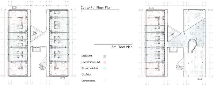
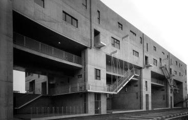
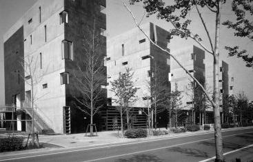
Situated at the southern border of Cité Universitaire park, this urban project seamlessly merges architecture with nature, even without park ownership. It’s strategically designed on a small plot near a busy road, offering spacious studios with adaptable partitions to cater to residents’ unique needs. What sets it apart is the dedication to surpassing minimum requirements, promoting interaction, socializing, fitness in a rooftop gym, and relishing city views.
This unique residence stands alone, appearing as a “split and raised” cube, with a clear layout that’s easy to see. Inside, it’s divided into three main parts running from north to south. Two parts are for living spaces, and the space in between is for moving around. But it’s not just practical – the staircase and the elevator are designed as standout features in their own stylish shapes. This modern home transforms into an attractive combination of glass and metal, creating a connection between the inside and outside, the park and the building, and the privacy of the living spaces with the boulevard.
• The building thoughtfully integrates with its urban surroundings. It addresses challenges like the ring road with semi-underground access levels, and being at a small plot without green space while maintaining an open and connected feel to the external environment.
• The building’s typology is well-defined and practical. It takes the form of a “split and raised” cube with a clear organization, offering a variety of social housing. The inclusion of common areas on the eighth floor adds a communal dimension to the building’s layout, enhancing its appeal.
• The individual dwellings are efficiently designed with a tight structural grid, maximizing open living spaces with natural light. The use of sliding partitions in some units adds flexibility. High-quality materials and full-height curtains in the façade design enhance both functionality and aesthetics.
(Source: https://hicarquitectura.com/2019/04/bruther-residence-for-researchers/) (Source: https://hicarquitectura.com/2019/04/bruther-residence-for-researchers/)
STRUCTURE
(Source: https://hicarquitectura.com/2019/04/bruther-residence-for-researchers/)
CONTEXTUALISED VOLUMETRY
(Source: https://hicarquitectura.com/2019/04/bruther-residence-for-researchers/)
(Source: https://hicarquitectura.com/2019/04/bruther-residence-for-researchers/)
(Source: https://hicarquitectura.com/2019/04/bruther-residence-for-researchers/)
(Source: https://hicarquitectura.com/2019/04/bruther-residence-for-researchers/)
(Source: https://hicarquitectura.com/2019/04/bruther-residence-for-researchers/)
MaHS_Foothill Heverleebos B
This four story mixed-use apartments consist of commercial zone and residential area in responding the surrounding land use. In order to maximize the land use area, the building height consist of 4 storeys in which the 3 upper floor for young adult dwellers connected by courtyard to grow sense of community. The project aims to serve as a low cost dwelling by water recylcing, photovoltaic energy source, less vehicle use, multi function and high density housing.
• Urban Tissue - The building U shape organization of the project is an approach to conforms the neighboring urban tissue instead of following the bold form of its original land subdivision. The void of the building allows the inhabitants to have connection to the outdoor and the street.
• Building Typology - The Rose Mixed-Use Apartments consist of multiple commercial spaces and dwelling area in effort to adapt its location in which surrounded by both commercial area and residential area.
• Individual Dwelling - The space allocated for each inhabitant is relatively small due to the targeted occupant which is young adult who is forced to leave youth facility.
(Source: Google earth 2023)
(Source: https://brooksscarpa.com/)
PUBLIC-PRIVATE STRUCTURE
(Source: Google earth 2023)
The building heights of the project relatively exceeding the height of neighboring buildings to maximize the density of the land. To merely break the impression of the height, the front of the building is subtracted in depth as its getting higher and presenting natural element as horizontal line in the upper floor.
(Source: https://www.behance.net/gallery/89461283/Rose-Mixed-use-Apartments-Venice-CA)
(Source: https://brooksscarpa.com/rose-apartments4)
(Source: https://archello.com/)
Stacked vegetation area on the first floor serves as soft barrier for safety reason also presenting natural element in the upperfloor.
The main stairs in the centre of the courtyard role as a main connector between 1st floor and 2nd floor also serves as collective area to sit and watch activity in the courtyard area which grows sense of community between inhabitants.
The void roles as an opening for the inhabitant to have direct connection to the outdoor toward the courtyard as the inhabitant public space, allowing the inhabitant to have natural light and air flow.
(Source: https://archello.com/)
The void serves a visual connector for the inhibitant meanwhile providing spatial privacy.
Inhabitant
Inhabitant Possible Inhabitant
Inhabitant
(Source: https://brooksscarpa.com/rose-apartments4)
Possible Inhabitant
Functions
Mixed-Use Organization
The commercial zone is organized on the ground floor to allow public permeability due to its mixed-use program meanwhile dwelling above are visually connected to the courtyard in which serves as public space for the dwellers. Commercial
(Source: https://brooksscarpa.com/rose-apartments4)
MaHS / MaULP_Foothill Heverleebos A
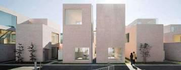
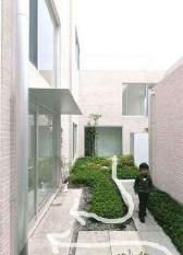
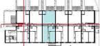
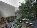
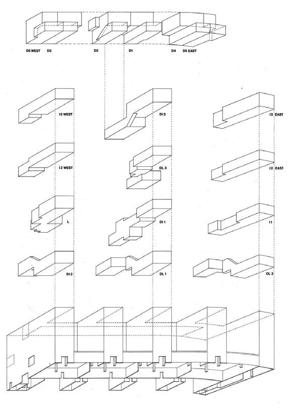
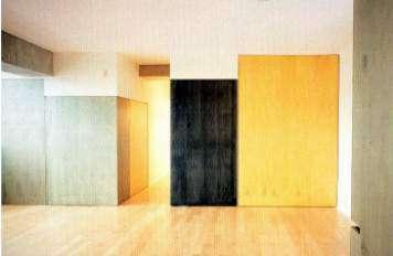
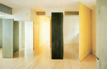
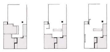
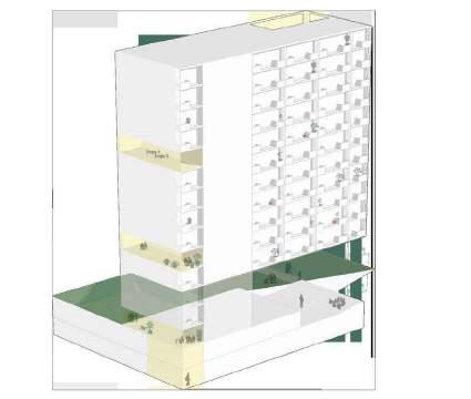
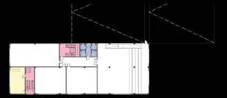
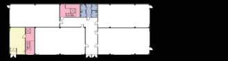
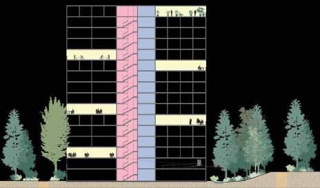
the residential project - in Fukuoka, Japan, 1991 - is a residential complex, with 28 residential apartments, conceived as a rather solid and inert mass of concrete, yet possessing a certain airiness and porosity due to the openings, the (partially) curved floor plan and the four patios present . The mysterious facade is extended to the interior where a dynamic play is created between silence and emptiness.
four active north facing voids interlock with four quiet south facing voids to bring a sense of the sacred into domestic life. The interiors are conceptualized as “hinged spaces” that allows growing and shrinking of areas according to the desire of the inhabitants.
relation to the urban tissue:
the building follows the existing road and there is a clear distinction between the public plinth on the ground floor (commercial) and the private housing above it. This distinction is made in part by the materials chosen (concrete and aluminum) and by the transparency of the various elements.
the building typology:
the different variants of the 5 different types (L, I, D, DI, DL) allow great freedom and flexibility. In addition, each facade enjoys natural light and views through the intelligent stacking of the volumes. Furthermore, a sense of passage is heightened by three types of access, by allowing apartments to have exterior front doors, and by interlocking apartments like a complex Chinese box.
the individual dwelling design:
the 28 apartment interiors are conceptualized as “hinged space,” a modern interpretation of the multi-use concept of traditional Fusuma. Episodic hinging reflects change in family over time; rooms can be added or subtracted accommodating grown-up children leaving or elderly parents moving in.
(Source: https://www.stevenholl.com/project/fukuoka-housing/)
private acces (pedestrians and cars)
acces (pedestrians)

PUBLIC-PRIVATE STRUCTURE
the residential complex is formed by two concepts: “articulated” spaces (articulated space) and “empty” spaces (vacant spaces). These different spaces and their interaction forms the basis for moving from public to private.
the structure of the building allows the sunlight (which is also reflected in the ponds) to fill the paved courtyards and the murmur of children playing and the chatter of the cafes to seep into the mediation space.
Holl uses the ponds to create a separation between the noisy and the quiet space. The corridors also create a sense of flow inside. Furthermore do the voids also creates an opportunity for all apartments to interact with the outdoor environment.
(Source: https://issuu.com/d.q.d/docs/void_space-hinged_space_housing)
CONTEXTUALISED VOLUMETRY
(Source: NCSU Libraries)
(Source: https://www.stevenholl.com/project/fukuoka-housing)
(Source: https://nicolearoach.com/void-space-housing-analysis)
(Source: https://www.stevenholl.com/project/fukuoka-housing)
(Source: cdesqueeze.files.wordpress.com)
MaHS_HeverleebosB
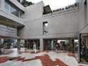
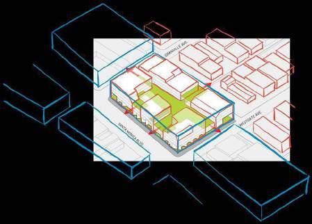
Westgate1515 is a project designed by LOHA in West LA, located on what used to be part of Route 66 and is now close to the busy Santa Monica Boulevard. It aims to create a more community-oriented and urban space in a neighborhood known for constant traffic. The project spans an entire city block, replacing a former car dealership, and combines student housing with civic purposes. The building’s design is open and welcoming to the street while providing privacy for residents. It features various roof heights and common outdoor spaces, breaking up the long façade along Santa Monica Blvd. Strategic voids create public spaces within the development, encouraging pedestrian activity. Overall, this project seeks to transform the neighborhood and engage the public in a livelier pedestrian environment along Santa Monica Boulevard.
Westgate 1515 is designed to break down the scale from a typical housing project. It mediates between the typology along the boulevard and the surrounding residential fabric. This is done by dividing the large building block in seperate volumes towards the top while also creating interior more human scaled circulation.
• the project inscribes itself in the urban fabric by respecting the building block layout
• the building finds a balance between the two surrounding typologies, the larger building blocks along the boulevard and the smaller residential dwelling spaces
• the individual dwelling is designed very spaciously, perhaps more standard according to American standards
• while the architects put an emphasis on enhancing the public aspect of the immediate surroundings of the project, apart from some indents, the project does not have an impact on real public space as commercial space is far from public
Description based on: https://www.theplan.it/eng/architecture/westgate1515-by-loha and https://loharchitects.com/work/westgate1515
http://zimas.lacity.org/
TWO LEVELS OF CIRCULATION

Underlaying images from https://www.theplan.it/eng/architecture/westgate1515-by-loha
THE RAISED STREET
Underlaying images from https://www.theplan.it/eng/architecture/westgate1515-by-loha
SPACIOUS STUDENT DWELLING
COMMERCIAL PLINTH
Underlaying images from https://www.theplan.it/eng/architecture/westgate1515-by-loha
(Source: https://references)
Analysed by Hoang Ngoc Dieu Tran_r0961080 &bogdan (the Bogdan & Van Broeck) (2009)
Bijgaardehof - designed by &bogdan, is part of a site that once belonged to a textile factory and then to a metalworking plant that closed down in 1997.
Close to the centre of Ghent, Bijgaardehof is a community including three co-housing groups (Wijgaard, De Spore and Biotope) with 59 dwellings, a neighbourhood health centre, a circuit of collective indoor and outdoor spaces and a workshop with a view of the Bijgaardepark.
Bijgaardehof’s specificity lies in the ambition to mutualise a set of functions overlapping at various scales: the three co-housing groups each have a communal space with a collective kitchen, dining room, living room, laundry room and a play area for the children.
The three groups also share a workshop, quiet areas, a winter garden, a roof garden for urban agriculture, collective generation of renewable energy.
• Bijgaardehof upgraded and turning a vacant brownfield along the railway tracks to a community fills with gardens and sharing functions; combining urban nature and urban agriculture; densified the urban fabric in the vicinity of local amenities and public transport.
• Bijgaardehof includes 3 different co-housing groups, forming 3 buildings with different heights and facing into a shared central community garden. Each housing unit has their own terrace facing different dirrections to maximize the view but still keeping their own privacy.
• Bijgaardehof with 59 housing units which separated into 5 categories: 4 studio units, 7 one bedroom units, 23 two bedroom units, 20 three bedroom units and 5 four+ bedroom units. Some two bedroom units are connectable to create a larger unit and some three and four+ bedroom units are located on 2 different levels. Every unit has their private area away from the active zone, offer plenty of choices for different groups of users, create a diversity, inclusive and reliable community.
(Source: https://www.bogdan.design/projects/bijgaardehof)
(Source: https://www.bogdan.design/projects/bijgaardehof https://snazzymaps.com/)
(Source: https://www.bogdan.design/projects/bijgaardehof https://snazzymaps.com/)
CONTEXTUALISED VOLUMETRY

(Source: https://www.bogdan.design/projects/bijgaardehof https://snazzymaps.com/)
(Source: https://www.archdaily.com/988277/bijgaardehof-co-housing-and-healthcare-centerbogdan-and-van-broeck)
(Source: https://www.archdaily.com/988277/bijgaardehof-co-housing-and-healthcare-centerbogdan-and-van-broeck)
1 bedroom unit [40 - 50m 2]
2 bedroom unit [80 - 85m 2]
3 bedroom unit [100 - 120m 2]
(Source: https://www.archdaily.com/988277/bijgaardehof-co-housing-and-healthcare-centerbogdan-and-van-broeck)
Wijgaard [20 units, 8 levels] De spore [11 units, 6 levels]
(Source: https://www.bogdan.design/projects/bijgaardehof)
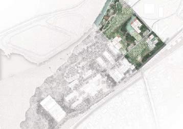
FOOTHILL HEVERLEEBOS _ A
ALIREZA MIRSHEKARI
JANNO DELISSEN
PAOLA PELAEZ RODRIGUEZ
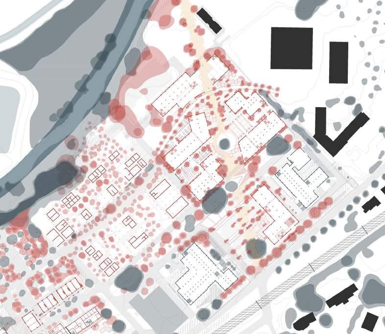
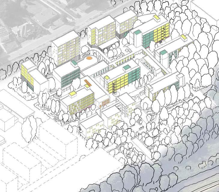
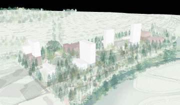
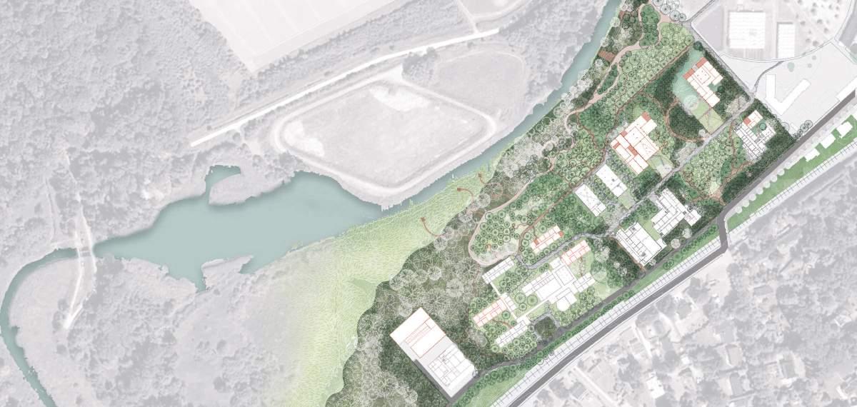
axonometric view of the site according to our vision
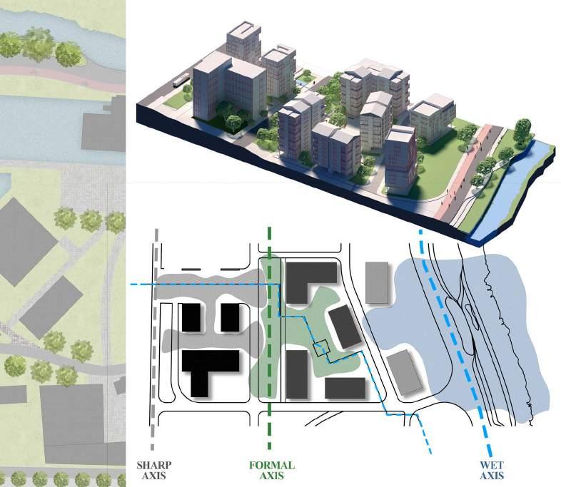
The rigid structure and rational hierarchy of the site is reflected in both the architectural scale and topological scale creating a grid that a priori seems disconnected from its surroundings. Human interventions are palpable, firmly anchored and strongly present. They are starkly contrasted with the inherent fluidity of the site.
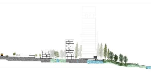
The buildings turn their back to the river and are scattered ad hoc. This approach seems to be the - questionable - result of the natural terraced topography. The weak relationship between the river and the built environment impacts the site in terms of aesthetics, recreational opportunities and the genius loci.
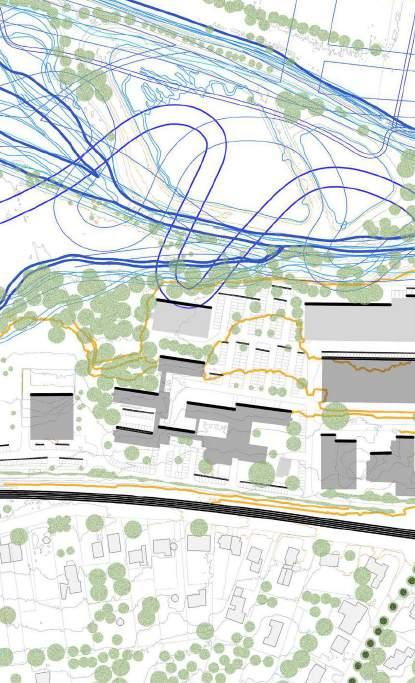
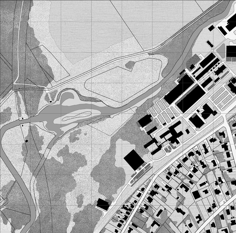
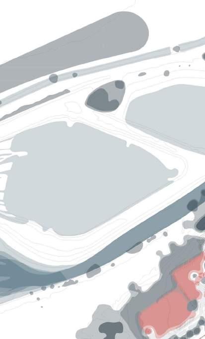
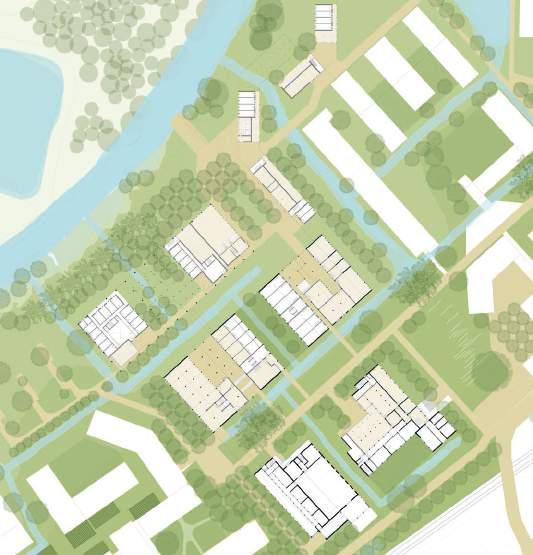
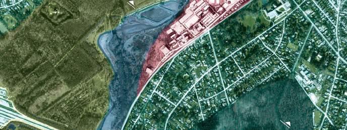
In this map we can see the routes or the movement of Dijle river through different years since 1769, and that the landscape design of the site historically includes water elements as ponds and water channels, some of them remains today and others don’t.
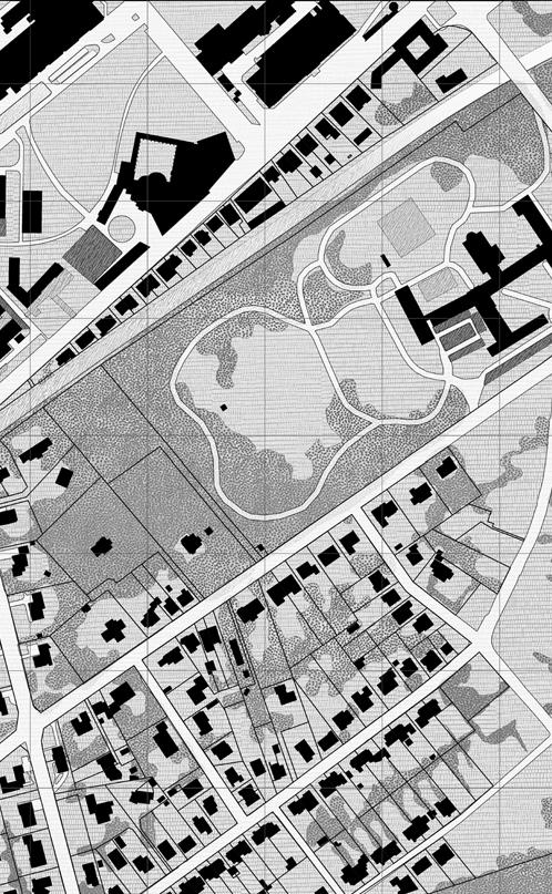
combination of the three different interpretive maps
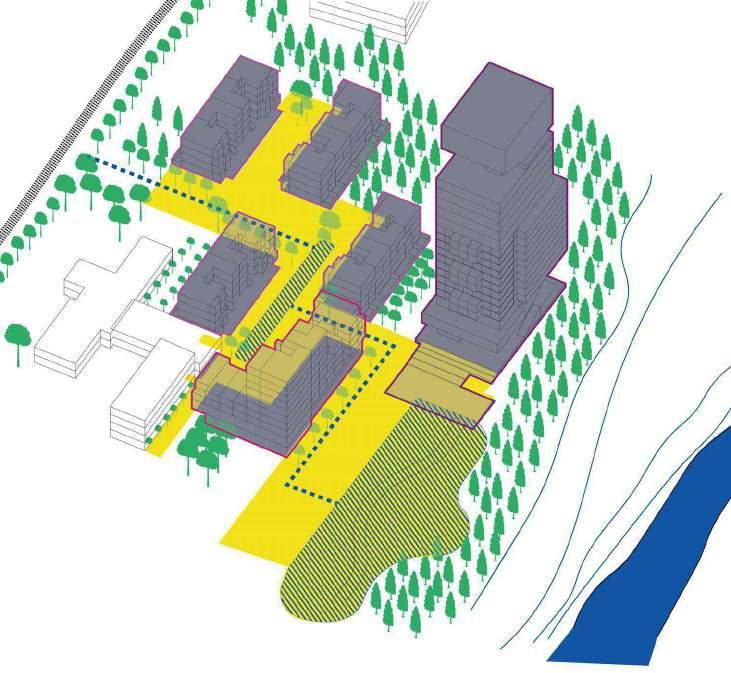
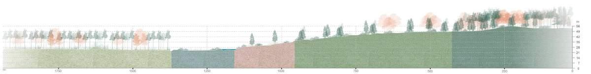
The site is mostly characterized by the following aspects: - terraced topography and the presence of the Dijle - geometrical grid and axes of existing infrastructure - existing axis that connects the open spaces.
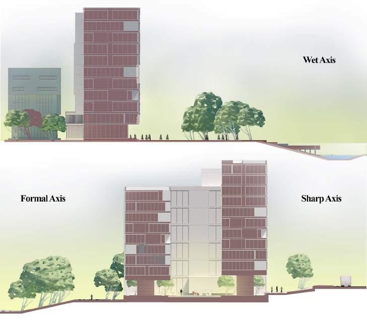
The site vision considers these elements to propose a new structure of open spaces in order to rebuild the relation of the site with the river. Our main concept - in addition to some strategical interventions in the existing infrastructure - is the introduction of 3 axes each with their own space and atmosphere. The wet axis (BLUE) near the river gives more space to the water and has some new ponds. The formal axis (GREEN) –that is highlighted by monumental trees - is an extension of the existing grandeur like the castle. This axis also connects existing and new open spaces for the public. The sharp axis (GREY) near the railroad focusses on mobility with a new bus station among other things.
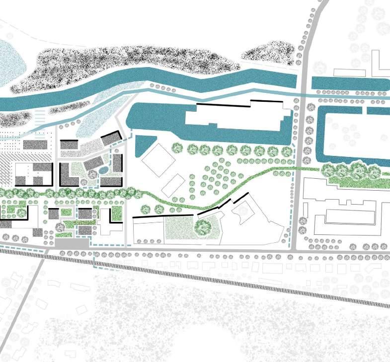
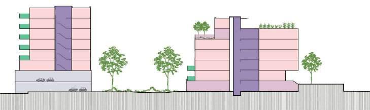
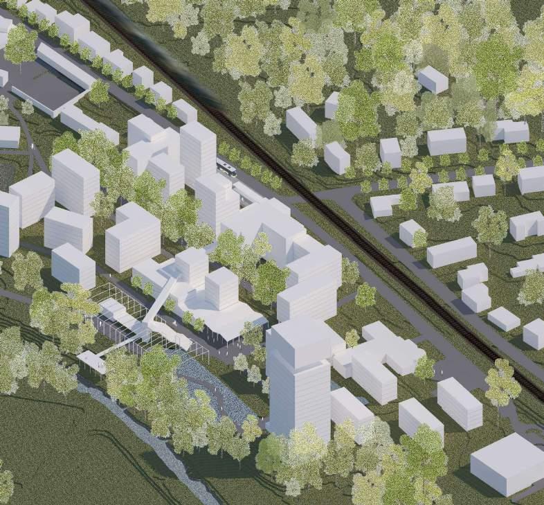
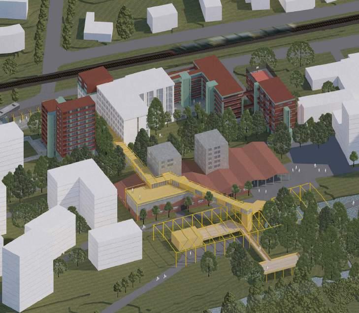
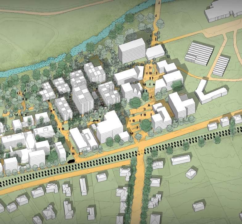
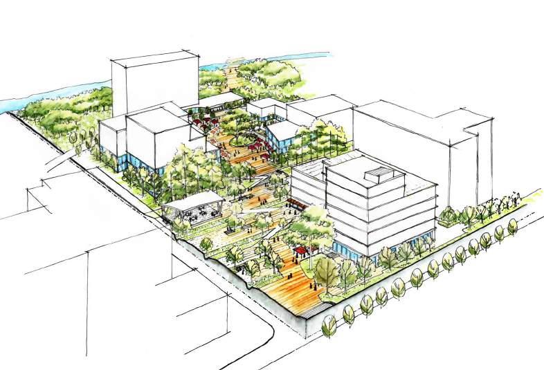
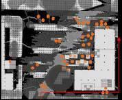
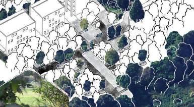
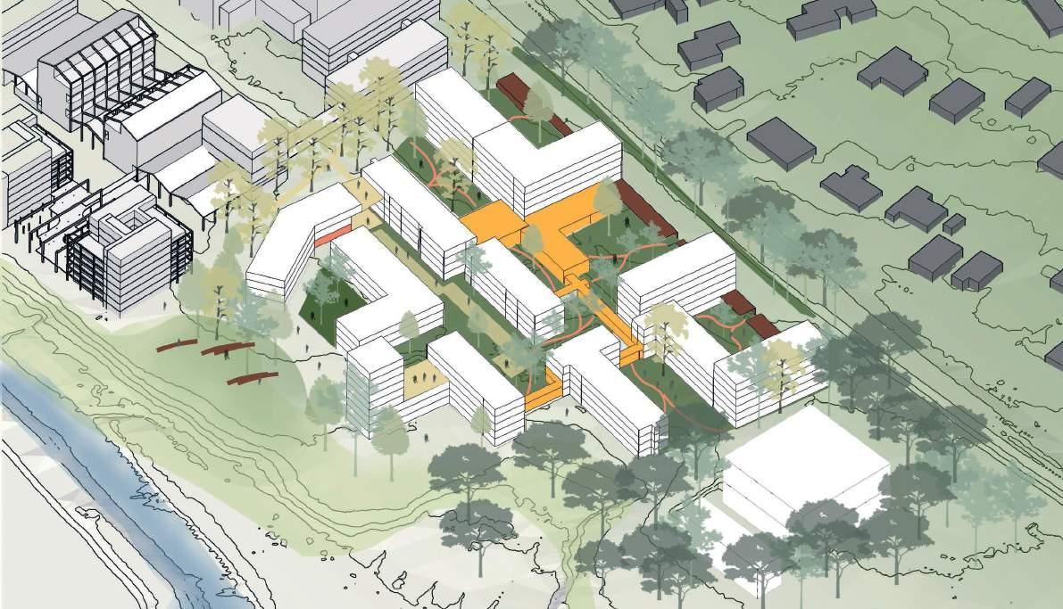
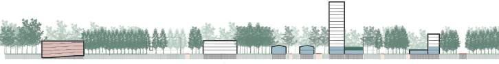
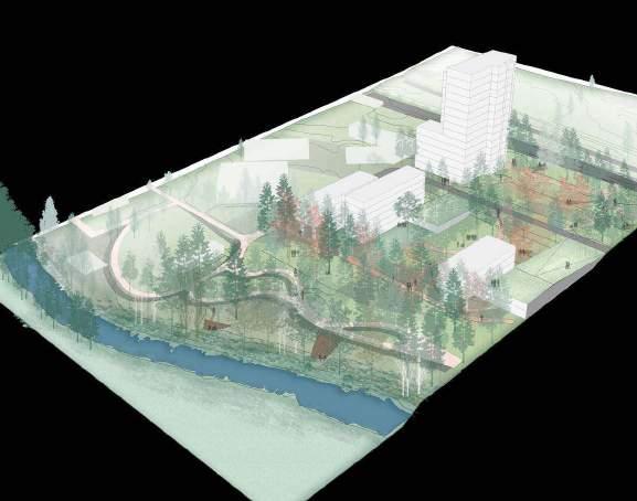
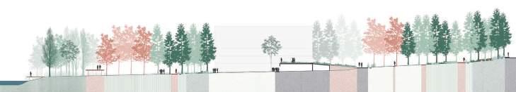
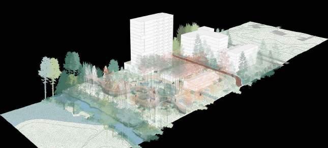
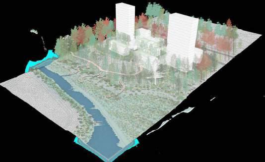
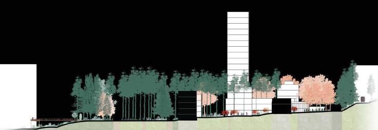
EcoFlow Horizon is an innovative part of our site that envisions sustainable living along a connected green spine. Three distinct terraces, meticulously integrated with terraced walkways, converge at a scenic riverfront esplanade. Emphasizing post-car principles, the project harmonizes nature, pedestrians, and cyclists, fostering ecological resilience and vibrant community interaction.
unveiling a panoramic tapestry through strategically positioned block typologies along each trace of EcoFlow Horizon, where every angle frames a stunning view, harmonizing modern living with the scenic beauty of the connected green spine. typology / maximazing nature's canvas
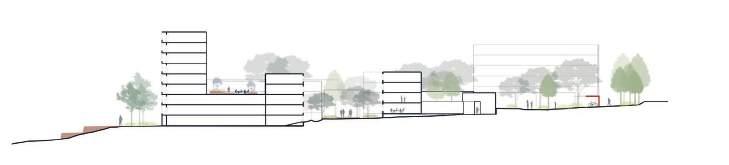
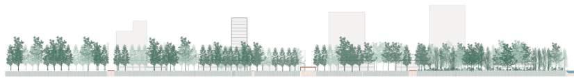
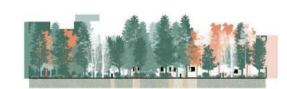
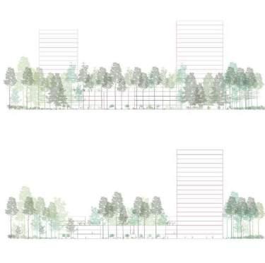
site sections seamlessly weave lush green open spaces with architectural marvels- each section is a testament to the intentional connection between nature and building, fostering a harmonious coexistence that defines the essence of sustainable living. sections / green harmony unveiled
Labyrinthine connectivity, intriguing passages and ambiguous atmospheres are part of the kaleidoscope - while some of the newly added interventions act as architectural carriers that provide an overall structure and stability, resulting in a certain macro-order that makes chaos and growth possible and allows dynamic interplay between the different transitional spaces.


the site has different gradations - just like a kaleidoscope - as a result of which the overall image, atmosphere and characteristics of the different spaces changes if you move throughout the site - this happens in all directions. sequence of transitional spaces
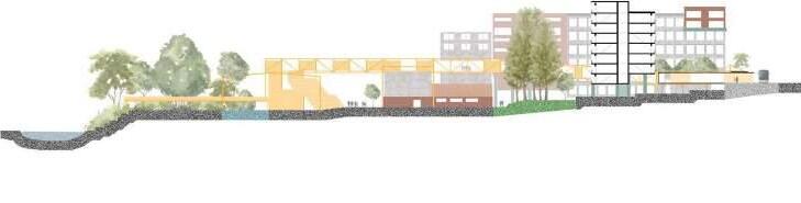
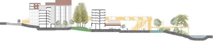
the yellow spine is a rather radical intervention that acts as a support structure and sprouts from the new bus station, finds its way throughout our site and eventually takes root in the landscape - providing a strong sense of passageway and connectivity.
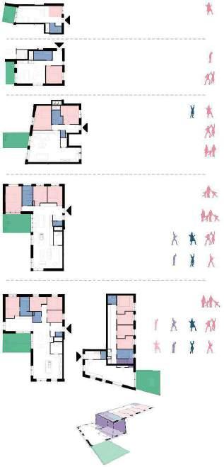
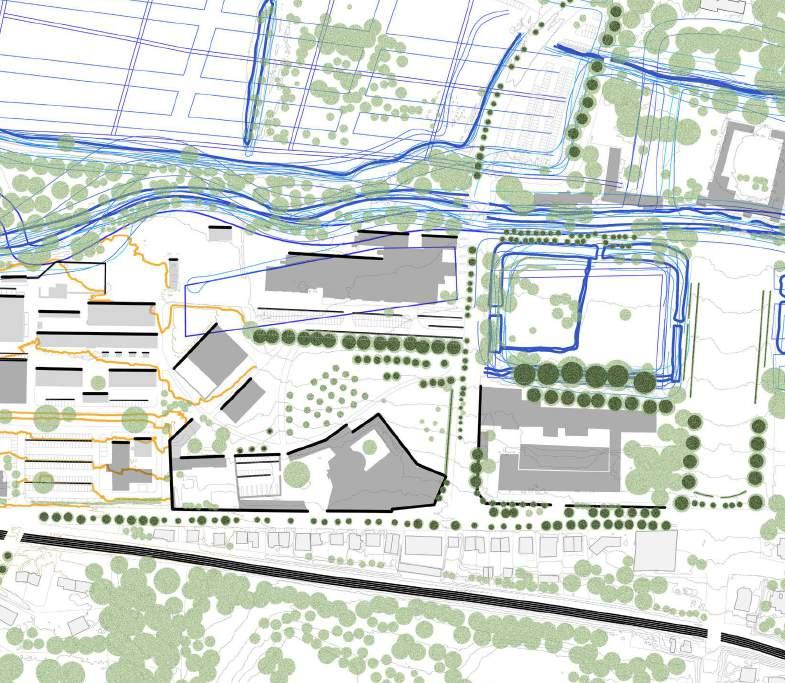
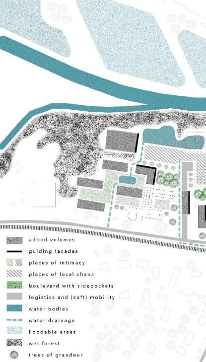
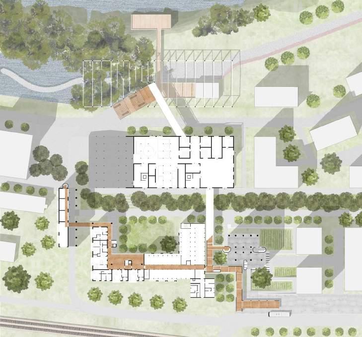
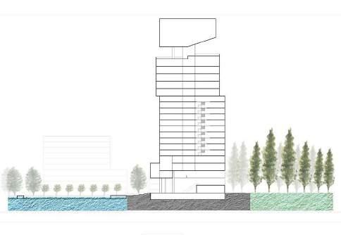
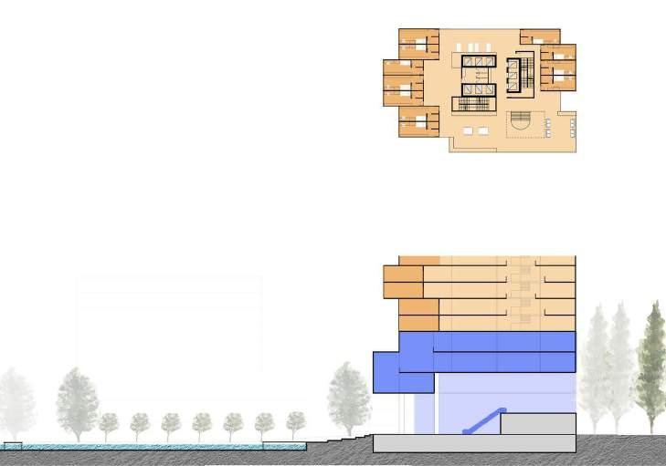
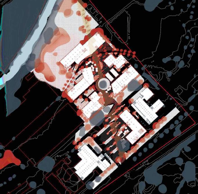
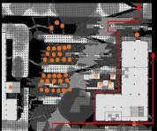
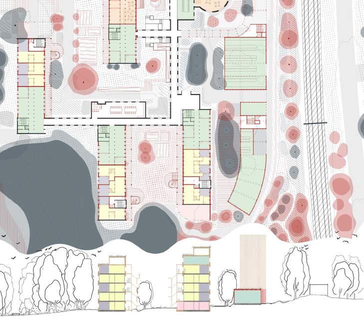
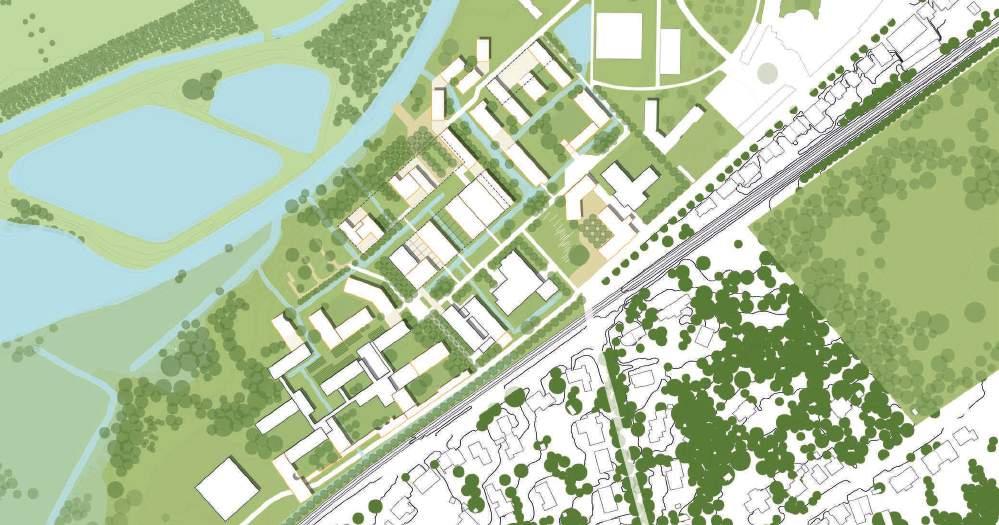
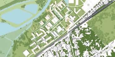
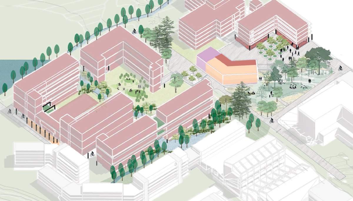
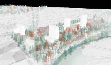
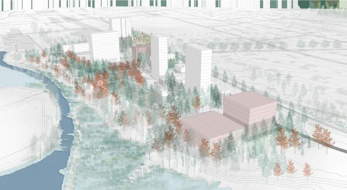
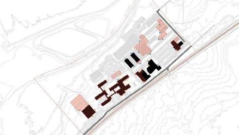
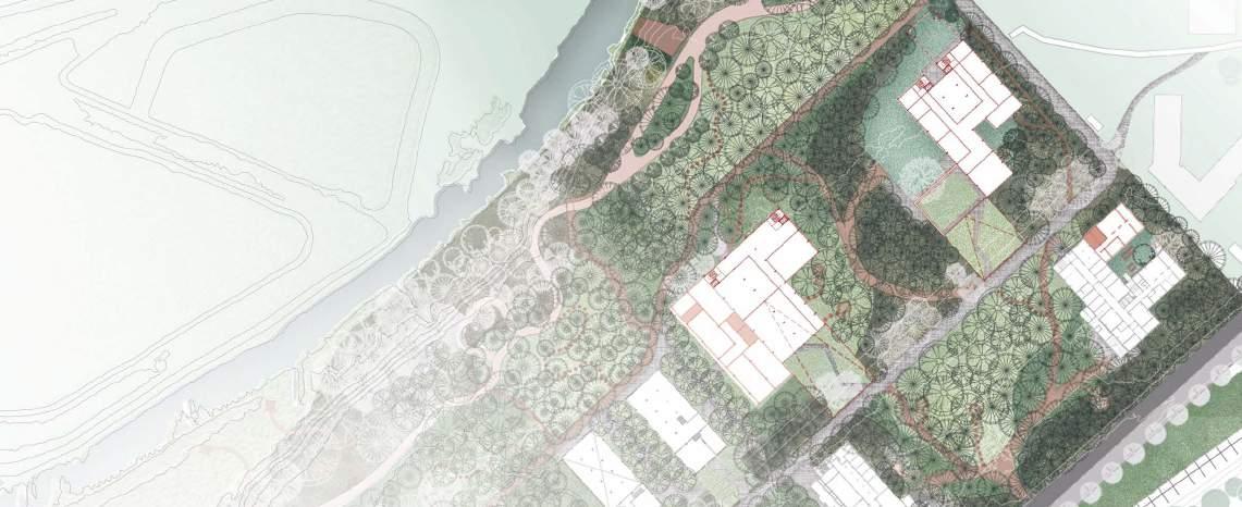
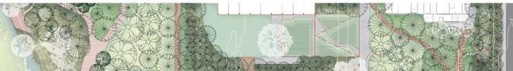
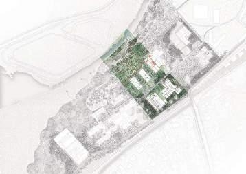
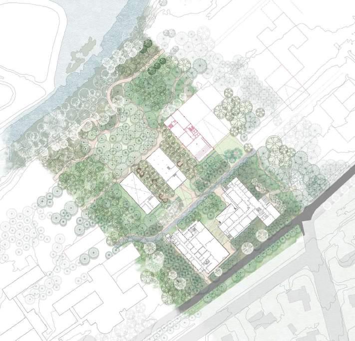
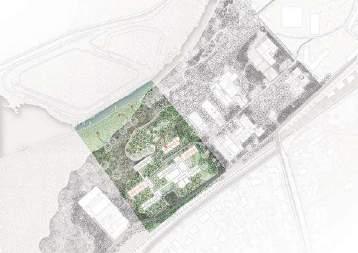
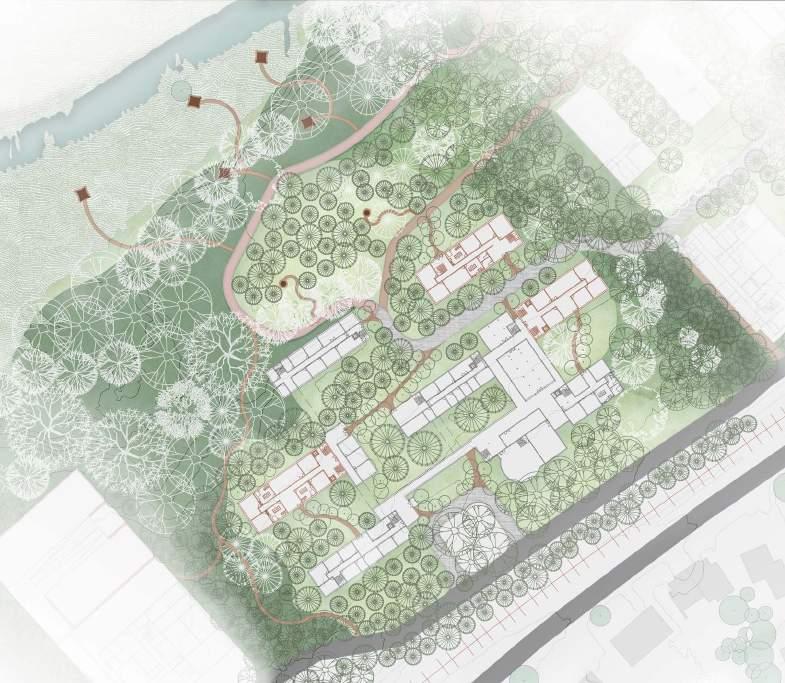
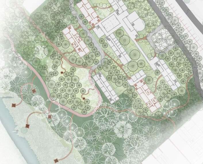
In this zoom, open spaces are organized by new water elements. Open space A, includes the principal pond and square, and is shaped by a new tower (for education facilities and student residence) and a new building (for housing and commerce). Open space B, includes a small pond and has the atmosphere of a courtyard, and is shaped by existing buildings reused for housing.
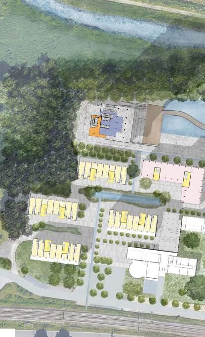
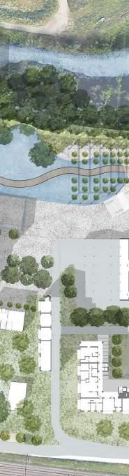
New Housing Building Commerce (1st and 2nd floors)
New ponds
New waterlines
Open Space
Pond + Square
Courtyard + Small pond
Dijle River
general structure
New Tower: Educational Facilities Student Residence
caption/image titles use - Avenir Next Demi Bold 14pt
captions and text use - Avenir Next 12 pt
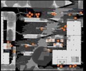
The existing KU Leuven campus is car oriented, which equals a lot of impermeable and oversized surfaces for circulation and parking spaces. The different types of ground surfaces are precisely mapped to be able to have specific interventions. This has also allowed to calculate the minimum required density.
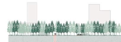
By investigating satellite images, the tree foliage on the site and the surrounding area is mapped. The darker, the higher the tree. Big tree typologies become clear. A line of trees visually separates the site from the valley. Monumental bunches of trees are spread over the site. In one part, the line of trees tries to enter the site.
During our survey we learn that the site is disconnected from the valley due to multiple big constructions along the valley border. The structural analysis of the buildings provides an insight in how to open up the valley not only to the site, but also to the urban area across the railway. Rather than going towards the valley, the valley enters the site.

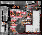
The design proposal is structured around some general ideas. The first one being a detailed reuse of existing (infra)structures. A precise mapping of the current situation allows for specific interventions centred around the idea of durability in terms of materials.
Then, to integrate the site into the surrounding fabric, three major moves structure the design vision. The Willem de Croylaan abruptly stops at the entrance of the site. This street now continues along the railway to provide access to the displaced logistics that used to be a barrier near the valley. The Herendreef is currently a straight axis flanked by beautiful trees. This boulevard will enter the valley to create a dense urban axis and a visual connection across the site. The street also connects the above laying campus to this site. Lastly, the swirly path in front of the library is continued to allow public access near the valley.
This vision hopes to create a lively and diverse part of the city of Leuven.

NGUYEN THAO PHAM
The main concept of this design is to create a physical as well as visual connection between the urban area, the campus and the valley, hence creating an urban axis leading to the valley. This high-density axis provides the survey site with various activities such as commercial, entertainment, space for events, offices and housing, etc. Furthermore, the design takes existing structures into consideration and aim to make the most use out of the existing structures/ tissues.

DISTRIBUTION DIAGRAM DURING DIFFERENT OCCASIONS
Extending nature by verdant fingers to direct the flow of people and generating activities toward the valley while blending the type of function, activities, and users to generate a sense of vibrant community.
The massing of the buildings are gradually smaller toward to the river to form more passages

Creating curb terraces to hold water and bioswale to optimise water retention in the site and putting trees along toward the river to absorb the water upward.
Turning the Front
Turning the river to become the front of the project to celebrate the river and the valley as the natural advantage of the site surroundings by generating activities.
The rational structure of the ICTS building allows the current offices to be mixed with new residential and public functions. The building forms a common ground between two public axes. The precise mapping of ground surfaces, trees and structure results in a precise intervention, making as much use as possible of the existing.
The recent bird watching tower is thought to scare away rare water birds. It is removed and replaced by trees. The design proposal takes a step back and looks from a distance at the important sand catch.
Residential Day Night
Office/Logistics
Public Interest
Productive Space
Typologies in Plan + Section
The present corridor becomes a collective internal mode of circulation, connecting different residential zones, work places, public functions and the common rooms.
Axonometric view + Horizontal reach to the valley
Coexistence of the different functions within the same structure. A current glimpse of the valley is used to approach the sand catch, making use of the existing hard surfaces.
The Axonometric drawing shows the main public spaces of the design.
There are different kinds of linear boundaries present on the site. Not only the buildings, but also the green structure along the river prohibits contact with the Dijle valley, which all follow the distinct terraced topography present on the site.
Due to the terraced structure, the linearity of the existing buildings along these terraces, and the vast amount of impermeable surfaces, the site is prone to pluvial flooding. The linearity also creates a certain loss of direction, leading the visitor to nowhere specific along the existing buildings.
The design responds to the analysis by enforcing the existing patterns of opening and closing of the buildings along the railway line, guided by the terraced structure, the new infiltration system to accommodate pluvial flooding and adaptive reuse of existing structures where possible. These principles guide the placement of new buildings.
Design concepts - 3 main guidelines
1. Shifting topography
2. New drainage system
3. Opening up (existing buildings)
Design Vision
The goal of the design is to open the site up towards the valley by inversing and repeating the existing rhythm of opening and closing along the different terraces. Along the railway line, the existing wall along the Cardinaal Mercierlaan is continued through placing buildings, drops in topography, or vegetal boundaries, keeping only one entrance for the public to enter the site. Once inside, the bike path takes the visitor parallel to the different terraces, where it is possible to catch glimpses of the valley through openings in the tissue. On each terrace, there is a specific public space, functioning as an orientation point on the site. Here, people are invited to switch directions, and looking for visual or physical interaction with the valley. Each terrace has a different living environment, varying from private houses with collective gardens, student housing, to work/production meets housing, proposing a versatile living environment.
Existing urban boundaries have left our site lacking definitive direction. The urban square pulls people into the site, functioning as a starting point which provides guidance with in the urban tissue, overlooking the valley and redirecting focus . When stepping down towards the valley, housing complexes with collective gardens create a more private atmosphere for living.
Emerging new openness in the urban fabric, both in terms of built structures and allowing water
Site plan
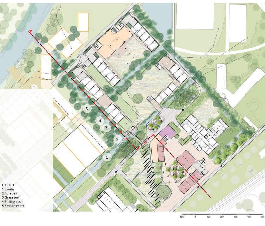
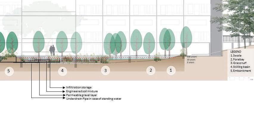
By strategically integrating biofiltration gardens and housing units with collective gardens culminating in swales, a new tissue emerges. This intentional approach promotes water infiltration, enriching the permeability of constructed units and elevating the overall permeability of the urban fabric.
Section A- Nature based water managment system
Integrating bio-filtration basins and swales within the urban fabric strategically manages pluvial flooding.
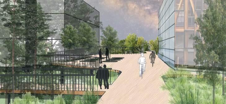
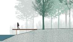
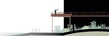
Balcony and bridges for congregation and connections
Elevated bridges and balcony provide the transition from collective to private space and glimpse of valley.
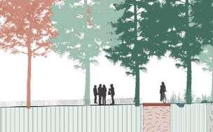
As we step down towards the valley, the typology of the tissue became more family oriented, it can be visually read first as a private/collective space that starts from the railway with a wall that guides the entrances through the patios, then it starts to open to a transition space and finally gets to a public view point park.
View of daily functions
The topography plays and important role on the viewpoint, creating a dynamic scenery with the wetland.
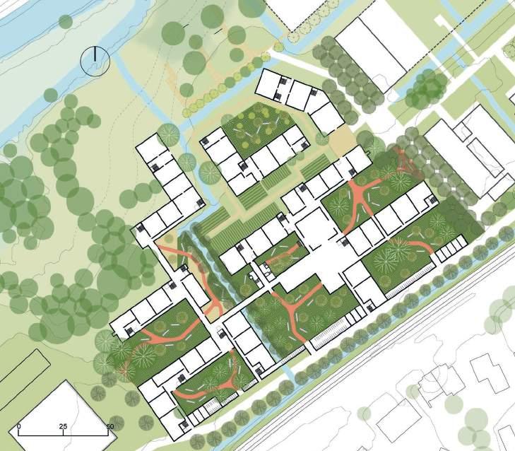
From private to public /site plan
The housing units are connected through collective spaces indoor outdoor, housings with a view towards the valley and one collective garden that serves as a transitional space welcomes you to be part of the public space where you can sit on the slope and admire the valley
A-A'
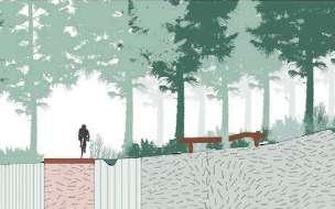
Where the collective and public reunites
The wall at the front is a functional element where you can park your bike behind and it is intended to be a welcoming structure, where from the first sight you notice different sizes of buildings and trees that enhance your curiosity on what is beyond.
Along the final terrace towards the valley, people are invited to interact with the river. This final major public space is connected to a network of smaller public spaces, creating a diverse living environment where housing goes hand in hand with production, education, logistics and recreation.
Different users
Students
Researchers
Families
Production
Logistics
Offices
(Top) The network of public spaces creates overlap between the different living environments.
(Top Right) An abstract representation of the network of public spaces in the transect.
GAUTAMI MANISH KASAT
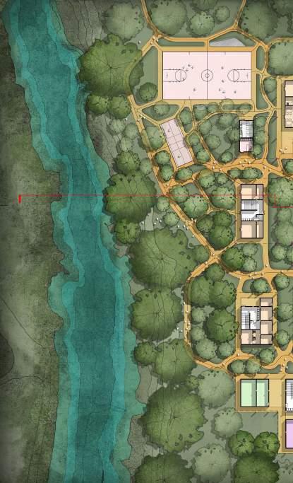
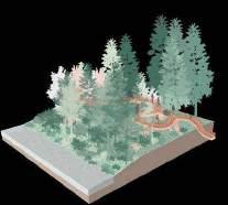
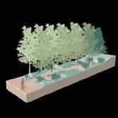
The site is surrounded by a various forests system, starting from the hill forest, then the garden forest, toward the valley, water and marsh forests. The site is acting as a connecting corridor and is now turning into a campus forest.
The site is divided into 3 big terraces, the first 2 on the south contained largely built components, with scattered vegetation system. The last terrace toward the river has an ecological corridor with a very thick vegetation system of marsh - water and trees.
The existing programs on site included campus, admin and logistics.; the new addition program is housing. Most of the buildings on terrace 1 are retained and modified, and the footprint on terrace 2 is redesigned.
Accessible Grass Clearing
Inaccessible Grassland
Vegetation Barriers
Existing Trees
Dense Trees along the River
Dense Grassland along the River
Marshland
Marshland with dense Trees
Existing Buildings
Existing impermeable Kept buildings
Demolished buildings New footprints Entrance Campus Residence
Admin and Logistic Action plan vegetation
Section AA - Looking towards the Valley Campus Admin & Logistics Housing
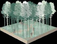
Nestled amidst diverse forest ecosystems like marshlands, swamps, and hills, the site envisions a transition campus forest in a terraced valley opening to the river. Purposefully designed for reflection, healing, and communion with the environment, it seamlessly integrates campus spaces, administrative functions, and housing.
The design focuses on introducing pine and maple forest areas, varying from thin to thick, promoting a stronger relationship with the river through a diverse mix of vegetation species. Embracing the seasonality and nobility of the forests, the proposal advocates a return to our fundamental connection with nature, encouraging a shift in urban form to allow the reclamation of space by forests.
This negotiation includes restoring the forest surface and crafting visions of expansive scenery through sloping typologies, open balconies, and hidden gardens. In essence, a harmonious blend fostering a connection between human activities and the natural environment that surrounds them.

Existing Trees
Proposed Trees
New Thick forest
New Moderate forest
New Thin forest
Marshland
Proposed Buildings
Existing Buildings
Vehicular Road
Cobble Trail
Rammed Earth Trail
River Biking Trail
Undefined Trails


Courtyard Housing
Standard Room - 15sq.m
Large room with Patio - 24sq.m
Studio room with Private Patio50sq.m
Family Studio with Private Balcony80sq.m
Garden Balconies
Utilities: Kitchen, Laundry, Toilets Common Spaces Circulation Core Corridors KUL Campus
The healing comes in many forms toward human: strolling on the elevated lane through the branches, meditation walks under the high canopies or sitting in the pods among the quiet seasonal alley garden… It is also the healing spaces for the forest, where lights are turned away for its peaceful sleep at night, and water is being kept for the roots to thrive.

Maple
Kept building
Proposed building
Grass slope
Elevated metal net lane
Walk-cycle soil trail
Cycle cobble trail
Sitting pod
Low bushes
Dense low vegetation

Elevated cycling lane Walk through the canopy
Garden of colors: Summer-Autumn
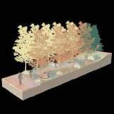

Fostering dynamic communities, the forest of gatherings seamlessly blends communal spaces, diverse housing units, and amenities to facilitate social cohesion. Simultaneously, it aims to forge a stronger connection between residents and nature through spaces for riverside admiration, forest camping, and seasonal harvests of apples, plums, cherries, and pears.
Section 1
Section 2
A thin forest community sheltered by a thick and moderate forest. 1. Elevated corridor - Continuous groundcover.
2. Garden terraces surrounded by forest.


Looking
New Thick Forest
New Moderate Forest
New Thin Forest
Marshland
Proposed Buildings
Existing Buildings
Vehicular Road
Cobble Trail
Rammed Earth Trail
River Biking Trail
Undefined Trails
Existing Trees
New Pine Trees
New Maple Trees


New apple, pear, cherry and plum trees
Key Spaces, Transversal Section & Strip
Promoting a life surrounded by forest.
 Sitting pods & elevated walking trail

Studio - 1 bedroom - 30m2Studio - 2 bedrooms - 45m2
▀▀ Common space
▀▀ Circulation core
▀▀ Commerce
▀▀ Office
▀▀ Sanitary Access point
Typical Student Housing - Upper Floors
▀▀ Shared Kitchen
▀▀ Shared Bathroom
▀▀ Student Std Room 14.5m2
▀▀ Studio - 1 bedroom 30-35m2
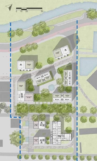
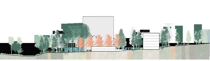
Housing complex - Ground floor Typical Section - Low RiseTypical Section - High Rise
The housing typologies are accommodated in low and high-rise building blocks that follow the same pattern with mixed-use ground floors. Meanwhile, the upper floors accommodate housing typologies for studios as well as standard student rooms with shared kitchens and bathrooms.
Leuven, Belgium
Guests
External Jury Members
Yuri Gerrits, KU Leuven
Guido Geenen, KU Leuven, WIT architecten
Joris Moonen, KU Leuven, MIDI
Sarah Van de Velde, Bureau Bas Smets
Ward Verbakel, KU Leuven, PLUSOFFICE
Annelies De Nijs, Atelier Horizon
Cristian Panaïté, METAPOLIS
Els Van Meerbeek, KU Leuven, Carton123
Pieter Van den Broeck, KU Leuven
Ellen Verbiest, KU Leuven
Guest Lectures
Janina Gosseye, TU Delft
Yuri Gerrits, KU Leuven
Dr. Xiaoxuan Lu, University of Hong Kong
Fadi Masoud, University of Toronto
Mircea Munteanu, METAPOLIS
Thomas Willemse, Studio Thomas Willemse
Projects visits
Korbeek winners - Els Van Meerbeek, Carton123
Centrale Werkplaatsen - Tom Boogaerts, &bogdan
De Drie Kreeften - Roeland Joosten, WIT Architecten
Teaching Team
Mircea Munteanu, affiliation
Teodora Romanova Stefanova, OSA Research Group, KU Leuven
Thomas Willemse, affiliation
Kelly Shannon, KU Leuven
Bruno De Meulder, KU Leuven
Stakeholders Exercise
Pieter Van den Broeck, KU Leuven
Student Groups
FOOTHILL HEVERLEEBOS
- MAHS/MAULP 1
Group A
Alireza Mirshekari
Janno Delissen
Giuliana Paola Palaez Rodriguez
Group B
Bram Vidts
Pham Nguyen Thao
Martin Adriel Purnomo
Group C
Ella Hens
Alfonso Nava Lopez
Unnati Khanduri
Group D
Gautami Manish Kasat
Santos Albeiro Blandino
Ngoc Dieu Tran Hoang
FOOTHILL GROENVELD
- MAHS/MAULP 1
Group A
Tom Van Laer
Praveenkumar Paramagourou
Asmae El Rhazi
Group B
Huijun Liu
Trang Minh Thuy Nguyen
Group C
Gayane Maes
Saba Asir Khan
Bezawit Tekle Gasso
SWAENENBERGH SITE
- MAULP 2
Group A
Verma Harshika
Paola Salvatierra Castro
Saran Maiprasert
Group B
Alexia Chalouli
Sri Keshava Tanguturi
Radhika Rishi
Group C
Eva Clara Atcheson
Tanvi Rajesh Belhekar
Group D
Ria Das
Junyao Su
GASTHUISBERG
- MAHS/MAULP 1
Group A
Elton Kibet Birir
Konstantina Nikoletta Karasarini
Yuhan Dong
Group B
Fatima Akman
Maha Abumaria
Yingjie Li
Group C
Dimitra Makraki
Alexa Gomez Custodio
Jinhao Cen
Group D
Radhika Somani
Victor Hugo Martinez Perez
Irene Gracia Aranda
GALGENBERG
- MAULP 2
Group A
Angelos Chouliaras
Muyleng Heng
Lamia Farhat
Group B
Marie Meurice
Javier Eduardo Lazarte Remisio
Vu Linh Chi Duong
Group C
Kato Belmans
Kshipra Mangesh Deolalkar
Group D
Supanut Udomsilaparsup
Zhang Yalan
Paedar MacCarthy
Booklet Layout & Editing
Mircea Munteanu
Teodora Romanova Stefanova
Thomas Willemse
Khalda El Jack
DEPARTMENT OF ARCHITECTURE

MASTER OF HUMAN SETTLEMENTS
MASTER OF URBANISM LANDSCAPE AND PLANNING