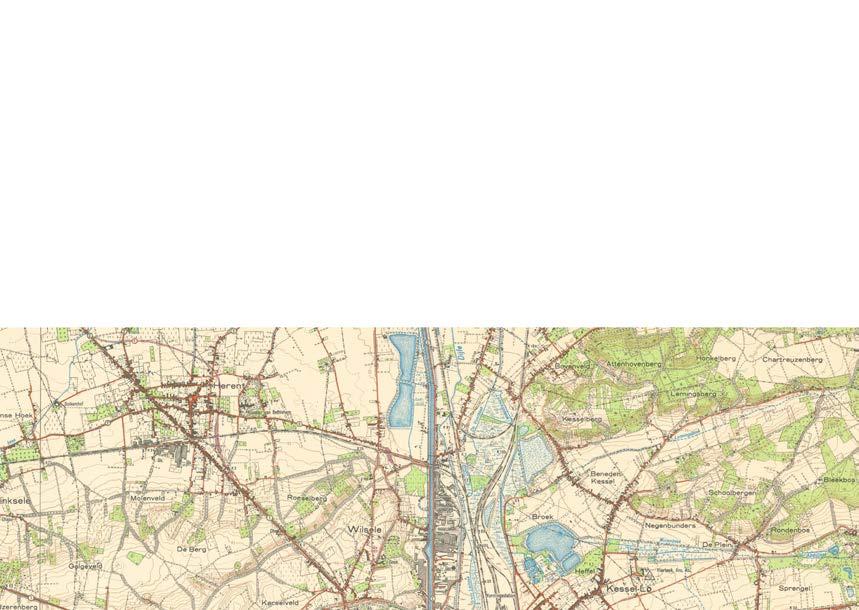
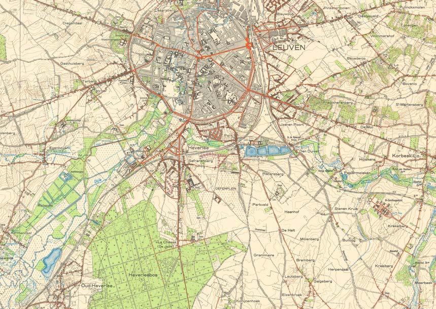
Leuven, Belgium
Master (of Science) Human Settlements & Master (of Science) Urbanism, Landscape and Planning
Faculty of Engineering and Department of Architecture
Promoters:
Mircea Munteanu (Metapolis), Teodora Romanova Stefanova (Gradoscope), Thomas Willemse (Studio Thomas Willemse) with Bruno De Meulder and Kelly Shannon (KU Leuven)

© Copyright KU Leuven
Without written permission of the thesis supervisors and the authors it is forbidden to reproduce or adapt in any form or by any means any part of this publication. Requests for obtaining the right to reproduce or utilize parts of this publication should be addressed to Faculty of Engineering and Department of Architecture, Kasteelpark Arenberg 1 box 2431, B-3001 Heverlee.
A written permission of the thesis supervisors is also required to use the methods, products, schematics and programs described in this work for industrial or commercial use, and for submitting this publication in scientific contests.
03.A
05 SWEANENBERGH
05.A OVERVIEW, A PHOTOGRAPHIC STORY
05.B INTERPRETATIVE MAPPING
05.C HOUSING ANALYSIS
05.D STRATEGIC PROJECTS
06 GASTHUISBERG
06.A OVERVIEW, A PHOTOGRAPHIC STORY
06.B INTERPRETATIVE MAPPING
06.C HOUSING ANALYSIS
06.D STRATEGIC PROJECTS
07 GALGENBERG
07.A OVERVIEW, A PHOTOGRAPHIC STORY
07.B INTERPRETATIVE MAPPING
07.C HOUSING ANALYSIS
07.D STRATEGIC PROJECTS
08 ACKNOWLEDGEMENTS
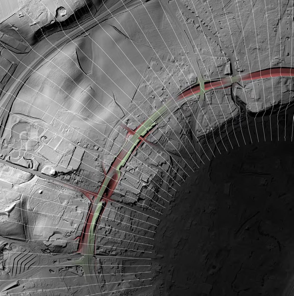
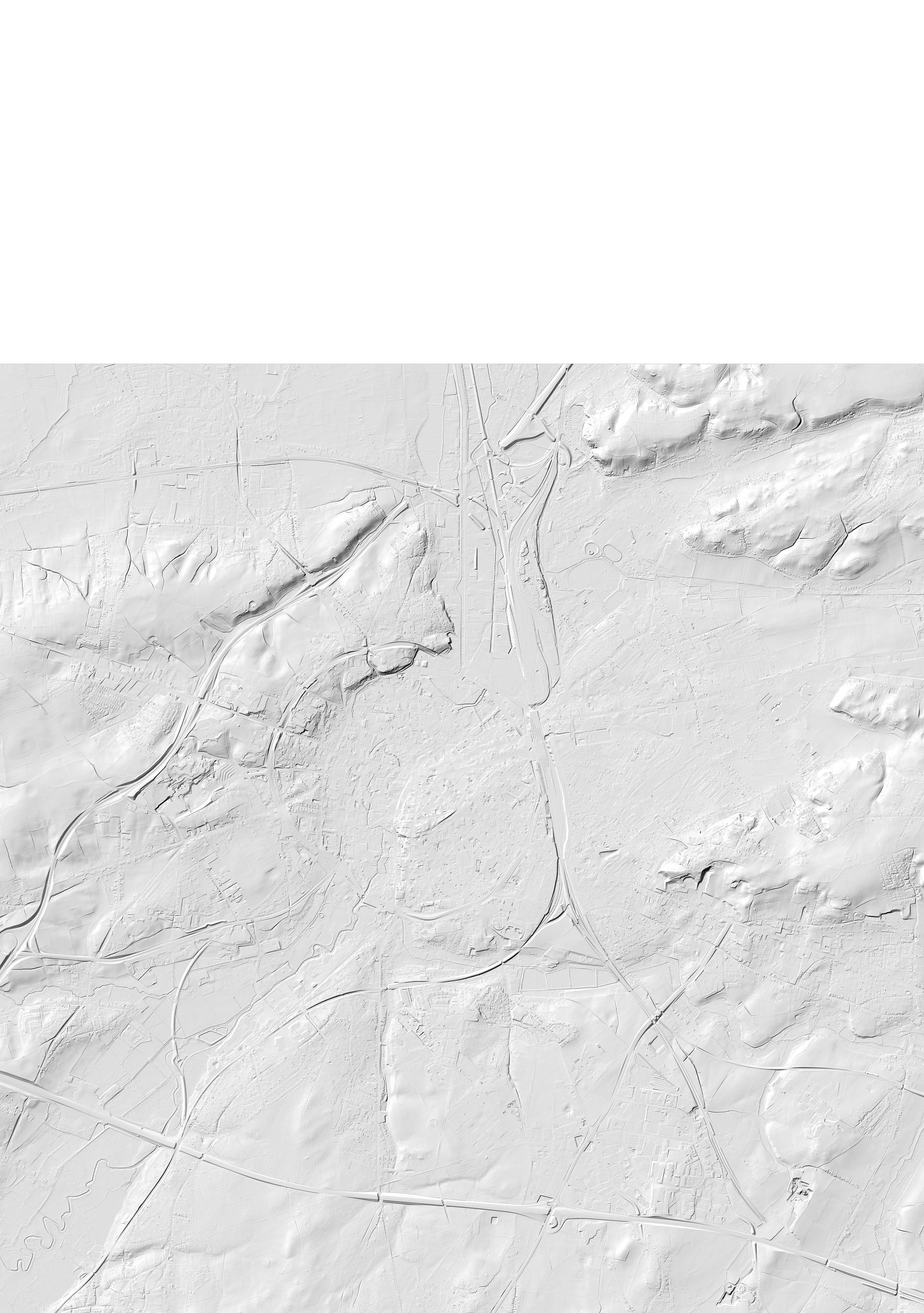
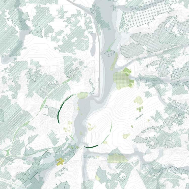
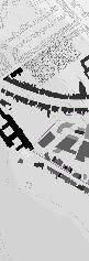
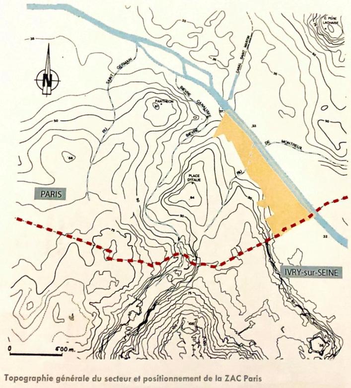
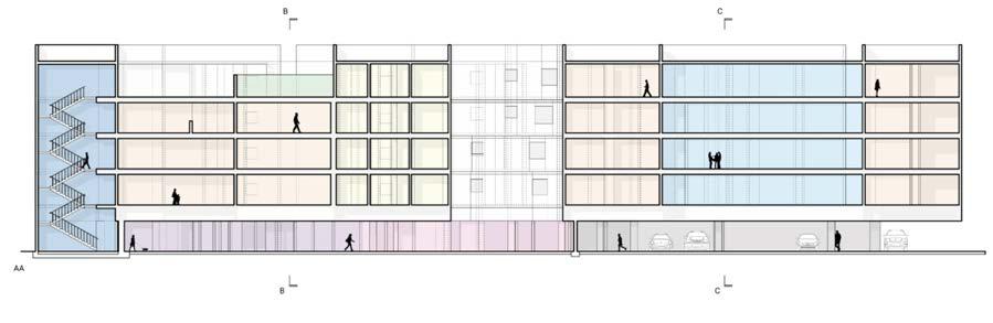
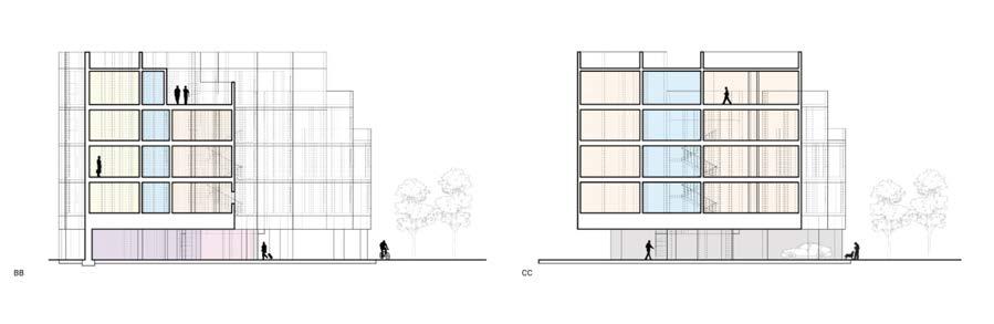
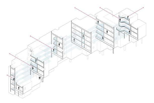
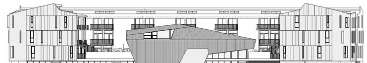
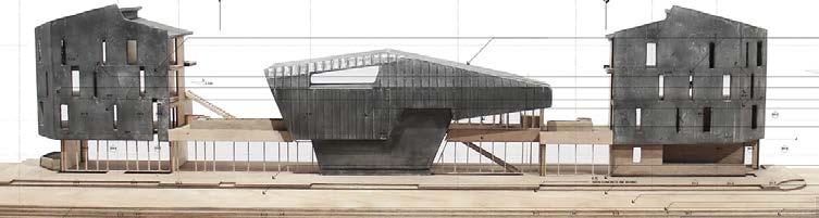
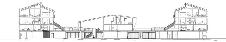
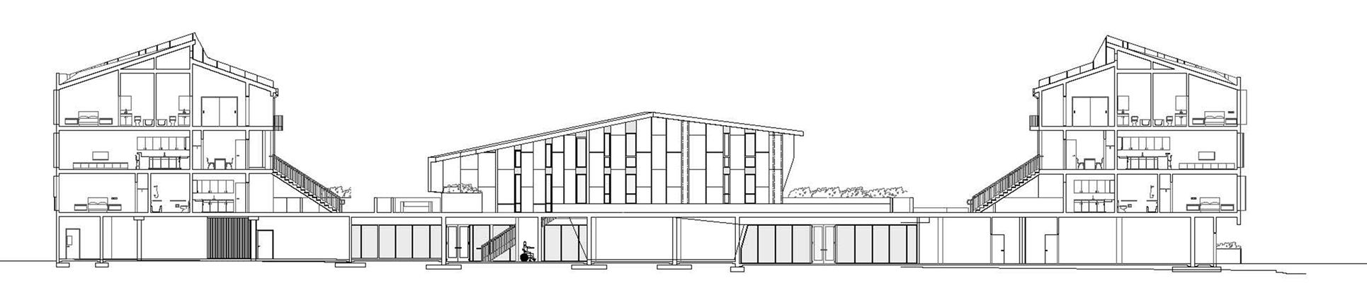
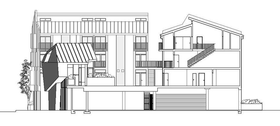
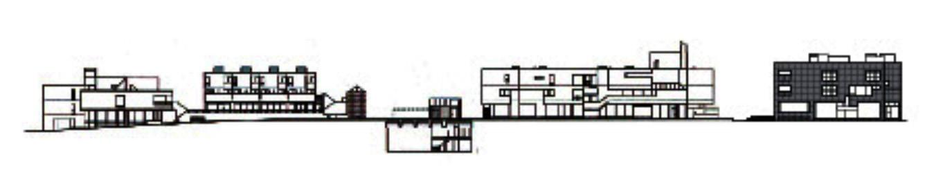
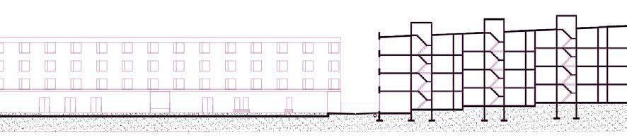
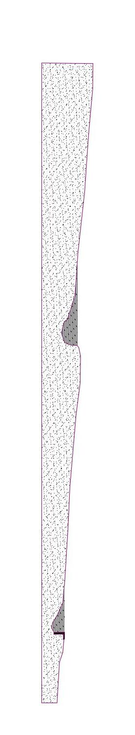
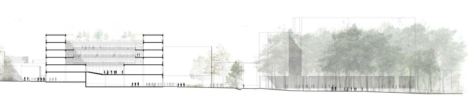
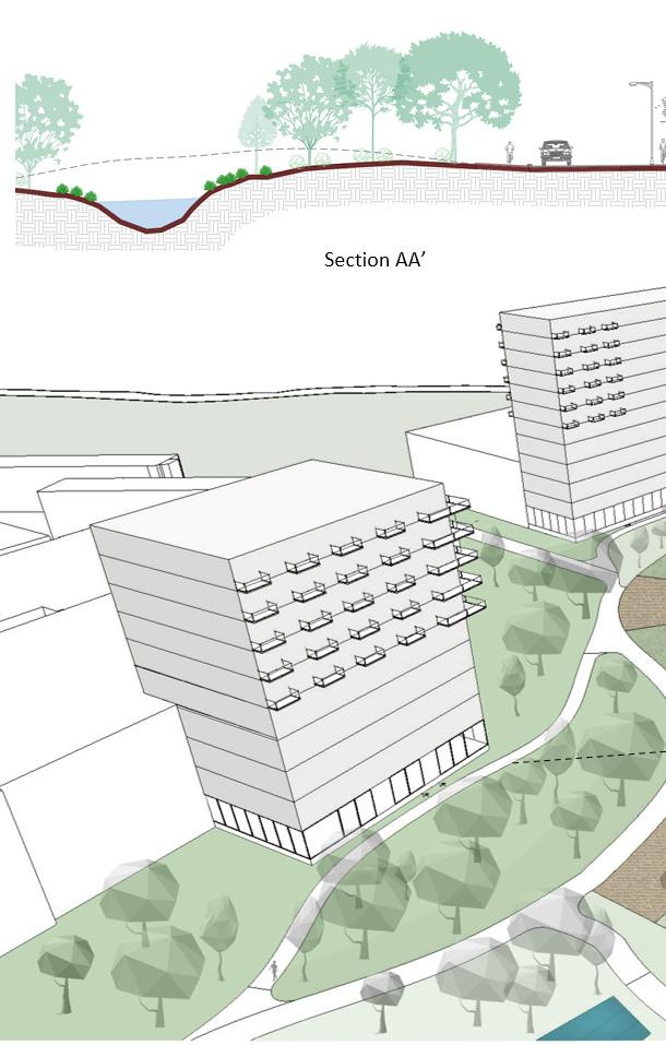
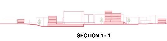
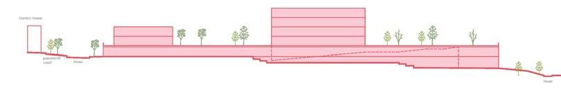
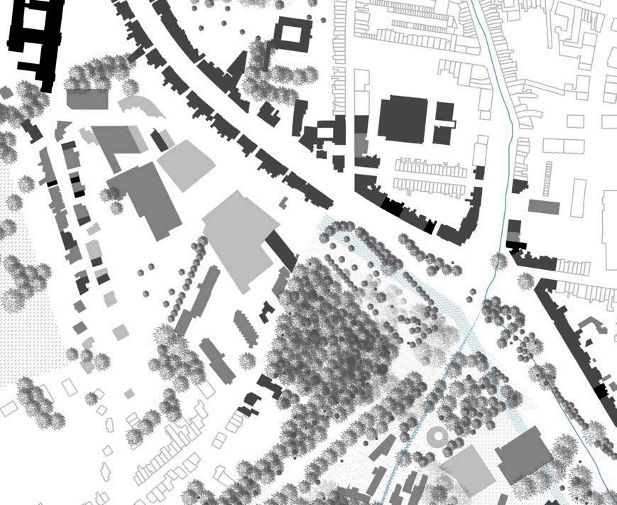
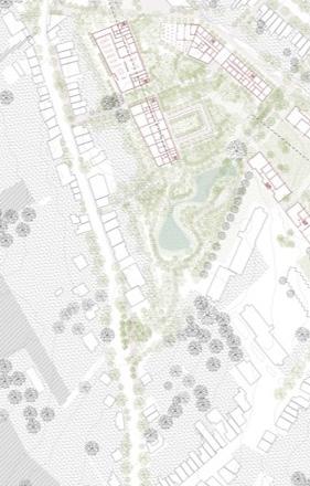
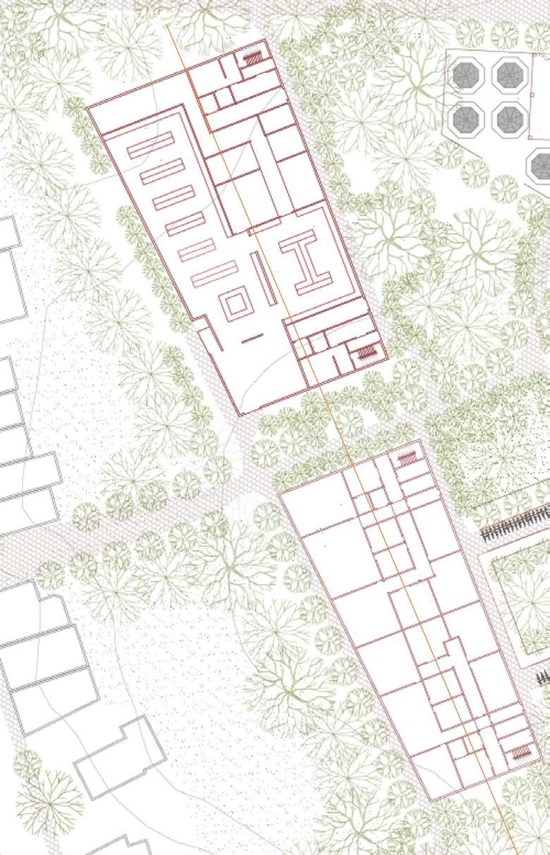
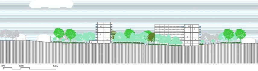
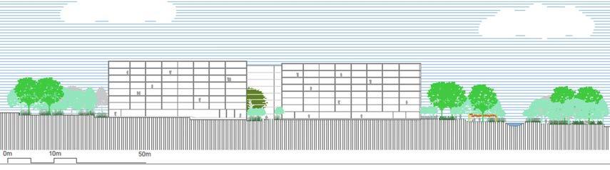
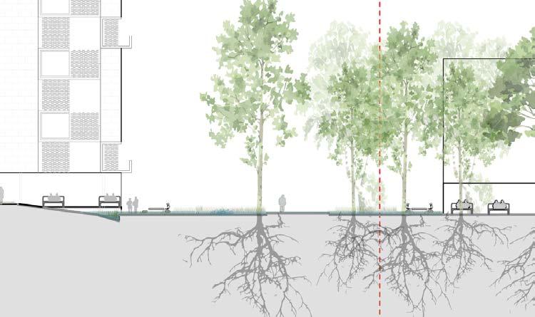
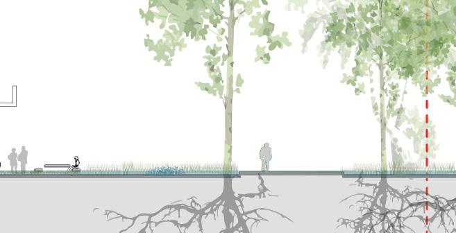
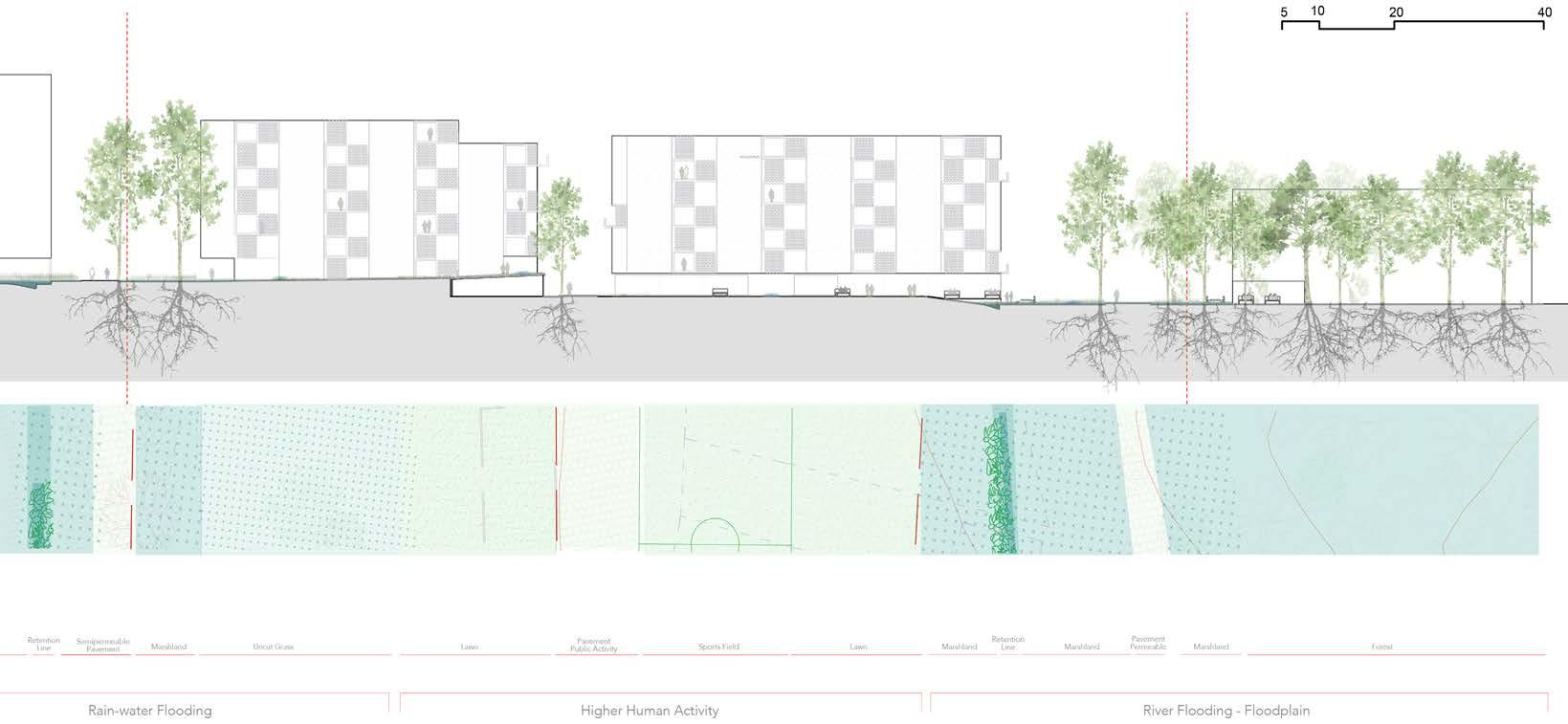
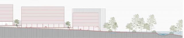
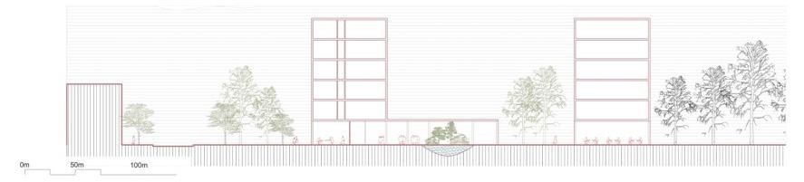
Topography and sections
MIRCEA MUNTEANU
TEODORA
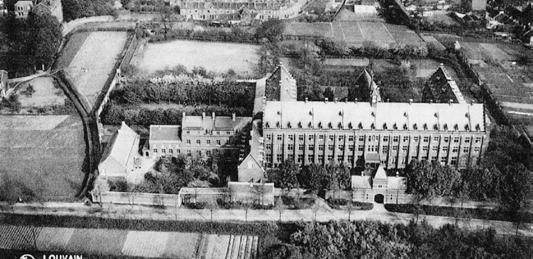
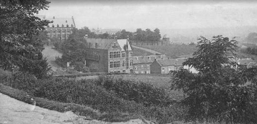
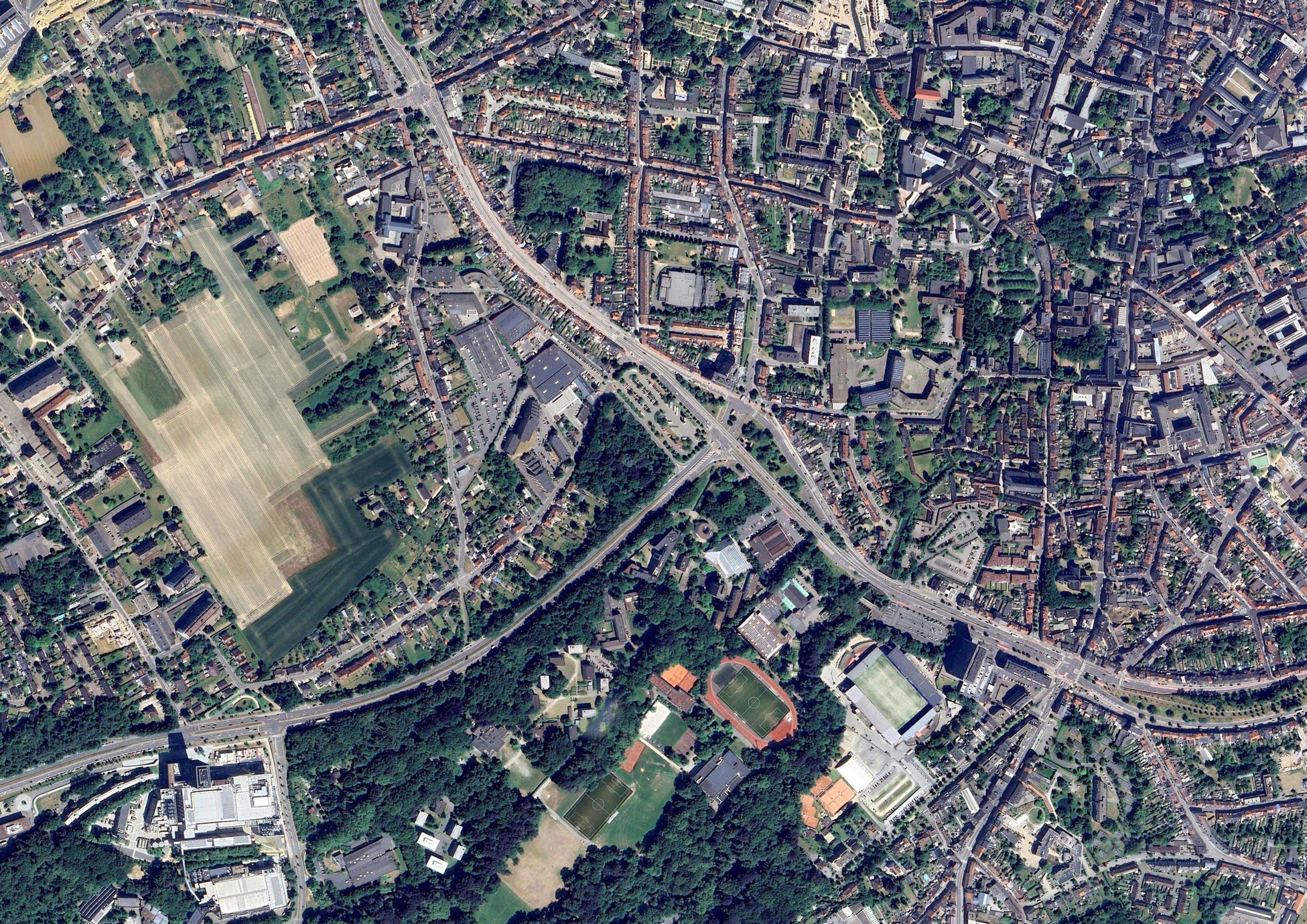
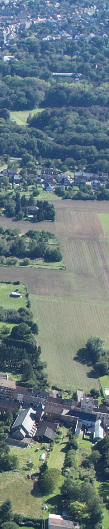
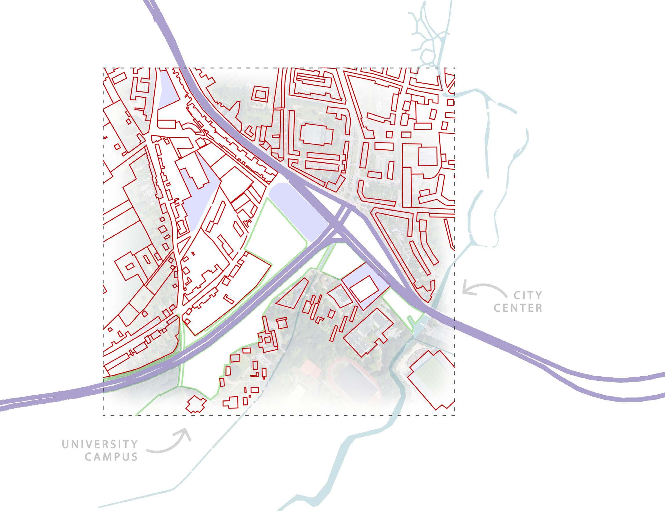
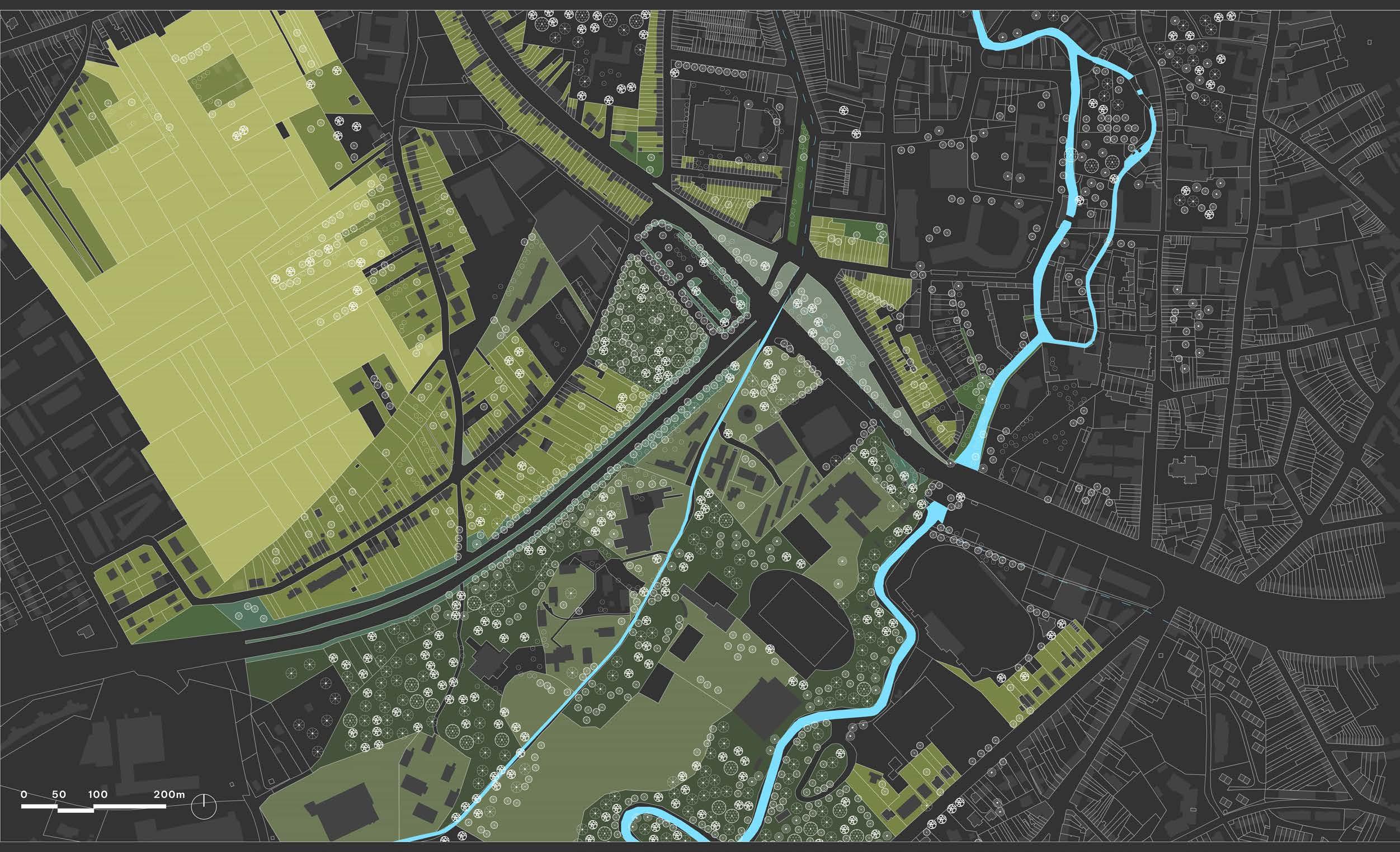
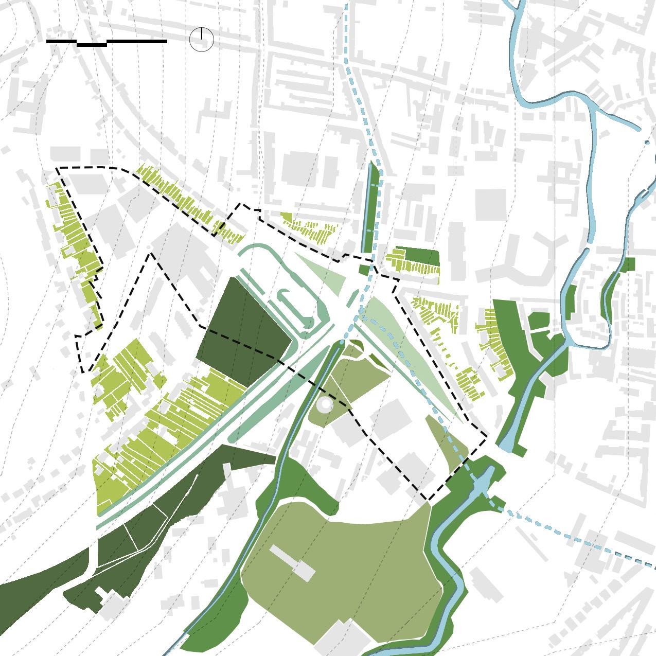
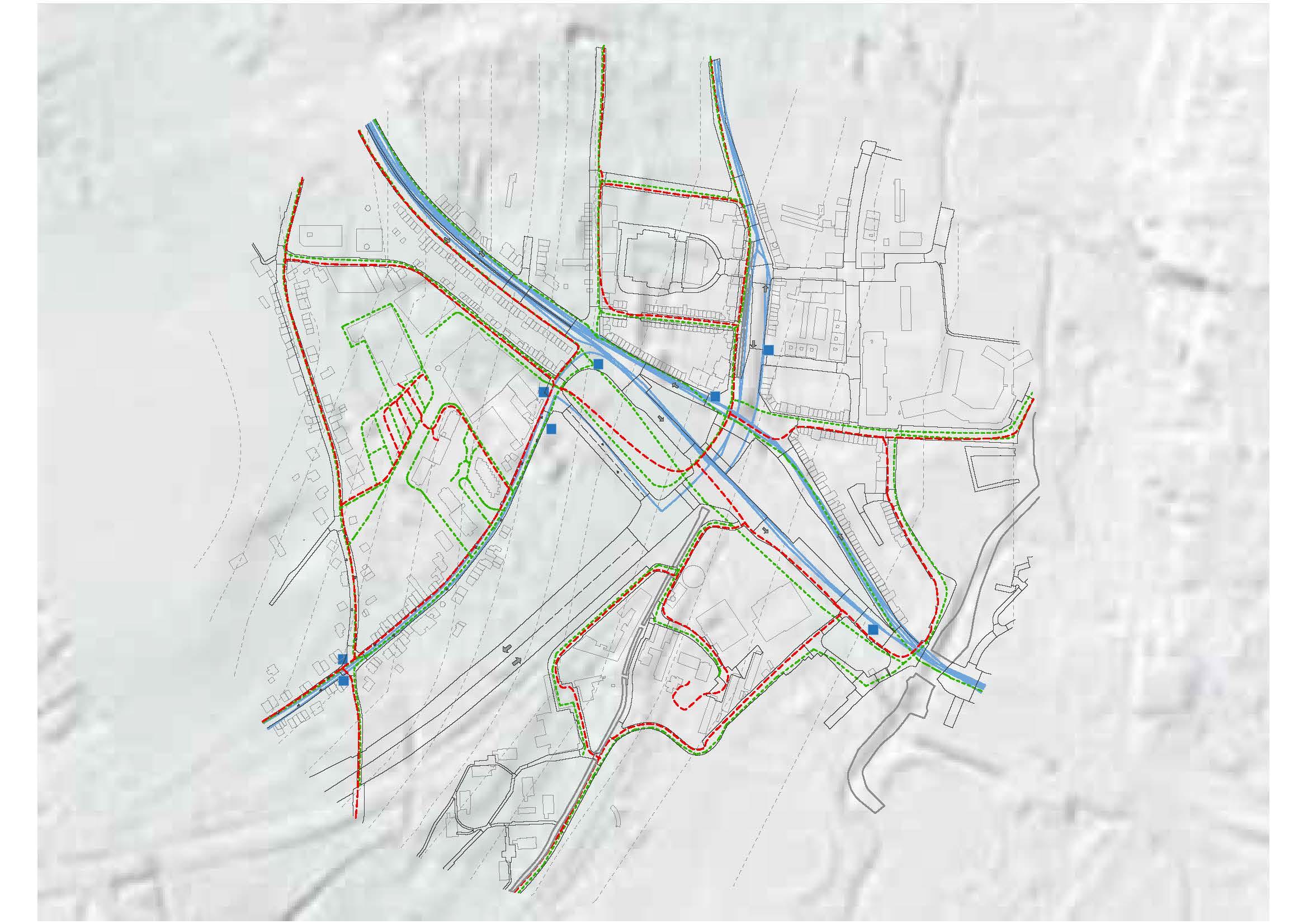
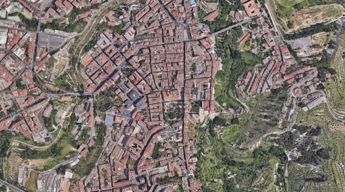
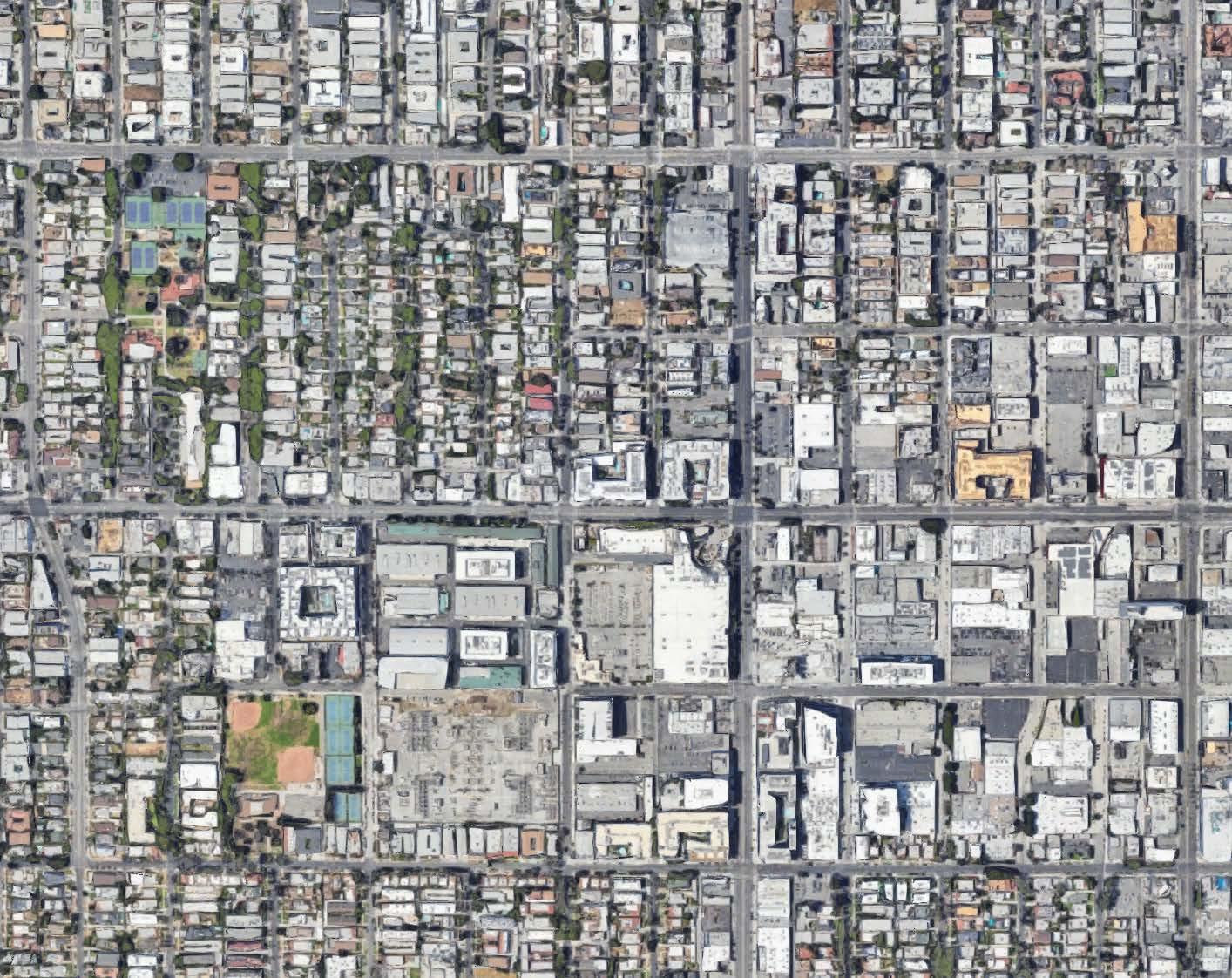
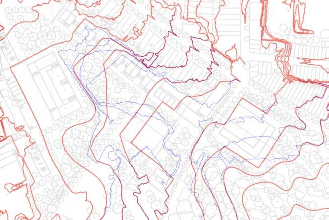
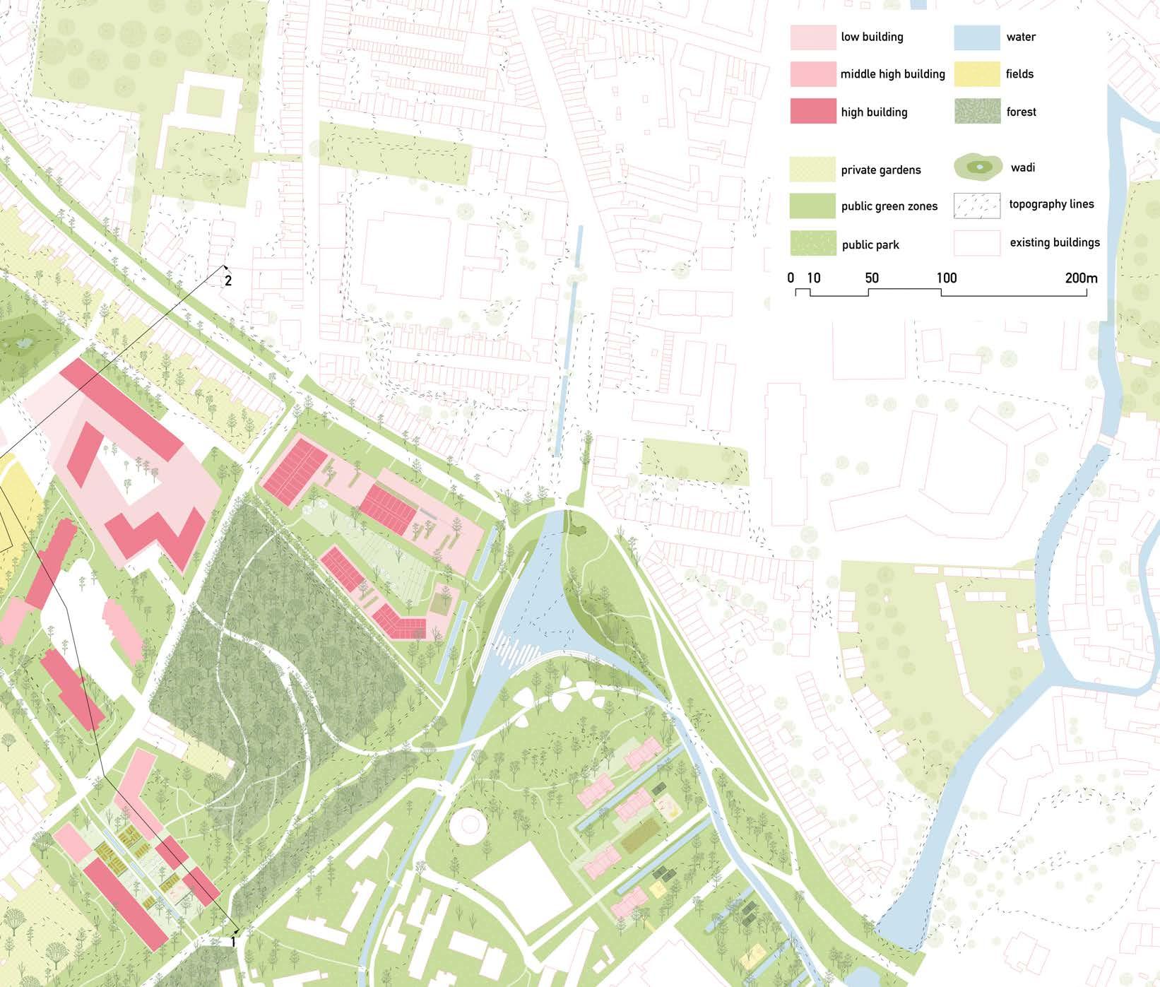
The site is comprised of fragments of urban fabrics on the western side (Witness hills) of Leuven, squeezed between the highway and ‘vesten’ (medieval earthworks) landscape (that was turned into a ring road). Since the 1950s, the area has become a dumping ground for larger institutions (university campus, university hospital, music academy, bank headquarters, big retail, etc.). The area is, in general, overinfrastructured (including large parking lots).
As a monofunctional dumping ground, the site lacks a clear structure (besides the underlying landscape) morphology and, despite its heavy programs, urbanity. The area’s potential identity and value is compromised by the dominant car-orientation and complete lack of (qualitative) public space.
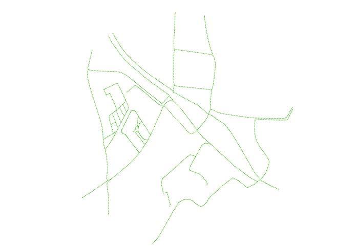
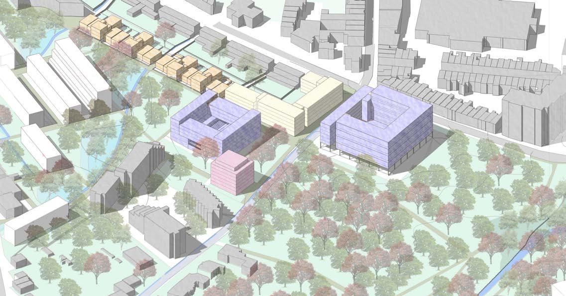
Specific sites for intervention were identified due to their relationship with the university (and a broader discussion of city - (monotonous) university), the gentrifying effect of the university and major shortages in the (student) housing market). All the sites are comprised of fragments of tissues (hospital, school, convent, etc) and the strong topographical relief that characterizes this area of Leuven.
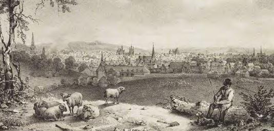
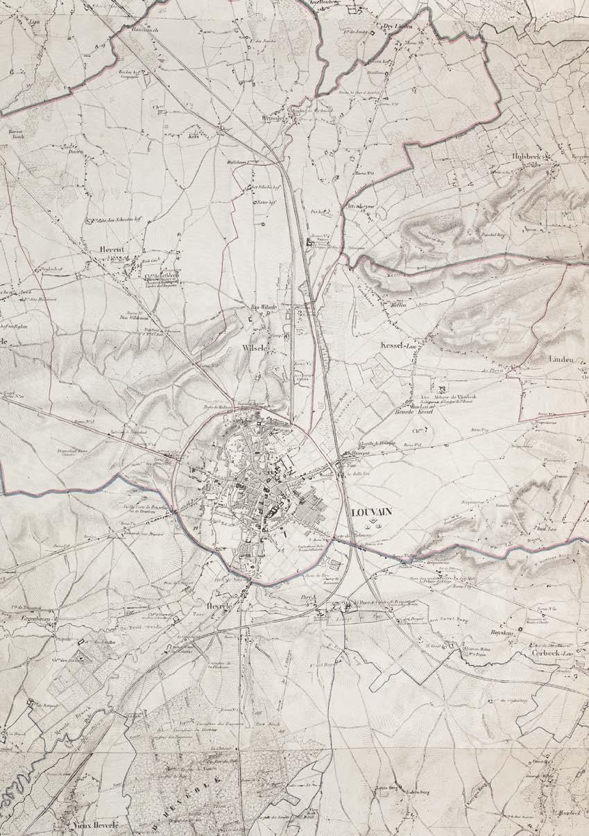
The city walls of Leuven mark a strong new artificial topography around the city. The Ferraris map of 1777 shows the clear distinction between the inner city development and the wide agricultural landscape beyond the walls. The flanks of the witness hills on the west side of the city form a strong agricultural landscape within the city walls with fields and vineyards. The steep slopes in this area explain the hesitant urban growth.
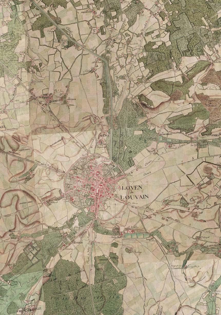
The Vandermaelen map from 1850 highlights the larger institutions that are set within the landscape. The larger estates of these institutions define figures in the landscape and often form the nucleus of car-dominated campuses of the enormous institutions that we find around Leuven today.
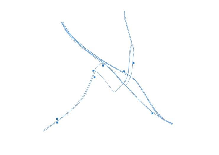
Infrastructure as destruction
Over time the city ramparts have been transformed into a linear park like the Remy boulevard. In the 1970's this landscape was dramatically uprooted. Through highway engineering a ring road is carved into the landscape. The dominance of the car becomes all-present around the city.

Hypotheses
1. Post-car/ post-carbon city
All sites must address the radically downgrading of car-infrastructure (including recuperation of parking lots, downsizing and re-arranging profiles).
2. Adaptive reuse
All sites include the transformation of complexes (and their parking lots) into mixed urban fabrics of (very) high density (mainly housing)
3. No new greenfield development
The consumption of landscape must not continue. On the contrary, projects must re-engage productively/constructively with the surrounding landscape.
4. Tissues of multiplicity
Tissues of multiplicity. The Univer-City is not mono-functional and it should not be segregated. Synergies must emerge from a multiplicity of functions, demographics, typologies, cultures.
Challenges based on hypotheses
Density:
For each site, the design should aim for a density with a Floor Area Ratio of minimum 2.0 in relation to the existing impervious surfaces on site (parking, roads and buildings)
Multiplicity:
The urban tissue should provide a high degree of urbanity, with mixed-use complementary functions, but ensuring that housing represents between 60% and 80% of the Total Floor Area.
Units:
The design should ensure an average floor area per inhabitant of 50 m2/p from the Total Floor Area for Housing.
GROUP A
TOM VAN LAER
PRAVEENKUMAR
PARAMAGOUROU
ASMAE EL RHAZI
GROUP B
HUIJUN LIU
TRANG MINH THUY NGUYEN
GROUP C
GAYANE MAES
SABA ASIR KHAN
BEZAWIT TEKLE GASSO
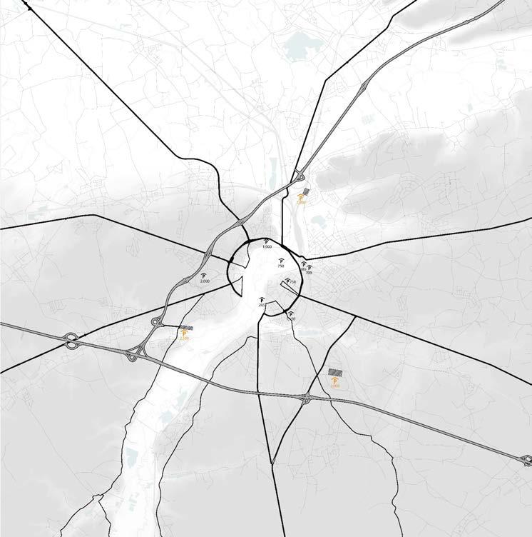
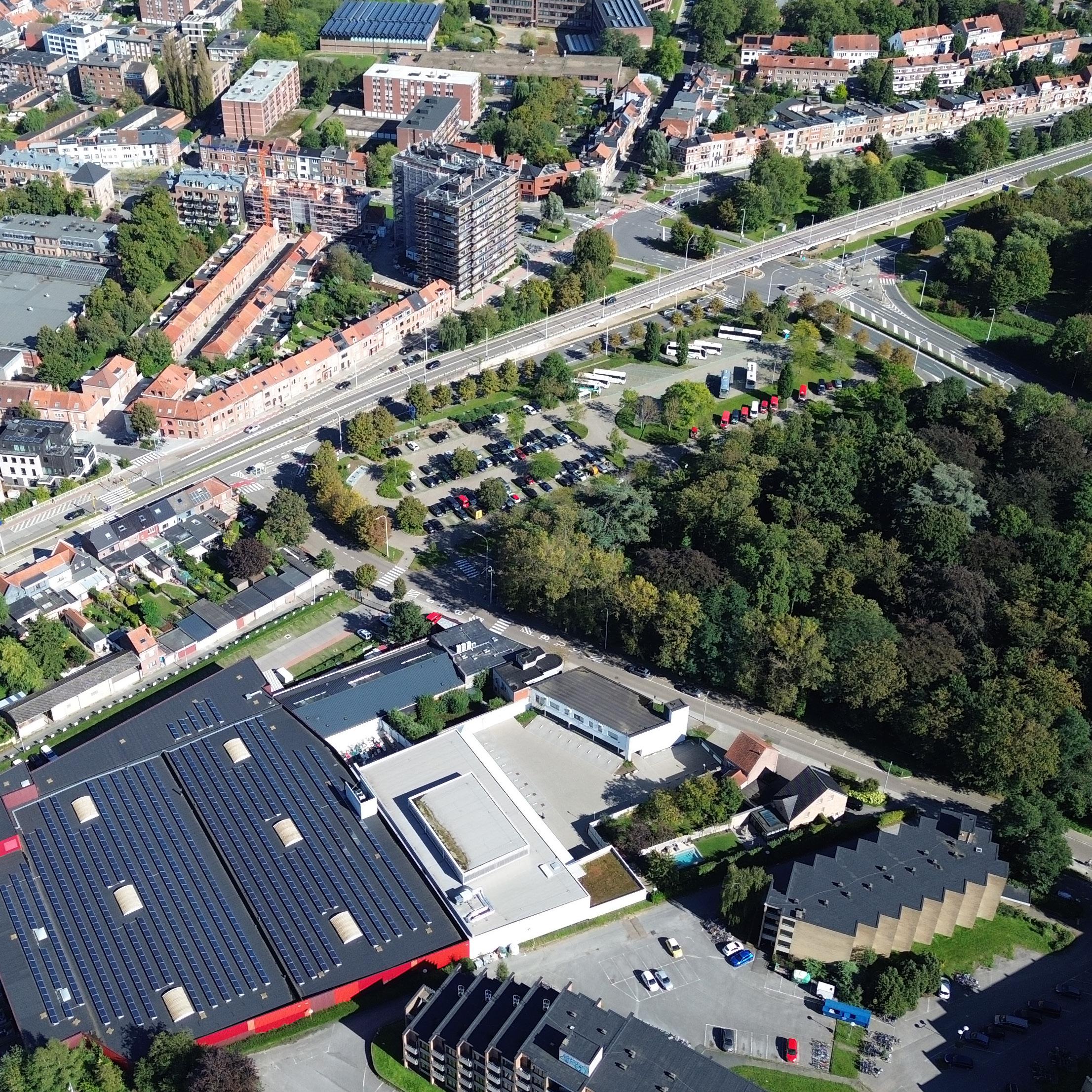
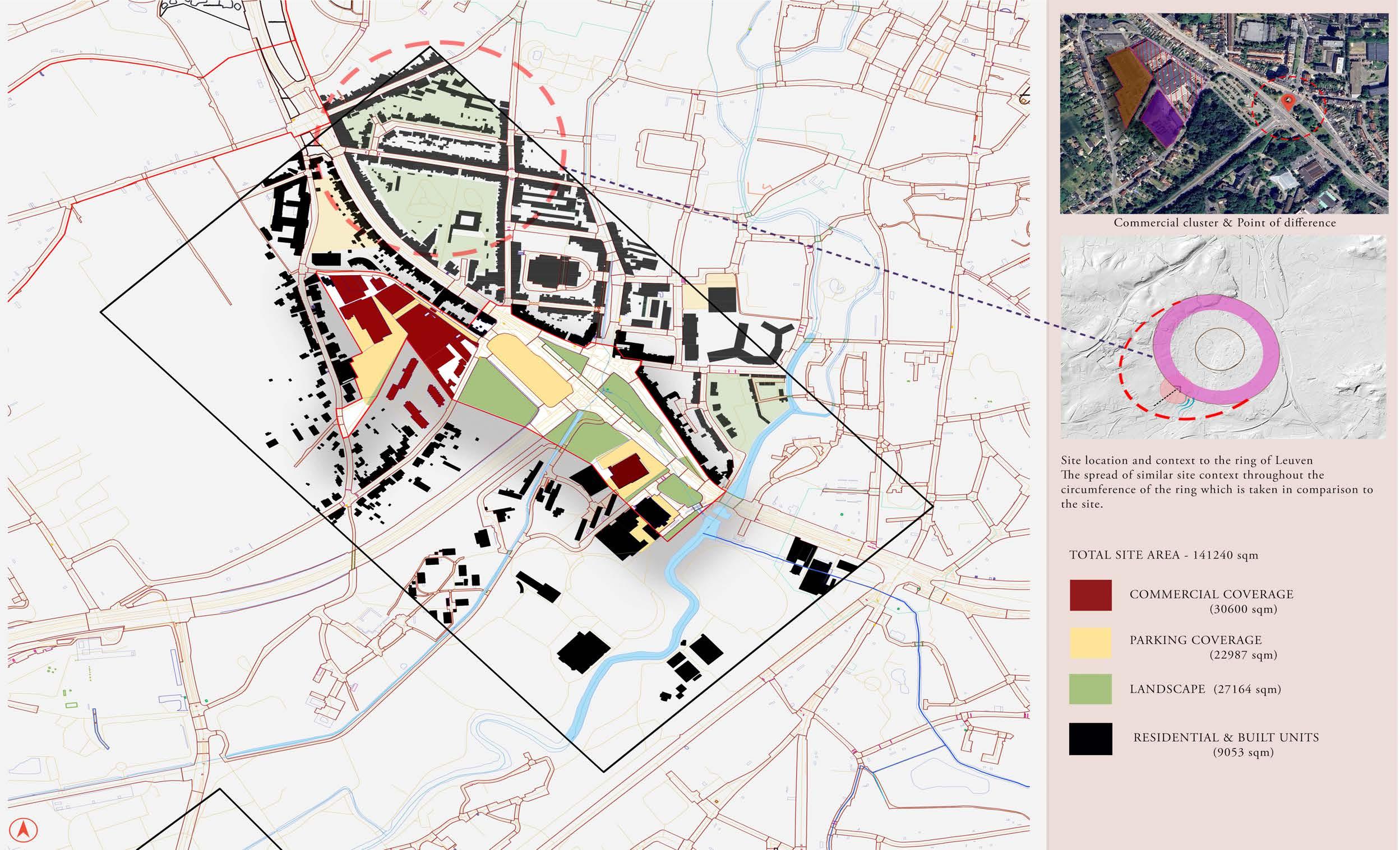
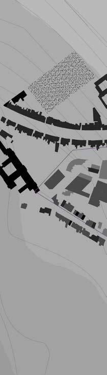
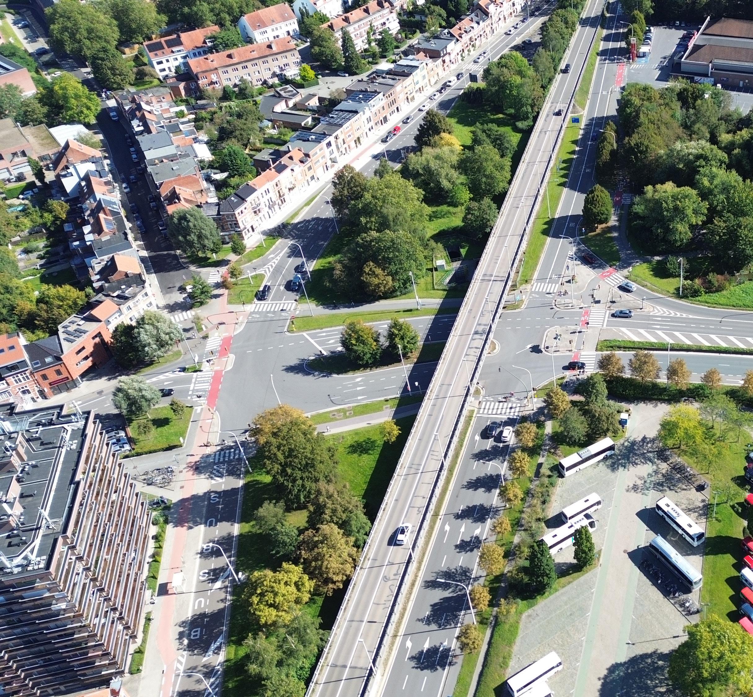
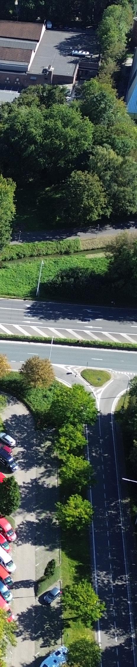
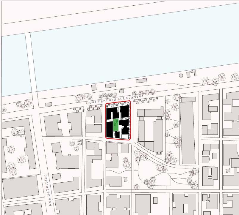
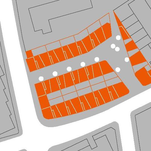
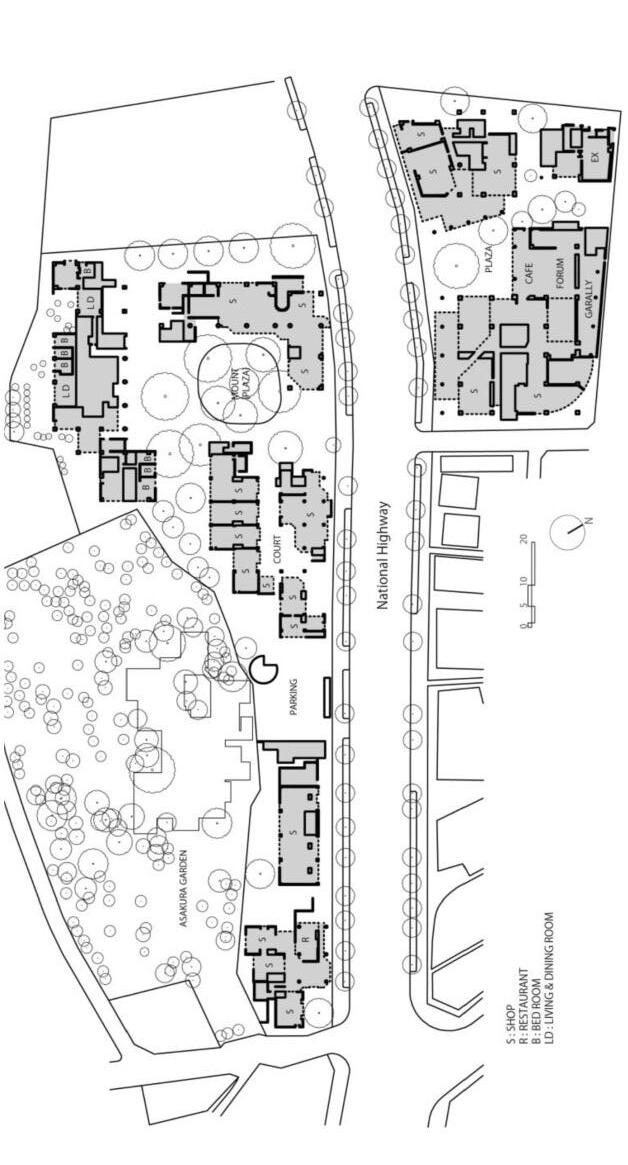
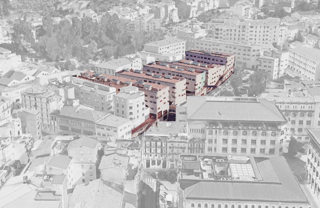
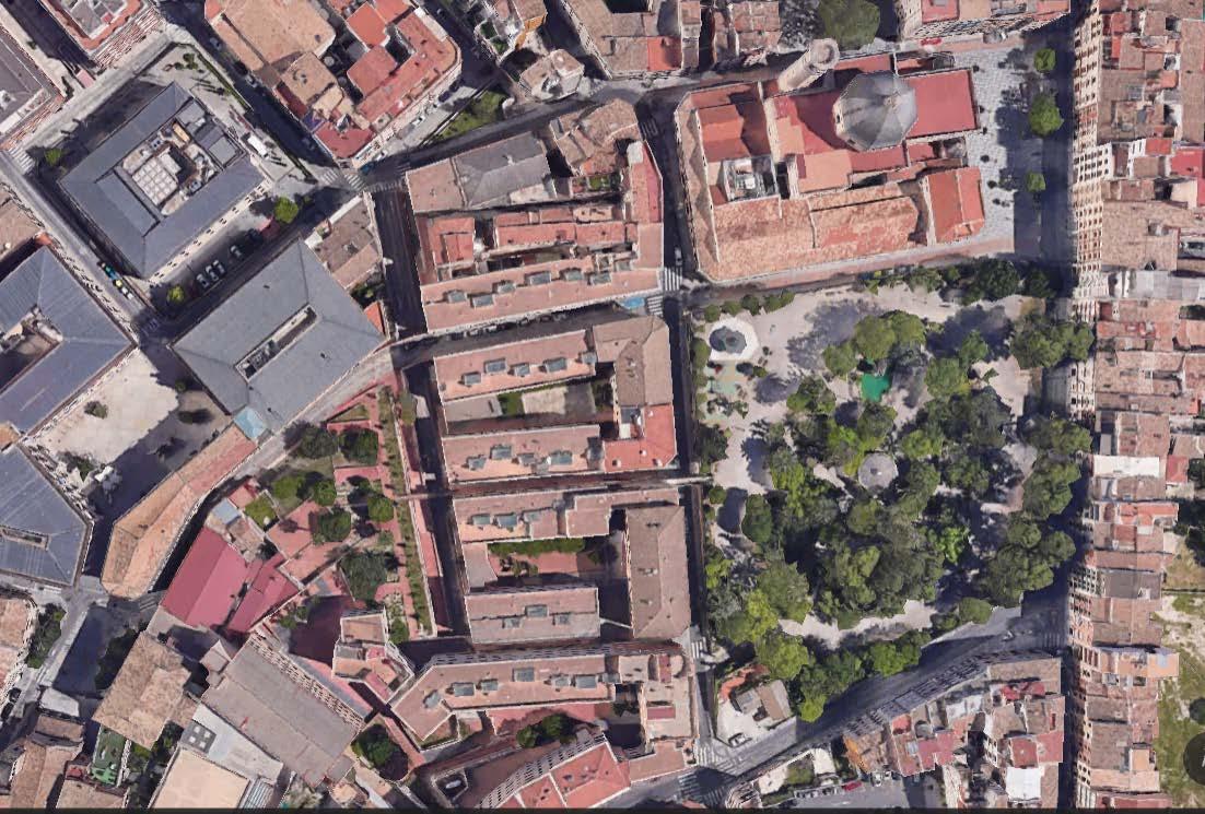
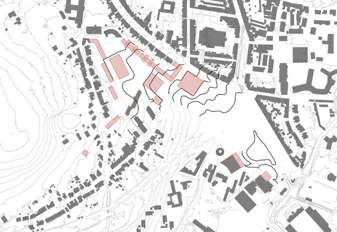
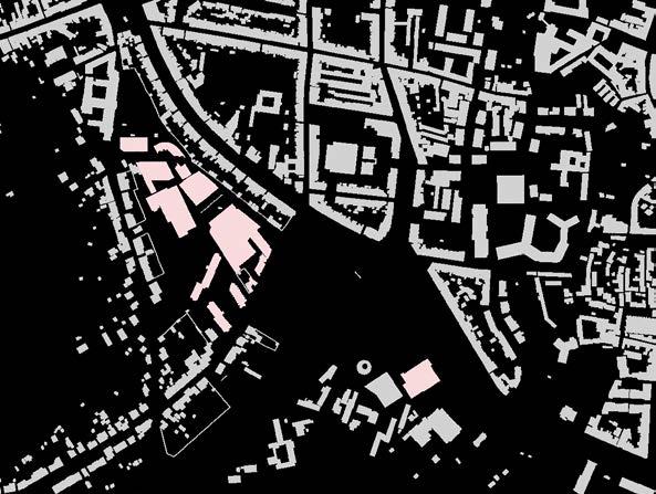
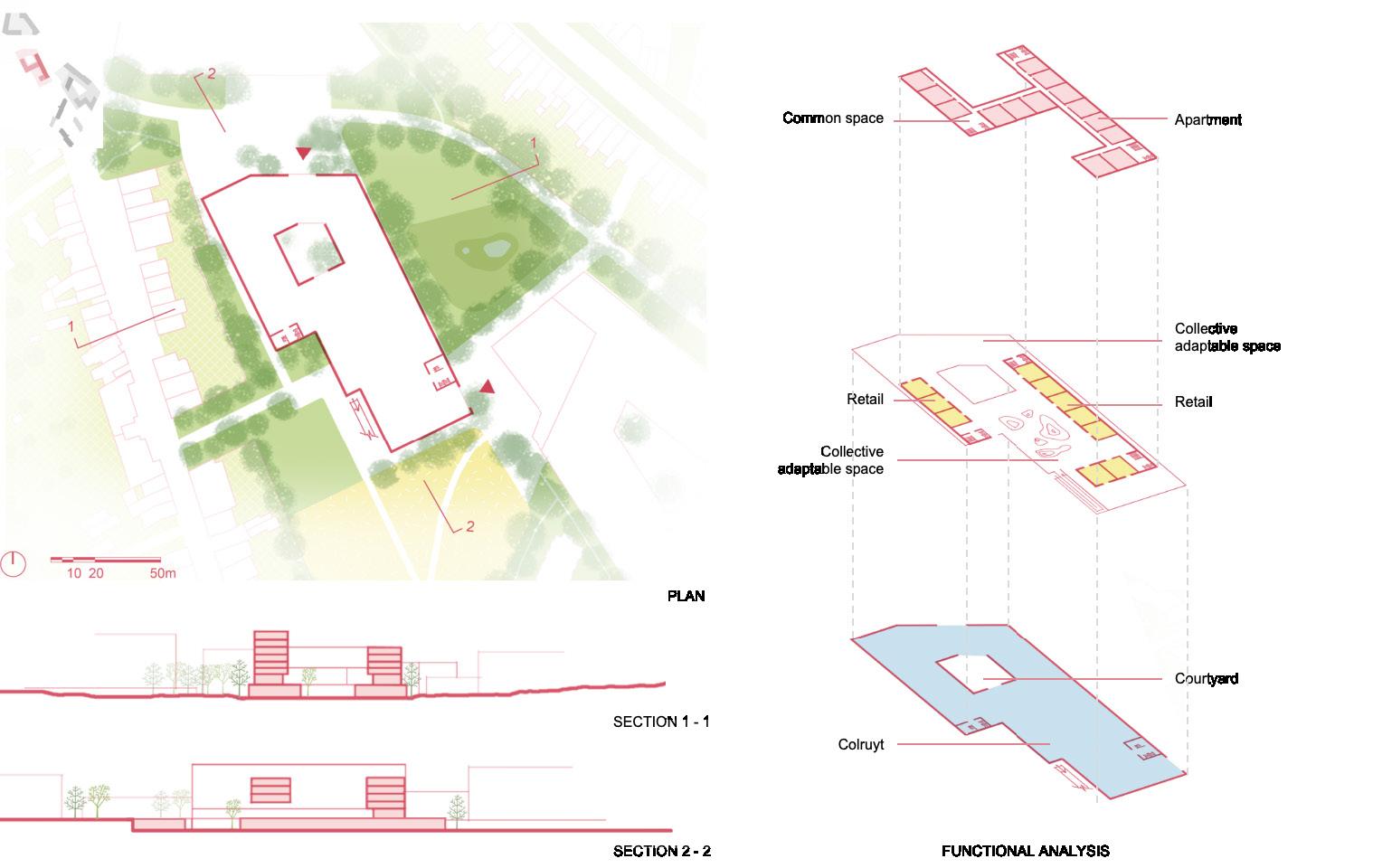
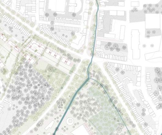
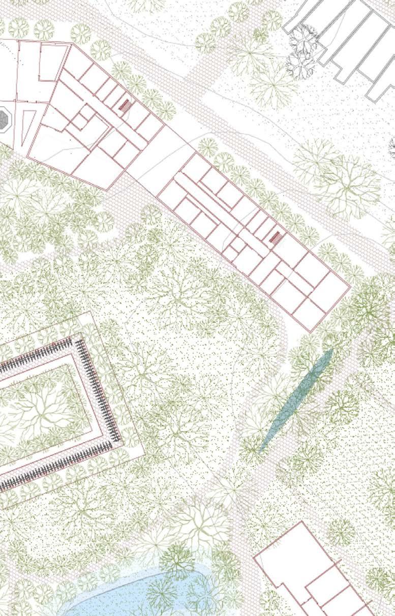
The site includes the Bodart Parking and the Carrefour-site at Tervuurse poort (including the reconsidetation of the viaduct), as well as the nearby big-box developments. The city gate at Kapucijnenvoer has been turned into one gigantic road crossing, including viaduct and peripheral functions on its corner; there is a city parking lot and an outdated supermarket (blocking a connection with the Arenberg park).
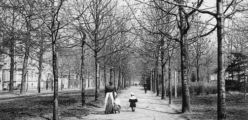
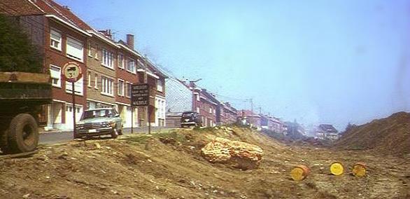
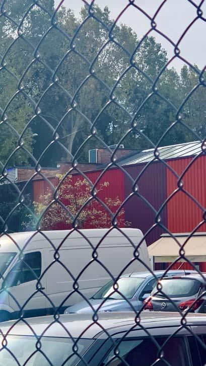
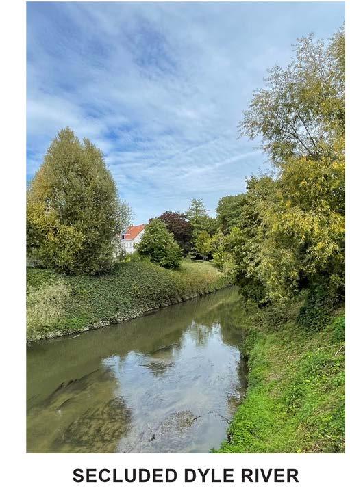
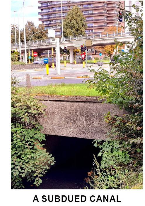
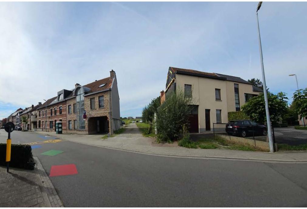
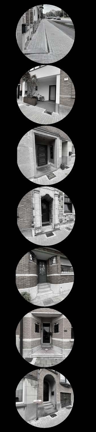
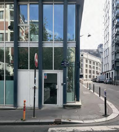
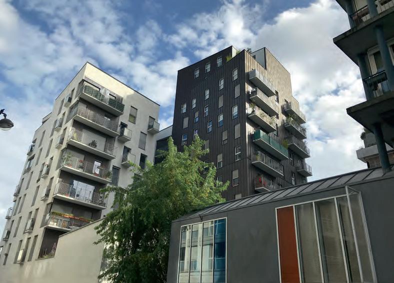
Overview, A Photographic Story
© Praveenkumar
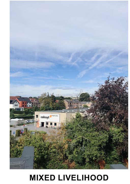
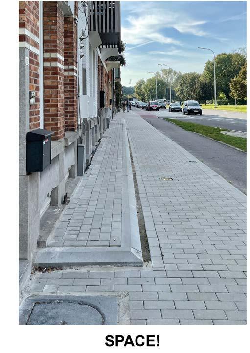
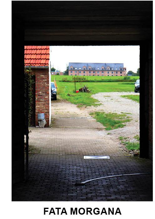
©Tom Van Laer
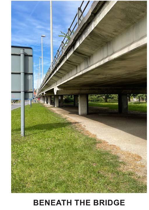
©Asmae
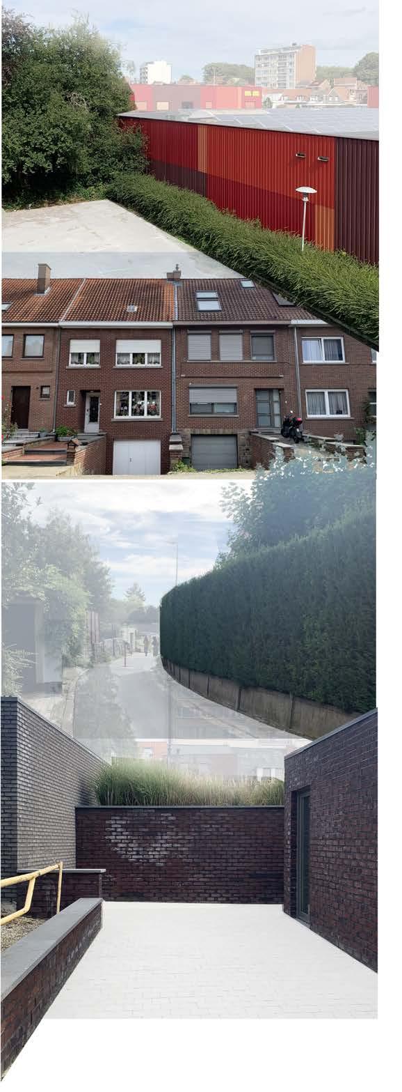
ENCLOSURE - DISSONANCE
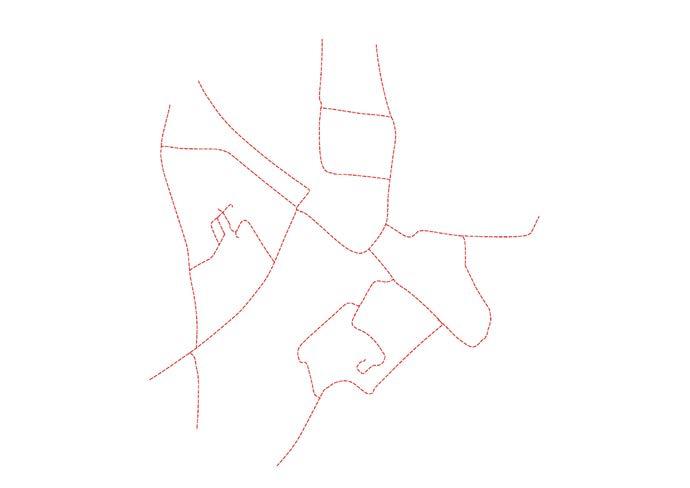
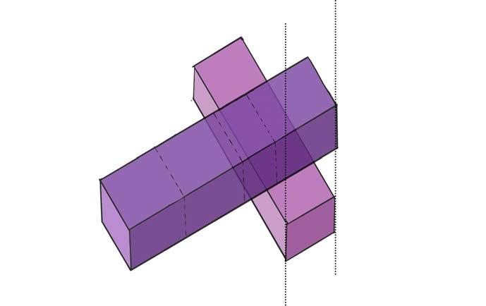
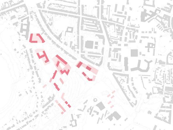
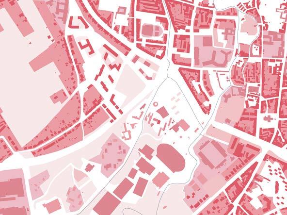
The outermost border of the site is marked by solid lines, indicating its tangible limits. The site appears enclosed, defined by tangible elements such as high walls, fences, or natural barriers that create a definitive edge to the site and making it challenging for movement in and out.
In purple are represented the intangible boundaries of the site. These limits are less concrete but are just as significant. They iclude roads and parkings representing barriers because of the imposing presence of cars and traffic that make it challenging for movement within the site.
 Asmae EL RHAZI
TANGIBLE LIMITS OF THE SITE:
“Boxes”, houses, fences, private properties limits
Green limits
Water limits
INTANGIBLE LIMITS OF THE SITE:
Parkings
High speed roads
Praveenkumar Paramagourou
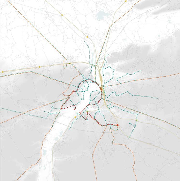
In Comparsion to the similar site area (ie.,2/3rd) it is observed that the settlement pattern differs with more mixed residential units and open landscape to the center of the units. Moreover parking is significantly allinged througout the road network.
What makes the difference in the settlement pattern of the two zones, is it the ring road which technically divides the city as dense and outskirt as commercial & Parking cluster?
How can we engage more with positive open spaces?
Huijun LiuWhat makes a positive space?
How can we engage more with positive spaces?
Can this fragmentation of functions and open spaces be converged and become the core of a new development ?
The over-constructed Groenveld crossroads has fragmented the open spaces and disconnected the users from these spaces. How can this crossroads be reimagined to become a more attractive, accessible and flood-adaptive “green crossroads” in the future ?
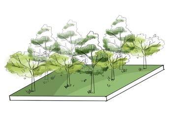
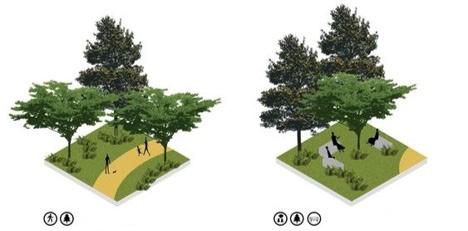
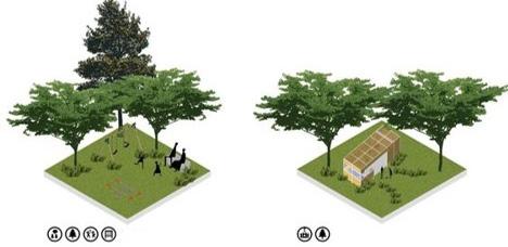
P-1 [Forest]
Accessibility
Attractiveness/ Activity
Tree density
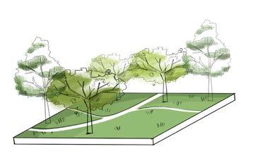
P-2 [Sport]
Accessibility
Attractiveness/ Activity
Tree density
P-3 [Private farm]
Accessibility
Attractiveness/ Activity
Tree density
P-4 [Unused open space]
Accessibility
Attractiveness/ Activity
Tree density
L-1 [Median strip]
Accessibility
Attractiveness/ Activity
Tree density
L-2 [Public park]
Accessibility
Attractiveness/ Activity
Tree density
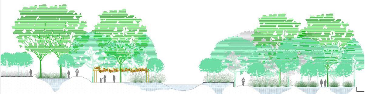
Foothill Groenveld_C
RIVER GENTLE SLOPE FLAT
RARE FLOODING FREQUENT FLOODING
How does man-made interventions - “cuts” and “fills”- transformed the topography and floodability in the Groenveld Bodart area?
Bezawit Tekle Gasso
STEEP SLOPE
FREQUENT FLOODING Legend
RIVER
RARE FLOODING
Landings
Playing and Sitting Trees
Grass covers
Path
Programmed and walker-paved walkways
Generally Accessible or Trespassable
Bounded
Publicly Accessible or Intermittently Accessible Inaccessible
Programmed and walker-paved walkways
Publicly Accessible or Intermittently Accessible Inaccessible Generally Accessible or Trespassable
Playing and Sitting
Trees
Grass covers
Path
Programmed and walker-paved walkways
Generally Accessible or Trespassable
Bounded
Publicly Accessible or Intermittently Accessible Inaccessible
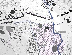
1) At the begining of the XXst century, the ground outside the historic wall was used as a productive ground, the valley was not built because of the flooding risks. And they use canals to irrigate water of the Dijl.
2) Then, during the middle of the century, the inside of the city is completed by individual houses. And the outside of the city mostly stays as food production.
3) At the end of the XXst century, there is a need for universitarian buildings and a new ringroad. The valley is becoming less and less green. And the rivers becomes underground.
4) Now, there are flooding risks, and more houses needed. This valley has a potential because the using of the ground has to change for the future. Cars needs less space, trades must be more local and water and houses need more space. (5)
The analysis of the developments in passenger mobility is one of our main areas for research. The main is issue is not only the monitoring of the current mobility, but even more the explanation of the transport behavior and the forecast of future transport volumes. what way does mobility have a greater impact on the city than any other factor?
1.Leuven Ijzerenmolenstraat
2.Leuven Sportcentrum
Analysed by Praveenkumar_r0963410
MaULP_FoothillGroenveld_A
How can a densely populated area be made more hazardous while yet accommodating a variety of uses, including residences, workplaces, and a university, in its evolving district?
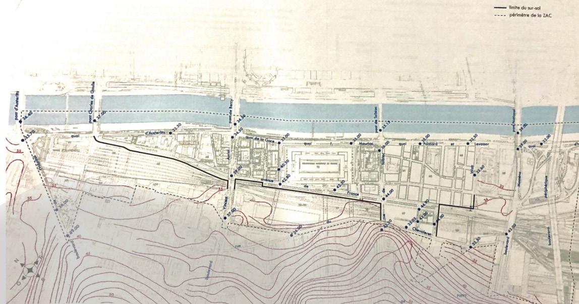
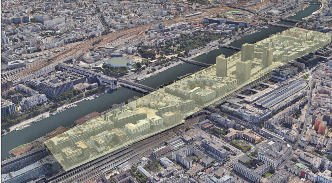
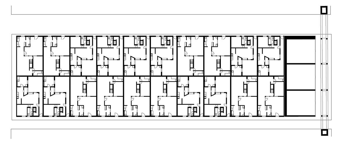
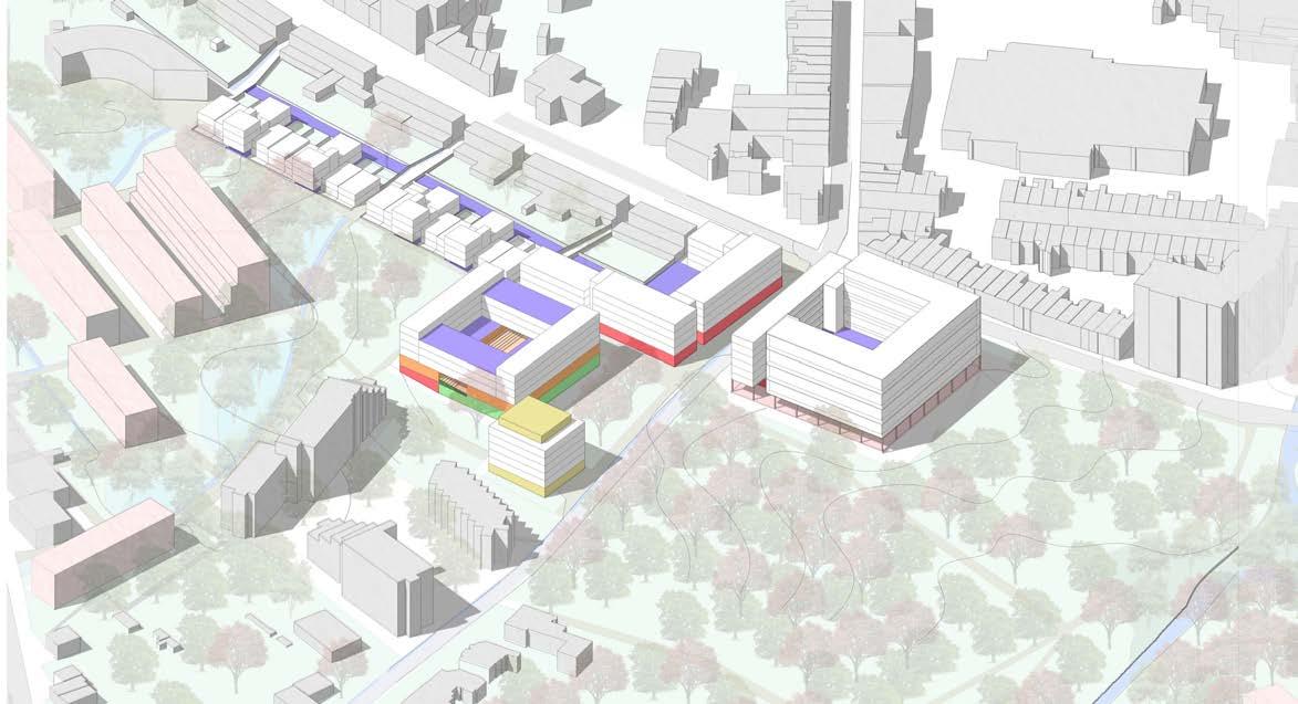
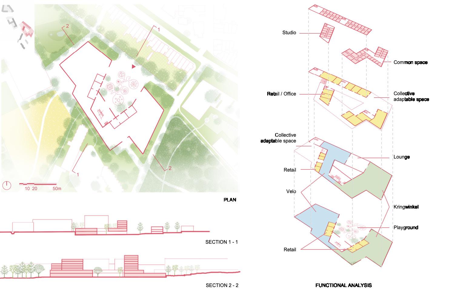
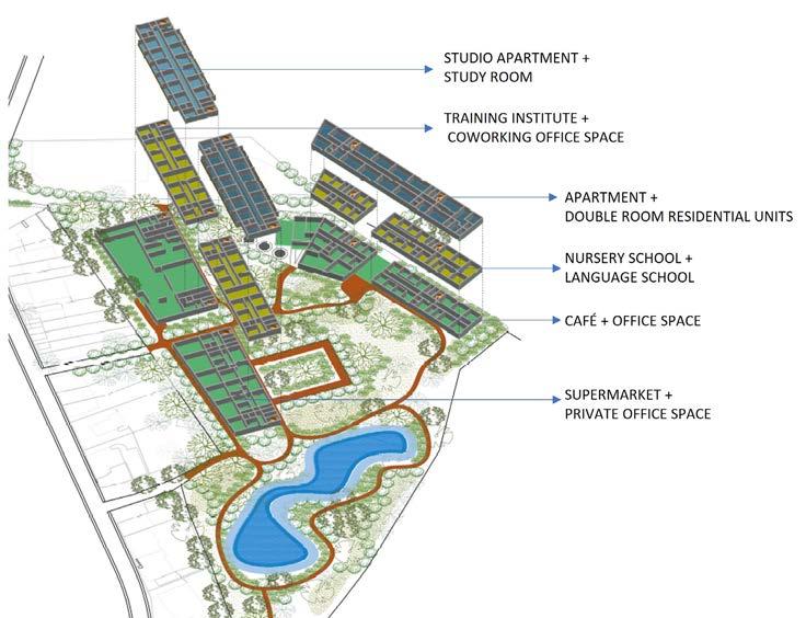
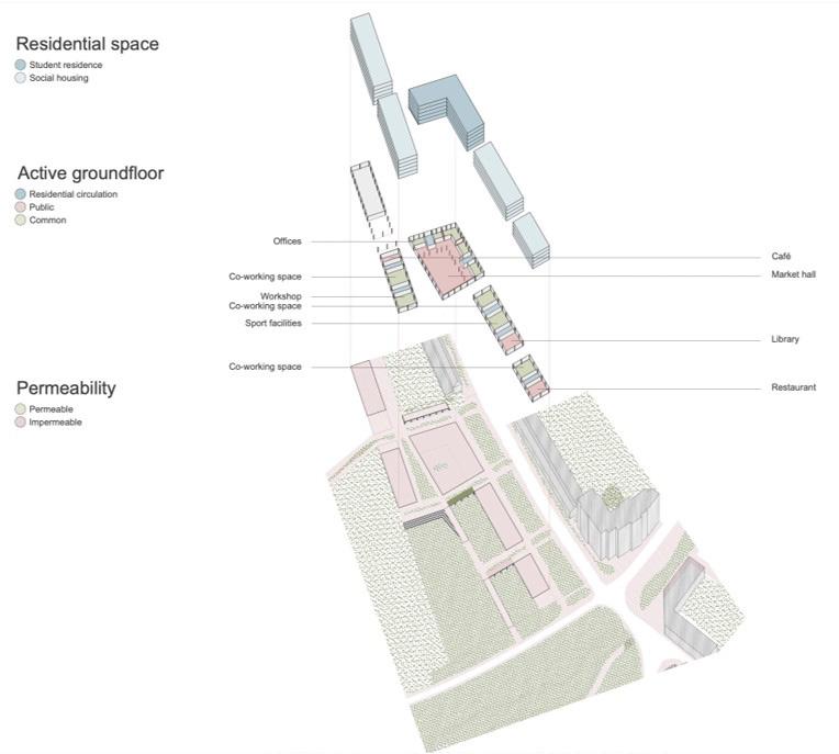
Builded surface: 337,000 m² SHON – Housing: 67 200 m² | Retails : 36 900 m² | Offices: 117 600 m² | Equipments: 5 200 m² | University : 110 000 m² | Park and public gardens : 11,2 ha
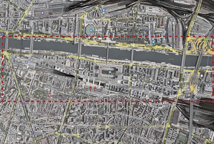
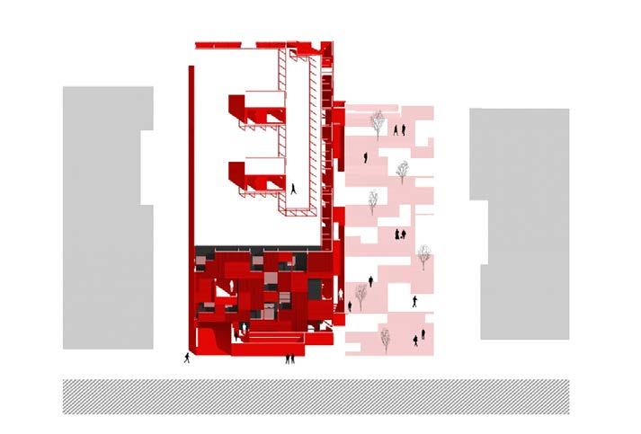
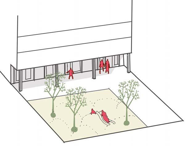
Instead of a rigid mass strategy, Christian de Portzamparc devises a set of guidelines that allow for flexibility. Christian de Portzamparc applies a notion of the “open block” and its illuminating and varied “open street” at the district level, which he developed throughout the 1980s. The roadway opens up onto the interior side of the open blocks with gardens planted because the buildings are separate and autonomous. Exposure to sunshine benefits all sides of the building. The roadway is used as the conduit for the vast array of programmes, volumes, and materials.
Christian de Portzamparc creates a set of guidelines that allow for modifications rather than a rigid mass plan. Christian de Portzamparc uses the “open block” and its illustrative, cosmopolitan “open street” on a district size, a concept he created in the 1980s. Due to the independence and separation of the buildings, the internal side of the open blocks with gardens can be accessed from the street. All of the building’s sides profit from solar exposure. Numerous different programmes, quantities, and materials are used along the length of the street.
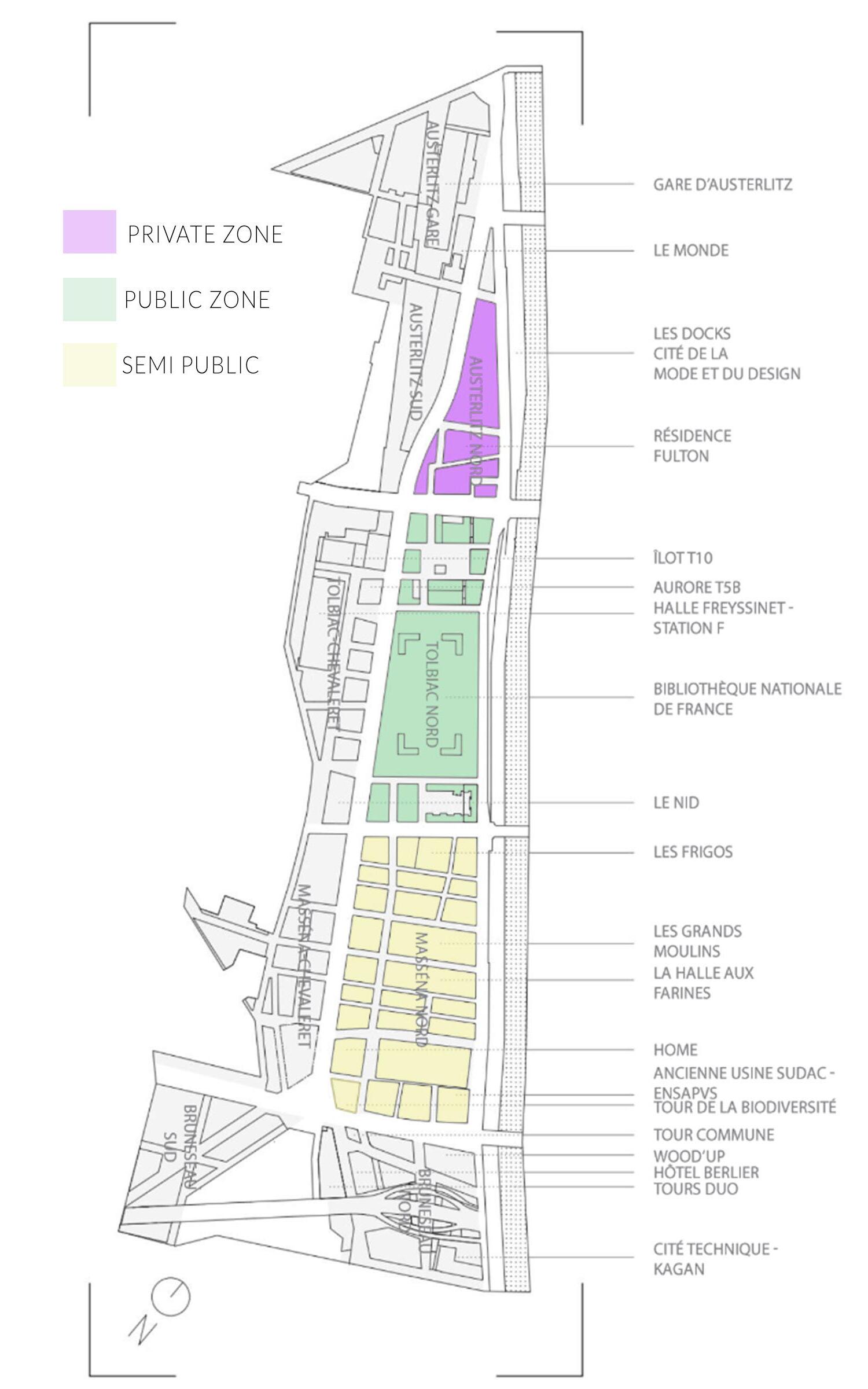
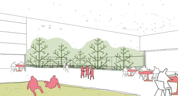
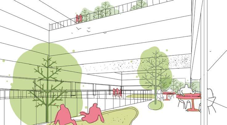
The whole structure of the fabric is followed with the concept of open spaces which deals with porous volume concept. The connectivity of different funtions with courtyard as a center. For eg., the quartier massena has a courtyard as common for office, residences and also for the commercial spaces but it is also surrounded by walled gardens as a private entity for residences whereas the courtyard acts as a semi public spaces for the offices & commercial space.
(Source: https://dash-journal.com/quartier-massena/)
(Source: https://dash-journal.com/quartier-massena/)
CONTEXTUALISED VOLUMETRY
A Linear stretch of open space volume with courtyard used as an functional circulation element throuhout the fabric
(Source: PARIS RIVE GAUCHE : UNE ZAC D’EXCEPTIONS De Seine Rive Gauche à Paris Rive Gauche, Lea’ Daumalle)
(Source: https://dash-journal.com/quartier-massena/)

(Source: https://dash-journal.com/quartier-massena/)
(Source: https://dash-journal.com/quartier-massena/)
(Source: https://dash-journal.com/quartier-massena/)
(Source: https://dash-journal.com/quartier-massena/)
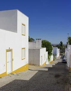
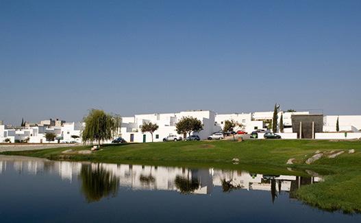
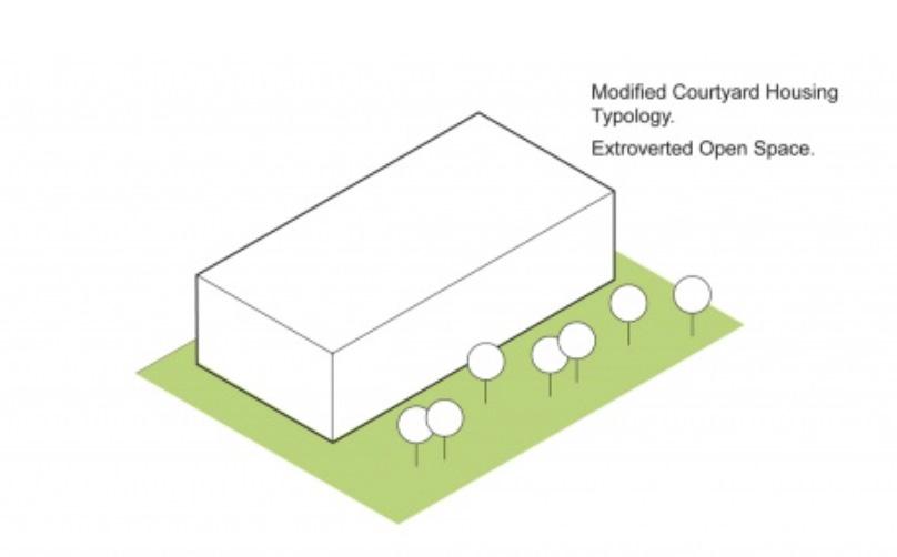
Malagueira was designed as a suburban community on the outskirts of Évora, Portugal, an old Roman town of about 40,000 that was the capital of the Alentejo region, located about 100 miles east of Lisbon. After multiple generations of development, this project attempts to address the needs of a previously known “Bairro Santa Maria” on an unincorporated land on the outskirts of Evora starting from 1977. This project consists of 10 (5 type A and 5 type B) variations of 8x12 meter, one or two-story homes with a patio area for each household. In the 1990s additional typologies were built with a smaller width of 6x12m. Now there are about 1200 housing units on the lying on 27 hectares of land.
The housing units were composed of two-story buildings with one to five bedrooms and a cozy private patio. There were a total of 1200 newly built houses arranged in Villas, with semi-detached houses spanning 100 meters in length and connected by peaceful residential streets.
The design is related to the residential fabric of the ancient ruins of Pompeii and Herculaneum through the presence of buildings that open up directly to the street and the challenging topography. The hierarchy in street width allows clear distinction of accessiblity - between the private and the public. He also follows a strategy to engage end users through the development of the concept
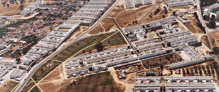
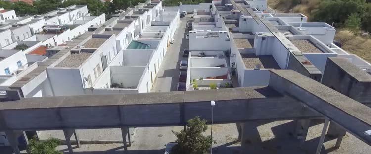
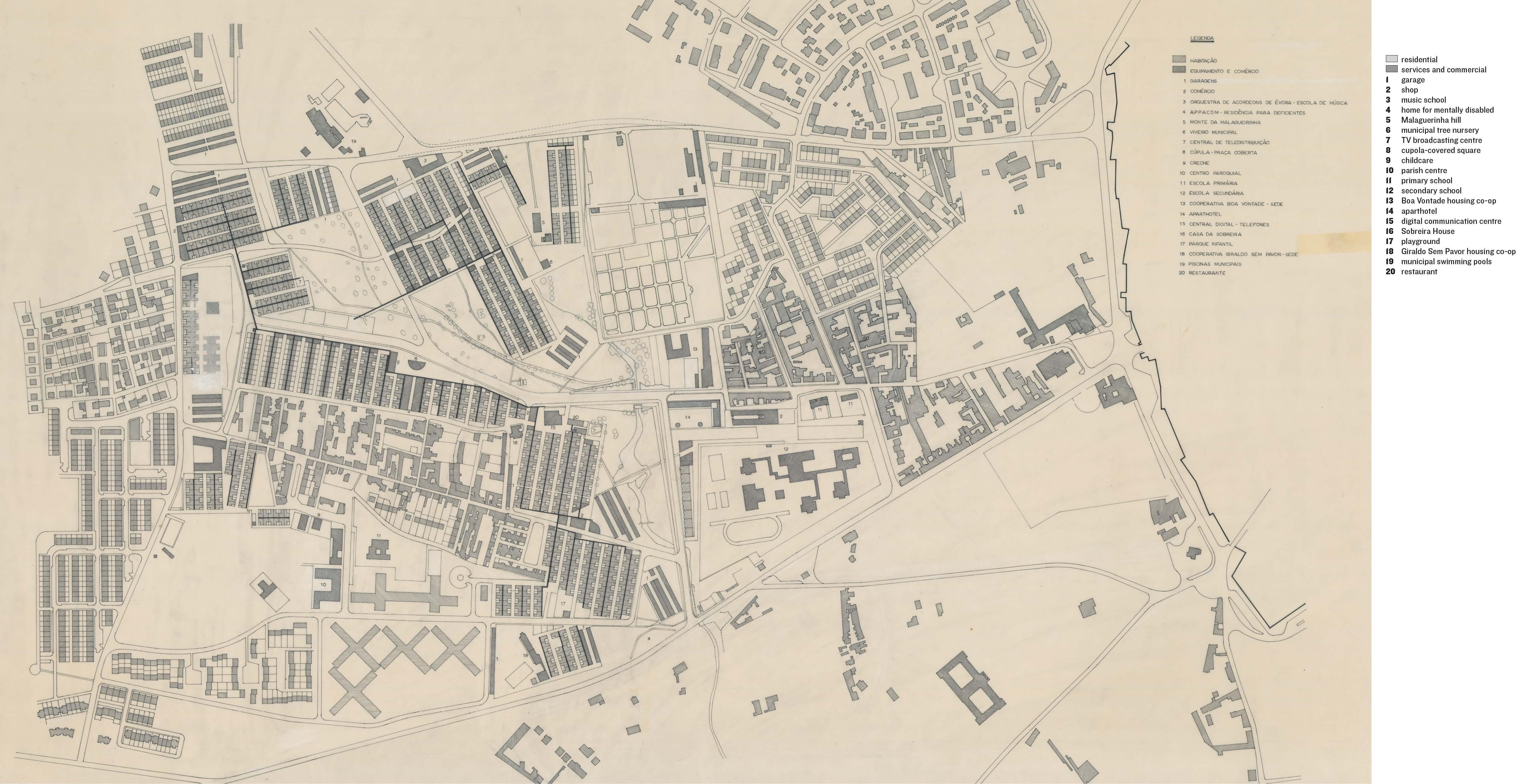
Aqueduct management
Unbuilt square
Music School Garage
Children Playground
Open ground (public space)
Nursery
Comercial blocks
Aqueduct
Motorized vehicle circulation
Pedestrian walkways
2550
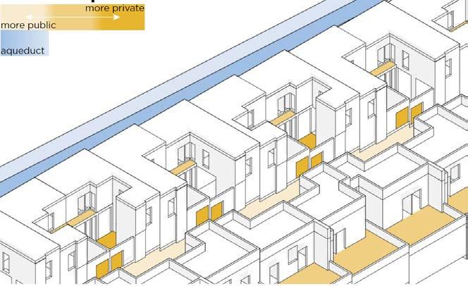
Increased privacy in the patios inside the houses and direct access to the street to create a sense of place and neighborhood.
The aqueducts, resembling a nearby Roman aqueduct, to convey utilities to the houses without digging the ground
(Source: https://issuu.com/josephrquan/docs/assig3_final_qdm)
(Source:https://www.omicsonline.org/open-access/modernize-the-courtyard-house-2168-9717-1000225-107859.html)
(Source: https://espacodearquitetura.com/projetos/bairro-da-malagueira/)
(Source: https://www.architectural-review.com/essays/revisiting-siza-an-archaeology-of-the-future
Analysed by Saba khan_r0962749
MaULP_Foothill Gronveld C
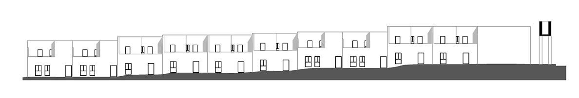
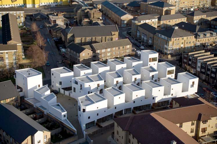
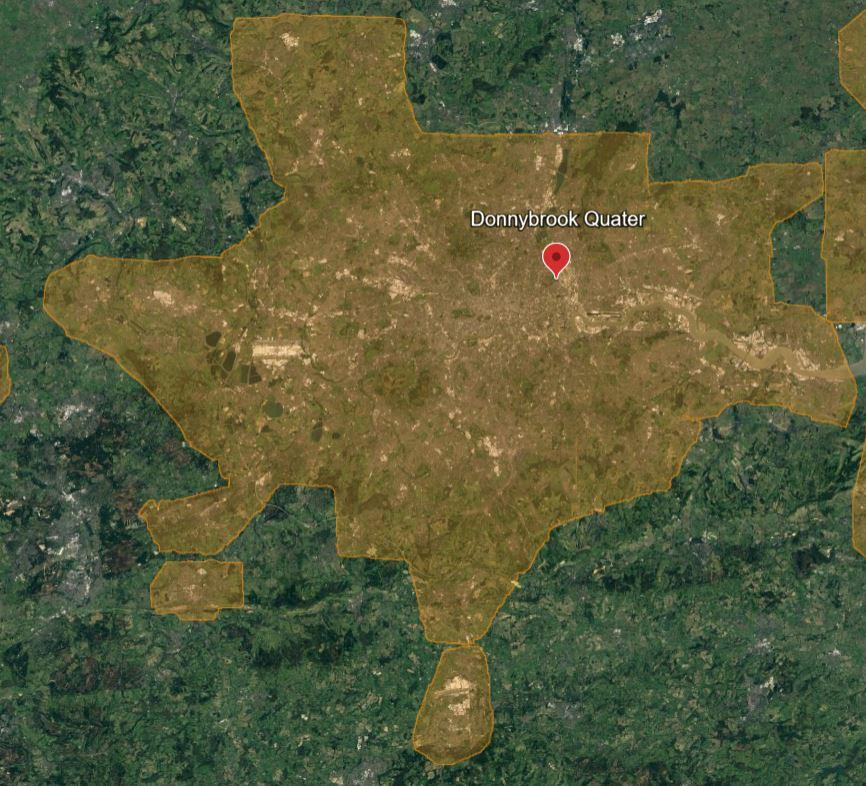
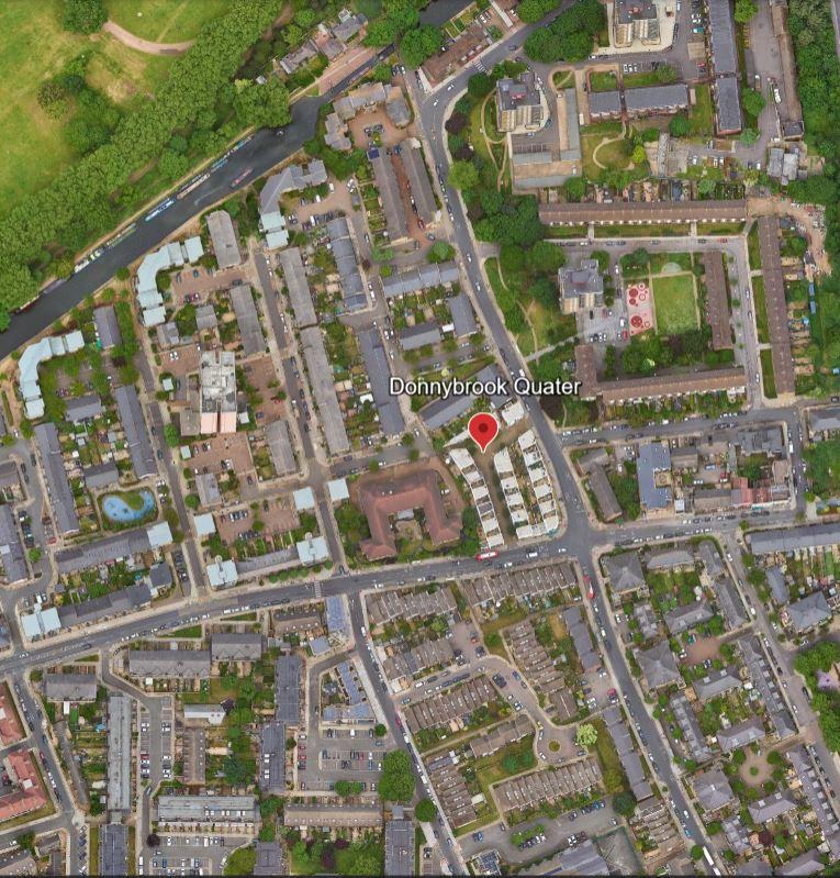
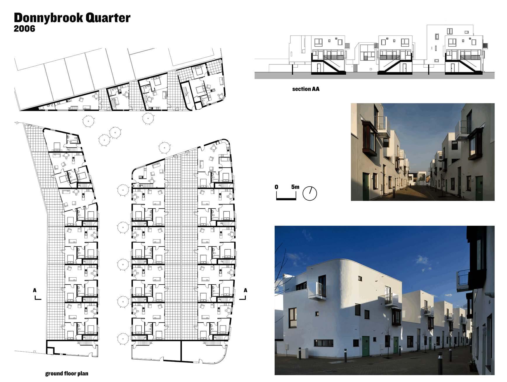
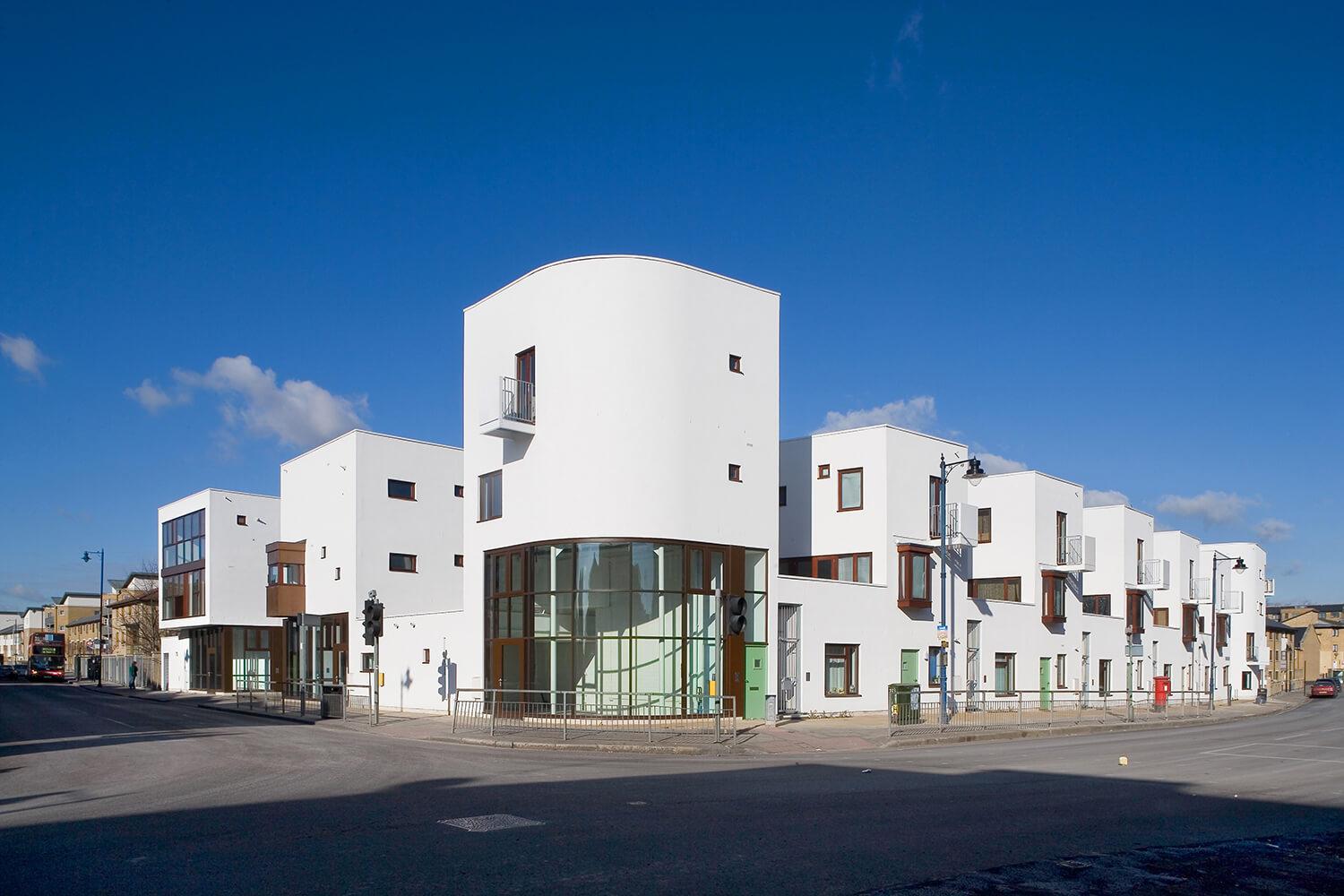
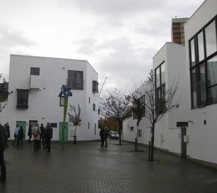
Donnybrook Quarter is a residential district of the Old Ford area of East London. The project has been the subject of numerous exhibitions and has attracted significant media and academic interest. It has been described as a model for large scale, high density, low rise urban design. The scheme is laid out around two new tree lined streets which cross the site creating strong spatial connections with adjacent neighborhoods.
-Enhancing urban density to encourage increased street activity and socioeconomic development within an under-resourced interior of London.
-Switching the perspective on sustainable architecture to focus on urban principles rather than solely technological aspects.
-Reinstating urban planning as the fundamental driving force in designing urban housing, with a strong emphasis on maintaining a close and direct connection with the street.
(Source: https://klublr.com/ena/donnybrook-quarter)
LOCATION: CENTRAL

(Source:
(Source: https://www.archilovers.com/projects/118274/donnybrook-quarter.html#info)
Thoughtful integration of Donnybrook Quarters contributes to the overall urban environment. It uplifts a sense of cohesion, making the housing an organic part of the neighborhood rather than an abrupt imposition. Building typology in Donnybrook Quarters is a blend of traditional and contemperory design elements, it optimizes the design with horizontal organization so that it takes advantage of the space with a total of 40 houses where 130 people live. At the same time this design respects more the English tradition and provides courtyards to each individual apartment.
(Source: https://westminsterresearch.westminster.ac.uk/ download/7f485cda552f27b6ca53d000d923488c444a41be38caea37220b7a9ae4af90ac/1931 523/Barber_3.pdf)
GROUND FLOOR PLAN
FIRST FLOOR PLAN
SECOND FLOOR PLAN
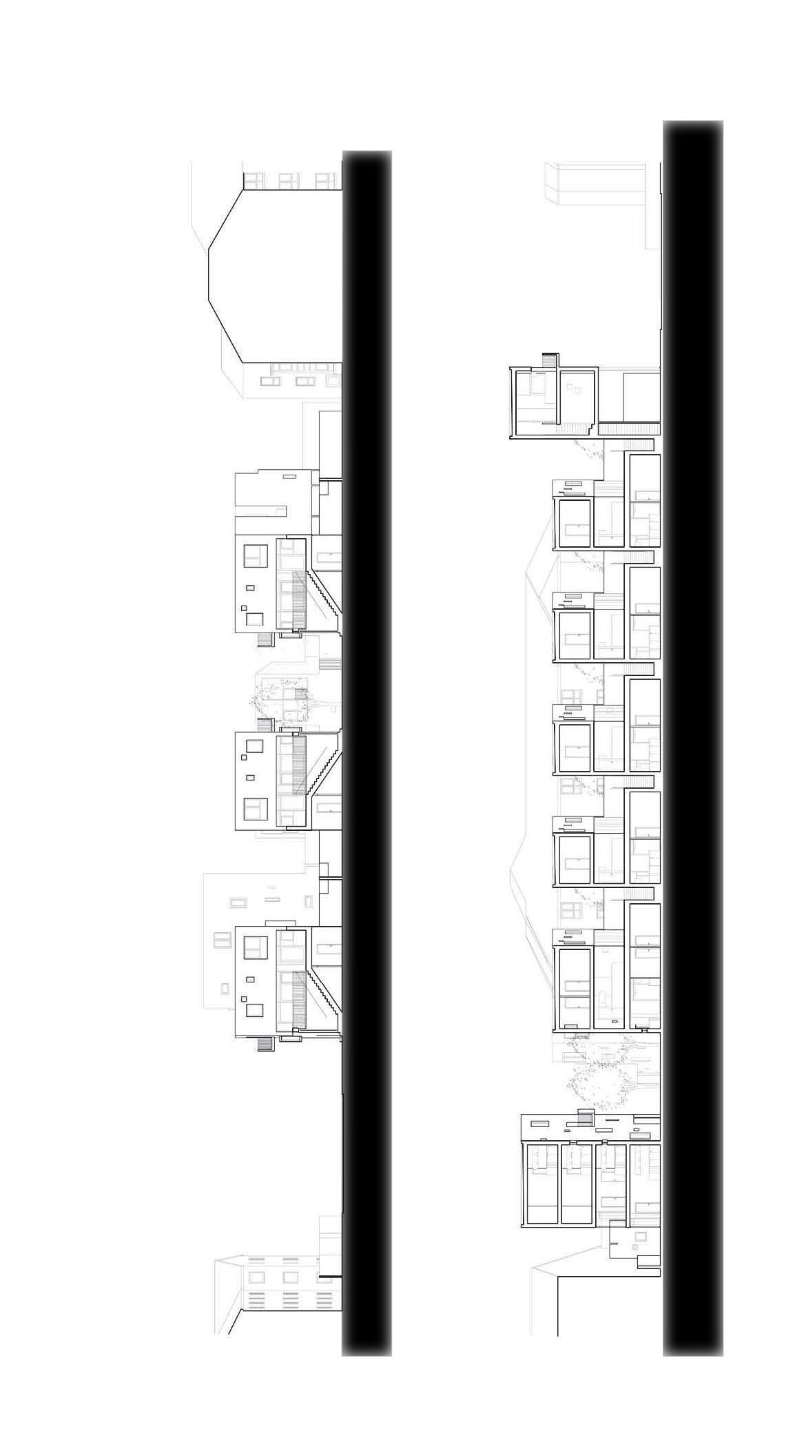
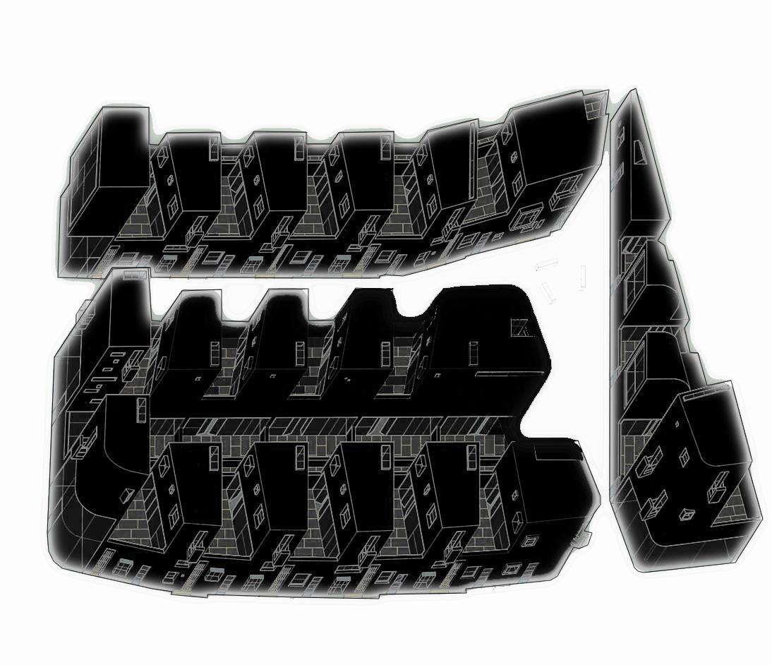
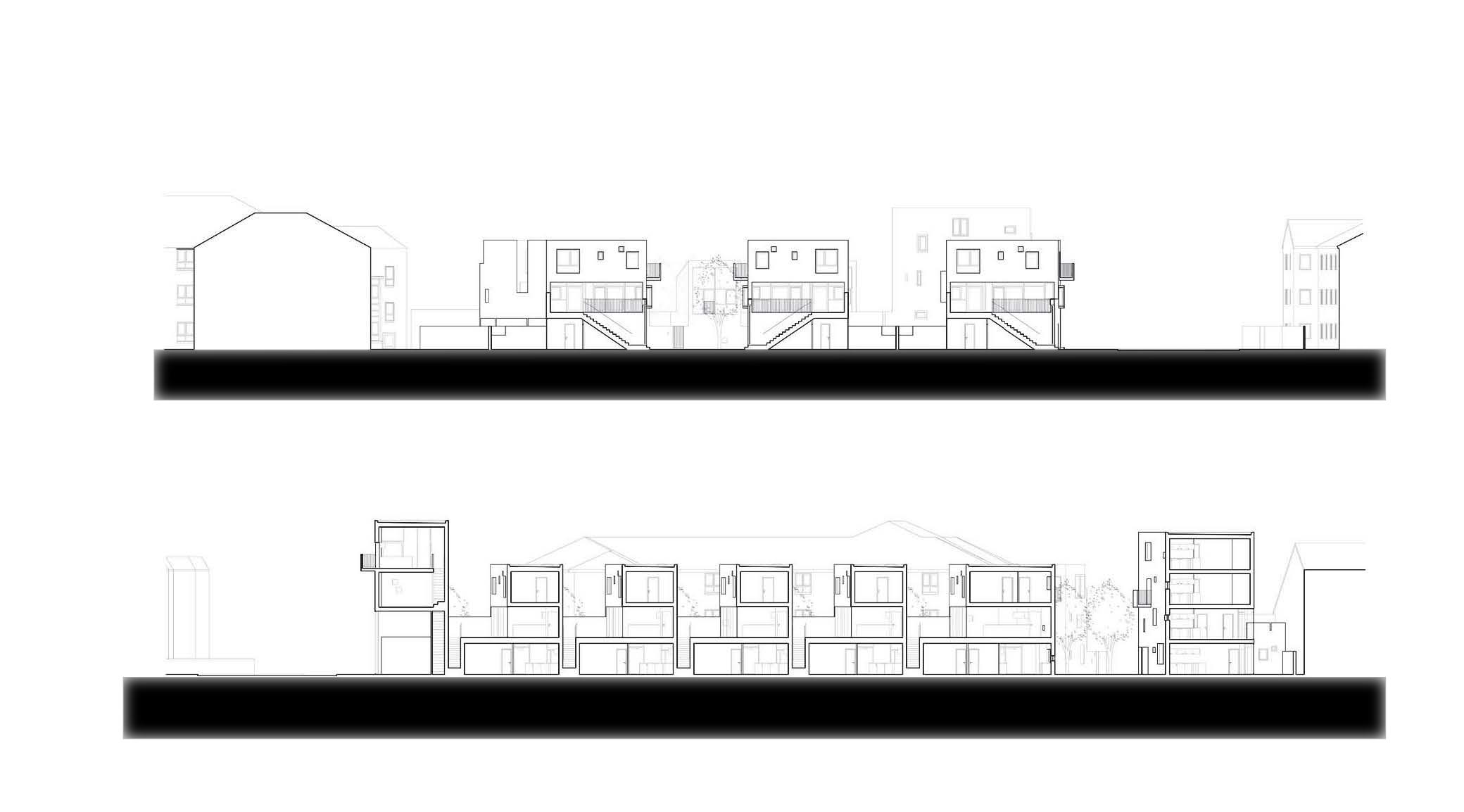
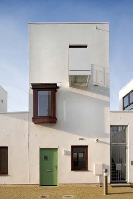
Barber's standard building block is a two-bed ground floor flat with a two-bed maisonette sat on top. Each maisonette has its own gated entrance directly off the pavement. From here an external stair leads up to a private courtyard running from the front to back of the plan at first floor level. The majority of each maisonette's glazing is oriented towards this space, while French doors enable an easy relationship between the courtyard and the kitchen and living room sited on the lower of the dwelling's two levels. Deployed in sequence this configuration generates terraces of a distinctive serrated profile. The flank walls of the maisonettes register like a giant order, providing a visual structure for the pot-pourri of different openings that animate the elevations. In addition to the large windows, gates and doors that occupy the lower level of these frontages, bay windows and balconies are teased out over the pavement at high level.
THIRD FLOOR PLAN
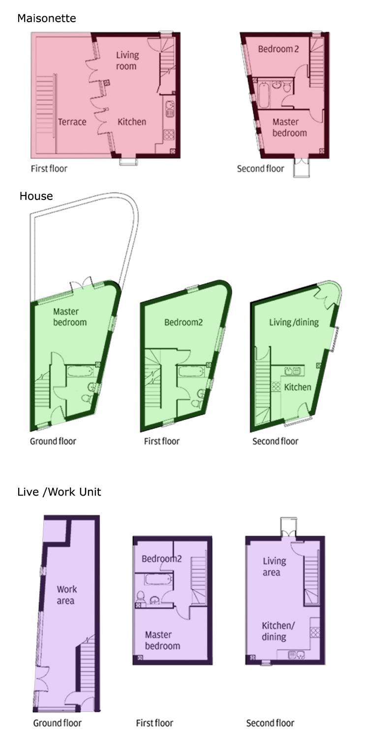
Donnybrook Quater have been developed a hybrid terrace/courtyard housing typology which has produced dwellings that are spacious, flooded with daylight and have a high level of privacy.The terrace enables every dwelling to have its own front door with circulation between units concentrated in the public open space of the streets and not in stairwells and decks. The courtyard has made it possible to achieve high densities despite all dwellings being between one and four stories high.
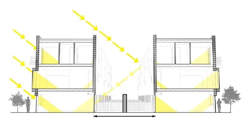
Final drawing, sectional one point perspective taken through the typical housing units, showing the structural build up and how the white acrylic render uses natural daylight to create well-lit internal and external areas in a tight urban site of high density
(Source: chrome-extension://efaidnbmnnnibpcajpcglclefindmkaj/https:// westminsterresearch.westminster.ac.uk/ download/7f485cda552f27b6ca53d000d923488c444a41be38caea37220b7a9ae4af90ac/1931523/ Barber_3.pdf)
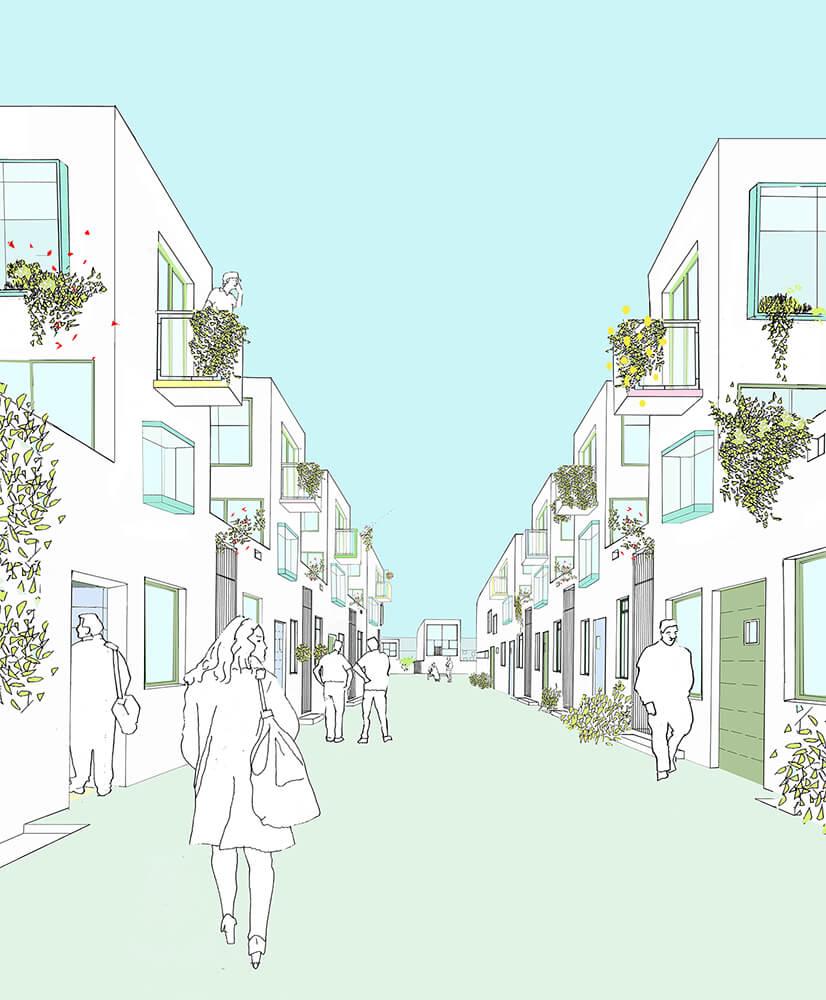
Every aspect of the design is configured to promote buzzing, thriving public space made with a hard edge of buildings. Streets overlooked by balconies, bay windows and roof terraces. Streets where people might enjoy to sit out, kids to play, people going to and from their homes or just passing through.
The street at the heart of the scheme runs north/south and joins with an east/west connection between Parnell Road and the recently completed housing along the canal. It gives access to the dwellings on either side and offers a pedestrian route for people walking along Old Fort Road and into Parnell Road. At the junction between the two routes is a public square. The public square is open to new and existing residents of the area and the cross routes link the new development to the existing community. In all parts of the site buildings form a hard edge to the street. Bay windows and balconies ensure that every inch of public space is heavily overlooked (and self policed) by residents. The scheme is a zero parking scheme and residents were asked to sign a no-car agreement when applying to purchase/rent.
(Source: http://housingplus.wikidot.com/donnybrook-housing)
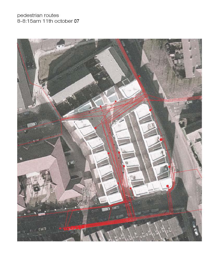
Post-occupancy analysis of pedestrian movement patterns around the Donnybrook Quarter
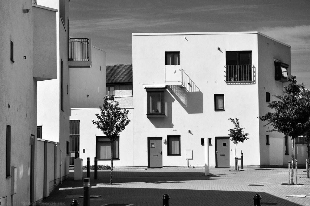
Photos around the Quarter
MaHS_Foothill Groenveld B
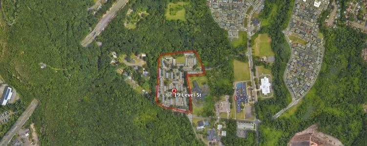
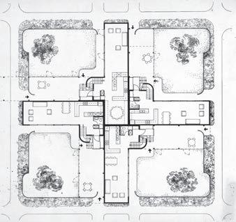
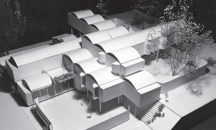
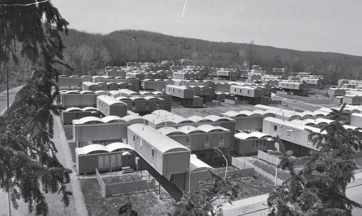
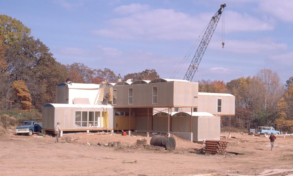
Located in New Haven, Connecticut, USA, the project was designed to solve the housing shortage problem in the area. Built in 1968 and completed in 1971, it consists of 148 prefab units, with a total area of about 4.8ha. Though later demolished in 1981, the project still served as a prominent example for modular housing in the 20th century.
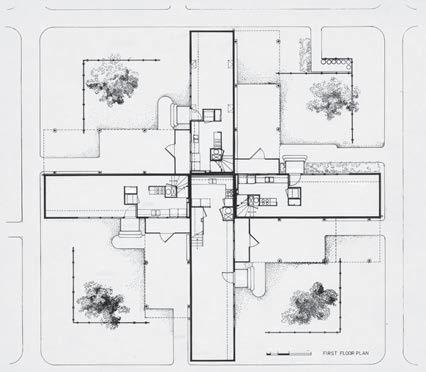
An alternative modular row house model, with two blocks (per housing unit ) stacked on top of each other. Four housing units were attached to a single core, providing a separate land plot and garden for each unit.
• The housing units were factory-made modular, with an attempt for low budget housing design and construction, the first project to use “20th century bricks”. However, the structure were unstable and the modular units turned out to be more expensive to fabricate than expected.
• 4 housing units with separated living-dining-kitchen and bedrooms were attached together in a cross shape. This allowed the families to have their own “space” but also decreased the social interaction between the neighbors and accessibility to collective gardens.
• The stacked blocks themselves did not blend in well with the surrounding urban tissues and presented a more gated enclave than a friendly neighborhood.
Location: 19 level st., new haven, ct, usa
(Source: Google Earth)
(Source: https://www.paulrudolph.institute/196801-oriental-masonic-gardens)
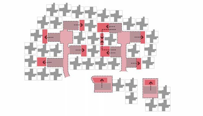
ACCESSIBILLITY TO COLLECTIVE GARDENS
(Source: Diagram redrawn by Trang Nguyen from original Masterplan)
Collective gardens are positioned within the housing units, However, accessibility to the gardens from the main roads are obstructed by the parking space in front. Some housing units are located further from the gardens, thus prevent the dwellers from accessing to the gardens.
SEPARATED COURTYARD WITHIN THE BUILDING
(Source: Diagram redrawn by Trang Nguyen from original Ground-floor plan)
Housing units of 2-5 bedrooms were attached together as a building block. Each housing unit had its own entrance and access to its private garden, with a collective utility core in the center.
(Source: https://www.paulrudolph.institute/196801-oriental-masonic-gardens)
(Source: Diagram redrawn by Trang Nguyen from original Masterplan)
Due to the position of the main roads and parking lots, accessibility to each collective gardens is limited to only a certain number of housholds, thus created a more isolated community.
(Source: https://www.paulrudolph.institute/196801-oriental-masonic-gardens)
As the housing units were placed askew to each other, they have different entrance and view to their gardens. The housing units all have fences surrounding their gardens, keeping the privacy of the dwellers.
(Source: https://www.paulrudolph.institute/196801-oriental-masonic-gardens)
(Source: https://www.paulrudolph.institute/196801-oriental-masonic-gardens)
After the completion of the project, the residential area was able to occupy 333 modules within 4.8ha, whilst still able to provide dwellers with sufficient open spaces. However, there was a lack of variety in the area as the functions and housing units design were the same without any landmark or focal points for the entire community.
The smaller, human-scale housing units were less over-whelming for the dwellers, but the lack of choice for personalization were more or less oppressive for them.
(Source: https://www.paulrudolph.institute/196801-oriental-masonic-gardens)
(Diagram redrawn by Trang Nguyen)
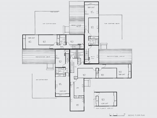
The design provided a variety of living unit typology, with 2 blocks (floors) stacked up, creating a housing unit. Each unit has 2-5 bedrooms (second-floor), separated living-kitchen-dining spaces (ground-floor) and has views to their own gardens.
(Source: https://www.paulrudolph.institute/196801-oriental-masonic-gardens)
(Simplified diagram and sections by Trang Nguyen)
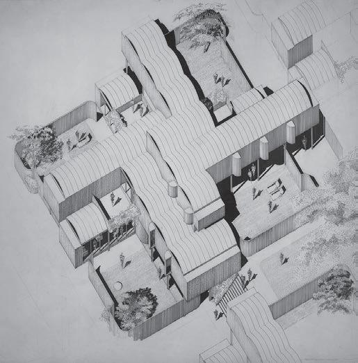
AXONOMETRIC VIEW OF ONE BUILDING BLOCK
(Source: https://www.paulrudolph.institute/196801-oriental-masonic-gardens)
3 BEDROOMS HOUSING UNIT - MODULE B AND F
5 BEDROOMS HOUSING UNIT - MODULE D, J AND H
Module A-E, module B-F, module C-G, module D-J-H is one single-family housing unit. By stacking the prefab modules askew to each other, the blocks created shading and semi-open space on the ground-floor. However, this made the dwellers felt like they live beneath the structure and they felt unsafe.
Prefab modules were stacked on slabs and columns on site, which was then thought to be a cheap construction technique. However, the structure was unstable and after sometime started to wear down and collapsed.
FUNCTIONAL DIAGRAM OF A TYPICAL 3 BEDROOMS UNIT
FUNCTIONAL DISPOSITION
(Source: https://www.nytimes.com/1979/04/29/archives/a-vision-of-the-future-now-an-eyesorevision-of-the-future-now-an.html)
For a typical 2-3 bedrooms unit, a collective bathroom is shared on the second-floor (2 bathrooms for 4-5 bedrooms unit). All bedrooms have view to the garden. The shared living-dining-kitchen is located on the ground-floor. This model were able to solve the housing shortage problem while providing sufficient function for dwellers. However, there were still a lack of social connection due to the way each housing units were positioned.
(Source: Analysis diagram by Trang Nguyen)
Huijun Liu_r0970221
MaULP_Foothill Groenveld B
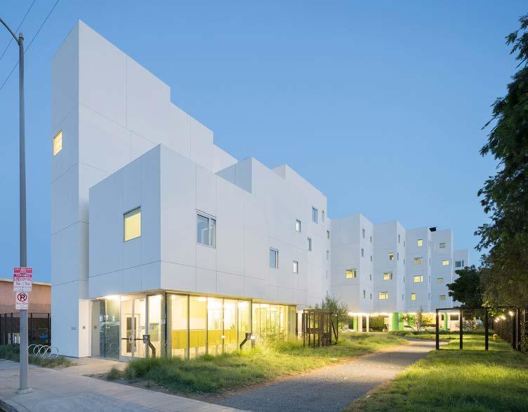
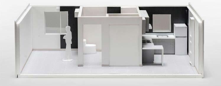
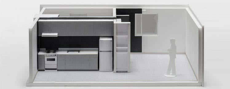
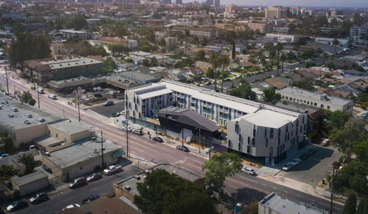
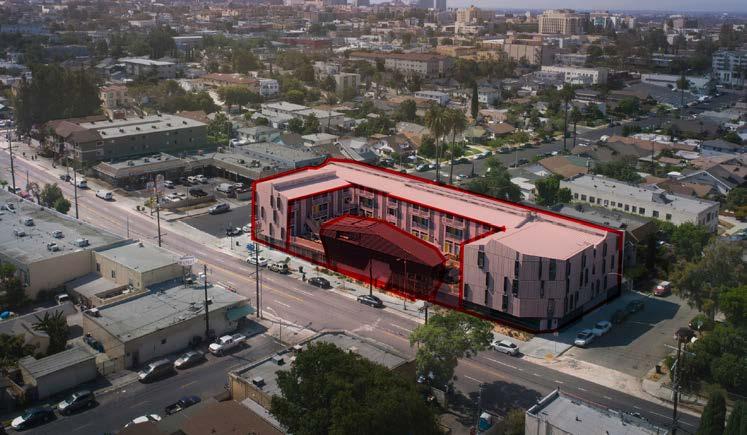
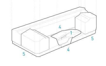
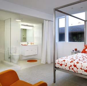
Located in Van Nuys, Crest Apartments transformed a vacant suburban lot into a 45,000 square-foot LEED Platinum permanent supportive housing center. The building includes 64 studio apartments for formerly homeless individuals, with 23 apartments set aside for homeless veterans. Completed in 2016, the project includes supportive services and community space for residents including social services offices, a communal kitchen, laundry room, conference room, residents’ lounge, and an outdoor community garden on the ground floor.
To make the most of the narrow and deep lot, the landscape commands the entire site and the design expression of programmatic and technical requirements were key.
(Source: https://archello.com/project/crest-apartments)
CONTEXTUALISED VOLUMETRY
The site is surrounded by a mix of neighboring commercial and lower-density residential areas. To the south, the building’s entry is located along a busy commercial thoroughfare near two freeways. To the north, the building’s community garden is adjacent to the backyards of single-family residential properties.
(Source: https://www.aia.org/showcases/195181-crest-apartments)
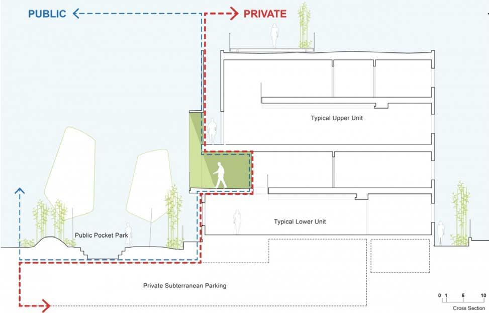
Gradient: Public(light)-Private(dark)
SPECIFIC CIRCULATION SCHEME
(Source: Adapted from https://www.mchap.co/MCHAPprojects/Crest-Apartments)
(Source: https://archello.com/story/54030/attachments/drawings/1)
The building’s arching form stretches the length of the east side of the lot, creating a sheltered courtyard with tiered terraces of apartments above. The building touches the ground at both the front and back of the site, creating a physical relationship to the smaller-scale single-family residences behind the property and the larger commercial facades running along the boulevard.
(Source: https://atelierbrianchou.com/precedent-study-crest-apartments)
(Source: https://atelierbrianchou.com/precedent-study-crest-apartments
https://www.arch.columbia.edu/books/reader/137-social-transparency-projects-on-housing)
The four upper residential floors of studio apartments include large windows and are connected by open-air corridors that introduce vibrant color, natural light, cross ventilation, and views of the surrounding city.
(Source: Adapted from https://www.mchap.co/MCHAPprojects/Crest-Apartments)
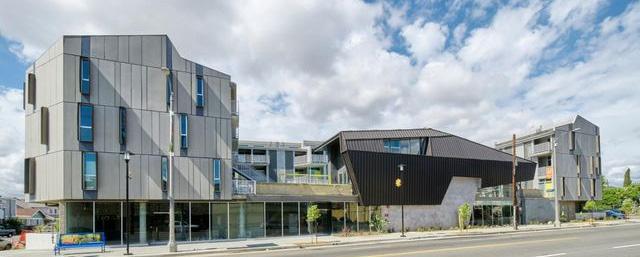
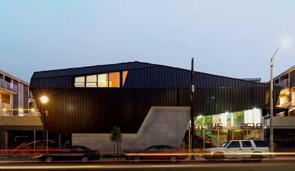
Called 2510 Temple, the apartment complex is located in the historic Filipino Town, just west of Downtown Los Angeles. The building responds to its context at both city-wide and neighborhood levels. Addressing the ongoing housing crisis in Los Angeles, where home prices have skyrocketed and construction has failed to keep pace with the need for multifamily housing, this project answers the demand for increased density. Thus, by offering a combination of 47 affordable and market rate apartments sit atop commercial space at the ground level.
The apartment complex looks unique with its Jagged rooflines, slot window and gray outer covering. It has a strong concrete base facing Temple Street. This part of the building is open to the public, gives the project a human-scale and makes the street feel lively. The entrance of the building hassculptural form, and it connects the the public and private sectors of the project. This makes the building feel like it’s a part of the city.
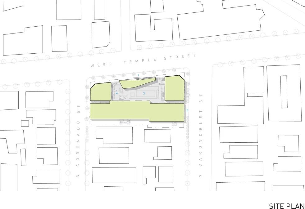
Occupying a full city block and surrounded by low-scale structures, the apartment complex is designed to respond to its context, at both the neighbourhood and city-wide level. The building contains a total of 47 residential units. Amenities such as shared offices, a gym and a community room that help give the building an urban identity.
The concrete base of the building houses is a commercial space, while the upper portion contains apartments and tenant amenities. The base also serves as a plinth, separating the private/residential portion of the project from the public areas.
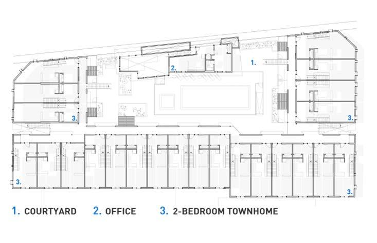
For the apartments, they are arranged in multi-storey volumes in a U shape around a central courtyard with a swimming pool. Standard apartments occupy the lowest floor, while the upper two levels are given over to townhouse-style units.

(Source: https://www.tighearchitecture.com/2510-temple - https://www.dezeen.com/2017/10/18/ tighe-architecture-2510-temple-sculptural-grey-apartment-building-filipinotown-los-angeles) (Source: https://www.tighearchitecture.com/2510-temple)
(Source: https://www.tighearchitecture.com/2510-temple)
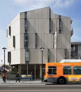
The base activates the streetscape and gives the project a human-scale by mediating between it and the apartment buildings above.
(Source: https://www.tighearchitecture.com/2510-temple)
(Source: https://www.tighearchitecture.com/2510-temple - https://www.dezeen.com/2017/10/18/tighe-architecture-2510-temple-sculptural-grey-apartment-building-filipinotown-los-angeles)
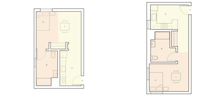
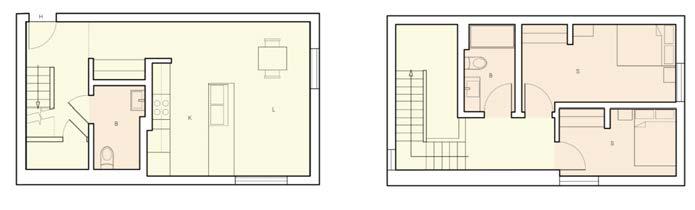
Dwelling Type 1: 1 -BD Flat
Type 1 is a one-bedroom flat. When steping inside, there’s a daytime area with a living space and a kitchen. At the back of the flat, there’s a nighttime area with a bedroom. In between these two zones, there’s a bathroom.
Dwelling Type 2: 2 -BD Townhouse
Type 2 is a two-bedroom townhouse. It has two floors. The first floor is for daytime activities, like the living space and kitchen. The second floor is for nighttime, with two bedrooms and two bathrooms.
Dwellings: 2 -BD Townhouse
Dwellings: 1 -BD Flat
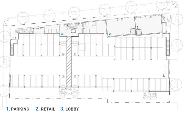
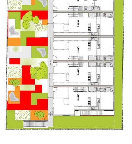
Courtyard + Pool + Spa Gym + Office + Lobby
Parking
Retail
This apartment complex offers a variety of functions, making it diverse. They interact with each other through open spaces, like the courtyard that is a central meeting place in the building where people can come together.
(Source: https://www.tighearchitecture.com/2510-temple - https://www.dezeen.com/2017/10/18/tighe-architecture-2510-temple-sculptural-grey-apartment-building-filipinotown-los-angeles)
Analysed by Gayane Maes_r089710 Maki and associates
MaHS_Foothill groenveld_C
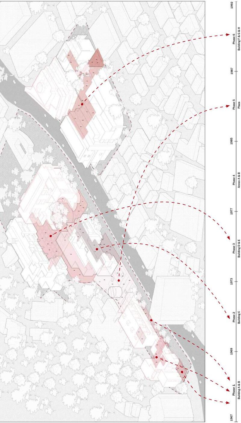
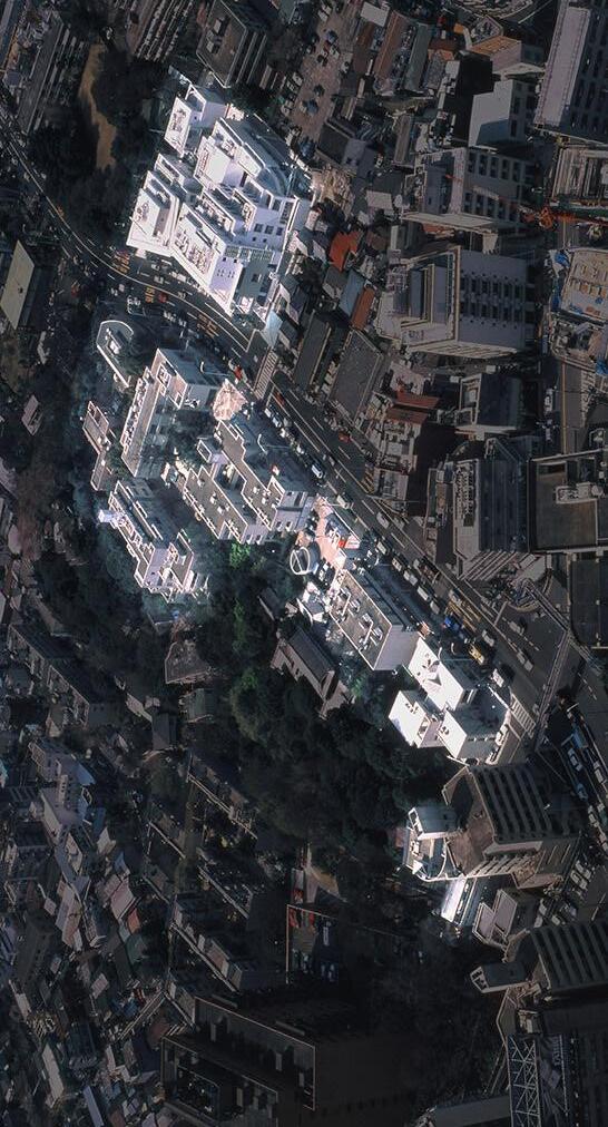
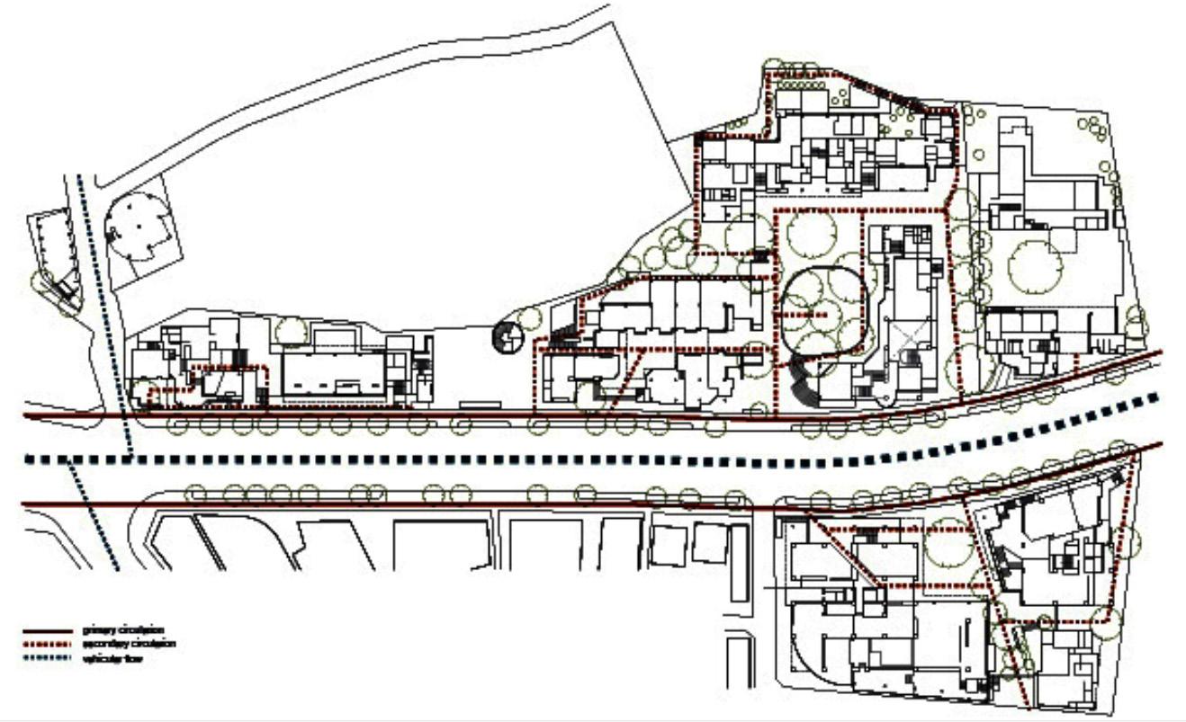
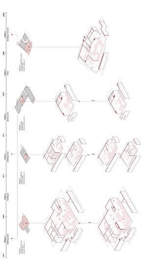
Since 1969, the Hillside terrace adapted to the needed of the city of Tokyo. The different layers of the building are consistent with the topographical and spatial changes. Diverse events take place in the building and make the relation with the city.
Scale in the space
Relation between the facade and the street
Adapting to the needed of the city : seven phases
Functional multiplicity : housing, stores, office
Urban culture : culturals events that link the city
EVALUATION
Briefly evaluate
• its relation to the urban tissue : Make part of the city, impacted the neighborhood, integrate volumetry, mixed-functions.
• the building typology : With its 6 phases, each building is unite and modern. Concrete, ceramic and aluminium are the principal materials. Public functions are downstairs and privet functions (like residential) are upstairs
• the individual dwelling design : The first design were adapted to large families and then studios and one-bedroom typologies came later. Today only 15 units are residential and the rest became offices.
CONTINIOUS SPATIAL VALUE OF JAPANESE CULTURE OPEN SPACE STRUCTURE
(Source: https://hillsideterrace.com/about/story/ https://academic.daniels.utoronto.ca/urbanism/wp-content/uploads/sites/3/2020/11/Hillside-Ter-
(Source: https://academic.daniels.utoronto.ca/urbanism/wp-content/uploads/sites/3/2020/11/ Hillside-Terrace.pdf )
HOW HIGHER HOW MORE PRIVET PUBLIC-PRIVATE STRUCTURE
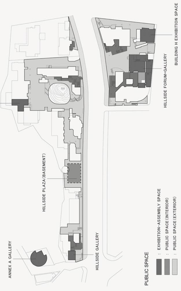
HIGH QUALITY URBAN SPACE CONTEXTUALISED VOLUMETRY
(Source: https://www.docomomo.pt/wp-content/uploads/2019/04/DocomomoJournal53_2015_ FMaki.pdf)
(Source: https://aeworldmap.com/2018/11/26/hillside-terrace-complex-i-vi-tokyo-japan/)
(Source: http://projectivecities.aaschool.ac.uk/wp-content/uploads/2012/03/03_HillsideTerrace. jpg)
(Source: http://projectivecities.aaschool.ac.uk/wp-content/uploads/2012/03/03_HillsideTerrace. jpg)
(Source: https://academic.daniels.utoronto.ca/urbanism/wp-content/uploads/sites/3/2020/11/ Hillside-Terrace.pdf)
(Source: https://aedesign.files.wordpress.com/2018/11/screen-shot-2018-11-25-at-18-21-05. png)
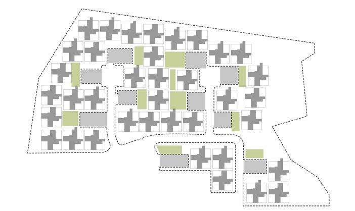
The Spanish city of Alcoi, situated in the Valencian community is characterised by its medieval architectural language and varied topography with adjusted urban tissue. The hill, on which the nucleaus of the village is positioned, is characterized by a dense buildingblock morphology. This urban typology alligns with or modifies the slopes, resulting
in sudden height-differences and cohesive public stairs, slopes and bridges which form the genius loci of the city. The project of our interest is La Sang, a social housing project which has been designed by Manuel De Solà-Morales in 1988. Le Sang Is marked by a strong sense of topography and ‘city-ness’.
The main quality on the larger urban scale of Le Sang lies primarily in its scale in relation to the existing tissue. It is however distinctive in the way it deals with the existing slope on the west-side: by stretching its ‘plinth’, the roofs of the first four blocks are of the same height. This, aside from its equal architectural language, enlarges the homogenous effect and acknowledges the topological aspects of its site.
The morphology of the figure ground is in allignment with the surroundings. Small stairs lead to the semi-public courtyards while the private entrances are accesible via public streets which run from the big square to the parc. The privateness of the courtyard is generated by its height-difference with the slope on the east while the intimiacy of the entrances is the result of the narrow passages trough the project. This, in combination with its pivital rooting as a divisional element between the parc and the square, makes for a strong and necessary gesture to the fragmented city-scape. The inclusiveness of the social housing company is reflected in the strategic architecture of De Solà-Morales.
https://www4.coacv.org/
The interventions form, together with the existing buildings, a courtyard tyoplogy. From this inner courtyard, connections are made to the adjecent parc. This parc has a private tendency due to its inclined nature and the resulting lack of direct acces points outside of the project. Taking advantage of the slope, a parking is created underneath the building to segregate car- and pedestrian routes.
https://www4.coacv.org/
MaHS_Foothill Groenveld B
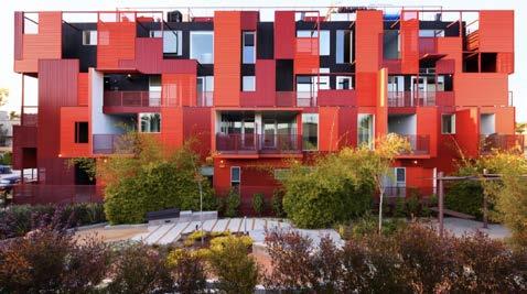
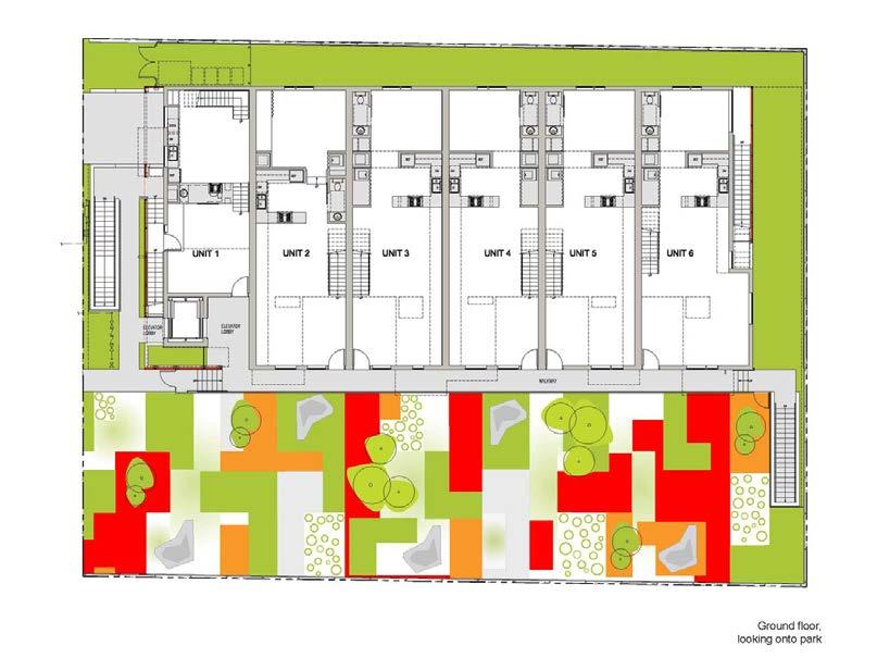
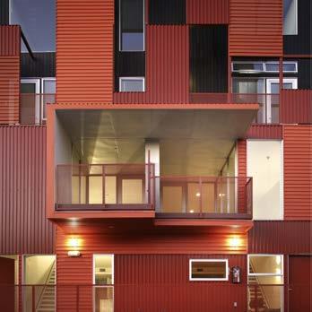
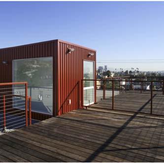
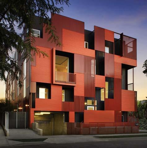
Formosa 1140 is located in West Hollywood. West Hollywood is known for its dens housing and only 1% of the public space is dedicated to public parks. Formosa 1140 uses another typology, so 1/3 of the plot can be opened to the public. The 11 residential units, that form the main building, have a public park frontage. By making use of a perforated metal sheeting and fenestration the public and private spaces are being separated in a unique way.
Formosa 1140 adds more green space into a neighbourhood that desperately needs it. This typology can be copied all through West Hollywood to create more (smaller) public green spaces all over these residential blocks. It can create pocket parks throughout the whole city.
Formosa 1140 is a community-driven city development. By creating 11 housing units, inside one bigger volume, facing a new public park the interaction between the residents and the community can flourish.
To create a transitional space between public and private areas the architects used the external circulation zones as a buffer. By playing with perforated metal sheeting and closing or opening different viewpoints the transition between these two different statuses (public-private) is being softened.
Formosa 1140 is higher than its surrounding buildings, but by creating a new public park that contrast is less noticeable. The flaming red building lightens up the neighbourhood and focusses not only on a qualitative space for its residents but also for the other community members. The 11 housing units are all located toward the public park. The external circulation zone is a buffer between the public atmosphere of the park and the private units, which works well.
The function of the building is not very surprising for this dens residential area. The building only contains residential units and a shared rooftop. Of course, the added green space to the public realm is a much needed element in West Hollywood.
(Source: https://loharchitects.com/work/formosa1140, https://www.archdaily.com/16194/formosa-1140-loha-architects)
(Source: https://www.google.com/maps)
PUBLIC-PRIVATE STRUCTURE
(Source: https://www.google.com/maps)
(Source: https://loharchitects.com/work/formosa1140)

(Source: https://www.archdaily.com/16194/formosa-1140-loha-architects/500f490728ba0d0cc70024b2-formosa-1140-loha-architects-image)
(Source: https://loharchitects.com/work/formosa1140)

(Source: https://www.archdaily.com/16194/formosa-1140-loha-architects/500f48fa28ba0d0cc70024b0-formosa-1140-loha-architects-image?next_project=no)
(Source: https://loharchitects.com/work/formosa1140, https://www.archdaily.com/16194/formosa-1140-loha-architects)
Studios and split-level appartments are organised arround square circulationcores, centrally situated in the plan. A variety of appartments can be found, going from studios to one-, two-, three- or four-bedroom appartments. The ‘uniqueness’ of these dwellings counter the idea of ‘sameness’ which is often associeted with the Modernist-tabula rasa social housing developments. http://manueldesola-morales.com
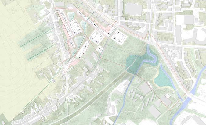
FOOTHILL GROENEVELD_A
TOM VAN LAER
ASMAE ELRHAZI
PRAVEENKUMAR PARAMAGOUROU
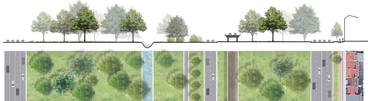
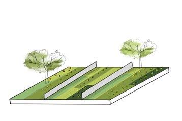
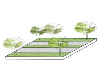
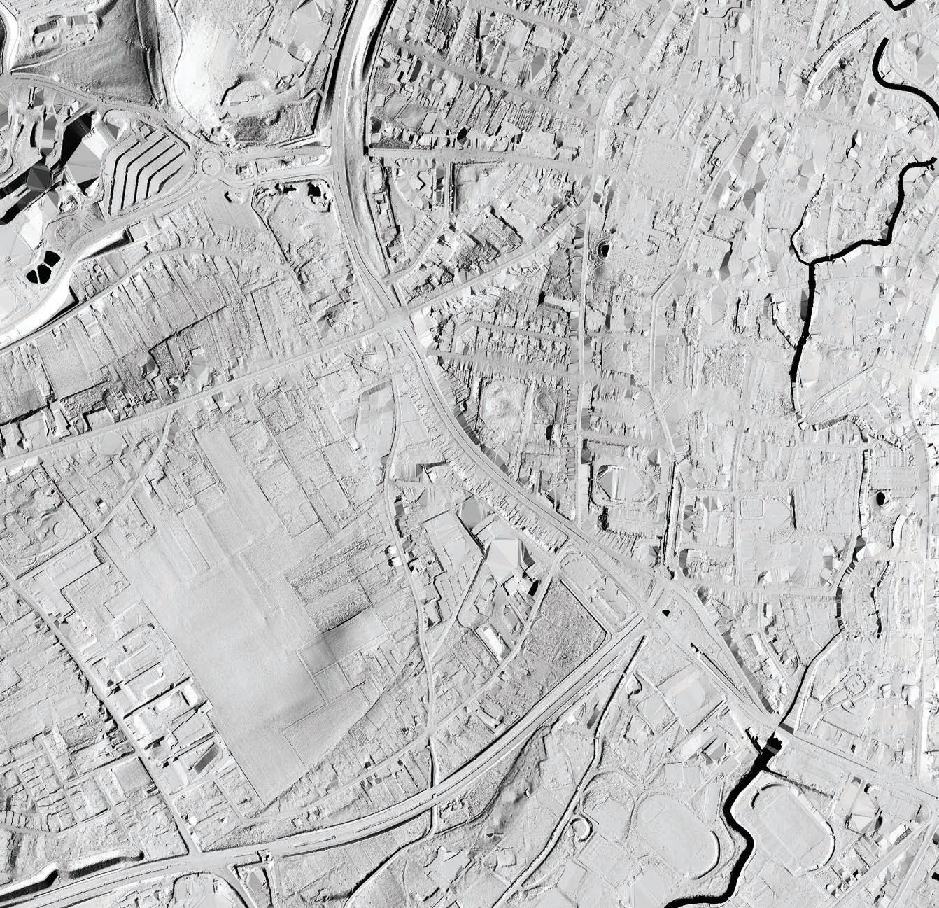
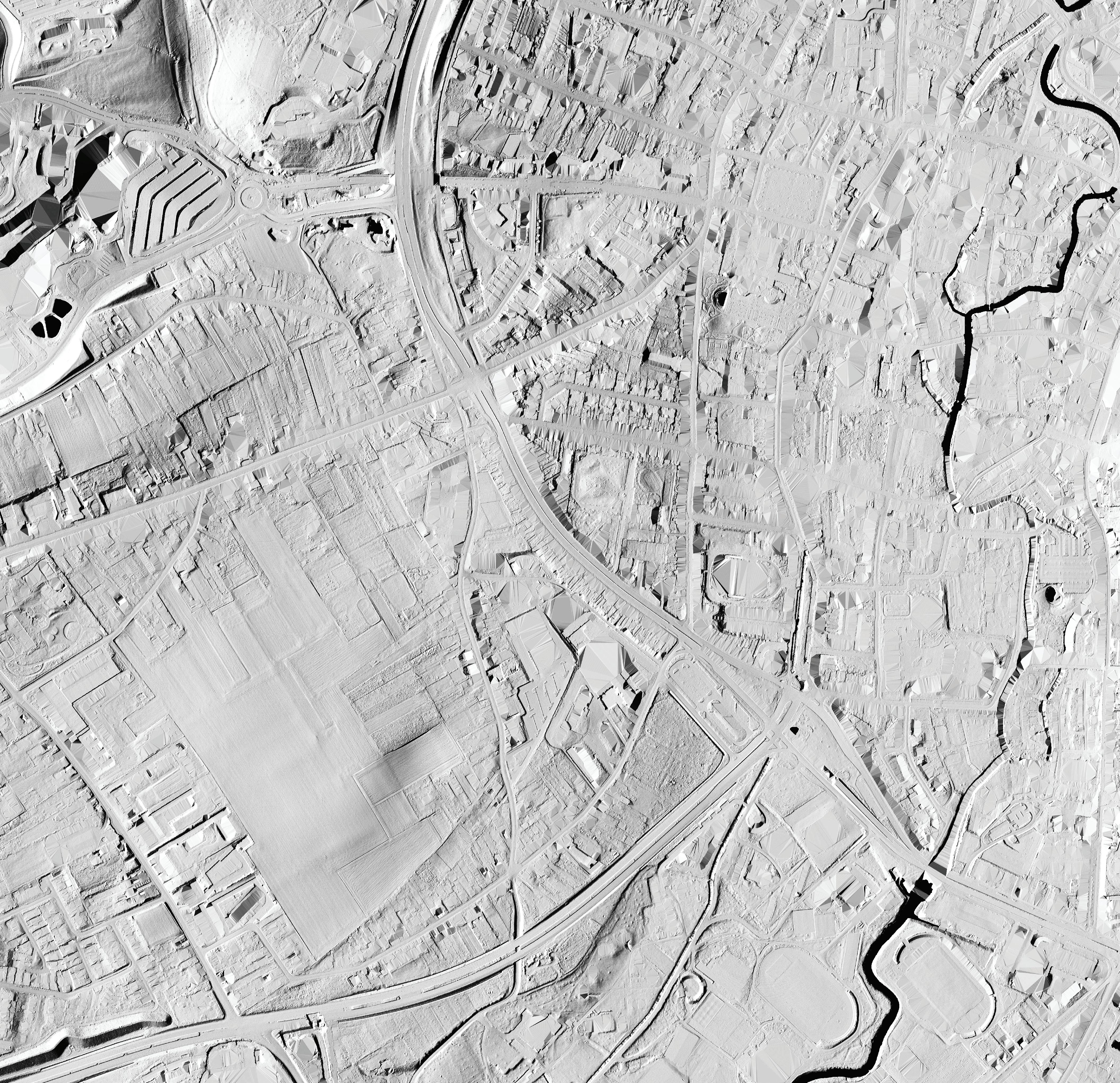
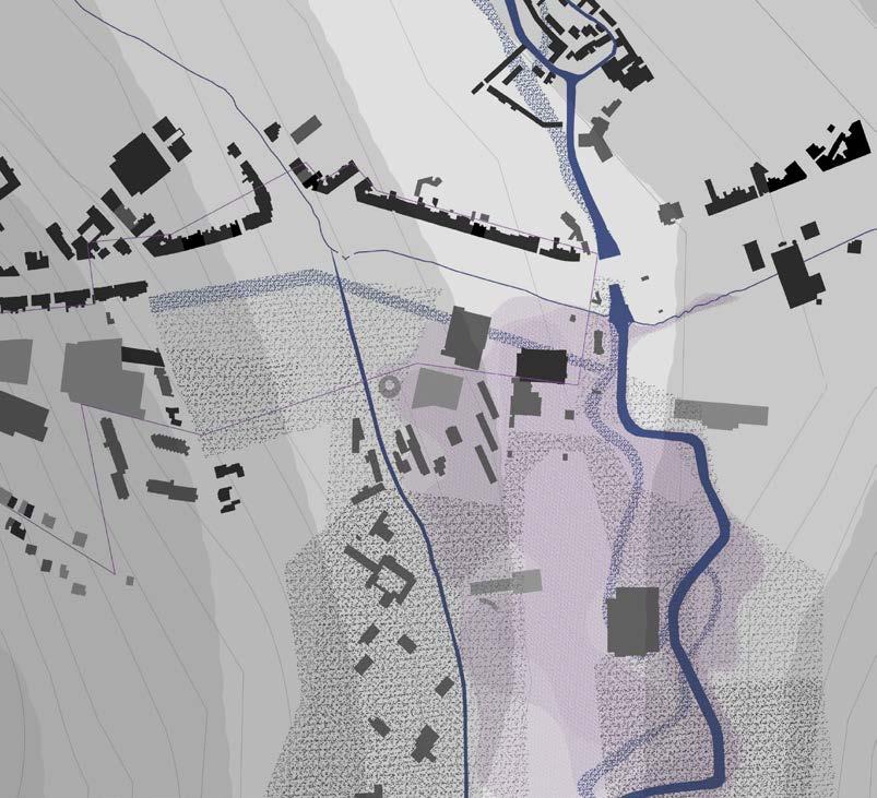
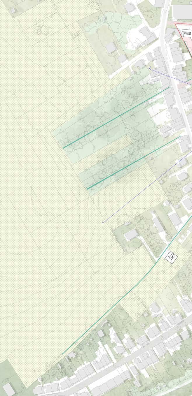
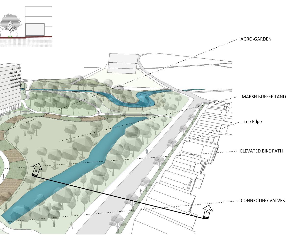
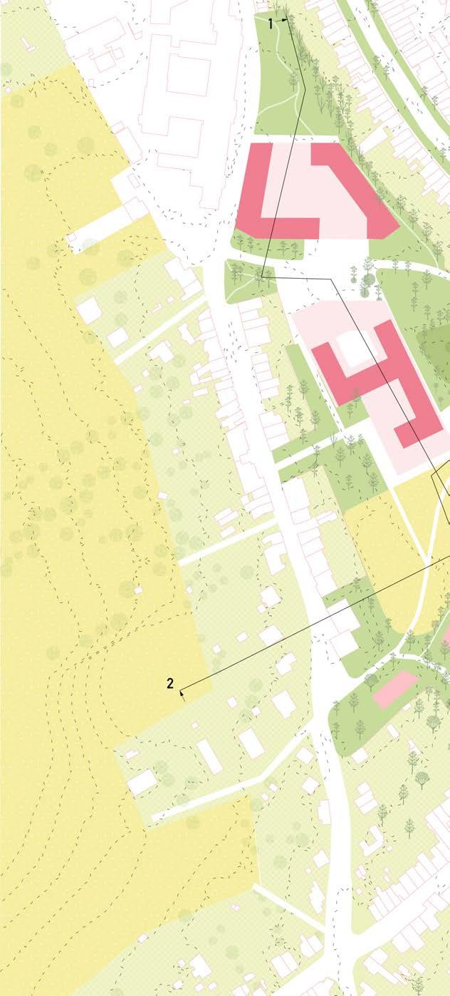
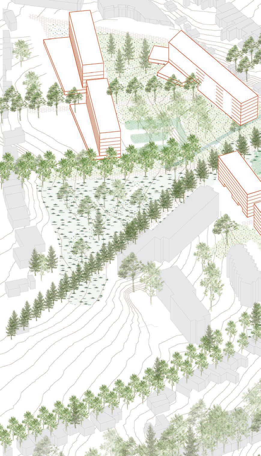
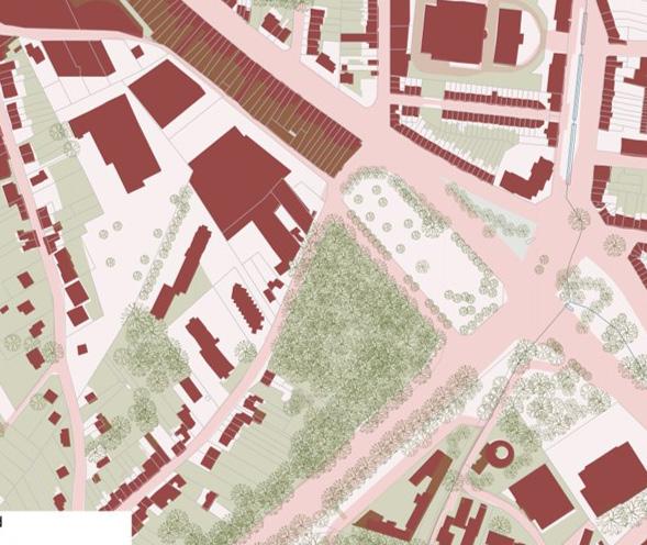
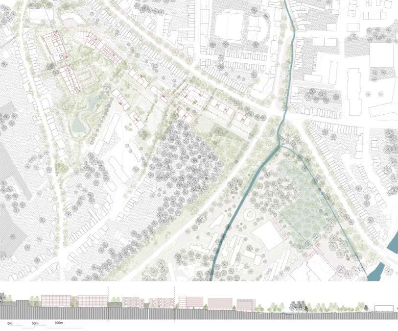
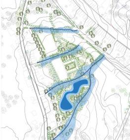
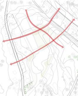
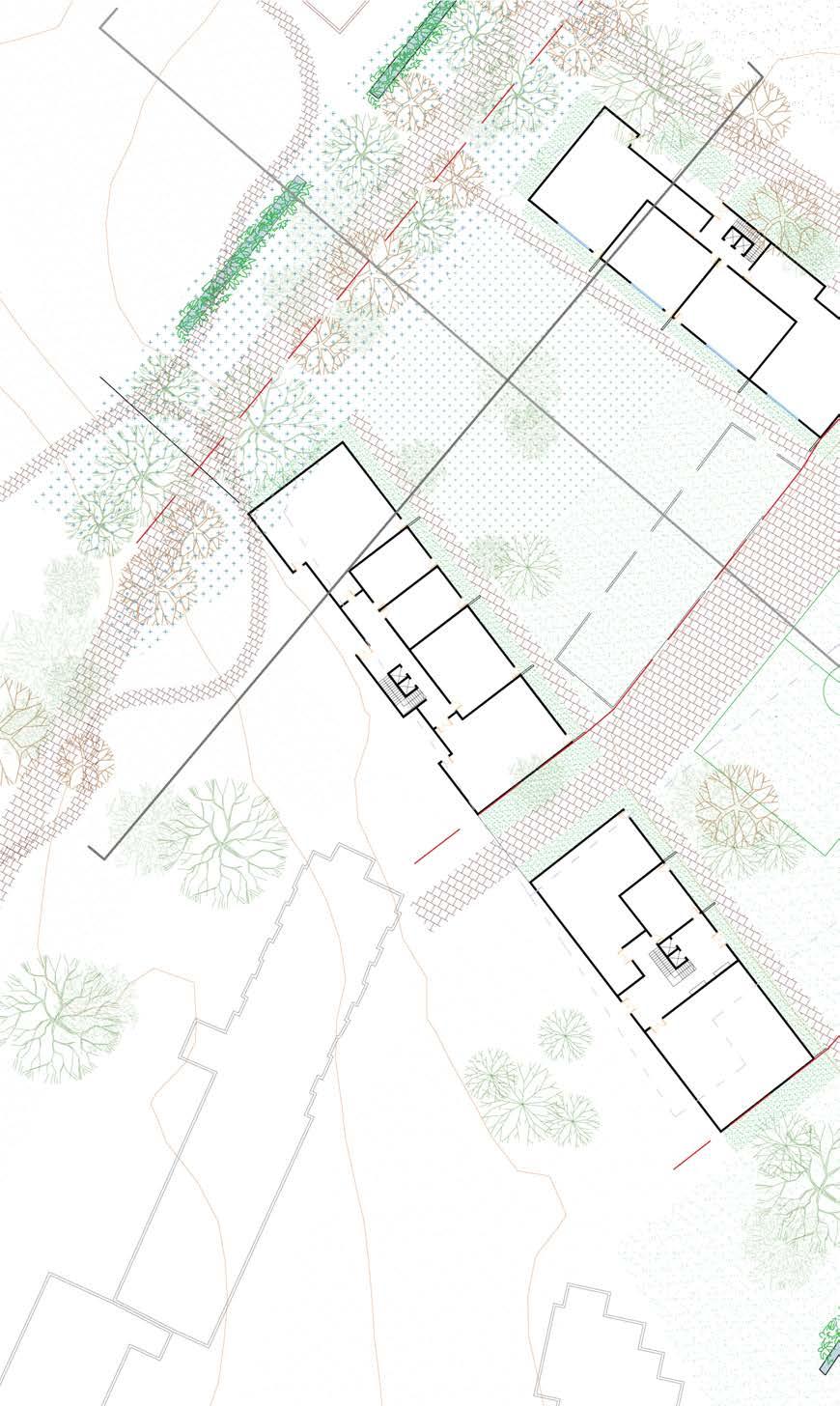
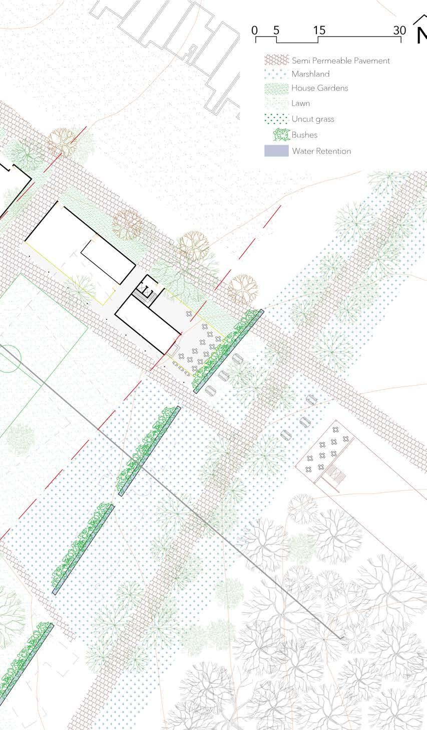
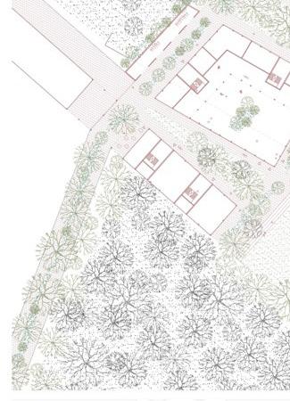
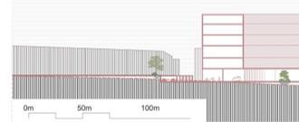
Due to large infrastructures on site, large horizontal platforms have been carved out of hill. In an another hand, road infrastructure has enhanced the existing slopes. As a result, a patchwork of manmade platforms and slopes define the site.
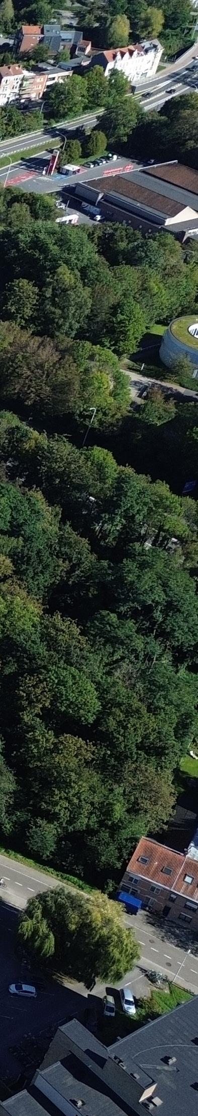
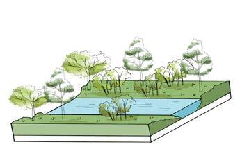
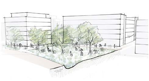
A big concern for Leuven is flooding, and the Arenberg park is a possible water containment area (in case it floods) with denser trees towards the valley serving as a buffer. In contradiction, there is a huge paved area present in the site that is the main reason for flooding.
Another aspect of impermeability is the impermeability of the site itself. The large platforms remark areas by differences in height and fences. As a result, the site is enclosed with few infrastructure for pedestrians to access these areas.
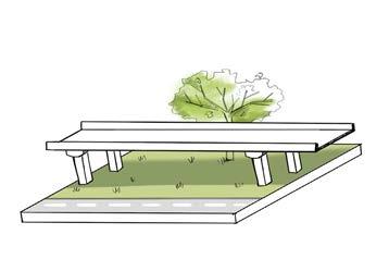
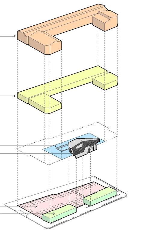
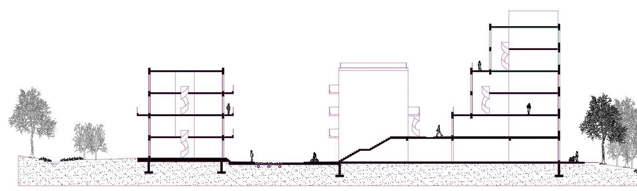
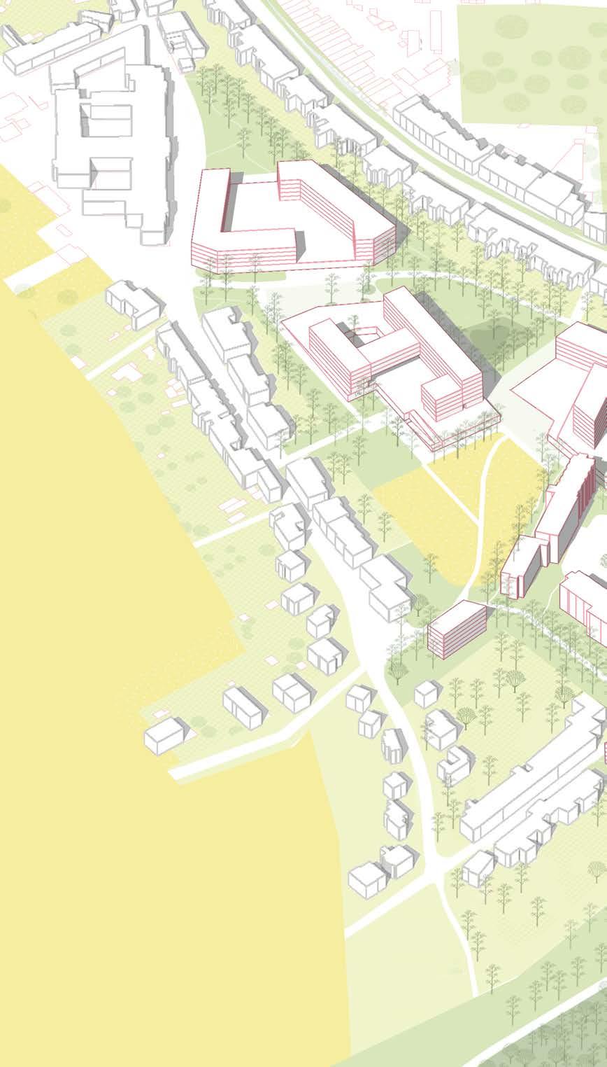
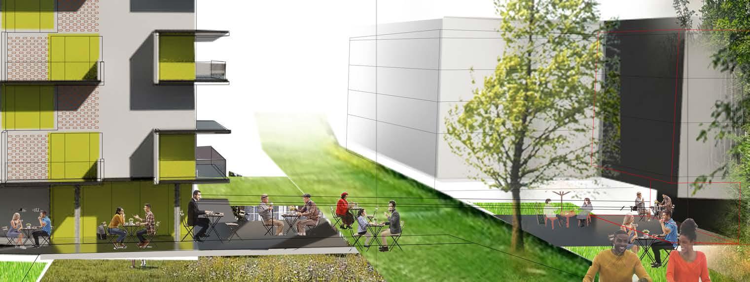
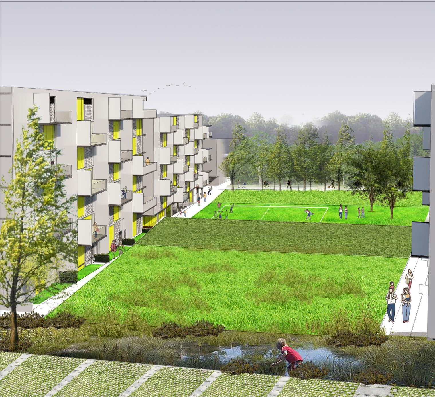
First, we reinterpret the platforms and diminish their inbetween boundaries by enhancing the topography lines. In function of this topography is the system of ditches and parks that keeps the valley and city from flooding. The ditches care for water retainment, creating wet and dry vegetational area like expansion zones. In the other hand, we acknowledged the existing building ribbons on the hill by placing similar volumes to their gardens which helps create pathways to open up the closed pit, where we design larger volumes with big public functions reminiscent of the previous infrastructure. Other buildings are placed in the valley to reactivate existing ones. Connected to this, is the new permeability of the ground, which contributes to the unification of the park by diminishing borders between functions and reconnecting the fragmented forrest by planting trees on the previous road infrastructure. As a result, direct interaction between the campus area, the hill and the city is made possible.

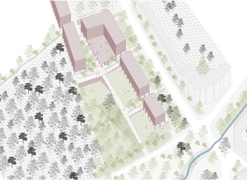
The positioning of the buildings is determined by the former platforms and the water-retainment bodies. Strips of buildings connect to the existing urban tissue and create pathways inbetween. The latter lead to the inner pit where a larger building holds production in its plinth.
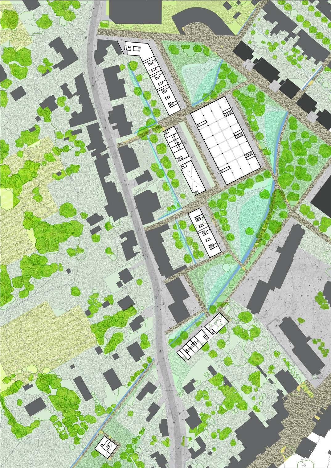
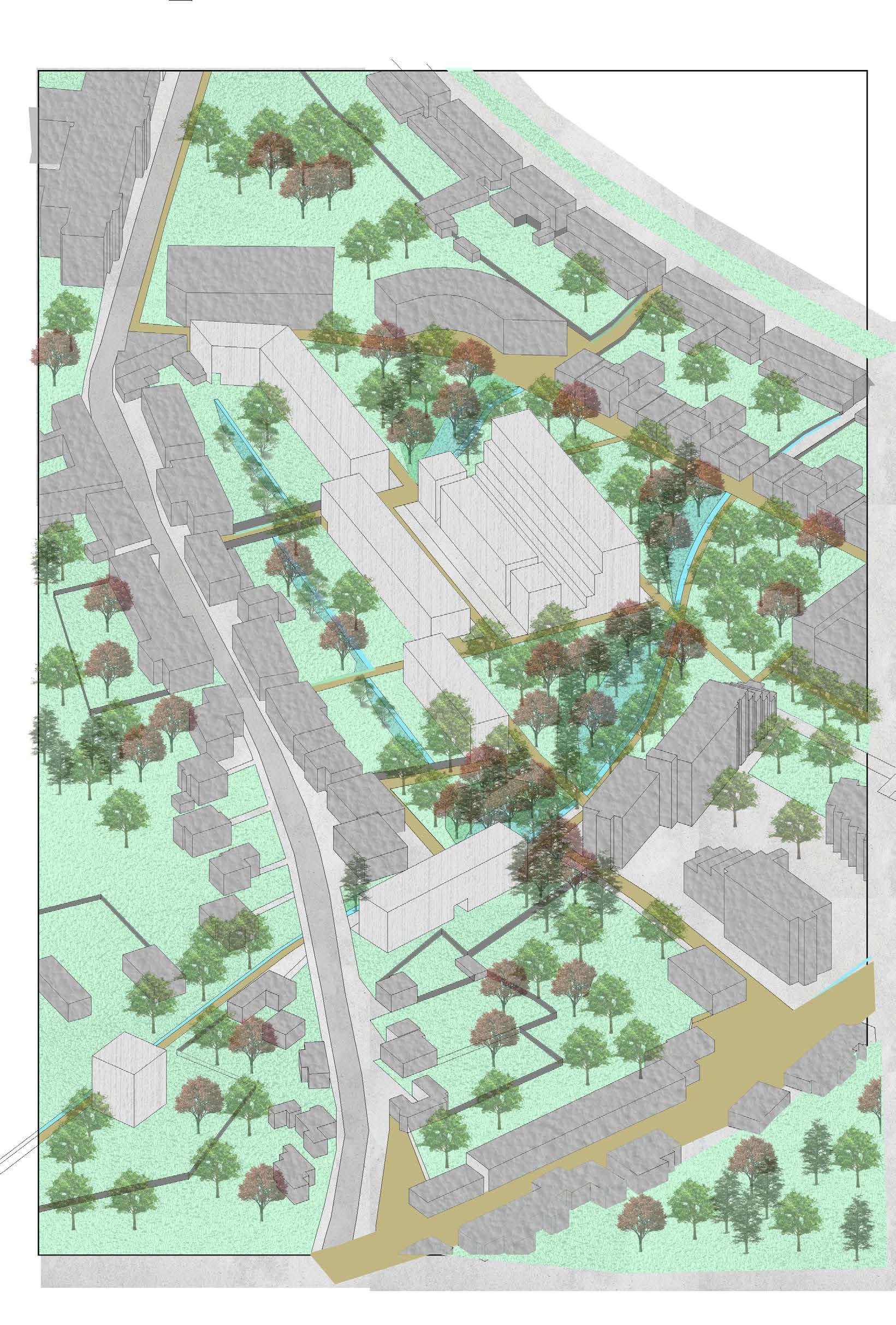
Axonometry of new buildings in context
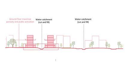
In response to the previous infrastructure, large footprints are on platforms and smaller ones follow the topography, forming various typologies and heights. These buildings house public functions activating the ground and shaping open spaces related to them, while mixing housing units on top. In between, soft transitions are ensured with enhanced new height lines, crafting gentle slopes as parks with different types of permeability, from wet ditches to semipermeable pathways connecting the site.


Existing topography
New topography

Housing communal areas
Restaurants, cafés, Convenience stores...
Shared areas for students

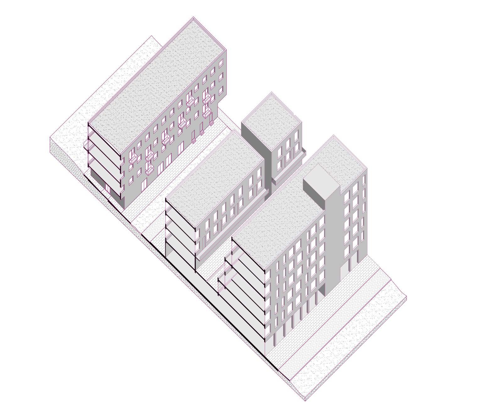
TYPOLOGY 1:
Typology 1: Lofts
Typology 2: Social housing (1/2 bedroom units)
Typology 3: Multi family housing 3/4 bedroom units
Typology 4: Student housing (rooms + Studios)
Typology 5: Individual Houses
TYPOLOGY 2:
TYPOLOGY 3:
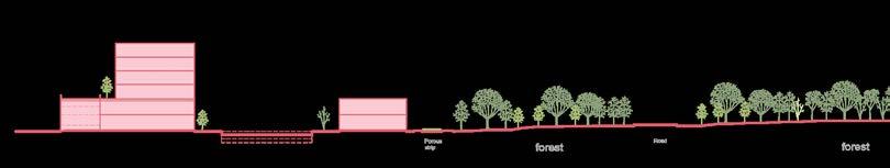
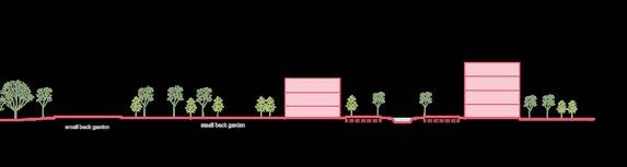
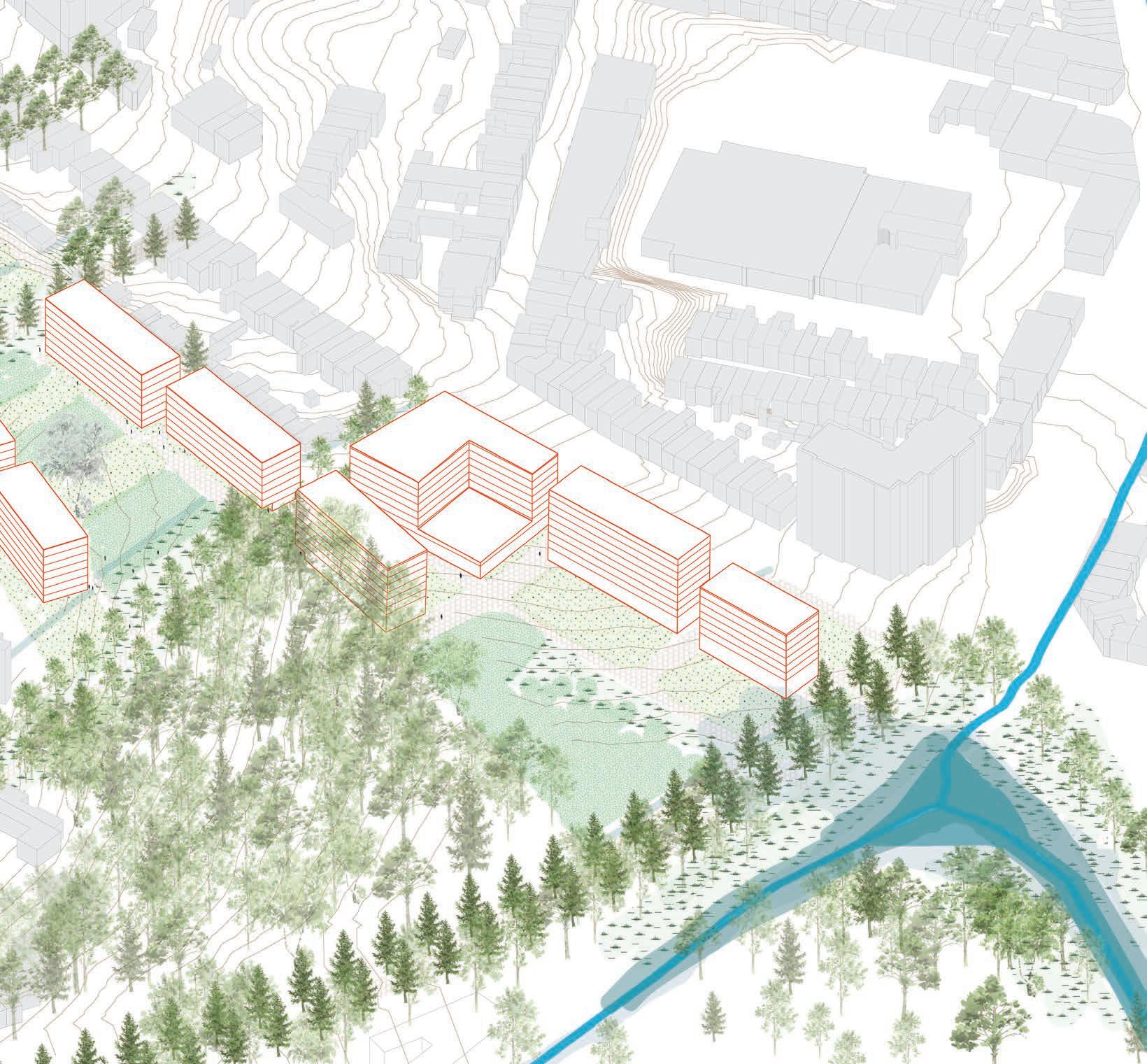
This part of the site is designed by dealing with the flooding and the tree cover as major aspect. The positioning of the building footprints infront of the existing structures creating a facade for the zone and also activating the parcel. Tree cover is extended till the edge of the city providing a dense forest facade.
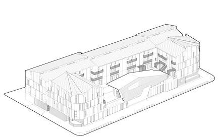
Axonometric view of the site demarking the different spaces
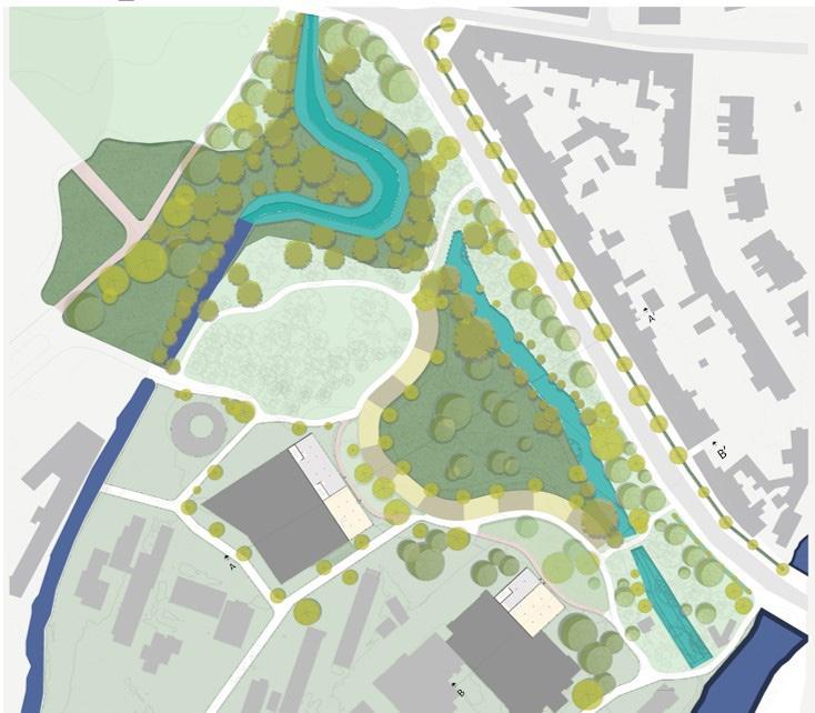
Masterplan_Site valley with buffer and footprints

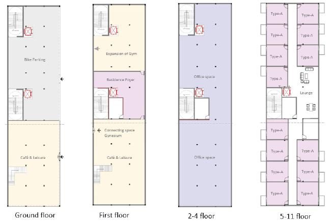

Built structures and Typologies
FOOTHILL GROEVELD _ Group B
HUIJUN LIU
TRANG MINH THUY NGUYEN
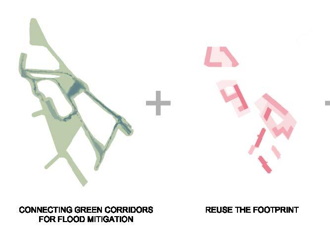
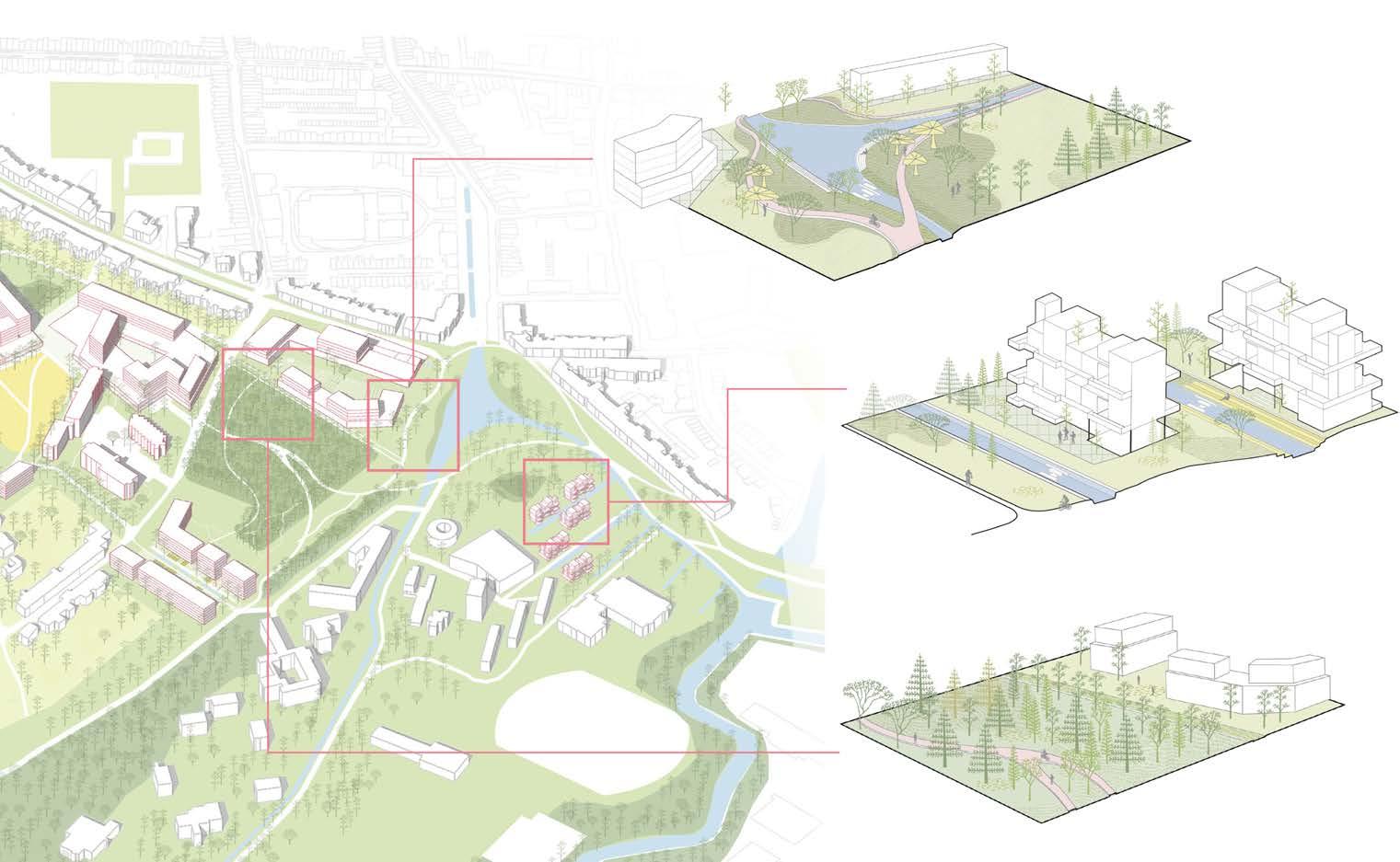
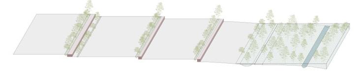
These four site readings, leading us to form our principles. We have placed the 'before' and 'after' scenarios together for better comparison .
1. Linking green corridors to enhance biodiversity and pedestrian experiences.
2. Flood mitigation strategies through sustainable design.
3. Utilizing existing footprints to preserve the site's character.
4. Introducing more open spaces to foster community and interaction.
All these four guiding principles shaped our vision.

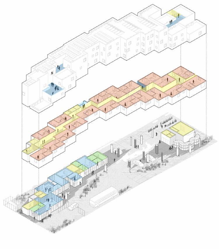
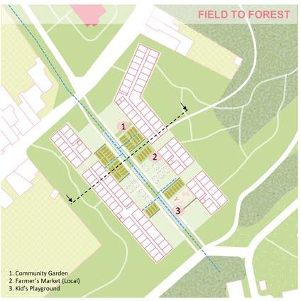
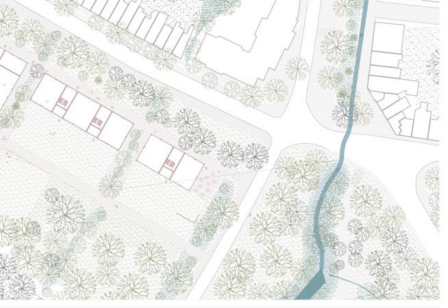
The existing open spaces/ green spaces are fragmented due to over-construction of roads and parking spaces for cars. The lack of permeable surface also causes more flooding, especially in facing the climate change crisis. The development strategy for the site is to create different clusters based on the surrounding existing context. The main idea is to reverse the traditional building blocks and landscape to increase public integration and mitigate flooding in the future. Different clusters will have different building typologies that correspond with the surrounding open spaces. As the topography changes from the Field to the Valley area, the landscape will orient the flow of water during heavy flooding and the flow of the users through these clusters. Imagining the Post Car-oriented city, the design emphasize on how the site will become a space for walking/ cycling and how it will respond to the future flooding scenario.

This reverse block idea offers a fresh perspective on urban design, instead of having buildings on the perimeter of a block with a private garden in the middle, the idea would be hard surface in the middle as a public space, and the outer perimeter is green and natural, presents a unique and innovative approach to urban planning. I explored this typology with the site's topography to create 'steps' or 'plateaus.' This approach utilizes the existing footprint and integrates the concept of 'Reverse Blocks.’
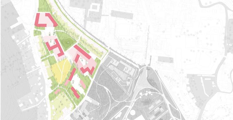
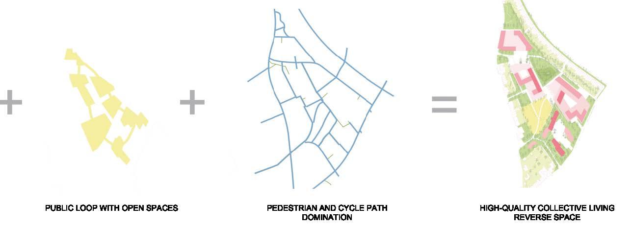
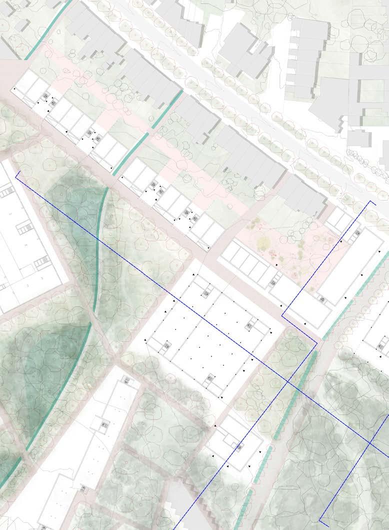
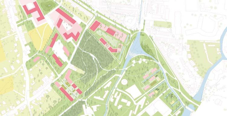
The design focuses on shaping spaces based on the natural topography and reversing the traditional landscape to guide the dwellers/users’ flow of experience within each cluster. The three clusters design based on the existing landscape and topography, with the idea to catch the flood water as much as possible before it over-flow to the city center and activate public spaces.
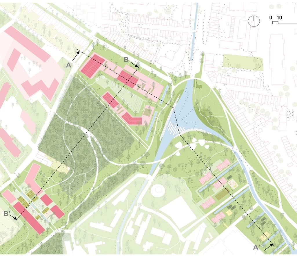
Three main clusters as transitional spaces between landscapes

Key plan


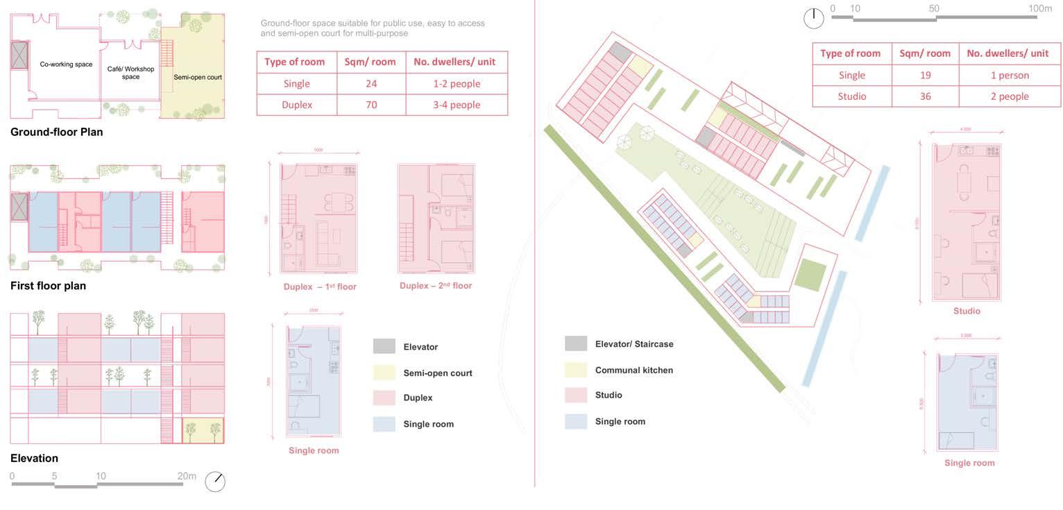
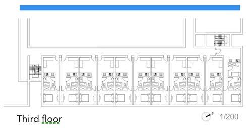
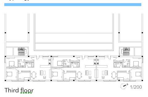
Typical housing unit typologies
Ground-floor opens for public use with access to semi-open court for multi-purpose, with collective balconies front and back on the upper floors to maximize view and open spaces. The housing units have different dimension suitable for many types of dwellers (single and family).
Bird-eye views of the area - Spatial design of Clusters
Imagining the Post Car-oriented city, the design emphasize on how the site will become a space for walking/cycling and how it will respond to the future flooding scenario. The clusters and the surrounding spaces are connected, with new landscape created within these clusters for more porosity, in terms of both water and users.
Buildings built across different time periods changing the site morphology - recent additions involve construction on the floodplain
EXISTING PERMEABLE GROUND-COVER
Footprints of existing impermeable infrastructures, roads and buildings, vis-a-vis permeable ground covers and vegetations
Human manipulations - subsequent cutting and filling- morphing the topography of Bodart and the projected increased flooding THE "CUT" AND "FILL" STORY
History of Building Morphology
RARE FLOODING FREQUENT FLOODING
RARE FLOODING FREQUENT FLOODING STEEP SLOPE RIVER
Existing Permeable Groundcover
The "Cut" and "Fill" Story
RARE FLOODING
Human manipulations across time have transformed the topography of the Groenveld Bodart area significantly. Massive parking infrastructures and buildings in the last few centuries, the “cuts” and the “fills” on the site and its vicinity have resulted in an ever-increasing flood risk which is expected to rise in the coming decades.
Our Projects attempts to welcome the flood and let it stay in the site while responding to the housing requirement of the post-car Bodart area. These demands are mitigated through
(1) forming terraces descending across the existing topography lines;
(2) following the neighboring site tendencies and parcel sizes, i.e, the agricultural mosaic behind the site and the existing housing block patterns;
(3) introducing corridors/walkways emboldening the gentle topographic lines, and emulating the forest corridor that enters the city of Leuven–; and
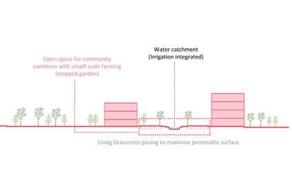
(4) introducing a range of permeable surfaces to allow water permeability through large and generous open spaces (using them as a block organizing principle)
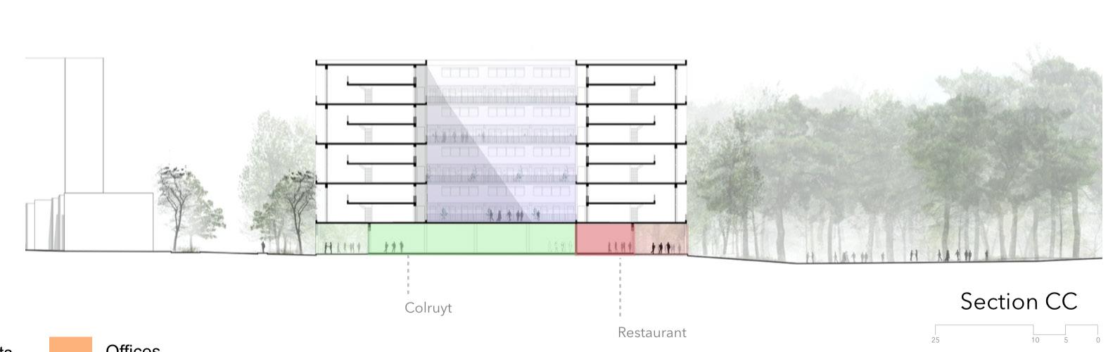
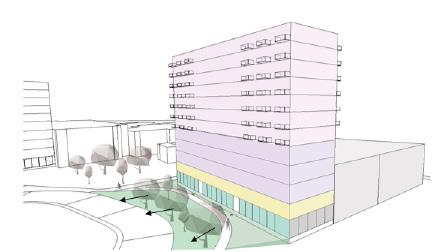
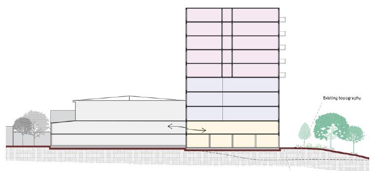
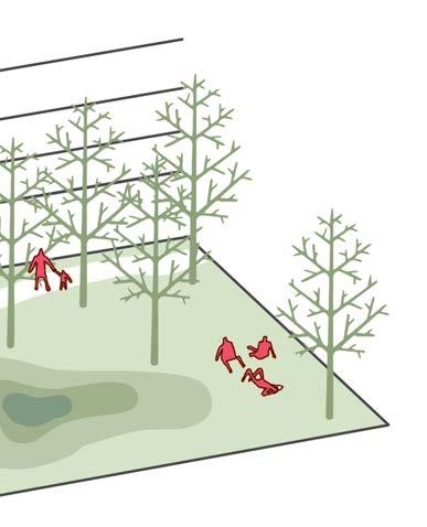
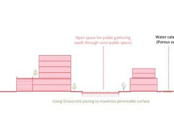
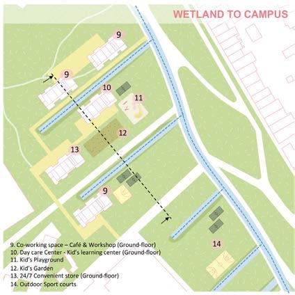
Urban vegetation provides a range of benefits, from regulating microclimates to positively influencing urban hydrology. The project is intentionally designed to welcome the neighboring valley, fostering increased community engagement. Urban garden terraces are integrated to improve water retention. Examining the topography, the ground floor hosts public spaces such as cafes, co-working areas, kindergartens, and play zones, while the upper floors are allocated for offices, with the remaining space reserved for residential use.
 SABA ASIR KHAN
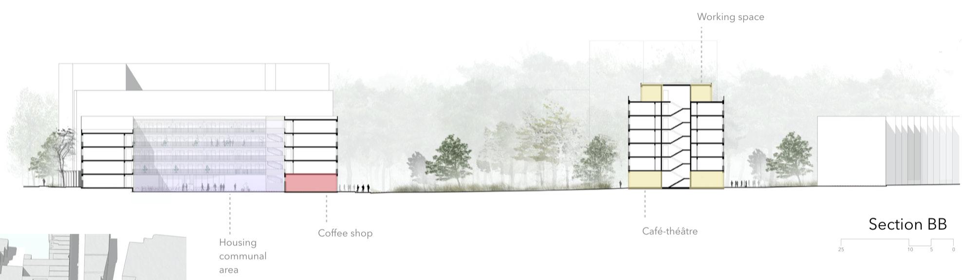
Section B-B
SABA ASIR KHAN
Section B-B

Social Interaction Urban Park
Hiking/walking Track
Park/Play Area
Co-housing Space
Permeable Ground
In contrast to the forest in front of the site, the large greenfield between the buildings allows increased interaction for people with the micro topography. The anticipated flood can stay with the range of permeable grounds and the water retention strip. The building typologies (two fronts of the building) allow the inhabitants to be visually connected to the greenfield – each housing unit opening to the generous open space.
Permeable Open Space - actively interacting with the housing through open ground floors and each unit opening up to the green field
Second Terrace - actively engaging with the third terrace through integrated programs.
Floodable ground-cover and water retaining strip
Transversal Section - proposed vegetation cover integrated with human activity
The housing interface - opening up all housing units to the forest and the greenfield inviting the glimpse of the valley into the homes. Active human involvement - unlike the protected forest while maintaining its floodability.
Nestled near the valley, a strategic reduction in architectural density carves expansive open spaces that blend harmoniously with the landscape. Molded by the topography, the project integrates retention zones and underground shelters. The setback layout from the street provides the opportunity for residences to feature a dual garden facade. Ground levels accommodate both communal and public amenities, including a marketplace.
 Terrace 3 - Plan
Terrace 3 -Section
GAYANE MAES
Terrace 3 - Plan
Terrace 3 -Section
GAYANE MAES
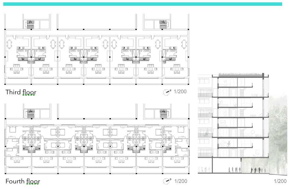
First Floor Typologies
Section Typologies - and Programatic Arrangement
Leuven, Belgium
Guests
External Jury Members
Yuri Gerrits, KU Leuven
Guido Geenen, KU Leuven, WIT architecten
Joris Moonen, KU Leuven, MIDI
Sarah Van de Velde, Bureau Bas Smets
Ward Verbakel, KU Leuven, PLUSOFFICE
Annelies De Nijs, Atelier Horizon
Cristian Panaïté, METAPOLIS
Els Van Meerbeek, KU Leuven, Carton123
Pieter Van den Broeck, KU Leuven
Ellen Verbiest, KU Leuven
Guest Lectures
Janina Gosseye, TU Delft
Yuri Gerrits, KU Leuven
Dr. Xiaoxuan Lu, University of Hong Kong
Fadi Masoud, University of Toronto
Mircea Munteanu, METAPOLIS
Thomas Willemse, Studio Thomas Willemse
Projects visits
Korbeek winners - Els Van Meerbeek, Carton123
Centrale Werkplaatsen - Tom Boogaerts, &bogdan
De Drie Kreeften - Roeland Joosten, WIT Architecten
Teaching Team
Mircea Munteanu, affiliation
Teodora Romanova Stefanova, OSA Research Group, KU Leuven
Thomas Willemse, affiliation
Kelly Shannon, KU Leuven
Bruno De Meulder, KU Leuven
Stakeholders Exercise
Pieter Van den Broeck, KU Leuven
Student Groups
FOOTHILL HEVERLEEBOS
- MAHS/MAULP 1
Group A
Alireza Mirshekari
Janno Delissen
Giuliana Paola Palaez Rodriguez
Group B
Bram Vidts
Pham Nguyen Thao
Martin Adriel Purnomo
Group C
Ella Hens
Alfonso Nava Lopez
Unnati Khanduri
Group D
Gautami Manish Kasat
Santos Albeiro Blandino
Ngoc Dieu Tran Hoang
FOOTHILL GROENVELD
- MAHS/MAULP 1
Group A
Tom Van Laer
Praveenkumar Paramagourou
Asmae El Rhazi
Group B
Huijun Liu
Trang Minh Thuy Nguyen
Group C
Gayane Maes
Saba Asir Khan
Bezawit Tekle Gasso
SWAENENBERGH SITE
- MAULP 2
Group A
Verma Harshika
Paola Salvatierra Castro
Saran Maiprasert
Group B
Alexia Chalouli
Sri Keshava Tanguturi
Radhika Rishi
Group C
Eva Clara Atcheson
Tanvi Rajesh Belhekar
Group D
Ria Das
Junyao Su
GASTHUISBERG
- MAHS/MAULP 1
Group A
Elton Kibet Birir
Konstantina Nikoletta Karasarini
Yuhan Dong
Group B
Fatima Akman
Maha Abumaria
Yingjie Li
Group C
Dimitra Makraki
Alexa Gomez Custodio
Jinhao Cen
Group D
Radhika Somani
Victor Hugo Martinez Perez
Irene Gracia Aranda
GALGENBERG
- MAULP 2
Group A
Angelos Chouliaras
Muyleng Heng
Lamia Farhat
Group B
Marie Meurice
Javier Eduardo Lazarte Remisio
Vu Linh Chi Duong
Group C
Kato Belmans
Kshipra Mangesh Deolalkar
Group D
Supanut Udomsilaparsup
Zhang Yalan
Paedar MacCarthy
Booklet Layout & Editing
Mircea Munteanu
Teodora Romanova Stefanova
Thomas Willemse
Khalda El Jack

DEPARTMENT OF ARCHITECTURE
MASTER OF HUMAN SETTLEMENTS
MASTER OF URBANISM LANDSCAPE AND PLANNING