
SITE ANALYSIS
Location
Circulation
Transportation Function
Site History - Before
Site History - Now
Green Study
Axis Study
Pattern Study
Construction
Sustainability
DIAGRAMS
SITE DEVELOPMENT
Floor Plans
Elevations
Sections
SENSUAL EXPERIENCE
The Lake Cultural Corridor Green Corridor
TOWER STUDIO 1
Plans
ZONING
PATTERN
Organic Footprint
Urban Extension
Envision Pattern
Natural Habitat
LANDSCAPING
Re-imagine Nature
Connect Nature
FORM FINDING
Synthesis
Vertical Addition
Circulation
CONCEPTUAL FORM
Sections STUDIO 2
Plans
Sections
Interior View STUDIO 3
Plans
Sections
Interior View
Family Unit Plans
Sections
Interior View CONSTRUCTION SUSTAINABILITY
Site: Phnom Penh City Center, Sangkat Srah Chak , Khan Daun Penh, Phnom Penh, Cambodia
Located inside the developing plan to be surrounded with new high-rise building in the near future, The site set the challenge to integrate the new building, giving relaxing spaces and nature to serve the community it has once served when the site was still a lake.
Area: 24500 sqm Parameter:


The site is located next to the Road where there is a lot of traffic but the traffic hasn’t spread out evenly yet because the empty lots make the space feels unsafe to travel.

4 car(20 moto)/100 sqm
6 car(30 moto)/100 sqm
9 car(45 moto)100 sqm
Most of the car travel along the narrow road on the north of the site. The surrounding roads are 3 lanes on both site of the street but the roads with activities are much busier and prefered by most vehicles.

The site sits in between different community of Borey, the old shophouse community and developing plans which are expected to be high-rise buildings.

Shophouse
Borey
Developing plan
Commercial Site
FUNCTIONS
Community
Culture Nature Once existed as a lake of 133-hectare with its surrounding, housed over 4,000 families...


SITE HISTORY - BEFORE


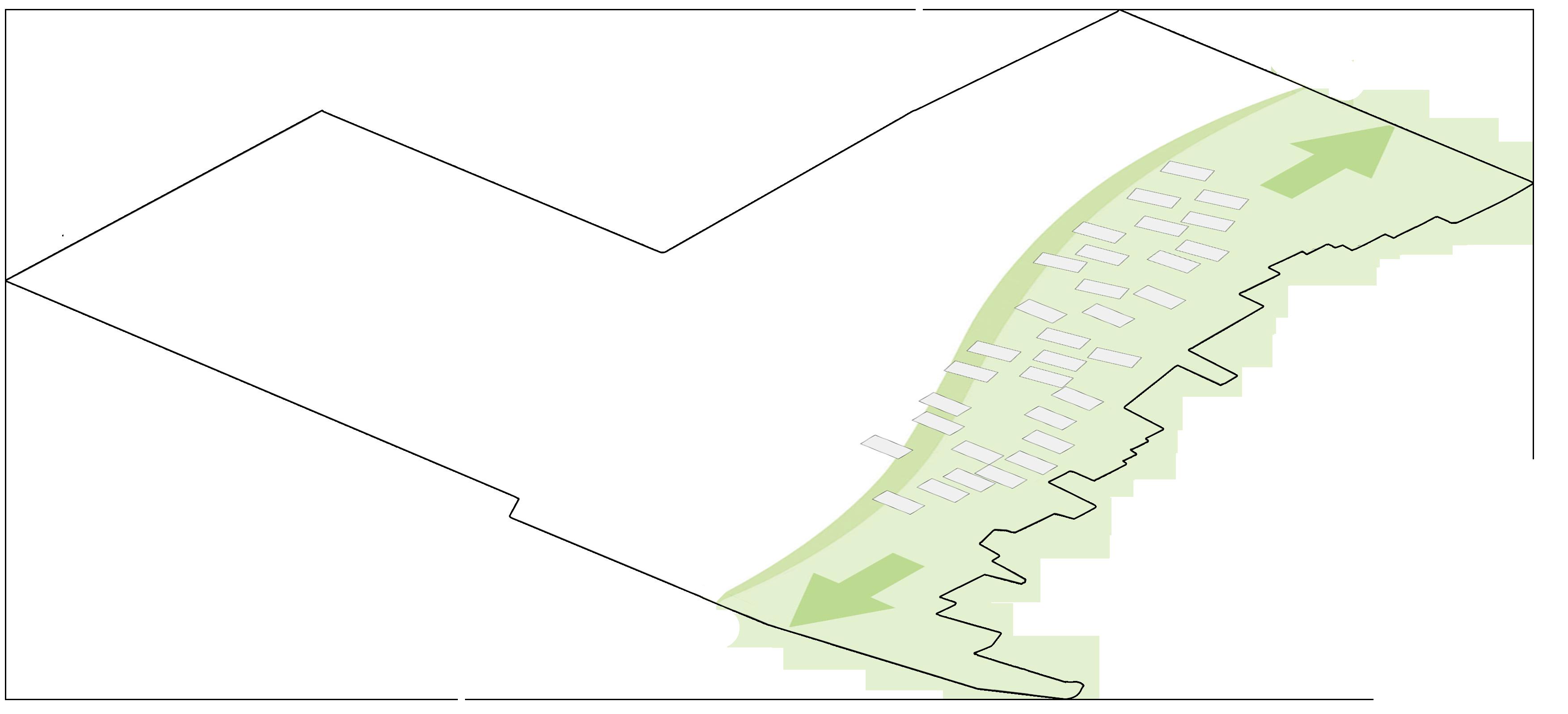
The site has 4 main axis. The old green axis marks the boundary of where the lake once was. The new green axis and road axis are new natural and man-made element after the lake is filled. Lastly, is the future axis where the srrounding will be built and then site will serve as a connection to the main road.

New Axis
Old Green Axis
New Green Axis
Road Axis
Due to unorganized urban grain, at the north of the site, the community creates organic patterns that has long existed over there in contrast to the new planned development on the south.


Community Pattern


Follow the pattern Orientation
Spread along the green axis


1 Extrude the Footprint

2 Assign Activities

_New Green Modern Lifestyle + Green
_Old Green Cultural activities + Green
Retail
Pattern
Food stalls
1 Create 2m hills using soil that were dug up
2 Dig up 800 mm deep lake along the axis
Water
Hills

Connect the Green and Blue element with canals


Canals
_ 300 mm deep
_ 25% of the site area
_ Serves as the sponge layer of the landscape
_In the dry season, it’s a walkway,
_In rainy season, the lake can expand, becoming a living landscape. And the canal become a decorated blue path to walk in or to appreciate.
Water
Hills


Entrance
Secondary Entrance
Main Circulation
Sub Circulation


Fishing/ picnic
Event/ Outdoor Dining
Dancing Area

Restaurant
Cafe Shops
Food Stalls


