MORISSET PLACE STRATEGY
Discussion paper

28768 9/2022
ACKNOWLEDGEMENT OF COUNTRY
Lake Macquarie City Council dhumaan Awabakala ngarrakal yalawaa, yalawan, yalawanan. Lake Macquarie City Council acknowledges the Awabakal people and Elders past, present and future.
Dhumaan ngayin ngarrakalu kirraanan barayidin. We remember and respect the Ancestors who cared for and nurtured this Country.
Ngarrakalumba yuludaka bibayilin barayida baaduka. It is in their footsteps that we travel these lands and waters.
Wording by the Aboriginal Reference Group and translated by Miromaa Aboriginal Language and Technology Centre.
CONTENTS
1. Introduction 4 2. Strategic Planning Framework 11 3. How we think Morisset can grow 18 4. Growth areas and precincts 25 Morisset regionally significant growth area 1. Central Precinct 28 2. Morisset M1 Gateway Precinct 34 3. North Morisset Precinct 38 4. West Morisset Precinct 42 5. South Morisset 46 Other locally and regionally important growth areas 6. East Morisset 50 7. Morisset Peninsula 51 8. Morisset Hospital site and waterfront 53 9. Cooranbong and Avondale Education Precinct 55 10. Dora Creek 55 11. Wyee Point 56 12. Wyee and south of Bushells Ridge Road 56 13. Eraring Transition Area 57 5. Blue-Green network 58 6. Movement infrastructure 62 7. Key topics for further investigation 70
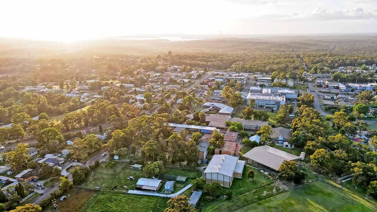
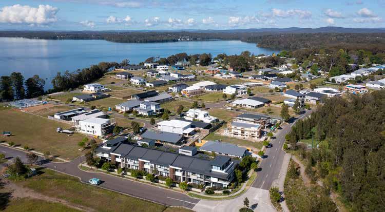
We are preparing a Place Strategy to guide the future development and growth of Morisset, which has been recognised by Lake Macquarie City Council and the NSW Government as a location of strategic significance for population and jobs growth, providing widespread benefits for the local government area and the broader Hunter region.
This discussion paper presents a vision for growing Morisset and aims to enhance what people love about the area. It proposes actions and studies that will be required to prepare and implement a Place Strategy for Morisset.
We invite you to provide feedback and help shape the future of Morisset.
WHAT IS A PLACE STRATEGY?
A Place Strategy is a framework to manage the growth of an area. It streamlines the process by which land is rezoned to enable more housing, services and jobs, and to help manage biodiversity conservation, flooding and bush fire threats. A Place Strategy will enable state and local planning requirements to be considered up front for growth areas in and around Morisset, with funding support from the NSW Government.
Decisions on infrastructure investment often lag behind new growth areas and the delivery of more housing. An infrastructure-first, place-based approach to planning requires infrastructure providers, the development industry and government agencies to take a coordinated approach. This collaboration will achieve better outcomes for communities, industry and government.
Place Strategy planning establishes a platform around which the community, state and local government, business and other stakeholders can collaborate in pursuit of an agreed vision and, in turn, attract growth and investment that balances social, economic and environmental outcomes.
Strategic planning to determine the best location for people, homes, and jobs must consider and balance a wide range of environmental, economic and social issues.
With a growing population, it makes sense to focus development and growth in and around our centres with good transport links and other required infrastructure. This not only makes our lives more convenient and connected, but also helps us avoid the costly impacts of greenfield or “out of centre” development. By planning wisely, we can create vibrant and thriving communities that are sustainable for generations to come.
Discussion paper - MORISSET PLACE STRATEGY 5
1. INTRODUCTION 1. INTRODUCTION
WHY PREPARE A PLACE STRATEGY FOR MORISSET?
Morisset is identified as a regionally significant growth area within the Hunter Regional Plan 2041 and, as such, requires the preparation and implementation of a Place Strategy.
Morisset is a good place for growth with its strategic location and qualities, including direct and easy access to the M1 Motorway, the Main North railway line, infrastructure availability, amenity, land availability, and proximity to the Central Coast, Newcastle/Hunter and Sydney.
PART 1 Making it happen
An infrastructure-first and place-based approach will materialise the regional plan’s vision and objectives into outcomes for the community.
Morisset will emerge as a regionally significant mixed-use centre supporting diverse businesses and services, as well as opportunities for more intensive multi-storey commercial, mixed use and residential development. Land release will be staged to optimise infrastructure delivery. Local strategic planning will identify infrastructure needs early, and coordinate transportation improvements and infrastructure provision to support the timely and efficient release of land for development.
At present, strategic land use decisions, including those relating to state infrastructure contributions, often precede capital investment planning by infrastructure and service delivery authorities. Consequently, decisions on infrastructure investment often lag behind the identification and development of new growth areas and increased housing in existing places.
For a growing Hunter, uncoordinated provision of services and infrastructure is not sustainable, efficient, cost effective or equitable.
Investigations into ecology and stormwater management are required to determine conservation and development potential. Development must be balanced with biodiversity conservation, within the broader context of the identified green corridors. Detailed ecological investigations will focus on:
WHAT AREAS ARE INCLUDED IN THE PLACE STRATEGY?
Singleton
• the location, nature and conservation value of vegetated lands, including any threatened species listed under State or Commonwealth legislation
• how this land, or parts of it, will complement green corridors
• the location of local ecological corridors, including riparian areas, and links to planned corridors outside the district
While the regional plan respects the ambitions of earlier planning, it catalyses a new approach to planning in the Hunter and generates wider conversations around a better, more coordinated planning system in NSW.
• the extent of potential biodiversity losses from development and the need for, and extent of, offsets.
An infrastructure-first and place-based approach to development requires infrastructure providers, the development industry and public authorities to take an integrated and coherent place-based approach to land use planning. It includes an urban development program, infrastructure assessment and place strategies for specific areas.
The boundary for the Place Strategy is based on the ‘Morisset regionally significant growth area’ identified in the Hunter Regional Plan 2041, as shown on page 26.
WHAT WILL THE PLACE STRATEGY CONSIDER?
The Morisset Place Strategy will consider biodiversity, flooding, transport and other relevant planning matters usually considered through individual land rezoning proposals. Supporting the Place Strategy will be a growth and change map outlining preferred land uses and transport infrastructure requirements.
WHAT HAVE WE ALREADY ACHIEVED?
Preparing place strategies is a fairly new planning tool in NSW, and was first formally required in the Hunter region through the Hunter Regional Plan 2041, published in late 2022. Council has been working with NSW Department of Planning and Environment (DPE) over the past 12 months to advance the preparation of the Place Strategy for Morisset. This includes:
seeking preliminary advice from key government agencies identifying possible investigation areas for growth/development
identifying and initiating studies required to prepare and implement the Place Strategy, some of which have been completed, some are in production, and some subject to funding. preparing a preliminary project plan and timeline for the Place Strategy (see page 8)
DPE endorsing the preparation of the Morisset Place Strategy as a priority for the Lower Hunter preparing and presenting this discussion paper to receive community input on insights and ideas from the initiation phase, and to hear and understand what people love about Morisset and what may be improved.
Lake Macquarie City Council Discussion paper - MORISSET PLACE STRATEGY 6 7
1. INTRODUCTION
Land Development Local strategy Infrastructure analysis Place strategy Rezoning Development assessment Development Infrastructure Development Corridor reservation Catalytic infrastructure Enabling infrastructure Supporting infrastructure -9-8 -7 -6-5-4-3-2 -1 0+1+2+3+4+5+6+7 Develop Procure Deliver Time (years) 13
Land development Infrastructure development
Figure from the Hunter Regional Plan 2041 shows how a Place Strategy is prepared ahead of rezoning in preparing for development of an area
Preliminary timeline
HOW WILL WE MOVE FORWARD?
Council is proposing a three-step process:
Undertake initial community engagement, seeking feedback on issues raised in this discussion paper (the remaining part of the Initiation phase)
a) Prepare a draft Place Strategy (including studies and analysis on a range of issues) for Council’s consideration and, if resolved by Council, place on public exhibition
b) Review submissions and present a final version of the Place Strategy to Council for adoption and Department of Planning and Environment endorsement.
Implement the Place Strategy
Preliminary project plan
• Transport scoping study Growth and resilience study
• Community feedback on discussion paper Studies:
Bush fire and flood studies (commenced), biodiversity and transport studies (subject to funding)
• Community feedback on draft Place Strategy
• Actions in Council resolution and DPE endorsement
The draft Place Strategy will propose a framework for development and conservation with:
• an overall vision for the development of the area
• growth precinct maps and phasing of envisaged development
• a vision for streets and places
• an infrastructure delivery plan
• an urban canopy and biodiversity conservation intent map.
PLACE DELIVERY GROUP
• Seek early agency advice
Identify and initiate studies
Propose growth areas for investigation
• Define key issues and draft project plan
Place Strategy nomination Discussion paper
• Establish Place Delivery Group (PDG)
• Investigate proposed growth precincts Infrastructure needs analysis
Set overall vision
Draft Place Strategy
• Infrastructure delivery plan
Consultation Consultation
DISCUSSION PAPER DRAFT PLACE STRATEGY
Insight and ideas from the initiation phase
Proposed framework for development and conservation
• Revise and finalise Place Strategy based on community feedback Review existing controls Implementation plan
• Update planning controls
• Other actions in the implementation plan
Timing of activities in Phase 3 will be considered further.
Place Strategy for Council to adopt and DPE to endorse
Some action may be concurrent with Phase 2b.
DPE has recently endorsed Council’s nomination of Morisset for the preparation of a Place Strategy and is organising the formation of a Place Delivery Group to coordinate its development. Some change to the preliminary timeline and project plan is to be expected.
NSW DPE is focused on delivering regional planning priorities through improved alignment of infrastructure planning and collaboration across government. A Place Delivery Group overseeing a place strategy will be chaired by the department and attended by relevant state agencies (such as Hunter Water Corporation, Biodiversity Conservation Division, Transport for NSW, Department of Education), councils, Local Aboriginal Land Councils and, where appropriate, proponents. The attendance of each Place Delivery Group is formed depending on requirements and issues.
The group will determine technical investigation requirements, remove the requirement for subsequent public authority concurrences and referrals at rezoning stage, track the performance of the Place Strategy, and endorse the Place Strategy and infrastructure delivery plan.
Lake Macquarie City Council Discussion paper - MORISSET PLACE STRATEGY 8 9
Hunter Regional Plan 2041 Transport scoping study Growth and resilience study Bush fire and flood study Place Strategy nomination Phase 1 - INITIATION Prepare project plan for Place Strategy and discussion paper Prepare draft Place Strategy and infrastructure delivery plan Prepare Place Strategy and implementation plan Phase 2a - DRAFT PLACE STRATEGY Phase 2b - PLACE STRATEGY Establish Place Delivery Group Place Strategy for adoption and endorsement Draft Place Strategy on exhibition Discussion Paper on exhibition 2025 2024 2023 2022
1INITIATION
Phase
INPUT
ACTIVITIES
OUTPUT ACTIVITIES ACTIVITIES
INPUT INPUT INPUT
OUTPUT OUTPUT
ACTIVITIES
Phase 2a - DRAFT PLACE STRATEGY Phase 2b - FINAL PLACE STRATEGY Phase 3IMPLEMENTATION
1. INTRODUCTION 1. 2. 3.
HOW WILL THE PLACE STRATEGY BE IMPLEMENTED?
The Place Strategy will set out objectives, planning principles and intentions for changes to the Lake Macquarie Local Environmental Plan (which specifies what can be built where through land use zones) and the Lake Macquarie Development Control Plan (which specifies certain design requirements for new development where Council is the approval authority). The Place Strategy will also form an addendum to the Lake Macquarie Local Strategic Planning Statement, which guides planning for the city, enshrined in State legislation.
The Place Strategy will serve as an infrastructure investment guide, and provide clarity for the community, government and industry on what and how Morisset will grow over the next 20-30 years.
HOW CAN I GET INVOLVED?
Preparation of the Place Strategy will be overseen by a Place Delivery Group, chaired by NSW DPE. Council will lead key investigations and provide opportunities for the community to get involved. We invite you to provide feedback on this discussion paper by visiting shape.lakemac.com.au.
Your feedback will provide valuable input in the next phase of the project where we will draft a Place Strategy for Morisset. The community will also be able to provide feedback on the draft Place Strategy, expected by July 2024.
DEVELOPMENT APPLICATIONS AND PLANNING PROPOSALS IN MORISSET
Will this affect my development application?
A Place Strategy is a very high-level document that establishes future direction. If you are planning to submit a development application for a site in Morisset, you can continue to do so.
For larger residential, mixed-use or commercial development proposals within the Morisset town centre, please contact Council to discuss your proposal, as our proposed changes may have benefits for your proposal, subject to timeframes.
Will this affect my planning proposal?
Planning Proposals prepared on land within or immediately adjoining the Morisset regionally significant growth area before the adoption of a Place Strategy must be consistent with the strategy outcomes identified in the Hunter Regional Plan 2041 for each regionally significant growth area.
Lake Macquarie City Council Discussion paper - MORISSET PLACE STRATEGY 10 11
1. INTRODUCTION
2. STRATEGIC PLANNING FRAMEWORK
This section outlines the strategic planning framework that supports the Morisset Place Strategy, including the local, regional and state plans that apply to the area.
LOCAL, REGIONAL AND STATE DIRECTIONS
Planning and development in Morisset is guided by state and local planning instruments. These planning instruments are administered by the NSW Government and Lake Macquarie City Council. The NSW Government and Council have varying levels of responsibility for the administration of the relevant planning instruments.
STATE AND REGIONAL STRATEGIC PLANNING
The NSW Government is responsible for:
The Hunter Regional Plan 2041
The Hunter Regional Plan 2041 (HRP 2041) is a 20-year land use plan prepared by the NSW Government under the Environmental Planning and Assessment Act 1979.
The plan aims to unlock sustainable growth opportunities and investments, as well as housing choice and lifestyle opportunities, to retain the Hunter’s position as a leading regional economy in Australia.
To support this aim, HRP 2041 identifies Morisset as a regionally significant growth area, which along with the supporting local centres of Cooranbong and Wyee, represents the largest future growth area in the Central Coast and Hunter, and will be a major point of connection between Greater Newcastle and Central Coast communities.
The identification of Morisset as a regionally significant growth area in HRP 2041 supports further investigation, tailored planning responses, activation and specific infrastructure investments to facilitate growth in the area.
Vision statement
The vision described for the Morisset regionally significant growth area in HRP 2041 is: Morisset will emerge as a regionally significant mixed-use centre supporting diverse businesses and services, as well as opportunities for more intensive multi-storey commercial, mixed-use and residential development. Land release will be staged to optimise infrastructure delivery. Easy connections will be maintained with the emerging centres of Warnervale and Lake Munmorah. Coordinated planning will benefit the district’s communities and businesses, with road network improvements and partnerships between government, industry and the Biraban and Darkinjung Local Aboriginal Land Councils. With the closure of mines and major power stations, Morisset’s economy will cater for renewable energy and circular economy developments, a growing lifestyle and tourism market, health services, goods distribution and urban food production.
Lake Macquarie City Council Discussion paper - MORISSET PLACE STRATEGY 12 13
2. STRATEGIC PLANNING FRAMEWORK
This section outlines the strategic planning framework that supports the Morisset Place Strategy, including the local, regional and state plans that apply to the area.
Greater Newcastle Metropolitan Plan 2036
The Greater Newcastle Metropolitan Plan 2036 (GNMP 2036), published by the NSW Government in 2018, sets out strategies and actions supporting growth across Cessnock City, Lake Macquarie City, Maitland City, Newcastle City and Port Stephens communities, which together make up Greater Newcastle.
The strategic metropolitan planning approach helps to achieve the vision of HRP 2041 by identifying programs that work towards the actions of both GNMP 2036 and HRP 2041.
In GNMP 2036, Morisset is identified as a strategic centre located in the metro frame surrounding Greater Newcastle. These metro frame centres are located by the water or the bush and have a strong identity, high amenity and a sense of place. Morisset will provide local housing and job opportunities, and will be designed to maintain the coastal and green outlooks, improve access to open space and retain the identity of places that collectively form Greater Newcastle.
LOCAL STRATEGIC PLANNING
Lake Macquarie City Council is responsible for:
Lake Mac 2032 - Community Strategic Plan
Lake Mac 2032 is the Community Strategic Plan (CSP) for Lake Macquarie City Council. It outlines the vision, goals and actions to guide the development of the city for the next decade. The plan was developed in collaboration with the community and aims to make Lake Macquarie a sustainable, connected and vibrant city that is a great place to live, work and play.
The plan focuses on seven strategic directions: Unique landscapes, Lifestyle and wellbeing, Mobility and accessibility, Diverse economy, Connected communities, Creativity and Shared decisionmaking. Each direction has a set of objectives, strategies and actions that are designed to achieve the overarching goal of creating a more liveable and sustainable city.
Lake Mac 2032 supports all the work that Council does, including establishing the broader strategic planning framework that guides growth and development across Lake Macquarie.
Local Strategic Planning Statement 2022
Council is responsible for setting the longterm vision for land-use planning in the city in collaboration with the community. This vision is outlined in our Lake Macquarie Local Strategic Planning Statement (LSPS)
The LSPS contains planning priorities and actions for the city, striving for Lake Macquarie to be one of the most productive, adaptable, sustainable and liveable places in Australia.
The planning statement identifies Charlestown, Glendale and Morisset as “regionally significant centres providing a wide range of services, community facilities, retail and employment to a wide spatial catchment”. The LSPS points out that the Cooranbong, Morisset and Wyee areas have considerable opportunities for urban development, and that Morisset’s location near the Central Coast, M1 Motorway and Northern Rail Line makes this area a sensible location for growth and affordable and diverse housing development, with easy access to nearby population and employment areas and main transport infrastructure. The LSPS includes directions for developing Morisset while preserving heritage and environmental values, improving the active transport network and developing a bustling local hub in Morisset town centre.
2008 Structure Plan for Morisset
Council adopted a broad Structure Plan for Morisset in November 2008. The Structure Plan is a strategic planning document guiding future urban development. The principles in the plan was applied to later amendments to the Lake Macquarie Local Environmental Plan, and Lake Macquarie Development Control Plans for the area. The Place Strategy will replace the Structure Plan.
Other Council strategic plans
Council has a range of adopted strategies that will inform the Place Strategy, such as the Housing Strategy, the Urban Greening and the Urban Heat Strategy, Walking, Cycling and Better Streets Strategy, Community Facilities Strategy, the Arts, Heritage and Cultural Plan, Destination Management Plan, and recreation and sports facilities strategies.
The Place Strategy in relation to the local, state and federal planning framework
Local Government Act 1993
Environmental Planning and Assessment Act 1979
Aboriginal Land Rights Act 1983
DEVELOPMENT AND PLANNING CONTROLS
Planning and development in Morisset is guided by a number of state and local planning instruments:
The Environmental Planning and Assessment Act 1979, which sets out major development concepts and principals including Part 4, which deals with development applications
The Environmental Planning and Assessment Regulation 2000, which contains all the regulations for the development concept and principles found in the Act.
State Environmental Planning Policies (SEPPs), which can set out when development consent is required, design principles and often nominates the consent authority for specific types of development. They provide a state-wide framework for allowing or prohibiting certain types of development considering infrastructure and coastal protection. The SEPPs can override Council’s planning guidelines.
Lake Macquarie Local Environmental Plan 2014
The Lake Macquarie Local Environmental Plan (LMLEP) 2014 is made under the Environmental Planning and Assessment Act, and establishes zones of land, such as environmental, rural, residential, business and industrial. Each zone specifies which developments are permitted with consent, permitted without consent, or prohibited. All land, privately-owned, leased or publicly owned is subject to these controls. The LMLEP also identifies other planning provisions such as maximum building heights and minimum lot sizes. The LMLEP consists of a written document and a series of maps. The figures on pages 16 and 17 show the current land use zones and Local Area Plans in the Lake Macquarie Development Control Plan within the Place Strategy area.
Lake Macquarie City Council Discussion paper - MORISSET PLACE STRATEGY 14 15
2. STRATEGIC PLANNING FRAMEWORK
Community Strategic Plan
Planning
Place
Hunter
Community Land and Business Plan
Proposal
Strategy
Regional Plan
State
Environmental Planning Policies Local Strategic Planning Statement Development Delivery Plan
Lake Macquarie Development Control Plan
The Lake Macquarie Development Control Plan (LMDCP) 2014 is the supporting document for the Lake Macquarie Local Environmental Plan 2014. It provides guidance and details requirements for development that should be considered when preparing a Development Application (DA). The LMDCP contains general controls for different zones and land uses, and detailed plans for specific geographic areas.
Within the Place Strategy focus area, these specific area plans apply:
10.5: Morisset Town Centre
11.7:
12.7:
12.8:
12.9:
Once the framework for development in Morisset is established through the Place Strategy, updates to the Lake Macquarie Local Environmental Plan and Development Control Plan will follow.
Lake Macquarie City Council Discussion paper - MORISSET PLACE STRATEGY 16 17 0 1 2 3 4 0.5 Kilometers 12.8 12.7 12.9 11.7 10.5 0 1 2 3 4 0.5 Kilometers N 0 1 2 3 4 0.5 Kilometers
Morisset Hospital Grounds Heritage Precinct
North Morisset
Precinct
Dora Creek
Township Flood Prone Land
Gimberts Road Morisset
N
Precinct
2. STRATEGIC PLANNING FRAMEWORK RU2 Rural Landscape RU3 Forestry RU4 Primary Production Small Lots RU6 Transition R2 Low Density Residential R3 Medium Density Residential SP1 Special Activities SP2 Infrastructure SP3 Tourist RE1 Public Recreation RE2 Private Recreation Boundary Morisset Place Strategy C1 National Parks and Nature Reserves C2 Environmental Conservation C3 Environmental Management C4 Environmental Living W1 Natural Waterways E1 Local Centre E2 Commercial Centre E3 Productivity Support E5 Heavy Industrial MU1 Mixed Use Land zoning map Local Area Plans in the Lake Macquarie Development Control Plan
3. HOW WE THINK MORISSET CAN GROW
The Greater Morisset Place Strategy is supported by the following vision, which has been created from community and stakeholder engagement.
This section outlines the strategic planning framework that supports the Morisset Place Strategy, including the local, regional and state plans that apply to the area.
PROPOSED VISION FOR MORISSET
Morisset is situated on Awabakal land. In the future, Morisset will be a vibrant strategic centre supporting the Hunter region’s economic transition. It is a thriving hub that caters to a diverse population of young families to retirees. It is a place where people want to live, with a robust local economy that has successfully navigated a transition to non-carbon intensive energy. Council will continue to consult with and incorporate knowledge from traditional owners, the Awabakal people.
It is a vital gateway between the Hunter and Greater Sydney on the Central Coast-Lake Macquarie planning corridor, with direct links to the M1 Motorway and Main Northern Rail Line. The area takes full advantage of its significant opportunities for growth in residential, commercial, recreation, tourism and industrial land use. Morisset and its supporting local centres, Cooranbong and Wyee, are recognised as the largest growth area in the Hunter and as a key part of supporting the economic transition of the region.
Morisset will continue to grow given its available land, transport connections and proximity to other parts of the Hunter, Central Coast and Sydney. Growth will support diverse businesses, creative enterprises, government and community services, and provide opportunities for more intensive multi-storey commercial, mixed-use and residential development.
Improvements to rail passenger services and Morisset’s position on the M1 Motorway will provide local employment and cater to the lifestyle preferences of the emerging hybrid-remote working models.
3. HOW WE THINK MORISSET CAN
Morisset is also the gateway to important natural areas including the Watagans National Park and Lake Macquarie, which will play an important role in tourism and active recreation industries. Growth will be attentive to local European and Aboriginal heritage and connect people with the lake and the Lake Macquarie State Conservation Area adjoining the Morisset Hospital site.
With several mines, Vales Point Power Station and Australia’s largest coal-fired power station at Eraring, due for closure by the end of the decade, the local economy will diversify to cater to the demand for renewable energy and circular economy developments, a growing lifestyle and tourism market, health services, goods distribution and urban food production. Supporting these activities is accessibility to tertiary education institutions including Avondale University and the University of Newcastle.
Vision statement
A vibrant and future-focused hub for jobs, industry, and affordable, diverse housing in the Hunter region. Morisset is home to unique communities with rich heritage, stunning green spaces, and world-class leisure and recreation opportunities.

Lake Macquarie City Council Discussion paper - MORISSET PLACE STRATEGY 18 19
GROW
POTENTIAL OF MORISSET
The draft vision for the Morisset Place Strategy enables a wide range of future possibilities for the growth of the area.
To support the vision for Morisset, four scenarios have been developed by the University of Newcastle’s Institute for Regional Futures, to clarify different imagined outcomes for business and employment, land use planning, housing supply and demand, social infrastructure, connectivity, infrastructure needs and community services.
The purpose of the scenarios is not to provide options to choose between, but to explore a wider range of issues and considerations to guide collaborative planning for the Place Strategy in support of Morisset’s growth to 2041.
Scenario 1:
Morisset as usual describes a future for Morisset that experiences significant growth across the area which is limited by current existing land use planning controls, a low number of land consolidations, opportunistic infill developments and limited additional investment in existing physical and social infrastructure. Current developments in planning will come to fruition, including the Gunther Industrial Estate, Mandalong Road South, Mandalong Road North and an industrial hub on Gimberts Road.
Scenario 3:
Gateway Morisset builds on the Inner Core scenario and leverages Morisset’s significant geographic advantage as a strategic road and rail transport corridor, driving urban intensification of Morisset Central and commercial, agricultural and industrial land uses adjacent to the M1 Motorway.
Gateway Morisset anticipates the introduction of faster rail through the Sydney-Central Coast-Newcastle Faster Rail improvement investments. With improved connections, the Growth Area becomes a destination of choice for weekend and extended getaways. Larger and more frequent festivals and events, including regular live music, are supported, which attracts more visitors and local residents to cultural and entertainment activities.
Scenario 2:
Inner Core promotes increased density around central Morisset, through changes to residential planning controls and state and Council investment in placemaking and the public domain. Placemaking investment is combined with Council programming to re-create central Morisset as a vibrant social heart.
Streets around the train station, especially Yambo and Dora Streets, would be pedestrian-priority spaces through ‘streets as shared spaces’ actions and upgrades to increase walkability and accessibility, and a potential bypass would be investigated to reduce through-traffic. The Morisset Community Hub is realised, creating a focal point for the public domain and serving as a catalyst for private investment in Morisset Central.
Scenario 4:
Morisset City is the full realisation of development across Morisset in terms of maximising residential and employment lands. The increase in population drives diversity in the residential housing market, sustains local businesses (including expansion and change of use in existing shopping centres), and creates a population density threshold consistent with social and cultural diversity, inclusion and cultural development.
Through the timely staging and managed release of urban development areas, with sensitivity to environmental constraints, the population progressively expands into new greenfield sites. Infrastructure investment precedes the population, especially in the provision of transport links within, and across, the region.
As with the Gateway Morisset scenario, demand for local jobs enables further growth of industrial and commercial activity adjoining the M1 Motorway. Morisset City also leverages the proximity to the M1 Motorway to support employment in west Mandalong Road, including freight, warehousing and logistics, that complements nearby centres. The Morisset City scenario would require Council to investigate the capacity, viability and development potential of growth areas outside the Place Strategy boundary including the Eraring Power Station site, former Morisset Hospital site, and the Transition (RU6) zoned lands of Morisset and Bonnells Bay.
Lake Macquarie City Council 20 Have your say How do you feel about the proposed vision and these scenarios? Visit shape.lakemac.com.au to provide feedback.
Discussion paper - MORISSET PLACE STRATEGY 21
3. HOW WE THINK MORISSET CAN GROW
SCENARIO OVERVIEW
MORISSET AS USUAL INNER CORE GATEWAY MORISSET MORISSET CITY
High intervention urban renewal and growth
PLACE STRATEGY OBJECTIVES
New jobs (2041)
Industrial: 3500
Commercial: 200
Key business development Expanding health care and social assistance needs, conservation management
Social infrastructure development
Industrial: 3500
Commercial: 600
Lifestyle and boutique retail, cafe and hospitality, night-time economy and culture
oriented development
Morisset’s draft vision and growth potential have been shaped with input from the community in recent years. In addition, Council collaborated with the University of Newcastle’s Institute for Regional Futures to undertake community engagement activities throughout 2022. These included interviews with stakeholders, such as businesses, government agencies, local Aboriginal groups, not-forprofit organisations and industry representatives. Council also hosted an information session with elected state and local members, as well as a community forum through an expression of interest process.
Industrial: 4300 Commercial: 5200
Freight and logistics, circular economy, intensive agriculture, carbon farming
Industrial: 4300 Commercial: 11, 500
University and education institutions, expanded health facilities
The community’s feedback helped identify key ideas and concerns regarding future development in and around Morisset. These key ideas have been summarised under the following draft Place Strategy objectives, which are intended to reflect community aspirations, state and local policy directions, and underpin growth.
Ageing in place, health and community services
Placemaking, public domain upgrades, civic and community services
Tourism infrastructure, arts, and cultural events, protected peri-urban production lands
Health, education, early childhood, community support, community development, transport, culture, sport and recreation, parks, and emergency services
Have
1. Enable the delivery of more housing, ensuring diverse and affordable housing options that meet the projected needs for Morisset (predominantly young families and empty nesters), and locate and design new housing to increase resilience to natural hazards.
2. Expand transport choice and reduce road trauma through improved infrastructure, and facilitate access to everyday services within 15 minutes by focusing new housing around Morisset Central Precinct and existing local centres.
3. Reinforce the role of the Morisset Central Precinct and the M1 Gateway Precinct as places for business and social life.
4. Ensure convenient, safe access to open space, recreation and community facilities and natural areas, locating new housing around the Morisset Central Precinct ‘green belt’ and near current and future planned facilities.
5. Well-designed, regenerative built environments, targeting net zero carbon emissions are sensitive to Morisset’s bushland setting, and support successful, thriving places where people want to live and work.
6. Improve economic resilience, access to local jobs and facilitate the growth of globally competitive small to medium enterprises, recognising Morisset’s locational advantage on the M1 Motorway, on the edge of the Greater Sydney Metropolitan Area, proximity to southern Lake Macquarie and Watagans National Park, and opportunities associated with the Eraring transition area.
7. Enhance and celebrate local heritage, culture and creativity, including partnering with Biraban Local Aboriginal Land Council to enable economic selfdetermination for Aboriginal residents, and identifying opportunities for adaptive re-use of the Morisset Hospital site.
8. Enhance biodiversity, conservation areas and corridors, linking the Greater Morisset Area to regional biodiversity corridors and protected areas.
Lake Macquarie City Council Discussion paper - MORISSET PLACE STRATEGY 22 23
Development drivers Opportunistic development Higher residential density in Morisset Central Purposedesigned transit/ transport-
Total population (2041) 42,060 44,680 45,170 57,545 Total dwellings (2041) 18,000 19,225 19,420 24,420
there any
missing? Visit shape.lakemac.com.au to provide feedback.
your say Do you support each of the proposed Place Strategy objectives? Are
objectives
3. HOW WE THINK MORISSET CAN GROW
Note: At the time this discussion paper was prepared, the Growth Area is estimated to comprise a population of just under 28,000 residents, 11,700 dwellings and local businesses and organisations that generate about 8700 jobs.
4. GROWTH AREAS AND PRECINCTS
This chapter identifies specific geographical areas that the Morisset Place Strategy will explore further.
This section outlines the strategic planning framework that supports the Morisset Place Strategy, including the local, regional and state plans that apply to the area.
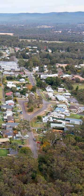
Council has identified five unique growth precincts within the Morisset regionally significant growth area (Place Strategy area), and eight locally and regionally important areas for growth in Greater Morisset (see page 26). The growth areas outside the Morisset Place Strategy area are described in short, because these communities interact together socially and economically, and their development is of relevance to the development of Morisset as a strategic centre in this region.
We have made a preliminary assessment of the five precincts within the Morisset regionally significant growth area, and their future potential. These assessments are informed by stakeholder engagement, strategic planning directions and the evidence-base prepared to support the development of the Place Strategy. The precincts will be further analysed in the next phase of the Place Strategy to establish development potential and principles for development including conservation areas, and values to be maintained or enhanced. Your feedback will be valuable for our further works.
We have further proposed potential priorities for each of the precincts within the Place Strategy area. These priorities serve as the basis for unlocking the area’s full potential and establishing the necessary conditions for growth and transformation. We would also like your input on these.
Lake Macquarie City Council Discussion paper - MORISSET PLACE STRATEGY 24 25
4. GROWTH AREAS AND PRECINCTS
GROWTH AREAS - MORISSET AND SURROUNDS
Morisset Place Strategy boundary
Local Government/Council boundary
Morisset regionally significant growth area
1. Central Precinct
2. Morisset M1 Gateway Precinct
3. North Morisset Precinct
4. West Morisset Precinct
5. South Morisset Precinct
Other local and regionally important growth areas
6. East Morisset
7. Morisset Peninsula
8. Morisset Hospital site and waterfront
9. Cooranbong and Avondale Education Precinct
10. Dora Creek
11. Wyee Point
12. Wyee and South of Bushells Ridge Road
13. Eraring Transition Area
Lake Macquarie City Council Discussion paper - MORISSET PLACE STRATEGY 26 27 0 1 2 3 4 0.5 Kilometers 1 2 3 4 5 6 7 8 9 11 12 13 10
Wangi Wangi
Dora Creek
Wyee Point
Bonnells Bay Morisset
Cooranbong
Mandalong
Wyee
M1
M1
B53
Trinity Point
4. GROWTH AREAS AND PRECINCTS
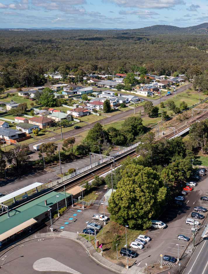
1. CENTRAL PRECINCT
AT A GLANCE:
By 2041, Central Precinct could support:
4922 people up from 1665
2225 dwellings up from 716
POTENTIAL FUTURE STATE
Morisset Central is a bustling and vibrant hub of activity, serving as a regional centre for commerce, industry, higher density housing and culture. Morisset Central is home to a range of local events and cultural activities, bringing together residents from all walks of life to celebrate the community’s diversity and vitality. With its unique character and sense of energy, Morisset Central is a key player in the ongoing success and development of the Lake Macquarie region.
ISSUES AND OPPORTUNITIES
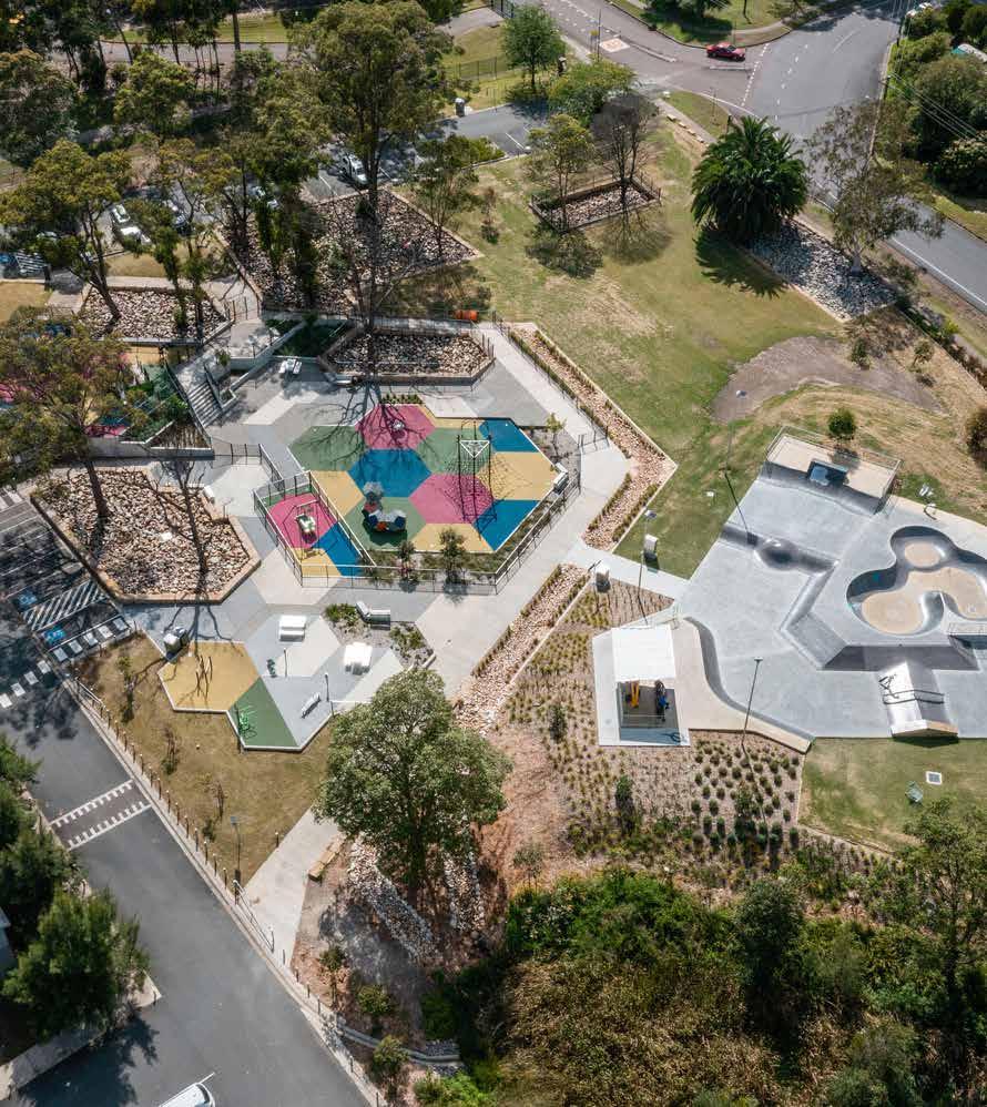
• Currently lacks any central public space
• Redevelopment of Morisset will help shape the broader regional identity of Lake Macquarie
• Attracting more large businesses to Morisset to draw people to the town from a broader catchment area
• Opportunities to capitalise on the development of new public recreation and entertainment facilities such as Cedar Mill, to support a 24-hour economy and mixed-use centre
• Creation of a high density and affordable housing area adjacent to the transport hub with greater development around the train station
• New public open spaces and better street experiences through redevelopment
• Opportunity to conserve and enhance creek lines, riparian corridors and deliver residential development with a broader biodiversity conservation/management plan in partnership with key stakeholders
• Land around the Morisset Multipurpose Centre contains threatened species habitat and native vegetation corridors that would provide high amenity for adjacent development
Dwelling and persons baseline figures and projections are approximated to the Australian Bureau of Statistics (ABS) defined SA1 boundaries. Due to discrepancies in precinct boundaries and SA1 boundaries, dwelling and persons figures are indicative only.
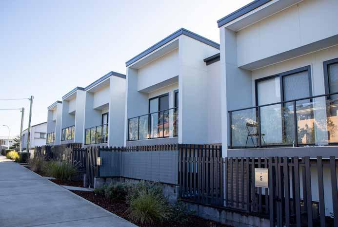
The Central Precinct is the vibrant social heart of greater Morisset, with attractive streetscapes and active street frontages, and mixed-use developments with shops, offices and higher density housing. Yambo and Dora Streets will be high amenity, with improved pedestrian movement. The community will have access to a new civic space and community hub with a new library, multipurpose rooms and exhibition space. Within the Central Precinct are major recreation facilities including sports fields, a central town park, skate park, and other recreation and community facilities. Centrally located, these facilities are within a 15-minute walk of surrounding precincts and form part of the inner green belt of the commercial core.
Transformation of Morisset into its present-day form began in 1887 with the establishment of sawmilling and the construction of the Great Northern Railway (now known as the Main North line), and there are several sites with heritage value in the Central Precinct. The railway corridor and the station master’s cottage are listed as having local heritage significance. Other local heritage listed items include the Morisset Memorial Hall, Morisset High School and Mullard Chambers Building. Many of the existing buildings in Morisset are older, on larger lots, with rear laneway access. These conditions are ideal for new housing development that supports quality, walkable neighbourhoods within a five-minute walk of shops, services, community facilities and the regional bus and train network. Council estimates the Central Precinct can accommodate an additional 2000 dwellings with an increase in building heights, in doing so, taking advantage of views to the Watagans National Park. Uptake of this opportunity will depend on investment in the public domain, community facilities, and market conditions and competition from new housing and commercial development elsewhere in the region.
Population and employment growth will be supported by upgrades to the state and local road network, particularly, Main Road (B53) from the M1 Motorway interchange through to Dora Street. The area also contains a large undeveloped area to the south of Awaba Street, west of Moira Park Road. It is currently zoned low density residential but is heavily vegetated, and contains riparian corridors associated with Melaleuca Creek. Council proposes the Morisset Place Strategy includes an action to retain, rezone and enhance the riparian corridors, and deliver residential development on the remainder of the site. This outcome would be subject to a broader biodiversity management plan prepared in partnership with the NSW Government, Biraban Local Aboriginal Land Council, the NSW Aboriginal Land Council and other key landowners. The Hunter Regional Plan 2041 has identified the site of the current Morisset Multipurpose Centre as a residential investigation area. Council is currently considering moving certain facilities to the proposed state-of-the-art Community Hub in the Morisset Central Precinct, while ensuring the land meets broader current and future needs of the community. This option will first be considered as a part of the Morisset Community Hub project which will further inform the Place Strategy.
Lake Macquarie City Council Discussion paper - MORISSET PLACE STRATEGY 28 29
4. GROWTH AREAS AND PRECINCTS
0 1 2 3 4 0.5 Kilometers
MORISSET CENTRAL PRECINCT DRAFT PRIORITIES

1. Create a vibrant social heart with inviting main streets, active street fronts and mixed-use development with a central community hub and civic space.
2. Support the review of development controls that relate to building density, to ensure a genuine mix of business and residential uses to enhance the character of Morisset Central and to support a 15-minute neighbourhood.
3. Create a main shopping strip close to transport infrastructure that maintains linkages to Morisset’s history as a rural market town.
4. Contribute towards the provision of new community and cultural facilities, including community and library floor space, communal rooms, work-based childcare services, production space for creative arts and medical services.
5. Plan for a mix of housing and a diverse offering of business services, retail and dining, and health and social services.
6. Plan for a town centre that asserts Morisset’s position as a gateway to Lake Macquarie City.
Have your say
7. Improve active transport connectivity between Morisset Central to the southern Lake Macquarie State Conservation area, and adjacent conservation lands.
8. Connect walking and cycling links to Morisset Central precinct, Bonnells Bay and open space foreshore areas.

9. Create new space for jobs in tourism and entertainment and supporting services, such as shops, restaurants, cafes and bars and transport, to create smaller activity areas.
10. Address potential impacts of 24-hour economy activities on amenity, including noise, safety, traffic and transport, amongst others.
11. Encourage the sympathetic renewal and adaptive reuse of local conservation heritage items.
12. Future development and land use plans conserve, protect and enhance environmentally sensitive areas and biodiversity corridors.
The above priorities are a set of draft strategic objectives, which future land use plans and development proposals will need to respond to. Do these draft priorities reflect the community’s aspirations for the area? Visit shape.lakemac.com.au to provide feedback.
Lake Macquarie City Council Discussion paper - MORISSET PLACE STRATEGY 30 31
4. GROWTH AREAS AND PRECINCTS
HRP2041: Hunter Regional Plan 2041 DoraSt B53 B53 FreemandsD r MandalongRd W y e e R d YamboSt Moira ParkRd AwabaSt Morisset Railway Station 2 3 4 1 Morisset regionally significant growth area Central Precinct boundary Morisset town centre Residential investigation area (HRP2041) Infill area (HRP2041) 1 2 3 4 Fishery Point Rd KahibahSt Kilometers Morisset Community Hub, bawarramalang Proposed Morisset Town Park Morisset Showground Morisset Multi-purpose centre C l a c ks C r e e k r ip e r i a n c o r r i d o r Melaleuca C r dirrocnairepiRkeero Kilometers
Impression of future town square and surrounding community and commercial development from the Morisset Town Centre Area Plan. New concept designs will be presented later this year.
Morisset civic centre and community hub project
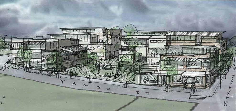
Developing a Town Square, surrounded by community, library, retail, commercial and function facilities in Morisset, has been identified as integral to creating a welcoming central public space in the Morisset Town Centre Area Plan (Area Plan). The Area Plan defines the town centre structure and “establishes the Town Square and the future town hub, to be surrounded by development suited to extended hours activity such as retail, cafes and takeaway food retailing, and community and function facilities”. The Town Square will provide residents, visitors and shoppers with a pleasant, lively and safe place for waiting, meeting, relaxing and engaging in community life. Council is working with the team at Lahznimmo Architects to investigate the potential for, and to develop, concept designs and a feasibility study for this project, the Morisset Community Hub.
The Morisset Community Hub will be a landmark development, demonstrating Council’s support of lifelong learning and a wide variety of cultural and recreational opportunities. It will celebrate the First Nations and European history of Morisset. The buildings will be adaptable and suitable for meetings and functions, provide community office accommodation, all-access and all-ages programs, and arts and crafts exhibitions. It will offer space for quiet study and information seeking, along with multifunction spaces for storytelling and children’s activities. The project will enable Council to deliver multiple strategic and organisational objectives, it will establish Morisset as a regional strategic centre and the Morisset Town Square as a vibrant hub that will attract and retain residents and businesses.
Lahznimmo Architects are due to deliver their concept designs and feasibility study in September 2023.
Proposed Morisset Town Park
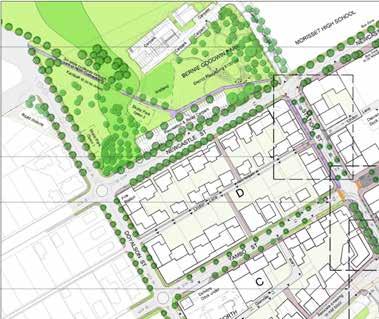
In 2014, Council adopted the Morisset Area Plan and Streetscape Master Plan. These plans propose a new central town park, bounded by Newcastle and Doyalson streets. The park would address the current disconnect between the Bernie Goodwin Reserve playground and skate park to the triangular shaped Rotary Park. Establishing the park would require the closure of Kahibah Street and upgrade of Doyalson Street, Newcastle Street, and associated intersections. Council has collected development contributions to help fund this work. Council proposes to continue planning for the central town park. A proposed principle of the Morisset Place Strategy is to ensure a growing population has walkable access to green, open space such as the proposed park.
Morisset Showground Master Plan
Morisset Showground is a key asset for the community and a unique selling point for Morisset. Council adopted the Morisset Showground Plan of Management and Master Plan in September 2022.
The plan envisages the showground as providing a venue for a variety of community groups and visitors to enjoy a diverse range of events and activities. The Morisset Place Strategy will align and help deliver the Showground Master Plan.
The plan includes 143 Dora Street, Morisset, the site of the current Morisset Multipurpose Centre. An option is to move certain facilities to the proposed state-of-the-art community hub in the Morisset Central Precinct, while ensuring the land meets broader current and future needs of the community. This will be considered as a part of the community hub project.
Lake Macquarie City Council Discussion paper - MORISSET PLACE STRATEGY 32 33
Morisset Town Park
Morisset civic centre and community hub
Morisset Showground
Morisset MultiPurpose Centre
4. GROWTH AREAS AND PRECINCTS
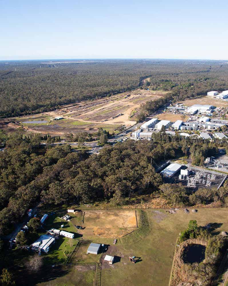
2. MORISSET M1 GATEWAY PRECINCT
AT A GLANCE:
By 2041, the Morriset M1 Gateway Precinct could support:
11,200 additional jobs
POTENTIAL FUTURE STATE
The M1 Gateway Precinct connects the growing and dynamic city of Morisset. With easy access to the M1 Motorway, this area has become a hub for businesses, both large and small, looking to capitalise on its strategic location. The area’s growth has facilitated Morisset’s evolution into a distinct and unique city, offering a diverse range of opportunities for people to work and play.
ISSUES AND OPPORTUNITIES
• Diversify and grow the regional economy and provide local jobs
• Proximity to the M1 presents opportunities for freight, warehousing and logistics operations, and intensive food production
• Cedar Mill will host a range of events, markets and functions, with capacity to stage outdoor performances for audiences of up to 30,000 people (due to open in 2024)
• Parts of the area is flood-prone, and included in an ongoing flood study
• The area west of the M1 contains threatened ecological community and species habitat and unmapped important wetland and riparian areas and vegetation, and should be further investigated in the biodiversity study
• Opportunity to enhance wetlands, creek lines, aquatic habitat and riparian corridors to assist in improving water quality in creek lines and ultimately the lake
The M1 Gateway Precinct spans land west of the M1 to Ourimbah Street east of the M1. With bidirectional access to the M1 and the intercity train network, and existing industrial and commercial operations, this area provides a significant opportunity to diversity and grow the regional economy and provide local jobs.
There is a significant demand for industrial land in the growth area due to the increasing penetration of e-commerce and higher demand for industrial and employment lands for freight, logistics and warehousing. Proximity to the M1 is ideal for these sectors. Additionally, there is a growing interest in hyper-localisation and decentralised urban planning, which encourages investment in outer suburban and regional areas.
Future planning will need to consider the implications of structural changes within the freight and logistics sectors, including within the Hunter region. This includes transformative proposals for the Port of Newcastle and the potential for Newcastle Airport to play an increasing role in fast freight distribution.
Cedar Mill Lake Macquarie stands to unlock new tourism and entertainment opportunities, and provide new social and recreational amenities for the people of Morisset and surrounding communities. The event space located on the former Morisset Country Club golf course, is currently under construction and will host a range of events, markets and functions, including staging of world-class performances. The southern part of the Cedar Mill site identified for residential investigation in the Hunter Regional Plan has a development approval with visitor/tourist accommodation and senior lifestyle village.
Land currently zoned rural landscape, north of existing land zoned for industrial use on Gimberts Road, may be suitable for expanded industrial development subject to mitigation of flood impacts.
Land north-west of the M1 interchange is floodprone and may be suitable for more intensive food production, benefiting from close proximity to the M1 for efficient distribution. Council proposes further investigation of this concept as part of the Morisset Place Strategy.
Lake Macquarie City Council Discussion paper - MORISSET PLACE STRATEGY 34 35
4. GROWTH AREAS AND PRECINCTS
0 1 2 3 4 0.5 Kilometers
M1 GATEWAY PRECINCT DRAFT PRIORITIES
1. Encourage intensive agriculture, including precision farming and greenhouses, for ongoing food security and to make use of strategic connections to wholesale distribution centres.
2. Incorporate private recreation facilities with other uses, such as manufactured home estates and seniors living to support greater housing choice and diversity.
3. Expand industrial, business and specialised retail employment uses to support greater diversity and opportunity in the local employment market.
4. Leverage proximity to the M1 Motorway to support employment in west Mandalong Road, including freight, warehousing and logistics.
5. Support the establishment of a freight and logistics hub in Morisset, which will benefit from access to road and rail networks with existing freight capability.
6. Enhance active transport connectivity between the Morisset M1 Gateway Precinct, Morisset Central Precinct, and residential centres.
7. Investigate opportunities to actively plan and respond to structural changes within the freight and logistics sectors, occurring in the Hunter region. This includes transformative proposals for the Port of Newcastle and the potential for Newcastle Airport to play an increasing role in fast freight distribution.
8. Incorporate initiatives that embody circular economy principles in the development and ongoing operation of employment lands.
9. Future development and land use plans must include provisions that protect, conserve and enhance environmentally sensitive areas and biodiversity corridors.
10. Improve traffic flow and movement along Mandalong Road/Dora Street towards the Morisset Central precinct.
Have your say
The above priorities are a set of draft strategic objectives, which future land use plans and development proposals will need to respond to. Do these draft priorities reflect the community’s aspirations for the area? Visit shape.lakemac.com.au to provide feedback.
Morisset regionally significant growth area
Morisset M1 Gateway Precinct boundary
Employment investigation area (HRP2041)
Employment opportunity (HRP2041)
Residential investigation area (HRP2041)
Cedar Mill
Gimberts Road North - investigation area
M1 West - investigation area
Lake Macquarie City Council Discussion paper - MORISSET PLACE STRATEGY 36 37
4. GROWTH AREAS AND PRECINCTS
B53 F r ee m na sd D r OurimbahSt MandalongRd yWee dR 1 2 3 M1 M1 Mandalong Rd
HRP2041: Hunter Regional Plan 2041
2 3
0 1 2 3 4 0.5 Kilometers G imbe r ts R d 1 2 3 4 Kilometers 0 1 2 3 4 0.5 Kilometers
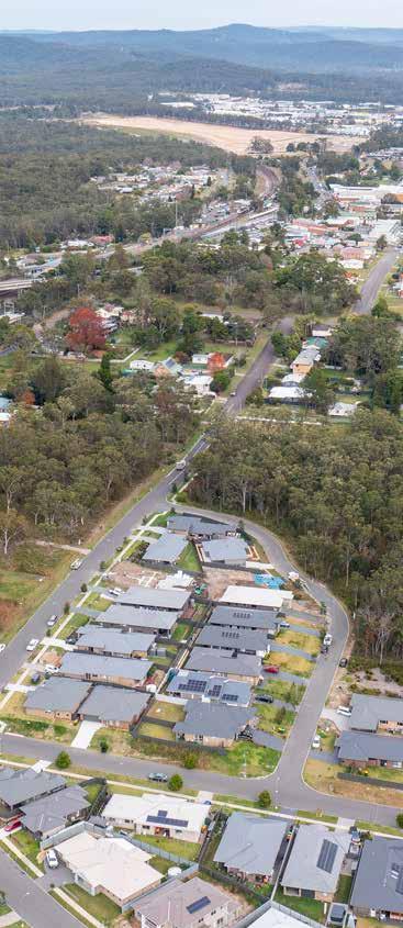
3. NORTH MORISSET PRECINCT
AT A GLANCE:
By 2041, the North Morisset Precinct could support:
4546 people up from 1403
2034 dwellings up from 593
POTENTIAL FUTURE STATE
North Morisset is a desirable lifestyle precinct for young people and families to live, work, play and learn. This is due to the diversity of affordable housing, which is close to key services, facilities, natural areas and public recreational spaces, and serviced by active and public transport.
ISSUES AND OPPORTUNITIES
• Potential for diverse types of housing
• Potential for land uses associated with urban services, such as childcare, gyms or recreational facilities, in Moira Park Road sub-precinct
• Opportunity to conserve and enhance Melaleuca Creek and its tributaries, aquatic habitat and riparian and native vegetation corridors
• Issues and opportunities associated with identified transport opportunities have to be further investigated
4. GROWTH AREAS AND PRECINCTS
Dwelling and persons baseline figures and projections are approximated to the Australian Bureau of Statistics (ABS) defined SA1 boundaries. Due to discrepancies in precinct boundaries and SA1 boundaries, dwelling and persons figures are indicative only.
Stockton Street and Terrigal Street sub-precincts
Much of the new housing in Morisset has been constructed in the Morisset north sub-precincts, as envisaged by previous plans for Morisset. These areas now provide diverse types of housing to meet people’s different needs, including free-standing homes, townhouses, dual-occupancies and secondary dwellings.
Moira Park Road sub-precinct
Land between Main Road (B53), the railway corridor, and Moira Park Road is currently zoned RU6 Transition, meaning future land uses require investigation. This area may be suitable for residential purposes, and land uses associated with urban services, such as childcare, gyms or private and public recreational facilities.
Russell Road sub-precinct
This area north of Ettalong Road is identified as a residential investigation area in the Hunter Regional Plan 2041. As former agricultural land, the Russell Road sub-precinct represents a major opportunity for a new walkable neighbourhood with open space and diverse housing options within a 15-minute walk of the Morisset Central Precinct.
A transport scoping study for greater Morisset (see section 6) has identified development of this sub-precinct may require upgrades to the Moira Park Road and Main Road (B53) railway underpass and intersection, provision of a second southern access point in addition to Ettalong Road, and proposed upgrades of Awaba Street. Potential road works, impact and benefits needs to be further investigated in the upcoming Place Strategy process.
Lake Macquarie City Council Discussion paper - MORISSET PLACE STRATEGY 38 39
The North Morisset Precinct is comprised of several distinct neighbourhoods. The area contains Clacks Creek and Melaleuca Creek – two riparian corridors of high ecological value.
NORTH MORISSET PRECINCT DRAFT PRIORITIES
1. Encourage higher residential housing densities that complement adjacent mixed-use development in Morisset Central, while retaining the areas unique character to support an active and vibrant city.
2. Plan for housing anchored by a central neighbourhood common and quality pedestrian and cycle connections to surrounding precincts.
3. Future development and land use plans conserve, protect and enhance environmentally sensitive areas and biodiversity corridors.
4. Future residential development and land use plans include provisions that address increasing risk of flooding, bush fire, urban heat and extreme events associated with climate change over the coming 50 years and beyond.
5. Create attractive, safe and connected streets for walking and cycling, particularly in activity spurred on by community spaces and parkland.
Have your say
The above priorities are a set of draft strategic objectives, which future land use plans and development proposals will need to respond to. Do these draft priorities reflect the community’s aspirations for the area? Visit shape.lakemac.com.au to provide feedback.
Morisset regionally significant growth area North Morisset Precinct boundary Residential investigation area (HRP2041) Infill area (HRP2041)
Stockton Street sub-precinct Terrigal Street sub-precinct
Moira Park Road sub-precinct Russell Road sub-precinct
Lake Macquarie City Council Discussion paper - MORISSET PLACE STRATEGY 40 41
4. GROWTH AREAS AND PRECINCTS HRP2041: Hunter Regional Plan 2041 B53 B53 Freemand s D r MandalongRd W y e e R d Dora Creek Moira ParkRd AwabaSt 3 4 2 1 Fishery Point Rd Mle la e u ca CreekRiperian corridor StocktonSt StationSt TerrigalSt BridgeSt essuR l R d Ettalong Rd Clacks Creek r ip e r i a n c o r r i d o r aMni dR DoraSt KahibahSt
1 2 3 4 1 2 3 4 Kilometers
4. WEST MORISSET PRECINCT
AT A GLANCE:
By 2041, the West Morisset Precinct could support:
1388 people up from 432
555 dwellings up from 265
POTENTIAL FUTURE STATE
West Morisset is a desirable lifestyle precinct to live, work, play and learn. This is due to the diversity of affordable housing, which is close to key services, facilities, natural areas and public recreational spaces, and serviced by active and public transport.
ISSUES AND OPPORTUNITIES
• Housing opportunities within walking distance to the Morisset Central Precinct and M1 Gateway Precinct.
• Access upgrades required for the development of the land fronting Freemans Drive could also help deliver access upgrades for the Morisset Showground Master Plan
• Opportunities for development in the area will need to carefully considerate environmental factors such as biodiversity and flooding
4. GROWTH AREAS AND PRECINCTS
The areas west of Freemans Drive contains an established low-density residential area and lifestyle villas for over 55s located on the northern side of Gimberts Road, and a large area of land currently zoned RU6 Transition on the southern side. The RU6 zoning means its future use is subject to further investigation and consultation with landowners and the community, and it is identified in the Hunter Regional Plan 2041 as a residential investigation area.
This area could potentially support further housing developments in an area within a 15-minute walk of the Morisset Central Precinct and short distance from the M1 Gateway Precinct. Development of land fronting Freemans Drive and Jamerin Way will require access upgrades to Freemans Drive, which may help deliver access upgrades envisaged for the Morisset Showground Master Plan. The flood-prone, vegetated western part of this area forms part of a valuable biodiversity corridor and is proposed to be zoned for environmental conservation.
Lake Macquarie City Council Discussion paper - MORISSET PLACE STRATEGY 42 43
Dwelling and persons baseline figures and projections are approximated to the Australian Bureau of Statistics (ABS) defined SA1 boundaries. Due to discrepancies in precinct boundaries and SA1 boundaries, dwelling and persons figures are indicative only.
WEST MORISSET PRECINCT DRAFT PRIORITIES
1. Ensure that housing development in the area is well-planned and designed to meet the needs of the community, with a particular focus on providing affordable and sustainable housing options.
2. Enhance pedestrian and cycle connections to surrounding employment and commercial centres.
3. Consider the long-term impact of housing development on infrastructure, such as water and sewage systems, and develop plans to ensure that infrastructure keeps pace with development.
4. Future development and land use plans conserve, protect and enhance environmentally sensitive areas and biodiversity corridors.
5. Future residential development and land use plans include provisions that address increasing risk of flooding, bush fire, urban heat and extreme events associated with climate change over the coming 50 years and beyond.
6. Address potential issues related to traffic congestion, parking and public transportation to ensure the area remains accessible and liveable.
Have your say
The above priorities are a set of draft strategic objectives, which future land use plans and development proposals will need to respond to. Do these draft priorities reflect the community’s aspirations for the area? Visit shape.lakemac.com.au to provide feedback.
Lake Macquarie City Council Discussion paper - MORISSET PLACE STRATEGY 44 45
4. GROWTH AREAS AND PRECINCTS B53 F r e e m a n d s D r MandalongRd W y e e R d
AwabaSt C la c k s C r e e k r ip e r ian co r r i d o r Jame r in Way M1
Morisset
Kilometers Kilometers
Morisset regionally significant growth area West Morisset Precinct boundary Residential investigation area (HRP2041) Infill area (HRP2041)
HRP2041: Hunter Regional Plan 2041
5. SOUTH MORISSET PRECINCT
AT A GLANCE:
By 2041, South Morisset Precinct could support:
3877 people up from 788
1597 dwellings up from 307
POTENTIAL FUTURE STATE
South Morisset is an area with great potential for growth, offering improved connectivity to the Morisset Central Precinct and intercity train services. It provides a variety of housing options, and caters to a diverse demographic of people.
ISSUES AND OPPORTUNITIES
• Land south of the Morisset train station provides an opportunity for housing within a 15-minute walk of transportation and commercial services.
• Development in this area should ideally be limited to the north of the site, near Morisset Central to preserve its high biodiversity value.
• Much of the land is owned by Biraban Local Aboriginal Land Council and the NSW Government, providing opportunities for collaboration in strategic planning outcomes
• A large part of the area is of very high ecological value and contains threatened species habitat and threatened ecological communities. Areas of high ecological value may be more suitable for conservation. This area should be further investigated in the biodiversity study.
• Issues and opportunities associated with identified transport opportunities have to be further investigated in the next phase of the Place Strategy.
4. GROWTH AREAS AND PRECINCTS
Land south of the Morisset train station provides a major opportunity to accommodate a growing population and provide housing within a 15-minute walk of intercity train services, regional bus services, and the Morisset Central precinct. As this area is high in biodiversity value, development would be limited to the north of the site, adjacent to the train station.
This land is currently zoned for medium density residential and RU6 Transition, meaning its future use is subject to investigation and consultation with landowners and the community. Much of this land is owned by Biraban Local Aboriginal Land Council and the NSW Government. A proposed objective of the Morisset Place Strategy is to help Local Aboriginal Land Councils empower their constituents, including achieving development outcomes for certain land. Biodiversity offset sites will be required for this area, and Council will continue working with Biraban Local Aboriginal Land Council, the NSW Aboriginal Land Council and the NSW Government to plan for the area.
Potential road access to this precinct needs to be investigated in the further Place Strategy process.
Lake Macquarie City Council Discussion paper - MORISSET PLACE STRATEGY 46 47
0 1 2 3 4 0.5 Kilometers
Dwelling and persons baseline figures and projections are approximated to the Australian Bureau of Statistics (ABS) defined SA1 boundaries. Due to discrepancies in precinct boundaries and SA1 boundaries, dwelling and persons figures are indicative only.
HRP2041: Hunter Regional Plan 2041
DoraSt
MacquarieSt Morisset Railway Station RivergumDr
GROWTH AREAS AND PRECINCTS Fishery Point Rd
Morisset regionally significant growth area
Investigation areas subject to ecological assessment (HRP2041)
1. Encourage higher residential housing densities that interface with adjacent residential uses, and mixed-use development in Morisset Central.
2. Street networks are designed to promote walking and cycling, to manage vehicle speeds and reduce the risk of injury and death, and are connected to the Morisset Central Precinct via direct pedestrian and cycling infrastructure.
3. Future development and land use plans conserve, protect and enhance environmentally sensitive areas and biodiversity corridors, and identify areas that would be suitable for conservation.
4. Freemand s D r MandalongRd W y e e R d
4. Future residential development and land use plans include provisions that address increasing risk of flooding, bush fire, urban heat and extreme events associated with climate change over the coming 50 years and beyond.
Have your say
The above priorities are a set of draft strategic objectives, which future land use plans and development proposals will need to respond to. Do these draft priorities reflect the community’s aspirations for the area? Visit shape.lakemac.com.au to provide feedback.

Lake Macquarie City Council Discussion paper - MORISSET PLACE STRATEGY 48 49
SOUTH MORISSET PRECINCT DRAFT PRIORITIES B53 B53
South Morisset Precinct boundary
Residential investigation area (HRP2041)
4. GROWTH AREAS AND PRECINCTS
OTHER LOCALLY AND REGIONALLY IMPORTANT GROWTH AREAS

6. EAST MORISSET 7. MORISSET PENINSULA PRECINCT
This area includes land east of Main Road (B53) and south of the Dora Creek Wastewater Treatment Plant (WTP). The majority of this land is currently zoned RU4 for small lot rural agricultural production. Reserving land for small lot agricultural production is important for the city’s economy, landscape and identity. As part of Council’s citywide review of small lot production land, Council consulted landowners in East Morisset. Council found that land closer to Morisset Central, and better serviced by public transport and existing infrastructure, is suitable for residential development, with limited evidence of primary production. Most landowners were responsive to the idea and it is recommended
that the transition of this area to low/medium density residential development be explored.
Hunter Water Corporation has requested residential development not occur within a 400-metre buffer surrounding the WTP. Conversion of this land represents a small proportion of the about 5200 hectares of small lot rural production and rural landscape zoned land in the city appropriate for agricultural uses.
Land south of the Lakeside Retirement Village, and bounded by Marconi Road and station is zoned RU6 – Transition, meaning that consideration of the appropriate longer-term zone is required, subject to further investigations and enquiry.
Morisset Peninsula is a unique and special place, characterised by waterfront communities and natural beauty. With a mix of low and medium density housing, it offers a diverse range of living options that are in harmony with the surrounding environment. The peninsula is a popular destination for both locals and visitors, providing a leisure/ tourism experience that is truly one-of-a-kind.
Trinity Point development offers a unique leisure experience for locals and visitors alike, contributing to the growth and diversification of the local economy.
Morisset Peninsula is home to numerous coves and unique waterfront communities. Trinity Point will continue to develop and offer a unique leisure experience for locals and visitors alike, helping to grow and diversity the local economy.
Existing residential land on the peninsula is zoned for a mix of low density and medium density housing. 20-year growth scenarios project the gradual development of dual occupancies, town houses and possible residential flat buildings where such development is economically attractive. Council expects most of the peninsula to remain as single detached houses, helping to retain local character and limit transport access impacts. In recent years, Council has delivered the Bonnells Bay to Morisset section of the R7 Morisset Peninsula to Cooranbong regional cycling route, and the Bay Vista Road shared path to Brightwaters. Council’s Walking, Cycling and Better Streets Strategy identifies additional local routes for delivery by Council and developers.
The Morisset Peninsula precinct incorporates investigation areas supporting potential development:
Fishery Point Road sub-precinct
Land south of Fishery Point Road, and to the west of residential dwellings in Windermere Park, is currently owned by Biraban Local Aboriginal Land Council and is zoned RU6 – Transition, meaning future land uses require investigation. This land was originally considered for recreational use. The site
is bounded to the west by a road reserve between Morisset Park Road and Fishery Point Road. A secondary road reserve is located linking the site with Morisset Park Road to the south. The site is heavily vegetated and contains threatened ecological communities, threatened species habitat and native vegetation corridors. This site also contains a state significant wetland and buffer identified in State Environmental Planning Policy (Resilience and Hazards). Conservation may be a more suitable use for this land. Council will continue working with Biraban Local Aboriginal Land Council, the NSW Aboriginal Land Council and the NSW Government to plan for the future.
Lakeside Adventist Church
The current site of the Lakeside Adventist Church is zoned C3 – Environmental Management, and has been identified for future land uses, subject to appropriate investigation and consultation with the community.
Bay Vista Road sub-precinct
Land adjacent to Bay Vista Road is currently owned by Biraban Local Aboriginal Land Council and the NSW Government, and has been identified as an investigation area in HRP 2041. The site contains threatened ecological communities and threatened species habitat. The site is zoned C2 –Environmental Conservation and this is likely to be the most appropriate zone for this land. Any future proposed rezoning of the site will need to involve biodiversity studies over a number of years, include strategies and mechanisms that improve ecological outcomes and demonstrate that the viability of threatened species populations on the Morisset Peninsula will not be adversely affected.
Lake Macquarie City Council Discussion paper - MORISSET PLACE STRATEGY 50 51
HRP2041: Hunter Regional Plan 2041 B53 FisheryPoint Rd Station St MarconiRd MoiraParkRd AwabaSt
Dora Creek Wastewater Treatment plant
Maddie Street Reserve
East Morisset growth area boundary
Residential investigation area (HRP2041)
4. GROWTH AREAS AND PRECINCTS
Hannell Street sub-precinct
Land surrounding Hannell Street near the intersection with Fishery Point Road is currently zoned RU4 – Primary Production. A vegetative piece of land located to the north of this land is zoned RU6 – Transition. Given these sites are located within proximity of Morisset, they have the potential to be used for intensification/ development in the future subject to further investigation, and measures that retain existing native vegetation corridors.
Mirrabooka Quarry sub-precinct

Land containing the former Mirrabooka Quarry site is currently owned by Council and the NSW Aboriginal Land Council, and is zoned RU6 –Transition. The future use of the site is subject to further investigation and consultation with the community.
8.
MORISSET HOSPITAL SITE AND WATERFRONT
The historic Morisset Hospital site is incredibly unique and offers an opportunity to vastly improve public lake access for the greater Morisset area. The site includes a state-listed heritage site under the NSW Heritage Act 1977, Morisset Hospital Precinct SHR 00827, which will be maintained, conserved and interpreted through adaptive re-use. The intention of listing on the State Register is to ensure its long-term conservation.
The NSW Government has gradually been winding down health services at the Morisset Hospital site. Further investigation and ongoing discussion is needed with the NSW Government, Council and the community to determine future uses of this site. The site requires a Conservation Management Plan or Heritage Asset Action Plan (HAAP) to ensure it is managed and maintained in a manner that ensures the ongoing conservation of its heritage significance, consistent with its state listing under the Heritage Act.
Consideration of the appropriate adaptive re-use of the hospital site, which maintains its heritage
Q Station, Sydney
significance, will require a clear understanding of the heritage significance of the location, what contributes to that significance and how that significance can be conserved. This discussion paper gives an opportunity for Council to gather early stage input from the community and Heritage NSW on the heritage significance of this site and options for adaptive re-use, which might be appropriate.
Just north of Morisset Hospital is an area zoned as RU6 Transition. This parcel of land is owned by Biraban Local Aboriginal Land Council and was originally considered for recreational purposes. It contains some aquatic habitat and floods in the lower portions of the site. It also fronts Pourmalong Creek. Recreation/conservation are likely future land uses.
The area adjoins the Lake Macquarie State Conservation Area and contains threatened ecological community and species habitat related to the Pourmalong Creek riparian corridors. This area should be further investigated in a future biodiversity study.
The former North Head Quarantine Station is a model example of adaptive re-use of a state listed heritage site of great historic value. At this site, public ownership and public access has been retained, whilst the historic significance of the place is conserved and maintained using funds generated by the leasing and adaptive reuse of the site.
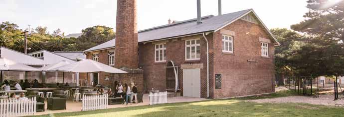
Lake Macquarie City Council Discussion paper - MORISSET PLACE STRATEGY 52 53
HRP2041: Hunter Regional Plan 2041
Bonnels Bay Balcolyn Silverwater Sunshine Windemere Park Trinity Point Lake Macquarie State Conservation Fishery Point Rd Fishery Point Rd Bay St Kilometers Morisset Peninsula growth area boundary Residential investigation area* Investigation areas subject to ecological assessment (HRP2041) RU6 - Transition zone 1 2 3 4 5 B a y VistaRd ennaH l l S t Fishery Point Road Sub-Precinct Lakeside Adventist Church Bay Vista Road Sub-Precinct Hannell Street Sub-Precinct Mirrabooka Quarry Sub-Precinct 1 2 3 4 5
4. GROWTH AREAS AND PRECINCTS
9. COORANBONG AND AVONDALE EDUCATION PRECINCT
North Cooranbong will continue to grow with the development of the Watagan Park residential estate. Additional land is available for residential development west of Freemans Drive and includes several parcels of land zoned RU6 – Transition, meaning its future use is subject to further investigation and consultation with the community.
Existing RU4 – Primary Production land located south of Newport Road is identified in Council’s Local Strategic Planning Statement as a growth investigation area. While there are some environmental constraints, the area is mostly cleared and largely unaffected by flooding. The area has good access to the M1 and may be suitable for expanded use for rural employment or potentially more housing.
Avondale University is expected to grow its presence within the region supporting the expansion and development of the broader area
10. DORA CREEK
Dora Creek is a unique lake and river-side community immediately north of Morisset. While serviced by the intercity train network and regional bus network, development around Dora Creek is constrained by flood-prone land. Council has developed the Dora Creek Area Plan to manage future development, flood risk and rising lake levels. It is expected most future growth will be limited to the Coorumbung Road residential subdivision currently under construction.
Transport for NSW is investigating options to upgrade the intersection of Main Road (B53), Dora Street and Wamsley Street, including constructing
into a vibrant and diverse community. The precinct, which contains the current site of the University, will provide a more diverse range of educational opportunities leveraging the city’s unique attributes and strategic advantages.
The Morisset to Cooranbong section of the R7 Morisset Peninsula to Cooranbong regional cycling route, via the Avondale education precinct, is near completion with a new shared pathway on Freemans Drive and a new bridge across Dora Creek to safely connect Victory Parade with Stockton Street. Council’s Walking, Cycling and Better Streets Strategy identifies a potential future off road cycling link to Awaba Mountain Bike Park.
Regional and state studies show that most of the city’s productive rural agricultural land is located in Martinsville. Council proposes to protect this land for ongoing rural production.
a separate walking and cycling bridge across Dora Creek, improving local access and contributing to the delivery of the R3 Belmont to Morisset regional cycling route.
Land with limited environmental value adjacent to the M1 Motorway may be subject to longterm investigation beyond the proposed 20year timeframe of the Morisset Place Strategy. Future development in this area should consider its location adjacent to Muddy Lake and the appropriate maintenance and enhancement of the lake and its tributaries.
Lake Macquarie City Council Discussion paper - MORISSET PLACE STRATEGY 54 55 Morisset
Area boundary RU6 - Transition zone ykliS rDkaO MorissetParkRd Lake
Hospital
Macquarie State Conservation Area Lake Macquarie State Conservation Area
11. WYEE POINT
Wyee Point is an older lakeside community bounded by environmental land high in biodiversity value. Part of the historical Ramsgate Estate paper subdivision was rezoned in 2022 for residential and environmental uses. The future re-use or redevelopment of the Morisset Hospital site may offer opportunity to improve walking and cycling access between Wyee Point and Morisset.
12. WYEE AND SOUTH OF BUSHELLS RIDGE ROAD
Wyee is an important growth area serviced by the intercity train network. Council will continue to actively work with landowners to plan for the future of the Wyee paper subdivision next to Wyee train station. There are several active planning proposals to rezone larger lifestyle lots to residential housing. A proposal for the Morisset Place Strategy is to improve strategic planning for the broader Wyee area, and to collaborate with Central Coast Council and the NSW Government to coordinate planning either side of the local government area boundaries at Bushells Ridge Road.
There are important native vegetation corridors necessary to maintain the viability of threatened species populations across the Lake Macquarie and Central Coast city boundary. These have been mapped and require protection, conservation and enhancement in future plans.
13. ERARING TRANSITION AREA
Owners of Eraring Power Station, Origin Energy, plan to cease coal-fired power operations by 2025. With existing electrical distribution, road and rail infrastructure, the 1100-hectare site provides a unique opportunity for future energy-related and employment land uses. Council proposes to continue to work collaboratively with current and future landowners and the NSW Government to secure local employment opportunities, and to grow and diversify the local economy of greater Morisset. There is significant support at various levels for initiatives that embody circular economy principles through, for example, the elimination of waste, reuse and recycling of materials, and the regeneration of nature. These types of initiatives typically rely on a significant movement of resources to/from value-add locations. The same strategic connectivity advantages that make the growth area a good freight and logistics hub candidate would also provide a strong platform for a circular economy precinct.
A circular economy precinct would be more locally/ regionally-focused (as distinct from the state/ national focus of a freight hub), leveraging its connections to high-construction areas (e.g., driven by residential growth) and areas where power stations and coal mines are in transition.
The growth area benefits from its proximity to the University of Newcastle, with well-established capabilities in circular economy research. For example, in 2021, the University and Council partnered to establish a Circular Economy Living Lab, offering seed funding for new research projects drawing from industry opportunities.
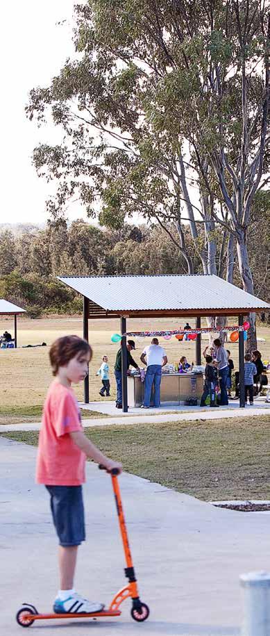
4. GROWTH AREAS AND PRECINCTS
The Circular Economy Living Lab is currently working with Origin Energy to investigate opportunities for the anaerobic digestion and recycling of fly ash at the Eraring Power Station for use as a product for other industries, including construction. The anaerobic digestion process can also be used to generate energy. If the process can be proven and commercialised, this would create demand for a site to be used as a waste-to-energy facility, relying on good transport connectivity and suitable separation to sensitive uses. Forward planning to safeguard the potential for such a site would be advantageous.
The Eraring Transition Area includes buffer lands around the power station that have high environmental values. These consist of:
• some land zoned C2 – Environmental Conservation
• SP1 – Special Activities zoned land that has been identified to have high biodiversity value. This land should be clearly identified as requiring protection, conservation and enhancement in future strategies and plans.
Lake Macquarie City Council Discussion paper - MORISSET PLACE STRATEGY 56 57
5. BLUE-GREEN NETWORK
KEY BIODIVERSITY MANAGEMENT AREAS
Morisset is unique in that it is pocketed with natural areas high in biodiversity value, which our community greatly value.
These areas include ecosystems that provide habitat for flora and fauna, including many threatened species such as squirrel gliders, flying foxes, the large-eared pied bat, green thighed frog, wallum froglet, reagent honeyeater, swift parrot, black-necked stork, powerful owl, masked owl, sooty owl, osprey, bones wattle and Wyong midge orchid. There are also a number of endangered ecological communities associated with creek lines and lower lying areas.
The Morisset Place Strategy will seek to strike a balance between providing new housing, jobs, community facilities and infrastructure, and enhancing natural areas.
A number of native vegetation corridors join larger patches of native vegetation and fauna habitat. This allows species and plant pollinators to move between areas (depending on their mobility) and keeps populations healthy and viable. It is very important to retain and enhance this network of corridors and larger patches of native vegetation. They operate to form the green infrastructure on both local and regional scales. Some of these corridors are described below.
5. BLUE-GREEN INFRASTRUCTURE
The large bushland area to the west is owned by Biraban Local Aboriginal Land Council and the NSW Government. Council will continue to collaborate with these stakeholders to realise a balance between biodiversity conservation and providing new homes close to Morisset train station.
Remaining environmental land within the Morisset Peninsula is high in biodiversity value. Council will continue to plan for and enhance these areas, including the environmental corridor linking the peninsula with the Lake Macquarie State Conservation Area around the Morisset Hospital site, via Fishery Point Road and Verdelho Street.
Clacks Creek riparian corridor
An important biodiversity and riparian corridor runs along Clacks Creek, connecting Dora Creek through to southern environmental zoned land. Council proposes to rezone several densely vegetated, flood-prone residential zoned sites to environmental conservation, as part of a broader biodiversity management plan to realise development outcomes on other sites with Biraban Local Aboriginal Land Council and the NSW Aboriginal Land Council.
Melaleuca Creek and Pourmalong Creek riparian corridors
Melaleuca Creek is a tributary of Dora Creek and Pourmalong Creek a tributary of Lake Macquarie. Together, these riparian corridors form a critical link for fauna from bushland north of Dora Creek to the Lake Macquarie State Conservation Area and surrounding environmental land to the south.
Southern Watagans to Lake Macquarie corridor

Most land between the former Morisset Country Club golf course and Wyee Point is zoned environmental conservation and forms part of a major biodiversity corridor linking the Watagans National Park to the Lake Macquarie State Conservation Area and Lake Macquarie itself.
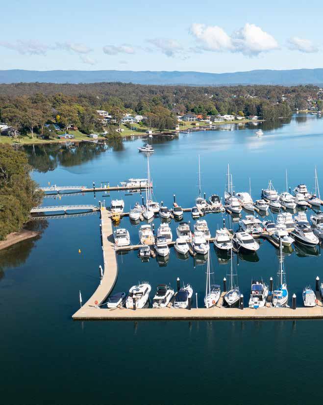
Morisset to Awaba corridor via Eraring
Morisset Peninsula and Lake Macquarie State Conservation Area
Land surrounding the Morisset Hospital site forms part of the Lake Macquarie State Conservation Area.
The heavily vegetated area north of Dora Creek to Awaba, surrounding the Eraring Power Station site, is zoned environmental conservation and forms part of the proposed Awaba State Conservation Area (north of the map).
Lake Macquarie City Council Discussion paper - MORISSET PLACE STRATEGY 58 59
Lake Macquarie State Conservation Area
High ecological value outside of development areas. High ecological value within areas that may be developed
Threatened Ecological Communities (BC and EPBC Act)
Morisset regionally significant growth area
Corridor of Remnant Native Vegetation. Significant contribution to movement & viability of flora & fauna.
Corridor of Partially Cleared Remnant Native Vegetation. Significant contribution to movement & viability of flora & fauna.
Partially Cleared Remnant Native Vegetation. Minor role in movement. May contribute to flora & fauna viability in other ways.
Remnant Native Vegetation. Minor role in flora & fauna movement. May contribute to flora & fauna viability in other ways.
Corridor of Partially Cleared Remnant Native Vegetation. Significant contribution to movement & viability of flora & fauna
Morisset regionally significant growth area
Growth precincts Morisset Place Strategy 0 1 2 3 4 0.5
Lake Macquarie City Council Discussion paper - MORISSET PLACE STRATEGY 60 61
Clacks Creek riperian corridor
Malaleuca Creek riperian corridor
1 2 3
Pourmalong Creek riperian corridor
0 1 2 3 4 0.5 Kilometers 3 1 2 3
5. BLUE-GREEN INFRASTRUCTURE
Morisset peninsula
Morisset hospital
Dora Creek
Kilometers 0 1 2 3 4 0.5 KilometersN Kilometers 0 0.5 1 2 3 4 0 1 2 3 4 0.5 KilometersN Kilometers 0 0.5 1 2 3 4 0 1 2 3 4 0.5 Kilometers ECOLOGICAL VALUE NATIVE VEGETATION
6. MOVEMENT INFRASTRUCTURE
6. MOVEMENT INFRASTRUCTURE
Infrastructure and land use planning that supports walking, assisted mobility, cycling and public transport will be critical to ensuring Morisset is an attractive place to live and work.
This section outlines the strategic planning framework that supports the Morisset Place Strategy, including the local, regional and state plans that apply to the area.
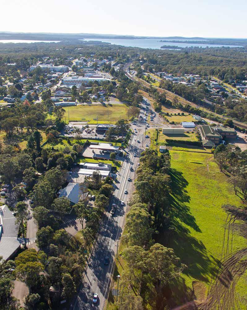
Morisset is uniquely located next to the bidirectional M1 Motorway interchange. Route B53 (also known as Main Road 217 or MR217) connects south-western Lake Macquarie to the M1 via Mandalong Road and Dora Street at Morisset. Parts of the road network currently experience high traffic volumes during peak periods.
Morisset railway station is located on the Main North line, and is serviced by InterCity trains (Central Coast and Newcastle Line services) travelling from Sydney Central and Gosford to Newcastle. In addition to school buses, the bus lines through Morisset offer bus connections of varying frequency to Cooranbong, Sunshine, Silverwater, Toronto, Cessnock and Lake Haven via Wyee.
Lake Macquarie City Council Discussion paper - MORISSET PLACE STRATEGY 62 63 M1 B53 Pacific Motorway W y ee Rd Freemans Drive 0 1 2 3 4 0.5 KilometersN Kilometers 0 0.5 1 2 3 4 Bonnells Bay Morisset Trinity Point Balcolyn Sunshine Silverwater Wyee Point
Cooranbong
Dora
Creek MandalongRd
most attractive and often the only realistic choice. However, the combination of low density, separated land uses and car-prioritising infrastructure decisions has consequences in terms of household costs, equity and choice. If we reduce car dependency, and vehicle ownership, we can reduce public health and infrastructure costs; reduce greenhouse gas emissions and air pollutants; improve the environment; and increase personal health and social equity.
This requires better walking, cycling and public transport networks, ideally that also integrate nature into neighbourhoods to get more people outdoors while creating wildlife corridors and stormwater solutions. These networks can lead to better placebased connections, where more people participate in and feel part of community life.
Council has adopted the Walking, Cycling and Better Streets Strategy and Urban Greening Strategy, identifying requirements for new pedestrian and cycling infrastructure, street trees, urban vegetation and supporting green infrastructure. identifying requirements for new pedestrian and cycling infrastructure, street trees, urban vegetation and supporting green infrastructure.
We can realise these outcomes by designing new communities, and retrofitting existing low density residential areas, into 15-minute neighbourhoods.
The 15-minute neighbourhood changes how we plan and design growth. It supports people who want to live and work locally and who seek to get around without a personal vehicle. It’s already a concept that we can see in the region, in more traditional towns and suburbs developed before the 1960s, including Maitland, Raymond Terrace and Cessnock.
Rather than cities, towns, villages and communities being separate zones for living, working, education, recreation and entertainment, they can be mixed neighbourhoods where people can generally access most everyday needs within a 15-minute walk or cycle from where they live.
Instead of residential growth radiating from a strategic centre, the 15-minute neighbourhood reestablishes the role and convenience of local centres, public areas and attractive, healthy streets, alongside the still-important centres that provide major concentrations of goods, services and employment.
Future growth will be intensified within a 15-minute walk of Morisset centre and other local centres, the Morisset railway station/transport interchange, schools, parks and community facilities. Within these areas, a high-quality pedestrian and cycling network should be prioritised.
Existing cycle routes
Off-road (shared path or other)
On-road low difficulty
On-road medium difficulty
On-road hard difficulty
Possible new cycle routes and upgrades*
New off-road path (shared path or other)
On-road low difficulty (upgrade)
On-road medium difficulty (upgrade)
On-road high difficulty (upgrade)
Possible new link or off-road trail
Possibilities for upgrades on existing roads are varied and due to site-specific considerations and may include widening of road shoulders, kerb adjustments, upgrade of crossings, and traffic/speed management.
Lake Macquarie City Council Discussion paper - MORISSET PLACE STRATEGY 64 65 M1 B53 Pacific Motorway MandalongRd Bonnels Bay Wyee Point Mandalong Cooranbong Morisset Dora Creek Summerland Point W y e e Rd FreemansDrive 0 1 2 3 4 0.5 KilometersN 0 0.5 1 2 3 4 Kilometers Principal pedestrian network designs and transport infrastructure, make the car the
Your Home 15 minutes 0 15 minutes Cafe and restaurants Community gathering space Community markets Community sports & recreation facility Local schools and daycare centres Local shops & services Local health facilities & services Natural green space Public open spaces 34
0 1 2 3 4 0.5 Kilometers Pica fi c M o torway Bonnells Bay Morisset Trinity Point Balcolyn Sunshine Silverwater Wyee Point Cooranbong Dora Creek W eey dR Freemans Drive 0 1 2 3 4 0.5 KilometersN 0 0.5 1 2 3 4 Kilometers
Rd
Newport
6. MOVEMENT INFRASTRUCTURE
MORISSET TRANSPORT SCOPING STUDY
Council commissioned a high-level transport scoping study to investigate the impact of different growth scenarios on the Morisset road network. The study followed an approach provided by the NSW Movement and Place Framework. Streets were sorted into four categories based on the vision for Morisset, and place intensity and movement function of the roads and streets. This provided a basis to consider transport network challenges and opportunities to achieve the intent of each street.
Key conflict areas have both high movement and high place value, such as the area around Dora Street. As prescribed by the movement and place logic outlined in the framework, on streets with a high place function such as main streets and civic spaces, place quality needs to be supported to enhance pedestrian safety, local amenity and improve local business activity. This may be done through design, speed limits and/or diverting through traffic.
Preliminary options to reduce traffic congestion through the centre and improve the place function of Morisset town centre have been suggested for investigation. These include consideration of an alternative route to the north of the city centre, possibly using Awaba Street, or an alternative route on the southern side of the railway using Macquarie Street. A range of other opportunities to enhance both place function and traffic movement were also explored in the study and suggested for further investigation. These are varied and include potential new road links, upgrade of roads and intersections, revision of speed limits, pedestrian crossings, and changes to streetscaping to enhance place and/or manage movement. The study also noted that the streetscaping opportunities identified in Councils DCP for Morisset town centre are effective for promoting the Place value of the centre and should be investigated further as to how to best incorporate them with other identified opportunities.
We will investigate these suggestions further in the next phase of the Place Strategy which will include an Infrastructure Delivery Plan. In the meantime, we would be keen to hear views on potential improvements to transport in and around the centre.
6. MOVEMENT INFRASTRUCTURE
Main roads
These roads and routes are central to the efficient movement of people and goods. They include motorways, primary freight corridors, major public transport routes, the principal bicycle network and key urban pedestrian corridors. Their place activity levels are less intense. However, these roads and routes can have significant meaning to local people.
To support these roads and routes we need to prioritise their strategic movement functions. We can limit negative impacts to place qualities or community severance through their planning, design and operation.
Local streets
These are the majority of the streets in our communities. They often have important local place qualities. Activity levels are less intense than for civic spaces, but these streets can have significant meaning to local people. Town and village main streets are usually ‘local streets’.
To support these streets we need to provide access for walking, cycling and private vehicles; safe, low-speed environments; easy access to public transport; and access for local deliveries while limiting through-traffic.
Main streets
These streets are some of the most vibrant places in our cities and towns. They have both significant movement functions and place qualities. Balancing the functions of these streets is a common challenge.
To support main streets we need to improve place qualities while providing access for walking and cycling and safe, low-speed environments, while also allowing for the efficient movement of people and freight. Trade‐offs and compromises may be required.
Civic spaces
These streets are at the heart of our communities and have a significant meaning, activity function or built environment. They are often in our major centres, tourist and leisure destinations and community hubs. They are places for people, with a priority on place.
We support the place quality of these street environments by giving priority to pedestrians; providing safe, low-speed environments; managing freight and deliveries; providing easy access to cycle routes and public transport; and limiting through-traffic.
Street categories in Morisset town centre, with dashed lines show alternative bypass opportunities to reduce traffic through the centre and achieve the vision for a vibrant and attractive centre
Lake Macquarie City Council Discussion paper - MORISSET PLACE STRATEGY 66 67
Main roads Main streets Local streets Civic spaces STREET CATEGORIES
ALTERNATIVES TO REDUCE CONGESTION IN THE TOWN CENTRE
To address the conflict between movement and place objectives along Dora Street between the town centre and the rail station, two route opportunities have been identified to reduce through traffic:
• via Macquarie Street, connecting to Dora Street at Stockton Street and Wharf Street
• via Awaba Street, including Awaba Street capacity upgrade with increases in speed to 70km/h
Both these options were considered in the preparation of the 2008 Structure Plan, but the link along the southern side of Morisset train line that connects Dora Street to Macquarie Street was preferred. Transport for NSW has undertaken preliminary investigations of this option and identified several geometrical constraints to its implementation.
The traffic scoping study therefore recommended that the alternative route in the northern part of Morisset via Awaba Street to be further considered.
These options are shown as dashed lines in the figure on page 67 and will be investigated further in the next phase of the Place Strategy.Street/Dora Street could be restricted to a left-out turn. This requires further investigation and alignment with proposed adjustments to Dora Street by Transport for NSW.
Mandalong Road upgrade
Today, a lot of traffic movement occurs between Morisset Peninsula and the M1 Motorway via Fishery Point Road, Dora Street and Mandalong Road. Mandalong Road is a state road and in 2022, the Federal Government and NSW Government announced funding towards an upgrade of Mandalong Road between Gateway Boulevarde and Wyee Road.
Transport for NSW is responsible for delivering the works which involve widening Mandalong Road between Gateway Boulevarde and Wyee Road to provide two travel lanes in each direction along with a new signalised intersection at the Wyee Road/Freemans Drive intersection and a new signalised intersection at the Gateway Boulevarde/ Mandalong Road Intersection.
Have your say
What do you think of the alternatives to reduce traffic through the centre?
Do you see opportunities or challenges in the greater Morisset transport system that should be further investigated in the next phase of the Place Strategy?
What can be done to make it easier for you to walk, cycle and take public transport in your everyday life?
OTHER MAJOR UPGRADES
In addition to the alternative routes for through traffic mentioned above, the study explores a range of other upgrades in Morisset and surrounds which will be further investigated in the next phase of the Place Strategy. For a full overview, see the report. Selected recommended upgrades in Morisset include:
• Mandalong Road/Dora Street upgrade (B53)dual lanes between M1 and Stockton Street, including a shared pathway and intersection upgrades: Mandalong Road/Dora Street / Freemans Drive and Mandalong Road/Gateway Boulevard intersections
• closing part of Kahibah Street and upgrading Doyalson Street and Newcastle Street to support new town park
• pedestrian and cycle upgrades at Dora Street
• streetscape improvements and speed reductions in town centre
• Fishery Point Road/B53 – upgrade to signalised intersection with Main Road (B53) with dual lanes on approach.
Lake Macquarie City Council Discussion paper - MORISSET PLACE STRATEGY 68 69
6. MOVEMENT INFRASTRUCTURE 0 1 2 3 4 0.5 0 1 2 3 4 0.5 Kilometers N B53 M1 Pac ific Motorway AwabaSt DoraSt Freemans Dr MandalongRd W y e e R d Fishery Point Rd KahibahSt MoiraParkR d
KEY TOPICS FOR FURTHER INVESTIGATION
7. KEY TOPICS FOR FURTHER INVESTIGATION
Health and emergency services
This section outlines the strategic planning framework that supports the Morisset Place Strategy, including the local, regional and state plans that apply to the area.
The future draft Place Strategy phase includes a further analysis of conservation values, constraints, infrastructure opportunities and development potential in Morisset, with particular focus on the investigation areas.
Morisset is serviced by several private medical centres and the Central Coast and Hunter New England Local Health districts. Gosford and Wyong hospitals have recently been expanded to accommodate increased demand, and to provide capacity for future population growth. In 2022, the new Maitland Hospital opened, and an expansion of the John Hunter Hospital is expected to be complete in 2026.
This section summarises current insights and key topics that will be further explored in the next phase. Each topic has been categorised according to Council’s four pillars of sustainability (social, environmental, economic and sustainable governance), which guide and facilitate the desired outcomes of Council’s work. Social Sustainability.
SOCIAL SUSTAINABILITY
Education services
There are currently about 4700 school-age children in the greater Morisset area, and 3660 currently attend a primary or secondary educational institution in the area1. The area is serviced by numerous public schools and private schools that draw students from within and out of the area. A lower population growth scenario may see an estimated additional 2200 school-age children by 2042, and a higher growth scenario an additional 6800. This will depend on the housing preferences, supply and availability of local jobs.
Additional student growth will drive the future demand, which will support the expansion of existing services or the creation of new education facilitates. The growth in demand for education facilities and services will require careful planning and consultation so it can be managed effectively.
1 Based on available enrolment data. School age children taken as ages 5-19 years, based on available data, Australian Bureau of Statistics (2021).
The NSW Government has gradually been winding down services at the Morisset Hospital site. The NSW Government has advised Council it is investigating alternative uses at the site sensitive to existing place heritage.
Council is supportive of NSW Health being more open with plans for the Morisset Hospital site and investigating options for alternative health facilities in Morisset.
Emergency service providers such as NSW Police, NSW Rural Fire Service, NSW Ambulance will be consulted and their comments considered in the next phase of the Place Strategy, particularly in relation to access and response time and capacity in the transport network.
Open space and recreation facilities
Morisset and the surrounding areas host important local and regional facilities including several sports fields and courts, playgrounds, skate parks, a swim centre, and the Morisset Showground. Council’s Parks and Play Strategy establishes people-to-open space ratios to ensure adequate facilities. As part of our Sports Strategy, Council is investigating options to embellish and expand sports fields in the greater Morisset area. A proposed planning principle of the Place Strategy is to ensure parks, play and sporting facilities are within walking distance of most of the population. The Morisset Showground Master Plan sets out a vision for embellishing the site and enabling a greater diversity of uses.
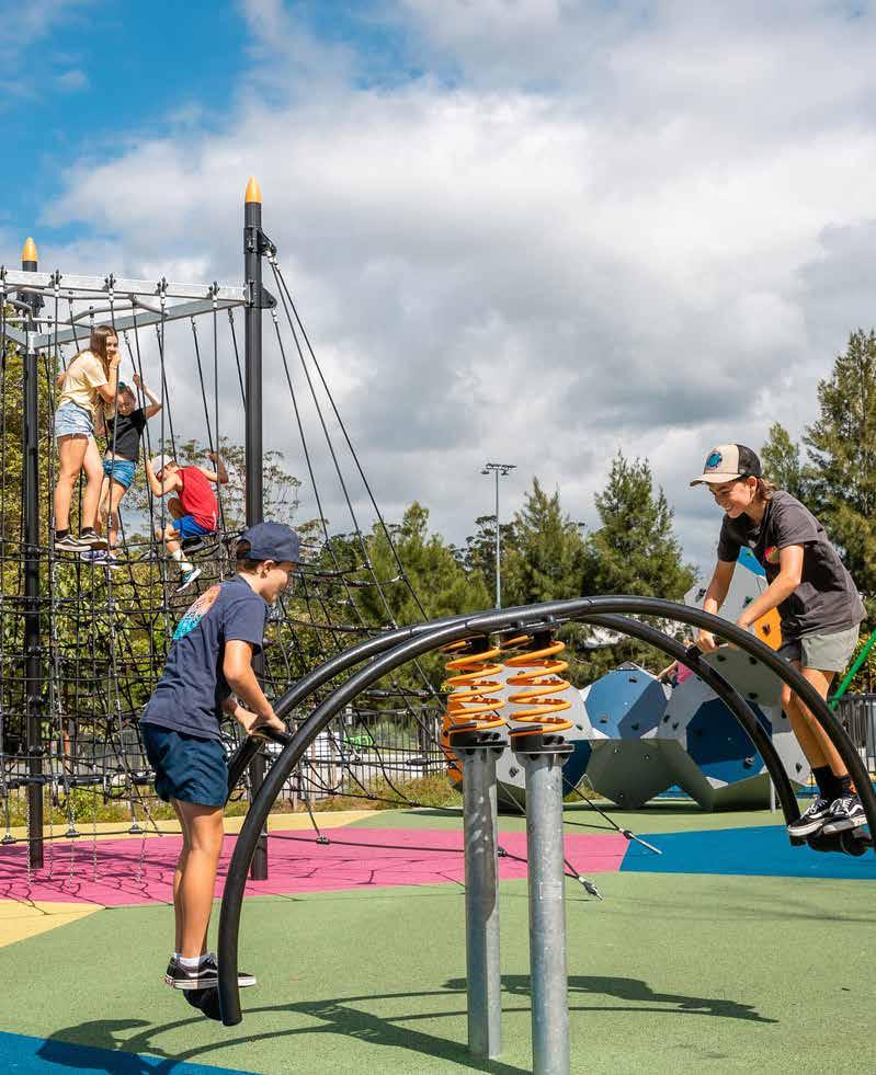
Lake Macquarie City Council Discussion paper - MORISSET PLACE STRATEGY 70 71
7.
7. KEY TOPICS FOR FURTHER INVESTIGATION
Lake foreshore access
Lake Macquarie is our city’s most important and distinct environmental, cultural, social and economic asset. Improving foreshore connectivity through active transport initiatives is a key priority for enhancing public access to the Lake Macquarie foreshore.
Early investigations suggest the Morisset Hospital site presents an opportunity to improve foreshore access, which could be achieved through the development of walking and cycling paths, improved road infrastructure and the creation of recreational spaces along the lakefront. Such initiatives will not only enhance the quality of life for residents in the area but also attract tourists and stimulate economic growth in the region.
Further opportunities to support lake foreshore accessibility is encouraged as part of the future Place Strategy.
Local character and recent growth
Streets within the Morisset centre reflect traditional building design, with smaller scale frontages, masonry facades, pitched or raked sheet steel roofs behind parapets, and deep box awnings over the footpath. More recent developments include two shopping centres, medical centres and the police station. Much of Morisset’s older housing stock remains on large lots about 900-square-metres in size. New housing development has largely taken place to the immediate north, characterised by detached dwellings and townhouses. The conversion of large, formerly rural, lifestyle properties has enabled larger-scale developments, achieving 15-30 dwellings per hectare and the provision of communal recreation spaces. Further afield, Cooranbong continues to grow and accommodate much of the incoming population, complemented by new housing on the Morisset Peninsula, including Trinity Point.
ENVIRONMENTAL SUSTAINABILITY
Cultural heritage
Lake Macquarie sits on the traditional lands of the Awabakal people. A review of the NSW Aboriginal Heritage Information Management System (AHIMS) identified 60 Aboriginal sites recorded within the area, several of which are located in growth precincts, and one Aboriginal Place declared (Lake Macquarie Resting Place). Council will continue to consult with Biraban Local Aboriginal Land Council during preparation of the Place Strategy.
The historic Morisset Hospital site is incredibly unique and offers an opportunity to vastly improve public lake access for the greater Morisset area. Consideration of the appropriate adaptive re-use of the hospital site, while maintaining its heritage significance, will require a clear understanding of the heritage significance of the place, what contributes to that significance and how that significance can be conserved. Council will continue to consult Heritage NSW and the community to progress preparation of the Place Strategy that is sympathetic to the unique historic Morisset Hospital site.
Biodiversity
Greater Morisset is home to some of the most biodiverse areas in the city. Key sites for biodiversity management and conservation include:
• large contiguous patches of habitat between the northern railway the State Conservation Area and lake, south of Morisset, and on the peninsula
• west of the M1, including Moorans Creek floodplain
• corridors throughout existing urban areas and Morisset Peninsula.
Further investigation of biodiversity conservation and management options is required, including development of a conservation plan, within which a potential strategic bio-certification for the Morisset area can operate, to target conservation and management of high-value sites in perpetuity.
Early consultation with the NSW Department of Planning and Environment and Biraban Local Aboriginal Land Council indicate a preference for strategic bio-certification to provide a more efficient approach to managing land development and biodiversity conservation.
Street trees and urban canopy
Analysis for Council’s Urban Greening Strategy shows Morisset has a slightly above average tree canopy (50 per cent) relative to other suburbs (44 per cent). The NSW Greener Neighbourhoods Guide recommends tree canopy of between 35-65 per cent for open space and streets, and 15-35 per cent for areas of private domain. Council will aim to increase tree canopy in accordance with targets set out in the Urban Greening Strategy. The Morisset Streetscape Master Plan includes provisions for street tree plantings as part of public domain upgrades.
Flooding and lake inundation
Parts of greater Morisset are affected by flooding, with numerous tributaries supplying Dora Creek, the largest catchment flowing into Lake Macquarie. Some creeks are ephemeral, with greater flows experienced during large rain events.
While the NSW Floodplain Development Manual and Flood-prone Land Policy enable development of flood-prone land, Morisset has ample higher ground available for residential development. Residential growth precincts are proposed to be limited to areas that are not flood-prone. A proposed planning principle is to provide new housing generally above three and five metres AHD2 to mitigate the effects of ongoing lake level rise and higher flood levels.
Council completed a flood study and floodplain risk management plan for Dora Creek in 2015, and is currently preparing a flood study for other floodprone areas within the Place Strategy area.
2 Australian Height Datum, where zero is calculated as the mean sea level from tide gauges along the Australian coastline between 1966-1968.
Bush fire
Bushland corridors and former agricultural land located within and around Morisset generally make up Vegetation Category 1, the highest risk for bush fire. Available data shows existing urban areas are generally protected from these areas by buffers. Bush fire risk varies for each growth precinct. With development and vegetation management, the bush fire risk profile will change.
Detailed investigation is recommended in the form of a strategic bush fire assessment, consistent with Planning for Bush Fire Protection Guidelines 2019. Council is currently preparing a high-level study for selected investigation areas within the Place Strategy area.
Contamination
Council maintains a database of contaminated or potentially contaminated land, consistent with the NSW Environmental Protection Authority’s Record of Notices. Several sites located within proposed growth precincts are identified as being potentially contaminated. Detailed contamination site assessments are required to progress preparation of the Place Strategy.
Mine subsidence
Centennial Coal operates the Mandalong longwall underground coal mine, accessed immediately west of the M1 interchange and serviced by the Mandalong Coal Delivery System railway loop south of Morisset. The mine extends beneath Morisset and Lake Macquarie. Mining beneath Lake Macquarie also occurs at the Chain Valley Colliery, supplying Vales Point Power Station. Current and future potential mining operations may limit industrial land development west of the M1. Further consultation with Centennial Coal and Subsidence Advisory NSW is required, and alternative sites for industrial land expansion may need to be investigated. Available data from Subsidence Advisory NSW suggests possible risks of subsidence in some areas of Morisset, including identified growth precincts. Development in these areas will require approval from Subsidence Advisory NSW, and further investigation is needed regarding rehabilitation and potential mine grouting.
Lake Macquarie City Council Discussion paper - MORISSET PLACE STRATEGY 72 73
Water and sewer infrastructure
Water and sewer are managed by the Hunter Water Corporation (HWC). Morisset, Cooranbong and Morisset Peninsula are serviced by the Dora Creek wastewater treatment plant, with a population capacity of 28,800 people. HWC additionally operate a water recycling scheme at Eraring Power Station.
HWC’s 2021 Growth Plan identifies an upgrade to the Dora Creek treatment plant within four years, and upgrades to several pump stations.
The Lower Hunter’s current water system can reliably supply around 55 billion litres of drinking water per year on an ongoing basis. This is less that the current average demand for water in the Lower Hunter, which is around 66 billion litres a year. Department of Planning expects the ‘supply deficit’ will increase in future as the population grows and climate change influences rainfall and evaporation. Lower Hunter Water Security Plan 2061 includes a program of actions needed to be sure the Lower Hunter has enough water during a long and severe drought. The plan underlines the importance of improving alignment of land use and water planning.
HWC has provided preliminary servicing advice based on the potential for higher population and employment growth in Morisset, noting growth closer to Morisset centre is preferable for the network. Preparation of the Place Strategy will require further collaboration with HWC to investigate the impact of different growth scenarios on water and sewer infrastructure, to balance demand with the risk of overinvestment and underutilised assets.
FLOOD STUDY UNDER PREPARATION
Council has engaged a consultant to undertake a flood study for Morans Creek, Stockton Creek, Upper Dora Creek, Mullards Creek, Clacks Creek and Melaleuca Creek. The study seeks to determine if identified investigation areas are suitable for development from a flood risk perspective. It includes data collection and review, community consultation, as well as hydrological and hydraulic modelling, flood modelling and an assessment of the consequences of flooding on the community. The flood study will also provide mapping that will indicate the flood hazard, flood function, flood emergency response classifications and flood planning area. In addition, the study will include information to support emergency management activities and advice on land use planning considerations.
The flood study is expected to be completed by 30 September 2023.
BUSH FIRE STUDY UNDER PREPARATION
Council has engaged a consultant to undertake a high-level bush fire study for the Morisset area.

The study seeks to determine if identified investigation areas are suitable for development from a bush fire risk perspective. It will examine the identified investigation areas in relation to the bush fire risk implications associated with potential future rezonings. It will also determine whether the areas can be made suitable for the intended future zoning/ land use subject to the implementation of any recommended bush fire protection measures and/or whether there are any ‘red flag’ areas where the bush fire risk is too high and where rezoning would not be recommended from a bush fire perspective. The study will also provide recommendations regarding any additional bush fire-related studies or work that would be required as part of any future rezonings.
The bush fire study is expected to be completed by 30 September 2023.
KEY STUDIES TO BE PREPARED
Council will collaborate with the NSW Government and landowners to undertake detailed studies required to determine whether certain land is fit for development, and ensure infrastructure meets the needs of projected population and employment growth. An infrastructure needs analysis (schools, health, emergency services, water, power, sewer, other government infrastructure) will be required in the next phase of the Place Strategy.
In addition to the flood and bush fire studies under preparation, Council has identified that the following key studies that are required to prepare the Place Strategy.
Funding support from the NSW Government will enable preparation of:
• a strategic biodiversity management and bio-certification study
• an integrated transport and land use plan, inclusive of a multi-modal microsimulation model, to identify upgrades to the state and local road networks, consistent with the NSW Network Planning in Precincts Guide
• more detailed assessments of potential land contamination for identified sites. The Place Delivery Group determines technical investigation requirements, and is expected to further define necessary studies.
Lake Macquarie City Council Discussion paper - MORISSET PLACE STRATEGY 74 75
7. KEY TOPICS FOR FURTHER INVESTIGATION
ECONOMIC SUSTAINABILITY Economy and services

The regional economy of Morisset is undergoing significant change as traditional industries such as coal-fired power generation transition to more sustainable practices. To support the preparation of this discussion paper, Council commissioned the University of Newcastle’s Institute for Regional Futures to prepare a growth and resilience study for the area.
Research undertaken has highlighted the need to support economic growth and transition in the region, with a focus on decarbonisation, leveraging location and people strengths, and investing in education and health services. The study has informed the development of growth precincts and identified policy implications for supporting sustainable and diverse economic growth. These include promoting circular economy principles, investing in innovation and collaboration, and supporting infrastructure and services that enhance community wellbeing and liveability. The study highlights the importance of proactive planning and engagement with stakeholders to ensure a successful transition to a sustainable and prosperous future for the region.
Detailed analysis of the economic and employment opportunities in the region should also be conducted to inform the development of growth precincts and ensure that they align with local strengths and opportunities. This growth should be further facilitated by priority infrastructure planning and investment, particularly in relation to transport connectivity
Facilitating the Place Strategy to enable structural changes in the economy, as described above, will require additional work in several industries.
Community engagement and consultation should be ongoing to ensure that local needs and aspirations are incorporated into the Place Strategy. This will require continued dialogue and collaboration between Council, businesses, residents and other stakeholders, as well as ongoing monitoring and evaluation to ensure that progress is being made towards achieving the desired outcomes.
Tourism and private recreation
The closure of the Morisset Country Club (golf course) and conversion to the Cedar Mill entertainment venue is a transformational project for Morisset. Together with the Trinity Point accommodation and marina, and Cooranbong ecocamp sites, these projects provide a foundation for greater Morisset to strengthen its visitor economy.
Transport infrastructure and car parking
The initial transport scoping study for Morisset has highlighted some challenges and opportunities in the Transport system. These need to be further investigated in the next phase of the Place Strategy which includes a more detailed traffic study and drafting an Infrastructure Delivery Plan.
Management of public car parking in Morisset will be guided by a new transport management plan or similar following preparation of the Morisset Place Strategy. The Transport Management Plan will reflect the directions of the city’s Parking Strategy, adopted in 2018. In 2022, Transport for NSW investigated options to expand commuter car parking at Morisset train station. Future expansion will be contingent on available funding from the State and Federal governments.
SUSTAINABLE GOVERNANCE
Aboriginal self-determination
The greater Morisset area is administered by Biraban Local Aboriginal Land Council (LALC), who have numerous local landholdings including a significant area south of Morisset train station. Biraban LALC has expressed a strong desire to facilitate the empowerment and selfdetermination of their community. Success for Biraban LALC would be realised in the form of an efficient and equitable planning process that enables the delivery of new housing, jobs and training for the whole community. Biraban LALC will continue to be a key stakeholder, informing the Morisset Place Strategy.
Community engagement and consultation
The draft vision for Morisset supports a diverse community with a wide variety of people and demographics. Sustainable governance involves meeting the needs of the present generation without compromising the ability of future generations to thrive. This requires making informed decisions that balance the need to preserve the existing character and features of the area amidst increasing development pressures.
Community engagement and consultation is essential for the development of the Place Strategy as it provides an opportunity for stakeholders to participate in the planning process, voice their concerns and contribute their knowledge and expertise. Engaging the community early in the Place Strategy planning process helps to build trust and establish ownership and community stewardship for the proposed initiatives. It also provides a platform for meaningful dialogue and collaboration between decision-makers and the community, which further promotes transparency and accountability in decision-making.
In preparing the Place Strategy, Council will consider feedback from a range of stakeholders along with the direction established in the strategic planning framework.
Lake Macquarie City Council Discussion paper - MORISSET PLACE STRATEGY 76 77
7. KEY TOPICS FOR FURTHER INVESTIGATION
lakemac.com.au lakemaccity ourlakemac
