6 minute read
5. SOUTH MORISSET PRECINCT


AT A GLANCE:
By 2041, South Morisset Precinct could support:
Advertisement
3877 people up from 788
1597 dwellings up from 307
POTENTIAL FUTURE STATE
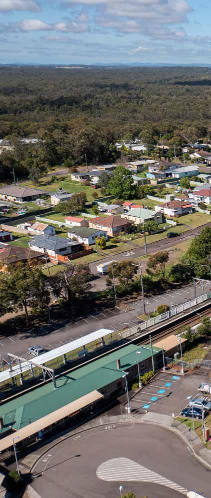
South Morisset is an area with great potential for growth, offering improved connectivity to the Morisset Central Precinct and intercity train services. It provides a variety of housing options, and caters to a diverse demographic of people.
ISSUES AND OPPORTUNITIES
• Land south of the Morisset train station provides an opportunity for housing within a 15-minute walk of transportation and commercial services.
• Development in this area should ideally be limited to the north of the site, near Morisset Central to preserve its high biodiversity value.
• Much of the land is owned by Biraban Local Aboriginal Land Council and the NSW Government, providing opportunities for collaboration in strategic planning outcomes
• A large part of the area is of very high ecological value and contains threatened species habitat and threatened ecological communities. Areas of high ecological value may be more suitable for conservation. This area should be further investigated in the biodiversity study.
• Issues and opportunities associated with identified transport opportunities have to be further investigated in the next phase of the Place Strategy.
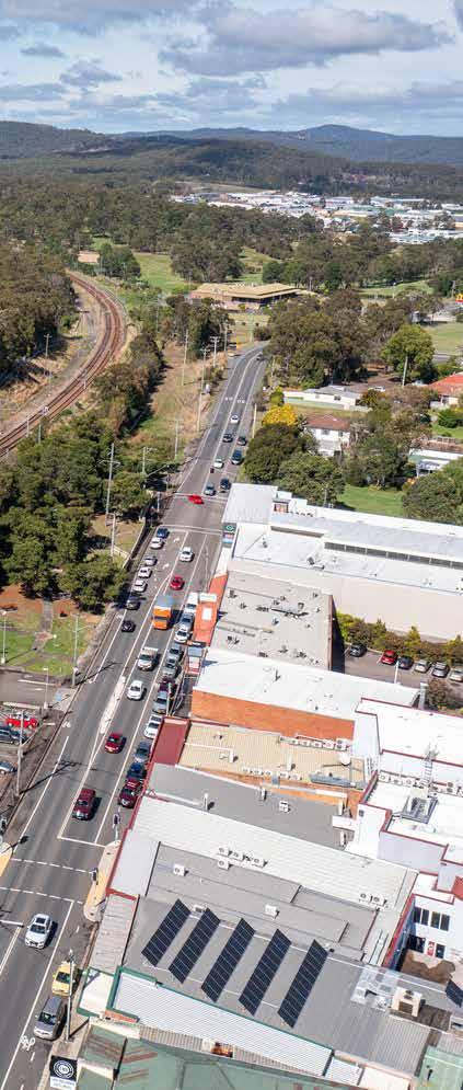
4. GROWTH AREAS AND PRECINCTS
Land south of the Morisset train station provides a major opportunity to accommodate a growing population and provide housing within a 15-minute walk of intercity train services, regional bus services, and the Morisset Central precinct. As this area is high in biodiversity value, development would be limited to the north of the site, adjacent to the train station.
This land is currently zoned for medium density residential and RU6 Transition, meaning its future use is subject to investigation and consultation with landowners and the community. Much of this land is owned by Biraban Local Aboriginal Land Council and the NSW Government. A proposed objective of the Morisset Place Strategy is to help Local Aboriginal Land Councils empower their constituents, including achieving development outcomes for certain land. Biodiversity offset sites will be required for this area, and Council will continue working with Biraban Local Aboriginal Land Council, the NSW Aboriginal Land Council and the NSW Government to plan for the area.
Potential road access to this precinct needs to be investigated in the further Place Strategy process.
HRP2041: Hunter Regional Plan 2041
DoraSt
MacquarieSt Morisset Railway Station RivergumDr
GROWTH AREAS AND PRECINCTS Fishery Point Rd
Morisset regionally significant growth area
Investigation areas subject to ecological assessment (HRP2041)
1. Encourage higher residential housing densities that interface with adjacent residential uses, and mixed-use development in Morisset Central.
2. Street networks are designed to promote walking and cycling, to manage vehicle speeds and reduce the risk of injury and death, and are connected to the Morisset Central Precinct via direct pedestrian and cycling infrastructure.
3. Future development and land use plans conserve, protect and enhance environmentally sensitive areas and biodiversity corridors, and identify areas that would be suitable for conservation.
4. Freemand s D r MandalongRd W y e e R d
4. Future residential development and land use plans include provisions that address increasing risk of flooding, bush fire, urban heat and extreme events associated with climate change over the coming 50 years and beyond.
Have your say
The above priorities are a set of draft strategic objectives, which future land use plans and development proposals will need to respond to. Do these draft priorities reflect the community’s aspirations for the area? Visit shape.lakemac.com.au to provide feedback.
4. GROWTH AREAS AND PRECINCTS
Other Locally And Regionally Important Growth Areas
6. EAST MORISSET 7. MORISSET PENINSULA PRECINCT
This area includes land east of Main Road (B53) and south of the Dora Creek Wastewater Treatment Plant (WTP). The majority of this land is currently zoned RU4 for small lot rural agricultural production. Reserving land for small lot agricultural production is important for the city’s economy, landscape and identity. As part of Council’s citywide review of small lot production land, Council consulted landowners in East Morisset. Council found that land closer to Morisset Central, and better serviced by public transport and existing infrastructure, is suitable for residential development, with limited evidence of primary production. Most landowners were responsive to the idea and it is recommended that the transition of this area to low/medium density residential development be explored.
Hunter Water Corporation has requested residential development not occur within a 400-metre buffer surrounding the WTP. Conversion of this land represents a small proportion of the about 5200 hectares of small lot rural production and rural landscape zoned land in the city appropriate for agricultural uses.
Land south of the Lakeside Retirement Village, and bounded by Marconi Road and station is zoned RU6 – Transition, meaning that consideration of the appropriate longer-term zone is required, subject to further investigations and enquiry.
Morisset Peninsula is a unique and special place, characterised by waterfront communities and natural beauty. With a mix of low and medium density housing, it offers a diverse range of living options that are in harmony with the surrounding environment. The peninsula is a popular destination for both locals and visitors, providing a leisure/ tourism experience that is truly one-of-a-kind.
Trinity Point development offers a unique leisure experience for locals and visitors alike, contributing to the growth and diversification of the local economy.
Morisset Peninsula is home to numerous coves and unique waterfront communities. Trinity Point will continue to develop and offer a unique leisure experience for locals and visitors alike, helping to grow and diversity the local economy.
Existing residential land on the peninsula is zoned for a mix of low density and medium density housing. 20-year growth scenarios project the gradual development of dual occupancies, town houses and possible residential flat buildings where such development is economically attractive. Council expects most of the peninsula to remain as single detached houses, helping to retain local character and limit transport access impacts. In recent years, Council has delivered the Bonnells Bay to Morisset section of the R7 Morisset Peninsula to Cooranbong regional cycling route, and the Bay Vista Road shared path to Brightwaters. Council’s Walking, Cycling and Better Streets Strategy identifies additional local routes for delivery by Council and developers.
The Morisset Peninsula precinct incorporates investigation areas supporting potential development:
Fishery Point Road sub-precinct
Land south of Fishery Point Road, and to the west of residential dwellings in Windermere Park, is currently owned by Biraban Local Aboriginal Land Council and is zoned RU6 – Transition, meaning future land uses require investigation. This land was originally considered for recreational use. The site is bounded to the west by a road reserve between Morisset Park Road and Fishery Point Road. A secondary road reserve is located linking the site with Morisset Park Road to the south. The site is heavily vegetated and contains threatened ecological communities, threatened species habitat and native vegetation corridors. This site also contains a state significant wetland and buffer identified in State Environmental Planning Policy (Resilience and Hazards). Conservation may be a more suitable use for this land. Council will continue working with Biraban Local Aboriginal Land Council, the NSW Aboriginal Land Council and the NSW Government to plan for the future.
Lakeside Adventist Church
The current site of the Lakeside Adventist Church is zoned C3 – Environmental Management, and has been identified for future land uses, subject to appropriate investigation and consultation with the community.
Bay Vista Road sub-precinct
Land adjacent to Bay Vista Road is currently owned by Biraban Local Aboriginal Land Council and the NSW Government, and has been identified as an investigation area in HRP 2041. The site contains threatened ecological communities and threatened species habitat. The site is zoned C2 –Environmental Conservation and this is likely to be the most appropriate zone for this land. Any future proposed rezoning of the site will need to involve biodiversity studies over a number of years, include strategies and mechanisms that improve ecological outcomes and demonstrate that the viability of threatened species populations on the Morisset Peninsula will not be adversely affected.
4. GROWTH AREAS AND PRECINCTS
Hannell Street sub-precinct
Land surrounding Hannell Street near the intersection with Fishery Point Road is currently zoned RU4 – Primary Production. A vegetative piece of land located to the north of this land is zoned RU6 – Transition. Given these sites are located within proximity of Morisset, they have the potential to be used for intensification/ development in the future subject to further investigation, and measures that retain existing native vegetation corridors.
Mirrabooka Quarry sub-precinct
Land containing the former Mirrabooka Quarry site is currently owned by Council and the NSW Aboriginal Land Council, and is zoned RU6 –Transition. The future use of the site is subject to further investigation and consultation with the community.


