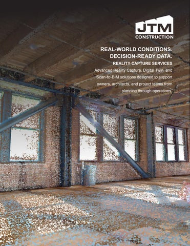
BIM Reality Capture Magazine

Page 1


WHO WE ARE

WE HAVE 25 YEARS OF COMBINED EXPERIENCE IN LAND SURVEYING, LAYOUT FOR GENERAL CONTRACTORS AND REALITY CAPTURE.

We have 25 years of combined experience in land surveying, layout for General Contractors and reality capture. With established roots at one of the oldest land survey firms in our area, we understand the value of survey control. At JTM Construction, we combine proven survey practices with the latest tech available to provide reliable information to our field crews and project teams. With Reality Capture Services (RCS), we aim to fill a void in the market and provide that same service to you.

JTM IS UNIQUE, AS WE OFFER REALITY CAPTURE SERVICES AS A SEPARATE SERVICE.

DECREASED RISKS

Understanding your building spatially is critical before design starts. Documenting existing conditions allows you to intelligently configure your space. An accurate model of the existing space dramatically decreases your risk of schedule impact due to unforeseen conditions or lack of information when construction starts. From there, the sky is the limit for what you can do with your digital assets.

COST EFFECTIVE

Reality Capture services reduce costly rework and improve efficiency by providing precise, real-time data. With 3D scanning and digital modeling, teams can accurately document conditions, detect conflicts early, and streamline coordination—minimizing delays, material waste, and labor costs. At JTM, we leverage this technology to deliver smarter, more efficient builds.

MAXIMIZING EFFICIENCY: 3D MODELS

Point clouds can be large and challenging to use in Revit, but our streamlined Scan-to-BIM workflows transform complex data into an accurate, high-quality BIM model. This allows you to start your work with confidence, improving design accuracy, coordination, and overall project efficiency while reducing rework and costly delays.

PROOF OF CONCEPT

We have a proven track record of reality capture successes both internally at JTM Construction and externally with some of our earliest RCS clients. We have performed work in the private and public sectors with various scopes that have included residential, commercial and industrial spaces. We provide services for quantity tracking, historical preservation, quality control and coordination, detailed as-built information, scan to BIM services and more.

REALITY CAPTURE SERVICES

We cope with rapid innovation in the construction industry by staying up to date with the most current technology, optimizing our workflows, and curating a range of accessible deliverables. We have a track record of successful projects because we provide digestible and reliable data. Our goal is to make reality capture relevant to the needs of our clients. We provide 4x the amount of data than the average contractor

Scan overlay allows us to place a 2D cad file in a 3D environment. Once placed we are able to see any deviation between reality and plans.

Point clouds are heavy data sets that Revit struggles to handle. JTM’s BIM team is well versed in working with this data and uses software to streamline the creation of BIM models that allow our clients to get straight to work, accelerating the process.

After scanning a space we are then able to see how level the floors are to aid in floor leveling and cost control for adapting a space for future needs.

When a full model isn’t needed we can provide the point cloud as a mesh in an IFC file format to better visualize the data collected and design inside the constraints of a space.

SCAN OVERLAY
SCAN TO BIM
SURFACE LEVELNESS
SURFACE MESH

REALITY CAPTURE SERVICES

Many older buildings lack accurate, up-to-date as-builts. With scan-toplan technology, we can quickly provide precise 2D CAD files.

Scanning for BOMA gives you the ability to get what you need now and have data available for any work that might happen in the future.

We can capture an existing space and compare the data to contract documents or models to verify the work in place meets the requirements of the owner or designer.

Laser scanning a space allows us to segment objects and classify them.

Once this is done, we can rearrange the space for maximum efficiency without interrupting the operators of the space.

CASE STUDIES: SCAN TO BIM

WESTLAND HOTEL

CLIENT: Urban Villages

LIDAR SCAN OF EXISTING HISTORIC BUILDING

• Provided accurate location of existing structural elements to ensure constructability.

• Identified that the architectural model was built perfect and the space was imperfect, due to the 100+ year old nature of the building, mitigating costly installation delays.

• Columns were out of square, due to environmental factors such as building settlement, earthquakes, etc. The scans allowed the team to accurately construct in areas where structures deviated from the new architectural drawings.

Once captured we can calculate the volume of any material on site that needs to be removed or added to help with budgeting or estimating the cost of a project.

Our floor analysis has helped projects stay on budget while providing insight into the performance of the decks under construction.

CASE STUDIES: AS-BUILT MAPPING

747 PLANE COORDINATION AT 1200 STEWART

CLIENT: Westbank

LIDAR SCANNING

• The 747 plane was cut into 30+ pieces. The team used the Lidar scan to capture all of the parts for coordination of MEPF that will be installed in the belly of the plane. The plane will be a functional space with an upscale bar for guests.

• Capturing all the plane pieces, aligning them with the model, allowed our team and trade partners to coordinate the field work.

• The client’s model depicted the plane as a whole, so our team had to carefully align the segmented scanned pieces to ensure accurate coordination and installation.

Temperature mapping allows us to compare the as-built conditions of the design intent of the object.

Verticality reports allows us to map the entire hoist way/walls to check plumbness and can be sent out as 3D PDFs.

SCANNING SUITES

JTM Construction’s state-of-the-art scanning suites, powered by advanced reality capture technology, provide significant benefits to owners and architects by delivering highly accurate, detailed 3D data of existing conditions. This technology allows for precise planning and design, reducing costly errors and unforeseen challenges during construction. By offering a clear visualization of the project from the start, JTM enhances collaboration between stakeholders, streamlines decision-making, and ensures alignment with the owner's vision and the architect's intent. With this innovative approach, JTM helps bring projects to life efficiently and with exceptional quality.

NAVVIS VLX 2

• 100m raw laser range

• 600,000 points per second

• 4 x 20 MP fisheye cameras

• SLAM unit, captures complex indoor spaces

• Exceeds industry standards for a wearable device

LEICA RTC360

• 130 m raw laser range

• Up to 2,00,000,000 points per second

• 36 MP 3-camera HDR system

• Operates in all weather conditions

• Excellent accuracy

• Ideal for outdoors, live decks/open spaces/terrestrial

GPR

• Potholing identifies underground utilities before work begins.

• Robotic total station captures utility location and composition.

• Data is stored in our site coordinate system and shared with VDC for coordination.

• Ensures fast, safe construction and prevents costly rework.

• GPR is used when potholing isn’t an option, detecting utilities without site disruption.

JAMES’ ABILITY TO THINK CRITICALLY AND STRATEGICALLY ENABLES HIM TO IMPLEMENT SOLUTIONS THAT NOT ONLY SOLVE IMMEDIATE CHALLENGES BUT ALSO POSITION PROJECTS AND ORGANIZATIONS FOR LONG-TERM SUCCESS. HIS METICULOUS ATTENTION TO DETAIL, PAIRED WITH HIS ABILITY TO SEE THE BIG PICTURE, ENSURES THAT EVERY INITIATIVE IS EXECUTED WITH PRECISION AND PURPOSE.

TEAM EXPERTS

CONTACT INFORMATION

jharbin@jtmconstruction.com 425.503.3014 www.jtmconstruction.com

DIRECTOR OF CONSTRUCTION TECHNOLOGY

James began his career in 2011 as a Party Chief at a Seattle land surveying and civil engineering firm, where he was trained by licensed land surveyors. In 2015, he joined a large construction company as a survey lead, and in 2018, he took a pivotal step by founding the survey department at JTM Construction. Well-established and highly respected in the reality capture community, James possesses a deep understanding of traditional survey practices while leveraging advanced scanning workflows to ensure precise data collection across diverse scanning platforms.

Renowned for his expertise, James stands out among his peers and frequently consults with both emerging and veteran software developers, helping pilot innovative solutions and selecting the best tools for his team. His thought leadership is widely recognized, and he is regularly invited to speak at industry events as a subject matter expert. With a client-centric approach, he curates tailored deliverables that directly address project-specific requirements.

Driven by a passion for enhancing the construction industry, James is committed to making a tangible, positive impact by building smarter and more efficiently.

SKILL SETS

• Innovation

• Evaluating technology

• Piloting emerging platforms

• Construction planning

• Digital asset management

• Drone pilot

• Reality capture expert

CONTACT INFORMATION

jpearce@jtmconstruction.com

206.498.6546

www.jtmconstruction.com

JAKE PEARCE

SURVEY SUPERINTENDENT

Jake developed a strong foundation in construction staking under the guidance of James at a at a Seattle land surveying and civil engineering firm. In 2016, he joined the same large construction firm as James, as part of their growing survey team. By 2019, he brought his expertise to JTM Construction.

With a meticulous attention to detail, Jake excels as a survey superintendent and reality capture specialist. He has extensive experience in establishing survey control and devising solutions for complex project captures that demand precise “best-fit” alignment to design documents and existing conditions. His proficiency in AutoCAD, terrestrial and SLAM scan registration, and fly-through solutions makes him a highly adaptable and valuable member of our team.

SKILL SETS

• Survey control

• Georeferencing scan data

• Datum translation in AutoCAD

CONTACT INFORMATION

mdrivas@jtmconstruction.com

206.747.1270

www.jtmconstruction.com

MORGAN DRIVAS

• NavVis IVION data management

• Fly-through presentations

• Reality capture specialist

VIRTUAL DESIGN & CONSTRUCTION MANAGER

Morgan began her career in 2017 as a BIM detailer for a large construction firm in downtown Seattle before transitioning to a VDC consultant role in 2018. In 2021, she joined JTM Construction, bringing her extensive expertise in virtual design and construction management to the team.

At JTM Construction, Morgan leads efforts in implementing advanced BIM technologies and optimizing project workflows. Her role involves developing high-precision digital models and driving design coordination through effective clash detection methods. With a proven track record in software evaluation and team training, Morgan consistently promotes continuous improvement and operational excellence across projects.

Beyond project execution, Morgan is dedicated to fostering the next generation of industry professionals. Her commitment to education and mentorship ensures a lasting legacy of innovation, quality, and progress in the ever-evolving AEC and reality capture industries.

SKILL SETS

• Innovation

• Evaluating technology

• Piloting emerging platforms

• Construction planning

• Digital asset management

• Design Coordination

• Reality Capture Modeling Expert

• 3D Modeling

Turn static files into dynamic content formats.

Create a flipbook
Issuu converts static files into: digital portfolios, online yearbooks, online catalogs, digital photo albums and more. Sign up and create your flipbook.