MELDING SYSTEMS FOR COMMUNITY SUSTENANCE


J N M.Arch 2023
Masters of Architecture 2023
Graduate Thesis Report
University of Idaho
Jillian Nelson
| M.Arch 2023 | University
Jillian Nelson
of Idaho

“And I knew exactly what to do. But in a much more real sense, I had no idea what to do.”
- Michael Scott
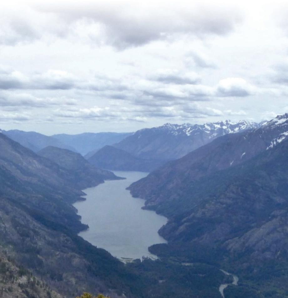
IMBRICATED ECOLOGY
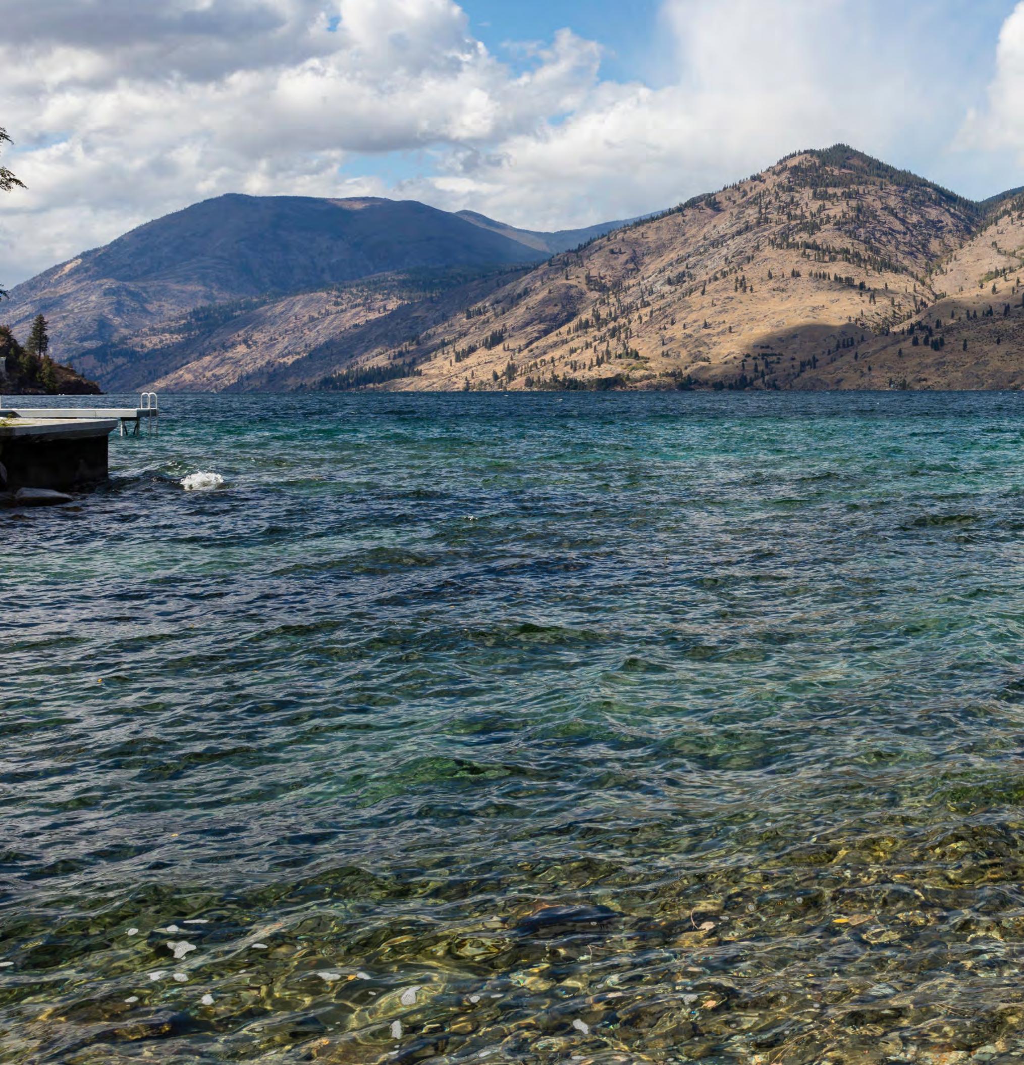
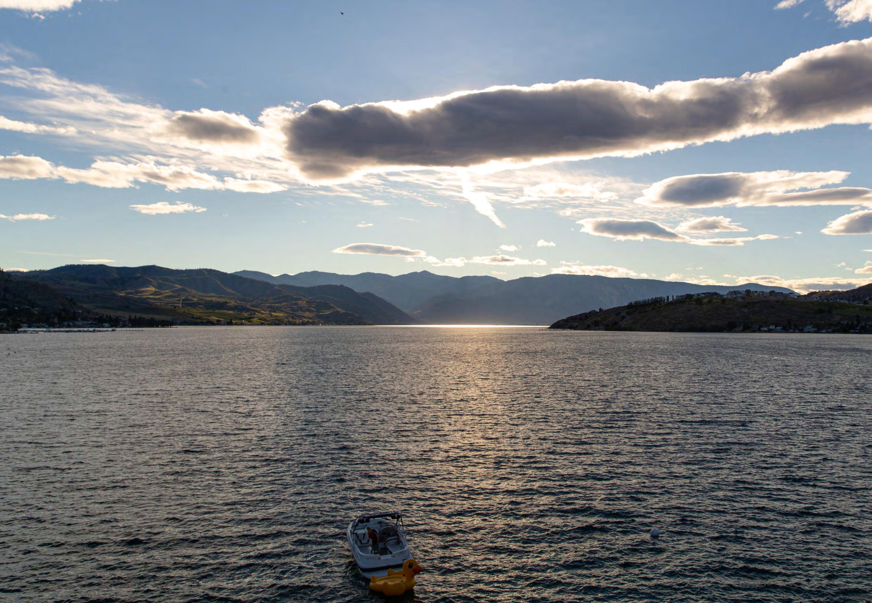
Lake Chelan, 1992
CONTENTSCONTENTS
 Jillian Nelson | M.Arch 2023 | University of Idaho
John | Adobe Stock
Jillian Nelson | M.Arch 2023 | University of Idaho
John | Adobe Stock
IMBRICATED ECOLOGY PARTII:PREDESIGN 8 Analysis Regional 9-13 Local 14-18 Desirability 19-21 Physicality 22-24 Code & Sensitivity 25-26 PARTI:INTRODUCTION 1 Editorial Essay 2 Project Proposal 3-5 Site Introduction Preliminary Project Goals 6 The Three Fingers 7 PARTIII:ASPIRATIONS 27 St. Louis Science Center 28-31 Northwest Maritime Center 32-33 Hassalo on Eighth 34 Pybus Market 35 PARTIV:SCHEMATICDESIGN 36 Schematic Design Off the Rails 37 Parti on Wayne! 38 Zoning Concept 39 Uniformed Intent 40 Your Site is Dead 41 Program Refinement 42 Digging In 43
CONTENTSCONTENTS

2023
Jillian Nelson | M.Arch
| University of Idaho
amenohi | Adobe Stock
IMBRICATED ECOLOGY PARTV: RESOLUTIONINTRODUCTION 44 Lakeside Ecology Center Site Plan 45 Building Program 46 PARTVI: SYSTEMSEXPOSITION 47 Barriers, Filters, & Screens Comprehensive Strategy 48 Focused Strategy 49 Stormwater Treatment 50 Integrating Structure Daylighting 51 Ventilation 52 Water Reclamation NORM Courtyard 53 Overview 54 NORM in Focus 55 Integrating On-Site Energy Geothermal Energy 56 Framing Resources 57 PARTVII: CONCLUSION&CREDITS 58 Final Thoughts 59 Thank You 60 References 61-62
PART I: INTRODUCTI
1
Jillian Nelson | M.Arch 2023 | University of Idaho
ION
MatHaywardMatHayward
IMBRICATED ECOLOGY 1
Lake Chelan, WA: Substance & Preservation
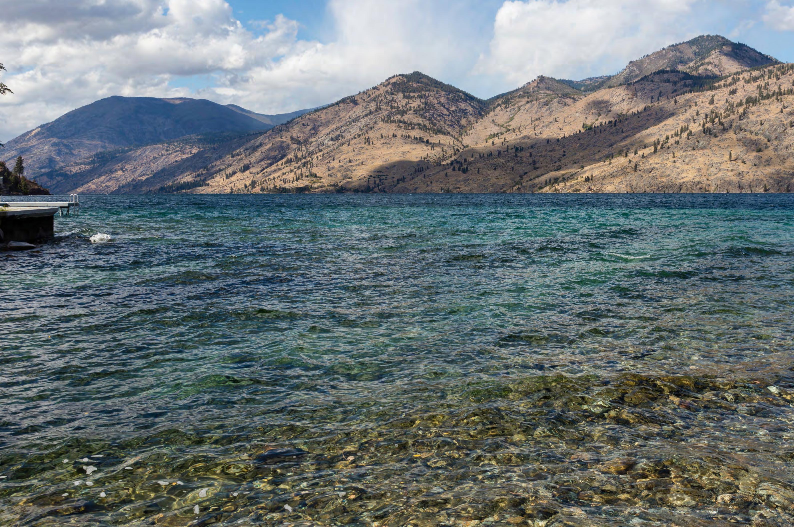
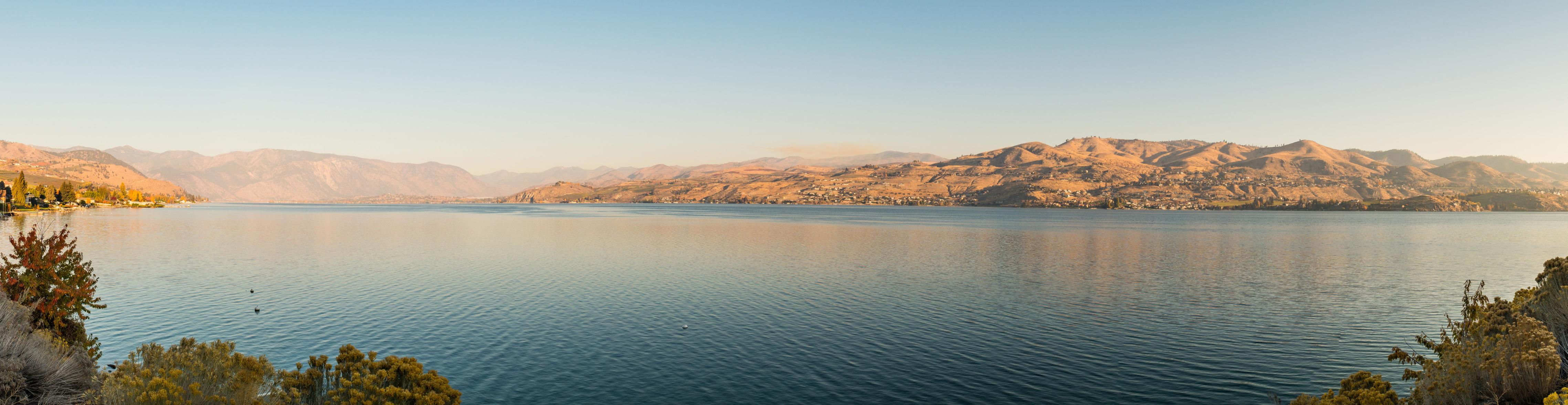
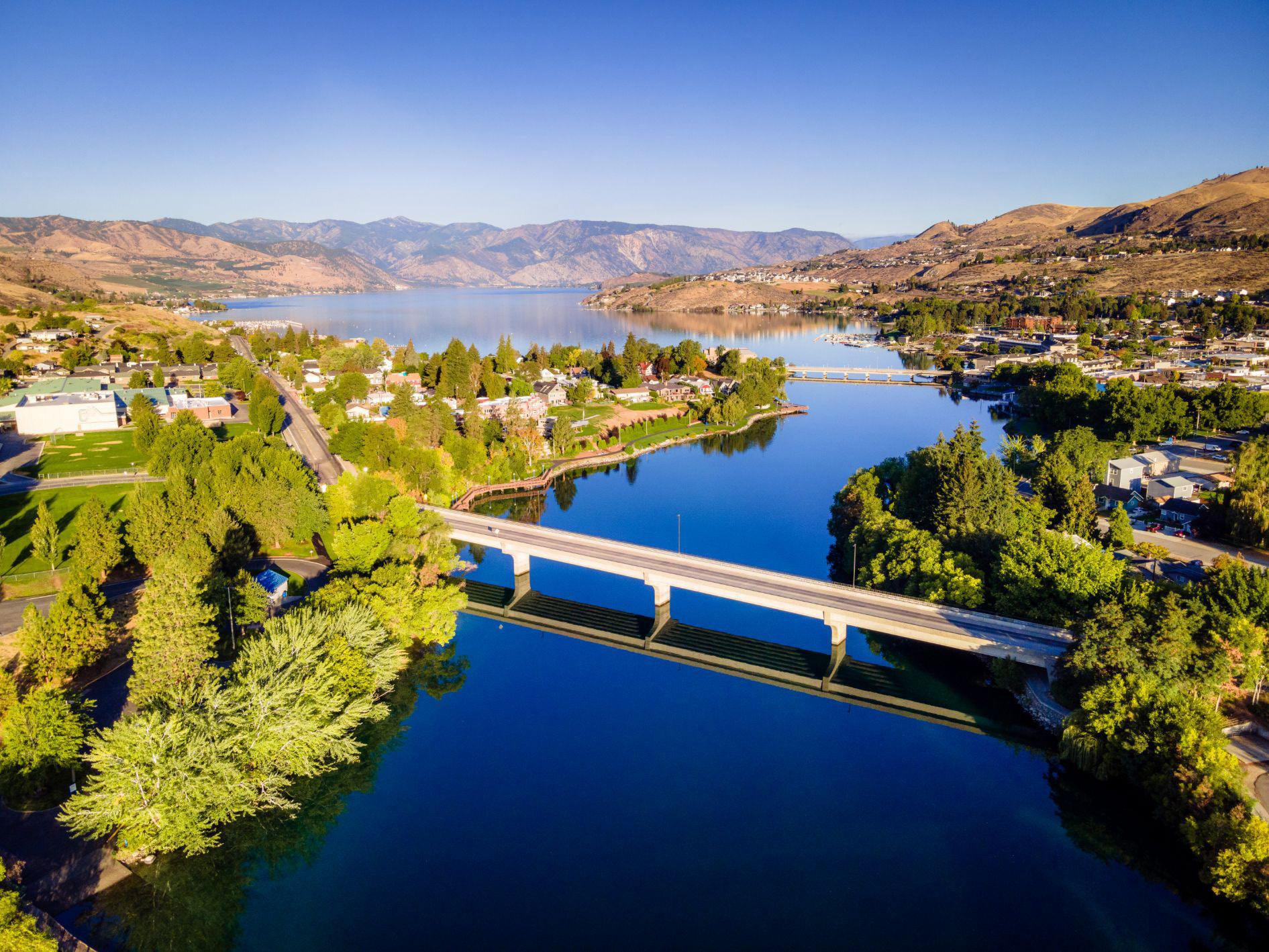
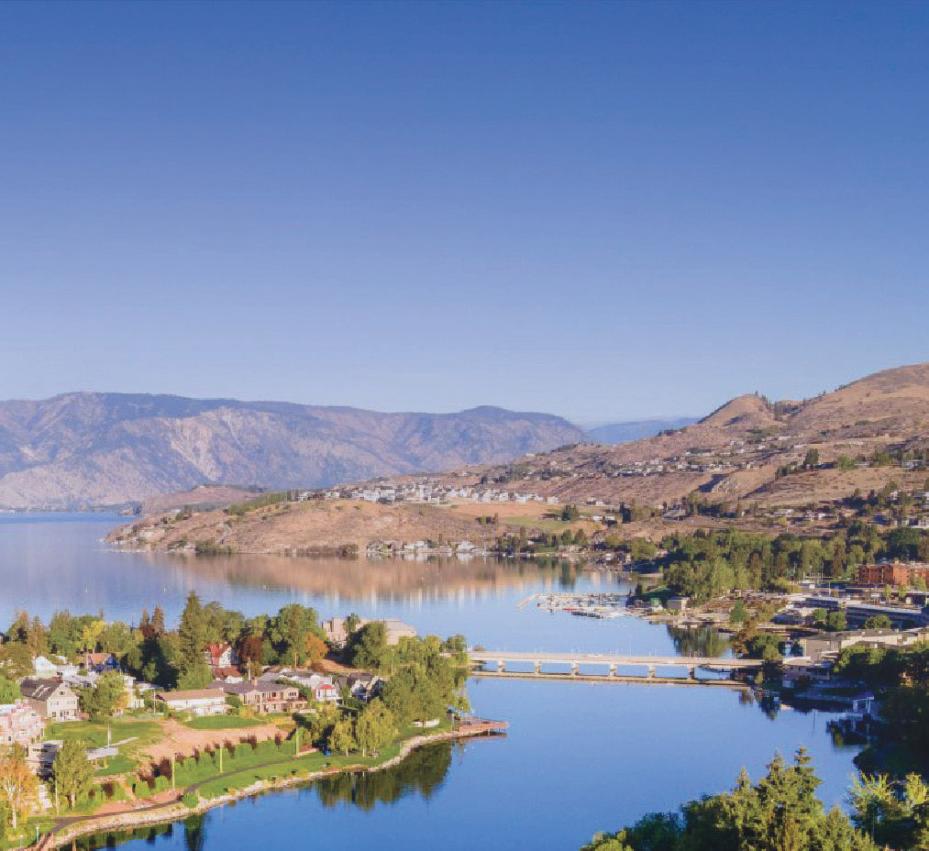
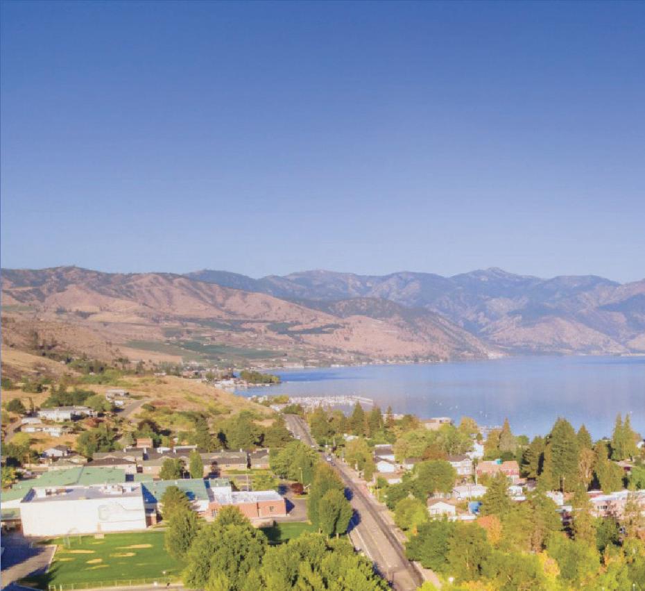
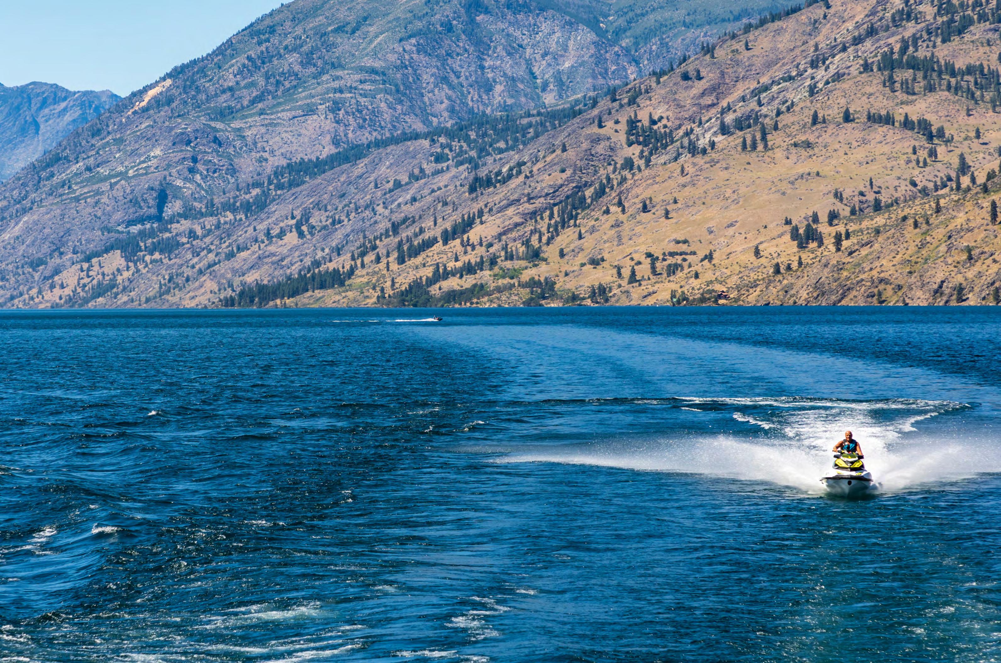
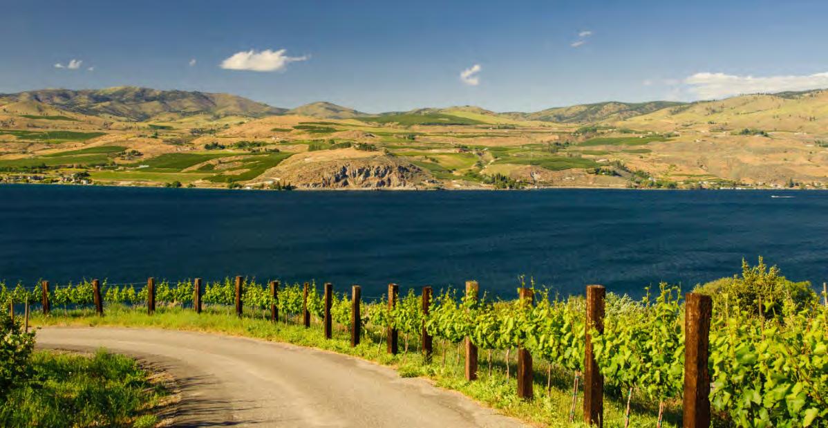
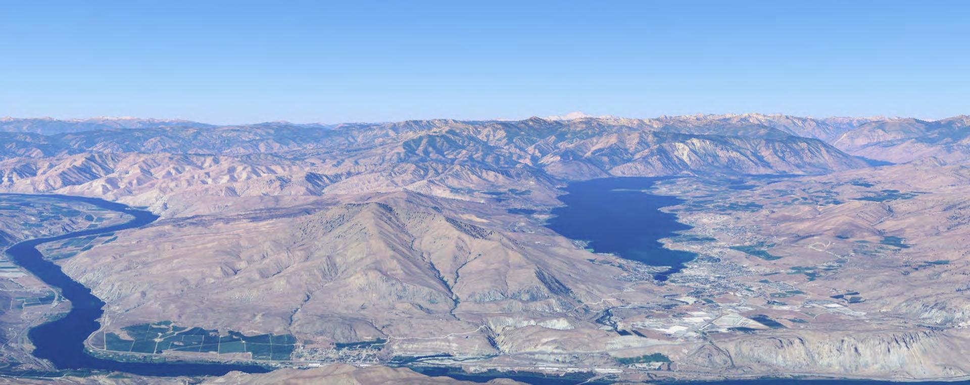
Lake Chelan is undoubtedly one of the most beautiful and exciting locations in the Pacific Northwest. The population swells by tens of thousands during the summer, spurred by the endless volume of recreational activities on, in, around, and above the lake and the ever-increasing viticulture. The City of Chelan’s economy relies heavily on tourism and agriculture. Within the last decade, Lake Chelan was granted its own American Viticultural Area (AVA) appellate, nested within the already established Columbia Basin AVA. This designation has allowed Lake Chelan’s wines to be recognized worldwide (even occasionally sipped at our own White House). Beyondclinchinghigherprofitsandnotoriety,theAVA designation signifies the uniqueness of Lake Chelan’s physical makeup. The relative elevation of the Chelan area prevented it from the sculpting process the Missoula Floods enacted on the Columbia Basin 8,000 years ago. Instead, multiple glaciers cut and ground their way into the Cascade Mountain range, leaving the 55-mile-long Lake Chelan, our country’s 3rd deepest lake, in their wake. This origin story is ‘just the tip of that iceberg’ in the uniquity of Chelan Valley’s geologic, geographic, and climatic qualities that accumulate into a booming agricultural center and pleasure fest to visit.
Lake Chelan may be home to an endless list of activities that are rare to find all in one place, but sadly there is one opportunity that is missing for both residents and visitors alike. Chelan fails to provide lakeside community space for promoting and cultivating community pride, celebrating existing culture, remembering origin, encouraging divergence, and, most importantly, a forum promulgating preservation of the blessings that make the community thrive. Without a designated space to meet these fundamental needs, the pith of the community will slowly decompose and rot away.
The existing spaces and developments in the Chelan area are geared toward affluent visitors, semiresidents (2nd or 3rd homeowners), and modern-day disciples of Dionysus. In terms of fiscal generation and economic well-being, this is not inappropriate. But what about community enrichment? A space that can embody the values mentioned above? Even within the bounds of Chelan’s tourism-centric planning,zoning,andeconomy,onewouldthinkthat even just one radical soul out there might take the opportunity to sneak in an educative or substantive activity for the community and visitors. But no. I wonder,withoutachanceto engageandexplorethe area’s geologic, climatic, and historical roots, are we
E E 2 Jillian Nelson | M.Arch 2023 | University of Idaho
able to appreciate them at the profound depth they deserve? Or meaningfully comprehend the systems that stem from them? I hope anyone who benefits from the experiences the lake area provides would want to preserve and protect its nature for their benefit and for the sake of future generations equally enjoying the bounty.

The nature of the lake and the systems connected to it are the reason for its ever-growing popularity. This popularity increases the burden on the active ecological, social, and climatic systems. So what stepsarebeingtakentoavoidatotalentropyofthese interdependentsystemsresponsibleforLakeChelan’s continued beauty and pleasure? The answer is none.
Providing exposure to information is vital in generating a conscious appreciation of these systemsandintegraltoactivatingnecessarybiophilic respect. The concept of ‘exposure’ plays a pivotal role in protecting these natural systems. However, exposure to information would be inadequate as a standalone concept. The efficacy of this conduit-type space is dictated by its accessibility and the implicitly exciting invitation to the public. Without either access

or invitation, unified and dedicated exposure will be difficult.


I want to be clear, the informative space I’m describing should go beyond stale infographics and data dumping. Exposure, access, and demonstrated value are tacit to its success. It should define a whole new way of engaging visitors and residents of Lake Chelan,lightingfireswithinthemtobetterunderstand how we impact the natural systems surrounding us. The space should facilitate exploration and interaction with the complex systems supporting Lake Chelan’s ecology. It would also be ideal if this place architecturally embodied the systems it seeks to promote, preserve, and protect. Its existence would serve as a support to the mission of its programming.
In almost every way, Chelan possesses the ideal environment, traits, and people to live a pleasant life or enjoy a beautiful vacation. I worry about how securethatpossessionisgiventhelackofopportunity and access to spaces and activities that support a genuine appreciation of the imbricated systems of the area and how people who benefit from them can contribute to maintaining it.
IMBRICATED ECOLOGY 2 IMBRICATED ECOLOGY
Thesis Introduction P

Everybody Wants Some

The starting point of my thesis project was the desire to develop an architectural design solution for a challenge that faces the Chelan Community. The first and most obvious problem that came to mind is the lack of available affordable housing. A growing amount of people are unable to work there and sustain residency. Statistically, only 1/3 of Chelan’s housing stock is occupied year-round; most of the market is used as 2nd or 3rd vacation homes or is reserved by their owners as VBRO-type tourist accommodations (Brunner).
Unsurprisingly, the growing volume of seasonally occupied units is tethered to the local area’s tourism-dominated economy. The area is rich with recreational activity options year-round but is also home to the PNW’s most fertile agricultural land. EasternWashingtonistheleadingproducerofapples and cherries for the entire United States. Specific to

the Chelan area, the most recent fruit claim to fame is the area’s grape production. With over 35 vineyards in the recently designated Lake Chelan AVA, wine tasting and vineyard touring have become the ultimate fusion of tourism and agriculture for the local economy (Steigmeyer). As the value of Lake Chelan as a natural resource and beloved vacation spot grows, so does the cost and privilege of local housing ownership.
The issue of affordable housing is quite ripe for solving in Chelan (pun intended). However, after working on a project regarding affordable housing during an undergrad studio, it became more apparent to me that many of the issues rooted in the affordable housing dilemma are systemic. Chelan’s lack of affordable housing, the seasonally driven
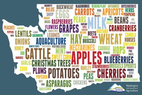
 Top Commodities word cloud by WSDA
P
| M.Arch 2023 | University of Idaho 3
Jillian Nelson
economy, and their relationship became my point of departure for seeking a challenge to focus my energy on and gain resolution through place-making or architectural design.
A robust volume of visitors is vital to survival and a thriving local economy. But in terms of relationships, I did wonder if other negative relationships had begun developing in correlation with the consistent growth of Lake Chelan’s popularity as a prized vacation destination. I considered some of the passages in The Turning Point, written by physicist Fritjof Capra, and how I might use a Systems Theory perspective to discoverwhereImightgenerate meaningfulvaluefor the community and the environment as a designer. Lake Chelan and its surrounding area contain a smorgasbordofnaturalandconstructedintertwining systems coexisting with interdependence and interrelatedness. How have the biological systems

faired alongside our human interventions, explicitly concerning the increasing human population and use of the famous aqua-pristine natural resource? Well, logic tells me that increased use of a natural resource reasonably equates to an increased burden on the systems within it. It occurred to me that an increased strain on Lake Chelan’s systems (environmental, ecological, and social) jeopardizes the very experience and nature that draws people to Lake Chelan. So what other systems are being impacted as Chelan’s popularity and usage grow? What do those impacts look like, and could I counteract the negative ones through architecture? Form corresponds with process, interrelations are associated with interactions, and the contrary unifies through oscillation.


 ...tnemoM tahT
IMBRICATED ECOLOGY 3
Why is it so bli spend the su in Lake Che


Seeds Of a Thesis


Whose Space is it Really?
Growing up in Chelan, I vividly remember a shared sense of us (locals) vs. them (tourists/or ‘206rs’ (a reference to Seattle’s area code). There seemed to be a collective understanding that tourists were the ‘other’ and their presence served a necessary function and should be tolerated to that extent at a minimum.
There is a park in Chelan called Don Morse Park; it once had a retaining wall along its waterfront, requiring the majority of swims along the shore to begin with, plunging your first step into the water to knee-deep depths. Alternatively, If you wanted to jump instead of wade, there was a set of castin-place docks stretching roughly sixty feet from shore. Separating the two concrete piers was a family swim area and an enclosed shallow swim area for young children.
Noticeably and curiously, people chose which dock they jumped from based on residency status. Interestingly, the pier to the south was unofficially moniker the ‘locals dock,’ and the other was sophisticatedly referred to as ‘the other dock.’


New Landscapes, New Reflections
The city commissioned a park redesign in 20122013. The retaining wall, docks, steps, and children’s pool area were removed. The only way to enjoy the water now is through a pebbled beach front. Strategic riparian habitat landscaping is a buffer between the beach front edge and bordering park grass.
My first visit to the ‘new’ Don Morse Park was a bit of a shock. An unspoken designated lake spot for the young people of Chelan to meet, socialize, and swim ceased to exist. I cherished my lakeside memories on the locals’ dock and the sense of belonging I found there; it was sad to think other kids and teens growing up here wouldn’t have the opportunity to experience that.
Wouldn’t it be nice if there was an opportunity for people to expose themselves to the science behind why its so great there?
Despite my initial disappointment, the redesign was pleasant enough, and of course, the lake remained beautiful. But a new pebblybeachfrontand some tall wispy grasses accompanied by an info placard don’t compare to the unique feeling of having that community gathering spot on the pier.
Germination
How can help


Whats the degree of impact one person can have on these systems while they are here?
How can someone a and positively contr to Lake Chelan’s na occurring ecolog


Upon further reflection on this ‘something special’, I concluded that the locals’ dock provided community members with a sense of ownership, belonging, and pride. I realized that acquiring those feelings is more thanjustapleasantexperience;theyarepartofthe fundamental desires that come with being human. A quick review of my undergrad psychology course notes on Maslow’s Hierarchy of Needs Theory gave me prompt confirmation. Designing a space that facilitatesusersmeetingthesefundamentalhuman needs, promoting stewardship, and nurturing ecological thinking fueled the development of my thesis project.

Nelson | M.Arch 2023 | University of Idaho
Jillian
P
P
4
What are the systems that make it this way?
an individuals maintain systems?

Could Lake Chelan become even more enjoyable with some form of collective effort?
If users can be moved to the point action here in Lake Chelan, could they be inspired to take these questions with them and apply them wherever they go?
actively ntribute aturally gy?
Can we ensure that our children’s children are able to have their own cherished memories on the pristine aqua-marine lake?

Is it even realistic to aim for a design to accomplish that?
If so, are we holding up our end of the deal?
Is there already a symbiotic relationship here?
Thought Snake Foundation
1)
2)
3)
Well, how do I even begin to incite wonder or positive action with design?
There’s Integrative Design, would this be ‘Instigative Design’?


How can architecture activate ecological stewardship?


What is the extent of my power as a designer in this situation?


blissful to summer elan?
Lake Chelan’s unique systems, their origins, and their complex imbrication and resulting beauty,
Chelan’s agriculture and tourism economy, and
Conceptualization of communal ownership, belongingness, and community pride
IMBRICATED ECOLOGY 4
Research Agenda
Abstract
This thesis project is based on the harmonious relationship between humans and the natural environment and increasing public access to the lake. Ultimately this project endeavors to create public and semi-private spaces that promote community connection while celebrating and encouraging responsible stewardship of Lake Chelan.
Design Concept
Manifestation of diverse, accessible community space on Lake Chelan that promotes biophilia, passive design strategies, and innovative technology while educating visitors on the local environment. The project will serve as a conduitforprideandavisionofacleaner future, offering interactive, educational programming for all ages on the lake’s origin,geography,andclimaticproperties.
Research Methods
Case Studies: focused examination of existingprojectsthathavesuccessfully executedorexemplifythegoalssetfor thisthesisproject.
Site Analysis: in-depth review and analysis of micro and macro natural and ecological systems affecting the projectsite.
OldFashionedtrialanderror.
P P
Jillian Nelson | M.Arch 2023 | University of Idaho 5 � � � Jillian Nelson | M.Arch 2023 | University of Idaho
Key Points & Questions


5 IMBRICATED ECOLOGY
Preliminary Project Goals
Comprehensive Goals
Program Goals
Protect and work within the existing natural
Protect and work within the existing natural systems
Design for resilience, and maintain for resilience, and maintain flexibility with multi-purpose spaces with multi-purpose spaces
Foster appreciation of the Lake Chelan
Foster appreciation of the Lake Chelan area’s natural systems area’s natural systems
Increase awareness of how we impact the Increase awareness of how we the naturalsystems,provideaccesstoresources on how to ensure it is a positive impact on how to ensure it is a positive
Increase interest in environmental in environmental stewardship
Arrange building circulation to narrate a circulation to narrate a journey
Create a sense of interactivity and Create a sense of and engagement between program types engagement between program types
Visual Experience Goals
Gallery spaces that selectively frame spaces that selectively frame views inward and outward views inward and
Increase community access to the lake
Increase access to the lake
Create spaces that facilitate community- Create spaces that facilitate communitybuilding events events
System Goals
Provide spaces for marine biology research
Provide for marine biology research and conservation efforts conservation
Diversifytheactivityopportunitiesforvisitors
Utilizeahybridofpassiveandmechanical Utilizeahybridofpassiveandmechanical systems that showcase attainable systems that showcase attainable energy efficiency and simultaneously energy efficiency and simultaneously leverage the natural systems in the area the natural systems in the area
Enhance the views bilaterally between land
Enhance the views land and lake lake.
Design a well-insulated skin system that a well-insulated skin system that creates handsome facades which catch creates catch the eye but do not compete with the the eye but do not with the natural beauty of its surroundings natural of its
Increase culture and
Increase pedestrian culture and walkability
S I
Jillian Nelson | M.Arch 2023 | University of Idaho
� � � � � � � � � � � � � � � � 6 Jillian Nelson | M.Arch 2023 | University

IMBRICATED ECOLOGY 6
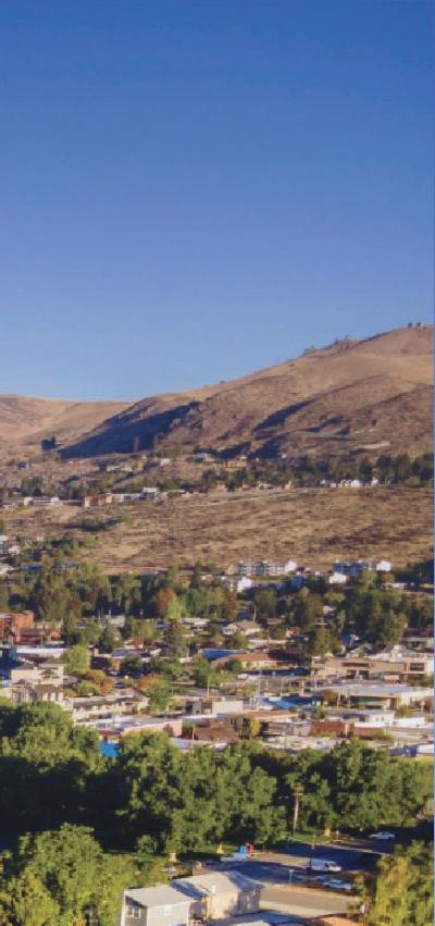
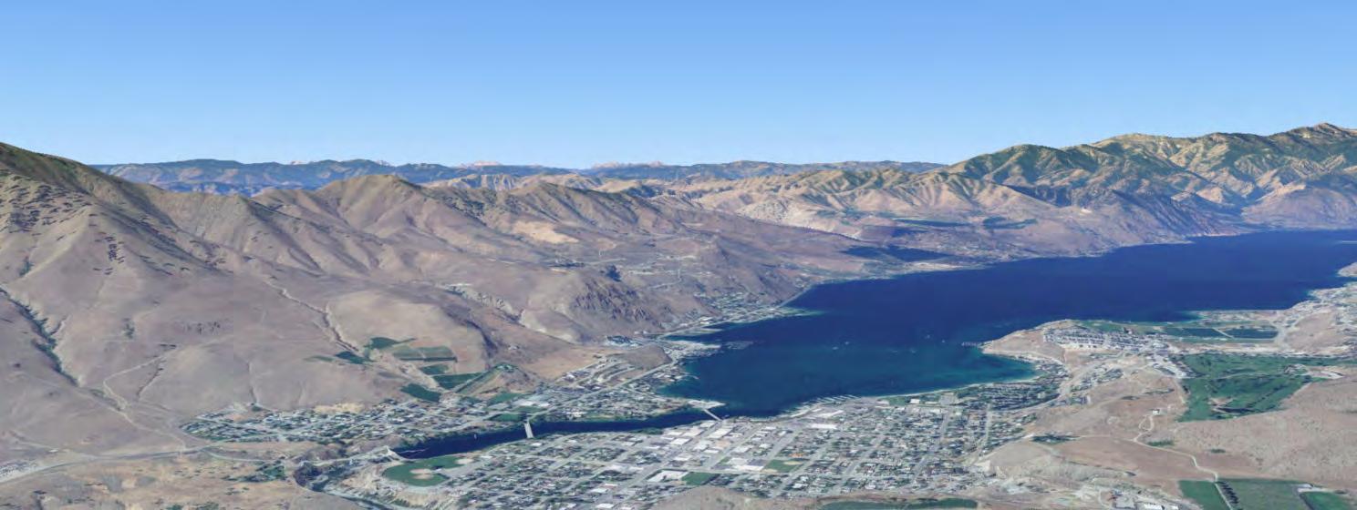
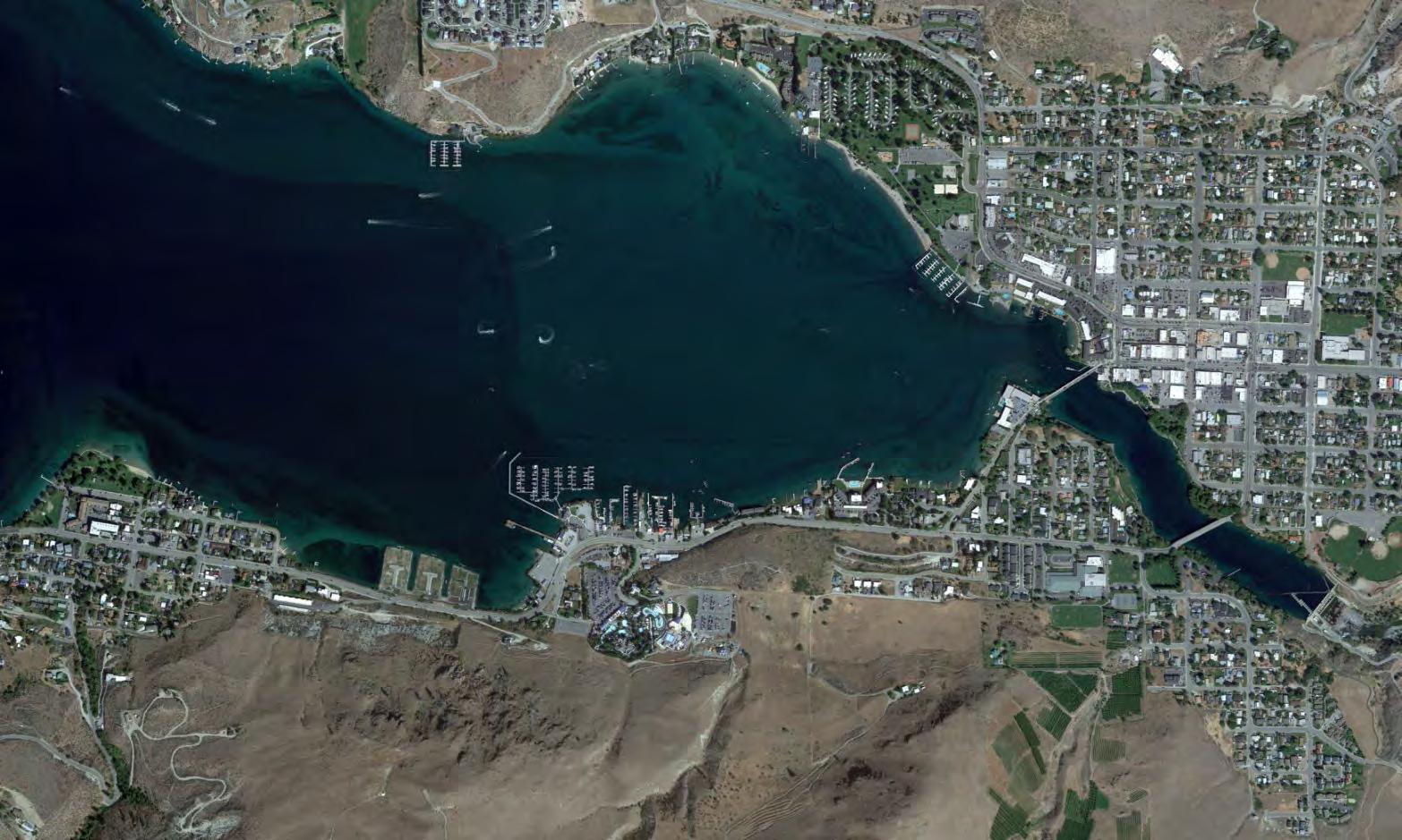
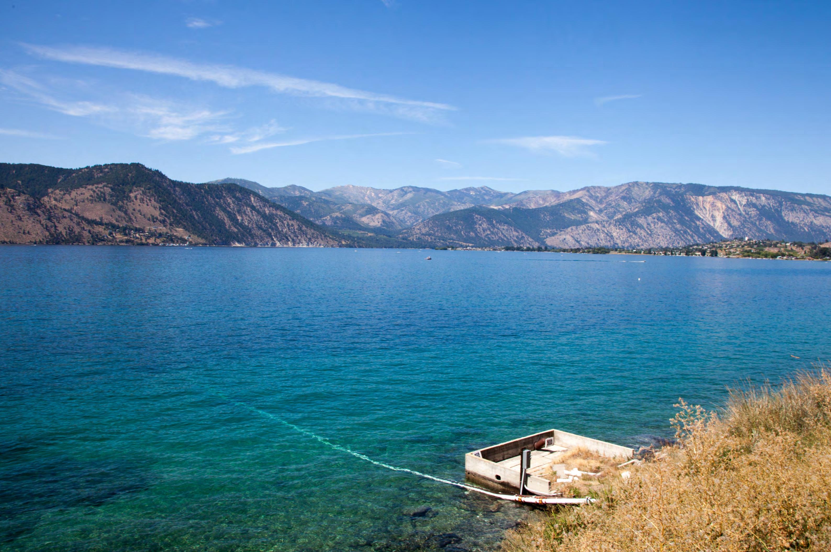
The Three Fingers
1700 W Woodin Ave., Chelan, WA 98816
47.834726, -120.042553
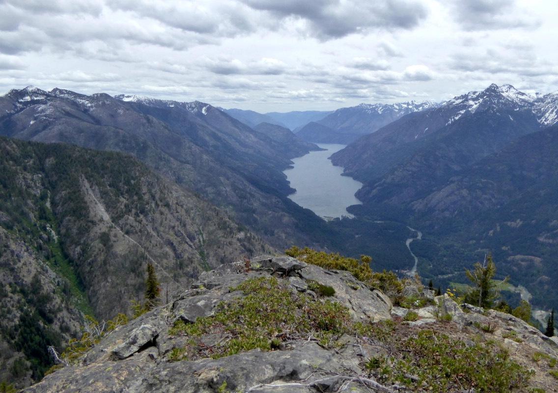
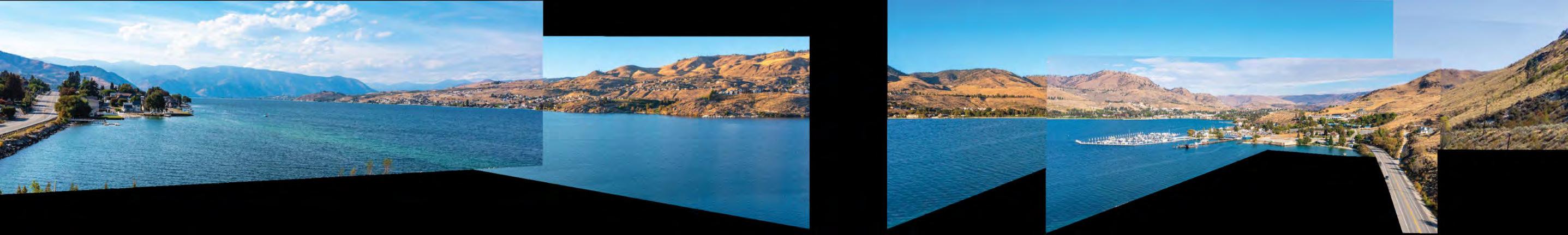
To begin, please allow this graphic introduction to the project site to be a brief rudimentary means of project orientation. The upcoming analysis dives deeply into the climatic and geologic factors affecting the region, micro-clamatic conditions, and existing idiosyncratic site features. I will also walk through the rationale for selecting this 6.2 acre site out of the available 100+ miles of shoreline that Lake Chelan has to offer.

S I
Site
| M.Arch 2023 | University of
7
Jillian Nelson
Idaho
2000ft N ➤ WA
Chelan County
Lake Chelan
N IMBRICATED ECOLOGY 7
City of Chelan
PART II: PREDESIGN
 Jillian Nelson | M.Arch 2023 | University of Idaho
IMBRICATED ECOLOGY
NathanielGonzalesNathanielGonzales
Regional | Local | Desirability | Physicality | Code & Sensitivity
What it is:
Broad ecological patterns occurring in differing landscapes are what I will refer to as an ecoregion. Ecoregions are comprised of distinctive plant and animal distribution patterns. Varying abiotic factors like climate, geology, soil, and hydrology, are key factors in ecosystem development; thus these factors naturally lend themselves to the defining of unique ecoregions.
Analysis Function:
Ecoregions provide a categorization system for the complex and diverse landscapes and climates occurring across the state of Washington. They have helped provide this project a foundational frame work to responsive predesign planning.

Scope & Purpose:
In focus for this project is the East Cascade ecoregion, Okanogan ecoregion, as well as the Columbia Plateau ecoregion. While ‘technically’ within the bounds of the East Cascade ecoregion, Lake Chelan is situated along the far northwest border edge abutting both the Okanogan and Columbia Plateau ecoregions. Because nature and the systems within it occur as a gradient, the graphics createdtodemarcateecoregionsinthisbooklet are not hard-line boundaries; which lead to the logical investigation of the Lake Chelan area as a convergence of all three ecoregions. The following section on these ecoregions is centered on information as it relates to Lake Chelan and its surrounding area.
Comprehension of natural systems occurring on a given site at a micro-level is increased with a more thorough understanding of the natural systems occurring at an expanded macro-level. Designing for integrated systems and energy efficiency logically calls one to seek understanding the systems within local, regional, micro and macro contexts.
A
Ecoregions
| M.Arch 2023 | University of Idaho 9
Jillian Nelson
Northwest
North
Okanogan
West
East
Columbia
Blue Mountains 1 2 3 4 5 6 7 8 9 9 8 7 5 6 3 4 2 1 N
Coast Puget Trough
Cascades
Canadian Rocky Mountains
Cascades
Cascade
Plateau
IMBRICATED ECOLOGY 9
20 mile radius demonstrating extreme proximity of multiple ecoregion
Ecoregions | East Cascades
Boundaries & Crossings:
East Cascades ecoregion makes up about 10% of all land in Washington state, beginning with the mountains east of the Cascade crest to the foothills that eventually flatten out to become the Columbia Plateau. Lake Chelan is its beginning in the north while the Columbia River Gorge marks its southern edge. Vehicular travel through this mountainous ecoregion at 5 primarypoints.Highway2allowspassagefrom the Puget Trough to cities such as Leavenworth and Wenatchee. In its southern end, I-90 slips through the Cascades passing near Cle Elum. Highway 2 and I-90 both connect to Route 97 and Alt Route 97, which is the most direct path to reaching Lake Chelan. Highway 410 and Highway 12 provide scenic routes through Mt Rainier National Park, with Highway 12 being the southernmost path to cross the ecoregion.
Landforms:
The Columbia River delineates the northeaster edge of the ecoregion before turning east into the Columbia Plateau. The river winds through the state and returns to the southernmost edge of the ecoregion at the bottom of the state.
Climate:
The climate dramatically drys out eastward of the Cascade crest. The crest acts as the beginning of the climatic gradient, with the ridge line receiving over 120 inches of annual precipitation (mostly snow) and lower elevations fall within the rain shadow over the foothills with a milder 20 inches of annual precipitation. Frigid mountain temperatures also gradiate as the elevations decrease giving the ecoregion a wild range in its growing season. East Cascades ecoregion’s growing season can vary from a high of 220 days to as little as 30 days depending on the elevation.
Puget Trough Regional | Local | Desirability |
A
Physicality | Code & Sensitivity
Nelson | M.Arch 2023 | University of Idaho 10
Jillian
¹ ´¹ ¹ ´ ¹ ¹ ´¹ ¹ ¹ ´¹ ´¹ ´ ¹ ´¹ ´ ¹ ´¹ ¹ ´¹ ¹ ´¹ ¹ ¹ ´¹ ¹ ´¹ ´ ¹ ´¹ ´ ¹ ´¹ ¹ ´¹ ¹ ´¹ ¹ ¹ ¹ ¹ ¹ ´ ¹ ´ ¹ ´¹ ¹ ¹ ´¹ ¨ Columbia River Gorge Puget ough Mt Ranier National Park Columbia River Lake Chelan Cascade Crest Natural POIs N Wenatchee ^ ^ ^ ^ Chelan Leavenworth Cle Elum Human POIs N _ ² 97 . 2 . 2 _ 97 _ 97 _ 97 ¡ 90 ¡ 90 S 410 . 12 Travel Routes N IMBRICATED ECOLOGY 10
Ecoregions | Okanogan
Boundaries & Crossings
The Cascades, the Rockies, and the Columbia Plateau in north-central Washington converge to form what is known as the Okanogan ecoregion. The vast (14% of all land in WA) and rugged area can be defined as the mountains between mountains, known for its scenic highland views existing between the North CascadesandtheNorthernRockies.Theregion abuttingtheEastCascadeecoregionandLake Chelan is known for its pleasant north-south running river valleys such as the Methow and the Okanogan. After passing through the East Cascades, Highway 97 provides connection through Okanogan Valley. State Route 20 is seasonally open, connecting the Puget Trough and northern Cascades with Methow Valley and small tourism towns such as Winthrop and Twisp.
Landforms
Geologically speaking, the origin story of this ecoregion is complex and long involving volcanoes, plate tectonics, and glacial sculpting from the ice age. Its worth noting that much of the energetic glacial activities are also responsible for form Lake Chelan, regardless of it technically lying outside the Okanogan ecoregion. Over 11,000 years ago during the Pleistocene era, much of the Okanogan was coveredinglaciers.Foreonstheice,formedand retreated, grinding away at the land beneath, picking up and moving rocks, minerals, and soil as it did. The final retreat of these glaciers was the end of the ice age and left behind what is now the physical form and face of this ecoregion. The Columbia River forms the Okanogan ecoregions most southern edge.
Climate
Extremes of both hot and cold can be expected in the Okanogan ecoregion. It’s known for hot, dry summers and brutally cold snowy winters. The western edge of the region settles under the rain shadow of the Cascades, receiving 12 inches of precipitation annually. In contrast, the eastern boundary of theregiontheamountofprecipitationdoubles due to the storm fronts occurring against the rising Canadian Rockies.
Summer months bring hot air flowing up from the Columbia Plateau, causing sweltering temperatures in the high 90s and regularly breaking into the triple digits. The winter months bring choking arctic air streams from Canada, responsible for the states coldest temperature ever recorded, a deathly -48º F in Winthrop, only an hours drive from Lake Chelan.
Puget Trough Regional | Local | Desirability |
A
Physicality | Code & Sensitivity
Jillian Nelson | M.Arch 2023 | University of Idaho 1
¹ ¹ ¹ ¹ ´¹ ¹ ¹ ´¹ ´¹ ´ ¹ ´¹ ´ ¹ ´¹ ¹ ´¹ ¹ ´¹ ¹ ¹ ¹ ´¹ ¹ ´¹ ´ ¹ ´¹ ´ ¹ ´¹ ¹ ´¹ ¹ ´¹ ¹ ¹ ¹ ¹ ¹ ´ ¹ ´ ¹ ´¹ ¹ ¹ ´¹ Columbia River Lake Chelan Puget ough Methow Valley Cascade Crest Okanogan Valley Cascade Rainshadow Rockies ´¨ ´¹´¹ ´¹ ´¹¨´¹´¹ ´¹¨ ´¹ ´¹ ´¨¹ ´¹ ´¹ ´¨´¹ ´¹¹ Natural POIs N Chelan ^^ ^ Winthrop Twisp ^ ^ Omak Oroville Human POIs N _ 97 _ 97 _ 97 _ 97 S 20 S 20 Travel Routes N IMBRICATED ECOLOGY 1
Ecoregions | Columbia Plateau
Boundaries & Crossings:
Occupying nearly 1/3 of Washington State’s land mass, the Columbia Plateau is a vast semi-arid landscape stretching between the Cascades and the Rockies, trenched with the flows of both the Columbia and Snake Rivers. The northernmost boundary abuts the Okanogan highlands; its entire western edge kisses the East Cascades and is bordered by theRockiesandtheBlueMountainstoitssouth and southeast, respectively. Running eastwest, I-90 connects many of the cities within this region, such as Ellensburg, and Moses Lake, to Spokane on the eastern edge of the state.Highway2isanotherprimaryconnector, springing from route 97 near Wenatchee in the East Cascade ecoregion, eventually passing through Coulee City and eventually rolling its way to Spokane. The famed agricultural heartland of Washington is also within the Columbia Plateau ecoregion, with the rolling hills of the Palouse making up its southeastern edge.
Landforms:
Jumping in the way-back context machine, nearly 17 million years ago, a wild flood of lava flowed over this area for approximately 10 million years. As a result, this ecoregion was covered in basalt rock (cooled and hardened lava), in some areas a little over a mile thick. Atopthisbedrockisalayerofsiltsandvolcanic ash blown in from the Cascades, which resulted in the rich and fertile loess soils and agricultural lands which stretch to the Palouse region of the Columbia Plateau.
More recently, and closer to the region border shared near Lake Chelan, massive flooding
associated with the Glacial Lake Missoula sculpted what is now known as the Channeled Scablands of eastern Washington, leaving behind its famed coulee landscape.
Climate:
TheColumbiaPlateauishighlyaffectedbythe Cascade’s long and enduring rain shadow. Summers in this region are known to be hot and dry, with cold gray winters. Late fall and early spring provide most of the region’s precipitation. In correlation with the given elevation, annual precipitation averages range from 6 to 25 inches. Snow falls within the region; however, it is mostly wet and quick to melt. The maritime effect moderates lower elevations from across the state, and the annual average temperature mildly rests between 40 to 57 degrees. Still, extremes of triple digits and subzero are not uncommon, along with occasional drought or forest fires.
Regional | Local |
A
Desirability | Physicality | Code & Sensitivity
Jillian Nelson | M.Arch 2023 | University of Idaho 12
¹ ´¹ ¹ ¹ ¹ ¹ ´¹ ¹ ¹ ´¹ ´ ´ ¹ ´¹ ´ ¹ ´¹ ¹ ´¹ ¹ ´¹ ¹ ¹ ´¹ ¹ ´¹ ´ ¹ ´¹ ´¹ ¹ ´¹ ¹ ´¹ ¹ ´¹ ¹ ¹ ¹ ¹ ¹ ´ ¹ ´ ¹ ´¹ ¹ ¹ ¹ ´¹ ´¨ ´¹´¹ ´¹ ´¹¨ ´¹ ´¹ ´¨¹ ´¹ ´¹ ´¨´¹ ´¹¹ ´¹¨ ´¹ ´¹ Columbia River Lake Chelan Rockies Cascade Crest Palouse Hills Channeled Scablands N Cascade Rainshadow Natural POIs Chelan ^ ^ ^ ^ ^ ^ Ellensburg Spokane Moses Lake Coulee City Wenatchee N Human POIs _ ² 97 . / 2 . 2 _ 97 _ 97 _ ` 97 N Travel Routes IMBRICATED ECOLOGY 12
Regional | Local | Desirability | Physicality | Code & Sensitivity
Viticulture Designation
What is it?
An American Viticultural Area (AVA) references adistinctappellationofgrapeoriginandisused onwinelabels.AnAVAisaspecific,demarcated grape-growing region compromised of specific geographic or climatic features which distinguish it from surrounding regions, having auniqueeffectonthearea’sgrapeproduction. Both vintners and consumers can benefit from this highly esteemed designation as it verifies the geographic pedigree of the wine and the characteristics it possesses, as well as justifies the value of the wine. Wines using a label that features an AVA notation require that a minimum of 85% of the grapes used to make that particular wine have been grown in the specified AVA and finished within the same state that the area is (TBT.gov).
Why did Lake Chelan Receive this?
Interestingly, the Lake Chelan AVA exists entirely within the larger Columbia Valley AVA, indicating how unique this area must be to
receive such recognition within an already recognizedarea.Thenationallyrecognizedarea can produce unique grapes with distinguishing nutrients, mineral values, and textures. This is all due to Lake Chelan’s high elevation, its ice age conception, which resulted in its unique soil composition, and finally, because it possesses a more temperate climate than any nearby regions.
The Lake Chelan AVA is notably different from others for its ability to nurture grapes under the “lake effect,” a condition that results in the most favorable temperatures for a longer growing season and reduced risk of frost.
What are the boundaries?
The Lake Chelan AVA ranges from 1,100 ft to 2,000 ft asl, wrapping along the shorelines of Lake Chelan from its southernmost tip and approximately 12 miles up the lake just past the city of Manson.
Lake Chelan Lake Chelan AVA Columbia Valley AVA Columbia River 1 2 3 4 3 4 2 1
A
Jillian Nelson | M.Arch 2023 | University of Idaho 13
Why does it matter to this project?
Increased tourism/exposure opportunities for my project. A demonstrated public interest in natural systems in the are. Give the people what they want! (aka my project)
The Lake Chelan Basin in Washington State is unique among grape growing regions in the stateduetoitsgeology,whichwasshapedby glaciers rather than the Missoula Floods. The resulting soil is rich in minerals and nutrients and, combined with the area’s microclimate, allows grapes to fully ripen while still retaining bright acidity. This makes the region suitable
for grape growing. Lake Chelan itself formed approximately 15,000 to 18,000 years ago during the Vashon/Wisconsin glacial period, as a result of the interaction between the Chelan Glacier and the Okanogan-Columbia Valley lobe of the Cordilleran ice sheet. The lake consists of two basins: the Lucerne basin, which is deep and fjord-like, and the Wapato basin, which is relatively wide and shallow in comparison. The lake is approximately 55 miles long and has a maximum depth of approximately 1,500 feet. The narrowest part of the lake is located at a constriction known as“TheNarrows,”whichisashallowledge135 feet below the surface of the lake.
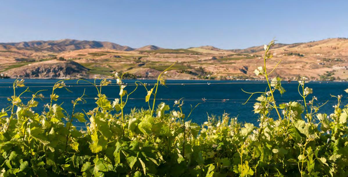 Photo: Richard Duval | Danita Delimont
Photo: Richard Duval | Danita Delimont
Photo: Richard Duval | Danita Delimont
IMBRICATED ECOLOGY 13
Climate Regional | Local | Desirability | Physicality | Code & Sensitivity
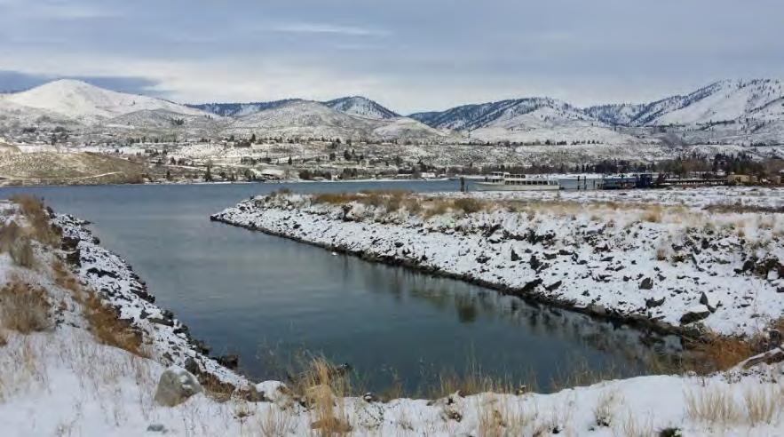
Temperatures
Winter months (Dec-Feb) on Lake Chelan are known for their biting cold temperatures. With lows in the single digits and from my personal experience, generally,onecanexpecttheregulartemperaturesto range from the low 20s to the upper 30s. Early Spring (March) is still chilly on the lake, slowly thawing out duringApril,andgraduallythetemperaturesbeginto rise in the month of May, if not somewhat erratically; this unstable transition is evident in the temperature
chart on the right, showcasing the month of May as having the largest temperature range in the year. The Summer months rapidly bring the heat and consistently bake throughout the season (June-Aug). As the earth tilts and Fall rolls onto the lake, there are still the odd warm days that can happen, but generally, the temperatures drop rapidly toward the end of October and into the Winter.
Jillian Nelson | M.Arch 2023 | University of Idaho
Data collected from Climate Consultant.
A 14
Months121110987654321 10 20 30 40 50 60 70 80 90 100 (Fº) Comfort Zone
IMBRICATED ECOLOGY 14
Design High Design Low
Climate Regional | Local | Desirability | Physicality | Code & Sensitivity
Rain & Snow
Rains do fall in Lake Chelan; however, one can mostly expect the majority of precipitation to come in the form of snow. As expected, there is no snow in the late Spring, Summer, and early Fall. From lived experience, I can tell you that 8 to 15 inches of snow can be expected to be seen from your window; whether it’s freshly fallen or lightly frozen is a bit more difficult to predict. The elevation of Lake Chelan puts it at a
‘high desert’ range, and the snow acts accordingly and is dry and powdery in nature with a very slow melt tendency. The lack of precipitation in the warm months puts Chelan at a high risk of forest fires; it only takes a bit of lightning during a light summer storm to ignite an entire hillside.
Data collected from Western Regional Climate Center.
Jillian Nelson | M.Arch 2023 | University of Idaho
15
A
❄ ❄ ❄ ❄ ❄ ❄ ❄ ❄ ❄ ❄ ❄ ❄ ❄ ❄ ❄ ❄❄❄ Months 0 5 10 15 20 25 30 35 40 45 (in) 0.0 .7 1.4 2.1 2.8 3.5 4.2 4.9 5.6 6.3 Õ (in) 1211987654321 10 ❄ ❄ ❄ ❄ ❄ ❄ ❄ ❄ ❄ ❄ ❄ ❄ ❄ ❄ ❄ ❄❄❄ High Mean Low Precipitation High Mean Snowfall IMBRICATED ECOLOGY 15
Climate Regional | Local | Desirability | Physicality | Code & Sensitivity
Predominant Winds
Having overlaid the months into their respective seasons,theannualtrendforwindsonthesitereflects calmer winters, ramping up in the spring, higher turbulence in the summer, and a winding down in the fall. While varying in speed, spring and summer months have similar directional tendencies blowing predominantly from the west and northwest-west. Because summer months tend to have the highest volume of lake use and lake activities, it is worth noting that winds from the east and east-southeast are nearly as common from the predominant west and west-northwest but not in strength.
Fall and winter resemble a similar directional wind relationship, just as spring and summer directions relate. Predominant blowing in fall and winter come from the east-southeast direction. Interestingly, the winter months show stronger winds than in the fall season, but much less often, it is considered calm nearly 30% of the time (thank goodness because it is cold enough without the wind factor!)
Data from Western Regional Climate Center.
Jillian Nelson | M.Arch 2023 | University of Idaho
A 16
24% 20% 16% 12% 8% 4% W S N E calm 12.3% 18% 15% 12% 9% 6% 3% W S N E calm 3% 18% 15% 12% 9% 6% 3% W S N E calm 29% 18% 15% 12% 9% 6% 3% W S N E calm 7% 1 6 13 20 5 12 20-+ MPH Winter Dec | Jan | Feb Summer June | July | Aug Spring Mar | April | May Fall Sept | Oct | Nov 1 6 13 20 5 12 20-+ MPH 1 6 13 20 5 12 20-+ MPH 1 6 13 20 5 12 20-+ MPH IMBRICATED ECOLOGY 16
Wind Behavior On-site
As described from the wind rose graphics on the previous page, Spring and Summer are the most active months for air movement on Lake Chelan. Lakeside Park and the neighborhood to the west of the site extend deeper into the lake than the three fingers, providing light protection from gusts down lake. The site is not completely protected from the predominant WNW winds in the summer months; the project’s outdoor spaces will benefit from some
neighborhoodtreesandvegetationbeforearrivingat the site. Eastern winds have quite the arduous journey along the base of the butte and neighborhood trees; concern for wind becoming pesky from this direction is minimal. During the Fall and Winter, the wind is not as aggressive and mainly flows from the ESE. Again, it has some work to do while navigating around the butte before affecting the site. The freezing temperatures during these colder months will make
Geographic Context
Chelan Butte
Columbia River
Jillian Nelson | M.Arch 2023 | University of Idaho
A 17
Climate Regional | Local | Desirability | Physicality | Code & Sensitivity
Spring & Summer
ESE Fall & Winter N W ESE E WNW
Google N Google IMBRICATED ECOLOGY 17
Palette 2030 Design Recommendations
Climate-specific design recommendations produced from Climate Consultant software.
Glazing
»»
»»
Glazing to Floor Ratio 20% for cold climates (winter temps 20ºF - 30º F) and between 44º – 56º latitude
Orient solar glazing within 15º of true south in the Northern Hemisphere, and no more than 25º from either orientation.
Materiality
»»
West | North | East Oriented Glazing: Double pane high performance glazing (Low-E)
»»
South Oriented Glazing: clear when designed for maximum passive solar gain
»»
Consider Tiles | Slate | and Wood as flooring surfaces to provide enough mass to store winter daytime solar gains and summer evening ‘coolth’
Insulation
Take advantage of the heat gain from lights/occupants/equipment keep that building tight and well-insulated to maintain a lower Balance Point Temperature.
»»
»» Pitched roofs, vented to the exterior & well-insulated ceiling below (shed the rain/snow and avoid ice dams)
Jillian Nelson | M.Arch 2023 | University of Idaho Climate Regional | Local | Desirability
A 18
| Physicality | Code & Sensitivity
 Diagramming angles for ideal solar glazing placement on site.
1)
3) Entrance of Edgewood City Hall on eastern facade.
Diagramming angles for ideal solar glazing placement on site.
1)
3) Entrance of Edgewood City Hall on eastern facade.
2 3 1
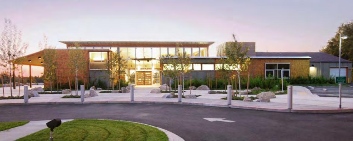
South North
2) Miller-Hull design for Edgewood City Hall in Edgewood WA showcasing beautiful wood aesthetics and mullion placements on facades for both direct solar gain and disused lighting strategies.
25º 15º
East West
Miller-Hull Edgewood City Hall
Miller-Hull Edgewood City Hall
IMBRICATED ECOLOGY 18
Google
Regional | Local | Desirability | Physicality | Code & Sensitivity
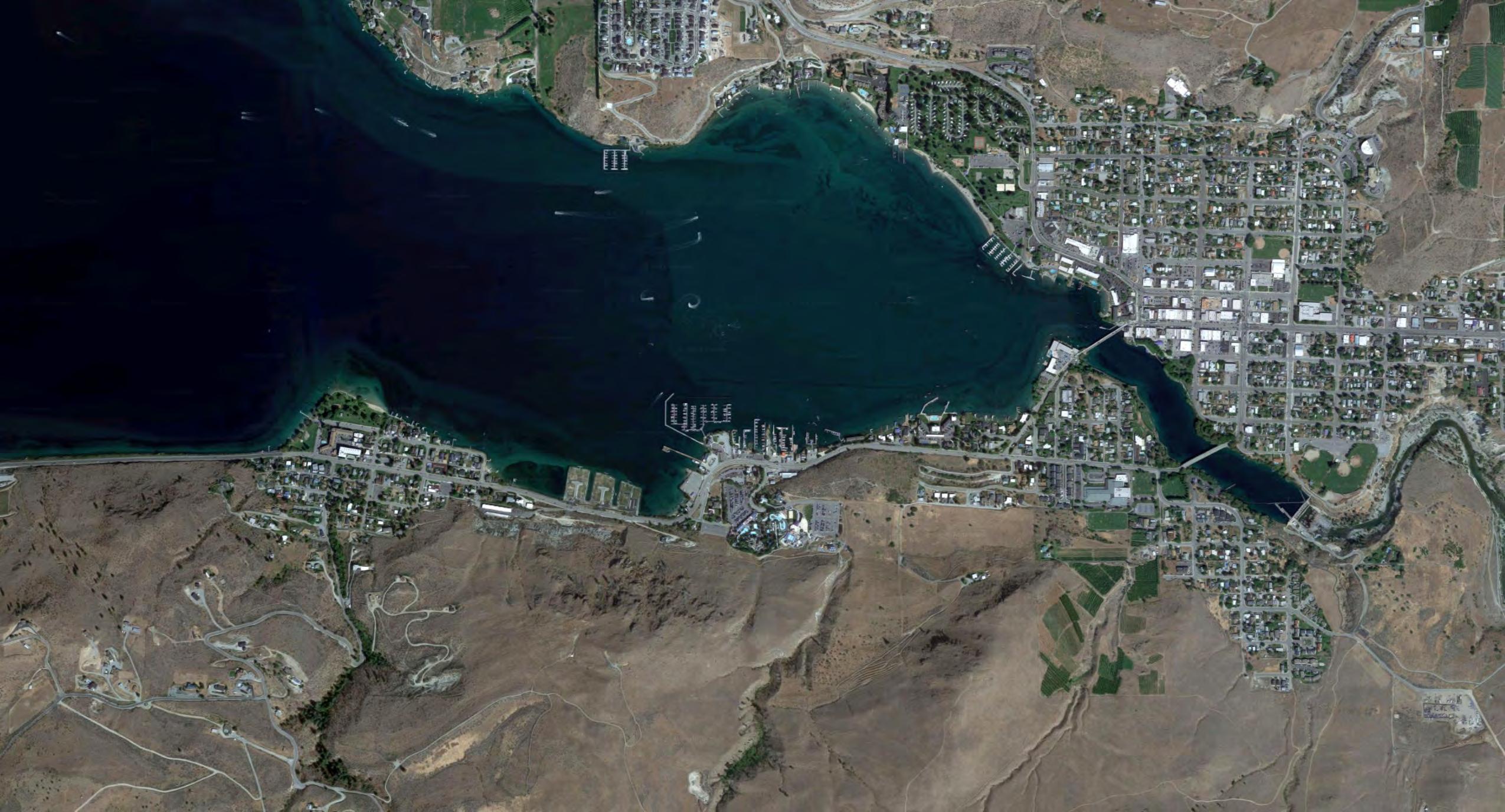
Selection Context
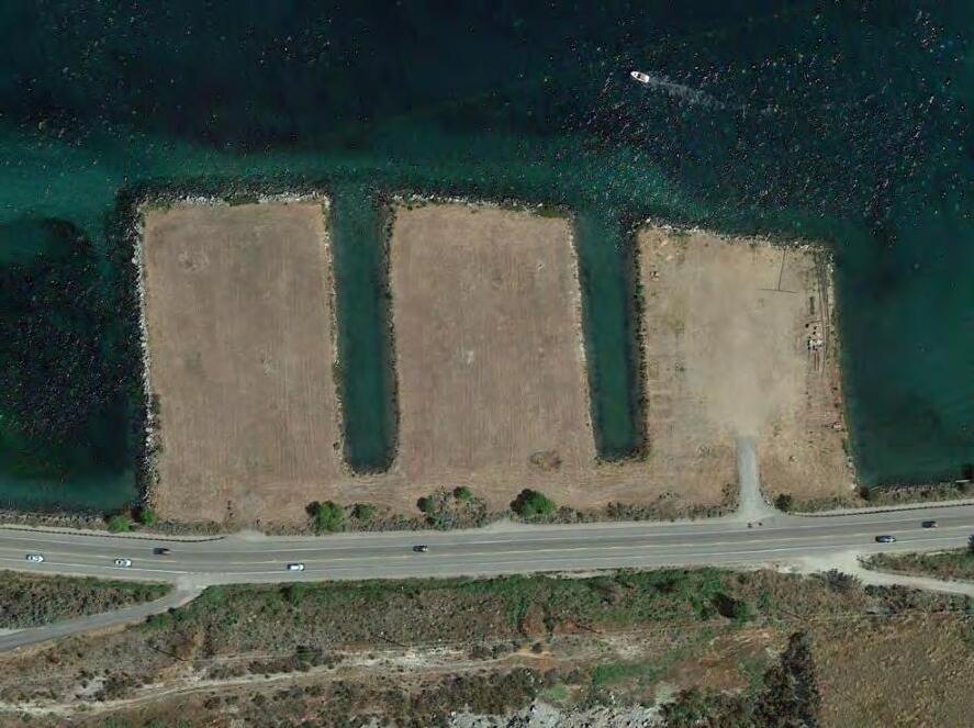
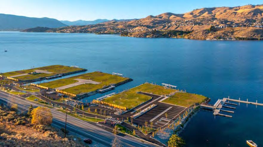
Iconic
The project asks to be situated in a prominent lakeside location. One that has high visibility both inward and outward. The Three Fingers, also known as the Goodfellow Fingers, is one of the most recognizable and controversial pieces of land along the south shore of Lake Chelan.
After the completion of the Lake Chelan Dam in 1927, the lake levels were raised artificially from twenty-one feet (from 1,079 feet to 1,100 feet above sea level) during peak summer months. The land beneath what is now the Three Fingers was dry during winter and fall but submerged in spring and summer.
In 1961, GBI acquired the land that is now the Three Fingers along the south shore. That same year, Goodfellow Construction of Wenatchee, WA, was contracted to widen Alternate State Route 97, the only yearround access to Lake Chelan along the west side of the Columbia River. During this job, the excess sand and rock were disposed of onto the Goodfellow property in a series of clean rows, which appeared as ‘fingers.’ The artificial peninsulas composed of fill material raised the land from 1,090 feet to 1,102 feet above sea level, extending approximately 250 - 300 feet into the lake; thus, ensuring GBI Holding’s property would be “permanently above the artificially raised seasonal water fluctuations of Lake Chelan” (WA Supreme Court, 2018).
The artificial seasonal lake level fluctuations affected numerous public street ends and public right-of-ways. The controversy of Three Fingers begins when public streets and right-of-way abut or cross near the protruding ‘fingers.’ These seasonally submerged public lands have tested the public trust doctrine of Washington State, protecting public access to navigable waterways for nearly fifty years.
The desire of GBI Holdings to sell or develop the land for commercial purposes has long been suspected and documented, much to the dismay of many Chelan residents and advocacy groups who wish to conserve the shores of Lake Chelan and the public access to them (Lake Chelan Mirror, 2012).
My project proposal and intent could answer both parties’ desires, adding beauty to the south shore while promoting how lake users can actively appreciate and protect the waters and experience of Lake Chelan.
Lakeside Downtown Wapato Point Manson ALT RTE 97
| M.Arch 2023 | University of Idaho
Jillian Nelson
19
A Sensitivity
N Lakeside IMBRICATED ECOLOGY 19
Regional | Local | Desirability | Physicality | Code & Sensitivity
Selection Context
Access & Additivity
The Three Fingers is one of the first views of both the lake and of the city nestled at its when entering from the west on Alt 97. This route is the primary entrance to many who visit the city from the west side of the state, traveling on the west side of the Columbia River from Wenatchee. This strip of lakeside roadway is the most used strip year-round according to WSDOT, which supports the project’s need for being in a highly accessible location. The public parks near downtown Chelan are closer in distance and provide pedestrians with greater options for swimming or lake viewing. Locating my project at the Three Fingers would increase the available location


options for pedestrians along the south shore, as well as increase lake access for local residents year round.
There is an existing roadside walking trail, Lakeside Trail, which passes along the north side of Alt 97 and passes by the Three Fingers. Creating a lake viewing area or water recreation access would bolster the use of Lakeside Trail as well as decrease the ‘commercial/industrial’ visual aesthetic that has slowly developed along this section of the roadway due to the watercraft rental businesses.
Nelson | M.Arch 2023 | University of Idaho
Jillian
A
20
N a b c 6,500 7,300 7,800 a b c Annual Average Daily Traffic Annual Google N 2 3 4 1 N Parks 1 2 3 4 Lakeside Park The Ranger Station Riverwalk Park Don Morse Park IMBRICATED ECOLOGY 20
Regional
Local | Desirability | Physicality | Code & Sensitivity


Selection Context
Transitions
The Three Fingers lends itself as a natural destination for this project given its close proximity to well-established community anchors and tourism activities. Locating the project at this site increases the diversity of available activities and at the same time promotes stewardship subconsciously to passerby’s. Currently as you approach Chelan on ALT 97 north bound, this cluster of businesses on the lake do not invoke a sense of beauty or idyllic ruggedness that the natural surroundings do. While not ‘ugly’ or even strictly industrial looking, there is an ‘auto

shop aesthetic’ that unfortunately spills out from the watercraft rental shops. I would like my project to help soften the existing contrast that this commercialized area is having along this shoreline. The site location is situated to be a prominent feature in this activity-heavy area, and a golden opportunity to create a subtler aesthetic transition into town while subtly representing ideals on nature and lake stewardship.
After passing Lakeside, the project site has prominence in the foreground when one first has the ability to see downtown Chelan from ALT 97.
A
2
Jillian Nelson | M.Arch 2023 | University of Idaho
|
1 2 3 4 5 6 7 8 N Downtown wntown Neighbors 1 2 3 4 5 6 7 8 Lady of the Lake Sunset Marina Lake Shores Watercraft & Boat Rentals Slidewaters Kevin’s Tire Service Jet Skis Ahoy Chelan Parasail & Watersports Lakeside Surf IMBRICATED ECOLOGY 21
Regional | Local | Desirability | Physicality | Code & Sensitivity
Site Characteristics
�
Geotechnical
Medium dense fill soil, suitable for spread footing foundation (as with typical two-story wood construction).
� Foundations must be backfilled with structural fill.
� All footings are to be embedded 24” (min) below surrounding grades for frost protection.
� Slab on grade- cast on top of capillary break of min 4” of pea gravel/clean crushed rock sheathed with a vapor barrier.
� Roof drains and footing drains should be separate.
Surface Presentation
� Site topography consists of three flat top rectilinear ‘fingers’ reaching into the lake, each separated by a channel width of approximately 60ft.
� The finger edges are armored with large boulders sloping down in the lake. Slopes range from 3H:1V to 1.5H:1V (Horizontal:Vertical).
 Looking up lake from the site (W).
Jillian Nelson | M.Arch 2023 | University of Idaho
A
374’ 220’ 310’
2
Origional images: Chelan Bay
Sunset Marina in the view East toward downtown Chelan.
IMBRICATED ECOLOGY 808’
60’ 60’
52’
22
288’ 765’
220’205’ 310’307’279’265’
N
Regional | Local | Desirability | Physicality | Code & Sensitivity
Lake Water Attributes
Elevation
Lake Chelan’s ‘full pool elevation’ rests at 1,100 ft ASL since 1927 after the completion of the Lake Chelan Dam. Water levels can be expected to fluctuate along the shallow southern end of the lake by generally 20 to 22 ft seasonally, with springtime being the lowest point in the water levels.
Lake Chelan Mean Monthly Elevation (ft) 1,089.8 Jan 1,087.8 Feb 1,086.2 Mar 1,086.5 April 1,090.7 May 1,097.0 June 200 1 Mile
Jillian Nelson | M.Arch 2023 | University of Idaho
A
2
Lake Surface At Full Pool: 1100 ft ASL
Partial Bathymetric Map of Lake Chelan N
1,099.2 July 1,099.0 Aug 1,097.9 Sept 1,095.8 Oct 1,093.9 Nov 1,092.0 Dec
RiverChelan Chelan
100 Three Fingers
IMBRICATED ECOLOGY 3
Regional | Local | Desirability | Physicality | Code & Sensitivity
Temperature
Lake Chelan’s uppermost surface waters (thermocline layer depth at 130’) have a dramatic temperature fluctuation as seasons come and go. The warmest water naturally occurs in the summer months (approximately 60°F75°F). Throughout the Fall season, the waters
dramatically drop in temperature each month, approximately 10 degrees per month (65°F-45°F). Winter months are dangerous for any swimming, falling from approximately 39°F down to a low of 33°F. In springtime, the water remains brisk throughout; only in May does the temperature creep up to around 48°F.
Potentiality
The south shore location of the Three Fingers, in conjunction with the man-made peninsulas extending 300 feet into the lake from the shoreline, provides a unique opportunity to harness the thermal energy of the lake. Utilizing the lake as a heat source/sink for the buildings on site could provide:
� A unique source for greater energy efficiency in the project cooling and heating systems.
� Its own exhibitory presence in the programming to showcase some of the untapped powers the lake can provide.
� Help fulfill the project goal of having the architecture embody the local systems.
Lake Water Attributes Late Summer
Early Spring
| M.Arch 2023 | University of Idaho
Jillian Nelson
A
Google 24
20 30 70 80 Jan Feb Mar April May June July Aug Sept Oct Nov Dec 50 60 40 Fahrenheit ° Lake Chelan Monthly Hi-Lo Water Temperature Range IMBRICATED ECOLOGY Early Winter Google ChelanBay 24
Regional | Local | Desirability | Physicality | Code & Sensitivity
Designing for City of Chelan
Design Codes:
� Ground Snow Load 45psf
� Roof Snow Load 35psf
� Wind 85mph
� Exposure “C”
� Frost Depth 18 Inches
� Seismic Category D
� Community Fire Planning Zone (CFPZ)
� Predominant Vegetation Class: Shrub-steppe
Natural Fuel Rules-of-Thumb:
Northern slopes tend to be cooler, wetter, more productive sites leading to heavier fuel accumulations/high fuel moistures/later curing/lower spread.
South and west slopes receive more direct sun and have higher temperatures, the lowest soil and fuel moisture, and the lightest fuels.
Light Fuels + Dry Sites = Wildfires W/ Highest Rate of Spread
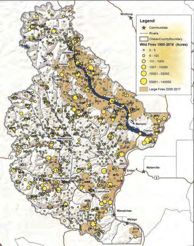
Chelan Ignition 1980-2016 Jillian Nelson | M.Arch 2023 | University of Idaho
A
2
Site
Luckily the southern slope abutting the site is mostly rock surface with little vegetation, unlike the majority of Chelan Butte.
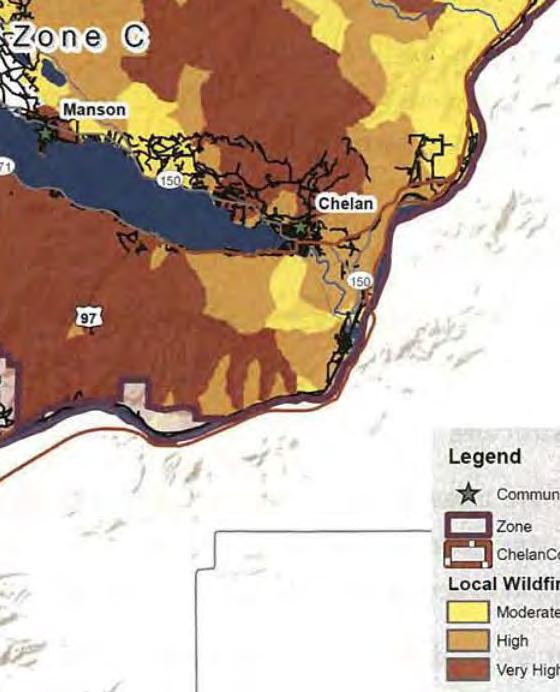
Chelan County Ignition History 1980-2016
Chelan County Wildfire Hazard Zones
IMBRICATED ECOLOGY 5
Regional | Local | Desirability | Physicality | Code & Sensitivity
Designing for City of Chelan
Design Codes:
� Waterfront Commercial (C-W)
� Environmental Designation: “High Intensity Shoreline”
� Setback Shoreline Designated 20’ *
� 35’ Maximum Building Height
� All roads within the project will be considered private and with maintenance responsibilities falling to financial stakeholders
� All structures including retaining walls, rockeries and other improvements of minor character (excluding fences and landscaping) require a 5’ setback from utility easements
* 10’ Setback Reduction if meeting Performance Standards
High Intensity
“The purpose of the “High Inten environment is to provide for hig intensity water-oriented comme transportation, and industrial u while protecting existing ecolog functions and restoring ecologic functions in areas that have bee previously degraded.”
City Of Chelan Shoreline Master Prog pg 41
Nelson | M.Arch 2023 | University of Idaho
Jillian
A
26
nsity” ighercial, uses gical gical een ogram
Impervious Surfaces & Stormwater Management
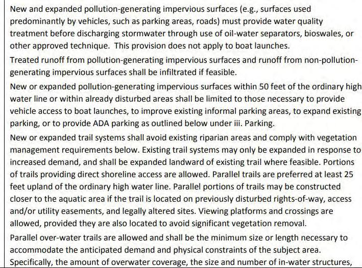
ParkingVegetation
from City of Chelan Master Shoreline Plan
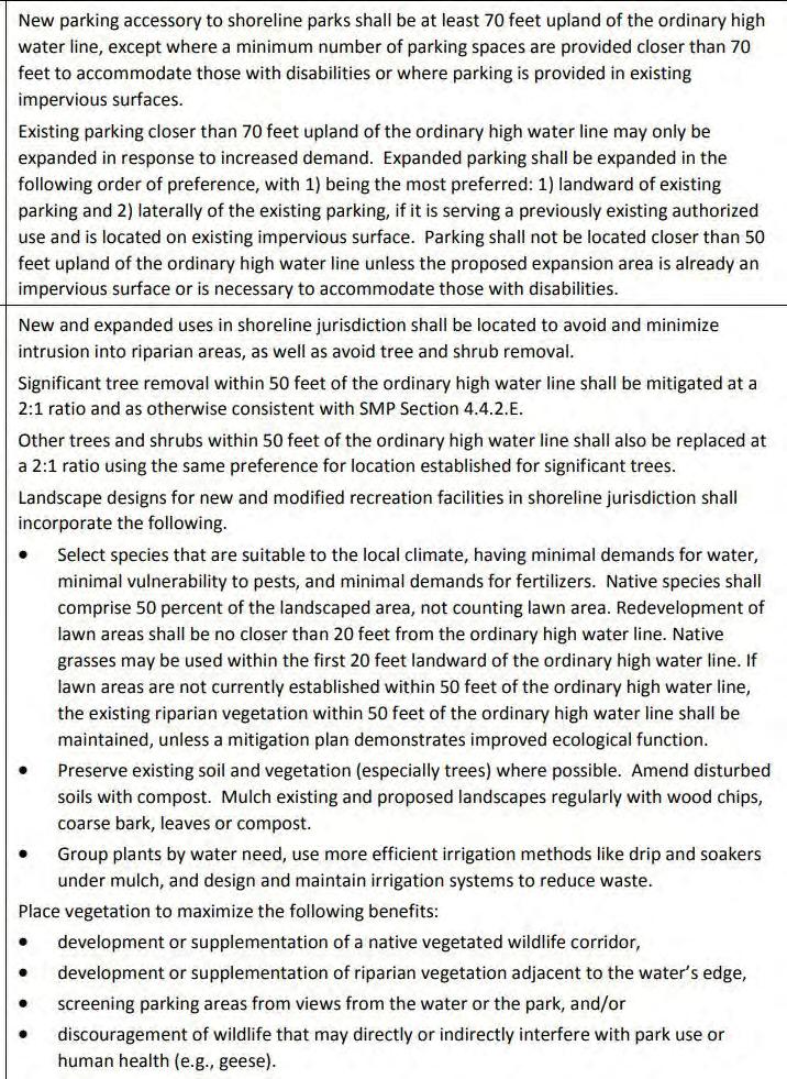
IMBRICATED ECOLOGY
Excerpts
6
PART III: ASPIRATION
 Jillian Nelson | M.Arch 2023 | University of Idaho
Studio49Studio49Studio49Studio49 NS IMBRICATED ECOLOGY
St. Louis Science Center
Introduction
The conception of the planetarium, science museum, and natural history museum began in the mid 1950s. The original Planetarium design for what would become the St. Louis Science Center was performed by Gyo Obata of Hellmuth, Obata, and Kassabaum (HOK) in the early 1960s. The St. Louis Science Center has gone through remodeling and re-expression over the course of four decades following its ground breaking, renewing itself and expanding. As a case study, I have been most intrigued with the available exhibit spaces within the project, the ability of the spaces to grow and remain flexible, as well as the overall engagement strategy that the Science Center uses to incite interest and education simultaneously.
Strategy
There seems to be something fun and educational for all demographics offered within the collection of buildings and outdoor spaces making up an overall 300,000 sf facilities. While this could be (or at least should be) somewhat expected of an institution geared toward expanding a visitors knowledge base, I do believe executing this primary objective through play and comfort is an art-form worthy of respect; and it appears the St. Louis Science Center has been striving to master this form of execution.
Play
Some examples of this ‘play and comfort’ strategy are pointed out in the graphic to the right. Creating options for dining experiences throughout the project is one form of providing comfort, the placement throughout the site also allows for more freedom and spontaneity during a guests visit. The GROW
campus is a recent indoor/outdoor addition to the Science Center that further detailed on the following page. Its provides fully immersive experiences and is designed with flexibility in mind for ever-changing exhibits and programming. The Energy Stage is of great interest to me for my project, I believe having a performance space and lecture space that allows for a multitude of demonstrations and guest interactions with educational information is an ideal spatial programming for providing users with a memorable experience.
Comfort
Onthesideofcomfort,asafemaleandfuturemother, I appreciate the thoughtfulness behind providing guests with a private nursing space. A facility that is geared toward all demographics is bound to attract families, which is something I would like my own project to aspire too. Taking into consideration the personal needs of all visitors and their situations while in a public space is something that I think young designers such as myself could exercise more awareness of. The Science Center also offers personal lockers,strollers,wheelchairs,andmotorizedscooters for its visitors. The storage and rental space of these accommodations are all something to be considered during the early stages of design for my project.
Finally, the other aspect of the St. Louis Science Center that I admired was the quantity and variety of spaces available to guests to reserve for private events and gatherings. Allowing guests or groups to utilize the established atmosphere within the Science Center to accommodate their gatherings is another way to extend a comfort to those within the community or visiting the community of St. Louis.
A
Jillian Nelson | M.Arch 2023 | University of Idaho
28
Hellmuth, Obata, and Kassabaum | Missouri Office
Dining options throughout the site GROW Campus
Stage

IMBRICATED ECOLOGY
4
Energy
Private
1 2 3 Lower Level 1. Energy Stage 2. Dig Site 3. Dinosaurs 4. Ecology and Environment 5. Dana Brown Fossil Prep Lab 6. Esports Area (Reservations Only) 7. T. Rex Room (Reservations Only) 8. Experience Energy 9. May Hall (Reservations Only) 1 4 2 5 7 8 9 6 DRINKING FOUNTAIN BIKE RACK ELEVATOR GIFT SHOP FOOD & BEVERAGES GUEST SERVICES NURSING STATION LOCKERS RESTROOMS STAIRS Elevators and ramps serve all public WHEELCHAIRS & STROLLERS RENTAL MEMBERSHIP SERVICES TICKETS TICKETS First Floor 10. Boeing Hall South 11. Boeing Hall North 12. GameXPloration 13. Energizer® Ball Machine 14. Starlite Cup 15. Science Café 16. GROW (outdoors) 16a. GROW Meeting Room 16b. GROW Pavilion 16c. GROW Classroom 16d. Fermentation Station 17. Life Science Lab 17a. Learning Lab 17a ? M 13 10 12 14 15 16 Oakland Entrance & Exit 17 16a 16b 16c 16d GROW Entrance Box Office 11 Second Floor 18. Discovery Room 19. Makerspace 20. Mission: Mars - Control 21. OMNIMAX® Theater 22. The Loft 23. Structures 24. Highway 40/I-64 Skybridge James S. McDonnell Planetarium Entrance James S. McDonnell Planetarium 25. Inside the Vault 26. Experience Flight 27. VR Transporter 28. Mission: Mars - Base 29. Liftoff 30. Orthwein StarBay: Star Shows 31. StarBridge 25 26 27 28 29 18 19 20 21 22 23 OMNIMAX® Theater 24 30 31 www.slsc.org 2 1 3 4 5 8
5
nursing accommodations Leasable space
St. Louis Science Center
Hellmuth, Obata, and Kassabaum | Missouri Office
Justified
St. Louis Science Center was my first case study selection, and I’ll admit it was at a point where I was not completely firm on what my thesis project would entail. I was however confident in my desire to create a project that would provide residents and visitors the opportunity to experience something simultaneously pleasurable and educational. A space for enjoying and celebrating the natural beauty and systems around them. When reviewing images of floor plans, exhibits, and even user-posted Yelp review photos, I felt like St. Louis Science Center successfully offers the ingredients to a fun and enlightening experience.
Principle Roots
One of my own challenges for my own project is how tocaptureandinstillasmuchprogressasIcantoward both social and experiential outcome goals that I’ve set. Something that the Science Center successfully does is engage an expansive demographic, which is something my own project will aim to achieve. When looking at the different spaces and the activities that
are accommodated therein, ultimately I wanted to see if there is a pattern or level of overlap in what is being provided.
It appears to me that one of the key ingredients that leads to robust enjoyment and engagement in the available spaces stems from designing with flexibility in mind. Planning for multi-purpose use of a given space maximizes the efficiency of the overall design. As seen in the labeled #4 diagram on the right hand side of the page, there is a relationship between multi-purpose space and diverse engagement. This is a strategy that I think will benefit my own set goals for my thesis project.
The other aspect articulated by the diagram is that performance and lecture space is also a key element in generating diverse engagement. Humans have been engaging in shared story-telling since the first fire-pit was dug. It is the oldest and most intuitive form sharing knowledge and entertainment. It is understandable and logical that spaces dedicated to this form of promulgation and entertainment serve in vitally providing wide spread and diverse engagement.
A
Jillian Nelson | M.Arch 2023 | University of Idaho
29
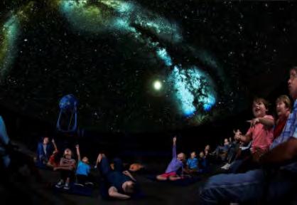
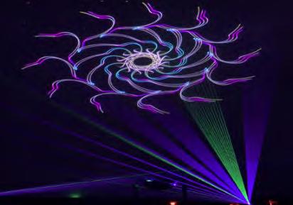
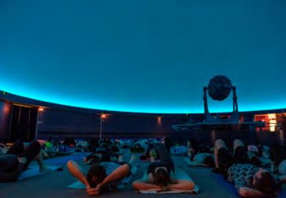
Planetarium used for light shows, stargazing, and yoga Energy Stage used for exciting demonstration and mellow story time GROW Pavilion showcasing its utility and interactive personality Strategies for diverse engagement through a ven diagram

Performan c e / L e c ture Space Shared P u r p o s e Space
Experience Energy
Yoga
Stargazing & History Laser Shows Makerspace GROW Story Time Diverse Engagement IMBRICATED ECOLOGY www.slsc.org 2 1 3 4 1 2 3 4
s
Shows & Demos
Under the Stars
9
St. Louis Science Center: GROW
Arcturis | St. Louis, Missouri
Purpose
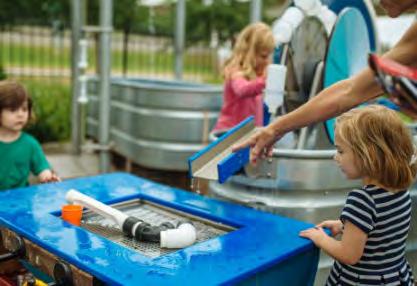
A quick review of St Louis Science Center’s website (www.slsc.org) allows a peek at what the GROW facilities has to offer patrons. The attraction provides a surplus of information, exhibits, and interactive activities surrounding food production, cutting edge technologies and the science of agriculture. The GROW Pavilion is an award-winning indoor space that provides exhibits, educational programs, and planned events for exploring the vital role farming plays in local and international economies. Also featuredisthe‘FarmTechField’,aplace wherepatrons get up close and personal with modern farming tools, technology and environmental sensors used on modern farms and crops. The on-site Greenhouse features demonstrations in growing foods using aquaponics, hydroponics, and aeroponic systems. The space provides a working example of open source agriculture and how modern technologies can be utilized to grow and provide sustenance for all. There is an interactive outdoor water area that allows forchildrentoplaywhilelearningabouttherolewater playsinagriculture.Alsofeaturednearbyisraingarden and permeable paver systems that allow guests to have a detailed view of how designed spaces can responsibly clean and contribute back to their local water table. GROW also features the Fermentation
Station, where guests are able to purchase beverages such as beer, wine and kombucha or grab a bite at the on-site burger bar that offers tasty food that uses ingredients produced on-site. The outdoor seating area is complimented by the encircling grape vines. The facilities also offers an area called homeGROWn that is dedicated to providing ideas, strategies, and access to knowledgeable staff and volunteers who can help you start producing your own ‘edible plot’. The advice and exploration continues even into postproduction with a compost area teaching about the process of turning food scraps into fertilizer.
Relevance
Pertaining to my own thesis project is the artful interactive experience of natural and human-aided systems that exist within agriculture. My project site is located within a region whose economy has historically been dependent on the agriculture of orchards for apples and cherries, and more recently, vineyards. The GROW Pavilion and Gallery is an exemplar of how one can use the concept of play to drive a design intended to provide an enlightening experience. The ability for visitors to take that experience home with them and implement it into their own lives is the comfort I hope my own design is able to deliver.
A
Jillian Nelson | M.Arch 2023 | University of Idaho 1 Arcturis 30
IMBRICATED ECOLOGY 1 2 3 Outdoor and indoor classroom spaces Entrance to GROW facilities Exterior view 2 3 Arcturis Arcturis 0
St. Louis Science Center: GROW
Arcturis | St. Louis, Missouri
Architecture
Arcturis, a multi-faceted design company located in St. Louis, Missouri, was the commissioned firm for designing GROW which won an AIA Distinguished Award in 2017. Arcturis reached out and enlisted the Planetariums original architect, Gyo Obata, as a design consultant and partner on the project. The indoor pavilion itself is 5,000 sf and features an open floor plan to accommodate ever-changing exhibits, events, and experiences. The designated spaces for GROW encompass a full acre of indoor and outdoor learning spaces, activities and exhibits.
Theimpressivestructureisasimpleandformalgesture that was imagined in response to the task of creating a modern reflection Midwestern agricultural history. Prior to reading a description on stlouscnr.com, that the glulam structure ‘evokes the simplicity found in the profile of a scythe or a plow’, I had thought the form and structure of the pavilion had perhaps been designed to poetically describe our ’roots’ with the earth given the projects programming. Either way, this project serves as an inspiration to what I hope my own design is able to achieve architecturally and socially.
A
1
Jillian Nelson
| M.Arch 2023 | University of Idaho
3
Arcturis
IMBRICATED ECOLOGY
1 2
Expansive interior with flexible exhibit space and stations ‘Rooted’ expressive structure
2
Arcturis
31
Arcturis Arcturis
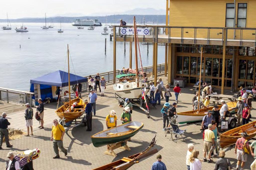
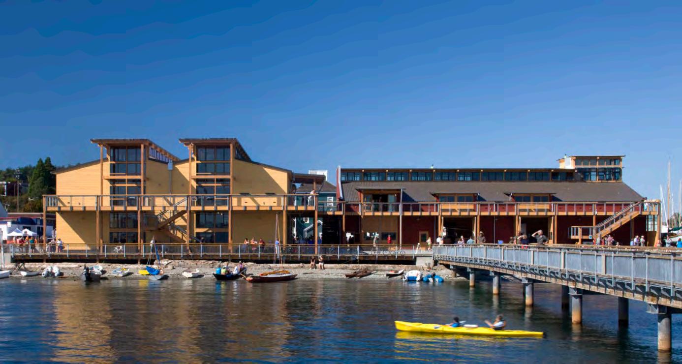
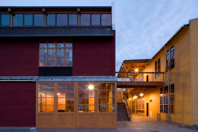
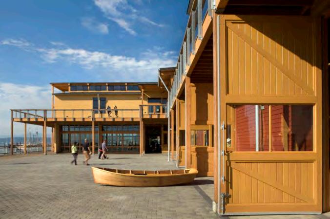
Northwest Maritime Center
Miller Hull | Port Angeles, Washington
Introduction
The Northwest Maritime Center (NWMC) aims to safeguard, enhance and revive the waters of Puget Sound. The project is located in Port Townsend, Washington, about 40 miles northwest of Seattle. Port Townsend’s strategic position on the shipping channels that lead into the west coast made it a bustling international boat-building seaport in the 1800s.TheNWMCisahubforeducatingpeopleabout traditional and modern maritime lifestyles. Moreover, it is the home of the Wooden Boat Foundation, which holds North America’s largest and oldest wooden boatfestival.Asidefromitseducationalcomponents, theprojectoffersvitalpublicspacesandaccesstothe shoreline for residents and visitors of Port Townsend. The building’s architecture exemplifies the Northwest marine building style, and the project is constructed using sustainable harvested wood.
The NWMC project comprises two buildings with a total area of 26,550 square feet. The Education Building houses educational programs such as a boat building and repair facility, classrooms, and a replica of a ship’s pilot house. The building is colored red as an homage to the town’s historic brick buildings and traditional waterfront structures. On the other hand, the Resource Building showcases the community’s rich maritime history through a retail space (chandlery), small vessel rental and storage, exhibits and information galleries, meeting rooms, and offices for maritime partner organizations. The building’s warm yellow color pays tribute to the color of traditional maritime structures in the area. The buildings encircle a paved public plaza, which links the NWMC Education Pier, an adjacent public jetty and boardwalk, and the two buildings. The plaza also hosts significant community events and forever guarantees public access to the shoreline. A second-
A
| M.Arch 2023 | University
Jillian Nelson
of Idaho
3
Port Townsend Leader
levelbalconyconnectsthetwobuildings,encirclesthe plaza, and offers panoramic views of Port Townsend BayandtheCascadeandOlympicmountainranges.
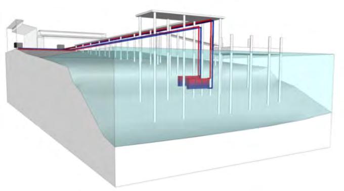
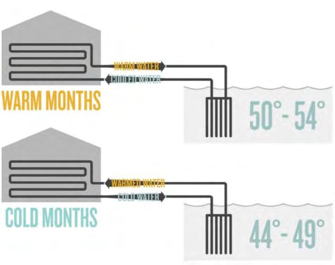
Ventilation
The Northwest Maritime Center (NWMC) project features various energy efficiency measures that include natural ventilation, heat recovery, and demand control ventilation systems. The project’s most significant source of energy savings is the sea, which serves as a source of thermal energy. The ocean-source geothermal system is a key sustainable feature that supplies all of the buildings’ HVAC and
domestic hot water heating needs. The system uses near-constant ocean water temperatures as a heat source or sink, achieving efficiencies more than 300% better than a similarly sized gas-fired or electric resistance system.
The heat pumps that use the ocean water are connected in a closed loop to titanium heat exchangers located in the deep waters below a new pier. The use of titanium heat exchanger plates located 12–15 ft below the lowest tide line ensures minimal marine growth. The indoor heat pumps are grouped together in mechanical mezzanine areas in each building for centralized maintenance access.
Each building is provided with space conditioning through a combination of ducted air systems, radiators,fancoils,andradiantfloordeliverysystems. The buildings’ hybrid active/passive ventilation system helps to reduce fan energy. Radiant floor
 Miller | Hull
IMBRICATED ECOLOGY
Miller | Hull
32
Ecotope
Northwest Maritime Center
Miller Hull | Port Angeles, Washington
heating is provided in the ground floor spaces, while radiator heating serves the upper floor office areas. Heat recovery ventilation is provided for the retail space, and operable windows are relied upon for ventilation and natural cooling in the offices.
Daylighting
The Northwest Maritime Center (NWMC) utilizes natural daylighting as a sustainable strategy in several ways. The building orientation is designed to optimize natural lighting, with actively occupied
A
Jillian Nelson
| M.Arch 2023 | University of Idaho
Ecotope
Debra Colvin
3
Northwest Maritime Center
spaces positioned against exterior walls. Additionally, the upper level spaces have abundant daylighting due to their orientation and use of continuous clerestories that run the length of the buildings. Ninety-four percent of regularly occupied spaces have outside views and daylighting levels that allow lights to be turned off during daylight hours.
To ensure even light distribution, meeting rooms and open offices have two running monitor bands, and daylightingcontrolsadjustartificiallightingasnatural light permits. The building design also includes clerestory windows that spill daylight throughout the spaces, and operable windows that facilitate natural ventilation. Daylight sensors are used throughout the building, adjusting lighting levels as necessary.
The building also employs a cost-saving measure by using daylight controls that turn lights off by default.
Overhangs and an automatic roller shade system helpcontrolglareandregulatetheamountofnatural light entering the space.
Success
The NWMC project design emphasizes energy efficiency while maintaining high levels of indoor air quality, comfort, and connection to the outdoors. The project uses natural resources, such as oceansource heat pumps, daylighting, and natural ventilation, to minimize its energy use and costs. The pier’s environment-friendly design demonstrates how building projects can minimize adverse effects on the natural environment. The end result provides indirect and direct community benefits, including reduced pollution, protection of natural habitat for fish and plants, and a gathering place to celebrate and learn about the area’s maritime culture.
IMBRICATED ECOLOGY Archdaily Archdaily Northwest Maritime Center 3
Hassalo on Eighth
Biohabitats, GBD Architects, Glumac, PLACE Studio | Portland, Oregon
Introduction
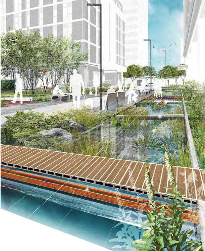
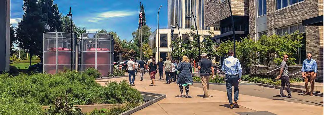
HassaloonEighthisamixed-usedevelopmentlocated in Portland’s Lloyd EcoDistrict. The development includes three buildings with 657 housing units, over 50,000 square feet of retail space, and over 250,000 square feet of commercial office space. The project team developed a strategy to treat and reuse 45,000 gallons of greywater and domestic sewage on-site dailytoreinvigoratetheLloydDistrictwithoutstraining municipal and environmental resources. The project treats and reuses the wastewater to reduce strain on the city’s aging water infrastructure and to prevent sewage overflow into the Willamette River.
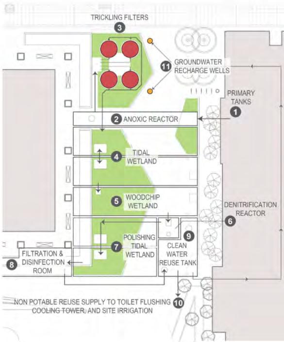
NORM
NORM is a system that uses biological processes and gravity to treat wastewater with minimal energy consumption. NORM stands for Natural Organic Recycling Machine and shares similarities to John Todd’s natural wastewater treatment system, the Living Machine. TheNORMsysteminvolvesseveralsteps.Wastewater is collected in the primary tanks, which connect to the sewer as an emergency overflow connection.
A
Jillian Nelson | M.Arch 2023 | University of Idaho
PALCE | asla.org
34
Lincoln Barbour | asla.org
Biohabitats
The wastewater is pumped from the tanks to an anoxic reactor, which provides an oxygen-free environment to reduce the nutrient content of the wastewater. Next, the wastewater goes through
trickling filters that are integrated into a park-like pedestrian corridor. In these filters, the wastewater is pumped over an organic medium that shelters microbes that devour the nutrients in the wastewater. This process allows for a high level of treatment in a narrow and tall silo, unlike conventional wastewater treatment plants that use large horizontal ponds. After that, the water is treated in a tidal wetland, a wood-chip wetland, and a dentrification reactor. Finally, it goes through a polishing tidal wetland, which creates flood conditions and drains similar to a tidal system, fostering naturally occurring microbial organisms that eat more nutrients. The wetlands are incorporated into the landscaping, with the primary treatment happening far below the pedestrian area; unpleasant smells are entirely avoided. Mechanical filters screen out fine particles, and ultraviolet and ozone systems eliminate lurking pathogens that mightbepresent,makingthewatersafeforreadyfor reuse in flushing toilets, running the buildings’ cooling systems, and irrigating the landscape. Any excess treatedwastewaterthatisnotusedisinjectedintodry wells to recharge the groundwater in the urban oasis that has negligible natural permeability, ensuring that no part of the wastewater is wasted.
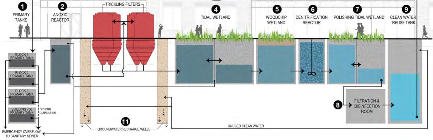
IMBRICATED ECOLOGY Biohabitats
34
PLACE | asla.org
Pybus Public Market
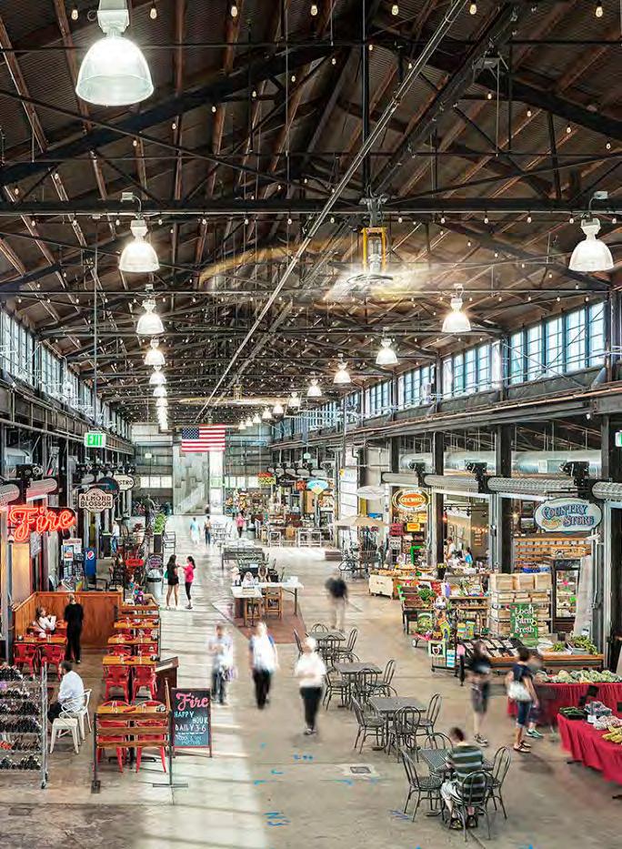
Graham Baba Architects | Wenatchee, Washington
About
Located in the Columbia Riverfront area of Wenatchee, the Pybus Public Market was developed as a collaborative effort between the Port of Chelan CountyandtheCityofWenatchee.Theprojectaimed to establish a permanent home for the Wenatchee Valley Farmer’s Market, capture the history and culture of the area, and create a new focal point for the community. To achieve this, the project team decided to renovate the Pybus warehouse building, which had been vacant since the departure of the E.T.PybusSteelCompany,ratherthandemolishitand construct a new building.
The structure was the first all-metal building in Wenatchee, erected after World War II, and it possessed a rugged industrial look that the designers sought to celebrate and preserve. ThedesignofthePybusMarketfocusedonstabilizing the existing structure while making it safe, practical, and inviting. The large sliding steel doors, made from remnantsoftheoriginalbuilding,provideentrytothe
fully-enclosed market, which preserves the interior volume that soars to 41 feet through the center of the building.Allexteriorcladdingandglazingarenew,as the existing metal walls could not be salvaged. The new Bonderized steel cladding will slowly weather over time, further enhancing the building’s hardearned patina. The roof is a new code-compliant structure built on top of the existing roof, which was preservedastheinteriorfinish.Allsignageisnew,and the market now features 18 stalls for local vendors, occupying 25,000 square feet.
The Pybus Market has transformed the vacant Pybus warehouse building into a year-round market that serves as a local, regional, and tourist destination. Themarketbringstogetherregionalfooddistribution and opportunities for new and emerging endeavors within the Wenatchee Valley, establishing this place
A
|
2023
explorewashingtonstate.com
3
Jillian Nelson
M.Arch
| University of Idaho
Ed Sozinho
as a significant community landmark. The project’s success is attributed to the aggregate of small, authentic, thoughtful moves rather than grand architectural statements.
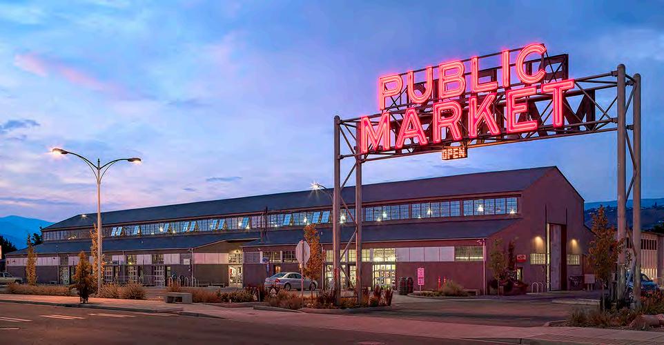
Resilience
What interests me in this project as a case study is its humble origins, its simple structural grid and its ability to adapt 80 years after its erection. The large single center bay and its accompanying side bays is classic to many forms of architecture, from rural farmhouses, to industrious warehouses, to breathtaking cathedrals. The structural organization lends itself across both time and purpose. This type of durability and flexibility is something I would like my design to achieve, so that any programming the communitywishestohaveinthefuture,thedesignwill naturally lend itself to that new vision while avoiding excessive waste in demolition and redevelopment.
Regeneration
This project was possible through an Ecology IntegratedPlanningGrantandisboastedasasuccess story of redeveloping a brownfield on Washington State’s Department of Ecology website. The site I’ve chosen was not ever considered a brownfield, but it is a landfill as explained earlier during my analysis section. I hope to create a project that increases public access along the waterfront, provides flexible spaces for new community connections, all while encouraging stewardship over Lake Chelan.
IMBRICATED ECOLOGY
Ed Sozinho
5
Ed Sozinho
PART IV: SCHEMATIC
 Jillian Nelson | M.Arch 2023 | University of Idaho
DESIGN
IC
IMBRICATED ECOLOGY
John | Adobe Stock
Off the Rails
Ballooning Program
As both of the headings above imply, clearly I had gotten a little off track from my initial design intent and project direction. My logic being that I needed to include as secondary attractions as I could to help fiscally support the educational experience I wanted the site to have. By doing this, I could also bring in more community connection experiences. However, my initial concept was becoming lost and arguably overshadowed by my misdirection. (Don’t worry, we do get back on track eventually.)
Shuttle Garage
Boat Access
Gift Shop
Maker Spaces
Gallery | Exhibit Space

Lobby | Info Center
Gift Shop
Conference Room
Marine Biology Lab
Walking Trail
SM Event Spaces
Stage/’Auditorium’ Space
Lobby | Info Center
Interactive Gallery
Gallery
Media Resource Room
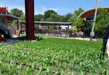
Outdoor Agro Pavilion
Shuttle/ Rideshare Drop Off
Botanical Garden
LG Event Space
Marine Biology Lab
S D
Nelson | M.Arch 2023 | University of Idaho 3
Jillian


Swimming Area Public Seating Entrance + Paths Pedestrian & Vehicle Marine Lab Facilities Equipment Storage Resident Offices Visitor Offices Conference Room A Conference Room B Break Room Mechanical Grow Rows/Beds Boat Dock/Access Lobby | Info Desk Open Exhibit A Open Exhibit B H2o Gallery Eco Gallery Geo Gallery Culture Room Stage | Auditorium Cafe | Snack Shoppe Gift Shop Adult Maker Space Child Maker Space Instructional Space A Instructional Space B Grow Rows Greenhouse Nurture Pavilion Admin Lobby Admin Offices Admin Breakroom Storage | Holding Picnic Area Restrooms Meeting Room A ‘Dressing’ Room A Commercial Kitchen Banquet Hall Pavilion Open Field Space ‘Dressing’ Room B Meeting Room B Bar | Restaurant Indoor | Outdoor Seating Live Music Staging Area Outdoor Movie Screening Area Boat Pull-up Food Service IMBRICATED ECOLOGY 37
Parti on Wayne!
Organization Parti Action Gradient
I have been interested in forms that feature interior courtyards, the interest was driven by providing protection from the blustery winds that can form in the summer season. What I found is that including a central void provides a natural division for programing which lead to my organizing principle of Observe | Blend | Practice. I imagined a gradient of activities that relate to one another, one end of the gradient involves learning, observation, and exploration. While the opposite end of the gradient is about the application of what has been learned. The center of the gradient provides space for rest, absorbtion, or processing what has been experienced on either end of the spectrum.
Because the fingers are a set of three, the courtyard inspired parti naturally lent itself to becoming a site wide organizing principle.
S
D
Jillian Nelson | M.Arch 2023 | University of Idaho 38
System Parti Looped
This graphic grew from my own sketches of the different systems I wanted to include on the site and trying to understand how they overlay and relate to one another. At this phase of design I had two coil fields for geothermal sourcing. Locating the heat pumps between the fingers allow them to be educative features along a perimeter walking path, while each pump provide energy for displacement ventilation systems to an exterior finger and to the center. I was considering placing waste water treatment along the spine of the middle finger and allowing the waste of the exterior fingers to be routed to the center for purification. Placing the system for water reclamation was considered with existing service lines minds.
IMBRICATED ECOLOGY 8
Zoning Concept
Invitation + Services
Zone 1 can be seen as the ‘connective tissue’ attaching the landfill phalanges to the shore line. It acts a public access zone for entering the site but also the thought was to design enticing moments of activity and utilizing public seating and landscaping to subtly entice visitation to the site by those traveling by vehicle. The first step to proliferating information and knowledge is access; I hoped this zone would intrigue and advertise the fingers as an access point as an educational experience.
Communion
This finger as zone 2 is meant to facilitate community connections and showcase the best view on the site looking up lake. The idea being that visitors could commune with each other or with nature. Following the concepts described in the earlier organizing parti, this finger provides the best visuals opportunities to ‘observe’ the natural systems on Lake Chelan.
S D
Nelson | M.Arch 2023 | University of Idaho Threshold Threshold 1
Jillian
INVITATION + SERVICES + SERVICES 2 COMMUNION
39
3 JOURNEY
Journey
Zone 3 features the ecology center and the majority of education features of the site. The zones title was chosen for its association with the process of learning. It fit at the time as well given this finger serves as the spine of the NORM water treatment system that the wastewater from each finger must go through for purification and reuse.
Quest
The final zone is titled Quest, while it may seem synonymous with journey, I felt there was a different energy behind quest. Quest is a term used for a mission of some sort, for those who have become motivated to seek and achieve specific set goals. To me the word describes a sharper and more focused travel. Originally, I had my heart set on designing a small marine biology lab for this project and placing it on the littlest finger. A place for established efforts such as KeepItBlue, or Lake Chelan Research Institute to have a prominent space directly on the lake to call home. I hoped to offer permanent labs and office space, but also provide spaces for visiting scientists and teams who seek to expand the knowledge base on Lake Chelan and its ultra-oligatrophic state. I imagined collaborative spaces and public speaking space so to increase the variety of options for visiting speakers and conferences that are already held in Lake Chelan.
The zone can be understood as the ‘practice’ portion of my organizing parti when applied to the overall site.
IMBRICATED ECOLOGY
9
Threshold 4 QUEST
Division of Three
As seen in some of my case studies, I wanted to utilize the classic division of three’s one typically sees in cathedral architecture to organize each of the three structure types. I found that not relying on internal bearing walls and instead utilizing a regular grid of
columns with the central bay as the widest would be the best way to maximize my spans, feature similar ratios in each of the three different looking forms, while maintaining maximal space flexibility for potential future programming and use.
Daylighted Emphasis
The direction I was headed focused on developing a structural system which could showcase a unique strategy for implementing natural daylighting. All utilized heavy timber construction but manifested in very different roof forms. The pointer finger featured structure with expressive timber arches and high ceilings to permit heavy use of clerestory lighting.
The center finger explored roof monitors with the intent of utilizing operable windows for both lighting and passive ventilation, featuring skylight apertures in roof ridges not featuring a monitor. The final structure, located on the little finger was a long linear form featuring a nonuniform sawtooth roof line, affixed with south facing P.V. panels and north facing apertures.
Structure Strategy
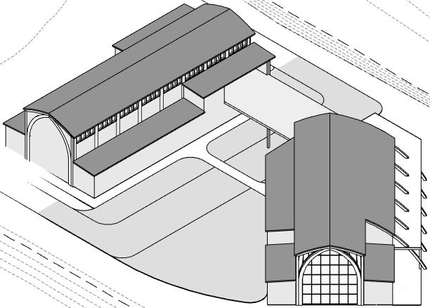
S D Arch
Jillian Nelson | M.Arch 2023 | University of Idaho
4
Uniformed Intent
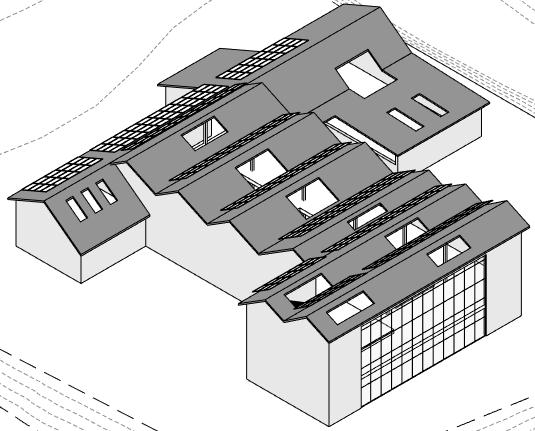

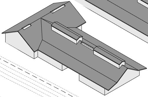
SawtoothMonitor
1
2
3 Strategy IMBRICATED ECOLOGY 0
Bay
Bay
Bay
Your Site is Dead.


Mid Crit Reflection

Mid-terms were a revelation for me, and I was very excited to get the feedback that I did. I presented my context and analysis and my project’s general direction. I was not in love with it, but it is where I was. The reviewer brought up that I picked a landfill site and that my introduction and pitch did not align with the direction I had taken. He said, ‘Your site is dead, and you have this pitch about ecology, so where’s the ecology you’ve added to the site? I see a whole lot of buildings, but I am not seeing how all of it supports your aims.’ Frankly, I could not have agreed more. I felt like I had jumped on a run-away train at some point, and the longer it charged forward, the further I was getting away from my original intentions.
Becoming overly excited and caught up in putting down every idea that pops into my head has always been my greatest challenge though out my time studying architecture. I felt overwhelmed by the ever-expanding scope, and being advised to get back to basics and review my goals and intent was precisely what I needed. Permission to go back and regroup is what I needed, and the greatest lesson I took away from this is that I should trust my instincts and give myself the authority to grant that permission. Why wait? Perhaps that confidence in trusting my gut comes with practice, or maybe it comes with time. It’s probably both. Either way, trusting myself and naturally pausing to regroup is a maturity I look forward to achieving in due time.
S D
NATURAL Geology, Climate, Immediate Resources SOCIAL Permanent & Seasonal Community Members N T.T. NATURAL Geology, Climate, Immediate Resources SOCIAL Permanent & Seasonal Community Members
Jillian Nelson | M.Arch 2023 | University of Idaho
4
Graphics are from Mid Crit Presentation
NORM Placement Area
Existing Water Lines
Existing Sewer Lines


Re-Route Ext. Fingers Waste to NORM, reuse for irrigation and toilets


Geothermal Heat Exchange Loop


Distribution Loops


Proposed Building Footprints


Heat Pump House/ Mechanical Turned Art Installation
IMBRICATED ECOLOGY 41
Playing for Keeps
Re-Focusing the Program
After mid-crit review, I took a serious look at my bloated programming and took it to the chopping block. I came back and utilized the lens I developed at the beginning of my project. Creating a positive impact on how we view and treat Lake
Chelan begins with access and exposure to information
on the systems and the power they have on the environment around us. Providing knowledge and pleasure simultaneously is not only positive reinforcement but what defines the foundation of a meaningful experience. Spaces that bring together residents and visitors to the
community are what enable an enriched social fabric which can only contribute to a fuller, diversified experience. These tenants are what I used as my programmatic principles when refining the programming of this project.
S D
Experience KnowledgePleasure Connection ResidentTourist Progress ExposureAccess Programmatic Parti P R Jillian Nelson | M.Arch 2023 | University of Idaho 4


Marine Lab Facilities Equipment Storage Resident Offices Admin Lobby Swimming Area Public Seating Entrance + Paths Pedestrian & Vehicle Meeting Room A ‘Dressing’ Room A Open Field Space ‘Dressing’ Room B Meeting Room B Bar | Restaurant Indoor | Outdoor Seating Outdoor Movie Screening Area Boat Pull-up Food Service Break Room Grow Rows/Beds Open Exhibit A Greenhouse Commercial Kitchen Banquet Hall Grow Rows Visitor Offices Conference Room A Conference Room B Stage | Auditorium Nurture Pavilion Pavilion Live Music Staging Area Open Exhibit B Boat Dock/Access Mechanical H2o Gallery Eco Gallery Geo Gallery Culture Room Cafe | Snack Shoppe Gift Shop Adult Maker Space Child Maker Space Instructional Space A Instructional Space B Admin Offices Admin Breakroom Storage | Holding Picnic Area Restrooms Pavilion Lobby | Info Desk IMBRICATED ECOLOGY AIS Decontaminate Area 42
Focused Goal + Objectives
Goal
Create public and semi-private spaces that celebrate and encourage stewardship of Lake Chelan.
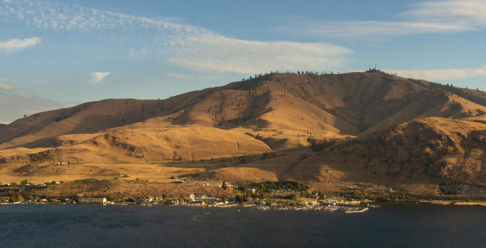
Objectives
1
Stewardship Ecology
Design an Ecology Center that emphasizes the multilayered relationship between humans and the natural environment, increases public access to the lake, provides a novel and substantive lakeside activity, and includes a linear mechanical space encased in glass to showcasing the collaborative process of the Geothermal Heat Source System utilizing Lake Chelan as the foundational resource.
2
Natural Resour
Implement a natural-re a Natural Organic R on-site wastewater m Geothermal Heat So Chelan as a clean ener the building. Showcase the design through cre courtyard environmen
Design a dedicated decontaminating w Species (AIS) to empow proliferation risks of AIS while facilitating acce lake stewardship, an mindfulness with ecolo delicate trophic state.
S D
Digging In Jillian Nelson | M.Arch 2023 | University of Idaho
3 4
Resources
Stewardship
-resource recycling system, such as Recycling Machine (NORM) for management, and a closed-loop Source System that utilizes Lake ergy source for heating and cooling se NORM as a central focal point of reating an experientially pleasant ent.
ed area for inspecting and watercraft of Aquatic Invasive ower the public to help reduce the IS in the lake, provide convenience cess and means to responsible nd increase the public practice of ogical sensitivity for Lake Chelan’s
Stewardship Enjoyment
Design a site-wide stormwater management system that utilizes biofiltration swales with special plantings tolerant of road salts and chemicals on the access easement and xeriscape biofiltration swales along the site’s shoreline perimeter to capture, treat, and infiltrate stormwater runoff before it enters Lake Chelan. Additionally, create outdoorpavilionspaces on the exterior fingers defining a lateral design axis and providing opportunity spaces for intimate lake-side communal connectivity, as well as a site wide perimeter walking path which encourages exploration, and promotes visual appreciation of Lake Chelan. Finally, develop two pedestrian bridges that solidify finger connectivity, increase access to the Ecology Center for park visitors, and provide a thrilling means of engagement and exposure to the beauty and lessons found in imbricating natural and built systems.
IMBRICATED ECOLOGY
4
43
Dawn | Adobe Stock
PART V: RESOLUTION
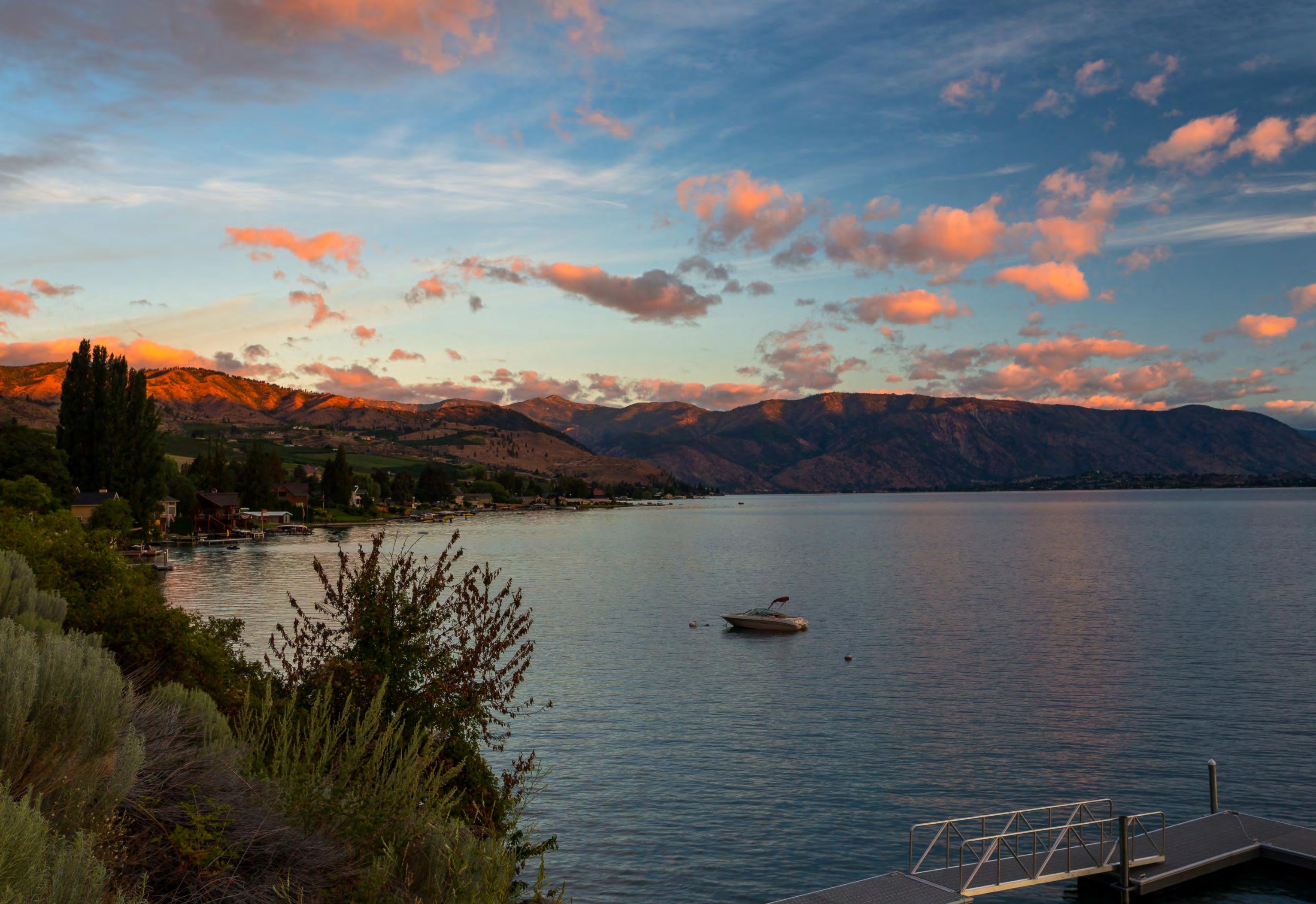 Jillian Nelson | M.Arch 2023 | University of Idaho
N
IMBRICATED ECOLOGY
Victoria | Adobe StockVictoriaStock
INTRODUCTION
Site Plan
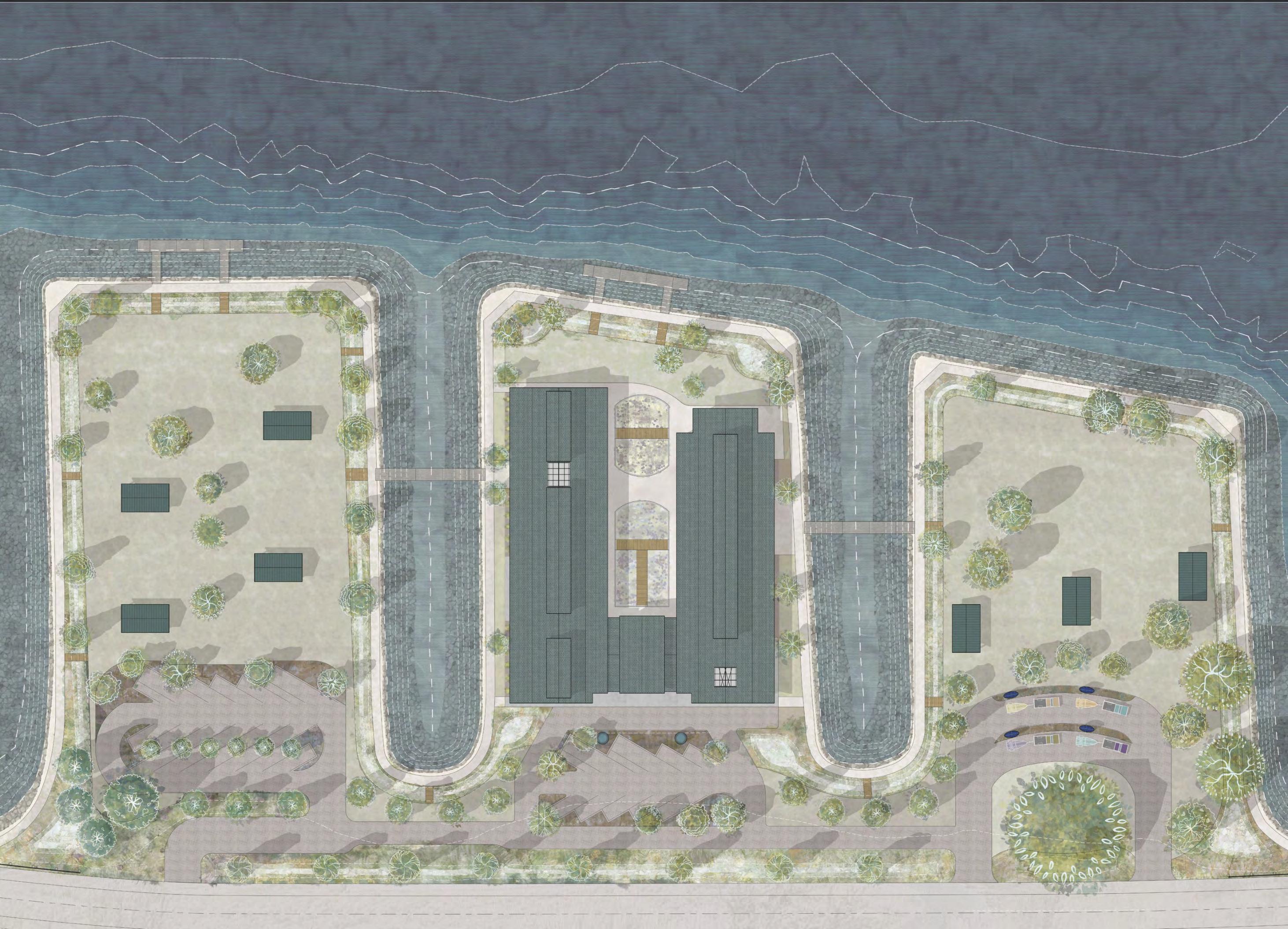
L E C
| M.Arch 2023 | University of
4
Jillian Nelson
Idaho
IMBRICATED ECOLOGY N 45
I decided to maintain the action gradient I developed earlier,asseenintheorganizationalparti.Observation and ‘information gathering’ takes place on the west wingofthebuilding,andinteractionsandapplication of knowledge are demonstrated in the programming of the east wing. Both wings and lobby spill into the open-air NORM Courtyard, where passive and active learning and interaction naturally blend. doubles as primary circulation space and celebrates the rich history of the City of Chelan and its residents. With engaging displays and historical photos, visitors peak into the fascinating stories that have shaped this community, fostering a deeper connection between visitors and the local heritage.
1440 sf530 sf
web of life within its waters. By showcasing ongoing experiments, energy production projects, and the importance of preserving the lake’s ecosystem, we raise awareness and inspire visitors to become guardians of this precious resource.
are classroom-styled spaces separated by a folding partition wall that easily opens, combining the spaces. The spaces are designed to facilitate workshops, community classes, conferences, or seminar series.
is a boutique eatery for Center visitors and parkgoers. The café offers beverages, small bites, a relaxed lounge atmosphere, outdoor seating, and an eclectic aviary theme based on the local bird species in the region.
sf
The features interactive and educationalresourcesabouttheLakeChelanregion’s Ice Age history, the glacial origin story of how Lake Chelan came to be, how and where in the region you can check out beautiful and sometimes baffling geologic formations and features throughout the Lake Chelan area.
Some educational projects, experiments, or artistic expressions may require greater precision, tools, or hardwarethantheclassroomspaces(LearnA&Learn B) currently offer. That is where the comes in. Equipped with tools and precision instruments, this space is a compact workspace accommodating small projects or experiments that aim to contribute to the community or the environment.
1980 sf
is a flexible gallery dedicated to revealing the intricate relationships within natural systems. Dedicated to exploring how different ecoregions, such as the East Cascades, Okanogan, and Columbia Plateau, interrelate and contribute to theecologicaldiversityandbeautyoftheLakeChelan area.Bypromotingasystems-thinkingapproachand demonstrating how we can integrate these principles into our daily lives, we encourage visitors to actively support local ecology.
Visitors are immersed in the wonders of Lake Chelan in the aptly named. With expansive views of the lake and its rugged north shore, this airy and flexibleexhibitionareahighlightseverythingrelatedto the lake, from its physical phenomena to the delicate
is the largest of the learning spaces, designed to provide comfortable space for guest speakers, community events, or more extensive group activities. Big Learn is located at the north end of the building on the east wing and, like Lake Space, takes advantage of the impressive views across Lake Chelan with large bright windows.
The is an informal outdoor instructional space that allows any of the Center’s learning experiences or events to take advantage of the comfortable climate during warmer months. A large, covered area and comfortable seating are available for reserved classes or events; when not used for that purpose, the area and seating are meant for all Lakeside Ecology Center visitors.
Observe, Blend, Practice Gallery Spaces Chelan History Hall Geology Space Ecoregion Space LakeSpace Instructional & Interactive Learn A & Learn B Peckish Café Workshop Big Learn Space Outdoor Classroom
L E C Gift Shop Lobby & Event Space Speaker Ecoregion Learning Space Geology Learning Space MEch ARt Chelan History Hall Mech. Reception 2500 sf
Building Program
1470 sf 1980 sf Breezeway NORM Courtyard stock room restroom rest room 7800 sf Gift Shop Lobby & Event Space Speaker Ecoregion Learning Space Geology Learning Space MEch ARt Chelan History Hall Mech. Reception 2500 sf
sf530
1470 sf
Breezeway NORM Courtyard stock room restroom rest room 7800 sf
1440
| M.Arch 2023 | University of
4
Jillian Nelson
Idaho
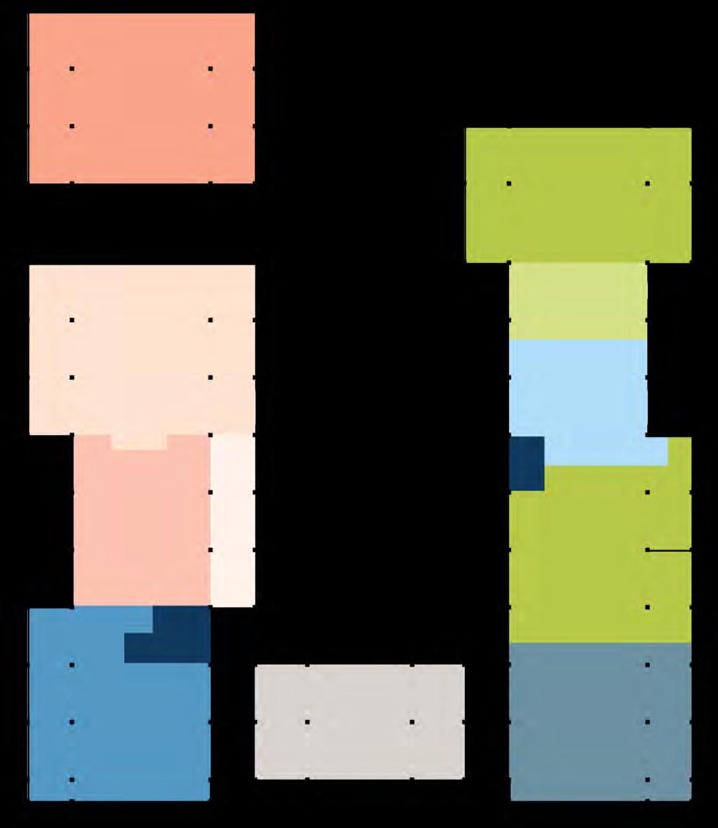

Admin storage+ S/R Peckish Cafe Instruction A Instruction B Speaker Space Mech. Maker Space Break Office Office Reception Office 1840 sf 1080 sf 970 sf 1020 sf 680 sf 2050 sf rest room W.C. Admin storage+ S/R Peckish Cafe Instruction A Instruction B Speaker Space Mech. Maker Space Break Office Office Reception Office 1840 sf 1080 sf 970 sf 1020 sf 680 sf 2050 sf rest room W.C. Flexible Barrier Primary Circulation IMBRICATED ECOLOGY Lake Space 2450 SF Ecoregion Space 2500 SF Geology Space 1440 SF Retail Space 1980 SF Big Learn Space 2050 SF Workshop 680 SF Peckish Cafe 1020 SF 970 SF SF Learn A 1080 SF Learn B Admin 1840 SF Lobby & Events 1470 SF Outdoor Classroom Chelan History Hall 530 SF wc wc NORM Courtyard 7800 SF Breezeway Reception OfficeOfficeOffice Break Storage +S/R Mech Mech Art Stockroom wc x 4 wc 46
PART VI: SYSTEMS EX
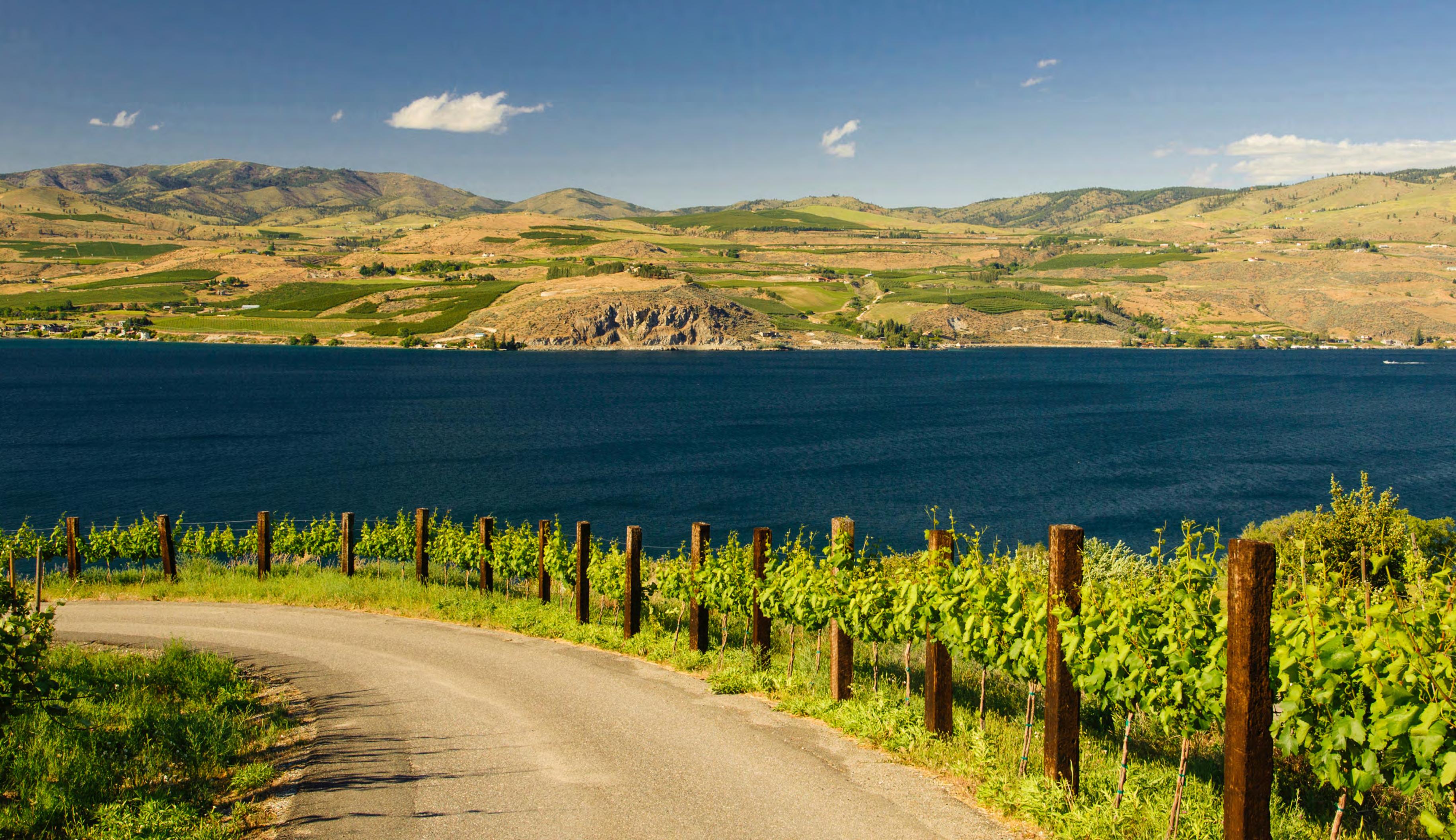
4
Jillian Nelson | M.Arch 2023 | University of Idaho
XPOSITION
Richard Duval & Danita Delimont
IMBRICATED ECOLOGY 47
B, F, & S
Comprehensive Strategy


Site-Design for Wind


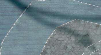


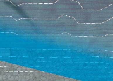


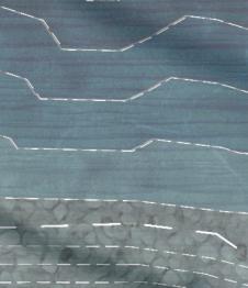
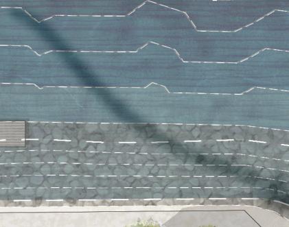


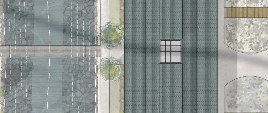


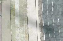


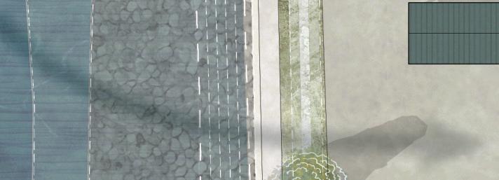


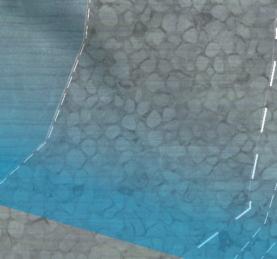


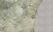


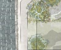


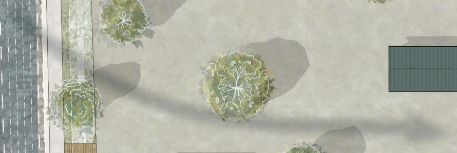

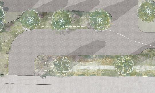
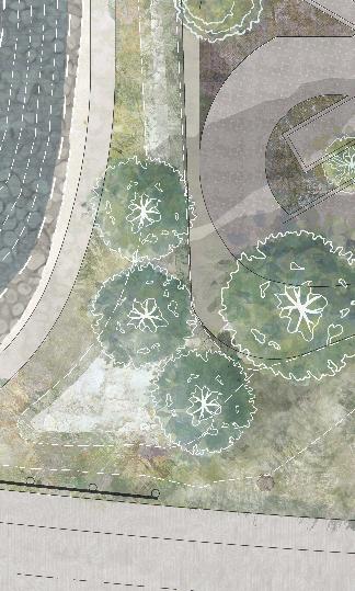
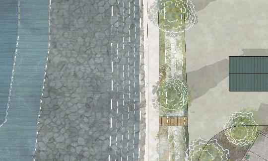
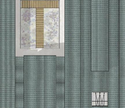
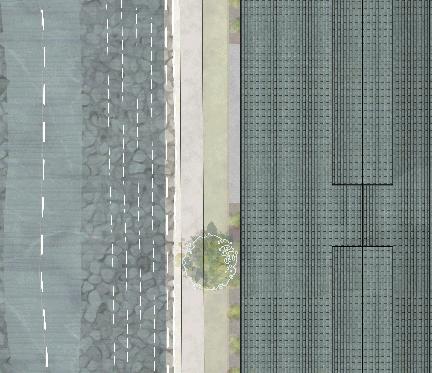


The current design allows the wind to be broken down as it flows over the site; the overarching goal when organizing the landscaping was to filter strong summer winds blowing predominantly from down lake (west).

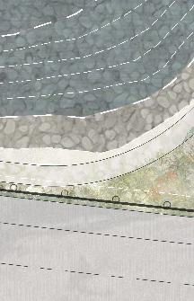
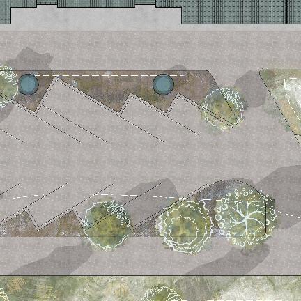
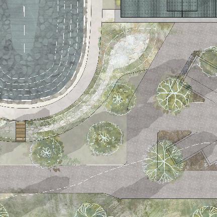
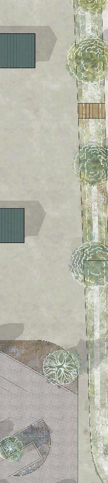
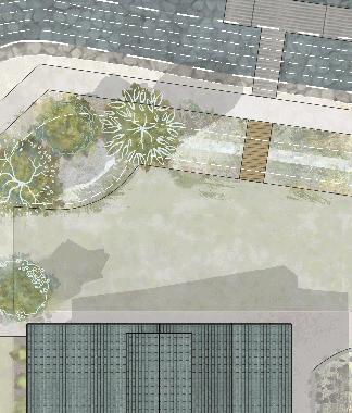
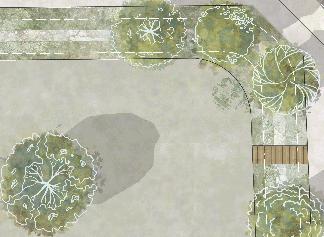
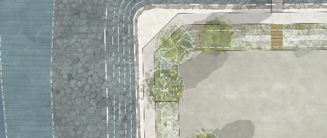
48 Jillian Nelson | M.Arch 2023 | University of Idaho Jillian Nelson | M.Arch 2023 | University of Idaho
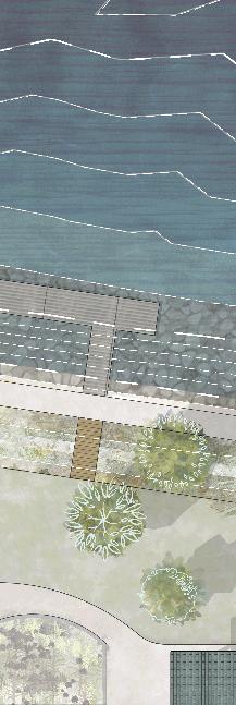


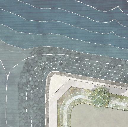
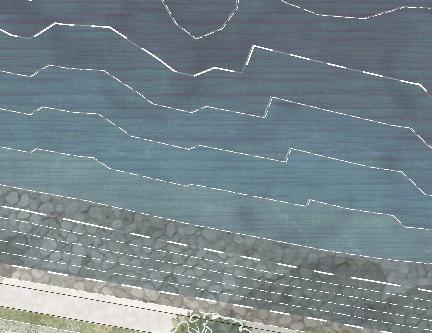
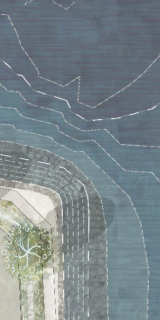
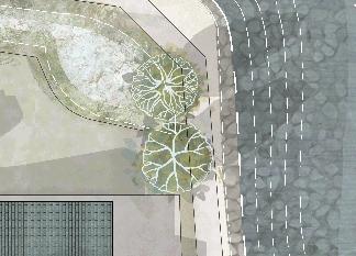
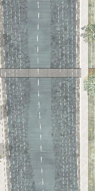
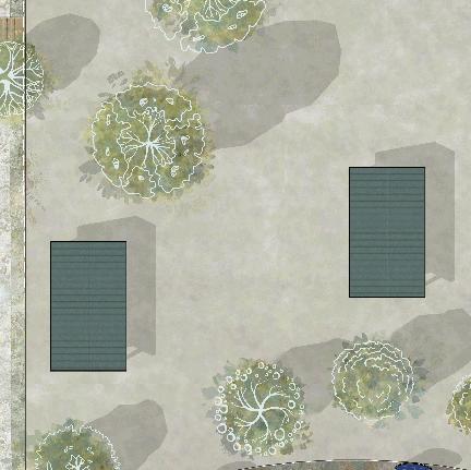
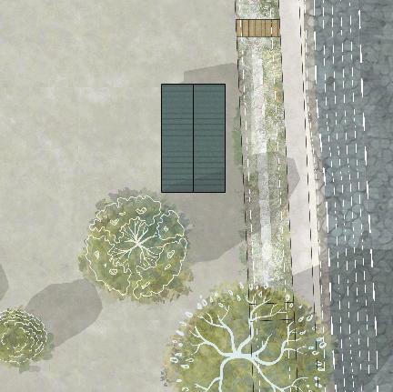
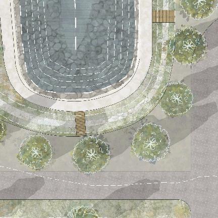
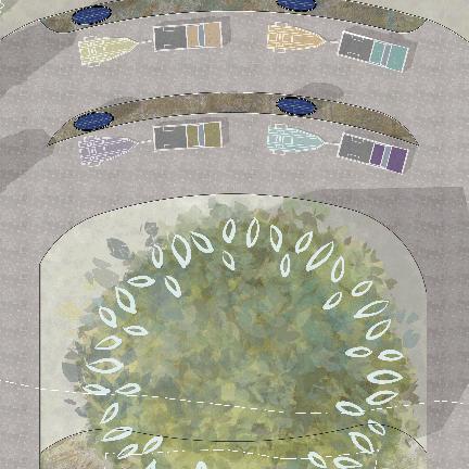
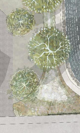


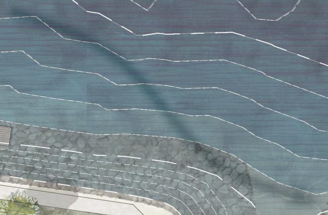
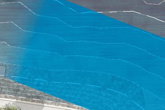


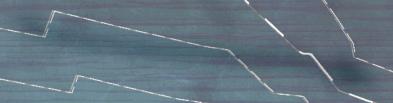

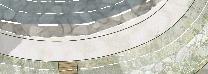
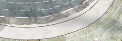


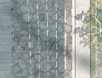


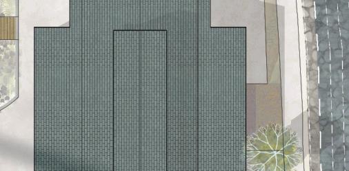


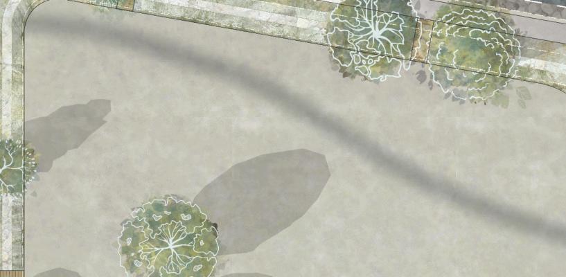

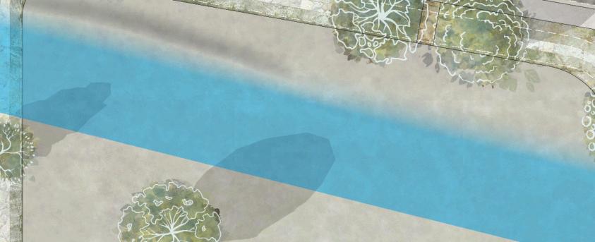


48 IMBRICATED ECOLOGY
Focused Strategy
Natural Ventilation & Protection
The building features a pleasant breezeway on the west wing of the building, allowing breezes to flow into the courtyard area after light filtration by the two sentinel trees facing the walking bridge. The air is allowed into the building through various retractable doors that allow user control over how much airflow is entering the building. When either the exterior doors in front of the maker space or Peckish Cafe are
ajar, there is the option to allow for cross ventilation by opening the doors on the east facade.
The exterior spaces along the tip of the finger rely heavily on the landscaping to filtrate the incoming breezes, in the render blow you are able to see the NE corner of this finger and the outdoor classroom area which is surrounded by trees to provide protection from both the wind and the strong summer sun.
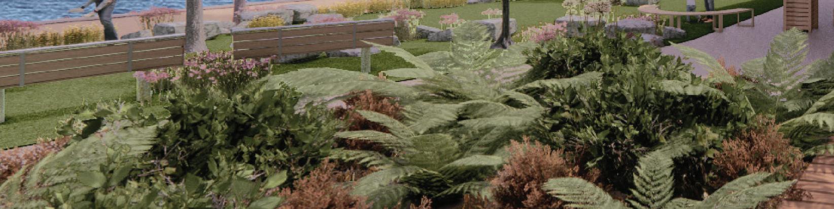
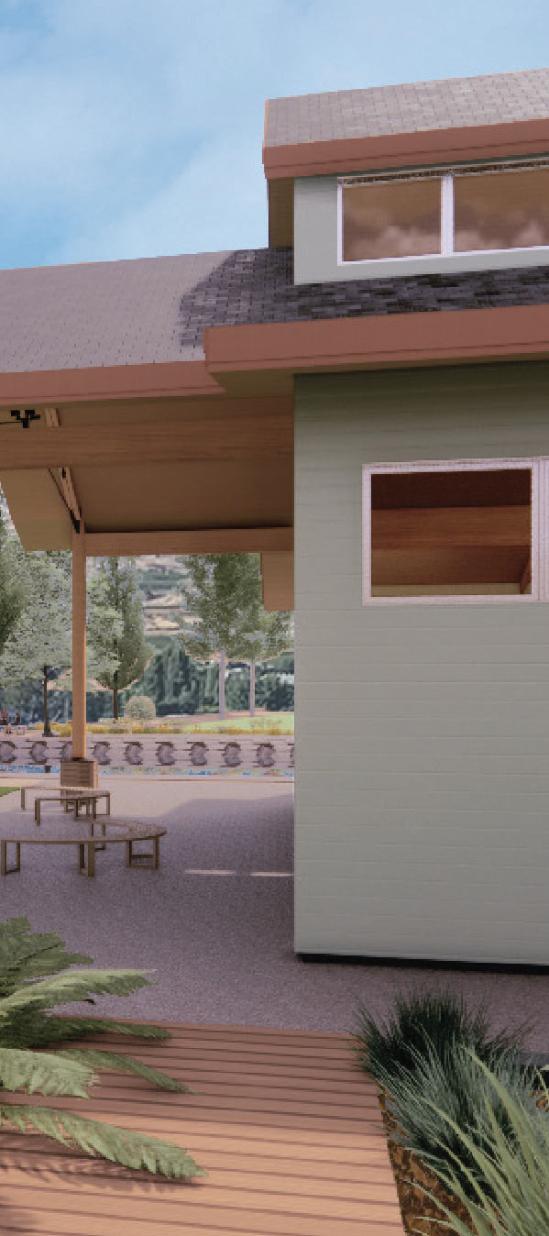
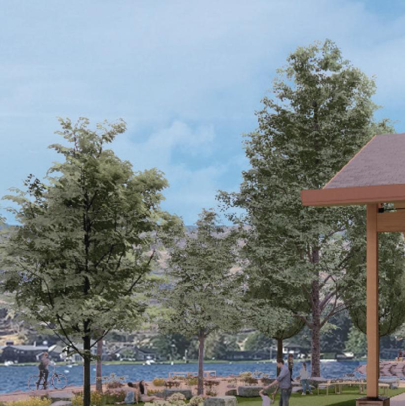
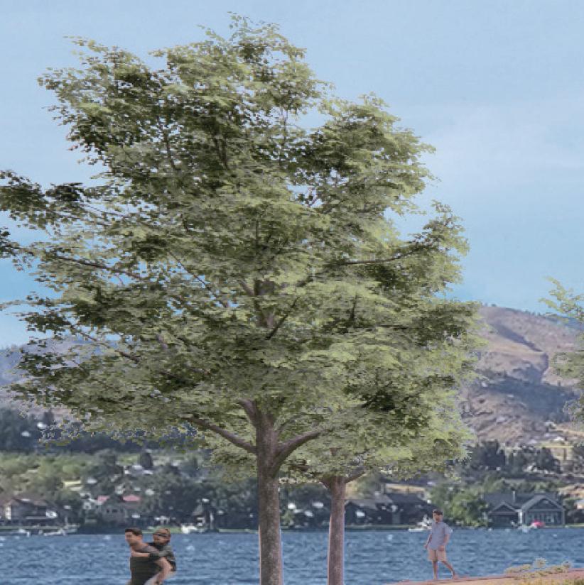
49
Jillian
| M.Arch 2023 | University of Idaho Jillian
| M.Arch 2023 | University of Idaho B,
Nelson
Nelson
F, & S
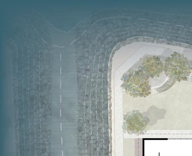
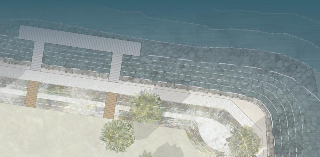


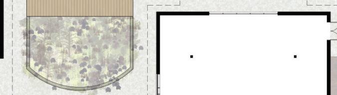
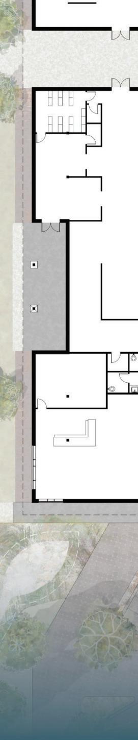
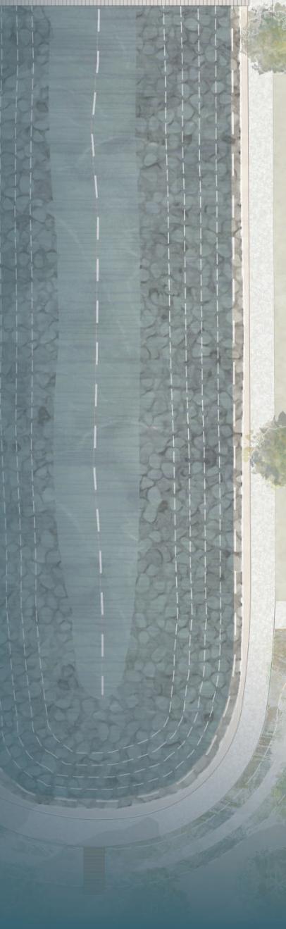
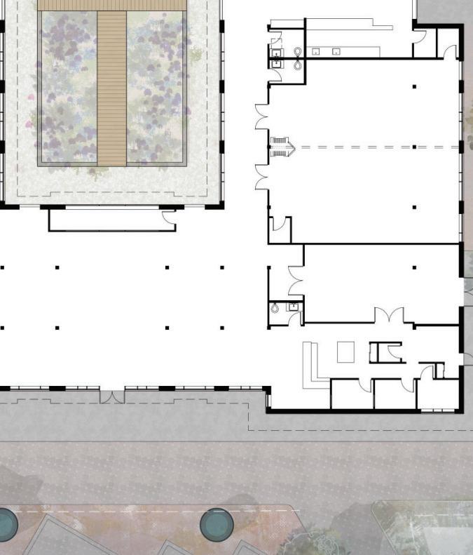


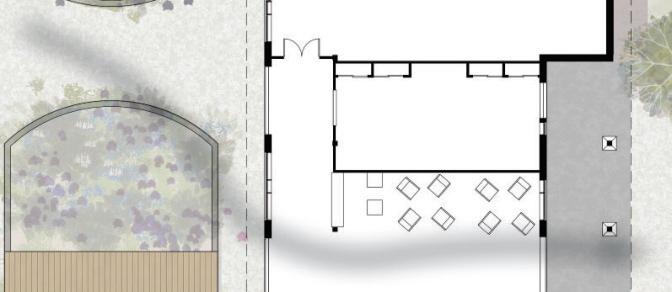
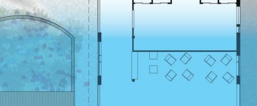
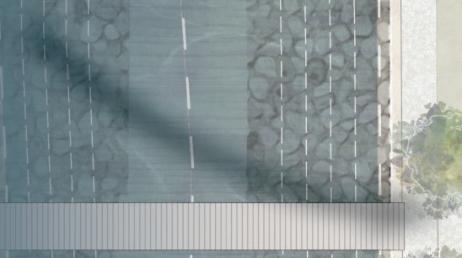


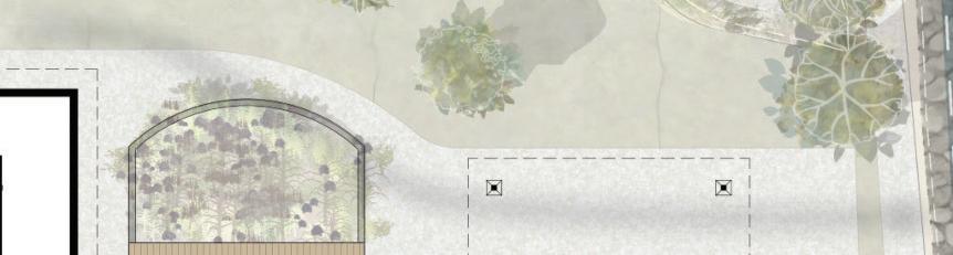

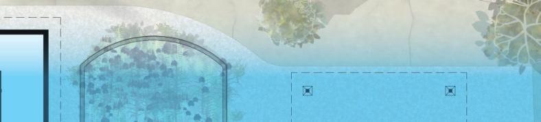


49 Outdoor Classroom Area 18% 15% 12% 9% 6% 3% W S N E mcal 3%
r IMBRICATED ECOLOGY
Summe
Capture & Treat Capture & Treat
Natural On-Site Treatment
Biofiltration Swales line the access easement abutting ALT RTE 97 with unique plantings tolerant of road salts and chemicals. Biofiltration Swales utilizing xeriscape species and pollinator insect favorites follow the site’s walking path and shoreline perimeter. The swale
captures, treats, and infiltrates stormwater runoff before it can enter the lake. The design showcases an organic means of treating lakeside stormwater for the community by adding contextualized fauna textures, increasing biodiversity, and ultimately enhancing the visual enjoyment of the existing vistas.

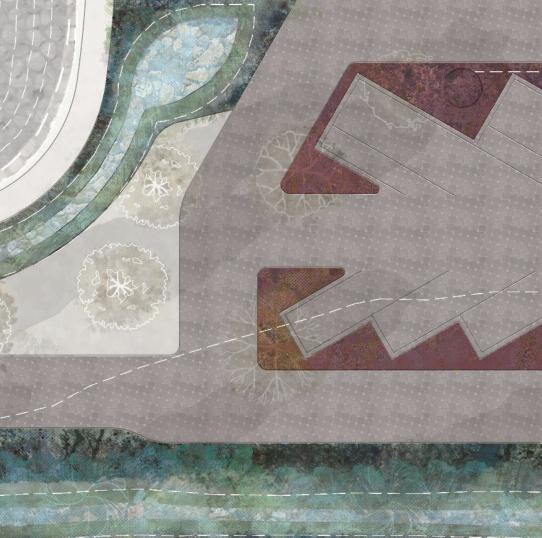
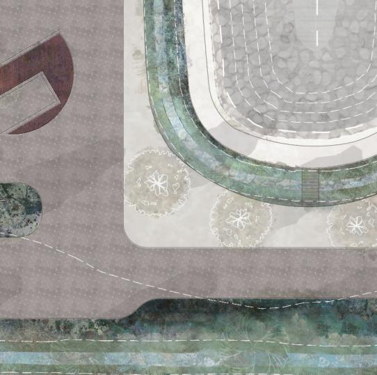
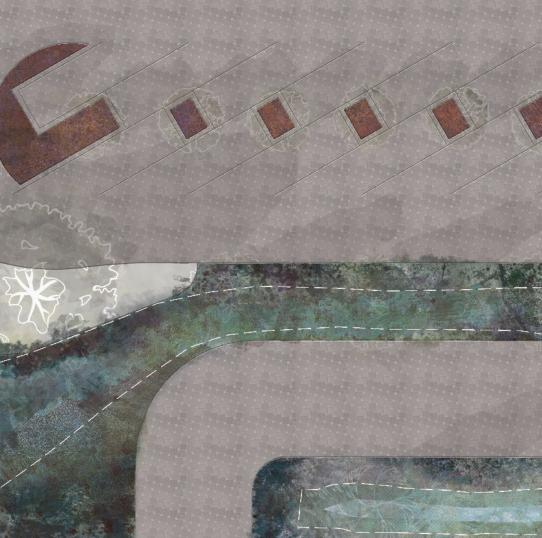

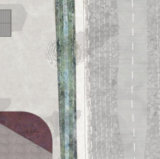

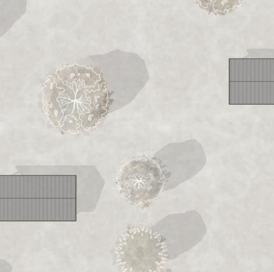
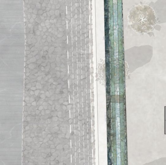
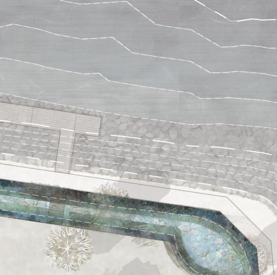
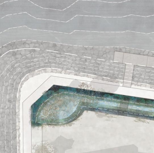
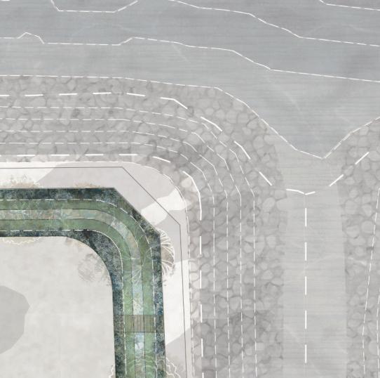
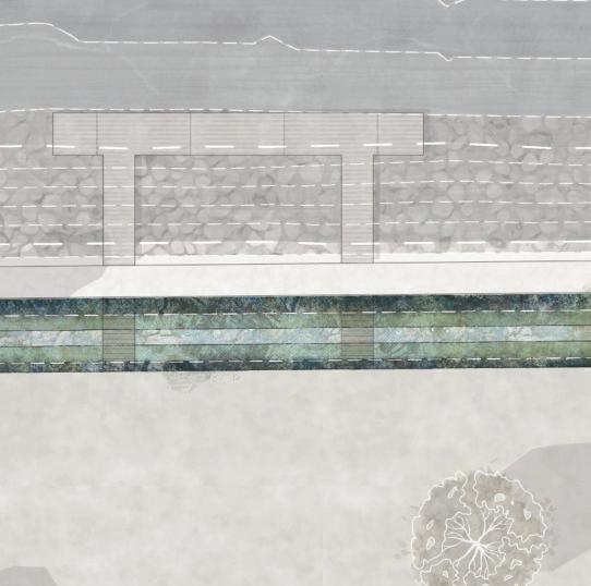
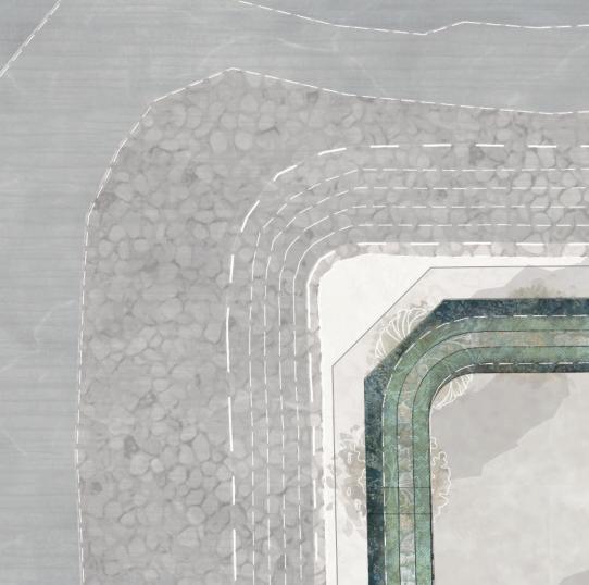
Jillian
| M.Arch 2023 | University of Idaho Jillian
| M.Arch 2023 | University of Idaho S T
Nelson
Nelson
50
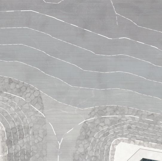
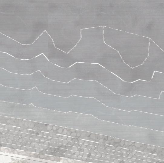

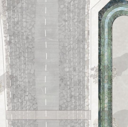
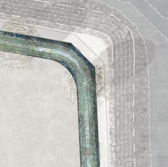
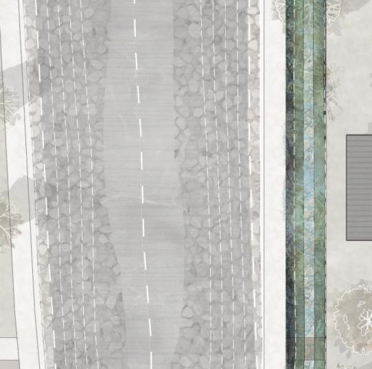
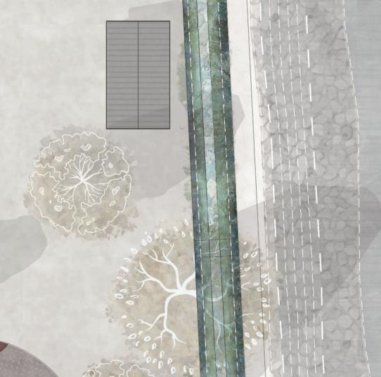
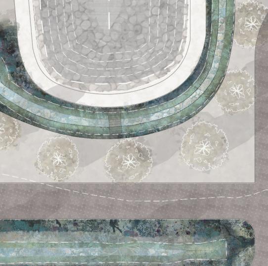
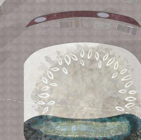
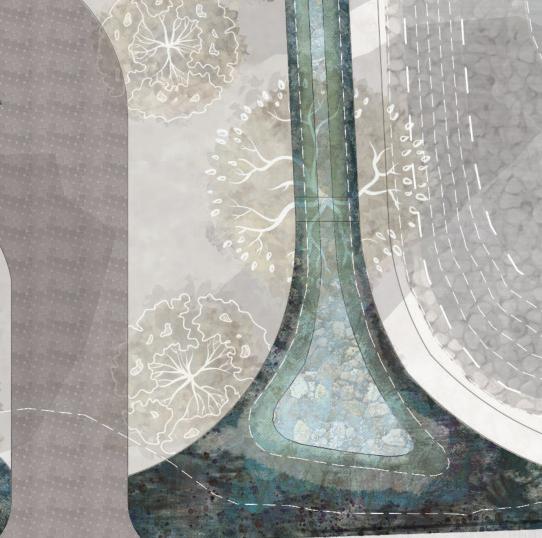


N Permeable Pavers Biocell Bioswale IMBRICATED ECOLOGY IMBRICATED Salt-Tolerance Z Drought-Tolerance e Increases Biodiversity
Yarro
Butterfly Weed
Rose of Sharron
Purple Sage
Yucca 50
Sedums
TheLakesideEcologyCenter’s structuralsystemdesignis thebeautyofexistingnatural systemswhileemphasizingthe
intermittentroofmonitorsthat
TheLakesideEcologyCenter’s structuralsystemdesignis centeredonshowcasingnatural lightingasafundamentaland sustainabledesignpractice. Thedesignstrategieswork harmoniouslytocelebrate thebeautyofexistingnatural systemswhileemphasizingthe importanceoftechnology.The three-baystructurefeatures intermittentroofmonitorsthat allowamplenaturallightto
energyefficiencyandreducing relianceonartificiallighting.The scissoredwoodtrusses,glulam
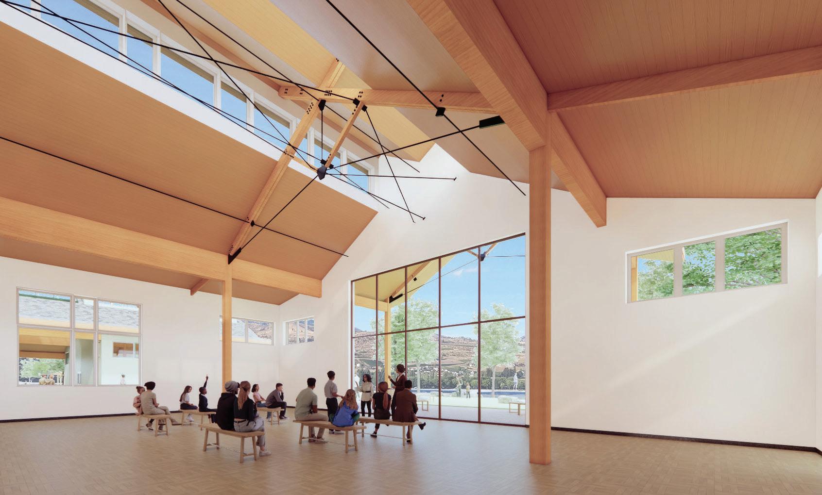
elevatethestructuralsystemas
penetratethespace,promoting energyefficiencyandreducing relianceonartificiallighting.The scissoredwoodtrusses,glulam beams,andwoodcolumnsare leftexposed,contributingto thebuilding’saestheticappeal whileofferingflexibilityfor futureuse.Additionally,visually strikingirontensioncables elevatethestructuralsystemas anornamentalfeaturewhile functionallyreinforcingthe trussed system.
IS
51
Daylighting


51
Ventilation


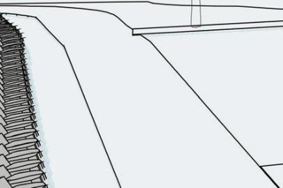
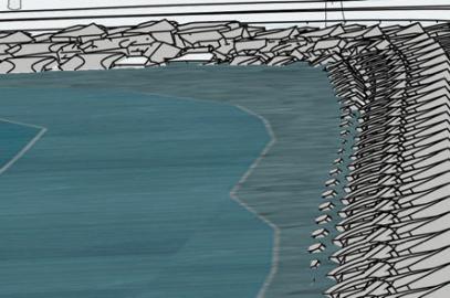
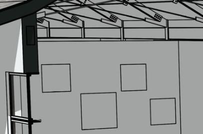
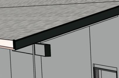


ScissoredBreeze


The heavytimberand trussed structuraldesign fortheLakesideEcologyCenteralsoenablethe building’snatural ventilationstrategies,promoting sustainabilityand (intheory) reducingenergy consumption.Usingroofmonitorswithawning windows,clerestorywindows,and retractable doorsallowsforcrossventilation,creatinganatural airflowthroughoutthebuildingwhendesired.This
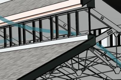
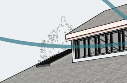
strategyreducesthe dependenceonmechanical systemsforairconditioning,promotingenergy efficiencyandsustainability. Committingtopassive strategiesearlyinthedesignphasehelpedinform theorientationofthebuildinganddesigning itsstructurealonganorth-south axistotake advantageoftheprevailingwindsandprinciples of thermal buoyancy
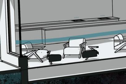
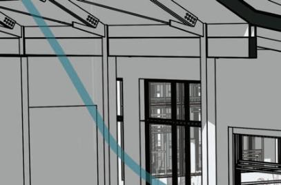
IS
| M.Arch 2023 | Universityof Idaho
JillianNelson


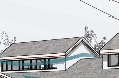
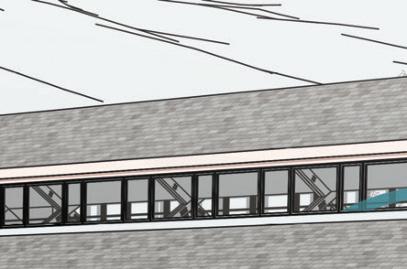
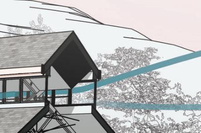

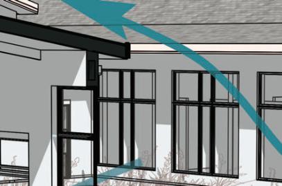
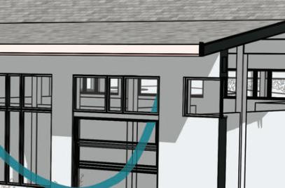
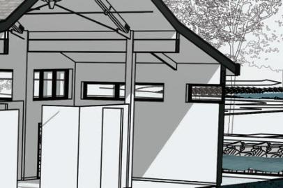
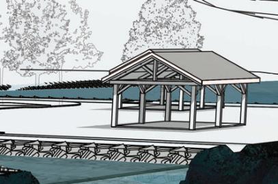


IMBRICATEDECOLOGY N
NORM Courtyard
System of Systems
ImplementingtheNaturalOrganicRecyclingMachine (NORM) provided a meaningful new approach to design with an ecological intent in mind. Pursuing integration of the system allowed the project to feature both an educational opportunity and provide a delightful public space for the community.
NORM efficiently treats wastewater by employing microbes that are ‘rockstars’ of biogeochemical cycling of inorganic and organic nutrients, matter, and pollutants. The NORM system is designed to prioritizesustainability,resourceefficiency,andallows for aesthetic integration while highlighting a natural and safe means of on-site treatment and reuse.
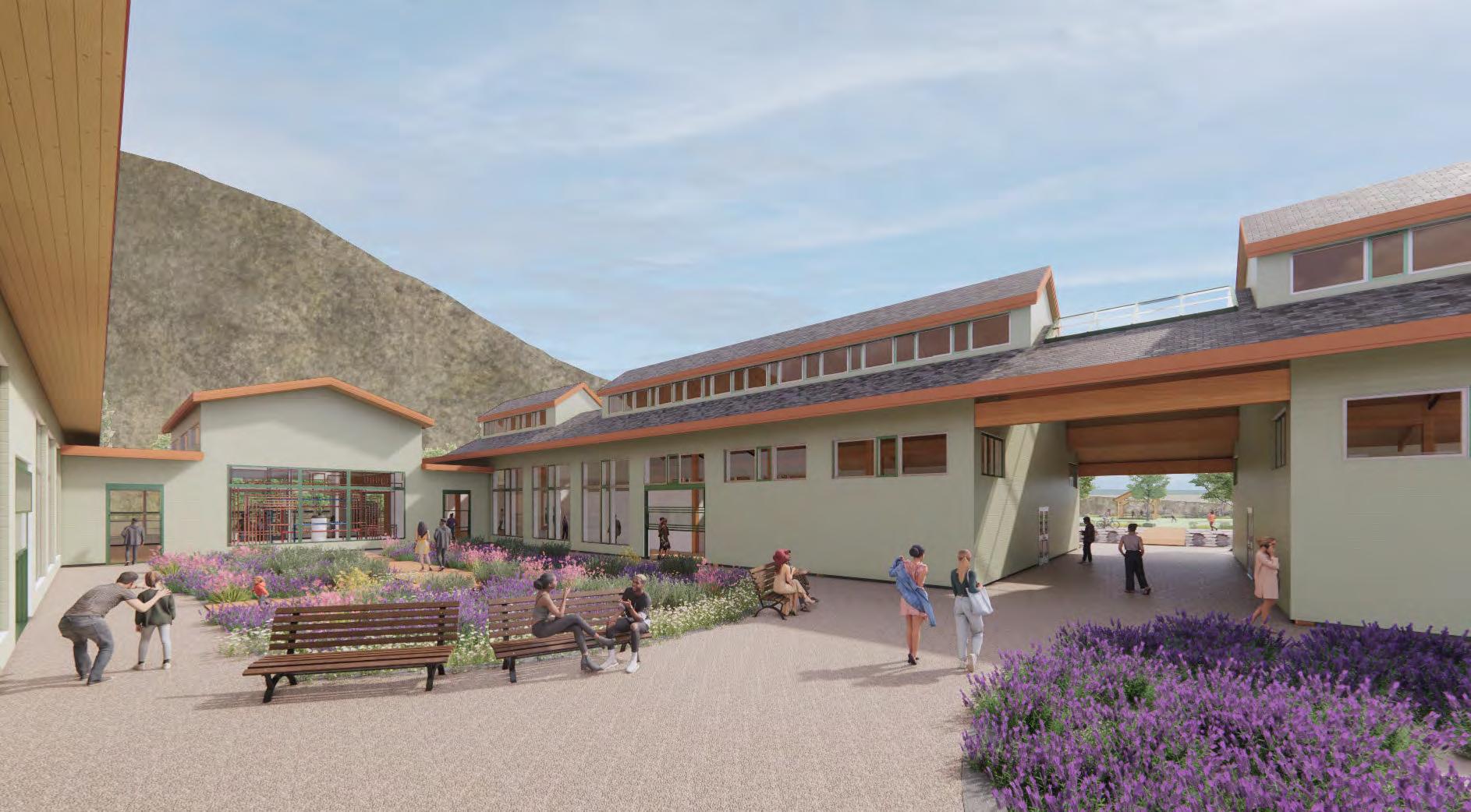
W R
| M.Arch 2023 | University of
5
Jillian Nelson
Idaho
IMBRICATED ECOLOGY 3
Components
As a meta-system, NORM showcases congruence and interdependence between natural and manmade systems. In my project, NORM behaves as an organizing design element, provides an interactive experience,anddemonstratesthepowerofconnecting with natural systems and the benefit of intentionally overlapping ecologies. NORM’s components are most simply explained by their functional purpose within the water reclamation process as follows: 1

Clean Water Storage
5 W R
Wetlands 4
Primary Waste Management
&
& Microbial
Overview Jillian Nelson | M.Arch 2023 | University of Idaho 54
2 3 4 5
Nutrient Reduction
Treatment Filtration
Activity Wetland Treatment Water Storage & Reuse
Filters Reactors Primary Waste Tank Groundwater Recharge Wells 1 2 3 5 IMBRICATED ECOLOGY 54
NORM in Focus
Percolate & Circulate
The means of travel for water being treated is mostly powered by gravity throughout the entire journey through NORM, and gradual filtration occurs at each step of the reclamation process. By relying on biological processes and natural systems, NORM minimizes the need for energy-intensive mechanical treatment methods typical to conventional
wastewater treatment plants. As diagrammed below, the circulation of treated water is not as simple as it appears on the surface (pun intended). Using the Primary Waste Tanks as the initial reference and with Clean Water Storage marking an end, the entire system runs the length of approximately 200 feet with a varying width at a maximum of 45 feet.
The wetlands and dentrification reactor work together to create flood and drain conditions mimicking a cleansing tidal system.
Woodchipper Wetland
Further enhances nutrient removal through the use of wood chips.
Polishing Tidal Wetland
Subterranean treatment through flood conditions which foster microbial organisms for additional nutrient reduction.
Clean Water Storage
Clean water is stored and ready for reuse: flushing toilets, landscape irrigation, AIS decontamination stations, or sent to groundwater recharge wells.
WC
WC
x2
Tidal Wetland
W R
Jillian Nelson | M.Arch 2023 | University of Idaho 5
Dentrification Reactor
Microbial den which facilitates the removal of nitrogen compounds.
Mechanical Filter Room
Micro-filtration and UV disinfection removes fine particles.
Groundwater Recharge Wells
Deep wells that injects excess reclaimed water into the ground to replenish groundwater.
Primary Waste Tanks
Collection and initial containment of wastewater with emergency overflow connection to city sewer system.
Anoxic Reactor
Oxygen-free microbe feasting hall reducing nutrient content of wastewater.
Trickle Pump Filter
Utilizes organic medium and microbial activity to remove nutrients. The funnel form and use of gravity uniquely illustrates NORM’s unique design economy.
C
WC
x3 <FILTRATION PURIFIED>
IMBRICATED ECOLOGY 5
Resourcing the Lake
The Lakeside Ecology Center utilizes Lake Chelan’s thermal energy to power its sustainable heating and cooling system by tapping into the thermal energy beneath the lake surface. The geothermal collection system is a closed-loop design that features 2100 feet of Pex tubing arranged in three rows, each measuring 60 feet in length. The looping configurations, spaced 3 feet apart and with an impressive 8-foot diameter, ensure optimal efficiency as the system sources or sinks heat into the waters of Lake Chelan.
With a 10-ton capacity, the system is more than capableofmeetingtheheatingandcoolingdemands of Lakeside Ecology Center’s current programming, totaling 20,800 square feet. Of that figure, 2,300 square feet is dedicated to unconditioned storage and circulation zones.
As designed, the system is sized in theory to meet the HVAC needs of a 26,000-square-foot building. The decision
to slightly oversize the system meant the ability to generously accommodate up to 7,500 square feet of future additions or zones (to the building or even new construction on the other fingers). It’s this potential for adaptability that made pursuing a geothermal system such a desirable strategy for creating resilient design.
During the design phase, it was crucial to identify a lakebed area where the underwater coils


I O-S E
GeothermalEnergyGeothermalEnergy Jillian Nelson | M.Arch 2023 | University of Idaho 1074’ ASL 56
remain at least 8 feet below the surface, even during Lake Chelan’s lowest water levels in early spring. The ideal
coil-field location was determined to be site-center, approximately 120 feet offshore, and submerged 26 feet below Full Pool levels (1074 ft ASL), ensuring temperature consistency and system effectiveness year-round.
The displacement ventilation system runs in an enclosed 20-inch plenum beneath the Center’s floor, comprising 2x2 layered panels (core: high-
Fan Coil Units
Plenum Air Distributive Ducting
Geothermal Heat Exchange Loop
density particle board, finish surface: hardwood in parquet pattern). The system also features selectively placed displacement floor grilles supported by steel pedestalsandgriddedstringers.Userscancontrolthe locationofthedisplacementgrilles,thefancoiloutput temperature,andtheairflowvolumeemittedfromthe grilles. The interactivity of this floor system and tactile user-controlled climate demonstrates adaptable design while poetically serving as an expression of blending natural and architectural ecology.
The building’s central mechanical room serves as the heart of operations, processing the geothermal collector loop, the heat pump, and supplying the air for twelve distinct building zones and their fan coils.
IMBRICATED ECOLOGY
6
Full Pool 1100’ ASL
Framing Resources Framing Resources
Mechanical Art
The building’s central mechanical room is the heart of HVAC operations, processing the geothermal collector Exposing the mechanical room and transforming the geothermal system into a central showpiece within the Lakeside Ecology Center
is a powerful and artistic statement, reinforcing the multi-layered relationship between humans and the natural environment. By deviating from the traditional approach of enclosing and hiding the mechanical room, the Center embraces
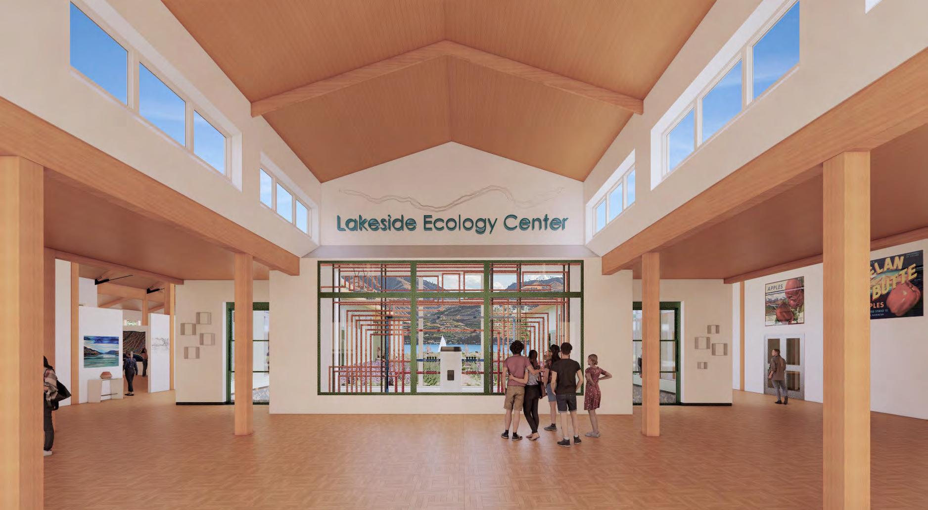
I O-S E
Jillian Nelson | M.Arch 2023 | University of Idaho 5
Mechanical Art Room
in Lobby
transparency and invites visitors to witness the intricate collaboration between various systems. IntentionallyframingNORMCourtyardandviewsof Lake Chelan with weaving copper pipes and steel manifoldsstrikesavisualconnection,symbolizingthe
interplay between systems of the built environment
interplay between systems of the built environment and of surrounding nature. This deliberate architectural design choice not only showcases the beauty of the mechanical system but also signifies the Center’s reliance on and message that Lake IMBRICATED ECOLOGY 57
T Experience Reflection
On the Surface
My awe of the natural systems and beauty of Lake Chelan inspired my thesis. Along the journey, I devoured information, deep diving into rabbit holes and often forcing myself to abort my Alice in Wonderland free fall so I could execute the design process I was gathering information for. I will be a lifelong learner, my curiosity is endless, and my fascination with natural systems is set in stone.
I set out to create an educational, engaging, and community-oriented space focused on ecological thinking, appreciation of nature, and stewardship of Lake Chelan. As I look back at my initial questions at the beginning of this project, some of my questions were pushed to my subconscious as I tackled more tangibleresultsthatcouldbegraphicallyrepresented.
I asked, ‘How can architecture activate ecological stewardship? What is the extent of my power as a designer in this situation? There’s Integrative Design, is what I’m considering Instigative Design?’ Without realizing it, this project became an experiment of treating architecture as its own form of ecology, using architecture to interact with already established
social and environmental systems. Design became a system of influence on users’ mutual interactions and attempted to influence how users interact with their physical surroundings. It ultimately pushed my architecture to be an instrument of change within the already present and larger systems.
Hindsight
I almost wish I had thought to focus my thesis questions concept of architecture as ecology. But if I am being honest, I did not realize this was a concept I was circling around. This project required an intense focus never required of me to seek out and understand a wide variety of systems I was only vaguely familiar with. My curiosity helped me develop a more meaningful appreciation for the endless potential if we shift our perspectives to view the world as one system which contains infinite systems.
I am thankful for everything I extracted from my grad studio. This final project was probably the first I presented that I felt I had genuinely executed what I had set out to do. It is a delicious feeling, and I expect I will not settle for anything less in the future.
F
Nelson | M.Arch 2023 | University of Idaho 59
Jillian
IMBRICATED ECOLOGY 9
Bruce
You brought joy back to my study of architecture. I’m beyond lucky to have had an instructor and advisor with the passion you have about systems, passive design, and environmentally conscience design. More than anything though, I’m grateful for your never-ending patience with my uncontrollable curiosity and I’m thankful for all the grace you’ve allowed me every time I have to extract myself from some information rabbit hole I’ve tumbled into. And I’m especially grateful that you nurtured a grad studio space where we could be fearless and come together to support one another reaching for the stars.
I couldn’t have wished for a better advisor and final academic studio experience.
Momma, your love and support is my everything. I can’t wait to become a young professional that you can cluck endlessly about with the other hens.
Dad, I can’t wait to give you some wicked trusses to deal with someday. Thank you for always being available to answer my questions, I’m beyond lucky to have a resource as knowledgeable and loving as you.


I wish you were here. There’s mountains of knowledge I wanted to learn from you and I was so close to finally getting too.
I thought of you everyday and hoped you would be proud of this project. I hope we can still work together someday. Even if it’s 60 years until we meet again, I bet you will still have a thing or two to teach me.
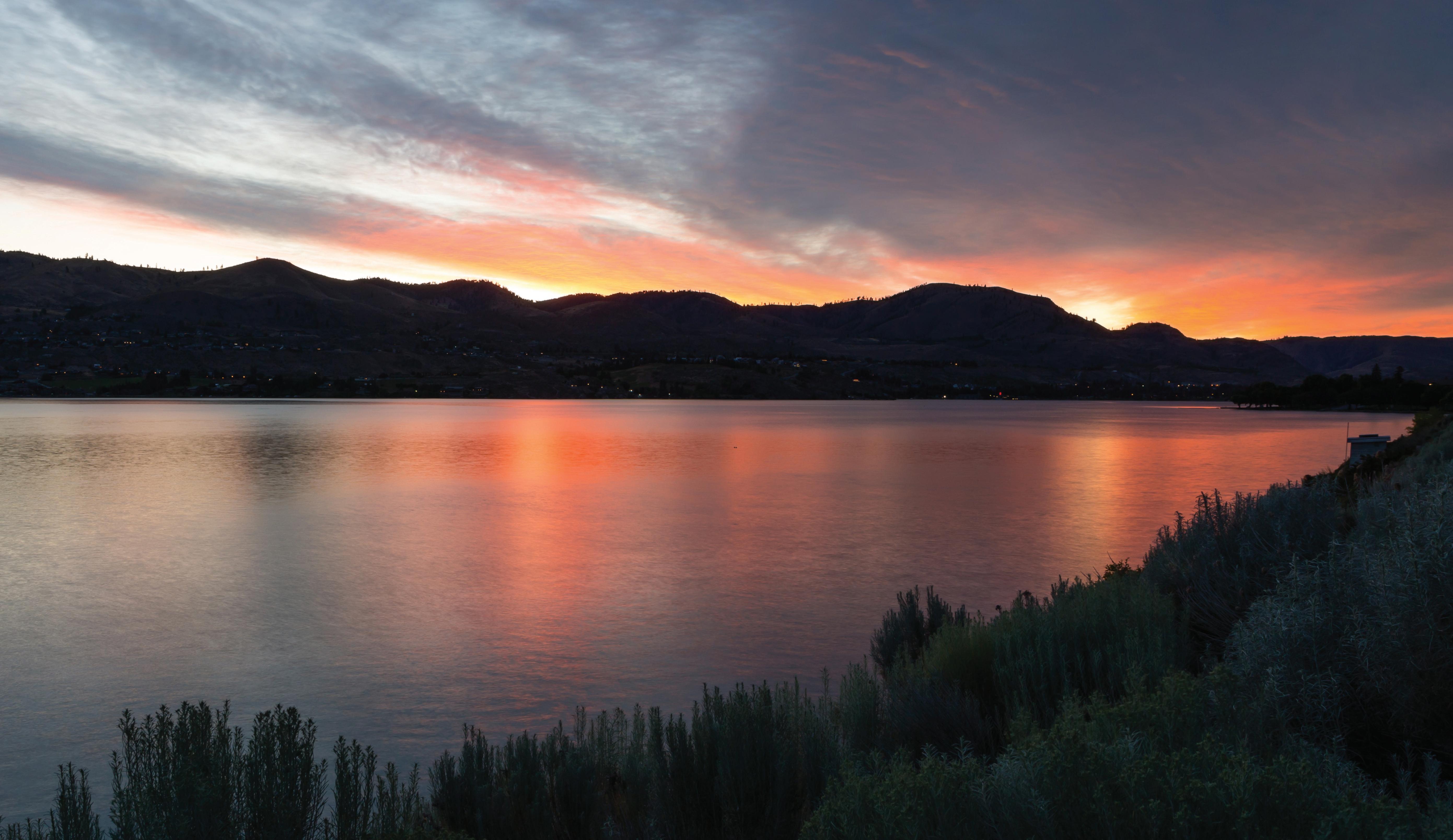
| M.Arch 2023 | University of Idaho
Jillian Nelson
Mom & Dad
60
Rick Jones
Danielle Hawkins
I don’t know that I’ve ever had a friend as kind, generous and empathetic as you. If it weren’t for you, your advice, your realness, and your willingness to stomach all my silliness, my project would not be what it is. I’m lucky to have met you, and I can only hope I can aspire to half the level of organization and time management you possess.
Truly, I cherish you, Danielle.
Abels & Gallegos
While I didn’t receive your help on this thesis project, I know that my academic career in architecture starts with you both at Pierce. Transition to 3rd year placement in university was seamless, and in the midst of a pandemic no less. I was in a position to graduate cum laude for my bachelors degree in two years, and finish my M.Arch degree in a single year. My drive brought me to the end, but I don’t doubt that my foundation established under you both is what set me up for success. Abels, thank you for emphasizing the power of starting a design with ‘I wonder...’ Gallegos, thank you gos, for your patience and always lending your ear
Thank you for listening to me, and reminding me to not be so serious. Thank you for all the pep talks, laughing at my architecture stories that you have no reason to listen too,enduring my all nighters and model making explosions in our living room, and thank you for being understanding of my madness as I have crawled my to finishing this thing. The next chapter is finally here, and I’m excited to begin it with you.
And no thank you to Turkey, the most demanding snuffle truffle pig on the planet. I have accomplished this work in spite of your constant whining and disruptive snoring.
Victoria | Adobe Stock Victoria Adobe Stock IMBRICATED ECOLOGY
60
Chris Lee Jr.
Project Introduction
Brunner, Julie. Chelan Valley Housing Affordability Needs Assessment. Housing And Community Development Consulting, Chelan, 2018, https://cityofchelan.us/pdfdocs/2019/01/Chelan-Valley-Housing-Needs-Assessment-10.2018.pdf. Accessed 3 June 2021.
Capra, Fritjof. “The Turning of the Tide.” The Turning Point, Bantam Books, New York, NY, 1982, pp. 21–49.
Eco Regions
Dawes, Ralph, and Cheryl Dawes. Geology Tour of Lake Chelan. 31 July 2015.
“Ecoregions in Washington.” LandScope America, 2023, http://www.landscope.org/ washington/natural_geography/ecoregions/. Accessed 18 December 2022.
Viticulture Designation
Phelps, Judy. “Apples to Grapes: The Path to the Lake Chelan AVA.” Great Northwest Wine, 2 June 2019, https://greatnorthwestwine.com/2019/06/02/apples-to-grapes-the-path-to-the-lakechelan-ava/. Accessed 29 December 2022.
Steigmeyer, Rick. “Lake Chelan AVA: World-Class Wine Destination.” The Wenatchee World, 22 Apr. 2021, https://www.wenatcheeworld.com/ncwfoothills/lake-chelan-ava-world-classwine-destination/article_27c868b6-a39c-11eb-bc57-27ca73341c8e.html.
TTBGov - American Viticultural Area (AVA). https://www.ttb.gov/wine/american-viticultural-area-ava. Accessed 29 December 2022.
Climate Data
Climate Consultant 6.0
Western Regional Climate Center. 2023, https://wrcc.dri.edu.
R
Jillian Nelson | M.Arch 2023 | University of Idaho 6
Selection Context
Chelan Basin Conservancy v. GBI Holding Co., 190 Wn.2d 249, 413 P.3d 549, 2018 Wash. LEXIS 208.
Lovato, Vince. “Judge Orders Removal of Three Fingers.” Lake Chelan Mirror, 4 June 2012.
Robbins, Jefferson. “Supreme Court Revises Three Fingers Ruling in Favor of Owners.” The Wenatchee World, 15 Mar. 2018, https://www.wenatcheeworld.com/news/local/supremecourt-revises-three-fingers-ruling-in-favor-of-owners/article_4636934b-3b7a-5122-835df22bdbb1b09c.html.
Washington State Courts - Opinions. 31 Dec. 1969, https://www.courts.wa.gov/opinions/index. cfm?fa=opinions.showOpinion&filename=331962MAJ.
WSDOT - Traffic Sections (AADT). 22 July, 2022, https://gisdata-wsdot.opendata.arcgis.com/datasets/WSDOT::wsdot-traffic-sections-aadt/explore?filters=eyJTdGF0ZVJvdXRlTnVtYmVyIjpbIjA5NyJdfQ==.
Lake Water Attributes
Kendra, Will and Lynn Singleton. “Morphometry of Lake Chelan.” Ecology Report No. 87-1, Water Quality Investigations Section, Segment No. 21-47-101, Washington State Department of Ecology, Olympia WA, January 1987.
USGS Surface Water Data for USA: USGS Surface-Water Monthly Statistics. https://waterdata. usgs.gov/nwis/monthly?referred_module=sw&site_no=12452000&por_1245200 0_149826=1180455,00062,149826,1926-03,2021-12&format=html_table&date_format=YYYY-MM-DD&rdb_compression=value&submitted_form=parameter_selection_list.
“Western US Water Temperature Data Analysis.” Columbia Basin Research. https://www.cbr. washington.edu/.
Designing for City of Chelan
Chelan County Community Wildfire Protection Plan Update . Chelan County, WA 2019.
Chelan County Shoreline Master Program. Chelan County, WA, 2021.
Chelan Municipal Code. https://www.codepublishing.com/WA/Chelan/.
U.S. Global Change Research Program, et al. Climate Science Special Report: Fourth National Climate Assessment, Volume I. U.S. Global Change Research Program, 2017. DOI.org (Crossref), https://doi.org/10.7930/J0J964J6.
IMBRICATED ECOLOGY 61
Site Characteristics
Battermann, Jamey S. “Preliminary Subsurface Exploration, Geologic Hazards, and Geotechnical Engineering Report: Goodfellow Fingers Short Plat SR-97 Chelan, WA”. Batterman Geotechnical Consulting, PLLC, 20 Jan. 2011.
EBG. “Plat Of Chelan Bay, A Common Ownership Interest Plat Community, Block 9, Plat of Lake Park, and Vacated Boulevard Avenue; within a portion of Govt. Lots 3, 4 and 5, Sec14., R.22E.W.M., City of Chelan, Chelan County, WA.” Map. 2022. 1”=60’. 48dNorth, Wenatchee.
St. Louis Science Center
“Arcturis Receives National Recognition from AIA.” STL Construction News, 4 Oct. 2017, https://stlouiscnr.com/arcturis-receives-national-recognition-from-aia/.
Loughlin, Caroline; Anderson, Catherine. Forest Park. University of Missouri Press, 1986.
“St. Louis Science Center.” VernerJohnson, https://vernerjohnson.com/portfolio/st-louis-science-center/.
“St. Louis Science Center - GROW Agriculture Pavilion.” Arcturis. https://www.arcturis.com/grow/.
Northwest Maritime Center
“Northwest Maritime Center Community Report 2021.” Northwest Maritime Center, 22 Aug. 2022, nwmaritime.org/annual-report-2021/.
Miller Hull — Northwest Maritime Center. 2009, https://millerhull.com/project/nw-maritime/. “Northwest Maritime Center.” Ecotope, 19 Nov. 2016, www.ecotope.com/project/northwest-maritime-center/.
Northwest Maritime Center, 23 Jan. 2023, nwmaritime.org/about/our-campus/.
Heller, Jonathan, and Adin Dunning. “Currents of the Past.” High Performing Buildings, 26 Dec. 2012, https://www.hpbmagazine.org/northwest-maritime-center-port-townsend-wa/. Accessed 29 Dec. 2022.
R
Nelson | M.Arch 2023 | University of Idaho 6
Jillian
Hassalo on Eighth | Natural Organic Recycling Machine
Andersen, Kyle. “Meet the New NORM in Water Management.” Biohabitats, www.biohabitats. com/wp-content/uploads/HassaloOn8th_Wastewater2.pdf. Accessed 9 Mar. 2023.
Kallipoliti, Lydia. “History of Ecological Design.” Oxford Research Encyclopedia of Environmental Science. 26. Oxford University Press. Date of access 19 May. 2023, https://oxfordre. com/environmentalscience/view/10.1093/acrefore/9780199389414.001.0001/acrefore-9780199389414-e-144.
Hassalo on Eighth | From Urban Blight to LEED Platinum Neighborhood | 2019 ASLA Professional Awards. 8 July 2020, https://www.asla.org/2019awards/641483-Hassalo_On_Eighth_From_ Urban_Blight.html.
Hassalo on Eighth | PLACE. 18 Jan. 2023, https://place.la/portfolio/hassalo-on-eighth/.
Herdt, Tanja. “From Cybernetics to an Architecture of Ecology: Cedric Price’s Inter-Action Centre” (2021).
Human Waste Treatment and Water Reuse at Hassalo on Eighth – Building Innovations. 4 Dec. 2018, https://www.buildinginnovations.org/case_study/human-waste-treatment-and-water-reuse-at-hassalo-on-eighth/.
“Lloyd Blocks.” GBD Architects. Accessed 10 March 2023. https://www.gbdarchitects.com/portfolio-item/hassalo-on-eighth/.
Pybus Market
“Chelan County Archives.” Explore Washington State, 17 Oct. 2022, explorewashingtonstate.com/ category/chelan-county/page/3/.
“Pybus Market.” Graham Baba Architects, grahambabaarchitects.com/pybus-market. Accessed 2 May 2023.
“Pybus Public Market.” Architect Magazine, 10 Oct. 2018, www.architectmagazine.com/project-gallery/pybus-public-market
IMBRICATED ECOLOGY 62


