


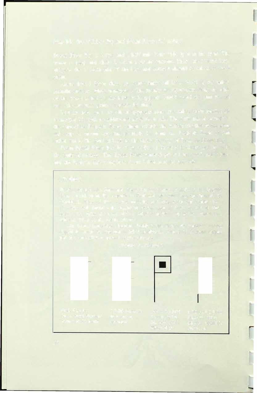
-& i, i. IL ..... & ..... WILDERNESS WATERWAY l Fl mi go \ , •••.. .. Tan am Trail Rt.4 Cit .II........ ...&•.. • & .. .... la\ --;-R ••••••'•....'••'•• • ....• ... •••..• "'.1-• .. • • • .. .. • • • • .. • T A • .I. a • a •• a a ..... . . .. .... .. .... . .. ... .. . ... I • • • • • • & • a • • .........·..·."....·......... .. ...·.·.·................ .. . ..... & .... "' .. .. "':'\............ ....... ,.. . ... .. .. �"-· .... ,J�i -••''....& :iiJ,f�t. � .. • • li a�� � y•••'. ...,.,I••••,......�-·.·.·.·.--.&-... •'• .. ....... . ' • Park bounday.•. ....--.-...... - ..-�.. "" JI. .. . ... .... .. ...... ............. .. . . .. ..... .. .. .. .. ..... ... .. . .. . ... .. .... .... .. . .. .. ...... .. .. .. .. .. .. .. • ....ti. ......... .... &..•...••• ........... ' • Everglades • _____ n R. ......... ........... ............ .II. A .I. .a .... ,, .... .:. . . . .. . .. . .. . .. .. . ...... . .. .. . .. .. .. .. .. .. .. .. .. -� .".... ... .. .. .. . .... . . y Florida j. S ndy � � � � � � � � � � \ � �
OFTHEEUER6LADES

� r.1 [1 2
.J
1�
� r r � J J J J J
AGUIDETOTHE
WILDERNESS
WATERWAY
NATIONALPARK GHILDREN'S ROOM


A GUIDETOTHE WILDERNESS WATERWAY OFTHE
EUERGLADESNATIONALPARK
BY WILLIAM G. TRUESDELL Park Naturalist

Published in Cooperation with the EVERGLADES NATURAL HISTORY ASSOCIATION

m ����F�aOFMIAMI PRESS
Copyright© 1969 by The University of Miami Press Library of Congress Catalog Card Number 71-81621

SBN 87024-119-2
All rights reserved, including rights of reproduction and use in any form or by any means, including the making of copies by any photo process, or by any electronic or mechanical device, printed or written or oral, or recording for sound or visual reproduction, or for use in any knowledge or retrieval system or device, unless permission in writing is obtained from the copyright proprietors.
Photographs courtesyoftheNationalParkService Manufactured in the United States of America
THEWILDERNESS WATERWAY
The National Park Service has marked a I00 mile inside water route from Everglades City on the Gulf of Mexico to Flamingo on Florida Bay. This boat trail winds its way through creeks, rivers, and open bays in the mangrove wilderness of Everglades National Park.
The maps in thisguideto theWildernessWaterwayaredrawnonascale of one to twenty thousand, or 3.17 inches per mile. They are based on aerial photographs by the United States Army Corps of Engineers and T-charts compiled from the photographs by the U.S. Coast and Goedetic Survey, with additions provided by the National Park Service. The maps show the markers and routes; campsites, Park boundaries, Ranger Stations; certain rivers, creeks, bays, lakes, and islands; and some of thevegetation types along the route. Depths in and near the channels are alsoindicated.
The accompanying text gives pertinent and helpful information for both the experienced boater andtheuninitiated newcomer to this famous, remote area.


Whocan usethe Wilderness Waterway
This boat trail is primarily for small craft. It is not advisable for boats with cabins or high windshields or boats over eighteen feet in length to attempt the entire trail, because of the narrow creeks and overhanging branches along some portions of the route. Larger boats can expect trouble navigating some of the creeks. Detours out to the GulfofMexico have to be made by some boats around some of the narrow, shallow creeks. Canoeists are encouraged to use the trail.
Wherethe Wilderness Waterway starts
You may start either from the Ranger Station at Everglades City or from the marina at Flamingo. This guide gives Everglades City as the starting point, but for boaters embarking from Flamingo, the guide can easily be utilized by following the last map first. The pertinent text for eachmap is on each facing page.
For your own protection you should check in and out with a Park Ranger at either place, providing a float plan of your expected time of arrivalor return.
Mudflats onFlorida Bay
v-
Howlongthetrip takes
Persons planning a trip the full length of the waterway should plan on a minimum of six hours by outboard or seven days by canoe. It is not advisable to attempt a round trip in one day. For a more enjoyable trip the boater should consider overnight stops and the possibilities afforded by side trips. Campsites have been provided along the boat trail; see information on p. 64 for details on backcountry camping.
Carryproperchartsandknowtherules
The boater is advised to carry U.S. Coast and Geodetic Survey charts lt1254 (Everglades-Alligator Bay), #1253 {Alligator Bay-Lostman's River, or#642-SC (Wiggins Pass-Lostman's River),# 599-SC {Lostman's River-Whitewater Bay), and#598-SC (Whitewater Bay-Flamingo). These charts give more details about adjacent areas and will be helpful when taking side trips down the many rivers leading to the Gulf, when doing additional exploration, or when looking for good fishing sites.
Be sure to familiarize yourself with the restrictions, suggestions, and information in this guide, including Park rules (p. 24), fishing regulations (p. 16), boating safety (p. 28), and backcountry survival (p. 48).
THE MANGROVE WILDERNESS
Influenced by a tropical climate, the southern tip of Florida has some of the most unusual plant communities to be found in the world. One of these plant communities is the mangrove forest. In the United States, mangrove forests grow only on the southern coast of Florida. In Everglades National Park a wide belt of mangrove swamp borders the shoreline of Florida Bay and the Gulf of Mexico and extends inland to meet the sawgrass of the everglades.
The sprawling mangrove wilderness interlaced by open navigable waterways is a tangled, sometimes impenetrable mass of vegetation. This consists primarily of four dominant woody species: the red, black, and white mangroves and the buttonwood. These species may occur singly or in mixed stands and produce communities which may vary in structure from an area of scattered shrubs to a dense forest of tall trees reaching SO to I 00 feet in height. The best developed forests are located on islands in the mouths of rivers along the Gulf coast. Large portions of this forest area were devastated by Hurricane Donna in September, 1960. The results of that storm, as well as the signs of regrowth, can be seen in this area. Mangroves do not compete well with other trees and tend to be crowded out on higher land; however, their ability to tolerate salt water conditions enables them to grow where other plants cannot survive.
6
All types of mangroves have been grown experimentally in fresh water and on dry land, and the red mangrove can often be seen lining the creeks flowing out of the glades in an almost pure fresh water situation.
The red mangrove is perhaps the tree first noticed because of its many stilt-like roots that seem to be supporting the tree on all sides, arching out and down like the legs of a giant crab. Also often noticeable are the cigar-shaped seedlings that begin growing while still on the parent plant. When these seedlings drop off they may float for great distances before they ground in shallow water and take root.
You will recognize the black mangrove trees by their many pneumatophores sticking up out of the mud. Looking like asparagus, these stalks are thought to act as breathing tubes for the tree. Another unusual feature of the black mangrove is its ability to excrete salt from the leaves. If you check the undersides of black mangrove leaves, you will sometimes find them heavily coated with salt crystals.
Not having the unusual characteristics of the red or black mangroves, the white mangrove is harder to spot but may be recognized because of these lacking features and by its thick and more rounded leaves. Before Hurricane Donna the largest trees along the Shark River were white mangroves.

Inaccessibility and remoteness make the mangrove forest a refuge for many animals, such as the panther, deer, bobcat, raccoon, mangrove cuckoo, diamondback terrapin, mangrove watersnake, and many crustaceans and mollusks. Brackish water supports an immense quantity and variety of aquatic life. Fish, especially mullet, red fish, snook, and tarpon, abound.
Many birds have established rookeries here because the area meets their nesting requirements. Tens of thousands of white ibises, herons, egrets, and other birds roost at night on certain mangrove keys of the Gulf coast, particularly during the summer. You can see many of these birds feeding on the banks of creeks and rivers. This remote area also provides protection for breeding populations of ospreys, bald eagles, and swallow-tailed kites.
It is through this unusual mangrove forest, abundant with wildlife, that the Wilderness Waterway winds its way from Everglades City to Flamingo.
EVERGLADES WILDLIFE
Everglades National Park is known throughout the world as an outstanding biological wilderness. The Park's land mammals include the black bear, panther, raccoon, oppossum, white-tailed deer, and bobcat. These animals, especially the bobcat and raccoon, can on occasion be seen swimming creeks from island to island in the mangrove wilderness.

7
Great White Heron
Two marine mammals, the bottle-noseddolpltin(often caUed porpoise) and the manatee, can be found in the mangroveregionofthePark. There are many varieties of fish, crustaceans, andshellfishthat attract fishermen tothePark'swaters.

The greatest attractions of the everglades are the reptiles and the bird life. The reptiles include alligators, found in the fresh water glades and along the rivers on the Gulf coast, and therare and almost extinct American crocodiles, found only along the northeastern edge of Florida Bay. Snakes are common in the everglades, but not as common as most people fear. Of the twenty-five species here, only four are poisonous, but care shouldalwaysbe takenwhenwalkingthrough thickvegetation.
AU of south Florida is known for its variety of beautiful, rare, and unusual birds. About 80 species nest in the Park and over 300 different species have been recorded. Wading birds such astheherons, egrets, ibises, and spoonbills claim the greatest amount of attention. Throughout the year many of these birds can be seenalongthewaterways. Inthe summer months roseate spoonbills are often seen feeding on the mud flats at the mouths of the coastal rivers. Duringthewinter numerous wood storks can be observed along the waterwaywhen theyreturntonestinthemangrove rookeriesnearthe Gulfcoast.
Much of the evergladeswildlife is missed because visitors seldom take time to look. While cruisingthe Wilderness Waterway, take time to slow down and look. Checkthelowmangrovebranchesright overthewater for an occasional green heron or perhaps a water snake, and peer under the mangrove roots to see if what appears to be alogntightturn out tobean alligator.
ARCHEOLOGY
Perhaps ten or twenty thousand years ago Indians were making their way southward through the North Americancontinent. About2,000 years ago these Indians or theirdescendants madetheir wayintothe area nowcalled Florida. Calusa was the name given to the Indians who first settled along the Gulf coast of Florida. Their mainvillagecenteredaroundtheCaloosahatchee River; however, as many as one hundred or more known encampmentswere spread out through the Ten Thousand Islands, alongthe banksof thelargeriversdrainingthe glades,and as far south as CapeSable. These Indians were fishermen and hunters who took advantage of the abundant shellfish, fish, and wildlifein the everglades. They cooked over

fires, made pottery, and used shells for tools andutensils. Throughoutthe mangrove wilderness, shell mounds mark the sites of former Indian encampments. At the time of the arrival of Spanfah explorers in Florida, these Indians were still livingalongthe Gulf coast. Foratime theyresisted the pressure of Spanish exploration and the movement southward of the Indians from the north. But by the end oftheeighteenth centuryno true Calusa Indians were to be found in Florida. Whether they died of white man's diseases, were all sold into slavery, or escaped to the islands tothe southis unknown.
Early European settlers along the Gulf coast took advantage of the Calusa Indian mounds, since often they represented the only high ground available. They built their homes andplanted fields ofsugarcaneandvegetables. Some of these sites are now protected inEvergladesNationalPark. A traveler along the Wilderness Waterway will have achancetovisitsome of these sites at areas such as Onion Key, Willy Willy Mound,theWatson Place, and the Turner Rivermounds.
WATER
Water is the keytothe life ofthe everglades. Formanythousandsofyears the summer rains have fallen, flooding the glades, and that water has flowed south and westinto the mangrove-lined riversalongthe Gulfcoast. This fresh water mixing with saltwatercreates abrackfahwater zonewith a productivity so great that the surrounding waters virtuaUy teem with aquatic life forms. This aquatic life provides food for an uncountable number of wading birds. It is the base of the food chain for Florida's million dollarfishing industry.
Historically the everglades had a hydroperiod (thetime the gladeswere covered by a shallow sheet of water) of nine or ten months each year. After the rainy season ended the waters in the north around Lake Okeechobee still flowed southward, and at such a slow rate (less than a half mile a day) that the southern glades were covered by water for three or four months after the rains stopped. It was this extra period of flooding that enabled the wildlife of the everglades to survive through the dry season.
Today, however, canals and levees around Lake Okeechobee andinthe flood control areas north and east ofthe Parkdivertnormal excesswaters to the Atlantic Ocean and the GulfofMexico, thusreducingthelengthof time water covers theglades.Thisresultsinreducedproductionofaquatic organisms, which in turn adversely affects thebird, fish, and animal populationsofthePark.

9
Map 1: EvergladesCity toChokoloskee Island (3.1 miles)
Leaving the Gulf Coast Ranger Station, boaters have a choice of two routes that will lead to the privately marked channel from Chokoloskee Island to the Lopez River. Both routes pass the square, brown, creosote polewitha white wooden flagandblack numerals, the Everglades National Park marker J30. Markers of this type are the ones to follow on the WildernessWaterway as youcontinuetoward Flamingo.
Following the established Coast Guard marking for the Florida west coast, the marker numbering on the Wilderness Waterway starts at the south and increases going north. As you go north the odd numbered markers should be on yourleft and the evennumbered ones onyour right. The numbers will be consecutive except in those areas where markers cannot be placed;inthesecasesthe numbers willbe skipped.


If you choose the shorelineroute, follow the small stick poles carefully after passingunder the causeway to avoid the oyster bars.
If you choose to run directly south to Chokoloskee Island, proceed with caution around the island, where numerous oysterbars surround the shoreline.
Easily accessible from Chokoloskee Bayare two Park Service campsites, both located on the Gulf ofMexico on the outside of the Ten Thousand Islands. The first campsite is on IndianKeyand canbereachedby following the U.S. Coast Guard channel from the Barron River. The second campsite can be reached by following Rabbit KeyPass to Rabbit Key (see Map 2).
A ranger-ledboatacadeheadsforbackcountry


Map 2: ChokoloskeeIsland toLopezRiver(2.8miles)
Passing Chokoloskee Island notice the height of the land. Chokoloskee is a 27-foot high Indian shell mound covering about 144 acres. The Calusa Indians lived on this island and on the shell mounds at the mouth of the Turner River perhaps as early as2,000 years ago. The Seminole Indians are responsible for the name "Chokoloskee," which means "old house."
Coming off either route-from around Chokoloskee Island or from the shoreline-the boater will easily spot the large pole markers that lead from Chokoloskee to Rabbit Key Pass. Follow these private markers closely, as numerous oyster bars lie just below the surface of the water, and the bay can be quite shallow during low tide.
As you approach the private marker numbered 33, you will be able to see the Park Service marker 127 at the mouth of the Lopez River.
Areas such as the mouth of the Lopez River at low tide often offer a good opportunity to see some of the Park's more spectacular wading birds. Be on the lookout for roseate spoonbills, white ibis, little blue herons, and other birds that make their homes in the mangroves.
Oyster bars buildupat mouthsofriversandon mudflats

,..


Map 3: LopezRivertoSundayBay(5.5 miles)

From markt:r 127 at the mouth of the Lopez River up the smooth waters there will be no markers until 126 at the Crooked Creek turnoff.
Between the mouth of the river and the campsite there are several oyster bars-be alert to avoid running aground. The north side of the small island near the mouth of the river has the deepest water. At this point there are oyster bars in the middle of the river.

At the next bend upstream there is an oyster bar on the north side. At the next sharp bend there is a mud bank on the north side.
The Lopez River bears the name of the Spanish family that settled in this area in the late I 800's and lived on the river for two generations, and whose descendants are still living on Chokoloskee Island. The Lopez homesite is located about halfway up the river on the right bank, just after the sharp bend. You can spot the site by the huge stone cistern that remains.
The National Park Service has cleared a campsite here, and a table and grill are provided. The boater who wants to do some fishing can camp here and have his choice of fishing among the Ten Thousand Islands or farther inland among the many rivers and creeks. Observe fishing regulations where they apply (see p. J 6 for fishing regulations in the Park).
I
Hu"icone-domaged mangrove treesline theriversin thePork


Map 4: SundayBay to OysterBay(3.8miles)
Markers 123, 121, 120, I 19, 117, J 16, and I JS can be followed with ease across Sunday Bay and into Oyster Bay. Run close to shore between markers I I 3 and J 14 while entering Oyster Bay.
Sunday Bay is the first or northernmost of eighteen major bays along the Wilderness Waterway. Most of these bays are brackish, affected both by Gulf tides and fresh water flowing from the many creeks and rivers that drain from the everglades. This brackish water zone may be as much as twelve miles wide. The width depends on the quantity of fresh water entering the coastal area and hence is greatest in wet years and is reduced during times of drought. It is most extensive in the fall when high ocean tides combine with the peak fresh water runoff to produce extensive flooding of the coastal marshes. The brackish water zone is generally associated with or adjacent to the mangrove belt.
FISHING REGULATIONS IN THE PARK
Salt Water
No license is needed for salt water fishing in Florida except for out of state residents who plan to sell fish or for seafood dealers.
Observe closed seasons: check with local game wardens or Park Rangers for dates of closed seasons on oysters, crawfish, stone crabs, etc.
Return undersized fish to water unharmed. Minimum sizes pennitted:
Bluefish-10 inches
Flounder-11 inches
Mackerel-12 inches
Mullet-12 inches
Observe limits on gamefish: Sailfish-2 only in possession
Pompano-10 inches
Redfish (red drum)-12 inches
Snook-18 inches
Trout (spotted, sea, weakfish)-12 inches
Shad-15 a day by hook and line
Snook-4 a day; l day bag limit
Tarpon-2 only in possession
Fresh Water
A state fishing license must be obtained to fish in the Park's fresh waters. All state fishing regulations apply in Park boundaries. Obtain a copy of the Florida Fresh Water Fishing Rules from the Florida Fish and Game Commission, Tallahassee, Florida.
(continued on p. 18)


16
I I

Continuing southward through the brackish bays, follow the markers as indicated on the map. Marker I09 is on anoyster bar; runnext to shore in thisarea.
If possible, also take time to look for themanyaquatic organisms that thrive in thiszoneof mixingwater,the most highly productivelife zone in the Park. Collecting land-derived nutrients andconverting them toorganic food material, this life zone provides an abundant food supply for many small aquatic organisms that areinturn feduponbylarger ones.
Killifish are the dominant fishes of the brackish marshes. In shallow areas these fish are fed upon by large wading birds such as great blue herons, Louisiana herons, and many others. In deeper waters theyare the food for many large fish, such as trout, which are in turn prey for larger fish such assnookandtarpon.
FISHING REGULATIONS - continued General

The following regulations apply to all waters within the boundaries of Everglades National Park:
Collecting, attracting, or feeding fish is prohibited.
Seahorses, starfish, and tropical fish may not be taken for commercial purposes. It is unlawful to buy or sell gamefish. Persons engaged in commercial fishing must have an annual permit.
The taking of oysters or clams for sale or commercial purposes is prolubited. Visitors may gather, only by hand or rake, a reasonable amount of oysters or clams for personal use only.
The taldng of crawfish by any method for commercial purposes is prohibited. Crawfish may be taken by hand or bully net during the open season prescribed by the State of Florida.
Ask a local conservation agent or Park representative about local rules of interest concerning nets, traps, etc.
There is plenty of fishing for everyone in these waters. Don't infringe on the other fellow. Respect his privacy, give him plenty of room, and don't interfere with his catch. When anchoring to fish be sure not to block boat channels and narrow watenvays. Doing so may cause accidents or make other boats go aground trying to avoid your boat.
Map 5: OysterBay tolastHuston Bay(4.3miles)
18
I l [ � � � � � l i � � � \ ], �
l-----�------��


' �l � � � ;J ) )
Huston Bay
4
Last Huston Bay
Map 6: LastHuston Bay to ChevelierBay(3.5 miles)
Chevelier Bay is shallow, with many bars. Run near shore between markers 91 and93 and95 and97.
Another Park Service campsite on the Wilderness Waterway can be reached by turning down the Chatham River toward the Gulf of Mexico. The camp, located about a mile from the turnoff, is at the homesite of the notorious Ed Watson and provides a picnictable, grill,and clearing for campers.
Ed Watson grew sugarcane here and made syrup, grew vegetables, and delivered his crops to the ports of Fort Myers and Key West. He is best known for his misdeeds. He allegedly hired persons with questionable reputations who oftenturnedup missingwhen it came time for them to be paid for their work. Watson met a violent end when he was shot in a confrontation with some of the local citizens on Chokoloskee Island in 1910. The remains ofhis house were razed after Hurricane Donna in 1960, but evidences of his farming operations therestill remain.

( l [ l l l l
Where sugarcane once grew, mangrove vegetation is now taking over


Map7: ChevelierBay toAlligatorBay(3.6 miles)
Follow the markers along the shore of Chevelier Bay. At marker 87 you will see the Darwin homesite built on a shell mound of the Calusa Indians who lived along the west coast of Florida up to the time of the first Spanish explorers.
Arthur Darwin, who says he was born in I 878, moved into th.is home just before the establishment of Everglades National Park. The last and only private citizen still living on Park land, he will be allowed to live out his life at th.is location.

Darwin was born in Arkansas, but grew up in Texas. He left Texas in 1934 when "everyone else was going to work for the WPA," as he preferred to work for himself. He worked as a hunter and trapper in the Lostman's River area and later as a carpenter and boat builder in the Everglades area. He retired to his present home in 1945 and constructed his house of cement and shells from the mound. In late spring the large royal poinciana tree at the water's edge will be covered with beautiful red blossoms.
After entering Tarpon Bay, watch for the mud bank near marker 77; stay close to the marker to avoid this bank.
You now enter Alligator Creek, one of the narrowest and most exciting areas of the Wilderness Waterway. Th.is creek is only about two boat widths wide and is covered by a canopy of low branches. The Park Service recommends that larger boats seek an alternate route, possibly returning to the Chatham River (Map 6, marker 99) and out to the Gulf of Mexico and down to Lostman's River, returning to the Wilderness Waterway via Lostman's (Map 10, marker 52).
Canoers onAlligatorBay


As you leave AIUgator Creek you will pick up marker 75 at Alligator Bay; follow markers 73 and 72 into the small bay locally called Dad's Bay, and 70 and 68 into PlateCreek.
Plate Creek is also narrow and has many logson thebottom; run slowly throughthis stretch of water.
When you enter Alligator Bay,take note of the way the tide is flowing. You will find that if the water is flowing with you in Alligator Creek, it will be moving against you in Plate Creek. Also note that the water in this area is quite clear. A taste will tell you that it is almost completely fresh water. However,it is notrecommendedfor drinking.
As you move through this area, look for indicators of fresh water such as the sawgrass that covers the glades. It can be seen along creek edges, together with cabbage palms, leather ferns,and an occasionalstrangler fig.
If you haven't seen an alligator by this time you may wonder where Alligator Baygot its name. From a population of three million aJJigatorsin Florida in 1800, the population dropped to 300,000 in 1900, andis now estimated to be reduced 90% more. Even though laws have been passed makingitillegal to hunt alligators in Florida,poachingstill goeson. Arthur Darwin stated that before his homesite became part of the Park he killed between 100 and 150 alligatorsthere,buttherearenone there now.
OTHER PARK RULES AND REGULATIONS
Hunting is not permitted and firearms are not allowed in the Park. No airboats or "glades buggies" are allowed anywhere within Park boundaries.
Dogs and cats are prohibited in the Park unless kept on leashes or other physical restraint or control.
No killing or collecting of biros, alligators, turtles, trees, plants, flower.;, or other forms of life, including orchids and air plants, is permitted in the Park.
Camping in other than designated areas is by permit only.
The building of fires is prohibited except in designated campsites or by campfire permit. No burning or collecting of driftwood is allowed.
Accidents involving personal injury or damage to the boat (other than scratched paint and sheared pins) should be reported to the nearest Ranger Station as soon as possible.
Any questions or suggestions concerning Park regulations will be welcomed by Park personnel.
Map 8: AlligatorBaytoPlateCreekBay(4.3miles)
24
[ ( ( C C [ ( { ( ( ( l [ l l [


Follow markers 62 and 60 through Lostman's Five Bay, 59 and 58 across Two Island Bay, and 58, 56, and 55 through Onion Key Bay. Between markers 59and 60watch closely to avoid two shallow banks.


You will undoubtedly notice several cabins along the waterway inthls area. Unlike Darwin, who is living on Park-owned land, these cabins are located on private land not yet acquired by the National Park Service. The failure of Congress to appropriate enough money for the Park Service to purchase all of the land withinthe authorized Parkboundaries has left the Park with many inholdings. As of 1969 much of the area near the waterway here is still in privateownership.
One of the two islands in Two Island Bay is disappearing. Whereas it takes years for mangrove islands to form, they can be destroyed overnight by one hurricane. High winds uproot trees, and surging tides wash away thesoiluntilthere isonlysmooth water where an islandoncewas.
Onion Key Campsite provides picnic tables, grills, a pit toilet, and, in summer, plenty of mosquitoes. During the 1920's OnionKey wasthebase camp for anambitiousland development scheme planned for theareanear the mouth of Lostman's River (Map 10). About twenty frame and canvas buildings occupied the one-acre island of OnionKey in 1925;however, the 1926 hurricane completely destroyed the buildings. Thereafter the development company reestablished their headquarters at the mouth of Lostman's, but the project soon folded. A Park Service patrol cabin now marks the siteof the proposed development.
 Raccoons arethemostabundant land mammals in this area
Map 9: PlateCreekBay to OnionKeyBay(3.0miles)
Raccoons arethemostabundant land mammals in this area
Map 9: PlateCreekBay to OnionKeyBay(3.0miles)
26 t � l � IJ � � � ( 0 L 0 (


Bay -
Onion Key Bay MuUc1
Map 10: OnionKeyBay to ThirdBay(3.8miles)
Between markers 55 and 53 you may wish to take a side trip to Lostman's River, which offers interesting areas for fishing and exploration, especially for campers from Onion Key. If fishing or pleasure boating in the area, watch for the numerous oyster bars at the mouth of the river.
During the winter months sand bars along the river are sometimes covered by wading birds feeding in the shallows. A sizable flock of white pelicans frequents a sand bar at the south end of Second Bay in Lostman's River from about December to April.
For the fisherman who wants to go all the way to the mouth of the river, there is good redfish and snook fishing all year around near the oyster bars. The oysters are edible but are not of commercial value because of their small size. They are often called "coon oysters" and are eaten by the raccoons that are abundant in this region.
BOATING SAFETY
Before boating in Everglades National Park or any water recreation area basic safetyprecautions should be taken.
Know how to swim
It is advisable to learn how to swim or at least how to save yourself and your family if an emergency should arise.
Maintain a safe boat
I. OneCoastGuard approved life-
4. Device for bailing saving device (jacket or cush-
5. Extra lines for towing ion)for each person aboard
6. Paddles or oars
2. Coast Guard approved fire ex-
7. Basic tool kit tinguisher
3. Emergency whistle or horn
8. First aid kit
9. Compass and charts
Have fixed boat equipment as required by state and federal laws. The Coast Guard Auxiliary will provide free boat safety examinations. All boats should be checked for the following:
I. Right size motor for hull
2. Proper lights for bow and stern
3. Registration numbers
4. Anchors with ample line
5. Approved safety gas cans
(continued on p. 30)
28
l l l t { ( ( � � � � � � � �


Map 11: ThirdBay toRodgersRiverBay(3.5miles)
Third Bay and Big Lostman's Bay are in the drainage of Lostman's River. These bays are fed by numerous fresh water creeks flowing out of the surrounding everglades. At the east end of Big Lostman's Bay, Lostman's Creek leads into one of the prettiest areas of the Park and to the turnoff to the campsite on Willy Willy Indian mound (see Map 12).
BOATING SAFETY -continued
Safe boat handling
Boarding: never jump into boat; step into center. Be sure lines are secure. Hand gear from dock to center of boat.
Loading: don't overload boat; distribute evenly and keep it low.
Getting underway: start motor before casting off. Start slowly, watching for other craft. Make sure non-swimmers and children are wearing life jackets and that additional life preservers are nearby for other passengers.
On the water: Be alert for bad weather, other boats, swimmers, sand bars, fishermen, and low branches of submerged logs in narrow creeks. Operate at safe speeds. Do not stand up in small craft unless necessary. Watch for fire hazards on board. Stop to help others if needed.
If you're in a large boat, watch out for smaller ones. You are responsible for the wake of your own boat. You will pass numerous fishing parties; remember to slow down and not make them struggle to keep from being swamped.
When traveling through narrow creeks and rivers, always be prepared for the approach of an oncoming boat. Travel at a slow enough speed as to not cause the other boat lo have to run ashore to prevent a collision. When underway also be sure to watch for fishermen who might have nets out.
When boating in any waters remember to be courteous. If you are uncertain who has the right of way, yield. Local Coast Guard stations or the Florida Boating Council, Tallahassee, Florida, supply information on boating regulations and safety. Boaters should be as familiar with these as with the laws governing the driving of automobiles.
Learn and observe the boating "Rules of the Road." Coast Guard and United States Power Squadron boating courses are available in many communities.
See also "Survival in Backcountry," p. 48.
30
( [ ( ( ( ( C C C ( ( ( ( ( ( [


�-J•:���---· � ,/{'it�� Rodgers River Bay frl��-�-i'#-�. ' °>:,:/(,' ' <' ••••• ••• :\/{:/ I"' .... '. --� ' .:,::::::::::::: ' 4 �"'"''"• • ' • ,. .. • , grass •• '-\ifl � ' , v,s..-""'-·,_., .• �--\' . ' • � ' • ��.,..i!' -:�� • I I 41 6.tz:;, 4'' \ \ \ \ \ \ BigLostman s Bay \ \ 4 \ \ \ 39 ..·.. · .. .. .. .. .. .. .. toWill Willy cam • : ' • American egret rookery I4I ,..,.....,.,,,,,,,.,. " �� iv"-� ..'ll>�" "'. , � , n : \ � ,, t 38 , • ' : I •• , , -� I i ,,O',.
Map 12: RodgersRiverBay co CabbageIsland(3.5 miles)
Lostman'sCreek Turnoffto Willy Willycampsite
To reach Willy Willy camp, proceed up Lostman's Creekto RockyCreek, which flows into Lostman's from thenorth. Asmall mangrove islandwith one cabbagepalmmarks theturnoffto RockyCreek. Asthe name implies, there are rocks inthiswaterway,and duringperiodsoflow watertheycan be hazardstoboaters. You will beable to seethe rocksjuttingupfrom the creekbottomthrough thecrystalclear water.
This irregularly dissolved limestone rock underlies most of the everglades and can be seen where fire has burned off or water has washedoff the overlying peat soil. Because of its rugged appearance it is called pinnaclerock.
Like many of the other campsites on elevated land, the Willy Willy mounds are shaded by such tropical trees as gumbo limbo, marlberry, cabbage palm, strangler fig, pigeon plum, and white stopper. These trees are also found in the hammocks or tree islandsthatoccur throughoutthe openeverglades.

Going through Rodgers River Bay southward, notice the two small islands indicated on the map that have served as a rookery for nesting Americanegrets, anhingas, and cormorants. Theseislands,aswellas many other similar ones, are close to vast foodsuppliesandoffer partialprotection from predators such as raccoons and bobcats. These animals have beenobservedswimming inthecreeksandbaysin thisregion,however,so complete protectionofnestsisnotpossible.
Birds may be seen roosting from February through October, with the heaviest nesting activity beginning in June. The area should not be approachedcloselywhenthe birdsarenesting.
Typical vegetation ofhammocksorformerIndian mounds
[ ( ( ( ( ( C C C C C C C C C C


� �n T� !, � � � J .J ) .J .J ·,.. MapNo.12 .... 4 .. .. .. BigLostman'sBay .., ' ' ' ' ' Americanegretrookery ' \ \ - "l-.•••••••,.-;.,;;Cl· ;,c����.t-fil-:f��.E.'�� r��•.•,•.��r ��-.��:'rr� �•� ',':�.•.•.,-� RockyCreekBay WillyWillycampilid .. ·.·.·.'>l': ' �.Ji<"•"'�$;,� ·-::::::�-"--ll��· i::-.�1�'\:.-:-::· • , ••:,,,•, y••.•• • •••• "'-"<:��..,·�• ••••••••.•••••••••.••••:�'j�·-·.·.·.·.·.·.·.·.· /•,,p,;,,•,::•::::::::::• (. - ".•.-".. . ">,;1 . °'·LS{:� 4 ', <ti ' RodgersRiverBay ', ', ' ,...... ........ ... ,. ......... . .. ... .. .. .. , .......... .......,..... .... ..... ........ .. ... " ...... • • • • • • • & .. .. • • ... • JI ..... $ �-:,,-����..............- :://:/:::::t:� :· ffe-,i,.,;::�����:(f;� <<<•:-:-:.:-:<<<< � ..."....,.... \ .............. r ·-:.>>:<<<<<<<· ' �:-:..;.;..:-:-:-:-: �......�,_:�·"•""''..... ,:,-,�:-:-:-:-:-:-:.:-:. ,,.ff....... I Ii. I.•• I'_"• "'.!€,�•<:¼' :·���.i..l'.1 •� ••.•• �-".· .....·.·.·.·.·..·. . ............ • • • .. .. .. & .... � ·"'·&·•�·.'",,,." ,. ,.,',. . . ( ,,,_�--· ... ·.:w.¼�•.•.•.• •.�Y �•.·.•.· . ��.,,:�'·• .. ...... ,.,,..�.. -� 'I"' • I 1) 8 ..... Q.. ... ................... ...... " ........... ... . .... .... .. ... ....... . ...... ."... .•.·.<<<<<·-� .•.•.•.•.•.•.•.• :>fP,� '·.•••••�;i�t:��!i,: �"tt-' ••••••••••••··1;,.';,,�i�� .:'\,�.... 1-,· •••••••••••••)�,,.,,,.,. .-<�-,. �1�_,3/1��_.;\,' �'�•',E%·�if-r,.�"t ...,,,�.,olfi!t1.�.:.,;.rtU.,�,,.:.jl.;i.·�i,i½�.x•J,;
Airplants onbuttonwoodbranches
Map 13: CabbageIsland toBroadRiverBay(3.1 miles)

Passing through the Cabbage Island region of the Wilderness Waterway, taketime toslow downandlook at thevegetation. Among the branches of many of the buttonwood and mangrove trees are numerous epiphytes,or airplants.Theseplantsincludesomewildorchidsandbromeliads,many of which resemble wild pineapple plants. These air plants are not parasites, but take all their nourishment from the air. Rigorously protected here in the Park, these aerial gardens should be ofinterestto passers-by formany years.
At the eastern end of Broad River Bay, at marker 26, boaters can follow the rivertoCampLonesome,anotherParkServicecamp locatedon an Indian mound. Tropical vegetation is plentiful on this mound, with gumbo limbo, cabbage palms, bananas,seagrapes,and nickerbean growing at this site. When approaching the camp, look for the arched mangrove trunkthatmarkstheboatlanding.
While many of the Seminole Indians hunted in thearea now belonging to the Park, very few established their homes in the area. One notable exception was Camp Lonesome where, as late as 1947, well built chickees werelocated.
In the Camp Lonesome area evidences of fresh water marshes can be seen. Look for the tall stalks of maiden cane, a close relative of bullrush. These plants are found near sloughs andpondsthroughoutthe everglades.

34 [ [ [ l l l l l t � L [. l l [ t


Map 14: BroadRiverBay andBroadRiver(3.8miles)

Broad River Bay is a two and a half mile long wide spot in the river. The water is deep and there is often a strong current. There are several large snags at the western end of the bay, and caution should be taken to avoid them.

Along Broad River there are some fairly tall trees. Most of the taller, straight ones are white mangroves. The mangrove vegetation along the edge of the water is not as extensive as it appears. Just beyond the thin row of trees the sawgrass prairie extends for miles.
You are now on a stretch of approximately five miles, from marker 26 to marker 25, with no additional navigation aids. The only major turnoffis the Cutoff to Rodgers River, which affords the visitor another interesting side trip. A circuit trip can be made by using the Rodgers River to run eitherout to the Gulf or back to the inside by way of Rodgers River Bay.
From Broad River Bay by way of Broad River it is about five miles to the Gulf of Mexico. The Broad River water depth is between 7 and9 feet, andthe Rodgers River depth is about 7 feet at mean low tide.
STORMS
Every year between June and November an average of eight to ten tropical storms build up in the Atlantic or Gulf and spin their way up through the Caribbean. Some of these storms intensify to hurricane strength (winds above 74 mph) and threaten the mainland. Some years as many as two or three storms may strike the coast, while in other years they may all blow themselves out somewhere in the North Atlantic.
Any boater launching a boat in Florida waters during the hurricane season should be aware of expected weather conditions. Boaters at all times should pay close attention to posted storm warnings.
STORM WARNINGS
RED FLAG: Small Craft Warning (winds to 38 mph)
2 RED FLAGS: Gale (up to 54 mph)
SQUARE RED 2 SQUARE RED FLAG WITH FLAGS WITH BLACK BOX: BLACK BOXES: Whole Gale Hurricane

36
( 0 0 [ ( [ C C [ [ .... [ r


� J J J J Ji J � J J .) .) ') ) Ji
Map 15: BroadRiver to WoodRiver(3.6 miles)


Broad River campsite, approximately one-tenth ofa mile north of Wood River, offers boaters apicnic table,grill, and a clearing for camping. For boaters staying overnight in this vicinity, there are numerouspossibilities for loop trips and explorations. The U.S. CoastandGeodeticSurveychart #599..SCshouldbeusedifsidetripsaremadehere.
Between BroadRiverand BroadCreekarethemostnarrowandshallow creeks along the Wilderness Waterway. If you enter thisareaat lowtideit is best to run outside to the Gulf, using the unmarked alternate route insteadof thewaterway,between markers25 and J7 (see Map 16).
Watchfor the manysnags in the shallow creeksalongthe waterway
�--- -:r--":-;r,.· .. " :.. ._ .. .. .
,. ,. ... ,. .. .. .... r ... r


Map 16: Wood River to Broad Creek (4.8 miles)

Broad Creek between markers 17 and 21 is very shallow, and between 21 and 23 passable only at high tide. Other creeks are passable most of the time, some with less than half-full tide. Even then the boater may have to lift his motor over logs that criss-cross the creeks. Run only at very slow speed to avoid hitting snags sticking up out of the water, and in shallow water, logs on the bottom. This route should not be attempted by boats over 18 feet in length, and for complete assurance of safe passage at low tide, all boats are advised to take the alternate route to the Gulf and around.
The simple alternate route takes only about I 5 minutes of time and could save perhaps an hour of frustration. Using the alternate route, pass two creeks emptying into the Gulf between Broad River and Broad Creek, and turn up the third opening, as shown on the map, picking up the waterway again on the other side of the narrow creeks described above.
Going to the outside is also very rewarding at this point if one wants to shell along a sandy beach or wade in the warm Gulf waters. Just north of the mouth of Broad River the white sands of Highland Beach stretch for about three miles. During low tides larger boats wiJI have to anchor offshore, as the slope from shore is very gradual.
The shallow waters of Broad Creek and the narrow creeks between it and Broad River provide some of the best feeding grounds for many of the Park's wading birds. American egrets, snowy egrets, Louisiana herons, and white ibis move about in th.is area in great numbers. During the summer and fall roseate spoonbills can be seen wading along the edge of the creeks during low tides.

Even though it is an excellent opportunity to see bird life, these narrow, shallow creeks may go completely dry during low tides, and the alternate route is strongly recommended.
Roseate Spoonbillsfeed alongthe westcoastin summermonths
[ [ [ [ [ C [ [ [ [


� � l � � J l �
MapNo. 16
Map 17: BroadCreek toHamey River(5.2 miles)

Throughout the Park, rivers, bays, and islands carry the names of famous explorers or early settlers. The Harney River was named for Lt. Col. William S. Harney of the United States Army, who led a savage campaign againsttheSeminoleIndiansduringthe 1830'sand 1840's.
It was on December 4, 1840, that Harney and !tis men started on the expedition that brought him eventually out to the Gulf of Mexico bythe river that nowbearshisname. The expeditionwasorganizedto pursue and capture the Indian Chief Chekika, whose band had raided Indian Key across Florida Bayandkilledanumber ofpeopleincludingthe famousDr. Henry Perrine. Hamey's party started out from the mouth of the Miami River into the glades in canoes. They found the Indian leader and his people at Chekika's hammock about 35 ntiles west of Mianti. Here, Chekika was shot and hanged. After this raid Harney and his soldierscontinued in theircanoes to travel west from hammock to hammock,searching out and destroying Indian camps. Twelve days after the start ofthe expeditionthesoldiersemerged on the GuJfcoast.

[ [ [ [ [ [ (


Map 18: HarneyRivertoCutoff toNorthHameyRiver(3.5miles)

One of the prettiest boat trips in the Park can be taken while in the Harney River area. By starting at the mouth of the Harney on the Gulf of Mexico, the boater can travel up the Harney River, across Tarpon Bay, up Avacado Creek and Rookery Branch all the way to the fresh water glades. This represents about a 25 mile trip from the Gulf. Rookery Branch is closed during the wading bird breeding season.
The Wilderness Waterway will bring the boater to the middle of this trip, offering the opportunity to proceed in either direction-out to the Gulf or to the inside.
Taking the entire route, the boater will pass through salt, brackish, and fresh water zones. Because the brackishwater zone lies between the others it is impossible to draw a sharp line indicating the end of salt water influence and the beginning of fresh water influence, and at certain times of the year tidal flows extend much farther inland than at other times. Also, even though the mangrove forests grow primarily around salt water, they are capable of growing in pure fresh water and can be found along the creeks at the headwaters of most of the rivers flowing from the everglades.
Aerialview oftheEastRiverrookery


�......-► • !=t,, tr .�•, . . .' .� ,. [ [ [ ( [ ( [


Map 19: NorthHarneyRiverCutoff toSharkRiver(4.0miles)

By leaving the Wilderness Waterway at Tarpon Bay and traveling farther inland along Avocado Creek, the boater will come to the Park Service campsite called Canepatch. Here there is a small dock, clearing, picnic table, griJI, and pit toilet. Sugarcane is found growing wild in this area, and wild limes, banana, and papaya trees are present. This site was one of the Calusa Indian mounds, and later used by Seminole Indians. One authority reports Indian chickees on the site in I928.

About two miles above Canepatch is another campsite on an Indian mound. This is Little Banana Patch, so named because of the banana trees growing there. Those boaters going to Little Banana Patch will find this area much more primitive than Canepatch; however, during the winter season visitors to the area are often rewarded by the coming and going of large flocks of wood storks and other birds from the nearby rookery located farther up Rookery Branch. Because boaters are likely to disturb nesting activities, the passage into the rookery is closed during the nesting season.
In the United States wood storks nest only in peninsular Florida. Several rookeries are located in Everglades National Park, and there is also one at Corkscrew Swamp, northeast of Naples, Florida.

The Florida population was estimated in 1969 to be between I 0,000 and 12,000 birds. These birds are considered a rare and endangered species because they are so closely dependent on the diminishing everglades water supply.
In addition, many of the common fresh water species of birds found in the Park, American coots, common gallinules, and numerous species of ducks, are present in this area.
I I
' I,,. r ,..... r r .. r w [ 0 0 [ [ C n 0


•.• •••••• •.•.•• i'!\';·.·.·.·.·.·.·.·.·.·.·.·.·.·.·.·.·.·.·. •.• Map No. 19 • • f- • • • • • • • • • • • • • • • • • • • • ,.,__._.,,,. --�-��; • •:-:-;-:-:,:.:,:,;.·••••<N'.-'.-:.:.: .t..... . . . . . . . . . .. . . . •'f ........................... ........ ... .. .. .......... .................. . . ..... .................... ........ ................. .... ·...· . .. .. · .. ·...... .. .. .. . .. . .. . .. .. .. .. .. ... · . .. .. .. ... .. ..·.. .. .. .. . .. ... .............. .... ............ ............. .... . ........... ... .... .. .... " ............ .. ... ...."." ............................. ............................................ " .................................................. . · ........ ...................· . · .. · . . . .. . .. .. . .. .. .. .. . .. ... · . -. .. .. .. .. .. . .. . .. . .. .. ... ... ·.·.· I & I, _.. & 4 & .a .& & " & _. _. • JI•& • & _. & .._ " _. I. _. I. • & & • ll .. ·--:.:.,, ...................................................... I & .f. _. • .a 4 "-"-.I. ..0 "-_. & & _. • _. _. _. ._ _. • .& a _. <I _. _. ,t & _. & a ... ......................... ' ....... ,............. .... . .............................................. ..... ...................................................... ;...:->:..:.. .:•·.-.. • ·e•t:e;·:..:•:·:<·:">:..:•:·:•:·:•:·:·:·:..>:..:<<..:<·: .......................... . .. .. .. .. .....- .. .. . .......... .. .. ... .. . . .. . . .. . .. . . .. .... . . . .................. .. . .. . . ... .. . . ......... .. .......... ........................................... ,......................i..•.·......•••......·.. ;,c,t.�a.. •••..•..•••••.........•..........................•..........•........ ·.·.·..·.·.... · . · .. · . .. .. .. . ..,.'..... _,_,... ......... . .. .. .. .. .. .. . · .. ·............ ,....••.i..•.....•..:.·.·......•••..·.. .. ..... .ii .ii. <I. ... & ' ....................... .. .. .. & ........ ........ . ' •••• & ...... .. ....... .. ........................ • .. .. & .... ...... ..... ...... .. .. .. .. • • .. & .... ....... ....... .. ' ..................................... ... ....... ... .......... ......... .................................... ...................................... I • • & 4 II. • • • • <I _. • & • • & a _. a. • ,t a .. • ......................................... .. - ..... ' ....... I • a • • a a .. a & & • • • • .. & • • • _. a & .. • • :})\}}}!(}}{}}{}}!{{{f{ ����r : ................................... ,........ ... ........ .................. " :::::::::::::::::::::::;:::::::::::::::::::x<::::::://::::::::::::::: ::::::::::::::::: • .. .. .. • .. ... ....... ....... & .. • ... " .. ... .. .. ... .. .. • .. .. ....... ...... .. . " .... .......... ... ............. . ... ............. ................ ::/· ::::/:::::::::::::::/:::::::/:/:/:�-. .-:,::;:::::::::::::: : ......•..•..• .. .. ...��ll!IF. ,:::::::::\:::::// I},(,' 1: .... , . .. .. . .. ·� ........................ ,,_ . .·...·.·.·.......... ·.·.. . ...... ... ............ .. .... ................. .. 1:-:-:.:-:-:-:.:-:.:-:-:-:.:. -i, ......... .. .......... . �:::::::::::::::::::::::::::: ... ' .... .. .. . .. . . . .. . . .. .. ......:.. <:::::::::::::::::.:•:. ?'•• ...:,:11,-1,,;;,- ••••-:-:-:-:-::::::::� .....:...:.:..:..>:..:......:..:....... .. ....:.:•:-:•:•:..:.>:.:..:<.:.: .................. ............................ ......... .. ... .... ., .................................. :::::::::::::::::.:•A;91_ , • ::<•>::-:-:::::::::::::::::::::::::::
Map 20: SharkRiverviaGunboatIslandtoLittleSharkRiver(2.5miles)

People have talked for years about going to Flamingoin theeverglades to fish. And when they arrive at Flamingo they learn that one of the most popular fishing areas in all of Florida is up around theShark River. Some forty-five species of fish are caught by Park anglers;mostofthesearesalt water fish and can be taken in theSharkRiverarea. Arichfishingground because of its estuarine character, it provides abundant aquaticorganisms for food, shelter, spawning, and nursery areas for many species. The list includes such notable foe of theanglerassnook,redfish, seatrout, several kindsofsnappersand groupers,and thesilverytarpon.
Except foronesmall island, Gunboat Island, so-named for its shape,the Shark River is wide, deep, and uninterrupted between Tarpon and Ponce deLeonbays.
SURVIVAL IN BACKCOUNTRY
Prior to starting a trip on the Wilderness Waterway, each boater should be certain that he is prepared to meet emergencies. Spare parts are essential to insure completion of the journey. Numerous oyster bars and submerged logs lie just under the water's surface in some areas and can easily shear a pin or dent a propeller beyond use.
Besides carrying extra shear pins and props, the boater may want to carry extra spark plugs and a set of tools. Always make sure that the motor is properly tuned, the battery is in good shape, and the running lights are working properly.
It is recommended that you carry enough food and water for a few extra days more than the expected length of your trip. Water is not available along the boat trail. It is also advisable to carry first aid equipment on board.
For your protection, check in with a Park Ranger before leaving Flamingo or Everglades City. Give him your itinerary and expected time of arrival. Also check in at the other end on arrival.
In case of accident remain with the boat. Park Rangers will search for overdue parties with aircraft and can spot boats more easily than individuals.
Recommended reading: MarinersAboard, Survival, OutdoorsmenAshore, by William B. Deichmann,Great Outdoors, paper,$1.00.
48
,1 .. ,,....,,1 i.. ,-1 I. r L r r I � [ r I • r ""'


Map 21: littleSharkRiver to OysterBay (4.3miles)
Along Shark River is what is perhaps the largest and best developedmangrove forest on earth. Local authors and historians described trees inthat magnificent forestthatmeasured over80feet in height. You won't see any trees quite that tall now, or for quite a number ofyears more, because in 1960Hurricane Donna moved up the Florida coast and tore thetopsout of the tallest trees. The mangrove forest was not totally destroyed, however, anditwillcomebackjust asit undoubtedly hasdoneinthepast.
Hurricanes are just as much a part of the natural features of the everglades as the many fires that ltistorically have burned the open glades. Even now, less than a decade after the violent storm, mangrove saplings have stretched to heights of 15 to 20 feet where the forest was almost leveled by the hurricane. Whereas some areas were hard hit, others withstood the fierce winds, and some tall mangroves can still be seen. One of the best stands can be found near the mouth of the Little Shark River. Heresome ofthe treesare60to 70 feet ltigh.
The Shark River, Little Shark River, and about ten other tributaries flow into a largebay on the Gulf ofMexico-Poncede Leon Bay. Thisbay is named for Juan Ponce de Leon, one of Spain's earliest explorers who twice sailed upthewestcoastof Florida. Onhis secondtripin 1521 Ponce and his crew were attempting to build an encampment onone of theTen Thousand Islands when they were attacked by Calusa Indians and driven backto theirboats. Juan Ponce receiveda mortalwoundduring this attack and died after returning to Cuba. Historians are not certain about the exact location of this attack. Some say it was most likely on Ft. Myers Beach, others say on Sanibel Island. No matter where, Ponce de Leon's namewillalwaysbe associatedwiththesaga of Floridaexploration.
At the northern end of Ponce de Leon Bay the National Park Service has provided another primitivecampsiteon GraveyardCreek. This sitecan bereachedmost easily by following the Shark River to the bay andthen bearing north to Shark Point. If you look closely you may see small hammerheadsharkscruising aroundthispoint.
Graveyard Creek was sonamedbecause of adoublemurder rumoredto have been committed there during the early I920's. It seems, asthe story goes, that two men attempted to steal the coon hides of another pair of coon hunters and were caught intheact. Thewould-bethieves neverwere seen again after the incident, and no one knew what had happened to them until about four years later when one of the menof the other party got drunk and talked about it. Both of the fantilies involved lived in the Everglades City and Lostman's area at the time, and relatives of these families still live nearEvergladesCity.
50 [ [ [ [ [ C [ [ [ [ [ [ [ [ [ [


.) ) J J � � � � � � o Q
Map 22: OysterBayto WhitewaterBay viaCormorantPass(4.0miles)

Between the Gulf of Mexico and Whitewater Bay there is asectionofU.S. Coast Guard marked channel. This channel, which opens on the Gulf by way of the Little SharkRiver,passesthrough OysterBay, Connorant Pass, Whitewater Bay, and Coot Bay on the way to Flamingo. USCG marker 48 is the one where the boater should turn if he wants to take the inside waterway north. Upon reaching this marker, the Wilderness Waterway marker 2 can be sighted.
Throughout the Park visitors will notice the dark brown birds that lend their nameto CormorantPass. The double-crested cormorantis commonly found throughout the state of Florida. They canoften be seen perched on snags or stumps at the water's edge or on channel markers where they perch and dry their feathers after they have been in the water. Toobtain food the cormorant submerges and pursues fish,which it attempts to catch in its long hooked bill. Often the cormorant will surface with a fishinits bill,and visitors canwatchhimswallowhismeal whole.
At the southern end of Oyster Bay there is another campsite, the Joe River site. It can be reached by boatingsouth from USCG marker#51 to the southern endofOyster Bay. The site is locatedontheleft bankas you enter Joe River. This site offers a shelter which is patterned after the Seminole Indian chickee.
Billowingcloudsform over theglades in theafternoon

[ [ [ [ [ [ [ [


Map No 22 0 50 Oyster Bay 4 - "'
Map 23: WhitewaterBay toMarker 26 (3.5miles)
Fifty to sixty years ago Whitewater Bay did not have as high salinity as it does today. Many rivers, such as the Roberts, Lane, North, and Watson, poured fresh water from the southern glades into the large inland bay. At that time sawgrass extended to the northern edge of the bay and other fresh water vegetation was also evident. A trip into Whitewater Bay now will show that a change has taken place. No longer does the sawgrass come to the water's edge. Salt water tolerant mangrove trees have taken over and surround it. The cause of this change is mainly due to the reduction of the natural flow of fresh water from the glades, resulting in increased salt water intrusion.
During the early J 900's developers and settlers began operations to drain the everglades so that the land could be utilized. At that time most of their efforts were concentrated around Lake Okeechobee. Historically, summer rains deposited water in the Lake Okeechobee region and the water spilled out the southern end of the lake and flowed southward through the wide everglades basin. This th.in sheet of water slowly flowed all the way to Whitewater Bay and the Gulf coast rivers. Developers stopped this flow by building levees around the lake and by providing canals to carry the excess waters out to the Atlantic and the Gul Since that time the everglades dry up a little more each year, and where once the fresh water mass held back the salt water from the Gulf, now saline or brackish waters extend farther and farther inland.


I
0 0 D [ 0 [ r I 3' r r r
DiamondbackRattlesnake
Osprey AmericanEgret


Map No. 23 J l/2 0 I 4 I I I I J 1/2 I �'of��· : � & !Q34 '\j 4 t J 1/2 ' 33 Q I I ' 4 I I 5 I I ' I I I I 5 • I Whitewater Bay I I I I I IQ 32 I I ' I ' I I ' I I I : 0 30 I ' I ' ' I ' ' I : 028 I I I I I 4 ' I . I IQ26 � . --�· I --'- . 4 0 J
Map 24: WhitewaterBay, Markers26 to 18(2.9 miles)
Campsites available in the vicinity of the southeastern portion of Whitewater Bay include Roberts River, Hells Bay, and Wedge Point. AU three havepicnic tables,grills, andclearingsfor tents.
Wedge Point with its small sandy beach is themost easily accessible,as it isin themiddleof thebayjust east ofUSCG marker 22.

Roberts River campsite can be reached by turning northeast after passing USCG marker# 18 and continuing up the Roberts River for about fivemiles.
The third site, Hells Bay, is the most difficult toreach. Turnnortheast from USCG Marker# 10 (at thenorthernendofTarpon Creek) andfollow the shoreline to East River. Then follow the river across two small bays, then through anarrowstretchofriver tothethirdsmall creekon theright. Then, by following this creek, you should arrive in Hells Bay. But even then you haven't found the campsite. You nexthave to drift southalittle until you see an opening to the northeast known as the "Gates of Hells Bay," and then run north until you find the campsite. By this time you will have figured out the reason for the bay'sname.Beforeattempting to locatethiscampsiteyou shouldobtain theU.S.CoastandGeodeticSurvey Chart598-SC whichdetailsthe area.
F1orida Bay
.. [ r L. ,I.. r !,., r I 1111 r I ... r I i.,,, r I ,.. r (i � ("i r,


MapNo.24 I I I ,1 ' I �Q26' 4 ' I J 1/2 ' �a\��-���, • ' ,. MidwayPass ;w. .... • 23 O'\ ' ' ' ' ' ' I I I , I I I,o 22 '\l, I ' ' Whitewater Bay I ' I 4 4 ) � � � ' 4 ' I ' ' I I � I I I I 3 , I � I ,o 18 I I 4 I I ' I 4 4 I ef:3P ' I I I .s I J J 1/2 2 <::::.> 0 RoberisR'ivercampsite 0 -.,� ,] '
Map 25: WhitewaterBay, Marker 18 to Tarpon Creek(3.2miles)
From the vicinity of Whitewater Bay, Coot Bay, and Flamingo, boaters have several alternate boat trips available to them. Oneofthe mostscenic trips would be a circuit trip around Cape Sable, or boaters could runout to East Cape, Middle Cape, and NorthwestCapeand backfrom Flamingo.
Cape Sable in French means sandy point, and there are milesofsandy beaches awaiting the visitor. A day on the capes could be spent shelling, swimming,orjustrelaxingon asandybeachin thewarmtropicalsun.
For canoers, Cape Sable can be reached by an inland route. Theroute goes down the Bear Lake Canal, across Gator Lake, across the flooded Cape Sable flats to Lake Ingraham, then through Lake Ingraham or the East Cape Canal to the Cape Sable beaches. One shortportage isinvolved in this trip. Several high spots along the way as well as the Cape Sable beaches provide sites where you can stop overnight or prepare a meal. Before starting this trip be sure to file a float plan and obtain acampfire permit fromthe Ranger Stationat Flamingo.
A second canoe trip can alsobetakeninthis area. Thecanoercanstart either at Flamingo or West Lake Pond, traveling through Long Lake, the Lungs, Alligator Creek,and Garfield Bight on Florida Bay. If you desire to stay overnight there are campsites along the way and on Florida Bay. Checkatthe FlamingoRangerStationfor locations.
In Coot Bay and Whitewater Baybesureto look tothetops of the tall dead mangroves along the water's edge. In these trees bald eagles and ospreys build their huge nests. In this particular area several nests can be seen from the waterway, and during the winter and spring months the birds can often be seen near thenestsites. Eventhough the bald eagle is considered a rare bird, the Park has apopulationofbetween200and250 birds. Research begun in the Park about ten years ago has shown that about 55 pairs of eagles breed annually and that an average ofabout 40 young areproducedeach year.
INSECTS AND WEATHER
Mosquitoes, sand flies, and other annoying insects are abundant in the Park throughout the summer. Insect repellents are a must during these months.
High humidity and pleasantly warm temperatures characterize the climate of the Everglades. During the summer, temperatures range in the 80's and 90's, and there may be frquent torrential local downpours and lightning storms.
Winters are normally pleasant and clear, but temperatures may drop to a low of 30° in an occasional cold wave.
See also "Storms," p. 36.
58
[ [ 0 r !. r Ir I t.. r I .. r ,.. r I lo,. r,r "" r I 1!!11 ,r


Whlt e B
Map 26: TarponCreek toButtonwood Canal(3.0miles)
Throughout the mangrove region of the Park evidence of the force of hurricanes is apparent. The boater running up the Buttonwood Canal into Coot Bay and beyond is certain to notice the tall gray trunks that stand like skeletons above the new growthofmangroves. Thecause oftJ1edeath of these once-tall trees was the J960 tropical storm named Donna. Like most hurricanes, Donna came up through the Caribbean, lightly touching the Virgin Islands and Puerto Rico. Her winds were first felt at Flamingo just before midnight on September9, I960.Sometimeduringthe morning of the tenth the windgauge at Flamingoblew downwhenwindsexceeded I50 miles per hour. Donna was not a rainy storm but, typical of most hurricanes, she caused strong surging tides. At I:00 A.M. in the morning the tide was about minus one foot,but by6:00 A.M. the tide hadswelled to 12feet,or about6feetoverthe seawall.
As the storm moved northward along the Gulf Coast huge sections of mangrove forests were torn up, low lying areas including much of Cape Sable were completely cleared, and the tidesurgedinlandformanymiles. Marl deposits around Bear Lake, over two miles inland,were theresult of Dorma's storm tide. The effect Dorma had on the mangrove region was severe and damaging, but not permanent. The mangrove forests are rebuilding. Unlike current man-caused water shortages that may eventually destroy whole sections of the everglades, hurricanes are a natural and recurring eventinthe area's ecology.
Mangrove creek prior to Hurricane Donna

,.. ... ,.. ... ... .... ,:.... ... ... .... C [ C [ C [


J J J J J ) J 3 Jl ) .,1 ) J J l 1
Map 27: ButtonwoodCanal to Flamingo (2.8miles)

Flamingo is at the southern end of the Wilderness Waterway, the marked inside route from Flamingo to Everglades City. If you are beginning the boat trail from this point, be sure to read the general information ("The Wilderness Waterway;•pp. S-0)atthefrontof thisguidebefore embarking. To start your trip from Flamingo, follow the Buttonwood Canal northto Coot Bay.
Stretching southward from the continental United States, the Florida peninsula reaches out for the tropics. Famous for its warm climate, mosquitoes, and excellent fishing, Flamingo is on the southerntip of Florida. A visitor to thearea will find a Park visitorcenterwithamodern museum, a ranger station, a motel,restaurant,boatmarina,campground,andpicnic areas.
Once Flamingo was a small fishing village with weatherbeaten frame buildings standing on stilts out over Florida Bay. Up until 1922 the only way to get to Flamingo was by boat. After that a dirt road was available for those brave travelers willing to attempt the trip. Sudden rain showers could turn the marl road to slippery mud, often delaying travelers for hours or even days. Now the modern Park road provides easy access to Flamingo.
Flamingo is the jumping off point for many exciting boating experiences. The vast expanse of Florida Bay with its many mangrove keys lies to the south. To the west is Cape Sable with its beautiful white sandy beaches, and to the north the vast wilderness of Whitewater Bay and hundredsofmilesof windingmangrovecreeksandrivers.
Boat basin at Flamingo

l l


,, ,, ,', •' ,, II ,, Florida Bay
BACKCOUNTRY CAMPSITES
When using backcountry camping facilities remember that you are not tl1e only one using the facilities. Many rules and regulations could be written, but the basic thing to remember is to treat your campsite as if you were coming right back and wanted it to be in good condition.
Picnic tables, grills, and trash receptacles arc provided at most campsites. Some campsites have pit toilets. Open campfires may be built at any campsite, but these should be completely obliterated prior to leaving.
It has become necessary to limit camping in the primitive campsites to 14 days between December I and April 30. For the remainder of the year, campers are restricted to 30 days of camping within Everglades National Park. Camping areas may not be reserved; they arc obtained on a first-come, first-served basis.
Primitiv� campsites have been established at the fol.lowing 5ites in the mangrove wilderness section of Everglades National Park:
See Wilderness Water- U.S. Coast and Campsite wayMapNo. Geodetic ChartNo. Gui/CoastArea(Everglades CitytoBroadRiver)
Indian Key (Indian Key Pass to Gulf of Mexico) I

Rabbit Key (Rabbit Key Pass to Gulf of Mexico) I
New Turkey Key (Chatham River to Gulf of Mexico)
Lopez River
Watson Place (Chatham River)
Lostman's River (Mouth of river on Gulf of Mexico)
Onion
Canepatch SharkRiver-CapeSableArea(BroadRivertoFlamingo)
Little Banana Patch Graveyard Creek
Joe River
Wedge Point
Roberts River
Hells Bay
Campingregulations inEvergladesNationalPark
I. Put all garbage in receptacles provided.
2. Use sanitary facilities where provided.
3. Collecting or burning of driftwood is not permitted. Additional cutting of vegetation around cleared campsites is not permitted.
Key Willy WiUy Mound Camp Lonesome Broad River 3 6 9 12 13 15 1254 or642-SC 1254 or642-SC 1254 or642-SC 1254 or642-SC 1254 or642-SC 1253 or642-SC 1253 or642-SC 1253 or642-SC 1253 or642-SC 1253 or642-SC
19 19 21 21 24 24 24 599-SC 599-SC 599-SC 598-SC 598-SC 598-SC 598-SC
64
r.

EVERGLADES-THEPARK STORY
By William B. Robertson, Jr.
"Here, in an attractively illustrated booklet of just the right length, is information on [Ute Everglades'] natural features which all visitors to the park will find helpful. The graphic account of the geology of Ute Everglades is particularly admirable, and there is also a fascinating summary of the human history of Ute region."
96 pp., illustrated
MAN IN THE EVERGLADES
By Chariton W. Tebeau
AudubonMagazine
SBN 87024-006-4 paper,$1.00
"Dr. Tebeau has done more than write a readable popular history. He has, by recounting these facts and memories, actually recorded history. Through his book,he has made available another dimension-the human dimension-of the story of Everglades National Park."
191 pp., illustrated

FloridaHistorical Quarterly
SBN 87024-074-9 paper,$2.95
SBN 87024-073-0 cloth,$4.95
ORCHIDS AND OTHER AIRPLANTS OF THE EVERGLADES NATIONAL PARK
By Frank C. Craighead
"This outstanding work merits a place on the library shelf of every naturalist. Its handsomely colored plates and easy reading style fill a vacancy in the study of epiphytical plants endemic to Florida. The book is well illustrated [and]an outstanding addition to the literature of Florida wildlife."
125 pp., illustrated
SBN 87024-033-1
FLORIDA'S LAST FRONTIER: THE HISTORYOF COLLIER COUNTY
By Charlton W. Tebeau
FloridaNaturalist
paper,$2.00
"This impressive work which has been a main source for all those interested in local history has been brought up to mid-1966 More than ever, Florida's last Frontier in its new edition is a practical and thoroughly readable necessity. Southwest Florida is lucky to have such a historian whose efforts are largely unequalled in other state areas."
278 pp., illus\rated
SBN 87024-002-l
CHOKOLOSKEEBAYCOUNTRY
With the Reminiscences of Pioneer C. S. "Ted" Smallwood
By Charlton W. Tebeau
MiamiHerald
hardback, $4. 00
This colorful story of a once-isolated and self-contained community is in the Ten Thousand Islands, now joined to the mainland by a causeway, includes the unfinisheq memoirs of a well known early settler, storekeeper, and postmaster.
88 pp., illustrated
SBN 87024-001-3
UNIVERSITYOF MIAMIPRESS
Drawer9088, Coral Gables,Florida33124
paper,$1.50
ro


