8 minute read
THEWILDERNESS WATERWAY


The National Park Service has marked a I00 mile inside water route from Everglades City on the Gulf of Mexico to Flamingo on Florida Bay. This boat trail winds its way through creeks, rivers, and open bays in the mangrove wilderness of Everglades National Park.
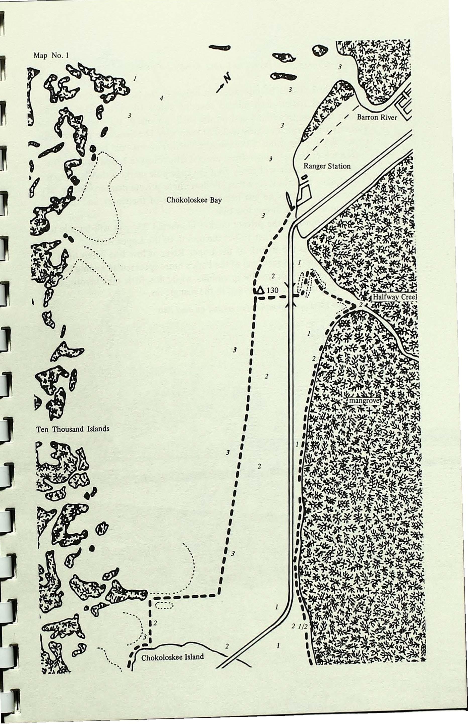
The maps in thisguideto theWildernessWaterwayaredrawnonascale of one to twenty thousand, or 3.17 inches per mile. They are based on aerial photographs by the United States Army Corps of Engineers and T-charts compiled from the photographs by the U.S. Coast and Goedetic Survey, with additions provided by the National Park Service. The maps show the markers and routes; campsites, Park boundaries, Ranger Stations; certain rivers, creeks, bays, lakes, and islands; and some of thevegetation types along the route. Depths in and near the channels are alsoindicated.
Advertisement
The accompanying text gives pertinent and helpful information for both the experienced boater andtheuninitiated newcomer to this famous, remote area.

Whocan usethe Wilderness Waterway
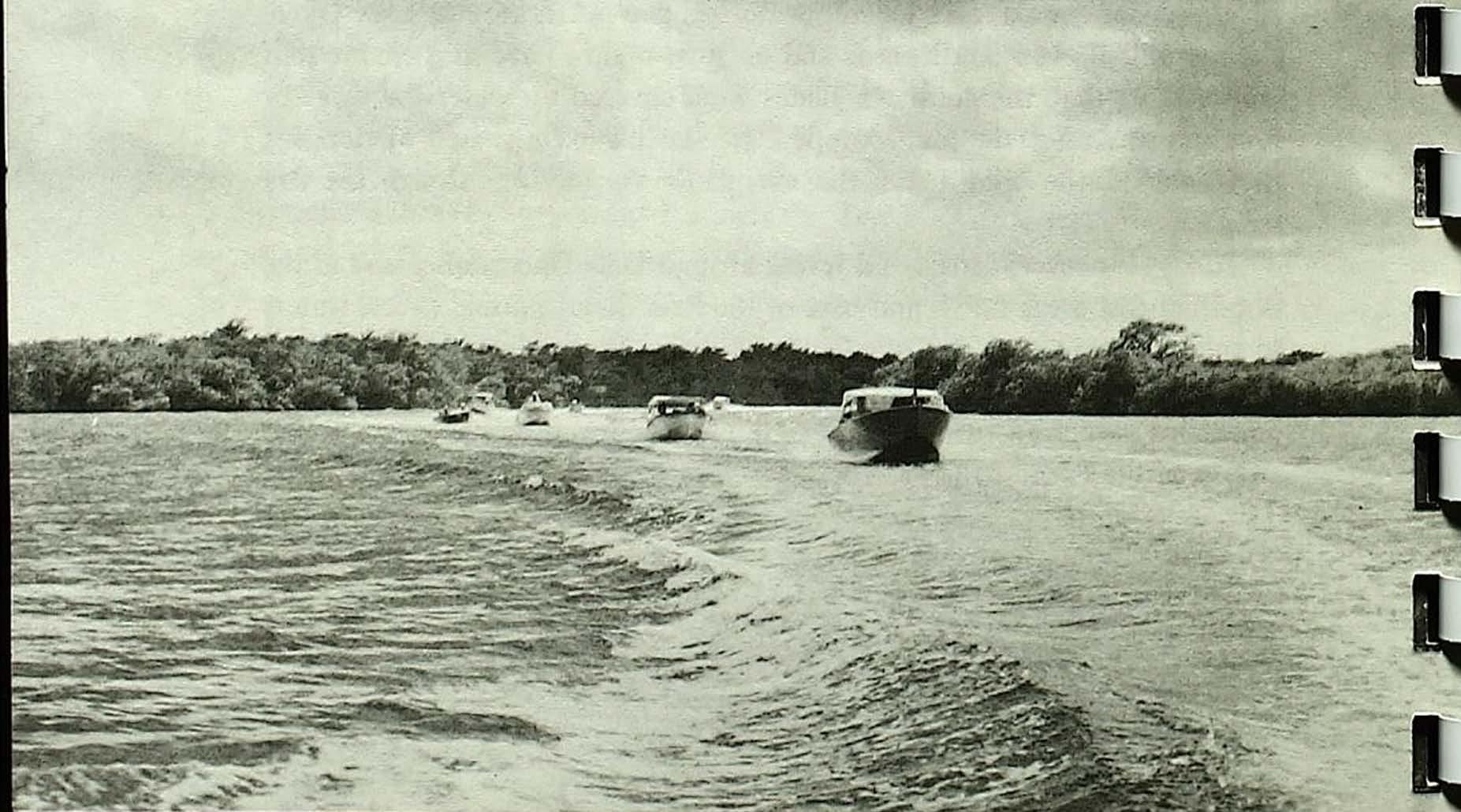
This boat trail is primarily for small craft. It is not advisable for boats with cabins or high windshields or boats over eighteen feet in length to attempt the entire trail, because of the narrow creeks and overhanging branches along some portions of the route. Larger boats can expect trouble navigating some of the creeks. Detours out to the GulfofMexico have to be made by some boats around some of the narrow, shallow creeks. Canoeists are encouraged to use the trail.
Wherethe Wilderness Waterway starts
You may start either from the Ranger Station at Everglades City or from the marina at Flamingo. This guide gives Everglades City as the starting point, but for boaters embarking from Flamingo, the guide can easily be utilized by following the last map first. The pertinent text for eachmap is on each facing page.
For your own protection you should check in and out with a Park Ranger at either place, providing a float plan of your expected time of arrivalor return.
Mudflats onFlorida Bay
Howlongthetrip takes
Persons planning a trip the full length of the waterway should plan on a minimum of six hours by outboard or seven days by canoe. It is not advisable to attempt a round trip in one day. For a more enjoyable trip the boater should consider overnight stops and the possibilities afforded by side trips. Campsites have been provided along the boat trail; see information on p. 64 for details on backcountry camping.
Carryproperchartsandknowtherules
The boater is advised to carry U.S. Coast and Geodetic Survey charts lt1254 (Everglades-Alligator Bay), #1253 {Alligator Bay-Lostman's River, or#642-SC (Wiggins Pass-Lostman's River),# 599-SC {Lostman's River-Whitewater Bay), and#598-SC (Whitewater Bay-Flamingo). These charts give more details about adjacent areas and will be helpful when taking side trips down the many rivers leading to the Gulf, when doing additional exploration, or when looking for good fishing sites.
Be sure to familiarize yourself with the restrictions, suggestions, and information in this guide, including Park rules (p. 24), fishing regulations (p. 16), boating safety (p. 28), and backcountry survival (p. 48).
The Mangrove Wilderness
Influenced by a tropical climate, the southern tip of Florida has some of the most unusual plant communities to be found in the world. One of these plant communities is the mangrove forest. In the United States, mangrove forests grow only on the southern coast of Florida. In Everglades National Park a wide belt of mangrove swamp borders the shoreline of Florida Bay and the Gulf of Mexico and extends inland to meet the sawgrass of the everglades.
The sprawling mangrove wilderness interlaced by open navigable waterways is a tangled, sometimes impenetrable mass of vegetation. This consists primarily of four dominant woody species: the red, black, and white mangroves and the buttonwood. These species may occur singly or in mixed stands and produce communities which may vary in structure from an area of scattered shrubs to a dense forest of tall trees reaching SO to I 00 feet in height. The best developed forests are located on islands in the mouths of rivers along the Gulf coast. Large portions of this forest area were devastated by Hurricane Donna in September, 1960. The results of that storm, as well as the signs of regrowth, can be seen in this area. Mangroves do not compete well with other trees and tend to be crowded out on higher land; however, their ability to tolerate salt water conditions enables them to grow where other plants cannot survive.
All types of mangroves have been grown experimentally in fresh water and on dry land, and the red mangrove can often be seen lining the creeks flowing out of the glades in an almost pure fresh water situation.
The red mangrove is perhaps the tree first noticed because of its many stilt-like roots that seem to be supporting the tree on all sides, arching out and down like the legs of a giant crab. Also often noticeable are the cigar-shaped seedlings that begin growing while still on the parent plant. When these seedlings drop off they may float for great distances before they ground in shallow water and take root.
You will recognize the black mangrove trees by their many pneumatophores sticking up out of the mud. Looking like asparagus, these stalks are thought to act as breathing tubes for the tree. Another unusual feature of the black mangrove is its ability to excrete salt from the leaves. If you check the undersides of black mangrove leaves, you will sometimes find them heavily coated with salt crystals.
Not having the unusual characteristics of the red or black mangroves, the white mangrove is harder to spot but may be recognized because of these lacking features and by its thick and more rounded leaves. Before Hurricane Donna the largest trees along the Shark River were white mangroves.
Inaccessibility and remoteness make the mangrove forest a refuge for many animals, such as the panther, deer, bobcat, raccoon, mangrove cuckoo, diamondback terrapin, mangrove watersnake, and many crustaceans and mollusks. Brackish water supports an immense quantity and variety of aquatic life. Fish, especially mullet, red fish, snook, and tarpon, abound.
Many birds have established rookeries here because the area meets their nesting requirements. Tens of thousands of white ibises, herons, egrets, and other birds roost at night on certain mangrove keys of the Gulf coast, particularly during the summer. You can see many of these birds feeding on the banks of creeks and rivers. This remote area also provides protection for breeding populations of ospreys, bald eagles, and swallow-tailed kites.
It is through this unusual mangrove forest, abundant with wildlife, that the Wilderness Waterway winds its way from Everglades City to Flamingo.
Everglades Wildlife
Everglades National Park is known throughout the world as an outstanding biological wilderness. The Park's land mammals include the black bear, panther, raccoon, oppossum, white-tailed deer, and bobcat. These animals, especially the bobcat and raccoon, can on occasion be seen swimming creeks from island to island in the mangrove wilderness.

Two marine mammals, the bottle-noseddolpltin(often caUed porpoise) and the manatee, can be found in the mangroveregionofthePark. There are many varieties of fish, crustaceans, andshellfishthat attract fishermen tothePark'swaters.

The greatest attractions of the everglades are the reptiles and the bird life. The reptiles include alligators, found in the fresh water glades and along the rivers on the Gulf coast, and therare and almost extinct American crocodiles, found only along the northeastern edge of Florida Bay. Snakes are common in the everglades, but not as common as most people fear. Of the twenty-five species here, only four are poisonous, but care shouldalwaysbe takenwhenwalkingthrough thickvegetation.
AU of south Florida is known for its variety of beautiful, rare, and unusual birds. About 80 species nest in the Park and over 300 different species have been recorded. Wading birds such astheherons, egrets, ibises, and spoonbills claim the greatest amount of attention. Throughout the year many of these birds can be seenalongthewaterways. Inthe summer months roseate spoonbills are often seen feeding on the mud flats at the mouths of the coastal rivers. Duringthewinter numerous wood storks can be observed along the waterwaywhen theyreturntonestinthemangrove rookeriesnearthe Gulfcoast.
Much of the evergladeswildlife is missed because visitors seldom take time to look. While cruisingthe Wilderness Waterway, take time to slow down and look. Checkthelowmangrovebranchesright overthewater for an occasional green heron or perhaps a water snake, and peer under the mangrove roots to see if what appears to be alogntightturn out tobean alligator.
Archeology
Perhaps ten or twenty thousand years ago Indians were making their way southward through the North Americancontinent. About2,000 years ago these Indians or theirdescendants madetheir wayintothe area nowcalled Florida. Calusa was the name given to the Indians who first settled along the Gulf coast of Florida. Their mainvillagecenteredaroundtheCaloosahatchee River; however, as many as one hundred or more known encampmentswere spread out through the Ten Thousand Islands, alongthe banksof thelargeriversdrainingthe glades,and as far south as CapeSable. These Indians were fishermen and hunters who took advantage of the abundant shellfish, fish, and wildlifein the everglades. They cooked over fires, made pottery, and used shells for tools andutensils. Throughoutthe mangrove wilderness, shell mounds mark the sites of former Indian encampments. At the time of the arrival of Spanfah explorers in Florida, these Indians were still livingalongthe Gulf coast. Foratime theyresisted the pressure of Spanish exploration and the movement southward of the Indians from the north. But by the end oftheeighteenth centuryno true Calusa Indians were to be found in Florida. Whether they died of white man's diseases, were all sold into slavery, or escaped to the islands tothe southis unknown.
Early European settlers along the Gulf coast took advantage of the Calusa Indian mounds, since often they represented the only high ground available. They built their homes andplanted fields ofsugarcaneandvegetables. Some of these sites are now protected inEvergladesNationalPark. A traveler along the Wilderness Waterway will have achancetovisitsome of these sites at areas such as Onion Key, Willy Willy Mound,theWatson Place, and the Turner Rivermounds.
Water
Water is the keytothe life ofthe everglades. Formanythousandsofyears the summer rains have fallen, flooding the glades, and that water has flowed south and westinto the mangrove-lined riversalongthe Gulfcoast. This fresh water mixing with saltwatercreates abrackfahwater zonewith a productivity so great that the surrounding waters virtuaUy teem with aquatic life forms. This aquatic life provides food for an uncountable number of wading birds. It is the base of the food chain for Florida's million dollarfishing industry.
Historically the everglades had a hydroperiod (thetime the gladeswere covered by a shallow sheet of water) of nine or ten months each year. After the rainy season ended the waters in the north around Lake Okeechobee still flowed southward, and at such a slow rate (less than a half mile a day) that the southern glades were covered by water for three or four months after the rains stopped. It was this extra period of flooding that enabled the wildlife of the everglades to survive through the dry season.
Today, however, canals and levees around Lake Okeechobee andinthe flood control areas north and east ofthe Parkdivertnormal excesswaters to the Atlantic Ocean and the GulfofMexico, thusreducingthelengthof time water covers theglades.Thisresultsinreducedproductionofaquatic organisms, which in turn adversely affects thebird, fish, and animal populationsofthePark.
Map 1: EvergladesCity toChokoloskee Island (3.1 miles)
Leaving the Gulf Coast Ranger Station, boaters have a choice of two routes that will lead to the privately marked channel from Chokoloskee Island to the Lopez River. Both routes pass the square, brown, creosote polewitha white wooden flagandblack numerals, the Everglades National Park marker J30. Markers of this type are the ones to follow on the WildernessWaterway as youcontinuetoward Flamingo.
Following the established Coast Guard marking for the Florida west coast, the marker numbering on the Wilderness Waterway starts at the south and increases going north. As you go north the odd numbered markers should be on yourleft and the evennumbered ones onyour right. The numbers will be consecutive except in those areas where markers cannot be placed;inthesecasesthe numbers willbe skipped.
If you choose the shorelineroute, follow the small stick poles carefully after passingunder the causeway to avoid the oyster bars.
If you choose to run directly south to Chokoloskee Island, proceed with caution around the island, where numerous oysterbars surround the shoreline.
Easily accessible from Chokoloskee Bayare two Park Service campsites, both located on the Gulf ofMexico on the outside of the Ten Thousand Islands. The first campsite is on IndianKeyand canbereachedby following the U.S. Coast Guard channel from the Barron River. The second campsite can be reached by following Rabbit KeyPass to Rabbit Key (see Map 2).