1 minute read
Map 2: ChokoloskeeIsland toLopezRiver(2.8miles)


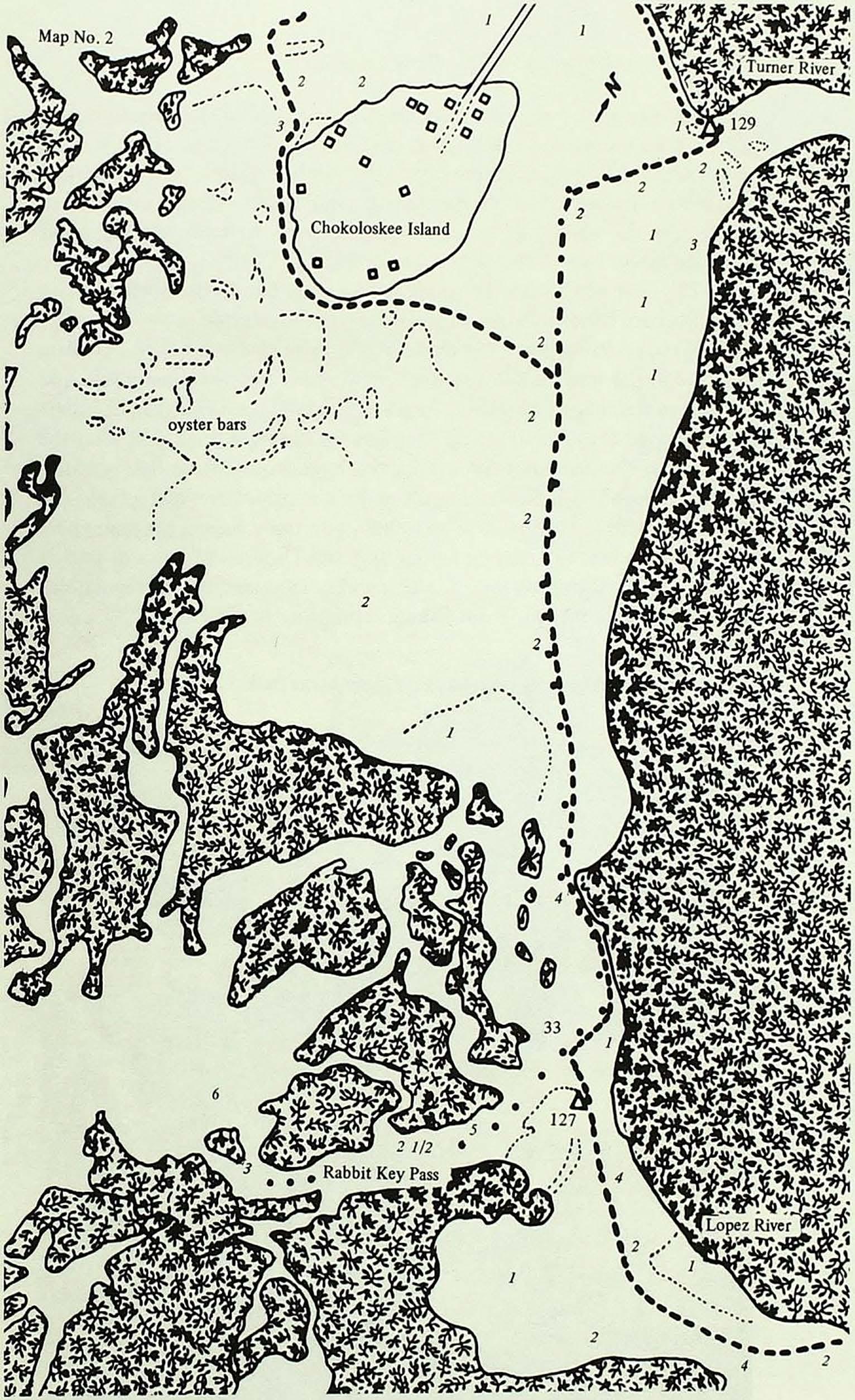
Passing Chokoloskee Island notice the height of the land. Chokoloskee is a 27-foot high Indian shell mound covering about 144 acres. The Calusa Indians lived on this island and on the shell mounds at the mouth of the Turner River perhaps as early as2,000 years ago. The Seminole Indians are responsible for the name "Chokoloskee," which means "old house."
Coming off either route-from around Chokoloskee Island or from the shoreline-the boater will easily spot the large pole markers that lead from Chokoloskee to Rabbit Key Pass. Follow these private markers closely, as numerous oyster bars lie just below the surface of the water, and the bay can be quite shallow during low tide.
Advertisement
As you approach the private marker numbered 33, you will be able to see the Park Service marker 127 at the mouth of the Lopez River.
Areas such as the mouth of the Lopez River at low tide often offer a good opportunity to see some of the Park's more spectacular wading birds. Be on the lookout for roseate spoonbills, white ibis, little blue herons, and other birds that make their homes in the mangroves.
Oyster bars buildupat mouthsofriversandon mudflats