International Research Journal of Engineering and Technology (IRJET) Volume: 07 Issue: 07 | July 2020
www.irjet.net
e-ISSN: 2395-0056 p-ISSN: 2395-0072
PADDY CROP CLASSIFICATION USING MICROWAVE SATELLITE DATA IN 23 DOWN HAIDERGARH CANAL COMMAND SYSTEM, UTTAR PRADESH, INDIA Ajeetam Krishna1, Abhijeet Singh2, Pragati Singh3, Dr. Rajesh Kumar Upadhyay4 1PG
Student, Agricultural Resources Division, Remote Sensing Application Centre Uttar Pradesh Student, Agricultural Resources Division, Remote Sensing Application Centre Uttar Pradesh 3Project Scientist, Agricultural Resources Division, Remote Sensing Application Centre Uttar Pradesh 4Scientist-SE and Head, Agricultural Resources Division, Remote Sensing Application Centre Uttar Pradesh 2PG
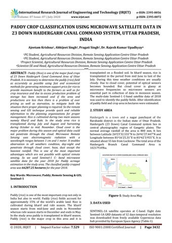
----------------------------------------------------------------------------***--------------------------------------------------------------------------transplanted on a flooded soil. In kharif season, rice is ABSTRACT- Paddy (Rice) is one of the major food crops transplanted in the period from mid June to last of the of 23 Down Haidergarh Canal Command Area of Uttar July. During this time weather conditions are usually Pradesh. It is necessary to determine the paddy (rice) field cloudy. Due to cloud cover, potential of optical sensors as accurately as possible using fast and economical becomes bounded. But cloud cover is glassy at methods for generating minimum support price for rice to microwave frequencies so microwave sensors are provide maximum benefit to the farmers as well as for essential part in collection of data in monsoon season. crop insurance and due to excess production problem of The multi-date Sentinel-1 C-band satellite data of 2018 storage has been increased and if the area and was used to identify the paddy fields. After identification productions are less then there is a problem of over of paddy field and crop area in hectares were estimated. pricing as well as starvation, to mitigate both the situation there proper planning is required. So the remote sensing and GIS technique provide quick and reliable 2. STUDY AREA information to the planning organizations for proper management. Rice is cultivated during two main seasons Haidergarh is a town and a nagar panchayat of the namely Kharif and Rabi. In the study area rice is Barabanki district in the Indian state of Uttar Pradesh. transplanted during July and August and harvesting Haidergarh (23 Down) Canal Command system lies in during October to mid. November. Cloud cover is the central physiographic region of Gangetic plains. The major problem during this season and optical data could normal average rainfall of the area is 800 mm. It lies not penetrate through the cloud. Microwave Remote between Latitude 26023’32.555’’N to 26041’27.447’’N and Sensing uses electromagnetic radiation with a Longitude between 81016’25.31’’E to 81042’3.955’’E. It is wavelength ranges between 1 cm and 1 meter. It enables situated about 55 km from Lucknow. The total area of the observation in all weathers condition, day-night and Haidergarh Branch Canal Command Area is penetrate through cloud cover, haze, dust except the 102179.49ha. heaviest rainfall. This is one of the most important advantages which are not possible with optical remote sensing. So we used Sentinel-1 C- band microwave satellite data for the year 2018 for Paddy acreage estimation in the study area. The classified paddy cropped area was 66287.25 hectares for the year 2018. Key Words: Microwave; Paddy; Remote Sensing & GIS; Sentinel-1
1. INTRODUCTION Paddy (rice) is one of the most important crop not only in India but also in world. Paddy (rice) fields account for approximately 15% of the world’s arable land. Rice is cultivated during kharif and rabi season. The kharif season starts from mid-June and ends in November whereas rabi season starts in December and ends in May. In the study area paddy is transplanted in kharif season. Paddy (rice) is the major crop in this area and it is
© 2020, IRJET
|
Impact Factor value: 7.529
Figure-1: Study Area Map 3. DATA USED SENTINEL-1A satellite operates at C-band. Eight date Sentinel-1A GRD datasets of 12 days temporal resolution was downloaded from freely available Copernicus data hub provided by European Space Agency (Table-1).
|
ISO 9001:2008 Certified Journal
|
Page 3432