
 Lorena Bello Gómez
Lorena Bello Gómez
Lorena Bello Gómez
Aqua Incognita I, II

Popocatepetl Volcano
Credit: Santiago Arau (2023)
Fall
Studio Report
2021+ 2022
Lorena Bello Gómez
Aqua Incognita I, II:
Deciphering and Reimagining
Liquidity
in the Mexican Altiplano
Aqua Incognita I, II: Deciphering and Reimagining Liquidity in the Mexican Altiplano
Aqua Incognita engages students in research by design, furthering the GSD focus on Mexico’s urbanization challenges, by advancing nature-based reparative actions in the water-scarce Apan Plains of the Central Mexican altiplano. This critical zone—originally a wetland territory and today bordering the thirstiest region of the nation, Mexico City—is engaged with unsustainable water scarcity urbanization.
Aquifer depletion by global commodity chains; unequitable distribution and non-circular management of water; and extractive land and resources practices, have started a process of cultural, biophysical and territorial desiccation that is now further triggered by climate change.
With the objective of helping communities that are struggling to see a viable future, the studios focused on the critical design question of how we can return liquidity to these former aquageographies and livelihoods. The studios formed part of a multiyear project collaboration between Harvard GSD, MIT, local universities, the municipality of Apan, six Ejido (collective) commissariats, and a local urbanism and landscape office (eeTestudio).
Studio Sponsor
Apan Municipallity, David Rockefeller Center for Latin American Studies, Harvard GSD, UKPACT Mexico Program.
Studio Instructor
Lorena Bello Gómez
Students
Fall ‘21: Ying Dong, Lauren Duda, Angel Escobar-Rodas, Barbara Graeff, Xingyue Huang, Jingyun Li, Hala Nasr, Sophie Mattinson, Alison Maurer, Morgan Vought, Maria Vollas, Zoe Wu. Fall ‘22: Celina Abba (TA), Aimen Fatima, Sophia Glasser-Kerr, Julia Li, Angelica Oteiza, Lara Prebble, Elizabeth Quintero, Julia Rice, Jiayu Tong, Arty Vartanyan, Sunjae Yu
UKPACT Collaborators
Antonio Azuela de la Cueva, Lorena Bello Gómez, Charlotte Chambard, Diane E. Davis, Gustavo Madrid, Raúl Mejía, Samuel Tabory, Luis Zambrano
Launching Workshop Guest Speakers
Lorena Bello Gómez, Gustavo Madrid, Charlotte Chambard, Antonio Azuela de la Cueva, Seth Denizen, Luis Zambrano
Visiting Expert Lecturers
Iñaki Echeverría, Loreta Castro-Reguera, Adriana Chavez, Claudia Dobles-Camargo, Alberto Kritzler, Cecilia Tortajada
Mid-Review Critics
Francesca Bennedetto, Danielle Choi, Jill Desimini, Natalia Dopazo, Alberto Kritzler, Gary Hilderbrand, Charlotte MalterreBarthes, Mpho Matsipa, David Moreno Mateos, Samuel Tabory, Belinda Tato, Robin Winogrond
Final Review Critics
Anita Berrizbeitia, Montserrat Bonvehi, Diane E. Davis, Claudia Dobles, Gary Hilderbrand, Alberto Kritzler, Rosalea Monacella, David Moreno Mateos, Nick Nelson, Einat Rosenzkrantz, Samuel Tabory, Belinda Tato, Felipe Vera, Alex Wall, Amy Whitesides, Robert Zimmerman
10
Critical Zones: On Liquid Disappearance, Aquifers and Climate Justice
Lorena Bello Gómez
26 Climate Change, Water Rights, and the Future of the Mexican Altiplano: An Interview with Lorena Bello
Sala Elise Patterson
Essays
30 Boundary-Work in Theory and Practice: The Need for Design Innovations to Counter the Rigidities of Conventional Social, Spatial, and Landscape Approaches to Water
Diane E. Davis
38 The Apan Landscape and Resilience Project: Looking Toward the Future
Gustavo Madrid, Charlotte Chambard
44 Apan Lake
50 Regenerating the Liquid Region: Cultivating Identity in the Mexican Altiplano
Barbara Graeff, Xingyue Huang, Morgan Vought
66 Apathon
Julia Li, Lara Trimarco Prebble
80 Water Sovereignty
Sophie Mattinson, Angel Escobar
Rodas, Zoe Wu
90 San Antonio Atocha (Tochac) Lake
96
Regenerating Liquid Terroir: Unearthing Liquidity Through Ecotourism in the Apan Plans
Elizabeth Nadia Quintero, Jiayu Tong
112
128
Embracing Water: Engaging Cooperatives Towards More Productive Bio-Cultural Landscapes
Yin Dong, Lauren Duda, Maria Vollas
Holding Water: Reconnecting the Urban to the Lacustrine
Syeda Aimen Fatima, Julia Helen Rice
140 Animas-Soltepec Lake
148
154
Re-learning How to Hold Ancestral Waters with Animal Agriculture
Sophia Glasser-Kerr
Animal Agriculture for a Regenerative Charreria
Sunjae Yu
164 Tecocomulco Lake 170
Aquatic Livelihoods: Reimagining the Management of Common Resources in the Tecocomulco Lagoon
Jingyun Li, Hala Nasr
184
Look Up to the Mountains
Alison Maurer
188 Recharge+
Angelica Oteiza, Arty Vartanyan
200 Reimagining Water Futures Exhibit 202
Acknowledgments 204 Contributors
Overview

8
MEXICO CITY

9
APAN PLAINS
Critical Zones: On Liquid Disappearance, Aquifers and Climate Justice
Liquid adj. liq·uid
1: flowing freely like water
2: having the properties of a liquid: being neither solid nor gaseous
3: a) consisting of, or capable of –ready conversion into cash
b) capable of covering current liabilities; quickly with current assets
4: a) shining and clear
b) being musical and free of harshness in sound
c) smooth and unconstrained in movement
d) articulated without friction and capable of being prolonged like a vowel
10 Title
Lorena Bello Gómez
Introduction
Liquid Disappearance
In Spring of 2020, while our survival as a species was being threatened by the Covid-19 planetary pandemic, some lakes in the high central Mexican plateau or altiplano disappeared from the surface of Earth. Metztitlan Lake was among them.1 Holding an average of 7 to potentially 50 million cubic meters in 700-5000 hectares was gone in days. For many, this disappearance went unnoticed. Can you envision a body of water after extraordinary rains the surface of 15 Central Parks in New York vanishing in plain sight? If not, can you visualize 35 Hyde Parks in London, or 6 Bois the Boulognes in Paris in the form of a lake surprisingly fading away? Out of disbelief, I couldn´t picture this myself until I saw the drone flights from our collaborator in Mexico, Gustavo Madrid, weeks later (fig.1). As Metztitlan is an endorheic lake with no natural outlet into the sea, imagine now that we were to assemble 868 Zocalo Squares in Mexico City, 685 Red
Squares in Moscow, or 113 Tiananmen Squares in Beijing, and fill them with water up to 10 meters (3 average floors) with not a single drain in their floors. Then, we watch this water vanish. Where did this water go? Why was this happening? What its consequences? Who was involved? Was this just simply climate change?
The emptied volumes of these visually assembled monumental commons, such as the 868 Zocalos, might help us picture just an infinite part of the volume of water vanishing away in the central Mexican plateau, both above and below its surface. But the roots and repercussions of this liquid disappearance due to our humanly induced desertification process are far more complex to decipher and reconstruct.2 As per their commoners, their dried assembled commons allow us to explain a parallel desiccation and disappearance of indigenous, revolutionary, and collective cultural values over time. Humboldt noted some in 1811 “Political essay on the kingdom of New Spain” (fig.2).3

11
Fig.1 Meztitlan Lake (2020) Credit: Gustavo Madrid
These disappeared values include:
1) amphibian indigenous values that were drained away, as were their lakes and resources, during an extractive and water-phobic colonization (1519-1810), after all the violent and bloody episodes of the Independence War (1810-1821), the Revolution (1910-1920), and the Agrarian Reform (1930 s -1940s); 2) more equitable and democratic values to redistribute arable land back from slaving haciendas to original peoples in the form of ejidos Collectively owned, individually farmed by ejidatarios, and still accounting for 52% of Mexican land, ejidos continue to be challenged by industry, agrarian industrialization, restrictions in water access, plus rampant privatization for urbanization through the NAFTA treaty (1950s-1992);4 3) and since NAFTA (1992-), 1917’s constitutional values (art. 27; 3rd par.) to:
“Regulate for social benefit the use of natural elements susceptible to appropriation, to equitably distribute public wealth, take care of its conservation, achieve a balanced development of the country, and improve the living conditions of the population.” 5
These values continue to be overlooked by a national government that has over time neglected its natural resources, and has instead, unlawfully commodified them for the profit of only a few—at the detriment of its commoners, their livelihoods, and the environment.
As result, in the Central Mexican Plateau, natural resources are still unsustainably being extracted, inequitably distributed, and linearly discarded without treatment. Like geographies where strong policies towards ecosystems protection and conservation are not in place, or enforced just for some, in parts of this high plateau of Mexico: a) volcanoes and mountains are being deforested and mined; b) some valleys are mechanically and unsustainably farmed for high yields during the rainy season with pesticides and agrochemistry; others are covered by limitless low-density urbanization; c) rainwater is mixed with sewers, piped, channeled, and drained away untreated into the sea; and d) aquifers are overexploited.
Together with the drainage of lakes and wetlands, all the above actions contribute to desertification by altering the hydrological cycle as follows: a´) by reducing aquifer recharge, biodiversity, and propelling fires, soil degradation, erosion, and siltation of water bodies; b´) by leaving an unproductive broken dusty soil uncovered for 8 months, again reducing aquifer recharge through organic soil moisture and roots, and by propelling land use change into impervious urban land that in turn exacerbates aquifer depletion; c´) by reducing both aquifer recharge, soil and atmospheric wetness, and by polluting soils, aquifers, and parcels bordering the channels,
12 12 Critical Zones
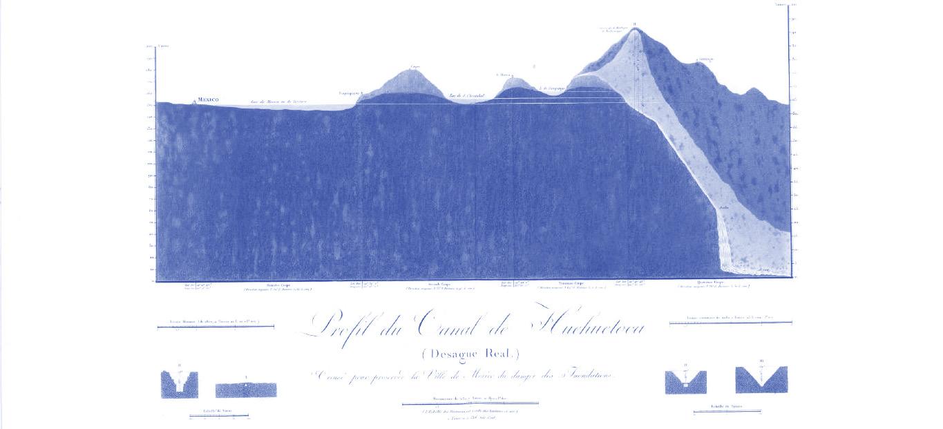
Fig.2 Profile du Canal de Huehuetoca (Desague Real.) Creuse pour preserver la Ville de Mexico du danger des Inondations (1811). Author: Alexander Von Humboldt
ultimately hurting the fauna of the Gulf of Mexico; and d´) by contributing to the risk of Day-Zero scenarios of water provision, land subsidence, and liquefaction during earthquakes.
But it gets worse. Now, in this already water-stressed ecosystem, we elevate the temperature 1.5 degrees Celsius by emitting more CO2 and receive more water volumes into the atmosphere from the melting poles. With this, climate change transforms La Niña and El Niño into more severe events such as prolonged droughts, alternating with severe hurricanes and less predictable rains. In tandem, neoliberal economic transformation invites the global market to land into this water-stressed plateau and lets multinational corporations mine and commodify its aquifers for the global export of products with large water footprints, also known as virtual water—such as beer, paper, train carts or steel. 6
Shockingly, water is gone from the Central Mexican Plateau. Like one more of the global market virtual transactions, water is rendered invisible through this virtual use, liquified from these aquifers into goods that get exported to the planet. And even if this tragic depletion wasn’t enough, the multinational corporations discharge their untreated waste into the plateau’s water bodies. In an already humanly induced desertic landscape, still within a constant “drainage culture”, and with higher evaporation rates due to global warming, it becomes sadly easier
to picture Metztitlan and the origin of its vanished body of water.
It is also easier to answer some of the departing questions relating to the Why? Where? and Who? as well as the climatic relationships that pertain to the liquid disappearance of water in the central Mexican plateau. And yet, still unclear are the consequences for the already economically and ecologically constrained livelihoods of its commoners or ejidatarios. How will they sustain life without water? Can they be economically liquid without it? Is there a future for ejido land without their most needed resource? Can cities and their hinterlands in these plateaus be water-resilient given this critical hydrological imbalance?
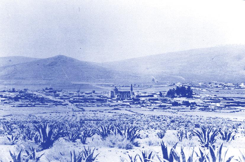
Like Metztitlan, some lakes in the nearby Apan Plains also vanished in the Spring of 2020 (fig.3). Their disappearance was visually much less impactful, as those living by their shores had witnessed their drainage for centuries. But this loss was no less concerning; prolonged droughts mean no harvest for the ejidatarios, whose livelihoods depend on rainfed cultivations. However, something this time was more alarming: the Apan aquifer, formerly lush, was almost depleted (fig.4,5). How could this be possible, given that “by virtue” of being a mirror sub-basin to that of Mexico City, this aquifer had only been available for human consumption since 1954?

13 Bello Gómez
Fig.3 Dry Apan Lake (2020) Credit: Gustavo Madrid


14 Critical Zones
Fig.4 National’s Basins & Valley of Mexico Basin. Source: CONAGUA. Credit: L. Bello & A. Meouchi
Fig.5 Valley of Mexico Basin. Aquifers’ Availability. Credit: L. Bello & A. Meouchi
Aquifers: Contested Critical Zones
These questions, and the search for answers, moved me to join a group of experts in law, ecology, environmental engineering, urbanism, and political sciences. Still ongoing, this project started in June of 2020 and continued with the support of a UK Pact Mexico program grant aiming to ameliorate the effects of climate change for the agrarian communities of the Apan Plains in the Valley of Mexico Basin. The Apan Plains are a paradigmatic “Critical Zone” in Latourian terms, where drought and biocultural loss are exacerbated by climate change, extreme resource depletion, and policies facilitating socio-economic and territorial desiccation.7
In what follows, I explain how the study of this Critical Zone was undertaken, what was achieved, how this work nurtured the design proposals of the Aqua Incognita students at the GSD, and how in return we nurtured it back.
Bruno Latour’s approach to the climate crisis through his “Critical Zones” work urges us to rethink our relationship with nature, embrace a more inclusive and localized approach to addressing environmental challenges, and recognize the agency of both human and non-human actors in shaping the planet’s future. Latour’s ¨Critical Zone¨ provides a definition and framework for our approach: “a spot on the envelope of the biosphere (Gaia’s skin in Lovelock’s parlance) which extends vertically from the top of the lower atmosphere down to the so-called sterile rocks and horizontally wherever it is possible to obtain reliable data on the various fluxes of ingredients flowing through the chosen site (which in practice generally means water catchments).” 6
As he writes “It’s not the human that we consider, it’s his action! We are urged to integrate and engage multiple stakeholders—including scientists, policymakers, indigenous communities, and local populations—to raise sensitivity and address the present challenges and shared vulnerabilities. Gone is the
idea of a disinterested and individual distant gaze. Collectively we recognize common interests and foster new forms of governance and sustainable strategies toward resilient practices. The word “critical” speaks to its fragility in the thermodynamic sense of “far from equilibrium.” It means that under stress it may break down entirely or shift to another state—“become critical”—and be ruined. In this way, “critical zonists” make these highly stressed zones visible through monitoring instruments and models resembling the work of intensive care units so familiar to physicians and surgeons.”9
Our team declared the nearly depleted Apan aquifer a Critical Zone to identify the necessary actions to alter the hydrological imbalance. Its critical state had already raised concerns and led to conflicts among various users, including municipalities and industry, as well as those who lacked access to water, such as ejidatarios— discussed in an interview later in this volume with Sala Patterson. Recognizing that the water cycle was underperforming at all stages, and that there is a shared dependency, could compel the stakeholders to seek a way forward—for example, that recharging the aquifer is beneficial for local industries, municipalities, and the water security of Mexico City. Ultimately, this shared recognition could present an opportunity to help those facing the greatest challenges.
After a year of thorough monitoring and measurement of this highly waterstressed zone to decipher the causes of this shared vulnerability, we produced a diagnosis. This diagnosis resulted from: a) a thorough study of the history, cultural values, and socioeconomics of the region (Fig.6); b) a meticulous search of the laws and policies that were facilitating this desiccation or not being enforced to amplify wetness; c) a rigorous scanning and analysis of water and soils’ quality, flora-fauna, and hydrological balance of the watershed; and d) the engagement with six ejidos, and main
15 Bello Gómez
municipal/state governments, to find equitable and resilient solutions. The resulting information from this monitoring and engagement can be accessed in the project website. 10 In summary, we demonstrated through data that:


a’) Ejidatarios face a perilous poverty cycle due to rain-fed industrial barley production for the global beer industry. This practice not only pollutes water but also depletes the sampled soil’s natural fertility, resulting in an unproductive and dusty landscape for most of the year. The high production and labor costs are imbalanced with the market rate for barley, leading to financial losses exacerbated by intermediaries. Additionally, frequent droughts and floods further burden farmers with increasing debts, while their arable land loses value and succumbs to urbanization. In this trend, Apan’s footprint has doubled in just two decades, intensifying the strain on the aquifer. Moreover, as younger generations migrate, the responsibility for land stewardship falls solely on the elderly, who face a heightened risk of fires during the dry season. These fires, monoculture and climate change have also amplified the loss of biodiversity in the region.
b’) The aquifer was initially protected by the water secretariat (CONAGUA) in 1954, with further reinforcement in 1957, specifically limiting concessions to human consumption due to its proximity to Mexico City. However, CONAGUA has granted discretionary industrial permits. In tandem to already operational global industries, the installation of the global beer company AB Inbev in 2018, utilizing wells from Hidalgo state, triggered a rapid depletion trend in the aquifer and lawsuits pending resolution.11 Besides, the responsibility for water treatment lies within financially constrained municipal budgets, posing challenges in meeting the costs of high federal electricity bills. Consequently, the Apan treatment plant operates at a mere 40% of its capacity, others are not operational, leading to the untreated mixing of rainwater, sewage, and industrial waste that ultimately finds its way into the Gulf of Mexico. It is important to note that ephemeral springs, which hold great potential for aquifer recharge, currently exist outside the boundaries of the legal framework.
16 Critical Zones
Fig.6 Historical Pictures. Composed mosaic. Credit: various
c’) The hydrological balance of the sub-basin is severely disrupted, leading to significant short-term impacts. Despite aquifer concessions amounting to 50 million m3/year, the deforested sub-basin with arid soils can only recharge 48 million m3/year, contributing to the ongoing depletion of the aquifer. Groundwater constitutes 90% of the region’s water resources, with 34% allocated for public-urban use, 30% for industry, 26% for agriculture (primarily for private former haciendas), and 10% for various purposes. On the other hand, 90% of rainfall is drained away through channels and bypasses, with a high 90% evaporation rate. As we also found that the valley is 1.5 degrees Celsius warmer than thirty years ago. This results in approximately 1332mm out of the total precipitation of 1469mm returning to the atmosphere. Consequently, regional lakes have experienced a drastic reduction in size, and the remaining water bodies face significant siltation due to erosion from dry soils. (fig.7).
d’) An Action Plan was developed in response, focusing on water conservation and livelihood restoration through nature-based solutions (NbS).12 Several ejidos and thousands of farmers in the watershed were engaged in the process (fig.8). This led to recommendations for governance and funding, which were considered by the municipal and Hidalgo state governments.13 Key actions included the approval of a growth-control plan in Apan, the implementation of biofilters and lake restoration projects, and the initiation of an impact mitigation program by the beer factory. 14 The commitment to implementing NbS through a Green Fund was made at the Harvard GSD by Hidalgo’s former governor, although industrialists’ commitment is still pending. The Nature Conservancy assessed the viability of a Water Fund, and the project was presented to the House of Representatives, securing their commitment to water resilience in the Valley of Mexico Basin in April 2023.15 Furthermore, a grant application
was submitted to develop a governance strategy with a focus on industrialists’ involvement.
The Aqua Incognita option studios at the GSD ran in parallel to these monitoring, research, and engagement initiatives, providing students with the valuable


17 Bello Gómez
Fig.7 Hydrological Balance. Credit: L. Bello & A. Meouchi
Fig.8 Capacity Building photos. Credit: various

18 Critical Zones
Fig.9 Troquilídeos del Valle de Mexico (1871-1873) Author: Jose María Velasco
opportunity to gain knowledge on the ground of climate action in a territory on the verge of hydrological, ecological, and socio-economic collapse. It allowed them to use their valuable design skillset to alter the direction by addressing such challenges. The selected Critical Zone´s border condition, mirroring the most urbanized region of the nation, was also heuristically important. The Apan Plains serve as a poignant reminder of what Mexico City´s valley used to be over a century ago, as beautifully depicted by Jose María Velasco and contemporary scientists in Mexican magazine La Naturaleza (1870-1912) (figs.9,10).16 Mexico City’s valley also highlights what the Apan Plains should avoid becoming, in tandem with the challenges posed by having 22 million thirsty neighbors.17 Transforming these challenges into opportunities to catalyze change through landscape conservation, restoration and livelihood resilience played a crucial role in the students’ designs, as explained below.
Reimagining Liquidity
With the above-mentioned aim of assisting agrarian communities in desiccated territories like the Apan Plains, the Aqua Incognita studios focused on the crucial design question of restoring liquidity to these former aquageographies and nested communities. An ecologically more balanced relationship with water with an emphasis towards long-term livelihood
resilience, requires interwoven actions to address the above broader range of interconnected challenges. To achieve this, the studio brief highlighted the role of models of living and production that are symbiotic with their surrounding ecosystems, leading to more equitable, ecologically sound, and economically balanced futures that could in turn ameliorate, and reduce migration. From a pedagogical standpoint, the studios had a focus on understanding and visualizing climate injustice and actors; analyzing and translating relevant case studies and alter actions; and designing altered livelihoods that could arise from the promotion of water conservation and livelihood restoration.
Ejidos were one focus of studio research. Given that agricultural land, specifically ejidos, constitutes the majority (74%) of land use in this critical zone, actions targeting ejidatarios are strategically impactful. Ejidatarios and farmers play a vital role in managing cultivated and forested areas, as well as caring for water bodies and drainage channels.18 By providing support to ejidos to become water stewards through the implementation of erosion control measures, conservation of forests and lakes, and reforestation of field borders and riverbanks, there is a tremendous potential for rainwater harvesting and infiltration, which contributes to aquifer recharge. This could be further enhanced with a return to agave plantations, a lost cultural

19 Bello Gómez
Fig.10 Hacienda Chimalpa (1892) Author: Jose María Velasco
landscape, which are highly acclimated to the dry season and enormous environmental and economic potential in the region.
Students learned from experts that these nature-based positive actions will not only improve local climate regulation but also foster habitat regeneration and connectivity for biodiversity, while reducing the risks of forest fires, floods, and droughts. They will also enhance the fertility and water-retention capacity of the soils, increasing the resilience of agricultural fields resulting in food security, a more diverse agrarian economy, and protect the land from urbanization and with it the aquifers. In tandem, by protecting major living rivers and ephemeral springs in the basin, and by withholding part of the current drained mixed rain-sewer water and treating it with biofilters, local and international actors could use this water to restore the highly stressed and disappearing lakes of Apan, Tochac, Animas-Soltepec and Tecocomulco.
Methodologically, the studios employed five actions of design research that built upon each other: 1) mapping the interwoven set of policies and stakeholders acting in the basin; 2) recognizing liquid processes affecting the basin’s territory in critical cartographies; 3) analyzing pertinent case studies and translating their values into alter-actions to the Apan Plains; 4) spatializing an interwoven set of such actions along a sectional time-based ecological transect or “critical zone transect” to provide more sustainable and resilient alter-livelihoods; and 5) constructing narratives that could convince a broad audience of departing stakeholders on the feasibility and desirability of such proposals from government to industrialists.
Action 1: Deciphering Liquidity. Workshop
The first act started with a workshop including Zoom lectures, Q&A sessions, and discussions with project experts, enabling the unpacking of field knowledge and to open a continuous communication throughout the semester.
External experts were later invited to present and participate in reviews. The objective was to provide a solid understanding of phenomena, actors, and to help students position themselves by choosing a specific challenge of interest.
This action focused on creating a diagrammatic map of actors, policies, and nested scales of influence of the chosen challenge (fig.12). Explorations included biocultural loss, drainage, monoculture, aquifer depletion, water conflicts, erosion, water pollution, virtual water, waste, etc. Students were encouraged to transform them into opportunities for future interventions by posing a “what if” question that could reshape the current status quo.
Pedagogically, it was aimed to develop the skills to navigate unfamiliar and complex territories and comprehend the interconnectedness between socio-economic, environmental, ecological, and political processes in unequal and climatically stressed territories.
Action 2: Deciphering Liquidity. Critical Cartographies
In the second act, students conducted a SWOT analysis of their chosen challenge, and translated their findings into critical cartographies at the sub-basin scale with mixed media. These cartographies helped visualize the physical manifestations of liquid processes at different scales and facilitated the development of collaborative actions involving farmers, industries, and the government to address the problem holistically.
The identified strengths, weaknesses, opportunities, and threats of the analysis enabled the students to establish connections between different phenomena in the territory (fig.11). This guided the definition of opportunistic actions and the identification of potential sites for impactful interventions. Together with actors and policies, critical cartographies provided a comprehensive overview of their intentions.
Pedagogically, these cartographies serve as a tool to synthesize gathered
20 Critical Zones

findings, inform the design process, and guide future visions. They enabled students to gain insights, make informed decisions, and identify impactful sites beyond descriptive maps.
In the Fall of 2021, we collaborated with local team members to validate their findings and identify sites for intervention. During a weeklong trip to Mexico City and the Apan Plains in the Fall of 2022, students had the opportunity to validate their own findings and establish relationships with supporting case studies, further enhancing their understanding of the context (pp 42-3).
Action 3: Reimagining Alter-Actions
The third act continued with the analysis of case studies, understood as alter-actions that could help shift the status quo. Some of these alternative actions encom-


passed the design of collective services, conservation, restoration practices, and new economic activities. Some included the implementation of blue-grey and green infrastructure, or the promotion of rotational farming rooted in the region’s Nahuatl culture. Students explored both indigenous practices, such as the xinampas, pulque production, or field borders, as well as contemporary examples like the East Kolkata Wetlands in India; or the USA EPA Playa Lakes, FAS Conservation Reserve Program, agro-silviculture, or the National Park program (fig.13).
Pedagogically, case studies played a crucial role in highlighting the importance of not reinventing the wheel repeatedly. Instead, they demonstrated the value of channeling energy into innovation for later showcasing successful proposals to stakeholders, emphasizing their suitability to the specific context.
21
Bello Gómez
Fig.11: SWOT analysis. Credit: Jingyun Li


Fig. 12 Actors Diagram. Actions of Water Depletion and Recharge. Credit: Yin Dong
Fig. 13 Alter-Actions. Credit: Charlotte Chambard
22 Critical Zones
Action 4: Reimagining Alter-Livelihoods
In the fourth act, students applied their knowledge and findings to spatialize actions and design strategies within ejidos or towns. The objective was to design water harvesting and conservation systems and explore the potential of green and circular economies as alternative options. The proposals addressed various aspects such as enhancing forests, rivers, and regenerative agriculture; optimizing the water cycle; or promoting the Plains as a pulque destination valley such as Napa or Guadalupe, for high-altitude marathons, or hiking and canoeing.
Actions were spatialized along timebased ecological transects or “Critical Zone transects” cut through a selected settlement with its upper, middle, lower slopes, and lakes. These served to visualize the interconnectedness of actions over time (fig.14). Afterwards, they envisioned the resulting alternative improved scenarios that will happen with their intervention.
The pedagogical goal was to emphasize the importance of the cascade effects of such actions for the circularity of water and wealth and consequently for the equitable resilience of the Apan Plains. Also, to show the performative potential of the interventions to serve as production and recreation, as well as the need of

waters, so to speak, of the work produced during the semester. The jury of critics represented the academic fields of landscape architecture, urban planning, and design. It also included members with active expertise in national governments, the private sector, and development agencies in Latin America. This aimed for students to construct a solid narrative that, as their interwoven projects, could convince a multisectoral set of stakeholders.
In response to the problems at stake, the studios emphasized the strength and intelligence of the design proposals and the production of alternative narratives to those that threaten the future on these livelihoods. Pedagogically this conclusory aspect of studio taught students that projects need be ‘bulletproof’ in data, but to also spur the imagination of an audience willing to implement such proposals (pp.198-99).
Students´ projects along nine critical zone transects, around the regional lakes of Apan, San Atonio Atocha (Tochac), Animas-Soltepec, and Tecocomulco can be explored in this volume (pp.44-197).
In looking back, the studios offered a complex problem to solve but also valuable lessons in the process. The relative underdevelopment of the Apan Plains compared to Mexico City pro -


23 Bello Gómez
Preserve Cultural Patrimony Engage with Natural Cycles Support Local Economy Agroforestry FarmingCoof><r.11ivc infiltr1,;.,nJi"h/poodlmenc;.,nw<11 llll �.,,""'..,. .,,,.,,.p...,,, � !� �'"'""'��� t� ,..•.,,,,r,J.,,;o,,,. tr,J;,-1,-1, � Mf't'vi>,,.,,,. m,J;,-/p,..,.,, t Agriculture FarmingCooperative Ejidos UuroC:irdrna.< � •;;:� d,;p;mg.,,;.,n u,i,,. � t LharoCardenas Production/MarkrtingCoopcr.itivc �4 �;� i{Wedands FarmingCoof><r.itivc 7 ..sli -=Lagun��;,��.rvancy j j j j j
Fig.14. Critical Zone Transect. Credit: Maria Vollas
The finest projects resulted from students working together to help these communities in a rigorous, ethical, and inventive manner. Some have already been recognized by these values as “Aquatic Livelihoods” by Jingyoon Li and Hala Nasr winning the Universities Competition at the Terra Lisbon Triennale in Fall 2022 (fig.15). The work from both studios was also showcased at the GSD during the Spring 2023 DRCLAS conference “Mexico + H2O” (pp.37) in the “Water Futures Exhibit” (pp.200-1).


Conclusion: Fighting at the Trenches of Climate Justice
In both Fall 2021 and Fall 2022 studios, students were presented with a unique opportunity to champion climate justice for those who are being left behind, offering genuine potential to challenge the existing status quo in the region.
In fact, I couldn’t have asked for a more dedicated team of climate fighters to join these trenches. I want to express my gratitude to them for their unwavering commitment to supporting these endangered livelihoods, for their creative thinking in integrating sustainable living practices with resource conservation and landscape restoration, for their efforts to weave together social, political, and ecological factors to enhance water resilience and reduce climate risks. Also for striving to counterbalance global forces of capital extraction by undertaking projects that bolster local economies while restoring soils, forests, and lakes, thereby reversing desertification. My hope is that Aqua Incognita students will carry these valuable lessons like seeds wherever they go and plant them, as the planet urgently requires the water and bountiful harvests that can arise from their endeavors.
To conclude, let me revisit our studio’s title, Aqua Incognita. In the past, land was unknown, leading to the term Terra Incognita. Today, we have explored and exploited all our “Terra”, resulting in water remaining one of our great unknowns: melting, rising, flooding, and drying out, leaving us with numerous uncertainties when it comes to designing more liquid futures. These are the unknowns that I was thrilled to explore with all the students and the project collaborators as we confronted the challenges present in the Mexican Plateau.
24 Critical Zones
Fig. 15. Visionaries Exhibit at Terra Lisbon Triennale (Fall 2022). Curator: Anastassia Smirnova. “Aquatic Livelihoods” by Li and Nasr Winner of Universities Competition” Credit: Lorena Bello & Brent Ryan
1 Metztitlan Ramsar site description: https:// rsis.ramsar.org/ris/1337 . Note that “laguna” should be translated as Lagoon. I chose instead its correct hydrological name “lake” in reference to its high-altitude location surrounded by mountains.
2 Mathew Vitz, ¨Desiccation, Dust, and Engineered Waterscapes, ¨ A City on a Lake: Urban Political Ecology and the Growth of Mexico City, (Durham: Duke University Press, 2018): 136.
3 Alexander V. Humboldt, Political Essay on the Kingdom of New Spain: With Physical Sections and Maps Founded on Astronomical Observations and Trigonometrical and Barometrical Measurements. 3d ed., (London: Printed for Longman, Hurst, Rees, Orme, and Brown, 1822). From his visit in 1803, Humboldt describes the desiccation of Mexico City’s lakes by comparison to Hernán Cortés´ description in 1520 (p.8-); He also criticizes the inhumanity of the works of the Huehuetoca drainage canal (p.94); He names the Llanos de Apan (Apan Plains) along the old entry road from Puebla to Mexico City (p.7).
4 Since NAFTA “ejidos” can be privatized and become “dominio pleno.”
5 Constitución Política de los Estados Unidos Mexicanos: Texto Vigente. (México, D.F.: Imprenta de la Cámara de Diputados Constitución Política de los Estados Unidos Mexicanos, 1917): Article 27, 3rd paragraph.
6 “Virtual water is the total amount of water required to produce a commodity (e.g., food and clothing). Hence, the trade of commodities, whether regional, national, or international, represents the transport of virtual water from one area to another.” See: https://wad.jrc.ec.europa.eu/virtualwater
7 Bruno Latour, et al. Critical Zones: The Science and Politics of Landing on Earth. (ZKM/Center for Art and Media; Cambridge: The MIT Press, 2020). zarch.2020154492
8 Bruno Latour, “Some Advantages of the Notion of “Critical Zone” for Geopolitics.” Procedia Earth and Planetary Science, 10, 3-6, (2014). See also, Bruno Latour, Politics of Nature: How to Bring the Sciences into Democracy (Harvard University Press, 2004).
9 Ibid.
10 Apan Paisaje y Resiliencia’s website, https://www.apanresiliencia.org/ See also: Eetestudio et al., “Reporte de diag-
nóstico del territorio de los llanos de Apan,” Apan Paisaje y Resiliencia, (UKPACT Program Mexico, 2022), 7-127. https:// static1.squarespace.com/static/63b23c9fcfb45e2e67c92020/t/64161ab94be8170d0 f9fb6b8/1679170252611/01+DIAGNOSTICO+%28optimizado%29.pdf
11 Other big consumers of water are: Papeles Higiénicos del Centro, Grupak, and Gerdau Corea
12
Eet estudio et al., “Plan de Acción,” Apan Paisaje y Resiliencia, (UKPACT Program Mexico, 2022), 496-537, https://static1. squarespace.com/static/63b23c9fcfb45e2e67c92020/t/64139d06b9bcbe1da47 341b1/1679006988951/03+PLAN+DE+ACCION.pdf
13 Eet estudio et al., “Governance Analysis and Recommendations Report,” Apan Paisaje y Resiliencia, (UKPACT Program Mexico, 2022), 356-495, https://static1. squarespace.com/static/63b23c9fcfb45e2e67c92020/t/64161b040ee2a02a00f2cecb/1679170327638/02+GOBERNANZA. pdf
14 “Aguas Firmes Program,” https://www. aguasfirmesgrupomodelo.com/en
15 Notilegis, “Enfrentando los Retos de la Gestión Hídrica de la Cuenca del Valle de México,” Cámara de Diputados, (04/11/2023), https://comunicacionsocial. diputados.gob.mx/index.php/notilegis/ celebran-en-san-lazaro-mesa-internacional-de-trabajo-enfrentando-los-retos-de-la-gestion-hidrica-de-la-cuenca-del-valle-de-mexico-
Video: https://www.youtube.com/ watch?v=ugnLOLGIW5o
16 Sociedad Mexicana de Historia Natural, México. Museo Nacional de Historia Natural. La Naturaleza. (México: Impr. de Ignacio Escalante, 1870-1912), https://catalog.hathitrust.org/Record/000533814/Home tos-de-la-gestion-hidrica-de-la-cuenca-delvalle-de-mexico-
17 Lorena Bello Gómez, CDMX Resilient Code: Water Commons in Mexico City, ZARCH, (15), 138–153 (2021), https://doi. org/10.26754/ojs_zarch/zarch.2020154492
18 Ejidos land use is followed by forest (20%), pasture (3%), urban areas (2%) and water bodies (1%)
25 Bello Gómez
Climate Change, Water Rights, and the Future of the Mexican
Altiplano: An Interview with Lorena Bello
26
Sala Elise Patterson
The recent United Nations Climate Change Conference in Glasgow offered fresh evidence of the unbridled global climate crisis, and reminded us that while humanity faces unprecedented threats, some communities are bearing an undue portion of the burden. GSD Design Critic Lorena Bello Gómez’s research combines landscape, architecture, and urbanism to mitigate that burden for environmentally vulnerable communities. As an urbanist, she is interested in how design at the territorial scale can address flawed policies and infrastructures to reduce injustice.
This semester, Bello is teaching “Aqua Incognita: Deciphering Liquid Territories in the Mexican Altiplano.” Using a water-scarce region in the hinterland of Mexico City as a case study, studio participants are designing sustainable and scalable pilot projects to help this farming region confront the fallout from unsustainable industrialization and the active threats to local livelihoods posed by climate change.
How has your practice informed the Aqua Incognita studio?
For five years, I have been looking at territories beyond cities that are engulfed in climatic risks. I typically work with local foundations in collaboration with interdisciplinary teams, raising support through international grants. My current project looks at the Apan Plains, an area 80 kilometers East from Mexico City. The city and the plains form a single region climatically, in terms of water resources, fluxes, and metabolism. But they don’t have any other connection, which cre-
ates tensions. There’s a political divide because these plains belong to another state, Hidalgo, with different policies, governor, and political agendas. And while Mexico City is always in the spotlight of climate crises; the Apan Plains don’t get into the news. This absence of visibility makes them vulnerable to climate change and to other environmental injustices. The studio is positioned to respond through design to the cultural, political, biophysical, and socioeconomic structural issues that are placing pressure on this liquid territory. We are supported by a UKPACT international grant to build capacity for implementation and to establish trust with local stakeholders.
“As climate crises increase, the new regimes of too much or too little water that don’t allow you to farm are also increasing. This requires a more equitable access, provision, treatment and reuse of water resources. Designers can provide scenarios showing the gains of such redistribution.”
Lorena BelloWhat can you tell us about these pressures?
In the 1920s, after an agrarian revolution, lakes were drained, and land was given back to farmers as commons or ejidos. This land is communally owned and individually farmed, a trend diminishing over time as the nation entered a neoliberal era. After NAFTA, in 1992, land could be privatized and transferred from common land to dominio pleno, or private land. Mexico is still urbanizing peri-urban areas in the outskirts of cities, transforming ejido land to urban land.
27
In Apan, land has been abandoned or overexploited through industrialization. Adding to farmer’s challenges, in 1954, the national government determined that the Apan Plains’ aquifer, linked hydrologically to Mexico City’s, could not be used by local farmers. Instead, the national government has granted aquifer access to many industrialists. There are now global beer and paper industries, metal companies, and solar farms in the valley, all using aquifer water needed by communities.
So, the crux of the issue is access to— and control over—water resources?
Yes. On the one hand, you have a population who depends on their land yet only have access to rainwater. Then you have the urban areas of the valley together with these industrialists, that have access and are depleting the aquifer—as nobody measures consumption.
This, along with the privatization of land, is causing water-intensive processes and erosion since Apan Plains’ municipalities lack urban plans to protect critical environmental zones and resources.
Does the course look at a particular kind of solution?
The studio is testing hypotheses through design, working closely with Mexican and global experts in law, urban sociology, ecology, agronomy, and environmental sustainability. This interdisciplinary team provides students a holistic view of the intertwined structural challenges that these communities are facing.
At selected settlements of ~2,000 people, students are designing aquacultural projects that improve the hydrological region in a bottom-up fashion. They are integrating formerly siloed areas of scientific knowledge to build spatial connections, creating processes that enhance positive feedback loops and decrease waste. They are designing systems, not objects.
Can you give me examples of potential solutions to any of the problems that you’ve mentioned?
Farmers can be helped to reforest and transition from barley monoculture into more sustainable and profitable agriculture. This will in turn diminish the amount of pesticides and agrochemicals that go into the aquifer and water bodies, and improve the quality of soil—which is arid—in order to amplify wetness.
As climate crises increase, the new regimes of too much or too little water that don’t allow you to farm are also increasing. This requires a more equitable access, provision, treatment, and reuse of water resources. Designers can provide scenarios showing the gains of such redistribution.
What kind of experience have you created for your students?
The Apan Plains make visible and tactile the challenges that vulnerable human/ non-human communities are facing. Students heard this in first person from different stakeholders and they had the opportunity to get a lot of feedback. In this sense, Aqua Incognita gives them an active voice in reducing such vulnerabilities with projects that must anticipate: resistance among actors, low budgets, low management and maintenance—not dissimilar from greening plans in Europe or the US.
When I think about landscape architecture, I imagine gardens. What does landscape architecture mean in the context of this work?
Landscape architect Frederick Law Olmsted was one of the first designers to think systemically about the metabolism of cities, with large visionary projects that move beyond gardens and become a kind of regional design. To me, it is an excellent way to think about sustainable regions today: How do you enhance the metabolic cycle of resources? How do you start closing cycles instead of linear structures that leave things open? So, part of the approach of the studio is to think about water circularly, moving from a myopic understanding of solutions to a holistic understanding of problems.
28 Climate Change, Water Rights, and the Future of the Mexican Altiplano

29
Sala Elise Patterson
Soil test during UK PACT capacity building project. Credit: Charlotte Chambard
Diane E. Davis
Boundary-Work in Theory and Practice: The Need for Design Innovations to Counter the Rigidities of Conventional Social, Spatial, and Landscape Approaches to Water
When people settle in a particular location and the population starts to rise, the landscape becomes increasingly manipulated through human-environment interactions that accommodate how that residency functions….Taking urban landscapes as the result of ongoing essentially human processes of inhabitation makes them a deeply historical phenomenon. 1
It is wrong to look for boundaries between preexisting social entities. Rather we should start with boundaries and investigate how people create entities by linking those boundaries into units. We should not look for boundaries of things but things of boundaries…. Boundaries come first, then entities.2
An urban growth boundary (UGB) separates urban areas from the surrounding natural and agricultural lands, or greenbelts. It puts a limit on how far out the city can expand. UGBs are often voter-approved and set for a specified period of time, like 20 years. Different cities may call these boundaries by different names, such as “urban limit lines” or simply “growth boundaries,” but they serve the same purpose of stopping sprawl development and encouraging sustainable growth practices. 3
30
This short essay takes the notion of boundaries as its conceptual and epistemological starting point, inviting the reader to reflect on the uses and abuses of boundaries in both landscape architecture and planning theory and practice. In so doing, it seeks to build on longstanding writings on the notion of “boundary work,” including classical sociological writings that explored the use of disciplinary boundaries to supplant power or enhance professional authority4 as well as recent debates in urban theory that have challenged several taken-for-granted categories and their bounded character, including the notion of the city.5 It asks what “work” the acceptance of fixed versus flexible social, spatial, categorical, or disciplinary boundaries plays in the planning, design, and landscape professions; with what implications for the construction of normative theory and practice; and with what impacts on the “real world” places, spaces, and activities that command attention? It does so as both response to and celebration of the work shared in these pages.
The urgency of this task is established not only by the struggles over the just and equitable sharing of water in a socially, historically, and politically-bounded locality like Apan, where multiple actors are claiming the “rights” to access, manage, or control water. It is also made urgent by the porosity of boundaries between Apan and Mexico City, whose hegemonic presence as the nation’s largest city and the host to unparalleled concentrations of political and economic power has put it in a position of extracting water from Apan. Yet even beyond
the geographic focus of this initiative, the need to think critically about the role of boundaries in Apan’s water conflict derives from the fact that as an ecological resource water itself knows no boundaries. This is a fact of relevance for every settlement, town, or city and not merely for Apan. It also is of urgency for nations and our planet. Water comes and goes, rises and falls, depending on human and non-human developments. Water does not follow strict jurisdictional boundary lines enshrined in jurisdictional maps established by governing actors and institutions decades ago. And water and access to it are determined by conditions both below and above the ground, in both subsoil and atmospheric dynamics, and not merely through the lens of horizontal boundary-drawing. This reality not only challenges Cartesian methods of understanding or establishing boundaries to manage water usage. The ways that waters flow create both fluidities and territories that are constantly in motion and not always legible through traditional forms of boundary mapping. This in turn requires thinking critically, constructively, and imaginatively about borders — and even borderlessness— and how one might identify particular scales of action to manage water both below and above ground.
Once we recognize that there may be multiple logics for setting boundaries or borders around water flows, a series of analytical and normative questions emerge. Would efforts to demarcate bounded territorial control of a water resources for political or economic gain differ from those advanced in the service
31
of livelihoods or perhaps with an eye to historical or cultural legacies? Would expert-led discussions of preserving and managing watersheds to accomplish these aims with an eye to future generations, rather than the past or present, require a different boundary logic than those which have been prioritized by collective farmers, industrialists, and authorities in the contemporary era? Design thinking, after all, is intended to be imaginatively oriented towards future possibilities as much as the operational pragmatics of the here and now. Might a reconfiguration of the territorial relationship between different bodies or water, or within water flows that transcend upstream-downstream or valley-mountain distinctions, provide new modalities for rethinking the possibilities and constraints established by water in the production of livelihoods, prosperity, and an environmentally just future? And what makes it legally, socially, or politically possible – or desirable – to think about current or future boundaries on water with an eye to below ground conditions as much as above ground or across ground? These are the questions that are put on the (water?) table, so to speak, when we think critically about the relationship between boundary-formation and water dynamics in the work presented in these pages. Such an inquiry also flows (another ill-chosen water metaphor notwithstanding) directly from the use of the Latourian notion of critical zones to deconstruct the human/nonhuman divide, as superbly articulated by Lorena Bello Gómez in her conceptual framing of this initiative and her decision to use it as the guiding ethos for student work.
Beyond the importance of defining the contours of Apan’s critical zones, the essays and projects presented in these pages also find affinity with recent writings by Dilip da Cunha,6 who has argued that the land-water distinction is historically produced, grounded in ideas about modernity, and potentially unproductive as a guide for water management.7 Neither Latour nor Da Cunha are alone
in questioning stark distinctions in our understanding of the built and natural environments. Recent scholarship has begun to question a wide range of binaries and their usefulness for understanding the world, not just those related to land and water as well as the human and non-human,8 but also to the rural-urban divide9 as well as the distinction between public and private,10 modernity and tradition,11 the legal and the illegal,12 and the formal versus the informal,13 to name but a few. Even so, many professional planners continue to embrace the operational utility of these binaries, precisely because they justify the policy frameworks, territorial domains, governing institutions, and regulatory tools utilized for policy action. In contrast, I begin with the assumption that the failure to epistemologically problematize the conceptual, operational, and historically acceptable categories of planning action – particularly with respect to land and water -- may also lead to ineffective and sometimes destructive outcomes, including greater social and spatial inequality, environmental crisis, and normative conflicts over citizenship, sovereignty, and scales of inclusion.14
With the series of innovative projects showcased in this monograph, we have an opportunity to reflect on the historical origins and contemporary application of conceptual and jurisdictional boundary-drawing in the fields of landscape and urban planning or in any of their subdomains of inquiry, ranging from communal development and the commons to infrastructure provision to regional planning to new territorialities of governance.15 What modalities of citizen or state power lay behind the deployment of efforts to demarcate clear sectoral, social, spatial, and /or jurisdictional spaces of water policy action? How fixed are these domains, and what empirical conditions might drive the shifting or blurring of such boundaries for planning action in the contemporary era? Under what social or spatial conditions will the construction or dismantling of water
32 Boundary-Work in Theory and Practice
boundaries either enable or constrain socially inclusive, just, or environmentally prudent territorial practice?
In calling for more reflection on conceptual boundaries and the `bounding’ processes associated with urban planning and landscape practices in Apan and elsewhere, we ask you to consider these four types of boundaries, as well as the relationships between them:
(1) Territorial boundaries and their social, political, economic, and legal construction. Planning institutions usually operate with fixed territorial, social, legal, or political domains of action governed by clear lines of administrative authority. Historically, many of these arrangements have been set by the nation-state, with many in the global south also established through colonial encounters.16 Yet by their very nature, they tend to be illequipped to address problems that exist in liminal spaces that straddle or sit outside longstanding institutional domains of authority. In political geography, the nature of these liminal spaces has become the object of study, recently seen in scholarship focusing on border conditions, such as the Ashgate Research Companion to Border Studies.17 The legal existence of national frontiers and the subsequent social construction of borderlands has long sustained interest in “boundary effects,” dating decades.18 Yet contemporary conflicts over water in Apan remind us that political or jurisdictional boundaries also operate at territorial scales smaller than the nation-state, such that a concern with boundary effects can readily be applied to neighborhoods, cities, regions, and so on. In the aftermath of extensive and extended urbanization that has advanced anthropocenic climate change, efforts are underway to develop new concepts that capture the ambiguity of the rural-urban divide, as exemplified in the notion of “desakota.”19 Might other hybrid concepts also emerge in the search for new water management practices in Apan?
(2) Social boundaries and collective identities, including the boundaries of communities, neighborhoods, and urban and rural “folk.”
Boundaries have always been a central concern in sociological studies of urban and national communities,20 primarily because they seemingly distinguish between insiders and outsiders to a shared social project. Critics of the Chicago School have challenged the traditional socio-spatial definition of communities and have raised questions about the ways that black and other minority communities set up their own boundaries and categories.21 More aligned with the focus on Apan, we are currently witnessing the role of urbanization in blurring the boundaries between rural and urban people,22 between the rural middle class and the “ordinary” farmers,23 as well through rural-urban land transfers that lead to the reconfiguration of class and caste.24 With the development of communication and information technology, there are even more opportunities to transcend these physical boundaries and produce new identity formations.25
(3) Symbolic boundaries and spatial narratives.
Symbolic boundaries are frequently used to enhance social boundaries, and viceversa.26 In Distinction, Bourdieu shows that the mechanisms of “making” and “unmaking” groups require construction of symbolic boundaries built on different tastes and cultural practices.27 Historical legacies can be marshalled in this regard, meaning that symbolic boundaries are also often linked with spatial narrative, although this means that they can also be contested. The making of Yellowstone National Park was accompanied by the discursive construction of symbolic groups, including so-called “white Indians,” “red Indians,” and “squawmen.”28 However, in this and other cases the boundaries of conservation zones legitimized by narratives can also undercover the substance of accumulation by
33 Davis
dispossession.29 Are we seeing similar outcomes in Apan, as a result of corporate domination of water resources?
(4) Sectoral boundaries in the planning discipline, particularly those built around a modernist conception of the city or the countryside, can functionally divide activities in ways that may require the embrace of certain skillsets or a narrowly-defined disciplinary expertise.
Modern planning and design practitioners have increasingly conceived of themselves through the lens of expert knowledge, in which planners who specialize in transport are frequently distinguished from those specializing in housing, or environment, or community development. Yet, such boundaries and sub-disciplinary distinctions fragment agentic capacities to advance equity goals. They also reinforce the territorial, social, and symbolic boundaries within and between settlements. One domain where ambiguity exists is in property rights, as legal mandates often hide ownership realities.30 To the extent that the construction of legal and illegal developments, complexities of individual versus collective property rights, and longthwarted efforts to distinguish between formal and informal settlements have vexed planning authorities and transformed the nature of their operations, fluidity of the real world hits up against the rigidity of concepts and categories. This appears to be even more the case with respect to water, and in a context like Apan where collective stewards of land are key agents in the struggle. As planners become more concerned with environmental sustainability, they increasingly confront the mismatch between human and nonhuman determinants of precarity and resilience; and in seeking new techniques to document the impacts of nature on humans, different institutions with different claims to property push back against efforts to protect natural resources over private ownership.31 Rapid technological change also raises new questions about the politics
of using spatial data to map boundaries in the built environment, whether for the purposes of strengthening markets, surveilling populations, dividing communities, or even sustaining disputes counter-mapping movements.
The list of boundaries identified here is certainly not exhaustive; and as previously mentioned, boundaries by their very nature are porous and constantly shifting. Again, we refer to Gieryn’s idea of three genres of boundary-work to think of boundary making: expulsion, expansion, and protection of autonomy.32 Who protects and transgresses the boundaries of legitimate planning action when it comes to water? How and under what conditions have boundaries for action been made, remade, renegotiated, managed or mismanaged; and with whose involvement? More importantly, we must remember that the categorization of boundaries is not always “clean.” In many cases, one sees interplay and overlap in boundary construction, something that is made eminently visible in water landscapes. Social boundaries and collective identities can also lead to the remaking of spatial narratives and physical boundaries or symbolic boundaries, each of which can separate people into groups and generate feelings of similarity and group membership.33 Water management practices are thus both cause and effect of spatial and discursive boundary drawing.
With these issues in mind, it is clear that greater attention must continue to be paid to a wider range of spatial scales and social conditions as we seek a better understanding of water boundaries, when they are reinforced or transgressed, by whom, and for what public versus private good. Key to the Apan experience are questions about the local vs. regional vs. national vs. international scale of boundary-drawing and how they may impact everyday livelihoods. How have farmers, industrialists, elected officials, and water experts contested or reproduced the social and symbolic boundaries that stand in the way of the
34 Boundary-Work in Theory and Practice
equitable sharing of water? What are the longer-term impacts of such boundary-making? With these questions as a template and armed with the tool-kit of scholars who challenge binaries and conventional boundaries, I urge you to read this monograph as evidence of the value of transgressive boundary-crossing. With the projects and essays contained within, you will be exposed to the importance of both critical and constructive thinking in the landscape, planning, and design professions. Most importantly, you will be amazed at what you find.
Da Cunha established a firm position on these topics that continues to resonate. In his words, “separating land and water is one of the first acts of design, setting out a ground of habitation with a line that has largely been naturalized in features such as the coastline, the riverbank, and the water’s edge. These features are subjected to artistic representations, scientific inquiry, infrastructural engineering, and landscape design with little awareness of the act that brought them into being.” In addition to ask questions about where the line is drawn between land and water, he also asked student to ponder the work performed by the separation that this line facilitates. In his words, is this separation found in nature or does nature follow from its assertion? Are there other beginnings to design and consequently, other possible natures and grounds of habitation?
8 Bruno Latour, Politics of Nature: How to Bring the Sciences into Democracy (Harvard University Press, 2004). See also Linda Nash, “The Agency of Nature or the Nature of Agency?” Environmental History 10 (1): 67–69 (2005).
1 Benjamin N. Vis, Cities Made of Boundaries: Mapping Social Life in Urban Form. (UCL Press, 2018).
2 Andrew Abbot, “Things of Boundaries.” Social Research 62 (4): 857–82 (1995).
3 Teris Shore, “What Are Urban Growth Boundaries and Why Do We Need Them?” Greenbelt Alliance, February 18, 2020. https://www.greenbelt.org/blog/what-areurban-growth-boundaries-need/.
4 Thomas F. Gieryn, “Boundary-Work and the Demarcation of Science from Non-Science: Strains and Interests in Professional Ideologies of Scientists.” American Sociological Review 48 (6): 781–95 (1983).
5 Neil Brenner and Christian Schmid, “Planetary Urbanisation.” In Urban Constellations, edited by Matthew Gandy (Jovis, 2011).
6 Dilip da Cunha, The Inventions of Rivers: Alexander’s Eye and the Ganga’s Descent (University of Pennsylvania, 2018).
7 As co-director with me in the Risk and Resilience track in the GSD’s Master of Design Studies program for several years,
9 Amy M. Lerner and Hallie Eakin, “An Obsolete Dichotomy? Rethinking the RuralUrban Interface in Terms of Food Security and Production in the Global South: An Obsolete Dichotomy?” The Geographical Journal 177 (4): 311–20 (2011). For application of these ideas to Mexico, see Nadine Reis, “A Farewell to Urban/Rural Bias: Peripheral Finance Capitalism in Mexico.” The Journal of Peasant Studies, 1–27 (2017).
10 Enrique R Silva, “Managing the Citizen: Privatized Public Works and the Bureaucratic Management of Citizenship in Post-Authoritarian Chile, 1990–2005.” Citizenship Studies 17 (5): 611–26 (2013). For treatment of these issues in Mexico see Diane E. Davis, “Zero-Tolerance Policing, Stealth Real Estate Development, and the Transformation of Public Space: Evidence from Mexico City.” Latin American Perspectives 40 (2): 53–76 (2013).
11 Arturo Escobar, Encountering Development: The Making and Unmaking of the Third World. (Princeton, 1995).
12 Francisco Chiodelli, Tim Hall, and Ray Hudson, The Illicit and Illegal in the Development and Governance of Cities and Regions: Corrupt Places (Routledge, 2018).
13 Ananya Roy, “Why India Cannot Plan Its Cities: Informality, Insurgence and the
35 Davis
Idiom of Urbanization.” Planning Theory 8 (1): 76–87 (2009).
14 See for example Nancy Lee Peluso, “Whose Woods Are These? Counter-Mapping Forest Territories in Kalimantan, Indonesia.” Antipode 27 (4): 383–406 (1995).
15 Reece Jones, “Categories, Borders and Boundaries.” Progress in Human Geography 33 (2): 174–89 (2009).
16 Lisa Tilley, “`The Impulse Is Cartographic’: Counter-Mapping Indonesia’s Resource Frontiers in the Context of Coloniality.” Antipode 52 (5): 1434–54 (2020).
17 Doris Wastl-Walter, The Ashgate Research Companion to Border Studies. (Taylor & Francis Group, 2011).
18 John W. House, “The Frontier Zone: A Conceptual Problem for Policy Makers.” International Political Science Review 1 (4): 456–77 (1980).
19 Terence G. McGee, “The Emergence of Desakota Regions in Asia: Expanding a Hypothesis.” In The Extended Metropolis - Settlement Transition in Asia, by Norton Ginsburg, Bruce Koppel, and T.G. Mcgee (University of Hawaii, 1991).
20 Michèle Lamont and Virág Molnár,“The Study of Boundaries in the Social Sciences.” Annual Review of Sociology 28 (1): 167–95 (2002).
21 Elijah Anderson, Code of the Street: Decency, Violence, and the Moral Life of the Inner City. (WW Norton, 1999).
22 Matthew, M. Chew, “New Boundary Work of Rural Migrants: How It Opens Up New Potential Ways of Remaking Rural-Urban Symbolic Boundaries in China.” Chinese Sociological Review 51 (4): 421–47 (2019).
23 Diane E. Davis, Discipline and Development: Middle Classes and Prosperity in East Asia and Latin America (Cambridge University Press, 2004).
24 Sai, Balakrishnan, Shareholder Cities: Land Transformations along Urban Corridors in India. (University of Pennsylvania Press, 2019).
25 Jen Schradie, “The Digital Activism Gap: How Class and Costs Shape Online Collective Action.” Social Problems 65 (1): 51–74 (2018). For a more historical account see Benedict Anderson, Imagined Communities: Reflections on the Origin and Spread of Nationalism. (Verso, 2006).
26 Michèle Lamont and Marcel Fournier, Cultivating Differences: Symbolic Boundaries and the Making of Inequality (University of Chicago Press, 1992).
27 Pierre Bourdieu, Distinction: A Social Critique of the Judgement of Taste. (Taylor & Francis Group, 1986).
28 Karl Jacoby, The State of Nature. Country Folk, Conservationists, and Criminals at Yellowstone National Park, 1872-1908.” (Cornell University Press, 2018).
29 Jesse Rodenbiker, “Urban Ecological Enclosures: Conservation Planning, PeriUrban Displacement, and Local State Formations in China.” International Journal of Urban and Regional Research 44 (4): 691–710 (2020).
30 Omar Razzaz, “Examining Property Rights and Investment in Informal Settlements: The Case of Jordan.” Land Economics 69 (4): 341–55 (1993).
31 James C. Scott, “State Simplifications: Nature, Space and People.” Journal of Political Philosophy 3 (3): 191–233 (1995).
32 Gieryn 1983, op. cit.
33 Akil Gupta and James Ferguson, “Beyond ‘Culture’: Space, Identity, and the Politics of Difference.” Cultural Anthropology 7 (1): 6–23 (1992).
36 Boundary-Work in Theory and Practice

37 Davis
Water Conference (2023). David Rockefeller Center for Latin American Studies. Organizers: Diane E. Davis, Gabriela Soto Laveaga
The Apan Landscape and Resilience Project: Looking Toward the Future
38 Gustavo Madrid Charlotte Chambard
The central objective of the Apan Landscape and Resilience project has been to consolidate a strategy for combating climate change in the region of the Llanos de Apan, or Apan Plains. The agricultural region is primarily focused on grain production, particularly malt barley supplying national and international beer industries, and has been severely impacted by the consequences of new climate realities including temperature changes, drought, erosion, and concentrated storm events. The design and policy focused strategy of the broader effort is aimed at spurring transformations at the landscape scale, increasing the resilience and strengthening of local communities and ejidos (communal landholding intuitions), promoting better agricultural practices, and developing climate-sensitive urban-regional infrastructure.
It is evident that we are facing a critical moment in our broader societal history. A series of events and circumstances largely constructed by our modern way of life endanger the significant progress we have undoubtedly achieved. It is a time for rethinking business as usual patterns of landscape scale management, or as the case may be, lack of management.
The Apan Valley is a sub-basin of the Valley of Mexico, which in turn is part of the hydrological system of the Pánuco River. Both valleys, Apan and Mexico, share a common history and future. They were formed by enormous lacustrine systems that are almost extinct today, a result of the interaction of topography that led to a system of closed lacustrine
basins that once totaled 1800 km2 of lakes and wetlands, fed by the northern and southern slopes of the volcanic system that crosses the center of Mexico. However, while the Valley of Mexico, as one of the most urbanized areas in the world, has been the subject of study and discussion for centuries, the mirror Valley of Apan has largely remained forgotten on the other side of the volcanic range. In 2020, a consortium of national and foreign specialists, including Harvard and MIT, won support from the UK Pact climate transitions fund of the United Kingdom to develop a project whose central objective has been to mitigate the effects of localized climate change in the valley and to ensure the water security of this rich basin. A basin which, among other things, holds some of the last remnants of the lacustrine system of Mexico’s central highlands in the Tecocomulco and Tochac lakes.
Today, these lakes continue to exist thanks to their symbiotic relationship with the surrounding forest systems that, although deteriorated, persist to the south with the cordillera de fuego and to the north with the mountain system of the Sierra de Chignahuapan. Their aquifers support humans and industry in the region, and furthermore, due to the underground hydraulic connectivity between basins, they also support the survival of millions of people in the Metropolitan Zone of the Valley of Mexico, particularly in its eastern area.
As a result of an initial one-year research process, an action plan was developed that we believe is necessary for establishing a unique model of water
39
security in the central Mexico highlands. It consists of a combination of technical interventions based on the principle of nature-based solutions, linked to a regenerative agriculture model, and the integration of the population—mostly farmers—into new governance models focused on stopping desertification and protecting water bodies.
To achieve these objectives, the project requires investment in two main areas: 1) the implementation of conservation and infrastructure actions at the regional territorial scale, and 2) the expansion of this broader strategic vision to regions that have not yet been fully considered. One such case is the neighboring Soltepec aquifer, located entirely in the state of Tlaxcala, which has not been studied due to resource limitations, but which is an integral component of the larger regional ecosystem.
As part of the investment and infrastructure strategy, the project has been divided into a series of micro-basins, each of which has been analyzed in terms of its current functioning, as well as its potential functioning if the necessary measures are implemented. The analysis concludes that appropriate micro-basin management can have a significant impact on the environmental conservation and water resource goals we have set.
These strategies also involve creating job opportunities and supporting overall human development for a series of ejidos and communities that have, to date, faced the consequences of regional climate change largely on their own. With sufficient funding, it will be possible to implement direct actions to address the threats faced by the region and secure access to quality water for millions of people.
Timeline
In June 2020, EET Estudio convened a working team composed of specialists in Green Infrastructure, Environment, Regional Planning, and Environmental Law to establish a viable regional strategy. In addition to the EET Estudio team,
technicians and researchers from Mexico and the United States were incorporated.
In August 2020, the project “Landscape conservation and livelihood restoration in the Mexican ejidal altiplano: the case of Apan, Hidalgo” was registered in the UK Pact call for projects focused on climate change adaptation and planning. The project has aimed to develop a flexible and ambitious climate change strategy for the region.
Also, in August 2020, contact was made with GIZ, the German international development agency, and AB-InBev, the corporate owner of Grupo Modelo. As a result of these collaborations, GIZ and AB-InBev expanded a project they had been working on concerning water resource conservation in the Zacatecas barley region in north central Mexico to include the Llanos de Apan, under GIZ’s broader DeveloPPP program for public private development partnerships.
In April 2021, formal work began in the region on the UK Pact funded project.
In March and April 2021, teams were deployed to address each of the priority aspects of the project, working with the ejidos of Apan, Almoloya, and Santiago Tetlapayac, as well as the Municipality of Apan, with other regions joining the initiative later.
In August 2021, the diagnostic report resulting from the UK Pact-funded work was presented, focusing on the current state of the region in three main axes: Water, Soil, and Biodiversity. The results were more dramatic than expected. Additionally, socio-economic factors were included as a cross-cutting axis to integrate actions in pursuit of sustainable livelihoods.
Since September 2021, various actors cooperating in the territory have implemented actions focused on soil conservation, with limited scope, in some ejidos in the area. However, forested areas and lakes have been left out of these actions so far, even though they are critical leverage points in the broader ecosystem for the conservation of water bodies and for the region’s aquifer.
40 Apan Landscape and Resilience
By November 2021, an “action matrix” was developed, identifying potential actors that could be integrated into the different areas of action across the various scales that the basin encompasses. A nature-based solutions manual and a master plan of actions at the basin scale and its main trajectories were also developed.
In September 2022, the Gonzalo Río Arronte Foundation approved funding, in a 50/50 partnership with the Municipality of Apan, for the construction of a pilot system of three community biofilters serving small settlements (1000-5000 inhabitants each) to improve the water quality discharged into the Tochac Lake.
By December 2022, the first of three biofiltration units was completed in the town of Jiquilpan in the Municipality of Apan. Another followed in Voladores in the summer of 2023.
In December 2022, the Municipal Program for Urban Development and Land Management for the Municipality of Apan was published in the Official Gazette of the State of Hidalgo, which is an essential requirement for regulating urban growth in the municipality. It is the first such urban development plan in the Apan Plains.
In April of 2023 the project was presented and got support from the House of Representatives.
Future Actions
These actions are gradually consolidating the strategy proposed by the broader Apan Landscape and Resilience project. However, it is necessary to maintain momentum and ensure that the benefits of the project reach the broader population. There is still critical work to be done, including:
+ Educating and integrating additional industry and economic actors that are operating in the area in order to strengthen and expand the implementation of actions needed for adapting to new regional climate realities.
+ Working at the federal level, in particular with the national water commission Conagua, to create administrative frameworks to support such initiatives.
+ Expanding the network of actors are who are engaged in the project’s initiatives, integrating other organizations and foundations as allies of the broader climate strategy for the region.
+ Creating a protection and regeneration program for the Lake Tecocomulco basin, the last remnant of the lacustrine system of the Valley of Mexico, as well as its river tributaries and the critical wooded areas that surround them.
+ Establishing a hybrid economic model that can sufficiently capitalize and value the work of small producers growing barley in the region, allowing them to continue with their agricultural activity while integrating new economic opportunities such as ecotourism or payment for the provision of ecosystem services that protect and restore the water and soil resources of the region.
+ Following through on the organizational and governance efforts of the project started in 2021, potentially establishing a “productive alliance” model that can help organize efforts and investments that might be directed to the broader region, bringing together government and the private sector with local capacities in furtherance of actions aimed at adapting to new regional climate realities.
41 Madrid


44
Apan Lake
Calpulalpan (Amaxac) River
Apan, Calpulalpan, La Laguna
Apan Lake is now an ephemeral body of water located in Apan municipality not far from the urbanized edge of the town core. It is reduced some 98% from its original sprawling footprint across the valley. In the pre-colonial era, the lake had an extension of some 9000 hectares, but it now reaches only 60 hectares at its full extent and remains dry for half of the year. Various tributaries that previously fed the lake have gradually been diverted, likely starting at the beginning of the colonial era and continuing through the middle of the 20th century, as a way to increase the availability of agricultural land. Students worked along three transects from the upper slopes to the lake in La Laguna Ejido, Apan City and along the Amaxac river in Calpulalpan. A fourth horizontal transect reimagined the system of canals of the former lakebed.
Regenerating the Liquid Region: Cultivating Identity in the Mexican Altiplano
Barbara Graeff
Xingyue Huang
Morgan Vought
Apathon
Julia Li
Lara Trimarco Prebble
Water Sovereignty
Sophie Mattinson
Angel Escobar-Rodas
Zoe Wu
45

46

47


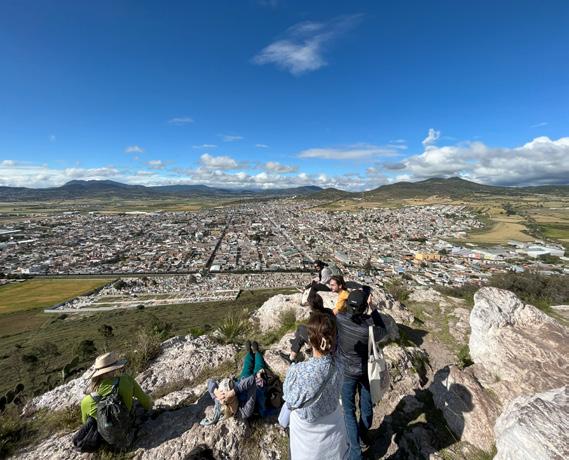
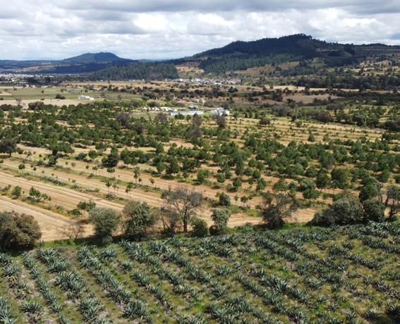


Regenerating the Liquid Region: Cultivating Identity in the Mexican Altiplano
Barbara Graeff Xingyue Huang Morgan VoughtRegenerating the Liquid Region underscores the inextricable interconnectedness between biodiversity and productivity. Through the case study of La Laguna, we propose regenerative agriculture as a pathway for Mexican altiplano communities to reclaim economic self-sufficiency and cultural identity to resist the ongoing local aquifer exploitation and agricultural market monopolization by global companies. Diversified and decentralized agave cultivation is proposed as an alternative to the current economy of barley monoculture, aiming to decrease economic dependency on global colonizing actors and strengthen local agency.
Integrated into the existing ejido communal property structure along bordos (or rows of raised earth separating agricultural fields) the project proposes a system of intra and inter-species diversity across communal lands, strengthening rotational milpa intercropping. A flexible yet robust network of collective spaces then support agricultural processing and community discourse, while water is reintegrated into the landscape through the expansion of vernacular land forming techniques and the decentralization of existing canals. This project, thus, aims to develop a multi-tiered network which could begin to restore the vibrant cultural and economic identity of La Laguna.
50

Critical Cartographies
51


Regenerating the Liquid Region
52
Top: Aquifer’s depletion in numbers. Bottom: Aquifer’s territory


53
Agave growth cycle
Graeff, Huang, Vought

A lesser long-nosed bat pollinating an agave flower Credit: M. Tschapka
54

55


56
Set of actions over time:
Reintroduction of biodiversity in communal lands
Diversification of agriculture production through rotational agave, grain, legume, and squash intercropping.
Establishment of a flexible (yet robust) network of collective spaces to support agricultural processing and shared life experiences.
Reintegration of water into the landscape through vernacular land forming techniques Treatment and redistribution of water through the improvement of the existing canals.

57

Holding water, silt and erosion: Uphill zones
the Liquid Region
58
Regenerating


59
Graeff, Huang, Vought
Top and Bottom: Erosion control, agriculture, and aquifer recharge: Terraces

Genetic bank drives agricultural transformation. Expanded productivity through inter and intra species diversity
60
Regenerating the Liquid Region


The genetic bank and irrigation channels between Year 0-6, Agricultural tranformation: Barley to Agave Year 6, and Agave Polyculture Year 11
61
Graeff, Huang, Vought

62
Liquid commons
Regenerating the Liquid Region


63
Graeff, Huang, Vought
Top and Bottom Left: Liquid commons, a structure of shared experience Bottom Right: Ruin of former hacienda’s church transformed into a Garden- Genetic bank of Agave

Post-Industrial Provocation: Water harvesting and aquifer recharge infrastructure
64
Regenerating the Liquid Region


65
Graeff, Huang, Vought
Top: Post-Industrial Park: Water Harvesting Infrastructure
Bottom: Aquifer Recharge: Re-appropriating the Brewing Infrastructure as Water Infrastructure
Apathon
Julia LiThe mismanagement of water threatens the longevity of the Apan Valley’s identity. Through proposals that are scalable to the entire valley, our project focuses on the Calpulalpan River to investigate water in the Vertical plane in tandem to the and canal system that stretches from the San Antonio Atocha Lagoon to the Apan Lagoon to investigate the Horizontal plane of water.
Applying different interventions within both of these transects, this project ultimately seeks to explore the different ways holding water can be achieved. In the vertical, this project proposes practices of silt management and erosion control through reforestation and river bank restoration, which in the long term will lead to aquifer recharge. Aquifer recharge is not possible in the lowlands due to the thick layer of tepetate, yet there is still value in holding water in the horizontal plane through the transformations of canals’ routes and forms as it leads to opportunities for the introduction of irrigation channels and grazing corridors.
The project focuses on how an event can be used to initiate interventions. In combination with the high air quality, altitude, and proximity to Mexico City, Apan has the potential to become a destination for altitude training but also for a race known as the Apathon, as the existing network of canals and streams suggest a series of trails throughout the valley. While the Apathon is a catalyst for this project and tool to bring local and international visibility to water and its management in the valley, ultimately who benefits the most is the Apan Valley as the new landscapes fostered support the present ways of life while providing new recreational space in the short term and help prepare the valley for unknown future uncertainties.
66
Lara Trimarco Prebble

Critical Cartographies
67

68 Apathon Shrinking Forest ForesttoAgricultureTransition B u i lding Proxim yt R ivermeetsC an a l Urban Polluti o n Ep hemeral joinsCl p u plalna
Land Urban Proximity Agriculture Proximity Sediment&Sil t RiverBankErosion RiverBankAccumulation
Ejido
Framework across the entire Calpulalpan River
Calpulalpan River Ephemeral River Ejido Canal


69 Li
Top to Bottom: River bank typologies and design implementation from highlands to midlands


REFORESTATION
Plant tree species mix
Restore understory
Amend soil with organic matter
RIVER BANK
Extensive, longitudinal riparian planting
Implement immediate design actions
Establish trail
5k race established
10k race established
Half marathon established
Full marathon established
0 YEARS
Long section of Calpulalpan River phasing over time
70
MARATHON
and NGOs work
agroforestry
agriculture
Trail to Firefly Sanctuary Universities
on
and
Mount Tlaloc
to 0 187.5 375 750m
Crops harvested
Agriculture


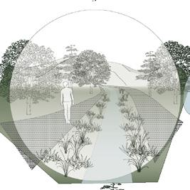
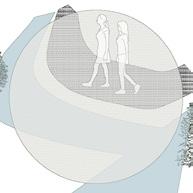


71 established Plant litter accumulation Fallen timber accumulation Canopy cover begins to develop Forest network develops Connection of ecological zones Sanctuary completed Mature forest grows in Mature forest completely developed Drainage lines reforested work with local farmers agriculture to forest transition Continued maintenance 100 YEARS 50 YEARS 20 YEARS 30 YEARS Development of environmental culture between Firefly Sanctuary and Apan PHASE 01: REFORESTATION Crop stalks as organic matter Soil for reforestation Expand forest network River bank restoration occurs concurrently Trail established along Calpulalpan River Trail starts at canal, ends at Firefly Sanctuary Length of Trail Trail connection to Apathon Pine Species Pinus montezumae Pinus oocarpa Pinus hartwegii Oak Species Quercus magnolifolia Quercus candicans Quercus castanea PHASE 02: RIVER BANK RESTORATION PHASE 03: ESTABLISH TRAIL Developing Environmental Culture Forest Transition Highlands to Lowlands Transition PHASE 04: MARATHON

72 Apathon
Stream Ephemeral Stream Canal City Lagoon Natural Areas Trail Network 5 KM 10 KM 1/2 Marathon Marathon Living Stream Ephemeral Stream Canal City Lagoon Natural Areas Trail Network 5 KM 10 KM 1/2 Marathon Marathon
Top: Current network of canals draining the Apan Plains Bottom: Proposed Apathon and trail network
Living

73 Prebble Apathon Mexico City Marathon Steamboat Marathon Crater Lake Marathon Shiprock Marathon New York City Marathon Chicago Marathon Boston Marathon St. George Marathon 500 m 1000 m 1500 m 2000 m 2500 m 3000 m 5 km 10 km 15 km 20 km 25 km 30 km 35 km 40 km Calendar Year Race Course February 10 KM May 20 KM August 30 KM Race Day 42.2 KM Year-Round Positions Race Day Positions Athletic Association Athletic Association Sponsors Registration Athlete Liaison Customer Service Race + Location Set Up Data Entry Medical Responders Landmark Water + Food Points 1) Racer’s Timeline + Activities for Altitude Adjustment 2) North American Marathon Altitudes 3) Year-Round + Race-Day Support
74 1500 M 750 M Proposed Stream Canal Overflow Direction + Water Volume Pathways Gates Vegetation Water Quantity Sediment Catchment Canal Topographies Biofilter + Nursery Slope Stabilization Biodiversity Apan Lagoon Dredged from Canal Dredged from Lagoon Tepetate Existing Proposed Access Network Control Creation Source Creation Increased Canopy as Shade Canopy as Shade Reduce Downstream Sedimentation Provides Clean Nursery Biofilter Ahuejote Proposed horizontal transect and the horizontal transformations and associated Apan valley futures
Recreational Space
• Altitude Training
• Running
• Biking
• Horseback Riding
• Ecotourism
• Outdoor Gathering
• Commuting Spaces
• Kayaking
• Fishing
Ecological Corridors
• Habitat Connection between Lagoons and Upland Slopes
• Organic Material
• Increase Soil Nutrients
• Increase Capacity to Hold Water
Agricultural Soil Restoration Irrigation
• Ensure Water Access
• Passive System
• No
• Grow Crops With Specific Water Needs
Intentional planning Ecosystem Restoration
• Associated Economies Depend on Future of Certain Landscape Qualities
▪ Air Quality, ▪ Water Quality
▪ Regionally Connected Landscape Apan Valley at Installation
Threats: Land Abandonment
Dried Aquifer
75
Electricity
Needed
Near
Future Unknown Future
Crop Security Crop Diversification Water Security
Access for Farmers and Grazers Network of Trails for Public and Visitors Control of Water Levels During Dry Season Creation of Biodiverse Spaces That Support Various Niches Source of Organic Material Creation of Diverse Spaces Increased Water Quantity Sedimentation Provides Vegetation Above Ground Reservoir Clean Water Public Education: Valuing Water

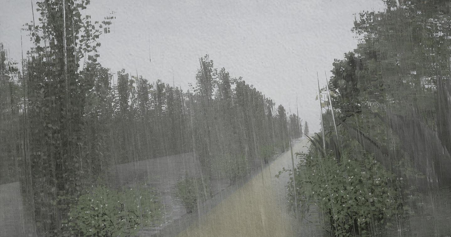

76
Top to Bottom: Ahuejote-lined canal path Ahuejote-lined canal path during rainy season and berm path after high waters


Trees provide shaded environment to reduce evaporation. Opportunities for recreation

Symbolically celebrating the expansion of the Apan Lagoon

Gathering Space
Revegetation of Dominio Pleno for Grazing and Gathering

Boardwalk Through Lagoon
New spatial experience with water to celebrate its holding.

activated for commuting and recreation in addition to altitude training

Opportunities for environmental restoration between agricultural parcels

Exposed path accessibl during canal flooding

Irrigation Network
Parcels have access to water through passive transit. Vegetation helps shade water and reduce erosion

Canal
Old canals constructed for drainage transformed to biosheets for large flooding events. Activated as trails when dry

Ecological enclosure that provides space for grazers, supporting efforts for reforestation in the uplands
77 Detail plans and perspectives
Finish Line
High Trail
Secondary
Trails
High Trail (2)
Canal Elevation
Ahuejote-Lined Lagoon
Flooded Wetlands


78
Apathon
Top to Bottom: Sediment trap after Calpulalpan River meets canal network, irrigation network through agriculture parcels, and ecosystem restoration after land abandonment


79 Prebble
Top - Bottom: Finish line over expanded Apan Lagoon, finish line over expanded Apan Lagoon (2), revegetated Dominio Pleno aong Apan Lagoon- gathering space
Our framework responds to Apan City’s unequal distribution and unsustainable water management by enhancing water sovereignty through seasonality, commons, and wetness. This strategy will be helpful in recovering a more balanced distribution and access to a resource that is currently being wasted away. Under this framework, we worked individually along the transect from mountains to the city and the lagoon.
Zoe’s project Revealing and Remediating Waterways: Building Commons in Apan reclaims the water from the rivers and treats it along linear biofilters before it reaches the lagoon. Once oxygenated,the overflow is reused to irrigate bordosalong the farmlands. Her project provides a nursery that can facilitate the planting of trees, which helps not only the legibility of the project but also the amplification of wetness through the tree canopy in both the city and the farmlands.
Sophie’s project Making Room for the Riverways in Apan reclaims the Amaxac River, which is in the process of becoming invisible today. In doing so, the river recovers its riparian ecology while facilitating water management to refill the lagoon. This new connecting landscape reestablishes a new relationship with waterwaysby bringing it back into Apan residents’ everyday life, traverses, cultural events, and festivities.
Angel’s project Water Sovereignty in Apan raises awareness of a new culture more responsive to water collection and care through three different proposals: the reimagination of today’s impermeable streets in Apan as waterways that could help delay and filter water; the reappropriation of public space by water to start raising awareness of water collection through commons; and the establishment of a new education program for waste collection.
80
Escobar-Rodas
Water Sovereignty Sophie Mattinson Angel
Zoe Wu

Critical Cartographies
81
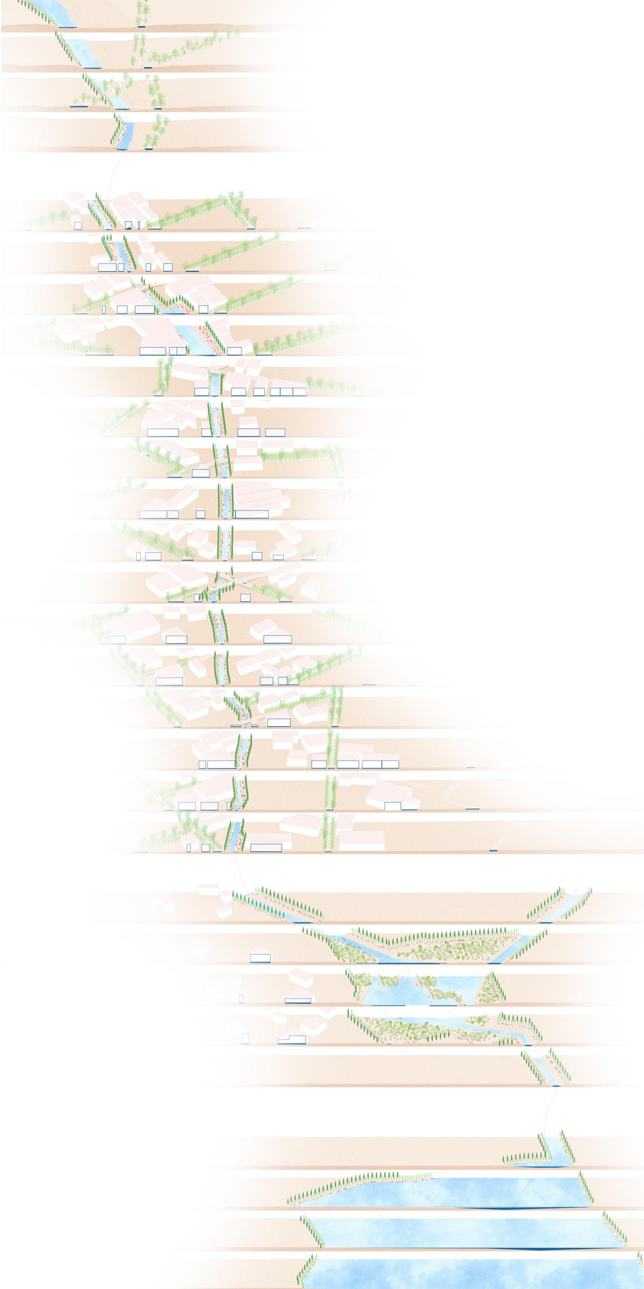
82
Making Room for the Riverways in Apan
Serial sections: Upper Slopes, Apan, Pond to La Laguna


83 Mattinson
Top: Apan Region
Middle: Widened path
Bottom: Pond


84 Toward Water Sovereignty
Top: Water plaza reimagines the only existing public space in Apan Bottom: Excavating into the ground as a form of public gathering is an acknowledgement of native architecuture


85
Escobar-Rodas
Top: Recycling center with sports fields and barbacoa pits
Bottom: The center gives the municipality of Apan a low-budget system of collecting recyclable waste

86 Phytoremediation Wu

87

88
Lagoon Wu

89


90
San Antonio Atocha (Tochac) Lake
Malayerba Spring // Almoloya and Zoquilpan
Dams // Almoloya, Francisco Villa, Lázaro Cárdenas
The Tochac Lake, a few kilometers south of Apan along the border of Hidalgo and Tlaxcala states, is reduced in size by 90%. It was once the largest body of water in the Apan Plains from the former Anáhuac Lake system, with a historical extent of some 125,000 hectares when taking into account its now-ephemeral sister lake, Soltepec. While Tochac still maintains water levels year-round, it has seen substantial declines in biodiversity both within the lake and in its surrounding areas. Students worked along three transects from the upper slopes to the lake in Francisco Villa Ejido, Lázaro Cárdenas Ejido, and Almoloya City along the Malayerba river.
Regenerating Liquid Terroir: Unearthing Liquidity Through Ecotourism in the Apan Plains
Elizabeth Nadia Quintero
Jiayu Tong
Embracing Water: Engaging Cooperatives Towards More Productive Bio-Cultural Landscapes
Yin Dong
Lauren Duda
Maria Vollas
Holding Water: Reconnecting the Urban to the Lacustrine
Syeda Aimen Fatima
Julia Helen Rice
91
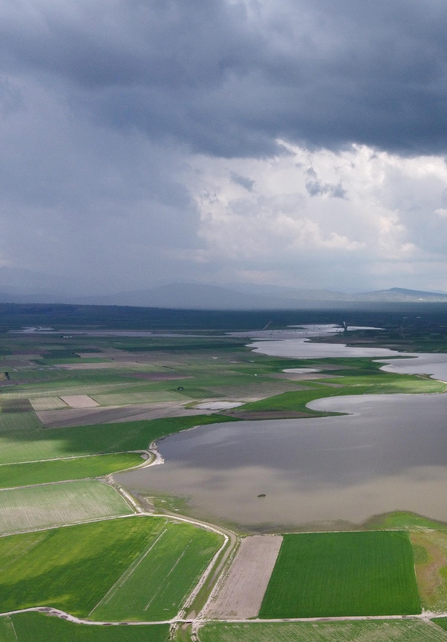
92

93


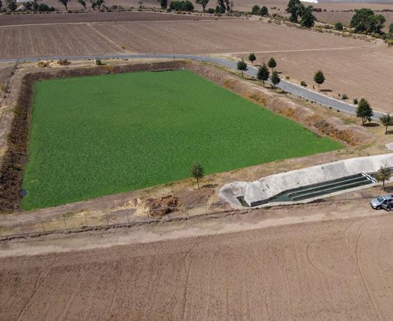

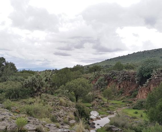


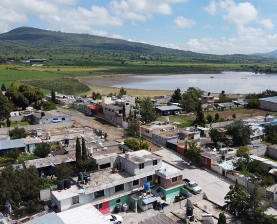


Regenerating Liquid Terroir: Unearthing Liquidity Through Pulquerias in the Apan Plains
Elizabeth Nadia Quintero Jiayu TongApan was once the pulque capital of Mexico. After the Mexican revolution and agrarian reform in the early 20th century, work was done to return the land back to the people. The movement was a collective one, with many, educational, economic, and social reforms established as goals. However, the reformed land tenure did not ensure economic prosperity for the farmers. To confront the environmental injustices being enforced on the altiplano, our project imagines a new wealth distribution through the Apan Plains Basin, through a transition of rain fed barley monoculture to the polyculture of Maguey and milpa. Since the Aztec civilizations, pulque used to be the ubiquitous drink of the altiplano region. It is a beverage made from agave, a plant that has acclimated through reversed photosynthesis to both dry and rainy seasons. As beer industries and companies began to expand their influence in Mexico, beer companies ran multiple slander campaigns against pulque to bolster the sale of beer. Francisco Villa as a destination explores how caring and symbiotic relationships between local people and their land, can be respectfully shared and enjoyed with non-extractive visitors that in turn, help support the local’s livelihoods and their vernacular landscapes. Every regenerative action, from the mountain pines to the axolotl in the lagoon, works to restore the lost health of its terroir. The goal is to move ejidos’ livelihoods into the twenty-first century by enhancing land, culture and water. Our project imagines a new wealth distribution through the Apan Plains, and a transition in economies. Rain fed barley monoculture production transitions to the polyculture of Maguey and milpa. This agricultural change lends its way to an economical one, providing the resources needed to grow the lake and preserve the culture of the Apan Plains, regenerating the terroir of the altiplano and unearthing liquidity through ecotourism in the Apan Plains.
96

Critical Cartographies
97


98

99
 Tong
Diagram of Mexico’s global production and exports of beer
Tong
Diagram of Mexico’s global production and exports of beer


Tong
Composite drawing of relationships of beer production across scales

104
Regenerating Liquid Terrior
Diagram of maguey biodiversity and pulque making process

105
Quintero, Tong
Ejidos’ sizes in the Tochac Lake micro-basin

106
Regenerating Liquid Terrior
Axonometric drawing tracing water runoff in Francisco Villa and stakeholder alignment


107 Quintero
Top: Detail composite of highlands midlands in Francisco Villa, Maguey cultivation and economy transition. Bottom: Maguey production and tasting pulqueria in the midlands
Phase 0 2022

Phase 1 2022-2025

Phase 2 2025-2028

Eco-tourism Phase 1 2025-2028
Target Population: Nearby municipality Attractions: Hacienda hotel, Chinampas, farmers’ market, fishing

Eco-tourism Phase 2 2028-2030
Target Population: Nearby Cities (Mexico City, Puebla) Attractions: Agave history/production, Hacienda Hotel, Chinampas

Top: Ecotourism timeline and phasing design
Phase 3 2028-2030

Eco-tourism Phase 3 2030-
Target Population: Mexico, U.S. Attractions: Mexican history, Hacienda hotel, Chinampas, Agave history/production, Participitory experience

Bottom: The three phases of ecotourism
108
Liquid Terrior
Regenerating

109 Tong
Forest
Reforestation
Agave Forest
Pulqueria
Agave Field
Ex-hacienda
Laguna de Atocha
Extended Waterbody
Fish Pond
Chinampas
Wetland
Barley Field
Barley Field
Reservoir
Ecotourism
Francisco Villa
diagram


110
View of the ruin garden in ex-hacienda
View of the outdoor Pulqueria
View showing ecotourism in Chinampas
View showing Farmers Market

111
Francisco Villa and ex-hacienda design plan
Embracing Water: Engaging Cooperatives Towards More Productive Landscapes
Situated in the former liquid territory of the Tochac lagoon and the settlement of Lázaro Cárdenas, our project aims to intertwine people, culture and the earth’s natural cycles in enriching the livelihoods of the region. Within an area that is subject to a continuous drought: one that is defined to be climatic and ecological, but also in extension economic and cultural, we are focused on embracing water and weather cycles, the local communities, and the cultural heritage of the region in revitalizing the landscape. Through the expansion of the existing Tochac lagoon and the series of traditional farming techniques and forms of care for the land (such as the Chinampas, the terraced agriculture and the practices of polyculture), we are investing in the local ecology, economy, and culture.
Focused on fighting drought and enriching the territory, our main values here are to:
1. Preserve the cultural patrimony of the area by embracing traditional farming techniques of polycultures.
2. Engage with natural cycles (water cycle, weather patterns).
3. Support the local economy by actively engaging the community and tourists. Lázaro Cárdenas will act as a pilot cooperative with the help of a local NGO. This will help remake the landscape into a living memory which is self-dependent and breaks the cycle of global dependency.
112
Ying Dong
Lauren Duda
Maria Vollas


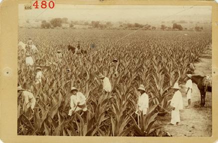


Critical Cartographies
Apan San Antonio Atocha Presa El Muerto Tecocomulco Presa Canada de Zoquiapan La Laguna Monte Tlaloc Iztaccihuatl
Territorial map of Lázaro Cárdenas
114

115

Territorial transect section through the working landscape
116

117
Yearly calendar highlighting different activities and ecological events overlaid with Mayan festivals

118

119


Corresponding diagrams highlighting crops and festivals according to topography and soils
120

121
Top: Different planting techniques throughout Lázaro Cárdenas along with diagrams showing a circular economy and recharging of the aquifer. Bottom: Plans for reforestation, agroforestry, agriculture, biofilters and chinampas

Timeline of reforestation and agroforestry
122 Embracing Water

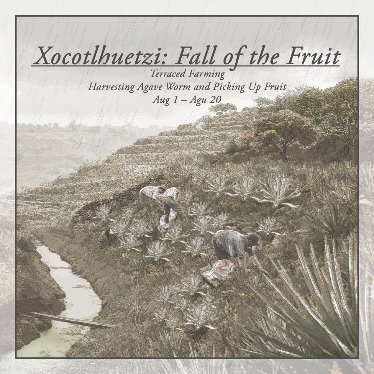
Different festivals and events based on time of year and site location
123
Dong, Duda, Vollas

124 Embracing Water Timeline of the biofilter


Different festivals and events based on time of year and site location
125
Dong, Duda, Vollas

126 Embracing Water
Timeline of the Chinampas


Different festivals and events based on time of year and site location
127
Dong, Duda, Vollas
Holding Water: Reconnecting the Urban to the Lacustrine
The project takes on the multiple and overlapping threats to water and livelihoods along the Río Mala Yerba through Almoloya. This transect exemplifies many of the existential challenges facing the communities of the Apan Plains. The Atocha or Tochac Lake once bordered the town of Almoloya, “the place where flows the water source” in Nahuatl. The lake has been drained by a series of canals which now serve as conduits for untreated wastewater to flow into the lagoon. The draining of the lagoon combined with a lack of sewage treatment has led to ecosystem collapse of the former wetlands. These problems are exacerbated by heavy sedimentation caused by erosion in the hills and fields surrounding Almoloya. The town itself has abundant groundwater resources, exemplified by the natural spring that forms a pool in the center of the community, but unplanned growth has led to a loss of character and disconnection from its original culture of water.
A phased process with multiple design and planning interventions will restore the natural hydrology of the Atocha Lake and Almoloya’s connection to its lacustrine environment. Check dams and retention ponds in the hills will slow the rapid soil loss while a biogas plant will process the solid waste of Almoloya and its surrounding communities. This biogas plant will power the existing sewage treatment plant and return clean water to the canals. The water will be used to irrigate a nursery which provides the native plants for reforestation projects in the hillsides and along the riparian corridor. Finally, a new system of aquaculture will offer farmers alternative economic opportunities while supporting the growth and restoration of the lacustrine ecosystem.
128
Syeda Aimen Fatima
Julia Helen Rice

Critical Cartographies
129

130 Holding Water
Map of sewage drainage shed for Atocha Lake with total sewage amounts

Selected transect highlighted within the region of study
131 Fatima,
Rice

Programmatic diagrams illustrating ways of holding water within the transect
132 Holding Water

133
Fatima, Rice
Proposed interventions along the transect


134
Top: Diagramatic section illustrating the ecological and social challenges along the project’s transect Bottom: Diagram explaining economic scales of proposed wastewater treatment systems across the Apan Plains


135
Interventions along the Rio Mala Yerba in relationship to the town of Almoloya


136
Fatima, Rice
Top: Diagram of wastewater treatment systems for Almoloya and surrounding communities
Bottom: Plan of sewage treatment plant, proposed biogas plant, and municipal nursery for Almoloya


137 Holding Water
Top: Plan of proposed aquaculture system. Bottom: Section perspective of fish ponds and canals


Top: Perspective section illustrating a proposed pattern of settlement. Right: Perspective section illustrating a proposed revamping of the spring in the center of town
138 Holding Water


Bottom: Section perspective of public nursery irrigated with reclaimed wastewater
139 Fatima,
Rice


140
Soltepec Lake
Capulac Spring, Sánchez Pond // Graciano
Sánchez, Quintanilla, Santiago Tetlapayac, Union Ejidal Tierra y Libertad
Lake Soltepec is today a sister lake to Tochac Lake and it sits between the states of Hidalgo and Tlaxcala. This body of water is completely desiccated year-round, and it only returns ephemerally during the rainy season. In the painting of Jose María Velasco of the plains of Mexico City´s Valley in 1875 we can see that this was also a recurrent phenomenon in the process of draining that valley´s lakes. Students worked along two transects from upper slopes to the lake in Santiago Tetlapayac Ejido and Union Ejidal Tierra y Libertad along ephemeral springs.
Re-learning How to Hold Ancestral
Waters with Animal Agriculture
Sophia Glasser-Kerr
Animal Agriculture for a Regenerative
Charreria
Sunjae Yu
141

142

143


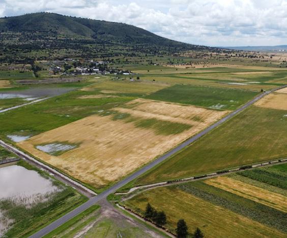


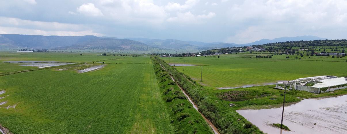


 The Valley of Mexico from the Santa Isabel Mountain Range, 1875
146
Credit: José María Velasco

147
Re-learning How to Hold Ancestral Waters with Animal Agriculture
Regenerative principles from indigenous practices can help restore the water, nutrient, and carbon cycles that have been broken by a worldview that only sees resources for commodification. Apan’s conventional farming is not resilient to increasing temperatures and periods of drought and flooding. Livestock grazing is mismanaged and degrading soil and water systems. Yet, animal husbandry which is the basis of the region’s cultural identity and pride is also an opportunity for restoring its vital lifelines. Soil storages and infiltration of water could return through formalizing animal grazing and combining it symbiotically with agriculture. Organizations with climate change mitigation agendas could fund the infrastructural changes and social programs for training, organizing, and monitoring to change illegal and detrimental practices.
In this project the upper watershed is designed to hold and infiltrate water, the lower watershed to absorb water through soil, and the lake to increase inundation. The lowlands have a wetland regeneration strategy: 1) canal buffer grassland grazing management and carbon farming, 2) planting future wetland easement 3) transitioning to sustainable wetland agriculture. The uplands restoration involves an organized effort for fire mitigation and soil building using animal labor. Silvopasture is a strategy to reforest uplands. In the dry season livestock graze in silvopasture orchards, eating from trees in droughts. Livestock migrate to manage grasslands when they are most palatable in the wet season and animals help with low land agriculture before sowing and after harvesting times.
I am proposing a long-term systematic transition of the region, with an adaptation of indigenous frameworks to guide conservation, restoration, and new economies of small businesses and agroecological tourism, that have cultural grounding and empower local people.
148
Sophia Glasser-Kerr

Critical Cartographies
149

Sectional exploration of best routes and needed actions
150 How to Hold Ancestral Waters


Top: Proposed routes
Bottom: Calendar of practices
151 Glass-Kerr


Composite drawing with actions along the transect, growth of the lake over time and canal terra-forming
152


153
Animal Agriculture for a Regenerative Charreria
This project proposes the regeneration of indigenous agriculture in regard to Charreria and animal husbandry in regard to local Charreria culture in the Apan Plains. In response to our current climatic crisis, the proposed framework involves enhancing Apan and Tlaxcala’s local culture and natural landscape to restore the beauty and abundance it once had.
Their indigenous agriculture techniques, including Xiuhpohualli, chinampa, milpa, duck-farming, and silvopasture, can coexist with animal husbandry when animal traces are managed as accumulative landforms while their manures are deployed as fertilizers. Seasonal changes that caused droughts and floods before can help harvest adaptive crops by using animal-made channels. Agriculture in Apan and Tlaxcala, which depended on the monoculture production of barley, can be transformed into a polyculture harvest of various crops within the cycle of the moon calendar and water level fluctuations, as their ancestors applied. These modified agriculture technologies collaborate with the regenerative Charreria culture to raise more revenue and work as an agritourism system.
Therefore, the human-based agricultural structure changes into a reciprocal one that works for each other. Apan and Tlaxcala can be a more sustainable community with a productive landscape that protects not only its culture but also livestock, nature, and economy. However, this fundamental change requires merely negligible labor with few guidelines: what the farmers need to do is go through planned routes instead of roaming anywhere. Nevertheless, these small efforts will be accumulated as a whole and alter the environments slowly but continuously to the extent that polyculture in the region can be sustainable. By all means, they are not only gathering their efforts but their love towards nature, in the belief of a better future.
154 Sunjae Yu

Critical Cartographies
155


Sequential diagram of animal-made land formations

156 cows sheep erosion section

157
horses buffalos
 Left: Site and parcel conditions Middle: Seasonal change conditions Right: Farmland transformation in 30 years


Diagram illustrating the seasonal change of farmlands
160 animal path wet normal dry rainy season manure maize pepper squash barley maize pepper tomato bean squash animal path dry manure maize pepper tomato bean squash barley normal oat manure


161
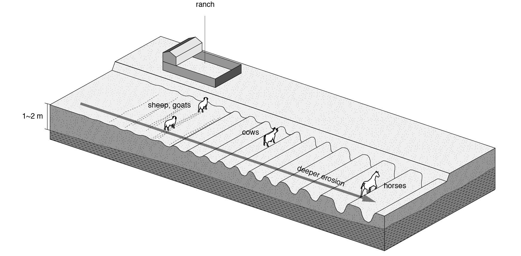
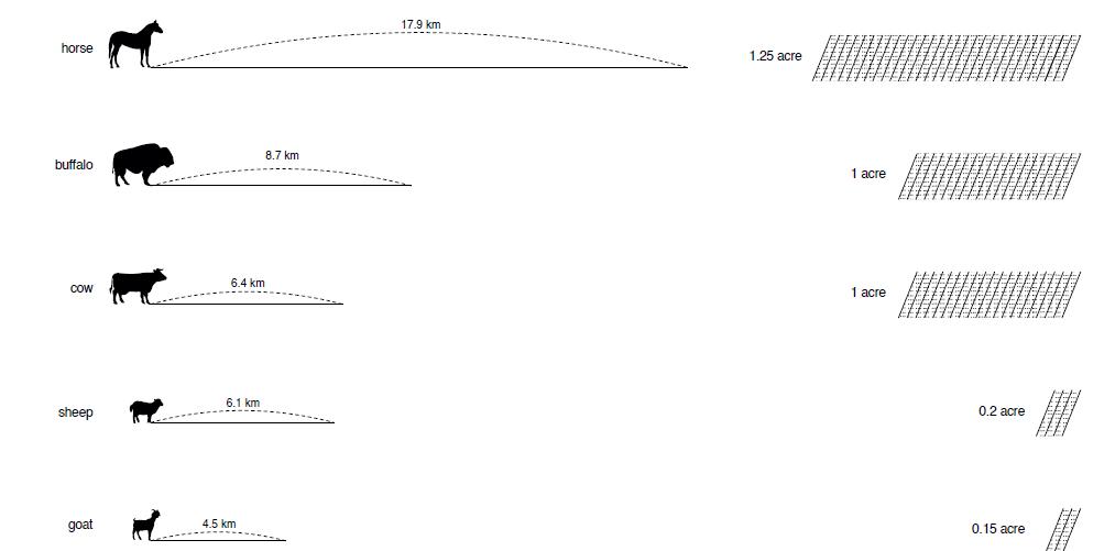

162
for
Animal Agriculture
a Regenerative Charreria
Top: Section exploring landformation and agriculture in dry season Bottom: Section exploring landformation and agriculture in rainy season


163 Yu
1-2: Festival in ex-hacienda and farmlands changed into Chinampas
3-4: Mounds in dry and rainy season


164
Tecocomulco Lake
Cuatlaco River // Alcantarillas Dam // Cocinillas, Francisco Sarabia, Rancho Nuevo, San Miguel Allende
Lake Tecocomulco, located several kilometers northeast of Apan, is the most visibly substantial permanent body of water left in the region from the former Anáhuac Lake system of the Mexico Valley Basin, but it is still reduced 50% in size. It currently remains fed by the Cuatlaco river, descending from the mountainous region to the north of Apan municipality and to the east of Almoloya municipality. Its borders fluctuate throughout the year, with the water body as a whole fluctuating in extent by hundreds of hectares depending on the yearly water regimes of rainfall. Students worked along two transects from the upper slopes to the lake in San Miguel Allende Ejido, and Rancho Nuevo along the Cuatlaco river.
Aquatic Livelihoods: Reimagining the Management of Common Resources in Tecocomulco
Jingyun Li
Hala Nasr
Look up to the Mountains: Care of Upland Waters for Stability in San Miguel Allende
Alison Maurer
Recharge + Angelica Oteiza Arty Vartanyan
165

166

167


Aquatic Livelihoods: Reimagining the Management of Common Resources in
Tecocomulco
Jingyun Li Hala NasrThe Tecocomulco Lagoon is one of the former Anáhuac lakes in the Mexican altiplano with critical ecological and cultural value. Due to the aggressive anthropization of its valley, the lagoon is shrinking as result of siltation caused by erosion, the near depletion of its aquifer with industrial/municipal concessions, and the farming land reclamation. In the face of these challenges, our proposed NGO focuses on repairing both the visible and the invisible; the lagoon, the aquifer, and farmers’ right to water resources through sustainable management of common resources.
In the first years, our NGO will focus on raising awareness about the value of the lagoon and its restoration by empowering the community with resource management knowledge. Eventually, the management will be handled entirely by community entities who would manage three levels of intervention. Upstream, micro-scale infrastructures are introduced to facilitate ground-water recharge and silt catchment. At midstream, reinstated metaplante helps the transition from barley monoculture into plant rotation with Milpa. Low-stream, the lagoon’s border is reclaimed through flooding and aquaculture—with land rental programs—to reduce the lagoon’s encroachment. Within the lagoon, Tule, an invasive species, are strategically removed and reused for boardwalk construction and filtration.
These bottom-up techniques and new infrastructures will enable annual maintenance by and for the locals while creating job opportunities and volunteering programs. Over time, the engagement with resource management practice becomes part of the aquatic cultural landscape and breathes new life into the local livelihood.
170

Critical Cartographies
171

172
Pamphlet for the proposed national reserve system

Sectional perspective illustrating recharge infrastructure, re-flooding program, silt management and invasive species control
173


174
Top: Low stream: dredging and silt management
Bottom: Midstream: reflooding through land rental program

175
Bottom: Upstream: recharge infrastructure and reforestation


176
Top: Carp management in rain season
Bottom: Micro-scale infrastructures facilitating groundwater recharge and silt-catchment

Tule’s strategic removal/reuse for boardwalk construction and filtration
177

178 Tule’s ecology

Twenty-year phasing strategy and overall framework for the restoration of the Tecocomulco lagoon

180

These bottom-up techniques will enable annual maintenance by and for the locals while creating job opportunities and volunteering programs. The engagement with resource management practice becomes part of the aquatic cultural landscape and breathes new life into the local livelihood. It is a very straightforward and user-friendly mechanism. It is also beneficial that we can go back and revise the application
181
1 Grazing Control
Introducing stream feeds allows for sheep herd movement and feedings to be better managed across the site.
2 Percolation Ponds and Checking Dam
Built strategically in areas where gravel and permeable material allow water to seep into aquifers. Constructed across the main channel to lower the flow velocity, helping reduce erosion and allowing sediment to settle out.

3 Contour Bunds and Trench
Contour bunding is aimed at educing run-off and increasing water filtration to reduce soil erosion and nutrient loss.
4 Rotational Cropping
Planting different crops sequentially on the same plot of land improves soil health.
5 Waffle Gardens
Consists of squares surrounded by berms, or raised mounds of dirt. The shape helps any water flow directly to the plants and with rain water retention.
companion planting - corm + squash + beans
6 Water Breaks
Break walls, habitation gardens, and garden filters create a gradual slope to absorb the silt that flows from the streams.

182 Introducing stream feeds allows for sheep herd movement and feeding to be better managed across the site Grazing Control 1 areas where gravel and allow water to seep into across the main channel to helping reduce erosion and sediments to settle out Contour bunding is aimed at reducing run-off and increasing water filtration to reduce soil erosion and nutrient loss. Planting different crops sequentially on the same plot of land to improve soil health Rotational Cropping 4 Contour Bunds and Trench 3 and Checking Dam 1 Grazing Control 4 Rotational Cropping


183 Consists squares surrounded by berms, or raised mounds of dirt. The shape helps any water flow directly to the plants and with rainwater retention companion planting corm + squash + beans Break walls and habitation gardens and garden filters create a gradual slope to absorb the silt that flows from the streams Waffle Gardens Water Breaks 5 6 the same health Consists squares surrounded by berms, or raised mounds of dirt. The shape helps any water flow directly to the plants and with rainwater retention companion planting - corm + squash + beans Break walls and habitation gardens and garden filters create a gradual slope to absorb the silt that flows from the streams Waffle Gardens Water Breaks 5 6 Built strategically in areas where gravel and permeable material allow water to seep into aquifers. Constructed across the main channel to lower the flow velocity, helping reduce erosion and allowing sediments to settle out Contour bunding is aimed at reducing run-off and increasing water filtration to reduce soil erosion and nutrient loss. Planting different crops sequentially plot of land to improve Rotational 4 Contour Bunds and Trench 3 Percolation Ponds and Checking Dam 2 sheep herd managed across Built strategically in areas where gravel and permeable material allow water to seep into aquifers. Constructed across the main channel to lower the flow velocity, helping reduce erosion and allowing sediments to settle out Contour bunding is aimed at reducing run-off and increasing water filtration to reduce soil erosion and nutrient loss. Planting Contour Bunds and Trench 3 Percolation Ponds and Checking Dam 2 2 Percolation Ponds and Checking Dam 3 Contour Bunds and Trench 6 Water Breaks 5 Waffle Gardens
Look up to the Mountains: Care of Upland Waters for Stability in San Miguel Allende
In a valley with a depleted aquifer and shrinking bodies of water, Tecocomulco Lagoon stands out as an ecological resource and a remnant of the historic Anáhuac landscape of the Valley of Mexico Basin. However, deforestation in the mountains around it have led to substantial sedimentation, accelerating natural succession into a wetland state.
To honor the importance of this lagoon on the edge of the small settlement of San Miguel Allende, this project attempts to halt that pattern of erosion through interventions in the uplands. Importantly, it builds an empathetic connection between locals, tourists, and the mountains’ ephemeral streams which carry sediment downhill.
This project seeks to use the framework of a collaboration between an NGO, ejidatarios, and external partners to culturally and economically motivate participation in lagoon health. First, visual markers of human care for the streams make them part of the cultural and social experience of this locale. These humanworks operate outside of the channels of Conagua jurisdiction by embracing ephemerality as modeled by the streams themselves. Second, a curated silvopasture/wildlands system fosters both fodder for livestock while promoting the reforestation of the area and the stabilization of soils. And third, partnerships build funding and education opportunities for longer-term success.
This project adds to the work of Jingyun Li and Hala Nasr to holistically address the needs of the community and its lagoon for the long term.
184 Alison Maurer


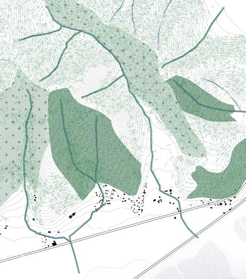

185


186
Look Up to the Mountains


187
Maurer
Recharge +
Angelica Oteiza Arty VartanyanRecharge + is a project where we look at the water cycle at different scales and the implications that actions on the territory of the Apan Basin have on it, particularly in the Cuatlaco River Basin. This cycle is one small part of the larger whole of smaller parts. The actions and implications in each scale compound and influence the larger scale order.
The Cuatlaco River Basin transect was identified and analyzed through its unique ecosystems related to altitude. The way water behaves depends on the topography and human-to-ecosystem interactions. The project builds on the existing lowlands, Tecocomulco Lagoon RAMSAR Protection Site Project, presented in Aqua Incognita I in 2021 and therefore focuses on the midlands and highlands of the Cuatlaco river. The project seeks to extend the Protection of the lagoon to the system that allows it to exist, therefore protecting the river basin and the forest that allows the system to continue to exist.
Additionally, Recharge + looks at strategies that point towards economic and water autonomy for locals in contrast to today’s forces that shape the environment, which is dependent on the global beer industry and industrial extraction. The project thus proposes two main operations: first, the protection of the river through the reforestation of the existing river buffer regulated by Conagua, through addition of a path along its course. Second, an additional land use buffer that incentivizes alternatives to monoculture economies on existing agricultural plots, trough the introduction of a forestry economy that promotes reforestation and high-altitude crop polyculture. The project looks at a timed intervention with the partnership of local ejidos: Cuatlaco and Rancho Nuevo, each corresponding to one of the altitudes.
188

Critical Cartographies
189

Diagram of the system to be protected by the proposed “Tecocomulco+Cuatlaco River Protection Act”
190

Site Plan llustrating the impact of the proposal on the river basin 191
HARVEST

COOPERATIVE PRODUCTION +
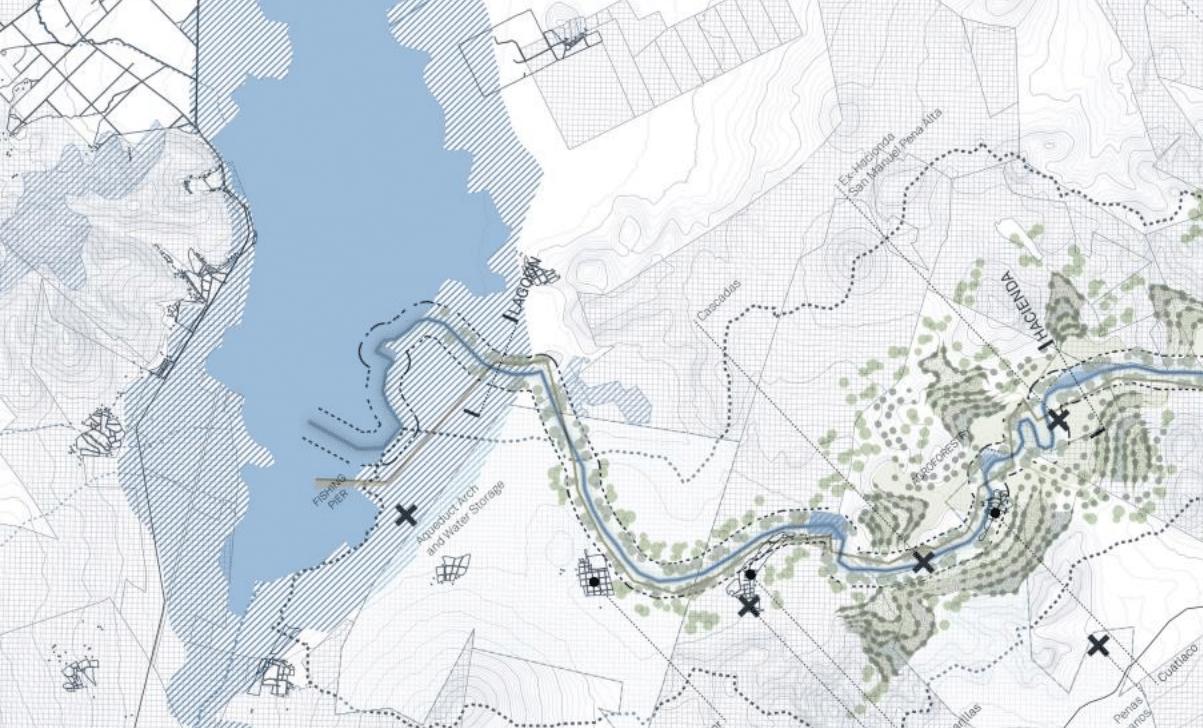
192
Top: Sectional transect with found anthropogenic processes Right: Challenges to water conservation


193
RESEARCH +
Bottom: Proposed actions along the Cuatlaco River watershed


Measured sections through (top) agroforestry actions and (bottom) settlement actions
194 Recharge +

Polyculture and agroforestry practices on the midlands trough multiplication of bordos provide a solution for soil nutrient depletion, lack of canopy and erosion control.

Nature-based solutions for pollution like bioswales prevent pollution runoff and help filter water before it reaches the Cuatlaco River and the aquifer.
195
Oteiza, Vartanyan
Agroforestry
Path Bioswale
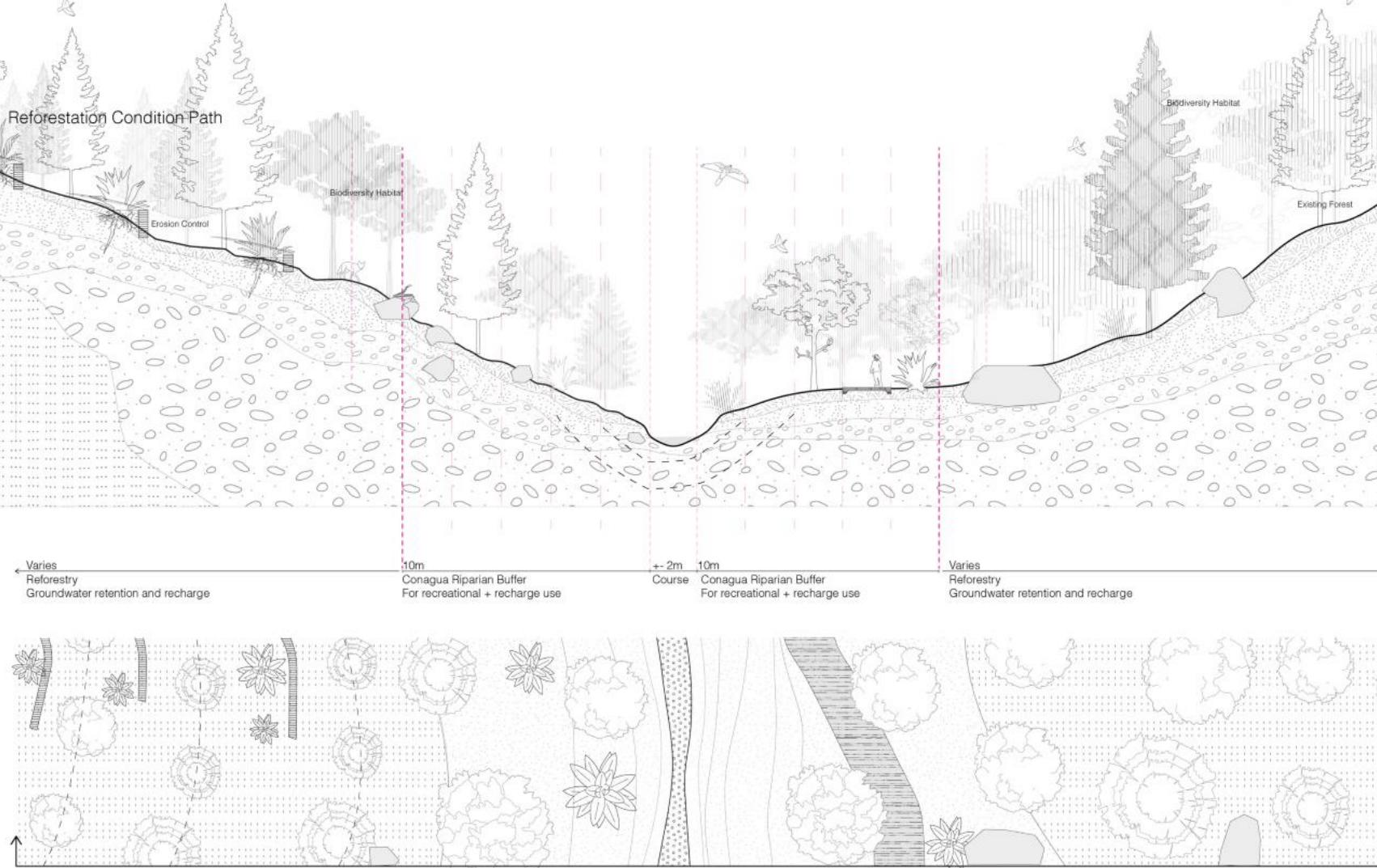

Measured sections through (top) forestry actions and (bottom) the base path actions
196 Recharge +

The path eventually reaches the forestry lab on the highlands. Creating an opportunity to learn about the importance of forests for water availability.

is an opportunity to tell the story of the impact of nature based solutions for water recharge. The invisible work of nature is highlighted trough experience
197
Oteiza, Vartanyan
Cuatlaco
Cuatlaco River Path over time
Forestry Lab Site


Reimagining Water Futures
Mexico+H2O = Challenges, Reckonings, and Opportunities
David Rockefeller Center for Latin American Studies
Harvard University Graduate School of Design Department of Landscape Architecture
Aqua Incognita I,II Team: Lorena Bello, Celina Abba, Arty Vartanyan
Special thanks to Professors Diane E. Davis and Gabriela Soto Laveaga for the opportunity to give visibility to this work; to DRCLAS for sponsoring our travels to Mexico; and to Dean Sarah M. Whiting , department Chair Gary Hiderbrand and former department Chair Anita Berrizbeitia for supporting these studios at the Harvard GSD.

200


201
This publication presents the work from two Option Studios that I offered at the Graduate School of Design at Harvard University in the Falls of 2021 and 2022, entitled respectively, Aqua Incognita I, II: [Deciphering Liquid Territories // Reimagining Liquidity] in the Mexican Altiplano. Both studios were run in parallel to a collaborative project—that started in June of 2020 and continued with the support of a UK Pact Mexico program grant—aiming to ameliorate the effects of climate change in an already humanly induced water-stressed basin, affecting agrarian communities in the Apan Plains of the central Mexican plateau or altiplano.
The depth of the students´ projects is indebted to the work of the local team led by Gustavo Madrid and Charlotte Chambard, whose commitment and engagement with these communities in tandem with their thorough exploration and analysis, constructed a precise status-quo of the basin as a Critical Zone for action. Especially regarding water conservation, livelihoods/soils restoration, and reforestation as explained in their essay. I thank you both for your support to the studios, together with the expertise of scholars and activists Antonio Azuela, our own Diane E. Davis, Raul Mejía, Elisa de Simone, Mónica Tapia, and Luis Zambrano. Not less important, for the support of all the students (26 GSD, 2 MIT graduates, and 2 Harvard undergrads ) who over the course of a semester or a year, transformed your plateau in their critical zones of research and design. In the case of GSD PhD candidate, Samuel Tabory, the topic of
Lorena Bello Gómezhis dissertation. Among the team, I use the opportunity to thank Diane E. Davis, and Samuel Tabory for the wonderfully sustained collaboration over these three years and for Diane’s thoughtful and elocuent essay in this publication.
At the GSD, I would like to extend my gratitude to our Dean, Sarah Whiting, Landscape Architecture’s Chair, Gary Hilderbrand, and former Chair, Anita Berrizbeitia, for supporting these two studios at the school. Without your leadership, projects like these would be difficult to support from academia, as it is still challenging to help those who need us the most, when the sources of capital are still in the hands of those creating such conditions. But, as climate crisis continue progressing, there is no doubt that capital would need to come to terms with society, ecology, and ecosystem performance. I am grateful for you to sharing my conviction that studios like Aqua Incognita are necessary to give our outstanding graduates the seeds that will contribute better harvests on Earth in the near future.
At Harvard University, I am indebted to the generosity of the Harvard David Rockefeller Center for Latin American Studies (DRCLAS) for their support of part of our travel to Mexico in the Fall of 2022 and the printing of this publication. In Cambridge, I owe special thanks to Andrew W. Elrick for making this possible. In Mexico, to former director Mauricio Benitez and Lorena Rodas, for all your support during our visit to Mexico. Also at DRCLAS to Mexico Program Directors, Diane E. Davis, and Gabriela Soto Laveaga, for giving space
202
Acknowledgments
Acknowledgments
to exhibit and explain the work of the Aqua Incognita studios in ¨Reimagining Water Futures¨ during the Spring’23 conference ¨Mexico + H2O = Challenges, Reckonings, and Opportunities. ¨ And for the opportunity to participate with the incredible group of experts in water that you brought to Cambridge. The rain of ideas was really refreshing after thinking about drought for so long.
In Mexico City, special thanks go to the British Embassy, ambassador, and team. To Senator Xóchitl Galvez for helping us connect with both the state government and industrialists. To Luis Zambrano for the inspiring visit to the Xinampas or ¨living pyramids”—as Pedro, our host in Xoximilco called them during our visit. To Alberto Kritzler for hosting us in La Laguna during Mextrópoli
To Lorena Rodas for the rich historical explanations at Zócalo and Coyoacán, and for helping us get to the Tehotihuacán and Xihuingo Pyramids. In the Apan Plains, we thank the Apan Municipality, its municipal president Guadalupe Muñoz and team for receiving and hosting us in the beautiful ex-hacienda of Soltepec. To Gustavo, for making all the arrangements and driving us across the former and millenary monumental landscape of the Anahuac Lakes. To my sister-inlaw, Julia Ryan, for helping us get the oldest socio-economic description from Apan and Almoloya (1789) at Berkeley, during the difficult Covid time of library research. I am deeply touched by the generosity of photographer Santiago Arau for letting us use his artful photography of this landscape in this publication.
Intellectually, we were guided in our positionality by concepts and frameworks from Latour’s Critical Zones, Deleuze & Guattari’s plateaus, Ostrom’s common pool resources, Latouche’s 8Rs, Orff’s ecological transect, Mathur & Da Cunha’s water imaginaries, and Urbonas Studio’s swamp observatory. The lessons learned came also from semester contributions in lectures and reviews from outstanding colleagues and experts, and I use the opportunity to thank them for their
valuable feedback. To opening symposium guest speakers, Gustavo, Charlotte, Antonio Azuela, Seth Denizen, Luis Zambrano, Elisa Simone and Raúl Mejía, for all your shared expertise. As well as to incredibly inspiring semester’s lectures from Iñaki Echeverría, Loreta CastroReguera, Adriana Chavez, Claudia Dobles Camargo, Alberto Kritzler, and Cecilia Tortajada. Review critics for mid-reviews were Francesca Benedetto, Danielle Choi, Jill Desimini, Natalia Dopazo, Alberto Kritzler, Gary Hilderbrand, Charlotte Malterre-Barthes, Mpho Matsipa, David Moreno Mateos, Samuel Tabory, Belinda Tato, and Robin Winogrond. For final reviews we were joined by Anita Berrizbeitia, Montserrat Bonvehí, Diane E. Davis, Claudia Dobles Camargo, Gary Hilderbrand, Alberto Kritzler, David Moreno Mateos, Rosalea Monacella, Nick Nelson, Einat Rosezkrantz, Samuel Tabory, Belinda Tato, Felipe Vera, Alex Wall, Amy Whitesides, and Robert Zimmerman.
Most important, I sincerely thank all the students for their patient quest in confronting a problem of this scope, and for their talent in synthesizing it through design with projects that embed a series of complex and hybrid actions to counterweigh the effects of desertification and biocultural loss in the Plains of Apan. This publication includes illustrations and original drawings from twenty-two GSD students: Ying, Lauren, Angel, Barbara, Xingyue, Jingyun, Hala, Sophie, Alison, Morgan, Maria, Aimen, Sophia, Julia, Angelica, Lara, Elizabeth, Julia, Jiayu, Arty, and Sunjae, who joined me at the trenches of climate justice for a semester at the GSD. Also, those of Gabriela Degetau and Alberto Meouchi for the UKPact work under my guidance. Special thanks to Celina Abba and Arty Vartanyan for the help in putting together the ¨Water Futures Exhibit¨ in Spring´23 and to Celina Abba for her artful contribution to this report. To all, I extend my deep appreciation being certain that our work will make a difference in the trenches of climate adaptation.
203
Bello Gómez
Lorena Bello Gómez is Design Critic in Landscape Architecture at the Harvard Graduate School of Design. Through international grants, she works with local foundations and NGOs in collaboration with interdisciplinary teams as a way to connect design expertise and political will to positively impact regenerative change and climatic adaptation. She has received support from the Andrew W. Mellon Foundation (2016), the Aga Khan Foundation (2017-2018), Fundación Social (2017), TUMO Foundation (2018), David Rockefeller Center DRCLAS (2019), MIT MISTI and HASS Programs (2018, 2019), UKPACT Mexico Program (2021) and Terrahabitus (2023-). With this support she has engaged in workshops with universities and/or governments in Colombia, Japan, Spain, India, Mexico, China, and Portugal. Bello holds a Master in Architecture with honors from Barcelona UPC (MArch´05), a Master of Architecture in Urban Design from Harvard GSD (MAUD´11), and a European PhD in Urbanism from Barcelona UPC (PhD´15).
Charlotte Chambard is a French environmental engineer currently working at the intersection of soil remmediation and reforestation towards water conservation.Chambard holds a dual Master’s Degree in Environmental Engineering and International Development from Agroparistech and SciencesPo Paris. Specialized in integrated water management and land planning, she has worked in China and Mexico on river basin management, green infrastructure and climate change adaptation.
Diane E. Davis is the Charles Dyer Norton Professor of Regional Planning and Urbanism and former Chair of the Department of Urban Planning and Design at Harvard’s Graduate School of Design (GSD). She also is the director of the Mexican Cities Initiative at the GSD, and faculty chair of the committee on Mexico at the David Rockefeller Center for Latin American Studies at Harvard. Before moving to Harvard in 2012, Davis served as the head of the International Development Group in the Department of Urban Studies and Planning at MIT, where she also was Associate Dean of the School of Architecture and Planning. Trained as a sociologist with an interest in cities in Latin America (BA in Geography, Northwestern University; Ph.D. in sociology, UCLA) Davis’s research interests include the relations between urbanization and national development, urban governance, urban social movements, and informality, with a special emphasis on Mexico.
Gustavo Madrid is a Mexican architect by the Autonomous Metropolitan University of México (UAM). He holds a DEA and a PhD Diploma in Urbanism from the Polytechnic University of Catalonia, Spain (UPC) with Cum Laude. At UPC, Gustavo was part of the research team of the university. He has won a mention in the Holcim Awards 2011 and the UPC Extraordinary Prix for his PhD thesis in 2014. Gustavo was Director in the Casa de la Ciudad Oaxaca for more than four years and now leads Espacio Entre Tiempo Estudio, a consulting firm based in Mexico City with a strong focus in urban planning and green infrastructure.
204
Contributors
Sala Elise Patterson is a writer interested in stories that reveal untold truths, highlight unsung heroes and celebrate hidden beauty. She began her career as an editor at Condé Nast Traveler Magazine and has since written about art, culture, current events, travel and lifestyle for The Atlantic’s CiytLab, T: The New York Times Style Magazine, KINFOLK, Ford Foundation Report, and Harvard Design Magazine, where she is a contributing writer. A serial expatriate (eight countries on five continents) and linguist (five languages), Sala brings a crosscultural perspective to every story she writes. Sala is the founding director of The Songhai Group, a boutique strategy firm, and she is Vice Chair of the Board of Trustees of The Phillips Collection, a modern and contemporary art museum in Washington, DC
Samuel Tabory is a third-year PhD student. He studies the governance and negotiation of urban-regional systems transitions, paying attention to questions of scale, infrastructure, and boundary. He is interested in how transitions and alternative governance logics interact with evolving spatial and temporal understandings of crisis under conditions of global environmental change. His work considers how conventions of both growth and polity are implicated by such ideas of crisis. Trained both as a planner and a Latin Americanist, comparative and global perspectives inform his work. His interests are interdisciplinary and multiscalar across planning, law, and urban science. An element of Sam’s focus on transitions includes an interest in the speculative and propositional work of
intervening in support of urban systems transitions.
Luis Zambrano is a biologist with a PhD in Ecology from UNAM where he is a professor in both the Sciences and Architecture Schools. After his Post-doctorate in Aquatic Ecology and Water Management at Wageningen Agricultural University (The Netherlands), he began his academic career understanding the effect of introduced species in lakes. Subsequently, he has worked with ecosystem management, particularly urban ecosystems. Zambrano has over a hundred scientific publications and is member of the Aldo Leopold Leadership Program of Stanford University, the Mexican Academy of Sciences and the National System of Researchers Level III.
205
Aqua Incognita I, II: Deciphering and Reimagining Liquid Territories in the Mexican Altiplano
Instructor
Lorena Bello Gómez
Report Design
Celina Abba, Lorena Bello Gómez
Lauren Duda (Fall 2021, Draft)
Report Editors
Celina Abba, Lorena Bello Gómez
Dean and Josep Lluís Sert Professor of Architecture
Sarah Whiting
Chair of the Department of Landscape Architecture
Anita Berrizbeitia Fall 2021
Gary Hilderbrand Fall 2022
Copyright © 2023 President and Fellows of Harvard College. All rights reserved. No part of this book may be reproduced in any form without prior written permission from the Harvard University Graduate School of Design.
Text and images © 2023 by their authors.
The editors have attempted to acknowledge all sources of images used and apologize for any errors or omissions.
Image Credits
Outside Cover: “River, Basin, and Territorial Transects, Rio Cuatlaco, Hidalgo, Mexico.”
Credit: Arty Vartanyan, Angelica Oteiza (Fall’22).
Inside Cover: “Popocatepetl Volcano.”
Credit: Photographer Santiago Arau (www. santiagoarau.com)
Pages 8-9: Google Earth.
Page 18: “Troquilídeos del Valle de Mexico” (1871-1873) Iconografia Botanica Siglo XIX Del Herbario Nacional de Mexico Credit: Jose María Velasco.
Page 19: “Hacienda Chimalpa” (1892, Museo Nacional de Arte) Credit: Jose María Velasco. Pages 42-43: Studio Trip pictures by Lorena Bello, Lorena Rodas, Jiayu Tong.
Pages 44-49, 90-95, 140-145, 164-169: Territorial drone pictures by Gustavo Madrid.
Page 146-147: The Valley of Mexico from the Santa Isabel Mountain Range, (1875, Museo Nacional de Arte) Credit: Jose María Velasco.
Pages 204-205: Reviews pictures by Lorena Bello (four top lines) and Anita Kan (bottom).
Page 207: Exhibit pictures by Lorena Bello. Cover Image by Alfred Quartey.
Harvard University Graduate School of Design
48 Quincy Street Cambridge, MA 02138
gsd.harvard.edu
Colophon

Studio Report
Fall 2021 -2022

Harvard GSD
Department of Landscape Architecture
Students
Fall ‘21: Ying Dong, Lauren Duda, Angel Escobar-Rodas, Barbara Graeff, Xingyue Huang, Jingyun Li, Hala Nasr, Sophie Mattinson, Alison Maurer, Morgan Vought, Maria Vollas, Zoe Wu
Fall ‘22: Celina Abba (TA), Aimen Fatima, Sophia GlasserKerr, Julia Li, Angelica Oteiza, Lara Prebble, Elizabeth Quintero, Julia Rice, Jiayu Tong, Arty Vartanyan, Sunjae Yu