
Lorena Bello Gómez
Lorena Bello Gómez

Lorena Bello Gómez
Aqua Incognita: Designing for Extreme Climate Resilience in Monterrey, [MX]
Aqua Incognita continues to engage students in grappling with water-resilient urbanization processes, through the design of systems-based reparative actions in the water-scarce region of Monterrey, Mexico. Mexico’s industrial cradle, and a region undergoing a nearshoring industrial boom, this metropolis of 5.4 million people is threatened by critically unbalanced water regimes. While facing its own version of a Day-Zero crisis in the summers of 2022-3, the city has also withstood recurrent flooding catastrophes over the years. These extreme climatic events are likely to intensify amidst the warming of our planet.
With the objective of catalyzing actions that could trigger a more resilient water future in Monterrey, the studio focuses on one of Monterrey’s most strategic Critical Zones: the Santa Catarina River. The restoration and conservation of this river basin and riparian corridor is key to the future of water security, the reduction of flood risk, and the equitable distribution of safe and healthy biodiverse areas across the city towards climate justice. Achieving these three objectives is part of a contested vision today. The studio has established a collaboration with experts, citizen groups, academia, the government, and the regional conservation institution Terra Habitus (studio sponsor) to push the transformation of this river watershed into a climate-resilient and ecologically stable region in the near future.
Studio Assistants
Samuel Tabory, Rolando Girodengo
Students
Fall ‘23: Sophie Chien, Pie Chueathue, Lucas Dobbin, Annabel Grunebaum, Miguel Lantigua Inoa, Bernadette McCrann, Emily Menard, Ashley Ng, Sanjana Shiroor, Daniella Slowick, Jianing Zhou, Boya Zhou
Fall ‘24: Anne Field, Manaka Hataoka, Mya Kotalac, Donguk Lee, Yuehan Eva Li, Sammy Mansfield, Cory Page, Drummond Poole, Markel Uriu, Yuqi Zhang, Nina Zhao
Studio Instructor
Lorena Bello Gómez
Symposium and Workshop: Urban Hydrological Adaptation. Tec of Monterrey, MX Organizers: Lorena Bello Gómez, Rubén Segovia Experts: Ismael Aguilar, Loreta Castro, Alejandro Echeverri, Ginés Garrido Respondents: Alessandra Cireddu, Nélida Escobedo, Alfredo Hidalgo, Karen Hinojosa, Rob Roggema, Surella Segú
Symposium and Design Charrette: Towards a Radical Ecological Transition Tec of Monterrey, MX Organizers: Lorena Bello Gómez, Rob Roggema, Rubén Segovia Experts: Antonio Azuela, Iñaki Echeverría, Eduardo Marín, Nicholas Nelson, Liz Silver Respondents: Lorena Bello Gómez, Rob Roggema, Lorenzo Rosenzweig, Selene Martínez
Visiting Expert Lecturers
Fall ‘23 Rosario Alvarez, Celina Balderas, Lorenzo Rosenzweig, Liz Silver, Gena Wirth Fall ‘24 Max Piana, Margarita Jover
Semester Critics
Fall ‘23 Carina Arvizú, Celina Balderas, Anita Berrizbeitia, Joan Busquets, Loreta Castro, Ginés Garrido, Maria Elosúa, Matthew Girard, Salvador Herrera, Javier Leal, Lorenzo Rosenzweig, Liz Silver, Luis Zambrano, Robert Zimmerman Fall ‘24 Anita Berrizbeitia, Loreta Castro, Adriana Chavez, Maurice Cox, Gary Hilderbrand, Javier Leal, Nick Nelson, Lorenzo Rosenzweig, Samuel Tabory
Final Review Critics
Fall ‘23 Carina Arvizú, Anita Berrizbeitia, Diane E. Davis, Maria Elosúa, Maria Goula, Salvador Herrera, Gary Hilderbrand, Jungyoon Kim, Liz Silver, Robert Zimmerman Fall ‘24 Salvador Herrera, Jungyoon Kim, Nick Nelson, Max Piana, Chris Reed, Samuel Tabory, Belinda Tato, Ed Wall, Robert Zimmerman
Studio Sponsor
Terra Habitus Fall ´23-24; David Rockefeller Center for Latin American Studies Fall 24
Lorena Bello Gómez
Samuel Tabory
Jianing
Water Footprints: Río
Santa Catarina Floodplain
Restoration in Cumbres de Monterrey National Park
Nina Zhao
Cumbres’ Water Forest: Riparian Eco-Restoration Towards Resilience
Donguk Lee
Eroding for Higher Ground: Riverbed Scarring in Monterrey
Mya Kotalac
From Visible to Invisible Sammy Mansfield
La Huasteca 98 Cumbres de Monterrey: Rewilding for a Hydro-Social Commons
Anne Field
108 Reciprocal Futures: The Cumbres National Park and the Origins of the Río Santa Catarina
Emily Menard
114
Erasing the Line while Flooding: Giving Room to the Santa Catarina River
Christopher Lucas Dobbin
128 Industrial Aqua: Hydrological Rearrangement through Hybrid Assemblage
Manaka Hataoka
Las Mitras
142 A Sublime Scar: Recovering the Lost Interface in Las Mitras
Yuehan Eva Li
154 Regenerating Capillaries: Toward a Blue-Green Network along Awakened Living Hydric Soils
Boya Zhou
164 Obispo, Unbounded: From Pipes to Creeks in Las Mitras
Drummond Poole
174 The Poetics of Circularity: Water, Energy, and Regenerative Industrial Near-Shoring Centralities in Monterrey
Sanjana Shiroor
180 Post Industrial Tapestry: Remediating and Visualizing Water Systems within the Industrial Urban Fabric
Markel Uriu
Loma Larga
194 El Río Vivo: Revitalizing Living Riverine Systems for Ecological, Hydrological and Cultural Connectivity
Daniella Slowick
206 Riverine Microclimates:
Shading Santa Catarina’s
Urban Riverfront
Ashely Ng
216 Santa Catarina’s Ojo de Agua: Erasing Concrete River Boundaries at Macroplaza
Bernadette McCrann
222 Bridging Monterrey, Reaching the Río Santa Catarina
Sophie Weston Chien
228 El Gran Bosque de Río: Microclimatic Urban [River]
Forest
Miguel Lantigua Inoa
La Silla
238 Río de Arboles: Giving Room to Trees, Temporary Nurseries, and Micro-Climates in Monterrey
Pie Chueathue
250 La Plaza Verde: Seeding Ecological-Civic Memory in the Río Santa Catarina Riverbed
Annabel Grunebaum
256 From 2D to 3D: Rethinking Surface Water Flow to Mitigate Heat and Flood Risks
Yuqi Zhang
264
Wasted Water: Dumping on The Río Santa Catarina
Cory Page
280 Acknowledgments
283 Contributors
Embracing
This report is the culmination of two and a half years of sustained collaboration between Lorena Bello Gómez, her students at the Harvard Graduate School of Design, and my new organization, Terra Habitus, one where I am capitalizing all my experience as founder and former CEO of the Mexican Fund for the Conservation of Nature, a leading national environmental Fund I had the privilege to lead from 1994 to 2020.
The collaboration of Terra Habitus with the GSD, thanks to the financial support to Terra Habitus by G-10, a philanthropic alliance funded by Monterrey’s private sector, has reaffirmed my conviction that bridging local expertise and resources with the energy and passion of young, talented individuals, both national and international, is essential to shifting our culture toward conservation and regeneration, envisioning resilient futures for our region.
Below, I summarize this pathway, shaped by ongoing meetings and conversations as we prepared a seminar in Spring 2023 and two option studios in the Fall semesters of 2023 and 2024, each involving immersive field visits to Monterrey. Alongside field research, we organized two symposiums and workshops in collaboration with local universities and students at Tecnológico de Monterrey (ITESM) and Universidad de Monterrey (UDEM).
The Monterrey metropolitan area lies between the northeastern edge of the Sierra Madre Oriental and the Tamaulipan coastal plain. With 5.4 million inhabitants, it is a dynamic urban and industrial hub, increasingly recognized for its competitiveness, robust economy, and nearshoring potential. Yet, amid rapid urbanization and industrial expansion, Monterrey faces acute environmental challenges: air pollution, water
Lorenzo J. de Rosenzweig
scarcity, seasonal floods, extreme heat, insufficient public transportation, and a shortage of recreational spaces and urban parks.
Monterrey’s most pressing social and environmental issues are extreme heat in low-income neighborhoods, pervasive air pollution, and the perilous oscillation between water scarcity and flooding.
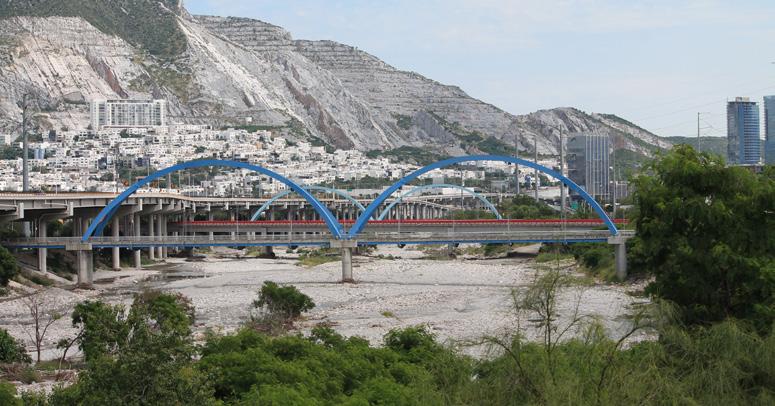
Exacerbated by climate change and rising demand, Monterrey narrowly avoided a Day Zero scenario of water provision in 2022 and 2023, as record-breaking summer temperatures intensified water scarcity. In late June and early July 2024, Tropical Storm Alberto and Hurricane Beryl delivered over 43 inches of rainfall—83% above the annual average—in just a few weeks. These extreme events filled all three major reservoirs (El Cuchillo, Cerro Prieto, and La Boca) with nearly 1.5 billion cubic meters of water, while simultaneously inflicting damage on public and private infrastructure that will require years and 10 billion pesos (approximately $555 million USD) to repair.
This recurring cycle underscores the urgent need for a deeper understanding of the hydrological cycle and improved management of the watershed and its critical aquifer recharge zones. In this new climatic reality, the vast and majestic mountains encircling Monterrey are essential to strengthening water management and resilience. Restoring and conserving these landscapes will play a crucial role in water filtration, flood regulation, and groundwater recharge, serving as vital “naturally distributed storage for water.” Acting as natural reservoirs, these mountains capture and slowly release water through their complex systems of rivers, streams, and aquifers—a capacity that is critical for maintaining water availability during dry periods and mitigating the impacts of extreme weather events.
The forests and vegetation of these mountains are also vital for climate change mitigation, capturing and storing carbon,
stabilizing soils, preventing erosion, and sustaining watershed health. By protecting and restoring these landscapes, Monterrey can enhance its water security and resilience, ensuring a sustainable water supply for its growing population and industry.
Monterrey is still far from being a sustainable and resilient city. Integrating a comprehensive, systems-based regenerative approach can help build an equitable, resilient, and biodiverse urban environment. By leveraging its natural landscapes and fostering a harmonious relationship between urban development and nature, Monterrey can set an example for other cities facing similar challenges. As Monterrey continues to grow, its focus on water resilience, heat reduction, and biodiversity will be key to ensuring a sustainable and thriving future for all its inhabitants, reducing the current gap in equality. It will also help Monterrey realize its potential as a true “BiodiverCity,” integrating biodiversity into urban planning and development, fostering harmonious coexistence between urban spaces and natural habitats, and ensuring that biodiversity flourishes within the city. Urban green spaces, biodiversity corridors, and community gardens for marginalized communities will enhance urban biodiversity and provide all residents with access to nature and green urban areas.
The talent and dedication of 35 students from the Harvard GSD, and the extraordinary leadership and strategic vision of Lorena Bello Gómez, have enabled us to bridge existing knowledge with innovative approaches to address Monterrey’s environmental and social challenges, while advancing biodiversity conservation and enhancing quality of life. Practical solutions for flood risk reduction, heat mitigation, watershed management, social inclusion, and green urban infrastructure provision, as presented in this work, will hopefully seed creative solutions embraced by both government and society.
One immediate task—requiring seamless collaboration among academia, civil society, the private sector, and all levels of government, to realize the citizens’ vision of transforming the Santa Catarina River’s urban riparian corridor and its headwaters into a well-managed, safe green infrastructure spanning 1,200 to 1,500 hectares. A comprehensive management plan would integrate its core 700-hectare urban section into a metropolitan park, where nature and recreation coexist for the benefit of both people and the environment.
A second pressing challenge is to design and implement a public-private sustainable finance mechanism—anchored in effective governance and transparency—that leverages voluntary water fees from Monterrey’s more than one million users, alongside private and international resources. Drawing from experiences in both the United States and Mexico, this innovative conservation finance tool could cover the long-term maintenance costs of the Santa Catarina Metropolitan Park and vast priority water basins and aquifer recharge areas, which are essential to strengthening Monterrey’s water resilience. These solutions can serve as a model for other cities confronting similar constraints, challenges, and opportunities—paving the way toward safer, more equitable urban living in harmony with regenerated landscapes, where nature is recognized as a key stakeholder and partner in a truly prosperous future.
“The gods had condemned Sisyphus to ceaselessly rolling a rock to the top of a mountain, whence the stone would fall back of its own weight. They had thought with some reason that there is no more dreadful punishment than futile and hopeless labor.”
The Myth of Sisyphus. Essay on the Absurd Albert Camus1
Globally, many territories are experiencing unprecedented megadroughts due to our humanly induced changing climates.2 As global temperatures rise, water is evaporating at alarming rates, pushing cities like Monterrey in northern Mexico or its capital, Mexico City, dangerously close to a Day-Zero scenario, when millions of taps could run dry. 3 After the airstream shifts from La Niña to El Niño, extreme heat and thirst are suffocated by deadly and costly megafloods. Then, extreme volumes of water downpour onto the broken and impervious soils of urban-rural watersheds designed to drain water as fast as possible: devastation follows.
Addressing the human-disrupted water cycle has become a Sisyphean task in the Anthropocene. But let’s not fool ourselves: expecting a different outcome while repeating the same actions, like Sisyphus, will be both futile and absurd.
In fact, without action, predictions show that by 2050, half of the global urban population will face water scarcity as urban water demand increases by 80%. 4 As early as 2016, two-thirds of the global population (4 billion people) experienced severe water scarcity for at least 1 month each year, with half a billion suffering year-round. 5 Between 2002-2021 droughts affected 1.43 billion people, killed over 21,000, and caused economic losses of $170 billion. 6 Urban heat, known as heatisland, has reached hazardous and deadly temperatures (49C~120F) and worsened air pollution. 7
During the same period, floods affected another 1.65 billion people, caused nearly 100,000 deaths, and resulted in $832 billion in economic losses.8 Contaminated water, poor sanitation and inadequate hygiene are linked to waterborne diseases such as cholera, diarrhea, dysentery, hepatitis A, typhoid and polio affecting countless lives. 9 More severe
pollutants including arsenic, fluoride, lead, fracking chemicals, pesticides, and antibiotics found in water, are associated with various cancers, neurological diseases, and antimicrobial resistance. 10 With water either everywhere or nowhere, the transmission of diseases and threats increase exponentially.
Many would agree that the above alterations to water and its cycle are among the most impactful and destructive anthropogenic influences on nature. We have transformed water—the most important source of life on our planet—into a source of conflict, food insecurity, migration, pollution, and health threats. 11 At the very core of all processes involving life, water is now central to many processes involving death.
One could say that in a reverse alchemic transmutation, humans have transformed our most precious common resource into a ubiquitous common risk, effectively mutating gold into lead.
In this urgent context, asking the same questions or working with those who have led us to our current situation, will not change the status quo. We need everyone who has a role and interest in finding synergies to help restore a more balanced hydrological cycle— especially in an environment facing increasing liquidity as a result. For this to happen, strategic commitments to water conservation, ecosystemic recovery, socio-environmental equitable health, sustainable water use and the promotion of compact and dense urbanization—instead of boundless standalone housing—are urgently needed.
In Monterrey’s metropolis, this could be an opportunity to implement urban-regional actions that prioritize water security to achieve hydro-ecological resilience at the watershed scale. For this to happen, neither water-scarce communities nor the environment can continue to bear the burden of over-extraction by those who profit at their expense. 12
Instead, as designers, we have the skills to blend the different voices, needs and interdisciplinary expertise into a common spatial framework and vision to restore a more resilient water cycle in this metropolitan region. Monterrey is currently behind, but it could use its delay to learn from best practices and propel itself into a more water-secure and healthier environment in the coming years. Could Monterrey be wise enough to seize this opportunity and achieve greater liquidity? This is the question that we tried to answer in Aqua Incognita III and IV. 13
To find the answer, the Spring 2023 research seminar “Resilience Under New Water Regimes: The Case of Monterrey [MX] Day Zero” met weekly with a visiting speaker and explored Monterrey’s water-related history, culture, urbanization, industry, and politics through readings. 14 By examining global trends and discussions, we studied Monterrey’s Day-Zero as a case study to decipher the “Why” of this water crisis, as well as the “Where,” “How,” and “With Whom” of most impactful actions to restore water resilience. Discussions aimed to understand and critically analyze initiatives from similar water-stressed regions to build the design research foundations for the Aqua Incognita III and IV Option Studios. 15
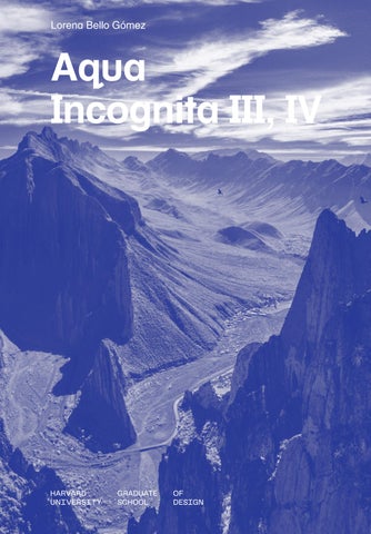
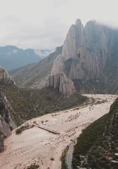
In tandem, Roberto Ortiz Giacoman’s masterful photography offered a glimpse into Monterrey’s sublime mountainous landscape (fig. 1) . Alejandro Cartagena’s critical eye and social conscience shed light on its harsh built environment (fig. 2). 17 Our search was also enriched by the DRCLAS water conference “Mexico + H2O,” which brought experts on Mexico’s water issues to address topics such as water scarcity, restoration, and both flood and drought within the Mexican context.18 Additionally, we knew from our work in the Apan altiplano of the many barriers and conflicting interests that complicate the implementation of necessary actions.19 But we also recognized that extended periods of crisis can be pivotal for mobilizing radical actions toward socioenvironmental change. Especially when our survival is at stake.
Before presenting the critical findings from our two years of design research, which laid the groundwork for the design responses presented in this report, let me summarize the water crisis and how it was averted. This summary includes research and discussions from seminar guests, interviews conducted during three visits to Monterrey in 2022-23,
and participation in conferences on Day-Zero (08/2022) and the Santa Catarina River (08/2023). During a fourth and fifth visit in the Falls of 2023 and 2024, alongside GSD students, we met government officials and participated respectively in the “Hydrological Urban Adaptation” and “Towards a Radical Ecological Transition” symposiums and workshops that I co-organized at the Tec of Monterrey. 20 For those interested in exploring this topic further, please refer to the references annexed to this publication.
Monterrey serves as a paradigmatic example of how urban drought and flood risk are exacerbated by extreme territorial resource depletion and policies that promote socioeconomic and ecological desiccation, all occurring within hydrologically unsustainable pro-growth logics.
Monterrey is a dry-climate city of 5.4 million settled in the larger basin of the Rio Grande, where average annual rainfall ranges between 22.83-25.6 inches (580-650 mm), and evaporation exceeds precipitation. 21 Situated at the “water door” of the Sierra Madre Oriental, before it descends into the Gulf of Mexico’s coastal plain, Monterrey has been urbanized to quickly drain its recurrent floods. Governance and infrastructure challenges have led to a long-brewing crisis, which, in 2022-2023 was exacerbated by six years of decreased rainfall patterns triggered by La Niña. Some citizens received only two hours of water per day, while others (0.5 million) relied on 450 water trucks for over a week. Industry was largely permitted to continue extracting water from the aquifer. But the reality was far more complex than a “good citizenry” versus “bad industry” narrative. 22
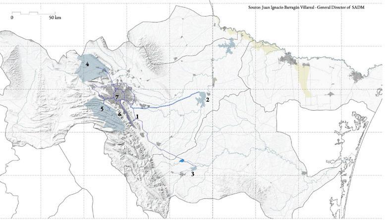
Water provision in Monterrey relies on roughly 60% surface water and 40% groundwater (fig.3). More precisely, out of the 16.18 m³/s of water provision 11.03 m³/s (68%) comes from surface sources such as La Boca, Cerro Prieto, La Mina or Cuchillo dams, while 5.15 m³/s (32%) is extracted from underground aquifers. After accounting for operational losses and leaks, the net water supply is 12.18 m³/s, with 70% (8,52 m3/s) allocated for domestic use, 19% (2.31 m³/s) for public use, and 11% (1.35 m3/s) for industries—as the latter extract directly from the aquifer with national water concessions.
Once used, the 12.18 m³/s are treated, with 8 m³/s sent to the water district of Tamaulipas, 1 m³/s is sold to agriculture, 1 m³/s sold to industry, and 2 m³/s are sold for other uses, leaving only 0.18 m³/s as a buffer. The average consumption per person is 165 liters per day, which exceeds the recommended 100 liters.
Industry is the driving force behind Monterrey’s fast growth and has a significant water footprint due to both virtual water exports and domestic consumption by workers. Additionally, given that the city is situated in the larger agricultural drylands of the low Rio Grande’s coastal plane, irrigation remains a major competitor for water resources.
Engineers explained that the crisis resulted from a shortage of 5.8 m³/s in water supply, caused by several factors: 1) two of the supply dams La Boca (0.92 m³/s) and Cerro Prieto (5.33 m³/s) were nearly depleted by the drought; 2) the new government took office in October 2021 with dams already at crisis capacity; 3) an extreme growth rate of 3,2% (180,000 inhabitants/year) driven by nearshoring, propelling urbanization in areas with limited supply and affecting aquifer recharge; 4) losses from leaks and system deficiencies (4 m³/s); 5) and the lack of automation to reduce pressure based on demand. Additional important vulnerabilities included: 6) the need to transfer 8 m³/s to Tamaulipas’ agricultural water district as compensation for El
Cuchillo dam;23 and 7) the transfer in January of 2021 of 450 million liters (Monterrey’s yearly supply) to honor the 1944 Binational Water Treaty with the US, which was done to suffocate a revolt by farmers in Chihuahua— who had refused to fulfill the agreement to protect their livelihoods. 24
Emergency responses involved a never-ending process of infrastructure expansion including: 1) the installation of 242 water tanks in neighborhoods lacking supply; 2) the drilling of 130 superficial wells and 28 deep wells (3000 feet) under federal emergency concession, to extract from the aquifer; 3) and the construction of a second aqueduct from their largest dam, El Cuchillo, which increased its capacity by 5 m³/s, bringing the total to 10.28 m³/s. Additional measures included: 4) increasing water prices based on consumption (while 50% reducing usage, 30% maintaining usage, and price-insensitive consumers increasing demand by 20%); 5) planning the construction of a fifth dam, Libertad, with a capacity of 220 million m³ to boost supply by 1.5 m³/s; and 6) implementing pressure modulation by dividing the system into 2,500 sectors to provide water where needed, and reduce the 2,500 liters/s (660.43 gallons/s) lost to leaks. These improvements aim to increase water provision to 25 m³/s by 2027 and to 30 m³/s by 2050, potentially through desalination or transfer from the Pánuco


River, both of which are highly unsustainable and undesirable solutions for both their economic and environmental costs.25
And yet, the best emergency response to this “extreme drought,” was another emergency, “extreme rain,” and its consequences: flooding. In June 2024, extreme rains from Tropical Storm Albert and Hurricane Beryl delivered as much water in two weeks as the metropolis typically receives in two years. After a prolonged drought, Regiomontanos celebrated these intense and destructive floods as the only means to refill their depleted reservoirs. So, once again, the extreme drought was averted by extreme rainfall, with an estimated bill of $555 million USD for Monterrey—with a total bill of $7.2 billion in the US according to NOAA. Later that September 2024 our trip to Monterrey was impacted by Hurricane Helene in our fly-in ($78.7 billion) and Milton in our way back ($34.3 billion). 27 (fig. 4)
Landscape Architects possess the skills to design spatial frameworks that tackle multiple challenges by working with natural processes and the ephemeral and cyclical forces of nature, rather than against them
Anne W. Spirn 28
The work presented in this report is motivated by a firm belief that we can escape the Sisyphean “drought-to-flood” destructive cycle in Monterrey. These recommendations are relevant to the current hydrological challenges faced by cities like Monterrey today. Despite significant barriers, this water crisis presents an opportunity to counteract many of the processes that threaten a livable future in an increasingly drier, hotter, polluted air, and less healthy biosphere, which is also periodically devastated by floods.
To uncovering the key incognitas necessary for breaking this cycle required us to look beyond the visible layers, repeated narratives, and usual suspects. In landscape architecture, this approach involves first identifying the underlying causes of complex problems, rather than merely addressing their symptoms with narrowly defined solutions. 29 With the encounters, we planned to project our spatial frameworks.
In our search for the “why?” of the crisis, we found that this metropolitan region is trapped in a perilous cycle of endless infrastructural expansion—driven by overexploitation from water-intensive agriculture and industrial growth focused on exports. Such industrial expansion fuels also endless, water-intensive, car-dependent urban sprawl characterized by small, standalone worker housing. Without policies to constrain growth, Monterrey´s metro-region has expanded its footprint by 2.8 times over the last thirty years, while its functional center is being abandoned.30 This trend exacerbates air pollution and flood risk, while reducing water recharge. Additionally, the lack of policies to protect aquifer recharge and curb overconsumption— both by inefficient planning and water management—has led to significant depletion of both surface and groundwater. Simultaneously, policies promoting car infrastructure and rapid drainage have dismantled the natural water network, resulting in the loss of water arteries, capillaries, moisture, wetness, and a vibrant biosphere, while increasing flood risk during extreme rainfall events. These policies have also contributed to desertification and the formation of heat islands in an already heavily polluted air. In the mountains, within Cumbres National Park, heat, drought, and a lack of management planning for twenty-three years since its designation have led to the loss of 2,500 hectares of forest due to fires and the encroachment of its valleys and waterbeds with private villas with swimming pools, or out-of-law new settlements. 31
The above-mentioned unsustainable urbanization processes contribute to water insecurity, flood risk, and human-environmental health degradation with big ecological and economic impact. Consequently, in our search for the “where?” and “how?” of water security and hydrological resilience, we identified various physical points for actions along Monterrey’s water cycle.
In the mountains, we explored actions towards water conservation, aquifer recharge, and flood risk reduction.
Water conservation and aquifer recharge actions involve regenerative agriculture and reforestation in Cumbres National Park, drawing many lessons from our experience with ejidatarios and farmers in Apan, Hidalgo. 32 Also, indigenous water conservation practices, US National Parks programs that could be reinterpreted for this culturally rich landscape, and successful local models such as Ecological Park Chipinque in Monterrey. 33 For flood risk reduction, we looked for alternative ways to naturally store water and reduce its speed, as well as to discourage riverbed encroachment and urban patterns of urbanization in this sublime and hydrologically strategic landscape. Here, we recognized the importance of La Huasteca, the gateway to Cumbres National Park and mouth of the river into the city, as a cultural icon known for its sublime beauty and sacred origins, its importance to Regiomontanos’ identity, as well as its vulnerability to floods—floods that disconnect and endanger its local communities. 34
In the urban watershed, we explored actions towards urban compactness and water circularity to reduce overall aquifer overexploitation and pollution while recovering Monterrey’s water blueprint and veins as a network of “cool bio-corridors” linking the mountains with an accessible and regenerated metropolitan river park.
For this, we considered demarcating a topographical line above which urbanization would be banned—similar to Santiago de Chile’s approach—to enhance water security through natural infiltration and delay in the middle slopes or piedemonte. 35 We learned that Monterrey’s municipality is already considering a swap program to move homes from these middle slopes. 36 We mapped the water footprint of both industry and housing and proposed policies to tax industries based on their virtual water and workers’ water use. This could promote higher density and direct
capital input toward watershed conservation. We also examined AECOM’s post-Hurricane Alex plan to reduce flood risk along the Santa Catarina River only understood as a mobility corridor, noting its lack of a regenerative approach to the river as an accessible urban ecology. Based on Monterrey’s original water blueprint, we explored the possibility of circular livelihoods along a regenerated river instead.
Rather than tackling problems in isolation, our spatial framework aimed to integrate all the above actions to enable Monterrey to achieve liquidity in both environmental and socio-economic terms.
Could this framework be the Santa Catarina River watershed?
4. Flowing Commons: The River Santa Catarina as a Climate Resilience Framework
As we explored Monterrey’s hydrological challenges more deeply, it became increasingly clear that balancing this fast-growing metro region with its water cycle and ecosystems towards water security could start by policies to constrain unsustainable growth, in tandem with the regeneration of all its riverine soils and landscapes. Instead of waiting for the next crisis, the government should proactively enhance the ecological regeneration—when feasible—of its original water blueprint. We are certain that this new spatial framework re-connecting the mountains across the watershed with the river valley can improve ecosystemic health and water security, ultimately bringing liquidity back to the metro-region.
Among this riverine network, the Santa Catarina River stands out for its importance in water security and flood risk reduction as well as for being the most visible part of Monterrey´s extreme fluctuation from drought to flood, linking physically the Cumbres mountains with the metropolis. Flooding has been linked to the Santa Catarina, its Santa Lucía Stream and Ojo de Agua (a spring) since the city’s founding. This flooding vulnerability is increased by its location at the eastern edge of the Sierra Madre Oriental range, source of 90% of Monterrey´s water, and the river´s basin. Due to its seasonality and water overexploitation, the water of the Santa Catarina is often invisible for most of the year, which promotes floodplain urbanization and heightens the vulnerability to catastrophic floods in return. In a warmer and wetter hydrosphere, the riverbed receives water from hurricanes and tropical
storms which drains rapidly through the 1,921.5 km² (192,150 hectares) of the Cumbres National Park canyons and the impermeable urban surfaces of asphalt and concrete.
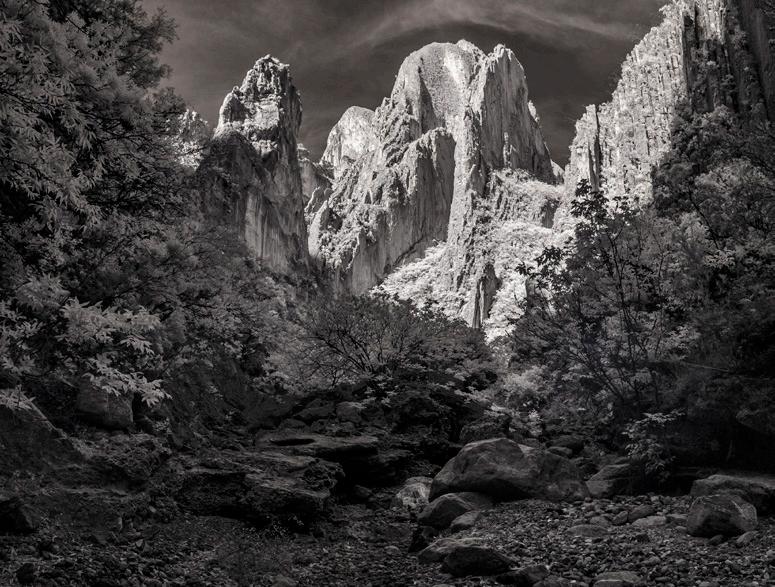
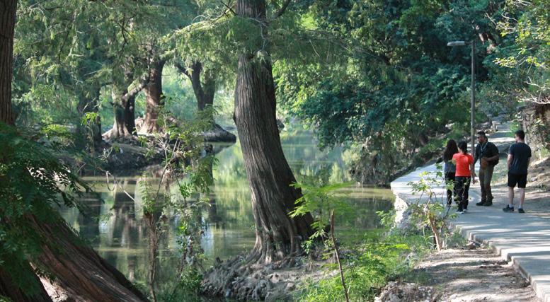
While it remains invisible as a mobility and flood control channel for several months or years, the Santa Catarina periodically bursts with water during hurricanes and tropical storms, reminding citizens of its liquid nature. When dry, the riverbed forms part of the living memories of contemporary Regiomontanos serving as a public space where they have learned to drive, play football, golf, or attend events like circuses, concerts, or visits from Pope John Paul II. (fig.5) However, since its destruction during Hurricane Alex in 2010, the river has evolved into an unmanaged, naturalized riverbed—altered more recently by tropical storms Alberto and Hurricane Beryl in 2024. Additionally, this urban wild is inaccessible and is constrained by 10-lane asphalt highways on both sides. Sadly, studies show that the river receives a high number of pollutants from illegal discharges and dumping sites which are washed away when it floods.37 So, accessibility to the river is not enough.
The future of the Santa Catarina River was extremely contested in the summer of 2023, when, fearing a potential shift to El Niño and the catastrophic hurricanes associated with it, the government began removing all trees from the Santa Catarina riverbed. However, the action was halted by a court decree following citizen mobilization conforming the collective “Un Río en el Río.” 38 They had already opposed the construction of an elevated
viaduct “segundo piso” on top of the existing highway—further impeding a pedestrian connection with the river. While cities like Boston have already paid 10.4 billion dollars back in 2007 to tear down these failed infrastructures this unnecessary mega-project is still being considered by Monterrey’s government these days and is experiencing the same opposition.
Later that October of 2023, during our first studio visit, the government announced plans to construct two additional spike dams in Cumbres National Park to reinforce the existing Rompepicos and to reduce the impacts of extreme flooding events. Some fear that these dams could bring a sense of security, promoting in turn the encroachment of the riverbed even further. Besides, more communities will be uncommunicated during floods.
So, in our search of “With Whom?” we started to see that strengthening our collaboration with Terra Habitus, with its significant capacity in nature conservation; as well as with the Tec of Monterrey, itself connected to industry and the government; the UDEM school of design, already working on a 50 hectares pilot at the Santa Catarina riverbed at San Pedro Garza García; and several forceful citizen groups, were collectively a forceful way to push the political will towards the design-led regeneration of Monterrey’s riverine landscapes in the years to come, and with it addressing an important front toward water security.
Would we be able to transform the Santa Catarina into a Flowing Commons?

5. One Vision. Three Regenerative Actions. Seven Principles Towards Resilience
“All rivers have fundamental rights and are living entities that possess legal standing in a court of law. Among other rivers have rights to: a) flow, b) perform essential functions within its ecosystem, c) be free from pollution, d) to feed and be fed by sustainable aquifers, e) regeneration and restoration.”
Universal Declaration of River Rights 40
Monterrey is far from recognizing the Santa Catarina as a living entity with fundamental rights. Santa Catarina is not yet a legal person, a subject of rights, a living person, or a living being or entity. 41 Yet, all the eco jurisprudence written by “The Rights of Nature” is already redrawing the rights of our environment globally—as one can explore in their monitor.42 More important, we understand that promoting those rights will promote hydrological resilience for Monterrey´s metropolitan region. And so, we translated them spatially to draw our vision. In a similar manner to Robert McFarlane´s recent book Is a River Alive?, written “with the rivers” who run through its pages, our vision was drawn “with the Santa Catarina River” for this water body and corresponding arborescent network to become a Flowing Commons, able to sustain life and those of the creatures than depend on its water. 43 An if well is true that due to overexploitation this river has diminished its water flow, Regios should learn that the river is the visible sensor of their water balance and cycle.
According to environmental lawyer Antonio Azuela, who joined our second symposium in Monterrey, a way to implement actions spanning the 1,200 to 1,500 hectares of Santa Catarina´s headwaters and the urban riparian corridor would be through the transfer of “custody” from the State to the municipalities:
“Streams, lakes, and lagoons that are national property, as well as the federal zone of hydraulic infrastructure located within the boundaries of populated areas … The Commission may enter into agreements with the governments of the states, the Federal District, or the municipalities for the custody, conservation, and maintenance of the federal zones referred to in this article.”
Article 117. National Water Law 44
Flowing Commons aims to enhance water security and climatic resilience for all living communities in Monterrey´s metropolitan region through nature-positive regenerative actions. It does so by establishing the Santa Catarina River watershed as a spatial framework for climate resilience to promote: 1) regenerative actions in the mountainous headwaters for natural water storage, infiltration, delay and flood reduction; 2) regenerative actions in the urban watershed to enhance blue capillaries or “cool-bio corridors” linking the mountains with an accessible and regenerated metropolitan river park (approx. 700 hectares of riparian corridor from Santa Catarina to Juárez); 3) and regenerative actions to reduce pollution and aquifer overexploitation overall. For this to happen the dual nature of the river must be addressed, its mountainous and urban condition, to understand how to regenerate their living or dormant soils to enhance the water cycle while bringing continuity along and across this riverine landscape and watershed. We learned from several cities that had successfully implemented projects to regenerate their main water bodies and or rivers, including: The Trinity (Dallas), Buffalo Bayou (Houston), the Seine (Paris Olympics), Los Angeles (LA), Mapocho (Santiago de Chile), Chattahoochee (Atlanta), Besós (Barcelona), Manzanares (Madrid), Medellín (Medellin), Yamuna (New Delhi), Rhine (The Netherlands), and Wadi Hanifa (Riyadh). These case studies were helpful to understand the actors, visions, values, actions, timelines and participatory processes behind them (see case studies p 36).
In the river’s uplands and headwaters, at the Cumbres National Park, we explored more distributed and decentralized process-based strategies toward flood reduction. Not all upland storage is equally beneficial. Traditional methods, such as dams, reservoirs, and concrete canals, have been used for years to manage upland water storage by slowing the flow of peak water. However, these structures often become clogged with silt and offer minimal benefits to the natural environment, as most vegetation and wildlife cannot access the stored water.
A more sustainable alternative is Distributed Natural Storage (DNS), which stores water throughout the upland landscape in numerous natural water stores like soil, shallow aquifers, and wet meadows. 45
This decentralized approach leverages the natural features of a healthy ecosystem to slow down water rather than stop it completely. By allowing water to infiltrate the soil and be gradually released, DNS reduces the risk of floods and enhances water supply reliability over time. This approach is not only cost effective compared to heavy infrastructure but also benefits wildlife and vegetation, making the ecosystem more resilient to challenges like wildfires. Storing water in soil, wet meadows, and shady riparian areas and wetlands reduces the water’s erosive energy, but it also reduces evaporation, increasing aquifer recharge. The overall effect is of a more forested, more absorbent and aqueous mountainous landscape and National Park that is inhabited by farming communities that enhance water conservation and improve their livelihoods as result.
Recognizing the river’s significance under its legal status as a river in the custody of the municipalities, or a newly formed water metropolitan area, within the urban watershed, we are proposing a comprehensive accessibility and vegetation strategy to regenerate the Santa Catarina River, transforming it into a vital component of climate resilience and living nature within the city as a Metropolitan River Park. Additionally, under the broader framework of capillarity and urban forestry, this initiative aims to create a flowing commons that not only reduces flood and heat risk but also enhances the overall hydrological performance of the watershed. For this, our framework includes the careful selection and design of major streams, that as “cool biocorridors” will thread the adjacent mountains with the river or run in parallel to it. These blue threads will serve as essential pathways for wildlife, fostering biodiversity and ecological connectivity between urban and natural landscapes. By integrating these natural systems into the urban fabric, we seek to improve socio-ecological wellbeing, providing residents with cooler, livable and living spaces while promoting a healthier, more resilient environment for future generations.
Overall, for this to happen we need to promote a new water culture in Monterrey, one that departs from a mechanized conception of water as a commodity, to understanding water as a source of life. Urban citizens, industrialists and farmers will benefit from policies that enhance a more sustainable and less polluting way of benefiting from water. A Clean Water Act in Monterrey could promote such culture. In the mountains, soils could do the work of filtering, cleaning and storing this water in the
aquifers, safeguarding it from fast evaporation in the open air. In the urban area, high-quality reclaimed water produced in Community Water and Energy Resource Centers or CWERCs by district, could start a process of clean water recirculation that would expand the capacity of aquifer provision in return. 46
The extended scale of a project dealing with water scarcity and abundance in an urban region, but through the lens of an urban river, requires an ability to telescope from macro to micro scales. Conceptualizing the Santa Catarina as a flowing commons requires multiscale and multi-disciplinary thinking. Out of our analysis we were able to characterize different areas of intervention in relationship to their geography, land use, urbanization status, their water regimes and the pollution of their soils. The first of these areas or micro-watersheds, stretches from the Rompepicos lamination dam to the Huasteca Canyon in Cumbres National Park; the second is the Huasteca Canyon, together with its urban door and river mouth into the metropolis; the third is Las Mitras’ southern watershed with its Obispo stream, its active or obsolete industrial fabric and its scarfed slopes; the fourth is along the Loma Larga and the Macro Plaza; a fifth comprises La Silla’s watershed by both Fundidora Park and the merging of La Silla and Santa Catarina rivers as sites of intervention. The joint exploration of case studies, the field work, and joint workshops at Monterrey’s Tec allowed us to formulate a set of values that could serve as guiding principles of the individually designed interventions that you will discover in this publication. These principles ensured that the plethora of individual design solutions will target the mutual goal of hydrological resilience in Monterrey. These principles, made manifest in the many design projects explored in this volume, are: 1) Visibility and invisibility: caring for water; 2) Ephemerality and recurrence: designing with floods; 3) Mutualism and reciprocity: effects beyond localized boundaries; 4) Capillarity and porosity: reclaiming water’s blueprint; 5) Circularity and recirculation: waste becomes source; 6) Connectivity and immersion: a living nature; 7) Equity and justice: everyone gains.
P1. Visibility and invisibility: caring for water. It is difficult to enhance an empathic relationship with a body of water, when its water disappears from months to years, only to return as a destructive flood. Destructive and deadly floods in 1909, Gilbert in 1989, Alex in 2010, and the most recent, Albert in 2024 stigmatized the Santa Catarina as alternately absent or all-too-present. It is time for an empathic return to the Santa Catarina as a source of life and liquid wealth, and almost all projects pursue this aim. The currently accepted culture of overscaled concrete structures to reduce water impacts, especially in the mountains, must shift, as this culture promotes a paradoxical urbanization in the National Park. The invisibility of natural storage could instead enhance water security and reduce encroachment overall. The projects that respond directly to principles of invisibility are: “Incognito Dams” and “From Visible to Invisible”.
P2. Ephemerality and recurrence: designing with floods Water invisibility promotes the encroachment of anthropogenic activity into the riverbed and erases the necessary room for the river to perform its cycles naturally, including flooding. Instead of fighting and resisting floods, design should embrace the strength and dynamics of the flood as an opportunity for active regeneration. Even as they fill in reservoirs, floods are also moments of material movement and energy that could rebuild higher ground or regenerate riverine forest with deposited silt. Equally importantly, the ephemerality of the flood could be considered for planting strategies. Several projects: “Eroding for Higher Ground,” “Water Footprints,” “Erasing the Line While Flooding,” “Un Río de Arboles,” “From Two Dimensional to Three Dimensional,” design with floods to rebuild ecology.
P3. Mutualism and reciprocity: effects beyond localized boundaries. Water is a flowing, interconnected network without physical boundaries. Water is ocean, is air, clouds, rain, is above and below ground in an interconnected cycle. So, like the butterfly effect, actions in the mountains affect the ocean and vice versa. So too, every action accounts to improve the network, just as Monterrey’s water access is entangled with the US through transboundary agreements increasing its vulnerability to water security. Creating more natural reserves to enhance its aquifers is an intelligent strategy to pursue and the river will improve as result.
Projects such as “Reciprocal Futures,” “Rewilding for a Hydro-Social Commons,” “Santa Catarina Green Again,” and “Wasted Water” follow these principles.
P4. Capillarity and porosity: reclaiming water’s blueprint Water structure is arboreal. Just as trees have branches, root systems and veins, water expands infinitely to bring life and moisture to our territories. Soils are the medium for water to flow horizontally to enhance water bodies, in the case of clay, or to flow vertically through sand, to recharge aquifers. Focusing on the small, networked filaments of an urban watershed, rather than on the arterial quality of the river itself, as well as on the conditions of permeability and porosity of the soil is key to confronting the endless and impervious surface of sprawling Monterrey. The urbanization of the mountains should stop and protecting water veins where urbanized or daylighting creeks in other areas should follow. “Regenerating Capillaries,” “Obispo Unbounded,” “A Sublime Scar,” and “Santa Catarina Ojo de Agua” all address these principles.
P5. Circularity and recirculation: waste becomes source. Water is a circular system, but it is still unsustainably used once, in linear fashion, by the city. Very different from nature that recirculates water continuously, a metropolis like Monterrey still discards polluted water into the environment. Due to its recurrent flooding, water is seen as a threat, simply to be moved out of the city as fast as possible. Design for circularity in such a context needs to be capable of thinking about reuse, of creating loops around flows of resources moving from linear to metabolic, and to shift into a culture of finite resources where extraction should be limited. Circularity is especially critical when it comes to water. Projects that respond to the need of recirculation are “The Poetics of Circularity,” ‘Wasted Water,” “Industrial Aqua,” “A Sublime Scar,” and “Post Industrial Tapestry.”
P6. Connectivity and immersion: a flowing and cool living nature. Descending to the river to swim separates pre-industrial from industrial times. This quintessential act of descending and immersing ourselves in water, goes back to our original swim in amniotic liquid before being born. If a river is given the right to flow clean, we will recover our right to flow with it. This immersion could be possible in the rainy season in Santa Cata -
rina’s headwaters, and projects like “Water Footprints,” “Eroding for Higher Ground” or “From Invisible to Visible” all have swimming in mind. That immersion, into a cool riverine forest, could also be possible in the urban river by designing with the flood in mind to reforest the borders. This connectivity will oblige mobility to change: there is no question that urbanization and mobility should tend towards compact urbanization and collective means of transport in Monterrey—if Regiomontanos were to push for their right to extend their lives and those of new generations. “Riverine Microclimates,” “Bridging Monterrey Reaching the Río Santa Catarina,” “El Gran Bosque de Río,” “Río de Árboles,” and “La Plaza Verde” respond to these principles.
P7. Equity and justice: everyone gains. Monterrey faces severe climatic impacts and deep social inequality. Rethinking its relationship with the river offers a chance to reconfigure ecological systems in ways that prioritize marginalized communities by reconnecting them first and then turning the river into a source of resilience. Moreover, the regeneration of the urban river for denser, more just urban development would counter sprawl that burdens low-income residents with long, costly commutes and limited services. More important, a regenerated Metropolitan River Park could be accessible to all citizens along the 52 Km from Rompepicos to Guadalupe. Projects responding to these principles were: “El Río Vivo,” “Río de Árboles,” “A Sublime Scar,” “Obispo Unbounded,” “Wasted Water,” “Bridging Monterrey.”
Like Macfarlane in Chennai, we went to Monterrey
“in search of the ghosts, monsters, and angels … the ghosts of rivers that had to be killed for this city to live. The monsters that these rivers take as terrible forms when they are resurrected by cyclones. The angels who watch over the lives of the rivers where they survive, and those who seek to revive those who are dying.”
Robert Macfarlane
47
The Santa Catarina River and its capillary network is a ghost in some parts, and it definitely returns like a monster from time to time. There are many angels taking care of this ghost and there is no doubt that they will continue fighting to keep it/him/her alive. It is my hope that these lines can help all those good angels. Monterrey stands at the edge of being able to break its Sisyphean water cycle of repeated fast drainage and repumping back to the city. Of continuous expensive reconstruction after flooding events. Wiser water care through hydrological regeneration could bring the city beyond Sisyphus to a more restorative, sustainable era in which Monterrey becomes a healthier ecosystem with retained moisture, cooler environments, that are more environmentally just. The Santa Catarina River is the key to life in a healthier environment and our designed visions could be critical to bringing this new era to fruition. (fig.6)
1. Albert Camus, The Myth of Sisyphus and Other Essays, translated by Justin O’Brien. (New York: Vintage Books, 1991) Originally published as Le Mythe de Sisyphe: [essai sur l’absurde] (Paris: Gallimard, 1942)
2. A. Park Williams, et al. “Rapid Intensification of the Emerging Southwestern North American Megadrought in 2020-2021.” Nature Climate Change, vol. 12, no. 3 (2022): 232–34. (Link)
3. See: Maria Abi-Habib et al, “Mexico’s Cruel Drought: Here You Have to Chase the Water.” The New York Times, Late Edition (East Coast), August 3rd, (2022)
4. Richard Connor & Michela Miletto, The United Nations World Water Development Report 2023: partnerships and cooperation for water; executive summary, (Peruglia: Unesco World Water Assessment Program, 2023) (Link); see also: IPCC (Intergovernmental Panel on Climate Change): Summary for Policymakers. H. Lee and J. Romero (eds.), Climate Change 2023: Synthesis Report. Contribution of Working Groups I, II and III to the Sixth Assessment Report of the Intergovernmental Panel on Climate Change. Geneva, IPCC, pp. 1–34. www. ipcc.ch/report/ar6/syr/downloads/report/ IPCC_AR6_SYR_SPM.pdf
5. Mesfin M. Mekonnen & Arjen Hoekstra, “Four billion people facing severe water scarcity,” Science Advances, 2 (2) (2016). (Link)
6. Richard Connor & Michela Miletto, Idid.
7. WMO. (2022) WMO Air Quality and Climate Bulletin. Geneva
8. CRED (Centre for Research on the Epidemiology of Disasters). 2022 Disasters in Numbers. (CRED, 2023) https://reliefweb. int/report/world/2022-disasters-numbers.
9. UN-Water. Summary progress update 2021: SDG 6 – water and sanitation for all. https:// www.unwater.org/sites/default/files/app/ uploads/2021/12/SDG-6-Summary-Progress-Update-2021_Version-July-2021a.pdf
10. Ibid.
11. Richard Connor & Michela Miletto, Idid.
12. Maria Kaika, ‘Don’t call me resilient again!’: the New Urban Agenda as immunology … or … what happens when communities refuse to be vaccinated with “smart cities” and indicators. Environment and Urbanization, 29(1), (2017), 89-102. https://doi-org.ezp-prod1.hul.harvard. edu/10.1177/0956247816684763
13. Liquidity understood as capacity to cover current liabilities.
14. Harvard GSD Spring 2023 Seminar: https:// www.gsd.harvard.edu/course/resilienceunder-new-water-regimes-the-case-ofmonterrey-mx-day-zero-spring-2023/
15. Harvard GSD Option Studio Fall 2023: AQUA INCOGNITA: Designing for extreme climate resilience in Monterrey, [MX] ( https://www.gsd.harvard.edu/ course/aqua-incognita-designing-for-extreme-climate-resilience-in-monterrey-mx-fall-2023/); Harvard GSD Option Studio Fall 2024: AQUA INCOGNITA IV: Designing for extreme climate resilience in Monterrey, [MX] (https://www.gsd.harvard. edu/course/aqua-incognita-iv-designing-for-extreme-climate-resilience-in-monterrey-mx-fall-2024/)
16. Find Roberto Ortiz Giacoman’s work here: https://www.robertortizphoto.com/
17. Find Alejandro Cartagena’s work here: https://alejandrocartagena.com/
18. David Rockefeller Center for Latin American Studies Spring 2023 Water +H2O Conference. https://drclas.harvard.edu/event/ mexico-h2o-challenges-reckonings-and-opportunities
19. Lorena Bello Gómez, “Critical Zones: On Liquid Disappearance, Aquifers, and Climate Justice. Aqua Incognita: Deciphering and Reimagining Liquidity in the Mexican Altiplano (Cambridge, US: Harvard Graduate School of Design), 10-25.
20. Co-organizer: Rubén Segovia (MArch II’17) in 2023, and Rubén Segovia with Rob Roggema in 2024. Both symposia at added to this publication.
21. Alessia Kachadourian. Mapeo hidrogeológico de la cuenca río Santa Catarina. Evidencias en superficie de los sistemas de flujo regionales subterráneos del agua. 2023 (Monterrey: Terra Habitus)
22. Kate Linthicum, “Taps Have Run Dry in Monterrey, Mexico, Where There is Water for Factories but not for Residents,” Los Angeles Times, July 22 (2022)
23. Ismael Aguilar-Barajas, Dustin E. Garrick,Water reallocation, benefit sharing, and compensation in northeastern Mexico: A retrospective assessment of El Cuchillo Dam, Water Security, Volume 8, 2019, 100036, ( https://www.sciencedirect.com/ science/article/pii/S2468312418300403 )
24. For the problem in 2020 see https:// www.gob.mx/conagua/prensa/el-trasvase-de-la-presa-el-cuchillo-solidaridad-no-compromete-el-abasto-de-agua-para-la-zona-metropolitana-de-monterrey
; For the problem with Chihuahua see: https://www.texasstandard.org/stories/ texas-mexico-rio-grande-basin-water-reservoir-deliveries-chihuahua-state-treaty/
25. Data provided by Juan Ignacio Barragán during his Zoom presentation in the 2023 Spring seminar.
26. Hurricanes´ economic impact by NOA: https://www.ncei.noaa.gov/access/billions/ events/
27. Ibid.
28. Anne W. Spirn, “Reclaiming Common Ground: Water, Neighborhoods, and Public Spaces.” The American Planning Tradition: Culture and Policy, edited by Robert Fishman. Washington, DC and Baltimore, MD: Woodrow Wilson Press and Johns Hopkins University Press, 2000, 297-313
29. Anne W. Spirn, “Rebuilding Urban Communities and Restoring Natural Environments.” Planning for the New Century, edited by Jonathon Barnett. Washington, DC: Island Press, 2001, 165-201
30. Roberto Ponce, Expansion Urbana de Monterrey Analysis. Published in: https:// www.expansionurbanamty.mx/ The population density decreased by 40% in the last 30 years. From 1990 to 2020, the population of the Metropolitan Area doubled, from 2.6 to 5.2 million inhabitants. During the same period, the urban footprint increased from 363 to 1,029 km², meaning it grew by 2.8 times. Instead of consolidating the already developed areas and densifying, we abandon the existing development to build in areas that are increasingly distant from the functional area of the city. While the center lost 263,558 inhabitants between 2000-2020 its peripheral municipality Garcia increased from 13,000 to 397,000 from 1990-2020.
31. SEMARNAT published the Management Plan in January 2023, while CONAMP declared the Cumbers National Park in 2000: https://www. dof.gob.mx/nota_detalle.php?codigo=5676308&fecha=03/01/2023#gsc.tab=0
32. Lorena Bello Gómez. Aqua Incognita: Deciphering and Reimagining Liquidity in the Mexican Altiplano (Cambridge, US: Harvard Graduate School of Design)
33. Link to Chipinque’s biodiversity program: https://www.chipinque.org.mx/biodiversidad; forestry: https://www.chipinque.org. mx/proteccion_forestal; research: https:// www.chipinque.org.mx/investigacion
34. Regiomontanos are people from Monterrey, Mexico.
35. Jorge Pérez Q. et Al. Estudio para la definición de áreas de protección natural y/o patrimonial, en el piedemonte Andino del sector oriente. (Universidad de Chile. Facultad de Ciencias Agronómicas. Laboratorio de Ecología de Ecosistemas, 2016)
36. Class presentation by urbanist Salvador Herrera (SPURS´23-25) in Fall 2023.
37. Martínez-Quiroga, G. E., De León-Gómez, H., Yépez-Rincón, F. D., López-Saavedra, S., Cardona Benavides, A., & Cruz-López, A. Alluvial Terraces and Contaminant Sources of the Santa Catarina River in the Monterrey Metropolitan Area, Mexico. Journal of Maps, 2021, p. 17(2), 247–256.
38. You can learn of the agenda and activities of “Un Río en el Río” in social media at #Unrioenelrio.
39. H Virginia Greiman, “The Big Dig: Learning from a Mega Project” ASK Magazine, 39, Apple Knowledge Services. NASA, July 15, 2020. https://appel.nasa.gov/2010/07/15/ the-big-dig-learning-from-a-mega-project/.
40. The Universal Declaration of Rights of Rivers can be found here: https://www. rightsofrivers.org/#declaration.
41. O’Donnell, Erin, et al. “Repairing Our Relationship with Rivers: Water Law and Legal Personhood.” A Research Agenda for Water Law, Edward Elgar Publishing, 2023, pp. 113–38.
42. Eco Jurisprudence Monitor site: https:// ecojurisprudence.org/dashboard/?map-style=political
43. Macfarlane, Robert. Is A River Alive? First edition., W.W. Norton & Company, 2025.
44. From 1994 to 2000, Antonio Azuela served as the Federal Attorney for Environmental Protection in the Mexican government.
45. See: Lancaster, Brad, and Joe Marshall. Rainwater Harvesting for Drylands and beyond. Volume 2, Water-Harvesting Earthworks. Rainsource Press, 2008; Peter Skidmore and Joseph Wheaton. “Riverscapes as Natural Infrastructure: Meeting Challenges of Climate Adaptation and Ecosystem Restoration.” Anthropocene, vol. 38, 2022, p. 100334
46. Look at our work with students in the Creating Environmental Markets Class with Robert Zimmerman in Spring 2024: The Laredo Resilience Project. Accessible here: https://rgisc.org/the-laredo-resilience-project/
47. Macfarlane, Robert. “Ghosts, Monsters and Angels” (India) in Is A River Alive? W.W. Norton & Company, 2025, p. 124
How to Ask the Right Question: Praxis in Design Research for Regional Climate Resilience
In August of 2022, the outlines of the Monterrey Aqua Incognita III and IV studios started to take shape. We had been invited to visit Monterrey by a friend and architect who had grown up in the city, with the idea that it might be generative to develop a landscape architecture design studio focused on the urban challenges faced by the region of some five million people. Following our two-plus years of work on water challenges in an agro-industrial region in the Apan plains of central Mexico, on the very far outskirts of Mexico City’s urban agglomeration, the possibility of developing a new project that would pick up many of the same themes held much promise. Additionally, the topic of Monterrey and its water scarcity challenges had been in the air of Mexican policy discourse as a possible harbinger of what might come for other parts of the country facing similar challenges. Following a visit to Apan in late July 2022 to present findings from the Aqua Incognita I studio that Bello Gómez had conducted at the GSD in the fall of 2021, we flew from the temperate high-elevation climate of Mexico City to the heat of Monterrey.
This initial visit was brief but productive. We met with officials from the Water and Drainage Department for the State of Nuevo Leon, the agency responsible for water provision in Monterrey’s metropolitan region. We arrived in the midst of a crisis: officials more than once stepped out of our meetings to take phone calls from the governor’s office, as the city was in the grips of an acute Day-Zero water shortage event. We also attended a conference on regional water scarcity organized by a prominent daily newspaper in Mexico. And we met with academics and local civil society leaders.
In a series of site visits to better understand the physical and ecological configuration of the region, we arrived at the imposing rock face of La Huasteca, along the valley floor of the Cumbres de Monterrey National Park, and travelled out to the existing
Rompepicos flood control “spike” dam. We slowed to a crawl in late afternoon traffic surrounded by tractor trailers in the workingclass suburb of García on the western edge of the city, trying to more fully understand the extent of low-slung industrial and suburban sprawl in the region, and observing the upstream conditions of the Río Pesquería, which flows along the north edge of the city. Our exposure to the more centrally positioned Río Santa Catarina gave us a sense of the daily experience of residents going about life in Monterrey. We caught glimpses of the dried-up river here and there as we crossed the city’s bridges back and forth, over and over again, and as we drove along the highway-like roads that border and constrain the river. We left on a Saturday afternoon for our return to Boston with much food for thought and a sense that the design studio would have many—perhaps too many— important challenges to address.
What could or should the studio be about, really? Would it be possible to frame a focused and coherent entry point suitable for project-based design work while still speaking to the full complexity of the expansive and multi-layered water challenges facing Monterrey? Should we focus on scarcity or flooding? Maybe both? What about sprawl? Could a landscape architecture design studio expect to tackle this set of unwieldy and expansive challenges? Would a planning component in parallel be beneficial? Who might sponsor such a studio? What sort of political environment would students be walking into? Was there an audience ready and willing to engage with design proposals for the region’s future and its relationship to water? At what sort of scale would studio participants work, and which specific challenges would students address?
None of these questions had obvious answers. To move forward in determining the focus and contours of the studio, we continued having conversations with people we had met in our initial visit to Monterrey. One
such meeting was with Lorenzo Rosenzweig, CEO and founder of Terra Habitus, a local non-governmental organization focused on regional conservation. Rosenzweig had spent his career working to leverage resources for conservation efforts in Mexico, not least during his tenure as president of the Mexican Fund for the Conservation of Nature. Part of his work with Terra Habitus was now focused on developing policy proposals for protecting the Santa Catarina river shed as an important urban-regional ecological asset under the project banner Rio Ciudad, and in the process, cultivating major private industrial donors to support the cause.
A collaboration between Terra Habitus and the Harvard Graduate School of Design seemed like a productive and generative way to move forward. But could we frame the river as the key focal point for Monterrey’s broader water challenges? The river was not necessarily the only or even the central point of entry to this broader complex of concerns. A web of ecological, political, and economic relationships and entanglements stretched to the limits of the broader metropolitan region, to its immediate mountainous headwaters, to its regional aquifer, and to the US border and beyond. The Río Santa Catarina is a tributary within the larger Rio Grande watershed, thus creating both current and potential future entanglements with binational water sharing treaties. We needed also to acknowledge the Monterrey region’s economic entanglements with the broader NAFTA (now USMCA) zone, as an industrial and manufacturing hub tightly linked into cross-national “nearshoring” trade relationships with the United States and Canada.
Those economic entanglements cannot be separated from the city’s water challenges. The city has grown and is growing, in large part because of its legacy and ability to continue capitalizing on its reputation as a critical economic engine in Mexico, meeting key manufacturing and logistics platforming demand from the US and Canada, and, in the process, providing a hugely significant base of urban employment in northern Mexico. As the city grows, more pressure is put on its water supply. Demand grows. Extraction grows. Impermeable surface coverage grows. We were left with the question: could the river provide an entryway into this intricate brew of topics and challenges?
A research seminar offered at the Graduate School of Design in the spring of 2023 focused on the Day-Zero challenge in
Monterrey and the goal of pursuing resilience under new extreme water and climate regimes. The seminar’s syllabus is attached to this report. The seminar was a next step in analytically sorting out the river’s role in, and potential connection to, Monterrey’s larger water and climate challenges. Designing a 14-week framework of topics and developing a roster of guest speakers promoted an active and ongoing conversation that brought additional interlocutors into our discussions. Over the course of the semester, we were able to get updates from, and think alongside, key partners in Monterrey. The seminar also offered a chance to hear from designers and experts who have worked on similar challenges in other contexts, both in Mexico and globally. Students engaged with concerns of water and growth; with aquifer health and the science-policy interface; with urban river regeneration and design projects; with water-sensitive urban green infrastructure practices; with the agriculture-water-industry nexus; with flood risk during extreme storm events; and with questions of equitable resource distribution and service provision. The seminar addressed a range of interconnected topics in Monterrey’s water crisis, and it created a repository of student-led research projects and joint analysis that established a base on which design proposals could further build.
As the seminar progressed in Cambridge, public conversation about many of these same themes was continuing to emerge and evolve locally in Monterrey. By early summer 2023, it was clear that the river, as both a challenge and opportunity, was gaining traction on the agendas of political and industrial sectors in the city, not least because of their interest in preparing Monterrey as a site for games of the 2026 World Cup, the so-called NAFTA World Cup, to be hosted across Mexico, the United States, and Canada. Various proposals began circulating in public discourse, with opposed camps coalescing around positions that sought major redevelopment efforts within and around the river, or those that sought to leave the channelized segment of the river untouched, intentionally letting it return to a “natural” state. After the federal water agency started razing trees and clearing vegetation along a portion of the riverbed in the summer of 2023, further controversy erupted over the appropriate role of the river as a symbolic, economic, and ecological asset in the city, representing larger debates about the future of the region and the many contested visions
of residents, politicians, NGOs, environmental activists, and business elites. “Un Rio en el Rio” (“A River in the River”) emerged as a prominent rallying call among those opposed to tree removal in the riverbed.
The Monterrey studio, broadly conceived as a space for serious design work about the ecological and urban challenges of a city like Monterrey, was now also becoming a vehicle for working with a topic that was actively in motion, a topic of great urgency in the lives of real people. The studio was emerging as an opportunity to integrate not just concerns of aesthetics, hydrology, infrastructure, and sound ecological functioning, but also of values, of politics, of questions about growth and limits, about equity and distribution.
It was increasingly possible to make the case that the studio could take up the river as a central thematic and ecological entry point, capitalizing on increased public attention, while still doing justice to the broader complexity of interconnections, linkages and entanglements in which the river is bound up. We began to articulate a project framing that, in the tradition of the ongoing Aqua Incognita studio analytic, sought to establish connections between “the seen” and the “not seen” of regional watersheds, to seriously engage with the uncertainty of the risks being faced, but also to not disallow the possibility of opportunities for change emerging under such conditions of uncertainty. Suddenly, it was entirely plausible, even compelling, to use the charismatic and nearly inescapable presence of the river as a feature of daily life in the city, as a means of grappling with the linkages that emanated from it. Such work would require centering the river, but
also tracing its relationship with its more rural headwaters, thinking about its explicitly urban watershed and the role it plays in the regional built environment, seeing its riverbed as a site of great ecological but also social potential, recognizing the catastrophic flood risk the river poses during extreme storms but also its attractiveness as a potential urban amenity to anchor different patterns of development. It became clear that we could shape a studio that, through the means of individual design projects, could collectively grapple with these multi-scale and multi-disciplinary challenges.
Getting to the “right” question and brief for this studio was not a neat or straightforward process. It was somewhat messy, long, and contingent, just like climate and resilience transitions more generally tend to be. Developing the brief required deep, sustained, and rigorous exploration. But it also required the flexibility to think about and adapt to evolving on-the-ground realities, constraints, and opportunities. It was a process that built on the questions we had already been asking, but it also pushed us to pose new ones. Ultimately, this publication illustrates not only the ongoing legacy and ethos of the Aqua Incognita studio series, but also the type of praxis in design-research that we think is necessary to make the design disciplines even more relevant to broad and urgent challenges like urban-regional climate resilience. As we look ahead to another iteration of the Aqua Incognita studio, and the broader line of design-research inquiry it embodies, we can only hope that our understanding of the “right” question keeps evolving.
Globally, the world is experiencing a period of unprecedented drought, the worst in 1200 years according to NASA. With rising global average temperatures, water is evaporating at high rates, with cities around the world, including in Monterrey in northern Mexico, coming dangerously close to reaching sustained Day-Zero scenarios where millions of taps could run dry. While drawing on global trends and discussions, this research seminar will use Monterrey’s water crisis as a paradigmatic example where the drought is exacerbated by extreme resource depletion and policies facilitating socio-economic and territorial desiccation, both embedded within widespread pro-growth logics.
Monterrey is a dry-climate city of five million, where challenges in governance and infrastructure have led to a longbrewing crisis that has now been pushed to the brink by six years of decreased rainfall patterns triggered by La Niña. Some citizens are receiving only two hours of water per day, while others rely on water distribution trucks. Industry has largely been allowed to continue extracting water from the aquifer. But the reality is more complex than a “good citizenry” vs. “bad industry” narrative. Through readings, writings and/ or mapping exercises, we will examine the many forces that are contributing to water crisis in Monterrey, (MX), and study different initiatives that–in the fields of landscape architecture, architecture, urban planning and design—are trying to foster wetness in water-scarce and desiccated territories.
The course is open to students in all programs at the GSD, with the hope that a transdisciplinary dialogue will foster more innovative strategies toward water resilience across scales.
This research seminar is intended to lay the conceptual foundation for a subsequent project-based Option Studio to be offered in the fall of 2023. One of the objectives of the spring seminar is to arrive at a framing for
Instructor: Lorena Bello Gómez, PhD
Teaching Fellow: Samuel Tabory, PhD Candidate
Spring 2023: HIS 4498
the water resilient initiatives that could be further investigated through design later in the year.
The class will meet once a week, structured around a visiting speaker, readings, and discussion on a range of topics intended to generate new knowledge as well as critical questions about the history, cultural traditions, urbanization, politics, governance, and water related practices in Monterrey, Mexico. These topics will help us contextualize our discussion of prior and current efforts to recover from water crisis or disaster in Monterrey and elsewhere. Students will be expected to produce a final research paper or design strategy that leads to a critical rethinking of past practices to increase water resilience in the near future.
Proposed projects could range from actionable designs to experimental interventions and speculations, including but not limited to: design prototypes, sustainable urban design models and policies, naturebased solutions, blue-green infrastructures, regenerative agricultural practices, financing mechanisms, alternative governing institutions, regulatory water redistribution, and so on. With the justification of its impact on Monterrey’s water resilience, they can target any scale within the Santa Caterina sub-watershed, its near shoring region, or the Rio Grande bi-national watershed. Students can decide if they want to work in pairs or individually. In the first two weeks of class, we will have discussions about how the work might be organized, with some collective conversations about common entry points. In this same time period, we will also ask students to determine which particular geographic site they will target for further research.
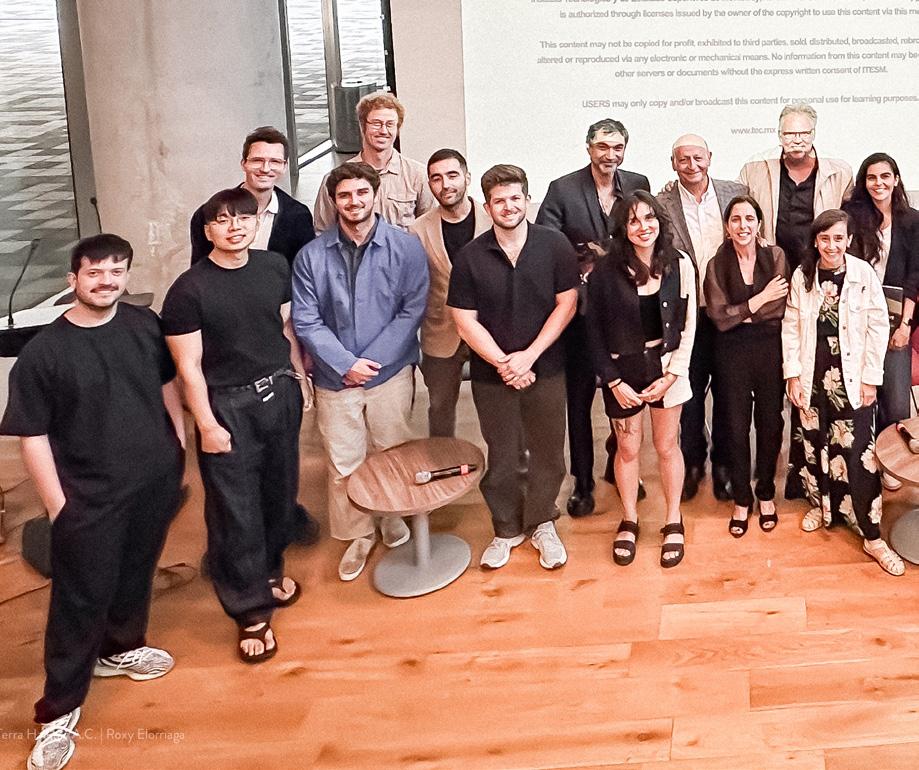
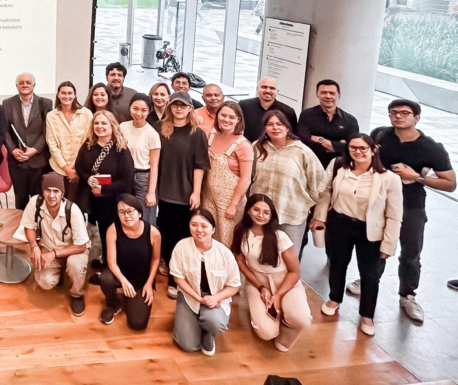
Previous page: Group picture after second symposium in Fall 2024 at the Tec of Monterrey Campus. Special thanks to Rubén Segovia. Credit: Roxana C. Elorriaga
Act I: Water crisis: Why?
Week 1 (Jan 30th) - Introduction to Day-Zero crises
Events of August 2022 in Monterrey, other day-zero scares and scenarios
(Cape Town, Mexico City, elsewhere)
Guest: Juan Ignacio Barragan
Week 2 (Feb 6th) - Nearshoring and water unbalanced urbanization
Resource demands of nationally important urban-regional economies driving macro-economic growth. Resulting unsustainable low-density urbanization into areas with no water supply.
Roberto Ponce, PhD
Week 3 (Feb 13th) - Bi-national water agreements: crossing borders
Water diplomacy, thirsty neighbors, water “adjustments,” and international obligations
Dale Whittington, PhD
Act 2: Water Resilience: Where?
Week 4 (Feb 20th) - Growth without supply: when the tap is always dry
Urban growth without services. Daily water use, urban services, and the everyday indignities of low-income urban sprawl and marginalization.
Diane Davis, PhD
Loreta Castro Reguera
Week 5 (Feb 27th) - Industry
Aquifer water concessions, efficiencies, waste, pollution, technical processes, and politics.
Robert Zimmerman
Week 6 (March 6th) - Agriculture
Concessions, efficiencies, waste, pollution, technical processes, histories, and politics
Gabriela Soto Laveaga, PhD
Week 7 (March 20th) - Watersheds and cities
Urban-regional water planning, water
basin and sub-basins delineation, upstream and downstream coordination
Lorenzo Rosenzweig
DRCLAS Water Conference at Harvard University (March 23rd 6-8pm; 24th 9am5pm)
Act 3: Water Resilience: How?
Week 8 (Mar 27th) - Managing the underground: aquifer recharge Monitoring, data representation/ uncertainty, nature-based solutions, and critical aquifer zones
Rosario Sanchez Flores
Tatiana Bilbao
Week 9 (Apr 3rd) - Water wise urbanism: praying for a hurricane:
Drought, changing regional weather patterns, coastal storm necessity/risk, insurance and financing
Guest: Maria del Carmen Elosúa
Week 10 (Apr 10th) - Urban rivers: natural systems and public space
Rivers and urban revitalization
Gines Garrido
Sandra Gutierrez
Week 11 (Apr 17th) - Distributing differently: alternative water futures and water regimes Collective action, justice frameworks around water as a human right; the politics of water redistribution and reform
Rosario Alvarez Gutiérrez
Gustavo Madrid, Charlotte Chambard
Week 12 (Apr 24th) - Workshopping and feedback on final projects
Projects can be written papers/reports, mapping or design projects
Final presentations (May 8th)
Students: Alberto Bolaños, Bryce Crawford, Aimen Fatima, Yimei Hu, Slide Kelly, Minh Nguyen, Lara Prebble, Anika Richter, Montgomery F. Simus, Leyla Uysal and Makio Yamamoto
32
In the face of the urban challenges that Monterrey and its metropolitan area are experiencing—with special attention to its hydro-climatic crisis—this symposium brings together experts in urban design, landscape and urban planning, to learn from their experiences in systemic projects where water becomes the backbone of climate regulation, mobility and social equity. This event is presented by the Cátedra FEMSA Foundation for the Master of Architecture and Urban Design of Tecnólogico de Monterrey in conjunction with the Master in Landscape Architecture program of the Harvard Graduate School of Design.
This symposium is part of the series of forums “Urban Solutions to the Climate Crisis: Regeneration of urban rivers” in collaboration with the Center for the Future of Cities of the Tecnólogico de Monterrey and the Water Center.
September 29-30, 2023
EGADE Business School Auditorium
San Pedro Garza García, NL, Mexico
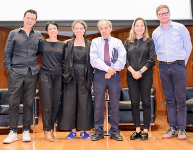
September 29, 2023
09.00AM Welcome and Intro to Symposium
Lorena Bello and Ruben Segovia
09.15AM Presentation by Ginés Garrido
10.00AM Presentation by Alejandro Echeverri
10.45AM Conversation
Speakers and Professors at MDU
11.30AM Roundtable Discussion
Moderator: Lorena Bello
12.00PM Lunch Break
01.30PM Panel Introduction
Lorena Bello and Ruben Segovia
01.45PM Presentation by Loreta Castro
02.30PM Presentation by Arroyo Vivo
03.15PM Conversation
Speakers and Professors at MDU
04.00PM Roundtable Discussion
Moderator: Samuel Tabory
September 30, 2023
07.00AM Visit to Arroyo Seco
09.00AM Design Charrette
12.00PM Lunch Break
01.30AM Design Charrette
Ismael Aguilar
Professor of Economic Development at the School of Social Sciences and Government at Tec of Monterrey and Associate Researcher at the Water Center for Latin America and the Caribbean. Monterrey, Mexico.
Lorena Bello Gómez, PhD
Design Critic in Landscape Architecture at the Harvard Graduate School of Design (GSD), Research Fellow at the Leventhal Center for Advanced Urbanism at the Massachusetts Institute of Technology (MIT). Cambridge, MA, USA.
Loreta Castro
Founder with José Pablo Ambrosi of Taller Capital, Co-Founder of the RX Degree Seminar at UNAM. Mexico City, Mexico
Alessandra Cireddu
Co-Founder of Espacio Multicultural de Arquitectura (EMA) and National Director of the Architecture Program at Tec of Monterrey. Guadalajara, Mexico
Alejandro Echeverri
Founder and Co-director of URBAM Center of Urban and Environmental Studies at EAFIT University, co-founder of Alejandro Echeverri + Valencia Architects and Distinguished Visiting Professor in Urbanism at Tec of Monterrey. Medellín, Colombia
Nélida Escobedo
Coordinator of strategic projects at the Center for the Future of Cities at Tec of Monterrey. Monterrey, Mexico
Ginés Garrido, PhD
Founding Partner of Burgos & Garrido Arquitectos Asociados (BGAA), Full Professor at Madrid ETSAM. Has taught at the Harvard GSD, the Universidad Central de Santiago de Chile and in Tucson. Madrid, Spain
Alfredo Hidalgo
Associate Dean of Research, Graduate and Continuing Education at Tec of Monterrey. Guadalajara, Mexico
Karen Hinojosa
Co-founder of Trama Urbana and National Director of the Urbanism Program at Tec of Monterrey. Monterrey, Mexico
Rob Roggema, PhD
Distinguished Professor in Regenerative Cultures at the Tec de Monterrey.The Netherlands
Ruben Segovia
Co-founder of LS-LAB and Director of the Master of Architecture and Urban Design (MDU) at Tec of Monterrey. Monterrey, Mexico
Surella Segú
Co-founder of EL CIELO and Professor of the Master in Architecture and Urban Design at Tec de Monterrey (MDU). Providence, RI, USA
Sam Tabory, PhD
Research Lead at CoRe, PhD candidate in Urban and Regional Planning from Harvard University.Cambridge, MA, USA.
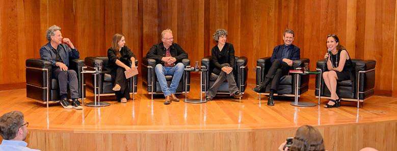
While still trying to implement the recommendations from its most recent and destructive Hurricane in 2010, in the summer of 2022 Monterrey almost reached a Day-Zero scenario of water provision. The following summer, its citizens also struggled to cope with high average temperatures of 40 degrees Celsius, within one of the most polluted atmospheres of the nation. This past June 2024, Alberto and Beryl refilled Monterrey’s dams by downpouring in two weeks the water the city normally receives in two years. Amidst a nearshoring industrial boom, promoting near endless unsustainable urbanization and raising questions about insufficient resources, it is difficult to imagine a livable future for Monterrey’s citizens without a radical transition towards climate resilience.
Along with many other cities, Monterrey finds itself on a path unfortunately advancing and making visible the consequences of a warming atmosphere and climate crises. While in other cities the implementation of nature-based solutions could be simple and/ or enough, due to Monterrey´s economic and ecological situation, even more radical efforts will be necessary. In these series of dialogues and design exercises, we will explore various routes that Monterrey decision-makers and citizens could choose to follow in the face of urgently needed radical commitments to resource conservation, ecosystemic recovery, and meaningfully sustainable growth.
Any such paradigm shift can only be achieved through alliances across citizens, decision makers, industrialists, and farmers, all of whom have a role to play in finding synergies that might allow the city not only to avoid catastrophic results but to also increase competitiveness and quality of life via urban-regional growth strategies that prioritize equity, heath, and ecological resilience.
September 30, 2024
Tecnológico de Monterrey, School of Architecture, Art and Design (EAAD) Monterrey, NL, Mexico
There is a reason the Monterrey region has yet to find itself on a more sustainable and resilient growth path. There are many barriers and conflicting interests challenging the implementation of the required actions to set the region on such necessary path. Such actions to seriously address both the ecological constraints and economic potential of the region have yet to materialize at scale. But extended moments of crisis are critical moments to mobilize radical actions.
toward change.
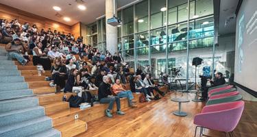
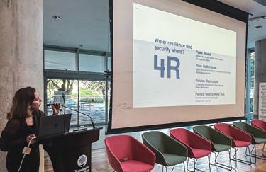
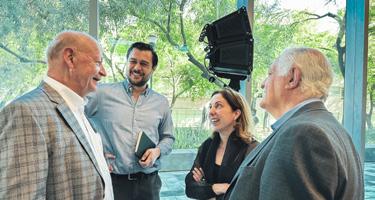
September 30, 2024
09.00AM
Welcome and Intro to Symposium
Ruben Segovia: Acknowledgments
Rob Roggema: Introduction to the symposium and design charrette
Lorena Bello: Introduction to the Santa Catarina challenge
09.30AM
Texcoco Lake Ecological Park Restoration
Presentation and Q&A
Iñaki Echeverria. Iñaki Echeverria Studio, Mexico City (MX)
Moderator: Selene Martinez and Lorenzo Rosenzweig.
10.50AM Coffee Break
11.10AM
Rivers Regeneration in Dallas, Austin & Houston Presentation and Q&A
Liz Silver. Principal Michael Van Valkenburgh Associates, New York (US)
Moderator: Lorena Bello / GSD Harvard
12.30PM Break for lunch
02.00PM
Panel introduction: Ruben Segovia
02.10PM
Towards a Water Sensitive Mexico City Presentation
Eduardo Marin. Felixx, Rotterdam (NL)
02.40PM
Dilemmas, Expectations, and Uncertainties for Mexico´s New water legislation Presentation
Antonio Azuela. UNAM, Mexico (MX)
03.00PM
Restoring rivers and improving habitats
Presentation
Nicholas Nelson. Harvard GSD
03.30PM Coffee Break
03.50PM Round table
Eduardo Marin, Antonio Azuela, Nicholas Nelson, Iñaki Echeverria and Liz Silver.
Moderator: Rob Roggema and Selene Martinez.
October 1st, 2024
All-Day Design Charrette
Antonio Azuela de la Cueva
Lawyer and sociologist specializing in urban and environmental law from a socio-legal perspective. Senior Research Fellow at UNAM and Vice President of the IberoAmerican Federation of Urban Planners. Mexico City, Mexico
Iñaki Echeverria
Architect and landscape urbanist, founder of a multidisciplinary practice in Mexico City. Faculty at Harvard GSD, Universidad Iberoamericana, and Aedes Network Campus Berlin. Mexico City, Mexico
Nicholas Nelson
Northeast Regional Director at Inter-Fluve, specializing in river and wetland restoration. Lecturer at Harvard GSD, and taught at Tongji, Minnesota, and Northeastern. Cambridge, United States
Eduardo Marin Salinas
Associate Partner, Project Leader, and Researcher at Felixx. Landscape designer and biologist with expertise in water and climate strategies. Rotterdam, Netherlands
Selene Martínez Guajardo
Executive Director of the Citizen Observatory of Air Quality in Monterrey. Biologist focused on environmental education, air quality, and climate action. Monterrey, Mexico
Rob Roggema, PhD
Distinguished Professor in Regenerative Cultures at the Tec de Monterrey.The Netherlands
Ruben Segovia
Co-founder of LS-LAB and Director of the Master of Architecture and Urban Design (MDU) at Tec of Monterrey. Monterrey, Mexico
Elizabeth Silver
Principal at MVVA, with a background in architecture and urban design. Lecturer at Harvard GSD, OCAD Toronto, and City College of New York. Cambridge, United States
1992-1999 Besós River (Barcelona, SP) Completed*
1994-2010 Wadi Hanifa (Riyadh, SA) Completed*
2004-2022 LA River Masterplan (Los Angeles, US) Plan
2006-2018 Room for the River (The Netherlands, NL) Built
2007-2015 Madrid Rio (Madrid, SP) Built
2009- Mapocho 42K (Santiago de Chile, CL) 23,16K Built
2012-2016 Medellín River Parks (Medellín, CO) Pilot Built
2016- Trinity River (Dallas, US) Plan
2017-2022 Miaojin River Corridor (Kunshan, CHN) Built
2017-2024 Seine Olympics (France, FR) Built* 2018-2020 Chattahoochee Riverlands (Atlanta, US) Plan*
2018- Alameda Creek (Alameda County, US) Plan
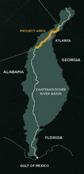
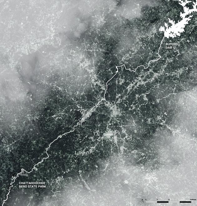
Existing condition study & Literature review Refining
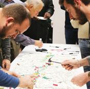
A SAFE, CONNECTIVE CORRIDOR
IMPLEMENTATION STRATEGY:
-Proposal for a 125-mile uninterrupted multimodal trail that extends from Buford Dam to Chattahoochee Bend State Park.
-3 sub-areas representing: the agricultural countryside, the urban core, and the suburban parklands
-4 demonstration sites for concept level study
The Chattahoochee Working Group formed
Defining the identity of the RiverLands with SACs
Existing condition study & Literature review
METRO ATLANTA REGION, GA
- 500 Million
- About 430 miles (690 km) long, begins in the Blue Ridge Mountains of Georgia and ends in the Gulf of Mexico
- One of the most used surface water resources in Georgia - Permanent river regulated by 13 dams that generate electricity and hydropower.

Chattahoochee RiverLands
-Proposal for a 125-mile uninter
-3 sub-areas representing: the ricultural countryside, the
PARTICIPATORY PROCESS:
-Worked with the Chattahoochee Working Group, a stakeholder group, to implement the visions.
-Engaged with Sub-Area Committees (SACs) to gather feedback.
-Held public forums and design charrettes with local stakeholders including land owners, non-profits, and local representatives.
SOCIAL IMPACTS (upon completion):
-An inclusive public realm for Atlanta’s booming metro population
-Addressing existing and historical inequalities in access to greenspace, benefiting the most vulnerable.
-Easier access to and stronger connectivity between parks through bicycle and pedestrian trails initiatives. A COMMON GROUND FOR ALL AN ECOLOGICAL REGUFE
Refining project goals at the public forums
RiverLands website online
Defining preferred alignment with the SACs
Studio workshops
Final report

POPULATION
1,000,000 residents living within
3 miles of the Seine River
One Dot = 100,000 People
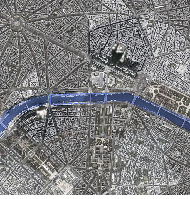
EXTREME EVENT TIMELINE
Paris banned swimming in the river in 1923 due to excessive water pollution
Originally commissioned in 1940, the Seine Aval plant at Achères treats the effluent from around 80% of the population of the Parisian region and has a rated capacity slightly in excess of 2m m³/ day

The French Water Law of 16 December 1964, which regulates water use and provides for the protection of water resources against pollution, is one of the pillars of contemporary water law in Europe
10-fold increase in Seine Aval treatment capacity Seine among water treatment plant is build
PARIS, FRANCE
- BUDGET:$ 1.5 BILLION
- 3/384MILES
- As the Seine passes through Paris, it widens, slows down, and exhibits more pronounced meanders.
- The process of cleaning the Seine River, particularly in the context of making it swimmable for the 2024 Paris Olympics, is a large-scale, coordinated environmental and infrastructural effort. The cleaning process follows a step-by-step approach, addressing various pollution sources, improving infrastructure, and restoring ecological balance
- Expand and upgrade the sewage system to handle stormwater and prevent overflows, especially after heavy rains. Build large underground cisterns to capture rainwater for later treatment.
- Connect unregulated sources (such as houseboats and unconnected residences) to the sewer system to reduce direct wastewater discharge.
- Continuously test water quality to ensure bacterial levels are safe for swimming, especially leading up to Olympic events
- Reintroduce native species and rehabilitate aquatic life affected by pollution, ensuring sustainable recovery of biodiversity.
STUDY TIMELINE
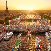
WATER QUALITY
IMPLEMENTATION
STRATEGY
- Expand and upgrade the sewage system stormwater and prevent overflows, heavy rains. Build large underground rainwater for later treatment.
- Connect unregulated sources (such unconnected residences) to the sewer direct wastewater discharge.
- Continuously test water quality to levels are safe for swimming, especially Olympic events
- Reintroduce native species and rehabilitate affected by pollution, ensuring sustainable biodiversity.
STUDY TIMELINE
European Directive on urban waters treatment
Action plan for Seine river quality improvement

- Improved water quality will reduce health risks like bacterial infections, enhancing public safety for swimming and other recreational activities.
- The Seine will open for public swimming at designated spots, improving access to urban green spaces and boosting local quality of life.
- The cleaner river will attract more tourists, especially with the Olympic events, boosting local economies and creating job opportunities.
- The cleanup will inspire greater environmental consciousness among residents, promoting sustainable practices
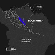
Population Density
One Dot = 100,000 People
CLIMACTIC EXTREMES
Severe droughts struck the Najd region periodically
Major drought led to mass displacement of Bedouin peoples in search for stable water
WATER SECURITY + RECLAMATION
IMPLEMENTATION STRATEGY:
- Proposal for a 120 km phased restoration of the Wadi Hanifa riverine corridor.
- Phase 01: Removing pollution sources.
- Phase 02: 57 km of the river was remediated using stone areation and native plants.
- Phase 03: Treated wastewater was reciruclated into the river and for agricultural use.
STUDY TIMELINE
Wadi Hanifa Development Strategy approved
A second drought hits, forcing the city to channelize some of the wadi for agricutlrural use
A massive flash flood decimated the urban areas near the Wadi Hanifa
A major flash flood strikes the wadi as restoration efforts are being completed
WATER SECURITY + RECLAMATION
IMPLEMENTATION
STRATEGY:
- Proposal for a 120 km phased restoration of the Wadi Hanifa corridor.
- Phase 01: Removing pollution sources.
- Phase 02: 57 km of the river remediated using stone areation native plants.
- Phase 03: Treated wastewater reciruclated into the river and agricultural use.
STUDY TIMELINE
Another severe drought has proven the restoration successfull
Moriyama & Teshima + Buro Happold selected as development leads
RIYADH, SAUDI ARABIA
$1 Billion (USD) 120 Kilometers | 74 Miles
The Wadi Hanifa is an ephemeral riverbed that serves as Riyadh’s primary agriculturual and wastewater corridor. The restoration sought to improve flooding outcomes, sanitary conditions, and the quality of life for residents.
SANITARY + HEALTH CONDITIONS
PARTICIPATORY PROCESS:
- The project was driven by the Arriyadh Development Authority (ADA), which aimed to address severe environmental degradation, restore ecological balance, and improve urban quality of life.
- The ADA says the project included public engagment, but there was little transparency outlining any outcomes.
Reverse osmosis plant in the Arabian gulf opens exacerbating wastewater discharg issues in the wadi


EQUITABLE PUBLIC ACCESS + OPEN SPACE
SOCIAL IMPACTS (upon completion):
- Development of parks, walking paths, picnic areas, and recreational zones along the wadi.
- 9 major parks, 5 lakes, pedestrian promenades, and recreational trails to enhance public use.
- Creation of cultural and historical sites for public engagement and tourism.
Wadi Hanifa construction beings
Zones 1, 2 & 3 complete
Adjoining Al-Quassim Expressway completed
Remaining zones completed

- 150-250 million per park
- 710 miles (1143 km) long, begins near Dallas and ends in Trinity Bay, which drains to the Gulf of Mexico
- Sinuous morphology, permanent
- Project region of focus: Dallas area. Selected due to urban flood risk.


-
- Partnership between the
- Project implementation is currently
STUDY
PARTICIPATORY PROCESS:
- Release of land use plans
- Trinity Park Conservancy IMPLEMENTATION STRATEGY:
- Board meetings - Community events - Community engagement during park planning (Harold Simmons Park)
SOCIAL IMPACTS (upon completion):
- Targets flood protection and mitigation, transportation, public recreation, business development, and environmental stewardship.
- Largest impact (and project priority) is reducing flood vulnerability
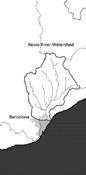
POPULATION
1,600,000 residents in Barcelona One Dot = 100,000 People
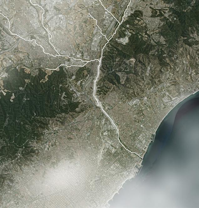
EXTREME EVENT TIMELINE
Rubi Flash Flood -the worst to ever take in Spain -more than 800 deaths
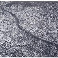
WATER HEALTH/QUALITY
- 20 million U.S. dollars
- The 6km portion stretching over Santa Coloma and Montcada Municipality
- Passing through the highly industrialized area - One of the most contaminated rivers in europe during 70s/80s


ECOLOGICAL HEALTH PUBLIC ACCESSIBILITY
IMPLEMENTATION STRATEGY:
- Different strategies for the upstream and downstream - Downstream - Upstream
: re-introducing the meandering morphology of the river : constructing a series of wetlands : outflow of the nearest treatment plants is pumped up to the wetlands : planting Phragmites Australis and Typha Latifolia to extract nutrients from wastewater : providing safe and accessible public realms around the river
STUDY TIMELINE
Barcelona Olympic Establishment of BR (Barcelona Regional. Agència de Desenvolupament Urbà) with an aim to transform the post-olympic.
Funding from EC (European Community)
SOCIAL IMPACTS (upon completion):
- Cleaner water - Habitats for wildlife - Recreation area along the water - Triggering other restoration projects around the river
Project opening to the public
Following project to extend the urban park to the sea (2.7km)
IMPLEMENTATION
- Different strategies for the upstream - Downstream
- Upstream
STUDY TIMELINE WATER HEALTH/QUALITY
: re-introducing : constructing a : outflow of the lands : planting Phragmites trients from wastewater : providing safe and
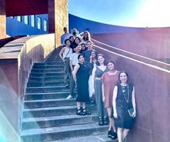

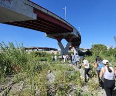
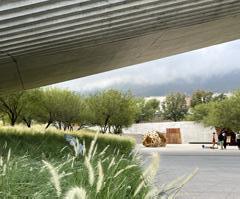
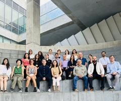

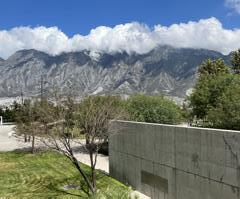
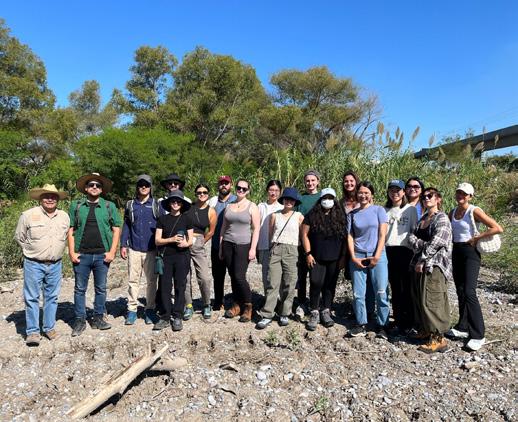
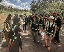

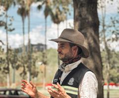
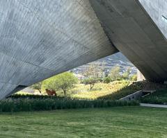
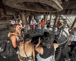
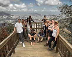
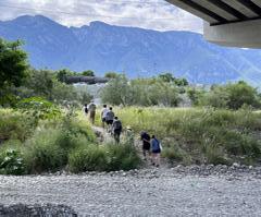
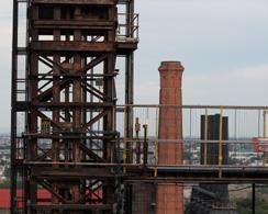
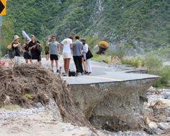
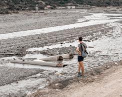
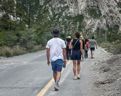
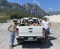
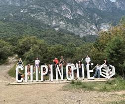
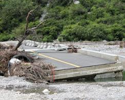
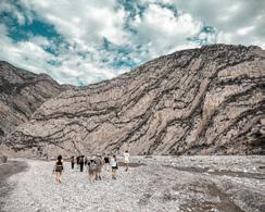
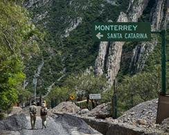
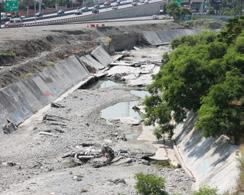
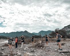
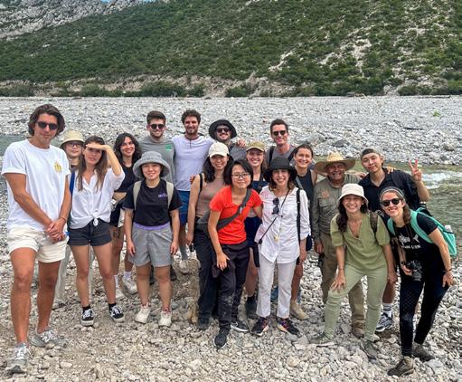
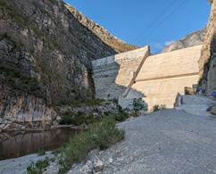
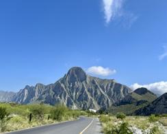
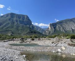
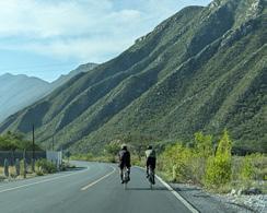
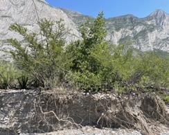
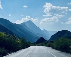
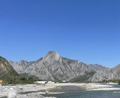
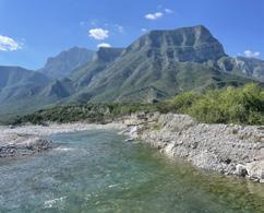
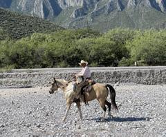
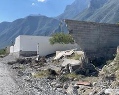
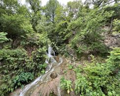
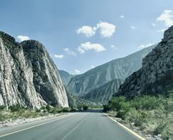
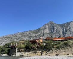
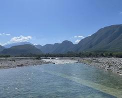
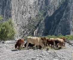
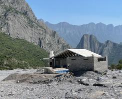
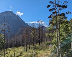
“I’ve spent decades trying to get this piece right. At some point, I found a way in: in the same way that a river begins far before we meet it, I imagine this music starting long before I play the first note; I just have to join it. Like the river, the music is always flowing, and like the river, it’s always changing. All I have to do is picture a river, feel its energy, get into its flow, and follow it.”
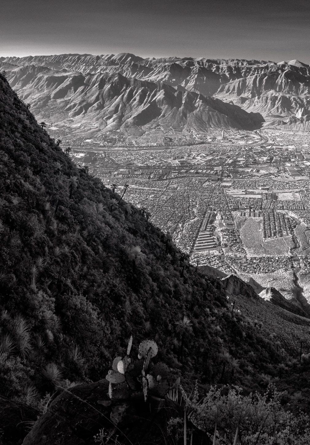
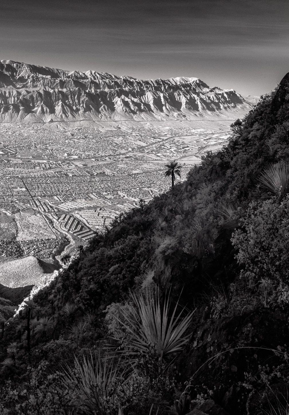
Jianing Zhou
“Incognito Dams” investigates aquifer recharge and flood-risk reduction strategies in the Cumbres de Monterrey National Park. This park is a critical mountainous headwater for Monterrey’s broader urban-regional watershed. The project offers a pathway for restoring aquifer water levels, mitigating flood risk of vulnerable communities along the Santa Catarina watershed, and encouraging a change of perception regarding the function and role of water in the Cumbres National Park watershed. It does so by blending, spreading, and dispersing nature-based flood control strategies into the cultural and ecological layers of eons of geological wonder.
The project relies on forging a bottom-up, less intrusive, and less overtly infrastructural vision for water management and flood control. This inspires a capacity building program with both ejidatarios and ranch owners for implementing a collective commitment to biodiversity and water conservation. In tandem the National Park could jumpstart a “Leave No Trace” educational program to raise awareness of their impact of waste and fires for the climatic resilience of Monterrey’s metropolitan region. Both programs are intended to counter the fast encroachment of private villas and tourism that have caused waste and fire hazards in the park, even while sustaining its local population.
The design framework begins at the existing Rompepicos dam at Corral de Palmas, used for controlling flood surges during extreme rain events. Following the mountainous watercourse up to the Huasteca Canyon, the design framework turns the whole transect of the Santa Caterina watershed into an invisible
decentralized dam system. The strategy contains three zones: its headwater zone or upper slopes, the hillslope zone or middle slopes, and the low slopes or floodplain, an area that for most of the year blends together with the river flood way. The landscape design proposal establishes zone 1 as a headwater zone and reforested reservoir; zone 2 as a hillslope with topographic intervention belts; and zone 3 as a hydraulic buffer floodplain.
These almost invisible strategies, embedded in the ecological and topographical layers of this monumental landscape, paradoxically make water in the valley more visible, more controllable, and more sustainable. “Incognito dams” provides a back-up water management model that complements Cumbres National Park’s highly engineered existing water infrastructure.

Top: Kit of parts for proposed intervention organized by approach type
Next page: Spatial framework
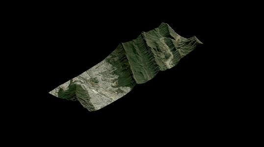
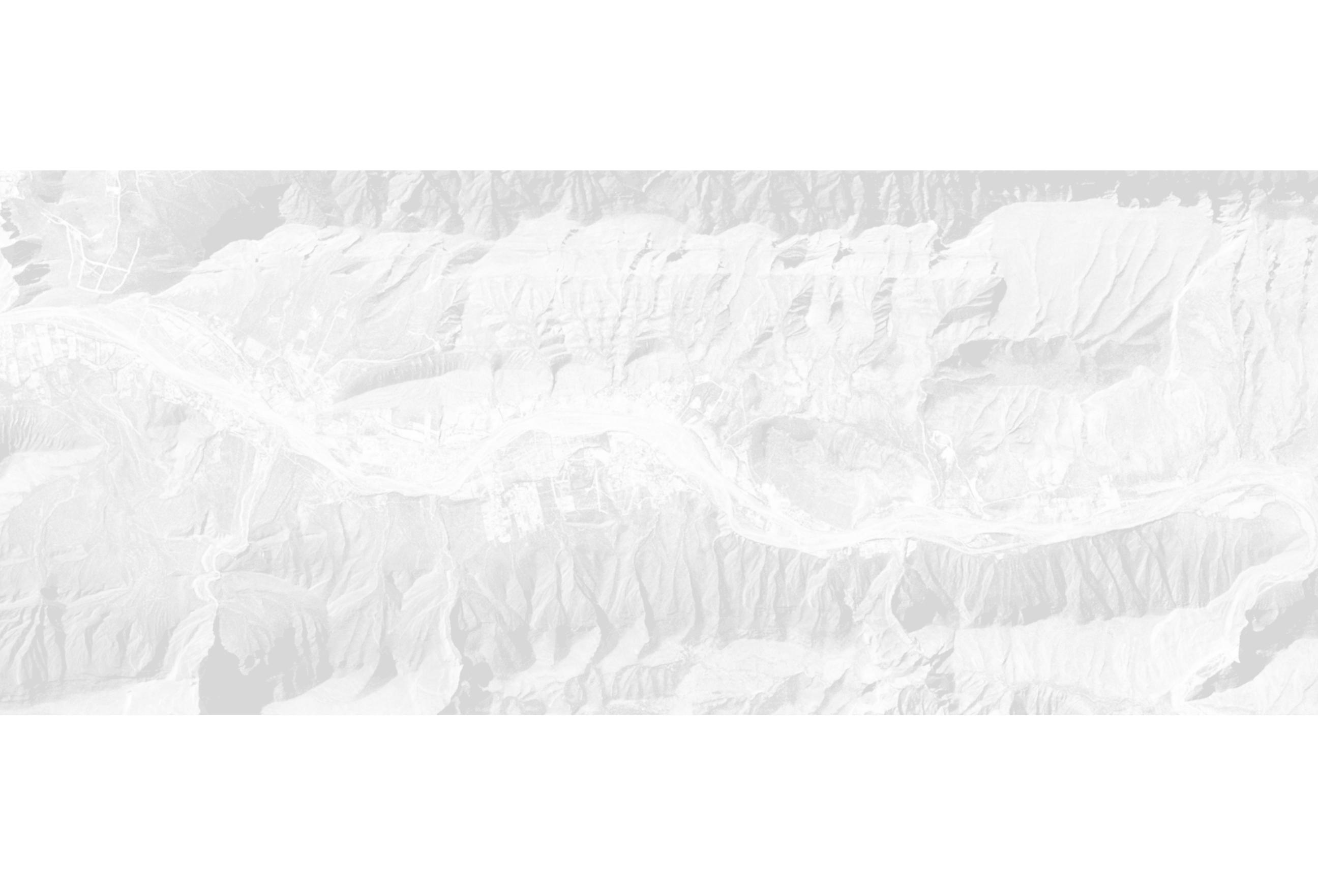


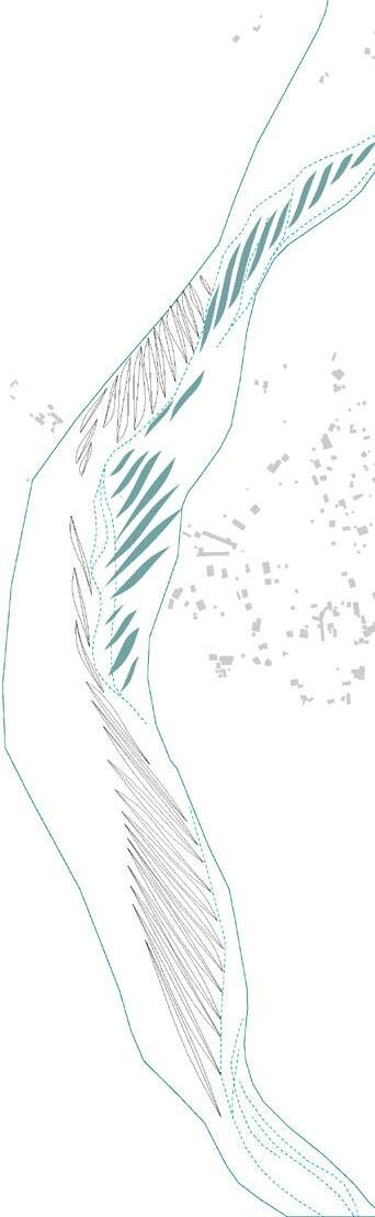
56
Nina Zhao
Río Santa Catarina, located within Cumbres de Monterrey National Park, presents a stark image of a dry and barren riverbed, carrying water only temporarily after heavy rains. This image contrasts with its historic vibrancy when residents crossed the river on horseback, and its riparian zones supported flourishing flora and fauna.
As a designated National Park, Cumbres de Monterrey faces unique challenges stemming from diverse human activities within its boundaries. Notably, local farming communities coexist alongside fiesta quintas, party houses, many of which encroach illegally into the riverbed, diminishing the space originally reserved for water flow and ecological functions. Urban encroachment has further exacerbated the degradation of the riparian buffer zone, threatened its ecological integrity and reduced opportunities for public engagement with water in a meaningful way.
This project proposes a progressive restoration and management strategy for Río Santa Catarina floodplain. Guided by the principle “the machinic regenerates the natural”, it sees human intervention not as opposition to nature but as a tool for re-establishing balance.
The reforestation plan is structured around a phased approach: sediment collection, water retention, and trial planting patches. These phases are represented through distinct microtopography modules designed to slow down water flow, collect sediment, and facilitate vegetation regeneration.
Visitors and local farmers are invited to participate in these regenerative efforts, fostering deeper connections between people, water, and nature.
More than an ecological repair, the project imagines a dynamic, evolving system that invites public interaction. By integrating reforestation sites with trail networks, the restoration sites become gateways into the landscape.
• L - Urban Monterrey overlapping with the National Park
• M - National Park management subzone
• S - Study area for riparian buffer restoration
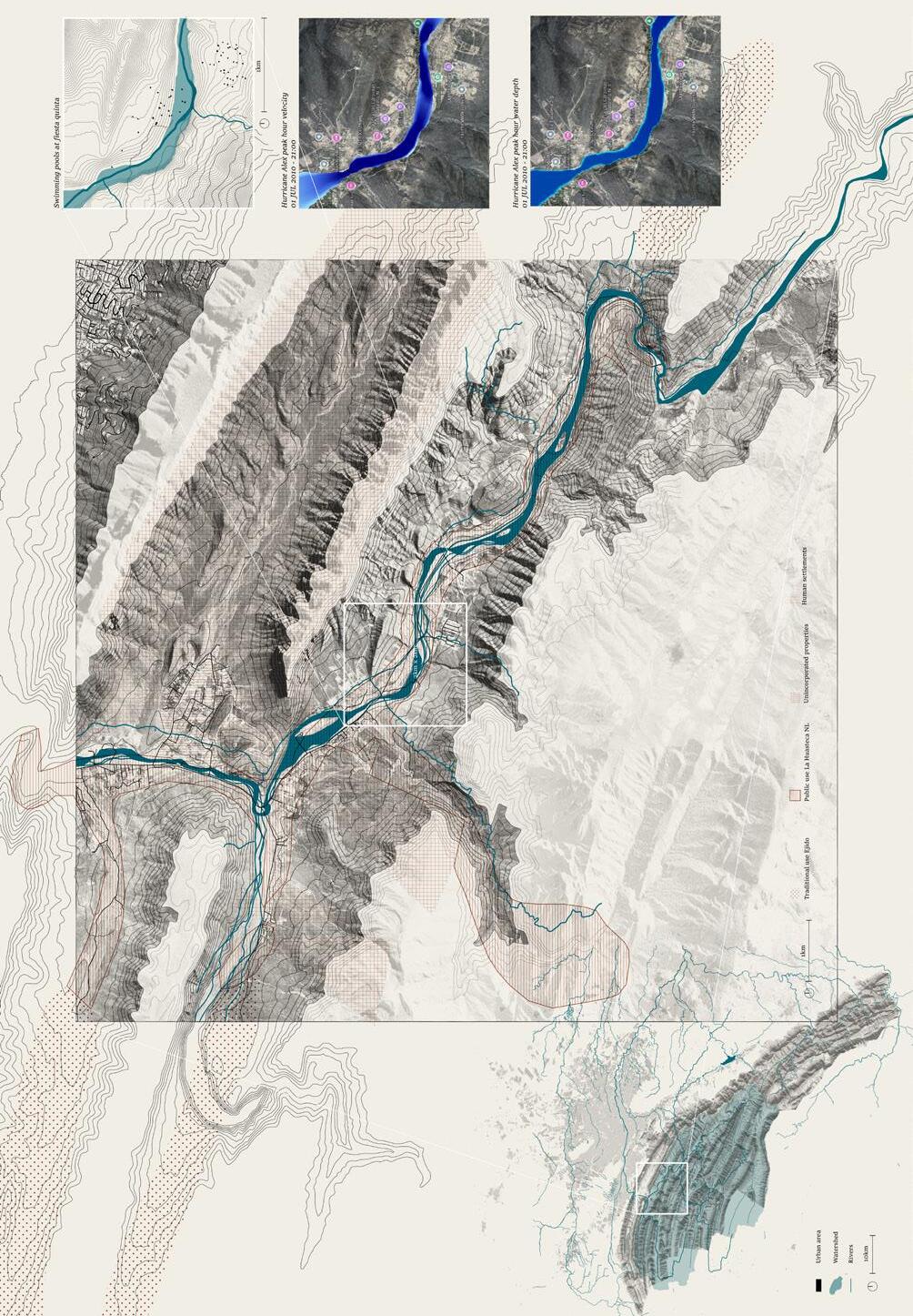
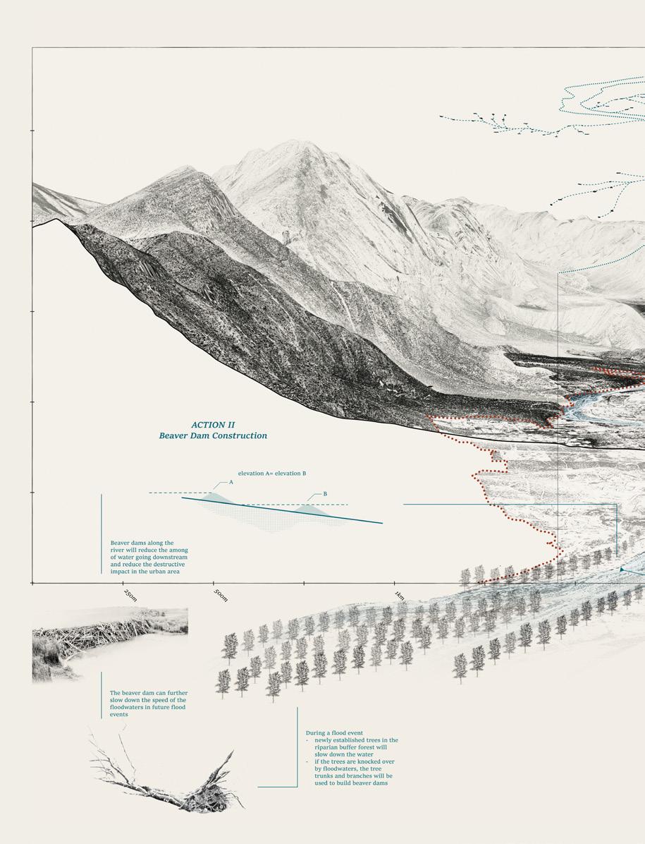
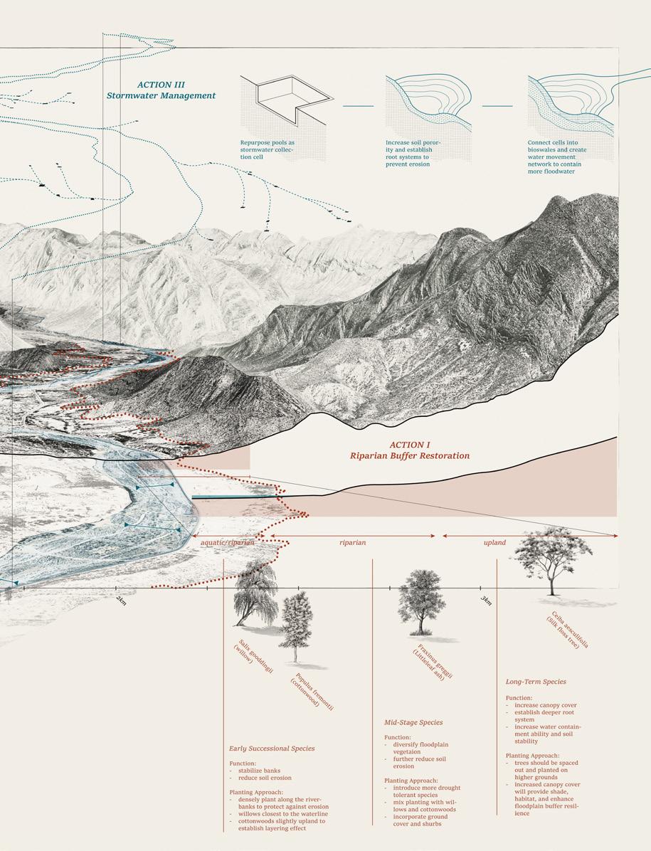
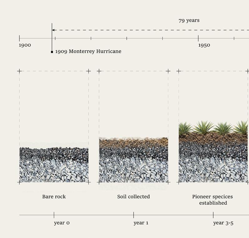
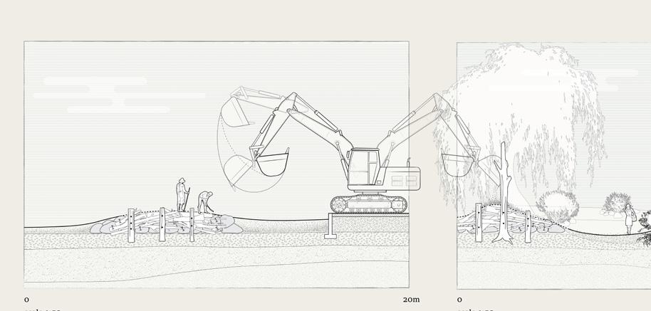
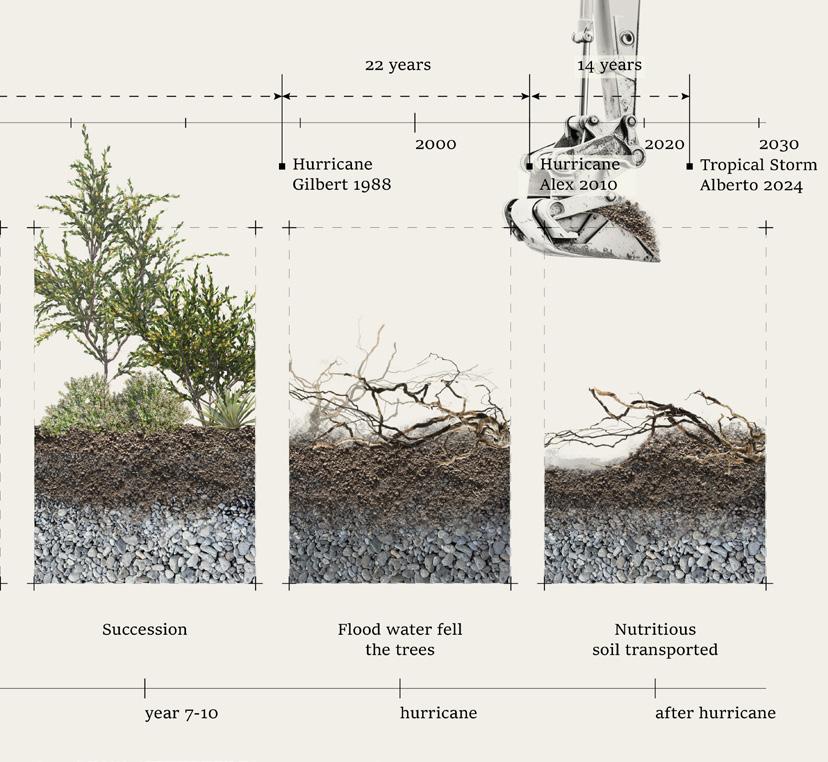
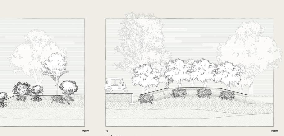
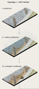

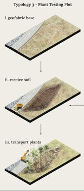
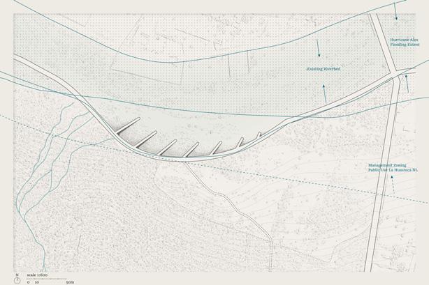
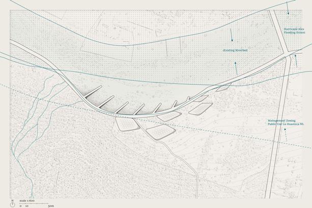
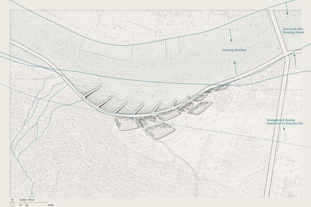
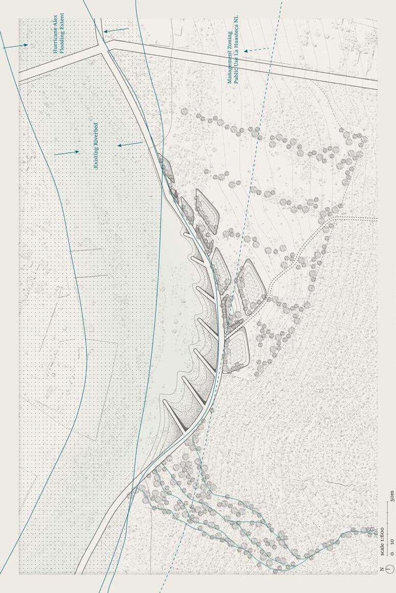
Left: Design proposal breakdown according to different phases
Top: Design over time
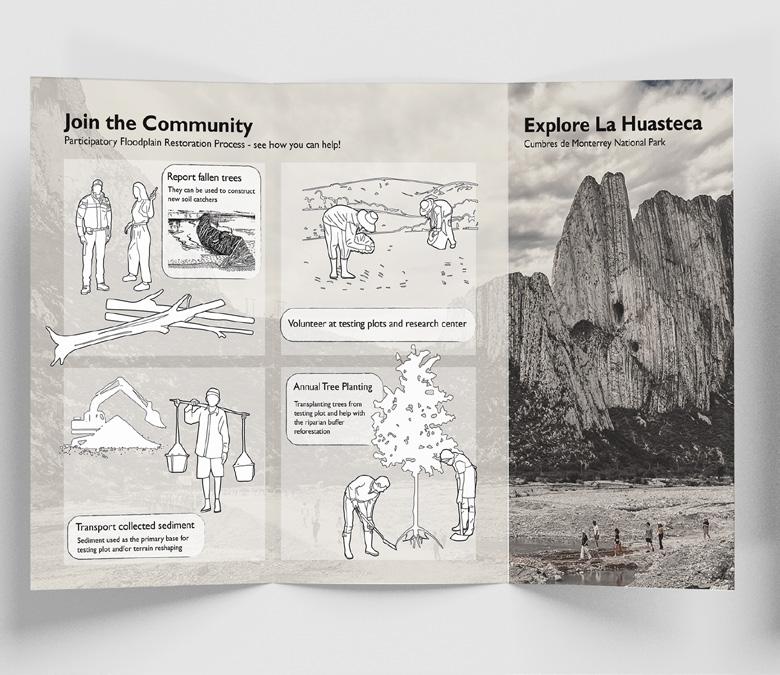
Next
Next page bottom: Section cutting across all three micro-topologies
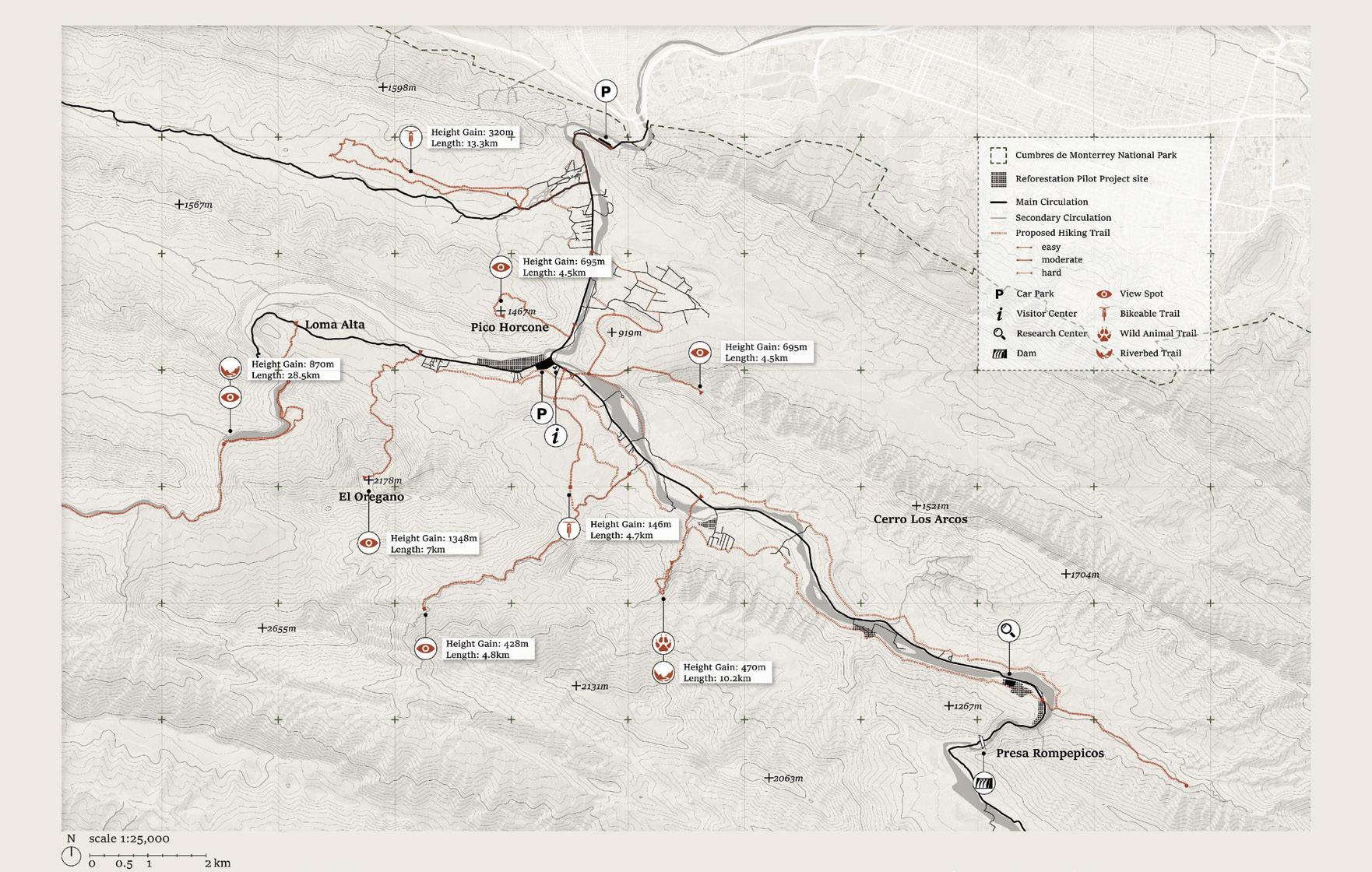
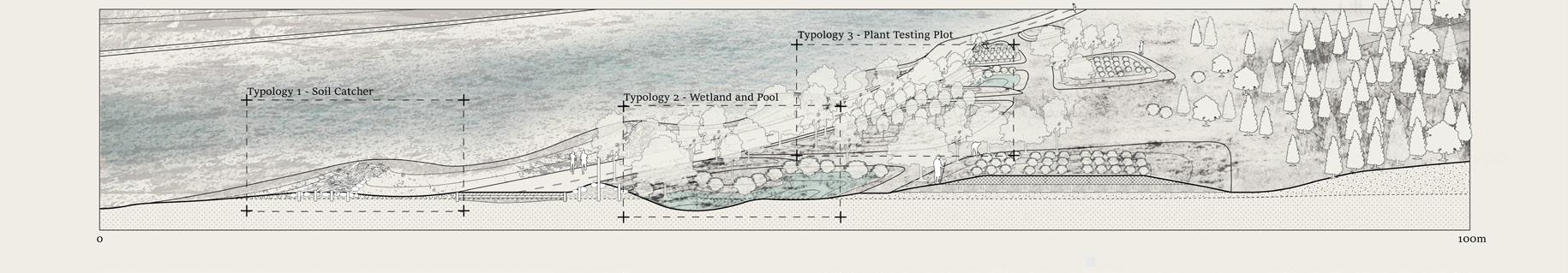
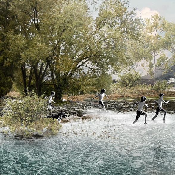
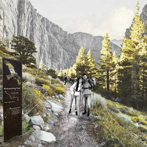
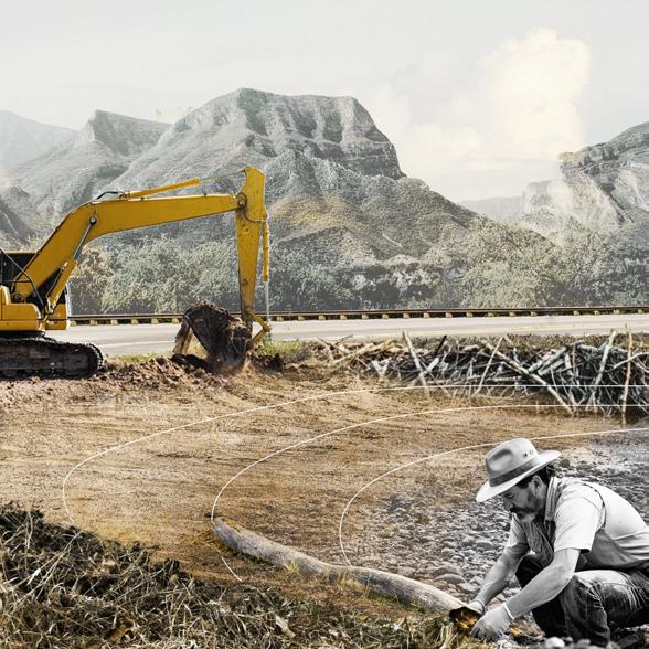
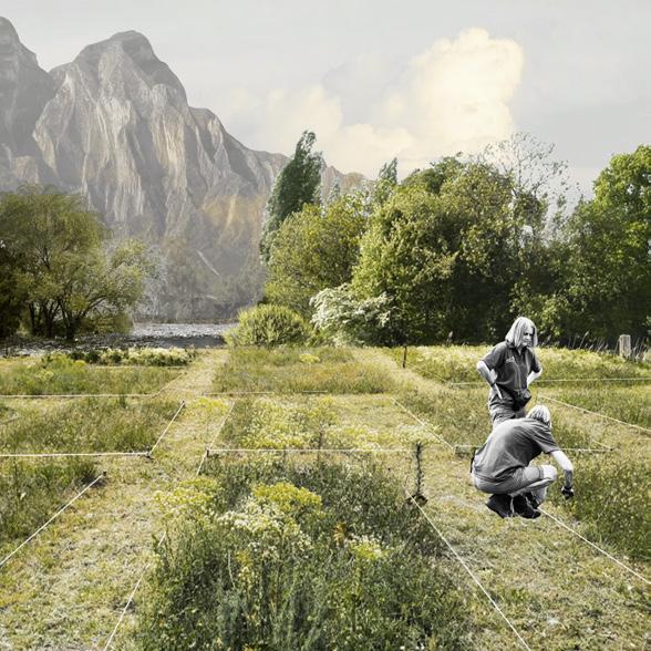
Donguk Lee
The Río Santa Catarina faces two interconnected yet extreme environmental challenges: severe flooding during heavy rain events and persistent water scarcity throughout much of the year. These hydrological extremes have wide-reaching implications for both urban Monterrey and the upstream communities of the Cumbres de Monterrey. My design approach addresses these issues by targeting their origin—at the headwaters in Cumbres de Monterrey National Park. This mountainous region is characterized by fragile Leptosol-dominated soils, steep topography, and a widespread lack of riparian vegetation and buffer zones. These conditions contribute to intense water erosion, which in turn accelerates runoff, leading to destructive flooding in the lower, urbanized areas of the Santa Catarina River Basin.
To confront these challenges holistically, the project proposes a multifaceted strategy rooted in ecological restoration and climate adaptation. Central to the design is a comprehensive soil restoration program, aimed at increasing infiltration and reducing runoff. This is supported by a strategic revegetation initiative that introduces native and adaptive plant species along riparian corridors and within rocky valleys. These measures not only stabilize the soil and slow down water flow, but also help to recharge aquifers and reestablish the region’s ecological functions.
However, the project goes beyond technical mitigation. It envisions a resilient, self-sustaining future for the indigenous and local communities who inhabit the region. By incorporating
modern agroforestry systems that integrate food production with forest conservation, and by designing climateresilient housing typologies rooted in vernacular architecture, the proposal fosters a harmonious relationship between people and landscape. These interventions are grounded in community empowerment and aim to preserve the region’s rich cultural heritage while improving quality of life.
Ultimately, this design reimagines the Cumbres de Monterrey not just as a place of ecological restoration, but as a living landscape of resilience, education, and cultural continuity. It aspires to transform the region into a model for sustainable coexistence and regenerative design, adding a new chapter to the evolving identity of Mexico’s national parks.
Geographical mapping of the Rio Grande watershed, illustrating the population living within its boundaries and the water’s journey across various physical, political, and cultural borders.
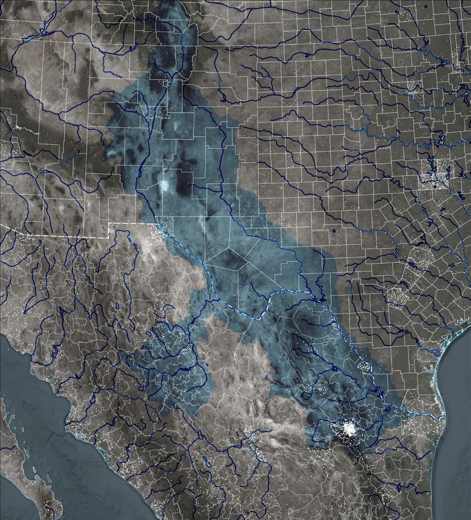
Watershed
States Counties
The Rio Grande, a lifeblood of the American Southwest, weaves its way across vast landscapes, nourishing countless lives under its protective embrace. Spanning nations, states, and communities, the Rio Grande binds together a rich tapestry of cultures and histories. Its vast reach demands not just isolated management but a holistic, integrated approach—uniting federal authorities, municipal powers, and local neighborhoods—to ensure that the legacy of this timeless waterway endures for all who call its banks home.

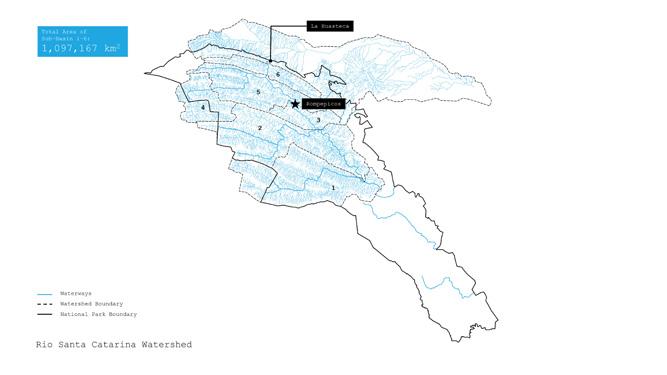
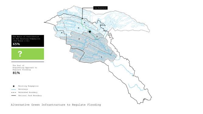
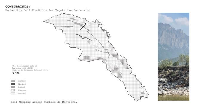
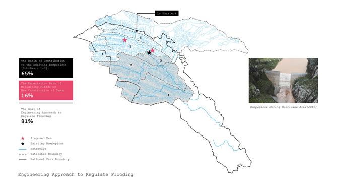
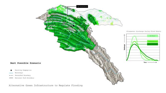
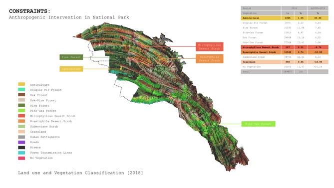
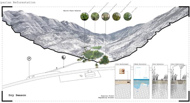
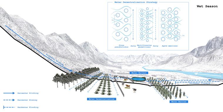
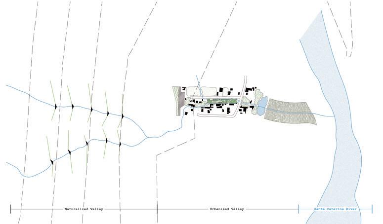
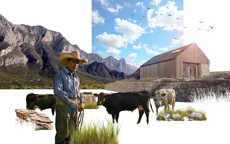
Conceptual and geo-referencing plan to visualize the relationship between Naturalized Valley and Ejidal Valley.
Mya Kotalac
A project investigating the geomorphology of the Santa Catarina river explores opportunities of catalyzing erosion along its riverbanks to encourage a more diverse riverbed and regeneration of biodiversity.
Following the natural topography of the meandering Santa Catarina, the scars and their subsequent fill create a web across the riverbed and new corridors for water and vegetation to co-exist. Following a process of excavation, or scarring, the force of the next flood event will provide the energy to erode, leaving behind a dynamic landscape to be revegetated.
The meander of the Santa Catarina river is formed by helicoidal flow, where the velocity of the water focuses on one end of the river bed, eroding this side, while simultaneously pushing sediment up onto the opposite bank. It can also be thought of as a helicoid, or helix, spiraling the water as it flows downstream. Ultimately, rendering the banks opposite the erosion as safe, higher ground. Harnessing and choreographing this phenomenon, the scars act as catalysts to form new areas of higher ground, as well as deeper areas of water retention.
Three new holidays around the 100 year cycle of flooding in Monterrey propose a new culture toward stewardship of the riverbed and accessibility to water in the region. The first holiday, Día de la Sequia, or “Day of the Drought” falls on the dryest day of the 100 year cycle and commences the scarring of the riverbed, in preparation for the flood to come.
The second holiday, Día de los rios, or “Day of the Rivers”, signifies the arrival of the flood, celebrating the resource of water as its energy erodes deeper corridors into the riverbed.
The third holiday, Día de la Siembra, or “Day of the Planting”, falls during the retreat of water, when plants can thrive and set their roots into the fresh soil of the new topography. The combination of these three actions work toward goals of slowing down water, holding it for longer, and ultimately shortening the period of drought while minimizing the impact of flood events.
During the months of rain, the proposed new riverbed will become a watering hole for the surrounding cultural activities, while in the dry months the erosion will be an eminent reminder of the flood. Both seasons cultivating a new stewardship toward the river and a respect for its metabolism, symbolizing a reclamation of the river’s territory.
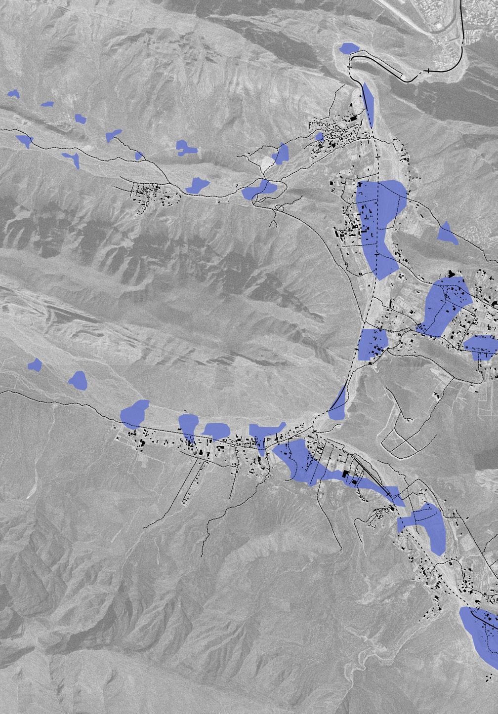
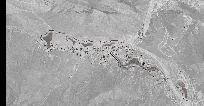
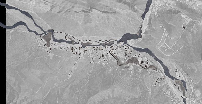
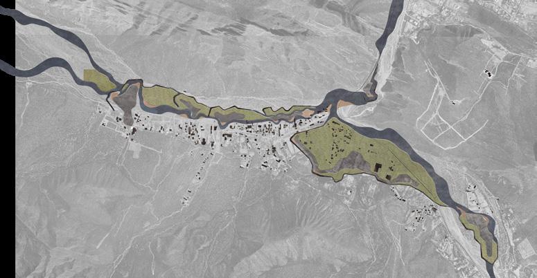
Left: The development of Cumbres National Park overlaid on to the network of flat topographies in the valley of the watershed. A pattern is revealed where development focuses in flatter areas, as well as areas where water collects.
Top: Masterplans of the initial web of scars and fill, the arrival of the flood, and the proposed new landscape. A series of proposed scars to reduce the water speed, while naturally forming higher protected ground and lower pools where swimming could be possible.
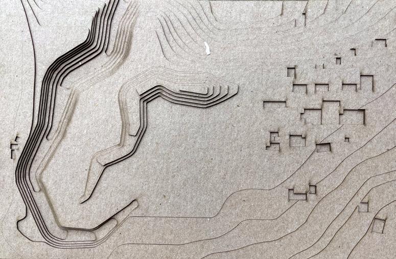
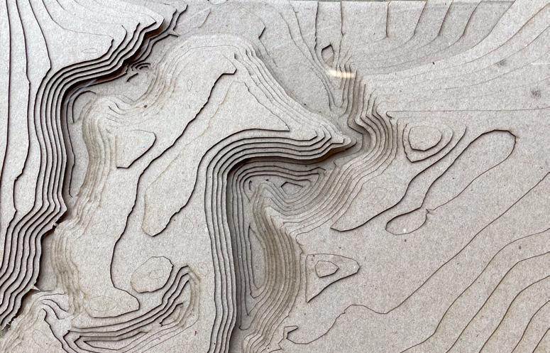
Top and Bottom: Physical model views of the topography of the original scar and the outcome, leading to an eventual retreat of development to respect the space of the river.
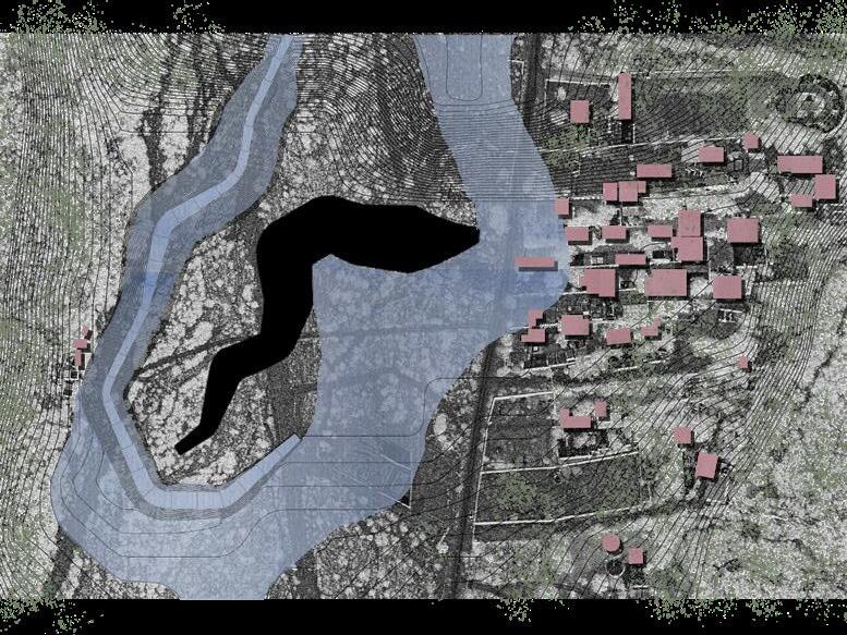
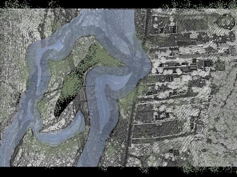
Top: Site plan of initial scar into the riverbed and mirrored mound of fill, a clear geometry as a symbol of the human intervention.
Bottom: Site plan of the topography post flood event, the scar becomes organic and new pools of water are left behind.
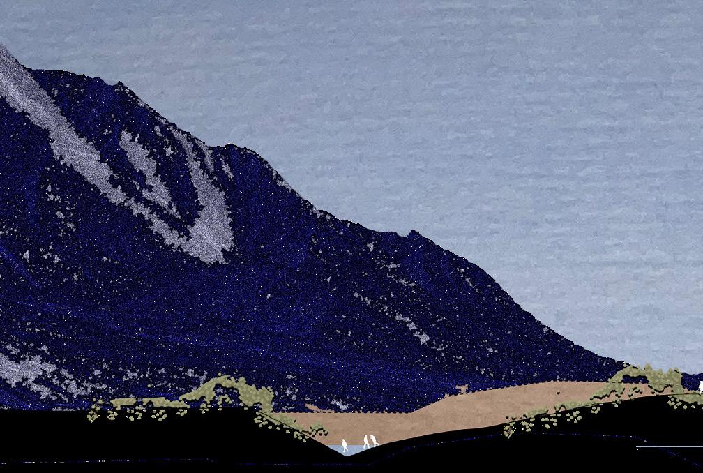


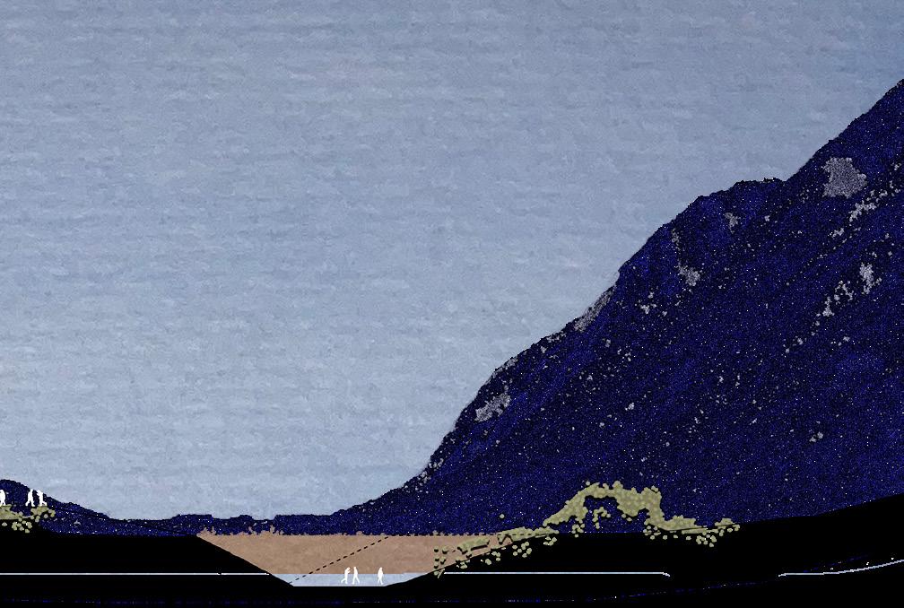


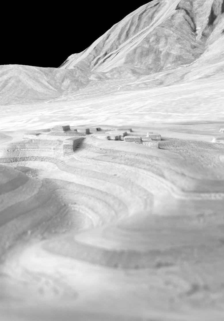
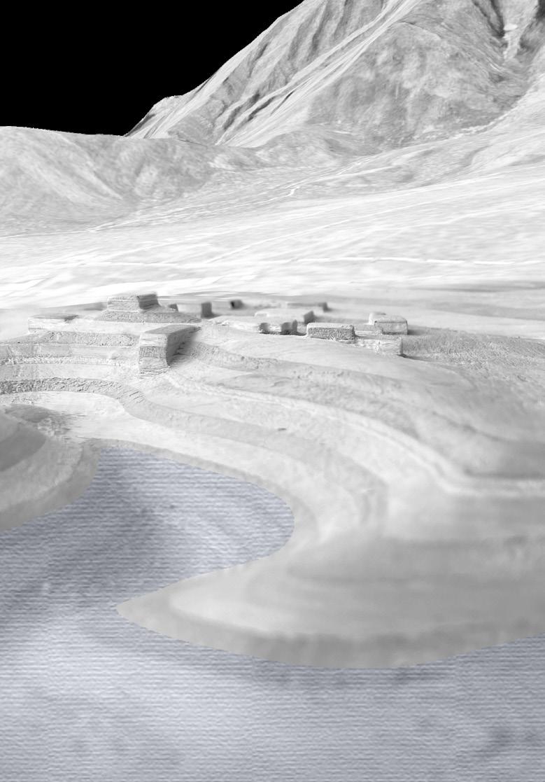
Sammy Mansfield
Monterrey, Mexico is an industrial city situated at the boundary of Cumbres National Park – a vast mountain range whose morphology has been shaped by the Santa Catarina River. In Monterrey, Mexico flooding is typically addressed through traditional engineering solutions like dams and channels – this project explores an alternative to these brickand-mortar interventions: explosive craters. These explosive craters –strategically dispersed throughout the mountain region of the Santa Catarina Watershed - are designed to retain the volume of water necessary to prevent large-scale flooding events. Immediately following storms, these normally dry craters transform into circular pools of water which grant different forms of life to their surrounding environments. From a utilitarian perspective, these basins become sources of water for local humans, livestock, and agriculture. Geologically, these basins allow the precious water to slowly penetrate through bedrock and replenish the parched aquifer. Culturally, these basins of water can evoke feelings of the sublime –inverted imprints on the landscape, hidden from view until one is immediately adjacent to these earthworks, whose reflective water, like a sheet of glass, reflect the surrounding mountainscape and the heavens above.
Constructing an explosive crater (through a singular blast) emits about 1% the amount of CO2 and costs about 2% that of a traditional dam. This project proposes the creation of 7 explosive craters in the Santa Catarina Watershed - substitutes to proposed construction of 3 new dams. These explosive craters range in diameter from 140m to 240m (with depths ranging from 21m to 36m),
and can hold a combined volume of 37,623,200m^3 of water at any given time - greatly higher than the 3-hour average storm surge quantity of 22,680,000m^3 – situating the craters as functional alternatives to increased weather events of greater force far into the future. These malleable landforms can be repaired and augmented to fit the needs of future storm events, evolving in shape and volume for sustained relevancy.
Explosive craters propose a new water retention typology which leave a lighter environmental and visual imprint on the land, cost a fraction of the traditional dam, and have the opportunity to produce new cultural ecologies to the Río Santa Catarina Watershed – becoming the hidden protectors of the landscape and people around them.
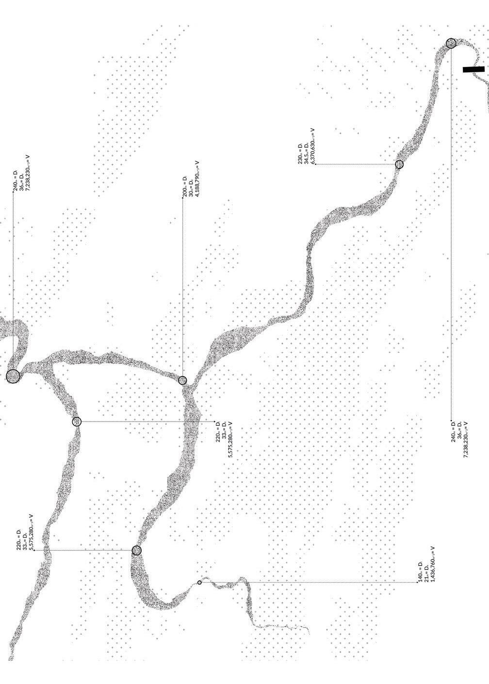
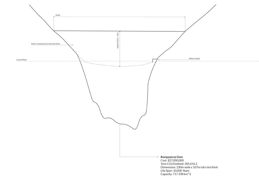
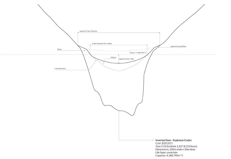
Proposed crater interventions, dam/ crater volume comparison.
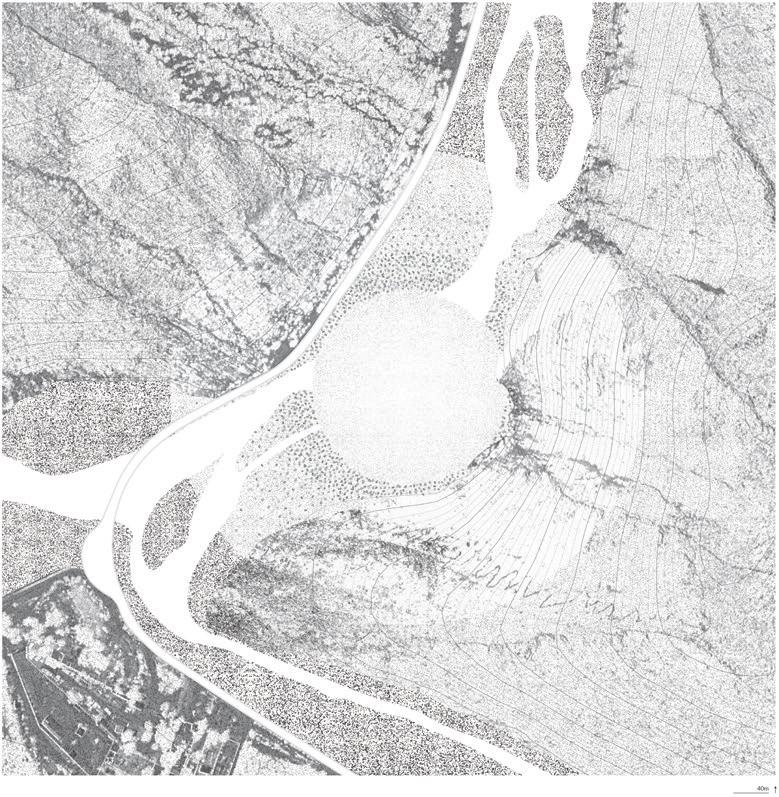
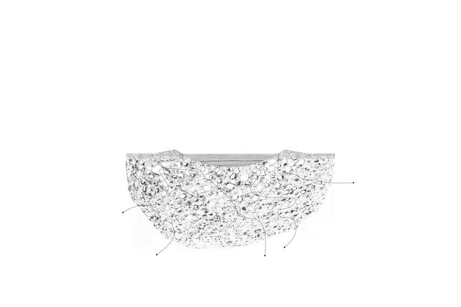

Facing Page: Sections showing the different stages in the craters lifetime - with each great flood, these stages will repeat themselves.

This Page: The initial formation of the crater, the crater disformed by water flow, the constellations reflected in the crater’s water.


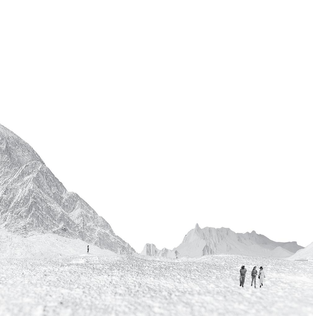
While approaching the crater from a distance, it appears invisible, hidden in the landscape.
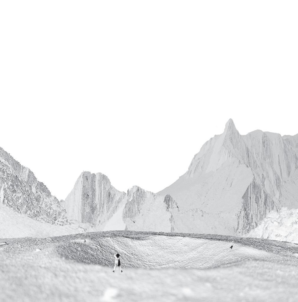
Once you reach the rim of the crater, you are greeted with the primitive form.
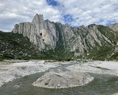
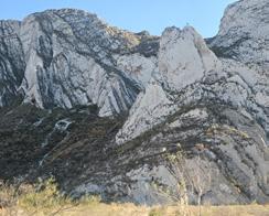
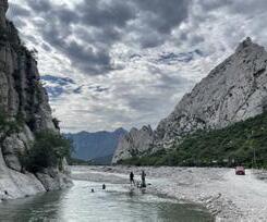
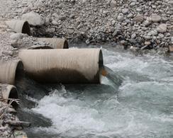
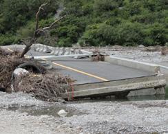
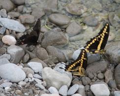
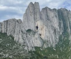
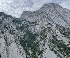
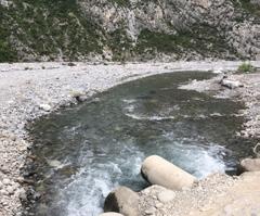
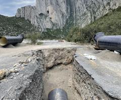
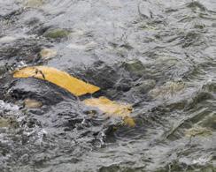
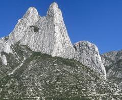
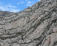
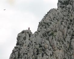
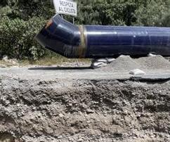
“Have you also learned that secret from the river; that there is no such thing as time?” That the river is everywhere at the same time, at the source and at the mouth, at the waterfall, at the ferry, at the current, in the ocean and in the mountains, everywhere and that the present only exists for it, not the shadow of the past nor the shadow of the future.”
98 Cumbres de Monterrey: Rewilding for a HydroSocial Commons
Anne Field
108 Reciprocal Futures: The Cumbres National Park and the Origins of the Río
Santa Catarina
Emily Menard
114 Erasing the Line: Giving Room to the Santa Catarina River
Christopher Lucas Dobbin
128 Industrial Aqua: Hydrological Rearrangement through Hybrid Assemblage
Manaka Hataoka
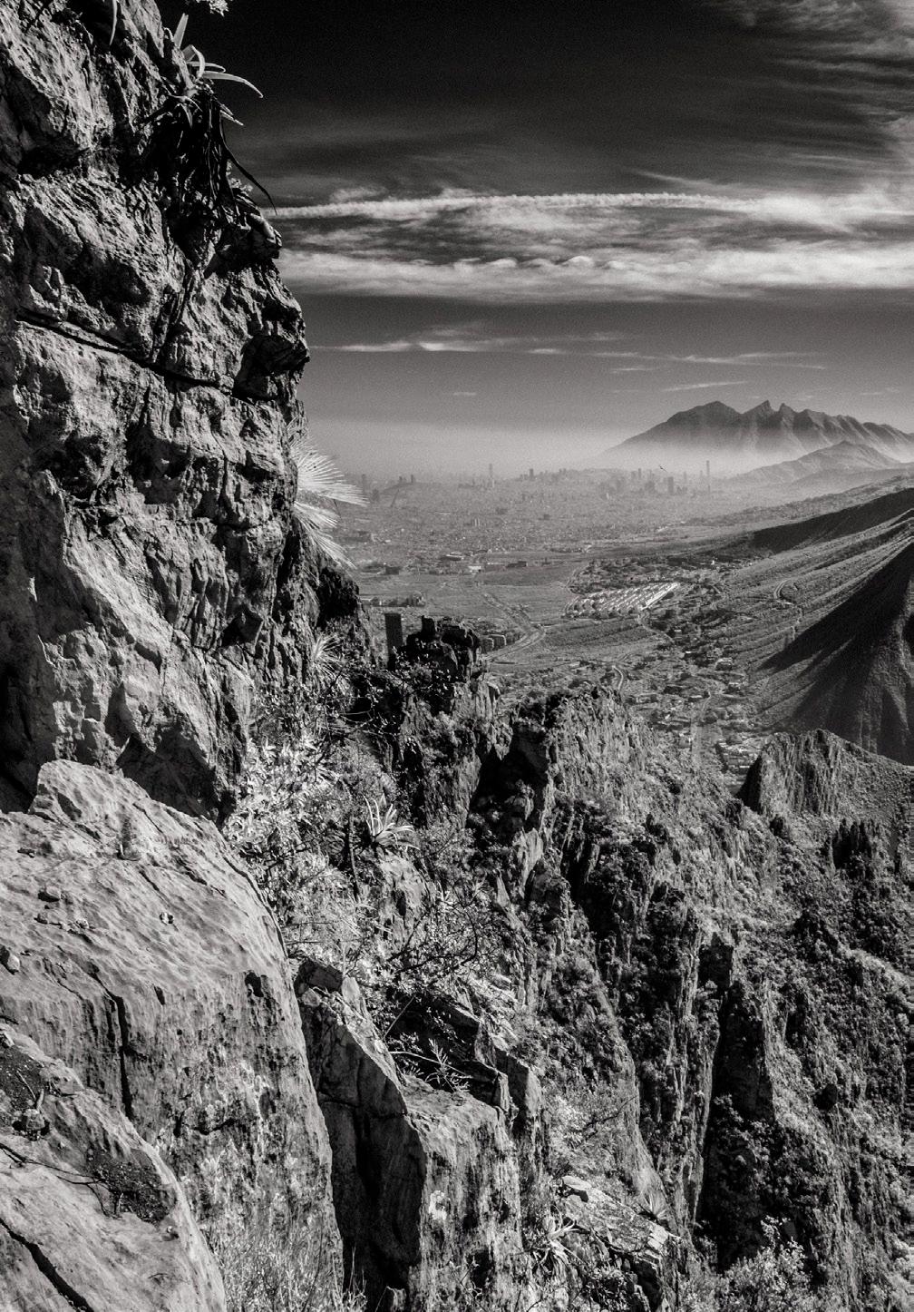
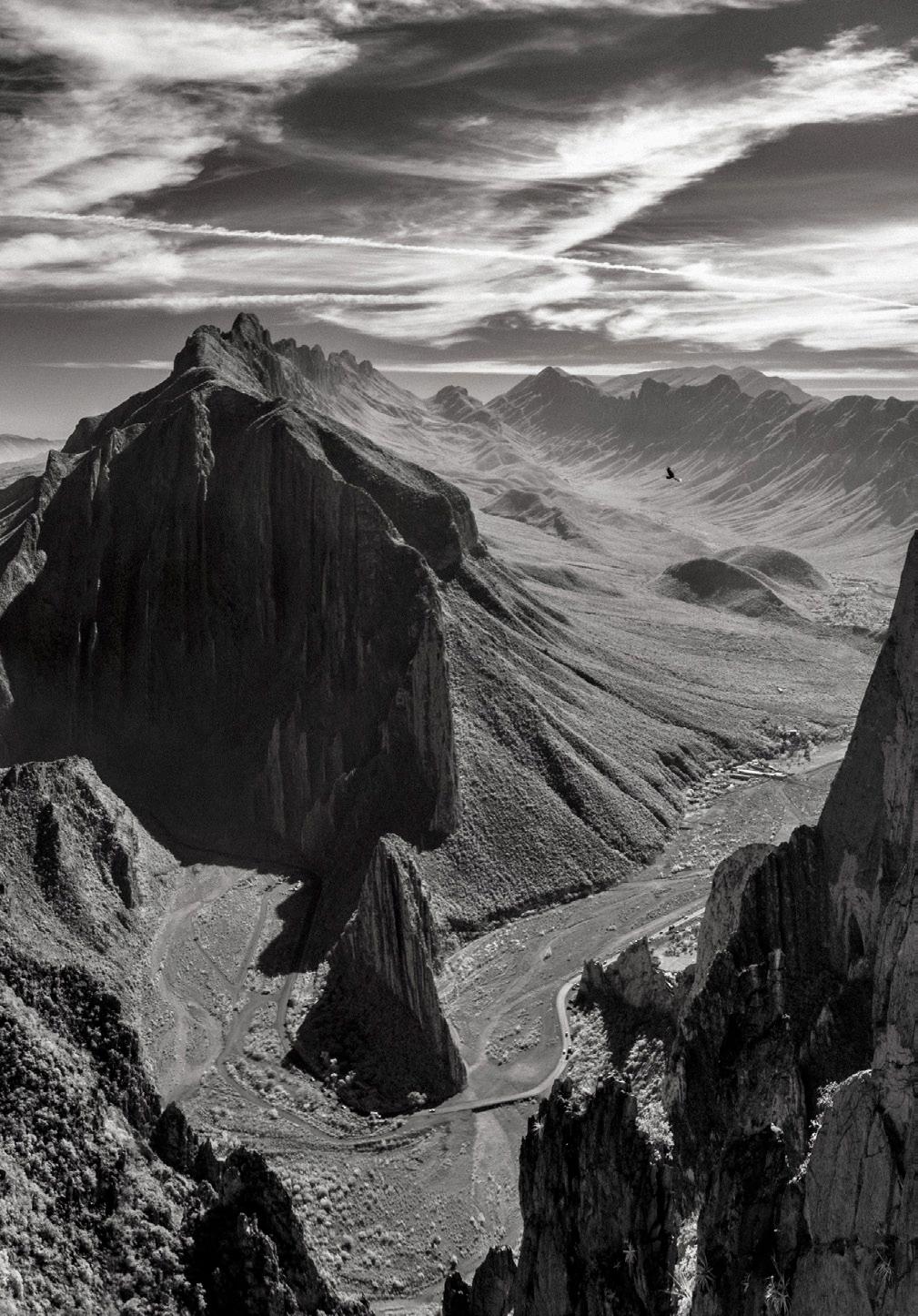
Anne Field
This project reimagines human and hydrological relationships to land in La Huasteca, the entrance to the Parque Nacional Cumbres de Monterrey. The project identifies four key focuses within this national park: water security, flood risk, biodiversity loss, and conflict with human activities. This national park has a significant presence of agriculture and human settlement, often overlaid with flood risk, aquifer recharge zones, and ejido-designated land. Existing agriculture largely consists of livestock grazing and crop cultivation, both of which currently impact erosion, water security, and biodiversity. By thoughtfully engaging with existing conditions, this project aims to foster cultural relationships to the river, increase biodiversity and water security, and mitigate flood risk. This is achieved through a number of applied landscape typologies, including the incorporation of culturally significant plants and the introduction of ecological, water-centric agricultural and land management practices. To preserve the character of the park, the proposed interventions work with existing site topography as much as possible.
The proposed interventions consist of four main strategies. First, the creation of an expanded riverbed with a vegetated riparian buffer and overflow channels helps manage flood events and create recreational value, allowing spaces for water activities during the rainy season. These channels distribute floodwaters throughout the floodplain, reducing the destructive force of water, while a renewed riparian buffer increases biodiversity value. Secondly, a new circulation system separates cyclists from vehicular traffic – this system
minimizes collisions and meanders alongside water channels, providing key views and recreational value. Thirdly, a terraced agricultural system is introduced: this increases aquifer recharge by slowing and capturing water in key recharge zones, and enhances existing agricultural ejido practices. The incorporation of agroforestry methods such as intercropping increases ecological and agricultural value, and works with rotational grazing for crop rotation, soil regeneration, and vegetation management. Finally, a series of re-vegetation buffers are introduced: in this system, sediment and water are trapped behind stone buffer strips that follow contour lines. Combined with planting and rotational grazing for seed dispersal and soil formation, this system encourages re-vegetation of the floodplain, reduces flood loads by slowing and distributing water, and increases aquifer recharge. Throughout these strategies, plants are selected by examining existing cultural connections to plant species, as well as endangered species and those with regenerative and biodiversity value. Through these actions, “Cumbres de Monterrey: Rewilding for a Hydro-Social Commons” reimagines relationships to water, agriculture, and biodiversity in the Parque Nacional Cumbres de Monterrey, fostering conservation and restoration of both ecology and livelihoods.
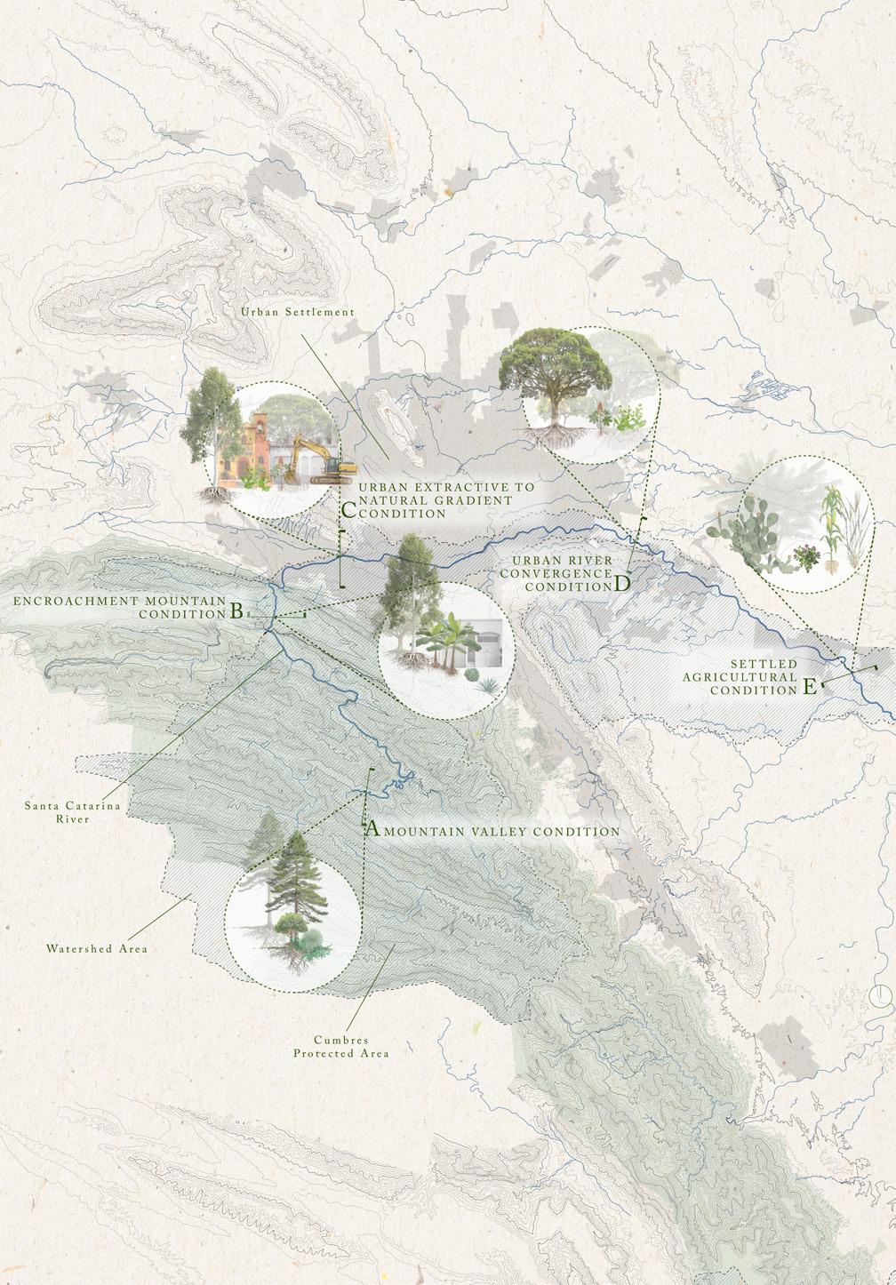
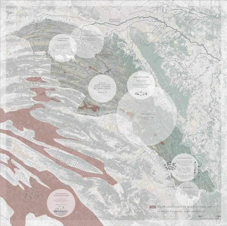
Top: Analysis of agricultural activities within and adjacent to the Parque Nacional Cumbres de Monterrey
Right: Plan view of site analysis, including locations where settlement, ejido-designated land, and aquifer recharge zones overlap
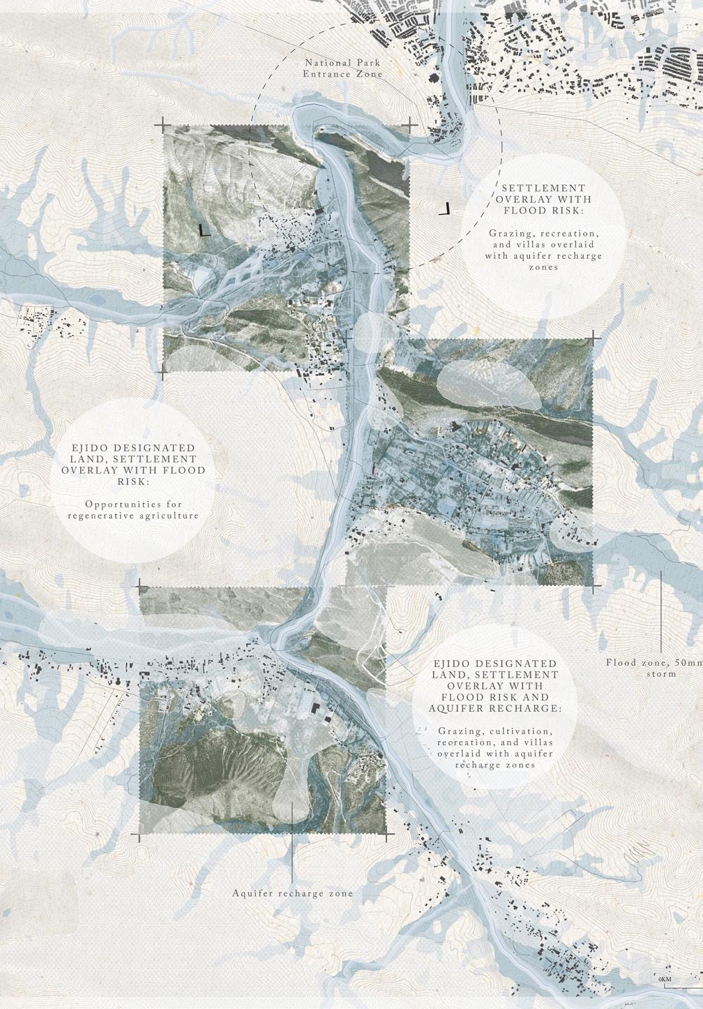
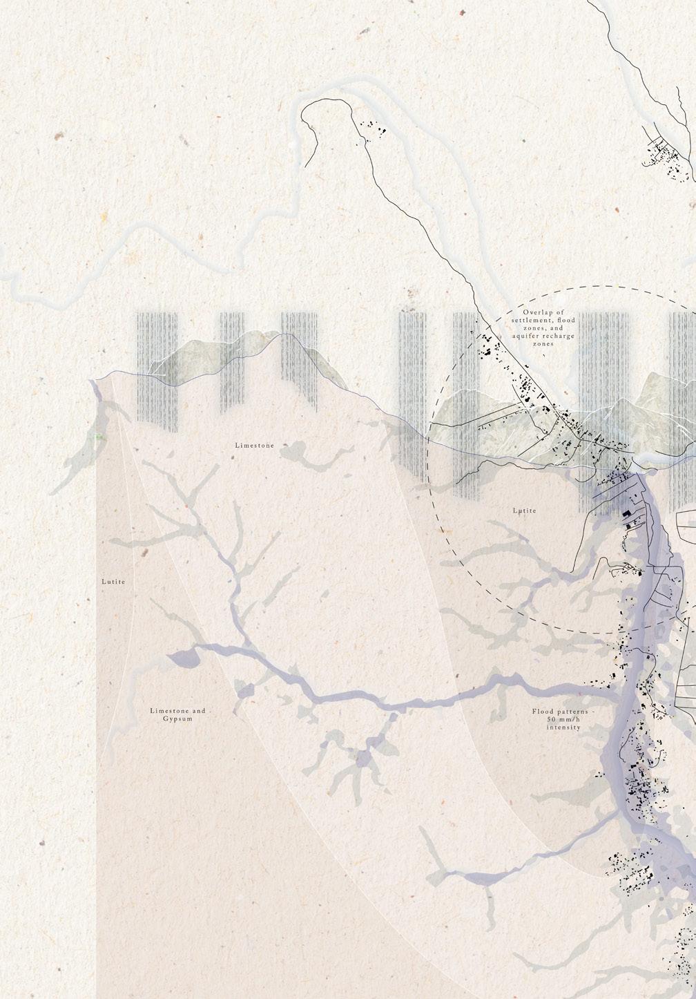
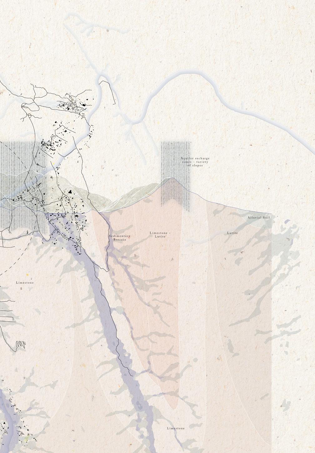
Plan-sectional analysis of river flood zones for a 50mm/h storm, deep geology, settlement patterns, and aquifer recharge zones. This study demonstrated the overlap of all three, and the presence of aquifer recharge zones across high, medium and low sloped areas.
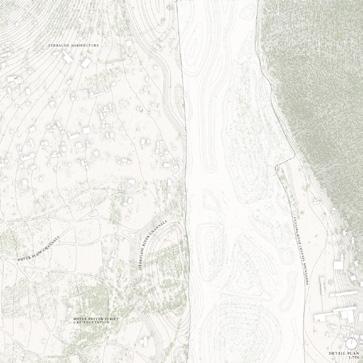
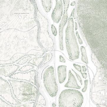
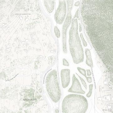
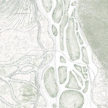
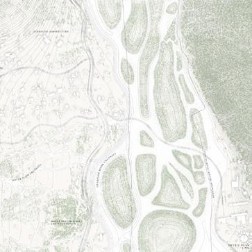
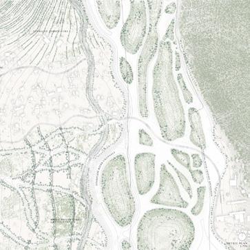
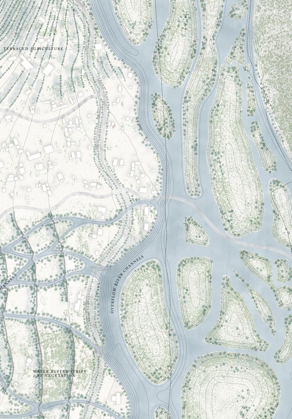


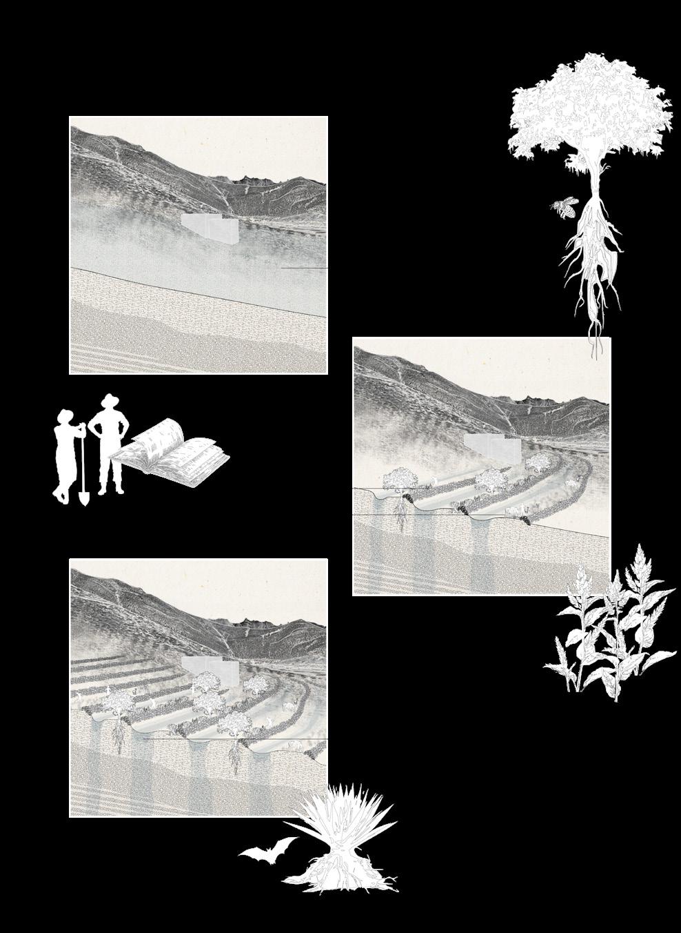
Following Pages: Section perspectives of site interventions, including selected plant species and their socio-ecological relationships.


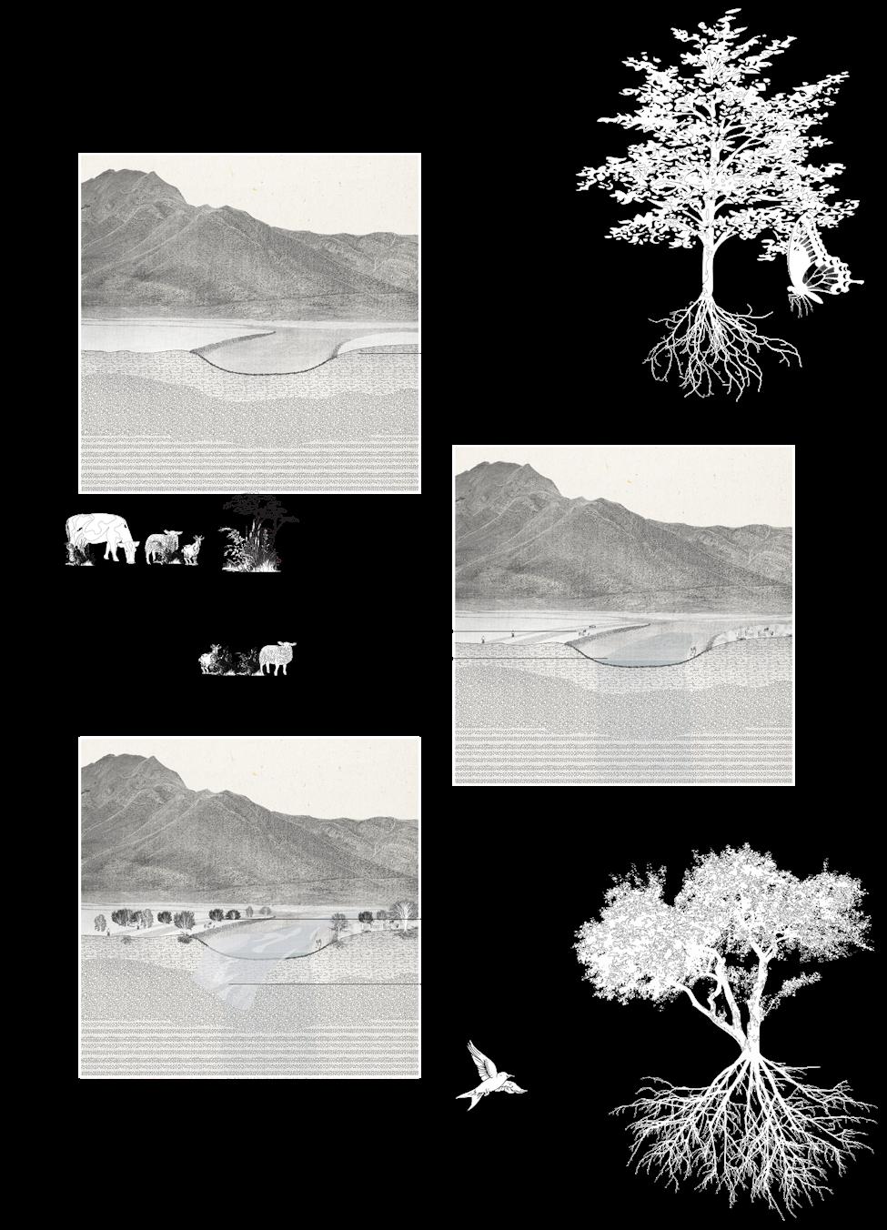


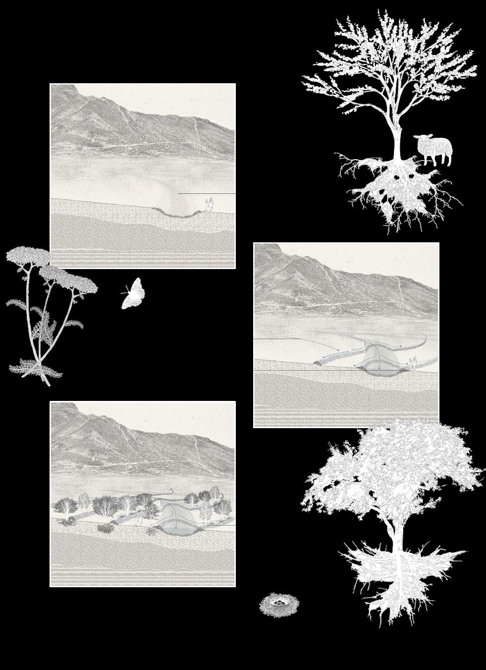

Emily Menard
Imagining reciprocal and regenerative futures for the Río Santa Catarina requires starting in the Sierra Madre Oriental mountain range along the many canyons of the Cumbres National Park. It is here where Monterrey’s regional aquifer is recharged, and where hundreds of water tributaries gather and burst during extreme rain events before entering the Monterrey’s urbanized metropolis.
This design proposal offers an ecologically and livelihood sensitive investment in reciprocal futures between Monterrey and its mountainous “headwater” ecologies. It creates pathways for recovering indigenous practices that were once prominent and that were based on a deep understanding of geology, slope, and nature. In doing so, “Reciprocal futures” designs a vision for a cultural landscape that protects and regenerates the riparian corridor and its aquifer, promoting the park ecosystem services and livelihood resilience for its ejido communities. Different design strategies achieve this vision by seeking reciprocity between cultivation and land management in a manner promoting water and park conservation.
Within the 178,000 hectares that comprise the Cumbres de Monterrey National Park, this project selects La Huasteca Canyon for its cultural importance as well as its monumental aesthetical beauty. During the rainy season the Río Santa Catarina enters Monterrey’s urban fabric through this canyon in opposite direction to those visiting the park. This strategic site, with its highly visible iconic limestone rocks is a monument to the regiomontanos’ relationship with its surrounding
mountain ecologies and its water cycle. It is also a site of tremendous virulence and destruction during extreme rain events. Its hydrological performance is diminished by illegal settlement encroachment that promotes deforestation, carbon emissions and biodiversity loss. In tandem, current unsustainable agricultural practices consume vast amounts of water while diminishing aquifer recharge.
In response “Reciprocal futures” strengthens this monumental iconography by regenerating and making legible the invisible riparian corridor of the Río Santa Catarina along the linear Huasteca Canyon. It promotes a more reciprocal and symbiotic interaction between the park and its ejidal communities. The project envisions a future where, as plant nuclei spread and as the water table eventually rises, the shape and character of this productive ecosystem will change. If we protect the upstream landscape of the Río Santa Catarina from unsustainable land use conversion and encroachment, and create reciprocal ecological-livelihood relationships, the riverine landscape will have an opportunity to live, grow and breathe with the movement of the river, supporting the ecological resilience of the broader metropolitan region.
Right: An exploration of territory and management overtime in the Sierra Madres Oriental mountain range. Once part of fluid Indigenous land, it is now under both federal, private, and communal management.


Left: Master plan
Top: A series of detail plans that illustrate six different spatial solutions grounded in Indigenous knowledge and where they occur on site.
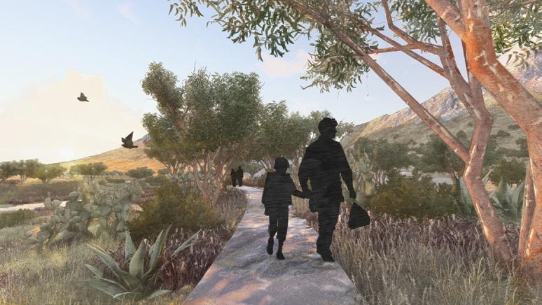
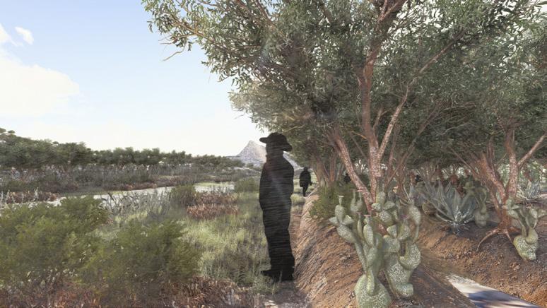
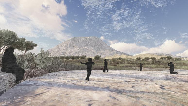
Christopher Lucas Dobbin
Monterrey has two major challenges with water: either there is not enough of it, or there is far too much. Flooding has long been a part of the city’s stigma. It is largely invisible for most of the year, but always looms as the rainy season approaches. For most of the twentieth century, Monterrey’s citizens feared the deathly toll and destructive nature of hurricanes, but today they celebrate their majestic floods as the only way to refill emptied reservoirs. But this is a high water-bill to pay. “Erasing the Line” explores the potential of the riverbed and its margins as a strategic site for urban flood mitigation and river regeneration. The project pursues security not through infrastructural control, but by engaging and giving room to the dynamic fluctuations of the river in its riskiest urban site, the urban mouth of the Cumbres de Monterrey National Park.
“Erasing the Line” incorporates the existing 2004 Rompepicos spike dam, as well as two additional spike dams that were proposed in October 2023. While these dams intend to reduce peak flow of water during extreme rain events, experts are concerned that the artificial sense of broader security that they provide masks the possibility of further urban encroachment on the riverbed.
A broader incognita of what it means to seek security in the face of risks from hybrid natural-engineered systems, such as urban rivers, requires a more comprehensive view of mechanisms for increasing room and visibility for the river’s natural processes, while also reducing risk. The project’s goal is to not only mitigate the risk of flooding but also restore the river to a more natural state.
In doing so, “Erasing the line” promises to deliver biodiversity as well as ecological and societal benefits to regiomontanos.
The notion that stable channels and unchanging ecosystems are always desirable is a fundamental misconception that needs rethinking, in Monterrey and elsewhere. Assuming such stability does not align with the river’s natural processes of erosion, sedimentation, and channel migration. This project resolves such challenges through a framework of “Space, Energy, Materiality, and Time”. By embracing the river’s dynamism, working in harmony with it rather than trying to control it, one can create a resilient and secure environment that adapts to seasonal changes and natural events. This project’s shift in approach prioritizes the ecological and social well-being of communities living along the Santa Catarina River, aligning with a sustainable, long-term vision for this metropolitan region. It signifies a commitment to making the river and its processes more visible and reducing risk, seeking security not through control but rather coexistence.
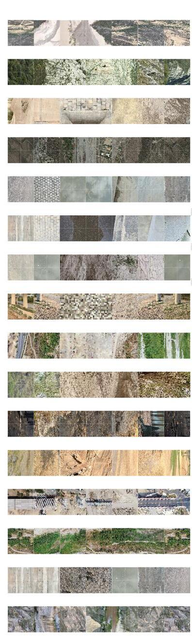


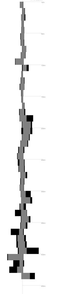
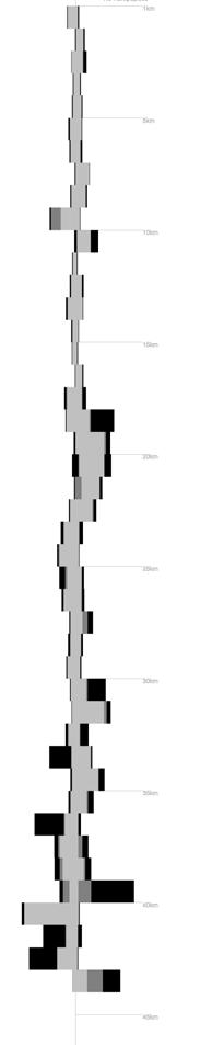
Volume of Water
Rompepicos Dam
Headwaters
Urban Mouth of the Cumbres de Monterrey National Park
Significant Flooding Low Risk Reduction [Project Site]
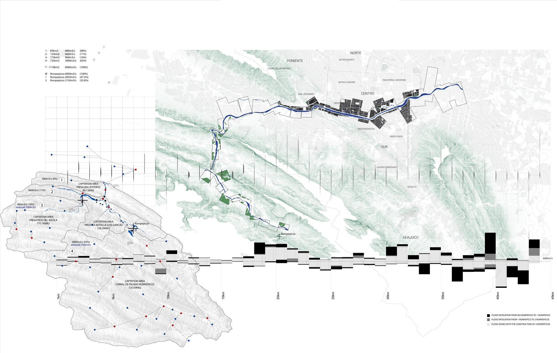
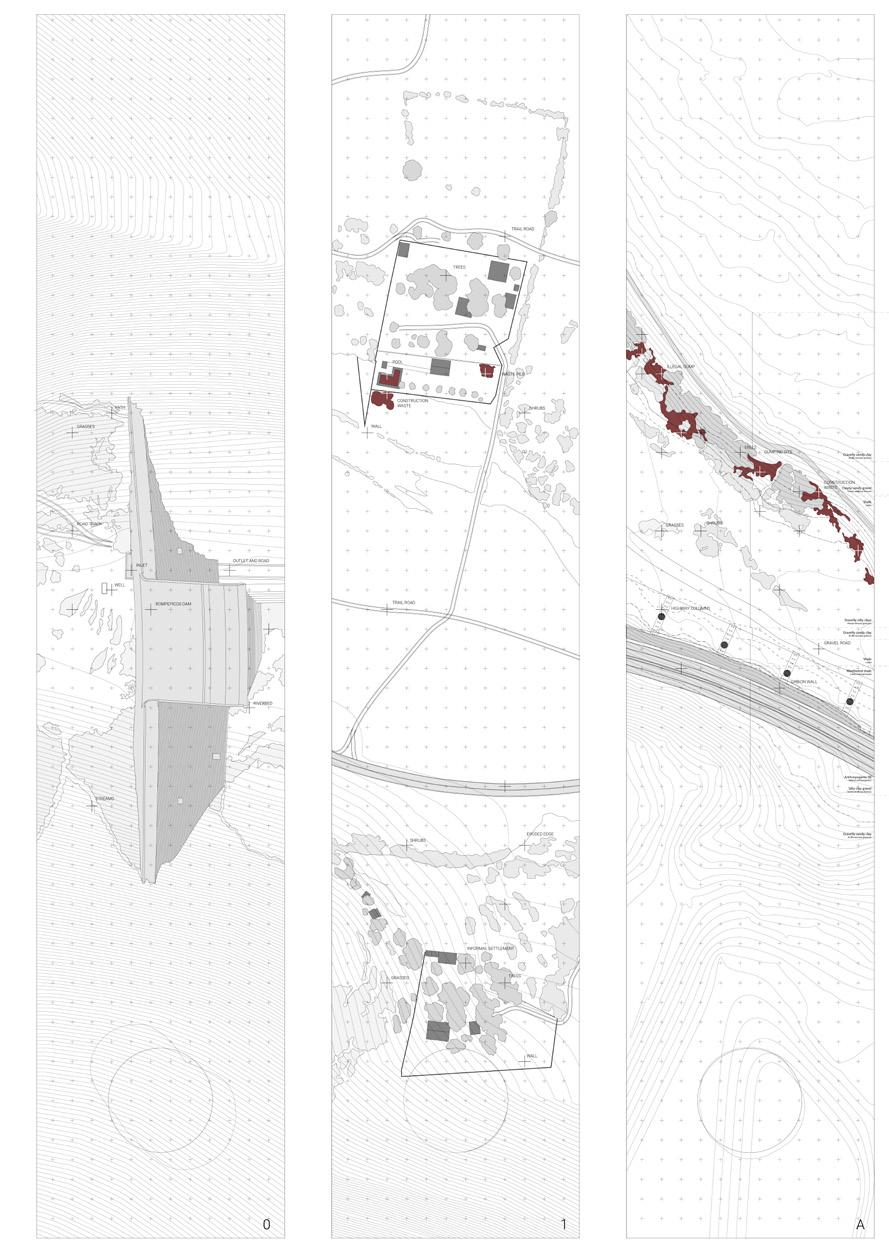
Analysis of various riverbed and river edge conditions at six sites along the Río Santa Catarina, identifying potential risk areas and sites of intervention
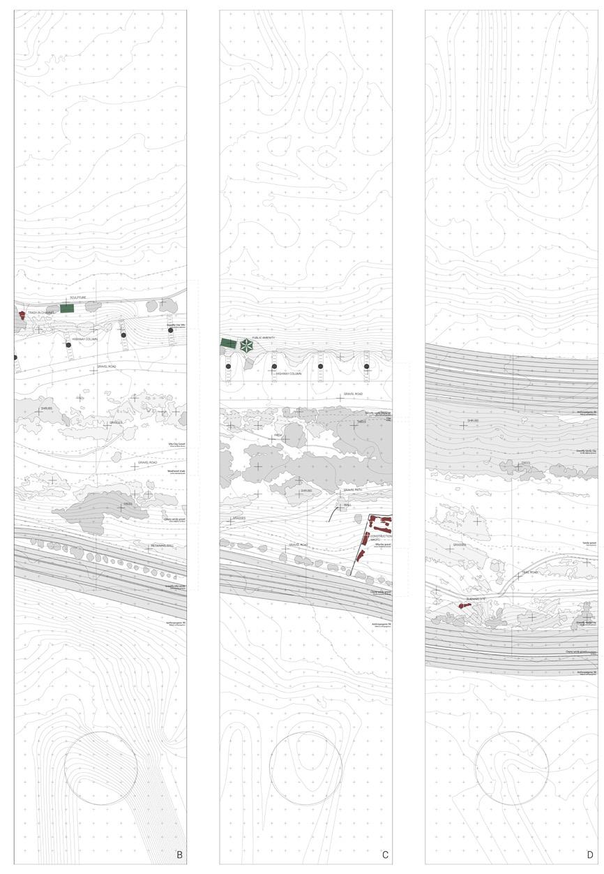
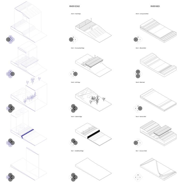
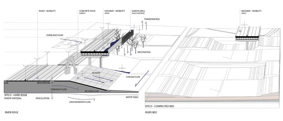
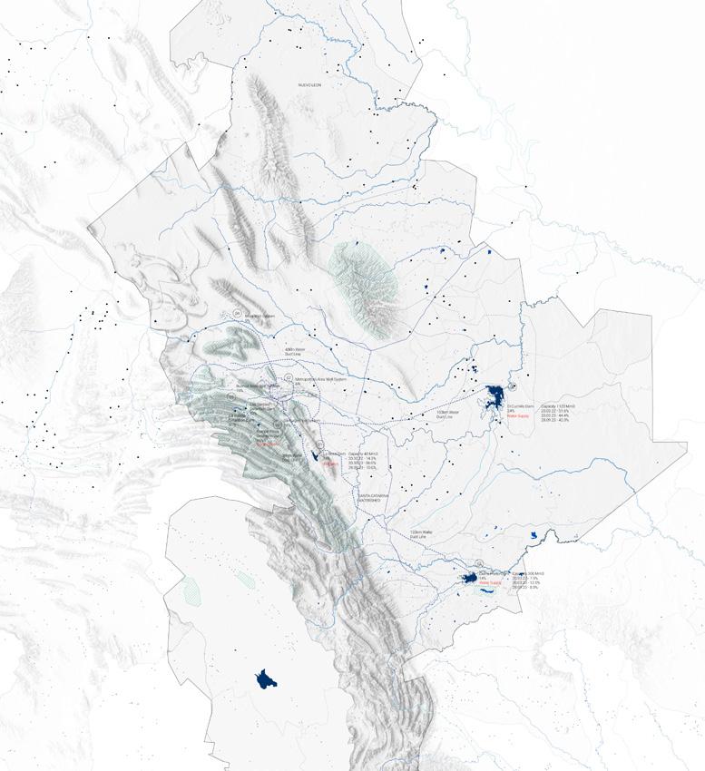
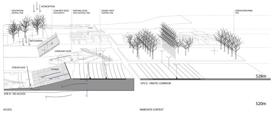
Impervious Surfaces
Disconnected Capillaries
Sierra Madre Institute
ASFM Elementary
American Consulate
Elevated Highway Encroachment
Informal Settlements within the Riverbed Industrial Corridor High Pollution Risk
Narrowing of River
Site plan of existing conditions and proposed modifications using the proposed framework of time, space, energy and material
Repurpose Lots
Restore Infiltration in the Capillaries
Raise Grade at Edges
Create Room for the River
Relocate and Design Floodable program
Reduce Energy/ Velocity
Protect Communities Prevent Industrial Pollution
Reroute Heavy Traffic
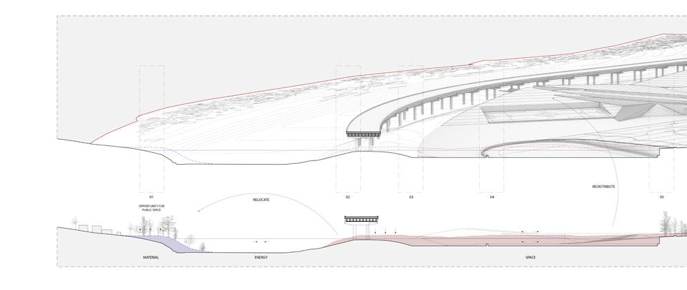
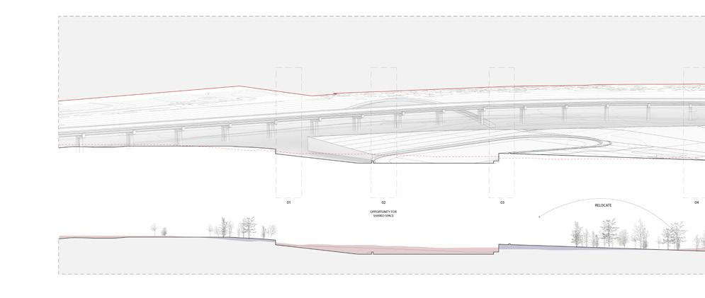
Site sections showing the processes of cut and fill which allow for more room for the river and the potential for social spaces
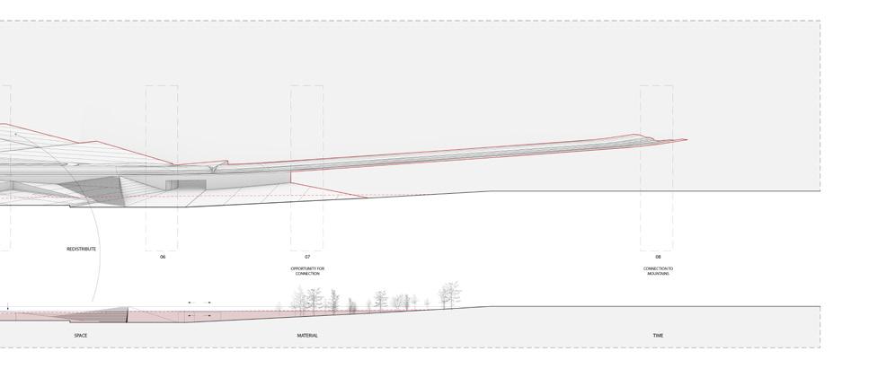
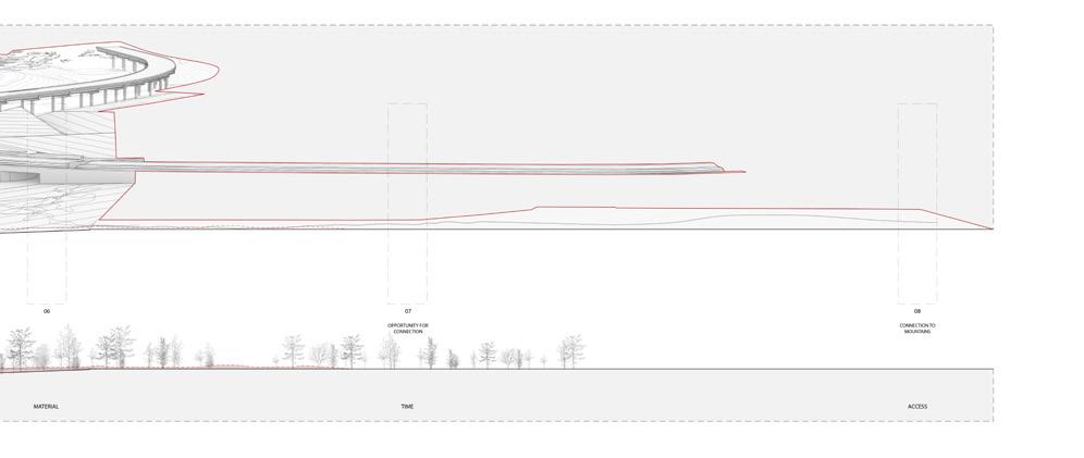
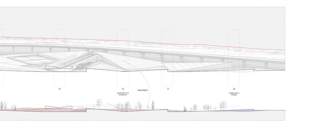
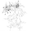


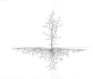


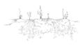


Section cut investigating the proposed landforming over time, embracing the deposits of silts and sediments into a new landscape
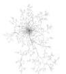


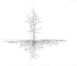

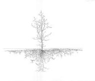


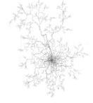


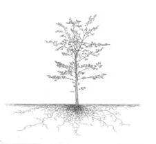


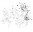


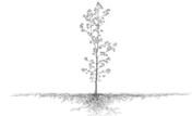


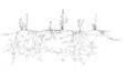

Manaka Hataoka
Monterrey is an industrial city where its productivity relies on water. As the city continuously invites manufacturing companies while being challenged by increased climate risk, the use of groundwater has expanded over the past few decades. Coupled with the pattern of land-use development that is little concerned with ecological metabolism, Monterrey’s current mode of industry is extremely extractive.
Industrial Aqua aims to alter the hydrologic flow around the industry. The proposed system transforms the water cycle to be more local and adaptive to climate risk. A series of independent infrastructures hybridizing mechanics and nature are weaved into the existing built environment to collectively harvest, modify, and resituate the water.
Among a few industrial districts in Monterrey, the project focuses on an industrial corridor stretching along the valley between Cumbres and Las Mitras. Running along the valley is El Obispo, a channelized waterless river. In addition to the channelized river, the project site is characterized by its high flood vulnerability. The area is situated at the mouth of the extensive alluvial fan of Río Santa Catarina. During a major flood, the water overflows from Santa Catarina, runs across the industrial district, and reaches El Obispo.
The proposal consists of two distinct yet continuous systems. One system operates within the built district, which is defined by industrial buildings and extensive logistic spaces. The proposed intervention includes rainwater collection from the extensive surfaces both on the roof and on the ground, the
water storage system in every parcel and water treatment/navigation channels along the chosen streets.
The second system intervenes within El Obispo. The waterless concrete channel is reimagined as a water treatment corridor for the rainwater/ wastewater released from the first system. The discharged water goes through different devices that modify water through various forces such as aeration, vegetation, sedimentation, and adsorption. The treated water is monitored and then either resupplied to the industries or infiltrated for the aquifer recharge after additional treatment.
Going beyond problem-addressing, Industrial Aqua aspires to be cultural. The intervention responds to and leverages the specific characteristics of the industrial district, spatially, materially, and metabolically. The interventions are brought together to add unique legibility to those existing conditions. Taken together, the project suggests that the collective efforts of industries can generate significant and systematic changes in hydrology while shaping the distinct and more ecological landscape of industries.
Right: a deep section illustrating water cycle around the industry in Monterrey. the groundwater is extracted from the aquifer that is defined by limestone, and part of it is embedded in the products to be shipped outside of the region.
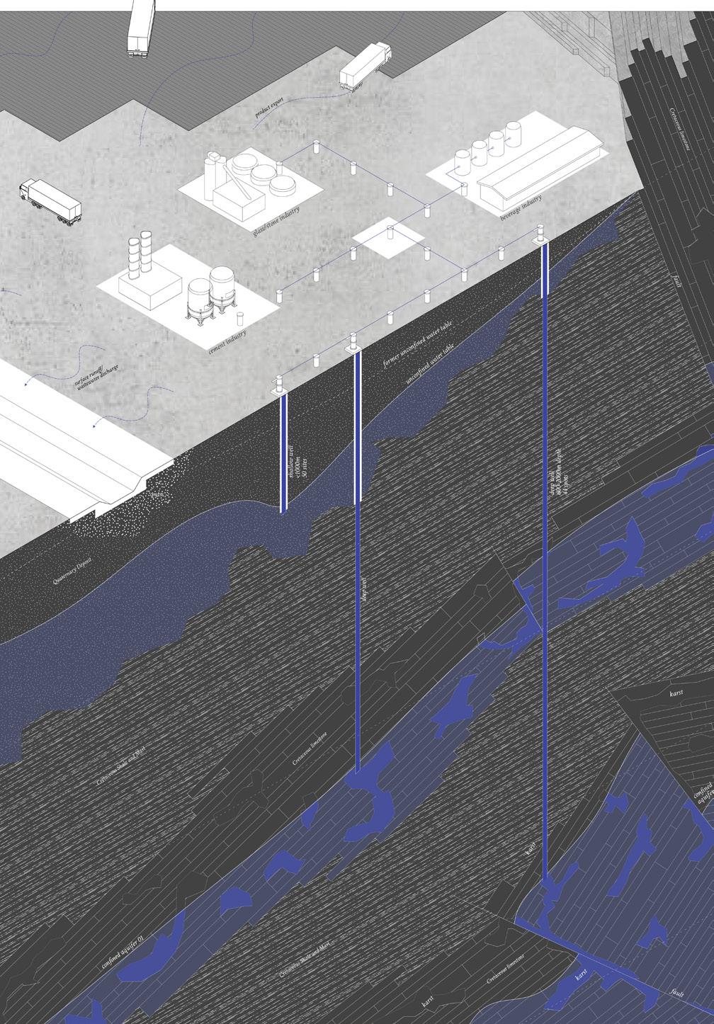
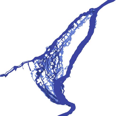
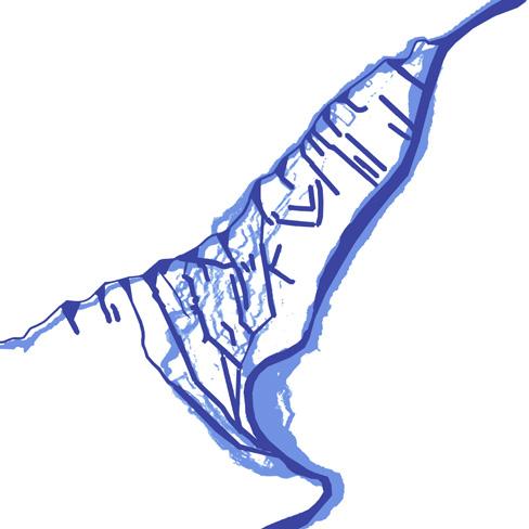
Top: flood risk diagrams, existing and proposed. situated at the mouth of the alluvial fan, the project site is one of the most flood-prone areas in Monterrey. on the proposed diagram, the streets running from Río Santa Catarina toward El Obispo were selected. to be
more adaptive to climate risk, they are proposed to function as canals that guide water toward El Obispo during high precipitation.
Right: a hydrological flowchart showing a series of independent interventions and their networks. the interventions hybridize mechanics and nature to collectively harvest, modify, and resituate both wastewater and rainwater.
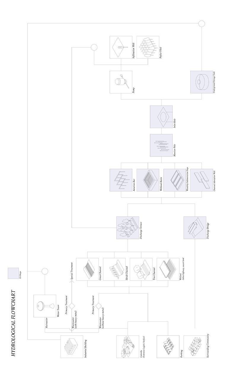
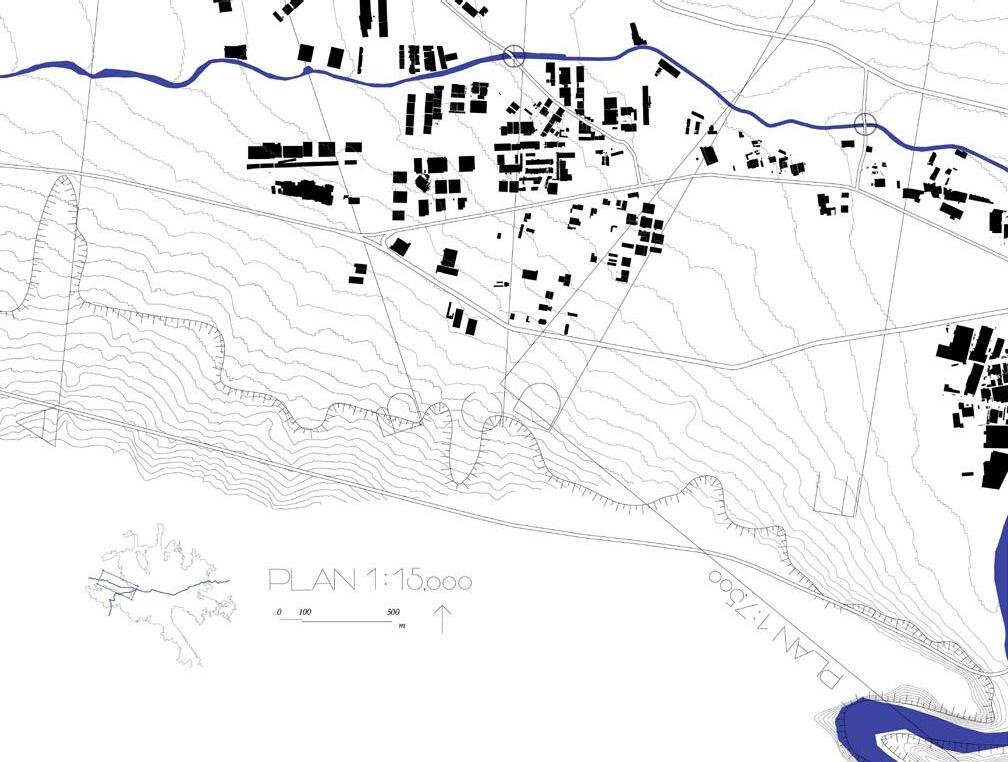
Above: a plan illustrating the industrial corridor stretching along the valley and El Obispo. the site is situated at the mouth of the extensive alluvial fan of Río
Below: a trans-section perspective showing a hydrological relationship between industrial districts, Río Santa Catarina, and groundwater recharge areas.
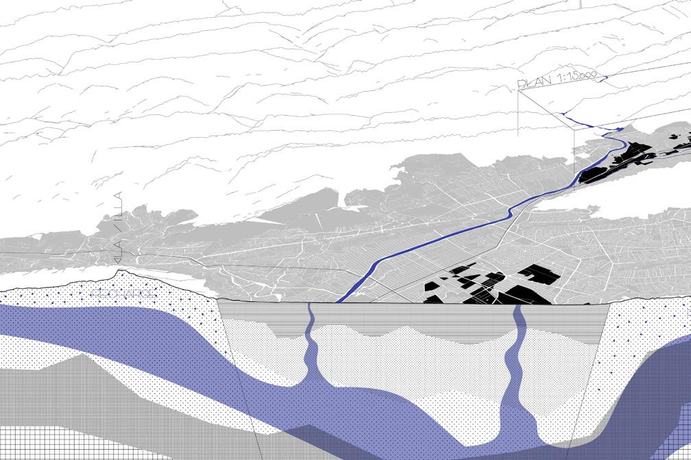
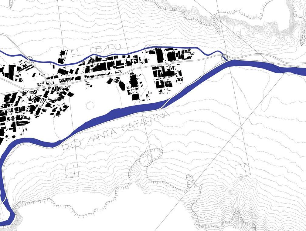
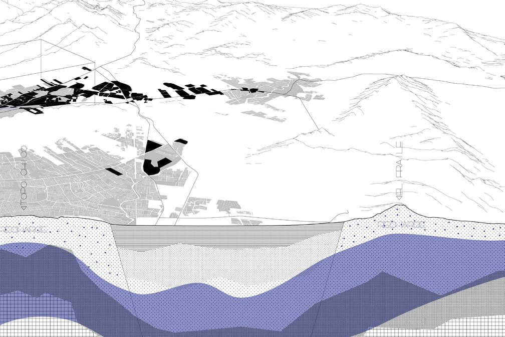
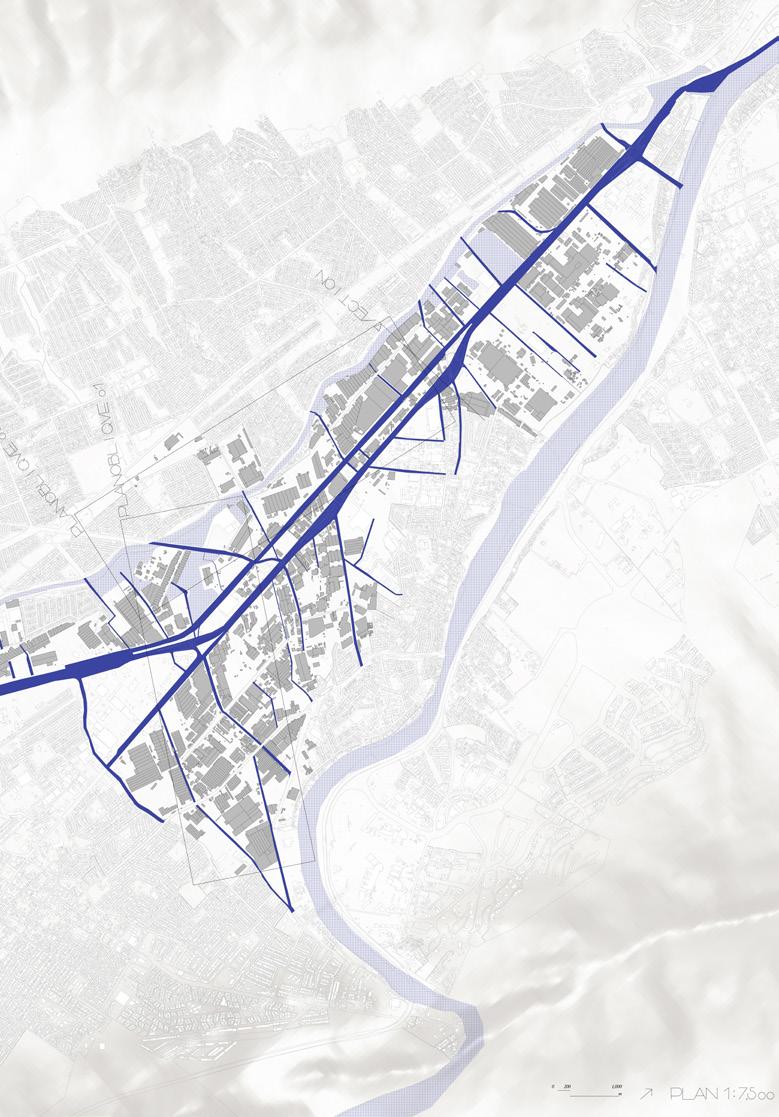
Top: a strategy plan highlighting the streets running from Santa Catarina to El Obispo. a channel system is introduced to the streets to navigate overflow from Santa Catarina, to El Obispo during heavy rain. during normal times, the channels are used for wastewater treatment/navigation
Right: plan obliques showing proposed two distinct yet continuous systems. the above is a system within built district, defined by industrial buildings and extensive logistic spaces. the below is a system around El Obispo. The waterless concrete channel is reimagined as a water treatment corridor for the rainwater/wastewater released from the first system.
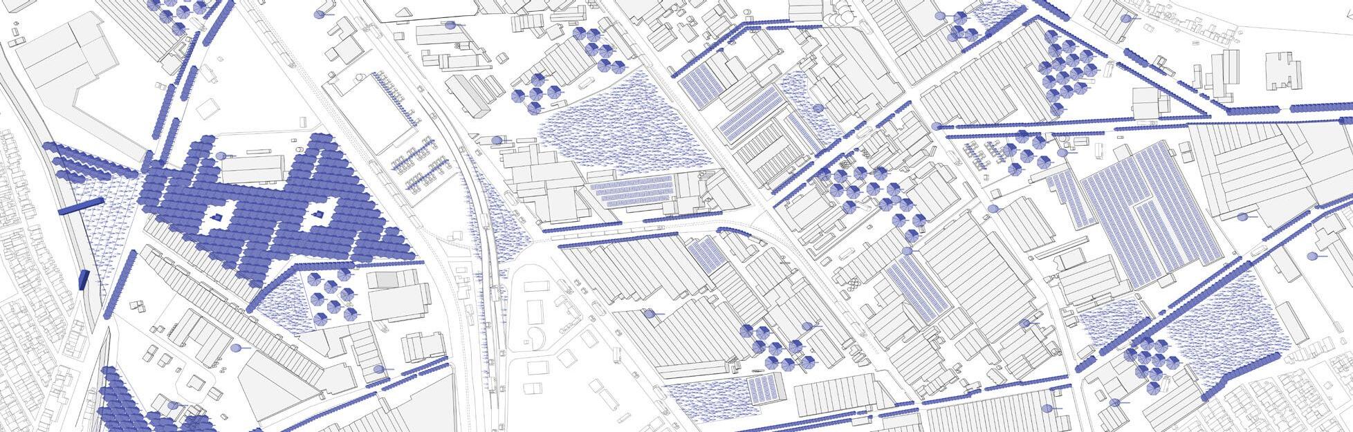
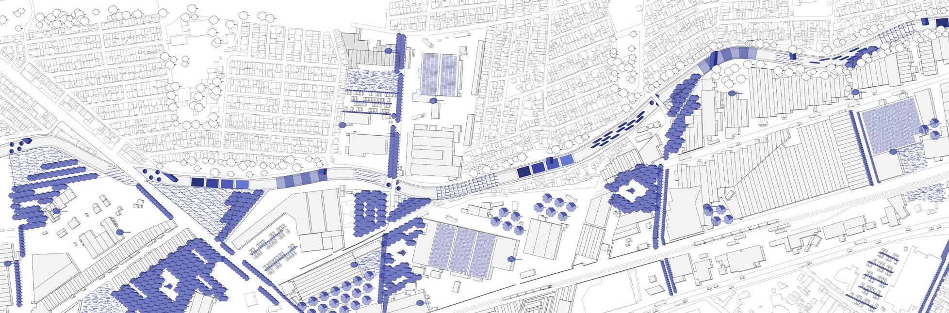
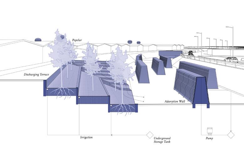
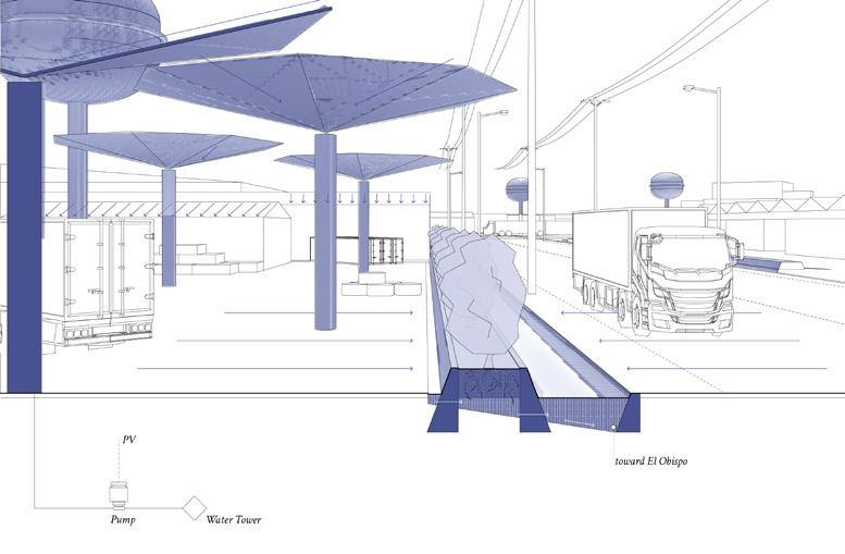
Top: a section perspective cutting through river bank of El Obispo. the interventions illustrated include a “discharge terrace,” “adsorption wall” and “discharge bridge.”
Below: a section perspective cutting through a parcel-street boundary. the interventions illustrated include a “water tower,” “umbrella,” and “shrub channel.”
Right: a series of physical models in 1:200, studying scales and forms of the
interventions. from top to bottom, the models represent an “aeration bar,” “wetland basin,” “woodchip sedimentation steps,” “charcoal adsorption wall,” “discharge bridge,” and “inlet hole.”


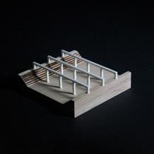


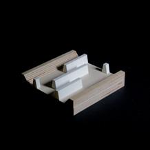


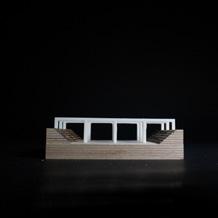
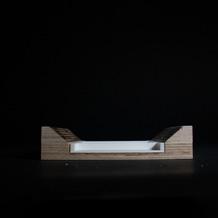

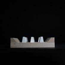

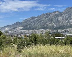
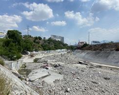
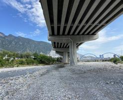
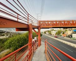
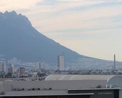
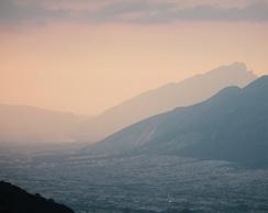
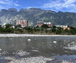
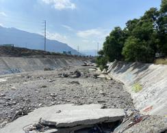
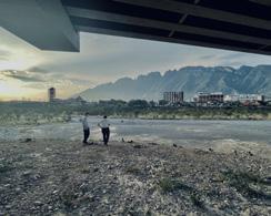
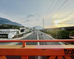
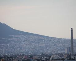
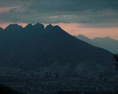
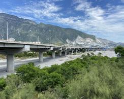
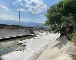
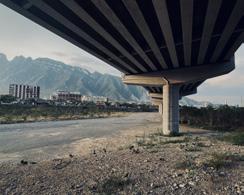
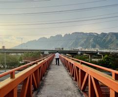
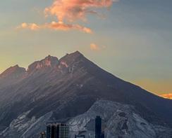
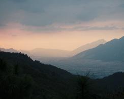
“Cities grow along riversides,” writes Yuvan, “then slowly forget their ecological, hydrological genesis. Later they slowly collapse under their own weight—unless perhaps there is a powerful re-invocation of what birthed a city in the first place: a river.”
Is A River Alive?
Robert Macfarlane
142 A Sublime Scar: Recovering the Lost Interface in Las Mitras
Yuehan Eva Li
154 Regenerating Capillaries: Toward a Blue-Green Network along Awakened Living Hydric Soils
Boya Zhou
164 Obispo, Unbounded: From Pipes to Creeks in Las Mitras
Drummond Poole
174 The Poetics of Circularity: Water, Energy, and Regenerative Industrial Near-Shoring Centralities in Monterrey Sanjana Shiroor
180 Post Industrial Tapestry: Remediating and Visualizing Water Systems within the Industrial Urban Fabric
Markel Uriu
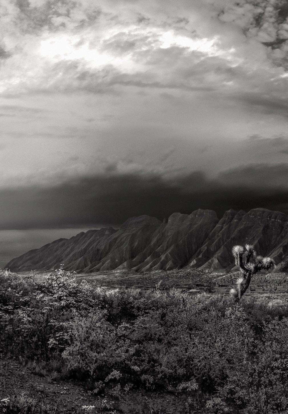
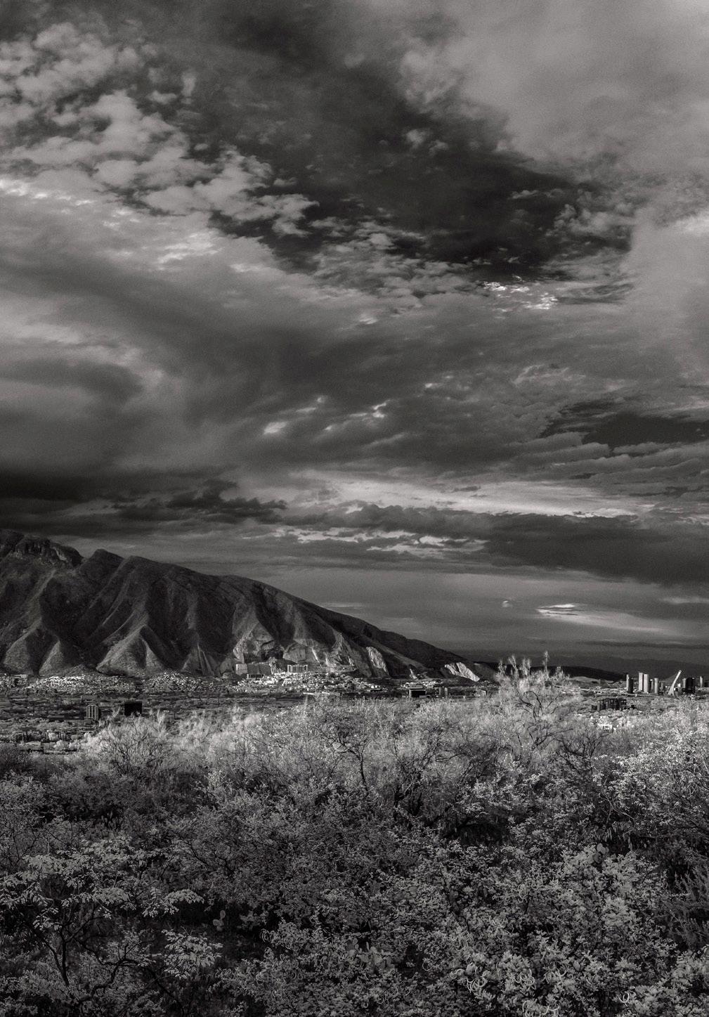
Yuehan Li Eva
Monterrey, the “City of Mountains,” has a storied relationship with water and geology, now altered by industrial booms and urbanization. Once a hydrologically functional landscape, the Río Santa Catarina and Las Mitras mountain have been reshaped into impermeable surfaces. By 2024, the city’s footprint has expanded sevenfold since the 1950s, driven by mining and urban sprawl that eroded natural recharge systems. Las Mitras, once a vital green space and geological treasure, is now scarred by mining and erosion, intensifying drainage issues and degrading ecosystems. Despite its designation as a nature reserve in 2000, continued exploitation of its resources has left irreversible marks.
However, these scars hold the potential for transformation and renewal. The design process reimagines Las Mitras not as a site to be concealed but as a space to inhabit the sublime ruin. Through temporal analysis, the project reveals lost interfaces between mountains, rivers, and the city. Quarry sites are transformed into wetlands for water retention and purification, addressing flooding and pollution. Excavation scars are repurposed into retention basins, while public spaces are designed to educate about the region’s extractive past and foster sustainable water management. The design integrates these systems into Monterrey’s urban fabric, creating a transparent dialogue between human and ecological histories.
This project aims to inhabit the sublime ruin, transforming damage into a catalyst for renewal. By making scars visible, it fosters public respect for the resilience of nature and the vulnerabilities of human intervention.
Las Mitras becomes a model for mountain-water reciprocity, demonstrating how damaged terrains can evolve into thriving ecosystems that balance ecological restoration and community engagement and coexistence with nature.
In 2000, Las Mitras was designated a nature reserve, yet mining persists, compromising natural recharge and drainage systems. Major excavation sites at both ends of the mountain, exploited by private companies like Cemex, have significantly diminished the landscape.
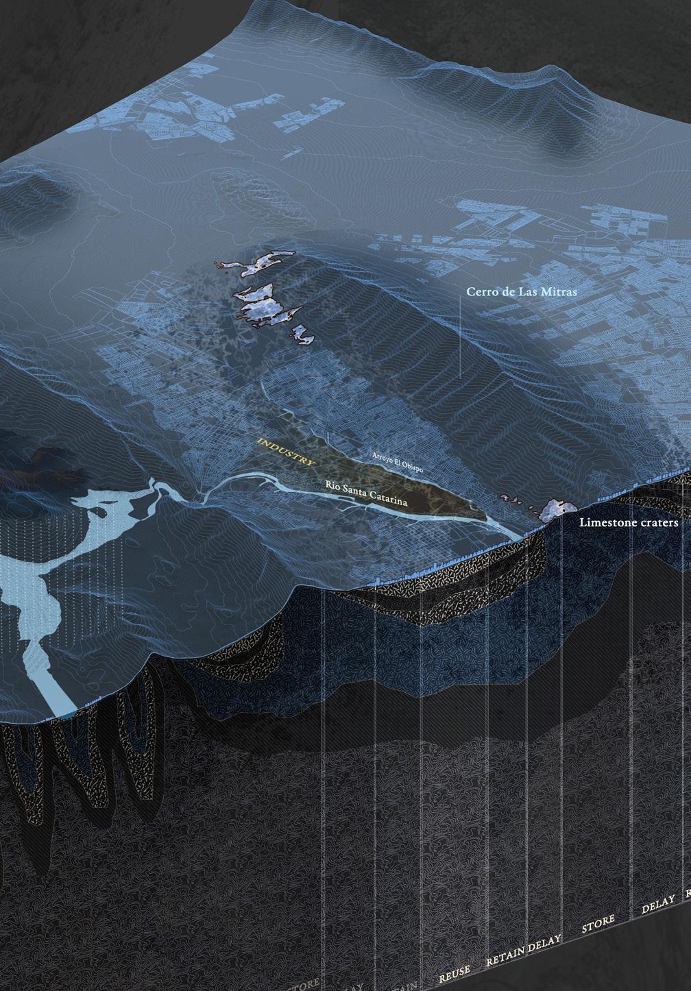
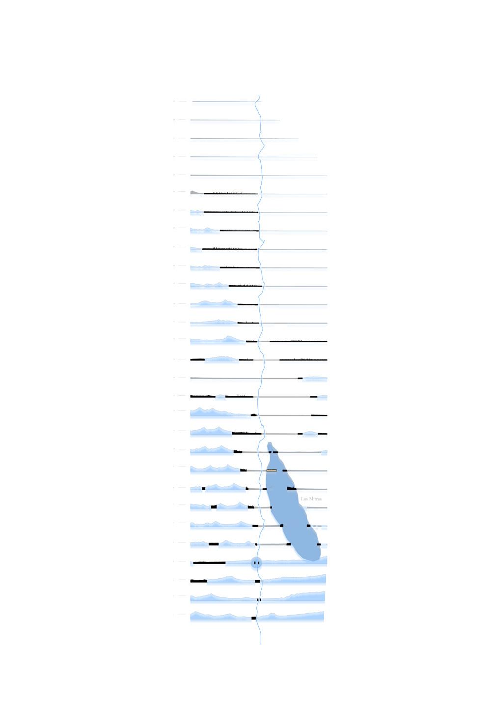
29 sections, reveal the lost interface and the temporal relationship between the mountains, the city, and the Río
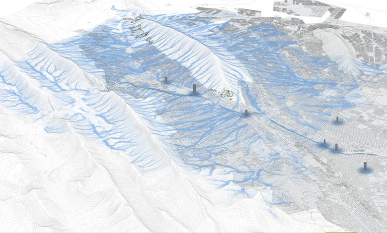
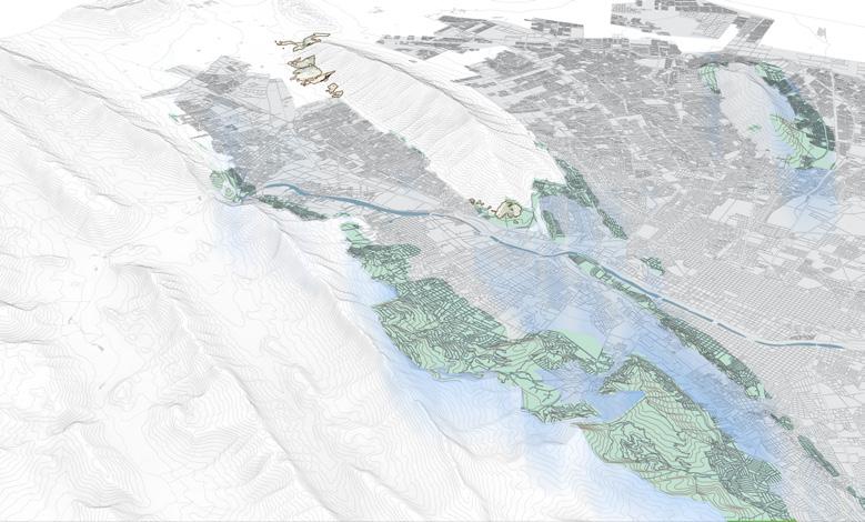
Top: From Mega-Drought to Mega-Flood
Bottom: The lost interface & infilltration zone
During flood season, Las Mitras channels large amounts of water through exposed limestone cliffs into the Río Santa Catarina, carrying pollutants that accumulate and disperse unimpeded. The region’s water should ideally be retained, slowed, and reused, but industrial scars hinder these functions.
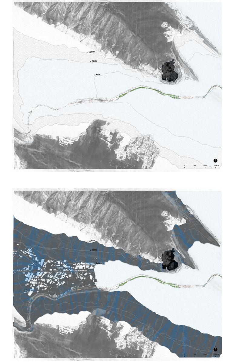
Top: The research process of the most vunerable yet potential interface formed between 0-100m elevation, emphasizing the infiltration zone where should be reutilized protected instead of viral expanded and occupied.
Right: Proposed framework. By repurpose the Las Mitras quarry sites as catalysts for social and environmental renewal,we transform the landscape into a transparent, sustainable space that highlights the native extractive history and remediation
efforts. This initiative aims to retain and purify mountain runoff, easing drainage pressures during flood events while establishing a model of mountain-water reciprocity.
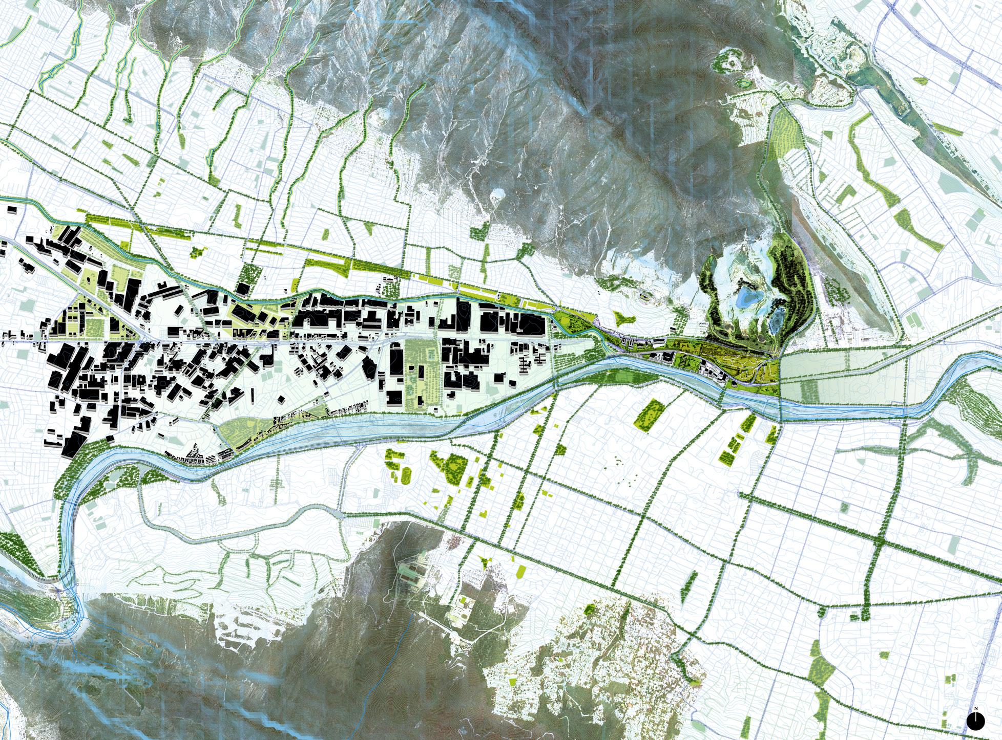
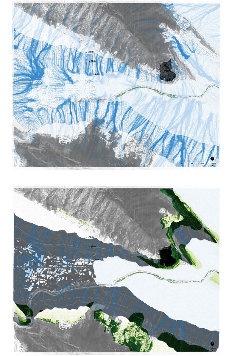
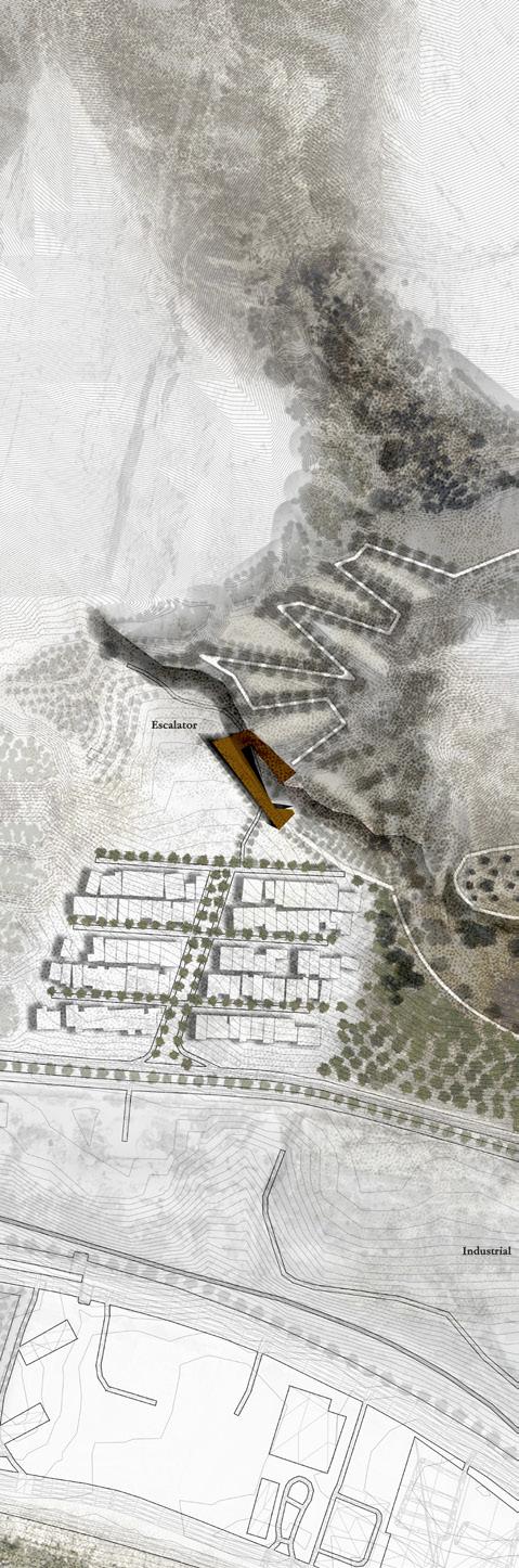
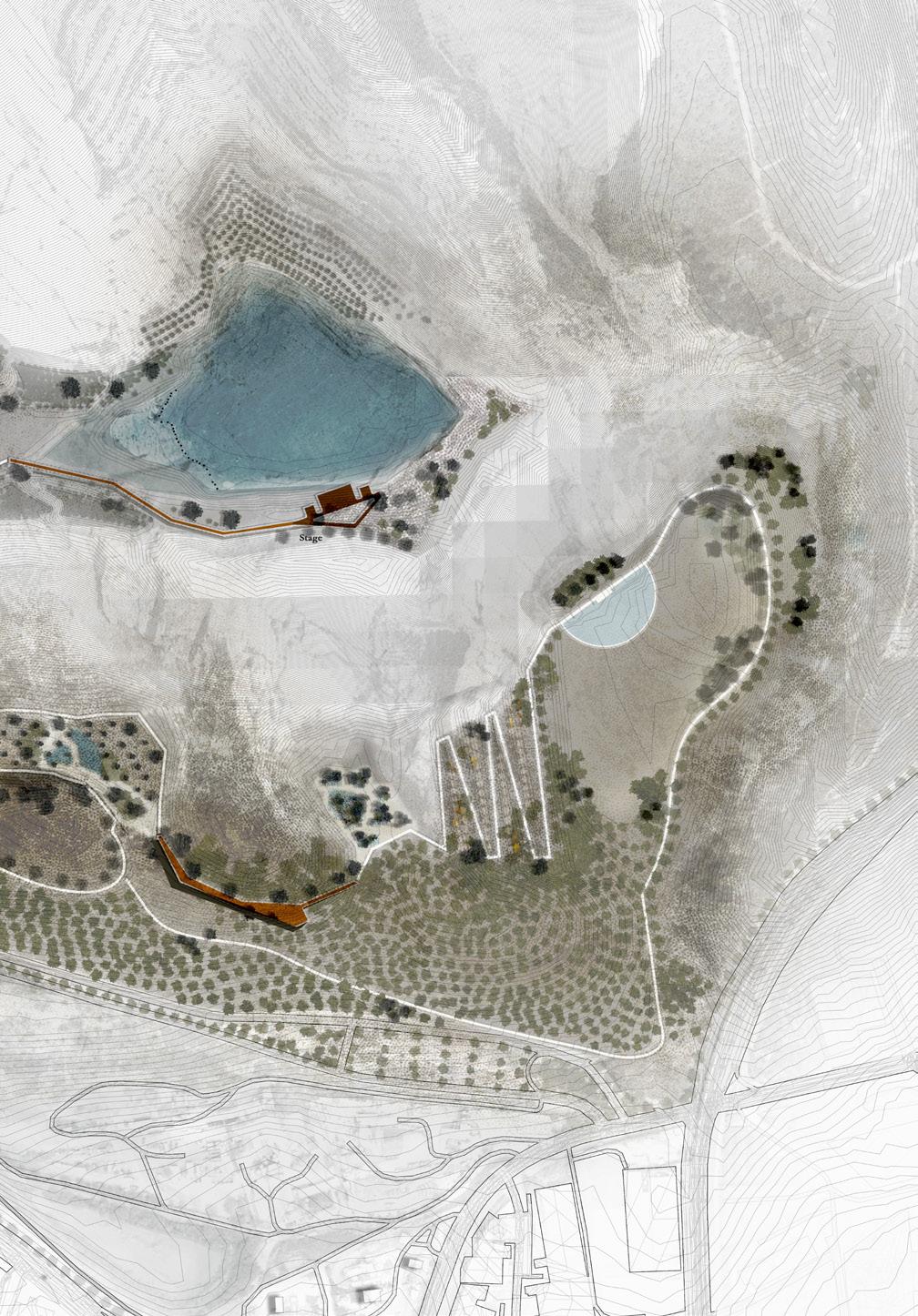
Through a terraced landform, we “roughen” the surface from the mountain to the valley while ensuring accessibility with an 8% slope and necessary escalator, allowing people to engage with different elevations. Rainwater is directed into the main pit as retention pond, while excessive water flows into lower quarries, forming two surface wetlands planted with flood-tolerant native species, temporarily storing varying amounts of water.
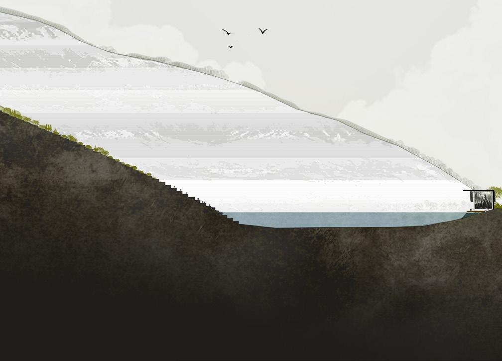
Section-Daytime: This sublime scar will become a stage for the city. Cross-sections illustrate maximum water levels and the relationship between the upper and lower quarries pits and their flood operations. The higher exposed cliff will be re-vegetated, and lower terraces can serve as seating for an amphitheater.
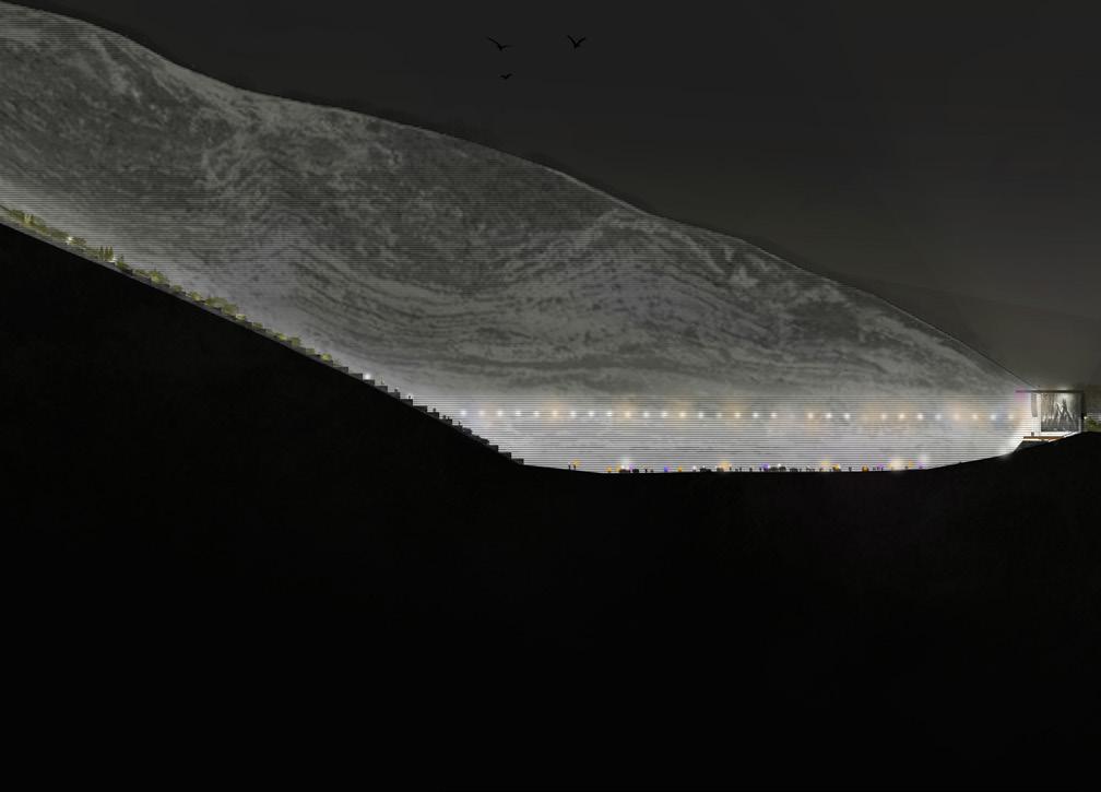
Section-Nighttime: At night, lighting celebrates the new connection between the mountains and the river, creating new memories for people. This sublime vision is a tribute to the city along with its extractive history.
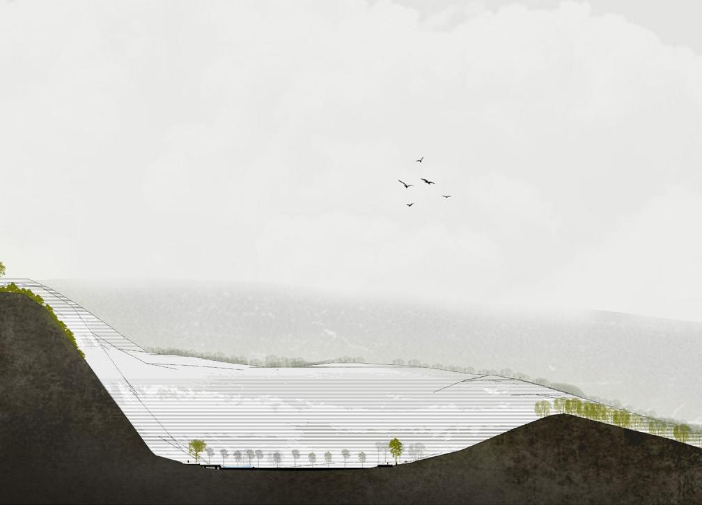
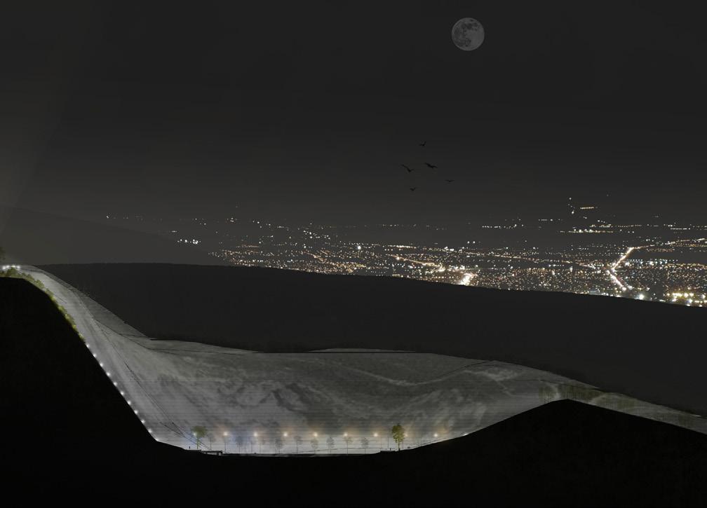
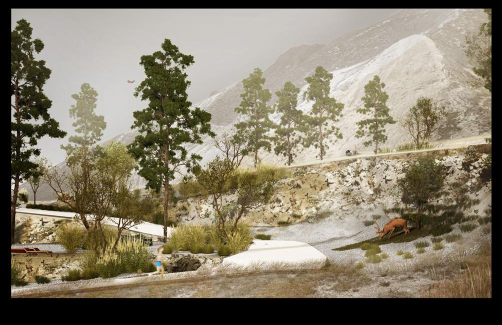

Will the rain-season reservoirs become a new urban water playground?
Boya Zhou
“Regenerating capillaries” proposes to recover a lost hydrological bluenetwork of capillaries in Monterrey’s metropolis, to enhance biodiversity and aquifer recharge while reducing heat island and flood risk. This network of tributaries, streams, creeks, and ravines that eventually feed into the Río Santa Catarina would, if implemented, offer an alternative systems approach to flood and heat reduction, reducing our dependency on big engineered infrastructural works.
One large Rompepicos dam has already been built in the Cumbres de Monterrey National Park to mitigate catastrophic flooding during extreme rain events, and two more similar dams are already proposed. Yet the effect of runoff flows from Las Mitras and La Silla mountainsides remain neglected. Runoff impacts have been exacerbated by the infinite urbanization of its middle and upper slopes, systematically encroaching on existing streams and ravines. The project reimagines the space for water from a single channelized line to a living network of capillaries, managing the water cycle integrally along Monterrey’s urban watershed. This shift introduces radical benefits of risk resilience, ecological wellbeing, thermal comfort, and enhances legibility and sensibility for urban natural systems.
Capillaries act horizontally and vertically. Horizontally, they establish continuity for human and non-human species, serving as symbiotic corridors while reducing heat island and delaying floods downstream. Vertically, capillaries act as spaces of infiltration, supporting living soils, providing a “sink” for carbon, and offering additional opportunities for aquifer recharge.
“Regenerating capillaries” provides an ecological and infrastructural network to be cared for and managed in sensitive ways. This means integrating these networks with existing water surfaces and underground drainage networks to increase hydrological performance. Capillary water acts differently according to slope and soil profile. Vertically, the capillary network consists of three layers that need to be carefully considered: 1) a berm system and drainage network, 2) trails and public space that enhance spaces of vegetation and provide buffers against additional settlement encroachment; and 3) spaces for seasonally specific opening water pooling.
By using a palette of interventions that rely on a gradient of recycled materials, planting patterns and landscape programs that reflect the transition from largely natural upper slopes to urban paved slopes, the capillary network becomes a legible system of climatic resilience in the urban landscape. At its core, “Regenerating capillaries” is a symbiotic corridor for runoff, while also creating urban ecological amenities for both recreation and wild-life habitation.
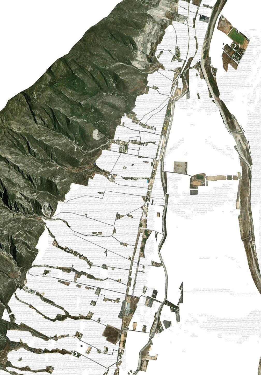
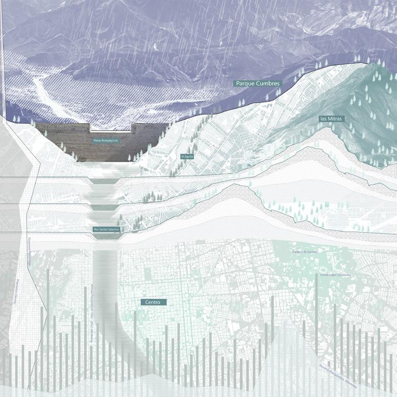
whowing the river and its relationship to the city and topography
showing water infiltration
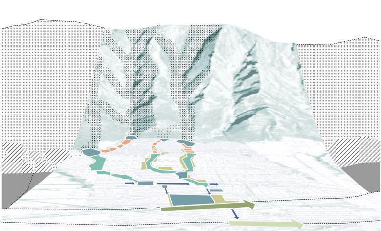


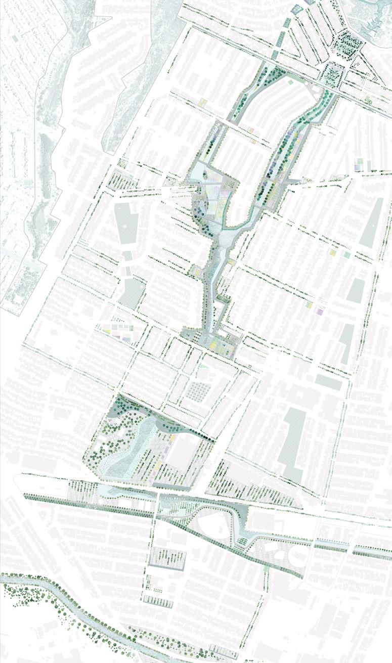
Previous spread: The capillaries for water are interpreted with diverse programs such as sports, events and reducing urban heat island.
and nonhuman symbiosis
Top: Earth digging, compressing and re-filling for berms and waterways. Diverse vegetation typologies, programs and recycled materials are introduced.
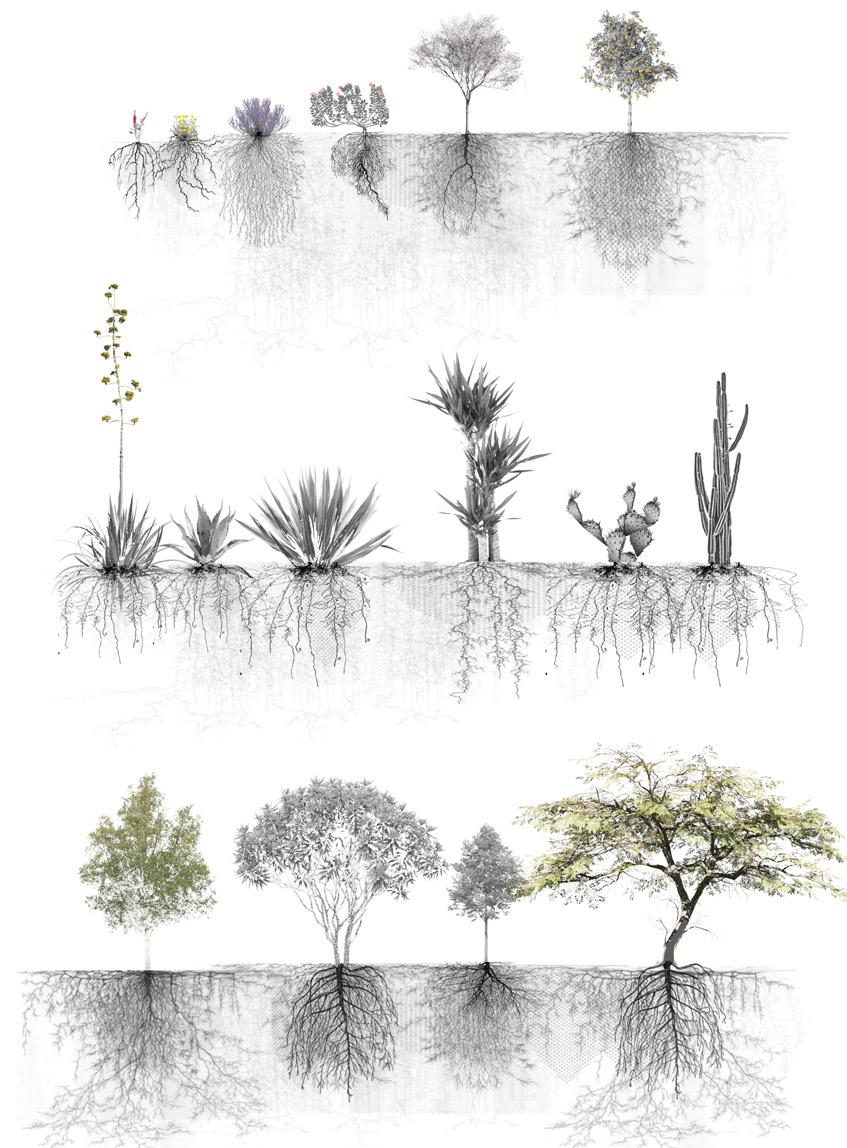
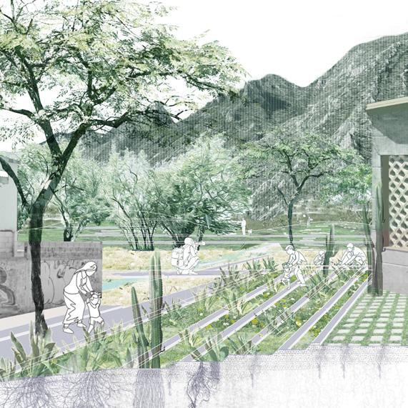
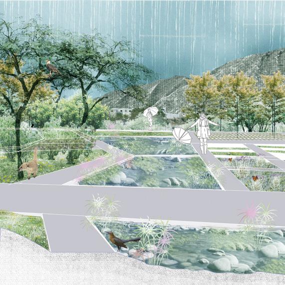
Drummond Poole
At the foot of Las Mitras, the Arroyo El Obispo crumbles away. The concrete channel is the last stop in the highly mechanized watershed, engineered to convey water from high in the mountains, to the channel, and into the Río Santa Catarina as quickly as possible. In doing so, the twentieth-century solution bypasses the natural surface functions of the watershed—to provide water for people, plants, and the aquifer—through its reliance on underground stormwater pipes and a concrete riverbed.
Obispo, Unbounded allows these necessary functions to surface in Las Mitras, working across up-slope, midslope, and down-slope conditions to slow, delay, and contain stormwater. In the mountains, bands of stone gabions— constructed of the surrounding loose rock—attenuate water flowing downhill, allowing for critical infiltration in the aquifer recharge zone. Infiltration is further improved by the afforestation of Acacia modesta—a species proven to thrive in the depleted soils around limestone quarries. In the mid-slope, stormwater pipes are intercepted as they meet an existing linear park. Their waters are cleaned through a series of biofiltration basins that open into a new urban confluence. Down-slope, the concrete envelope of the Arroyo El Obispo is broken where it meets the linear park, allowing its waters to be partially diverted and filtered through the park.
Working together, this series of interventions absorbs water across the slopes of Las Mitras, water that otherwise would contribute to persistent flooding downstream in the Río Santa Catarina. The concrete channel of El Obispo remains intact, serving as a release valve
for the urban network of creeks in the event of severe overflows. Through these actions, water—a previously hidden and inaccessible resource—returns to the public realm in Las Mitras, staging discourse around its quality, use, and management.
Top: Diagram of intervention
Bottom: Geologic section of Las Mitras
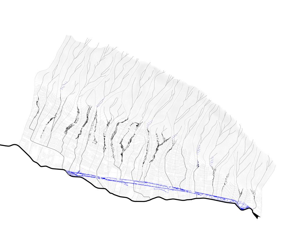
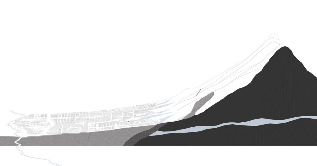
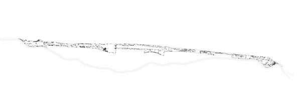

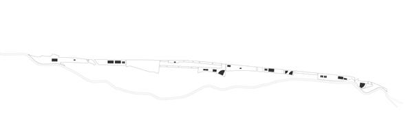
Sports Fields
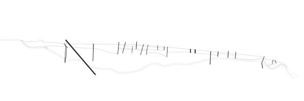
Roads
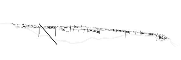
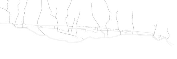
Left: Existing site conditions
Existing Surface Conditions
Subsurface Stormwater Pipes
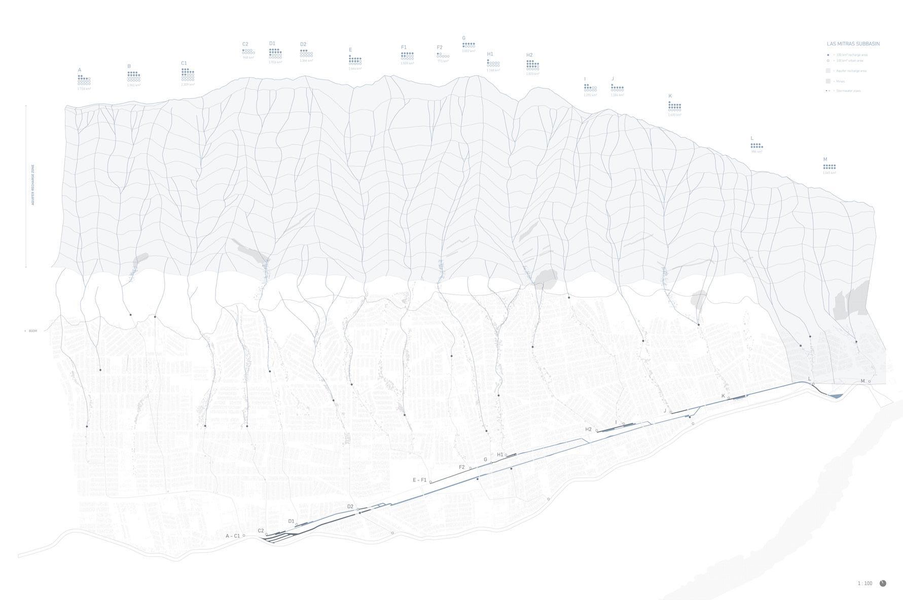
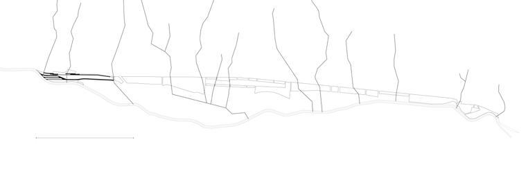
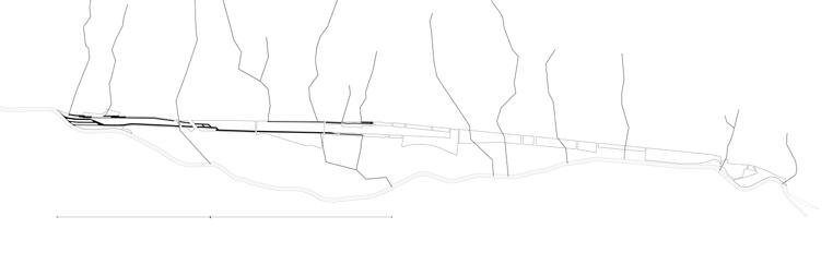
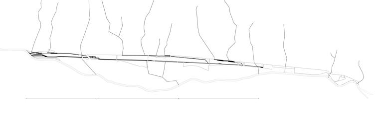
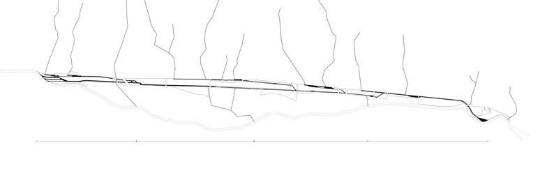
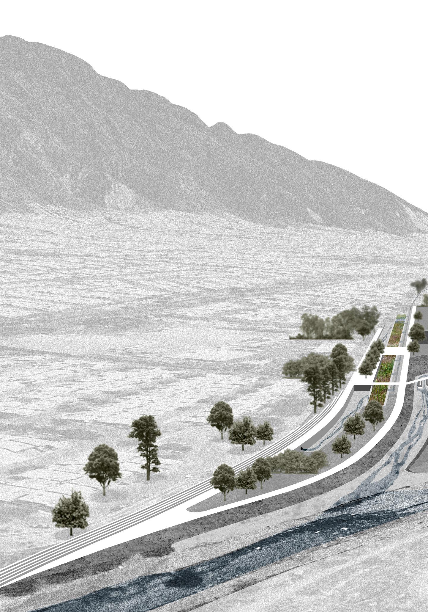
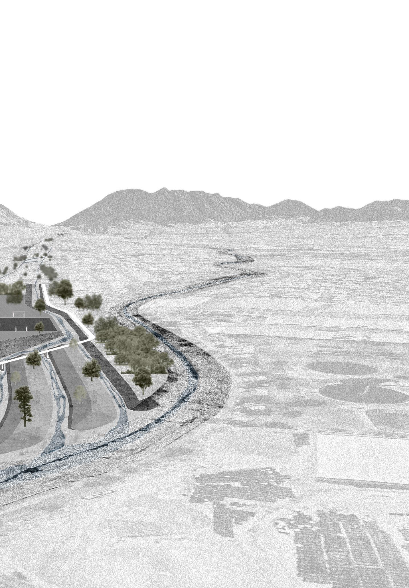
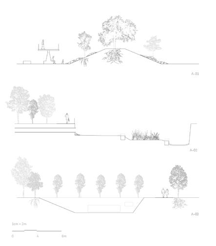
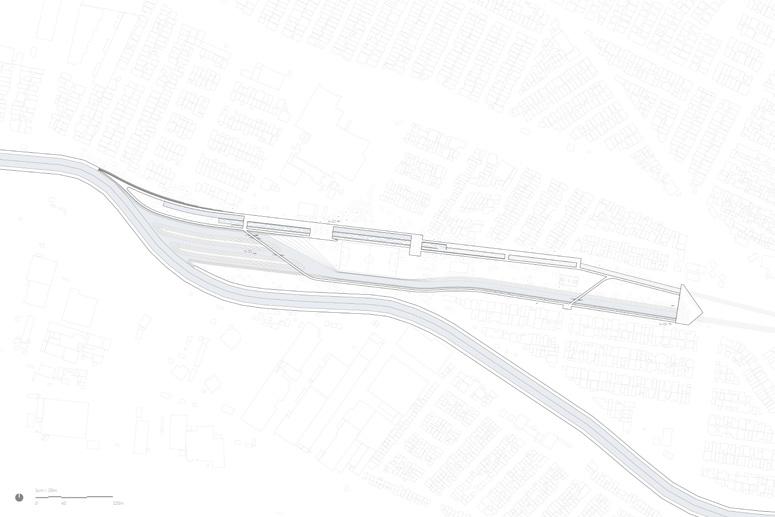
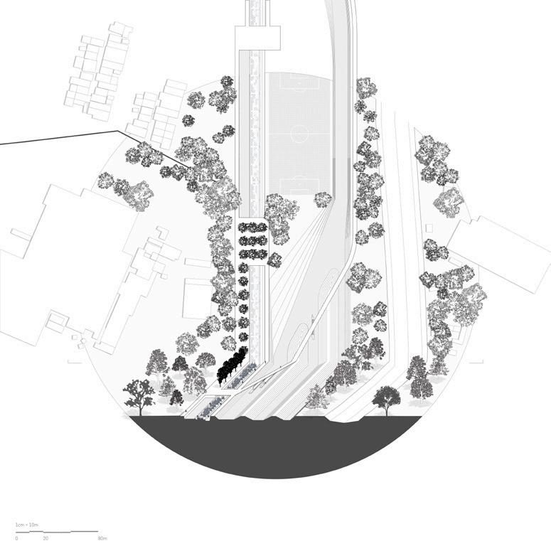
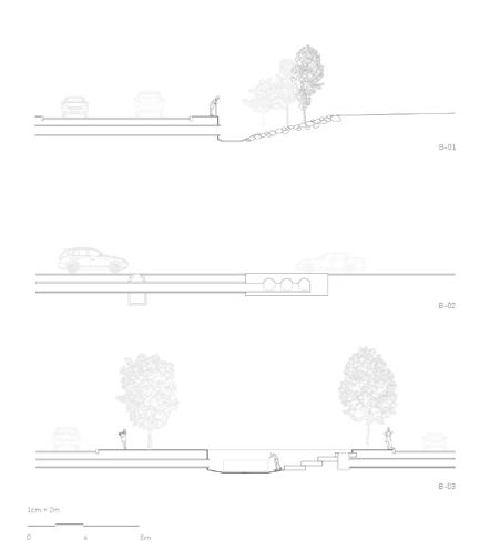
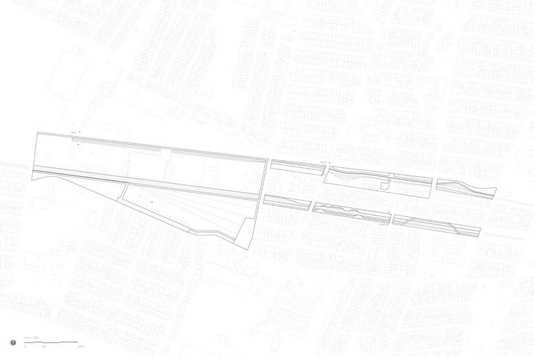
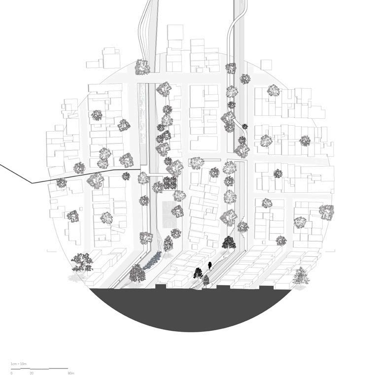
Section - perspective - plan of creeks running through urban condition
Sanjana Shiroor
Vulnerability in Monterrey can be defined through several lenses. Some of the most pressing are those triggered by sprawl and isolation, lack of access to basic infrastructural services, and overwhelming proximity to risk zones. This latter risk is especially so for marginalized communities located along key points of the Río Santa Catarina or adjacent to sites of mining and extraction along Cerro Las Mitras. “The poetics of circularity” asks, as the city grows, can we design new points of centrality using existing resources and brownfield sites through remediation? Is it possible to specifically mitigate threats to vulnerable communities through such designs?
The extremes of drought and flood in Monterrey bring forward the need to relate to water differently. At its core, this project imagines re-designing a brownfield site to absorb, reuse and provide water back to the Río Santa Catarina to help mediate flood crisis and drought across multiple temporalities. It suggests that privileging principles of circularity within a vision for pursuing new centralities can put growth, vulnerability, and resource use on a new and more sustainable trajectory for this growing industrial region.
The design of circular districts like those proposed in “The poetics of centrality” offers a framework for renewing industrial models in Monterrey that are cleaner, less extractive, and less demanding of the land and city’s resources. The project proposes newly reconfigured scales and patterns of industry that encourage higher density live-work communities embedded in amenity rich urban fabrics. By providing water, the project intervenes in a
continually growing industrial landscape, one that is unsustainably sprawling towards the western outskirts of the city. It establishes new centralities on closer-in, previously industrial sites. The project proposes that the emergence of new centralities on existing underutilized parcels in the municipality of San Pedro achieves re-design sustainable water and energy districts. These provide the possibility of an autonomous, selfsufficient, and largely self-sustaining community while enhancing housing and amenities to current and future vulnerable communities.
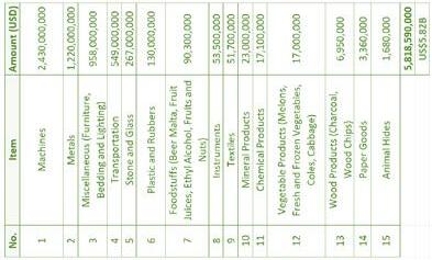


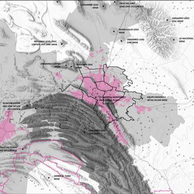
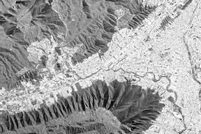


Top: Critical Cartography I / Mapping sources, catchment, extraction and recharge of Water [and other commodities] across the Monterrey Metropolitan Area.


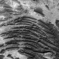


Right: Critical Cartography II / Mapping runoff and collection of water through the capillaries of Cerro Las Mitras, Flood risk along Río Santa Catarina and Access to resources [Drainage, Sanitation and Electricity] amongst vulnerable communities[transect]
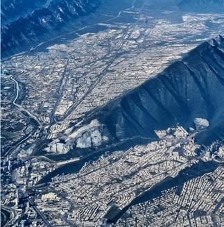


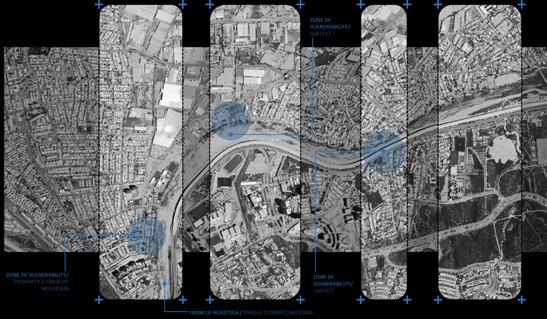


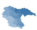

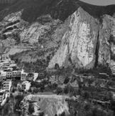

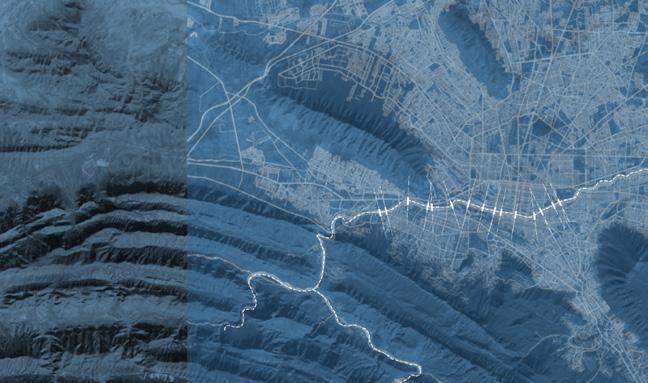

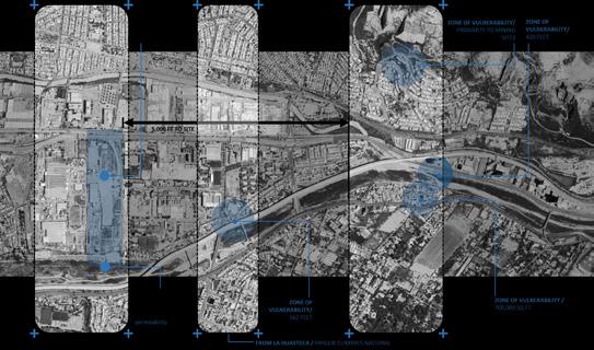
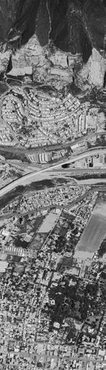
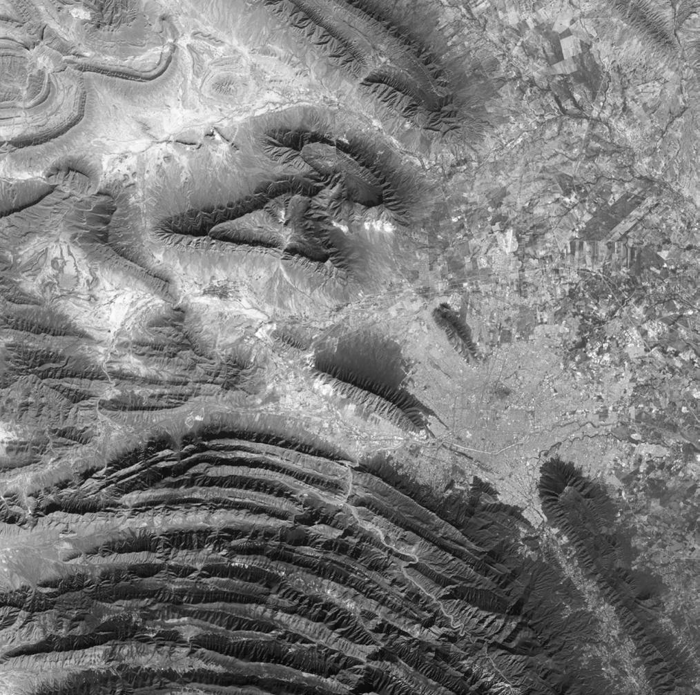


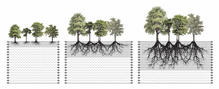

Top: Zoning diagram weaving programs and remediative landscapes on the site, Design Strategy for Circularity and Mixed-Use functionality of the site.
Bottom: Phytoremediation diagram for Phasing Year 1-4, restoring nutrients and removal of organic and inorganic contaminants [from previous nylon factory] from the brownfield site.
Next page: Site design, strategies for housing, remediation and circularity of water / Bringing retention, autonomy and self-sufficiency to the forefront by slowing down and meandering of water.
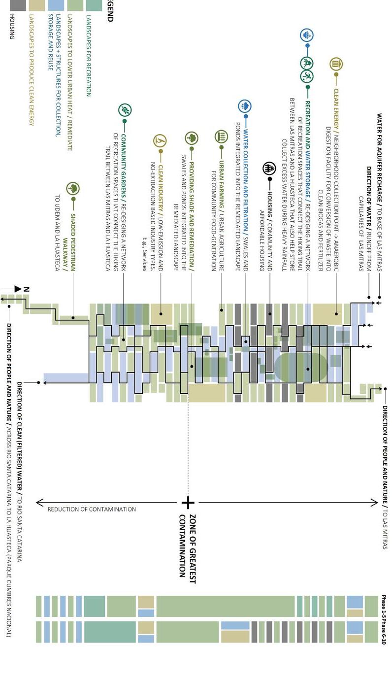
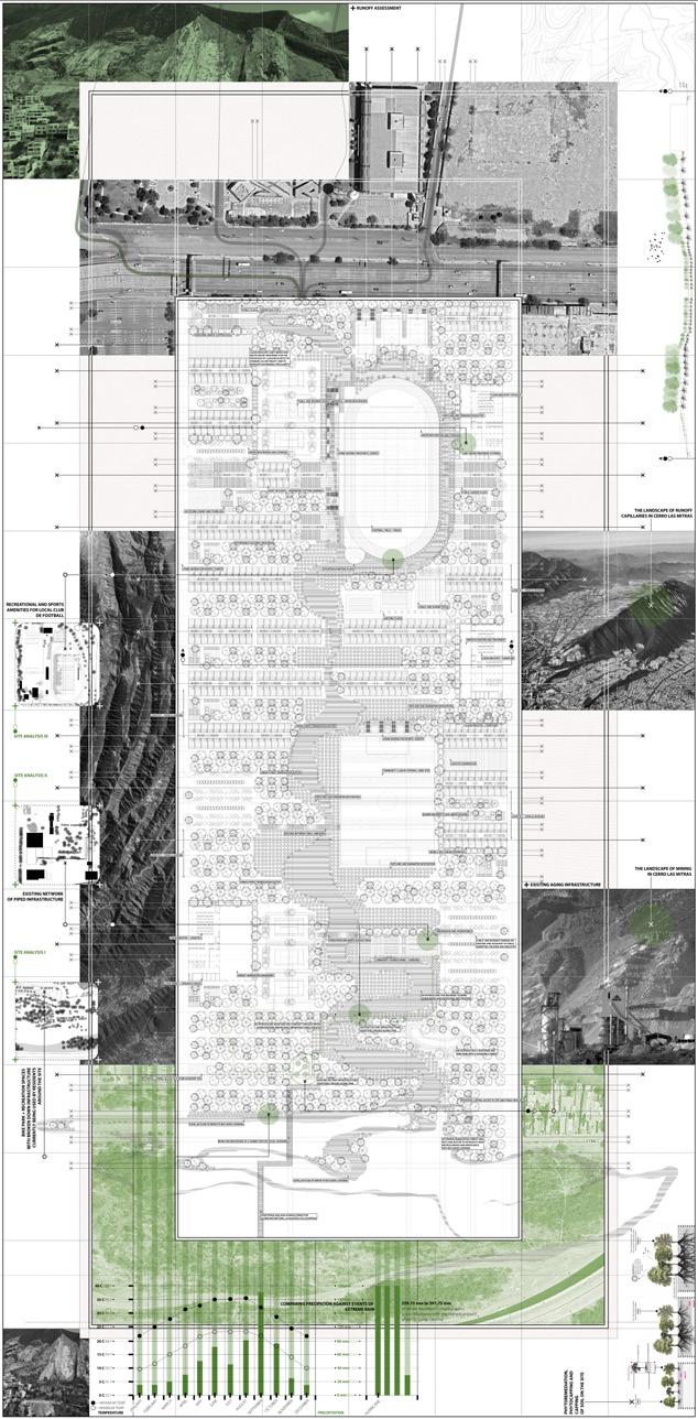
Markel Uriu
A rapidly changing industrial site, between a river and a canal, is remediated using a tapestry of plants to create new typologies for urbanization and make room for intermittent flooding along the Río Santa Catarina and Arroyo El Obispo. The site, located in San Pedro Garza Garcia, is an industrial site in which industry is rapidly moving westward as the city develops, and much of the neighborhood now stands vacant. This creates an opportunity for redevelopment that addresses the intermittent flooding of the river and provides affordable, denser housing along the future train line that will connect the new outskirts to the rest of the city. This project proposes floodable zones and dry zones with grid plantings that remediate to transition from industrial to habitable land.
Mixed-use buildings with floodable ground floors are built throughout the site, creating a structure in which land, humans, and the broader ecology can exist simultaneously between the river and the canal. As the site develops, the plant grid shifts into various ecologies: A Riparian ecosystem, a Floodable community, and a Dry ecology. The Riparian ecology utilizes trees and shrubs to stabilize the soils along the riverbank, while the floodable and dry ecosystem utilizes additional herbaceous plants and shrubs that still stabilize, but also contribute to both aesthetic and functional needs, ultimately producing a range of ecologies within the site.
Former infrastructure is repurposed, creating the framework for the main transportation roads throughout the site, while pre-existing buildings located within the dry zones are repurposed for commercial use on the site. Walking
pathways, running North and South enable pedestrians to move throughout the site on foot, connecting to the pathways and roads moving East and West.
Plants include:
Miscanthus (Miscanthus sinensis, varieties), Chinese Silver Grass :: Pennisetum rojo (Pennisetum setaceum ‘Rubrum’), Purple Fountain Grass :: Ajillo (Tulbaghia violacea), Society Garlic :: Espárrago (Asparagus densiflorus), Asparagus Fern :: Huizache (Acacia farnesiana), Sweet Acacia :: Cenizo (Leucophyllum frutescens), Texas Sage :: Santolina (Santolina chamaecyparissus), Lavender Cotton:: Tradescantia ceniza (Tradescantia sillamontana), White Velvet Spiderwort :: Mezquite (Prosopis glandulosa), Honey Mesquite :: Chilopsis Linearis- Desert willow :: Sauce de río (Salix nigra), Black Willow :: Quercus spp. – Oak Tree :: Agave lechuguilla, Lechuguilla Agave :: Nopal (Opuntia spp.), Prickly Pear Cactus :: Carpobrotus edulis, Ice Plant :: Tomillo, Thymus vulgaris, Common Thyme :: Helecho águila (Pteridium aquilinum), Bracken Fern :: cuajatinta (Justicia spicigera), Mexican Honeysuckle :: Gobernadora (Larrea tridentata), Creosote Bush :: Tepehuaje (Lysiloma acapulcense), Acapulco Lysiloma
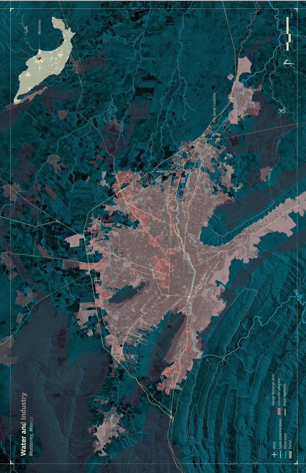
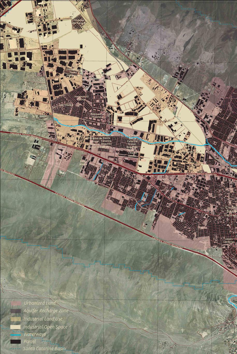
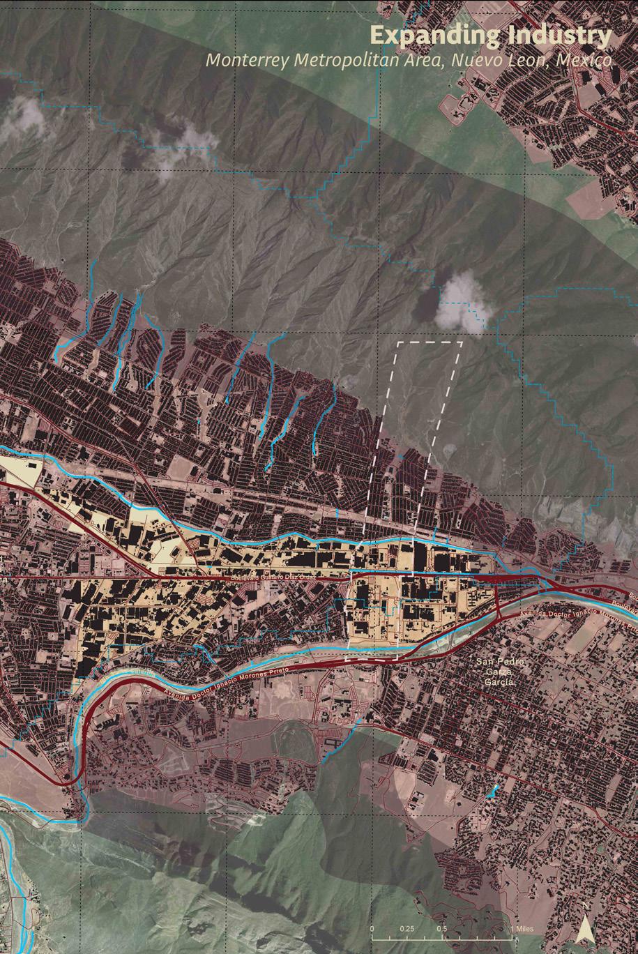
Top: Sub-surface water extraction from industrial private wells.
Right on top: Canal system designed for water retention referencing San
Right: Plan for new urbanization featuring mixed use residential buildings with floodable ground level floors, and repurposed industrial buildings. Canal systems for water retentions determine lot sizes.

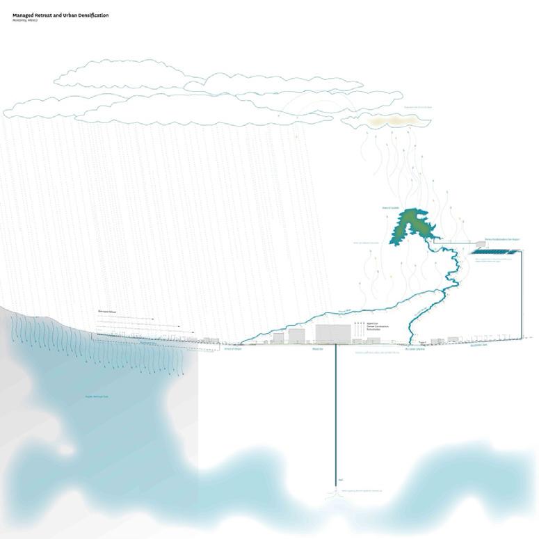
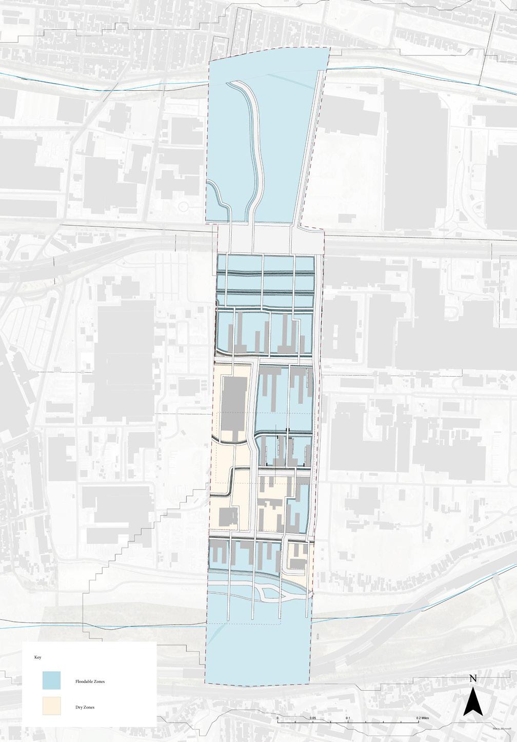
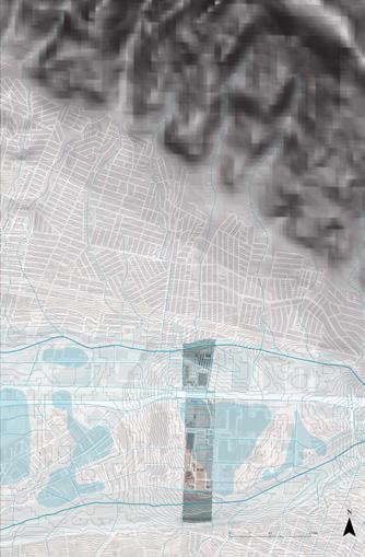

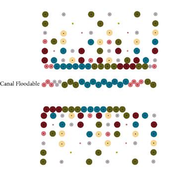
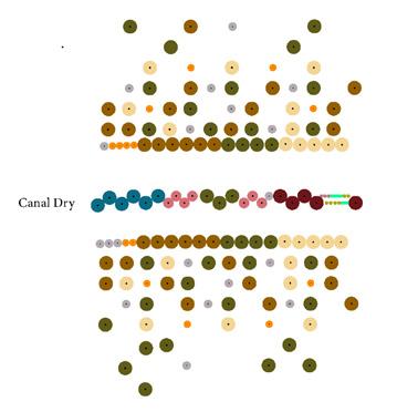
Grid planting plans for the floodable and non-floodable areas of redevelopment.
All plants have remediation qualities of pollutants found in industrial and automobile areas.
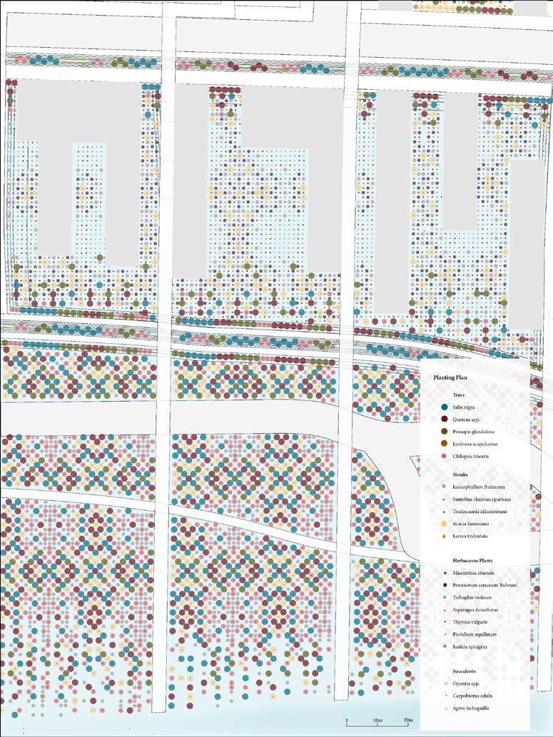
Detail plan showing the intersection of planting plan typologies as it meets the Río Santa Catarina. Woody plants in the riparian zone promote soil stabilization.
Top: Detail plan showing the variation of planting in floodable and dry areas. Pre-existing infrstraucture determine dry zones.
Bottom: Section cut showing the floodable areas in relationship to the buildings and canals.
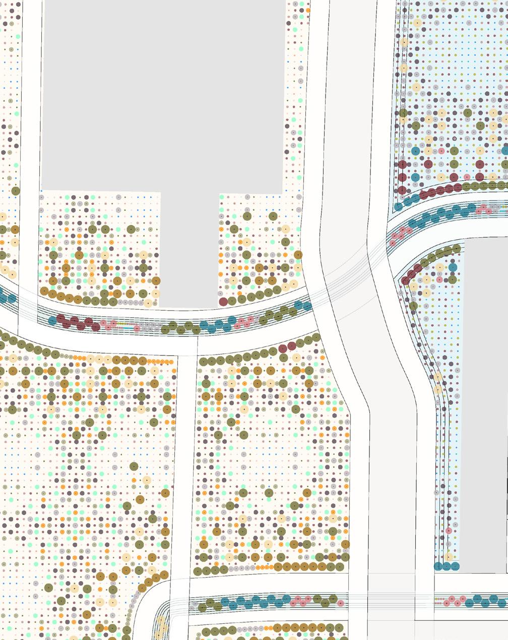
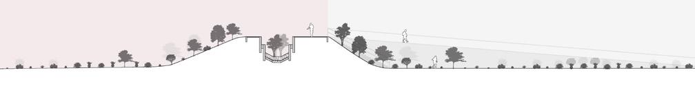
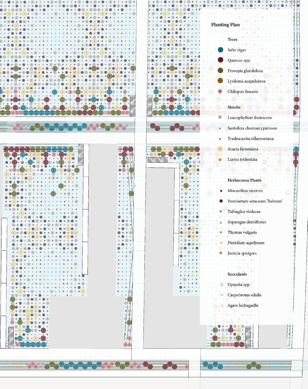
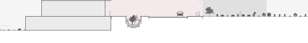
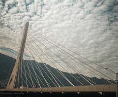
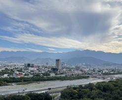
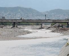
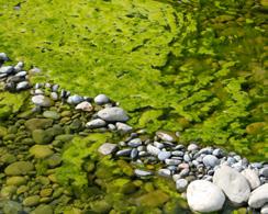
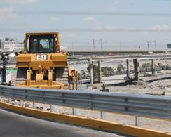
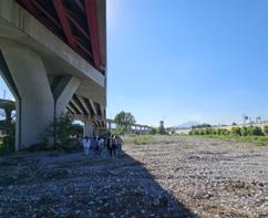
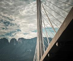
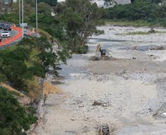
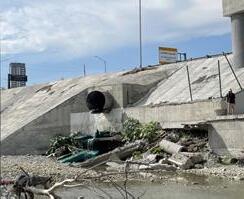
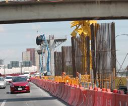
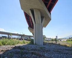
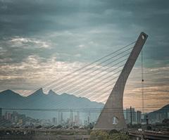
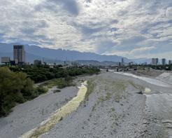
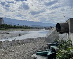
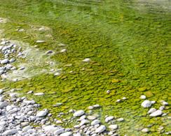
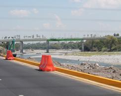

“Together, we read aloud a Declaration of the Rights of the river Cam—as if just saying might make it so: We declare that the River Cam and its tributaries have the right to flow and be free from over-abstraction, the right to be free from pollution … Partway through, I had to stop speaking. I was overwhelmed by hope and futility … Our fate flows with that of rivers, and always has.”
Is A River Alive?
Robert Macfarlane
194 El Río Vivo: Revitalizing Living Riverine Systems for Ecological, Hydrological and Cultural Connectivity
Daniella Slowick
206 Riverine Microclimates: Shading Santa Catarina’s Urban Riverfront
Ashely Ng
216 Santa Catarina’s Ojo de Agua: Erasing Concrete River Boundaries at Macroplaza
Bernadette McCrann
222 Bridging Monterrey, Reaching the Río Santa Catarina
Sophie Weston Chien
228 El Gran Bosque de Río: Microclimatic Urban [River] Forest
Miguel Lantigua Inoa

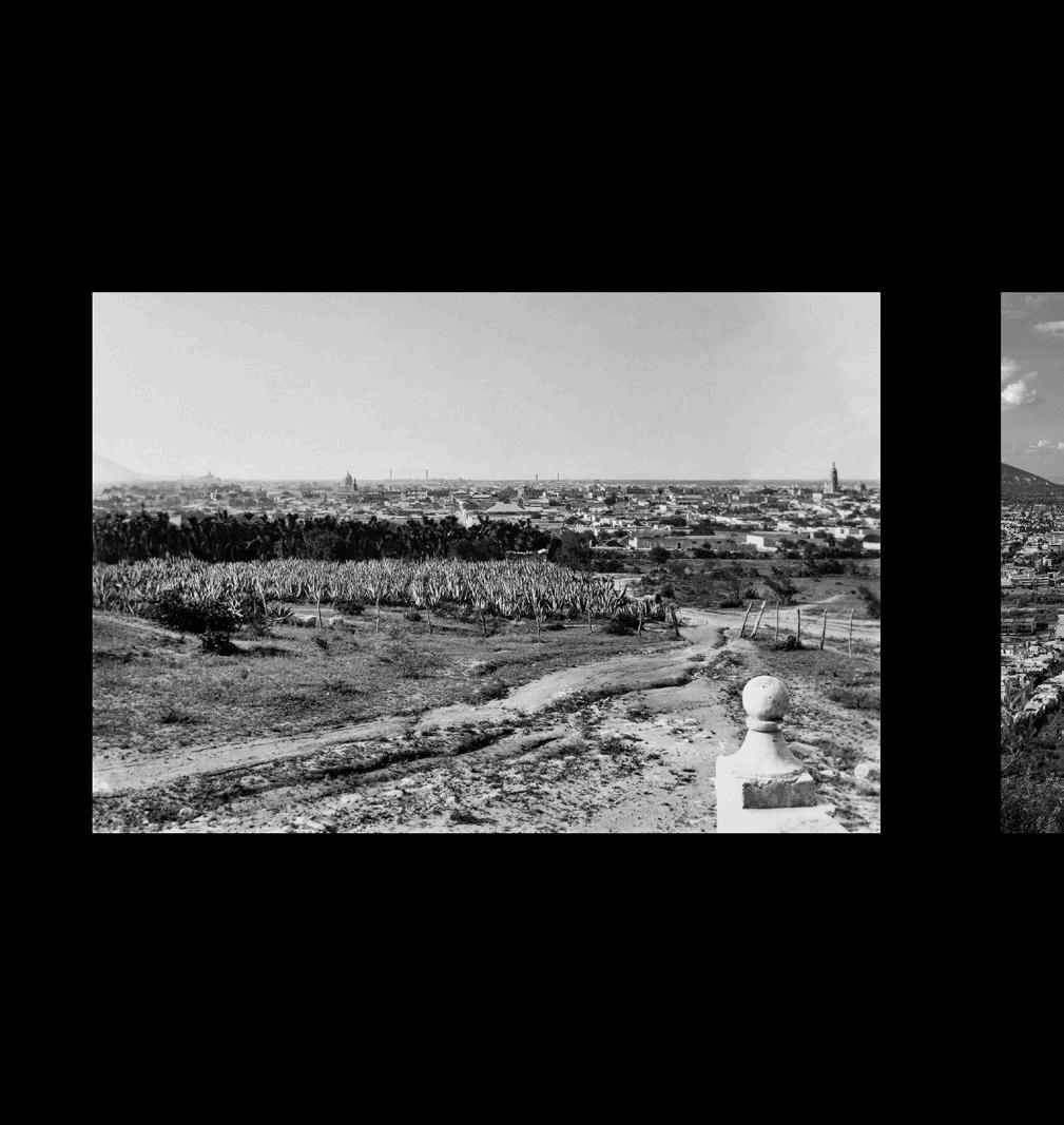

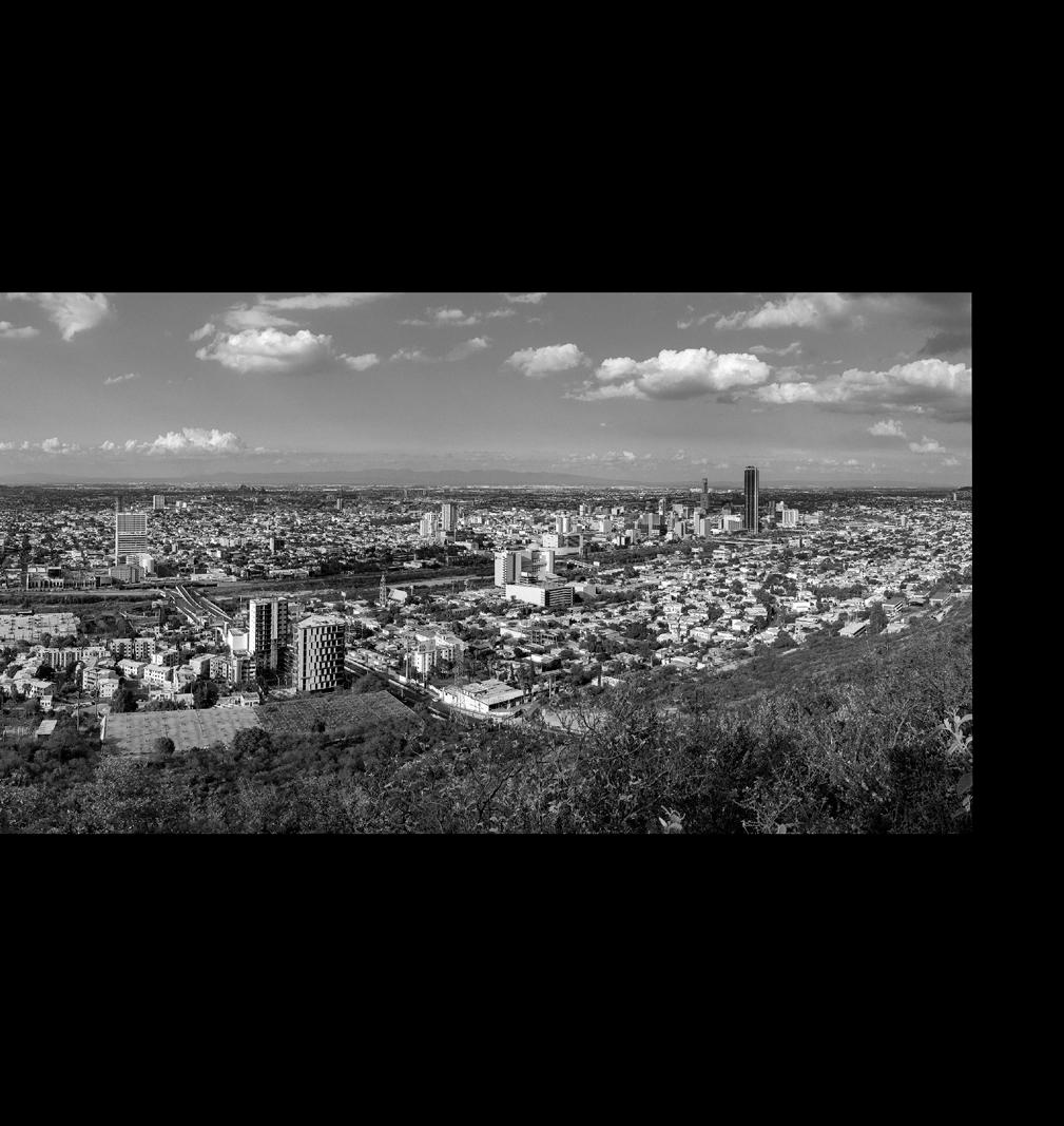
Daniella Slowick
Urbanization and industrialization have caused deterioration to the ecological fabric of Monterrey’s Río Santa Catarina, as well as the health of marginalized communities located along its banks. Independencia, a historic neighborhood located on the south bank of the river, directly across from the Macroplaza city center, has been particularly affected by unsustainable growth patterns, inequitable resource distribution, and limited access to greenspace. Both the river and Independencia have variously been neglected, isolated, and stigmatized within the city. To unite fragmented and marginalized hydrological and social systems, this project proposes a design for a collection of human-scale microclimates that provide therapeutic shade and access to nature, enable water filtration and percolation, and support wildlife habitat amidst the megalithic urban structures of Monterrey that produce vast amounts of heat, pollution, and wastewater.
The series of micro-interventions –within the river itself and extending into adjacent urban settlements by following the boundaries of paved-over tributary streams passing through Independencia - culminate in a transversal park that revitalizes the semi-arid ecology of the river and provides a healing greenspace for the chronically underserved community of Independencia. Leveraging the project’s central location, it also cultivates a shared recreational space that unites the currently fragmented connection between neighborhoods of Centro and Independencia by providing a link between the existing cultural spaces of the Basilica de Guadalupe on the south bank and the Macroplaza extending from the north bank into the city
center. This strategy can be replicated in other locations along the Río Santa Catarina as a method to unite bifurcated communities, provide therapeutic greenspace, and revive ecological networks.
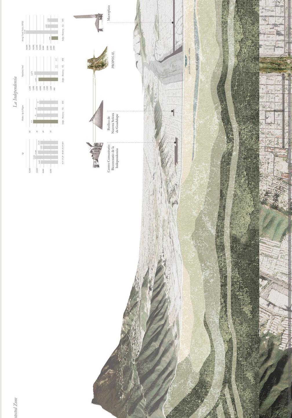
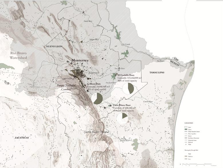
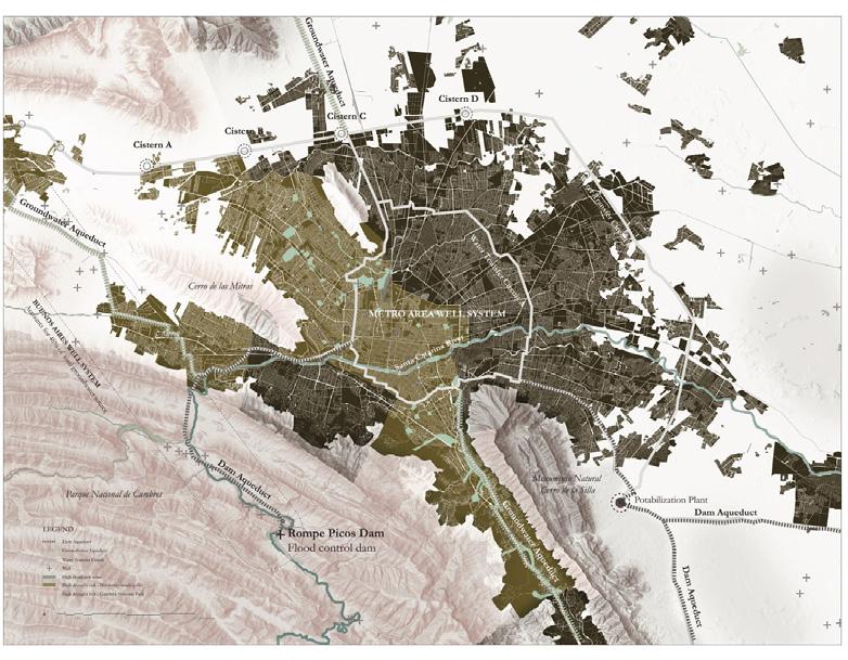
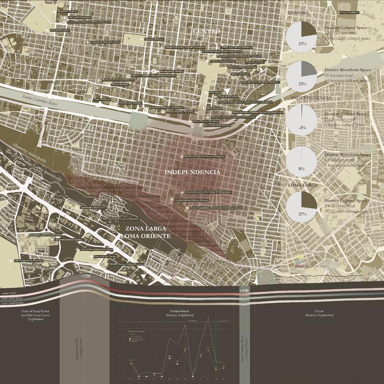
Next spread: Proposed plan within Santa Catarina River featuring riverbed restoration using terraced gabion walls with native ornamental and edible plants and shrub-steppe bioswales extending into Independencia in location of former tributary.
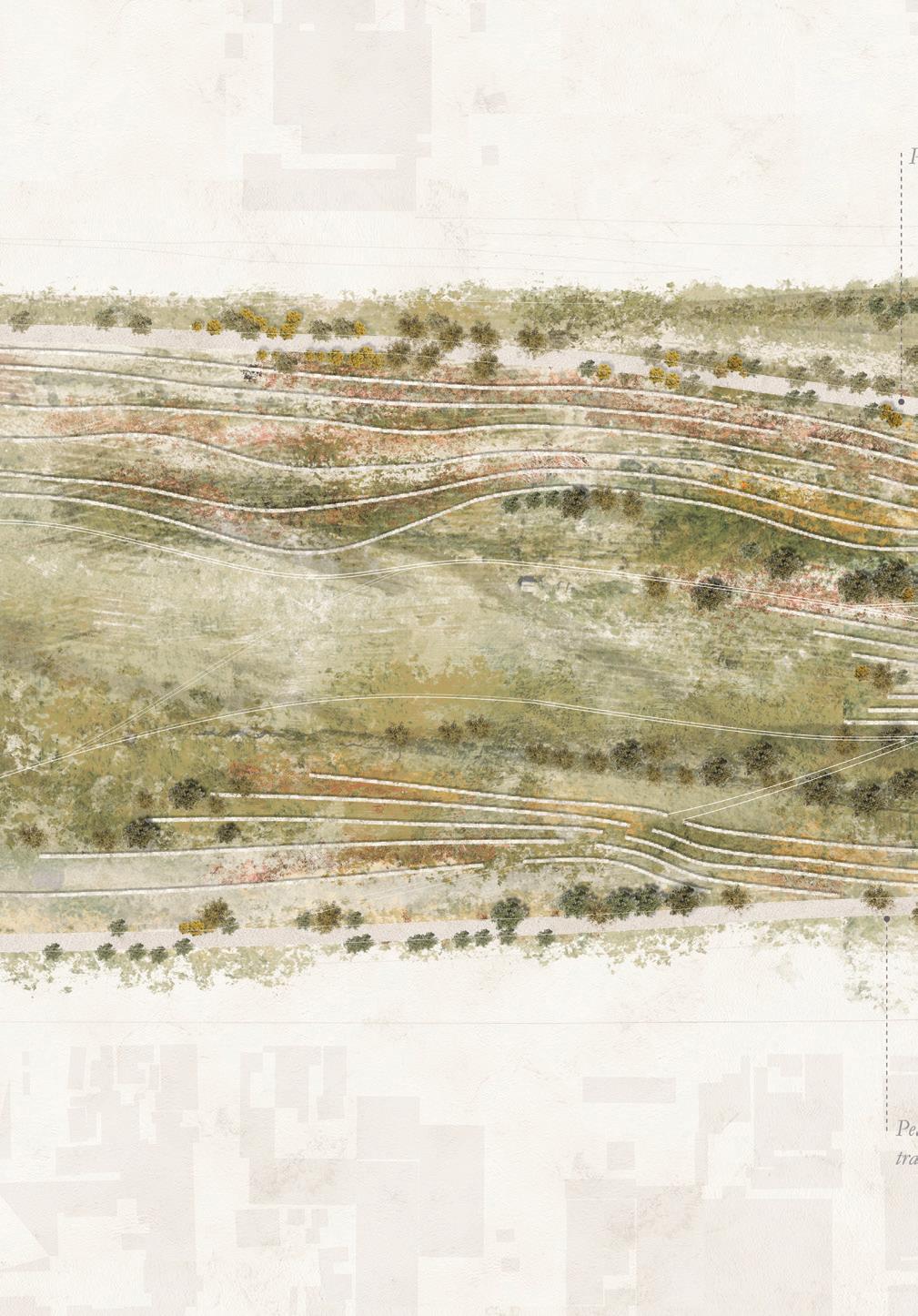
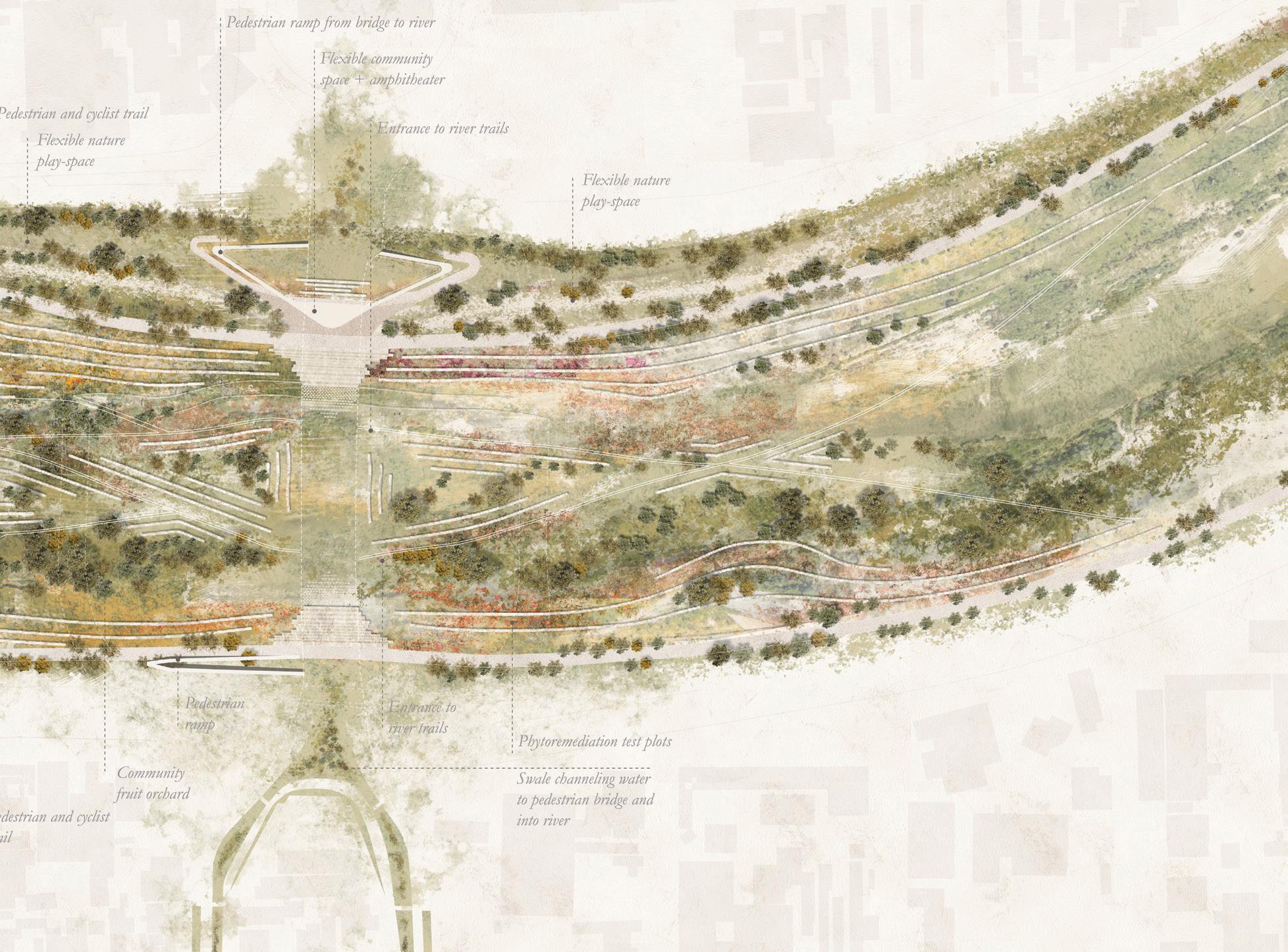
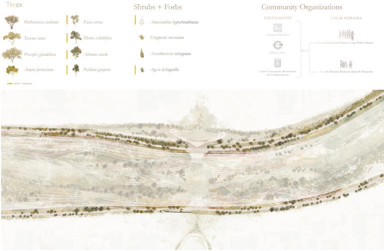
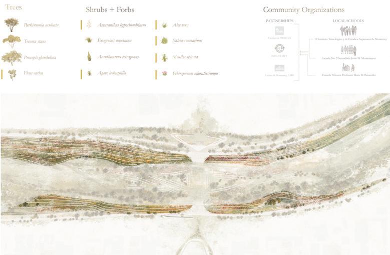
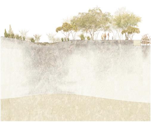
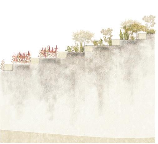
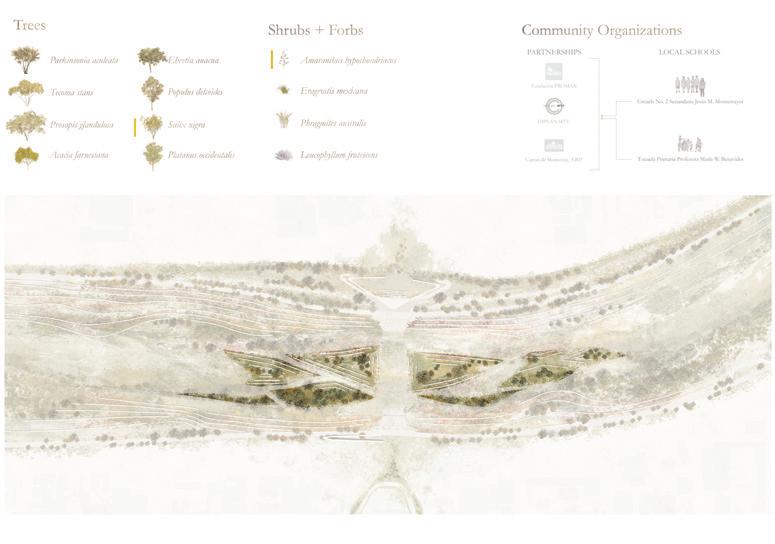
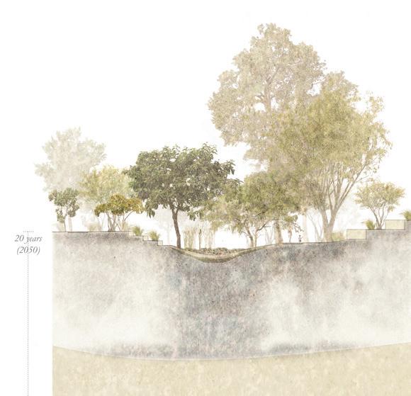
Riverbed restoration strategy creating riparian woodland in river’s basin with carved gabion terraces to collect ambient moisture, recharge groundwater, restore soil, and generate microclimates
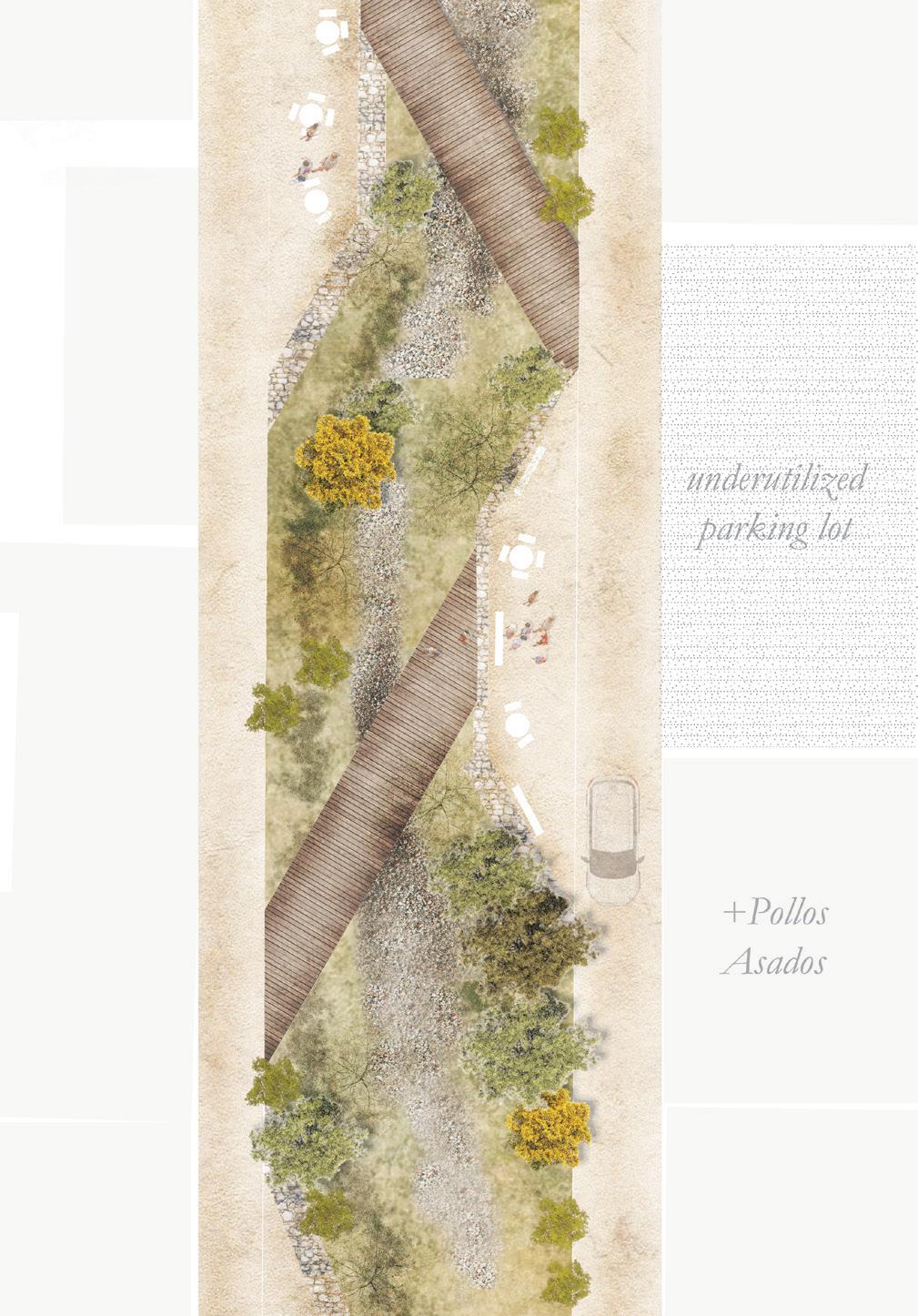
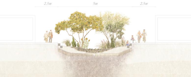
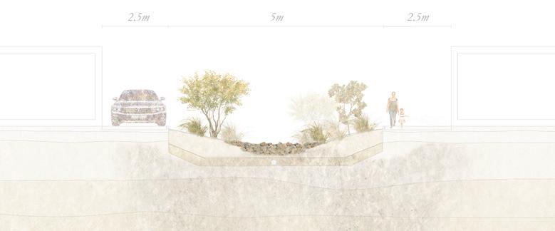
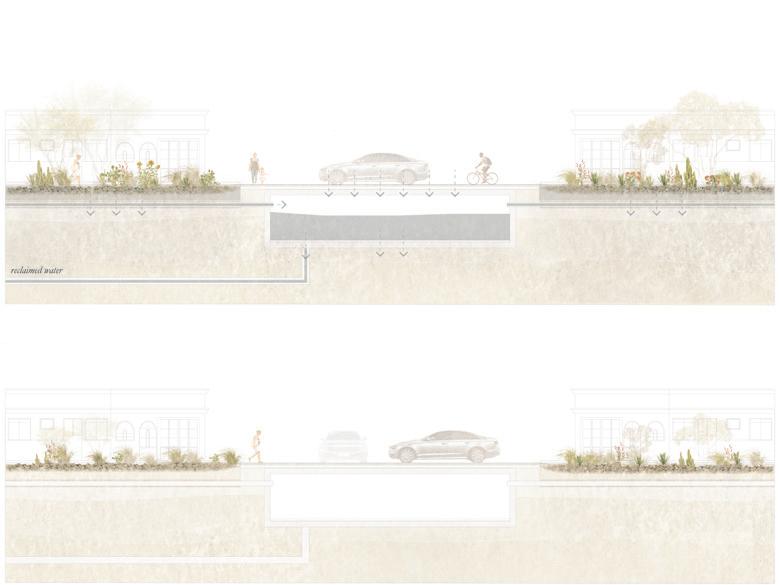
Previous page: Plan for thoroughfare within Independencia. Former tributary to be granted access to the river with street/road replaced by central swale.
Top: Pedestrian thoroughfares to exist on either side of the swale, accessible via car for residents and emergency services.
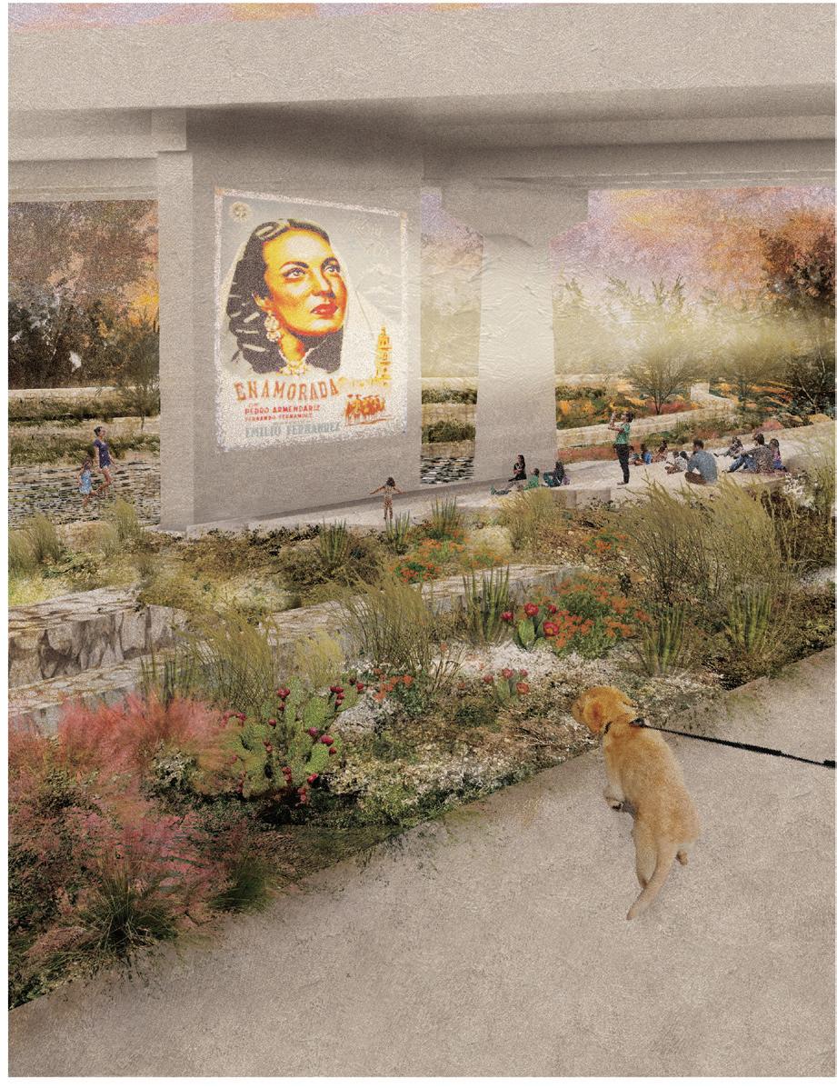
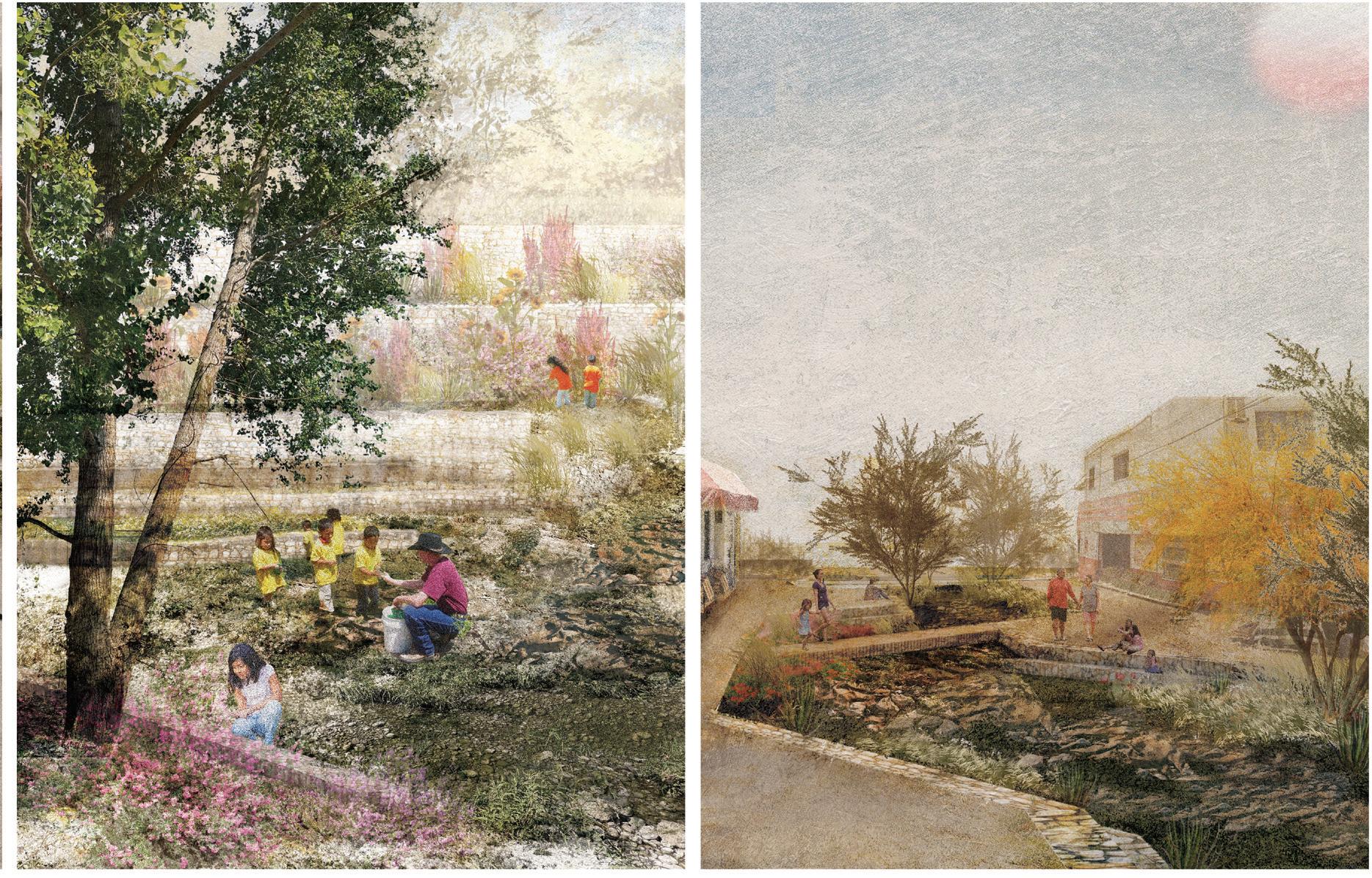
Ashley Ng
Forty years of intense car-driven urbanization in industrial Monterrey have turned the Río Santa Catarina into a backbone of highway infrastructure. Unfortunately, Monterrey has taken US cities as a model, with ten-lane highways spanning both sides of the river. These highways create an abrupt and harsh urban edge between regiomontanos and its river, severely restricting access to this flood-stigmatized urban nature. In the summer of 2023, the Governor of Nuevo Leon state announced a plan for a viaduct along the river’s southern side. If constructed, this viaduct would exacerbate disconnection and increase air pollution in a narrow river valley. Unfortunately, Monterrey is far behind peer cities in reducing emissions through densification and collective mobility.
“Riverine Microclimates” radically opposes the viaduct plan and instead explores the conversion of this river belt of asphalt into an urban riverfront. This riverfront is designed to regenerate spaces of urban conviviality with nature by getting people down to the river. Given Monterrey’s intense heat, the project relies on a series of microclimates at intermittent points of access along the river. To reconnect the river to the city center and adjacent neighborhoods, the configuration of the highway needs to dramatically shift. In this project, the transition from highway to riverfront is envisioned as an intentional phased recalibration of space over time.
The intervention first diversifies public transportation by connecting existing networks with a proposed tram system, eventually reducing the number of car lanes and reclaiming space for pedestrians to wander. By providing a
forested canopy cover for ample shade, the project fuses microclimatic mobility stops at points of entry into the river and prioritizes pedestrian continuity.
Additional space by the riverfront provides sites for natural infiltration and public space for the city. Bioswales collect surface runoff to reduce pressure on the river corridor during heavy rains, mitigating chronic flooding and pollution. These interventions create a larger network and palette of public space and ecological solutions that help democratize the existing urban edge along the Río Santa Catarina, making them accessible public spaces for social congregation and diverse forms of mobility and connectivity.
“Riverine microclimates” reconceptualizes urban relationships with the river through the introduction of new mobility infrastructures that unlock public spaces for social and ecological activation. In a dense city like Monterrey, this urban riverfront project offers a framework for linking fast paced routines of daily work and commutes to the slower pace of moments found in new civic and ecological public space.

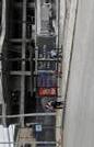
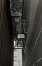
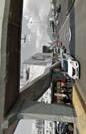
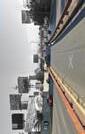
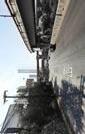
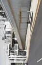
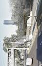
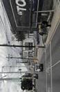

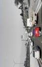

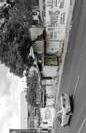
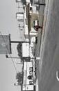
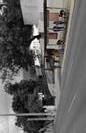
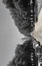
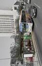
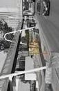
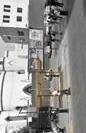
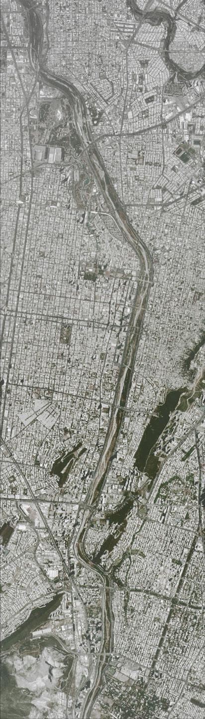
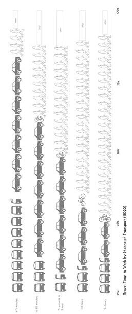
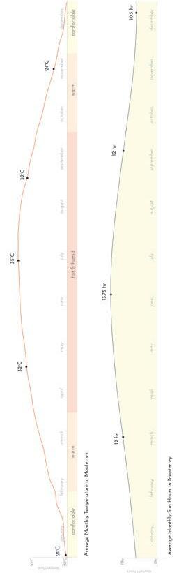
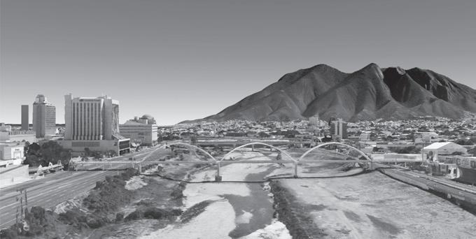
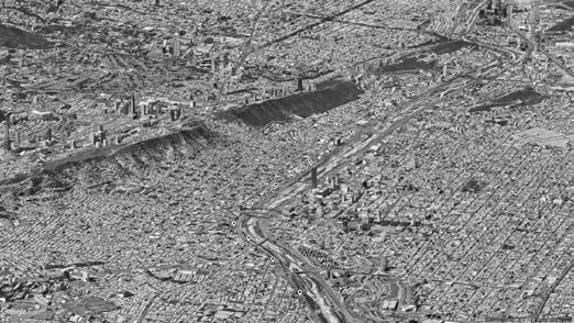
Top: Section showing the river and its adjoining highways
Bottom: (Axon) This project reconnects Río Santa Catarina to neighborhoods in the South and the urban fabric of the city center.
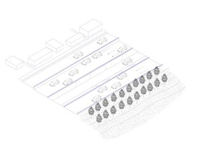
7 car lanes
One way highway
No access to river
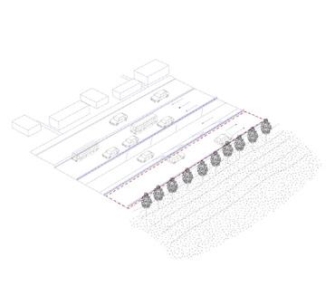
pedestrian walk
lanes next to river for young trees and project + 10 years
2 bus lanes (BRT) 4 car lanes
Reclaim lane for pedestrian walk
Decommission two lanes next to river for tree planting
*Removing existing young trees and replanting + 10 years
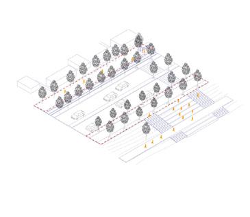
Tram replaces BRT 4 car lanes (two-way)
Road maintenance
Pedestrian walk constructed
*Asphalt removal + perforation for porosity
*Construction of swales for runoff
*Addition of traffic lights for crosswalks
Temporary structures that can be rebuilt after a big flood event + 20 years + 40 years
Tram replaces 4 car lanes (two-way)
Road maintenance
Pedestrian walk
*Asphalt removal
*Construction
*Addition of traffic
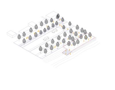
Tram 4 car lanes (two-way)
Paseo extended towards river for shade plaza - marketplace/vendors
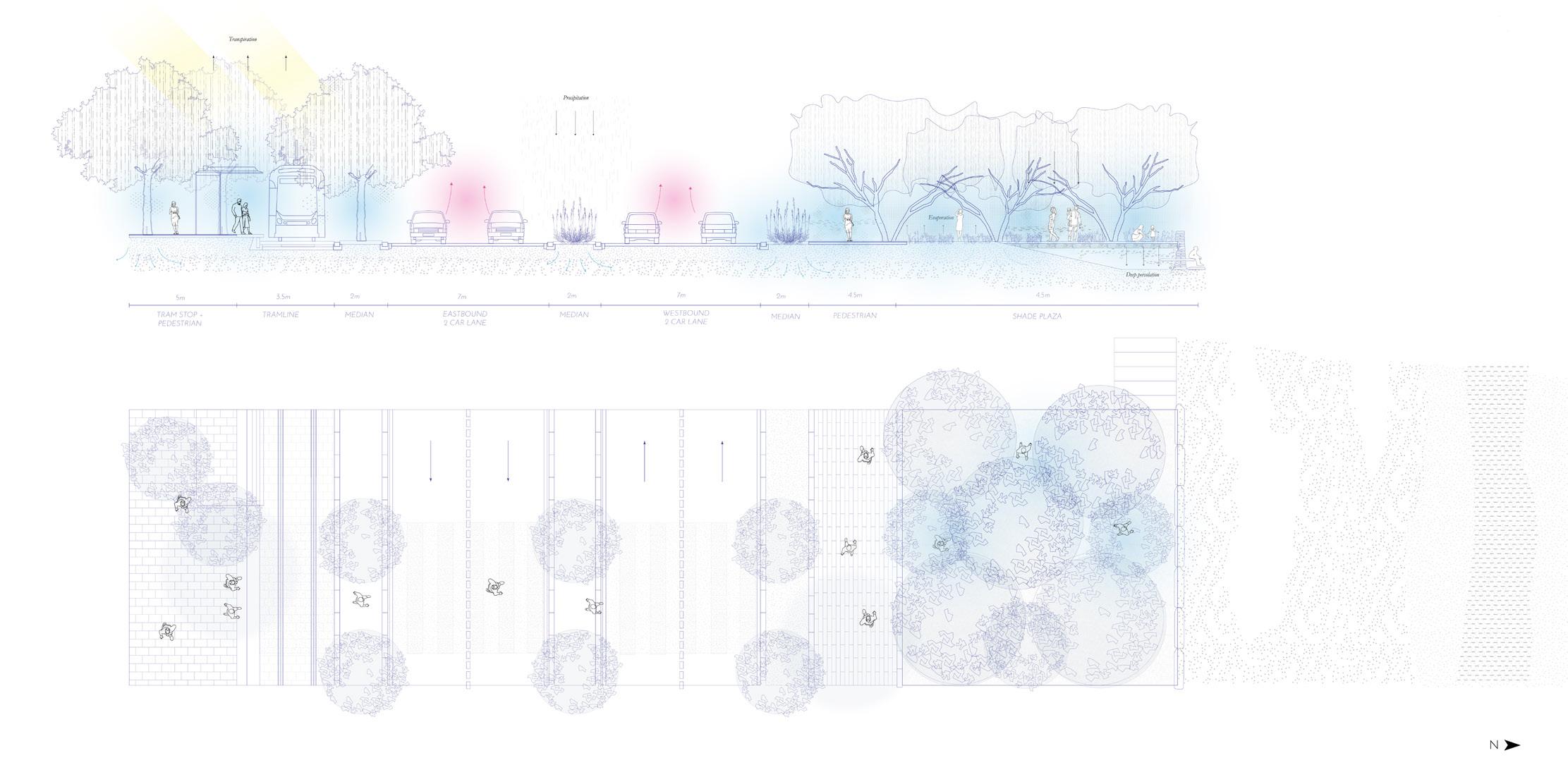
Designated points of access along Santa
are public spaces but also sites of natural
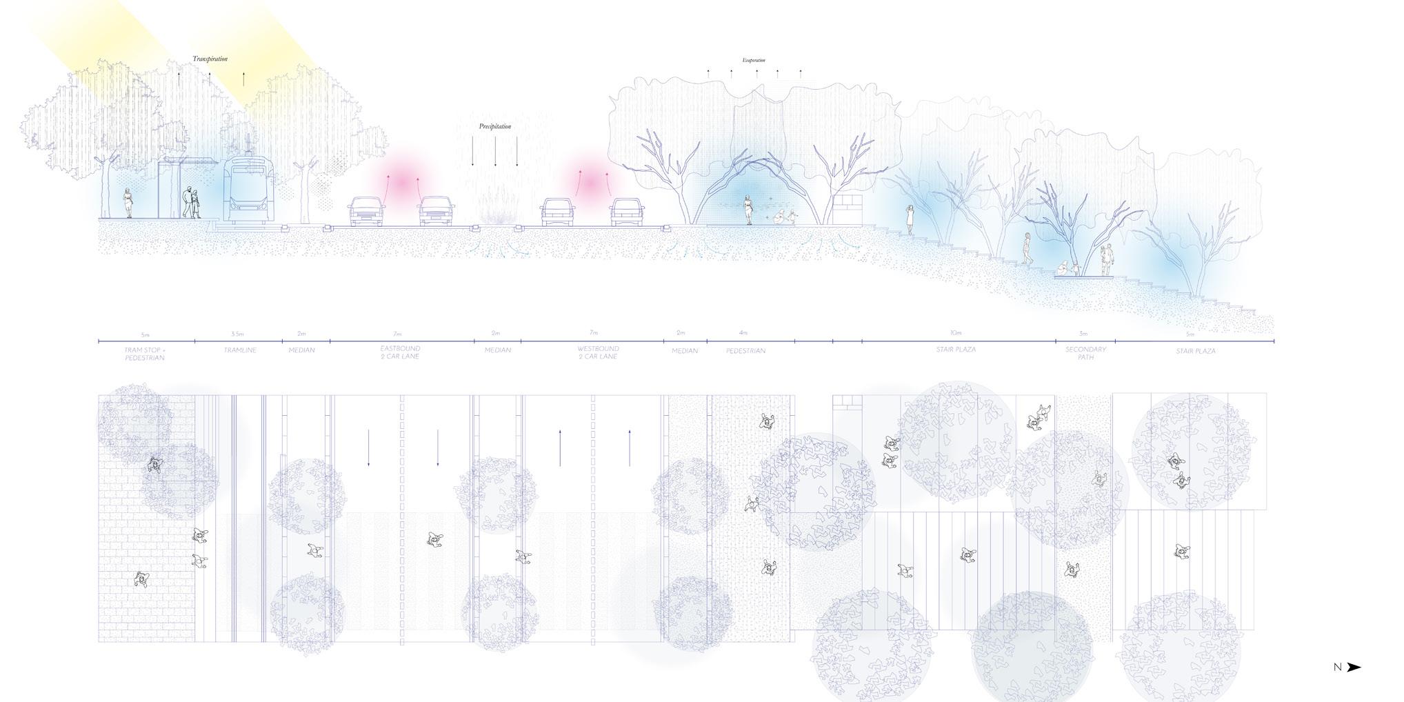
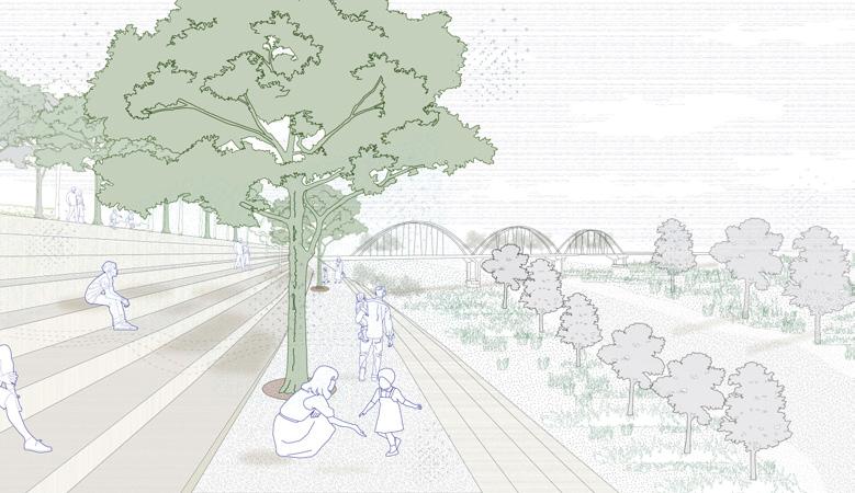
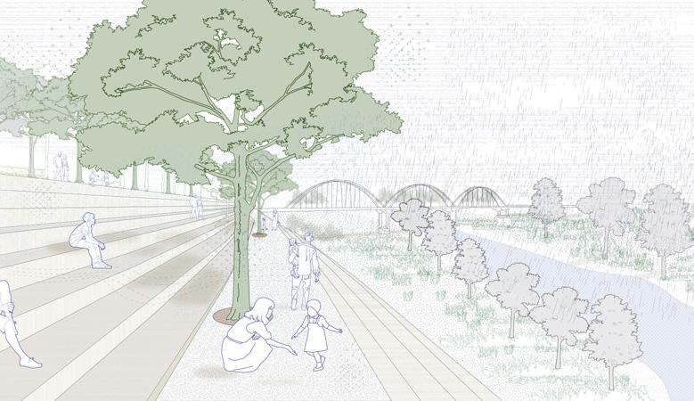
is the
see
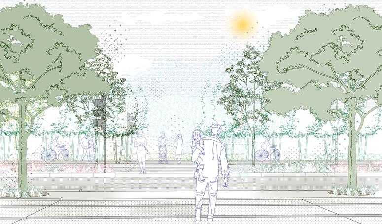
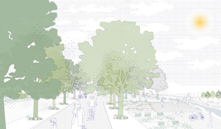
Bernadette McCrann
Concrete overtakes Monterrey and creates barriers throughout the city. The highway infrastructure surrounding the Santa Catarina River creates a physical and visual wall, separating residents and storm-water from this riverine ecology. Ironically, this condition contrasts with the area’s iconic mountainous landscape, which is consistently in view in every location. But many residents cannot experience this side of Monterrey, since almost all open space is flat, paved, and overwhelmingly oriented toward vehicles. The river represents an opportunity to reconnect Monterrey back to nature.
This project proposes an adaptive reuse of the Zaragoza Multimodal Bridge to convert highway infrastructure for pedestrian and ecological use. The Zaragoza bridge is a pedestrian only plaza, facilitating movement across the river between the downtown neighborhood of Centro and the more socially marginalized neighborhood of Independencia located on the adjacent bank. The project incorporates a pedestrian park into the bridge. Functionally the project also extends the neighboring Macroplaza to which it links, introducing a pastoral green space to the plaza. It will also give a much-needed access to new public space to the Independencia neighborhood. Pedestrian footpaths will extend down from the bridge, allowing people to walk both across the river and into it. A stormwater management system will also be integrated into the design of the bridge and park, reintroducing water to the river environment and counteracting current cycles whereing stormwater is generally channeled out of the river as quickly as possible.
The pedestrian parkway will become an iconic public monument as part of the central downtown corridor in Monterrey—much like the Ojo del Río and Fundidora Park to which it connects via river walk—at the other end of the Macroplaza. By explicitly connecting the river to some of the most important and recognizable existing public spaces in the city, the project seeks to give visibility to the interconnections between land, river, and people that characterize life in the broader Monterrey region. Rethinking an existing emphasis on concrete infrastructure via such a prominently visible project will help advance a public narrative about reorienting urban development priorities to reintroduce the people of Monterrey back to the river and mountains that define the region’s topography and hydrology.
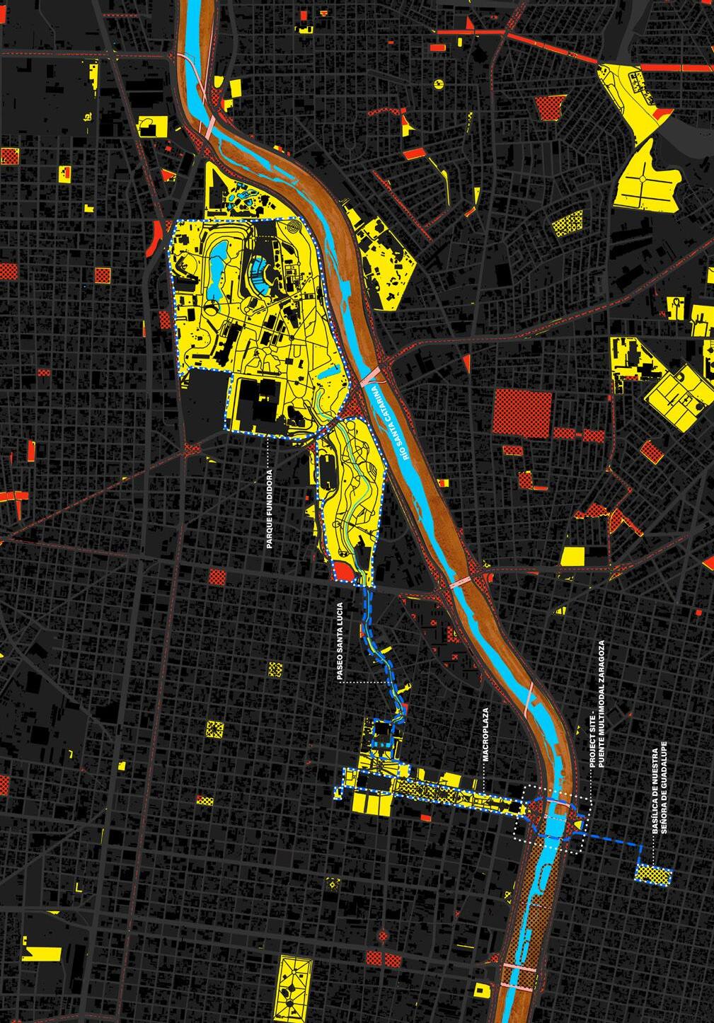
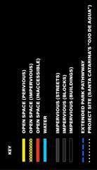
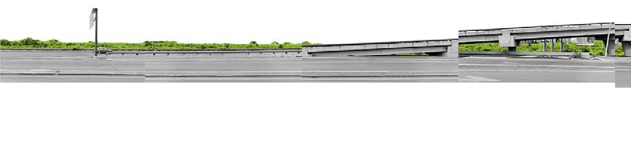
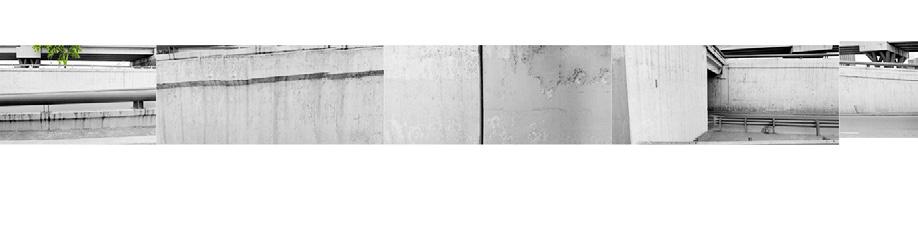
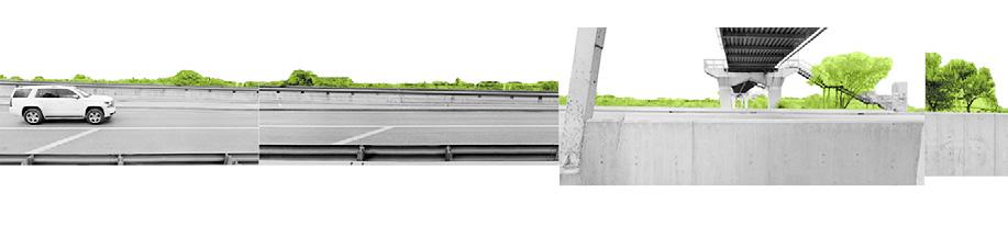
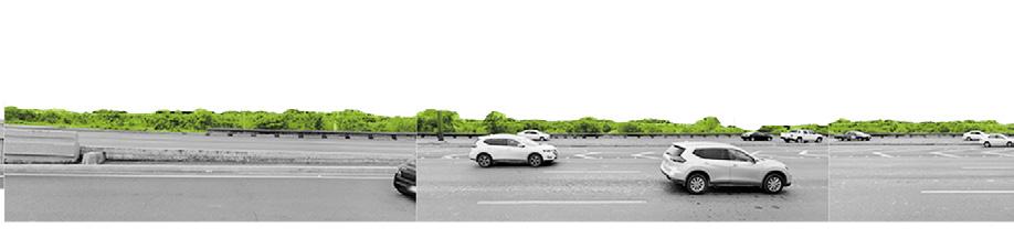
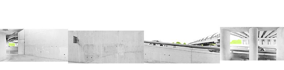
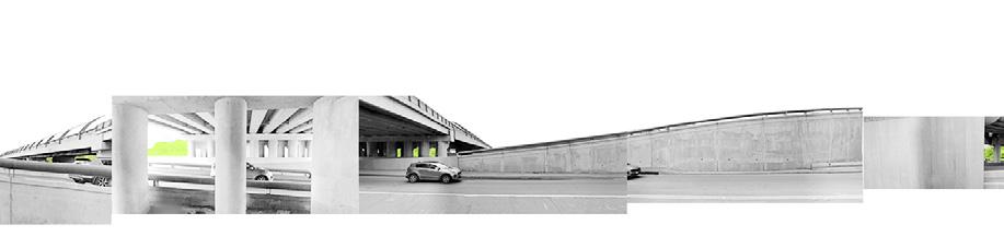
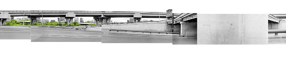
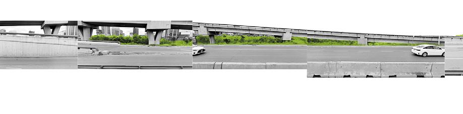
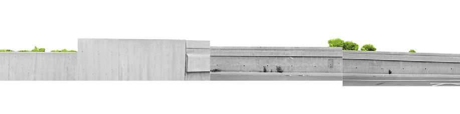
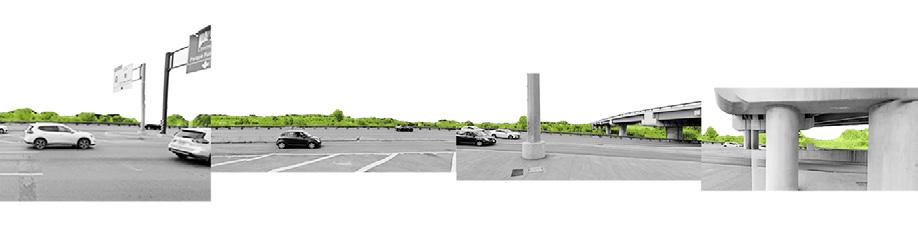
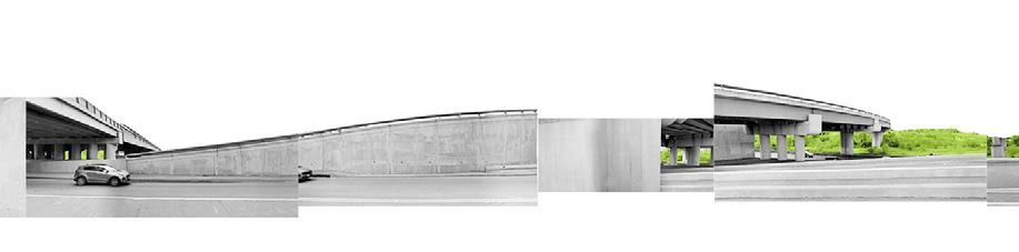
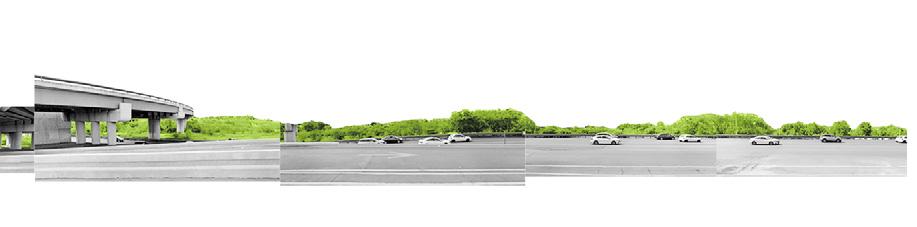

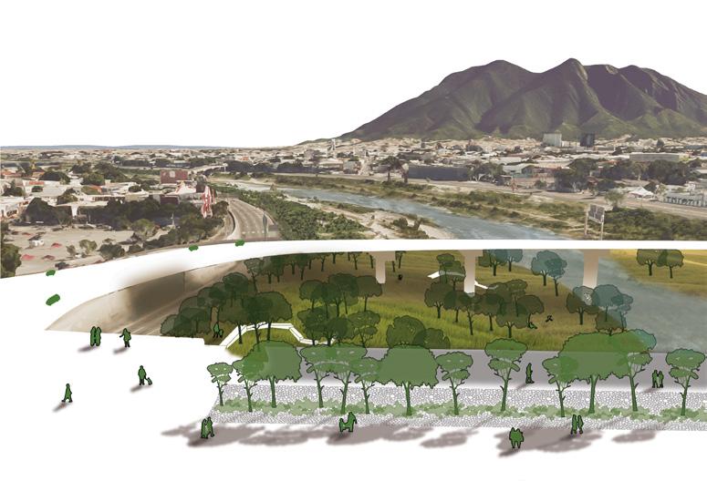
Lower plan— the berms on either side of the bridge create a meandering pedestrian park down from the existing plazas at street level and intro the river. The park includes pathways and terraced steps for recreational use. Planting in the riverbed follows existing river flows and flooding.


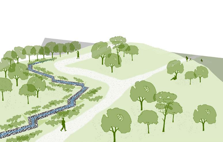
Sophie Weston Chien
This project uses Monterrey’s existing concrete road infrastructure to connect residents to the river and to each other, utilizing the city’s bridges. By returning Monterrey’s significant riverside highways to a two-way system on both sides, it is possible to develop new traffic patterns that would reclaim up to seven lanes of travel. These in turn could be allocated to the riverfront. Moreover, this project adaptively reuses redundant bridges, freed by this reconfiguration, as new civic spaces that connect pedestrians both across the river and to the riverbed.
Each bridge has a unique relationship to the riverbed, and each is a test case that fills a specific community need. These include an urban park, marketplace and ecological buffer zone. The project’s mesoscale reconfiguration of traffic flows lays fundamental groundwork for reestablishing a pedestrian relationship to the river. Its design strategy requires Monterrey to believe in a future where the city must abandon sprawl, which is a looming, ongoing threat to aquifer recharge, and reimagine itself as tight, interconnected neighborhoods.
The river has a part to play in such a transition. Developing dense neighborhoods in the middle of the city required the Río Santa Catarina to be understood as an amenity and a connector, a place where people want to live. By converting east-west highways along the riverfront to support mass transit infrastructure, car lanes can be eliminated and bolster the river’s edge. The newly reclaimed riverfront land can be programmed as a complementary support to the nearest bridge, using berms to reduce flood risk and providing essential land forming for park assets like sports fields and bike paths.
Plans for these reimagined and reclaimed pedestrian bridges would necessarily rely on participatory tools to engage neighbors on both sides of the river in developing strategies for meeting current needs of residents. “Bridging Monterrey” exhibits a material ethic that is uncommon in Monterrey, shifting a land of flowing concrete toward a vision of careful reuse and adaptation.
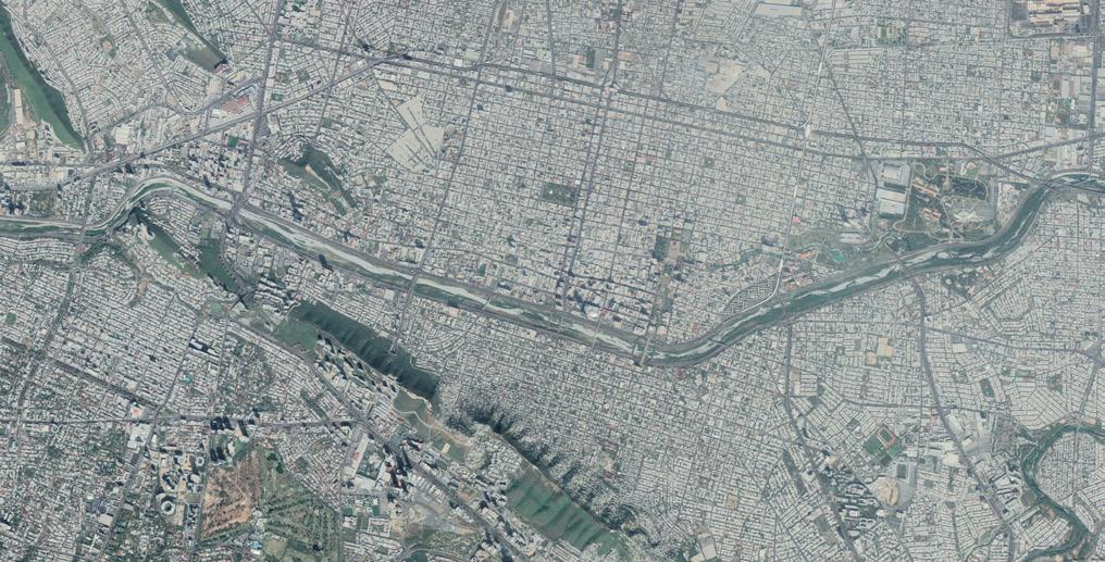
Current condition and phasing of the intervention
river + daylight tributaries traffic
90’
river + daylight tributaries
slower + cleaner water traffic conditions
50’
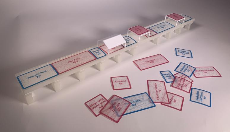
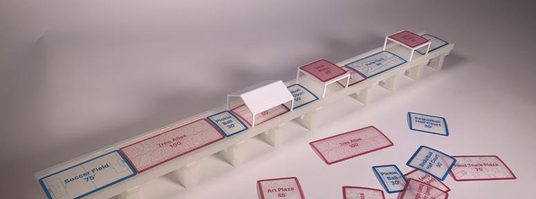
Participatory program model with program tiles and roofs to engage community members on bothsides of the river.
Miguel Lantigua Inoa
The Río Santa Catarina is a paradox for Monterrey. For a city with severe water scarcity, the river accommodates the episodic influx of water from hurricanes and storms—with major hurricane events occurring roughly every 10-15 years. While the riverbed hardly contains water for much of the year, it should nonetheless be understood as an essential part of the city’s infrastructure. Following the recent storms, a robust ecological habitat has formed within the predominantly dry riverbed. It is within this dynamic condition that El Gran Bosque de Río (Urban River Forest) advocates for the importance of microclimatic environments which have the potential to combat Monterrey’s urgent heat and water crises while at the same time substantially providing equitable cross-city access to areas of robust ecological habitat. These two primary objectives are achieved through leveraging the river’s natural tree growth, its surrounding infrastructure, its increasingly flourishing habitats, and its east-west cross city connectivity. In this way, counterintuitively, Río Santa Catarina can and must become home to an episodic urban forest in the riverbed capable of setting the tone for how to work with, and not against, water as well as broader ecological processes.
There are over 32 bridges which connect the northern and southern segments of Monterrey. In addition to these bridges, the river is nested between wide expressways. Both physical constraints make it difficult for pedestrians to access the river as well as maintain a feasible navigability throughout the city. Meanwhile, over the years, many areas of the difficult-toaccess riverbed are now robust ecological
habitats. It can be argued that the limited accessibility, and therefore the limited human activity in the riverbed in recent years may have contributed to the formation of such habitat. And so, a key challenge is to improve accessibility while protecting the river’s ecology, all while acknowledging that habitat and ecosystem formation in the riverbed is cyclical, operating in relation to cycles of flood-driven destruction of habitat, followed by the regrowth of those habitats in multi-year periods of relative calm between major storm events.
The city’s surface temperature varies greatly among the several municipalities which make up the metropolitan region of Monterrey. However, on close inspection, aerial views of sparsely vegetated areas help explain this stark temperature contrast which continues to worsen in Monterrey. Within the densest areas of the city, the linear riverbed demonstrates cooling impact not due to water, but vegetation. In short, vegetated areas considerably improve the surface temperatures - increasing vegetated segments across the city will help alleviate the city’s heat challenge. It is for this reason that the project proposes leveraging the rivers robust tree canopies as the starting point for a more robust strategic afforestation.
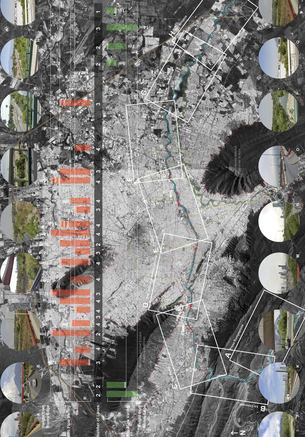
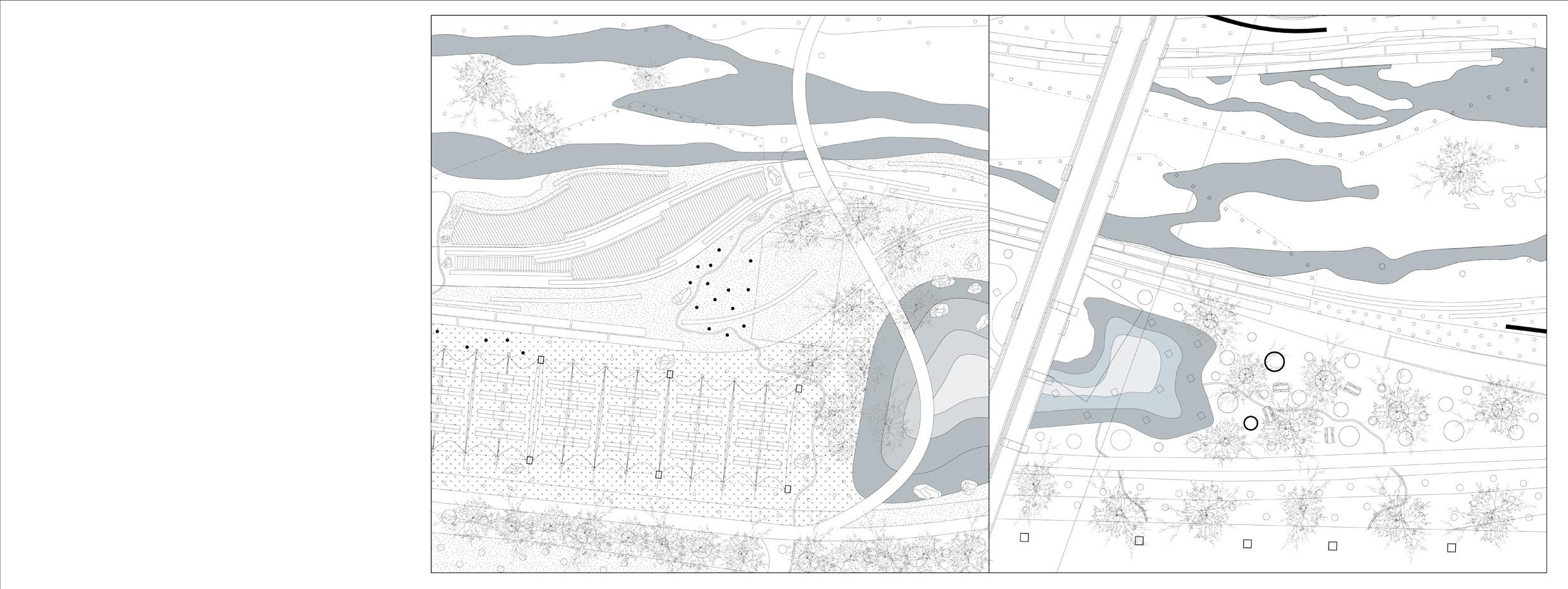
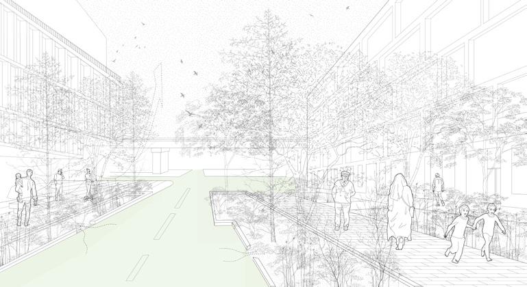
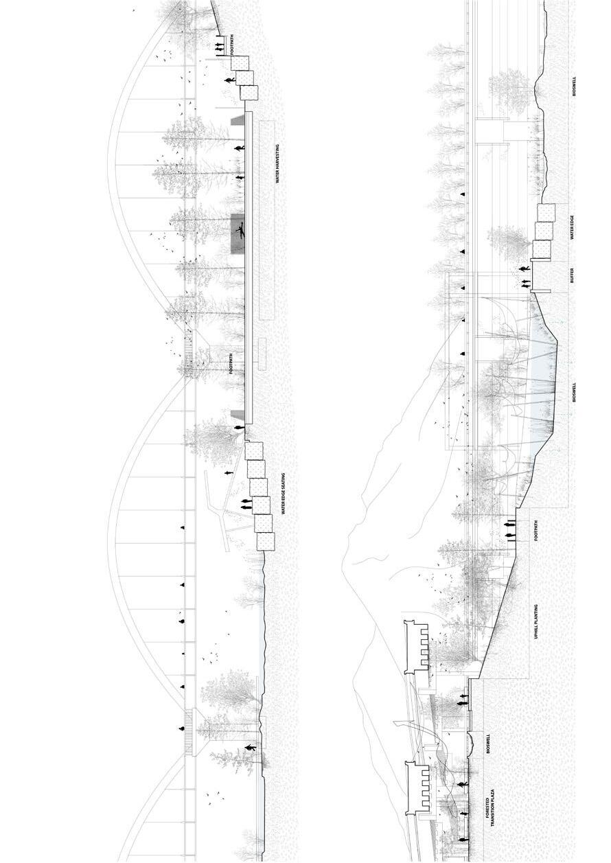
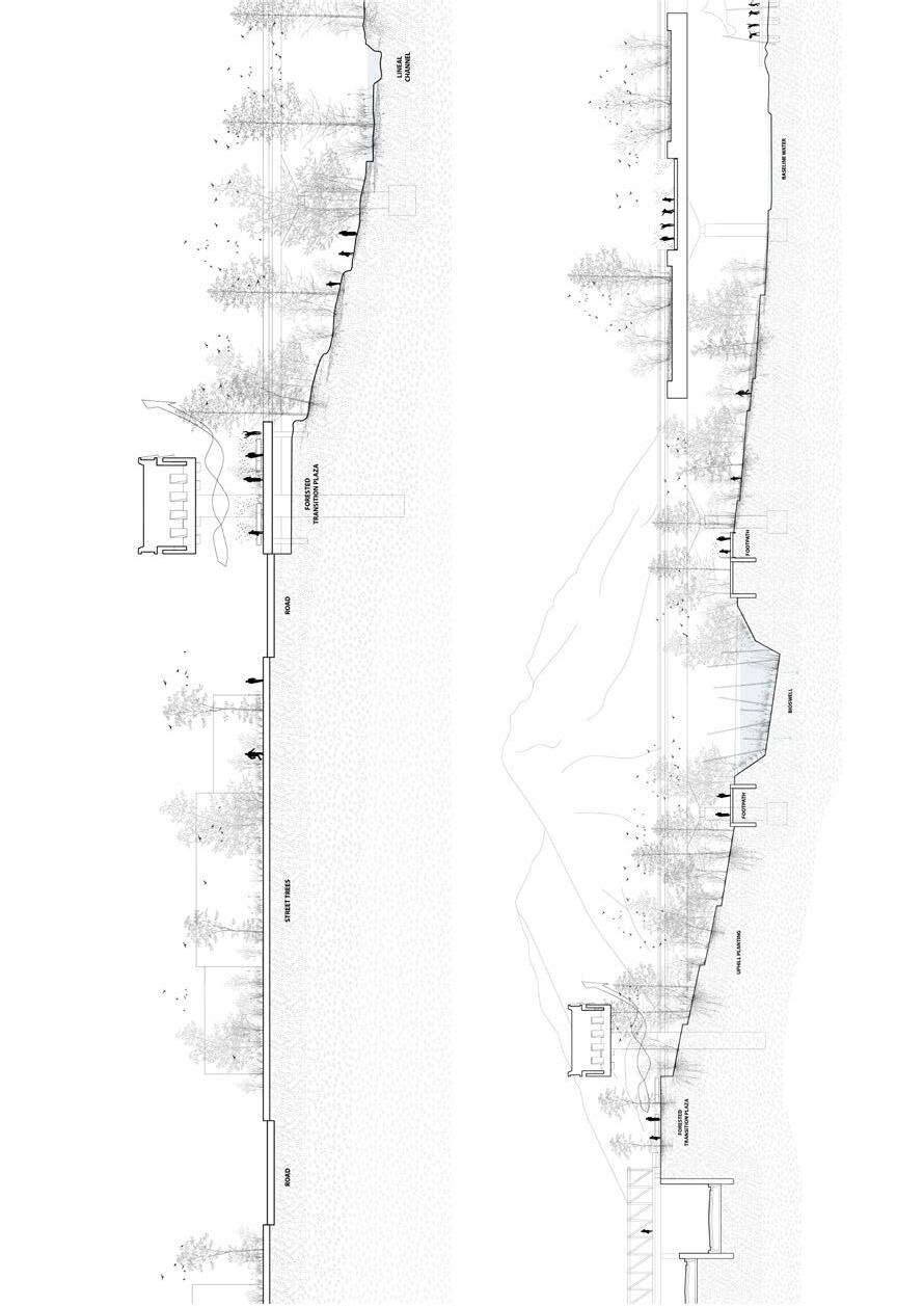
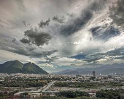
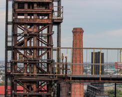
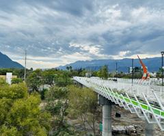
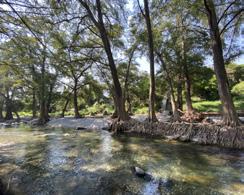
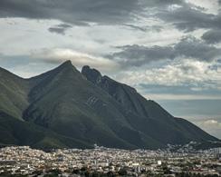
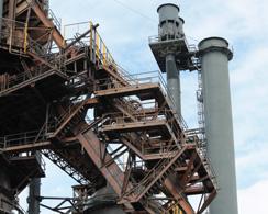
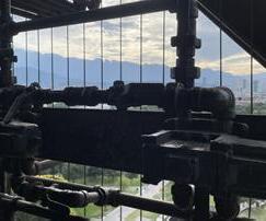
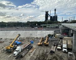
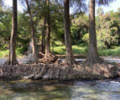
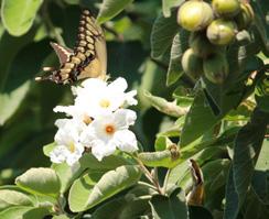
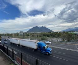
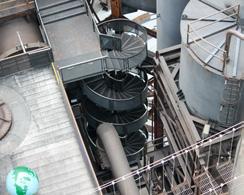

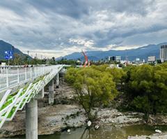
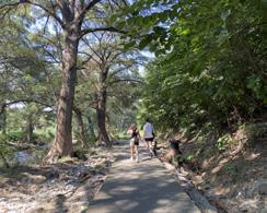
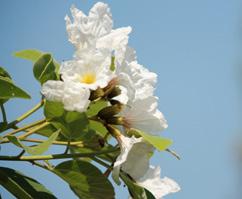
“How he loved this river, how it enchanted him, how grateful he was to it! In his heart he heard the newly awakened voice speak, and it said to him: “Love this river, stay by it, learn from it.” Yes, he wanted to learn from it, he wanted to listen to it. It seemed to him that whoever understood this river and its secrets, would understand much more, many secrets, all secrets.”
238 Río de Arboles: Giving Room to Trees, Temporary Nurseries, and Micro-Climates in Monterrey
Pie Chueathue
250 La Plaza Verde: Seeding Ecological-Civic Memory in the Río Santa Catarina Riverbed
Annabel
Grunebaum
256 From 2D to 3D: Rethinking Surface Water Flow to Mitigate Heat and Flood Risks Yuqi Zhang
264 Wasted Water: Dumping on the Río Santa Catarina Cory Page
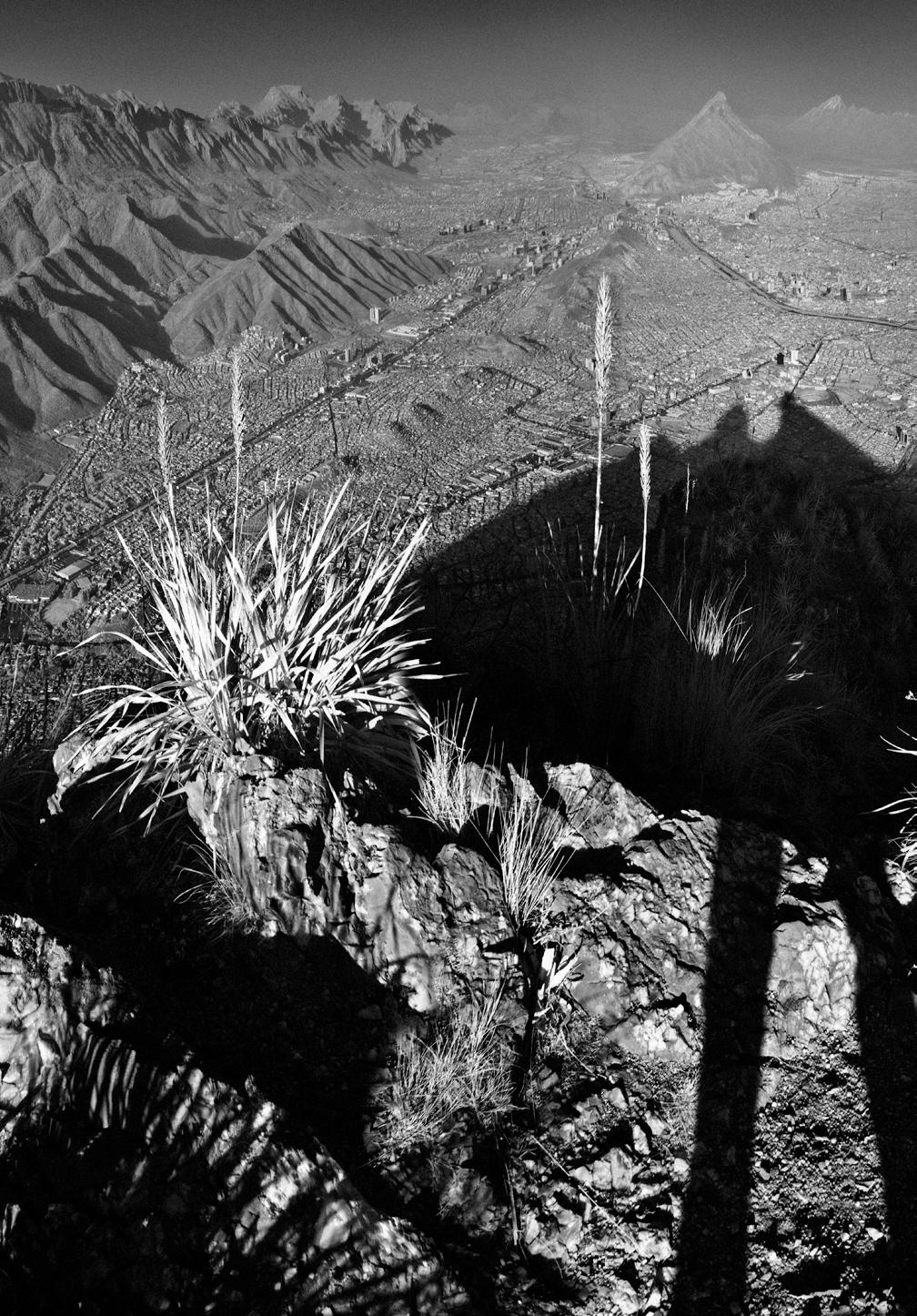
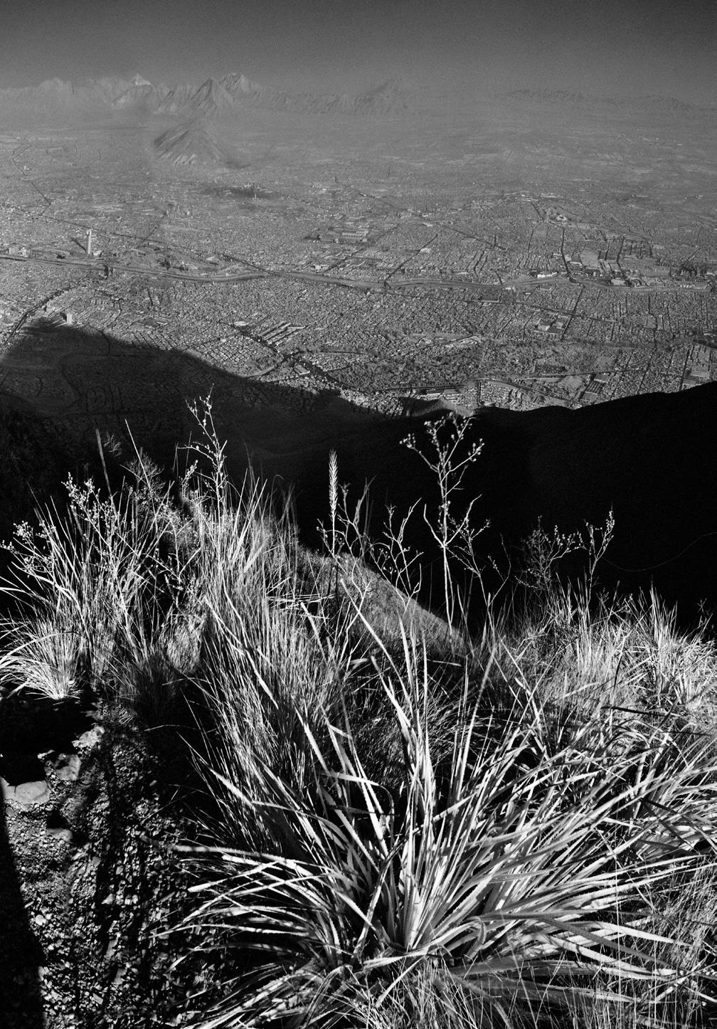
Pie Chueathue
“Río de Árboles” focuses on reducing and reimagining tree removal within the Río Santa Catarina. In contrast to proposals which have called for removing all trees in the river, motivated by a concern for the impediment that dense vegetation can pose to water flows during critical storm events, “Río de Árboles” suggests the selective removal of invasive species while designing the growth and managed retrieval of others. Going further, the project proposes the available riverbed floodplain as a backbone of microclimatic coolness across an extremely hot metropolis, while providing endemic species to surrounding neighobrhoods to implement an urban forest there.
The project envisions a lightfootprint, temporary tree nursery and tree distribution hub model, utilizing sites along the riverbed to reforest current heat-islands. These sites cut along different transversal transects of Santa Catarina’s urban watershed. The proposal goes beyond preserving river vegetation. Rather, the riverbed nursery is a seeding point for many microclimates for newly implemented urban forests throughout the city of Monterrey. In this manner, “Río de Árboles” could implement projects such “Regenerative Capillaries” or “Un Río Vivo” elsewhere in Monterrey.
Over a five-year cycle, preceding hurricane season, the riverbed can function as a production ground for cultivating native trees. These saplings can later be distributed to various sites across the city that are a priority for urban greening. These trees will be both an urban amenity and a mitigation strategy for hot temperatures. In anticipation of major hurricanes, tree
saplings will be harvested and relocated from the pilot site to be permanently planted in receptor sites across the city.
The first pilot project is a temporary nursery in the riverbed adjacent and below the Puente Verde pedestrian bridge. This will distribute saplings to the surrounding communities. The pilot site will also be a new public space, Nursery Park, for citizens nearby. “Río de Árboles” will encompass collaborative efforts among the municipality, non-profit organizations, educational institutions, and Monterrey’s residents. Ultimately, the project will create new green jobs in the city, redefining the Río Santa Catarina from a largely abandoned runoff and waste channel into a river of urban forestry production that can expand green spaces, creating micro-climates, and generating socio-economic benefits across the city.
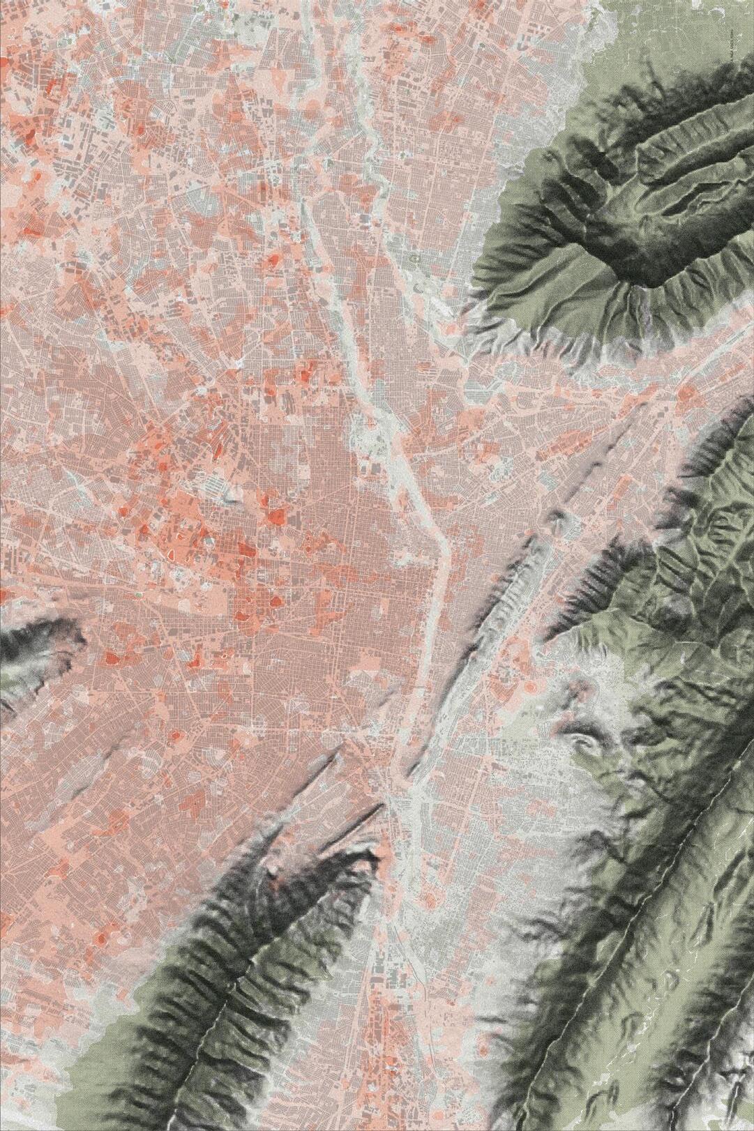
5
3
Bottom:
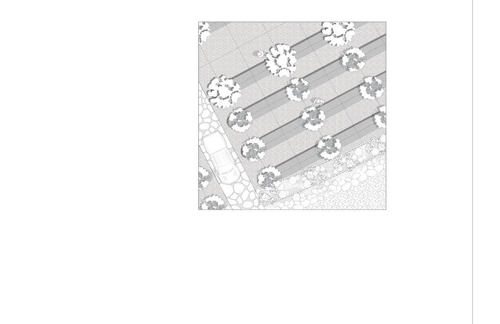
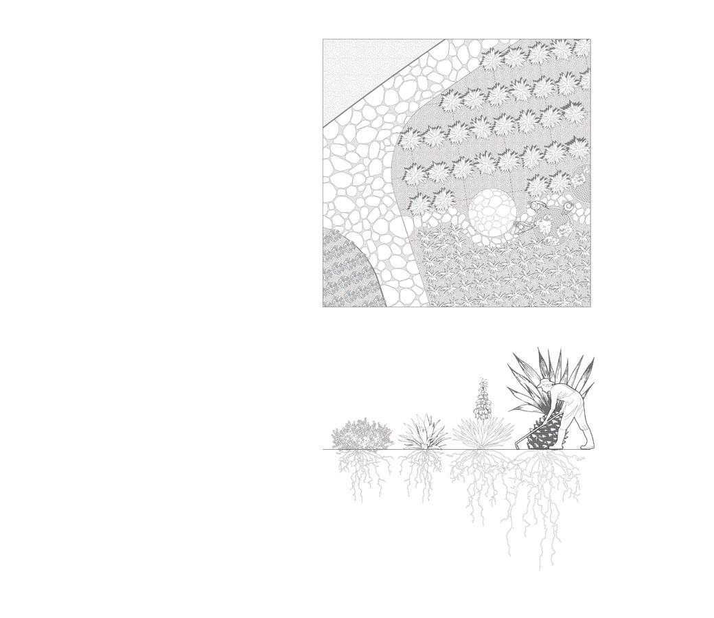
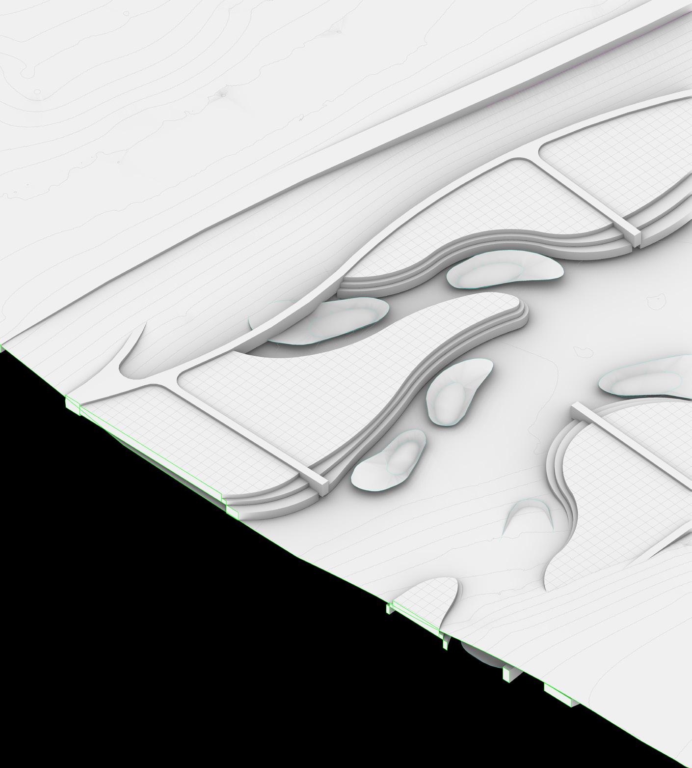


The project encompasses labor-related activities and engenders socio-economic benefits for the city of Monterrey.

The medicinal testing plot for educational purpose
Annabel Grunebaum
Monterrey is a growing metropolis that is highly water-vulnerable. It faces uncertain threats from anthropogenic climate change processes. Balancing this region’s growth with its water cycle and ecosystems requires amplifying the potential of its riverine landscapes.
“La Plaza Verde” reconnects the Santa Catarina’s cooling river ecology to the citizens of Monterrey.
Rather than waiting for the next flood or drought to arrive, the city can anticipate actions to diminish the impact of such events. To enhance the health and biodiversity of the riverbed, while creating space for pedestrian congregation, this project reclaims parts of the riverbed as civic space, with an eye toward human-centered space coexisting with the river’s dynamic ecological processes and biome.
The project proposes a plan in two phases. First, the project addresses current challenges through a managed removal process to promote the health of existing river-bed vegetation. The project then proposes to remediate a lush ecological biome in combination with targeted public space intervention. Together, these welcome pedestrians into the riverbed as a sort of “green plaza.”
Historical traces of this riverine landscape remind one of the close relationship that Regiomontanos once had with Santa Catarina’s riverbed. “La Plaza Verde” reimagines the space below the recently built Puente Verde pedestrian bridge, drawing inspiration from Mexican traditions of civic congregation in central plazas to cultivate new memory seeds of human/non-human conviviality in the riverbed.
Honoring both human and riverbed ecologies, this flood resistant and ecologically embedded “amphitheater” softens the current hard river edges with gentle materials and ephemeral programming. In doing so, it fills a void within the city’s proposed “Green Corridor” plan, which currently does not sufficiently consider the river.
“La Plaza Verde” is a vehicle for reincorporating a substantial area of the riverbed under the Puente Verde into the city’s green corridor strategy. Facilitating city-wide celebration together with everyday circulation, “La Plaza Verde” creates an ecological and civic monumental venue whose modest footprint ushers Regiomontanos/as back to their river.
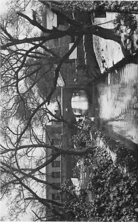
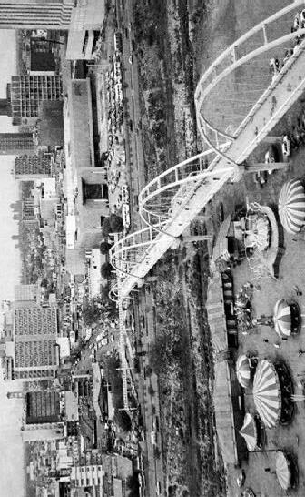
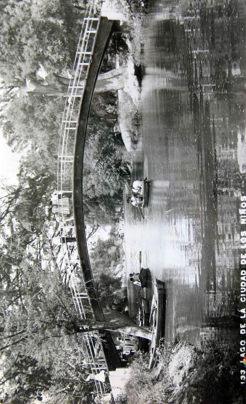
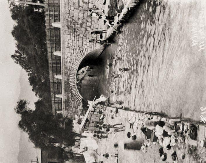
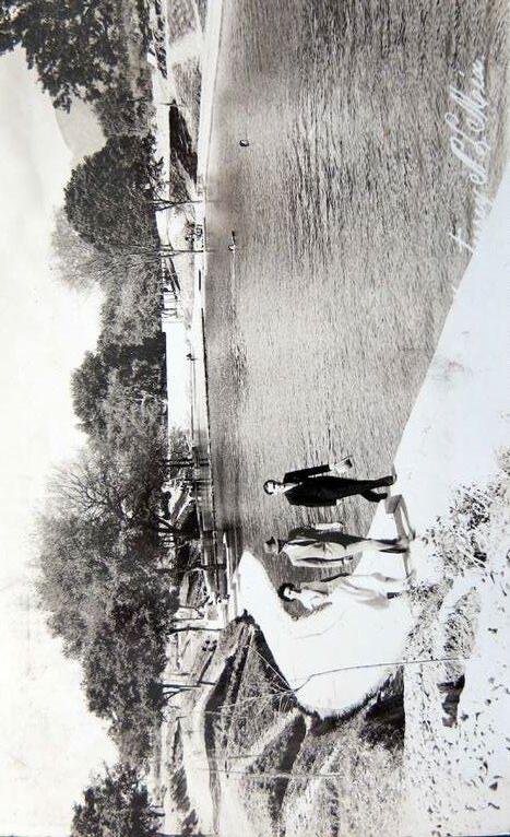
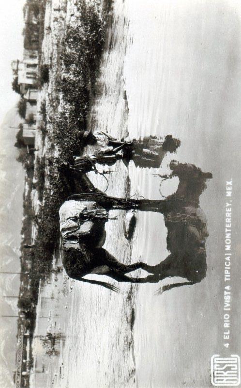
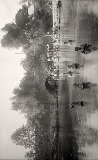
[LA PLAZA VERDE]
A city rooted in the river | a river rooted in its city
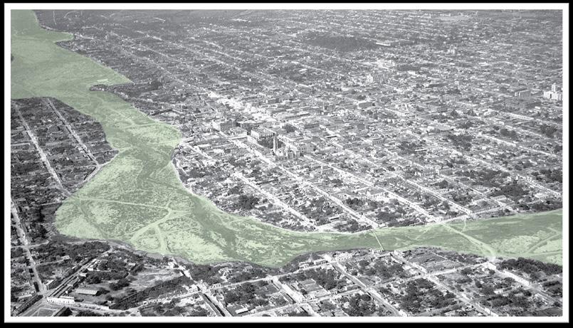
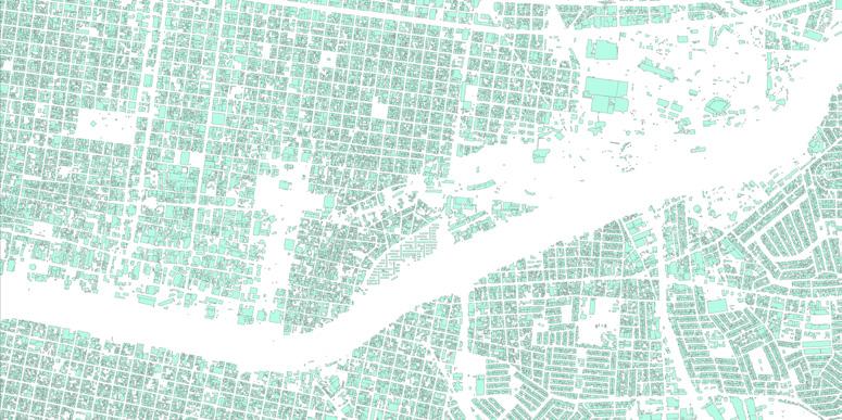
Top: Extending the memory seed of the river into the city by tracing the river edge over time, and planting riverine trees in its place to foster an everyday reminder of where the water once stretched
Right: Mapping green, blue and gray spaces accross the city
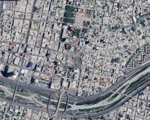
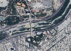
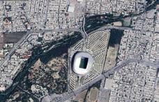


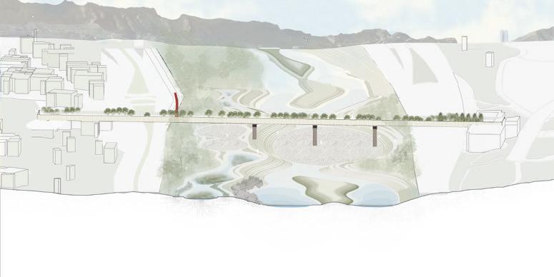
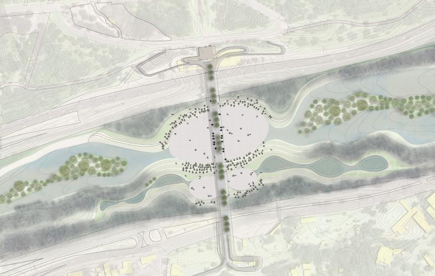
Top: Proposed intervention section. A space with the capacity to facilitate both city-wide celebration and everyday circulation through a riverbed park.
Bottom: this flood resistant plan will soften the edge of natural and built environments with gentle intervention qualities.
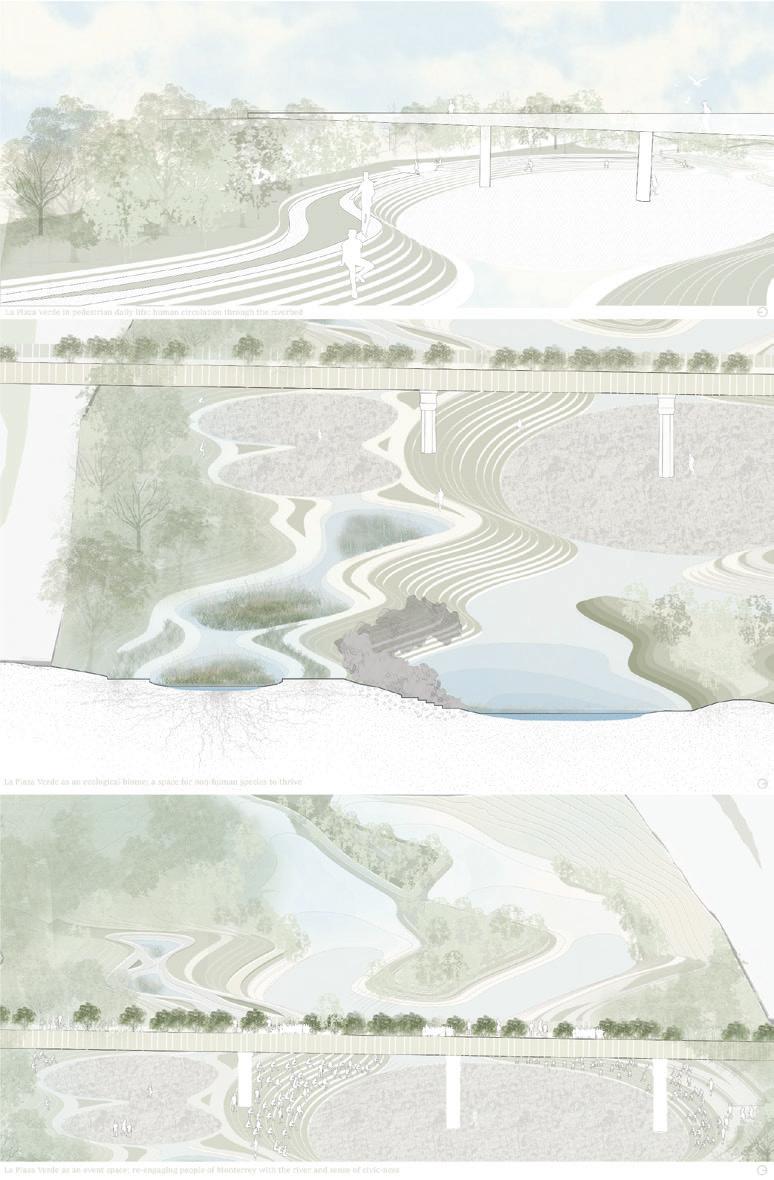
Reintroducing Santa Catarina’s lush ecosystems to the people of Monterrey; drawing inspiration from the tradition of the Latin plaza, and the region’s historic riverine culture to cultivate a familiar experience in the riverbed.
Yuqi Zhang
Monterrey is characterized by a stark divide between wealthy and lowincome communities. Industrial areas are scattered throughout the city along the Río Santa Catarina and Río La Silla, often surrounded by impoverished neighborhoods, exacerbating spatial inequalities. Focusing on the confluence of these two rivers, the proposal aims to reduce flood risks, heat island effects, and river pollution for nearby low-income communities by expanding room for the rivers, storing excess precipitation, and promoting filtration through enriched vegetation.
Extensive impervious surfaces and urban drainage infrastructure in Monterrey only allows precipitation to flow horizontally, leading to excessive surface runoff, severe flood risks, and river contamination, while the soil remains lack of moisture. Thus, this project suggests transforming the 400 acre floodplain between the two rivers into a floodable “central park” for Monterrey. The excess soil from making the park more floodable can be used to reinforce the edges near low-income communities and construct vegetated embankments for the surrounding industrial area. It also proposes utilizing large industrial rooftops to collect rainwater for irrigating nurseries created from bare, unused land. The park consist of four elevated “activity islands,” which remain dry and accessible to the public at all times, surrounded by lowered areas with gentle slope with water retaining ponds to welcome and then capture stormwater. Considering the different proximity to flood, the park will integrate diverse habitats and programs in different parts, creating vibrant urban spaces for various activities while providing habitats
for Monterrey’s flora and fauna. Visitors arriving by car can park on the north side and enter the park, while the south side primarily serves the surrounding neighborhood on foot. Walking along the bridge and across the river, the flood-filled ponds in the forest provide a visual indication of the flood level. Upon reaching the central activity island, you can choose to head upward for a variety of activities or stroll gently downward through open fields of flowers and nurseries, eventually reaching a densely wooded riparian forest to experience the rich diversity of flora and fauna. In doing so, the proposal aims to strengthen the connection between human activity and the ecosystem, while raising awareness and encouraging greater attention to water dynamics in daily life
Right: An overlay of various social vulnerabilities, with the area highlighted by dotted lines an intersection of all issues.
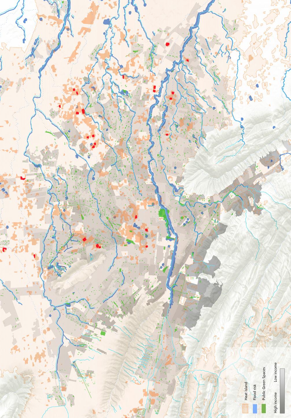
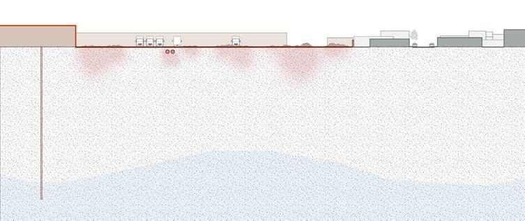
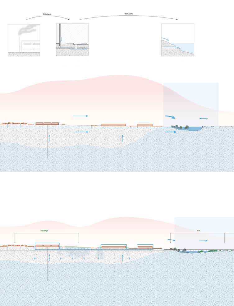
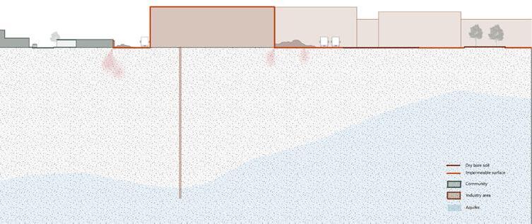
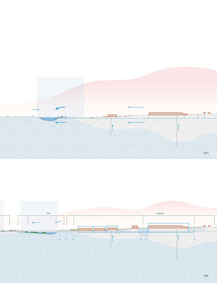
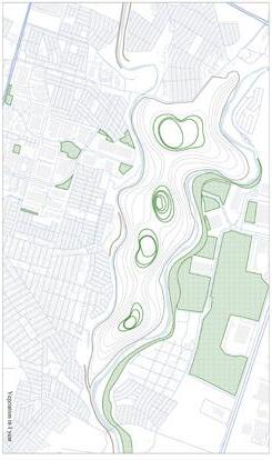
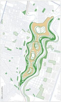
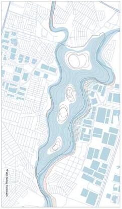
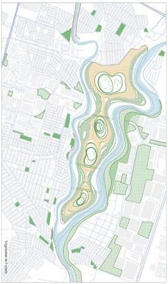
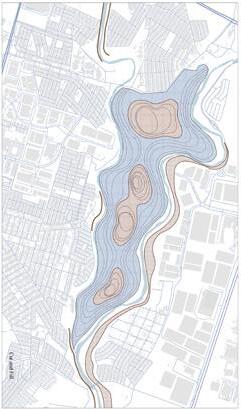
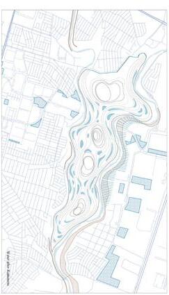
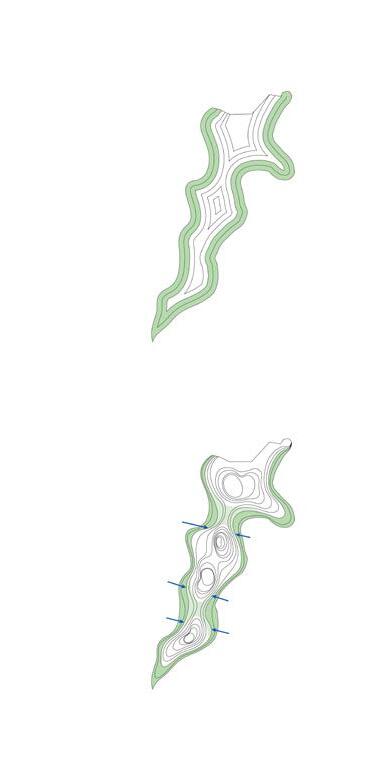
Yuqi Zhang
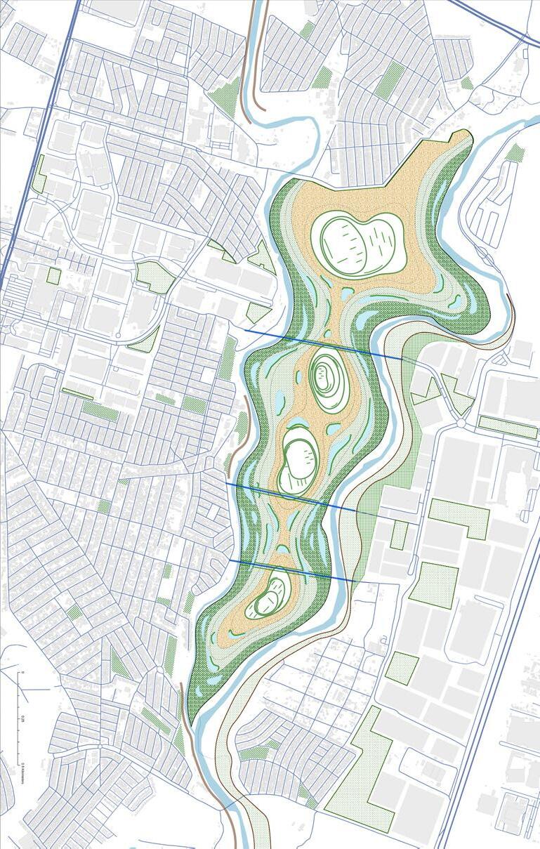
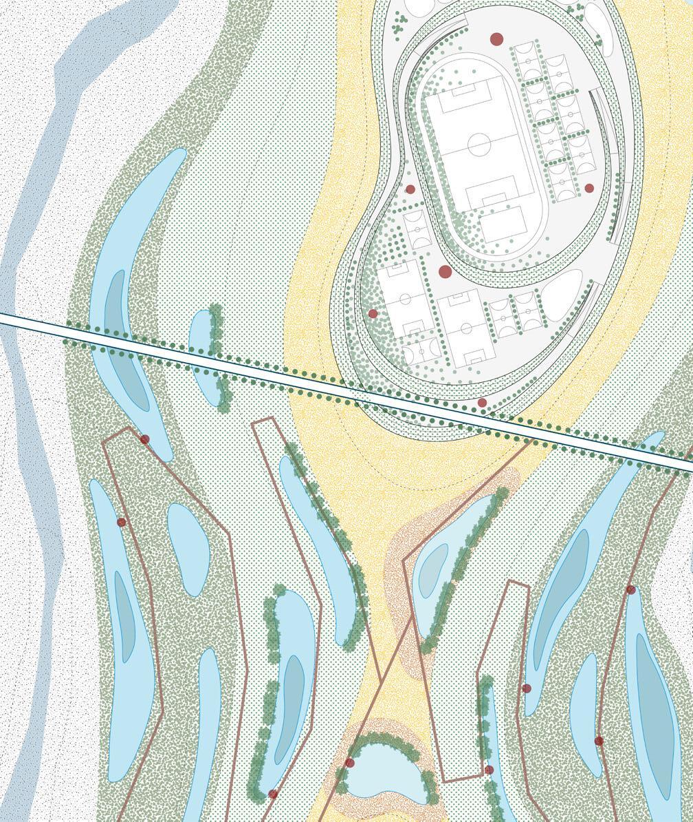
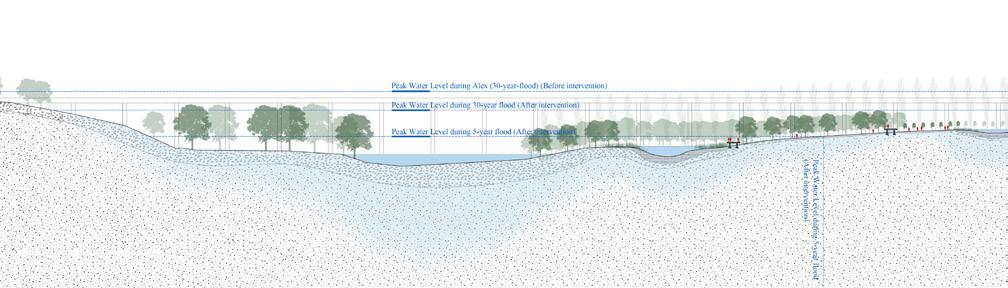
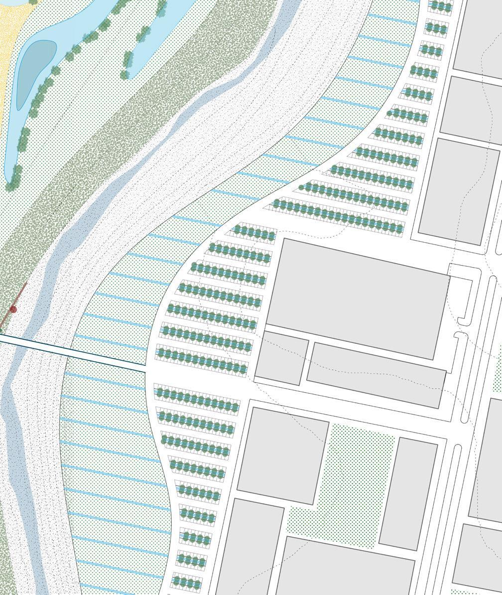
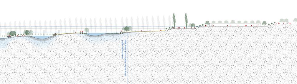
Cory Page
The Río Santa Catarina, once a vital artery for Monterrey, has deteriorated into a polluted corridor burdened with 15 clandestine landfills and 24 wastewater discharge points. Wasted Water envisions a transformative future where these sources of contamination are eradicated, restoring the river as a vibrant urban asset. This proposal reimagines the degraded riparian zones and neglected lands along the river as opportunities for environmental and social revitalization. By introducing a new typology—the Community Waste and Energy Resource Center (CWERC)— paired with neighborhood-based “Zero Centers” for waste management and localized wastewater treatment, the project proposes a metabolic system that positions waste and water as key drivers of resilience.
The CWERC facility acts as a hub for processing wastewater and generating renewable energy, while the “Zero Centers” tackle waste and material recovering issues at the neighborhood scale. Together, these interventions form a decentralized system designed to foster environmental health and community empowerment. This approach not only reduces pollution but also creates economic value, funded through new tax revenues collected from industrial stakeholders and energy sales generated by CWERC operations. By addressing pollution at its source and repurposing waste, the project lays the groundwork for a more sustainable and equitable urban future.
The proposal goes beyond remediation; it seeks to reestablish Monterrey’s relationship with the Santa Catarina. By reopening access
points and redesigning the watershed with hydrological health as a guiding principle, the river is repositioned as a central urban amenity. Waste, previously an environmental burden, is repurposed into a dynamic berm that anchors the architecture of the new site program and directs water into stormwater swales. Using waste as a tool to repurpose degraded sites will support flood mitigation, allow for urban density, and activate streetscapes. These interventions not only manage water but also enhance public space, making the riverfront an integral part of daily urban life.
The vision culminates in an integrated park and stormwater management system that ties Monterrey’s urban fabric back to its river. The final phase transforms the viaduct at Highway 20 into a filtration system, completing the river’s renewal and symbolizing the city’s commitment to sustainable growth. By aligning environmental, social, and economic goals, Wasted Water imagines a future where the Río Santa Catarina is no longer a repository for waste but a symbol of resilience and renewal for Monterrey.
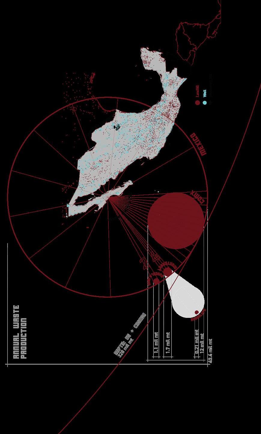
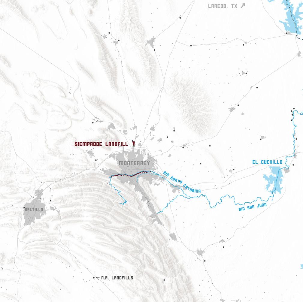
the Río Santa Catarina is inherently connected to Monterrey’s water supply and thus the downstream impacts of pollution, both visible and not, extend as far as the Rio Grande and the Gulf of Mexico.
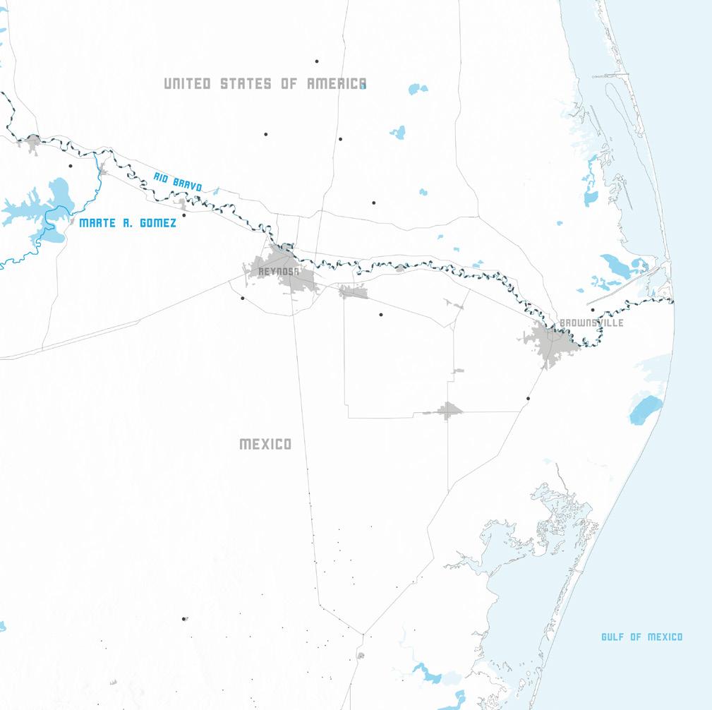
Resevoir Pollution
Clandestine Dumping

Bottom: section drawings illustrate pollution’s dual impact: during the dry season, leachate infiltrates groundwater as a chemical pollutant, while extreme floods carry waste downstream as a physical pollutant.
Top: riverine dumping on the Santa Catarina reflects an underfunded waste management system, worsened by high disposal costs and peripheral infrastructure locations.

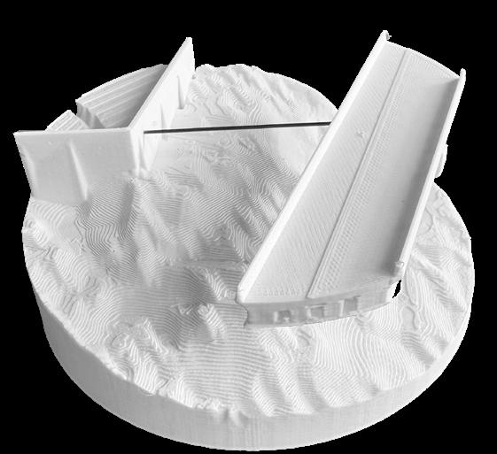
Left: site plan of the linked system that connects the “Zero Center” and QWERC - serving as vital infrastructure to reunite the community with its river.
Top: a section and model showing reusing the vidaduct as a linear filtration cordiors for stormwater.
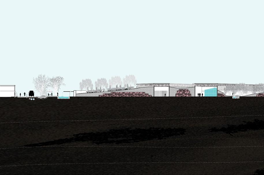
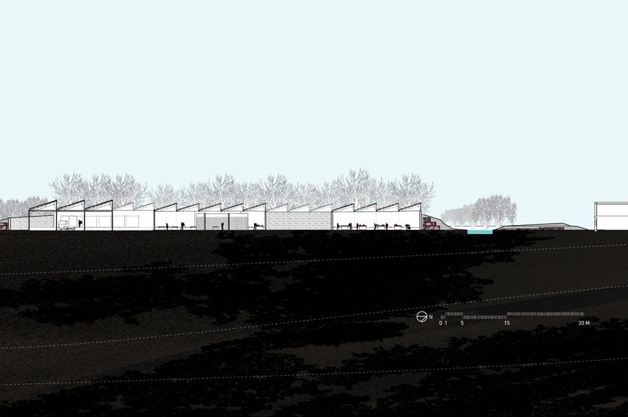
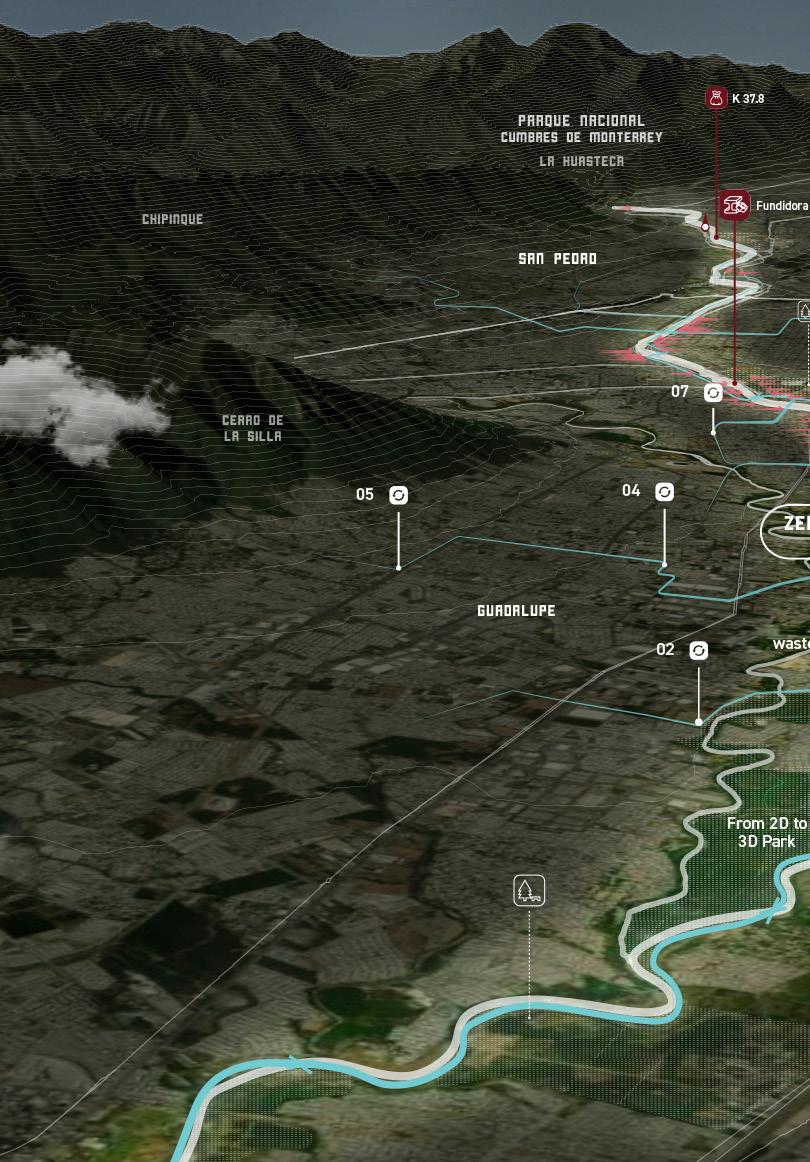
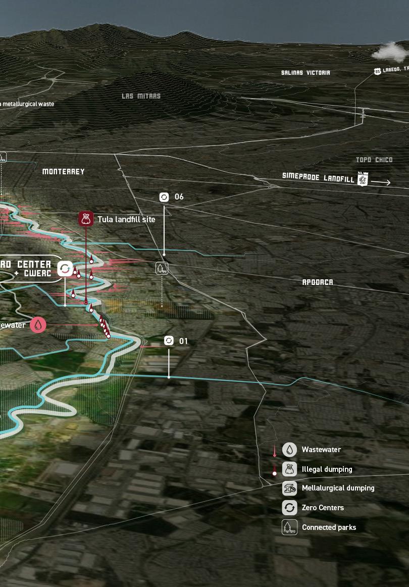
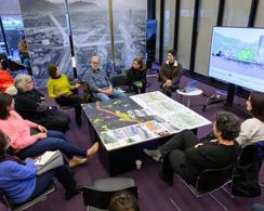

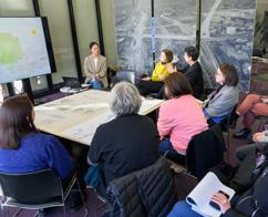
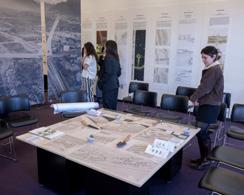
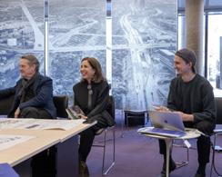
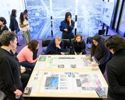
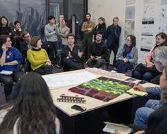
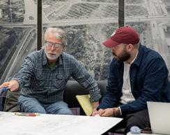
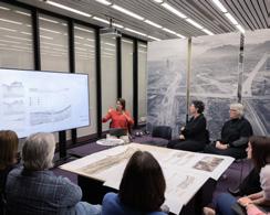
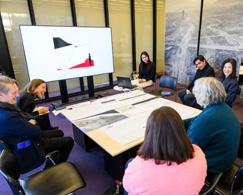
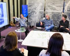
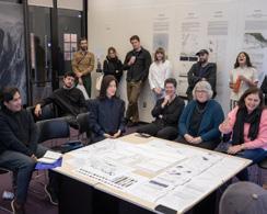
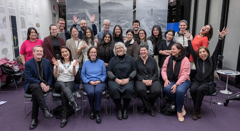
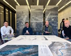
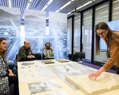
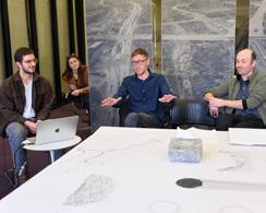
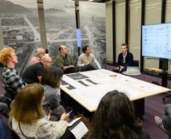
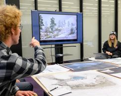
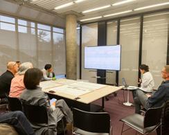
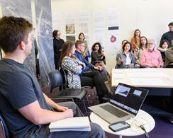
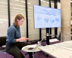
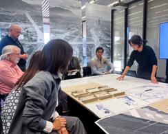
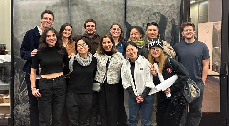
Bello Gómez
This publication presents the work from two Option Studios that I offered at the Graduate School of Design at Harvard University in the Falls of 2023 and 2024, entitled respectively, Aqua Incognita III, IV: Designing for Extreme Climate Resilience in Monterrey, MX. Both studios were run in parallel to a collaborative project on nature conservation and regeneration with the Monterrey based NGO Terra Habitus, who sponsored our travel and this publication thanks to a three-year grant from G-10, a philanthropic coalition of Monterrey´s private sector, and personal donations from Alberto Garza Santos and Eugenio Clariond Reyes-Retana.
Still ongoing in a second phase, the project aims to enhance water-security and climatic resilience for communities in Monterrey´s metropolitan region through nature-positive regenerative actions. It does so by establishing the Santa Catarina River as a spatial framework for climate resilience strategies to promote: 1) regenerative actions in the mountainous headwaters for natural water storage, infiltration, delay and flood reduction; 2) regenerative actions in the urban watershed to enhance blue-green capillaries linking the mountains with an accessible and regenerated metropolitan river park; 3) and regenerative actions to reduce pollution and aquifer overexploitation overall.
The depth of the students´ projects is indebted to the support of the local team, led by Lorenzo J. de Rosenzweig. His expertise provided a thorough understanding od the status-quo conditions of the Santa Catarina River watershed, helping us envision and ground our spatial framework. This expertise, combined with his life-long commitment to nature conservation in Mexico and the rich analysis of his team’s local experts, were critical contributions to our studio. Additionally, he shared studies from the Water Center at the Tec of Monterrey and UDEM’s Río Ciudad pilot project, that enriched our approach. I
thank you, Lorenzo, for your generosity in sharing your wisdom with me and our 35 GSD students.
In the case of GSD PhD candidate, now Doctor Samuel Tabory, you transformed this territory into a topic that ignited the thought in your dissertation. Thank you, Sam, for the continuous inspiring brainstorming over the past five years, and for your rich contributions to the seminar, both studios, and to this publication. I am certain that our work from the ground and academia, will continue to make a difference in the trenches of climate adaptation.
At the GSD, I would like to extend my gratitude to our Dean, Sarah Whiting and Landscape Architecture’s Chair, Gary Hilderbrand, for supporting these two studios at the school. Without your leadership, projects like these would be difficult to support from academia. But, as climate crisis continue progressing, there is no doubt that capital would need to come to terms with society, ecology, and ecosystem performance. I am grateful for you in sharing my conviction, despite current political winds, that studios like Aqua Incognita are necessary to give our outstanding national and international graduates the seeds that will contribute better harvests on Earth soon.
This project would not have been possible without the invitation and support of María del Carmen Elosúa during our first visit to Monterrey in July 2022 and July 2023.
Architect, MIT alumna, and former director of planning at San Pedro’s Municipality, María facilitated all the introductory meetings with important stakeholders in Monterrey, including Juan Ignacio Barragán (Water Agency director), Aldo Ramírez (Tec of Monterrey’s Water Center director), Rosario Álvarez (Pronatura Noreste director), and Lorenzo J. de Rosenzweig (Terra Habitus director). María also organized a gathering with former MIT and GSD alumni such as Roberto Ponce (Gov-
ernment School at Tec), Javier Leal (Implang director at San Pedro), Rubén Segovia (Architecture School at Tec) and then GSD student Rolando Girodengo (now Architecture School at Tec). Lorenzo introduced us later to the Río Ciudad team at UDEM directed by Daniela Frogheri, Rafael García and Eduardo Galván. Rubén also introduced us to his team at the Tec EADD directed by Alfredo Hidalgo and Mark Wood, to Edgar Olais (Implanc director at Monterrey) as well as to José Antonio Torre, Perla Martínez and Rolando Cantú (Tec of Monterrey´s Center for the Future of Cities) to whom I owe the invitation to join a forum on urban river regeneration in late August of 2023.
Almost all the above-mentioned individuals became part of our studio, and I owe you big thanks. Either for your participation in our seminar; for joining or supporting the symposia; for joining the workshop and design charette with your students; for welcoming us during our visit to explain your current projects; or for joining some of our reviews either by Zoom or in person. In the symposia, we were lucky to learn in person from the work of local and international experts such as Loreta Castro, Alejandro Echeverri, Ginés Garrido, and Ismael Aguilar, in 2023. And the following year, from Antonio Azuela, Iñaki Echeverría, Eduardo Marín, Nicholas Nelson, and Liz Silver. It was very enriching to participate in these events with all of you, and I want to thank those who moderated or joined the panel discussions, as your name is in the first page of this report. For these enriching symposia, we especially need to thank Ruben Segovia, without whom they would not have happened. Thank you, Rubén, for welcoming us both years at Tec.
I am deeply touched by the generosity of photographer Roberto Ortiz Giacoman for letting us use his artful photography of Monterrey’s monumental and sublime mountainous landscape in this publication. Your photography has been a continuous source of inspiration for the duration of this project, and I cannot think of a better way to close this first chapter than with the beauty of Monterrey’s sublime mountains portrayed by you.
During our trips to Monterrey, we owe special thanks to Terra Habitus´ team for making our stay an unforgettable experience, for expanding the empathy of our students for your treasured territory, and for contributing to our sensitive and contextual responses to its current challenges. To Ximena and Sarah, for
helping us with all the logistics, and to Roxy and Enrique for your warmth, knowledge and company while traversing the Santa Caterina Riverbed from its headwaters to its coastal plain. Walking together along the dry canyons of Cumbres National Park in 2023, or in a place transformed by its aqueous nature after the flood in 2024 is a memory that will stay with us. Entering museums, municipal offices, eating together, and laughing with both Roxy and Enrique was the best therapy after long days of field research, design charettes and symposia.
Special thanks in Monterrey go also to members of “Zenderío,” “Un Río en el Río,” “Parques y Vida Silvestre,” and “La Cumbre Cotidiana,” for walking with us along the Santa Catarina River and for joining our symposia. To “El Señor del Bosque” for hiking with us to Chipinque Ecological Park and to director Lorena Vázquez-Ordaz for receiving us and explaining the Park´s current plan. Students were thrilled to have Rolando Girodengo and Javier Leal, welcoming us in your city both years. I sincerely thank you both.
At Harvard University, I am indebted to the generosity of the Harvard David Rockefeller Center for Latin American Studies (DRCLAS) for their support of part of our travel to Mexico in the Fall of 2024. Thank you, Sol Carbonell and Lorena González, for making this possible and for Paulina González´s essay on our work at the DRCLAS webpage. I also owe special thanks to the Bloomberg Center for Cities at the Harvard Kennedy School for connecting me in the Spring 2023 with both, Monterrey´s Mayor Donaldo Colosio, and San Pedro´s Mayor Miguel Treviño. Thank you Isabel Mejía for reaching out. Thank you also Donaldo Colosio from joining us at the GSD during your visit. Our work benefited from the publicity that it received. In that regard, we owe special thanks to the GSD’s Office of Communications for sending Kyra Davies to Monterrey with us during the Fall 2023. Thank you, Kyra, for all the beautiful posts and promotional media on the GSD’s online media during that time. Your well-written essay “From Drought to Flood” helped our work achieve international exposure. Thank you also to Anita Kan and Justin Knight for the wonderful pictures during reviews that now form part of the publication. Also at the GSD, I am grateful to my colleagues, Nicholas Nelson—who traveled with us to Monterrey—and Robert Zimmerman, for your shared knowledge and support to the
studios. Both your experience in river ecology restoration and regeneration contributed to compelling and strategic projects. The lessons learned came also from semester contributions in lectures and reviews from outstanding colleagues and experts, and I use the opportunity to thank them for their valuable feedback. We had inspiring lectures from: Rosario Álvarez, Celina Balderas, Margarita Jover, Max Piana, Lorenzo Rosenzweig, Liz Silver and Gena Wirth.
Fall semester critics were: Carina Arvizú, Anita Berrizbeitia, Joan Busquets, Loreta Castro, Maurice Cox, Adriana Chavez, Ginés Garrido, María Elosúa, Matthew Girard, Salvador Herrera, Gary Hilderbrand, Javier Leal, Nick Nelson, Lorenzo J. de Rosenzweig, Liz Silver, Samuel Tabory, Belinda Tato, Luis Zambrano and Bob Zimmerman.
Final review critics were: Carina Arvizú, Anita Berrizbeitia, Diane E. Davis, María Elosúa, Maria Goula, Salvador Herrera, Gary Hilderbrand, Jungyoon Kim, Max Piana, Nick Nelson, Chris Reed, Liz Silver, Samuel Tabory, Belinda Tato, Ed Wall and Robert Zimmerman. It really takes a village to formulate thoroughly designed resilient responses!
Most important of all, I sincerely thank all the students who joined us to find a way forward for climatic resilience in Monterrey. Seminar students helped us break the ice with many discussions and research projects.
Thanks go to: Alberto Bolaños, Bryce Crawford, Aimen Fatima, Yimei Hu, Slide Kelly, Minh Nguyen, Lara Prebble, Anika Richter, Montgomery F. Simus, Leyla Uysal and Makio Yamamoto.
Tasked with the hardest part were those who had to project a hydrological resilient future for Regiomontanos. This publication includes illustrations and original drawings from twenty-three GSD students who joined our studios:
Sophie Chien, Pie Chueathue, Lucas Dobbin, Annabel Grunebaum, Miguel Lantigua Inoa, Bernadette McCrann, Emily Menard, Ashley Ng, Sanjana Shiroor, Daniella Slowick, Jianing Zhou, and Boya Zhou in 2023.
Anne Field, Manaka Hataoka, Mya Kotalac, Donguk Lee, Yuehan Eva Li, Sammy Mansfield, Cory Page, Drummond Poole, Markel Uriu, Yuqi Zhang, and Nina Zhao in 2024.
I admire your patient quest in confronting a problem of this scope, and for your talent in synthesizing it through design with the thoughtful and imaginative proposals in
this publication. I trust that our effort will continue to change the narrrative of the Santa Catarina River in Monterrey.
For the beautiful display of all the students work I owe special thanks to Miu Kondo and Rolando Girodengo for their artful and patient contribution to this report.
To all, I extend my deep appreciation.
Lorena Bello Gómez is Design Critic in Landscape Architecture at the Harvard GSD following her lectureship at MIT SA+P (2013-2020) and Porto’s FAUP (2020-2021). At the GSD Bello coordinates Core IV “The Near Future City” in tandem with seminars and option studios focused on water-resilience. Through international grants, she works with local institutions and interdisciplinary teams to connect design expertise and political will to positively impact regenerative change and climatic adaptation. She has received support from the Andrew W. Mellon Foundation in Spain, the Aga Khan Foundation in India, Fundación Social in Colombia, TUMO Foundation in Armenia, the David Rockefeller DRCLAS in Mexico, UKPACT Mexico Program and Terra Habitus. She has also engaged in workshops with universities and/or governments in Colombia, Japan, Spain, Mexico, China, and Portugal. Publications include Aqua Incognita I-II, City in Transition and Beyond Reconstruction. She holds a master’s in architecture with honors from Barcelona UPC (MArch´05), a Master of Architecture in Urban Design from the Harvard GSD (MAUD´11), and a European PhD in Urbanism from Barcelona UPC (PhD´15).
Lorenzo J. de Rosezweig is an environmental leader dedicated to regenerating the natural and cultural heritage of Mexico and the planet. With over 40 years of experience, he has pioneered innovative conservation finance models, earning support from government agencies, international organizations, and private donors. As co-founder and CEO of the Fondo Mexicano para la Conservación de la Naturaleza (FMCN) for 27 years, he helped raise over $400 million and funded more than 2,000 projects. Lorenzo has trained hundreds of professionals in conservation and sustainable finance and
worked closely with rural communities and civil organizations in Mexico and beyond. He has designed over 30 conservation programs and structured financing for the award-winning IMAX film Flight of the Butterflies. Since 2020, he has led the design of a private land conservation and regenerative ranching model for northern Mexico’s grasslands. A published author and advocate for environmental journalism, Lorenzo continues to raise awareness on conservation.
Samuel Tabory leads research at CoRe, focusing on building robust policy evidence around nonlinear systems change for improved Commons governance across scales. He contributes to research design and evaluations of complex systems, shaping CoRe’s strategic programming. Trained as a regional planner, Sam specializes in environmental governance and is passionate about the everyday politics of innovation across urban and rural contexts. His work bridges research and action, supporting multi-level partnerships, policy dialogue, and coalition-building for equitable climate and resource transitions. Sam’s experience spans community development and highlevel policy engagement, working with diverse stakeholders. Before CoRe, he advised a restoration initiative in Mexico (UK PACT), managed research for a U.S. National Science Foundation network, and served at the Chicago Council on Global Affairs. He has contributed to reports for UN Environment, the World Bank, and NATO. His scholarly work appears in Global Environmental Change, Urban Transformations, and Journal of Industrial Ecology. Sam holds a PhD in Urban and Regional Planning at Harvard.
Aqua Incognita III IV: Designing for Extreme Climate Resilience in Monterrey, MX
Instructor
Lorena Bello Gómez
Report Design
Lorena Bello, Rolando Girodengo, Miu Kondo
Report Editors
Lorena Bello, Samuel Tabory
Report Copy Editors
Miu Kondo, Cory Page
Dean and Josep Lluís Sert Professor of Architecture
Sarah Whiting
Chair of the Department of Landscape Architecture
Gary Hilderbrand
Copyright © 2025 President and Fellows of Harvard College. All rights reserved. No part of this book may be reproduced in any form without prior written permission from the Harvard University Graduate School of Design.
Text and images © 2025 by their authors.
Harvard University Graduate School of Design 48 Quincy Street Cambridge, MA 02138 gsd.harvard.edu
The editors have attempted to acknowledge all sources of images used and apologize for any errors or omissions.
Image Credits
Outer Cover: Nidus ad Huasteca
Credit: Photographer Roberto Ortiz Giacoman (www.robertortizphoto.com)
Inner Cover: San Judas - Anfiteatro
Credit: Photographer Roberto Ortiz Giacoman
Pages 28-29: Picture by Roxana C. Elorriaga
Pages 42-43: Studio Trip pictures by students, Lorena Bello, and Roxana C. Elorriaga
Page 44, 94, 140, 190, 234: Pictures by students, Lorena Bello, and Roxana C. Elorriaga
Pages 46-47: Mitra a Huasteca III
Credit: Photographer Roberto Ortiz Giacoman
Pages 95-96: Nidus ad Huasteca
Credit: Photographer Roberto Ortiz Giacoman
Page 142-144: Yucca _ La escondida
Credit: Photographer Roberto Ortiz Giacoman
Pages 192-193: Loma Larga s/f
Credit: Photographer Roberto Ortiz Giacoman
Pages 236-237: Ensillado 2011
Credit: Photographer Roberto Ortiz Giacoman
Pages 278-279: Review pictures by students, Lorena Bello, Anita Kan, and Justin Knight
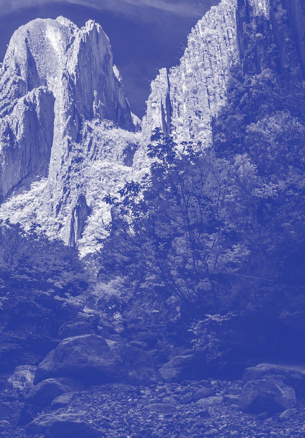
Studio Report
Fall 2023 + 2024
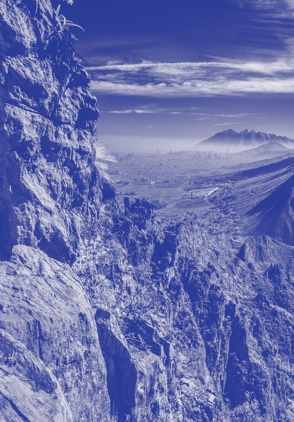
Harvard GSD
Department of Landscape Architecture
Fall ‘23: Sophie Chien, Pie Chueathue, Lucas Dobbin, Annabel Grunebaum, Miguel Lantigua Inoa, Bernadette McCrann, Emily Menard, Ashley Ng, Sanjana Shiroor, Daniella Slowick, Jianing Zhou, Boya Zhou
Fall ‘24: Anne Field, Manaka Hataoka, Mya Kotalac, Donguk Lee, Yuehan Eva Li, Sammy Mansfield, Cory Page, Drummond Poole, Markel Uriu, Yuqi Zhang, Nina Zhao