CORTLANDT CHIN

Portfolio

cchin002@citymail.cuny.edu
718-869-6256
https://www.linkedin.com/in/cortlandtchin-471663215/
June 2024 -
August 2021
May 2021 -
August 2017
The City College of New York, City University of New York (CUNY)
Master of Architecture
AIAS, NOMAS
Graduate Architecture Club, Spitzer School Asian Club
University at Buffalo, State University of New York (SUNY)

Bachelor’s of Arts in Environmental Design
Mathematics minor
Cum Laude
Dean’s List: Spring 2020, Fall 2020, Spring 2021
University at Buffalo Thunder of the East Marching Band
January 2023
-
July 2021
August 2017 -
July 2017
Shake Shack
New York, New York
Employee of the Month nominee - July 2021
• Employee of the Month for exceptional communication and teamwork.
• Optimized the cleaning process of the fryers at the end of the night, allowing it to be cleaned up to 50% faster.
• Streamlined the process for frying chicken, reducing wait times by up to 50%.
Queens Community House
Rego Park, NY
• Collaborated with 3 Camp Counselors to mentor up to 30 incoming 4th graders and prepared the students for the upcoming school year.
• Distributed lunch to up to 100 campers and centralized the storage of leftover foods, leading to a 50% faster setup and cleanup time.

Institution:
SUNY University at Buffalo
Instructor: Conrad Kickert
Semester: Spring 2021
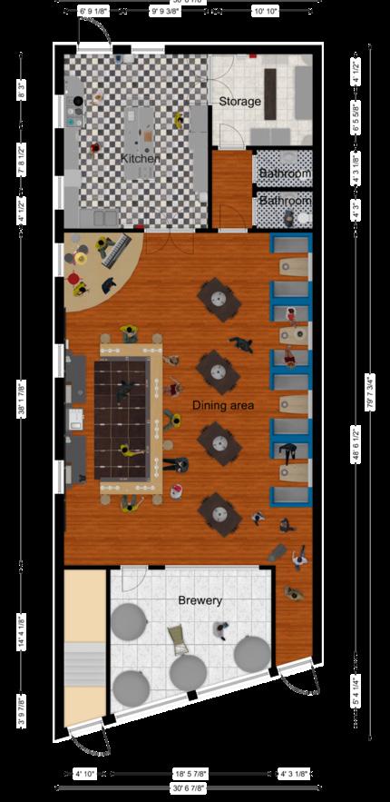
Ever since before the COVID-19 pandemic, the number of retail stores lining America’s Main Streets has been in decline. The advent of online shopping and large corporations have been driving this change over the past decades. The result is a changing consumer spending pattern leaving storefronts vacant and unoccupied. Planners and government officials have begun to explore potential uses for vacant storefronts. What would a postretail future look like?
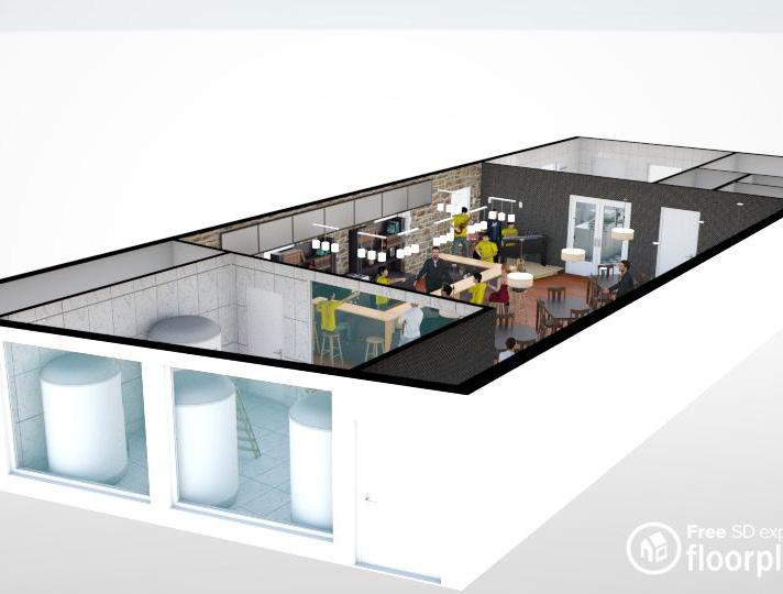
This Environmental Design studio sets out to answer that question. The backdrop for this studio is 1202 Broadway-Fillmore, a vacant storefront located in a neighborhood hard-hit by disinvestment and segregation. The studio examined the current conditions of the neighborhood, and explored potential non-retail uses for vacant storefronts. This exploration focuses on one possible re-use for a vacant storefront: a brewpub.
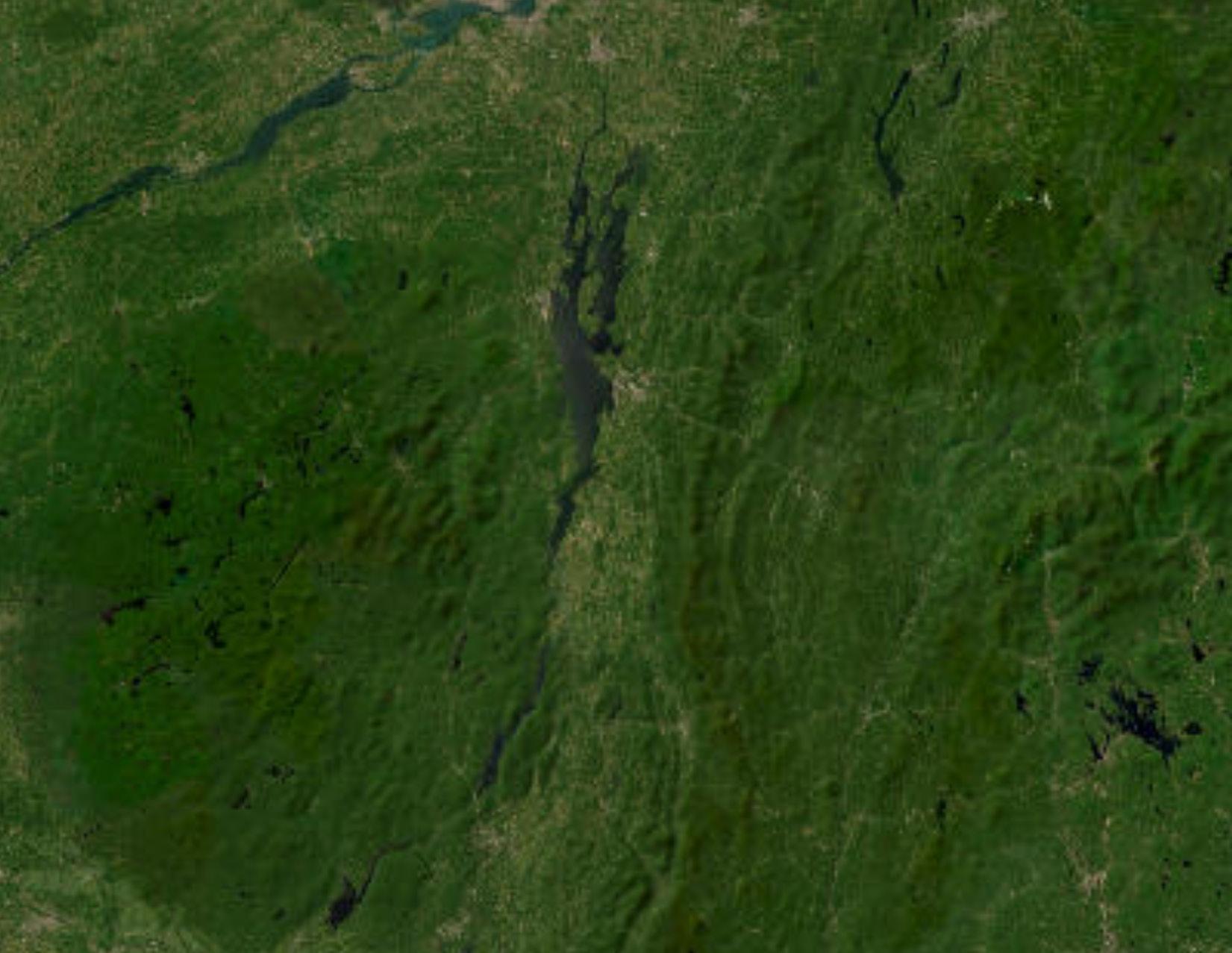
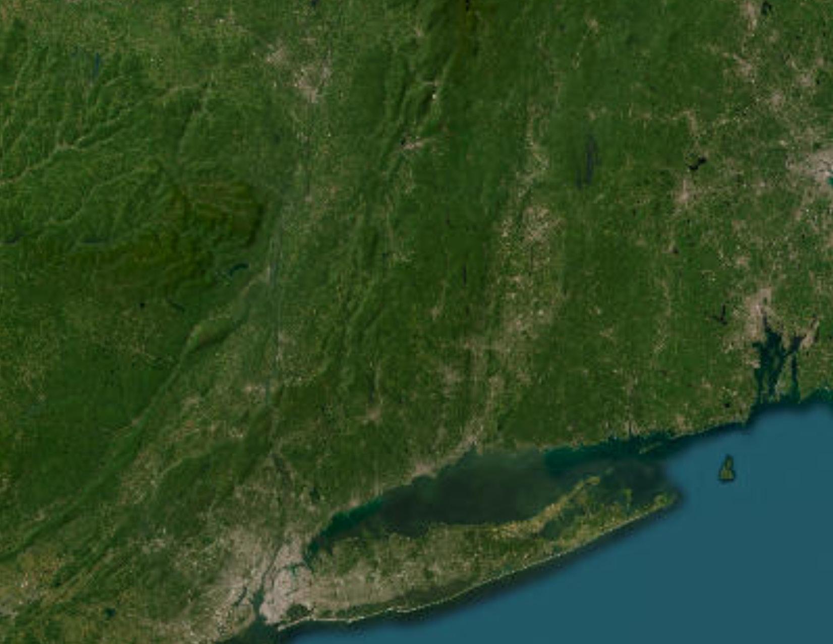
demographics. (ESRI ArcGIS)
SWOT analysis. (Adobe Illustrator)
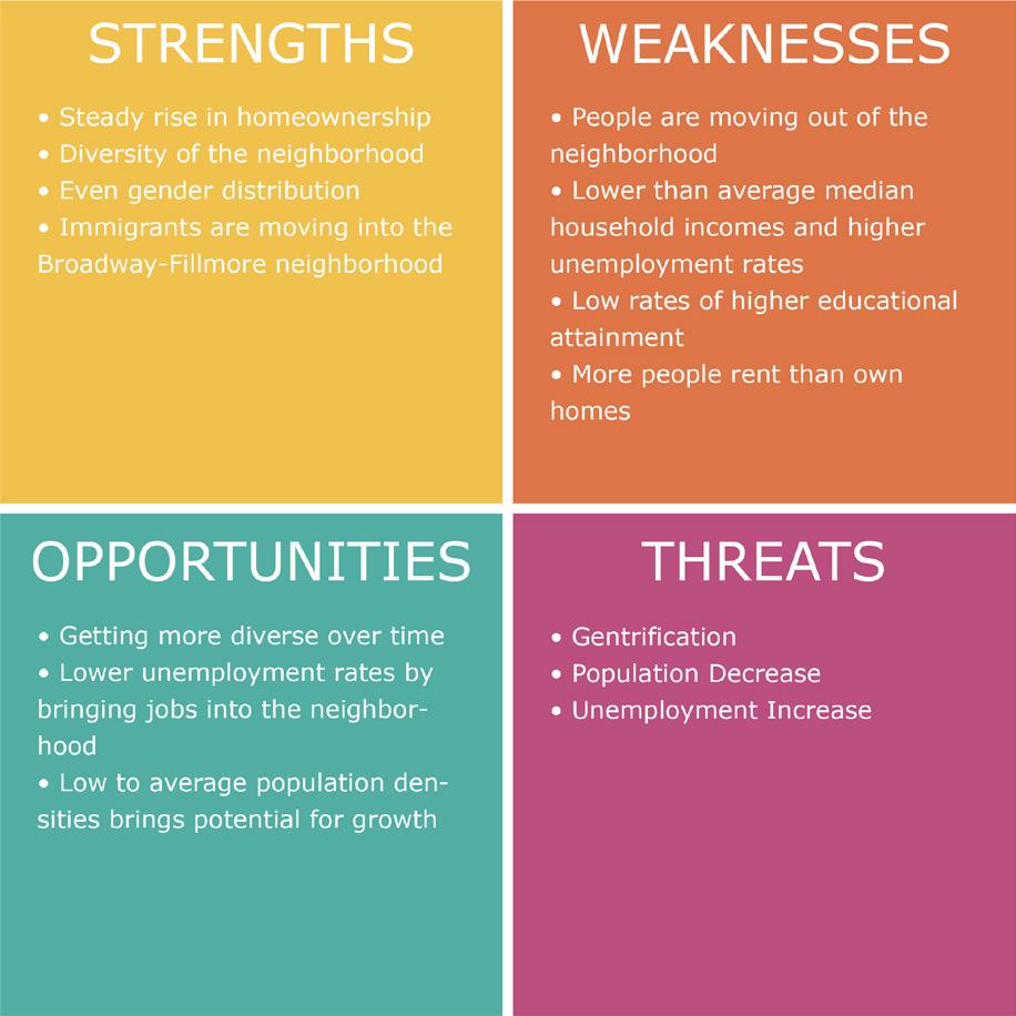
making the case for a storefront brewpub.
best practice: Layman Brewing, West Allis, WI. (AutoCAD) storefront re-design.
Institution:
SUNY University at Buffalo
Instructor: Dr. Jiyoung Park
Semester:
Spring 2021
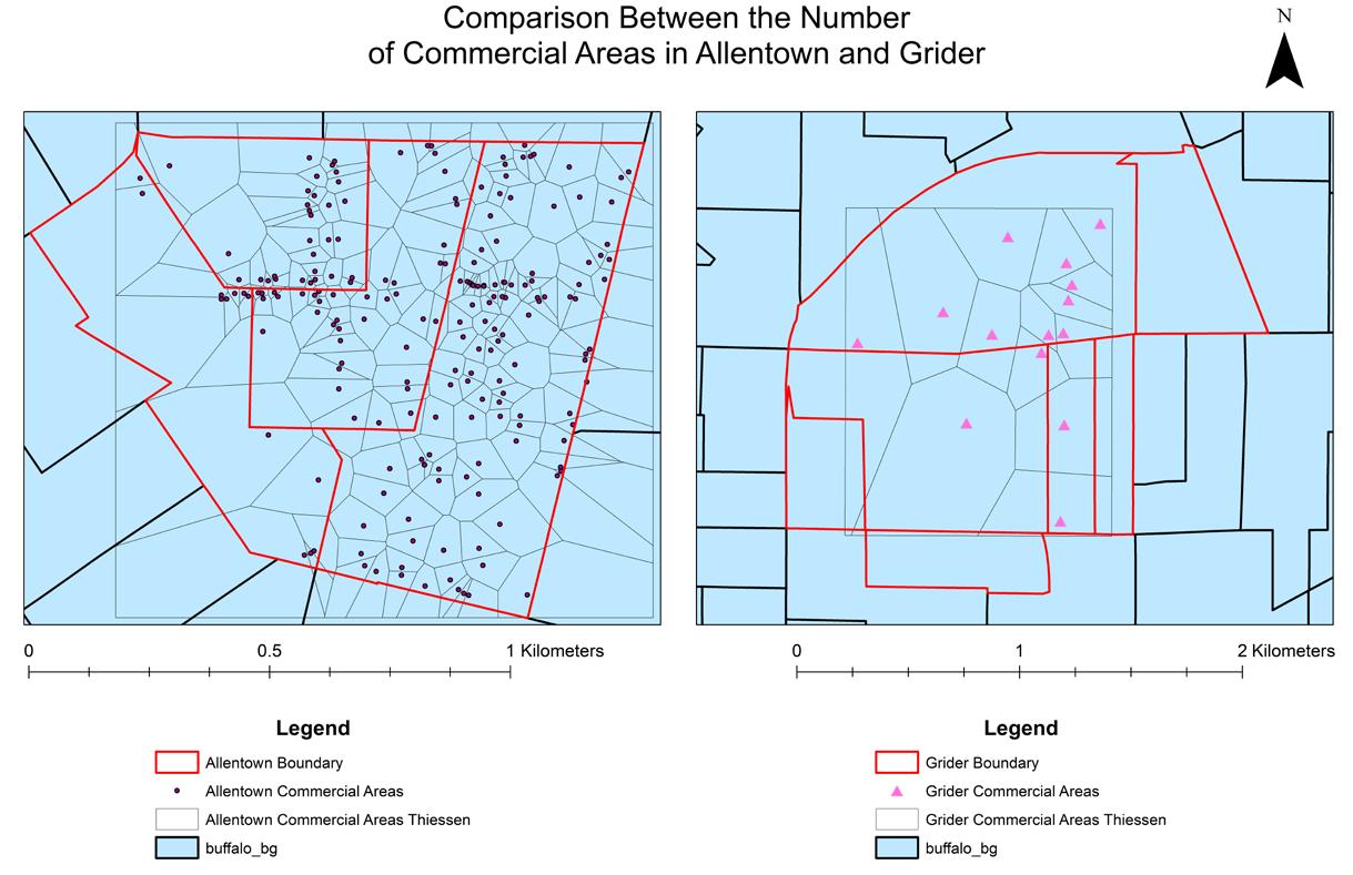
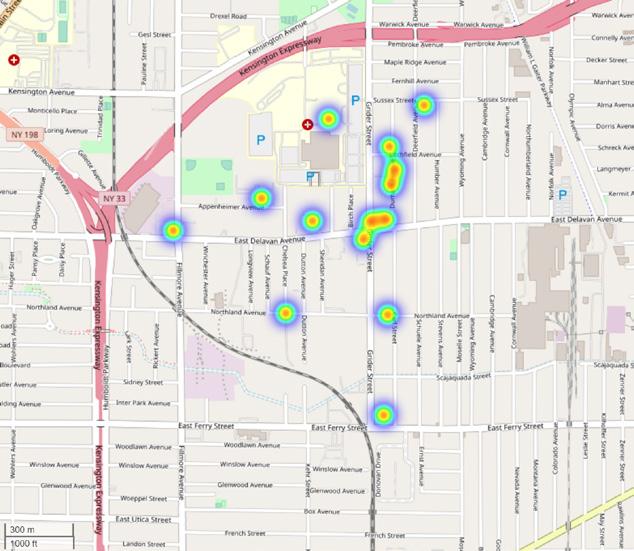
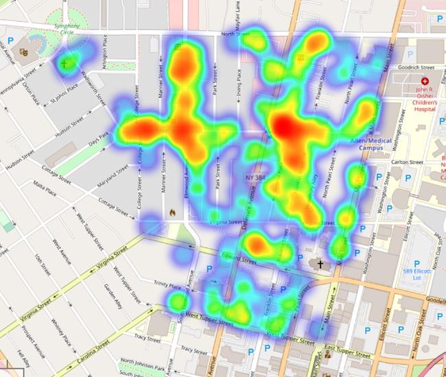
This course expands upon GIS skills and mapmaking theory, where the final project was to apply the acquired knowledge to a topic in urban planning discourse. The topic chosen was walkability in under-served communities, and how often that one may find a very walkable neighborhood in Buffalo.
Statistical analysis was accomplished using the Python programming language. GIS revealed two neighborhoods at the walk score and race extrema: Allentown and Grider. Allentown has a highest household income and population of Whites, while Grider is the exact opposite, with the highest population of African Americans. GIS and statistical analysis suggested that more commercial areas tend to increase the walkability of a neighborhood. Low-income and areas with a high population of African-Americans tend to be less walkable.
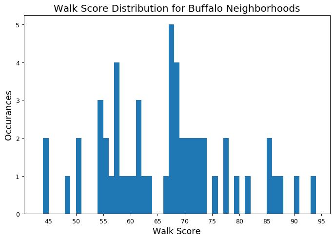
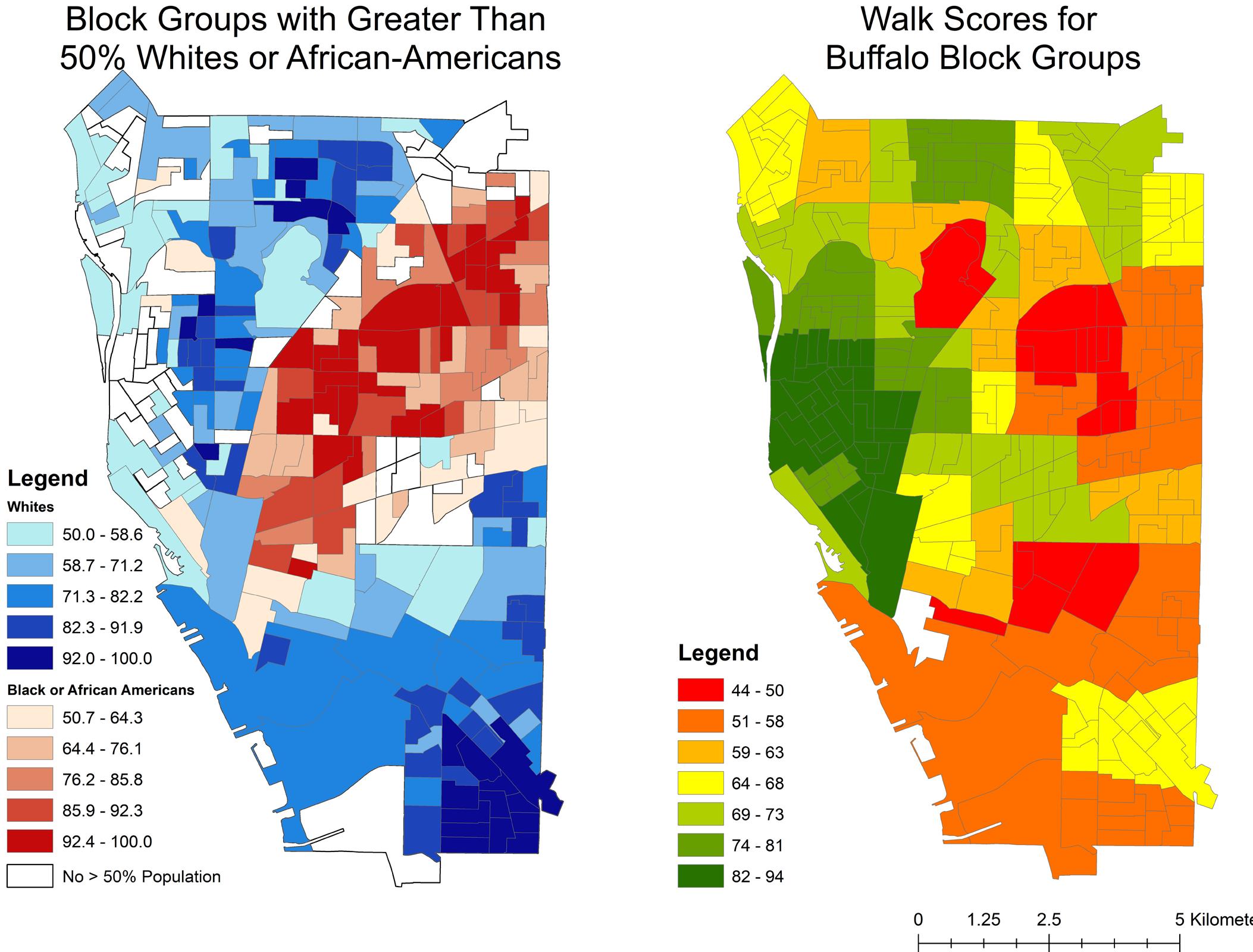
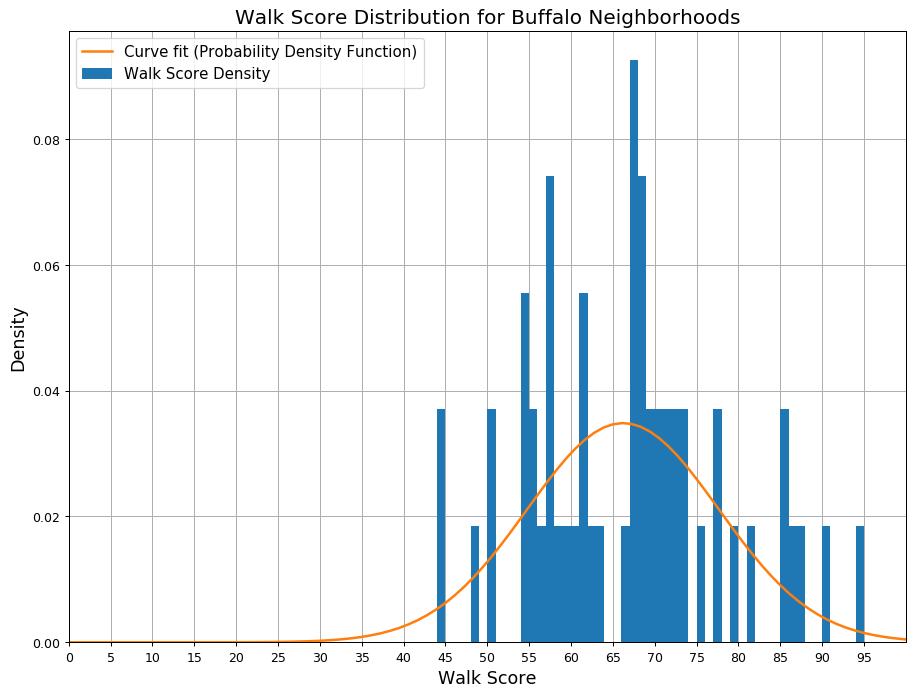
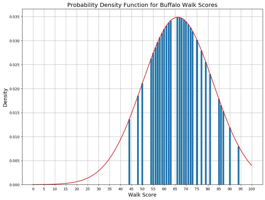
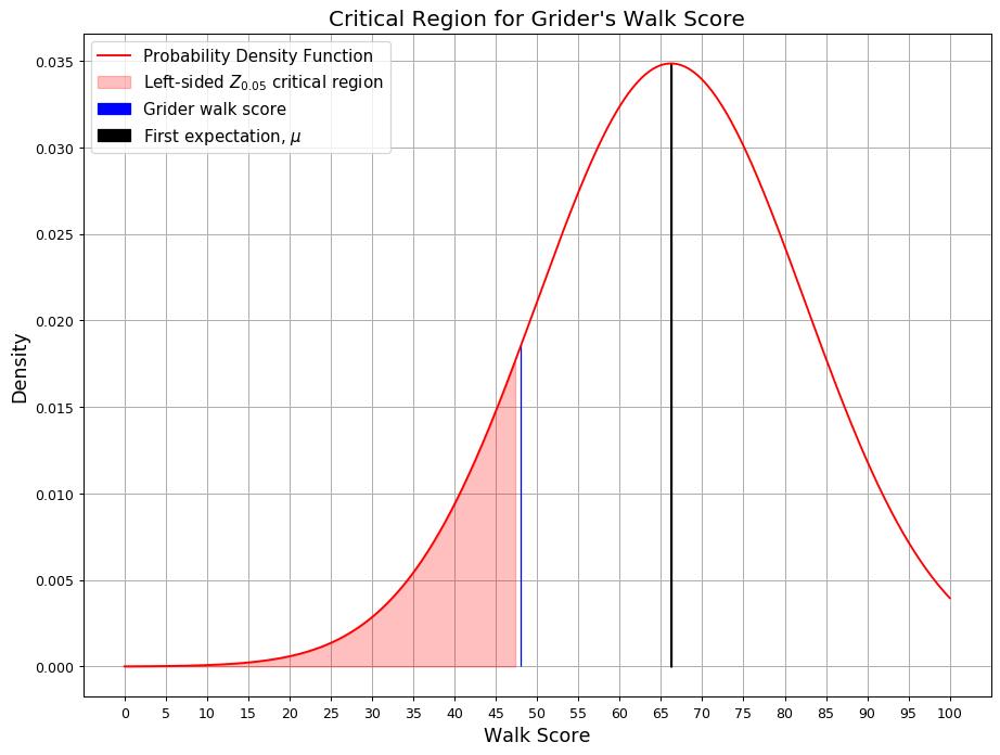
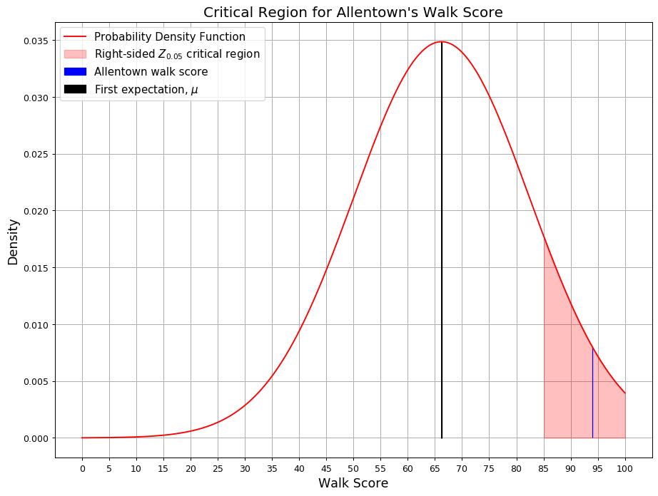
This research suggests that African-Americans consistently live in poorly walkable neighborhoods and have poor access to neighborhood amenities such as grocery stores, businesses, and entertainment. Whites, on the other hand, consistently live in more walkable neighborhoods and have an abundance of access to grocery stores, bars, and other businesses. This finding only holds true for the city of Buffalo, although there may be similarities in other Rust Belt cities. Statistical analysis suggests that a very walkable neighborhood is rare in Buffalo, while it is barely common to find a poorly walkable neighborhood. The results of the maps and data analysis can help inform readers of neighborhoods disproportionately affected by poor walkability, and can shed light on an environmental justice issue located right here in Buffalo’s backyard.
An obvious recommendation would be to invest in Grider and other African-American neighborhoods by placing more commercial areas in these neighborhoods. However, incorporating pedestrian infrastructure may come at the cost of rising property values, at least for single-family homes. Local municipalities may want to consider legislations aimed at curtailing rising property values as a result of a denser non-White neighborhood. That way, more shops and restaurants can provide services to these areas without the risk of rising rent prices.
Software Used:
Top: ESRI ArcGIS
Bottom: Python
Institution:
SUNY University at Buffalo
Instructor: Dr. Emmanuel Frimpong Boamah
Semester: Fall 2020
The objective of this course was to construct a research paper on a contemporary topic in urban planning. Since this is the first time the course was held during the COVID-19 pandemic, it was only natural to uncover the how much of an impact it had on the field.
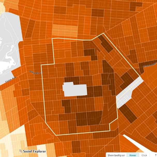
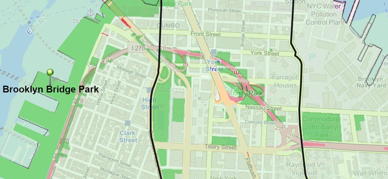
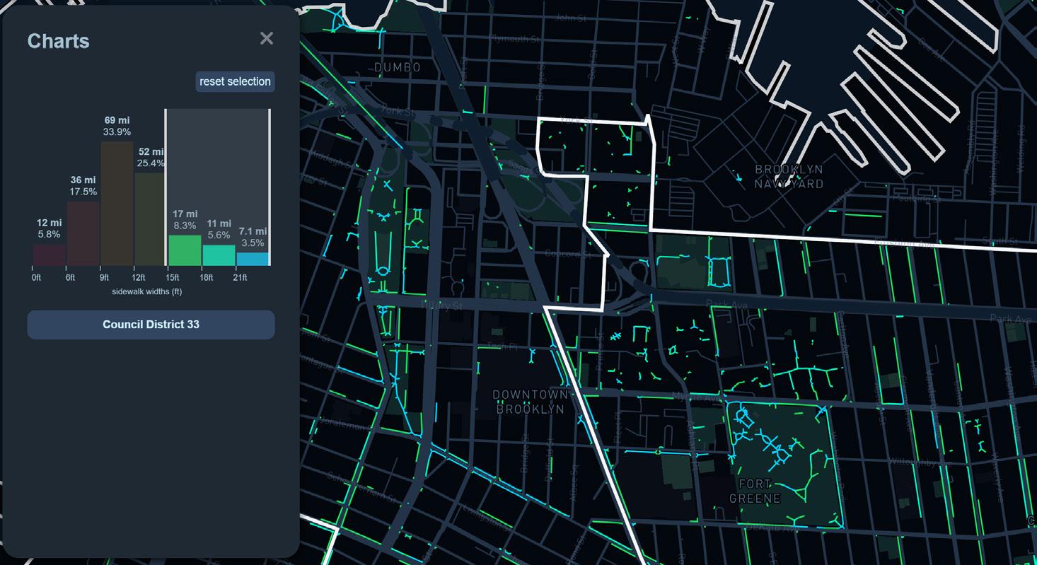
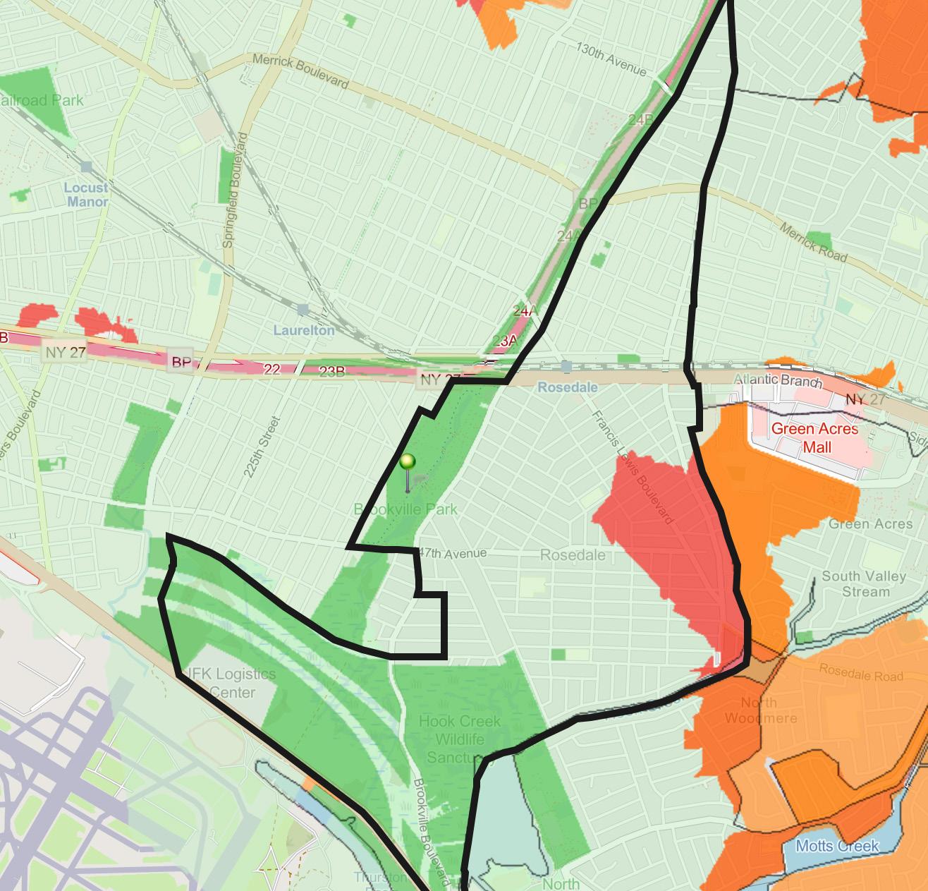
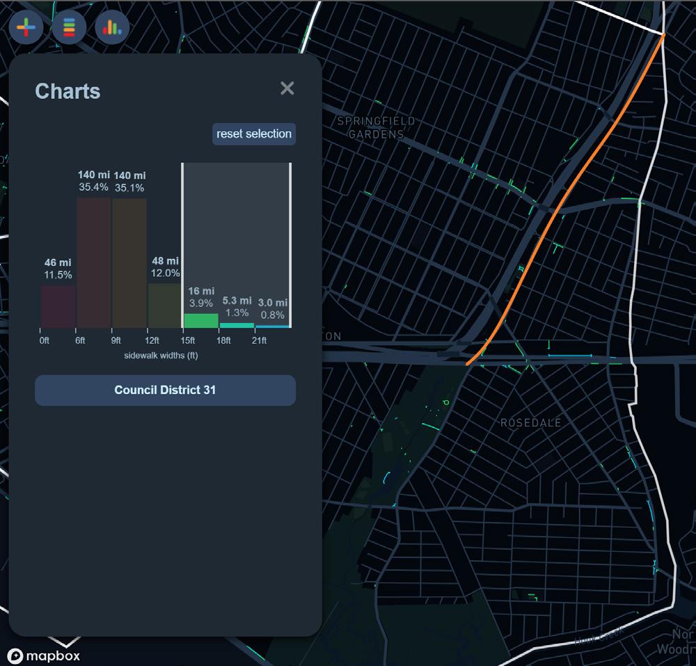
The paper examined park access during the height of the pandemic - when former governor Andrew Cuomo closed off playgrounds in an effort to slow the spread of the coronavirus. In many minority neighborhoods, these playgrounds were their only access to public spaces. Many residents had no problem visiting their nearby public space, since they weren’t tethered to a playground. This examination was then broken down by race to determine if the lack of park access Tools used were Python 3, Sidewalk Widths NYC, and ParkServe by the Trust For Public Land.
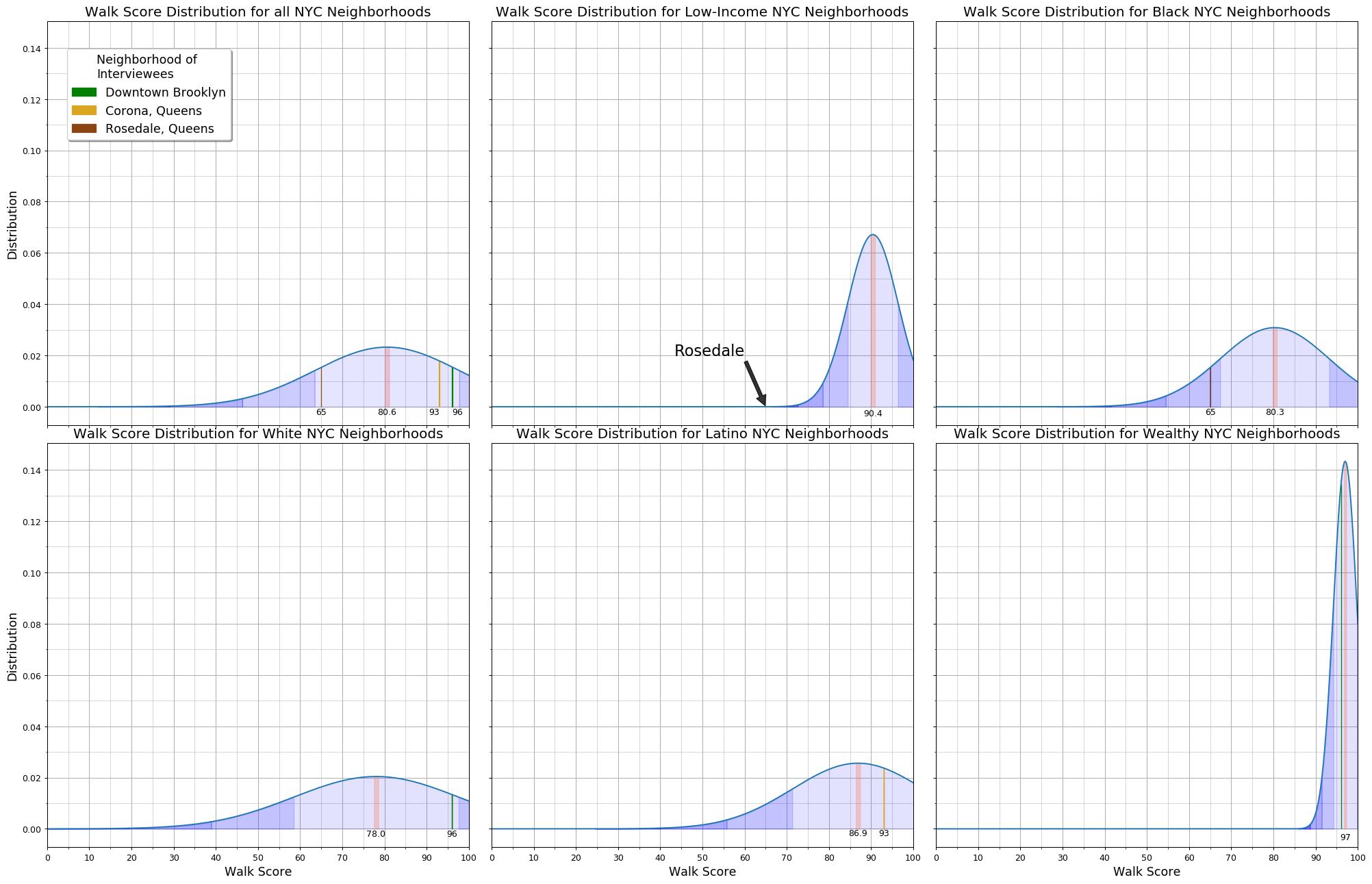
Comparison between Downtown Brooklyn and Rosedale, Queens. A unique metric used in this research are the widths of the sidewalk, which could facilitate social distancing. Therefore, one recommendation put forth by the paper would be to expand New York City’s Open Streets initiative, especially in low-income and minority neighborhoods.
Another metric used was proximity to parks, since they remained opened during the playground closure. The red and orange zones designate areas that are not within a 10-minute walking distance from a park. This finding bolsters the recommendation that the Open Streets initiative should be expanded for minority residents.
One finding is that larger parks were mostly unaffected by the city-mandated shutdown of parks and playgrounds, yet they were the most crowded public spaces in the city. The reason for this irony is speculative, although it is safe to assume that due to the closures of smaller parks nearby, larger parks were unaffected, becoming a funnel for resident to go to. As previously mentioned, this became dangerous as social distancing became more difficult to enforce due to the high volume of people.
Another finding is that wealthy communities seems to have more sidewalks that are wide enough for social distancing, while AfricanAmerican communities have almost none. The parks in these two contrasting neighborhoods are no exception. Hispanic communities do have sidewalks that are acceptable for social distancing, but they are much more spread out across the neighborhood than African American communities. This is just one of the many examples of systemic racism that African-Americans have to endure.
Institution:
SUNY University at Buffalo
Instructor: Ellen Parker
Semester: Fall 2020
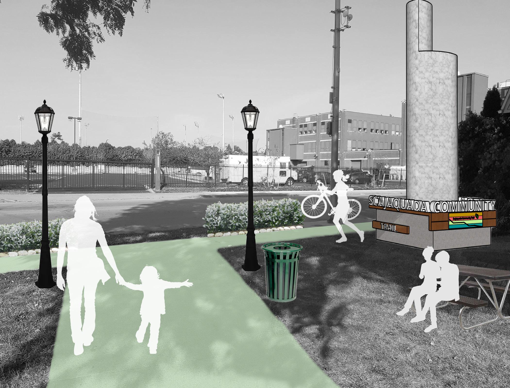
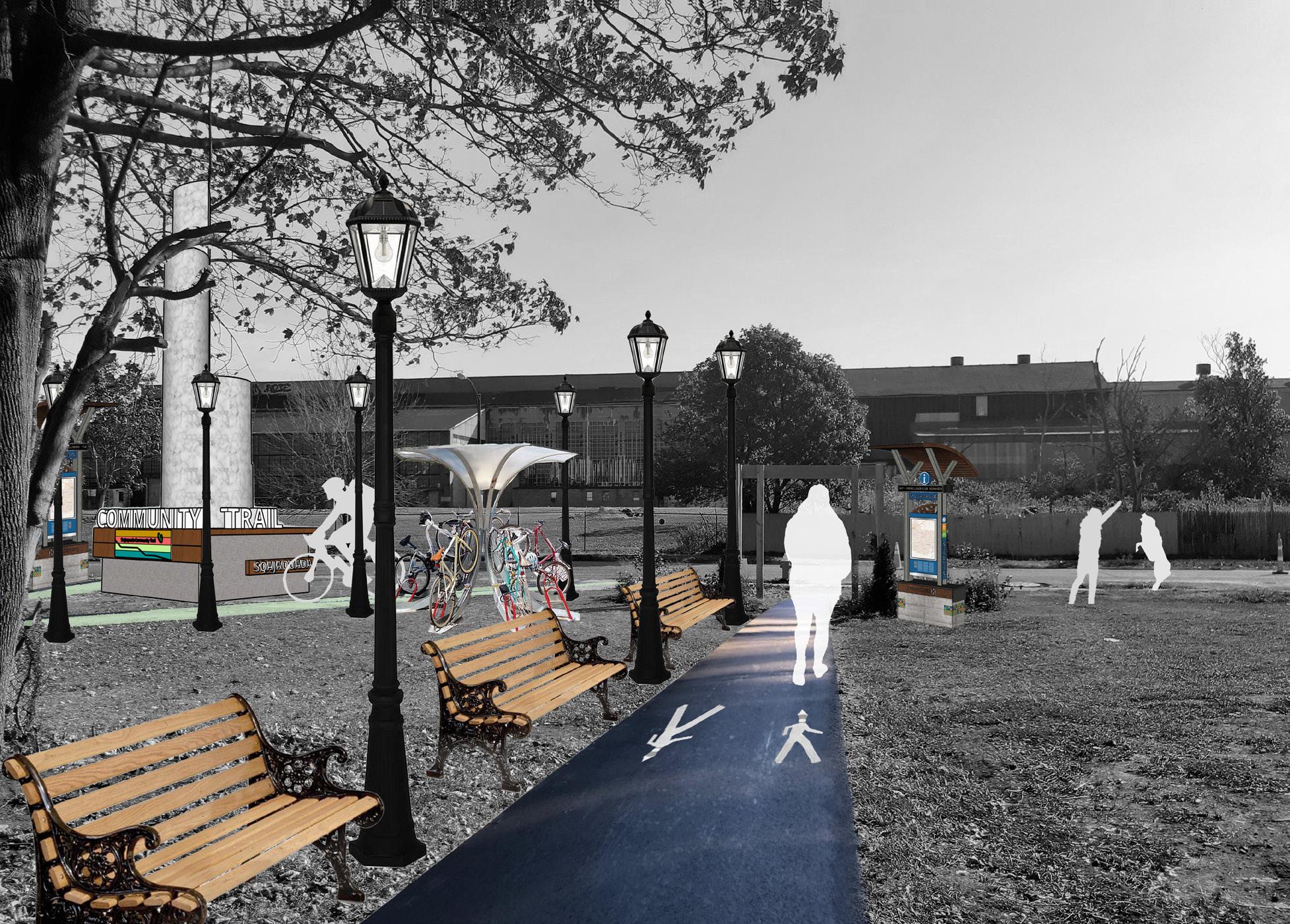
The third in a series of workshops is centered around Scajaquada Creek, which was buried underground to combat pollution and urban development. Ever since, the creek has been largely forgotten by the residents residing above. In addition, the creek played an important role during The War of 1812 by helping 200 American Riflemen fend off 600 British soldiers looking to sabotage a supply depot in nearby Black Rock, NY.
This studio aimed to resurrect creek’s existence and its historical importance by proposing a trail that runs above its length. Empirical surveys showed that the creek runs below an existing, albeit poorly maintained, trail. Recommendations include upgrades to an existing community garden, wayfinding, and public art along the segment. Ample bike infrastructure is also suggested to connect to the Buffalo Bicycle Masterplan. Recommendations came in the form of a report and Photoshopped images.
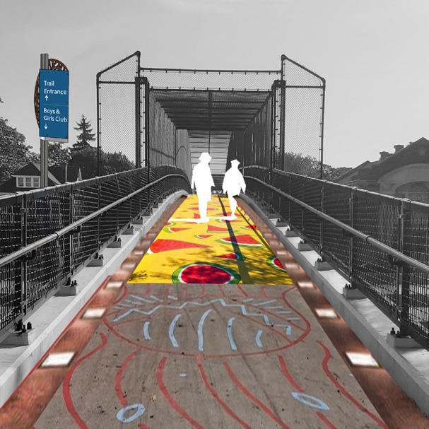
adequate wayfinding and historical markings. (Adobe Photoshop)

implementation and connection to the Buffalo Bicycle Masterplan. (Adobe Photoshop)
Institution:
CUNY The City College of New York
Instructors:
Jeremy Edminston
Kaitlin Faherty
Software:
Top: ESRI ArcGIS
Right: Rhino Semester: Fall 2022
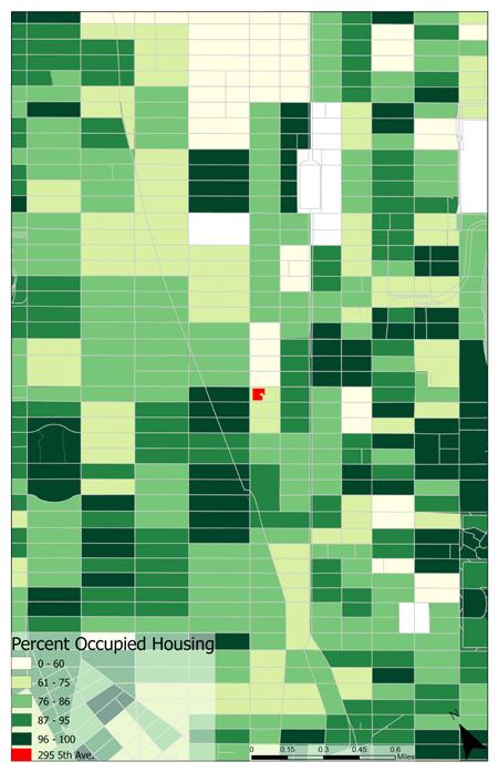
Unit 23 is a yearlong graduate studio focusing on architectural form. A site was selected and documented through drawings. The site is the Textile Building (295 Fifth Ave.), and the drawings of this site dictate the direction of the architectural proposal.
The drawings of 295 Fifth Ave. direct the project towards the novel “Invisible Cities” written by Italo Calvino. The novel consists of nine chapters each consisting of five themes. Readers are invited to read the novel in any order, crafting their own narrative of the story.
Using the novel as a Literary Provocateur, this project centers on the narrative of Hidden Cities, where Calvino describes two contrasting cities, when they are actually one. How can architecture situate not one, but two cities inside a space?
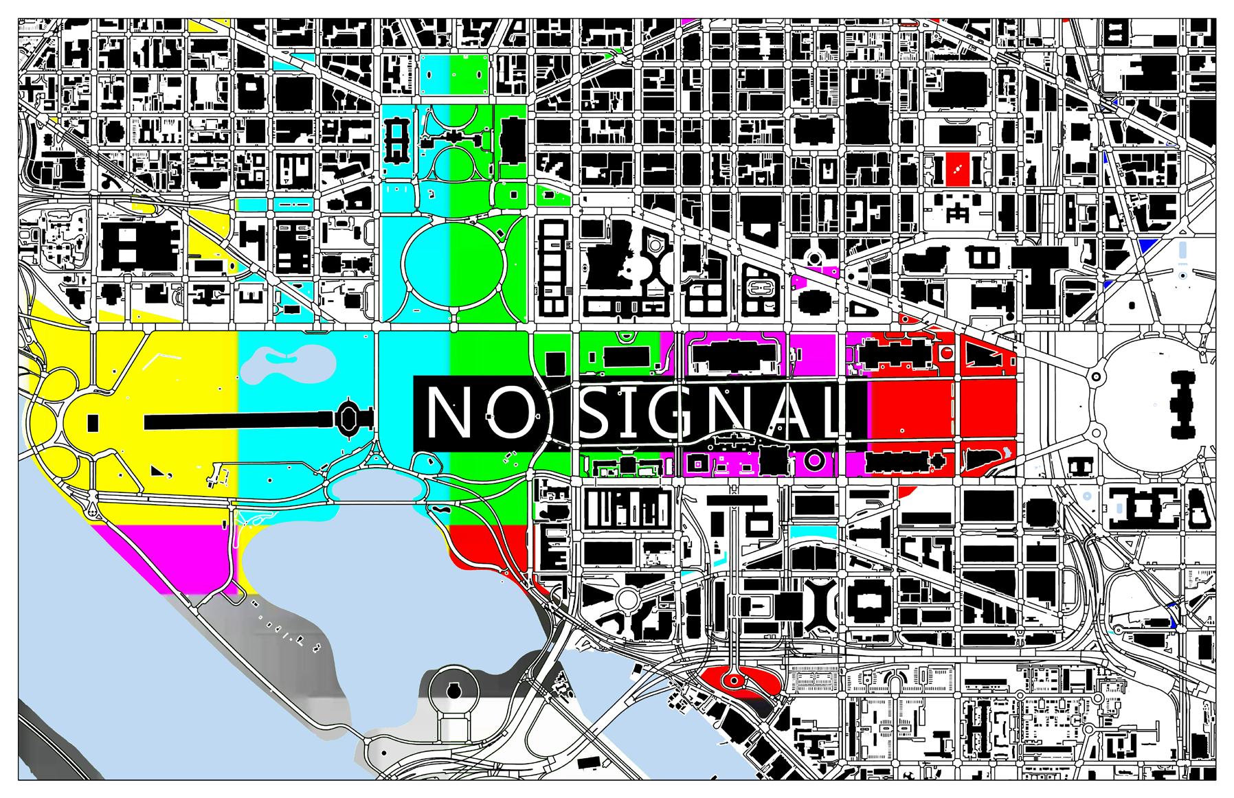
Institution: CUNY The City College of New York
Instructors: Jeffery Robertson John Yurchyk
Software: ESRI ArcGIS Semester: Spring 2022
First year graduate studio in architecture situating on the White House. The map is the protest route during the George Floyd protest on June 1, 2020. The day former president Donald Trump authorized the use of tear gas to clear protesters from Lafayette Square.
Institution:
CUNY The City College of New York
Instructors: Jeffery Robertson
John Yurchyk
Software: ESRI ArcGIS
Adobe Photoshop
Semester: Spring 2022
A map reconceptualizing the relationship between green spaces and public spaces in Washingtom, D.C What happens if you censor green spaces, let alone public spaces?
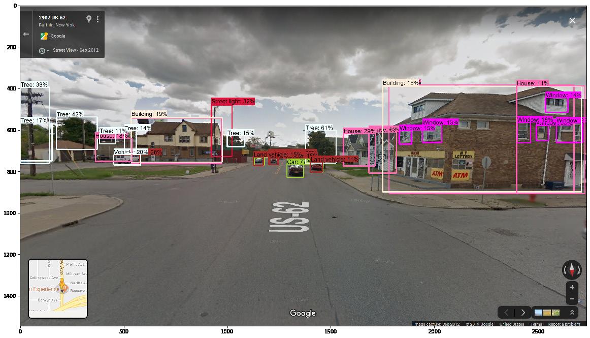
Institution:
SUNY University at Buffalo
Instructors: Li Yin, Hao Zhang
Software: Python3
Semester: Fall 2019
The first in a series of environmental design studio. Harnessing the power of machine learning by using objection detection to recognize urban street greenery, buildings, and automobiles. The purpose was to introduce Google Street View as a viable tool for urban planning, while showcasing the benefits of machine learning for the discipline.
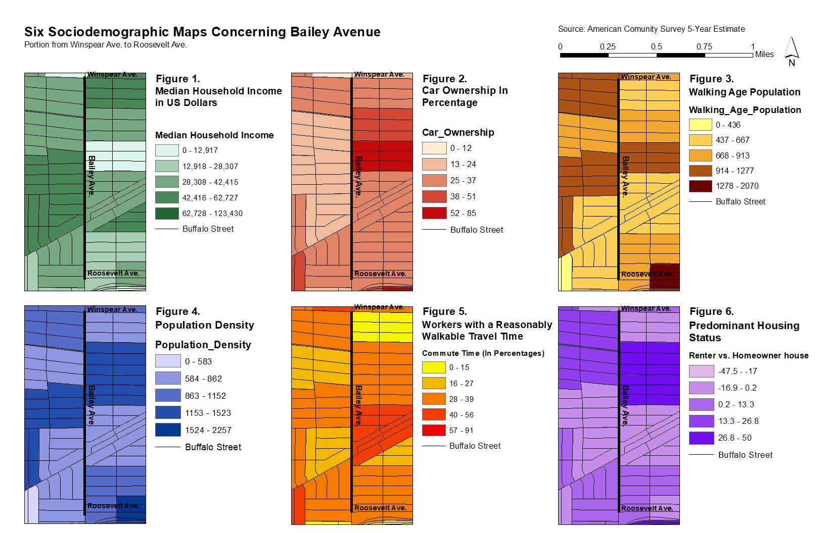
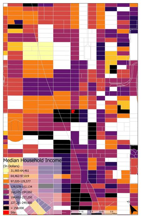
Institution: SUNY University at Buffalo
Instructors: Li Yin, Hao Zhang
Software: ESRI ArcGIS
Semester: Fall 2019
Sociodemographic maps meant to understand the urban language of Bailey Ave. by block group. It is a predominantly young neighborhood with a lot of opportunities for revitilization.