1 minute read
SCAJAQUADA COMMUNITY TRAIL

by ctchin2

Institution:
SUNY University at Buffalo
Advertisement
Instructor: Ellen Parker
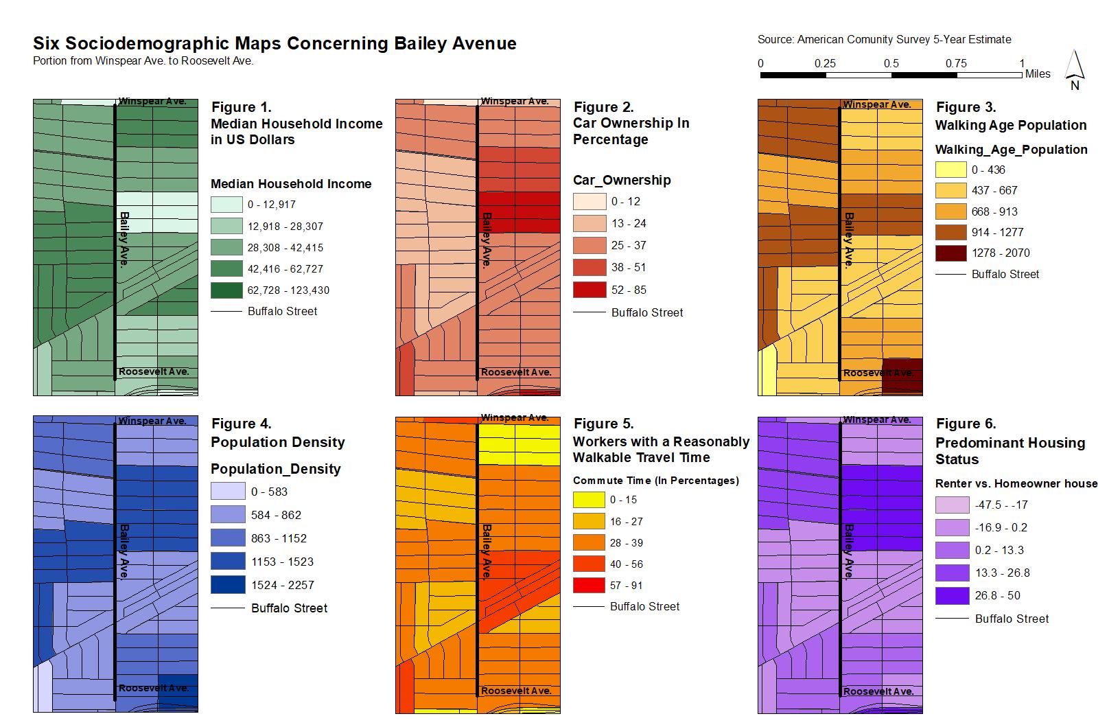
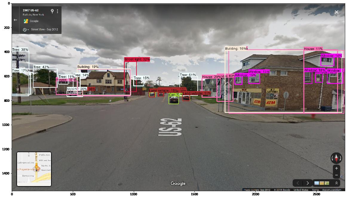
Semester: Fall 2020 implementation and connection to the Buffalo Bicycle Masterplan. (Adobe Photoshop) adequate wayfinding and historical markings. (Adobe Photoshop)
The third in a series of workshops is centered around Scajaquada Creek, which was buried underground to combat pollution and urban development. Ever since, the creek has been largely forgotten by the residents residing above. In addition, the creek played an important role during The War of 1812 by helping 200 American Riflemen fend off 600 British soldiers looking to sabotage a supply depot in nearby Black Rock, NY.
This studio aimed to resurrect creek’s existence and its historical importance by proposing a trail that runs above its length. Empirical surveys showed that the creek runs below an existing, albeit poorly maintained, trail. Recommendations include upgrades to an existing community garden, wayfinding, and public art along the segment. Ample bike infrastructure is also suggested to connect to the Buffalo Bicycle Masterplan. Recommendations came in the form of a report and Photoshopped images.


20: street and sanctuary.
Institution: CUNY The City College of New York
Instructors: Jeffery Robertson
John Yurchyk
Software: ESRI ArcGIS
Semester: Spring 2022
First year graduate studio in architecture situating on the White House. The map is the protest route during the George Floyd protest on June 1, 2020. The day former president Donald Trump authorized the use of tear gas to clear protesters from Lafayette Square.
Institution: CUNY The City College of New York
Instructors: Jeffery Robertson
John Yurchyk
Software: ESRI ArcGIS
Adobe Photoshop
Semester: Spring 2022
A map reconceptualizing the relationship between green spaces and public spaces in Washingtom, D.C What happens if you censor green spaces, let alone public spaces?