
WORKING WITH WILDERNESS
EMBRACING NATURE AND COMMUNITY THROUGH ECOLOGICAL DESIGN
SCHOOL
PREPARED FOR KROKA EXPEDITIONS
ALLY HEALY & BEN LLOYD THE CONWAY
MARLOW, NEW HAMPSHIRE
ACKNOWLEDGMENTS
This plan set is made possible from the commitment and knowledge of the Kroka core team: Nathan Lyczak (Executive Director), Ezra Fradkin (Managing Director), Jacob Sherwood (Farm Manager) and Linda Fuerderer (Facilites Manager). Thanks to Gia Bialoglowka for the photos included within this plan set. Thanks to the entire Kroka staff and community for their enthusiastic support throughout this process and for their participation in two community engagement sessions. The feedback has been deeply appreciated. Thanks to Kroka parent and Conway Alumnus Nicko Rubin for the initial permaculture design and guidance. Additional thanks to semester parent Kevin Hawkes for his illustrations that have inspired the new farm energy center.


MISSION, PROGRAMMING & GOALS
KROKA MISSION STATEMENT
Kroka Expeditions is a wilderness expedition school for young people on an organic farm in Marlow, New Hampshire. Kroka believes that consciousness and altruistic will can be brought forward through a living relationship with the natural world and within the circle of community.
WILDERNESS EXPEDITION PROGRAMMING
SUMMER PROGRAMS
One-to four-week expedition and basecamp programs for youth ages 9-18
FALL & WINTER SEMESTER SCHOOL
Three to five month long transformational wilderness journeys for ages 16-21
PROGRAMS FOR SCHOOLS
Farm-based experiences and wilderness expeditions for schools and colleges
Kroka Expeditions is at a moment of growth where it is considering new ways of engaging campers, interacting with the land, and navigating the purchase of a new parcel. The following goals created in partnership with Kroka and the Conway team, consider these challenges and see them as opportunities to assist Kroka as it enters a new era.
PROJECT GOALS
PERMACULTURE FARM DESIGN
• Create a productive, edible, educational, and interactive landscape that supports farm programming and ecosystem functions
• Rotate grazing animals through an abundant silvopasture landscape
• Harvest the fertility of the land through the addition of berries, fruit and nut trees.
ADDRESS WETNESS IN KROKA VILLAGE
• Investigate why areas in the village get wet and stay wet
• Create a dry and more camper-friendly environment in Kroka Village
WATER MANAGEMENT
• Design resilient stormwater infrastructure
• Improve the water quality of Kroka Pond
• Slow and spread stormwater run off through the landscape
• Encourage the movement of water to where it is most useful
IMPROVE CROSSING AT NH STATE ROUTE 123
• Design a safe crossing across New Hampshire State Route 123
• Create a path connection to the new parcel and the Class 5 access road to the north
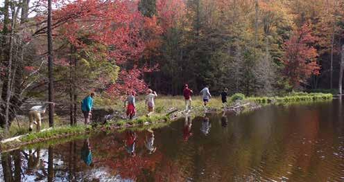
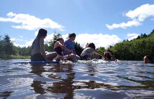
Semester students utilize the land year-round for outdoor activities. A group expedition to the nearby beaver pond.
Running down the boardwalk towards Kroka Pond and Village.
Close interaction with farm animals is common for campers.
REGIONAL CONTEXT
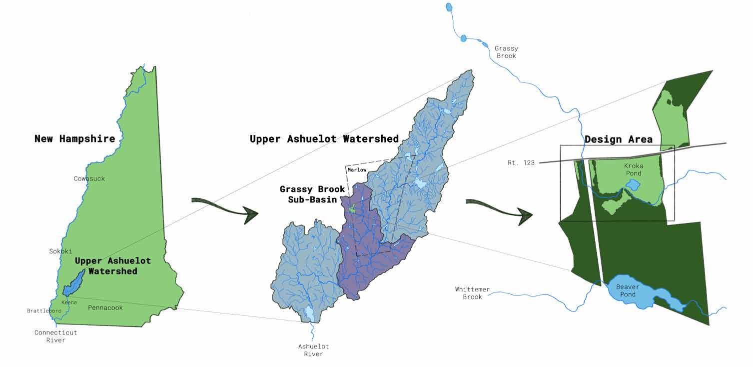
LOCATION & HISTORY
Located in southwestern New Hampshire, 25 minutes north of modern day Keene, 30 minutes east of modern day Brattleboro, the site sits within the ancestral unceded territory of the Sokoki tribe, of the greater Abenaki (meaning "People of the Dawn Land"). The Sokoki people have been present in the area for over 10,000 years, historically using the Ashuelot and Connecticut River as natural corridors for trade and transportation. Europeans settled the area in the early 1700s, moving up from the Connecticut River and eventually into the upper Ashuelot River by the late 1700s. The Ashuelot played a crucial role in the region's industrial growth, powering mills and providing an easy conduit for transporting goods downriver, via water and rail, to ports and industrial centers.
WATERSHED & SUB-BASIN
"Ashuelot" is an Abenaki word which means the "place between" or "collection of many waters." The Ashuelot River basin encompasses approximately 415 square miles. The site sits within the upper Ashuelot watershed, towards the top of the Grassy Brook sub-basin. The Grassy Brook flows for approximately 0.8 miles from its source through six other forested parcels before entering the Kroka site through a culvert under Route 123. The Whittemer Brook flows approximately 0.4 miles from its source at the top of the watershed before entering the Kroka site, eventually meeting the Grassy Brook 0.6 miles downstream. The Grassy Brook encounters no man-made dams before flowing into the Ashuelot River at the bottom of the valley.
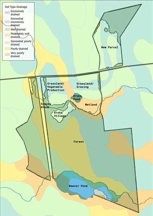
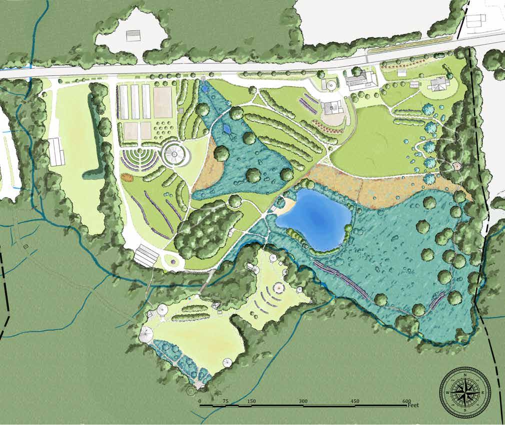
SITE BOUNDS
The site consists of approximately 95 acres of land, 13 of which are on the newly acquired parcel to the north of Route 123. This parcel comprises open pasture and hemlock-hardwood forest which connects to the Feuer State forest to the north. The parcel also has a house, pool, animal barn, and other farm infrastructure. The main campus, south of Route 123, is an 82-acre parcel that runs south through open field, wetland, exposed bedrock, and dense hemlockhardwood forest, to the Whittemer Brook and the dramatically terraced Beaver Pond. The site is bordered by conservation land to the south and west and straddles the Marlow-Alstead town line.
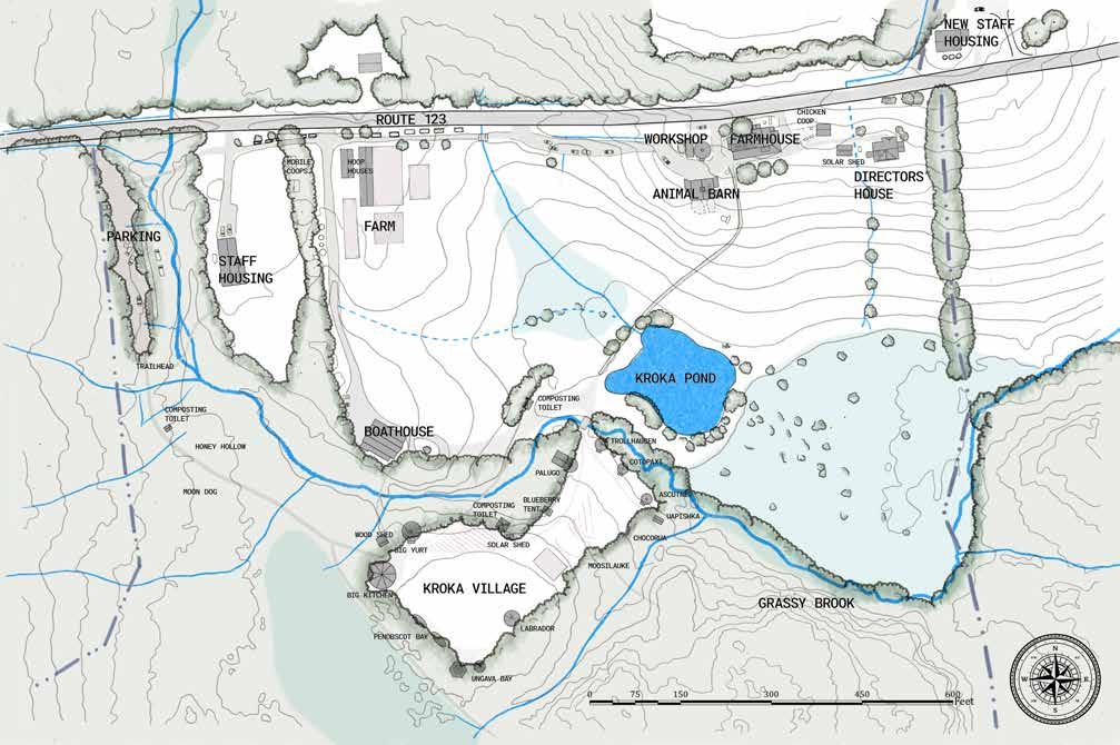
EXISTING CONDITIONS
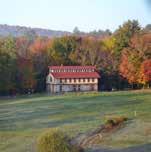
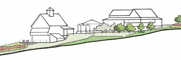
FARMHOUSE & BARN
In 2007, Kroka moved from Vermont to this campus and brought many existing structures with them including the Big Yurt and Earth Lodge. In 2020, construction was completed for the renovated Farmhouse based on architectural plans from Laura Fitch. The original farmhouse at Kroka was moved roughly 500 feet east from its originally sited location. The new barn was sited to the southwest, and designs came from the same architect. The Animal Barn was completed in 2017. The Workshop north of the Barn is a primary location for running power tools and having access to electricity.
BOATHOUSE
The Boathouse was built and completed in 2018. It serves as an area for staff and campers to pack and unpack gear, including boats, when they arrive or return from an expedition. The Boathouse is sited north of the grassy brook, with the Boathouse road currently used for access to the Boathouse and turnaround. It is also used for parking during large events.
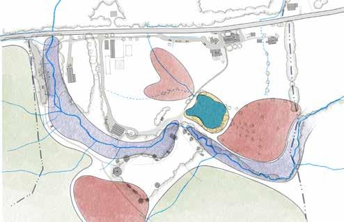
GRASSY BROOK & KROKA POND
The pond at Kroka was excavated from wetland in 2012. These wetlands appear the pond to the south and north. The Grass Brook runs south of the pond in a channelized stream bed that was dug by a previous land owner in the 1980s. The original course of the brook used to run through what is now Kroka Pond and fanned out through the lower wetlands.
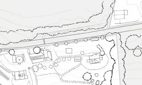
WETLANDS & KROKA VILLAGE
The southwestern edge of Kroka Village backs up to a wetland and creates a very wet topography in the areas by the Big Bitchen and Teepee, the two earthen structures and kitchen, which combined create the Penobscot Bay base camp. The recently constructed Ungava bay structures were built to replace another two earthen structures which had run the course of their lives. The siting of any structures through design alternatives will be considerate of the 50-100 foot wetland buffer in any given zones surrounding these areas.
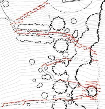
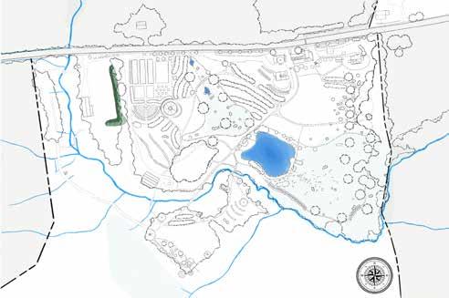
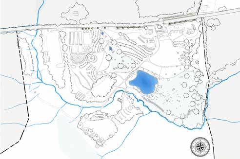
KROKA VILLAGE
WETLAND
WETLAND
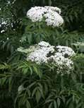
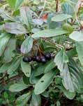
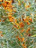
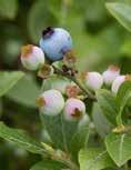
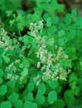
BERRIES
BERRIES
BRIDGE OVER BROOK KROKA POND BARN & FARMHOUSE
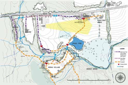
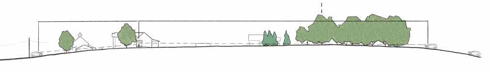
SIGHTLINES TO BOATHOUSE
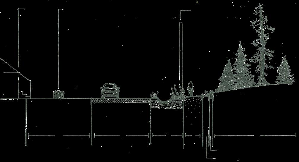
At Kroka, it is important for the directors to maintain a viewshed from the Farmhouse and Barn over to the Boathouse, what this document refers to as the director's platform. The Boathouse is where staff and student campers arrive and pack before an expedition and when they return from expedition. The terrain to the northeast of the Boathouse is rolling, with steep slopes and wetlands. Therefore, to maintain sightlines to the Boathouse, any tree or shrub planted within this viewshed must have a low maximum height, as illustrated in the section below.
SIGHTLINE TO KROKA POND
Kroka Pond is used for swimming and other recreation, therefore it is important to maintain sightlines to the pond, especially when standing on the second story porch over looking the pond. The Farmhouse is an important location at Kroka because it is a central gathering point for staff. Currently, the edge of the pond is maintained as mowed lawn to the northeast edge of the pond to provide the largest viewshed possible. Any design intervention needs to maintain this sightline to Kroka Pond for water and swimming safety purposes.
LONG VIEWS
There are some long distance views from Kroka Village to the northeast where you can see the white house: new staff housing is situated here starting in 2025. Alternatively, the long view from the Farmhouse porch out over the pond is also very expansive. In the fall, when the leaves start to drop, one can see to the farthest back edge of Kroka Village.
A long viewshed from Kroka village to the new staff housing.
Long view from the farmhouse to Kroka Pond and beyond to the village.
An important sightline from the Barn and Farmhouse to the Boathouse. A view from the Farm to the Animal Barn is important to maintain because farm programming happens in both places at once.
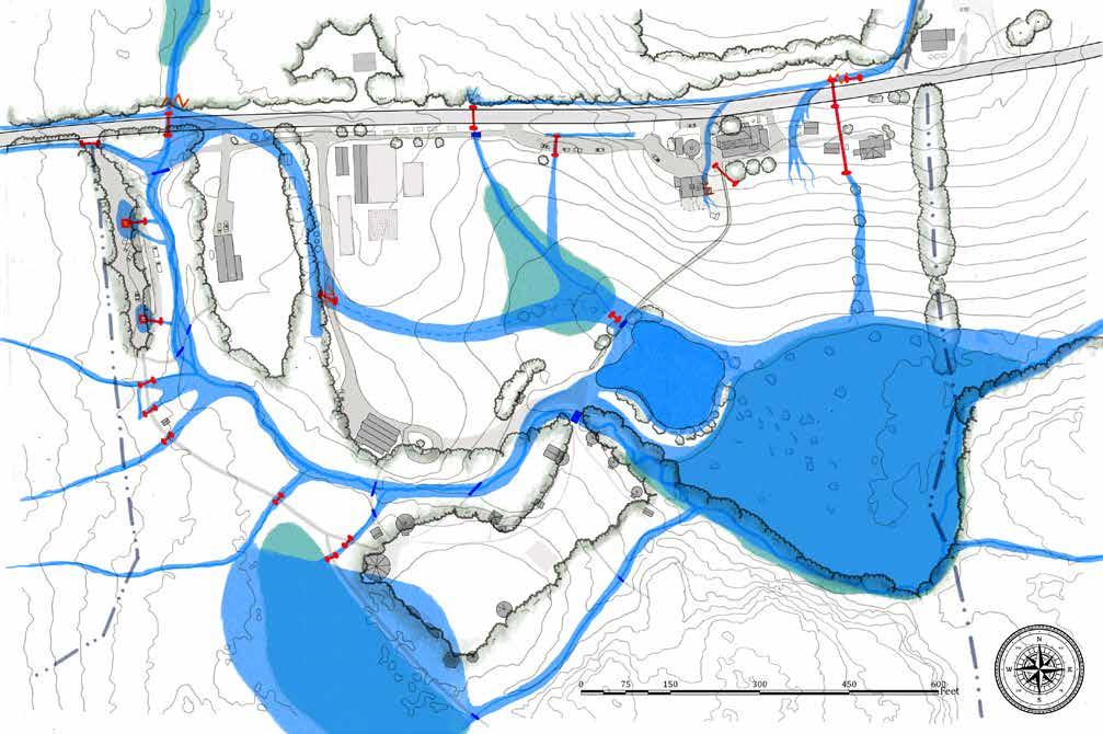
ACCESS & CIRCULATION
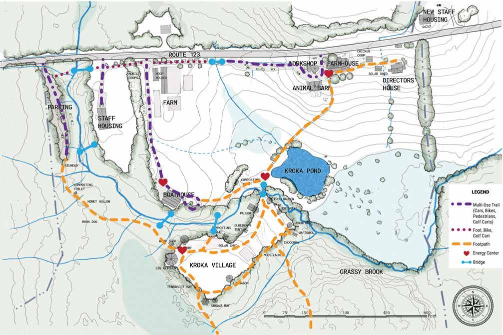
VEHICULAR TRAFFIC & PARKING
The entrance to Kroka is between the Workshop and the Farmhouse off Route 123. This is a one-way road that loops by the Animal Barn and travels west down a steep slope to an area that is used for pedestrians, bicycles, golf carts, and vehicular traffic and includes parallel parking for 8to 10 cars. From there, the vehicular access ends with the exit back onto Route 123. There is also parking at the trailhead farther west, a short walk to Kroka Village. Parking along the Boathouse road happens for events like Semester School graduations. Staff also park in the driveways for the staff housing. Parking for events happens in the canopy edge between the farm and staff housing and can wrap around into the northern lawn area.
PEDESTRIAN & BIKE ACTIVITY
A lot of Kroka's community uses bikes and golf carts to circulate around camp. The multi-use paths (for pedestrian, bicycle, vehicles and golf carts) are concentrated to the northern part of the campus, towards Route 123. The southern part of the campus is a network of trails that are utilized by walkers and bicyclists. There is a loop trail around Kroka Village, as well as bridges that lead over the Grassy Brook to trail networks between the western staff house to behind the composting toilet in Kroka Village. There is little to no activity or circulation in the spaces between the Boathouse road and the boardwalk. There is also no summer circulation east of Kroka Pond or south of the Directors' House. This area is considered notably under-utilized from Kroka's perspective.
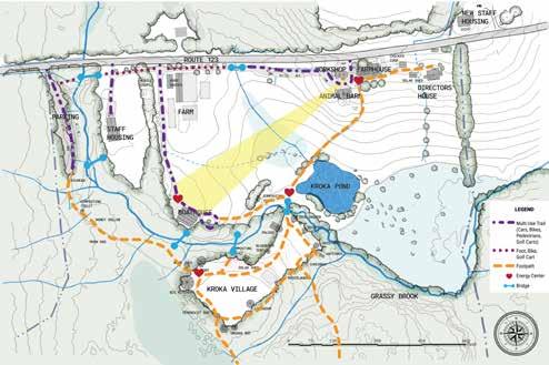
ENERGY CENTERS
There are four primary "energy centers" at Kroka, labeled by hearts on the map to the right. An energy center is a place where people gather. At Kroka, these centers have all formed by happenstance, or primarily by encounters on the trail. The northernmost energy center is in the administrative area with the Farmhouse, Animal Barn, and Workshop. There is an energy center between Kroka Pond and the current primary entrance to Kroka Village. There is an energy center by the entrance to the Boathouse. The final energy center is by the Big Kitchen, Big Teepee, and Big Yurt in Kroka Village.
WINTER USE PATTERNS
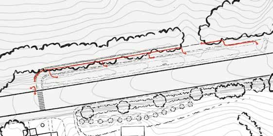
During the winter the land at Kroka is still utilized. The only areas that are plowed are the trailhead parking area, the Boathouse road, and the administrative area. All of the other areas, including the boardwalk, are hand-shoveled by staff or students. There are three primary areas for cross-country skiing at Kroka: Upper Pasture loop, Lower Pasture loop and the Camp loop. After a fresh snow, the Kroka community enjoys utilizing the hill south of the Farmhouse. There is also a first aid station located in the administrative area. Keeping these areas available for use in the winter is important to maintain with any design intervention.
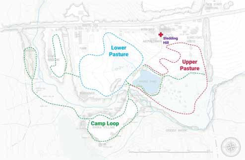
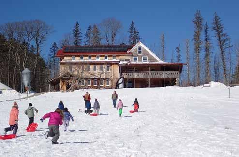
The ski trail map for Kroka's campus. The sledding hill south of the farmhouse.
PARALLEL PARKING
PARKING
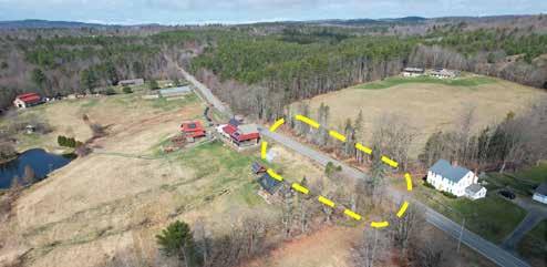
ROUTE 123 CROSSING
TRAFFIC PATTERNS
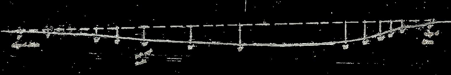
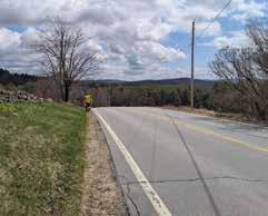
This segment of New Hampshire State Route 123 is considered a "high speed, low volume" road by the New Hampshire Department of Transportation. This means that people are driving fast on the road, and that the road is not considered to have a large numbers of cars driving on it at any given time. During a 30-minute observation period on a Thursday from 4 to 4:30pm, 35 cars passed going either direction. A representative of the New Hampshire Department of Transportation reported that car traffic here moves at an average speed of 53 MPH, despite the posted speed limit of 45 MPH. The posted speed limit is over one mile away in either direction from the Kroka campus. The sightlines for crossing in the proposed location are limited in both directions due to the hill crest on either side of the road. This makes the hill crest an obstacle for creating a safe crossing in the proposed area.
CLASS 5 ROAD CROSSING
The volume and speed of vehicles must be considered when determining a safe crossing location. If pedestrians are crossing farther east by the Class 5 Road (1), both the eastern and western sightlines are restricted. By measuring the distances from each of the sightlines on the hill crest from a driver's height, an analysis can be performed to determine the safety of the crossing location. From the eastern sightline, the determined length for a car traveling west was 300'. From the Class 5 Road crossing location to the western sightline, a distance of 380' was measured. Based on the current speed limit of 45 MPH and the restricted sightlines, this is not a safe crossing location. If cars are traveling at 45 MPH, there would need to be a distance of 359.6' or more for the stopping sight distance for a car for this crossing to be considered safe.
FARMHOUSE ROAD CROSSING
The second crossing location option (2) is directly north of the well in front of the Farmhouse, further west of the Class 5 Road crossing location. At this location, only the eastern sightline is restricted. The eastern sightline to the Farmhouse crossing is estimated at 480'. The western sightline now extends beyond the crest of the hill, which gives people crossing the street plenty of time to recognize when it is safe to cross. This road crossing option is safer than the Class 5 Road crossing because only one sightline is restricted. This option meets the minimum requirement for safe stopping in a 45 MPH speed zone.
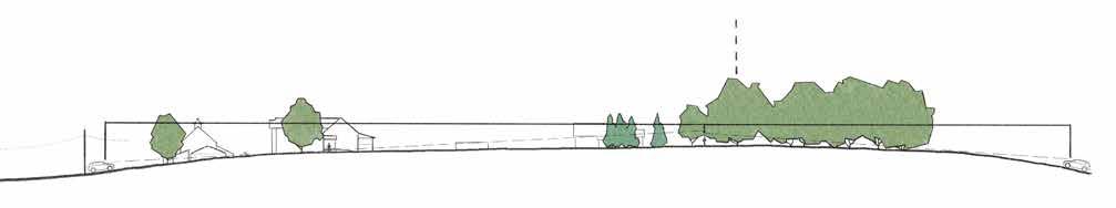
Section A-A': Sightlines to Class 5 Road Crossing.
Section A-A': Sightlines to the Farmhouse Road Crossing.
The proposed crossing area location highlighted with a dashed yellow line. Restricted sightline from hill crest on Route 123.
FARMHOUSE ROAD CROSSING
ROUTE
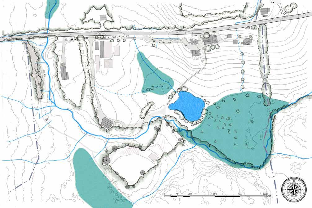
SLOPES & DRAINAGE
Slopes, drainage, and micro-basin delineations illustrate an undulating landscape that moves water in many directions.
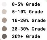
SLOPES
Slopes of greater than 30% are observed south of the animal barn, around the proposed road crossing, and along the banks of the western portion of the Grassy Brook as it runs through the site. Slopes level out to the west and north of the hoop houses, around and below Kroka Pond, and in the western portion of the Village and in the forest. This steep topography creates conditions where water moves fast over some areas and slow over others. In the steep areas, some erosion has been observed, and measures should be taken to ensure these slopes are stabilized.
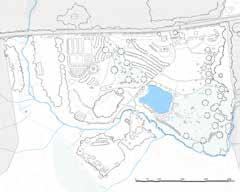
MICRO-BASINS
Yellow lines in the map to the right, also highlighted in the small map, bottom left, delineate micro-basins that determine where surface water runs on site. The larger the basin, the more water accumulates. The steeper the basin, the quicker it accumulates. The undulating topography throughout the focus area creates three primary micro-basins: the flat woodland zone to the west of the Village, Kroka Pond, and the Grassy Brook. The Grassy Brook is the largest basin on site, but also, given its nature, moves water the fastest. Kroka Pond and the woodland zone receive water runoff from sloped areas but store it in their respective basins, slowing water enough for it to infiltrate. This highlights the large retention capacity for water throughout the site and begins to explain the wet conditions observed in the western portion of Kroka Village.
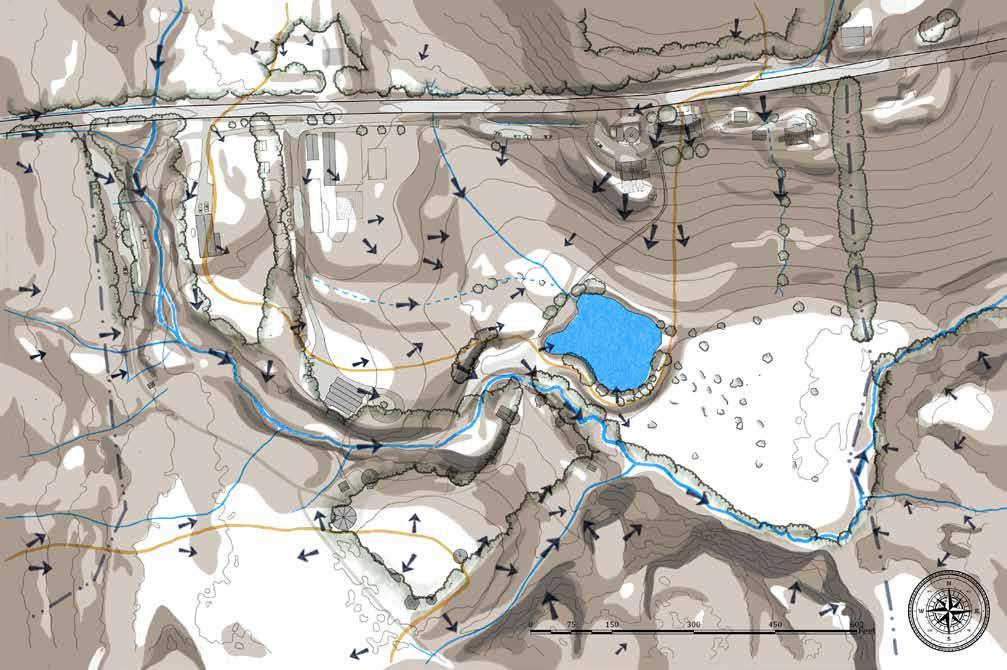
DRAINAGE
Arrows show the expected direction of runoff from micro-basin divisions, shown in yellow. Water moves through the swales and ditches and accumulates in Kroka Pond. Water also moves through the forest to accumulate in the woodland zone west of the Village. Following the drainage patterns of these two basins, it is observed that water eventually drains from them into the Grassy Brook basin. In Kroka Pond this happens via the man-made overflow in the northeast corner of the pond. The woodland zone is drained via streams north and south of Kroka Village. This gradual drainage slows the speed at which water enters the Grassy Brook, helping to ease stormwater inundation of the brook and regulate flood waters downstream. In large rain events, however, the steep slopes prevalent throughout the site and channelization of the Grassy Brook contribute to flooding conditions in the Grassy Brook and Kroka Pond, disrupting campus activities, sweeping away bridges, and limiting access between the administrative area and Kroka Village.
Slope, drainage, and micro-basin delineations overlay.
Kroka Pond has a very limited vegetative buffer to the north. It is the basin for the farm barn and ~800' off Route 123.
GRASSY BROOK
WOODLAND BASIN
GRASSY BROOK BASIN
KROKA POND BASIN
GRASSY BROOK BASIN
KROKA POND SLOPES & DRAINAGE
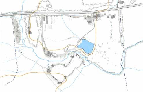
WETLANDS
Wetlands are key components of natural ecosystems. They are home to diverse species of plants and animals, and serve many ecosystem functions and services.
WETLANDS
Wetlands play a crucial role in stormwater management by acting as natural buffers that help slow runoff, absorb and temporarily store water, reduce flood risks, filter pollutants, and improve water quality. In New Hampshire, wetlands are protected through the wetlands protection law (RSA 482-A), which regulates activities within and near water bodies to safeguard water quality and prevent environmental damage.
BUFFERS
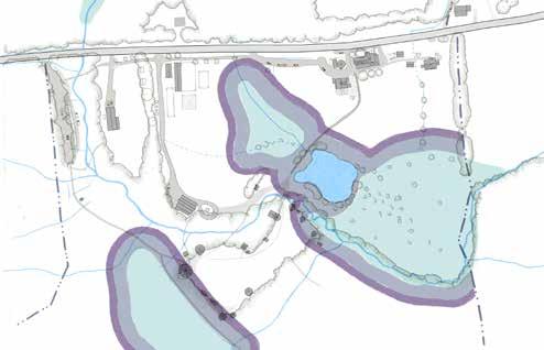
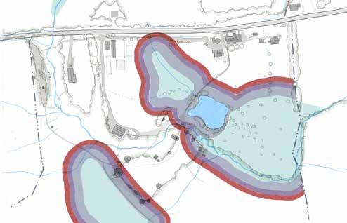
New Hampshire priority wetlands have 50', 75', and 100’ regulated buffers, depending on non-primary vs primary wetland conditions. These wetlands have been mapped by the U.S. Fish and Wildlife Department, but not officially delineated, and so their boundaries and buffers have not been defined. Buffer overlays, illustrated in the three graphics below, begin to show how these zones interact with the site. The 75' and 100' buffers cover substantial areas of the village along the western and eastern edges. Buffers are vital for maintaining healthy wetlands by filtering pollutants, providing habitat, and protecting wetlands from adjacent land use impacts. Activities that should be avoided in wetlands and buffer zones are filling, grading, excavating, dredging, draining, any significant altering of stormwater discharge, intensive mowing, heavy machinery operation, and constructing structures and impervious surfaces. Wetland buffers should be respected around further campus development and interventions should support these ecosystems and ecosystem functions.
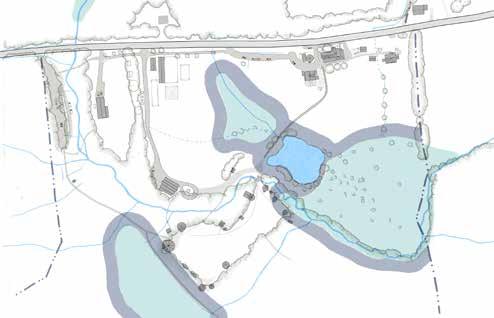
KROKA POND
KROKA VILLAGE
WOODLAND WETLAND
LOWER WETLAND
UPPER WETLAND
GRASSY BROOK
SOILS
Wetlands are key components of natural ecosystems. They are home to diverse species of plants and animals, and serve many ecosystem functions and services.
HYDRIC SOIL CONDITIONS
Standing water has been observed up to the dashed black line in the Village. Soil pits from the area marked with the red dot show hydric soils and a clearly defined clay layer approximately 10” deep (see bottom left image). Hydric soils are soils that are consistently saturated with water to the point that anaerobic digestion occurs. Water infiltration here was recorded at 1" over 6 hours in May 2025. The site is also part of the Rangeley Formation, with prominent exposed ledge south of Grassy Brook. This indicates shallow depth to bedrock, which may explain the slight sub-basin divide that runs through the Village. From these observations, the hydric soils in Kroka Village may be due to a combination of this clay layer and shallow depth to bedrock elevating the water table and creating wetland conditions. A wetland ecologist should be consulted to properly delineate the wetlands on site.
Observed standing
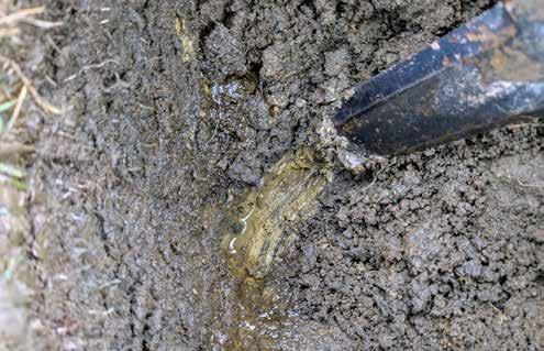
UMass Soil Lab sample results, taken from the test pit.
SOIL QUALITY
Soil sample results along the western edge of the village are consistent with northern hemlock-hardwood forest soil characteristics - low in available macronutrients, but high in iron and aluminum, (elemental components of hemlock needles). The results show clear signs that this area was cleared from the same forest type that surrounds it.
A soil drainage map, showing the extent of the Kroka property.
SOIL DRAINAGE
The map above illustrates the expected water drainage quality of the entire Kroka property. The test pit revealed a 10" deep clay layer located in what is designated by Soil Survey Geographic Database for New Hampshire (SSURGO) as moderately well drained soil. However the standing water, clay layer, and hydric soils indicate that this area is likely an extension of the poorly draining wetland soils to the west.
water in dashed black line and test pit and soil sampling from the area marked with the red dot.
The clay layer, observed approximately 10" deep.
FLOOD VULNERABILITY
The site is vulnerable to floods that disrupt connections from the farm to the Village and threaten key infrastructure.
WATER INFRASTRUCTURE
There are eight bridges throughout the focus area, 14 culverts, including three that run under Route 123, and two stormwater drains that outlet into the Grassy Brook. "Grey infrastructure" like this cannot expand to accommodate increased flows. If it does, it can collapse, putting vulnerable areas throughout the site at risk.
JULY 2023 RAIN EVENT
The map shows how water inundates the site in heavy rain events, and displays the retention capacity of Kroka Pond and the wetlands throughout the site.
In July 2023, the culvert sending Grassy Brook under Route 123 failed, backing up the north side of the culvert and sending water over the road, crossing a micro-basin and finding a new course across the Boathouse road, through the swale and into the pond. The banks also spilled over at the sharp bend of Grassy Brook by the main bridge that accesses the Village. According to many reports, flood waters went as high as the composting toilets, just to the west. This is especially risky with possible humanure entering Kroka Pond and Grassy Brook. Whether from the composting toilets, animal barn, or pasture overflow, the pond saw a spike in nitrogen content (see next page) resulting in high levels of e. coli that restricted recreation in the pond.
The easternmost culvert under Route 123 is sized too small according to staff observation and likely overflowed in this event, although this has not been confirmed. If this culvert were to overflow, it would send water across the road and down the steep slope beside the chicken coop, where erosion has been observed, as well as against stone retaining walls on the eastern face of the Barn, where erosion has also been observed.
DESIGNING FOR FLOOD
This rain event disrupted access to the Village along the main route from the Farmhouse and administration areas. Culverts should be resized and measures put in place to account for more intense rain events that cause more disruption throughout campus. The relocation of the composting toilets out of flood zones and paths that guarantee consistent access to Kroka Village in all conditions should also be considered, while green infrastructure in riparian zones should be installed to slow and sink water before it enters vulnerable areas.
Flooding scenario for Kroka Expeditions, based on July 2023 observations.
July 2023 flooding observed from the west of the Animal Barn.
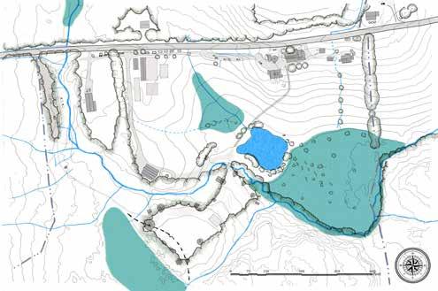
KROKA POND
KROKA VILLAGE
WOODLAND WETLAND
LOWER WETLAND
UPPER WETLAND
GRASSY BROOK
BOATHOUSE DRIVE UNDERSIZED
CULVERT COLLAPSE HUMANURE IN FLOOD WATERS
WATER QUALITY
IMPROVING WATER QUALITY
The main threats to Grassy Brook water quality include Route 123 pollution runoff, human waste from composting toilets, and general sediment in runoff. Increasing vegetation in the roadside ditches and throughout riparian zones help to filter runoff before it accumulates in the brook. Kroka Pond's water quality hinges on inputs from Route 123, runoff from Kroka's administrative area, animal waste from the Animal Barn and pastures, and human waste from the composting toilet, west of the pond.
ELEVATED LEVELS OF E. COLI
Kroka does weekly testing during the camp season to determine if the pond water is safe for swimming. To the right is a graphic that represents the recent e. coli testing dated back to 2022. According to the facilities manager, Kroka Pond has been closed for periods of the last three seasons to swimming and recreation due to elevated levels of e. coli present in the water. Each of the three e. coli spikes, illustrated in the chart, were the result of large rain events that carried high levels of nitrogen into the pond.
RELOCATING THE COMPOSTING TOILET
If the composting toilet near Kroka Pond were relocated to an area outside of the flood zone, then risk of humanure runoff into the pond would be greatly reduced. Efforts to reduce runoff, slow stormwater, strategically expand riparian zones, and improve up-basin conditions are likely to improve the water quality of the Grassy Brook and Kroka Pond, allowing for more recreation opportunities.
2022 — 2024 KROKA POND E.COLI COLONY LEVELS
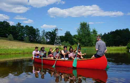
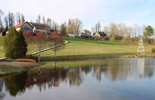
Campers enjoying Kroka Pond on paddleboards.
A school group practicing canoe skills on Kroka Pond.
Kroka Pond provides on-site water-based recreation for campers in the summer months when the water quality allows for swimming.
Weekly water quality testing is performed throughout the summer season to ensure that water remains safe for swimming and recreation. The chart above shows the spike in e. coli bacteria in 2023 when Kroka Pond was shut down due to high levels of e. coli. WATER QUALITY
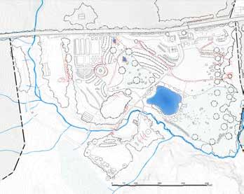
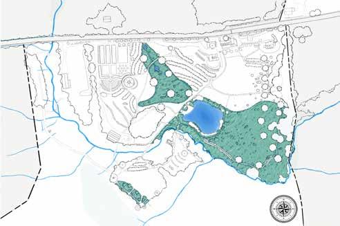
CHARACTER ZONES
Kroka Expeditions merges camp programming with nature immersion. Understanding how eco- and anthro-character zones interact clarifies what should be preserved and what should be improved in future development.
ECO-CHARACTER ZONES
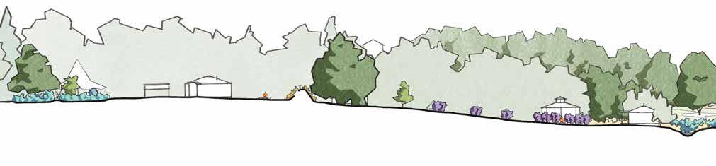
The ecological character of the Kroka focus area revolves mainly around water and the forest to the south. Wetlands provide habitat, stormwater filtration, and groundwater recharge. The pond serves as a bio-retention basin in flood events, delaying the accumulation of water downstream. The riparian zone along Grassy Brook provides habitat, filters sediments and pollutants before entering the brook, regulates stream temperature, and stabilizes the brook banks. The northern hemlock-hardwood forest provides shade, protecting vulnerable temperature-sensitive species like brook trout and salamanders, sequesters carbon, regulates nutrient cycling, absorbs water in flood events, and offers shelter, food, and nesting sites for wildlife.
ANTHRO-CHARACTER ZONES
The public face of Kroka Expeditions spans from the Farmhouse, along Route 123 and the multi-use trail, to the trailhead parking. This area is where people come and go from the site and is accessible to the public. The year-round staff housing is an integral part of Kroka. Its proximity to the site allows the campus to be managed effectively. The zone around the Boathouse is used for staging and is a critical energy center on campus. The farm, comprising the northern hills that slope down to Kroka Pond and the wetland, are where production and animal husbandry take place. The thresholds connect the outside world to the off-grid, mindfull experience of Kroka Village. Woodland camps populate the forest in between the trailhead parking and the Village, offering scenic camping. Seasonal staff housing is situated in the northeast corner of the village, allowing seasonal staff to monitor village basecamps. Kroka Village is the heart of camp programming, where the campers play, cook, and spend most of their time while they are on campus.
OVERLAYS AND IMPLICATIONS
The first of the overlapping zones is the wetland/pond and farm. These areas can have a positive relationship; however, if animal waste reaches the pond untreated, the water quality of the pond will diminish, lowering its recreational value. The second overlap is the pond's function as a stormwater retention basin and as a site of recreation. These two functions clash, as stormwater brings pollutants into the pond. If green infrastructure were to interrupt runoff higher in the watershed, the pond could better serve this dual function. The third overlap is between the wooded camps and the forest habitat and riparian buffer. This interaction works well, as the campers sleep on elevated platforms which minimally disrupt the forest and riparian ecosystem. The last overlay is between the wetlands and Kroka Village. To maximize the potential of this area, it is best to draw the woodland wetland farther into the village, giving the observed standing water a place to go and a root structure to absorb it. This intervention can reduce the moisture content in the surrounding village, allowing the lawn to be of greater use to staff and campers.
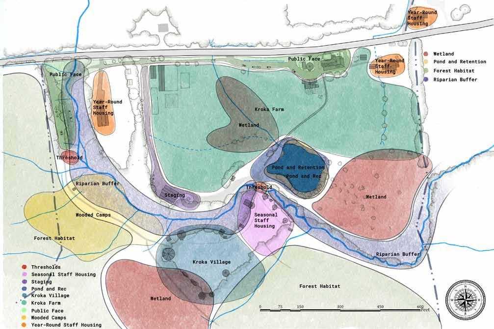
Ecological Character Zones.
The overlay of character zones shows where ecological and anthropogenic zones intermingle, or otherwise "clash."
CONSIDERATIONS & CRITERIA
WATER AS A DESIGN
CONSIDERATION
A lot of water runs through the Kroka campus. The following designs honor the water and see it not only as a recreational resource, but also as an ecological resource. These primary functions can improve the overall experience at Kroka. Increasing frequency and severity of rain events flood key areas of the campus. Not only does this restrict access and constrict programming, but it also threatens the water quality of Kroka Pond and the Grassy Brook. When vegetated riparian zones are expanded, and stormwater is treated towards the top of the basins, runoff that enters these important water bodies will be cleaner and water recreation is improved. Upper-basin interventions, along with culvert upgrades and moving critical infrastructure out of floodable areas will benefit Kroka's relationship to water.
DESIGN CRITERIA
Below is a list of criteria that was considered in the design process. Criteria emerged from conversations with the clients and the process of site analysis. Farm infrastructure focuses on growing farm programming and production. Expansion capacity recognizes the desire for a growing Kroka community to experience the campus through an accessible and meaningful gathering space. Circulation promotes the means of dry and accessible travel around Kroka's campus. Artwork of the proposed new gathering space by Kevin Hawkes.
FARM INFRASTRUCTURE
• Classroom for 25 students
• Processing area, minimum 200 sq. ft.
• Storage for apple press, winnowing equipment, and other low-tech machinery, minimum 200 sq. ft.
EXPANSION CAPACITY
• A structure accommodating a new gathering space
• Additional activity spaces for campers, both outdoors and in
• Any new structure to be accessible to utility lines stemming
• Overflow parking for up to 80 cars
CIRCULATION
• Dry trails and paths
• Accessible trails where possible
LOW IMPACT, HIGH PRODUCTION
FEATURES
• Elevated boardwalk in southwest corner of Kroka Village creates a dry crossing for campers to get to basecamps. A densely planted wet garden helps uptake water in the soil.
• Gathering space by Kroka Pond accommodates outdoor classes.
• Dense permaculture plantings throughout the focus area increase food production on site.
• Additional permeable parking added north of the Boathouse.
• Willow Walk south of Directors' House creates a 'take 5 space' for staff and campers to break for 5 minutes and go on a short walk.
• Boardwalk added through the wetland expands berry and nut harvest.
• Expanded annual beds by greenhouse.
PROS
Approachable design; high crop yields; minimal earthworks.
CONS
Farm programming space is limited; pond energy center is still vulnerable to flooding and disruption.
OVERFLOW
FEATURES
• Rerouted main path avoids the vulnerable area of flooding in Grassy Brook and creates a new, dry primary path uphill and over an existing bridge crossing.
• Animals relocated in new structure beside Boathouse to prevent contamination from manure.
• Farm programming and classroom moved into the first floor of existing Animal Barn allowing for more human engagement in an existing structure with good views to the pond.
• Patio and amphitheater built into the hillside below to create another space for gathering with a great view.
• Additional stormwater measures taken to encourage the filtration of water through the site.
• Vegetated buffer splits the village in two distinct circles to create a stronger sense of refuge for staff and campers.
PROS
Respects natural flow of water and prioritizes ecosystem functions.
CONS Energy centers move away from the pond.
EMBRACING EVOLUTION
FEATURES
• Relocation of earthen structures in the village away from wetland edge to drier ground.
• Basecamp Village is oriented inward to bring celebration to the forefront.
• New structure near the farm production area provides multiple program options.
• Natural swimming pool design in the pond with a boardwalk structure makes it easier for campers to observe the natural ecology in the pond.
• Paths offer more access throughout the site with improved access to the eastern edge of the site and connections between the new structure and the Boathouse and Farmhouse areas.
PROS
Ample farm programming space; existing sightlines celebrated; more pond recreation opportunities.
CONS
Less farm production; energy intensive implementation.
Embracing Evolution map in plan view.
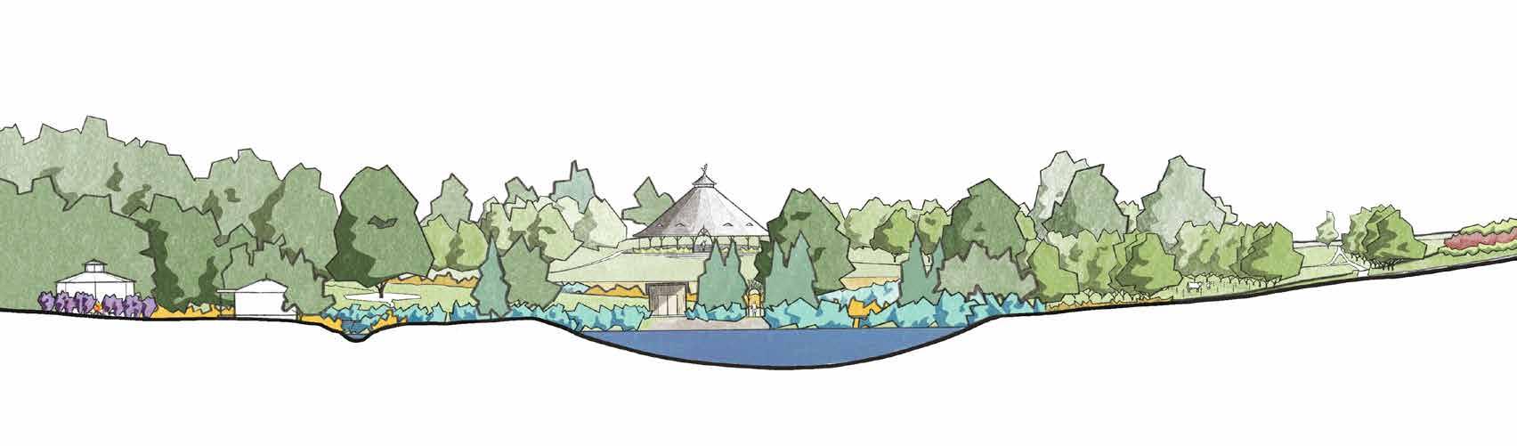
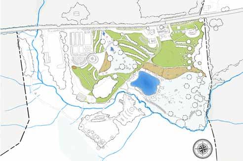
FINAL DESIGN
This design combines aspects of all three design alternatives. It envisions a resilient campus that honors water, integrates permaculture, has a safe road crossing, and includes a new energy center for the continued evolution the Kroka landscape.
PERMACULTURE
Supports farm programming by increasing crop yields within a climate resilient landscape, providing shade for grazing, and building topsoil.
CHECK DAM SYSTEM
Forebay and check dams remove sediment from Route 123 runoff prior to it entering a natural wetland ecosystem. This improves water quality in the pond and other waterbodies downstream.
RAIN GARDEN
Swale and berm direct water during flood events into an enhanced boathouse road culvert, protecting the road surface from washing out in floods.
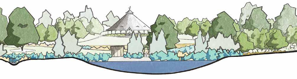
FARM ENERGY CENTER
A pavilion at the edge of the farm production zone creates an accessible space for community gathering with views of the barn, pond and boathouse.
EDUCATIONAL GARDEN
Edible and medicinal plants form an accessible showpiece near the farm energy center.
COMPOSTING TOILET
A new bathroom is a short walk from the farm energy center.
BRIDGE CROSSING
New bridge draws main route for Village access out of the area currently inundated during large floods.
STAFF CIRCLE
Creates a gathering point for staff nearby to their lodging.
TWO VILLAGES
Added vegetation defines use of Basecamp Village and Staff Village.
ESTABLISHED WETLAND
Wetland plants fill the wet areas of the Village and boardwalks provide access to the basecamps.
VEGETATION BUFFER
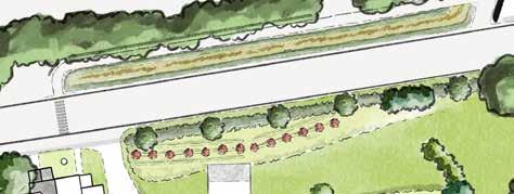
Herbaceous native perennials and flowering trees create a visual barrier to Route 123 and form an edge to camp spaces.
RT 123 CROSSING
Crossing area located in the safest point of the road. New multi-use path set back from road draws users away from traffic.
WATTLES
Catch runoff and sediment, build topsoil, encourage root proliferation, and prevent erosion in areas with steep slopes.
FARMHOUSE RAIN GARDEN
Collects and sinks water from farmhouse gutter system.
WILLOW WALK
A gently sloping path provides a "take-5" space for staff and campers to debrief.
OUTDOOR CLASSROOM
A new gathering space in an underutilized zone of campus.
REDIRECTED MAIN PATH
Realignment avoids fall lines and promotes a more sustainable and safe path of travel.
RIPARIAN BUFFER
Campus infrastructure pulled away from pond to restore natural ecosystem function, flood resilience and improve water quality.
WETLAND WALK
Boardwalk provides access and production while improving long-term soil and root structure conditions in the wetland.
RELOCATING EARTHEN STRUCTURES
Structures moved from wet conditions along the western edge of the Village to dryer soils along the eastern edge.
KROKA POND
Activity centers are drawn away from the pond in the final design, making the water body more of a destination rather than the epicenter of activity.
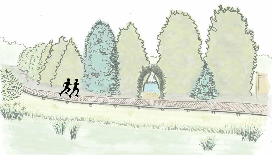
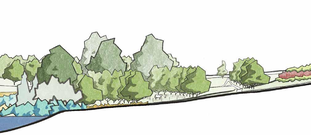
A NEW PERSPECTIVE
The path is rerouted behind the line of cedars along the northwest edge of the pond, allowing the evergreen trees to serve as a privacy barrier to the small beach. This creates an opportunity for an entrance threshold between the cedars, seen in the perspective drawing to the right.
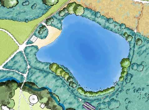
ESTABLISHING THE RIPARIAN ZONE
Kroka Pond serves recreation, aesthetic, cultural and water retention functions. In the final design, the riparian zone around the pond is planted up, with more trees and shrubs, cooling the water's edge in the hot summer months and providing the last barrier of stormwater filtration before runoff enters the pond.
Perspective sketch of Kroka Pond with rerouted boardwalk and new beach entrance through a willow archway.
KROKA POND
WILLOW ARCH
RIPARIAN BUFFER
RIPARIAN BUFFER POND INLET
CROSSING & ADMINISTRATIVE AREA
The administrative area experiences some minor changes in the final design, with a light touch to improve the plant palette, access and circulation, and sightlines.
ADMINISTRATIVE AREA
The primary path will consist of both boardwalks and pathways. It will be rerouted to avoid walking downslope on a fall line. By moving the path in front of the apple trees, the trail becomes more sustainable. A rain garden off the southeast corner creates a place for water to infiltrate. Live-stake wattles and permaculture plantings in front of the Barn prevent erosion in one of the steepest slope on site and reduces the amount of animal waste run off that enters Kroka Pond downslope. The sightline to Boathouse from director's platform northwest of the Barn is also is maintained with the appropriate height planting based on the depth.
CROSSING

The multi-use trail must support pedestrians and bicyclists and not be so large that golf carts would use the path of travel. shrub plantings along the road will create a sense of 'road narrowing; that allows for a slower flow of traffic in that area. In partnership with the New Hampshire Department of Transportation, new signage indicating a crossing ahead will be installed on either side of the hill crest.
FARM
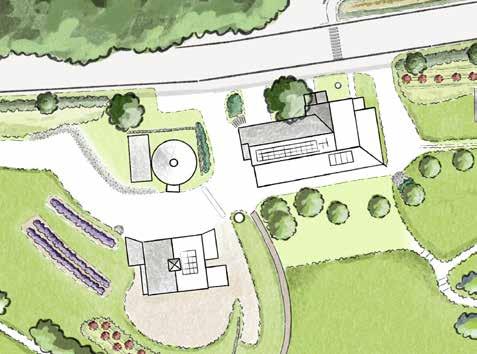
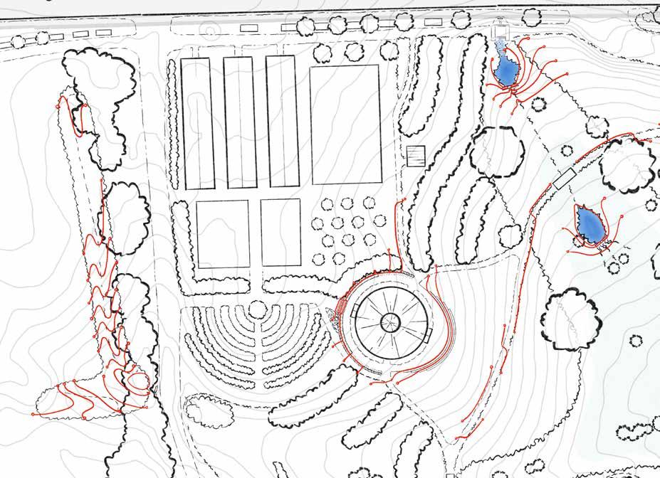
The farm sees a revolution in use, with permaculture plantings integrated throughout, and a new energy center that provides space for farm programming, events, and a strategically placed focal point on the property.
ORCHARD AND ROTATIONAL GRAZING
Trees are planted just off contour, on keyline, to allow water to migrate into the upper wetlands system. Rows are planted ~40 feet apart in order to allow animals to be rotationally grazed down the rows and throughout the farm's permaculture plantings.
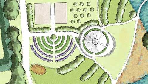
FARM ENERGY CENTER
The energy center is situated southeast of the annual production beds and is composed of a large educational garden, a timber-framed round house for events and farm programming, an open lawn, and a composting toilet to the north (out of the focus frame). The round house can be accessed by new trail networks from the farmhouse, and accessible paths from the northern multi-use path, the Boathouse access road, and the Boathouse itself. The structure is framed by rows of fruiting trees and opens up to expansive views of the campus to the iconic Farmhouse and Barn, Kroka pond, and Boathouse.
KROKA VILLAGE
Kroka Village sees a cultural shift, from one large village to two distinct villages that embrace the functions of each area.
WOODLAND WETLAND WATER MANAGEMENT
The planted wetland and boardwalk create a new feature in the upper village. This feature serves to absorb water from the lawn of the village, slightly reducing the recreation area while improving the condition of the soil. The boardwalk is built through the wetland to access to Penobscot Bay and Ungava Bay, as well as medicinal plantings throughout the planted wetland.
A NEW VISION FOR THE VILLAGE
Kroka Village has six new features, apart from the woodland wetland, mentioned above. A line of trees separates the staff and basecamp areas of the village, embracing each space allowing both to serve their unique functions. This line of trees also serves as the refuge to locate the new earthen structures. The Staff Village replaces the diseased blueberries with honeyberries that frame a staff circle. The bridge from the Staff Village is reduced in size and priority, and the riparian area is planted with a new bank of trees, woody shrubs, and herbaceous groundcover. Not shown in this section is the new bridge to access the village further northwest.

Wetland garden section showing the wetland plant palette.
WETLAND GARDEN
RESOURCES GRADING PLAN
Grading the access path across Route 123 to the Class 5 Road and new parcel involves grading cuts which maintains an accessible pathway. These cuts will require tree removal and earth retention with a stone wall.
Grading for the highly sloped Willow Walk will require cut-andfill earthworks. This feature is involves standard switchbacks with a maximum slope of 20 percent over 40 feet, while the majority of the path has a slope between 5 and 10 percent.
An area for the outdoor classroom is also graded via the cut-and-fill technique, resulting in a clearing with 3 percent slope.
A new swale and berm directs water to the rain garden is designed to the west of the Boathouse access road. This protects the road from washout and directs any stormwater (if Grassy Brook were to leave it's channel) toward the resized culvert under the access road.
The round house cut-and-fill grading involves retention of the uphill slope with a dry stone wall that tapers from 3'-6" to 0'-0", providing handicapped accessibility along its southern length, stairs to access the structure directly, and path accessibility to a new composting toilet to the north. The round house itself sits on a leveled platform, with perimeter drains resolving any water issues. The platform transitions to the lawn below via four steps, highighting the dramatic views to the Farmhouse to the northeast, the pond to the south east, and the Boathouse to the southwest.
Two check dams are graded into the upper wetland area and the drainage ditch is filled in below the second check dam fto allow for water to slow and sink into the wetland.
A berm is graded to the south and east of the pond composting toilet. This creates a barrier between Grassy Brook overflow and the humanure basin, which in turn protects the water quality of the Grassy Brook and Kroka Pond in flood events.
The new bridge to access Kroka Village is created with bouldering and earthworks which raises the bridge 4 feet off of the brook, accounting for any flood events, while providing a grading scheme that allows for tractor access.
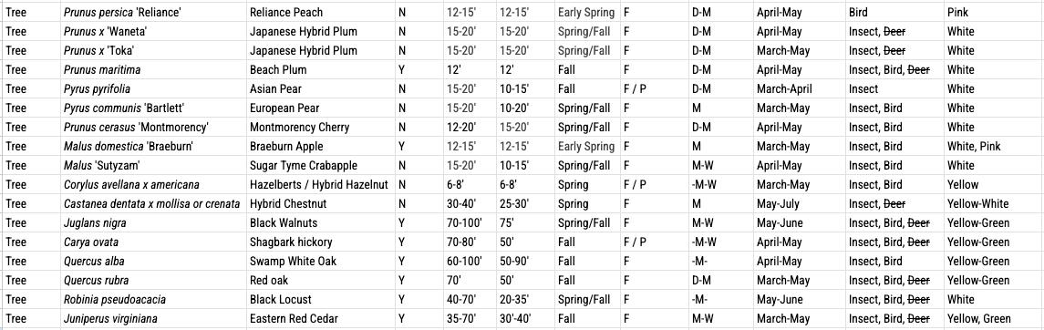
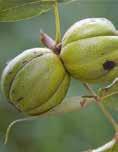
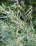
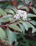
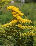
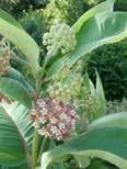
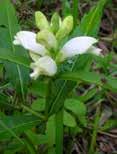
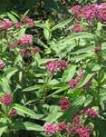
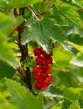
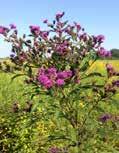
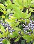
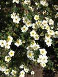
PERMACULTURE PLANT PALETTE


Permaculture can continue to be integrated into the landscape at Kroka. This palette consists of plant species that would increase the production capacity and crop yields through a palette of berries, fruit and nut trees. It supports farm programming by creating a climate resilient landscape, providing shade for grazing animals and building topsoil through plant nutrients and root structures.
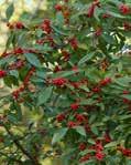
Note: Eastern Red Cedar should not be grown near apple trees, or should be spaced over 500' away from this species due to cedar apple rust, which can severely afflict the health of apple and crabapple varieties.


PERMACULTURE
PLANT PALETTE
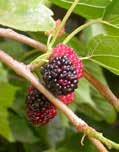
Morus alba
Sambucus canadensis
Myrica pensylvanica
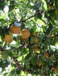
Aronia melanocarpa Pyrus pyrifolia
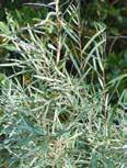
Hippophae rhamnoides
Prunus cerasus
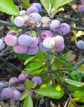
Vaccinium angustifolium
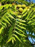
Juglans nigra
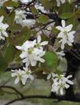
Amelanchier laevis
Carya ovata
Cornus alba f. aurea sibirica
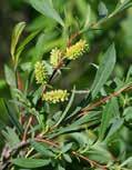
Diervilla lonicera Salix exigua
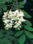
Robinia pseudoacacia
Salix purpurea
Berries & Shrubs
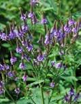
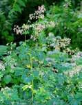
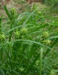
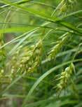
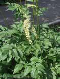
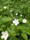
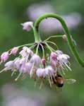
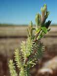
WETLAND PLANT PALETTE

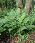
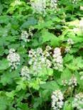
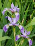
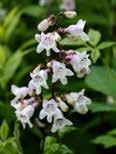
The wetland plant palette for Kroka reflects the diversity of plants found in the existing forested wetland and beaver pond on the southern half of the site. Some of these plant communities and species in these areas include many different types of ferns, as well as Northern Blue Flag Iris and Blunt Spikerush. Shrub willows and Joe-Pye Weed round out the palette.
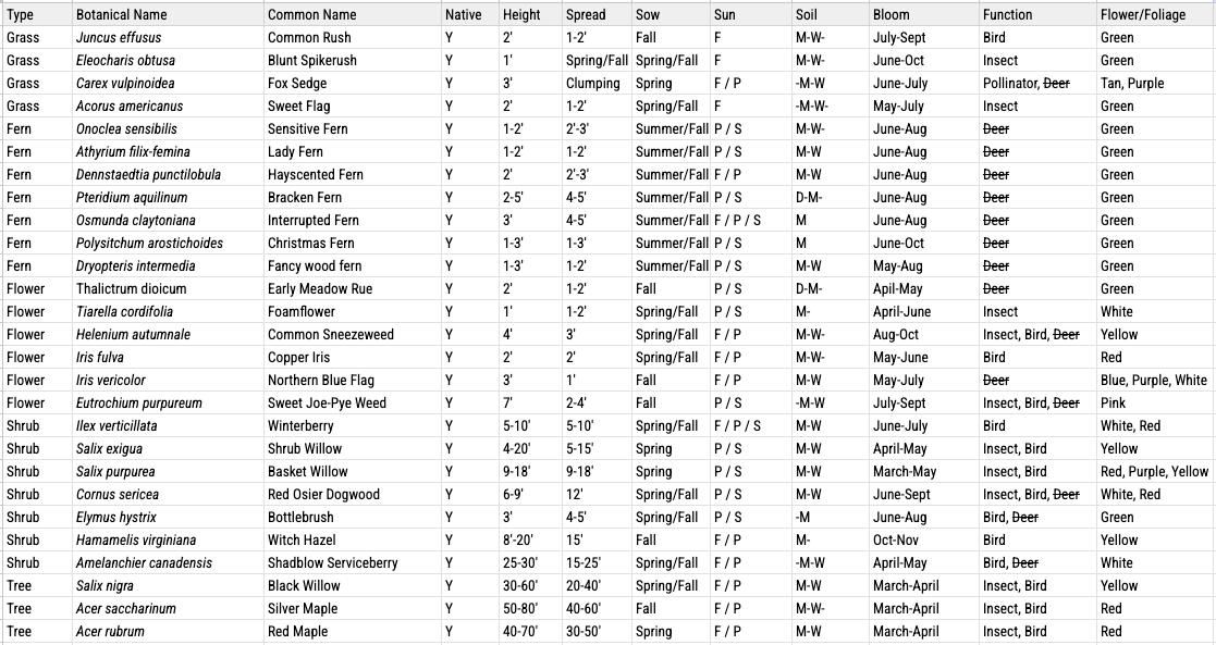


WETLAND PLANT PALETTE
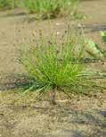
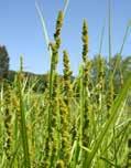
Eleocharis obtusa Carex vulpinoidea Onoclea sensibilis Thalictrum dioicum
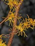
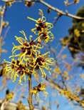
Ilex verticillata Salix exigua Dasiphora fruticosa Elymus hystrix Hamamelis virginiana
Athyrium filix-femina Iris fulva Dennstaedtia punctilobula Eutrochium purpurem
Salix nigra Acer saccharinum Acer rubrum
#10 GAUGE WIRE STAUBS
REMOVE BURLAP & ALL WIRE
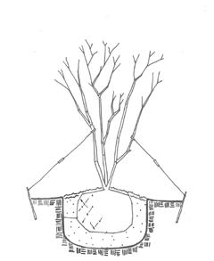
Detail 1. Multi-trunk serviceberry on-swale bracing.
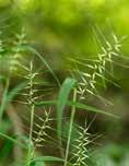
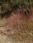
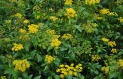
GRASSLAND & MEADOW PLANT PALETTE


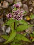
This plant palette is focused on engaging the Kroka community around the new farm energy center with plants that have educational, edible or medicinal value. It features a broad range of plants from sensory lavender to surprising spilanthes, also known as the tooth-ache plant. The discoveries in this garden intend to delight and surprise the Kroka community for years to come.
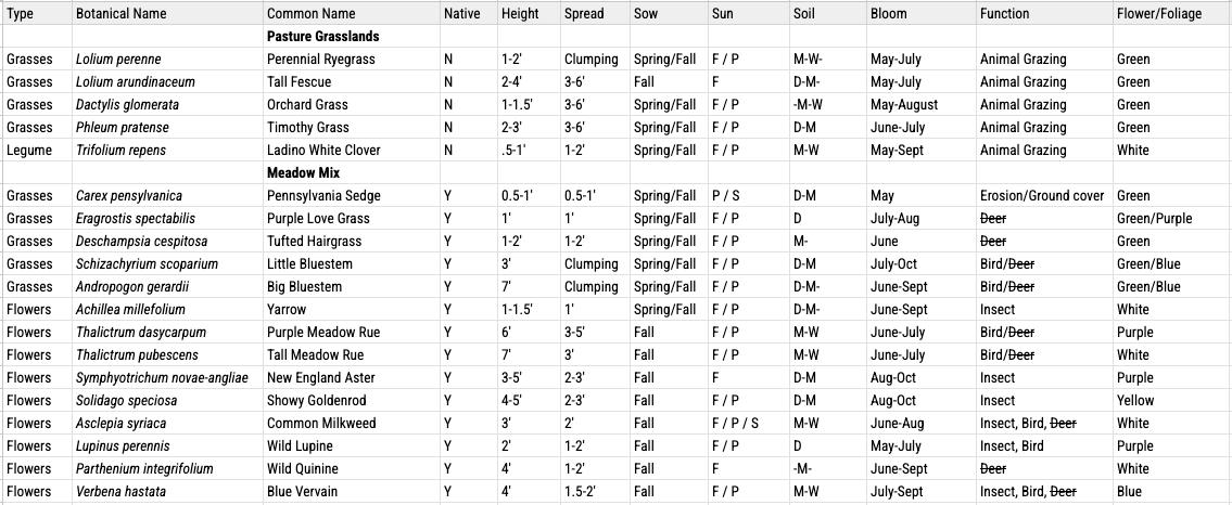
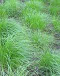


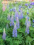
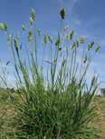
Grassland Meadow
Carex pensylvanica
Thalictrum dasycarpum
Verbena hastata
Eragrostis spectabilis
Phleum pratense Solidago speciosa
Asclepia syriaca
Trifolium repens
Achillea millefolium
Symphyotrichum novae-angliae
Lupinus perennis Dactylis glomerata Parthenium integrifolium
Deschampsia cespitosa
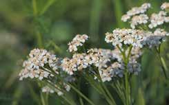
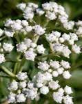
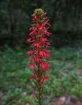
RAIN GARDEN PLANT PALETTE

The rain garden palette features plants that tolerate a wide range of soil moisture conditions, including flowering perennials such as Golden Alexander and Black Eyed Susan.
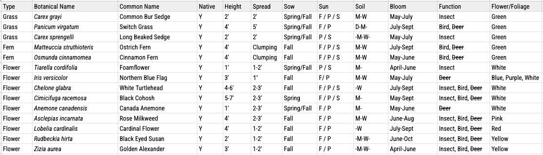


WETLAND
PLANT
Carex grayi Panicum virgatum
Matteuccia struthioteris
Osmunda cinnamomea Tiarella cordifolia
Iris vericolor Chelone glabra
Carex sprengelii
Lobelia cardinalis Rudbeckia hirta
Zizia aurea
Cimicifuga racemosa Anemone canadensis Asclepias incarnata
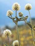
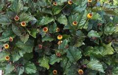
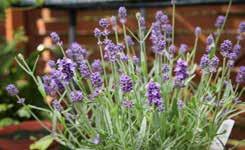
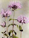
EDUCATIONAL GARDEN PLANT PALETTE

This plant palette is focused on engaging the Kroka community around the new farm energy center with plants that have educational, edible or medicinal value. It features a broad range of plants from sensory lavender to surprising spilanthes, also known as the tooth-ache plant. The discoveries in this garden intend to delight and surprise the Kroka community for years to come.

Note: While currants are an excellent option from a food production and processing standpoint, they also serve as the alternate host for white pine blister rust (WPBR), a serious disease of white pine trees. The species on this list (Ribes nigrum 'Titania' and Ribes rubrum 'Rovada') are both on the approved list for planting, but a permit is required to plant currants in the state of New Hampshire. Kroka should carefully consider the planting of these species, follow the guidelines from the approved list from Extension of University of New Hampshire, and only plant approved varieties.
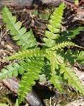
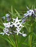


Comptonia peregrina Amsonia hubrichtii Malus 'Snowdrift' Echinacea purpurea Ribes rubrum 'Rovada'
Penstemon digitalis Hamamelis virginiana
Carex sprengelii
Allium cernuum Lavandula angustifolia
Acmella oleracea
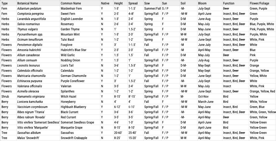
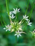
Sassafras albidum Allium canadense Adiantum pedatum
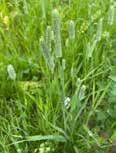
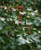
STREET & PATH PLANT PALETTE

The plants in this palette are intended to be planted along the street and paths at Kroka. Along the southern edge of Route 123, hawthorne and crabapples can be planted with an understory of herbaceous perennials that die back each season. These plantings will provide a visual barrier to the road from Kroka and will also reduce the amount of mown lawn on campus.
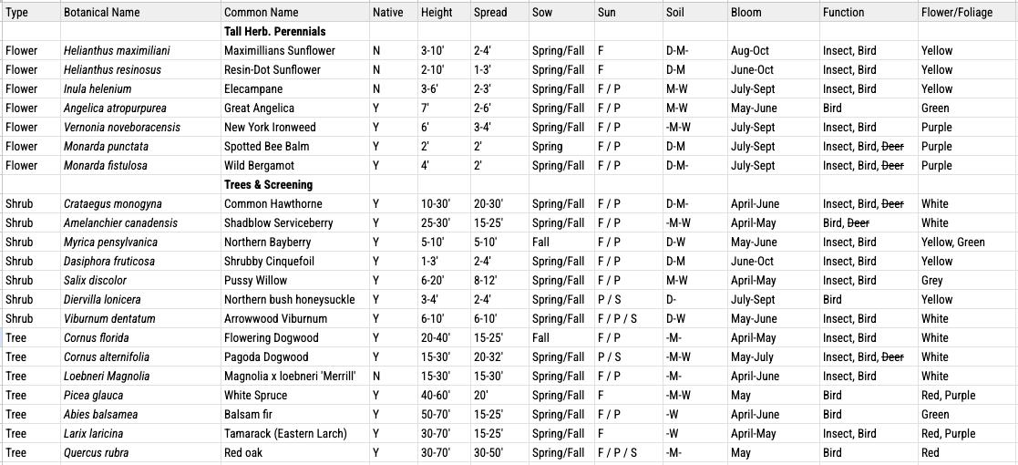


Angelica atropurpurea Vernonia noveboracensis Monarda punctata Monarda fistulosa
Amelanchier canadensis Myrica pensylvanica Dasiphora fruticosa Abies balsamea Larix laricina
Crataegus monogyna Salix discolor Viburnum dentatum Picea glauca
Quercus rubra Diervilla lonicera Loebneri Magnolia
Detail 1.
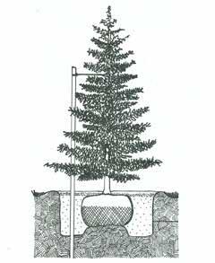
Detail 1. Ball & burlap conifer tree planting.
WOODEN STAKE
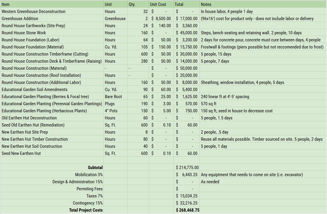
PHASE ONE COST ESTIMATE
ESTABLISHMENT (2025 - 2030)
This phase prioritizes ecological alignment and sets the seeds for growth. Only from a stable footing can expansion truly come. Establishment preps Kroka with earthworks and young trees and plants. These earthworks address critical locations where intense storms have impacted Kroka in the past; along the Boathouse road, beside the Animal Barn, down the slope to the pond (on the hillside and along the upper wetland ditch that flows into Kroka Pond), and by the pond-side composting toilet.
Trees and plugs prepare Kroka for future growth, intentionally planted into a landscape prepared to accommodate a new farm energy center, established crisscrossing trails, and outdoor classrooms. Estimates consider hydraulic interventions along with opportunities for staff and camp involvement.
Note: Given current uncertainties regarding tariffs and other financial conditions, accurately estimating future costs is extremely difficult. The cost estimates on the following sheets are approximations based on current prices which may fluctuate wildly, and cannot predict future contingencies.
PHASE TWO COST ESTIMATE
SUCCESSION (2030 - 2035)
This phase begins to uncover the full potential of Kroka. Trees have been planted to intersect and embrace the two Villages. The willows are establishing themselves along the eastern slope, under the Director's House. The wetlands and orchards are growing up and out, creating new arenas to explore and harvest. In this phase, paths are constructed throughout campus, providing access to this newfound abundance while respecting vulnerable flood zones and and pulling infrastructure away from them.
The main path is rerouted to access Kroka Village, effectively expanding the riparian zone west of the pond and creating a destination experience to the pond. The composting toilet is deconstructed and moved to the farm, supporting programming and future growth in that area. The Willow and Wetland Walks are built, and the campus begins to take advantage of the new spaces that are being cultivated within the landscape.
PHASE THREE COST ESTIMATE
EVOLUTION (2035 - 2050)
This phase imagines a future where resilient infrastructure and healthy ecosystems meet the next evolution of Kroka. The orchard is in full bloom. Paths draw community members in every direction. Maturing vegetation creates intimate and expansive outdoor spaces, and a new farm energy center emerges, drawing campers and community members to broadened programming and events.