

 Fitch Mountain Park and Open Space Preserve
Management Plan November 20, 2017
Prepared for:
City of Healdsburg, Community Services Department
550 Westside Road
Healdsburg, CA 95448
With support from:
California State Coastal Conservancy

1330 Broadway, 13th Floor
Oakland, CA 94612‐2512

Grant Agreement No. 14‐071
Prepared by:
Prunuske Chatham, Inc.
400 Morris Street, Suite G
Sebastopol, CA 95472
With support from:
Sonoma County Agricultural Preservation and Open Space District
747 Mendocino Avenue, Suite 100
Santa Rosa, CA, 95401
City of Healdsburg staff and the Healdsburg City Council would like to thank Senator Mike McGuire for assisting with the Preserve acquisition and funding; the Healdsburg Parks and Recreation Commission; and Chris Herrod, Kathy Birdsong, Ron Dobley, Shawn Widick of the Parks and Recreation Open Space Subcommittee. We thank Jake Newell of the Sonoma County Agricultural Preservation and Open Space District and LandPaths staff, Craig Anderson, Lee Hackeling, Omar Gallardo, and Erin Mullen for providing helpful input and support. We also thank Ken Wells, Sonoma County Trails Council; Nick Nesbitt, Redwood Empire Mountain Bike Association; Alisha O’Loughlin, Sonoma County Bicycle Coalition; Ray Holley, The Healdsburg Tribune; Dave Henderson and Kate Symonds from the Fitch Mountain Association; Ted Calvert, local historian; the Fitch Mountain Fund, and the many other residents and friends of Healdsburg who contributed ideas for stewarding and protecting Fitch Mountain.
1 | Fitch Mountain Park and Open Space Preserve | Management Plan Table of Contents 1 Introduction 4 Overview...................................................................................................................................................4 Goals and Plan Purpose 4 Conservation Values .................................................................................................................................5 Preserve Acquisition .................................................................................................................................6 Plan Development Methods 7 2 Preserve Description............................................................................................................... 9 Overview...................................................................................................................................................9 Adjacent Ownership 9 Historic Land Uses...................................................................................................................................11 Existing Facilities and Uses......................................................................................................................13 Park Improvement Area 15 Map of Park Improvement Area 16 3 Physical Features................................................................................................................... 17 Topography and Soils..............................................................................................................................17 Geology 18 Climate....................................................................................................................................................18 Watershed and Hydrology......................................................................................................................20 Viewsheds 21 4 Data Collection Methods...................................................................................................... 22 Biological Surveys....................................................................................................................................22 Trail and Recreation Planning 24 5 Biological Resources ............................................................................................................. 25 Plant Communities..................................................................................................................................25 Wildlife Communities..............................................................................................................................33 Special-status Species 37 6 Resource Management......................................................................................................... 46 Habitat Protection...................................................................................................................................47 Hydrology and Erosion Control...............................................................................................................49 Invasive Plant Management 52 Special-status Plant Protection...............................................................................................................56 Wildlife Species Protection.....................................................................................................................58 Habitat Restoration 59 Invasive Animal Management ................................................................................................................60 Contaminant and Pathogen Control 61 Cultural and Historical Resources 62
2 | Fitch Mountain Park and Open Space Preserve | Management Plan Climate Change Adaptation....................................................................................................................63 Staff Trainings and Communication 65 7 Fire Risk Abatement.............................................................................................................. 66 Ignition Sources and Fuel Conditions......................................................................................................67 Fire Management Recommendations ....................................................................................................68 8 Public Uses and Engagement................................................................................................ 77 Public Uses 77 Group Activities.......................................................................................................................................83 Other Public Uses 84 Enforcement ...........................................................................................................................................86 Educational Opportunities......................................................................................................................86 Engaging and Managing Volunteers 87 9 Trails and Recreation ............................................................................................................ 90 Public Access and Parking.......................................................................................................................92 Trails and Recreation Facilities ...............................................................................................................93 Trail Maintenance, Construction, and Decommissioning 99 Signage and Maps.................................................................................................................................105 Memorials and Dedications..................................................................................................................107 Vista Points 108 Site Furnishings.....................................................................................................................................111 Vehicles 111 Trash Collection 112 10 Calendar of Management Activities............................................................................... 113 11 Implementation and Additional Funding....................................................................... 117 Possible Funding Opportunities............................................................................................................117 12 Permitting........................................................................................................................ 121 13 References ....................................................................................................................... 125 Figures Figure 1. Typical Culvert Outfall.................................................................................................... 51 Figure 2. Canopy Coverage Targets 73 Figure 3. Techniques for Making the Prune Cut ........................................................................... 74 Figure 4. Fitch Mountain Park and Open Space Preserve Improvement Plan ............................. 96 Figure 5. Fitch Mountain Park and Open Space Preserve Improvement Plan – Section A 97 Figure 6. Fitch Mountain Park and Open Space Preserve Improvement Plan – Section B .......... 98 Figure 7. Trail Outsloping............................................................................................................ 103 Figure 8. Plan View and Cross Section of a Waterbar 103
A. Plant Species Observed on the Preserve
B. Wildlife Species Observed on the Preserve
C. Invasive Plant Species and Management Guidelines
D. Plant Species Suitable for Restoration Plantings
E. Habitat Restoration Methods
F. ADA Requirements
G. Overview of Recommended Management Actions and Timeframe for Implementation
H. Estimate of City Staff Management Time
I. Framework for Group Activities
J. Conservation Easement
K. Recreation Conservation Covenant
3 | Fitch Mountain Park and Open Space Preserve | Management Plan Figure 9. Rolling Dip Details ........................................................................................................ 104 Figure 10. Examples of Preserve Signage ................................................................................... 106 Figure 11. Existing Conditions at Designated Vista Points.......................................................... 109 Tables Table 1. Summary of Trail Use on the Preserve............................................................................ 78 Table 2. Existing and Proposed Trails and Associated Lengths .................................................... 99 Table 3. Trail Widths and Clearances 102 Table 4. Calendar of Ongoing Management and Monitoring Activities..................................... 114 Table 5. Applicable Local, State, and Federal Regulations ......................................................... 121 Exhibits
and
Context
Existing Trail System
Plant Communities
Special-status Species Occurrences in the Vicinity
of Management Concern
Improvements
1. Location
Regional
2.
3.
4.
5. Areas
6. Public Access
and
7. Fire Management
Emergency Access Areas Appendices
1 Introduction Overview
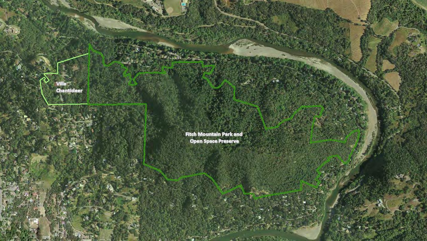
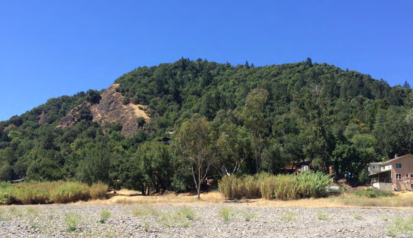
The Fitch Mountain Park and Open Space Preserve is a 173-acre property that encompasses the entire 991-foot peak of Fitch Mountain and most of its surrounding slopes (Exhibit 1). The Preserve is densely forested with coast redwood, Douglas fir, California bay, madrone, oaks, and a rich array of understory species. These forests provide valuable habitat for a wide variety of animal species. Located along the middle reach of the Russian River, Fitch Mountain is one of the most prominent physical landmarks in northern Sonoma County. The property was purchased in 2014 by the Sonoma County Agricultural Preservation and Open Space District (District) and transferred from the previous owner directly to the City of Healdsburg (City). The City in turn transferred it temporarily to the non-profit organization LandPaths to manage on behalf of the City during an interim period. Title to the Preserve will revert back to the City in November 2017. During this interim period and with funding obtained from the California Coastal Conservancy (Coastal Conservancy), the City retained Prunuske Chatham, Inc. (PCI) to develop a long-term management plan (Plan) for the property.
Goals and Plan Purpose
The overarching goals for the Fitch Mountain Park and Open Space Preserve’s use and management are to:
1. Protect the mountain’s biodiversity, soil and aquatic resources, and ecological functions,
2. Protect the mountain’s scenic values, and
4 |
Fitch Mountain Park and Open Space Preserve | Management Plan
3. Provide public recreational and educational opportunities that are compatible with the protection of natural resources.
In addition to these goals, which were outlined by the District in acquisition and conservation easement documents, the City has an additional goal of managing the Preserve to reduce fire hazard to nearby properties. The purpose of this Plan is to provide guidance for meeting all of these goals. The Plan covers the Fitch Mountain Park and Open Space Preserve as well as portions of the City-owned Villa Chanticleer event center, where public access improvements area proposed within the Park Improvement Area; see Exhibit 2. For simplicity, these two properties are referred to collectively as the Preserve in this document.
The Plan summarizes the existing ecological conditions on the Preserve, identifies key resource management needs, and provides recommendations for improving public access, managing public uses, and managing the risk of wildfire.
Conservation Values
The Preserve was purchased to preserve and protect native plant and wildlife diversity and specialstatus species habitat; to preserve the mountain’s scenic and viewshed values; and to provide passive1 outdoor public recreation and educational uses providing that such uses are compatible with protection of natural resources (District 2014).
The Preserve supports extensive woodlands and forests that provide habitat for a wide variety of species. Its slopes drain directly to the Russian River, so protecting the Preserve will help protect water quality in the river. In conjunction with other nearby protected lands, Fitch Mountain provides undeveloped habitat that is vital to maintaining wildlife migration corridors in the Russian River valley.
Fitch Mountain is one of the most prominent physical landmarks in northern Sonoma County. The mountain is adjacent to the city of Healdsburg and provides a scenic backdrop for the city, other communities along the Russian River, and travelers along the Highway 101 corridor. The distinct peak of this heavily wooded mountain rises abruptly from the surrounding landscape and can be seen from a great distance in all directions.
The Preserve’s combination of biological diversity and accessible location adjacent to the Healdsburg urban area make it valuable both for protecting natural resources and for providing the public with
1 The 2014 Easement defines “passive outdoor recreational and educational uses” as “those recreational and educational activities typically associated with natural, undeveloped open space lands, and that are generally nonstructured and require minimal or no developed facilities or improvements, such as walking, biking, jogging, hiking, dog walking, bird watching, nature viewing, picnicking, and public events that avoid impact to significant cultural and natural resources.”
Fitch Mountain Park and Open Space Preserve | Management Plan
5 |
recreational and educational opportunities close to home. The Preserve is near several other protected and public lands including multiple conservation easements, city parks, Healdsburg Ridge Open Space Preserve, and other protected county lands.
Preserve Acquisition
The acquisition of Fitch Mountain was a priority for both the District and the City for decades (Coastal Conservancy 20152). The District first purchased a “Forever Wild” conservation easement (1994 Easement) over a portion of the mountain and what is now the Preserve in September 1994. The negotiations between the District and owners provided for future public use of the land by including a permitted use in the 1994 Easement “to convey all or a portion of the property to the City of Healdsburg or other willing park or open space entity for the purpose of a park.” The District attempted to purchase the 146-acre property in fee in early 2003, but negotiations failed and it was sold to a private party. The District worked with the new property owner and developed a purchase and sale agreement in 2012.
A survey performed by the District in early 2013 revealed 23 encroachments on the mountain. The encroachments ranged from brush removal and gardens to structural improvements. Some of the encroachments affected lands subject to the original 1994 easement, which prohibits the land uses identified at the encroachment sites. For liability reasons, the City would not accept fee title to any portion of the Preserve with encroachments nor would the City accept the Preserve with pending easement violations. After extensive negotiations with the private seller in 2013 and 2014, District staff secured a new purchase agreement that addressed the encroachment issues by acquiring the Preserve in two phases.
The District completed the purchase of 173 acres in November 2014 (Phase 1), and the previous landowner transferred fee title directly to the City. The City then transferred the land to LandPaths, a Sonoma County non-profit organization that “creates ways for people to experience the beauty, understand the value, and assist in healing the land in their local communities.” LandPaths executed an Irrevocable Offer to dedicate the land to the City, and the City will accept the offer after a three-yearperiod concludes in 2017. The District is providing up to $250,000 for planning studies and for operations and maintenance of the Preserve during the interim three-year period.
Preserve infrastructure development will occur on Phase 1 lands and the adjacent City-owned park, Villa Chanticleer. The agreement between the City and the District included an amended Conservation Easement (2014 Easement or Conservation Easement; Appendix J) designed to enhance natural resource protections, to clarify permitted natural resource management and recreational uses, and to clarify procedural provisions of the easement. The 2014 Easement provides protections equal to or greater than the original 1994 Easement. Along with the 2014 Conservation Easement, the District and City
2 Preserve acquisition information and text taken from Coastal Conservancy Grant Agreement No. 14-071 documentation.
6 |
Fitch Mountain Park and Open Space Preserve | Management Plan
entered into an agreement for a Recreation Conservation Covenant to assure that the Preserve will be used, maintained, and operated by the City as a public park and open space in perpetuity; see Appendix K. The Covenant requires that the Preserve be available to the public for passive outdoor recreation in a manner consistent with the 2014 Easement. The 26 acres comprising the Phase 2 lands is not planned to be acquired since the encroachments were not resolved. If other parcels adjacent to the Preserve are offered to the City in the future, the City may consider incorporating them into the Preserve if doing so would enhance the conservation or public use values of the Preserve, and could be accomplished at minimal cost.
Plan Development Methods
This Plan and initial public access planning is being funded by a $150,000 grant from the Coastal Conservancy (Grant Agreement No 14-071) and $50,000 match from the City. This Plan is based on a literature review; field assessments of the Preserve; meetings and interviews with the City planning department, fire department staff, Parks and Recreation Open Space Subcommittee members, LandPaths, and District; and public input.
Public input was carefully considered in the development of the Plan. Prior to Plan development, a focus group meeting was held with local stakeholders to orient them to the process and help identify key topics to address in the Plan. In June 2016, City and PCI staff met with representatives of community groups including the Fitch Mountain Fund, Fitch Mountain Association, and other community members, to solicit input on local concerns and opportunities for public access on the Preserve. This initial outreach effort focused on those organizations that are working directly to benefit the local Fitch Mountain community and have a long history of working on the mountain.
In July 2016, the City of Healdsburg hosted a larger public meeting at Villa Chanticleer to solicit input on priorities and concerns prior to the development of the Plan. During the meeting, presentations were made by City staff including Jaime Licea, Parks Superintendent, and Mark Themig, Community Services Director, Craig Anderson, Executive Director of LandPaths, and PCI biology and landscape architecture staff. Linda Collister, Fire Marshall with the City, and Omar Gallardo, Outreach and Diversity Director with LandPaths, provided support during the meeting. Meeting attendees voiced their concerns on topics including preserving natural resources and scenic values, public uses, trail connections within the Preserve and to surrounding areas, fire risk, emergency access, enforcement, and opportunities for education and citizen involvement.
In November 2016, the City released the draft Plan to the public to solicit input on the recommendations to guide future management of the Preserve. The City hosted a public meeting at the Healdsburg Community Center on November 14, 2016. During the public meeting, presentations were made by City and PCI staff. The meeting provided an overview of the key management objectives and actions and public access improvements presented in the Plan. The public meeting was well attended, especially by local residents in support of continued mountain biking on the Preserve. The public had an opportunity to review the Plan and submit comments over a several week period for the City’s
Fitch Mountain Park and Open Space Preserve | Management Plan
7 |
consideration. The majority of public input the City received on the November draft Plan was related to mountain biking.
As a result of the public input, the City released a revised draft Plan on December 10, 2016. The Plan incorporated numerous minor modifications and clarifications requested during the public input process. In addition, the Plan included two major changes, one relating to mountain biking and the second to an additional Park Improvement Area. Initially, the Plan did not recommend mountain biking as an allowable use. In response to support from the community, District, local bike advocacy groups, and City staff, mountain biking was added as an allowable activity with additional conservation measures to ensure the use is compatible with natural resource protection and quality of experience for visitors. The second significant content change was the inclusion of a second Park Improvement Area to be located at the summit of Fitch Mountain; see Park Improvement Area below for further information. After discussion with City staff regarding the intent of the acquisition of the Preserve and the intent set forth in the Conservation Easement, a Park Improvement Area was designed at the summit. This was envisioned as an area that could support large group gatherings and camping should the City choose to allow these activities.
The City’s Parks and Recreation Commission considered the revised draft Plan and invited public input at their December 14, 2016 meeting. After significant public comment and concerns about the revised Plan, the Commission tabled action on the Plan and extended the public comment period. During the extended review time, City staff met with Fitch Mountain Association representatives and the Parks and Recreation Open Space Subcommittee to explore potential solutions that would meet the City’s goals and address the community’s concerns. During this time, the City held a third public open house on January 24, 2017. This well-attended meeting included a comprehensive question and answer forum. The overwhelming, nearly unanimous consensus at the public open house was in opposition to the Park Improvement Area at the summit and to any kind of special events occurring at the summit. City staff recommended removal of the second Park Improvement Area at the follow-up Parks and Recreation Commission meeting on February 8, 2017. The Commission unanimously approved removing the summit Park Improvement Area from the Plan and directed City staff to revise the document and submit it for approval from City Council in March 2017.
The Plan is only one step in the stewardship of the Preserve. Next, the City and its partners will work to implement the recommended actions. Many of the actions described here will require funding and/or staffing beyond current levels. City staff will consider the tasks outlined and determine what can be done with existing resources, and what additional resources they will need. Funding for major improvements and restoration will need to be procured. Full implementation of the Plan will take years and the City will need to make ongoing decisions about how best to fit available resources to Preserve projects. The Plan should be reviewed on a regular basis (proposed for every three years) and updated as needed to incorporate lessons learned, changing conditions, new scientific information, and changes in regulations and policies; see Implementation and Additional Funding.
8 |
Fitch Mountain Park and Open Space Preserve | Management Plan
2 Preserve Description Overview
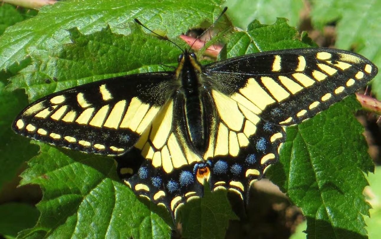
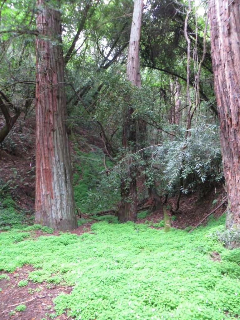
The 173-acre Fitch Mountain Park and Open Space Preserve encompasses the mountain’s peak and most of its slopes. It includes most of the undeveloped portions of the mountain. Preserve features include dense, shady forests of oaks, bays, madrones, redwoods, and Douglas fir; an intermittent creek; diverse bird life; and beautiful displays of visiting butterflies. The mountain offers spectacular views of the Russian River, Alexander and Dry Creek Valleys, and the Mayacamas mountain range. The Preserve consists of nineteen parcels, which range from under 1-acre to 53 acres in size. The Preserve is in the unincorporated county, but is within the City of Healdsburg’s Sphere of Influence, Urban Growth Boundary, and Urban Service Area. The City has recognized the Preserve’s importance by designating it as Open Space and a Major Scenic Ridgeline in the City’s General Plan. The Fitch Mountain Park and Open Space Preserve property is adjacent to the City-owned Villa Chanticleer.
Adjacent Ownership
The Preserve lies to the east of downtown Healdsburg (Exhibit 1). Residential parcels surround the base of Fitch Mountain and the Russian River, making up the Fitch Mountain community. Larger-sized, estate properties and more densely populated subdivisions lie to the west and southwest towards downtown Healdsburg. The Preserve is located immediately southeast of the River’s Bend reach of the Russian
9 |
Fitch Mountain Park and Open Space Preserve | Management Plan
View of Fitch Mountain from Camp Rose
River and adjacent to the Sonoma County Regional Parks’ (Regional Parks) Del Rio Woods public beach and parking lot. Further downstream is the Healdsburg Veterans Memorial Beach, owned by Regional Parks.
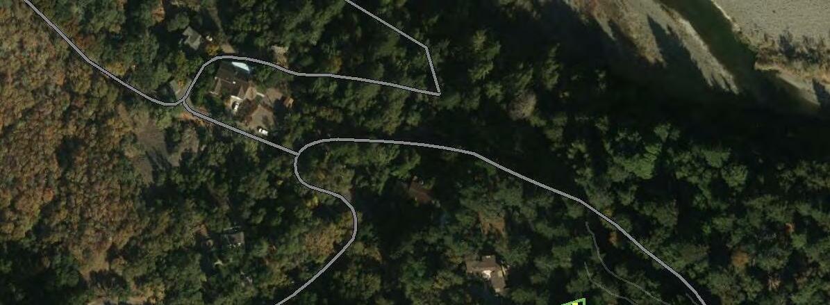
The Fitch Mountain Park and Open Space Preserve is immediately adjacent to the City-owned Villa Chanticleer event center, Lower Villa Chanticleer Park (Lower Park), and Villa Chanticleer Dog Park (Dog Park; all three collectively referred herein as the Villa Chanticleer). The Villa Chanticleer is managed by Tayman Park Golf Group. It supports a historic landmark building, adjacent annex, picnic area, parking lots, and outdoor garden with gazebo. The site is used extensively for weddings and meetings. Below the main Villa Chanticleer event center, there is a large parking lot adjacent to the Dog Park and Lower Park; these facilities are maintained by volunteers and City Park staff, respectively. The Lower Park has picnic tables and a playground. The Dog Park is an enclosed 1.5-acre facility supported by the Healdsburg Dog Park Committee. This lower Villa Chanticleer area is currently the primary vehicle and foot access to the Fitch Mountain Park and Open Space Preserve and will also be the location of the Park Improvement Area described in this Plan; see Park Improvement Area below and Exhibit 2. The Park Improvement Area is outside of the actual Fitch Mountain Park and Open Space Preserve boundaries, but is the designated trailhead improvement area described in this Plan.
Fitch Mountain sits among a series of undeveloped lands protected by District-held conservation easements that lie along the Russian River and surrounding lands (Exhibit 1). To the south of the Preserve are Sotoyome Highlands (1,160 acres), rolling upland terrain with a wealth of native plants and wildlife, and Windsor Oaks (711 acres), which forms a community separator between Windsor and Healdsburg and supports vineyards, oak woodlands, and riparian areas. The small Ratchford Conservation Easement runs along the southern face of Fitch Mountain and forms a scenic buffer of native vegetation between Fitch Mountain and the neighboring communities. To the northwest of the Preserve is the Callahan Conservation Easement (107 acres), established to protect a prominent ridgeline visible from Highway 101 and the city of Healdsburg. It supports diverse habitats and includes a stretch of the Russian River. The Callahan Conservation Easement also lies adjacent to the Healdsburg Ridge Open Space Preserve. Healdsburg Ridge is situated at the urban edge of Healdsburg and provides public hiking and wildlife-viewing and beautiful oak woodland, serpentine chaparral, and mixed evergreen forests; this preserve is currently owned by the District but is scheduled to transfer to the City in the near future. West of the Preserve off South Fitch Mountain Road are the Healdsburg Golf Club at Tayman Park and City-maintained Badger Park, as well as smaller facilities that are part of the City’s urban park system.
Fitch Mountain Park and Open Space Preserve | Management Plan
10 |
Historic Land Uses
The human history of Fitch Mountain and the surrounding lands is typical of the coastal California ranges (Origer 2016). Native Americans, including Southern Pomo, flourished on the area’s rich resources for thousands of years until the arrival of European settlers. The Pomo were hunter-gatherers who lived in rich environments that allowed for dense populations with complex social structures. They settled in large permanent villages that were distributed around seasonal camps and task-specific sites. Primary village sites were occupied continually throughout the year and other sites were visited in order to procure particular resources that were especially abundant or available only during certain seasons. Sites often were situated near sources of fresh water and in ecotones where plant and animal life were diverse and abundant, such as those occurring along the Russian River. One such village was located a mile northeast of downtown Healdsburg in the Fitch Mountain vicinity. This village was called Wotoakka’ton and was the home of Chief Soto, for whom the Rancho Sotoyome land grant was later named (Calvert 2007).
Native American communities in the Healdsburg area and throughout California began to decline in the early 1800s under pressure from Spanish missionaries, European-American colonization, and the spread of disease. By the 1850s the local village sites were nearly eliminated by smallpox epidemics, in addition to ongoing military campaigns against the Pomo led by General Mariano Vallejo (Calvert 2007). The remaining population was driven into limited areas around Fitch Mountain and the adjacent bend in the Russian River.
Further losses occurred in 1840 when Cyrus Alexander, a fur trapper for whom Alexander Valley was later named, was sent by sea captain Henry Delano Fitch to scout lands north of San Francisco and acquire land grants through General Vallejo. Captain Fitch acquired the 48,000-acre Mexican land grant known as Rancho Sotoyome after marrying into the General Vallejo family. Healdsburg was the headquarters for the rancho. After his death in 1849, Fitch’s
11 |
Fitch Mountain Park and Open Space Preserve | Management Plan
View of Fitch Mountain in 1912 Source: Sonoma County Library
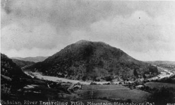
Russian River encircling Fitch Mountain in 1922 Source: Sonoma County Library
widow auctioned off most of the land to pay taxes.
A resort was planned for the top of the mountain in 1923 or 1924. A road to the summit was completed in 1928, financed and built by Thomas Scoble, the owner of the adjacent Del Rio Woods resort. The summit was cleared of underbrush and a “saucer-shaped turn” was made for vehicles and parking. An old stump of a “great live oak with its hundreds of carved initials” was lifted out by steam shovel and discarded over the side (Calvert 2007).
In 1935, a 7-acre parcel on the mountain was purchased by Zelma Ratchford, the first woman real estate agent in Sonoma County (Calvert 2007). Over time, she purchased hundreds of additional acres. She and her family enjoyed riding horses and driving up the fire road in their jeep. She and her family held the property until the mid-1990s. In her journal, Ratchford recalls considering asking the City of Healdsburg to annex 35 acres near Villa Chanticleer for development. The City did not have the funds at the time. By 1995, Ratchford was hopeful that the property and the adjacent Villa Chanticleer would serve as a regional park. She eventually established conservation easements with the Sonoma County Agricultural Preservation and Open Space District (the 1994 Fitch Mountain Easement and the Ratchford Easement), and hosted a picnic at the summit to celebrate. Descendants of Captain Fitch were among the guests (Calvert 2007).
The mountain has remained heavily wooded and undeveloped with the exception of the unpaved road since the 1950s (ECON 2013). A portion of the Fulton-Hopland 60kV Transmission Line was constructed over a portion of the west end of the Preserve at some point in its history (Origer 2016). Cultural resource surveys of the Preserve, including a mixed-strategy field evaluation, found no remnants of cultural or historical resources (Origer 2016).
12 |
Fitch Mountain Park and Open Space Preserve | Management Plan
Existing Facilities and Uses
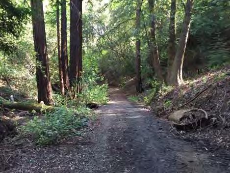
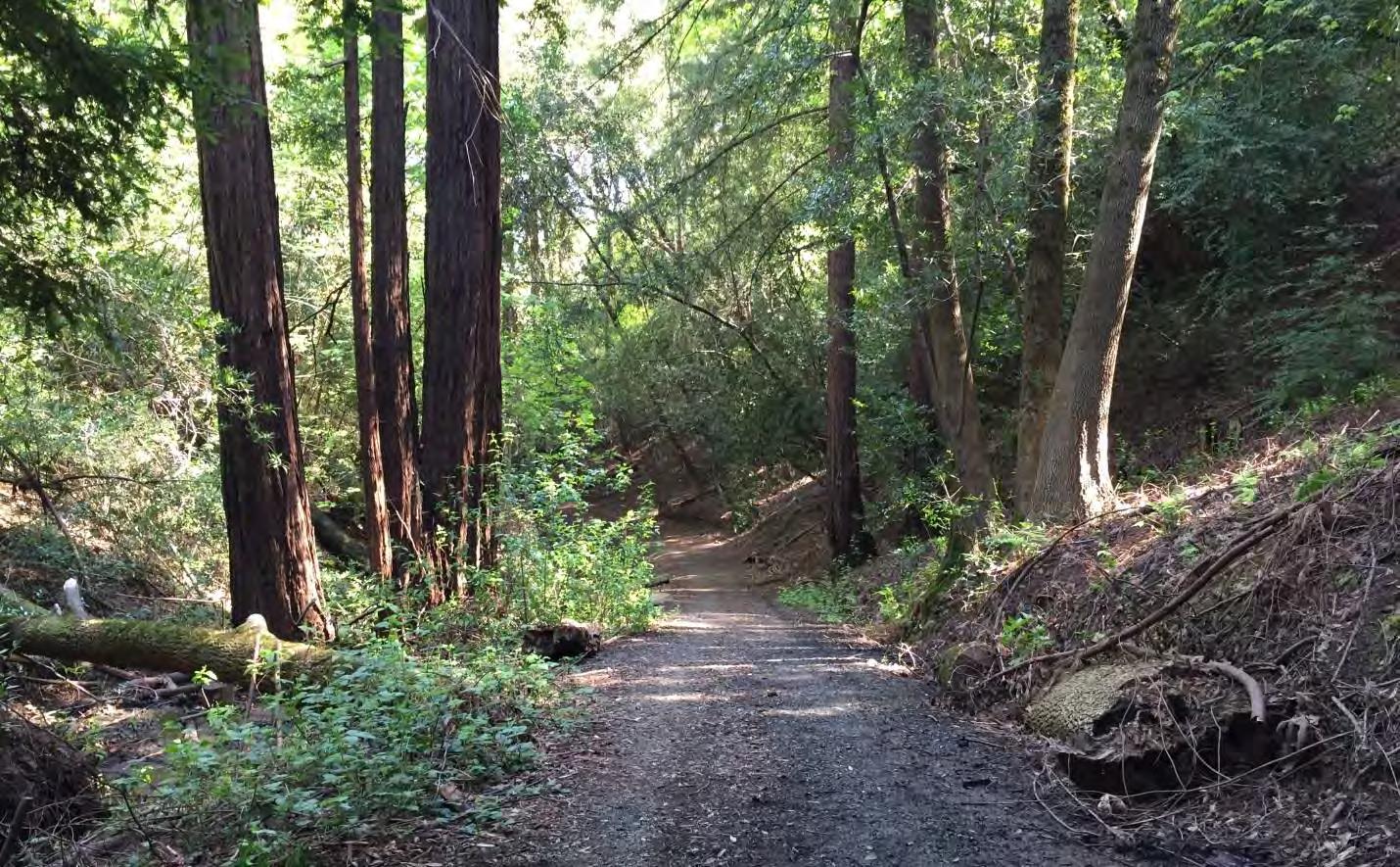
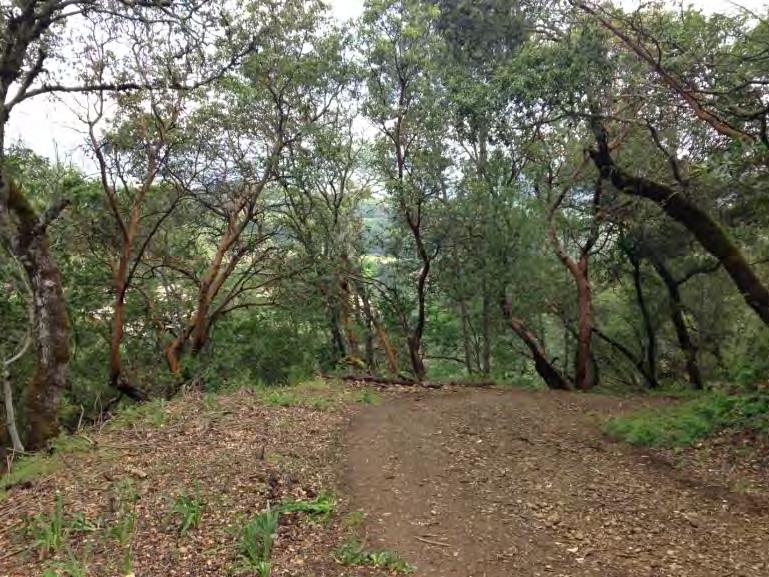
The Fitch Mountain Preserve is largely undeveloped with the exception of an unpaved road and a small number of trails (Exhibit 2). A fire road crosses through the Preserve, originating off North Fitch Mountain Road and ascending to the upper elevations of the Preserve and then descending to Hilltop Road at the east end of the Preserve. From the northwestern edge of the Preserve to the mountain top, the fire road is referred to as Fitch Mountain Trail. A section of Fitch Mountain Trail includes a short loop leading to the upper summit and parallels the road below. A small spur trail also leads to the lower summit; a second hilltop knoll with views of the surrounding lands. Starting at the junction of the Fitch Mountain Trail, Butterfly Trail meanders along the south side of the mountain on contour before joining Hilltop Trail east of the summit. Butterfly Trail offers excellent views to the south of the Russian River and eastern edge of the City. On the north side of the mountain, an unmaintained county road, Riverview Drive, runs in an east-west direction on contour. The road extends through a portion of the Preserve and provides a nice level hiking trail. It is accessible at the west end from Fitch Mountain Road at the base of Fitch Mountain Trail and at the east end from the residential area on Riverview Drive. A connector trail through the Preserve is needed to connect Riverview Trail to Fitch Mountain Trail, so that visitors do not need to walk on North Fitch Mountain Road, which is narrow and unsafe for pedestrians.
Currently, the Villa Chanticleer is the primary access point for Preserve visitors arriving in vehicles. Surrounding residential areas have limited parking due to narrow roads. Most local residents access the
13 |
Fitch Mountain Park and Open Space Preserve | Management Plan
Fitch Mountain Trail
Preserve on foot. Pedestrian access is located at the intersection of Fitch Mountain Trail at North Fitch Mountain Road, at both ends of Riverview, and at the end of Hilltop Road. Access to the Preserve at Hilltop Road is granted through easements across private property.
From the Preserve, the County-owned beach Del Rio Woods is also accessible by foot or driving. Roads surrounding the Preserve provide limited shoulders and no sidewalks. There are no maintained streets with sidewalks from downtown Healdsburg to the Villa Chanticleer property as well. Along Powell Street, there are no sidewalks past the intersection with Powell and North Fitch Mountain Road.
Public access improvements, including parking and trailheads, will be focused on the Villa Chanticleer property as described in this Plan; see Park Improvement Area below. Currently, many informal trails from the Villa Chanticleer lead directly to the Preserve, including an informal trail network near the Dog Park that leads down a steep embankment to Fitch Mountain Trail near the County-owned water tank. The tank provides water to the residents of Fitch Mountain. Additional informal trails lead to the fire road further upstream of the water tank and cross a seasonal drainage. Many informal trails are also present from surrounding private properties to the northwest and southwest of the Preserve, and near the northeast corner near Hilltop Drive. All of these informal trails connect to Fitch Mountain Trail and Hilltop Trail.
The Preserve is not officially open to the public, but use of the property has been occurring for many years. The fire road and trails are used informally by local residents and the general public, especially for dog walking, nature hikes, and mountain biking. LandPaths, the current property owner, has led several outings focusing on wildflowers and history. They have also sponsored volunteer workdays on the mountain focusing on non-native broom removal and trail and road maintenance. Workdays have occurred monthly, except during the summer. An informal trail watch program, Stewards on the Scene, has been established by LandPaths. This is a group of volunteers who have been trained to identify erosion and other common issues on the mountain. Volunteers also keep a careful watch on the Preserve’s drainages following rain events. The local Fitch Mountain community is also very active in reporting hazards to LandPaths and many local residents have taken on efforts to remove invasive broom along the fire road and trails on the Preserve including work by the Fitch Mountain Association and the former Fire Free Fitch group.
14 |
Fitch Mountain Park and Open Space Preserve | Management Plan
Park Improvement Area
According to the Conservation Easement, all site improvements and certain group activities must be located within designated and approved Park Improvement Areas (CE §5.2.2 and 5.4.2). Improvements restricted to Park Improvement Areas include restrooms, safety lighting, public art displays, play structures, picnic tables, and other similar improvements. Group activities restricted to Park Improvement Areas include public or private events such as “park celebration events, fundraising events, weddings, picnics, and other activities that promote the scenic values while respecting the conservation values of the property” with over 25 attendees and special event “camping for groups of up to 25 people” (CE §5.2.2).
Currently, only one Park Improvement Area is proposed; see Park Improvem ent Area map on page 16; Exhibits 2 and 6. The Park Improvement Area is outside of the formal Fitch Mountain Park and Open Space Preserve boundaries and lies within the adjacent Villa Chanticleer, a City‐owned Park. The Park Improvement Area is technically outside the jurisdiction of the District’s Conservation Easement, but it represents the only feasible location where a formal trailhead with vehicular access to the Preserve can be developed around the mountain.
A formal Preserve entrance will be developed within the Park Improvement Area at the existing lower parking lot at the Villa Chanticleer. This will include a new trailhead, gathering/interpretive area, picnic area, low gradient trail, and connection to the existing trail network. The Villa Chanticleer improvement area comprises 10.6 acres and utilizes an existing parking lot as the primary public access point for the Preserve. The Villa Chanticleer also already serves as an informal public access point for the majority of Preserve visitors arriving in vehicles. The proposed entry to the Preserve is adjacent to other park facilities and has the least financial and environmental impacts; see Trails and Recreation for further information.
Fitch Mountain Park and Open Space Preserve | Management Plan
15 |
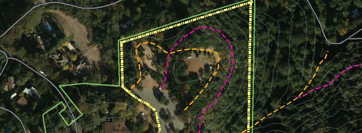
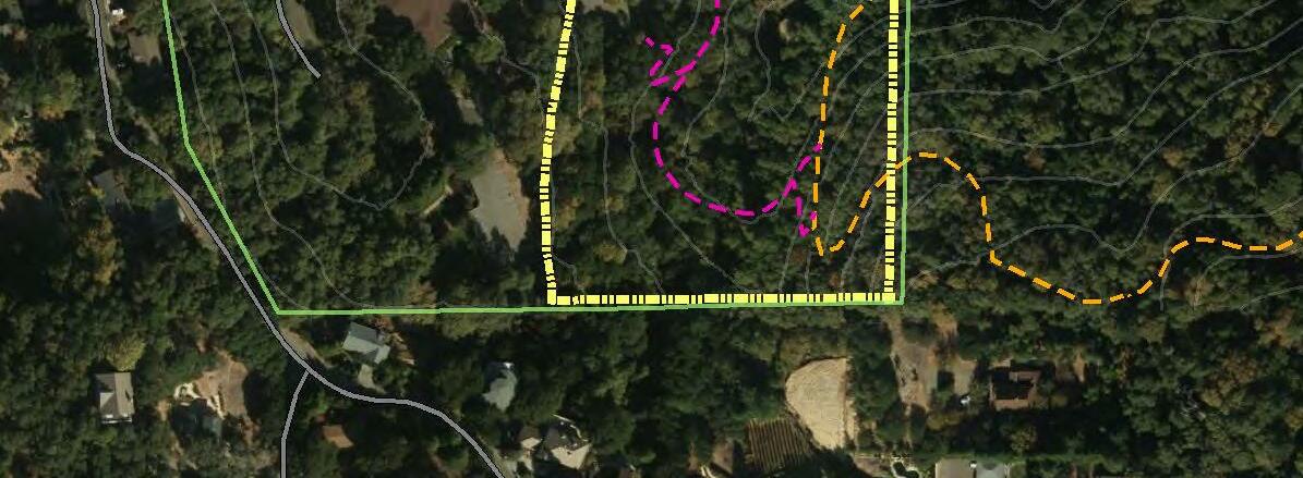
SUNSET CHANTICLEER RIVER VIEW FITCH MOUNTAIN SCENIC VALLEY VIEW STEWART EAGLE ROCK ± 0 200 400 100 Feet Park Improvement Area Fitch Mountain Park and Open Space Preserve Sources: Aerial imagery - Sonoma County 2013 0.6 Villa Chanticleer boundary Park Improvement Area 20' contours Roads Existing trail Proposed trail - approximate location Fitch Mountain Park and Open Space Preserve boundary
3 Physical Features Topography and Soils
The Preserve is situated on the steep slopes of Fitch Mountain and encompasses the entire 991-foot peak. It is bisected by an east-west trending ridge. On all sides of the mountain, the land drops abruptly to the lower Russian River valley below. The southern side of the mountain drops more precipitously than the more gently sloping northern side. The lower contours of the Preserve are at approximately 200 feet. From the base of the mountain at North Fitch Mountain Road and Hilltop Drive, the average grades along the fire road are 11 and 14 percent, respectively. The ridge line is fairly flat with 1 percent grades.
The main soil types on the Preserve are classified as Josephine loam (30-50% slopes) and Los Gatos gravelly loam (30-75% slopes; NRCS 2016). These are both well-drained soils formed in weathered sandstone and shale of the Great Valley Sequence geologic unit, which underlies most of the upland areas of Healdsburg (California Geological Survey 2011). Josephine loam soils are mapped on the northfacing slopes of Fitch Mountain, and the Los Gatos loams are mapped on the south-facing side. The erosion hazard rating for both soil types is high to very high. Josephine soils typically support forests of Douglas fir, redwood, bay, and associated hardwoods as an understory, while Los Gatos soils typically support oaks and shrubs (NRCS 2016); this pattern is reflected on the Preserve. At the northeast corner

17 |
Fitch Mountain Park and Open Space Preserve | Management Plan
Fitch Mountain Trail
of the Preserve, on the Russian River floodplain, there are small slivers of land mapped as riverwash and sandy alluvial soils.
Geology
The Preserve lies within the Coast Range, among the northwest-trending folds and faults at the seismically active junction of the North American Plate and Pacific Plate. The Preserve and the adjacent low rolling hills separate the northern limits of the Santa Rosa Plain from the Alexander Valley.
As described by geologist Terry Wright (undated),
“Fitch Mountain is an island in geological time. The mountain began at the bottom of the Pacific over a 100 million year period that ended about 50 million years ago. Pebbles of granite and volcanic rock, sand and clay from an earlier Sierra Nevada washed down great rivers to the sea. They became layers of sediment almost four miles thick.
Much more recently, in geological time, Sonoma County got active. About five million years ago the area was blanketed with ash and lava from volcanoes to the east. The San Andreas Fault had worked its way north, the great crack in Earth’s crust created by the force of the Pacific plate moving against North America. Blocks of the earth move up, down, over and around. The block that is now Fitch Mountain was pushed up, an ancient ocean floor rock surrounded by much younger faults and volcanic remains. As it rose, the harder rocks forced the Russian River to meander around this island in time…and the Russian River combined with erosion are conspiring to slowly tear it down.”
The northwest trending Healdsburg Fault runs across the southwestern portion of the Preserve, connecting to the Rodgers Creek Fault to the south. The Alexander and Maacama Fault Zones run along parallel courses to the east of the Preserve. As noted above, the mountain is formed from weathered sandstone and shale of the Great Valley Sequence geologic unit, which underlies most of the upland areas of Healdsburg (California Geologic Survey 2011).
A magnitude 5.7 earthquake occurred on the Healdsburg fault in 1969. Based on information in the Sonoma County General Plan, seismic events of similar magnitude are expected to occur somewhere in Sonoma County every 20-30 years (PRMD 2008). According to the Association of Bay Area Governments (ABAG), Fitch Mountain is considered to be at risk for very strong ground shaking from earthquakes along the Maacama and Healdsburg-Rodgers Creek fault and from rainfall-induced landslides and debris flows (ABAG 2016a and 2016b). Areas within the Great Valley Sequence are also highly prone to landslides in overly steep cut slopes. (California Geological Survey 2016).
Climate
Fitch Mountain and the surrounding valleys currently have a Mediterranean climate, with a rainy, cool
18 |
Fitch Mountain Park and Open Space Preserve | Management Plan
season typically lasting from November through April and dry, warm conditions the rest of the year. For the period from 1931 to 2005, average minimum and maximum temperatures in Healdsburg were 39 to 59° F in winter and 52 to 87° F in summer (WRCC 2016).
However, conditions are changing, as they are around the globe. Based on USGS data, between 1911 and 2000, average maximum temperatures in the North Bay Region (Sonoma, Marin, and Napa Counties) had already increased approximately 1.0°F while average minimum temperatures have increased approximately 1.7°F (NBCAI 2013). Climate models released by the International Panel on Climate Change in 2007 have been downscaled to develop regional predictions. These predictions suggest that these increases will continue, with summer temperatures rising by approximately 6 to 11°F, on average, by the end of the century in this region (Micheli et al. 2016). Average annual temperatures in the Healdsburg area are predicted to increase from 3 to 5°F above their recent historic (1961-1990) average of 57.9°F in that time (California Energy Commission 2016). Based on current trends, the number of extreme heat (>94°F) days is predicted to rise from the historic average of 4 to approximately 60 by the end of the century (California Energy Commission 2016). 2014 was California’s warmest year on record (i.e., since 1895); 2015 was the second warmest, and to date, 2016 is the third warmest (NOAA 2016).
Average annual rainfall in Healdsburg is 41 inches for the period from 1893-2012 (WRCC 2016). However, Sonoma County and California in general experienced severe drought between 2011 and 2015. The 2013-2014 water year was the third driest for the state in 119 years of record (NOAA 2016). The 2015- 2016 water year had slightly above average precipitation for the North Coast region (NOAA 2016).
Regional climate predictions differ in terms of trends in overall precipitation. However, all models predict that weather will be more variable in the future, with extreme events like droughts and floods becoming more common and more intense. Also, due to rising temperatures and the greater concentration of precipitation into short, extreme events, drought stress on soils and plants is expected to increase even if precipitation increases in the North Bay. This stress is modeled as climatic water deficit, which integrates measures of solar radiation, evapo-transpiration, and air temperature given available soil moisture derived from precipitation. According to NBCAI (2013), even in scenarios predicting wetter winters, measures of drought stress on soils in late summer are projected to increase approximately 11-22% in the North Bay by the end of the century.
These changes in climate pose a serious challenge to natural systems and human uses of the Preserve, as they do throughout California and the globe. Native plant and wildlife communities may change in composition and distribution, with potential losses of species that are less tolerant of higher temperatures and weather extremes. In Sonoma County, suitable conditions for redwood, Douglas fir, montane hardwoods, Oregon oak woodlands, and montane chaparral are predicted to decline while conditions suitable for coast live oak woodlands, chamise chaparral, and other shrublands are projected to increase (Micheli et al. 2016). Water resources for humans, plants, and animals may decline, as a
19 | Fitch Mountain Park
Space Preserve | Management Plan
and Open
result of either lower overall precipitation or of more extreme storm events with less opportunity for rainwater infiltration. Flooding, fire, and disease may become more common. However, Fitch Mountain’s relatively intact and diverse natural landscape, as well as its topographic diversity, strongly bolsters its resilience to these changes.
Watershed and Hydrology
Fitch Mountain sits along a prominent bend in the Russian River, Sonoma County’s largest watershed. The Russian River watershed drains 1,500 square miles of land in Sonoma County and Mendocino County to the north. It is the second largest river in the San Francisco Bay Area. To the north of the Preserve, the river flows through the Alexander Valley, makes several sweeping bends to the east of the City, including the prominent River’s Bend, before meandering around Fitch Mountain at the final bend. After passing the mountain, the river flows under Healdsburg Memorial Bridge before joining Dry Creek, in the Dry Creek Valley, and then flows west through the lower Russian River communities before reaching the Pacific Ocean near Jenner.
The Preserve encompasses a number of ephemeral drainages that flow directly to the Russian River. On the north slope of the mountain, there are seven drainages that flow through steep forested ravines in the direction of North Fitch Mountain Road and eventually join the Russian River to the north. Drainage from the south slope of the mountain also flows directly into the Russian River. Due to the steep
Fitch Mountain Park and Open Space Preserve | Management Plan
20 |
View of the Russian River from the top of Fitch Mountain
topography, the drainages support only ephemeral flows and do not provide habitat for native fish.

Flows originating on the Preserve provide clean water directly to the Russian River. For terrestrial wildlife, the drainages and their associated vegetation provide critical migration corridors from the Russian River to the uplands of Fitch Mountain. The forests on the Preserve serve as a groundwater recharge and storage area. Structurally complex vegetative cover promotes rainfall infiltration through interception and absorption. Natural, vegetated tributary channels also help to regulate flows and the delivery of sediment to downstream aquatic habitats, improving conditions for the endangered fish of the Russian River watershed.
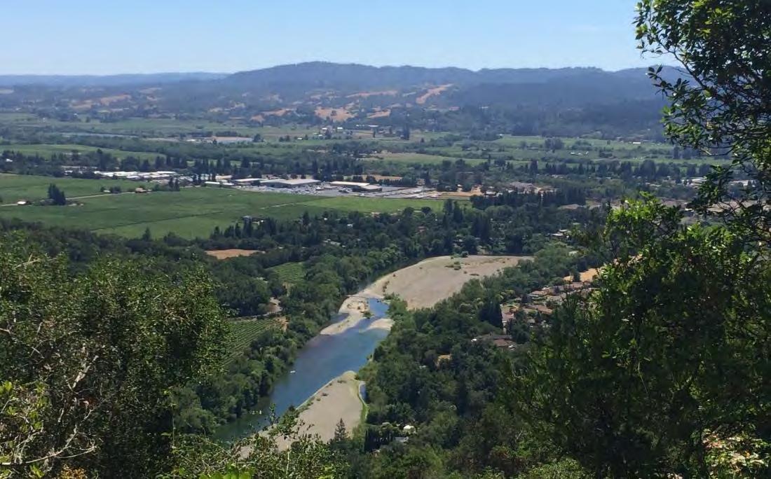
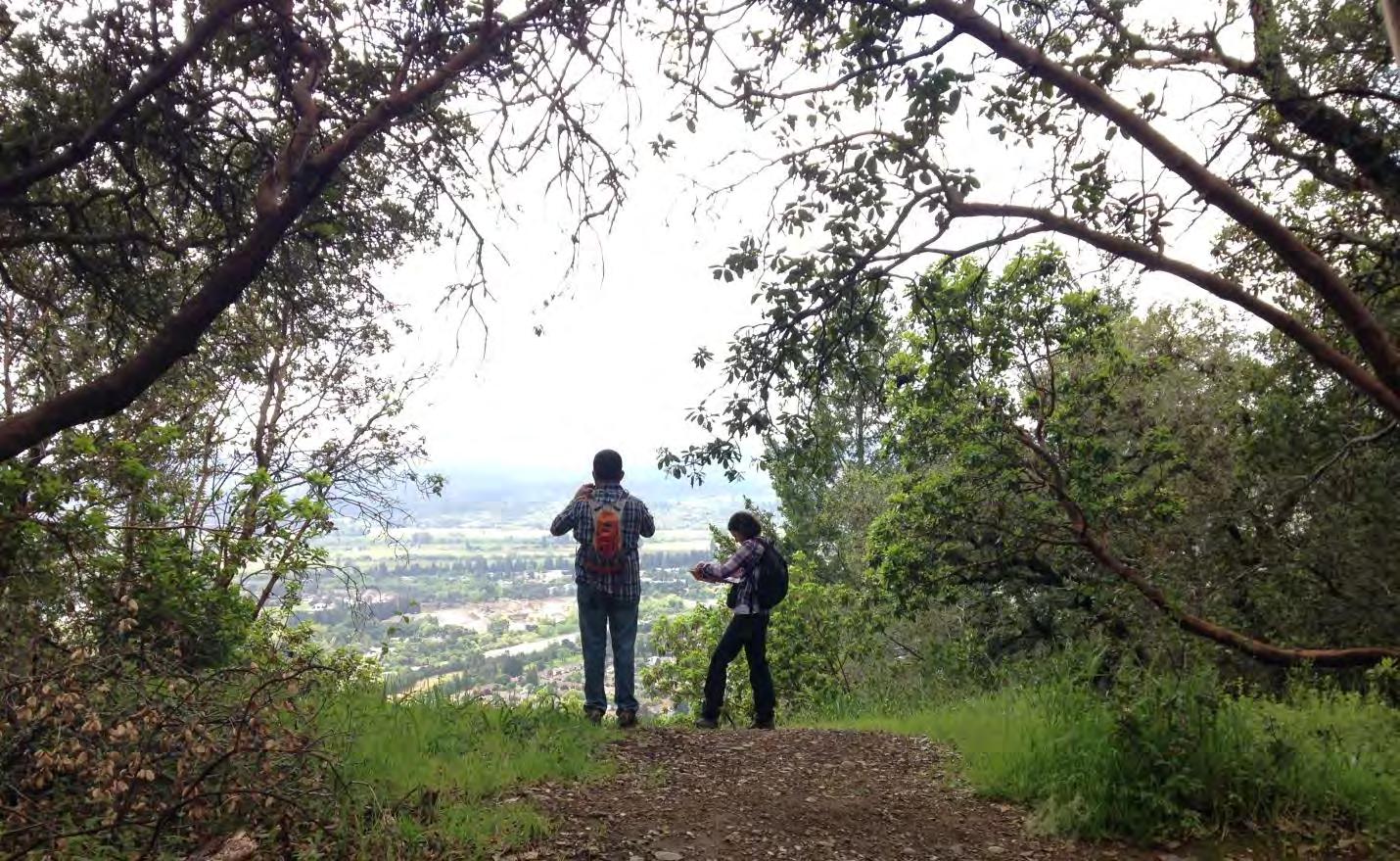
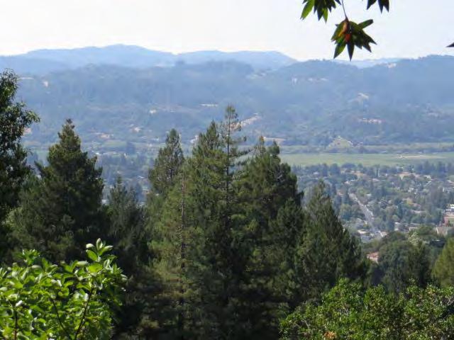
Viewsheds
Hosting the highest point in the vicinity of the city of Healdsburg, Fitch Mountain plays a key role in the scenic beauty of northern Sonoma County. It serves as a significant landmark behind the city and is a prominent feature visible from the nearby Dry Creek and Alexander Valleys and the Mayacamas mountain range. While on the Preserve, visitors are provided with spectacular views of mainstem Russian River, forested woodlands of the surrounding hillsides, and glimpses of the city and nearby valleys. The densely forested woodlands and lack of development on the mountain provides both visitors and those seeing it from afar with an appreciation of the Preserve’s natural beauty.
21 |
Fitch Mountain Park and Open Space Preserve | Management Plan
View of the Russian River and Healdsburg Ridge Open Space Preserve from Fitch Mountain Trail
4 Data Collection Methods
Biological Surveys
Biological field surveys of the Preserve were conducted by PCI biologists familiar with the region’s flora and fauna. Surveys were conducted in spring and summer 2016. Surveys focused on habitat mapping, identification of plant community structure and rare plants, identification and mapping of management issues, and wildlife surveys.
Data Collection
During surveys, PCI biologists used aerial maps of the Preserve to navigate throughout the land. Largescale features such as plant community boundaries were marked by hand on aerial maps due to poor GPS reception in the forest canopy. A Trimble XH GPS with sub-meter accuracy was used to collect data on smaller-scale or localized features including patches or individual invasive plant infestations, and species observations. Complete lists of all plant and wildlife species observed were compiled. Upon returning from the field, hand-drawn features were digitized in ArcGIS 10.4.1 and GPS data was differentially corrected and downloaded. The data was incorporated into a single database to create the Preserve maps. Additional notes including species observations were collected in field books by each biologist.
22 | Fitch
|
Mountain Park and Open Space Preserve
Management Plan
Summit view from the top of Fitch Mountain
Botanical Surveys
Botanical surveys were conducted to characterize plant communities, compile an inventory of species observed, map vegetation types and invasive species, identify locations of vegetation management concerns, and to evaluate the potential presence of special-status plant species. Results of previous botanical surveys and the draft Sonoma County Vegetation Map (District 2016) were used as a baseline upon which to build. Surveys were conducted in on March 30, April 14, and September 8 and 26. During each survey, the trails of the Preserve were traversed on foot and all species were identified to the level necessary to determine sensitivity. Due to steep terrain and dense vegetation, surveys beyond trails were very limited. Surveys were also limited by seasonality and annual variation; additional species are likely to be present beyond those described here. Plant identification and nomenclature follow the Jepson Flora Project (2016). Representative plant species observed within the Preserve are provided in the Plant Communities section below. For a full list of all plant species observed on the Preserve, see Appendix A.
Wildlife Surveys
Wildlife surveys were conducted to evaluate the potential for presence of special-status wildlife, compile an inventory of species observed and wildlife habitats, and evaluate existing habitats. Surveys were conducted on March 30, April 14, May 4, and September 8, 2016 in the morning through lateafternoon. Nocturnal surveys were not completed. Surveys were conducted with the aid of binoculars. Visual cues (e.g., nests, tracks, scat, burrows, and skeletal remains), calls, songs, and direct observations were used to identify wildlife. Unique habitat features (e.g., woody debris, water sources, etc.) and other plant materials were examined for presence of mammals, amphibians, reptiles, and birds. A complete list of all observed wildlife species on the Preserve is provided in Appendix B. These lists include observations from PCI as well as input from local residents and LandPaths biologists.
Literature Review
A background literature and database search, and review of existing studies previously conducted on the Preserve (Bush and District 1997, Wood 2004) and region, were completed to help characterize the biological communities and ecological processes important to the Preserve. Natural Resources Conservation Service (NRCS) soil survey data (NRCS 2016) were consulted to inform erosion and habitat assessments. Vegetation classification manuals (Sawyer et al. 2009, Klein et al. 2015) were consulted to help describe the structure and composition of existing communities. The potential for occurrence of special-status species within the Preserve was determined based on occurrences reported in the
23 | Fitch Mountain Park and Open Space Preserve | Management Plan
California Department of Fish and Wildlife (CDFW) California Natural Diversity Database3 (CNDDB), the primary source for special-status plant and animal sighting information in the state (CDFW 2016a). Special-status species with potential to occur on the Preserve were identified based on a comparison of existing habitat conditions and features with species needs, proximity to reported occurrences, and geographic range of subject species. Existing studies and site-specific maps were used to provide a baseline for the resource assessment and inform potential management concerns. A comprehensive list of all references consulted during the literature and existing study review is included in the References section below.
Trail and Recreation Planning
For trail and recreation planning, PCI landscape architecture staff conducted field surveys focused on identifying and mapping areas for public access, trail alignments, outdoor developed areas, alternative access points, viewing areas, and modifications or decommissioning of existing trails. The public, City of Healdsburg staff and members of the Parks and Open Space Subcommittee engaged in the design process by providing input in the planning process and development of the conceptual design. ADA compliance was assessed to provide the greatest accessible experience possible; a challenge given the constraints of the Preserve’s steep slopes and limited access points. A preliminary erosion inventory was also conducted for the purposes of identifying areas that need improvement. GPS, LiDAR data, and Google Earth were used to locate and map features for the existing and proposed trail network and the Park Improvement Area. General layout considerations, typical grade and cross slope, drainage methods, widths, surfaces, and vegetation clearance were also developed. Design standards were followed per Sonoma County, the City of Healdsburg, California Building Code, and the U.S. Access Board’s Final Guidelines for Outdoor Developed Areas (36 CFR Part 1191).
3 The California Natural Diversity Data Base (CNDDB) is a repository of information on sightings and collections of rare, threatened, or endangered plant and animal species within California. It is maintained by the California Department of Fish and Wildlife (CDFW). CNDDB reports occurrences of special-status species that have been entered into the database and does not generally include inventories of more common animals or plants. The absence of a species from the database does not necessarily mean that they do not occur in the area, only that no sightings have been reported. In addition, sightings are subject to observer judgment and may not be entirely reliable as a result.
24 | Fitch
Preserve |
Plan
Mountain Park and Open Space
Management
5 Biological Resources Plant Communities
Fitch Mountain Park and Open Space Preserve supports native forest and woodland that is remarkably robust and diverse given its proximity to urban development (Exhibit 3). Although Fitch Mountain logging appears to have occurred historically, based on historic photos and evidence of cut redwoods, the mountain’s steep terrain and limited land uses in recent decades have allowed for dense forests to develop. Redwood4, Douglas fir, bay, madrone, and oak forest types intermingle in a shifting mosaic with composition influenced by slope, aspect, and moisture availability. Natural regeneration is evident in many places. The understory is primarily composed of native shrubs, ferns, and forbs, and is especially rich under the dappled shade of the oak woodlands, and at the moist northern base of the mountain. There is also a small amount of annual grass-dominated vegetation present on steep rocky slopes and road cuts. In disturbed areas along roads and trails, invasive broom is abundant and has potential to extend further.
4 Latin names for common plants are provided in Appendix A; for special-status plants, they are provided within the text.
25 |
Fitch Mountain Park and Open Space Preserve | Management Plan
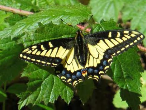
Anise swallowtail
The plant communities of the Preserve are described below, including their distribution on the mountain, typical species composition, major management concerns, and key ecological values. On Fitch Mountain, these vegetation types mix extensively, but they are categorized here based on the species that are most abundant or characteristic in a stand. Classification follows vegetation alliances defined by the Classification of the Vegetation Alliances and Associations of Sonoma County, California (Klein et al. 2015). Each community is designated as sensitive or non-sensitive, based on federal, state, and local regulations.
Redwood Forest
Redwood forest occurs primarily in the drainages on the north side of the mountain, where greater moisture and deeper soils are available. Most of the Preserve’s redwood stands are growing from old stumps, evidence of a past history of timber harvest. The understory is limited in the dense evergreen shade, but is dominated by native shrubs, ferns, and herbaceous species. Robust thickets of spicebush are common at the base of the mountain, and scattered patches of wild strawberry, redwood ivy and redwood sorrel are also present. Further up the drainages, wood rose, poison oak, and ferns (sword fern, lady fern, and California polypody) are dominant in the understory.
The redwood stands on the Preserve, although they were historically logged, appear healthy, have a native-dominated species composition, and are relatively free of invasive species infestations. Redwoods are tolerant of fire; the thick bark of mature trees protects them, and younger trees resprout readily from the root crown. Redwoods are considered highly sensitive to water deficit and high temperatures, and their distribution may contract from hotter, dryer
Redwood forest
26 | Fitch
Mountain Park and Open Space Preserve | Management Plan
parts of their range like Fitch Mountain (Micheli et al. 2016). Key management concerns for the Preserve’s redwood stands include climate change, soil compaction, and fragmentation; see Resource Management section for further discussion.
Redwood forests are considered sensitive by the California Department of Fish and Wildlife (CDFW 2010), and by other agencies where they occur in riparian settings, as they do on Fitch Mountain. Redwood forests serve important functions of biodiversity conservation, wildlife habitat, carbon sequestration, soil conservation, and water supply and water quality protection.
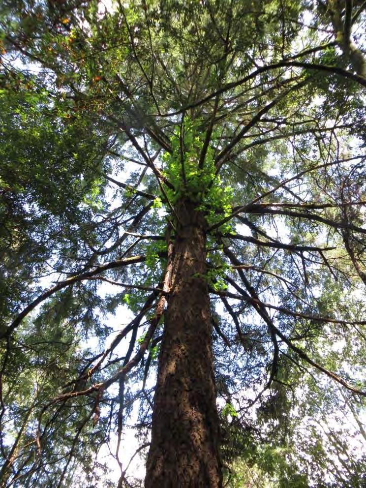
Douglas Fir Forest
Douglas fir occurs on the Preserve as a component of all the forest types, and in some more distinct stands on the mountain’s upper slopes. Several very large trees are present on the ridgetop. In Douglas fir-dominated stands, the understory is generally limited to sapling trees of Douglas fir, bay, and oak, and scattered native shrubs including toyon, poison oak, and California blackberry.
Like the redwoods, the Douglas fir stands on the Preserve were historically logged but have a native-dominated species composition, appear healthy and are relatively free of invasive species infestations. Natural regeneration of firs is abundant.
In some settings in Sonoma County, Douglas fir regeneration is considered a threat to the maintenance of native oak stands, as they gradually shade out the shorter oaks in the absence of fire, and land managers thin firs to encourage oaks. On the Preserve, firs may be thinned in specific locations where they appear to threaten significant oaks, such as the large mature coast live oak on the lower summit. Large-scale thinning of firs is not recommended. Firs are a major component of the mountain’s diverse forests. Especially as climate changes, maintaining the mountain’s overall biodiversity, including stands of Douglas fir—which have been projected to decline in this region (Micheli et al. 2016) should be a high priority in planning for resilience.
27 | Fitch
Mountain Park and Open Space Preserve | Management Plan
Douglas fir tree
Other key management considerations for the Preserve’s Douglas fir forests are climate change and fire; see Resource Management section for further discussion.
Douglas fir forests are not considered sensitive but provide valuable wildlife habitat, carbon sequestration, soil conservation, and water supply and water quality protection.
California Bay Forest
California bays are common throughout the Preserve, and are the dominant tree in stands on the northwestern part of the mountain. The shade of these dense-canopied evergreen trees limits the understory, but scattered sapling trees, low-growing California blackberry, poison oak, and ferns are common. Where openings occur, the understory is more developed, and composition is similar to that of the mixed oak forest understory (see below). In larger drainages near the base of the mountain where more moisture is available, small groves of big leaf maple are present, as well as occasional Oregon ash.
The bay forests on the Preserve are regenerating abundantly on the Preserve, appear generally healthy, and are dominated by native species, although broom is present in disturbed areas. Sudden Oak Death, the forest disease caused by the pathogen Phytophthora ramorum, has been confirmed by laboratory testing in bay trees at the base of the mountain, beyond the Preserve boundary, and in two locations on the Preserve midway up the mountain’s south-facing slope (UC Berkeley 2016). California bay is a foliar host for the disease; it is not killed by the disease, but can be a significant source of inoculum for the pathogen to spread to other species, such as live oaks and black oaks, which can become infected in their trunks and killed. No oak die-off from apparent SOD has been observed to date on the Preserve; its relatively warm, dry climate may help limit the spread and impact of the disease. California bay resprouts readily after fire or cutting, and can thrive in both sunny and shaded locations. Current projections are for California bay distribution in this region to be relatively stable as climate change progresses (Micheli et al. 2016), but increased drought stress due to rising temperatures could affect the vigor and disease resistance of even broadly-adapted species like this one. Key management concerns for the Preserve’s bay forests include fire fuel load management and Sudden Oak Death transmission to more vulnerable species.
California bay forests are considered sensitive by CDFW. They provide valuable wildlife habitat, carbon sequestration, soil conservation, and water supply and water quality protection. They also provide welcome shade for trail users.
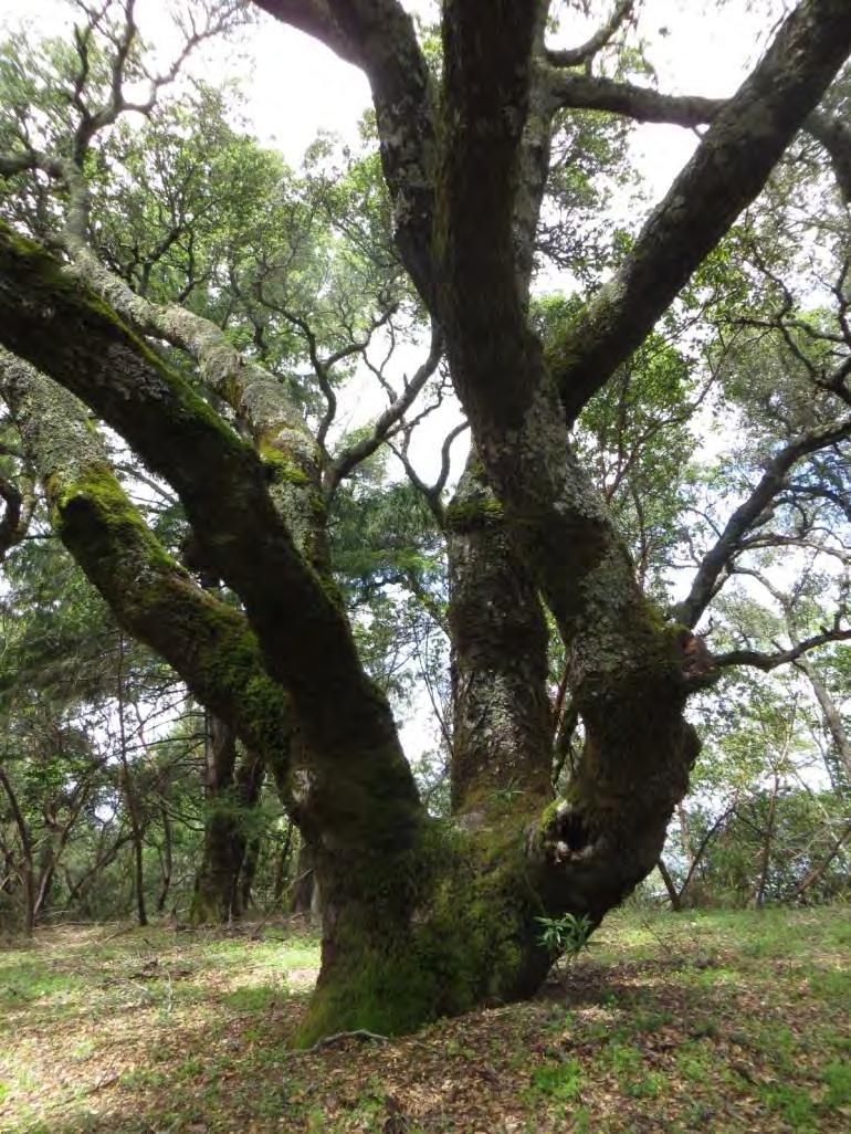
Mixed Oak Forest
Mixed oak stands, characterized by several oak species occurring together, are present in the northeastern part of the Preserve. Coast live oak, black oak, and Oregon oak are the most common tree species. There are also what appear to be naturally occurring hybrids, sharing traits intermediate to the live and black oaks. Madrone, buckeye, and bay are also often present in these areas. The deciduous canopies of the black and Oregon oak allow for filtered sunlight to reach the understory. This allows for a generally diverse, nearly continuous understory which is structurally complex, with species of many
28 |
Fitch Mountain Park and Open Space Preserve | Management Plan
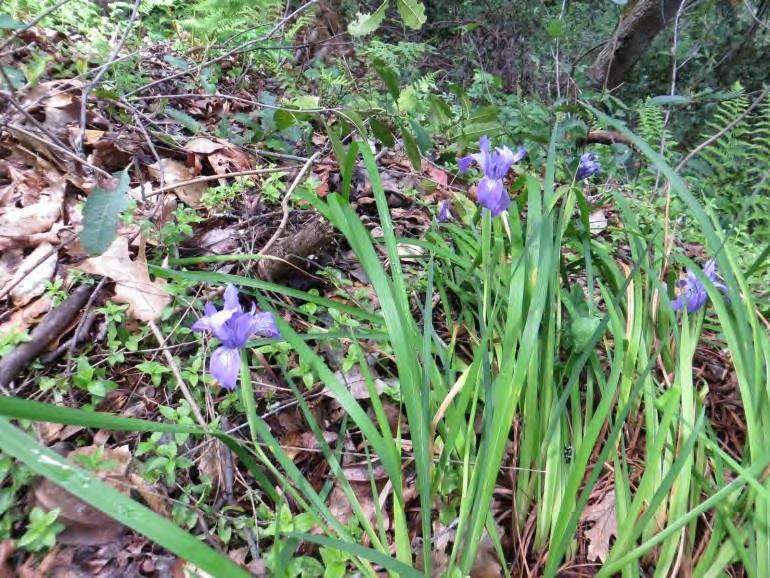
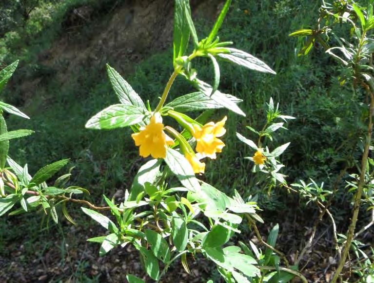
different heights and forms. In addition to regenerating trees, shrubs are abundant, including toyon, elderberry, snowberry, hazelnut, monkeyflower, and white-stemmed raspberry. Vines (California honeysuckle, wild cucumber, and Dutchman’s pipevine) climb in the trees and shrubs. Native perennial grasses including Torrey’s melic and California fescue are common. Ferns (sword fern, wood fern, goldenback fern, maidenhair fern, and California polypody) are abundant, as are herbaceous annual and perennial species. Many of these herbaceous species have showy flowers, including mule’s ear, canyon larkspur, woodland star, baby blue eyes, paint brush, and Indian pink. In the moister areas at the north-facing base of the mountain, a slightly different suite of species occurs, including spice bush, oceanspray, California blackberry, and western columbine.
Some non-native, invasive species are present in the mixed oak woodlands. Broom species (French broom, Spanish broom, and Scotch broom) are the most abundant, occurring primarily along road and trail edges and other disturbed or cleared locations. Forget me not occurs in several locations along trails along lower portions of the Preserve; see Invasive Plant Management section further discussion.
Napa false indigo, the one special-status species documented on the Preserve, occurs in mixed oak woodland or openings in other forest types; see Special-status Species section further discussion.
The mixed oak forests on the Preserve appear healthy, with a native-dominated species composition, and evidence of natural regeneration. Current projections are for coast live oak distribution in this region to remain relatively stable, and for Oregon oak to decline; projections for black oak are not available (Micheli et al. 2016). No projections are available for most associated understory species, but a decline in the deciduous oaks of the Preserve seems likely to be accompanied by a loss of some associated herbaceous species. Key management concerns for the Preserve’s mixed oak stands include invasive species management, climate change, and special-status species protection.
29 |
Fitch Mountain Park and Open Space Preserve | Management Plan
Douglas iris (above) and monkeyflower (below)
The mixed oak forests of Fitch Mountain are highly diverse communities that support substantial native biodiversity. They are especially valuable to wildlife, and also provide carbon sequestration, soil conservation, and water supply and water quality protection. They provide shade and wildflower viewing for trail users. While not considered sensitive by CDFW, native oak woodlands and Oregon oak and black oak in particular--are called out for protection in the Sonoma County General Plan (PRMD 2008).
Madrone Forest
Madrone is a defining component of the forest on Fitch Mountain’s south side, where conditions are warmer and dryer than on the north-facing slopes. It only occasionally occurs as single-species stands, more often occurring as the characteristic species co-dominating the canopy with bays, coast live oaks, and black oaks.
With its somewhat sparser canopy than bay or live oak, and its tendency to mix with other species including deciduous oaks, madrone-dominated forests have a relatively well-developed understory. Regenerating trees are abundant, shrubs including poison oak and toyon are occasional, and ferns, soaproot, and Torrey’s melic are common on the forest floor.
As evergreens, madrones retain some foliage throughout the year, but in summer, the past year’s leaves begin to discolor and are shed, leaving only the spring’s new growth (Reeves 2007). Madrones are known to be vulnerable to a variety of pathogens, from fungal blights of the leaves that do not significantly reduce tree growth but may reduce its visual attractiveness, to more serious or lethal branch, root and stem infections. They can be infected and sometimes killed by Phytophthora ramorum During the spring 2016 surveys, many of the madrones on the Preserve did appear to have sparse canopies, but by the fall 2016 site visit, their foliage appeared healthy, suggesting that any infections present are not currently severe.
Madrone stands are considered a seral plant community, maintained or encouraged by disturbances including wildfire and dying out when overshadowed by taller trees like Douglas firs. Madrones are typically top-killed by fire, but they readily resprout from burls and also germinate most readily in bare mineral soil (Reeves 2007), as is left after wildfire. Madrone is considered moderately vulnerable to climate change (Churchill 2012); the associated black oak is considered likely to decline, while coast live oak is projected to remain stable (Micheli et al. Madrone forest
30 |
Fitch Mountain Park and Open Space Preserve | Management Plan
2016). Understory associates may also be at risk. Key management concerns for the Preserve’s madrone forests include climate change and Sudden Oak Death and other pathogens.
The madrone forests of Fitch Mountain provide wildlife resources, carbon sequestration, soil conservation, and water supply and water quality protection. They shade the trails for recreational users, and are appreciated by many visitors for their visual beauty. This plant community is considered sensitive by CDFW (2010).
Coast Live Oak Woodland
Coast live oak-dominated forest occurs mostly on the Villa Chanticleer property, but there are also some notable large coast live oaks that stand along the ridge top, providing scenic and shady resting spots along the trail. As in bay forests, the understory of coast live oak woodland is limited by its dense evergreen canopy. Scattered sapling trees, low-growing California blackberry, poison oak, and ferns are common. Where openings occur, the understory is more developed, and composition is similar to that of the mixed oak forest understory.
Coast live oak stands on the Preserve appear somewhat stressed, with leaf dieback and reduced canopies, as they do in many locations around Sonoma County following several years of severe drought. Coast live oaks, with thick bark and the ability to resprout, are tolerant of fire. Climate change projections for this region indicate that coast live oak distribution is likely to remain relatively stable (Micheli et al. 2016), but increased drought stress due to rising temperatures could affect the vigor and reproduction of even broadly-adapted species like this one. Key management concerns for the Preserve’s coast live oaks stands include Sudden Oak Death and invasive species management
The coast live oak forests of Fitch Mountain provide wildlife resources, carbon sequestration, soil conservation, and water supply and water quality protection. They also shade the trails for recreational users.
Fitch Mountain Park and Open Space Preserve | Management Plan
31 |
Mature coast live oak tree
Annual Grassland
Small patches of annual grass-dominated habitats are present on the mountain, on steep rocky cliffs on the southern and eastern edges of the Preserve, as well as on road cuts in sunny, exposed locations. These areas generally have sparse cover but are dominated by non-native wild oats and bromes, with a variety of other herbaceous species and occasional small shrubs.
The largest of the steep, rocky outcrops is located along the southern central boundary of the Preserve. This outcrop was not accessible on foot, and so was only observed from a distance using binoculars. Another outcrop which appeared to have similar cover and was adjacent to the road supported native naked buckwheat as well as non-native wild oats and false brome. Occasional poison oak and non-native broom plants were present, as well as a few individuals of invasive fennel.
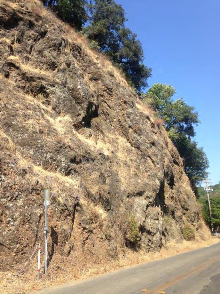
Some of the larger roadcuts on the south-facing side also support sparse grass-dominated vegetation. These are typically steep, eroding slopes where native forest species are not able to regenerate. Wild oats, naked buckwheat, and non-native broom dominate these locations.
These grass-dominated slopes provide some wildlife resources, and limited soil conservation values. However, given their dominance by annual species and non-native, invasive species, these areas would benefit from restoration.
32 |
Fitch Mountain Park and Open Space Preserve | Management Plan
Rocky outcrop at base of mountain along North Fitch Mountain Road
Wildlife Communities
The diversity and abundance of animal species occurring on the Preserve are directly correlated to the diversity and richness of its forest and woodland plant communities. Habitats on the Preserve offer animals nesting habitat, food, shelter, and seasonal water. The Preserve itself is large and diverse enough to sustain a wide variety and abundance of wildlife species through part or all of their life cycle. On the Preserve, 2 reptile, 60 bird, and 5 mammal species and many butterflies and other invertebrates have been documented by professional biologists and local community members. For a complete list of all wildlife species observed and scientific names, see Appendix B.
The following discussion includes a general summary of wildlife typically associated with forest and woodlands habitats like those on the Preserve, based on regional occurrence information as well as sitespecific field observations. Although characteristic assemblages of wildlife species occur predictably within certain vegetation types, relatively few animals are restricted to a single habitat, and, indeed, some may require more than one habitat type. Wildlife communities are described across broad plant communities.
Wildlife Communities Overview
Forest and woodland habitats dominate the Preserve and support birds, mammals, amphibians, reptiles, and a variety of invertebrates. Birds represent the most numerous and prominent wildlife species within
33 |
Fitch Mountain Park and Open Space Preserve | Management Plan
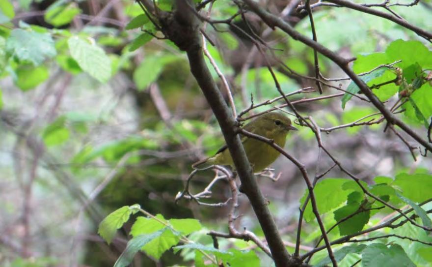
Orange-crowned warbler
these habitats. Year-round resident birds of woodland and forest habitats such as those found on the Preserve include chestnutbacked chickadee, western-scrub jay, American robin, common bushtit, oak titmouse, Bewick’s wren, California quail, dark-eyed junco, and spotted towhee. Migratory species observed and potentially breeding within the Preserve include a number of species of vireos, flycatchers, and warblers.
Tree-climbing birds such as woodpeckers, nuthatches, and brown creeper also frequent the Preserve. Year-round residents include acorn, Nuttall’s, hairy, and downy woodpeckers. Casual winter residents include ruby-crowned kinglet, varied thrush, and Townsend’s and yellow-rumped warblers. The dense fir and redwood patches are also key habitat for Sonoma County’s largest woodpecker, the pileated woodpecker. Pileated woodpeckers can frequently be seen near the drainage at the water tank this is likely a pair of birds defending their territory, which they tend to do year-round.
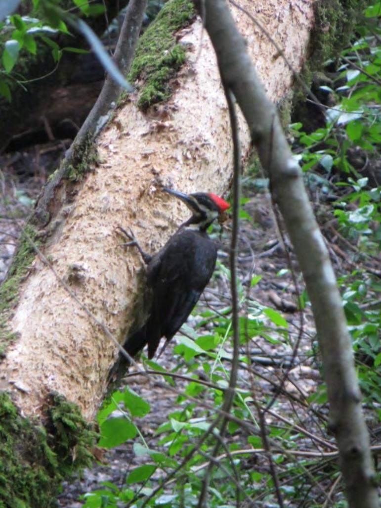
Suitable foraging and breeding habitat also exists for raptors on the Preserve. Two of Sonoma County’s most common raptors, red-tailed and red-shouldered hawks, have been confirmed on the Preserve. Cooper’s and sharp-shinned hawks, uncommon forest and woodland hawks, also use the Preserve, especially in winter. Small vertebrates within the habitats serve as a food source for predatory hawks. The larger oak, fir, and redwood trees are prime habitat for nesting raptors.
Mature redwood and Douglas fir habitats on the Preserve provide possible habitat for Sonoma County’s forest-dwelling northern spotted owl. This species has limited occurrences along the Highway 101 corridor in close proximity to urban development (CDFW 2016a). Habitat value is constrained by the proximity of urban development and the small size of the Preserve relative to the owls’ typical home range. The nearest established territory is documented near Lake Sonoma and Mill Creek watershed to the west. However, dusky-footed woodrats, the preferred food source for spotted owls, occur within the understory of Preserve’s habitats and are fairly abundant. Owls documented within the Preserve include great horned owl and northern pygmy-owl.
34 |
Fitch Mountain Park and Open Space Preserve | Management Plan
Pileated woodpecker
The woodland and forest habitats of the Preserve support a number of mammals. Undisturbed habitats with limited human activity provide escape, cover, migration corridors, and nesting sites for larger carnivorous mammals. A neighboring resident reported that mountain lion have been seen on the mountain. The Preserve also supports other top carnivores including bobcat and gray fox; fox scat is visible along the trails. Smaller vertebrates, such as birds, small mammals, and herpetofauna, serve as a significant food source for these carnivores. Western gray squirrels are locally abundant. The diversity of forested and wooded habitats on the Preserve and the nearby Russian River also provide excellent foraging and roosting habitat for bats, including several special-status species.
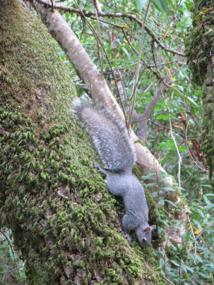
Native oaks and oak communities found within the Preserve serve as a significant resource for many wildlife species in the form of both food and shelter. Every part of the oak tree, including acorns, leaves, twigs, pollen, roots, and sap, is utilized as forage by native species. Perhaps the most widely recognized source of food is the acorn. This high-energy food is used heavily by acorn woodpeckers, western scrub-jays, and western gray squirrels. Individual trees are also important food storage sites for acorn woodpeckers, which cache acorns for future consumption, particularly in dead and dying oak trees. The use of acorns by a number of wildlife species is important for oak dispersal and regeneration. The entirety of an oak tree, from canopy to roots, also serves as shelter for wildlife. Even the layer of detritus around the base of an oak is utilized by amphibians and insects.
On the woodland and forest floor, woody debris piles and layers of duff provide habitat for amphibians. Locally common amphibians including Ensatina, California slender salamander and arboreal salamander are likely to occur on the Preserve. Common reptiles of this community include Skilton’s skink, fence lizard, alligator lizard, common kingsnake, rubber boa, gopher snake, and ring-necked snake. Two reptile species were documented on the Preserve by PCI, western fence lizard and alligator lizard, but other species are likely to occur there as well.
The Preserve also supports habitat for a variety of native butterflies and other beneficial pollinators.
35 | Fitch Mountain Park and Open Space Preserve | Management Plan
Western gray squirrel
One trail, Butterfly Trail, is appropriately named as it reportedly supports a suite of butterfly species at certain times of the year. The peak of Fitch Mountain is also a local hot spot that attracts many butterflies in search of a mate a phenomenon known as butterfly hilltopping. Butterflies documented on the Preserve include four species of swallowtail, Lorquin’s and red admirals, buckeyes, monarchs, and lesser known species like the great basin wood nymph.
Two species of invertebrates occur on the Preserve that are relatively isolated from other populations given their limited mobility and distance to other suitable habitat. These are the banana slug and Pacific sideband snail. Banana slugs, the second largest terrestrial slug in the world, can frequently be found moving along the forest floor of the Preserve consuming dead organic matter. The Pacific sideband snail is a long-lived terrestrial snail endemic to the Pacific Coast. This species similarly lives in cool forested habitats on the forest floor.
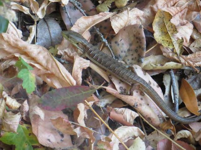
The Preserve provides limited habitat for aquatic species. Steep ephemeral drainages flow from the mountain top and drain to the Russian River below. Due to the steep topography, these drainages may only flow during the wet winter months, but the north-facing drainages are likely to stay cool and moist throughout the year and provide the microclimate conditions required by many wildlife species. The most prominent drainage along Fitch Mountain Trail is more persistent and pools remain into summer. These persistent pools may support breeding habitat for amphibians and a water source for a variety of other wildlife species. These cool, moist drainages are also important movement corridors for wildlife as they navigate from the lower mountain to the summit and across the mountain’s slopes.
Developed areas occur along the edges of the forest and woodland habitats on the Villa Chanticleer. The wildlife habitat values of developed areas are generally considerably less than those of the surrounding natural habitats. Wildlife in the developed areas are typically more acclimated to human activity and include species common in urban and suburban habitats. Common mammals include native raccoon,
36 |
Fitch Mountain Park and Open Space Preserve | Management Plan
Alligator lizard (top) and Pacific sideband snail (bottom)
striped skunk, and non-native Virginia opossum, rats, and mice. Trees and shrubs provide roosting and potential nesting substrate for numerous species of birds. Currently, the Preserve supports two nonnative bird species—wild turkey and Eurasian collared-dove—with potential habitat for a number of additional bird species that are ubiquitous across the county.
Special-status Species


The Preserve supports habitat or potential habitat for a number of special-status species. Special-status species include plants and animals native to California that are afforded legal protections because they are at risk. These species occur in small isolated populations or in fragmented habitat, show a marked population decline, depend on habitat that has been greatly reduced or is threatened by further loss, or have historical records in the state but no longer persist. These species require careful consideration for resource management actions or land-use changes.
The potential for occurrence of special-status species on Fitch Mountain was determined based on occurrences reported in the California Department of Fish and Wildlife California Natural Diversity Database (CNDDB), the primary source for special-status plant and animal sighting information in the state (CDFW 2016a, Exhibit 4) and an extensive background and literature review. Special-status species with potential to occur on the Preserve were identified based on a comparison of existing habitat and microhabitat conditions with species needs, proximity to reported occurrences, and geographic range of subject species. Only those species with documented occurrences on or near the Preserve and immediate management needs are included in this Plan.
Special-status plants and animals include those species that are afforded legal protection under the federal and California Endangered Species Acts (ESA and CESA, respectively) and other regulations, including:
The California Natural Diversity Data Base is a repository of information on sightings and collections of rare, threatened, or endangered plant and animal species within California. It is maintained by the California Department of Fish and Wildlife (CDFW). CNDDB reports occurrences of specialstatus species that have been entered into the database and does not generally include inventories of more common animals or plants.
Species listed or proposed for listing as threatened or endangered under the federal and California ESA or proposed for listing under the California ESA;
Species that are recognized as candidates for future listing by agencies with resource management responsibilities;
California Species of Special Concern and Fully Protection species classified by CDFW
Plant species, subspecies, and varieties defined as rare or threatened by the California Native Plant Protection Act;
Certain plant species listed by the California Native Plant Society; and

Species that otherwise meet the definition of rare, threatened, or endangered as described in the CEQA Guidelines.

37 | Fitch Mountain Park and Open Space Preserve | Management Plan
Special-status Plants
Although the Preserve is relatively rich in native species, only one special-status plant species was documented on the Preserve during 2016 surveys. Most of Sonoma County’s special-status plant species are not associated with the forest types present on Fitch Mountain. Of the special-status species recorded from the Preserve vicinity, most are associated with vernal pools or grassland, which are not present on the Preserve. Species that do occur in the vegetation types present on the Preserve, and are known to occur in the region, are described below. In addition, several special-status species mentioned in a 2004 survey of the Preserve (Wood 2004) are discussed. California Rare Plant Ranks [CRPR, as designated by the California Native Plant Society (CNPS)]5 are provided below; lower numbers (on a scale of 1-4) indicate greater rarity. In addition, a number of native species that do not have special legal status but that are uncommon on Fitch Mountain and merit protection are described.
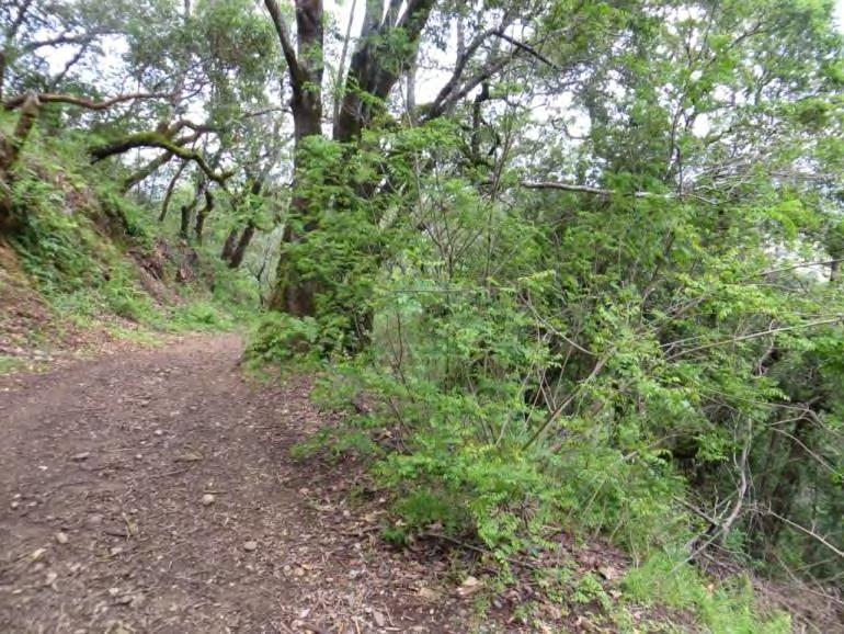
Napa false indigo (Amorpha californica; CRPR 1B.2) occurs on the Preserve. Here and in general, this deciduous shrub in the pea family occurs in openings or filtered shade within woodland or forest settings. The Preserve is near the northern edge of its current distribution (Calflora 2016, CDFW 2016a), which includes Sonoma, Napa, Lake, and northern Marin counties. The CNDDB contains a record of this species on Fitch Mountain’s northeastern slopes from 1952 (CDFW 2016a); the next nearest recorded occurrence is approximately 3 miles to the southeast. During 2016 field surveys, hundreds of plants were observed along the trail edges on the northern slope of the mountain. The plant’s distribution and population size beyond trail and fire road edges is unknown, as much of the Preserve is
5 California Rare Plant Ranks:
1A – Presumed extirpated in California and rare or extinct elsewhere
1B – Rare, threatened or endangered in California and elsewhere
2A – Presumed extirpated in California, common elsewhere
2B - Rare or endangered in California, more common elsewhere
3 - Plants about which more information is needed; a review list
4 – Plants of limited distribution; a watch list
Suffixes:
.1 Seriously threatened in California
.2 Moderately threatened in California
.3 Not very threatened in California
38 |
Fitch Mountain Park and Open Space Preserve | Management Plan
Napa false indigo along Fitch Mountain Trail
too steep to safely traverse on foot.
Napa false indigo typically blooms between April and July, with a terminal spike of purple or brown flowers. Its leaves are pinnate, with oblong leaflets. The shrub is relatively delicate, and grows to about 6-8 feet in height. Many of the plants observed in 2016 appeared to have been cut in the past during road maintenance work, and were approximately 3 feet tall. This species is the larval food plant for the California Dogface butterfly, California’s state butterfly, and the silver-spotted skipper (Shapiro and Manolis 2007). CNPS (2016) notes that Napa false indigo is threatened by development and habitat alteration, as well as potentially by road maintenance.
Common viburnum (Viburnum ellipticum; CRPR 2B.3), is typically found on north-facing slopes in chaparral or forest. Its nearest recorded occurrence to the Preserve is 6 miles to the southeast, in Pepperwood Preserve. Its current range extends from the Bay Area into Washington (Jepson Flora Project 2016). This white-flowered, deciduous shrub in the muskroot family has not been observed during surveys of the Preserve, but has low potential to occur. It blooms in May and June.
A previous survey of the Fitch Mountain area (extending beyond the boundaries of the current Preserve; Wood 2004) noted four special-status species, including:
Green monardella (Monardella viridis; CRPR 4.3) - No occurrence information is available for this species in the CNDDB, but is known from the dry slopes and ridges in chaparral, oak woodland, and conifer forest of eastern Sonoma County and western Lake County. This subshrub in the mint family was not observed during 2016 surveys but may still be present. It is considered a species of limited distribution, not very endangered in California. It typically blooms between June and September.
Marsh violet (Viola palustris; CRPR 2B.2) - This may have been a misidentification as this species is not otherwise reported from Sonoma County (Best et al. 1996, CalFlora 2016, CDFW 2016a). This purple-to-white-flowered perennial herb in the violet family is typically found in wet meadows, marshes, and on streambanks. It typically blooms between April and July. The common western heart’s ease (Viola ocellata) is also recorded from Fitch Mountain, and may have been mistaken for marsh violet.
Northern California black walnut (Juglans hindsii, CRPR 1B.1) - This species was recorded from the base of Fitch Mountain, perhaps beyond Preserve boundaries. Only mature stands of this tree are considered rare and special-status; younger trees are generally naturalized from orchard stock or ornamental plantings. Mature stands are not present on the Preserve.
Oregon lungwort (Mertensia bella; CRPR 2B.2) - This may have been a misidentification as this species is not otherwise reported from Sonoma County (Best et al. 1996) and has no other reported occurrences south of the immediate California-Oregon border (CalFlora 2016, CDFW 2016a). This blue-flowered perennial herb in the borage family is typically found in wet meadows. It typically blooms between May and July.
There are a number of native perennial herbs that do not have special legal status but have been
39 |
Fitch Mountain Park and Open Space Preserve | Management Plan
reported as uncommon on Fitch Mountain (Symonds 2016); these merit special attention and protection from disturbance. They include:
Canyon larkspur (Delphinium nudicaule)
Coast mule’s ears (Wyethia glabra)
Imbricate phacelia (Phacelia imbricata)
Indian paintbrush (Castilleja affinis)
Inside out flower (Vancouveriana planipetala)
Little mountain thimbleweed (Anemone lyallii)
Rein orchid (Piperia spp.)
40 |
Fitch Mountain Park and Open Space Preserve | Management Plan
Special-status Animals
The following descriptions include those special-status animals observed on the Preserve, species identified as having a high potential for occurrence, and/or species of historical significance. The focus of this section is to highlight the wildlife species with the most pressing management needs. The presence of these species makes the protection of the Preserve’s resources especially important.
Birds
Over 400 bird species have been documented in Sonoma County, including 167 that are known to breed in the county. These include a wide range of species from habitat specialists to generalist, year-round residents, winter residents, summer residents, spring and fall migrants, and rare vagrants. Many of these species can and do occur within the Fitch Mountain area. In addition to special-status bird species listed below, there are additional watch list species that have been documented on the mountain including sharp-shinned and Cooper’s hawk, oak titmouse, and Nuttall’s woodpecker; see Wildlife Species Protection section for recommendations to protect these and all other bird species.
Osprey (Pandion haliaetus)
Status: CDFW Watch List
Osprey are a large raptor typically found near water, where they feed almost exclusively on fish. Osprey will swoop from flight or while hovering to catch fish near the water surface with their specialized feet. Nests are constructed near water in large trees (10 to 250 feet) or on man-made structures, including artificial platforms. Nests are often reused and consist of a large platform of sticks, twigs, and other plant material. Breeding occurs from March to September; they lay an average of 3 eggs. Young breed at 3 years of age. Threats to this species include insecticide contamination and subsequent reproductive failure. Breeding success has increased since the 1970s ban on DDT.
Local Occurrence and Observations: Osprey are permanent residents of Sonoma County (Bolander and Parmeter 2000; Burridge 1995). They are a fairly common summer resident, but less common in winter. They are known to be abundant along the mainstem Russian River. Suitable nesting habitat is present on the Preserve given the close proximity to the river and presence of larger mature trees that can support their nest structures.
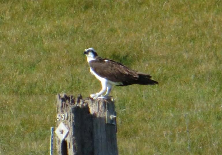
41 | Fitch
Plan
Mountain Park and Open Space Preserve | Management
White-tailed Kite (Elanus leucurus)
Status: Fully Protected by CDFW White-tailed kites are a medium-sized raptor of semi-open habitats. They are characterized by their white and gray plumage and black shoulder patches and red eyes. They can often be seen hovering, searching for small mammals and “parachuting” down on their prey. This species occurs year-round in open woodlands, bottomlands, and agricultural grasslands. Nests are typically constructed in large bushes or trees in open areas or at the edge of forested habitats. Kites breed from May to August and lay an average of 4 to 5 eggs. Kites will defend nests vigorously. During the nonbreeding season, this species can be found in large communal roosts. Populations have been expanding since the 1930s in part due to the clearing of wooded habitats.
Local Occurrence and Observations: White-tailed kites are permanent residents of Sonoma County (Bolander and Parmeter 2000; Burridge 1995). Open grassland habitats are common habitat for this species in the county. Kites have been reported directly west of the Preserve in open grassland and woodland habitat. Limited habitat is present on the Preserve as this species typically does not occur in densely forested areas.
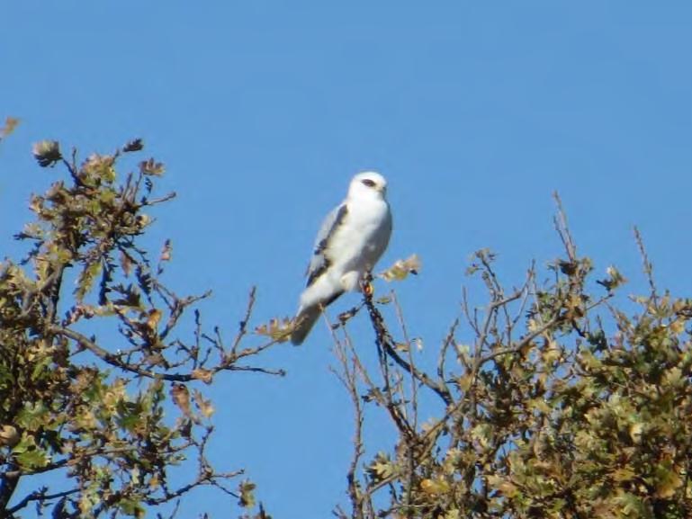
Great Egret (Ardea alba)
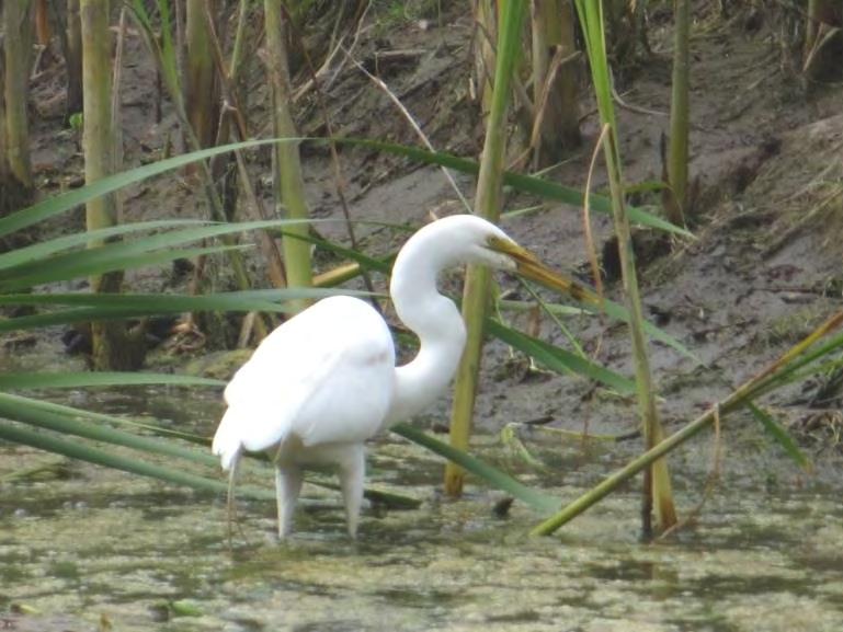
Status: Not formally listed, but rookeries are protected
Great egrets are a medium to large wading bird in the heron family. They are commonly seen in marshes, ponds, shores, and mudflats where they feed primarily on fish, but will also take smaller animals. They are characterized by the nearly all-white plumage, long neck, black legs, long yellow bill, and ornamental plumes developed during the breeding season. Courtship can begin as early as January to March with the nesting season extending into June to August or later. Colonial nests are built in large trees or snags. Nests are a large bulky platform of sticks. Average clutch size is 3 to 5 eggs. Over a century ago, populations were nearly decimated as these and other showy waterbirds were hunted for their decorative plumes.
42 | Fitch
|
Mountain Park and Open Space Preserve
Management Plan
Local Occurrence and Observations: Great egrets are permanent residents of Sonoma County (Bolander and Parmeter 2000; Burridge 1995). Grassland and shallow wetland habitats in the county are common foraging areas for this species. Rookeries that support both great blue heron and great egret are known from the Preserve vicinity. Suitable nesting habitat for great egret is present on the Preserve.
Great Blue Heron (Ardea herodias)
Status: Not formally listed, but rookeries are protected
Great blue herons are large wading birds in the heron family. They are commonly seen in freshwater and saline wetland habitats and open grassy habitats. Sonoma County’s largest herons, they are characterized by their long legs, flexible necks, pointy bill, and bluegray coloration. Their diet is comprised primarily of fish, but they will also take smaller animals. Courtship can begin as early as January to March with the nesting season extending into June to August or later.
Colonial nests are built in large trees or snags, often in association with great egrets. Average clutch size is 3 to 4 eggs. This species is sensitive to disturbance during the nesting season.
Local Occurrence and Observations: Great blue herons are permanent residents of Sonoma County (Bolander and Parmeter 2000; Burridge 1995). The Russian River riparian corridor and surrounding open lands are used as foraging habitat. Rookeries that support both great blue heron and great egret are known from the Preserve vicinity. Suitable nesting habitat for great blue herons is present on the Preserve.
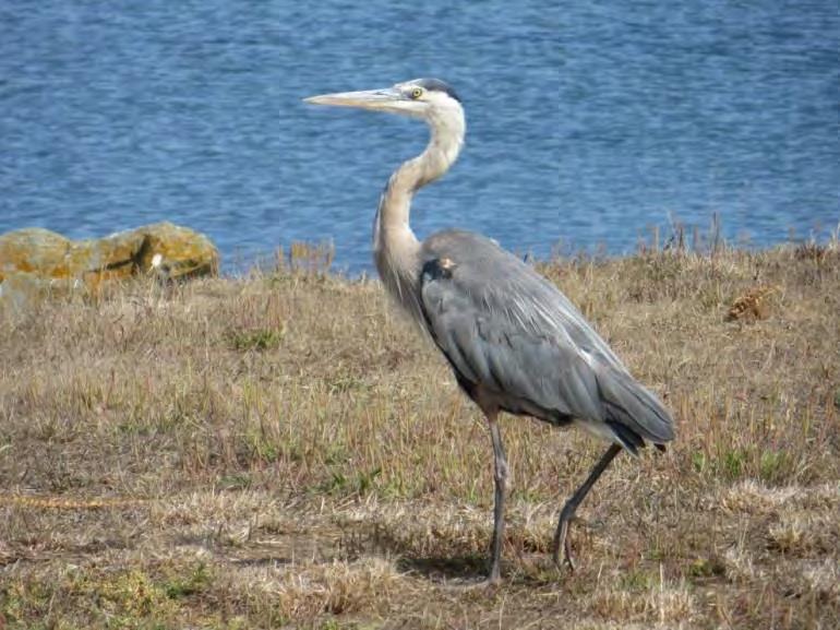
Northern Spotted Owl (Strix occidentalis caurina)
Status: Federally listed as threatened, State candidate as Threatened, and California Species of Special Concern
Northern spotted owls are an uncommon permanent resident of dense forest habitats in northern California and oak and oak-conifer habitats in southern California. This nocturnal species requires dense, multi-layered canopy cover for roosting sites. Spotted owls feed upon a variety of small mammals, birds, and large arthropods. Nest sites include tree or snag cavities or broken tops of large trees. The typical breeding period lasts from early March through June, rearing two young per season. A pair of owls may utilize the same breeding site for five to 10 years; however, they may not breed every year. This species has a fairly large territory size (varies geographically, minimum size is approximately 5 square miles; USFWS 2011). The spotted owl has experienced a population decline due to the loss and degradation of existing mature and old growth forests and, most recently, the establishment of barred owls in the west.
43 | Fitch Mountain Park and Open Space Preserve | Management Plan
Local Occurrence and Observations: Northern spotted owl are a fairly common permanent resident in Sonoma County, where they occupy old-growth coniferous forests of redwood, Douglas fir or pines blended with smaller evergreen hardwoods (Bolander and Parmeter 2000; Burridge ed. 1995). Spotted owl territories are reported from densely forested lands near Dry Creek, Mill Creek, and further to the west and along the Maacamas to the east (CDFW 2016a). Limited habitat is present on the Preserve due to the proximity to urban development, small area of suitable habitat, and fairly large territory size of this species. Spotted owls may occur on the Preserve on occasion.
Bats
There are approximately 15 bat species with known occurrences within northern California, and a number of these species have a high probability of occurring within the Preserve and adjacent lands. Bats are highly mobile with many being migratory. Foraging habitats range from woodlands, forests, and grasslands to open water. All of our local Sonoma County species are insectivorous and feed by echolocation. Bats use caves, mines, buildings, bridges, tree hollows, and other natural and man-made crevices for roosting. Focused surveys for bats were not performed as part of this field surveys for the Plan; nocturnal observations, mist netting, or ultrasonic detection would likely reveal a number of species utilizing the Fitch Mountain area. Two special-status bat species have reported occurrences near the Preserve—pallid bat and Townsend’s big-eared bat (CDFW 2016a). Additional bat species (e.g., hoary bat, fringed bat) identified as having moderate to high priority for conservation by the Western Bat Working Group may also occur on the Preserve.
Pallid Bat (Antrozous pallidus)
Status: California Species of Special Concern
Pallid bats occupy grassland, shrubland, woodland, and forest habitats at low elevations in California. They can most commonly be found in open, dry habitats with suitable rocky areas for roosting. This species can also be found roosting in caves, crevices, mines, hollow trees, and buildings during the day. Night roosts generally consist of more open areas such as porches and open buildings. Pallid bats feed on large flightless arthropods which they capture from the ground a unique foraging strategy in comparison with other bat species. Pallid bats are a yearlong resident throughout most of its range. During the non-breeding season, both sexes may be found roosting in groups of 20 or more individuals. Young are born from April to July. As with many bat species, pallid bats are extremely sensitive to roosting site disturbance.
Local Occurrence and Observations: Pallid bats are year-round residents in Sonoma County. Pallid bats

44 | Fitch
Park
Preserve | Management Plan
Mountain
and Open Space
have a single reported occurrence to the east of the Preserve in riparian habitat. The lack of recent nearby records for this species is probably a result of under-reporting as they are likely to continue to occur within the Healdsburg area. Suitable habitat is present on the Preserve. They may utilize the woodland and forest habitats for foraging and limited roosting.
Townsend’s Big-eared Bat (Corynorhinus townsendii)
Status: State candidate as Threatened and California Species of Special Concern
Townsend’s big-eared bats occupy low to mid-elevation mesic habitats including, riparian, mixed forest, coniferous forest, prairies, and agricultural lands. This species emerges in late evening and forages for small moths and insects which it picks from leaves. Their flight pattern is slow and maneuverable and they are capable of hovering. Roosting sites include caves, mines, tunnels, buildings, and other manmade structures. Unlike other bat species, Townsend’s do not tuck themselves in crevices and prefer open roosts with their fur erect and ears tucked back for optimal thermoregulation. Mating typically occurs in winter with a single young born in May or June. Maternal roosts consist of a small number of females and young, typically less than 100 individuals. Townsend’s are a year-round resident in California.
Local Occurrence and Observations: Townsend’s big-eared bats are year-round residents in Sonoma County. There are multiple reported sightings to the west of the Preserve from the 1950s. The lack of recent nearby records for this species is probably a result of under-reporting as they are likely to continue to occur within the Healdsburg area. Suitable habitat is present on the Preserve. They may utilize the woodland and forest habitats for foraging and limited roosting.
45 | Fitch Mountain Park and Open Space Preserve | Management Plan
6 Resource Management
The principal goals for land management of the Fitch Mountain Park and Open Space Preserve are to protect and conserve natural resource and scenic values while providing passive outdoor public recreation and education. This Plan provides guidance for balancing these multiple goals. Achieving this balance will require ongoing implementation, monitoring of changes to the Preserve over time, and adjusting management strategies as needed.

Protecting the key natural resources on the Preserve means conserving the ecological processes that sustain them. For instance, maintaining diverse plant communities will require facilitating native plant regeneration and providing habitat connectivity to allow for climate change-related shifts. Protecting native wildlife will require ensuring that key movement and dispersal corridors are maintained. Water resources on and downstream of the Preserve can be safeguarded by sustaining healthy native plant communities to hold soil in place, retain water in the soil, and soften the erosive effects of rainfall. Managing the risk of fire will be needed to protect all of the natural resources as well as the local residents and Healdsburg community.
Like all natural systems, the Fitch Mountain landscape will change over time, especially with climate change and increased public use. Effective long-term natural resource management of the Preserve will
46 | Fitch
Mountain Park and Open Space Preserve | Management Plan
Riverview Trail
require observing and understanding those changes, and making decisions about how to adjust management strategies accordingly. Monitoring can provide information on the impacts of public uses, vegetation management for fire risk abatement, and the local effects of larger ecological changes. Adaptive management will also entail staying informed of current research on relevant resource management issues and methods.
The objectives and actions outlined below and in the following sections are designed to support natural processes and to enhance the Preserve’s ecological role in the larger landscape while also allowing lowintensity public uses. Overarching objectives are provided for all of the management areas of concern, with specific actions for each. Management actions are assigned time frames for implementation: short-term (1-5 years), long-term (6+ years), or ongoing. Short-term actions are the highest priority management actions that should be undertaken by the City within the next five years or sooner. Longterm actions may require additional planning or fundraising and should be completed within the next 10 years, after completion of the higher priority items. Ongoing actions should be implemented immediately. Many of the objectives and actions provided are interrelated. More detailed information specific to fire risk abatement, public uses and engagement, and trails and recreation planning is provided in the sections which follow. An annual calendar of activities is provided at the end of the Plan; see Calendar of Management Activities. An overview of the management actions and timeframe for implementation is included in Appendix G. An estimate of management time is included as Appendix H. This estimate represents City staff labor hours required for ongoing management of the Preserve, but could be accomplished through a variety of methods such as contracting with a service provider and supplementing with volunteer help. Key areas of management concern are shown in Exhibit 5.
Habitat Protection
The most fundamental responsibility of Preserve management is to protect its resources and habitats by ensuring that no park development or recreational uses directly or indirectly damage them. Perhaps the single most effective step toward conserving the Preserve’s habitats is to limit infrastructure development. Using existing roads and trails (unless they pose an active erosion or other management concern), locating trailheads and other facilities near existing development, and keeping park facilities at a modest scale will all benefit natural resources on the Preserve.
Where new trails or facilities are proposed, careful consideration should be given to their placement and design. Fragmenting natural habitats with linear disturbances like trails increases the exposure of previously intact
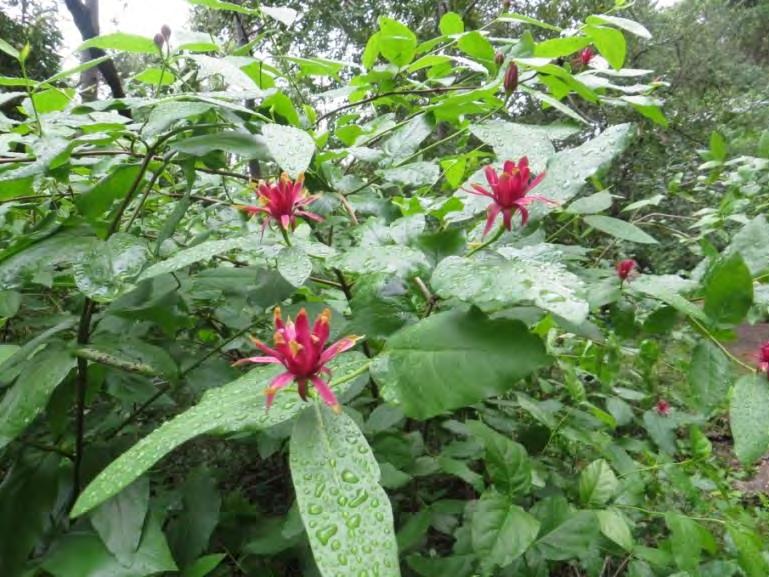
47 | Fitch
Mountain Park and Open Space Preserve | Management Plan
Spice bush
habitats to different conditions in adjacent terrain. These microclimate changes or “edge effects” can change habitat suitability for native species and increase risk of invasion by exotic species. Broom invasions along Preserve roads where soil is disturbed and canopy cover is reduced are an example of this effect. Some edge effects may be beneficial Napa false indigo seems to thrive at forest edges along trails but these are likely to be outweighed by detrimental effects. Fragmentation by roads and trails can reduce wildlife use of otherwise high quality habitat. On Fitch Mountain, protecting corridors for wildlife to move up and down the mountain and to the Russian River is especially important to facilitate access to a variety of food and shelter resources and microhabitats. Ensuring that any new trails are outside of sensitive habitat areas and corridors will support natural resources on the Preserve.
OBJECTIVE RM-1: Protect native plant and wildlife communities during development of public access improvements and long-term management of the Preserve
ACTIONS
Limit the development of new trails, roads, and other park infrastructure. Only one new trail, a short multi-use connector trail between Fitch Mountain Trail and Riverview Trail, is being proposed within the actual Fitch Mountain Park and Open Space Preserve boundaries. All additional trailhead and trail development is proposed for the Villa Chanticleer property. Other park infrastructure should be limited to only what is needed to support passive uses of the Preserve, such as simple directional and interpretive signage and benches. (O)
Keep roads, trails, and other park infrastructure out of sensitive habitat areas. Important habitat areas such as wildlife movement corridors, redwood groves, and large expanses of intact habitat need special protection; see Exhibit 5. Focus any new development away from these areas; instead, locate park infrastructure in areas of existing development around the Villa Chanticleer. (O)
Maintain buffers between new trails or park infrastructure development and drainages. One trail is proposed that will cross the seasonal drainage on the Villa Chanticleer property; this will include enhancement of an existing informal trail and subsequent habitat restoration. For any future trail development, maintain setbacks of at least 50 feet from drainages. Where needed, restore native vegetation and/or repair erosion damage in these areas to enhance their function as buffers. (O)
48 |
Fitch Mountain Park and Open Space Preserve | Management Plan
Hydrology and Erosion Control
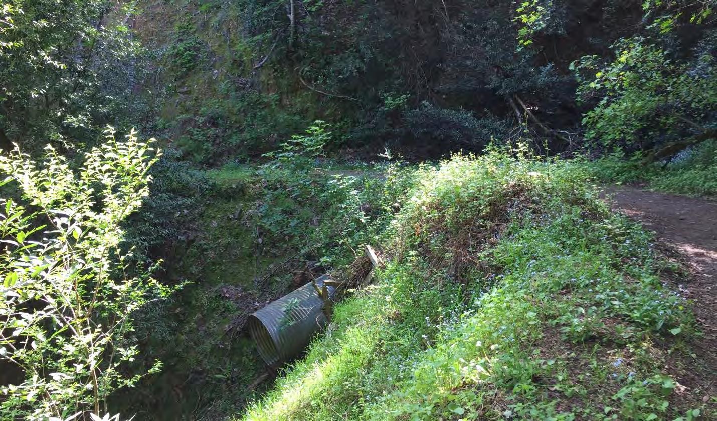
The Preserve has modest hydrologic alterations and areas of soil erosion. The historic fire road that crosses through the Preserve and serves as the primary pedestrian trail is fairly steep in certain locations and exhibits road drainage problems. The drainage that flows between the Fitch Mountain Park and Open Space Preserve and Villa Chanticleer is deeply incised and eroding; emergency repairs to the drainage and roadway were completed by the County of Sonoma in 2004. The repair work may be contributing to erosion issues along the drainage. Several steep drainages on the north side of the Preserve are culverted and have blocked inlets or inadequate outfalls.
Upland erosion and channel incision reduce infiltration of water into the soil and increase the rate at which surface water concentrates and moves off site. Unplanned and poorly designed trail networks are notorious for altering runoff pathways, concentrating flows, causing increased soil compaction and erosion, and reducing groundwater infiltration. Maintaining healthy vegetative cover and soil permeability will reduce erosion, protect downstream water quality, and increase absorption and storage of rainwater, recharging aquifers.
49 | Fitch
Mountain Park and Open Space Preserve | Management Plan
Culvert along Riverview Trail
OBJECTIVE RM-2: Ensure that Preserve management activities and public access improvements protect soil and water quality
ACTIONS
Complete a comprehensive assessment of drainage areas on the Preserve. Evaluate conditions and erosion issues and make site-specific recommendations for repair. Two existing locations along the drainage just below Villa Chanticleer would benefit from assessment and restoration:
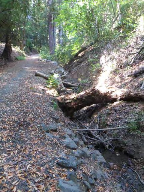
Along the upper portion of the channel, on the Villa Chanticleer property (Location C on Exhibit 5), there is debris (trash and cut vegetation) to remove along the east-facing slope. This is a relatively open, moist area that should be assessed for erosion concerns. After erosion control is addressed as needed, plant the area with native perennial species, trees and shrubs; see Trails and Recreation section for further information.
(S)
On the channel above and below the water tank (Location D on Exhibit 5), the drainage is actively eroding. Headcuts occur along the channel and should be stabilized especially given the proximity to Fitch Mountain Trail/emergency access road. Some work has been done to stabilize the side slopes and protect the road. Existing culverts could be contributing to the erosion problems. The entire drainage area should be assessed by an erosion control specialist or engineer and a treatment plan developed to prevent further deepening and widening of the channel and protect the road. (L)
Complete a comprehensive assessment of all culverts on the Preserve. This should include recommendations on appropriate culvert sizing and configurations. Culvert outlets may need rock protection at the outfall depending on location and configuration. Culverts extending into the air can shoot water onto the soil below and lead to erosion and road failure; see Figure 1, Typical Culvert Outfall. (S)
Monitor active erosion areas and culvert crossings each spring and winter and following large
50 |
Fitch Mountain Park and Open Space Preserve | Management Plan
Drainage along Fitch Mountain Trail
storm events to detect critical changes and determine if they warrant modification or repair; see Exhibit 5 for locations of existing culverts. (O)
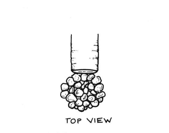
If fresh erosion is visible or existing problem areas are rapidly changing, seek consultation from a qualified professional, in collaboration with an ecologist, to evaluate and design a repair. All treatments must be performed in a manner that protects sensitive ecological resources. (O)
Along drainages, where bank stabilization is warranted to protect the trail system and aquatic resources, use only methods that enhance habitat, such as biotechnical measures incorporating vegetation and/or large wood. In general, drainage system management should focus on the restoration and enhancement of natural functions such as hydrologic, geomorphic, and successional processes. (O)
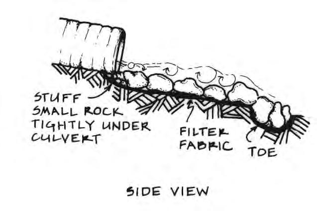
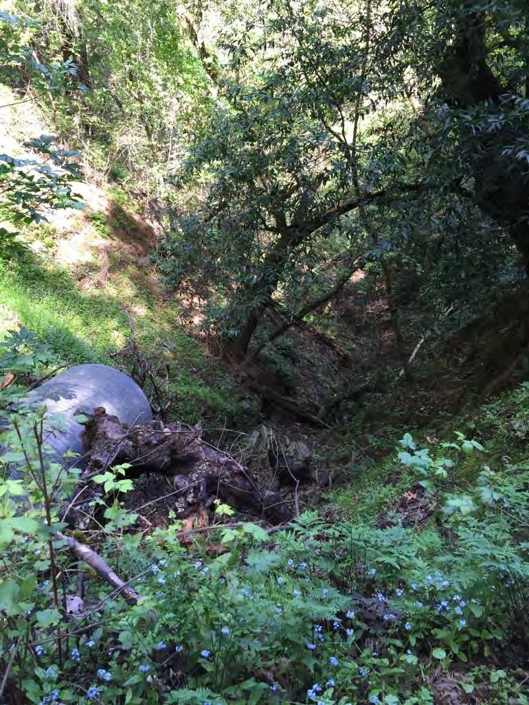
Implement erosion control measures for all ground disturbing activities and promptly revegetate with native plantings. (O)
See trail related Best Management Practices in the Trail Construction, Maintenance, and Decommissioning section for further information. (O)
51 |
Fitch Mountain Park and Open Space Preserve | Management Plan
Figure 1. Typical Culvert Outfall
Culvert outfall on Riverview Trail
Invasive Plant Management
Invasive plant species are present on the Preserve, especially in disturbed areas along trails, roads, and other places vegetation has been cleared or soil disturbed. These are species, introduced from other parts of the world that tend to grow and spread rapidly. They often create dense stands where little else can grow and change habitat conditions in ways that are detrimental to native plant species and native wildlife. They can also increase fire hazards. The highest priority for management of invasive species on the Preserve is to prevent their further establishment or spread. The second priority is to eradicate or manage existing populations where they degrade natural resource values or pose a fire hazard.
Appendix C lists invasive species currently on the Preserve by management priority level and management methods. Priority is based on the feasibility of control and the level of ecosystem impacts incurred by the species. Eradication is recommended where feasible for species that have very high ecosystem impacts, and for species that are not yet widespread on the Preserve and could be readily removed. Control is recommended for species that are very widespread on the Preserve, or for those with more limited ecosystem impacts. Invasive removal should be accompanied by restoration plantings and other habitat restoration measures. Exhibit 5 shows locations of isolated invasive species and representative locations for widespread invasive plants.
Preferred methods for removing or limiting existing stands of invasive species on the Preserve are manual or mechanical removal, planting with competitive native species, and/or otherwise influencing habitat conditions to suppress undesired species (e.g., by shading out with a native overstory, limiting ground disturbance, etc.). If non-chemical approaches to high priority invasive species are implemented on the Preserve but are found not to be successful, and the City determines that risk to the Preserve’s natural resources from the infestation is high, herbicide use may be considered on a case-by-case basis. Herbicide application should be done under the guidance of a licensed Pest Control Advisor.
In some settings in Sonoma County, Douglas fir regeneration is considered a threat to the maintenance of native oak stands, as they gradually shade out the shorter oaks in the absence of fire, and land managers thin firs to encourage oaks. This is a native species, but Douglas fir is considered somewhat invasive as a result of fire suppression practices. Firs on the Preserve may be thinned in specific locations where they appear to threaten significant oaks. Large-scale thinning of firs is not recommended on this Preserve.
The species currently of greatest concern on the Preserve are non-native brooms. These species and their impacts are discussed in greater detail below.
52 | Fitch Mountain Park and Open Space Preserve | Management Plan
Broom

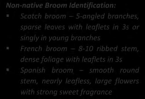

Non-native Broom Identification:
Scotch broom – 5-angled branches, sparse leaves with leaflets in 3s or singly in young branches
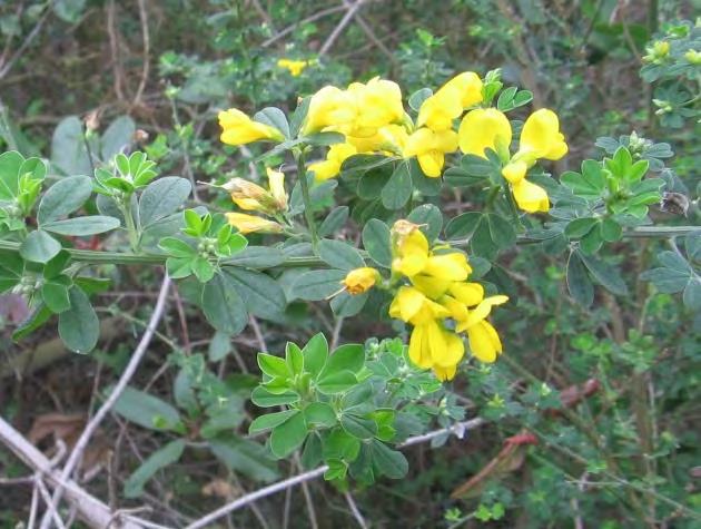
French broom – 8-10 ribbed stem, dense foliage with leaflets in 3s
Spanish broom – smooth round stem, nearly leafless, large flowers with strong sweet fragrance
Broom species, including Scotch broom, French broom and Spanish broom, are abundant along Fitch Mountain’s trails and roads, although recent efforts to control them have reduced the extent of mature broom substantially. All three of these shrub species are able to establish rapidly in disturbed soil, produce large quantities of long-lived seed, and thrive in forest openings such as those along trails and roads. One medium-sized Scotch broom shrub can produce 12,000 seeds in one year (Bossard et al. 2000). Broom can establish dense stands, shading out and excluding other vegetation such as regenerating trees, overtaking trails, and providing abundant, flammable material for fire. Broom species bloom in spring and early summer, and seeds mature in summer. Seeds are flung from the plant when the seed pod dries and bursts open. Seeds can be further dispersed on vehicle tires or people’s shoes, as well as by ants, birds, and precipitation runoff. French broom seed is known to survive at least five years in the soil, and may survive as long as 30 years (Bossard et al. 2000). Some Scotch broom seeds have been found to be viable for over 80 years (Ewart 1908, Turner 1933). Disturbance appears to increase broom germination. The scarifying effects of mechanical soil disturbance may help break the hard seed coat which protects broom seeds. Broom can resprout after fire, and fire may increase seed germination, if temperatures are not too high; seedlings are often abundant in brush piles burned along the Preserve’s roads. Broom is suppressed by shade, so areas with denser, more intact native tree canopies are less vulnerable to invasion.
Vegetation management activities on the Preserve, including clearing for emergency access and fuel reduction, appear to have facilitated the spread of broom in the past and have high potential to continue unless carefully undertaken. Extensive efforts have been underway through LandPaths and other local volunteers to pull broom by hand from the Preserve. These efforts have had promising results, but will require ongoing efforts until seedbanks are exhausted.
53 | Fitch Mountain Park and
Preserve | Management Plan
Open Space
Broom
OBJECTIVE RM-3 Prevent the establishment and spread of invasive plant species
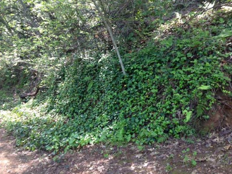
ACTIONS
Prevent the spread of invasive plants via vehicles and equipment. Mowing, other vegetation management, and any other vehicle or equipment travel along the Preserve’s roads and trails (or off-road) has high potential to spread invasive species. Clean vehicle and equipment tires and undercarriages of all soil and vegetation fragments before entering uncontaminated areas. (O)
Maintain native canopy. Broom thrives in forest openings, which primarily occur on the Preserve along roads and trails. Ensure that clearing for emergency access and fire hazard reduction does not reduce canopy cover substantially; see Fire Management Recommendations for further discussion. Where canopy is already limited and natural regeneration is not evident, undertake native revegetation to increase cover; see Habitat Restoration section for further discussion and Appendix D for suggested species. (O)
Limit ground-altering activities in extent and duration. Trail development, grading, disking, and digging provide ideal conditions for most invasive species to establish. Avoid these activities, especially in otherwise undisturbed habitat. (O)
When ground alteration occurs, revegetate promptly with an appropriate suite of native species. Among species native to the habitat type, include natives that grow rapidly, and/or those that have growth habits and seasonal timing similar to potential invaders, to help suppress invasive populations; see Appendix D for suggested species. (O)
Along road edges where there is little mature or regenerating native vegetation, undertake proactive plantings of Fitch Mountain-local native species that are low fire hazard, and competitive with broom and other weeds. Propagate the plants from Fitch Mountain sources if possible, or from Sonoma County sources; see Habitat Restoration section for further discussion and Appendix D for suggested species. (L)
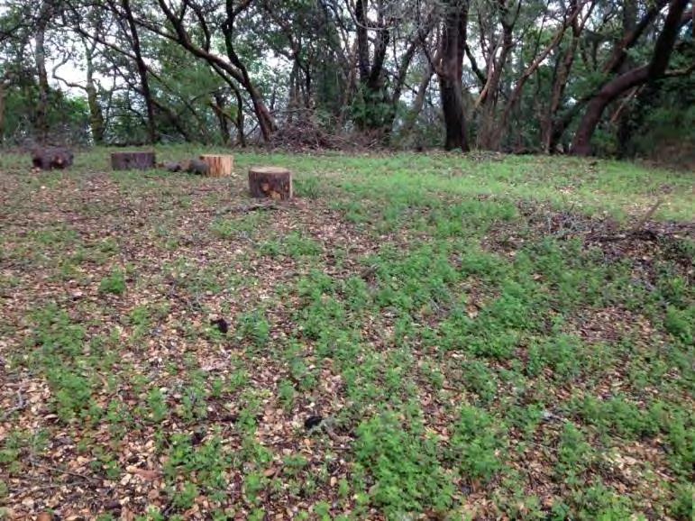
54 | Fitch
Mountain Park and Open Space Preserve | Management Plan
Broom seedlings at summit (above) and English ivy along Riverview Trail (below)
Ensure that seed, straw, mulch, or other plant material brought onto the site for revegetation, landscaping, or erosion control purposes is weed-free. (O)
Use only species native to Fitch Mountain and Sonoma County for restoration, landscaping, and erosion control. Plants and seeds should be of local provenance if possible from the Preserve itself, the Russian River watershed or adjacent areas with similar environmental conditions; see Climate Change Adaptation section for further discussion. (O)
Train staff to recognize invasive species and help prevent their spread. Preserve visitors and/or volunteer trail watchers can also serve as valuable eyes on the landscape to spot new infestations. Manual removal of invasive plant species can be a good activity for supervised volunteers. Many resources are available for learning to identify invasive species, including The California Invasive Plant Council (www.cal-ipc.org) and CalFlora (www.calflora.org/). (S)
If resources are available, educate residents immediately adjacent to the Preserve about invasive species, and encourage use of native species for landscaping. This could be accomplished in conjunction with fire safety education. Information could be transmitted through utility mailings, on the City website, or on guided walks through the Preserve. (L)
OBJECTIVE RM-4: Manage existing populations of invasive plant species
ACTIONS
Manage or eliminate existing infestations already on the Preserve; see Appendix C for speciesspecific recommendations and Exhibit 5 for key locations and time frames for removal. Focus first on eradicating new occurrences, plants at the edge of an existing infestation, or infestations within high-quality native habitat. In large patches, work from the edges inward. Use hand and mechanical methods. Minimize ground disturbance, and apply erosion control and/or native revegetation treatments for any substantial disturbance area. (O, S)
Thin Douglas fir trees selectively where they appear to threaten significant oaks, such as the large mature coast live oak on the lower summit. There are also some locations with dense growth of small Douglas fir saplings; these may be thinned where they pose a fire hazard; see Fire Risk Abatement for further discussion. Any thinning should only be done under the direction of and monitoring by a vegetation ecologist or forester, with caution to ensure that fir removal does not increase invasive species populations. Large-scale thinning of firs is not recommended. (O)
Avoid the use of herbicides. Use only to spot treat high-priority infestations that have not been controlled by manual efforts, or where manual removal would cause extensive soil disturbance. Consult a licensed Pest Control Advisor for specifications regarding application of herbicides. (O)
During invasive removal, avoid damage to existing native plants, which, if left intact, may help suppress the invasive plant growth. (O)
Remove all invasive plant material with any potential to germinate (e.g., seeds, rhizomes, stem fragments for stoloniferous species) and dispose of in landfill. Burning does not always achieve high enough temperatures to kill some seeds, including those of broom. Ensure that no seed is dispersed while removing plants from site. (O)
Schedule vegetation removal to minimize impacts to breeding birds, soil, and water quality:
August 15 - October 15. This is the best time for ground-disturbing work; it avoids impacts to breeding birds; minimizes erosion risk; and allows for prompt replanting with natives in time
Mountain Park and Open Space Preserve | Management Plan
55 |
Fitch
to take advantage of cool, wet winter weather for establishment. However, it may be more difficult to remove plant roots at this time.
October 16 – February 14. This is the easiest time to remove broom and other non-native plants. However, ground-disturbing work should only proceed if no rain is predicted for 48 hours and erosion control BMPs are in place following removal.
February 15 – August 15. Limited vegetation removal can take place if bird surveys are completed; see Wildlife Species Protection section for further guidance. (O)
Establish Fitch Mountain-local native species that are competitive with broom and other weeds in invasive removal areas. Focus on areas where no native regeneration is occurring. Propagate the plants from Fitch Mountain sources if possible, or from Sonoma County sources; see Habitat Restoration section for further discussion and Appendix D for suggested species. (O)
Monitor results of invasive species removal efforts annually to assess effectiveness and identify follow-up needs. Repeat treatments will usually be necessary. (O)
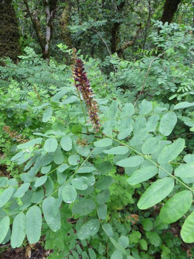
At least once annually, document invasive species conditions and develop updated recommendations for management on the Preserve. This should be conducted by a qualified biologist or staff person trained in natural resources. The effort could be supported by trained volunteers. (O)
Special-status Plant Protection
One special-status plant, Napa false indigo, has been documented on the Preserve and there is low potential for several others to occur. The main threats to the Napa false indigo population on the Preserve currently are vegetation clearing for road access and fire hazard reduction, invasive species, and climate change. Vegetation clearing along road and trail edges or for new trails or other development could remove or damage plants, or could degrade habitat quality by facilitating too much sun exposure. However, limited ongoing clearing along trails may also benefit this plant, providing the small openings with dappled sun within intact forest that it typically occupies. The Preserve’s infestations of broom species also pose a threat to Napa false indigo, as broom can occupy similar habitat niches as Napa false indigo. Climate change could reduce the habitat suitability for this species on
56 |
Fitch Mountain Park and Open Space Preserve | Management Plan
Napa false indigo
Fitch Mountain, but the Preserve is currently well within the species’ tolerances, so it is probably not more vulnerable than most plant species on the Preserve. Exhibit 5 shows the general location of Napa false indigo along the Preserve’s roads and trails; other areas have not been surveyed due to inaccessibility.
Several other special-status plant species have low potential to occur; see Special-status Species section for further information. Because most of the Preserve has not been surveyed due to its steep terrain, the presence of any additional special-status plants could not be ruled out during the 2016 surveys. General protective measures should be in place to ensure that any future development does not damage any special-status plant species on the Preserve.
OBJECTIVE RM-5: Protect the Preserve’s population of Napa false indigo
ACTIONS
Ensure that Napa false indigo plants are not damaged during vegetation management activities. Train crews to recognize this species prior to each vegetation clearing effort, and have a trained supervisor oversee all work in areas where this plant occurs. (O)
Do not establish new trails or other park development in areas occupied by Napa false indigo. (O)
Propagate Napa false indigo from the Preserve’s population for use in revegetation. This species can be propagated from seed or cuttings, under the guidance of a qualified botanist or restoration specialist. After nursery propagation, it can then be used in broom removal areas, butterfly habitat enhancement areas, and other revegetation locations with appropriate microclimate conditions. Supplemental irrigation or time-release water will support its establishment; see Habitat Restoration section for further discussion. (L)
OBJECTIVE RM-6: Ensure that future park developments are not detrimental to specialstatus plant species
ACTIONS
Prior to any park development in areas beyond existing trails and roads, conduct a botanical survey to ensure that no special-status species are present; see Plant Communities and Specialstatus Plants sections for a discussion of plant species with potential to occur. Surveys should be conducted at the appropriate time for plant identification, and should be conducted by a botanist experienced with Sonoma County sensitive species. (O)
If any special-status plant species are found in areas proposed for development, adjust project plans to avoid impact to the species. Consult with a qualified botanist to determine appropriate setback distances and protection measures. (O)
57 | Fitch Mountain Park and Open Space Preserve | Management Plan
Wildlife Species Protection
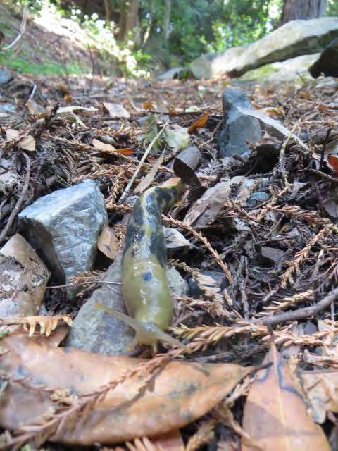
The Preserve supports a number of sensitive resources including potential habitat for several specialstatus species and common wildlife. Many of these species are protected by state and federal regulations. The following recommendations include those needed for regulatory compliance and for protection of special-status and common wildlife during public access improvement projects and ongoing management of the Preserve. Additional wildlife habitat protection and enhancement measures are described in the Habitat Restoration and Fire Risk Abatement sections.
ACTIONS
Perform preconstruction surveys prior to significant ground disturbance (e.g., large scale vegetation removal or trimming, trail construction and other public access improvement projects). Surveys (on the day preceding work and/or ahead of the construction crew) should be performed by a qualified biologist to ensure no special-status species and common wildlife are occupying the area. If wildlife species are observed within the work area or immediate surroundings, these areas must be avoided until the animal(s) has (have) vacated the area, and/or, upon approval by the regulatory agencies, the animal(s) must be relocated out of the area by a qualified biologist. (O)
Conduct an annual training session for all City field staff. The training should be conducted by a qualified biologist and should include a discussion of the sensitive biological resources within the Preserve, the potential presence of special-status species, and ongoing management activities. This should include a discussion of special-status species’ habitats, protection measures to ensure species are not impacted by project activities, project boundaries, and biological conditions outlined in the Plan. The training could be completed in conjunction with the staff training described in the Staff Trainings and Communication section. (O)
Complete presence/negative finding bat surveys prior to removal or significant trimming of any trees which are over 6 inches in diameter at breast height. Surveys should be completed by a qualified biologist. Because each individual bat species may use different roosts seasonally and from
58 |
Fitch Mountain Park and Open Space Preserve | Management Plan
OBJECTIVE RM-7: Protection biological resources during ongoing Preserve management and public access improvement projects
Banana slug
night to day, surveys must be conducted by a qualified biologist at the appropriate times. (O)
As feasible, work outside of the critical breeding bird period (February 15 through August 31) during ongoing Preserve management (i.e., vegetation removal or trimming) and vegetation removal associated with public access improvement projects. If activities must occur during this period, work areas should be surveyed prior to commencing. Complete surveys for all humanrelated ground disturbance activities in natural habitats and vegetation trimming and removal. Trained City staff would be qualified to complete the surveys. If active nests or behavior indicative of nesting are encountered, those areas plus a 50-foot buffer for small songbirds and 250-foot buffer for larger birds (e.g., owls, raptors) should be avoided until the nests have been vacated. If the work areas are left unattended for more than one week following the initial surveys, additional surveys should be completed. (O)
Habitat Restoration
While most of the Preserve is comprised of high quality native habitat already, there are several opportunities for enhancing current conditions. Planting native grasses, perennials, shrubs, and some trees or protecting naturally-occurring seedlings can help prevent erosion, improve wildlife and pollinator habitat, and slow the spread of invasive species. See Exhibit 5 for locations of proposed restoration efforts. Appendix D provides recommendation for suitable plant species for restoration plantings and Appendix E provides an overview of habitat restoration methods.
OBJECTIVE RM-8:
Restore habitat functions and native biodiversity where these are impaired on the Preserve
ACTIONS
Restore native forest and woodland plant species to locations where invasive plant populations have been removed and native regeneration is not occurring; see Exhibit 5 for specific examples and time frames for implementation. Include an array of native shrubs, perennials, grasses, and, if needed, trees from genetically appropriate stock. In some locations, protection of young native seedlings from herbivory may be sufficient. Consider installing educational signage to describe the restoration and other management issues for visitor education. Submit restoration plans to the District for approval. (O)
Plant native forest and woodland species along road and trail edges where vegetation is regularly cleared to reduce fire hazard or to improve emergency vehicle access and native vegetation is absent. Replace fire-prone non-native species with native species that provide little fuel or are not highly flammable. Otherwise, leaving disturbed, open niches after vegetation clearing is likely to encourage invasive species and erosion. In some locations, protection of young native seedlings from herbivory may be sufficient. See Appendix D for a list of suggested species. (O)
Enhance native butterfly habitat by incorporating larval host plants and nectar plants into restoration palettes. Especially along road edges near the top of the mountain, incorporating these plant species can support the Preserve’s unusual abundance of native butterflies; see Location B on Exhibit 5 and Appendix D. (L)
Use brush piles or large downed limbs around native plantings as an alternative browse
59 |
Fitch Mountain Park and Open Space Preserve | Management Plan
protection method that will also provide coarse woody material for upland wildlife species. (O)
Remove non-critical fencing. If boundary fencing is needed on the Preserve, ensure it is wildlifefriendly. (S)
Include a mixture of plant types (i.e., shrubs, vines, perennials, and herbaceous species as well as trees) in planting palettes to improve the structural diversity of habitats. The maintenance of structurally diverse habitats is especially important for birds. (O)
Invasive Animal Management
Like invasive plants, invasive animal species can have deleterious effects on native biodiversity. Nonnative animals displace native species, compete with and consume native wildlife, carry diseases, and change the food web by displacing or destroying native food sources. Without proper management and monitoring, problematic species can become quickly established and pervasive. Currently, only two nonnative bird species are known to occur on the Preserve wild turkey and Eurasian collared-dove.
Wild turkeys in Sonoma County are part of the range expansion of the Merriam’s turkey, a subspecies native to the semi-arid mid- and southwestern U.S. This species was not present in California at the time of European settlement, but has been introduced throughout the state since the 1870s for hunting. This species colonizes habitats with trees and open grassland. The effects of introduced turkeys on native wildlife are not well understood, but this opportunistic omnivore could pose a threat to native wildlife through predation or direct competition (CDFG 2004). Wild turkeys are likely to use the more open wooded habitats on the Preserve.
The Eurasian collared dove is a relative newcomer to North America. It has proliferated since its accidental introduction to the Bahamas in the 1970s and subsequent spread to mainland Florida. This species thrives in residential areas. It typically does not occur in densely forested areas; however, in cooler months, large flocks will roost in large trees and move into the Preserve and use the edge habitats. Additional non-native birds may also frequent the Preserve (e.g., house sparrow, European starling, brown-headed cowbird). Many of these bird species are ubiquitous across the county, would be difficult to control on a large scale, and site-specific control would be ineffective.
Given the Preserve’s proximity to residential development, the presence of feral and free-ranging domesticated cats is a concern and should they become established on the Preserve, they should be carefully managed. This is an introduced species that threatens native wildlife populations and natural ecosystems (CDFW 2016b). They prey directly on native mammals, birds, reptiles, and amphibians. Nationally, free ranging and feral cats kill billions of birds, rodents, and other small animals annually. They can also serve as reservoirs for a variety of diseases that can be transmitted to native wildlife. Feeding cats does not deter them from killing wildlife. Cats that are provided supplemental feed are capable of high rates of reproduction which in turn results in greater predation pressure on native wildlife.
60 | Fitch
Plan
Mountain Park and Open Space Preserve | Management
OBJECTIVE RM-9: Prevent the establishment of new populations and control existing populations of non-native and domesticated and feral animals
ACTIONS
At least once annually, document invasive animal species conditions (e.g., new species occurrences, sizes of existing populations) and develop updated recommendations for management on the Preserve. This should be conducted by a qualified biologist or City staff person trained in natural resources. The effort could be supported by the volunteer patrol program and/or conducted in conjunction with regional efforts. (O)
Educate visitors through signage about the importance of keeping the Preserve free of non-native animals, avoiding accidental or intentional feeding of wildlife that may attract predators, intentional introductions, and general habitat protection measures. (S)
Monitor for the presence of feral cats on the Preserve and intentional feeding by local residents. If they are found on the Preserve, they should be removed. Educate neighboring homeowners about the negative effects of cats on native wildlife species and the importance of keeping the Preserve free of cats. (O)
Participate in local management programs to control invasive animals if such programs become established. (O)
Contaminant and Pathogen Control
Phytophthora ramorum and other common plant pathogens are present on the Preserve. These are not currently causing major plant losses. However, there is potential for pathogens to spread, especially as public uses increase, climate changes, and plants become more stressed. Using standard Best Management Practices (BMPs) to reduce the spread of pathogens will help protect the Preserve’s forests. BMPs should also be followed when potential contaminants like fuels and pesticides are used on the Preserve, to protect water quality, plants, wildlife, and human health and safety.
OBJECTIVE RM-10: Minimize the use of chemicals on the Preserve
ACTIONS
Avoid the use of pesticides and herbicides; see Invasive Plant Management for alternatives and further discussion. (O)
If pesticides or herbicides are used, use with caution to prevent contaminated runoff. This is particularly important for all road maintenance activities and invasive plant species treatments by Preserve staff or other groups. Herbicide application should be done under the guidance of a licensed Pest Control Advisor. (O)
Employ Best Management Practices for staging, maintenance, fueling, and spill containment of all potentially hazardous materials used on the Preserve. (O)
Mountain Park and Open Space Preserve | Management Plan
61 | Fitch
OBJECTIVE RM-11: Minimize the spread of pathogens into and within the Preserve
ACTIONS
Before purchasing any nursery stock for restoration plantings or landscaping, confirm that the nursery follows current Best Management Practices for preventing the spread of SOD and other plant pathogens (consult the California Oak Mortality Task Force, www.suddenoakdeath.org, for current standards). Inspect all plant materials for symptoms of SOD or other pathogens before bringing onto the Preserve. (O)
Train park staff on host species, symptoms, and disease transmission pathways for Phytophthora ramorum and other Phytophthora species, and on Best Management Practices to prevent the spread of SOD, including (Swiecki and Berhhardt In Review):
Clean equipment before and after working in forest and woodland habitats, including chainsaws, boots, and truck tires (spray with a 10% bleach solution or other disinfectant, then rinse).
Work in forest and woodlands in the dry season instead of the wet season when spores are being produced and infections are starting. Avoid or minimize pruning oak, tanoak, and bays in wet weather.
Leave potentially infected downed trees on site instead of transporting the material to an uninfected area. Where infection is already known to be present, leaving P. ramoruminfected or killed trees on site has not been shown to increase the risk of infection to adjacent trees. Removal from the Preserve is only recommended if it is the first infected tree to be detected in the area, if fire risk is high, or for aesthetic, safety, or other reasons. If infected material is removed from site, dispose of at an approved and permitted dump facility within the quarantine zone encompassing the 14-county infected quarantine zone.
If necessary to reduce safety or fire hazards, infected trees can be cut, branches chipped, and wood split. Do not leave firewood and chips in an area where they might be transported to an uninfected location. (O)
Educate park users about measures to prevent the spread of SOD. Include trailhead signage requesting visitors to stay on established trails and respect trail closures. Encourage visitors to clean their shoes of soil and plant matter after visiting the Preserve to reduce the spread of SOD. Additional public educational materials have been developed by the California Oak Mortality Task Force (COMTF 2014). (S)
Participate in the annual SOD Blitz sponsored by the California Oak Mortality Task Force and UC Extension to identify and monitor progression of SOD throughout the Sonoma County. The Preserve would serve as a good location to participate in the Blitz to complete a rapid assessment of SOD presence and to train staff and volunteers to monitor the Preserve for SOD. (O)
Cultural and Historical Resources
Fitch Mountain and the Russian River valley have a long history of human occupation. While surveys of the Preserve did not identify cultural or historical resources, any archaeological remains uncovered during Preserve improvements or maintenance activities will need to be protected in accordance with State law. In addition to protection, the rich history of the Preserve can be highlighted for educational purposes in displays and tours; see Educational Opportunities section for further discussion.
62 | Fitch
Mountain Park and Open Space Preserve | Management Plan
OBJECTIVE RM-12: Protect archaeological, historical, and tribal cultural resources during Preserve maintenance and improvements
ACTIONS
If previously unknown archaeological materials are encountered during construction, project personnel should avoid altering the materials and their context until a qualified archeologist has evaluated the situation. Archaeological materials should not be collected. If the archaeologist determines that the find potentially qualifies as a unique archaeological or historical resource, all work should stop in the immediate vicinity to allow the archaeologist to evaluate the find and recommend appropriate treatment. Treatment and resolution may include either a modification to the project to allow the materials to be left in place or undertaking data recovery of the archeological materials in accordance with standard archaeological methods. The preferred treatment is protection and preservation in place. (O)
If any human remains or funerary objects are discovered during soil-disturbing activities, all work must stop in the vicinity and the Sonoma County Coroner must be notified. If the coroner determines that human remains are of Native American origin, they will contact the Native American Heritage Commission (NAHC) within 24 hours of identification pursuant to Public Resources Code Section 5097.98. NAHC would appoint a Most Likely Descendant (MLD). All reasonable efforts should be made to develop an agreement for the treatment, with appropriate dignity, of any human remains and associated or unassociated funerary objects. (O)
Climate Change Adaptation
Changing climate driven by release of carbon dioxide into the atmosphere is likely to influence many ecological variables relevant to the Preserve’s management, from the geographic ranges of species, plant life cycles, and species interactions, to stream flows, insect outbreaks, and disease outbreaks. The climate is already becoming warmer and more variable. Regardless of changes in precipitation and fog, for which trends are not yet clear, climate change is increasing water stress for California vegetation. The plant communities of the Preserve are likely to change as a result, with potential for losses of more drought-sensitive species like redwood and Oregon oak and their many understory associates, and increases in broadly adapted species like coast live oak and drought-tolerant shrubs. Warmer conditions also typically lead to more frequent disease outbreaks. Stressed or dying vegetation provides greater fuel for fires.
In the face of rapid change, an important conservation strategy is to manage for healthy ecosystem function so that the environment can retain maximum ability to adapt. All of the objectives and actions described in the Plan support this goal. But there are several additional objectives and actions to implement that are climate change-specific. For further reading and other local efforts on this emerging topic, see the National Wildlife Federation’s Climate Smart Conservation (NWF 2014) and Point Blue’s Climate Smart Restoration toolkit (Point Blue 2016).
63 | Fitch Mountain Park and Open Space Preserve | Management Plan
OBJECTIVE RM-13: Minimize the carbon footprint of Preserve management activities, and support the natural carbon sequestration functions of Preserve habitats
ACTIONS
Where vehicles and gas-powered machinery are needed, use them efficiently. Minimize vehicle trips to the Preserve, and use hand labor where possible rather than gas-powered equipment. This also preserves the naturally peaceful, quiet setting of the Preserve for wildlife and human visitors. Engage volunteers to help get labor-intensive work accomplished by hand. (O)
Facilitate the continued establishment of mature native trees and understory species and protect soils from disturbance, as all of these provide long-term carbon sequestration. Ensure that management practices protect natural regeneration. (O)
Encourage bicycling or walking to the Preserve by maintaining safe, accessible approaches to trails and providing a bike rack at the primary entrance. (O)
OBJECTIVE RM-14: Protect the resilience of the Preserve to climate change by supporting habitat connectivity and protecting water resources
ACTIONS
Protect drainages on the Preserve, and their linkage between uplands and the Russian River. Conserving habitats across environmental gradients such as elevation may help allow for localized shifts within and beyond the Preserve. Drainages are especially valuable, as these habitats are naturally resilient to changes in moisture, provide thermal refugia for wildlife, and already serve as corridors for wildlife movement. Ensure that native vegetation and other wildlife resources in these areas are protected; see Fire Management Recommendations. (O)
Avoid fragmenting intact habitat with trails or other park development. Especially for species that have limited dispersal abilities, or that are highly sensitive to human and dog presence, having fragmented habitat will limit species adaptation. (O)
Manage collaboratively. Because climate-driven changes encompass lands beyond the Preserve boundaries, working with other private landowners and resource agencies (i.e., Cal Fire, Regional Parks, Sonoma County Water Agency) to address management issues collaboratively will be increasingly important. (O)
OBJECTIVE RM-15: In Preserve restoration efforts, plan for current and future conditions, while learning from the past
ACTIONS
Select plant palettes with changing conditions in mind. This is a new and evolving topic in restoration science, so stay apprised of developments. Based on our current understanding, plant palettes should still be comprised of species known to occur locally, but broadening the scope of a
Fitch Mountain Park and Open Space Preserve | Management Plan
64 |
planting may provide insurance against future conditions. Including multiple species from within plant lifeform types also provides redundancy that can serve as “insurance” against unknowns. Review species’ known geographic distributions as a guide to how changing conditions may affect plantings. (O)
Select plant propagule sources with changing conditions in mind. This too is relatively uncharted territory for restoration planting. Current understanding suggests that selecting propagules from local (Healdsburg and Russian River) sources, but aiming to capture genetic diversity and a range of environmental tolerances by collecting from a variety of individuals and a range of microhabitats relative to moisture, solar exposure, and elevation may be beneficial. (O)
Monitor Preserve conditions such as tree regeneration to facilitate adjusting management strategies to meet changing circumstances. This is one of the most important components of climate change adaptation. Conditions on the Preserve may be very different in 10 or 50 years, and Preserve managers will need to stay apprised of site conditions and be ready to update their practices accordingly. (O)
Staff Trainings and Communication
An essential component of long-term Preserve management will be to ensure that City staff know and understand the overarching conservation values and supporting land management objectives and actions outlined in this Plan. This will be especially important as staff roles change and if different City departments participate in land management activities or events on the Preserve.
OBJECTIVE RM-16: Ensure that City staff are informed of Preserve management activities and staff/City departments are in communication about the Preserve
ACTIONS
Conduct an annual meeting for all City departments involved with management activities and Preserve events. The meeting should include a thorough discussion of the overarching goals for natural resource protection and conservation on the Preserve, restrictions of the District’s Conservation Easement, public uses, fire risk abatement, ongoing operations and maintenance activities, and changes to the City staff management structure. As new employees join relevant City departments, they should be apprised of the Preserve land management practices at new hire trainings. The Plan and any subsequent updates should be made readily available to all relevant City staff. (O)
Develop and implement a communication protocol within and between City departments to coordinate Preserve management actions, including routine maintenance activities, fire risk abatement, public safety issues and complaints, and planned events. (S)
65 | Fitch
Mountain Park and Open Space Preserve | Management Plan
7 Fire Risk Abatement
In California’s Mediterranean climate, with annual cycles of lush vegetative growth during mild, wet winters and springs, followed by extended warm, dry summers and falls, fire has periodically reshaped the landscape and vegetation communities for millennia. Many of the region’s plant communities are tolerant or even dependent on fire to germinate and thrive. Longstanding fire regimes include both lightning-ignited fires and those struck by indigenous people managing their landscapes. It is thought that fire has played an important role in maintaining grassland patches in areas where oak woodland or other woody communities would otherwise have dominated. Indigenous people used fire in some settings to increase the abundance of plant species they used for food, as well as of those that supported game animals. Now that Sonoma County is well populated and developed, wildfire prevention and suppression is the norm. Land managers in the county are increasingly concerned about the effects of fire suppression on the rich mosaic of habitats that characterize much of the county.
Fitch Mountain presents unique fire considerations due to its location, climate, topography, and vegetation. The steep mountain is surrounded by roads and houses, which increase the risk of the spread of fire from nearby lands onto the Preserve. Wind from any direction could fan an ignition source. Steep slopes all around can allow for the uphill thermal rush of flames through areas of continuous fuels from ground to treetop. Some of the vegetated drainages can also act as chimneys to increase fire intensity. Dry summers and periodic drought reduce fuel moisture and increase
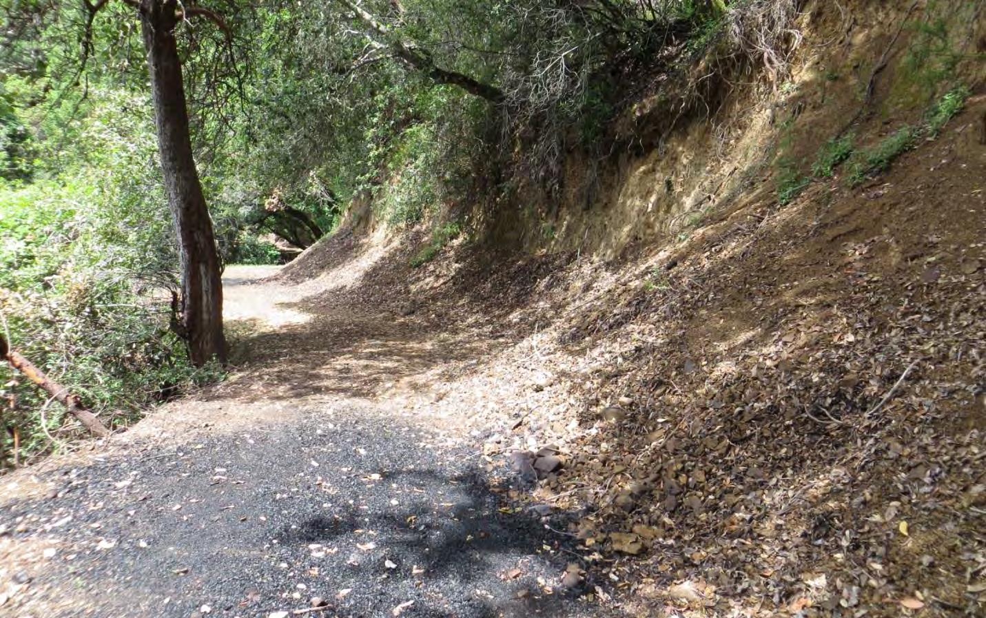
66 |
Fitch Mountain Park and Open Space Preserve | Management Plan
Controlled burn pile area on Butterfly Trail
flammability. Given the Preserve’s proximity to urban development, there is a need to manage the mountain to reduce the risk of fire and allow for appropriate control measures in the event of a fire. On the positive side, the Russian River provides a natural fire break on three sides of the mountain. Internal fire roads are maintained to assist with fuel management and fire suppression access, and State and local fire departments are both nearby.
The Fitch Mountain area, including the Preserve, is designated as a “High Fire Hazard Severity Zone” (Cal Fire 2007). It falls within a State Responsibility Area and is under the control of Cal Fire. However, the area is considered a mutual threat zone due to the high fire risk and safety concerns and the ability for a fire to impact incorporated City of Healdsburg. Due to the proximity to the City limits and the potential for rural fire to impact the City, the Healdsburg Fire Department is under contract with the Sonoma County Office of Fire and Emergency Services to provide service to the areas of Fitch Mountain. The City is responsible for responding to any fire event on the mountain, but works closely with Cal Fire to provide mutual aid.
The primary goals for fire risk management on the Preserve will be to protect lives and property from the threat of a wildfire and ensure the safety of firefighters and public. This can be accomplished by maintaining access for emergency vehicles and reducing the incidence and impacts of accidental fire within the Preserve boundaries and from adjacent lands to a reasonable degree. Given the topography, habitat composition, and regional climate, it is not reasonable to expect the elimination of fire on the mountain while also retaining its recreation values and preserving natural resources. Maintaining emergency vehicle access, reducing the extent of flammable non-native fuels, working with surrounding landowners on creating fire safe buffers on their own property, and educating park visitors about fire safe behaviors are the primary strategies for protecting Fitch Mountain and the surrounding communities from a catastrophic fire.
Ignition Sources and Fuel Conditions
There are a number of primary potential ignition sources that could start a fire on the Preserve. For Preserve visitors, unauthorized smoking, illegal campfires, and fireworks could result in a humaninduced fire with increased public use. Educating park visitors and patrolling for illegal activities when fire danger is high will be the primary means to reduce these sources. Vehicles and equipment used on the Preserve for routine maintenance, vegetation clearance, patrols, or other activities have the potential to spark a fire. Use of mechanized equipment and vehicles will need to be managed carefully during all work activities, especially during the dry season. Lightning strikes are the primary source of natural wildland fires in Sonoma County. While lightning strikes are rare in this region, it is possible that lightning could strike a tall tree on the ridge-top. If ignited, burning embers could be broadcast downslope and ignite other vegetation under dry conditions.
The highest priority for controlling ignition sources is outside the Preserve boundaries on adjacent lands. The Preserve is surrounded by roads and houses, and power lines run along the base of the mountain and across it. Sparks from vehicles, fireplaces, woodstoves, outdoor power tools, or branches on power
67 |
Fitch Mountain Park and Open Space Preserve | Management Plan
lines could start a fire, which could then be fanned by the intensity of an uphill rush into the Preserve. Preventing these types of ignition will require neighborhood outreach and education, creation of defensible spaces, and vegetation clearance around power lines.
The Preserve supports a number of native and non-native plants with potential to contribute to hazardous fire conditions on the Preserve as well as a build-up of dead, woody fuels in some locations. It may be necessary to control the density and regeneration of these plant species and removal of dead trees to maintain more fire-safe plant communities. Plant species of concern include:
Non-native broom. This is the most invasive of the fire hazard plants on the Preserve. This nonnative plant is hard to get rid of as it re-sprouts from the base once cut and seeds can remain viable for decades. The long-term viability of the seeds will require a real concerted effort to reduce the extent of the broom infestation on the Preserve and control re-sprouts. Broom management recommendations are provided in the Invasive Plant Management section.
Douglas fir. This native is a resinous species that is highly flammable due to its high oil and resin content and low moisture content in leaves and branches. Large Douglas fir trees on ridge tops can act as fire-brands by igniting (through lightning or other sources) and sending sparks long distances. Thickets of dense fir regeneration can become a fuel hazard in the mid-canopy zone leading to fire climbing into the overstory (fire ladder). In addition, compared to oak leaf litter, the needle-fall and forest litter build-up of fir creates denser and higher forest-floor fuels which in turn can allow for hotter, more sustained burning which is more damaging to native oaks.
California bay. This native tree is also a resinous species with a high fire rating. Sprouts tend to form dense stands that not only pose a fire hazard, but may reduce plant diversity.
Fire Management Recommendations
Reducing the risk of a wildland fire on Fitch Mountain and controlling the potential for spread of a fire from within the Preserve boundaries or from nearby lands will require on-the-ground vegetation management, public outreach, and education. The greatest risk for fire on the mountain will be the spread from neighboring property. Educating the Fitch Mountain community about creating defensible spaces will be critical to protecting their homes, controlling a fire’s spread, and ensuring a safe zone for fire response. In the event of a fire or medical emergency, maintaining the fire road across the mountain will be key to ensuring a prompt and safe response from the firefighting community. Keeping visitors informed of fire-prevention behaviors and how to respond in the event of fire will be critical for their safety and reducing the fire risk potentially associated with additional public use.
OBJECTIVE FR-1: Reduce the risk of the spread of fire between Fitch Mountain and adjacent parcels, to protect the lives and property of the community
68 | Fitch Mountain Park
Preserve | Management Plan
and Open Space
ACTIONS
To the extent that resources are available, work with the appropriate State and County agencies to educate residents of the Fitch Mountain community about the importance of and legal requirements for creating “defensible spaces” around structures. Work with Fire Safe Sonoma to develop a Community Wildfire Protection Plan. Annually, in the spring, distribute the Inspection Notice and Fire Safe Practices guide prepared by Sonoma County Fire and Emergency Services, Fire Prevention Division for the Fitch Mountain area. The optimal time to reach out to residents is in late winter when the recommended actions can be implemented concurrently before the breeding bird season commences, fuels cure, and invasive plants set seed. (S)
To the extent that resources are available, evaluate the current conditions of adjacent properties at the greatest risk for the spread of fire onto the Preserve and from the Preserve to their lands. Provide one-on-one guidance on vegetation management and fire safe landscaping to landowners. (L)
OBJECTIVE FR-2: Reduce the risk of fire on the Preserve as a result of increased public use
ACTIONS
Educate visitors about the high fire dangers on the mountain. Install signage at all entrances and trailhead locations to inform visitors of emergency access routes and the importance of keeping the Preserve fire safe; Exhibit 7. (S)
Enforce a no smoking policy on the Preserve as stipulated by Sonoma County Ordinance (5953) and the Healdsburg Municipal Code (8.24.040). Ensure that all entry way signage includes the no smoking policy and references the ordinances. (S)
Prohibit fires, including cook stoves and barbeques, on the Fitch Mountain Park and Open Space Preserve. State this prohibition on signage at entrances and trailheads. Allow exceptions only for resource management activities conducted with the oversight of fire agencies. (S)
Provide adequate barriers at the Villa Chanticleer trailhead and other access points to keep nonauthorized motorized vehicles (especially motorcycles) out of the Preserve. (S)
OBJECTIVE FR-3: Reduce the risk of fire on the Preserve as a result of maintenance activities
ACTIONS
Prohibit vegetation management for ongoing Preserve maintenance or fire risk abatement during red flag days according to the National Weather Service. (O)
Require all equipment and vehicles used on the Preserve to be equipped with spark arrestors or other means of controlling backfiring. (O)
Require all vehicles driving onto the Preserve to carry standard fire-fighting equipment (e.g., shovel, McLeod, fire extinguisher). (O)
Limit use of power tools for maintenance or other activities during periods of high and very high
Fitch Mountain Park and Open Space Preserve | Management Plan
69 |
fire danger as per Cal Fire6 (except for emergencies). (O)
Limit driving onto the Preserve, with the exception of emergencies, during periods of high and very high fire danger. (O)
Do not park or drive over flammable material such as grasses and dry brush. (O)
Complete City staff patrols of the Preserve during high fire danger days. Patrols should also be completed during the 4th of July holiday and other community celebrations when the risk of illegal fireworks increases. (O)
Complete daily patrols as part of the volunteer trail watch program. (O)
Maintain clear, unobstructed access along the fire and emergency access road by trimming back encroaching vegetation and promptly responding to and removing any trail obstruction; see Exhibit 7 and Table 3. (O)
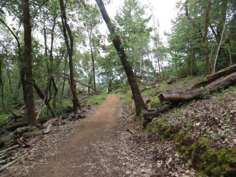
Ensure that fire department staff or other entities overseeing fuel load management activities participate in the annual staff meeting and communication protocol; see Staff Trainings and Communication section for further information. (S)
OBJECTIVE FR-4: Strategically reduce hazardous fire conditions on the Preserve while protecting natural resources
ACTIONS
Fire Risk Abatement Plan
Develop a Fire Risk Abatement Plan prior to completing any on-the-ground work. The plan should include a description of the current and target condition of the treatment area, map and photos (see photo point action under Natural Resource Protection) of the treatment area, identify immediate and long-term goals, timeline for implementation, access points, disposal methods, and target species. Fire Risk Abatement Plans may cover a period of 1 to 5 years. The plan should meet applicable Conservation Easement requirements and must be submitted to the District for approval (CE §5.4.6). The District requires 45 days for review and 14 days for any follow-up submittals. The Fire Risk Abatement Plan should follow the natural resource and fire management recommendations set forth is this document. (O)
6 Fire danger ratings and guidance can be obtained from Cal Fire Healdsburg or Healdsburg Fire Department. The National Weather Service also maintains a Fire Weather site with updated information on fire danger.
70 |
Fitch Mountain Park and Open Space Preserve | Management Plan
Vegetation clearance along Fitch Mountain Trail
Natural Resource Protection
Ensure that all fuel reduction work is guided on the ground by personnel familiar with native plant identification and wildlife requirements. Impacts on native vegetation should be minimized. Special-status plant species, including Napa false indigo, and wildlife species should be protected during fuel load management activities. (O)
Perform biological trainings and surveys prior to vegetation management activities as outlined in the Wildlife Species Protection section. (O)
Limit ground disturbance during all vegetation management activities. Where bare ground is exposed as a result of work, promptly treat to prevent erosion, establish native species, and limit colonization by weedy species; see Appendix D and E for seeding recommendations. (O)
Allow maintenance vehicle access only on the fire and emergency access road and existing trails. Avoid driving beyond these areas. For any vegetation management along drainages or other interior Preserve locations, areas should be accessed by foot. (O)
If vegetation management is needed along drainages for public safety, ensure that the special ecological values of the habitat are maintained. Work only in sites that are accessible without driving off-road or off-trail, dispose of cut vegetation without blocking drainages, minimize ground disturbance, and maintain duff and native canopy. (O)
Prevent the spread of Sudden Oak Death and invasive plant species during all vegetation management activities (COMTF 2008); see Containment and Pathogen Control and Invasive Plant Management sections for further discussion. (O)
Unless they pose a threat to public safety or increased fire risk, retain decaying and dying trees, limbs, snags, and debris piles for wildlife habitat. If a downed trees crosses over a trail, cut and move to the side. These features are critical habitat elements for wildlife. (O)
Maintain habitat complexity, especially along drainages and habitats outside of the fire and emergency access corridor. This will require maintaining a balance between providing diverse, multistory forest and woodlands for wildlife utilization and plant community diversity and the need for fire risk abatement. (O)
Limit disturbance to dusky-footed woodrat nests during vegetation management activities. Nests should be left intact and adjacent vegetation should be carefully pruned under the guidance of a qualified biologist. (O)
Prior to vegetation management activities, establish permanent photo points to illustrate beforeand after-treatment conditions. Use GPS coordinates, permanent survey stakes, or detailed maps to record locations. Provide typical views of treatment locations as well as views of sensitive areas such as drainages or Napa false indigo stands for five years after treatment. Use photos to review changes in habitat conditions. Photos should be taken at the same month each year – for example, in May or June when new leaves are present on plants. If undesirable changes in plant cover or composition are noted, review practices and revise as needed to protect natural resources. (O)
Engage a professional botanist or vegetation ecologist to review fire hazard reduction practices every five years to ensure that vegetation removal is not negatively affecting native plant community species composition or health, or wildlife communities. (O)
Clearances
Maintain Fitch Mountain Trail and Hilltop Trail for fire and emergency access while retaining as much native vegetation as possible; see Exhibit 7 and Table 3. These roads may be maintained with an overhead clearance of no more than 15 feet. Road surfaces should be maintained at their current
71 |
Fitch Mountain Park and Open Space Preserve | Management Plan
widths (approx. 8-15’) and not expanded. These will serve to a certain degree as shaded fuel breaks as fuels are reduced on either side of the road. (O)
Maintain Butterfly Trail for trail users only; see Exhibit 7 and Table 3. This trail may be maintained with an overhead clearance of no more than 8 feet. Trail surface should be maintained at its current width or no more than 6 feet. (O)
Maintain Riverview Trail to allow passenger vehicle travel in an emergency; see Exhibit 7 and Table 3. This trail may be maintained with an overhead clearance of no more than 8 feet. Trail surface should be maintained at its current width or no more than 6 feet. Care should be taken to avoid disturbance to the dense native understory along the road edges and canopy. (O)
Practices
Maintain canopy cover to inhibit vigorous growth of non-native broom that may pose a fire hazard, leaving no more than 5 to 10 feet between tree crowns. See Figure 2. Canopy Cover Targets photos below. (O)
Thin or prune live and dead vegetation where there is a need to manage vegetation for public safety. Thinning/pruning should focus on:
Non-native understory shrubs; see Invasive Plant Management recommendations for further information.
Dead and diseased Douglas fir and bay trees and those trees with 25% or less live crown.
Dense growth of Douglas fir and bay saplings less than 6 inches in diameter at breast height (DBH). These may be thinned to 10-12 feet apart. Trees larger than 6 inches DBH shall remain standing unless marked for removal by a qualified biologist.
Multiple bay sprouts emerging from one stump. These may be thinned to one or two trees.
Limbs within 10 to 15 feet from the ground. On smaller trees, care should be taken to leave at least 30% of the tree height with live foliage. See Figure 3. Techniques for Making the Prune Cut as a guide for tree pruning.
Piles of brush, unless designated as wildlife habitat, should be lopped and scattered or chipped; see Disposal below. (O)
Do not top trees. Topping trees can result in wounds that allow pathogens to become established and can compromise the long-term health of the tree. (O)
Maintain clearance around power pole at the intersection of Fitch Mountain Trail and Fitch Mountain Road while maintaining native canopy cover and understory species. (O)
Work with PG&E and other utility companies to monitor and maintain vegetation clearances around power lines and cell tower both on Preserve and nearby lands (cell tower). Current PG&E practices include the removal of vegetation within 4 feet of any transmission or distribution line and removal of any potentially hazardous tree or branch with potential to encroach on the lines. Typically, PG&E provides an annual survey of the lines followed by vegetation clearance. For questions or concerns contact: Western Environmental Consulting, Inc. (707-577-7055) or PG&E’s Vegetation Program Manager (707-577-7271). (O)
Timing
Complete vegetation management during spring or after the first significant rains in fall and through winter when fire danger rating is medium or lower and native vegetation is most easily identifiable. Bird nesting surveys will be required in late winter through spring; see Wildlife Species Protection section for further guidance. (O)
72 |
Fitch Mountain Park and Open Space Preserve | Management Plan
73 |
Fitch Mountain Park and Open Space Preserve | Management Plan
Figure 2. Canopy Coverage Targets
Representative photos of existing canopy cover along Fitch Mountain Trail that meet target of no more than 5 to 10 feet between tree crowns.
Representative photos of existing canopy cover along Fitch Mountain Trail that are too low and warrant enhancement to reduce invasion of broom plants, preserve native understory, and maintain shade for Preserve users.
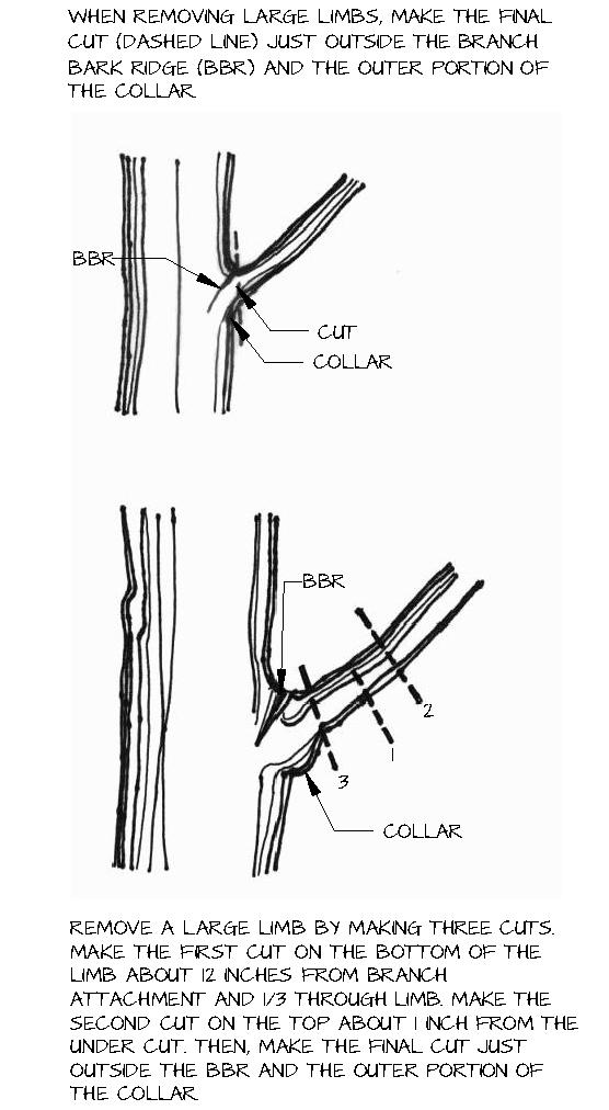
74 |
Fitch
Mountain Park and Open Space Preserve | Management Plan
Figure 3. Techniques for Making the Prune Cut
Disposal
Lop and scatter slash with no build-up deeper than 12 inches. Slash may also be chipped and scattered no more than one inch deep, but should not be scattered against tree trunks or in areas where it could suppress native plant growth (e.g., road edges suitable for Napa false indigo). For any non-native plant removed with the potential to sprout or set seed, remove from the Preserve or burn. (Burning will require follow-up monitoring as broom seed can survive some fire temperatures.) For non-native plant suppression, chips may be scattered deeper after consultation with a qualified biologist. Do not place materials within drainages, which may obstruct flows or wash downstream. (O)
Discontinue practice of placing brush piles along roadways. Slash should be lopped and scattered. Do not place slash on the toe of a cut slope or along any ditch or drainage where it could impede natural stream flow and plug a culvert. If erosion control or sediment catchment is warranted, employ other techniques that are less flammable including revegetation with appropriate native plants. (O)
75 |
Fitch Mountain Park and Open Space Preserve | Management Plan
Disposal pile along Fitch Mountain Trail (above) and trail closure sign during controlled burn (below)
OBJECTIVE FR-5: Manage burn piles to prevent the accidental spread of fire and spread of invasive species
ACTIONS
Ensure all managed fires are overseen by authorized personnel. (O)
Burn piles only when weather and fuel moisture conditions are appropriate (e.g., no wind, low temperatures, high fuel moisture content in surrounding areas) as permitted by Northern Sonoma County Pollution Control District and Cal Fire. (O)
Burn outside of the bird nesting (February 15 – August 31) and bat maternity season (spring –summer). If activities must occur during this period, burn activities should be reviewed and approved by a qualified biologist before commencing. (O)
Require all firefighting equipment and personnel to remain on site until the entire burn pile area is cold. Firefighting equipment should include water (spray backpacks or other pressurized equipment), shovels, McLeods, chainsaws, and Pulaskis. (O)
Maintain appropriate clearances around burn piles. Burn piles should be kept relatively small–no larger than 4-feet in diameter. These should be placed in areas with no overhanging vegetation lower than 20 feet and with 5 to 10 feet of bare ground around the perimeter as per burn permit requirements. (O)
Close the Preserve to visitors during burn days. (O)
Monitor burn pile locations for the establishment of invasive plant species. Broom and other invasive plants may germinate in these disturbed locations. (O)
76 |
Fitch Mountain Park and Open Space Preserve | Management Plan
8 Public Uses and Engagement
The Fitch Mountain Park and Open Space Preserve was protected to provide passive public recreation while also preserving the natural resources of this unique area. The Preserve provides tremendous opportunities for Healdsburg residents and visitors to experience the mountain via the existing road and trail system. However, even passive recreation has impacts on natural resources. For example, hiking, dog walking, and biking can result in trampling of vegetation, soil erosion along trails, litter, and both indirect and direct effects on wildlife. The construction of both authorized and unauthorized trails can further exacerbate soil erosion, damage vegetation, and fragment native habitats. Therefore, public uses of the Preserve warrant careful consideration and specific recommendations to protect natural resources. Continued use of the Preserve will need to be compatible with the protection of natural resources in accordance with the Conservation Easement. When the Preserve opens formally, the public will need guidance on allowable uses and the importance of resource protection.
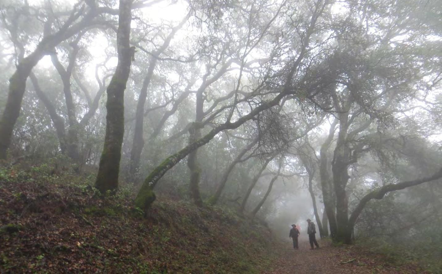
Public Uses
The Preserve offers several passive recreational activities opportunities. Currently, popular activities include hiking, running, and general sightseeing, dog walking, mountain biking, and wildlife viewing (bird and butterfly watching). The majority of Preserve users are hikers and runners comprising approximately 75% of off all trail users. Approximately 15% of Preserve users hike with dogs, of which 75% are offleash. Mountain bikers comprise less than 10% of trail users. Public use estimates are based on
77 |
Fitch Mountain Park and Open Space Preserve | Management Plan
Fitch Mountain Trail
monitoring completed by the Healdsburg Fire Department from approximately August through November in 2016. This includes all users reaching the upper summit of Fitch Mountain. These numbers are approximations and actual Preserve use may vary; see Table 1.
*Users broken down by groups: 50% = 1 -2 people; 40% 3-5 people; 10% = more than 5 people
# Based on use over a 3-month period, data only represents those users reaching upper summit
All Public Uses
According to the Conservation Easement, all outdoor recreational activities on the Preserve shall be compatible with natural resource protection (CE §5.2.2). These allowable uses include those that require minimal or no developed facilities or improvements and avoid impacts to significant cultural and natural resources. Based on these goals, only those uses compatible with resource protection are being proposed in this Plan and are limited to hiking, running, dog walking (on-leash), and mountain biking. Group activities and other public uses are addressed below.
OBJECTIVE PU-1: Provide visitor use experiences that are compatible with natural resource protection and that minimize user conflicts
ACTIONS
Develop public use policies for the Fitch Mountain Park and Open Space Preserve that would be reviewed by the City of Healdsburg’s Parks and Recreation Commission and adopted by City Council prior to the Preserve transferring to the City. Follow the Framework for Group Activities
Fitch Mountain Park and Open Space Preserve | Management Plan
78 |
User Type* Number of Groups and Individuals Reaching Upper Summit# Percentage of Overall Trail Users Group and individual hikers and runners 744 77.3% Group and individual dog walkers (off-leash) (on-leash) 158 (125; 80% of dog walkers) (33; 20% of dog walkers) 16.4% (13%) (3.4%) Group and individual mountain bikers 61 6.3% Total 963 100%
Table 1. Summary of Trail Use on the Preserve
when developing public use policies; see Group Activities below and Appendix I. The policy should also be developed with public input and review. (S)
Promote responsible and courteous conduct on the Preserve. Post rules at the Villa Chanticleer trailhead and on the trail map. Require all users to (see Dog Walking and Mountain Biking for additional rules):
Use only open trails – respect trail closures and do not trespass on private land
Leave no trace – be sensitive to the dirt beneath them, stay on existing trails, do not create new ones, pack out at least as much as they pack in
Be kind and courteous of other trail users - let other trail users know they are coming, anticipate other users on the Preserve
Don’t scare animals – give animals enough room and time to adjust to they are presence, give animals room to pass
Plan ahead – know their abilities and the terrain of the mountain, always come prepared, know their exit strategy in the event of an emergency (O)
Post signage at all entrances outlining park use regulations and guidelines for the protection of natural resources. Also provide interpretive information to help visitors understand the conservation values and sensitive resources of the Preserve. (S)
Develop a downloadable trail map outlining all trail use regulations, including trail etiquette and safety, and directions to the Preserve via Powell Avenue. Post trail map on the City’s website. (S)
Educate users about their ability to spread non-native plants and pathogens. Install signage at the Villa Chanticleer trailhead and trail map. (O, S)
Prohibit hunting, harvesting, and collection of plants and native wildlife, fires, and smoking on the Preserve. (O)
Close the Preserve from sunset to sunrise to protect nocturnal wildlife and discourage illegal after-dark activities; after hour group activities would be considered on a case- by-case basis (e.g., night hike). (O)
Monitor trail usage during the wet season and implement closures for all users as necessary. (O)
Promptly respond to and remove any trail obstructions. This will encourage users to stay on the trail and discourage users from going around obstacles which can result in trail widening. Existing site topography will in itself also limit this response by trail users. (O)
Fitch Mountain Park and Open Space Preserve | Management Plan
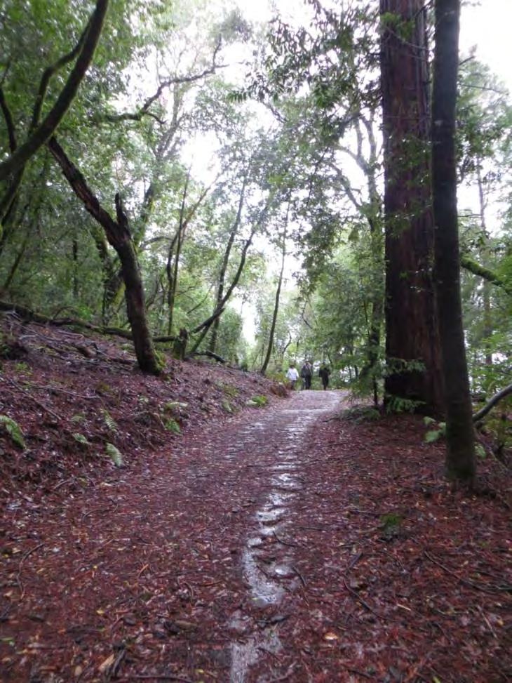
79 |
Fitch Mountain Trail
Maintain a stable trail surface and address problems immediately. If drainage or erosion problems are of concern, considering hardening the trail tread to alleviate issues; see above. (O)
Monitor for vegetation changes along trail edges. If trampling becomes an issue, consider temporary signage telling users to stay on the trail. If chronic problems are observed, consider the installation of edge protection (e.g., physical barrier or additional shrub plantings with protection) at the problem location.
Design new trails to be multi-use to reduce user conflicts and ensure a sustainable trail network; see Trail Design, Construction, and Decommissioning for further information. (O)
Monitor for the development of unauthorized trails and decommission promptly; see Trail Design, Construction, and Decommissioning for further information. (O)
Monitor the Preserve for unauthorized uses; see Enforcement section. (O)
Respond to trail use concerns. For example, if excessive mountain bike speeds are reported or dogs are off-leash, post temporary signage (4-6 weeks) to address the concern. If problems persist, reach out to the trail user community and try to make direct contact either through increased presence on the Preserve or through local groups. (O)
Develop a volunteer trail watch program to monitor Preserve usage; see Engaging and Managing Volunteers section. Volunteers would not be expected to approach visitors with off-leash dogs directly or mountain bikers and other trail users not following the rules, but their presence on the trail could decrease unauthorized uses. (S)
Post City contact information on Preserve trailhead signage for trail users to report comments and concerns. Include a comment link on the City’s website. (S)
Develop a monitoring program to track public use changes on the Preserve over time. If public use increases and detrimental impacts on natural and scenic resources and user conflicts arise, modify management strategies and allowable uses as necessary. (L)
Hold an annual public meeting with the Parks and Recreation Commission to review ongoing operations and public uses of the Fitch Mountain Park and Open Space Preserve (O).
Establish a user group that would meet with the Open Space Subcommittee of the Parks and Recreation Commission as needed to discuss management of the Fitch Mountain Park and Open Space Preserve. The group would be established by the Parks and Recreation Commission. (O)
Dog Walking
Currently, the Preserve is used by dog walkers. Based on monitoring of trail use on the Preserve, the majority of dog walkers have their pets’ off-leash. While man’s best friend may seem like a perfect companion for a walk outdoors, domesticated dogs can be detrimental to native habitats and local wildlife populations, and unleashed dogs can affect other visitors’ sense of peace and safety. The
Fitch Mountain Park and Open Space Preserve | Management Plan
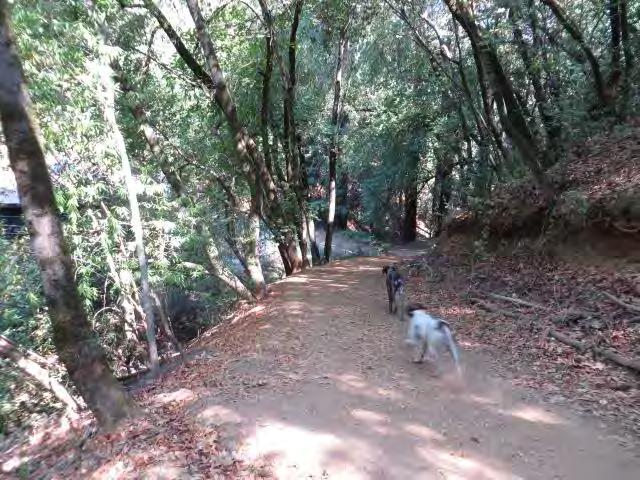
80 |
Off-leash dogs
impacts of dogs, especially off-leash, on wildlife may include harassment, injury, or death. When restrained by a leash, these impacts can be reduced. Improper disposal of dog waste is also a major concern—dog waste and waste bags are a frequent sight along the Preserve trails. The presence of dogs on the Preserve, especially off-leash dogs, was a common concern from participants in the public input process for this Plan.
According to the Conservation Easement, dogs may be permitted on the Preserve, but only on designated trails and they must be on leash at all times (CE §5.2.2(d)). Dog walking will require careful monitoring and enforcement to ensure that those requirements are met, that natural resources are being protected, and that visitor safety and quality of experience are not negatively affected.
OBJECTIVE PU-2: Minimize the effects of dogs on the natural resources of the Preserve and on visitors’ safety and quality of experience
ACTIONS
Monitor dog usage and modify management strategies and allowable uses as necessary to protect natural resources and the safety and quality of experience for visitors. (O)
Allow dogs only if they are physically controlled on a leash no longer than 6 feet at all times, pursuant to Sonoma County and City of Healdsburg rules; see Enforcement. (O)
Prohibit dogs off trail. (O)
Add dog waste bag and trash receptacles at the Preserve entrance at the Villa Chanticleer. Ensure that bags are kept stocked and picked up along the trail network. (S)
Provide clear signage indicating that dogs must be on leash, dog waste must be properly disposed of, and that users must keep dogs on established trails. Include educational text on interpretive signage explaining impact of dogs. (S)
See also Preserve rules and monitoring under Objective PU-1. (O)
Mountain Biking
Mountain bikers have been using Fitch Mountain for many years. The existing 3 miles of trails offers a short but challenging ride for a small percentage of the overall trail users. Currently, mountain biking comprises less than 10% of all trail uses. Based on feedback during the public input process, the majority of mountain bikers are local Fitch Mountain and Healdsburg residents seeking a quick ride before or after work and on the weekends. Most bikers seeking longer more challenging rides are typically using the larger parks that are better suited for mountain biking with desirable single-track trails. These include the remote Lake Sonoma Recreation Area (17,615 acres, 40 miles of trails), 13 miles northwest of Healdsburg, and the well-used and scenic Annadel State Park (5,500 acres, 40 miles of trails). Local bikers also utilize the existing 3 miles of trails at Healdsburg Ridge Open Space Preserve (155 acres) to the north of the Preserve.
Mountain biking, like all other public uses, can have negative effects on vegetation, soil, and wildlife
81 |
Fitch Mountain Park and Open Space Preserve | Management Plan
resources and result in user conflicts. It is considered an allowable use under the Conservation Easement (CE §5.2.2(a)). However, it like all other trail uses will need to be compatible with the underlying conservation values of the Preserve. The presence of mountain bikers on the Preserve was a concern from community members during the public input process.
Continued use of the Preserve for biking will need to ensure that vegetation and wildlife communities are protected, the trail surface is maintained and any erosion or drainage issues are promptly addressed, and trail obstructions are promptly removed. This will require monitoring by the City or other Preserve managers and engagement of the trail watch community. Implementing measures requesting all trail users to be responsible and courteous will be important so everyone can enjoy the mountain. Engaging the local biking community will be critical to addressing any conflict concerns, encourage participation in work days, and to build a sense of Preserve stewardship.
OBJECTIVE PU-3: Support responsible and safe mountain biking that protects natural resource and minimizes user conflicts
ACTIONS
Monitor mountain bike usage and modify management strategies and allowable uses as necessary to protect natural resources and the safety and quality of experience for visitors. (O)
Implement bike use “Rules of the Trail” to promote responsible and courteous conduct on the Preserve (see “Rules of the Trail” by IMBA (2016); summarized below). Post rules at the Villa Chanticleer trailhead and on the trail map. Require all mountain bikers to:
Ride only open trails – respect trail closures and do not trespass on private land
Leave no trace – be sensitive to the dirt beneath them, stay on existing trails, do not create new ones, pack out at least as much as they pack in
Always maintain control of their bike – maintain a safe speed, ride within their limits
Yield to other trail users – bicyclists should always yield to hikers and dog walkers, let other trail users know they are coming, anticipate other users as they ride around corners (bells appreciated), yield to uphill bikers
Don’t scare animals – give animals enough room and time to adjust to their presence, slow down and give them room to pass
Plan ahead – keep equipment in good working order, know their abilities and the terrain of the mountain, know their exit strategy in the event of an emergency, always wear a helmet (O)
Complete an inventory of the entire trail network to identify potential problems areas with regard to mountain biking and road drainage. The inventory should be completed by an expert in sustainable trail design. If problem areas are identified, develop a treatment plan to protect soil and prevent erosion and implement any such measures. (S)
Engage the mountain bike community in park stewardship Enlist the help of local biking advocacy groups and bike shops to educate the mountain biking community on trail etiquette and safety to minimize user conflicts and resource impacts, and encourage participation in trail work days. (O)
See also Preserve rules and monitoring under Objective PU-1. (O)
Fitch Mountain Park and Open Space Preserve | Management Plan
82 |
Group Activities
The Preserve offers many opportunities for public use and enjoyment and the potential for group activities. The Conservation Easement allows the City to accommodate a limited number of group activities. These include “public or private special events such as park celebration events, fundraising events, weddings, picnics, and other activities that promote the scenic values while respecting the conservation values of the property” CE §5.2.2(b) and “camping for groups of up to 25 people” CE §5.2.2(c). The Conservation Easement includes limits on the location, size, and frequency of such activities within the Fitch Mountain Park and Open Space Preserve.
The City’s vision is to support low impact, “leave no trace” activities that are consistent with the conservation values of the Preserve. In general, it is the City’s goal to allow small group activities that do not detract from visitor experience or result in negative impacts on the land. No large group activities or camping would be allowed within the Fitch Mountain Park and Open Space Preserve.
Large group activities would be permitted at the designated Park Improvement Area at the Lower Villa Chanticleer Park. These could include such activities as fundraisers for the Fitch Mountain Park and Open Space Preserve, staging for group running or walking events, or other celebratory activities. The City would support groups having a “ceremonial hike” up the mountain to gather for a short period of time (e.g., 15 minutes or less) to celebrate, remember, or take a group photo.
All group activities within the Fitch Mountain Park and Open Space Preserve would be subject to the terms outlined in the Conservation Easement. Group activities would also be required to follow the City’s special event permit process. In addition, the City will develop a set of use policies that govern day-to-day use and group activities that would be adopted by City Council. Any group use will need to comply with these uses policies.
It is important to note that any activities within the Park Improvement Area would also be subject to the terms outlined in the “Lease between the City and Healdsburg and Tayman Park Golf Group, Inc. for the Villa Property” and would need to be coordinated with the Villa’s operations.
OBJECTIVE PU-4: Support group activities that preserve the natural resources and scenic values of the land
ACTIONS
See public use policies under Objective PU-1. (S)
Require that all group activities on the Preserve follow the City of Healdsburg Special Event Application process for pre-approval. (O)
Allow only events that “leave no trace.” Do not allow events that would result in littering, permanent alteration of the Preserve (e.g., vegetation clearance or damage, alternations of trails, soil erosion, etc.) or any detrimental impacts on the natural resources of the Preserve. (O)
83 |
Fitch Mountain Park and Open Space Preserve | Management Plan
Keep trails and summit areas open to the general public during group activities. (O)
Within the Fitch Mountain Park and Open Space Preserve, limit group activities to no more than 25 people in attendance [CE §5.2.2(b)(i)]. (O)
Limit group activities with up to 50 people in attendance to the designated Park Improvement Area [CE §5.2.2(b)(ii)]. (O)
Limit large group activities to no more than 150 people, only within the designated Park Improvement Area, and events that start and end at an off-site location but traverse through the Preserve, to no more than 12 times per year [CE §5.2.2(b)(iii)] and no more than twice per month. Attendees may also hike, run, or bike on the Fitch Mountain Park and Open Space Preserve on their own; the number of trail users is not restricted in the Conservation Easement. (O)
Prohibit sound amplification and artificial lighting within the Fitch Mountain Park and Open Space Preserve (CE §5.2.2). Individual lights (e.g., headlamps) would be considered on a case-by-case basis. (O)
Other Public Uses
Other public uses of management concern on and around the Preserve include camping, equestrian use, creation of informal trails, and other illegal activities.
Camping
Camping is not planned for the initial phase of development on the Preserve. However, the 2014 Easement states that camping for groups of up to 25 people may be permitted within the Park Improvement Area(s) as a special event (CE §5.2.2(c)). This allowance requires that the City demonstrate that the use is consistent with the preservation of natural resources and the conservation purposes of the Conservation Easement. If camping were to be considered in the future, the Plan would need to be amended to address this public use.
Horseback Riding
Equestrian use of the Preserve is not currently planned. There is currently no adequate parking or turnaround space for horse trailers at the Preserve. However, this use is not specifically prohibited by the 2014 Easement and if parking access became available in the future, equestrian use could be considered. Opening the Preserve to horseback riding would raise a number of other considerations relating to public safety, Preserve management, and user experience, and would require additional analysis, design, and environmental review. The Preserve’s steep terrain and gravel roads may pose safety hazards for riders, horses, and other users in the vicinity. Compared to hiking/biking trails, trails open to equestrians would require greater vegetation clearance and construction of wider bridge structures for spanning drainages. Equestrian trails would also require additional reinforcement of the sediment control structures crossing the road due to the increased impact of hoof action on the land.
Nearby facilities with horseback riding trails are already established with longer riding experiences and are recommended for the local equestrian community. Equestrian trails are available at the nearby Foothill, Riverfront (2-mile riverfront trail loop), and Shiloh Ranch Regional Parks, Lake Sonoma, and Annadel State Park.
Fitch Mountain Park and Open Space Preserve | Management Plan
84 |
Informal Trails
Many informal trails lead from adjacent residential parcels and Villa Chanticleer onto the Fitch Mountain Park and Open Space Preserve. Due to the Preserve’s rugged topography, there are few interior informal trails. On the other hand, the informal trails from outside the Preserve are well-traveled. Many are poorly aligned, too steep for the grade, and cross through native habitats and drainages. In addition to creating visual impacts and fragmenting native habitats, over time, these trails can result in erosion problems, limit natural regeneration and wildlife usage, and create confusion in wayfinding for Preserve visitors.
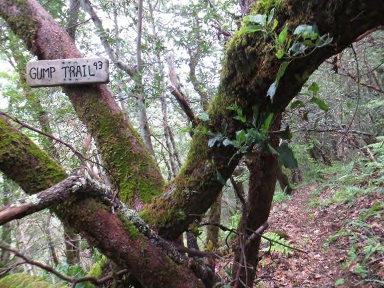
Illegal Activities
Use of the Preserve for illegal activities including camping and marijuana cultivation is not routinely reported, but warrants monitoring. Both activities could result in serious impacts to habitat quality, water quality, and aesthetics of the Preserve. Habitat clearing, stream diversion, and pesticide and fertilizer use that pollute streams and can kill wildlife are of particular concern with marijuana cultivation. These activities also pose a significant safety threat to park users.
OBJECTIVE PU-5: Prevent unauthorized uses on the Preserve to protect public safety and natural resources
ACTIONS
Post signage at all entrances outlining all current allowable uses on the Preserve. Include information about nearby locations for horseback riding. (S)
Maintain an active Preserve presence by City staff to monitor for unauthorized uses; see Enforcement section for further information. (O)
Monitor for the development of unauthorized trails and decommission promptly; see Trails Maintenance, Construction, and Decommissioning section. Educate Preserve visitors on the impacts of unauthorized trails via outreach to user groups, such as bike advocacy groups or other means. (O)
Further develop the volunteer trail watch program in collaboration with LandPaths; see Engaging and Managing Volunteers section for further information. (S)
Fitch Mountain Park and Open Space Preserve | Management Plan
85 |
Informal trail
Enforcement
The Fitch Mountain Park and Open Space Preserve is located in unincorporated Sonoma County and as such is subject to the Sonoma County Code. Sonoma County retains the right to enforce the Sonoma County Code within unincorporated land in the County. The City currently has no jurisdiction to prosecute violations to the Sonoma County Code or Healdsburg Municipal Code on the unincorporated Preserve lands. Public safety and protection of natural resources is paramount to successful management of the Preserve. Therefore, the City needs to work with the County Board of Supervisors to take all necessary and appropriate steps to delegate to the City supplemental authority for the unincorporated portions of the Preserve under their ownership and management. This means granting the City authority to effectively prosecute violations to the Preserve rules and regulations that are critical to the safety of the Preserve visitors and larger community and also the preservation of natural resources.
OBJECTIVE PU‐6: Ensure Preserve rules and regulations are being enforced
ACTIONS
Formalize an agreement with Sonoma County granting the City supplemental authority to enforce the rules and regulations on the unincorporated portions of the Preserve. The City should have the authority to actively affirm and enforce regulations on the Preserve for the benefit of public safety and resource protection. Once the agreement is in place, the City will provide supplemental law enforcement activities related to public uses on the Preserve including dogs off‐leash, unauthorized mountain bike uses (e.g., excessive speed, use during trail closures, off‐trail travel), and illegal fires or smoking. The City should establish a protocol for frequency of patrols and fines for non‐compliance. (S)
Further develop the volunteer trail watch program to monitor trail use and compliance. Volunteer patrollers can help the City monitor trail use and they can also serve as an important resource in educating Preserve users about the mountain, trail use, and trail etiquette. Volunteers would not be asked to directly enforce rules; see Engaging and Managing Volunteer section for further information. (S)
Educational Opportunities
There are many opportunities to engage the public in learning about and caring for the Fitch Mountain Park and Open Space Preserve. These range from providing educational signage about the Preserve’s natural features to offering guided walks to hosting work days for invasive species removal and habitat restoration. LandPaths has been instrumental in facilitating such opportunities during the interim management period. They have hosted a variety of well‐attended public education events and workdays. Whether City staff takes on that community engagement role directly, or continues a collaborative partnership with an organization like LandPaths to do so, providing opportunities for the community to learn about and support the Preserve will be critical to the successful long‐term management of the Preserve.
Fitch Mountain Park and Open Space Preserve | Management Plan
86 |
OBJECTIVE PU-7: Provide and maintain opportunities for public education about the Preserve’s history and natural resources
ACTIONS
Install signage at the trailhead informing visitors of Preserve rules and activities being undertaken on the Preserve. These include parking regulations and locations, access points, seasonal trail closures, as applicable, trash and dog regulations, unauthorized uses, no-smoking policies, vegetation management and restorations efforts, and natural resources. (S)
Develop an interpretive trail brochure that describes the Preserve’s natural resources and history. Provide the brochure at public locations such as the Healdsburg Chamber of Commerce, Visitors Bureau, and Healdsburg branch of the County Library. The brochure should also be available electronically for visitors to download from the City’s website. (S)
Provide public hikes through the Preserve, either through the City itself or through a local partner organization, such as the existing LandPaths program, which emphasize its natural resources, and history. Advertise these walks to Healdsburg residents and tourists. Consider developing a formal Preserve docent program to support these hikes. (O)
Engage with local schools and students. Local art or science students could be involved in producing seasonally rotating displays for an entry arbor. (L)
Develop a native plant walk to educate the public about the mountain’s native plants and wildlife; see Figure 4. (L)
Engage the Spanish-speaking community through focused guided hikes and events that highlight the natural resources of the Preserve such as LandPaths’ Vamos Afuera program. (L)
Engaging and Managing Volunteers
Many local residents care deeply about the Preserve, and harnessing their enthusiasm and energy can have many benefits. Volunteers and non-profit groups (e.g., Fitch Mountain Association, Fitch Mountain Fund), currently contribute to the Preserve’s stewardship primarily through invasive species removal, fire hazard reduction, funding raising, and participation in LandPaths-led outings and restoration efforts.
Engaging LandPaths or another qualified consultant to continue trail watch and community restoration events would be one way to use the volunteer potential within the Healdsburg community. This would also ensure that volunteer efforts are supervised by a staff person familiar with and committed to the City’s management needs. Alternatively, the City could organize and oversee volunteer efforts directly, but this would likely require additional staffing. For some limited efforts, such as trash pickup where no disturbance to native habitats is planned, small groups of volunteers may be able to work independently without direct supervision. In general, all other volunteer stewardship work should be supervised.
87 | Fitch
Plan
Mountain Park and Open Space Preserve | Management
OBJECTIVE PU-8: Provide opportunities for the public to volunteer on the Preserve that are aligned with the City’s stewardship needs and goals
ACTIONS
Engage volunteer help in appropriate Preserve tasks including supervised trail work (construction and repair), invasive species removal and restoration plantings, and survivorship monitoring of restoration plantings. Any extensive invasive species removal efforts (i.e., those involving more than a few isolated individual plants) should be part of a comprehensive restoration plan. (O)
Further develop the volunteer trail watch program. Volunteer patrollers maintain a positive presence on the trails and can monitor trail use, identify and report litter problem areas, invasive species, and maintenance needs. Volunteers could be identified by a t-shirt, vest, or name badge, and could discourage prohibited uses like off-leash dogs simply by their presence. Volunteers would not be asked to directly enforce rules. (S)
Engage Madrone Audubon Society to complete annual bird counts of the Preserve to document bird population trends. Seek assistance from local bird watchers to monitor changes over time. If changes are detected, evaluate possible causes and adjust management strategies as appropriate. If non-native species are detected, evaluate the need for management; see Invasive Animal Management section for further information. (O)
Engage volunteer help in Citizen Scientist monitoring programs. This could be accomplished in collaboration with LandPaths or other local groups (e.g., Fitch Mountain Association) to train and supervise volunteers to identify invasive weed species, track the spread of established invasions, monitor removal efforts and restoration plantings, and track special-status plant populations including Napa false indigo. (O)
Guidelines for Managing Volunteers
Successful volunteer programs all have some means of recruiting, training, retaining, and thanking volunteers for their service7. A volunteer event or program, whether developed by the City or through partners like LandPaths, should clearly address how it will meet each of these needs. While any volunteer project should strive to understand and meet the interests and goals of the volunteers themselves, it is still critically important that any volunteer effort chiefly meet the needs of the City.
Recruiting
Partner with existing community groups or organizations (e.g., LandPaths) that already have established successful volunteer programs.
Understand the goals of volunteers via direct engagement or capture this information on a volunteer application form.
Promote volunteer opportunities through signage at the Preserve, the City’s webpage and social media, utility bill mailings, media outlets, and direct outreach.
Mountain Park and Open Space Preserve | Management Plan
88 |
Fitch
7 Guidelines for Managing Volunteers was developed by Hattie Brown and the Laguna Foundation as part of a joint management plan developed for the Laguna Wetlands Preserve with PCI.
Training
Orient volunteers to the Preserve. Develop a short document to distribute or use existing resources to teach volunteers about the history, resources, and needs of the Preserve.
Explain the purpose for any volunteer activities, and how they fit into the overall Preserve management and needs.
Provide safety training including guidelines for any tools used and avoiding general field hazards (e.g., ticks, poison oak, dehydration, etc.).
Provide the opportunity for volunteers to develop new skills, knowledge, and social connections.
Retaining
Provide a range of activities that vary in timing, location, and ability so a diversity of volunteers can participate and do not tire of recurring events.
Stress success.
Provide snacks and water to encourage hydration and keep people fueled, and also to provide time for social interaction.
89 | Fitch Mountain Park and
Space Preserve | Management Plan
Open
9 Trails and Recreation
A formal Preserve entrance will be developed within the Park Improvement Area at the existing lower parking lot at the Villa Chanticleer with a new trailhead, gathering/interpretive area, picnic area, low gradient trail, and connection to the existing trail network. A pedestrian footbridge will be installed to provide a safe crossing of the drainage between the Preserve and the Villa Chanticleer trailhead. A new ADA-compliant walkway will be installed connecting the existing dog park and playground with the newly developed Preserve entry and restroom. This new walkway will help unify these spaces as a park center.
Existing trails on the Preserve will remain in place. However, the network of smaller informal trails around the Villa Chanticleer and trails from surrounding private properties will be decommissioned. Decommissioning the informal trails will simplify maintenance for the City and help establish one dedicated public access point. Terrain on the mountain is steep, so connections to the existing trail network were designed to be on contour and as low gradient as possible. A new connector trail from Fitch Mountain Trail to Riverview Trail will also be installed. Pedestrian access points that exist on public roads around the perimeter of the Preserve will be maintained and improved, with new signage and modification of existing gates to be more pedestrian friendly. Pedestrian connections to the river will be identified on Preserve maps. The addition of a low-gradient trail around the mountain from the trailhead was evaluated, but determined not to be currently feasible given the existing topography,
Fitch Mountain Park and Open Space Preserve | Management Plan
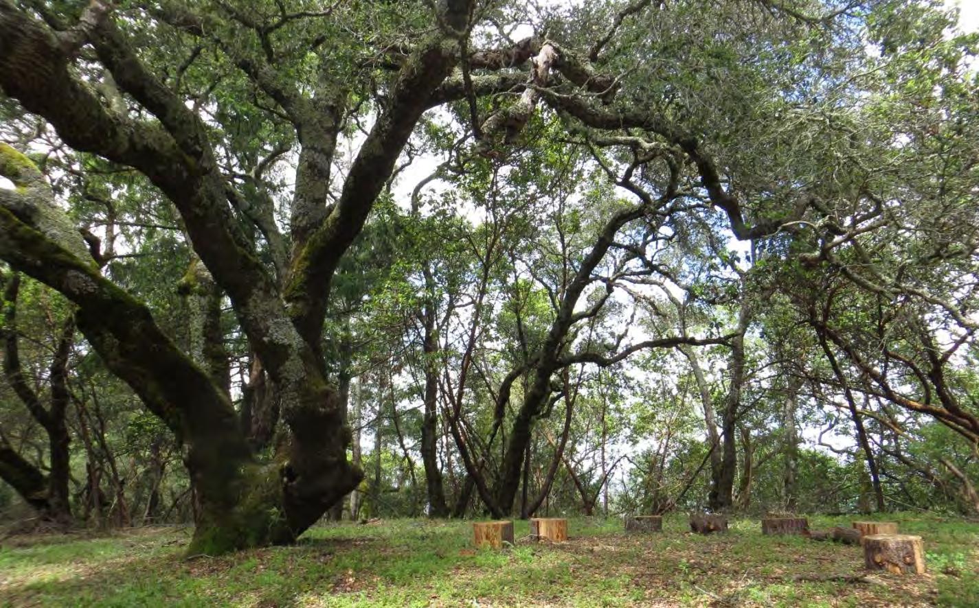
90 |
Informal seating at overlook on Lower Summit Trail
associated drainages, property boundaries, impacts on natural resources, and costs associated with implementation.
Ideally, all improvements within the Park Improvement Area would be implemented at once. However, the City’s schedule for a November 2017 transfer of the Preserve and funding restrictions may not allow the development of all new trails and recreation facilities to occur by this time. The trail and recreation improvements are being proposed in two phases.
Phase A
The following are the Phase A improvements which will be implemented within the Park Improvement Area:
Parking lot improvements
Trailhead
Picnic area
Connector trail (Pileated Woodpecker Trail) to Fitch Mountain Trail and pedestrian footbridge
Improvements at pedestrian and emergency vehicle access entry points
Signage
Benches and picnic tables
The timing of these improvements will be contingent on securing funding with a goal of either 2017 or 2018. In the event that the improvements are not completed by the Preserve transfer date of November 2017, it is anticipated that the existing access methods will continue with some minor improvements until such time as the full improvements can be funded and implemented.
Note: An ADA compliant portable restroom will need to be installed at the eastern side of the entry to serve Preserve users until the restroom can be constructed. This should be screened with wooden fencing or other material to protect the Preserve’s visual beauty.
Phase B
The following are the Phase B improvements within the Park Improvement Area. If funding and timeline do not allow their construction concurrently with Phase A, they should be implemented when funding becomes available.
Restroom
ADA compliant walkway connecting Preserve to dog park and play ground
Possible modifications to dog park
Low gradient trail (Banana Slug Trail)
Connector trail to Riverview (Riverview Connector)
Fitch Mountain Park and Open Space Preserve | Management Plan
91 |
Public Access and Parking
Public access to the Preserve will be provided within the Park Improvement Area at the Villa Chanticleer via the lower parking lot; see Figures 4-6. The decision to use the existing parking lot as the primary public access point for the Preserve was preferred by the City as it has the least financial and environmental impacts. In addition, there were no good alternative public vehicle access points given the steep terrain within the Preserve boundary and no viable alternative locations for public parking. Providing amenities such as a restroom with running water and drinking fountains will also be easiest at Villa Chanticleer given its existing water and sewer connections. The Villa Chanticleer already serves as an informal public access point with the majority of non-resident visitors entering from this point. The proposed entry to the Preserve is also adjacent to other park facilities including a playground and dog park. Adding the Preserve entry to this space will enhance the existing City-owned recreational area and provide amenities to all users. The existing parking lot accommodates space for emergency vehicle turnaround. Access for emergency vehicles entering the Preserve via the fire road will also be maintained at the Hilltop access point. The portion of Riverview within the Preserve will be maintained for emergency escape route for passenger vehicles only. Design for public access was guided by the ADA requirements outlined in Appendix F.
The existing parking area will be modified to include two new ADA parking spaces and a drop-off space. Parking for clean air vehicles will also be designated with signage. Modifications to the existing curb on the eastern side of the parking lot will be needed for the installation of an ADA walkway connecting the Preserve entry to the proposed restroom and existing park areas. Existing ADA access to the playground and dog park is limited and accessibility improvements to these areas are recommended, to enhance
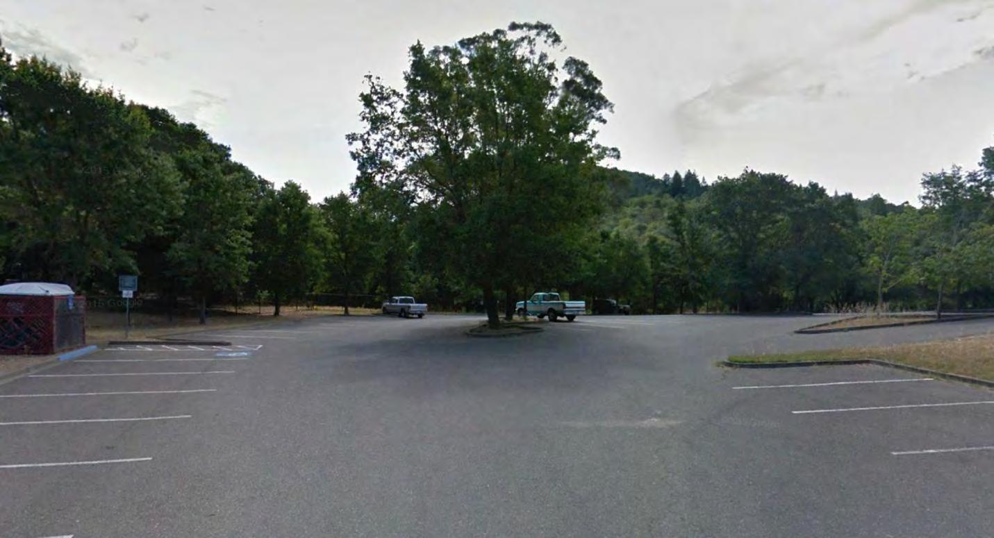
92 |
Fitch Mountain Park and Open Space Preserve | Management Plan
Existing parking lot at Villa Chanticleer
the entire recreational area and unify the space. ADA access will be provided from the parking lot to the restroom, trailhead, and picnic area. A segment of accessible trail, the upper portion of the Pileated Woodpecker trail, will also be constructed. This provides approximately 1,200 linear feet of ADA compliant access.
OBJECTIVE TR-1: Provide safe public access and sufficient parking to Preserve visitors while conserving natural resources and scenic qualities of the Preserve
ACTIONS
Utilize existing parking lot at the Villa Chanticleer with improvements described above; see Figures 4-6. Engage an engineering/landscape architecture firm to develop construction drawings and specifications for improvements. Submit improvement plans to the District for approval. (S)
Provide opportunities for visitors of all abilities to experience the Preserve, with ADA compliant facilities. (S)
Install and maintain signage at all trailheads with trail routes and recognized access points clearly delineated. Post signage at the Riverview and Hilltop access points directing visitors to formal trailhead parking location at the Villa Chanticleer and noting private property considerations. (S)
Maintain emergency vehicle access onto the Preserve via the Fitch Mountain and Hilltop trailheads to the ridgetop. These routes will provide access to key destinations in the event of a fire or medical emergency and will serve as a launching point for foot access to more remote locations on the Preserve as needed. Existing access areas should be evaluated by the local emergency response agencies for adequate turnaround. (O)
Trails and Recreation Facilities
New trails and recreation facilities will be centered within the Park Improvement Area on the Villa Chanticleer for the following reasons:
The site already supports existing infrastructure,
It is readily accessible, which makes maintenance more feasible,
Trailhead development would result in minimal impacts on natural resources,
Site topography is gentler compared to that of other areas on the Preserve, and
It serves as the existing entry point for most Preserve users.
The Preserve will have one dedicated entry point from the existing parking area. The entry, trailhead/gathering area, and picnic area will be terraced in keeping with the natural topography of the site; see Figure 5, Section A. The entry will be visually separated from the playground and dog park, and visitors will enter the Preserve under the canopy of existing coast live oak trees. Although the Preserve entry will be visually separated from the other park facilities, it will be connected by a proposed ADA compliant walkway that includes access to a proposed permanent two stall restroom. This allows for the Preserve entry to have a natural feeling while still being connected to the other facilities and amenities. Encouraging visitors to enjoy all three park spaces will help create a more integrated, connected park center. Alterations to the existing dog park fence are also recommended to improve maintenance and
Fitch Mountain Park and Open Space Preserve | Management Plan
93 |
access while freeing up space for the Preserve and possibly integrating an area for natural play.
The entry to the Preserve will include bike parking, entry signage, trash and recycling containers, a drinking fountain and water bottle filling station, and bags made available for dog waste. This entry area will be accessible to City maintenance staff, and a curb cut at the drop off area will allow maintenance vehicles to enter the space. Removable bollards will be installed to control traffic and the space will be surfaced with a material similar to decomposed granite. Users will follow the access route down to the trailhead which also serves as a gathering and interpretive area. Signage is discussed below.
The access route from the entry to the trailhead will be ADA compliant and accessible for ATV’s but not larger vehicles. The trail width will be 4 to 6 feet wide and surfaced with decomposed granite or similar material. The trailhead (approx. 25 x 55 feet) will also be ADA compliant and also surfaced with a material similar to decomposed granite. The trailhead space will be a terrace on the hillslope under the canopy of existing oak trees. On one edge of the terrace will be a curved seat wall which will serve a dual purpose –slope retention and seating for groups. On the opposite edge of the terrace, overlooking the Preserve woodlands, will be a retaining wall that extends as a guardrail with displays of interpretive signage. An information kiosk will display park rules, information, and additional maps. The two trails leading from this area will go either to the greater Preserve (via the Pileated Woodpecker Trail) or to an ADA compliant picnic area (via the Banana Slug Trail). Park users can continue from the picnic area along the low gradient (not ADA) Banana Slug Trail that ties into the restroom and returns to the parking lot. This trail will be beneficial for people who want to experience the Preserve, but are more limited in mobility, such as small children and elderly people.
If taking the trail to the greater Preserve from the trailhead, Pileated Woodpecker Trail, the first portion will be accessible, with gradients of 5% or less, and terminate at a 5-foot wide turn around, just above the timber steps that lead to the footbridge; see Figure 6, Section B. The slope above this trail is currently littered with debris and should be assessed for erosion, cleaned up, and replanted with native trees and shrubs. This revegetated area can serve as a ‘native plant walk’ educating Preserve users on the various types of native vegetation and uses. The last leg of the access improvements from the Villa Chanticleer utilizes an existing trail that will be improved and stabilized. There will be timber steps installed to compensate for the steep slope in addition to some realignment. The trail will cross over a seasonal drainage. An approximately 40-foot long pedestrian footbridge will be installed over the
Fitch Mountain Park and Open Space Preserve | Management Plan
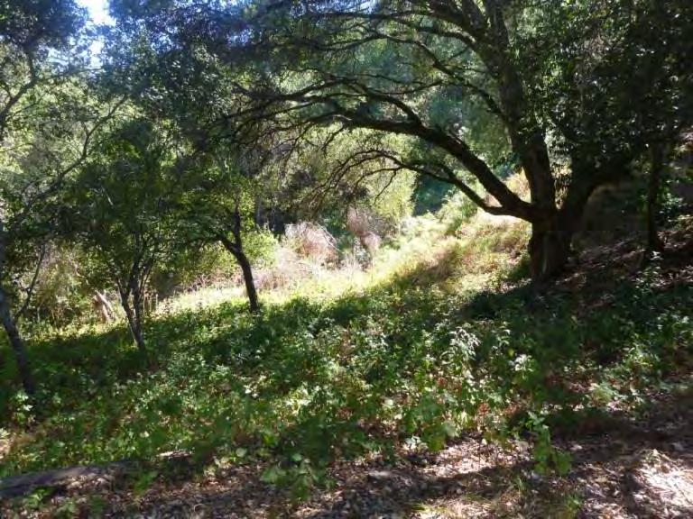
94 |
Existing conditions at proposed trailhead and gathering area within the Park Improvement Area
drainage. The drainage is currently being crossed by hikers and causing some erosion, so the installation of the footbridge will help to manage for that. The area will also be enhanced with native riparian vegetation. After crossing the drainage, the trail will fork, allowing users to enter the upper or lower portions of the Preserve via Fitch Mountain Trail.
Once on the Preserve, a connector trail from the lower portion of Fitch Mountain Trail to Riverview Trail is proposed. Currently park users have to walk or bike along Fitch Mountain Road to access the Riverview Trail; this route increases interface with residences and vehicles. The new connector will be a multi-use trail approximately 2 feet in width that will follow contour to the extent feasible. Where the proposed trail ties into Riverview Trail there is evidence of an old road alignment. The proposed connector trail will allow park users to stay within the Preserve boundary to access Riverview Trail, a low gradient trail and public road that can be used to access Hilltop and Butterfly Trails for a loop around the mountain; see Existing Facilities and Uses for description of existing trails. Vista points, signage, and bench locations are provided on Exhibit 6, Public Access Improvements.
OBJECTIVE TR-2: Provide a safe route from the Villa parking lot to Fitch Mountain Trail with amenities for park users while keeping the Preserve’s natural resources intact and enhancing environmental education experience
ACTIONS
Develop improvements as described above and shown on the Improvement Plan; see Figures 4-6. Engage an engineering/landscape architecture firm to develop construction drawings and specifications for improvements. Follow all applicable codes and regulations and ensure compliance with applicable conservation easement requirements. Submit improvement plans to the District for approval. (S)
Use natural materials that blend with the site for construction. Including locally sourced rock, paving materials, and plantings. Site furnishings, such as benches, can be rustic and informal, constructed from felled trees, etc. (O)
Enhance environmental education experience with interpretive signage and programming focused on the native flora, fauna, watershed, Preserve history, and geology. (S)
Implement BMPs to protect natural resources during construction; see Resource Management section. (O)
Minimize removal of existing native vegetation during site development. Design trails to avoid mature trees and plan revegetation as needed to maintain native canopy cover and understory species. (O)
Fitch Mountain Park and Open Space Preserve | Management Plan
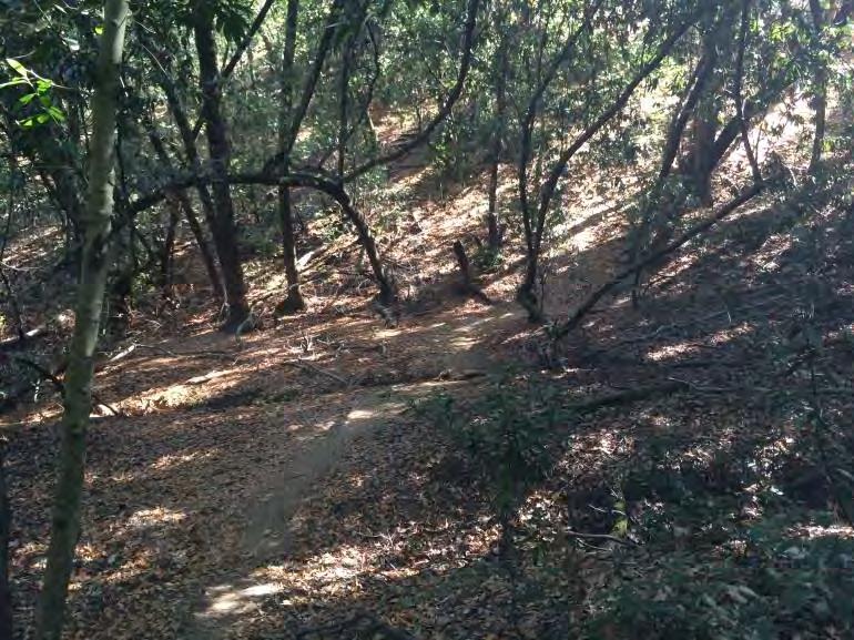
95 |
Existing trail over drainage to be improved
PROPOSED ENTRY W/ PARK SIGNAGE, BIKE PARKING, TRASH CANS, & DRINKING FOUNTAIN
PROPOSED ACCESSIBLE PARKING
PROPOSED DROP OFF ZONE
PROPOSED ACCESS ROUTE
PROPOSED TRAILHEAD & GATHERING AREA W/ SEATWALL, INFORMATION KIOSK, MAPS, & INTERPRETIVE SIGNS
EXISTING UPPER PARKING LOT
EXISTING ROAD WITH PROPOSED ONE WAY ACCESS
RESTORE SLOPE, PLANT WITH NATIVES & INSTALL EDUCATIONAL SIGNAGE
PILEATED WOODPECKER TRAIL WITH ACCESSIBLE SECTION TO TIMBER STEPS
PROPOSED TIMBER STEPS
PROPOSED PEDESTRIAN FOOTBRIDGE
EXISTING DRAINAGE W/ PROPOSED RIPARIAN HABITAT ENHANCEMENT
DIRECTIONAL SIGNAGE, TYP.
PROPOSED CONNECTOR TO FITCH MOUNTAIN TRAIL WITH ACCESS TO UPPER PARTS OF PRESERVE
EXISTING FIRE ROAD (FITCH MOUNTAIN TRAIL)
PRESERVE ENTRY
PROPOSED CONNECTOR TO FITCH MOUNTAIN TRAIL WITH ACCESS TO LOWER PARTS OF PRESERVE
VILLA CHANTICLEER
SITE ACCESS
NOTES:
1.EXISTING OAK TREES TO BE SAVED AT PRESERVE ENTRY.
2.DOG WASTE BAGS & WATER BOTTLE FILLING STATION TO BE PROVIDED AT ENTRY.
3.INTERPRETIVE SIGNS TO CONVEY INFO ON FITCH MOUNTAIN HISTORY, GEOLOGY, FLORA, FAUNA, & THE RUSSIAN RIVER WATERSHED.
4.PROPOSED TRAILS FOLLOW ALIGNMENT OF SELECT EXISTING TRAILS W/ ADJUSTMENTS & IMPROVEMENTS.
5.ADA ACCESS WILL BE PROVIDED TO TRAILHEAD, RESTROOM, & PICNIC AREA.
EXISTING PARKING LOT WITH MINOR MODIFICATIONS FOR PRESERVE ACCESS
PROPOSED PUBLIC RESTROOM (TWO STALLS 10X20)
PROPOSED TABLES & BENCHES IN SHADE
EXISTING TREE CANOPY, TYP.
EXISTING FIRE ROAD IMPROVE AS NEEDED TO MAINTAIN LOOP
BANANA SLUG TRAIL: PROPOSED LOW GRADIENT TRAIL
PROPOSED PICNIC & INTERPRETIVE AREA
EXISTING WATER TANK
PROPOSED CLEAN AIR VEHICLE PARKING
PROPOSED ACCESSIBLE WALK CONNECTS PARK ELEMENTS. ADJUST PARKING LOT CURB AS NEEDED.
NOTE: DRAWING IS CONCEPTUAL. EXISTING & PROPOSED ELEMENTS ARE LOCATED APPROXIMATELY. LIDAR DATA WAS USED IN COMBINATION WITH AERIAL PHOTOGRAPHY. NO TOPOGRAPHIC SURVEY WAS CONDUCTED.
FITCH MOUNTAIN PARK AND OPEN SPACE PRESERVE IMPROVEMENT PLAN -
FIGURE
4
DOG PARK PLAY GROUND
SECTION B SEE FIGURE 6
SECTION A SEE FIGURE 5
TRAILHEAD/ GATHERING AREA
RETAINING WALL W/ INTERPRETIVE SIGNAGE
ACCESSIBLE TRAIL TO PICNIC AREA OR GREATER PRESERVE
EXISTING GRADE
PROPOSED RETAINING/SEATWALL
SECTION ELEVATION A
ENTRY SIGNAGE
ACCESSIBLE ROUTE TO TRAILHEAD
EXISTING PARKING TO BE MODIFIED FOR PRESERVE ACCESS
FITCH MOUNTAIN PARK AND OPEN SPACE PRESERVE
IMPROVEMENT PLAN - FIGURE 5
EXISTING OAKS
KIOSK
INFORMATION
EXISTING GRADE
PROPOSED TIMBER STEPS
DIRECTIONAL SIGNAGE TO UPPER & LOWER PARTS OF PRESERVE
PROPOSED BRIDGE APPROACH
EXISTING DRAINAGE PROPOSED PEDESTRIAN BRIDGE
SECTION ELEVATION B
PROPOSED STEPS TRANSITION FROM BRIDGE TO EXISTING GRADE
FITCH MOUNTAIN PARK AND OPEN SPACE PRESERVE
6
IMPROVEMENT PLAN - FIGURE
Trail Maintenance, Construction, and Decommissioning
The Preserve includes a network of over 3 miles of existing trails that traverse through steep terrain and offer many scenic viewpoints (Exhibit 2, Table 2). An additional 0.4 miles of trails are being proposed to provide a safe connection from the trailhead to the existing trails and create other linkages within the Preserve (Exhibit 6, Table 2). Keeping established trails clear, visible, and readily passible is important for enabling public uses of the Preserve. Steep trails may require more regular maintenance to manage potential erosion and flow concentration that may degrade trails and impact downstream aquatic habitats. A desirable trail gradient is not greater than 5-12%; however, many portions of the Preserve have existing trail gradients that exceed this with segments as steep as 25-30%. As such, seasonal monitoring and maintenance of trails with BMPs will be required; see Calendar of Management Activities section. Due to the dense forest and woodland habitats on the mountain, vegetation along the trail network may require routine maintenance as well, but will need to be completed in such a manner as to protect wildlife resources and native plants. Illegal and informal trails need to be decommissioned.
Fitch Mountain Park and Open Space Preserve | Management Plan
99 |
Trail Name Length (miles) Existing Fitch Mountain Trail (includes loop to upper summit and lower summit spur trail ) 2 Hilltop Trail 0.6 Butterfly Trail 0.6 Dog Park Loop 0.2 Riverview Trail (road, partial) 0.2 Total Existing: 3.6 miles Proposed Riverview Connector 0.1 Banana Slug Trail 0.2 Pileated Woodpecker Trail 0.1 Total New: 0.4 miles and/Total Existing and New: 4 miles
Table 2. Existing and Proposed Trails and Associated Lengths
OBJECTIVE TR-4: Maintain trails so that they are accessible, free of obstacles, and usable for all intended users, using practices that protect wildlife and native plants
ACTIONS
Provide clear, unobstructed access of the trail network for users. (O)
Trim back encroaching vegetation that obscures trails or signage or makes passage difficult or unsafe. This will also help reduce the risk of visitor exposure to ticks and poison oak. (O)
Promptly respond to and remove any trail obstructions reported by Preserve users or volunteer patrols. (O)
Maintain accessibility to benches and other park amenities by mowing or trimming vegetation leading up to benches as well as underneath them as appropriate. (O)
Complete twice-annual surveys by a qualified resource manager in fall and spring of the entire trail network on the Preserve to evaluate trail feature performance and monitor for active erosion areas. Also review trails following significant storms. If chronically wet trails are noted and accompanied by soil compaction and/or erosion and remediation is not practical, implement seasonal closures. Install “seasonal closure” signage at each entry point of the closed section of trail. (O)
OBJECTIVE TR-5: For any new trail development, select routes, methods, and surfaces to protect native habitats, prevent erosion, allow for easy maintenance, and provide an enjoyable experience to all users
ACTIONS
Only 3 new connector trails are recommended in this Plan. To protect natural resources, no additional trails are recommended. (O)
Consult with a trail designer and vegetation ecologist on the design, layout, construction, and prescribed maintenance procedures of any new trail. Topography, vegetation, drainage patterns, and soil type will influence trail type and alignment and should be carefully considered. All trails should be constructed to minimize visual and natural resource impacts. (O)
Design trails for the intended use with appropriate widths and clearance heights; see Table 3. (O)
Design trails to avoid steep slopes. Trails on steep slopes contribute to erosion and sedimentation problems. The most desirable trail gradients are 5% or less. Given the naturally steep topography of the Preserve, maintain grades between 5-12% for the trail’s running slope. Steeper slopes should be introduced for short durations and incorporate steps or switchbacks. (O)
Follow Best Management Practices to manage potential erosion and flow concentration associated with trail construction and maintenance; see Trail Best Management Practices figures below (Marin RCD 2007). (O)
Outslope trails to allow water to sheet across it naturally; see Figure 7. Outsloping is a process where the trail surface is sloped in the same direction as the slope on which it is located. Focused storm water causes erosion. Trails that are outsloped allow the water to flow over the trail and spread out, infiltrating into the adjacent woodlands. Insloping is a
100 |
Fitch Mountain Park and Open Space Preserve | Management Plan
process where the trail surface is sloped in the opposite direction of the slope on which it is located. Trails that are insloped focus storm water and typically involve culverts which will increase erosion potential and maintenance. Cross slopes should be between 2-5% depending upon surface type.
Implement cross drainage techniques to quickly move water off the trails. These should include water bars, rolling dips, swales and culverts. Consult with a design professional when implementing cross drainage techniques, to ensure the appropriate method, spacing, and installation techniques are used.
Water Bars are earthen barriers angled across a trail to divert surface flow off a trail in an effort to reduce focused flows and velocities. Water bars are useful on steep slopes; see Figure 8.
Rolling Dips are a reverse in the trail grade, usually a short dip followed by a rise, that forces water off the trail. This accomplishes the same effect as a water bar but will last longer due to the gentle dip and rise of the trail grade; see Figure 9.
Minimize the amount of soil disturbance and avoid trail alignments in seeps or wet areas. When planning trails visit the site in the wettest months to see drainage patterns and seeps. (O)
Construct during the dry months when ground is not saturated. Install temporary erosion control measures such as wattles before construction begins and remove once the site has been stabilized with native vegetation or other method. (O)
Maintain vegetated filter strips at the base of slopes and along trails to allow surface water to slow down and for sediment to be retained. (O)
Avoid using heavy equipment where possible to limit ground disturbance. (O)
Obtain necessary permits and contract with an experienced trail contractor. (O)
OBJECTIVE TR-6: Decommission or discourage use of informal trails
ACTIONS
Decommission existing unauthorized trails by installing physical barriers (e.g., downed logs, native thicket- or bramble-forming plants) at each entry point and multiple points along the trail to discourage use. Prioritize decommissioning of informal trails on the Villa Chanticleer near the Preserve entrance, where new access is planned. Signage should also be posted to inform the public of the closure and the sensitivity of the habitat. Develop and implement a restoration plan for the disturbed area in consultation with a vegetation ecologist. This may require soil decompaction. Monitor for trespass of the closure area and success of the restoration efforts. (S)
Monitor for the establishment of new unauthorized trails during routine patrols and take appropriate actions to discourage use and restore disturbed areas. (O)
101 | Fitch
Mountain Park and Open Space Preserve | Management Plan
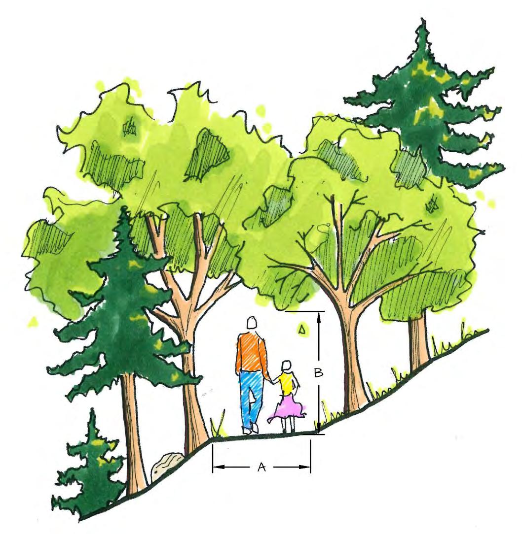
102 |
Trail Type A B Fire and Emergency Access Road (Fitch Mountain and Hilltop Trails) 10’ max. 15’ max Butterfly and Riverview Trails 6’ max. 8’ max. Accessible Trail 4’ min. 8’ max. Riverview Connector Trail 2’ min. 8’ max.
Fitch Mountain Park and Open Space Preserve | Management Plan Table 3. Trail Widths
and Clearances
Trail Best Management Practices
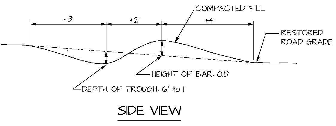
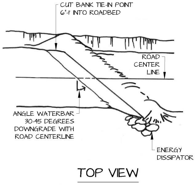
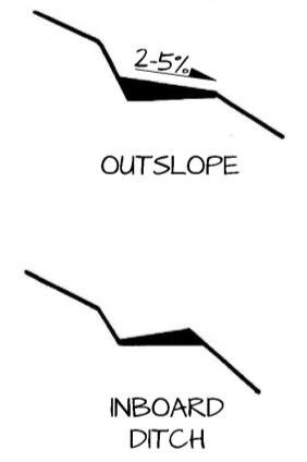
103 |
Fitch Mountain Park and Open Space Preserve | Management Plan
Figure 7. Trail Outsloping
Figure 8. Plan View and Cross Section of a Waterbar
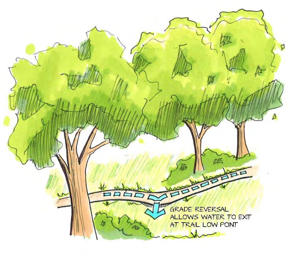
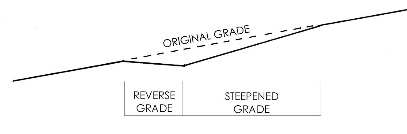
104 |
Fitch Mountain Park and Open Space Preserve | Management Plan
Figure 9. Rolling Dip Details
Signage and Maps
Signage on the Preserve will be important to improve the visitor experience, enhance safety, and protect natural resources by directing people to stay on designated trails. A standardized sign system will help create a cohesive and consistent image for the Preserve. Signs should not overwhelm the natural beauty of the Preserve or otherwise detract from trail users’ experience. Signs will require routine inspection and maintenance to ensure that they are in good condition.
The Preserve will be identified to the public with directional signage to the Preserve from the intersection of Fitch Mountain Road and Chanticleer Way via Powell Avenue. Additional directional signage will be provided on Chanticleer Way, leading to the lower parking lot. Entry signage will be installed at the parking area to welcome visitors to the Preserve and provide a sense of arrival. Upon arrival at the trailhead, there will be an information kiosk with Preserve rules and a map of the trail network, additional access points, and emergency exits. At the trailhead, interpretative signage will also be provided, with an overview of the natural and scenic resources and regional significance of the Preserve. Nature trail signs will educate visitors about the native plants and restoration efforts near the trailhead. Directional signs will be located at trail intersections and secondary Preserve entrances to assist visitors with wayfinding. These should be relatively small signs that provide information on direction, trail segment lengths and difficulty, and allowable uses. Boundary signs will need to be placed at the access points on Riverview, base of Fitch Mountain Trail, Hilltop Road, and at the Preserve boundaries where informal access points or encroachments and private property occur.
OBJECTIVE TR-7: Provide Preserve signage that is clear and unified in design to improve public awareness of the Preserve, its trails, and its regulations
ACTIONS
Install signage as described above and shown on the Improvement Plan; see Figures 4-6. Consult with a graphic designer to develop a formal design plan (with logo) for signage on the Preserve and contract with a sign company for fabrication and installation. Signage outside of the Preserve boundaries (i.e., bottom Hilltop Road) will require coordination with Sonoma County as these areas are outside the City’s jurisdiction. (S)
Keep signage consistent in style throughout Preserve, to enhance the sense of identity among the multiple Preserve entries. Ensure that signage does not detract from Preserve views and aesthetics. Maintain a visual hierarchy among signs of different types: boundary, directional, interpretive, and entry. See Figure 10. Examples of Preserve Signage photos below. (S)
Ensure that all signs meet applicable Conservation Easement size and content requirements and that they are approved by the District (CE §5.4.6). Acknowledge District’s role in protection of the Preserve and other funding sources. (S)
Develop a downloadable trail map outlining all trail use regulations, including trail etiquette and safety, and directions to the Preserve via Powell Avenue. Post trail map on the City’s website. (S)
At least once annually, review all signage on the Preserve to identify maintenance needs. (O)
See Educational Opportunities section for additional information on signage and development of a Preserve brochure. (O)
105 | Fitch Mountain Park
and Open Space Preserve | Management Plan
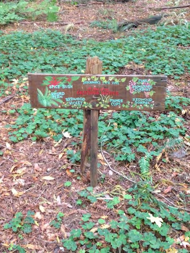
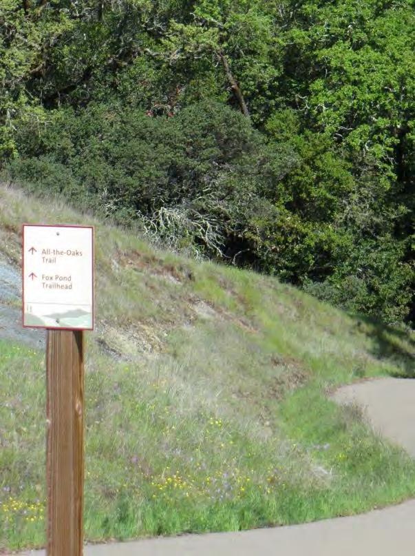
106
|
Fitch Mountain Park and Open Space Preserve | Management Plan
Figure 10. Examples of Preserve Signage
Entry and interpretative (top) and nature trail (bottom left) signage on the Patterson
Point Preserve with a uniform, handcrafted style. Simple, directional signage at Healdsburg Ridge Open Space Preserve (bottom right).
Memorials and Dedications
Memorials or dedications are a good way to fundraise for the Preserve and also develop community identity within the Preserve. The ideas and areas identified for memorials include:
Benches or picnic tables. However, no additional benches or picnic tables beyond what is shown in this Plan are recommended, to maintain the wild, undeveloped nature of the Preserve.
Native memorial trees to be planted on the slope around the trailhead and along the accessible trail near the entry. Small signs can be installed at the base of the trees including education information on the trees.
Tiles or plaques can be installed on the trailhead retaining wall.
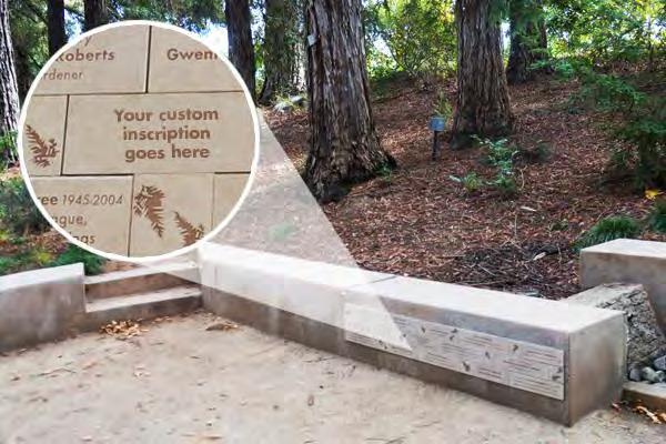
Artist commissioned mural (depicting some of the local flora and fauna) could be planned for the southern face of the trailhead retaining wall to be dedicated or funded by a local sponsor.
Memorial and dedication features should be spaced out in such a fashion that they do not interfere or compete with the Preserve’s natural beauty.
OBJECTIVE TR-8: Provide dedication and memorial opportunities for funding while maintaining the natural experience for Preserve users
ACTIONS
Develop memorial and dedication opportunities as described above. Engage a designer to help with developing a program for memorial and dedication features. Submit memorial program and signage plans to the District for approval. (S)
Use natural materials and colors that blend with the site to the extent feasible. (O)
107 |
Fitch Mountain Park and Open Space Preserve | Management Plan
Examples of memorial tiles. Source: UC Davis
Vista Points
The Preserve provides many scenic vistas of the Russian River valley and lands surrounding the city of Healdsburg. Preserving these vistas points in the densely wooded habitats on the mountain will require routine vegetation management and will need to be completed in such a manner as to protect wildlife resources and native plants. Currently, four vista points are proposed, some with accompanying benches; see Exhibit 6.
OBJECTIVE TR-9: Maintain designated vista points for visitor enjoyment while preserving wildlife habitat and native plants
ACTIONS
Perform routine vegetation pruning/thinning at the designated vista points under the direct supervision of a qualified biologist. Impacts on native vegetation should be minimized. Specialstatus plant species, including Napa false indigo, and wildlife species should be protected during vista point vegetation management activities. See Figure 11. Existing Conditions at Designated Vista Points. (O)
Remove Doulas firs where trees have the potential to grow up and obstruct views. (O)
Retain decaying and dying trees, limbs, snags, for wildlife habitat unless they pose a threat to public safety or increased fire risk. (O)
Do not top trees. (O)
Follow vegetation disposal and pruning recommendations in the Fire Risk Abatement section. (O)
Complete vegetation management work during spring or after the first significant rains in fall through winter when fire danger rating is medium or lower and native vegetation is most easily identifiable. Bird nesting surveys will be required in late winter through spring; see Wildlife Species Protection section for further guidance. (O)
108 |
Fitch Mountain Park and Open Space Preserve | Management Plan
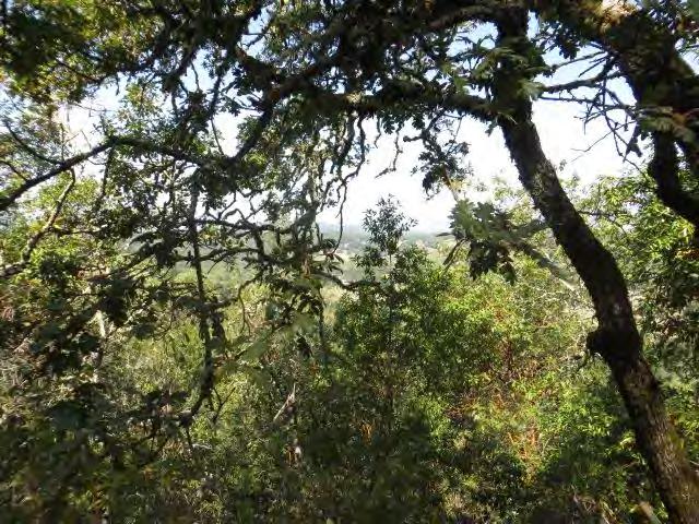
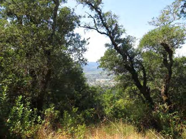
109 |
Fitch Mountain Park and Open Space Preserve | Management Plan
Figure 11. Existing Conditions at Designated Vista Points
Vista Point 1 on Fitch Mountain Trail; selectively prune low hanging branches
Vista Point 2 at Upper Summit; view intact
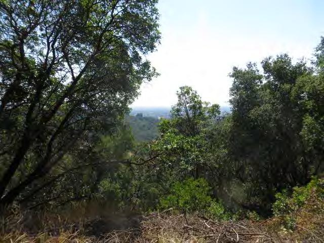
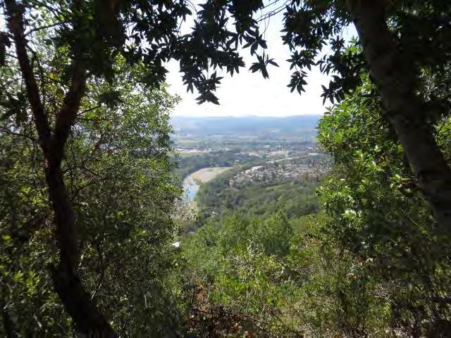
110 |
Fitch Mountain Park and Open Space Preserve | Management Plan
Vista Point 3 at Lower Summit; view intact
Vista Point 4 at along Butterfly Trail; view intact
Site Furnishings
Site furnishings such as benches are proposed to be installed at a few locations within the Preserve to allow for the enjoyment of vista points, provide spots to rest and have lunch, and mitigate for the steep mountainous terrain. The majority of site furnishings will be located within the Park Improvement Area, with some furnishings spread throughout the greater Preserve at designated points; see Exhibit 6.
OBJECTIVE TR-10: Locate seating throughout the Preserve to allow for resting and enjoyment at appropriate intervals while minimizing impacts to sensitive resources and maintaining the natural aesthetics
ACTIONS
Install seating so it is accessible for all intended users. Limit disturbance to sensitive plants by placing furnishings in areas where there is sparse vegetation. (S)
Place benches facing the trail or upslope of the trail to protect native herbaceous vegetation. (O)
Install seating on flat, stable ground to minimize erosion. (O)
Install seating made from locally sourced materials (i.e., fallen trees or rustic benches) to maintain the natural aesthetics of the Preserve. (O)
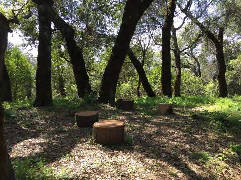
Affix site furnishings to the ground so they cannot be moved by Preserve users. (O)
Monitor areas where site furnishings are placed for litter. (O)
Vehicles
The dirt roads and trails of the Preserve will be closed to public vehicle use to protect public safety, user experience, and conservation values. The 2014 Easement prohibits motorized vehicle travel off of roadways (i.e., off of paved public roads) except for the minimum necessary in connection with permitted construction, maintenance, emergency access, and property management activities (CE §5.5.8). Even limited vehicle travel for Preserve management has potential to increase fire risk, disturb soil, and spread invasive plant species on the Preserve; see Fire Risk Abatement and Invasive Plant Management sections for further discussion.
111 |
Fitch Mountain Park and Open Space Preserve | Management Plan
Existing Preserve seating
OBJECTIVE TR-11: Minimize vehicular trips onto the Preserve to protect the wilderness like experience for users
ACTIONS
Prohibit motorized vehicle use on the Preserve, except for the minimum necessary in connection with permitted construction, maintenance, emergency access, and property management activities. Maintain existing locked gates at Preserve boundaries; see Exhibit 5. (O)
Designate the road from the upper Villa Chanticleer parking lot to the lower parking lot as oneway with no uphill travel. This will reduce the number of vehicle and Preserve visitor conflicts during events. (S)
Ensure that vehicular travel does not contribute to fire risk; see Objective FR-3 for detailed guidance. (O)
Ensure that vehicular travel does not contribute to the spread of weeds; see Objective RM-3 for detailed guidance. (O)
Limit vehicular travel for Preserve management to established dirt roads and trails except in the case of emergency. Avoid vehicle travel when soil is very wet. (O)
Trash Collection
With the increased human presence and use of the Preserve, the control and management of trash will need attention. Trash can be a major source of soil and water contamination and can be detrimental to wildlife. Improperly disposed of trash can also degrade a visitor’s experience to the Preserve. Debris left on the Preserve may also be a source of soil or water contamination. Trash collection and removal will need to be part of regular Preserve management.
OBJECTIVE TR-12: Minimize litter on the Preserve to protect wildlife, water quality, and user experience
ACTIONS
Maintain a pack-in, pack-out policy for visitors. Install signage at all entrances and trailhead locations to inform visitors of the importance of keeping the Preserve free of trash. Provide contact information in the event of illegal dumping at any location within or adjacent to the Preserve. (O)
Install and maintain trash receptacles at the Villa Chanticleer trailhead. If additional trash cans are needed, place at Preserve entrances and not within the Preserve interior. Receptacles should be provided for both recyclables and non-recyclables, or trash should be sorted off site. All receptacles should be specifically designed to keep wildlife out of the trash and from tipping them over. Trash should be removed from the receptacles on a regular basis to avoid overflow. (S)
Install dog waste bags and trash cans at the Villa Chanticleer trailhead with signage informing visitors of the importance of keeping the Preserve free of pet waste; see Dog Walking section for further discussion. (S)
Educate the trail-user community in park stewardship and continue the volunteer trail watch program with LandPaths to encourage the collection of litter on the trail network. (S)
112 | Fitch
|
Mountain Park and Open Space Preserve
Management Plan
10 Calendar of Management Activities
Fitch Mountain Park and Open Space Preserve will require careful management to ensure the protection of natural resources and sustainable public access. Management will require routine maintenance activities such as patrols, trash removal, and trail repairs as well as active natural resource protection including invasive species removal and habitat restoration. Effective management of the Preserve will require dedicated City staff or outside support. The following table outlines the ongoing annual Preserve needs to ensure a safe and enjoyable experience for visitors as well as those actions that are needed to protect and enhance natural resources.
113 | Fitch Mountain Park and
Preserve | Management Plan
Open Space
Table 4. Calendar of Ongoing Management and Monitoring Activities
Task Frequency/Season
Public Uses Patrol trails and monitor usage; implement closures Weekly
Respond to complaints or hazards
Remove trash. Restock dog waste bags and trail maps
Develop and implement monitoring plan to track use changes
As needed
Bi-weekly, as needed
Ongoing
Staff Trainings and Communications
Train City staff on park management activities and protocols (e.g., BMPs, SOD, invasive species identification, wildlife protection, fire risk)
Communicate within and between City departments
Train new hires
Annually in spring
Trail and Road Maintenance
Inspect road/trail surfaces for safety, emergency access, and erosion; repair as needed
Inspect culverts; repair as needed
Ongoing
As needed
Twice annually, spring and winter, and following significant storm events
Twice annually, spring and fall, and following significant storm events
Review all Preserve signage for maintenance or updating needs
Inspect designated overlooks and manage vegetation as needed
Twice annually, spring and winter
Annually in spring or fall through winter; breeding bird surveys needed for work from mid-February through May
Invasive Species Management
Remove invasive plant species; see Appendix C Annually/ongoing; late summer preferred for soil and wildlife protection; see text for working in other seasons
Conduct annual review of invasive plant species occurrences on the Annually in spring
Timing for Work (Month) J F M A M J J A S O N D
Task
Preserve and update management recommendations as needed
Conduct annual review of invasive animal species occurrences on the Preserve and update management recommendations as needed
Special-status Plants Conduct focused botanical surveys prior to any park development (within Preserve boundaries only, not the Villa Chanticleer); develop and implement mitigation plan as needed
Wildlife Protection Conduct preconstruction wildlife surveys prior to vegetation removal and construction projects
Conduction preconstruction breeding bird surveys prior to vegetation removal and construction projects
Habitat Restoration Plantings
Maintenance of plantings – weeding and irrigation
Monitoring of restoration planting performance
Annually in spring
Spring through summer, as needed
Fire Risk Abatement
Review and approval of Fire Risk Abatement Plan
Ongoing
February through August
Fall (typical)
Spring through fall (typical)
Annually in summer
As needed
Establish and monitor permanent photo points Ongoing; Annual photos in spring
Complete vegetation thinning/pruning
Spring and fall through winter, as needed; breeding bird surveys needed for work from mid-February through May
Outreach to neighboring landowners (fire clearances and invasive species)
As resources are available
for Work (Month) J F M A M J J A S O N D
Frequency/Season Timing
Volunteers Develop and implement volunteer trail watch program Ongoing
Engage volunteers’ help in bird counts or monitoring invasives, rare plants, SOD, etc.
Ongoing
Task Frequency/Season Timing for Work (Month) J F M A M J J A S O N D
11 Implementation and Additional Funding
Once the Plan is adopted, it will be implemented by City staff and, as needed, by other City partners or contractors. Public use pressure on the Preserve may change over time and the City will need to evaluate the current uses and habitat protection goals and adjust management accordingly. Conditions on the Preserve may also be very different in the next 10 years and beyond in the face of climate change, and Preserve managers will need to stay apprised of site conditions and be ready to update their practices accordingly. The Plan should be reviewed at least every five years and updated as needed to incorporate lessons learned, new scientific information, and changes in regulations and policies. In general, the following steps are recommended for Plan implementation:
City staff should review the Plan’s improvement recommendations (such as trail connectors, benches, signage, additional restoration planting, etc.) and determine what steps are necessary to develop plans, obtain permits and District approvals, and provide funding to implement the improvements. This may include identifying a package of improvements for a possible grantfunded project or projects.
City staff should review Plan maintenance or operational recommendations that require additional resources to determine staffing, equipment, and/or training needs, and to identify budget implications for review by the City government. A new or dedicated staff person from the City may be needed to oversee Preserve management and planning activities. The City could also consider retaining LandPaths or another consultant with expertise in natural resource protection and public engagement for management of the Preserve.
City departments should review their land management and maintenance protocols relative to the Plan recommendations, and where there are no staffing or budget implications, implement Plan recommendations.
City staff should evaluate Plan recommendations regarding communication and collaboration with neighboring landowners, and develop a plan to implement the recommendations.
City staff should develop a 3-year progress report and Plan update, as needed. The progress report should evaluate tasks completed in those 3 years and document any lessons learned, changing site conditions and use patterns, and changes to relevant regulations and policies. It should also state whether a Plan update is needed at that time. The progress report/updated Plan should be submitted to the appropriate City staff and District for approval.
Any future Preserve projects not specifically identified in this Plan should be evaluated for compliance with the goals and objectives identified herein.
Possible Funding Opportunities
A number of potential funding sources are available to support public access improvements, invasive species removal, habitat restoration, and fuel load management activities on the Preserve. The availability of funding will change over time and new sources may become available. The City should evaluate funding opportunities regularly. Many state and federal agencies that provide grants maintain
117 | Fitch
Mountain Park and Open Space Preserve | Management Plan
e-mail lists for announcements and updates.
California Forest Improvement Program
The California Forest Improvement Program (CFIP) is a long-standing program administered by Cal Fire to help improve management of public and private forest lands and resources. Cost-share assistance is provided to private and public ownerships containing 20 to 5,000 acres of forest land for management planning, site preparation, tree purchase and planting, timber stand improvement, fish and wildlife habitat improvement, and land conservation practices.
http://calfire.ca.gov/resource_mgt/resource_mgt_forestryassistance_cfip
California State Coastal Conservancy
The City successfully applied to the Coastal Conservancy to support the management plan development. The Conservancy encourages applications to fund implementation of plans the agency has funded. The Conservancy provides grants from a variety of state bond measures and other sources. Applications are accepted year-round, although many of the bond-funded programs have specific submission due dates. The first step is to contact the appropriate Program Manager to discuss potential projects and match them to the best funding source.
http://scc.ca.gov/grants/
Environmental Enhancement and Mitigation (EEMP) Program
EEMP grants are administered by the California Natural Resources Agency. Eligible projects must be directly or indirectly related to the environmental impact of the modification of an existing transportation facility or construction of a new transportation facility. Grants are awarded annually for urban forestry projects and for the acquisition, restoration, or enhancement of resource lands to mitigate for the loss or detriment of such lands within or near transportation improvements. For example, if a nearby road improvement project resulted in loss of Napa false indigo habitat or native woodlands, restoration projects in the Preserve could provide potential mitigation. http://resources.ca.gov/bonds_and_grants/eemp/
The Habitat Conservation Fund (HCF) Program
Administered by the California Department of Parks and Recreation, HCF allocates approximately $2 million per year for grants to cities, counties, and districts to protect threatened species, address wildlife corridors, create trails, and provide for nature interpretation programs that bring urban residents into park and wildlife areas. The HCF Program requires a 1:1 funding match and sunsets in FY 2019/2020. https://www.parks.ca.gov/?page_id=21361
National Fish and Wildlife Foundation (NFWF) Pulling Together Initiative
NFWF is a non-profit foundation created by Congress in 1984 to work with public and private partners to fund and promote conservation projects. One of the many funds administered by NFWF, the Pulling Together Initiative “provides modest grants to help local communities effectively manage” invasive
118 | Fitch Mountain Park and Open Space Preserve | Management Plan
plants such as the broom infestation in the Preserve. Priority is given to bringing together citizens groups, landowners, and experts to develop and implement weed management projects. Applications are typically accepted annually.
www.nfwf.org/pti
Recreational Trails Program (RTP)
California Department of Parks and Recreation also administers federal funding through the Federal Highway Administration (FHWA) for recreational trails and trails-related projects. The RTP is administered at the federal level by the Federal Highway Administration (FHWA) with funds distributed to state agencies. The program funds up to 88% of the cost of eligible trail projects. Due to the development of new federal guidelines for non-motorized trail projects, the next round of funding is not anticipated until 2018.
http://www.parks.ca.gov/?page_id=24324
Sonoma County Agricultural Preservation and Open Space District – Matching Grant Program
The Matching Grant Program provides a one-to-one match for acquisition, restoration, and recreation development projects within or near the urban areas of Sonoma County. This competitive program awards grants on a 2-year cycle with the next round scheduled for 2018. To be considered, restoration and recreation projects must have a plan (e.g., master plan, management plan, restoration plan) and must be within two years of construction at the time of submittal.
http://www.sonomaopenspace.org/how-we-work/matching-grant-program/
State of California Wildlife Conservation Board – Public Access Development Program
The Public Access Development Program provides grants and local assistance awards to cities (and other entities) that manage and operate wildlife oriented public access properties or programs. Applications are accepted on year-round basis; the Board meets four times per year to consider approval of funding for projects. This source funds the development of pedestrian trails for those wanting to enjoy California’s wildlife resources and could be considered as a potential source for the proposed trailhead improvements.
https://wcb.ca.gov/Programs/Public-Access/Grants
State
Responsibility Area Fire Prevention Fund (SRAFPF) Grant Program
A Cal Fire program, SRAFPF “provides funding for projects related to the removal of dead or dying trees, hazardous fuel (vegetation) reduction, fire prevention education, and fire prevention planning.” This funding source could be utilized for fuel management on the Preserve as well with the neighboring landowners.
http://calfire.ca.gov/fire_prevention/fire_prevention_fund_grants
Fitch Mountain Park and Open Space Preserve | Management Plan
119 |
Supervised Adult Crews (SAC), Sonoma County Youth Ecology Corps (SCYEC), Conservation Corps North Bay (CCNB), and California Conservation Corps (CCC)
These crews provide opportunities for cost-effective restoration, invasive species management, and some trail work. Supervised Adult Crews provide an alternative work to adult offenders with a focus on projects in parks and other areas that benefit communities. SCYEC operates summer and some yearround crews as both employment and environmental stewardship training for 16-24 year-old Sonoma County residents. CCNB and CCC are year-round programs for young adults who receive training in land management skills such as plant and irrigation installation, erosion control, invasive plant removal, trail construction, and forest thinning for fire protection.
http://www.sonoma-county.org/probation/adult_services/supervised_adult_crews.htm
http://youthecologycorps.org/
http://www.ccnorthbay.org/ www.ccc.ca.gov/
Other Sources
Other possible sources of funding for smaller-scale projects and ongoing maintenance include:
Local Rotary and other public service organizations.
Private contributions. To increase the visibility of this option, the City could highlight it on utility billing inserts or on the City’s main web page.
The Fitch Mountain Fund. The Fitch Mountain Fund, supported by the Community Foundation of Sonoma County, has been set up to allow the park to be supported by community donors and park user, grants, and family foundations to support the Preserve for years to come.
Fitch Mountain Association. This association could assist with volunteering and fundraising efforts through outreach and support from their members.
Trail maintenance and cycling advocacy groups (e.g., Redwood Empire Mountain Bike Alliance, Sonoma County Bicycle Coalition, Sonoma County Trails Council). These organizations could assist with community education, trail construction and maintenance, and possibly fundraising.
120 |
Fitch Mountain Park and Open Space Preserve | Management Plan
12 Permitting
There are a number of state and local plans and policies that govern land use and development on the Fitch Mountain Park and Open Space Preserve and the City-owned Villa Chanticleer property. Future development and land use changes would be subject to a range of local, State, and federal regulations. Table 5 includes a description of applicable and relevant local, State, and federal regulations and the agencies responsible for enforcing them. The list is not exhaustive and additional regulations may apply. In addition to regulatory permits, some improvements on the Fitch Mountain Park and Open Space Preserve require additional District approvals in accordance with the Conservation Easement. More specific guidance on applicable plans and policies will be provided once the conceptual design is approved.
Table 5. Applicable Local, State, and Federal Regulations
Municipality/Agency
City of Healdsburg
City of Healdsburg Land Use Plan
PQP – Public / Quasi Public
OS - Open Space in Sphere of Influence
City of Healdsburg General Plan
GOAL LU-C: A pattern and intensity of land use that respects residential neighborhoods as well as natural constraints and conditions.
GOAL NR-B: Conservation and restoration of Healdsburg’s native plants and wildlife, ecosystems, and waterways.
GOAL NR-C: Preservation and enhancement of Healdsburg’s natural setting.
This designation provides for governmentowned facilities, public and private schools, parks and quasi-public uses. It applies to the Villa Chanticleer property.
This designation provides for agricultural and other open space uses.
Allow only low-intensity urban development and open space land uses in areas characterized by steep slopes, environmental hazards, scenic ridgelines, and hillsides.
Protect large, mature trees that contribute to the visual quality of the environment or provide important wildlife habitat.
The use of native plant species in landscaping and erosion control.
Retain the Top of Fitch Mountain as open space to preserve its natural environment, scenic beauty, and use for public trails. Protect major ridgelines from visually obtrusive development.
Protect distinctive natural vegetation such as oak woodlands, riparian corridors, and mixed evergreen forest is encouraged.
Protect viewsheds along scenic highways, roads, and streets.
121 |
Fitch Mountain Park and Open Space Preserve | Management Plan
Municipality/Agency
GOAL PS-H: A park and recreation system that is suited to the needs and interests of Healdsburg residents and visitors.
GOAL S-D: Prevent the loss of lives, injuries, and property damage due to wildland and urban fires.
City of Healdsburg
Land Use Code
Land Use Code 20.24, Article I, Environmental Performance Standards
Land Use Code 20.24, Article II Heritage Tree Protection Requirements
Land Use Code 20.24, Article III Riparian Setbacks
City of Healdsburg Planning and Building Department
Sonoma County
Sonoma County
Land Use and Zoning
Sonoma County
General Plan Open Space Goals Elements
Acquire and develop sites for the recreational needs of Healdsburg and the surrounding community.
Maintain areas of high fire danger as open space or low-intensity uses.
Prohibits excessive vibration, dust, noise, and glare.
Protects certain trees in order to preserve cultural heritage, maintain and enhance the scenic beauty of the community, improve air quality, assist in abating soil and slope erosion.
Limits temporary or permanent improvements within 100 feet of the Russian River and 25 feet from a creek or existing riparian vegetation.
Building permits
Americans with Disabilities Act compliance Guidance provided from City. See Appendix F for further information.
General Plan Planning Area
Healdsburg and Environs
Land Use Designation Resources and Rural Development
Base Zoning Resources and Rural Development
Combining Districts
GOAL OSRC-3: Identify and preserve roadside landscapes that have a high visual quality as they contribute to the living environment of local residents and to the County's tourism economy.
B8 – Lots within Healdsburg Urban Service Boundary/Urban Growth Boundary cannot be subdivided.
Development compatible with the preservation of scenic values.
122 |
Fitch Mountain Park and Open Space Preserve | Management Plan
Municipality/Agency
Goal OSRC-7: Protect and enhance the County's natural habitats and diverse plant and animal communities.
(Zoning Regulations Sec. 26-64-005)
Special-status species, marshes, and wetlands, and sensitive natural communities are regulated to protect and enhance the County’s natural habitats and diverse plant and animal communities.
Preservation and protection of native trees and woodlands, including oak woodlands, control of invasive species, native plant regeneration, and control of Sudden Oak Death.
Goal OSRC-8; Protect and enhance Riparian Corridors and functions along streams, balancing the need for agricultural production, urban development, timber and mining operations, and other land uses with the preservation of riparian vegetation, protection of water resources, flood control, bank stabilization, and other riparian functions and values.
(Zoning Regulations Sec. 26-66-005)
GOAL WR-1 - 6: Protect, restore and enhance the quality of surface and groundwater resources.
Sonoma County Ordinances and Municipal Code
Sonoma County Permit and Resource Management Department
State Agencies
North Coast Regional Water Quality Control Board
California Department of
County Ordinance No. 3651, Heritage or Landmark Trees, Municipal Code Chapter 26D – Heritage or Landmark Trees, 26-88-010(m), 26-02-140
Compliance with County building and zoning regulations
Riparian corridors on the Preserve fall within the biotic resources zone where setbacks apply to all future development to allow for the protection of riparian vegetation, water resources, and habitat values.
Protect water resources through water quality, ground water, and conservation and re-use, watershed management policies that will guide the future development of the Preserve.
Permits require for removal of designated heritage or landmark trees.
Grading, Building, and Zoning Permits
Compliance with the CWA Section 401 or State CWA
Water Quality Certification for impacts on waters of the State.
Compliance with Fish and Game Code Section 1602
1602 Lake and Streambed Alteration Agreement for impacts on jurisdictional areas.
123 |
Fitch Mountain Park and Open Space Preserve | Management Plan
Municipality/Agency
Fish and Wildlife/California Department of Fish and Game Code
California Endangered Species Act
California Register of Historical Resources and California Public Resources Code
Federal Agencies
Compliance with Fish and Game Code Section 2081
Incidental Take Permit for state-listed wildlife and/or plant species covered under the California ESA.
California Code of Regulations, Title 14, Section 670.5
Protect endangered, threatened, and fully protected wildlife and plant species.
California Code of Regulations, Sections 5014 and 5024.5
Identify and protect archaeological, historical, paleontological, and tribal resources.
U.S. Army Corps of Engineers Compliance with the Clean Water Act (CWA) Section 404
U.S. Fish and Wildlife Service
State Historic Preservation Officer (SHPO)
Endangered Species Act (ESA) Section 7 consultation
Sections 106 and 110 of the National Historic Preservation Act, 36 CFR Part 800
Approval of fill in waters of the U.S. or jurisdictional wetlands pursuant to the federal Clean Water Act.
For projects requiring CWA Section 404 permit.
For projects requiring CWA Section 404 permit.
124 | Fitch Mountain Park and Open Space Preserve | Management Plan
13 References
Association of Bay Area Governments (ABAG). 2016a. San Francisco Bay Area Hazards Groundshaking Map. http://resilience.abag.ca.gov/earthquakes/.
Association of Bay Area Governments (ABAG). 2016b. San Francisco Bay Area Hazards Landslide Map. http://resilience.abag.ca.gov/earthquakes/#LANDSLIDES.
Best, C., J. T. Howell, W. and I. Knight, and M, Wells. 1996. A Flora of Sonoma County. California Native Plant Society, Sacramento, CA.
Bolander, G., and Parmeter, B. 2000. Birds of Sonoma County: An Annotated Checklist and Birding Gazetteer. Napa: Redwood Region Ornithological Society.
Bossard, C., J. M. Randall, and M. C. Hoshovsky, Eds. 2000. Invasive Plants of California’s Wildlands. University of California Press, Berkeley, CA.
http://www.cal-ipc.org/ip/management/ipcw/index.php
Burridge, B., editor. 1995. Sonoma County Breeding Bird Atlas, Detailed Maps and Accounts for our Nesting Birds. A project of Madrone Audubon Society.
Bush, L. and Associates and Sonoma County Agricultural Preservation and Open Space District (District). 1997. Fitch Mountain Properties, Baseline Documentation. February 4, 1997.
Cal Fire. 2007. Sonoma County Fire Hazard Severity Zones in SRA. Adopted by Cal Fire on November 7, 2007.
CalFlora. 2016. (Online database). Information on wild California plants for conservation, education, and appreciation. http://www.calflora.org/
California Coastal Conservancy (Coastal Conservancy). 2015. Grant Agreement No. 14-071. Dated May 4, 2015.
California Department of Fish and Game (CDFG). 2004. Strategic Plan for Wild Turkey Management. November 2004.
California Department of Fish and Wildlife (CDFW). 2010. List of Vegetation Alliances and Associations. Vegetation Classification and Mapping Program, California Department of Fish and Game. Sacramento, CA. September 2010. https://www.wildlife.ca.gov/Data/VegCAMP/Natural-Communities/List
Fitch Mountain Park and Open Space Preserve | Management Plan
125 |
California Department of Fish and Wildlife (CDFW). 2016a. California Natural Diversity Database, RareFind Version 5. Sacramento, CA.
California Department of Fish and Wildlife (CDFW). 2016b. Cats and Wildlife. http://www.dfg.ca.gov/wildlife/nongame/nuis_exo/dom_cat/
California Energy Commission. 2016. Cal-Adapt: Local Climate Snapshots. http://caladapt.org/tools/factsheet/
California Geological Survey. 2016. Preliminary Geologic Map of the Healdsburg 7.5’ Quadrangle, California. http://www.conservation.ca.gov/cgs/rghm/rgm/preliminary_geologic_maps.htm
California Native Plant Society. 2016. Inventory of Rare and Endangered Plants. http://www.cnps.org/cnps/rareplants/inventory/
California Oak Mortality Task Force (COMTF). 2008. A Safety Message for Firefighters: Precautions Regarding Sudden Oak Death. June 2008.
California Oak Mortality Task Force (COMTF). 2014. A Guide for Recreational Users: Simple Precautions to Prevent the Spread of Sudden Oak Death. July 2014.
http://www.suddenoakdeath.org/wp-content/uploads/2014/12/recreation-11-08-with-new-2014map.pdf
Calvert, Ted. 2007. A Sense of Place: The Legacy of Fitch Mountain. Amoruso Printing. Healdsburg, CA.
Churchill, Derek. 2012. Forest: North Pacific Dry Douglas-fir-Madrone Forest and Woodland. In Climate Change Sensitivity Database. http://climatechangesensitivity.org/
ECON. 2013. Phase 1 Environmental Site Assessment, Fitch Mountain, Healdsburg, California. November 7, 2013.
Ewart, A.J. 1908. On the longevity of seeds. Proceedings of the Royal Society Victoria, 21:1-210. Cited in Kew Royal Botanic Gardens Seed Information Database, http://data.kew.org/sid/SidServlet?ID=10826&Num=fA1
Fire Safe Sonoma. 2005. Living with Fire in Sonoma County - A Guide for the Homeowner.
International Mountain Biking Association (IMBA). 2016. Rules of the Trail. https://www.imba.com/about/rules-trail
Fitch Mountain Park and Open Space Preserve | Management Plan
126 |
Jepson Flora Project (eds.) 2016. Jepson eFlora. http://ucjeps.berkeley.edu/IJM.html.
Klein, A., T. Keeler-Wolf, and J. Evens. 2015. Classification of the Vegetation Alliances and Associations of Sonoma County, California. Prepared for the Sonoma County Agricultural Preservation and Open Space District and the Sonoma County Water Agency. December 2015. http://sonomavegmap.org/datadownloads/
Marin Resource Conservation District (Marin RCD). 2007. Groundwork – A Handbook for Small-scale Erosion Control in Coastal California.
Micheli E., L. Flint, S. Veloz, K. Johnson (Higgason), and N. Heller. 2016. Climate Ready North Bay Vulnerability Assessment Data Products: 1. North Bay Region Summary and Vegetation Reports. A technical memorandum prepared by the Dwight Center for Conservation Science at Pepperwood, Santa Rosa, CA, for the California Coastal Conservancy and Regional Climate Protection Authority. http://climate.calcommons.org/crnb/vegreports
National Oceanic and Atmospheric Administration (NOAA). 2016. Climatological Rankings: California Average Temperature Rankings. National Centers for Environmental Information. https://www.ncdc.noaa.gov/temp-and-precip/climatological-rankings/index.php?
National Wildlife Federation. 2014. Climate Smart Conservation: Putting Adaptation Principles into Practice. Accessed at: http://www.nwf.org/pdf/Climate-Smart-Conservation/NWF-Climate-SmartConservation_5-08-14.pdf
Natural Resources Conservation Service (NRCS). 2016. Custom Soil Resource Report for Sonoma County, California. Accessed at: http://websoilsurvey.sc.egov.usda.gov/App/HomePage.htm
North Bay Climate Adaptation Initiative (NBCAI). 2013. Climate Change in the North Bay for Residents of Marin, Sonoma, and Napa Counties. Climate Smart North Bay Fact Sheet Series. North Bay Climate Adaptation Initiative. Santa Rosa, CA.
Origer, T. 2016. A Historical Resources Survey for the Fitch Mountain Park and Open Space Preserve Project, Healdsburg, Sonoma County, California. June 17, 2016.
Point Blue. 2016. Climate Smart Restoration Toolkit. Available at: http://www.pointblue.org/ourscience-and-services/conservation-science/habitat-restoration/climate-smart-restorationtoolkit/
Reeves, Sonja L. 2007. Arbutus menziesii. Fire Effects Information System. U.S. Department of Agriculture, Forest Service, Rocky Mountain Research Station, Fire Sciences Laboratory. http://www.fs.fed.us/database/feis/
Fitch Mountain Park and Open Space Preserve | Management Plan
127 |
Sawyer, J., T. Keeler-Wolf, and J. Evens. 2009. A Manual of California Vegetation. Second Edition. California Native Plant Society and California Department of Fish and Wildlife. Sacramento, CA.
Shapiro, A. and T. Manolis. 2007. Field Guide to Butterflies of the San Francisco Bay and Sacramento Valley Regions. University of California Press. Berkeley, California.
Sonoma County Agricultural Preservation and Open Space District (District). 2014. Deed Agreement by and between the City of Healdsburg and The Sonoma County Agricultural Preservation and Open Space District Conveying a Conservation Easement and Assigning Development Rights. Document No. 201482294. Recorded November 18, 2014.
Sonoma County Agricultural Preservation and Open Space District (District). 2016. Draft Vegetation Map for Fitch Mountain Area. Vegetation Mapping and LiDAR Program. http://sonomavegmap.org/
Sonoma County Permit and Resource Management Department (PRMD). 2008. Sonoma County General Plan 2020. Adopted by Resolution No. 08-0808 of the Sonoma County Board of Supervisors, September 23, 2008.
Swiecki, T.J and Bernhardt, E. A. In review. Managing sudden oak death in California forests and woodlands: before, during, and after Phytophthora ramorum invasion. Gen. Tech. Rep. PSW-GTR-242.
Albany, CA: U.S. Department of Agriculture, Forest Service, Pacific Southwest Research Station. 129 pages.
http://www.suddenoakdeath.org/diagnosis-and-management/managing-sudden-oak-death/
Symonds, K. 2016. Personal communication: letter to Mark Themig, Community Services Director, City of Healdsburg. November 28, 2016.
Turner, J.H. 1933. The viability of seeds. Kew Bulletin Misc. Information, 1933:257-269. Cited in Kew Royal Botanic Gardens Seed Information Database, http://data.kew.org/sid/SidServlet?ID=7328&Num=SwS
U.S. Fish and Wildlife Service (USFWS). 2011. 2011 Northern Spotted Owl Survey Protocol, February 7, 2011. Pacific Southwest Region, Fish and Wildlife Service, Sacramento, CA.
University of California Berkeley. 2016. SODMAP Project. Forest Pathology and Mycology Laboratory. http://nature.berkeley.edu/garbelottowp/?page_id=755
Western Regional Climate Center (WRCC). 2016. Monthly Climate Summary, Healdsburg, California. http://www.wrcc.dri.edu/cgi-bin/cliMAIN.pl?caheal+nca
Wood, R. 2004. Fitch Mountain, Healdsburg, California – A Biological Study. March through June 2004.
Fitch Mountain Park and Open Space Preserve | Management Plan
128 |
Wright, T. (Geological consultant and professor of geology at Sonoma State University). Undated. Geology of Fitch Mountain: An island in geological time. Unpublished article provided by Ted Calvert.
129 | Fitch Mountain Park and Open Space Preserve | Management Plan
Exhibits
1. Location and Regional Context
2. Existing Trail System
3. Plant Communities
4. Special-status Species Occurrences in the Vicinity
5. Areas of Management Concern
6. Public Access Improvements
7. Fire Management and Emergency Access Areas
Exhibits|
Fitch Mountain Park and Open Space Preserve - Management Plan
Del Rio Woods Holden CE Toyon Drive CE Roake CE Sotoyome Highlands CE Callahan CE Healdsburg Veterans Memorial Beach Giorgi/ Recreation Park Windsor Oaks CE Villa Chanticleer Plaza Park Healdsburg Ridge OSP Badger Park Tayman Park Healdsburg Barbieri Brothers Park Fitch Mountain § ¨ 101 Healdsburg Pool DRY CREEK RUSSIANRIVER LandPaths Riddell Preserve Pepperwood Preserve Foothill Regional Park ± 0 1 2 0.5 Miles Exhibit 1. Location and Regional Context Fitch Mountain Park and Open Space Preserve Fitch Mountain Park and Open Space Preserve Other Protected Lands Other Public Owner City of Healdsburg Aerial imagery: Sonoma County 2013 Hydrology: USGS Protected Lands: CPAD 2015 Sources Private with Conservation Easement
Æ õ õ õ õ " " " " " " " " / / / / Villa Chanticleer SCWA Del Rio Woods Public beach access and parking BENJAMIN RIO LINDO HILLTOP CHANTICLEER TOYON VALLEY VIEW SUNSET HOLLY SCENIC FITCHMOUNTAIN SOTOYOME MADRONE BAILACHE STEWART ROSECAMP HASSETT MAPLE DEER LAUREL MANZANITA MCDONOUGHHEIGHTS OAK RIVER VIEW EAGLE ROCK RIOLINDO RIVER VIEW SPRING TOYON VALLEY VIEW BUENA VISTA ALTAVISTA TOYON BUCKEYE TRAIL RIO LINDO REDWOOD REASON ± 0 500 1,000 250 Feet Exhibit 2. Existing Trail System Fitch Mountain Park and Open Space Preserve Aerial imagery: Sonoma County 2013 Preserve boundary: Sonoma County Agricultural Preservation and Open Space District Villa Chanticleer trails: LandPaths Sources Preserve boundary Other public lands Park Improvement Area 20' contours Æ Parking õ Pedestrian access only Roads Dirt road Existing trail / Upper summit, viewpoint / Lower summit, viewpoint / Other viewpoints " Endpoints for trail mileage and average grade
Exhibit 5 for informal trails and trails to be decomissioned. Butterfly Trail Fitch Mountain Trail Fitch Mountain Trail Riverview 0.2 mi, 0% 0.6 mi, 14% 0.6 mi, 1% 0.9 mi, 11% 0.6 mi, 1% Hilltop Trail Dog Park Loop ! 0.2 mi Fitch Mtn. Trail Loop 0.4 mi, 5%
Note: See
± 0 500 1,000 250 Feet
Exhibit 3. Plant Communities
Sources Preserve boundary Villa Chanticleer Dirt road Trail Plant communities Redwood forest Douglas fir forest California bay forest Mixed oak forest Madrone forest Coast live oak woodland Annual grassland Developed
Fitch Mountain Park and Open Space Preserve Aerial imagery: Sonoma County 2013
Vegetation:
Adapted from Sonoma County Vegetation Mapping and LiDAR Program
High Priority Invasive SpeciesTime Frame*
1 acacia S
2 broom (French, Scotch, Spanish) O
3 cotoneaster S
4 English ivy S
5 fennel S
6 forget me not S
7 Himalayan blackberry O
8Klamath weed O
9 olive S
10 pampas grass S
11 plum S
12 vinca O
*S= short term, L = long term, O = ongoing Restoration Opportunities Time Frame
ABroom removal, understory restoration S
BBroom removal, revegetate eroding slopeS
CDebris cleanup, erosion control, revegetationS
DRestoration of eroding drainage L
Notes Some invasives (especially broom) are widespread or have additional occurrences, and map shows only representative locations; see text for additional information.
Napa false indigo is likely to occur throughout the northern slopes of the Preserve; only trail-side occurrences are shown.
See text for erosion control and Preserve-wide trail improvements.
Exhibit 5. Areas of Management Concern
! ! ! . ! . ! ! ! . ! ! . / / / / + Water tank # Fence removal , , , , , Cell tower (off Preserve) Fence removal Unauthorized clearing? ! 4 ! 5 ! ( 2 ! 2 ! 6 ! ( 4,7 ! 8 ! ( 6,7 ! 2,4 ! ( 12 ! 6 ! 12 ! ( 10 ! ( A ! ( B ! C ! ( D ± 0 500 1,000 250 Feet
Fitch Mountain Park
and Open Space Preserve
Preserve boundary Villa Chanticleer Dirt road Trail Informal trail - to decommission Gates ! . Culvert Power lines / Viewpoint - selective pruning High priority invasive species Restoration opportunities Napa false indigo 1 A , Potential wildlife corridoravoid fragmentation
/ / / / / " " ) " ) " " " " ) " ) " Villa Chanticleer SCWA Del Rio Woods 3 4 2 1 5 B B B, D D D D D D B,D ± 0 500 1,000 250 Feet
Mountain
Preserve
Sources Preserve boundary Other public lands Park Improvement Area 20' contours Roads Dirt road Existing trail Proposed trail - approximate location / Upper summit, viewpoint, bench / Lower summit, viewpoint, bench / Viewpoint, bench / Viewpoint, no bench / Bench " Signage (B = boundary, D = directional)
Exhibit 6. Public Access Improvements Fitch
Park
and Open Space Preserve Aerial imagery: Sonoma County 2013
boundary: Sonoma County Agricultural Preservation and Open Space District
Butterfly Trail Fitch Mountain Trail Fitch Mountain Trail Riverview 0.2 mi, 0% 0.6 mi, 14% 0.6 mi, 1% 0.9 mi, 11% 0.6 mi, 1% Hilltop Trail Riverview Connector ! 0.1 mi Dog Park Loop ! 0.2 mi Banana Slug Trail ! 0.2 mi Pileated Woodpecker Trail ! 0.2 mi Fitch Mtn. Trail Loop 0.4 mi, 5%
Notes Bench at Viewpoint 1 to be located on upslope side of trail to protect native herbaceous vegetation. Additional boundary fencing to be installed; see text for details.
r r Villa Chanticleer SCWA Del Rio Woods Riverview maintained for emergency passenger vehicle travel only BENJAMIN RIO LINDO HILLTOP CHANTICLEER TOYON VALLEY VIEW SUNSET HOLLY SCENIC FITCHMOUNTAIN SOTOYOME MADRONE BAILACHE STEWART ROSECAMP HASSETT MAPLE DEER LAUREL MANZANITA MCDONOUGHHEIGHTS OAK RIVER VIEW EAGLE ROCK RIOLINDO RIVER VIEW SPRING TOYON VALLEY VIEW BUENA VISTA ALTAVISTA TOYON BUCKEYE TRAIL RIO LINDO REDWOOD REASON ± 0 500 1,000 250 Feet Exhibit 7. Fire Management and Emergency Access Areas Fitch Mountain Park and Open Space Preserve ButterflyTrail See text for overhead clearance, surface widths, and pruning/thinning guidelines. Note: Aerial imagery: Sonoma County 2013 Building footprints: Sonoma County LiDAR 2013 Preserve boundary: Sonoma County Agricultural Preservation and Open Space District Villa Chanticleer trails: LandPaths Sources FitchMountainTrail Preserve boundary Other public lands r Emergency access points Fire and emergency access road Dirt road Trail Informal trail Building footprints Paved road Gate Fitc h MountainTrail Hilltop Trail Fitch Mtn. Trail Loop
Appendices
A. Plant Species Observed on the Preserve
B. Wildlife Species Observed on the Preserve
C. Invasive Plant Species and Management Guidelines
D. Plant Species Suitable for Restoration Plantings
E. Habitat Restoration Methods
F. ADA Requirements
G. Overview of Recommended Management Actions and Timeframe for Implementation
H. Estimate of City Staff Management Time
I. Framework for Group Activities
J. Conservation Easement
K. Recreation Covenant
Appendices| Fitch Mountain Park and Open Space Preserve ‐ Management Plan
Appendix A – Plant Species Observed on the Preserve
A1 Plant List| Fitch Mountain Park and Open Space Preserve - Management Plan
Latin Name Common Name Native (N) or Introduced (I) Acacia dealbata* silver wattle I Acer macrophyllum big leaf maple N Achillea millefolium yarrow N Acmispon scoparius California broom N Adiantum capillus-veneris common maidenhair fern N Aesculus californica California buckeye N Allium triquetrum three cornered leek I Amorpha californica Napa false indigo N; CNPS List 1B.2 Anagallis arvensis scarlet pimpernel I Anisocarpus madioides woodland madia N Aquilegia formosa western columbine N Arbutus menziesii Pacific madrone N Athyrium filix-femina western lady fern N Avena sp. wild oat I Baccharis pilularis coyote brush N Bromus diandrus ripgut brome I Bromus laevipes narrow flowered brome N Calycanthus occidentalis spice bush N Carduus pycnocephalus Italian thistle I Carex sp. sedge N Castilleja sp. paint brush N Chlorogalum pomeridianum var. pomeridianum soap plant N Corylus cornuta var. californica hazelnut N Cotoneaster pannosa* cotoneaster I Cynoglossum grande hound's tongue N Cynosurus echinatus hedgehog dogtail I Cyperus eragrostis tall flatsedge N Cytisus scoparius* Scotch broom I Delphinium nudicaule canyon larkspur N Dryopteris arguta wood fern N Elymus glaucus blue wildrye N Erigeron canadensis horseweed N Eriogonum nudum naked buckwheat N Eriophyllum lanatum N Festuca bromoides brome fescue I Festuca californica CA fescue N Foeniculum vulgare* fennel I Fragaria vesca wood strawberry N Fraxinus latifolia Oregon ash N Gastridium phleoides nit grass I
Name Common Name Native (N) or Introduced (I)
monspessulana* French broom I
helix* English ivy I
puberulum sneezeweed N Heteromeles arbutifolia toyon N
discolor oceanspray N Hordeum marinum ssp. gussoneanum Mediterranean barley I Hypericum perforatum* Klamath weed I Iris douglasiana Douglas iris N
hindsii Northern California black walnut N; CNPS List 1B.1 for naturally-occurring, mature groves only Lathyrus vestitus hillside pea N Lithophragma affine woodland star N Lonicera hispidula honeysuckle N Marah fabaceus wild cucumber N Melica californica California melic N Melica torreyana Torrey's melic N Melissa officinalis lemon balm I Mentha pulegium pennyroyal I Mimulus aurantiacus sticky monkeyflower N Monardella sp. monardella N Monardella villosa ssp. villosa coyote mint N Myosotis latifolia forget-me-not I Nemophila sp. baby blue eyes N Olea europaea* olive I Pentagramma triangularis goldenback fern N Phacelia imbricata imbricate phacelia N Polygala californica California milkwort N Polypodium californicum California polypody N Polystichum munitum western sword fern N Prunella vulgaris var. lanceolata self-heal N Prunus sp. ornamental/wild plum I Psuedotsuga menziesii var. menziesii Douglas fir N Quercus agrifolia coast live oak N Quercus garryana Oregon oak N Quercus kelloggii black oak N Rosa gymnocarpa woodland rose N Rubus armeniacus* Himalayan blackberry I Rubus leucodermis white stemmed raspberry N Rubus ursinus California blackberry N Sambucus nigra ssp. cerulea blue elderberry N Sanicula crassicaulis Pacific sanicle N
A2 Plant List| Fitch Mountain Park and Open Space Preserve - Management Plan Latin
Genista
Hedera
Helenium
Holodiscus
Juglans
*An invasive plant species; see Appendix C.
A3 Plant List| Fitch Mountain Park and Open Space Preserve - Management Plan Latin Name Common Name Native (N) or Introduced (I) Scrophularia californica bee plant N Sequoia sempervirens redwood (coast) N Silene laciniata ssp. californica California indian pink n Spartium junceum* Spanish broom I Symphoricarpos mollis creeping snowberry N Torilis arvensis spreading hedgeparsley I Toxicodendron diversilobum poison oak N Trientalis latifolia starflower N Umbellularia californica California bay N Vitis californica California wild grape N Whipplea modesta modesty N Wyethia glabra smooth mule ears N
Appendix B –
Wildlife Species Observed on the Preserve
Scientific Name
Birds
Common Name
Branta canadensis Canada Goose
Aix sponsa Wood Duck
Callipepla californica California Quail
Meleagris gallopavo Wild Turkey (non-native)
Ardea herodias1 Great Blue Heron
Ardea alba Great Egret
Cathartes aura Turkey Vulture
Elanus leucurus White-tailed Kite
Accipiter striatus Sharp-shinned Hawk
Accipiter cooperii Cooper's Hawk
Buteo lineatus Red-shouldered Hawk
Buteo jamaicensis Red-tailed Hawk
Columba fasciata Band-tailed Pigeon
Streptopelia decaocto Eurasian Collard-dove (non-native)
Zenaida macroura Mourning Dove
Otus kennicottii Western Screech-owl
Bubo virginianus Great Horned Owl
Glaucidium gnoma Northern Pygmy-owl
Calypte anna Anna's Hummingbird
Selasphorus rufus Rufous Hummingbird 1 Special-status species indicated in bold.
B1 Wildlife List| Fitch Mountain Park and Open Space Preserve - Management Plan
Scientific Name
Melanerpes formicivorus
Common Name
Acorn Woodpecker
Picoides nuttalli Nuttall’s Woodpecker
Picoides villosus Hairy Woodpecker
Picoides pubescens Downy Woodpecker
Colaptes auratus Northern Flicker
Dryocopus pileatus Pileated Woodpecker
Contopus sordidulus Western Wood-pewee
Empidonax difficilis Pacific-slope Flycatcher
Vireo cassinii Cassin's Vireo
Vireo huttoni Hutton's Vireo
Vireo gilvus Warbling Vireo
Cyanocitta stelleri Steller's Jay
Aphelocoma californica Western Scrub-jay
Corvus brachyrhynchos American Crow
Corvus corax Common Raven
Tachycineta thalassina Violet-green Swallow
Baeolophus inornatus Oak Titmouse
Poecile rufescens Chestnut-backed Chickadee
Psaltriparus minimus Bushtit
Sitta canadensis Red-breasted Nuthatch
Certhia americana Brown Creeper
Troglodytes pacificus Pacific Wren
Thryomanes bewickii Bewick's Wren
Regulus calendula Ruby-crowned Kinglet
B2 Wildlife List|
Mountain Park and Open Space Preserve - Management Plan
Fitch
Scientific Name
Polioptila caerulea
Common Name
Blue-gray Gnatcatcher
Catharus ustulatus Swainson’s Thrush
Catharus guttatus Hermit Thrush
Turdus migratorius American Robin
Ixoreus naevius Varied Thrush
Bombycilla cedrorum Cedar Waxwing
Oreothlypis celata Orange-crowned Warbler
Dendroica coronata Yellow-rumped Warbler
Dendroica townsendi Townsend's Warbler
Wilsonia pusilla Wilson's Warbler
Pheucticus melanocephalus Black-headed Grosbeak
Pipilo maculatus Spotted Towhee
Melozone crissalis California Towhee
Junco hyemalis Dark-eyed Junco
Piranga ludoviciana Western Tanager
Pheucticus melanocephalus Black-headed Grosbeak
Carpodacus purpureus Purple Finch
Haemorhous mexicanus House Finch
Spinus tristis American Goldfinch
Carduelis psaltria
Reptiles
Elgaria multicarinata multicarinata
Sceloporus occidentalis
Lesser Goldfinch
California Alligator Lizard
Western Fence Lizard
B3 Wildlife List| Fitch Mountain Park and Open Space Preserve - Management Plan
Scientific Name
Mammals
Common Name
Neotoma fuscipes Dusky-footed Woodrat
Neurotrichus gibbsii Shrew-mole
Puma concolor Mountain Lion
Sciurus griseus Western Gray Squirrel
Urocyon cinereoargenteus Gray Fox
Invertebrates
Adelpha bredowii californica California Sister
Ariolimax columbianus Banana Slug
Battus philenor Pipevine Swallowtail
Cercyonis sthenele Great Basin Wood Nymph
Danaus plexippus Monarch
Erynnis sp. Duskywing
Hyalphora euryalus Ceanothus Silk Moth
Junonia coenia Buckeye
Limenitis lorquini Lorquin’s Admiral
Monadenis fedelis Pacific sideband (snail)
Nymphalis antiopa Mourning Cloak
Papilio eurymedon Pale Swallowtail
Papilio rutulus Western Tiger Swallowtail
Papilio zelicaon Anise Swallowtail
Pieris rapae Cabbage White (non-native)
Vanessa atalanta Red Admiral
B4
Wildlife List| Fitch Mountain Park and Open Space Preserve - Management Plan
Scientific Name
Vanessa cardui
Zerene Eurydice
Common Name
Painted Lady
California Dogface
B5 Wildlife List| Fitch Mountain Park and Open Space Preserve - Management Plan
Appendix C – Invasive Plant Species and Management Guidelines
For all species: Dispose of all invasive plant parts with potential to resprout in a landfill. Other plant parts may be chipped and/or left in place for wildlife habitat if desired. Accompany extensive invasive removal efforts with seeding or planting of natives, monitoring for resprouts, and prompt re-treatment as needed. Herbicide-based treatments are not included here. If herbicide is to be used, consult with a licensed Pest Control Advisor. High
Several mature trees in Villa Chanticleer woodland
ERADICATE. Remove any seedlings by pulling or digging out. Remove mature trees (see text for wildlife protection guidelines), or continue monitoring for and removing seedlings as they appear.
broom (French, Scotch, Spanish)
Genista monspessulana, Cytisus scoparius, Spartium junceum
Shrub
Abundant along fire roads, trails, and in woodlands of Villa Chanticleer
CONTROL. Continue reduction/eradication efforts, focusing on isolated patches, edges of larger patches, and locations adjacent to native vegetation. Minimize disturbance of soil and adjacent native vegetation. Pull young plants by hand or with weed wrench, in spring or early summer before seeds have formed. Note that the resulting ground disturbance may facilitate a flush of new seedling germination. Return to treated sites to remove seedlings by pulling or hoeing, or suppress by tarping or deep mulching; treat consistently until seed bank is depleted. For large plants, cut with loppers or saw as close to the base as possible, and repeat with any resprouts. Establish competitive native vegetation. See text for additional discussion.
cotoneaster Cotoneaster pannosus Shrub
Occasional on Villa Chanticleer
Common along northern Preserve boundaries near developed areas; occasional in interior woodlands
ERADICATE. Cut at ground level. Dig out smaller rootstocks by hand, or monitor and repeat cutting as needed.
ERADICATE. Prioritize isolated occurrences in woodlands, and removal from trees; ivy can kill mature trees and/or cause branch breakage. If vines are firmly attached to trees and cannot be pulled down, cut the vines on the trunk with pruners or loppers and let upper portions of plant die in place. Rakes or McLeods can be useful for raking up aboveground plant parts and exposing stems for removal. Plants can sprout from stem or root fragments; remove all plant parts from site.
C1 Invasive Plants| Fitch Mountain Park and Open Space Preserve - Management Plan
Name Latin Name Life Form Distribution on Preserve Management Guidelines
Common
Priority
acacia Acacia dealbata Tree
English ivy Hedera helix Vine
Common Name Latin Name Life Form Distribution on Preserve Management Guidelines
fennel Foeniculum vulgare
Perennial herb
Occasional along roadside on eastern edge of Preserve
ERADICATE. Dig out plants manually or mechanically, including root crown, when soil is moist. Removing mature plants will entail ground disturbance and should be done in conjunction with native revegetation (see text). Repeated treatments may be needed until seedbank exhausted. Until stands are removed, cut flowering stalks to minimize seed production.
forget me not Myosotis latifolia Perennial herb
Along some trails in lower part of Preserve
CONTROL. While not usually considered highly invasive, this species is common in moist, shady parts of the Preserve and should be removed where found. Forget me not may displace native forbs in otherwise undisturbed woodlands. Remove by hand, removing as much of the creeping roots as possible.
Himalayan blackberry Rubus armeniacus Shrub/Vine
Occasional in moister areas, at Villa Chanticleer and near Preserve edges
Klamath weed Hypericum perforatum
Perennial herb
olive Olea europaea Tree
CONTROL. Manage in locations where it appears to be spreading or is reducing habitat values (e.g., streambanks). Dig out by hand. If cuttings were made before seed set, debris may be left in piles for wildlife habitat or chipped; otherwise, remove from the Preserve.
pampas grass Cortaderia sp.
Perennial grass
plum Prunus sp. Tree
Along roads and trails
Seedlings in Villa Chanticleer woodlands
In disturbed area near Fitch Mountain Road entry
Occasional in Villa Chanticleer woodlands and along Riverview
vinca Vinca major Vine Along Riverview Trail
CONTROL. Remove by hand, including rhizomes. Establish competitive native species.
ERADICATE. Occurrences are limited but have potential to spread, so prompt eradication is recommended. Pull by hand when soil is moist.
ERADICATE. Occurrence is limited but has potential to spread, especially in disturbed or open areas. Dig out and follow with erosion control and revegetation.
ERADICATE. Occurrences are limited but spreading, so eradication is recommended before additional spread occurs. Cut at base and cover with black plastic, or cut repeatedly until roots are exhausted.
CONTROL. Careful hand removal of all plant parts is effective for small patches. Work inward from the perimeter of patches, pulling vinca back in on itself to prevent further spread of the weed between removal sessions.
C2 Invasive Plants| Fitch Mountain Park and Open Space Preserve - Management Plan
Common Name Latin Name Life Form
Moderate Priority
eucalyptus Eucalyptus sp. Tree
Distribution on Preserve
Above Riverview near proposed connector trail, occasional on Villa Chanticleer; does not appear to be spreading. Monitor.
Management Guidelines
MONITOR. If these species are found to be spreading or threatening native habitat, develop control plan.
false brome Brachypodium distachyon Annual grass
Along road edge on eastern edge of Preserve
Italian thistle Carduus pycnocephalus Annual herb Occasional along fire roads and trails
pennyroyal Mentha pulegium Perennial herb Below water tank
threecornered leek Allium triquetrum
Perennial herb Northwestern edge of Preserve
perennial pea Lathyrus latifolius Perennial herb
privet Ligustrum sp. Shrub
Taiwanese photinia Photinia serratifolia Shrub
Along roadway in Villa parking and Riverview east end.
Occasional along Riverview
Along Fitch Mountain Trail past power lines, and along Riverview
veldt grass Ehrharta erecta Perennial grass Limited patch along Riverview.
ERADICATE. Occurrences are limited but spreading. Pull or dig out and follow with erosion control and revegetation; repeated treatments will be needed, or securely cover with heavy fabric to prevent resprouting.
ERADICATE. Remove seedlings where found.
ERADICATE. Occurrences limited to a few individuals. Remove by hand or repeatedly cut to ground if needed to avoid extensive ground disturbance.
ERADICATE. Occurrences are limited but have potential to spread. Remove by hand, including all of base of plant. Repeated treatment will likely be needed.
C3 Invasive Plants| Fitch Mountain Park and Open Space Preserve - Management Plan
Appendix D – Plant Species Suitable for Restoration Plantings
Common Name Latin Name Road and Trail Edges - low fire hazard
Erosion Control After Ground Disturbancefast growing, tolerates disturbed soil
Attracts Butterflies and Other Pollinators
Sun and Moisture
Requirementsdrought tolerant once established unless otherwise noted
Notes
Trees
black oak Quercus kelloggii full sun
California buckeye Aesculus californicus
x (adult host plant for pipevine swallowtail, western tiger swallowtail, California sister, Lorquin’s admiral)
full sun
madrone Arbutus menziesii x full sun to part shade
Oregon oak Quercus garryana full sun
Shrubs and Vines
California blackberry Rubus ursinus x x part shade, some moisture
California coffeeberry Frangula californica x
California fuchsia Epilobium canum
Tree planting needs limited to any areas of extensive ground disturbance, or where additional canopy cover desired. None of the listed species pose high fire hazards.
(larval host plant for pale swallowtail butterfly) full sun
full sun Not seen on Fitch Mountain
D1 Plant Recommendations| Fitch Mountain Park and Open Space Preserve - Management Plan
x
x x x
Common Name Latin Name Road and Trail Edges - low fire hazard
Erosion Control After Ground Disturbancefast growing, tolerates disturbed soil
Attracts Butterflies and Other Pollinators
(adult host plant for pipevine swallowtail butterfly)
Sun and Moisture Requirementsdrought tolerant once established unless otherwise noted
Notes
but nearby
coyote brush Baccharis pilularis x x (adult host plant for California sister) full sun
coyote mint Monardella villosa x x x full sun
deerweed Acmispon glaber x x x full sun
Dutchman's pipevine Aristolochia californica x
x (larval host plant for pipevine swallowtail butterfly) part shade
hazelnut Corylus cornuta x part shade
honeysuckle Lonicera hispidula x part shade
Napa false indigo
Amorpha californica var. napensis x
narrow leaf
milkweed Asclepias fascicularis x x
x (larval host plant for California dogface butterfly and others) part shade
x (adult host plant for pipevine swallowtail, western tiger swallowtail)
D2 Plant Recommendations| Fitch Mountain Park and Open Space Preserve - Management Plan
full sun
Strong competitor with broom species, but considered highly flammable. Avoid plantings in fire break areas.
Pea family, similar ecologically to broom species
Not seen at Fitch Mountain but nearby; from plugs or seed
Common Name Latin Name Road and Trail Edges - low fire hazard
Erosion Control After Ground Disturbancefast growing, tolerates disturbed soil
Attracts Butterflies and Other Pollinators
Sun and Moisture Requirementsdrought tolerant once established unless otherwise noted
Notes
phacelia Phacelia imbricata x x x full sun From seed or plugs
snowberry Symphoricarpos albus, mollis x sun to part shade
spicebush Calycanthus occidentalis x x part shade, some moisture
sticky monkeyflower Mimulus aurantiacus x x x (host plant for buckeye butterfly) full sun
toyon Heteromeles arbutifolia x x sun to part shade
wild grape Vitis californica x sun to part shade
Grasses, Rushes, & Sedges
blue wildrye Elymus glaucus x sun to part shade From seed
California brome Bromus carinatus x sun to part shade From seed
California fescue Festuca californica x part shade From plugs
California melic Melica californica x x full sun Plugs or seed
red fescue Festuca californica x x full sun to part shade From seed
Torrey's melic Melica torreyana x part shade Plugs or seed
Other Herbaceous Species
bracken fern Pteridium aquilinum var. pubescens x sun to part shade From container
California bee plant Scrophularia californica x x (larval host plant for part shade From container
D3 Plant Recommendations| Fitch Mountain Park and Open Space Preserve - Management Plan
Common Name Latin Name Road and Trail Edges - low fire hazard
Erosion Control After Ground Disturbancefast growing, tolerates disturbed soil
Attracts Butterflies and Other Pollinators
Sun and Moisture
Requirementsdrought tolerant once established unless otherwise noted
Notes buckeye butterfly)
D4 Plant Recommendations| Fitch Mountain Park and Open Space Preserve - Management Plan
x
California poppy Eschscholzia californica x x sun From seed iris Iris douglasiana, macrosiphon x
sun to part shade From bulbs
x x
naked buckwheat Eriogonum nudum x
sun From seed
x x
var. pomeridianum x x sun
part
self-heal Prunella vulgaris
part shade, some moisture From plugs soap plant Chlorogalum pomeridianum
to
shade From seed or container
x x full
Spanish clover Acmispon americanus
sun From seed
sword fern Polystichum munitum x part to full shade, some moisture From container
x x
yarrow Achillea millefollium x
full sun From seed
Appendix E - Habitat Restoration Methods
Overview
This Plan provides only general guidance on restoration planning for the Preserve. Once specific projects are selected for implementation, site-specific plans should be developed by a restoration specialist. Plans typically include a statement of project goals, site preparation methods (soil treatments and invasive species control) as needed, planting locations, plant species composition, plant sourcing plans, plant protection methods, and maintenance and watering protocols. For larger projects, identifying monitoring methods, success criteria, and potential remedial actions are also important. The level of detail needed for the restoration plan will depend on the scope of the project, and the sensitivity of the habitat involved.
Identifying Project Goals
Clearly identifying project goals from the start provides a basis for success criteria, and for determining whether project efforts were successful. For instance, a goal for a Preserve project that combines invasive removal and planting of native species along roadsides could be “to replace highly flammable, invasive broom stands with low-growing native perennials and shrubs that pose low fire hazard.”
Preparing the Site
Site preparation methods for Preserve restoration may include invasive species control or, on steep slopes, installation of biodegradable erosion control materials. For trail decommissioning, decompaction of soil by tilling and incorporation of weed-free composted plant material may be valuable to improve soil structure, biology, and chemistry. Keep in mind that low nutrient levels typically favor native species over introduced species, so high-nitrogen supplements should generally be avoided. Native soil layers should be kept intact, unless soil is infested with weed seeds. In that case, a restoration specialist may decide to bury infested soil under other soil layers, or take other actions to limit invasive germination.
Most Preserve sites planned for restoration are likely to have substantial invasive species populations present. Control or eradicate these before planting; see Invasive Plant Management for details.
Planting Design
Planting design may be illustrated in detail (i.e., all plants individually called out on drawings) or more generally (i.e., appropriate planting zones identified). If the site includes a variety of microhabitats, appropriate species for each setting should be called out. Generally, mimicking natural distribution of plants is desirable for an open space setting. Creating same-species clusters, rather than dispersing all
E1
Habitat Restoration Methods| Fitch Mountain Park and Open Space Preserve - Management Plan
species evenly over the site, can facilitate wildlife use. Plant spacing and total plant numbers should be guided by expected mortality and project goals as well as by each species’ typical growth patterns. For plantings intended to slow the spread of invasive species, dense plantings may be crucial to success.
Selecting a Plant Palette and Propagule Types
Appendix D provides lists of species suitable for restoration seeding or planting on the Preserve, with guidance on species sun and moisture needs. These lists are not exhaustive, but any additional species selected should be reviewed by a botanist or revegetation specialist. On Fitch Mountain, restoration needs are limited, and abundant nearby intact habitat can be used as a guide for species selection. As we change the Earth’s climate, we also need to consider what species are likely to thrive in more volatile, warming conditions. In general, including a diversity of plant types appropriate to the habitat (e.g., shrubs, vines, perennials, and herbaceous species rather than only trees in a woodland setting) will provide the greatest ecological benefits. Using a range of species is also wise when conditions are changing and unpredictable, to enhance the likelihood of success. Other constraints such as propagule availability, ease of establishment, and irrigation needs should also be considered in species selection.
Suitable propagule types will depend on plans for irrigation, maintenance, and plant protection, and on availability. On the Preserve, native trees should generally be planted directly from seed, or from restoration nursery containers (e.g. deep, narrow containers such as Deepots or Treepots); in focal areas with more traffic, larger specimens may be desirable but are likely to need more irrigation to establish. Shrubs will typically be planted from restoration containers. Herbaceous perennials can be planted from plugs or in some cases or for extensive areas, from seed. Perennial grasses can be planted from seed or plugs; see Appendix D for recommendations by species.
Seed or Plant Collection/Propagation
Revegetation efforts should use genetically-appropriate local plant material. In general, seed sources should be from the Preserve itself, from the Healdsburg vicinity, or at least from the larger Russian River watershed. For plantings of special-status species like Napa false indigo, use only seed collected from the site unless a botanist directs otherwise.
As climate continues to change, it may be desirable to select species or seed sources that are nearby but from slightly hotter, dryer, or more exposed locations or topographic positions, in an attempt to incorporate the genetic stock of individuals tolerant of new conditions. This approach is still under consideration by restoration scientists and should be carefully researched to avoid unintentional deleterious effects on local genetic diversity.
E2 Habitat
Fitch
-
Restoration Methods|
Mountain Park and Open Space Preserve
Management Plan
Occasionally, appropriate material may be available commercially from local nurseries or regional native seed producers. More often, custom collection and/or propagation will need to take place. This may be done in partnership with local organizations that operate restoration nurseries, such as the county jail, or with commercial restoration nurseries. Seed collection will frequently be possible on the Preserve itself. Seed collection can be a good activity for supervised volunteers under the guidance of a restoration specialist. Seed collection efforts must be certain not to damage donor populations, and should aim to incorporate an array of the existing diversity in the donor population.
Planting from Seed
Seeding may be accomplished by broadcasting and raking in (for small areas). If seeding of extensive roadside areas is undertaken, hydroseeding could also work well. A typical seeding rate for these methods in Preserve settings is 40 bulk pounds per acre; see Appendix D for suitable species. Apply in several passes from different directions to achieve even coverage. All seeding methods must ensure that seed is in contact with soil, and is covered by appropriate mulch or a thin (1/4”) layer of soil. This covering helps protect seeds from predation and helps soil retain moisture. Mulch may consist of a variety of weed-free materials such as weed-free straw or native grass hay, hydromulch, or biodegradable erosion control mats.
Planting from Containers and Plant Protection
Planting holes should generally be as deep as the root ball of container plants, and approximately twice as wide as the root mass. Providing a soil berm around the plant helps retain water. Mulch with clean, weed-free, chipped woody material. Mulch helps retain soil moisture and reduce weed growth. Mulch to a depth of 3” and a diameter of 2’ around each plant, but keep mulch 4” away from plant stems to avoid fungal growth. Weed mats of biodegradable material such as cardboard or burlap may also be used. Ensure that these are securely anchored in areas of seasonal flooding. Protective netting, tubing, or fencing will generally be needed to protect Preserve woody plantings from herbivory by deer, rabbits, and rodents, and from accidental damage during Preserve maintenance.
Irrigation
For woody plantings outside of an active channel, irrigation is usually very helpful in establishing native species. Typically, plantings are irrigated for 3-5 years after planting, and waterings are gradually reduced in frequency as plants become established. Two common approaches to irrigation in open space settings are drip systems or time-release water products such as DriWater™. Drip irrigation generally produces best results in plant survival and growth, but can be expensive and requires a water source. On the Preserve, drip irrigation would only be feasible for plantings near a water source such as the Villa. For the more remote areas typical of the rest of the Preserve, DriWater™ can be used. This is
E3
-
Habitat Restoration Methods| Fitch Mountain Park and Open Space Preserve
Management Plan
a gel installed in plastic tubes that slowly releases water as natural bacterial action breaks down the gel. The product is installed at planting time and the gel is replaced on an approximately monthly basis during the dry season. While not as effective as drip irrigation or hand watering, DriWater™ may increase plant survival where no other irrigation method is feasible. Finally, if volunteer labor and supervision is available, and plantings are close to a fire road, a water truck could be used, with volunteers taking buckets of water to individual plants, or using a hose to reach plants.
For herbaceous perennial plantings, irrigation is often helpful when it is available, but is not necessarily essential in a remote setting like the Preserve. Using vigorous, well-rooted plugs and planting during the early rainy season will increase chances of success without irrigation.
Monitoring and Maintenance
Maintenance and monitoring of revegetation efforts typically continues for at least three to five years after planting. Monitoring results will help identify maintenance needs, show project progress or lack thereof, and help inform future efforts. For small projects, monitoring may be informal; for more substantial efforts, recording data on survivorship, growth, native plant cover or richness, and invasive species abundance is very useful. Remedial actions can include replanting (often with different species better suited to site conditions), increased irrigation or plant protection, erosion repair, and weed control. Photomonitoring can be helpful to show qualitative changes in the site over time. To assess herbaceous establishment, either formal (e.g., line intercept or quadrat-based) or informal (e.g., visually estimated) quantitative assessment of plant cover can be used.
Schedule of Work
Most native plant installation should occur in October through December, when rainfall supports plant establishment. Planting at other times of year may reduce likelihood of establishment, or may require additional irrigation. Weed control and irrigation is usually needed from approximately April through September, depending on annual weather conditions. Maintenance of plant protection may be needed throughout the year, depending on pressure from wildlife and other site conditions. Formal monitoring for herbaceous species is easiest to conduct when most species are blooming, in April or May. Formal monitoring for planted woody species can be conducted at any time when deciduous plants are in full leaf, but monitoring in late summer will provide the best assessment of dead plants if replacement plantings are planned.
E4
Habitat Restoration Methods| Fitch Mountain Park and Open Space Preserve - Management Plan
Appendix F – ADA Requirements
Overview
Public recreation at the Preserve will require ADA compliance as described in the California Building Code (CBC) and Final Guidelines for Federal Outdoor Developed Areas (Guidelines; 36 CFR Part 1191). Accessibility is defined as “the combination of various elements in a building or outdoor area, which allows access, circulation and full use of the building, facilities, and programs by persons with disabilities” (CBC §202.A). The following are codes and design guidelines that apply specifically to the proposed programming for passive recreation and environmental education at the Preserve:
Parking
CBC §1132B.2(5): Parking lots will be provided with accessible parking spaces and curb cuts leading to all adjacent walks paths or trails.
For the existing parking lot, two accessible spaces will be provided in addition to an 8-foot wide passenger-side van access aisle. Single-space dimensions are to provide a 9-foot parking area with an 8-foot unloading access aisle on the passenger side of the vehicle. When two spaces are provided, the access aisle can be centered between them. The accessible spaces are to be located as near as possible to the primary entrance or on the shortest accessible route from parking to the facility, activity, etc. Passenger drop-off or loading zones will provide a 5-foot by 20-foot accessible aisle adjacent and parallel to the vehicle pull-up space. Walking surfaces crossing or joining the vehicular way that are not separated by curbs, railings, or other elements will be demarcated with continuous, detectible warnings. Accessible spaces will not exceed a 2% slope in any direction, and appropriate signage and striping are required. (CBC §1129B)
Routes of Travel
CBC §1132B.2(6): Trails and nature walk areas, or portions thereof, will be constructed with gradients that permit at least partial use by wheelchair occupants. Hard surface paths or walks will be provided to serve buildings and other functional areas.
The proposed accessible routes and trails will be accessible from the parking area to the restroom, trailhead and picnic and interpretive areas. Slope in the direction of travel will not exceed 5% unless a ramp is provided; however, use of ramps is not anticipated for this project at this time. The maximum cross slope will be 2%. If an accessible route is less than 60 inches wide, passing spaces at least 60 inches by 60 inches will be located at maximum intervals of 200 feet. The minimum width of an accessible route is 36 inches. Where the accessible route terminates, warning signage and a 60-inch level turning area will be provided. Surfacing of the access path is anticipated to be a hard but permeable surface, such as decomposed granite. (CBC §1133B.7.3)
Restrooms
CBC §1132B.2(3): To the extent that sanitary facilities are provided, each public use area that is accessible to wheelchair occupants by automobile, walks, or other paths of travel.
F1
ADA Requirements| Fitch Mountain Park and Open Space Preserve - Management Plan
The proposed restrooms will be accessible, and restroom design will conform to CBC §1115B. It is assumed that the toilet facility will have two units.
Trailhead, Gathering, and Picnic Area
CBC §1132B.2(2): Beaches, picnic areas, day-use areas, vista points and similar areas will be accessible. Specifics on accessibility to picnic tables have been extracted from the Guidelines. Where two or more picnic tables are provided in an area, at least 50%, but no less than two tables, will be accessible. (Guidelines §T206.2.2)
Each wheelchair space must provide knee space at least 30 inches wide, 19 inches deep, and 27 inches from the ground or floor to the bottom of the tabletop, as well as toe clearance of 9 inches above the ground extending for a depth of 24 inches. At a minimum, there will be a 36-inch wide clear floor or ground space surrounding the usable portions of the table measured from the back edge of the seat or the back edge of the table if no seat is provided. The surface of the clear floor or ground space will be decomposed granite, and the wheelchair spaces will be firm and stable. The slopes of the clear floor and ground spaces will not exceed 2% in any direction. (Guidelines §T306)
Nature Trails
CBC §1132B.2(2): Nature trails and similar educational and informational areas will be accessible to the blind by the provision of rope guidelines, raised Arabic numerals and symbols for identification, information signs, and related guide and assistance devices.
At this time, it is anticipated that the trailhead/gathering area and picnic/interpretive area will double as a nature trail.
Bridges
The pedestrian bridge will be outside the accessible area. However, it will comply with the following guidelines. It will have smooth, slip-resistant surface with warning curbs and 42-inch tall guardrails when the bridge surface is more than 30 inches above the ground (CBC §1133B.8.1). Gaps between bridge decking material will not be greater than 0.5 inches.
Existing Trails
Conversations with Sonoma County PRMD indicate that existing trails at the Preserve would not be required to be accessible, only the trailhead and the other programming elements as described above. However, if new trails are to be installed from the trailhead and lead to constructed elements, such as overlooks or vista points, portions of those trails and the constructed elements to which they lead may be required to be accessible.
Exhibits
Accessible exhibit design elements include font style and size, color contrast, tactile exhibits, interactive exhibits, controls, exhibit mounting heights, and positioning of exhibits on the path of travel.
ADA Requirements| Fitch Mountain Park and Open Space Preserve - Management Plan
F2
Signs
Accessible trails and trailheads must be designated with a symbol at the trailhead or designated access points. Advisory trail signs shall be provided for trails that are not accessible, and it is recommended they supply the following information: running slope, cross slope, clear tread width, surface type, obstacles, trail length, trail elevation and elevation change. (Guidelines §T221.1)
F3
Fitch
Plan
ADA Requirements|
Mountain Park and Open Space Preserve - Management
Appendix G – Overview of Recommended Management Actions and Timeframe for Implementation
Resource Objective
Ongoing1
Resource Management
Habitat Protection
RM-1
Recommended Management Action
Limit the development of new trails, roads, and other park infrastructure
Keep roads, trails, and other park infrastructure out of sensitive habitat areas
Maintain buffers between new trails or park infrastructure development and drainages
Monitor active erosion areas and culvert crossings each spring and winter and following large storm events
If fresh erosion is visible or existing problem areas are rapidly changing, seek consultation from a qualified professional
Hydrology and Erosion Control
RM-2
Along drainages, where bank stabilization is warranted to protect the trail system and aquatic resources, use only methods that enhance habitat
Implement erosion control measures for all ground disturbing activities and promptly revegetate with native plantings
Prevent the spread of invasive plants via vehicles and equipment
Maintain native canopy
Limit ground-altering activities in extent and duration
RM-3
Invasive Plant Management
RM-4
When ground alteration occurs, revegetate promptly with an appropriate suite of native species
Ensure that seed, straw, mulch, or other plant material brought onto the site for revegetation, landscaping, or erosion control purposes is weed-free
Use only species native to Fitch Mountain and Sonoma County for restoration, landscaping, and erosion control
Manage or eliminate existing infestations already on the Preserve
Thin Douglas fir trees selectively where they appear to threaten significant oaks
Avoid the use of herbicides
During invasive removal, avoid damage to existing native plants
Remove all invasive plant material with any potential to germinate
Schedule vegetation removal to minimize impacts to breeding birds, soil, and water quality
Establish Fitch Mountain-local native species that are competitive with broom and other weeds in invasive removal areas
1 Short-term and long-term actions may also need to be implemented on an ongoing basis.
G1
Fitch
Plan
Management Actions |
Mountain Park and Open Space Preserve - Management
Resource Objective
Recommended Management Action
Monitor results of invasive species removal efforts annually
At least once annually, document invasive species conditions and develop updated recommendations for management on the Preserve
Ensure that Napa false indigo plants are not damaged during vegetation management activities
RM-5
Special-status Plant Protection
RM-6
Do not establish new trails or other park development in areas occupied by Napa false indigo
Prior to any park development in areas beyond existing trails and roads, conduct a botanical survey to ensure that no special-status species are present
If any special-status plant species are found in areas proposed for development, adjust project plans to avoid impact to the species
Perform preconstruction surveys prior to significant ground disturbance
Conduct an annual training session for all City field staff
Wildlife Species Protection
RM-7
Complete presence/negative finding bat surveys prior to removal or significant trimming of any trees which are over 6 inches in diameter at breast height
As feasible, work outside of the critical breeding bird period (February 15 through August 31) or perform surveys
Restore native forest and woodland plant species to locations where invasive plant populations have been removed and native regeneration is not occurring
Plant native forest and woodland species along road and trail edges where vegetation is regularly cleared to reduce fire hazard or to improve emergency vehicle access and native vegetation is absent
Habitat Restoration
RM-8
Use brush piles or large downed limbs around native plantings as an alternative browse protection method that will also provide course woody material for upland wildlife species
Include a mixture of plant types (i.e. , shrubs, vines, perennials, and herbaceous species as well as trees) in planting palettes to improve the structural diversity of habitats
At least once annually, document invasive animal species conditions
Invasive Animal Management
RM-9
Monitor for the presence of feral cats
Participate in local management programs to control invasive animals if such programs become established
Avoid the use of pesticides and herbicides
If pesticides or herbicides are used, use with caution to prevent contaminated runoff
RM-10
Contaminant and Pathogen Control
RM-11
Employ Best Management Practices for staging, maintenance, fueling, and spill containment of all potentially hazardous materials used on the Preserve
Before purchasing any nursery stock for restoration plantings or landscaping, confirm that the nursery follows current Best Management Practices for preventing the spread of SOD and other plant pathogens
Train park staff on host species, symptoms, and disease transmission pathways for Phytophthora ramorum and other Phytophthora species, and on Best Management Practices to prevent the spread of SOD
G2
Management Actions | Fitch Mountain Park and Open Space Preserve - Management Plan
Resource Objective
Cultural and Historical Resources
RM-12
Recommended Management Action
RM-13
Climate Change Adaptation
RM-14
Participate in the annual SOD Blitz
If previously unknown archaeological materials are encountered during construction, project personnel should avoid altering the materials and their context until a qualified archeologist has evaluated the situation
If any human remains or funerary objects are discovered during soil-disturbing activities, all work must stop in the vicinity and the Sonoma County Coroner must be notified
Where vehicles and gas-powered machinery are needed, use them efficiently
Facilitate the continued establishment of mature native trees and understory species and protect soils from disturbance
Encourage bicycling or walking to the Preserve
Protect drainages on the Preserve
Avoid fragmenting intact habitat with trails or other park development Manage collaboratively
Select plant palettes with changing conditions in mind
Select plant propagule sources with changing conditions in mind
RM-15
Staff Trainings and Communication
Fire Risk Abatement
Monitor Preserve conditions such as tree regeneration to facilitate adjusting management strategies to meet changing circumstances
RM-16 Conduct an annual meeting for all City departments involved with management activities and Preserve events
Prohibit vegetation management for ongoing Preserve maintenance or fire risk abatement during red flag days
Require all equipment and vehicles used on the Preserve to be equipped with spark arrestors or other means of controlling backfiring
Require all vehicles driving onto the Preserve to carry standard fire-fighting equipment
Limit use of power tools for maintenance or other activities during periods of high and very high fire danger
FR-3
Fire Management Recommendations
Limit driving onto the Preserve, with the exception of emergencies, during periods of high and very high fire danger
Do not park or drive over flammable material such as grasses and dry brush
Complete City staff patrols of the Preserve during high fire danger days
Complete daily patrols as part of the volunteer trail watch program
Maintain clear, unobstructed access along the fire and emergency access road by trimming back encroaching vegetation and promptly responding to and removing any trail obstruction
Develop a Fire Risk Abatement Plan prior to completing any on-the-ground work
FR-4
G
Ensure that all fuel reduction work is guided on the ground by personnel familiar with native plant identification
3 Management Actions | Fitch Mountain Park and Open Space Preserve - Management Plan
Resource Objective
Recommended Management Action
FR-5
and wildlife requirements
Perform biological trainings and surveys prior to vegetation management activities
Limit ground disturbance during all vegetation management activities
Allow maintenance vehicle access only on the fire and emergency access road and existing trails
If vegetation management is needed along drainages for public safety, ensure that the special ecological values of the habitat are maintained
Prevent the spread of Sudden Oak Death and invasive plant species during all vegetation management activities
Unless they pose a threat to public safety or increased fire risk, retain decaying and dying trees, limbs, snags, and debris piles for wildlife habitat
Maintain habitat complexity, especially along drainages and habitats outside of the fire and emergency access corridor
Limit disturbance to dusky-footed woodrat nests during vegetation management activities
Prior to vegetation management activities, establish permanent photo points to illustrate before- and aftertreatment conditions
Engage a professional botanist or vegetation ecologist to review fire hazard reduction practices every five years
Maintain Fitch Mountain Trail and Hilltop Trail for fire and emergency access
Maintain Butterfly Trail for trail users only
Maintain Riverview Trail to allow passenger vehicle travel in an emergency
Maintain canopy cover to inhibit vigorous growth of non-native broom that may pose a fire hazard
Thin or prune live and dead vegetation where there is a need to manage vegetation for public safety
Do not top trees
Maintain clearance around power pole at the intersection of Fitch Mountain Trail and Fitch Mountain Road
Work with PG&E and other utility companies to monitor and maintain vegetation clearances around power lines and cell tower
Complete vegetation management during spring or after the first significant rains in fall and through winter
Lop and scatter slash with no build-up deeper than 12 inches
Discontinue practice of placing brush piles along roadways
Ensure all managed fires are overseen by authorized personnel
Burn piles only when weather and fuel moisture conditions are appropriate
Burn outside of the bird nesting (February 15 – August 31) and bat maternity season (spring – summer)
Require all firefighting equipment and personnel to remain on site until the entire burn pile area is cold
Maintain appropriate clearances around burn piles
Close the Preserve to visitors during burn days
G4 Management Actions | Fitch Mountain Park and Open Space Preserve - Management Plan
Resource Objective
Public Uses and Engagement
Allowable Public Uses
PU-1
Recommended Management Action
Monitor burn pile locations for the establishment of invasive plant species
Promote responsible and courteous conduct on the Preserve
Educate users about their ability to spread non-native plants and pathogens
Prohibit hunting, harvesting, and collection of plants and native wildlife, fires, and smoking on the Preserve
Close the Preserve from sunset to sunrise to protect nocturnal wildlife and discourage illegal after-dark activities
Monitor trail usage during the wet season and implement closures for all users as necessary
Promptly respond to and remove any trail obstructions
Maintain a stable trail surface and address problems immediately
Monitor for vegetation changes along trail edges
Design new trails to be multi-use to reduce user conflicts and ensure a sustainable trail network
Monitor for the development of unauthorized trails and decommission promptly
Monitor the use of the Preserve for unauthorized uses
Respond to trail use concerns
Hold an annual public meeting with the Parks and Recreation Commission to review ongoing operations and public uses of the Fitch Mountain Park and Open Space Preserve
Establish a user group that would meet with the Open Space Subcommittee of the Parks and Recreation Commission as needed to discuss management of the Fitch Mountain Park and Open Space Preserve
Monitor dog usage and modify management strategies and allowable uses as necessary to protect natural resources and the safety and quality of experience for visitors
PU-2
Allow dogs only if they are physically controlled on a leash no longer than 6 feet at all times
Prohibit dogs off trail
Monitor mountain bike usage and modify management strategies and allowable uses as necessary to protect natural resources and the safety and quality of experience for visitors
PU-3
Implement bike use “Rules of the Trail” to promote responsible and courteous conduct on the Preserve Engage the mountain bike community in park stewardship
Require that all group activities on the Preserve follow the City of Healdsburg Special Event Application process for pre-approval
Allow only events that “leave no trace ”
PU-4
Keep trails and summit areas open to the general public during group activities
Within the Fitch Mountain Park and Open Space Preserve, limit group activities to no more than 25 people in attendance
Limit group activities with up to 50 people in attendance to the designated Park Improvement Area
G5 Management Actions | Fitch Mountain Park and Open Space Preserve - Management Plan
Resource Objective
Recommended Management Action
Limit large group activities to no more than 150 people, only within the designated Park Improvement Area, and events that start and end at an off-site location but traverse through the Preserve, to no more than 12 times per year and no more than twice per month
Prohibit sound amplification and artificial lighting within the Fitch Mountain Park and Open Space Preserve
Maintain an active Preserve presence by City staff to monitor for unauthorized uses
Other Public Uses
Educational Opportunities
Engaging and Managing Volunteers
Trails and Recreation
Public Access and Parking
Trails and Recreation Facilities
PU-5
PU-7
PU-8
Monitor for the development of unauthorized trails and decommission promptly
Provide public hikes through the Preserve
Engage volunteer help in appropriate Preserve tasks
Engage Madrone Audubon Society to complete annual bird counts of the Preserve
Engage volunteer help in Citizen Scientist monitoring programs
TR-1
Maintain emergency vehicle access onto the Preserve via the Fitch Mountain and Hilltop trailheads to the ridgetop
Use natural materials that blend with the site for construction
Implement BMPs to protect natural resources during construction
TR-2
Minimize removal of existing native vegetation during site development
Provide clear, unobstructed access of the trail network for users
Trim back encroaching vegetation that obscures trails or signage or makes passage difficult or unsafe
Promptly respond to and remove any trail obstructions
Trail Maintenance, Construction, and Decommissioning
TR-4
Maintain accessibility to benches and other park amenities
Complete twice-annual surveys by a qualified resource manager in winter and spring of the entire trail network on the Preserve to evaluate trail feature performance and monitor for active erosion areas and chronically wet areas
Only 3 new connector trails are recommended in this Plan. To protect natural resources, no additional trails are recommended
Consult with a trail designer and vegetation ecologist on the design, layout, construction, and prescribed maintenance procedures of any new trail
TR-5
Design trails for the intended use with appropriate widths and clearance heights
Design trails to avoid steep slopes
Follow Best Management Practices to manage potential erosion and flow concentration associated with trail construction and maintenance
Minimize the amount of soil disturbance and avoid trail alignments in seeps or wet areas
G6 Management Actions | Fitch Mountain Park and Open Space Preserve - Management Plan
Resource Objective
Recommended Management Action
Construct during the dry months when ground is not saturated
Maintain vegetated filter strips at the base of slopes and along trails to allow surface water to slow down and for sediment to be retained
Avoid using heavy equipment where possible to limit ground disturbance
Obtain necessary permits and contract with an experienced trail contractor
TR-6 Monitor for the establishment of new unauthorized trails during routine patrols
Signage TR-7
At least once annually, review all signage on the Preserve to identify maintenance needs
Memorials and Dedications TR-8 Use natural materials and colors that blend with the site to the extent feasible
Perform routine vegetation pruning/thinning at the designated vista points under the direct supervision of a qualified biologist
Remove Doulas firs where trees have the potential to grow up and obstruct views
Vista Points TR-9
Retain decaying and dying trees, limbs, snags, for wildlife habitat unless they pose a threat to public safety or increased fire risk
Do not top trees
Follow vegetation disposal and pruning recommendations
Complete vegetation management work during spring or after the first significant rains in fall and through winter
Place benches facing the trail or upslope of the trail to protect native herbaceous vegetation
Install seating on flat, stable ground to minimize erosion
Site Furnishings TR-10
Install seating made from locally sourced materials
Affix site furnishings to the ground so they cannot be moved by Preserve users
Monitor areas where site furnishings are placed for litter
Prohibit motorized vehicle use on the Preserve, except for the minimum necessary in connection with permitted construction, maintenance, emergency access, and property management activities
Ensure that vehicular travel does not contribute to fire risk
Vehicles TR-11
Ensure that vehicular travel does not contribute to the spread of weeds
Limit vehicular travel for Preserve management to established dirt roads and trails except in the case of emergency
Trash Collection TR-12 Maintain a pack-in, pack-out policy for visitors
Short-term (1-5 years)
Resource Management
G7 Management Actions | Fitch Mountain Park and Open Space Preserve - Management Plan
Resource Objective
Hydrology and Erosion Control
Invasive Plant Management
Habitat Restoration
Invasive Animal Management
Contaminant and Pathogen Control
Staff Trainings and Communication
Fire Risk Abatement
Fire Management
Recommendations
Public Uses and Engagement
Recommended Management Action
RM-2 Complete a comprehensive assessment of drainage areas and culverts on the Preserve
Address erosion on upper portion of the channel on the Villa Chanticleer property
RM-3 Train staff to recognize invasive species and help prevent their spread
RM-4 Manage or eliminate existing infestations already on the Preserve
RM-8 Remove non-critical fencing. If boundary fencing is needed on the Preserve, ensure it is wildlife-friendly
RM-9 Educate visitors through signage about the importance of keeping the Preserve free of non-native animals
RM-11 Educate park users about measures to prevent the spread of SOD
RM-16 Develop and implement a communication protocol within and between City departments
FR-1 Work with the appropriate State and County agencies to educate residents of the Fitch Mountain community about the importance of and legal requirements for creating “defensible spaces” around structures
Educate visitors about the high fire dangers on the mountain
Enforce a no smoking policy on the Preserve
FR-2
Prohibit fires, including cook stoves and barbeques, on the Fitch Mountain Park and Open Space Preserve
Provide adequate barriers at the Villa Chanticleer trailhead and other access points
FR-3 Ensure that fire department staff or other entities overseeing fuel load management activities participate in the annual staff meeting and communication protocol
Develop public use policies for the Fitch Mountain Park and Open Space Preserve that would be reviewed by the City of Healdsburg’s Parks and Recreation Commission and adopted by City Council prior to the Preserve transferring to the City
Post signage at all entrances outlining park use regulations and guidelines for the protection of natural resources
Allowable Public Uses
PU-1
Develop a downloadable trail map outlining all trail use regulations, including trail etiquette and safety, and directions to the Preserve via Powell Avenue
Educate users about their ability to spread non-native plants and pathogens
Develop a volunteer trail watch program to monitor Preserve usage
Post City contact information on Preserve trailhead signage for trail users to report comments and concerns
Add dog waste bag and trash receptacles at the Preserve entrance at the Villa Chanticleer
PU-2
Provide clear signage indicating that dogs must be on leash, dog waste must be properly disposed of, and that users must keep dogs on established trails
G8 Management
| Fitch
-
Actions
Mountain Park and Open Space Preserve
Management Plan
Resource Objective
PU‐3
Other Public Uses
PU‐5
Enforcement
Educational Opportunities
Engaging and Managing Volunteers
Trails and Recreation
PU‐6
PU‐7
Recommended Management Action
Complete an inventory of the entire trail network to identify potential problems areas with regard to mountain biking and road drainage
Post signage at all entrances outlining all allowable uses on the Preserve
Further develop the volunteer trail watch program
Formalize an agreement with Sonoma County granting the City supplemental authority to enforce the rules and regulations on the unincorporated portions of the Preserve
Further develop the volunteer trail watch program to monitor trail use and compliance
Install signage at the trailhead informing visitors of Preserve rules and activities
Develop an interpretive trail brochure that describes the Preserve’s natural resources and history
PU‐8 Further develop the volunteer trail watch program
Phase A ‐ Implement Phase A improvements prior to the official public opening
Phase B ‐ Implement Phase B improvements when funding becomes available
Public Access and Parking TR‐1
Trails and Recreation Facilities
Trail Maintenance, Construction, and Decommissioning
TR‐2
Utilize existing parking lot at the Villa Chanticleer with improvements described on Figures 4‐6
Provide opportunities for visitors of all abilities to experience the Preserve, with ADA compliance facilities
Install and maintain signage at all trailheads with trail routes and recognized access points clearly delineated
Develop improvements as described on the Improvement Plan on Figures 4‐6
Enhance environmental education experience with interpretive signage and programming focused on the native flora, fauna, watershed, Preserve history, and geology
TR‐6
Decommission existing unauthorized trails by installing physical barriers
Install signage as described and shown on the Improvement Plan on Figures 4‐6
Keep signage consistent in style throughout Preserve, to enhance the sense of identity among the multiple Preserve entries
Signage TR‐7
Ensure that all signs meet applicable Conservation Easement size and content requirements and that they are approved by the District
Develop a downloadable trail map outlining all trail use regulations, including trail etiquette and safety, and directions to the Preserve via Powell Avenue
Memorials and Dedications TR‐8 Develop memorial and dedication opportunities on the Preserve Site Furnishings TR‐10
Install seating so it is accessible for all intended users
G9
Management
Fitch Mountain Park and Open Space Preserve ‐ Management Plan
Actions |
Resource Objective
Recommended Management Action
Vehicles TR-11 Designate the road from the upper Villa Chanticleer parking lot to the lower parking lot as one-way
Trash Collection TR-12
Long-term (6+ years)
Resource Management
Hydrology and Erosion Control
Install and maintain trash receptacles at the Villa Chanticleer trailhead
Install dog waste bags and trash cans at the Villa Chanticleer trailhead with signage
Educate the trail-user community in park stewardship
RM-2 Address erosion on channel above and below the water tank
Invasive Plant Management RM-3
Special-status Plant Protection
Habitat Restoration
Fire Risk Abatement
Fire Management
Recommendations
Public Uses and Engagement
Public Uses
Along road edges where there is little native vegetation, undertake proactive plantings of Fitch Mountain-local native species that are low fire hazard, and competitive with broom and other weeds
Educate residents immediately adjacent to the Preserve about invasive species, and encourage use of native species for landscaping
RM-5 Propagate Napa false indigo from the Preserve’s population for use in revegetation
RM-8 Enhance native butterfly habitat by incorporating larval host plants and nectar plants into restoration palettes
FR-1 Evaluate the current conditions of adjacent properties at the greatest risk for the spread of fire onto the Preserve and from the Preserve to their lands
PU-1 Develop a monitoring program to track public use changes on the Preserve over time
Educational Opportunities PU-7 Engage with local schools and students
Develop a native plant walk to educate the public about the mountain’s native plants and wildlife Engage the Spanish-speaking community through focused guided hikes and events that highlight the natural resources of the Preserve
G10 Management Actions | Fitch Mountain Park and Open Space Preserve - Management Plan
H Management Estimate| Fitch Mountain Park and Open Space Preserve - Management Plan Appendix H – Estimate of City Staff Management Time
Minor repairs/maintenance to roads, trails, culverts, overlook vegetation (task includes minor treatmentsremoving downed vegetation along trails, clearing culverts, light pruning, posting signage, etc.; major repairs and tree work would be an additional expense and may require outside contractors
permits)
Open Space
Potential for Volunteer Assistance ConsultantEcologist or Biologist ConsultantLandscape Architect/ Trail Designer Weekly Annually Weekly/Notes Annually Weekly/Notes Annually Annually Annually Coordination 0.5 26 0.5 26 Patrol trails and monitor use Yes 6 312 Respond to complaints and hazards, post signage (see maintenance below) 0.5 26 0.5 26 Enforcement (time may be needed from additional community service departments) 0.5 26 Manage wet season trail closures and signage Yes 2 hours/week only during rainy season 52 Maintain trailhead, picnic area, restroom (future), and accessible trails within PIA 5 260 Coordination 0.5 26 0.5 26 Train City staff (other department staff time may be needed) Only in spring 8 Only in spring 12 Only in spring; per person 8 8 Communicate within and between City departments 0.5 26 Train new hires As needed 16 8 Coordination 0.5 26 0.5 26 Inspect road/trail surfaces for safety, emergency access, and erosion Yes 5 hours/week, 5 times per year 25 Inspect culverts, review signage and replace signs (2 times per year), and inspect designated overlooks (1 time per year) Yes 5 hours/week, 5 times per year 25
and
Yes 0.5 26 As needed 80 12 Decommission/discourage use of unauthorized trails Yes As needed 8 As needed 24 Design of trail repair improvements (includes
on trail design elements to be implemented with volunteer help) As needed 8 20 Oversee volunteer trail work days Yes 6 hours/week, 8 times per year 48 As needed 24 City Staff - Parks Super. City Staff - Resource Specialist/ Preserve Manager City Staff - Maintenance Management of Public Uses Staff Trainings and Communication Trail and Road Maintenance 1
Fitch Mountain Park and
Preserve Estimate of Staff Management Time*
consultation
* Estimate does not include staff time for coordination and implementation of site development projects, habitat restoration, fire risk abatement completed on the Preserve, or materials.
Fitch Mountain Park and Open Space Preserve Estimate of Staff Management Time*
Potential for Volunteer Assistance ConsultantEcologist or Biologist ConsultantLandscape Architect/ Trail Designer Weekly Annually Weekly/Notes Annually Weekly/Notes Annually Annually Annually City Staff - Parks Super. City Staff - Resource Specialist/ Preserve Manager City Staff - Maintenance Coordination As needed 12 Conduct annual review of invasive plant occurrences, management recommendations Yes 1 time per year 8 20 Conduct annual review of invasive animal occurrences, management recommendations Yes 1 time per year 8 8 Oversee volunteer invasive species removal work days Yes 6 hours/week, 8 times per year 48 As needed 24 Coordination As needed 16 Conduct preconstruction wildlife surveys prior to vegetation removal 20 Conduct preconstruction bird surveys prior to vegetation removal 20 Develop and implement trail watch program Yes 0.5 26 Engage volunteer help Yes 0.5 26 Annual Hours Estimate 84 32
86 832 446 Volunteers Wildlife Protection Invasive Species Management 2
Appendix I – Framework for Group Activities
The Conservation Easement allows the City to accommodate a limited number of group activities. These include “public or private special events such as park celebration events, fundraising events, weddings, picnics, and other activities that promote the scenic values while respecting the conservation values of the property” CE §5.2.2(b) and “camping for groups of up to 25 people” CE §5.2.2(c). The Conservation Easement includes limits on the location, size, and frequency of such activities within the Fitch Mountain Park and Open Space Preserve.
Group activities of less than 25 attendees are not restricted to a specific location within the Preserve. Group activities with more than 25 attendees and camping (but not currently planned) are restricted to designated Park Improvement Areas. No Park Improvement Area has been designated within the actual Preserve boundaries, but rather within the City-owned Lower Villa Chanticleer Park; see Plan for further information.
All group activities within the Fitch Mountain Park and Open Space Preserve would be subject to the terms outlined in the Conservation Easement. Group activities would also be required to follow the City’s special event permit process. In addition, the City will develop a set of use policies that govern day-to-day use and group activities that would be adopted by City Council. Any group use will need to comply with these uses policies. It is important to note that any activities within the Park Improvement Area would also be subject to the terms outlined in the “Lease between the City and Healdsburg and Tayman Park Golf Group, Inc. for the Villa Property” and would need to be coordinated with the Villa’s operations.
The following includes those allowable uses and amenities associated with group activities within the Fitch Mountain Park and Open Space Preserve and the designated Park Improvement Area.
Timing
Hours of Activity
Generally April through October, other times at discretion of City
Sunrise to sunset; after hour events would be considered on a case- bycase basis (e.g., night hike)
Generally April through October, other times at discretion of City
Sunrise to sunset; after hour events would be considered on a case- bycase basis (e.g. camping, night hike)
I1 Framework for Group Activities| Fitch Mountain Park and Open Space Preserve - Management Plan
Allowable Uses and Amenities Fitch Mountain Park and Open Space Preserve Park Improvement Area Group Activities Small groups with up to 25 attendees, unlimited
No
No
Medium groups with up to 50 attendees, unlimited; and large groups with up to 150 attendees, up to 12 per year, but no more than twice per month Camping
Yes; for up to 25 people, but not currently proposed Structural Improvements
Yes; see Figures 4 -6
I2 Framework
Fitch Mountain Park and Open Space Preserve - Management Plan Allowable Uses and Amenities Fitch Mountain Park and Open Space Preserve Park Improvement Area Exclusive Use No No Sound Amplification No Yes; per Lease Lighting No; individual portable lights would be considered on a case- by-case basis (e.g., night hike) Yes; existing parking lot lights in the lower parking lot, safety lighting only Food Service No Yes Fire (open flames, camp fires, or camp stoves) No Yes; only BBQ in designated area at Villa Alcohol No Yes; consistent with City policies and Lease Vehicles Yes; limited to service vehicles and equipment for maintenance and management of Preserve Yes; existing paved areas only Restrooms No Yes; existing facility, upgrades proposed Trash No receptacles; Leave No Trace events only Yes; permanent trash collection facility proposed; Leave No Trace events only City Staff Oversight (during events) Dependent on activity Dependent on activity Fees Charged Yes; limited Yes; limited
for Group Activities|
J Conservation Easement | Fitch Mountain Park and Open Space Preserve ‐ Management Plan
– Conservation
Appendix J
Easement
FN"\ lo '? 1 '-1 o1
RECORDING REQUESTED BY AND RETURN TO:
Clerk of the Board of Directors
Sonoma County Agricultural
Preservation and Open Space District
575 Administration Drive, Room 102A
Santa Rosa, CA 95403
Free recording per Gov't Code Sec 27383
DEED 40 Pgs
Fee: $0.00
DEED AND AGREEMENT BY AND BETWEEN
. THE CITY OF HEALDSBURG AND THE SONOMA COUNTY AGRICULTURAL PRESERVATION AND OPEN SPACE DISTRICT
CONVEYING A CONSERVATION EASEMENT AND ASSIGNING DEVELOPMENT RIGHTS
The City of Healdsburg ("GRANTOR") and the Sonoma County Agricultural Preservation and Open Space District, a public agency formed pursuant to the provisions of Public Resources Code sections 5500 et seq. ("DISTRICT"), agree as follows:
RFCITALS
A. GRANTOR is the owner in fee simple of that certain real property located in Sonoma County and more particularly described in Exhibit A, attached hereto and incorporated herein by this reference ("the Property").
B. In 1990 the voters of Sonoma County approved the creation of DISTRICT and the imposition of a transactions and use tax by the Sonoma County Open Space Authority ("the Authority"). The purpose for the creation of DISTRICT and the imposition of the tax by the Authority was to provide for the preservation of agriculture and open space through the acquisition of interests in appropriate properties from willing sellers. The District was created and the tax imposed in order to further the state policy for the preservation of agricultural and open space lands, to meet the mandatory requirements imposed on the County and each of its cities by Government Code sections 65560 et seq., and to advance the implementation of the open space elements of their respective general plans. In order to accomplish those purposes, DISTRICT and the Authority entered into a contract whereby, in consideration of the Authority's financing of DISTRICT's acquisitions, DISTRICT agreed to and did adopt an acquisition program that was in conformance with the Authority's voter approved Expenditure Plan. In 2006, the voters of Sonoma County approved an extension of the transaction and use tax, a transfer of the taxing authority to the County of Sonoma, and an update of the Expenditure Plan. The DISTRICT's acquisition program remains in full compliance with the updated voterapproved Expenditure Plan.
- {_ .. Page 1 of 40
1111 2014082294
Of Sonoma County 1ll1am F. Rousseau 11/18/2014 02:48 PM
NATIONAL TITLE
Records
FIDELITY
2
1
C. In 1994, DISTRICT acquired a conservation easement over a portion of the Property ("the 1994 Easement"). The 1994 Easement was recorded in the Office of the Sonoma County Recorder on September 15, 1994 as Document No. 1994-0106860. The 1994 Easement expressly acknowledged the property owner's right to convey the Property to the City of Healdsburg or other willing park or open space entity for purposes of a public park. GRANTOR and DISTRICT now desire to amend the 1994 Easement (1) to reflect that conveyance for park purposes, (2) to expand the 1994 Easement to encompass the entirety of the Property, (3) to clarify permitted natural resource management and recreation and educational uses, and (4) to clarify procedural provisions of the Easement. This Conservation Easement provides protections equal or greater than those provided by the 1994 Easement and constitutes an amendment to the 1994 Easement, executed in accordance with Civil Code sections 815 through 816.
D. On Octobei 21, 2014, DISTRICT's Board of Directors, pursuant to Government Code section 65402 and Sonoma County Ordinance No. 5180, determined, by its Resolution No. 14-0423, that the acquisition of this Conservation Easement in the Property was consistent with the Sonoma County General Plan (specifically the Plan's Open Space and Resource Conservation Element) because the Conservation Easement will preserve the largely open, scenic character of an important scenic landscape (OSRC-2), will protect and enhance natural habitats and diverse plant and animal communities (OSRC -7), and will provide opportunities for public outdoor recreation in a location convenient to urban areas (OSRC 17.1 ). By that same resolution, the DISTRICT's Board of Directors determined that its acquisition of this Conservation Easement is consistent with the voter-approved Expenditure Plan.
E. This Conservation Easement will further the goals, objectives and policies of the following adopted local plans. Under the City of Healdsburg's General Plan Land Use Section 1.4, a portion of the Property is identified as Conserved Open Space. The General Plan's Scenic Resources Section 19.1 identifies Fitch Mountain as a scenic resource. Finally, in the General Plan's Biological Resources Section 15.3 Fitch Mountain is identified as having considerable botanical and wildlife habitat. In addition, the City of Healdsburg's Park and Open Space Master Plan calls for the City to manage properties acquired by the Open Space District on Fitch Mountain for nature preserves for wildlife and passive public use. The DISTRICT's Connecting Communities and the Land, A Long-Range Acquisition Plan also identifies Fitch Mountain as a priority for preservation. Under the 'Recreation and Education' category, the Property fulfills the goal of providing hiking trails and scenic vistas in many directions. It is a Property of regional importance because of its high visibility and strategic location adjacent to Healdsburg and the Highway 101 urban corridor. Under the 'Greenbelts and Scenic Hillsides' category, the Property will protect a prominent, scenic, highly visible, and unique Property. Under the 'Water, Wildlife, and Natural Areas' category, the Property supports multiple wildlife species within a designated Priority Oak Woodland.
F. In 1994, DISTRICT acquired a conservation easement over a portion of the Property ("the 1994 Easement"). The 1994 Easement was recorded in the Office of the Sonoma County Recorder on September 15, 1994 as Instrument No. 1994-0106860, and was subsequently amended to modify the legal description of the lands subject thereto by that certain writing recorded with the Sonoma County Recorder on J/ -/ 8" -1 'f [Date] as Instrument
DOC #2014082294 Page 2 of 40
2
No. 2oJ {-0 ?2J-<a9 . GRANTOR and DISTRICT now desire to amend, replace, and supersede the 1994 Easement, as amended, with this Conservation Easement ( 1) to enhance natural resource protections; (2) to clarify permitted natural resource management and recreation and educational uses; and (3) to clarify procedural provisions of the easement. This Conservation Easement provides protections equal to or greater than those provided by the 1994 Easement and supersedes the 1994 Easement in conformance with the requirements of California Public Resources Code Section 5540.
u. DISTRICT has the authority to acquire conservation easements by virtue of Public Resources Code section 5540 and possesses the ability and intent to enforce the terms of this Easement.
THEREFORE, in consideration of the foregoing recitations and of the mutual covenants, terms, conditions, and restrictions herein set forth and other valuable consideration receipt of which is hereby acknowledged, GRANTOR and DISTRICT agree as follows:
EASEMENT
1. Grant and Acceptance of Conservation Easement and Assignment of Development Rights. Pursuant to the common and statutory law of the State of California including the provisions of Civil Code sections 815 to 816, inclusive, GRANTOR hereby grants to DISTRICT and DISTRICT accepts a conservation easement over the Property in perpetuity under the terms and conditions set forth herein ("the Easement"). GRANTOR hereby irrevocably assigns to DISTRICT all development rights associated with the Property, except those rights which are specifically reserved by GRANTOR through this Easement.
2. Conservation Values. The Property is situated adjacent to the City of Healdsburg. It encompasses the upper slopes and the peak of the 991-foot high Fitch Mountain, a very prominent natural landmark. The Property is heavily forested, with few small clearings. Critical resources on the Property (collectively "the Conservation Values"), include open space, natural resources and wildlife habitat, scenic qualities, and recreational and educational opportunities. These include, but are not limited to the following:
2.1 Natural Resources. The Property has an extensive forested area, including oak woodland, and mixed oak/Douglas fir and redwood forest, which provides habitat for a wide variety of species. The Property has also been identified in the County's General Plan as an area with special species habitat. Protection of the Property will help protect the water quality and quantity of Russian River watershed. The Russian River is significant for natural resources because, among other things, it provides habitat for endangered steelhead and threatened Coho salmon.
2.2 Scenic Values. The Property encompasses the entire 991-foot peak of Fitch Mountain and its surrounding upper slopes. Fitch Mountain is very visible from a significant length of County-designated Scenic Corridor Highway 101. The Russian River, a County-
DOC #2014082294 Page 3 of 40
3
designated Waterway Trail, wraps around the base of Fitch Mountain on the north, east, and south sides. Fitch Mountain thus provides a prominent backdrop for recreational river users. In addition, Fitch Mountain is the most prominent natural feature seen from the city of Healdsburg, which borders it on the west side. The green forested area provides a natural backdrop to the city and contributes to its ambiance. Looking out from the Property, visitors may see Mt. St. Helena, the Mayacama Mountains, the Alexander Valley, and many other prominent features of Sonoma County.
outdoor public recreation and educational uses providing that such uses are compatible with the protection ofthe Property's natural resources. The Property provides opportunities for recreational activities and wildlife viewing in a natural area adjacent to the Healdsburg urban area.
3. Conservation Purpose. It is the purpose of this Easement to preserve and protect forever the Conservation Values of the Property, as described in Section 2. This purpose shall hereinafter be referred to as "the Conservation Purpose of this Easement." GRANTOR and DISTRICT intend that this Easement will confine the use of the Property to activities that are consistent with the Conservation Purpose of this Easement and will prohibit and prevent any use of the Property that will materially impair or interfere with the Conservation Values of the Property. GRANTOR and DISTRICT intend that all Conservation Values of the Property will be fully preserved and protected in perpetuity. In the event, however, that the preservation and protection of one Conservation Value becomes irreconcilably inconsistent with the preservation and protection of another Conservation Value, the following priorities shall be followed: preservation and protection of natural resources and scenic views shall take precedence over preservation and protection of recreation and educational uses.
PART TWO: RESERVED AND RESTRICTED RIGHTS
4. Affirmative Rights of DISTRICT. DISTRICT shall have the following affirmative rights under this Easement:
4.1 Protecting Conservation Values. DISTRICT shall have the right to preserve, protect and document in perpetuity the Conservation Values of the Property.
4.2 Property Inspections. DISTRICT shall have the right to enter upon the Property and to inspect, observe, and study the Property for the purposes of (i) identifying the current activities and uses thereon and the condition thereof, (ii) monitoring the activities and uses thereon to determine whether they are consistent with the terms, conditions and Conservation Purpose of this Easement, (iii) enforcing the terms, conditions and Conservation Purpose of this Easement, and (iv) exercising its other rights under this Easement. Such entry shall be permitted at least once a year at reasonable times, upon one week's prior notice to GRANTOR, and shall be made in a manner that will not unreasonably interfere with GRANTOR's use and quiet enjoyment of the Property pursuant to the terms and conditions of this Easement. Each entry shall be for only so long a duration as is reasonably necessary to achieve the purposes of this Section 4.2, but shall not necessarily be limited to a single physical entry during a single twenty4
DOC #2014082294 Page 4 of 40
four hour period. Notwithstanding the foregoing, should DISTRICT's General Manager have a reasonable belief that GRANTOR is in breach of this Easement, DISTRICT shall have the right at any time, upon twenty-four hours' prior notice to GRANTOR, to enter upon the Property for the purpose of determining whether such breach has occurred. The rights of entry provided by this Section 4.2 shall extend to the officers, agents, consultants, and volunteers of DISTRICT.
4.3 Enforcement. DISTRICT shall have the right to enforce the rights herein granted and to prevent or stop, by any legal means, any activity or use on the Property that is inconsistent with the teiiiiS, conditions or Conservation Pu..-pose of this Easement and to require restoration of such areas or features as may be damaged by such activities or uses.
4.4 Approval of Certain Uses. DISTRICT shall have the right to review and approve proposed uses and activities on the Property as more specifically set forth in Section 5 and Section 6.
4.5 DISTRICT Signage. DISTRICT shall have the right to erect and maintain a sign or other appropriate marker in a location on the Property acceptable to GRANTOR, visible from a public road, bearing information indicating that the Property is protected by DISTRICT and ackno\vledging the sources of DISTRICT funding for the acquisition of this Easement The wording and design of the sign or marker shall be determined by DISTRICT with consent of GRANTOR. No such sign or marker shall exceed thirty-two (32) square feet in size nor be artificially illuminated. DISTRICT shall be responsible for the cost of erecting and maintaining such sign or marker.
5. GRANTOR's Reserved and Restricted Rights. GRANTOR shall confine use of the Property to activities and uses that are consistent with the Conservation Purpose of this Easement. Any activity or use that is inconsistent with the Conservation Purpose of this Easement is prohibited. Without limiting the generality of the foregoing, the following activities and uses are expressly reserved, restricted or prohibited as set forth below. GRANTOR and DISTRICT acknowledge that the following list does not constitute an exhaustive recital of consistent and inconsistent activities and uses, but rather (i) establishes specific allowed activities and uses, (ii) establishes specific prohibited activities and uses, and (iii) provides guidance for determining the consistency of similar activities and uses with this Easement, in accordance with the procedures set forth in Section 6.
5.1 General Requirements for All Uses.
5 .1.1 Compliance with Governmental Regulations. All activities and uses on the Property shall be undertaken in a manner consistent with all applicable federal, state, and local statutes, ordinances, rules, and regulations.
5.1.2 Compliance with Terms, Conditions and Conservation Purpose of this Easement. All activities and uses on the Property shall be undertaken in a manner consistent with the terms, conditions and Conservation Purpose of this Easement.

t.. DOC #2014082294 Page 5 of 40
5
5.1.3 Protection of Conservation Values. All activities and uses on the Property shall be undertaken in a manner that protects and preserves the Conservation Values.
5.1.4 Protection of Soil and Water. No activity or use on the Property shall be undertaken in a manner that results in significant soil degradation or pollution, or significant degradation or pollution of any surface or subsurface waters.
5.1.5 Notice and Approval Procedures. Whenever in this Section 5, prior notice to or approval by DISTRICT is required, such notice shall be given or approval shall be obtained in accordance with Section 6 of this Easement.
5.1.6 Management Plan. GRANTOR intends to develop and implement, or cause to be developed and implemented, a Management Plan and a Trails Master Plan for the Property (both plans referred to hereinafter as "Management Plan"). The Management Plan may include designation of trails, nature and location of proposed park improvements, nature and location of proposed park uses, and other provisions for operation and management of the Property as a public park and open space preserve as GRANTOR deems appropriate. The Management Plan will be subject to review and approval by DISTRICT in accordance with Section 6.1 of the Easement. The Management Plan shall not be implemented on the Property until it has been approved by District. DISTRICT's review and approval of the Management Plan shall be based on the Management Plan's consistency with the terms, conditions and Conservation Purpose of this Easement
Once the Management Plan is approved by DISTRICT, uses and improvements described in that approved Management Plan shall be deemed to be consistent with the Conservation Purpose of this Easement and shall be permitted on the Property without further notice to or approval by DISTRICT required not withstanding any other provision in this Easement. All such uses and improvements shall be undertaken in accordance with the terms and conditions of this Easement and in compliance with all applicable laws and regulations.
The Management Plan may be amended, revised or updated from time to time provided that such amendment, revision or update shall be subject to DISTRICT's approval in accordance with Section 6.1 of this Easement. DISTRICT's review and approval of amendments, revisions and updates to the Management Plan shall be based on the amendment, revision or update's consistency with the terms, conditions and Conservation Purpose of this Easement.
5.2 Land Uses. Use of the Property is restricted solely to natural resource protection preservation, restoration and enhancement, and recreational and educational uses as defined in this Section 5.2. Residential, commercial, or industrial use of or activity on the Property is prohibited except for commercial use as reserved in Section 5.2.4.
5.2.1 Natural Resource Protection, Preservation, Restoration and Enhancement. GRANTOR reserves the right to protect, preserve, restore and enhance the natural 6
DOC #2014082294 Page 6 of 40
resources of the Property in accordance with sound, generally accepted conservation practices and the provisions of Section 5.5.
(a) Mitigation. The Property shall not be available to mitigate for environmental impacts of projects located on or off site.
5.2.2 Recreational and Educational Use. Subject to the provisions of Section 5.6, GRANTOR shall make the Property available to the public for passive outdoor recreational and educational uses. All outdoor recreational and educational uses and activities on the Property shall be designed and undertaken in a manner compatible with natural resource protection. As used in this Section 5.2.2, "passive outdoor recreational and educational uses" shall mean those recreational and educational activities typically associated with natural, undeveloped open space lands, and that are generally nonstructured and require minimal or no developed facilities or improvements, such as walking, biking, jogging, hiking, dog walking, bird watching, nature viewing, picnicking, and public events that avoid impact to significant cultural and natural resources. No sound amplification is permitted on the Property. No artificial lighting is permitted on the Property except for safety lighting located within the "Park Improvement Areas" designated, as described below, that is described within an approved Management Plan. Permitted passive outdoor recreational and educational uses include, but are not limited to:
(a) Walking, bicycling, jogging, hiking, bird watching, nature study, picnicking, and other such passive recreational and educational uses similar in nature.
(b) Public or private special events, such as park celebration events, fundraising events, weddings, picnics, and other activities that promote the scenic values while respecting the conservation values of the property shall be permitted only as follows:
i. Events with up to 25 people in attendance may occur on the Property without limitation on the number of events per year.
ii. Events with up to 50 people in attendance may occur within the Park Improvement Areas designated within a Management Plan reviewed and approved in accordance with Section 6.1 ("Park Improvement Areas"), without limitation on the number of events per year.
iii. Events_with up to 150 people in attendance may occur on the Property within the "Park Improvement Areas" no more than 12 times per year. GRANTOR shall document date, event size, type and location of each such event. Such
DOC #2014082294 Page 7 of 40
7
documentation shall be made available to DISTRICT upon request.
IV. Special events shall not result in any permanent alteration of the Property nor have any detrimental impact on the natural resources of the Property.
(c) Subject to the limitations of Section 5.2.2 Dili!Yl, camping for groups of up to 25 people may be permitted as a special event within the Park Improvement Areas designated within the Management Plan only if and to the extent that GRANTOR can demonstrate that such uses are consistent with the preservation of natural resources and the Conservation Purpose of this Easement.
(d) Dogs shall be permitted on the Property only on trails designated by GRANTOR. All dogs shall remain on-leash at all times.
(e) GRANTOR may charge a nominal fee to cover costs directly associated with recreational and educational programs and use of the Property. DISTRICT reserves the right to request, and GRANTOR shall provide documentation of such costs.
5.2.3 Limited Agricultural Use (Grazing). GRANTOR reserves the right to graze livestock for purposes of vegetation and fire management in accordance with Section 5.5.4. Such grazing shall be undertaken in accordance with sound, generally accepted conservation practices, and in a manner that preserves the natural resources and open space character of the Property.
5.2.4 Commercial. GRANTOR reserves the right to use the Property for the following commercial uses in connection with use of the Property as a public park. Any revenue generated from commercial activities and uses shall be used toward the cost of operating, maintaining, restoring, and enhancing the Property, and towards recreational and educational programs that take place on the Property. If revenues exceed the cost of operating, maintaining, restoring and enhancing the Property, excess revenues may be used for purposes of operation, maintenance, restoration and/or enhancement of park and open space properties owned by the City of Healdsburg and preserved by DISTRICT under a recorded conservation easement.
(a) Recreation and Education. Nominal fees may be charged for permitted recreational and educational uses in accordance with Section 5.2.2.
(b) Special Events and Fundraising. GRANTOR may use the Property for special public and private events in accordance with Section 5.2.2.(b).
DOC #2014082294 Page 8 of 40
8
(c) Ancillary Uses. Subject to DISTRICT approval, GRANTOR may, in connection with use of the Property for public recreational and educational purposes, undertake other minor ancillary commercial uses found to be consistent with the Management Pian and with Conservation Vaiues of this Easement.
5.3 Subdivision and Parcels. GRANTOR and DISTRICT acknowledge and agree that the Property is now and shall always remain under one common ownership. GRANTOR shall not further divide the Property, whether by subdivision, conveyance, lot line adjustment, or any other means, nor shall GRANTOR gain or seek to gain recognition, by certificate of compliance under the Subdivision Map Act or otherwise, of additional parcels which may have previously been created on the Property by prior patent or deed conveyances, subdivisions, or surveys, nor shall GRANTOR place or convey any portion of the Property into ownership separate from the whole of the Property.
5.3.1 Exceptions. This prohibition against division ofthe Property shall be inapplicable to:
(a) Conveyance to Government or Non-Profit Entity. Subject to prior written approval by DISTRICT, GRANTOR may voluntarily convey a portion of the Property to a government or non-profit entity exclusively for conservation or public access purposes.
(b) Leases. Subject to prior written approval by DISTRICT, GRANTOR reserves the right to lease a portion(s) of the Property for the permitted grazing, recreational and educational uses described in Section 5.2.
5.3.2 Historic Parcels. GRANTOR acknowledges that one or more additional historic parcels may exist on the Property, previously created by patent or deed conveyances, subdivisions, lot line adjustments, surveys, recorded or unrecorded maps or other documents. GRANTOR waives all rights to recognition of such historic parcels, whether through certificate of compliance under the Subdivision Map Act or otherwise.
5.4 Structures and Improvements GRANTOR may repair, replace, construct, place and maintain structures and improvements on the Property only as provided below. At no time shall structures and improvements on the Property result in impervious surfaces on, cumulatively, more than .5 acres ofthe Property. Furthermore, no structure or improvement shall exceed 18 feet in height. Furthermore, at least ninety percent (90%) of the Property, by acreage, shall, at all times, remain undeveloped and free of any structure or improvement of any kind.
5.4.1 Maintenance, Repair or Replacement of Structures and Improvements. GRANTOR may maintain, repair or replace structures and improvements existing at the date hereof or constructed subsequently pursuant to the provisions of this Easement, as follows:
DOC #2014082294 Page 9 of 40
9
(a) If the maintenance, repair or replacement does not increase the height of the structure or improvement, increase the land surface area it occupies or change its location or function, no notice to or approval by DISTRICT shall be required.
(b) Any maintenance, repair or replacement that increases the height of the structure or improvement, increases the land surface area it occupies, or changes its location or function shall be treated as new construction and shall be subject to the provisions of Sections 5.4.2 through Section 5.4.6.
5.4.2 Improvements for Recreational and Educational Uses. GRANTOR reserves the right to construct or place improvements associated with permitted public outdoor recreational and educational uses as set forth in this Section 5.4.2.
(a) Minor Improvements. GRANTOR may construct or place minor improvements associated with permitted public outdoor recreational and educational uses, including, but not limited to benches, drinking fountains, refuse and recycling containers and other similar minor improvements without further notice to or approval from DISTRICT.
(b) Trails and Pathways. GRANTOR may construct or place paved or permeable trails and pathways with prior written approval of DISTRICT.
(c) Other Improvements. GRANTOR may construct or place other improvements associated with public outdoor recreational and educational uses permitted under Section 5.2.2., that have not been approved in the Management Plan, including, but not limited to restrooms, safety lighting, public art location, play structures, picnic tables and other similar improvements only with prior written approval of DISTRICT. All such improvements shall be located within one or more "Park Improvement Areas" designated within a Master Plan reviewed and approved in accordance with Section 6.1.
5.4.3 Access Roads. Subject to prior written approval of DISTRICT, GRANTOR may construct new roads and reconstruct or expand existing roads provided that such roads (i) either are required for emergency vehicle access, or for permitted public recreation and educational use, and (ii) are the minimum necessary for such uses and activities. Roads shall be constructed and maintained so as to minimize erosion and sedimentation and ensure proper drainage, utilizing Best Management Practices for roads as recommended by California Department of Fish and Game or other similar or successor entity. Roads constructed subsequent to this Easement may not be paved with asphalt, concrete or other impervious surface unless such paving is required by any federal, state or local law, code, ordinance or regulation. Roads that are abandoned, permanently closed and/or decommissioned shall be revegetated with native species, stabilized and ensured of proper drainage.
DOC #2014082294 Page 10 of 40
10
5.4.4 Fences and Gates. GRANTOR may construct, place and erect fencing and gates only as necessary for either permitted natural resource protection, preservation, restoration or enhancement, or permitted public recreational and educational use of the Property. Fencing must be the minimum necessary for such use. All fencing and gates must (a) preserve the scenic values of the Property; (b) not impede wildlife movement except in cases where necessary to protect the allowed natural resources preservation, restoration and enhancement, or recreational and educational uses described in this Easement and (c) comply with the DISTRICT's then current guidelines for fences on conservation lands. Notwithstanding the provisions of Section 5.4.1, in the event of destruction or deterioration of any fences and gates, whether existing at the date hereof or constructed subsequently in accordance with the provisions of this Easement, GRANTOR may maintain and/or replace such fencing and gates only pursuant to the provisions of this Section 5.4.4. In the event any fence or gate, or portion thereof, becomes obsolete or unnecessary for the uses described in this Section 5.4.4, shall remove such fencing or gate from the Property.
5.4.5 Utilities and Energy Resources. Subject to prior written approval of DISTRICT, GRANTOR may expand existing or develop or construct new underground utilities, including but not limited to electric power, septic or sewer, communication lines, and water storage and delivery systems provided that such utilities are directly required for permitted public recreational and educational uses of the Property and are reasonably scaled to serve only those uses.
5.4.6 Signs. GRANTOR reserves the right to construct signs as set forth in this Section 5.4.6. No sign shall be artificially illuminated.
(a) Without prior written notice or approval of DISTRICT, GRANTOR reserves the right to construct or place two signs not to exceed 16 square feet in size each in connection with permitted public recreation and educational uses.
(b) Without prior written notice or approval of DISTRICT, GRANTOR reserves the right to construct or place signs less than 6 square feet in size to (i) mark the boundary of the Property; (ii) provide directional, interpretive and educational information; and (iii) set forth park and/or local area rules or regulations applicable to use of the Property as a public park, provided that the size and number of such signs shall be limited to that which is reasonably necessary to accomplish the permitted uses herein, and further provided that such signs are sited and constructed in a manner that does not create a significant visual impact.
(c) Subject to prior written approval of DISTRICT, GRANTOR may construct or place additional signs necessary or appropriate for permitted public recreation and educational uses, provided that any such additional signs are sited and constructed in a manner that does not create a significant visual impact.
DOC #2014082294 Page 11 of 40
11
5.5. Land and Resource Management. All land and resource management activities shall be designed and implemented in accordance with sound, generally accepted conservation practices.
5.5.1 Surface Alteration. Alteration of the contour of the Property in any manner whatsoever is prohibited, including, but not limited to, excavation, removal or importation of soil, sand, gravel, rock, peat or sod, except as reasonably necessary in connection with the uses allowed under Section 5 of this Easement. In connection with allowed uses, movement of over 12 cubic yards of material in any calendar year that is not included in an approved Management Plan is subject to prior District consent.
5.5.2 Water Resources. Draining, filling, dredging, diking, damming or other alteration, development or manipulation of watercourses, subsurface water, springs, ponds and wetlands is prohibited except as reasonably necessary in connection with (i) the maintenance, replacement, development and expansion of water storage and delivery systems allowed under Section 5.4.5, and (ii) the preservation, restoration and enhancement of natural resources allowed under Section 5.5.5. Subject to the limitations of this Section 5.5.2, GRANTOR reserves all rights and entitlements to use of surface and subsurface water as may exist under state or federal law.
5.5.3 Mineral Exploration. Exploration for, or development and extraction of, minerals and hydrocarbons by any surface or sub-surface mining or any other method is prohibited.
5.5.4 Fire Management. GRANTOR reserves the right to undertake vegetation management activities for the purpose of fire control provided the techniques used minimize harm to native wildlife and plants and are in accordance with all applicable laws, and subject to District approval of a Fire Management Plan. Fire management methods are limited to:
(a) Brush removal and mowing of the Property, or other methods of similar nature and intensity; and
(b) Prescriptive burning undertaken in a manner consistent with the standards and requirements of the local fire protection agency having Jurisdiction; and
(c) Limited grazing consistent with Section 5.2.3.
5.5.5 Natural Resource Preservation, Restoration and Enhancement. GRANTOR reserves the right to undertake natural resource conservation and restoration activities, including, but not limited to, bank and soil stabilization, practices to reduce erosion, enhancement of water quality, and plant and wildlife habitat, and activities that promote biodiversity. GRANTOR may remove or control invasive, non-native plant and animal species that threaten the Conservation Purpose of this Easement or impede the 12
DOC #2014082294 Page 12 of 40
growth of native species, provided the techniques used minimize harm to native wildlife and plants and are in accordance with all applicable laws.
5.5.6 Native Vegetation and Tree Removal. Harvesting, cutting, removal or destruction of any native vegetation and trees is prohibited, except as reasonably necessary (i) to control insects and disease, (ii) to prevent personal injury and property damage, (iii) within footprint of permitted public recreational and educational improvements, (iv) for the purpose of fire management, in accordance with Section 5.5.4; and (v) for natural resource management, including native seed collection and plant propagation for use on the Property as set forth in Section 5.5.5 of this Easement.
5.5.7 Native Animal Removal. Killing, hunting, trapping, injuring or removing native animals is prohibited except (i) under imminent threat to human life or safety; and (ii) as reasonably necessary to promote or sustain biodiversity in accordance with restoration and enhancement activities in connection with Section 5.5.5, using selective control techniques consistent with the policies of the Sonoma County Agricultural Commissioner and other governmental entities having jurisdiction.
5.5.8 Off-road Motorized Vehicle Use. Use of motorized vehicles off roadways is prohibited, except for the minimum necessary in connection with permitted construction, maintenance, emergency access and property management activities.
5.5.9 Dumping. Dumping, releasing, burning or other disposal of wastes, refuse, debris, non-operative motorized vehicles or hazardous substances is prohibited.
5.5.10 Outdoor Storage. Outdoor storage is prohibited except as provided in this section.
(a) Materials Required For Permitted Uses. GRANTOR may store materials and supplies required for permitted uses outdoors, provided such storage shall be located so as to minimize visual impacts.
(b) Storage of Construction Materials. GRANTOR may store needed construction and other work materials outdoors during construction of permitted structures and improvements on the Property while work is in progress and for a period not to exceed thirty (30) days after completion or abandonment of construction. Construction shall be deemed abandoned if work ceases for a period of 180 days.
5.6. Public Access Limitations. GRANTOR and DISTRICT understand and agree that the Property will be developed for and will continue to be a public park and open space preserve in perpetuity. GRANTOR, however, reserves the right to exclude the public from the Property on a temporary basis to the extent necessary for public health or safety or for preservation of the Conservation Values of the Property. Nothing in this Easement shall be construed to preclude GRANTOR's right to grant access to third parties to the Property consistent with the terms, conditions and Conservation Purpose of this Easement.
DOC #2014082294 Page 13 of 40
13
5.7. Easements. GRANTOR may continue the use of existing easements of record granted prior to this Easement. The granting of new temporary or permanent easements, and the modification or amendment of existing easements is prohibited without the ptior written approval of the DISTRICT. It is the duty of GRANTOR to prevent the use of the Property by third parties that may result in the creation of prescriptive rights.
PART THREE: PROCEDURES AND REMEDIES
6. Notice and Approval Procedures. Some activities and uses permitted by this Easement require that prior written notice be given by GRANTOR to DISTRICT, while other activities and uses permitted by this Easement require the prior written approval of DISTRICT. Unless and until such notice is given or approval is obtained in accordance with this Section 6, any such activity or use shall be deemed to be prohibited on the Property. GRANTOR shall use the procedures in this Section 6 and Section 19 of this Easement to provide notice to DISTRICT or to obtain DISTRICT's approval. All notices and requests for approval shall include all information necessary to permit DISTRICT to make an informed judgment as to the consistency of the GRANTOR's request with the terms, conditions and Conservation Purpose of this Easement. Forms for notices and requests for approval shall be available at DISTRICT's offices.
6.1 Approval, Amendments, Revisions and Updates of Master Plan. GRANTOR and DISTRICT acknowledge that within three years of the execution of this Easement it is GRANTOR's intent to prepare, or cause to be prepared, a Management Plan for the Property to define and guide future use and development of the Property. For purposes of this Easement, it is agreed that the Management Plan and any amendments, revisions or updates (collectively "Revisions") will be deemed sufficient for its purpose provided the plan identifies (a) all major components of proposed park use (including recreational, educational, and resource management use), (b) the nature of each proposed use and its intended location, (c) all proposed structures, and (d) all actions to be taken to protect natural resources. If GRANTOR desires to construct or place improvements for recreational and educational uses pursuant to Section 5.4.2(b), GRANTOR shall designate one or more areas for such improvements within the Management Plan ("Park Improvement Areas"). Park Improvement Areas shall not, cumulatively, exceed ten percent ( 10%) of the Property, by acreage. Pursuant to Section 5 .1. 7 of this Easement, such Management Plan and Revisions require DISTRICT's approval prior to their implementation. The Grantor reserves the rights to include any permitted uses and I or activities allowed under this Easement in the Management Plan.
6.1.1 Standards for Approval. DISTRICT's approval of the Management Plan and any Revisions shall be based solely upon its reasonable determination as to whether the Management Plan and Revisions are consistent with the terms, conditions and Conservation Purpose of this Easement. DISTRICT acknowledges that, in light of the public processes required for development of the Property for recreation and educational use and natural resource preservation, time is of the essence and DISTRICT's approval shall not be unreasonably withheld or delayed. GRANTOR shall use the following procedure to obtain DISTRICT's approval for the Management Plan and any Revisions:
14
DOC #2014082294 Page 14 of 40
6.1.2 Procedure for Approval. GRANTOR may, at its discretion, at any time, submit a Management Plan or Revisions to DISTRICT for its review and approval. DISTRICT shall have forty-five (45) days from the receipt ofthe Management Plan or Revisions, plus fourteen (14) days from any subsequent or follow up submittal, to review the Management Plan or Revisions and either approve the Management Plan or Revisions or notify GRANTOR of any objection thereto. DISTRICT's response, whether tentative approval or objection, shall be in writing and delivered to GRANTOR in accordance with Section 19. If DISTRICT has any objections to the :rvlanagement Plan or Revisions, it shall state such objections in sufficient detail to enable GRANTOR to modify the Management Plan or Revisions so as to bring it into compliance with the terms, conditions and Conservation Purpose of this Easement.
6.1.3 California Environmental Quality Act. In connection with any environmental review of the Management Plan or Revisions under the California Environmental Quality Act ("CEQA") or any successor statute then in effect, GRANTOR shall provide DISTRICT with notification of and opportunity to comment on any draft environmental document made public under the statute, prior to adoption or certification of that environmental document.
6.1.4 District Approval of Master Plan. Upon DISTRICT's approval and GRANTOR's adoption of a Management Plan or Revisions, all uses and improvements described therein and all development reasonably necessary to implement those described uses and improvements, shall be deemed to be consistent with the terms, conditions and Conservation Purpose of this Easement and shall be permitted on the Property with no further notice to or approval by DISTRICT required. All such uses, development, improvements and activities shall at all times remain subject to the substantive limitations of Section 5. Any update or amendment to the approved Management Plan or Revisions shall be subject to District approval.
6.2 Uses/Activities Requiring Notice or Approval to DISTRICT. In the absence of a Master Plan approved by DISTRICT, or for uses and activities not described in a Master Plan approved by DISTRICT, the following procedures shall be followed for giving notice or obtaining DISTRICT approval where such notice or approval is required by this Easement. Unless and until such notice is given or approval is obtained in accordance with this Section 6.2, any such activity or use shall be deemed to be prohibited on the Property.
6.2.1 Standards for Approval. In any instance in which DISTRICT approval is required, DISTRICT's approval shall be based solely upon its reasonable determination as to whether the activity or use is consistent with the terms, conditions and Conservation Purpose of this Easement and whether the request is complete and accurate. DISTRICT acknowledges that, in light of the public processes required for development of the Property for recreation and educational use and natural resource preservation, time is of the essence and DISTRICT's approval shall not be unreasonably withheld or delayed.
DOC #2014082294 Page 15 of 40
15
6.2.2 Procedure for Giving Notice to DISTRICT. For any activity or use that requires prior written notice to DISTRICT, GRANTOR shall deliver such notice to DISTRICT at least forty-five (45) days prior to the commencement of such activity or use. That forty-five (45) day time period provides DISTRICT an opportunity to evaluate whether the proposed activity or use is consistent with the terms, conditions and Conservation Purpose of this Easement before the activity or use is begun.
6.2.3 Procedure for Obtaining Prior Approval from DISTRICT. For any activity or use that requires prior written approval from DISTRICT, GRANTOR shall file a request for such approval ("GRANTOR's request") at least forty-five (45) days prior to the intended commencement of such activity or use. DISTRICT shall have forty-five (45) days from the receipt of a complete request for approval to review the request and to approve, conditionally approve, disapprove or notify GRANTOR of any objection thereto. Disapproval or objection, if any, shall be based on DISTRICT's determination that the proposed activity or use is inconsistent with the terms, conditions or Conservation Purpose of this Easement or that GRANTOR's request is incomplete or contains material inaccuracies. If, in DISTRICT's judgment, the proposed activity or use would not be consistent with the terms, conditions or Conservation Purpose of this Easement or the request is incomplete or contains material inaccuracies, DISTRICT's notice to GRANTOR shall inform GRANTOR of the reasons for DISTRICT's disapproval or objection. Only upon DISTRICT's express written approval, given by DISTRICT's General Manager, may the proposed activity or use be commenced, and then only in accordance with the terms and conditions of DISTRICT's approval.
6.2.4 DISTRICT's Failure to Respond. Should DISTRICT fail to respond to GRANTOR's request for approval within forty-five (45) days ofthe receipt of GRANTOR's request, GRANTOR may, after giving DISTRICT ten (10) days written notice by registered or certified mail, commence an action in a court of competent jurisdiction to compel DISTRICT to respond to GRANTOR's request. In the event that such legal action becomes necessary to compel DISTRICT to respond and GRANTOR prevails in that action, DISTRICT shall reimburse GRANTOR for all reasonable attorney fees incurred in that action. In the alternative, GRANTOR may commence a proceeding in arbitration under Section 13.
6.2.5 Uses Not Expressly Addressed. In the event GRANTOR desires to commence an activity or use on the Property that is neither expressly reserved nor expressly prohibited in Section 5, GRANTOR shall seek DISTRICT's prior written approval of such activity or use in accordance with the procedure set forth in Section 6.2. The exercise of any activity or use not expressly reserved in Section 5 may constitute a breach of this Easement and may be subject to the provisions of Section 10.
7. Costs and Liabilities Related to the Property.
7.1 Operations and Maintenance of the Property. GRANTOR agrees to bear all costs and liabilities of any kind related to the operation, upkeep, and maintenance of the Property and does hereby indemnify and hold DISTRICT harmless therefrom. Without limiting the 16
DOC #2014082294 Page 16 of 40
foregoing, GRANTOR agrees to pay any and all real property taxes, fees, exactions, and assessments levied or imposed by local, state or federal authorities on the Property. GRANTOR further agrees to maintain general liability insurance covering acts on the Property. Except as specifically set forth in Section 8.2 below, DISTRICT shall have no responsibility whatever for the operation of the Property, the monitoring of hazardous conditions thereon, or the protection of GRANTOR, the public, or any third parties from risks relating to conditions on the Property. Except as otherwise provided in Section 8.1, GRANTOR hereby agrees to indemnify and hold DISTRICT harmless from and against any damage, liability, claim, or expense, including attomeys' fees, relating to such matters.
7.2 Hazardous Materials.
7 .2.1 No DISTRICT Obligation or Liability. Notwithstanding any other provision of this Easement to the contrary, the parties do not intend and this Easement shall not be construed such that it creates in DISTRICT:
(a) The obligations or liabilities of an "owner" or "operator" as those words are defined and used in environmental laws, as defined below, including, but not limited to, the Comprehensive Environmental Response, Compensation and Liability Act of 1980, as amended (42 United States Code, sections 9601 et seq.) ("CERCLA");
(b) The obligations or liabilities of a person described in 42 United States Code section 9607(a)(3) or any successor statute then in effect;
(c) The right to investigate and remediate any hazardous materials, as defined below, on or associated with the Property; or
(d) Any control over GRANTOR's ability to investigate and remediate any hazardous materials, as defined below, on or associated with the Property.
7 .2.2 Warranty of Compliance. GRANTOR represents, warrants, and covenants to DISTRICT that GRANTOR's use of the Property shall comply with all environmental laws, as defined below.
7 .2.3 Definitions. For the purposes of this Easement:
(a) The term "hazardous materials" includes, but is not limited to, any flammable explosives, radioactive materials, hazardous materials, hazardous wastes, hazardous or toxic substances, or related materials defined in CERCLA, the Hazardous Materials Transportation Act, as amended (49 United States Code sections 1801 et seq.), the Resource Conservation and Recovery Act of 1976, as amended (42 United States Code sections 6901 et seq.), sections 25117 and 25316 of the California Health & Safety Code, and in the regulations adopted and publications promulgated pursuant to them, or any other federal, state, or local environmental laws, ordinances, rules, or regulations concerning the environment, 17
.., DOC #2014082294 Page 17 of 40
industrial hygiene or public health or safety now in effect or enacted after the date of this Easement.
(b) The term "environmental laws" includes, but is not limited to, any federal, state, local or administrative agency statute, regulation, rule, ordinance, order or requirement relating to environmental conditions or hazardous materials.
8. Indemnification.
8.1 GRANTOR's Indemnity. GRANTOR shall hold harmless, indemnify, and defend DISTRICT, its agents, employees, volunteers, successors and assigns, from and against all damages, liabilities, claims and expenses, including reasonable attorneys' fees, arising from or in any way connected with (i) injury to or the death of any person, or physical damage to any property resulting from any act, omission, condition or other matter related to or occurring on or about the Property, except to the extent that such damage, liability, claim or expense is the result of the negligence, gross negligence, or intentional misconduct of DISTRICT (it being the intent of this provision to limit GRANTOR's indemnity to the proportionate part of DISTRICT's damage, liability, claim or expense for which GRANTOR is responsible); and (ii) the obligations specified in Section 7; and (iii) any approvals given under Section 6. In the event of any claim, demand, or legal complaint against DISTRICT, the right to the indemnification provided by this Section 8.1 shall not apply to any cost, expense, penalty, settlement payment, or judgment, including attorneys' fees, incurred prior to DISTRICT's written notice of such claim, demand, or legal complaint to GRANTOR, unless GRANTOR has acquired knowledge of the matter by other means, nor to any costs, expenses, or settlement payment, including attorneys' fees, incurred subsequent to that notice unless such cost, expense, or settlement payment shall be approved in writing by GRANTOR, which approval shall not be unreasonably withheld.
8.2 DISTRICT's Indemnity. DISTRICT shall hold harmless, indemnify, and defend GRANTOR, its heirs, devisees, successors and assigns, from and against all damages, liabilities, claims and expenses, including reasonable attorneys' fees, arising from or in any way connected with injury to or the death of any person, or physical damage to any property, resulting from any act, omission, condition, or other matter related to or occurring on or about the Property and attributable to DISTRICT, except to the extent that such damage, liability, claim or expense is the result of the negligence, gross negligence, or intentional misconduct of GRANTOR (it being the intent of this provision to limit DISTRICT's indemnity to the proportionate part of GRANTOR's damage, liability, claim or expense for which DISTRICT is responsible). In the event of any claim, demand, or legal complaint against GRANTOR, the right to the indemnification provided by this Section 8.2 shall not apply to any cost, expense, penalty, settlement payment, or judgment, including attorneys' fees, incurred prior to GRANTOR's written notice of such claim, demand, or legal complaint to DISTRICT, nor to any costs, expenses, or settlement payment, including attorneys' fees, incurred subsequent to that notice unless such cost, expense, or settlement payment shall be approved in writing by DISTRICT, which approval shall not be unreasonably withheld. DISTRICT hereby also agrees to hold harmless, indemnify and defend GRANTOR from and against all damages, liabilities, claims and expenses, including attorneys' fees, asserted against GRANTOR by any officer, agent, employee, or volunteer of DISTRICT, for personal injury and/or property damage arising out of any
DOC #2014082294 Page 18 of 40
18
inspection or visit to the Property by any such officer, agent, employee or volunteer on behalf of DISTRICT, except to the extent that such injury is attributable to the negligence, gross negligence or intentional misconduct of GRANTOR.
9. Baseline Documentation for Enforcement. In order to establish the present condition of the Property, DISTRICT has prepared a Baseline Documentation Report which will be maintained on file with DISTRICT and which is intended to serve as an objective information baseline for monitoring compliance with the terms of this Easement. A copy of the Baseline Documentation Report has been reviewed and approved by GRANTOR. The parties agree that the Baseline Documentation Report provides an accurate representation of the Property at the time of the execution of this Easement. The Baseline Report will be supplemented through periodic monitoring reports as the DISTRICT performs its regular monitoring of the Property. 'II\
Remedies for Breach.
10.1 DISTRICT's Remedies. In the event of a violation or threatened violation by GRANTOR of any term, condition or restriction contained in this Easement, DISTRICT may, following notice to GRANTOR, institute a suit to enjoin and/or recover damages for such violation and/or to require the restoration of the Property to the condition that existed prior to such violation. The DISTRICT's notice to GRANTOR shall contain a general description of the condition claimed by DISTRICT to be a violation and shall contain a reasonable and specific cure period by which the violation is to cease and the Property is to be restored to the condition that existed prior to the violation. The notice shall be provided in accordance with Section 19. If DISTRICT reasonably determines that circumstances require immediate action to prevent or mitigate significant damage to the Conservation Values protected by this Easement, DISTRICT (a) may pursue any and all remedies available under law without waiting for the cure period to expire, and (b) shall have the right, upon the giving of 24 hours' notice, to enter the Property for the purpose of assessing damage or threat to the Conservation Values protected by this Easement and determining the nature of curative or mitigation actions that should be taken. DISTRICT's rights under this Section 10 shall apply equally in the event of either actual or threatened violations of the terms ofthis Easement. GRANTOR agrees that DISTRICT's remedies at law for any violation of the terms of this Easement are inadequate and that DISTRICT shall be entitled to injunctive relief, both prohibitive and mandatory and including specific performance, in addition to such other relief, including damages, to which DISTRICT may be entitled, without the necessity of proving either actual damages or the inadequacy of otherwise available legal remedies.
10.2 DISTRICT's Discretion. Enforcement of the terms of this Easement shall be at the sole discretion of DISTRICT, and any forbearance by DISTRICT to exercise its rights under this Easement in the event of any violation or threatened violation of any term of this Easement shall not be deemed or construed to be a waiver by DISTRICT of such term or of any subsequent violation or threatened violation of the same or any other term of this Easement. Any failure by DISTRICT to act shall not be deemed a waiver or forfeiture of DISTRICT's right to enforce any terms or conditions of this Easement in the future.
DOC #2014082294 Page 19 of 40
..LUo
19
10.3 Liquidated Damages. Inasmuch as the actual damages that would result from the loss or deprivation of the Conservation Values of the Property caused by a violation by GRANTOR of the terms of this Easement are uncertain and would be impractical or extremely difficult to measure, GRAt"'TOR and DISTRICT agree that the damages allowed to DISTRICT by Civil Code section 815.7(c) shall be measured as follows:
(a) For an improvement prohibited by this Easement, an amount equal to the product of (i) the market value of the improvement, (ii) the length of time that the improvement exists on the Property (in terms of years or portion thereof) after notice of violation has been given, and (iii) the then current annual interest rate for post judgment interest; and
(b) For an activity or change in use prohibited by this Easement, whether or not it involves an improvement, an amount equal to any economic gain realized by GRANTOR because of the activity or change in use; and
(c) For an activity or change in use prohibited by this Easement, whether or not it involves an improvement and where there is no measurable economic gain realized by GRANTOR, the product of (i) the cost of restoration, as set forth in a written estimate by a qualified person selected by DISTRICT, (ii) the length of time that the prohibited activity or use continues (in terms of years or portion thereof) after notice of the violation has been given, and (iii) the then current annual interest rate for post judgment interest.
All liquidated damages assessed under this Section 10.3 shall be paid to DISTRICT.
10.4 GRANTOR's Compliance. If DISTRICT, in the notice to GRANTOR, demands that GRANTOR remove an improvement, discontinue a use or both and claims the damages allowed by Civil Code section 815.7(c), then GRANTOR may mitigate damages by fully complying with DISTRICT's notice within the cure period provided therein. If GRANTOR so complies, then in the event of litigation arising out of the notice, brought either by GRANTOR or by DISTRICT, if GRANTOR prevails, then GRANTOR shall be entitled to economic damages, if any, resulting from its compliance with DISTRICT's notice. Neither DISTRICT nor GRANTOR shall be entitled to damages where DISTRICT has not claimed damages in its notice.
10.5 Remedies Nonexclusive. The remedies set forth in this Section 10 are in addition to, and are not intended to displace, any other remedy available to either party as provided by this Easement, Civil Code sections 815 et seq. or any other applicable local, state or federal law.
11. Limitations on Liability.
11.1 Acts Beyond GRANTOR's Control. Nothing contained in this Easement shall be construed to entitle DISTRICT to bring any action against GRANTOR for any injury to or change in the Property resulting from causes beyond GRANTOR's control, including, but not limited to, fire, flood, storm, and earth movement, or a tortious or criminal act of a third party which GRANTOR could not have prevented in the exercise of due care, or from any prudent 20
., DOC #2014082294 Page 20 of 40
action taken by GRANTOR under emergency conditions to prevent, abate, or mitigate significant injury to the Property resulting from such causes so long as such action, to the extent that GRANTOR has control, is designed and carried out in such a way as to further the Conservation Purpose of this Easement.
11.2 Lawful Exercise of Pre-Existing Rights. Nothing contained in this Easement shall be construed to entitle DISTRICT to bring any action against GRANTOR for any injury to or change in the Property resulting from a third party's lawful exercise ofits own rights under a valid and enforceable easement, encumbrance, reservation or restriction recorded on the Property prior to and existing as of the time of the recordation of this Easement and surviving as of the time of the injury or change in the Property.
11.3 Retention of Remedies Against Third Parties. Nothing contained in this Easement shall, in any way, limit any remedy against third parties available to GRANTOR or to DISTRICT under this Easement, Civil Code sections 815 et seq. or any other applicable local, state or federal law.
11.4 No Intended Third Party Beneficiaries. This Agreement is made and entered into for the purposes described herein and for the benefit of the GRANTOR and the DISTRICT, and their respective successors and assigns. The parties hereto do not intend to create any third party beneficiaries to this Agreement. It is the intent of the parties that no other person or entity shall have any right of action or remedy based upon, nor any right to seek enforcement of, any provision in this Agreement, except as may otherwise be provided by law
12. Arbitration. If a dispute arises between the parties concerning the consistency of any activity or use, or any proposed activity or use, with the terms, conditions or Conservation Purpose of this Easement, or any other matter arising under or in connection with this Easement or its interpretation, either party, with the written consent of the other, may refer the dispute to arbitration by a request made in writing upon the other. Provided that GRANTOR agrees not to proceed with any activity or use that is the subject of the dispute pending resolution of the dispute, the parties shall select a single arbitrator to hear the matter. If the parties are unable to agree on the selection of a single arbitrator, then each party shall name one arbitrator and the two arbitrators thus selected shall select a third arbitrator who shall be a retired United States District Court or California Superior Court judge; provided, however, if either party fails to select an arbitrator within fourteen ( 14) days of delivery of the request for arbitration, or if the two arbitrators fail to select a third arbitrator within fourteen (14) days after the appointment of the second arbitrator, then in each such instance, a proper court, on petition of any party, shall appoint the second or third arbitrator or both, as the case may be, in accordance with California Code of Civil Procedure sections 1280 et seq., or any successor statutes then in effect. The arbitration shall be conducted in accordance with said statute, including, without limitation, the provisions of Section 1283.05 of the Code of Civil Procedure which are incorporated into, made a part of, and made applicable to any arbitration pursuant to this Section. The Conservation Purpose of this Easement, the terms and conditions of this Easement, and the applicable laws of the State of California shall be the bases for determination and resolution, and a judgment of the arbitration award may be entered in any court having jurisdiction thereof. The prevailing party shall be entitled, in addition to such other relief as may be granted, to a reasonable sum as and 21
DOC #2014082294 Page 21 of 40
for all its costs and expenses related to such arbitration, including, but not limited to, the fees and expenses of the arbitrators, but excluding attorneys' fees, which sum shall be determined by the arbitrators and any court of competent jurisdiction that may be called upon to enforce or review the award.
13. Extinguishment and Condemnation.
13.1. Extinguishment. Subject to the requirements and limitations of California Public Resources Code section 5540, or successor statute then in effect, if circumstances arise in the future that render the Conservation Purpose of this Easement impossible to accomplish, this Easement can only be terminated or extinguished, whether in whole or in part, by judicial proceedings in a court of competent jurisdiction, and the amount of the compensation to which DISTRICT shall be entitled from any sale, exchange or involuntary conversion of all or any portion of the Property after such termination or extinguishment, shall be determined, unless otherwise provided by California law at the time, in accordance with Section 13.2. All proceeds paid to DISTRICT shall be used by DISTRICT for the purpose of the preservation of agriculture and open space within Sonoma County.
13.2 Condemnation. If all or any part of the Property is taken by exercise of the power of eminent domain or acquired by purchase in lieu of condemnation; whether by public, corporate, or other authority, so as to terminate this Easement in whole or in part, either GRANTOR or DISTRICT (or both, on such conditions as they may agree) may commence appropriate actions to recover the full value of the Property (or portion thereof) subject to the condemnation or in-lieu purchase and all direct or incidental damages resulting therefrom. Any expense incurred by GRANTOR or DISTRICT in any such action shall first be reimbursed out of the recovered proceeds; the remainder of such proceeds shall be divided between GRANTOR and DISTRICT in accordance with Section 13.3.
13.3 Property Interest and Fair Market Value. This Easement constitutes a real property interest immediately vested in DISTRICT. For the purpose of this Section 13, the parties stipulate that, in the event of condemnation of the Property or any portion thereof, the fair market value of the Property for purposes of just compensation shall be determined as though this Easement did not exist. Unless otherwise agreed upon by the parties in writing at the time of condemnation all compensation received shall be paid to DISTRICT, except such sums as are directly attributable to improvements made on the Property by GRANTOR after the date of this Easement, which sums shall be paid to GRANTOR, provided that the improvements were not made or funded by DISTRICT and further provided that the improvements do not constitute a breach of this Easement.
PART FOUR: MISCELLANEOUS
14. Approvals. Whenever in this Easement the consent or approval of one party is required for an act of the other party, such consent or approval shall not be unreasonably withheld, conditioned or delayed.
DOC #2014082294 Page 22 of 40
22
15. Interpretation and Construction. To the extent that this Easement may be uncertain or ambiguous such that it requires interpretation or construction, then it shall be interpreted and construed in such a way that best promotes the Conservation Purpose of this Easement. This Easement is intended and shaH be construed to supersede the 1994 Easement.
16. Easement to Bind Successors. The Easement herein granted shall be a burden upon and shall continue as a restrictive covenant and equitable servitude running in perpetuity with the Property and shall bind GRANTOR, GRANTOR's heirs, personal representatives, lessees, executors, successors, including but not limited to purchasers at tax sales, assigns, and all persons claiming under them forever. The parties intend that this Easement shall benefit and burden, as the case may be, their respective successors, assigns, heirs, executors, administrators, agents, officers, employees, and all other persons claiming by or through them pursuant to the common and statutory law of the State of California. Further, the parties agree and intend that this Easement creates an easement encompassed within the meaning of the phrase "easements constituting servitudes upon or burdens to the property," as that phrase is used in California Revenue & Taxation Code section 3712(d), or any successor statute then in effect, such that a purchaser at a tax sale will take title to the Property subject to this Easement.
17.
Easement will be made in any subsequent deed, or other legal instrument, by means of which any interest in the Property (including, but not limited to, a leasehold interest) is conveyed and that GRANTOR will attach a copy of this Easement to any such instrument. GRANTOR further agrees to give written notice to DISTRICT of the conveyance of any interest in the Property at least ten (10) days prior to any such conveyance. These obligations of GRANTOR shall not be construed as a waiver or relinquishment by DISTRICT of rights created in favor of DISTRICT by Section 16 of this Easement, and the failure of GRANTOR to perform any act required by this Section 17 shall not impair the validity of this Easement or limit its enforceability in any way.
18. Warranty of Ownership. GR_ANTOR warrants that it is the owner in fee simple of the Property, and that on the date it executed this Easement the Property is not subject to any liens or deeds of trust.
19. Notices.
19.1 Method of Delivery. Except as otherwise expressly provided herein, all notices, (including requests, demands, approvals or communications) under this Easement shall be in writing and either served personally or sent by first class mail, postage prepaid, private courier or delivery service or telecopy addressed as follows:
To GRANTOR: Assistant City Manager City of Healdsburg
401 Grove St.
Healdsburg, CA 95448
Fax: 707-431-3321
DOC #2014082294 Page 23 of 40
23
To DISTRICT:
General Manager
Sonoma County Agricultural Preservation and Open Space District
747 Mendocino Avenue, Suite 100
Santa Rosa, CA 95401
Fax: 707-565-7359
Or to such other address as such party from time to time may designate by written notice pursuant to this Section 19.
19.2 Effective Date of Notice. Notice shall be deemed given for all purposes as follows:
(a)
When personally delivered to the recipient, notice is effective on delivery.
(b) When mailed first class postage prepaid to the last address designated by the recipient pursuant to Section 19.1, notice is effective one business day following the date shown on the postmark of the envelope in which such notice is mailed or, in the event the postmark is not shown or available, then one business day following the date of mailing. A written declaration of mailing executed under penalty of perjury by the GRANTOR or DISTRICT or an officer or employee thereof shall be sufficient to constitute proof of mailing.
(c) When mailed by certified mail with return receipt requested, notice is effective on receipt as confirmed by the return receipt.
(d) When delivered by overnight delivery with charges prepaid or charged to the sender's account, notice is effective on delivery as confirmed by the delivery service.
(e) When sent hv telex or fax to the last telex or fax number of the recioient ,-, -J -.._ known to the party giving notice, notice is effective on receipt as long as (i) a duplicate copy of the notice is promptly given by first-class or certified mail or by overnight delivery or (ii) the receiving party delivers a written confirmation of receipt. Subject to the foregoing requirements, any notice given by telex or fax shall be considered to have been received on the next business day if it is received after 5 p.m. (recipient's time) or on a non-business day.
19.3 Refused or Undeliverable Notices. Any correctly addressed notice that is refused or undeliverable because of an act or omission of the party to be notified shall be considered to be effective as of the first date that the notice was refused or considered undeliverable by the postal authorities, messenger, or overnight delivery service.
20. Amendment. If circumstances arise under which an amendment or modification of this Easement would be appropriate, GRANTOR and DISTRICT shall be free to jointly amend this Easement, provided that any amendment shall be consistent with the Conservation Purpose of this Easement, shall ensure protection of the Conservation Values of the Property, shall not affect the Easement's perpetual duration and shall be consistent with Public Resources Code section 24
DOC #2014082294 Page 24 of 40
5540 and any successor statute then in effect. Any such amendment shall be in writing, executed by GRANTOR and DISTRICT, and recorded in the Office ofthe Sonoma County Recorder.
No Forfeiture. Nothing contained in this Easement shall result in a forfeiture or reversion of GRANTOR's title in any respect.
22. Termination of Rights and Obligations. A party's rights and obligations under this Easement shall terminate upon transfer of the party's interest in the Property, except that liability for acts or orrJ.ssions prior to transfer shall survive transfer.
23. Enforceable Restriction. This Easement and each and every term contained herein is intended for the benefit of the public and constitutes an enforceable restriction pursuant to the provisions of Article XIII, section 8 of the California Constitution and California Public Resources Code section 5540, or any successor constitutional provisions or statutes then in effect.
24. Applicable Law and Forum. This Easement shall be construed and interpreted according to the substantive law of California, excluding the law of conflicts. Any action to enforce the provisions of this Easement or for the breach thereof shall be brought and tried in the County of Sonoma.
25. Pronoun Number and Gender. Whenever used herein, unless the provision or context otherwise requires, the singular number shall include the plural and the plural the singular, and thP Pender include the feminine and neuter.
26. GRANTOR and DISTRICT. Wherever used herein, the terms GRANTOR and DISTRICT, and any pronouns used in place thereof, shall mean and include the above-named GRANTOR and its heirs, successors, and assigns, including any persons claiming under them, and the above-named DISTRICT and its successors and assigns, respectively.
27. DISTRICT's General Manager. Wherever used herein, the term DISTRICT's General Manager, and any pronoun used in place thereof, shall mean and include the General Manager of DISTRICT and his duly authorized representatives.
28. Entire Agreement. This instrument sets forth the entire agreement of the parties with respect to this Easement and supersedes all prior discussions, negotiations, understandings, or agreements relating to this Easement, all of which are merged herein. No alteration or variation of this instrument shall be valid or binding unless contained in a written amendment prepared, executed and recorded in accordance with Section 20.
29. Severability. In the event any provision of this Easement is determined by the appropriate court to be void and unenforceable, all remaining terms and conditions shall remain valid and binding. If the application of any provision of this Easement is found to be invalid or unenforceable as to any particular person or circumstance, the application of such provisions to persons or circumstances, other than those as to which it is found to be invalid, shall not be affected thereby.
DOC #2014082294 Page 25 of 40
o------ -
25
30. Estoppel Certificates. DISTRICT shall, at any time during the existence of this Easement, upon not less than thirty (30) days' prior written notice from GRANTOR, execute and deiiver to GRA.N'TOR a statement in writing certifying that this Easement is unmodified and in full force and effect (or, if modified, stating the date of execution and date of recording of the respective amendment) and acknowledging that there is not, to DISTRICT's knowledge, any default by GRANTOR hereunder, or, if DISTRICT alleges a default by GRANTOR, specifying such default. DISTRICT's obligation to deliver the statement of certification is conditioned on GRANTOR's reimbursing DISTRICT for all costs and expenses reasonably and necessarily incurred in its preparation as determined by DISTRICT's General Manager.
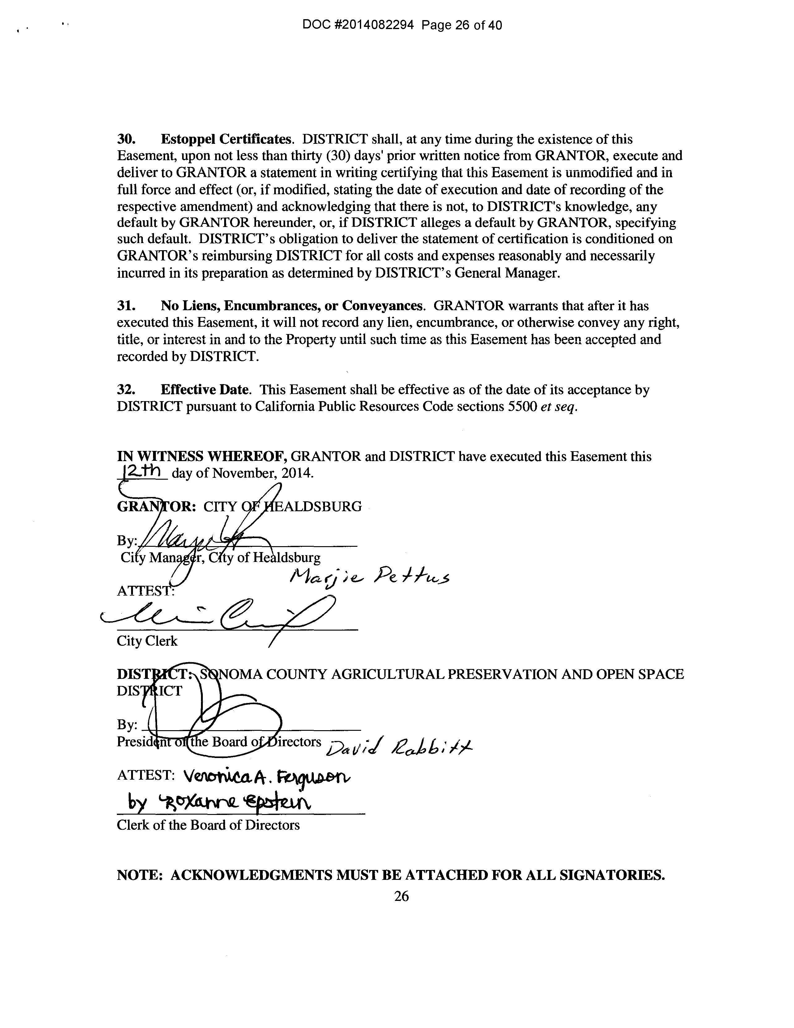
31. No Liens, Encumbrances, or Conveyances. GRANTOR warrants that after it has executed this Easement, it will not record any lien, encumbrance, or otherwise convey any right, title, Oi interest in and to the Property until such time as this Easement has been accepted and recorded by DISTRICT.
32. Effective Date. This Easement shall be effective as of the date of its acceptance by DISTRICT pursuant to California Public Resources Code sections 5500 et seq.
IN WITNESS WHEREOF, GRANTOR and DISTRICT have executed this Easement this 2:th day of November, 2014.
ALDSBURG
City Clerk
NOMA COUNTY AGRICULTURAL PRESERVATION AND OPEN SPACE
irectors i/a t/ ;/ J2o.J, b; 1?'-
ATTEST:
Clerk of the Board of Directors
NOTE: ACKNOWLEDGMENTS MUST BE ATTACHED FOR ALL SIGNATORIES. 26
DOC #2014082294 Page 26 of 40
State of California __________ County of Sonoma __________
On _November 13, 2014 before me, __ Courtney Triola , Notary Public (here insert name and title of the officer}, personally appeared Marjie Pettus, who proved to me on the basis of satisfactory evidence to be the person whose name is subscribed to the within instrument and acknowiedged to me that he/she executed the same in his/her authorized capacity, and that by his/her signature on the instrument the person, or the entity upon behalf of which the person acted, executed the instrument.
I certify under PENALTY OF PERJURY under the laws of the State of California that the foregoing paragraph is true and correct.
WITNESS my hand and official seal.
DOC #2014082294 Page 27 of 40
Notary Acknowledgment- Buyer SSCORPD0283.doc I Updated: 10.10.12 (Seal) COMM. #1978154 m NOiARY f"IJBLIC -CALIFORNIA '?J SONOMACOUNiY My Comm E.xpire9 June 10. 2016 ( v v v • uw·v·• • e Printed: 11.13.14@ 09:33PM by CT CA-FT -FSNX-01500.080705-FSNX-7051401360
CALIFORNIA ALL-PURPOSE CERTIFICATE OF ACKNOWLEDGMENT
State of California County of __ ____
On Nov 12 2014 before me, _____ ___, (Here insert name and title of the officer) personally appeared _________ tt _____________
who proved to me on the basis of satisfactory evidence to be the person(* whose name(x) ismre subscribed to the within instrument and acknowledged to me that :executed the same in authorized and that by his&dkt»r on the instrument the or the entity upon behalf of which the acted, executed the instrument.
I certify under PENALTY OF PERJURY under the laws of the State of California that the foregoing paragraph is true and correct.
ADDITIONAL OPTIONAL INFORMATION
DESCRIPTION OF THE ATTACHED DOCUMENT
Deed & Agmt Between City of Healdsburg and (Title or description of attached document) SCAPOSD for Conservation Easement
(Title or description of attached document continued)
Number of Pages __ Document Date 11112/2014
Board Reso 14-0423, 10/21/2014
{Additional information)
CAPACITY CLAIMED BY THE SIGNER
D Individual (s)
D Corporate Officer (Title)
D Partner(s)
D Attorney-in-Fact
D Trustee(s)
Other President SCAPOSD
INSTRUCTIONS FOR COMPLETING THIS FORM
Any acknowledgment completed in California 1111tst contain 1•erbiage exactly as appears above in the notOI)' section or a separate acknowledgment form must be properly completed and attached to that document The only exception is if a document is to be recorded outside of California. In such instances, any alternative acknowledgment verbiage as may be printed 011 such a document so long as the verbiage does not require the notary to do something that is illegal for a notary in California (i.e. certifying the authorized capacity of the signe11. Please check the document carefully for proper notarial wording and attach this form if required.
• State and County infomation must be the State and County where the document signer(s) personally appeared before the notary public for acknowledgment.
• Date of notarization must be the date that the signer(s) personally appeared which must also be the same date the acknowledgment is completed.
• The notary public must print his or her name as it appears within his or her commission followed by a comma and then your title (notary public).
• Print the name(s) of document signer(s) who personally appear at the time of notarization.
• Indicate the correct singular or plural forms by crossing off incorrect forms (i.e. he/she/they, is /are) or circling the correct forms. Failure to correctly indicate this information may lead to rejection of document recording.
• The notary seal impression must be clear and photographically reproducible. Impression must not cover text or lines. If seal impression smudges, re-seal if a sufficient area permits, otherwise complete a different acknowledgment fonn.
• Signature of the notary public must match the signature on file with the office of the county clerk.
•!• Additional infonnation is not required but could help to ensure this acknowledgment is not misused or attached to a different document.
•!• Indicate title or type of attached document, number of pages and date.
•!• Indicate the capacity claimed by the signer. If the claimed capacity is a corporate officer, indicate the title (i.e. CEO, CFO, Secretary).
• Securely attach this document to the signed document
DOC #2014082294 Page 28 of 40
SANDRA L.
FAUS
_ Commission# 1957686 Notary Public - California i z '{· · Sonoma County ?; ) · My Comm. Expires Oct 22, (Nota; teal) 0 0 0 0 4 4 0 0 0 0 0 0 0 0 0 +
Signature of Notary Public
200& Version CAPA vl2.10.07 800-873-9865 www.NotaryClasses.com
EXHffiiTA LEGAL DESCRIPTION
THE LAND REFERRED TO HEREIN BELOW IS SITUATED IN THE UNINCORPORATED AREA, COUNTY OF SONOMA, STATE OF CALIFORNIA AND IS DESCRIBED AS FOLLOWS:
TRACT ONE:
BEING A PORTION OF THE LANDS OF THE RATCHFORD FAMILY LIMITED PARTNERSHIP, A CALIFORNIA LIMITED PARTNERSHIP AS DESCRIBED IN THOSE DEEDS RECORDED AS DOCUMENT NOS. 1996 0001078 AND 1996-001079 BOTH OF OFFICIAL RECORDS, SONOMA COUNTY RECORDS, SAID PORTION BEING MORE PARTICULARLY DESCRIBED AS FOLLOWS:
PARCEL ONE:
COMMENCING AT FOUND 1/2" IRON PIPE AND TAG LS 3216 MARKING THE NORTHWEST CORNER OF LOT 18, BLOCK A OF THE CAMP ROSE SUBDIVISION AS SHOWN AND DELINEATED ON THAT RECORD OF SURVEY FILED IN BOOK 149 OF MAPS AT PAGE 10 SONOMA COUNTY RECORDS; THENCE NORTH 31 DEGREES 53 MINUTES 04 SECONDS WEST, 1132.06 FEET TO A SET IRON PIPE, SAID PIPE BEING THE TRUE POINT OF BEGINNING OF THE PARCEL OF LAND HEREIN DESCRIBED; SAID POINT OF BEGINNING ALSO MARKING A POINT ON THE WESTERLY LINE OF PARCEL ONE OF EXHIBIT "A" CONTAINED IN THAT DEED AND AGREEMENT CONVEYING A CONSERVATION EASEMENT AND ASSIGNING DEVELOPMENT RIGHTS RECORDED AS DOCUMENT NO. 1994-0106860 OF OFFICIAL RECORDS, SONOMA COUNTY RECORDS; THENCE LEAVING SAID WESTERLY LINE SOUTH 58 DEGREES 59 MINUTES 23 SECONDS EAST, 750 FEET, MORE OR LESS, TO THE MOST NORTHERLY CORNER OF THE LANDS OF THE RATCHFORD FAMILY LIMITED PARTNERSHIP AS DESCRIBED IN THAT DEED RECORDED AS DOCUMENT NO. 1996 0070434 OF OFF OFFICIAL RECORDS, SONOMA COUNTY RECORDS; THENCE ALONG THE NORTHWESTERLY LINE OF LAST SAID LANDS, SOUTHWESTERLY 200 FEET, MORE OR LESS, TO THE NORTHWESTERLY CORNER COMMON TO LAST SAID LANDS AND THE LANDS OF THE RATCHFORD FAMILY LIMITED PARTNERSHIP AS DESCRIBED IN THAT DEED RECORDED AS DOCUMENT NO. 1996 0070435 OF OFFICIAL RECORDS, SONOMA COUNTY RECORDS; THENCE ALONG THE NORTHWESTERLY LINE OF LAST SAID LANDS, SOUTHWESTERLY 80 FEET, MORE OR LESS TO THE NORTHWESTERLY CORNER COMMON TO LAST SAID LANDS AND THE LANDS OF THE RATCHFORD FAMILY LIMITED PARTNERSHIP AS DESCRIBED IN THAT DEED RECORDED AS DOCUMENT NO. 1996 0070436 OF OFFICIAL RECORDS, SONOMA COUNTY RECORDS; THENCE ALONG THE WESTERLY LINE OF LAST SAID LANDS SOUTH 246 FEET, MORE OR LESS TO THE SOUTHWEST CORNER OF LAST SAID LANDS, SAID CORNER ALSO MARKING A POINT ON THE SOUTHERLY LINE OF THE ABOVE MENTIONED LANDS OF THE RATCHFORD FAMILY LIMITED PARTNERSHIP; THENCE ALONG SAID SOUTHERLY LINE SOUTH 80 DEGREES 04 MINUTES WEST, 173 FEET, MORE OR LESS TO THE NORTHEASTERLY CORNER OF LOT 10, BLOCK BAS SHOWN AND DELINEATED ON THAT MAP SUBDIVISION CAMP ROSE, FILED IN BOOK 21 OF MAPS, AT PAGE 6 SONOMA COUNTY RECORDS; THENCE LEAVING SAID SOUTHERLY LINE NORTH 9 DEGREES 56 MINUTES WEST, 50.00 FEET TO THE SOUTHEASTERLY CORNER OF PARCEL ONE OF SAID CONSERVATION EASEMENT; THENCE ALONG THE EASTERLY LINE OF LAST SAID CONSERVATION EASEMENT NORTH 20 DEGREES 23 MINUTES 38 SECONDS WEST, 903.00 FEET TO THE POINT OF BEGINNING. A-1
DOC #2014082294 Page 29 of 40
BASIS OF BEARINGS: NORTH 80 DEGREES 04 MINUTES 00 SECONDS EAST BETWEEN FOUND IRON PIPE MONUMENTS MARKING THE NORTHERLY LINE OF BLOCK A, CAMP ROSE SUBDIVISION AS SHOWN ON THAT RECORD OF SURVEY FILED IN BOOK 149 OF MAPS, AT PAGE 10, SONOMA COUNTY RECORDS.
APN: 087-130-002-000
PARCEL TWO:
ALL THOSE LANDS DESCRIBED IN THAT DEED TO THE RATCHFORD FAMILY LIMITED PARTNERSHIP {IN COMPLiANCE WiTH COUNTY' OF SONOMA FiLE NO. LLA 96 003) RECORDED AS DOCUMENT NO. 1996 0070434 OF OFFICIAL RECORDS, SONOMA COUNTY RECORDS.
APN: 087-140-037-000 (PORTION)
PARCEL THREE:
ALL THOSE LANDS OF THE RATCHFORD FAMILY LIMITED PARTNERSHIP {IN COMPLIANCE WITH COUNTY OF SONOMA FILE NO. LLA 96 004) AS DESCRIBED IN THAT DEED RECORDED AS DOCUMENT NO. 19960070435 OF OFFICIAL RECORDS, SONOMA COUNTY RECORDS.
APN: 087-140-037-000 (PORTION)
PARCEL FOUR:
ALL THOSE LANDS OF THE ZELMA RATCHFORD TRUST AS DESCRIBED IN THAT CERTIFICATE OF COMPLIANCE RECORDED AS DOCUMENT NO. 1996-0021559 OF OFFICIAL RECORDS, SONOMA COUNTY RECORDS.
APN: 087-140-037-000 {PORTION)
TRACT TWO:
BEING A PORTION OF THE LANDS OF THE RATCHFORD FAMILY LIMITED PARTNERSHIP, A CALIFORNIA LIMITED PARTNERSHIP AS DESCRIBED IN THOSE DEEDS RECORDED AS DOCUMENT NOS. 1996 0001078 AND 1996 0001079 BOTH OF OFFICIAL RECORDS, SONOMA COUNTY RECORDS, SAID PORTION BEING MORE PARTICULARLY DESCRIBED AS FOLLOWS:
PARCEL ONE:
COMMENCING AT FOUND 1/2" IRON PIPE AND TAG LS 3216 MARKING THE NORTHWEST CORNER OF LOT 18, BLOCK A OF THE CAMP ROSE SUBDIVISION AS SHOWN AND DELINEATED ON THAT RECORD OF SURVEY FILED IN BOOK 149 OF MAPS, AT PAGE 10, SONOMA COUNTY RECORDS; THENCE NORTH 31 DEGREES 53 MINUTES 04 SECONDS WEST, 1132.06 FEET TO A SET IRON PIPE, SAID PIPE BEING THE TRUE POINT OF BEGINNING OF THE PARCEL OF LAND HEREIN DESCRIBED; SAID POINT OF BEGINNING ALSO MARKING A POINT ON THE WESTERLY LINE OF PARCEL ONE OF EXHIBIT "A" CONTAINED IN THAT DEED AND AGREEMENT CONVEYING A CONSERVATION EASEMENT AND ASSIGNING DEVELOPMENT RIGHTS RECORDED AS DOCUMENT NO. 19940106860 OF OFFICIAL RECORDS, SONOMA COUNTY RECORDS; THENCE LEAVING SAID WESTERLY LINE NORTH 50 DEGREES 43 MINUTES 22 SECONDS EAST, 113.77 FEET TO A SET IRON PIPE; THENCE NORTH 33 DEGREES 36 MINUTES 54 SECONDS WEST, A-2
.' DOC #2014082294 Page 30 of 40
470.66 FEET TO A POINT ON THE WESTERLY LINE OF PARCEL ONE OF SAID CONSERVATION EASEMENT; THENCE LEAVING SAID WESTERLY LINE NORTH 83 DEGREES 36 MINUTES 24 SECONDS EAST, 236.38 FEET TO A POINT MARKING THE CENTERLINE OF 40 FOOT WIDE EASEMENT FOR ROAD, PUBLIC AND PRIVATE UTILITIES PURPOSES; THENCE ALONG SAID CENTERLINE THE FOLLOWING COURSES: SOUTH 75 DEGREES 37 MINUTES 20 SECONDS EAST, 34.51 FEET; THENCE NORTH 82 DEGREES 49 MINUTES 39 SECONDS EAST, 44.76 FEET; THENCE SOUTH 84 DEGREES 22 MINUTES 57 SECONDS EAST, 60.79 FEET TO A SET 80 PENNY SPIKE, NOT TAGGED; THENCE SOUTH 45 DEGREES 43 MINUTES 59 SECONDS EAST, 227.74 FEET TO A SET 80 PENNY SPIKE, NOT TAGGED; THENCE SOUTH 76 DEGREES SO MINUTES 43 SECONDS EAST, 168.64 FEET THENCE ALONG A TANGENT CURVE TO THE RIGHT HAVING A RADIUS OF 240.00 FEET, A CENTRAL ANGLE OF 34 DEGREES 47 MINUTES 16 SECONDS, FOR A LENGTH OF 145.72 FEET; THENCE SOUTH 42 DEGREES 03 MINUTES 27 SECONDS EAST, 52.75 FEET; THENCE SOUTH 27 DEGREES 49 MINUTES 41 SECONDS EAST, 47.26 FEET TO A SET IRON PIPE; THENCE LEAVING SAID CENTERLINE SOUTH 49 DEGREES 08 MINUTES 43 SECONDS EAST, 342 FEET, MORE OR LESS TO THE MOST NORTHERLY CORNER OF THE LANDS OF THE RATCHFORD FAMILY LIMITED PARTNERSHIP AS DESCRIBED IN THAT DEED RECORDED AS DOCUMENT NO. 1996-0070432 OF OFFICIAL RECORDS, SONOMA COUNTY RECORDS; THENCE ALONG THE NORTHWESTERLY LINE OF LAST SAID LANDS SOUTHWESTERLY 230 FEET, MORE OR LESS TO THE NORTHWESTERLY CORNER TO LAST SAID LANDS AND THE LANDS OF THE RATCHFORD FAMILY LIMITED PARTNERSHIP AS DESCRIBED IN THAT DEED RECORDED AS DOCUMENT NO. 1996-0070433 OF OFFICIAL RECORDS, SONOMA COUNTY RECORDS; THENCE ALONG THE NORTHWESTERLY LINE OF LAST SAID LANDS SOUTHWESTERLY 210 FEET, MORE OR LESS TO THE NORTHWESTERLY CORNER COMMON TO LAST SAID LANDS AND THE LANDS OF THE RATCHFORD FAMILY LIMITED PARTNERSHIP AS DESCRIBED IN THAT DEED RECORDED AS DOCUMENT NO. 1996 0070434 OF OFFICIAL RECORDS, SONOMA COUNTY RECORDS; THENCE LEAVING SAID COMMON CORNER NORTH 58 DEGREES 59 MINUTES 23 SECONDS WEST, 750 FEET, MORE OR LESS TO THE POINT OF BEGINNING.
BASIS OF BEARINGS: NORTH 80 DEGREES 04 MINUTES 00 SECONDS EAST BETWEEN FOUND IRON PIPE MONUMENTS MARKING THE NORTHERLY LINE OF BLOCK A CAMP ROSE SUBDIVISION AS SHOWN ON THAT RECORD OF SURVEY FILED IN BOOK 149 OF MAPS, AT PAGE 10, SONOMA COUNTY RECORDS.
APN: 087-130-003-000
PARCEL TWO:
ALL THOSE LANDS DESCRIBED IN THAT DEED TO THE RATCHFORD FAMILY LIMITED PARTNERSHIP (IN COMPLIANCE WITH COUNTY OF SONOMA FILE NO. LLA 96-001) RECORDED AS DOCUMENT NO. 19960070432 OF OFFICIAL RECORDS, SONOMA COUNTY RECORDS.
APN: 087-140-038-000 (PORTION)
PARCEL THREE:
ALL THOSE LANDS DESCRIBED IN THAT DEED TO THE RATCHFORD FAMILY LIMITED PARTNERSHIP (IN COMPLIANCE WITH COUNTY OF SONOMA FILE NO. LLA 96-002) RECORDED AS DOCUMENT NO. 19960070433 OF OFFICIAL RECORDS, SONOMA COUNTY RECORDS.
APN: 087-140-038-000 (PORTION)
A-3

.. . . DOC #2014082294 Page 31 of 40
TRACT THREE:
BEING A PORTION OF THE LANDS OF THE RATCHFORD FAMILY LIMITED PARTNERSHIP, A CALIFORNIA LIMITED PARTNERSHIP AS DESCRIBED IN THOSE DEEDS RECORDED AS DOCUMENT NOS. 1996-0001078 AND 1996001079 BOTH OF OFFICIAL RECORDS, SONOMA COUNTY RECORDS, SAID PORTION BEING MORE PARTICULARLY DESCRIBED AS FOLLOWS:

COMMENCING AT FOUND 1/2" IRON PIPE AND TAG LS 3216 MARKING THE NORTHWEST CORNER OF LOT 18, BLOCK A OF THE CAMP ROSE SUBDIVISION AS SHOWN AND DELINEATED ON THAT RECORD OF SURVEY FILED IN BOOK 149 OF MAPS, AT PAGE 10, SONOMA COUNTY RECORDS; THENCE NORTH 5 DEGREES 48 MINUTES 37 SECONDS EAST, 1097.02 FEET TO A SET IRON PIPE, SAID PIPE MARKING AN ANGLE POINT IN THE CENTERLINE OF A 40 FOOT WIDE EASEMENT FOR ROAD, PUBLIC AND PRIVATE UTILITIES PURPOSES AND ALSO BEING THE TRUE POINT OF BEGINNING OF THE PARCEL OF LAND HEREIN DESCRIBED; THENCE LEAVING SAID CENTERLINE NORTH 82 DEGREES 15 MINUTES 51 SECONDS EAST, 409.82 FEET TO A SET IRON PIPE; THENCE SOUTH 77 DEGREES 29 MINUTES 56 SECONDS EAST, 125 FEET, MORE OR LESS TO THE MOST WESTERLY CORNER OF THE LANDS OF THE COUNTY OF SONOMA, AS DESCRIBED IN THAT DEED RECORDED AS DOCUMENT N0.19920118630 OF OFFICIAL RECORDS, SONOMA COUNTY RECORDS; THENCE ALONG THE SOUTHERLY LINE OF LAST SAID LANDS SOUTH 77 DEGREES 29 MINUTES 56 SECONDS EAST {SOUTH 76 DEGREES 15 MINUTES EAST, DEED), 160.00 FEET TO THE MOST SOUTHERLY CORNER OF LAST SAID LANDS; THENCE ALONG THE WESTERLY LINE OF SAID LANDS NORTH 12 DEGREES 30 MINUTES 04 SECONDS EAST {NORTH 13 DEGREES 45 MINUTES 00 SECONDS EAST, DEED), 100 FEET TO THE MOST EASTERLY CORNER OF SAID LANDS; THENCE LEAVING SAID LANDS NORTH 48 DEGREES 27 MINUTES 03 SECONDS EAST, 178.7 FEET, MORE OR LESS TO THE MOST SOUTHERLY CORNER OF LOT 122, BLOCK A, AS SHOWN AND DELINEATED ON THAT MAP ENTITLED "DEL RIO WOODS SUBDIVISION NO.2" FILED IN BOOK 47 OF MAPS, AT PAGE 7, SONOMA COUNTY RECORDS; THENCE ALONG THE SOUTHERLY LINE OF SAID LOT NORTH 79 DEGREES 48 MINUTES 28 SECONDS EAST (NORTH 80 DEGREES 55 MINUTES EAST, MAP), 100.00 FEE TO THE MOST EASTERLY CORNER OF SAID LOT, SAID CORNER ALSO MARKING A POINT ON THE WESTERLY RIGHT OF WAY LINE OF FITCH MOUNTAIN HIGHWAY AS SHOWN AND DELINEATED ON LAST SAID SUBDIVISION MAP; THENCE SOUTHERLY, SOUTHWESTERLY AND WESTERLY ALONG THE WESTERLY RIGHT OF WAY OF FITCH MOUNTAIN ROAD AS SHOWN AND DELINEATED ON THAT "PLAN AND PROFILE OF THE FITCH MOUNTAIN ROAD, SONOMA COUNTY HIGHWAY SYSTEM" FILED IN BOOK 44 OF MAPS, AT PAGE 49, SONOMA COUNTY RECORDS, 738 FEET, MORE OR LESS TO THE MOST EASTERLY CORNER OF THE LANDS OF THE ZELMA RATCHFORD TRUST, AS DESCRIBED IN THAT DEED RECORDED AS DOCUMENT NO. 1996 0021562 OR OFFICIAL RECORDS, SONOMA COUNTY RECORDS; THENCE ALONG THE NORTHEASTERLY LINE OF SAID LANDS NORTHWESTERLY 198 FEET, MORE OR LESS TO THE MOST NORTHERLY CORNER OF SAID LANDS; THENCE ALONG THE NORTHERLY LINE OF SAID LANDS EASTERLY 206 FEET, MORE OR LESS TO THE MOST WESTERLY CORNER OF LAST SAID LANDS, SAID CORNER ALSO MARKING A POINT ON THE NORTHEASTERLY LINE OF THE LANDS OF THE RATCHFORD FAMILY LIMITED PARTNERSHIP AS DESCRIBED IN THAT DEED RECORDED AS DOCUMENT NO. 1996 0070432 OF OFFICIAL RECORDS, SONOMA COUNTY RECORDS; THENCE ALONG THE NORTHEASTERLY LINE OF LAST SAID LANDS 119 FEET, MORE OR LESS TO THE MOST NORTHERLY CORNER OF LAST SAID LANDS; THENCE LEAVING LAST SAID LANDS NORTH 49 DEGREES 08 MINUTES 43 SECONDS WEST, 342 FEET, MORE OR LESS TO THE POINT OF BEGINNING.
A-4
.' DOC #2014082294 Page 32 of 40
BASIS OF BEARINGS: NORTH 80 DEGREES 04 MINUTES 00 SECONDS EAST BETWEEN FOUND IRON PIPE MONUMENTS MARKING THE NORTHERLY LINE OF BLOCK A, CAMP ROSE SUBDIVISION AS SHOWN ON THAT RECORD OF SURVEY FILED IN BOOK 149 OF MAPS, AT PAGE 10, SONOMA COUNTY RECORDS.
APN: 087-110-007-000
TRACT FOUR:
BEING A PORTION OF THE LANDS OF THE RATCHFORD FAMILY LIMITED PARTNERSHIP, A CALIFORNIA LIMITED PARTNERSHIP AS DESCRIBED IN THOSE DEEDS RECORDED AS DOCUMENT NOS. 1996 0001078 AND 1996-001079 BOTH OF OFFICIAL RECORDS, SONOMA COUNTY RECORDS, SAID PORTION BEING MORE PARTICULARLY DESCRIBED AS FOLLOWS:
COMMENCING AT FOUND 1/2" IRON PIPE AND TAG LS 3216 MARKING THE NORTHWEST CORNER OF LOT 18, BLOCK A OF THE CAMP ROSE SUBDIVISION AS SHOWN AND DELINEATED ON THAT RECORD OF SURVEY FILED IN BOOK 149 OF MAPS, AT PAGE 10, SONOMA COUNTY RECORDS; THENCE NORTH 5 DEGREES 48 MINUTES.37 SECONDS EAST, 1097.02 FEET TO A SET IRON PIPE, SAID PIPE MARKING AN ANGLE POINT IN THE CENTERLINE OF A 40 FOOT WIDE EASEMENT FOR ROAD, PUBLIC AND PRIVATE UTILITIES PURPOSES AND ALSO BEING THE TRUE POINT OF BEGINNING OF THE PARCEL OF LAND HEREIN DESCRIBED; THENCE LEAVING SAID CENTERLINE NORTH 5 DEGREES 54 MINUTES 13 SECONDS EAST, 327.02 FEET TO A FOUND 1/2" PIN WITH 3/4" SQUARE TOP MARKING THE SOUTHWEST CORNER OF THE LANDS OF DREW AS DESCRIBED IN THAT DEED RECORDED AS DOCUMENT NO. 86 109512 OF OFFICIAL RECORDS, SONOMA COUNTY RECORDS, SAID PIN ALSO MARKING THE SOUTHWEST CORNER OF THE LANDS KENNEALLY AS SHOWN AND DELINEATED ON THAT RECORD OF SURVEY, FILED IN BOOK 356 OF MAPS, AT PAGE 40, SONOMA COUNTY RECORDS; THENCE ALONG THE WESTERLY LINE OF SAID LANDS DREW NORTH 15 DEGREES 06 MINUTES 24 SECONDS EAST (NORTH 16 DEGREES 21 MINUTES 20 SECONDS EAST, MAP), 35.00 FEET TO A SET IRON PIPE IN THE CENTERLINE OF AN EXISTING 8 FOOT WIDE DIRT ROAD; THENCE ALONG THE CENTERLINE OF SAID DIRT ROAD THE FOLLOWING COURSES: NORTH 70 DEGREES 05 MINUTES 34 SECONDS WEST, 111.78 FEET; THENCE NORTH 84 DEGREES 44 MINUTES 36 SECONDS WEST, 90.84 FEET; THENCE SOUTH 77 DEGREES 45 MINUTES 10 SECONDS WEST, 48.70 FEET; THENCE NORTH 84 DEGREES 24 MINUTES 40 SECONDS WEST, 133.51 FEET; THENCE LEAVING SAID CENTERLINE NORTH 30 DEGREES 01 MINUTES 07 SECONDS WEST, 108.09 FEET TO A POINT IN THE CENTERLINE OF SAID 40 FOOT WIDE EASEMENT FOR ROAD, PUBLIC AND PRIVATE UTILITIES PURPOSES; THENCE ALONG LAST SAID CENTERLINE THE FOLLOWING COURSES: THENCE SOUTH 74 DEGREES 53 MINUTES 10 SECONDS WEST, 145.61 FEET; THENCE SOUTH 52 DEGREES 26 MINUTES 01 SECONDS WEST, 131.78 FEET; THENCE SOUTH 31 DEGREES 26 MINUTES 55 SECONDS WEST, 27.26 FEET; THENCE SOUTH 75 DEGREES 37 MINUTES 20 SECONDS EAST, 34.51 FEET; THENCE NORTH 82 DEGREES 49 MINUTES 39 SECONDS EAST, 44.76 FEET; THENCE SOUTH 84 DEGREES 22 MINUTES 57 SECONDS EAST, 60.79 FEET TO A SET 80 PENNY SPIKE, NOT TAGGED; THENCE SOUTH 45 DEGREES 43 MINUTES 59 SECONDS EAST, 227.74 FEET TO A SET 80 PENNY SPIKE, NOT TAGGED; THENCE SOUTH 76 DEGREES 50 MINUTES 43 SECONDS EAST, 168.64 FEET; THENCE ALONG A TANGENT CURVE TO THE RIGHT HAVING A RADIUS OF 240.00 FEET, A CENTRAL ANGLE OF 34 DEGREES 47 MINUTES 16 SECONDS, FOR A LENGTH OF 145.72 FEET; THENCE SOUTH 42 DEGREES 03 MINUTES 27 SECONDS EAST. 52.75 FEET; THENCE SOUTH 27 DEGREES 49 MINUTES 41 SECONDS EAST, 47.26 FEET CONTINUING TO THE POINT OF BEGINNING.

.. DOC #2014082294 Page 33 of 40
A-5
BASIS OF BEARINGS: NORTH 80 DEGREES 04 MINUTES 00 SECONDS EAST BETWEEN FOUND IRON PIPE MONUMENTS MARKING THE NORTHERLY LINE OF BLOCK A, CAMP ROSE SUBDIVISION AS SHOWN ON THAT RECORD OF SURVEY FILED IN BOOK 149 OF MAPS, AT PAGE 10, SONOMA COUNTY RECORDS.
APN: 087-110-009-000
TRACT FIVE:
BEING A PORTION OF THE LANDS OF THE RATCHFORD FAMILY LIMITED PARTNERSHIP, A CALIFORNIA LIMITED PARTNERSHIP AS DESCRIBED IN THOSE DEEDS RECORDED AS DOCUMENT NOS. 1996 0001078 AND 1996-0001079 BOTH OF OFFICIAL RECORDS, SONOMA COUNTY RECORDS, SAID PORTION BEING MORE PARTICULARLY DESCRIBED AS FOLLOWS:
COMMENCING AT FOUND 1/2" PIN WITH 3/4" SQUARE TOP MARKING THE SOUTHWEST CORNER OF THE L4NDS OF DREW AS DESCRIBED !N THAT DEED RECORDED AS DOCUMENT NO. 86 109512 OF OFFICIAL RECORDS, SONOMA COUNTY RECORDS SAID PIN ALSO MARKING THE SOUTHWEST CORNER OF THE LANDS OF KENNEALLY AS SHOWN AND DELINEATED ON THAT RECORD OF SURVEY FILED IN BOOK 356 OF MAPS, AT PAGE 40, SONOMA COUNTY RECORDS; THENCE ALONG THE WESTERLY LINE OF SAID LANDS OF DREW NORTH 15 DEGREES 06 MINUTES 24 SECONDS EAST (NORTH 16 DEGREES 21 MINUTES 20 SECONDS EAST, MAP), 35.00 FEET TO A SET IRON PIPE IN THE CENTERLINE OF AN EXISTING 8 FOOT WIDE DIRT ROAD; THENCE ALONG THE CENTERLINE OF SAID DIRT ROAD THE FOLLOWING COURSES: NORTH 70 DEGREES OS MINUTES 34 SECONDS WEST, 111.78 FEET; THENCE NORTH 84 DEGREES 44 MINUTES 36 SECONDS WEST, 90.84 FEET; THENCE SOUTH 77 DEGREES 45 MINUTES 10 SECONDS WEST' 48.70 FEET; THENCE NORTH 84 DEGREES 24 MINUTES 40 SECONDS WEST, 133.51 FEET; THENCE LEAVING SAID CENTERLINE NORTH 30 DEGREES 01 MINUTES 07 SECONDS WEST, 108.09 FEET TO A POINT IN THE CENTERLINE OF A 40 FOOT WIDE EASEMENT FOR ROAD, PUBLIC AND PRIVATE UTILITIES PURPOSES; THENCE ALONG LAST SAID CENTERLINE THE FOLLOWING COURSES ALONG A CURVE TO THE LEFT WHOSE CENTER BEARS NORM 15 DEGREES 06 MINUTES 50 SECONDS WEST, HAVING A RADIUS OF 85.00 FEET, A CENTRAL ANGLE OF 46 DEGREES 26 MINUTES 23 SECONDS, FOR A LENGTH OF 68.90 FEET; THENCE NORTH 28 DEGREES 26 MINUTES 47 SECONDS EAST, 41.83 FEET; THENCE ALONG A TANGENT CURVE TO THE RIGHT HAVING A RADIUS OF 70.00 FEET, A CENTRAL ANGLE OF 32 DEGREES 06 MINUTES 14 SECONDS, FOR A LENGTH OF 39.22 FEET; THENCE LEAVING SAID CENTERLINE NORTH 51 DEGREES EAST, 180 FEET, MORE OR LESS TO THE SOUTHWESTERLY CORNER OF THE LANDS OF REDWOOD EMPIRE TITLE COMPANY AS DESCRIBED IN THAT DEED RECORDED IN BOOK 2296 OF OFFICIAL RECORDS, AT PAGE 819 SONOMA COUNTY RECORDS; THENCE ALONG THE SOUTHERLY LINE OF LAST SAID LANDS EAST 370 FEET, MORE OR LESS TO THE SOUTHEASTERLY CORNER OF LAST SAID LANDS; SAID CORNER ALSO MARKING A POINT ON THE SOUTHWESTERLY LINE OF BLOCK HAS SHOWN AND DELINEATED ON THAT "PLAT OF DEL RIO WOODS SUBDIVISION NO.6" FILED IN BOOK 48 OF MAPS, AT PAGE 36, SONOMA COUNTY RECORDS; THENCE LEAVING SAID SOUTHEASTERLY CORNER AND ALONG SAID SOUTHWESTERLY LINE SOUTH 40 DEGREES 24 MINUTES 32 SECONDS EAST (SOUTH 39 DEGREES 18 MINUTES EAST, MAP), 61 FEET, MORE OR LESS TO AN ANGLE POINT IN LOT 9 OF SAID BLOCK H. SAID ANGLE POINT MARKING THE WESTERLY TERMINUS OF THE COURSE IDENTIFIED AS NORTH 65 DEGREES 03 MINUTES WEST, 75.0 FEET ON SAID MAP; THENCE LEAVING SAID BLOCK H SOUTH 21 DEGREES 54 MINUTES 44 SECONDS WEST, 187.30 FEET TO A SET !RON P!PE ON THE NORTHERLY l!NE OF SA!D LANDS OF DREW FROM WHICH A FOUND 3/4" IRON PIPE AND TAG LS 2757 MARKING THE NORTHWESTERLY A-6
. DOC #2014082294 Page 34 of 40
CORNER OF SAID LANDS OF KENNEALLY AND DREW BEARS NORTH 74 DEGREES 37 MINUTES 36 SECONDS WEST (NORTH 73 DEGREES 22 MINUTES 40 SECONDS WEST, MAP), 104.35 FEET; THENCE ALONG SAID NORTHERLY LINE NORTH 74 DEGREES 37 MINUTES 36 SECONDS WEST, 104.35 FEET TO SAiD FOUND 3i4" iRON PiPE; THENCE AlONG THE WESTERlY liNE OF LAST SAID LANDS SOUTH 15 DEGREES 06 MINUTES 24 SECONDS WEST, 173.71 FEET TO THE POINT OF BEGINNING.
BASIS OF BEARINGS: NORTH 80 DEGREES 04 MINUTES 00 SECONDS EAST BETWEEN FOUND IRON PIPE MONUMENTS MARKING THE NORTHERLY LINE OF BLOCK A, CAMP ROSE SUBDIVISION AS SHOWN ON THAT RECORD OF SURVEY FILED IN BOOK 149 OF MAPS, AT PAGE 10, SONOMA COUNTY RECORDS.
APN: 087-110-010-000

TRACT SIX:
BEING A PORTION OF THE LANDS OF THE RATCHFORD FAMILY LIMITED PARTNERSHIP, A CALIFORNIA LIMITED PARTNERSHIP AS DESCRIBED IN THOSE DEEDS RECORDED AS DOCUMENT NOS. 1996 0001078 AND 1996 0001079 BOTH OF OFFICIAL RECORDS, SONOMA COUNTY RECORDS, SAID PORTION BEING MORE PARTICULARLY DESCRIBED AS FOLLOWS:
PARCEL ONE:
ALL THOSE LANDS CONTAINED WITHIN PARCEL ONE OF EXHIBIT "A" AS DESCRIBED IN THAT DEED AND AGREEMENT CONVEYING A CONSERVATION EASEMENT AND ASSIGNING DEVELOPMENT RIGHTS
RECORDED AS DOCUMENT NO. 1994-0106860 OF OFFICIAL RECORDS, SONOMA COUNTY RECORDS.
APN: 087-110-012-000 (PORTION), 087-120-001-000 (PORTION), 087-130-004-000 (PORTION), 087-220001-000
PARCEL TWO:
BEGINNING AT THE SOUTHEAST CORNER OF LOT 38, BLOCK F AS SHOWN AND DELINEATED ON THAT MAP ENTITLED "PLAT OF DEL RIO WOODS SUBDIVISION NO.4" FILED IN BOOK 48 OF MAPS, AT PAGE 32, SONOMA COUNTY RECORDS, SAID CORNER ALSO MARKING AN ANGLE POINT IN THE NORTHERLY LINE OF PARCEL ONE HEREIN DESCRIBED; THENCE LEAVING SAID NORTHERLY LINE AND ALONG THE EASTERLY BOUNDARY OF SAID LOT 38, BLOCK F NORTH 6 DEGREES 13 MINUTES EAST,
100.0 FEET TO A POINT ON THE SOUTHERLY LINE OF RIVER VIEW DRIVE AS SHOWN AND DELINEATED ON SAID PLAT OF DEL RIO WOODS SUBDIVISION NO.4; THENCE ALONG THE SOUTHERLY AND EASTERLY LINES OF SAID RIVER VIEW DRIVE THE FOLLOWING THE COURSES: SOUTH 83 DEGREES 47 MINUTES EAST, 16.0 FEET; THENCE NORTH 6 DEGREES 13 MINUTES EAST 30.0 FEET TO THE SOUTHEASTERLY CORNER OF LOT 31, BLOCK E AS SHOWN AND DELINEATED ON SAID PLAT OF DEL RIO WOODS SUBDIVISION NO.4; THENCE ALONG THE EASTERLY LINE OF SAID LOT 31, BLOCK E NORTH 6 DEGREES 54 MINUTES EAST, 83.30 FEET TO A POINT THE SOUTHERLY LINE OF LOT 25, BLOCK A AS SHOWN AND DELINEATED ON THAT MAP ENTITLED "DEL RIO WOODS SUBDIVISION NO.2" FILED IN BOOK 47 OF MAPS, AT PAGE 7, SONOMA COUNTY RECORDS; THENCE ALONG THE SOUTHERLY LINE OF SAID BLOCK A THE FOLLOWING COURSES: SOUTH 76 DEGREES 27 MINUTES EAST, 9.53 FEET, MORE OR LESS; THENCE ALONG A TANGENT CURVE TO THE LEFT HAVING A RADIUS OF 625 FEET, A CENTRAL ANGLE OF 18 DEGREES 35 MINUTES, FOR A LENGTH OF 202.7 FEET; THENCE NORTH 84 DEGREES 58 MINUTES EAST, A-7
DOC #2014082294 Page 35 of 40
26.69 FEET; THENCE ALONG A TANGENT CURVE TO THE RIGHT, HAVING A RADIUS OF 375 FEET, A CENTRAL ANGLE OF 9 DEGREES, FOR A LENGTH OF 58.91 FEET; THENCE SOUTH 76 DEGREES 02 MINUTES EAST, 254.78 FEET; THENCE ALONG A TANGENT CURVE TO THE LEFT, HAVING A RADIUS OF 1125 FEET, A CENTRAL ANGLE OF 6 DEGREES 22 MINUTES, FOR A LENGTH OF 125.01 FEET; THENCE NORTH 87 DEGREES 36 MINUTES EAST, 150.5 FEET TO THE SOUTHERLY CORNER COMMON TO LOT 10, BLOCK A OF SAID SUBDIVISION NO.2 AND LOT 9, BLOCK A AS SHOWN AND DELINEATED ON THAT MAP ENTITLED "DEL RIO WOODS SUBDIVISION NO. 1", FILED IN BOOK 46 OF MAPS, AT PAGE 27, SONOMA COUNTY RECORDS; THENCE CONTINUING ALONG THE SOUTHERLY LINE OF BLOCK A OF SAID DEL RIO WOODS SUBDIVISION NO. 1 THE FOLLOWING COURSES: NORTH 87 DEGREES 36 MINUTES EAST, 117.51 FEET; THENCE ALONG A TANGENT CURVE TO THE RIGHT, HAVING A RADIUS OF 175 FEET, A CENTRAL ANGLE OF 12 DEGREES 32 MINUTES, FOR A LENGTH OF 38.28 FEET TO A POINT ON THE SOUTHERLY LINE OF LOT 6, BLOCK A OF SAID DEL RIO WOODS SUBDIVISION NO. 1, SAID POINT ALSO MARKING THE MOST NORTHERLY CORNER OF LOT 53, BLOCK CAS SHOWN AND DELINEATED ON THAT MAP ENTITLED "PLAT OF DEL RIO WOODS SUBDIVISION NO. 3", FILED IN BOOK 48 OF MAPS, AT PAGE 30, SONOMA COUNTY RECORDS; THENCE LEAVING THE SOUTHERLY LINE OF LAST SAID BLOCK A AND ALONG THE NORTHWESTERLY LINE OF SAID LOT 53, BLOCK C, SOUTH 29 DEGREES 15 MINUTES WEST, 165.45 FEET TO MOST WESTERLY CORNER OF SAID LOT 53, SAID CORNER ALSO MARKING A POINT ON THE NORTHEASTERLY LINE OF RIVER VIEW DRIVE AS SHOWN AND DELINEATED ON SAID PLAT OF DEL RIO WOODS SUBDIVISION NO.3; THENCE ALONG THE NORTHERLY AND NORTHWESTERLY LINES OF SAID RIVER VIEW DRIVE THE FOLLOWING COURSES: NORTH 59 DEGREES 21 MINUTES WEST, 21.10 FEET; THENCE SOUTH 30 DEGREES 39 MINUTES WEST, 30.0 FEET TO THE MOST NORTHERLY CORNER OF LOT 62, BLOCK D OF SAID PLAT OF DEL RIO WOODS SUBDIVISION NO.3; THENCE NORTH 59 DEGREES 21 MINUTES WEST, 40 FEET, MORE OR LESS, TO A POINT MARKING THE MOST EASTERLY CORNER OF THAT PARCEL CONVEYED TO THE FITCH MOUNTAIN WATER COMPANY, A CALIFORNIA CORPORATION, BY INSTRUMENT RECORDED SEPTEMBER 6, 1962 IN BOOK 1911 OF OFFICIAL RECORDS, AT PAGE 906, SONOMA COUNTY RECORDS; THENCE SOUTH 23 DEGREES 09 MINUTES WEST, 100.87 FEET, MORE OR LESS TO A POINT MARKING THE MOST WESTERLY CORNER OF LOT 62 IN SAID BLOCK D; THENCE ALONG THE SOUTH'lJESTERLV AND SOUTHERLY LiNES OF SAID BLOCK D THE FOLLOWiNG COURSES: SOUTH 45 DEGREES 40 MINUTES WEST, 103.54 FEET; THENCE SOUTH 59 DEGREES 21 MINUTES EAST, 24.0 FEET; THENCE SOUTH 38 DEGREES 29 MINUTES EAST, 83.74 FEET; THENCE SOUTH 28 DEGREES 39 MINUTES EAST, 69.96 FEET; THENCE ALONG A TANGENT CURVE TO THE LEFT, HAVING A RADIUS OF 125.0 FEET, A CENTRAL ANGLE OF 112 DEGREES 54 MINUTES, FOR A LENGTH OF 246.31 FEET; THENCE NORTH 38 DEGREES 27 MINUTES EAST, 134.33 FEET; THENCE SOUTH 51 DEGREES OS MINUTES EAST, 239.86 FEET; THENCE NORTH 39 DEGREES 01 MINUTES EAST, 99.47 FEET TO THE MOST EASTERLY CORNER OF LOT 43, BLOCK D OF SAID DEL RIO WOODS SUBDIVISION NO. 3, SAID CORNER ALSO MARKING AN ANGLE POINT IN THE SOUTHERLY LINE OF OAK DRIVE AS SHOWN AND DELINEATED ON SHEET 4 OF THAT MAP ENTITLED "DEL RIO WOODS SUBDIVISION NO.2", FILED IN BOOK 47 OF MAPS, AT PAGE 7, SONOMA COUNTY RECORDS, SAID ANGLE POINT BEING AT THE SOUTHEASTERLY TERMINUS OF THE COURSE IDENTIFIED AS SOUTH 50 DEGREES 59 MINUTES EAST,48.62 FEET; THENCE ALONG THE SOUTHERLY AND WESTERLY LINES OF LAST SAID OAK DRIVE THE FOLLOWING COURSES: NORTH 81 DEGREES 06 MINUTES EAST, 212.81 FEET; THENCE SOUTH 42 DEGREES 36 MINUTES EAST, 117.67 FEET; THENCE SOUTH 9 DEGREES 30 MINUTES EAST, 219.87 FEET; THENCE LEAVING LAST SAID SOUTHERLY AND WESTERLY LINES SOUTH 42 DEGREES 31 MINUTES 58 SECONDS EAST, 186.92 FEET, MORE OR LESS TO A POINT FROM WHICH THE MOST SOUTHERLY CORNER OF LOT 3, BLOCK D OF SAID DEL RIO WOODS A-8

.. DOC #2014082294 Page 36 of 40
SUBDIVISION NO.2 BEARS NORTH 15 DEGREES 40 MINUTES 00 SECONDS EAST, 180.00 FEET, SAID POINT MARKING THE NORTHEASTERLY CORNER OF PARCEL ONE ABOVE DESCRIBED; THENCE ALONG THE NORTHERLY LINE OF THE ABOVE DESCRIBED PARCEL ONE NORTH 71 DEGREES 48 MINUTES 33 SECONDS WEST, 1978.28 FEET, MORE OR LESS TO THE POINT OF BEGINNING.
Excepting therefrom all that portion of the Lands of F.R.A.N.C.E.Z. LLC as described in Document Number 2003-050835 of Official Records, Sonoma County Records, also being a portion of formally the Lands of Ratchford Family L.P as described in Document Number 1998-062069 of Official Records, Sonoma County Records and being more particularly described as follows:
Beginning at a 6"x6" concrete monument at the northeast corner of Lot 43 as shown on the Del Rio Woods No. 3 Subdivision, filed in Book 48 of Maps, Pages 30-31, Sonoma County Records said point also being on the southerly Right-of-Way intersection of Riverview Drive and Oak Drive as shown of Del Rio Wood Subdivision No.2, filed in Book 47 of Maps, Page 07-13, Sonoma County Records; thence along said southerly Right-of-Way of Oak Drive, N 79" 50'44" E, 212.12 feet; thence S 43" 51'24" E, 117.67 feet; thence S 10" 11'42" E, 219.25 feet; thence leaving said southerly Right-of-Way of Oak Drive and along the easterly line ofthe aforementioned Lands of Ratchford Family L.P., S 24" 24'00" E, 186.91 feet; thence S 20" 15'40" E, 60.77 feet, more or less, to the north line of that Conservation Easement as described in Document Number 1994-0106860 of Official Records, Sonoma County Records; thence leaving said easterly line of the aforementioned Lands of Ratchford Family L.P. and along the northerly line of said Conservation Easement, N 71 • 48'33"W, 514.04 feet; thence leaving said northerly line, N oo· 00'00" W, 251.24 feet, more or less, to a 3/8 iron pipe; at the southeast corner of the aforementioned Lot 43 of the Del Rio Woods No. 3 Subdivision; thence along the easterly line of said Lot 43, N 37" 44'19" E, 99.59 feet to the Point of Beginning.
APN: 087-110-012-000 (PORTION), 087-120-001-000 (PORTION)
PARCEL THREE:
COMMENCING AT FOUND 1/2 11 !RON P!PE AND TAG LS 3216 THE NORTH\"JEST OF LOT 18, BLOCK A OF THE CAMP ROSE SUBDIVISION AS SHOWN AND DELINEATED ON THAT RECORD OF SURVEY FILED IN BOOK 149 OF MAPS, AT PAGE 10, SONOMA COUNTY RECORDS; THENCE NORTH 31 DEGREES 53 MINUTES 04 SECONDS WEST, 1132.06 FEET TO A SET IRON PIPE, SAID PIPE BEING THE TRUE POINT OF BEGINNING OF THE PARCEL OF LAND HEREIN DESCRIBED; SAID POINT OF BEGINNING ALSO MARKING A POINT ON THE WESTERLY LINE OF PARCEL ONE OF EXHIBIT "A" CONTAINED IN THAT DEED AND AGREEMENT CONVEYING A CONSERVATION EASEMENT AND ASSIGNING DEVELOPMENT RIGHTS RECORDED AS DOCUMENT NO. 1994-0106860 OF OFFICIAL RECORDS, SONOMA COUNTY RECORDS; THENCE LEAVING SAID WESTERLY LINE NORTH 50 DEGREES 43 MINUTES 22 SECONDS EAST, 113.77 FEET TO A SET IRON PIPE; THENCE NORTH 33 DEGREES 36 MINUTES 54 SECONDS WEST, 470.66 FEET TO A POINT ON THE WESTERLY LINE OF PARCEL ONE OF SAID CONSERVATION EASEMENT; THENCE ALONG SAID WESTERLY LINE SOUTH 20 DEGREES 23 MINUTES 38 SECONDS EAST, 495.00 FEET TO THE POINT OF BEGINNING.
BASIS OF BEARINGS: NORTH 80 DEGREES 04 MINUTES 00 SECONDS EAST BETWEEN FOUND IRON PIPE MONUMENTS MARKING THE NORTHERLY LINE OF BLOCK A, CAMP ROSE SUBDIVISION AS SHOWN ON THAT RECORD OF SURVEY FILED IN BOOK 149 OF MAPS, AT PAGE 10, SONOMA COUNTY RECORDS. A-9
DOC #2014082294 Page 37 of 40
APN: 087-130-004-000 (PORTION)
PARCEL FOUR:
ALL THOSE LANDS OF THE ZELMA RATCHFORD TRUST DESCRIBED IN THAT CERTIFICATE OF COMPLIANCE NO. 95-1045, RECORDED AS DOCUMENT NO. 1996-0021553 OF OFFICIAL RECORDS, SONOMA COUNTY RECORDS.
APN: 087-053-005-000 (PORTION)
PARCEL FIVE:
ALL THOSE LANDS OF THE ZELMA RATCHFORD TRUST DESCRIBED IN THAT CERTIFICATE OF COMPLIANCE NO. 95-1046, RECORDED AS DOCUMENT NO. 1996-0021554 OF OFFICIAL RECORDS, SONOMA COUNTY RECORDS.
APN: 087-053-005-000 (PORTION)
PARCEL SIX:
LOTS 30 AND 31, IN BLOCK E, AS SAID LOTS ARE NUMBERED AND DESIGNATED UPON THE MAP OF DEL RIO WOODS SUBDIVISION NO.4, FILED FOR RECORD MAY 25, 1932 IN BOOK 48 OF MAPS AT PAGE(S) 32 AND 33, SONOMA COUNTY RECORDS.
APN: 087-045-036-000
PARCEL SEVEN:
LOTS 1 THROUGH 4, INCLUSIVE, IN BLOCK F, AS SAID LOTS ARE NUMBERED AND DESIGNATED UPON THE MAP OF DEL RIO WOODS SUBDIVISION NO.4, FILED FOR RECORD MAY 25, 1932 IN BOOK 48 OF MAPS AT PAGE(S) 32 AND 33, SONOMA COUNTY RECORDS.
APN: 087-045-001-000, 087-045-002-000
PARCEL EIGHT:
LOTS 8 THROUGH 12, INCLUSIVE IN BLOCK F, AS SAID LOTS ARE NUMBERED AND DESIGNATED UPON THE MAP OF DEL RIO WOODS SUBDIVISION NO.4, FILED FOR RECORD MAY 25, 1932 IN BOOK 48 OF MAPS AT PAGE(S) 32 AND 33, SONOMA COUNTY RECORDS.
APN: 087-045-004-000
PARCEL NINE:
LOTS 15 THROUGH 18, INCLUSIVE, IN BLOCK F, AS SAID LOTS ARE NUMBERED AND DESIGNATED UPON THE MAP OF DEL RIO WOODS SUBDIVISION N0.4, FILED FOR RECORD MAY 25, 1932 IN BOOK 48 OF MAPS AT PAGE(S) 32 AND 33, SONOMA COUNTY RECORDS.
APN: 087-045-006-000 A-10
.. , DOC #2014082294 Page 38 of 40
PARCEL TEN:
LOT 19 IN BLOCK F, AS SAID LOTS ARE NUMBERED AND DESIGNATED UPON THE MAP OF DEL RIO WOODS SUBD!V!S!ON NO.4, F!LED FOR RECORD MAY 25, 1932 !N BOOK 48 OF MAPS AT PAGE(S) 32 AND 33, SONOMA COUNTY RECORDS.
APN: 087-045-007-000
PARCEL ELEVEN:
LOTS 20 THROUGH 38, INCLUSIVE, AS SAID LOTS ARE NUMBERED AND DESIGNATED UPON THE MAP OF DEL RIO WOODS SUBDIVISION NO.4, FILED FOR RECORD MAY 25, 1932 IN BOOK 48 OF MAPS AT PAGE(S) 32 AND 33, SONOMA COUNTY RECORDS.
.. 4 DOC #2014082294 Page 39 of 40
A-ll
CERTIFICATE OF (Government Code Section 27281) BY THE BOARD OF DIRECTORS OF THE SONOMA COUNTY AGRICULTURAL PRESERVATION AND OPEN SPACE DISTRICT OF A DEED AND AGREEMENT BY AND BETWEEN THE CITY OF HEALDSBURG AND THE SONOMA COUNTY AGRICULTURAL PRESERVATION AND OPEN SPACE DISTRICT CONVEYING A CONSERVATION EASEMENT AND ASSIGNING DEVELOPMENT RIGHTS
This is to certify that the interests in the Deed And Agreement By And Between The City of Healdsburg and The Sonoma County Agricultural Preservation And Open Space District Conveying A Conservation Easement And Assigning Development Rights conveyed by the City of Healdsburg to the Sonoma County Agricultural Preservation and Open Space District, a governmental agency formed pursuant to the provisions of Public Resources Code Section 5500 et seq. ("District"), are hereby accepted by the President of the Board of Directors on behalf of the District pursuant to the authority conferred by Resolution 14-0423 of the Board of Directors, dated October 21, 2014 and the District consents to the recording thereof by its duly authorized officer.
Dated: Jtjr2_j?..D/lf
}'"TrEST: VeJ\01'\iut
Clerk of the Board of Directors
DOC #2014082294 Page 40 of 40
K Recreation Covenant | Fitch Mountain Park and Open Space Preserve - Management Plan
Appendix K – Recreation Conservation Covenant
