


21 Horizontal Drilling in Western Canada Part 5: The Vital Role of the Geoscientist in Effective Horizontal Drilling and Completions 25 March is National Engineering & Geoscience Month: Design the Future!
Go Take a Hike $10.00 FEBRUARY 2013 VOLUME 40, ISSUE 2 Canadian Publication Mail Contract – 40070050
26


> GEOSCIENCE SOFTWARE
> CRITICAL INFORMATION
> CONNECTED WORKFLOWS


CONNECTED AT EV ERY TOUCH P OI NT


The IHS suite of geoscience software—which includes IHS Petra®, Kingdom®, LOGarc™ and GeoSyn™—is designed to seamlessly connect to the industry’s leading source of critical Oil & Gas information, eliminating the need to move data manually from source to source and project to project. With this powerful new combination, users can streamline data transfer, enhance database performance and simplify project sharing. The result? Workflows that connect like never before.
Connected workflows mean that IHS customers spend less time looking for data and more time looking for the next big opportunity. It’s just one of the many ways that IHS helps to advance the decisions that advance the Oil & Gas industry.
Find out more at IHS.com/geoscience

Streamline data transfer and simplify project sharing with IHS geoscience software and critical O&G information.
CSPG OFFICE
#110, 333 – 5th Avenue SW
Calgary, Alberta, Canada T2P 3B6
Tel: 403-264-5610
Web: www.cspg.org
Office hours: Monday to Friday, 8:30am to 4:00pm
Executive Director: Lis Bjeld
Tel: 403-513-1235, Email: lis.bjeld@cspg.org
Event Coordinator: Kelsey Green
Tel: 403-513-1225, Email: kelsey.green@cspg.org
Member Services:
Tel: 403-264-5610, Email: membership@cspg.org
Publications and Website: Emma MacPherson
Email: emma.macpherson@cspg.org, Tel: 403-513-1230
Programs Development: Aileen Lozie
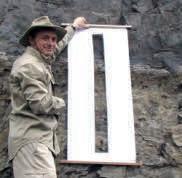
Tel: 403-513-1227, Email: aileen.lozie@cspg.org
Database Administrator and Accounting: Kasandra Amaro
Maternity leave until January 2014
Corporate Sponsorship: Lis Bjeld
Tel: 403-513-1235, Email: lis.bjeld@cspg.org
Controller: Eric Tang
Tel: 403-513-1232, Email: eric.tang@cspg.org
EDITORS/AUTHORS
Please submit RESERVOIR articles to the CSPG office. Submission deadline is the 23rd day of the month, two months prior to issue date. (e.g., January 23 for the March issue).
To publish an article, the CSPG requires digital copies of the document. Text should be in Microsoft Word format and illustrations should be in TIFF format at 300 dpi., at final size. For additional information on manuscript preparation, refer to the Guidelines for Authors published in the CSPG Bulletin or contact the editor.
Technical Editors
Ben McKenzie Colin Yeo (Assistant Tech. Editor) Tarheel Exploration Encana Corporation Tel: 403-277-4496 Tel: 403-645-7724
Email: bjmck@live.com Email: colin.yeo@encana.com
Coordinating Editor
Emma MacPherson, Publications Coordinator, CSPG Tel: 403-513-1230, emma.macpherson@cspg.org,
ADVERTISING
Advertising inquiries should be directed to Emma MacPherson, Tel: 403-513-1230 email: emma.macpherson@cspg.org. The deadline to reserve advertising space is the 23rd day of the month, two months prior to issue date.
FRONT COVER
Miocene
CORRECTION:
RESERVOIR ISSUE 2 • FEBRUARY 2013 3 FEBRUARY 2013 – VOLUME 40, ISSUE 2 ARTICLES Photo of the Month 15 Horizontal Drilling in Western Canada Part 5: The Vital Role of the Geoscientist in Effective Horizontal Drilling and Completions ................................................................................................................. 21 2012 CSPG Honorary Address ............................................................................................ 24 March is National Engineering & Geoscience Month: Design the Future ............ 25 Go Take A Hike ...................................................................................................................... 26 Fall Lecture Tour Wrap-Up ................................................................................................ 29 DEPARTMENTS Executive Comment .......................................................................................................... 5 Technical Luncheons 8 Division Talks .................................................................................................................... 12 Continuing Education 16 Rock Shop ................................................................................................... 14, 22, 23, 28
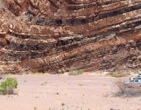
carbonate aeolian deposits displaying multi-directional cross-stratification and honeycomb weathering in Andalucia, Spain. Photo by Chad Glemser.
The RESERVOIR is published 11 times per year by the Canadian Society of Petroleum Geologists. This includes a combined issue for the months of July and August. The purpose of the RESERVOIR is to publicize the Society’s many activities and to promote the geosciences. We look for both technical and non-technical material to publish. Additional information on the RESERVOIR’s submission guidelines can be found at http://www.cspg. org/publications/pubs-reservoir-submissions.cfm. The contents of this publication may not be reproduced either in part or in full without the consent of the publisher. Additional copies of the RESERVOIR are available at the CSPG office. No official endorsement or sponsorship by the CSPG is implied for any advertisement, insert, or article that appears in the Reservoir unless otherwise noted. All submitted materials are reviewed by the editor. We reserve the right to edit all submissions, including letters to the Editor. Submissions must include your name, address, and membership number (if applicable). The material contained in this publication is intended for informational use only. While reasonable care has been taken, authors and the CSPG make no guarantees that any of the equations, schematics, or devices discussed will perform as expected or that they will give the desired results. Some information contained herein may be inaccurate or may vary from standard measurements. The CSPG expressly disclaims any and all liability for the acts, omissions, or conduct of any third-party user of information contained in this publication. Under no circumstances shall the CSPG and its officers, directors, employees, and agents be liable for any injury, loss, damage, or expense arising in any manner whatsoever from the acts, omissions, or conduct of any third-party user. Designed and Printed by The Data Group of Companies, Calgary, Alberta.
The spelling of Gerald Wendland’s last name was incorrect in the Service Awards listing found in the January 2013 edition of the Reservoir. We apologize for this error.
Want to bring geology back into geophysical interpretation?
Aboard
Landmark’s new DecisionSpace® Desktop software accelerates seismic interpretation with geomodel-enabled workflows.
The geophysics and geology modules in Landmark’s new unified DecisionSpace® Desktop software share the same topology engine. This gives geophysicists easy access to framework construction tools that combine well picks and horizons to produce a high resolution, accurate geomodel. The geomodel uses conformance technology to produce well-based surfaces at the same resolution as seismic data, enabling a model that truly represents your reservoir. Get better answers faster. Visit halliburton.com/DecisionSpaceDesktop

High
Simplified® All
Science
© 2013 Halliburton. All rights reserved.


CSPG EXECUTIVE
PRESIDENT
Paul MacKay • Shale Petroleum Ltd. paul.mackay@shalepetroleum.com Tel: 403.457.3930
VICE PRESIDENT
Dale Leckie • Nexen Inc. daleleckie@nexeninc.com Tel: 403.613.0458
PAST PRESIDENT
Robin Mann • AJM Deloitte rcmann@deloitte.ca Tel: 403.648.3210
FINANCE DIRECTOR
Samantha Etherington • Barrick Energy SEtherington@barrick-energy.com Tel: 403.386.6459
ASSISTANT FINANCE DIRECTOR
Gord Stabb • Durando Resources Corp. gstabb@durando.ca Tel: 403.819.8778
PROGRAM DIRECTOR
Dave Russum • AJM Deloitte drussum@deloitte.ca Tel: 403.648.3228
ASSISTANT PROGRAM DIRECTOR
Alexis Anastas • Nexen Inc. alexis_anastas@nexeninc.com Tel: 403.699.4965
SERVICES DIRECTOR
Mike Seifert • Canadian Discovery mseifert@canadiandiscovery.com Tel: 403.269.3644
ASSISTANT SERVICES DIRECTOR
Weishan Ren • Statoil Canada Ltd. wren@statoil.com Tel: 403.724.0325
COMMUNICATIONS DIRECTOR
Curtis Evans • ERCB curtis.evans@ercb.ca Tel: 403.297.8386
ASSISTANT COMMUNICATIONS DIRECTOR
Riona Freeman • Harvest Operations Corp. riona.freeman@harvestenergy.ca Tel: 403.233.6624
OUTREACH DIRECTOR
Dawn Hodgins • Imperial Oil Resources dawn.hodgins@exxonmobil.com Tel: 403.232.5931
ASSISTANT OUTREACH DIRECTOR
Andrew Fox • MEG Energy Corp. andrew.fox@megenergy.com Tel: 403.770.5345
EXECUTIVE DIRECTOR
Lis Bjeld • CSPG lis.bjeld@cspg.org Tel: 403.513.1235
EXECUTIVE COMMENT
A message from President, Paul MacKay
Initiatives GeoConvention, Education Trust Fund, and Outreach
One of the privileges given the incoming CSPG President is the coveted February slot for the Executive Comment in the Reservoir. This slot is reserved for the president so that vision and initiatives can be articulated and communicated to the membership. In a sense it is a ‘State of the Society” address. One of the most important roles of the President is to clearly communicate with the membership. The President with indispensible support from the CSPG Executive and Staff needs to keep the membership aware of the successes and challenges throughout the year. This communication is done in context to the vision of the Society. Meaning, that individual activities might be successful in their own right but are only considered useful if they help the CSPG reach its Goals and Vision.
This comment asks the question: What is our Vision? Fortunately it was articulated and distilled several years ago by previous Executives. Very succinctly, our vision is: ‘To be the pre-eminent regional geoscience society’. How do we gauge our progress on this journey of pre-eminence? Some ways to measure are: how influential we are in the broader geologic community, how commonly are we cited, are we being emulated by other organisations, is our technical discussion followed and does it lead to new concepts in geologic thinking? To a large extent we are advancing on our goals and vision. The real challenge as President is not to create new initiatives but how to promote the things we do well and refocus the areas where we are weak in the context of this vision.
The CSPG is a strong society. Andrea Hood (our past Finance director) showed us in the January Executive Comment that the financial health of the CSPG is strong and affords us opportunity in the future. Our Technical Luncheons are well attended and remain the one of the largest regular technical meeting of geologists in North
America. The technical divisions have grown in popularity and offer an excellent means of both educating and networking our membership. The Annual Convention is growing in popularity and this growth is seen with increased attendance and revenue. The issue we face is how do we maintain this momentum while being a Society that is willing to take risks to reach its vision? With this thought, I suggest three priorities where we can move forward to have significant impact on our science.
The first priority is the Annual National Convention held in conjunction with the CSEG and the CWLS, as well as with guest organizations (GeoConvention). The Convention is the Society’s showcase event. The stated vision of GeoConvention is to be: “The pre-eminent geoscience meeting in North America,” which dovetails well with the CSPG Vision. Both the trade show on the exhibit floor and the technical presentations are enthusiastically received by the membership but we can do better with respect to improved quality and revenue. In the past there has been a lack of consistency from year to year in GeoConvention. In an effort to bring stability to the conference a new relationship with our sister societies is currently under review. GeoConvention will become a limited partnership of the three Societies and will be self-operating. The concept is that with operatorship nestled directly in the convention the learning from each successive year will remain within an established planning group such that the convention can institute a continuous improvement policy and deliver conventions that build on each other year after year. The new corporate structure of GeoConvention is expected to be a significant step in reaching this vision. We will know we have been successful with our convention by tracking increased attendance amongst our membership and from out-of-Country attendees. (Continued on page 7...)
RESERVOIR ISSUE 2 • FEBRUARY 2013 5


EDUCATION SCHEDULE
Last Chance


a.m.
Short Courses
Field Seminars

rates end February 27!


Registration and Information: Toll-free (U.S. and Canada) (888) 338.3387, or (918) 560.2650 • Fax: (918) 560.2678 • email: educate@aapg.org Download a registration form at http://www.aapg.org/education/index.cfm
Houston,
Basic
Austin, Texas Earlybird
Houston,
Earlybird
Modern
Earlybird
Earlybird
UPCOMING
E-Symposium: Petrophysics of Carbonates February 21, 2013 10:00
CST Winter Education Conference - 14 courses over 5 days! February 11-15, 2013
Texas
Well Log Analysis April 15-19, 2013
rates end March 18! Petrophysical Analysis and Integrated Approaches to the Study of Carbonate Reservoirs April 16-18, 2013 Austin, Texas Earlybird rates end March 18! Field Safety Course for Field Trip Leaders March 27-28, 2013
Texas
Terrigenous Clastic Depositional Systems April 5-12, 2013 South Carolina
rates end March 8! Deep-Water Siliciclastic Reservoirs April 14-19, 2013 Northern California
rates end March 15! Clastic Reservoir Facies and Sequence Stratigraphic Analysis of Alluvial-Plain, Shoreface, Deltaic, April 20-26, 2013 and Shelf Depositional Systems Earlybird rates end March 22! Utah
CORPORATE SPONSORS
DIAMOND
Geologic Systems Ltd.
PLATINUM
APEGA
Cenovus Energy
ConocoPhilips Canada
Conoco- Nexen
GOLD
Devon Energy Corp.
Encana Corporation
Imperial Oil Ltd.
Shell Canada Limited
SILVER
Athabasca Oil Sands Corporation
CSEG Foundation
CSPG Educational Trust Fund
EOG Resources
IHS
LED Signs
Roke Technologies Ltd.
TAQA North Ltd.
BRONZE
AGAT Laboratories
CNRL
Husky Energy Inc.
Loring Tarcore
Poggenpohl
RIGSAT Communications
RPS Energy
Schlumberger Canada Limited
Sensor Geophysical Ltd.
Suncor Energy
Talisman Energy
As of January 2013
A Special Thanks to Geologic Systems Ltd.,
CSPG ’s Top Sponsor of the Month
(...Continued from page 5)
The Executive’s second priority is the Educational Trust Fund (ETF). This fund was established over a decade ago to promote education in petroleum geology across the country. The challenge facing our science at a national level is to maintain Canada as a centre of excellence in the geosciences. We have a proud tradition of geologic capabilities in our advanced educational institutes, government agencies, and the petroleum and mining industries. How can we continue this tradition into the future? The question for the ETF is what can it become and how can it be directed as a compliment and support to the Vision of the CSPG? The Trust has incredible potential and should be an enhancement to the Society, which provides substantial support to many initiatives of the CSPG and improves the state of the science of geology in the country. As such the ETF structure is currently being brainstormed by the ETF Trustees and the CSPG Executive. From this, a stronger Trust will emerge with new direction and a stronger mandate to promote geology within the country.
The third priority to this Executive will be to improve our national presence. Our intention will be to retool our Outreach effort and to refocus this effort on the future geology generation enrolled in our universities. The ‘C’ in the CSPG stands for Canadian but often we function as Calgarian. It is natural for Calgary to dominate our organisation as the vast majority of our membership live in Calgary and the bulk of our corporate support comes from businesses within Calgary. However, we are rapidly becoming a younger demographic with new vibrant centres in geology developing across the country. If the Society wishes to remain pertinent to the broader Canadian geologic community, we will need to become more involved with geologists at an earlier stage in their development and to take the Society to them.
We have over thirty geoscience departments in universities across our country. The postsecondary enrollment in geology in Canada is on an upswing. The petroleum industry, mining industry, and the rapidly expanding environmental industry are placing greater demand for geology-trained students in this country. There is a gravitational shift occurring in geology in Canada and as the shift occurs the CSPG must adapt and become more inclusive while still maintaining our traditional roots. The Earth Science Department at the University of Calgary is a case in point. It is now the largest geology department in North America with an
enrollment of greater than 600 students (1.5 to 2.0 times larger than the next largest department). Clearly our future lies in these types of departments and, as such, our Outreach Program will become more important as a tool to extend our presence to the younger generation and to extend our presence across the country.
Currently our University Outreach effort consists of free student membership, our Distinguished Lecturer program (Visiting Petroleum Geologist), student volunteers at our convention, and SIFT (Student Industry Field Trip). These are excellent effective programs but we likely need to do more. To find out how we can be more effective in the geology departments across the country we are sending out senior CSPG representatives (ambassadors). These individuals have a mandate to engage the geology departments at a personal level, to explore ways that the CSPG can be more effective for them, and to aid them in connecting with the broad geology community within industry. The CSPG should be an active liaison for the science between the researchers and the practitioners. These ambassadors of the CSPG are the first step in what is hoped to be a broad, comprehensive effort to engage the faculty, staff, and students of geology departments across the country with the CSPG.
Geologists have been at the forefront of the opening of our country. We are described as a resource-rich country and it is through the historic efforts of geoscientists in our country that we have been able to define these resources and for the most part develop them efficiently and responsibly with leading-edge technology of the day. Canada has a tradition of strength in the geologic sciences. There is every indication that this tradition will continue with the next generation. These three priorities are not quick fix suggestions but rather part of an ongoing plan to provide a forum where the geoscience community can come together and enjoy a rich conversation that supports Canadian geologic pre-eminence. How well we manage this mandate will be reflected by how well our membership continues to engage in its Society.
RESERVOIR ISSUE 2 • FEBRUARY 2013 7
TECHNICAL LUNCHEONS FEBRUARY LUNCHEON
PleistoceneHolocene karstification of Barbados and its implications for the Devonian Grosmont reservoir
SPEAKER
Hans Machel
11:30 am Tuesday, February 5, 2013 Calgary, TELUS Convention Centre Exhibit Hall E, North Building Calgary, Alberta
Please note: The cut-off date for ticket sales is 1:00 pm, Thursday, January 31, 2013. CSPG Member Ticket Price: $45.00 + GST. Non-Member Ticket Price: $47.50 + GST.
Each CSPG Technical Luncheon is 1 APEGA PDH credit. Tickets may be purchased online at www.cspg.org.
ABSTRACT
Barbados is located at 13°10’ north latitude, 59°35’ west longitude, and is about 32
Please check www.cspg.org for the most up to date information.
Webcasts sponsored by
x 23 km in size. Overlying tectonically deformed siliciclastic sediments, about 80% of the surface of the island is made up of Quaternary carbonates with ages approximately 800,000 years to recent. These carbonates are a few meters to about 120 m in thickness and form a series of terraces, which were deposited in response to an interplay of tectonic uplift and eustatic sea level changes, with tectonic uplift ranging episodically from ~7 to 440m per 100,000 years over the past 800,000 years.
The Pleistocene carbonates, and even some underlying Miocene chalks, are extensively overprinted by epigene (top-down) and hypogene (bottom-up) karst processes. Epigene karst features include various types of caves, solution valleys, and sinkholes. Flank-margin caves are the most common cave type. Sinkhole density is high, with an average of five sinkholes per square km. However, some areas have a much higher density while others are almost devoid of sinkholes. Sinkholes range in diameter from about 10m to 120m and are up to about 15m deep. Another striking morphological karst feature is a network of valleys, locally referred to as gullies. Their origin is problematic and much debated. Most gullies have caves along at least a part of their paths, commonly decorated with flowstone or other speleothems.
A number of lessons learnt from the karst in Barbados can be applied to the Devonian Grosmont reservoir in Alberta, despite the vast differences in age and size. For example, numerous sinkholes identified in seismic
images can be interpreted as epigene karst features that developed rapidly on one or several former land surfaces. Drainage patterns akin to the gullies of Barbados can be expected in the Grosmont as well, but not as deep or as densely spaced, and with different orientations. The Grosmont may contain a few stream caves and many more flank-margin caves; the latter should not be as frequent as in Barbados but may be considerably larger.
Integrating these aspects with the known geologic history of Alberta, it appears that the Grosmont platform was karstified in at least two major epigene episodes, and perhaps as many as four. The first major episode for which there is tangible evidence was a ‘warm epigene karstification’ during the Jurassic –Cretaceous, for which Barbados provides a useful analog. The second episode was/is a ‘cold epigene karstification’ that started sometime in the Cenozoic and is continuing to this day. The present repertoire of karst features probably is a composite of these two epigene karstification episodes. In addition, circumstantial evidence suggests that epigene karst gives way to a deep hypogene karst in the downdip part of the platform. The latter likely has different characteristics, i.e., most notably a maze system of passages rather than a stream system overlain by sinkholes. At present the hypogene karst system in the Grosmont is virtually unexplored.
8 RESERVOIR ISSUE 2 • FEBRUARY 2013
FEBRUARY TECHNICAL LUNCHEONS SUBJECT TO CHANGE.
TECHNICAL LUNCHEONS FEBRUARY LUNCHEON
The exploration, appraisal, and development of unconventional reservoirs: A new approach to petroleum geology
SPEAKER
Richard K. Stoneburner
AAPG Distinguished Lecturer
11:30 am Wednesday, February 20, 2013 Calgary, TELUS Convention Centre Macleod Hall C/D, South Building Calgary, Alberta
Please note: The cut-off date for ticket sales is 1:00 pm, Wednesday, February 13, 2013. CSPG Member Ticket Price: $45.00 + GST. Non-Member Ticket Price: $47.50 + GST.
Each CSPG Technical Luncheon is 1 APEGA PDH credit. Tickets may be purchased online at www. cspg.org.
ABSTRACT
The discovery of commercial oil and gas production from shale or mudstone reservoirs has dramatically changed how we explore for and develop oil and gas accumulations. In conventional exploration, appraisal, and development there is a fairly standard and accepted application of processes and technologies. However, the processes and technologies that are employed in the exploration, appraisal, and development of mudstone reservoirs are significantly different, and they are often employed for different reasons and at different stages of the cycle.
Prospect identification is always the initial phase of any exploration project. In most cases in the conventional world this is a result of the interpretation of seismic data, either 2D and/or 3D, in order to identify the areal extent of the prospect, which would typically be on the order of a few hundred acres or in some instances a few thousand acres. However, in the unconventional world the identification is done at a basin level and is not typically supported by seismic, but rather by detailed analysis of a few key wells and their associated petrophysical attributes. Once those attributes are deemed to have the potential of supporting a commercially productive mudstone reservoir, then the utilization of seismic might be
employed to help define the boundaries of the reservoir. However, that would typically be the exception as the reservoir boundaries are generally defined by the configuration of the basin, which is generally fairly well understood and can encompass a million acres or more.
Once the prospect has been identified, the evaluation processes during the exploratory drilling phase are dramatically different. During conventional exploration the validation of the presence, or lack, of hydrocarbons is largely done by the acquisition and interpretation of data from open-hole wire-line logs. While cores, either whole or sidewall, will often be taken, they are typically acquired not to validate the productivity of the reservoir but rather to supplement the open-hole log data. In unconventional exploration, the opposite is the case. While the open-hole logs are extremely important once the discovery is made to calibrate the reservoir, the most critical data around the validation of the quality of the reservoir is the detailed analysis of the rock acquired from whole core. While some of the attributes that are measured from the mudstone core are common to conventional exploration, there are many more measurements taken on mudstone reservoirs that are totally unique to this type of reservoir.
As the prospect moves into appraisal and development mode, there are also unique processes and technologies in the unconventional world that are used to more fully understand the reservoir. The most important of those is the calibration, through the use of specific algorithms, of the data acquired from the whole-core data to the open-hole data that is being acquired from the appraisal and development drilling. Because the cost and time necessary to acquire an extensive collection of wholecore data can be prohibitive, there will be a limited number of wells from which whole
Webcasts sponsored by
core is taken in any given field. Therefore, it is critical to be able to calibrate the various measurements from the whole core to the open-hole log data that will be available on many more wells. This is also the point during which 3D seismic would be acquired as opposed to the acquisition of that type of data during the identification process. In unconventional development, the primary benefit of the 3D seismic data is not to identify where you want to drill, but where you don’t want to drill. Specifically, the horizontal lateral is placed to minimize the effect of faulting on the lateral.
Throughout the entire period of field appraisal and development, the practice of geosteering is critical to the economic success of the field. Since virtually all of the unconventional development is done with the application of horizontal drilling, it is critically important that the drill bit maintains its position within the highest quality reservoir while the lateral is being drilled. Since the drilling operations are performed around the clock, and unexpected changes in dip or the presence of faults can cause the bit to rapidly change its relative stratigraphic position, a Gamma Ray tool is incorporated into the bottom-hole drilling assembly in order to provide continuous measured depth Gamma Ray log data, which is then converted to a true vertical depth (TVD) log using software designed specifically for this process. This TVD log data is subsequently correlated with nearby well control to determine where the lateral is positioned stratigraphically at all times during the drilling operation. When the bit has been interpreted to be out of the desired stratigraphic section, or target window, it is the responsibility of the geosteerer to collaborate with the drilling organization to make the necessary changes to get the bit back into the target window.
BIOGRAPHY
Richard Stoneburner is President North America Shale Production Division for BHP Billiton Petroleum. Prior to joining BHP Billiton, Dick was President and Chief Operating Officer for Petrohawk Energy Corporation and was responsible for all upstream operations.
Dick’s earlier career positions include Vice President-Exploration of 3TEC Energy Corporation until its merger with Plains Exploration & Production Company and working as a geologist for a number of exploration and producing companies including Hugoton Energy Corporation, Stoneburner Exploration, and Texas Oil and Gas.
Dick has more than 35 years of experience in the energy business and has a Bachelor of Science degree in Geological Sciences from The University of Texas at Austin and a Masters of Science degree in Geology from Wichita State University.
RESERVOIR ISSUE 2 • FEBRUARY 2013 9
TECHNICAL LUNCHEONS MARCH LUNCHEON
Mass balance effects in depositional systems
SPEAKER
Chris Paola
AAPG Distinguished Lecturer
11:30 am, Tuesday, March 5, 2013
Calgary, TELUS Convention Centre
Macleod Hall C/D, South Building Calgary, Alberta
Please note: The cut-off date for ticket sales is 1:00 pm, Thursday, February 28, 2013.
CSPG Member Ticket Price: $45.00 + GST. Non-Member Ticket Price: $47.50 + GST.
Each CSPG Technical Luncheon is 1 APEGA PDH credit. Tickets may be purchased online at www.cspg.org.
ABSTRACT
Net deposition is accompanied by systematic loss of sediment mass from the transport system. How is this mass loss reflected in the deposits, and to what extent can it be used to predict stream-wise facies changes? We review mass-extraction analyses of laboratory experiments on fluvial channel stacking; experimental and field turbidites that show a change from channel-dominated to lobe-dominated deposits at about 80% total mass extraction; and experimental, theoretical, and field studies that show a close connection between rate of mass loss and rate of downstream grain-size fining. Applied thoughtfully, depositional mass balance provides a framework for quantitative prediction and comparison across basins of varying scale and shape.
BIOGRAPHY
Chris Paola is CSE Distinguished Professor of Earth Sciences, University of Minnesota, Minneapolis, and does research at St. Anthony
TECHNICAL LUNCHEONS MARCH LUNCHEON
Integrated, web-accessible, public-sector, geoscience mapping systems
SPEAKER
Harvey Thorleifson Ph.D., P.Geo., D.Sc. Director, Minnesota Geological Survey; State Geologist of Minnesota; Professor, University of Minnesota
11:30 am
Tuesday, March 22, 2013 Calgary, TELUS Convention Centre Macleod Hall C/D, South Building Calgary, Alberta
Please note: The cut-off date for ticket sales is 1:00 pm, Thursday, March 17, 2013. CSPG Member Ticket Price: $45.00 + GST. NonMember Ticket Price: $47.50 + GST.
Each CSPG Technical Luncheon is 1 APEGA PDH credit. Tickets may be purchased online at www.cspg.org.
ABSTRACT
Regional geological, geophysical, and geochemical surveys are a service provided by geological survey agencies at the federal and state/provincial level. This mapping represents authoritative lowresolution regional information regarding the properties, composition, structure, and origin of sediments and rocks, based on observations and inferences backed by research on material, process, and history. This spatial accounting is needed to provide context that supports the progress of both public and private sector applications related
Webcasts sponsored by

Falls Laboratory. His research interests are in physical sedimentary geology and stratigraphy, especially the dynamics of channelized systems such as rivers and deltas. His education includes a B.S. in Environmental Geology from Lehigh University, a M.Sc. in Applied Sedimentology from University of Reading, and a D.Sc. in Marine Geology from the MIT/WHOI Joint Program in Oceanography.
Webcasts sponsored by
to energy, minerals, water, waste disposal, construction, and hazards as well as basic research. We are well into a transition from conventional paper reports and standalone databases, to web-accessible 3D geological mapping linked to geological, geophysical, and geochemical databases, supported by required documentation. This transition will accelerate, as users favour this format, and as geological survey agencies respond to societal needs.
BIOGRAPHY
Harvey Thorleifson was appointed Director of the Minnesota Geological Survey, State Geologist of Minnesota, and University of Minnesota Professor in 2003. He is 2012/2013 President of the Association of American State Geologists, he was the 2004/2006 President of the Canadian Geoscience Council, predecessor of the Canadian Federation of Earth Sciences, and he was the 2003/2004 President of the Geological Association of Canada. He is originally from western Manitoba; he completed his undergrad and Masters at the Universities of Winnipeg and Manitoba; he holds a Ph.D. from University of Colorado; and while with the Geological Survey of Canada from 1986 until 2003, he conducted field work at sites ranging from Alberta to offshore Hudson Bay.
10 RESERVOIR ISSUE 2 • FEBRUARY 2013
PALEO 2013
Presented in conjunction with the CSPG Palaeontological Division and Mount Royal University Earth Sciences Department
Mount Royal University, 4825 Mount Royal Gate SW, Calgary, Alberta
Lectures and poster displays – Saturday, March 16, 2013, 9:00 AM to 4:30 PM Workshops – Sunday, March 17, 2013, 9:00 AM to 4:00 PM
Saturday lecture events and poster viewings are free and require no registration. There will be fossil displays and activities of interest to a wide audience, including families, on the Saturday. Sunday workshops do require registration and a minor fee.
SPEAKER SCHEDULE
Saturday, March 16th
All talks to be held in Jenkins Theatre, lower level of Mount Royal University
9:00 - 9:15 AM Opening statement by Wayne Braunberger, APS President, and Symposium instructions by Mona Marsovsky
9:15 - 10:15 AM The perils of P rotichnites: The checkered history of an iconic ichnotaxon. Robert MacNaughton, Ph.D. Research Scientist, Geological Survey of Canada
10:15 - 10:30 AM Coffee break
10:30 - 11:00 AM Insects and health and safety considerations for field paleontologists in A lberta . Darren Tanke, Royal Tyrrell Museum
11:00 - 11:30 AM Permian fossils around the world. Charles M. Henderson, Ph.D. P. Geol., Professor and Head of Department of Geoscience, University of Calgary
11:30 - 12:00 PM C limate change and vertebrate evolution in the early Permian. Jason Pardo, Masters Student, University of Calgary
12:00 - 1:00 PM Lunch break
1:00 - 1:30 PM Trace fossils of the Eocene Green River Formation: Implications for paleoenvironments. Jennifer Scott, Ph.D., Assistant Professor, Department of Earth Sciences, Mount Royal University
1:30 - 2:00 PM L ate Quaternary mollusc faunas of A lberta and Saskatchewan. Lisa Bohach, Ph.D., P.Geol., Stantec Consulting Ltd.
2:00 – 2:45 PM Poster session. Poster presenters are requested to be with their posters
2:45 - 3:00 PM Coffee break
3:00 - 3:30 PM D inosaur biostratigraphy of the H orseshoe C anyon Formation (Upper C retaceous): Evidence for climatic and evolutionary influences. David A. Eberth Ph.D., Senior Research Scientist, Royal Tyrrell Museum
3:30 - 4:30 PM C anadian trilobites. Brian Chatterton, Ph.D., University of Alberta.
4:30 PM Finish
WORK SHOP
Sunday March 17th
Room B213, Mount Royal University.
A mmonite Seminar
9:00 AM to 4:00 PM with a one-hour lunch break from 12 PM to 1 PM. Bring your own lunch.
Presenter:
Wayne Braunberger, M.Sc. P. Geol., Alberta Palaeontological Society
Ammonoid cephalopods, generally referred to as “ammonites” are one of the most common fossils found in marine sediments deposited within the Western Interior Basin of North America during the Mesozoic. A prolific and diverse group, “ammonites” are extremely useful in biostratigraphic and paleogeographic studies.
This day-long seminar will give participants an overview of the methods used to describe, illustrate, and identify “ammonites”:
● What is an ammonite?
● Form and function
● Taxonomic nomenclature
● Preservation
● Descriptive terminology
● Understanding the species description
● Use in biostratigraphy and paleogeography
● Collection, preparation, and illustration
Seminar participants are encouraged to bring one or two of their own specimens.
Cost: $30 per person
To register for workshops contact Mona Marsovsky (403) 547-0182 or giftshop@albertapaleo.org, Make the cheque payable to the Alberta Palaeontological Society, P.O. Box 35111, Sarcee Postal Outlet, Calgary Alberta, Canada T3E 7C7. Deadline for workshop registration is March 4, 2013. Registration is limited to 20 participants, so register early.
RESERVOIR ISSUE 2 • FEBRUARY 2013 11
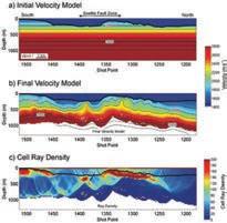
Seismic detection of subtle faults and fractures
SPEAKER
Robert Godfrey, Ph.D., Schlumberger, Calgary
12 noon
Thursday, February 7, 2013 Conference Centre Room A, +30 level, Western Canadian Place (Husky Energy), 707-8th Avenue S.W. Calgary, Alberta
ABSTRACT
This presentation describes reservoir studies that incorporate seismic methods for characterizing fracture systems. With the exception of large-scale faults that the seismic interpreter can pick by hand, most structural lineaments are ignored
as being too small and numerous to be interpreted manually. Moreover, it is not straightforward to account for the effects of these small features in reservoir models. Advanced seismic imaging and processing techniques and workflows have been developed to assist geoscientists in this challenging interpretation task. Case studies demonstrate how these methods inform operators as they make well placement and reservoir management decisions.
BIOGRAPHY
Bob Godfrey is a geophysical advisor at the Schlumberger Heavy Oil Regional Technology Center (RTC) in Calgary. He is part of a multidisciplinary team tackling critical technical issues related to heavy oil production. His own focus is on geophysical applications – primarily field experiments – to aid in characterizing heavy oil reservoirs and monitoring the subsurface details of heavy oil production. Bob has a Bachelors degree in Geological Engineering from the University of British Columbia and a Doctorate in Geophysics from Stanford University. Prior to joining the Calgary
RTC in 2008, he worked as a Geophysicist with Mobil, a Research Geophysicist with Digicon, and has held various technical and managerial roles with WesternGeco in a diverse range of geographical locations.
DIVISION INFORMATION:
Structural Division talks are monthly and cover a diversity of structural themes. Our Structural Division sponsors are HEF Petrophysical and Husky Energy. All are welcome and no registration is required. For additional information, to be placed on the Division e-mail list, or to present a talk, please contact Darcie Greggs, Darcie. Greggs@huskyenergy.com.


12 RESERVOIR ISSUE 2 • FEBRUARY 2013
STRUCTURAL GEOLOGY DIVISION Sponsored by NOW AVAILABLE CSPG is proud to present our 2013 Geological Calendar 14 membersubmitted photos from all over the world Available Now! Online: www.cspg.org Office: 110 - 333, 5th Ave SW 2013 CSPG Geological Calendar www.cspg.orgNot too late to get your copy!
DIVISION TALKS
DIVISION TALKS INTERNATIONAL DIVISION
The prospectivity of the unconventional oil and gas resources in the Vaca Muerta Shale of the Neuquén Basin of Argentina
SPEAKER
Dr. Easton Wren
Exploration Vice President and a Director of Americas Petrogas Inc.
12:00 Noon
Wednesday, February 13th, 2013 Nexen Plus 15 Conference Centre Nexen Annex Building 7th Ave. & 7th Street SW Calgary, Alberta
ABSTRACT
The Neuquén Basin of Argentina has a long history of oil and gas exploration and development. In the last two years the emerging focus has been on the two principal source rocks in the basin, namely the Vaca Muerta and the Los Molles Shales.
The Vaca Muerta is late Jurassic-early Cretaceous in age and covers an area of 8,500 square miles. It varies in depth between 5,500 and 4,000 feet but can be thicker than 2,000 feet.
The shale characteristics are considered to be similar to the Eagle Ford, Haynesville, Bakken, and Horn River shale plays and have attracted much interest from many of the major and independent oil companies active in those areas of North America.
It is still very early in the exploration phase and available published data on some of the shale characteristics is limited. However, there is already sufficient evidence from recent discoveries to generate substantial optimism that the Vaca Muerta will be
a major producing formation.
This presentation will provide a general description of the Vaca Muerta in the Neuquén Basin, its regional distribution and characteristics based on available information, and indicate the resource potential of the play.
BIOGRAPHY
Dr. Easton Wren is well known in Canada and recognized internationally as an instructor/ presenter with a background in television production.
He received his B.Sc. (Hons) in Geology and his Ph.D. in Geophysics from the University of Glasgow in Scotland. His professional experience in the oil industry includes positions with Ray Geophysical Company in Libya, the United Nations in Uganda, Amoco Canada and PanCanadian Petroleum in Calgary. In 1978 he founded Petrel Consultants and was President and General Manager of the company until 1986. In recent years he has been Exploration Vice President and a Director of Americas Petrogas Inc, a Calgary junior oil and gas company with oil and gas operations in Argentina and a potash/phosphate project in Peru.
Sponsored by
Dr. Wren has lectured at U.S. and Canadian universities, and has developed and presented industry-oriented training courses to a wide variety of audiences.
He was elected President of the Canadian Society of Exploration Geophysicists for 1981, received the Society’s Best Paper award in 1974, the Meritorious Service Award in 1977, and Honorary Membership in 1988. He has authored several published papers on seismic topics in both technical and nontechnical publications.

In 1987, he was Distinguished Lecturer for the American Association of Petroleum Geologists (AAPG). He is also an active member of SEG, CSEG, and APEGGA. He was the producer and host of CFAC-TV Calgary “Science Spectrum” documentary program.
DIVISION INFORMATION:
There is no charge. Please bring your lunch. The facilities for the talk are provided complimentary of Nexen, coffee by IHS, and refreshments by Geochemtech Inc. The speakers are provided with gifts by Drilling Information and Quad Operations. For further information or if you would like to give a talk, please contact Bob Potter at (403) 863-9738 or ropotter@geochemtech. com or Trent Rehill at (403) 606-6717 or trehill@kulczykoil.ca. Or visit our new Face Book page (“CSPG International Division”).
RESERVOIR ISSUE 2 • FEBRUARY 2013 13
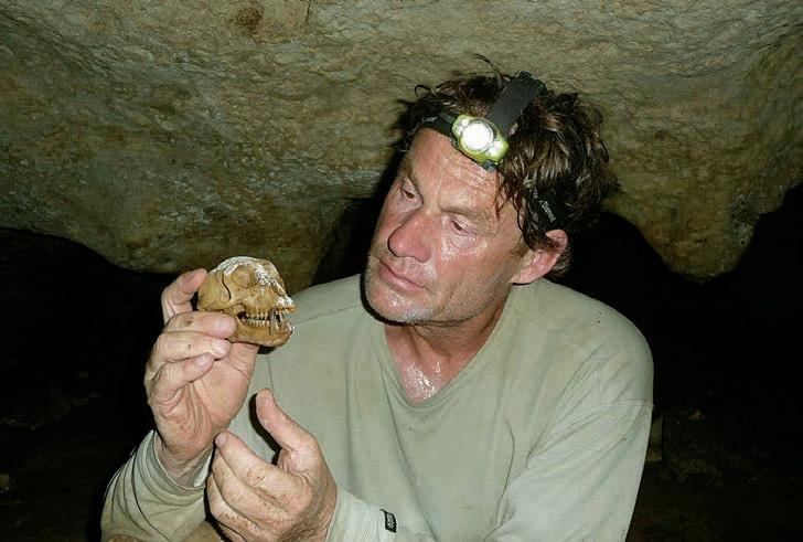
DIVISION TALKS PALAEONTOLOGY DIVISION
History of collecting tyrannosaurs in Alberta and an emerging view of their growth and evolution
SPEAKER
Tetsuto Miyashita, Ph.D. Candidate University of Alberta
7:30 PM
Friday, February 15th, 2013 Mount Royal University, Room B108 Calgary, Alberta
ABSTRACT
Alberta is the most fertile of all places to hunt for tyrannosaur fossils. More tyrannosaur species are known from Alberta (Albertosaurus, Daspletosaurus, Gorgosaurus, and Tyrannosaurus) than from other famous localities such as Montana (USA), Gobi Desert (Mongolia), or Liaoning (China). Alberta also overwhelms other localities in the number of 75-100% complete tyrannosaur skeletons. Many of the best-preserved specimens are on display in museums across North America, and casts of the Albertan tyrannosaur specimens are in almost every museum in the world with decent collections of
ROCK SHOP
dinosaur specimens. So the chance is quite good that you are looking at an Albertan tyrannosaur if you happen to see a mounted tyrannosaur skeleton or a skull that is not Tyrannosaurus rex in museums outside Alberta.
Who collected tyrannosaurs from Alberta, and what have we learned from the Alberta tyrannosaurs? I will re-visit the history of tyrannosaur collecting in the province, including: the skull of Albertosaurus that gave Joseph Burr Tyrrell a fine dinosaur museum named after him; the nearly perfect skeleton of Tyrannosaurus buried under rubble before excavation was complete; a growth series of Gorgosaurus that reveals how fast the animal grew and how tyrannosaurs survived ‘mid-life crisis’; and a bonebed of Albertosaurus that took the perseverance of Philip Currie to re-discover nearly a century after Barnum Brown left the quarry (and resulted in the recent TV documentary and book “Dinosaur Gangs”). The last part of the presentation is on a new species of Daspletosaurus from Alberta and the realization of a previously unknown subgroup of tyrannosaurs in the Campanian of western North America. The new species is represented by many well-preserved skulls and skeletons. It consists of a subadult with its face bitten by another tyrannosaur, an adult that was found by a camera lens cap tumbling down the hill, and one of the best tyrannosaur specimens from Alberta with a complete skull (the excavation of which took three different team between 2001 and 2012).
Sponsored by
BIOGRAPHY
Tetsuto Miyashita is Ph.D. student at the University of Alberta. A book by the prominent Canadian dinosaur paleontologist Philip Currie – a Christmas gift from parents when he was ten – sparked his dream of becoming a paleontologist. He moved to Drumheller, Alberta, at age 16 to volunteer for Royal Tyrrell Museum of Palaeontology. Subsequently, during four years as an undergraduate and two years in the master’s program at the University of Alberta, he was supervised by Philip Currie, invertebrate zoologist Rich Palmer, developmental biologist Sally Leys, ichthyologist Alison Murray, and marine ecologist Richard Strathmann. In their labs, he got his hands on various projects, including anatomy of early vertebrates, systematics of tyrannosaurs, soft tissues in ankylosaurs, biomechanics of marine invertebrate larvae, ecology of intertidal snails, and development of fishes. Recently, he was on a tour through China to study basal tyrannosaurs and other theropod dinosaurs.
INFORMATION
This event is jointly presented by the Alberta Palaeontological Society, Mount Royal University, the CSPG Palaeontology Division and Cenovus Energy. For details or to present a talk in the future please contact CSPG Paleo Division Chair Philip Benham at 403-6913343 or APS Coordinator Harold Whittaker at 403-286-0349, or contact programs@ albertapaleo.org. Visit the APS website for confirmation of event times and upcoming speakers: http://www.albertapaleo.org/.
14 RESERVOIR ISSUE 2 • FEBRUARY 2013
Conventional Wells • Horizontal Wells - Spearfish - Viking - Bakken - Cardium - Horn River Shale Gas
.serpaconsulting.com
Email: afran@telusplanet.net www
PHOTO OF THE MONTH
RESERVOIR ISSUE 2 • FEBRUARY 2013 15
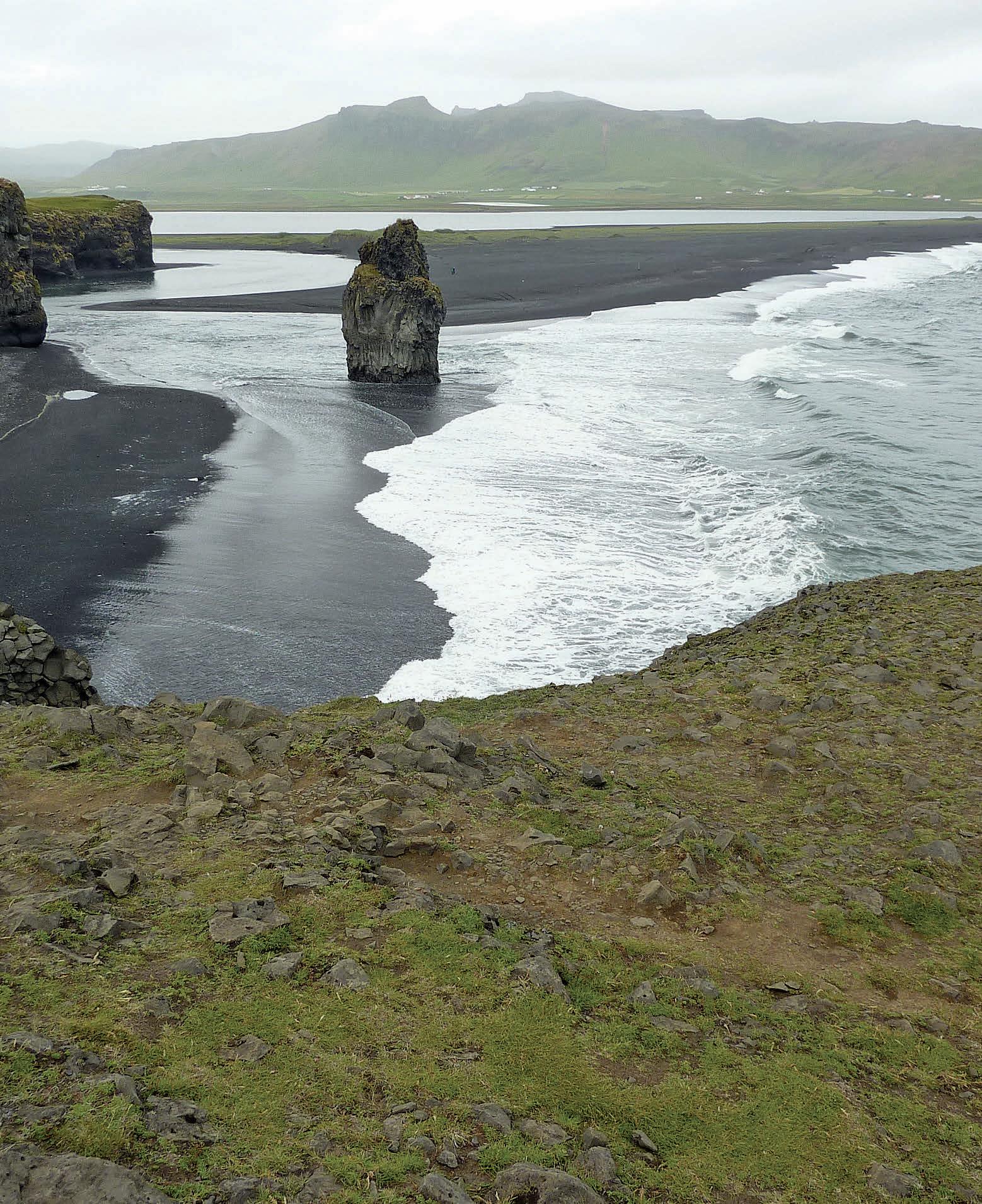
Black Sand Estuary, Iceland. Photographer: Milovan Fustic.
CONTINUING EDUCATION
2013 Education Program –Our instructors
BY THOMAS JEROME Chair of the CSPG Committee of Continuing Education education@cspg.org
February already... As always, time flies by, busy as we all are with our work, our family, and our friends.
To convince you to take a few minutes to look for that one course in our program that will make your work simpler in 2013, we have interviewed three instructors. They will explain to you in their own words why classroom courses, core facility workshops, and field seminars are important for your career and for your company.
2013 Continuing Education Committee
Ali Beken, Andrew Couch, Andrew Riben, Clarke Campbell, Heather Archibald, Johanna Alvarez, Thomas Jerome, and Yi Zhao.
Supporting CSPG Staff Member
Aileen Lozie
2013 Supervising Director and Assistant Director
Dave Russum and Alexis Anastas
GLEN ECKERT – TEACHING CLASSROOM-STYLE COURSES
After having been well received in the spring of 2012, we have the pleasure to welcome back Glen in 2013 with a revised version of his course. Glen is one of the talented speakers that come each year to Calgary to share their knowledge with our community.
Glen, can you introduce yourself to our readers? What led you to teaching?
I’ve been in the drilling business for nearly 35 years now, starting as a driller in 1978 and moving up the ladder to the responsibilities of a VP of Operations. I’ve been involved in drilling worldwide. Being Canadian, a large part of my work was done in Western Canada.
In early 2012, a field geologist convinced me I should share my knowledge with his colleagues. It would help them in their work to know more about drilling. The course I gave through the CSPG in the spring of 2012 was the result of this. The positive feedback I received showed me that my friend was correct.
That first course opened doors to several O&G companies that asked me to teach to their teams internally. Since then, I’ve shared my time between my job of driller and my new career as an instructor.
To be of value, a course must remain upto-date all the time. Like other instructors,

I continue to add content based on the experience I gain daily in my work.
Why do you think courses should be important for our community?
Our industry is facing more and more complex challenges to find and produce oil and gas. As a result, new ideas, techniques, and tools are constantly being developed. It is true in my field but also in all the scientific domains covered by the other instructors.
Geoscientists should constantly keep their ear to the ground by reading articles, attending technical lunches, and, naturally, by participating in courses.
Sending an employee to a course has a cost for companies of course, but it is an extremely small price to pay compared to the hundreds of thousands of dollars that can be saved thanks to the newly acquired knowledge.
At the end of the day, taking courses improve productivity. It’s as simple as that.
But why not simply learn from colleagues? Why the need to attend a formal course?
Colleagues are an invaluable source of information and every geoscientist should learn as much as possible from others’ experience.
Courses are complementary to this though. On one hand, colleagues will teach you about the techniques that they have mastered through the years. On the other hand, a formal course will introduce new approaches that may not yet be used in your company, but that could make an impact in the way you understand and produce your reservoir.
Courses bring a breath of fresh air if you want. As mentioned earlier, they improve the participant’s productivity and beyond that they will improve the participant’s and the company’s competitiveness.
Thanks Glen for your time. My pleasure, Thomas. I’m looking forward to teaching again in Calgary this spring.
(Continued on page 18...)
16 RESERVOIR ISSUE 2 • FEBRUARY 2013


2013 Education Program Together,
1,000
www.cspg.org/educa=on
Come
and
Pick
their
Brains!
Register
online
for
the
2013
training
program!
Some of
instructors ... ... Meet the
online! Early Bird registration for the Spring Courses will end at the beginning of March! www.cspg.org/education
our instructors are bringing over
years
of
knowledge
and
exper=se!
our
others
(...Continued from page 16 )
EVA DRIVET – TEACHING COREBASED WORKSHOPS
Eva is one of the instructors for the CSPG who runs courses focused on the interpretation and integration of core and core data. She will be teaching two corebased workshops this spring; a full-day course with Lisa Griffith on the methodology for describing clastic and carbonate cores, and a second half-day course with David Hills and Laurie Slezak on an overview of Devonian carbonates in Western Canada.
Eva, can you tell us a little about yourself?
Hi Thomas. I’ve been a geologist for nearly 20 years now. I’ve specialized in carbonates, first with my M.Sc. under Dr. Mountjoy’s supervision, then with my work at Shell Canada and other mid-sized companies, and now as a consultant.
Through the years, I got the chance to work with some great mentors who not only shared their knowledge, but also inspired me to teach. It led me to first volunteer in 1996-1997 in the CSPG Continuing
Education Committee that you are now chairing. Then in 2010, I started teaching through the CSPG, both for professional members (through Continuing Education) and for students (through the SIFT program). Actually, the second course I’m offering this year with two of my colleagues is one we taught only to students so far until we realized that it might also be of interest to the whole community.
You seem to work a lot with cores. Geology is all about studying rocks. Collecting data from core samples is a natural extension of this. Beyond that, our O&G industry is facing bigger challenges than ever to increase production in existing mature fields or to develop unconventional resources. We won’t face those challenges without having a deeper understanding of our reservoirs. Core data provide us with that extra information we need.
It’s very rewarding to see how such small rock samples, when properly studied and combined with other data such as logs and production history, are able to bring light to problems commonly encountered in the industry.
For core data, Calgary is quite a unique place ... Indeed, we have the chance to find in town the largest core facilities in the world. The ERCB core facilities store well above 1,500 kilometers of core data! We have also some very modern laboratories that provide state-of-the-art technologies and can assist in extracting a lot of information from those cores.
What are the benefits of taking corebased workshops, such as the two courses you are offering?
O&G companies often will collect cores when drilling. Unfortunately, due to tight deadlines, heavy workloads, or lack of resources, time is not always available in the office to make the best of those data.
Describing cores can also be intimidating at first – for example, when you start your
2013 EDUCATION PROGRAM
EARLY BIRD DEADLINES
Spring Education Weeks Friday March 8th
Summer Field Seminar 6 weeks before each seminar
Fall Education Weeks Friday September 6th
career, when you arrive from other places where core data are rare, or simply when you have not worked with them for a long time.
Core-based workshops are great opportunities to learn the skill set required to maximize value out of your core data. You gain experience looking at cores under the guidance and mentorship of instructors who have a strong background in describing cores, and many years working in the O&G industry. Attending such courses better prepares you to incorporate core descriptions into your workflow, which ultimately will assist in generating more potential.
Thanks Eva.
Thanks for giving me the opportunity to talk about something I am so passionate about.
PATRICIO DESJARDIN – ORGANIZING FIELD SEMINARS
Patricio won the 2011 CSPG Graduate Thesis Award for his Ph.D. work completed at the University of Saskatchewan. In 2013, Patricio is organizing his first CSPG field seminar with his former Ph.D. supervisor, Luis Buatois.
Patricio, can you summarize your career for us? Have you taught already in the past?
I’m Argentinean and I graduated in geology over there. From 2005 to 2010, I was in Saskatoon for my Ph.D studies. Once completed, I worked for some time as a consultant for Shell Canada before being
18 RESERVOIR ISSUE 2 • FEBRUARY 2013
hired by Shell’s office in Houston. Through the years, I’ve worked on many different clastic plays, such as deep-water in the Gulf of Mexico, some unconventional plays in East Texas now, and – of course – Canadian plays during my Ph.D.
I caught the passion for teaching thanks to my mom who is a professor back home. When I was in Argentina, I was already teaching intensively in science outreach programs, to share my passion for geology with non-specialists. During my Ph.D., I continued teaching to students on advanced topics like sedimentology. I was also involved in organizing field seminars for the University. Once at Shell, I gave some internal courses on my Ph.D. results and now the CSPG is giving me the opportunity to teach to the community. I’m looking forward for it.
We are happy to have you on-board for 2013. How do you manage to teach while working in a major operator?
My management in Houston is very supportive. They have no problem letting me teach about my Ph.D. results outside of Shell. They have also a lot of respect for the CSPG and they are happy to I have a chance
to give back to the community that granted me an award for my Ph.D. work.
Did receiving the CSPG Graduate Thesis Award help you in your career? It did indeed. It gave me and it continues to give me a lot of exposure. For example, the AAPG Explorer is supposed to mention it in its January issue (n.b., this interview was conducted in December 2012). That exposure gave me opportunities. It helped me starting with Shell and today, it’s giving me the chance to teach through the CSPG.
That Award also boosted my self-confidence: it always feels good to be recognized by your colleagues!
Your Award was well deserved. To get back to field seminars, how important are they for you in your work, and by extension, how important do you think they can be for other geologists?
A famous geologist in Argentina once said, “What is the best way to study the subsurface? Go to the mountains!” I completely agree with that. In O&G, well data give you a lot of details about your reservoir and outcrops give you an idea on how everything gets organized on the large scale.
GEOEDGES INC.
Texas & Midcontinent US Geological Edge Set
With the development of seismic in the last few decades, some geoscientists thought outcrops would be less needed. It might be true in some cases, but now that our reservoirs are more and more complex, outcrops should be looked at more than ever, I think.
Personally, I’m using them as a guide on how to build 3D static models of my reservoirs. So actually, outcrops didn’t become obsolete because of the advances in computer modeling. They simply provided much needed input to build geologically valid 3D models!
Outcrops will continue to prove useful, I have no doubt about that.
Thanks Patricio and once again, welcome as an instructor in our Training Program.
Thanks to the CSPG for giving me that opportunity to give back to the community. It’s a pleasure doing it considering everything the Canadian community has done for me.
Western Canada: Slave Point, Swan Hills, Leduc, Grosmont, Jean Marie, Horn River Shales, Elkton, Shunda, Pekisko, Banff, Mississippian subcrops and anhydrite barriers in SE Sask., Bakken, Three Forks, Montney, Halfway, Charlie Lake, Rock Creek, Shaunavon, BQ/Gething, Bluesky, Glauconitic, Lloyd, Sparky, Colony, Viking, Cardium, Horseshoe Canyon and Mannville CBM, Oilsands Areas, Outcrops
US Rockies & Williston: Red River, Mississippian subcrops & anhydrite barriers (Bluell, Sherwood, Rival, etc), Bakken, Three Forks, Cutbank, Sunburst, Tyler, Heath, Muddy, Dakota, Sussex, Shannon, Parkman, Almond, Lewis, Frontier, Niobrara, Mesaverde shorelines, Minnelusa, Gothic, Hovenweep, Ismay, Desert Creek, Field Outlines, Outcrops
Texas & Midcontinent: Permian Basin paleogeography (Wolfcampian, Leonardian, Guadalupian), Granite Wash, Mississippian Horizontal Play, Chat, Red Fork, Morrow, Sligo/Edwards Reefs, Salt Basins, Frio, Yegua, Wilcox, Eagleford, Tuscaloosa, Haynesville, Fayeteville-Caney, Woodford, Field Outlines, Outcrops, Structures
North American Shales: Shale plays characterized by O&G fields, formation limit, outcrop, subcrop, structure, isopach, maturity, stratigraphic cross-sections. Includes: Marcellus, Rhinestreet, Huron, New Albany, Antrim, Utica-Collingwood, Barnett, Eagleford, Niobrara, Gothic, Hovenweep, Mowry, Bakken, Three Forks, Monterey, Montney, Horn River, Colorado
Eastern US / Appalachia: PreCambrian, Trenton, Utica-Collingwood, Medina-Clinton, Tuscarora, Marcellus, Onondaga Structure, Geneseo, Huron, Antrim, New Albny, Rhinestreet, Sonyea, Cleveland, Venango, Bradford, Elk, Berea, Weir, Big Injun, Formation limits, Outcrops, Allegheny Thrust, Cincinatti Arch, Field outlines
Deliverables include:
-Shapefiles and AccuMap map features
-hard copy maps, manual, pdf cross-sections
-Petra Thematic Map projects, GeoGraphix projects, ArcView map and layers files
-bi-annual updates and additions to mapping
-technical support
RESERVOIR ISSUE 2 • FEBRUARY 2013 19
Western Canada Geological Edge Set Northern US Rockies & Williston Basin Geological Edge Set Eastern US / Appalachian Basin Geological Edge Set North American
Geological Edge Set Detailed and accurate geology at your fingertips in Petra, GeoGraphix, ArcGIS, AccuMap, GeoScout and other applications for information contact: Joel Harding at 403 870 8122 email joelharding@geoedges.com www.geoedges.com
Shales
May 6 -10
Telus Convention Centre and ERCB Core Research Centre
PLEASE JOIN US FOR TWO EXCITING LUNCHEON SPEAKERS IN 2013:
Al Hancock, Monday, May 6
Al began rock, ice, alpine, and expedition climbing 15 years ago after taking numerous climbing courses. A few years later, he began to set his sights on the ultimate challenge for high-altitude climbers, climbing the highest mountain on each of the world’s seven continents (known as the Seven Summits). In 2003 he completed the first of his Seven Summits, Mount Denali in Alaska. Fast forward five years, he became the 13 Canadian to have climbed all seven summits (202nd worldwide) -- including Mount th Everest twice, in 2007 and 2010.
Deborah Yedlin, Tuesday, May 7
Herald Business columnist Deborah Yedlin began her career working as an investment banker in 1987, working in New York for Goldman Sachs. Upon completing her MBA in Finance, Deborah continued working in corporate finance, first in Toronto and then in Calgary. Deborah’s career in business journalism began in 1996 and has included positions with the Financial Post and the Globe and Mail. Deborah has held her current position as business columnist for the Calgary Herald since April 2007. She is also a weekly business commentator for CBC radio.
In addition to her professional obligations, Deborah is active in the Calgary community, sitting as a director on a number of not-for-profit boards.
Deborah was born and raised in Edmonton, holds an undergraduate degree from the University of Alberta, an MBA from Queen’s University, and recently completed the Institute of Corporate Directors program through the Haskayne School of Business.
REGISTRATION
Registration for GeoConvention 2013: Integration will open March 18 , 2013. Please visit www.geoconvention.com to purchase your convention registration and special event tickets.
Once again this year, CSEG, CSPG, and CWLS members will receive a discounted registration rate; renew or purchase a society membership as you register for the convention and qualify for discounted pricing.
20 RESERVOIR ISSUE 2 • FEBRUARY 2013
For more information visit www.geoconvention.com
EARLY BIRD PRICING (deadline March 30, 2013 at midnight EST) Member Non-Member Student Retired Presenter $475.00 $575.00 $90.00 $205.00 $350.00 REGULAR PRICING (deadline April 30, 2013 at midnight EST) Member Non-Member Student Retired Presenter $585.00 $685.00 $90.00 $205.00 $350.00 ON-SITE PRICING (on-site registration opens Monday, May 6th at 7:00am at the TELUS Convention Centre) Member Non-Member Student Retired Presenter $685.00 $785.00 $90.00 $205.00 $350.00 Please note that all prices are in Canadian dollars and do not include GST.
HORIZONTAL DRILLING IN WESTERN CANADA
Part 5: The vital role of the geoscientist in effective horizontal drilling and completions
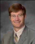
| By Dave Russum, Director Geoscience, AJM Deloitte
The goal of drilling and completion is to efficiently and economically extract hydrocarbons. To achieve success, the devil is in the details; and those details require the input of many different disciplines. Because the results are largely influenced by the rocks, the geoscientist needs to be involved from drilling location to production and beyond.
A REVERSAL OF ROLES
In the development of unconventional resources there has been something of a reversal in roles where the geoscientists have become more cautious in assessing these plays, while engineers, financiers, and the media have tended to the optimistic view that any rock can be completed successfully and that virtually unlimited hydrocarbons can be produced. To some degree, we are guilty of creating this mindset by quoting vast volumes of in-place hydrocarbons without providing meaningful assessment of what might be produced.
The geoscience community must ensure that we provide the best possible interpretation that incorporates all available information and does not mislead the stakeholders.
THE IMPORTANCE OF MULTIDISCIPLINARY TEAMS
Figure 1 illustrates many of the issues that need to be addressed in preparing for a successful drilling campaign. While I have attempted to place the issues under the geoscience or engineering responsibility, the arrows indicate that none of the issues are relevant solely to a single discipline and all are relevant to the final result. This particular chart is directed towards unconventional reservoirs but it could easily be tailored to any target reservoir.
The left side of the chart is the domain of the geoscientists. It is really directed towards investigating what we know of the reservoir; any limitations in our knowledge need to be placed in the green area in the centre of the chart. The complete team needs to assess whether the weaknesses in the project are significant enough to require the acquisition of more data. This may be an economic assessment of whether spending money to acquire more data is a better approach than proceeding straight to the drilling stage.
The right side lists some of the decisions necessary to determine how the well will be
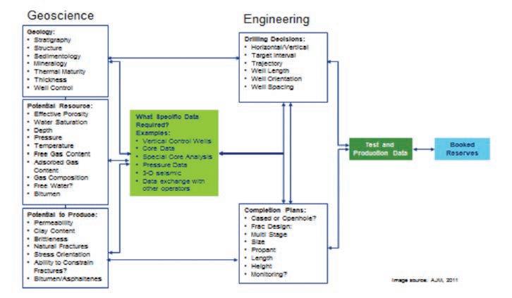
drilled and, subsequently, how the well will be completed. The combination of all the information and the planning decisions will hopefully lead to successful production, which in turn leads to booked reserves that become a measure of corporate success.
In virtually any project, the initial concept is likely driven by the geologist. The amount of vertical well control and the data available from those wells will influence the understanding of the opportunity. I like to view the initial potential in what I term the CONFirm process.
THE CONFIRM PROCESS FOR REVIEWING UNCONVENTIONAL PROSPECTS
Once a potential opportunity has been identified, the geologist must assess five conditions to determine whether the opportunity is worth further consideration. Most geologists will already use a similar method to this:
• Continuity of Reservoir – While obvious, it is amazing how often we see plays where assumptions of continuity have not been borne out by horizontal drilling. In the haste to drill a horizontal producing well, the geologist has failed to assess whether additional vertical stratigraphic tests, seismic data, or other tools are required to improve our understanding of the continuity of the reservoir. This is a major contributor to why horizontal drilling is so difficult in
underexplored areas.
• Consistency of Reservoir – Does existing control suggest similar rock properties for the target zone across the project area? A prospect with consistent rock properties is obviously far more likely to produce consistent results.
• Content of Pore volume –Understanding the principles of hydrocarbon generation becomes key to assessing the potential in self-sourced reservoirs. Where a formation is well known as a source rock, with proven generation at a particular depth, the risks are much reduced.
• Concentration of Pore volume –The high in-place numbers assigned to many plays are often a function of their considerable thickness. Low concentration of gas or oil spread over a thick interval may be far less viable than a thin zone with more concentrated hydrocarbon.
• Fracturing? – This addresses the question of whether there is effective natural permeability or whether the rock has properties that would enable or prevent inducing artificial fractures for effective reservoir drainage.
If the team has doubts on any of these five
(Continued on page 22...)
RESERVOIR ISSUE 2 • FEBRUARY 2013 21
Figure 1. Planning to production flowchart.
criteria, it becomes important to assess what can be done to reduce these risks. The next step should be to estimate the volume of hydrocarbons in place and determine whether the ultimate recovery is adequate to justify the potential number of wells required, the potential risks, and the potential costs. Drilling a pilot hole through the formation to gather information prior to kicking off horizontally is a logical solution where there is some uncertainty.
THE AIMED APPROACH FOR TESTING WHETHER A PROSPECT IS APPROPRIATE FOR YOUR COMPANY
A company may have an excellent opportunity but it may not be appropriate to pursue. A second useful check is the AIMED approach; the acronym stands for Accessibility, Infrastructure, Manpower, Economic, and Diligence. If the project scores highly in each of these five considerations then it is likely appropriate for your company to pursue.
• Accessibility – This covers both the access to the mineral rights and the physical ability to get into an area and drill up the rights. If a company has limited rights or surface access is a
ROCK SHOP
problem, the project might not be worth the effort.
• Infrastructure – In the current investment climate there is an expectation of short-term production. Is there infrastructure in the way of plants and pipelines available in the area with the capacity to handle production coming from this project?
• Manpower – Does your company have the manpower and expertise to be able to carry out the project? A company with no experience in horizontal drilling and completions will struggle to achieve a successful project.
• Economics – Does a quick mental assessment of costs and productivity suggest that this project has a chance to be viable?
• Diligence – Does your company have the staying power to see this project through to completion? If management is looking for short-term results and your project cannot realistically deliver for a number of years, then the project may not be appropriate.
If your company scores low on any of these considerations there may be a need to seek partners, create a Joint Venture, or dispose of the project to a company better able to handle a project of this type.
GEOSCIENCE INPUT TO THE WELL PLANNING PROCESS
Many of the issues have already been touched on in Part 4 of this series (January 2013 Reservoir) and they will only be mentioned briefly here. Assuming the technical evaluation supports continuing with the project. The next stage would be to assess how to drill the well.
Any evidence that the geologist or geophysicist can provide regarding variability of reservoir quality, presence of faults, or other concerns needs to be clearly identified at this time.
The orientation of the horizontal wellbore may be insignificant in areas of consistent geology and benign stress; it can become critical in areas with strong linear stress fields where the orientation can either enhance or hinder the eventual fracture program.
The well length and trajectory needs careful consideration – how long a well to drill; should


22 RESERVOIR ISSUE 2 • FEBRUARY 2013
(...Continued from page 21)
Conventional Vertical and Horizontal Wells Oil Sands - SAGD/Coring Programs Shale Gas/Oil Shales Coal Bed Methane Project Supervision Email: progeo@telus.net Tel: (403) 262-9229 Fax: (403) 265-0377 Website: www.progeoconsultants.com petrographical & sedimentological descriptions for samples (thin section - fluid inclusion studies) conventional vertical/horizontal wells operations geology SPECIALIZED IN GEOLOGICAL WELLSITE SUPERVISION AND CORE ANALYSIS RockWell Consulting our best friend and most valuable partner is our client Stephan C. Dragomir president www .g e ok2. c om - phon e: 403.831.9941 - s dr a gomir@geok2.com 1602 – 5th St N.E. Calgary, AB T2E 7W3 Phone: 403-233-7729 www.tihconsulting.com e-mail: tih@shaw.ca T.I.H. Consulting Ltd. Geologic Well-Site Supervision *Domestic & International Supervision 906, 505 6 St. SW Calgary, AB T2P-1X5 Jocelyn Lampron, P. Geol. President & CEO Wellsite Geological Supervision *Conventional Wells-Heavy Oil/SAGD *Coal Bed Methane Wells www.hopewellpetroleum.com info@hopewellpetroleum.com CD N BA CD BA n yevr 234 765 101112 15 8 9 16 1413 23456 11 10987 1716151413 2322212019 2627282930 35 12 18 24 25 36 34333231 section lsd township ph: 403.266.3132 cell: 403.818.8549 *On & Offshore Geological Supervision
the well be drilled horizontally through the best interval in the reservoir or at an angle through the reservoir to contact all zones; should it be toe up, heel up, or close to the bottom of the reservoir on the assumption that fractures will generally be induced upwards? Additionally, how effective are formation boundaries likely to be in limiting fracture growth; is there an overlying or underlying wet zone that needs to be avoided?
Critical to all these decisions will be whether a single horizontal wellbore can be expected to effectively drain the complete interval or should the plan assume multiple wellbores displaced vertically?
Next will be consideration of well spacing. Horizontal wells need to be spaced an optimal distance apart – too close and fractures in adjacent wells will interfere with one another, too far apart and an undrained volume may be created between wells. It may be better to space wells further apart initially with the option to infill later than to drill too close a spacing initially.
GEOLOGIST INPUT TO DRILLING THE HORIZONTAL WELL
A remarkable number of horizontal wells are
unsuccessful; they may fail to find the zone at the expected elevation, once in the zone they may fail to stay in the zone because the zone has petered out or the drill bit has strayed too high or too low. Modern drilling is largely focused on drilling the wellbore as quickly as possible, so if there is a delay in identifying a problem; many metres of hole may have been drilled before corrections can be made. Attempts to correct a problem are seldom cheap and rarely yield as good results as a well that has been drilled without problems.
The benefits of an experienced wellsite geologist and that same geologist sitting all the wells in an area cannot be overstated. Familiarity with the local rocks, recognizing subtle changes, a solid working relationship with the rig crew, and good communication with the operations geologist at head office are all vital to ongoing success.
GEOSCIENCE INPUT
TO COMPLETING HORIZONTAL WELLS
It is vital that all the specific data obtained from the drilling process be incorporated in the completion planning. Did the well stray out of zone, was there evidence of variable rock quality, did the wellbore intersect a fault, and any other issues that might affect the

completion need to be fully discussed with the completion engineer.
Monitoring of the fracture treatment using microseismic can yield useful information on the distribution of induced fractures with respect to length, height, and complexity. Unfortunately, good data acquisition is expensive – whether it is through monitoring from offsetting wellbores or from the surface – such that there becomes a challenge to balance the cost with the significance of the data.
GEOSCIENCE ROLE IN POST APPRAISAL
We cannot improve in our role as geologists unless we fully understand the success or failure of our activities. This extends beyond the drilling and completion process. We need to access production data and understand the impact of the rocks as well as the drilling and completion on those results. It is only through an open mind and continuous learning that we can improve overall project results.
I welcome your feedback; feel free to contact me at drussum@deloitte.ca

RESERVOIR ISSUE 2 • FEBRUARY 2013 23
ROCK SHOP Opus Training Group 403 720-9810 www.opustraininggroup.com Geology Training for the Petroleum Industry Wellsite 101 (The name that says it all!!!) Bus 403.234.7625 800, 555 - 4 th Avenue SW, Calgary, AB, T2P 3E7 info@WellsiteGeologists.com www.WellsiteGeologists.com
2012 CSPG HONORARY ADDRESS
| By Tom Sneddon
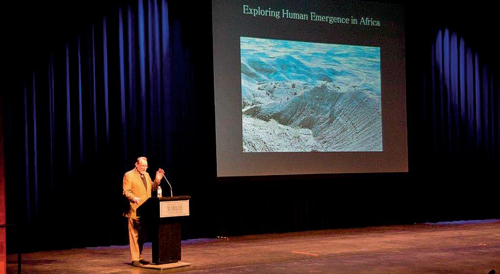
The 2012 edition of the annual Honorary Address entitled “From Evolution to Exploration: Our African Journey” played to nearly 1,100 junior high school students from both Calgary and Canmore school boards and 528 of the general public on November 26, 2012 at the Jubilee Auditorium. Exit interviews with teachers and students suggested this event is a highlight of the school year and provides a much appreciated look at what geoscientists and related disciplines do for a living.
The two topics this year were the fascination we all have with chasing the hydrocarbon elephant pools out of the sedimentary jungle around the world and the fossil record of our own species from the earliest known emergence of hominids in Africa to the present day.
“Exploring for Elephants” was the first presentation, delivered by Dr. Trent Rehill, VP Exploration for Kulczyk Oil Ventures of Calgary. He vividly described the fascination with exploration that motivates explorationists the world over. Trent began his career in Calgary, which then led him (like many CSPG members) around the world. His African career and adventures is the crossover point between the world of petroleum exploration and the topic of hominid origins (the topic of Dr. Ian Tattersall, Director
Emeritus of Anthropology at the American Museum of Natural History in New York).
Dr. Tattersall explored the human hereditary tree from its roots over three million years ago (and possibly five million) through periods when many hominids occupied the world, to the present day when Homo sapiens rules this planet alone. The two talks are available on the CSPG website (under Events and Honorary Address) for those unfortunate enough to be unable to attend it live.
The organizing committee wishes to thank all those who helped out with planning and executing the event, the contributing societies, and to the individuals and companies who sponsored it.
Thank you sponsors!


24 RESERVOIR ISSUE 2 • FEBRUARY 2013
MARCH IS NATIONAL ENGINEERING & GEOSCIENCE MONTH: Design the Future!
Alberta is now home to more than 67,000 Professional Engineers and Geoscientists, with more joining the professions every month. Their work benefits everyone –improving our quality of life, keeping us safe, and driving our economy.
During National Engineering & Geoscience Month (NEGM) in March, it’s time to shine the spotlight on their achievements and look toward the future.
Professional Engineers and Geoscientists are innovators who use their creativity and problem-solving skills to bring ideas to life and make the world better. NEGM is an opportunity to show parents, students, and the public how engineering and geoscience make a difference in their everyday lives.
Dozens of events will be held throughout the month to raise awareness about the professions and highlight careers in engineering and geoscience. Activities will be taking place in cities and towns across the province – from science competitions and networking events to engineering art shows, forums, and much more.
For full details on APEGA kickoff and networking events during NEGM, visit APEGA’s website at www.apega.ca to see the NEGM Calendar of Events. Click
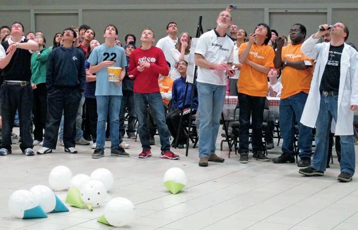
on National Engineering & Geoscience Month under the K-12 & Teachers section.
SCIENCE COMPETITIONS
Throughout March, APEGA and partners will host science olympics and elementary school science nights in communities around the province. In 2012, more than 5,000 students, teachers, and volunteers took part in these events, which challenge students through hands-on activities.
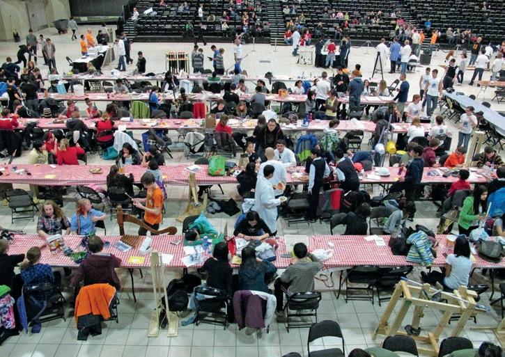
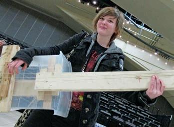
NEGM NEWSPAPER SUPPLEMENT
To learn more about the people, careers, and events celebrated during NEGM, look for the annual NEGM newspaper supplement in the February 28 edition of the Calgary Herald and Edmonton Journal, and on March 8 in the Grande Prairie Herald Tribune. Articles in the supplement will profile engineers and geoscientists whose innovations and volunteer work are helping design the future, both in Alberta and beyond our borders.
GET INVOLVED
If your organization is holding an event to celebrate NEGM, let APEGA know. Contact Corinne Lutter at 780-426-3990, ext. 2287, or by email at clutter@apega.ca, to have your event added to the Calendar of Events.
RESERVOIR ISSUE 2 • FEBRUARY 2013 25
Hundreds of students will take part in science olympics events during National Engineering & Geoscience Month in March.
Students and volunteers watch the balloon drop challenge during last year’s Edmonton Science Olympics.
Students designed and played their own musical instruments at last year’s Edmonton Science Olympics competition.
GO TAKE A HIKE Emerald Basin-Mt. Wapta, Yoho National Park, BC
| By Philip Benham, Yingchun Guan, and Ron Spencer
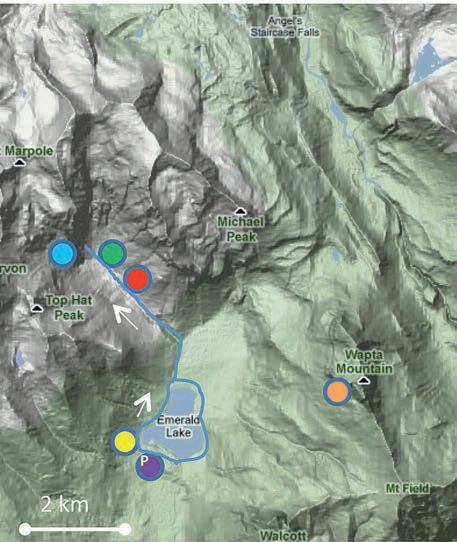
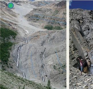
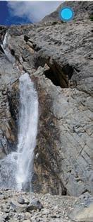
Option 1 Trailhead: From Hwy 1 in Yoho National Park drive 1.6 km south of Field and turn west on the Emerald Lake Road. Drive nine km to Emerald Lake Lodge parking lot. Proceed clockwise around the lake. At the north end of the lake there is a trail junction (proceed north and then west along the Emerald Basin Trail to the end of the route. The trail ends before twin waterfalls but they can be reached with a challenging scramble. Complete the lake loop upon your return.
Distance: 12 km for entire trail, or just 5.4 km if you circle the lake only. The trail around lake is well maintained, the leg to Emerald Basin is a bit rough. The final stretch to the waterfalls is challenging.
Elevation Gain: 250m to waterfalls in Emerald Basin, but negligible around lake.
Option 2: Contact the Burgess Shale Geoscience Foundation and book (for a fee) a guided hike (http:// burgess-shale.bc.ca/) to the Burgess Shale. Be sure to identify, when booking and on the day of the hike that you wish to take a side trip to visit Mt. Wapta. See the Burgess Shale hike for more information. If you want to look closely at the dolomite on Mt. Wapta add at least three hours.
The beautiful waters of the aptly-named Emerald Lake draw many hikers. They take on a milky turquoise colour from suspended glacial rock flour, which reflects sunlight’s green and blue spectrum. The easy trail around the lake also provides views of the Burgess Shale quarry up along Burgess Pass and distant views of hydrothermal dolomite cones on Mt. Wapta. Upon completing this hike, enjoy the views from the restaurant patio at Emerald Lake Lodge or stay overnight for a real treat.
For many hikers the simple loop around Emerald Lake is sufficient, but the side trail up Emerald Basin is worth the effort for the geologically inclined. The trail ascends through forest and colourful patches of meadow to a rocky enclosed cirque surrounded by towering mountains such as the glacier-clad President. The rubble at trail end

contains a mix of strata such as colourful shales of the Arctomys, the reddish, heavily-burrowed carbonates of the Pika Formation, thinly laminated, carbonate-rich shales of the Stephen Formation, and variably dolomitized chunks of Eldon and Cathedral formations. Some of the boulders show features exhibited on the top slopes of Mt Wapta (without the 20+ km hike to reach them).
The trail ends within sight of twin waterfalls. It is worth the scramble to enjoy the cooling spray off the falls, but also to examine the well-exposed steeply dipping shale of the Stephen Formation. The thin, alternating light-grey calcareous beds and dark shales represent turbidites and periods of quiescence.
Background
by Astrid Arts.
Photo
Left: Well exposed thin-bedded calcareous shales of the Stephen Formation exposed near the refreshing mists of Twin Falls. The strata are inclined (blue lines) by a thrust fault (out of the picture to left) that raises Eldon over Cathedral. Right: View of the bedded Stephen Fm at the waterfalls.
View into cirque at the end of Emerald Basin. The trail is underlain by the Cathedral Formation. The circle identifies tight folds in the shales, which become more apparent as you reach the end of the trail.
26 RESERVOIR ISSUE 2 • FEBRUARY 2013
View of Michael Peak from Emerald Lake Bridge. The trees mostly cover the Cathedral and Stephen formations. The exposed bulk of the mountain is Cambrian Eldon (Cel) but is capped by the Pika (Cpk).
The view of Cambrian-hosted hydrothermal dolomite on Mt. Wapta from Emerald Lake allows an appreciation of the dolomite geometry near the platform margin.
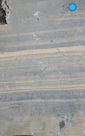


Vertically-oriented dolomite “pipes” or “cones” (brown) cut through the lower portion of the Eldon Formation limestone (grey); upward, dolomite spreads out and becomes stratiform. This dolomite pipe is visible immediately above Walcott’s Quarry – roughly perpendicular to view from Emerald Lake. Geochemical analysis of the dolomites suggest they formed at temperatures in excess of 100ºC (Spencer, 2006).
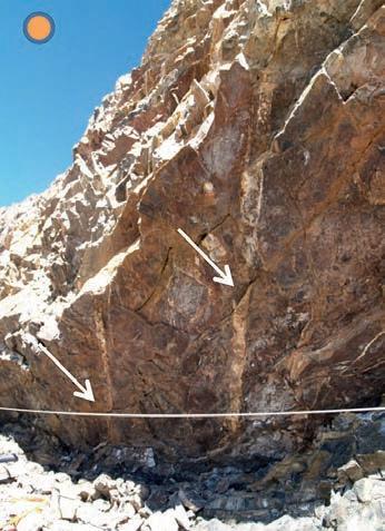
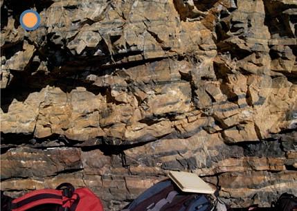
The intensity of dolomitization is bed dependant, with some beds dolomitized and others not, but generally decreases away from these fractures.
REFERENCES:
Balkwill, H.R., Price, R.A., Cook, D.G., and Mountjoy, E.W. 1980. GSC Map 1496A, Golden, East Half.
Price, R.A., Cook, D.G., Aitken, J.D., and Mountjoy, E.W. 1980. GSC Map 1483A, Lake Louise, West Half.
Spencer, R. 2006. Constraints on the Origin of dolomite in the Middle Cambrian Eldon Formation at Mt. Wapta from Fluid Inclusion and Stable Isotope Data. CSPG-CSEG-CWLS Convention abstract.
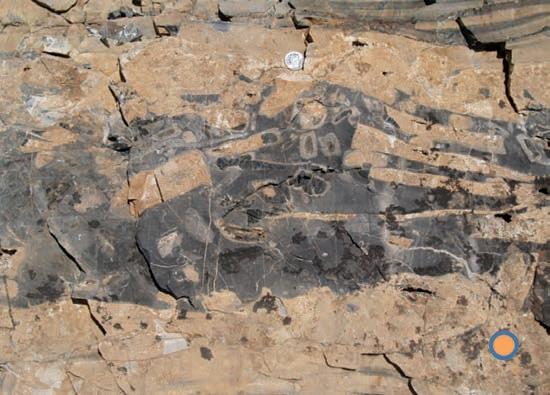
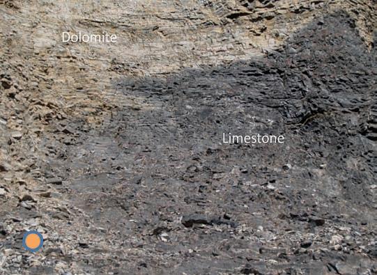 Distinct beds such as the conglomerate can be followed laterally to see the change in dolomite (and chert) intensity in a given bed.
The dolomite feathers out into the limestone at the edge.
Thinly laminated turbidite deposits within the Stephen Shale at Twin Falls.
Distinct beds such as the conglomerate can be followed laterally to see the change in dolomite (and chert) intensity in a given bed.
The dolomite feathers out into the limestone at the edge.
Thinly laminated turbidite deposits within the Stephen Shale at Twin Falls.
RESERVOIR ISSUE 2 • FEBRUARY 2013 27
View is upwards, beneath an overhang at core of dolomite pipe; relatively thin (a few cm) vertical fractures (indicated by arrows) filled with sparry dolomite appear to have fed the dolomitizing fluids upward.
ROCK SHOP
油田投资项目咨询 油田收购评估 油气田勘探开发技术支持
Reservoir Geomodeling Reservoir Simulation Integrated Study
Julee Lee (403) 554-3957, Helen Cao (403) 968-6268, Gary Selby (403) 818-1594 jlee@petrosteer com, hcao@petrosteer com, gselby@petrosteer com
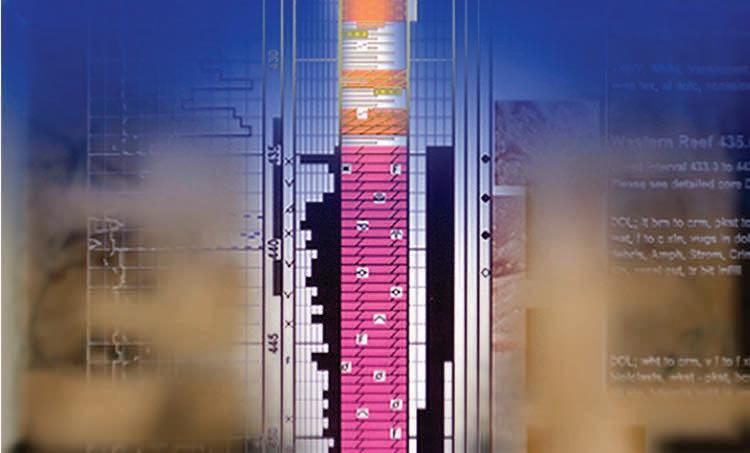


In-House and Multi-Media Narrated Self-Study Courses Also Available
Instructor: E. R. (Ross) Crain. P.Eng. 1-403-845-2527 ross@spec2000.net


28 RESERVOIR ISSUE 2 • FEBRUARY 2013 Strip Log Strip Log Horizontal Log Horizontal Log Mud Log Mud Log Log Viewer Log Viewer Log Manager Log Manager Log Analysis Log Analysis Suite 102, 7370 Sierra Morena Blvd SW, Calgary, AB T3H 4H9 info@WellSight.com 1-800-447-1534 (403) 237-9189
Excellence in Geological Services for Over 20 Years Integrated Reservoir Studies for All Resource Types 4D Geomodelling & Geosteering Horizontal Well Path Planning Infill Well Placement Studies SMART4D Modelling ® Software www.uogc.com 403.265.0111 91 0 , 396 11th Ave SW C a lgar y, AB Cana da WELLSITE GEOLOGICAL SUPERVISION Cell403 819 2516 farhat@sableconsultants.com SABLECONSULTANTS.COM Conventional Wells Coring Programs Heavy Oil/Oil Sands Coal Bed Methane SAGD Horizontal Project Supervision www.rpsgroup.com/energy (403)263-0449 17084 Global Leaders in Wellsite Geology Serving the petroleum industry for over 25 years ■■ Conventional Vertical / Horizontal Wells ■■ Unconventional Heavy Oil / CBM Wells ■■ International WSG / Operations Geology • Domestic and International wellsite supervision • Conventional and Unconventional wells • Extensive Hz experience • Customized corporate solutions available (403) 250-3982 sales@clconsultants.ca www.clconsultants.ca
COURSES For Engineers, Geologists, Geophysicists, and Technicians Practical Quantitative Log Analysis: 15 – 17 Apr 2013 Analysis of Unconventional Reservoirs: 18 Apr 2013 Analysis of Rock Mechanical Properties: 19 Apr 2013 Details and Registration at: www.spec2000.net/00-coursedates.htm
===
PRACTICAL LOG ANALYSIS
=== – 50 Years Worldwide
–
–
Experience
Analysis, Training, Mentoring, Forensic Reviews
www.petrosteer.com 贝 特 斯 亚 海 外 石 油 研 究 中 心
FALL LECTURE TOUR WRAP-UP
| By Garrett Quinn
During the fall semester the University Outreach Committee had the good fortune of sending two speakers to schools in Ontario and British Colombia. Jean Hsieh of Talisman Energy and Trevor Johnson of Husky Energy helped fulfill the Committee’s mandate to educate students about the CSPG and the energy industry in Canada by sharing exciting talks from the frontlines of the global petroleum industry operating out of Calgary.
Jean Hsieh, a carbonate sedimentologist, visited University of Toronto Scarborough, Queen’s University, University of Ottawa and Carleton in a joint session, and McMaster University. She delivered a talk on an Oligocene carbonate field in the Kurdish region of Iraq. This talk shattered perceptions that there are no big, exciting discoveries left to be made by the current and future generations of petroleum geoscientists and helped students gain a better understanding of how they can apply what they are learning in the classroom to the oil and gas industry.
Jean has long been active in student outreach as part of her involvement with both the AAPG, while working in San Ramon and Houston, and now the CSPG. She explained that her urge to participate in the University Outreach Committee’s Fall Lecture Tours came from a desire to give back to the community and help students who were unsure about what to do with their careers. As someone who took a bit of a meandering career path herself, she hoped to give some assurance to the students by
sharing her story along with her lecture. It was also her hope that by sharing her experience she could also raise student awareness about career opportunities in the oil and gas industry.
Like many of today’s geosciences students outside of western Canada, Jean had not considered pursuing a career in oil and gas when she was an undergraduate. This all changed after she gained industry exposure and experience by participating in the Student Industry Field Trip (SIFT), and taking a subsequent summer job in Calgary. Jean attributes her transition from academia to the oil and gas industry to the experience she gained from taking advantage of these exciting opportunities.
Speaking about her motivation to visit the Central Canadian region in particular Jean says, “I also went to school in Ontario, so I chose to do a tour in Ontario in order to help expose students to the oil and gas industry.” She further elaborates, “I know I had very little exposure; I am sure there are students who would really enjoy a career in this industry if only they knew about it.” And when asked if she would go again, Jean said, “I would definitely do it again! It really helped me to feel excited about my own career and job again. Speaking positively with students is always a benefit!”
Trevor Johnson, a Sr. Staff Geoscientist in the Canadian Frontier exploration group at Husky, took his talk to the University of British Columbia, Simon Fraser University, and
the University of Victoria. Like Jean, Trevor’s talk showcased exciting petroleum geoscience work being done and what it meant to be a geoscientist. His talk centered on the theme of integrating geology, physical geography, and geophysics. This theme is coming increasingly to the forefront of our industry. Specifically, Trevor focused on how principles and methodologies from these disciplines could be applied together to aid in mapping depositional environments and physical features like estuaries, lakes, and even mud volcanoes from an offshore 3D seismic volume.
Brendan Smithyman, a University of British Columbia Ph.D. candidate working on seismic inversion for his thesis, wrote to the CSPG about the talk. He remarked that, “the lasting impression from [Trevor’s] talk was exactly what it should have been: a very impressive view into the sorts of interesting problems that are seen in industry settings on a daily basis.” Brendan goes on to note that, “this speaks for itself, and encourages students to consider industry employment and involvement in an informed way.”
The feedback from Jean and the students at the University of British Columbia go to the core of why the CSPG continues to support the lecture tours: there isn’t a more direct and accessible way of highlighting to students the exciting technical challenges we face as geoscientists in the oil and gas industry. Hopefully these
(Continued on page 30...)
RESERVOIR ISSUE 2 • FEBRUARY 2013 29
CORPORATE SUPPORTERS
AGAT Laboratories
Apoterra Seismic Processing Ltd.
ARC Resources Ltd.
Arcis Seismic Solutions
Cabra Consulting Ltd.
Canadian Natural Resources Ltd.
CGG Veritas Services Inc.
Compass Directional Services
Continental Laboratories Ltd.
Cossack Land Services Ltd.
Crescent Point Energy Trust
Datalog Technology Inc.
Edge Technologies Inc.
Encana Corporation
Exova Canada Inc.
Explor
GeoTir Inc.
GLJ Petroleum Consultants Ltd.
IHS
Kulczyk Oil Ventures
LXL Consulting Ltd.
McDaniel & Associates Consulting Ltd.
MOH & Associates Oilfield Consultants
National Oilwell Varco
Nickpoint Environmental Services
Olympic Seismic Ltd.
Paradigm Geophysical Corp.
Pason Systems Corp.
Perpetual Energy Inc.
Pioneer Professional Group
Pro Geo Consultants
ProActive Health
Pulse Seismic
Regent Resources Ltd.
Rigsat Communications
RPS Energy Canada Ltd.
SAExploration
Schlumberger Canada Limited
SeisWare
Sensor Geophysical Ltd.
Sigma Explorations Inc.
Sourcex
Total Gas Detection Ltd.
Trident Exploration Corp.
Western Geco
AS OF JANUARY 10, 2013
CSPG welcomes our 2013 Corporate Supporters! The benefits of being a corporate member include:
• Recognition in the monthly Reservoir and quarterly Bulletin
• One associate membership
• Reserved tables at the technical luncheons with your company logo
• One free pass to the CSPG Core Conference
…and more! Contact Kasandra Klein at kasandra.klein@cspg.org to be a corporate member today!
(...Continued from page 29 )
challenges of working international fields and complex geophysical datasets inspire students to pursue a career in petroleum geoscience.
Outreach initiatives like the Lecture Tours also allow the students to network with the speakers, putting a face to our industry and helping answer student questions about how to find jobs and what skills are sought after. Finally, the tours provide an opportunity for students to learn about what the CSPG can offer them: from free student membership to the Student Industry Field Trip (SIFT), student awards and grants, field trips, networking events, and conferences.
The CSPG University Outreach Committee is always looking for enthusiastic individuals with new and creative lecture ideas to present to inquisitive undergraduate and graduate students across Canada. If you have an idea for a talk that you would like to give on any aspect of petroleum geology or if your university is interested hosting a lecturer, please feel free to contact either Chad Glemser (C.Glemser@shell.com) or Garrett Quinn (gquinn@osumcorp.com). The CSPG University Outreach Committee expresses their sincere appreciation and thank you to all universities involved with hosting a lecturer on tour this year, and, of course, the lecturers for contributing their time and effort toward making this program a success.

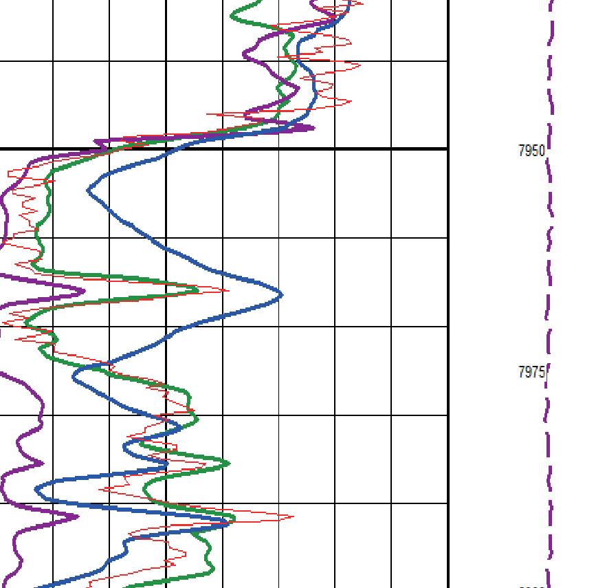

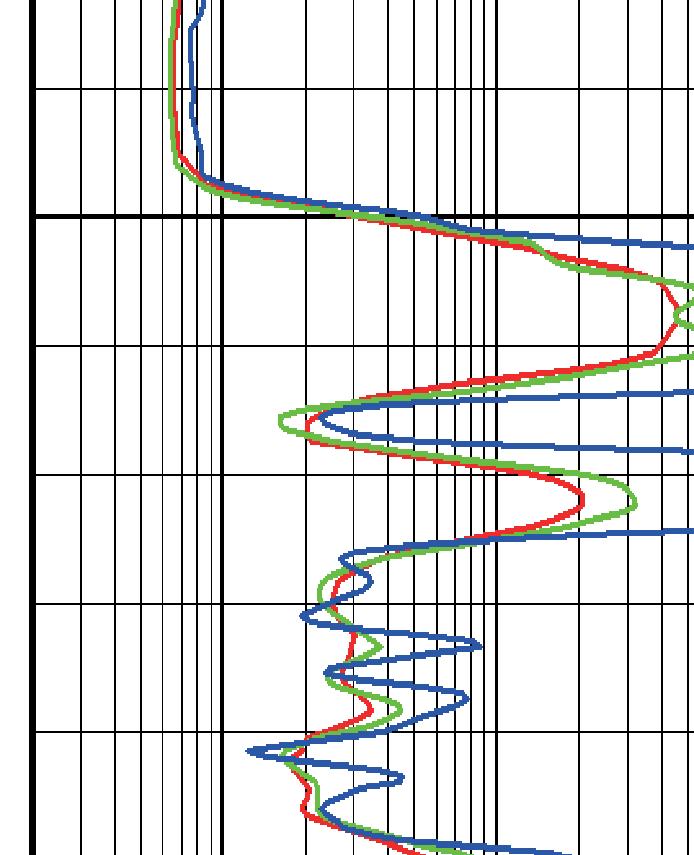


30 RESERVOIR ISSUE 2 • FEBRUARY 2013
Quality Multi-clientData
Professionals in Geoscience
www.apega.ca
The Geo-Mentor
Soon another crop of eager new graduates will arrive in our corporate geoscience departments.
Remember what it was like when you were one of them? The uncertainty about what you were capable of? The doubt you felt about actually finding valuable minerals deep underground?
The next generation of geoscientists need more experienced colleagues to translate the jargon and inspire them to become the best they can possibly be in a hugely demanding profession. During their early career as an APEGA Geoscientist-in-Training, knowledge, wisdom and practical skills descend on neophytes in an avalanche that overwhelms and can boggle the mind. They need someone to lean on who can sort out the useful bits from information that is not of immediate value. If you have been practicing for a significant period of time, you can probably fill the role of mentor.
APEGA has a series of Professional Development courses, seminars and symposiums you can use to become a good mentor. Give us a call to find out what might work to fit your needs. Perhaps we can mentor you!
For more information:
Tom Sneddon, P.Geol.
Director Geoscience and Outreach
P: 403-262-7714 or 888-262-3688
E: tsneddon@apega.ca


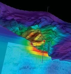
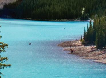


Blueback Reservoir T +1 403 538 4821 E information@blueback-reservoir.com blueback-reservoir.com Blueback Reservoir the preferred and chosen GeoScience Solutions Partner
