Registration is open for this year’s Core Conference, themed “Establishing Connections: The Interplay of Rocks, Energy, and People”
SPONSORSHIP OPPORTUNITIES
Demonstrate your organizations dedication to supporting the geoscience community and our economy by sponsoring the 2025 Core Conference.
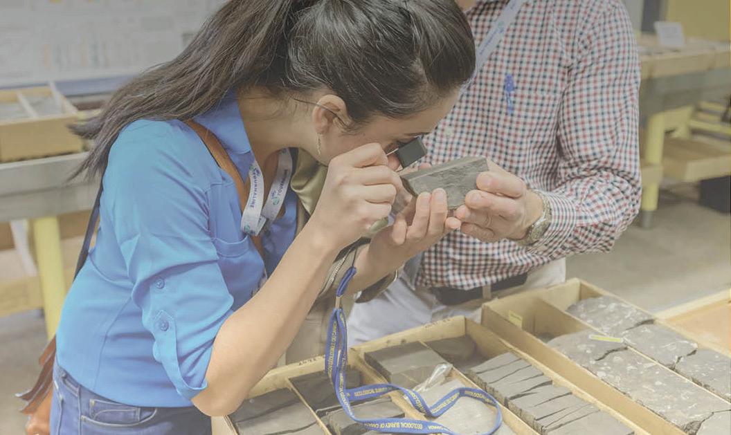
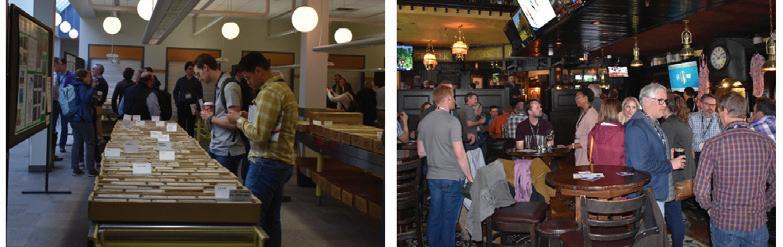
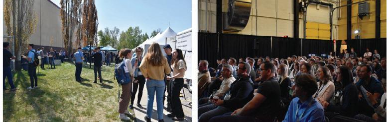
The annual Core Conference, CEGA’s premier rock-focused event, fosters collaboration and knowledge sharing in geoscience.
It o ers a chance to explore diverse rock types and network with experts, from top Canadian academics to seasoned industry professionals.
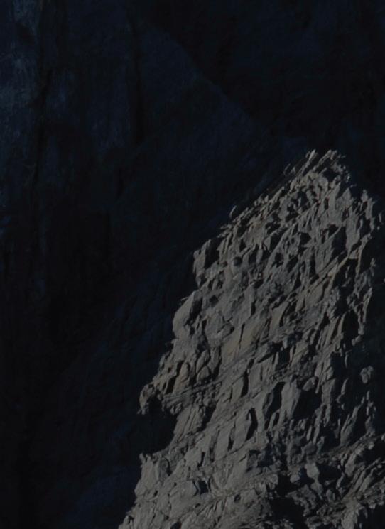
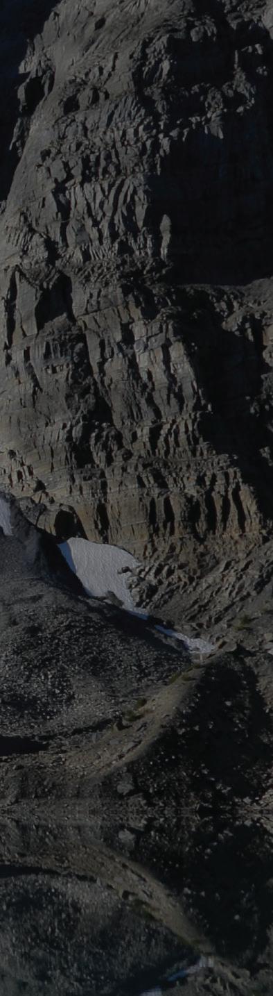
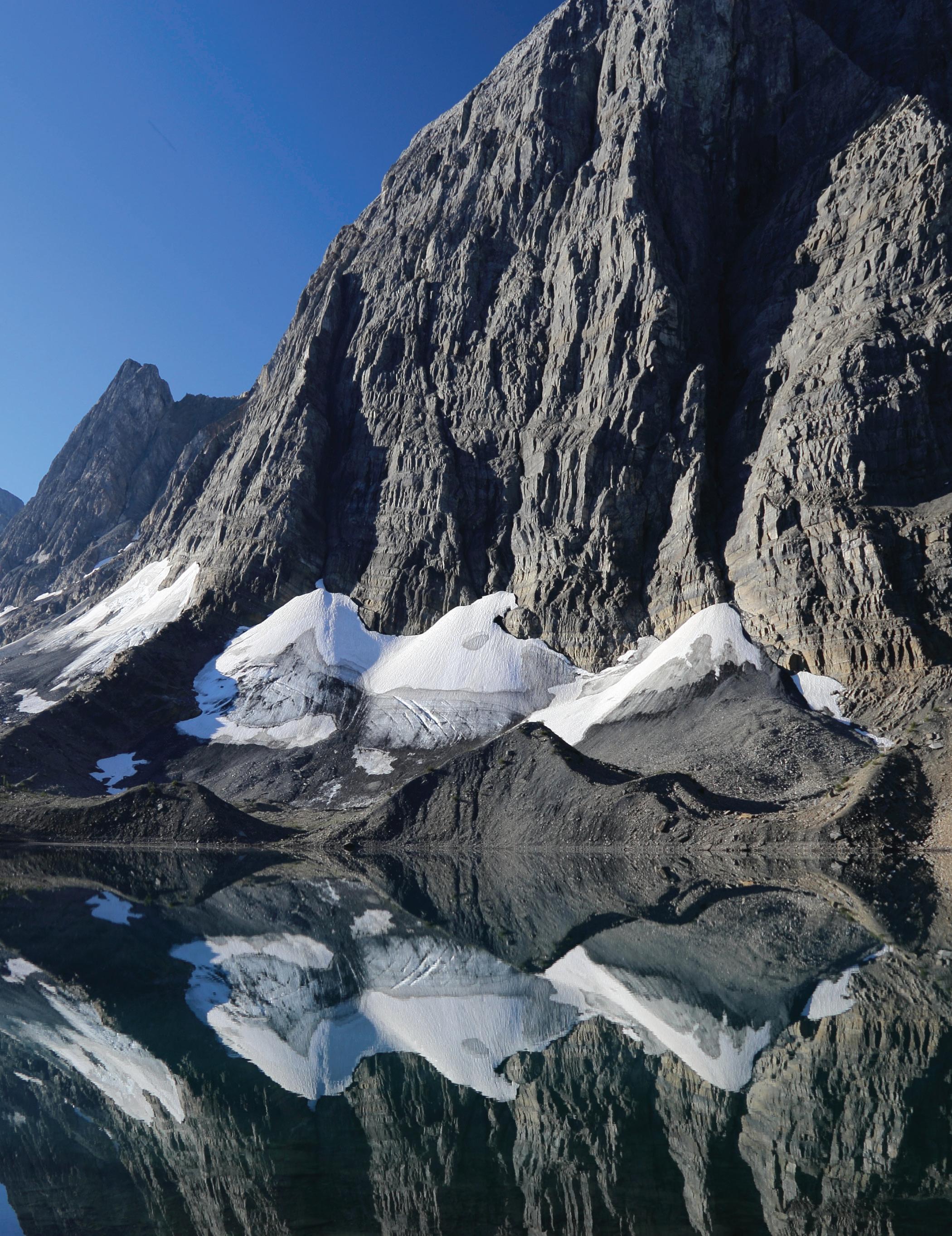
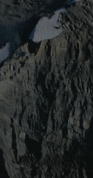
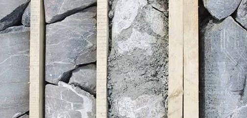
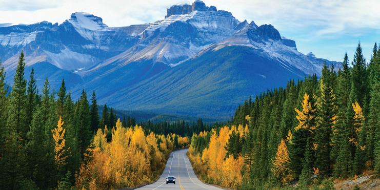
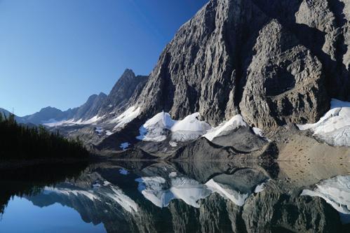
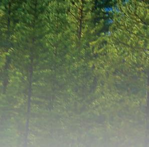
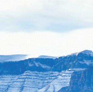
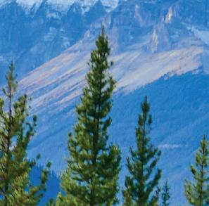
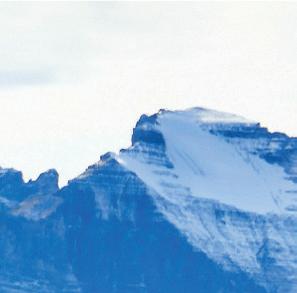
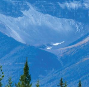
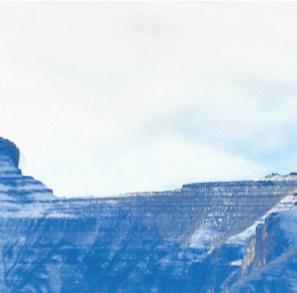
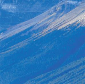
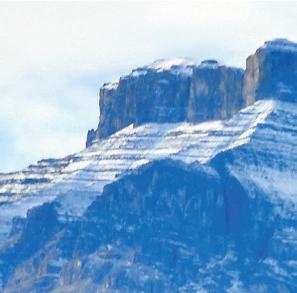
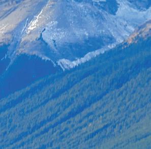
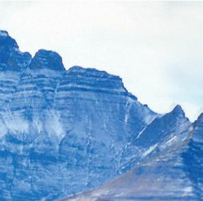
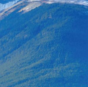
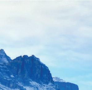
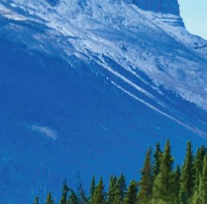
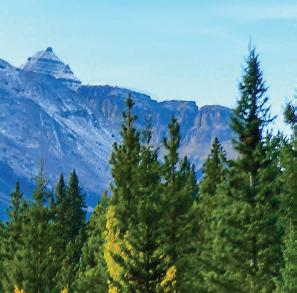
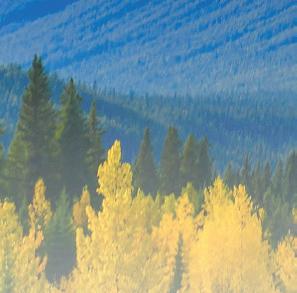
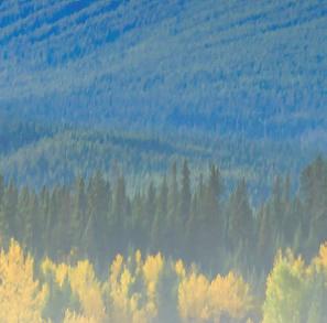
Floe Peak and Floe Lake, British Columbia.
Floe Peak is part of a continuous mega-outcrop of bedded micritic limestones of the Upper Cambrian Ottertail Formation. Known as “The Rockwall”, this outcrop is continuous for 54 km from its northern exposures at Mount Hurd, just south of the Trans-Canada Highway, to Mount Wardle, just north of Highway 93. The Ottertail Formation is up to 610 m thick and is thought to be correlative with the much thinner Lyell (to the east) and Jubilee (to the west) formations. This massive slab is
of a west-dipping
in which the Ottertail is sandwiched between two shale-dominated units
the underlying Cambrian Chancellor Formation to the east and the
CambroOrdovician McKay Group to the west. Talus cones and
Photo by: Dave Robinson.
FROM THE EDITOR
SARAH SCHULTZ , TECHNICAL EDITOR FOR THE RESERVOIR
WELCOME...
to our March and April issue of the CEGA Reservoir!
The CEGA Core Conference and Geoconvention are now open for registration. Please visit the CEGA website to learn more about the presentations for both events!
CEGA is offering a series of courses targeted at summer students! To sign your students up for these courses and to learn more visit the CEGA website.
In this issue we present the continuation of our regular articles:
• An Introduction to Geomechanics Today: A Series on the Latest in Geomechanics
• The Blue View: Industry Trends Through Woodmac’s Lens
In this issue we present the following articles:
• Scott Gardiner: Geoscience and the “Longitude Problem”: How a Clockmaker Changed the World
• Jon Noad: Broadening our Understanding of Bird Ichnology Through Neoichnology
In this issue we showcase the following:
• 2025 Message from the Board
• 2025 Inaugural GeoSpiel
• CEGA Bootcamp Course Series
• 58th WIUGC Conference Highlights
• Alberta Palaeontological Society 28th Symposium
Congratulations to the following award recipients:
• Dr. James MacEachern for the R.J.W. Douglas Medal
To sign up for our upcoming 2025 technical luncheon and division talks please visit the CEGA website.
We look forward to receiving your manuscripts for the upcoming 2025 issues of the CEGA Reservoir.
Sarah Schultz
PUBLICATIONS INFORMATION
The RESERVOIR is published 6 times per year by the Canadian Energy Geoscience Association. The purpose of the RESERVOIR is to publicize the Association’s many activities and to promote the geosciences. We look for both technical and non-technical material to publish.
The contents of this publication may not be reproduced either in part or in full without the consent of the publisher.
No official endorsement or sponsorship by the CEGA is implied
for any advertisement, insert, or article that appears in the RESERVOIR unless otherwise noted. All submitted materials are reviewed by the editor. We reserve the right to edit all submissions, including letters to the Editor. Submissions must include your name, address, and membership number (if applicable). The material contained in this publication is intended for informational use only.
While reasonable care has been taken, authors and the CEGA make no guarantees that any of the equations, schematics, or
devices discussed will perform as expected or that they will give the desired results. Some information contained herein may be inaccurate or may vary from standard measurements. The CEGA expressly disclaims any and all liability for the acts, omissions, or conduct of any third-party user of information contained in this publication. Under no circumstances shall the CEGA and its officers, directors, employees, and agents be liable for any injury, loss, damage, or expense arising in any manner whatsoever from the acts, omissions, or conduct of any third-party user.
BOARD OF DIRECTORS 2025
PRESIDENT
Shelley Leggitt
Kiwetinohk Energy Corp. shelley.leggitt@cegageos.ca LinkedIn
Canadian Discovery Ltd. christa.williams@cegageos.ca LinkedIn
DIRECTOR
Ryan Lemiski
Canadian Natural Resources Limited outreach@cegageos.ca Linkedin
DIRECTOR
Kevin Webb
Aquataine Energy Ltd. conferences@cegageos.ca LinkedIn OFFICE CONTACTS
MEMBERSHIP INQUIRIES
Tel: 403-264-5610
Email: membership@cegageos.ca
ADVERTISING INQUIRIES
Britney Stewart
Tel: 403-513-1230
Email: britney.stewart@cegageos.ca
FINANCE DIRECTOR
Rachel Lea
Suncor Energy director nance@cegageos.ca LinkedIn
DIRECTOR
Scott Leroux
Taggart Oil Corp. education@cegageos.ca Linkedin
CONFERENCE INQUIRIES
Kristy Casebeer
Tel: 403-513-1234
Email: kristy.casebeer@cegageos.ca
MANAGING DIRECTOR
Emma MacPherson
Tel: 403-513-1235
Email: emma.macpherson@cegageos.ca
2025 MESSAGE FROM THE BOARD
KEVIN WEBB, CEGA CONFERENCE DIRECTOR
Connection, growth, and shared success
As your CEGA conference director, I am honoured to serve our wonderful geoscience community. Having spent over a decade working internationally, I am thrilled to return to Canada and contribute to the ongoing growth and innovation within our field. My journey with CEGA began much like many of yours—attending my first technical talk, engaging in conversations that sparked new ideas, and realizing the immense value of being part of a network of passionate professionals.
Throughout my career, I have had the privilege of working across diverse geoscience landscapes, from North America, Europe, Asia and Africa, and one thing remains constant: the power of collaboration. While working abroad, I was an active member of the European Association of Geoscientists and Engineers (EAGE), and now, back in Canada, I see an incredible opportunity to blend international perspectives with the ingenuity and technical expertise that define our CEGA community.
Networking and technical knowledge exchange are at the heart of CEGA. Whether you are an experienced professional, a young geoscientist, or a student looking to establish connections, this association offers a platform to share ideas, learn from one another, and foster innovation. I’ve witnessed firsthand how Canadian expertise is respected on the global stage—our advancements in unconventional resources, carbon capture and storage, and geological characterization are setting industry benchmarks. Many international companies look to Canada for leadership in these fields, and I believe CEGA can play a critical role in ensuring our members remain at the forefront of these discussions.
One of my goals as conference director is to create opportunities for meaningful engagement. Conferences, technical luncheons, field trips, and social gatherings are not just about presentations and data sharing—they are about building relationships that drive progress.
I encourage each of you to participate, present your work, and contribute to the collective knowledge of our field. By sharing realworld case studies, research insights, and best practices, we elevate one another and strengthen the industry as a whole.
Our profession is evolving, and with it, so must we. As we continue to explore new energy frontiers and integrate emerging technologies, it is vital that we support the next generation of geoscientists. Mentorship, education, and outreach efforts will ensure that the expertise we have today is carried into the future. I encourage our seasoned professionals to take the time to guide young geoscientists and for members to actively seek out learning opportunities within CEGA.
In a world of constant division within our societies, media, and politics, let’s set a new standard. Rather than being defined by differences— whether in society, industry, or even within our own professional circles—let’s choose collaboration. By fostering open discussions, sharing knowledge, and supporting one another in the pursuit of scientific and technical excellence, we create an environment where everyone thrives. A rising tide lifts all boats, and by working together, we ensure that our community remains strong, innovative, and resilient.
I look forward to seeing many of you at upcoming CEGA events and welcome any ideas on how we can continue to enhance the value of our association. Let’s make this a year of connection, growth, and shared success.
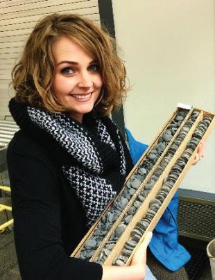
JOIN THE INAGURAL 2025 CEGA GEOSPIEL
WE LOOK FORWARD TO SEEING YOU OUT THERE!
Ian & Tracy Theunissen Co-Chairs, 2025 CEGA Geospiel
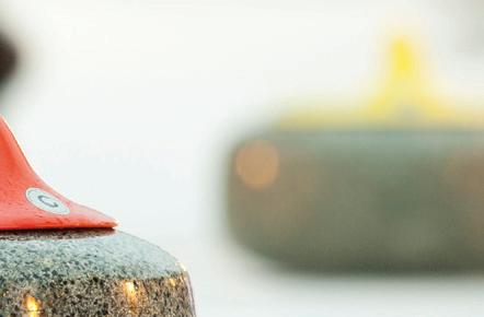
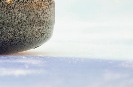
Get ready to slide into action with the first ever CEGA Geospiel, the ultimate curling bonspiel, happening at the North Hill Curling Club from April 3-5th, 2025! Whether you’re a beginner, intermediate, or advanced curler, the Geospiel is designed for everyone.
Teams are guaranteed to play a minimum of three games, giving you plenty of opportunities to sweep your way to victory, or at least have a blast trying! You can register as a team of four, or sign up solo and be paired with others to form a complete team. No matter where you’re at in your curling journey, you’ll find a group that suits your experience and guarantees plenty of fun with CEGA colleagues and sponsors.
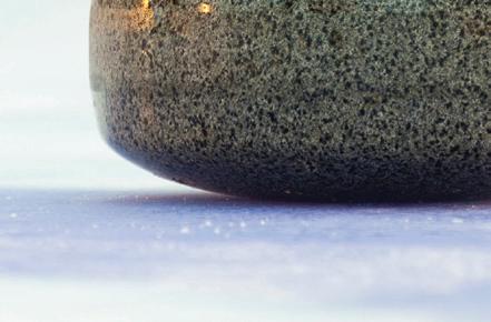
Curling and geology share a common foundation—both require precision, strategy, and an understanding of the forces at play. Whether you’re delivering stones, sweeping with speed, or calculating your next move, you’ll feel right at home on the ice.
Not only will you enjoy exciting games, but every registration also includes access to cool prizes and an unforgettable banquet. It’s a great way to celebrate your victories, network with fellow curlers, and enjoy some delicious food after a great day on the ice. The Geospiel isn’t just about curling—it’s about bringing the geoscience community together for a fun and rewarding three days.
Whether you’re a first-timer or a seasoned pro, don’t miss out on this incredible weekend of curling. Space is limited, so be sure to register early to secure your spot in this unforgettable event.
If you are interested in sponsoring the tournament this year, please contact Julie Beally
An Introduction to Geomechanics Today: A Series on the Latest in Geomechanics
INTRODUCTION
AMY D. FOX, PH.D., P.GEO., PRESIDENT, ENLIGHTEN GEOSCIENCE LTD.
In 2013 the Reservoir ran a sequence of articles called Geomechanics for Everyone, a Series on Geomechanics for all Disciplines. In addition to the article that introduced the series, a group of colleagues and I published five technical articles covering geomechanical risks, geomechanical data, hydraulic fracturing basics, “fracability” and caprock integrity during injection operations. As a sort of follow up in 2017 there was a special “Geomechanics Issue” of the Reservoir, which included an interview with Pat McLellan, the introduction of some new geomechanical data-collection techniques, musings on the state of hydraulic fracture modeling and an appeal to regulators to provide better-quality image logs. Since then, the Reservoir has been pretty quiet on the topic of geomechanics, save for a preview of the 2023 Gussow Conference, the theme of which was “Geomechanics for Sustainable Energy Development.” But has geomechanics itself gone quiet? Not in the least, which is why a new article series is a good idea.
INDUSTRY CHANGES
It’s fair to say that although it certainly hasn’t disappeared, geomechanics has shifted focus somewhat over the more than a decade since the first Reservoir series, and even since the 2017 special issue. For example, in 2013, the development of unconventional hydrocarbon reservoirs was fully under way, but with much left to learn. In the world of hydraulic fracturing, geomechanics was front and centre because theory was needed to understand what was going on in the subsurface. Now, however, the focus is operational, with engineers using a wealth of data to find the technical limits of completion and production efficiency. As another example, let’s look at oil-and-gas drilling activity in the Western Canada Sedimentary Basin. In 2013 the Montney and Duvernay plays were established but in early stages of development. Since then, they’ve come to dominate the Western Canada unconventional scene. Geomechanics, however, is still incredibly relevant in both plays, including in terms of some serious concerns such as wellbore stability during drilling, induced seismicity and casing deformation. In the Montney, I’ve started hearing the term “monobore” more frequently, but is it geomechanically achievable everywhere? And some Duvernay horizontal wells present serious geomechanical drilling challenges. Finally, many geomechanical issues from oil and gas are also present in other industries, such as carbon capture and geothermal.
In some of these projects, geomechanics can be absolutely critical to success or failure. In all of these industries, regulators are increasingly recognizing the role of geomechanics in assessing risk and including more geomechanical requirements in getting project approvals.
WHAT TO EXPECT - FUTURE ARTICLES
So, what can you expect to see in this new article series? Given that it is planned to span the entire year and perhaps spill into 2026, some aspects are still being worked out, but in general we expect to address several timely topics including:
• The latest on hydraulic fracturing, with a focus on modeling
• Geomechanics in the geothermal and carbon capture and storage industries
• Where geomechanics fits into regulatory aspects for different project types
• A preview of geomechanics in Atlas 2027, the coming update to the 1994 Geological Atlas of the Western Canada Sedimentary Basin
• An overview of induced seismicity in Western Canada
• The role of geomechanics in casing deformation
There might even be some other surprises thrown in. The series will include content from a number of contributors both in Canada and beyond, providing a variety of perspectives and experiences.
RESOURCES
Before signing off, I want to share some important resources that anyone can access to learn more about geomechanics. There are far more available than there were back in 2013.
In 2007, building on foundational rock mechanics textbooks such as and Fjær et al.’s (first edition 1969) Petroleum Related Rock Mechanics and Jeager, Cook and Zimmerman’s Fundamentals of Rock Mechanics (first edition 1992), Dr. Mark D. Zoback of Stanford University published Reservoir Geomechanics, providing a more fulsome perspective on the behavior of the entire reservoir, presenting known geomechanical theory and highlighting then-current avenues of developing research. In the mid-2010s Dr. Zoback’s course of the same name began to be offered by Stanford as a massive open online course (a MOOC), which later moved to edX.org. To date more than 12,000 people around the world have completed it. In 2019 Dr. Zoback and Arjun Kohli published Unconventional Reservoir Geomechanics to address the needs of a changed oil and gas industry. Quickly it, too, had an accompanying online MOOC (also on edX). Both courses are still available and are free if you don’t need a completion certificate. In addition, one can find a few other geomechanics courses on YouTube, usually as a series of university lectures (e.g., those by Dr. D. Nicolas Espinoza at University of Texas at Austin).
REFERENCES
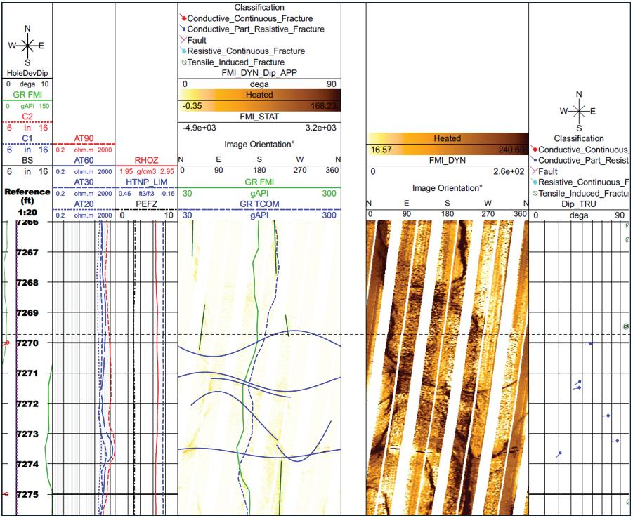
Part of an image log from well 58-32 of the Utah FORGE geothermal project showing natural fractures and induced tensile fractures. (Data from the project are available from the project website.)
Another important resource that really emerged during the COVID-19 pandemic is webinars. American Rock Mechanics Association (ARMA), Society of Petroleum Engineers (SPE) and American Association of Petroleum Geologists (AAPG) are amongst some of the organizations that developed several geomechanics-related special interest groups that put on regular webinars, most of which are recorded and archived either on YouTube or their own websites.
Finally, a brief word of warning. Another change since 2013 has been the proliferation of publications on geomechanics, both in journals and as papers presented at an ever-increasing number of conferences. Unfortunately, this increase has come with a decrease in the share of these papers that are in any way peer-reviewed (which is itself an imperfect process; for an interesting read, if you are an SPE member check out the President’s Column in the January 2025 issue of Journal of Petroleum Technology titled “A Cold Look at the Quality of SPE Publications”). While important and high-quality work is certainly still being published, it can be difficult to separate the wheat from the chaff, as the saying goes.
CLOSING
I sincerely hope the Reservoir readership will enjoy the coming new geomechanics content. Our goal is to make it more informational than highly technical, hopefully making it enjoyable for readers of any background. Remember, if you want to read any of those articles from 2013 (July/August issue and onward) or 2017 (January/February issue), you can access them through your membership by logging on to the CEGA website and going to the Reservoir Archives page.
Fjær, E., R. M. Holt, P. Horsrud, A. M. Raaen and R. Risnes, Petroleum Related Rock Mechanics, 2nd ed., Elsevier Developments in Petroleum Science no. 53, 2008
Jaeger, J. C., N. G. W. Cook and R. W. Zimmerman, Fundamentals of Rock Mechanics, 4th ed., Blackwell Publishing, 2007
Zoback, M. D., Reservoir Geomechanics, Cambridge University Press, 2007
Zoback, M. D. and Kohli, Unconventional Reservoir Geomechanics: Shale Gas, Tight Oil, and Induced Seismicity, Cambridge University Press, 2019
CEGA BOOTCAMP COURSE SERIES
The CEGA Bootcamp Course Series is the perfect opportunity to equip your summer students with hands-on, industry relevant experience that will accelerate their growth and enhance their impact on your projects.
INTRODUCTION TO WESTERN CANADA SEDIMENTARY BASIN AND THE PETROLEUM SYSTEM
Instructors: Jim Barclay
May 20, 2025 | 8:30 am - 12:30 pm
Classroom Course | CEGA Student member rate: $300+gst
INTRODUCTION TO WELL LOGGING AND PETROPHYSICAL INTERPRETATION
Instructor: Kelly Skuce
May 20, 2025 | 1:00 pm - 4:00 pm
Classroom Course | CEGA Student member rate: $300+gst
METHODOLOGY FOR DESCRIBING CLASTIC FACIES AND CORE LOGGING
Instructor: Brian Zaitlin, Zaitlin Geoconsulting ltd., Michael Webb, Michael Webb Geoconsulting ltd.
May 21, 2025 | 8:15 am - 4:30 pm
Core Research Centre Course | CEGA Student member rate: $775+gst
STRAWMAN FOR ESTABLISHING A GEOLOGICAL WORKPLAN FOR AN EXPLORATION AND/OR RESERVOIR DEVELOPMENT PROJECT
Instructor: Brian Zaitlin, Zaitlin Geoconsulting ltd.
May 23, 2025 | 8:30 am - 12:30 pm
Classroom Course | CEGA Student member rate: $300+gst
SEQUENCE STRATIGRAPHY OF NON-MARINE, MARGINAL MARINE AND INCISED VALLEY DEPOSITS: CORE-BASED EXAMPLES FROM THE WCSB
Instructor: Brian Zaitlin, Zaitlin Geoconsulting ltd., Michael Webb, Michael Webb Geoconsulting ltd.
May 27- 28, 2025 | 8:15 am - 4:30 pm
Core Research Centre Course | CEGA Student member rate: $1550+gst
WIUGC 2025
The 58th Western Inter-University Geosciences Conference (WIUGC) was hosted by a committee of students from the geology program at Mount Royal University in Calgary Alberta, from January 9-11.
The committee consisted of two co-chairs, Callista Elias and Jessalyn Hall, along with Mark Inkster, Aatish Mann, Alyson Stauffer, Pawel Kuczaj, Brayden Dunn, and Kieran McClenahan. The WIUGC is an annual student-run conference that alternates between universities across Western Canada. This year’s event welcomed over 90 student attendees and professional delegates from Alberta, Saskatchewan, Manitoba, and Ontario. The conference provided opportunities for students to come together to further their career development and knowledge through technical talks, poster presentations, a field trip, and career and industry fairs.
The conference kicked off on Thursday, January 9 with a career fair hosted by CEGA, where the student attendees had the opportunity to network with hiring companies; proceeding the career fair was the industry fair and poster presentations, where students had the opportunity to showcase their research in a mixed environment. Friday, January 10 brought a day of technical talks, both industry and studentled, from geophysical applications to gold deposits found in the Yukon.
These technical talks are an important aspect of this student conference, as this is an opportunity for students who are new to presentations to showcase their work in front of their peers. Friday’s festivities finished off with the Challenge Bowl hosted by CSEG, where Tyler Wong and Dylan Sawatzly (University of Manitoba) took home first prize and will be competing in the Challenge Bowl at GeoConvention in May 2025.
The conference concluded on Saturday, January 11 with a field trip to the Royal Tyrrell Museum where the student attendees were given the opportunity to get a behind-the-scenes tour. Following the field trip was the awards banquet as a final farewell to the attendees and industry representatives. The award for Best Poster Presentation went to Gabriel Johnston (Mount Royal University), and the award for Best Student Talk went to Wil Munro (University of Toronto). The conference showed students the wide range of geoscience applications in Western Canada, as well as helped further develop a strong community across geoscience students.
GEOSCIENCE AND THE ‘LONGITUDE PROBLEM’:
How a Clockmaker Changed the World
SCOTT GARDINER
As a young petroleum geologist making maps, proposing well locations, and being an enthusiast of geography and historical maps, I often wondered why the location of places, well sites, and points of interest has an unusual combination of units for longitude and latitude, that is “degrees” followed by “minutes” and “seconds.” I was intrigued—at face value, these units, like foot-pounds, candle power, and acre-feet, made no sense to me, and perhaps to many of us geo-types. Given time to ponder this, I had a revelation during a business trip to London, England, where I spent a day off between meetings at Greenwich.
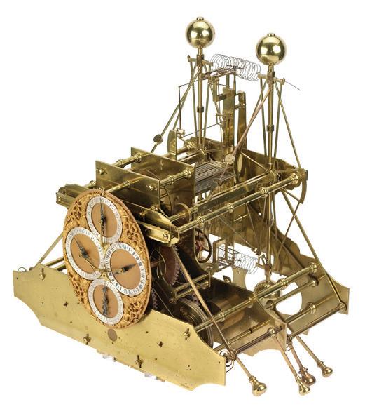
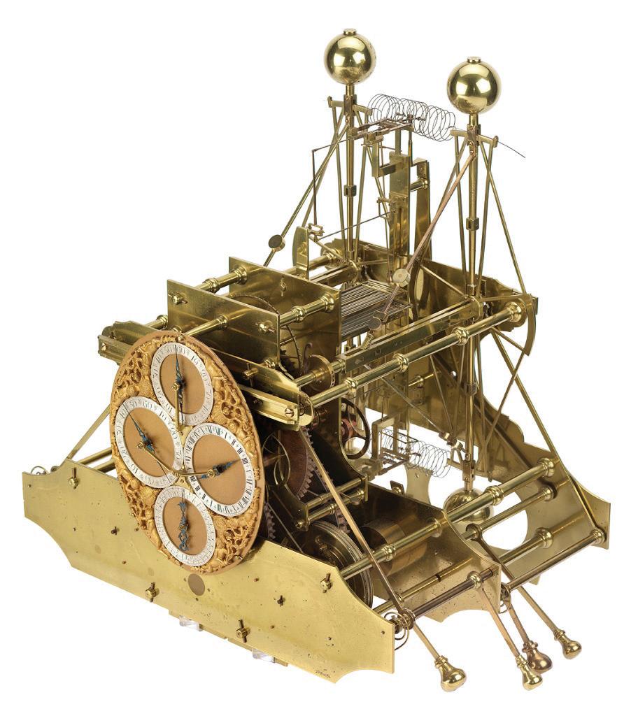
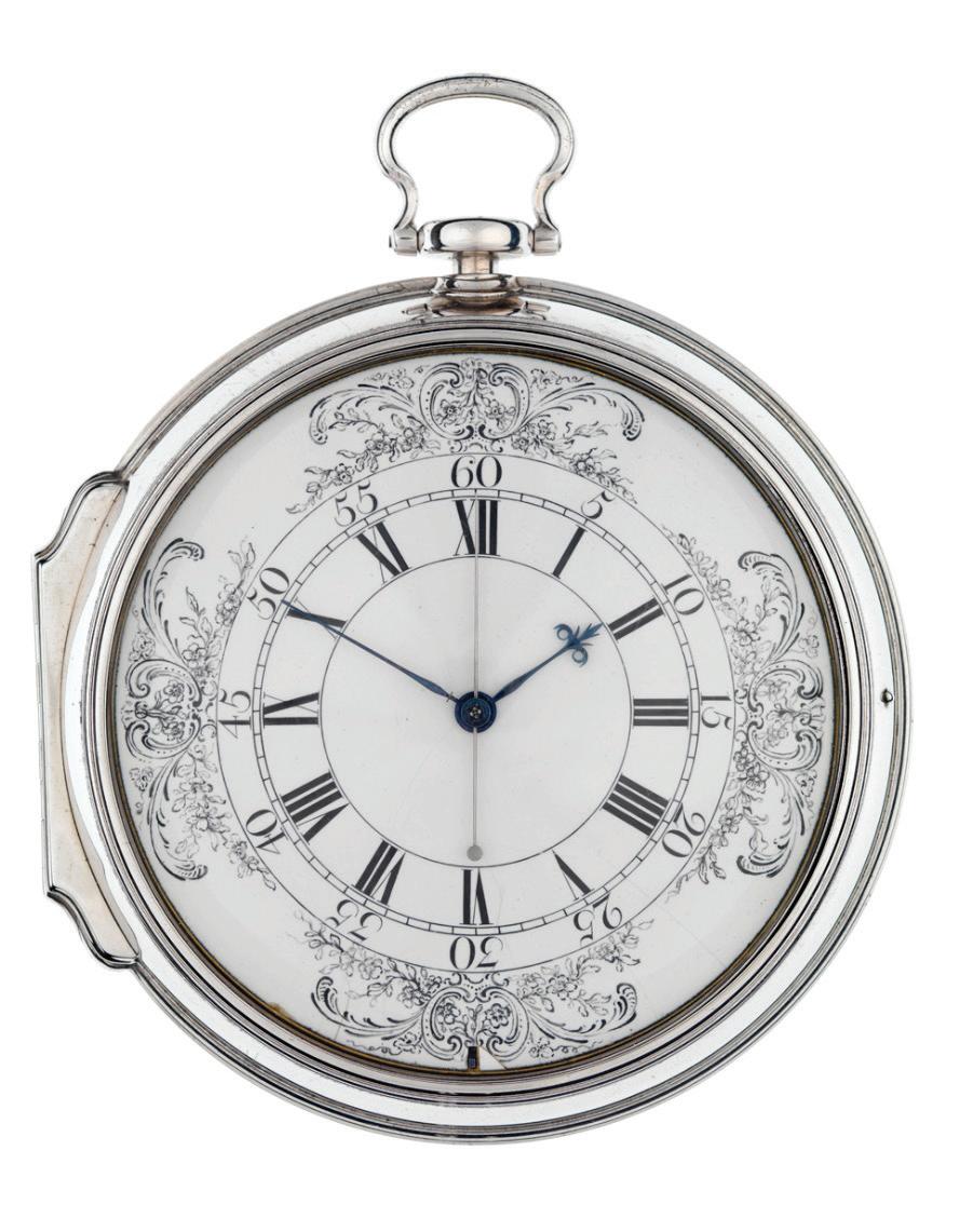
Figure 1. Marine timekeeper, H1, in the basement museum of Greenwich Observatory, London. It still works! Image from the Royal Museum Greenwich.
HERE’S THE BACKSTORY
The origin of these units centered around clocks, the British naval supremacy, and the need for accurate navigation to avoid shipwrecks and for warfare and commercial trading purposes.
In 1707, a fleet of five British naval ships were shipwrecked, ironically so close to home, just off the southwest coast of England at the rocks off the Isles of Scilly. Sadly, over 1,400 sailors lost their lives. This loss of life and equipment so bothered Queen Anne of England that in 1714 she declared a GBP 20,000 cash prize (today’s equivalent of GBP 1.5 million or approximately CAD 2.7 million) to anyone who could solve the “longitude problem.”
Back then, a ship sailing at sea could determine its location in a north-south direction (i.e., latitude) using the heavens. A ship’s latitude was determined by looking at the stars and midday sun using an astrolabe; later, a sextant was used to determine the angle between a celestial body and the horizon. The intelligentsia and aristocracy of the day felt the answer for longitude would also lay in the stars using the Royal Observatory at Greenwich, London, built in 1675. It is located about eight miles east of Buckingham Palace, overlooking the Thames River. In response, the Royal Astronomical Society began in earnest mapping the night skies using the latest telescopes. Before her death in 1714, Queen Anne appointed a “Board of Longitude,” comprised of key figures from politics, the Navy, astronomy, and mathematics to evaluate submissions of proposed solutions. The board chairman was none other than the esteemed Sir Isaac Newton.
Decades went by. No solution. More shipwrecks. Much improved night sky mapping ensued, but none of it solved the longitude problem. But the royal astronomers were having a heyday with their new toys, with full royal support and funding.
In 1735, quite unexpectedly, a former carpenter and self-taught clockmaker from Northern England stepped forward, declaring he had the answer to the longitude problem. John Harrison, age 43, was an established maker of pendulum clocks used on dry land, and he had built the world’s first pendulum-free clock, which could be used at sea. It was as accurate as most pendulum clocks on land, but most importantly, he claimed that it would work well on the rolling waves and in the salt air of the sea. He sought the prize using his new horological creation: a marine chronometer (a.k.a. clock), affectionately named Harrison One or H1 (Fig. 1).
Heresy! The royal astronomers and Board of Longitude were aghast. Who is this person? What are their credentials and education? And what does a clock have to do with stars, or indeed, longitude?
Harrison proposed that if a ship used his pendulum-free clock upon departing for sea via the Thames River, it could be set to London (i.e., Greenwich) time when it was precisely 12 noon. On a clear day while at sea, out of sight of any land either to the west or east of Greenwich, the ship could determine when it was high noon at its present location. By comparing ship time to the clock’s (i.e., Greenwich) time, the ship’s navigators could calculate the time difference between their present location and Greenwich time. For example, if they observed that it was 12:00 pm for the ship and 3:00 pm in Greenwich time, the ship was three hours behind Greenwich time. The earth was known to be a sphere comprising 360 degrees, so each of the 24 hours of a day represented 15 degrees (i.e., 360 degrees/24 hours). Thus, a ship three hours behind Greenwich time would be located 45 degrees west of Greenwich. When combined with latitude, this gave the ship a precise x,y location on the earth’s surface. Fractions of a degree called for finer splits of minutes and seconds; thus degrees, minutes seconds for longitude (and latitude).
Even before Harrison’s marine chronometer invention, comparing time on land to a reference point time on land was one of two known methods for calculating longitude. The challenge was having a clock that enabled this at sea. Even the great Sir Isaac Newton had said to a Parliamentary Committee in 1714 that no known clock could work accurately amid storms and changing temperature, humidity, and barometric pressure, not to mention variations in gravity and the pitching, rolling and yawing of a ship at sea.
At the request of the naysayers, the Board of Longitude in particular, Harrison underwent a series of sea trials, first to Lisbon and, in later years, to Jamaica and Barbados using ever-improved versions of his timepiece (i.e., H2, H3, and H4 [Fig. 2]). Making improvements to the clocks took decades. Harrison’s H4 clock was found to be accurate to within 3–5 seconds a month (representing less than 1 nautical mile of longitude), which was far more accurate than any pendulum clock on land. After 45 years of continual improvements and test trials, he satisfactorily proved that his timepiece worked accurately and reliably at sea, providing necessary unequivocal proof and overcoming many manmade obstacles and politics. Eventually, as John became elderly, his son, William, took up the cause. In 1773, on his deathbed at the age of 80, John Harrison finally received the prize he so deserved.
Currently, all four restored Harrison clocks are on display in the museum basement of the Royal Observatory at Greenwich. H1, H2, and H3 remarkably still work. H4 is kept in a stopped state because, unlike the first three, it requires oil for lubrication and is at risk of degrading as it runs.
Figure 2. Marine timekeeper, H4, the great-greatancestor of all wristwatches, in the basement museum of the Greenwich Observatory, London.
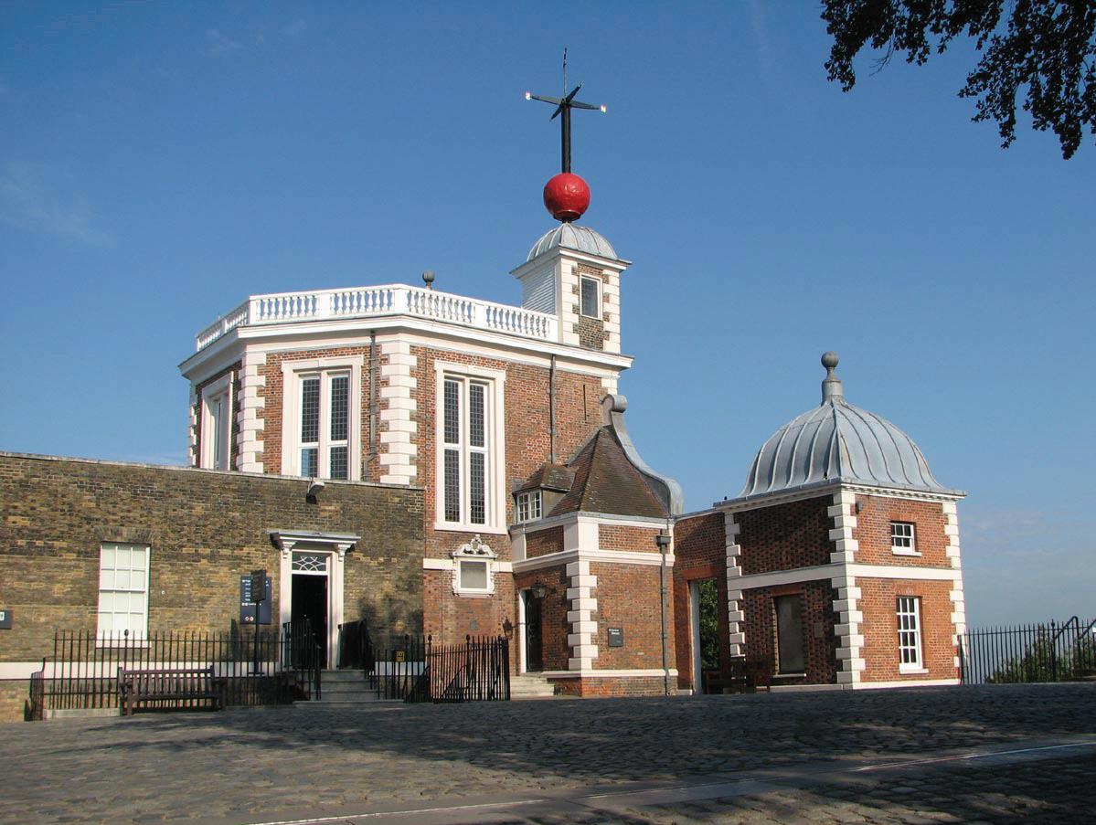
Figure 3. Courtyard of the Greenwich Observatory with the ball drop. The zero longitude line is in the foreground. Image from The Royal Observatory
GENERAL IMPLICATIONS OF LONGITUDE
In summary, the general implications of Harrison’s life’s work are as follows:
1) Wristwatches: The H4 clock is considered the great-great ancestor to all modern-day wristwatches because it was the world’s first pendulum-free clock and is the size of a largish pocket watch.
2) Prime meridian defined: A zero-longitude line (i.e., the prime meridian), dividing the western and eastern hemispheres, is permanently indicated on the ground near the entrance of the Greenwich Observatory, overlooking the naval museum on the Thames River below.
3) Greenwich ball drop: On top of the observatory, since 1833 and still to this day, the orange ball drops to indicate 1:00 pm (this was originally done at 12 noon) for sailors departing on the Thames so they can accurately set their clocks (Fig. 3). This seafaring time method was subsequently adopted at major USA ports in Washington, D.C., on the Potomac River, and in New York City and Boston. It is even done symbolically on New Years Eve in Times Square and worldwide.
4) Greenwich Mean Time (GMT): GMT is displayed on the (atomic) clock at Greenwich Observatory and is used worldwide as an accurate reference point for all time measurement, time zones, etc.
5) Time zones: The 24 worldwide time zones, especially those offshore in the world’s oceans, are defined largely by lines of longitude, with occasional deflections or deviations around islands or points of land.
6) Dominion Land Survey (DLS) Meridians: The DLS in Western Canada was surveyed from 1871–1881. Its original purpose was to demarcate farmland and field positions for agricultural land. The six meridians of the DLS across four provinces (MB, SK, AB, and BC) all follow lines of longitude (97°27ʹ28.41ʺ, 102°, 104°, 106°, 108° all west of Greenwich).
7) Provincial boundaries: The provincial boundaries of MB, SK, AB, and BC are in part demarcated by lines of longitude, finally settled ca. 1905–1912.
8) Map projections: The challenge of taking a spherical earth and projecting it onto a flat map surface is key to accurate x,y positioning of any point on the earth’s surface. The solution involves accurately dealing with changes in longitude and latitude around the globe.
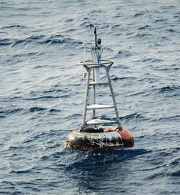
9) Null Island: The point of intersection of zero longitude and zero latitude (i.e., the equator) is marked by a weather buoy known as Null Island, located in the Atlantic Ocean offshore of Equatorial Guinea, Africa (Fig. 4).
longitude and zero latitude. Images from Wikipedia.
Figure 4. Null Island (left) and the weather buoy (right) located at the intersection of zero
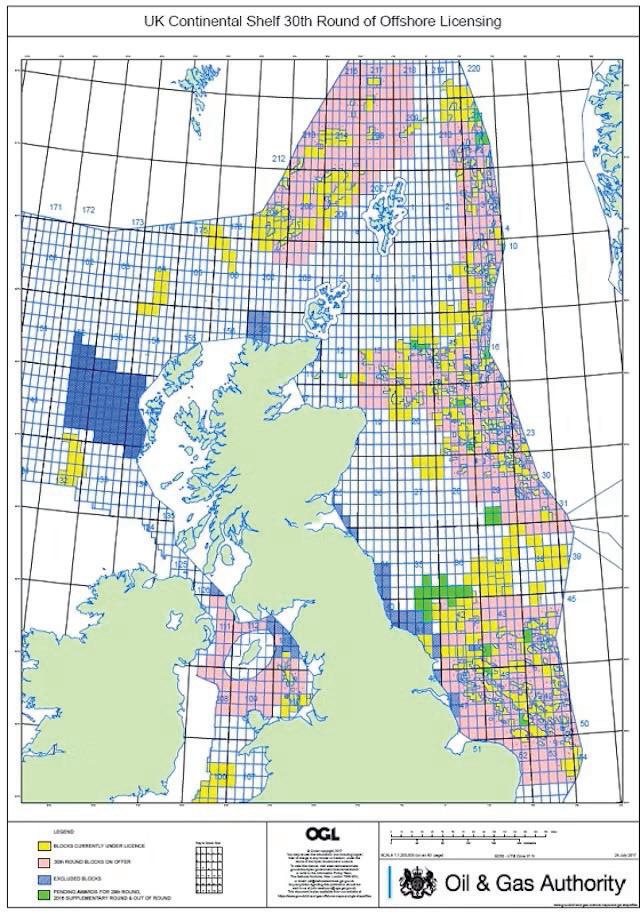
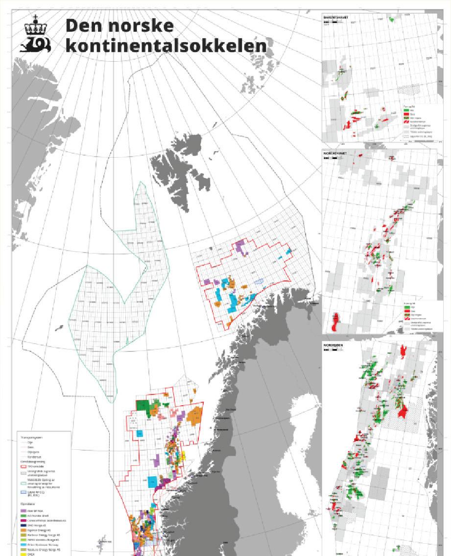
Figure 5. UK (left) and Norway (right) offshore quads and block boundaries defined by longitude (and latitude). Images from Offshore Magazine and Norsk Petroleum.
SPECIFIC IMPLICATIONS FOR GEOSCIENCE
How do geoscientists benefit from Harrison’s invention? This question is a bit like asking “what is water used for?”; there are so many. Above all, being able to determine longitude (and latitude) provided the foundation for the subsequent birth, 200 years later, in 1974, of global positioning systems (GPS) and, thus, geographic information systems (GIS) for map-making, both on the earth’s surface, in the subsurface, and in airspace. Longitude and latitude coordinates (and sometimes elevation) are used in geoscience; mineral exploration; petroleum exploration; production; and carbon capture, utilization, and storage (CCUS) for positioning in 2-D or 3-D space. Here are some examples:
1) Well locations: Oil and gas well drilling and well name location nomenclature (e.g., 10-20-042-12W4) is based on the DLS system, which is used to define farmland and agricultural boundaries.
2) Offshore exploration and production (E&P) block boundaries: Lines of longitude and latitude commonly demarcate and delineate offshore oil and gas exploration and/or production license blocks (e.g., offshore Atlantic Canada [NL and NS], offshore UK/Ireland/Norway/ Netherlands/Denmark/Germany North Sea [quadrants or quads], USA Gulf of Mexico [protraction areas], Brazil Santos and Campos basins [Fig. 5]). More recently these offshore block boundaries are also used for CCUS licenses (e.g., North Sea in UK/Norway/ Denmark/Netherlands).
3) GPS: GPS is used extensively in geoscience to determine x,y coordinates on the earth’s surface for well locations, outcrop locations, seismic line locations, volcano monitoring, groundwater monitoring, monitoring of melting glaciers, etc.
4) GIS: GIS software, such as ArcGIS and QGIS, is used to layer and visualize various map datasets. This helps users determine the
spatial relationships between disparate data. It is used extensively in non-North American international E&P operations where AccuMap or GeoSCOUT software does not exist.
5) Geophysical surveys: Precise seismic shot-point locations and locations of 2-D and 3-D seismic lines are critical to our petroleum industry. These data are used to map subsurface structures, faults, and depositional and structural trends.
6) Topographic maps: These maps were critical in early surface geology mapping throughout Canada. Accurate positioning of rock outcrops, strata, lakes, and rivers is important for map users, such as those planning rig roads, seismic lines, access routes, drill pads, well locations, and pipeline egress.
7) Well location and wellbore trajectory: Coordinates are used to decide optimal drilling surface locations, and once drilling is underway in the subsurface, to pinpoint wellbore trajectories in directional drilling (i.e., the location of the drill bit and wellbore relative to target reservoirs, faults, nearby wellbores, and other subsurface hazards).
8) 3-D geological models: Precise x,y,z spatial data is essential for geological reservoir modelling, and thus in planning well locations and trajectories for optimum production and depletion.
9) Induced seismicity monitoring: Coordinates are critical for tracking induced seismicity that may arise from hydraulic fracturing of horizontal wellbores in unconventional shale/tight oil and gas wells, carbon dioxide injection, and for geothermal activities.
10) Remote sensing and GIS: GIS uses longitude and latitude data to integrate and analyze various datasets, such as satellite imagery, seismic data, and geological maps.
11) Permitting and lease management: Many governments require detailed geographic information to define corner points and boundaries of exploration and production permits. Spatial data ensures operations stay within the leased or licensed areas.
12) Environmental impact assessment: Coordinates are required to assess and mitigate the impact of petroleum and mineral E&P activities on local ecosystems.
13) Geothermal energy: Longitude and latitude data facilitate the mapping of regions with high geothermal potential (e.g., near tectonic plate boundaries, volcanic zones, hot springs). They are also important for subsurface thermal gradient mapping compiled from heat flow studies, borehole measurements, and remote sensing to identify suitable sites.
14) CCUS: Longitude and latitude are used to identify geological formations suitable for CO₂ storage, such as deep saline aquifers and depleted oil and gas reservoirs. Coordinates also help assess risks related to faults, fractures, and caprock integrity. For injection point localization, geospatial data ensures precise drilling and injection of CO₂ into designated storage sites, and to place monitoring wells to track CO₂ plume movement and ensure containment.
Were it not for the humble genius and tenacity of John Harrison 250 years ago, we geoscientists might still be making inaccurate maps and mining and drilling in the wrong locations. Our job is surely already challenging enough relying on the map accuracy we now enjoy in the 21st century using satellites and GPS!
RESOURCES:
Cartwright, M. (2023, March 14). Harrison’s marine chronometer. World History Encyclopedia. https://www.worldhistory.org/article/2197/harrisonsmarine-chronometer/ John Harrison. (n.d.). In Wikipedia. https://en.wikipedia.org/wiki/John_Harrison Null Island. (n.d.). In Wikipedia. https://en.wikipedia.org/wiki/Null_Island Redfern Animation. (n.d.). The Harrison timekeepers H1, H2, H3, and H4. https://redfernanimation.com/the-harrison-timekeepers Royal Museums Greenwich. (n.d.). Longitude found: The story of Harrison’s clocks. https://www.rmg.co.uk/stories/topics/harrisons-clocks-longitudeproblem
Royal Museums Greenwich. (n.d.). What made the search for longitude so important? https://www.rmg.co.uk/stories/topics/what-made-search-longitudeso-important
Sobel, D. (2007). The true story of a lone genius who solved the greatest scientific problem of his time. HarperPerennial, 208 p.
AUTHOR: Scott Gardiner | 403 708-7973 (c) | sgardiner.upstream@outlook.com
Alberta Palaeontological Society 28th Annual Symposium
SATURDAY, MARCH 15, 2025
JENKINS THEATRE, MAIN BUILDING LEVEL 1 (LOWER LEVEL), MOUNT ROYAL UNIVERSITY
9:00 – 9:15 am Opening Statements
Cory Gross, APS President
Symposium Introduction
Mona Trick, APS Symposium Chair
9:15 – 10:15 am Squid Games: Challenges in Ammonite Paleoecology
Dr. Cam Tsujita, Department of Earth Sciences, Western University, London, Ontario
10:15 – 10:30 am COFFEE BREAK
10:30 – 11:00 am Changes in Dinosaur Diversity in Response to Continental Fragmentation
Dr. Matthew J. Vavrek, Cutbank Palaeontological Consulting
11:00 – 12:00 pm Overview and Update on the Kaskie Hadrosaur Project in Dinosaur Provincial Park
Darren H. Tanke, Senior Technician II, Royal Tyrrell Museum of Palaeontology, Drumheller, Alberta
12:00 – 1:00 pm LUNCH BREAK
1:00 – 1:30 pm* Joggins Fossils Cliffs, Nova Scotia: A Carboniferous (320-Million-Years-Old) Highly Diverse Paleoecology and a UNESCO World Heritage Site
Tako Koning, Consulting Geologist
1:30 – 2:00 pm* Exploring the Diverse Plant Fossils of the Early Eocene Flora of Republic, Washington
Dr. Kathleen Pigg, Professor and Curator of Fossil Plants, BioKIC (Biodiversity Knowledge Integration Center), School of Life Sciences, Arizona State University, Tempe Arizona
2:00 – 3:00 pm POSTERS & DISPLAYS BREAKOUT SESSION AND COFFEE BREAK Poster presenters are requested to be with their posters
3:00 – 3:30 pm New insights into amphibian anatomy, evolution and ecology from the Paleozoic of Atlantic Canada
Dr. Hillary Maddin, Carleton University, Ottawa, Ontario
3:30 – 4:30 pm Tyrant Lizard Kings and Queens: A Tale of Canadian T. rexes
Dr. Emily Bamforth, Philip J. Currie Dinosaur Museum
4:30 pm Closing remarks for Paleo 2025
Mona Trick, APS Symposium Chair
*Schedule revision.
SUNDAY, MARCH 16, 2025
Workshop: 3D Imaging of Fossils
Registration required | 9:00 am – 12:00 pm | $20.00 per person (no GST charged)
2025 UPCOMING EVENTS INFORMATION
MARCH
March 6th-8th
40th Annual Squash Tournament
Location: The Bow Valley Club 250-6 Ave SW, Calgary, AB T2P 3H7
March 12th In Person only
12:00-1:00 pm MST
Heavy Oil/Oil Sands Technical Division
Navigating the Subsurface: Steering the Future of Oil and Gas
Speaker: Gary Bugden, B.Sc., P.Geol. President at Cabra Consulting Ltd.
Location: New CEGA Classroom, 500 4 Ave SW, +15 level, Calgary, AB
March 15th-16th
PALEO 2025
Location: Mount Royal University Room B108 4825 Mount Royal Gate SW Posters in Main Hallway on Level 1 Lectures in Jenkins Theatre
March 26th In Person only
12:00-1:00 pm MST
International Technical Division
A significant developing onshore hydrocarbon play in East Africa. How could Canadian E&P companies get involved?
Speaker: Thomas Feuchtwanger, Sadek Ben Lamin, CanAfrica Resource Consultants and Bob Schmitz, P. Eng., Reef Energy Solutions
Location: New CEGA Classroom, 500 4 Ave SW, +15 level, Calgary, AB
APRIL
April 3rd-5th
1st Annual CEGA GeoSpiel
Location: North Hill Community Curling Club 1201 2 St NW, Calgary, AB T2M 2V7
April 8th In Person only
11:30 am -1:00 pm MST Technical Luncheon
SA-SAGD in the Grand Rapids: Taking Cold Lake Development to the Next Level
Speaker: Brittan Jones, Imperial Oil
Location: Calgary Petroleum Club Devonian Ballroom 319 5 Ave SW, Calgary, AB T2P 0L5
April 9th In Person only
12:00-1:00 pm MST
Heavy Oil/Oil Sands & BASS Technical Division
Bars & Caves – stratigraphic heterogeneity & structural complexity within the McMurray & underlying Devonian formations at Kearl Oil Sands Mine
Speaker: Bogdan L. Varban and Lauren A. Eggie, Imperial Oil, Kearl Geoscience Team
Location: New CEGA Classroom, 500 4 Ave SW, +15 level, Calgary, AB
VISIT
2025 UPCOMING EVENTS INFORMATION
MAY
May 6th In Person only
11:30 am -1:00 pm MST
Technical Luncheon
Applying Stratigraphy and Depositional Mapping to Improve Hydrocarbon Recovery in Unconventional Shale and Oil Sands Reservoirs
Speaker: Greg M. Baniak, PhD, P.Geo
Location: Calgary Petroleum Club Devonian Ballroom 319 5 Ave SW, Calgary, AB T2P 0L5
JUNE
June 10th
11:30 am -1:00 pm MST
Technical Luncheon
Addressing Challenges in RTA using New Core Analysis Method - A Luncheon Hosted in Collaboration with SPE Calgary Chapter
Speaker: Christopher R. Clarkson, PhD, PEng
In Person only
Location: Calgary Petroleum Club Devonian Ballroom 319 5 Ave SW, Calgary, AB T2P 0L5
Broadening our Understanding of Bird Ichnology through Neoichnology
JON NOAD, STANTEC CONSULTING; UNIVERSITY OF ADELAIDE
INTRODUCTION
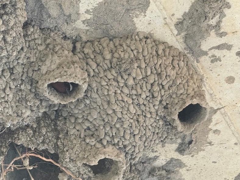
Bird footprints are some of the most recognizable traces in the fossil record. Yet birds exhibit a wide variety of other behaviours which may also be preserved as ancient traces (Belaústegui et al 2017). Records include feeding traces like probing, nesting structures and possibly coprolites, but the study of the traces left by modern birds extends their scope to courtship-related scrapes, swimming and diving traces, bird resting and perching traces and feather impressions, as well as other feeding strategies and more subtle scrape-like nests (Belaústegui et al 2017). Note that eggs are no longer classified as trace fossils. In this article we will review ancient bird traces and suggest other potential bird-generated traces that have not previously been identified as fossils.
Evidence suggests that birds “took flight” around 145 million years ago (Lockley and Harris 2010), around the same time period that Archaeopteryx was alive. Tracks similar to those made by modern shorebirds, ducks, herons and roadrunners appeared in the fossil record at this time and became abundant over the next few million years. In contrast, the earliest body fossils of these birds date back only 70 million years, suggesting that early track makers were members of extinct lineages with similar feet and behaviours, including feeding strategies (Lockley and Harris 2010). The enantiornithines were the dominant avians in the Mesozoic (with clawed fingers on their wings and teeth), with neornthines dominating throughout the Tertiary (Mainwaring et al 2023). The latter can be delineated based on a backward pointing hallux, wide divarification (the angle between outer digits) and no heel pad (except large terrestrial birds).
As we will see, fossil bird traces are dominated by shorebirds (Lockley and Harris 2010), with many records of bird footprints and some feeding traces. This relates to their taphonomy (the study of how organisms decay and become fossilized or preserved in the paleontological record) where coastal settings preferentially preserve bird traces due to their soft substrates, to abundant fauna and food sources, and to changes in water depth allowing traces to quickly become covered and potentially fossilized.
BIRD FOOTPRINTS
Tracks are by far the most common bird traces. Most animals will make tens of thousands of footprints but only have a single carcass to contribute to the fossil record, should scavengers and taphonomy allow it. Fossil bird footprints date back to at least the early Cretaceous; there is some evidence for Triassic trackways, but these were probably made by bird-like therapod dinosaurs (Wikipedia), with most Cretaceous records from Asia (Lockley and Harris 2010). As mentioned, these tracks are all very similar to modern bird traces.
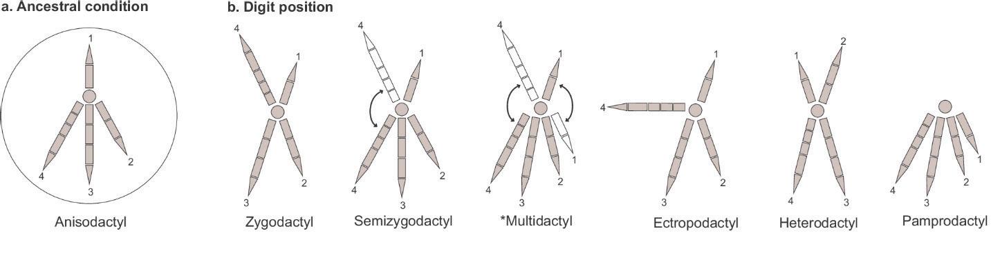
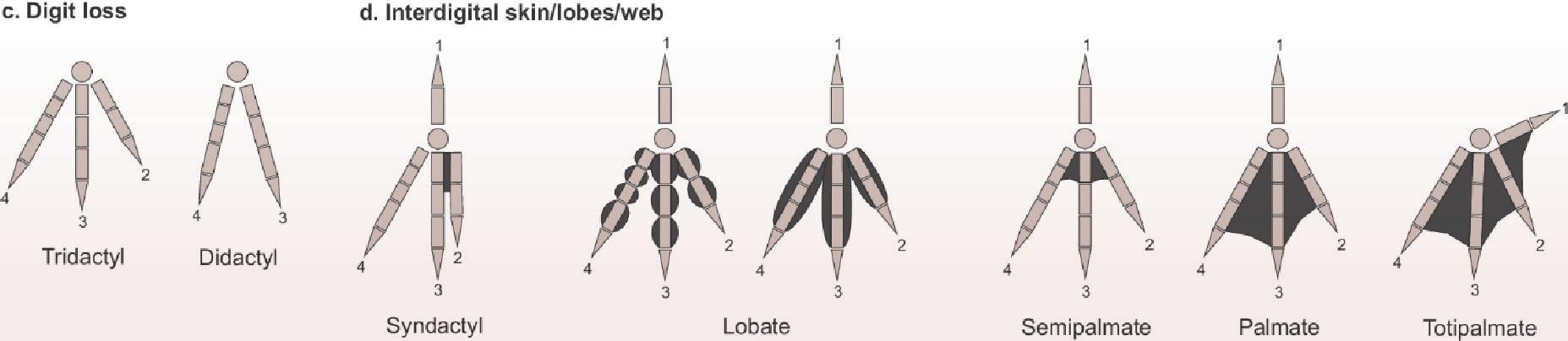
The morphology of a bird footprint is very variable depending on its lifestyle. Avian feet are traditionally classified in several categories based on the number of digits, and their positional arrangement and mobility. These categories include the following (Elbroch and Marks 2001; Carril et al 2024):
Footprint type Description
Classic bird tracks (anisodactyl)
Three toes forward and one pointing back, common
Game bird tracks (technically anisodactyl)
Webbed or palmate tracks, anisodactyl
Totipalmate
Zygodactyl
Hallux greatly reduced or absent, may be raised, termed incumbent
Toe 1 (hallux) absent or tiny, fully webbed
Also webbed but webbing extends to toe 1, toe 4 is longest
Two toes forward and two back, second most common
TABLE 1. Basic classification of bird feet
Examples
Herons, egrets, crows, eagles, hawks and falcons, moorhens, crows, swallows, kingfishers, thrushes, sparrows, spoonbills, etc.
Game birds, shorebirds (partially webbed feet are termed semipalmated), rails, coots, plovers, oystercatchers, stilts, sandpipers, phalaropes, turkeys, grouse, etc.
Loons, swans, ducks, avocets, gulls and terns, flamingos
For our purposes, we are really concerned with four toed (anisoldactyl) versus three toed (tridactyl), and whether the feet are fully or partially webbed, or not webbed. Shorebirds (and other birds) mentioned in this article are in bold.
Bird foot types (from Carril et al 2024)
With the bias towards shorebirds tracks in the ancient (Greben and Lockley 1993), the most common fossil bird footprints are anisodactyl and tridactyl, with varying degrees of webbing. The presence or absence of hallux (the rear facing claw in anisodactyl tracks) is also important in their classification, although differing substrates may mean that the bird may have a hallux but that it does not register as an impression.
The KSU website (Kansas University 2025) lists 42 species of fossil bird footprints. In terms of depositional setting, 34 were deposited on the water margin or lake and 6 are continental deposits. Twenty-five are shoreline birds, 5 are flamingo, pelican or anseriform (duck), 4 are fully terrestrial and the rest were not identified.
CEGA has partnered with Mentoring365 and 12 world class organizations to provide amazing and diverse mentoring opportunities for CEGA members. These organizations include:
• National Aeronautics and Space Administration (NASA)
• Geological Society of America (GSA)
• American Geophysical Union (AGU)
• Society of Exploration Geophysicists (SEG)
www.cegageos.ca/community/mentoringcega
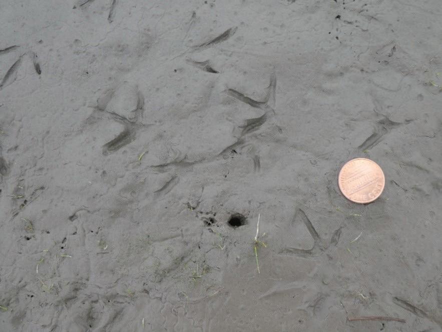
Modern duck footprint from Calgary, Alberta
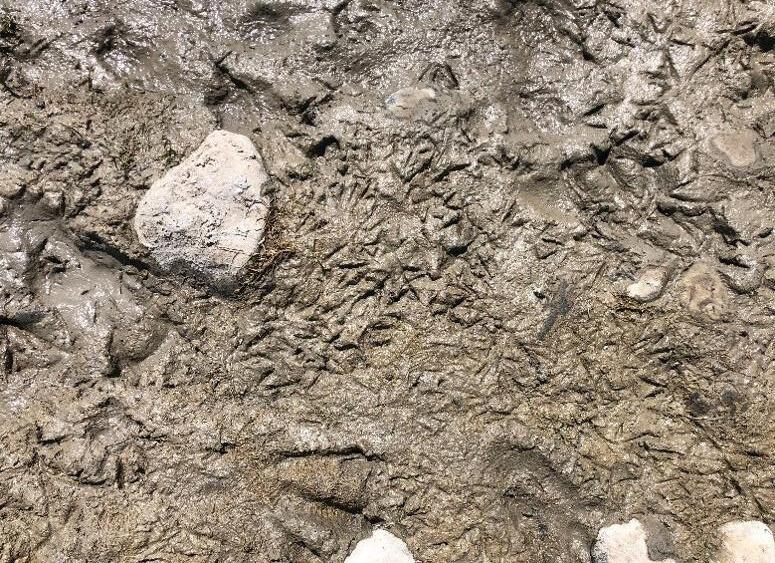
Modern trample zone AKA bird disco, where many birds have walked in the same area, Lethbridge, Alberta
CLASSIFICATION OF FOSSIL BIRD FOOTPRINTS
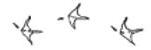
Fossil bird footprints are classified based on their morphology, using a similar Linnean naming system to body fossils (ichnotaxa). These can be grouped into ichno-groups, which tend to occur in particular ichnofacies (sediment types) or ichnocoenoses (environments) (Lockley et al 2021). Types of footprints are NOT tied to a particular bird, which is very important as different animals can make identical traces due to similar behaviours (Lockley and Harris 2010). Common track types have been recorded over intervals from the Cretaceous to recent, including examples such as:
Trace Description Modern example Sketch of trackways
Avipeda, Aquatilavipes and Koreanaornis
Quadridigitus
Small, almost right angle, tridactyl prints, lack a hallux, varying sizes
Tridactyl with a big heel, proximal webbing and an occasional hallux
Jindongornipes Three equal digits, almost right angle, like an anchor and thin digits, with no hallux
Piping plover
Spotted sandpiper
Willet
Gruipeda
Goseongornipes, Ignotornis and Hwangsanipes
Small tracks, divarication angle 108°, indistinct pad impressions
Semi-palmate, with bigger hallux, varying sizes
Spoonbill (see feeding behaviours); willet; spotted sandpiper
Uhangrichnus and Presbyornithiformipes
Webbed, rounded digits, tridactyl with small or absent hallux
Magnoavipes
Very large footprint, long, slender birdlike toe impressions, claws
Canada goose
Cranes
Sandhill
TABLE 2. Common bird footprints (after Kim et al 2012; Fiorillo et al 2011; Carmens and Worthy 2019; Lockley et al 2021)
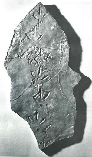
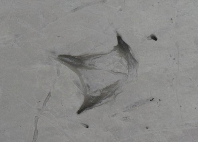
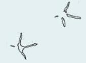
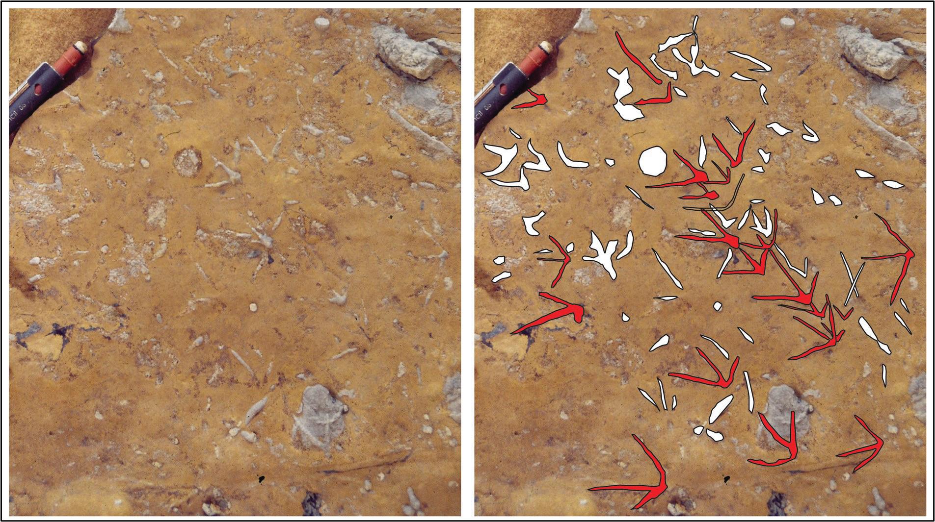
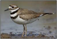
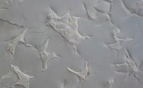
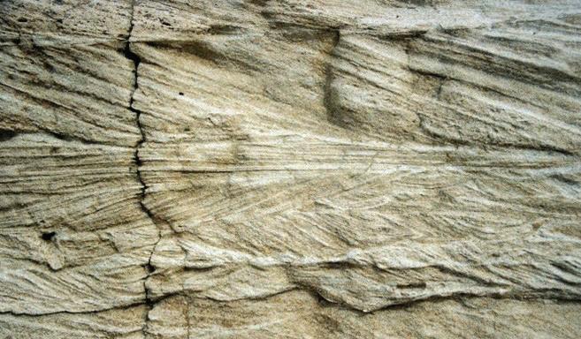
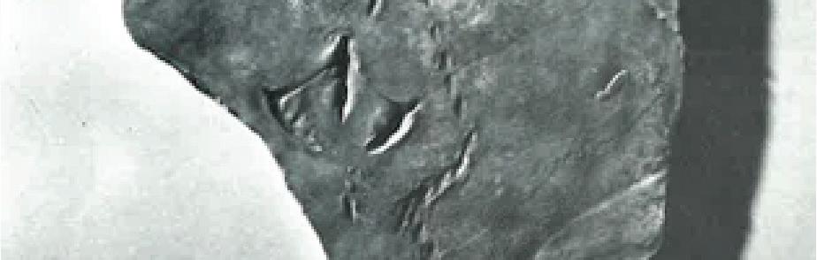
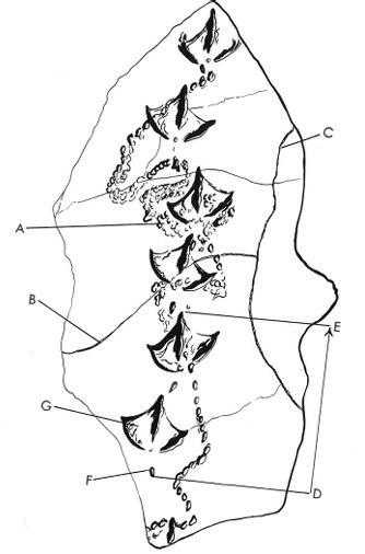
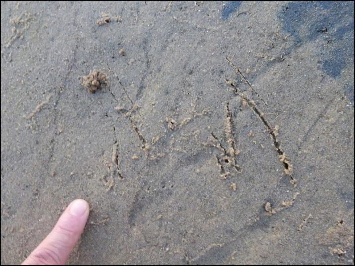
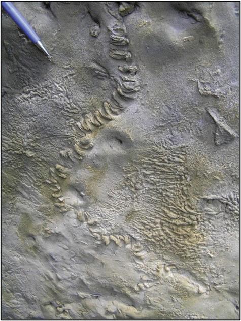
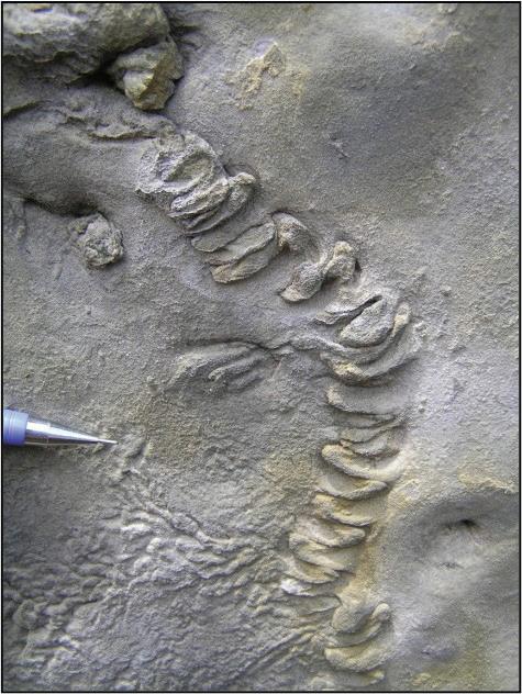
A comparison of fossil and recent bird tracks is informative. Fossil bird footprints were discovered in Miocene mangrove deposits in Sandakan, Sabah, eastern Borneo (Noad 2005; 2013; 2017). Their mangrove origin was confirmed by their direct association with fossil mangrove lobsters ( Thalassina anomala). The footprints were tridactyl with straight digits and a wide divarification angle and lacked a hallux. A study of modern bird traces found many similar tracks, but most retained a hallux (stilts, moorhens, rails, oyster catchers, sandpipers, ibis). Plover and (closely related) killdeer footprints appeared most similar, both being upland shore birds, around 23 to 27 cm in length. This suggests that a Miocene bird, walking like a plover, with similar feet, left these tracks in the mud beneath a mangrove channel.
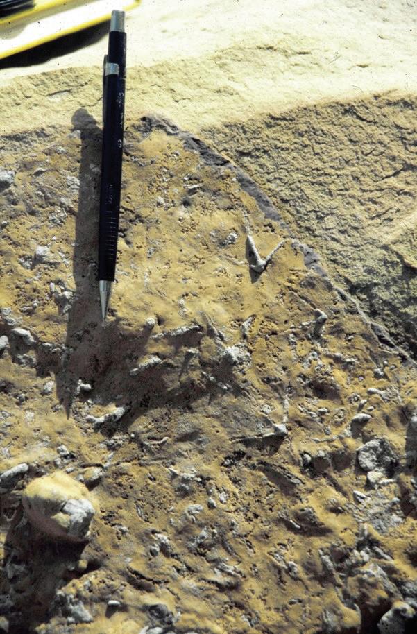
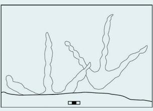
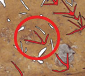
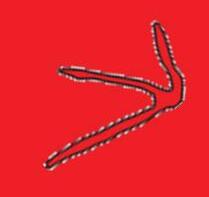
Interpreted bird footprints (in red) from the Miocene Sandakan Formation, Sandakan, eastern Borneo. The tracks are preserved as cemented mudstone casts on the base of a mangrove channel sandstone. Note the association with prod marks (highlighted in white)
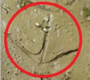
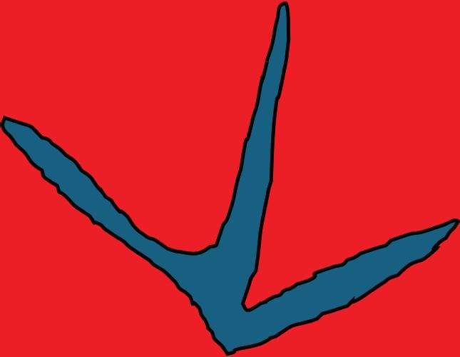
Comparison between killdeer footprint (above) and footprint from the Sandakan Formation (below)
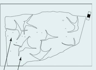
The bedding plane also exposed a series of small, circular traces which are interpreted as prod marks. Other examples of prod marks are discussed in the Feeding Traces section, as well as another newly reported trace from the Sandakan Formation.
Obviously more recent deposits, such as the Pliocene of the Lake Eyre Basin, Australia, may exhibit footprints that can fairly confidently be tied to modern birds, such as flamingos, a variety of waders and pelicans or swans. The ichnotaxa include Anatipeda, Phoenicopterichnum and Koreanaornis (Carmens and Worthy 2019).
FAMOUS BIRD FOOTPRINT LOCALITIES
Cretaceous examples
The Cretaceous, non marine, Hamman Formation of southeastern Korea has yielded thousands of bird tracks as well as plants, freshwater molluscs and dinosaur footprints, from several sites (Paik et al 2012). The Hamman Formation is composed of reddish shales and fluvial sandstone. At the Gajinri site, interpreted as a lakeshore deposit, the density of bird footprints may be up to 600/m2 (Kim et al 2012). More than 1000 bird tracks are exposed on a single bedding plane at the Gyeongsangnamdo Institute of Science Education (GISE) in Jinju, with impressive morphological and behavioral diversity. These range from a variety of feeding strategies to landing and running traces (Falk et al 2014).
The current named ichnogenera from the Haman Formation include: Koreanaornis (a small incumbent anisodactyl track possibly lacking a hallux), Ignotornis sps. (semipalmated tracks) and Goseongornipes (similar to Koreanaornis and smaller than Ignotornis and Hwangsangornipes). Koreanaornis and Goseongornipes tracks would be made by shorebird-like birds similar to sandpipers and plovers (Falk et al 2014). There are also Jindongornipes, Uhangrichnus (webbed) and Hwangsanipes (Lockley et al 2012). The palaeoclimate was thought to be warm and dry (Paik et al 2012) with dessication cracks and evaporite deposition.
The Upper Cretaceous Cantwell Formation in Denali National Park and Preserve (DENA), Alaska, contains an unparalleled fossil avian biodiversity (Fiorillo et al 2011). Bird tracks are preserved in multiple locations along a 40-km transect in DENA in fluvial and lacustrine deposits. The approximate body sizes of the birds based on tracks show a range from sparrow- to heron-sized birds, with Aquatilavipes, Ignotornis, Magnoavipes, Gruipeda and Uhangrichnus sp. Other localities include southern Australia (early Cretaceous) with tridactyl, partially webbed Avipeda (Martin et al 2023).
Paleogene examples
The Eocene Green River Formation in Wyoming and Utah is also famous for its fossil bird footprints and the Uinta Basin has at least 10 trackway localities including the webbed Presbyorniformipes. More localities outcrop in the adjacent Green River Basin and are often laterally extensive along strike (Moussa 1968). Other morphologies include Gruipeda and Avipeda, made by shorebirds similar to plovers and sandpipers. In general, the footprints are abundant but of low diversity, with small wading birds the most common but larger birds also present (Curry 1957). The footprints are preserved in very fine-grained, dolomitic limestone (Curry 1957; Moussa 1968), similar to the Solnhofen Limestone. Ripples are rare (Moussa 1968) and do not host footprints, but there are mud cracks and raindrop impressions on what was probably a muddy shoreline, subject to periodic emergence (Curry 1957).
Modern plover tracks, Calgary, Alberta
Fossil, semipalmate bird footprints of the Green River Formation (Virtual Petrified Wood Museum website)
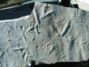
Typical sample of the Green River limestone with tridactyl bird footprints
Late Eocene tracks are also found in Presidio County, Texas, including Gruipeda, Avipeda and several other species (Hunt and Lucas 2007).
Diatryma tracks (a very large terrestrial bird) were found in the Eocene of Washington State (Hunt and Lucas 2007). The same area exposed the Eocene Chuckanut Formation with heron-like tracks of Ardeipeda; webbed bird tracks of Charadriipeda sp. (lacking a hallux) and small shorebird tracks of Avipeda sp. The heron tracks show gaps, with the hopping gait representing a possible hunting strategy (Mustoe 2002).
The Upper Eocene of the southern Pyrenees, Spain, is made up of mixed intertidal flat, sandy beach facies, different types of heterolithic, backbarrier deposits and conglomeratic, fluviatile facies. The tidal flat deposits contain abundant footprints of aquatic birds including Charadriiformes: Charadriipeda (plover-like) and a new ichnotaxon, Leptoptilostipus. The bird tracks and flat-topped wave ripples indicate falling water levels, while the raindrop marks, desiccation cracks, pseudomorphs after halite and adhesion ripples are clear evidence of subaerial conditions in an overall deltaic setting (Payros et al 2000).
Further tracks, made by small wading birds, were found in Oligocene lagoonal, calcareous shales in Zaragoza (de Raaf et al 1965). There are also much larger web-footed (heron-like) bird tracks in these deposits. Sumatran deposits of similar age contain two types of Aquatilavipes, preserved in very fine-grained sandstone (Zonneveld et al 2011) in an intertidal flat setting. These tracks are most similar to those produced by small shorebirds such as avocets, sandpipers, stilts, rails and plovers. The second track type are more like rail tracks (Zonneveld et al 2011).
Eocene trace fossils from South Kalimantan include nine avian footprint ichnogenera (Aquatilavipes, Archaeornithipus, Ardeipeda, Aviadactyla, cf. Avipeda, cf. Fuscinapeda, cf. Ludicharadripodiscus, and two unnamed forms). They were found in a coal mine and were associated with avian feeding and foraging traces (Zonneveld et al 2024a). The depositional setting is interpreted by the authors as channel-margin intertidal flats in a tide-influenced estuarine setting.
Neogene examples
Fossil bird footprints are much more common in the Neogene. Miocene lacustrine deposits in Death Valley preserve a variety of tracks, including large avians. There are many other US Miocene bird footprint localities (Hunt and Lucas 2007) including Lake Mead, New Mexico and the Texas Panhandle. An Iranian locality in the west Zanjan province has yielded abundant tetradactyl Iranipeda isp., Ornithotarnocia isp., and webbed Culcitapeda tridens footprints, laid down in a playa setting (Khoshyar et al 2016).
In Argentina, the Miocene Toro Negro Formation in La Rioja province contains Fuscinapeda sp. preserved in flood deposits in an anastomosing fluvial system. More of these prints have been found in Andean intermontane basins (Krapovickas et al 2009). The Toro Negro palaeo-community consists of three different birds (a perching bird, a shorebird, and a large cursorial bird), with some footprints preserved in channel top deposits.
Large, tridactyl bird footprints of Miocene age were found in sandstone blocks in the Ebro Basin of Spain (Diez-Martinez et al 2016). They include Uvaichnites, with slender digits, no hallux and no webbing, made by a bird similar to a modern crane. Associated tracks from other localities include Charadriiformes (waders and gulls), Anseriformes (ducks and geese), and Ciconiiformes (storks and herons) (Doyle et al 2000).
Another famous Miocene site in Spain is in Sorbas, Almeria Province. Three distinctive avian ichnotaxa can be identified: Antarctichnus, Iranipeda and Roepichnus sp. These traces are associated with shorebirds, including plovers, storks, ducks and/or gulls, respectively. They are preserved in lagoonal marl deposits behind a coastal barrier with an overall tidal signature, with abundant herringbone crossstratification (Doyle et al 2000). There are also fossil insects and mammalian tracks. The excellent fossil preservation suggests that the
Sketch of hopping heron (based on fossil trackway) from the Eocene Chuckanut Formation, Washington State, USA (taken from Mustoe 2002)
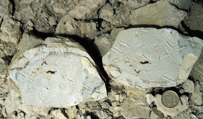
Fossil bird tracks from Sorbas, SE Spain
Herringbone cross-stratified sandstone from Sorbas, SE Spain
water saturation state was closest to the moist-damp/stiff-moderate category, and therefore the optimum for preservation of tracks (Doyle et al 2000).
Well preserved Pleistocene footprints were discovered on the southern coast of Buenos Aires province in Argentina in siltstone, sandstone and claystone outcropping along a beach for at least 10 km. These are thought to be fluvial flood deposits and host four bird ichnotaxa including Phoenicopterichnum, Charadriipeda, Gruipeda and Aramayoichnus (a large, rhea-like bird) sp. (Aramayoa et al 2015). These contrast with Pleistocene coastal aeolianites of Portugal, which contain traces attributed to coots (Gruipeda), jackdaws and owls, the latter a possible feeding trace (de Carvalho et al 2023).
Holocene fossils have been found around Formby Point, UK, including human footprints and those of wading birds, between 7500 and 4500 years old. Oystercatcher prints are the most common and there are also crane tracks and mammal tracks outcropping along the formerly reed fringed coastline (Roberts 2009). It is likely that offshore barrier islands deflected the force of the waves, allowing muds to be deposited at the coast (Roberts 2009).
Modern settings such as Cooking Lake, 25 km southeast of Edmonton, provide useful neoichnological data (Kimitsuki et al 2024) including tracks, trackways, and trampling marks found along the lake margins. Most tracks were incumbent anisodactyl (tridactyl; incipient Koreanaornis). Webbing was only noted in one palmate trackway. Trample grounds are found just above the high-water mark.
FEEDING TRACES
Birds use a wide variety of feeding strategies. Shorebirds use a subset of these techniques, many of which have been identified in the fossil record. These include the following:
Probe and peck
marks
Several dozen near-circular to sub-oval depressions are associated with the Ignotornis and Aquatilavipes tracks at DENA and are interpreted as shallow punctures produced by the narrow bill of a bird (Fiorillo et al 2011; Falk et al 2014). The DENA features compare well with probe marks produced by modern members of the Charadriiformes, which include plovers, woodcocks and other birds (Elbroch and Marks 2001). Some are conical, some twinned.
Similar probe and peck marks were seen in Cretaceous deposits of Korea (Falk et al 2010), associated with web footed Koreanaornis bird tracks. Clustered probing has also been observed (Elbroch and Marks 2001; Falk et al 2014), although isolated probes are more common. Among the arcuate traces of Ignotornis gajinensis is a small elliptical indentation that may represent a jabbing motion or peck by the spoonbill-like bird responsible for the trace (Falk et al 2014).
Zonneveld et al (2011) described numerous small scratch marks, divots and pits occurring on the bedding planes co-occupied by avian and invertebrate trackways in the Ombilin Basin, Sumatra. They consider these markings similar to probe and peck marks that occur in the Cretaceous Haman Formation of Korea (Falk et al 2010) and Cantwell Formation of Alaska (Fiorillo et al 2011), and to peck marks and probe marks emplaced during rail, killdeer and plover foraging activities in modern lakeside and intertidal flat settings.
A coal mine site in Kalimantan (Zonneveld et al 2024a) exposed both tracks and associated traces including small, shallow, circular to ovoid divots and pits (Type I traces), V-shaped gouges (Type II traces), and other traces (see below). Type I traces are consistent with either probe marks or peck marks reported from modern shorebirds (Elbroch and Marks 2001; Falk et al 2010; Zonneveld et al 2011) and were not aligned, suggesting random probing. Type II traces are consistent with pecking and scratching. Peck marks are emplaced when the food resources are at, or near, the sediment surface (Zonneveld et al 2024a).
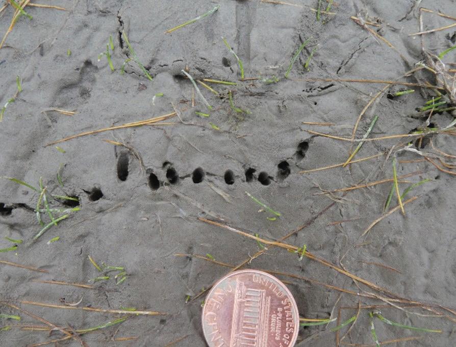
Modern plovers peck or probe an an average of 5 to 7 times per minute (Elbroch and Marks 2001) while foraging for tiny crustaceans. An example of probe marks made by a plover are shown in the photo below. Note the linear sets of probes and slight elongation due to the beak being slightly open.
Large deer tracks from Formby, showing the style of preservation in the Pleistocene muds
Plover prod marks, modern, Glenmore Reservoir, Calgary, Alberta Note the twinned bills. US cent for scale.
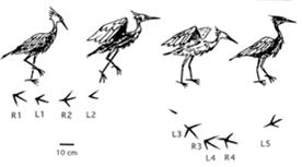
Probable Presbyornithiformipes tracks with associated, interrupted dabble marks (taken from Erickson 1967)
Observations at Cooking Lake identified modern feeding traces including probe marks in isolation, clustered or aligned. Some traces appear as paired probes, made by birds with open beaks. Most shorebirds were observed probing sporadically along the lake margins (Kimitsuki et al 2024). Avian tracks are distributed along lake shores, with higher concentrations found closer to the water’s edge, though not within the water itself, probably representing changes in the firmness of the substrate.
Foot stirring
There is evidence that the Ignotornis trackmaker sometimes used a shuffling gait that could be inferred as a foot-stirring strategy designed to raise food from the substrate where it foraged. The foot shuffling behavior has only been noted in trace fossils from the Cretaceous of Colorado (Lockley and Harris 2010; Kim et al 2012). Modern herons are known to use this hunting strategy (Lockley and Harris 2010).
Dabbling
The webbed trace Presbyornithiformipes, recorded from the Eocene of North America, is associated with dabbling marks (Yang et al 1965; Erickson 1967; Lockley et al 2021). Some Cretaceous specimens of Koreanaornis trackways from Korea have associated dabble marks (Kim et al 2012).
Scything
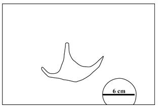
The semipalmated, tetradactyl trace Ignotornis gajinensis, seen in Korean Cretaceous deposits, is associated with arcuate to semi circular, double-grooved, or paired impressions resulting from black-faced
spoonbill-like feeding behavior (Swennen and Yu 2005; Lockley and Harris 2010; Kim et al 2012; Lockley et al 2012; Falk et al 2014). The birds sweep their beaks back and forth creating zig-zag, arcuate paired traces, slightly smaller than those of the modern spoonbill (Falk et al 2014). There is ichnological evidence that the birds may stop the scything behaviour in deeper water, much like modern spoonbills, and of other subtle behaviours (Falk et al 2014). Black swinged stilts also use a scythe-like feeding method, as well as peck and probe techniques. Flamingos leave very distinctive feeding traces with the birds using a similar feeding technique.
The Kalimantan coal mine mentioned on the previous page (Zonneveld et al 2024a) also exposed straight to gently arcuate paired and singular grooves (Type III traces) and dimpled surfaces (Type IV traces). Type III traces are similar to sweep (or scything) marks created by water birds foraging in shallow water (Swennen and Yu 2005; Lockley et al 2012). Spoonbill sweeping results in paired, arcuate grooves that show a back-and-forth pattern (like avocet feeding traces), often overlain by footprints (Zonneveld et al 2024a). The dimpled surface can result from microbial binding or intense avian activity, the latter interpretation favoured due to the abundant bird footprints (Zonneveld et al 2024a).
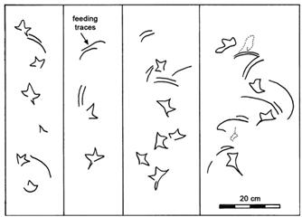
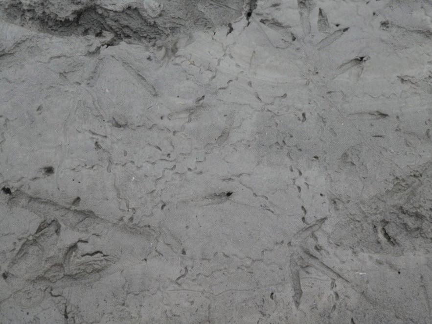
Swishing
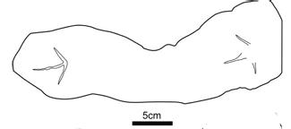
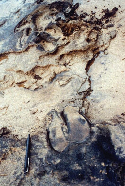
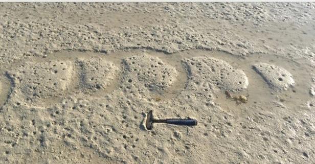
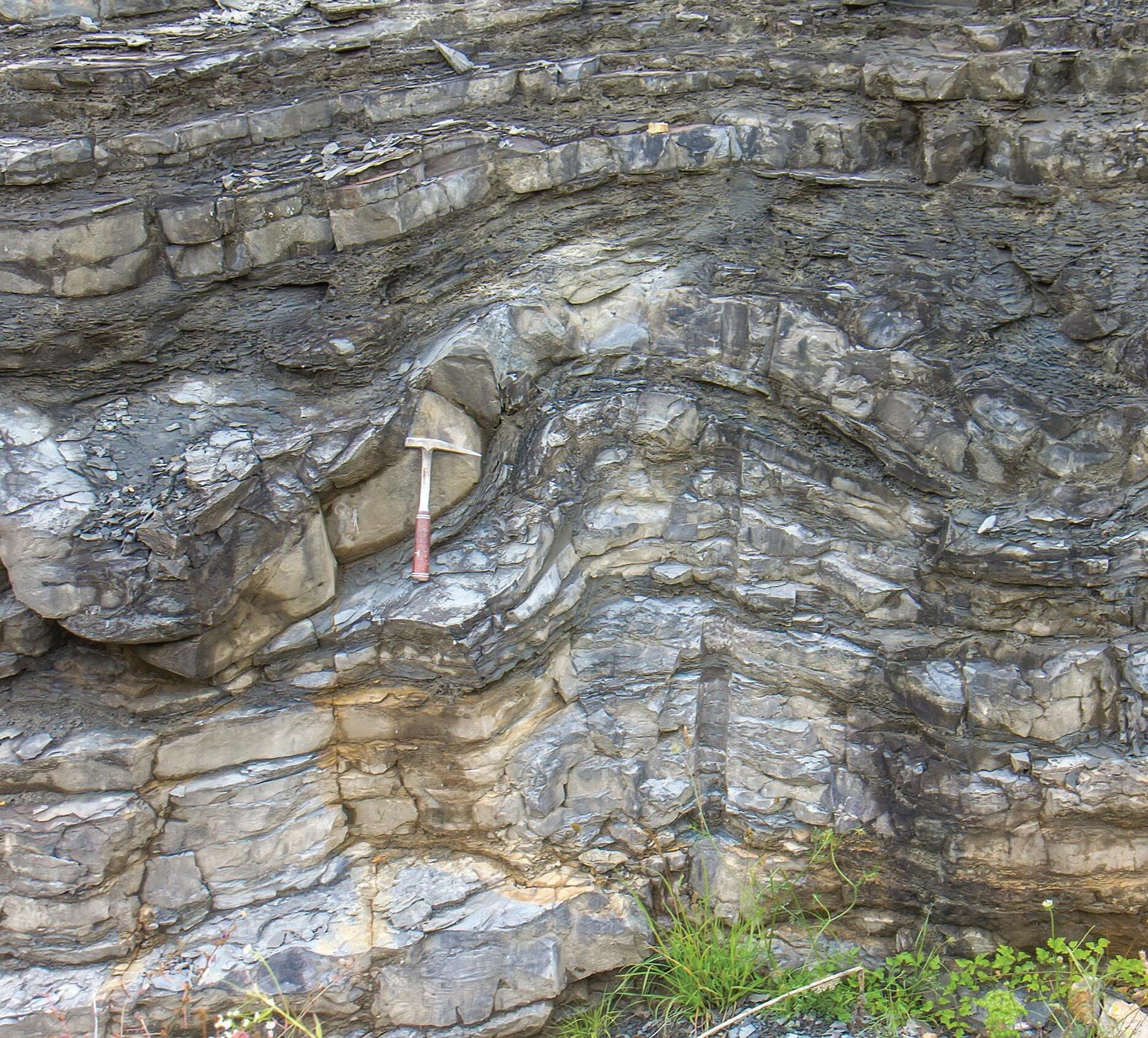
Certain modern birds move their heads back and forth through the sediment to sift for food. The movements are less extreme than those of spoonbills or avocets. A new discovery from Miocene deposits of the Sandakan Formation shows the first report of a fossil swish trace preserved in a sandstone bed. The fossil occurred 4 m below a bed exposing fossil bird footprints (see Footprints section), in a mangrove channel composed of sandstone.
Line drawings of webbed-footed trackways of Ignotornis gaijinensis and associated arcuate bill traces (from Lockley et al 2012)
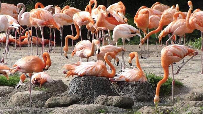
Flamingos and their nests, which could potentially be fossilized (www.sonomabirding.com)
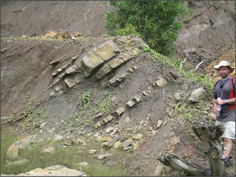
Outcrop of the Sandakan Formation, eastern Borneo, exposing Miocene mangrove deposits with associated fossil bird feeding traces.
Modern swish feeding traces, possibly made by a plover at Glenmore Reservoir, Calgary, Alberta. Field of view 15 cm.
Modern swish trace made by a blacksmith plover, St. Lucia estuary, South Africa
Flamingo feeding trace (photo taken from Twitter)
Other types of feeding trace
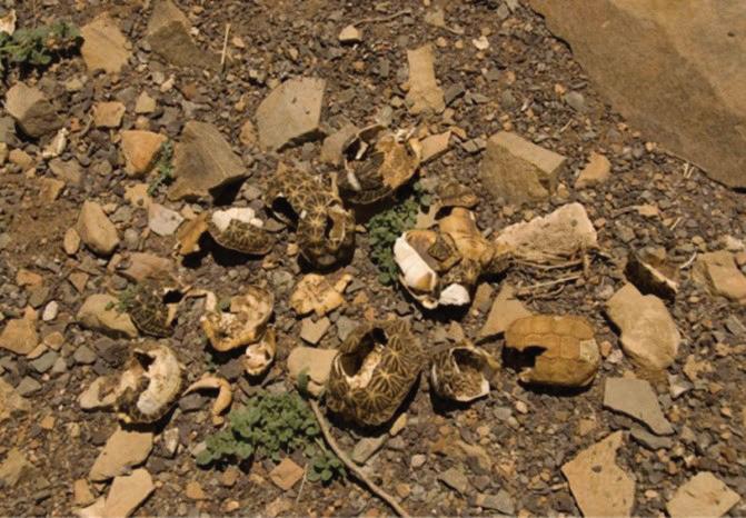
Other feeding strategies that may be utilized by birds include killing sites, where kites or gulls drop snails onto a rocky surface to break them open. Golden eagles will catch tortoises and then drop them onto rocks to break the shells, providing access to the flesh within. Allegedly Aeschylus, an ancient Greek tragedian, died in 456 or 455 BC when an eagle dropped a tortoise on his bald head, mistaking it for a rock (Wikipedia).
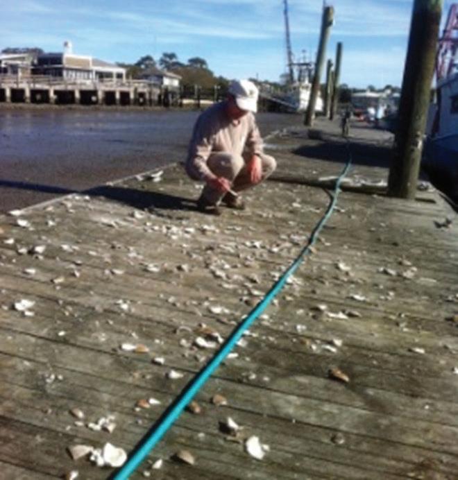
Up to 23 species of bird, including gulls, crows, eagles and vultures, will take advantage of rocks to crack nuts, molluscs and hard-shelled food. Western gulls drop Washington clams, using different heights depending on the size and thickness of the shells. Anecdotal evidence suggests that bearded vultures will do the same to mountain goats, knocking them off ledges (www. cracked.com: www.audubon.org). A fossil locality littered with smashed tortoise shell or clams would likely represent a potential fossil feeding trace site.
Certain woodpeckers stash acorns in cracks in the trunks of trees. Other birds (and mammals) store food the winter. It should be possible to identify such caches in the fossil record. Ostriches make holes in the ground (and do literally push their head into the ground) when looking for grubs. Birds may also leave wing marks in fine grained sediment when swooping down to catch crabs or small mammals, or simple scratch marks when foraging for seed. The mantra is to keep an open mind when examining sedimentary rocks deposited in a terrestrial setting. There may be feeding traces, burrows and more awaiting the ichnologist.
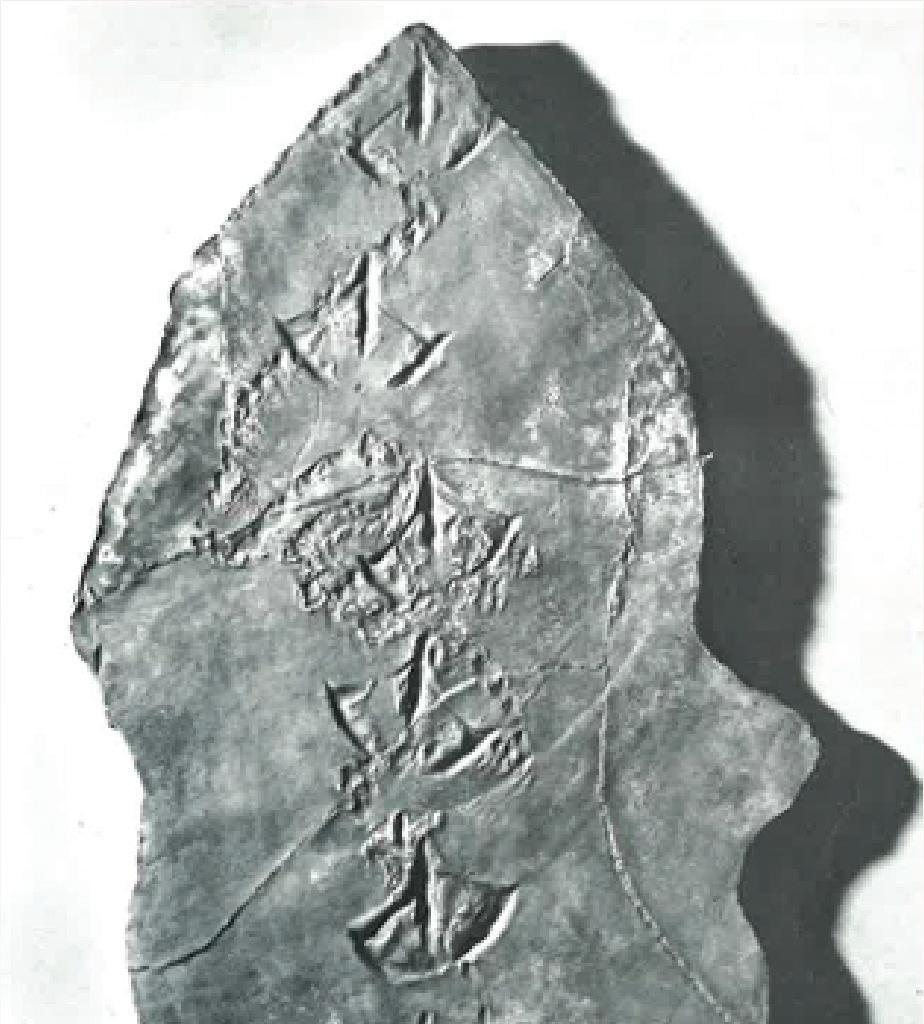
First report of fossil “swish” bird feeding trace from the Miocene Sandakan Formation, eastern Borneo. Propelling pencil for scale.
Example of an invertebrate killing field, with herring gulls dropping gastropods in order to break them open, Norfolk, UK
Example of broken tortoise shells dropped by birds
NESTING SITES
The nests of euornithine birds—the precursors to modern birds—were probably partially open and the neornithine birds—or modern birds— were probably the first to build fully exposed nests. The apparent trend through time has been towards more complex nesting structures and fewer offspring, possibly related to greater cognitive functions (Mainwaring et al 2023).
Early nests were probably scrapes, or eggs were buried. Pedogenesis would destroy many of these structures. Exposed nests allow greater parental care, including for later dinosaurs such as maiasaurs, ornithoraptors and Troodons (Horner 1984). Their nests were bowl shaped with a distinct rim. Cretaceous enantiornithines nested among sand dunes in Argentina, with their eggs half buried in sediment (Fernandez et al 2013), in contrast to most neornithines. The open nests of the neornithines may have helped them to survive the mass extinction event (Mainwaring et al 2023).
Fang et al (2018) surveyed all 242 bird families and found that 60% nest in trees, 20% nest in non-tree vegetation and the remaining 20% nest on the ground, in riverbanks or on cliffs. Cup nests are by far the most common. The development of constructed nests allowed new niches to be colonized (Mainwaring et al 2023).
In terms of fossils, very few nests have been identified, beyond the examples mentioned above and a few Pleistocene nests preserved in tufa. Another find was a hole drilled into a fossil palm stump, presumably by a woodpecker, but further details are lacking. Nests constructed from mud would seem to have a better chance of preservation in the fossil record. Such nests include swallows, who use globules of mud to construct a nest and flamingos, who build a pedestal out of mud on which to lay their egg. It is suggested that palaeontologists look for scrapes on bedding planes, especially in overbank mudstone beds. The presence of eggshell may allow Cretaceous examples to be delineated from dinosaurs. In the Tertiary there may also be fossil scrapes, horizontal burrows into soft sediment, holes drilled into fossil wood (see above), or even masses of fossilized plant material which may in actuality be nests, although some authors do not consider these are traces (Buatois & Mángano 2011). Once again, the association with eggshell or droppings would help to confirm their avian origin. There are probably many more fossil nests than realized, just waiting to be identified.
COPROLITES AND REGURGITALITES
Pleistocene nest preserved in tufa, Germany (seen on auction site), compares to a find from Lower Fraconia, Germany. Diameter 13 cm.
Bird droppings can be petrified and preserved but may be difficult to recognize in the field. The semi liquid guano issued by many birds may be difficult to fossilize but thicker beds of ancient guano have been recorded. Coprolites are locally common in the Eocene Green River Formation of Utah, Wyoming and Colorado, particularly in environments that preserve complete fish. Some authors argue that birds are likely predators to produce coprolites with bones. In 25 Eocene assemblages, up to 69% of fish remains consist of presumed fossil pellets (Hunt and Lucas 2007).
Regurgitalites, or owl pellets, have been recognized both directly and indirectly in the fossil record. A New Mexican specimen contains cranial and post cranial material from two rodents. Some cave microvertebrate assemblages are thought to be degraded owl pellets (Hunt and Lucas 2007).
Modern swallow nest constructed of mud, Dinosaur Provincial Park, Alberta
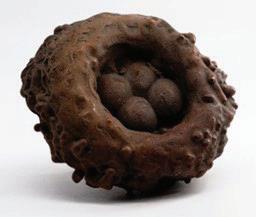
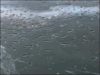
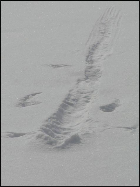
Oval goose resting traces seen in ice beneath the Zoo Bridge, Calgary, Alberta. Note the small protrusions breaking the ovals to right, made by the geese’ feet. Traces are approximately 40 cm long.
OTHER POTENTIAL BIRD TRACE FOSSILS
We have discussed a wide variety of bird traces. Some additional suggestions (Belaústegui et al 2017) to look out for include:
Bird resting traces
A dinosaur resting trace has been identified in the Whitmore Point Member of the Moenave Formation in southwestern Utah (Milner et al 2009), associated with a trackway and tail drags. The resting trace includes symmetrical pes impressions and well-defined impressions made by both hands, the tail, and the ischial callosity. Another example was presented by Milan (Milan et al 2008). Modern avian examples have been observed preserved in ice and snow around Calgary, Alberta. The best example is of goose resting traces (GRT) which have an oval shape with an irregularity at the rear end where the goose rested its feet on the ice. Duck resting traces are also common (but frequently soiled with excreta).
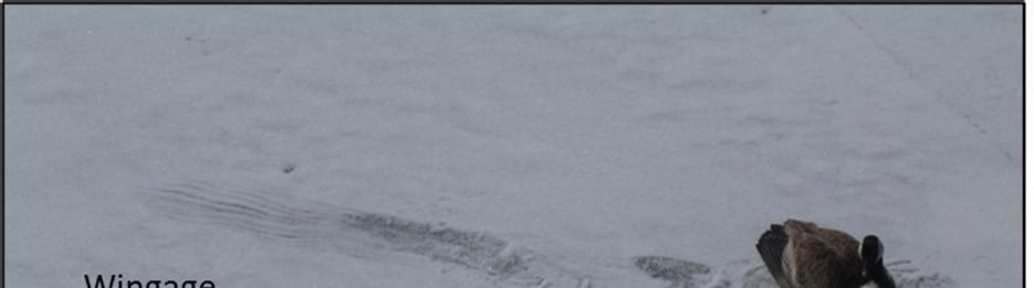
One paper (Falk et al 2014) mentioned finding an oval-shaped, slightly depressed area, bounded on one side by a crescent-shaped indentation and on the other by what appears to be a small linear trough. The authors were unable to interpret this feature but, from the description, and utilizing a neoichnological analogue, this could be interpreted as a bird resting trace. Another type of modern bird trace preserved in snow is landing traces, both duck and goose. There is often an initial skid mark, followed by a landing and resting trace. Wing marks are preserved to the sides of the skid as the bird tries to slow itself down. Wing marks may also be preserved in isolation during takeoff. Possible landing traces were recorded in the tracks of Ignotornis gajinensis, with the trackway having an abrupt beginning interpreted as a landing (Falk et al 2014). Elbroch and Marks (2011) describe the distinctive takeoff pattern of certain modern birds and it seems likely that these could be recognized on larger bedding planes exposing bird footprints.
Another landing trace with wing marks alongside. Length of trace around 2.5 m.
Dinosaur courting traces have been recognized at several locations in Colorado. Large, paired scoop shaped depressions are interpreted as leks (Lockley et al 2015). These structures may be a metre long and 15 cm deep but there are likely to be smaller ones preserved as fossils, made by predecessors of modern grouse.
CONCLUSIONS
A wide variety of bird traces are preserved in the fossil record. The tracks are mostly from shorebirds, which is mainly due to the taphonomy of the coastal deposits. The same types of tracks keep appearing from the Cretaceous to recent times, suggesting recurring behaviours and feet morphologies rather than the same bird species throughout. Associated with the footprints are a variety of feeding traces, including a new type of trace from the Miocene of eastern Sabah, allowing us an insight into bird behaviours.
The use of neoichnology allows us to examine modern traces in detail, and to understand how they formed. It is strongly suggested that the neoichnological record be used to create templates that can be applied to ancient outcrops exposing bird footprints, to help to identify other significant bird trace fossils. These would include other types of feeding traces, landing and takeoff traces, and resting traces.
Finally, I was struck by the description of a mating behaviour (Elbroch and Marks 2011) where a male plover high steps forward, taking short, stiff steps and then slams both feet down before flying straight up in the air. This behaviour can be captured perfectly in the bird’s footprints. How many other behaviours like this could we interpret, were we to really examine fossil trackways in detail? As most birds would readily tell you - the sky is the limit!
Goose landing trace in snow, Calgary, Alberta, with track maker still present.
REFERENCES
Abbassi, N. and Lockley, M.G. 2004. Eocene Bird and Mammal Tracks from the Karaj Formation, Tarom Mountains, Northwestern Iran, Ichnos, 11:3-4, 349-356, DOI: 10.1080/10420940490428689.
Aramayoa, S.A., de Biancoa, T.M., Bastianellia, N.V. and Melchor, R.N. 2015. Pehuen Co: Updated taxonomic review of a late Pleistocene ichnological site in Argentina. Palaeogeography, Palaeoclimatology, Palaeoecology 439 (2015) 144–165.
Baer, J. 1990. Geologic road log Spanish Fork, Utah to Price, Utah. Utah geological and Mineral Survey, open file report 181.
Belaústegui, Z., Muñiz, F., and de Carvalho, C.N. 2017. Bird Ichnology, bioturbation, bioerosion and biodeposition. Evolucao - Revista de Geistória e Pré-História. 2 (1)
Buatois, L. & Mángano, M.G., 2011. Ichnology. Organism-substrate interactions in space and time, Cambridge University Press, New York, 358 pp.
Buckley, L. 2025. HYPERLINK “https://lisabuckley.com/tag/bird-tracks%20 accessed%20January%202025”https://lisabuckley.com/tag/bird-tracks accessed January 2025..
Camens, A.B. and Worthy, T.H. 2019. Pliocene avian footprints from the Lake Eyre Basin, South Australia, Journal of Vertebrate Paleontology, 39:4, e1676764, DOI: 10.1080/02724634.2019.167676.
Carril, J., De Mendoza, R.S., Degrange, F.J., Barbeito, C.G. and Tambussi, C.P. 2024. Evolution of avian foot morphology through anatomical network analysis. Nature Communications volume 15, Article number: 9888 (2024).
de Carvalho, C.N., Belo, J., Figueiredo, S., Cunha, P.P., Muniz, F., Belaústegui, Z., Cachao, M., Rodriguez-Vidal, J., Caceres, L.M., Baucon, A., Murray, A.S., Buylaert, J-P., Zhang, Y., Ferreira, C., Toscano, A., Gomez, P., Ramírez, S., Finlayson, G., Finlayson, S. and Finlayson, C.. 2023. Coastal raptors and raiders: New bird tracks in the Pleistocene of SW Iberian Peninsula. Quaternary Science Reviews 313 (2023) 108185.
Curry, H.D. 1957. Fossil tracks of Eocene vertebrates, southwestern Uinta basin, Utah. Eighth Annual Field Conference.
Díaz-Martínez, I., Suarez-Hernando, O., Martínez-García, B.M., Larrasoaña, J.C. and Murelaga, X. 2016. First bird footprints from the lower Miocene Lerín Formation, Ebro Basin, Spain. Palaeontologia Electronica. 19.1.7A: 1-15, palaeo-electronica.org/ content/2016/1417-early-miocene-bird-footprints
Doyle, P., Wood, J.L. and George, G.T. 2000. The shorebird ichnofacies: an example from the Miocene of southern Spain. Geological Magazine , Volume 137, Issue 5 , September 2000 , pp. 517 – 536, DOI: https://doi.org/10.1017/S0016756800004490.
Elbroch, M. and Marks, E. 2001. Bird Tracks and Sign: a guide to North American species. Published by Stackpole Books.
Erickson B R, 1967. Fossil bird tracks from Utah. Mus Observer, 5(1): 6-12.
Falk A R, Hasiotis S T, Martin L D, 2010. Feeding traces associated with bird tracks from the Lower Cretaceous Haman Formation, Republic of Korea. Palaios, 25: 730-74.
Falk, A.R., Lim, J-D. and Hasiotis, S.T. 2014. A behavioral analysis of fossil bird tracks from the Haman Formation (Republic of Korea) shows a nearly modern avian ecosystem. Vertebrata PalAsiatica 52, pp. 129-152.
Fang Y.-T., Tuanmu M.-N. and Hung C.-M. 2018. Asynchronous evolution of interdependent nest characters across the avian phylogeny. Nat. Commun.9, 1863. (doi:10.1038/s41467-018-04265-x.
Fernandez MS, Garcıa RA, Fiorelli L, Scolaro A, Salvador RB, et al. (2013) A Large Accumulation of Avian Eggs from the Late Cretaceous of Patagonia (Argentina) Reveals a Novel Nesting Strategy in Mesozoic Birds. PLoS ONE 8(4): e61030. doi:10.1371/journal.pone.0061030.
Fiorillo, A.R., Hasiotis, S.T., Kobayashi, Y., Breithaupt, B.H. and McCarthy, P.J. 2011. Bird tracks from the Upper Cretaceous Cantwell Formation of Denali National Park, Alaska, USA: a new perspective on ancient northern polar vertebrate biodiversity, Journal of Systematic Palaeontology, 9:1, 33-49, DOI: 10.1080/14772019.2010.509356. Fossilwiki website: bird ichnology (accessed December 2024).
Horner, J.R. 1984. The nesting behaviour of dinosaurs. Scientific American vol. 250, no. 4.
Hunt, A.P. and Lucas, S.G. 2007. Cenozoic vertebrate trace fossils of North America: Ichnofaunas, ichnofacies and biochronology. In: Lucas, Spielmann and Lockley, eds., 2007, Cenozoic Vertebrate Tracks and Traces. New Mexico Museum of Natural History and Science Bulletin 42.
Hunt-Foster, R.K., Lockley, M.G., Milner, A.R.C., Foster. J.R., Matthews, N.A., Breithaupt, B.H. and Smith, J.A. 2016. Tracking dinosaurs in BLM Canyon Country, Utah. Field guide. Society of Vertebrate Palaeontology. AGM, Salt Lake City, Utah. Kansas State University 2025. Website https://ichnology.ku.edu/ (accessed February 2025).
Khoshyar, M., Abbassi, N. and Zohdi, A. 2016. Ichnology of the Gruiformes coastal bird footprint from Upper Red Formation (Miocene), Hesar region, west of the Zanjan Province. Conference paper.
Kim, J.Y., Lockley, M.G., Seo, S.J., Kim, K.S., Kim, S.H. and Baek, K.S. 2012. A Paradise of Mesozoic Birds: The World’s Richest and Most Diverse Cretaceous Bird Track Assemblage from the Early Cretaceous Haman Formation of the Gajin Tracksite, Jinju, Korea, Ichnos, 19:1-2, 28-42, DOI: 10.1080/10420940.2012.660414.
Kimitsuki, R., Zonneveld, J-P., Coutret, B., Rozanitis, K., Li, Y., Konhauser, K. and Gingras, M.K. 2024. Neoichnology of a Lake Margin in the Canadian Aspen Parkland Region, Cooking Lake, Alberta. Sedimentologika | 2024 | Issue 2 | eISSN 2813-415X. King, M.R. 2015. Application of Ichnology Towards a Geological Understanding of the Ferron Sandstone in Central Utah. PhD. thesis. Department of Earth and Atmospheric Sciences, University of Alberta.
Krapovickas, V., Ciccioli, P.L., Mángano, M.G., Marsicanoa, C.A. and Limarino, C.O. 2009. Paleobiology and paleoecology of an arid–semiarid Miocene South American ichnofauna in anastomosed fluvial deposits. Palaeogeography, Palaeoclimatology, Palaeoecology 284 (2009) 129–152.
Lockley, M.G. and Harris, J.D. 2010. On the trail of early birds: a review of the fossil footprint record of avian morphological and behavioral evolution. In: Trends in Ornithology Research Editors: P. K. Ulrich and J. H. Willett, pp. 1-47.
Lockley, M.G., Lim, J-D., Kim, J.Y. , Kim, K.S., Huh, M. & Hwang, K-G. 2012. Tracking Korea’s Early Birds: A Review of Cretaceous Avian Ichnology and Its Implications for Evolution and Behavior, Ichnos, 19:1-2, 17-27, DOI: 10.1080/10420940.2012.660409.
Lockley, M.G., McCrea, R.T., Buckley, L.B., Lim, J.D., Matthews, N.A., Breithaupt, B.H., Houck, K.J., Gierliński, G.D., Surmik, D., Kim, K.S., Xing, L., Kong, D.Y., Cart, K., Martin, J. and Hadden, G. 2015. Theropod courtship: large scale physical evidence of display arenas and avian-like scrape ceremony behaviour by Cretaceous dinosaurs. Nature, Scientific Reports.
Lockley, M., Kim, M., K.S., Lim, J.D. and Romilio, A. 2021. Bird tracks from the Green River Formation (Eocene) of Utah: ichnotaxonomy, diversity, community structure and convergence, Historical Biology, 33:10, 2085-2102, DOI: 10.1080/08912963.2020.1771559.
Mainwaring M.C., Medina, I., Tobalske, B.W., Hartley, I.R., Varricchio, D.J., and Hauber, M.E. 2023 The evolution of nest site use and nest architecture in modern birds and their ancestors. Phil. Trans. R. Soc. B 378: 20220143.https://doi.org/10.1098/ rstb.2022.0143.
Martin, A.J., Lowery, M., Hall, M., Vickers-Rich, P., Rich, T., Serrano-Brañas, C.I. and Swinkels, P. 2023. Earliest known Gondwanan bird tracks: Wonthaggi Formation (Early Cretaceous), Victoria, Australia. PLoS ONE 18(11): e0293308. https://doi. org/10.1371/journal.pone.0293308.
Milàn .J, Loope D.B. and Bromley R.G. (2008) Crouching theropod and Navahopus sauropodomorph tracks from the Early Jurassic Navajo Sandstone of USA. Acta Palaeontol Pol 53: 197–205.
Milner, A.R., Harris, J.D., Lockley, M.G., Kirkland, J.I. and Matthews, N.A. 2009. Bird-Like Anatomy, Posture, and Behavior Revealed by an Early Jurassic Theropod Dinosaur Resting Trace. PLoS ONE 4(3): e4591. https://doi.org/10.1371/journal. pone.0004591.
Moussa, M. 1968. Fossil tracks from the Green River Formation (Eocene) near Soldier Summit, Utah. Journal of Palaeontology.
Mustoe, G.E. 2002. Eocene Bird, Reptile, and Mammal Tracks from the Chuckanut Formation, Northwest Washington. Palaios, 2002, V. 17, p. 403–413.
Noad, J. 2005. Mysterious mangroves. Rock Watch Magazine, issue 40, pp. 4 to 5. Noad, J.J. 2013. The Power of Palaeocurrents: reconstructing the palaeogeography and sediment flux patterns of the Miocene Sandakan Formation of eastern Sabah. Indonesian Journal of Sedimentary Geology, 28: pp. 31-40.
Noad, Jon. 2017. Making sense of swamps: integrating fossils with sedimentology. In: 52 More Things You Should Know About Palaeontology. Published by Agile Libre. Padia, D., Desai, B., Chauhan, S. and Vaghela, B. 2024. Discovery of fossil avian footprints from Late Holocene sediments of Allahbund uplift in Great Rann of Kachchh of Western India. Nature Scientific Reports (2024), 14:31506 https://doi. org/10.1038/s41598-024-83210-z.
Paik, I.S., Lee, Y.I, Kim, H.J. and Huh, M. 2012. Time, Space and Structure on the Korea Cretaceous Dinosaur Coast: Cretaceous Stratigraphy, Geochronology, and Paleoenvironments, Ichnos, 19:1-2, 6-16, 10.1080/10420940.2012.660404.
Payros, A., Astibia, H., Cearreta, A., Suberbiola, X.P., Murelaga, X. and Badiola, A. 2000. The Upper Eocene South Pyrenean Coastal deposits (Liedena sandstone, navarre): Sedimentary facies, benthic formanifera and avian ichnology. Facies 42(1), 107-132, DOI: 10.1007/BF02562569.
De Raaf, J.F.M., Beets, C. and van der Sluis, G.K. 1965. Lower Oligocene bird tracks from northern Spain. Nature July 10, 1965.
Rigby, J.K. 1968. Guide to the Geology and Scenery of Spanish Fork Canyon Along U. S. Highways 50 and 6 Through the Southern Wasatch Mountains, Utah. Brigham Young University Geology Studies Volume 15 – 1968. Part 3, Studies for Students No. 2. Roberts, G. 2009. Ephemeral, Subfossil Mammalian, Avian and Hominid Footprints within Flandrian Sediment Exposures at Formby Point, Sefton Coast, North West England, Ichnos, 16:1-2, 33-48, DOI: 10.1080/10420940802470730.
Swennen C. and Yu, Y .T. 2005. Food and feeding behavior of the black-faced spoonbill. Waterbirds, 28(1): 19-27.
De Valais, S. and Melchor, R.N. 2008. Ichnotaxonomy of Bird-Like Footprints: An Example from the Late Triassic-Early Jurassic of Northwest Argentina. Journal of Verterbrate Paleontology 28(1):145-159.
Bird ichnology, Wikipedia, accessed January 2025.
Zonneveld, J.-P., Zaim, Y., Rizal, Y., Ciochon, R. L., Bettis III, E. A., Aswan & Gunnell, G. F. 2011. Oligocene Shorebird Footprints, Kandi, Ombilin Basin, Sumatra, Ichnos, 18:4, 221-227, DOI: 10.1080/10420940.2011.634288.
Zonneveld, J-P., Zaim, Y., Rizal, Y., Aswan, A., Ciochon, R.L., Smith, T., Head, J., Wilf, P. and Bloch, J.J. 2024a. Avian foraging on an intertidal mudflat succession in the Eocene Tanjung Formation, Asem Asem Basin, south Kalimantan, Indonesian Borneo. Palaios, v. 39, 67–9. DOI: http://dx.doi.org/10.2110/palo.2023.004.
Zonneveld, J-P., Naone, S. and Britt, B. 2024b. Waterbird foraging traces from the Early Eocene Green River Formation, Utah. In Press.
R.J.W. DOUGLAS MEDAL
The R.J.W. Douglas Medal was established by the Canadian Society of Petroleum Geologists in 1980 to honour the memory of one of Canada’s outstanding geologists, Dr. Robert J.W. Douglas. It recognizes those who best emulate the scientific qualities of this extraordinary geologist. This medal is awarded annually by the Canadian Energy Geoscience Association to an individual for outstanding scientific contributions to the understanding of sedimentary geology and, just as importantly, commending major contributions to regional tectonics and structural geology that are important to petroleum geology in Canada.
Professor James MacEachern
AN INSPIRATIONAL GEOLOGIST AND TIRELESS PROMOTOR OF SEDIMENTOLOGY
Professor James MacEachern has dedicated his career to the advancement of sedimentology in Canada and abroad. He built his career on foundations that include high-quality research, inspirational teaching, mentorship of aspiring geoscientists, and providing high-quality service and leadership in the sedimentological community. Prof. MacEachern has profoundly impacted the sedimentary geosciences, and he has done so in an admirably humble fashion. His seminal work during and since his PhD established the many uses of ichnology in facies analysis and sequence stratigraphy. His syntheses regarding the ichnofacies concept have enabled non-ichnologists to integrate ichnology in their own sedimentological research. Simply stated, Prof. MacEachern’s efforts have driven the international recognition that ichnological and sedimentological datasets must be integrated to fully understand the origins of sedimentary rocks. There is no question that James MacEachern is one of Canada’s leading sedimentary geologists and a worthy recipient of the R.J.W. Douglas Medal!
Written by Shahin Dashtgard and Murray Gingras
JOIN
Dedicated to supporting its members since 1927, CEGA continuously offers new opportunities to enhance their skills and enrich their experiences, from events to publications to receiving grants to awards and much more.
COMMUNITY CONNECTION
Learn new skills and expand your professional network by volunteering with any of CEGA’s programs. Share your experiences through our mentor@CEGA initative.
Advance your technical knowledge through peer reviewed papers in the Bulletin of Canadian Energy Geoscience and articles in the digital Reservoir magazine.
The Mission of the Society is to advance the professions of the energy geosciences - as it applies to geology; foster the scientific, technical learning and professional development of its members; and promote the awareness of the profession to industry and the public.
Further your education and receive CPD credits with our technical offerings - technical luncheons, division talks, short courses, field seminars, and more!
Meet members of the industry through our social events. Several networking events are held throughout the year, as well as our annual sporting events - Mixed Golf, Road Race and Squash
The Blue View: Industry Trends Through Woodmac’s
NORTH AMERICA IN CONTEXT: OVERARCHING THEMES ACROSS THE INDUSTRY
1.
CNRL exercises swap and takes full control of AOSP mines in a non-cash deal
CANADA UPSTREAM
2.
Executive Orders: Federal onshore permits
n CNRL exercises swap and takes full control of AOSP mines in a non-cash deal
Canadian Natural Resources (CNRL) will exchange 10% of its interest in the Scotford Upgrader and Quest Carbon Capture and Storage facilities for Shell’s remaining 10% working interest in the Athabasca Oil Sands Project (AOSP) mines: Jackpine, Muskeg and undeveloped Pierre River. CNRL’s production will increase by approximately 31,000 b/d because of this transaction (about 4% of 2025 thermal and oil sands production guidance mid-point). Post-transaction, CNRL will own 100% of the AOSP mines and 80% of the Shell-operated Scotford Upgrader and Quest CCS facilities. The transaction is expected to close by the end of Q1 2025, pending regulatory approvals.
Shell first divested most of its oil sands business to CNRL in 2017, retaining only 10% in AOSP mines. As part of that deal, there was a provision that allowed this asset swap to occur under certain circumstances. Shell will reduce its upstream emissions exposure but lose a highly profitable production asset at current oil price levels. The higher stake in the AOSP Upgrading asset remains compelling as the integrated nature of the project will keep throughput high and the Scotford Upgrader is adjacent and closely operationally linked to the Shell-operated Scotford Refinery and chemicals complex. The Major remains committed to the refining complex as evidenced by early-stage investments in CCS (Polaris) and trialing biofuels.
With last year’s 20% exit in AOSP from Chevron, CNRL had 90% interest in the mines prior to this announcement. We expected CNRL to exercise on the available option as the company prefers full operational control of its assets. The deal gives CNRL complete control over both mining sites, to further optimize and integrate both projects, and continue to improve cost structures. Integration is a theme that has significantly benefitted competitor Suncor by integrating Base Mine and Syncrude and other bitumen feedstock sources and improve overall upgrader utilization. Additionally, both projects have significant approved expansion capacity with regulatory approvals in place. CNRL indicated in Q1 2024 they were assessing a 195,000 b/d Horizon expansion opportunity but were assessing basin egress capacity. This also gives them the optionality to develop Jackpine Phase 2 or Pierre River in the future with paraffinic frothing and avoid expensive upgrading capacity expansions.
CNRL has demonstrated remarkable progress and efficiency in operating the AOSP mines. Since acquiring the majority stake in 2017, CNRL has implemented optimization projects, process improvements, and enhanced reliability, boosting the gross production capacity at AOSP mines from 196 kbl/d to approximately 350 kbl/d by Q3 2024. Since
3.
Exploration green shoots in an unlikely geography
assuming operatorship from Shell in 2016, CNRL has managed to reduce overall operating costs significantly.
As of Q3 2024, the Quest Carbon Capture and Storage (CCS) facility, located next to Shell's refinery and chemicals complex, has the capacity to capture and store around 1.2 MT CO2/year. Although the Quest facility's capacity and Shell's 20% stake are smaller compared to some of Shell's other major CCS projects, it remains a crucial part of Shell’s overall CCS strategy, contributing to its goal of reducing carbon emissions and achieving net-zero emissions by 2050.
US LOWER 48 UPSTREAM
n Executive Orders: Federal onshore permits
Last week’s Presidential Executive Orders included a call to expedite permits on onshore Bureau of Land Management (BLM) federal acreage. There are only two states where upstream activity materially hinges on BLM permits: New Mexico and Wyoming. The former dominates, with New Mexico receiving three times the federal permit requests as Wyoming. We dove into the data to look a bit deeper.
What’s our biggest takeaway? Pending permits from the two states have climbed 17% in the past three years but the number of approvals have not seen a requisite uptick as well. This aligns with operator messaging that operating on Federal land has consistently become more challenging. The current average time to complete a permit sits close to 320 days, up from 250 days in the 2010s.
The Executive Order points to process change. Currently, when the BLM receives an Application for Permit to Drill (APD), they conduct an onsite inspection with relevant parties, perform a National Environmental Policy Act analysis, and decide to approve, modify, deny, or defer the application.
An approved APD is valid for two years or until the lease expires, with a possible two-year extension. The trend we highlight signals a resource limitation on how many permits the BLM offices can process in a set period, again aligned with operator commentary. Note though, that Wyoming is showing signs of starting to work down its backlog.
Increased resources for the BLM and simplifying the permitting process – including revisions – could help reverse this trend overall and increase the appetite to drill more on federal acreage. Some federal leases still hold the lowest breakeven barrels in Lower 48.
Look to our recent Energy Pulse for a more comprehensive take on President Trump’s multiple executive orders on US energy.
n Exploration green shoots in an unlikely geography
Small public operator TXO Resources recently press released a San Juan Basin exploration project in New Mexico. Efforts are targeting the Mancos Shale in an area near BP’s 2017 Mancos activity. TXO’s initial work will focus on roughly 3,500 acres and include 15,000 ft lateral wells. Its EUR estimates top 25 bcf per well, with up to 12 completions in its Phase 1 project.
The Mancos play has been an exploration target throughout the Rockies for years. West of TXO’s position, the play is also present in Utah (Uinta Basin) and was targeted by Newfield (Ovintiv) beneath the Monument Butte field.
Thematically, news of some Rockies gas exploration starts to address two issues we’ve been visiting with clients about the past six months.
• Gas exploration interest unfolding – Gas-focused activity has been sparce, and the only new supply source (Western Haynesville) has been a sub-commercial play extension rather than greenfield work. The Mancos isn’t that, although the formation has been tested and well control is available. The play has shown impressive well deliverability with more to come, should the right demand signals appear. Recent Logos Mancos wells averaged over 3,400 boe/d and BP’s high profile test wells flowed above 10 mmcfd. TXO’s wells are further north, deeper into the Mancos gas window.
• Leveraging basis demand to support growth – Countless Rockies gas projects in the Piceance, San Juan and Greater Green River Basin were arguably shelved too soon when US gas prices started declining decade ago. But some Rockies gas operators are now
SCOTT NORLIN, GIT
Research Analyst, Upstream Canada
Scott joined the Canadian Upstream Research team at Wood Mackenzie in June 2019. He is responsible for providing financial asset valuation and objective commercial analysis on company and play activity across Canada. His coverage ranges from North American large caps to junior private producers. He also covers CNRL and Cenovus for the corporate analysis team, providing high level company valuation and strategy analysis.
turning volatile seasonal pricing into a strength, getting more comfortable capturing upside from winter month pricing that isn’t always baked into asset acquisition costs. Also, Pacific coast gas demand appears resilient in our most recent forecasting because of changing LNG export forecasts, as well as demand growth associated with data center expansion and re-industrialization in the US Southwest. San Juan growth may come in short bursts of activity corresponding to periods of basis strength rather than steady activity.
It’s important to note that these projects are lower-cost, fail-fast exploration options. The bulk of San Juan Mancos potential sits below legacy CBM plays. As those volumes continue to decline, gas pipeline egress options open to backfill existing infrastructure.
Hilcorp has been active in Mancos drilling and permitting, after its US$3 billion purchase of ConocoPhillips’ (COP) San Juan assets in 2017. COP were one of many larger operators –including BP, Encana (Ovintiv) and WPX – that exited the San Juan to focus on higher return plays. Given TXO is significantly smaller than those other sellers may mean that it’s able to better prove up the Mancos without requiring mid or large cap project success metrics.
TXO’s project alone won’t be a needle mover, but successful wells could spark more activity. We expect additional ‘niche’ gas plays in the Rockies becoming more common, slowly moderating the region’s declining production.
XIN YI
Research Associate, Canadian Upstream Research
Xin's responsibilities include financial asset valuation and emissions modelling for Canadian and Alaskan assets. She also contributes to corporate analysis for Canadian and international mid caps and large caps such as Tourmaline Oil and Chevron.
DISCLAIMER – THE VIEWS AND OPINIONS STATED BELOW ARE BASED ON WOOD MACKENZIE’S DATA, SOURCED FROM PUBLIC SOURCES ACROSS THE GLOBE AND OUR PROPRIETARY TOOLS SUCH AS LENS.
WELCOME TO THE 2025 CEGA CORE CONFERENCE
We can’t wait to bring together Canada’s geoscience community— see you in May!
Core Conference Co-Chairs:
Daniela Beccera, SLB & Carolyn Furlong, MacEwan University
PLANNING IS UNDERWAY FOR THE EVENT, WHICH WILL TAKE PLACE ON MAY 8 AND 9, 2025, AT THE ALBERTA ENERGY REGULATOR CORE RESEARCH FACILITY—JUST ONE WEEK BEFORE THE ANNUAL GEOCONVENTION.
Since its inception in 1969, the Core Conference has remained a world-class event where geoscientists gather to examine hundreds of meters of core, share technical insights, and connect in a relaxed setting—where the rocks do most of the talking. This spirit of collaboration inspired this year’s theme: “Establishing Connections: The Interplay of Rocks, Energy, and People.”
This year’s program will feature some of the usual suspects, including the characterization of the Montney and Duvernay plays. Stratigraphic frameworks will be explored through studies ranging from the Devonian Elk Point Basin to the Athabasca Oil Sands. Reservoir characterization will extend into energy storage and sequestration, covering halite caverns, helium reservoirs, and CO₂ sequestration in coal seams. And for those exploring the deep subsurface, we’ll showcase reservoir properties of the Basal Cambrian complex and various basement rocks.
We look forward to reconnecting with familiar faces and welcoming new ones in an environment where ideas are shared and celebrated. Don’t miss the Core Meltdown at The Canadian Brewhouse at the end of the final day—a time-honoured tradition and the perfect opportunity to catch up with colleagues and friends in a festive setting. Here’s hoping for a beautiful Calgary Spring day!
On behalf of the organizing committee, thank you for your continued support of the conference and the CEGA. Stay tuned for updates!
VISIT THE WEBSITE
UPCOMING EDUCATION
OIL RESERVOIR ENGINEERING FOR GEOSCIENTISTS
Monday, March 17, 2025
8:30 AM - 4:30 PM
Instructor: Kamal Malick, P. Eng. MBA
Location: New CEGA Classroom
Online registration closes March 10, 2025
GAS RESERVOIR ENGINEERING FOR GEOSCIENTISTS
Tuesday, March 18, 2025
8:30 AM - 4:30 PM
Instructor: Kamal Malick, P. Eng. MBA
Location: New CEGA Classroom
Online registration closes March 11, 2025
ECONOMIC ANALYSIS AND DECISION MODELING
Wednesday, March 19, 2025
8:30 AM - 4:30 PM
Instructor: Kamal Malick, P. Eng. MBA
Location: New CEGA Classroom
Online registration closes March 12, 2025
SEDIMENTOLOGY, STRATIGRAPHY, RESERVOIR CHARACTERIZATION AND FAIRWAYS OF A TIGHT OIL PLAY, CARDIUM FORMATION ALBERTA
Thursday, April 24 to Friday, April 25, 2025
8:30 AM - 4:30 PM
Instructor: Dr. Per Kent Pedersen, Professor at the University of Calgary