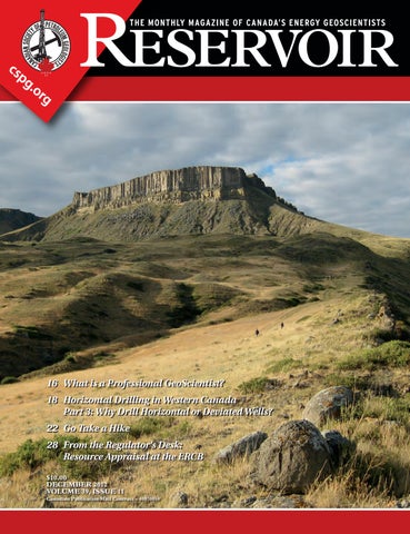
December Reservoir 2012

Page 1

16 W hat is a Professional GeoScientist? 18 Horizontal Drilling in Western Canada Part 3: Why Drill Horizontal or Deviated Wells? 22 G o Take a Hike 28 F rom the Regulator’s Desk: Resource Appraisal at the ERCB $10.00 DECEMBER 2012 VOLUME 39, ISSUE 11 Canadian Publication Mail Contract – 40070050

> GEOSCIENCE SOFTWARE

> CRITICAL INFORMATION

> CONNECTED WORKFLOWS

CONNECTED AT EV ERY TOUCH P OI NT

The IHS suite of geoscience software—which includes IHS Petra®, Kingdom®, LOGarc™ and GeoSyn™—is designed to seamlessly connect to the industry’s leading source of critical Oil & Gas information, eliminating the need to move data manually from source to source and project to project. With this powerful new combination, users can streamline data transfer, enhance database performance and simplify project sharing. The result? Workflows that connect like never before.

Connected workflows mean that IHS customers spend less time looking for data and more time looking for the next big opportunity. It’s just one of the many ways that IHS helps to advance the decisions that advance the Oil & Gas industry.

Find out more at IHS.com/geoscience

Streamline data transfer and simplify project sharing with IHS geoscience software and critical O&G information.

CSPG OFFICE

#110, 333 – 5th Avenue SW

Calgary, Alberta, Canada T2P 3B6

Tel: 403-264-5610

Web: www.cspg.org

Office hours: Monday to Friday, 8:30am to 4:00pm

Executive Director: Lis Bjeld

Tel: 403-513-1235, Email: lis.bjeld@cspg.org

Member Services:

Tel: 403-264-5610, Email: membership@cspg.org

Publications and Website: Emma MacPherson

Email: emma.macpherson@cspg.org, Tel: 403-513-1230

Programs Development: Aileen Lozie

Tel: 403-513-1227, Email: aileen.lozie@cspg.org

Database Administrator and Accounting: Kasandra Amaro

Tel: 403-513-1233, Email: kasandra.amaro@cspg.org

Corporate Sponsorship: Lis Bjeld

Tel: 403-513-1235, Email: lis.bjeld@cspg.org

Controller: Eric Tang

Tel: 403-513-1232, Email: eric.tang@cspg.org

EDITORS/AUTHORS

Please submit RESERVOIR articles to the CSPG office. Submission deadline is the 23rd day of the month, two months prior to issue date. (e.g., January 23 for the March issue).

To publish an article, the CSPG requires digital copies of the document. Text should be in Microsoft Word format and illustrations should be in TIFF format at 300 dpi., at final size. For additional information on manuscript preparation, refer to the Guidelines for Authors published in the CSPG Bulletin or contact the editor.

Technical Editors

Ben McKenzie Colin Yeo (Assistant Tech. Editor) Tarheel Exploration Encana Corporation

Tel: 403-277-4496 Tel: 403-645-7724

Email: bjmck@live.com Email: colin.yeo@encana.com

Coordinating Editor

Emma MacPherson, Publications Coordinator, CSPG Tel: 403-513-1230, emma.macpherson@cspg.org,

ADVERTISING

Advertising inquiries should be directed to Emma MacPherson, Tel: 403-513-1230 email: emma.macpherson@cspg.org. The deadline to reserve advertising space is the 23rd day of the month, two months prior to issue date.

RESERVOIR ISSUE 11 • DECEMBER 2012 3 DECEMBER 2012 – VOLUME 39, ISSUE 11 ARTICLES What is a Professional GeoScientist? ............................................................................... 16 Horizontal Drilling in Western Canada Part 3: Why Drill Horizontal or Deviated Wells? 18 2012 Young Geoscience Professional Networking Event 21 Go Take a Hike ....................................................................................................................... 22 2011-2012 CSPG University Student Event Grant –Supporting Student Group Educational Initiatives .................................................... 24 Free Stuff 27 From the Regulator’s Desk: Resource Appraisal at the ERCB 28 DEPARTMENTS Executive Comment 5 Technical Luncheons .......................................................................................................... 8 Photo of the Month ......................................................................................................... 10 Division Talks .................................................................................................................... 11 Continuing Education ...................................................................................................... 12 Rock Shop ............................................................................................ 11, 16, 25, 28, 29
FRONT COVER
the
the
injections of andesitic magma through a dike system
same
resulted in the
that is now exposed.
Square
Butte,
Montana. Looking north along one of
dikes toward
Cretaceous-aged Square Butte. Multiple
into the
sill eventually
columnarly jointed laccolith
Photo by Danielle Kondla.
The RESERVOIR is published 11 times per year by the Canadian Society of Petroleum Geologists. This includes a combined issue for the months of July and August. The purpose of the RESERVOIR is to publicize the Society’s many activities and to promote the geosciences. We look for both technical and non-technical material to publish. Additional information on the RESERVOIR’s submission guidelines can be found at http://www.cspg. org/publications/pubs-reservoir-submissions.cfm. The contents of this publication may not be reproduced either in part or in full without the consent of the publisher. Additional copies of the RESERVOIR are available at the CSPG office. No official endorsement or sponsorship by the CSPG is implied for any advertisement, insert, or article that appears in the Reservoir unless otherwise noted. All submitted materials are reviewed by the editor. We reserve the right to edit all submissions, including letters to the Editor. Submissions must include your name, address, and membership number (if applicable). The material contained in this publication is intended for informational use only. While reasonable care has been taken, authors and the CSPG make no guarantees that any of the equations, schematics, or devices discussed will perform as expected or that they will give the desired results. Some information contained herein may be inaccurate or may vary from standard measurements. The CSPG expressly disclaims any and all liability for the acts, omissions, or conduct of any third-party user of information contained in this publication. Under no circumstances shall the CSPG and its officers, directors, employees, and agents be liable for any injury, loss, damage, or expense arising in any manner whatsoever from the acts, omissions, or conduct of any third-party user. Designed and Printed by The Data Group of Companies, Calgary, Alberta.

Want to find all the potential in your reservoir quickly?

Unlock

Introducing new DecisionSpace® Earth Modeling software.

Combine proven science with intuitive usability with the Earth Modeling module of the unified DecisionSpace® Desktop software. Collaborate more closely and efficiently by sharing a common subsurface framework. Improve understanding of reservoir potential and uncertainty with 3D reservoir characterization. Discover more of your reservoir’s potential with user-created workflows, industry-leading algorithms and intelligent defaults.To get better answers faster, visit halliburton.com/DecisionSpaceDesktop

© 2012 Halliburton. All rights reserved. High Science Simplified®

CSPG EXECUTIVE

President

Robin Mann • AJM Deloitte rcmann@deloitte.ca Tel: (403) 648-3210

Vice President

Paul MacKay • Shale Petroleum Ltd. Paul.Mackay@shalepetroleum.com Tel: (403) 457-3930

Past President

Kirk Osadetz • Geological Survey of Canada, Calgary kosadetz@nrcan.gc.ca Tel: (403) 292-7022

Finance director

Andrea Hood • geoLOGIC systems ltd. ahood@geologic.com Tel: (403) 262-1992

assistant Finance director

Samantha Etherington • CNRL samantha.etherington@cnrl.com Tel: (403) 386-6459

Program director

Jon Noad jonnoad@hotmail.com

assistant Program director

Dave Russum • AJM Deloitte drussum@deloitte.ca Tel: (403) 648-3228

serVices director

Michelle Hawke • Apache Canada Ltd. Michelle.Hawke@apachecorp.com Tel: (403) 261-1200

assistant serVices director

Mike Seifert • Canadian Discovery Ltd. mseifert@canadiandiscovery.com Tel: (403) 269-3644

communications director

Jim Barclay • ConocoPhillips Canada

Jim.E.Barclay@conocophillips.com Tel: (403) 532-3889

assistant communications director

Curtis Evans • ERCB curtis.evans@ercb.ca Tel: (403) 297-8386

outreach director

Simon Haynes • Statoil Canada Ltd. sihay@statoil.com Tel: (403) 724-0364

assistant outreach director

Dawn Hodgins • Imperial Oil Resources dawn.hodgins@exxonmobil.com Tel: (403) 232-5931

executiVe director

Lis Bjeld • CSPG lis.bjeld@cspg.org Tel: (403) 513-1235

EXECUTIVE COMMENT

A message from Robin Mann, 2012 President

A Year in Review

It is always amazing how quickly a year goes by, something that has certainly been the case for me as President of the CSPG. You start the year with a number of great intentions and plan to get so much done but by the end you wonder where the time has gone and if you actually accomplished anything. The good thing about the CSPG is the Society itself. With so many hardworking and dedicated volunteers almost all of what we offer our members does get done extremely well by all of the Committees.

The Executives role is to basically make certain that the Committees have a good environment to work within and are neither hampered nor impaired in offering the programs and services that the members require. The Executive also needs to set strategy for the Society, some of which is fairly basic governance, as well as formulate and provide longer-term strategic direction. This helps to ensure that the Society is set for success in the future.

Looking back on the past year, there have been a number of things that were accomplished and we should be proud as a Society of all the work that has been done. We will have a modernized set of bylaws going forward, which will have been voted on by you as members. Even though these are not top of everyone’s mind or have a high profile, they are extremely important to allow the Society to operate properly, to grow, and to be set up for future success. I would like to thank Kirk Osadetz and Lis Bjeld for all of their efforts in getting these rewritten and put in the proper form that will set the Society up for the future.

Another, more obvious, accomplishment over the past year has been the completion of our office at 333 5th Avenue. We moved into the office in September 2011; however, all good things take time to complete and it has taken almost a year for the staff to put all of the finishing touches to the space such we can now say that the office is totally done (an office space is actually never finished completely but we are basically there). The crown jewel is the lighting fixture that has been mounted up along the front wall of the office (which is observable from the street) highlighting our new tag line “Canada’s Energy Geoscientists.”

This past year also saw another excellent GeoConvention with great attendance, stellar talks, and world class companies exhibiting. Each year the convention improves over the last in certain ways and this year was no exception. I would like to thank all those that volunteered on a job well done and we look forward to next year’s GeoConvention: Integration on May 6-10.

Over this past year, the Executive has been pushing uniformity in the communication coming from the CSPG office, its executive, and the committees. Communication is different from marketing and sponsorship, but they are all tied together. We as a Society spent a significant amount of time marketing who we are and going after sponsors for various events. To do this properly we need to communicate effectively and be consistent on how we look and are seen by our members, sponsors, and suppliers.

Over the past couple of years the CSPG has put in significant effort to create a recognizable brand that distinguishes the CSPG as a worldclass scientific organization. It is very important that all of our communications, the office, the Executive, and the committees stay consistent, such that our members and everyone else we touch see a consistent message and look from the CSPG. Corporations spend millions of dollars to get a recognizable look and feel for their brand, and we need to stay on course for all CSPG events and communications to do the same.

Finally, I would like to thank all those who volunteer for the CSPG for all of your hard work, dedication, and commitment. Without our volunteers we would not be at the level we are and would not be able to offer most of the programs we do. The tireless hours that go into getting everything done, the personal time that is given by the volunteers is truly amazing. To be part of such an organization is a privilege and to have been President of this organization for the past year has been an honor. Did I actually get anything accomplished this past year; well, the Society is still standing, is financially sound, is striving to have consistent branding, and continues to have a tremendous volunteer base; so I guess the answer is “I think so.”

RESERVOIR ISSUE 11 • DECEMBER 2012 5

Five Great Days of the Finest Geoscience Training for One Low Price

List of Topics::

• Risk and Uncertainty for Contemporary Prospect Evaluation

• Asset Management in Unconventional Plays

• Geocellular Modeling in Unconventional Resources

• Carbonate Reservoir Geology

• Carbonate Seismic Sequence Stratigraphy

• Carbonate Depositional Systems

• Quick Guide to Carbonate Well Log Analysis

• Geological Interpretation of Seismic Data

• Seismic Amplitude Interpretation

• Interpretation of 3D Seismic Data

• Principles and Applications of Well Logging

• Formation Evaluation of Thinly-bedded Reservoirs

• “Old” (Pre-1958) Electric Logs: A Quick Review

• Data Acquisition Methods and Completion Techniques

(Four concurrent sessions each day – mix and match according to your interests and training needs. Buffet lunch and refreshments included each day.)

Small AAPG Bookstore open during breaks each day

Tuition for the

(Your five-day badge can be transferred to a friend or colleague if you can't attend

Hosted by the Norris Conference Center: 803 Town & Country Lane Houston, TX 77024

Phone: 713-590-0950

Fax: 713-590-0961

Special group rate at nearby Hotel Sorella

Registration and information:

Toll-free (U.S. and Canada) 888-338-3387, or 918-560-2650

Fax: 918-560-2678

E-mail: educate@aapg.org

Download a registration form at: www.aapg.org/education/wec.cfm

AAPG Members..........................$1795 $1995 Non Members............................$2095 $2295 Individual Courses....................$500day $550/day
week:
five
all
days.)
SIGN UP NOW!
WINTER EDU
BY BECOMING AN AAPG MEMBER AND REGISTERING BEFORE JAN. 14 th 10 th ANNUAL HOUSTON, TX • FEBRUARY 11-15, 2013 Price increase after 1/14/2013 Price through 1/14/2013 SAVE $ 500
CATION CONFERENCE

CORPORATE SPONSORS

Dia M on D

CENOVUS ENERGY

GEOLOGIC SYSTEMS LTD.

POGGENPOHL

Platinu M

IMPERIAL OIL LTD.

NEXEN INC.

SCHLUMBERGER CANADA LIMITED

SHELL CANADA LIMITED

GolD

APEGA

DEVON ENERGY CORP.

ENCANA CORPORATION

Silver

ATHABASCA OIL SANDS CORPORATION

CSEG FOUNDATION

CSPG ETF

ENERPLUS

IHS

JEWELSUITE

LED SIGNS

ROKE TECHNOLOGIES LTD.

RPS

SENSOR GEOPHYSICAL LTD.

TAQA NORTH LTD.

Bronze

BLUEBACK RESERVOIR

EARTH SIGNAL PROCESSING LTD.

GEOSTRATA

GEOVARIANCES

GLJ PETROLEUM CONSULTANTS LTD.

HUSKY ENERGY INC.

PARADIGM

SUNCOR

TALISMAN ENERGY

TUCKER ENERGY SERVICES

AS OF NOVEMBER 10, 2012

A SPECIAL THANKS TO GEOLOGIC SYSTEMS LTD., CSPG’S TOP SPONSOR OF THE MONTH

RESERVOIR ISSUE 11 • DECEMBER 2012 7

technicaL Luncheons

Beyond Roads –The Musandam Expedition

SPEAKER

tu esday, d e cember 11, 2011 10:30 am, a n nual h o liday s o cial presented by geologic systems ltd. 11:30 am, te chnical Luncheon presentation

c a lgary te L u s c onvention c en tre c al gary, a l berta

Join us for this year’s CSPG Annual Holiday Social. This is a sellout social event that you don’t want to miss. Buy your tickets early!

Please note: the cut-off date for ticket sales is 1:00 pm, thursday, december 6, 2012. csPg member ticket Price: $42.00 + gst non-member ticket Price: $45.00 + gst

Each CSPG Technical Luncheon is 1 APEGA PDH credit. Tickets may be purchased online at www.cspg.org.

Ab S TRACT

I solated. Rugged. Desolate and beautiful. The Sultanate of Oman is a desert nation containing vast ergs, rugged coastline, and a mountainous hinterland. It is also a country with a rich cultural record, rooted in antiquity. Although well known for its ophiolites and hydrocarbon deposits, Oman is uniquely situated near the Makran subduction zone. Its coastal embayments have the proven ability to preserve tsunami deposits (tsunamites), which are useful for constructing tsunami periodicity, as well as recording seismicity along the Makran subduction zone.

The Beyond Roads expedition was the first scientific expedition to explore the Musandam Peninsula north of Khasab, Oman. A team of three Adventure Scientists became the first Westerners to survey the mountainous interior of this region in well over 50 years. This area has remained

unstudied due to the complete absence of roads, lack of fresh water, and the steepness of the terrain. The goals of the expedition were to conduct a preliminary sedimentologic expedition in several eastfacing embayments to test for the presence of tsunamites and to explore the hinterland for undescribed archaeological sites. This talk will provide a humorous and insightful look at the man-made and natural obstacles the team faced during their expedition, as well as present the exciting findings from this 10-day experience.

b IOGRAPH y

D r. Simon Donato is the founder of Adventure Science and lives in Calgary. A McMaster University graduate, he spent over four years working as a stratigrapher for a large Calgarybased oil and gas company. Driven by his love of exploration, he has recently taken his geoscience career in a new direction, leaving his desk job to become the host for an new adventure travel television show called Boundless, set to air during winter, 2013. More information on Adventure Science can be found on www.adventurescience.ca.

8 RESERVOIR ISSUE 11 • DECEMBER 2012
LUNCHEON Webcasts sponsored by NOW
A great Holiday gift for $10 CSPG is proud to present our 2013 Geological Calendar 14 member submitted photos from all over the world Available Now! Online: www.cspg.org Office: 110 - 333, 5th Ave SW 2013 CSPG Geological Calendar www.cspg.org Calendar Chair: Markus Ebner Coordinating Editor: Emma MacPherson emma.macpherson@cspg.org Advertising: Emma MacPherson emma.macpherson@cspg.org www.cspg.org CSPG Office 110 - 333, 5th Ave SW
DECEMBER
AVAILABLE

They can copy us. They just can’t be us.

If imitation is the sincerest form of flattery, we’re one flattered group. Drawing on a quarter century of oil and gas experience, geoLOGIC continues to be the market leader in data, software solutions and support. And while we lead the way, our competitors desperately create parity products, sometimes years after us. For details on how geoLOGIC leads the way, visit www.geoLOGIC.com/leader

RESERVOIR ISSUE 11 • DECEMBER 2012 9
customer-driven data,
software
upstream decision-making needs.
Leading the way with
integrated
and services for your
geoSCOUT | gDC | petroCUBE at www.geoLOGIC.com

PHOTO OF THE MONTH

10 RESERVOIR ISSUE 11 • DECEMBER 2012
Results of a glacial outburst flood at Jokulhlaup in southern Iceland. Photo by Sherman Hirowatari.

diVision taLKs STRUCTURAL GEOLOGY DIVISION

40Ar / 39Ar dating of clay-rich fault gouge from major thrusts in the Alberta portion of the Canadian Rocky Mountain

Fold-and-Thrust

Belt

SPEAKERS

Dinu Pana

Alberta Geological Survey/ERCB, Edmonton, AB, Canada, T6B 2X3

t i m o ’ Brien and Ben va n Der Pluijm Geological Sciences, University of Michigan, 2534 C. C. Little Building, 1100 North University Ave, Ann Arbor, MI 48109

12:00 n o on

t h ursday, December 6th, 2012 Conference Centre r oom a , +30 level, Western Canadian Place (Husky e nergy), 707-8th avenue S.W. Calgary, a lb erta

Ab S TRACT

T he Rocky Mountain Fold-and-Thrust Belt of western Canada consists of a

ROCK SHOP

series of eastward-propagating thrusts that transported ‘miogeoclinal’ and foreland basin sediments during Mesozoic and early Cenozoic deformation. In this study, we present new ages of clay-rich fault gouge collected from thrust faults located in the Rocky Mountains and Foothills of Alberta. The ages unravel a major Early Eocene phase of deformation and hint at older Jurassic and Cretaceous tectonic pulses that correlate well with the deposition of major clastic wedges within the adjacent foreland basin. Ages of faults were obtained by extrapolating results of four grainsize fractions with varying percentages of detrital (2M1) and authigenic (1Md) illite polytypes and their 40Ar/ 39Ar total gas ages.

In the eastern Front Ranges and western Foothills, gouge samples from four major thrust faults, including the McConnell, Nikanassin, Brule, and Muskeg thrust faults, yielded similar ages of 54 Ma. These Early Eocene ages represent the last phase of compressional deformation within the Rocky Mountains fold-and-thrust belt of southern Canada. To the west, in the Front Ranges, the Greenock Thrust yielded an age of 103.3 ± 3.1 Ma. This late Early Cretaceous age coincides within analytical error with the initiation of the deposition of the Fort St. John-Dunvegan ‘clastic wedge’ with a depocentre in the Peace River region, and with both the emplacement of ‘mid-Cretaceous plutons’ in the Omineca Belt and deposition of the Crowsnest volcanics in the southern Canadian Rockies. Farther west, in the Main Ranges, a sample of gouge from the Pyramid Thrust (north east of Jasper) produced an age of 162.8

Sponsored by

± 4.9 Ma. This Middle to Late Jurassic age, the oldest faulting age preserved in the foreland, coincides within analytical error with the pre-Oxfordian unconformity recorded in the Fernie Formation and likely represents the age of initiation of thin-skinned deformation in the Rockies.

These new results, combined with recent results from the southern Alberta Rocky Mountains (e.g., ~72 Ma ages obtained from the Rundle thrust system), support the interpretation that the Rocky Mountain Fold-and-Thrust Belt in southern Canada formed through a series of forwardpropagating deformation pulses, ranging in age from the late Middle Jurassic to the Early Eocene.

DI VISION I N FORMATION:

Structural Division talks are monthly and cover a diversity of structural themes. Our Structural Division sponsors are HEF Petrophysical and Husky Energy. All are welcome and no registration is required. For additional information, to be placed on the Division e-mail list or to present a talk, please contact Darcie Greggs, Darcie.Greggs@huskyenergy. com.

Reservoir Geomodeling Reservoir Simulation Integrated Study

Julee Lee (403) 554-3957 Helen Cao (403) 968-6268 Gary Selby (403) 818-1594 jlee@petrosteer com, hcao@petrosteer com, gselby@petrosteer com

PRACTICAL LOG ANALYSIS COURSES

For Engineers, Geologists, Geophysicists,

19 Apr

and Registration at: www.spec2000.net/00-coursedates.htm

and Multi-Media Narrated Self-Study Courses Also Available === Instructor: E. R. (Ross) Crain. P.Eng. 1-403-845-2527 ross@spec2000.net === – 50 Years Worldwide Experience – Analysis, Training, Mentoring, Forensic Reviews –

RESERVOIR ISSUE 11 • DECEMBER 2012 11
Analysis
Unconventional
Analysis
Rock
油田投资项目咨询 油田收购评估 油气田勘探开发技术支持
and Technicians Practical Quantitative Log Analysis: 15 – 17 Apr 2013
of
Reservoirs: 18 Apr 2013
of
Mechanical Properties:
2013 Details
In-House
www.petrosteer.com 贝 特 斯 亚 海 外 石 油 研 究 中 心

continuing education

2013 Education Program

t hom as Jerome Chair of the CSPG Committee of Continuing Education

My name is Thomas Jerome and, since July 2012, I’m the new Chair of the CSPG Continuing Education Committee. The mission of our committee is to organize the CSPG short courses and field seminars for members and non-members.

Our 2012 Fall Education Week is now done and I’d like to thank you for your participation in the name of our committee and of the CSPG.

It is now with great pleasure that we are introducing to you our 2013 Education Program.

2013 CSPG E DUCATION PROGRAM

O ur 2013 Education Program is organized around three events:

The Spring e d ucation Weeks will consist of classroom courses organized in downtown Calgary and in the ERCB core facilities during the weeks around the GeoConvention: Integration 2013.

The Summer Field Seminars will be centered on trips to outcrops around Calgary that, we believe, will be good analogues to your reservoirs.

The Fall e d ucation Weeks will then send us back to the classroom in downtown and in the core facilities, once the weather becomes too bad for field seminars.

GEOEDGES INC.

Detailed and accurate geology at your fingertips in Petra, GeoGraphix, ArcGIS, AccuMap, GeoScout and other applications

Canada Geological Edge Set Northern US Rockies & Williston Basin Geological Edge Set

US / Appalachian Basin Geological Edge Set North American Shales Geological Edge Set

Registrations are now open online for these three events. We will continue to add dates to the Summer and Fall events but you will find the most up-to-date listing on the CSPG website ( www.cspg.org/ education ).

As you can see, our 2013 Education Program shows some changes compared to what we have done in the past.

All the summer field trips are now grouped into a specific event, the Summer Field Seminars . In the past, they were usually presented mixed with our program of short courses around the GeoConvention. Outcrops have always been essential to our industry because they reveal details about the spatial organization of our reservoirs that other data can’t show us. This is more true today than ever before as we work on more and more complex reservoirs. Grouping field trips into one specific event will allow us to give them all the importance they deserve. In so doing, we are actually bringing back an approach

(Continued on page 14...)

for information contact: Joel Harding at 403 870 8122 email joelharding@geoedges.com www.geoedges.com

Western Canada: Slave Point, Swan Hills, Leduc, Grosmont, Jean Marie, Horn River Shales, Elkton, Shunda, Pekisko, Banff, Mississippian subcrops and anhydrite barriers in SE Sask., Bakken, Three Forks, Montney, Halfway, Charlie Lake, Rock Creek, Shaunavon, BQ/Gething, Bluesky, Glauconitic, Lloyd, Sparky, Colony, Viking, Cardium, Horseshoe Canyon and Mannville CBM, Oilsands Areas, Outcrops

US Rockies & Williston: Red River, Mississippian subcrops & anhydrite barriers (Bluell, Sherwood, Rival, etc), Bakken, Three Forks, Cutbank, Sunburst, Tyler, Heath, Muddy, Dakota, Sussex, Shannon, Parkman, Almond, Lewis, Frontier, Niobrara, Mesaverde shorelines, Minnelusa, Gothic, Hovenweep, Ismay, Desert Creek, Field Outlines, Outcrops

Texas & Midcontinent: Permian Basin paleogeography (Wolfcampian, Leonardian, Guadalupian), Granite Wash, Mississippian Horizontal Play, Chat, Red Fork, Morrow, Sligo/Edwards Reefs, Salt Basins, Frio, Yegua, Wilcox, Eagleford, Tuscaloosa, Haynesville, Fayeteville-Caney, Woodford, Field Outlines, Outcrops, Structures

North American Shales: Shale plays characterized by O&G fields, formation limit, outcrop, subcrop, structure, isopach, maturity, stratigraphic cross-sections. Includes: Marcellus, Rhinestreet, Huron, New Albany, Antrim, Utica-Collingwood, Barnett, Eagleford, Niobrara, Gothic, Hovenweep, Mowry, Bakken, Three Forks, Monterey, Montney, Horn River, Colorado

Eastern US / Appalachia: PreCambrian, Trenton, Utica-Collingwood, Medina-Clinton, Tuscarora, Marcellus, Onondaga Structure, Geneseo, Huron, Antrim, New Albny, Rhinestreet, Sonyea, Cleveland, Venango, Bradford, Elk, Berea, Weir, Big Injun, Formation limits, Outcrops, Allegheny Thrust, Cincinatti Arch, Field outlines

Deliverables include:

-Shapefiles and AccuMap map features -hard copy maps, manual, pdf cross-sections

-Petra Thematic Map projects, GeoGraphix projects, ArcView map and layers files

-bi-annual updates and additions to mapping -technical support Texas

12 RESERVOIR ISSUE 11 • DECEMBER 2012
Eastern
Western
Set
& Midcontinent US Geological Edge
You’ve  been  working  hard  all  year  long   Time  for  a  reward!   Treat  yourself  with  our  training  next  year:   Our  2013  Educa;on  Program  is  now  opened  for  registra;on!   Spring  Educa;on   Weeks   Summer  Field   Seminars   Fall  Educa;on   Weeks   Mid-­‐April  to  Mid-­‐May   2013   July  to   September  2013   End  of  October   2013   www.cspg.org/educa;on   2013 REGISTRATION OPENED!

that was experimented with in 2010 ( then called the Summer/Fall Field Trip Seminar Series ).

We recognize that early access to information will help you plan ahead for your 2013 training. To that end, we are presenting to you the whole 2013 program right away instead of communicating about each event individually, only a few months before it would happen. We are also starting our communication about the 2013 Education Program now in the last quarter of 2012. Companies that are already discussing their 2013 training budgets now have all the information they need to sign up their employees to our courses and seminars next year.

bRINGING MORE CLARIT y TO OUR E DUC ATION PROGRAM

Your feedback forms as well as the comments we heard from our colleagues told us things such as “This course is not very well described, how am I sure it is what I want? I’d better not take it or I might be disappointed”, “I expected something different” or “how do I find quickly on your website what field trips are about tight gas?”

From comments such as these, it is obvious that our program content was not described in enough detail and was lacking clarity. For 2013, we brought a number of changes that we believe will solve that problem.

Firstly, the course and field trip descriptions have been refined. Among other things, you will find details such as the prerequisites, the targeted audience, and a clear summary of the content. For field trips, some additional, specific information is also now provided such as the hiking difficulty, what to wear, or the type of vehicles being used.

Secondly, the courses and field trips are now grouped online by theme instead of being simply listed globally. You will find them organized by scientific domain such as petrophysics, soft skills, or sedimentology. You will also find them organized by reservoir type such as oil sands and tight gas. Furthermore, we will make sure our courses and field trips are as complementary as possible to one another. We want to ensure a good coherence in our program.

Thirdly, we have decided to distribute our

2013 Continuing Education Committee

adam leather, ali Beken, andrew Couch, andrew riben, Clarke Campbell, Heather archibald, Johanna alvarez, thomas Jerome, and Yi zhao

Supporting CSPG Staff Member

aileen lozie

2013 Supervising Director

Dave russum

2013 Supervising a ssistant Director alexis anastas

Spring Education over three weeks around the GeoConvention instead of two as traditionally done. So doing, we will limit the risk of having courses on similar topics occurring at the same time.

At last, as explained earlier, we are now providing you with all the information we already have on our three events as early as December 2012 to help you organizing yourself in 2013.

WORKING FOR OUR COMMUNIT y... W ITH yOUR HELP

O ur ties to the geology community in Calgary and beyond are essential. The CSPG’s only purpose is to serve this community to the best way we can. In our education committee, we know we are doing a great job when we manage to deliver to you the courses and field trips you want.

For that, we need first to know what your expectations are. What are the things we do well, what are those we do not, and what are the new things you want us to do.

We are here to listen to you, so:

l e t us know what you need from us.

Some of the participants in our training program are already doing so via the feedback forms they are completing at the end of a course. We thank you for that –the information you are providing helps us to improve our work.

As a complementary tool, we are now launching a new email CSPG address dedicated to our committee and to the CSPG Education Program: education@cspg.org

L O OKING FORWARD WORKING W ITH yOU IN 2013...

My team and I would like to conclude this article by thanking you for participating in our program in the past and in this coming year. 2013 is going to be an exciting year and we are looking forward to working with you.

Feel free to contact us at any time. Your comments are always welcomed. (...Continued

14 RESERVOIR ISSUE 11 • DECEMBER 2012
page 12)
from

ENTRY DEADLINE

Registration

Deadline: January 18, 2013 No refunds after this date Register online at www.cspg.org 30th Annual
Join Us February 7 - 9, 2013 GO ONLINE AND REGISTER TODAY TO AVOID DISAPPOINTMENT! This squash tournament is open to CSPG and CSEG members Canadian Society of Petroleum Geologists ● Canada’s Energy Geoscientists 110 - 333 5 Ave SW Calgary, AB T2P 3B6 ● Phone: (403) 264-5610 Fax: (403) 264-5898 The CSPG Squash Tournament is one of the largest industry sponsored racquet tournaments in Calgary This year is our 30th year and we are still going strong The event draws a large number of earth scientists and has oversold the limit of 130 players for the past 10 years. Please visit www.cspg.org for a full list of registration details. Sponsorship Opportunities Interested in becoming a sponsor for this exciting event. Please email Jay Williams at jay@roke.ca
CSPG Squash Tournament

W H AT IS A PROFESSIONAL GE OSCIENTIST ?

Recently, I had a visit from a nephew who is about to qualify for his Journeyman’s papers as a full-fledged electrician. He exuded excitement about his new job in Fort McMurray where he is into his third (and hopefully last) tour as an apprentice, as well as his future prospects as a journeyman electrician. He was disappointed at the quality of workmanship he found at site on his first tour, as he is dedicated to performing highquality work himself. That dedication led to a full-time assignment as a re-work electrician on his second tour and would continue into the next one.

We discussed some of the principles of doing a good job, including pride in your work; commitment to the environment; health and safety; and service to one’s employer. His upbringing and education stressed these virtues, hence his surprise when he discovered not all his co-workers held the same values. As I saw my nephew off to his plane, I figuratively crossed my fingers that some of his values would rub off on his colleagues and the reverse wouldn’t happen.

Geoscientists, particularly those of the

ROCK SHOP

geologist persuasion, have the great privilege of working at their hobby. Every geoscientist I know has a passion for rocks that extends far back to childhood and many of our colleagues claim they are well paid for an activity they would do voluntarily, if they could afford to. They read voraciously, write equally enthusiastically, and trade information and wisdom easily with colleagues, often to the dismay of the company bean counters. Geos are dedicated academics first and practitioners second. The high quality, in fact, world-class articles that appear in the CSPG Bulletin and Reservoir bear witness to that fact.

It is quite common that practitioners often teach and academicians often practice professionally. Academics are specifically exempted from licensing by the Engineering and Geoscience Professions Act while they are teaching at a degree-granting institution. Off campus, when consulting with individuals or corporate persons on a fee basis, university/ college/technical school teachers of any level become practitioners and licensing is mandatory in the jurisdiction where the work is being performed.

Both academics and Professional Geologists have common attributes, in particular they share:

• A thirst for knowing and constant renewal of knowledge

• A fascination with the Earth and Earth processes

• A respect for environmental values that arise from the thirst for knowledge and observing how humanity interacts with the landscape

• A fascination with the solar system and cosmos and its interaction with the earth

• A highly developed curiosity about how and why things work

• A commitment to doing the right thing for the pubic

• A true joy in tramping around in the wilderness

• A commitment to excellence in all they do

Anyone who doesn’t believe we share these attributes has obviously never attended a CSPG field trip or the GeoConvention!

Professional Geologists have an additional set of attributes that are normally outside academic interests. These involve the business

16 RESERVOIR ISSUE 11 • DECEMBER 2012
Conventional Wells • Horizontal Wells - Spearfish - Viking - Bakken - Cardium - Horn River Shale Gas Email: afran@telusplanet.net www.serpaconsulting.com 1602 – 5th St N.E. Calgary, AB T2E 7W3 Phone: 403-233-7729 www.tihconsulting.com e-mail: tih@shaw.ca T.I.H. Consulting Ltd. Geologic Well-Site Supervision

of doing geology and applying the results to society through economically viable projects for resource recovery or environmental remediation and protection, including the identification of geohazards. Execution of these projects supply measureable and usually large benefits for society, but also includes hazards to public health and safety over both the short and long term.

Identification and mitigation of geohazards demands close cooperation with Professional Engineers, Professional Geophysicists, investment professionals, lawyers, and government regulatory agencies in both a team environment and occasionally in an adversarial situation. Reasoned and respectful argument with open minds is very much a professional attribute.

Some projects present hidden, often long-term, hazards to the public that must be monitored over time. A dramatic example of this would be the long-term monitoring of pore pressures and seismicity at the foot of a rolled earth or concrete gravity dam. Raising and lowering the reservoir surface elevation and repeated episodes of earthquake activity can compromise dam stability. Teams of Professional Engineers and Geoscientists must assess each hazard before the design for the project is set, and then must remain vigilant over the life of the structure to ensure public safety.

Another, less dramatic example known to every working petroleum asset team involves the day-to-day monitoring of oil and gas reservoirs to document changes to production and development of tactical plans to maintain reservoir pressure and productivity. The same monitoring activity can detect changes to wellbore stability for each well in a field that could result in casing or cement-bonding failures and consequent contamination of the surface or near-surface environment. Public safety could be impacted and certainly those kinds of failures in the past have triggered community relations issues that in turn have made field operations more challenging for everyone. They also degrade the reputation of the professions in the eyes of the public.

Professional Geologists also have specific duties to their employers, clients, and the public that are rooted in our specialized academic knowledge and industrial experience. The duty to warn intervenes when we feel the public interest or the well-being of the company is being compromised. The duty of trust imposes an obligation to be sure of our facts before briefing higher management or a gathering of members of the general public. If no one trusts our word, we are of little use to anyone. Fiduciary duty should be a no-brainer to all professionals: we manage other people’s money and the truth and accuracy of our declarations should be implicit.

We have a duty to obey the law, whether we agree with it or not. If we don’t agree with a law, we also have a duty to make our disagreement known to the legislators, together with well thought-out arguments about what and why a law should be changed. It is unfortunate so few of our profession have been active in politics because the wisdom we have acquired by studying earth processes is often absent when there is a public will to regulate some aspect of our work that is contrary to how earth processes operate. The public may want us to control earthquakes, landslides, or volcanoes, and hold us accountable for the uncontrollable without asking first whether that control and accountability is reasonable and doable.

In short, Professional Geoscientists are dedicated to the ethical application of geoscience to society. Society in turn reaps the benefits from Geoscientists’ labour. Professional Geoscientists rely on academic geoscientists to instruct the young and increase the scope and depth of our understanding of the earth and earth processes.

As Professional Geoscientists, we also publicly accept the responsibility for our actions and commit to providing services to the community that we are competent to perform. In turn, society rewards us in proportion to the service we provide and continues to respect us for our commitment to the public interest.

May 6 -10

Telus Convention Centre and ERCB Core Research Centre

ABSTRACT SUBMISSION IS NOW OPEN

Please visit www.geoconvention.com to submit your abstract.

Presentations that integrate the various disciplines of the geosciences, engineering, technology, the environment, and business are preferred.In order to offer something for everyone, we are designing a technical program that will include large, general themes that encourage multi-disciplinary contributions and will focus on various specific areas within a general topic. We are also planning a range of specialized technical sessions focused on advances in specific disciplines.

MAJOR THEMES OF GEOCONVENTION 2013: INTEGRATION INCLUDE;

n Heavy Oil and Oil Sands

n Unconventional Resources

n Mature Fields

n Unconventional Petrophysics

n Seismic to Simulation

n Best of SEG/EAGE

INCREASE YOUR CORPORATE PROFILE!

n Emerging Technology

n Frontiers

n Arctic

n Core Conference

Interested in Exhibit, Sponsorship or Advertising opportunities for the 2013 Convention? Please contact Alyssa Middleton, Assistant Convention Manager, for more information: alyssamiddleton@shaw.ca, 403-453-0181

For more information visit www.geoconvention.com

RESERVOIR ISSUE 11 • DECEMBER 2012 17
Geo2013_Reservoir_ halfpgAd_Nov.indd 1 12-10-15 2:39 PM

HORI z ONTAL DR ILLING IN W E STERN C A NADA

Part 3: Why Drill Horizontal or Deviated Wells?

There are really three driving forces towards drilling horizontally; one relates to surface issues, a second to reservoir issues, and the third to political, environmental, and economic issues. This review will focus first on horizontal drilling and then look at the more recent impact of multi-stage fracturing, the drilling of multi-laterals from a single vertical wellbore, and other enhancements to the process that have brought us to a level of ability that would not have been anticipated a few years ago.

SURFACE ISSUES

The most common reason for this type of drilling in the early years was to overcome situations where surface access was virtually impossible vertically above the target horizon. This could be a result of natural barriers such as lakes, rivers, or steep terrain; manmade obstacles including habitation, industry, surface mining operations, uncooperative surface rights holders; or a myriad of other surface access issues. The map of the Norman Wells field development in Part 2 (November 2012 Reservoir) of this series is a good example of this type of activity.

More recently, the surface issues are often aimed at minimising the footprint of the activity by consolidating wellheads and production facilities to a single lease. Though likely a more expensive capital project, this approach does reduce environmental impact, improve relations with other surface users, and likely reduces operating cost.

S U b S URFACE I S SUES

Th e spectacular initial productivity results reported from horizontal wells is largely driven by the ability to access orders of magnitude more reservoir rock than an equivalent vertical well. For thin zones of a few metres such as the Cardium Formation of western Alberta, there may be up to a thousand-fold increase in

rock volume accessed. A 100-metre-thick zone of shale in the Horn River Basin of northeastern British Columbia may still see a ten-fold increase in rock volume accessed.

Horizontal drilling has been used in many subsurface applications; early application was in conventional reservoirs. Thin oil zones overlying water in such plays as the Glauconitic of southern Alberta, or heterogeneous reservoirs where ‘sweet spots’ of good-quality reservoir rock may be unpredictably interspersed with lowquality rock such as the Mississippian in southeast Saskatchewan were early favourites.

Access to greater rock volume becomes critical in low-permeability reservoirs that have rapidly become the mainstay of new activity in North America.

The Bakken is a classic example of a formation that has benefitted considerably from horizontal drilling. Ten years ago, it would have been seen as a sporadic producer on isolated structures in North Dakota, Montana, and southeast Saskatchewan. These structures had enhanced permeability allowing some oil production. Today, horizontal drilling and sophisticated fracturing techniques has provided the permeability to extract oil from a very large area. The oil in these

18 RESERVOIR ISSUE 11 • DECEMBER 2012
Figure 1. Bakken drilling in southeast Saskatchewan.

reservoirs is conventional light oil so this is an example of conventional oil in an unconventional reservoir. (see ‘What is Unconventional Oil’ in the September 2012 issue of the Reservoir).

A small portion of Bakken production in southeast Saskatchewan (Figure 1) illustrates some of the different attempts to develop the formation. These attempts include:

• O ne-mile-long horizontals from west to east, east to west, north to south, south to north,(shown in gray)

• Two-leg, half-mile horizontals (gray)

• T hree-legged ‘bird foot’ horizontals accessing a quarter section from a single surface location (yellow), and

• T hree-legged ‘pitch fork’ horizontals (pink)

It becomes obvious that there are an infinite number of variables even in the drilling of the horizontals that may have a considerable impact on productivity and the economics of a development.

While the rock quality may drive the need for horizontal wells, it is also true that highly viscous oil (unconventional oil) in conventional reservoir rocks can also benefit from the technology. The Bluesky of the Peace River oil sands deposit is an example of a highly porous and permeable reservoir containing degraded oil that is capable of cold production – production without the need for heat to reduce viscosity (Figure 2).

In this example, drilling has progressed from single-leg horizontal wells with approximately 200 metre well spacing to progressively closer spacing and more complex multi-lateral wells in the past few years.

Special circumstances can make horizontal drilling a critical factor. Incorporating the technique in production of bitumen has been particularly important. The use of horizontal wells in gas storage reservoirs has provided a mechanism for very rapid injection or removal of natural gas as supply and demand dictates.

(Continued on page 20...)

RESERVOIR ISSUE 11 • DECEMBER 2012 19
Figure 2. Evolution of horizontal drilling in the Bluesky of the Peace River Arch. Figure 3. Horizontal drilling for the Montney Formation at Swan Lake, northeastern British Columbia.

POLITICAL AND ECONOMIC ISSUES

Overriding all technical and geological issues, it is obvious that much of the horizontal drilling activity in North America is driven by the price of the product and the fiscal regime under which a company is operating. When the price of oil dropped to $10 per barrel in 1998 horizontal activity dropped rapidly; when natural gas prices were at $10 and expected to rise to $20/mcf in the mid2000s there was tremendous incentive to drill horizontal gas wells. Commitments in the field and the planning process do not allow companies to shut down operations over night, but there is no question that price fluctuation does change activity in subsequent years.

Horizontal wells have the characteristic of high initial productivity that at high product prices can lead to payout of drilling and completion costs in a matter of months, creating an extremely attractive scenario for investors. Unfortunately,

that buoyant activity has proven to be a challenge for the Canadian industry. Every success in the States has tended to reduce demand and impact transportation capacity for Canadian exports, placing downward pressure on the market price of Canadian natural gas and liquids.

Additionally, in Alberta, an attempt in October 2007 to increase Government revenue by increasing royalty rates created a slowdown in industry activity that was compounded by the 2008 recession before finally being resolved in 2010. Incentives to drill longer wells (not necessarily deeper), and reduced royalty rates during early production encouraged horizontal drilling and maximising initial productivity of both oil and gas in this type of well.

In contrast to the Jenner Field (Figure 2, p. 17, November 2012 Reservoir), Figure 3 (page 19) shows how horizontal drilling was applied from the start of development in the Swan Lake Montney

Systems Ltd.

gas field of northeastern British Columbia. All the horizontal wells are drilled with a northwest-to-southeast orientation to take advantage of the stress field that influences natural and induced permeability on the west side of the WCSB. The Montney typically has a number of target zones at different levels in the formation; the thickness of the formation can require separate drilling programs to exploit these discrete intervals.

20 RESERVOIR ISSUE 11 • DECEMBER 2012
geoLogic
Present our Annual Holiday Social & Technical Luncheon Tuesday
Wine
Appetizers
Technical
This
available
Canada’s Energy Geoscientists (...Continued from page 19 )
CSPG and
December 11th, 2012
&
10:30-11:30 am
Luncheon 11:30-1:00 pm
is a sellout social event that you don’t want to miss Tickets are
at www.cspg.org

2012 yOUNG GEOSCIENCE PROFESSIONALS Networking Event

CSPG’s inaugural Under-35 event has been such a success that we have now named it to be the Young Geoscience Professionals Networking Event. October 18th saw the third annual installment – and a great time was had by all!

The yearly function is held to offer networking opportunities amongst younger members and students as well as to provide mentorship opportunities from veteran geoscientists and CSPG volunteers. Young geoscientists are the future of our organization and their engagement is vital to keeping the Society vibrant and alive.

This year over 175 young geoscientists and students were in attendance at WEST Restaurant and Bar (approximately 90 Regular and Associate CSPG members, 40 student members, and 50 member hopefuls). We saw current CSPG Board of Directors as well as various members and Chairs of CSPG committees in attendance. Corporate mentorship came from Debbie Cook (Cenovus Energy), Stan Lavender (ConocoPhillips Canada), Ayaz Gulamhussein (Shiningstar Energy), Randy Smith (McLeay Geological Consultants), Martin Teitz (Encana), Paul MacKay (Shale Petroleum), Clint Tippett (Shell Canada), Andrew Fox (MEG Energy), and Ian Kirkland (Sproule Associates).

The event would not have been possible without the tremendous support of our sponsors:

RESERVOIR ISSUE 11 • DECEMBER 2012 21
PREMIER SPONSOR
E DUC ATION SPONSOR bRON z E SPONSOR G OL D SPONSORS V E NUE Look for us again in October of 2013!
SILVER SPONSOR

GO TAKE A HIKE

Riomaggiore

– Portovenere, Italy: a Ligurian coastal walk around Tethys

trailhead: Proceed by regular mainline train from Milan (three hours to La Spezia), then ten min local train to Riomaggiore, the southeastern-most of the five Cinque Terre villages. The trail (#3 red/white marker) begins at the main thoroughfare up through the village, ascending as a stairway.

distance: ~13 km (4-5hr), then return by boat, or 26km loop. Walk quickly ascends the beautiful Ligurian coast, past terraced vineyards, to Colle de Telegrapho. After five kilometers of relative flat, path descends to Portovenere, a fortified fishing village and heritage site, which has pre-Roman origins.

elevation gain: Coast to Santuario church: 340m; Colle de Telegrapho at 516m.

The peninsula between the Cinque Terre villages and La Spezia offers a unique opportunity to walk on a scenic coastal Mediterranean trail, explore two UNESCO-listed historical towns at Riomaggiore and Portovenere, and traverse the overturned limb of a major fold developed during the Miocene collision phase of a back-arc basin, all within the confines of an Italian nature reserve.

Exposures along the trail route consist primarily of sedimentary units within the Tuscan Nappe, originally deposited (Triassic to Miocene) on the Adria continental passive margin on the northern flank of the African continental plate. The oldest units traversed are the Jurassic La Spezia platform ramp limestones, although Lower Mesozoic ophiolites can be seen further north along the coast. La Spezia is capped by the organic-rich Portoro limestone, quarried as an ornamental building stone for its black/gold colour. Additional Mesozoic mixed carbonate/marl/dolomite units are found along the trail, including the distinctive red-stained Rosso Ammonitico, a deep ramp and slope deposit. These Mesozoic units indicate a gradual subsidence of the platform carbonates, eventually resulting in a pelagic environment by the Early Cretaceous. The well exposed Macigno Formation turbidites cap the succession and indicate the start of the collision between Africa and Europe, with the development of an Oligocene foredeep.

At Riomaggiore, Macigno turbidites outcrop along the rocky shore, forming picturesque near-vertical beds from which small fishing boats and water transport between the five villages and Portovenere is usually available. The trail (#3) ascends the ravine by a long flight of easterly climbing stairs, crossing the main road to La Spezia, then switching back to a hilltop, where the former church of Santuario della Madonna di Montenero overlooks fine views of the coast and the other four villages. The trail (#3 or 3a) continues easterly in a more gradual ascent, crossing older unexposed Mesozoic sediments, with spectacular views of the coastal cliffs. The trail resumes a steeper incline to the open hilltop at Colle de Telegraphos, about two hours from the start. From here, the trail gradually descends through a forested nature reserve to Campiglia (382m), after which deep- to shallow-water carbonates are exposed near the cliff. After heading inland, the Portoro quarry is just off the trail, then on to a southeast-facing slope, where Portovenere is laid out below. Stone steps lead down past the 16th century citadel to Piazza Bastieri, restaurants, and the promenade. Shallow-water carbonates/calcilutites are the primary outcrop along the coast, illustrating various structural styles and compositions.

REFERENCES : 1) Papini, M. and Vannucchi, P. 2004. Cruising Along Deformed Adria Cont. Margin & Tethys Rocks, 32nd International Geological Congress.

2) Bardwell, S. 2003. Walking in Italy, Lonely Planet.

3) Terrain map http://maps.google.com.

Background
by Astrid Arts.
Photo
View SE from coastal path towards Portovenere, with cliff-forming dolomites of Mt. Castellana/Biassa Fm. The path was originally a mule track along the descending coast. Terraced cultivation developed on the extensive erosional debris, with La Spezia-Cinque Terre road and author’s accommodation overlooking the Tyrrhenian coast.
22 RESERVOIR ISSUE 11 • DECEMBER 2012
View NW from Portovenere of La Spezia Limestone in fault contact with younger Mt. Castellana/Biassa Fm. dolomites.

View northwest along the Italian coast of the Tyrrhenian Sea from Riomaggiore. The thin-bedded overturned limb of Oligocene Macigno turbiditic sandstones outcrop in the foreground, with older faulted ophiolitic and clastics of the Ligurian subduction in the distance.

View from trail of gently folded limestones of the Lower Jurassic La Spezia Fm. platform carbonate, with detail of anticline axis trending NW-SE in insert. Citadel and 12th century church at Portovenere in foreground.

Small overturned syncline in Macigno Fm. turbidites, with similar SE trend as above fold in platform carbonates at Portovenere. Note style differences due to bed thickness and competency.

The Reservoir Committee welcomes contributions from our readership to this series. If you wish to offer a submission to Go Take a Hike on your favourite hike of geological interest, email the Reservoir at Emma.MacPherson@cspg.org for more information.

Quarry of “Portoro Marble”, a massive organicrich Lower Jurassic ornamental black limestone, with dolomitized ‘gold’ streaks. Riomaggiore, one of five coastal ravine villages
RESERVOIR ISSUE 11 • DECEMBER 2012 23
Erosional relief and small kink fold of Jurassic Rosso Ammonitico Fm. on trail

2011-2012 CSPG U N IVERSIT y ST UDENT E VENT GRANTS –Supporting Student Group Educational Initiatives

As a recent graduate starting out my career in Calgary’s petroleum industry, I have quickly come to appreciate the value of the opportunities I’ve had to get out into the field. Whether it’s to improve our understanding of the theoretical principles of geology, to develop observation and interpretation skills, or get a better grasp of the implications of geologic complexity to reservoir development, there’s simply no substitute for field experience.

Unfortunately, it can be difficult for students to access these opportunities because of financial constraints and burgeoning enrolment numbers. Recognizing this challenge, the CSPG University Outreach Committee included field trips in the types of educational events eligible for the University Student Event Grants. Last year’s grants helped fund educational events and field trips organized by a number of student groups across Canada, including the University of New Brunswick and Acadia University.

The University of New Brunswick grant winners used their $1,000 award to help to fund their 2012 Hale Trip. The Hale Trip, led by Dr. Park and Dr. Shaw, took a group of eight undergraduate geology students to explore the geology of Ireland and Scotland for two weeks last May. Significant stops included some classic geologic locations: the Moine Thrust Belt, the Lewisian Gneiss Complex, and Donegal’s carboniferous sediments and fossils.

The students felt the trip was “eye-opening” and a unique, hands-on learning experience. According to Sean Gorman, a 4th year student who participated in the trip, “Not only did students learn how to visualize sedimentary geology in a real world scenario, they got to see it with their own eyes.” Similarly, 3rd-year student Emily Palmer remarked that “The trip was full of spotting fossils, comprehending sedimentary sequences, and learning to evaluate palaeo-environments based on sedimentary features.” The University of New Brunswick’s geology students expressed their sincere thanks to the CSPG for awarding them one of the 20112012 Student Event Grants.

The grant winners from Acadia University were members of the Fletcher Geology Club. Their CSPG Student Event Grand helped send twenty members of the Earth and Environmental Science Department on a weekend trip to Cape Breton Island. Led by Sandra Barr and Rob Raeside, the group travelled across the island examining rocks ranging from plutonic and volcanic to clastic and carbonate. Highlights included the Bras d’Or terrane subduction zone and recent exposures of the sub-Mississippian unconformity, which juxtaposes fossiliferous Windsor Group limestone with weathered Precambrian volcanics. From the trip, students gained a better understanding of the provenance of sedimentary rocks and an appreciation of the importance of unconformities.

The CSPG would like to once again congratulate all winners of the 2012 Student Event Grants. The application deadline for the 2012-2013 grants will be March 8, 2013. Please see the scholarships page in the students section of the CSPG website (www.cspg.org) for additional information and applications.

We look forward to receiving applications from student societies and organizations that wish to host a field trip or other educational event related to soft-rock geology and / or oil and gas exploration and development.

24 RESERVOIR ISSUE 11 • DECEMBER 2012
Acadia University’s Fletcher Geology Group viewing the Precambrian Blair River Inlier from the MacKenzie Mountain Look-off. University of New Brunswick’s Hale Trip 2012, taken atop the famous Moine Thrust Belt. Back row (left to right): Kynan Hughson and Sean Gorman. Middle row: Dr. Adrian Park, Michelle Jacobs, Sarah Boye, Breagh Lebert, Emily Palmer, and Lacy McNaughton. Front row: Sean Kellock and Dr. Cliff Shaw.

ROCK SHOP

Strip Log Strip Log Horizontal Log Horizontal Log Mud Log Mud Log Log Viewer Log Viewer Log Manager Log Manager Log Analysis Log Analysis Suite 102, 7370 Sierra Morena Blvd SW, Calgary, AB T3H 4H9 info@WellSight.com 1-800-447-1534 (403) 237-9189
Excellence in Geological Services for Over 20 Years Integrated Reservoir Studies for All Resource Types 4D Geomodelling & Geosteering Horizontal Well Path Planning Infill Well Placement Studies SMART4D Modelling ® Software www.uogc.com 403.265.0111 91 0 , 396 11th Ave SW C a lgar y, AB Cana da WELLSITE GEOLOGICAL SUPERVISION Cell403 819 2516 farhat@sableconsultants.com SABLECONSULTANTS.COM Conventional Wells Coring Programs Heavy Oil/Oil Sands Coal Bed Methane SAGD Horizontal Project Supervision www.rpsgroup.com/energy (403)263-0449 17084 Global Leaders in Wellsite Geology Serving the petroleum industry for over 25 years ■■ Conventional Vertical / Horizontal Wells ■■ Unconventional Heavy Oil / CBM Wells ■■ International WSG / Operations Geology • Domestic and International wellsite supervision • Conventional and Unconventional wells • Extensive Hz experience • Customized corporate solutions available (403) 250-3982 sales@clconsultants.ca www.clconsultants.ca *Domestic & International Supervision 906, 505 6 St. SW Calgary, AB T2P-1X5 Jocelyn Lampron, P. Geol. President & CEO Wellsite Geological Supervision *Conventional Wells-Heavy Oil/SAGD *Coal Bed Methane Wells www.hopewellpetroleum.com info@hopewellpetroleum.com CD N BA CD BA n yevr 234 765 101112 15 8 9 16 1413 23456 11 10987 1716151413 2322212019 2627282930 35 12 18 24 25 36 34333231 section lsd township ph: 403.266.3132 cell: 403.818.8549 *On & Offshore Geological Supervision
Available Online: www.cspg.org Office: 110, 333 - 5th St SW Price Member: $17.95 +GST Non - Member: $19.00 +GST

FREE STUFF

In the spirit of Christmas, below are descriptions of some computer applications and websites that I have found useful in my geological activities*. AND, they are FREE!

Karen’s Directory Printer (http://www.karenware.com/) Perfect for creating a listing of files lurking in those terabyte virtual closets.

Pa St ( http://folk.uio.no/ohammer/past/) Easy-to-use data analysis package.

Poptools (http://www.poptools.org/) Statistical add-in for Excel.

Shapefile v iewer (http://www.qarah.com/ shapeviewer/ or http:// avangardo.com/) Teeny-tiny little executables that let you view shapefiles.

timeScale Creator (https://engineering.purdue.edu/Stratigraphy/tscreator/ index/index.php) Quickly makes stratigraphic charts. Very customizable.

SOME INTERESTING GEOLOGICALLy ORIENTED WE bSITES:

• http://www.onegeology.org/

OneGeology’s aim is to create dynamic geological map data for the world

• http://leggeo.unc.edu/Petunia/ igMet atlas/mainmenu.html Atlas of igneous and metamorphic rocks, minerals, and textures

• http://www.sepmstrata.org/Page.aspx?pageid=1 SEPM’s stratigraphy website dealing with a variety of sedimentary geology topics

• http://www.earthscienceworld.org/images/index.html American Geosciences Institute website providing quality geoscience images

*Material described in this article may not actually do anything remotely useful for anyone. No warranties are provided, either implicitly or explicitly, that the items will perform as described. The author, the Reservoir, the CSPG, and most of the known universe accept no responsibility whatsoever for any negative consequences should you attempt to access or use these items. Excessive use has been known to cause eyestrain, carpal tunnel syndrome, and personal relationship issues. Use at your own risk.

RESERVOIR ISSUE 11 • DECEMBER 2012 27

FROM THE REGULATOR’S DESK: Resource Appraisal at the ERCB

Notes on regulatory issues for industry geologists from regulatory colleagues at the Energy Resources Conservation Board (ERCB).

ERCb – NOT JUST A REGULATORy bODy

In addition to its major function as a regulatory body the ERCB has important information and knowledge roles, one of which is providing advice to government. The ERCB (the Board) is also expected to appraise Alberta’s energy resources and their potential productive capacity, as well as their internal and external markets.

The Board was created in 1938 to address the wastage of natural gas in the Turner Valley oil field. Its professional staff consisted of four engineers who collected and analyzed well data to determine well producibility. The need was to understand at what rate wells could be produced without causing reservoir damage, unacceptable loss of reservoir pressure, or wastage of gas. The control of well production was the foundation of the Board’s conservation authority, and was quickly followed by the need to delineate pools and to determine reserves. The Board created a Geology Department in 1941 to help define pools and evaluate wells.

After the Leduc discovery in 1947, the Board was involved with prorationing crude oil as a result of a request by industry to ensure fairness of production. The ability to accurately delineate pools and establish credible pool reserves was necessary to

determine equitable prorationing of oil production due to limited access to market for petroleum products.

At about the same time Albertans became concerned that we did not have sufficient natural gas reserves to support gas export. The Dinning Commission was created to study the reserves of and demand for Alberta’s natural gas. Its 1949 report led to the Gas Resources Preservation Act and the public reporting of Alberta’s natural gas reserves. For the proper administration of Alberta’s petroleum resources, the report recommended that the Board should have “full and up-to-date information… and technical personnel of the highest competence.” The Board would then be able to publish comprehensive statistical information on the petroleum industry.

The Board prepared several reports on natural gas reserves from 1949 to 1959. The first oil and gas reserves report was published in 1961. It estimated Proved Recoverable Reserves of crude oil and natural gas liquids, and Established Disposable Reserves of marketable natural gas. The first oil sands reserves report was published in 1963; the first coal reserves report in 1972.

Through regulating development, the Board has always been uniquely positioned to perform these reserves determination and reporting duties given the role it played in collecting and interpreting data, its knowledge of the local and regional geology, and its knowledge of resource recovery.

RESOURCE APPRAISAL

It is appropriate and necessary for a government agency to conduct resource appraisal activities since most of the mineral resources of Alberta are owned by the crown. The rights are leased to private companies for development, but ownership remains with Albertans. The Board is, in effect, creating an inventory of public assets. Unlike most international jurisdictions that simply collate industry work, the government of Alberta uses Board technical staff to conduct its own analysis of raw data and provide a credible, unbiased appraisal of its energy resources.

The term resource appraisal has different meanings to different readers. The Board uses the term from an inclusive ‘big tent’ perspective. Many people associate resource appraisal with regional studies and policy development, and consider reserves work as a regulatory activity. The Board uses the term resource appraisal in its wider context, to incorporate both.

Resource appraisal activities include all geological, engineering, socio-economic, and environmental considerations used to identify and quantify Alberta’s energy resources. Direct and indirect processes involve data collection, interpretation, collation, and technical analysis to provide resource delineation, resource estimation, and reserves determination as separate and distinct topics.

In this day and age, work is not performed unless it has a strong purpose. Resource appraisal outputs – the nature, location, and extent of energy resources and their in-place and recoverable quantities – are used for provincial land-use and other policy development, regulatory control, local and regional conservation, resource management, and resource arbitration.

T HE bOARD’S R ESOURCES/RESERVES T ERMINOLOGy

In 1973 the Board created its own reserves classification system for oil and gas and coal resources using the term proved, basing it on the definition of established (used for gas) that is, in essence, proved plus 50 per cent probable. It aligned coal reserves reporting with this new system by having proved include measured with some part of indicated.

28 RESERVOIR ISSUE 11 • DECEMBER 2012
SHOP (The name that says it all!!!) Bus 403.234.7625 800, 555 - 4 th Avenue SW, Calgary, AB, T2P 3E7 info@WellsiteGeologists.com www.WellsiteGeologists.com
ROCK

The system was both technically sound and simple enough to communicate estimates effectively to non-technical audiences. The Board used this system until it adopted the Inter-Provincial Advisory Committee on Energy (IPACE) system in 1978.

The IPACE system is simple and well suited to conventional hydrocarbon reserves. The definition of the recoverable volumes –Established Reserves and Ultimate Potential – were similar to the 1973 Board system; the change had little impact on the reporting of conventional oil and gas reserves.

IPACE, however, had only a single, generic term for quantities in the ground – Initial Volume In-Place. This was less precise than the Board’s previous definition and it became necessary to introduce resource-specific modifications; first to suit coal resources, then mineable bitumen resources, and later for other unconventional hydrocarbon resources – in situ bitumen, coalbed methane (CBM), and shale gas.

The Board continues to evaluate other classification systems1. Many of these systems have a more restrictive meaning of proved than they had in previous versions, and have become more connected to the business needs of industry. The definitions and methodologies for calculating reserves and resources used by companies in their financial reports under these systems are more prescriptive than those used by the Board. While the Board is modernizing its processes to ensure alignment with these systems, on a long-term, provincewide basis for planning and communications purposes, less restrictive definitions are still appropriate – especially for unconventional resources.

ROCK SHOP

DATA REqUIREMENTS

Like most organizations with a long history of estimating conventional oil and gas reserves the Board has needed to continuously update its experience, processes, and skill sets –particularly over the past decade to manage unconventional resources. Ensuring that the appropriate data are collected and interpreted and that appropriate processes are used to determine resources and reserves is challenging. The Board now has considerable experience in the analysis of continuous accumulations of coal, bitumen, CBM, and tight gas, and now shale gas, enabling it to readily understand the in-place resources; however, the determination of recoverable reserves is more difficult.

GEOLOGICAL FRAMEWORK AND RESOURCE DELINEATION

Understanding the regional geological framework in which the resources exist is a fundamental requirement for resource appraisal. Board geological staff in Calgary and at the Alberta Geological Survey (AGS) in Edmonton have, for decades, built a fundamental understanding of Alberta’s geology and petroleum systems. Much of the conventional resource appraisal work requires detailed knowledge of the local geology.

The Board’s resource delineation includes all aspects of identifying the location, nature, and extent of Alberta’s individual and collective energy resource accumulations, including pool, field, play, area, and deposit designations. This has to be done at both the local and regional scales. Deciding whether two wells are in the same or different pools is important on the local scale while establishing the full extent of a continuous accumulation is important on the provincial scale.

While the nature of pools and the depth of analysis have changed since 1938, the fundamental purpose of tying well production to a source remains a key activity of the Board. However, the whole concept of pool administration keeps evolving as industry commingles more production from multiple zones, develops continuous accumulations (tight gas, in situ bitumen, CBM, tight oil, and shale gas) and uses multi-stage frac’ing to now, in a sense, create pools rather than discover them.

RESOURCE ESTIMATION…

Resource estimation at the Board includes all aspects of data interpretation, geological analysis, other technical considerations, methodology, and calculation of energy resource quantities in the ground. It includes both the detailed work to estimate a volume from which conventional pool reserves can be determined, as well as initial estimates of areally extensive hydrocarbons that might become exploitable in the future, as in the case of provincial shale gas resources. This is what many people traditionally consider as resource appraisal.

More Board effort is being directed toward unconventional resources as industry continues to find more economic ways to develop them. While effort continues on conventional resources, more is being placed on large-scale, regional geologic assessments of continuous hydrocarbon accumulations than on local, pool-scale assessments for both future-looking views of resource recovery and regional land use planning purposes. As an example, a major study providing inplace resources estimates of hydrocarbons in some of the shales in Alberta is expected to have been released by the time this article is published.

(Continued on page 30...)

RESERVOIR ISSUE 11 • DECEMBER 2012 29
Conventional Vertical and Horizontal Wells Oil Sands - SAGD/Coring Programs Shale Gas/Oil Shales Coal Bed Methane Project Supervision Email: progeo@telus.net Tel: (403) 262-9229 Fax: (403) 265-0377 Website: www.progeoconsultants.com petrographical & sedimentological descriptions for samples (thin section - fluid inclusion studies) conventional vertical/horizontal wells operations geology SPECIALIZED IN GEOLOGICAL WELLSITE SUPERVISION AND CORE ANALYSIS RockWell Consulting our best friend and most valuable partner is our client Stephan C. Dragomir president www .g e ok2. c om - phon e: 403.831.9941 - s dr a gomir @ge ok2. com

CORPORATE MEM bERS

ALLEN GEOPHYSICAL CONSULTING LTD

APACHE C ANADA LTD

APEGA

BAKER ATLAS

B DO C ANADA LLP

BLACK SWAN ENERGY

BLUEBACK RESERVOIR

C ANADIAN NATURAL RESOURCES LTD

C A SEY & AS SOCIATES

CENOVUS

CSEG FOUNDATION

CONOCOPHILLIPS C ANADA LIMITED

DE VON C ANADA CORPORATION

ENCANA

E NERPLUS CORPORATION

EXXON MOBIL UPSTREAM RESEARCH COMPANY

GEOLOGIC SYSTEMS LTD

GEOSTRATA RESOURCES INC.

GEOVARIANCES

GLJ PETROLEUM CONSULTANTS LTD

HALLIBURTON

H U NT OIL COMPANY OF C ANADA

H USKY ENERGY INC.

IHS

IM PERIAL OIL RESOURCES

JEWELSUITE

LED S IGNS

LITTLE ROCK DOCUMENT SYSTEMS

LORING TARCORE LABS

MJ SYSTEMS

M URPHY OIL COMPANY

NE XEN INC

PARADIGM

PE NN WEST PE TROLEUM LTD

PE TROCRAFT PRODUCTS LTD

PLUSPETROL S.A.

ROKE TECHNOLOGIES

ROXAR

RPS E NERGY C ANADA LTD

SCHLUMBERGER

S HELL C ANADA LIMITED

S IGMA EXPLORATIONS INC.

S PROULE AS SOCIATES LIMITED

STATOIL

SU NCOR E NERGY INC

TALISMAN ENERGY INC

TOTAL E&P CANADA LTD.

TOU RMALINE OIL CORP

TUCKER ENERGY SERVICES

U NITED OIL AND GAS CONSULTING

WEATHERFORD LABORATORIES

AS OF NOVEMBER 10, 2012

CSPG welcomes our 2012 Corporate Members!

The benefits of being a corporate member include:

• Recognition in the monthly Reservoir and quarterly Bulletin

• One associate membership

• Reserved tables at the technical luncheons with your company logo

…V ERSUS R ESERVES DETERMINATION

Reserves determination includes all aspects of resource analysis, engineering and economic considerations (including socioenvironmental impacts of resource recovery), and determination of initial and remaining recoverable quantities of energy resources, including ultimate potential. The economic considerations are in the context of provincewide norms, with only periodic review.

Analysis of production data is the main tool for the evaluating conventional oil and gas reserves, whereas volumetrics are used for the deposit-scale bitumen, CBM, and coal reserves. Assessing provincial reserves of conventional resources involves the roll-up of tens of thousands of individual pools, whereas assessing unconventional resources and coal reserves involves the analysis of only a few hundred broad deposits.

INFORMATION DISSEMINATION

The Board has a formal mandate to provide advice to government and to disseminate information. Having determined Alberta’s inplace resources and recoverable reserves, this information should be available to anyone who could use it to make better resourcerelated decisions, whether government, industry, or the general public.

The Board has published an annual reserve report for 51 years. Since 2000 it has produced a report that combines the reserves analysis with the Board’s responsibility to perform market supply/demand appraisal. The combined report (ST98) 2 puts the reserves in context of production forecasts, and validates those forecasts with reserves data.

Prior to 2000 the report was a presentation of reserves data (hundreds of pages of reserve tables) with limited text. Today there is lengthy explanatory text, moving away from simply presenting data to presenting reserves and resources information. The ST98 report is available at no cost on the ERCB’s website; the digital reserve tables for the thousands of conventional pools are available for purchase.

T HE R EGULATORy CONNECTION

Besides pool delineation, a strong illustration of the connection of the Board’s resource appraisal work to its regulatory work is demonstrated in the oil sands. Board staff has been aware of the wide areal extent of heavy oil in the northeast part of the province from the beginnings of its regulatory role. It shared this knowledge with government to create an effective administration of bitumen, first through the designation of oil sands

deposits and later through the creation of oil sands areas. Later, this knowledge helped determine the extent of Alberta’s world-class bitumen resource – of 178 billion recoverable barrels – and resolve the gasover-bitumen dispute.

The gas-over-bitumen regulatory process required significant geological input. For example, the Board created an industry/ Board staff group to provide a regional overview of the geological framework and identify the gas associated with the bitumen. The Board issued Report 2003-A: Athabasca Wabiskaw-McMurray Regional Geological Study (RGS), a 187-page report that included the efforts of seconded professionals from eleven companies.

INDUSTRy CONNECTION

The primary function of the Board is regulating the industry that produces Alberta’s energy resources, especially in the areas of public safety, resource conservation, and environmental protection. Nevertheless, the Board also takes its other mandates –including resource appraisal and reserves assessment – seriously; having trained and knowledgeable geological staff is fundamental to success in those areas.

The Board’s geologists and engineers understand that engaging their industry colleagues through conferences, courses, consultation, and discussion is vital to keeping abreast of new ideas, issues, and knowledge. While Board and industry professionals are occasionally thrust into an adversarial role, it is important to continue communicating to gain additional insight and perspective. After all, better information concerning Alberta’s energy resources makes for better decisions.

Rick Marsh and Curtis Evans are staff members with the Energy Resources Conservation Board, Alex Bolton and George Eynon are Board Members

REFERENCES

1 The United Nations Framework Classification for Fossil Energy and Mineral Reserves and Resources 2009 (UNFC-2009), National Instrument 51-101 (NI 51-101); Canadian Oil and Gas Evaluation Handbook (COGEH); Petroleum Resources Management System (PRMS); and the International Reporting Template For Exploration Results, Mineral Resources And Mineral Reserves (CRIRSCO template).

2 ST98-2012: Alberta’s Energy Reserves 2011 and Supply/Demand Outlook 2012-2021 (http://www.ercb.ca/sts/ST98/ST98-2012.pdf).

30 RESERVOIR ISSUE 11 • DECEMBER 2012
• One free pass to the CSPG Core Conference …and more! Contact Kasandra Klein at kasandra.klein@cspg.org to be a corporate member today!
(...Continued from page 29 )

Investing in the Future

At APEGA we like to make science fun! We also hope to attract the best and brightest students to careers in geoscience. And we remain committed to building strong relationships with the geoscience community. Put that all together and you get an active geoscience outreach and sponsorship program.

In fact, every year APEGA provides in-kind donations and thousands of dollars to multiple groups as a sponsor of organizations and events including: Alberta Science Literacy Association, Alberta Women’s Science Network, Canmore Museum and Geoscience Centre, Doodle Train, Earth Sciences for Society, Geophysics Undergraduate Student Society, Geoscience Day, Honorary Address, P.S. Warren Undergraduate Geological Society, Rock ‘N’ Fossil Clinics, Rundle Group of Geology, Seismic in Motion, Stones and Bones Summer Camp, TELUS World of Science, TELUS Spark and W.C. Gussow Geoscience Conference as well as multiple science olympics and science fairs.

That’s because, like you, we see sponsoring geoscience outreach organizations and events as an investment in future human capital and an important opportunity to raise awareness of the wealth generation and quality of life made possible by geoscientists right here in Alberta.

By working with Alberta’s geoscience community, we help to ensure that today’s students become tomorrow’s geoscience leaders.

For more information: Tom Sneddon, P.Geol. Geoscience Affairs Manager

P: 403-262-7714 or 888-262-3688 E: tsneddon@apega.ca

Professionals in Geoscience www.apega.ca

Petrel

Data Management Solutions by GeoScience Solutions Partner

Take charge of your Petrel* projects and data with our Blueback Project Tracker and plug-ins for Petrel.

Blueback Reservoir has developed a portfolio of Data Management Solutions to track and monitor your Petrel projects from all Petrel users and maintain order and structure of your Petrel environment.

Explore the possibilities with the Ocean* Development environment.

With Blueback Reservoir`s experience and knowledge many more things are possible.

Learn more? Contact us today

Blueback Reservoir T +1 403 538 4821 E sales@blueback-reservoir.com blueback-reservoir.com

Turn static files into dynamic content formats.

Create a flipbook
Issuu converts static files into: digital portfolios, online yearbooks, online catalogs, digital photo albums and more. Sign up and create your flipbook.