16 W hat is Unconventional Oil? 26 G o Take a Hike 29 A Slippery Day in Dinosaur Provincial Park 33 F rom the Regulator’s Desk: Ensuring Frac’ing is Safe $10.00 SEPTEMBER 2012 VOLUME 39, ISSUE 8 Canadian Publication Mail Contract – 40070050


> GEOSCIENCE SOFTWARE
> CRITICAL INFORMATION
> CONNECTED WORKFLOWS


CONNECTED AT EV ERY TOUCH P OI NT


The IHS suite of geoscience software—which includes IHS Petra®, Kingdom®, LOGarc™ and GeoSyn™—is designed to seamlessly connect to the industry’s leading source of critical Oil & Gas information, eliminating the need to move data manually from source to source and project to project. With this powerful new combination, users can streamline data transfer, enhance database performance and simplify project sharing. The result? Workflows that connect like never before.
Connected workflows mean that IHS customers spend less time looking for data and more time looking for the next big opportunity. It’s just one of the many ways that IHS helps to advance the decisions that advance the Oil & Gas industry.
Find out more at IHS.com/geoscience

Streamline data transfer and simplify project sharing with IHS geoscience software and critical O&G information.
CSPG OFFICE
#110, 333 – 5th Avenue SW
Calgary, Alberta, Canada T2P 3B6
Tel: 403-264-5610
Web: www.cspg.org
Office hours: Monday to Friday, 8:30am to 4:00pm
Executive Director: Lis Bjeld
Tel: 403-513-1235, Email: lis.bjeld@cspg.org
Member Services:
Tel: 403-264-5610, Email: membership@cspg.org
Publications and Website: Emma MacPherson
Email: emma.macpherson@cspg.org, Tel: 403-513-1230
Programs Development: Aileen Lozie
Tel: 403-513-1227, Email: aileen.lozie@cspg.org
Database Administrator and Accounting: Kasandra Amaro
Tel: 403-513-1233, Email: kasandra.amaro@cspg.org
Corporate Sponsorship: Lis Bjeld
Tel: 403-513-1235, Email: lis.bjeld@cspg.org
EDITORS/AUTHORS
Please submit RESERVOIR articles to the CSPG office. Submission deadline is the 23rd day of the month, two months prior to issue date. (e.g., January 23 for the March issue).
To publish an article, the CSPG requires digital copies of the document. Text should be in Microsoft Word format and illustrations should be in TIFF format at 300 dpi., at final size. For additional information on manuscript preparation, refer to the Guidelines for Authors published in the CSPG Bulletin or contact the editor.
Technical Editors
Ben McKenzie Colin Yeo (Assistant Tech. Editor) Tarheel Exploration EnCana Corporation
Tel: 403-277-4496 Tel: 403-645-7724 Email: bjmck@live.com Email: colin.yeo@encana.com
Coordinating Editor
Emma MacPherson, Publications Coordinator, CSPG Tel: 403-513-1230, emma.macpherson@cspg.org,
ADVERTISING
Advertising inquiries should be directed to Emma MacPherson, Tel: 403-513-1230 email: emma.macpherson@cspg.org. The deadline to reserve advertising space is the 23rd day of the month, two months prior to issue date.
RESERVOIR ISSUE 8 • SEPTEMBER 2012 3 SEPTEMBER 2012 – VOLUME 39, ISSUE 8 ARTICLES What Does it Take to be a Good Geologist? 7 What is Unconventional Oil? 16 Writing a Rockin’ Resume 20 Student Industry Field Trip (SIFT) 2012 22 The 2012 CSPG Annual Classic Golf Tournament has Evolved! 25 Go Take a Hike ....................................................................................................................... 26 A Slippery Day in Dinosaur Provincial Park ................................................................... 29 From the Regulator’s Desk: Ensuring Frac’ing is Safe .................................................. 33 Convention Wrap-Up ........................................................................................................... 38 DEPARTMENTS Executive Comment .......................................................................................................... 5 Technical Luncheons .......................................................................................................... 8 Division Talks .................................................................................................................... 15 Rock Shop .................................................................................... 10, 13, 15, 18, 25, 36
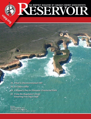
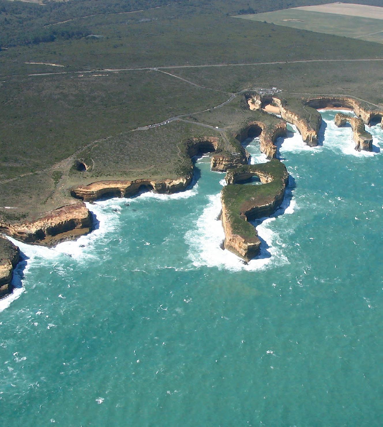
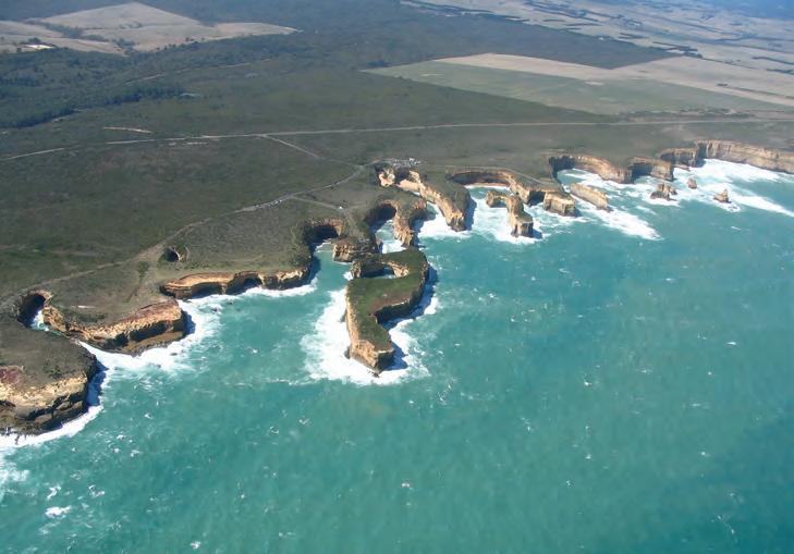
FRONT COVER Port Campbell National Park. An aerial view of the
12
Apostles – Cliffs, pillars, arches, and caves are carved into Pliocene-aged limestone; Southeast coast, Victoria, Australia. Photo by Steve Metzger.
The
year
Canadian Society
Petroleum
This includes a
issue
months
July
purpose
RESERVOIR
to publicize the Society’s many activities and to promote the geosciences. We look for both technical and non-technical material to publish. Additional information on the RESERVOIR’s submission guidelines can be found at http://www.cspg. org/publications/pubs-reservoir-submissions.cfm. The contents of this publication may not be reproduced either in part or in full without the consent of the publisher. Additional copies of the RESERVOIR are available at the CSPG office. No official endorsement or sponsorship by the CSPG is implied for any advertisement, insert,
article
noted. All submitted materials
reviewed
the editor.
right
edit
including letters
Editor. Submissions must include your name,
membership
applicable).
material contained
this publication is intended for
use only. While
taken, authors
no guarantees that any of the equations,
devices discussed will perform as expected
they will give the desired results. Some information contained herein may be inaccurate
may vary from standard measurements. The CSPG expressly disclaims any and all liability for the acts, omissions, or conduct of any third-party user of information contained in this publication. Under no circumstances shall the CSPG and its officers, directors, employees, and agents be liable for any injury, loss, damage, or expense arising in any manner whatsoever from the acts, omissions, or conduct of any third-party user. Design and Layout by Sundog Printing. Printed in Canada by Sundog Printing.
RESERVOIR is published 11 times per
by the
of
Geologists.
combined
for the
of
and August. The
of the
is
or
that appears in the Reservoir unless otherwise
are
by
We reserve the
to
all submissions,
to the
address, and
number (if
The
in
informational
reasonable care has been
and the CSPG make
schematics, or
or that
or
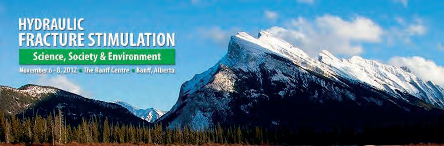
Industry use of hydraulic fracturing (fracking) for stimulating wells has resulted in dramatic productivity increases, notably in unconventional resources such as shale gas. The subject of hydraulic fracturing in the oil and gas industry is regularly discussed in numerous workshops and conferences that disseminate best practices towards delivering increased production. On the other hand, the public perception of ‘fracking’ is focused on perceived negative consequences and has resulted in local to national government moratoriums and the mobilization of numerous opposition groups.
Join us November 6 - 8, 2012 at the Banff Centre as the 2012 Gussow Conference looks to bring clarity to the scientific aspects of hydraulic fracturing within the context of the energy requirements of society and the environmental impacts of the industry.
2012 Technical Program
Keynote Speaker: Tuesday, November 6, 2012
George King, Apache Corporation (Houston)
Session 1 & 2: Science and Engineering of Hydraulic Fracturing
Session Chair: Robert Hawkes, Pure Energy Services
Speakers:
Dan Moos, Baker Hughes
Ron Gusek, Sanjel
Norm Warpinski, Pinnacle
Session 3 & 4: Environmental Impacts Part 1: Seismicity/ Earthquake Potential
Session Chair: Kris Vasudevan, University of Calgary
Speakers:
Jason Hendricks, Nexen
Gillian Foulger, Durham University
Michael Kendall, University of Bristol
Doug Schmidt, University of Alberta
David Eaton, University of Calgary
Session 5 & 6: Environmental Impacts Part 2: Surface/Subsurface Water Impacts
Session Chair: Karlis Muehlenbachs, University of Alberta
Speakers:
Karlis Muehlenbachs, University of Alberta
Don Getzlaf, NCS Energy Services
Alex Haluszka, Matrix Solutions
Richard Jackson, Geofirma Engineering
Session 7 & 8: How Hydraulic Fracture Stimulation has Changed Market Fundamentals, the Economy and Regulations
Session Chair: Carol Crowfoot , ERCB
Speakers:
George Eynon, ERCB
Ken Paulson, BC Oil & Gas Commission
Peter Howard, CERI
Carol Crowfoot, ERCB
Panel Discussion: Cost vs. Benefit of Hydraulic Fracturing
Registration fees: *All registration fees include accommodation, meal package, and conference materials.
Early Bird Registration
Regular Registration
Student
$1,000.00 CDN (early bird closes September 15, 2012)
$1,300.00 CDN
$900.00 CDN
*Please call Aileen Lozie at (403) 513-1227 if you wish to register over the phone.
Sponsored By:


Save $300 and register before September 15 at www.cspg.org/gussow


CSPG EXECUTIVE
President
Robin Mann • AJM Deloitte rcmann@deloitte.ca Tel: (403) 648-3210
Vice President
Paul MacKay • Shale Petroleum Ltd. Paul.Mackay@shalepetroleum.com Tel: (403) 457-3930
Past President
Kirk Osadetz • Geological Survey of Canada, Calgary kosadetz@nrcan.gc.ca Tel: (403) 292-7022
Finance director
Andrea Hood • geoLOGIC systems ltd. ahood@geologic.com Tel: (403) 262-1992
assistant Finance director
Samantha Etherington • CNRL samantha.etherington@cnrl.com Tel: (403) 386-6459
Program director
Jon Noad jonnoad@hotmail.com
assistant Program director
Dave Russum • AJM Deloitte drussum@deloitte.ca Tel: (403) 648-3228
serVices director
Michelle Hawke • Apache Canada Ltd. Michelle.Hawke@apachecorp.com Tel: (403) 261-1200
assistant serVices director
Mike Seifert • Canadian Discovery Ltd. mseifert@canadiandiscovery.com Tel: (403) 269-3644
communications director
Jim Barclay • ConocoPhillips Canada
Jim.E.Barclay@conocophillips.com Tel: (403) 532-3889
assistant communications director
Curtis Evans • ERCB curtis.evans@ercb.ca Tel: (403) 297-8386
outreach director
Simon Haynes • Statoil Canada Ltd. sihay@statoil.com Tel: (403) 724-0364
assistant outreach director
Dawn Hodgins • Imperial Oil Resources dawn.hodgins@exxonmobil.com Tel: (403) 232-5931
executiVe director
Lis Bjeld • CSPG
lis.bjeld@cspg.org Tel: (403) 513-1235
EXECUTIVE COMMENT
A Message from Jim Barclay, Communications Director
C URRENT ACTIVITIES
Summer Ramblings
I would like to give an update here on the main activities related to the Communications portfolio of the CSPG.
The Bulletin of Canadian Petroleum Geology has seen a changing of the guard recently. Burns Cheadle, Western University and Dave Morrow, Geological Survey of Canada have taken over as the new Editors-in-Chief replacing Rob MacNaughton, Geological Survey of Canada who will be retiring from his post later this year. Rob, along with Denis Lavoie, have stewarded the Bulletin through challenging times in the last several years including the necessary conversion to a digital format as well as the publication of two special issues. They have also worked very hard to return the Bulletin to a more regular publication schedule, with the 2012 Bulletin issues being placed on a fast tracked schedule. Well done boys – and welcome, Dave and Burns! And I’d be remiss if I didn’t mention the constant hard work of Denise Then and her editorial team, Thank you.
In early August the Geocalendar committee gathered to select photos for the 2013 calendar and were pleased with the number of high quality photos of geological significance that were submitted. Look for your copy of the 2013 Geocalendar when you receive the November issue of the Reservoir.
In addition to our regular publications there has also been activity related to the creation of a variety of special publications.
1. Go Take a Hike book: dedicated to Cindy Riediger Status: Underway.
2. 2011 Gussow Conference: Geomodelling book Status: Underway.
3. Future Petroleum Provinces memoir Status: Discussion Stage.
4. WCSB Digital Atlas Status: Underway.
5. Horn River Shale book Status: Published.
We have a new staff member in the CSPG office following the departure of Caitlin Young. Emma MacPherson has taken over the role of publications and website coordinator.
We are happy to see the new website rollout – thanks to many who put this in place! With the new platform and design for the site, the biggest priority is to ensure pertinent, accurate, and predominately technical information is available for all CSPG members.
A big concern since 2011 has been to update the CSPG bylaws. Why? To ensure that our governance rules assist in the continued prosperity and growth of the CSPG. Unfortunately, despite Kirk Osadetz and our small committee finishing the writing job late last year, there has recently been a brand-new act created by the Federal Government that govern nonprofit societies. So we are back to the drawing board and drafting a new set of bylaws that achieve the aims above AND conform to the new regulations. Maybe it is a convenient happenstance for us. More on the bylaws to come.
RESERVOIR ISSUE 8 • SEPTEMBER 2012 5


They can copy us. They just can’t be us. If imitation is the sincerest form of flattery, we’re one flattered group. Drawing on a quarter century of oil and gas experience, geoLOGIC continues to be the market leader in data, software solutions and support. And while we lead the way, our competitors desperately create parity products, sometimes years after us. For details on how geoLOGIC leads the way, visit www.geoLOGIC.com/leader
Leading the way with customer-driven data, integrated software and services for your upstream decision-making needs.
geoSCOUT | gDC | petroCUBE at www.geoLOGIC.com
CORPORATE SPONSORS
Diamo ND
IHS
GEOLOGIC SYSTEMS LTD
SCHLUMBERGER CANADA LTD
Plati N um
CENOVUS
CONOCOPHILLIPS
ENCANA
IMPERIAL OIL
NE xEN INC
SHELL
TALISMAN ENERGY
POGGENPOHL
GolD
APEGA
CSPG EDUCATIONAL TRUST FUND
DE VON CANADA
WE ATHERFORD L ABORATORIES
S ilver
ENERPLUS
JE WELSUITE
ROx AR
TAqA NORTH
B ro N ze
ATHABASCA OIL SANDS
BAKER ATLAS WIRELINE
BLUEBACK RESERVOIR
PARADIGM
GEOVARIANCES
CSEG FOUNDATION
HUSKY ENERGY
LED SIGNS
LITTLE ROCK DOCUMENT SERVICES
LORING TARCORE LABS
MACqUARIE CAPITAL MARKETS CANADA LIMITED
ROKE TECHNOLOGIES
RPS BOYD PETROSEARCH
HALLIBURTON ENERGY SERVICES
SUNCOR ENERGY
SUNDOG PRINTING
WEATHERFORD CANADA PARTNERSHIP
AS OF AUGUST 10, 2012
W H AT DOES IT TA k E TO bE A G OOD GEOLOGIST ?
| By Jim Barclay
Well, what is a geologist? I recall and like an Oxford definition I read once, something like: a geologist is one “who studies the Earth”. An all-encompassing definition. But it brings to mind the key aspect of what we do as geologists or geoscientists: we observe, we study the Earth.
I like that this definition does not constrain who a geologist must be – there is no mention of university degrees, discipline, accreditations, experience, etc. It does not specify the exact discipline within the geology field – one could be a geophysicist, a geologist, an engineer, a hydrologist, a geotechnical practitioner, etc. One could be working in any field such as the oil and gas world, mining, water, aggregates, construction, archeology, or others. The definition does not dictate very much in
fact, other than the necessity of “studying the Earth”.
The definition reminds me of the early “geologists” or naturalists of the 17th to 19th centuries. I think of people like William Smith (1769-1839), the canal builder, who envisoned the concept of stratigraphy from looking at rocks all over Britain. Like Nicolas Steno (1638-1686), the geologist turned Catholic Bishop, who compared modern shark’s teeth to objects found in rocks and considered the objects to be ancient sharks’ teeth. What unified such early scientists and naturalists was their abundant curiosity, their use of keen observations and their development of insightful interpretations. And they did so, remarkably, without the rich heritage of scientific context that we enjoy today.
(Continued on page 19...)
RESERVOIR ISSUE 8 • SEPTEMBER 2012 7
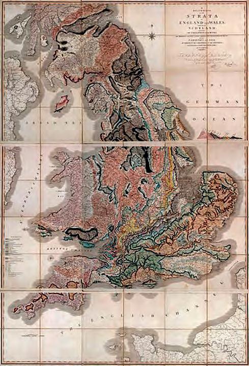
The first geological map of Britain, published by William Smith in 1815. LiveScience Image Gallery Scan by the Library Foundation, Buffalo and Erie County Public Library.
technicaL Luncheons SEPTEMBER LUNCHEON
The Dodsland Viking tight oil play: stacked wave-reworked, shallow-shelf deltas
SPEA k E R
J. e d ward m a thison Alethia Geologica
11:30 am tu esday, se ptember 11, 2012 te Lu s convention centre calgary, a lberta
Please note: t h e cut-off date for ticket sales is 1:00 pm, Wednesday, se ptember 5, 2012. csPg m e mber t icket Price: $42.00 + gst no n- m e mber t icket Price: $45.00 + gst
E ach CSPG Technical Luncheon is 1 APEGA PDH credit. Tickets may be purchased online at www.cspg.org.
Horizontal well technology combined with multi-stage fracturing (HWMF) has revolutionized the oil industry over the last decade (although high oil prices have not hurt). This has led to revitalization of a number of Viking light-oil reservoirs in west-central Saskatchewan. In addition, new conceptual tools have been forged and old tools refined that allow reassessment of shallow-shelf, tight sand reservoirs. Application of these new and refined conceptual tools to the Viking Dodsland reservoir trend allows reinterpretation of the depositional/erosional events that shaped these reservoirs. This in turn facilitates precise, high-resolution reservoir mapping. High-resolution mapping enhances HWMF application by optimizing both well placement and trajectory.
Webcasts sponsored by

The Viking Formation, forming the Dodsland trend of Saskatchewan, is an amalgamation of three severely toptruncated deltaic units (Viking 3 to 1 in descending order). The lower two units, Viking 1 and 2, are the most productive reservoir zones. Distal delta front to distal prodelta sediments bearing a stressed proximal to distal Cruziana ichnofacies are the only sediments preserved of the constructive phases of delta growth for these sedimentary packages. More proximal facies (i.e., proximal delta front, distributary channels, stream mouth bars, delta plain, etc.) were stripped off during destructive phases of deltaic cycles. Sediments above the wave ravinement surface formed during delta destruction comprise two distinct facies representing different marine processes. Regionally extensive chertrich layers (pebbles to coarse sands with interlaminated mudstones) record delta abandonment and shoreface retreat with coarse (proximal delta front to delta
ALL YOUNG GEOLOGISTS!
CONNECT and NETWORK with your peers, future employers, CSPG volunteers and learn how CSPG’s services and technical development programs can aide your professional development
Date: Thursday, October 18, 2012
Location: West Restaurant & Bar
Time: 4:30pm – 8:00pm
Appetizers and beverage ticket included….. FREE Register online at www.cspg.org (limited spots available)

8 RESERVOIR ISSUE 8 • SEPTEMBER 2012
CALLING
CALLING ALL YOUNG GEOLOGISTS!
top) sediments, being re-deposited on the distal delta front and prodelta. During the early stages of delta destruction of deltaic cycles 1 and 2, proximal deltaic sediments were reworked by trangressive submergence, into elongate submarine bars (inner shelf shoals). These fine- to medium-grained shoal sands, bearing a stressed Skolithos-Cruziana ichnofacies characterized by abundant robust Teichichnus and Palaeophycus, were ultimately deposited in a lower shoreface setting. A regional erosion surface, the VE 4 surface of Boreen and Walker (1991), progressively truncates the entire reservoir assemblage from south to north, ultimately intersecting the underlying Viking B deltaic assemblage along the northern margin of the Dodsland trend.
Within the context of the Viking Formation of west-central Saskatchewan the lower two Viking units of the Dodsland trend (Viking 1 and 2) are distinct depositional events despite being coextensive with Viking reservoir units to the south that form the Verendrye, Forgan, Elrose, Plato, North Plato, and Fiske pools. These relationships imply delta-lobe switching within successive trangressive-regressive episodes. Viking unit 3 is a single deltaic succession that blankets the entire area. The Viking 1 deltaic lobe, south of Dodsland, was reworked by transgressive submergence to form an inner shelf shoal that comprises the main reservoir of the Plato pool. Distal and proximal delta front sediments and chert pebble “lags” are the most prolific portions of the southern Viking 2 delta lobe and Viking 3 delta. These successions are coarser grained than in the Dodsland trend and reflect both higher energy conditions and more proximal settings during deposition.
Within a sequence stratigraphic framework, the Viking deltaic cycles of west-central Saskatchewan record high-frequency lowstand events that punctuate highstand progradation. These sedimentary packages can also be explained by a loss of accommodation space resulting from a clastic wedge building into a foreland basin. Viking sediments of west-central Saskatchewan are southwesterly derived and represent the most basinward extension of the Bow Island sediment source. They are also stratigraphically higher and therefore
younger than westerly derived Viking clastics to the north that comprise the Kerrobert Viking pool reservoir.
The Viking pools of west-central Saskatchewan are conventionally trapped tight-sand reservoirs that were deformed by later salt dissolution into their present configuration. In addition, small-scale faulting has affected the reservoirs locally. Weak groundwater recharge into these low-permeability rocks has resulted in disequilibrium amongst reservoir fluids. High-permeability oil zones and gascharged portions of reservoirs that have been dropped by post hydrocarbon migration salt dissolution into the water column are flushed of hydrocarbons whereas low-permeability oil zones are incompletely swept and retain high residual oil saturations.
Understanding the primary depositional architecture of the Viking deltaic packages and associated facies distribution is critical to planning and implementing HWMF programs in the west-central Saskatchewan. Optimum well placement, in turn, is essential to a successful HWMF projects. Understanding the post oilmigration history of the reservoirs is necessary to understanding present-day fluid distribution and the resultant impact on hydrocarbon production.
REFERENCES
Boreen, T. and Walker, R.G. 1991. Definition of allomembers and their facies assemblages in the Viking Formation, Willesden Green area, Alberta. Bulletin of Canadian Petroleum Geology, v. 39, p. 123-144.
b IO GRAPHY
“A good traveler has no fixed plans and is not intent on arriving.” Lao Tsu
I began my journey into geology via a correspondence course in high school driven by the need for a third science in order to attend university. The main appeal was that I didn’t want to work in an office. After a brief flirtation with Anthropology (I was brought to my senses by a course in the systematics of cultural anthropology), I found my true calling. A few field seasons searching for lead/zinc in Ordovician carbonates in the High Arctic confirmed my choice and led to the realization that carbonates and their contained fossils were my true passion
(sandstones were so blasé). Spurred by a desire to follow my true calling and a lack of jobs, I decided to pursue a Master’s degree in micropalaeontology at the University of Saskatchewan, an eminently practical choice for a would-be petroleum geologist. A few years of staring down a microscope and a lack of jobs in micropalaeontology convinced me that this was not my destiny so I logically accepted a job searching for uranium in Precambrian sandstones. After three years in the mineral industry, a combined total of seven summers in the “bush,” and two long winters coupled with the arrival of our daughter, field geology lost its sheen and I accepted an office job in an oil company.
Through my 30+ years in the oil industry I have worked on both domestic and international projects in a variety of basins: rift, trans-tensional, and foreland, dealing in clastics from Cambrian to Tertiary in age. I have worked in large multinational to small domestic oil companies and consulted both independently and in large consulting firms. I have given numerous talks, principally on clastic sequence stratigraphy, sedimentology, and hydrocarbon trapping. I have authored and co-authored several papers on Devonian micropalaeontology/biostratigraphy, and various aspects of Mannville Group sequence stratigraphy, sedimentology, bio-geochemistry, and reservoir geology. I still believe that geology is fundamentally a field science, but can also be explored on a computer screen from a desk, although sometimes a rock hammer would be handy!
RESERVOIR ISSUE 8 • SEPTEMBER 2012 9
technicaL Luncheons SEPTEMBER LUNCHEON
Using high resolution chemostratigraphy to determine wellbore pathways in multilateral drilling campaigns:
an
example from the Horn River Formation, British Columbia, Canada
SPEA k E R Gemma Hildred Chemostrat
11:30 am
Wednesday, september 19, 2012 teLus convention centre calgary, alberta
Please note: the cut-off date for ticket sales is 1:00 pm, thursday, september 13, 2012. csPg member ticket Price: $42.00 + gst. non-member ticket Price: $45.00 + gst.
Each CSPG Technical Luncheon is 1 APEGA PDH credit. Tickets may be purchased online at www. cspg.org.
ROC k SHOP
Shale resource plays have risen to the forefront of hydrocarbon exploration over the last decade. However, the fine-grained, macroscale homogeneity of most shale plays negates some of the more traditional approaches to reservoir characterization and stratigraphic correlation. A common problem is that shale accumulation in restricted basins limits the use of biostratigraphy, and palynomorphs are often thermally degraded. Electric-log correlations are also hampered by the variable controls on U, K, and Th and the recognition of sedimentary facies is made especially difficult when only cuttings samples are available.
Furthermore, shale resource plays are often exploited using horizontal drilling, a technique that requires drilling to, and staying within, a targeted zone. A recent study conducted by Halliburton revealed “approximately 50% of wells geosteered using the conventional gamma-ray geosteering methods within an area of the Haynesville were misplaced for more than 50% of their lateral length.” (http://www.epmag.com/Production-Drilling/ Geosteering-Unconventional-Shale-ReservoirsPotential_80771). The challenge, then, is to define a stratigraphic framework that will repeatedly allow accurate placement of the wellbore within the “sweet spot” in a multilateral drilling campaign. Inorganic whole rock geochemical data can be used to meet this challenge.
Using examples from the Horn River Formation, this talk will demonstrate how a high-resolution stratigraphic framework can be used to precisely locate lateral wellbores relative to a pilot hole. A robust chemostratigraphic zonation has been established for the Evie, Otter Park, and Muskwa members of the Horn River Formation in

Reservoir Geomodeling Reservoir Simulation Integrated Study
Julee Lee (403) 554-3957, Helen Cao (403) 968-6268, Gary Selby (403) 818-1594 jlee@petrosteer com, hcao@petrosteer com, gselby@petrosteer com
Webcasts sponsored by
northeastern British Columbia using variations in inorganic whole rock geochemical data. In this example, chemostratigraphy is used on two vertical wells to subdivide the Horn River Formation into five geochemical packages and nine higher resolution geochemical units based on variations in key elements (U and CaO), element ratios (Si/Zr, Th/U), the enrichment factor of vanadium (EFV), and terrigenous input.
Chemostratigraphy can provide regional correlations of shale reservoirs to help in understanding broad, basinal stratigraphies and events. Additionally, changes in inorganic geochemical data can be used to determine wellbore pathways in multilateral drilling campaigns. Because these data can be acquired rapidly and at wellsite, this application has large potential in the Horn River Basin and beyond. Furthermore, the same dataset can be used to model mineralogy and rock properties, identify anoxic conditions, differentiate biogenic and detrital silica, and in some cases, can be used to understand how shale stratigraphy may be interpreted in a sequence stratigraphic context.
bIOGRAPHY
Gemma Hildred graduated from the University of Birmingham with an M.Sc. Honours degree in geology in 2006. Gemma began her career at Chemostrat Intl. Ltd. in 2006 and is now a senior geologist at Chemostrat Inc. in Houston, overseeing proprietary work throughout North America. Gemma also continues to research and publish work on the applications of inorganic whole rock geochemical data to geosciences and to the oil industry, specifically studying low accommodation fluvial sequences in Western Canada and the chemostratigraphic characteristics of the Eagle Ford Formation, West Texas.
PRACTICAL LOG ANALYSIS COURSES
For Engineers, Geologists, Geophysicists, and Technicians
Practical Quantitative Log Analysis 17 – 19 Apr 2012
Analysis of Unconventional Reservoirs – 22 May 2012
Log Analysis for Stimulation Design – 23 May 2012
Practical Quantitative Log Analysis 16 – 18 Oct 2012
Details and Registration at: www.spec2000.net/00-courseware.htm
In-House and Multi-Media Narrated Self-Study Courses Also Available === E. R. (Ross) Crain. P.Eng. 1-403-845-2527 ross@spec2000.net === – 50 Years Worldwide Experience – Analysis, Training, Mentoring, Forensic Reviews –===
10 RESERVOIR ISSUE 8 • SEPTEMBER 2012
油田投资项目咨询 油田收购评估 油气田勘探开发技术支持
www.petrosteer.com 贝 特 斯 亚 海 外 石 油 研 究 中 心
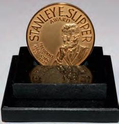
STANLEY SLIPPER MEDAL
CALL FOR NOMINATIONS
“This pioneer and explorer in geology, engineering and natural gas technology bequeathed a fundamental knowledge, years ahead of his time and was considered by many a virtual Leonardo da Vinci of the Petroleum Industry. Slipper, our First President, deserved the honour (unbeknownst to him) of our highest award in the Canadian Society of Petroleum Geologists” (Aubrey Kerr).
The Stanley Slipper Medal is the CSPG’s highest honour.
The gold medal is presented annually by CSPG for outstanding contributions to oil and gas exploration in Canada. The contributions of the winner of this award should encompass a number of activities related to aspects of petroleum exploration. Such activities include: initiating and/or leading exploration programs, significant discoveries on new or existing exploration trends, teaching and/or training of explorationists, and involvement in and leadership within geological societies and professional organizations.
The committee is currently calling on the CSPG membership to provide additional nominations for this prestigious award. The award winner must be a CSPG member and should be able to attend the awards presentation to be held in the spring of 2013.
Please include an updated bibliography and letters in support of your nominee.
Nominations should be mailed, faxed or emailed before October 15 to:
CSPG Stanley Slipper Committee – Clint Tippett
110, 333 – 5 Ave SW Calgary, AB T2P 3B6
Email: clinton.tippett@shell.com and membership@cspg.org
Phone: 403-264-5610 Fax: 403-264-5898
RESERVOIR ISSUE 8 • SEPTEMBER 2012 11
2011 Stanley Slipper Recipient Ned Gilbert
Stanley Slipper Medal
technicaL Luncheons OCTOBER LUNCHEON
The Tagish Lake meteorite: clues to ‘maturation’ of organic matter in the early solar system
SPEA k E R
Dr. Chris Herd
Smithsonian Institution’s National Museum of Natural History
11:30 am
tu esday, o c tober 9, 2012 te Lu s convention centre calgary, a lberta
Please note: the cut-off date for ticket sales is 1:00 pm, monday, october 1, 2012.
csPg member ticket Price: $42.00 + gst non- member ticket Price: $45.00 + gst
Each CSPG Technical Luncheon is 1 APEGA PDH credit. Tickets may be purchased online at www.cspg.org.
The complex suite of organic materials in carbonaceous chondrite meteorites probably originally formed in interstellar space and/or the solar protoplanetary disk, but was subsequently modified in the meteorites’ asteroidal parent bodies. The mechanisms of formation and modification are still very poorly understood. We carried out a systematic study of variations in the mineralogy, petrology, and soluble and insoluble organic matter in distinct fragments of the Tagish Lake meteorite. The circumstances of this meteorite’s fall and recovery enable new insights into pre-terrestrial organic matter variability. The variations correlate with indicators of parent body aqueous alteration, and at least some molecules of importance for life on Earth formed during the alteration.
bIOGRAPHY
Dr. Chris Herd is a geologist whose interests are many and varied, and best described under the heading of comparative planetology. He
Webcasts sponsored by
has a fascination with the origin and geologic evolution of planets in the solar system. Dr. Herd completed his undergraduate degree in Geological Sciences at Queen’s University in 1997. His interest in working on meteorites from Mars took him to the University of New Mexico in Albuquerque for his Ph.D., which was fully funded by a NASA graduate fellowship. In 2001 he moved to the Lunar and Planetary Institute in Houston, where he worked as a postdoctoral fellow with access to the facilities at the Johnson Space Center. He was hired in July of 2003 at the University of Alberta as assistant professor in the Department of Earth and Atmospheric Sciences, and was awarded tenure in July 2008. He teaches Mineralogy and Planetary Geology for the Geology program, and is the curator responsible for the Alberta Meteorite Collection, the largest University-based meteorite collection in Canada. In 2006, he led the consortium purchase of the pristine specimens of the organic-rich Tagish Lake meteorite. He recently returned from a year-long sabbatical at the Smithsonian Institution’s National Museum of Natural History in Washington, D.C., and is now supervising the construction of a unique facility for the curation of pristine meteorites.
12 RESERVOIR ISSUE 8 • SEPTEMBER 2012
technicaL Luncheons OCTOBER LUNCHEON
An Arctic perspective on 20th century warming
SPEA k E R
Gifford m i ller
University of Colorado, Boulder, CO
11:30 am
tuesday, o c tober 23
t e L u s c onvention c en tre c al gary, a l berta
Please note: the cut-off date for ticket sales is 1:00 pm, Wednesday, october 17, 2012. csPg member ticket Price: $42.00 + gst. non-member ticket Price: $45.00 + gst.
Each CSPG Technical Luncheon is 1 APEGA PDH credit. Tickets may be purchased online at www.cspg.org.
Over the past century our planet has warmed about 1.5°F. We know this from thermometers that have recorded temperatures around the planet. It is a fact. The more interesting questions are “Why?” and “Is the warming part of a natural cycle, or related to something we humans are doing?” The planet has been hotter and colder in the past, can this be just part of a longer climate cycle? Despite being remote and inhabited by few people, the Arctic is an ideal region to try to answer these key questions because temperature changes are always larger in the Arctic than elsewhere in the Northern Hemisphere. This is because of the strong positive feedbacks from snow, plants, and sea ice, resulting in a signal much larger and clearer in the Arctic than elsewhere. A little-noticed Arctic study by a Canadian geographer in the 1960s demonstrated that some ice caps preserve rooted tundra plants that are revealed as the ice margin recedes. We have capitalized on this observation to derive an extensive database of vegetation “kill dates” from which we can place the current warming in a millennial perspective and help to explain the occurrence of severe climate perturbations such as the Little Ice Age (1300-1850 AD). I will review how studies in the Arctic help to place the warmth of the past century in a longer-term perspective to try to get a better understanding of what this warming means.
Webcasts sponsored by
bIOGRAPHY
Gifford Miller, Ph.D. Professor of Geological Sciences and Fellow, Institute of Arctic and Alpine Research (INSTAAR), University of Colorado at Boulder. Director, Center for Geochemical Analysis of the Global Environment (GAGE).
As a Quaternary Geologist, Gifford focuses his research on reconstructing the behavior of the climate system in the recent past as a means of improving our understanding of natural climate variability. He has conducted extensive field campaigns in the Eastern Canadian Arctic, Iceland, and Svalbard that focus in reconstructing past environmental change and deriving inferences about the associated
climates that lead to those changes. He has also had an active field program in Australia for more than 20 years, where he is studying the impacts of human colonization on a continent that never had humans, or even placental mammals. Gifford was elected a Fellow of the American Geophysical Union and the Geological Society of America, where he was recipient of the Easterbrook Distinguished Scientist Award. He is also a Foreign Member of the Norwegian Academy of Science and Letters.
ROC k SHOP


RESERVOIR ISSUE 8 • SEPTEMBER 2012 13 1602 – 5th St N.E. Calgary, AB T2E 7W3 Phone: 403-233-7729 www.tihconsulting.com e-mail: tih@shaw.ca T.I.H. Consulting Ltd. Geologic Well-Site Supervision
2012 Ph.D. and M.Sc. CALL FOR THESES
Ph.D. AWARD
Win $2,500.00 and a framed certificate; and a one-year membership with the CSPG for: the Doctoral thesis that makes the most significant contribution to Canadian sedimentary geology in 2012.
M.Sc. AWARD
Win $2,000.00 and a framed certificate; and a one-year membership with the CSPG for: the Master’s thesis that makes the most significant contribution to Canadian sedimentary geology in 2012.
Winning thesis topics in recent years have included: detailed integrated studies of the Falher, Paddy, Hondo, and Gog; a stratigraphic re-interpretation of the Alexandra Reef
Complex, which has led to new insights into the nature of Devonian reefs; new thoughts about the classic Carboniferous section at Joggins, Nova Scotia; structural re-interpretation of the Livingston Range anticlinorium; detailed sedimentologic study of the Cenozoic geology in Trinidad; biogenic shale gas potential of the Upper Colorado Group; and evaporite diapirism in the Canadian Arctic Archipelago.
Deadline for submissions is September 14, 2012.
For submission, an electronic copy (PDF format if possible) of the thesis is preferred but a hard copy if properly bound will be accepted. Submitted hard-copy theses will be returned in late January 2013 after judging.
Eligible theses are either produced in a Canadian university, regardless of project location, or deal with a Canadian sedimentary/petroleum geology topic, regardless of the university of origin. Theses entered for the 2012 awards must have been submitted to a recognized university inside or outside Canada, and must have formed part of the requirements for degrees awarded at the Fall 2011 or Spring 2012 convocations.
Candidate theses must be well written, and clearly and adequately illustrated.
PLEASE SEND THESIS SUBMISSIONS FOR JUDGING TO: Canadian Society of Petroleum Geologists (CSPG) Graduate Thesis Awards Committee
c/o Andre Chow
Pengrowth Energy Corporation 2100, 222 – 3rd Avenue SW Calgary, AB T2P 0S4
Phone: (403) 213-3713 • Fax: (403) 234-6886
Email: andre.chow@pengrowth.com
14 RESERVOIR ISSUE 8 • SEPTEMBER 2012
diVision taLKs GEOMODELING DIVISION
Geomodeling and the multidisciplinary team
SPEA k E R
David Garner
Statoil Canada Ltd.
12:00 Noon
September 26, 2012
Husky Conference room a +30 South tower, 707 8th ave SW Calgary, a lberta
Ab S TRACT
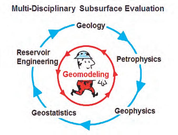
G eomodels help build a bridge between Geology, Geophysics, Petrophysics, and Reservoir Engineering. The strength of integration within a multi-disciplinary subsurface team has a positive impact on characterizing petroleum reservoirs for exploration or development. Each subsurface technical discipline delivers analysis of diverse data and results. The collected data for reservoir characterization is sparse; study results are ambiguous by nature; and risk is inherent in all our decisions.
The impact of integration can be significant for forecasting production and for assessing the technical risks we could encounter. Development strategies can be made around uncertainties in performance. This is a continuous process subject to the ever-growing information created over the life of a field. As a science in the petroleum industry we are still learning and evolving with many challenges remaining to be solved. Geomodeling is a growing field with the best set of tools available to integrate all these data, and to give possible answers.
b IOGRAPHY
D avid Garner is Principal Geomodeler in R&D for the Heavy Oil Technology Center in Statoil’s Calgary office. Before joining Statoil, Mr. Garner held the position of Senior Advisor Geologic Modeling for Chevron Canada Resources. Prior to that, he was with ConocoPhillips Canada. He worked on a variety of international reservoir studies applying Geostatistics through TerraMod Consulting over several years.
Mr. Garner holds two geophysics degrees, a B.S from Washington and Lee University and an M.S. from Cornell University. In 2006 he received a Citation in Geostatistics from the University of Alberta. Mr. Garner has presented papers at conferences throughout his career. He is an active member of the Canadian Society of Petroleum Geologists where he previously served as Finance Director. David was general chair for the 2011 CSPG Gussow conference, “Advances in Applied Geomodeling for Hydrocarbon Reservoirs: Closing the Gap.” He currently serves as a co-chair for the Geomodeling Technical Division committee and is editing a special Geomodeling publication.
I N FORMATION
T here is no charge for the division talk and we welcome non-members of the CSPG. Please bring your lunch. For details or to present a talk in the future, please contact Weishan Ren at wren@statoil.com.


RESERVOIR ISSUE 8 • SEPTEMBER 2012 15
by • Domestic and International wellsite supervision • Conventional and Unconventional wells • Extensive Hz experience • Customized corporate solutions available (403) 250-3982 sales@clconsultants.ca www.clconsultants.ca
Sponsored
W H AT IS UNCONVENTIONAL OIL?
| By Dave Russum, Director of Geoscience, AJM Deloitte
I N TRODUCTION
T he oil and natural gas industry has seen radical changes in recent years with increasing oil production coming from such sources as the oil sands and lowpermeability reservoir rock.
The terminology for describing oil and gas production and reservoirs has become muddled causing confusion not only within the industry, but also for investors and the public at large. This can become particularly significant where one type of extraction or type of product falls out of public favour due to environmental or public perception issues.
Adding to the confusion is the fact that an industry that had been perceived to be a sunset industry in North America with declining oil and gas production is suddenly claiming to have decades or even centuries of resources available. Was peak oil a lie? Why do we suddenly have cheaper natural gas than we have had since before the Millennium? It is hardly
surprising that the general public regards our industry with skepticism and distrusts

FORMATION
many of our activities.
This paper is an attempt to provide a simple terminology for oil that can help clarify and differentiate different opportunities by recognizing that there is a significant difference between the product and the reservoir from which it is produced. A similar paper focused on gas will be published at a later date.
T H E PROb L EM
I f we call gas from a low-permeability reservoir ‘unconventional gas’ we should call oil from low-permeability reservoirs ‘unconventional oil’. Yet, in most cases, the gas or oil produced is indistinguishable from the virtually pure methane or light oil produced from ‘conventional’ reservoirs. Additionally, if we have already used the term ‘unconventional oil’ in this way, how do we differentiate heavy oil and bitumen from light sweet oil’?
These terms are confusing enough within our industry but the misunderstanding goes much deeper when the Industry is looked at from a distance by investors, surface rights holders, environmentalists, politicians, or the general public.
The confusion arises from a lack of differentiation between the product and the reservoir from which it is produced.
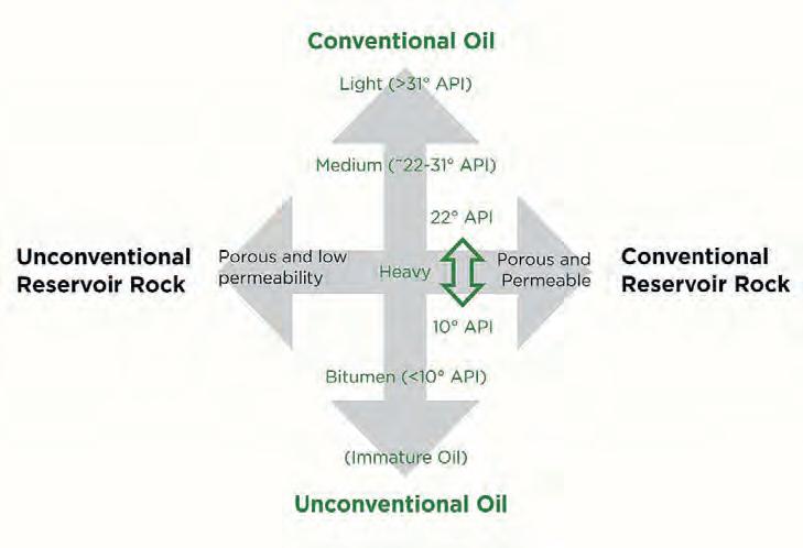
PETROLEUM ENGINEERING LTD OPUS COURSESCATALOGUE CONSULTING www.opuspetroleum.com Tollfree (877) 266-6126 Telephone (250) 358-2590 Figure 1. Differentiating conventional oil versus unconventional oil.
INTERPRETATION
A
If we start to differentiate the product, light oil to degraded oil (Figure 1, y-axis), and the reservoir from which it is produced, unconventional to conventional reservoir rock (x-axis), we get a simple diagram:
In figure 1, API gravity is used to illustrate the range of oil types from conventional to unconventional oil on the y-axis. The transition occurs somewhere in the heavy oil range of 10-22° API gravity. This is obviously a gross simplification of the complex subject of oil properties. Immature oil, which is basically kerogen (a precursor of oil), that requires cracking
to generate oil has been placed below bitumen on this axis. For each quadrant we can then describe the characteristics of the opportunities (Figure 2).
Conventional o i l in Conventional r eservoirs – The top right quadrant (green) has been the target of our activity for more than a hundred years and likely includes the easiest, cheapest, and most environmentally neutral opportunities to pursue. As long as a basin or geographic area has adequate supplies of oil available from this quadrant, there is very little incentive to pursue the other quadrants.
u n conventional o i l in Conventional
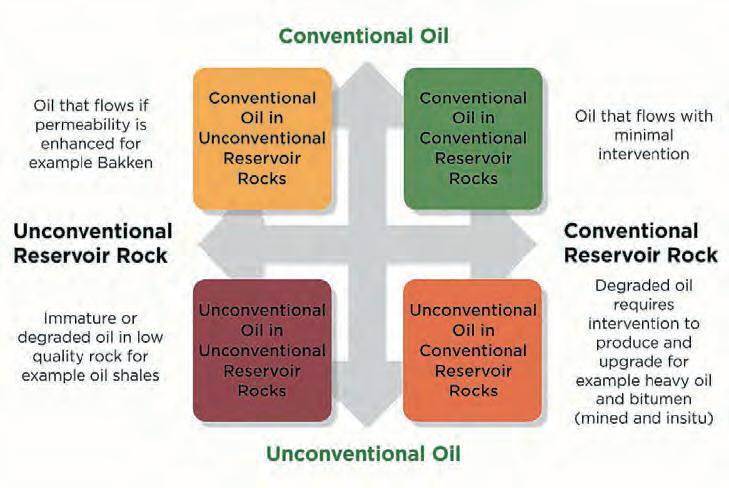
r eservoirs – The bottom right quadrant (orange) includes degraded heavy oil and bitumen that require special methods to extract. Oil resources in the Athabasca Tar Sands in Canada (variously called oil sands and bitumen sands as well), and ultra-heavy oil in the Orinoco Basin in Venezuela are good examples. The oil is clearly unconventional but the reservoir rock holding the oil typically has very high porosity and permeability resulting in a highly concentrated resource.
Conventional o i l in u n conventional r eservoirs – The top left quadrant (yellow) is the primary target of recent activity in such plays as the Bakken and Cardium where modern technology of horizontal drilling and multi-stage fracturing is enabling production from rocks previously viewed as non-productive or uneconomic. In most cases, the product is very light oil but it is contained in reservoir rock with extremely low permeability. Often the industry and media is mistakenly calling this rock ‘oil shale’ whereas the actual reservoir rock is of much coarser grains than would be defined geologically as a shale. Confusion arises because the low permeability may be caused by the presence of shale-sized particles within the rock and/or the close proximity to true shales that may act as a local source rock for the targeted porous reservoir.
u nc onventional o i l in u nc onventional r eservoirs – The bottom left quadrant (red) would include both kerogen (an immature precursor of oil) and bitumen

RESERVOIR ISSUE 8 • SEPTEMBER 2012 17
S OLUTION
www.csurconference.ca 14th Annual Unconventional Resources Conference | October 3 & 4, 2012 | Calgary TELUS Convention Center Join us for two days of technical presentations by industry experts. You do not want to miss this event! CSUR Member Discount Employees of Member Companies save $200 Bundle Discount Register 6 people from your company & each person saves $150 There are two ways to save up to $350 on your registration fee: (Continued on page 18 ...)
Figure 2. Defining the oil and the reservoir.
(a degraded form of oil) in very lowpermeability rocks. The reservoir rock is typically shale that also provided the source of the oil and hence these shales are often considered as self-sourcing. The term ‘oil shale’ has been used for decades to describe rocks of this type; the best known example in North America is the Green River Formation in Colorado and Wyoming where efforts to economically extract oil have been have been ongoing for more than fifty years. These rocks require both cracking at high temperatures to convert kerogen to oil, and some kind of efficient fracturing of the rock, to enable extraction of the oil. The two steps may occur simultaneously in situ or in a mining operation followed by high temperature treatment. In either case, this extraction is much more challenging economically and environmentally than processes used in the other three quadrants.
A DDITIONAL C L ARIFICATION
T he colour scheme of green, yellow, orange, and red provides an approximate indication of the ease of production and consequent cost and potential environmental impact of pursuing these resources. In general terms, low-cost oil falls in the top right quadrant while extremely high- cost oil will fall in the bottom left quadrant.
In addition, Figure 3 indicates how this same organization of the oil opportunities helps to clarify the possible oil resource availability. Previous proponents of peak oil have really only considered the top right (green) quadrant. Since that time, the yellow and orange quadrants have added considerably more oil to the equation. Perhaps, at some point in the future, the
ROC k SHOP
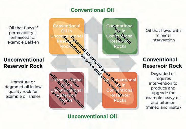
red quadrant will be added to the available reserves, but it will take considerably higher prices along with diligent research and experimentation to convert the lower left quadrant from concept to reality.
C ONC LUSION
T his methodology is a simple, nontechnical, approach to describing petroleum reservoirs and their contents. This is intended to provide clarity within the industry to investors, politicians, and to the consumer, whose limited exposure to the industry is through the news media, the price of oil at the pumps, and on their utility bills. It hopefully provides insights into recent changes to our industry and why the direction of future supply and cost of hydrocarbons both locally and on a global scale is so difficult to predict.


A future paper will look at whether this approach can be applied to dry natural gas and liquids rich natural gas reservoirs. In the meantime, I value any feedback you may have and encourage all geoscientists to consider whether the terminology you and your colleagues are using in your corporate portfolios is appropriate.
18 RESERVOIR ISSUE 8 • SEPTEMBER 2012
Conventional Vertical and Horizontal Wells Oil Sands - SAGD/Coring Programs Shale Gas/Oil Shales Coal Bed Methane Project Supervision Email: progeo@telus.net Tel: (403) 262-9229 Fax: (403) 265-0377 Website: www.progeoconsultants.com petrographical & sedimentological descriptions for samples (thin section - fluid inclusion studies) conventional vertical/horizontal wells operations geology SPECIALIZED IN GEOLOGICAL WELLSITE SUPERVISION AND CORE ANALYSIS RockWell Consulting our best friend and most valuable partner is our client Stephan C. Dragomir president www .g e ok2. c om - phon e: 403.831.9941 - s dr a gomir @ge ok2. com
(...Continued from page 17)
Figure 3: Examining the potential.
Indeed many did so against formidable cultural obstacles.
My theme here is to point out that geology is an unusual science, one that I call a visual “observational science.” It is not dominated by mathematics, calculations, experiments, and such (typically, but not always!). Geologists certainly do collaborate with many such disciples and indeed some geo-work falls fully within other disciplines. The geosciences are distinguished from other sciences by their interpretation level and in dealing with limited data and by dealing in the fourth dimension (time). Is geology an art? Not really but it perhaps inhabits a space somewhere akin to an art but not necessarily a rigorous hard science. It is the combination of observed data and an artful interpretation of typically incomplete data and an inability to be sure of what exactly happened in geologic history. Here for example we can think readily of unknowns of the Precambrian.
Closely tied to the observational demands of the science, is the demand of curiosity. Curiosity is what drives the interest in observing. One of our main problems is the subjective viewing of the earth using a model-driven viewpoint. A model-driven approach ignores the value of evaluating mutliple hypotheses. Models do give

us a framework to gather observations (data) and build evidence to develop an interpretation(s). But our models can blind us to important observations that maybe don’t fit the model, are ignored, or not appreciated. And since we have trouble seeing what we are NOT looking for, we must depend on curiosity to uncover a truth. And we can hope that curiosity can help us to see something we don’t expect to see.
Now we do work with models or concepts a lot - we must - given the unknowns of what happened in geologic time. I think of the quip that an engineer is one who
thinks numbers are facts, whereas we geologists think that concepts are facts.
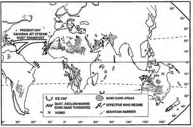
And I also think that, when working well, we show an ability to relate seemingly unrelated concepts or facts and using those to create and bolster an interpretation or story. An ingenious example that I like is the application of the observation of Saharan winds blowing dust westwards and far out into the Atlantic Ocean – then applying that model to western Canada Triassic rocks (Davies, 1997).
And while we use all the above talents in search for petroleum, how does a subsurface geologist work? I think a cupful of doggedness, persistence, “sleuthing” (pers. comm. from Andy (A.R.) Vogan, 2012), getting all the data possible – all go a long way towards successful prospecting. I call this “doing the homework: – gathering all the data possible within the given time constraints.
And another element we use in prospecting is the focus on “not just what is, but what might be” (pers. comm. from Keith (G.K.) Williams, circa 1990). Our practice is limited by well control and perhaps limited seismic or other data. And certainly there is usually little data exactly where we want to drill. Thus we are always working with inferring “what might be,” between data points. That is the prize.
What does this note have to do with the CSPG? We are a technical geological society. I offer this note as perhaps a way of getting down on paper what I think we actually do. And by providing this, there is an element of wanting to pass along what I have observed. And I want to suggest that if our activities in the CSPG do not serve the cause of “good petroleum geology” or “good prospecting”, then we are getting off-track.
R EFERENCE
D avies, G.R. 1997. Aeolian sedimentation and bypass, Triassic of western Canada, Bulletin of Canadian Petroleum Geology, v. 45, no. 4, p. 624-642.
RESERVOIR ISSUE 8 • SEPTEMBER 2012 19
Nicholas Steno portrait by J.B. Trap, circa 1686.
(...Continued from page 7)
Fig. 21 from Davies, 1997. His caption: Distribution of Quaternary aeolian-marine dune-sand-derived turbidites off northwestern Africa, west-central Africa, eastern Brazil and northwestern Australia and their relationship to offshoredirected winds transporting sand from coastal desert dune fields. Modified from Sarnthein and Diester-Haass (1977) and other sources. The position of the present-day Saharan jet stream and related aeolian sediment transport is also shown. Similar processes but in much shallower, lower-relief basin settings, may have occurred in the Lower Triassic Montney Formation of western Canada and in other Triassic units in that area.
WRITING A ROCk I N’ RESUME
| By Aliyyah Mohamed (Marketing & Communications Coordinator, Canadian Discovery Ltd.)
Now that you have graduated, it is time to enter the workforce. Landing your ideal job requires a strong application and you have only seconds to grab a recruiter’s attention during their initial screening process. A well-written resume, along with a cover letter tailored to the position is vital in making this happen.
C OVER L E TTER
TIMEWELLSPENT
W hy are you applying for the job? How t ip: C opy and paste the job requirements into your cover letter and explain how you meet the criteria they are looking for. For example, if a company is seeking someone with the “ability to communicate effectively, document work and meet project deadlines,” you could state, “While employed at Company X for Y number of months/years, I communicated effectively with my team by providing weekly project updates to ensure project deadlines were met.”

Some clients say they spend up to 80% of their time cleaning up data. TGS has spent over 20 years cleaning up data, so you can spend more time on interpretation and evaluation.
Email WellData@tgs.com to learn more about TGS’ library of digital well logs, mud logs, directional surveys, production data, interpretive products and more.
ES UMES
esumes are selected “by indicating any number of keywords that define the functional roles and experience needed for that job. Only resumes that contain those keywords will turn up in a search” (Ober, 2003, p. 521).
Including a career goal or objective in your resume that matches the job you are applying to is important. “Your Objective is where you explain how and why you are uniquely qualified to contribute to the company” (Pongo, 2012).
O NTENT
Your resume should include:
• C ontact information (name, phone number, address, email)
• J ob objective – concise summary of your area of expertise, career interest and goals
• Education
• Job history
• Skills
• P rofessional and personal development
• Honours, awards
• Volunteer or extracurricular activities
F OR MAT
S elect a simple, easy-to-read style, avoid font effects, and be sure to keep font types to one or two maximum. Bulleted lists using strong action verbs will create impact and will help to keep the reader focused (Pongo, 2012). Proper grammar, spelling, and punctuation are also essential to a strong job application.
20 RESERVOIR ISSUE 8 • SEPTEMBER 2012
Learn more at www.tgs.com/welldata Spending a lot of time on well data clean up? TGS is.
E DUC ATION
“ Education discusses your academic history. The convention…is…to list [the] history in reverse chronological order, listing first your most recent schooling or degree awarded” (Graves and Graves, 2007, p. 48). If you are lacking relevant work experience, your education should appear first on your resume.
You should include your degree title, name of university or college, major or minor, date of graduation, GPA (if required). You can also list courses that “provided distinctive experiences that uniquely qualify you for the job” (Ober, 2003, p. 529). Do not list all courses you completed during your undergraduate degree as that information can be obtained if you are required to submit a transcript.
WOR k E X PERIENCE
T his section provides insight on previous responsibilities and the jobs that you have held. It also provides employers with your continuous work record (Graves and Graves, 2007). A chronological resume format, which is my preference, begins
with your most recent information and works backward. Functional resumes are organized by type of skill developed (e.g., communications, hydrogeology, accounting, etc.) and are more pertinent if you are re-entering the workforce, changing industries, or moving to a different line of work (Ober, 2003).
t ip: Include a short list of accomplishments for each job. Show the relevance of your accomplishment and how it benefited the organization, for example: “Produced a quarterly trending report used to align corporate Procurement strategy.”
R E FERENCES
G enerally, contact information for your references does not need to be included in your resume as it is typically provided to your prospective employer as requested.
Remember to be honest with regard to your resume content and use concrete achievement-oriented words while trying to
GEOEDGES INC.
be creative with adjectives.
Best of luck to all of you with your job search!
SOURC E S CITED
Graves, H. and Graves, R. 2007. A strategic guide to technical communication. Broadview Press, Peterborough, ON.
Ober, S. 2003. Contemporary business communication (5th ed.). Houghton Mifflin, Boston, MA.
Pongo. 2012. 5 rules for building a great resume. Retrieved from http://www. pongoresume.com.
GeoScout and other applications for information contact: Joel Harding at 403 870 8122 email joelharding@geoedges.com www.geoedges.com
Western Canada: Slave Point, Swan Hills, Leduc, Grosmont, Jean Marie, Horn River Shales, Elkton, Shunda, Pekisko, Banff, Mississippian subcrops and anhydrite barriers in SE Sask., Bakken, Three Forks, Montney, Halfway, Charlie Lake, Rock Creek, Shaunavon, BQ/Gething, Bluesky, Glauconitic, Lloyd, Sparky, Colony, Viking, Cardium, Horseshoe Canyon and Mannville CBM, Oilsands Areas, Outcrops
US Rockies & Williston: Red River, Mississippian subcrops & anhydrite barriers (Bluell, Sherwood, Rival, etc), Bakken, Three Forks, Cutbank, Sunburst, Tyler, Heath, Muddy, Dakota, Sussex, Shannon, Parkman, Almond, Lewis, Frontier, Niobrara, Mesaverde shorelines, Minnelusa, Gothic, Hovenweep, Ismay, Desert Creek, Field Outlines, Outcrops
Texas & Midcontinent: Permian Basin paleogeography (Wolfcampian, Leonardian, Guadalupian), Granite Wash, Mississippian Horizontal Play, Chat, Red Fork, Morrow, Sligo/Edwards Reefs, Salt Basins, Frio, Yegua, Wilcox, Eagleford, Tuscaloosa, Haynesville, Fayeteville-Caney, Woodford, Field Outlines, Outcrops, Structures
North American Shales: Shale plays characterized by O&G fields, formation limit, outcrop, subcrop, structure, isopach, maturity, stratigraphic cross-sections. Includes: Marcellus, Rhinestreet, Huron, New Albany, Antrim, Utica-Collingwood, Barnett, Eagleford, Niobrara, Gothic, Hovenweep, Mowry, Bakken, Three Forks, Monterey, Montney, Horn River, Colorado
Eastern US / Appalachia: PreCambrian, Trenton, Utica-Collingwood, Medina-Clinton, Tuscarora, Marcellus, Onondaga Structure, Geneseo, Huron, Antrim, New Albny, Rhinestreet, Sonyea, Cleveland, Venango, Bradford, Elk, Berea, Weir, Big Injun, Formation limits, Outcrops, Allegheny Thrust, Cincinatti Arch, Field outlines
Deliverables include:
Texas & Midcontinent US Geological Edge Set
-Shapefiles and AccuMap map features -hard copy maps, manual, pdf cross-sections -Petra Thematic Map projects, GeoGraphix projects, ArcView map and layers files -bi-annual updates and additions to mapping -technical support
RESERVOIR ISSUE 8 • SEPTEMBER 2012 21
Western Canada Geological Edge Set Northern US Rockies
Williston Basin Geological Edge Set Eastern US / Appalachian Basin Geological Edge Set North American Shales Geological Edge Set Detailed
Petra,
AccuMap,
&
and accurate geology at your fingertips in
GeoGraphix, ArcGIS,
ST UDENT I N DUSTRY F IELD T R IP (SIFT) 2012
| By 2012 Chair: Debbie Cook
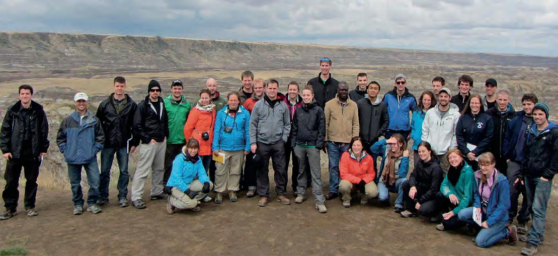
The 2012 edition of the CSPG SIFT program, which ran from April 29th to May 11th, was a tremendous success. The SIFT program has phenomenal volunteer and industry support with 20 committee members involved in planning and organizing, and 20 industry professionals providing lectures and field trips. In addition to an outstanding volunteer base, financial support from our industry sponsors allows the CSPG to continue to offer this flagship program every year. Our major industry sponsors for 2012 were: ConocoPhillips Canada, Imperial Oil Limited, Shell Canada Limited, EnCana Corporation, Devon Energy, Cenovus Energy, Talisman Energy, Husky Energy, and Nexen Incorporated. SIFT was also fortunate to receive in kind donations by Enerplus Corp., Crescent Point Energy, Golder Associates, University of Calgary Earth Science Department, SAIT, RigStar Communications, and ERCB Core Research Centre. On behalf of the entire SIFT committee and the CSPG, I want to thank all the individuals and companies for their continued support of this incredible program.
The CSPG SIFT 2012 Committee hosted 32 undergraduate students enrolled in geoscience programs from across Canada. These budding geoscientists came to Calgary for a two-week introduction to the Canadian petroleum industry through classroom lectures, core workshops, an exploration game, field trips, and many opportunities to talk to professionals working in our industry.
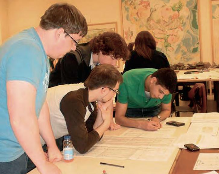
Throughout the two weeks, students attended lectures presented by industry experts with topics including well logging and log interpretation, carbonate and clastic reservoirs, geophysics, wellsite operations, heavy oil, and more. To keep up with current activity in the industry, we also held an Environmental Talk, and lectures on Unconventional Resources and Global Energy Outlook. In addition to the lectures, students were able to
weather. A large component of the SIFT trip is having the students apply concepts learned on the trip to an intense, handson exploration game. The game teaches students some of the realities of the oil and gas business. Teams of four form a company and are given a small land base and seed capital to start exploring and building their company. They use real well log data to make interpretations of the geology and identify “sweet spots” that they use to bid

tour the demonstration rig at SAIT and did a ‘Behind the Scenes’ tour of the Royal Tyrrell Museum, as well as take in the legendary four-day trip through the Rockies. The Dinosaur Provincial Park trip was unfortunately cancelled due to
on additional land, drill wells, and structure business partnerships. At the end of the program an experienced industry panel judges the interpretations and success of the individual companies and awards the Bill Ayrton Technical Award.
22 RESERVOIR ISSUE 8 • SEPTEMBER 2012
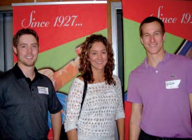
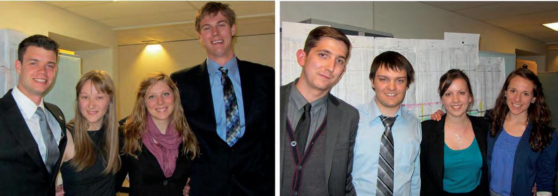
Figure 1. Left to right: Justin Drummond, Acadia University; Danielle Howlett, University of Waterloo; Tara Forstner, Dalhousie University; Eric Rops, Western University.
Figure 2. The Larry Strong Financial Award, (Steven Porter, Memorial University; Michael D’Angelo, Lakehead University; Lauren Eggie, University of Manitoba; Mariana Calabrese, McMaster University).
l a rry Strong Financial award: (left to right) Naomi Miles, University of Calgary; Chinemerem Dennar, Dalhousie University; Brent Perrin, Brandon University; Judy Lam, Carleton.
2012 Student Participants: Omar Al-Mufti, University of Ottawa; Dayne Anderson, University of McGill; Morufu Basiru, Brandon University; Mariana Calabrese, McMaster University; Laura Colgrove, University of Guelph; Michael D’Angelo, Lakehead University; Zachary DiLoreto, University of Windsor; Ryan Dorcas, Saint Mary’s University; Justin Drummond, Acadia University; Lauren Eggie, University of Manitoba; Dennis Ellison, University Of Calgary; Colin Etienne, University of Victoria; Tara Forstner, Dalhousie University; Keith Gillis, St. Francis Xavier University; Riley Gudgeon, Queen’s University; Torrey Hallan, University of Alberta; Danielle Howlett, University of Waterloo; Nicole Hunter, University of Saskatchewan; Veronique Lafrance, Université du Québec à Chicoutimi; Freda LeBlanc, Mount Royal University; Jason Levesque, University of New Brunswick; Jagabir Ningthoujam, Brock University; Karin Ostler, Laurentian University; Alex Pernin, University of Toronto; Arianne Petley-Ragan, Carleton University; Thierry Plamondon-Tremblay, Université Laval; Steven Porter, Memorial University; Eric Rops, Western University; Adam Staruiala, University of Regina; Joëlle Thiboutot Goyette, Université du Québec à Montréal; Dawn Tobey, Dalhousie University; and Ben Vautour, Simon Fraser University.
Each year, the SIFT Committee complements the two-week SIFT program with a Summer Job Program. The goal of this component of SIFT is to place newly trained SIFT graduates with oil and gas companies in Calgary so that they can continue the learning experience.
This year, four students found summer positions. Each year, we continue to look for companies willing to hire our SIFT graduates. If your company is able to offer a position, please contact the CSPG office for more information.
I have had the great privilege of leading this program for this past year and have thoroughly loved this opportunity. The 2013 Chair position is yet to be filled, but will be soon decided as planning for the upcoming year begins in the fall. Many thanks all the SIFT Committee members that have worked on the committee over the past 34 years. The organizing committee puts in a huge effort every year and it is a result of their hard work that SIFT is such a success.
2012 Chair: Debbie Cook
2012 Committee Members: Allan Carswell, Andrew Cook, Catherine Skilliter, Dawn Hodgins, Debbie Cook, Geoff Speers, Heather Slavinski, Ian DeWolfe, Indy Raychaudhuri, Keith Yaxley, Kate McCutcheon, Matthew LeForte, Meghan Speers, Melanie Regehr, Nate Kreiger, Noel Devere-Bennett, Stacia Skappak, Taylor Olson, Richard Forrester, and Simon Hayes.
RESERVOIR ISSUE 8 • SEPTEMBER 2012 23
Bill ayrton technical award: (left to right) Kevin MacRae, St. F.X.; Matthew Brzozowski, Windsor; Tim Peters, Simon Fraser; Rabi Nizami, University of Toronto.
CSPG PROFESSIONAL DEVELOPMENT
CSPG PROFESSIONAL DEVELOPMENT
SHORT COURSES & FIELD SEMINARS
SHORT COURSES
The Stratigraphic Setting of Lower and Middle Triassic Strata
Instructor: Jim Dixon
Dates: October 25th, 2012 (Morning Only)
Price: $400.00 CDN Member
$525.00 CDN Non-Member
The Architecture of Fluvial Reservoirs
Instructor: Andrew Miall
Dates: October 25 & 26, 2012
Price: $975.00 CDN Member
$1,100.00 CDN Non-Member
Writing for Earth Scientists: A One -Day Clinic
Instructor: Matt Hall
Dates: October 22, 2012
Price: $625.00 CDN Member
$750.00 CDN Non-Member
Sequence Stratigraphy: Principals and Applications
Instructor: Octavian Catuneanu
Dates: October 22 & 23, 2012
Price: $1,150.00 CDN Member
$1,275.00 CDN Non-Member
Fluvial Stratigraphy
Instructor: John Holbrook
Dates: October 24 & 25, 2012
Price: $1,050.00 CDN Member
$1,175.00 CDN Non-Member
Technology of Multi -Stage Fracing of Horizontal Wells
Instructor: Saad Ibrahim
Dates: October 26, 2012
Price: $620.00 CDN Member
$745.00 CDN Non-Member
SHORT COURSES
Log Analysis for Stimulation Design
Instructor: Ross Crain
Dates: October 24, 2012
Price: $800.00 CDN Member
$925.00 CDN Non-Member
Log Analysis in Unconventional Reservoirs
Instructor: Ross Crain
Dates: October 23, 2012
Price: $800.00 CDN Member
$925.00 CDN Non-Member
Shale Gas Critical Fundamentals, Techniques and Tools for Exploration
Instructor: Basim Faraj
Dates: October 22, 2012
Price: $830.00 CDN Member
$955.00 CDN Non-Member
Directional Drilling and Geological Placement for Beginners
Instructor: Glen Eckert
Dates: October 25, 2012
Price: $850.00 CDN Member
$975.00 CDN Non-Member
Directional Drilling and Geological Placement (Advanced)
Instructor: Glen Eckert
Dates: October 26, 2012
Price: $955.00 CDN Member
$1,080.00 CDN Non-Member
Mannville Stratigraphy, Sedimentology, and Petroleum Geology
Instructor: Doug Cant
Dates: October 15 - 17, 2012
Price: $1,735.00 CDN Member
$1,860.00 CDN Non-Member
Rock Creek Stratigraphy, Sedimentology, and Petroleum Geology
Instructor: Doug Cant
Dates: October 24, 2012
Price: $870.00 CDN Member
$995.00 CDN Non-Member
Subsurface Methods - Core Work and Log Correlation in Clastic Sediments
Instructor: Doug Cant
Dates: October 22, 2012
Price: $1,000.00 CDN Member
$1,125.00 CDN Non-Member
FIELD SEMINARS
Geology of the Athabasca Oil Sands
Instructor: Murray Gingras & Mike Ranger
Dates: September 6th - 8th, 2012
Price: $3,900.00 CDN Member
$4,025.00 CDN Non-Member
Geology of Horizontal Wells in Liquid-Rich Reservoirs
Instructor: Deborah Sanderson & Andrew Newson
Dates: September 7th, 2012
Price: $675.00 CDN Member
$800.00 CDN Non-Member
Wabamun, Bakken Equivalent Exshaw, and Banff Formations in Core, Cuttings, and Outcrop from Southern Alberta
Instructor: Tim Hartel, Willem Langenberg, & Barry Richards
Dates: September 14th & 15th, 2012
Price: $750.00 CDN Member
$875.00 CDN Non-Member
24 RESERVOIR ISSUE 8 • SEPTEMBER 2012
REGISTER ONLINE AT www.cspg.org/CSPG/Education
THE 2012 CSPG ANNUAL CLASSIC GOLF TOURNAMENT HAS
On June 21 and 22, 2012, the CSPG celebrated the 52nd Annual CSPG Classic Golf Tournament at the Elbow Springs Golf Club in Calgary under sunny skies and the new two-day match play format. This evolution compliments the time and demographic shifts within today’s oil and gas industry as witnessed by the number of returning participants, as well as many new registrants attracted by the two-day schedule.
The testimonials also reflect that we are on the right track:
“Great format; fits my work schedule perfectly.”
“Best two days of fun golfing and socializing ever!”
“I couldn’t have committed before, but now I’m hooked.”
“It’s my first year and I’m ready to sign up for next year’s tournament. Two thumbs up.”
The 52nd CSPG Annual Classic Golf Tournament included two rounds of golf with power carts, on-course sponsor tents with refreshments and food, Thursday dinner at the club courtesy of AGAT Laboratories, and Friday breakfast with MJ Systems prior to the morning shotgun. The Friday evening awards banquet and entertainment topped off the event at the Calgary Petroleum Club with presentations of trophies and prize money to the flight winners and runners-up. This year’s tournament featured two vacation trips to New York City and Palm Springs, a BBq, and daily hole and skill prizes.
Agapé Hospice, our returning charity partner, benefited from raffle ticket sale proceeds held during the tournament. The support of all participants is greatly appreciated.
Congratulations to the 2012 CSPG Classic Golf Tournament Paskapoo Flight champion John Skinner with runner-up Kevin Muir. Winners of the remaining 15 Flights are Jeff Kriz, John Williams, Richard Chisholm, Carl Glaser, Bob Lee, Ken Chobotuk, Paul Hutchin, Matt Blanch, Foon Der, Colby Ruff, Larry Love, Dave Shklanka, Nolan Gustafson, Robert Mitchell, and George Ardies.
The Chuck Wagon champion team consisted of Rich Sereda, Bill Saunders, Brad Torry, and Mike Murphy.
On behalf of all its participants, the CSPG 2012 Classic Tournament Committee sincerely thanks the 52 sponsors who contributed to a successful event this year, particularly our Diamond sponsors: geoLOGIC Systems Ltd, Little Rock Document Services, and Schlumberger of Canada.
Visit the photo gallery from the 2012 CSPG
Classic by copying and pasting the following link into your browser:
https://picasaweb.google. com/116994163142 636723223/CSPGClas sic2012Candid?authkey=Gv1sRgCKzjlaTpsc 76rAE#.
Mike LaBerge, Chairman CSPG Classic Golf Committee
RESERVOIR ISSUE 8 • SEPTEMBER 2012 25
k SHOP *Domestic & International Supervision 906, 505 6 St. SW Calgary, AB T2P-1X5 Jocelyn Lampron, P. Geol. President & CEO Wellsite Geological Supervision *Conventional Wells-Heavy Oil/SAGD *Coal Bed Methane Wells www.hopewellpetroleum.com info@hopewellpetroleum.com CD BA 234 765 101112 15 1413 section lsd ph: 403.266.3132 cell: 403.818.8549 *On & Offshore Geological Supervision
EVOLVED! ROC

GO TA k E A H I k E Canada’s Deadliest Rockslide – Frank, Alberta
| By Willem Langenberg, Monica Field, and David McIntyre
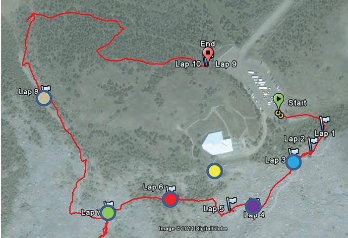
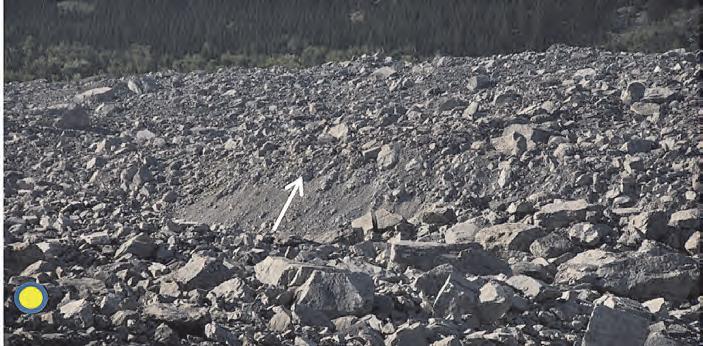
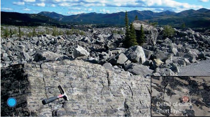
trailhead: Drive 1.5 km up to the Frank Slide Interpretive Centre from Highway 3. Walk from the parking lot to the main view point on the boardwalk in front of the Centre. Return to the parking lot and proceed on a well-maintained trail starting near the NE corner of the lot. The loop trail ends back at the parking lot.
distance: 1.5 km
elevation g ain: 35 metres
In the early morning hours of April 29, 1903, about 100 million tonnes of limestone fell from Turtle Mountain in less than 100 seconds, partly burying the coal-mining town of Frank and killing more than 90 of the town’s 600 inhabitants.
Turtle Mountain forms part of the Livingstone Thrust sheet of the Foothills in the Crowsnest Pass area and consists of Paleozoic carbonates and Mesozoic clastics (Langenberg et al., 2007). The dominant geological structures on Turtle Mountain are the Turtle Mountain Anticline and the Turtle Mountain Thrust. The rocks forming the upper part of the mountain are mainly Paleozoic strata of the Palliser (fractured dolomitic limestone), Banff (mudstone, siltstone, banded chert and limestone), Livingstone (limestone and dolomite, sometimes cherty), and Mount Head (dolomitic siltstone, dolomite and limestone) formations. The main blocks in the slide mass are from the Livingstone Formation and to a lesser extent the Banff Formation. The Mount Head Formation is only present in minor amounts. The highly fractured Palliser limestone in the core of the anticline was only involved for a minor amount and cannot be recognized in the slide mass.
The collapse of the mountain was caused by fragmentation of the fractured rock mass followed by the flow of the broken rock down the slope, forming a rock avalanche and involving motion-induced vibration (Cruden and Hungr, 1986). The mass of fragmented rock flowed down the slope like a dense fluid without vertical mixing of the debris. This long run-out rockslide travelled three kilometres from the top of Turtle Mountain to the far side of the valley and covered three square kilometres under up to 45 metres of rock.
On the Frank Slide Trail, superb views of the enormous debris field allow for close-up examination. The inverse grading of the deposit and fairly steep splash zone can be observed. In addition, fluvial boulders and pebbles that were scooped up from the Crowsnest River drainage are located along the trail. The face of Turtle Mountain displays the geological structure, which was the main contributing factor to this slide. The path follows the old Frank and Grassy Mountain Railway grade for some distance after it exits the slide deposits. Along the trail, an igneous clast conglomerate forming part of the Blairmore Group is exposed.
Reference: Cruden, D.M. and Hungr, O. 1986. The debris of the Frank Slide and theories of rockslide-avalanche mobility. Canadian Journal of Earth Science, v.23, p.425-432.
Langenberg, C.W., Panâ, D., Richards, B.C., Spratt, D.A., and Lamb, M.A. 2007. Structural Geology of Turtle Mountain area near Frank, Alberta. Alberta Energy and Utilities Board, EUB/AGS Earth Sciences Report 2007-03, 30 p.
Background Photo by Astrid Arts.
From the viewpoint, inverse grading with the largest blocks on top (head of arrow) can be seen exposed along the highway cut, as described in Cruden and Hungr (1986).
26 RESERVOIR ISSUE 8 • SEPTEMBER 2012
A big block of black chert-bearing Banff Formation in the foreground and a bigger one in the background lie among limestone blocks from the Livingstone Formation.

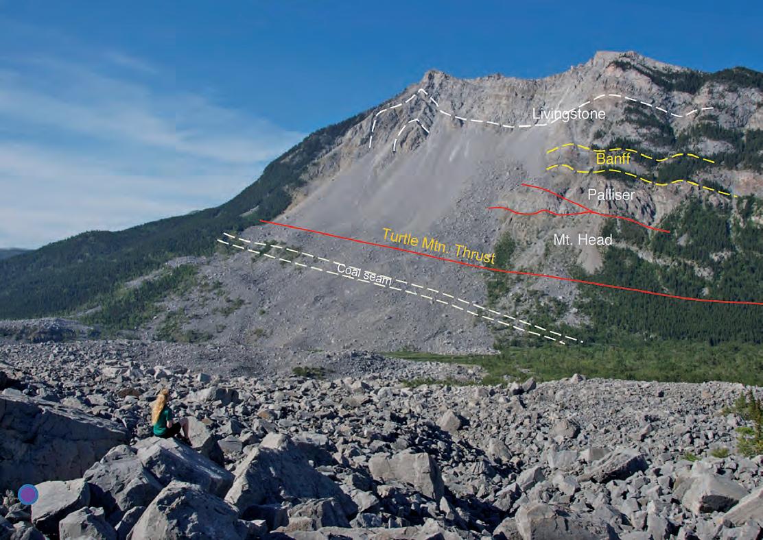
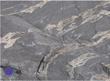
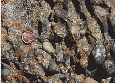
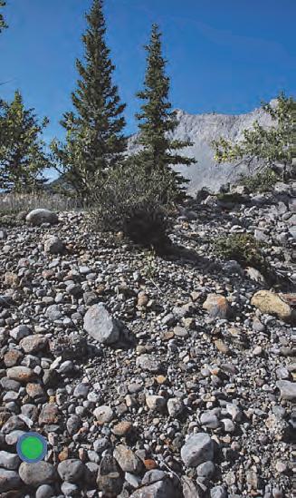
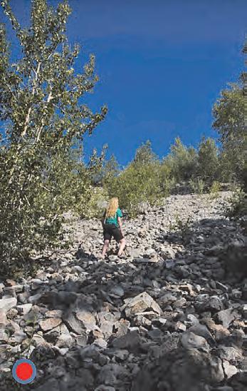 View of Turtle Mountain as seen from the trail. The structure of the mountain is outlined, as well as its constituent rocks. Blocks from the Livingstone and Banff formations make up most of the slide in the foreground.
Detail of limestone block of the Livingstone Formation, showing some interlayered blonde chert beds.
Conglomerate of the Cretaceous Blairmore Group (bedrock below slide), which has a high proportion of igneous clasts.
Rounded pebbles and boulders from recent fluvial deposits of the Crowsnest River, scooped up by the slide and dropped amongst the slide blocks.
View of Turtle Mountain as seen from the trail. The structure of the mountain is outlined, as well as its constituent rocks. Blocks from the Livingstone and Banff formations make up most of the slide in the foreground.
Detail of limestone block of the Livingstone Formation, showing some interlayered blonde chert beds.
Conglomerate of the Cretaceous Blairmore Group (bedrock below slide), which has a high proportion of igneous clasts.
Rounded pebbles and boulders from recent fluvial deposits of the Crowsnest River, scooped up by the slide and dropped amongst the slide blocks.
RESERVOIR ISSUE 8 • SEPTEMBER 2012 27
Steep slope of the splash zone near the edge of the slide, resulting from debris flowing uphill. The splash zone now has more trees than the rest of the slide mass.
All ages welcome
Adults: $20 ($25 at door)
students: $10 ($15 at door)
Children (12 & under): free For groups of 10 or more please contact the CSPG office at (403) 264-5610 | www.cspg.org
From Evolution to Exploration Our African Journey
2012 HONORARY ADDRESS
Monday Nov. 26 2012
Southern Alberta Jubilee Auditorium, Calgary AB Doors 6:00 pm | Talks 7:00 pm
SPEAKERS
Ian Tattersall – Curator Emeritus, Biological Anthropology, American Museum of Natural History, New York
Dr. Trent Rehill – VP Geosciences, Kulczyk Oil Ventures
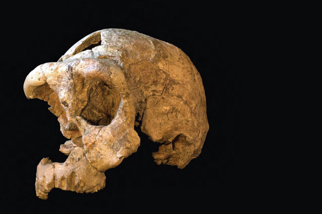
A SL IPPERY DAY in Dinosaur Provincial Park
| By Tannis McCartney
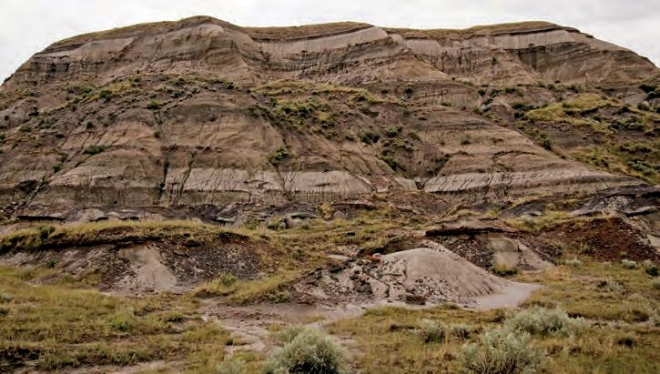
In early June, 28 students and three CSPG volunteers set out from Calgary, under the leadership of Derald Smith, for a field trip to Dinosaur Provincial Park. The subject of the field trip, however, was not dinosaurs. Instead, it was a “Reconstruction of an Upper Cretaceous Fluvial Paleo-Meander Belt, Steveville Badlands, Dinosaur Provincial Park, Alberta.”
The drive southeast from Calgary was rainy, but that didn’t dampen anyone’s spirits and the wet weather kept the rattlesnakes hidden away. The Steveville Badlands are in the northwest corner of Dinosaur Provincial Park and they are an excellent place to observe counter point bar deposits, which are siltier than point bar deposits and can contain IHS. This is also a great place to see how oxbow-fills can differ from traditional facies models in that they can contain alternating sandstone and mudstone beds rather than just mudstone.
In most parts of the Steveville Badlands, the IHS, point bars, and counter point bars are easy to pick out, but there are a few places where everything is a chaotic mess, which Derald postulates may have been caused by earthquakes.
As anyone who has spent time in the Red Deer River Valley knows, rain makes the badlands pretty slippery, and the field trip morning was no exception. Fortunately, none of the students took a big slide in
the mud (unfortunately the same cannot be said for the author of this article), and the sun came out in the afternoon to dry everyone out before the bus ride back to Calgary.
Derald was a very engaging field trip leader (and hard to keep up with on the greasy slopes), and it was great to see students approaching him with questions on the way back to Calgary.
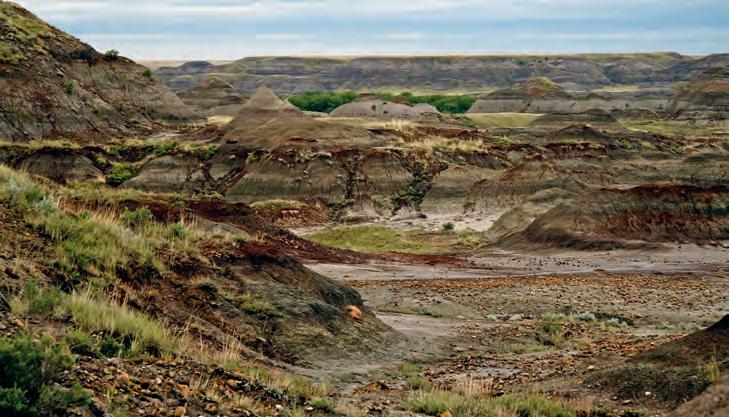
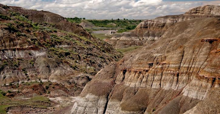
RESERVOIR ISSUE 8 • SEPTEMBER 2012 29
Fluvial deposits in the Steveville Badlands of Dinosaur Provincial Park.
The Steveville Badlands.
The Red Deer River (background) provides a visible example of the expected scale of point bars and counter point bars.
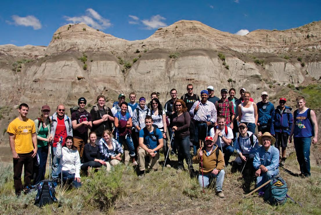
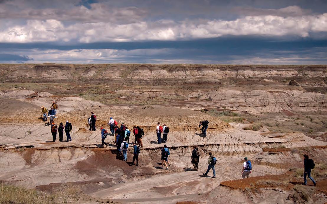
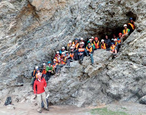
30 RESERVOIR ISSUE 8 • SEPTEMBER 2012
Crossing the badlands.
The field trip group at the last outcrop stop of the day.
PETROLEUM INDUSTRY COURSES
CSPG Student Industry Field Trip, 2012
by: Bill Ayrton
WHO SHOULD ATTEND
New geologists, engineers, geophysicists and landmen, as well as summer students entering the industr y for the first time will find the courses a very beneficial introduction to the petroleu m industry . These courses will be extremely useful to nonprofessional and support staff in the oil and gas industry, as w ell as accountants, lawyers, brokerage and financial personnel working primarily alongside the oil and gas industry.
TO REGISTER
To register or to obtain additional information regarding in-house and upcoming courses, please contact:
Ayrton Exploration Consulting Ltd.
Tel: (403) 262-5440
Email: ayrtonex@shaw.c a
Or visit our website: www.ayrtonexploration.com
OVERVIEW OF THE OIL & GAS INDUSTRY IN WESTERN CANADA
Date: November 28th and 29th, 2012
Cost: $945 (includes GST)
Instructor: Bill Ayrton
Effective for personnel just joining the oil patch, or for financial, accounting, and information systems personnel.
• Learn about the many facets of the industry.
• Oil finding, land acquisition, drilling, seismic, well completion, jargon and terminology.
GEOLOGY FOR NON-GEOLOGISTS
Date: December 11th and 12th, 2012
Cost: $945 (includes GST)
Instructor: Bill Ayrton
Effective for geological technicians or administrative staff, or for those who just want a better understanding of geology to appreciate the world around us.
• Learn about earth structure, geologic time-scale and processes, Western Canada geology, and interesting nearby locations.
• Participate in a r ock identification exercise , cross-section project and a mini-field trip in downtown Calgary.
GEOLOGY OF THE WESTERN CANADIAN SEDIMENTARY BASIN
Date: October 30th, 31st, and November 1st, 2012
Cost: $1365 (includes GST)
Instructor: Bill Ayrton
Ideal for those who wish to improve their geological understanding of where and how we look for oil and gas fields in Western Canada.
• To visualize what Western Canada looked like throughout the stages of history, for example, the position of the sea versus land, what sediments were deposited, and what type of life that existed and evolved.
• To review the importance of each major stratigraphic unit, i.e. Devonian, Mississippian, Cretaceous, etc.
• Discuss the geological and seismic expression of typical oil and gas fields in each unit.
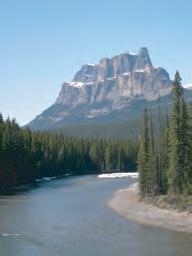
RESERVOIR ISSUE 8 • SEPTEMBER 2012 31
technology • seismic • rocks • maps • formations • land • sediments • history • sea • fossils • environment
Photo
GE OLOG Y FO R NON- GE OLOG ISTS Pr esen ted by W.G. ( Bi ll) A yr to n
ACQUISITION
ACQUISITION
for the 11th running of November 12 - 16, 2012 Calgary, Alberta
1 3D Seismic Data Acquisition: An Update on Modern Technologies and Usage Methodologies
ATTRIbUTES
ATTRIbUTES
8 Geophysical Characterization of Heavy Oil Reservoirs
16 Gravity and Magnetic Methods for Hydrocarbon Exploration
1 3D Seismic Data Acquisition: An Update on Modern Technologies and Usage Methodologies
Malcolm Lansley November 15 - 16
2 Planning Land 3D Seismic Surveys
Malcolm Lansley November 15 - 16
Andreas Cordsen November 13 - 14
2 Planning Land 3D Seismic Surveys
Andreas Cordsen November 13 - 14
PROCESSING
3 ABC's of Seismic Data Regularization
PROCESSING
Mauricio Sacchi November 12
8 Geophysical Characterization of Heavy Oil Reservoirs Satinder Chopra November 12 - 13
Satinder Chopra November 12 - 13
9 3D Seismic Attributes for Prospect Identification and Reservoir Characterization
16 Gravity and Magnetic Methods for Hydrocarbon Exploration Richard Smith November 13 dATA MANAGEMENT
13 dATA MANAGEMENT
17 Fundamentals of Survey Bart Iverson
4 Velocity Model Building
3 ABC's of Seismic Data Regularization
Mauricio Sacchi November 12
Ian Jones November 13 - 14
4 Velocity Model Building
Ian Jones November 13 - 14
ROCK PROPERTIES
ROCK PROPERTIES
5 Rock Physics for Geophysical Reservoir Characterization and Recovery Monitoring
5 Rock Physics for Geophysical Reservoir Characterization and Recovery Monitoring
Gary Mavko November 12 - 13
6 Geophysical Petrophysics
Gary Mavko November 12 - 13
Winston Karel November 14 - 15
6 Geophysical Petrophysics
Winston Karel November 14 - 15
7 Exploration Rock Physics and Seismic Reservoir Prediction
7 Exploration Rock Physics and Seismic Reservoir Prediction
Per Avseth / Tor Arne Johansen November 15 - 16
Per Avseth / Tor Arne Johansen November 15 - 16
Kurt Marfurt / Satinder Chopra November 15 - 16
9 3D Seismic Attributes for Prospect Identification and Reservoir Characterization
Kurt Marfurt / Satinder Chopra November 15 - 16
INTERPRETATION
10 Seismic Geomorphology
INTERPRETATION
Henry Posamentier November 15 - 16
10 Seismic Geomorphology
Henry Posamentier November 15 - 16
11 Multicomponent Seismic Exploration in Western Canada
11 Multicomponent Seismic Exploration in Western Canada Richard Bale / Rob Kendall
12 Seismic Amplitude Interpretation
Richard Bale / Rob Kendall
Hilterman
16
16
13 - 14
12 Seismic Amplitude Interpretation Fred Hilterman November 13 - 14
13 Seismic Interpretation in the Exploration Domain
Smith
13 Seismic Interpretation in the Exploration Domain Tim Smith November 15 - 16
15 - 16
SElECTE d TOPICS
14 Hydraulic Fracturing and Microseismic
SElECTE d TOPICS
Shawn Maxwell November 15 - 16
14 Hydraulic Fracturing and Microseismic Shawn Maxwell
15 Fractured and Shale Reservoirs: From Geologic Concepts to Reservoir Models
Ahmed Ouenes / Scott Cooper
15 Fractured and Shale Reservoirs: From Geologic Concepts to Reservoir Models
Ahmed Ouenes / Scott Cooper
15 - 16
15 - 16
15 - 16
All
Aboard!
November
November
November
Bart
Neil Thompson November
Pitfalls
Loading Eric Keyser November
PROFESSIONAl
19
Val Carter November
Meant! Val Carter November 14 21 Chairing Effective Meetings Dan Spiwack / Char Spirtos November 13 22 Presentation of Complex Scientific Information Mark Lane / Michael Parker November 14 23 Writing with Confidence Audrey Habke November 14 WEb INAR 24 Converted-Wave Seismic Exploration Rob Stewart November 14 The Canadian Society of Exploration Geophysicists invites you to attend our 11th annual Continuing Education Week. Early Bird Registration deadline is June 30, 2012. Registration closes September 30, 2012. For course details and registration information call (403) 262-0015 or visit our website at: www.cseg.ca Keep your ear to the rail for the Wednesday Night Social Event, November 14, 2012. CANADIAN SOCIETY OF EXPLORATION GEOPHYSICISTS
SUBJECT TO CHANGE WITHOUT NOTICE • LIMITED CLASS SIZES, SO BOOK EARLY All Aboard! for the 11th running of November 12
2012 Calgary, Alberta
17 Fundamentals of Survey
Iverson /
13 18 Bits Bytes Seismic Data Formats:
in Seismic Data
14 - 15
SKIll S
Powerful Presentations
13 20 That's Not What I
REGISTRATION OPENS MAY 1, 2012 – COURSES
- 16,
November
November
Fred
November
Tim
November
November
Richard Smith
/ Neil Thompson November 13 18 Bits Bytes Seismic Data Formats: Pitfalls in Seismic Data Loading Eric Keyser November 14 - 15 PROFESSIONAl SKIll S 19 Powerful Presentations Val Carter November 13 20 That's Not What I Meant! Val Carter November 14 21 Chairing Effective Meetings Dan Spiwack / Char Spirtos November 13 22 Presentation
Complex Scientific Information Mark Lane / Michael Parker November 14 23 Writing
Confidence Audrey Habke November 14 WEb INAR 24 Converted-Wave Seismic Exploration Rob Stewart November 14 The Canadian Society of Exploration Geophysicists invites you to attend our 11th annual Continuing Education Week. Early Bird Registration deadline is June 30, 2012. Registration closes September 30, 2012. For course details and registration information call (403) 262-0015 or visit our website at: www.cseg.ca Keep your ear to the rail for the Wednesday Night Social Event, November 14, 2012. CANADIAN SOCIETY OF EXPLORATION GEOPHYSICISTS REGISTRATION OPENS MAY 1, 2012 – COURSES SUBJECT TO CHANGE WITHOUT NOTICE • LIMITED CLASS SIZES, SO BOOK EARLY
of
with
FROM THE REGULATOR’S DESk
Ensuring Frac’ing is safe
| By George Eynon, Cal Hill, and Ron MacDonald
Notes on regulatory issues for industry geologists from regulatory colleagues at the Energy Resources Conservation Board (ERCB).
In the “trailer” for this series, we noted that regulators have to consider the possible harm that could occur from oil and gas activities and find ways to mitigate the risk of that harm actually occurring. In this way, we can be sure that the risks are acceptable. At the same time, we ensure that development
of Alberta’s energy resources occurs in a fair and responsible way that is in the public interest.
Much of what we discuss in these columns is intended to help professional geoscientists talk knowledgeably to neighbours, friends, and acquaintances about important energy issues.
One such issue attracting considerable
media and public attention is hydraulic fracturing (frac’ing).
Public concerns about frac’ing generally relate to the potential for groundwater contamination, the toxicity of the chemical additives in the frac fluids, water management and use, storage, treatment and disposal of flow-back fluids, communication between the wells being
(Continued on page
Chevron Industrial Research Chair in Petroleum Reservoir Characterization
The Department of Earth Sciences at Memorial University seeks candidates for a Chair in Petroleum Reservoir Characterization. The selected candidate will contribute, through geological and/or geophysical studies, to the use of petrophysical, seismic and geological/geochemical data to characterize reservoir properties, potential and change during production. The offshore oil and gas fields of Newfoundland and Labrador provide one of the natural laboratories for these studies and provide an opportunity to develop innovative science.
The position is open to be filled at the rank of Assistant, Associate or Full Professor. The position will continue as a tenured or tenure-track appointment when the industrial funding expires. Applicants must possess a Ph.D. and should preferably have post-doctoral experience.
The Chair is funded by Chevron Canada Limited for a period of five years, with matching funds contributed by the Research & Development Corporation of Newfoundland and Labrador. Oil and gas companies operating in offshore Newfoundland and Labrador have a significant research and development spending obligation per regulatory requirements. The successful candidate will play a key role in helping Chevron Canada satisfy this obligation. There may be opportunities to collaborate with the holder of the Chevron Chair in Petroleum Engineering.
The successful candidate shall also seek additional funding through the Natural Sciences and Engineering Research Council of Canada Industrial Research Chair program . This position could be filled at the Associate or Senior Industrial Research Chair level, depending on the experience and background of the selected candidate. A clear outline of the expectations for candidates applying to this program are given at the NSERC/CRSNG website (http://www.nserc-crsng.gc.ca/Professors-Professeurs/CFS-PCP/IRC-PCI_eng.asp)
The successful candidate is expected to maintain a vigorous research program, sustain a strong record of peer -reviewed publication and external funding, advise and mentor undergraduate and graduate students, contribute energetically to the building of a basins group in the department, and support its teaching mission, including delivery of courses in petroleum geology.
Memorial University is the largest university in Atlantic Canada. As the province's only university, Memorial plays an integral role in the educational and cultural life of Newfoundland and Labrador. Offering diverse undergraduate and graduate programs to almost 18,000 students, Memorial provides a distinctive and stimulating environment for learning in St. John's (http://www.stjohns.ca/index.jsp), a very safe, friendly city with great historic charm, a vibrant cultural life, and easy access to a wide range of outdoor activities. For further information about Memorial, please view the website at www.mun .ca.
Applicants should send a curriculum vita, the names of three referees and a one-page statement of teaching and research interests. Copies of three relevant technical publications may also be included. Informal enquiries and formal applications should be addressed to:
Dr. John Hanchar, Head of Department Department of Earth Sciences
Memorial University of Newfoundland
St. John's, Newfoundland, Canada, A1B 3X5
Tel. (709-864-4850
Fax. (709) 864-4851
E-Mail: jhanchar@mun.ca
REFERENCE: VPA-EASC-2011-001
The deadline for applications is 1 October 2012. The successful candidate would be expected to start in the new role early in 2013. This position is subject to budgetary approval.
Memorial University of Newfoundland is committed to employment equity and encourages applications from qualified women and men, visible minorities, aboriginal people and persons with disabilities. All qualified applicants are encouraged to apply; however Canadians and permanent residents will be given priority. Partners of candidates for positions are invited to include their resume for possible matching with other job opportunities and candidates eligible for NSERC University Faculty Awards are encouraged to apply.
RESERVOIR ISSUE 8 • SEPTEMBER 2012 33
34...)
frac’d and existing ones, and induced microseismic events.
F RAC ’I NG IN AL bE RTA
Most of the problems with frac’ing that have caught the public’s attention occur in various U.S. states and not in Alberta or other western provinces. This is due in part to the fact that many of the potential problems have already been addressed under our existing regulations – after all, the ERCB has been regulating for almost 75 years! While much of the needed mitigation is in place, technological advancements mean there are always new risks to manage.
Frac’ing is performed in individual wells, but those wells are almost always part of an overall development plan for an area that involves a number of pads, each with numerous individual wellbores and associated operating facilities.
Hydraulic fracture stimulation in vertical wells is a common practice in Alberta; more than 171,000 have been frac’d since the 1950s. Similarly, horizontal wells have been drilled in Alberta since the 1980s.
It is the combination of two technologies –horizontal drilling and multi-stage hydraulic frac’ing – that revolutionized oil and gas activity in Alberta in about 2008. More than 5,000 horizontal wells have been stimulated using multi-stage hydraulic fracturing technology in Alberta.
While the techniques were developed and honed for shale gas plays in the U.S., in Canada they are mostly being used in tight oil plays (Viking, Cardium, etc.) and in gas plays with high liquids content. This should come as no surprise considering the disparate commodity prices and the value commanded by liquids compared to natural gas.
GROUNDWATER PROTECTION
As noted, the regulator must consider the possible harm that could occur from oil and gas activities and, more importantly, find ways to mitigate the risk of that harm actually occurring.
Alberta Environment and Sustainable Resource Development (ESRD) and the ERCB work together on groundwater issues. While ESRD is responsible for ensuring potable water is safe for Albertans, the ERCB makes sure that oil and gas activities do not jeopardize groundwater integrity.
There are two potential causes for
groundwater contamination from frac’ing operations: poor wellbore construction and poor fluid handling at surface.
The ERCB has strict requirements around wellbore construction that prevent frac fluids from contacting groundwater. Directive 027(1) provisions restrict activities that occur close to water wells and prohibit the use of potentially toxic frac fluids above the base of groundwater protection (BGWP).
Directives 008 (2) and 009 (3) prescribe casing and cementing requirements designed to form an impenetrable barrier between fluids in the wellbore and those in the adjacent rock formations, especially the useable aquifers. In most instances, there are two or more sets of casing and cement over useable water formations. If surface casing is set shallower than 180m, the next string must be cemented full length back to surface.
This is the type of information that the general public needs to be assured that their water wells and the groundwater aquifers they depend on are properly protected.
I MPORTANCE OF GEOLOGY
In addition to the protection afforded by wellbore casing and cementing requirements, Alberta’s geology does its part. Most water wells for domestic or agricultural use are less than 100 m deep – and generally less than 50 m deep. It is important the public understands that most oil and gas activities occur far below the BGWP, and therefore much deeper than normal water wells. In Alberta, most horizontal wellbores are at drilled depths of 600–2,500 m.
Most oil and gas activities occur hundreds if not thousands of metres below the aquifers. In most of the plains areas of Alberta, the rocks separating the aquifers from the target rocks were deposited in laterally extensive layers and include sealing formations that help contain fluids in the unlikely event that migration occurs.
The oil and gas we explore for and produce has been trapped for millions of years, re-enforcing the concept of shales and mudstones as seals or barriers to upward fluid migration – and demonstrating the ability of the rocks to store fluids over geologic time.
FLUID HANDLING
Another way that groundwater could become contaminated is through poor fluid handling at surface.
Again, the ERCB has developed strict
rules in Directive 056 (4) that govern the storage, transportation, management, and disposal of waste frac fluids. Alberta has 183 approved disposal facilities for oilfield waste, including more than 50 acid gas injection wells. These disposal wells are tested at least annually to ensure proper containment and wellbore integrity. In 2011, ERCB field staff conducted about 500 audits and more than 100 inspections of waste management facilities and disposal wells. What’s more, no fluids – not even treated water – are allowed to be released into natural water bodies.
Similarly, Directive 055 (5) establishes requirements for primary storage, secondary containment, leak detection systems, spill prevention, weather protection, operating maintenance, and inspection processes. In addition, two directives – Directive 050 (6) and Directive 058 (7) – govern oilfield waste management.
F R AC FLUIDS AND CHEMICALS
Fracture fluids contain many different components and the types used depend on many factors, but especially the rock properties. So-called slick-water fracs use primarily water, while others can use hydrocarbon-based liquids, types of gas (propane or nitrogen), or combinations thereof. The fluid generates the pressure required to frac the rock and carries the proppant into the newly created fractures.
The chemicals in frac fluids serve a variety of purposes: to reduce friction, change viscosity, act as a biocide, prevent corrosion, or inhibit scaling. Typically, the chemical additives are less than 1-2% of the total fluid volume.
The ERCB (along with regulators in B.C. and Saskatchewan) will soon all require mandatory disclosure of frac fluids through a web-based system for Directive 059 (8) data submission. To date this information has not been in a format that is easily searchable by the public or other stakeholders. The chemical components of frac fluids have been available on material safety data sheets required for transportation, but are not readily accessible. The website for Western Canada (www.fracfocus.ca) should include Alberta data later this year.
Industry has classified about 1,500 products used as frac fluid additives into three categories: those with no adverse health or environmental impacts, those that are not harmful provided specific controls or practices are followed, and those that (Continued on page 37...)
34 RESERVOIR ISSUE 8 • SEPTEMBER 2012
(...Continued from page 33 )
Your Partner in Unconventional Oil
Multiple Components – More Information – Better Decisions
Mitigating risk and maximizing resource recovery requires the best toolkit available. CGGVeritas has the advanced technology, geoscience knowledge and operational experience to offer solutions optimized for any unconventional oil reservoir. Based on methods developed in partnership with resource play pioneers, we are recognized leaders in multicomponent seismic acquisition, processing and reservoir analysis, utilizing:
• Sercel DSU3 Digital Sensor Units for superior vector fidelity and high-quality multicomponent data recording
• State-of-the-art processing, imaging and analysis tools to enable quantitative interpretation and reduce development risk
• Advanced tools for PP-PS Registration and Joint PP-PS Inversion for more reliable estimation of fluid and rock properties
• Decades of multicomponent experience
RESERVOIR ISSUE 8 • SEPTEMBER 2012 35 cggveritas.com/UR
Get to Know Our SeisAble Benefits
SHEAR WAVE SPLITTING ATTRIBUTE MAP
Layer-based shear-wave splitting analysis is applied to produce attribute maps of the fast anisotropic direction (azimuth of platelets shown) and the S1-S2 arrival time delay (background color as well as size of platelets shown). The fast anisotropic direction indicates fracture azimuth or maximum principal horizontal stress direction while the time delays correlate with the magnitude of fracture intensity or the magnitude of deviatory horizontal stresses.
ROC k SHOP


36 RESERVOIR ISSUE 8 • SEPTEMBER 2012 Strip Log Strip Log Horizontal Log Horizontal Log Mud Log Mud Log Log Viewer Log Viewer Log Manager Log Manager Log Analysis Log Analysis Suite 102, 7370 Sierra Morena Blvd SW, Calgary, AB T3H 4H9 info@WellSight.com 1-800-447-1534 (403) 237-9189
Excellence in Geological Services for Over 20 Years Integrated Reservoir Studies for All Resource Types 4D Geomodelling & Geosteering Horizontal Well Path Planning Infill Well Placement Studies SMART4D Modelling ® Software www.uogc.com 403.265.0111 91 0 , 396 11th Ave SW C a lgar y, AB Cana da Conventional Wells • Horizontal Wells - Spearfish - Viking - Bakken - Cardium - Horn River Shale Gas Email: afran@telusplanet.net www.serpaconsulting.com WELLSITE GEOLOGICAL SUPERVISION FARHAT HYDERI,P.Geol. President / CEO 3300, 205 - 5th Ave SW Calgary, AB T2P 2V7 Tel403 726 0666 Fax403 264 1262 Cell403 819 2516 farhat@sableconsultants.com SABLECONSULTANTS.COM Conventional Wells Coring Programs Heavy Oil/Oil Sands Coal Bed Methane SAGD Horizontal Project Supervision www.rpsgroup.com/energy (403)263-0449 17084 Global Leaders in Wellsite Geology Serving the petroleum industry for over 25 years ■■ Conventional Vertical / Horizontal Wells ■■ Unconventional Heavy Oil / CBM Wells ■■ International WSG / Operations Geology
could potentially cause adverse health or environmental impacts. The latter group represents about 10% of the products. Industry is considering simply avoiding those additives and requiring that non-harmful alternatives be made available. Meanwhile, the ERCB is reviewing this classification of additives and considering what regulatory requirements might be appropriate for their use.
WATER USE AND MANAGEMENT
A significant public concern relates to the large volume of water required for frac’ing operations and the impact of this demand on local water sources.
Water use in multi-stage frac’ing can be extremely high – up to 40,000 m3 per well. Sourcing water volumes for a shale gas or tight oil play area with several pads and numerous wells can be both difficult and expensive.
Water reporting requirements set out in Directive 059 (8) were developed by the ERCB and ESRD and are intended to provide improved surveillance, as well as information about non-saline and saline water use and the water sources accessed by licensees. CAPP has also created a set of operating practices for its members governing water sourcing, measurement, and re-use.
T R AFFIC , NOISE , DUST, ETC .
Traffic, noise, dust, and other nuisance factors associated with frac’ing operations can be significant. The drilling and completions (including frac’ing) are conducted from a multi-well pad, and can occur over 12-24 months once full-scale development begins. Landowners are accustomed to activity that lasts only a few weeks with conventional wells.
The pumping equipment, storage facilities, truck deliveries, and operations personnel required mean that each pad becomes, in reality, a light industrial site for that period of time. Area operators have to coordinate traffic routing with the local authorities to minimize the impacts on residents and other businesses. This is normal practice under the ERCB requirements for notification and consultation, but it is all the more important given the scale and duration of frac’ing operations.
I N TERWELL COMMUNICATION
A risk recently reported in the media concerns frac’ing operations in one well impacting another, be it a company’s own well or that of a third party, and includes
producing wells, inactive or abandoned wells, or wells being drilled. Well interference can affect operations, damage equipment, or – in extreme cases – cause a release at surface.
In most cases to date, the impact to an adjacent well has been in the form of a pressure surge confined to the producing horizon. However, in a few cases fluids have been ejected from the offset well and spilled onto the land.
All the communication has been from wellbore to wellbore; the shallower layers of rock, including the shallow aquifers, are isolated and protected by several strings of cemented casing.
This past January the ERCB issued Bulletin 2012-02 (9) to remind industry of its obligations to maintain control of its operations, to fully understand the potential impacts on offset wells (producing, inactive, or abandoned), and to report incidents that occur. We have had eight incidents since the bulletin was issued, of which five impacted the companies’ own wells! All are under investigation.
Meanwhile, the ERCB is preparing a new directive on hydraulic frac’ing.
At the time Bulletin 2012-02 was being prepared, the ERCB asked industry to develop recommended practices to manage the risks associated with interwell communication. To that end, an industry committee preparing Recommended Practices for Hydraulic Fracturing (IRP-24) is expected to release the piece focused on interwell communication in August 2012.
I NDUCED SEISMIC EVENTS
There have been numerous stories in the media identifying induced seismic events as a concern. Most cases, however, involve injection/disposal wells in several U.S. states rather than hydraulic frac’ing per se.
Injection/disposal wells in Alberta (there are more than 50 of them) are required to inject at pressures below the fracture pressure of the reservoir rock and the primary seal formation.
The AGS (Alberta Geological Survey, which is part of the ERCB) has been monitoring seismicity in the western provinces for the past several years. While oil and gas production and injection activities are capable of creating “micro-seismic” events, when these do occur they are of small magnitude (0 to -3) and are not felt at surface.
However, there have been several instances of frac’ing inducing seismic events of greater magnitude that were felt at surface. It is thought that these events (of magnitudes about +3 or greater) involved reactivating pre-existing faults. Two events in the U.K. in 2011 were felt at the surface.
T H E GEOSCIENTISTS’ ROLE
We geoscientists can have a positive effect on public opinion; all of us should be doing more to allay public concerns by speaking out.
We have a professional obligation to explain things to the general public – a duty to inform in order to earn and maintain our social licence to operate – starting with our families, relatives, and friends. There is a great deal of poor information circulating in both the conventional and social media that fuels people’s fears and concerns.
Geoscientists can play a role in ensuring that the media and the public have access to reliable information. We can explain what industry is required to do to mitigate the harms identified by the regulator – and how that dramatically reduces the risk. But we should be careful not to dismiss people’s concerns too easily as being unfounded or irrational; their fears and concerns are real to them, based on the information they have.
Being proactive and becoming part of the oil and gas sector’s public face will go a long way towards ensuring Albertans have confidence in our industry.
Cal Hill and Ron MacDonald are ERCB staff members; George Eynon is a Board Member.
E N DNOTES
(1) Directive 027: Shallow fracturing Operations – Restricted operation
(2) Directive 008: Surface Casing Depth Requirements
(3) Directive 009: Casing and Cementing Minimum Requirements
(4) Directive 056: Energy Development Applications and Schedules
(5) Directive 055: Storage Requirements for the Upstream Petroleum Industry
(6) Directive 050: Drilling Waste Management
(7) Directive 058: Oilfield Waste Management Requirements for the Upstream Petroleum Industry
(8) Directive 059: Well Drilling and Completion Data Filing Requirements
(9) B ulletin 2012-02: Hydraulic Fracturing: Interwellbore Communication between Energy Wells
RESERVOIR ISSUE 8 • SEPTEMBER 2012 37
(...Continued from page 34 )
CORPORATE
MEMbERS
ALLEN GEOPHYSICAL CONSULTING LTD
APACHE CANADA LTD
APEGA
BAKER ATLAS
BDO CANADA LLP
BLACK SWAN ENERGY
BLUEBACK RESERVOIR
CANADIAN NATURAL RESOURCES LTD
CASEY & ASSOCIATES
CENOVUS
CSEG FOUNDATION
CONOCOPHILLIPS CANADA LIMITED
DE VON CANADA CORPORATION
ENCANA
ENERPLUS CORPORATION
E x xON MOBIL UPSTREAM RESEARCH COMPANY
GEOLOGIC SYSTEMS LTD
GEOSTRATA RESOURCES INC.
GEOVARIANCES
HALLIBURTON
HUNT OIL COMPANY OF CANADA
HUSKY ENERGY INC.
IHS
IMPERIAL OIL RESOURCES
JEWELSUITE
LED SIGNS
LITTLE ROCK DOCUMENT SYSTEMS
LORING TARCORE LABS
MJ SYSTEMS
M URPHY OIL COMPANY
NE xEN INC .
PARADIGM
PENN WEST PETROLEUM LTD.
PETROCRAFT PRODUCTS LTD.
PLUSPETROL S.A.
ROKE TECHNOLOGIES
ROx AR
RPS ENERGY CANADA LTD.
SCHLUMBERGER
SHELL CANADA LIMITED
SIGMA E xPLORATIONS INC.
SPROULE ASSOCIATES LIMITED
STATOIL
SUNCOR ENERGY INC .
TALISMAN ENERGY INC .
TOTAL E&P CANADA LTD.
TOURMALINE OIL CORP.
UNITED OIL AND GAS CONSULTING
WEATHERFORD LABORATORIES
AS OF AUGUST 10, 2012
CSPG welcomes our 2012 Corporate Members!
The benefits of being a corporate member include:
• Recognition in the monthly Reservoir and quarterly Bulletin
• One associate membership
• Reserved tables at the technical luncheons with your company logo
• One free pass to the CSPG Core Conference
…and more! Contact Kasandra Klein at kasandra.klein@ cspg.org to be a corporate member today!
GEOCONVENTION WRAP-UP
Once again the CSEG, CSPG, and CWLS came together to produce an excellent convention with GeoConvention 2012: Vision. This year was another great success, with over 4,000 delegates enjoying some or all of the five-day event.
With almost 250 oral presentations, over 100 posters, and 19 core displays up at the ERCB Core Research Centre, the 2012 technical program had something to interest all delegates. Highlights included the honorary sessions for Drs. Eric Mountjoy and Cindy Riediger, as well as the CSEG special session on Thursday, which featured invited speakers from around the world addressing issues of interest to today’s geoscientist. Congratulations to the 2012 award winners – a full listing of winners may be found at www. geoconvention.com, and awards for best geological, core, and integrated posters and papers will be distributed at the September 11 CSPG luncheon; please congratulate the winners in person if you are in attendance!
Dr. Michael Byers addressed delegates during Monday’s luncheon with a keynote talk on sovereignty issues in the Arctic, which led to an interesting q & A period, and LGen Romeo Dallaire addressed a capacity crowd on Tuesday with a thought-provoking and inspiring talk that prompted delegates to give a standing ovation, and which was the topic of discussion for the rest of the week among many in attendance.
Registration was another key success of Vision 2012: as mentioned, over 4,000 delegates took part in this year’s event. This included over 3,000 paying delegates, as well as over 400 delegates who took advantage of the advance sale of complimentary exhibit floor passes. Student registration jumped over 80% over last year to a total of 373 delegates,
with a further 78 student presenters in attendance. Returning events like the Challenge Bowl, as well as the new Student Travel Assistance Program and Industry/Student Luncheon will ensure this is a continuing trend.
The Earth Science for Society exhibition returned to the TELUS Convention Centre in 2012 as well. Featuring interactive, handson exhibits that allows younger students to, among other things, explore for fossils and try gold-panning, this program attracted over 350 members of the general public as well as over 1,300 junior high students over its three-day run.
In addition to registration, the two other main revenue streams of the convention are exhibits and sponsorship. Thanks to the hard work of both these committees, budget numbers were exceeded in these areas. The exhibit floor was sold out this year, with a waiting list of companies eager to attend in the future. Foot traffic was increased by bringing bars and food stations into greater prominence on the floor, and creating more of an event out of the evening receptions that took place Monday and Tuesday night. The Sponsorship Committee worked to develop new opportunities to better fit the needs of our industry partners, and expanded the advertising opportunities available. Between the successes of these programs, and decreased costs in other areas, the 2012 Convention is well on its way to meeting expected budget targets.
Our thanks to the hundreds of volunteers, from all three societies, that give their time year-round to ensure the success of this event. The convention would not be a success without their hard work and dedication. See you next year for GeoConvention 2013: Integration, May 6 – 10!
38 RESERVOIR ISSUE 8 • SEPTEMBER 2012 GeoConvention 2013: i n tegration Call F o r aBS t raC t S O pening early November at www.geoconvention.com. More details to follow shortly.
Professionals in Geoscience
www.apega.ca
Teamwork Pays
At APEGA we know and understand that we live and practice in a complex world. The heavy lifting in the resource extraction industries, and in the environmental industry, is done by teams, often led by Professional Geoscientists. These teams include professionals, technologists and support staff both at headquarters in the city and at camp in the field.
There’s no question in our minds that geoscience projects require teams to manage questions surrounding the many varied issues including governance, tax impact, reporting and environmental concerns including land-use and ground disturbance.
Through consultation and communication, all these issues, and a multitude of others, are resolved to ensure the projects we work on benefit society. The Geoscience Professionals’ code of ethics and paramount responsibility to protect public safety and well-being must be recognized and acted upon.
P.Geo.s and Professional Licensees (Geoscience) are team players. No doubt. Our work helps keep Alberta safe and strong and the only way we can achieve that goal is through teamwork amongst professionals.
For more information: Tom Sneddon, P.Geol. Geoscience Affairs Manager
P: 403-262-7714 or 800-661-7020
E: tsneddon@apega.ca
Want to bring geology back into geophysical interpretation?
All Aboard
Landmark’s new DecisionSpace® Desktop software accelerates seismic interpretation with geomodel-enabled workflows.
The geophysics and geology modules in Landmark’s new unified DecisionSpace® Desktop software share the same topology engine. This gives geophysicists easy access to framework construction tools that combine well picks and horizons to produce a high resolution, accurate geomodel. The geomodel uses conformance technology to produce well-based surfaces at the same resolution as seismic data, enabling a model that truly represents your reservoir. Get better answers faster. Visit halliburton.com/decisionspacedesktop
High Science Simplified®

© 2012 Halliburton. All rights reserved.