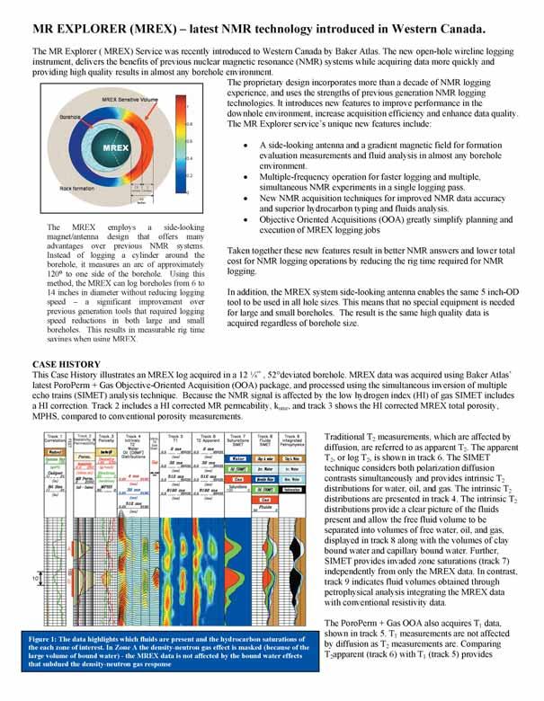
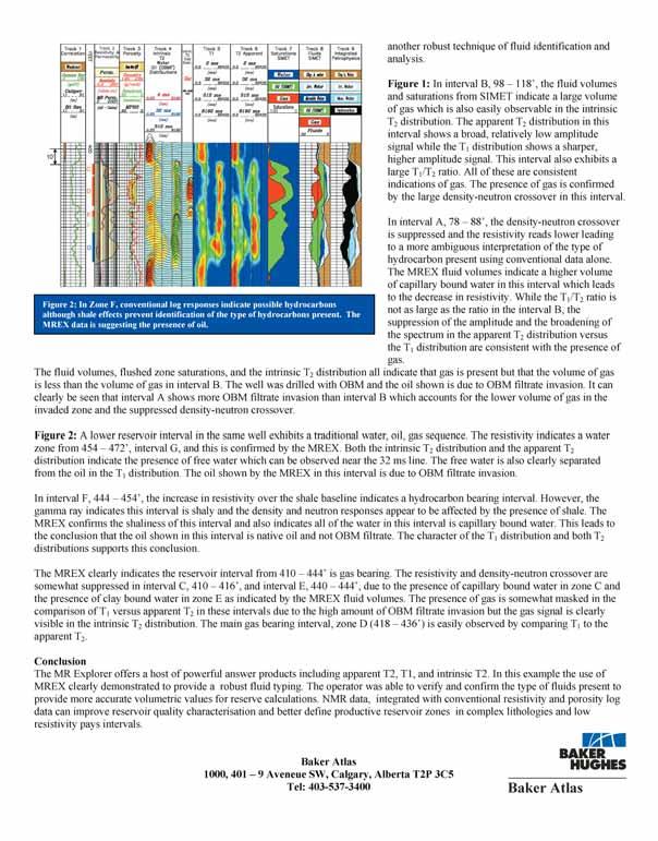
■ Volunteer with the Edmonton Science Outreach Network
■ Volunteer with the Edmonton Science Outreach Network
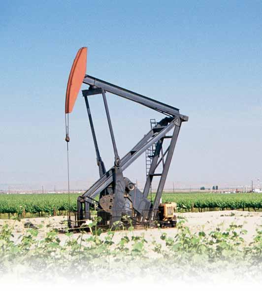
■ Enrichment Factors of the Qinshui Coal Bed Methane Reservoir in China
■ Enrichment Factors of the Qinshui Coal Bed Methane Reservoir in China
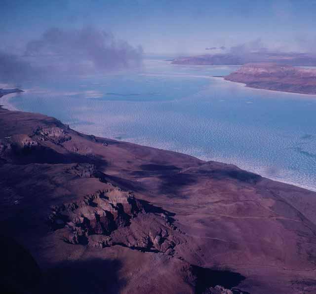
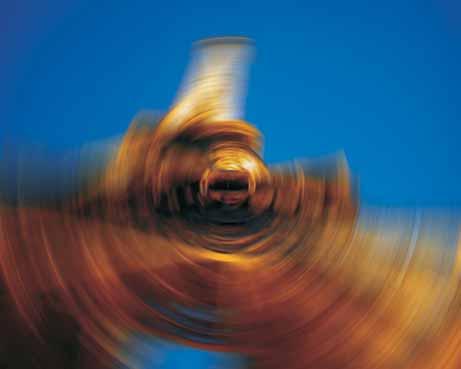
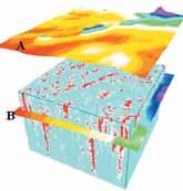
■ 2004 Honorary Address: Volcanoes of the Deep Sea
■ 2004 Honorary Address: Volcanoes of the Deep Sea
CSPG OFFICE
#160,540 - 5th Avenue SW
Calgary,Alberta,Canada T2P 0M2
Tel:403-264-5610 Fax:403-264-5898
Email:cspg@cspg.org Web:www.cspg.org
Office hours:Monday to Friday,8:30am to 4:00pm
Business Manager:Tim Howard
Email:tim.howard@cspg.org
Office Manager:Deanna Watkins
Email:deanna.watkins@cspg.org
Communications Manager:Jaimè Croft
Email:jaime.croft@cspg.org
Conventions Manager:Lori Humphrey-Clements
Email:lori@cspg.org
Corporate Relations Manager:Kim MacLean
Email:kim.maclean@cspg.org
EDITORS/AUTHORS
Please submit RESERVOIR articles to the CSPG office.Submission deadline is the 23rd day of the month,two months prior to issue date. (e.g.,January 23 for the March issue).
To publish an article,the CSPG requires digital copies of the document.Text should be in Microsoft Word format and illustrations should be in TIFF format at 300 dpi.For additional information on manuscript preparation,refer to the Guidelines for Authors published in the CSPG Bulletin or contact the editor.
COORDINATING EDITOR & OPERATIONS
Jaimè Croft
CSPG
Tel:403-264-5610
Fax:403-264-5898
Email:jaime.croft@cspg.org
TECHNICAL EDITOR
Ben McKenzie
GEOCAN Energy Inc.
Tel:403-261-3851
Email:bjmck@telusplanet.net
ADVERTISING
Kim MacLean
Corporate Relations,CSPG
Tel:403-264-5610,Ext 205
Email:kim.maclean@cspg.org
Advertising inquiries should be directed to Kim MacLean.The deadline to reserve advertisingspace is the 23th day of the month, two months prior to issue date.All advertising artwork should be sent directly to Kim MacLean.
The RESERVOIR is published 11 times per year by the Canadian Society of Petroleum Geologists. This includes a combined issue for the months of July/August.
Advertisements,as well as inserts,mailed with the publication are paid advertisements.No endorsement or sponsorship by the Canadian Society of Petroleum Geologists is implied.
The CSPG Rock Shop is an attractive and affordable way to target the CSPG readership. Spaces are sold at business card sizes (3.5” wide by 2” high).To reserve space or for more information,please contact Kim MacLean at 403-264-5610,ext.205.
The contents of this publication may not be reproduced either in part or in full without the consent of the publisher.
our technical and volunteer winners have not diminished.In 2005,we will move away from the Awards Dinner format and we will present all of our awards at Technical Luncheons throughout the first six months of the year.
On behalf of the Society I would like to thank Douglas Carsted for over ten years of commitment to the Annual Awards Dinner and the CSPG.
The CSPG is a technical society driven by volunteers.We,as a society,try to recognize our members for both their technical and volunteer achievements and in 2005 we would like to better showcase our award winners.
For decades the majority of the CSPG awards were presented at an Annual Awards Dinner.In its prime,this formal evening was the event of the year.Crowds of members came to see their peers & mentors receive CSPG awards recognizing their technical prowess and volunteer commitments.Unfortunately,times have changed.Most of us these days have more demanding personal and professional schedules and the CSPG Awards Dinner is no longer a priority.However,the achievements of
In the September Reservoir,Debbie Horbachewski - Awards Coordinator,wrote an article on the many different Technical and Volunteer Awards the Society offers.If you missed that article,here are the highlights:
VOLUNTEER AWARDS Volunteer
For those who have served at least two years on a committee demonstrating their commitment to the needs of the society Service
For those who have demonstrated significant service to the society through their volunteer work,commonly at a committee chair level
CONTOURING
Faulted contours
Isopachs
Volumetrics
Grid operations
New flexing options
CROSS SECTIONS
Digital and/or Rastor
Geocolumn shading
Multiple rasters/well
Stratigraphic/Structural
Shade between crossover
Dipmeter data
MAPPING OPTIONS
Bubble maps
Production charts
Log curves
Posted data
Highlighted Symbols
CROSS PLOTS
Log crossplots
“Z” crossplots
Lithologies to facies
Pickett plots
Regression curves
User defined overlays
PETRA® delivers the industry’s only easy-to-use and affordable integrated solution for today’s workflows. It provides multi-user access to large projects through geological, petrophysical and engineering analysis tools. The PetraSeis™ option extends PETRA® into 2D/3D seismic interpretation with practical tools such as RasterSeis™ Download a trial version at www.geoplus.com, or callus at 888-738-7265 (in Houston, call 713-862-9449) for more product information.
DECLINE CURVES
Compute EUR, RR, etc.
Hyperbolic or exp.
Rate/Time or Cum P/Z
User defined Econ. Limit
User defined Extrap. Time
THE CSPG GRATEFULLY ACKNOWLEDGES ITS
*CORPORATE MEMBERS:
ABU DHABI OIL CO., LTD. (JAPAN)
ARCHEAN ENERGY LTD.
BAKER ATLAS
BURLINGTON RESOURCES CANADA LTD.
BG CANADA EXPLORATION & PRODUCTION, INC.
BP CANADA ENERGY COMPANY
CALPINE CANADA
CANADIAN FOREST OIL LTD.
CONOCOPHILLIPS CANADA
CORE LABORATORIES CANADA LTD.
DEVON CANADA CORPORATION
DOMINION EXPLORATION CANADA LTD.
DUVERNAY OIL CORP.
ECL CANADA
HUNT OIL COMPANY OF CANADA, INC.
HUSKY ENERGY
IHS ENERGY
IMPERIAL OIL RESOURCES LIMITED
LARIO OIL & GAS COMPANY
MJ SYSTEMS
MURPHY OIL COMPANY LTD.
NCE RESOURCES GROUP INC.
NEXEN INC.
NORTHROCK RESOURCES LTD.
PENN WEST PETROLEUM LTD.
PETRO-CANADA OIL AND GAS
REEVES WIRELINE
SAMSON CANADA
SHELL CANADA LIMITED
SPROULE ASSOCIATES LIMITED
SUNCOR ENERGY INC.
TALISMAN ENERGY INC.
TOTAL E&P CANADA LIMITED
UPTON RESOURCES INC.
*CORPORATE MEMBERS AS OF AUGUST 24, 2004
NEW MEMBER LIST
Adetokunbo AdebayoCore Laboratories Canada
Mazin Al-Hussaini
Michele Asgar-DeenCarleton University
Attila BalogBaker Atlas
Kerrie L.BannUniversity Of Alberta
Diego BarrenecheaAJM Petroleum Consultants
Andrew P.BeatonAlberta Geological Survey
Stephen BedellEOG Resources Canada Inc.
Shane J.BerkowskyConocoPhillips Canada Limited
Lawrence M.BernsteinTalisman Energy Canada
Aaron S.BonkContinental Rocktell Services
Monty L.BowersCapitol Energy Resources Ltd.
Mark F.BowmanAssociated Mining Consultants Ltd.
Karen Brawley-HoggTripoint Energy Ltd.
Colleen M.BridgeHusky Energy Inc.
Heather K.CampbellPenn West Petroleum Ltd.
Matthew M.CatonChoctaw Geological Resources Enterprise
Aleksandra Naczk-CameronCanadian Natural Resources Ltd.
Megan D.NamespetraTalisman Energy Canada
Pamela D.NavickasRakhit Petroleum Consulting Ltd.
Sadafumi NeoHidaka-City,
Charlotte A.Newton-StroppelDuke Energy
Pat I.OkaroConocoPhillips Canada Limited
Harold OppeltAnadarko Canada Corporation
Gregory J.ParryResponse Energy Corp
Robert M.PaulNorwest Labs - Energy Resources Group
April D.ReadNexen Inc.
Michael M.ReeseBaker Hughes INTEQ
G.J.ReidManor House Venture partners
Sami RiahiUniversity Of Calgary
James D.ScottCanadian Natural Resources Ltd.
Christine C.L SeeHEF Petrophysical Consulting Inc.
Wendy L.StraatmannDominion
Paul J.TeniereRakhit Petroleum Consulting Ltd.
Craig TherensPrecision Wireline Technologies
Robert TheriaultMinistere des Resources Naturelles
Michael J.TinklerHusky Energy Inc.
Jillian L.Tofer
Genevieve M.VerbruggenNew Century Petroleum Corporation
Ian B.WeitzEncana Corporation
Kara L.WightEncana Corporation
Barry J.WihakGolden Horizon Exploration Inc.
Tatiana ZouenkoDevon Canada Corporation
Jennifer L.ZwarichAlberta Energy And Utilities Board
TECHNICAL LUNCHEONS
OCTOBER LUNCHEON
The history of dinosaur hunting in western Canada,a perspective on the eve of the centenaries of Alberta,Albertosaurus,and Tyrannosaurus Rex
SPEAKER
Philip J.Currie
Royal Tyrrell Museum of Palaeontology
11:30 am Tuesday,October 12,2004
TELUS CONVENTION CENTRE CALGARY, ALBERTA
Please note:
The cut-off date for ticket sales is 1:00 pm,Thursday,October 7th. Ticket price is $28.00 + G.S.T.
The first dinosaurs were discovered in western Canada more than a century ago.In 1905,H.F.Osborn named Albertosaurus after the newly created province of Alberta.In the same scientific paper,he named Tyrannosaurus Rex,an animal that has since become the most famous of all dinosaurs.
The significance of the Cretaceous fossil resources was realized during the “Great
Canadian Dinosaur Rush” (1911-1925),when more than 300 skeletons found their way into the displays of museums around the World. After a long period of inactivity,a renaissance of interest in dinosaurs led to the establishment in 1985 of the Royal Tyrrell Museum of Palaeontology in the badlands at Drumheller.
The Alberta badlands have long been one of the richest dinosaur-producing areas in the world,and continue to produce half-a-dozen new skeletons every year,some of which represent new species.But intensive, multidisciplinary studies have also revealed new aspects of dinosaurian biology.Some bonebeds are the remnants of mass deaths of herds of duckbilled and horned dinosaurs, migrating seasonally between Alberta and Alaska.Eggs and nests have been recovered from sites in southern Alberta that probably represent communal nesting grounds. Dinosaur trackway sites in Alberta and British Columbia have produced thousands of footprints and an incredible amount of data on how dinosaurs moved and interacted.As studies become more sophisticated, palaeontologists are revealing aspects of dinosaur physiology,variation,and behaviour. Extinction theories abound,but the evidence is favouring an asteroid hitting the Earth 65
EXECUTIVE COMMENT
Tracks
For those who set new standards of excellence through outstanding contributions in committee or other work
President’s
The highest volunteer award for outstanding service to the society
TECHNICAL AWARDS
Grad Thesis
Best M.Sc.& Ph.D.theses produced in a Canadian university (regardless of project location) or dealing with a Canadian sedimentary/petroleum geology topic (regardless of university of origin)
Link
Best Technical Luncheon presentation
Medal of Merit
Best Paper in the previous year on a subject related to the petroleum geology of Canada
Honourary Membership
Awarded for distinguished service to the Society (there are currently 44 Honourary Members)
R.J.W.Douglas Medal
For outstanding contributions to the understanding of sedimentary geology in Canada
Stanley Slipper Gold Medal
For outstanding contributions to the field of exploration in Canada
We hope the new awards presentation format will better showcase the great achievements of our members.Presentations will start in January and end in May with our most prestigious awards.See the upcoming schedule below and take the opportunity this year to truly understand and recognize the accomplishments of your colleagues.Who knows,you could be next.
Astrid Arts,Assistant Service Director
million years ago.But did they really die out? It is now widely accepted that more than 8,000 species are alive today.We call them birds.
BIOGRAPHY
Philip J.Currie,Curator of Dinosaurs (Royal Tyrrell Museum of Palaeontology) and Adjunct Associate Professor (University of Calgary).B.Sc.(Toronto, 1972),M.Sc.(McGill,1975),Ph.D.(McGill,1981), Fellow of the Royal Society of Canada (1999) and a member of the Explores Club (2001).As a researcher at the Royal Tyrrell Museum of Palaeontology (Drumheller),he has published 75 scientific articles,85 popular articles,and eleven books,focussing on the growth and variation of extinct reptiles,the anatomy and relationships of carnivorous dinosaurs,and the origin of birds. Fieldwork connected with his research has been concentrated in Alberta,Argentina,British Columbia,China,the Arctic,and Antarctica.He received the Sir Frederick Haultain Award (for significant contributions to science in Alberta) in 1988 and the American Association of Petroleum Geologists Michel T.Halbouty Human Needs Award in 1999.Since 1986,he has supervised or co-supervised 31 M.Sc.and Ph.D.students at the University of Calgary,the University of Saskatchewan,and the University of Copenhagen. He has given hundreds of popular and scientific lectures on dinosaurs all over the world,and is often interviewed by the press.
JANUARY 25TH LUNCHEON Volunteer & Service Awards Presentation
Volunteer Appreciation Social before and after luncheon
MARCH 15TH LUNCHEON
Tracks,Medal of Merit,Link & Grad Thesis Presentation Awards Social before the luncheon
MAY LUNCHEON
Stanley Slipper,R.J.W.Douglas, Honourary Membership* & President’s * Honourary Membership will be presented at the Long Time Members Reception in June,the winner will be announced at the May Luncheon
OCTOBER LUNCHEON
Integration of geology, petrophysics,and reservoir engineering for characterization of carbonate reservoirs through Pickett plots
SPEAKER
Roberto Aguilera
11:30 am Thursday,October 21,2004
TELUS CONVENTION CENTRE CALGARY, ALBERTA
Please note:The cut-off date for ticket sales is 1:00 pm,Monday,October 18th. Ticket price is $28.00 + G.S.T.
The concept of rock fabric has been shown to be very useful for characterization of carbonate reservoirs.This study shows that a Pickett crossplot of interparticle porosity vs. true resistivity (in some cases,apparent resistivity or true resistivity affected by a shale group) should result in a straight line for intervals with a constant rock fabric.The slope of the straight line is related to the
porosity exponent m,the water saturation exponent n,and the size of the particles forming the interparticle porosity.Different slopes are obtained for different rock fabrics. The method helps to reconcile geology to fluid flow by illustrating the important link between geology,petrophysics,and reservoir engineering.
Lines of constant rock fabric are displayed on a Pickett plot,together with water saturation, permeability,process speed k/ ,capillarypressure curves,pore-throat apertures rp35 and r35,Kozeny’s constant (Fs 2),and height above the free-water table.Pattern recognition while placing all these data in a consistent form on a Pickett plot allows determination of flow units and a more rigorous characterization of carbonate reservoirs.The method is aimed at heterogeneous carbonate reservoirs,which have a limited amount of hard data.
The use of this technique is illustrated with data from the Mission Canyon Formation in the Little Knife field of North Dakota,where a significant volume of oil in place is below the structural closure and updip wells
penetrate micropores that provide an effective seal in this stratigraphic trap.
BIOGRAPHY
Roberto Aguilera is president of Servipetrol Ltd.in Calgary,Canada and an adjunct professor in the Chemical and Petroleum Engineering Department at the University of Calgary,where he concentrates in teaching about the theoretical and practical aspects of naturally fractured reservoirs.He is a petroleum engineering graduate from the Universidad de America at Bogata,Columbia,and holds a Master’s degree and a Ph.D.in petroleum engineering from the Colorado School of Mines.He was an AAPG instructor on the subject of naturally fractured reservoirs from 1984 to 1996.He has presented his course on naturally fractured reservoirs and has rendered consulting services throughout the world.He is a Distinguished Author of the Journal of Canadian Petroleum Technology (1993 and 1999),a recipient of the Outstanding Service award from the Petroleum Society of the Canadian Institute of Mining,Metallurgy,and Petroleum Engineers (CIM) in 1994,and a Society of Petroleum Engineers Distinguished Lecturer on the subject of naturally fractured reservoirs for 2000-2001.
TECHNICAL LUNCHEONS
NOVEMBER LUNCHEON
BC’s offshore petroleum: recent developments and prospectivity of Queen Charlotte Basin
SPEAKERS
Dr.Michael Whiticar
School of Earth and Ocean Sciences, University of Victoria
Dr.Ron Smyth
BC Offshore Oil and Gas Team
Ministry of Energy and Mines
11:30 am Tuesday,November 4,2004
TELUS CONVENTION CENTRE CALGARY, ALBERTA
Please note:
The cut-off date for ticket sales is 1:00 pm,Thursday,October 28th. Ticket price is $28.00 + GST
The British Columbia offshore basins have been closed to exploration by both federal and provincial moratoria since the 1970s after the initial phase of exploration by Shell Canada in 1963-69 and by Chevron Canada in 1971-72.This included about 38,500 line kilometers of seismic and 14 offshore dry wells in the Queen Charlotte (QCB) and Tofino Basins.The QCB was the focus of a three-year multidisciplinary basin analysis by the Geological Survey of Canada under the Frontier Geoscience Program from 1987 to 1990 when over 1,200 line kilometers of seismic was shot.In 2001 the GSC released a bulletin on the petroleum resource potential of the west coast basins that indicated a petroleum resource potential for the QCB of 9.8 billion bbls oil and 25.9 TCF gas,in-place.Despite a failed attempt to negotiate a Federal-Provincial Pacific Accord in the 1980s,the release of these petroleum estimates has renewed the question for governments,coastal communities,and industry of lifting the offshore moratorium.
Since 2001,the British Columbia government has undertaken several reviews of the moratorium:1) review of offshore oil and gas technology,2) independent science panel review to determine if oil and gas could be extracted in a scientifically and environmentally sound manner,and 3) task force of government MLA’s to listen to the views of communities and First Nations.Favourable findings led the BC
Government to ask the Federal Government to consider lifting the federal moratorium.BC also appointed a dedicated offshore oil and gas team to develop a provincial position and to move effectively towards development of the resource.In response,the Government of Canada announced in 2003 that it would undertake a three-part review of the federal moratorium focused only on the QCB.This project would consist of:
1) review of science issues,
2) public hearings,and
3) engagement with First Nations to ensure their interests are fully explored.
The science review was conducted at arms length by a Royal Society of Canada expert panel,which reported their findings in February of 2004.The other two components are ongoing.
The UVic Petroleum Systems Modeling group conducted detailed petroleum assessment using existing data from selected regions of QCB.The region is tectonically and sedimentologically
heterogeneous.Therefore petroleum generation from Cenozoic units is restricted,not basin-wide.Presently,the majority of Neogene source rocks are mature,mostly gas-prone,and entered the petroleum window in the past 10Ma.In the studied region,the most productive fairway is about 75 km wide and extends 380 km along Hecate Strait.Offshore Mesozoic source rocks are poorly understood.Using onshore equivalents,the offshore Mesozoic sources are oil-prone and now overmature.
BIOGRAPHY
Michael Whiticar,Professor in Biogeochemistry in SEOS,joined UVic in 1990 after periods with PetroCanada,Calgary;the Federal Institute of Geosciences and Natural Resources (BGR), Hannover,FRG;and the University of Copenhagen,DK as the Nordic Professor in Petroleum Geology.
Ron Smyth is the Chief Science Officer with the BC Offshore Oil and Gas Team,Ministry of Energy and Mines.He was the Director of the BC Geological Survey from 1985 to 2000.He is a graduate of Trinity College,Dublin and Memorial University of Newfoundland.
Facies architecture of an ostensibly monotonous limestone succession –the giant Famennian Palliser Platform of western Canada
SPEAKER
Arndt Peterhänsel
Dept.of Earth Sciences
University of Cambridge
11:30 am Thursday,November 25,2004
TELUS CONVENTION CENTRE CALGARY, ALBERTA
Please note:
The cut-off date for ticket sales is 1:00 pm,Monday,November 22nd. Ticket price is $28.00 + GST.
The Giant Devonian Palliser Epeiric Platform
Numerous carbonate platforms around the world are dominated by uniform,thickbedded,poorly fossiliferous and burrowmottled,subtidal limestones.Owing to these rather unexciting traits,they have not received much attention and thus their depositional setting is still poorly understood.With a thickness of up to 600 m and an outcrop area of about 100 000 km2 – a sixth of its total distribution – the apparently monotonous Palliser Formation in the Canadian Rocky Mountains and its subsurface equivalent,the Wabamun Formation,represent a case in point.There,almost 200 000 km3 of calcareous sediments were deposited in the aftermath of the Frasnian–Famennian mass extinction.The Palliser epeiric carbonate platform with its westward-oriented rollover ramp is largely characterised by open-marine,frequently wave-agitated,shallow subtidal deposition.
Obliteration Processes
The Palliser platform displays ubiquitous evidence for dominance of storm sedimentation with grainstone-filled burrows,millimetre- to centimetre-size rip-up clasts of various facies
types,abraded clasts,and frequent interbedding of intraclastic grainstones.Obliteration processes include comminution,bioerosion,and syngenetic skeleton dissolution,as well as bioturbation.These features left a distorted picture of the Palliser facies,thus significantly hampering sedimentological and palaeoecological interpretations and concealing the extent of the Late Devonian faunal crisis and discovery.In fact,an ample amount of “nonskeletal” micritic grains were identified as being of biogenic origin.These micritised echinoderms and endocasts of dissolved calcareous algae suggest that a vast area of the Palliser platform must have been characterised by subtidal dasycladalean and crinoid gardens.The millimetre-sized dasycladalean algae formed a photosynthetic carpet covering the lower tier, while the taller crinoids represented the more wave-resistant canopy of the benthic community.Both acted as trappers,stabilising fine sediment in similar ways to modern sea grasses.
Facies Architecture
Detailed analysis of the depositional macro- and microfacies revealed hitherto unappreciated lateral and vertical variations in
(Continued on Page 20...)
Proud sponsor of Dr.Arndt Peterhänsel’s presentation.
DIVISION TALKS
HYDROGEOLOGY & INTERNATIONAL
DIVISIONS
Tilted oil-water and gas-water contacts in the North Sea Basin
SPEAKERS
Dan Barson
EarthScience Consulting Inc.
Hugh Dennis Petro-Canada,London,UK.
12:00 Noon
Thursday,October 21,2004
Encana Amphitheatre
2nd Floor,east end of the Calgary Tower Complex
1st Street and 9th Avenue SW Calgary,Alberta
Two of the largest oilfields discovered in the North Sea in the last decade,Buzzard (c.450 x 106 BOE recoverable) and Brenda (c.200 x 10 6 BOE recoverable) are stratigraphic traps.While most established remaining reserves are in structural traps,it
is widely accepted that all the “big bumps” have now been identified.The UKOOA estimate that 5 to 11 x 109 BOE remains undiscovered,but to find this new oil,new ideas are needed.In the North Sea, exploration success depends on shifting away from the search for structural traps to focus on stratigraphic and hydrodynamic prospects.
In this presentation,we first review how to recognise hydrodynamic oil and gas-water tilts and how to calculate tilt magnitudes.We then discuss the “big picture” of regional fluid flow patterns in the North Sea Basin. Finally we present case studies of a number of North Sea oil and gas fields with documented hydrodynamically tilted petroleum-water contacts.The case studies include Britannia (Lower Cretaceous sandstone),Pierce (Paleocene sandstone), Dan (Chalk),and Ula (Jurassic sandstone). These fields from the UK,Norwegian,and Danish sectors of the Central Graben occur at depths ranging from 3,000 m – 4,000 m and include a variety of reservoir lithologies.
INTERNATIONAL DIVISION
Antrim series of International talks #3: “Argentina - recent issues and Antrim’s investment in the northwest basin”
SPEAKER
Keith Skipper
Antrim Energy Inc.
12:00 Noon
Friday,October 8,2004
Encana Amphitheatre
2nd Floor,east end of the Calgary Tower Complex 1st Street and 9th Avenue SW Calgary,Alberta
BIOGRAPHY
Keith Skipper,P.Geol.is a seasoned explorationist and executive whose early career was with AMOCO,subsequently Bridge Oil Limited and PanCanadian.He is presently Executive Vice President of Antrim Energy Inc.and a non-executive director of Avery Resources Inc.
Keith has a keen interest in global petroleum issues - besides trying to find oil and gas at a profit.
INFORMATION
There is no charge.Please bring your lunch. Refreshments are provided by EnCana and ECL Canada.For more information or to give a talk in the future,please contact Geoffrey Say at 403 263 0449 or e-mail at g.say@ecqc.com
Hydrodynamically tilted oil- and gas-water contacts are generated by lateral overpressure gradients (potentiometric or hydraulic gradients) in hydraulically continuous aquifers.In such regions, petroleum-water contacts dip in the direction of water flow which is also the direction of pressure drop.In the North Sea, potentiometric gradients are controlled on a regional scale by the de-watering of overpressured intervals in the basin.On a local scale,potentiometric gradients are controlled by aquifer heterogeneities such as faults,channels,facies changes,pinch-outs, and/or thinning.
INFORMATION
The luncheon talks are free and open to the public.Please bring your lunch. Refreshments are provided by Norwest Laboratories and Encana.For further information,or to present a talk,please contact Stephen Grasby at (403) 292-7111 or sgrasby@gsc.nrcan.gc.ca.or Geoffrey Say at 403 263 0449 or e-mail at g.say@ecqc.com
ENVIRONMENTAL GEOLOGY DIVISION
A simple man’s approach to the climate change controversy
SPEAKER
James M.White
NRCan,Geological Survey of Canada
12:00 Noon
Friday,October 22,2004
Aquitaine Building
2nd Floor Conference Room
540 – 5th Avenue SW
Calgary, Alberta
There are grounds for concern about climate change,a position which has caused many debates with geological colleagues. This talk considers several lines of evidence that persuade me that the issue is significant.
Enquiry into the relationship between trace gases,such as carbon dioxide,and climate began over a century ago,spurred on by geological evidence of dramatically different past climates.The significance of trace gases is well established,and our activities can influence their atmospheric concentrations. Geology shows that climate has changed on many time scales and from many causes, ranging from tectonics to solar variability, but carbon dioxide is one important factor. The fact that warmer climates,such as the “mediaeval warm period”,were not caused by man does not mean that our activities are not influencing the modern climate.The “urban heat island” effect has been used to dismiss evidence of surface warming,but there are corroborating lines of evidence independent of urban temperature records. Moreover,re-analyzed satellite data supports evidence of surface warming.It is
STRUCTURAL DIVISION
Kohat Plateau: A general tectonic study
SPEAKER
Dr.Wasim Paracha
12:00 Noon
Thursday,October 14,2004
Petro-Canada
West Tower room 17 B/C
150 6th Avenue SW Calgary, Alberta
The Kohat region in northern Pakistan area is a complex tilted plateau,with moderate to steep dips and asymmetrical structures due to a large number of wrench-tectonic thrusts,rejuvenated structures,and normal faulting.The study area (72°N,33°50’E to 72°30’N,33°25’E) needs more investigation of Recent to Eocene structural changes that occur within different parts of the region. The author studied the geological and geophysical results of the Indo-Eurasian collision with Asia during Paleogene time and the rotational wrenching that formed due to the southwards lesser force vector from the Tadjik Basin (west of Tibet) area and the northwards-directed stronger force vector from the Indian continent.Special emphasis has been made on the E-W structural trend with tight anticlines and
wider synclines in the eastern Kohat Plateau and tighter synclines in the western part of Kohat Plateau.The collision also caused a north-south oriented series of deep-seated, left-lateral,basement-effected faults in the west (in Pakistan),while in the east (in India) an east-west-oriented right lateral (Dauki and Haflong) fault system formed.The study also found evidence for continued tectonics, with a high rate of earthquakes in the area.
The study is based on five wells,published literature,field surveys,and geophysics.The 2D seismic data interpretation is based on the seismic attributes and geometry.Seismic data from the western part of the study area have been critical in imaging rotational structures.A large number of ridges have been identified in the studied area confirming the presence of Eocene detachments in a continuous sequence of Middle Eocene shale.Large numbers of duplex structures also have been interpreted in the area.
The structural features are difficult to tie with surrounding areas even after the seismic study.The most significant feature of the area is the correct geological division, and exact marking of the location.The geology of the Kohat Plateau is different compared to southern Potwar (east of study area) and westernmost Kohat Basin (south
often said,correctly,that “climate has always changed,and people adapted”,but the process of adaptation bears a closer look. The potential impact of climate change on complex societies is illustrated by the collapse of classic Mayan civilization.
BIOGRAPHY
James White is a palynologist and biostratigrapher at the Geological Survey of Canada,Calgary.During his 26-year career,he has worked in the Quaternary,Cenozoic,and Mesozoic,and paleoclimatology is a natural adjunct to his scientific work.
INFORMATION
All lunch talks are free.Please bring your lunch. For more information or to present a future talk for the Environment Division contact Andrew Fox at foxaj@bp.com.
of study area).Both these basins have gone through significant petroleum exploration, while significant potential remains in the Kohat Plateau.The Potwar Plateau is a down-plunging geographic extension of the Kohat Plateau and as a result,has a more subdued relief compared to Kohat Plateau.
The northern and northwestern areas of Kohat have more tight and deformed structures as compared to the south and southeastern areas due to rotational activity. The whole Kohat region,like Potwar,is composed of imbricate wrench faults and these imbricate faults are gentle in the Potwar area while steeper in the Kohat area. The eastern part of the Kohat Plateau formed as a duplex structure in the Kohat Formation.The western part of the area has more tectonic damage as compare to the eastern Kohat region.The Middle Eocene is better developed in Kohat Plateau.In some areas northwest of Kohat Plateau,this formation outcrops in isoclinal folds parallel to the Main Boundary Thrust.The Lower Eocene (Chorgali Formation) is damaged more in the western part of Kohat area, which also proves the rotational direction of the continent was northwest from southeast. The steep dips and throws of the wrenchfaulting system in the area also supports the statement.The main source rock for the
(Continued on Page 18...)
GEOMATHEMATICS AND COMPUTER DIVISION
Geostatistical reservoir modeling with seismic data: Accounting for issues of scale in different data sources and the geomodel
SPEAKER
Clayton V.Deutsch, University of Alberta
12:00 Noon Wednesday,October 27,2004
ConocoPhillips Auditorium
3rd Floor, above Plus 15+ level 401 – 9th Avenue SW Calgary, Alberta
Geostatistical tools are being used increasingly for constructing numerical representations of petroleum reservoirs. The advantage of such tools is the reproducible and defendable modeling of heterogeneity and quantification of uncertainty.A promise of geostatistics is the rigorous handling of scale,that is,we can account for the differences between the scales of multiple data and the scale of the geomodel.This promise is easily kept when calculating deterministic estimates with kriging.It is systematically broken when using geostatistical simulation tools for heterogeneity/uncertainty.An important feature of modern geostatistical simulation is that values are assigned at the scale of the data at grid nodes;the values do not represent the entire grid cell.Moreover, most geostatistical methods do not explicitly account for the large scale of
seismic data.The scale differences are huge.
Simulation requires a multivariate probability model of the variable under consideration at all locations simultaneously.This distribution may also include different variables if seismic data are being considered in a statistical manner.These probability distributions must necessarily be simplified for practical application.Building a model of scale change into the probability distribution adds a significant level of complexity. Some fairly simple geostatistical models exist to account for data of different scale.They are typically based on assuming the same scale between the primary data being modeled,the geomodel cells,and the seismic data being used as an exhaustively sampled secondary variable;however,the scale difference between these data types is very significant. The geostatistical approaches in common usage will be described and the reasons to adopt such simple models will be explained in the seminar.
There are some new exciting methodologies that are under development that include direct simulation and stochastic inversion. There are many reasons why these new methodologies have not been widely adopted in practice.These new methodologies and ongoing areas of
STRUCTURAL DIVISION
oil/gas accumulation available in the study area is from the Patala and Kuldana Formations.
The Kohat Plateau has potential for hydrocarbon exploration,with unexplored land,prospective structural styles,and some existing discoveries.The existing structures have been interpreted from low quality broader group-length 2D seismic data.It is recommended to explore these complex wrench-faulted imbricate structures with 3D seismic to understand the proper structure of the area.It is clear that 2D time migration struggles to delineate targets on such
imbricate structures due to sideswipe energy. 3D migration should improve imaging and allow better AVO modeling.
BIOGRAPHY:
Wasim Paracha (Ph.D.,Stockholm University, Sweden) has over ten years of oil and gas industry professional experience in 2D/3D seismic/sequence stratigraphy interpretation, prospect generation,well-log interpretation/corelation,and basin analysis on international projects from the Canadian Arctic to the Himalayas and North Sea.Dr.Paracha has published over 24 articles/papers and authored books also.A new book “Seismic Interpretation
research will be discussed in the seminar.
BIOGRAPHY
Dr.Deutsch is a Professor in the School of Mining and Petroleum Engineering,Department of Civil & Environmental Engineering Engineering at the University of Alberta.He teaches and conducts research into better ways to model heterogeneity and uncertainty in petroleum reservoirs and mineral deposits.
INFORMATION
There is no charge.Non-members of the CSPG are also welcome.Please bring your lunch. For details or to present a talk in the future, please contact David Garner at 403-243-8223, e-mail:David.Garner@ConocoPhillips.com or Peter Dankers at 403-770-0350,e-mail Peter.Dankers@divestco.com
from page 17)
Handbook”is in the process of being printed.
INFORMATION:
Talks are free,please bring your lunch. Goodies and drinks are provided by HEF Petrophysical Consulting Inc.If you would like to be on the Structural Division e-mail list,or if you’d like to give a talk,please contact Elizabeth Atkinson at (403) 296-3694 or eatkinso@petro-canada.ca.
message from the president
The CSPG has a strong commitment to geoscience education and, in particular, to petroleum geology. We are all familiar with the technical conferences, luncheons, field trips and courses that the Canadian Society of Petroleum Geologists (CSPG) hosts to further the education of our members.
The Society also has a significant outreach initiative with two main objectives. The first is to encourage university students to consider petroleum geology as a career. Programs such as the Student Industry Field Trip, the Visiting Lecturer Program and scholarships and awards are the foundation of this initiative. The second objective is to educate the general public and K-12 students about the geosciences. The Honorary Address and funding for programs such as EdGEO and the Burgess Shale Geoscience Foundation are examples of the initiatives focused on achieving this latter objective.
craig lamb president canadian society of petroleum geologists
Funding of these Outreach Programs is provided through the CSPG Educational Trust Fund (ETF). Although the ETF has been in existence for a number of years, capitalization is not currently at a level whereby income from the capital can fund all of the Outreach Programs on an ongoing basis. Thus, we are embarking on a new fundraising initiative to strengthen the Fund so that the CSPG can continue its role of educational outreach.
The following pages outline information about the various programs that benefit from the Fund. I hope this information will clarify the role of the CSPG Educational Trust Fund and that you will consider providing your support, professionally and financially.
bruce mcintyre chairman educational trust fund
As the recently-minted Chair of the CSPG Educational Trust Fund (ETF), I would like to take this opportunity to introduce the ETF, its many programs and activities and, bring you up to speed on what we have been up to over the past year.
The ETF exists, ”… for the advancement of geological education, in particular, and to enhance the profile of petroleum geology to society, in general.” The following articles outline the Outreach Programs funded by the ETF in support of this goal. These articles will give you a feel for the wide array of programs the CSPG Educational Trust Fund supports, all on your behalf.
The Board of Directors, in concert with the CSPG Executive, select the Outreach Programs the ETF supports. Our mandate is to fund programs that are geoscience related, educational in nature and, ideally, national in their scope.
message from the chairman
Some of the programs, such as the Student Industry Field Trip, are funded by the CSPG Educational Trust Fund and corporate sponsorship. Other programs, such as EdGEO, rely on contributions from other philanthropic bodies as well as the ETF.
Currently, the CSPG Educational Trust Fund receives more requests for funding than we can manage. In some instances, Outreach Programs are funded to a lesser extent than we would like. To meet their needs, we are dramatically increasing the size of the Fund’s endowment in our quest to enhance the national profile of the geosciences.
Over the next several months we are launching a fundraising initiative to increase the Fund and continue our educational outreach on behalf of the CSPG membership. We appreciate and look forward to your continued support of this worthy cause.
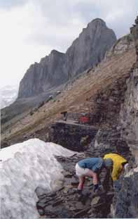
student industry field trip (sift)
Funded under the direction of the CSPG Educational Trust Fund (ETF), SIFT provides programs to the general public and to students of all academic levels. Initiated in 1978 by the CSPG, the program was based on a concept conceived by Bill Ayrton to introduce bright, young geoscientists to the petroleum industry. One student, representing each of the 31 Canadian Universities offering degree programs in geology, geophysics or geological engineering, is invited to participate each year. Since its inception, more than 780 students have participated in the program; many of whom have subsequently chosen to pursue successful careers in the petroleum industry.
This year, 31 students from across Canada participated in an action-packed two weeks consisting of lectures, field trips and an exploration game. Topics included clastic and carbonate sedimentology, sequence stratigraphy, geophysics and well logging. Students used their new-found knowledge in an exploration game to form companies consisting of three or four individuals, purchase land, and drill wells in order to gain an understanding of the science and business of the oil patch. At the end of the trip, each company presented their results to a panel of judges who determined the winning team for best geological interpretation and for most money earned.
Field trips play a very important role in SIFT and are often one of the highlights for the students. There is a oneday tour of Dinosaur Provincial Park, a four-day
doug hamilton director educational trust fund
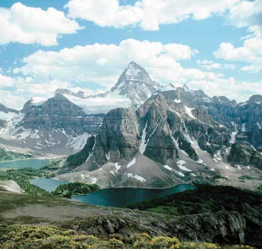
excursion into the Canadian Rocky Mountains and a Rocky Mountain flyover that is extremely beneficial in initiating discussions on the structural evolution and development of the Canadian Cordillera.
A relatively new, and very successful, addition to SIFT is the summer employment program. The committee works with petroleum companies to set up summer job interviews for the students who are very enthusiastic and eager to use their newly acquired skill sets. As many as one third (10) of the students may stay in Calgary for the summer to try out working in the Petroleum industry.
SIFT committee members, many of whom were SIFT students themselves, find working with the students to be an extremely rewarding experience. Jennifer Squance, who works at Talisman Energy, is quoted as saying “The Student Industry Field Trip exposed me to a geological career that I may not have considered. ... I have now chosen petroleum geology as a career.” Angela Dowd of Canadian Natural Resources Limited states, “… SIFT sparked my interest in petroleum geology, provided me an excellent career opportunity and has been the catalyst for many lasting friendships.” Both Jennifer and Angela are now active SIFT committee members.
Thank you to all the past and present volunteers, the CSPG Educational Trust Fund and the membership at large for their continued support of such a key program for the CSPG. Without the commitment of numerous volunteers who assist by giving lectures, core seminars and field trips, SIFT would not be the success that it is year in and year out and we could not offer such a fantastic opportunity to the students.
laraine kish co-chair honorary address committee
Since 1978, the Honorary Address has engaged the general public to show how exciting and interesting science can be, especially for children. This annual fall program typically involves a daytime program designed for students and an evening program for families. The topics vary each year and have ranged from “Dinosaurs in Denver” to “Earthquakes & Tsunamis.”
In 2003, a snowstorm did not stop over 700 people from coming out to enjoy the evening educational program where the audience was filled with people of all ages. From a Boy Scout troop that makes the event part of its weekly meeting, to a retired couple who attend annually, the Honorary Address is a special evening for everyone involved. Many geoscience professionals bring along friends and family to educate them in their professional area of interest. Attendees have the opportunity to ask questions after the presentations and mingle with the presenters during the intermission as well as at the end of the evening. Before the presentations and during intermission, everyone is able to visit a variety of booths in the foyer. From hands-on science exhibits to rock shops, there is something for rock hounds of all ages.
honorary address
The afternoon sessions of the Honorary Address are for school children. In 2003, more than 2,700 students were bused in to participate in the program. This interactive event allows students time to hear and participate in fascinating discussions and speak with the presenters. It is a great way to educate students and has the farthest reach of any of the CSPG outreach programs.
The Honorary Address provides a chance for the general public to hear about geoscience topics in an easy-to-understand format. It also gives the presenting societies an opportunity to showcase the tremendous work that professionals from Canada and across North America are doing in the geosciences.
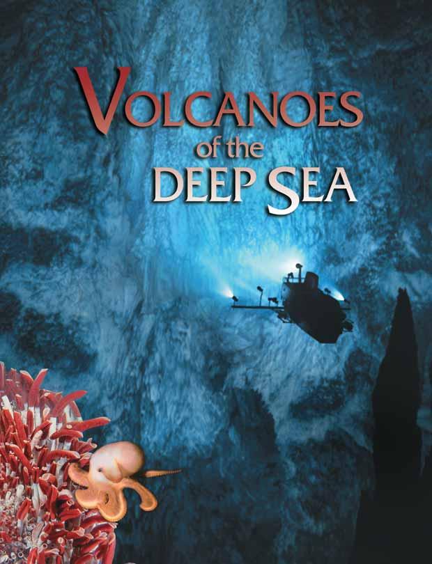
The CSPG is pleased to present this year’s Honorary Address entitled “Volcanoes of the Deep Sea.” The event will take place on November 9, 2004. Emory Kristof of National Geographic will plunge the audience deep into the ocean to explore the mysterious hydrothermal vents on the mid-oceanic ridge. Emory will reveal the fantastic diversity of the deep; its strange communities of organisms, shipwreck gardens, bioluminescent creatures and awesome giant predators. An astounding 97% of the earth’s biosphere is located here in the dark regions of the deep oceans that we have truly just begun to explore.
The University Outreach Committee was formed in 2002 to augment links between the CSPG and Canadian university earth science departments. We aim to help attract university geology students to the petroleum industry or related government and academic positions, and ultimately to have them join the CSPG. During its short life, Outreach has had considerable success in designing new programs and building on existing activities.
university outreach
University Conferences – The Outreach Committee has assumed sponsorship of the John Webb Trophies and CSPG Trophy, awarded annually at the Western Inter-University Geological Conference and the Atlantic Universities Geological Conference, respectively. We also award a student prize at the Advances in Earth Science Research Conference, organized by students at Ottawa-Carleton. We provide financial support for these conferences, and also have CSPG members attend where possible, to award the trophies and give presentations.
Lecture Tours - Expanding upon the previous Visiting Petroleum Lecture and Link Award tours, Outreach has organized three extensive lecture tours of Canadian Earth Science departments during the past two years. High-profile CSPG members such as Bill Ayrton, Ashton Embry, Lisa Griffith, Denis Lavoie, and David James have delivered not only high-quality technical presentations, but relevant career- and industry-related discussions. Outreach is planning additional tours in 2004/2005, with the goal of reaching every department at least once per year.
Student Chapters - The Committee is working on plans to bring in more student members through their university geology clubs, as opposed to individual memberships. We are hoping to have several student clubs join the CSPG as student chapters in the coming year.
Corporate Donations and Research –We continue to formulate systematic plans to sponsor links between industry and the universities. During 2003/2004, EnCana donated cores to Mount Royal College, and Devon has committed to a major core donation to at least two Canadian universities. We are canvassing industry for more donations of material, and for ideas to work cooperatively on research with university departments.
For more information on any Outreach activities, please contact Nadya Slemko at (403) 237-3925 or outreach@cspg.org.
2003 AUGC CSPG Trophy Winner:
2004 WIUGC John Webb Trophy Winners: Undergraduate: Ryan Ickert – University of Alberta
Graduate: Louise Longridge – University of British Columbia
2004 AESRC Best Poster Award Winner: Denis Lacelle – University of Ottawa
Jamie Braid – St. Francis Xavier
Each year, the Canadian Society of Petroleum Geologists awards seven scholarships to promote advanced education and research in those fields of geology having application to the petroleum industry. The CSPG regional scholarships are awarded to graduate and undergraduate students attending Canadian universities in each of three regions of Canada: Western Canada, Ontario/Quebec, and the Atlantic provinces. Scholarship applicants must have Canadian Citizenship or Landed Immigrant status. Graduate scholarships are open to M.Sc. or Ph.D. students attending Canadian universities progressing to their second or subsequent year(s) of full-time study in petroleum geology-related disciplines. These disciplines include structural geology, sedimentology, stratigraphic studies involving clastic or carbonate rocks, paleontology and geochemistry. Each of the three graduate scholarships has a value of one
The CSPG Graduate Student Thesis Award is awarded annually to one M.Sc. and one Ph.D. thesis that makes the most significant contribution to sedimentary and/or petroleum geology in Canada. The award for the top thesis in each category consists of a one-year membership in the CSPG, a CSPG book, a framed certificate and a cash prize for the Ph.D. winner of $1500 and for the M.Sc. winner of $1000. The award was inaugurated in 1958 with one combined M.Sc./Ph.D. award for the first several years. In 1964 the award was divided into its present format of a separate M.Sc. and Ph.D. award. Over the past 45 years the winners of this award have included some very well known geologists.
Each year Geology departments from universities across Canada are contacted for submissions which are then evaluated in the fall for awards. Eligible theses are those produced by students who have graduated at the preceding Spring or Fall convocation from a Canadian university, or who have completed research in the same period at a foreign university on a suitable Canadian topic. The criteria by which these are judged include definition of purpose and success in reaching goals, method and logic of investigation, originality of topic, ideas and content, validity of interpretationsand conclusions, completeness of data generation and presentation, contribution to science and industry, depth and
cspg regional scholarships
thousand five hundred dollars ($1,500.00). The CSPG Undergraduate Scholarship is open to all undergraduates enrolled in an accredited Earth Science program of a Canadian University who are in their second or third year. Each of the three undergraduate scholarships has a value of one thousand two hundred and fifty dollars ($1,250.00). The deadline for applications is May 31 of each year and scholarship recipients are notified in October.
A minimum of three adjudicators, who are members of the CSPG, evaluate each application and rank per region. The judges discuss the merits of each application and make a decision on the scholarship winner. The heaviest weighting is given to academic standing, however professors' appraisals, previous awards, publications and graduate thesis descriptions play an important role in the evaluation process.
cspg graduate student thesis awards committee
thoroughness of research and overall effort as well as organization of chapters, quality of writing and effective use of illustrations. Successful theses will also provide, where appropriate: a full consideration of the economic implications of scientific contributions made from a small study area or topic; and will relate any observations made in modern depositional settings to the ancient record, and vice versa. By mid December the winning theses are determined by the committee, and authors and respective supervisors are notified thereafter.
Winning thesis topics in recent years have included studies of Ichnology and neoichnology, detailed studies of Cretaceous (Falher, Basal Colorado) and Carboniferous (Kiskatinaw) reservoirs, modern channel bar sand geometry, epeiric carbonate platform deposition and an integrated sedimentological, ichnological, paleoenvironmental and paleoecological study of submarine fans.
andrew d. baillie award
Andrew Dollar “Andy” Baillie (1912-2001) had a geological career that spanned five decades. His petroleum career began with the British American Oil Company (the precursor to Gulf Canada) in 1953. After retiring from Gulf, Andy spent more than 20 years pursuing his passion for teaching geology in a variety of ways. His technical skills and desire to share his knowledge made him an invaluable asset to the geological community.
In 1997, to celebrate his lifetime of geological involvement, the CSPG awarded Andrew Baillie the Stanley Slipper Gold Medal for “lifelong accomplishments and outstanding contributions to petroleum geology in Canada and abroad.” He was an inspiration to
literally hundreds of geologists, who came under his influence, however fleetingly, during his life.
Andy was an active member of the CSPG and had a particular interest in the CSPG Educational Trust Fund. In 1991, the CSPG established the “Andrew P. Baillie Award” for student presentations at the CSPG annual conference. A $1000 award and commemorative trophy are presented annually for the Best Student Oral Presentation and the Best Student Poster Presentation. These awards recognize excellence in technical presentations by students and encourage a level of technical prowess worthy of Andrew D. Baillie.
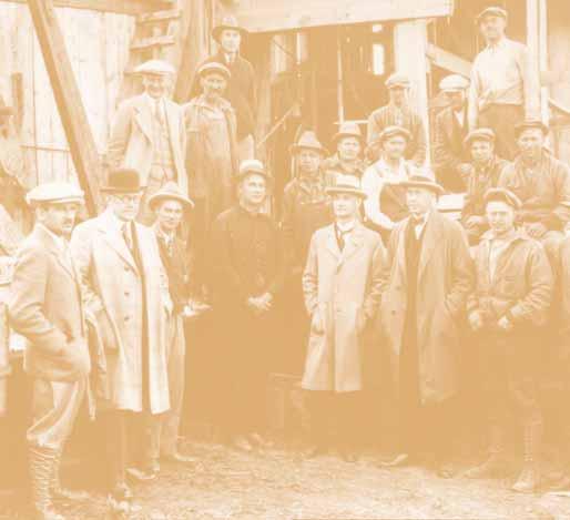
conocophillips glen ruby memorial scholarships in geosciences
ConocoPhillips Canada is proud to continue the ConocoPhillips Glen Ruby Memorial Scholarships in Geosciences. These scholarships are presented each year to second, third and fourth years students to promote excellence in petroleum geology and geophysics.
•$2,000 – 2nd year geoscience student
•$3,000 – 3rd year geoscience student
•$5,000 – 4th year geoscience student
ConocoPhillips Canada is pleased to recognize and honor a pioneer who has had a lasting influence on the Canadian Oil and Gas industry. From 1926 to 1929, Glen Ruby was Vice President and General Manager of Marland Oil’s Canadian partnership, Hudson's Bay Oil and Gas. While in Alberta he was a driving force behind the inaugural meeting and formation of the Alberta Society of Petroleum Geologists (renamed Canadian Society of Petroleum Geologists in 1972). Glen Ruby dedicated his life to exploration and has been recognized as one of the great pioneers in the global search for oil and gas. In addition to Canada, he successfully explored for oil in Chile, Alaska and the US Rocky Mountain basins. At one time he was credited with
having made the most northerly and southerly oil discoveries in the world.
Since inception, the Canadian Society of Petroleum Geologists has been a forum for sharing ideas and knowledge about the geology of Western Canada and the Canadian frontiers. This knowledge exchange has played a fundamental role in the successful development of the Canadian oil industry. Glen Ruby’s legacy thrives three quarters of a century later.
ConocoPhillips has been active in Canada since 1880 through the activities of heritage companies including Continental Oil Company, Marland Oil / Hudson's Bay Oil and Gas, Gulf Canada Resources, British American, Royalite, Asamera, Pennzoil, Stampeder, Mannville, Crestar, Conoco Canada, and Phillips Petroleum. We proudly honor Glen Ruby as a pioneer and industry leader and we are pleased that the memorial scholarships will assist in the development of future geoscientists.
For more information or to apply for a ConocoPhillips Glen Ruby Memorial Scholarship,visit www.cspg.org www.cseg.ca or www.conocophillips.ca
photo: Glenbow ND-3-4155(a)
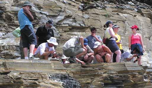
The Burgess Shale Geoscience Foundation was established as a non-profit earth science educational organization in 1993, based in the village of Field, Yoho National Park, British Columbia. We believe that increasing the profile of earth sciences is of critical importance to society, because an understanding of our Earth is fundamentalto intelligent debate on resource management, natural hazards, climate change, and environmental issues that affect us all. Yet, earth science is given a low priority in many of our public classrooms today, although the need for professional geoscientists in our society is great.
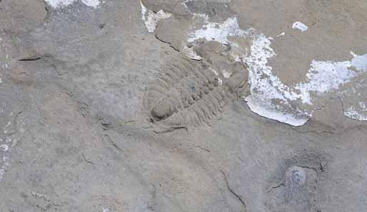
Our purpose is to increase earth science literacy through the interpretation of the fossils preserved in the Burgess Shale (a UNESCO World Heritage Site), and their related geology. The Burgess Shale is the best source of preserved Cambrian-aged flora and fauna, and remains a topic of intense scientific research and debate; serving as a kind of “holy grail” for many geologists and palaeontologists. The fascinating story of the Burgess Shale fossils is a popular topic that appeals to a variety of people from a range of backgrounds and disciplines. We provide quality earth science educational programs for teachers, students, industry, the general public, based on these themes:
•The History and Evolution of Life on Earth
•Rocks and Mountain Building
•Climate Change and the Evolution of Landforms
•Geohazards
Currently, we offer the following educational programs:
I. Earth Science Educational Guided Hikes:
•The Burgess Shale Fossils (Walcott’s Quarry)
•The Mt. Stephen Trilobite Beds
•The Iceline Trail (Glaciation and Climate Change)
II. Earth Science Professional Development Workshop for Teachers
•provides teachers with the tools and understanding to teach earth science components, as well as enhance their pure science curricula with more earth science examples
III. Burgess Shale High School Research Project
•involves students and their teachers in real scientific research thereby enhancing their science curricula and encouraging students to pursue careers in science
•poster presentation won the GeoCanada 2000 Conference People's Choice Award
IV. Earth Science Applied Continuum Theory
•Demonstrates the interdisciplinary nature of earth
burgess shale geoscience foundation
science by illustrating concepts from the (pure) science curricula with examples from the earth sciences. Classroom exercises and activities developed support the teachers’ workshop and the high school research project
V. The Wonder Lecture Series
•provides a dynamic series of lecture presentations unfolding the mysteries of the mountains within the Rocky Mountain Parks UNESCO World Heritage Site, and their fossils
VI. Earth Science Classroom Presentations
•an on-the-road program that brings the fascinating story of Yoho's fossils and related geology into classrooms throughout the school year
The CSPG has funded our popular High School Research projects in the past, and currently funds our annual teachers’ workshop both directly through the ETF, as well as indirectly through sponsorship of the EdGEO program. We believe that the most efficient way to increase earth science literacy amongst students is through their teachers. This is because, each teacher that takes our course may be teaching as many as 150 students annually (this year our course filled quickly with 25 teachers, and it is the fifth time that we have offered it). There is a real demand from teachers for geoscience resources and professional development opportunities! The course is made possible by a dedicated group of Calgary geoscientists who volunteer their time each summer to come out and teach the course.
With sustained funding, we have plans to further develop and expand the programs that we offer. We sincerely thank the CSPG and the affiliated ETF for their ongoing support of our innovative earth science educational programming. lisa holmstrom, b.sc. (honors) geophysics, professional teaching certificate, education coordinator, the burgess shale geoscience foundation
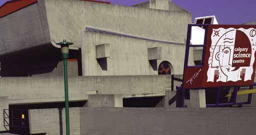
calgary science centre
Since 1997, the CSPG’s Educational Trust Fund has provided the Calgary Science Centre Society both annual funding and volunteer resources. This type of long-term, holistic, relationship is one that the Calgary Science Centre treasures.
The Calgary Science Centre is a charitable organization. Our goal is to engage people, mostly children ages 3-12, in the thrilling process of scientific discovery. An experience at the Calgary Science Centre will leave a visitor with not only some new science principles, but will open their minds to new questions where creative thinking and confidence is nurtured. We offer hands-on exhibits, fun programs, and captivating Discovery Dome shows.
Although the Calgary Science Centre covers many different science-related topics, it is absolutely imperative that we connect the community with the sciences that define our locale. Presenting industries like geology, agriculture, oil and gas exploration, to children—in their own language—can only serve to strengthen the health and possibilities of our community.
At first blush, one may question the correlation between a program like the “Invent-an-Alien Contest” and the geosciences. In this contest, students
ms. punam kumar director, community & fund development calgary science centre
are asked to research and design a three-dimensional life form that could theoretically live on a given planet. Now consider the compatibility of skills of these students and a geologist:
•Generating and presenting ideas
•Co-operative planning
•Public speaking and writing
•Scientific procedure
•Understanding the factors that comprise an environment
•Understanding the link between a life form and its environment
In essence, could the fossils that are central to a geologist's work not be considered “alien”?
All of these skills, among many others, are nurtured as part of the 15-year contest, sponsored by the CSPG. Imagine the impact of this contest on a young mind.
As the Calgary Science Centre embarks on its exciting future—soon into a new, expanded building— we will be looking to significantly build on our current programs, and thus partnerships.
The Calgary Science Centre and CSPG are natural, complimentary partners: what the CSPG seeks to accomplish in industry at the high-level, the Calgary Science Centre nurtures at the front lines.
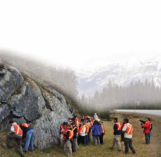
In August, Calgary hosted "Earth Science for the Global Community” - the fourth GeoSciEd conference of the International Geoscience Education Organization (the outreach arm of the International Union of Geological Sciences). The GeoSciEd conferences are designed for Earth science teachers from elementary to university level to meet Earth scientists who deliver educational outreach programs through their communities, museums, or science centres. GeoSciEd IV was a great success, attended by over 260 delegates from 24 countries. Realizing the importance of public outreach programs for earth sciences, the CSPG Educational Trust Fund provided financial support sponsored a special workshop for K-12 level teachers, and participated as an Exhibitor. In addition, numerous CSPG members were involved in organizing the conference (Godfrey Nowlan, Conference Chair; Jon Dudley, Publicity Chair; Grant Mossop, Fundraising Chair; John Cox, Technical Program Co-Chair; Dave Eberth, Field Trip Chair; Sandy McCracken, Treasurer; Ken Drabinsky, Exhibits Co-Chair; Jon Greggs, Technical Services).
Earth scientists and educators shared ideas and concepts in Earth science education and in the development of programs that lead to an integrated understanding of the Earth. The innovative technical program included keynote addresses, workshops, and oral and poster sessions. A special workshop held at the AEUB Core Research Centre entitled “Alberta RocksUnderground” for K-12 teachers introduced participants to important reservoir rocks from the subsurface of western Canada. Field trips visited many world-renowned sites of interest including the Rocky Mountains, the Burgess Shale, Dinosaur Provincial Park, the Royal Tyrrell Museum of Paleontology, the Frank Slide, and the Athabasca Glacier.
GeoSciEd IV has left a fabulous legacy in seed money for future conferences as well as some funding to help subsidize the attendance of teachers and delegates from developing countries. GeoSciEd IV has also benefited the local community in partnership with the CSPG. All of the GeoSciEd IV field trip guides are going to be made available in PDF format on the CSPG website. Many of these guides are unique in having been co-written by teachers and geologists, and include useful exercises for teachers to help deliver geological themes to their students. The guides are currently being revised to take advantage of improvements suggested following their use during the conference. As conference chair Godfrey Nowlan notes, “Thanks to the CSPG, this will provide a lasting legacy for the Calgary educational community”.
GeoSciEd IV was an unqualified success and received rave reviews from the delegates. The organizers have received many letters of thanks. Your CSPG was a proud participant in the conference and is pleased that this public awareness event was such a success. Thanks to the CSPG members who helped organize and deliver such a wonderful conference and congratulations to all whom attended and organized GeoSciEd IV. You have all left the Earth a slightly better and more appreciated place!
jon dudley
canadian natural resources limited geo sci ed iv publicity chair
geosciediv
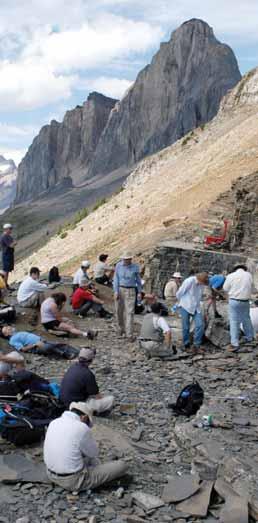
Delegates take a well earned rest after hiking up to the Walcott Quarry site of the Burgess Shale. This was the realization of a lifelong dream for many of the intrepid hikers. (Photo courtesy of Alan V. Morgan, University of Waterloo, GeoSciEd IV National Chair.)
national
edgeo workshop program
EdGEO is a national program which sponsors earth science workshops for local groups of teachers across Canada. In 2003, 202 teachers attended EdGEOsponsored workshops in Calgary, Cambridge Bay, Resolute, Iqualuit, Vancouver, Edmonton, Drumheller, Field, Parrsboro and Yellowknife. EdGEO's goal is to provide teachers with classroom resources (including rock and mineral kits, fossil sets, local guidebooks, maps and posters), and confidence, through knowledge and handson activities, to enhance their ability and enthusiasmto teach the earth science components of the curriculum in our schools. “These types of workshops are lifesavers, inspirational and necessary! Thank you for helping me become a better teacher” (Calgary), I feel much better equipped to make this an exciting topic for my students” (Regina), “Excellent demonstration ideas that have been classroom tested. Hands-on practice made content relevant. Wonderful ‘goody-bag’ that is immediately applicable,” “Passionate speakers! Contagious” (Vancouver).
EdGEO is co-ordinated by the Canadian Geoscience Education Network of the Canadian Geoscience Council. The workshops are all run by dedicated local groups of geoscientists and teachers.
eileen van der flier-keller chair, national edgeo committee school of earth and ocean sciences university of victoria
Each workshop addresses the specific needs and interests of the diverse parts of Canada, while also covering earth science topics that are listed in the school science curriculum. “Will I be able to bring to students an enlightened overview: show how it all fits into their learning: why it is important to learn about the earth and how they can have fun learning” (Calgary).
The CSPG Educational Trust Fund is EdGEO’s largest sponsor and as such has been instrumental in the funding of this program. The importance of this Canadian effort is well summed up by a teacher from Edmonton who, after attending a recent workshop, wrote, “I learned a lot … I appreciate the fact that other groups are donating time/money to educating teachers. In the long run it is the children who win”.
EdGEO is working to expand the program into more communities in Canada.
For more information, or if you are interested in running or attending a workshop, please contact Eileen Van der Flier-Keller fkeller@uvic.ca, (250) 721-2725 or go to the EdGEO website www.edgeo.org.
canmore museum and geoscience centre
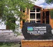
The Centennial Museum Society of Canmore (Society) was incorporated as a non-profit historical society in 1984. In 1998, a geoscience centre was added to the mandate of the Society and has been developed under the direction of a geoscience committee. The name of the museum was later changed to the Canmore Museum and Geoscience Centre (Museum). The Museum concentrates on the history of Canmore, with particular focus on the rich coal mining and railway history. The focus of the Geoscience Centre is on the mountain building processes that led to the present mountain structure. Current facilities run by the Society include the Canmore Museum and Geoscience Centre which is located at 902B 7th Avenue in the new Canmore Civic Centre (see figure 1) and the restored barracks of the Northwest Mounted Police on main street. Three Sisters Mountain Village is the main sponsor for our operations.
The intent of the Geoscience Centre is to increase the awareness of the public of the fascinating geology of the area. The Geoscience Committee is involved in a number of activities aimed at doing this. These activities include making displays and showing videos of the geology of the Bow Valley, educational outreach, summer camps, field trips, presentations, speaker series and self-guided hikes. These activities are described in more detail on our web site (www.cmags.org).
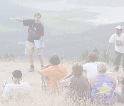
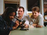
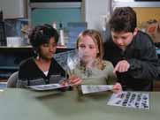
A number of programs have been initiated since 1998. The Stones and Bones summer geology camp for 10 - 12 year olds has continued since 2000. Funding by PromoScience (NSERC), the Canadian Society of Petroleum Geologists (CSPG), the Canadian Society of Exploration Geophysicists (CSEG), the Association of Professional Engineers, Geologists and Geophysicists of Alberta (APEGGA), the Town of Canmore, Talisman Energy Inc. and our Society has allowed us to hire a geoscientist for the summer to run our Stones and Bones summer camp program and to add an outreach program and a Geoscience Open House to the list of activities that we support. The Stones
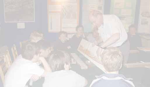
and Bones Program is much improved since adding the summer geoscientist to our staff in 2001. The Geoscience Outreach program was initiated in May 2001 for students at the Lawrence Grassi Middle School (see figure 2) and has continued every year since then. This year we expanded the program to include students from the Queen Elizabeth School in Calgary. Our first Geoscience Open House was held in June 2002 and has also become an annual event.
The CSPG has been a key sponsor of our facility. In addition to sponsoring the Stones and Bones program, the CSPG has been very helpful in giving suggestions and advice, particularly with regard to finding other sponsors. Tim Howard of the CSPG pointed us to Promoscience (NSERC) and the Calgary Foundation, both of which have been generous sponsors.
Until recently, the Museum was located in an old 2450 square foot building. In February 2002, the Town of Canmore invited us to be part of the new twostorey Canmore Civic Centre. Our Grand Opening in the new facility was June 12, 2004. Our nominal share of the new Civic Centre is 5000 sq. ft. or 20% of the building complex. The actual floor space is 3625 sq. ft. including 1000 sq. ft. for an office and a gift shop and 800 sq. ft. for a workshop and storage area. This leaves about 1800 sq. ft. for display space compared with 1300 sq. ft. in the old facility. We also have access to a 500 sq. ft. classroom for school outreach programs, summer camp programs, and geological talks. There is also space in the hallway of the building for temporary movable displays.
The Centennial Museum Society of Canmore is always looking for volunteers to improve or make new geological displays and for sponsors to help fund our operations. Meetings are held alternately in Canmore and Calgary approximately every month. Please consider attending our meetings or visiting the Museum!
richard green, p. geoph. talisman energy inc. vp geoscience, centennial museum society of canmore
science in a crate
You're 9 years old and the hair on the back of your neck is standing up. You're snooping around a dank, dark basement in your town's museum. Suddenly, you spot an old, odd- looking machine. You call to your friends in a voice just above a whisper. “This looks like a time machine.”
You jump on board, pressing buttons and pull levers. You hear a whirring noise, like the sound of a helicopter waiting to lift off. The room changes shape. Light and dark shadows rise and fall over you. You're time travelling!
Crates are booked by teachers and shipped to schools from Fort Chipewyan to Medicine Hat and everywhere in between. With over 160 crates in circulation, Science Alberta's portable science resources leave behind budding enthusiasts who have acquired a new appreciation for science and technology learning.
Thanks to a generous donation from the Canada Society of Petroleum Geologists, Anadarko Canada and Canadian Society of Exploration Geophysicists we will have 20 revised geoscience crates in rotation at the start of the school year. The two crates explore the composition and forces on Earth.
Science Alberta Foundation builds knowledge rather than facilities and works hard to make science accessible and fascinating to learners of all ages.
The machine stops. Where are you? To find out you conduct a series of experiments on magnetic fields, currents in water and investigate samples of rock, minerals and fossils.
That's the story line Grade 7 students will be exploring when they open Science Alberta's Science-In-A-Crate (SIAC), which will arrive in their classrooms at the end of November.
Linked closely to Alberta curriculum, the crates transform difficult science concepts into visual and understandable real-world experiences for kids. “I'm impressed. Very well organized, easy-to-follow, highinterest activities,” writes a teacher from Ryley, Alberta. “In a small, rural school, our resources are limited and the crate is a perfect solution.” Another teacher from High River writes: “These crates are invaluable.”
Science Alberta Foundation supplies schools, libraries, museums and interpretive centres with ready-made science resources through our ScienceIn-A-Crate program.
The second crate storyline reads like a geologist's boot camp. New minerals have been discovered in a northern Alberta community. Junior high school students compete to identify the rocks and minerals after learning about the physical properties of minerals, how minerals grow and how to identify minerals.
“We make science and technology fascinating for children,” says Arlene Ponting, CEO. “By honing their observation and inquiry skills we are helping to create tomorrow's inventors, innovators, scientists and thinkers.”
Science Alberta Foundation, in partnership with educators, parents, communities, government and industry, designs, develop and delivers resources that motivate children, youth and families to embrace lifelong science and technology learning.
canadian society of petroleum geologists • 14
Science Alberta Foundation has 162 crates in distribution, covering 42 topics.
In 2003 the CSPG Educational Trust Fund joined other sponsors (the Geological Survey of Canada, the Canadian Geological Foundation, BC Parks, the Canadian Institute for Advanced Research, and Natural Resources Canada) to produce a colourful two-sided pamphlet on the Geology of Mount Robson Provincial Park. Mount Robson, for which the park is named, is the highest peak in the Canadian Rocky Mountains. Lindsay Iredale (University of Calgary) was the key designer working under the supervision of Gerry M. Ross (Geological Survey of Canada) who conceived of the project after many years of conducting geological research in and around the park, most recently as a prime investigator with the Windermere Consortium.
Side one of the pamphlet includes a geological map with accompanying photographs of geological and landscape highlights, a primer on understanding geological maps, a graphic geological time scale, a description of the major geological units in the park, and a simplified cross section (based on Eric Mountjoy,s work) showing the architecture of Mount Robson. Side two consists of photographs and illustrations describing how the Rocky Mountains were built, the unique fossils of the first hard-bodied life, the effects of glaciation on the mountains, and why Mount Robson is so high. There is also a panel describing turbidity currents, turbidites, and Bouma sequences. One of the major geological units in the park, the Miette Group, is comprised predominantly of turbidite deposits which, as the pamphlet explains, attract the attention of many petroleum geologists since such deposits are a common target of offshore exploration.
geology of mount robson provincial park
The pamphlet’s major sales centre is the Mount Robson Provincial Park Interpretive Centre with additional sales at one of the local Bed and Breakfast establishments. Over the past year about 500 copies have sold for a minimum donation of $5.00; a price set to cover subsequent printings. The Mount Robson Interpretive Centre also features an enlargement of the pamphlet as one of its main displays. The distribution and display of the pamphlet at these public venues does much to increase the public profile of the CSPG ETF with the advantage of being more accessible to the general public than if only available through sponsoring association offices. This is one of the great benefits of the broad spectrum of products and activities supported by the CSPG ETF.
Certainly the Mount Robson Interpretive Pamphlet has garnered the attention of the public and done much to increase the public’s awareness and knowledge of geosciences. Wayne Van Velzen, Area Supervisor for 20 years at Mount Robson Park, wrote upon seeing the pre-print of the pamphlet that of the “… many education/interpretation packages developed… it is by far the best.” It is “… an excellent product to help our half million visitors per year better understand and appreciate the park's landscapes;” a resounding testimony for a product proudly supported by the CSPG Educational Trust Fund.
donors
$20,000+
Bruce G. McIntyre
$5,000+
Anadarko Canada Corporation APEGGA
Andrew D. Baillie
William A. Bell
Canadian Natural Resources Ltd.
ConocoPhillips Canada
Devon Canada Corporation
EnCana Corporation
Robert H. Erickson
In Memory of Grace Shultz: Earl Fawcett
Harley N. Hotchkiss
Olympic Seismic Ltd.
Petro-Canada Oil And Gas
Sproule Associates Limited
Darol J. Wigham
$500-$999
John Andriuk
Stephen A. Antoniuk
Gordon A. Beach
Belloy Petroleum Consulting
Graeme R. Bloy
Phil Brown
Cabre Exploration Ltd.
Calpine Canada
Canadian Hunter
Exploration Ltd.
M.A. Carrigy
$1,000-$4,999
Anderson Energy Ltd.
Apache Canada Ltd.
James E. Barclay
Bellport Resources Ltd.
Ted Best
BP Canada Energy Company
Charles L. Buckley
Burnet, Duckworth, Palmer LLP
C.S.E.G.
Tony Cadrin
C.K. Caldwell
Continental Laboratories (1985) Ltd.
John A. Downing
Bob Earle
ECL Canada
Faraway Resources
geoLOGIC systems ltd.
George D. Grant
Andrew P. Holder
Michael E. Hriskevich
F. Bernard Clare
Dean W. Clemenson
Michael J. DesRoches
Warren J. Doenz
Andrew L. Evans
A.F. Fischer
Brian F.G. Fischer
Thomas P. Gallagher
R. Perry Glaister
G.G.L. Henderson
D. W. Holmes
K. Dave Hutchinson
A.R. Keevil
Husky Energy
Ian E. Hutcheon
Imperial Oil Resources
Jenik Consulting Inc.
Tako Koning
Keith A. Lowell
McAra Printing
Mike Ware Memorial Fund
Murphy Oil Company Ltd.
Nexen Inc.
Arne R. Nielsen
B. S. Norford
Alice & Allin Folinsbee Payne
Fred G. Rayer
Reeves Wireline
Kathryn A. Scales
Shell Canada Limited
N. Desmond Smith
Charles R. Stelck
Talisman Energy Inc.
Uldis Upitis
Harry W. Woodward
Anonymous Donors: 4
Donald M. Kent
R. James Kirker
D. Keith MacDonald
Emmanuel Malterre
Mancal Energy Inc.
Monica G. Meding
MJ Systems
Francois Montandon
Murphy Canada
Exploration Ltd.
Organ Family (Doreen)
Don R. Reid
Rozsa Petroleum Ltd.
Samson Canada Ltd.
William D.M. Smith
Christian Viau
John Wall
James Donald Weir
Gordon C. Wells
Edwin P. Williams
C. Edward Wright
Brenda M. Wright
Raymond W. Yole
F. G. Young
Anonymous Donors: 2
The Educational Trust Fund is grateful to everyone who has made a donation to this worthwhile and important program.
PALAEONTOLOGY DIVISION
Geology,faunal composition, and taphonomy of a Late Cretaceous shell bed in the Milk River valley, southern Alberta
SPEAKER
Emily Frampton
University of Calgary
7:30-9 PM
Friday,October 15th,2004
Room B108
Mount Royal College
4825 Richard Road SW Calgary, Alberta
The Pinhorn Ranch site is a rich faunal assemblage of Late Cretaceous age containing both invertebrate and vertebrate microfossil material.The site is located within the Foremost Formation,a transitional unit between the underlying marine Pakowki Formation and the overlying non-marine Oldman Formation. The Foremost Formation was deposited in a marginal marine shoreline environment that records a series of regressive cycles of barrier-island beach sands overlain by lagoonal and marsh deposits laid down during the regression of the Pakowki Sea 79 million years ago.This site was also within close proximity to continental,freshwater and brackish water environments,the influences of which are reflected in the faunal composition of the assemblage.The site has yielded bivalves,oysters,and gastropods,and the teeth and bones of sharks,fish,amphibians,crocodiles,turtles, and dinosaurs.Brackish and marine fauna are the most common,as the site was deposited in a brackish to marine environment.Freshwater and continental fauna are rarer as they were transported into the site.To date,nearly 50 species have been identified from this assemblage.The site itself appears to be a mixed accumulation of fauna that shows no distinct pattern of deposition.But extensive mapping and excavation,and the collection of taphonomic attributes such as the degree of abrasion,the orientation of elements,the amount of fragmentation,and several other features will allow depositional patterns to be recognized and provide information on environmental energy,the degree of transport of specimens,and other factors of
(Continued on Page 28...)
NOVEMBER LUNCHEON
carbonate particle composition and fossil abundance reflecting bathymetrical variations. A subdivision of the succession is not based merely on vertical lithological changes but instead third-order transgressive-regressive facies trends were used,which can be correlated over hundreds of kilometres across the epeiric platform.During long-term transgressions,restricted easterly platform areas – now in the subsurface of the Alberta Foothills and Prairies – developed potential stratigraphic traps for hydrocarbons with peritidal calcisiltstones and fenestral fabric sandwiched into regressive evaporite deposits.
CONCLUSIONS
Seemingly monotonous,thick limestone successions,such as the Palliser Formation,hide
an originally more heterogeneous facies than hitherto appreciated.Obliteration and storm sedimentation played an important role in the determination of the platform architecture. These processes and the predominance of nonreef flora and fauna,such as green algae and echinoderms,especially in post-extinction periods,likely influenced the architecture of many other epeiric carbonate platforms in similar ways,for example by preventing the development of a distinct rim.The results of this work could serve as a model for an improved sedimentological understanding of many giant tropical platforms that have previously been largely neglected.Finally,the reconstruction of the Palliser facies architecture significantly improves the prospects of locating oil and gas in these platform deposits.
EMERGING PETROLEUM RESOURCES DIVISION
The mandate of the Emerging Petroleum Resources Division (EPRD) is to provide a forum for CSPG members that are engaged in the search,characterization,and evaluation of resources that are commonly regarded as “unconventional” here in Canada.As we look ahead for future petroleum resources,much of the production is expected to come from less conventional plays.Some of the primary emerging resources include coalbed methane,gas and oil shales,gas hydrates, and very-low permeability reservoirs.All of these emerging resources have large resource estimates attached,but are currently challenged by technological or economic limitations.
Monthly luncheons are held at noon on the second Wednesday of every month in the ConocoPhillips Auditorium.The ConocoPhillips Auditorium is located on the +30 level on the west end of the building,at 401 - 9th Avenue SW,Calgary. Speakers for the luncheons are sought from industry,academia,and research institutions to include topics on coalbed methane,gas hydrates,gas and oil shales, very-low permeability reservoirs,and other resources that gain attention in these “unconventional resource” arenas.
For information on last-minute speakers, changes in date or venue,and the latest information on unconventional petroleum
resources,please join the EPRD e-mail distribution list by contacting caddelem@bp.com with title “EPRD list”.
Now available for import into ACCUMAP and other mapping programs:
1) Mississippian Subcrops and Devonian Reef Edges – Alberta, NE BC, Sask. and NWT- completely updated in 2003/04
2) Glauconitic Channel Trends – Southern and central Alberta
3) Colony Reservoir Trends – East-central Alberta
4) Bluesky-Dunlevy Reservoir Trends – NE BC
5) Halfway-Doig Shoreline Trends – NE BC, NW AB
6) Charlie Lake Siphon, Cecil and North Pine Reservoir Trends – NE BC
All edges are formatted as map features and as editable annotation lines and regions
For more information contact Mike Sherwin at 262-1151 Email mike@sherwingeological.com or view at www.sherwingeological.com
BIOGRAPHY
Arndt graduated from the Ruprecht-KarlsUniversität in Heidelberg with a German Diploma degree in geology-palaeontology in 1993.In 1996 Arndt received his M.Sc.followed by his Ph.D.in Geology from the College of Graduate Studies and Research at the University of Saskatchewan.Arndt has received numerous awards and was the winner of the 2003 CSPG Ph.D.thesis award.Arndt is currently involved with an award of a 24-month European Commission Marie Curie Individual Fellowship for postdoctorate research in Cambridge,England.
JACK PORTERVIGNETTES OF CANADIAN PETROLEUM GEOLOGY
Martin Frobisher’s Second Voyage to his “Frobishers Streytes” to mine for gold
Leaving the Thames estuary,Frobisher’s small fleet sailed up the North Sea and docked at the Orkney Islands on June 7th where,after bartering for fresh produce,the three ships advanced westward in the North Atlantic. Master Yorke,in the leading vessel,Michael, sighted the southern extremity of Greenland (Friesland) on July 4th.The fleet,after reconnoitering its coastline for four days,was unable to make land owing to a mist-shrouded sea congested with ice flows.By July 17th,after crossing the Labrador Sea,they reached landfall of Hall’s Islet and Hall’s Island,both being seaward extensions of Hall Peninsula (Northeast Foreland).
During a storm the following day,the fleet found shelter by anchoring in a cove on Hall’s Islet,the small island from where the “blacke stone” had been found the previous summer. Frobisher was rowed ashore with a number of miners and craftsmen,including two assayers, to prospect for “gold ewer”,but after scouring the terrain,the prospecting party returned to the Ayde,the search being futile.
The entrance to “Frobisher Streytes” had been blocked by icebergs and pack ice when the fleet first arrived at Hall’s Islet.However, on the morning of July 19th,the passageway was unrestricted,the ice barriers having been blown out to sea.Martin Frobisher enthusiastically ordered his fleet to proceed into his streytes” where,after crossing to its Southwest Foreland (Meta Incognita),the three vessels found safe harbor in a large fiord. He named it Jackman’s Sound in honour of Charles Jackman,the mate to Master Christopher Hall of the Ayde,for his navigational prowess in evading the winddriven icebergs during the previous stormy night.It was here on July 20th,1577 that Martin Frobisher conducted a service for the assembled crew members of the flagship Ayde, Gabriel,and Michael,offering prayers of thanksgiving for their safe crossing and present refuge.He further prayed for the redemption of the natives of the region,which he described as “those barbarous people trained up in Paganrie and infidelitie” and their eventual conversion to Christianity (Ibid., 1971,Morison,Samuel Eliot ---pp.520,521).
Prior to Frobisher’s departure in the Ayde, from Jackman’s Sound to the Northeast
Foreland (Hall Peninsula),he had instructed the masters and crews of the Gabriel and Michael to explore for gold ore along the Southwest Foreland.It was at one of the many coves investigated that the seamen and prospectors unexpectedly came upon a native settlement. The surprised and fearful inhabitants immediately fled into the interior.Their flight resulted in the unobstructed foraging of the natives’ camp and the theft of one of their dogs by the seamen.In a surreptitious attempt to establish contact with the wary natives,whom they anticipated would soon return,some knives and small trinkets were conspicuously dispersed in some of their tents.However,the natives,suspecting treachery on the part of the seamen,attacked them as they attempted to return to the Gabriel and Michael.In the ensuing encounter,their bows and arrows were no match for the harquebusiers fired by some of the soldiers escorting the sailors and prospectors in the ships’ longboats to their vessels.These portable guns were so incomprehensible to the terrified natives that they fled in disarray,some leaping into the sea to their deaths from their strategic positions
along the shoreline cliffs.During this engagement,the seamen captured two native women,one of which was released owing to her decrepit condition.The other,a young mother with an infant,was taken aboard one of the ships as a hostage.Following the encounter, the seamen returned to the abandoned tents of the natives and despoiled their contents.In doing so,some clothes were found amongst the natives’ belongings,which were presumed by the seamen to have been part of the attire of their five missing colleagues.
During their investigation of the coastline of the Southwest Foreland,Frobisher’s prospectors came upon a dead Arctic narwhal beached on the shore of an inlet.This most captivating souvenir from the sea both mystified and astonished the prospectors.Its singular tapered and spiraling ivory tusk was almost two yards in length.George Best,who was Martin Frobisher’s deputy aboard the Ayde and one of the narrators of Frobisher’s expeditions,sketched this fascinating whale and named it,understandably,a “sea unicorn”. He,unmistakably,portrayed this whale as
(Continued on Page 24...)
having a fish’s body,exhibiting both dorsal and ventral fins including a tail fin.The body of his “fish” appears to be scale-covered. After removing and examining its tusk,it was discerned that the tip had been broken, revealing a hollow interior.Since the horn of the mythical unicorn was reputed to possess medicinal properties,specifically as an antidote for poison,the seamen inserted living spiders into the tusk’s interior chamber and observed that the spiders had died.One can only assume that the reputed results of their experiment with the spiders and “horn” of their dead “sea unicorn” would allay any former doubts concerning the existence of the unicorn,perpetuated by generations through folklore (1963,Oleson,Tryggvi J.:Early Voyages and Northern Approaches 10001632,pub.McCelland and Stewart Ltd.,p.150).
After returning to England,Frobisher presented the ivory tusk to Queen Elizabeth. She was so intrigued with her gift that she considered it as an amusing ornament,dubbing it a “jewel” and would enjoy displaying it as a conversational topic when entertaining her courtly guests.
During the period when the crews of the Gabriel and Michael had been prospecting the shores of the Southwest Foreland,Frobisher in the flagship Ayde had been searching the Northeast Foreland of his “streytes” for a safe harbor to prospect for gold ore.At the same time,he was ever mindful of the fate of his five seamen captured by the natives the previous year.He was hopeful that they were still alive and could be ransomed by exchange of kind.
On arriving at Hall’s Island (Loks Land) sometime in late July,Frobisher,along with 40 members of his ship’s 120-man compliment, were transferred in longboats to the island, not only for the purpose of accessing it for its gold potential,but to lay title to the region. Frobisher’s landing party was comprised of 30 gentlemen investors in the Company of Cathay,the remainder being soldiers and prospectors.Failing to find any worthwhile “precious” ore,the group ascended a conspicuous hill,located on the south-central side of the island,to conduct a formal ceremony as a rite to take possession of the region.Believing the island and its adjacent Northeast Foreland to be the western extremity of the Asian continent,Frobisher’s party,at the crest of the prominent hill, commenced their ceremony with an invocation of solemn prayer.This was followed by a somewhat pompous display of military protocol and accompanied by trumpet blasts, which ritual officially sanctioned the region on behalf of Queen Elizabeth.Frobisher named the island’s hill Mount Warwick,in honour of the Earl of Warwick,their expedition’s principal
PUTTING HIGH RESOLUTION AEROMAGNETIC DATA
Exploration geologists can benefit from High Resolution AeroMagnetic (HRAM) data as a complement to their conventional interpretation.Then why,in this environment of integrated interpretation,is there sometimes a level of intimidation when it comes to employing the potential field methods,specifically HRAM data? Perhaps it is the fear of the unknown that causes professionals in our industry to shy away from this useful data.In this article,we will be exploring the acquisition,processing,and interpretation of HRAM data.
Traditionally,aeromagnetic data have been used to map the magnetic basement below sedimentary cover and intra-sedimentary intrusions,allowing geoscientists to have a better understanding of structure.Recently, advances in acquisition,processing,and interpretation techniques have made it possible to also map intra-sedimentary faults and fracture zones.To understand how these advances resolve the sedimentary section,it is important to understand the overall acquisition and processing workflow.
High Resolution AeroMagnetic data are acquired by flying an aircraft with a mounted magnetometer approximately 100 – 150m from the ground surface over an area of exploration interest.The aircraft typically flies along closely spaced (100-800m) parallel lines (traverse lines) and along wider-spaced cross lines (control lines) usually flown perpendicular to the traverse lines.These are used to tie the traverse lines.In-field quality control allows for recognition and correction of acquisition problems.These data are, therefore,a grid representing the Earth’s magnetic field recorded along the flight lines. This magnetic field is a combination of the Earth’s internal (core) magnetic field,fields generated by anthropogenic sources,external magnetic fields (solar radiation),and geological anomalies.
The Earth’s magnetic field,if it were undisturbed,would be akin to a dipole magnet, positioned at the centre of the Earth. However,lateral variations of the rocks’ magnetization,caused by the combined effects of induced and remnant magnetism,create regional and local disturbances (anomalies) in this field.These variations are associated with the origin and geological structure of the area under consideration.Magnetization of rocks is defined by their magnetic susceptibility which is controlled by their concentration of magnetic minerals.Because a rock’s magnetization can only exist at temperatures
below the Curie point (550ºC),geologically important magnetic anomalies exist only to depths of 30-40 km from surface.The basement and intra-sedimentary anomalies are what geophysicists try to unveil in the processing of HRAM data,and are later interpreted to produce maps that are used in the integrated interpretation workflow.
Several corrections to the acquired data must take place so that the data are ready for processing.The Earth’s core magnetic field is subtracted from the observed data.The core magnetic field is estimated using the International Geomagnetic Reference Field (IGRF).Effects of solar radiation,called diurnal variations,are determined using the flightsynchronized records of the ground magnetometer and are also subtracted from the observed data.Anthropogenic or cultural anomalies (caused by pipelines,wells,bridges, farms,processing plants,etc.) generate noise in the data at high frequencies that can mask geological anomalies.Cultural editing removes these particular artifacts from the data and is performed by a knowledgeable geophysicist who compares video of the ground surface with recordings from the magnetometer.The cultural sources that cause the anomalies are observed visually and are checked against anomalies on the raw magnetic data.They are then removed from the digital version of the data using special software.The key to cultural editing is to not remove any real subsurface magnetic anomaly in the process.
The next step in the processing workflow is to
BY EMILY DUNCAN, GEDCO
apply an algorithm that ‘reduces to the pole’ the anomalies,which means that it moves the anomalies to above their true source.This is necessary because the inclination of Earth’s magnetic field at different latitudes causes the peak of anomalies in the data to appear at locations other than right over their source. This is especially important at mid-latitudes, not as important at Northern latitudes,and not applicable near the equator.
After cultural editing and reduction to the pole are complete,the processing and interpretation of HRAM data becomes an integral task.The magnetic data at this point show a general distribution of magnetic anomalies demonstrating broad regional trends (Fig.1).It is important to highlight as much structure as possible in this phase of processing.This is accomplished through the application of a series of filters that enhance geologically meaningful anomalies which are naturally of low-amplitude signals.Such anomalies form correlatable trends and lineaments caused by structural elements in the basement and sedimentary cover (Fig.2).At this point,it is impossible to tell quantitatively from what depth the anomalies transpire.
Depth inversion is the next stage of the processing/interpretation workflow.The purpose of depth inversion is to find the distribution in depth of the subsurface sources for anomalies.Along each flight line,depth solutions are calculated which define the subsurface position of magnetic sources that
(Continued on Page 28...)
Figure 1.Total Magnetic Field data after Reduction-to-Pole.The magnetic anomaly caused by the Souris River Fault is not visible here.
Figure 2.Filtered Magnetic Field map.Data from Fig.1 were processed using separation,Goussev, and bandpass filters.Filtering reveals a strong linear anomaly caused by the Souris River Fault.
are generating anomalies.The calculation of their distribution is usually performed using the Werner and Euler inversion algorithms. These algorithms exploit the fact that shortwavelength anomalies are from shallow sources and long-wavelength anomalies are from deeper sources.
Figure 3.A depth slice at 50m below surface from the 3D volume created using MaFIC™.Linear magnetic anomaly,caused by the Souris River Fault (Fig.2),correlates with a trend of shallow depth solutions obtained by the Euler inversion algorithm.
PALAEONTOLOGY DIVISION
(...Continued from Page 19)
accumulation.This data can then be used to determine the mode of formation for this rich faunal site.
BIOGRAPHY:
Emily Frampton received a B.Sc.in Earth Sciences from the University of Calgary and is currently working on a M.Sc.in paleontology at the University of Calgary under the supervision of Dr.L.V.Hills.Previous experience in paleontology includes several field seasons as a laboratory technician at the Field Station of the Royal Tyrrell Museum in Dinosaur Provincial Park.
INFORMATION:
This event is jointly presented by the Alberta Palaeontological Society,Mount Royal College and the CSPG Palaeontology Division.For information or to present a talk in the future please contact CSPG Paleo Divison Chair Philip Benham at 403-691-3343 or programs@ albertapaleo.org.Visit the APS website for confirmation of event times and upcoming speakers:http://www.albertapaleo.org/
Once the depth solutions have been calculated along the flight lines,they are put into a program such as MaFIC™ (Magnetic Fault Identification Cube).This program takes the discrete depth solutions that exist on a 3D grid,and through mathematical extrapolation, creates a continuous 3D volume.This is essentially a 3D visualization tool of 2D magnetic data that has been inverted over a pre-selected range of depths.The enhanced magnetic anomaly maps and the 3D volume (MaFIC™) are compared to correlate lineaments and trends of their truncations (Fig. 3).With these two data sets,the structural grain is represented,showing a generalized view of structural discontinuities that could be faults,stratigraphic edges,or magnetic contacts in the basement.
Presenting the data in a 3D volume is useful as it can be loaded into a workstation and compared directly to other digital data sets.It is a powerful integration tool for magnetic data with geological,seismic,topographic, and/or gravity data.Integration strengthens the interpretation since we can look at correlations between data that are all acquired independently.
The ambiguity of separate interpretations drops dramatically with each different type of data interpretation that we include.High
Resolution AeroMagnetic (HRAM) data continually prove to be useful in mapping basement structure as well as aiding geoscientists in interpreting the sedimentary section.HRAM data provide additional information and perspective,particularly when dealing with 2D seismic or in wrench fault environments.
For further information on HRAM data and how it can enhance geological interpretation, please contact GEDCO at (403) 262-5780 or visit their website www.gedco.com.
RIGHTS, PRIVILEGES, RESPONSIBILITIES and OBILGATIONS of SEISMIC DATA OWNERSHIP
Identify and clarify unwritten rules practiced in industry as they pertain to seismic data ownership. Address subtle nuances where current standard industry practice is not uniform. A sampling of the topics discussed in this seminar include:
• The Do’s and Don’ts of Data Quality Inspections • Releasing Data for Sale •
• Data Room Practices • Seismic Data Licensing Agreements •
• Partner Obligations and Responsibilities • Copying Data and Maps • • Data Archival Obligations for Frontier Datasets •
• Third Party Data Licensing Agreements • Speculative Survey Transfer Fees
This seminar will also bring these rules and obligations to life for the attendee through the use of common business case scenarios involving seismic data such as corporate acquisitions, property divestitures, farmouts, show & tells, seismic review options and seismic data sale transactions.
Instructor: J. Douglas Uffen, P. Geoph. Fee: Non-Member: $400.00 plus GST (CAPL Member $350.00 plus GST)
Please contact Denise Grieve at 237-6635 or dgrieve@landman.ca
Figure 4.MaFIC™ volume of data integrated with gravity anomaly (A) and seismic surface (B) on a workstation.
VOLUNTEER WITH THE EDMONTON SCIENCE OUTREACH NETWORK
BY CATHY PERRATON,EDMONTON SCIENCE OUTREACH NETWORK
The Edmonton Science Outreach Network (ESON) invites Scientists,Technologists, Engineers,and Mathematicians (STEMs) to help us engage students in science and technology.
STEMs report that they volunteer with ESON because it gives the opportunity to:
• Encourage student participation in science
• Share their knowledge with students
• Provide information to students on careers in science
ESON volunteers may visit classrooms and share their passion for science and technology through hands-on presentations.The majority of our requests are from Elementary Schools. STEMs provide curriculum support on topics ranging from:Rocks and Minerals,Testing Materials and Designs,Waste and Our World, Plant Growth and Changes,Electricity and Magnetism,Weather Watch,Sky Science,and Heat and Temperature.
Students benefit from personal,interactive contact with STEMs working in diverse fields. Following a classroom visit from our volunteers,students report being increasingly aware of science and technology in their lives.
Students report that they learned more from ideas “being explained in a different way.”
“Science isn’t just about taking notes.” “Scientists can tell you so much more.”
STEMs are also a vital resource for teachers.Feedback from teachers emphasizes the value of tactile learning and the positive response from the students:
• ESON’s volunteers “bring the curriculum to life and in my opinion,reality beats virtual science.”
“It amazed me how electric the atmosphere became,and how interested the kids were.” ESON volunteers also answer science and technology questions,facilitate field trips, guest lecture at conferences,and deliver teacher professional development workshops.
BREAKING STEREOTYPES
Our vision of a “scientist” is exceptionally inclusive.Part of our mission of promoting science education includes breaking down barriers and stereotypes.ESON is committed to changing the way students think about science and scientists.A classroom visit from a volunteer STEM can belie the image of a scientist as the “mad scientist” working in isolation in a cluttered,bubbling laboratory. STEMs work in a dizzying array of fields and ESON volunteers represent:the Natural Sciences,Physics,Chemistry,the
Petrochemicals Industry,Medicine,Astronomy and Space Science,Agriculture,Construction, the Mechanical Trades,Engineering and Technology,Geology,and Meteorology.Those examples are hardly exhaustive.In addition, STEMs may contribute expertise garnered from personal interests or hobbies like Bird Watching or Model Building.
CONTACT ESON
ESON is a non-profit organization that has connected volunteer STEMs with teachers for 14 years.To volunteer with ESON or for more information contact:
Dr.Michael Caley at 448-0055; esons@telus.net;www.sciencehotline.ca
Anyone who is interested in volunteering but does not live in the Edmonton and Area Region please contact:
The Alberta Science Literacy Association (ASLA) at (403) 245-8942 or email info@asla.ca
ASLA is a provincial organization that coordinates the five Science Outreach Networks in:
• Edmonton (ESON)
• Calgary
• Grande Prairie
• Medicine Hat
• Red Deer
patron.To further affirm the legitimacy of their claim,they erected,as tangible evidence,a cairn of rocks in the shape of a cross,upon which the Queen’s ensign was affixed.
On the return to the Ayde,following Frobisher’s party descent from Mount Warwick,they were met by a large group of natives who appeared receptive to engage in a session of bartering.Accordingly,by gesturing, the natives conveyed a procedure that would entail two members from the corresponding parties to be engage in the actual trading transactions.Frobisher,acutely concerned of the fate of his five seamen who were taken hostage by natives the previous summer, decided to engage in a devious tactic.He selected,as his partner,Master Christopher Hall of the Ayde who together,on the pretext of friendly swapping of trade articles,would attempt to capture their native counterparts. The ruse failed and,for his efforts,Frobisher received an arrow deftly imbedded in his
buttocks from one of the natives,as he and his partner scrambled for safety.Before reaching the longboats,a sturdy Cornish miner managed to grab one of the natives and in the ensuing tussle,was successful in capturing him.Owing to the rapidly deteriorating weather conditions,Frobisher’s party,along with their hostage,were unable to utilize the longboats to return to the Ayde.This resulted in a miserable night spent onshore in the open,where an expected attack by the natives failed to materialize.Frobisher,hoping the five seamen were still held captive by the natives, was once again in a bargaining position to negotiate their release.The native woman, with her infant,as well as a native man had been secured on the Ayde.He believed his only recourse was to arrange a reciprocal exchange of each others’ hostages.Frobisher’s hopes were subsequently buoyed when a deputation of natives met with him,expressing through their use of sign language that their white hostages were in the region and were
desirous of contacting him.Accordingly,he penned a letter,dated August 7th,1577,which was directed to any one of the five seamen. The letter informed them that he had on board the Ayde three native hostages:a man, woman,and child.Frobisher further states that the male captured the previous year died shortly after arriving in England.He succinctly enunciates the repercussions should the terms of his ransom fail to be met by stating in part:“Moreover you may declare unto them,that if they deliver you not,I wyll not leave a manne alive in their Countrey.And thus,if one of you can come to speake with me,they shall have eyther the Man,Woman,or Childe in pawne for you.” Along with his letter to be delivered by native couriers to the hostages,Frobisher included “Penne,Incke, and Paper.” His rational was that should their captors be unprepared to fulfill his demands, the seamen,if alive,could conceivably alert Frobisher of their existence,assuming the natives would permit a reply (Ibid.,1971,
(Continued on Page 32...)
JACK PORTER
(...Continued from Page 24)
ENRICHMENT FACTORS OF THE QINSHUI COAL BED METHANE RESERVOIR IN CHINA
BY JIANBO ZHANG, CONSULTANT
ABSTRACT
The factors of coalbedmethane (CBM) enrichment include CBM resource, permeability,desorption condition,pressure of coal bed,preservation condition,and hydrological condition.Where the above conditions are combined beneficially, commercial CBM reservoirs can be formed. Qinshui CBM reservoir is a successful exploration example.
INTRODUCTION
Qinshui Basin is located in Northern China’s Shanxi province.Qinshui CBM reservoir is in the southern part of the basin.There are two main coal beds,one of Permian age (coal bed #3) the other of Carboniferous age (coal bed #15).The first CBM well in the basin was Well Jin 1,drilled by Petro-China in 1997.Initial production was 4050 m3/d. The depth of the coal beds is about 500 meters.Five other wells were drilled around Well Jin1 in the same year,with well spacing of about 300 meters.Each produce 2700 – 3000 m3/d.Jin 1-2 has the highest production at 9780 m3/d.Three more wells were drilled in this area later – Jin 2, Jin 3,and Jin 4.Each produces around 3000 m3/d.The gas in place is 35.2 e9m3 in an area covering 182.22 km2.
CHARACTER OF COAL BED
The thickness of coal bed #3 is 5 – 6m, and the depth is 300 – 750m.Coal bed #15 has a thickness of 2 – 3m and the depth is 100m lower than the depth of coal bed #3.
The vitrinite reflectance of the coal beds is 2.58% – 3.78%.Their gas content is more than 25 m3/t and gas saturations are more than 90%.The generating gas substances are vitrinite and inertinite.The content of vitrinite is 65.7 – 96.8%.The high vitrinite content of the coal beds in Qinshui Basin
results in higher permeability as the higher the percentage of vitrinite,the more common are coal cleats.
PRESERVATION CONDITION
The reservoir is located in the southern part of Qinshui basin where there are fewer closed faults.It is a very good structure for CBM to be preserved in the reservoir.
There is more than 10 meters of mudstone on top of the coal bed #3.Underlying it are mudstones and siltstones.They do not have many fractures and they form good top and bottom seals.
The breakthrough pressure for the cap rock of coal bed #3 is 3 – 10MPa,while that of coal bed #15 is 2 – 15Mpa.This indicates a very competent cap rock.
Test results for 13C 1 ranged from -20.8 – -39‰.The methane content is 94.5 – 98% (Tables 1,2).These results show
that the reservoir has a very good preservation condition.
HYDROLOGICAL CONDITION
The water production is 3 – 10m3/d after hydraulic fracturing.The total salinity is about 2800 mg/l.The biggest fault near the CBM reservoir is a closed fault.It prevents water from flowing through the reservoir (see Fig.1), thus protecting the methane in this area.
GAS CONTENT
The gas content and gas saturation are quite high in the Qinshui CBM reservoir.Gas content of coal bed #3 ranges from a high of 31.6m3/t to a low of 10.93 m3/t.The highest gas content of coal bed #15 is 37.34m3/t and the lowest is 9.9 m3/t.Gas saturation of coal bed #3 is 90 – 100% while the gas saturation of coal bed #15 is 73 – 93%.
PERMEABILITY OF THE COAL BED
Although there are not as many cleats in the coal bed related to the coal rank,there are
Table 2: The testing results of coal bed permeability
Table 1: The testing results of C-isotope of methane
Figure 1.Sketch map of Qinshui CBM reservoir.
many natural fractures because of structural movements.As a result,the permeabilities of the coal beds are higher compared to the coal beds in other areas of China.The highest permeability is 2x10⁻³ m 2 (see Table 2).
CONCLUSIONS
Factors of coalbed methane(CBM) enrichment include CBM resource, permeability,and pressure within the coal bed that is influenced by preservation and hydrological conditions.In the Qinshui Basin,the above conditions are combined beneficially with each other.Thus the CBM reservoir has a very high gas content,gas saturation,and pressure.Qinshui CBM reservoir is the first CBM reservoir in China and a very good example of where multiple factors have come together to enhance the reservoir.
REFERENCES
Jianbo Zhang,Hongyan Wang.1999.The forecast of CBM sweet point in Qinshui basin.
Kai Qian,Qingbo Zhao.1996.The theory and test technology of CBM development and exploration.
JACK PORTER
Morison,Samuel Eliot ---pp.522-526).
Unfortunately,Frobisher’s hopes had been dashed,for not one of the five hostages nor a letter of reply was delivered to him.His letter, which he presumed had been delivered, appears to have been withheld,the captured seamen,if alive,never having been aware of the natives’ ulterior motives.What they had instigated appears to have been a ruse to entrap,maim,or murder additional seamen. No further dialogue was forthcoming,the natives having withheld any additional information that would shed light on the hostages’ past or present status.Their ultimate plight lay shrouded in mystery for some 286 years until Charles Francis’ disclosure in 1863 (CSPG Reservoir,July/August,2004).
In late July,1577,Frobisher ordered the crews of the Gabriel and Michael to proceed to Countess of Warwick Sound,which was located on the Northeast Foreland.He had selected a small island near the north entrance to the Sound to be the site of their mining operation.He named it Anne Warwick Island in honour of the Countess.It would appear that his selection of this location to garner
“gold ore” may have had more to do with the logistics involved in mining and transporting the ore to the ships as well as providing protection from the natives.In regards to the latter,a small house “fortress” was constructed of rocks and mud bricks during the ensuing mining operations.
During Elizabethan times the genesis of metallic occurrences within the earth’s crust was influenced more by philosophical reasoning than by scientific observation. Gabriel Frascatus,in 1575,believed that baser metals gradually “mature” into the nobler ones and further that differential heat within the earth’s crust determines the rank of the metal, such that with increasing heat pyrite would beget lead,which in turn begets silver which finally begets gold.An analog with the vegetable kingdom for the origin of gold held that there was a maturing of a “metallic seed” ripening into gold (1938,2nd ed.1954,Adams,Frank Dawson:The Birth and Development of the Geological Sciences,pub.Dover Publications, Inc.,pp.296,297).This maturation concept may have influenced Frobisher’s gold seekers in selecting pyrite-bearing rocks as an indicator of this baser metal’s coexistence with gold.
Commencing on or near August 1,1577 and continuing for the next three weeks, approximately 200 tons of country rock, believed to constitute gold ore,was removed from Anne Warwick Island.It was selectively trenched and conveyed to the holds of the three ships.At this juncture the season was showing signs of change with ice,formed during the night,encrusting the ship’s hulls;a portent of the impending Arctic winter.
The next day the tents were dismantled which was followed by a departure ceremony involving the lighting of a fire,and a parade with the display of ensigns,and terminating with the soldiers firing a salute to Countess Anne Warwick.Thus ended 36-day duration of exploring for and mining of “gold ore” in the remote region of “Frobishers Streytes”.
Frobisher’s fleet,after weighing anchors,set sail on August 23rd and were home-bound for England with their “ore” and three native hostages intact.The return voyage to England was not without difficulties and tragedy.
To be continued...
(...Continued from Page 29)
The Canadian Society of Petroleum Geologists – Educational Trust Fund
The Canadian Society of Petroleum Geologists – Educational Trust Fund in association with The Canadian Society of Exploration Geophysicists and the Association of Professional Engineers, Geologists and Geophysicists of Alberta presents:
Featuring National Geographic Photographer Emory Kristof
Through the porthole of a submersible, The CSPG Educational Trust Fund, in partnership with The Canadian Society of Exploration Geophysicists (CSEG), and The Association of Professional Engineers, Geologists & Geophysicists of Alberta (APEGGA), will present the 2004 Honorary Address: Volcanoes of the Deep Sea.
Through the porthole of a submersible, The CSPG Educational Trust Fund, in partnership with The Canadian Society of Exploration Geophysicists (CSEG), and The Association of Professional Engineers, Geologists & Geophysicists of Alberta (APEGGA), will present the 2004 Honorary Address: Volcanoes of the Deep Sea.
On Tuesday November 9th, National Geographic Photographer Emory Kristof will take us to the depths of the oceans and introduce us to the sunless world that flourishes along the Mid-Ocean Ridges. At over 2000 feet below sea level, technology will allow us to discover the unknown universe of mid-oceanic ridges and deep sea vents including scalding black smokers billowing ultra-hot fluids and unique organisms exploiting the rich waters.
On Tuesday November 9th National Geographic Photographer Emory Kristof will take us to the depths of the oceans and introduce us to the sunless world that flourishes along the Mid-Ocean Ridges. At over 2000 feet below sea level, technology will allow us to discover the unknown universe of mid-oceanic ridges and deep sea vents including scalding black smokers billowing ultra-hot fluids and unique organisms exploiting the rich waters.
Emory’s work in the deep sea involves a challenging journey which has led to many scientific breakthroughs and thanks to the generosity of our corporate sponsors, a complimentary afternoon presentation for over 2400 students will inspire a new generation of scientific explorers.
Emory’s work in the deep sea involves a challenging journey which has led to many scientific breakthroughs and thanks to the generosity of our corporate sponsors, a complimentary afternoon presentation for over 2400 students will inspire a new generation of scientific explorers.
Tickets for the Honorary Address evening can be purchased through Ticketmaster starting October 1st and further details can be found in your poster insert in this issue of the reservoir.
Tickets for the Honorary Address evening can be purchased through Ticketmaster starting October 1st and further details can be found in your poster insert in this issue of the reservoir.
See you in November…
See you in November…
Adults $10 and students $6 – all taxes and fees included. Group rates available (10 or more)
Adults $10 and students $6 – all taxes and fees included. Group rates available (10 or more)
Featuring National Geographic Photographer Emory Kristof