■ Oil and Gas Reserves Reduction –A Geologist’s Perspective
■ Oil and Gas Reserves Reduction –A Geologist’s Perspective
■ The Canadian Geological Foundation
■ The Canadian Geological Foundation
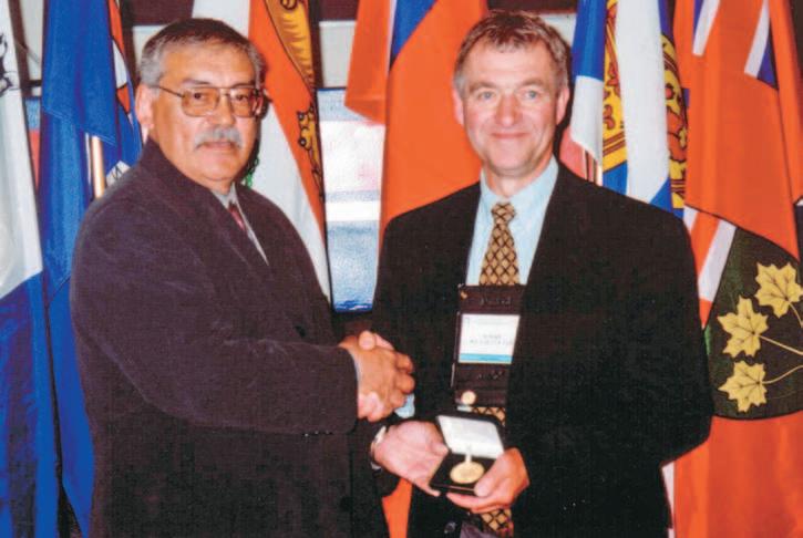
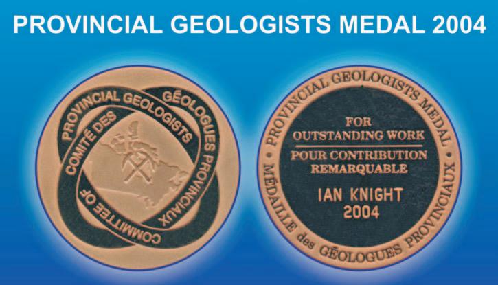
■ Provincial Geologist Medallist 2004: Ian Knight
■ Provincial Geologist Medallist 2004: Ian Knight
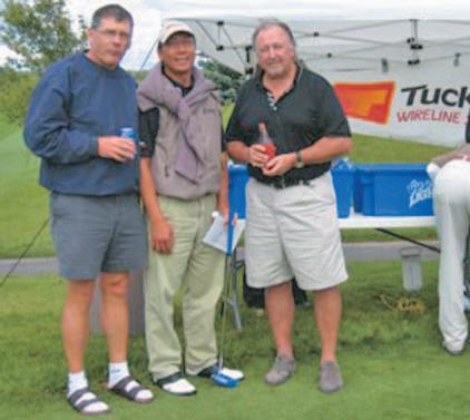
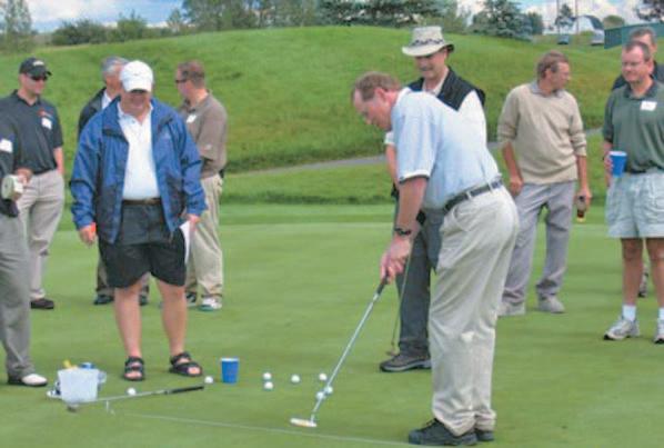
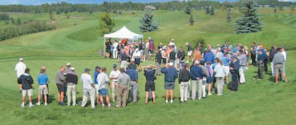
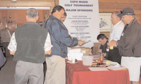
■ The CSPG Annual Mixed Golf Tournament
■ The CSPG Annual Mixed Golf Tournament
CSPG OFFICE
#160,540 - 5th Avenue SW
Calgary,Alberta,Canada T2P 0M2
Tel:403-264-5610 Fax:403-264-5898
Email:cspg@cspg.org Web:www.cspg.org
Office hours:Monday to Friday,8:30am to 4:00pm
Business Manager:Tim Howard
Email:tim.howard@cspg.org
Office Manager:Deanna Watkins
Email:deanna.watkins@cspg.org
Communications Manager:Jaimè Croft
Email:jaime.croft@cspg.org
Conventions Manager:Lori Humphrey-Clements
Email:lori@cspg.org
Corporate Relations Manager:Kim MacLean
Email:kim.maclean@cspg.org
EDITORS/AUTHORS
Please submit RESERVOIR articles to the CSPG office.Submission deadline is the 23rd day of the month,two months prior to issue date. (e.g.,January 23 for the March issue).
To publish an article,the CSPG requires digital copies of the document.Text should be in Microsoft Word format and illustrations should be in TIFF format at 300 dpi.For additional information on manuscript preparation,refer to the Guidelines for Authors published in the CSPG Bulletin or contact the editor.
COORDINATING EDITOR & OPERATIONS
Jaimè Croft
CSPG
Tel:403-264-5610
Fax:403-264-5898
Email:jaime.croft@cspg.org
TECHNICAL EDITOR
Ben McKenzie
GEOCAN Energy Inc.
Tel:403-261-3851
Email:bjmck@telusplanet.net
ADVERTISING
Kim MacLean
Corporate Relations,CSPG
Tel:403-264-5610,Ext 205
Email:kim.maclean@cspg.org
Advertising inquiries should be directed to Kim MacLean.The deadline to reserve advertisingspace is the 23th day of the month, two months prior to issue date.All advertising artwork should be sent directly to Kim MacLean.
The RESERVOIR is published 11 times per year by the Canadian Society of Petroleum Geologists. This includes a combined issue for the months of July/August.
Advertisements,as well as inserts,mailed with the publication are paid advertisements.No endorsement or sponsorship by the Canadian Society of Petroleum Geologists is implied.
The CSPG Rock Shop is an attractive and affordable way to target the CSPG readership. Spaces are sold at business card sizes (3.5” wide by 2” high).To reserve space or for more information,please contact Kim MacLean at 403-264-5610,ext.205.
The contents of this publication may not be reproduced either in part or in full without the consent of the publisher.
Goodbye,Farewell,Oh,one more thing, Elections:Do we want them?
This is my final Executive Summary.After three years as your Vice President,President, and now Past President,I’m leaving the Executive behind,our Society is in good hands. I would like to thank my employer,EnCana Corporation for the support and their willingness to allow me to serve you,the membership.I would also like to thank the current and past Executive Committees for their efforts on behalf of you,the membership. The Executive is in place to serve you and
Season’s
Greetings!
You are invited to join the CSPG & geoLOGIC Systems Ltd. for wine and cheese on Thursday,December 9,2004 10:30 am – 11:30 am Telus Convention Centre (just outside the Technical Luncheon Hall)
Watch for more details in the December Reservoir.
A MESSAGE FROM THE PAST PRESIDENT
ensure that our Society will continue for years to come with our long-range planning.
Our office staff has also done a great job keeping the Society on track and working for the membership on services,administration and our annual conventions.Tim Howard,our Business Manager,is now working on our future home and the potential of us working with other Calgary-based societies on a common home in 2006.Deanna Watkins our Program and Services Manager has 90% of the members’ e-mail addresses,which has greatly improved our ability to communicate with the entire membership.Jaimè Croft, Communications Manager,has worked hard to improve the content and quality of the Reservoir and continues to work with our other publications and editors.Lori Humphrey-Clements,our Conventions Manager,has done a wonderful job on the conventions front and has also become a mother to a newborn son,and I would like to wish her well with her new bundle of joy.And last but not least,the newest addition to our staff,Kim MacLean,our Corporate Relationship Manager has done a great job of marketing our Society to the industry’s service companies and has helped us to make the Reservoir an important marketing tool for the industry.
My exit from the Executive Committee allows me to mention one of the most frustrating things:the lack of volunteers interested in serving on the Executive.As your last elected President,the last three years have seen a dearth of members willing to serve.The last two years have see acclamation of your entire Executive.Our Bylaws allow for members to volunteer as candidates,have someone nominated them for office or to write in an additional candidate on an election ballot.Each year the Past President works hard to find the required candidates,with very little interest from the membership.The strength of our society rests with the willingness of the membership to serve in all of the varied roles. The CSPG is a not-for-profit society and the Governance states we will hold an election once a year.Let’s hope in the future,we’ll have the ability to have ten members out of 3,000 willing to step-up to serve a term for their society.
Once again,thanks for the opportunity to serve you the last three years.
John R.Hogg CSPG President,2003
Feb. 14-18,
Courses include:
- Reservoir Engineering for Geologists
- Geochemical Exploration
- Tight Gas Sands
- Risk Analysis for Development Applications
- Giant Oil and Gas Fields
- Well Log Analysis
- Assessment, Classification & Reporting of Reserves
- Practical Salt Tectonics
- Essentials of Subsurface Mapping
- Permeability in Carbonate Rocks
Toll-free (U.S. and Canada) 888-338-3387or 918-560-2621 Fax 918-560-2678
You are invited to join the CSPG & geoLOGIC Systems Ltd. for wine and cheese on Thursday,December 9,2004 10:30 am – 11:30 am Telus Convention Centre (just outside the Technical Luncheon Hall)
Watch for more details in the December Reservoir.
TECHNICAL LUNCHEONS
NOVEMBER LUNCHEON
BC’s offshore petroleum: recent developments and prospectivity of Queen Charlotte Basin
SPEAKERS
Dr.Michael Whiticar School of Earth and Ocean Sciences, University of Victoria
Dr.Ron Smyth
BC Offshore Oil and Gas Team Ministry of Energy and Mines
11:30 am
Thursday,November 4,2004
TELUS CONVENTION CENTRE CALGARY, ALBERTA
Please note:
The cut-off date for ticket sales is 1:00 pm,Thursday,October 28th. Ticket price is $28.00 + GST
The British Columbia offshore basins have been closed to exploration by both federal and provincial moratoria since the 1970s after the initial phase of exploration by Shell Canada in 1963-69 and by Chevron Canada in 1971-72.This included about 38,500 line kilometers of seismic and 14 offshore dry wells in the Queen Charlotte (QCB) and Tofino Basins.The QCB was the focus of a three-year multidisciplinary basin analysis by the Geological Survey of Canada under the Frontier Geoscience Program from 1987 to 1990 when over 1,200 line kilometers of seismic was shot.In 2001 the GSC released a bulletin on the petroleum resource potential of the west coast basins that indicated a petroleum resource potential for the QCB of 9.8 billion bbls oil and 25.9 TCF gas,in-place. Despite a failed attempt to negotiate a Federal-Provincial Pacific Accord in the 1980s,the release of these petroleum estimates has renewed the question for governments,coastal communities,and industry of lifting the offshore moratorium.
Since 2001,the British Columbia government has undertaken several reviews of the moratorium:1) review of offshore oil and gas technology,2) independent science panel review to determine if oil and gas could be extracted in a scientifically and environmentally sound manner,and 3) task force of government MLA’s to listen to the views of communities and First Nations.Favourable
findings led the BC Government to ask the Federal Government to consider lifting the federal moratorium.BC also appointed a dedicated offshore oil and gas team to develop a provincial position and to move effectively towards development of the resource.In response,the Government of Canada announced in 2003 that it would undertake a three-part review of the federal moratorium focused only on the QCB.This project would consist of:
1) review of science issues,
2) public hearings,and
3) engagement with First Nations to ensure their interests are fully explored.
The science review was conducted at arms length by a Royal Society of Canada expert panel,which reported their findings in February of 2004.The other two components are ongoing.
The UVic Petroleum Systems Modeling group conducted detailed petroleum assessment using existing data from selected regions of QCB.The region is tectonically and sedimentologically
heterogeneous.Therefore petroleum generation from Cenozoic units is restricted,not basinwide.Presently,the majority of Neogene source rocks are mature,mostly gas-prone,and entered the petroleum window in the past 10Ma.In the studied region,the most productive fairway is about 75 km wide and extends 380 km along Hecate Strait.Offshore Mesozoic source rocks are poorly understood.Using onshore equivalents,the offshore Mesozoic sources are oil-prone and now overmature.
BIOGRAPHY
Michael Whiticar,Professor in Biogeochemistry in SEOS,joined UVic in 1990 after periods with PetroCanada,Calgary;the Federal Institute of Geosciences and Natural Resources (BGR), Hannover,FRG;and the University of Copenhagen, DK as the Nordic Professor in Petroleum Geology.
Ron Smyth is the Chief Science Officer with the BC Offshore Oil and Gas Team,Ministry of Energy and Mines.He was the Director of the BC Geological Survey from 1985 to 2000.He is a graduate of Trinity College,Dublin and Memorial University of Newfoundland.
Advancing the process of reservoir management
NOVEMBER LUNCHEON
Facies architecture of an ostensibly monotonous limestone succession –the giant Famennian Palliser Platform of western Canada
SPEAKER
Arndt Peterhänsel
Dept.of Earth Sciences
University of Cambridge
11:30 am Thursday,November 25,2004
TELUS CONVENTION CENTRE CALGARY, ALBERTA
Please note:
The cut-off date for ticket sales is 1:00 pm,Monday,November 22nd. Ticket price is $28.00 + GST.
The Giant Devonian Palliser Epeiric Platform
Numerous carbonate platforms around the world are dominated by uniform,thickbedded,poorly fossiliferous and burrowmottled,subtidal limestones.Owing to these rather unexciting traits,they have not received much attention and thus their depositional setting is still poorly understood.With a thickness of up to 600 m and an outcrop area of about 100,000 km2 –a sixth of its total distribution – the apparently monotonous Palliser Formation in the Canadian Rocky Mountains and its subsurface equivalent,the Wabamun Formation,represent a case in point.There, almost 200,000 km3 of calcareous sediments were deposited in the aftermath of the Frasnian–Famennian mass extinction.The Palliser epeiric carbonate platform with its westward-oriented rollover ramp is largely characterised by open-marine,frequently wave-agitated,shallow subtidal deposition.
Obliteration Processes
The Palliser platform displays ubiquitous evidence for dominance of storm sedimentation with grainstone-filled
burrows,millimeter- to centimeter-size ripup clasts of various facies types,abraded clasts,and frequent interbedding of intraclastic grainstones.Obliteration processes include comminution,bioerosion, and syngenetic skeleton dissolution,as well as bioturbation.These features left a distorted picture of the Palliser facies,thus significantly hampering sedimentological and palaeoecological interpretations and concealing the extent of the Late Devonian faunal crisis and discovery.In fact,an ample amount of “non-skeletal” micritic grains were identified as being of biogenic origin.These micritised echinoderms and endocasts of dissolved calcareous algae suggest that a vast area of the Palliser platform must have been characterised by subtidal dasycladalean and crinoid gardens.The millimeter-sized dasycladalean algae formed a photosynthetic carpet covering the lower tier,while the taller crinoids represented the more waveresistant canopy of the benthic community. Both acted as trappers,stabilising fine sediment in similar ways to modern sea grasses.
Proud sponsor of Dr.Arndt Peterhänsel’s presentation.
TECHNICAL LUNCHEONS
DECEMBER LUNCHEON
New insights into the exploration potential of deepwater carbonate slope deposits and their application to the Devonian in the subsurface of Alberta
SPEAKERS
Nigel Watts,Ian McIlreath, and Jeremy Philips EnCana Corporation
11:30 am Thursday,December 9,2004
TELUS CONVENTION CENTRE CALGARY, ALBERTA
Please note:
The cut-off date for ticket sales is 1:00 pm,Monday,December 6th. Ticket price is $28.00 + GST
One of the more impressive carbonate environments is the slope and basin facies of many carbonate complexes.Although typically ignored by industry,no geologist can fail to be in awe by the sight of massive, randomly oriented,individual limestone blocks of carbonate margin sediment or in debris flows interbedded with finer lime mudstones when they are seen in outcrop.
Often our understanding of the genesis and nature of this carbonate facies is hampered because modern slope deposits are not easily accessible (i.e.,deep water).Ancient occurrences of slope deposits are sometimes misinterpreted as tectonic breccias or melanges.Isolated carbonate bodies in basinal settings are easily mistaken for pinnacle reefs or downslope mounds. Further,slope deposits occur at depth and are therefore impacted by major changes in pressure,temperature,and oxygen levels, the effects of which are poorly understood.
Yet,this unique environment,where our sedimentological knowledge is lacking,is an area that hosts hydrocarbon reservoirs of major economic importance (e.g.,the Poza Rica Field in Mexico - a giant oil field).
Using examples from modern slope deposits in the Caribbean and ancient examples from,primarily,the Devonian of the Southern Canadian Rockies and the West Texas-New Mexico Permian Reef Complex, we will show that you can develop play types for this environment based upon recognizing certain facies and associations.
For the last decade or so,industry has been extensively exploring deep-water clastics worldwide while similar deep-water carbonates have been largely ignored. However,with increased recognition of this facies many new examples of potential exploration targets from carbonate slopebasin settings could be identified,and existing reservoirs could be reinterpreted and better optimized.The deep slope and basin should not be dismissed as a feasible exploration area and may house new play trends if the long-standing practice of stopping exploration at a carbonate edge is resisted.Historically,industry has used slope deposits as “proximity indicators” showing how close they are to platform margins. Perhaps as explorationists we are going the wrong way! Maybe there are a number of new conceptual plays in the Western Canadian Sedimentary Basin that have not been truly exploited!
BIOGRAPHY
Nigel Watts,a geologist with EnCana Corporation,has over twenty years of experience in the exploration for and production from carbonate reservoirs.He has developed exploration plays in most of the carbonate sequences in the Western Canada Sedimentary Basin.For several years he was involved in the geological characterization of Devonian reefs for EOR schemes.Nigel has also studied ancient carbonate sequences in the US, Canadian East Coast,Indonesia,Angola,Great Britain,and Europe as well as modern carbonates in Jamaica,Mexico,and Belize.He has taught in-house short courses on carbonate sedimentology,field seminars on the Devonian reefs in the Canadian Rockies,and modern carbonate field seminars.He has published papers and given talks,on carbonate sedimentology,carbonate diagenesis, stratigraphy,structural geology,and reservoir characterization.
Ian McIlreath,Technical Advisor at EnCana Corporation,has worked a number of separate stints during his 30-year career on carbonate margin to basin transitions in outcrop and in the subsurface in Canada,the U.S.,southeast Asia, and in the Middle East.He utilizes detailed outcrop field studies as analogs to model subsurface cases in exploring for hydrocarbons. He has studied many of the Upper and Middle Devonian margin-to-basin transitions in outcrop, from just north of Waterton National Park, along the Front Ranges to just south of the Yukon border.His interest in carbonate slopes began with his Ph.D.thesis on the Middle Cambrian carbonate margin to basin transitions
exposed in the Main Ranges in Yoho National Park.Dr McIlreath has received a number of technical and major service awards from the CSPG and was President in 1983.
Jeremy Philips graduated from the University of Alberta with a B.Sc.Specialization Geology in 2000.After graduation,he went on to join PanCanadian working a variety of projects from regional carbonate exploration to reservoir modeling in carbonates and clastics.He currently works for EnCana developing exploration plays in the Devonian and Cretaceous of Central Alberta.
KEEPING TRACK
Vince Ekvall
New: Spry Energy Ltd.
Previous: Canadian Superior
Facies Architecture
Detailed analysis of the depositional macro- and microfacies revealed hitherto unappreciated lateral and vertical variations in carbonate particle composition and fossil abundance reflecting bathymetrical variations.A subdivision of the succession is not based merely on vertical lithological changes but also used third-order transgressiveregressive facies trends,which can be correlated over hundreds of kilometers across the epeiric platform.During longterm transgressions,restricted easterly platform areas – now in the subsurface of the Alberta Foothills and Prairies –developed potential stratigraphic traps for hydrocarbons with peritidal calcisiltstones and fenestral fabric sandwiched into regressive evaporite deposits.
CONCLUSIONS
Seemingly monotonous,thick limestone successions,such as the Palliser Formation, hide an originally more heterogeneous facies than hitherto appreciated. Obliteration and storm sedimentation played an important role in the determination of the platform architecture. These processes and the predominance of non-reef flora and fauna,such as green algae and echinoderms,especially in postextinction periods,likely influenced the architecture of many other epeiric carbonate platforms in similar ways,for example by preventing the development of a distinct rim.The results of this work could serve as a model for an improved sedimentological understanding of many giant tropical platforms that have previously been largely neglected.Finally,the reconstruction of the Palliser facies architecture significantly improves the prospects of locating oil and gas in these platform deposits.
BIOGRAPHY
Arndt graduated from the Ruprecht-KarlsUniversität in Heidelberg with a German Diploma degree in geology-palaeontology in 1993.In 1996 Arndt received his M.Sc. followed by his Ph.D.in Geology from the College of Graduate Studies and Research at the University of Saskatchewan.Arndt has received numerous awards and was the winner of the 2003 CSPG Ph.D.thesis award. Arndt is currently involved with an award of a 24-month European Commission Marie Curie Individual Fellowship for post-doctorate research in Cambridge,England.
DIVISION TALKS
HYDROGEOLOGY DIVISION
Geological and hydrogeological characterization of the IEA Weyburn CO2 Monitoring and Storage Project
SPEAKERS
Ben Rostron Earth and Atmospheric Sciences, University of Alberta
Daniel Khan Earth & Atmospheric Sciences, University of Alberta
Steve Whittaker
Saskatchewan Industry & Resources
12:00 Noon
Thursday,September 18,2004
EnCana Amphitheatre, 2nd Floor East end of the Calgary Tower Complex, 1st Street and 9th Avenue SW Calgary, Alberta
In July 2000,a major research project was launched by the Petroleum Technology Research Centre (PTRC) in close collaboration with EnCana Resources to study the potential for geological storage of CO2 in the Weyburn oilfield,located in southeast Saskatchewan.The Weyburn Project has become an active field demonstration of geological carbon storage, and the largest CO2 sequestration operation in the world.Geological and hydrogeological mapping was completed on a 50,000 km2 area around the Weyburn Project site to identify the directions and rates of fluid flow through aquifers,to assess the competence of aquitards,and to define boundary conditions for risk analysis system models.
Mapping revealed that formation fluid-flow directions are generally up-dip through the aquifers from the S-SW toward the NE.Total dissolved solids (<5 to >350 g/L) of formation water varies laterally within individual aquifers and vertically throughout the section due to mixing between Ca-SO4 water of meteoric origin,high salinity Na-Cl
INTERNATIONAL DIVISION
Speculated petroleum potential offshore Tanzania,with particular emphasis on Antrim’s perseverance in the Pemba segment
SPEAKER
Keith Skipper
Antrim Energy Inc.
12:00 Noon
Tuesday,November 16,2004
EnCana Amphitheatre, 2nd Floor East end of the Calgary Tower Complex, 1st Street and 9th Avenue SW Calgary, Alberta
The East African coastal margins are under explored although there are commercial accumulations of gas (Songo Songo on-stream June 2004) and numerous indications of the potential presence of commercial oil.Effective and organically rich petroleum source rocks in the “oil window” exist in the Mesozoic and Tertiary.In addition to activities targeting offshore Madagascar and Mozambique,the potential of the Pemba segment offshore Kenya and Tanzania,has been high-graded by
Antrim and others as an area worthy of further exploratory investigation,primarily for oil sourced from the Jurassic and Cretaceous. Reservoir targets are principally clastic with potential giant-size traps predicted to occur, particularly in Tertiary “resedimented” facies and Cretaceous Neocomian clastics.Technical evaluations are at an early stage but there is a growing appreciation as new data is acquired (both well and seismic) in the potential of what may perhaps be a “forgotten” frontier.
BIOGRAPHY
Keith Skipper,P.Geol.is a seasoned explorationist and executive whose early career was with AMOCO,then subsequently at Bridge Oil Limited and PanCanadian.He is presently Executive Vice President of Antrim Energy Inc and a non-executive director of Avery Resources Inc.Keith has a keen interest in global petroleum issues - besides trying to find oil and gas at a profit.
INFORMATION
There is no charge.Please bring your lunch. Refreshments are provided by EnCana and ECL Canada.For more information or to give a talk in the future,please contact Geoffrey Say at 403 263 0449 or e-mail at g.say@ecqc.com
brines,and hypersaline Ca-Na-Cl brines. Within the project area,there is no evidence for regional flow of formation waters from the deep hydrogeological systems of the Midale aquifer across the Watrous aquitard into the shallow (1000 to 300 m deep) upper aquifers.The Watrous aquitard should serve as an excellent primary seal for CO2 injected into the Midale reservoir at the Weyburn Field low-flow velocities (<1 m/yr).Also, favourable (horizontal) flow directions in the Midale aquifer enhance hydrodynamic trapping of CO2.High flow velocities in overlying aquifers (1-10 m/yr) are important input parameters to assess the impact of CO2 leakage into overlying horizons.
Geological and hydrogeological mapping demonstrates that the Weyburn site is a good location to sequester CO2 from a fluid flow perspective.The multi-disciplinary approach and techniques used at Weyburn can be used to identify other sites for CO2 sequestration and are applicable to geological storage site characterization in sedimentary basins worldwide.
1) New 2004 Version: Glauconitic Channel Trends - Southern and central Alberta, West-central Saskatchewan
2) Mississippian Subcrops and Devonian Reef Edges - Alberta, NE BC, NWT and Saskatchewan
3) Colony/Sparky Reservoir Trends - East - central Alberta
4) Bluesky-Dunlevy Reservoir Trends - NE BC
5) Halfway-Doig Shoreline Trends - Peace River Arch, NE BC
6) Charlie Lake Siphon, Cecil and North Pine Reservoir Trends - NE BC
All edges are formatted as map features for use in Accumap and ESRI Shape files for other programs. For more information contact: Mike Sherwin 403-263-0594
For the past 15 years,oil and gas producers in Alberta have been increasingly turning to the disposal of acid gas (H2S and CO2) by injection into deep geological formations.The flow of acid gas in the subsurface is driven by imposed pressure gradients and buoyancy,and is dependant on density and viscosity ratios between the injected acid gas and the
formation water.The evolution of the acid gas plume can be divided into two stages:a) formation and spread of the plume in close vicinity of the borehole during injection and b) long-term migration of the acid gas plume after injection has ceased.The flow of the acid gas during injection is driven mainly by injection hydrodynamics and is controlled by viscous forces that dominate over buoyancy effects.In the case of acid gas injection operations in the Alberta Basin,the respective acid gas plumes have probably spread between 100 and 1,500 m from the injection well.After injection has ceased,the migration of the acid gas plume is driven by a combination of hyrodynamic forces (flow of formation water) and buoyancy – the latter,in most cases,being dominant.Therefore,migration of the acid gas plume will be generally updip with slight deviations dependant on the direction and magnitude of formation water flow.Dispersion and dissolution of the acid gas along the flow path restricts the spread of the plume to a distance of a few tens of kilometers away from the injection well.
BIOGRAPHY
Karsten Michael received his degree as “Diplom
STRUCTURAL DIVISION
Keep an eye on your basement!
It is the foundation of the overlying stratigraphy and structure
SPEAKERS:
John W.Peirce and Lisa A.Griffith
GEDCO
12:00 Noon
Thursday,November 18,2004
Petro-Canada
West Tower Room 17 D
150 6th Avenue SW Calgary, Alberta
ABSTRACT
The influence of basement on the overlying stratigraphy and structure is axiomatic for those geoscientists who work on a regional scale.The question is not ‘if’,but ‘how much,and where’? However,for those who work mostly at the prospect scale,it is
common to lose sight of the importance of the regional perspective,and therefore to fail to consider how basement tectonics may be influencing a play.
This paper will discuss many of the ways the basement influences overlying stratigraphy and structure using case studies to support and illustrate important points.The majority of examples will be Canadian,but some international cases will be included.
This paper was previously presented at the 2004 CSPG Convention.
Examples of basement control on shallower stratigraphy and structure:
Crystalline basement usually has a characteristic set of joints which are pervasive on a regional to continental scale.Often these basement joint orientations are reflected in near surface lineaments as mapped on remote sensing data.In the Western Canada and Williston
(Continued on Page 16..)
Geologe”(M.Sc.equivalent) from the Technical University Berlin,Germany and obtained his Ph.D. degree from the University of Alberta in 2002. Currently,he is working at the AEUB/AGS on hydrogeological aspects of CO2 and acid gas sequestration in the Alberta Basin.
Stefan Bachu is a Senior Advisor for Energy and CO2 Geoscience at the Alberta Geological Survey (AGS),Alberta Energy and Utilities Board.For the past several years Stefan has focused his efforts on the potential for CO2 storage in geological media in Alberta as a mitigation strategy for reducing greenhouse gas emissions into the atmosphere.Based on his contribution to this emerging field,Stefan was appointed in 2003 as a Lead Author for writing the Special Report on CO2 Capture and Storage by the International Panel on Climate Change,due for publication in the Spring of 2005.
INFORMATION
All lunch talks are free.Please bring your lunch. For more information or to present a future talk for the Environment Division contact Andrew Fox at foxaj@bp.com or for the Hydrogeology Division contact Steve Grasby at sgrasby@gsc.nrcan.gc.ca.
Rakhit Petroleum Consulting Ltd. announces that Cheryl Y. Wright has joined their management team as Director of Sales. Ms. Wright received her business degree from the University of Calgary and has focussed on marketing/sales and business development of geotechnical projects and services for over 20 years. She spent the last 12 years operating her own successful business practice acting as exclusive marketing agent for several geotechnical companies.
Earlier this year, Rakhit Petroleum Consulting Ltd. and Canadian Discovery Ltd. announced their corporate merger. “Bringing the two companies together under the same roof will bolster our collective technical experience, skills and resources, and will lead to significant improvement in our products and delivery systems” stated Kaush Rakhit, President of Rakhit Petroleum Consulting Ltd. With a library of hundreds of hydrogeologic studies and several new projects on the horizon, Rakhit continues to be a leader in delivering quality, timely and relevant products.
Contact Cheryl Wright at 403.264.4466
Rakhit Petroleum Consulting Ltd. Strengthens Management Team
Basins,these joint orientations strike NE and NW (although they can change character and orientation subtly from terrane to terrane).These preferred orientations strongly influence the orientation of smaller-scale fractures and faulting in the entire overlying Phanerozoic section.It is often unclear whether these aligned structures are through-going in depth,but certainly the presence of major basement jointing should make a geoscientist investigate the possibility of a fractal joint ‘family’ which may influence such elements as preferred fluid movements within pools.
Reactivation of pre-existing basement faults is also an important – but complex - way the basement interacts with the overlying section.Reactivation can occur multiple times with not only a wide variety of magnitude of movement,but also with different senses of motion through time. Not only does basement structure imprint carbonate and clastic deposition,it can also have a major influence on the behaviour of later evaporite deposits.
Pre-existing basement structure can also
have a major effect on the development of fold and thrust systems in later orogenies. There are several examples of major stratigraphic and structural variations being controlled by underlying basement faults, including the major changes in structural style on either side of the Great Slave Lake Shear Zone,and the Vulcan Suture.
Wrench faults and other deep-seated faults impact surrounding sediments diagenetically as major conduits for focussing the flow of hot fluids.Hot fluids can play a local role in the thermal maturity of source rocks,but more importantly,they control the creation - or destruction – of reservoir quality.
CONCLUSION
Basement structure is the foundation for the overlying stratigraphy and structure. There are many examples of subtle variations that appear,at first glance,to be random.With closer examination over a large area,the underlying cause – basement control – often becomes clear. Understanding this influence and learning to decipher it gives the explorationist the power of prediction.Prediction is one of the most critical skills for generating new
PALAEONTOLOGY DIVISION
Why are the Canadian Rockies important for conodont work in the outboard terranes of western Canada?
SPEAKER
Erik C.Katvala
University of Calgary
7:30 PM
Friday,November 19,2004
Mount Royal College Room B108
4825 Richard Road SW Calgary, Alberta
The microfossils known as conodonts belong to an extinct group of animals closely related to vertebrates.Conodonts evolved relatively quickly,allowing for precise biostratigraphic age determination equaling or surpassing most fossil groups
during their span from the Late Cambrian through the Triassic.Application of conodont biostratigraphy in the Canadian Rocky Mountains over the last few decades has significantly refined our understanding of the geologic history in the region.
The terranes of Western Canada represent one of the biggest puzzles in geology.The original North American continent in the Rocky Mountains represents a close, relatively well-understood control point with which to compare the geologic histories of the terranes.Comparing these two regions by using conodont species with recognized paleogeographic significance as well as recognized unconformities,tectonic events,and changes in sea level,continues to increase our understanding of the unique geologic histories present in the terranes.
BIOGRAPHY:
Erik Katvala received a B.Sc.in zoology and
plays,whether one is working in a frontier basin overseas or in a very mature basin here at home.
BIOGRAPHIES:
Dr.John W.Peirce is a Managing Partner of GEDCO with responsibility for their Geophysical Services Division.He has worked on basin analysis and the interpretation of gravity and magnetic data throughout the world.
Lisa Griffith (lgriffith@telus.net;669-7494) is President of Griffith Geoconsulting Inc.and was Chief Geologist of GEDCO until recently.Her specialty is clastic sedimentology.She has been instrumental in drilling over 120 wells and optimizing production in 50 fields.
INFORMATION:
Talks are free;please bring your lunch.Goodies and drinks are provided by HEF Petrophysical Consulting.If you would like to be on the Structural Division e-mail list,or if you’d like to give a talk,please contact Elizabeth Atkinson at (403) 296-3694 or eatkinso@petrocanada.ca.
geology from the University of Calgary,a M.S. in paleontology and stratigraphy from the University of Montana,and is currently working on a Ph.D.with Dr.Charles Henderson at the University of Calgary.His previous experience in paleontology includes ages from Cambrian through Cretaceous in areas from Montana through northeast British Columbia and along the West Coast on Vancouver Island and in southeast Alaska.
INFORMATION:
This event is jointly presented by the Alberta Palaeontological Society,Mount Royal College and the CSPG Palaeontology Division.For information or to present a talk in the future please contact CSPG Paleo Divison Chair Philip Benham at 403-691-3343 or programs @albertapaleo.org.Visit the APS website for confirmation of event times and upcoming speakers:http://www.albertapaleo.org/
EMERGING PETROLEUM RESOURCES DIVISION
Fracture analysis in low permeability reservoirs
SPEAKER
Satyaki Ray
Schlumberger
12:00 Noon
Tuesday,November 16,2004
ConocoPhillips Auditorium
3rd Floor – west side of building 401- 9th Avenue SW (Gulf Canada Square) Calgary, Alberta
Natural fractures are significant contributors to oil and gas production from both conventional and nonconventional geological strata.The reservoirs in these geological strata could have moderate to high porosity and permeability as well as low porosity and permeability.Open natural fractures in all reservoirs may act as boons to producibility.Sometimes they may act as risks,causing early water breakthrough in hydrocarbon producing wells.This is particularly critical for low permeability sandy and shaley reservoirs when primary porosity is either obliterated by digenesis or reduced by stresses.The permeability in such cases is driven mostly by natural fractures.The challenge is often manifested in the form of lack of resolution of formation evaluation tools of the subsurface and the scale of these features. In this talk,a brief discussion is done on the scale and relative occurrence of fractures in various types of reservoirs and a way to describe them in the subsurface using high-resolution borehole images.The aim is to demonstrate global and local examples of analysis and visualization of fractures using electrical and acoustic images of the subsurface.This information could be integrated with other reservoir engineering information to accurately model the reservoir.
INFORMATION
All luncheon talks are free – please bring your own lunch.If you would like more information about future EPRD activities,please join our email distribution list by sending a message with the title “EPRD list”to caddelem@bp.com.
THE LIVING MODEL
TRACKING AND GUIDING YOUR RESERVOIR DEVELOPMENT: THE ULTIMATE WORKFLOW SOLUTION
THE LIVING MODEL TM WORKFLOW FACILITATES A COMPLETELY DIFFERENT APPROACH TO SUBSURFACE CHARACTERIZATION—FROMSEISMIC TO SIMULATION. Instead of each domain passing its results down the chain, an asset team can now share the same reservoir model and focus on the areas that really impact day-to-day business decisions.
PetrelTM is at the heart of the Living Model, complemented by GeoFrame®, ECLIPSE®,Merak® , and InsideReality.TM Blending these Schlumberger Information Solutions technologies and potentially third-party products and services, the Living Model provides a 3D representation of the reservoir with both static and dynamic modeling capabilities. It enables modeling for the masses, uniformity for decision making and models that can be updated easily.
A combination of speed and application depth, the Living Model is the ultimate workflow solution.
Faculty Position in Petroleum Geoscience (Reservoir Imaging)
The Department of Earth Sciences at Memorial University of Newfoundland invites applications for a faculty position in Petroleum Geoscience (Reservoir Imaging). This position is an integral element in Memorial University’s new broadly-based strategic petroleum initiative, the Oil and Gas Development Partnership (www .mun.ca/ogdp), which recognizes the rapid expansion in hydrocarbon exploration and production in offshore Newfoundland. The successful candidate will join an active department of 25 faculty members (www .esd.mun.ca) and will play a complementary role in a growing team of petroleum geoscientists operating within the framework of the PanAtlantic Petroleum Systems Consortium (PPSC: www.mun.ca/ogdp/ppsc).
This position is funded as a contractual position until March 31, 2008, under the terms of a grant from the Atlantic Innovation Fund to the PPSC, with the possibility of renewal or conversion to tenure track with administrative approval.
Applicants will be expected to undertake cutting-edge research in reservoir imaging, based on expertise in structural/stratigraphic reconstruction and geophysical characterization.
Applicants will normally hold a PhD in petroleum geoscience or a related field. They should have a demonstrated record of technical achievement and publication in a field relevant to the appointment and of excellence in teaching at the undergraduate and graduate levels. A proven record of effective involvement with the petroleum industry would be a significant asset.
The Department of Earth Sciences comprises researchers with a wide range of interests relevant to petroleum geoscience and close collaborative ties with industry and geological surveys, locally, nationally and internationally. Current petroleum-related research in the Department is supported by extensive analytical, field and computing facilities, including an immersive visualization room.
Memorial University is the largest university in Atlantic Canada. As the province’s only university, Memorial plays an integral role in the education and cultural life of Newfoundland and Labrador. Offering diverse undergraduate and graduate programs to almost 18,000 students, Memorial provides a distinctive and stimulating environment for learning in St. John’s, a safe, friendly city with historic charm, a vibrant cultural life and easy access to a wide range of outdoor activities.
Memorial University is part of a vigorous, local community which maintains an inventory of available positions for qualified partners. Partners of candidates for positions are invited to include their resume for possible matching with other job opportunities. Memorial University is committed to employment equity and encourages applications from qualified women and men, visible minorities, aboriginal people and persons with disabilities. All qualified candidates are encouraged to apply; however, Canadians and permanent residents will be given priority.
Review of applications will begin November 1, 2004, and continue until the position is filled. Interested persons should send a resume and the names of three referees to:
Dr. Rick Hiscott, Interim Department Head Department of Earth Sciences
Memorial University of Newfoundland St. John’s, NL, Canada A1B 3X7
Phone: (709) 737 -2334
Fax: (709) 737-7437
E-mail: head@esd.mun.ca
JACK PORTERVIGNETTES OF CANADIAN PETROLEUM GEOLOGY
Continued from the October Reservoir
Martin Frobisher’s Third Voyage to his “Frobishers Streytes” to mine for gold
Martin Frobisher’s first obligation on returning to England,following his second voyage to “Frobishers Streytes” in 1577,was to visit Queen Elizabeth at her Windsor Court to inform her of the expedition’s success in returning home with his crew and fleet intact.The exception,unfortunately, being Master William Smith of the Gabriel who was washed overboard and drowned during a fierce storm encountered on the return journey.His bosun,also washed overboard,managed to grab an overhanging ship’s rope and was saved.To the Queen’s delight,he proudly conveyed to her the good news that the ships’ holds contained a cargo of 200 tones of “gold bearing ore.” Frobisher pleased her further by presenting her with the “horn of the sea unicorn” (narwhale tusk) as a personal souvenir from her new domain, Meta Incognita.Martin Frobisher further acknowledged his disappointment in not being able to obtain the release of five of his seamen who had been snatched by those “salvagies” during the seamens’ unauthorized attempt to trade with them on Hall’s Island in the summer of 1576.Nevertheless,Frobisher had returned with a native woman and her infant as well as an unrelated male,which members of his crew had captured,for the purpose of negotiating a ransom for the return of the five seamen.
The shipment of “gold ore” had been mined from exposed bedrock at water’s edge on Anne Warwick Island – named after the Countess of Warwick,the wife of the Earl of Warwick.The latter was an influential friend of Queen Elizabeth and a sponsor of Frobisher’s voyages.This small island is located at the northwest entrance to Countess of Warwick Sound;the latter being situated on the North Foreland of “Frobishers Streytes.” The early onset of winter storms,accompanied by the formation of sea ice,had restricted the period for the removal and loading of the “ore” to three weeks.This inclement weather further prevented Frobisher from fulfilling a subordinate mandate,which order required either the barque Gabriel or barque Michael to proceed 100 leagues (300 miles) into “Frobishers Streytes” to ascertain if it would have a connection with the fabled Strait of Anian,which was conceptualized to access the Southern Sea (Pacific Ocean).
The “ore” contained in the flagship Ayde,and the Gabriel and Michael,was unloaded, transported,and sequestered in Bristol Castle as well as the Tower of London.Bulk samples of 100 pounds were first smelted at Winter’s warehouse at Bristol in two improvised small furnaces built by Jonas Schultz,a German assayer.His questionable and probable spurious results,obtained from relatively small bulk samples,smelted in inadequate furnaces which were incapable of attaining a temperature required to separate any metal contained in the “ore,” indicated a yield of £40 value of gold per ton smelted (i.e.£2 per 100 pounds of “ore” sample smelted).Schultz further alleged that since his small furnaces produced insufficient heat to separate the gold content from the “ore,” that much gold was lost in the process and remained in the residual slag.During Schultz’s smelting operation,Robert Denham,who was an English assayer,along with Martin
Frobisher,Michael Lok,and William Winter were present as curious observers,bent on being convinced that their “ore” contained enough gold to not only liquidate the Company’s indebtedness,following the expenses incurred during Frobisher’s voyages of 1576 and 1577,but also to finance a return expedition to Anne Warwick Island to mine a much larger quantity of “ore.” When Denham’s opinion was solicited by Lok in regard to Schultz’s claim of the richness of gold contained in the “ore,” the former equivocated by failing to challenge Schultz on his methodology and the validity of his results.Apparently,Denham,by his deliberate attempt to vacillate was,in effect, safeguarding his career so as not to place himself in jeopardy (2001,McDermott,James: Martin Frobisher – Elizabethan Privateer; pub.,Yale University Press,New Haven and London,p.197).
MAKING THE CIRCLE STRONGER: A GEOSCIENTIST’S PERSPECTIVE
The following is a geoscientist’s summary of the multi-discipline professional development sessions offered at the APEGGA Annual Conference in Edmonton in April 2004.(The 2005 Conference will be in Calgary).Over 220 people attended the six different 2-day streams of sessions – under the common theme “Making the Circle Stronger”. Many participants attended the APEGGA Summit Awards on the evening of the second day.John Boyd,P.Geoph.,CSEG President in 1986,received the L.C.Charlesworth Professional Service Award; Dr.Elizabeth Canon,P.Eng.,an organizer of an afternoon Conference session,received the Frank Spragins Technical Award.
Making the Circle Stronger: A geoscientist’s perspective on the 2004 APEGGA Annual Conference Professional Development Seminars
I take professional development seriously. My logbook is more-or-less up to date and whenever I get the chance to attend a CSPG,CSEG or APEGGA luncheon or brown bag function,I’m there.I confess I am also a course junkie.
Lately,my interest in course work widened. I became a part-time trainer for the Petroleum Industry Training Service – which provides a new context to evaluate course and trainer performance.It was with this new-found viewpoint that I found myself northbound on Highway 2 from Calgary to that geotechnical engineering marvel known as the Shaw Conference Centre in Edmonton on April 21 to attend four PD sessions and the APEGGA Summit Awards Gala.Structured on the theme “Making the Circle Stronger”,my selection of the session topics promised an overview of several growth technologies with connections to resource development.
Day 1 morning session: “Exploration and Development of Bitumen” presented by Mike Ranger.Mike is well known in the industry for his enthusiasm and knowledge of the Athabasca deposits and provided a flood of information over the next four hours.
The presentation was divided into two parts: The Big Picture and The Details.Both portions were scaled to the non-geoscience
BY TOM SNEDDON, P.GEOL,
crowd,using a minimum of jargon and wellselected photographs to illustrate key points. Your humble scribe was glad for this,as the last time I had any contact with oil sands geology was in the late 1980’s.Much has been learned in the intervening 15 years!
Mike walked us through the key elements of oil sands deposit architecture:the Prairie Salt subcrop,the pre-Cretaceous unconformity and its topography,the stratigraphy of the Clearwater and McMurray formations,and the overlying drift geometry.He then showed how each element affects the quality of the bitumen reservoirs within the Athabasca basin.
Having established a clear frame of reference,Mike then wove in the details and specifics of the Wabasca deposit and one sub-basin of the Athabasca deposit,the Hangingstone.
The Wabasca basin is still relatively undisturbed,in equal parts due to its remote location and its smallish size compared to the Peace River and Athabasca deposits.The
(Continued on Page 22...)
Hangingstone is another story.In 1986 there were 43 wells in the sub-basin.In 2003 there were 245.The 202 new holes were not for bitumen development purposes however.They were drilled for gas production and this information sparked a lively discussion about the recent treatment of gas producers in the oil sands area.
Day 1 afternoon session: “Coalbed Methane and Water Resources”.The first of three presenters was Michael Gatens of MGV Energy,with the topic “Introduction and History of NGC/CBM Development” where NGC/CBM is Natural Gas from Coal/Coal Bed Methane.Michael made two distinctly different presentations:a discussion of the structure of the industry through its association,the Canadian Society for Unconventional Gas,and an outline of both the technology for coal-sourced methane extraction and the issues surrounding the technology.
To those outside the unconventional gas industry,Michael’s talk presented the issues in remarkably non-partisan way that stimulated both discussion and fresh thinking about where this comparatively new source of energy is going.Particularly interesting was Michael’s discussion about
why the environmental damage resulting from uncontrolled formation water release in the Powder River Basin in Montana would not happen in Alberta.First,Alberta’s regulatory environment is radically different from that in the Mid-Western United States and secondly,different basins have different properties and challenges.Getting that concept across to the public is clearly a tough assignment for the industry.
The second segment of the session featured Mary Griffiths of the Pembina Institute presenting “Stakeholder Issues and Water in Natural Gas in Coal/Coalbed Methane Development in Alberta”.Whereas Michael Gatens’ talk promoted the views of the industry,Mary Griffiths’ role was to counter with public policy and safety concerns.
She began by explaining the role and mandate of the Pembina Institute as a group of people interested in “holistic and practical solutions for a sustainable world.” The Institute sees itself attempting to link together sustainable development from “Technical and Management Solutions”, public policy,and education.
Mary’s presentation was based on a set of recommendations from a report prepared
by the Institute in 2003 that suggested:(1) formal regulations should require the use of non-toxic substances for hydraulic fracturing in non-saline geologic zones,(2) prevention of negative environmental impacts from dewatering non-saline aquifers,(3) an optimum method of use or disposal of different grades of non-saline waters,(4) performance of a cumulative environmental impact assessment of large projects,and (5) strengthening the role of Alberta Environment in management of non-saline produced water.
Bill Gunter from the Alberta Research Council had the final paper of the day, “Potential Impacts of Future Technologies on CBM”.
The criteria for CBM utilization from a particular coal seam include permeability greater than .1 mD and adequate porosity to hold gas,water or a combination of the two.The enhanced extraction methods for recovery of methane involve withdrawing water from the coal or flushing water and methane with some other gas,such as nitrogen,carbon dioxide or power station flue gas.All these alternatives have been explored and all work well.
(Continued on Page 30...)
GIS Powered by
Coalbed Methane: Back to Basics of Coal Geology
2005 Gussow Geoscience Conference
March 9-11, 2005
Get fired up for a discussion on one of the hottest topics in the industry while relaxing at the Radisson Inn, nestled in the beautiful Rocky Mountain setting of Canmore, Alberta. The 2005 Gussow Conference will focus on geological aspects around Coalbed Methane (CBM)/Natural Gas from Coal (NGC) reservoirs. Sessions will focus on the following themes: geological controls on CBM, microscopic and geochemical coal studies, technical aspects of CBM from the lab to the field, and CBM in the Western Canada Sedimentary Basin. Preceding the conference is an optional short course to be held in Calgary.
Important dates to remember:
November 1, 2004 - Abstracts for poster submissions will be accepted.
December 1, 2004 to January 31, 2005 - Early-bird registration - save $100 off the registration fee!
For more information regarding the conference schedule, keynote speakers, registration, or poster submission guidelines, please refer to the CSPG website.
Simply go to http://www.cspg.org, click on Conventions in the menu bar and follow the links to the 2005 Gussow Conference!
To sponsor this high energy conference, please contact Bill McDougall, Obann Resources Ltd., 403-540-8610, email: obanres@shaw.ca or Kim MacLean at 403-264-5610, extension 205.
CANADIAN SOCIETY OF PETROLEUM GEOLOGISTS 2005 EXECUTIVE COMMITTEE
The Canadian Society of Petroleum Geologists takes great pleasure in announcing the Executive Committee for 2005. The new Executive will take office following the Annual General Meeting at the Telus Convention Centre on Tuesday,January 11,2005.
PRESIDENT – JEFF PACKARD
BIRTH: Montreal,P.Q.(1952)
EDUCATION: B.Sc.Geology,Concordia University (1976);Ph.D.Geology,University of Ottawa (1985)
EXPERIENCE: 1974-77,uranium exploration,Urangesellshaft Canada;1983-86,NSERC Visiting Scientist and contract, Geological Survey of Canada;1986-90,carbonate specialist,Texaco Canada Resources;1990-92,Senior Geologist,Imperial Oil;1992-98,consultant and senior partner in Rhomb Carbonate Consulting;1998-2001, Senior Geologist,Poco Petroleum;2001-2004,Senior Geologist,Burlington Resources
PROFESSIONAL MEMBERSHIPS: CSPG
CSPG ACTIVITIES: General Chair of Canadian Reef Inventory Project (1985-89);CSPG Executive candidate (1988);co-founder of Carbonate Liar’s Club of Calgary (1988);Geological Atlas Project (1989-94);CSPG Visiting lecturer (1992-93), technical coordinator for carbonate papers at CSPG Annual Convention (1994);CSPG Winterburn Advantage Committee (1995);Co-General Chair,Joint CSPG-SEPM Convention 1997 (1995-97);Co-Convener 2004 Dolomite Conference (2002-04)
PUBLICATIONS: numerous written papers and oral presentations on carbonate geology of WCSB and Arctic Canada
AWARDS: CSPG Tracks Award (1987);CSPG President’s Award (1999)
VICE-PRESIDENT – JAMES REIMER
BIRTH: Kitchener,Ontario (1955)
EDUCATION: Hons.B.Sc.Geology,University of Waterloo (1978);M.Sc.Geology,University of Waterloo (1980); Canadian Securities Course (1997)
EXPERIENCE: 1980-94,Geologist,Exploration Team Leader,& Chief Geologist – Business Development,Home Oil Company Ltd.;1995-96,Chief Geologist – Acquisitions & Vice-President Exploration,Stampeder Exploration Ltd.;1997-98, Vice-President Exploration,Encal Energy Ltd.;1999-2001,Vice-President West Business Unit,Encal Energy Ltd.;2002-2003,President,Race Rocks Resources Ltd.;2004-present,Vice-President Exploration & Development,Result Energy Inc.
EXPERIENCE: 1977,Hudson’s Bay Oil and Gas;1978-81,Amoco Canada Petroleum;1981-2001,Canadian Hunter Exploration Ltd.;2001-03,Burlington Resources Canada Ltd.;2003-04,Berland Exploration Ltd.
PROFESSIONAL MEMBERSHIPS: CSPG,AAPG,APEGGA
CSPG ACTIVITIES: Technical Luncheon Committee
PUBLICATIONS: Co-author of a Stratigraphic and Structural study of Cardium Reservoirs at Winchell Coulee;co-author of a Study of the Falher D Stratigraphy exposed on Mt.Spieker,B.C.
AWARDS: CSPG Service Award (2000)
ASSISTANT FINANCE DIRECTOR – MARTY HEWITT
BIRTH: Hamilton,Ontario (1959)
EDUCATION: Hons.B.Sc.Geology,McMaster University (1982);Third European Summer School for Advanced Management, University of Leeuwarden,The Netherlands (1990);MBA,University of Calgary (1991)
EXPERIENCE: 1982-2000,Petro-Canada;2000-02,PanCanadian Gulf of Mexico,Inc.;2002-04,EnCana Oil & Gas (USA) Inc.
PROFESSIONAL MEMBERSHIPS: CSPG,AAPG,APEGGA,SEG,SPE,GSL,HGS
CSPG ACTIVITIES: Annual Convention Field Trips Committee (1982);Publications and Sales Committee (1982-85);Publications and Sales Committee - AAPG Publications,Chair (1986-87);Student Industry Field Trip (1986-87);Open Golf Tournament Committee (1991);50th Anniversary Fund (1992-94);Annual Convention Finance Committee Chair (1996)
AWARDS: Service Award (1996);Volunteer Award (1998)
PROGRAM DIRECTOR – DOUG HAMILTON
BIRTH: Pauls Valley,Oklahoma (1960)
EDUCATION: Geological Technology,Southern Alberta Institute of Technology (1983);B.Sc.Geology,University of Saskatchewan (1988)
CSPG ACTIVITIES: Student Industry Field Trip - Committee member (1993-2004);Student Industry Field TripChairman (2000-02);CSPG Educational Trust Fund - Director (2002-04)
PUBLICATIONS: Numerous oral presentations and written papers on regional geology and fracture reservoir characterization
AWARDS: CSPG Volunteer Award (1998,2000);CSPG Service Award (2003)
ASSISTANT PROGRAM DIRECTOR – MEMORY A.J. MARSHALL
BIRTH: Moose Jaw,SK (1974)
EDUCATION: B.Sc.Specialization Zoology,University of Alberta (1997);B.Sc.Specialization Geology,University of Alberta (1999)
EXPERIENCE: 1999-2004,Senior Geologist,Husky Energy Inc.
PROFESSIONAL MEMBERSHIPS: CSPG,APEGGA
CSPG ACTIVITIES: Rock the Foundation Convention – Core Meltdown Subcommittee (2001);Diamond Jubilee Convention –Special Events Co-Chair (2002);I.C.E.Joint Conference – Marketing/Publicity Co-Chair (2004)
AWARDS: CSPG Volunteer Award (2001),CSPG Service Award (2002)
SERVICE DIRECTOR – ASTRID ARTS
BIRTH: Edmonton,Alberta (1972)
EDUCATION: B.Sc.Honours,Geology,University of Alberta;M.Sc.,Earth and Atmospheric Sciences,University of Alberta
CSPG ACTIVITIES: Digging Deeper Convention - Core Conference sub-committee (1999);Rock the Foundation ConventionSpecial Events Chair (2001);Diamond Jubilee Convention - Publicity & Marketing Chair (2002);CSPG Educational Trust Fund - Director (2003)
PUBLICATIONS: Co-author of a Stratigraphic and Structural study of Cardium Reservoirs at Winchell Coulee.Co-author of a Study of the Falher D Stratigraphy exposed on Mt.Spieker,B.C.
AWARDS: CSPG Service Award (2001),CSPG Tracks Award (2002)
ASSISTANT SERVICES DIRECTOR – SHANNON NELSON EVERS
BIRTH: Edmonton,Alberta (1972)
EDUCATION: B.Sc.Geology,University of Alberta (1996)
EXPERIENCE: 1970-72,Exploration Geologist,Mobil Canada;1976-77,Exploration Geologist,BP Canada;1977-present, Stratigrapher,Geological Survey of Canada
PROFESSIONAL MEMBERSHIPS: CSPG,AAPG,ISSC
CSPG ACTIVITIES: CSPG Volunteer since 1973 - currently Ex-officio member of the Executive as the Senior Managing Editor; Chair,Publications Committee;Chair,Stratigraphic Nomenclature Committee;Member,Honorary Membership Committee;Technical Program Coordinator,2005 AAPG/SEPM Convention;Vice-Chair, International Subcommission on Stratigraphic Classification (ISSC)
PUBLICATIONS: Arctic geology,sequence stratigraphy,vitamin D and MS
AWARDS: CSPG Link Award (2002)
OUTREACH DIRECTOR – DAVE MIDDLETON
BIRTH: Vancouver,B.C.(1961)
EDUCATION: Geology & Geophysics,University of Calgary (1982);Continuing Education Petroleum Technology,Southern Alberta Institute of Technology (1987)
EXPERIENCE: 1980-84,Geological Research Technician,Petro-Canada Geological Research & Services;1985-92,Exploration Technologist,Petro-Canada Foothills & Frontier Exploration;1992-97,Geological Systems Coordinator, Petro-Canada Geological & Geophysical Applied Technology;1998-2004,Geoscience & Geomodeling Applications Specialist,Petro-Canada Upstream Information Systems
AWARDS: CSPG Volunteer Award (1994);CSPG Service Award (2001)
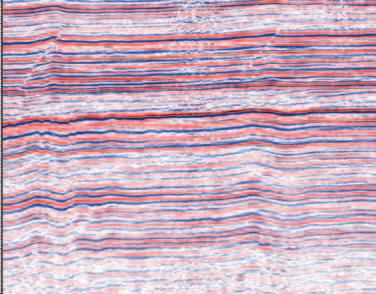
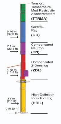
These three logs, taken from the same well, demonstrate the power of RECON’S industry leading technology. You have the evidence. The most complete picture from your open hole logs, only from RECON. Call: 51-RECON
Standard 33 samples/meter (1:240)
High-resolution
Ultra high data resolution 133 samples/meter (1:60) Available only from RECON
66 samples/meter (1:120)
The conclusive evidence is in RECON’S ultra-high data resolution open hole logs pinpoint thin beds.
H2S stimulation is another enhanced CBM alternative Bill described in some detail.42 projects are in operation that use unmineable coal seams for sequestering H2S from gas plants.CH4 is harvested and introduced into the plant output.Bill also talked about using bacterial decomposition of coal to produce CH4
A panel discussion on NGC/CBM opportunities and problems concluded the day.At the industry level,it is clear that Alberta’s Horseshoe Canyon coals will be exploited first,followed by the deeper Manville coals.The young Ardley coals will likely be developed last,as a series of technological breakthroughs are needed before economic CH4 extraction is feasible. It is also clear that commingling coalbed gas with interbedded sandstone gas production will be necessary to make total zone production feasible.
Probably the most important barrier to widespread acceptance of NGC/CBM resource exploitation will be the general mistrust felt by the public toward the oil and gas industry in general.Both Michael Gatens and Mary Griffiths agreed the single common thread through all public meetings and hearings to date relate to past industry practices and to the Powder River basin CBM operations.A major effort to gain public confidence in the Canadian industry is clearly essential.
Day 2 morning session: Rick Brommeland from the National Institute of Nanotechnology in Edmonton moderated “Nanotechnology:Awareness”.The leadoff speaker for the morning session was Dr. Steven Dew,Department of Electrical and Computer Engineering at the University of Alberta.He drew the difficult task of setting the stage for the following speakers with a paper called simply “Nanotechnology”.
Steven began by defining Nanotechnology. For the uninitiated (me),nanotechnology deals with engineering processes with long dimensions less than 1x10⁻⁹ m.Steven’s definition,a quote from Albert Franks,was: “that area of science and technology where dimensions and tolerances in the range of 0.1 nm to 100 nm play a critical role.”
The origins of nanotechnology can be traced to Richard Feynman’s seminal 1959 paper “There’s plenty of room at the bottom” in which he called for research into reducing the size of machines and data storage devices.He got people thinking, although at that time there simply weren’t any tools available for reaching into the nano-regime.
Eric Drexler coined the term “nanotechnology” in 1986.Drexler foresaw the potential for machines capable of assembling devices at the molecular level. He also raised ethical concerns about selfreplicating nanodevices getting out of control and evolving into an unpredictable form he referred to as “grey goo”.
Steven showed us a table of objects with their nanometer dimensional equivalents to get us thinking about relative sizes.For instance,an average person is 1.7 billion nm high;a hair is 75,000 nm in diameter;a virus is in the range of 75-100 nm;a transistor junction is 90 nm; DNA is 1 – 2 nm in length and a single atom is in the order of 0.1 nm in diameter.
Some of the tools available for this sort of work include self-assembly,electron beam lithography,scanning probe electron microscopy (which can manipulate individual atoms),and zeolite minerals that can trap or sieve single molecules of a defined size.
Research into nanostructured materials is progressing rapidly for such applications as nanofiltering,gas sensor substrate,and templates for nanowires.An interesting development is the extraordinarily hard nanocrystalline materials.Why would
anyone want to build things at such an incredibly small scale? First of all,in an important sense,nanotechnology is nothing new.The petrochemical industry has been using catalysis,which is manipulating individual molecules on a megagram scale, for nearly 100 years.
Dr.Murray Gray from the Department of Chemical Engineering at the University of Alberta discussed current uses of nanotechnology within industry.Those applications include ion exchange columns for water treatment;adsorption techniques and crystalline molecular sieves synthesized from SiO2;and utilization of titanium and aluminum for low cost,elevated temperature gas separation purposes. Hydrotreating with nanoscale (5 nm) molybdenum islands on ceramic supports provides high molecule selectivity applications.Murray reminded us that bitumen upgrading is essentially a selfassembly operation,as the light ends that result from hydrotreating require no outside manipulation to achieve chemical stability. He also told us about a number of other self-assembly operations that will soon become commonplace such as the production of nanotubes and “buckyballs” (buckminsterfullerite) from poly-aromatic
(...Continued on Page 33)
The Canadian Society of Petroleum Geologists – Educational Trust Fund
The Canadian Society of Petroleum Geologists – Educational Trust Fund in association with The Canadian Society of Exploration Geophysicists and The Association of Professional Engineers, Geologists and Geophysicists of Alberta presents:
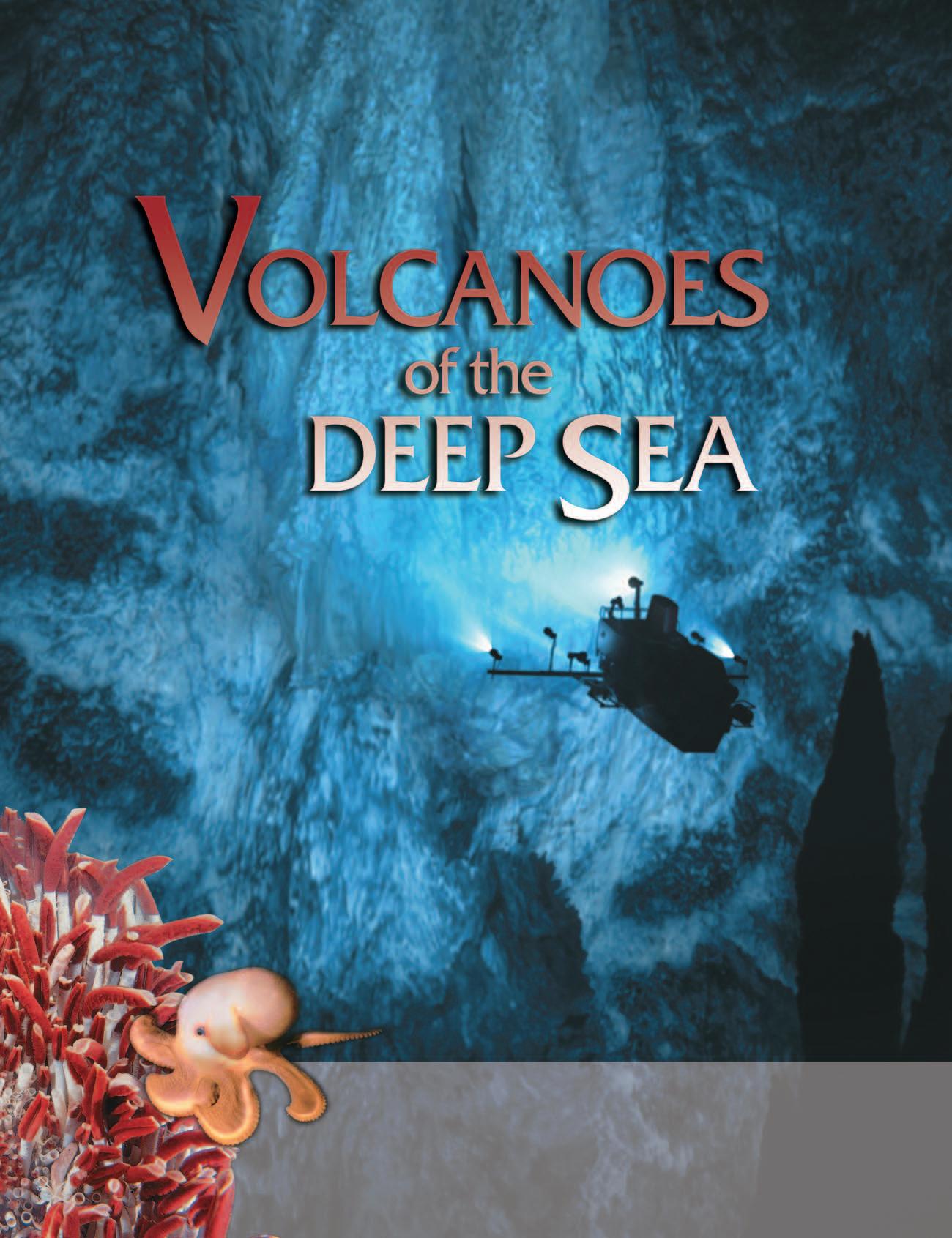
Featuring: Emory Kristof
Featuring: Emory Kristof - Visit the extreme deep with National Geographic Contributing-Photographer-in-Residence
Emory Kristof: Discover deep sea vents and mid-ocean ridges!
November 9th, 2004 – Performance at 7:00 PM
November 9th, 2004 – Performance at 7:00 PM
At the Center Street Auditorium. 3900, 2nd St NE
Tickets available at Ticketmaster – 777-0000 or www.ticketmaster.ca
Adults $10 and students $6 – all taxes and fees included. Group rates available (10 or more), more info at: www.cspg.org
Thank-you to our Sponsors:
hydrocarbons for very strong,light engineering materials.
Next,Eric Vignola of Nova Chemicals treated us to an insight into “Polymer Nanocomposites Based on Smectite Clays: Preparation,Properties and Potential Applications”.Now,those of us from a geoscience background have a feeling for the native properties of smectites that does not include any notion of polymerization.We know active sites exist on clay platelet surfaces and usually think of them as sites for ion exchange activity.The idea of plugging an oppositely charged polymer thread end into those nanoscale active sites for purposes of creating a solid is pretty foreign.
Granted,those of us who have had experience with flocculants have used small amounts of polymers to initiate flocculation, but the idea of large-scale binding to create solid materials for such diverse uses as auto parts,impact protection packaging, household furniture and appliances,gas barriers and fire-retarding building materials is simply astonishing.
The last speaker on nanotechnology was John McRory,the acting vice-president of research for TR Labs in Calgary.In “MEMS and Nanostructures,” John led us through a
series of research efforts at TR Labs that were not strictly Nanostructures,since the long dimension of some of the Micro-Electric-Mechanical-Systems (MEMS) structures were in the 1x10 -6 range (microstructures).These projects helped the lab to develop expertise,which will ultimately achieve strictly nanostructure dimensions while producing useful products at the same time.
TR Labs is primarily concerned with telecommunications and specifically with the RF portion of the spectrum (<1 THz and >100 kHz).The main line of enquiry is directed to moving away from analog devices and into the realm of purely digital radio electronics.At the moment,both RF and digital devices cannot coexist on the same substrate,as they interfere with one another. Much of the research in progress is working toward noise abatement and noise immunity in hybrid analog and digital devices.
Physical size of inductors is one significant limiting factor in reducing RF circuits from micro- to nanoscale.Heat is another.John gave an example of how a heat problem is used to advantage:a variable inductor,used for tuning an RF circuit,was developed using a bimetal strip with sub-millimeter dimensions which changed capacitance by passing a dc
current through it,causing it to heat and curl away from the lower potential electrode.
John expects true nanoscale RF devices to appear over the next decade in response to the telecommunications industry need for smaller,lower power,and higher efficiency devices.
Day 2 afternoon session: “Geomatics in Alberta:Present and Future”,involved four papers from the Department of Geomatics Engineering at the University of Calgary led by Dr.Elizabeth Cannon.Elizabeth gave an introduction to the field of geomatics,which has emerged over the past decade as a cornerstone technology for all earth sciences and civil engineering.It is rapidly penetrating every field where the spatial organization of objects needs to be known and data retrieved and displayed quickly. Geomatics is now a $30 billion/year industry,worldwide.As an industry,it is very important to Canada in general and Alberta in particular.There are over 200 companies active in Alberta in the GPS/GIS field with $10 billion/year revenues.A staggering 20% per year growth rate continues to transform and expand the industry thanks to a strong base of R&D and entrepreneurial innovation.
(Continued on Page 47...)
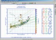
OIL AND GAS RESERVES REDUCTION - A GEOLOGIST’S
INTRODUCTION
In early January 2004 the Royal Dutch/Shell Group announced nearly a four billion barrel reduction in proven oil and gas reserves.In February El Paso followed with a 41% reduction in its reserves.In March Shell again reduced its reserve estimates another 250 million barrels in one Norwegian field alone.Now other companies including Husky and Forest are announcing cuts and surely we are only seeing the beginning of a trend that will likely continue at least through the end of 2004.
Newspapers and petroleum industry journals have provided ample commentary on how this situation could have arisen ranging from executive deception and greed to the “artistic” nature of reserve estimation.A headline in the March 21,2004 San Jose Mercury News proclaims “Estimates of oil reserves based largely on guesswork”.
I have gotten calls from colleagues,family, and investment analysts asking,“What does all this mean and how is it possible for proven reserves to disappear?”
I have had conversations with a prominent New York City law firm planning a class action suit against Royal Dutch/Shell on behalf of its shareholders asking how they should understand the damage to their clients.
Published explanations by investment and industry pundits emphasize failure of SEC regulations,liberal interpretations of these guidelines by certain companies,the lack of qualified reserve certification analysts,and outright deception and corruption on the part of industry executives.
I read a thinly disguised agenda into many of these commentaries.The most noteworthy is an article by Ronald Harrell,CEO of Ryder Scott Company,in which he makes a case for the need to certify reserve analysts to avoid recurrence of this kind of problem (Oil and Gas Journal,March 14,2004).The implication is clear:don’t use ordinary geologists,geophysicists and engineers for reserve studies because they will make mistakes;it should be a law that only companies like mine,Ryder Scott (and, unfortunately,our competition Netherland Sewell,Dames and Moore,etc.) be allowed to do this important work.
Right.That will give us the same confidence that companies like Arthur Anderson
BY ARTHUR E. BERMAN, EDITOR, HOUSTON GEOLOGICAL SOCIETY BULLETIN
brought to the accounting world recently. I write this article to present a perspective that,so far at least,I have not seen in the press.There are abundant technical causes for significant changes and reinterpretations of proven reserve estimates particularly in fields in early phases of development.My intent is not to apologize for the petroleum industry or to validate the claims that reserve determination is either an art or a science or that it is based on guesswork.My objective is simply to describe the factors that can and regularly do create revisions in resource assessments in the oil and gas business.I will add that the incorporation of modern seismic and petrophysical techniques into the process and methodology alone may be enlightening even to those who understand the technical aspects of a reserve certification.
Perhaps my discomfort with reports on the current reserve reduction issue (will some journal eventually call this “reserve-gate” so we don’t get confused?) is symptomatic of an era in which journalists repeat press releases and information presented at press conferences as the truth.Apparently investigative reporting is out-of-fashion or is not judged to have a market.
I have participated in reserve determinations where major changes in both oil and gas inplace and proven reserves have resulted solely from new technical information or interpretation methodologies.In these cases changes were made by staff at technical levels well in-advance of any executive direction for change or revision.In the case of the Shell
reserve write-down there is almost no data available to evaluate the cause of the “problem” largely because investigative journalism is not functioning to reveal this information.I have gleaned the following from the press:
1.Much of the Shell reductions come from two gas fields:Gorgon in Australia and Ormen Lange in Norway.Neither of these fields have yet produced a cubic foot of gas and partners in both fields like ChevronTexaco and ExxonMobil have taken a “what me worry?” public posture.
2.Another source of Shell’s write-downs is from the Niger Delta region of Nigeria where Shell has been the main operator of oil production for decades.Shell’s conduct is blamed by indigenous groups in that area for every sort of political,social, and environmental abuse.There is some evidence that Shell’s overstatement of reserves may have been to maintain the favor of the Nigerian government in its OPEC and national posturing.
Assuming that these are,in fact,the chief sources for Shell’s reserve re-statements then we must evaluate two different causes for the changes.The Niger Delta situation seems to be less technical and more political and economic in nature.I have heard that there is a technical issue here in the estimation of reserve replacement but this is a separate issue in my opinion.The GorgonOrmen Lange situation seems more closely related to the reserve estimation question that has been emphasized in the press.
The acquisition of Meta Incognita,being a new domain of England,discovered by English mariners and presumed to contain untold quantities of gold-bearing ore,had engendered so much pride and optimism by Queen Elizabeth and the shareholders comprising the Company of Cathay,that any misgiving concerning chicanery of Schultz’s part was yet to surface.The lure of mineral riches,which had captured Frobisher,was not unlike that of Spain’s Coronado who searched in vain for gold purported to be associated with the mythical Seven Cities of Cibola in America’s Southwest some 37 years earlier.
Jonas Schultz was the same German assayer who had previously confirmed the opinion expressed by Giovanni Agnello,an Italian assayer,that gold dust was present in the “blacke stone” found on Hall’s Islet during Frobisher’s first voyage.His allegation that the “ore” to be found on Hall’s Islet could be worth £240 of gold after being smelted,was the justification for Frobisher’s second voyage (Ibid.:2001,McDermott,James – p.196).
Understandably,Schultz was appointed official assayer to this expedition and sailed with Frobisher in the flagship Ayde.The first area of
investigation,following the fleet’s arrival at the entrance to “Frobishers Streytes,” had been Hall’s Islet.A scouring of the little island failed to reveal the presence of the sought after “blacke stone.” Frobisher,who accompanied Schultz on the search,was perplexed that the “blacke stone’s” mother lode could not be found (Ibid.:2001,McDermott,James – p.175).
The modest gold value of £40 per ton of smelted “ore,” as claimed by Jonas Schultz, following his initial run,failed to exceed values arrived at in successive trial runs.As a result, Frobisher became suspect of Schultz’s competency and so obtained another German mineralogist,a Dr.Burchard Kranich,hoping that his smelting methodology,if applied to 100-pound bulk samples,would result in greater recovery of gold than the results claimed by Schultz.Since both were vying for the position of official assayer of Frobisher’s anticipated third voyage,there was little,if any, cooperation between them and much antagonism.Since Kranich did not have access to a furnace to smelt an initial test run of the “ore,” Frobisher requested the Schultz make his available.However,the latter emphatically refused causing the irate Frobisher to have
Schultz’s furnace dismantled and in doing so, revealing its inner workings as well as the method of its construction to Kranich (Ibid.: 2001,McDermott,James – p.200).
Frobisher’s recourse,resulting from the impasse created in respect to the availability of a small furnace,was to suggest that a much larger bulk sample of “ore,” consisting of some ten tons,be conveyed to Keswick,located in northwest England.There,large furnaces used in the smelting of copper ore,could be utilized.Schultz stubbornly resisted Frobisher’s proposal,citing among other arguments,the excessive transportation costs.No doubt his rational was to protect his reputation, knowing in all probability,that the “ore” was worthless and that his claim was groundless. However,in the end,Jonas Schultz won out over his rival,Kranich,after the latter was exposed by Robert Denham when he discovered that Kranich has doctored the “ore” samples by the introduction of antimony,which contained silver,copper,and lead (Ibid.:2001,McDermott,James – pp.199201).As a consequence,the large smelting furnaces at Keswick were never utilized to prove the worthlessness of the Company’s (Continued on Page 54...)
Why An Interpretive Statistically Based Petrographic Analysis is
Thin Section Petrology is the backbone of a Reservoir Quality Assessment.
Very good reservoir quality chertarenite formed after dissolution of early pore filling carbonate cement that significantly limited compaction. Porosity is locally blocked by kaolinite. Note highly leached feldspar.
flow. This zone is extremely sensitive to the introduction of incompatible acid.
Thin Section Petrology is the backbone of a Reservoir Quality Assessment. An interpretive analysis and the ability to compare zones depends on the acquisition of reliable statistics. Statistical analysis of rock components, grain size and porosity types and determination of paragenesis can only be obtained by thin section analysis.
In most intervals, thin section analysis of drill cuttings provides the same high quality data that can be obtained from core and greatly enhances binocular drill cutting assessment.
Demand nothing less than the most comprehensive statistical analysis that only GR Petrology provides.
Flaky bitumen will migrate during oil
OIL AND GAS RESERVES ARE NOT DISAPPEARING
I want to clarify an important but not necessarily obvious point in the reserve reduction debate of 2004:none of the reserve reductions announced so far suggest that any oil and gas has disappeared. The revisions announced by Shell and El Paso involve moving reserves from the proven category to the probable category; there are likely correlative shifts from the
probable to the possible category as well but I have not seen discussion beyond the first order shift from proven to probable reserves.
I will not complicate the issue or this article by discussing the finer points of definition that are used in the petroleum industry for these categories nor will I digress into the SEC’s or any other regulatory agency’s interpretation or use of those terms.
Proven reserves means what it says:the volumes of oil and gas assigned to this category have been directly proven by tests or reliable measurements in a well and reasonably extrapolated beyond that well using information from other wells.
What could cause volumes of petroleum to be moved from proven to probable? New information based on additional tests, measurements and production history.In the early stages of field development reserve estimation is based almost entirely on volumetric calculations.Simply stated this means the size of the reservoir container (gross rock volume) above an oil or gas/water contact reduced by the percentage of that volume not available for petroleum recovery.
BASIC CONCEPT I:
PETROLEUM/WATER CONTACT
In the simplest case an oil or gas field is defined by a structural closure above a petroleum/water contact.If the petroleum/ water contact is known then a gross volume above that contact can be simply calculated.
In the case of Royal Dutch/Shell the big reserve reductions occurred in fields currently under development such as Gorgon (Australia) and Ormen Lange (Norway).In cases such as these many wells available for free water level determination are disposable exploration wells possibly drilled several years ago with limited tests. More recently drilled appraisal wells commonly have either drill stem tests (DSTs) conducted in cased hole and/or actual development wells with some production history.
In the structural cross-section (below) only one well has a drill stem test in Reservoir “A”.Well #5 tested significant amounts of gas and condensate but also tested water.Has the gas/water contact been found in this well? Factors such as the salinity of the water and the predicted volume of water condensed from natural gas must be considered.In this particular case some of the tested water is interpreted as formation water though some of it is probably condensed water and water derived from formation invasion by drilling mud.
The gas/water contact is,therefore, interpreted to lie within the tested interval of 4,000-4,050 meters.Should the contact be placed at or near the bottom of the interval or somewhere higher? Every meter higher will reduce the gross rock volume across the closure.In an early stage of field development the contact will probably be placed near the bottom of the tested interval.Later tests or production might cause the contact to move either up or
down.If the contact later is moved up,for example,ten meters,this could result in a 20% reduction in proven reserves for this reservoir.Suddenly the Shell and El Paso reserve reductions are placed in a context that makes them seem less extreme and, perhaps,less suspect.
BASIC CONCEPT II: FREE WATER LEVEL
All petroleum accumulations have a transition zone some interval above and below the petroleum/water contact.This means that for some height above the petroleum/water contact a combination of, in this case,gas and water will be produced. somewhat higher above the contact waterfree petroleum will be encountered and at some depth below the contact petroleumfree water will be encountered.
In order to accurately calculate the volume of recoverable,proven reserves in a given reservoir the free water level must be determined.The free water level and the petroleum/water contact are not the same. Furthermore,a free water level can almost never be determined by a physical formation test but must be determined by combining well pressure test data and capillary pressure test data taken from cores taken from the well.Without getting involved with the technical details it is obvious that this determination will be made from a relatively small number of intervals and samples that were taken from both the petroleum- and water-productive intervals of a well.This is virtually impossible to achieve in an exploration well and difficult even in a
development well.
A Pressure-Depth Plot can be made with pressures derived from a combination of drill stem tests,pressure tests and production tests.Pressures from the gas interval should plot on a single pressure gradient and pressures from the water interval on another.The intersection of these gradient lines defines the free water level.The free water level may be definitive
or not depending on the number and type of data points;it may support or not support drill stem or production test interpretations.An interpretation that integrates all data must be made but this may change as more information is gotten particularly as the field goes on production.
Assume that a reserve estimation is determined based on methods described for petroleum/water contact and free water level.Later additional or better pressure test or production history information will be gathered.If a production well prematurely produces water the free water level interpretation must be revised upward. If water is produced,say,after a year or so from a zone ten meters higher than the free water level interpretation,this will result in a 20% proven reserve reduction for this particular 50 meter-thick reservoir based solely on water contact and free water level interpretation.
BASIC CONCEPT III:
PETROPHYSICS—POROSITY, WATER SATURATION AND PERMEABILITY
Everything described so far has dealt with gross rock volume,that is,the total volume of reservoir rock above the petroleum/water contact and free water level.Not all that volume contains petroleum and water of course.The rock only has space available for fluids between rock grains.This is called pore space. Unconsolidated sand on a beach,for instance,may have 35% pore space or porosity,the unit measure of pore space percent.Rock obviously will have less porosity due to burial compaction, cementation and other diagenetic factors.
Most porosity data available for a reserve estimation comes from wire-line logs that measure rock and fluid properties around the well bore.Porosity logs give a reasonable estimate of porosity based on certain assumptions including the density and mineralogy of the rock grains as well as the composition of fluids in the pore space.
Porosities measured from wire-line logs must be compared with and calibrated to porosity measurements taken from core samples over the same intervals of the well.Commonly only a few core porosity
measurements are available for every 100 or more meters of log porosity.An adjustment is made to the log porosity based on comparison with corresponding core porosity measurements.From the cross-plot example the placement of a “best fit” line through the data points is,as always,an interpretation.If the error range is 20% in a rock whose porosity averages 20% the affect on overall pore volume available within the gross rock volume may be +/- 4% of proven reserves.
(Continued on Page 38...)
Well #1 Porosity Log
Once porosity is determined the petrophysicist must then determine the percent of pore space that is filled by petroleum and water,respectively.This is called water saturation.Water saturation is determined more empirically than porosity, in that it is deduced from porosity and other petrophysical properties.In modern reserve determinations there is sufficient doubt about calculated water saturations that often this is calculated as a height function above free water level using capillary pressure data derived from cores.I have already explained the potential for adjustment in free water level so it is safe to say that at least an equal chance for adjustment in water saturation is possible with more test or production data.
A third and crucial petrophysical parameter is permeability,the ability of fluid to move through the pore spaces in a reservoir rock. Permeability determines how much of the petroleum stored in the reservoir pore space can be moved and economically produced.Since permeability is measured from core samples and cannot be determined from wire-line logs,an empirical relationship between porosity and permeability must be determined by crossplotting.This approach has all the inherent errors already explained in the example of cross-plotting log vs.core porosity.The correlation or transform between porosity and permeability becomes less reliable in lower porosity intervals of the reservoir which volumetrically may contain significant amounts of petroleum,especially gas,due to limitations of the wire-line tool.
The combination of porosity,permeability, and fluid composition is used to determine a recovery factor,the percentage of petroleum in-place that can be reasonably and economically produced.Permeability has the most pronounced affect on recovery factor of all the factors.A change in assumed permeability that results from more test or production data will have a one-to-one effect on recovery factor and therefore proven reserves.A 20% reduction, for instance,in overall average permeability will reduce proven reserves by 20% for that reservoir interval.
BASIC CONCEPT IV: SEISMIC
DEFINITION OF STRUCTURAL CLOSURE AND FLUID CONTACT
Almost no prospects are drilled today by major oil companies without some seismic data and few prospects are drilled without 3D seismic data.Advances in the acquisition and processing of seismic data have been spectacular during the past decade or so as computer technology has permitted increased imaging capability in the subsurface.
Early in the development of an oil or gas field seismic is used as the primary means to define structural closure and,therefore, volumetric calculation of reserves.Since seismic data is measured in the time domain an algorithm must be developed to convert time structure to depth structure.Initially this is accomplished based on a velocity model that takes into account the major, known vertical changes in geology that affect the travel and return time of seismic
waves to and from the reservoir horizon. Lateral changes in velocity are far more problematic.Velocity uncertainty is increased in areas with salt,shale,or volcanic bodies in the sedimentary column, as well as in the case of anisotropic reservoir and non-reservoir layers.
Typically as wells are drilled,the seismic structure maps are “flexed” or mechanically manipulated to match the at-well values for reservoir tops and bases.As understanding of the petrophysics of both reservoir and non-reservoir rock improves the velocity model must become more sophisticated and complex in order to match the well data and predict development drilling locations.At some point in field development changes or surprises in petroleum/ water contact,free water level, porosity,permeability,and water saturation must be incorporated into the seismic model.Several generations of seismic processing and acquisition commonly occur in the life of an oil or gas field.
Seismic data is essential to carry reservoir and fluid properties from wells to areas between wells.As reservoir simulations and material balance calculations become more sophisticated with increased production history,seismic interpretation is required to define reservoir compartments,baffles,and seals as well as to provide direct imaging,in some cases,of fluid indicators.
Increasingly,seismic attributes such as amplitude,impedance,or coherence are used to predict and map fluid and reservoir properties in developing oil and gas fields. The process is similar to the geological and petrophysical methods described previously. Seismic attributes are calibrated with rock properties measured in wells and correlated away from the wells.
Correctly calibrated well and seismic attributes such as amplitude or impedance allow conversion to net pay using rock property transforms.The reservoir distribution detail that can be accomplished away from well control greatly exceeds what could be done by facies and depositional environment mapping in the past.A liability is that,as in the example shown above,the calibrated reservoir distribution is less continuous than in the initial assessment.In this particular case the number of wells
required to drain the field’s reserves exceeds the economic limit;previously proven reserves must be moved into probable or even possible categories.
It is increasingly common to perform a seismic inversion that starts from petrophysical and lithologic well data and produces a seismic response to match those rock properties.Detailed reservoir zonation using sequence stratigraphy for correlation permits accurate seismic facies identification
and time-stratigraphic interpretation of seismic data.This approach yields a far more realistic view of reservoir connectivity and continuity.
Well data by definition is sparser than seismic data and the geologic interpretation of structural and stratigraphic well information is almost always simpler than the seismic data can provide.Much can change as calibrated seismic imaging is used to map reservoir quality,fluid contact and structural configuration.A subtle variation, for instance,in the velocity model and resulting time-depth conversion can modify the gross rock volume under closure by significant amounts.Likewise seismic attribute and fluid content mapping often results in important revisions to net rock volume.
WHAT IT ALL MEANS
Most advances in sophistication of geologic and geophysical models in the early phases of field development result in downward adjustments in proven reserves.Later in the development and life of an oil and gas field this tendency is sometimes reversed.This is a subjective and personal observation and not a demonstrable truth.
I present this brief and incomplete overview of some of the factors that go into a modern field assessment to illuminate the many, purely technical factors that can affect changes in proven reserves.In the publicized case of Royal Dutch/Shell I cannot and should not speculate on the reasons and motives behind the recent downward revisions.My reaction,however,as a technical scientist is that we should exercise caution and restraint in evaluating announced reserve revisions until explanations are given that go beyond the purely reactive and speculative stage we now are experiencing.Ordinarily the considerations I have described would not become public information until the fields were rather fully developed and,even then, the presentation of this information would be given in the highly technical environment of engineering and geoscience conferences. Perhaps the controversy and reaction to the Royal Dutch/Shell and forthcoming proven reserve reductions will force some of this information into the public sector.
Reprinted with permission of Art Berman and the Houston Geological Society Bulletin.
CONTOURING
Faulted contours
Isopachs
Volumetrics
Grid operations
New flexing options
CROSS SECTIONS
Digital and/or Rastor
Geocolumn shading
Multiple rasters/well
Stratigraphic/Structural
Shade between crossover
Dipmeter data
MAPPING OPTIONS
Bubble maps
Production charts
Log curves
Posted data
Highlighted Symbols
CROSS PLOTS
Log crossplots
“Z” crossplots
Lithologies to facies
Pickett plots
Regression curves
User defined overlays
PETRA® delivers the industry’s only easy-to-use and affordable integrated solution for today’s workflows. It provides multi-user access to large projects through geological, petrophysical and engineering analysis tools. The PetraSeis™ option extends PETRA® into 2D/3D seismic interpretation with practical tools such as RasterSeis™ Download a trial version at www.geoplus.com, or callus at 888-738-7265 (in Houston, call 713-862-9449) for more product information.
DECLINE CURVES
Compute EUR, RR, etc.
Hyperbolic or exp.
Rate/Time or Cum P/Z
User defined Econ. Limit
User defined Extrap. Time
THE CANADIAN GEOLOGICAL FOUNDATION
Did you know that there is a large Foundation in Canada whose purpose is to fund geoscience projects “...for charitable and educational purposes in Canada relating to the science of geology....”? You probably did not and the purpose of this article is to increase awareness within the CSPG of The Canadian Geological Foundation (CGF).The Canadian Geological Foundation was incorporated in 1968 as a non-profit,charitable organization dedicated to assist in the development of geological sciences in Canada.
The Foundation has a membership of 14 geoscientists who are broadly representative of the geoscience community in Canada.I have served on the Foundation as a member representing industry for the last three years and thus have had an opportunity to observe the activities supported by the Foundation at first-hand.Members and the Board of Directors meet once a year in the spring when the Foundation’s financial performance is reviewed and final decisions are made on grants for the year.The Canadian Geological Foundation invites interested parties to submit grant proposals each year and grants are made based on applications submitted by March 31 and assessed by the full Membership acting as the Grants Selection Committee.
The Foundation’s assets are held in trust. Investment transactions are effected by the Treasurer,in consultation with the Board, through the advice and services of an independent investment advisor.A conservative investment policy has been adopted by the Board to secure the longterm growth of the trust funds.Accounting and auditing services are provided by chartered accountants.
In 1969,the Foundation received C$ 625,000 from its first benefactor,Mr.Thayer Lindsley of New York.Mr.Lindsley was an American geologist and mining executive who had devoted a large part of his life to geoscience and mining in Canada.Today,the Foundation has an investment portfolio valued at over
$1,000,000.Much of the new growth has come from the benefaction of Mr.Jérôme H. Remick III,a former geologist with the Québec government.As of 2002,he had donated nearly $500,000 to the Foundation held in a trust fund bearing his name.
Hundreds of individuals have made donations to the Foundation over the years.The Foundation’s annual grants program is funded by donations and the revenue earned on the investment of its two trust funds.Individuals who wish to support the worthwhile and numerous activities of the Foundation can make a tax-deductible donation.
The Foundation, as of 2002,had awarded 325 grants representing approximately $1,250,000.These awards were mostly in support of projects proposed and sponsored by professional associations, university Earth-science departments,and museums.A large part of the disbursements in any year is used as “seed” money to help initiate worthy projects.Such projects include:
• Promoting public interest in the value of geological sciences to society
• Summer institutes for the training of high school science teachers in the field of earth sciences
BY MARK COOPER, ENCANA CORPORATION
• Preparation of career booklets in the geological sciences
• Preparation of general geology textbooks, displays,videos,and films emphasizing Canada and involving national co-operation
• Partial financial support for the publication of special scientific papers involving national cooperation
• Support of national seminars and conferences aimed at the application of geological sciences to development of natural resources,and
• Financial assistance to geological societies in co-operative projects of national and long-term significance.
Canadian Geological Foundation Grants for 2003 included:
• Interactive Palaeontological Program (student educational activity) at the Fundy Geological Museum
• Dynamic Earth Visitor Centre (exhibit) at the Science North Foundation
• Nova Scotia’s GEOhopper Scavenger Hunt (children’s educational activity)
• New Brunswick EdGEO Workshop (teacher education) run by the Atlantic Geoscience Society
• Geology of Mount Robson Provincial Park (brochure)
• Geology of the Kelowna Area (guidebookreprinting) produced by the Kelowna Geology Committee
We would encourage any CSPG member involved in these types of activities to consider applying to the Foundation for a grant (successful proposals are typically awarded $1,000 to $3,000),and we also welcome donations from CSPG members interested in supporting the Foundation.
To contact the Foundation please see the current list of Officers at the Foundation’s website:www.canadiangeological foundation.org/OfficersMembers.html
Mr.Thayer Lindsley
Mr.Jérôme H. Remick III
PROVINCIAL GEOLOGIST MEDALLIST 2004: IAN KNIGHT
The Provincial Geologists Medal is awarded to recognize major contributions in the area of geoscientific research and related developments or applications that serve to meet the mandate of Canada’s provincial and territorial Geological Surveys.Each Survey may nominate a candidate each year,and an external national selection committee representing industry,academia,and the GSC chooses the recipient from the pool of nominees.For 2004,the winner of the Provincial Geologists Medal was Ian Knight of the Geological Survey of Newfoundland and Labrador,a division of the Department of Natural Resources,Government of Newfoundland and Labrador.The citation below was read by Mr.Gordon MacKay of Nunavut’s Department of Economic Development and Transportation during the medal presentation at the 61st annual Energy and Mines Ministers Conference in Iqaluit, July 20,2004.
CITATION
Geologists are said to “translate the Earth’s language into our own,” with “trained senses” and “disciplined thinking.” So wrote Hans Cloos in 1953,and this description beautifully captures the scientific mien of Dr.Ian Knight of the Geological Survey of Newfoundland and Labrador.
Ian Knight has devoted the past 30 years of his life to mapping and deciphering the geological history of western Newfoundland.Although this has included a definitive memoir on the
Carboniferous rocks of the Bay St.George Sub-basin,most of Ian’s prodigious output of maps,reports,and papers has been concerned with the Cambro-Ordovician sedimentary platform of the Newfoundland Appalachians. Through his exquisite descriptions of the geology of this vast area,he,along with his collaborators,has elegantly portrayed the geological evolution of the ancient continental margin of Laurentia.
Ian has been described as a “classic” field geologist – one who brings extensive knowledge of carbonate and clastic sedimentology,sequence stratigraphy, metamorphic and structure geology,and paleontology and diagenesis to each
exposure he encounters.However,being well apprised of the intricacies and surprises in outcrop,he is reluctant to “arm-wave,” which makes his subscription to a particular model all the more valuable.
Ian’s maps and reports are legendary for their detail,objectivity,and accuracy.He reads the rocks like a book with a sharp eye for the smallest detail.His encyclopaedic knowledge of western Newfoundland,from individual outcrops to depositional cycles,has made him an invaluable source of information for the petroleum industry.Recognizing his work as exceptional and indispensable to exploration,the Canadian Society of Petroleum Geologists presented Ian with the R.J.W.Douglas Medal for 2000,the Society’s award-of-excellence for outstanding contributions to the understanding of sedimentary geology in Canada.
The mineral industry,too,has benefited from Ian Knight’s talent and diligence. His elucidation of the geological events that control zinc mineralization in the area was a great aid to mineral discovery.Furthermore, his understanding of the science and art of marble has made him a key contributor to the fledgling dimension-stone industry in the province.
Despite the breadth of his achievements, Ian Knight is an extremely modest man. His co-workers value him as an open and generous person who is unstinting in sharing his scientific expertise.For his tireless energy over three decades,his superior talent for geological observation, and his personal and scientific integrity,Ian Knight is truly deserving of the 2004 Provincial Geologists Medal.
Ian Knight (right) receiving the Provincial Geologists Medal in Iqaluit from the Honourable David Simailak,Co-chair of the Mines Ministers Conference and Minister of Economic Development and Transportation for Nunavut.
Fed up of drilling 20m of overhole for a logging tool?
Fed up of drilling 20m of overhole for a logging tool?
FOCUS from Baker Atlas requires just 10m of overhole.
The gamma ray measure point on the FOCUS triple combo (array resistivity, density, neutron, gamma ray) is just 9.76m. That saves you drilling time, and maybe even a bit. And logging at 18m per minute saves yet more rig time, by reducing logging times by as much as 40%. Combine that with the best data accuracy in the industry and that’s quite a deal.
FOCUS – efficiency and accuracy, every well, every time.
FOCUS Triple Combo
2004 CALENDAR OF EVENTS
DATE: November 1,2004
EVENT: DAPL/RMAG/DGS Prospect Fair and TechnoFest
LOCATION: Denver,Colorado
INFORMATION: For more information please visit www.rmag.org/fair
DATE: November 7-10,2004
EVENT: Geological Society of America Annual Conference
LOCATION: Denver,Colorado
INFORMATION: For more information please visit www.geosociety.org
DATE: November 9,2004
EVENT: CSPG Annual Honorary Address: Volcanoes of the Deep Sea
LOCATION: Calgary,Alberta
INFORMATION: Emory Kristof returns to Calgary in November to take us exploring the fascinating world of the Deep Sea Mid-Oceanic ridges.Keep an eye out for more information on this multi-media event in upcoming issues of your Reservoir!
For more information please visit www.cspg.org
DATE: November 17-19,2004
EVENT: Canadian Society for Unconventional Gas - 6th Annual Conference on Unconventional Gas
LOCATION: Calgary,Alberta
INFORMATION: For further conference information please contact: Kerri Markle,PTAC,Society Coordinator - CSUG phone:(403) 218-7720 fax:(403) 920-0054 kmarkle@ptac.org,www.ptac.org
DATE: December 7-10,2004
EVENT: Offshore Southeast Asia (OSEA)
LOCATION: Suntec City,Singapore
INFORMATION: For more information visit http://www.osea-asia.com/
DATE: December 10-12,2004
EVENT: PETEX
LOCATION: London,England
INFORMATION: For more information please visit http://www.pesgb.org.uk/pesgb/system/default.asp
DATE: May 15-18,2005
EVENT: Halifax 2005 - a Joint Meeting of the Geological Association of Canada,the Mineralogical Association of Canada,the Canadian Society of Petroleum Geologists,and the Canadian Society of Soil Sciences.
INFORMATION: The historic seaport provides a wealth of opportunities to investigate Nova Scotia’s heritage and culture,juxtaposed with all the amenities of a modern urban centre.Extensive seacoast exposures and a diverse geological history provide the backdrop for a rich technical program.The “Building Bridges” theme of the meeting is both symbolic of the harbour bridges that distinguish our Halifax – Dartmouth skyline,and a metaphor
for the multi-disciplinary program that is designed to bridge the gaps within geoscience,and between geoscience and society.
We look forward to providing you with the opportunity to discover the charms of our beautiful city and renew the ties that bind our geoscience community.
For more information please visit www.halifax2005.ca
DATE: August 8-11,2005
EVENT: Earth System Processes 2
LOCATION: Calgary,Alberta
INFORMATION: Sponsored by the Geological Society of America and the Geological Association of Canada Web site:www.geosociety.org/meetings/esp2 Theme Session Proposal submission deadline: September 15,2004
Abstract submission deadline:April 26,2005
Description:International meeting,interdisciplinary focus Earth’s surface environment is a complex web of feedbacks among the biota,oceans, atmosphere,lithosphere,and cryosphere.ESP 2 will discuss advances made in the last four years toward better understanding the nature of these feedbacks in the modern world,how they have emerged and evolved over the Earth’s history and how they will respond to human perturbations in the future.
For more information,contact:Diane Matt, P.O.Box 9140,Boulder,CO 80301-9140, 1-303-357-1014 (phone) 1-303-357-1074 (fax) dmatt@geogociety.org (e-mail)
Season’s Greetings!
You are invited to join the CSPG & geoLOGIC Systems Ltd. for wine and cheese on Thursday,December 9,2004 10:30 am – 11:30 am Telus Convention Centre (just outside the Technical Luncheon Hall)
December Reservoir.
Reduce your risk in Seismic acquisition
Boyd PetroSearch helps you evaluate new territory.
Exploring? Boyd PetroSearch offers a comprehensive Project Management service to provide high quality, cost-effective options for seismic exploration. We manage every stage of your exploration program – from pre-planning through recording. And our experience in approvals, mapping, permitting and HSE is unbeatable.
Find out how we can reduce your risk in acquiring seismic data by ensuring that your projects are completed safely, on time and on budget.
Geomatics Engineering is rooted in the art of surveying engineering,wherein much of the early research was conducted.In fact, the Geomatics Department arose from the Department of Surveying Engineering within Civil Engineering at the University of Calgary in the early 1980s under Dr.Ed Krakiewski.It deals with acquisition, modeling,analysis,representation,and management of geospatial data.
Dr.Gerard Lachapelle’s paper on “Satellitebased Positioning and Wireless Location” provided basic information on Global Positioning System (GPS) technology.While the use of GPS instruments has exploded in recent years,the basic concepts behind the numbers on the receive read-out,the sources of error and limits of performance are poorly understood.Gerard described in simple terms how to interpret readings and what to expect in terms of accuracy from the three main classes of instruments available today.He then described the differential GPS and Real Time Kinematics (RTK) sub-metre positioning technologies also in simple terms.Most of the audience was unaware these technologies exist and it was a revelation to me.
Gerard concluded his talk with the information that GPS version 2 (GPS2) will begin installation this year and will take seven years to complete.A new system named Galileo will be ready in three to five years,with 16 to 18 satellites visible at any given time.This will enhance system reliability considerably.
Dr.Nasser El-Sheimy introduced participants to “Mobile Mapping Systems”, which has been the focus for R&D at the Department for a number of years. Examples of applications already in the field for this application of RTK technology include municipal infrastructure mapping using digital video data acquisition,real-time identification and location of forest fire hotspots using Differential GPS (DGPS), LIDAR (Light Detection and Ranging) airborne surveys,and pipeline mapping using the GeoPig System.Current research includes work on integration of a low-cost attitude sensor in mobile systems to further improve mapping accuracy.
The final paper in the series was presented by Cathy Valeo.The paper was entitled “Environmental Applications of Geomatics Engineering” and it dealt with using remote sensing techniques integrated with Geographic Information Systems (GIS) technology to monitor environmental conditions in near-real time.
Multispectral imaging from satellite platforms is readily available from internet sources, some of which are free.Cathy gave us a set of URL’s where imagery is available.She then described how GIS (which can also stand for “Geospatial Information Systems”) can be populated with both imagery and ground truth data to produce accurate thematic maps for environmental monitoring purposes.She also made the point that without the sophisticated data management capabilities of a modern GIS,many data management tasks would be impractical,such as data conversion,parameter extraction,and interactive mapping.
Another application of GIS is providing data for numerical modeling purposes. Environmental models can be as simple as a set of parametric statistics displayed using standard charts from a spreadsheet or as complex as single-purpose,custom programmed predictive models that are part of a fully integrated package.Cathy walked us through a simple example of a soil erosion problem using a simple “bridged” parametric statistical model,a more complex “embedded” model that subdivided a watershed into its component parts using subprograms written in Visual Basic for Applications and a sophisticated “assimilated” approach to watershed three dimensional simulation modeling using a specialized modeling language called PCRaster,a public domain tool available for free downloading from the internet.
The four Geomatics talks were extremely informative.By chance,I am in the early stages of developing a multidimensional field program that will require using GPS and GIS technology.The insights I gained from the workshop will make my coordination task much easier as I now have some background information,and an important set of contacts to smooth the way.
In summary,I found the workshops and seminars offered for Professional Development at the APEGGA Annual Conference to be extremely interesting and helpful.The contacts made with the presenters and with other participants during the coffee breaks,lunch breaks and the wrap-up Gala will be very useful in both a business and professional sense during the coming year.In the normal course of business,there are some disciplines that an independent professional would never encounter.Cross-fertilization of ideas from other branches of earth sciences and engineering is partly what APEGGA Professional Development functions are all about.
Tom Sneddon has been a member of CSPG for many years and volunteers at many APEGGA functions.He started his professional career in geophysics with AMOCO in 1966,where he joined the CSEG,but was led astray into geology in the 1980’s where he has been ever since.Tom is also a part-time trainer for the Petroleum Industry Training Service.
Clear Hills Iron Ltd.,Peace River Energy,Inc. Suite 3000,West Tower,Petro Canada Centre 150 - 6th Avenue S.W.,Calgary,Alberta T2P 3Y7
CSPG
Back row standing:Henry Lickorish,Rick Steedman,Bob Gunn.Middle row standing:Jamie Jamison,Jean Pelletier, Kevin Root,Jurgen Kraus,Wasim Paracha,Joy Feng,Pam Simper,Marc-Andre Brideau,Jeff Nazarchuck. Front row kneeling:Thomas Kubli,Greg Lynch,Mike Perkins,George Allen,Elizabeth Atkinson,Alexis Anastas.
On September 11,a group of 18 people gathered for the 2004 Structural Division Field
Trip.The objective of the trip was to hike up Dauntless Mountain,in the Dogtooth Range of
the Purcells,to see Cambrian and Eocene extension,Laramide trusting,and a diatreme. Mother nature did not smile on us,however, as we attempted to ascend Dauntless Mountain.It had rained a lot the previous week and the entire night before the hike, and loggers decided to initiate spot logging in Quartz Creek valley since July.The combination made the road impassable about half way up to our starting point.
Much thanks to Thomas Kubli for doing an excellent job,leading us through a series of highway outcrops,as a back-up.We looked at the stratigraphy of the Horsethief Creek group,and folding in the footwall of the Purcell Thrust.We examined the relationship between structure and stratigraphy at the boundary between the Purcells and the Selkirks.
Thanks also to trip sponsors,Devon and TEK Consulting.
We still want to try to get to Dauntless Mountain sometime.If we don’t get a break this fall,we will try again at some appropriate future date (likely next fall).
ATKINSON, STRUCTURAL DIVISION CHAIR
THE CSPG ANNUAL MIXED GOLF TOURNAMENT
In 1990,the Annual Mixed Golf Tournament was first held.This was to address a perceived need to have a tournament that was not too serious,to allow for networking and getting to know other CSPG members in a relaxed and comfortable setting.Bill Hoskins and Peter Harrington,both then with Unocal,were instrumental in getting it off the ground.It is now held annually on the Friday of the last weekend before Labour Day.
For four years,it was held at Cottonwood Golf Club,just southeast of the city.In early 1994,under pressure from its members, Cottonwood decided that it would no longer hold tournaments on Fridays.The decision was made by the Mixed Golf Committee to change the venue rather than the day,and so the tournament was moved to Lakeside Greens that year.The following year,the switch was made again,this time to D’Arcy Ranch in Okotoks.This venue has proved so popular,and D’Arcy Ranch staff are so cooperative and friendly,that the tournament has been held there ever since.
The 15th Annual Tournament was held at D’Arcy Ranch on August 27,2004,with an 8:00 AM shotgun start.The organizing committee consisted of David Middleton,
David Caldwell,Ron Britton,Penny Harley, Jane Crandall,Rick Sereda,Norm Hopkins, Carter Clarkson,and Dick Willott.Kim MacLean,from the CSPG office,helped out considerably,and was a good liaison with the office.
After a particularly damp preceding week, the weatherman decided to cooperate,and
all-in-all the day was very pleasant – almost ideal for about 15 holes,at which time a brief thunderstorm interrupted proceedings and caused a short delay.
The early morning play was slow,due to very wet ground conditions.The heavy rains of the previous several days did not permit cutting of the grass,which resulted in many
a lost ball.Carts were restricted as to where they could go,and the long wet grass caused many a shot to be less-than-ideal.
Nevertheless,all teams (143 golfers – there was one no-show) finished the round and enjoyed the post-game dinner and prize awards.
The Low Gross Trophy,awarded on behalf of Financial Management (Alberta) Limited, was claimed by the team of Mike Hartwick, Martin Bradford,Jon Sliwinski,and Jane Crandall.Low Net,awarded on behalf of Precision Wireline Technologies,went to Norm Hopkins,Robert Paul,Patricia Halbauer,and Barry Mazurkewich.The High Gross,awarded by CSPG,went to the team of Raza Hasanie,Rich Nash,and Dan Krpan.
For the first time,participants were allowed to purchase Mulligans,and the proceeds were donated to the CSPG Educational Trust Fund.With a little extra help from Lisa Abbott and Bob Earle of ProGeo Consultants,$1740 was raised and donated. Thanks go to all who participated.
The putting contest sponsored by Tucker Wireline Services followed the round, providing a good chance to chat,and a distraction while waiting for the dinner.The trip-for-two weekend at the Springs in Radium was won by Paul Sabatini.
Many thanks are extended to all our sponsors.The tournament is looked forward to by many people in the society as a highlight of their summer,and the ongoing support of our sponsors ensures that this event will continue in future years.
MANY THANKS TO OUR SPONSORS: MAIN SPONSOR
HOLE-IN-ONE SPONSORS:
geoLOGIC systems ltd.
Global Link Data Solutions
BREAKFAST SPONSORS:
Hycal Laboratories
Norwest Labs
Baker Atlas GOLD SPONSORS
SILVER SPONSORS
BRONZE SPONSOR
HOLE SPONSORS:
1.Belloy Petroleum Consulting Ltd.
2.Gilbert Laustsen Jung Associates
3.Recon Petrotechnologies
DeGolyer & MacNaughton Canada
4.Northstar Drillstem Testers
Boyd PetroSearch
5.Fugro Airborne Surveys
6.geoLOGIC systems ltd.
7.ProGeo Consultants
Wellsite Gas Detection Inc.
8.M.J.Systems
9.ECL Canada Consulting Ltd.
10.CL Consultants Limited
11.Schlumberger-GeoQuest SIS
IHS Energy
12.Global Link Data Solutions
13.RigSkills
14.Divestco
FirstEnergy Capital Corp.
15.Response Seismic Surveys
16.Core Laboratories Canada Ltd.
17.Wildcat Scouting Services
GEDCO
18.Sproule Associates Limited
CONTRIBUTORS & PRIZE DONORS:
Blue Grouse Seismic
Canadian Discovery
Continental Labs
DeGolyer & MacNaughton
Datalog Technology Inc.
Earth Signal Processing
FirstEnergy Capital Corp.
Hycal Labs
IBM
Kestrel Data
Landmark Graphics
McAra Printing Pulse Data
Reinson Consultants Ltd.
Stoakes Consulting Group
Veritas GeoServices
Weatherford DST and many others.
“ore,” which would,in all probability,have made Frobisher’s third mining expedition unnecessary.
Ironically,Michael Lok and his associates with the Company of Cathay had placed more credence in the ability of the two unprincipled Saxon assayers than their own English assayers,in particular Robert Denham.It was Denham who opined that the “blacke stone” found on Hall’s Islet was devoid of gold or other previous metals.His opinion had run counter to both Schultz and Agnello,the latter an Italian assayer.Two other English assayers, namely William Williams,the principal assayer of the Tower of London and George Needham,a London assayer associated with Mines Royal,had independently assessed the “blacke stone” prior to Schultz’s and Agnello’s appraisals and,like Denham,had declared the specimen to be worthless.
The “blacke stone” had been found by Master Robert Gerrard of the Gabriel during the first visit to Hall’s Islet.He had first mistaken it for a loose lump of sea coal,the size of a “halfe pennye loafe.” Gerrard never lived to witness the ramifications of his innocent act as a short time later,he was seized along with four fellow seamen of the Gabriel,by a group of natives on Hall’s Island. They were never seen again by their fellow mariners despite the dedicated efforts of Frobisher (Ibid.:2001,McDermott,James –p.141).The ominous “blacke stone” was to become the catalyst that sparked the first, albeit futile,Canadian Gold Rush.
The three captured natives,after arriving in England were put on public display,much to the astonishment and amusement of their viewers.In Bristol,the adult male,suffering from broken ribs when wrestled to the ground during his capture by Nicholas Congar,a Cornish miner,displayed his prowess in his kayak on the Avon River by piercing local ducks in flight with darts propelled from a hand sling.He later succumbed from the injuries received during his capture.The woman’s death was attributed to contracting measles,the victim having no resistance to the disease.Their deaths occurred within seven weeks following their arrival in England.The surviving male infant,despite being nourished by a wet nurse,died eight days later (Ibid.: 2001,McDermott,James – pp.191,192).Being branded infidels,the three natives were nevertheless interred in Church of England consecrated cemeteries,perhaps through genuine compassion engendered by collective guilt.
To be continued...
What is your competitive advantage?
In the game we play, we cannot survive on yesterday’s ideas. Knowledge is an important resource for industry success, and our key competitive advantage is what we know and how well we apply it.
The CSPG has always been the primary conduit for knowledge transfer within the geologic community. As oil and gas becomes evenharder to find, the
knowledge needs of our industry will continue to increase almost exponentially. The CSPG will continue to provide forums for networking and the exchange of ideas.
The CSPG is not peripheral to industry success; it is a part of everything we do. When you invest in the CSPG, you invest in the future.
Canadian Society of Petroleum Geologists ...the SOURCE