How Employers Benefit from Building the Pool of Independent Employees
How Employers Benefit from Building the Pool of Independent Employees
■ 2004 Gussow Geoscience Conference
■ 2004 Gussow Geoscience Conference
■ 2005 Gussow Geoscience Conference
■ 2005 Gussow Geoscience Conference
■ Quaternary Gas in Northern Alberta
■ Quaternary Gas in Northern Alberta
■ CSPG Annual Awards Dinner
■ CSPG Annual Awards Dinner
Comprehensive, trusted oil and gas information for the Western Canadian Sedimentary Basin, Northern Territories, and East Coast. From mineral rights to surface information, E&P data to M&A, AccuMap offers unparalleled data and analysis tools. New ventures. Exploration. Economics. Exploitation. Drilling. Production. Delivery. Acquisitions and Divestitures. Wherever your opportunities take you, IHS Energy supports you every step of the way.
CSPG OFFICE
#160,540 - 5th Avenue SW
Calgary,Alberta,Canada T2P 0M2
Tel:403-264-5610 Fax:403-264-5898
Email:cspg@cspg.org Web:www.cspg.org
Office hours:Monday to Friday,8:30am to 4:00pm
Business Manager:Tim Howard
Email:tim.howard@cspg.org
Office Manager:Deanna Watkins
Email:deanna.watkins@cspg.org
Communications Manager:Jaimè Croft
Email:jaime.croft@cspg.org
Conventions Manager:Lori Humphrey-Clements
Email:lori@cspg.org
Corporate Relations Manager:Kim MacLean
Email:kim.maclean@cspg.org
EDITORS/AUTHORS
Please submit RESERVOIR articles to the CSPG office.Submission deadline is the 23th day of the month,two months prior to issue date. (i.e.,January 23 for the March issue).
To publish an article,the CSPG requires digital copies of the document.Text should be in Microsoft Word format and illustrations should be in TIFF format at 300 dpi.For additional information on manuscript preparation,refer to the Guidelines for Authors published in the CSPG Bulletin or contact the editor.
COORDINATING EDITOR & OPERATIONS
Jaimè Croft
CSPG
Tel:403-264-5610
Fax:403-264-5898
Email:jaime.croft@cspg.org
TECHNICAL EDITOR
Ben McKenzie
GEOCAN Energy Inc.
Tel:403-261-3851
Email:bjmck@telusplanet.net
ADVERTISING
Kim Maclean
Corporate Relations,CSPG
Tel:403-264-5610,Ext 205
Email:kim.maclean@cspg.org
Advertising inquiries should be directed to Kim MacLean.The deadline to reserve advertisingspace is the 23th day of the month, two months prior to issue date.All advertising artwork should be sent directly to Kim MacLean.
The RESERVOIR is published 11 times per year by the Canadian Society of Petroleum Geologists. This includes a combined issue for the months of July/August.
Advertisements,as well as inserts,mailed with the publication are paid advertisements.No endorsement or sponsorship by the Canadian Society of Petroleum Geologists is implied.
The CSPG Rock Shop is an attractive and affordable way for advertisers to present their services to the CSPG readership.Spaces are sold at business card sizes (3.5” wide by 2” high). To reserve space or for more information,please contact Kim MacLean at 403-264-5610,ext.205.
The contents of this publication may not be reproduced either in part or in full without the consent of the publisher.
CONTOURING
Faulted contours
Isopachs
Volumetrics
Grid operations
New flexing options
CROSS SECTIONS
Digital and/or Rastor
Geocolumn shading
Multiple rasters/well
Stratigraphic/Structural
Shade between crossover
Dipmeter data
MAPPING OPTIONS
Bubble maps
Production charts
Log curves
Posted data
Highlighted Symbols
CROSS PLOTS
Log crossplots
“Z” crossplots
Lithologies to facies
Pickett plots
Regression curves
User defined overlays
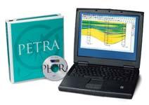
PETRA® delivers the industry’s only easy-to-use and affordable integrated solution for today’s workflows. It provides multi-user access to large projects through geological, petrophysical and engineering analysis tools. The PetraSeis™ option extends PETRA® into 2D/3D seismic interpretation with practical tools such as RasterSeis™ Download a trial version at www.geoplus.com, or callus at 888-738-7265 (in Houston, call 713-862-9449) for more product information.
Our fiscal year starts September 1st and ends on August 31st.Since we are mid-way through,this is an opportune time to bring you up to date on how we got to where we are,how we are doing so far,and where we expect to go for the balance of the year.
Around October each year,the Executive team begins the Business Planning exercise that reviews all of the Society’s programs and services and develops a three-year plan. Following that,the Executive then turns to our committees and requests budgets and three-year estimates for the upcoming fiscal year.In June,the Finance Committee tables a draft budget to the Executive for approval.
As the new accounting year opens in September,it is the Finance Committee’s responsibility to keep the Executive apprised of how our society is doing relative to budget. Areas of concern are brought to the attention of respective Executive directors who in turn will meet with the appropriate committee to resolve issues.Through this process,we are
A MESSAGE FROM THE FINANCE DIRECTOR
able to stay on top of problems as they develop,re-allocate resources as necessary, and effectively plan for the future.
With assets of just over $1 million,our Society continues to remain in a strong fiscal position.
INVESTMENTS
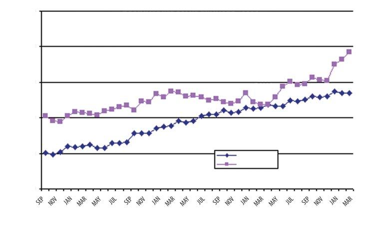
As with all non-profit organizations,our investment approach is a conservative one –we aim to grow at a reasonable pace with a 70/30% split of income/equity within the portfolio.Our Society’s original $550K investment has grown to a market value of $694K since February 1998,with average growth of 7% (Figure 1).We have weathered a brutal bear market and our investments are performing quite well.Equity growth during the last three months has been dramatic as the market rebounds.Our Society also maintains a reserve of just over $200K with a Manulife Money Market account.Our cash at hand is typically around $60K for operational expenditures month-to-month.
YEAR-TO-DATE ACTUALS TO BUDGET
The following is a brief summary (by committee) of where our society is at relative to our business plan.
Operations constitute a large part of our expense.So far,Corporate Membership revenue is down relative to budget,however,a corporate membership drive is underway and the response has been favourable.We are confident that we will reach our forecast revenue by fiscal yearend,given some operating cost savings and enhancements to other programs.
Continued on Page 64...
We would like to thank the following companies for hiring a SIFT student in 2003: Consider hiring one from the ETF Student Industry Field Trip.
SIFT introduces bright young geoscience students from 31 Canadian universities to a unique immersion into the petroleum industry in Calgary.
Students are available from mid-May to late August.
If you are interested in hiring a student, or if you would like more information please contact: Andrea Marsh Tom Brown Resources Telephone: (403) 515-6001 Email: amarsh@tombrown.com
CORPORATE RELATIONS
THE CSPG GRATEFULLY ACKNOWLEDGES ITS *CORPORATE MEMBERS:
ABU DHABI OIL CO., LTD. (JAPAN)
ARCHEAN ENERGY LTD.
BAKER ATLAS
BURLINGTON RESOURCES CANADA ENERGY LTD.
CALPINE CANADA
CANADIAN FOREST OIL LTD.
CONOCOPHILLIPS CANADA RESOURCES LIMITED
CORE LABORATORIES CANADA LTD.
DEVON CANADA CORPORATION
DOMINION EXPLORATION CANADA LTD.
DUVERNAY OIL CORP.
ECL CANADA
EL PASO OIL & GAS CANADA, INC.
HUNT OIL COMPANY OF CANADA, INC.
HUSKY ENERGY
IHS ENERGY
IMPERIAL OIL RESOURCES LIMITED
LARIO OIL & GAS COMPANY
MJ SYSTEMS
MURPHY OIL COMPANY LTD.
NCE RESOURCES GROUP INC.
NEXEN INC.
NORTHROCK RESOURCES LTD.
PENN WEST PETROLEUM LTD.
PETRO-CANADA OIL AND GAS
REEVES WIRELINE
SAMSON CANADA
SHELL CANADA LIMITED
SPROULE ASSOCIATES LIMITED
SUNCOR ENERGY INC.
TALISMAN ENERGY INC.
TOTAL E&P CANADA LIMITED
UPTON RESOURCES INC.
*CORPORATE
TECHNICAL LUNCHEON “SOCIALS”
As you have probably noticed,we have recently been holding socials at the Telus Convention Centre just prior to selected Technical Luncheons.The main purpose of these socials is to provide an atmosphere for everyone to mingle,network and get caught up with your industry peers,even if it is for only 20 minutes. To date,we have held two such events,one on December 9,to celebrate the holiday season
and the other on February 10,in recognition of our many Volunteers.Both events were well attended and enjoyed by all.
Going forward,we are planning to hold three to four socials throughout the year,each focusing on a specific event or theme such as volunteerism,return to the grind in September,Christmas,and a Spring Fling.The next planned social will be themed for the warmer weather that we all hope is coming, and will be held on May 6,from 10:30am to 11:30am,just prior to the Technical Luncheon.So dig out your loudest Hawaiian shirt (we know you have one in your closet!) and join us for a glass of wine,a pina colada or a marguerita.For those of you who are not betting animals,might we also suggest snowshoes,balaclavas,and/or wooly knicks.
We will look forward to seeing you there in all your lily-white,winter-atrophied glory! Surf’s up and we’ll have fun,fun,fun until our VP Exploration takes our T-Bird away…
Thursday, May 6 10:30 am – 11:30 am Telus Convention Centre (The same hall as the Technical Luncheon.)
Reception will include cocktails and light finger food. Prize draws will be announced as well.
Thank you to our sponsors of this event: Baker Atlas Please join us prior to the May 6 Technical Luncheon for our
TECHNICAL LUNCHEONS
MAY LUNCHEON
Geology and evolution of the Humber Arm Allochthon, Southwest Bay of Islands, Newfoundland:hydrocarbon prospects and challenges
SPEAKER
Elliott Burden Memorial University of Newfoundland
AUTHORS
Elliott Burden,Tom Calon,and Christopher Buchanan Memorial University of Newfoundland
11:30 am Thursday,May 6,2004
TELUS CONVENTION CENTRE CALGARY, ALBERTA
Please note: The cut-off date for ticket sales is 1:00 pm, Monday,May 3rd. Ticket price is $28.00 + GST.
Western Newfoundland is truly a remarkable place.For nearly 200 years there have been numerous documented reports of oil seeps (live oil) and rocks that burn (source rocks). For more than 100 years,international geological expeditions have traced the strata (reservoir) and pronounced upon the geology (structure).And,for more than 30 years,the geology and architecture of western Newfoundland have played a key role in supporting plate tectonic models for opening and closing of ancient oceans.For many,the simple act of standing upon a mountain of obducted oceanic crust and mantle and looking out upon the underlying shallow water carbonate platform can still excite visions of the timing and scale of tectonism affecting this region.So too,the area clearly shows the components for an active petroleum system.
In 1999,with renewed interest in exploration for Paleozoic hydrocarbons in eastern Canada,the GSC NATMAP program launched a regional mapping initiative to study a cross-section of Appalachian Foreland and Platform Architecture.As the most easterly leg of this transect,a detailed mapping of the transported strata lying beneath the obducted ophiolite complex, identified new aspects of regional stratigraphy,structural evolution,and burial history.Southwest of the Bay of Islands,the foredeep deposits form thick successions in the lower slices of the allochthon,comprising
both distal siliciclastic-dominated units and more proximal shale-carbonate-dominated units.Remarkably,some of these flysch units are only mildly affected by thrust-loadinginduced burial,suggesting that the leading edge of the obducted oceanic slices evolved as a highly erosive thrust front at the time of emplacement on the distal margin.
The good news is that allochthonous and par-autochthonous strata extending up to and,in fact,lying beneath the western edge of the ophiolite complex still remains within the lower part of the oil window.Deep-gas foothills-type fold and thrust traps in porous and permeable carbonate and clastic strata remain high on any list of exploration strategies.Additional consideration will have to be given to the impact of high-angle wrench faults and their role in fracturing and compartmentalizing reservoirs and opening conduits for fluids to escape into overlying strata.
BIOGRAPHY
Elliott Burden completed undergraduate and
graduate programs at the University of Toronto and the University of Calgary.In 1982,Elliott moved to Memorial University to build a palynology laboratory for research and education. His ongoing field and lab studies continue to explore and promote applied palynology for resource and environmental assessments.
Since 1977,Tom Calon,has been a faculty member of the Earth Sciences Department at Memorial University.A Ph.D.graduate of the State University of Leiden (Netherlands),Tom has spent much of his career exploring economic applications of structural geology.Petroleum studies include work in the foothills of the Oman Mountains and the Nanaimo Basin in British Columbia.
Christopher Buchanan graduated from the University of Waterloo in 1996.In 2001,and after several years of uranium exploration with Cameco in Saskatoon,Chris joined the NATMAP Team at Memorial University.Having recently completed his M.Sc.Chris has decided to stay at Memorial,beginning a Ph.D.program researching the structural geology of a gold belt in central Newfoundland.
TECHNICAL LUNCHEONS
MAY LUNCHEON
Hydrogeological and stress effects on the producibility of coalbed methane in Cretaceous-Tertiary sediments of the Alberta Basin
SPEAKER
Stefan Bachu Alberta Geological Survey
11:30 am Tuesday,May 25,2004
TELUS CONVENTION CENTRE CALGARY, ALBERTA
Please note: The cut-off date for ticket sales is 1:00 pm, Thursday,May 20th. Ticket price is $28.00 + GST.
The flow of formation water in Cretaceous and Tertiary strata in the Alberta basin is driven by gravity (topography) and erosional rebound,and is controlled by rock permeability and the presence of gas-saturated sandstones.The salinity of formation water in shallow coal seams,where the flow is driven by topography,is low,generally less than 1,500 mg/l,although in places it reaches 3,000-5,000 mg/l.The salinity of formation water in the deeper,underpressured strata in the westcentral part of the basin is significantly higher,
JUNE LUNCHEON
Accommodation and the Sequence Stratigraphic Paradigm
SPEAKER
Dr.William E.Galloway Institute for Geophysics
John A.and Katherine G.Jackson School of Geosciences
The University of Texas at Austin 11:30 am Tuesday,June 8,2004
TELUS CONVENTION CENTRE CALGARY, ALBERTA
Please note:The cut-off date for ticket sales is 1:00 pm,Thursday,June 3rd.
Ticket price is $28.00 + GST.
reaching 18,000 mg/l in Upper Cretaceous coals,and several tens of thousands (up to more than 100,000 mg/l) in Lower Cretaceous Mannville coals.This affects treatment and/or disposal strategies with regard to the water produced concurrent with coalbed methane.
The producibility of this resource depends on coal permeability,which decreases westsouthwestward with increasing burial depth, from the order of several darcies (D) in the very shallow zones to less than a millidarcy in the deep zones.The minimum effective stress, which affects coal permeability by closing fractures,increases west-southwestward from zero at the erosional edge of these strata to approximately 20 MPa near the Rocky Mountain deformation front.Fractures, including those in coal seams,will generally be vertical,and will propagate on a southwestnortheast axis along the direction of the maximum horizontal stress.The preferred orientation is generally perpendicular to the Rocky Mountain deformation front.
Considering the hydrogeological and stress regimes in conjunction with estimations of the gas content in coals,the regions with probably good CBM potential and producibility are the Ardley coal zone in the Scollard Formation and the coal zones of the stratigraphically deeper Edmonton and
Belly River groups along their respective subcrop in central and southern Alberta.The deep Edmonton and Belly River strata in western and central Alberta,and the Mannville coals have most likely a reduced CBM potential as a result of low permeability and high water salinity.
BIOGRAPHY
Stefan holds Engineering,M.Sc.,and Ph.D degrees in Water Resources,Hydrogeology,and Transport Processes.In 1983,he joined the Geology Department in the Alberta Research Council and,in 1996,was transferred with the Alberta Geological Survey to the Alberta Energy and Utilities Board where he is currently a Senior Advisor for Energy and CO2 Geoscience. Stefan has been involved in various research activities:numerical modeling of deep injection of residual water from tertiary oil recovery, reservoir analysis and characterization, geothermics,and hydrogeology of the Western Canada Sedimentary Basin.For the past five years,Stefan has focused his efforts on the potential for CO2 storage in geological media in Alberta as a mitigation strategy for reducing greenhouse gas emissions into the atmosphere. Stefan has published more than 100 papers in scientific journals and conference proceedings and has made more than 120 presentations at professional conferences and symposia,along with writing more than 50 client reports.
Sequence stratigraphy correctly targets the goal of defining genetic stratigraphic units that incorporate strata deposited within a synchronous sediment dispersal system.Its application has emphasized the recognition and use of fluvial entrenchment and/or regressive ravinement surfaces as the singularly defining boundaries of sequences. These surfaces are conceptually associated with times of onset,maximum rate,and/or lowest position of relative sea level fall when accommodation space is reduced. However,a growing body of literature argues that the sequence paradigm itself needs to expand its “accommodation space”.I present three areas where greater flexibility is needed:
1.Well-dated Quaternary analogues demonstrate that the fluvial
entrenchment surface is neither inherently synchronous nor regional, and that timing and attributes of lowstand systems tracts and their bounding surfaces are highly dependent upon the vagaries of paleogeography and sediment supply. The rigid presumption of regional isochroneity of fluvial entrenchment surfaces in the stratigraphic record results in unlikely paleogeographic interpretations.
2.A growing compendium of case histories of marine-dominated basin fills documents stratigraphies in which subaerial or ravinement surfaces correlative to fall events are poorly preserved or entirely lacking,but in which unconformity-bounded genetic
TECHNICAL LUNCHEONS
JUNE LUNCHEON
stratigraphic units can be readily defined by combinations of transgressive ravinement,submarine deflation,mass wasting,and marine starvation surfaces.These surfaces may not and need not correspond to a relative fall of sea level.
3.High-resolution dating and stratigraphic relationships demonstrate that deposition of sandy facies along shelf margins, slopes,and deep basins commonly is diachronous,areally restricted,and not uniquely associated with specific relative sea-level.Extrapolation of genetic unit boundaries off-shelf by correlation of lithologic boundaries, such as base of thick sand bodies,or stacking patterns is undesirable.
Recognition,correlation,and mapping of genetic stratigraphic units require understanding of the overall depositional systems tract and of the full array of regime variables that create stratigraphic surfaces and facies:sediment supply,textural
JUNE LUNCHEON
Elephant hunting in Nevada
SPEAKER
Alan K.Chamberlain Cedar Strat Corp.
11:30 am Tuesday,June 29,2004
TELUS CONVENTION CENTRE CALGARY, ALBERTA
Please note:The cut-off date for tickets sales is 1:00 pm,Thursday,June 24th. Ticket price is $28.00 + GST.
The central Nevada thrust belt provides an opportunity to explore for giant oil and gas fields.Thick,thermally mature,organic-rich, lacustrine oil shales deposited in the Mississippian Antler basin flood plains are the source beds for the fifty million barrels of oil already produced in Nevada.Karsted unconformities,stromatoporoid reefs,impact breccias,and sandstones make Nevada’s
composition,base level change,and energy regime.Surfaces include physical stratigraphic surfaces,which have environments of origin, predictable physical attributes,and specific stratigraphic context (i.e.,fluvial incision surface,transgressive ravinement surface), geometric surfaces (i.e.,downlap surface),and conceptual surfaces (i.e.,sequence boundary, maximum flooding surface,correlative conformity).An empirical,rather than modelbased,methodology first defines the depositional systems context,then identifies the physical stratigraphic surfaces actually preserved,traces their extent,and tests their chronostratigraphic reliability.Selection of the most useful and geologically meaningful conceptual surface for defining regional genetic units builds upon this observational framework.Functional,reproducible,and chronostratigraphic “...genetically related successions of strata bounded by unconformities or their correlative conformities...” can be defined,correlated, mapped,dated,and interpreted through the use of a variety of regional stratigraphic surfaces of non-deposition and erosion.
BIOGRAPHY
Dr.William E.Galloway is currently a Research Professor at the Institute for Geophysics and Morgan Davis Emeritus Professor of Petroleum Geology at the University of Texas at Austin.He has more than 30 years of research and teaching experience in the areas of clastic depositional systems and sequences,basin analysis,and petroleum geoscience.Dr.Galloway is the author of more than 100 papers and abstracts on subjects ranging from clastic sedimentology,sequence stratigraphy,petroleum geology and resource evaluation,hydrogeology, and uranium geology,and is co-author of the popular reference “Terrigenous Clastic Depositional Systems”,first published in 1983, with a second edition in 1996.His research has included projects in the Gulf of Mexico,Permian, Anadarko,North Sea,Gulf of Alaska,Sydney,and Barrow-Dampier basins.He has taught a variety of courses for the AAPG Continuing Education program as well as for many petroleum and minerals exploration companies.He has won numerous awards for his teaching and publications,including most recently the AAPG Distinguished Educator Award.
Devonian reservoir rocks most favorable for giant accumulations.Late Cretaceous thrusting created the compressional features of the prolific Canadian foothills, Utah/Wyoming thrust belt and the central Nevada thrust belt.
Typically,oil seeps are associated with oilbearing thrust belts worldwide.However,a blanket of Tertiary volcanics sealed in many of Nevada’s oil seeps and concealed Nevada’s thrust belt.Some of these seeps, including Grant Canyon,Blackburn,Trap Spring,and Eagle Springs oil fields,built up enough oil to become commercial.So far,all of Nevada’s crude has been produced from these commercial oil seeps.Little effort has been expended to identify the source of these commercial oil seeps because of the lack of an accurate geologic map and model. In contrast to other states,the State of Nevada has never surveyed its mineral potential.The cursory geologic mapping by the federal government is not adequate for exploration purposes.Old depositional and deformational models,based on insufficient
data,have been entrenched into the literature,thus impeding exploration.
An old model championed by the United States Geological Survey is the theory that the Mississippian Antler Basin siliciclastics were deposited as flysch turbidites into a deep foreland basin between the Antler highlands in central Nevada and the Utah hingeline in central Utah.However,new field data indicates regressive sequences containing vascular plant roots (Stigmaria) penetrating bedding planes and lacustrine palynomorph assemblages.This new data dispels the old model and supports a new depositional environment model.The new model shows that the richest and most oilprone Mississippian source rocks are lacustrine oil shales.Lacustrine oil shales make oil exploration in the Antler Basin very attractive.Cumulative thicknesses of these world-class lacustrine oil source rocks are measured in thousands of feet in outcrops and wells.They are thick enough and rich enough to generate trillions of barrels of oil.
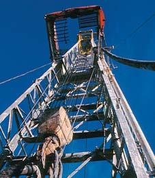
NEW COURSE
INTRODUCTION TO WELLSITE GEOLOGY
This Is The First Comprehensive Course In Wellsite Geology Techniques Offered Since The 1980’s. It Is Designed To Formalize And “Fast-Track” Training In This Highly Technical Field, And Compliments Other Short Courses Offered By Industry Partners.
SUMMARY:
This 9-day ‘hands-on’ workshop will teach basic Wellsite Geology techniques. It includes a full day field trip to a working drilling rig where theory will become ‘real time’, and a session at the AEUB Core Research Centre where a carbonate and clastic core will be examined. This course covers all aspects of Wellsite Geology including choice of equipment, Wellsite Geology Report preparation, drilling rig sociology, understanding the needs of oil company clients, and running a consulting business.
INSTRUCTOR: C. ALEX FRANCOEUR, P.GEOL.
With 24 years wellsite Geology experience, Alex Francoeur has trained numerous Wellsite Geologists including Mining Geologist career-changers, recent Geology graduates, and Foreign trained Geology Professionals. Several industry partners will co-instruct some sessions.
WHO SHOULD ATTEND:
• Geologists wishing to enter the field of Wellsite Geology
• Working Wellsite Geologists who are unsure if their skill sets are complete
• Foreign trained Wellsite Geologists who need to learn the ‘Canadian Way’ of doing things.
• Oil Company Geologists/Personnel who want to understand the origin of data that is being sent to them by Wellsite Geologists.
DATES:
June 1-June 10, 2004, (September 14-23*, 2004, November 2-11*, 2004)
Until the early 1980s the typical exploration practice in Nevada was to drill just the Tertiary valley fill in synclines.Therefore,most of the eight hundred wells drilled in Nevada penetrate only syncline Tertiary valley fill.Few wells have penetrated any Paleozoic section. However,two significant fields were found by drilling “too deep” and penetrating Devonian rocks below the Tertiary unconformity.Oil flows from Devonian reservoirs in the Blackburn and Grant Canyon oil fields.One well in Grant Canyon flowed 4,000 barrels a day for ten years.It has now produced more than 15,000,000 barrels of oil since its discovery in 1983.The Grant Canyon reservoir consists of 200 to 400 feet of karst breccia at the top of the Middle Devonian Simonson Formation.This karst interval is found in wells and measured sections throughout the eastern Great Basin.In addition to the karst interval, stromatoporoid reefs,impact breccia,quartz sandstones,and other intervals provide world-class reservoir rocks within the eastern Great Basin Devonian sequences.An isopach of all the Devonian sequences reveals a structurally compressed basin –the Sunnyside Basin – and can be used to predict the spacial distribution of potential Devonian reservoir rocks.The Simonson karst breccia interval alone has the capacity to store billions of barrels of oil in certain structures.A careful analysis of logs from the few wells that penetrated other significant portions of Paleozoic rocks shows that, contrary to preconceived notions,many intervals contain similar reservoir rocks.
Another deeply entrenched notion that discouraged exploration investment is that the north-south structural grain of the eastern Great Basin was caused by Tertiary extension which could have compromised seals on older,compressional structures. However,new mapping is revealing many uncharted compressional features and a lack of extensional features.The new maps demonstrate that the region underwent much more compression than previously thought.Furthermore,some of these features show no evidence of being broken by major Tertiary extensional faults.Several unbroken compressional structures in the Timpahute Range,50 miles south of the prolific Grant Canyon field,are exposed.
Another example of an intact compressional feature is the Golden Gate fault fold 40 miles south southeast of the prolific Grant Canyon field and ten miles north of the Timpahute Range.The Golden Gate fault fold is ten miles long and five miles wide and has more than five thousand feet of closure.It may have trapped billions of barrels of oil before it was breached by headward erosion of the
Colorado River.New mapping reveals that no Tertiary extensional faults compromise the structure.Similar structures,along strike that have escaped erosion,likely contain billions of barrels of oil and trillions of cubic feet of gas. Oil seeping from these giant fields is probably the source for the commercial oil seep fields in Nevada.However,old opinion and theories based on little or poor geologic mapping have obscured the true understanding of Nevada geology for at least five decades.As a result, past oil exploration efforts in Nevada based on old tectonic and depositional models have been disappointing.
BIOGRAPHY
Alan K.Chamberlain received his B.A.and M.S. from Brigham Young University and his Ph.D. from Colorado School of Mines.His dissertation, Structural Geology and Devonian Stratigraphy of the Timpahute Range,Nevada,provides a new exploration model that could lead to significant discoveries in this frontier region. After he worked for Exxon,Gulf,Marathon,and Placid,he became president of Cedar Strat Corp.in 1984.
Cedar Strat was organized at the request of several major oil companies to fill a need for exploration data for Great Basin exploration. Alan conceived the idea of using a scintillation counter to create a surface gamma-ray log of
measured sections while working for Gulf Oil after having worked for Exxon Minerals USA in uranium exploration.It was not until Placid hired him away from Marathon to head up their Great Basin program that he had the freedom to test the idea.At Placid,Alan had the unique opportunity to visit many of Shell Oil Company’s staked measured sections by helicopter with former Shell geologists.They had been involved in measuring the sections in the 1950s and 1960s.Using the Shell measured sections he learned the Paleozoic stratigraphy of the Great Basin.As he remeasured many of the sections,he applied his new technique of surface gamma-ray logs. He earned the Best Poster of the Session Award at the 1983 National American Association of Petroleum Geologists when he presented his work on surface gamma-ray logs in the Wyoming thrust belt and in the Great Basin. His abstract and subsequent paper attracted the attention of national and international oil companies that have applied his surface gamma-ray log technique worldwide. Development of this successful technique resulted in the formation of Cedar Strat Corp. in 1984.A presentation to the American Association of Petroleum Geologists of the results of Alan’s new,sequence stratigraphic model of the Mississippian Antler Basin including lacustrine source rocks secured him the Levorson Award in the late 1980s.
DIVISION TALKS
EMERGING PETROLEUM RESOURCES DIVISION
Regional underpressure and gas-saturation in the Upper Cretaceous and Tertiary of Central Alberta
SPEAKER
Jim Letourneau
Big Picture Geoscience Inc.
12:00 Noon
Tuesday,May 11,2004
EnCana Ampitheatre
Tower Centre, Room 498 (TC498) 2nd Floor - East end of the Calgary Tower Complex 1st Street and 9th Ave SE Calgary, Alberta
The Upper Cretaceous and Tertiary sandstones of Central Alberta (Paskapoo, Scollard,Edmonton,Horseshoe Canyon,and Bearpaw) form a major shallow,low-pressure gas resource.The source of this gas is likely from associated coal seams.These zones were
initially bypassed due to formation damage and low gas prices.
A normal water gradient is up to 350% overbalanced in some of these formations.A detailed examination of over 800 pressure tests confirmed that the Scollard member and Edmonton Group are pervasively gassaturated.Formation pressures decrease with proximity to formation outcrop along the Red Deer River.Conventional hydraulic head calculations using these data result in an eastwest hydraulic gradient.
The extreme underpressures in these zones have been attributed to pore volume expansion associated with erosional unloading.This paper proposes an alternate hypothesis.Gas pressure gradients show a predominantly west to east gradient.The lowest measured formation pressures (<200 kPa) were usually found within 20 km of the formation outcrop.It appears that the bulk of the gas is migrating up dip in response to the regional gas pressure gradient. Post-Tertiary methane desorption from
ENVIRONMENTAL DIVISION
Joint Talk Environment Division and Emerging Petroleum Resources Division
Sustainable development and the regulation of the Coal Bed Methane Industry
SPEAKER
Allan Ingelson
Haskayne School of Business, University of Calgary
12:00 Noon
Friday,May 14,2004
Aquitaine Tower
2nd Floor Conference Room
540 - 5th Avenue SW Calgary, Alberta
The United States is the world leader in the exploration and production of coal bed methane.Sustainable development is one objective of the U.S.regulatory system.A legal system that promotes sustainability incorporates the following elements:respect for ecological integrity;an efficient use of
resources;an equitable distribution of the benefits from CBM development;stakeholder participation in the resource development process;and stewardship.The U.S.regulatory system provides for stakeholder participation and,to a certain extent,respect for ecological integrity and the efficient use of resources. Governments in other countries intending to facilitate a sustainable CBM industry should consider both the environmental impact assessment and citizen participation elements of the U.S.regulatory system.To further promote sustainability in planning for CBM development,governments should ensure that:all of the environmental impacts are evaluated in the planning process;the ‘polluter pays’ principle and the precautionary approach are incorporated into the regulatory system; surface occupants are compensated for damage arising from CBM development;the regulatory system addresses the needs of future generations;and leadership is provided by the government and its regulatory agencies to encourage the CBM industry to engage in sustainable business practices.In addition, industry-specific sustainability indicators and environmental performance measures should be developed and implemented.
associated coals and vertical migration of gas from underlying units are minor components of the regional gas migration system.Lateral migration of gas towards outcrop along the Red Deer River Valley is proposed as a mechanism to create underpressures in the Upper Cretaceous and Tertiary sandstones in Central Alberta.
INFORMATION
All luncheon talks are free - please bring your own lunch.If you would like more information about future EPRD activities,please join our e-mail distribution list by sending a message with the title “EPRD list”to caddelem@bp.com.
VENUE AND DATE CHANGE
Please note that beginning in April 2004,the venue and regular date has changed for Emerging Petroleum Resources Division talks.The location is the EnCana Ampitheatre,located on the second floor at the east end of the Calgary Tower Complex at the corner of 1st Street and 9th Ave SE.The regular date will be the second Tuesday of each month except where conflicting with CSPG Luncheon Talks.
BIOGRAPHY
Allan Ingelson is Associate Dean (Undergraduate Programs) in the Haskayne School of Business, University of Calgary.He holds Science,Arts,and Law degrees from the universities of Calgary, Denver,and Alberta and has been a Barrister and Solicitor in Alberta since 1991.He has lectured on business law,petroleum land management,and the global environment of Canadian business in the Haskayne School of Business,and on natural resources law in the Faculty of Law.Allan Ingelson co-authored a book on international ecotourism,published by the University of Calgary Press in 2001.His research and teaching interests focus is on Energy Regulatory Law and Policy,Sustainable Development,Mining Law,Heritage Management,and Ecotourism.
INFORMATION
All lunch talks are free.Please bring your lunch. For more information or to present a future talk on the Emerging Petroleum Resources contact Matt Caddel at caddelem@bp.com.For information or to present a talk for the Environment Division contact Andrew Fox at foxaj@bp.com.
Energyat Arcis goes beyond oil and natural gas. It is apparent in our team, our service and our reputation.
PARTICIPATION SURVEYS
SEISMIC DATA LIBRARY DATA MARKETING
SEISMIC DATA PROCESSING
LAND, MARINE AND DEPTH
DIGITAL MEDIA SERVICES
ACQUISITION PROJECT MANAGEMENT
3D DESIGN AND MODELING
GIS, MAPPING AND GOVERNMENT APPROVALS
DIVISION TALKS
SEDIMENTARY DIVISION
Permian shift and collapse of thermohaline circulation: dress rehearsal for a looming environmental disaster?
SPEAKER
Benoit Beauchamp Geological Survey of Canada
12:00 Noon, Monday,May 17,2004
Nexen Annex Theatre +15 Level, South of C-Train Platform (Nexen Annex Building) 801 - 7th Avenue SE Calgary, Alberta
Is the Gulf Stream about to shut down? This question looms ever more menacingly over the fate of our planet.As CO2 levels increase in the atmosphere,many believe that the rising temperatures and the melting of sea ice in the Arctic will conspire to slow – and even shut down – the Gulf Stream,the hot and salty arm of the global conveyor belt of thermohaline circulation (THC) that carries heat from the southern hemisphere to the northern.Europe is the net beneficiary of the current THC pattern,enjoying a relatively warm climate in spite of its high latitudes.
Should this global conveyor belt shut down, Europe could be plunged into cold and unpleasant climatic conditions with devastating consequences for economies and populations. But exactly how far we are from a THC shift is open to question.Some scientists warn it will happen in our lifetime;others argue that it would take millions of years of atmospheric CO2 increase to cause such a shift.Regardless, a sombre reminder of this doomsday environmental scenario occurred some 280 millions years ago along the northwest margin of the super-continent Pangea.
For more than 40 million years,from late Early Carboniferous to the Early Permian,NW Pangea was bathed by warm waters as shown by tropical-like carbonate platforms and reefs flourishing well into temperate paleolatitudes (40-50°N).This occurred at a time of widespread glaciations over much of Gondwana,hence suggesting that the unusually warm conditions enjoyed by NW Pangea resulted from a net transport of heat from the southern frigid Gondawa to the balmy northern hemisphere.A Gulf Streamlike northeast-bound current across Panthalassa,linked to the global conveyor belt, is seen as responsible for this anomaly.Global warming,associated with an Early Permian increase in atmospheric CO2,led to the rapid
meltdown of Gondwana glaciers,and shortly after,to a global THC shift.The warm water carbonate factories of NW Pangea gave way to cold water factories,indicative of a major shift to much colder oceanic conditions.These conditions lasted until the P-T boundary,when unabated global warming ultimately led to the complete collapse of the conveyor belt,one of many events associated with the largest mass extinction in Earth history.
BIOGRAPHY
Benoit Beauchamp received his Ph.D.from the University of Calgary in 1987.He has since been working as a Research Scientist for the Geological Survey of Canada in Calgary,conducting research in the Canadian Arctic.He is a renowed expert on the Carboniferous and Permian history of Pangea and on the energy potential of Canada’s northern basins.He received the CSPG President’s Award in 1997.
INFORMATION
Talks are free - don’t forget to bring your lunch! Coffee and donuts will be provided.If you are interested in joining the Sedimentology Division e-mail listing which currently provides luncheon reminders,or if you care to suggest a technical topic or present a talk to the division,please contact Scott Rose at (403) 699-4780 or scott_rose@nexeninc.com.
GEOMATHEMATICS AND COMPUTER DIVISION
Practical geostatistics:a deeper look at spatial correlation models and their impact on reservoir characterization
SPEAKER
Richard L.Chambers, Quantitative Geosciences LLP, Broken Arrow,OK
AUTHORS
Jeffrey M.Yarus & Richard L.Chambers, Quantitative Geosciences LLP
12:00 Noon Thursday,May 27,2004
ConocoPhillips Auditorium 3rd Floor- above Plus 15+ level 401 9th Ave SW Calgary, Alberta
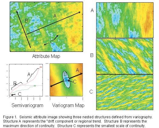
The mathematical characterizations of petroleum reservoirs using geostatistical principles require models of spatial continuity such as the semivariogram.The shape of the experimental semivariogram calculated from raw data is often far more complex than models we use to represent them.In general, what is required for the variogram model is the model type,the value of the nugget (if present),the range,and the sill.When the experimental variogram is particularly complex,nested variogram models (structures) can be used.Modeling nested structures is more complicated, but if done carefully,offers valuable insight into the geology,geophysics,or processing of such data.
Furthermore,geological surfaces and properties often have multiple directions of continuity equally important but difficult to see using the traditional variogram graph.To visualize multiple directions of continuity,a variogram map may be constructed that displays the geometry of continuities in all directions simultaneously.Unlike the traditional 2D variogram,multiple azimuths are displayed as radial lines initiated from a common origin in a “map” view.The origin is located in the center of the map and the changes in variance are plotted for each lag along each line.The values are contoured or rendered with different colors.If vertical information is included,the variogram map can be produced in 3D.The construction of 2D and 3D variogram maps simplifies the parameterization of the variogram necessary for reservoir characterization software,and allows for more detailed modeling of important subtle trends.Methodology and examples are shown.
BIOGRAPHY
Dr.Yarus obtained his Ph.D.from the University of
South Carolina in 1977 before joining Amoco Production Company where he worked as an exploration geologist in the Gulf of Mexico.From 1981 until 1988,he worked in exploration and production as an independent in a variety of basins throughout the Rocky Mountain States.In 1988,Jeffrey joined Marathon Oil Company’s Petroleum Technology Center in Littleton,Colorado where he introduced the company to geostatistical reservoir characterization.Moving toHouston in 1996,he worked as a technical manager and executive for GeoMath,a subsidiary of Beicip-Franlab,Smedvig Technologies (Roxar), and Knowledge Reservoir,Inc.In August of 2001, Jeffrey,along withDr.Richard L.Chambers,started Quantitative Geosciences,Inc.,a consulting firm specializing in reservoir characterization and geostatistics.Jeffrey is well known throughout the industry for his seminars and lectures that he has given in Europe,Malaysia,the Middle East,South
PALAEONTOLOGY DIVISION
Reefs of the MaritimesPrimarily the JurassicCretaceous Abenaki Offshore
SPEAKER
Leslie Eliuk
GeoTours Consulting Inc.
7:30 p.m.
Friday,May 28,2004
Mount Royal College Room B108
4825 Richard Road SW Calgary, Alberta
Reefs in the Maritimes have a long, complicated,and disjointed history since at least two oceans have closed and opened there since the Precambrian.If Gaspé Quebec is included,some of the oldest reefs (Silurian) have spectacular seacoast outcrop exposures.Though most of the Carboniferous successor basins are nonmarine,there are Windsor Group reefs that have been interpreted as deep deposits. Today deep-water corals still form thickets and ‘reefs’ that act as nurseries protecting young fish among their branches in channels and gullies at the edge of the Nova Scotia shelf.This talk will give a brief pictorial survey of these reefs of different ages and types.
America,and the USA.He has worked with most of the software development corporations specializing in reservoir characterization to evaluate and suggest improvements to their products.Jeffrey has served as AAPG’s Publications Chairman,and has authored many papers and abstracts on geostatistics.Along with his partner Richard,he co-edited the 1995 AAPG volume on Stochastic Modeling and Geostatistics. The second volume in that series is due out later this year.
INFORMATION
There is no charge.Non-members of the CSPG are also welcome.Please bring your lunch.For details or to present a talk in the future,please contact David Garner at 403-243-8223,e-mail: David.Garner@ConocoPhillips.com or Peter Dankers at 403-770-0350,e-mail Peter.Dankers @divestco.com
However it will concentrate on fossil reefs of the Nova Scotia offshore Jurassic-Cretaceous Abenaki Formation with their great variety from microbial-based mud mounds to deepwater sponge reefs to coral-coralline sponge shallow-water reefs.
Carbonate reefs usually are thought of as indicators of clear,shallow,near-tropical waters.But both the history of the Maritimes reefs from Silurian to Recent and the variety of reefs in a single formation,the Abenaki, show that there are very different kinds of reefs in very different climatic,bathymetric, and paleogeographic settings.One does not need to annex the Turks-Caicos or Caymans
for a Canadian reef since modern sponge reefs occur off British Columbia and in the high Arctic Ocean,and coral thickets occur off Nova Scotia and probably BC as well.Of course if you want a holiday by warm shallow reefs in clear waters then maybe the Caribbean is still our closest best bet.If we lived 150 million years ago,we wouldn’t need to drive or fly south for tropical vacations but simply head a hundred miles or so off Halifax. However we might be surprised to see that sponges and corals then seemed able to get along with the muddy waters of a major delta centred on Sable Island unlike today when nutrients and clays are inimical to coral growth.Now,of course,one needs to drill three to four kilometers below the seabed and look at the cuttings,sidewall cores,and limited number of whole cores in the 10 or so wells drilled at the Late Jurassic continental shelf margin.
Early results are presented from a reexamination of the Abenaki reefs some three decades since Shell Demascota G-32 first penetrated them.New wells and continued research on European Jurassic reefs by Reinhold Leinfelder and others
allow a better look at the reefs of the Abenaki.EnCana’s (PanCanadian) discovery of the 1-2 TCF Panuke Field between the two oldest wells near the margin and the additional wells associated with that discovery have been particularly helpful in adding more to our knowledge of these mid-Mesozoic reefs.The presence of corals of the modern hexacorals (Order Scleractinia) and the prolific evidence of bioerosion give these reefs a modern aspect but the coralline sponges and proximity in some cases of very argillaceous beds to reefal beds is more problematic.However this juxtaposition may indicate that what are considered classical warm-shallow-water reefs and ‘atypical’ non-tropical and deep (and/or ‘dirty’) water reefs receiving increasing study recently are not that far apart.It does seem to confirm the observation that if a fossil reef actually looks like an in-situ build-up with framebuilders in growth position then it is probably anomalous and not a shallow high-energy margin reef.Indeed given enough physical degradation and bioerosion,some reefs may ‘disappear’ before they have a chance to be buried in the rock record.
CORE AND SAMPLE DIVISION REPORT
Our next meeting will be on Tuesday June 15,2004 at the EUB Core Research Centre,3545 Research Way NW,Calgary from 12:00-1:30 PM noon.Our main topic of discussion will be: Drill Cuttings Collection and EUB Requirements in Alberta
Advances in drilling technology have greatly increased drilling penetration rates making the collection of drill cuttings for Geological evaluation challenging.This fact,combined with the high number of wells being drilled has resulted in a large volume of drill cuttings being collected.In addition to the challenges this presents to wellsite geologists,the EUB is faced with trying to collect relevant and valuable material while meeting their own challenges for storage space and allocation of staff hours to process,sort,and store the material. Drill cuttings submission requirements are regulated through a section in the EUB’s “Guide 56” in which operators are required to determine sample requirements based on the classification of the well and the zones targeted.It has been determined through joint discussions between the EUB and the Geological community that the intentions of sample collection through the criteria outlined in Guide 56 are not always being met,and that some refinement to the criteria is necessary
to ensure that valuable material is being collected and submitted.We feel that it is necessary and appropriate that those revisions be determined through a joint effort between the EUB and the geological community.In addition,we would like to also address joint concerns about collection of non-valuable material,which adds an extra burden of time and expense to those collecting and processing it at wellsite and also to the EUB Core Research Centre to sort and store it (e.g.,thick intervals of uphole shale).
Once revisions have been determined,the CSPG Core and Sample Division will be soliciting the endorsement of the CSPG executive and of the major operators and then recommending changes to the EUB.
We will discuss these issues and formulate a recommendation.If you are unable to attend, but wish to have your opinions brought to the meeting,please email your ideas to:Doug Hayden,Chair,CSPG Core and Sample Division via dhayden@shaw.ca
Check the CSPG website for updates on the group’s activities and projects.If you would like more information on upcoming activities of this group,please contact Doug Hayden at dhayden@shaw.ca
BIOGRAPHY
Leslie Eliuk,P.Geol.(B.Sc.and.M.Sc.University of Alberta).Early retirement in 1999 from Shell Canada after 30 years helping them explore and produce from mostly carbonate reservoirs was short-lived.The 1998 PanCanadian Deep Panuke Field discovery in his beloved Abenaki Formation has meant work helping geologists of EnCana and several other operators look again at the cuttings and core from these Jurassic-Cretaceous carbonates in both old 1974 and new 2003 wells. Thus his intention to go back to university and look more closely at these East Coast carbonates has been helped in the data acquisition and financing by these welcome events but slowed by the requirement for confidentiality and the happy continuing addition of new data to mull over.
INFORMATION:
This event is jointly presented by the Alberta Palaeontological Society,Mount Royal College and the CSPG Palaeontology Division.For information or to present a talk in the future please contact CSPG Paleo Divison Head Philip Benham at 403-691-3343 or programs @albertapaleo.org.Visit the APS website for confirmation of event times and upcoming speakers:http://www.albertapaleo.org/
AAPG CANADA INTERNATIONAL REGION ANNUAL MEETING
For AAPG members resident in Canada, Guests welcome June 2,2004 4:30 pm to 7:00 pm
Kensington Room, Calgary Marriott Hotel 110 – 9thAve.S.E. Calgary,T2G 5A6
Please join us on thelate afternoon of last dayof the CSPG convention complimentary refreshments provided for more information contact: Warren Workman, 403 269 9550 ext 224 wworkman@apexenergy.com
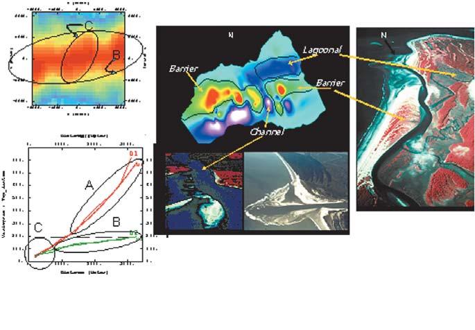
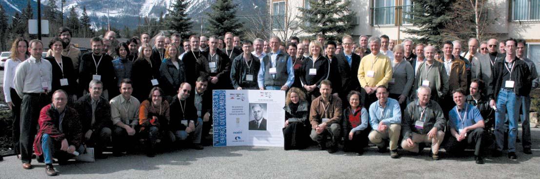
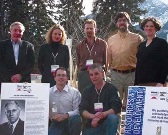
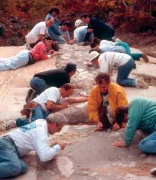
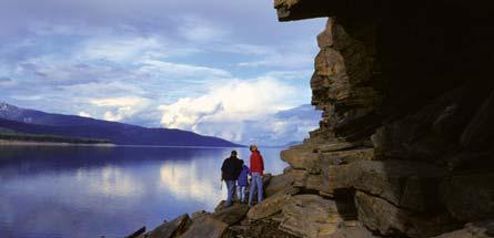
2004 GUSSOW GEOSCIENCE CONFERENCE: WATER RESOURCES & ENERGY DEVELOPMENT
The CSPG has recently resurrected the “Banff Conference” style of single topic miniconferences with a new series named after a former CSPG President William C.Gussow. The first of these annual mini-conferences was recently held March 19-20th,2004 in Canmore and was entitled “Water Resources & Energy Development”.
The issue of continued and increased water usage by the energy industry,especially potable water resources,has recently become a major public concern.Therefore,the CSPG felt a need to educate our membership and other stakeholders on the issues and what is being done to address them.
The program was comprised of three sessions;Water Resources for Petroleum Exploration and Production,Handling and Disposal of Produced Water,and Resource Conflict.
Together these sessions addressed a number of issues including:
• How other jurisdictions have and are dealing with water resource issues.
• The amount,geographic distribution,and types of water usage by the energy industry.
• The technical feasibility of using brackish or saline water resources.
• Both existing and potential conflicts between various water users.
The event was a tremendous success, attracting approximately 100 participants with representation from consulting, industry,government,and NGO’s such as the Pembina Institute and the Lakeland Industry Community Association.Three internationally renowned keynote speakers set the stage for the individual sessions
providing informative,educational,and entertaining insights into the topics.
The “Round Table” discussion session following the session presentations allowed the participants to actively participate in further questioning of the speakers and to add their own concerns and expertise to the discussion.
The intimate nature of a small focused conference set in the scenic Rocky Mountains was an opportunity for scientists, regulators,lawyers,and laypersons to interact and discuss issues of common concern in a relaxed and informal atmosphere.
The CSPG is proud to have brought these groups together for two days of constructive discussion on a very topical and sensitive subject.
As one participant put it,“This was an excellent,timely,informative conference with the right experts and the right participants present.”
The organizing committee would like to express their thanks to:
Technical Session Chairs
• Dr.Kevin Parks,Alberta Geological Survey
• Dr.Bill Gunter,Alberta Research Council
• Dave McGee,Alberta Environment
Round Table Moderator
• Dr.Grant Mossop,Geological Survey of Canada
Keynote Speakers
• Dr.Marios Sophocleous, Kansas Geological Survey
• Dr.Bill Gunter,Alberta Research Council
• Dr.Yousif Kharaka,U.S.Geological Survey
• Dr.David Percy,Dean of Law, University of Alberta
Speakers
• Brenda Austin, Alberta Energy and Utilities Board
• Jon Fennell,Komex International Ltd.
• Dr.Karsten Michael,Alberta Geological Survey
• Dr.Ernie Perkins,Alberta Research Council
• Peter B.Bulkowski,Petro Canada
• Lorne Ternes, Lorne J.Ternes Professional Corporation
• Steve Wallace,Alberta Environment
• Dan Woynillowicz,Pembina Institute for Appropriate Development
Thanks also to the conference sponsors:
• Borden Ladner Gervais
• Canadian Natural Resources Ltd.
• Nexen Canada Ltd.
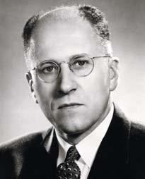
WILLIAM C. GUSSOW – BIOGRAPHY
BY GEORGE EYNON, CHAIR - COMMITTEE ON CONVENTIONS
WILLIAM CARRUTHERS GUSSOW -
For whom the CSPG dedicates and names its Geoscience Conference Series
William C.Gussow published his seminal paper, “Differential Entrapment of Oil and Gas:a Fundamental Principle” in 1954.With its emphasis on fluid flow,regional migration paths for hydrocarbons,and the displacement of oil by gas on a regional scale,his thinking paved the way for petroleum systems analysis as we have come to know it.Simple and obvious though his concepts might seem to us now,they were at the time both controversial and contrary to accepted ideas. All of us who have successfully explored for oil and gas in basin-flanking traps owe a debt of gratitude to his clear thinking and explication.The lucid simplicity of his ideas was illustrated by now classical figures,one of which – a profile showing differential entrapment and displacement of hydrocarbons in the Devonian Leduc reef trend of Alberta – we have adapted and adopted for the logo of the CSPG’s eponymous William C. Gussow Geoscience Conference Series.
Not content with just a single such accomplishment in his geological career,in the late 1980s Bill Gussow patented methods of tertiary recovery from partially depleted reservoirs using natural gas for displacement of the oil.Application of the techniques resulted in dramatic increases worldwide of recoverable reserves in already discovered reservoirs,and helped alleviate the gloom being spread that we were running out of oil.
Bill was born in London in 1908,and his family soon moved to Canada when his father was appointed as the first Dominion botanist.Bill obtained B.Sc.and M.Sc.degrees at Queens University in Kingston,Ontario,and his Ph.D. from MIT.His early career included surface mapping with the Geological Survey of Canada, various mining projects,and engineering geology for hydroelectric power developments.In 1945 Bill joined Shell Oil Company and worked in eastern and western Canada.From 1956 to 1971 Bill worked for Union Oil Co.California.
Bill’s wisdom,experience,and thoughts are reflected in a long list of publications,and have been recognized by the many honors he has received.In 1999 he received the Stanley E. Slipper Award,the CSPG’s highest honour,and in 2000 was the recipient of the AAPG’s Pioneer Award.
Bill will always be,for so many geologists,a classic role model,continually coming up with new and
often startling ideas,and being so generous in sharing his experience with others.Perhaps most of all we appreciate his kindness,his friendliness, and his gentle sense of humor.
As a thoughtful,incisive,and visionary thinker, there is no-one more fitting in the ranks of illustrious CSPG members than William Carruthers Gussow for whom to dedicate and name the CSPG Geoscience Conference Series.
2005 GUSSOW GEOSCIENCE
CONFERENCE:
COMING SOON 2005 Gussow Geoscience Conference on Coalbed Methane
March,2005
The 2005 Gussow conference will focus on the geological aspects around Coalbed Methane (CBM) / Natural Gas from Coal (NGC) reservoirs and plans are underway to co-host the event with the Canadian Society for Unconventional Gas (CSUG),The Society for Organic Petrology (TSOP) and the Canadian Society for Coal Science and Organic Petrology (CSCOP).Sessions will focus on various aspects of coal geology including petrography,sedimentary environments,case studies,etc.from both a national and international perspective.Earlybird registration begins in December 2004.
CSPG William C. Gussow Geoscience Conference Series
The CSPG has established a special topic mini-conference series to be held in the first quarter of the year.The meeting is an annual 2-day mini-conference on a specialized topic, held in Canmore.The CSPG is pleased and honoured to dedicate this conference series to William C.Gussow,a Past President and Honourary Member of the CSPG who has distinguished himself,his society and his country through his pioneering work in geology.The 2005 Gussow Geoscience Conference on Coalbed Methane will follow the successful 2004 Gussow Geoscience conference on Water Resources and Energy Development.
If you’d like to get involved with this conference please contact Matt Caddel at caddelem@bp.com.
Now available for import into ACCUMAP and other mapping programs:
1) Mississippian Subcrops and Devonian Reef Edges – Alberta, NE BC, Sask. and NWT- completely updated in 2003/04
2) Glauconitic Channel Trends – Southern and central Alberta
3) Colony Reservoir Trends – East-central Alberta
4) Bluesky-Dunlevy Reservoir Trends – NE BC
5) Halfway-Doig Shoreline Trends – NE BC, NW AB
6) Charlie Lake Siphon, Cecil and North Pine Reservoir Trends – NE BC
-all edges are formatted as map features and as editable annotation lines and regions
For more information contact Mike Sherwin at 262-1151 Email mike@sherwingeological.com or view at www.sherwingeological.com
OILS VILLE byBUD
So how’s the updated software working? It keeps getting delayed.
to download your very own copy of OilsVILLE, visit www.divestco.com!
We’re still using their old version. Er, nice pink and teal box...
It plays David Foster’s olympic theme song on start-up!
Isnʼt it nice when software upgrades are actually released when promised? True to our word, Divestco has launched Version 1 of the much-anticipated ESRI-based GeoCarta Tools GeoCarta Tools are based on an open systems philosophy and can be configured to query and report against a wide variety of public and proprietary data. Also, as scheduled, the first quarter release of GeoVista 4.1 brings its users enhanced functionality and compatibility.
Find out more about what GeoCarta Tools V1 and GeoVista V4.1 can offer your company - visit us at the CSPG Conference, May 31 to June 2, or contact the sales team directly at (403) 237 - 9170 or sales@divestco.com
Discover the Business of Energy
The Canadian Centre for Energy Information (Centre for Energy) is a non-profit organization created in 2002 to meet an urgent need for information about all parts of the Canadian energy sector from oil, natural gas, coal, thermal and hydroelectric power through to nuclear, solar, wind and other sources of energy.
From freestanding information kiosks, to our print publications and Web portal, the Centre for Energy delivers accurate, factual and current information on Canadian energy.
We believe that an informed public makes better business decisions related to energy, chooses careers in energy, invests in energy and even uses energy more wisely.
www.centreforenergy.com
Bookmark us today!
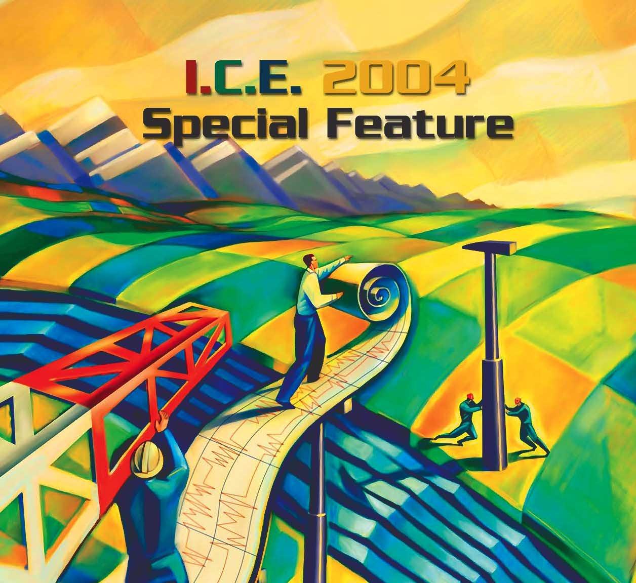
Welcome to the I.C.E.2004 Joint Conference.This year’s conference is being co-hosted by the CSPG,the CHOA,and the CWLS;together,the membership of these societies represents an important and significant cross-section of the petroleum industry’s technical community.
In promoting the theme;Innovation, Collaboration,and Exploitation,this year’s conference brings this community closer by offering a technical program that intertwines the disciplines and provides a forum for knowledge exchange.If abstract submissions of our memberships are a valid barometer of the future of the Oil and Gas Industry in Western Canada,then collectively we have spoken loudly.Four areas of interest appear to have overwhelmingly captured our concern: heavy oil,unconventional gas,domestic frontier exploration,and the possible impact of technological advances.
The organizing committee is very pleased to start the conference on Monday May 31st with a special plenary session giving the floor to select high-profile industry and government leaders who will speak on a common theme: The Future of the Oil and Gas Business in the Western Canada Sedimentary Basin.This session will focus on upstream issues,and each of the panelists will speak on their corporation’s focus,future,and the driving elements that shape their strategy.The session will showcase the complimenting and contrasting perspectives,views,and visions from a cross-section of the Canadian upstream oil and gas industry.
Following the opening plenary session Monday morning,five oral technical session streams will begin in parallel.By the end of Wednesday afternoon a total of 25 technical sessions will have seen 198 oral presentations covering many of the classic geological topics,as well as some you may not have seen before.Of special note is the number of abstracts dealing with topics related to Unconventional Gas resources;as a result,we have organized three complete sessions on the topic.Those who have interest in petrophysics will be drawn to a series of sessions covering topics ranging from innovations in technology to SCAL to interpretation case studies and novel techniques.On the heavy oil side,five linked sessions cover a progression of topics from G&G to facilities and upgrading.
The exhibition floor is arranged to
accommodate 55 poster presentations which will cover a range of topics similar to the oral sessions.Poster authors will be present at their posters during the ice breaker and minibreaker.Plan to include a review of the posters during your tour of the exhibition hall.
Registrants have the opportunity to choose from an offering of 32 short courses and field trips that will be run before,during,and after the conference.Whether you are new to the field,or an experienced professional,we are certain you’ll find courses of interest and an opportunity to benefit from a broader and varied scope.
In keeping with tradition,the core conference will be run Thursday and Friday at the Alberta Energy and Utilities Board’s Core Research Center. Nineteen cores will be on display from a broad range of environments,with extra emphasis on a number of significant oil sands projects.
All presentations will be judged based on content,delivery,and innovation.The Awards for exceptional presentations,in a number of
categories,will be presented at the core windup on Friday afternoon.
This year’s technical program is designed to reflect the importance of integration and collaboration between diverse disciplines,as we build towards a common future.Thank you to the technical sub-committees,the session chairs,the presenters,and you,the delegates for helping to bring together what will certainly be a valuable and worthwhile learning and knowledge-exchange experience.
ENJOY THE PROGRAM!
Richard EvoyGrant Spencer Tech Program ChairTech Program Chair CSPGCWLS
KC Yeung Tech Program Chair CHOA
CANADIAN SOCIETY OF PETROLEUM GEOLOGISTS
WHAT IS A PETROLEUM GEOLOGIST?
Being a petroleum geologist is more than just a job! It is a fun and rewarding career.To be a petroleum geologist is to be the SOURCE of so much that contributes to the quality of everyone's daily lives.
Without petroleum geologists successfully finding and helping to recover petroleum resources there would be no fuels,plastics,paints,synthetic rubber,cosmetics,paved roads,glues,nor synthetic fibres used in outdoor clothing such as fleece vests!
To be a petroleum geologist is to have a career that takes you around the world,to spend time in the outdoors or in front of a high tech workstation.It is to read ancient stories from rocks,to work with and learn from others on multi-disciplinary teams.
It is to be a part of the proud community which is the Canadian Society of Petroleum Geologists. Beinga petroleum geologist is so much more than a job!
OUR HISTORY...
The Canadian Society of PetroleumGeologists was founded in 1927.Since then it has grown from an Alberta-focused organization into a national body representing petroleum geology coast to coast and from our southern border into the high arctic.With over 3,500 members from around the world,some 40 committees,and over 400 dedicated volunteers,the CSPG is one of Canada's most successful and enduring non-profit professional societies.The scope of its activities within the industry and its commitment to the highest standards of service to the profession it represents have been a hallmark of the Society from its inception,and form the foundation of its mandate today.
OUR GOALS...
The Mission of the Society is to advance the science of petroleum geology,foster professional development and esprit de corps of members,and promote community awareness of the profession. OUR MISSION...
Advance professional development and foster the spirit of scientific research throughout its membership; Advance the science of geology,especially as it relates to petroleum,natural gas,and other fossil fuels; Promote the technology of exploration for finding and producing these resources; Promote public awareness of the role of petroleum geologists; Develop a sense of pride,community,and purpose for all Canadian Petroleum Geologists;and, Advance the national character of the Society.
CSPG MEMBERSHIP...WHAT’S IN IT FOR ME?
Career & Professional Development ... maintain and develop new skills
Technical Journal
•Bulletin of Canadian Petroleum Geology, 20-30 articlesper year
Technical Talks
•19 technical luncheons per year
•webcasts of luncheon talks
•11 Divisions provide over50 presentations per year
Annual Conference
•over 100 technical talks
•field trips,short courses,core displays
•exhibits
Publications
•Memoirs,Lexicons,Field Guides and more…
Networking ... critical for career development
Annual conference social events
Non-technical social events
•Golf,Squash &Hockey tournaments, 10 km road race
Reservoir Magazine
•monthly update on technical and networking events
Website
•online membership directory
•CareerSource
Member Services
•group insurance,member discounts
Public Awareness ... ensuring the vitality of the profession and industry Science Fair Awards
•introducing teachers and youth across Canada to geology
Student Industry Field Trip
•industry and geology students get a chance to learn about each other
Public Honorary Address
•distinguished scientists have talked on geology, space,weather,the Titanic,anthropology and much more...
CSPG
160,540 - 5TH AVENUE S.W.
Rw Catalog
Canadian Well 2002 CWLS
Information included on CD:
• 2002 Rw Catalog (Over 50,000 Data Points)
- PDF Format
- Spreadsheet (XLS) Format
• 1987 Rw Catalog (5,600 Data Points)
- PDF format
- Original “Data on Disk” Digital Format
• LAS 2.0 and 3.0
Prices (Shipping Not Included*):
Members#: $25.00 CDN (limit one per member, two per corporate member)
Non-members: $65.00 CDN
Network License (corporate members): $500 CDN
Network License (non-members): $1000 CDN
To order contact the CWLS office at (403) 269-9366.
The Canadian Well Logging Society (CWLS) is the oldest petrophysical organization in the World. Devoted to formation evaluation, the society was incorporated in Calgary in 1957. In that time the society has endeavored to produce a technical journal with a Canadian slant. The CWLS is thus an appropriate place for those interested in exploring mineral resources in the Western Canada Sedimentary Basin, the Canadian Arctic, offshore eastern Canada, and southern Ontario.
The society has great support from the petroleum industry with over 40 corporate sponsors and 500 members. The CWLS has in turn provided a great deal of support to the petroleum industry.
The CWLS holds a technical luncheon on the third Wednesday of every month (except in the Summer and February) for the benefit of those interested in log analysis and petrophysics.
Contact Information
If you are interested in any of the information in this advertisement or would like to learn more about the Canadian Well Logging Society please visit our website at www.cwls.org. Or you can contact the office directly:
Local talent has been under represented at our monthly technical luncheons. So, in addition to the usual President’s Award for the year’s best technical luncheon presentation there will be a new Vice-President’s Award. This award, in the amount of $500, will be for the best luncheon talk by a Canadian-based speaker who is from an oil company or from a university or college.
Anyone who is considering presenting at a luncheon or who has a suggestion for an interesting topic should contact John Nieto at (403)231-0276 or john_nieto@anadarko.com.
Logging Society
Student Awards
The Canadian Well Logging Society announces yearly awards for undergraduate and graduate students in engineering and earth sciences. The purpose of these awards is to raise interest and awareness of careers in Petrophysics and Formation Evaluation. Formation evaluation and Petrophysics are the studies of rocks and their fluids as they pertain to the oil and gas industry.
Three $2000 awards will go to students who submit thesis proposals that critically examine some aspects of well logging, formation evaluation or petrophysics. Award winners will be selected in April of each year.
An additional $5000 will be awarded yearly for the best thesis related to Formation Evaluation and submitted to CWLS upon graduation. The winner of this award will be invited at the expense of the CWLS to make a presentation at a lunch meeting of CWLS in Calgary. The final thesis can be submitted at any time in the year of graduation. The award winner will be selected in January of next year.
For more information on how to apply please visit www.cwls.org.
Special Core Database
Members have free access to the Special Core Database. To gain access, visit the society’s website at www.cwls.org and visit the Core Database page. From there members can request access. You will then be supplied a user name and password information necessary to access the special core site. For more information please contact Jeff Levack at (403) 232-1705 or jlevack@tuckerenergy.com.
Upcoming Luncheons
Apr. 14Robert Cluff Permeability Jail And Implications
For “Basin Centered Gas” Production And Resource Assessment
May. 19Roberto AguileraA Triple Porosity Model For Petrophysical Analysis Of Naturally Fractured Reservoirs
Jun. 9TBATBA
Want to join? Call or email Dion Lobreau at (403) 231-7673 or dlobreau@mancal.com
Registration Reminder
The I.C.E. 2004 Joint Conference is quickly approaching, have you registered? Take advantage of the great savings by registering before May 19, 2004. The quickest and easiest way to register for the conference, and ensure your spot for the Luncheon, Field Trips and Short Courses is ONLINE at www.cspg.org or www.choa.ab.ca or www.cwls.org
Convention Schedule
The 2004 Organizing Committee has worked very hard to provide Conference delegates with the most superior Technical Program and Special Events to date.
Monday, May 31 Tuesday, June 1 Wednesday, June 2 Thursday, June 3 Friday, June 4
This year’s conference features a brand new event to kick-start the Technical Program. The Plenary Session begins Monday, May 31, 2004 at 9:00am in Hall B of the Round Up Centre. This session will feature a panel of six industry and government leader’s who will share their views and visions on “The Future of the Oil & Gas Industry, a Canadian Perspective”.
Monday’s Luncheon guest is Simon Winchester, a world-renowned author, journalist and broadcaster. He will be discussing his latest book “Krakatoa: The Day the World Exploded”.
Another new event to this year’s conference is the BBQ Beef and Beans Luncheon on the Exhibits Floor, from 11:30am to 1:00pm on Tuesday, June 1, 2004.
Judging & Awards
The I.C.E. 2004 Joint Conference recognizes and rewards high quality presentations. Presentations are judged by panels of peers, session chairs, and randomly selected audience participation. This year’s award categories are:
Best Student Core
Best Core
Best Geological Paper
Best Petrophysical Paper
Best Heavy Oil Paper
Best 3 Posters (from all categories)
Best Student Paper –Andrew Baillie Award ($1000 cash)
Best Student Poster –Andrew Baillie Award ($1000 cash)
All winners will be announced at the Core Meltdown. For more information regarding judging and awards, please contact one of our Committee members.
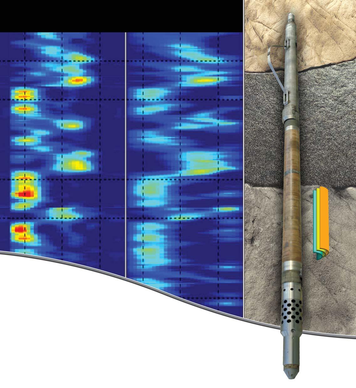
The new MR Explorer tool operates at multiple frequencies, allowing faster logging and multiple, simultaneous NMR experiments in a single logging pass. This next-generation tool uses a side-looking antenna design and a gradient magnetic field to provide comprehensive NMR data for formation evaluation and fluid analysis in almost any borehole environment. You'll get improved NMR data accuracy as well as superior hydrocarbon typing and fluids analysis, while you reduce the total cost of your NMR logging operations.
Want best-in-class NMR technology and reliable, quality results regardless of borehole size, salinity, or deviation? We offer the MR Explorer service -- your best choice for NMR answers.
www.bakerhughes.com
Latest NMR Technology Introduction to Western Canada
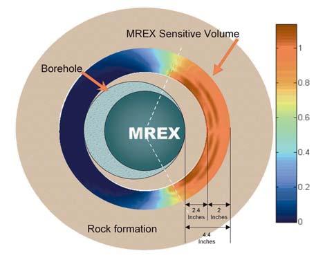
The MR Explorer (MREX) Service, a 21st century magnetic resonance technology, is currently being introduced to Western Canada by Baker Atlas. The new openhole wireline logging instrument, delivers the benefits of previous nuclear magnetic resonance (NMR) systems while acquiring data more quickly and providing high quality results in almost any borehole environment.
The MREX employs a side-looking magnet/antenna design that offers many advantages over previous NMR systems. Instead of logging a cylinder around the borehole, it measures an arc of approximately 120º to one side of the borehole. Using this method, the MREX can log boreholes from 6 to 14 inches in diameter without reducing logging speed – a significant improvement over previous generation tools that required logging speed reductions in both large and small boreholes. This results in measurable rig time savings when using MREX.
The proprietary design incorporates more than a decade of NMR logging experience, and uses the strengths of previous generation NMR logging technologies. It introduces new features to improve performance in the downhole environment, increases acquisition efficiency and enhances data quality. The MR Explorer service's unique new features include:
• A side-looking antenna and a gradient magnetic field for formation evaluation measurements and fluid analysis in almost any borehole environment.
• Multiple-frequency operation for faster logging and multiple, simultaneous NMR experiments in a single logging pass.
• New NMR acquisition techniques for improved NMR data accuracy and superior hydrocarbon typing and fluids analysis.
• Objective Oriented Acquisitions (OOA) greatly simplify planning and execution of MREX logging jobs.
Taken together these new features result in better NMR answers and lower total cost for NMR logging operations by reducing the rig time required for NMR logging.
In addition, the MREX system side-looking antenna enables the same 5 inch-OD tool to be used in all hole sizes. This means that no special equipment is needed for large and small boreholes. The result, is that the same high quality data is acquired regardless of borehole size.
The tool's 2.4 inch minimum depth of investigation is deep enough to provide valid NMR data in rugose boreholes and when mudcake is present.
The MREX service is the first commercially available, side-looking NMR logging tool that operates using a gradient magnetic field and multiple frequencies. Using this configuration, the MREX system can conduct multiple NMR data acquisitions simultaneously on a single logging pass. This speeds logging operations and contributes to significantly improved data quality. The side-looking MREX instrument runs eccentered in the wellbore and is ideally suited for logging deviated wells. This results in more successful NMR logging jobs and higher quality NMR data, even in high-inclination wells.
NMR data, integrated with conventional resistivity and porosity log data can improve reservoir quality characterisation and better define productive reservoir zones in complex lithologies and low resistivity pay intervals.
In this example, conventional logs indicate the oil-water contact point to be where the resistivity decreases and the porosity & gamma measurements indicate increasing shale content. The NMR log reveals that the decrease in resistivity is due to an increase in irreducible water volume (BVI) and that the zone has moveable hydrocarbons for an addtional 34 feet of reservoir. The hydrocarbon content in confirmed by the shift that is apparent in the T2 spectrum.