Please submit RESERVOIR articles to the CSPG office.Submission deadline is the 23rd day of the month,two months prior to issue date. (e.g.,January 23 for the March issue).
To publish an article,the CSPG requires digital copies of the document.Text should be in Microsoft Word format and illustrations should be in TIFF format at 300 dpi.For additional information on manuscript preparation,refer to the Guidelines for Authors published in the CSPG Bulletin or contact the editor.
COORDINATING EDITOR & OPERATIONS
Jaimè Croft Larsen
CSPG
Tel:403-264-5610 Fax:403-264-5898
Email:jaime.croftlarsen@cspg.org
TECHNICAL EDITOR
Ben McKenzie
GEOCAN Energy Inc.
Tel:403-261-3851
Email:bjmck@telusplanet.net
ADVERTISING
Kim MacLean
Corporate Relations,CSPG
Tel:403-264-5610,Ext 205
Email:kim.maclean@cspg.org
Advertising inquiries should be directed to Kim MacLean.The deadline to reserve advertising space is the 23rd day of the month, two months prior to issue date.All advertising artwork should be sent directly to Kim MacLean.
The RESERVOIR is published 11 times per year by the Canadian Society of Petroleum Geologists. This includes a combined issue for the months of July/August.
Advertisements,as well as inserts,mailed with the publication are paid advertisements.No endorsement or sponsorship by the Canadian Society of Petroleum Geologists is implied.
The CSPG Rock Shop is an attractive and affordable way to target the CSPG readership. Spaces are sold at business card sizes (3.5” wide by 2” high).To reserve space or for more information,please contact Kim MacLean at 403-264-5610,ext.205.
The contents of this publication may not be reproduced either in part or in full without the consent of the publisher.
FRONT COVER
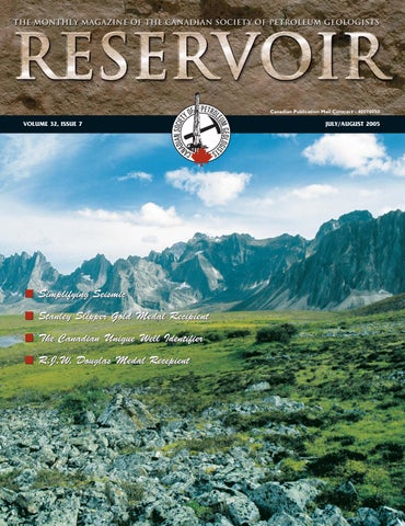
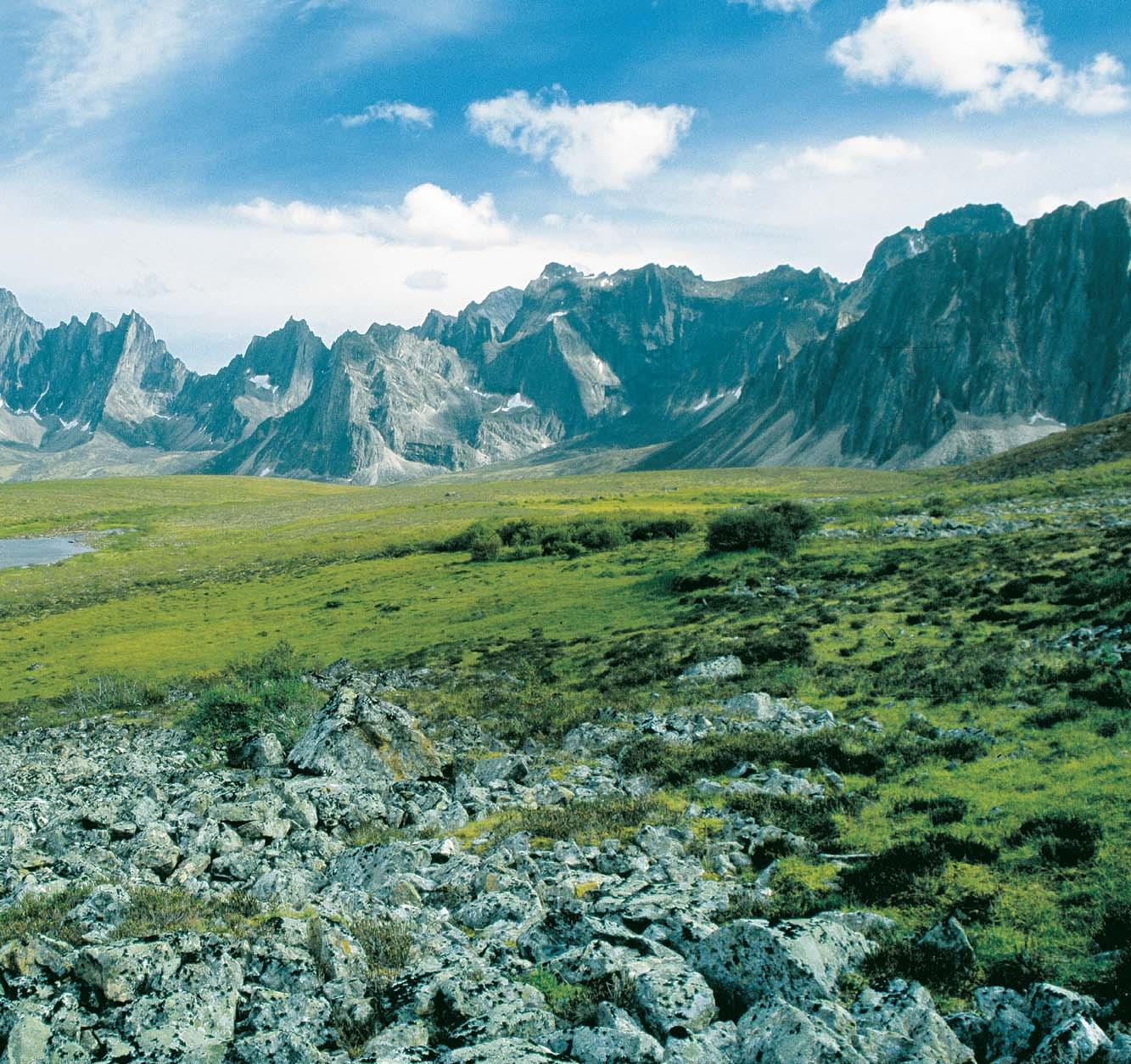
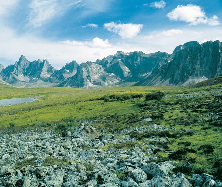
Ellesmere Island,Nunavut. Cross-bedded sandstones of the Lower Triassic (Bjorne Formation) in the Sawtooth Range of Ellesmere Island.Photo by Derek Evoy.
being a part of an annual convention (albeit a minor part),I realized how rewarding a little bit of my extra time could be.
It was almost a year ago that I first considered becoming a part of the CSPG Executive.When asked if I would consider a voluntary position for a two-year term I hesitated,not because of an expected time commitment but because I realized I knew very little about how the society operated.It has only been six months now since I joined the Executive and already I have learned an enormous amount about the structure of the CSPG,expectations of the membership,the continual need for improvement and change,and the obstacles we face accomplishing society goals.
My previous involvement with the CSPG was strictly with annual convention committees, although I did reap the benefits of other factors of the society such as division talks,technical luncheons,and courses.It isn’t surprising then that I chose the Assistant Program Director position that is composed of exactly that portfolio of committees.In this position,I have the great opportunity of meeting and working with the numerous individuals that compose the Continuing Education,Technical Luncheon, Technical Division,and Conventions committees and sub-committees.I looked at a position on the Executive as another “baby step” in my volunteer résumé.To me it is just like an extension of my past experiences with the CSPG,all of which were valuable in a different way.
My introduction to the CSPG began with my first volunteer position at the 2001 Rock the Foundation Convention.Still green in the oil and gas industry I needed to ease myself into a volunteer position so that I could balance the time commitment that it required,and maintain my work responsibilities.That first position was coordination of the well known Core Conference wind-up,the Core Meltdown.I shared this position with Shannon Nelson Evers,another rookie volunteer looking to get involved with the CSPG.Having never planned a large industry social before,I had no way of knowing what an enjoyable experience it would be! After
Only weeks after Rock the Foundation ended I found myself drawn to bigger and better things for the 2002 Diamond Jubilee Convention.With one social event in my pocket,why not try them all? In 2002 Shannon and I co-chaired the Special Events Committee.This was our first experience of being on the Convention Committee,and organizing sub-committees underneath us.It was a great introduction to the workings of a massive web of committees and individuals that are necessary to pull together a large 5-day event.The monthly meetings which began a year before the event gradually increased to bi-weekly meetings and finally weekly sessions in the remaining month.I was fortunate to meet and work with a wonderful convention committee.I made a large number of industry contacts through the planning process,and developed even more working and personal friendships.
The 2004 I.C.E.Joint Conference with the CSPG,CWLS,and CHOA societies was yet another step up in volunteering.For me,the key factor for being a part of that convention committee was the challenge.Once again I teamed up with Shannon Nelson Evers to co-chair the Marketing and Publicity for I.C.E. 2004.Not only did the position entail more time,earlier organization,and more planning, but it involved the equal participation of two other professional societies.The first committee meetings started about 14 months before the event date,and required a very scheduled calendar to keep on target for monthly deadlines.Unlike the previous positions Shannon and I had held,Marketing and Publicity was unique in that our efforts and results were evident in the months leading up to the convention.Last year’s experience provided the satisfaction of facing and conquering new challenges.
In closing I wish to thank all the individuals who have volunteered their time with the CSPG to help make the society successful and a joy to be a part of.I embrace the benefits that I have experienced from volunteering with this society.As a member of the CSPG Executive,I look forward to the new challenges I will face.My reward will be giving back to the society and definitely the new relationships I will develop with my colleagues.
Memory Marshall
Assistant Program Director
BRITISH COLUMBIA
AMOCO W OJAY d-11-I
MARK TOWN b-75-K
d-11-I / 93-I-10
b-75-K / 94-B-16
CANHUNTER TOWN c-80-G c-80-G / 94-B-16
BC STAR NIG c-38-A
COAST
c-38-A / 94-H-4
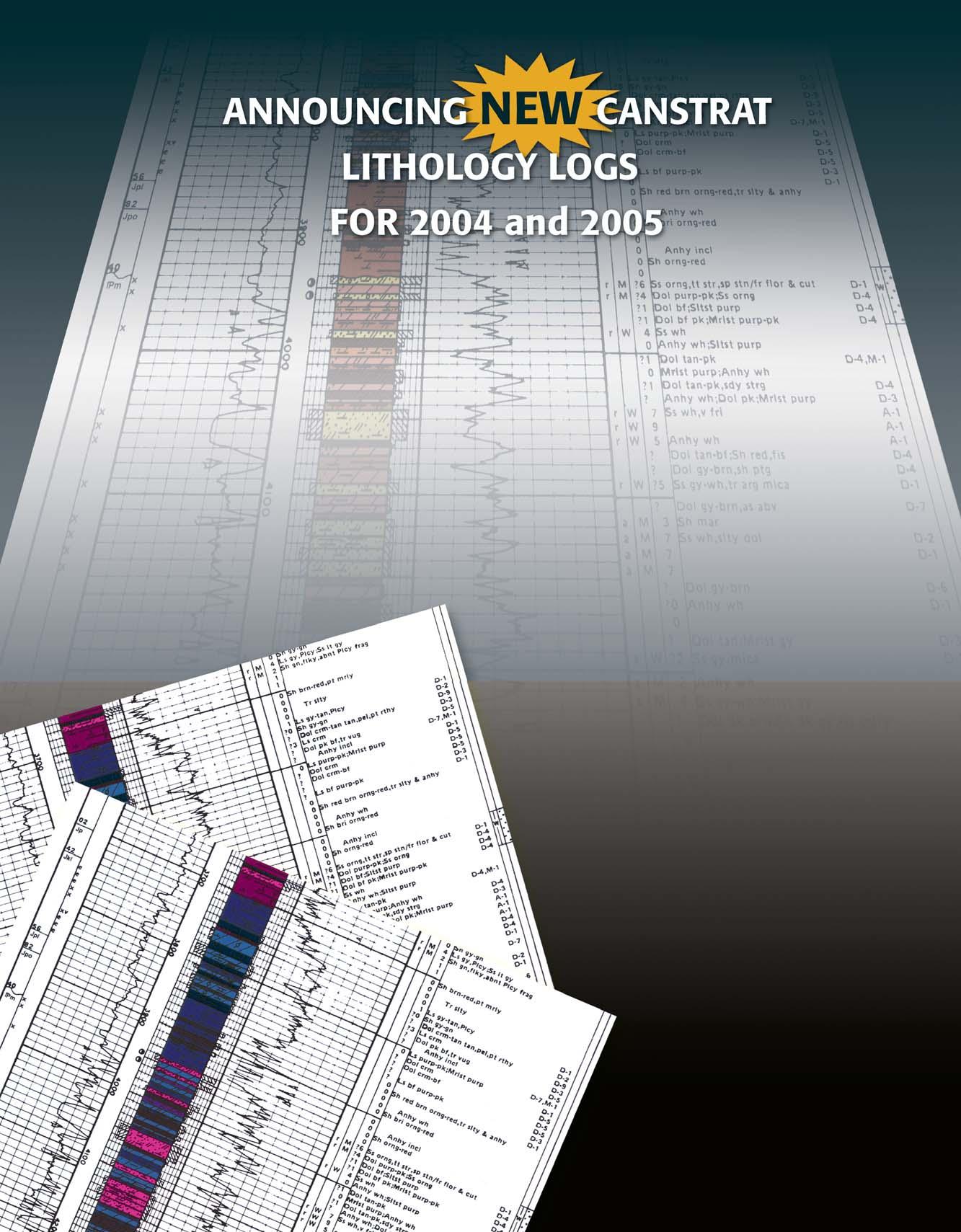
These new logs are available in Striplog form, pdf and ASCII formats. Call CANSTRAT at 403-284-1112 or visit www.canstrat.com to find out more about our complete inventory of 35,000 logs located throughout North America.
Tel: 403-284-1112
Fax: 403-284-1115 canstrat@telusplanet.net
THE CSPG GRATEFULLY ACKNOWLEDGES ITS CORPORATE MEMBERS:
THE CSPG GRATEFULLY ACKNOWLEDGES ITS CORPORATE MEMBERS:
ABU DHABI OIL CO., LTD. (JAPAN)
ARCHEAN ENERGY LTD.
BAKER ATLAS
BG CANADA EXPLORATION & PRODUCTION, INC.
BP CANADA ENERGY COMPANY
BURLINGTON RESOURCES CANADA LTD.
CALPINE CANADA
CANADIAN FOREST OIL LTD.
CONOCOPHILLIPS CANADA
CORE LABORATORIES CANADA LTD.
DEVON CANADA CORPORATION
DOMINION EXPLORATION CANADA LTD.
DUVERNAY OIL CORP.
ECL CANADA
geoLOGICsystems ltd.
HUNT OIL COMPANY OF CANADA, INC.
HUSKY ENERGY INC.
IHS ENERGY
IMPERIAL OIL RESOURCES LIMITED
LARIO OIL & GAS COMPANY
MJ SYSTEMS
MURPHY OIL COMPANY LTD.
NCE RESOURCES GROUP INC.
NEXEN INC.
NORTHROCK RESOURCES LTD.
PENN WEST PETROLEUM LTD.
PETRO-CANADA OIL AND GAS
PETROCRAFT PRODUCTS LTD.
PRECISION WIRELINE
PRIMEWEST ENERGY INC.
SAMSON CANADA
SHELL CANADA LIMITED
SPROULE ASSOCIATES LIMITED
STARPOINT ENERGY LTD.
SUNCOR ENERGY INC.
TALISMAN ENERGY INC.
TOTAL E&P CANADA LIMITED
CSPG EDUCATIONAL TRUST FUND
A MESSAGE FROM THE ETF CHAIRMAN
Any of you that have attended the technical luncheons over the last several weeks and have seen the advertisement for “Fresh EGGs Needed” in the Reservoir may have guessed that we were referring to Geologists and Geoscientists.The “E” can represent any number of adjectives such as Enthusiastic, Energetic,Encouraged,Empowered and so on.
Over the past several weeks,the CSPG Educational Trust Fund (ETF) has sold chocolate EGGs to raise awareness of the ETF. Each EGG was $5 and offered a 1 in 13 chance to win a number of great prizes from digital cameras to iPods.Prize-winning tickets were found between the wrapper and the chocolate.
The ETF is embarking on a campaign to inform our stakeholders what we do with the ETF’s funds and what we could do if the fund were to grow.Over the next several months we will be featuring programs that the Trust has supported since its inception over 25 years ago.
The ETF has undergone a major reorganization over the last two years in order to provide the Trust with the necessary
funds to advance geological education,in particular,and to enhance the profile of petroleum geology to society,in general.It’s Board of Directors and their roles have been redefined and how the ETF invests the funds entrusted to it has been changed.
The ETF now has a voice on the Executive through the Outreach Director,who sits on both the Executive,as an ex-officio member, and on the ETF Board,as a voting member.The balance of the Board members are focused on its funding targets from industry,individuals, and our geological community.We feel this approach will serve you,our members,well.
In March 2003,the ETF Board along with the Executive decided to move its investment portfolio to The Calgary Foundation whose role is the management of philanthropically derived funds.The ETF’s funds of approximately $1 million are now invested alongside the $264 million currently managed by The Calgary Foundation,resulting in greater investment diversification.Currently,the ETF can withdraw up to 5% of its funds in any one year.More information about The Calgary Foundation can be found at:www.thecalgaryfoundation.org
The CSPG Executive has committed to transfer to the ETF any funds that are surplus to its needs.As well,any surpluses derived from other CSPG events will be directed into the fund.With your assistance,we can help educate and employ the next generation of Petroleum Geologists.
Bruce McIntyre ETF Chairman
CORPORATE MEMBERS AS OF
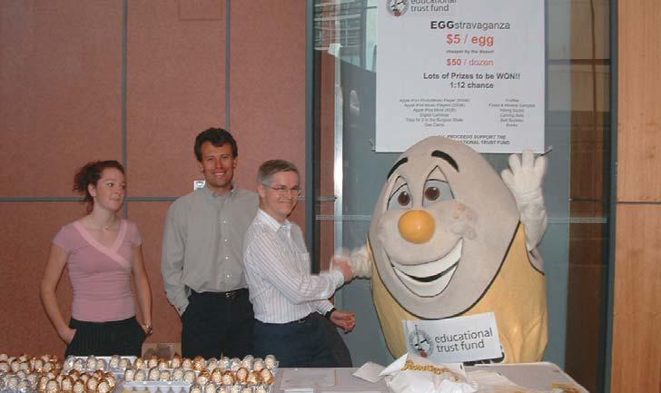
ETF Board Members Chuck Buckley and Claus Sitzler as well as Kim Bastedo,launch “FRESH EGGs NEEDED” campaign at CSPG Technical Luncheon on June 7.
TECHNICAL LUNCHEONS
TICKET REPRESENTATIVE REGISTRATION
It is once again time to plan for the CSPG bi-monthly Technical Luncheons.The CSPG has nineteen luncheons planned for the 2005/2006 Season.There are two methods for having tickets sent directly to a ticket representative in your office:
1.) FOR CORPORATE MEMBERS OF CSPG Corporate Members may order a set number of tickets per luncheon,which will be couriered to you with an invoice.For orders of less than 10 tickets per luncheon,a $5.00 handling fee will be added to the invoice.You must take the same number of tickets for each luncheon and returns are not accepted.The following month’s tickets will be sent out if the previous month’s invoice has been paid.Any changes to your standard number of tickets must be made well prior to tickets being sent out.Additional tickets may
be arranged through the CSPG office.If you wish to use this option,you must register with the office by September 1,2005.
2). FOR THOSE WHO ARE NOT CORPORATE MEMBERS –PREPAYMENT:
For companies who are not Corporate Members you may elect to pre-purchase a set number of tickets for the 2005-2006 Season’s 19 luncheons.For orders of less than 10 tickets per luncheon,a $5.00 handling fee needs to be added to each mailing to cover courier/mailing/ handling costs.Returns are not accepted and extra tickets can be purchased direct from the CSPG office.If you wish to use this option,you must register with the office by September 1,2005. Payment is required upon registration for this program.
If you wish to register in this program, please use the form below.
If you do not wish to use either of these options tickets can be purchased directly from the CSPG office,using cheque,cash, debit,Visa,or MasterCard.Luncheon tickets are $28.00 plus GST each and go on sale two months in advance.Please watch your Reservoir or visit www.cspg.org for luncheon abstracts.
If you have any questions please feel free to contact me at 264-5610 or via email at jaime.croftlarsen@cspg.org.
TICKET REPRESENTATIVE REGISTRATION FORM
(including Postal
OPTION 1 – CSPG CORPORATE MEMBERS ONLY
__________ NUMBER OF TICKETS FOR EACH LUNCHEON
For Ticket Orders of less than 10 tickets for each lunch,a $5/month Handling fee will be added to your invoice.
OPTION 2 – PREPAYMENT
__________ NUMBER OF TICKETS FOR EACH LUNCHEON
Prepayment due:________ Tickets x $29.96 (incl.GST) X 19 (Total # of luncheons) = $_____________
If less than 10 tickets for each lunch ordered,a handling fee of $53.50 ($5.00 plus GST per month) is included in this payment.
TOTAL PREPAYMENT ENCLOSED IS: $ _____________ (TICKETS) + $ ___________ (HANDLING FEE) = $ __________________
We accept Visa,MasterCard,or cheque as payment. If paying by credit card:
The Beaufort Mackenzie Basin: assessing the future resource potential
SPEAKER
Peter Graham
AUTHORS
Peter Graham and Christoper L.Bergquist
11:30 am Thursday,September 8,2005
TELUS CONVENTION CENTRE CALGARY, ALBERTA
Please note:
The cut-off date for ticket sales is 1:00 pm,Tuesday,September 6th.
Ticket price is $28.00 + GST.
Oil and gas exploration in the Beaufort Mackenzie Basin has seen a recent resurgence as energy companies attempt to tap this basin’s proven resource potential in light of the current North American gas market.After a nearly ten-year operational hiatus and beginning in 1999,over 4 million acres of land has been leased with associated work commitments in excess of 500 million dollars,17 new 3-D seismic surveys have been acquired (including one major offshore survey),fourteen new wells have been drilled,and major advancement has been realized on the proposed Mackenzie Valley pipeline.
But the Beaufort Mackenzie is a considerably different landscape than that during initial phases of exploration in the 1970s and 80s. Challenges today result from isolation by geography and from infrastructure.In particular,the once sizeable northern-based oilfield service network that supplied early arctic operations has diminished to a remaining few stalwart operators.The extensive marine drilling fleet that was developed by Canmar and Beaudril has been either sold and moved to other regions of the world,has been dismantled,or has been cold stacked and left to the harsh Arctic environment.
But the opportunities that remain today are significant,though also different than what the Beaufort Mackenzie initially offered. Preliminary exploration was focused toward oil but discovered mostly gas.Early explorers relied on an extensive grid of 2-D seismic,but newly acquired 3-D surveys have clearly imaged new play types that have
the potential to exceed the resource size of previously discovered fields in the Beaufort Mackenzie.These new 3-D data sets have allowed for a more comprehensive understanding of the basin’s sequence stratigraphy and have been effective in identifying new play fairways and reservoir intervals.A reassessment of the petroleum system has notably enhanced the basin’s richness and supports a greatly expanded range of prospectivity,and innovation in Arctic operations has significantly lowered costs and increased environmental protection.
Though it is still early in this current exploration cycle,significant advances have been made in understanding the basin’s complete hydrocarbon potential.If a final agreement can be reached towards the timely completion of the Mackenzie Valley Pipeline the Beaufort Mackenzie will play a key role in North America’s energy supply.
BIOGRAPHY
P eter Graham (peter.graham@devoncanada .com) is an exploration geologist with Devon Canada – Frontiers.He has worked the past five years in the Beaufort Mackenzie Basin with the previous ten years in the BC foothills, NWT,and the Yukon.He is a graduate of the University of Calgary with B.Sc.degrees in geology and zoology.
Christopher L.Bergquist (chris.bergquist@ devoncanada.com) is an exploration geologist with Devon Canada – Frontiers.He has worked 25 years in exploration and development,in both clastics and carbonates. He started his career with Gulf Oil in the Gulf of Mexico,West Africa,and Canada,and then consulted internationally.He is currently with Devon Energy working in the Beaufort Mackenzie Basin,where he has ten years’ overall experience,and the Mackenzie Corridor.Chris has a B.A.in Earth Sciences from Dartmouth College.
Canadian Stratigraphic Services (2000) Ltd. A Division of Sigma Explorations Inc. 1, 4639 - 6 Street NE Calgary, Alberta T2E 3Z6
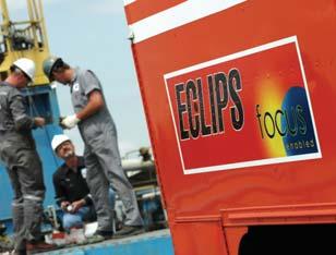
FOCUS enabled ECLIPSlowering the total cost for every open hole job
FOCUS enabled ECLIPSlowering the total cost for every open hole job
FOCUS enabled ECLIPS reduces the total cost (rig time plus logging) of a complete FE program.
The short FOCUS logging suite (array resistivity, density, neutron porosity, acoustic) logs at 18M/min and can be combined with full service options such as Earth Imager, HDIP & XMAC.
Fast logging speeds, reduced over-hole requirements, full service capability - the result driving down your open logging costs without compromising your formation evaluation program.
For additional information contact your Baker Atlas representative at 403-537-3400.
FOCUS enabled ECLIPS – efficiency, accuracy, & full service, every well, every time.
Baker Atlas
SEPTEMBER LUNCHEON
Operation Franklin and Its Legacy
SPEAKERS
J.W.(Bill) Kerr and Christopher Harrison
11:30 am
Thursday,September 22,2005
TELUS CONVENTION CENTRE CALGARY, ALBERTA
Please note:
The cut-off date for ticket sales is 1:00 pm,Monday,September 19th. Ticket price is $28.00 + GST.
PART 1. OPERATION FRANKLIN
Speaker:J.W.(Bill) Kerr, Formerly Geological Survey of Canada
Fifty years ago,in the summer of 1955,the Geological Survey of Canada conducted Operation Franklin,the first helicoptersupported exploration program in the Canadian Arctic Islands.It was a reconnaissance program,covering about 200,000 square miles,about the same area as France.The project used a DC-3 aircraft,two Sikorsky S55 helicopters,and three dog teams.
Four base camps were established,and as work was completed the group moved from one to the next.Key areas,selected from trimetregon air photos,were studied by two-man teams.These teams were put into fly camps by helicopter and they mapped the areas they could reach on foot and worked out the stratigraphy.
The results of Operation Franklin were published in Memoir 320 of the Geological Survey of Canada.It contains a chapter for each study area,and chapters that integrate the knowledge learned about them.Many of the current formations and concepts were established by the project.
The geologists did a lot of walking from their fly camps,but the study areas still look small and scattered when they are plotted on a map of the Arctic.We jokingly referred to this phase of exploration as “postage stamp geology.”
For those of us who were on Operation Franklin,it was an unforgettable adventure. It also was a scientific milestone that set the stage for government and industry to
further explore and understand our high Arctic.
PART 2. AFTER OPERATION FRANKLIN Speaker:Christopher Harrison, Geological Survey of Canada
Operation Franklin provided a framework geological understanding of the central Arctic Islands that led to 25 years of successful oil and gas exploration,the development of the Bent Horn Oil Field on Cameron Island,and Canada’s northernmost mine,the Polaris zinc-lead deposit on Little Cornwallis Island. Map units defined as a result of Operation Franklin fieldwork led to the first systematic description of strata ranging from Proterozoic to Tertiary in age.Descriptions include strata of the Sverdrup Basin,which hosts vast reserves of gas and some oil in the Triassic and Jurassic strata,and coal in those of the Cretaceous and Paleogene. Geological maps,based on the interpretation of trimet imagery,provided a reconnaissance-scale picture of the Cenozoic deformation of Ellesmere Island, salt diapirs of the Ringnes and Axel Heiberg islands,Devonian salt-based folds of Bathurst Island,and the basement-involved structures of the Cornwallis fold belt and Boothia Uplift.
The geology of this vast region is now understood from the combined efforts of industry,government,and university-based research.The contributions from industry are derived in large part from reflectionseismic profiling and exploratory drilling during the period between 1960 and 1985. University-based research has focussed on topics such as sedimentology,sequence stratigraphy,biostratigraphy,organic geochemistry,fission-track analysis, geomagnetics,and halokinetic processes. Government-supported geoscience,mostly executed by the Geological Survey of Canada (GSC) and supported logistically by the Polar Continental Shelf Project,has provided an up-to-date regional-scale understanding of bedrock and surficial geology.GSC Calgary maintains a permanent archive of collected samples,well cuttings,core,geophysical,geochemical and biostratigraphic data,and published and unpublished reports.Although field-based research continues at a modest level, government efforts are now concentrated on providing public access to current and archived information using GIS and standardized web delivery methods.
BIOGRAPHY
Bill Kerr was a summer assistant on Operation Franklin while he was a student at the University of Alberta.He later completed a Ph.D.at Columbia University and then taught at Queens.He subsequently joined the GSC and worked in the Arctic for 19 years.He published many reports on the Arctic and wrote a popular book on the Frank Slide.He consulted internationally from 1980 to 1997.Recently,he built a self-storage business in Calgary,which he now owns and operates.
Christopher Harrison worked for ten years in mineral exploration in the Arctic and across Canada before joining the GSC in 1984.His Ph.D.from Rice University,Houston,examined the structure of the fold belt on Melville Island. He has spent the last 23 years studying and mapping the geology of Canada’s Arctic Islands and offshore.His most recent work has been on the salt diapirs and salt-withdrawal minibasins of western Axel Heiberg Island,an area first studied during Operation Franklin.
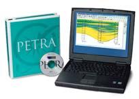
PETRA® delivers the industry’s only easy-to-use and affordable integrated solution for today’s workflows. It provides multi-user access to large projects through geological, petrophysical and engineering analysis tools. The PetraSeis™ option extends PETRA® into 2D/3D seismic interpretation with practical tools such as RasterSeis™ Download a trial version at www.geoplus.com, or call us at 888-738-7265 (Houston: 713-862-9449 / Calgary: 403-264-9523) for more product information.
DECLINE CURVES
Compute EUR, RR, etc.
Hyperbolic or exp.
Rate/Time or Cum P/Z
User defined Econ. Limit
User defined Extrap. Time
DIVISION TALKS
SEDIMENTOLOGY DIVISION
Pervasive dolomitization with subsequent hydrothermal alteration in the Clarke Lake gas field,Middle Devonian Slave Point Formation,British Columbia,Canada
SPEAKER*
Jeff Lonnee* and Hans Machel Department of Earth & Atmospheric Sciences,University of Alberta
12:00 Noon Monday,July 18,2005
Nexen Annex Theatre +15 Level, North of C-Train Platform 801 - 7th Avenue SW Calgary, Alberta
The Clarke Lake gas field in British Columbia, Canada,is hosted in pervasively dolomitized Middle Devonian carbonates of the Slave Point Formation.The Clarke Lake Field consists mostly of pervasive matrix dolomite and some saddle dolomite,the latter varying in volume from about 20 to locally 80 percent over any 10 m core interval.Some of the saddle dolomite is replacive,some is cement, and both are associated with dissolution porosity and recrystallized matrix dolomite. A rigorous petrographic and geochemical examination of the reservoir dolomites was conducted which included stable and radiogenic isotope analyses,fluid inclusion microthermometry,crush-leach analyses of fluid inclusions,trace and rare earth element chemistry,and calculation of thermal maturation,as well as consideration of the size and shape of the dolomitized rock body.
The integration of all data indicates that pervasive matrix dolomitization was
NEW MEMBER LIST
accomplished by long-distance migration of halite-saturated brines during the Late Devonian to Mississippian.Fluid inclusion homogenization temperatures suggest 150°C (uncorrected) to 190°C (corrected) at the time of matrix dolomitization.This differs markedly from most of the dolomitized Devonian reefs in the Alberta Basin south of the Peace River Arch (PRA),where pervasive dolomitization was accomplished by advection of slightly modified seawater at temperatures of about 60–80°C.
The replacive and cement saddle dolomites,as well as the associated dissolution and recrystallized matrix dolomites,at Clarke Lake are hydrothermal alteration products of the matrix dolomites,and formed from the invasion of a hydrothermal gypsum-saturated brine during periods of extremely high heat flow and regional plate-margin tectonics in the Late Devonian to Mississippian.Fluid inclusion homogenization temperatures suggest hydrothermal alteration occurred between 230°C (uncorrected) and 267°C (corrected), which are significantly higher than the maximum temperature of about 190°C attained by the Slave Point Formation during burial.The sources of the halite- and gypsumsaturated brines are Middle Devonian evaporite depositional environments roughly 200 km south and/or east of Clarke Lake,near the PRA.
BIOGRAPHY
JEFF LONNEE is a Ph.D.Candidate at the Department of Earth and Atmospheric Sciences,University of Alberta,under the supervision of Dr.Hans G.Machel.He previously obtained an M.Sc.(1999) and an honours B.Sc.(1997) from the University of Windsor,Ontario.His research involves the application of a wide array of traditional and
more modern techniques to identify the mechanisms of hydrocarbon reservoir origin and alteration in carbonates,the origin of MVT sulphide deposits,and the evolution of subsurface fluids.Over the past seven years, much of this work has been published in 8 refereed papers,4 technical reports,and 14 conference proceedings.He is a member of CSPG,AAPG,SEPM,GAC,and EGS.
HANS G.MACHEL is a Professor at the Department of Earth and Atmospheric Sciences,University of Alberta.His research involves carbonate/evaporite facies and diagenesis,low-temperature geochemistry,and petroleum geology of Alberta,particularly dolomitization,cathodoluminescence,and diagenetic redox-processes relevant to sour gas, sulfur and MVT sulfide deposits,and magnetic exploration for hydrocarbons.He is a member of 10 professional organizations and associate editor of 2 international journals.He was president of EGS (1994-6) and SLMS (1995-6). Honours include the CSPG Link Award (1989), a Humboldt Research Fellowship (1993-4), CSPG Medal of Merit (1994),and the Klepser Lecturer Award (1999).
INFORMATION
Talks are free – don’t forget to bring your lunch!
Tim Horton’s coffee and donuts will be provided.If you are interested in joining the Sedimentology Division e-mail listing which currently provides luncheon reminders,or if you care to suggest a technical topic or present a talk to the division, please contact Scott Rose at (403) 875-7673 or scott_rose@nexeninc.com.
Visit the sedimentology division website for extended abstracts,forum discussion,photo gallery,upcoming events,and much more at: http://www.cspgsedimentology.org.
2005 CALENDAR OF EVENTS
DATE: August 8-11,2005
EVENT: Earth System Processes 2
LOCATION: Calgary,Alberta
INFORMATION: Sponsored by the Geological Society of America and the Geological Association of Canada Web site:www.geosociety.org/meetings/esp2
Theme Session Proposal submission deadline: September 15,2004
Abstract submission deadline:April 26,2005
Description:International meeting,interdisciplinary focus.Earth’s surface environment is a complex web of feedbacks among the biota,oceans,atmosphere, lithosphere,and cryosphere.ESP 2 will discuss advances made in the last four years toward better understanding the nature of these feedbacks in the modern world,how they have emerged and evolved over the Earth’s history and how they will respond to human perturbations in the future.
For more information,contact:Diane Matt P.O.Box 9140,Boulder,CO 80301-9140, 1-303-357-1014 (phone),1-303-357-1074 (fax), dmatt@geogociety.org (e-mail)
DATE: September 12-16,2005
EVENT: Upper Devonian Reef-Strata and Hydrothermal Dolomitization in the Southern Northwest TerritoriesCSPG Fieldtrip
LOCATION: Hay River & Area,NWT
INFORMATION: For more information and to register visit www.cspg.org.
DATE: September 20-22,2005
EVENT: Upper Cretaceous Shelf and Shoreface Sandstones: Montana Outcrops and Alberta Basin Cores - CSPG Fieldtrip
LOCATION: Fort Benton,Montana
INFORMATION: For more information and to register visit www.cspg.org.
DATE: September 21-23,2005
EVENT: The Belly River Formation in Southern & Central Alberta,Workshop & Fieldtrip - CSPG Fieldtrip
LOCATION: Brooks - Milk River,Alberta
INFORMATION: For more info and to register visit www.cspg.org.
DATE: October 28-30,2005
EVENT: AUGC
LOCATION: Memorial University of Newfoundland, St.John’s,Newfoundland
INFORMATION: For more info please email augc2005@mun.ca
DATE: November 13-17,2005
EVENT: SETAC North America 26th Annual Meeting
LOCATION: Baltimore,Maryland
INFORMATION: The Society of Environmental Toxicology and Chemistry (SETAC) will hold the SETAC North America 26th Annual Meeting at the Baltimore Convention Center in Baltimore,Maryland, November 13-17,2005.This year’s theme is “Environmental Science in a Global Society:SETAC’s Role in the Next 25 Years.” More information can be found on the Society’s website:www.setac.org.
CANADIAN SOCIETY OF PETROLEUM GEOLOGY CALL FOR NOMINATIONS 2006 EXECUTIVE COMMITTEE
In accordance with Article VI,subparagraph (a) of the By-Laws,the Nominating Committee hereby calls for Nominations to Stand for Election to the 2006 Executive Committee of the Canadian Society of Petroleum Geologists.
Nominations can be made in two ways:
1) Formal Nominations are to be made in writing,signed by at least twenty-five members in good standing and endorsed by the nominee who is consenting to stand for office.Candidates nominated in this fashion will automatically be added to the Nomination Slate.Nominations should be forwarded to the CSPG office by September 15,2005.The slate of candidates will be published in the November Reservoir and the election will take place on November 27,2005.
2) Informal Nominations can be made via email or letter;please confirm that the nominee is willing to stand for the office of choice and send to CSPG Office to the attention of the Past President.Candidates nominated in this fashion will be considered for addition to the Nomination Slate by the Nominations Committee.
The following vacancies exist for 2006:
• Vice President• Assistant Finance Director
• Assistant Program Director• Assistant Services Director
Successful candidates for the Directorships will serve two-year terms and the elected Vice President,a third one-year term as Past President.Interested parties should contact the office for details and general requirements of service on the Executive.
This field trip will give us the opportunity to study structural and stratigraphic relationships of Neoproterozoic and Cambrian strata at Dauntless Mountain, in the northern Purcell Mountains.
Features to study include:
• Stratigraphy of the upper Horsethief Creek Group (Windermere) and Lower Cambrian Hamill Group and Donald Formation
• Geometry related to Lower Cambrian extension, including unconformities and related Volcanics
• Folding and thrusting related to Laramide compression
• Late Eocene extensional faults
• A Diatreme cutting through Cambrian strata
• Historical and current placer gold mining operations (time permitting)
This field trip features a day-long hike off-trail with an elevation gain of about 700 metres. It includes about 2 hours of bushwhacking and various traverses on loose scree. Only healthy, sure-footed hikers are encouraged to participate.
Approximate trip schedule:
Friday, August 26
6:00 p.m. leave Downtown Calgary
9:30 p.m. arrive Golden. B.C. –Ponderosa Motor Inn
Saturday, August 27
8:00 a.m. leave Golden and drive to Dogtooth Mountains
9:00 a.m. start hike
5:00 p.m. return from hike and drive to Calgary
10:00 p.m. arrive Downtown Calgary
Cost of accommodation is approximately $40. You will also be responsible for your own meals. Transportation will be provided.
2005 C.S.P.G.
Structural Division Field Trip
2005 C.S.P.G. Structural Division Field Trip
Organizers: Thomas Kubli (TEK Consulting Ltd.) and Elizabeth Atkinson (Petro-Canada)
Contact Elizabeth Atkinson at 296-3694 or eatkinso@petro-canada.ca to sign up.
DEADLINE AUGUST 19, 2005
JACK PORTERVIGNETTES OF CANADIAN PETROLEUM GEOLOGY
AFTERMATH OF MARTIN FROBISHER’S THREE VOYAGES TO META INCOGNITA
Continued:
In June 1578,as Martin Frobisher’s fleet was sailing to Meta Incognita,spies for the Spanish Ambassador to England,Bernardino de Mendoza,had surreptitiously obtained pieces of “ore” representative of the 200 tons transported to England the previous year.The Spanish,on assaying the samples,found them to be worthless.This conclusion made King Phillip II suspect that the English had been forwarned of his agents tactics and consequently created a ruse by substituting rocks devoid of precious metals.Following the return of Frobisher’s fleet in 1578 with his containment of 1350 tons of “ore,” Mendoza submitted to Phillip II a precise report of all aspects of Frobisher’s third voyage.It left little doubt that an insider,who had accompanied Frobisher,had betrayed his fellow adventurers. Robert Denham,the English assayer,was suspected of being the spy,but in reality may have served as a double-agent (Ibid.:2001, McDermott,James --- p.246).
Mendoza had commented in his report,a reference to Meta Incognita,citing:“it is incomprehensible that a land so cold as this can produce anything.” He was alluding to the belief,being prevalent at the time,that the planets,of which both the sun and moon were included,influenced the development of specific metals,i.e.,the Sun,gold;the Moon, silver;Mercury,quick-silver;et cetera. Accordingly,gold was to be found in hot countries where the Sun’s rays created the greatest intensity of heat.The Spanish, understandably,believed they had tangible proof of this concept,a-propos their gold wealth derived from the equatorial regions of South America (1938,Adams,Frank Dawson: The Birth and Development of the Geological Sciences,repub.1952,Dover Publications,Inc., p.282).Interestingly,Martin Frobisher alluded to the gold potential of Meta Incognita,based on a entomological observation that the abundance of spiders found there are:“as many affirme,are signes of great store of Golde.” (2001,McDermott,James --- p.157).
Among the more than 400 men,comprised of
seamen,miners,artisans,soldiers,and gentlemen adventurers,who had accompanied Frobisher on his third voyage to Meta Incognita,some 40 deaths had occurred.For the most part their demises were the result of debilitating conditions attributed to an inadequate diet,compounded by prolonged exhaustion from working in an inhospitable environment.To a lesser extent,some mortalities were the result of accidents involving mining operations.As well several unfortunate mariners were washed overboard during storms while crossing the “Ocean Sea” (North Atlantic).
The fact that only two of Frobisher’s 15 vessels failed to return to England on his third voyage would indicate a rather remarkable accomplishment.Apart from Frobisher’s flagship Ayde,which was characterized as a 200-ton “tall ship,” the rest of the fleet’s ships were 100 tons or less.The 20-25 ton barques: Gabriel and Michael were owned by the Company of Cathay,while the Ayde was on loan from Queen Elizabeth.The major portion were owned by merchants who were shareholders in the Company.These vessels had previously been engaged in maritime commerce to friendly ports along the European coast.The Dennis (Denys),which was one of the three barques in Frobisher’s fleet,of 30 tons,sank,after being crushed by ice,at the entrance to “Mistaken Strait” (Hudson Strait). The buss Emanuel of Bridgewater was a sturdily built 100-ton freighter of its day.She met her fate on her homeward journey after reaching the European shore,being blown aground in Smerwick Harbour on the Dingle Peninsula in southwest Ireland.The testimony to her disaster was the 110 tons of Meta Incognita “ore” discharged from her ruptured hold and strewn along the beach.Neither mishap sustained any loss of life.
Frobisher’s leadership prevailed despite the setbacks his ships endured in the icecongested coastal water fronting the barren terrain of Meta Incognita.The respect and confidence engendered by Frobisher precluded any mutinous acts by his seamen, despite the hardships they endured.Likewise his fleet’s captains and master held him in high regard,not so much as a navigator,since his mathematical skills were lacking,but because of his seamanship prowess and his perseverance in the face of danger.His concern for his seamen was foremost,as evident by his persistent search,during his second and third voyages for his five seamen
who had been abducted by natives,during his first voyage.On September 1,1578,being the scheduled date of the fleet’s departure from Beares Sound,a sudden storm had placed the last of the miners on Sussex Island in jeopardy of being abandoned.However,Frobisher and his small crew utilizing a ship’s pinnace braved the storm and by gaining access to the beach, rescued the desperate miners.
The admiration and acclaim for Martin Frobisher by the 60 Company of Cathay’s adventurers,along with Queen Elizabeth,who had together financed his third voyage to Meta Incognita,was to be short-lived.Their realization,following the bulk sample assays at the Dartford furnaces,that the 1,350 tons of “ore” contained in the holds of the 13 returning vessels contained neither gold nor silver caused the investors of the failed enterprise to place the blame on Frobisher.
Frobisher’s admonishment was exacerbated by a report prepared by Edward Selman,who as Michael Lok’s agent,served as notary on Frobisher’s third voyage,being assigned to the latter’s flagship, Ayde.Selman had stepped beyond his authority,when on July 30,1578, while the Ayde lay at anchor off Anne Warwick (Kodlunarn) Island,he had interfered with orders given by Master Charles Jackman to his boatswain and quartermaster.Frobisher,who was dining with Captain Edward Fenton,on the latter’s Judith at the time,became aware of the dispute on returning to his Ayde. Consequently,he rebuked Selman for his unauthorized interference.The severe reprimand by the mercurial Frobisher caused the rankled Selman to be accusatory of Frobisher’s ineptness as the commander of the third voyage to MetaIncognita.His vilification was contained in his “official” version of
Frobisher’s third voyage.Its contents only served to reinforce the censuring of Frobisher. Notwithstanding,George Best and Thomas Ellis,both of whom accompanied Frobisher on his third voyage,wrote candid accounts of this final expedition to Meta Incognita.
George Best’s True Discourse,was a narrative of all three voyages.He had sailed in the barque Gabriel in 1576,the flagship Ayde in 1577 and the Anne Francis in 1578.Thomas Ellis’ account is titled:True Report of the Third and Last Voyage into Meta Incognita.Another narrative of Frobisher’s second voyage,written by Dionyse Settle and titled:A True Report of the Laste Voyage into the West and Northwest Regions,was published in 1577.Unlike Selman’s diatribe,all three authors extolled the tenacity of Frobisher and the maritime skills of his fellow officers in overcoming almost insurmountable hazards.
Attempts by the Company of Cathay to reimburse their creditors were made at the expense of Frobisher’s crew members who had accompanied him on his third voyage to Meta Incognita.Following the compensations to the miners and artisans,the residual was allotted to the seamen. The measly sums,usually less than £1, were a gross violation of their agreed remuneration.In some instances,a cap or other article of used clothing was included to justify the seaman’s shortfall.In one case,a Frobisher crewman,having died shortly after returning to England,had the cost of the food he consumed during his illness,as well as his burial expenses,deducted from his allotted wage.Frobisher and his fellow officers also felt the brunt of the Company’s insolvency.As late as March,1580,the latter was still in arrears of Frobisher’s stipulated £25 per month
compensation for his services (Ibid.:2001, McDermott,James --- p.248).
Frobisher,in desperate need of money,had solicited Queen Elizabeth,early in 1579,to obtain an appointment in the service of the Crown.Elizabeth,still harbouring her displeasure with him,as the result of the Meta Incognito mining fiasco,ignored his request.
Thomas Allen,one of the Company of Cathay’s adventurers,had been appointed the Company’s treasurer in late 1578,to replace Michael Lok.His mandate was to liquidate the assets of the Company to pay off its creditors. When Allen listed the sale of the Company’s barque Gabriel,Frobisher,through sentimental attachment,was desperate to purchase the vessel that brought him as well as his remaining crew of 13 men and boys safely home to England following his first voyage to Meta Incognita.Much to his disappointment, she was knocked down for a mere £80,a sum Frobisher was incapable of meeting (Ibid.: 2001,McDermott,James --- p.261).
The revelation of the mining fiasco and attendant financial debacle suffered by the Company of Cathay’s Meta Incognita project, had extinguished Frobisher’s short-lived limelight.Without a commission from his Queen or financial support from his former associates,he was,once again,taken to his familiar pursuits involving pirating/ privateering. However,by July 1,1585 Sir Francis Drake was commissioned by Queen Elizabeth,with instructions from the Admiralty,to obtain the release of English grain ships held by Phillip II authority in Spanish ports.Drake’s mandate also included the interception of Spanish merchant ships and treasure galleons on the (Continued on page 19...)
open sea during their course to and from Spain’s New World settlements.By pillaging and razing their fortified colonies,the English had hoped to defuse Spains expansionist desires north along the Atlantic seaboard.Drake,who was admiral of the 25-vessel fleet,one member of which was Elizabeth’s Ayde;appointed Martin Frobisher as his vice-admiral.He was to command a squadron of 13 vessels,the Primrose being his flagship.Drake’s military personnel comprised 2,000 soldiers.The expedition embarked from Portsmouth on September 14,1585.Unfortunately for Drake, a fleet of 17 Spanish galleons,laden with gold and other great treasures had arrived at their home ports just prior to Drake’s fleet having departed from Portsmouth.
Drake’s expedition to the West Indies was accompanied by a natural disaster in which at least 20 percent of his fleet’s personnel succumbed to a highly contagious disease believed contracted in Santiago,Verde Islands during the plundering of the town.The sickness, resulting in the victims’ deaths,was diagnosed as the “burning ague” which ships’ surgeons of the day believed was attributed to tropical vapours emanating from foul evening air.By the time Drake’s fleet arrived at Santo Domingo, Hispaniola (Dominican Republic) the mortality
toll from the illness had reached 500 victims. Forced ransoms,following stages of pillaging by Drake’s forces in Santo Domingo and Cartagena,on Colombia’s north coast,finally terminated with the utter destruction of St. Augustine’s town and fortifications.The latter,located on Florida’s north coast,was the most northerly fortified colony of Spain’s New World.
Drake decided to have his fleet sail north along the Atlantic seaboard in search of the newly established colony located on Roanoke Island,(now part of North Carolina).It had been established by Sir Walter Raleigh in August of the previous year and was the first English settlement in North America,in spite of its abortive existence.Sighting a large bonfire on a bank near the settlement,Drake and his fellow officers utilized their ship’s pinnaces to enter Roanoke Sound and were warmly greeted by the colony’s governor, Ralph Lane.It was apparent that the colonists were in a predicament,being short of provisions,since the anticipated supply ship was yet to arrive and the natives were becoming increasingly more hostile.Lane and his councillors,following their meeting, besought Drake to transport members of the entire colony,which consisted of 106 individuals,back to England.Both Drake and
Frobisher,in a spirit of compassion,were only too pleased to deliver them from their plight. Unfortunately,three of their fellow colonists were inadvertently left behind.A second colony was established on Roanoke Island in 1587,with Captain John White being appointed governor by Sir Walter Raleigh. However,all members of this second colony had vanished by 1591.
The value of the booty obtained by Drake during the West Indies raids amounted to £60,000.After payment of wages and sundry expenses,some £40,000 remained,which amount,when prorated to the adventurers who had financed the expedition,resulted in a rather modest return of £6 per share. The fleet’s failure to intercept and capture a bullion-laden Spanish galleon was, undoubtedly,a disappointment to the expedition’s shareholders (Ibid.:2001, McDermott,James --- pp.297-299,306-308, 316-318).Martin Frobisher’s statue had yet to be resurrected by his Queen and with his remuneration intact,he decided to return to Yorkshire,the place of his early childhood.His designs now,at age 47,were on becoming a successful landowner and enjoy a more bucolic lifestyle.
To be continued...
Simplifying Seismic
Chapter
7
Dr.Easton Wren
2D and 3D Seismic
This is the seventh chapter in a series,which will explain the seismic business in simple terms.Designed specifically for geological personnel in the oil industry it should provide a forum for information and questions. This installment will focus on the differences between 2D and 3D seismic and the relative benefits of both.
INTRODUCTION
Most people in the oil industry are familiar with the expressions “2D” and “3D” but when these terms are used in reference to seismic data,perhaps only geophysicists are aware of the significance of these and the differences between them.
While “2D” has been around since the earliest days of the seismic business in the 1920s and “3D” has its historical origins in the 1960s,one is not necessarily “better” than the other.Both have pros and cons in terms of seismic imaging and cost factors and both should be considered in terms of exploration objectives.
3D seismic has become very “trendy” and is certainly a sweetheart of the news media,but there are numerous poor quality 3D data sets,the quality usually being a function of the acquisition/processing design and the available budget.Since one usually gets what one pays for,the old adage of “go first class and cry only once” applies.
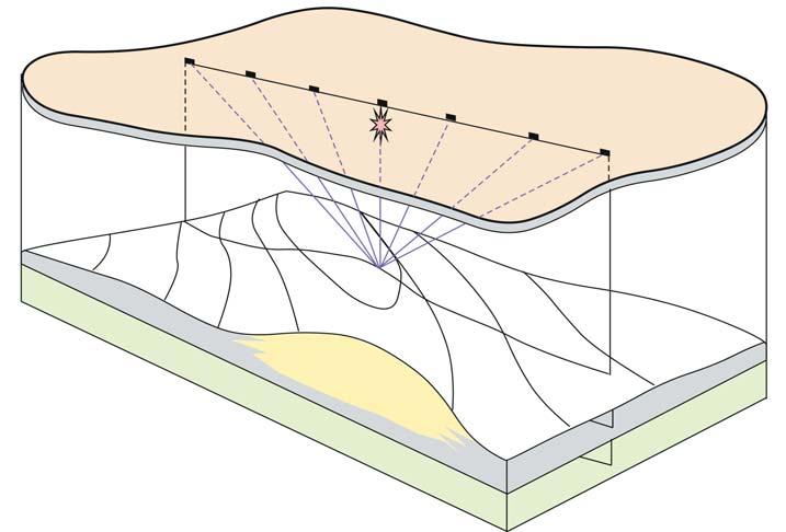
“2D” SEISMIC
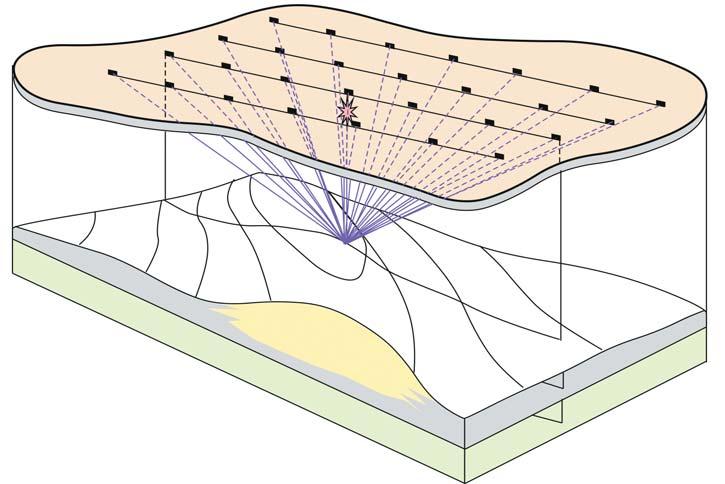
2D seismic by definition involves a line of geophones with the shot points positioned at regular intervals along the line (Figure 7-1). This set-up is referred to as “in-line” and was the traditional practice until the onset of 3D in the late 1960s when two or more parallel lines of geophones” listened” while the shots were systematically placed at intervals between them.This ultimately led to multiple parallel lines of geophones laid out as a grid and all geophones listened to the response to each individual shot (Figure 7-2).
It is something of a paradox but “2D” was always 3D since the geophones could not be designed to listen/record only signals which moved in a vertical plane or curtain under the line of geophones.This is physically impossible since sound travels as a three-dimensional wavefield and therefore the geophones would record signals which came from any direction. Thus,the traditional 2D line of seismic is a mixture of information coming from all directions,including the vertical plane.The best analogy once again is one face of the
Figure 7-1.2D seismic line acquisition (courtesy:Amoco).
Figure 7-2.3D seismic line acquisition (courtesy:Amoco).
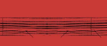
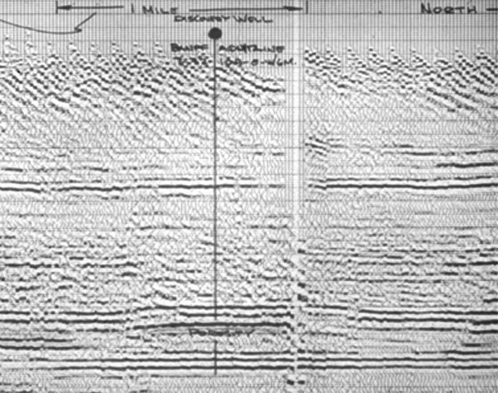
Rubik cube,which contains information from the other faces unless it is solved (Figure 7-3). This led to utter confusion when drilling a structural anomaly on a 2D line resulted in a target horizon being regional.The anomaly was imaged by projection onto the seismic section and was described as “sideswipe” or, more correctly,as “out-of-the-plane”.In reef plays such as the Rainbow Lake Keg River (Figure 7-4),there were numerous dry holes and a prevailing feeling that “seismic did not work very well”.Companies resorted to sequential series of 2D lines with tight grids to image the reef spatially but mistakes were commonplace.
“3D” SEISMIC
This problem of spatial resolution is almost totally eliminated with 3D acquisition and processing.In the field,the process generates a cube or volume of data,which has significant spatial distribution to provide the equivalent of an unsolved Rubik cube,which may be subsequently migrated to generate the structural setting.
“2D” seismic was never called 2D during its time.This would be like minting a coin in Roman times and stamping it 55 B.C.In other words,in the days of 2D there was no contemplation of the arrival of 3D.It should be remembered though that both “2D” and “3D” are 3D samplings of the subsurface,the difference is that “3D” is controlled sampling spatially while “2D” is not.
The Rubik Cube analogy is valid again when we consider the need for migration.It is impossible to properly solve (migrate) the Rubik Cube if there is only one face (i.e.,2D data) available.We require the six faces of the cube to be available to properly solve in vector (3D) space (Figure 7-5).
(Continued on Page 22...)
THE LIVING MODEL
THE LIVING MODEL TM WORKFLOW FACILITATES A COMPLETELY DIFFERENT APPROACH TO SUBSURFACE CHARACTERIZATION—FROMSEISMIC TO SIMULATION. Instead of each domain passing its results down the chain, an asset team can now share the same reservoir model and focus on the areas that really impact day-to-day business decisions.
PetrelTM is at the heart of the Living Model, complemented by GeoFrame®, ECLIPSE®,Merak® , and InsideReality.TM Blending these Schlumberger Information Solutions technologies and potentially third-party products and services, the Living Model provides a 3D representation of the reservoir with both static and dynamic modeling capabilities. It enables modeling for the masses, uniformity for decision making and models that can be updated easily.
A combination of speed and application depth, the Living Model is the ultimate workflow solution.
Figure 7-3.An unordered Rubik cube contains data from several sides.
(...Continued from Page 21)
2D seismic has largely become the undesirable process and most companies will require 3D definition of a prospect before committing to drill.However,2D data has some advantages,cost being a significant one. A well designed/positioned 2D line can be used to advantage and can generate better vertical resolution while compromising spatial
resolution.This is a function of the statistical azimuthal averaging,which is common in 3D data handling.2D lines have a constant relation to anisotropy if they are straight and this can have a certain advantage in interpretation.
In general,however,3D seismic,if carefully acquired and processed,can be used for all of
the above,particularly by selecting appropriate 2D lines from the 3D volume and using the two data sets as complimentary pairs in the interpretation.In the final analysis, 3D data has significantly improved the ability to image geological structure (reefs,faults,salt domes,anticlines,channels) and has made enormous contributions to new field discoveries over the last 30 years.
Note:Questions on this and subsequent articles are invited.Please send any question by e-mail to the author at eastonw@telus.net.A selection of questions with answers will be published regularly
Figure 7-4.2D seismic over the Banff-Aquitaine Rainbow discovery (Pan American Petroleum Corporation).
Figure 7-5.Properly migrated data can provide a correct structural picture in 3D space.
Fall Field Seminars
Modern Deltas
Leaders: Harry H. Roberts, Gregory Stone and Samuel Bentley, Coastal Studies Institute, Louisiana State University, Baton Rouge, Louisiana
Date: September 5-9, 2005
Location: Begins in Baton Rouge and ends in New Orleans, Louisiana
Tuition: $2,500 (increases to $2600 after 8/8/05), includes 5 nights lodging, bus and boat transportation, field lunches, and guidebook
Who Should Attend
Geoscientists who need to understand the sedimentary architecture of deltas, internal characteristics of constituent sediment bodies, and sequence/seismic stratigraphic relationships with surrounding facies.
Sedimentology and Sequence Stratigraphic Response of Paralic Deposits to Changes in Accommodation: Predicting Reservoir Architecture, Book Cliffs, Utah
Leaders: Keith W. Shanley, Consultant, Denver, CO; J. Michael Boyles, University of Wyoming, Laramie, WY
Date: September 8-14, 2005
Location: Begins and ends in Grand Junction, Colorado
Tuition: $1,850 (increases to $1950 after 8/11/05), includes ground transportation, lunches, and guidebook
Who Should Attend
Geologists, geophysicists and reservoir engineers working in exploration and production settings.
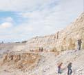
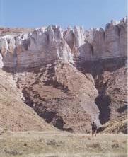
Fractures, Folds, and Faults in Thrusted Terrains: Sawtooth Range, Montana
Leaders: Steven N. Boyer, Consultant, Tacoma, WA; William Hansen, Jireh Consulting Services, Great Falls, MT; Charles F. Kluth, Kluth & Associates, Littleton, CO; James Sears, University of Montana, Missoula
Date: September 12-17, 2005
Location: Begins and ends in Great Falls, Montana
Tuition: $2,500 (increases to $2600 after 8/15/05), includes lunches, transportation, guidebooks, admission to Glacier National Park, and some additional meals.
Who Should Attend
Geologists, geophysicists, log analysts, engineers and exploration managers who want a thorough understanding of the geology and complexity of exploring in thrust belts.
Modern Clastic Depositional Environments
Leader: Miles O. Hayes, Research Planning, Inc., Columbia, South Carolina
Dates: September 14-20; September 29 - October 5, 2005
Location: Begins in Columbia and ends in Charleston, South Carolina
Tuition: $2,200 (increases to $2300 four weeks prior to each start date), includes lunches, transfer to Charleston, South Carolina, lecture notes and SC Coastal Environments CD-ROM.
Who Should Attend
Development and exploration geologists, engineers, log analysts, geophysicists, and exploration and development supervisors who want to acquaint themselves with a wide range of modern clastic environments.
STANLEY SLIPPER GOLD MEDAL RECIPIENT
BY GODFRIED WASSER AND DAVE RUSSUM,CHAIRPERSONS OF THE CSPG EDUCATION COMMITTEE
PATRICIA J.LEE
Stanley Slipper Gold Medal Canadian Society of Petroleum Geologists 2005
The Stanley Slipper Gold Medal is named for Stanley E.Slipper (1890-1982),the first President of the Canadian Society of Petroleum Geologists.It is the Society’s most prestigious award.The award is presented annually to an individual who has made an outstanding contribution to petroleum exploration in Canada and has been personally identified as having played a crucial role in a major Canadian hydrocarbon discovery.
The real significance of our Society having created an Award in Slipper’s honour,lies in his many geological and engineering achievement.Both past and future recipients should reflect on Stan’s long fruitful career and what it means to them.A graduate in 1911 from Queen’s,Slipper started off (as did many of his contemporaries) with the GSC on tough frontier field parties (e.g.,Yukon Alaska Boundary,141W).Slipper’s two assignments in Turner Valley,surface geology and well sitting Dingman No.1,both with the GSC,were followed by his taking over as “Petroleum Engineer” in 1917 for the Department of Interior,which had its offices in the Lancaster Building.He helped in the first assessment of oil and gas reserves.
He delved into the primitive Federal statutes of 1914 and rewrote regulations culminating in his 1922 “Manual for Operators under Oil and Gas Regulations”,a hands-on practical guide for field crews,the forerunner to the Conservation Board.Stan would rent out his mud pump ($10/day) which he took along to help kill gas wells.Stan also successfully brought a wild gas well at Pelican Rapids
under control by re-installing a wellhead.In 1923,Stanley Slipper switched to consulting, (both geology and engineering),moving to room 916 in the Lancaster building,later becoming Chief Geologist for the Gas Company.Stan devised the first dead-weight pressure gauge (built by the Gas Company’s shop),enabling the measurement of differences of as little as one pound per square inch.He was the first to recognize and evoke the super-compressibility of gas during a Turner Valley rate case in 1932.Harry Hunter,his successor at Canadian Western Natural gas Light Heat and Power,confirmed that Stan proved more gas had been produced than could be accounted for.
Slipper was not only the first President of our Society;he fought off the Association of Professional Engineers of Alberta’s attempts to absorb geologists long before the term “Petroleum Geologists” was even dreamed of.This pioneer and explorer in geology, engineering,and natural gas technology bequeathed a fund of knowledge,years ahead of his time and was considered by many a virtual Leonardo da Vinci.My many associations with Stan,ending in a final interview with him in 1981 (at age 92) convinced me that he indeed deserved the honour (unbeknownst to him) of our highest award in the Canadian Society of Petroleum Geologists.
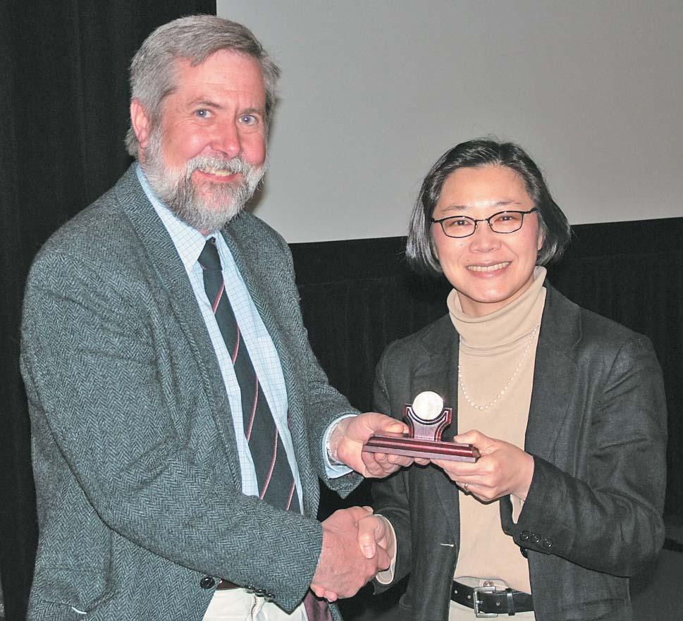
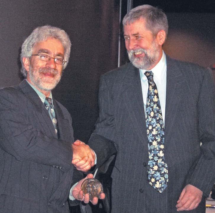
The award for 2004 is made to Patricia J.Lee for her involvement in the discovery of the Devonian Caroline Beaverhill Lake “A” pool in west-central Alberta in 1986.
The first successful exploration in the Devonian Beaverhill Lake Group occurred in 1957 in the Swan Hills area.Up until 1970,a family of predominantly oil-prone pools had been delineated in the region northwest of Edmonton including Virginia Hills,Judy Creek, Snipe Lake,Kaybob,Carson Creek,Ante Creek,Kaybob South,and Goose River.The next decade also proved productive with prolific gas fields tapped at Rosevear,Erith, Hanlan,and Brown Creek (Blackstone). Where the porous margins went to the south was a mystery.The edge separating bank to the west from basin to the east seemed to trend beneath the Brazeau Thrust at the leading edge of the Foothills and when it emerged northwest of Calgary,widely spaced deep tests failed to nail down the location of the elusive but prospective carbonate bank edge.The game was afoot, the prize was potentially company-making and the playing ground was huge.
THE STORY OF THE CAROLINE DISCOVERY: Patricia Lee was born in Montreal,Quebec and obtained her B.Sc.Honours in Geology from McGill University in 1978.She came to Calgary to work for Shell Canada at a time when the industry was booming.In 1980 and still a rookie geologist,Pat proposed that a cross-functional posting between geology and geophysics would be good training for her as a future explorer.Although this hadn’t been done in Shell Canada before they saw the benefits and agreed to Pat’s proposal for a one-year transfer to geophysics.Pat was eager for a challenge and wanted an assignment that included seismic processing,modeling and interpretation.Shell was active in the Brown Creek and Stolberg areas and it was decided that her assignment was to extend the Swan Hills play south to the Caroline area,an area that had been long ignored.It was suggested that she examine the possibility that modern seismic might better define the loosely constrained edge of the Swan Hills Formation of the Beaverhill Lake Group in the Caroline region.Pat had developed a series of synthetic seismic models by 1981 after studying the sparse deep well control (less than one well per Township in the Caroline area) and the nature of the producing analogue pools around Hanlan 150 km to the north.The model that best matched the character on the seismic data suggested that subtle but distinct changes in seismic response should be present where the transitions from off-reef through porous margin and into tight back-bank occur. However,she was to find out it was the belief at the time in Shell Canada that the interpretation of porosity in carbonates on seismic was considered to be very unreliable. In fact,more experienced geophysicists before her had not interpreted porosity on seismic in the Caroline area and according to Shell geophysicists working the analogue areas to the north,the seismic there did not exhibit porosity character either.Even though Pat had technical explanations for these inconsistencies,the play was given a very low probability of success and no priority.
The early 1980s were a difficult time for the industry.The introduction of the National Energy Program in 1980 and its attendant restrictions on industry cash flow had teamed up with a recession to constrain exploratory expenditures.With more conventional play types having the upper hand,funding for such a new concept proved difficult.In addition, capturing a substantial portion of a pool in the Caroline region was anticipated to be difficult given the presence of several shallower producing trends in the Cardium and Rundle
zones that had the effect of holding the deeper rights.Fortunately the Province had begun the introduction of deep rights reversion in the late 1970s and this had the effect of returning to the market significant tracts of deep rights over the trend by the early 1980s.
Convincing management proved to be a major challenge but Pat was persistent.Using primarily older trade seismic,she mapped out a potential Swan Hills porous bank edge only a kilometre or two wide but approximately 25 kilometres long.With some conservative reservoir parameters,the prospect could hold in the order of a trillion cubic feet of raw gas. Although considered to be very technically risky,the size of the prize was large enough that Shell began to shoot new state-of-the-art seismic lines across the fairway.In late 1982,a small team was formed to pursue this opportunity under the wing of Felix Frey, Manager of Foothills Exploration.Joining Pat was Gary Billings who was assigned to look after the new seismic.The narrowing down of the target location was aided by the activities of a number of competitors in the play.In 1972,Atlanta had drilled a non-porous onbank test at 8-1-35-6W5 while in 1973, Quasar had drilled an off-bank test at 10-3435-5W5 about six miles to the northeast.In 1982,just as the play was unfolding,Dome drilled a test in-between the control wells at 11-17-35-5W5.Pat predicted the Dome well would just miss and encounter tight on-bank. She was right! The edge was thus constrained by well control to lie between the Dome and Quasar penetrations and their along-strike continuations,fitting Pat’s original interpretation.Additional seismic was shot and through a coordinated and strategic land acquisition program a land base was assembled.In 1984,Canterra probed for the margin at 6-14-35-5W5.Again,Pat’s model predicted that it would just miss by coming up off-bank.And indeed she was right.Although these wells did not confirm the porous bank edge existed,Shell was increasingly intrigued that this rookie’s prospect could be real.All that was needed now for Shell was a successful well to validate Pat’s concept.
In late 1985 the time had come to take this next step.Logic would have dictated a location close to the competitor wells but a pending land expiry forced a test to be drilled about six miles to the south-southeast at 7-18-34-4W5 on a tract of 100% Shell acreage.This critical test at a location predicted by Pat’s model to hit porosity,spudded on December 1,1985. The rig was released on February 13,1986, interestingly thirty-nine years to the day from when Leduc had been brought on.With much anticipation,as the bit penetrated the target zone at 3,653 metres,excitement erupted as it found 20.3 metres of gas-bearing porous reef
margin averaging 9% porosity! Kevin Polan,the geologist who had been transferred onto the project and was at the wellsite,made the historic phone call to the office.The well was later found to flow at a rate of 650 e3m3/d (23 mmcf/d) at 8000 kPa.Finally after five long years,Pat’s model was proven to be true.The well was hailed as a major gas discovery!
Shell was quick to capitalize on its confidential knowledge.It chose to rely on logs only and at first deferred the production testing of the discovery well to keep the success under wraps.Shell moved the rig farther north to a location between the competitor wells and successfully drilled another winner two months later with twice the pay zone as the first.It too was quietly shut down without production testing.In a masterfully structured series of farm-ins,lease sales,and additional drilling,Shell was able to capture approximately 50% of the productive acreage over the pool (later increased to 71.7% of the working interest through unitization and purchase).By the time the one-year confidentiality period on the discovery expired in early 1987,the game was largely over as far as the main pool was concerned. Many exciting challenges remained including the construction of a new sour gas handling facility in ranching and agricultural country,not to mention the long-term operation of the field’s infrastructure.
In a portion of the Western Canadian Sedimentary Basin written off for big pools by many,Caroline was a tremendous discovery.At a raw gas-in-place of just over 2 Tcf,Caroline was the first major discovery of its class size since Kaybob South in 1961.Caroline’s wells penetrate between 20 and 40 metres of pay with 8-11% porosity having 22-275 md of permeability.Hydrocarbon saturation ranges from 90-92% and recovery efficiency is expected to be 90%.Its 16 producing wells flow through a gathering system of 230 km spread over 50 sections of pool acreage.The field experienced a plant capacity constrained flat life of 10 years following the commencement of production in 1993 with raw gas rates totaling approximately 10,500 e3m3/d (375 mmcf/d).The field proved to be a giant producing 100 mmcf/d sales gas,28,400 bbl/d of natural gas liquids,18,300 bbl/d of condensate,and 4000 tons/d of sulphur.Even with today’s raw gas rates at about 25 to 30% below peak production,current revenues from production are in excess of $1 million per day.
Caroline’s 64.7 billion cubic metres (2.3 TCF) of raw gas in place was amazingly twice the size of the estimate from Pat’s original interpretation.On a molecular basis the EUB reports the gas stream is 36% methane,33% hydrogen sulphide,15% liquefied petroleum gas,and 8% condensate (C5+).Its reserves
Continued on page 33...
Patricia Lee receiving the Stanley Slipper Gold Medal Award from President,Jeff Packard.
THE CANADIAN UNIQUE WELL IDENTIFIER
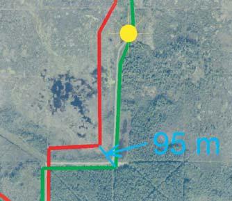
Well identification systems serve two main purposes.One is to be able to uniquely label a particular wellbore event and the other is to be able to geographically locate that event and its derived data.These two goals are different in that the actual surveyed location of a well has much more accuracy inherent to it than is available in typical well identification systems.However,a standard system will decrease the likelihood of geographical errors occurring when using that data – and is much easier to use then trying to remember x,y coordinates to six decimal places.Typically,a well identifier is linked to the local survey system.This works fine where a company or organization is regionally focused but is less effective for the larger companies with operations spanning several diverse jurisdictions.
With over 500,000 wells drilled to date in Canada (and millions worldwide) by the oil and gas industry,it is vitally important to be able to identify each individual well specifically. This is required for geologic mapping, reservoir engineering,royalty calculations,etc.
In Canada,this data is captured in the unique well identifier (UWI).The UWI is used not only to geographically locate a particular hole in the ground,but also to help identify what type of well it is and its completion history.It was initially developed as a means of standard well identification by the Geoscience data Committee of the Canadian Petroleum Association (now the Canadian Association of Petroleum Producers) in the late 1970s.
In addition to the Canadian UWI,there are numerous other public and proprietary systems in use worldwide.Some of the more prominent well identification systems include:
API – A well identification number assigned by the appropriate regulatory body as prescribed by the American Petroleum Institute D-9 Committee for identifying wells in the United States.The code includes digits to define the state (2) + county (3) + well (5) + wellbore (2) + well completions (2).
WWN – A 12-digit,worldwide well numbering system presently maintained by
BY BEN MCKENZIE
Petroconsultants in use outside the United States and Canada.
DTI – A well name defined by the Department of Trade and Industry of the UK which consists of a concatenation of codes for country,quadrant,block,block suffix, platform design,drilling sequence number, and well suffix.
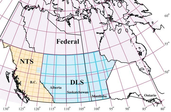
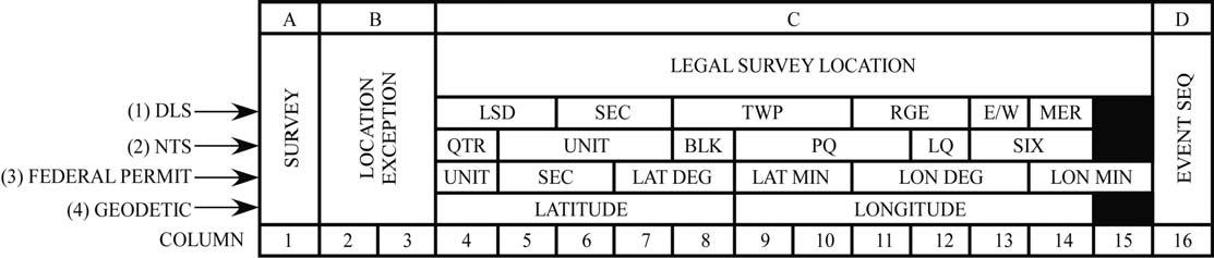
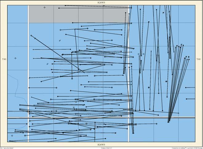
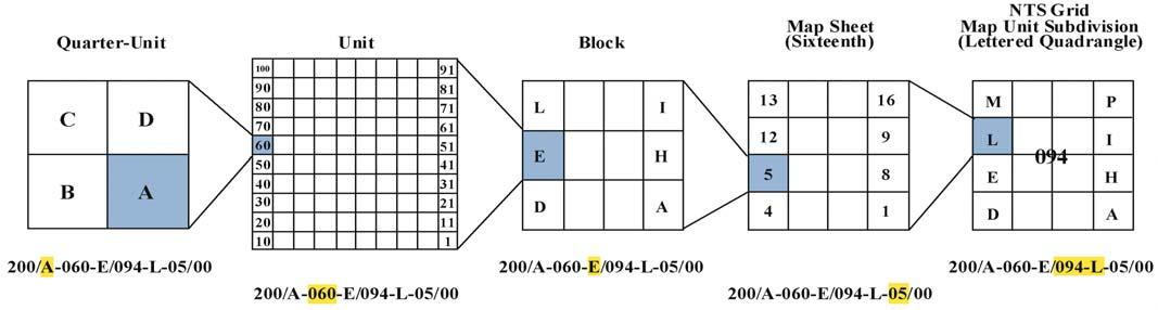
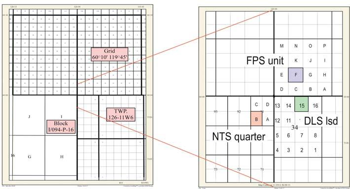
In western Canada and the northern and offshore frontier areas (Figure 1),the UWI is defined in three main survey systems – the Dominion Land Survey (DLS),the National Topographic Series (NTS),and the Federal Permit System (FPS).The general format consists of 16 characters as shown in Figure 2.
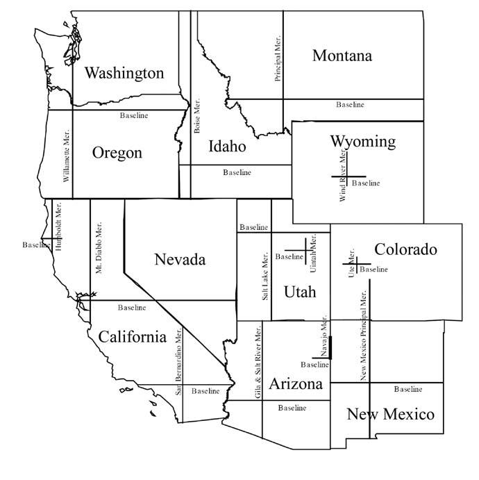
The leading character identifies which survey system is being used,which in turn defines the remaining characters.There are four codes for the systems used:“1” for the Dominion Land Survey used in the western provinces;“2” for the National Topographic System used in British Columbia outside of the Peace River Block;“3” for the Federal Permit System used for the offshore areas and areas north of 60º; and “4” for geodetic coordinates which were intended for use in Ontario,Quebec,and the Maritime provinces.Within the individual sections of the UWI,leading zeros are used as required so that the entire UWI remains at 16 characters.The names and abbreviations used for the different portions of the UWIs vary somewhat,depending on the individual practice of any given company or government agency.
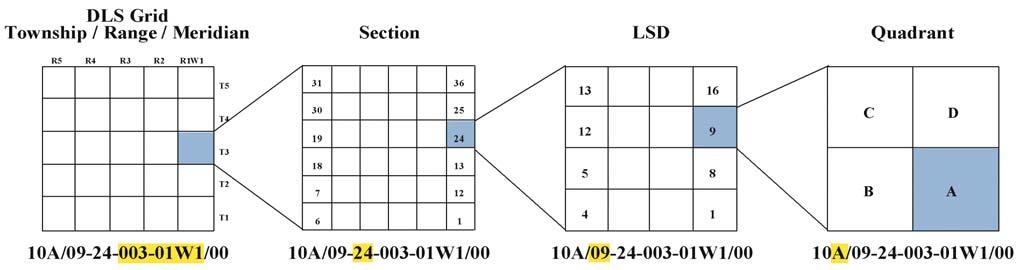
The DLS system was initially established to aid development of the prairie provinces during the early pioneering days and is also known as the Township-Range system.It covers Manitoba,Saskatchewan,Alberta,and a portion of British Columbia known as the Peace River Block.Figure 3 illustrates the composition of a UWI in the DLS system.The DLS begins by identifying the base meridian (longitude) line,then the township and range
(Continued on Page 28...)
Figure 2.UWI format.
Figure 1.Main UWI systems in use in Canada.
Dave Thomas VP of Exploration, Concho Equity Holdings Corp.
(...Continued from Page 27)
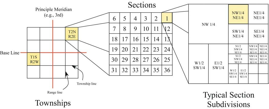
and on down through the section,legal subdivision (LSD),and quadrant.The first meridian,identified as W1 or “west of the first” occurs at 97º27'28.4" longitude.The remaining meridians occur at every fourth degree of longitude – W2 at 102º,W3 at 106º,W4 at 110º,W5 at 114º,and W6 at 118º.East of the base line,the meridians are designated as E1,etc.and are also 4º apart. Within each meridian,the basic map unit is the township,which consists of a quadrangle six miles by six miles (the system was set up long before the country converted to metric).Each township is uniquely identified by the meridian/township/range combination.
As an aside,this odd choice for the W1 base line was apparently chosen as it was close to the Red River settlement near Winnipeg,which – it seemed at the time – would be the starting point of western expansion.Interestingly, according to Williams (2003),the initiation of the DLS surveying without consultation with the Metis of the region was at least partly responsible for the Riel Rebellion.
Townships (Twps) are numbered from south to north,with Twp.1 at the U.S./ Canada border (49º latitude) and Twp.126 at the northern border of the prairie provinces (60º latitude).Ranges (Rges) are numbered from east to west on the west side of the base line (W1) and west to east on the east side.West of the first meridian,there are a maximum of 34 ranges at the broadest distance along the 49th parallel.For the standard meridians,the maximum is 30 ranges.Because the DLS system attempts to map a square parcel on a round surface (the earth),there has to be some correction to account for the converging longitude lines.This occurs every four townships,starting at the boundary between townships 2 and 3,resulting in progressively fewer ranges as the latitude increases.Also,as to be expected with the fairly basic early surveying practices and large distances covered,there are some areas
where the townships are not as precise in size or shape as would be preferred.
For the smaller divisions within a township, the complicating issue of the earth’s curvature is not as serious.As indicated above,a township (nominally) consists of 36 square miles (six miles by six miles).Each square mile is called a section and is divided into 16 LSDs (4x4 grid) as shown in Figure 3. The LSD is further divided into quadrants. Quadrants are designated by letters while LSDs,sections,townships,ranges,and meridians are numeric.The general format of a UWI in the DLS system consists of 16 characters as shown in figure 3 and are defined as:
SS = survey system;e.g.,DLS = 1
LE = location exception;used to indicate more than one drill hole in the LSD and usually indicates the sequence in which the holes were drilled;the first well is 00,the next well is 02 and then sequentially numbered up to 19;the location exception code may also consist of a letter and number combination used to identify a particular type of resource
LSD = legal subdivision;numbered 01 to 16
SEC = section;numbered 01 to 36
TWP = township;numbered 001 to 126
RGE = range;numbered 01 to 34
W or E = “west of” or “east of”
MER = meridian;numbered 1 to 6
P = unused character in the DLS system but required in others
ES = event sequence;the chronological sequence of a significant drilling or completion operation in a drill hole that yields a separate and unique set of data; numbered 0,2 to 9 (at the current time,the system can only handle ten events)
Typically the first,second and fifteenth characters are not shown when writing out the DLS UWI.
The various components of the UWI in the DLS system are written with dashes and
slashes for better readability as (for example):100/01-01-001-01W1/00.The UWI identifies the actual location of the bottom of the hole,which may be different from the surface location if the well is deviated (directionally or horizontally drilled).The location exception code indicates what type and which distinct hole the well is.The event sequence is related to the drilling and/or completion history of a particular wellbore.
While the majority of wells drilled are the result of petroleum exploration and development,there are several other types of boreholes which require a UWI.These include wells drilled to evaluate or produce oil sands,coal resources,and fresh water.Oil sands evaluation wells use two-letter combinations for the location exception codes.The values can range from AA to HZ, excluding the use of I and O (e.g.,BI or HO) and are not necessarily assigned in the chronological order of drilling.Coal drill holes are identified by the location exception codes of 1A through 9Z.Likewise,they do not use I or O and the codes are not necessarily in the chronological order of drilling.The exclusion of the letters I and O is to avoid confusion with the numbers 1 and 0.
Fresh water sources are identified by the first character in the location exception code by “F” for wells,“L” for lakes,and “R” for rivers.The second character (0 through 9,excluding 1) indicates the chronological order in which the freshwater source locations were activated.
For situations where the drilling spacing unit (typically for heavy oil wells) is less than one LSD in size,the first character of the location exception code identifies the quadrant (i.e., A,B,C,or D) and the second character (0 through 9,excluding 1) indicates the chronological order in which the wells were drilled in the quadrant.Another situation arises where the well is drilled in a road allowance.Road allowances are essentially a provincial right-of-way that runs along the
Figure 3.Composition of a unique well identifier in the DLS system.
section edges.The location exception code for a well drilled in a road allowance uses either “S” or “W” (for south or west, respectively),combined with a sequential number of 0 through 9,excluding 1.
Potentially,a single well could penetrate more than one type of resource.For example,a well drilled for oil or gas could have the UWI of 100/10-20-030-15W4/00 (for the first well in the LSD).The same location,if it encountered oil sands would be 1AA/10-20-030-15W4/00 (for the first oil sands occurrence in the LSD). And,for the first coal occurrence in the LSD, it would be 11A/10-20-030-15W4/00.
At the other end of the UWI,the event sequence code indicates a significant event in the life of the well.This may be a subsequent completion in a different zone (Figure 4a),a deepening (Figure 4b),or a re-entry in vertical wells or deviated or horizontal legs originating from an existing well.As seen in Figure 4c,an event (A-E) may end in a different LSD than the original wellbore.In that situation,the event code would show that there was more than one significant event in the wellbore and the location code would reflect the bottom-hole co-ordinates.
Although the UWI is intended to be a standard referencing system,there are some differences between the provinces.For example,the Saskatchewan Industry and Resources Department defines the location exception code by first dividing the LSD into five parts instead of four:
• a 100.6 m square centered on the centre of the LSD;
• the SE;
• the SW;
• the NW;and
• the NE
The first licence issued within the central square of the LSD will have an LE of 01,the second licence issued will have 02,etc.,up to the ninth licence (09).The tenth licence will have an LE of 0A,the eleventh will be 0B, etc.The first licence issued within the SE 1/4 of the LSD will have an LE of 11;the second licence issued will have a 12,up to the ninth licence at 19.The tenth licence will have an LE of 1A,etc.The first licence issued within the SW 1/4 of the LSD will have an LE of 21; the second licence issued will have a 22,up to the ninth licence at 29.The tenth licence will have an LE of 2A,etc.And so on.The Saskatchewan location/ naming system can be fairly convoluted,as can be the well control (see Figure 5),and the assignment of the UWI is handled by the Petroleum Development Branch.
A) Multiple completions in a wellbore;the first completion is the “0” event,the next completion is the “2”event
B) Multiple depths in a wellbore;A-B was the original depth and is the “0”event,B-C is the depth reached after additional drilling and is the “2”event
4.Examples of well events in the UWI.
C) Multiple legs in a wellbore;A-B was the original depth and is the “0”event,A-C is the first new leg and is the “2”event;A-D is the second new leg and is the “3”event,A-E is the third new leg but ends in a different LSD than the original wellbore; A-E will be the “4”event,but will have section 11 as its (bottom-hole) location rather than section 10
5.Examples of vertical and deviated well control (data from AccuMap).
Figure
Figure
(...Continued from Page 29)
The National Topographic System (NTS) takes a completely different approach from that of the DLS system in that it is based on latitude and longitude.Although very little of Canada has been surveyed on the ground, there is still a necessity to refer to areas of the country and to designate maps at various scales in a systematic way.To accommodate these needs,the National Topographic System was designed.In the Canadian petroleum industry,the NTS is used throughout most of British Columbia as the basis for the UWI.The general format of a UWI in the NTS system consists of 16 characters as shown in Figure 6:
The fundamental unit of the NTS is the primary quadrangle (PQ),which consists of 4° of latitude by 8°of longitude over all of Canada (except in the high arctic north of Latitude 80°,where the east-west dimension is 16°of longitude).The primary quadrangles are numbered and arranged in east-to-west rows, with the SE corner of quadrangle 0 (zero) at the intersection of 40°North Latitude and 48° West Longitude,in the Atlantic Ocean,south of Newfoundland.The numbering scheme for the primary quadrangle is decimal,with quadrangle 10 immediately west of quadrangle 0,quadrangle 20 immediately west of quadrangle 10,quadrangle 30 immediately west of quadrangle 20 and so on.Quadrangle 11 lies immediately north of quadrangle 10, quadrangle 12 immediately north of quadrangle 11,etc.
NTS primary quadrangles are subdivided into 16 secondary quadrangles (Lettered Quadrangles – LQ),designated A to P in a zig-zag pattern starting with "A” as the Lettered Quadrangle in the southeast corner of the Primary Quadrangle (Figure 6).Each of the secondary quadrangles in turn is subdivided into sixteen tertiary quadrangles (called Sixteenths),which are numbered from 1 to 16,in a zig-zag arrangement,also starting with 1 in the
southeast.The dimensions of each tertiary quadrangle are 15 minutes of latitude by 30 minutes of longitude.
The next size category divides each Sixteenth into 12 Blocks (Blk),lettered A to L.Each Block is composed of 100 numbered Units (Unit),which,in turn,are composed of four lettered Quarter-units (Qtr).Although the size varies somewhat with latitude,the Blocks are roughly 2/3 the size of a township,four Units are about the size of a DLS section,and one Quarter-unit is about the size of a LSD.(Figure 7).
Unlike the DLS codes in Alberta and Saskatchewan,the NTS location exception and event sequence codes as currently used in B.C.are simple numbers indicating the chronological order of the well or event. Like Alberta,B.C.doesn’t use the number “1” in those two codes.
The third main well identification system is the Federal Permit System and it is used for wells north of 60º latitude and in the offshore areas.The general format of a UWI in the Federal Permit System consists of 16 characters as shown in figure 2.
It is written as:
3EE/U-SS DT-MT DLG-MG/Q,where
3 = the survey system (i.e.,FPS,as opposed to 1 for DLS and 2 for NTS)
LE = Location Exception
U = Unit
SS = Section
DT = Degrees Latitude
MT = Minutes Latitude
DLG = Degrees Longitude
MG = Minutes Longitude
Q = Event Sequence
The basic unit in the FPS system is the grid area.Grid areas are bounded east and west by every 15’ of longitude (e.g.,110º00’, 110º15’,110º30’,etc.) and north and south by every 10’ of latitude (e.g.,60º00’,60º10’, 60º20’,etc.).The location of the grid area is referenced to the latitude and longitude of its northeast corner (see Figure 7).
At the maximum,the grid area is divided into a 10 by 10 matrix of 100 sections (not to be confused with the DLS section of a square mile).Sections begin numbering with section 1 in the southeast corner and proceed north to section 10 in the northeast corner.Section 11 drops back to
Figure 6.Composition of an unique well identifier in the NTS system.
Figure 7.Relative sizes in
the southern border and again numbers north and so on to a maximum of ten columns.Section 100 is identified as “00”. Because the longitude lines converge northwards,the sections become narrower and narrower until the number of sections in a grid area is reduced.For example,while a grid area off the east coast of Nova Scotia at latitude 45ºcontains 100 sections,at 60º
latitude – north of the prairie provinces –the grid area has 80 sections.At 68º,the grid area decreases further from 80 sections to 60 sections.At 70º,the bounding longitudes change from every 15’ to 30’ and the grid area starts back with 100 sections.
Next in size are units.Every section is divided into a 4x4 matrix yielding 16 units
(similar to the LSDs in a DLS section).The units are identified by the letters “A” through “P”,starting in the southeast corner and zig-zagging up to the northeast corner (Figure 7).Like the NTS location exception and event sequence codes in B.C.,the FPS completes the UWI by using simple numbers to indicate the chronological order of the well or event.
While the DLS,NTS,and FPS numbering systems cover the bulk of well identifiers used in the petroleum industry in Canada, there are two others to mention.One is the system intended for use in the eastern provinces,where there are a small number of oil and gas wells and the other is the DLS system as used in the adjoining western U.S. states of Montana and North Dakota.
The Geodetic survey system identifies the center point of a rectangular area by giving the latitude in columns 4-8 and the longitude in columns 9-14,with an implied decimal between columns 5 and 6 and between columms 11 and 12 (see figure 2).Geodetic coordinates have not attained popular support and the eastern provinces instead use a variety of local systems.
Ontario identifies the well by a combination of county / township / lot / concession.Since Ontario wasn’t part of the homesteading era,their survey system is not quite as simple to interpret as that used in the west. New Brunswick uses a system similar to the FPS but oriented to that province.There the well identifier is composed of the company name,a topographic location name,and the unit / section / grid number (a four-digit
(Continued on Page 33...)
Figure 9.Composition of PLSS UWI.
Figure 8.Base Lines and Meridians of the western U.S. states (after exhibit 6,Premier Data Services).
Sept.
Sept. 28-29 also with PETER JONES
Call (403) 264-0173 or judith.lentin@thementors.com
Wellsite Geological Supervision since
number).Quebec provides some location information in their well identifier as they break the province into regions (A-F),which gives a general location.More information on well identification in the individual eastern provinces can be found at:
New Brunswick
http://www1.gnb.ca/0078/hydrocarbons/ Petroleum_Data-e.asp and http://www.gnb.ca /0062/regs/86-190.htm
In the U.S.,all of the states except the original 13 colonies (and their subsequent spin-offs), Texas,and Hawaii,use the U.S.Public Land Survey System (PLSS).The PLSS became official government policy shortly after the Revolutionary War,with the passing of the Land Ordinance of 1785.This ordinance grew out of a political movement led by Thomas Jefferson (hence,the alternate nameJeffersonian Survey System) and John Adams that held that an essential part of a democracy was the right to own property.Under this “rectangular survey system”,land is subdivided after a baseline,running east and west,and a meridian,running north and south,is first established (Figure 8).
Once the baseline and meridian are defined, townships of 36 square miles are numbered
from the origin (Figure 9 ).The sections in the PLS system begin in the northeast corner and zig-zag down to the southeast corner.Each section is subdivided into quarters down as far as needed.For example,a proper legal description of the 40-acre square tract of land highlighted in Figure 9 would be described as: • NW 1/4,NE 1/4,Sec.1,T.2 N,R.2 E,3rd Principal Meridian
In other words,the property is located in the northwest quadrant of the northeast quadrant of Section 1 which is within the township located two townships north of the baseline and two ranges east of the third principal meridian.Because a single section is 640 acres (one square mile),a quarter section is 160 acres (the typical homestead grant),and a quarter,quarter section,as in the case of the hypothetical property description above,is 40 acres.
As mentioned at the beginning of this article, the ability to locate wells precisely is vitally important in the petroleum industry,as they are the data points used for all subsurface interpretation.The UWI aids this process by tying the well to a standardized survey system in a way that is relatively easy to visualize.
REFERENCES
Alberta Energy and Utilities Board.2004. Guide 59:Well Drilling and Completion Data Filing Requirements.AEUB.Calgary,Ab.38 p.
Offshore Petroleum Board.2001.Information on Well Data,Geological Data,Geophysical Data,and Land Rights.Canada-Nova Scotia Offshore Petroleum Board.Appendix I.
Oil,Gas & Salt Resources Library.2005. Maps/Data,Well locations.http://www.ogsr
STANLEY SLIPPER GOLD MEDAL
included 580 billion cubic feet of sales gas,225 million barrels of hydrocarbon liquids,and 20 million tons of sulphur.With all the natural gas liquids and condensate some have characterized Caroline as a giant oil pool. Caroline’s significance to the Province of Alberta was staggering.At the time of discovery,it contained 10% of the Province’s remaining natural gas liquid reserves,15% of its remaining condensate reserves,and 25% of its remaining sulphur reserves.
To put it in a financial context,the Caroline complex represented a billion-dollar asset and it has generated several billions of dollars in revenues for the project owners.Not bad for the manifestation of Pat’s model!
Pat would be the first to state that exploration is a team game and this testimonial would be incomplete without mention of some of the others who worked with her to make this discovery happen.A number of individuals in management were instrumental in the discovery including Felix Frey,Ray Woods,Lorne Kingwell,Roger Brundrit,Glen Robertson,and Paul Merki. Amongst them,Felix’s active promotion and careful planning were crucial.Pat’s geological colleagues included Kevin Polan,Mike Marshall,and Pat George.Geophysically involved were Gary Billings,Wayne Glover, Murry Cathcart,Catriona Hickley,and Lorne Smith.There were also many people on the Land,Community Consultation,
library.com/well_locations.html.Accessed April 20,2005.
Petrotechnical Open Software Corp.(2000). Ref_naming_system.http://www.posc.org/ Epicentre.2_2/DataModel/LogicalDictionary/S tandardValues/ref_naming_system.html. accessed April 3,2005
Premier Data Services.2005.Introduction to Land Information,White Paper,v7.2. http://www.premierdata.com/literature/Intro% 20Land%20Information.pdf.Accessed April 18, 2005.105 p.
Rasband,James,Salzman,James,Squillace, Mark.Natural Resources Law and Policy –Section III-C.Federal Disposition of the Nation’s Land and Resources,http://natural resources.byu.edu/chap2.html.Accessed April 18,2005.
Saskatchewan Petroleum Development Branch.2003.Instruction Directive I.D.EM-46 Well Licence Application.Saskatchewan Industry and Resources.http://www.ir.gov. sk.ca/adx/asp/adxGetMedia.asp?DocID=3685, 3680,3384,2936,Documents&MediaID=5102& Filename=Insturction+Directive+ID+EM46+Well+Licence+Application.pdf.Accessed April 4,2005.
Williams,Gordon.Prairie Land Systems. 2003.powerpoint presentation to the Alberta Families History Society.www.afhs.ab.ca/aids/ talks/2003_oct_williams.ppt,accessed April 3, 2005.31 p.
Williams,Gordon.The Dominion Lands Survey System (DLS System).presentation to the Alberta Families History Society. http://www.afhs.ab.ca/aids/talks/2003_oct_wil liams.html,accessed April 3,2005.
Drilling,Testing,and Production sides who made vital contributions.
Pat went on to additional successes in the Foothills at Waterton and in northeastern British Columbia.She has held various positions in Exploration and Production and is currently Chief Geologist at Shell Canada.
Pat’s technical leadership,creativity,and tenacity,which lead to the discovery of the Caroline Beaverhill Lake “A” Pool,make her a worthy recipient of the Stanley Slipper Gold Medal.
R.J.W. DOUGLAS MEDAL RECIPIENT
Pierre-André Bourque –Citation
Pierre-André Bourque was born in Shawinigan,Quebec,and was raised in Sorel. He received his B.Sc.,M.Sc.,and,in 1973,his Ph.D.,all from Université de Montréal.After a brief stint as a geologist with the provincial Ministére de Richesses Naturelles,he joined the faculty of Université Laval,Quebec,in 1974.Pierre-André recently retired and is now professor emeritus.
Pierre-André has been a force in Quebec geology for over three decades.During this time,he has mastered the middle Paleozoic stratigraphy of the Gaspé Peninsula, producing a stream of detailed Government of Quebec geological maps and reports about this critical and complex area of Appalachian Canada.These have been augmented by an enviable array of high quality refereed journal articles focused on the Silurian:its sedimentology,paleoecology, reefs,diagenesis,and tectonic evolution –the most recent contributions being collected in the June 2001 special issue of the Bulletin of Canadian Petroleum Geology. His vast experience in the region has made him the requisite expert to consult for background on its hydrocarbon potential. Pierre-André’s interest in the Silurian reefs of the Port-Daniel sector led him to pursue in more detail that most enigmatic of Paleozoic reef types,stromatactis-bearing mud-mounds.With pre-eminent studies on examples from western Europe and North Africa,he has established himself as a premier international authority on these kinds of reefs.
Fluently bilingual and a devoted educator, Pierre-André co-authored the reef chapter of the famous Facies Models textbook, supervised a cadre of excellent graduate students who have themselves gone on to prominence,and delivered decades of field trips and classes on advanced sedimentology and stratigraphy.He has presented numerous short courses to oil company personnel in Morocco and Algeria.His highly popular introductory earth history course has been taken by thousands of Université Laval undergraduate students.Not only has he been active in distance learning via television,his French language website on the fundamentals of geology is consulted heavily by francophones world-wide.Along with his teaching and research achievements,he has been an active geological citizen,serving on many committees internal and external,including with the Natural Sciences and Engineering Research Council of Canada and the International Geological Correlation Program of the International Union of Geological Sciences,reviewing innumerable manuscripts and grant proposals,serving as
associate editor of the Bulletin of Canadian Petroleum Geology,representing the Canadian Society of Petroleum Geologists and Society for Sedimentary Geology (SEPM) on campus,and advising the Quebec Institut National de la Recherche Scientifique-Géoressources and the Geological Survey of Canada.Pierre-André was the 2002 recipient of the Côme Carbonneau Prize from the Ordre des Géologues Québec for his outstanding service.
With the award of the R.J.W.Douglas Medal of the Canadian Society of Petroleum Geologists,we salute Pierre-André Bourque for his superlative achievements in elucidating the regional geology of Quebec and his international stature in carbonate sedimentology.
Benoit Beauchamp (L) receiving RJW Douglas Medal on behalf of Pierre-André Bourque
Maximum reservoir performance
Want to make the most of your valuable oil and gas reserves?
Roxar’s integrated technology solutions and services help companies of all sizes realize the full economic potential of their oil and gas resources.
• Innovative modeling and simulation software
• Downhole monitoring and control systems
• Reservoir production multiphase metering
• Reservoir and production consultancy
Roxar’s leading-edge technology solutions from reservoir interpretation through to production & process meet the changing needs of users in managing the entire reservoir lifecycle.