■ An Overview of Alberta’s Oil and Gas Land Tenure System
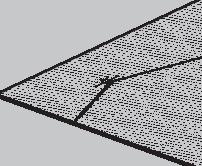
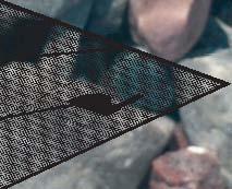
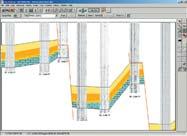
■ Simplifying Seismic
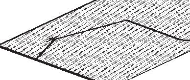
■ Simplifying Seismic
■
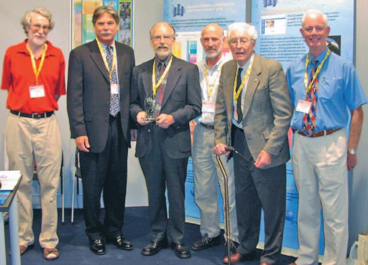
■ Halifax 2005
■
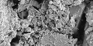
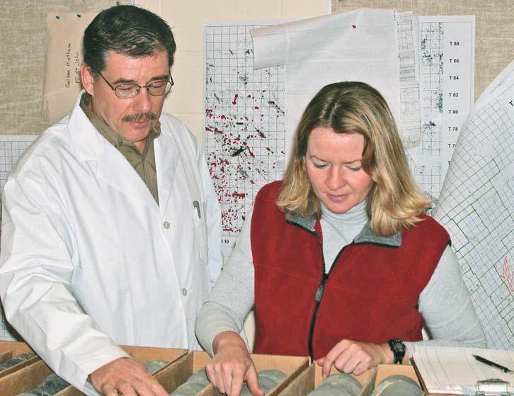
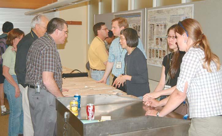
■ AAPG 2005 – Core Conference
■ AAPG 2005 – Core Conference
CSPG OFFICE
#160,540 - 5th Avenue SW
Calgary,Alberta,Canada T2P 0M2
Tel:403-264-5610 Fax:403-264-5898
Web:www.cspg.org
Office hours:Monday to Friday,8:30am to 4:00pm
Business Manager:Tim Howard
Email:tim.howard@cspg.org
Office Manager:Deanna Watkins
Email:deanna.watkins@cspg.org
Communications Manager:Jaimè Croft
Email:jaime.croft@cspg.org
Conventions Manager:Lori Humphrey-Clements
Email:lori@cspg.org
Corporate Relations Manager:Kim MacLean
Email:kim.maclean@cspg.org
EDITORS/AUTHORS
Please submit RESERVOIR articles to the CSPG office.Submission deadline is the 23rd day of the month,two months prior to issue date. (e.g.,January 23 for the March issue).
To publish an article,the CSPG requires digital copies of the document.Text should be in Microsoft Word format and illustrations should be in TIFF format at 300 dpi.For additional information on manuscript preparation,refer to the Guidelines for Authors published in the CSPG Bulletin or contact the editor.
COORDINATING EDITOR & OPERATIONS
Jaimè Croft
CSPG
Tel:403-264-5610 Fax:403-264-5898
Email:jaime.croft@cspg.org
TECHNICAL EDITOR
Ben McKenzie
GEOCAN Energy Inc.
Tel:403-261-3851
Email:bjmck@telusplanet.net
ADVERTISING
Kim MacLean
Corporate Relations,CSPG
Tel:403-264-5610,Ext 205
Email:kim.maclean@cspg.org
Advertising inquiries should be directed to Kim MacLean.The deadline to reserve advertisingspace is the 23th day of the month, two months prior to issue date.All advertising artwork should be sent directly to Kim MacLean.
The RESERVOIR is published 11 times per year by the Canadian Society of Petroleum Geologists. This includes a combined issue for the months of July/August.
Advertisements,as well as inserts,mailed with the publication are paid advertisements.No endorsement or sponsorship by the Canadian Society of Petroleum Geologists is implied.
The CSPG Rock Shop is an attractive and affordable way to target the CSPG readership. Spaces are sold at business card sizes (3.5” wide by 2” high).To reserve space or for more information,please contact Kim MacLean at 403-264-5610,ext.205.
The contents of this publication may not be reproduced either in part or in full without the consent of the publisher. Design & Layout by
Additional copies of the RESERVOIR are available at the
2004 was another active and successful one for the Society.A key milestone was our achievement of holding three conferences. The first conference was on Dolomites and “by all accounts this fully-subscribed technical meeting was an unqualified success”.In March,the first Gussow Conference was held in Canmore.The theme of that conference was Water Resources and Energy Development.The purpose of these smaller conferences is to provide venues for presentation of ideas on specific topics and to promote discussion within a smaller group of participants.Our major event of the year, the annual conference,was held jointly with the Canadian Well Logging Society (CWLS) and,for the first time,the Canadian Heavy Oil Association (CHOA).The program was both a technical and financial success.In addition to the conferences,we continued to have a strong technical luncheon program.In 2005,we will be the host society for the AAPG Convention and I know many of you are now working hard to make it an event of which we can all be proud.
Although,there were no new publications in 2004,we are hopeful that the Geological Atlas of the Western Canada Sedimentary Basin will be available in 2005 via the internet.Also,an agreement was signed with GeoScienceWorld to make our publications available on their website commencing in January,2005.This is a good opportunity to make our publications available worldwide while generating additional income for the Society.
The one publication which has grown over the year is The Reservoir.Kim MacLean joined the staff on a permanent basis in January and has been instrumental in making The Reservoir a profitable venture.Related to the increased level of advertising and support,we are now working on increasing the content of the magazine.The Reservoir Committee,supported by Jaimè Croft,our Communications Manager,is now working on
A MESSAGE FROM THE PAST PRESIDENT
increasing the quality and quantity of content in the magazine to increase its value to the members.If you have an article that you think the members would enjoy,please submit it to the office.
Successful efforts continued with our outreach programs (SIFT,Visiting Lecturers, ETC.) which are funded by the CSPG Educational Trust Fund (ETF).During the year it became apparent that there was some confusion among the membership regarding the CSPG and the ETF and it was decided to include the outreach programs within the programs of the CSPG.To this end the new position of Outreach Director has been established on the CSPG Executive.The ETF will continue to focus on fund-raising to fund those programs.
We continue to maintain a close liaison with other technical societies.We have been urged by our members,sponsors,and conference exhibitors to hold more joint conferences, particularly with the CSEG.We are therefore in discussions with the CSEG as well as other societies to determine how we can best work together.Related to technical synergy, the Executive is evaluating the possibility of joining with several other societies,including Petroleum Society of CIM,CSEG,and PTAC in a joint office facility which could enable us to share common facilities while cutting overhead costs.We think this could also lead to better communications and more joint cooperation between these organizations.
Your Executive spent a lot of time over the year examining both technical and social programs.This has been driven,in part,by the results of the 2004 Membership Survey (July/August Reservoir).As part of this process,attention has been focused on making all our programs and events profitable.As a result,we have decided to discontinue the Awards Banquet tradition since it is no longer being supported sufficiently by the members.In its place,a new format of volunteer recognitions and award presentation will be implemented in 2005.We are committed to continuing to evaluate our programs to ensure that they are providing benefits for all members.
As you no doubt realize,our industry is changing and that,with the aging demographics,we have to take a closer look at what the future will be for the CSPG.We have a major challenge ahead since the (Continued on Page 31...)
CONTOURING
Faulted contours
Isopachs
Volumetrics
Grid operations
New flexing options
CROSS SECTIONS
Digital and/or Rastor
Geocolumn shading
Multiple rasters/well
Stratigraphic/Structural
Shade between crossover
Dipmeter data
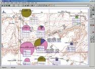
MAPPING OPTIONS
Bubble maps
Production charts
Log curves
Posted data
Highlighted Symbols
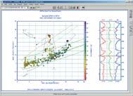
CROSS PLOTS
Log crossplots
“Z” crossplots
Lithologies to facies
Pickett plots
Regression curves
User defined overlays
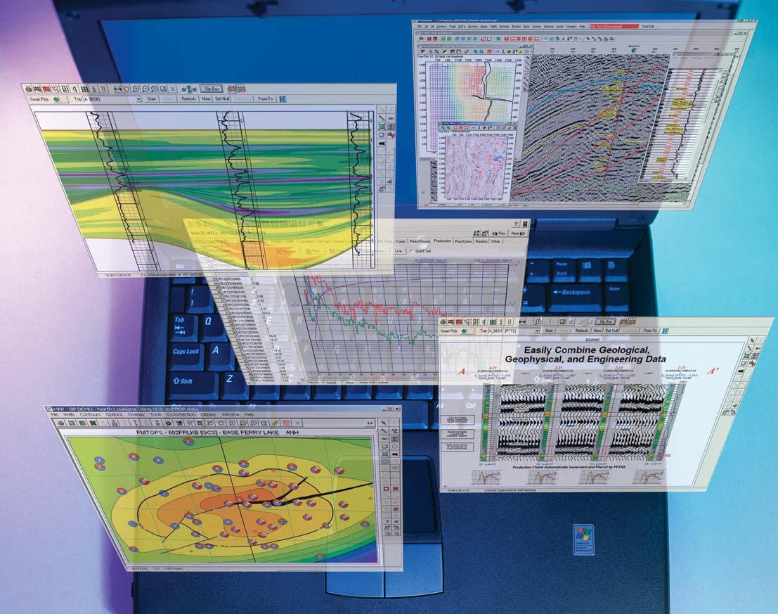
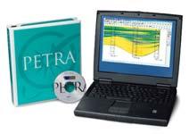
PETRA® delivers the industry’s only easy-to-use and affordable integrated solution for today’s workflows. It provides multi-user access to large projects through geological, petrophysical and engineering analysis tools. The PetraSeis™ option extends PETRA® into 2D/3D seismic interpretation with practical tools such as RasterSeis™ Download a trial version at www.geoplus.com, or callus at 888-738-7265 (in Houston, call 713-862-9449) for more product information.
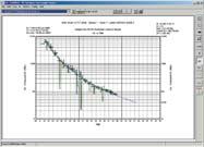
DECLINE CURVES
Compute EUR, RR, etc.
Hyperbolic or exp.
Rate/Time or Cum P/Z
User defined Econ. Limit
User defined Extrap. Time
THE CSPG GRATEFULLY ACKNOWLEDGES ITS
*CORPORATE MEMBERS:
ABU DHABI OIL CO., LTD. (JAPAN)
ARCHEAN ENERGY LTD.
BAKER ATLAS
BURLINGTON RESOURCES CANADA LTD.
BG CANADA EXPLORATION & PRODUCTION, INC.
BP CANADA ENERGY COMPANY
CALPINE CANADA
CANADIAN FOREST OIL LTD.
CONOCOPHILLIPS CANADA
CORE LABORATORIES CANADA LTD.
DEVON CANADA CORPORATION
DOMINION EXPLORATION CANADA LTD.
DUVERNAY OIL CORP.
ECL CANADA
HUNT OIL COMPANY OF CANADA, INC.
HUSKY ENERGY INC.
IHS ENERGY
IMPERIAL OIL RESOURCES LIMITED
LARIO OIL & GAS COMPANY
MJ SYSTEMS
MURPHY OIL COMPANY LTD.
NCE RESOURCES GROUP INC.
NEXEN INC.
NORTHROCK RESOURCES LTD.
PENN WEST PETROLEUM LTD.
PETRO-CANADA OIL AND GAS
PRECISION WIRELINE
SAMSON CANADA
SHELL CANADA LIMITED
SPROULE ASSOCIATES LIMITED
STARPOINT ENERGY INC.
SUNCOR ENERGY INC.
TALISMAN ENERGY INC.
TOTAL E&P CANADA LIMITED
*CORPORATE MEMBERS AS OF NOVEMBER 24, 2004
What is your competitive advantage?
In the game we play, we cannot survive on yesterday’s ideas. Knowledge is an important resource for industry success, and our key competitive advantage is what we know and how well we apply it.
The CSPG has always been the primary conduit for knowledge transfer within the geologic community. As oil and gas becomes evenharder to find, the
knowledge needs of our industry will continue to increase almost exponentially. The CSPG will continue to provide forums for networking and the exchange of ideas.
The CSPG is not peripheral to industry success; it is a part of everything we do. When you invest in the CSPG, you invest in the future.
TECHNICAL LUNCHEONS
JANUARY LUNCHEON & ANNUAL GENERAL MEETING
Conglomerates:interpretation of depositional environments and bounding discontinuities*
SPEAKERS
Dr.Laurie Davis
Fugro-Jacques Geosurveys Inc. St.Johns,Newfoundland
Dr.John D.Harper
ConocoPhillips Canada Ltd. Calgary,Alberta
11:30 am
Tuesday,January 11,2005
TELUS CONVENTION CENTRE CALGARY, ALBERTA
Please note:
The cut-off date for ticket sales is 1:00 pm,Thursday,January 6th. Tickets are $28.00 + GST.
Conglomerates occur inalm ost every environment as a matter of normal
depositional processes.In the bulk of the literature they occur as fluvial channel deposits,transgressive lags,and marine coastal sediments.They commonly have a sequence boundary associated with them, usually at their base.The reason for this is that in many instances the underlying sands commonly lack any pebbles contained within them.It was this observation that led to our research. Studies of modern deposits,including our own investigations,have identified the fact that the base of conglomerates does not necessarily require interpretation as an erosional contact. The transition,albeit abrupt,can simply represent a normal depositional change from underlying non-conglomeratic sands. There is valid reason for the lack of conglomerate in those same sands.In addition,conglomerates are difficult to work with in core because of their large grain size.In outcrop,sedimentary structures are readily evident. Interpretation of the environments of deposition is also hampered by the lack of
research on the fabric and grain-size differences of conglomerates,which range from granules to large boulders.
The very occurrence of conglomerates implies the existence of topographic relief relatively close to the deposits.This relief may be in the source area whether the conglomerates have been transported in fluvial systems from higher terrain,or remobilized through secondary coastal erosion,or the cutting of canyons on a shelf margin.Continental glacial transport can carry coarse-grained sediments long distances beyond the high altitude source terrain,and even into deep water and the realm of dropstones,whereas mountain glacial transport keeps the conglomerates close to their alpine source.
Deepwater conglomerates derived from land imply a narrow shelf because such sediments require storm conditions to move them.Deepwater conglomerates can be generated also through erosion and/or collapse of shelf margin slopes.
Thus,the provenance of the sediment is important for determining its origin and the environment.
The high energy conditions necessary to move conglomerates normally do not extend deeper than the shallow shoreface along relatively long linear coastlines. Even in fluvial settings,conglomerates do not move unless they are involved with flood water settings in high-velocity river systems.
We will look at conglomerates in a variety of settings from mountain terrains to deep water to offshore marine occurrences in association with glacial tills in the context of process models and base level relationships.Our goal is to encourage that studies not be misled into paradigm interpretations.Tough as conglomerates are to study,answers for their interpretation can be found in the subtleties they leave in the record.
BIOGRAPHY
Laurence Davis,Ph.D.,(Memorial University of Newfoundland):Presently employed as a senior project geoscientist with Fugro Jacques GeoSurveys Inc.,St.John’s,specializing in offshore 2D and 3D geohazard assessment and related marine geoscience investigations.He was previously affiliated with the Centre for Cold Ocean Resources Engineering (C-C0RE), Memorial University,where he was a project manager and research scientist involved in a joint industry-government funded Marine Minerals Research Program.His doctoral research involved a multi-disciplinary investigation of a modern coarse-grained barrier system and its application to the interpretation of analogous ancient systems.
John D.Harper,Ph.D.,P.Geol.,FGSA,FGAC: presently Senior Geological Advisor, ConocoPhillips Canada Ltd.;Retired Full Professor,Petroleum Geology,and the first Director of the Centre for Earth Resources Research at Memorial University of Newfoundland to Jan 1,1998,and more recently an Adjunct Professor to 2002;formerly with Shell Development,Shell Oil,Shell Canada,and Trend Exploration.He has operational,management and research credentials over the past 36 years in reservoir characterization and basin analysis for Canadian,US,and International onshore and offshore basins.His most recent activities have been in the Mackenzie Delta - Beaufort,the Scotian Shelf and Deep Water,the West Coast of Newfoundland,and the Grand Banks.
*Please note,this abstract has been updated since the December Reservoir.Our apologies for any inconvenience.
PETROLEUM INDUSTRY COURSES
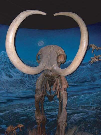
Mammoth,
Tyrell Museum.
Photo: Bill Ayrton
WHO SHOULD ATTEND
New geologists, engineers, geophysicists and landmen, as well as summer students entering the industry for the first time will find the courses a very beneficial introduction to the petroleum industry. These courses will be extremely useful to nonprofessional and support staff in the oil and gas industry, as well as accountants, lawyers, brokerage and financial personnel working primarily alongside the oil and gas industry.
TO REGISTER
To register or to obtain additional information regarding in-house and upcoming courses, please contact:
Ayrton Exploration Consulting Ltd.
Tel: (403) 262-5440
Email: ayrtonex@telusplanet.net
Or visit our website: www.ayrtonexploration.com
SUCCESSFUL PROSPECTING in the WESTERN CANADIAN SEDIMENTARY BASIN
Date: January 25 & 26, 2005
Cost: $856 incl. GST Instructor: Bill Ayrton
Generating and recommending successful prospects is the lifeblood of exploration and production companies. We acquire land rights and seismic, drill wells, evaluate acquisitions and farm-in / farm-out proposals, and those involved will find this course an excellent review of how prospecting should be done.
Course objectives:
• Review the steps critical to successful prospecting
• Create reliable subsurface interpretations, consider “multiple hypotheses”, and select the one that best fits the data
• Integrate interdisciplinary coordination
• Develop a “prospect template”
• Make effective presentations and recommendations.
New Course
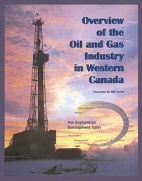
OVERVIEW OF THE OIL & GAS INDUSTRY IN WESTERN CANADA
Date: February 15 & 16, 2005
Cost: $856 incl. GST
Instructor: Bill Ayrton
Effective for personnel just joining the oil patch, or for financial, accounting, and information systems personnel.
• Learn about the many facets of the industry.
• Oil finding, land acquisition, drilling, seismic, well completion, jargon and terminology.
GEOLOGY FOR NON-GEOLOGISTS
Date: March 15 & 16, 2005
Cost: $856 incl. GST Instructor: Bill Ayrton
Effective for geological technicians or secretaries, or for those who just want a better understanding of geology to appreciate the world around us.
• Learn about earth structure, geologic time-scale and processes, Western Canada geology, and interesting nearby locations.
• Participate in a rock identification exercise, contouring project and a mini-field trip in downtown Calgary.
GEOLOGY OF THE WESTERN CANADIAN SEDIMENTARY BASIN
Date: March 29, 30 & 31, 2005
Cost: $1284 incl. GST
Instructor: Bill Ayrton
Ideal for those who wish to improve their geological understanding of where and how we look for oil and gas fields in Western Canada.
• To visualize what Western Canada looked like throughout the stages of history, for example, the position of the sea versus land, what sediments were deposited, and what type of life that existed and evolved.
• To review the importance of each major stratigraphic unit, i.e. Devonian, Mississippian, Cretaceous, etc.
• Discuss the geological and seismic expression of typical oil and gas fields in each unit.
JANUARY LUNCHEON
Revisiting the Early Cretaceous paleogeography of N.E.British Columbia – important stratigraphic controls on large gas fields
SPEAKER
Brad J.Hayes
Petrel Robertson Consulting Ltd.
11:30 am Tuesday,January 25,2005
TELUS CONVENTION CENTRE CALGARY, ALBERTA
Please note:
The cut-off date for ticket sales is 1:00 pm,Thursday,January 20th.
Early Cretaceous paleogeography has been mapped in exquisite detail in the Western Canada Sedimentary Basin.In particular,relief on the pre-Mannville unconformity shows a remarkably intricate drainage system, characterized by three major trunk valleys –the Spirit River,Edmonton,and St.Paul / Assiniboia valleys – and intervening highlands. However,the northwestern terminus of the Early Cretaceous drainage system is relatively poorly understood,as illustrated by significantly different maps drawn by Jackson (1984 AAPG Deep Basin Memoir) and Smith (1994 Geological Atlas of Western Canada).
Detailed study of uppermost Jurassic and Lower Cretaceous strata in northeastern B.C.and adjacent Alberta allows us to tie this area into the basin-wide drainage system with a high degree of confidence.The key lies in distinguishing Aptian/Albian fluvial valley-fill sandstones (Gething Formation) from uppermost Jurassic and lowest Cretaceous deltaic strata (Buick Creek sandstone). Mapping out these relationships also leads us to a better understanding of stratigraphic controls on hydrocarbon distribution and exploration/ development potential.
Buick Creek strata consist of moderately to poorly sorted,highly quartzose sandstones, containing coals up to a few metres thick, and bay-fill shales up to ten metres thick.It was deposited in a broad deltaic system lying along the eastern edge of the foredeep, and sourced from the northeast.It is equivalent to the Nikanassin Formation of the Deep Basin and to the Minnes Group in outcrop,and clearly pre-dates the preGething unconformity.Westward,toward the foredeep,the Buick Creek interfingers with prodeltaic upper Fernie shales.
Lower Gething strata comprise stacked fluvial fining-upward successions,grading from sandy chert-pebble conglomerates and lithic sandstones,up to interbedded fine sandstones and mudstones with coaly material.Mineralogy, distribution,stratigraphic succession,and lack of substantial coals distinguish the lower Gething from the Buick Creek,although the two units can be difficult to distinguish where sand-on-sand contacts occur.Lower Gething strata were deposited along the axes of preGething valleys,during the earliest stages of Aptian/Albian relative sea-level rise.
Upper Gething strata are more heterolithic, consisting of interbedded fine sandstones and shales deposited in floodplain and channelized settings.Lithologically,they are very similar to the lower Gething,but are finer-grained,except in channel bodies containing coarser sands locally eroded from the Buick Creek.The upper Gething completely infilled pre-Gething topography during a period of Early (?) Albian highstand.
Post-Gething,pre-Bluesky relative sea-level fall and valley incision can be mapped in the Aitken Creek / Nig North / Wargen areas by linking isolated bodies of valley-fill strata assigned to the Bluesky Formation.Fluvial conglomerates and estuarine sands filled these younger valleys, but were eroded and reworked in most areas to form Bluesky transgressive shoreface complexes.The pre-Bluesky drainage system paralleled pre-Gething drainage topography closely,likely as a result of differential compaction of the Gething valley fill.
Using these stratigraphic observations,we can map two converging northwesterly-directed regional valleys.The northeastern valley links to the Edmonton / Peace River valley system of the central and western Alberta Plains,while the more southwesterly valley correlates to the Spirit River and Cut Bank valley systems of west-central and southwestern Alberta.Both
are filled with lower Gething fluvial strata,while the regional interfluve between the two is capped by Buick Creek sandstones.Upper Gething heterolithic strata complete the preGething valley fill and cap the interfluve,and pinch out to the northeast on the flank of the Keg River Highlands.Pre-Bluesky valleys occur only in the far west,but Bluesky transgressive shorefaces are much more widespread.
Buick Creek,Gething,and Bluesky strata host up to two TCF of gas reserves and tens of millions of barrels of oil in northeastern B.C.Today,they are still active exploration and development targets. Most production to date has been from highquality,stratigraphically continuous Buick Creek deltaic sandstones and from Bluesky valley-fill and shoreface sandstones and conglomerates. Tremendous productive potential remains in lower-quality Gething fluvial sandstones, undiscovered Bluesky valley fills,and bypassed opportunities in the Buick Creek.Improved understanding of Jurassic/Cretaceous stratigraphy and paleogeography will assist in converting this potential to economically-recoverable reserves.
BIOGRAPHY
Brad Hayes is Executive Vice-President of Petrel Robertson Consulting Ltd.,where one of his major areas of interest is mapping Mesozoic petroleum geology of the Western Canada Sedimentary Basin.This presentation has been developed from four regional exploration evaluation studies of the Lower Cretaceous of northeastern B.C.and adjacent Alberta,done at Petrel Robertson over the past several years.Brad graduated from the University of Toronto in 1978 with a B.Sc. (Honours) in Geology,and from the University of Alberta in 1982 with a Ph.D.in Geology.In addition to regional exploration studies at Petrel Robertson,he is leading a systematic evaluation of unconventional (“tight”) gas opportunities in Western Canada.Brad also has extensive experience in field assessments and geological modeling,in Canada and internationally.Brad is a PastPresident of the CSPG,and is currently an Associate Editor with the Bulletin of Canadian Petroleum Geology.
TECHNICAL LUNCHEONS
FEBRUARY LUNCHEON
Natural gas storage: western Canada perspective
SPEAKER
Karen James
AUTHORS
Garry McCarroll, Shaju Koickel, Heather Joy, Karen James
11:30 am Tuesday,February 8,2005
TELUS CONVENTION CENTRE CALGARY, ALBERTA
Please note:
The cut-off date for ticket sales is 1:00 pm,Thursday,February 3rd. Ticket price is $28.00 + GST.
Natural gas storage capacity in the Western Canada Sedimentary Basin currently exceeds 300 Bcf.Gas is stored by a variety of users for a variety of purposes.These include utility companies to meet winter peak demands,pipeline companies for operational balancing,producers to increase sales revenues,end users to reduce costs, and by all types of industry participants to capture opportunities from gas price volatility.
Despite a history of almost 40 years in Alberta,“street awareness” of business and technical criteria for storage development and operations remains low.Why is gas storage an attractive business? Why does an E&P company have clear advantages over Utilities in the storage business? What makes a good storage reservoir? A brief overview of the business drivers behind gas storage will be presented in addition to a detailed discussion of technical elements.
Multi-disciplinary efforts combining conventional geology,geophysics,and reservoir engineering are rigorously applied to define the potential storage container. High quality reservoirs,high deliverability wells,and high commodity prices dictate that operators commit to best practices for inventory control.Understanding and communicating the spatial geometry of the tank is a critical aspect to managing the reservoir.Often,the selected reservoirs
have been depleted by very few wells attesting to the high quality of the original (now depleted) reservoir.Thus,well control may not be as dense as typically encountered in secondary or tertiary oil recovery schemes.With less rock data to characterize internal variations of the reservoir,high quality seismic and mapping of analogy pools are required to extrapolate between wells inside the storage pool and along pool boundaries.Detailed mapping is subject to frequent revision according to reservoir performance and simulation results.
One important difference between conventional exploitation and natural gas storage is cycle time (injection to depletion).The premise that underpins gas storage operations is the ability to deliver large volumes of gas at specific times of peak demand (and attractive commodity pricing). Thus,a pool may be cycled from full to empty within a few months.With such rapid cycling,reservoir assumptions if not carefully considered will quickly be proven inaccurate with potential costly results.
BIOGRAPHY
EnCana is the largest independent gas storage operator in North America with facilities in Alberta,California,and Oklahoma. Two years ago,EnCana’s Western Canadian project team successfully built the 29 Bcf Countess Storage facility from grassroots.The development took place over one year from concept to in-service date.EnCana’s US New Ventures project team is currently developing its first salt cavern storage facility in Louisiana.
The four authors cited here represent part of a larger dynamic team.Karen James has been project geologist with EnCana’s Gas Storage Team for 11 years.Garry McCarroll has been leading reservoir engineering and operations for Gas Storage for 7 years,Shaju Koickel has been reservoir engineer with the team for 5 years.Heather Joy recently joined the Gas Storage Team as project geophysicist.
FEBRUARY LUNCHEON
Issues and approaches for integrated hydrocarbon systems analysis in tertiary deltas - what we have learned:examples from deep water Nigeria
SPEAKER
Lori L.Summa
11:30 am Tuesday,February 22,2005
TELUS CONVENTION CENTRE CALGARY, ALBERTA
Please note:
The cut-off date for ticket sales is 1:00 pm,Thursday,February 17th. Ticket price is $28.00 + GST.
One consequence of the search for new exploration opportunities has been a push into higher-risk areas of known hydrocarbon provinces such as Tertiary deltas.We are testing new plays in deeper water and older strata,and using that experience to push into deeper plays in shallow water.Given this activity,it seems an appropriate time to examine how our paradigms for hydrocarbon systems in Tertiary deltas have shifted through ongoing successes and failures,and use that knowledge to exploit newer opportunities more effectively.This presentation explores elements of what we have learned,via an integrated plate to molecular-scale approach to hydrocarbon systems analysis,with emphasis on alternate scenarios,and on what we might have overlooked.
Evolution in both technologies and approaches to hydrocarbon systems analysis in Tertiary deltas has been driven by a major goal of predicting liquids,though this objective is now changing as natural gas acquires greater economic value.Efforts to accomplish this goal have led to the development of technologies that improve our ability to quantify the volumes and types of hydrocarbons entering and leaving a trap.We use source facies distribution and maturity,structure timing,and the PVT properties of generated hydrocarbons to constrain the inflow of hydrocarbons to a trap.These variables are amenable to quantitative evaluation,assuming a good genetic understanding of the processes controlling basin formation and fill,including regional tectonics,climate,and sediment supply,assisted by understanding of molecular clues from rocks and oils.We use structural style,physical properties of seals,regional continuity of major aquifers,and the PVT
properties of reservoired hydrocarbons to constrain the outflow of hydrocarbons from a trap.These variables can also be quantified and related to one another using a series of molecular- to regional-scale tools.
But how have the ongoing efforts to quantify hydrocarbon type and distribution modified our overall hydrocarbon systems models for Tertiary deltas? Early models tended to predict a relatively simple hydrocarbon distribution,controlled largely by the presence of higher maturity source rocks in depositional thicks.That simple paradigm has evolved to a model in which complex migration histories and trapping mechanisms are now thought to be a major control on hydrocarbon type and distribution.In addition,timing of hydrocarbon charge relative to trap development has always been recognized as an important factor in predicting hydrocarbon type and quality,but the tools developed over the past several years enable us to quantify those relationships and better predict hydrocarbon distribution. Finally,our understanding of how fluid pressures and seal properties constrain the
ASSISTANTPROFESSOR
type and distribution of hydrocarbons has also evolved significantly.This presentation illustrates the evolution of these tools and approaches,with examples of evolving hydrocarbon systems models from deep water Nigeria,and potential application to other deltaic systems.
BIOGRAPHY
• Lori received her B.Sc.from University of Rochester,New York in 1979 and her Ph.D. from University of California,Davis in 1985
• Lori has worked with ExxonMobil Upstream Research Company in Houston,Texas since 1985.
• Her research includes Integrated hydrocarbon systems analysis,fluid flow,basin modeling,fluid inclusions,and clastic diagenesis.Since 1990,she has been the research scientist and team lead for the hydrocarbon migration and basin modeling technical team.Currently she is team lead on a research project targeting new exploration opportunities through integration of technologies related to basin formation,fill,and evolution
• Lori is an AAPG member and is an author with numerous publications and presentations to her credit
APPLIED SEDIMENTOLOGYAND/OR STRATIGRAPHY
DEPARTMENTOFEARTH AND OCEAN SCIENCES
THE UNIVERSITYOFBRITISH COLUMBIA
The Department of Earth and Ocean Sciences at the University of British Columbia invites applications for a tenure-track faculty position in the area of sedimentology and/or stratigraphy.We seek a scientist whose research enhances and extends our existing strengths, particularly in areas that are process oriented and/or applied, including but not limited to, exploration and exploitation of fossil fuels, environmental studies and economic geology.This appointment is at the Assistant Professor level although applications from exceptionally well-qualified, more senior scientists will be considered, particularly if they address under-representation of designated equity groups such as women, visible minorities, disabled persons or aboriginal people.Candidates from all relevant fields of Science and Engineering are encouraged to apply.The position will be available as early as July 1, 2005.A Ph.D.is required by the commencement date.Teaching at the undergraduate and graduate levels is expected.
The University of British Columbia hires on the basis of merit and is committed to employment equity.All qualified persons are encouraged to apply;however, Canadians and Permanent Residents of Canada will be given priority.This position is subject to final budgetary approval.For more information about the Department and this position, visit our web site at http://www.eos.ubc.ca.
Applicants should send their curriculum vitae and a statement of research and teaching interests, and arrange for three letters of recommendation to be sent to:
Dr. Paul L. Smith, Head
Department of Earth and Ocean Sciences
University of British Columbia, 6339 Stores Road Vancouver, B.C. Canada V6T 1Z4
E-mail: AppliedSed@eos.ubc.ca Fax: 604-822-9014
The deadline for receipt of complete applications is February 14, 2005.
DIVISION TALKS
HYDROGEOLOGY DIVISION
Burial and charge history modelling of the Peace River tar sands:implications for maturation and migration of Athabasca tar sand oils
SPEAKERS
Jennifer J.Adams,C.Riediger, and S.Larter
Petroleum Reservoir Group, Department of Geology and Geophysics, University of Calgary
M.Fowler
Geological Survey of Canada Calgary,Alberta
12:00 Noon
Thursday,January 20,2005
Encana Amphitheatre, 2nd Floor
East end of the Calgary Tower Complex 1st Street and 9th Avenue SW Calgary, Alberta
Tar sand bitumen has been well characterized chemically;however,much controversy remains concerning the source rocks,migration pathways,and time of migration.The Peace River hydrocarbons are the only tar sands trapped west of the Exshaw sub-crop edge between the oil kitchen and the Athabasca tar sands. Previous cursory characterization has identified the Exshaw Formation as the main source rock,and varying levels of biodegradation (API gravity 8-24),which may reflect complex maturation and/or reservoir charge history.
In this study,30 Mesozoic bitumen samples were taken across the Peace River oil sands region,for detailed petroleum geochemical analysis.Biomarkers were used to define oilsource rock correlations and to map biodegradation levels across the area.Onedimensional basin models along an up-dip Peace River Arch section were developed to investigate burial history of the tar sands.
From biomarker analysis,the source of the Peace River bitumens and western Gething reservoirs is the Exshaw Formation.The presence of both biodegraded and nondegraded oils in closely spaced pools points to a complex charging history before and after burial past 80°C.Charge history modelling of lower Cretaceous reservoirs overpredicted the levels of biodegradation due to early charge,and long residence times at low temperatures.Thus,water leg and cooling effects were incorporated into the models to reduce simulated degradation and replicate observed tar sand alteration. Timing of maturation and the dominant oil migration driving forces and pathways to the Athabasca tar sands will be discussed in the context of oil degradation patterns across the province.
Attention CSPG VOLUNTEERS Past and Present!
You are invited to the 2nd Annual Volunteer Appreciation Day!
When: Tuesday, January 25th, 10:30 am - 1:30 pm
Where: Telus Convention Centre
Sponsored by: Baker Atlas and geoLOGIC
This will be a fun get together with great PRIZE DRAWS, food and beverages!
Also don't forget to buy your Technical Luncheon tickets and attend the presentation of the 2004 VOLUNTEER AWARDS held prior to the scheduled speaker.
For more information visit www.cspg.org and click on VOLUNTEER SOURCE! Jump in... and get involved!
SEDIMENTARY DIVISION
Structural controls on karst development,Oparure Block, New Zealand.
SPEAKER
Colin Frostad Anadarko Canada
12:00 Noon
Monday,January 17,2005
Nexen Annex Theatre
+15 Level, North of C-Train Platform (Nexen Annex Building) 801 – 7th Avenue SE Calgary, Alberta
ABSTRACT
Te Kuiti Group limestones and Mahoenui Group mudstones crop out extensively on
the Oparure Block,southern Waikato District,New Zealand.Reactivation of major north-south-oriented normal faults,including the Waipa Fault,to an oblique-slip motion has resulted in a consistent set of Riedel fractures in the Te Kuiti Group limestones. Large,discontinuous fracture breccias form along first-order Riedel faults.
The Mangawhitikau Stream drains the Oparure Block from west to east,down the regional dip on the Te Kuiti Group of a few degrees to the east.As groundwater interacted with the Te Kuiti Group limestones,karst development began.Along with the epikarst zone a shaft and conduit zone was formed primarily along first- and second-order Riedel fractures.By the time the Mangawhitikau Stream eroded down to the Te Kuiti Group many open conduits
STRUCTURAL DIVISION
Evolution of pull-apart basins and transtensional structures
on strike-slip faults.
SPEAKER
John W.F.Waldron, Department of Earth and Atmospheric Sciences,University of Alberta
12:00 Noon
Thursday,January 20,2005
Petro-Canada
West Tower room 17 D (17th floor) 150 6th Ave SW
Calgary, Alberta
Many deep sedimentary basins are formed in association with strike-slip faults,typically late in the history of orogens,and contain significant amounts of coal,oil,and natural gas.However,interpretations of the development of strike-slip and transtensional basins are generally based on highly simplified models,which describe only instantaneous strains and stresses,and do not take into account the significant rotations associated with basin development.
Several well documented examples of such basins occur in the Appalachians of Atlantic Canada,where sediments of Carboniferous (Mississippian-Pennsylvanian) age were
deposited unconformably across the mosaic of terranes assembled in the Devonian Acadian orogeny.The largest of these basins, the Maritimes Basin,contains numerous subbasins,many of which record evidence for dextral strike-slip motion during their development.
Within the Maritimes Basin,the Stellarton sub-basin is a Pennsylvanian pull-apart structure located close to the MegumaAvalon terrane boundary,at the stepover between major dextral faults.The basin contains a thick succession of rapidly deposited Pennsylvanian clastic sedimentary rocks,documented through a history of coal mining,and more recently through exploration for coal-bed methane.Coal seams and oil shales allow stratigraphic correlation within the basin,permitting reconstruction of basin subsidence and structural evolution.Coal seams represent approximate paleo-horizontal surfaces; thickness variations in the most coal-rich portion of the basin-fill (corrected for tilt and compaction) show that the basin subsided asymmetrically during deposition. Rapid fault-related subsidence created a trap for coarse sediment,allowing coal-forming mires to develop on the opposite side of the basin.North-striking normal faults dissected the basin fill during and soon after deposition,early in the diagenetic history. Contouring of mine plans allows fault offsets
were present in the limestone and captured the stream flow,resulting in the formation of caves.
BIOGRAPHY
Colin Frostad received his M.Sc.from the University of Calgary in 2001,specializing in the structural controls of karst formation,under the supervision of John Hopkins.Colin is presently working as a geologist for Anadarko Canada.
INFORMATION
Talks are free – don’t forget to bring your lunch! Coffee and donuts will be provided.If you are interested in joining the Sedimentology Division email listing which currently provides luncheon reminders,or if you care to suggest a technical topic or present a talk to the division,please contact Scott Rose at (403) 699-4780 or scott_rose@nexeninc.com.
to be identified and measured.Faults are found to show offsets that vary systematically along strike,demonstrating that fault-bounded blocks were rotated clockwise during movement.The mining data also show that both coal seams and faults were folded by east- to northeasttrending folds,consistent with an overall environment involving dextral strike-slip motion.
The geometry of normal faults in the Stellarton sub-basin may be developed into a generalized kinematic model for the behaviour of fault-bounded blocks that absorb the extensional component of deformation in a pull-apart basin.The fault heaves are simply related to the shear strain and the amount of extension.At larger strains than occurred at Stellarton,it can be shown that previously formed extensional faults would begin to show inversion as reverse faults.These results have general application in both the stratigraphic and the structural development of transtensional basins,and have important implications for future exploration in environments affected by strike-slip faulting.
BIOGRAPHY
John Waldron grew up in the UK,attending Cambridge University as an undergraduate and
(Continued on Page 39...)
GEOMATHEMATICS AND COMPUTER DIVISION
Seismic reservoir characterization: methods and applications
SPEAKER
Todor Todorov
Petro-Canada Oil and Gas
12:00 Noon
Wednesday,January 26,2005
ConocoPhillips Auditorium
3rd Floor- above Plus 15+ level
401 9th Ave SW
Calgary, Alberta
Integration of seismic data and geological models is an important part of any successful exploration and development project.Well log measurements provide high resolution and accurate picture of the subsurface rock properties and fluid content.Unfortunately in most of the cases this information is spatially sparse.Seismic data provide a very good spatial coverage,but a band-limited in nature, have lower resolution,and are contaminated with noise.The integration of both sources of information for rock properties and fluid prediction is the goal of seismic reservoir characterization.
The following are the main methods used to achieve the above goal:
• Post-Stack Seismic Inversion:derives the acoustic impedance of the subsurface, usually relates to porosity
• Elastic Impedance Inversion:inversion of mid- or far-stacks,relates to lithology and fluid content
• Amplitude Versus Offset Analysis (AVO): derives elastic rock properties,relates to lithology and fluid content
• Geostatistical mapping:methods to
PALAEONTOLOGY DIVISION
Darkened skies and sparkling grasses:the potential impact of the Mazama ash fall on the Northern Plains
SPEAKER
Dr Gerald A.Oetelaar
University of Calgary
7:30 PM
Friday,January 21,2005
Mount Royal College Room B108
4825 Richard Road SW Calgary, Alberta
Mazama ash has long served as an important chronostratigraphic marker for geologists and archaeologists working in southern Alberta.Despite the thickness and
widespread distribution of the tephra,few of these researchers have examined the potential impact of the ash fall on the plant, animal and human communities of the area. To some extent,this failure to explore the consequences of such natural disasters reflects the paucity of historical documentation and the lack of current research on the impacts of volcanic eruptions on human communities.The 1980 eruption of Mount St.Helens has prompted a renewed interest in the study of volcanoes,including their impacts on climate,plants,animals,and humans.This paper explores the potential impact of the Mazama ash fall on the climate,ecology,and human populations of the northern Plains in light of this current research.
BIOGRAPHY
Dr Gerald Oetelaar is an Associate Professor in
integrate seismic maps and log properties, honors the well information at the well locations
• Statistical Inversion using Neural Networks: builds a complex,non-linear relationship between seismic information (seismic attributes) and any log property,can be used to derive volume shale,porosity, lithology,… models
A complete project usually requires the use of all the above methods.
the Department of Archaeology at the University of Calgary.He received his B.A.from the University of Calgary,his M.A.for Simon Fraser University,and his Ph.D.from Southern Illinois University in Carbondale.His current research interests centre on landscape evolution during the Holocene and First Nations’ perceptions and uses of the northern Plains.
INFORMATION
This event is jointly presented by the Alberta Palaeontological Society,Mount Royal College, and the CSPG Palaeontology Division.For information or to present a talk in the future please contact CSPG Paleo Divison Chair Philip Benham at 403-691-3343 or programs@ albertapaleo.org.Visit the APS website for confirmation of event times and upcoming speakers:http://www.albertapaleo.org/
Courses include:
- Reservoir Engineering for Geologists
- Geochemical Exploration
- Tight Gas Sands
- Risk Analysis for Development Applications
- Giant Oil and Gas Fields
- Well Log Analysis
- Assessment, Classification & Reporting of Reserves
- Practical Salt Tectonics
- Essentials of Subsurface Mapping
- Permeability in Carbonate Rocks
Toll-free (U.S. and Canada) 888-338-3387or 918-560-2621 Fax 918-560-2678
The Immiugak A-06 gas chimney in the Beaufort Sea –direct evidence of hydrocarbon migration preserved in microfossils
SPEAKER
Dr.Dave McNeil
Geological Survey of Canada
12:00 Noon Wednesday,January 26,2005
Shell Centre
4th floor (Room 447)
400 4th Avenue SW Calgary, Alberta
(Audience members are requested check with Shell front security desk for room access instructions)
The Gulf et al Immiugak A-06 well,drilled in the offshore Tertiary fold belt of the westcentral Beaufort Sea,penetrated 3,800 metres of marine-to-terrestrial strata of Late Cenozoic to Early Eocene age (Iperk, Mackenzie Bay,Kugmallit,Richards,and Taglu sequences).The well is situated on a northwest-southeast aligned,shale-cored anticline,which has been breached by vertically migrating hydrocarbons. Syndepositional growth of the diapiric anticline occurred from the Eocene to the Early Pliocene.An apparent gas chimney occurs in Oligocene-Miocene strata
(Kugmallit and Mackenzie Bay sequences) at the crest of the structure.The gas chimney may extend to the top of the sedimentary succession,suggesting gas migration via the Iperk Sequence to the seafloor.An overpressured zone occurs below 1,3001,500 metres,within the Eocene Richards and Taglu sequences,based on well log interpretations.
Benthic foraminifera,both agglutinated and calcareous,from cuttings of the A-06 well clearly show evidence of migrating hydrocarbons (bitumen) and other fluids and chemical reactions (dissolution and precipitation of silica).Additionally,mineral grains recovered from the well cuttings appear to indicate carbonate and magnetic mineralization characteristic of hydrocarbon-related diagenesis within a gas chimney environment.
The microfossil analysis indicates that the main phase of hydrocarbon migration passed through Oligocene and Miocene strata immediately above the overpressured zone.Pliocene-Pleistocene foraminifera of the Iperk Sequence show little or no diagenetic alteration.Additionally, foraminifera in the shale/mud and coaly section (Richards to Taglu Sequence) in the lower part of the well show essentially normal burial diagenetic trends.
Thermal maturity,determined by Rock-Eval, vitrinite reflectance (%Ro),and FCI
STRUCTURAL DIVISION - PROFILE
The Structural Division’s mandate is to provide a forum for CSPG members who are interested in structural geology and tectonic processes,and to showcase what is new and current in structural geology. Topics are wide-ranging and include both compressional and extensional tectonics.
The division aims to provide informal brownbag talks every month from September to May.Talks typically average about 45 minutes followed by a short question/discussion period,and are currently located on the 17th floor of the Petro-Canada West Tower,150 6th Ave.S.W. Speakers for the luncheons are sought from industry and academia,and new volunteers are always welcome.
The division also hosts at least one field trip per year.These trips are informal and are lead by volunteers within the structural community.They are designed to be low cost,and involve no more than one evening away from home.
If you are interested in joining the Structural Division e-mail listing which currently provides luncheon reminders and a few other notices of interest to the structural community,if you care to suggest a technical topic or present a talk to the division,or if you have a field trip idea,please contact Elizabeth Atkinson at (403) 296-3694 or eatkinso@petro-canada.ca
(Foraminiferal Colouration Index),indicate that Taglu strata are within the early oil generation window (e.g.,~0.60%Ro;Tmax up to 436oC,and FCI up to 5.9).
BIOGRAPHY
Dave McNeil (Ph.D.,University of Saskatchewan) is a micropaleontologist with the Geological Survey of Canada.His main areas of research are Cenozoic and Mesozoic microfossils in the Beaufort-Mackenzie and Western Canada Sedimentary basins.His expertise is on benthic “forams”used for regional biostratigraphy and sequence stratigraphic analysis.An innovative sideline to his primary biostratigraphic work is the analysis of burial diagenetic effects on microfossils and the assessment of thermal maturity based on colour changes in agglutinated foraminifera.Dr. McNeil’s interpretation of the Immiugak A-06 well relies heavily on contributions from numerous colleagues at the Geological Survey of Canada.
INFORMATION
This event is presented by the CSPG Palaeontology Division and the Alberta Palaeontological Society.For information or to present a talk in the future please contact CSPG Paleo Divison Chair Philip Benham at 403-691-3343 or programs@albertapaleo.org. Visit the APS website for confirmation of event times and upcoming speakers: http://www.albertapaleo.org/
KEEPING TRACK KAREN WEBSTER
New: Enerplus Senior Geologist
Previous: Nexen Senior Geologist
2004 CALENDAR OF EVENTS
DATE: March 9-11,2005
EVENT: 2005 Gussow Geoscience Conference - Coalbed Methane:Back to the Basics of Coal Geology
LOCATION: Canmore,Alberta
INFORMATION: Get fired up for a discussion on one of the hottest topics in the industry while relaxing at the Radisson Inn,nestled in the beautiful Rocky Mountain setting of Canmore,Alberta.The 2005 Gussow conference will focus on geological aspects around Coalbed Methane (CBM)/Natural Gas from Coal (NGC) reservoirs.Sessions will focus on the following themes:geological controls on CBM,microscopic and geochemical coal studies,technical aspects of CBM from the lab to the field,and CBM in the Western Canada Sedimentary Basin.
Preceding the conference is an optional short course to be held in Calgary.
The 2005 Gussow Conference is presented by the CSPG in partnership with the Canadian Society for Unconventional Gas (CSUG),The Society for Organic Petrology (TSOP),and the Canadian Society for Coal and Organic Petrology (CSCOP). Members of any of these organisations are eligible for member’s registration rates.
Registration
Early bird registration will open December 1,2004.
Rates:
• Early Bird (Member):$250.00
• Early Bird (Non-Member):$350.00
• Regular Registration Rates will commence on February 1,2005.
• Member:$350.00
• Non-Member:$450.00
Conference registration closes March 4th,2005.
Conference registration fees include admission to the ice-breaker on the evening of March 9,the keynote address dinner on March 10,the keynote address lunch on March 11,as well as continental breakfasts,coffee breaks,and buffet-style lunches throughout the conference.
Accommodations at the Canmore Radisson Inn and Conference Centre are available to conference delegates at preferred rates.
DATE: May 15-18,2005
EVENT: Halifax 2005 - a Joint Meeting of the Geological Association of Canada,the Mineralogical Association of Canada,the Canadian Society of Petroleum Geologists,and the Canadian Society of Soil Sciences.
INFORMATION: Extensive seacoast exposures and a diverse geological history provide the backdrop for a rich technical program.The “Building Bridges” theme of the meeting is both symbolic of the harbour bridges that distinguish our Halifax – Dartmouth skyline, and a metaphor for the multi-disciplinary program that is designed to bridge the gaps within geoscience,and between geoscience and society.
We look forward to providing you with the opportunity to discover the charms of our beautiful city and renew the ties that bind our geoscience community.
For more information please visit www.halifax2005.ca
DATE: June 19-22,2005
EVENT: AAPG Annual Convention in Calgary,Alberta –Exploring Energy Systems
LOCATION: Round-up Centre,Calgary,Alberta
INFORMATION: For more information please visit http://www.aapg.org/calgary/index.cfm
DATE: August 8-11,2005
EVENT: Earth System Processes 2
LOCATION: Calgary,Alberta
INFORMATION: Sponsored by the Geological Society of America and the Geological Association of Canada Web site:www.geosociety.org/meetings/esp2 Theme Session Proposal submission deadline: September 15,2004.
Abstract submission deadline:April 26,2005
Description:International meeting with an interdisciplinary focus on Earth’s surface environment as a complex web of feedbacks among the biota,oceans,atmosphere,lithosphere,and cryosphere.ESP 2 will discuss advances made in the last four years toward better understanding the nature of these feedbacks in the modern world, how they have emerged and evolved over the Earth’s history,and how they will respond to human perturbations in the future.
For more information,contact: Diane Matt, P.O.Box 9140,Boulder,CO 80301-9140 1-303-357-1014 (phone) 1-303-357-1074 (fax) dmatt@geogociety.org (e-mail)
DATE: November 13-17,2005
EVENT: SETAC North America 26th Annual Meeting
LOCATION: Baltimore,Maryland
INFORMATION: The Society of Environmental Toxicology and Chemistry (SETAC) will hold the SETAC North America 26th Annual Meeting at the Baltimore Covention Center in Baltimore,Maryland, November 13-17,2005.
This year’s theme is “Environmental Science in a Global Society:SETAC’s Role in the Next 25 Years.” More information can be found on the society’s web site www.setac.org
JACK PORTERVIGNETTES OF CANADIAN PETROLEUM GEOLOGY
Continued from the December Reservoir
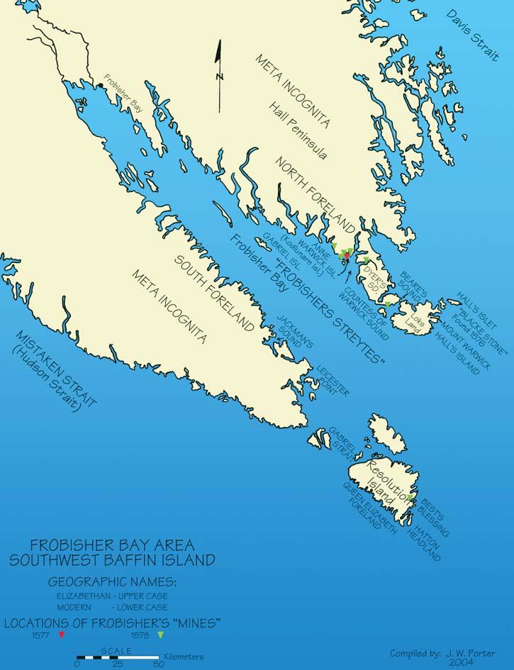
Martin Frobisher’s Third Voyage to his “Frobishers Streytes” to mine for gold
Of the 15 vessels comprising Frobisher’s fleet,four were provided by the Company of Cathay,namely:the Ayde,Gabriel,Michael and Judith ;the last being commanded by Frobisher’s lieutenant general,Edward Fenton,who had volunteered to supervise the intended temporary colony to be situated on Anne Warwick (Kodlunarn) Island.Frobisher,as admiral of the fleet,was assigned to sail in the flotilla’s flagship, Ayde The fleet’s other 11 vessels were owned by the various investors involved in his third expedition to Meta Incognita.Six of these were sturdily built merchant ships,designated to transport the ”gold ore” back to England. Christopher Hall,the chief pilot of the expedition,had been assigned to sail as master of the merchant ship, Thomas Allen.He had previously served as master of the Gabriel as well as the Ayde on Frobisher’s expedition to Meta Incognita in 1576 and 1577 respectively.The remaining five ships were smaller,20- to 40-ton merchant vessels, one of which was destined to become the fleet’s single casualty.
Proceeding,initially,southwest down the English Channel,the fleet turned north at Land’s end to berth at Plymouth,where their crews took on water for their Atlantic crossing.Later,on June 6,1578,while sailing off Cape Clear in southernmost Ireland,they came to the rescue of the vessel, Grechwinde,manned by an English crew from Bristol.A party of Frobisher’s seamen boarded the distressed vessel and found the surviving crew members in dire straits,their ships and its contents having been ravaged and pillaged,following an attack by French pirates.Martin Frobisher,true to his seafaring compatriots,came to their rescue. A party from his crew dressed the wounds of the disabled survivors and provided them with food and water,such that they were sufficiently recuperated to make their own way back to Bristol Harbour.
Sailing northwest into the Atlantic under favourable winds and clear weather,the southeastern tip of Friesland (Greenland) was sighted during the early hours of June 20. After rounding Kap Farvel (Cape Farewell), Frobisher decided a landing attempt would be made after sighting human habitation above the shoreline.Accordingly,he
communicated with his pilot,Christopher Hall and ordered him to transfer from the Thomas Allen to the smaller Gabriel where he, in turn,would join him from his flagship. When this was accomplished,the Gabriel proceeded inshore and after dropping anchor,Frobisher,Hall,and a number of seamen were rowed ashore in the ship’s long boat.On disembarking,Frobisher immediately took possession of the region in the name of Queen Elizabeth and christened it West England.He and his fellow mariners were under the misapprehension that they were the first Christians to set foot on their newly discovered land.Subsequently,Edward Fenton of the Judith and several of his seamen,also came ashore to join Frobisher’s
party.Together they proceeded to the natives’ encampment,where on arriving,they found it to be deserted.The natives,in their haste to avoid contact with the landing party, had retreated into the interior,abandoning their tents and equipment,including 40 pups. Frobisher had ordered that only one pup be taken but one of the ships’ trumpters, surreptitiously,was able to smuggle another aboard.To compensate for the theft:looking glasses (mirrors),bells,and small toys were left in one of the native’s tents (Ibid., McDermott – pp.218,219).
Edward Sellman,a member of Frobisher’s third expedition,who had written an
(Continued on Page 26...)
operation
Recon
These three logs, taken from the same well, demonstrate the power of RECON’S industry leading technology.
Standard 33 samples/meter (1:240)
You have the evidence. The most complete picture from your open hole logs, only from RECON. Call: 51-RECON (517-3266)
High-resolution 66 samples/meter (1:120)
Ultra high data resolution 133 samples/meter (1:60) Available only from RECON
The conclusive evidence is in RECON’S ultra-high data resolution open hole logs pinpoint thin beds.
account of the voyage,makes reference to Frobisher’s investigation of the abandoned native encampment in Greenland,by noting:“Some of our men that were with the General (Frobisher) aland did see in their tente nalyes like scupper (shipboard) nalyes,and a tryvet of yron.” This paradoxical example of a Stone Age culture utilizing Iron Age artifacts would indicate that the Greenland natives had commercial contact through bartering with European traders.
The writer,at this juncture,would like to digress temporarily from Frobisher’s third voyage and instead refer the reader to Tryggi J.Oleson’s book: Early Voyages and Northern Approaches 1000-1632 ,published by McClelland and Stewart Limited in 1963. Oleson presents a credible,thoroughly researched,and illuminating account of the development of our present Eskimo/Inuit culture by the intermixing of Nordic Greenlanders with the indigenous natives of Greenland (Skraelings).He chronicles the history of the Icelandic settlements in Greenland,which were established by Eiriki Thorvaldsson (Eric the Red) in 986 A.D.–from their viable existence,through a period of isolation commencing in the late 14th century,to their disappearance by the mid-16th century.
Now available for import into ACCUMAP and other mapping programs:
1) New 2004 Version: Glauconitic Channel Trends - Southern and central Alberta, West-central Saskatchewan
2) New: Lloydminster Reservoir Trends - Eastern Alberta
3) Mississippian Subcrops and Devonian Reef Edges - Alberta, NE BC, NWT and Saskatchewan
4) Colony/Sparky Reservoir Trends
- East - central Alberta
5) Bluesky-Dunlevy Reservoir Trends - NE BC
6) Halfway-Doig Shoreline Trends
- Peace River Arch, NE BC
7) Charlie Lake Siphon, Cecil and North Pine Reservoir Trends - NE BC
All edges are formatted as map features for use in Accumap and ESRI Shape files for other programs.
For more information contact: Mike Sherwin 403-263-0594
Oleson examines the numerous theories, advanced by authorities,concerning their disappearance.He can find little substantive evidence to agree with any of the proposed hypotheses.In particular,he disputes the role of climate change in causing the slow deterioration and ultimate demise of the settlements.In this regard,reference is made to the paper entitled: Present Temperature Compared to Medieval Warm Period and Little Ice Age (Gerhard,C.Lee,2004,Climate change:Conflict of observable science, theory and politics;Am.Assoc.Petroleum Geologists Bull.,vol.88 no.9,p.1214). Gerhard’s Fig.2,as supplied by David Wojick, illustrates the Medieval Warm Period was present in 1000 A.D.and continued until 1200 A.D.During the following 200 years a gradual cooling occurred until 1400 A.D.,at which juncture the Little Ice Age commenced.It lasted for almost 500 years, having terminated near the close of the 19th century.A gradual warming has continued to the present.The earth’s temperature differential between the Medieval Warm Period and the Little Ice Age is shown to be almost 3°C dropping from +2°C in 1200 A.D.to almost -1°C at the onset of the latter period.This data would indicate,when applied to the Icelandic settlements in Greenland,that the colonists enjoyed a stable,tolerable climate for the first 200
years of their colonization.During that period,the principal economy was animal husbandry,their farms being located in the lower coastal regions of the fjords,which contained grassy meadows for the grazing of their cattle and sheep.During the temperature descent to the Little Ice Age, the settlements began to wither with the males leaving the farms to engage in a fulltime livelihood of hunting.Concomitantly, the indigenous natives,known as Skraelings (little people),began to migrate south,from their northern hunting habitats,to interact with the Nordic hunters.
Culturally,the Skraelings,representing the Dorset Culture,were a very primative race, their physical characteristics being decidedly diminutive.They have been described as non-violent pygmies,having black hair with little facial hair,flat noses,very dark eyes,and swarthy complexions.They were eaters of raw meat and fish as well as carrion.Their stone tools and weapons,like themselves were also diminutive.Dogs were not utilized for drawing sleds.
Dionyse Settle,who accompanied Frobisher on his second voyage to Meta Incognita in 1577,described in his memoir two distinct types of native’sdwellings,which he
(Continued on Page 28...)
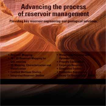
Advancing the process of reservoir management
Evaluations
• Corporate Reserves
• Simulation Studies
• Production Engineering
• Heavy Oil Studies (EOR, SAGD)
Proposed Study Area
R1W4M
(...Continued from Page 26)
observed on the mainland of Countess of Warwick Sound.He believed them to be contemporary,to quote:“– the poore caues and house of those countrie people,which serue them (as it shoulde seeme) for their winter dwellings,& are made two fadome vnder grounds,in compasse rounde lyke to an Ouen,being ioyned fast by one another, hauing holes like to a Foxe or Conny berrie, to keepe and come togither.” These excavated caves are known as vistir(s) and are associated with the Skraeling.They predate Settle’s description of the contiguous dwellings he refers to as “houses,” which:“– are seated commonly in the foote of a hil,to shielde them better from the colde winds,hauing their dore and entrance euer open towardes the South. From the ground vpward they builde with whales bones,for lacke of timber,whiche bending one ouer another,are handsomly compacted in the toppe togither,& are coureed ouer with Seales skinnes – In eache house they haue only one roome,hauing the one halfe of the floure raysed with broad stones a fote higher than y other,whereon strawing Mosse,they make their nests to sleepe in.” Oleson contends that these two types of dwellings are not contemporary; that Settle’s cave type was inhabited by the Skraeling (Dorset Culture) and predate his house type,the latter constructed by the emerging or present Eskimo/Inuit (Thule Culture) (Ibid.,1963,Oleson – pp.52,53).
The male Icelandic colonists,with their Nordic features,were viewed by the Skraelings as giants.In their role as hunters, they were referred to as the Tunnit (men of the reindeer).Oleson asserts that the lengthy period of interrelationship of the Tunnit with the Skraelings,in their common pursuit for survival,through hunting and fishing,extended beyond Greenland.Many members of both races had migrated to the coastal areas of northern Labrador, southern Baffin Island (where they were known as the Tornit),Ungava Bay,Ungava Peninsula,and the islands of Canada’s eastern Arctic.They lived in rectangular or square-shaped houses containing several rooms with sunken floors.The low walls were built of large stone slabs with the roof supports consisting of whale ribs,its surface covered with seal skins.The remains of these stone dwellings,as well as burial sites, are still evident in parts of the aforementioned regions.Such archaeological evidence patently confirms the presence of the Tunnit in these regions,they having predated the present Inuit.
The commingling of Tunnit males with Skraeling women signaled the erosion of the (Continued on Page 31...)
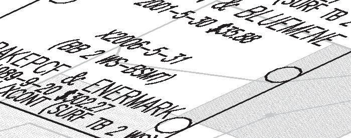
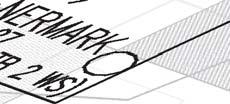
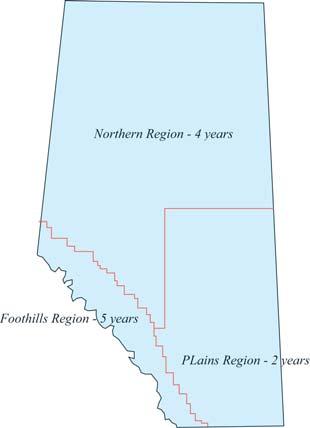
AN OVERVIEW OF ALBERTA’S OIL AND GAS LAND TENURE SYSTEM
INTRODUCTION
Tenure – term used to describe the system whereby mineral rights are managed by the Department of Energy and disposed to individuals and companies as agreements.
The importance of proper management of non-renewable resources (i.e.,oil,gas,and minerals) has long been recognized as essential by both the government and by the oil and gas industry.Alberta’s oil and gas tenure legislation has evolved in response to changing knowledge and requirements of the petroleum industry and the government. However,three key principles have remained constant throughout the process:
1) No tenure agreement conveying rights is necessary for methods of exploration other than well drilling,although access is subject to permission by the surface rights owner.
2) Once discovered,there is no obligation for oil and gas to be produced.
3) Tenure is granted beyond the term of an agreement on the basis of the agreement’s capability to produce in paying quantity.
In Alberta,the mineral rights in approximately 81% of the province’s 66 million hectares are owned by the provincial government and are managed by the Department of Energy.The remaining 19% are held by the federal government,by the successors in title to the Hudson’s Bay Company,by the national railway companies,and by the descendants of original homesteaders through rights granted by the Crown before 1887.The former are known as Crown mineral rights and the latter as Freehold rights.
HISTORY
Between 1670 and 1869,the Hudson’s Bay Company held the mineral rights in what is now Manitoba,Saskatchewan,Alberta,and the Northwest Territories.Most of these rights were traded to the Dominion of Canada in exchange for five percent of the land surveyed in the fertile belt (including the mineral rights). In Alberta,this amounted to slightly less than 1,000,000 hectares.
The Government of Canada administered these mineral rights until 1930,when the Crown mineral rights in Alberta were transferred to the Province.The Provincial Lands Act came into force the following year; however,it and the associated regulations were almost identical to the former federal regulations.During these early years, Prospecting (i.e.,exploration) Permits were
BEN MCKENZIE, GEOCAN ENERGY, RESERVOIR TECHNICAL EDITOR
granted for one year on a maximum area of 768 hectares.The permit holder was required to conduct core drilling on the permit area to earn the entire area in lease.Leases were granted with a 21-year-term and could be renewed a further 21 years if they were capable of producing commercial quantities of hydrocarbons.Leases could be grouped (up to a maximum of 8,000 hectares) to allow for more efficient exploration and exploitation.
By 1936,it had become apparent that the
prospecting permit areas were too small for the scale of exploration needed.Regulations were changed to allow for larger areas and the maximum size of lease groupings was increased to 20,000 hectares.Prospecting Permits were discontinued in 1937 and replaced by the Petroleum and Natural Gas Reservation.Up to 40,000 hectares could be included in a reservation,allowing exploration over large tracts where little was known about the geology and the hydrocarbon potential of the area.
(Continued on Page 30...)
Early Bird Registration closes January 31 Registration closes March 4
Coalbed Methane: Back to Basics of Coal Geology
(...Continued from Page 29)
Reservations were acquired by competitive bid.If no bid was received on the sale date,the reservation became available the following day for a minimum filing fee on a first-come,firstserved basis.Loosely specified work requirements were imposed on the reservation holder to ensure that an exploration effort was maintained throughout the life of the reservation.Reservations could be grouped to a maximum of 80,000 hectares (312 sections).
Completion of the work program entitled the reservation holder to select 50% of the area as lease blocks.Each block could be no larger than a nine-section square or eight-section rectangle.The leases had to be arranged in a checker-board fashion or separated by
corridors at least one section (1.6km) wide.In the event of a commercial oil discovery,the reservation holder had to make a lease selection around the discovery within three months.An equal area surrounding the lease reverted to the Crown,which could subsequently be made available to industry for further development.Although this created a complex leasing system,it provided a highly competitive situation for companies of all sizes.
Initially,hydrocarbon exploration was mainly directed at crude oil,however,increasing amounts of natural gas were being discovered. At the same time,major limitations to gas pool development were recognized in the tenure system with its lease block and corridor approach.As a result,the natural gas licence
CSPG/CSEG 22nd ANNUAL SQUASH TOURNAMENT
This year’s tournament will be played at the WORLD HEALTH EDGEMONT CLUB, 7222 Edgemont Blvd.N.W.,Calgary,on February 3 – 5,2005.
The emphasis is always on having fun,but there is keen competition for the serious players.From beginners through to provincially ranked players in both the men’s and women’s divisions.We expect the same this year,so there is sure to be a level of play suited to you.Please register now while you are thinking of it!
MAXIMUM OF 125 PLAYERS,SO GET YOUR ENTRY IN EARLY TO AVOID DISAPPOINTMENT!
EVENTS:Men’s & Women’s A,B,C,D,and Novice.Open only to members of the C.S.P.G.(or an affiliated society) and their spouse or equivalent.
ENTRY FEE: $50.00 includes GST ($40.00 Students)
• Fee includes two guaranteed matches (Saturday teams tourney),shirt,beer (please drink responsibly) and food during the tournament,Saturday night dinner (Please specify Chicken (C),Beef (B),Salmon (S) or Veggie (V)),and draw prizes. Saturday’s dinner will be held at the Edgemont Club.
• Pre-tournament registration social will be at Bow Valley Racquet Club (3rd Street and 5th Avenue S.W.) on Tuesday,February 1 at 5:00 pm.Pick up your tournament kit and first draw time,and enjoy a free pint of Ale with munchies.
• All door prize draws Saturday evening – must be present to win.
• Extra Dinner Ticket:$35.00 for non-playing guests only.(Will be limited to 15 due to venue space.)
ENTRY DEADLINE:January 20,2005.
EARLY BIRD DRAW PRIZE for entries received prior to January 6,2005. (No refunds after January 20,2005) Entry forms are available online at www.cspg.org or from your December 2004 Reservoir.
FOR FURTHER DETAILS CONTACT:
Colin Thiessen 650-0086;Alan Rutherford 861-2643;Jessie Gould 873-8150; David Caldwell 265-8987;Chris May 645-5193;Randy Smith 263-0449; Jolene Wood 243-0820;Ryan Barnett 781-1712;Travis Brookson 261-9290.
was introduced in 1951.The lease block and Crown Reserve corridor requirements were waived,but the area selected had to be contiguous and were zone specific.Natural gas licences also required a continuous drilling program over the term of the licence.At the end of the term,21-year natural gas leases could be selected.
As time proceeded,technical and economic reasons led to further revisions of the tenure system.In 1952,the Crown Reserve natural gas licence was introduced to stimulate longrange exploration for natural gas,which was considered marginally economic at the time.In 1954,Crown Reserve drilling reservations were introduced to stimulate drilling to specific target zones thought to have good prospects for crude oil.Likewise,in 1962,it was recognized that the focus of exploration activity was moving into the central basin area in pursuit of deeper multi-zone prospects.This shift was causing a decline in activity in the southeast portion of the province.As a result, a new administrative area (Block A) was created.In that area (Twp.1-64,Rge.1-30W4), the Crown Reserve system was replaced by the petroleum and natural gas permit,which had a number of incentives to make exploration there more attractive.
By the mid-seventies,a number of concerns about the existing tenure system had been identified.One of the most important issues was the stagnation in exploration of deeper geological zones.Some operators were holding large lease blocks by production from shallow zones,which many smaller operators felt was delaying the development of the deeper zones.Other issues included: 1) the need to stimulate drilling activity, 2) the decreasing possibility of discovering new oil pools that would exceed the areal extent of a lease block,and 3) the need to simplify and reduce the number of agreement types.
Thus,in 1976,the government passed amendments to the Mines and Minerals Act to address these issues.In addition to revisions to simplify the types and terms of agreements offered,the concept of deeper rights reversion was introduced.This new principle required that the rights below the deepest productive zone in the lease would revert to the Crown,as well as any lands considered to be non-productive.
In 1985,the Mines and Minerals Act was again revised in order to further simplify lease continuation and to carry the principle of deeper rights reversion a step further.Among the more significant changes was the shift from the government to the lessee of the
(Continued on Page 32...)
former’s culture.During their lengthy period of dispersion andamalgamation with the Skraelings,the Icelandic Tunnit lost,not only their language,but their traditional customs and Christian faith,as they retrogressed from an Iron Age culture into a Stone Age culture.According to Oleson,the former Icelandic Greenlanders (Tunnit) and that country’s Skraelings (Dorset Culture) are the progenitors of the modern Eskimo/Inuit (Thule Culture).When Europeans,some of whom were Danish missionaries,arrived in Greenland in the late 16th and early 17th centuries,they found the Greenlanders to be highly varied in appearance.Some had retained vestiges of their Icelandic ancestors while most exemplified the modern Eskimo/Inuit.All were considered pagan and collectively spoke the unique Eskimo/Inuit linguistic tongue inherited from the Skraelings (Ibid., 1963,Oleson – p.70).
This remarkable fusion of two ethnically distinct people produced an unique hybrid race.Within a span of 500 years,they spread across the Arctic regions from Greenland to the north coast of Siberia.This begs the question:was the Little Ice Age the causation of this process?
To be continued...
EXECUTIVE COMMENT
...Continued from page 5
industry is currently not hiring enough new graduates to replace those of us who will be retiring over the next decade.Other societies are already facing decreases in their memberships;we have to develop a strategy of keeping ours strong.Therefore,we are going to hold a strategic planning session in early 2005 and would like to have a good representation of our membership involved. Please contact me if you are interested in participating.
It has been an honour and privilege to serve as your President in 2004.I could not have done it without the hard work of many others.I would therefore like to express my thanks to the members of the Executive for their support.I would also like to thank all the volunteers who have worked so hard to make our Society strong and vibrant.Thanks also to the staff – Tim,Jaimè,Deanna,Kim, Lori,and Sarah – for running daily operations so effectively.You have all done a fantastic job!
Craig Lamb Past President
responsibility for identifying a productive lease and applying for a continuation.Also,the practice of allowing all the productive lands in a lease to be continued based on the deepest productive zone anywhere in the lease was changed to reflect production by specific spacing units.This allowed further freeing up of unproven rights.
A decade later,a new list of issues had
accumulated and,in 1995,the Industry Advisory Committee was established.Its purpose was to review the petroleum and natural gas tenure legislation,regulations, policies,and rules,and to involve the oil and gas industry as fully as possible in the review process.Further review led to additional amendments to the Petroleum and Natural Gas Tenure Regulation,which took place on January,26,2000.The Industry Advisory Committee remains active and is the primary vehicle for discussing future changes to the regulations.
PRESENT TENURE SYSTEM
Jan. 24 - 28 April 4 - 8
Feb. 7 - 8 April 25 - 26
The present tenure system allows for the Department of Energy to dispose of petroleum and natural gas (P&NG) leases and licences (1) on application,dependent on Ministerial approval,(2) by sale by public tender,and (3) pursuant to any other procedure determined by the Minister.The majority of agreements are issued by sale by public tender.The word ‘sale’ is a misnomer as the Crown always retains title to the minerals and the process is actually an auction by sealed tender with the rights leased to the highest bidder.
Any company or individual who wishes to acquire P&NG rights may submit a standardized Posting Request form.The Department examines the requested rights to ensure that they are undisposed and then refers the request to the multi-agency Crown Mineral Disposition Review Committee.This committee is responsible for identifying any surface access restrictions,e.g.,seasonal restrictions for the protection of wildlife habitats.
The maximum size for a single posting is 15 sections in the Plains Region (Figure 1),
32 sections in the Northern Region,and 36 sections in the Foothills Region.The minimum size for most parcels is an oil well spacing unit.Land sales typically are held every two weeks,the dates of which are published two years in advance.The normal posting cycle of 17 weeks consists of a twoweek acceptance period,seven weeks for internal processing,and eight weeks from the publication date of the Public Offering Notice to the sale date.
A request may be made for all the rights in a posting parcel,or for only a portion of them (Figure 2).If all rights are available,a request may be made for:
1) All rights,
2) All rights from the surface to the base of a specified zone,or
3) All rights below the base of a specified zone to some other specified zone
If there is an existing agreement so that not all the rights are available,the request can be for:
1) All available rights from the surface or the base of a specified zone to the top of the existing agreement,or
2) All available rights from the base of the existing agreement to some other specified zone
Bids have to be submitted by noon on the date of the sale.The bids must be in one of the prescribed formats and has to include (by electronic funds transfer) a $625 application fee,the rental for the first year of the agreement (at $3.50 per hectare),and a bonus bid.The minimum bonus amount is $2.50 per hectare for a lease and $1.25 per hectare for a licence.Results are available at 9:00 a.m.via the Department’s electronic mailing list and are published at 10:00 a.m.the day after the sale.
Figure 1:Alberta P&NG Licence Regions. (After figure 4,page 9,Alberta Oil and Gas Tenure)
Figure 2.Combination of zones available for leasing (After Figure 3,Page 8,Alberta Oil and Gas Tenure)
Simplifying Seismic
Chapter 1
Dr.Easton Wren
This is the first chapter in a series,which will explain the seismic business in simple terms.Designed specifically for geological personnel in the oil industry,it should provide a forum for information and questions.This opening installment will focus on the very early history of geophysics in exploration in general and trace the beginnings of the seismic method exploration.
BRIEF HISTORY OF GEOPHYSICS (EARTH PHYSICS)
Aristotle (383322 B.C.) is usually given the credit for compiling the first known geophysical treatise, the “Meteoroligica”, which embraced weather, oceanography,astronomy and meteors.Formal seismic instrumentation appeared in A.D.132 when Chang Heng set up his seismoscope in China,which indicated earthquake activity.Any movement would cause water to flow from a spout into the frog’s mouth.This would determine magnitude and direction.
Throughout medieval times,the divining stick or rod became a standard tool in the search for groundwater or rare minerals.Even today this particular methodology is still practiced but is not yet understood.
The main growth phase occurred during the Renaissance when Leonardo da Vinci (14521519) initiated new thinking on geology, vulcanology,aircraft,parachutes,submarines, and art,notably the Mona Lisa.The painting itself is Leonardo’s understanding of the Earth as a “living organism” and not simply a dead planet.He also deduced that alpine rocks were once submerged under the sea when he identified the fossil clam shells they contained. Leonardo’s work with sound and light has provided the tools for the modern understanding of the main geophysical methods employed in the oil and mining industry.
Many other famous scientists have contributed to the development of geophysical methods. These include William Gilbert (1540-1603) who founded the science of magnetism;Galileo Galilei (1564-1642) who developed the formulae for gravity and invented the thermometer;Christian Huygens (1629-1695) who explained refraction and diffraction in wave behavior;Sir Isaac Newton (1642-1727) who formulated the basic Laws of Motion;Benjamin Franklin (1702-1790) who studied lightning and postulated continental drift.
These early scientists had great skills and insight and few could stray from a natural curiosity of the earth amongst their other interests. However,the development of geophysics was somewhat slow and academic during the 1800s and the first attempts at recording earthquakes did not occur until 1880.In 1897 the first global network of seismic monitoring systems was proposed and was operating by 1899.
The early investigations and development of geophysics has followed four unique pathways based on four important earth properties:
• Density,measured as the force of gravity
• Magnetization,expressed as the local magnetic force
• Electrochemical,measured with electrodes
• Acoustic response (seismic),measured by geophones
Each of these methods has played a key role in the evolution of applied geophysics in exploration for minerals,coal,and oil and gas. While each one has special characteristics and applications,our interest will be focused on the seismic method which is the most popular and provides the best definition of those targets we seek in the oil and gas industry.We will follow the changes that occurred when earthquake physicists began to consider the possibility of creating artificial earthquakes to make images of the geological subsurface and began the exploration process for natural resources.
Aristotle
Replica of Chang Heng’s seismoscope
Leonardo da Vinci
Galileo Galilei
EARLY DEVELOPMENTS WITH SEISMIC
The use of seismic methods as an exploration tool is essentially a twentieth century phenomenon.While the global network of seismic (i.e.,earthquake) observatories was established in the 1890s,it was not until the early 1920s that an artificial earthquake method was developed to use seismic as a remote sensing or imaging tool for subsurface geology.
There were several independent discoveries that ultimately were to be embraced in the general understanding and application.One of the more romantic was the work of the German scientist,Ludger Mintrop.He had been a Professor of Earthquake Seismology prior to World War I and was drafted by the military.The German High Command was not sure how to use his talents and assigned him to various sectors of the war.He served in the airship division as a physicist but it was as a commander of a long range artillery unit that he suggested that he could detect the position of enemy artillery installations using his seismograph equipment from the university. The idea was simple.Lay out the seismic detectors (geophones) in a pattern and record the miniature earthquakes created by the shock waves of the enemy guns and identify their position by triangulation.
After a demonstration of the method at a firing range,Ludendorff,the Supreme Commander,was convinced and ordered deployment of these units at the front. However,resources were scarce,the war was drawing to a close,and the system was never implemented.
Mintrop entered the post-war years with an idea that it was possible to generate artificial earthquakes at the surface and inject energy into the ground to produce information about the geological subsurface.An early experiment focused on salt domes buried in the Rhine Valley which were considered to be causing oil traps.Success was achieved and Mintrop was invited by Gulf Oil to bring his technique to the United States and demonstrate its value.In 1923,his seismic techniques were applied and identified the Orchard Salt Dome,between Houston and San Antonio.This was drilled and became the Orchard Oilfield.Seismic had arrived as a viable tool and swept throughout North America.The first geophysical crew arrived in western Canada in the summer of 1926, working out of Lethbridge.
Of particular interest here is that Mintrop had a business relationship with Conrad and Marcel Schlumberger in Paris in the early 1920s.Together they formed the Societe de Prospection Electrique,a geophysical company engaged primarily in mineral exploration using electrical (resistivity) methods.After a short period Mintrop went his own way and created his commercial company “Seismos” (the Greek work for sound).In the 1960s this company became “Prakla,” then “Geo-Prakla” then finally,Schlumberger.It is fascinating that the founding fathers of the two service industries,seismic and well logging,created their own companies and ultimately united under the one flag at the end of the century.
Mintrop’s story does not end here.He later returned to university life as a professor.We shall see how his influence with one of his graduate students,a young Dutchman called Otto Koefoed,resulted in a dramatic discovery which became part of modern seismic’s most powerful interpretive tools –the method of A.V.O.,or amplitude versus offset.
EARLY EXPLORATION FOR OIL AND GAS WITH GEOPHYSICAL TOOLS
Itis over two hundred years since early pioneers noticed the peculiar oil-saturated sandstone exposed along the banks of the Athabasca River.Since that time,the history of oil and gas in western Canada has gathered much momentum and geophysics has played an increasingly significant role.
The first Canadian discovery of natural gas happened by accident at Alderson in Alberta in 1883.A cable-tool rig drilling a water well along the CPR right-of-way encountered gas at a depth of 335 meters and the well blew wild with severe consequences when several of the drilling crew were injured.At Medicine Hat in 1890,natural gas was discovered during coal seam drilling operations and led to the first commercial development of a natural gas field.In 1914 the Dingman well was completed in Turner Valley and produced wet gas with very light oil.
During the course of this early history, geophysics was emerging as a practical method of reducing the odds in exploratory drilling.The earliest indications of geophysical operations in western Canada include torsion balance (gravity) surveys run at Norman Wells and over the southern plains of Alberta in the 1920s.In 1930, extensive torsion balance surveys were conducted in southern Alberta by Hudson’s Bay Oil and Gas.The first full-time geophysicist appears to have been J.Edgar Duncan who worked for the Gas Company from 1929 till 1933.The first seismic survey was run at Turner Valley in 1929 for Royalite. This was followed by seismic operations in Lethbridge (1933) and High River (1934).
The crews all came from the United States and had no sense of winter conditions.Thus, all seismic work was done in the summertime,avoiding the extreme heat of mid-Continent areas like Texas and Oklahoma.Winter activities were not
Sir Issac Newton
Benjamin Franklin
initiated until after World War II.Today,most seismic operations are run in the winter, peaking in January,when budgets usually kick in and when frozen ground conditions provide easier access,less surface damage,no interference with crops,and achieve better quality data at relatively lower cost.
By the late 1930s,seismic work was on the increase only to be partly affected by World War II.In 1944,seismic data acquired by United Geophysical led to the discovery of Shell’s Jumping Pound Gas field.
Canada’s most noted petroleum geophysicist of the time was the late Norman J.Christie (1914-1997).Not only was he highly respected as a scientist but he had an acute sense of business and gained the reputation of being Canada’s geophysical ambassador.He achieved the highest honours that the seismic industry could bestow including being president of the SEG (the global Society of Exploration Geophysicists).
Western Canada’s oil industry made a quantum leap with the discovery from seismic data of the Leduc Number 1 near Edmonton in February 1947.This came after Imperial had drilled over 120 consecutive dry holes and were thinking of abandoning western Canada.In spite of known Devonian reef oil at Norman Wells and oil in the older rocks of the Foothills,it was not considered likely that there would be much to be found under the Cretaceous of the prairie.Thus, Leduc was as much a milestone for the geophysical industry as it was for the oil and gas industry itself.Both came of age with Leduc.
Note:Questions on this and subsequent articles are invited.Please send any question by email to the author at estonw@telus.net.A selection of questions with answers will be published regularly.
Leduc Number 1
HALIFAX 2005
Halifax,Nova Scotia,is the site of the 2005 joint meeting of the Geological Association of Canada,the Mineralogical Association of Canada,the Canadian Society of Petroleum Geologists and the Canadian Society of Soil Science.The meeting,hosted by the Atlantic Geoscience Society (an affiliated society of CSPG),will be held at Dalhousie University between May 15 and 18.The theme of Halifax 2005 is “Building Bridges” and the meeting logo is a stylized bridge that is both symbolic of the harbour bridges that distinguish the Halifax – Dartmouth skyline,and a metaphor for a multi-disciplinary technical program that is designed to bridge the gaps within geoscience,and between geoscience and society.
The Halifax organizing committee has been working on behalf of the four societies for more than three years,to develop a diverse and interesting program of science and social events.Although this is not the first time that CSPG has teamed up with GAC and MAC –many members will remember St.John’s 1988,and,of course,GeoCanada 2000 in Calgary - it is the first time that the societies have met jointly with the CSSS.We are
BY H. SCOTT SWINDEN, GENERAL CHAIR, HALIFAX 2005
excited by this opportunity and think that this will add an interesting new scientific dimension to the meeting.
Halifax 2005 will augment the CSPG annual meeting,by providing a focus for a diverse program of geoscience focused on eastern North Amerca and its hydrocarbon systems. CSPG’s premier contribution to the technical program is a symposium entitled Petroleum Systems of the Arctic and Atlantic Margins,organized by Grant Wach of Dalhousie University,who is also the CSPG vice-chair of the meeting’s organizing committee.This symposium will run for the three days of the meeting and features sessions on:Atlantic Margin Petroleum Systems;Basin Evolution and Salt Tectonics; Stratigraphic Successions and Petroleum Systems of Lacustrine Basins;Paleozoic Basins in Eastern Canada - New Concepts for Hydrocarbon Systems;and New Insights for Exploration of Petroleum Systems (Plenary Session).In addition to this symposium,there will be a number of Special Sessions dealing with aspects of sedimentary basin evolution and sedimentation that will be of interest to CSPG members.
The meeting features 16 field trips,to a wide variety of geological environments within the Atlantic Provinces.Of special interest to CSPG members will be Trip A2,Salt Tectonics and Sedimentation in Western Cape Breton Island, Nova Scotia led by Ian Davison (Earthmoves) and Chris Jauer (Geological Survey of Canada – Atlantic) and Trip A5,Facies Heterogeneity in Lacustrine Basins:The Transtensional Moncton Basin (Mississippian) and Extensonal Fundy Basin (Triassic - Jurassic),New Brunswick and Nova Scotia led by David Keighley (University of New Brunswick) and David E.Brown (Canada–Nova Scotia Offshore Petroleum Board).
CSPG is also making a significant contribution to the Halifax 2005 program through its sponsorship of three short courses:SC-3 Sequence Stratigraphy for Students organized by Art Donovan,Cindy Yielding,and Grant Wach;SC-4 From Lithosphere to basin: numerical and analogue modelling of basin and foldbelt evolution organized by Juergen Adam,Chris Beaumont,Ritske Huismans, Steven Ings,and Glen Stockmal;and SC-5 Seismic geomorphology organized by Henry Posamentier.
In addition to the technical program,the organizing committee is planning a full slate of special events including a harbour tour and Maritime feast on the Halifax waterfront,a full slate of awards luncheons,a fun run,and a student breakfast,sponsored by CSPG. Because the MAC will be celebrating its 50th anniversary in 2005,we are planning a number of celebratory events including a gala birthday party,a public lecture on minerals in society,and a display of specimens from the Pinch mineralogical collection.
The Halifax 2005 organizing committee is proud of the bridges we are building and we are looking forward to showing them off to the Canadian geoscience community next May.CSPG has played a key role in planning for Halifax 2005,and in ensuring that the program is well stocked with science from the emerging hydrocarbon plays of eastern North America.For more information on the meeting,please visit our website at www.Halifax2005.ca.We look forward to providing you with the opportunity to discover the charms of our beautiful city and renew the ties that bind our geoscience community.
Scott Swinden General Chair
2005 Organizing Committee
ANNUAL AWARDS REPORT
Every year the Canadian Society of Petroleum Geologists and the CSPG Educational Trust Fund present an assortment of awards to deserving individuals for excellence in the science of petroleum and sedimentary geology, distinction in the field of fossil fuel exploration,high quality oral and written presentations,leadership in volunteerism, and exemplary academic performance at the graduate and undergraduate levels.This year,due to a change in presentation
SERVICE AWARDS
ShaunAlspach
WesBader
Jim Barclay
Selena Billesberger
GraemeBloy
MarkCaplan
DouglasCarsted
AllanCarswell
Andre Chow
NancyChow
MariaCioppa
JohnCody
BillCox
Graham Davies
EvaDrivet
JonDudley
Phil Esselinger
RichardEvoy
George Eynon
Steve Grasby
DougHamilton
DougHardman
GregHayden
Brad Hayes
SeanHayes
AndreaHenry
PeterHodgins
MemoryMarshall
DonKeith
Luc Lalonde
LarryLane
DaleLeckie
ScottLeroux
GrantLos
EdMathison
RobertMcAuley
DennisMeloche
DonMunro
TomMoslow
BY DEBBIE HORBACHEWSKI, AWARDS COORDINATOR
format,we will be highlighting each award in the CSPG Reservoir prior to their presentation at the Technical Luncheons. Please check back every month for a new Award spotlight.
This month the CSPG Executive and Awards Committee take great pride and pleasure in presenting those volunteers receiving Volunteer and Service Awards for 2004.It is with much gratitude and appreciation that these recipient’s names
IanMuir
ShannonNelson
Andy Newson
BobNixon
JeffPackard
Vic Panei
PaulPiovoso
BrianPratt
Indy Raychaudhuri
CindyRiediger
TerriSami
MikeSeifert
RickSteedman
RichardThom
TedWatchuk
JackWendte
John-PaulZonneveld
VOLUNTEER AWARDS
LeahAlspach
NicholasAyre
RyanBarnett
LawrenceBernstein
PeterBoyle
PaulBushell
DavidCaldwell
IanCameron
RandiChristiansen
GelaCrane
PeterDankers
MarianneDoehler
AngelaDowd
MarkDucheck
JamesDuggan
Ned Etris
KymFawcett
JessieGould
KarenGreengrass
DawnHodgins
DebbieHorbachewski
are brought forward by their respective nominators.Without a strong core of volunteers in the CSPG,we would not be the society we are today.From volunteering at the annual Convention to chairing a committee for a number of years,CSPG volunteers have continued to prove themselves to be dedicated,talented individuals.
Congratulations and well done!
MelanyHysert
PatJans
DeanneKatnick
ShawnLaFleur
ThereseLynch
JamesMacEachern
MarkMallamo
MarcCharest
JenniferMarques
BillMartindale
BlairMattison
ChrisMay
DavidMiddleton
NolanMoore
PeterMustard
PatrickElloitt
FrankPogubila
KenPotma
AndrewRoyle
AlRutherford
AsmaSaleem
DeborahSanderson
DonSimmons
StaciaSkappak
NadyaSlemko
RandySmith
JenniferSquance
TimSteels
ColinThiessen
KevinTreptau
JenniferUnterschutz
StephanieVan Hoekelen
KristaWalker
Karen Webster
WallaceWells
KentWilkinson
DickWillott
Jolene Wood
KeithYaxley
ColinYeo
BETSY NICHOLLS: 1946-2004
The Royal Tyrrell Museum mourns the loss of award-winning researcher Dr.Betsy (Elizabeth) Nicholls,who passed away on October 18,2004,after a prolonged and courageous battle with cancer.Dr.Nicholls had been the marine reptile specialist at the Royal Tyrrell Museum since 1990.She was one of Alberta and Canada’s most celebrated and accomplished vertebrate palaeontologists.
Nicholls was internationally known for discovering and describing new species of marine reptiles.A sampling of her career highlights includes:
• Collecting and researching the world’s largest known ichthyosaur found in the Pink Mountain region of northeastern British Columbia.In 2000,Nicholls received the Rolex Award for Enterprise for her pivotal role in recovering the remains of the 23-metre-long reptile.
• Collecting and studying new primitive marine reptiles from the Wapiti Lake area of northeastern British Columbia,a project that established western Canada as one of the world’s most important localities for Triassic marine reptiles.
• Collecting and studying North America’s oldest known plesiosaur,discovered north of Crowsnest Pass.
Dr.Nicholls was born in Oakland,California, in 1946.At the age of 10,she moved with her family to Melbourne,Australia.She later returned to the U.S.where she completed her undergraduate studies in palaeontology at the University of California at Berkeley.
In 1969,Betsy moved to Canada with her husband,Jim,who had accepted a position with the University of Calgary.She completed her M.Sc.in biology (palaeontology) at the University of Calgary in 1972 and in 1989,after completing her thesis on marine reptiles from Morden, Manitoba,she received her Ph.D.
STRUCTURAL DIVISION
Edinburgh University as a graduate student, where he studied the sedimentary and structural geology of southwest Turkey for his Ph.D.project.Moving to Newfoundland for a short stint as a post-doc,he developed an interest in the sedimentary geology and tectonics of the Appalachians.In 1981 he moved to Nova Scotia,to a position at Saint Mary’s University,teaching both sedimentary and structural geology,and continuing research in the Appalachians.Work with Glen Stockmal (Geological Survey of Canada) led to the identification of a triangle zone and the recognition of previously poorly known Acadian structures in western Newfoundland.In Nova Scotia he worked on the evolution of the turbidite-dominated Meguma Group and on deformation associated with Carboniferous strike-slip faults.Comparison of deformed turbidite successions took him into Archean rocks of the Slave Province (Northwest Territories).
...Continued from Page 16
In 2000,he moved to the Department of Earth and Atmospheric Sciences at the University of Alberta,where he was appointed Associate Chair with responsibility for undergraduate studies in 2004.He has continued to do research on Atlantic Canadian tectonics in Newfoundland and Nova Scotia,interpreting new industry data as they became available.He has also begun projects in the Cordillera,looking at the Proterozoic Windermere Supergroup of the Rockies and Cariboo Mountains,and the Mesozoic Bowser Basin of Northern BC.
INFORMATION
Talks are free;please bring your lunch.Goodies and drinks are provided by HEF Petrophysical Consulting.If you would like to be on the Structural Division e-mail list,or if you’d like to give a talk,please contact Elizabeth Atkinson at (403) 296-3694 or eatkinso@petro-canada.ca.
Throughout her 14 years at the Tyrrell Museum,Betsy called Calgary home and made the 170-kilometre commute to Drumheller and back every day.Dr.Nicholls touched all those who were fortunate enough to have known her.She will be remembered for her tireless efforts, commitment and dedication to her work,and to the museum.She is survived by husband Jim and daughters Jennifer and Kat.
AAPG 2005 – CSPG CORE CONFERENCE, JUNE 23-24, 2005
EXPLORING ENERGY SYSTEMS
One of the cornerstones of the Canadian Society of Petroleum Geologists’ technical activities is the Core Conference held annually in conjunction with the Society’s spring convention.In 2005 the AAPG Annual Convention is slated for Calgary (June 19 – 22) with the CSPG as the host Society.But the tradition will live on! The CSPG Core Conference is scheduled for June 23 – 24 immediately following the AAPG Annual Meeting.The venue will be (as it has been for the past 35 years) the Alberta Energy and Utilities Board (AEUB) Core Research Centre,the largest and most functional facility of its kind in the world.
The theme for the CSPG Core Conference will follow that of the AAPG Annual Meeting:Exploring Energy Systems.Over thirty core displays,with supporting posters,will be organized into three sub-themes:unconventional,conventional, and frontier/ international hydrocarbon systems.The unconventional displays will include coal-bed methane,tight-gas,and oilsands/heavy-oil cores from Canada and the United States.The conventional core displays will consist of both sandstone and carbonate reservoirs representative of the varied producing zones in the Western Canada Sedimentary Basin.The Canadian Frontier examples will include the
Mackenzie Delta,Scotian Shelf,Northwest Territories,and Grand Banks.International displays from regions such as the Alaskan North Slope,North Sea,and Gulf of Mexico and from countries such as Ecuador,Saudi Arabia,Brazil,Mexico,and Yemen are either confirmed or in the process of being solicited.
It is anticipated that the 2005 CSPG Core Conference will set a precedent in terms of overall attendance because it immediately follows the AAPG Annual Meeting.Thus, core displays/posters are being invited/
accepted so as to cover the broad spectrum of interest of both CSPG members and AAPG Convention attendees.A registration fee of $20 U.S.will be charged to attend the Core Conference. For your $20 registration you’ll also receive a core-manual publication,as well as entry into the annual Core Meltdown, slated for Friday afternoon.
All CSPG members are encouraged to attend the AAPG convention,but if you are unable to do so,you can still attend the Core Conference.Registration forms for the 2005 AAPG Conference are available on the AAPG website www.aapg.org,or you can follow the links from the CSPG website at www.cspg.org.You can also fill out the registration form in the Final Circular which will be available in February’s Reservoir and AAPG Explorer.
On behalf of my committee,thank you for your support.We look forward to seeing you at the Core Conference.
Gerry Reinson Core Conference Chair
AGREEMENTS
There are two basic types of agreements available – licences and leases.The licence was intended to operate as a short-term exploratory agreement and the lease as a longer-term development agreement.They differ in the amount of land a single parcel can contain and in the length of initial term for which the rights are acquired.
For a licence,along with the right to drill for and recover oil and gas comes an obligation to evaluate the rights contained in the parcel. In the Plains Region (Figure 1),the lessee has two years to do so.The term for the Northern Region is four years,while that of the Foothills Region is five years.These terms take into account the different geology, climate,topography,and access restrictions of the three regions.
Generally,drilling on a licence satisfies this obligation.However,the licence could also be grouped with other initial-term licences in the immediate area.This would then allow the lessee to develop the best geological prospect and validate the parcels while reducing the need to drill unnecessary wells. The number of sections validated by a well is dependent on the depth of the well and the region that the licence is in.Table 1,is a portion of Schedule 2 of the Petroleum and Natural Gas Tenure Regulations,which identifies the amount of land earned by the depth of the validating well.
The well must evaluate rights that are contained in the licence,but is not required to have encountered oil or gas – a well that is dry and abandoned can be used for validation.In addition to a new well,reentered wells may also be used for grouping and validating purposes,provided they are drilled to at least the prescribed minimum depth beyond the total measured depth of the well prior to the re-entry.Once a well has been drilled,the lessee may validate the earned land (convert to lease) for an intermediate term of five years.The intermediate-term licence takes on the same characteristics as a primary-term lease.
The other agreement type is the lease.A lease can be continued beyond its primary term if the lessee can demonstrate that it is capable of producing petroleum or natural gas in paying quantity at expiry.However,the rights below the deepest productive zone in the lease,as well as any land considered to be nonproductive would revert to the Crown.
When a lease reaches the end of its primary term or a licence the end of its intermediate term,it expires unless the lessee can prove that it is capable of production.Each spacing
unit in the lease or licence is assessed individually.A spacing unit is eligible to be continued if it:
1) Contains a productive well, 2) Is considered to be productive based on technical information, 3) Is subject to an obligation to pay offset compensation, 4) Is subject to a unit agreement,or 5) Is subject to a gas storage unit agreement
OFFSET REQUIREMENTS
When a well is placed on production,the assumption is that it will drain all the oil or gas from the spacing unit in which it is located and then will begin to drain the oil or gas from the adjoining spacing units.Because Alberta operates under the Rule of Capture*, the owner of an adjacent spacing unit is not entitled to any compensation for this drainage.The adjacent owner’s only recourse is to drill a well and produce the oil or gas before the offsetting well does.
When the producing well is on freehold land that adjoins Crown land,drainage of the adjacent Crown spacing units would ultimately result in a loss of revenue to the Crown and, by extension,the people of Alberta.The government is obligated to take some action to prevent,or obtain compensation for,the drainage.The Department of Energy, therefore,serves notice on each adjoining Crown lessee that they must put a well on production in each Crown spacing unit in order to offset the drainage by the freehold well.Unless the lessee can demonstrate that the freehold well is not draining Crown reserves,failure to comply with the notice results in the cancellation of the affected Crown spacing units.
UNITIZATION
Oil and gas reservoirs may extend across multiple leases or intermediate-term licences.In such cases,the various lessees may combine their agreements and operate as a single entity in order to achieve a more efficient and cost-effective operation.The area within the unit is divided into tracts, which are assigned a percentage value based on technical parameters.When the unit reaches the end of its usefulness,it is terminated and the agreements contained in it become subject once again to normal land tenure requirements for productivity.
CONCLUSION
The tenure system facilitates the leasing of the province’s petroleum and natural gas rights.This allows companies to explore for and develop Alberta’s oil and gas resources, for the benefit of the province’s residents. Recent events have shown the impact these resources have on the province.
Table 1.Examples of earning entitlement (sections) for validating and grouping wells drilled on P&NG licences.
The tenure system has evolved over the years to keep pace with changing geological knowledge,technology,and world events.For over 70 years,the Alberta government has overseen the orderly development of the province’s petroleum and natural gas resources.Their efforts have led to the Alberta tenure system being looked upon by industry as one of the best in the world.
*The rule of capture:a doctrine based on English common law.If a game animal or bird from one estate migrated to another,the owner of the latter estate was perfectly within his rights to kill the game on his land. Similarly,owners of land had the right to draw out whatever wealth lay beneath it;for,as one English judge had ruled,no one could be sure of what was actually going on “through these hidden veins of the earth.”
As applied to oil production,the rule of capture meant that the various surface owners atop a common pool could take all the oil they could get,even if they disproportionately drained the pool or reduced the output of nearby wells and neighboring producers. Inevitably,therefore,the owners of adjacent wells were in heated competition to produce as much as they could as swiftly as possible,to avoid having the pool drained by another (Definition from The Prize by Daniel Yergin,1991,p.32).
This article is a summary of the information contained in the Alberta Oil and Gas Tenure publication prepared by the Alberta Department of Energy.The complete document is available at: http://www.energy.gov.ab.ca/ten/docs/ABR_ 2002_ tenure.pdf
For additional information on Tenure,please see also:http://www.energy.gov.ab.ca/com/Tenure/ default.htm
Schedule 2 of the Petroleum and Natural Gas Tenure Regulations can be found at: http://www.energy.gov.ab.ca/com/Room/ Industry+Room/Industry+Updates/Information+ Bulletins/Minerals/Mineral/2001-01 +Appendix+2.htm.
FORMER PRESIDENT DIGBY MCLAREN HONOURED WITH NEW MEDAL
BY STAN FINNEY AND GODFREY NOWLAN
Just prior to printing the January Reservoir, we learned that Mr.Digby McLaren passed away on December 8,2004. We wish to extend our deepest sympathies to Mr.McLaren’s family. We are grateful for his lifetime of work and his commitment to our industry and the CSPG.
During the Opening Ceremony of the 32nd International Geological Congress,held in Florence,Italy,August 20-28,2004,the International Commission on Stratigraphy made its first-ever presentation of the Digby McLaren Medal.This Medal was established to recognize a geoscientist who has produced a significant body of internationally important contributions to stratigraphy over a number of years.It is essentially a career achievement award,recognizing an outstanding career with numerous important accomplishments.At the Congress in Florence,the award was presented to Dr.Jan Hardenbol for his fruitful career of fundamental research in calibrating and understanding the sedimentary record of the Mesozoic and Cenozoic history of the Earth.
The Medal is named in honor of Canadian geologist Digby McLaren.While a scientist with the Geological Survey of Canada,he chaired from 1968 to 1972 the SilurianDevonian boundary working group of the International Union of Geological Sciences Commission on Stratigraphy.Under Dr. McLaren’s leadership,this group developed the “golden spike” concept of a Global Stratotype Section and Point (GSSP) in defining the Silurian/Devonian boundary. From 1972 to 1976,Dr.McLaren chaired the International Commission on Stratigraphy, and under his leadership the procedures and standards used to define inter- and intrasystemic boundaries were developed and formalized.In addition,the Commission on Stratigraphy set up subcommissions in every geological system and working groups for every boundary between systems.The primary,on-going goal of the International
Commission on Stratigraphy is to define GSSPs for the 90 stage-level boundaries of the Geologic Time Scale.More than 50 have been defined with Dr.McLaren being responsible for the first.In addition,Digby McLaren was a founder and later chairman of the International Geological Correlation Programme (IGCP),sponsored by IUGS and UNESCO.In the early 1980s,he served on the Advisory Committee on Science and Technology in Society to the Director General of UNESCO.In 1987,McLaren was elected the 101st President of the Royal Society of Canada,and was largely responsible for revitalizing and expanding its role and scope.In particular,he successfully created a firm foundation for the Canadian Global Change Programme.McLaren is the author of over 100 publications and maps in the fields of paleontology,biostratigraphy and regional geology.Of particular note,he was one of the earliest proponents of the theory of mass extinctions caused by catastrophic meteorite impact,linking these ideas firmly to disconformities in the fossil record (1969 Presidential Address to the Paleontological Society of America).McLaren has the rare distinction of being both a Fellow of the Royal Society (London) and a Foreign Associate of the U.S.National Academy of Sciences,and has had a distinguished service record as President of the Paleontological Society,the Alberta Society of Petroleum Geologists,and the Geological Society of
America.His contributions have earned him numerous accolades and honours.He received Canada’s highest civilian honour,as an officer of the Order of Canada,in 1987. By naming the career achievement medal after Digby McLaren,the International Commission on Stratigraphy honours not only Dr.McLaren but also the many hundreds of stratigraphers past and present who have contributed to the scientific mission of the International Commission on Stratigraphy and its various Subcommittees and Working Groups.
Jan Hardenbol,now with Global Sequence Stratigraphy Inc.,in Houston,Texas, was recognized for several major accomplishments,especially during his thirty years (1964-1994) with Exxon Production Research,initially in Bordeaux,then in Houston.He was the leading stratigrapher in the development and calibration of sequence stratigraphy and a guiding force in chronostratigraphy,especially for the Paleogene System.In addition to being senior author of the immensely valuable integratedstratigraphy charts for the Mesozoic and Cenozoic (published in 1998) that built on his earlier global sea-level compilations with Exxon,Dr.Hardenbol continues to be an active leader in development of highresolution time scales,in the understanding of global sequences,and in interpreting sedimentary facies patterns.
Digby McLaren (2nd from right) with,from left to right,Jim Ogg – Secretary General of ICS,Stan Finney – Vice Chair of ICS,Jan Hardenbol – recipient of the Digby McLaren Medal,Felix Gradstein – Chair of ICS,and Nicol Morton –Chair of the ICS Stratigraphic Prize committee and Chair of the Jurassic Subcommission.
The Canadian Society of Petroleum Geologists,in partnership with the Canadian Society for Unconventional Gas (CSUG),The Society for Organic Petrology (TSOP),and The Canadian Society for Coal and Organic Petrology (CSCOP) invite you to join us for the 2005 Gussow Geoscience Conference. The CSPG is pleased and honoured to dedicate this “Banff Conference” style two-day conference series to William C.Gussow,a past president and Honorary Member of the CSPG who has distinguished himself,his society,and his country through his pioneering work in geology.The conference is sponsored by the Geological Survey of Canada (Marquee Sponsor) and Burlington Resources (Keynote Sponsor).
Following last year’s successful inaugural conference,the 2nd annual Gussow Geoscience Conference will focus on the geological aspects of coalbed methane reservoirs.This exciting conference will be held at the Radisson Hotel,nestled in the beautiful Rocky Mountain setting of Canmore, Alberta.This is an ideal intimate setting for discussing issues and innovations surrounding coalbed methane reservoirs with invited speakers and peers from industry.
The conference will open on March 9 with an optional core workshop on Coal cores: examination for source rock and reservoir properties in CSG exploration at the AEUB Core Research Centre in Calgary.Presenters Drs.David Marchioni (of Petro-Logic Services) and Judith Potter (of JP Petrographics) will examine the macroscopic features of coal,coal rank,and compositional factors controlling them,and the implications for exploration and production of natural gas from coal.
The plenary session will begin on Thursday with a keynote address by Dr.Dale Leckie of Nexen Energy,followed by two engaging sessions:Geological Controls of CBM,and Petrographic and Geochemical Aspects of CBM.The day will close with a dinner and keynote address by Mr.Andrew Scott of Altuda Energy Corporation.Two sessions will be held on Friday, Technical Aspects of CBM from the Lab to the Field and CBM Case Studies from Around the World, as well as a luncheon keynote address by Dr.Marc Bustin of the University of British Columbia and CBM Solutions.
Don’t delay…register for this exciting event by January 31st and take advantage of the earlybird registration rates.To register for the conference,please see our website at http://www.cspg.org/gussow_conference.html.
Here is a sampling of the range of topics covered by our 21 invited speakers…
KEYNOTE SPEAKERS:
Dale A.Leckie, Nexen Inc.,Calgary,AB,Canada
Sequence Stratigraphic Setting and the Accommodation Space of Coal Accumulations
R.Marc Bustin, Department of Earth & Ocean Sciences, The University of British Columbia,Vancouver,BC,Canada
Factors Influencing the Reservoir Capacity of Coal and Gas Shale
Andrew Scott, Altuda Energy Corporation,San Antonio,TX,USA
How to Explore for Coalbed Methane in Frontier Regions with Limited Data: Overview of a Coalbed Methane Exploration Model
SESSION SPEAKERS:
Andrew Beaton, Alberta Geological Survey
J.Sebastian Bell, Sigma H Consultants Ltd.
Rusty Riese, BP
Romeo Flores, U.S.Geological Survey
Judith Potter, JP Petrographics
Charles R.Nelson, University of North Dakota EERC
Chad Hartman, TICORA Geosciences,Inc.
Peter J.Crosdale, Energy Resources Consulting Pty Ltd.
Charles E.Barker, U.S.Geological Survey
Mohinudeen Faiz, CSIRO Petroleum
Gareth Chalmers, University of British Columbia Greg Bell, Coal Gas Technology Co.
R.Marc Bustin, The University of British Columbia
Prasanta Mukhopadhyay, Nova Scotia
Thomas Gentzis, CDX Canada
Shane Harrison, SH Consulting Department of Energy
Maria Masterlez, Indiana University
Steve Tedesco, Dorado Gas Resources
H.A.von Schoenfeldt, CDX Gas
For a complete list of speakers and topics,please refer to our website.
Coalbed Methane: Back to Basics of Coal Geology
Early Bird Registration closes January 31 Registration closes March 4 2005 Gussow Geoscience Conference March 9-11, 2005
Fed up of drilling 20m of overhole for a logging tool?
Fed up of drilling 20m of overhole for a logging tool?
FOCUS from Baker Atlas requires just 10m of overhole.
The gamma ray measure point on the FOCUS triple combo (array resistivity, density, neutron, gamma ray) is just 9.76m. That saves you drilling time, and maybe even a bit. And logging at 18m per minute saves yet more rig time, by reducing logging times by as much as 40%. Combine that with the best data accuracy in the industry and that’s quite a deal.
FOCUS – efficiency and accuracy, every well, every time.