Please submit RESERVOIR articles to the CSPG office.Submission deadline is the 23rd day of the month,two months prior to issue date. (e.g.,January 23 for the March issue).
To publish an article,the CSPG requires digital copies of the document.Text should be in Microsoft Word format and illustrations should be in TIFF format at 300 dpi.For additional information on manuscript preparation,refer to the Guidelines for Authors published in the CSPG Bulletin or contact the editor.
COORDINATING EDITOR & OPERATIONS
Jaimè Croft Larsen
CSPG
Tel:403-264-5610 Fax:403-264-5898
Email:jaime.croftlarsen@cspg.org
TECHNICAL EDITOR
Ben McKenzie
GEOCAN Energy Inc.
Tel:403-261-3851
Email:bjmck@telusplanet.net
ADVERTISING
Kim MacLean
Corporate Relations,CSPG
Tel:403-264-5610,Ext 205
Email:kim.maclean@cspg.org
Advertising inquiries should be directed to Kim MacLean.The deadline to reserve advertising space is the 23rd day of the month, two months prior to issue date.All advertising artwork should be sent directly to Kim MacLean.
The RESERVOIR is published 11 times per year by the Canadian Society of Petroleum Geologists. This includes a combined issue for the months of July/August.
Advertisements,as well as inserts,mailed with the publication are paid advertisements.No endorsement or sponsorship by the Canadian Society of Petroleum Geologists is implied.
The CSPG Rock Shop is an attractive and affordable way to target the CSPG readership. Spaces are sold at business card sizes (3.5” wide by 2” high).To reserve space or for more information,please contact Kim MacLean at 403-264-5610,ext.205.
The contents of this publication may not be reproduced either in part or in full without the consent of the publisher.
It is hard to believe that a year has passed since starting the position of Assistant Program Director on the CSPG Executive team.Previously I had been involved as a member of different CSPG committees but had never considered being part of the Executive.I had a basic understanding of what role I would fill,but overall I thought it represented new challenges and a great opportunity to work with,and meet,other members of the CSPG.In the end,the position provided me with these opportunities but has also given me additional insight into the immense efforts that the various volunteers provide to their committees.I have a great deal of respect, appreciation,and understanding of the benefits that the numerous committees,that I liaise with on behalf of the CSPG Executive,provide to the membership.
Recently,I have assumed my new role as Program Director and I thank my predecessor,Vern Stasiuk,for his outstanding contributions and leadership over the last two years.In conjunction with Memory Marshall,this year’s Assistant Program Director,we will continue to focus on increasing our level of communication between the various committees and subcommittees in our portfolio.As discussed in my last Executive Comment (July/August, 2004),our position serves a vital role to liaise between the technical committees and the CSPG Executive,as well as to facilitate new initiatives and assist new committees or sub-committees that are being established or changed.
As in previous years,the CSPG Program Directors present to the Executive the short- and long-term goals and objectives for each of the committees they oversee. Listed below is a brief review of various highlights from 2004 and a discussion as to our,and the Executive’s,vision as to where Programs are heading in 2005.
A MESSAGE FROM THE PROGRAM DIRECTOR
CONTINUING EDUCATION
Under the leadership of Godfried Wasser and Dave Russum,this committee accepted the challenge to revitalize the Continuing Education portfolio and to identify opportunities to link the CSPG with other geoscience societies for our mutual benefit. Overall,the committee has done an outstanding job by making several new courses available to our membership and, starting in 2006,they will be overseeing convention courses and fieldtrips.This will offer great synergies between the Convention and Continuing Education committees.Looking forward to the coming year and based on their present momentum, we envision continued growth in the Education Committee portfolio with their focus on delivering exciting and specialized local courses and field trips to our members.
TECHNICAL DIVISIONS
The CSPG has eleven Technical Divisions which offer frequent lunchtime and evening seminars on areas of specific geologic interests.The Program Directors will strive to encourage a good working relationship between themselves,the CSPG Executive, and the various Technical Division Chairs.In addition,we will continue with our interdivision communication initiative,which was started during the 2004 campaign and has proven effective in fostering cross-divisional presentations.
TECHNICAL LUNCHEONS
The Technical Luncheon committee has continued to provide a large and diverse series of technical and scientific presentations for our members throughout 2004.Also,it is significant to note that the volume of hits on the internet web-casts were up greatly this year and we anticipate seeing this trend repeated into 2005.The Executive,together with the University Outreach Committee,consider this webbased service as a major benefit and communication link with our non-Calgarybased student members.
CONVENTIONS AND CONFERENCES
Our primary convention aim is to continue to collaborate and interact between the CSPG and other scientific and technical societies for conventions and conferences. The 2004 Annual Convention was another successful joint venture with the CSPG cohosting the event with the Canadian Heavy Oil Association and the Canadian Well
depths
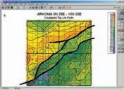
CONTOURING
Faulted contours
Isopachs
Volumetrics
Grid operations
New flexing options
CROSS SECTIONS
New Unassigned Tops
Digital and/or Raster
Geocolumn shading
Stratigraphic/Structural
Shade between crossover
Dipmeter data
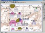
MAPPING OPTIONS
Expanded GIS Functions
Bubble maps
Production charts
Log curves
Posted data
Highlighted Symbols
CROSS PLOTS
Log crossplots
“Z” crossplots
Lithologies to facies
Pickett plots
Regression curves
User defined overlays
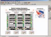
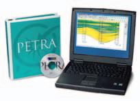
PETRA® delivers the industry’s only easy-to-use and affordable integrated solution for today’s workflows. It provides multi-user access to large projects through geological, petrophysical and engineering analysis tools. The PetraSeis™ option extends PETRA® into 2D/3D seismic interpretation with practical tools such as RasterSeis™ Download a trial version at www.geoplus.com, or call us at 888-738-7265 (Houston: 713-862-9449 / Calgary: 403-264-9523) for more product information.
DECLINE CURVES
Compute EUR, RR, etc.
Hyperbolic or exp.
Rate/Time or Cum P/Z
User defined Econ. Limit
User defined Extrap. Time
THE CSPG GRATEFULLY ACKNOWLEDGES ITS CORPORATE MEMBERS:
THE CSPG GRATEFULLY ACKNOWLEDGES ITS CORPORATE MEMBERS:
ABU DHABI OIL CO., LTD. (JAPAN)
ARCHEAN ENERGY LTD.
BAKER ATLAS
BG CANADA EXPLORATION & PRODUCTION, INC.
BP CANADA ENERGY COMPANY
BURLINGTON RESOURCES CANADA LTD.
CALPINE CANADA
CANADIAN FOREST OIL LTD.
CONOCOPHILLIPS CANADA
CORE LABORATORIES CANADA LTD.
DEVON CANADA CORPORATION
DOMINION EXPLORATION CANADA LTD.
DUVERNAY OIL CORP.
ECL CANADA
geoLOGICsystems ltd.
HUNT OIL COMPANY OF CANADA, INC.
HUSKY ENERGY INC.
IHS ENERGY
IMPERIAL OIL RESOURCES LIMITED
LARIO OIL & GAS COMPANY
MJ SYSTEMS
MURPHY OIL COMPANY LTD.
NCE RESOURCES GROUP INC.
NEXEN INC.
NORTHROCK RESOURCES LTD.
PENN WEST PETROLEUM LTD.
PETRO-CANADA OIL AND GAS
PETROCRAFT PRODUCTS LTD.
PRECISION WIRELINE
PRIMEWEST ENERGY INC.
SAMSON CANADA
SHELL CANADA LIMITED
SPROULE ASSOCIATES LIMITED
STARPOINT ENERGY LTD.
SUNCOR ENERGY INC.
TALISMAN ENERGY INC.
TOTAL E&P CANADA LIMITED
CORPORATE RELATIONS
A MESSAGE FROM CORPORATE RELATIONS
WHAT FOOTPRINT DO YOU WANT TO LEAVE BEHIND?
Through its many programs and services,the Canadian Society of Petroleum Geologists has reached and inspired thousands of industry professionals as well as the general public across Canada,sharing knowledge and promoting geosciences. The success of CSPG programs and services is partially attributed to the dedication and support of our industry partners.
A primary component of industry investment is through our Corporate Membership Program.To continue the legacy of the Society’s 13 original founding members and the thousands of members since 1927,I invite your company to become a Corporate Member.
The Canadian Society of Petroleum Geologists would like to welcome three new Corporate Members to our Society: geoLOGIC systems ltd.,PETROCRAFT PRODUCTS LTD.and PrimeWest Energy Inc.We look forward to our continued partnerships with you in 2005.
If your company is not currently listed in the column on the left and would like to be,or if you have any questions or feedback on our Corporate Membership Program,please contact me at 403-264-5610,extension 205.
Kim
P.S.Bruce,loved your red shoes – where did you get them?
A WARM WELCOME TO OUR NEW CORPORATE MEMBERS
CORPORATE MEMBERS AS OF
FEBRUARY 24, 2005
TECHNICAL LUNCHEONS
APRIL LUNCHEON
How to correlate well logs in clastic sediments:Implications of sedimentology and sequence stratigraphy
SPEAKER
Doug Cant
Doug Cant Geological Consulting
11:30 am Thursday,April 14,2005
TELUS CONVENTION CENTRE CALGARY, ALBERTA
Please note:
The cut-off date for ticket sales is 1:00 pm,Monday,April 11th. Ticket price is $28.00 + GST.
Correct correlation of well-log crosssections is neither simple nor intuitive.It requires application of rules derived from sedimentology and sequence stratigraphy. Layer-cake sections (correlated in every log by joining intervals of similar lithologies) fail in that correlations produce units with irregular geometries unlike those of any modern sediment packages and imply impossible facies relationships.
Now available for impor t into ACCUMAP and other mapping programs:
1) New 2004 Version: Glauconitic Channel Trends - Southern and central Alberta, West-central Saskatchewan
2) New: Lloydminster Reservoir Trends
- Eastern Alberta
3) Mississippian Subcrops and Devonian Reef Edges - Alberta, NE BC, NWT and Saskatchewan
4) Colony/Sparky Reservoir Trends
- East - central Alberta
5) Bluesky-Dunlevy Reservoir Trends
- NE BC
6) Halfway-Doig Shoreline Trends
- Peace River Arch, NE BC
7) Charlie Lake Siphon, Cecil and North Pine Reservoir Trends - NE BC
All edges are formatted as map features for use in Accumap and ESRI Shape files for other programs.
For more information contact: Mike Sherwin 403-263-0594
Stratigraphic sections should be hung on datums that were originally flat depositional surfaces.The following types of surfaces,all resulting from shoreline transgression, approach this requirement (in descending preference):
1) deep-water flooding surface, 2) shallow-water flooding surface, 3) coal bed or coaly zone.
Never use a regressive surface,particularly a marine to non-marine transition;this kind of contact is commonly aggradational – not a flat stratigraphic surface.
In marine sediments,correlations are made on sand-shale contacts at the tops of regressive coarsening-upward cycles.Each contact reflects a stratigraphically abrupt change in the type of sediment accumulating on the sea bottom,and is therefore a time surface.Most seismic reflections are generated by this kind of stratigraphic interface.In marine sediments,sedimentology of depositionally active environments implies the following rules for correlation of stratigraphically hung sections:
1) correlation lines consistently slope downward distally,and 2) units defined by correlation lines become finer offshore.Sequence stratigraphy shows sediments are organized into packages that do not correlate to one another,and implies:
3) where sediments abruptly become coarser seaward,a new unit should be defined.
Rule 1 can be overridden by post-depositional compaction effects or syn-sedimentary tectonism.This effect can be used to help correlate the surface over which compaction drape occurred;in Cretaceous rocks of Alberta,drape occurs over erosional topography on the sub-Mannville unconformity.
In deeper-water facies,shaley coarseningupward cycles are commonly sheet-like with only gradual changes in thicknesses and lithologies.In nearshore facies,coarseningupward to blocky sand-dominated packages show offshore fining and clinoforming,and may terminate proximally (or alongshore) by onlap and distally (or alongshore) by downlap.Shoreline units also may show abrupt facies changes into non-marine deposits,and/or truncation by unconformities.Reservoir rocks commonly lie on these unconformities,and may not correlate directly to the marine facies. Unconformable superimposition of units also prevents reliable facies interpretation of log patterns without calibration to cores.
In non-marine sediments,abrupt contacts between units of different lithologies may be either unconformities or equivalents to major surfaces of transgression.These surfaces can be correlated easily;some are channeled,but others are flat and may be used as datums if necessary.Braided-river sheet sands and conglomerates cannot be subdivided or correlated internally.In finergrained sediments,coals and coaly zones generated during shoreline transgressions, and minor fining-upward successions can be used to correlate within and subdivide this facies.However,these correlations are extremely difficult because of local facies variations and later channel incision.
Valley fills (incised channel fills) can be recognized where a regional log pattern is cut.However,recognition is much more difficult where background sediments show local variability,particularly laterally restricted channels.Valley fills generally can be correlated on logs by the stratigraphic level from which they incise.However,where subsidence rates were very low,several may cut down from virtually the same surface. Because a valley is filled during regional transgression that generates landward fluvial aggradation and translation of facies over tens to hundreds of kilometres,the lithology of the fill does not vary abruptly along its trend in most cases.Modern estuarine facies form only a thin veneer on the top of the channel fill at the limit of the post-Pleistocene transgression and are not representative of the laterally extensive valley fill.Because of the lateral uniformity,the overall lithology can sometimes be used to identify and correlate different valley fills hanging from the same surface.Caution is required because different valleys with similar fill cannot be distinguished in this way.
BIOGRAPHY
Doug Cant received a B.Sc.from the University of Toronto and M.Sc.and Ph.D.(1977) from McMaster University,specializing in modern and ancient clastic sedimentology.He has operated Doug Cant Geological Consulting since 1998. Projects have included reservoir analysis,play development,and regional work in western Canada,as well as field redevelopment studies in international basins.Previous to that he researched subsurface sedimentology and stratigraphy in research institutions,and worked for an international oil company in the United States.He has published extensively on fluvial facies models,Mannville stratigraphy and sedimentology,deep-basin gas,foreland basin stratigraphy,sequence stratigraphy of shoreline reservoirs,and conglomerate reservoirs.He teaches courses in Calgary and internationally on many of these subjects.He was awarded the CSPG Medal of Merit in 1996.
OYO GEO SPACE now offers GeoRes, the industry’s most advanced, multi-level, digital downhole seismic acquisition system. GeoRes, designed with fiber optic for data transmission, enables continuous, high-sampling, real-time, full wave-field recording and superior system reliability in deep boreholes. This results in the oil and gas reservoir explorationist being able to produce high resolution microseismic monitoring to map fracture events or provide cost effective, high definition reservoir characterization through downhole 3D VSP’s. The configurable architecture of GeoRes enables even the most innovative clients to design a downhole survey that meets or exceeds their requirements.
Please contact Larry Walter (lwalter@geo-eng-res.com), Mike Dahl (mdahl@oyogscanada.com) or William Ta (wta@oyogscanada.com) for more information.
APRIL LUNCHEON
Sedimentary response to fault evolution in rift basins: Insights from the Gulf of Suez, Greece,and the North Sea
SPEAKER
Robert Gawthorpe
University of Manchester Professor of Sedimentology and Tectonics
11:30 am Thursday,April 28,2005
TELUS CONVENTION CENTRE CALGARY, ALBERTA
Please note:
The cut-off date for ticket sales is 1:00 pm,Monday,April 25th,2005. Ticket price is $28.00 + GST.
The evolution and linkage of fault segments to form continuous,basin-bounding normal fault zones is recognized as a first-order control on the size,shape,and stratigraphy of sedimentary basins within areas of continental extension.Integrated structural and sedimentological studies of the late Jurassic of the North Sea and outcrop analogues from the Miocene of the Suez rift and the late Quaternary of Greece have allowed the evolution of fault populations to be investigated and the landscape and sedimentary response to fault evolution to be determined.These studies highlight marked temporal changes in structural style and sedimentary response that have a major impact on syn-rift reservoirs and the timing of trap development.Typically,the active faulting phase of rift basin evolution can be divided into three progressive stages:i) rift initiation,ii) fault interaction and linkage,and finally iii) rift climax.Typically the rift initiation
to rift climax evolution occurs on the timescale of several million years.
During rift initiation,fault activity is distributed on short (1-4 km long),low displacement (<1 km) segments.Major tilted fault blocks that characterize the structural style during the later rift climax stage are absent,and fault-propagation folding above blind normal faults is a prominent feature at the Earth’s surface.Examination of stratal terminations around fault tips suggest that faults may attain their maximum length soon after the onset of rifting.Over the first several millions of years of rifting,earlyformed segments either begin to hard link –forming longer,segmented fault zones – or become inactive and die.Stress feedback between ruptures on adjacent fault segments is an important control on fault growth.
Following rift initiation,displacement becomes progressively localized onto >25 km-long border fault zones that bound broad,tilted fault blocks.During this interaction and linkage phase,many of the early intra-block fault zones become inactive.Thus,strain becomes progressively localized on fewer,but longer,fault zones and,as a result, displacement rate on the remaining ‘rift climax’ faults is greater than during rift initiation times.The stratigraphic expression of this strain localization is a change in the basin fill from overfilled during rift initiation times, when sedimentation is dominated by continental to shallow marine/lacustrine deposits,to sediment-starved,deep-water facies during the rift climax phase when displacement rates outpace sedimentation. Furthermore,the breaching of relay ramps during linkage may cause major readjustments to the drainage networks feeding sediment into the rift.
The locus of fault activity continues to migrate following the development of a through-going, linked border fault zone.Commonly this is associated with a narrowing of the rift zone such that old,inactive faults become progressively abandoned and uplifted in the footwalls of younger fault zones.This results in cannibalization of older basin fills.
The dynamics of fault population evolution illustrated here are comparable to those suggested by analogue and numerical modeling studies.They have important implications for the tectono-stratigraphic evolution of rifts and for understanding complex and often subtle syn-rift plays and the structural compartmentalization of major fault blocks.
BIOGRAPHY
Robert Gawthorpe holds both a B.Sc.Honors and a Ph.D in Geology from the University of Leeds, UK.He started his career in 1985 with BP Exploration and in 1988 became an Elf Aquitaine Research Fellow at the University of Durham.In 1989 Robert joined the University of Manchester as Lecturer/Senior Lecturer in Geology,in 1998 he attained the position of Reader in Geology,and in 2000 became a Professor of the Sedimentology and Tectonics Department,where he continues his work today. From 1990 to the present,Robert has been developing and instructing short courses and field-based workshops for oil companies and academia in tectonics and sedimentation and in seismic and sequence stratigraphy.He has authored and co-authored over 75 scientific papers and earned the Fearnsides Prize –Yorkshire geological Society (1987) and the Lyell Fund – Geological Society,London (1993).Robert is a member of the AAPG,AGU,GSL,GSA,SSG, and the International Association of Sedimentologists.
TECHNICAL LUNCHEONS
MAY LUNCHEON
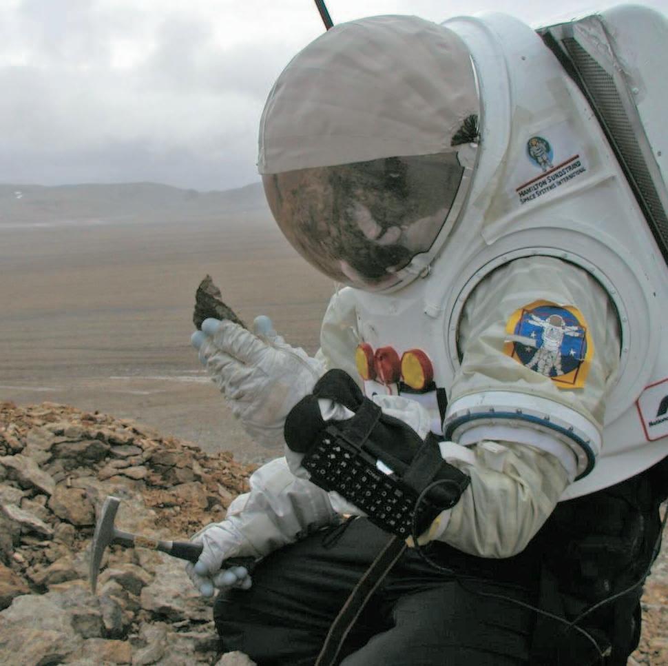
Mars in Canada:
The NASA Haughton-Mars Project,Devon Island,Nunavut
SPEAKER
Dr.Robert R.Stewart University of Calgary
11:30 am Tuesday,May 10,2005
TELUS CONVENTION CENTRE CALGARY, ALBERTA
Please note:
The cut-off date for ticket sales is 1:00 pm,Thursday,May 5th. Ticket price is $28.00 + GST.
The Haughton meteorite impact structure on Devon Island,Nunavut is a fascinating geological site as well as one of the most Mars-like places on Earth.Similar,but not quite as harsh as Mars,the Haughton crater is cold (average temperature –17°C),dry, rocky,and windy.The NASA SETI Institute has led a program of exploration,research, and habitation to the area for the last eight years.The goals of the Haughton-Mars Project (HMP) are to understand the biology and geology of this Mars analogue,in addition to learning how humans can live and work in such an environment.As part of the effort at Haughton,the University of Calgary Applied Geophysics Group has been conducting geophysical surveys,both ground-penetrating radar (GPR) and high-resolution seismic,for the last three summers.Objectives of the geophysical work at HMP are to image the permafrost layer (thought to be similar to that on Mars) as well as deeper geologic horizons.Developing near-surface imaging techniques on Earth and applying them on Mars missions should assist in understanding Martian depositional processes,chronologies, and possibly life-related anomalies.
Surveying conditions at HMP can be severe due to the high winds of the polar area (up to 100 km/hr during these field surveys),low summer temperatures (-10°C to +5°C),rain, sleet,and snow – even though this region is characterized as a desert – and significant ultraviolet radiation.Nonetheless,excellent GPR data,acquired using Sensors & Software NOGGIN and PulseEKKO devices,were recorded with 50,100,and 250 MHz antennae at various sites near the HMP camp. These surveys image depths from about 0.5m to 3m and indicate layering and permafrost events.High-resolution seismic results,using
a Geometrics 60-channel system and accompanying geophones,also show the permafrost layer.Shallow excavations,seismic refractions,and GPR reflections at the site all proved useful and indicate that the permafrost layer is at a depth of about 60cm. We also tested geophysical operations in prototype spacesuits and found the suits to be manageable although cumbersome.We expect that subsurface imaging techniques will provide valuable geological information on future robotic as well as manned Mars missions.
BIOGRAPHY
Rob graduated from the University of Toronto with a B.Sc.in physics and mathematics and completed a Ph.D.in geophysics from the Massachusetts Institute of Technology.He has been employed with the Chevron Oil Field Research Company in La Habra,California;Arco Exploration and Production Research Centre in Dallas,Texas;Chevron Geosciences Co.,Calgary; Veritas Software Ltd.,Calgary,and is President of GENNIX Technology Corp.
Since 1987,Rob has been a professor of geophysics at the University of Calgary and held
the Chair in Exploration Geophysics from 19871997.He is the director of the CREWES Project, an industry-university consortium studying advanced seismic methods supported by 25 energy and geophysical companies around the world.CREWES was honoured with the Society of Exploration Geophysicist’s (Tulsa) Distinguished Achievement Award in 2003.
Rob was President of the Canadian SEG in 199798 and recently received the CSEG’s Honorary Membership Award.In 1999,he completed the SEG’s inaugural Distinguished Educator Program: a 6-month lecture tour - teaching and consulting in 13 countries.He has served as a member of the Canadian Space Agency’s Space Exploration Advisory Board,The California-based Mars Institute,the Association of Professional Engineers,Geologists,and Geophysicists of Alberta (APEGGA) Council,and University Technology International Inc.’s Board of Directors.He has led geophysical expeditions to Central America to apply radar and seismic techniques in archaeological searches and participated in the NASA Haughton Mars Project,exploring in the Canadian High Arctic.
MAY LUNCHEON
From deep water exploration to tar sand production: Bugs,biodegradation, and the origin of heavy oil
SPEAKER
Steve Larter
Department of Geology and Geophysics University of Calgary
11:30 am Tuesday,May 24,2005
TELUS CONVENTION CENTRE CALGARY, ALBERTA
Please note:
The cut-off date for ticket sales is 1:00 pm,Wednesday,May 18th,2005. Ticket price is $28.00 + GST.
Microbial action has destroyed or altered most of the world’s petroleum resources, producing heavier and more acidic crudes. While this has beenknown for a long time, the rates at which this happens,the reactions and organisms involved,and the nature of the alteration process have remained shrouded in
mystery.We now know that the major reactions involve microorganisms carrying out hydrocarbon-water reactions producing methane as a major end-product as well as heavy oil.We know that the processes take place under anaerobic conditions without the need for free oxygen and we know how fast the process happens.We have even isolated some of the DNA from organisms that carry out the processes.We think that the oil degradation floor at 80°C probably represents the base of life in the crust and it seems the microorganisms in the reservoirs are slowly evolved descendants of those deposited with the reservoir rather than organisms carried down from the surface into the reservoir.It typically takes up to about 10Ma to destroy the n-alkanes in crude oils causing commercial problems in deep waterproduction settings and the Canadian Tar sands could have reached the state they are in around 35Ma or less after reservoiring. The principle control on fluid properties such as viscosity or API gravity is the mixing of fresh oil into actively degrading oil contained in reservoirs.I describe how,using these concepts,fluid properties can be predicted predrill using basin modeling approaches.
The production of methane as a common major product during biodegradation of oils in deep reservoirs raises the exciting possibility that if this process could be accelerated,recovery of some of the heavy oil or tar sand bitumens or even residual oils in conventional oilfields,could be recovered as methane on production timescales.
BIOGRAPHY
Steve Larter is currently the Canada Research Chair in Petroleum Geology at the University of Calgary.Steve has held Professor positions at the University of Newcastle,UK,and the University of Oslo in Norway.Prior to this Steve worked for Unocal in California for many years from 1979 to 1986.Steve received his B.A.in Natural Sciences from the University of Cambridge in 1974,he then received his M.Sc. in Organic geochemistry and organic petrology in 1975 and his Ph.D.in Petroleum Geochemistry in 1978 from the University of Newcastle upon Tyne,UK.Steve’s main research interests include:Production of heavy oil, petroleum biodegradation,and petroleum and reservoir geochemistry,migration,and production.
DIVISION TALKS
SEDIMENTOLOGY DIVISION
Internal Architecture of an ancient,passive margin turbidite system, Upper Kaza Group, Windermere Supergroup, British Columbia
SPEAKER
Lori Meyer
Imperial Oil Resources Ltd.
12:00 Noon
Monday,April 18,2005
Nexen Annex Theatre
+15 Level, North of C-Train Platform 801 - 7th Avenue SE
Calgary, Alberta
Unconfined,sand-rich,basin-floor submarine fan deposits have been identified in the neoProterozoic Upper Kaza Group of the Windermere Supergroup at Castle Creek, British Columbia.Subglacial exposure at
Castle Creek has made this an excellent outcrop for determining lateral bed correlations without having to reconstruct or extrapolate correlations between measured sections that are significant distances apart.
Regional time slices through the Upper Kaza Group and equivalent stratigraphy in the southern Canadian Cordillera are interpreted to indicate a distal basin-floor setting for the Castle Creek study area with correlative strata becoming more proximal to the continental slope in a southeast direction.Detailed studies of the sedimentology and stratigraphy have identified three stratigraphic regions in the Castle Creek study area that imply a prograding basin-floor fan depositional setting with evidence of lateral shifts (axis to off-axis) in sedimentation.This large and continuous exposure provides both vertical stratigraphy and lateral facies correlations that can be used as an analogue for modern deep-water petroleum reservoirs.
BIOGRAPHY
Lori Meyer is a recent M.Sc.graduate from the University of Calgary,and is currently employed as a geologist with Imperial Oil Resources Ltd.
INFORMATION
Visit the Sedimentology Division Website at www.cspgsedimentology.org.
Talks are free – don’t forget to bring your lunch! Coffee and donuts will be provided.If you are interested in joining the Sedimentology Division e-mail listing which currently provides luncheon reminders,or if you care to suggest a technical topic or present a talk to the division, please contact Scott Rose at (403) 699-4780 or scott_rose@nexeninc.com.
ENVIRONMENTAL GEOLOGY DIVISION
Environmental impacts and management challenges of Oil Sands development
SPEAKER
Dan Woynillowicz
Pembina Institute
12:00 Noon
Friday,April 22,2005
Acquitaine Tower
2nd Floor Conference Room
540 – 5th Avenue SW
Calgary, Alberta
Alberta’s oil sands are increasingly being touted as the most viable source of oil to sate North America’s ever-growing consumption.With persistent instability in the Middle East and declining domestic reserves of conventional oil,the oil industry and governments alike are turning their eyes and ambitions towards the oil sands.In 2003, oil sands represented 54 percent of Alberta’s
total oil production and one third of Canada’s total oil production.The government of Alberta predicts that by 2005 oil sands production will represent half of Canada’s total production of crude oil,and by 2015 more than 2 million barrels per day are projected to be produced.While much emphasis has been placed on the economic windfall that this development will bring, increasingly attention is being paid to the environmental costs associated with the pace and scale of development.This presentation will introduce the numerous environmental impacts and management challenges posed by oil sands development.
BIOGRAPHY
Dan Woynillowicz is an Environmental Policy Analyst with the Pembina Institute’s Energy Watch Program.Mr.Woynillowicz has a B.Sc.in Environmental Science and is currently pursuing a Masters in Environmental Management degree at Royal Roads University.With a focus on Alberta’s oil sands industry,he is the Pembina Institute’s lead staff member responsible for
providing analytical review and critique of government policy and legislation,industrial project applications,and Environmental Impact Assessments.Mr.Woynillowicz is an environmental representative on several multistakeholder groups in the Fort McMurray area focused on environmental monitoring and management in the oil sands region,including the Terrestrial Environmental Effects Monitoring (TEEM) group and the Cumulative Environmental Management Association’s (CEMA) Surface Water Working Group (SWWG).
INFORMATION
All lunch talks are free.For information or to present a future talk for the Environment Division contact Andrew Fox at andrew.fox @megenergy.com
Thanks a Million to Talisman
Talisman Energy is making a solid investment in the future of the engineering profession in Alberta. Over the next 10 years, $1 million in Talisman scholarships will be awarded to Faculty of Engineering students at the University of Alberta. Talisman deserves top marks for developing outstanding talent in the energy sector.
The Faculty of Engineering at the University of Alberta and Talisman celebrate their shared commitment to higher education, innovation, and the best professional practice in engineering.
The University of Alberta’s Faculty of Engineering is among North America’s leading engineering research and teaching centres with 4,300 students, 30 research chairs, $73 million in annual research activity, over 120 new professors, several new buildings, and outstanding facilities. Visit www.engineering.ualberta.ca for further information.
Talisman Energy Inc. is a large independent upstream oil and gas producer with global operations based in Calgary, Alberta. Talisman is committed to investing in and supporting the potential of the people and communities in which it works, contributing over $4 million to hundreds of projects in 2004. Visit www.talisman-energy.com for further information.
HYDROGEOLOGY DIVISION
Carbon isotope geochemistry as an exploration tool:Examples from Central Alberta
SPEAKERS
Jim Letourneau
Big Picture Geoscience Inc.
Karlis Muehlenbachs
University of Alberta
12:00 Noon Thursday,April 21,2005
Encana Amphitheatre, 2nd Floor East end of the Calgary Tower Complex 1st and 9th Avenue SW Calgary, Alberta
Investigation of natural gas carbon isotope composition in shallow dry gas reservoirs overlying deeper hydrocarbon targets may reduce exploration risk.The detection of deep hydrocarbons using shallow direct hydrocarbon indicators – such as seepages – or geochemical anomalies is a common exploration tool.Carbon isotopes of natural gas components have been used to determine gas origin (surface casing ventflows,natural seepages,storage reservoir surface leaks),thermal maturity, reservoir compartmentalization,and to allocate commingled gas production.In Central Alberta,Devonian methane d13C values range from -40 to -50°PDB and shallow dry gas d13C from -50 to -65°.
PALAEONTOLOGY DIVISION
Ichnology and palaeoenvironments of a glacially influenced,marine and estuarine deposit: the Early Permian southern Sydney Basin,Australia
SPEAKER
Dr.Kerrie L.Bann
University of Alberta
7:30 pm
Friday,April 15th,2005
Mount Royal College Room B108
4825 Richard Road SW
Calgary, Alberta
The Lower Permian Pebbley Beach Formation of the Sydney Basin,Australia,
records sediment accumulation in shallow marine to coastal environments,at the close of the late Palaeozoic Gondwanan Ice Age. This succession is spectacularly exposed in clean,wave-washed coastal outcrops and contains an abundant ichnological data set. Previous interpretations have suggested an inner to outer shelf and slope environment of deposition.Detailed trace fossil and sedimentological analysis displays,however, characteristics that contradict a fully marine interpretation.Instead,the interval reflects the vertical superposition and lateral juxtaposition of brackish-water and fully marine units.Two facies associations are recognized.Facies association A consists of various marine deposits ranging from lower offshore,upwards through lower,to middle shoreface.The marine deposits contain evidence of wave domination and local
Vertical hydrocarbon migration from deep reservoirs may result in isotopically heavier shallow gases.Shallow natural gas samples from the Upper Belly River and Edmonton Group were collected in the vicinity of known Devonian hydrocarbon accumulations.These samples were analyzed for carbon isotopes and examined relative to their proximity to underlying Devonian pools.In some cases isotopically heavier (by 6-10°for C1) gases were observed in formations overlying Devonian hydrocarbon accumulations.Further investigation is required to determine the true origin of these anomalies.
fluvial influence,suggesting deposition in proximity to a contemporaneous delta. Facies association B consists of heterolithic estuarine channel fill deposits,estuarine basin fills,and estuarine abandonment deposits colloquially known as ‘billabong’ deposits.
BIOGRAPHY
Kerrie received her Ph.D.in ichnology, sedimentology,and high-resolution sequence stratigraphy,from the University of Wollongong, Australia,in 1999.She undertook a Post-Doctoral Research Fellowship at the University of Queensland in 2000,where she completed a research project sponsored by SANTOS & Oil Company of Australia focussing on the ichno-sedimentological re-evaluation of the Permian facies scheme of the reservoir intervals in the Bowen Basin,Queensland.Kerrie is currently employed as a Post-Doctoral Research Fellow in the Ichnology Research Group at the University of Alberta and is involved in several projects focussing on the application of ichnology to detailed palaeoenvironmental analysis,sequence stratigraphy,and its use in petroleum exploration.
INFORMATION
This event is jointly presented by the Alberta Palaeontological Society,Mount Royal College, and the CSPG Palaeontology Division.For information or to present a talk in the future please contact CSPG Paleo Division Chair Philip Benham at 403-691-3343 or programs@ albertapaleo.org.Visit the APS website for confirmation of event times and upcoming speakers:http://www.albertapaleo.org.
STRUCTURAL DIVISION
Structural evaluation from drill cuttings
SPEAKER
Peter Hews
Hara Consulting Ltd.
12:00 Noon
Thursday,April 21,2005
Petro-Canada
West Tower, Room 17G (17th floor)
150 6th Avenue SW Calgary, Alberta
Fractures,faults,brecciation,slickensides, crenulations,and duplexing are just some of the structural features that can be observed
in drill cuttings.A methodology for logging these features will be presented that will aid in the structural interpretation from an individual well.This technique is invaluable to geologists – both at wellsite and those that work with archived samples – explorationists and management.
We are not necessarily just looking for fractured reservoir rock but also trying to justify the placing of faults and folds in a given wellbore. Ultimately,this technique will help to interpret some of the complexities that Foothills drilling projects present.Through detailed quantifying and logging of the various structural features observed,a better understanding of the tectonic elements encountered in a particular section will be achieved.
BIOGRAPHY
Since 1976,Peter Hews has been involved with various aspects of hydrocarbon,structural,and sedimentary geology in western Canada,Europe, and the Caribbean.He has an M.Sc.from Carleton University in Ottawa and has worked primarily as an independent consultant,as well as at BP Canada and Continental Laboratories.
INFORMATION
Talks are free;please bring your lunch.Goodies and drinks are provided by HEF Petrophysical Consulting.If you would like to be on the Structural Division e-mail list,or if you’d like to give a talk,please contact Elizabeth Atkinson at (403) 296-3694 or eatkinso@petro-canada.ca.
Geomechanics of the Mallik gas hydrate reservoir, Mackenzie Delta,NWT
SPEAKER
Pat McLellan
Advanced Geotechnology Inc.
12:00 Noon
Wednesday,April 20,2005
ConocoPhillips Auditorium
(3rd Floor – west side of building) 401-9th Avenue SW (Gulf Canada Square) Calgary, Alberta
A comprehensive investigation of the in-situ stress regime and natural fracturing in the Mallik gas hydrate reservoir was conducted
as part of an international research project, led by the Geological Survey of Canada,that flow-tested natural gas from JAPEX/ JNOC/GSC et al Mallik 5L-38 in 2002.Vertical stress magnitude was determined with bulk density data from logs and cores.Minimum horizontal in-situ stress magnitudes were estimated from leak-off test data in the area and a profile of MDT micro-fracture stress tests conducted in Mallik 5L-38.The orientations of the principal horizontal in-situ stresses were determined from the local structural geology,regional borehole breakouts,deformed hole ellipticity,and shear velocity anisotropy.Natural fractures were identified on an FMI borehole image log within and adjacent to gas hydrate intervals in the well.Peculiar heat distribution patterns observed during the thermal stimulation test
April 24 - 26, 2005
Delta Regina Hotel Regina, Saskatchewan, Canada For more information, please call: (306) 787-7662 Canada or (701) 328-8000 United States
in the well are partially explained by the contribution of natural fractures.The presence of partially open,permeable,subvertical natural fractures in some of the gas hydrate-rich intervals,coupled with relatively low horizontal in-situ stresses,and slight overpressures,could have important implications for gas hydrate production from horizontal wells in this setting.Applications of this geomechanical data to evaluating wellbore instability while drilling and sand production risks in gas hydrate reservoirs will be demonstrated.
BIOGRAPHY
Pat McLellan is the president of Advanced Geotechnology Inc.(AGI),a petroleum engineering and geoscience consulting firm that specializes in geomechanics.He graduated with a B.Sc.(Eng.) in Geological Engineering in 1979 from Queen’s University and an M.Sc.in Geotechnical Engineering in 1983 from the University of Alberta.He previously held technical and supervisory positions in Petro-Canada and Shell Canada before founding AGI in 1994.Pat was a distinguished lecturer for the Society of Petroleum Engineers in 2002-03.
INFORMATION
All luncheon talks are free – please bring your own lunch.If you would like more information about future EPRD activities,please join our e-mail distribution list by sending a message with the title “EPRD list”to Matthew.Caddel@bp.com.
Saskatchewan Industry and Resources and North Dakota Geological Survey
2005 CALENDAR OF EVENTS
DATE: April 6-7,2005
EVENT: 2005 Annual Calgary Mining Forum
LOCATION: Ramada Hotel Downtown,Calgary,Alberta
INFORMATION: The 2005 annual Calgary Mining Forum will take place April 6-7 at the Ramada Hotel Downtown. As always,this mining-industry conference and trade show will include presentations by mineralexploration companies,services companies, consultants,and government geologists.The topics range from exploration methods to background science to specific prospects and investments opportunities.Short courses on exploration-related themes are also in the works.With low-cost registration,the usual Forum attendance is a mix of geologists,exploration and service companies,and investors.
Details are posted in the Calgary Mineral Exploration Group website www.meg.calgary.ab.ca; please also contact Paul Hawkins (phawkins@shaw.ca.403-242-7745) or Henry Lyatsky (lyatsky@telus.net,403-282-5873).
Western Canada and Alberta have a vibrant mining industry.
DATE: April 18,2005
EVENT: Understanding Natural Gas Markets
LOCATION: CAPL Office,Calgary,Alberta
INFORMATION: For more information please visit www.landman.ca
DATE: May 15-18,2005
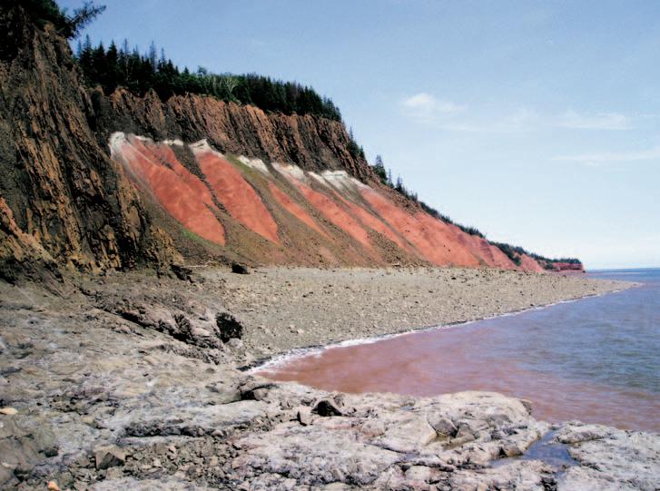
EVENT: Halifax 2005 - a Joint Meeting of the Geological Association of Canada,the Mineralogical Association of Canada,the Canadian Society of Petroleum Geologists,and the Canadian Society of Soil Sciences.
INFORMATION: The historic seaport provides a wealth of opportunities to investigate Nova Scotia’s heritage and culture,juxtaposed with all the amenities of a modern urban centre.Extensive seacoast exposures and a diverse geological history provide the backdrop for a rich technical program.The “Building Bridges” theme of the meeting is both symbolic of the harbour bridges that distinguish our Halifax –Dartmouth skyline,and a metaphor for the multidisciplinary program that is designed to bridge the gaps within geoscience,and between geoscience and society.
We look forward to providing you with the opportunity to discover the charms of our beautiful city and renew the ties that bind our geoscience community.
For more information please visit www.halifax2005.ca.
DATE: May 30-June 2,2005
EVENT: CSPG Continuing Education Field Trip:Triassic sedimentary framework and sequence stratigraphy.
LOCATION: Williston Lake,British Columbia
INFORMATION: Triassic strata are major hydrocarbon producers in the Western Canada Sedimentary Basin,particularly
in British Columbia.Excellent exposure of Triassic strata occurs along the shores of Williston Lake in the Foothills and Front Ranges of the Canadian Rocky Mountains.The Williston Lake field course centers around the sedimentologic and stratigraphic development of the Triassic succession in Western Canada.Excellent outcrop equivalents of all major producing subsurface units (Montney,Doig,Halfway, Charlie Lake,Baldonnel,and Pardonet) are observed and discussed.The Williston Lake trip occurs in a remote part of British Columbia. Participants are thus expected to be in reasonably good physical condition.Participants stay at the Ottertail Lodge near the mouth of the Nabesche River and visit Triassic outcrop exposed along the shores of Williston lake via jet-boat.For more information visit www.cspg.org.
DATE: June 19-22,2005
EVENT: AAPG Annual Convention in Calgary,Alberta –Exploring Energy Systems
LOCATION: Round-up Centre,Calgary,Alberta INFORMATION: For more information please visit http://www.aapg.org/calgary
DATE: August 8-11,2005
EVENT: Earth System Processes 2
LOCATION: Calgary,Alberta
INFORMATION: Sponsored by the Geological Society of America and the Geological Association of Canada. Web site:www.geosociety.org/meetings/esp2. Theme Session Proposal submission deadline: September 15,2004.Abstract submission deadline: April 26,2005.Description:International meeting, interdisciplinary focus.Earth’s surface environment is a complex web of feedbacks among the biota, oceans,atmosphere,lithosphere,and cryosphere. ESP 2 will discuss advances made in the last four years toward better understanding the nature of these feedbacks in the modern world,how they have emerged and evolved over the Earth’s history, and how they will respond to human perturbations in the future.
For more information,contact:Diane Matt, P.O.Box 9140,Boulder,CO 80301-9140 1-303-357-1014 (phone) 1-303-357-1074 (fax) dmatt@geogociety.org (e-mail).
DATE: November 13-17,2005
EVENT: SETAC North America 26th Annual Meeting
LOCATION: Baltimore,Maryland
INFORMATION: The Society of Environmental Toxicology and Chemistry (SETAC) will hold the SETAC North America 26th Annual Meeting at the Baltimore Convention Center in Baltimore,Maryland, November 13-17,2005.
This year’s theme is “Environmental Science in a Global Society:SETAC’s Role in the Next 25 Years.” More information can be found on the Society’s website:www.setac.org.
JACK PORTERVIGNETTES OF CANADIAN PETROLEUM GEOLOGY
Continued from the March Reservoir
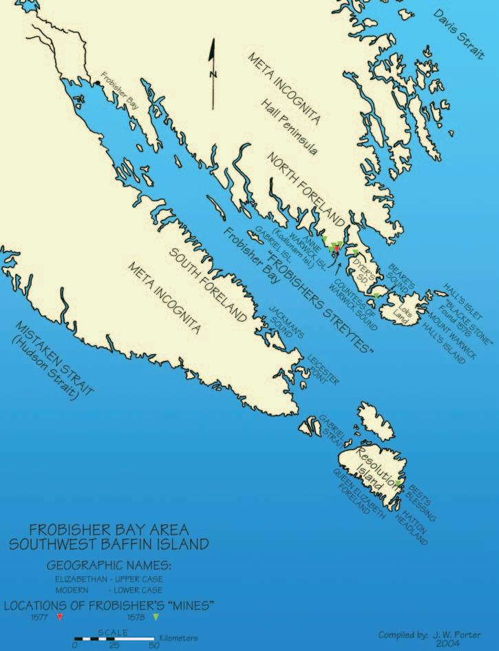
Martin Frobisher’s Third Voyage to his “Frobishers Streytes” to mine for gold
On August 9,some ten days following Frobisher’s arrival at Anne Warwick (Kodlunarn) Island,he appointed five of his captains to serve on a council to address the pressing problem concerning the construction of a large fortified house,slated to be situated on the island.Such a structure, when completed,was intended to provide shelter for the one hundred colonists, miners,tradesmen,soldiers,and seamen.It would serve as administrative headquarters for Edward Fenton,assigned to be the colony’s resident commander.
From the beginning of the council’s discussion,it was obvious that a start-up,at this juncture,was ill-advised,owing to the unanticipated events which had beset Frobisher and his fleet during the previous month.The extraordinary severe weather, which had taken this fleet off-course and into Mistaken (Hudson) Strait,with the resultant dispersion of half of his fleet’s ships,effected his delay of one month in the fleet’s scheduled arrival at Anne Warwick Island.The assembling of the modular frame skeleton of the house had been in jeopardy since an indispensable component,being half its frame,had been freighted by the Dennis when she was damaged by an iceberg and sank off Queen Elizabeth Foreland at the entrance to Mistaken (Hudson) Strait.Her fate was initiated by a violent storm which had commenced on the night of July 2,when the fleet’s thirteen vessels had proceed thirty miles into Mistaken (Hudson) Strait.The crews of the surviving ships had utilized beams,laths,and poles,which were subsequently destroyed or lost in the seamens’ attempts during the storm to fend off the threatening ice pans and icebergs.Some of these materials had also been destined for use in the construction of the house.
Of the eleven ships of Frobisher’s fleet which had reassembled at Anne Warwick Island,at the time of the council’s meeting,three were unaccounted for: Anne Frances,Thomas of Ipswich, and Moon.The latter contained,as part of its cargo,84 tons of beer selected for the colonists.Its copiousness would suggest that it was to serve,in part,as a panacea to ameliorate the effects from such a remote and unaccustomed environment.The two
other vessels carried coal,as part of their cargoes,so indispensable for the colonists’ survival.Notwithstanding the shortages, Edward Fenton proposed that he was prepared to remain with a reduced contingent of sixty colonists,providing a smaller version of the house could be completed prior to the departure of the fleet and that the three unaccounted ships would arrive with the beer,fuel,and various provisions.However,Frobisher and his council,after soliciting the opinions of the fleet’s master carpenters to ascertain the length of time it would take to complete a scaled-down replica,were informed that its construction would entail some eight to nine
weeks of concerted effort.With only three weeks of estimated time left before the fleet was due to depart for England,before freeze-up,Frobisher and his council had no other recourse but to agree to hold in abeyance the colony project until the following year (Ibid.:2001,McDermott,James – pp.233,234).
The natives inhabiting “Frobishers Streytes” were,understandably,awe-stricken when Frobisher returned with an inordinately larger fleet and their corresponding personnel.Based on his second voyage in which a fleet of three ships carried a total of
(Continued on Page 22...)
one hundred and forty-three men,one can extrapolate that his third voyage,utilizing fifteen vessels,could transport in excess of six hundred men,which included forty seamen,thirty soldiers,and thirty miners who would remain to contribute to the colony.No such fleet of its size had yet to collectively encroach upon Canada’s northeast coast,prior to the 20th century, unless it could have involved the Norsemen in their kaupships (broader and larger sailing vessels as opposed to their combined sailand oar-powered longships),who had explored the coast of Labrador (Markland), following the establishments of their settlements in Greenland (Friesland) (Ibid.:1963,Oleson,Tryggvi J.– pp.12,13, photo facing p.152).
Native groups were rarely sighted in the “Frobishers Streytes” region during Frobisher’s third voyage and usually as sentinels on hilltops.No contact occurred, apart from a meeting with several natives by seamen from the Gabriel near present-day Kimmirut,Meta Incognita Peninsula on July 16th.Their evasiveness,in the “Frobishers Streytes” area,stemmed from a fear of renewed retribution on Frobisher’s part, which he initiated following the abduction of five of his seamen during his first voyage. Frobisher’s retribution resulted in the kidnapping of a male native during his first voyage and during the following year,the seizure of another male,as well as a mother and her infant.Prior to returning to England, on both occasions,he had attempted to use his hostages for retaliation,but,unfortunately, an exchange was never effected.Whether the five seamen were released by the natives, only to perish,or were murdered,as revenge for the kidnapping and disappearance of their kin,remains a mystery to this day.The only tangible evidence relating to the fate of these English mariners was found during Frobisher’s return on his second voyage. George Best’s account of all three voyages in his publication entitled True discourse,records that on July 31,1577,Captain Yorke’s ship,the Michael,had drifted some twelve miles to the lee side of Jackman’s Sound to another bay, which the captain named Yorke Bay.The following day,on Captain Yorke’s return to Jackman’s sound,he reported to Frobisher at his flagship Ayde,that during the previous evening he had noticed,from the Michael,the presence onshore of a native encampment. After taking a landing party ashore,he found the camp had recently been deserted and assumed their occupants had fled in fear. However,on investigating the contents of their tents,he discovered,amongst fresh animal carcasses,a canvas doublet (16th century European man’s jacket),a girdle (encircling sash),and three unmatched (...Continued
leather shoes of varying sizes.The probing seamen were confident that these articles of clothing had been worn by some of their five compatriots at the time of their abduction. Their seizure had taken place at Hall’s (Loks Land) Island on August 30th,1576.The site of the natives’ encampment,containing the European articles of clothing,lay across “Frobishers Streytes,” a distance of approximately fifty-five miles to the southwest.
The following day Yorke,assisted by Master Hall of the Ayde and a combined party of forty gentlemen and soldiers,set out in two pinnaces to search for the occupants of the deserted encampment.After reconnoitering the coastal area,the natives in their kayaks, were eventually sighted in a restricted bay.In their attempt to escape to open sea,they were confined by their pursuers and were forced onshore where they were attacked by Yorke and his party.In the ensuing engagement,six natives were killed and a mother and her infant was captured.A second aged woman was also taken but later released.One of the soldiers,on finding the mother and her infant concealed in a rocky enclosure,shot an arrow at her,having mistaken her for a man.The arrow grazed the woman’s hair,but pierced her baby’s arm.Both were taken to the Michael where James Beare,who served as master as well as the fleet’s chief surgeon,applied salve to the infant’s arm.Interestingly,the mother removed the dressing and salve.She applied her own remedy which consisted of licking her baby’s wound,which primordial treatment proved to be successful. The revengeful seamen named the site Bloody Point following the slaughter of the natives on August 2nd,1577,during Frobisher’s second voyage (Ibid.:1975, Kenyon,W.A.– pp.58-62).
During Frobisher’s third voyage the natives, as expressed by their wariness,believed that Frobisher and his men would continued to harbour designs on further killings,as well as seizures,of members of their families. Rightfully so,for on August 14th,1578, Martin Frobisher,along with Captain George Best of the Anne Francis and a number of their seamen,utilizing three pinnaces,set out on a search and seize mission for any vulnerable natives,some of whom they believed had been surreptitiously observing their mining operations.After extensively reconnoitering some of the island in Countess of Warwick Sound,no natives could be observed.However,landing parties had found abandoned tents devoid of their dweller’s clothing,utensils,and weapons;the occupants having taken their possessions with them to a more secure habitat.A large
dart,found near one of the tents,was indicative of the native’s hasty retreat. Should Frobisher and Best had managed to have captured any natives,it was their intention to return with them to England (Ibid.:1975,Kenyon,W.A.– p.106).
During the month of August,Frobisher’s miners painstakenly hammered into manageable pieces 1,350 tons of “black ore” and “red ore” garnered from mines located near the shoreline of Countess of Warwick Sound,as well as those from outlying areas of “Frobishers Streytes.” The fragmented “ore” was hand carried in baskets by all available personnel,including the gentlemen who accompanied the expedition,and deposited in the holds of the awaiting ships to serve as ballast for their homeward journey.
Of the six mines which produced varying tonnage of “ore,” during Frobisher’s third voyage,four were to contribute the major portion of the cumulative yield.They were, in order of productivity:the Countess of SussexMine,located six and one-half miles northwest of Anne Warwick Island,which mine was discovered by Captain Gilbert
Yorke of the Thomas Allen ;followed by the Sussex Island mine in Beare’s Sound,located twenty-four miles southeast of the forementioned island and discovered by Master and Fleet Surgeon James Beare of the Michael .Denham’s Mount mine,whose site was six miles southeast of the reference island,was named after Robert Denham,the English “goldfiner” (assayer/alchemist),who apparently evaluated its worth.Best’s Blessing,the most distant mine,which yielded three hundred tons of “black ore,” was located ninety miles from Anne Warwick Island on a small island off Hatton’s Headland – the latter being the headland of Queen Elizabeth Foreland,represented by the southeast coast of Resolution Island.Two other mines,positioned in proximity to Anne Warwick Island,namely:Winter’s Furnace on Newland Island,situated two miles to the southwest and Fenton’s Fortune,located on the mainland and a distance of one mile,were both found to be disappointing and abandoned for other sites.The latter mine,discovered by Captain Edward Fenton,is the only mine which (Continued on Page 40...)
These three logs, taken from the same well, demonstrate the power of RECON’S industry leading technology. You have the evidence. The most complete picture from your open hole logs, only from RECON. Call: 51-RECON
Standard 33 samples/meter (1:240)
High-resolution
Ultra high data resolution 133 samples/meter (1:60) Available only from RECON
66 samples/meter (1:120)
The conclusive evidence is in RECON’S ultra-high data resolution open hole logs pinpoint thin beds.
SPRING TRAINING WITH AAPG!!
In addition to our exciting Spring Field Seminars, highlighted last moth, we have 3 Spring Short Courses to help you “get in shape” in your job skills!!
INTRODUCTION TO CONCEPTS AND TECHNIQUES OF PETROLEUM GEOLOGY
Date: April 4-6, 2005
CANCELLED
Location: Dallas, Texas
Tuition: $700 (increases to $800 after 3/7/05), includes course notes and refreshments, field transportation and box lunch on field trip day
Instructor: Susan M. Landon, Independent Geologist, Denver, Colorado
Who Should Attend
Geological technicians and other support personnel (landmen, attorneys, secretaries) with minimal background in geology who would benefit from an introduction to the principles of petroleum geology. Support staff are an integral part of corporate teams, and bet ter understanding of industry goals and petroleum geology will allow these individuals to make a more significant contribution to the organization.
QUANTIFICATION OF RISK - PETROLEUM EXPLORATION AND PRODUCTION
Date: May 16-19, 2005
Location: Denver, Colorado
Tuition: $995, AAPG members; $1,095, non-members (increases to $1095/1195 after 4/18/05), includes course notes and refreshments
Instructors: Mark McLane, Ray Young, Rose and Associates, Midland and Dallas, Texas, respectively
Who Should Attend
Course is designed for geologists, geophysicists, engineers, and their managers. The course is also helpful for financial advisors, corporate planners, accountants, and state and federal government individuals.
OVERVIEW OF THE SUBSURFACE PETROLEUM GEOLOGY OF NORTHERN SOUTH AMERICA: FROM MATURE ONLAND SUPERGIANTS TO OFFSHORE FRONTIERS
Dates: May 23-24, 2005
Location: Houston, TX
Tuition: $785, AAPG members; $885, non-members (increases to $885/995 after 4/25/05), includes course notes and refreshments
Instructors: Paul Mann, Alejandro Escalona, Jackson School of Geosciences, University of Texas, Austin, TX
Who Should Attend
1) Higher- and mid-level management at major companies pondering the question of where to explore in northern South America. Venezuela and Trinidad jointly are one of the leading suppliers of oil and gas to the US market and will continue to do so into the 21st century.
2) Entry-level explorationists at major or smaller companies and independent consultants faced with the task of quickly "getting up to speed" in this large and geologically-complex region.
AAPG CANADA REGION – VOLUNTEERS WANTED!
The Canada Region of the American Association of Petroleum Geologists (AAPG) needs you.If you are a member of the AAPG and interested in volunteering, please consider how you can assist.
Members of the Canada Region are wanted to serve on various committees,and if you are an Active,Honorary,or Emeritus Member of the AAPG you are also eligible to take advantage of one or both of the opportunities below.
1) Call for Nominations for Delegates,AAPG House of Delegates
The Canada Region is currently represented in the AAPG House of Delegates by fourteen Delegates from the Region,and there will be five vacancies in these 3-year positions for the coming term of office (2005-2008).There are also additional opportunities to serve as Alternate Delegates.
The House of Delegates of the AAPG is responsible for all legislative functions of the Association,within the scope of the AAPG’s Constitution and Bylaws.As a group,the
HOD is an influential body and serving as a Delegate is a great way to get involved in the workings of the AAPG.Canadian Region Delegates also participate in the Executive Committee of the Region.
Interested? Want more information? Want to submit your name – or that of another candidate? Then for any of these opportunities please contact the following (as soon as possible before April 30,2005):
Bob Phelps,Secretary/Foreman bphelps@cariboures.com 403-539-4328
or by mail:AAPG Canada Region c/o CSPG,160,540 – 5th Avenue SW Calgary,AB,T2P 0M2
2) Canadian Representative AAPG Advisory Council
The Canada Region of the AAPG is currently seeking nominations to fill a fouryear term representing Canada Region on AAPG’s Advisory Council.
The Advisory Council serves in an advisory capacity to the Executive Committee.They report on matters involving ethics and
EXECUTIVE COMMENT
Logging Society.This year’s annual convention,which will be held June 19-22, also promises to be an exciting event as the CSPG is hosting the convention on behalf of the AAPG.
With respect to conferences,our directive remains the same:identify opportunities for thematic,topical mini-conferences and collaborate with other societies on joint conferences.The 2005 Gussow Geoscience Conference,“Coalbed Methane:Back to Basics of Coal Geology”,was held in Canmore March 9-11 and was hosted by the CSPG in partnership with the Canadian Society for Unconventional Gas (CSUG), the Society for Organic Petrology (TSOP), and the Canadian Society for Coal Science and Petrology (CSCOP).Thematic sessions focused on various aspects of coal geology including petrology,sedimentary environments,case studies,and much more
(...Continued from Page 5)
with both a national and international perspective.There was a focused discussion of one of the hottest topics in the industry, all while enjoying the beautiful Rocky Mountains as a backdrop.
In closing,I thank all of the past and present volunteers of the various committees and sub-committees under the Program portfolio for your continued efforts and enthusiasm.Without this commitment,our membership would not enjoy many of the professional benefits offered through our conventions,conferences,technical luncheons,technical seminars,and continuing education that they do today.
Doug Hamilton CSPG Executive Program Director
BY S. HENRY WILLIAMS
discipline,long-range planning,constitutional review,nominations for officers and honors and awards,and other special projects as requested by the Executive Committee.
Members of this committee serve four years and include the immediate pastpresident and two former presidents,the immediate past chairman of the House of Delegates,elected members from the AAPG’s U.S.Sections and International Regions,and officers of each Division.For complete details about the Advisory Council,please refer to AAPG’s Constitution and Bylaws.
Generally,two meetings are held each year, one of which is in conjunction with the AAPG Annual Convention.In some years, extra meetings are held as required depending on special projects requested by the Executive Committee.
Further information can be obtained by contacting Canada Region’s current AC Representative,Marty Hewitt,at 645-2544 or marty.hewitt@encana.com or at the AAPG’s website aapg.org.
KEEPING TRACK
Simplifying Seismic
Chapter 4
Dr.Easton Wren
This is the fourth chapter in a series,which will explain the seismic business in simple terms.Designed specifically for geological personnel in the oil industry it should provide a forum for information and questions.This installment will focus on signal theory intrinsic to the modern world of electronic communication and the importance of the seismic signal (or wavelet) in the seismic process.
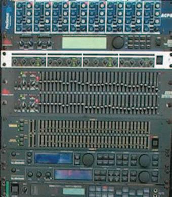
COMMUNICATION THEORY
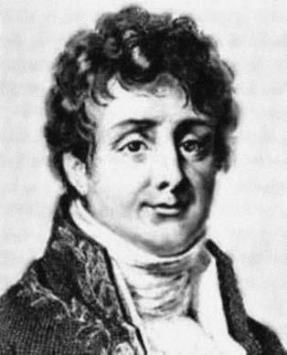
The modern world would be completely different without electronic communication systems such as home stereo systems, satellite links for television,mixing boards (Figure 3-1),cellular phones,etc.This electronic universe is the result of the work of the French mathematician Joseph Fourier (1768-1830),who developed the mathematical formulation of signals,signal attributes,analysis and synthesis (Figure 3-2).
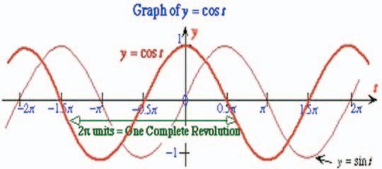
The Fourier Transform and the Inverse Fourier Transform are the mathematical contributions that shaped the world of communication (signal) theory.Fourier recognised the significance of signal amplitude,frequency,and phase and we shall see how these attributes are intrinsic to seismic interpretation.He discovered that all signals are made up of bundles of frequencies of different strengths (amplitude),which are misaligned (out-of-sync) with each other (phase).Any signal could be distinguished on the basis of its attribute characteristics (Figure 3-3).
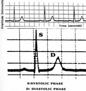
All signals carry information. The digital signal on a cable TV system carries information, as does the cellular phone. An electrocardiogram provides a doctor with detailed information about the condition of the patient’s heart and therefore provides a painless monitor.Well logs contain a daisy chain of signals strung together to give a continuous record of the variations of rock
parameters in the borehole.Seismic signals carry information with respect to the travel time,which allows the geophysicists to map the depth to the signal event;the amplitude of the signal,which contains discrete
information about the rock type,the percentage of pore-space,the pore geometry,and the fluid in the pore (oil,gas, or water);the signal frequency,which defines our ability to resolve small or thin pay targets;and the signal phase,which facilitates calibration of seismic data with well logs through the use of synthetic seismograms.
SIGNAL ATTRIBUTES
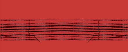
We are concerned with three attributes of a seismic signal – namely amplitude,frequency, and phase.Of these,amplitude is the most familiar since it represents signal strength such as in the use of the volume control in a home stereo system,where the amplification of sound reflects the decibel increase;the strength of a heartbeat on an electrocardiogram,measured in microvolts (Figure 3-4);or in the height of a wave in an ocean storm or a gentle ripple in a pond.In each of these examples,the stronger the amplitude the more energy there is in the signal.Seismic signal amplitude is carefully measured in the field by the geophone and this measurement must be preserved so that amplitude interpretation can be done properly.
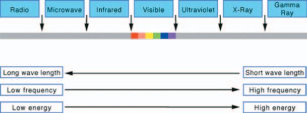
Signal frequency is not so intuitively obvious.Frequency by definition is the number of times something repeats in one second,measured in hertz.It is inversely proportional to wavelength,such that long wavelengths have low
Figure 3-1.Mixing board used to digitally adjust components of the acoustic signal.
Figure 3-3.Acoustic signal attributes.
Figure 3-2.Portrait of the French mathematician Joseph Fourier.
frequency and vice-versa.An individual’s pulse rate is usually about 60 times per minute or once per second,or equivalent to one hertz.With exercise,this may increase to 180 times per minute or three times per second,equivalent to three hertz.In sound, we are dealing with much higher frequencies – up to 17,000 hertz – for the human ear. Colours of the spectrum vibrate even faster, up to six million times per second in the case of the primary colour red.For comparison,well logs range up to 30,000 hertz while seismic,as described in Chapter 3,is severely band-limited to about 100 hertz. The electromagnetic spectrum gives the best illustration of frequency ranges and their corresponding wavelengths (Figure 3-5).
Phase is the most complex of the attributes in practice.It is interesting that an anagram (using the same letters to make a different word) of the word “phase” is “shape”.This mnemonic is most useful and coincidental, since it allows the concept of phase to be explained in simple terms.A signal,which has vertical symmetry of shape is referred to as zero phase – or more correctly,zero degrees of phase.If it is inverted,i.e.,rotated by 180 degrees so that it is upside down,it has been phase-shifted or distorted.If it is rotated by the same amount again it is now back to vertical upward,and back to zero degrees.Any incremental rotation or shift such as 90 degrees or 120 degrees,etc. produces a different shape of the signal, hence the expression phase or harmonic distortion.Phase is therefore a measure of the deviation in shape of a signal away from symmetry,measured in degrees.The word “phase” is used in the English language to describe mutual agreement,such as “we are in phase with each other” or disagreement, such as “we are 180 degrees out-of-phase”, i.e.,diametrically opposed.The zero phase signal corresponds to our definition of lognormal polarity while its inverse (180 degrees of phase rotation,or turned upside down) is our definition of reverse polarity.In other words when something is inverted it has a phase rotation of 180 degrees.
Phase is a most cumbersome concept and it is wise to let it sit and be absorbed by osmosis as examples of signal phase and their utilization are presented in due course. It is simply a measure of signal distortion –“harmonic distortion” to the sound engineer.
(Continued on
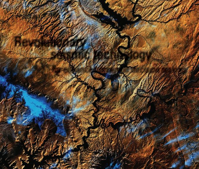
GigaViz Revolutionary seismic technology for enhanced reservoir decision making
Maximize the value of your large-scale 3D seismic data for smarter prospect generation.
Rapidly illuminate and interpret more quality prospects and decrease time to first oil all while lowering your total cost of ownership.
GigaVizTM scalable, cluster-based visualization, interpretation, and attribute analysis software provides rapid, interactive screening of massive volumes of seismic data utilizing unique volume rendering technology. Together with GeoFrame® integrated reservoir characterization system on LinuxTM, GigaViz covers the full spectrum of basin-scale workflowsfor exploration reconnaissance and hydrocarbon prospecting.
Enhance your interpretation understanding and prospect decision making through the immediate identification of key reservoir indicators—at any scale.
(...Continued from Page 29)
It should be obvious that this is the language of the electrical engineer and since geophysicists are trying to extract geological information from the seismic signal (wavelet) they,too,are in the signal business and use the same jargon and terminology.
The seismic signal is affected by its return journey through the earth to each geological boundary (Chapter 3).Thus the signal suffers progressive wear and tear and its condition at the geophone is severely damaged.This is referred to as convolution.The signal therefore must be repaired in data processing with the techniques known as deconvolution and migration.This is a critical step in the whole process since the signal attributes are vital in defining the rock type,
pore geometry,pore filling fluid,and pay thickness.If these attributes are not corrected,the interpretation will be flawed.
In a later chapter we will revisit the signal attributes and illustrate how each one gives very detailed evidence of the stratigraphic nature of the rocks and,in particular,how we can use the attributes in reservoir characterization.
Note:Questions on this and subsequent articles are invited.Please send any question by e-mail to the author at eastonw@ telus.net.A selection of questions with answers will be published regularly.
2005 WESTERN INTER-UNIVERSITY GEOLOGICAL CONFERENCE
The University of Saskatchewan is very proud to have hosted the 41st annual Western InterUniversity Geological Conference from January 6th to 9th at the Sheraton Cavalier Hotel in downtown Saskatoon.Over 230 enthusiastic undergraduate and graduate students from eight Western Canadian universities attended the three-day conference.Through technical sessions,poster displays,short courses,and guest speakers, students were provided with the unique opportunity to meet with their peers,industry delegates,and professors.
The technical portion of the conference consisted of a number of industry and student talks,as well as poster sessions.We were pleased to have Erin Crerar and Aaron Grimeau of the CSPG present their informative and interesting luncheon talk on ‘The First Five Years for a Petroleum Geologist.’ Through talks such as these, students had the opportunity to discover new and exciting information about geological topics,as well as realize the expectations that are involved in becoming a professional.Our career fair allowed students to approach
industry professionals on a personal basis and receive answers to questions to which they otherwise may have limited access.
Many students also took the opportunity to share their knowledge through the presentation of talks and posters.Although all of the student presentations were impressive, only a few winners took home the coveted prizes,and they are as follows:
1) Undergraduate Poster:Chad Glemser,U of S:‘Stable Isotope Evidence of Drought Cyclicity in the Yucatan’
2) Graduate Poster:Aaron Diefendorf,U of S: ‘Spatial Variation of Stable Isotope Values of Modern Irish Surface Waters’
3) CSPG-Sponsored Undergraduate Talk:Jana Hanova,U of C:‘An Analysis of the Eagle Butte Impact Structure (Alberta)’
4) CSPG-Sponsored Graduate Talk:Beverly Mack,U of M:‘ Palesol Development in the Devonian Snipe Lake Reef Complex,WestCentral Alberta’
5) Inaugural Canadian Sedimentology Research Group (of the GAC) for best Sedimentology Presentation:Beverly Mack,U of M.
Students not only had the opportunity to participate in the technical portion of our conference,but they also had the chance to experience a taste of Saskatchewan’s geology.Early morning tours to the Allan and Cory Potash Mines enjoyed much interest,as students were eager to get an underground view of the extensive Prairie Evaporite.Tours to the new Canadian Light Source were also popular,as students learned about the unique state-of-the-art imaging facility.Events such as the Icebreaker Night and Banquet and Dance Night provided a social atmosphere in which students further networked and shared geological knowledge.
Industry sponsors were fundamental in assisting the organizing committee’s endeavor.Through the help of sponsors such as the CSPG,the Western Inter-University Geological Conference continues to play a vital role in the continuing development of relations between students and their peers and industry representatives.
Figure 3-5.The electromagnetic spectrum.
Figure 3-4.Amplitude illustrated by an electrocardiogram.
BY AMANDA PERROT AND KEITH DODSWORTH, WIUGC 2005 CO-CHAIRS
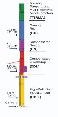
Fed up of drilling 20m of overhole for a logging tool?
Fed up of drilling 20m of overhole for a logging tool?
FOCUS from Baker Atlas requires just 10m of overhole.
The gamma ray measure point on the FOCUS triple combo (array resistivity, density, neutron, gamma ray) is just 9.76m. That saves you drilling time, and maybe even a bit. And logging at 18m per minute saves yet more rig time, by reducing logging times by as much as 40%. Combine that with the best data accuracy in the industry and that’s quite a deal.
FOCUS – efficiency and accuracy, every well, every time.
FOCUS Triple Combo 10.6m (34.5 ft)
ANNUAL AWARDS REPORT
Every year the Canadian Society of Petroleum Geologists and the CSPG Educational Trust Fund present an assortment of awards to deserving individuals for excellence in the science of petroleum and sedimentary geology,distinction in the field of fossil fuel exploration,high quality oral and written presentations,leadership in volunteerism,and exemplary academic performance at the graduate and undergraduate levels.This year, due to a change in presentation format,we will be highlighting each award in the CSPG Reservoir prior to their presentation at the Technical Luncheons.Please check back every month for a new Award spotlight.
We would like to extend our congratulations to the Medal of Merit winners who were chosen after the last article was written.The Medal of Merit presentation was at the technical luncheon on March 15th.
Congratulations to Jennifer Wadsworth,Ron Boyd,Claus Diessel,and Dale Leckie for their 2003 paper,“Stratigraphic Style of Coal and Non-Marine Strata in a High Accommodation Setting:Falher Member and Gates Formation (Lower Cretaceous),Western Canada” Bulletin of Canadian Petroleum Geology,v.51, no.3,p.275-303.
TSUNAMI DONATIONS
Tsunami Spare Change Collection:Thanks for your donations
Thank you to all who contributed to the “Spare Your Pockets and Free Your Change” Tsunami Relief Collection during the January, 2005 Technical Luncheons.Luncheon attendees took advantage of the spare change amnesty and saved their pocket linings by donating $316.70 over two January luncheon events.The CSPG made a donation on behalf of its members for this amount to the “Southeast Asia Earthquake and Tidal Wave Relief” fund of the Canadian National Red Cross.Thanks to those who were able to contribute to this campaign,and to the many members who made individual donations to their relief agency of choice.As the tsunami disaster fades from the headlines take time to pause and reflect on how much we as petroleum geologists depend on the Earth for our quality of life,and how quickly the Earth can also take so much away.
Thanks again for your support.
Jon Dudley Public Affairs Chair
BY DEBBIE HORBACHEWSKI, CSPG AWARDS COORDINATOR
At the April 14th technical luncheon the new H.M.Hunter Award will be presented.The H.M.Hunter Award was developed this year to acknowledge CSPG members who have provided long-term service to the society in a variety of capacities.Mr.H.M.Hunter was a founding member of the ASPG,and this award is named in honour of his work in the early days of the Society on the Executive and his subsequent volunteerism.
Our H.M.Hunter Award recipients this year are Leslie Eliuk and Clint Tippet.Leslie Eliuk has been volunteering with the CSPG since 1975 in various capacities,including sitting on the Sedimentology Division Committee for seven years,as a committee member and contributor for the Lexicon Committee, involvement in the Conventions,and most recently as a committee member for the Graduate Thesis Awards.Mr.Eliuk has been involved in over 10 committees and projects that the Society has benefited from.Thank you for your hard work and congratulations!
Clint Tippet has worked with the Society since 1981,on a wide range of committees and projects,including the Historical Publications Committee,the CSPG Calendar Committee,
Student Industry Field Trip,and the Education Committee,to name but a few.He continues to serve on the Archives and History Committee.Mr.Tippet sets an example to his fellow CSPG members by his hard work and dedication.Thank you for your effort and congratulations!
At the April 28th technical luncheon the President’s Award will be presented.Every year the President’s Award is presented to individuals who have contributed to the Society through outstanding service.This year the recipients are the three Co-Chairmen of I.C.E.2004,the joint conference of the CSPG, CHOA,and CWLS.Ian Moffat (CSPG),Daryl Wightman (CHOA),and Ken Farschou (CWLS) brought together and led a volunteer organizational team that worked hard to bring us an excellent opportunity to exchange knowledge and network.Please join us in thanking these gentlemen for their hard work in making this conference a reality,and their employers,Talisman Energy,UTS Energy Corporation,and Schlumberger,for providing support and understanding throughout this extremely busy time.
Congratulations to all and well done!
Now that the Bulletin collection has been digitized,we are moving on to our collection of CSPG Memoirs and Special Publications. The Communications Committee is currently asking for donations from the Memoir series.
If you have copies of Memoirs 1-18 that you are willing to donate to the digitizing project,please email jaime.croftlarsen@cspg.org.
(Please note that publications cannot be returned.) Your continued help on this project is greatly appreciated!
2005 AAPG ANNUAL CONVENTION
AAPG Canada Region Golf Tournament
Date: Sunday,June 19th
Time: 6:00 am (return times will be between 2:30 pm and 4:30 pm)
Location: Kananaskis Country Golf Course
Fee: US $180 + GST
(includes breakfast,power cart,prizes,lunch,non-alcoholic refreshments,and transportation to and from the Hyatt Regency Calgary)
Limit: 144 persons
Experience the Soul of Downtown Calgary (CSPG)
Date: Monday,June 20th Time: 7:00 pm – midnight
Location: Piq Niq Café and Beat Niq Jazz Club (8th Avenue)
Fee: US $40 + GST
(includes admission,appetizer buffet,live entertainment, and two alcoholic beverage tickets)
Limit: 125 persons
SOCIAL ACTIVITIES
Celebration of Alberta Centennial (CSPG)
Date: Tuesday,June 21st
Time: 6:00 pm – 11:00 pm
Location: Heritage Park Historical Village
Fee: US $50 + GST
(includes transportation,admission,buffet dinner,alcoholic and non-alcoholic beverages)
Limit: 1,000 persons
VOLUNTEERS NEEDED!
The American Association of Petroleum Geologist’s 2005 Annual Convention will be held from Sunday,June 19 through to Friday,June 24.Both student and non-student volunteers are needed to aid with various tasks during the convention. For those students willing to work one half day (4-6 hours) we will give you a $25 rebate towards your registration fee onsite.Students who work two half-day sessions (8-10 hours) will receive $25 and a LUNCH VOUCHER for each day of
volunteering.All funds to be paid out will be in US dollars at the end of each day!
If you are interested in a volunteer opportunity,please contact Peter Kouremenos at volcal@aapg.org or visit our website for more details www.aapg.org/calgary
Gather your friends and be a part of the 2005 Global Roundup experience – it’s a wonderful and easy networking opportunity!
AAPG FIELD TRIPS AND SHORT COURSES
BY ASHTON EMBRY, 2005 AAPG CONVENTION COMMITTEE
Very important components of the technical program of a geological meeting are the field trips and short courses.These provide the chance to learn in-depth about aspects of the geology of an area or new geological concepts and techniques.The upcoming AAPG convention offers CSPG members a wide selection of trips and courses which will be of interest to most of our members.A variety of field trips covers numerous topics including sedimentology,diagenesis, structure,coal bed methane,sour gas,and renewable energy.Some of the trips also include a core component.For carbonate enthusiasts there are trips to both a Devonian reef and the Mississippian succession.The dolomite trip will provide all the latest ideas on this topic,not to mention at a great windup dinner and debate at The Post in Lake Louise.The Cretaceous succession is well covered and trips will visit the Athabasca Oil Sands,Upper Cretaceous shallow gas reservoirs,the Belly River Group, and the latest Cretaceous to Early Tertiary assemblage.
The structure of the Foothills and adjacent mountains is the focus of four trips.The
Calgary to Golden transect provides an overview of the deformed belt.All explorationists searching for pools in the Foothills will be interested in the Turner Valley to Waterton trip which will focus specifically on the structure and hydrocarbon pools of that portion of the Foothills.Trips to Kananaskis and Moose Mountain will allow a detailed look at the structure and stratigraphy of these picturesque areas.
The trip to the coal beds of the Horseshoe Canyon Formation will provide those involved in coal bed methane exploration and production a chance to see their reservoirs in the flesh.The renewable energy trip includes a visit to a wind farm as well as a golden opportunity to visit the city dump to check out the state-of-the-art landfill gas operation. The sour gas and acid injection trip is also a technology-oriented adventure and offers the chance to visit a variety of operations.
THE TRADITION LIVES ON!
Immediately following the AAPG Annual Convention,the CSPG Core Conference is scheduled for June 23 – 24,keeping the theme Global Round Up:Exploring Energy Systems.
During the two days,25 – 30 core displays will be organized into 3 sub-themes:
It is anticipated that the 2005 CSPG Core Conference will set a precedent in terms of overall attendance because of the fact it immediately follows the AAPG Annual Meeting.
DATE & TIME:
Thursday,June 23 8:00 am – 4:00 pm Friday,June 24 8:00 am – 3:30 pm
LOCATION:
AEUB Core Research Centre (as it has been for the past 35 years)
FEE:
$40 CAD (includes entrance to Core Meltdown) Register online: www.aapg.org/calgary/
View of deformed Proterozoic strata at the leading edge of the Lewis Thrust sheet on Vimy Peak from the Bear’s Hump,Waterton National Park,Alberta. Photo courtesy of Glen Stockmal.
The short course lineup is especially diverse and there is literally something for everyone.Notably,a number of courses are being offered for the very first time.The ichnology course will involve substantial core examination and focus on the use of trace fossils for determining environments of deposition.A brand new course on carbonate sequence stratigraphy will provide the latest concepts and methodologies for correlating carbonate strata using sequence stratigraphic surfaces. It will be complimented by a similar clastic sequence course as well as an overview course on clastic facies.All the basics of
Middle Cambrian Eldon Formation exposed on the west face of Wapta Mountain in southeastern British Columbia.Buff-weathering dolomite occurs in two vertical pipes at left-centre and in stratiform geometry with abrupt dolomite “fronts”at the top right.Photo courtesy of Graham Davies.
petroleum geochemistry will be presented in a course that will demonstrate how geochemistry can greatly enhance exploration strategies and identify new plays.A course on water chemistry will provide everything you always wanted to know on this topic and will allow a much better understanding of DST data.Cap rocks can be just as important as reservoir rocks and a new course will look at their properties and how one can predict cap rock leakage.The course on geodynamic modeling of fold belts will be of special interest to the structural geology fraternity as will the course on fractured reservoirs. 3D seismic has revolutionized petroleum exploration / exploitation and the 3D seismic course will give geologists a very good understanding of this methodology which images the subsurface in beautiful detail.An overview course of coalbed methane will bring all participants up to snuff on this rapidly expanding exploration activity.There will also be an exotic course on the environmental issues associated with exploring and producing in the Rainforest.
I encourage you to look over the descriptions of the field trips and short courses in the recently distributed Convention Announcement Booklet.If you want to participate in one of more of these activities I suggest you register early because, given the projected attendance numbers, most will quickly fill up.I would also emphasize that it is not necessary to register for the convention to participate in these activities.You can register for the trips and courses on the AAPG site at http://www.aapg.org/calgary/ globalroundup.cfm.
Joint Meeting - Dalhousie University, Halifax, Nova Scotia
May 15–18, 2005
Over the past forty years, exploration in the Canadian Arctic and Atlantic sedimentary basins has resulted in the discovery and delineation of several active petroleum systems, with a number of major oil and gas discoveries under production. The “Petroleum Systems of the Arctic and Atlantic Margins” Symposium sponsored by the CSPG at Halifax 2005, May 15-18, is an ideal venue to bring together those exploring, producing, and researching in the region, to share their interpretations and insights with fellow enthusiasts. Petroleum-related conference field trips showcasing Nova Scotia’s spectacular geology will enhance its value to all participants. Some of the symposia (SM), sessions (GS, SS), courses (SC), and field trips (FT) of interest to CSPG members include:
FT-A2 Salt Tectonics and Sedimentation
FT-A5 Lacustrine Basins (Transtensional and Extensional)
FT-A7 Triassic-Jurassic Faunal and Floral Transition
FT-B1 Accretion of peri-Gondwana terranes
FT-B2 The Joggins section – Lyell’s Galapagos
FT-B6 Macrotidal Environments of the Minas Basin
FT-B7 Deformation Along a Contintental Transform Fault
GS-5 Sedimentology, Paleontology and Micropaleontology
SC-2 Thermochronology – Applications to Geoscience
SC-3 Sequence Stratigraphy for Students (Art Donovan- BP)
SC-4 Geodynamical Modeling (Chris Beaumont, Stockmal, et al)
SM-5c Stratigraphy and Petroleum Systems of Lacustrine Basins
SM-5d Paleozoic Basins in Eastern Canada
SM-5e New Insights for Exploration of Petroleum Systems
SS-5 Transpression and Transtension in Sedimentary Basins
SS-6 Thermochronology – Application to Sedimentary Basins
SS-8 Provenance of Sedimentary Rocks
SS-11 Sediment Instability – Coast to the Slope
SS-14 Big Rivers through Geological Time
SS-15 Coal-age Galapagos
SS-19 Assembling Avalon and peri-Gondawana terranes
SS-20 Ore and Hydrocarbon Systems
SS-21 Upper Paleozoic Basins
REGISTRATION
On-line registration is the preferred method. A downloadable, fax-in registration form will also be available at the conference website. Electronic registration will be available on the website beginning Monday, February 14, 2005. Early registration at reduced costs is available until May 6, 2005. All preconference registration ends at midnight May 6, 2005. Registration after that date will be onsite at the conference. Full registration instructions can be found on the website. The fee structure (in Canadian dollars) includes 15% HST. For more information:
CALL: (902) 424-2523
EMAIL: hfx2005@gov.ns.ca
VISIT: www.halifax2005.ca
ARCTIC GAS PIPELINES
MACKENZIE VALLEY GAS PIPELINE
Proponents submit applications
A much anticipated milestone in the 30-year long pursuit to bring Mackenzie Delta gas to market was reached October 7,2004,as Imperial Oil Resources,on behalf of the Mackenzie Gas Project co-venturers,filed applications for regulatory approvals to the National Energy Board (NEB).The partners in the project are the Mackenzie Valley Producers Group comprising Imperial Oil Resources (34.2%),ConocoPhillips Canada (16%),Shell Canada (11.2%),ExxonMobil Canada (5.3%),and the Aboriginal Pipeline Group (APG) (33.3%).The APG was created in 2000 to represent the ownership interest of the Aboriginal peoples of the Northwest Territories.
The project entails the construction of a 1,220-kilometre natural gas pipeline through the Mackenzie Valley to just south of the Northwest Territories/Alberta border, where it will connect with the NOVA Gas Transmission System.A 176-kilometre gathering system will collect gas from the three “anchor fields” – Taglu,Niglintgak,and Parsons Lake.From there,it will be delivered to a processing facility about 20 kilometres east of Inuvik.There,the liquids will be separated out and enter a smaller, buried pipeline in the same right-of-way as the main pipeline,along the east side of the Mackenzie River.This line will deliver the liquids to the Enbridge oil pipeline at Norman Wells.
The pipeline approval process is expected to take at least 18 months.Imperial says a decision on whether to go ahead with the pipeline has not been made.A final decision rests on receiving the necessary approvals, and assessing any conditions associated with the approvals,as well as other factors such as gas markets.If the project goes ahead,site development could start in the summer of 2006,followed by three years of camp, facilities,and pipeline construction.
The capital cost of the Mackenzie Gas Project is now projected to be over $7 billion,up from the $5 billion original price tag.Much of the additional cost is for the construction of the liquids pipeline.The main gas pipeline will have an initial design capacity of 1.2 bcf/d,expandable with additional compression to 1.9 bcf/d.The anchor-field owners have contracted for shipment of about 830 mmcf/d of natural gas on the proposed pipeline,leaving 370 mmcf/d capacity available for contract to
BY DONNA BURDEN, CANADIAN DISCOVERY LTD.
Proposed Mackenzie Valley Gas Pipeline System
other producers.While the pipeline design is still flexible,firm 15- or 20-year commitments will be required from potential shippers to allow finalization of the design.
Reserves
Together the three Mackenzie Delta anchor fields,Taglu (Imperial 100%),Niglintgak (Shell 100%),and Parsons Lake (ConocoPhillips 75%,ExxonMobil 25%), have proven reserves estimated at 6 tcf of
natural gas (NEB).A study recently completed for the pipeline proponents by consultants Gilbert Laustsen Jung Associates,estimates that total discovered and undiscovered gas resources of 16.7 tcf will be available to the pipeline over a 25year period under the planned pipeline design scenario of 1.2 bcf of gas per day. This resource is estimated from those fields likely to be produced first,namely those in the Basin Margin and Listric Fault Zone
(Continued on Page 38...)
(...Continued from Page 37)
plays of the Mackenzie Delta and shallow Beaufort Sea,and the Cambrian sandstone play in the Central Mackenzie Valley.
Timeline
August 2004: The Joint Review Panel (JRP) was appointed to conduct the environmental impact assessment of the Project on behalf of the Mackenzie Valley Environmental Impact Review Board (MVEIRB),the Inuvialuit Game Council (IGC),and the Canadian Environmental Assessment Agency (CEAA).
October 7,2004: The proponents filed their regulatory applications for approvals, supported by an environmental impact statement.Once the EIS is deemed complete by the JRP,a technical review and public hearings phase can proceed.
February 3,2005: The Joint Review Panel halted the environmental review claiming Imperial’s submission was incomplete regarding the impact the pipeline would
have on communities along the route. Imperial says it will respond as quickly as possible.
Spring and summer 2005: The JRP and NEB will jointly coordinate public hearings, after which the JRP will make recommendations to the NEB.
Fall and winter 2005/06: The NEB is expected to render a decision on the project.
Deh Cho Opposition
A number of issues could still slow or halt the progress of the pipeline.Of immediate concern is the apparent opposition by the Deh Cho First Nation,whose land claims and self-government agreements with the Federal Government have yet to be settled.The Deh Cho is the only First Nations group that has not agreed to the Mackenzie Valley Pipeline crossing its land,which covers the southern 40% of the route.Land ownership,revenue sharing,and Deh Cho representation on the
Joint Review Panel are the major outstanding issues that need to be settled.The Deh Cho launched two lawsuits in September 2004, seeking an injunction to stop the environmental review process.
ALASKA GAS PIPELINE
Recent developments
The effort to commercialize stranded gas from Prudhoe Bay on the Alaskan North Slope has also taken a giant step forward. On October 11,the U.S Congress gave the green light for construction of a $20 billion, 5,600-kilometre Alaska Natural Gas Pipeline.Originally part of an omnibus Energy Bill that was stalled in the Senate for nearly four years,Congress attached the pipeline authorization to the 2005 Military Construction Appropriations Bill.A controversial clause in the original bill to set a floor price for the gas was removed, ensuring an easy passage of the bill.Many stakeholders had objected to that provision,saying it would have given Alaska producers an unfair advantage.Included in
the new legislation are federal loan guarantees of up to $18 billion,streamlined regulatory procedures,and favourable changes to tax laws.
With the federal bill passed,Alaska lost no time in presenting a pipeline project proposal to the three major North Slope producers,BP,ConocoPhillips,and ExxonMobil.On December 15,the producers responded by putting forward a joint proposal to build the pipeline.Now that major federal hurdles have been cleared,the producers are looking for a clear fiscal contract with the state of Alaska, including concessions on taxes and royalties. Alaska Governor Frank Murkowski,who has been pushing hard for the pipeline project, has said that Alaska would be interested in taking an equity ownership interest in the pipeline.He is hoping to complete negotiations with the companies in time to present specific terms of a stranded gas contract for approval by the state legislature in the current session – that is,before the end of June.
The gas line,if it gets the go-ahead,has been described as the largest private construction project ever undertaken in North America. The expected route would follow the existing TransAlaska oil pipeline to Fairbanks,then along the Alaska Highway into the Yukon and northern British Columbia to Alberta,where it would connect with a system of lines into the U.S. Midwest.It would take about 10 years to design and build the line,which could supply 4.5 bcf of gas per day,currently about 7% of U.S consumption,for 50 years.It would allow producers to tap into known gas reserves of more than 35 tcf in the Prudhoe Bay oil field,where the gas has been reinjected for decades.Additional smaller discoveries,plus undiscovered reserves onshore and nearshore,push estimates of ultimate conventional reserves to the 100to 230-tcf range.
OTHER PROPOSALS
While the proposal by the North Slope producers would appear to have all the momentum,it is one of two currently being negotiated under the Stranded Gas Act. TransCanada Pipelines holds 27-year-old certificates under international treaties and Canada’s Northern Pipeline Act,giving it exclusive rights to build both the Alaskan and Canadian portions of the line.In June 2004,TransCanada filed an application under the Alaska Stranded Gas Development Act,and announced that it would proceed with an application for a right-of-way lease across state lands.The company says that once the right-of-way is
approved,it would be willing convey it to another builder under a commercial agreement in order to move the project ahead,as its main focus is on building the Canadian portion of the line.However,it is not altogether clear that TransCanada’s 1978 certificates will stand the test of time. Both the Alaska gas producers and rival pipeline builder Enbridge Inc.are challenging the validity of TransCanada’s claim to exclusive rights.Their position is that current technological and environmental standards make it an entirely different project than that envisioned in 1978.The producers and Enbridge want to build the Canadian portion of the line as a “greenfield project” under National Energy Board rules rather than what they see as the outdated Northern Pipeline Act (NPA). They claim that proceeding under the NPA will eliminate competition,increase costs, and delay the construction.Federal Natural Resources Minister John Efford says his department is reviewing the NPA before making a recommendation to the federal cabinet.
Meanwhile,back on the Alaska side,other pipeline companies are lining up.The state is carrying on discussions outside of the Stranded Gas Act with the Alaska Gasline Port Authority,among others.The Port Authority wants to pipe the gas overland to a proposed LNG facility at Valdez,and claims its proposal could get the gas to market in the shortest period of time.This proposal is seen as having considerable merit to politicians,as it would keep all of the estimated 6,000 jobs in Alaska.
OUTLOOK
Assuming the Alaska pipeline is approved quickly,most sources give it a completion date of 2014.The most optimistic estimate of completion of the Mackenzie Valley gas pipeline is 2009.
Most industry observers now believe there would be a ready market for both the Alaskan and Canadian arctic gas.The viability of either project could rest on gaining access to the growing spare pipeline capacity in TransCanada’s main pipeline system to eastern Canada and the U.S. midwest.If both pipelines go ahead,there will be competing pressure for that capacity, as well as for materials and manpower, which could push up the cost of the projects.In submitting their applications in October,the Mackenzie Gas Project proponents all issued cautiously optimistic statements.While significant hurdles still remain,we are significantly closer to seeing two major new gas-producing regions in the Alaskan and Canadian arctic.
INFORMATION
This article is condensed from more in-depth reviews by Canadian Discovery Ltd.For the full report or information on products offered by CDL,please visit www.canadiandiscovery.com or call 269-3644.
displays an adit,which was spiked into the vertical face of a massive wall of Proterozoic metasediments in order to facilitate the removal of “ore.” This adit was located,described,and photographed by W.A.Kenyon,of the Royal Ontario Museum,during his archaeological investigation in 1974 of Anne Warwick Island and neighbouring onshore mine and appraisal sites in Countess of Warwick Sound (Ibid.:1975,Kenyon,W.W.– p.144, photos p.145).The adit’s rectangular-shaped opening appears as a massive and tilted, obviously man-made,entrance,going nowhere – a desolate marker,created by Frobisher’s Cornish miners nearly 427 years ago;symbolic of a burial chamber, where Canada’s first gold seekers,with their unfulfilled aspirations rest.
The two mine sites on Anne Warwick Island,which had accounted for the greater part of two hundred tons of “ore” returned to England from Frobisher’s second voyage, had only contributed sixty-five tons to the aggregate removed from other mines during his third voyage.A small mine,known Winter’s Furnace on Newland Island, located one and one-half miles to the southwest of Anne Warwick Island,had supplied a minor portion of the two hundred tons freighted to England in 1577.
This mine appears to have been inactive during Frobisher’s third voyage.
The prospectors,who selected the potential mining areas,were invariably the fleet’s captains or senior officers.They would secure samples from solid bed rock exposures which,by necessity,were located near the shoreline of sheltered harbours or islands. The specimens were analyzed either on-site or at Anne Warwick Island by one of the fleet’s “goldfiners” (assayer/ alchemist). Utilizing a portable coal-fired retort (small furnace),the “goldfiner” would pulverize the rock sample,to which various mineral additives were mixed.By firing this compound,its volatiles would be dispelled and,hopefully,the residue would reveal traces of visible gold.It was obvious that unethical “goldfiners,” with their methodology shrouded in secrecy so as to prevent discloser,could “salt” their assays by introducing minuscule portions of gold or silver.
(On a matter of personal observation, prospectors exploring for gold,along the greenstone (chloritic andesite) belt north of Yellowknife in 1946,would use empty tin cans as improvised retorts,into which they would place pulverized samples of potential ore from veins of quartz-bearing diorite.By heating the
tins and their contents in wood fueled fires,the prospectors would hope to observe,in the residue,traces of gold.)
The fleet’s chief “goldfiner” was Jonas Schultz, whose assays’ results of one-hundred-pound bulk samples of “black ore” obtained from the two hundred tons mined during Frobisher’s second voyage,were subject to skepticism on Frobisher’s part.However,they were convincing enough to the Company of Cathay’s gold-fevered zealots to warrant an expanded task force for a third voyage to be lead by the dubious Frobisher.
Robert Denham,the English assayer and Schultz’s assistant,although somewhat suspect of Schultz’s assay result was,by his acquiescence,willing to accept them. Interestingly,Bernardino de Mendoza,the Spanish ambassador to England had, without the knowledge of the Company of Cathay,received a reliable account of Frobisher’s second voyage and,as well, specimens of the “black ore.” Spanish assayers concluded,much to the delight of King Philip II,that the metal “ore” contained was not gold but marcasite. Because of Mendoza’s familiarity with the 1577 voyage,Denham is alluded to have operated as a spy for Spain,but speculatively,he may have served as a double agent (Ibid.:2001,McDermott, James – p.246).
Canadian Well Logging Society
Past Publications on CD
Past Publications on CD has successfullybeen completed and CDs are now available for purchase.
Past Publications on CD consists of 611 CWLS papers published between 1951 and 2000.
This CD includes software that enables the user to search the pdf documents by title or keywords.
Just type the topic of interest and view the search results.
Cost: $50 for members and $150 for non-members.
To order, please contact the CWLS office at (403)269-9366.
The indiscriminate selection of potential ore bodies based solely on rock colour and their subsequent en masse or blanket mining by Frobisher’s miners would lead one to conclude that his “goldfiners” had little knowledge of the mode of occurrence of metallic ores.Gold- and silver- bearing quartz veins were,at the time,mined in the region of the Harz Mountains in Saxony and Bohemia. Geogius Agricola (Georg Bauer),a physician in the mining towns of Joachimsthal (15771533) and Chemnitz (1534 - 1555) took an absorbing interest in the mine-working methods of the region.In his classic publication De Re Metallica,he hypothesizes that the lodes were associated with fissures and veins,which he inferred,required selective mining (1954,Adams,Frank Dawson:The birth of the Geological Sciences, pub.Dover Publications,Inc.,p.185).The fact that such knowledge was either unavailable or ignored by the Company of Cathay’s financial backers seems incredulous,based on the dire consequences of Martin Frobisher’s second and third voyage to mine for gold in Meta Incognita.
To be continued....
Looking for a Geoscience Summer Student?
Consider hiring one from the ETF Student Industry Field Trip.
SIFT introduces bright young geoscience students from 31 Canadian universities to a unique immersion into the petroleum industry in Calgary.
Students are available from mid-May to late August. If you are interested in hiring a student, or if you would like more information please contact: Andrea Marsh EnCana Corporation Telephone: (403) 645-2924
Email: andrea.marsh@encana.com
We would like to thank the following companies for hiring a SIFT student in 2004:
RESEARCH COVERS 65 MILLION YEARS
The Canadian Society of Petroleum Geologists (CSPG) is helping a graduate student at Saint Mary’s travel back through time – back 65 million years ago.
Adam MacDonald,who is a geology major in the Master of Applied Science Program at the University,is the recipient of the prestigious CSPG Eastern Canada Graduate Scholarship. He is the only student in the entire region to receive this honour.The support will aid him in his research on the geological evolution of the Scotian Slope.
Only a handful of scholarships from the CSPG are awarded to students from across Canada on a yearly basis.This is the second year in a row that a geology student from Saint Mary’s has received a scholarship from this popular organization.
“It’s rewarding to come out on top,” says MacDonald during an interview from the Bedford Institute of Oceanography (BIO), which is Canada’s largest centre for ocean research.The BIO,located on the Bedford Basin in Dartmouth,Nova Scotia,is where the St.Margaret’s Bay native conducts his research.
“The scholarship will allow me to effectively probe the influences of sea level change,salt tectonics,and shelf-crossing glaciations on sedimentation patterns,stratigraphic architecture,and geometry of the Scotian Slope during the last 65 million years – a time period termed by geologists as the Cenozoic Era,” he says.
To facilitate this research,he is using state-ofthe-art computer technology at the BIO to interpret 3-Dimensional (3D) and 2Dimensional (2D) marine seismic reflection data while incorporating geophysical and biological information from offshore oil and gas exploration wells.Such a process will allow him to identify the transformations that have occurred in the Scotian Slope.
“The Scotian Slope is approximately 80,000 square kilometres,” explains MacDonald,who points to a computer-animated image of the Slope on a large computer screen in a lab at the BIO.“It extends 850 kilometres from the United States international border in the southwest to the Newfoundland boundary in the northeast.The average width is slightly less than 100 kilometres from the Shelf edge in 200 metres of water out to 4,000 metres of water.
BY PAUL FITZGERALD
MacDonald has stellar grades,an impressive track record in conducting geological field research,and other notable scholarships, which are the three key reasons he received a scholarship from the CSPG.He has worked as a student geologist for the Department of Natural Resources (Nova Scotia) and as a Saint Mary’s co-op student for the Geological Survey of Canada Atlantic.He has also worked as a geologist and geophysicist with Canadian Seabed Research.Through working with such well known organizations,he’s gained an abundance of experience.
“The highlights of my career have most certainly been my travels to sea,working and studying onboard research vessels and drill ships in almost every area of the eastern Canadian margin,and as far out to sea as the Sohm Abyssal Plains,” he says.
“Most recently,while working as a Saint Mary’s co-op student,I traversed the Canadian Arctic from the Beaufort Sea through the North West Passage,circled Baffin Island,and crossed Hudson Bay on an Icebreaker while participating in an international multi-disciplinary project called the Canadian Arctic Shelf Exchange Program (CASES),” he says.“CASES is an academically funded research project to assess the impact of global warming and climate change through combined oceanographic and natural
sciences.It was a great experience to work together with so many science enthusiasts on such an influential project.”
This summer he’ll be heading west to Calgary,Alberta where he will work as an intern geologist for EnCana Corporation. EnCana is one of the largest oil and gas exploration and development companies in North America.
He credits his success in the field of geology to a number of his peers – people like Drs. Pierre Jutras and Georgia Pe-Piper,both geology professors at Saint Mary’s,and David Piper of the Geological Survey of Canada.
He also holds a number of other awards,such as The Society for Sedimentary Geology/American Association of Petroleum Geologists Award,the Saint Mary’s Graduate Scholarship,and COSTA-Canada Continental Slope Stability Research Fund Graduate Scholarship.
After graduating from Saint Mary’s next year, MacDonald says his goal is to work for a well known organization where he can continue conducting research that relates to the geosciences.
The value of the CSPG scholarship is $1500.00.
The Golf Committee would like to acknowledge the CSPG for their long association with the tournament and for their ongoing support as a sponsor of this event.
AGAT Laboratories
Baker Atlas Wireline
Belloy Petroleum Consulting
Computalog
Devon Canada Corporation
Full Circle Systems Inc.
Geographix
GeoStrata Resources Inc.
GLJ Associates Ltd.
Kestrel Data Ltd.
M J Systems
Polaris Explorer Ltd.
Q-byte - a division of IBM Canada Ltd.
ReCon Petrotechnologies Ltd.
Reeves Wireline
Schlumberger of Canada
Solid State Geophysical
Tucker Wireline Services Canada Ltd.
Varco Canada Limited
Varidata
Anadarko Canada Corporation
AON Reed Stenhouse
Archean Energy Ltd.
Burlington Res. Canada Energy Ltd.
Canadian Soc. of Petroleum Geologists
Canadian Superior Energy Inc.
Continental Laboratories Ltd.
Core Laboratories Canada Ltd.
Divestco.com Inc.
Energy North Inc.
Enermarket Solutions Ltd.
Fort Calgary Resources
Genesis Corporate Search Ltd.
Geo-logic Systems
Global Link Data Solutions
Greystone Resources Ltd.
Jimel Oilfield Scouting Services Ltd.
McLeay Geological Consultants Ltd.
Meloche Monnex
Paramount Resources Ltd.
ProGeo Consultants
RGS Consultants Ltd.
RigSat Oil Field Communications
Sproule Associates Ltd.
Thunder Energy Inc.
Total E&P Canada Ltd. West Canadian
Arcis Partnership
Beaver Drilling Ltd.
Callera Energy Ltd.
Canadian Discovery Ltd.
CL Consultants
Continental Laboratories Ltd.
Hycal Energy Research
IEXCO Canada Inc.
Trevor Johnstone
Martin Quinn
Mi Casa Rentals Inc.
Nordin Resource Consultants
Akita Drilling Ltd
Crow River Resources
Delta P Test Corp.
Fekete Associates Inc.
Heather Oil Ltd.
Oleum Exploration ltd.
Pajak Engineering Ltd.
Petrocraft Products Ltd.
Petro-Tech Printing Ltd.
R E Newman Expl. Consultants Ltd.
Rana Resources Ltd.
Regent Resources Ltd.
Townsend Field Scouting Services Ltd.
Wavenrock Resources
Wild Rose Geological Services
Wildcat Scouting Services (1991) Ltd.
NAME:
SPOUSE’S NAME:
COMPANY:
ADDRESS (Bus.):
Registration Form
Hydro-Fax Resources Ltd.
Polaris Resources Ltd.
Sigma Explorations Inc.
Spirit Energy Inc.
POSTAL CODE:
PHONE: FAX:
E-Mail:
SHIRT
All contestants are required to have a photo (any will do) in the Golfer’s Photo Roster. New applicants or former contestants who do not meet this request are considered to have submitted an incomplete entry. Former contestants who have submitted a photo in the past need not do so again. Handicap / Golf Index __________________ or
Average of best three 18-hole scores in past 2 years:______________ If Index is less than 9.0, please provide your Club and Membership Number _______________________________________________
Entry Fee: Includes three rounds of golf with power cart, Paid driving range, Door prize draws, Skill prizes, BBQ (at Elbow Springs), and Awards Banquet (Calgary Winter Club) both for you and your guest.
Cost: $310.00 Tournament Fee
*The course requires all golfers in a tournament of this size to use a power cart. The $18.00/day per golfer cart fee is included in the cost.
To assist the Entertainment Committee with budgeting, please indicate if you plan to attend the two major social events of the tournament: Wednesday Barbecue: Self: Yes q No q Guest: Yes q No q Friday Awards Banquet: Self: Yes q No q Guest: Yes q No q
Make Cheques Payable To: Canadian Petroleum Geologists Open
For more information call Gerry Nyberg: Bus. 216-2510
E-mail: gnyberg@progressenergy.com or rnixon@glja.com
Entries must be received on or before MAY 6, 2005. Entries received after May 6, will be placed on the waiting list, no exceptions! All entries ranked chronologically. New golfers welcome. First come, first served, if space is available. Do not wait until the last minute to send in your entry.
NEWS FROM UNIVERSITY OF MANITOBA
Newest faculty takes name of distinguished graduate and entrepreneur
University of Manitoba announces naming of Clayton H.Riddell Faculty of Environment,Earth,and Resources and establishment of $10-million endowment fund
The University of Manitoba has named the Clayton H.Riddell Faculty of Environment, Earth,and Resources in honour of Clay Riddell,a prominent University of Manitoba graduate,entrepreneur,and exploration geologist.
A long-time friend and supporter,Clay Riddell has made a $10-million gift to the University of Manitoba to create an endowment fund to ensure the success of the Faculty,now in its second year of operation.
“Hopefully,I can help the new Faculty continue the University of Manitoba’s long tradition of training outstanding earth scientists who combine academic excellence with responsible environmental and social attitudes,” said Dr.Riddell, Chairman and Chief Executive Officer of Paramount Resources.
“The naming of a Faculty is a rare and significant honour,and one befitting of Dr.Riddell in every respect.His name is well suited to be associated with this innovative and progressive faculty.He is a distinguished graduate of this University, and an individual who brings originality, enthusiasm,and concern for the community.As a leader in Canada’s energy sector,he has demonstrated an exemplary combination of entrepreneurial spirit and environmental and social responsibility,” said Emöke Szathmáry,President and ViceChancellor.
“This wonderful gift gives the Faculty of Environment,Earth,and Resources an
unparalleled opportunity to establish ourselves as a premier Faculty in Canada and to promote excellence in teaching, research,and community service.As a new Faculty,the effect of Dr.Riddell’s $10million gift on our research and programs will be truly transformational,” said Leslie King,Founding Dean of the Clayton H. Riddell Faculty of Environment,Earth,and Resources.“Dr.Riddell’s investment in our professors,students,and programs will have far-reaching impact over time and throughout Manitoba,Canada,and the world.”
While it is common for business schools at Canadian universities to be named,it is less often the case in other disciplines.The Clayton H.Riddell Faculty of Environment, Earth,and Resources is only the second named Faculty at the University of Manitoba.The I.H.Asper School of Business was named on May 24,2000.
The $10-million endowment fund will provide significant support for long-term planning as well as funding to recruit and retain top-quality faculty members.It can also be used in matching grants to leverage funding from national granting bodies,to develop new areas of curriculum and course delivery,and to establish scholarships for outstanding undergraduate and graduate students.
The Faculty was established by the University Senate in 2001 and admitted its first students in fall 2003.Its units include the Department of Environment and Geography,the Department of Geological Sciences,and the Natural Resources Institute.The Faculty currently has over 400 students enrolled,with many more taking courses from its innovative offerings.More than 50 full-time faculty members make up the teaching complement,with additional expertise available as cross-appointments and adjunct professors from other units of the University and beyond.
The Faculty offers undergraduate Bachelor degrees in environmental science and environmental studies,a Bachelor of Arts in geography,and Bachelors of Science in physical geography,geology,and geophysics.Graduate degrees include programs in environment, geography,geological sciences,geophysics,and natural resources management.Doctoral programs are also available in geography, geology,geophysics,and natural resources and environmental management.
Clayton H.Riddell graduated from the University of Manitoba with a B.Sc.(Hons.) in Geology in 1959.He went on to become a pioneering geologist recognized for making a major impact on the future of Canada’s energy reserves.
In the 1970s and early 1980s,he discovered and developed major new gas fields in northeastern Alberta using basic geological principles,along with innovative interpretations of underground reservoir conditions and air-drilling technology. Building on this success,his company, Paramount Resources,continues to break new frontiers by exploring for deep gas in other areas of Canada and the United States.
The same skills and innovative thinking that opened up the gas fields in northeastern Alberta have more recently been applied to northwestern Alberta and the Northwest Territories,where Dr.Riddell’s company has already had exploration successes in what could prove to be a new major natural gas producing area.His work with Aboriginal communities,including the Deh Cho peoples of Ft.Liard,is seen as a leading example of cooperative resource development.Early in the exploration process,he established a strong working relationship with the community by providing employment opportunities to many local people.
As founder and CEO of Paramount Resources for 26 years,Clay Riddell is one of the longest-serving corporate leaders of a Canadian energy company.He continues to serve as the company’s Chairman and Chief Executive Officer.
The University of Manitoba honoured Dr.Riddell with the honorary Doctor of Laws degree in May,2004.
University of Manitoba Public Affairs
For further information,please contact: Chris Rutkowski (204) 474-9514
22ND CSPG SQUASH TOURNAMENT
BY COLIN THIESSEN, SQUASH COMMITTEE CHAIR
Calgary’s longest running squash tournament once again took centre stage under the CSPG banner from February 3-5th 2005.Thanks in large part to main sponsor Tucker Wireline and despite Mother Nature factoring into the equation,over 120 Earth Scientists braved the slick city streets and converged on the World Health Club.
Past rivalries were reborn,old friendships renewed,and it’s safe to say that a good time was had by all.A full compliment of divisions for both men and women meant that the emphasis for the event remained on fun but there was also keen competition for the serious players.
The Tournament committee lead by Colin Thiessen worked diligently garnering sponsorship,setting up matches,and making the necessary arrangements for use of the facilities. The year-over-year growth continued,and participants and sponsors were treated in the way they have become accustomed.
Highlights are too numerous to list.One must be in attendance to fully appreciate all that goes on both inside and outside the squash courts.
The Men’s A Final between Jon Cox and Dave Safton will no doubt be remembered as an alltime classic.Coming in a close second was the
SPECIAL THANKS...
ever popular Teams Tournament sponsored by Baker Hughes.The ‘Teams” as it’s called for short,allows those players that may have already lost out in their respective divisions another opportunity to take to the court.On Saturday afternoon teams of six play 5-minute matches against other teams with the team garnering the most points at the conclusion being declared the victor.Honorable mention goes to the “Sumo Death Match” played between Brian Fyke and Dell Pohlman.
This year the event had 10 students participate. Eight from the U of C and an additional two made the drive from Edmonton.Looking back, I’m sure many reading this article remember their first CSPG Squash Tournament and the contacts and friendships that were made.If there was one big winner during the course of the three-day event it would definitely be this year’s charity,the Educational Trust Fund.Over four thousand dollars were donated to the ETF as a result of beer,lottery,and a contribution by
Tucker.Hats off to each and everyone who supported this worthwhile venture and to Arcis Corporation for being the Taxi Chit sponsor.
On behalf of all involved,congratulations to all event winners and a special thank-you to each and every one of this year’s sponsors.Thank you to the committee for their efforts again this year, Jessie Mitton,Travis Brookson,Ryan Barnett, Dave Caldwell,Brian Fyke,Jolene Wood,Warren Dublonko,and Randy Smith.It’s this combination of sponsorship and participation that have made the event what it is today.
Special Thanks to the CSPG Squash Tournament & Tucker Wireline
The CSPG Educational Trust Fund would like to thank participants and sponsors of the CSPG Squash Tournament for their generous
support,and extend Special Thanks to Tucker Wireline for their kind donation.
Over $4000 was raised at the Squash tournament and kindly donated to the Educational Trust Fund to help support outreach activities.ETF Outreach programs encourage university students to consider petroleum geology as a career and help to educate the general public and K-12 students about the geosciences.
Special thanks to Colin Thiessen,Chair of the CSPG Squash Tournament and his organizing committee;Dave Caldwell,Travis Brookson, Jessie Mitten,Brian Fyke,Warren Dublonko, Ryan Barnett,Randy Smith,and Jolene Wood for their time and efforts in organizing this event and helping to raise funds for the CSPG Educational Trust Fund.
Baker Hughes Teams Tournament
Lot’s of fun was had by all
Maximum reservoir performance
Want to make the most of your valuable oil and gas reserves?
Roxar’s integrated technology solutions and services help companies of all sizes realize the full economic potential of their oil and gas resources.
• Innovative modeling and simulation software
• Downhole monitoring and control systems
• Reservoir production multiphase metering
• Reservoir and production consultancy
Roxar’s leading-edge technology solutions from reservoir interpretation through to production & process meet the changing needs of users in managing the entire reservoir lifecycle.