■ Understanding Reservoir Geometry helps Optimize your Waterflood
■ Understanding Reservoir Geometry helps Optimize your Waterflood
CSPG OFFICE
#600,640 - 8th Avenue SW
Calgary,Alberta,Canada T2P 1G7
Tel:403-264-5610 Fax:403-264-5898
Web:www.cspg.org
Office hours:Monday to Friday,8:30am to 4:00pm
Business Manager:Tim Howard
Email:tim.howard@cspg.org
Communications Manager:Jaimè Croft Larsen
Email:jaime.croftlarsen@cspg.org
Conventions Manager:Lori Humphrey-Clements
Email:lori.humphreyclements@cspg.org
Corporate Relations Manager:Kim MacLean
Email:kim.maclean@cspg.org
Membership Services:Sarah Barton
Email:sarah.barton@cspg.org
Reception/Administration:Tanya Santry
Email:tanya.santry@cspg.org
EDITORS/AUTHORS
Please submit RESERVOIR articles to the CSPG office.Submission deadline is the 23rd day of the month,two months prior to issue date. (e.g.,January 23 for the March issue).
To publish an article,the CSPG requires digital copies of the document.Text should be in Microsoft Word format and illustrations should be in TIFF format at 300 dpi.For additional information on manuscript preparation,refer to the Guidelines for Authors published in the CSPG Bulletin or contact the editor.
COORDINATING EDITOR & OPERATIONS
Jaimè Croft Larsen
CSPG
Tel:403-264-5610,Ext 227 Fax:403-264-5898
Email:jaime.croftlarsen@cspg.org
TECHNICAL EDITOR
Ben McKenzie
Tarheel Exploration
Tel:403-277-4496
Email:bjmck@telusplanet.net
ADVERTISING
Kim MacLean
Corporate Relations,CSPG
Tel:403-264-5610,Ext 229
Email:kim.maclean@cspg.org
Advertising inquiries should be directed to Kim MacLean.The deadline to reserve advertising space is the 23rd day of the month, two months prior to issue date.All advertising artwork should be sent directly to Kim MacLean.
The RESERVOIR is published 11 times per year by the Canadian Society of Petroleum Geologists. This includes a combined issue for the months of July/August.
Advertisements,as well as inserts,mailed with the publication are paid advertisements.No endorsement or sponsorship by the Canadian Society of Petroleum Geologists is implied.
The CSPG Rock Shop is an attractive and affordable way to target the CSPG readership. Spaces are sold at business card sizes (3.5” wide by 2” high).To reserve space or for more information,please contact Kim MacLean at 403-264-5610,ext.205.
The contents of this publication may not be reproduced either in part or in full without the consent of the publisher.
FRONT COVER
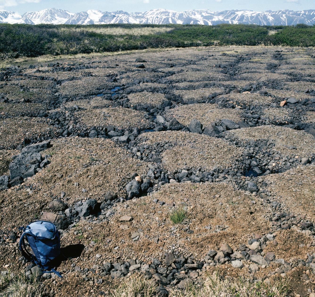
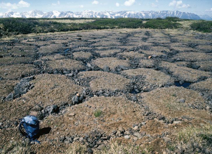
Mount Edziza, British Columbia. Sorted polygons on alpine permafrost. Such geometric patterns of sediment and vegetation are caused by the cracking, heaving, and size-sorting of sediments during freeze/thaw cycles. Photo by Jerry Osborn.
A little while ago I found myself engaged in a post-game conversation with a new member of our FOG (‘Fat Old Guys’) hockey team. He inquired about my schooling and I offered in response that I had a Ph.D.from the University of Ottawa in ...science.Well nobody gets a Ph.D.in generalized ‘science’ (an honourary D.Sc.maybe),and my piece of parchment clearly indicates a Ph.D.in geology.So why had I been so obtuse? The very sad truth is,and I admit this with great reluctance,I must have hoped that this new acquaintance would fill in the discipline blank himself and perhaps think my area of expertise was in a more exalted field like chemistry or physics.WOW! I might as well have backed the car over my own dog.That sin of omission weighed heavily on my conscience,and although it mostly was a reflection of the sad state of my own ego,at least a small part has to be attributed to how society mirrors back to us an image of our profession and the perceived importance of Earth Sciences.1
In general,I’m not entirely alone in having these nagging doubts.The graph below portrays the response of 238 industry-based geologists (mostly) and geophysicists to a 2004 CSPG survey question.Fully 30% did not consider themselves geoscientists,and another 30% were riding the fence.Why, pray tell,would such a large percentage of degreed individuals (25% or more with higher degrees!) who are currently working in their discipline,not consider themselves geo-scientists?
After some reflection on this issue,the thought struck me that my perspective was completely absurd.Furthermore I’ve decided,in a calm and introverted fashion, that I’m mad as hell and I’m not going to take it anymore!
GEOSCIENCE ROCKS!
If the earth sciences have an under-inflated image it comes largely from two half-truths. Firstly,a large proportion of geoscientists work in the non-renewable resource exploration/extraction field.2 Be it mining or petroleum,neither industry enjoys a particularly enviable reputation with the public.In many cases the public perception is very dated,and in other instances it is just plain wrong,but it’s out there folks! This was particularly brought home to me upon receipt of some short surveys taken the past two years with some 60 SIFT students, representing all areas of Canada.Arguably these 3rd-year students should be particularly predisposed to the energy sector – a biased sample if ever there was one.After all,these students are studying
THE CSPG GRATEFULLY ACKNOWLEDGES ITS CORPORATE MEMBERS:
THE CSPG GRATEFULLY ACKNOWLEDGES ITS CORPORATE MEMBERS:
ABU DHABI OIL CO., LTD. (JAPAN)
APACHE CANADA LTD.
BAKER ATLAS
BG CANADA EXPLORATION & PRODUCTION, INC.
BP CANADA ENERGY COMPANY
BURLINGTON RESOURCES CANADA LTD.
CANADIAN FOREST OIL LTD.
CANETIC RESOURCES TRUST
CONOCOPHILLIPS CANADA
CORE LABORATORIES CANADA LTD.
DEVON CANADA CORPORATION
DOMINION EXPLORATION CANADA LTD.
DUVERNAY OIL CORP.
ENERPLUS RESOURCES FUND
geoLOGICsystems ltd.
GRIZZLY RESOURCES LTD.
HUNT OIL COMPANY OF CANADA, INC.
HUSKY ENERGY INC.
IHS
IMPERIAL OIL RESOURCES LIMITED
LARIO OIL & GAS COMPANY
MJ SYSTEMS
MURPHY OIL COMPANY LTD.
NCE RESOURCES GROUP INC.
NEXEN INC.
NORTHROCK RESOURCES LTD.
PENN WEST PETROLEUM LTD.
PETRO-CANADA OIL AND GAS
PETROCRAFT PRODUCTS LTD.
PRIMEWEST ENERGY TRUST
PROVIDENT ENERGY LTD.
RPS ENERGY
SHELL CANADA LIMITED
SPROULE ASSOCIATES LIMITED
SUNCOR ENERGY INC.
TALISMAN ENERGY INC.
TOTAL E&P CANADA LIMITED
WEATHERFORD CANADA
GEOSCIENTISTS FOR OUR FUTURE
On behalf of the CSPG Educational Trust Fund (Trust) I would like to take this opportunity to express a sincere thank you to those individuals and corporations that have supported the Trust over the years through their participation,contributions,and dedication to our shared vision.
In recognition of our shared vision,I would like to provide you,our stakeholders,with an update as to the direction the Trust intends to take over the next several years.
Over the last year the Trust has seen donations of $107,048 from both corporate and individual donors.This amount includes sponsorship contributions that have been directed towards specific programs such as the Student Industry Field Trip or the CSPG Honorary Address.The Trust’s fund as managed by The Calgary Foundation currently has a value of just over $1 million dollars.The fund earned $42,074.37 of interest and investment income net of $11,215.12 in fees during fiscal 2006.Donations to the Trust have also come from the various social and sporting events that the Society sponsors and has amounted to $5,710.
The Trust’s mandate is to inspire individuals to pursue a career in petroleum geoscience through the funding of innovative,informative educational programs.A growing demand for energy,declining production of petroleum,and our aging demographic require an increasing number of qualified petroleum geoscientists.To address these challenges,the Trust recognizes the need to support programs that promote both community awareness of petroleum geology and the impact geoscientists have on almost every facet of our society.
public education at the K-12 level,as well as general public awareness of our profession.
The major university initiative to date,the Student Industry Field Trip (SIFT),has been extremely successful in attracting young, enthusiastic geoscientists into our industry. Going forward,the Trust plans to increase its exposure to the university student body through specific outreach programs that provide individual scholarships and departmental lectures on topics related to petroleum geoscience.
The ultimate test of our efforts will be seen in the number of new graduates that have career opportunities within our industry.To that end we are initiating a “100 Students Jobs Initiative” (featured in the July/August 2006 Reservoir) that will match students with summer job opportunities and provide both the employers and the employees the chance to learn what each has to offer.
The Trust supports general public education and K-12 with funding directed to various science educational programs.In order for the Trust to provide funding each program must make application and meet criteria specific to raising awareness of geoscience.The Honorary Address is a prime example of a CSPG-sponsored event that is directed toward raising public awareness of geoscience in general.Additional Trust-supported educational programs are the Burgess Shale Geoscience Foundation,the Calgary Science Centre,and the National EdGEO workshop program.The Trust’s challenge to date has been its limited ability to provide funding to all of the worthy programs that apply for the Trust’s support and the ability to fund more national programs.
With continued individual and corporate support,the Trust has the ability to fund its current programs.To expand upon this current program list,the Trust’s Board and the CSPG Executive have identified a number of university outreach and public educational programs that will require additional funds.
CORPORATE MEMBERS AS OF OCTOBER 12, 2006
In order to identify a career in petroleum geology as an option we must touch individuals at various stages of their education.The Trust will allocate the majority of its efforts towards university geoscience students and their faculties.In addition to university students,the Trust will also direct a portion of its support to
Through our geoscience community’s continued generosity and dedication,we will realize our shared goals and we will carry forward the legacy of our esprit de corps.
On behalf of the CSPG Educational Trust’s Board of Directors I thank you for your interest and continuing support of the Trust.
Bruce G.McIntyre,Chairman
RPSEnergy is an international consultancy providing support and advice on the development of natural resources,the management of the environment and the health & safety of people.
TECHNICAL LUNCHEONS
NOVEMBER LUNCHEON
Emerging plays in Saskatchewan: Shallow gas and the Bakken and Torquay formations,Southeastern Saskatchewan
SPEAKER
L.K.Kreis & M.Yurkowski Saskatchewan Industry and Resources
11:30 am Tuesday,November 7,2006
TELUS CONVENTION CENTRE CALGARY, ALBERTA
Please note:
The cut-off date for ticket sales is 1:00 pm,Thursday,November 2nd. Ticket price is $31.00 + GST.
Upper Devonian to Lower Misssissippian Bakken Formation shales in the Williston Basin are inferred to have generated and expelled at least 16 billion m3 (100 billion of barrels) of light oil (~40°API),but only a small fraction of this Bakken-sourced oil has been identified in,or produced from,Williston Basin reservoirs.Over the past few years,multi-lateral horizontal well
completions and large sand-fracture completions in low permeability reservoirs have resulted in significant new Bakken production in the Viewfield-Stoughton area of southeastern Saskatchewan.Careful examination of cores, geophysical logs and production data indicate a high potential for further development through horizontal completions in low permeability by-passed pay and in undiscovered reservoir sandstones of the Middle Member of the Bakken Formation in southeastern Saskatchewan.
In recent years,dolostones and dolarenites of the Upper Devonian Torquay Formation, underlying the Bakken Formation,have,for the first time,also proven to be productive along their subcrop edge in an area straddling the Saskatchewan-Manitoba border.In this area,large land positions have been taken in pursuit of 40°API oil from the Torquay Formation at depths of less than 1100m.
The past five years have seen a dramatic increase in exploration for shallow biogenic gas pools in low-permeability Cretaceous sandstones,siltstones,and shales in Saskatchewan.High gas prices have encouraged
NOVEMBER LUNCHEON
Commercial CBM production at Corbett Creek – from resource to reserves
SPEAKER
Mike Finn
Trident Exploration Corp.
11:30 am Tuesday,November 21,2006
TELUS CONVENTION CENTRE CALGARY, ALBERTA
Please note:
The cut-off date for ticket sales is 1:00 pm,Thursday,November 16th. Ticket price is $31.00 + GST.
This presentation will review the development history of the Corbett project from its inception in 2000 as a five-spot vertical pilot through to the current horizontal development scheme.We will look
specifically at the changes in exploitation strategy that were instrumental in converting the resource-in-place to proven reserves, including well design evolution,pad-based drilling,geosteering using 3D seismic,and geological controls on production.
Corbett represents the complex and iterative interaction between all functional disciplines to achieve continuous improvement of results and solve an increasingly detailed matrix of variables that ultimately affect production outcomes.It also showcases Trident's community development philosophy – asset-based community development – which is a strategy for working with communities to identify and act upon positions of strength – not weakness –to create win-win situations.This strategy has provided Trident with our social license to operate in an environment where the implications of coalbed methane development are misunderstood by stakeholders and industry.
industry to look beyond traditional gas producing areas of western Saskatchewan. Three exploration plays are emerging: 1) wildcat exploration of the eastern margin of the Western Canada sedimentary basin; 2) unconformity-related plays such as those associated with the Belle Fourche sandstone; 3) shale gas.The stratigraphic framework and petrophysical characteristics of potential gas reservoirs are not yet well understood.
BIOGRAPHY
Kim Kreis has worked as a petroleum research geologist with Saskatchewan Industry and Resources since 1983.Kim obtained both his B.Sc. and M.Sc.in geology from the University of Regina. His most recent research has been focused on the hydrocarbon potential of the Bakken and Torquay formations in southeastern Saskatchewan.
Melinda Yurkowski has worked as a petroleum geologist with Saskatchewan Industry and Resources since 1999.Prior to this she worked as a petroleum geologist in the private sector for four years.Melinda also earned both her B.Sc.and M.Sc.in geology from University of Regina.Her current research is focused on the geology of the shallow gas deposits of Saskatchewan.
PROUD SPONSORS
BIOGRAPHY
Mike Finn graduated from the University of Alberta in 1979 with a B.Sc.in Geology.Mike spent several years drilling Frontier projects in Northern Canada and offshore East Coast.His first exposure to CBM in the Western Canada Sedimentary Basin came at the end of the 1980s.During the 1990s he worked for a series of intermediate and small oil and gas companies on a large number of North American basins.This is where and when he worked with partners who were having success in the American CBM basins.Mike joined Trinity Energy in 2000,and commenced drilling on Mannville projects that year,including Corbett.In 2002 he joined Trident Exploration when they purchased the Corbett asset from Trinity.Mike Finn is currently the Chief Geologist and Director of CBM Assets at Trident, exploring for and developing Horseshoe Canyon and Mannville CBM.
DECEMBER LUNCHEON
The Great Asian Tsunami and its aftermath
SPEAKER
Alan V.Morgan University of Waterloo.
10:30-11:30 am
CSPG Annual Holiday Social Exhibition Hall Foyer
11:30 am Thursday,December 7,2006
TELUS CONVENTION CENTRE CALGARY, ALBERTA
Please note:
The cut-off date for ticket sales is 1:00 pm,Monday,December 4th. Ticket price is $31.00 + GST.
TSUNAMI!
On December 26,2004 most of the western world awoke to the fact that a massive force 9 earthquake had rocked the area from northern Sumatra to the Andaman Islands in
the Bay of Bengal.Over the course of the following hours and days,news began arriving of huge seismically generated tsunami waves that had pounded coastlines from Thailand to Sri Lanka,India,the Maldives,and even Africa. The death toll rose into the thousands,then tens and even hundreds of thousands;whole resorts had been lost,villages had disappeared,and people’s lives were changed forever.This illustrated talk explores the general origins of the tsunami;summarises,by the use of satellite images,“before and after” scenes of the devastation;and comments on some of the larger implications of tsunamis.
BIOGRAPHY
Alan V.Morgan was born in Wales and educated at the University of Leicester,the University of Calgary,and received his Ph.D.from the University of Birmingham,England.Following a post-doctoral year at the University of Western Ontario he became an Assistant professor,crossappointed between the Department of Environment Resources Studies and the Department of Earth Sciences,at the University of Waterloo.He is currently a Professor in the Department of Earth Sciences at Waterloo.
Dr.Morgan has promoted the public awareness of science for over 30 years,through over 750 outside lectures,three national tours,and addresses in Sri Lanka,the United States,and Europe.
Alan has received numerous teaching and service awards throughout his career,notably:
1.The Distinguished Teaching Award from the University of Waterloo in 1991,
2.The Bancroft Medal from the Royal Society of Canada in 1994,
3.The Robert H.Moss Award for Excellence in College Teaching from the National Association of Geology Teachers in 1995,
4.The E.R.W.Neale Medal of the Geological Association of Canada for outstanding efforts to communicate and explain the geosciences to the public in 1998,
5.The J.Willis Ambrose Medal of the Geological Association of Canada for sustained geological service to the community,and
6.The Waterloo Award (by the City of Waterloo) for communication of Science to the citizens of the Region.
Who gives you instant access to your proprietary & multi-vendor data sources in one query tool?
Divestco's GeoCarta Tools allows you to query and map all your proprietary and multi-vendor data sources using ESRI's robust GIS ArcView software. With the intensive query tool, comprehensive engineering tools and powerful reporting features, you can easily collect, display, analyze and interpret oil and gas data from multiple sources in one easy-to-use application.
The Veritas Experience
At Veritas, our experience minimizes your exploration risk. We deliver leading seismic imaging technologies and highly sought 3D and 2D seismic data. When location, qualityand experience are important, you can depend on Veritas. Calgary: 403.205.6000
LAND DEPTH IMAGING
Before spudding your next well, work with Veritas to obtain a superior structural image and experience the advantages of effectivecollaboration between interpreter and imager.
Expertise
>largest team of depth imaging specialists in Canada
>largest in-house geophysical R&D team in Canada
>most experience acquiring and processing Foothills and Deep Basin data Service
>dedicated processors, supported by industryrecognized imaging experts
>visualization facilities for effective QC and interactive analysis
>leverage communication and teamwork to achieve your goals adipiscing elit.
Technology
>advanced 2D and 3D model building tools
>anisotropic imaging algorithms designed for land data
>thousands of CPU nodes enable large throughput capacity
www.veritasdgc.com
IHS + PETRA®…
depthsinnovationsresults visions that exceed all others. now.
CONTOURING
Faultedcontours
Isopachs
Volumetrics
Gridoperations
Newflexingoptions
CROSS SECTIONS
NewUnassignedTops
Digitaland/orRaster
Geocolumnshading
Stratigraphic/Structural
Shadebetweencrossover
Dipmeterdata
MAPPING OPTIONS
ExpandedGISFunctions
Bubblemaps
Productioncharts
Logcurves
Posteddata
HighlightedSymbols
3D VISUALIZATION
Deviatedwellbores
Digitallogs
Gridsurfaces
Tops,ShowsandPerfs
Landgridoverlay
Mapimages
DECLINE CURVES
ComputeEUR,RR,etc.
Hyperbolicorexp.
Rate/TimeorCumP/Z
UserdefinedEcon.Limit
User defined Extrap.Time
How our vision supports yours
PETRA: Pioneer of easy, affordable PC solutions for today’s workflows.
IHS: The industry’s leading choice of E&P data and delivery systems to populate PETRA projects. The combination: Fast, confident prospect analysis for you.
Download a trial version at www.ihs.com/energy/petra, or call us at 888-738-7265 for more information. And stay tuned for more on our vision of streamlined data flows for prospect studies.
DIVISION TALKS
STRUCTURAL DIVISION
Do cratonic thermal histories record how lithospheric processes affect petroleum systems?
SPEAKER
Kirk Osadetz
Geological Survey of Canada – Calgary
12:00 Noon
Thursday,November 9,2006
Petro-Canada
West Tower, Room 17 B/C
150 6th Avenue SW Calgary, Alberta
Cratonic thermal history can be inferred using temperature-sensitive processes,such as organic maturation,mineral fission track annealing,and mineral gas retention.These processes are sensitive between 60-120°C, which is also important for hydrocarbon generation and reservoir diagenesis.The comparision of thermal histories from four basement profiles indicates that lithospheric processes affected Williston Basin petroleum systems.A deep profile from Sudbury,illustrates the slow and progressive cooling of the central
CALENDAR OF EVENTS
DATE: November 21-23,2006
EVENT: Yellowknife Geoscience Forum
LOCATION: Yellowknife,NWT INFO: www.nwtgeoscience.ca/ forum & www.miningnorth.com
The Glenbow Museum would like to acquire a cable tool bit.
If anyone happens to have something along those lines available to donate, please contact Doug Cass at:
Glenbow Archives (403) 268-4203 dcass@glenbow.org
craton as it was steadily and progressively erosionally denuded during the Mesozoic and Cenozoic.A profile from Pinawa Manitoba, provides indications of “basement” geothermal gradient variations during the Late CretaceousPaleogene and the late Paleozoic.The younger geothermal gradient anomaly occurs during Interior Seaway subsidence and sedimentation that others have attributed to lithospheric processes.The similar,but large,Paleozoic geothermal gradient anomaly is inferred to have a similar origin,perhaps related to Antler orogenesis.Two Williston Basin region profiles record thermal history variations below the Phanerozoic sedimentary succession.Like Pinawa,some Williston Basin regions,along the “keel” of the Elk Point Basin record a late Paleozic geothermal gradient anomaly that can be linked to lithospheric thinning.This event controlled Devonian and Carboniferous Kaskaskia subsidence and affected petroleum generation in lower Paleozoic source rocks. While conclusions are preliminary,our work suggests linkages among “far-field” plate interactions,cratonic lithospheric tectonics, sedimentary basin geothemal history,and petroleum system function.
BIOGRAPHY
Mr.Kirk Gordon Osadetz is Acting Director Geological Survey of Canada - Calgary and the Program Manager of the Earth Sciences Sector,Gas Hydrates - Fuel of the Future? Program.He is a graduate of the University of Toronto (B.Sc.,1978;M.Sc.,1983).He leads a Canadian Office of Energy Research and Development research project,is a collaborating partner investigator in a project funded by the Australian Research Council led by Dr.B.P.Kohn and Prof.A.J.W.Gleadow of the University of Melbourne.He has collaborated on two major research programs with the French Petroleum Institute and worked with Canadian companies to deliver a CIDA-funded,professional development and technology transfer program in China and Canada.He has served as Director-Treasurer, co-chair of the Technical Program committee, and as a member of several CSPG convention committees.Currently,he is serving a second term as an Associate Editor of the Bulletin of Canadian Petroleum Geology.Before joining the Geological Survey he worked at Gulf Canada Ltd.and PetroCanada Resources Inc.
(...Continued from page 5)
geoscience and must have had at least an introductory knowledge of the nature,and vital importance of,petroleum and mineral resources.Furthermore,the two-week educational trip they were on (and had readily volunteered for),was being underwritten by petroleum industry sponsors.Clearly,as influence peddlers we weren’t very successful.3 The above graph records the negative factors that these students are considering when thinking about a petroleum geoscience career.The environment was their primary concern.The lay public,I’m sure,has even greater misgivings.
Along with most human activity,resource exploration and extraction is inherently disruptive to the environment.Society demands its material products.As geoscientists,we aid the process of meeting that demand.No apologies offered or necessary.What is incumbent upon us is to ensure that we collectively (and individually) 1) minimize our impact on the environment,4 2) restore that environment when we have damaged it,and 3) reduce our own demands on the resources employed (e.g.,energy, water),wherever possible.It is our responsibility (in part) to educate the public on the very real challenges involved in resource extraction,but also to inform them that significant and successful efforts are being made to responsibly manage our environmental impact.A few examples amongst many would include low impact seismic,integrated land management (ILM), substantially reduced air emissions,the use of pad drilling,and the move to saline water source for tar sands.To be sure challenges
remain (more extensive bitumen mining,high well density resource plays),but we can take significant pride on the current environmental stewardship and on our continuous efforts to improve.
The second half-truth (actually closer to a myth) centers on the subject of purity and perceived academic rigor.The ‘natural’ sciences (another semantic nightmare) have traditionally comprised biology,chemistry, physics,geology,and mathematics.Of these, chemistry,physics and math are considered “pure” as they form the building blocks for all other sciences.I do not contest that a fundamental knowledge of these disciplines is very important,but this in no way makes geology or geophysics a second rate,or even derivative,science.The strength of Earth science (or Earth systems science),indeed what sets it above and beyond other disciplines,is it’s ability to integrate across all natural (including human) processes,and more importantly,to make sense of what are extremely complex systems as they operate and dependently interact through time.No other science has the moxie (or mandate) to tackle the scale and temporal dimension of the Earth processes that are of concern to geoscientists.At the very same time, our science has direct application to meeting basic human needs (water,metals,fuels). Astrophysicists are left behind in the cosmic dust!
Our science deals with the intersection of the abiotic and biotic,fluid and solid, philosophic and pragmatic.It is the ultimate holistic endeavor.As our species’ impact on this planet continues to grow,appropriate
mitigation of this effect will only come from knowledge-driven public policy. Earth systems science will be an integral and critical part of that knowledge base. In addition,if public policy in this regard is to gain acceptance,than it is important that citizens have a basic understanding of how this planet works and how its various parts interact! I would advocate therefore,that some form of mandatory Earth systems science be taught at the elementary and secondary levels.Imparting the big picture to students should be seen as an absolutely necessary complement to teaching the artificially siloed basics of pure science.
As has been said many times,our laboratory is the Earth.Lithosphere,asthenosphere, hydrosphere,biosphere,atmosphere – Earth sciences embrace them all.Our collective effort as geoscientists is to decipher and then build predictive models of the processes within,and the interaction between,these spheres! This understanding is both strategic and critical for humankind. In this age of global change on a resource-challenged planet,our science is not only relevant,it is simply vital.
So endth the sermon!
My tenure on the executive of the Canadian Society of Petroleum Geologists is now drawing to a close.In looking back I fear I gained far more than I gave.Lest accusations of embezzlement arise,let me clarify and indicate that my profit was in terms of friendships made,knowledge accrued,and satisfaction obtained from a memorable volunteer experience! I extend to the executives with whom I have served,and to the Society staff,a most sincere thank-you for your guidance and support.To the membership,please keep on volunteering and I’ll see you in the trenches.
Jeff Packard,Ph.D. GEOLOGY
1 For this editorial I have fully equated geoscience and earth science,although the latter term is in my mind more inclusive,and probably embraces geomorphology, climatology,oceanography,and other disciplines.
2 That being said,many also work in the renewable resource sector (groundwater)!
3 To be fair the survey was taken very near the beginning of the student industry field trip;the full court press hadn’t been implemented at that point!
4 And by environment I include not only the immediate landscape,but the subsurface (soil, shallow and deep aquifers),surface waters, and atmosphere.
PALAEONTOLOGY DIVISION
The evolution of calcium carbonate skeletons in invertebrates
SPEAKER
Holly Parkis
University of Alberta
7:30 pm
Friday,November 17,2006
Mount Royal College Room B108
4825 Mount Royal Gate SW Calgary, Alberta
Calcium carbonate skeletons in invertebrates are ubiquitous – from molluscs to arthropods,sponges to echinoderms – many of the major groups have representatives that protect and support themselves with calcium carbonate. It is an excellent skeletal material,both readily available in ocean waters and easy to deposit in a variety of forms.However, continuous,well-mineralized skeletons do not appear in the fossil record until the late Ediacaran and early Cambrian.It has been
proposed that this Cambrian explosion may be an artifact of the appearance of skeletons instead of an indication of the appearance of the Metazoa,but this still begs the question of why and how that skeletal material was being used.Several scenarios purport to explain this puzzle,including first,a facilitation of calcium carbonate deposition by certain changes in the chemical composition of the atmosphere;second,a need for protection as a result of increased predation;and third — and most likely — a combination of these factors,but a truly satisfactory answer has not yet emerged.
BIOGRAPHY
Holly is currently working towards the completion of her Ph.D.in the Department of
Biological Sciences at the University of Alberta. She studies plasticity in Pisaster ochraceus,the purple coloured starfish common along the coastline of western North America.
INFORMATION
This event is jointly presented by the Alberta Palaeontological Society,Mount Royal College and the CSPG Palaeontology Division.For information or to present a talk in the future please contact CSPG Paleo Division Chair Philip Benham at (403) 691-3343 or programs@ albertapaleo.org.Visit the APS website for confirmation of event times and upcoming speakers:http://www.alberta paleo.org/
KEEPING TRACK
GREG S.JONES from VP Exploration, Columbus Exploration Ltd to VP Exploration, Magellan Resources Ltd.
RYAN CARNEGIE from Junior Geologist, Columbus Exploration Ltd to Geologist, Magellan Resources Ltd.
JACK PORTERVIGNETTES OF CANADIAN PETROLEUM GEOLOGY
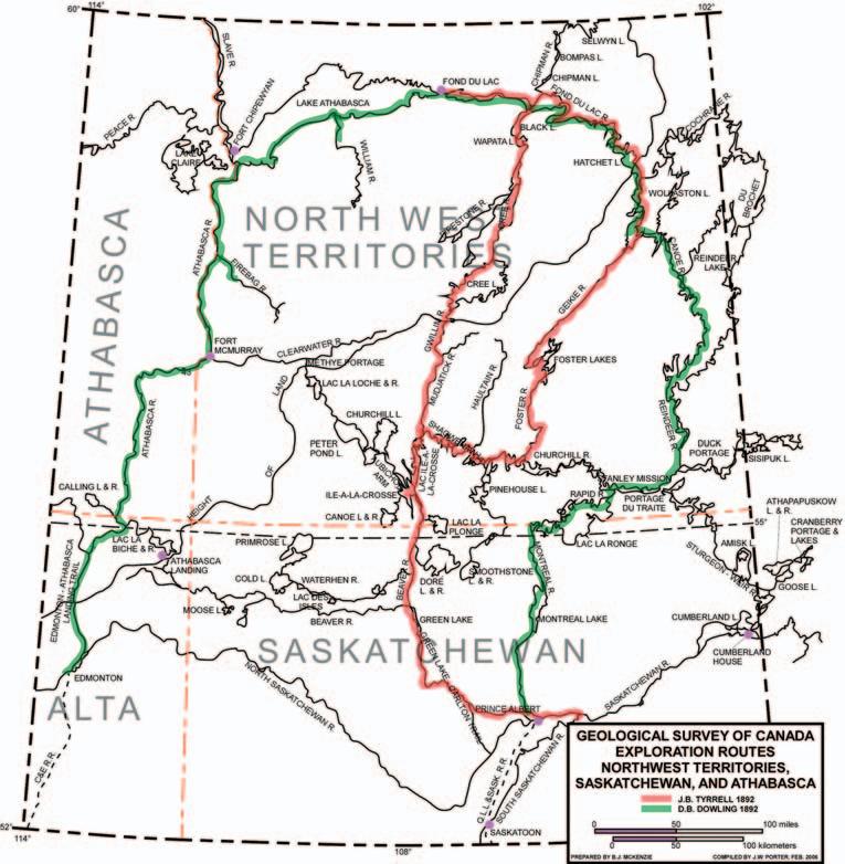
J.B. TYRRELL’S INTRODUCTION TO THE INTERIOR OF CANADA’S PRECAMBRIAN SHIELD
Following his party’s descent of Old Fort River,they proceeded north out of Old Fort Bay,a distance of 10 miles,where Dowling examined low-lying,horizontally bedded exposures of Athabasca sandstone. Continuing 43 miles northeast,brought his party to the mouth of William River, located halfway along Lake Athabasca’s coastline.The lower reaches of William River traverses an extensive sand dune complex extending landward for a distance of 14 miles;its provenance undoubtedly derived from the area’s exposed Athabasca formation.The river’s flat,delta sand plain forms the lake’s most pronounced promontory along its southern coastline.Dowling ascended William River for a distance of 17 miles, having examined outcroppings of flat-lying, horizontally bedded Athabasca sandstone, approximating heights of 100 feet, occurring along the river’s edge,12 miles above its mouth.
Thirty-one miles east of William River,at the mouth of an unnamed creek,Dowling gave a detailed description of an exposure of Athabasca sandstone which,to quote: “The section is 12 ft.10 in,in thickness, and is composed of:Light grayish-yellow to white sandstone,not very hard,in beds of 5 in.and 6 in.,splitting thinner.Cleavage cracks have broken the beds into blocks 1 to 2 ft.square,so that the whole falls easily.A few green nodules are found scattered through the bed----------7 ft. Thin shaly sandstone,green and red mottled,split readily into thin plates----5 ft. At the base a bed of light-coloured finegrained sandstone is found to contain many small disc-like nodules of irregular shape,of a light green cherty material------------10 in.” (Ibid.:1896,Tyrrell,J.B,Athabasca Lake and Churchill River – p.71D).
After continuing his traverse of the south shore of Lake Athabasca for an additional 16
miles,he and his party arrived at the mouth of the Beaver (MacFarlane) River,whose onshore area,like that of the lower reaches of William River,exhibited a complex of sand dunes.Dowling and his party did not attempt an ascent of the Beaver River.The proximity of the river’s mouth to a plateau,as expressed by the Fox Hills,had resulted in the Beaver River incising a short,but deep gorge into the Athabasca Formation. Consequently,the numerous rapids and falls, resulting from the steps and terraces of sandstone forming the river’s bed,prevented Dowling and his party from attempting to travel up its waterway.Fittingly,the English translation of the Chipewyan natives’ name applied to the Beaver River is Grand Rapids River.Proceeding 11 miles to the northeast of Beaver River,Dowling’s party arrived at Poplar Point.This site marked the abrupt narrowing of Lake Athabasca and this constriction continued to its limit,some 64
(Continued on page 33..)
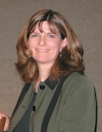
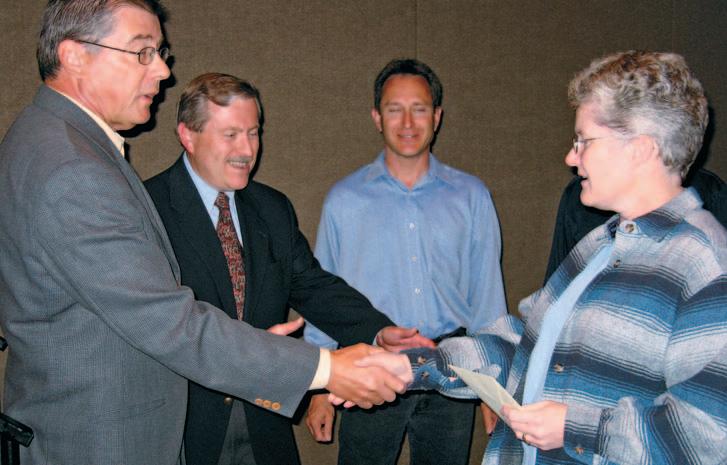
DEANNA WATKINS - CONGRATULATIONS & THANKS
BY TIM HOWARD, CSPG BUSINESS MANAGER
In September of 1988,Sheila Dylke,the Society’s original staff member,finally got some help in the office when we hired our second staff member.Deanna Watkins,who had,until then,been working as an EMT out of Strathmore,decided that the carnage on the province’s highways was worse than that in the Society office.Having been with us for the past 18 years,it would be safe to say that she was wrong in that assessment.
Over the years Deanna has become the corporate memory of our Society and it is with a great deal of trepidation that,as of September 1,2006,we surrendered her to the outside world.While Deanna is no longer working as a CSPG staff member,we have not entirely lost her services;she will continue
with us in a contract position looking after our bookkeeping.
When Deanna first came to the Society,the role of the office was dramatically different from that of today.Sheila and Deanna ensured that our membership database, which was just transitioning into electronic form,was up-to-date for mailing purposes; they looked after publications and technical luncheon ticket sales,and served as the principal Society information source.Nearly two decades later,most of the Society’s activities have at least some connection to the office and Deanna’s role over the years evolved from office manager to accounting, network guru,data system champion,and font of all knowledge-CSPG.
Most members will remember Deanna as the primary point of contact when either visiting or calling the office.But she is much more than just our longest-serving staff member. She is a truly eclectic individual and her tastes and personal achievements run the gamut of a modern day dilettante.
Deanna has,for years,played competitive hockey.She was playing ladies hockey long before it achieved the national status it enjoys today and has gone so far as to actually play in the NHL.Now,while that accomplishment is impressive in itself,it needs a little bit of amplification.Most of you will be surprised to know that there are actually two NHLs. There’s the one that is familiar to a few of us, with those multi-million-dollar prima donnas playing a questionable level of our national obsession,and then there is the other NHL, the one that features some of the best hockey this country has ever seen.Blinding speed,aggressive stick-handling,ruthless cross-checking,and really nice quiche lorraine after every game.Yes,since 1996 Airdrie’s Nutty Housewives League has benefited from Deanna’s skill,determination, and superb fund-raising ability.Broken ankles, battered ribs and ego,and bad hair days have not deterred her from supporting a league that today is international in scope and welcomes some of the best geriatric athletes in the area.From November to March the Society office is awash is the fragrance of Bengay.Deanna has even played in the CSPG tournament.
She is also an accomplished equestrian, competing in Gymkana and Hunter horse jumping.Her horse,Red,is affectionate,large and psychotic.Put the three together and you have recipe for stepped-on feet and faceplants.She is also a competitive curler and recently,she and her husband,Mike,have taken up golf.
In her younger days,Deanna was even a biker, touring much of North America with her folks.She’s been a swimming instructor and a lifeguard.She’s also one heck of a drywaller, electrician,and flooring technician.Mike appears to have found the perfect mate: cooks,cleans,performs CPR,and renovates.
She lends generously of her time, volunteering with Calgary Search and Rescue and,every second Monday,as a PALS volunteer,along with her golden lab,Niki, visits a local seniors home.Deanna would have us all believe she is hard-hearted,ironfisted technocrat,but when it comes to any
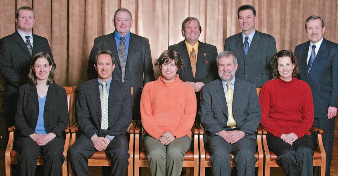
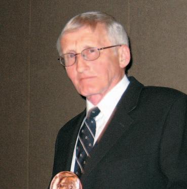
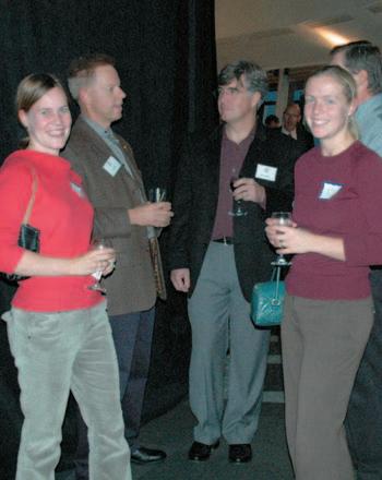
Gerry Reinson,Colin Yeo,Jim Reimer,Deanna Watkins,and Tim Howard
Gerry Reinson congratulating Deanna on her years of service.
kind of animal,she is a pussycat.Whether its raising money for the SPCA,saving cats like Alex and Tootsie from certain death,finding homes for wayward critters,crawling around in sewers to rescue kittens,neutering the alley-cat behind their home (he might have a different take on her benevolence),or spending a small fortune to re-assemble Niki’s back-end,Deanna is an animal-lover without match.
On the professional side,Deanna has proven herself equal to mastering virtually any task put to her;she applied her early bookkeeping experience to bringing order to the Society’s accounting practices back in 1996 when we brought our books in-house.She spent a number of years learning and re-learning new membership management systems as we worked our way towards our current program,iMIS.For those of you not familiar with membership data management systems, operating such an animal is akin to making a piñata out of a wasp’s nest - it’s death by a thousand stings.In fact it has likely been working with iMIS for the last five years that has prompted Deanna to bail on us.Beyond bookkeeping and data management,Deanna was our office jack-of-all-trades.She kept the office running smoothly,kept the computers functioning (no small feat in itself),and looked after all of our older members like they were family.
Deanna,we wish you well in whatever endeavours you may pursue.Certainly,if your track record with us is any indication of what your future holds,you will be successful.
Geology Petrel
Petrel* workflow tools provide a complete seismic-to-simulation toolkit— one solution uniting the subsurface domains of geophysics, geology, and reservoir engineering.
Geologists can use new modeling capabilities to better predict facies distributions, work with geophysicists to analyze structural uncertainties, and work with reservoir engineers to define a well placement strategy.
“It is like having an extra geologist sitting there, it’s telling you things that youdidn’t know, it’s testing your theories like you never saw before and helping you come up with new ideas.” David Hamilton, CEO, Subsurface Computer Modeling
With Petrel software, all work processes lead to one shared earth model, resulting in faster, better decisions.
sisinfo@slb.com
www.slb.com/petrel
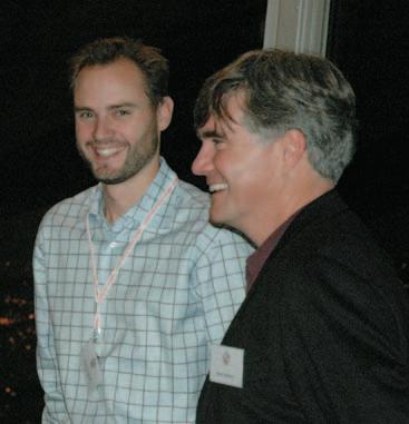
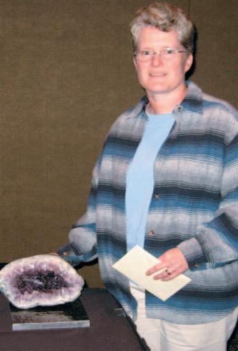
Deanna and a gift to remember us by.
YOUR CSPG STAFF: AN UPDATE
Over the course of the past several months the CSPG has experienced some significant staffing adjustments in response to both the operational needs of the Society and personal changes of some of our staff.For those of you who were able to attend the September 19th Technical Luncheon,you will be aware that Deanna Watkins,our longest-serving Membership staffer,has elected to leave the Society after 18 years and join the private sector as a consultant. Another column in this issue provides some detail on what Deanna will be doing.
While Deanna will continue to support the Society in a contract capacity looking after the CSPG,Trust,and Convention bookkeeping,she will be replaced in the Membership and Volunteer Management portfolio by Sarah Barton.Sarah had been serving the Society as the Convention Assistant.One of Deanna’s challenges during her tenure was to maximize the potential of our superb data management,iMIS while managing bookkeeping for the CSPG and a number of office functions.It became apparent that,as the demands of the Society increased,full-time attention to our data needs was required so we are pleased that Sarah will finally be able to devote herself exclusively to becoming our iMIS ‘Champion.’
We expect Sarah’s role as Convention Assistant to be filled in October,however, within the Convention & Conference cadre there are additional changes;beyond Sarah’s departure from Conventions,Lori will also be away for awhile on a maternity leave starting in December.In order to ensure as smooth and seamless a transition as possible in what is one of the Society’s largest evolutions,we have retained the services of Shauna Carson to replace Lori during her absence.Shauna joins us from the Calgary Exhibition and Stampede where she used to work with us each year in the delivery of our annual convention. She is no stranger to the Society or our annual event,nor she to us.We were fortunate in being able to lasso her.
For those of you who have either visited our new office or called since our move,you will likely have met or spoken to Tanya Santry. Tanya,who worked with us in support of our recent convention,has stayed on to take over Reception/Administration services with the Society.When you call the office, you will likely be talking to Tanya from now on.She is also assuming many of the office
duties that were heretofore done by all staff on an ad hoc basis.Since taking over,Tanya has done a sterling job of snapping the office into line,organizing and streamlining office administration,and once more putting a live voice to our telephone system.
The balance of the office staff remains unchanged.Tim Howard is our Business
BY TIM HOWARD, CSPG BUSINESS MANAGER
Manager,Kim MacLean is in charge of Corporate Relations,building a robust and consistent relationship with our corporate supporters,and Jaimè Croft Larsen holds down the Communications fort,looking after our many publications and our website,plus Public Affairs.
ASSISTANTPROFESSOR, PROCESS SEDIMENTOLOGY
DEPARTMENTOFEARTH AND OCEAN SCIENCES
THE UNIVERSITYOFBRITISH COLUMBIA
The Department of Earth and Ocean Sciences, University of British Columbia, seeks an individual with outstanding research and teaching capabilities for a tenure-track Assistant Professor position in the general field of process sedimentology. We especially seek an individual whose research is at the leading edge of his/her field. Examples include, but are not limited to, application of sedimentary geology or stratigraphy to environmental processes or natural hazards, paleo-environmental systems, biogeochemical and diagenetic processes of sedimentary systems, sedimentary facies modeling, physical sedimentary systems and the interface of sedimentology/stratigraphy with 3-D seismic for hydrocarbon-related studies. An individual who combines field-based research with a strong quantitative component is desirable.
The successful candidate will have a Ph.D. and preferably postdoctoral experience. He/she will have a demonstrated capability or potential to carry on an active, externally funded research program of international caliber and to supervise graduate students. An ability to contribute to the undergraduate and graduate teaching needs in the various programs offered by the Department, and a willingness to engage in collaborative research with Departmental colleagues, will be criteria for selection. The Department comprises a diverse and dynamic faculty of 46 scientists with research expertise in the solid and environmental Earth sciences extending from Earth’s mantle, through the crust, near-surface, oceans and atmosphere to the planets. For more information about the Department and its research and teaching programs, please visit our web site at www.eos.ubc.ca.
UBC hires on the basis of merit and is committed to employment equity. We encourage all qualified persons to apply. Canadians and permanent residents of Canada will be given priority. The position is subject to final budgetary approval. Although the appointment is advertised at the Assistant Professor level, applications from exceptionally qualified, more senior individuals will be considered, particularly if they address under-representation of designated equity groups such as women, aboriginal people, visible minorities or persons with disabilities.
Applicants should send their curriculum vitae, a statement of research capabilities and interests, a statement of teaching experience and interests, and the names and complete contact information for three persons of high standing who are willing to provide letters of reference to Dr.Paul L.Smith,Head,Department of Earth and Ocean Sciences,The University of British Columbia,6339 Stores Road, Vancouver,BC V6T 1Z4 Canada.E-mail:ProcessSed@eos.ubc.ca;Confidential fax:604-822-9014. The deadline for applications is January 22,2007.
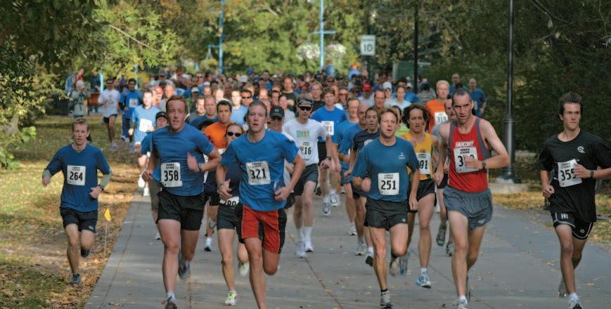
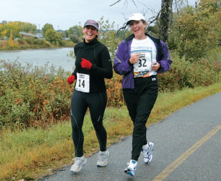
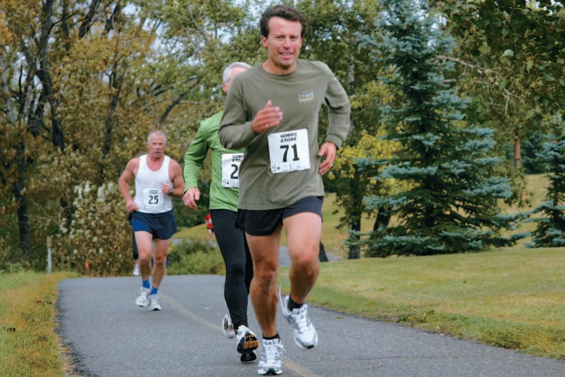
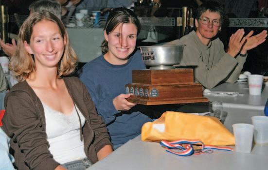
18TH ANNUAL CSPG/CSEG 10K ROADRACE AND FUN RUN
BY
This year’s race was held on Wednesday, September 13,and the evening turned out to be very pleasant,filled with enthusiasm and fun. The course started at Eau Claire and took runners along the Bow River pathway on the south side of the river.Some runners were seen trying to chase down their co-workers in friendly competition in this 10km event,and others met their match eating pizza at the post-race social.It was great to see so many runners out this year,despite the wet weather! Like every year,it’s nice to see that we had runners of all abilities,some seasoned and speedy runners,as well as some first-time racers.The post-race social was held at Quincy’s once again,where the racers and volunteers attempted to devour their weight in pizza and numb their aches with refreshments while awards and prizes were being given out.
Many thanks go out to the volunteers and sponsors,without whom this event is not possible.Great job as well to everyone who ran!
This year’s sponsors were:Veritas,Tucker Wireline,Gord’s Running Store,Conroy Ross Partners,IHS Energy,Weatherford,Devon,
FIONA KATAY, 2006 RACE CHAIR
Anne Burrage and Andrea Henry.
Claus Sitzler,Barrie Dargie,and Christopher Fic.
Apoterra Seismic Processing,CGG Canada Services,Divestco,Earth Signal Processing, Paradigm,Regent Resouces,Vault Energy Trust,Arcis,Baker Atlas,Birchcliff Energy, High Pine Oil,Spitfire Energy,Petro-Canada, AGAT Laboratories,and thanks to all the staff at the YMCA.
Special thanks also goes out to this year’s race committee for all your efforts:Stuart Mitchell, Cindy Koo,Dorothy Chen,Vic Urban,Kathy Taerum,Christine Manion,Anne McIntyre, Kim Maclean,Matt Hall,Angela Kennedy,and race director Fiona Katay.
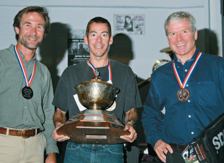
Full race results can be found at www.cspg. org.Here’s a summary of the CSPG,CSEG and CAPL winners from this year’s race:
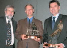
Mike Mokievsky-Zubok,Darren Lazaruk,and Robin Sandee.
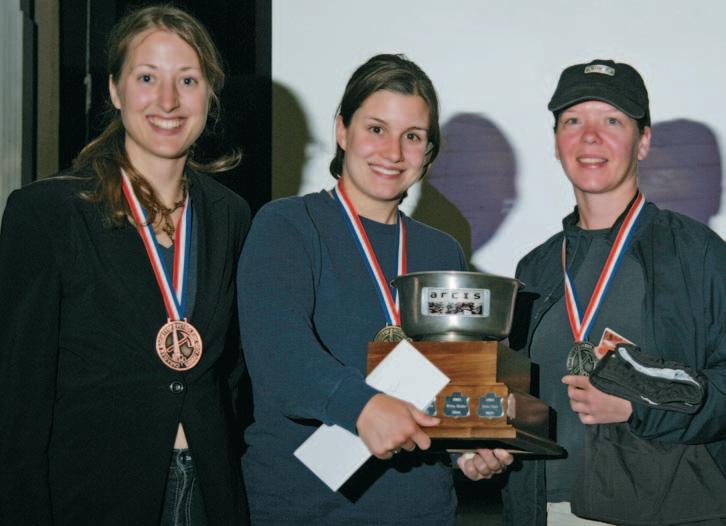
Kathy Chernipeski,Anne McIntyre,and Lisa MacKinnon.
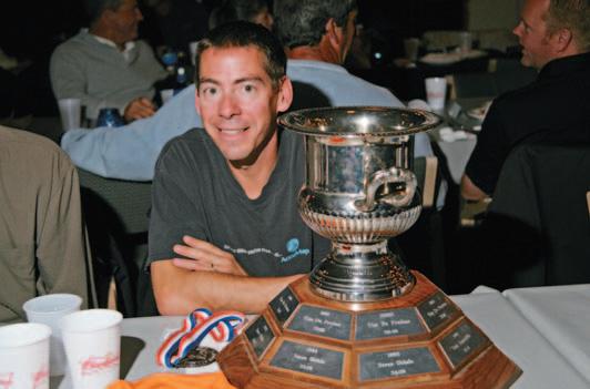
Darren Lazaruk and his trophy.
Fiona,Race Chair,with Ann and her award.
ROCK SHOP
miles eastward,at the discharge of the Fond du Lac (Stone/Black) River.At Poplar Point, Dowling observed a lobstick,fashioned by Chipewyan natives from a large spruce tree, which was presumably a signpost to indicate a change in passage.The 21-mile water route along the lake’s south shore to Fond du Lac post displayed occasional low exposures of Athabasca sandstone.Dowling further noted the presence of coarse-grained sandstone beds,associated with an exposure of Athabasca strata,on one of the small islands lying off Poplar Point.
During a two-day respite at Fond du Lac post, Tyrrell’s single-mast fishing boat,the Pterodactyl,which was utilized by Dowling to survey the south coast of Lake Athabasca, was returned to Fort Chipewyan to winter there,pending Tyrrell’s intended survey of the lake’s north shore in 1893.Having completed preparations for the second half of the field season,Tyrrell instructed Dowling to continue his survey of the remaining 43 miles of the lake’s easternmost south shore to the mouth of Fond du Lac (Stone/Black) River, while he elected to survey its opposite shore. Both parties,each employing two canoes, proceeded eastward on July 30th.It was Tyrrell’s intention to make a compass and boat-log survey of the north shore.
The channel configuration of the eastern extension of Lake Athabasca is constricted to a width of one mile at Fond du Lac post, expanding to an average breadth of three miles for the next 22 miles.Its remaining length of 21 miles to the mouth of Fond du Lac (Stone/Black) River averages one mile in width.The uneven north shore of this narrow eastern extension,as mapped by Tyrrell,is represented by Laurentian (Archean) rocks,
consisting of an assemblage of granites and granodiorites,including gneisses and schists. It reveals,as well,Huronian (Lower Proterozoic/Aphebian) basic eruptive rocks consisting of predominantly plagioclase norites and gabbros.Dowling mapped the flat-lying,unmetamorphosed,Paleohelikian Athabasca Formation,exposed along the opposite shore.He is here quoted:“ The high escarpment rising to the south of the lake comes out on the shore east of Fond du Lac, and seems there to be nearly all of sandstone beds with possibly a cap of till.On the shore the sandstone is exposed in a series of steps, rising gradually back to a height of eighty feet. Near the top of the hill the beds are seen again and at this point (15 miles east of the post) the thickness exposed is 120 feet.The beds range from eight inches to two feet in thickness,and are of a hard pinkish sandstone with a few oval impressions which may be organic.This escarpment seems gradually to rise to the east as it approaches the east end of the lake,and with the high land to the north forms a narrow gorge in which the lake is confined to a narrow river-like stretch of water.Angles of elevation were taken on trees on the summit of the ridge in two places,giving heights of 431 feet and 300 feet. It would thus appear that the sandstone here attains a thickness of over 400 feet,and that the surface has a slight dip to the west so that at the mouth of the Athabasca River it has declined to about the lake level.” (Ibid.:1896, Tyrrell,J.B.:Athabasca Lake and Churchill River —- p.71).
Tyrrell expanded further on Dowling’s report on the thickness and attitude of the Athabasca Formation,15 miles east of Fond du Lac to quote:“Athabasca Lake is here five miles wide,and lies in a long narrow valley with a steep sandstone escarpment between
ROCK SHOP
400 and 500 feet high on its south side.” and further:- the great valley of Athabasca Lake, which extends eastward to Black Lake,dates back to a period long before the glacial epoch.” (Ibid.:,1896,Tyrrell,J.B.:Athabasca Lake and Churchill River —— p.64D).The existence of a valley which directed the watercourse of the Athabasca region into the Mackenzie River drainage basin is now partially masked by Lake Athabasca.It is conceivable that Tyrrell’s valley is an expression of a drowned aulacogen,based on the abrupt discontinuity of the Athabasca formation escarpment along and beneath the lake’s south shore and its absence over the topographic higher Archaen terrain on the lake’s north shore.
On or about July 25th,1892,Joseph Tyrrell and his party had been surveying the north shore of Black Lake in latitude 59°17’ 34”: After proceeding two miles east of the mouth of Chipman River,it being located at the apex of the lake’s northwest and northeast shorelines;his plans for the field season of 1893 were instantly crystallized. According to Tyrrell:“– one of our Indian canoemen (Chipewyans:Ithingo or Heddery) pointed out a place among the overhanging willows,where he stated that a portage left the lake on the canoe-route by which the Chippewyan (sic) Indians annually travel to their hunting grounds at the head of the Telzoa (translation:broad shallow river,now known as the Dubawnt) River;adding that the Telzoa River flows an unknown distance towards the north,into the country of the Eskimos and the musk oxen.On the information here gained the expedition of the following year was largely planned,when, without guides,the Telzoa River was descended for 800 miles to its mouth at the
(Continued on page 46...)
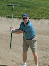
17TH ANNUAL CSPG MIXED GOLF TOURNAMENT
BY DAVID MIDDLETON, COMMITTEE CHAIR
The 17th Annual CSPG Mixed Golf Tournament was held at D’Arcy Ranch Golf Course on August 25th,2006.The tournament was held on another perfect Alberta day,with sunny skies and warm temperatures,and involved 144 enthusiastic golfers,on a course that was in perfect shape. This year we had a full tournament,with several disappointed golfers on the wait listing.
The tournament committee consisted of David Middleton & David Caldwell as cochairs,Dick Willott,Penny Christensen,Hugh Wishart,Carter Clarkson,Stephen Robinson, Norm Hopkins and Kim McLean.Thanks also to Brenda Pearson and Kathy Scales for helping at registration.
A big thanks to FMA Insurance as our platinum sponsor.We also appreciate our other sponsors at the gold level, Weatherford Canada and Tucker Wireline Services,and our silver sponsors,AGAT Laboratories,Baker Atlas,IHS Energy,and Recon PetroTechnologies,along with the breakfast sponsor Bodycote Norwest Labs, and many hole sponsors,as well as the various companies that graciously donated prizes.Everyone was recognized by copious signage on course,in the dining and breakfast areas,and on the road into the course,and our premier sponsors had the opportunity to put up a banner on the clubhouse.
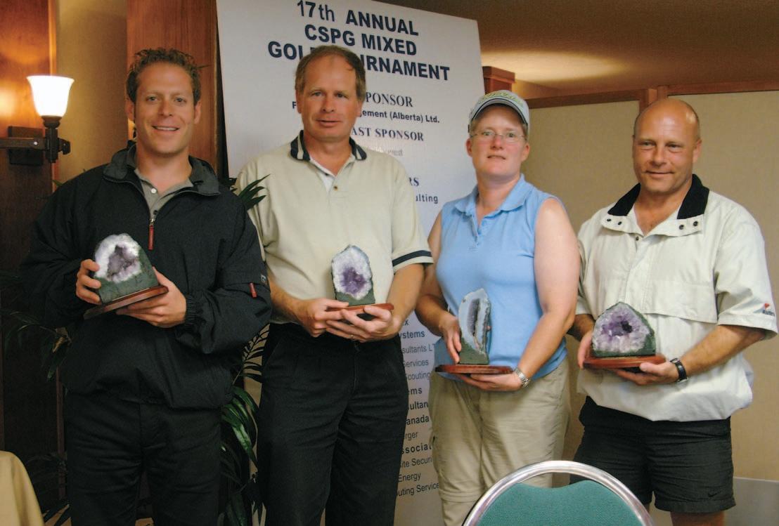
The trophy for Low Gross was won by the team of Shawn Lafleur,Ron Hill,Richard Klippenstein,and Deanna Watkins.The Low Net trophy was captured by the team of Sean Pearson,Andrew Arthur,Murray Dublonko, and Tammea Arthur.The High Gross trophy was awarded to the team of Lincoln Browning,Victor Irwin,Ann Blair,and Clarence Campbell.
A variety of skill prizes for long putts;long drives for the various levels of golfers;and balls in the sand,coulee,or water were won, with the golfers taking home a variety of gift certificates.Unfortunately,no one was precise enough of a shot maker to win the geologic “Alaska Cruise for the team,” or the Global Energy $10,000 prize,but everyone made a good attempt.Terry Phillips and Amanda Holowach were the skillful winners for the two IPod Nano players on the FMA closest to the target holes.
The on-course hospitality venues hosted by Recon PetroTechnologies,IHS Energy, geoLOGIC,and Baker Atlas were well appreciated by tournament attendees,and everyone had fun participating in the various skill prizes.
The always popular tournament draw prize of mountain bike was won by Leanne Ewashen,and Bob Robson was the happy winner of the Ipod and speakers.Many other prizes such as a digital camera,LCD tv,and
gift certificates were drawn for from the attending golfers.
Tucker Wireline ran the putting contest as the tournament was proceeding,giving everyone a chance to compete,and also donated the putting contest prize – a $600 gift certificate to the Fairmont Resorts.The very pleased winner of the contest was David Harris.
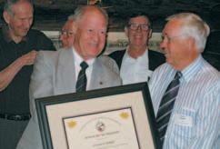
Baker Atlas once again was very generous in donating a “Golf with Lanny” package,and tickets on the draw were sold to the crowds. Dwayne Sparks was the lucky winner of golf and dinner for three with Lanny McDonald, with transportation by limo.Additional Trust draws were for golf and accommodation.The proceeds from the mulligan tickets were also directed to the CSPG Trust.The Mixed Golf tournament was pleased to be able to donate $2,710 to the CSPG Trust at the end of the tournament.
We look forward to seeing everyone next year at D’Arcy Ranch for the 18th Annual tournament.Thanks to all the committee members for their hard work and support of the tournament.I know the members and guests who attended had a great time and appreciated the fellowship on the course and the various hospitality venues.
David Middleton & David Caldwell, Mixed Golf Tournament co-chairs
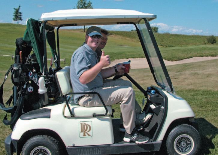
Dick Willott and Darren Aldridge giving a “thumbs up”to a gorgeous day on the golf course!
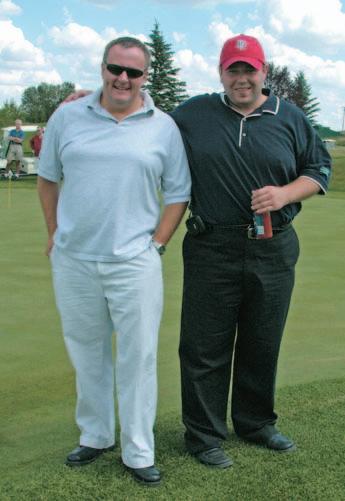
Andy Shaw,Baker Atlas,and Carter Clarkson,Hycal Energy Research Labs.
Low Gross Winners:Shawn Lafleur,Ron Hill,Deanna Watkins,and Richard Klippenstein.
EDUCATION CONFERENCE
Houston, TX
February 12-16, 2007
Courses will include:
Essentials of Subsurface Mapping
Introduction to Computer Mapping
Practical Mapping of Surfaces, Properties and Volumes for Reservoir Characterization
Rock Properties of Tight Gas Sandstones
Introduction to Coalbed Methane
Risk, Uncertainty and Decision-Making in Unconventional Resource Plays
Seismic Amplitude Interpretation—Lithology and Pore Fluid Estimation
3D Seismic Attributes for Prospect Identification and Reservoir Characterization
Seismic Geomorphology & Seismic Stratigraphy
Basic Openhole Log Interpretation
Advancements in Petrophysics and What to do with Them
Introduction to DST’s for Geologists
HOSTED BY THE HILTON HOUSTON WESTCHASE HOTEL 9999 WESTHEIMER ROAD
713-974-1000 FAX: 713-974-6866
SPECIAL AAPG GROUP RATES!
Tuition for the week is only $1295 for AAPG Members, $1395 for non-members* or $325/day for individual courses *(price increases to $1395/$1495 after 1/15/07)
REGISTRATION AND INFORMATION: Toll-free (U.S. and Canada) 888-338-3387, or 918-560-2650
Fax: 918-560-2678; e-mail: educate@aapg.org
Download a registration form at http://www.aapg.org/education/wec.cfm
EPISODIC GLOBAL TECTONICS
BY ASHTON EMBRY, GEOLOGICAL SURVEY OF CANADA, CALGARY
Ashton Embry received a PhD in stratigraphy from the University of Calgary in 1976. Since 1977 he has been with the Geological Survey of Canada where he is currently a Senior Research Scientist.His research efforts have been centred on the sedimentology and stratigraphy of the Devonian and Mesozoic strata of the Canadian Arctic Islands and he has conducted fieldwork in this area since 1969.He has been working on applications of sequence stratigraphy to sedimentary successions since 1974 and has published on specific methodologies for using this discipline to improve correlations.
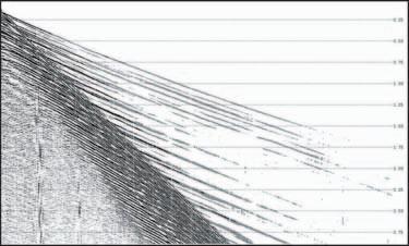
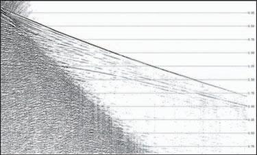
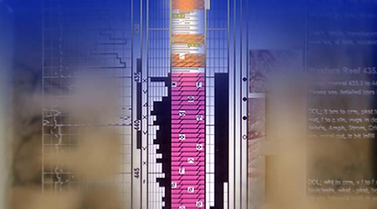
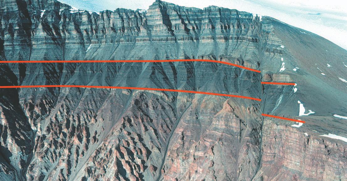
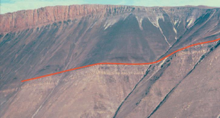
Two prominent unconformities are marked by the red lines.The lower one is an angular unconformity that
on Carboniferous clastics and carbonates (light).Yelverton Pass,northern Ellesmere Island.
SEQUENCE STRATIGRAPHY MEETS
PLATE TECTONICS
Based on recent advances in plate tectonics, sedimentology,and sequence stratigraphy,I suggest that the Earth is affected by relatively short-lived episodes of increased tectonic activity separated by longer intervals of relative quiescence.If true,this may have important implications for how we interpret the history of the earth and exploit its resources.
From the early 1960s to the mid-1990s sedimentary geology enjoyed many exciting new developments which included the formulation of plate tectonic theory with its consequent insights into the origin and development of sedimentary basins,major advances in sedimentology that allowed detailed facies analysis and paleogeographic reconstructions,and the development of sequence stratigraphy that provided insights into allogenic controls of sedimentary successions and the generation of predictive stratigraphic models.
It seems we have reached a bit of a plateau regarding big,new concepts and methods in sedimentary geology.However,cyclostratigraphy appears to one field that promises to bring new understanding and improved time control for sedimentary and tectonic processes.We may also be on the
verge of another major shift in thinking,and this comes from a combination of the aforementioned three advances achieved in the latter half of the 20th century - plate tectonics,sedimentology,and sequence stratigraphy.
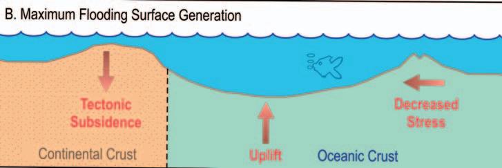
EPISODIC DIASTROPHISM
The methodologies,interpretations,and insights from these three pillars of sedimentary geology have led to a concept that I call “Episodic Global Tectonics.” Its main thesis is that the Earth is affected by relatively short-lived episodes of increased tectonic activity separated by longer intervals of relative quiescence.The widespread episodes of increased tectonism seem to occur with a frequency of 1-2 million years and vary substantially in magnitude.Currently,they are best expressed within sedimentary successions but igneous and metamorphic terrains potentially also harbour indicators of such episodic crustal instability.
A similar concept was debated in geological circles during the 1800s and the first half of the 20th century.However,after 1950 the concept has been essentially ignored, although it can be found in a few papers.In this article I will provide a summary of early thinking on this concept,the evidence that has indicated to me it is worth considering
a theoretical model that might account for such a phenomenon,and some of the implications for geology if episodic global tectonics actually did occur throughout earth history.
In the 19th century episodic global tectonics was widely accepted and each geological period was seen as being bounded by unconformities that represented global “revolutions.” By the end of the century the concept was under considerable debate,and it was questioned if unconformities indicated “great earth movements affecting all quarters of the globe” or were due to “an aggregation of local events dependent on local conditions uncontrolled by overmastering agencies of universal dominance.” The author of these quotes was the influential American geologist,Thomas Crowder Chamberlin,known best for his method of multiple working hypotheses.He favoured the former explanation and in 1909 proclaimed “diastrophism as the ultimate basis of correlation.”
THE RISE OF SEA LEVEL
During the first half of the 20th century natural,worldwide divisions of earth history were generally accepted but many interpreted them due mainly to tectonically driven rises and fall of sea level rather than to widespread epeirogenic uplift.In 1949
places Upper Triassic shale (dark)
James Gilluly,in his presidential address to the Geological Society of America,declared that “worldwide orogenic revolutions do not appear to have been demonstrated” and few have dared to raise the concept of episodic global tectonics since that time.
One individual who gently kept the concept alive was Larry Sloss who,in the same year as Gilluly declared that global tectonics was a non-starter,gave birth to sequence stratigraphy by coining the term sequence for a stratigraphic unit bounded by unconformities.Sloss’ sequences were bound by major Phanerozoic unconformities that extended over much of North America, and by the early 1970s he was claiming that the same unconformities were present on the cratonic portions of other continents. Furthermore he had no doubt as to the tectonic origin of such unconformities and thus Larry Sloss became the “keeper of the faith” for episodic global tectonics until his death in 1996.
Ironically,when Sloss was proposing tectonic mechanisms to explain his observations,his former student,Peter Vail, along with his Exxon colleagues, revolutionized sequence stratigraphy with seismic sections and a eustasy-driven, deductive model of sequences and their bounding unconformities.The Exxon eustatic model was accompanied by incredibly detailed and precisely dated sea level charts and it washed away any thoughts of global tectonism.The geological community,with the proviso that local tectonics “enhanced” unconformities in some cases,ecstatically embraced eustasy as the long sought key to global correlation.
MESOZOIC SEQUENCE BOUNDARIES, SVERDRUP BASIN
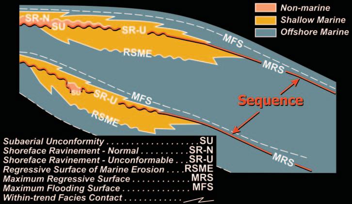
At the same time as the Vail eustasy-based sequence model was sweeping over the geological community,I was studying the 9 km-thick Mesozoic succession in the Sverdrup Basin of Arctic Canada.Numerous major unconformities punctuated the strata and I employed sequence stratigraphy for subdividing the succession into pragmatic units for facies analysis and paleogeographic reconstructions.One of the major improvements that Exxon scientists made to sequence stratigraphy was to extend the definition of a sequence boundary from “only an unconformity” as used by Sloss to one which included a “correlative conformity.” This allowed sequence boundaries and the sequences they enclosed to be correlated over much,if not all,of a basin.
I discovered that the sequence bounding unconformities that occurred on the flanks
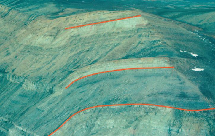
Three unconformities are marked by the red lines.The lower one puts Middle Triassic shales on Lower Triassic fluvial sandstones.The middle unconformity has Upper Triassic limestone on Middle Triassic shale.The upper one is within the Upper Triassic and at this locality about 200 m of strata have been removed at the unconformity. Greely Fiord,northern Ellesmere Island.
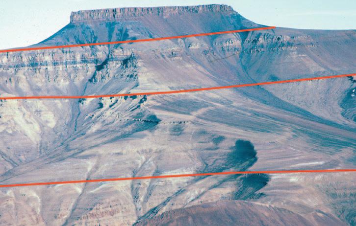
The red lines mark prominent maximum regressive surfaces within the Lower Triassic succession.These conformable surfaces form readily recognizable sequence boundaries well within the basin and correlate to unconformities on the basin flank.Otto Fiord,northern Ellesmere Island.
The top of the Lower Triassic sequence is marked by a prominent maximum regressive surface (red line) near the basin centre.The strata consist mainly of slope and outer shelf shale and siltstone with some thin outer shelf sandstone just below the boundary.Nansen Sound,northern Ellesmere Island.
of the Sverdrup Basin joined basin-ward with conspicuous stratigraphic surfaces that marked the initiation of major transgressions.I referred to such readily recognizable surfaces as “maximum regressive surfaces” and they were ideal for the use as the conformable portion of the sequence boundary.These surfaces,which could be dated by paleontology,provided a convenient age designation for the sequence boundary.These observations differed from what was portrayed on the Exxon deductive sequence model which placed the maximum regressive surface (their transgressive surface) stratigraphically well above the unconformity.Such a difference is likely due to their use of a non-actualistic sinusoidal base level curve as a primary input parameter in their model.When a reasonably actualistic base level curve (e.g., one based on eustasy or episodic tectonics) is used for sequence modeling,the start of transgression coincides with the initiation of base level rise.This in turn results in the unconformity and the maximum regressive surface forming a single unbroken boundary from basin edge to basin center as is observed in most cases.
TECTONICS AND SEQUENCES
Now that I had my sequence boundaries clearly defined and well dated,the question of whether they were of eustatic or tectonic origin arose.I first went with a eustatic origin because they matched events on the Exxon sea level curve.However,I was not comfortable with this because various features of the boundaries strongly favoured a tectonic origin.
The characteristics which had tectonics written all over them included:
• the strata below the unconformities were often tilted and in some cases faulted,
• there were major changes in depositional regime across the boundaries,
• there were major changes in sediment composition and direction of source areas across the boundaries,and
• there were significant changes in tectonic regime and subsidence rates across the boundaries.
Almost exactly 20 years ago I let the data rather than the prevailing theory guide my interpretations and postulated that the Mesozoic sequence boundaries of the Sverdrup basin were mainly of tectonic origin.Further work over the past two decades has only solidified this position.
GLOBAL COMPARISONS
It was somewhat disturbing to me that tectonically driven sequence boundaries of the Sverdrup Basin matched very well with
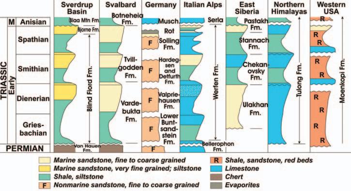
events on the Exxon global sea level chart.I decided to review the literature for the occurrence of major sequence boundaries in the Triassic in other basins throughout the world to see if my Triassic boundaries were due to a local tectonic phenomenon or were expressions of something larger.
The literature descriptions plus observations made on field excursions to the Triassic of the southwestern USA, Svalbard,and northeastern British Columbia left no doubt in my mind that the major Triassic sequence boundaries I had recognized in my corner of the world dominated the Triassic stratigraphy in basins on at least four continents.The available evidence also indicated that the Triassic sequence boundaries in a number of basins had characteristics supportive of a tectonic origin.Thus,I was faced with the hard-toescape interpretation that significant tectonic episodes affected large areas of the Triassic world and that they were separated by long intervals of relative quiescence. Derek Ager’s oft quoted quip that “the stratigraphic record is like a soldier’s life; long intervals of boredom separated by short intervals of terror” took on new meaning.
The Triassic was of course the time when Pangea was in full bloom and one way of rationalizing such widespread tectonics was that I was actually looking at only one continent,albeit a super one.I then looked at my Jurassic unconformities that also had all the indicators of a tectonic origin.And like the Triassic ones they were also represented on the Exxon sea level curve, especially the early version that only included the major Jurassic events.A
literature search revealed that these too were common in many basins around the world,seemingly confirming the Exxon interpretation.However,in many cases the Jurassic unconformities also bore the telltale signs of tectonics being a major factor in their generation.This convinced me that very widespread,perhaps global,sequence boundaries were not necessarily proof of a eustatic origin and that tectonics could also produce such a phenomenon.
IN SEARCH OF A MECHANISM
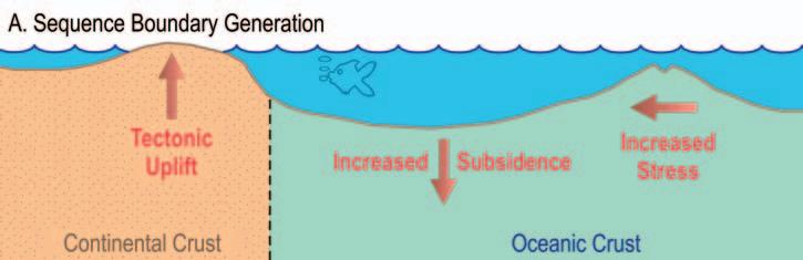
The occurrence of widespread, synchronous,tectonically generated sequence boundaries is a clear expression of episodic global tectonics and it begs for a reasonable theoretical model to explain such a phenomenon.
Larry Sloss over 30 years ago appealed to “episodic changes in the proportion of melt in the asthenosphere below the continents” as a driving mechanism (Sloss and Speed, 1974).I offered up the hypothesis of episodic changes in the spreading rates and/or directions of the interlocking plates affecting the horizontal stress field that in turn would drive tectonic movements on the margins of sedimentary basins (Embry, 1997).This model also included a eustatic component related to tectonic deformation of the oceanic crust.
Recently I stumbled on a wonderful paper that postulated that perturbations in mantle convection and consequent effects on crustal processes drive the generation of global,large scale sequence boundaries (Collins and Bon,1996).Overall I think this hypothesis of mantle-driven crustal dynamics may be the best explanation so far
for episodic global tectonics and I recommend this paper to anyone interested in some mind-expanding hypothesizing.
IMPLICATIONS
I certainly shy away from the cliché of paradigm shift for the concept of episodic global tectonics but it does have some implications for how we interpret the history of the earth and exploit its resources.
It provides the elusive “natural order” to earth history and the sequence boundaries would contribute to global correlations and the refinement of the global time scale especially for the Precambrian.The occurrence of predictable episodes of tectonism would help to focus resource exploration because the consequences of such relatively short-lived events might well include petroleum trap formation and mineralizing fluid migration.
I am hopeful the academic and industrial geoscientific communities will take this hypothesis seriously and will begin testing its validity.Right now there is some tantalizing evidence that supports it and its implications are too profound to let it lie dormant in the shadow of the overextended and poorly supported eustasy model. Anyways,we owe it to Larry Sloss to see if he was right on this one as he was on so many other things.
Ashton Embry,Geological Survey of Canada, Calgary,Photos by Ashton Embry aembry@nrcn.gc.ca
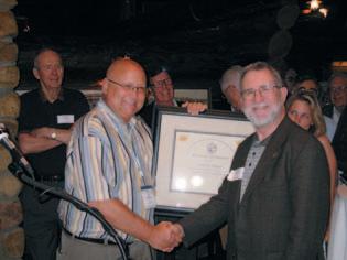
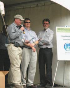
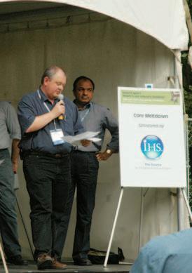
THURSDAY, DECEMBER 7, 2006
EXHIBITION HALL FOYER TELUS CONVENTION CENTRE (NORTH SIDE)
10:30 AM - 11:30 AM
TECHNICAL LUNCHEON TICKETS ARE AVAILABLE AT THE CSPG OFFICE
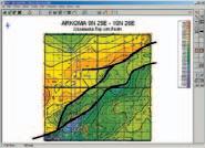
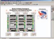
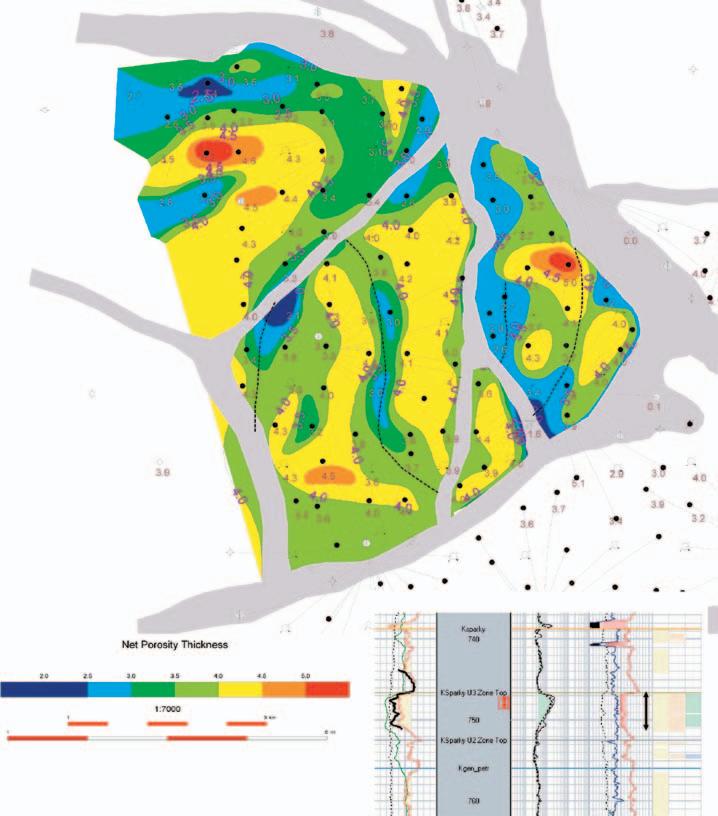
UNDERSTANDING RESERVOIR GEOMETRY HELPS OPTIMIZE YOUR WATERFLOOD
BY LISA M. DEAN, AND R. MIREAULT, FEKETE ASSOCIATES INC.
Geologists and engineers have always been faced with the challenge of trying to define, develop,and optimize gas and oil fields.This is difficult enough when dealing with primary production in conventional pools but is even more challenging when applying EOR strategies. It is our experience that the performance of most WCSB waterfloods could benefit from a closer look at the geology of the reservoir to improve waterflood performance.
The critical first step is reservoir characterization and description of reservoir geometry, based on regional geology,petrophysical log interpretation,test data,and detailed core analyses.When done properly,subsequent integration with engineering data can greatly enhance the understanding of past reservoir performance and facilitate greater hydrocarbon recovery through optimal flood design.
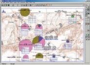
This procedure was successfully applied in a study of the performance of a 165-well waterflood in the Upper Mannville Sparky pool. Project objectives were to:characterize and visualize the (Sparky) reservoir,provide reasons for the erratic and declining production rates in some areas under the current waterflood scheme,effectively increase recoveries throughout the area,and identify any potential for stepout drilling.
RESERVOIR CHARACTERIZATION AND GEOMETRY
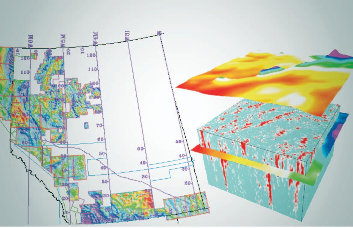
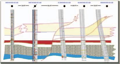
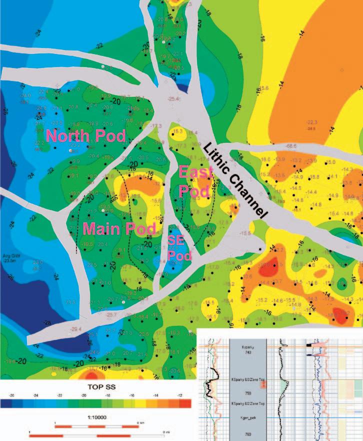
The Upper Mannville Sparky Pool consists of one productive horizon,the Sparky Sand,and is situated on a structural high that gradually dips from the northeast to the southwest (Figure 1).The Sparky consists stacked,coarsening upward sand layers,separated by shale;typical of a marine environment.Permeability in the Sparky Sand is in the order of 100 millidarcies.
The Upper Mannville Pool is located in a marine shoreface system that has been segmented by post-depositional lithic channels.The Sparky Structure map,Figure 1,shows an overall dip to the southwest with a couple of structural culminations against the west side of the interpreted channels.The western edge of the north-south channels has a sharp erosional profile,while the eastern edge is gradual.The culminations imply internal faulting and may influence the location of the channels.The channels and faults create a separate structural culmination for each of the four reservoir ‘pods’. The pods have been labeled as Main,East, Southeast,and North for reference,as shown in Figure 1.
The extent of compartmentalization in the Sparky pool was identified from an understanding of the sedimentology and depositional environments.One such channel creates the southeastern and eastern limits of the pool.Seismic interpretation indicates the presence of other channels within the pool that act as baffles and may hydrodynamically isolate each pod,creating a barrier to waterflood operations.Recognition of these channels and knowledge of their width and cross sectional profile allows for the optimal design of the scheme patterns.
The presence and location of the channels are supported by well penetrations and seismic interpretation.The conclusion that the lithic channels act as barriers is supported by well injection,production performance,and modern day analogues.One modern-day example of syn-depositional channeling is in the Irrawaddy Delta,Myanmar (Figure 2).It illustrates the complex shapes that result when wave energy and tides interact with low littoral drift in a shallow,stable basin.Regionally,geometric patterns created by the sand accumulations and erosional drainage system of the Irrawaddy Delta resemble the syn-depositionally created patterns of the Upper Mannville Sparky reservoirs.Figure 3 presents a scaled comparison of the seismically interpreted location of major channels through the middle of the reservoir to a satellite image of the Irrawaddy basin.
Isopach maps for gross formation thickness indicate both east-west thick and north-south thin trends that reflect the geometric pattern in the Irrawaddy Delta.The east-west thick and north-south thin trends carry through to the gross sand interval thickness and net porosity thickness maps (Figure 4).The net porosity thickness maps show a small area of lesser rock
Figure 2 - Satellite Image of modern day syn-depositional channeling in the Irrawaddy delta,Myanmar (Burma).
Figure 3 - Scaled Comparison of the Upper Mannville Sparky Pool to the Irrawaddy delta,Myanmar (Burma).
quality on the west side of the east pod.This area is interpreted as lagoonal from core analysis.
Core analyses confirm the complex nature of the Upper Mannville (Sparky) sands.Cored wells encountered embayment deposits,lithic coarse-grained channel deposits with calcite cement filling the pore spaces,and a middle shoreface environment containing fine-grained sands with crossbedding and hummocky stratification.In addition,the Upper Mannville Marker to the Sparky isopach and the Sparky vertical thickness maps indicate the existence of additional lithic channels not obvious on seismic.A subtle seismic low is seen by well 04/12-30,which is located in a seismic thin.The correlation was the basis for inferring the presence of lithic channels without the necessity of well control.
WATERFLOOD PRODUCTION PERFORMANCE
There is significant variation in cumulative oil produced from wells in the Sparky pool (Figure 5) but attempts to correlate porosity, permeability,and water saturation with well production failed.Bubble maps were used to demonstrate that there is no correlation between sand quality,based on minimum
gamma ray and maximum resistivity values,and cumulative oil production or well capability. Productivity index (cumulative oil divided by producing hours) and cumulative GOR also show no correlation to either rock quality or oil production.The maps suggest that rock quality is not the reason for the observed differences in cumulative oil production or well production capability.
Conversely,there is a strong correlation between injected water volumes and offsetting oil production if the lithic channels are considered to be barriers to flow. Superimposing cumulative production and injection volumes on the net pay map creates the impression that production well performance is primarily related to well position and water injection volumes.By serendipity, channeling increased the injection/production well ratio in some reservoir compartments.In the south part of the Main pod (best area), channeling almost creates a four (4) spot pattern,compared with the nine (9) spot inverted pattern for the rest of the pool.
To illustrate,well 104/04-30 is one of the top producing wells in the pool yet has only average
log values while wells with much “better” log characteristics have lower cumulative production.However,well 104/04-30 is flanked by two injection wells and experienced several years of very low GOR with elevated oil production rates,due to waterflood support. This ‘low GOR’ period,accounts for most of the oil produced from well 104/04-30.A subsequent increase in GOR coincides with the inception of a free gas phase in the reservoir and a corresponding drop in oil productivity.
It was noted that the better producers in the south portion of the Main pod are directly flanked by two injection wells.In Section 30 (the North Pod) the interpreted channels isolate wells that would otherwise be between two injectors.These wells have not responded to waterflooding.For example,well 104/13-30 is apparently between injection well 103/13-30 and 103/14-30 but experienced lower cumulative oil production than expected.
In contrast to the south portion of the Main pod,the northern portion of Section 30 has injected significantly less water and contains incomplete flood patterns.Given that the northern wells like 100/05-31 have encountered similar reservoir quality,a producing GOR that is consistently higher than the reported solution GOR for the pool indicates lack of waterflood support.The East and Southeast pods in Section 30 also appear under-injected and have an insufficient number of water injection wells.
Thus the primary determinant of oil production performance has been the amount of water injected and the position of the producing well relative to the injection wells.A secondary influence may be the pay thickness in that it has preferentially influenced the direction of water flow.Poor rock quality in the lagoonal area of Section 30 (west side of eastern pod) may have discouraged water flow.
RESERVOIR INTEGRATION
Grouping well production and injection according to the four pods identified by the reservoir geometry resulted in material balance calculations that were consistent with the observed production trends and GOR performance for each well.The consistency of the explanation further confirmed that each pod was at a different stage of waterflood development as follows:
East Pod: Operating with an incomplete waterflood pattern;
Southeast Pod: No injection wells in the pod,operating on primary production;
Main Pod: The portion of the pod that responded to the initial flood is ready for conversion to line drive;
North Pod: The initial waterflood pattern is under-injected.
Figure 4 - Upper Mannville Sparky Pool Net Porosity Thickness Isopach map (Phi > 24%).
The Upper Mannville Sparky pool started as an inverted 9-spot pattern but the only wells that have experienced significant success to date are all in the 5-spot pattern position,directly between two injection wells in the south portion of the Main pod.In order to achieve similar success in the remainder of the pool a plan was developed to convert the East, Southeast,and North pods to a ‘pseudo’ 5-spot pattern and address the shortfall in water injection volumes.The conversion was accomplished via a combination of well conversions to injection,returning suspended wells to production,and infill-drilling selected locations.
Based on the successful performance of an offset pool,additional oil can be recovered from a ‘watered-out’ 5-spot pattern by subsequently converting to a NE to SW trending ‘line-drive’ to displace the oil in the “dead spots’ created from the 5-spot pattern. Some of the wells in the southern portion of the Main pod indicate that the time is approaching for at least a partial conversion.
The timing of conversion is based on individual well production.If a candidate well is currently producing little oil at a high watercut,it is recommended for immediate conversion to injection.If the well is producing greater than 3 m3/day of oil at less than 90% watercut,it is identified for a future conversion when it waters out.
CONCLUSION
The overall conclusion is that the seismic,well data,and well production provide a consistent picture of several reservoir compartments within the Upper Mannville Sparky pool. Down-cutting lithic channels proved to be a barrier to flow within the Sparky sand. Faulting may influence the location of the channels and in combination provide the trap/seal for each compartment.As the reservoir characterization and geometry of the Sparky pool evolved,the engineering analysis of pressure and production data became clear.It was not until the four-pod version and positioning of the lithic channels were defined in association with injection wells that the waterflood performance could be understood and recommendations made. The integration of geology with engineering was critical in providing the best model to facilitate greater hydrocarbon recovery in the waterflood.
INFORMATION
This article is condensed from a more comprehensive review by Ray Mireault,P.Eng.and Norbert Alwast,P.Geol.of Fekete Associates Inc.For information on products and services offered by Fekete,please visit www.fekete.com or call 403-213-4200.
REFERENCES
Moslow,T.F.and Pemberton,S.G.2003.Clastic Depositional Environments and Facies:Applied Sedimentology and Ichnology to the Interpretation of Depositional Environments in Core,Volume I. Course Notes.
The Geology of the Mid-Mannville Subgroup in the West-Central Lloydminster Heavy Oil Trend,Alberta;
O’Connell,S.C.and Benns,G.W.,Alberta Research Council Open File Report # ED 1988-1.
Sedimentary Environments and Facies,edited by H.G.Reading.Department of Geology and Mineralogy,University of Oxford.Printed in 1978, Reprinted in 1979,1980,1981,1982,Distributors: Elsevier North-Holland Inc.52 Vanderbilt Avenue, New York,New York 10017.
Western Canada Geological Edge Set 2006 Version
Now available for import into ACCUMAP, GEOSCOUT and other applications:
1) Mississippian Subcrops and Devonian Reef Edges - AB, NE BC, NT and SK
2) Triassic Halfway, Doig, Charlie Lake - Peace River Arch, Alberta, NE BC
3) Rock Creek Subcrop Edge - Alberta
4) Glauconitic Channel Trends - AB and SK
5) Colony/Sparky/Lloydminster Reservoir Trends - East-central AB
6) Bluesky-Dunlevy Reservoir Trends - NE BC
7) Viking Fm. - Alberta
8) CBM - Horseshoe Canyon, Mannville
All edges are formatted as map features for use in Accumap and ESRI Shape files for other programs.
For more information contact: Mike Sherwin 403-263-0594
Figure 5 - Upper Mannville Sparky Pool Cumulative oil production (m3) to December 2003.
head of Chesterfield Inlet.” (Ibid.:1896, Tyrrell,J.B.:Athabasca Lake and Churchill River – p.53D).
Reinforcing accounts state that on the same day of Tyrrell being informed of the location of the portage by one of his canoemen,his curiosity was aroused after witnessing 19 canoes of Chipewyan hunters from the Fond du Lac area traversing Black Lake’s northwest coastal waters.On questioning one of his Chipewyan canoeman,he was informed their destination was to reach the Barren Lands,the traditional summer home of the vast herds of wandering caribou (1978,Inglis,Alex:Northern Vagabond - The Life and Career of J.B.Tyrrell,pub. McCelland and Stewart Ltd.,p.11).
The commencement of the ascent of the Fond du Lac (Stone/Black) River by Tryrrel’s and Dowling’s combined parties was an introduction to a tranquil river flowing into the eastern end of Athabasca Lake.Behind a boulder-strewn morainic hill,located on the north bank of the river’s mouth,a massive boss,270 feet in height of foliated norite, was examined by Tyrrell.Four-and-one-half
miles further up the river,on its south bank, a similar norite or pyroxene gneiss was inspected.The first of many encounters with hazardous rapids along the river’s course occurred a mile-and-one-half above the forementioned exposure.To avoid tracking,it necessitated portaging a distance of 660 yards to the head of the rapids (Stony Rapid).Here,another intrusive of norite was investigated.The easy flowing Fond du Lac (Stone/Black) River is diverted abruptly to the south at a distance of 15 miles from its mouth.At this point,the river narrows and increases in velocity as it flows between bosses of amphibolite and reddish gneiss.Powerfull rapids occur threequarters of a mile above the bend in the river,which necessitated the two parties to portage a distance of almost two miles. Tyrrell,utilizing his aneroid barometer, measured a fall of 160 feet between the head and foot of this series of rapids.He named this portage,Woodcock Portage after rousing a bird,during his crossing, which he identified as the species Philohela minor.He noted that this species was very rare to have been observed this far north. The first quarter of a mile along the footpath of the Woodcock Portage led to a
steep escarpment of Athabasca sandstone whose face,some 100 feet above its base, revealed a terrace,which Tyrrell concluded was evidence of a former shoreline of hyper-Lake Athabasca.Above Woodcock Portage lay Middle Lake,some two-andone-quarter miles long,which the two parties crossed to commence a three- andone-quarter mile portage.This would take them to the bank of the Fond du Lac (Stone/Black) River,in proximity to its intake from Black Lake.Tyrrell named this portage,Elizabeth Portage,after a sister whose birthday fell on the same day that his combined party made use of it.He restricted the name Elizabeth Falls to the lowermost waterfall at the end of a threemile succession of impassable rapids contained by a narrow gorge.The rapids are separated by falls with heights approaching 10 feet.Tyrrell’s aneroid barometer indicated that the elevation of Black Lake was 120 feet higher than that of Middle Lake,indicating an average drop of 30 feet to the mile,over a distance of four miles.
To be continued ...
Focusing on Gas?
Now there is a better method for identifying gas and measuring gas saturation in cased holes. Baker Atlas is proud to introduce the GasViewSM service, a high-resolution measurementand analysis service that produces an exceptionally clear picture of reservoir gas.
Using Baker Atlas’ RPMSM pulsed neutron system, the GasView service can be used to measure reservoir gas in virtually any well. Applications range from identifying by-passed pay in wells nearing abandonment to openhole log replacement for new wells.
Contact your Baker Atlas representative today to learn how the GasView service can help you produce more gas with greater efficiency.