12 Innovative Solutions for Targeting Duvernay Completions 16 Go Take a Hike 20 Potash Petrophysics - Then and Now 26 GeoConvention 2014: Focus $10.00 JULY/AUGUST 2014 VOLUME 41, ISSUE 07 Canadian Publication Mail Contract – 40070050


Seamlessly bring more data into the fold. Dynamically present your insight like never before.
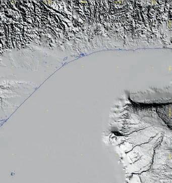
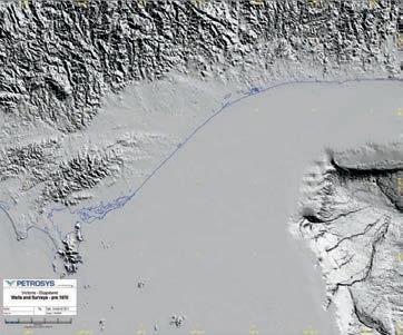
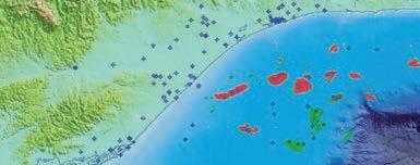
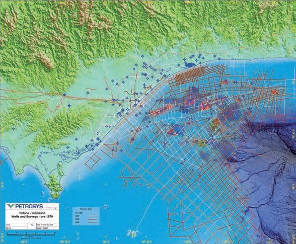
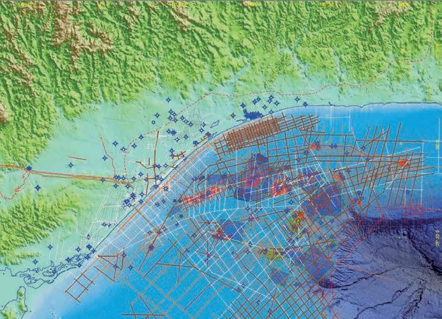
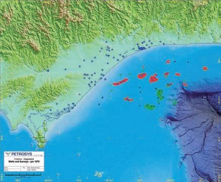
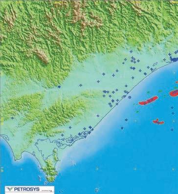
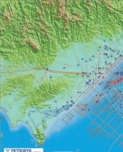
The Petrosys Plug-in for Petrel ® gives you access to powerful Petrosys mapping, surface modeling and data exchange from right where you need it – inside Petrel. Now you have the power to effortlessly and meticulously bring your critical knowledge together on one potent mapping canvas. Work intuitively with your Petrel knowledge and, should you so require, simultaneously aggregate, map and model data direct from multiple other sources – OpenWorks ®, ArcSDE®, IHS ™ Kingdom ®, PPDM ™ and more. Refine, enhance and then present your results in beautiful, compelling detail. The result? Decision-making is accelerated through consistent mapping and surface modeling as focus moves from regional overview through to the field and reservoir scale. To learn more go to www.petrosys.com.au/petrel
CSPG OFFICE
#110, 333 – 5th Avenue SW
Calgary, Alberta, Canada T2P 3B6
Tel: 403-264-5610
Web: www.cspg.org
Office hours: Monday to Friday, 8:30am to 4:00pm
Executive Director: Lis Bjeld
Tel: 403-513-1235, Email: lis.bjeld@cspg.org
Event Coordinator: Kelsey Thompson
Tel: 403-513-1226, Email: kelsey.thompson@cspg.org
Member Services:
Tel: 403-264-5610, Email: membership@cspg.org
Publications and Website: Emma MacPherson
Email: emma.macpherson@cspg.org, Tel: 403-513-1230
Educational Trust Fund/Outreach Coordinator: Kasandra Amaro
Tel: 403-513-1226, Email: kasandra.amaro@cspg.org
Technical Programs: Biljana Popovic
Tel: 403-513-1225, Email: biljana.popovic@cspg.org
Corporate Sponsorship: Lis Bjeld
Tel: 403-513-1235, Email: lis.bjeld@cspg.org
Controller: Eric Tang
Tel: 403-513-1232, Email: eric.tang@cspg.org
EDITORS/AUTHORS
Please submit RESERVOIR articles to the CSPG office. Submission deadline is the 23rd day of the month, two months prior to issue date. (e.g., January 23 for the March issue).
To publish an article, the CSPG requires digital copies of the document. Text should be in Microsoft Word format and illustrations should be in TIFF format at 300 dpi., at final size. For additional information on manuscript preparation, refer to the Guidelines for Authors published in the CSPG Bulletin or contact the editor.
Technical Editors
Hugh S. Mosher Colin Yeo (Assistant Tech. Editor) Nunaga Resources Ltd. Encana Corporation
M.: 403-809-9997 Tel: 403-645-7724
Email: hsmosher@telus.net Email: colin.yeo@encana.com
Coordinating Editor
Emma MacPherson, Publications Coordinator, CSPG Tel: 403-513-1230, emma.macpherson@cspg.org,
ADVERTISING
Advertising inquiries should be directed to Emma MacPherson, Tel: 403-513-1230 email: emma.macpherson@cspg.org. The deadline to reserve advertising space is the 23rd day of the month, two months prior to issue date.
The RESERVOIR is published 11 times per year by the Canadian Society of Petroleum Geologists. This includes a combined issue for the months of July and August. The purpose of the RESERVOIR is to publicize the Society’s many activities and to promote the geosciences. We look for both technical and non-technical material to publish. Additional information on the RESERVOIR’s submission guidelines can be found at http://www.cspg.
(if applicable). The material contained in this publication is intended for informational use only.
While reasonable care has been taken, authors and the CSPG make no guarantees that any of the equations, schematics, or devices discussed will perform as expected or that they will give the desired results. Some information contained herein may be inaccurate or may vary from standard measurements.
The CSPG expressly disclaims any and all liability for the acts, omissions, or conduct of any third-party user of information contained in this publication. Under no circumstances shall the CSPG and its officers, directors, employees, and agents be liable for any injury, loss, damage, or expense arising in any manner whatsoever from the acts, omissions, or conduct of any third-party user. Designed and Printed by The Data Group of Companies, Calgary, Alberta.
FRONT COVER
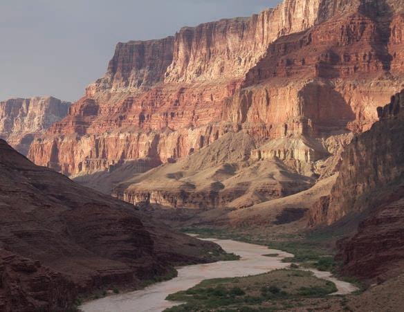
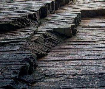
Mile 60 on the Grand Canyon Colorado River float trip. This is the last of the Paleozoic clastic rocks exposed travelling downstream from Lees Ferry. This 700m exposure starts at river level with Early Cambrian Tapeats sandstone and continues up through the recessive Bright Angel Shale and thin Middle Cambrian Muav Limestone. The impressive upper cliffs are the Devonian Temple Butte Formation and Mississippian aged Redwall Limestone. Photo by Dave Robinson.
The Metropolitan Conference Centre
A
International Prospects
Regulatory Issues & Sustainability
Large- Scale Deposits
Medium/Small - Scale
Reservoirs
New Drilling & Completions, Production Technologies
Steven Schamel
Allard Martinius
Dan Schwartz
Kevin Parks
Travis Hurst
Steve Hubbard
Ron Boyd
Milovan Fustic
Norka Marcano
Barry Bennett
Bill Macfarlane
Barkim Demirdal
Ian Gates
Cap Rocks & Reservoir
Integrity
GeoX Consulting Inc.
Statoil R&D
AERA Energy LLC
Alberta Energy Regulators
Alberta Energy Regulators
University of Calgary
ConocoPhillips Ltd
Statoil Canada Ltd.
University of CalgarySchlumberger post -doc
University of Calgary
Nexen Energy ULC
Nexen Energy ULC
University of Calgary, Schulich
School of Engineering
Dale Walters Taurus Reservoir Solutions Ltd.
Pat McLellan McLellan Energy Advisors Inc.


PAST PRESIDENT
Paul MacKay • Shale Petroleum Ltd. paul.mackay@shalepetroleum.com Tel: 403.457.3930
PRESIDENT Dale Leckie
PRESIDENT ELECT
Tony Cadrin • Journey Energy Inc. tony.cadrin@journeyenergy.ca Tel: 403.303.3493
FINANCE DIRECTOR
Gord Stabb • Durando Resources Corp. gstabb@durando.ca Tel: 403.819.8778
FINANCE DIRECTOR ELECT
Astrid Arts • Cenovus Energy aarts@barrick-energy.com Tel: 403.766.5862
DIRECTOR
Alexis Anastas • Nexen Energy ULC alexis_anastas@nexencnoocltd.com Tel: 403.699.4965
DIRECTOR
Andrew Fox • MEG Energy Corp. andrew.fox@megenergy.com Tel: 403.770.5345
DIRECTOR
Milovan Fustic • Statoil Canada Ltd. MFUS@statoil.com Tel: 403.724.3307
DIRECTOR
Michael Laberge • Channel Energy Inc. mike.laberge@telus.net Tel: 403.301.3739
DIRECTOR
Robert Mummery • Almandine Resources Inc. mummery1@telus.net Tel: 403.651.4917
DIRECTOR
Weishan Ren • Statoil Canada Ltd. wren@statoil.com Tel: 403.724.0325
DIRECTOR
Darren Roblin • Endurance Energy snowice@telus.net Tel: 587.233.0784
EXECUTIVE DIRECTOR
Lis Bjeld • CSPG lis.bjeld@cspg.org Tel: 403.513.1235
A message from Andrew Fox, Outreach Director
The CSPG has an extensive program of Outreach that is primarily focused on university students studying geology but also has educational initiatives that engage school-aged children and the general public in geosciences.
CSPG Outreach consists of four main initiatives:
• Student Industry Field Trip (SIFT)
• University Outreach
• Graduate Theses Awards
• Honorary Address
The Student Industry Field Trip (SIFT), which has been running since 1978, is an Outreach program designed to recruit top performing geology students to consider a career in the petroleum industry. For two weeks students are exposed to many aspects of the petroleum industry including participating in a challenging exploration game. Attending SIFT is a significant award for earth sciences students. It is seen as providing a “foot-in-the-door” to the Canadian Oil Patch by students attending universities that are considered to be off the radar of the industry recruiting tours. Many SIFT Alumni obtain employment in the energy industry and often become long term volunteers for the CSPG. The 37th SIFT was held in May 2014 with thirty-two undergraduate students from each Canadian university Earth Sciences department participating. Taylor Olson (Cenovus) and Meghan Speers (Consultant) did an outstanding job leading the SIFT Committee this year. I would be remiss not to mention our generous corporate sponsors who again made SIFT possible.
University Outreach is also a major effort by the CSPG. Chad Glemser (Shell) and his University Outreach Committee are doing an excellent job shepherding a number of programs benefiting university earth sciences students who become the main source of future petroleum geologists. The CSPG offers free membership to students who are enrolled in an accredited university Earth Science program. This student membership allows students to apply for CSPG scholarships and grants and get discounts for conferences, field trips and
courses that are offered by the CSPG. Students also get on-line access to the Reservoir and the Bulletin of Canadian Petroleum Geology
The University Outreach Committee manages the Regional Undergraduate Awards which reward academic excellence and a strong interest in petroleum geoscience. Student Event Grants support the costs of departmental field trips and courses for undergraduate students. Students working in Calgary can attend the Summer Student Field Trip. Last year Derald Smith (University of Calgary) led a group of 32 students to the Porcupine Hills to examine fluvial deposits. Through the University Outreach program the CSPG sponsors Regional Student Conferences in Atlantic Canada (AUGC), Quebec (Jeux de Géologie), Ontario (AESRC) and Western Canada (WIUGC). Our volunteers have an opportunity to interact with students from across Canada at these regional conferences and promote the value of the CSPG.
University Outreach also manages the University Lecture Tours where speakers from Industry and Government visit earth science departments across Canada in order to present on timely topics related to petroleum geoscience. Brad Hayes (Petrel Robertson) and Kirk Osadetz (Carbon Management Canada) graciously volunteered their time to speak to students this past year. University Outreach is planning to have a more extensive program of visiting speakers for the upcoming school year.
University Outreach also hosts student networking events at the GeoConvention. GeoConvention itself provides awards for best student oral and poster presentations, travel subsidies and registration refunds to students who volunteer at the convention.
Honorary Address is another Outreach initiative targeting not only CSPG members but also students, teachers and the general public. Its mandate is to provide engaging speakers discussing topical issues related to petroleum
(Continued on page 7...)
CORPORATE SPONSORS
SAMARIUM
geoLOGIC systems ltd.
TITANIUM
ConocoPhillips
APEGA
Nexen ULC
IHS
Shell Canada Limited
PLATINUM
Schlumberger Canada Limited
Cenovus Energy Inc.
Imperial Oil Resources
AGAT Laboratories
GOLD Devon Canada Corporation
MEG Energy Corp.
Tourmaline
Baker Hughes
SILVER
CGG Services (Canada) Inc.
Suncor Energy
MJ Systems
Encana Corporation
Canadian Natural Resources Ltd.
Athabasca Oil Corporation
Enerplus
EOG Resources Canada Inc.
Husky
ION Geophysical
Petrosys
BRONZE
Olympic Seismic Ltd.
Arcis Seismic Solutions
Seisware
Loring Tarcore
PGS
Saudi Aramco
Roke Technologies Ltd.
Belloy Petroleum Consulting
Earth Signal Processing Ltd
Sensor Geophysical Ltd.
Tucker Energy Services Canada
Pro Geo Consultants
Talisman Energy
Geovariances
Hunt Oil
Tesla
TGS
Continental Laboratories (1985) Ltd.
Total Gas Detection Ltd.
RPS Energy Canada Ltd.
Explor
GLJ Petroleum Consultants Ltd.
Paradigm Geophysical (Canada) Corp.
PLS Inc
As of June 2014
A Special Thanks to Geologic Systems Ltd., CSPG ’s Top Sponsor of the Month.
(...Continued from page 5)
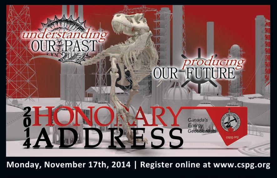
geoscience. The Honorary Address will be held on November 17, 2014 when Scott Tinker from the Texas Bureau of Economic Geology and François Therrien from the Royal Tyrrell Museum will be presenting “Understanding Our Past, Producing Our Future.” Keith Millis (OptiSeis) leads the Honorary Address Committee which promises to deliver an Honorary Address that the CSPG membership won’t want to miss.
The CSPG has given an award for the best graduate thesis since 1958. Many award winners have gone on to become business
and technical leaders at Canadian energy companies, leading geoscientists at federal and provincial regulators and geological surveys, and professors at Canadian universities. This year the CSPG has raised the value of the Graduate Theses Awards to acknowledge the increased cost of obtaining a graduate degree as well as rewarding academic excellence. The CSPG has also re-established the Regional Graduate Student Awards to provide additional funding for graduate students in the process of completing their programs. The Graduate Awards Committee led by Andre Chow
(Continued on page 15...)

•
•
•
•
•


Conventional / Un-conventional 1350, 734 - 7th Ave SW Calgary, AB T2P 3P8
B 403.234.7625, www.WellsiteGeologists.com
C 403.660.9883, info@WellsiteGeologists.com

George Eynon earned his B.Sc. in geology and geography in 1969 from the University of London and then worked as a high school teacher for a year with the Greater London Education Authority, before moving to Hamilton to do his M.Sc. in geology. He finished in 1972, after writing a thesis on the structure of braid bars: facies relationships of Pleistocene braided outwash deposits. In 1991, George attended the Senior Executive Program at the Sloan School of Management at the Massachusetts Institute of Technology. He also studied the Institute of Corporate Directors education program at the University of Calgary’s Haskayne School of Business in 2012 and 2013.
Mr. Eynon joined CSPG in 1972 and his first committee in 1986. Over the years, he was a Session Chair for the Annual Convention seven times (1991, 1993, 1998, 1999, 2000, 2005, 2006), the Chair of various committees including the Technical Program (1986), Keynote Address Committee (1994, 1996), Nominations Committee and Awards Dinner (1997) and Committee on Conventions (2001 – 2005). His three-year Executive term was centred on his 1996 Presidency, where one of the most important contributions was the realization that CSPG needed to hire a business manager and get the society’s finances under control, a task he oversaw. George has given several CSPG talks, including as keynote speaker at AGS 75th Anniversary Lecture (1995), and CADE/CAODC Conference (1997). His work has not gone unnoticed by his peers, winning him many awards: Graduate Thesis Award (1973), Tracks Award (1987), President’s Award (1993), Volunteer Award for work in AAPG House of Delegates (1998) and Service Award for work as Founder and Chair of the Committee on Conventions (2004).
His volunteering is not limited to CSPG. Notable from a long list of achievements is extensive work with AAPG, including
serving in the House of Delegates (1989 –2008), as a Charter Member of the Divisions of Environmental Geosciences (1992 –Present) and committee work from 1991 to 2006. He has won several AAPG awards, including Distinguished Service Award (1996), Certificate of Merit (1993 and 2002) and Honorary Lifetime Membership (2008). With APEGA, he was a Member and Chair Practice Review Board (1994 – 1997) and various ad hoc governance and strategic planning committees (2012 – Present). He served on various committees with CAMPUT, Canada’s Energy Regulators, from 2008 through 2013, including on the Energy Resource Committee.
George started his professional career at Amoco in 1972, and over the next 20 years, he worked for several companies including Paramount Resources, Superior Oil, Suncor Energy, Bow Valley Industries, SMI Oil and Gas. He moved into increasingly senior roles, first as a technical geologist then moving into managerial and executive positions in exploration and production. In 1996 he moved to Ziff Energy as the Vice President of Corporate Consulting. Two years later, he became the Director of North American Upstream Oil and Gas Research at CERA:
Cambridge Energy Research Associates. He became the VP of Business Development and External Relations and Research Director, Natural Gas Division in 2004 at CERI –the Canadian Energy Research Institute. In 2008 Mr. Eynon moved to the Energy Resources Conservation Board (ERCB) as a Board Member until it became the newly formed Alberta Energy Regulator in 2013, where he served as a Hearing Commissioner. Later that year, George founded Geos Eynon and Associates Consulting, which works with industry and public stakeholders at all levels on a wide-range of energy issues, from strategic to operational.
As well as his professional work, Mr. Eynon has sat on a number of boards, including SMI Oil and Gas (1994 – 1996), Derek Oil and Gas (2004 – 2008), Geoscientists Canada (2013 –Present) and APEGA, as a Councillor (2012 – 2017), and currently as APEGA’s Director on the Board of Geoscientists Canada.
George has made substantial technical contributions to geoscience. He has lectured extensively around the world; he has given regulatory advice to numerous national, state, and provincial jurisdictions world-wide; and he has spoken at conferences including CSPG and the Canada China Economic Cooperation Conference Mr. Eynon has taught at the Petroleum Land Management Program at the Haskayne School of Business, University of Calgary, as well as delivering numerous inhouse courses for industry and government organizations.
George has had an exceptional and varied career. He is a top notch geoscientist, teacher, and leader. He is a dedicated volunteer, always serving to improve our geoscience community. CSPG is pleased to award George Eynon with Honorary Membership Status.

and Registration at: www.spec2000.net/00-coursedates.htm
E. R. (Ross) Crain. P.Eng. 1-403-845-2527 ross@spec2000.net
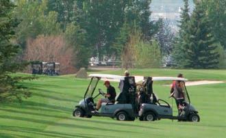


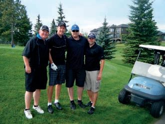

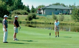
August 22, 2014
Join us and have fun in this four golfer best ball tournament. Your cost includes a round of golf, meals, plenty of hospitality and good times, and a chance to network with your colleagues and industry sponsors
Registration Rates: CSPG member: $90.00+gst
Non-member: $130.00+gst
For more information and to register today please go to www.cspg.org
Robin Mann joined CSPG in 1977, after he graduated from Dalhousie University with a B.Sc. (Honors), writing his thesis on the Formation of the Scotian Basin and Atlantic Margin. Two years later, he received his M.Sc. from Carleton University after completing a thesis on the Formation of the Rocky Mountain Foreland and Thrust Belt. Mr. Mann became increasingly active in CSPG starting in 1997, when he became the Chairman of the Insurance Committee, which earned him a Service Award in 2005. In 2011, he joined the Educational Trust Fund Committee and became the Society’s Vice President.
During his 2012 Presidential term, he oversaw several important projects. He executed changes to the GeoConvention Agreement to include all three technical societies, as well as inclusion of a public outreach component. Mr. Mann supervised changes as CSPG incorporated as a not-for-profit under new Canada Revenue Agency directives, and oversaw the creation of new bylaws and the restructuring of the Executive Committee. Robin was personally involved in the office move and rebranding efforts. His efforts have left a clear and tangible mark on CSPG.
As a geologist, Mr. Mann has more than 35 years of experience in the petroleum industry in both geological and management roles. He started with Amoco Canada in 1977 as an exploration geologist, then spent a few years in a
similar role at Aquitaine Company, then joined the consulting world as an Exploration and Development Geological Consultant with Fekete and Associates. This experience allowed Robin the confidence to cofound the geological consulting firm of Hume, Mann & Associates in 1984. The firm merged and grew, as did Mr. Mann’s role. Over the years, he has been the Vice President of Geology, Chief Operating Officer, Chief Financial Officer, President, Chairman, and CEO. The company changed names over the years until as AJM Petroleum Consultants, it was purchased by Deloitte Canada, where Robin now works as a Partner, heading up their Global Resource Evaluation and Advisory Practice. In addition to his own work,
he has sat on the Board of Directors for several companies, including Castlerock, Seventh Energy and Westward Energy.
Mr. Mann has presented several keynote addresses and talks over the last 14 years, in places ranging from New York to Rio de Janeiro to London, on topics such as Shale Gas in North America, The Oil and Gas Regulatory Environment in the Caribbean, and Economic Viability of Oil and Gas Prospects in the Western Canadian Sedimentary Basin. He has taught unconventional gas exploration both domestically and in Brazil.
As well as his work with CSPG, Robin has been active with APEGA and AAPG, serving as a Member of the Division of Professional Affairs since 1987. Mr. Mann has always been active in his community. As the father of four sons, he became very involved with minor hockey, donating his time to Hockey Calgary (1993 – 2004) and Hockey Alberta (2004 – 2007, 2010), including a 5 year stint as President of Hockey Calgary (1999 – 2004) and a Board Member of Hockey Alberta (2004 – 2007). He also sat on the board for Magnetic North Theatre Festival (2010).
Over his career, Mr. Mann has been a purely technical geologist, a leader, an executive, a board member, an active volunteer and a company founder. CSPG is proud to welcome Robin Mann into the ranks of Honorary Members.
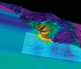
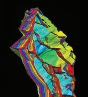
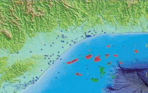
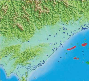
The Upper Devonian (Frasnian) Duvernay Formation represents an extensive proven source rock and major shale resource play. Although productive, the formation comprises shale – carbonate successions that are characterised by significant lateral facies variations, which cause problems when targeting sweet spots and identifying changes in mineralogy in order to optimise fracking. Moreover, variable E-log responses and the lack of reliable biostratigraphic data, all contribute to produce poor chronostratigraphic correlations that restrict accurate mapping of play fairways. To counter these problems, Chemostrat Canada Ltd has established a unique Duvernay Shale Database to improve stratigraphic correlation, to provide data for frack optimisation and sweet spot mapping. The Shale Database uses high resolution chemostratigraphy (based on 50 elements), TOC and C-isotope chronostratigraphic data to constrain the fieldand subregional-scale correlations and anoxia maps for sweet spot identification. In addition, the same chemostratigraphic elemental dataset employed for correlation has also been used to model mineralogy (following calibration from X-ray diffraction (XRD) dataset) to produce mineral and brittleness logs providing data for petrophysical calibration and frack optimisation. The ongoing Database currently consists of 18 wells drilled in the Kaybob and Willesden Green fields and provides operators with pilot-hole data of offset well comparisons for many of the areas targeted for upcoming development wells.
RESOLUTION
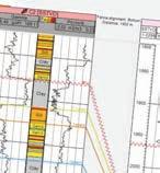
The Duvernay is traditionally correlated using wireline log data. However due to the absence of high resolution biostratigraphy these correlations cannot be validated. With the occurrence of significant lateral facies variations and somewhat repetitive E-log motifs, miss-matched correlations can occur. As a result, well to well correlations and intra Duvernay mapping of sweet spot development can be compromised. Shale sequences are ideally suited to correlation using chemostratigraphy as subtle stratigraphic variations in the mineralogy of sedimentary rocks (especially the clay minerals and heavy minerals), caused by changes in provenance, depositional environment and climate, amongst other factors, are reflected by minor changes in the inorganic geochemical dataset.
Chemostrat Canada Ltd. offers three grades of elemental chemostratigraphy data dependant
on the application, instrumentation and interpretative methodology. 1) Handheld XRF (HHXRF) typically determines 10-20 elements (dependant on rock type) and is ideally suited to lithotyping and basic chemostratigraphic correlation. 2) Bench top XRF, which is best undertaken on powdered or pelleted samples (c.25-40 elements) and suited to rapid turnaround lab / wellsite analysis for correlation, geosteering and rock properties. 3) High resolution inductively-coupled plasma - optical emission spectrometry (ICPOES) and inductively-coupled plasma - mass spectrometry (ICP-MS) analysis (c.50 elements) for detailed correlation, anoxia mapping and reservoir characterization. The Duvernay Shale Database offers high resolution (10 fold) chemostratigraphic correlation for Kaybob and Willesden Green fields based on ICP data of all samples, but also demonstrates the suitability and application of HHXRF and bench top XRF in the Duvernay. Furthermore, the chemostratigraphic correlation framework is supplemented by chronostratigraphic correlation of the Duvernay based on carbon isotope stratigraphy (δ13C). This technique is based on the correlation of fluctuations in 13C/12C values in the oceans through time, which are recorded in the composition of marine carbonates (δ13Ccarb) and organic rocks (δ13Corg) and can be tied to a well-documented global database that is characterized from the Neoproterozoic to Cenozoic. As a result, C-isotope analysis can be used as a chronostratigraphic tool suitable for core and cuttings, especially where biostratigraphic data are lacking.
Three major isotopic excursions can be detected in the Duvernay succession and these have been tied to global events associated with P. punctata conodont biozone. Significantly, these excursions validate the chemostratigraphic correlations and also provide a chronostratigraphic framework to map the distribution of carbonate, clay and organic preservation within sub-basins of the Duvernay. Moreover, a combined elemental and C-isotopic chemostratigraphic approach can provide a means for regional correlation of the Upper Devonian in Alberta and British Columbia, but is also equally applicable to other shale plays around the world.
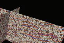
Understanding the mineralogy of shale resource plays is imperative for completing horizontal wells and maximising well
performance. Precise measurements of clay content are needed to determine the relative brittleness of shales which can help in formulating fracking strategies. XRD is routinely used to evaluate sedimentary rock mineralogy, however to acquire accurate XRD data can be time consuming and expensive. As a result, in the limited time prior to completion, most decisions over frack stage placements are based on E-log and strip logs. However, onsite or ‘hot shot’ elemental chemostratigraphic data can also be used to model mineralogy and organic content and therefore provide mineralogical data comparable to XRD and TOC data either in realtime or within 1-2 days prior to completion. In addition, the integration of elemental chemostratigraphic data with E-log data provides a means to enhance and cross check the petrophysical interpretation of reservoir properties leading to improved decision making for frack optimisation. The Shale Database provides modelled mineralogical and TOC data for all wells and provides XRD and TOC validation data that form the basis of the modelling protocols. Such a combined approach is not limited to a particular area or stratigraphic interval and the model developed for the Duvernay Formation can be applied to analogous intervals across the study area, ultimately providing a clearer understanding of a field’s physical characteristics and thereby helping in the best placement of lateral wells and the deployment of techniques such as fracking.
The Duvernay Formation will be the focus of massive drilling challenges over the next few years. It is critical that operators adopt a rigorous and scientifically proven, but pragmatic, workflow to ensure that data and interpretations remain consistent throughout the development cycle. It can be argued that Chemostrat’s Duvernay Shale Database provides a bench-marked high quality dataset that can be used immediately to aid in correlation, mapping and completion optimisation in upcoming wells, however it also represents a foundation resource onto which new data can be layered and constantly applied to upgrade your understanding of the Duvernay.
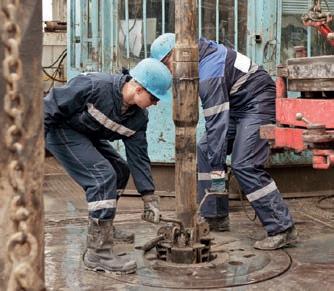
Chemostrat Canada Ltd in association with Belloy Petroleum can now offer lab, hot shot and wellsite chemostratigraphy services with Chemostrat’s portable solutions.
Chemostrat Canada Ltd in association with Belloy Petroleum Consulting Ltd can provide fast turnaround elemental, mineralogical, magnetics and TOC data in the lab, in the corestore or at wellsite for geosteering, correlation, reservoir quality and completion optimisation.
At GeoConvention: FOCUS 2014 we recently showcased our portable and wellsite solutions, demonstrating how clients can benefit from the combined strength of Chemostrat’s proven analytical and interpretative skills and Belloy’s 35 years of wellsite expertise in Canada.
Chemostrat/Belloy - Taking science to the field
In association with
Chemostrat Canada Ltd.
Sun Life Plaza West Tower, 144-4 Avenue SW, Suite 1600, Calgary, Alberta, T2P 3N4
t 403-463-8188
e CAoffice@chemostrat.com
Belloy Petroleum Consulting Ltd.
102, 902 - 9th Avenue SE Calgary, Alberta, T2G 0S4
t 403-237-8700
e contact@belloy.ca
Outcrops, Stratigraphy, and Geomodeling: Lisa Stright, University of Utah,USA Michael Pyrcz, Chevron,USA
Multi-scale Data and Multi-variate Modeling:
Sanjay Srinivasan, University of Texas at Austin, USA
Claude Scheepens, ConocoPhillips, USA
Properties in Models: Advancing Continuous Variables
Mohan Srivastava, FSS Consultants, Canada
Colin Daly, Schlumberger, UK
Post-processing Geomodels: Clayton Deutsch, University of Alberta, Canada Weishan Ren, Statoil, Canada
Modeling Uncertainty:
Emmanuel Gringarten, Paradigm, USA
W. Scott Meddaugh, Midwestern State University, USA
Geomodeling Unconventionals: Jeffrey Yarus, Halliburton, USA
Ian Gates, University of Calgary, Canada
Host: Canadian Society of Petroleum Geologists (CSPG)
Location: RimRock Hotel, Banff, Alberta, Canada
Dates: September 22-24, 2014 (Monday AM to Wednesday PM)
(Pengrowth), diligently reviews all of the theses submitted to the CSPG.
There are numerous Outreach initiatives that the CSPG would like to further expand. The CSPG lags behind other professional and technical associations in Outreach to school-aged children and their teachers. The CSPG participates in the Calgary Teacher’s Convention and has plans to become more involved in Calgary Area high school career days. These programs must be expanded to the rest of Alberta and across the country. The CSPG also needs to help students and teachers across Canada where there are existing earth sciences programs in high schools. The Society must encourage and assist other provinces to develop high school earth science courses for their curriculum. In order to attain these new goals a substantial volunteer effort, financial resources and commitment from the CSPG membership is required if we are to extend our influence into the Canadian education system.
The CSPG must ensure that all of our Outreach initiatives can be deployed across Canada so that we are not perceived as only serving the
Calgary membership. In order to address the challenge of being Canadian in scope the CSPG is using initiatives such as the Ambassador Program to develop greater cooperation with our sister geoscience societies across the country and Canadian university Earth Sciences departments.
The CSPG Educational Trust Fund (ETF) plays a critical role for Outreach at the CSPG. The ETF, which is a registered Canadian charity, funds programs that advance petroleum geoscience education. Many of the CSPG’s Outreach efforts are funded by the ETF. In the last year the ETF has provided over $60,000 of funding to various Outreach initiatives. As the ETF grows in value through the generous donations from our members, it can fund an increasing number of Outreach initiatives. There is never a shortage of applications for funding and new opportunities for geoscience education are always being developed by motivated individuals and groups.
It has been 18 months since I began as the Director responsible for Outreach by the CSPG. In that time my pride in belonging to
the CSPG has increased substantially because of the positive programs that our Society supports. I think that we are on the right track to enhance, develop and fund existing and new Outreach initiatives that can be deployed across Canada.
I want to thank my Outreach predecessors, Simon Haynes (Statoil) and Dawn Hodgins (Imperial Oil), who set the bar for me to emulate and supported me throughout my tenure as Director. Outreach requires a Director to champion it but it wouldn’t happen without the Outreach committees and the CSPG Staff. Our volunteers and Office Staff are amazing. Their commitment and enthusiasm make our programs successful. Our volunteers are the best ambassadors for our profession to students and the public. Their employers should also be commended for encouraging volunteerism. My hope for the incoming year is that some of you who are reading this article decide to make a difference and volunteer with one of the existing Outreach committees or help develop new initiatives that promote geoscience education.
(Terrain map from http://maps.google.com)
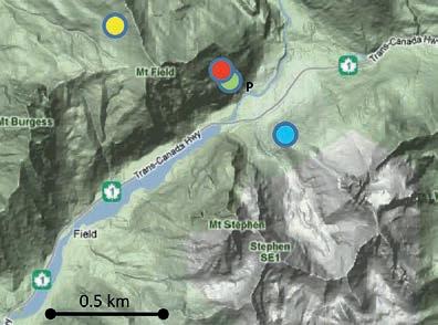
Trailhead: Travel west on the TransCanada Highway down the Kicking Horse Pass. Turn north onto the Yoho Valley Road (look for the signs to Takkawkaw Falls) and follow it 800 metres to the entrance of the Monarch campground and park at one of two parking lots located at the entrance to the campground. Locate the adits on the cliff wall to the northwest.
Distance: ~2 km loop. Walk through the campground to access the scramble route at the back of campsites. Elevation gain is ~100 m. At the adit you’ll have a great view of the Kicking Horse Valley and perhaps a long train! Do not attempt to enter the mine (both illegal and dangerous), disturb the mine gates or take any material from the site.
Field, B.C. is known for its significant Burgess Shale fossil sites, but these overshadow two important economic deposits in the area: the Monarch Mine on Mt Stephen and, at the southeast end of famous Fossil Ridge, the Kicking Horse Mine on Mt Field. Galena and sphalerite (lead and zinc sulphides) and a little bit of silver from both mountains were mined until 1952 with over three million dry tons of ore removed from what is now Yoho National Park. Relict mining structures can still be seen on the hillsides and within the adit openings. The adits on Mt Field are accessible by a short, brisk scramble, perfect for a highway rest stop or early evening stretch if you stay in Field overnight. There’s no collecting allowed – this is a National Park and a UNESCO world heritage site!
Long before this international distinction, Tom Wilson (formerly of the Northwest Mounted Police) and his Stoney guide named “Gold Seeker” travelled up the Bow Valley in 1882 and then beyond to the vicinity of Field. He was the first non-native to see Lake Louise and Emerald Lake. He noticed mineralization in the valley upstream of Field and staked a claim, which he later sold for $21,000 (a value of approximately half a million dollars today). Ultimately there were three main mines; East and West Monarch Mines on Mountain Stephen (which are inaccessible) and Kicking Horse Mine (originally named Black Prince for its dark sulphide ores) on the north side of the valley on the slopes of Mount Field. Even though the Park was established in 1886, the mines were developed because jurisdiction for mining belonged to the BC government. Rights for activities in all national parks became Federal jurisdiction in 1930 and no more mining permits were issued. The proximity to the newly built railway allowed for rapid development of the mine and by 1888 the ore was being shipped to the Trail smelter (Hedley, 1954). The resulting East and West Monarch mines utilized an aerial tramway to extract the ore to the local processing site. From there conveyor belts transported the ore to crushers which reduced the rock to centimetre sized fragments. At the mill, this debris was mixed into a slurry with water and cyanide where it was ground into a powder by manganese steel balls. The mine was at its peak over the years of World War I when demand for lead was at an all-time high (reaching 27 cents a pound). Even though the Kicking Horse deposit was discovered not long after the Monarch, it wasn’t worked extensively until 1925. All mines were shut down by 1952, and five years later all underground equipment was salvaged and the mill equipment shipped to Cowichan Copper Incorporated on Vancouver Island.
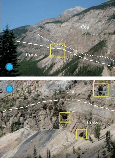
On your ascent, take time to view across the across the valley. Entrances into the Monarch Mine on Mt Stephen are visible but not easily accessible; spot them at the truncation of a prominent dark grey interval by a salmony pink hydrothermal dolostone, just as on Mt Field (yellow box in figure to left). Assuming the two ore bodies in Monarch and Kicking Horse mines are connected, they could be over 2 km long. The stratiform, NW–SE linear ore bodies in both mountains (see map on next page) are invisible from the road, but they are mostly within the lower portions of the Cambrian Cathedral Formation. They run parallel and proximal to the Cathedral Escarpment which had about 150 m of relief on the Cambrian seafloor. It is at the foot of this escarpment that the Burgess Shale and its famous fauna were preserved.
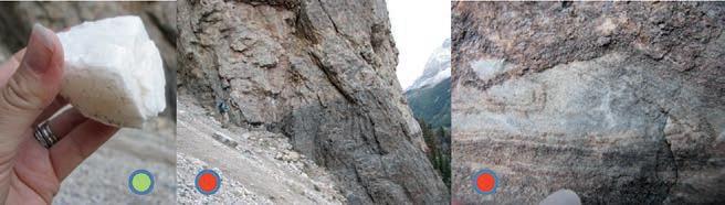
Centre Left is a view of the flanks of Mount Stephen, from a viewpoint on the slopes of Mount Field). The Monarch mine entrances are within the yellow box. The dashed line marks the contact between the pink hydrothermal dolomite and grey muddy carbonates of the lower Cathedral (Cca). The Cathedral sits on the mixed siliciclastics and carbonates of the Middle Cambrian Mount Whyte Formation (Cmw).
Bottom Left: Yellow boxes mark the adits on Mt Field. The black scree (marked with an ‘s’) below the adits is not galena waste from the mine but rather it is black dolomudstone. Bottom Right: View of Cathedral Escarpment on Fossil Ridge. Note the extremely steep contact with the relatively flat lying Burgess Shale.
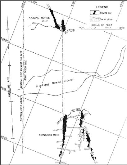
Above: Map showing relationship of ore bodies to the Stephen-Field Fault and the Kicking Horse and Monarch Mines. Figure from Brown, 1948.
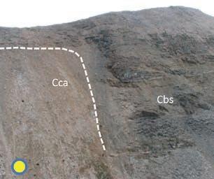
Top Left: View to Mount Stephen from near adit entrance on Mount Field. The mine entrances roughly line up with the hydrothermal dolomite contact.
Above Left (green circle): Dark coloured, soccer ball shaped pyrite (pyritohedra) enveloped in white hydrothermal saddle dolomite.
Far Left (red circle): view of remnant wooden scaffolding in the blocked entrance to the mine.
Centre (red circle): The entrances to the adits have been blocked off. The mines are extremely dangerous due to risk of fall, rock fall and leftover mine equipment. Do not attempt to enter the abandoned mine.
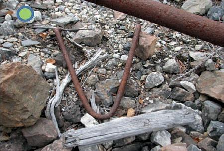
Lower Left: Remnants of mine equipment can be seen on the ascent to the adit. Remember that these are part of the park history and just like the rocks and flowers, are illegal to disturb.
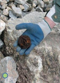
The ore bodies occur in brecciated grey dolomite with white (hydrothermal) dolomitic veins running throughout. Abundant minerals in the layered zone include galena (PbS), amber coloured sphalerite ([Zn,Fe]S), pyrite (FeS2) and chalcopyrite (CuFeS2) (Ney, 1954). Native silver is a rare constituent as well as non-metallic minerals such as quartz, talc and amphibole. The mineralized zones average about 5.6% Pb, 8.9% Zn and 31g silver per tonne (Hoy et al, 2000). Presumably, the mud accumulation over millions of years was gradually squeezed by its own weight, releasing magnesium-rich dolomitizing brines that also brought the Kicking Horse Mine metals. Geologists debate the timing of emplacement of the ores whether Cambrian, Devonian or sometime during the mountain-building of the Rockies (late Cretaceous to early Cenozoic).
Recently, a middle Cambrian age for ore deposition was proposed based on observations indicating an ancient tectonic collision; in this scenario, metal rich brines that leaked up basement faults onto the seafloor promoted bacterial growth and attracted marine animals. For more discussion on the dolomitization event refer to the Mount Stephen, Bow Glacier, Yoho Glacier and Wapta Mountain hikes. Whichever geologic model you prefer, there is a wealth of rock evidence from the abundant talus below the mine adits. Sturdy hiking shoes are best because there is no formal path and a helmet is recommended if you go up to the cliff wall. It seems odd to think that this local area, now protected by Parks Canada, was once the site of active, economic mining, both of fossils exported to the Smithsonian Institute and of metal ores.
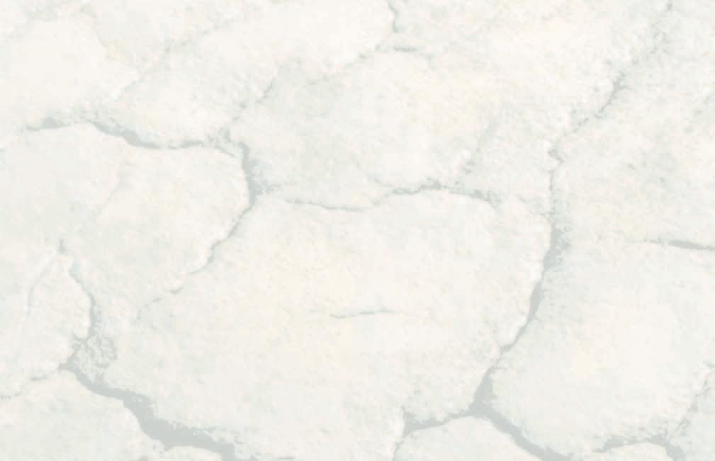
Top, far left: White saddle dolomite – so called because the crystal structure is warped into a saddle shape. It typically forms in temperatures in the range of 60-150°C which are common to hydrothermal conditions. Note that fragments of white dolomite and some mineralization can be seen in pebbles along the banks of the KH river in Field… without the effort of the scramble! Above left: boundary near adit entrance of pink hydrothermal dolostone and dark grey dolo-mudstone. Above Right: Some of the original carbonate textures (herringbone calcite in this case) still exist although the rock has subsequently been altered to dolomite. Herringbone calcite occurs as an early void filling cement in Pre-Cambrian and lower Paleozoic carbonates. It is often associated with anaerobic or organic rich settings. Top, far right: The slope scree contains gossan, a rusty mass that is common where metal sulphides (such as pyrite and sphalerite) are exposed to air and chemical weathering.
References: Aitken, J.D. 1971. Control of lower Paleozoic sedimentary facies by the Kicking Horse Rim, southern Rocky Mountains, Canada. Bulletin of Canadian Petroleum Geology, v. 19, p. 557-569.
Brown, W.L., 1948. Monarch and Kicking Horse mines. Structural Geology of Canadian Ore Deposits, 231-237. Fletcher, T., 2011. Mid-Cambrian lithostratigraphy, Kicking Horse Belt, Canada. Palaeontographica Canadiana v. 31, 39-72.
Hedley, M.S., 1954. Mineral Deposits in the Southern Rocky Mountains of Canada, In ASPG Fourth Annual Field Conference Guidebook: Banff-Golden-Radium, pages 110-118.
Hoy, T., D. Brown, J. Lydon and Cominco Mine Staff, 2000. Sullivan and other Pb-Zn Deposits. South-eastern British
Columbia and Northern Washington. Geo-Canada 2000 Conference Field Trip Guidebook Number 17. 140 pages.
Johnston, P.A., Johnston, K.J., Collom, C.J., & Powell, W.P. (2009). Palaeontology and depositional environments of ancient brine seeps in the Middle Cambrian Burgess Shale at The Monarch, British Columbia, Canada. Palaeogeography, Palaeoclimatology, Palaeoecology, 277, 86-105.
Keith, S.B., et al., 2009. Cambrian tectonic setting and fluid source for the Burgess Shale seep-related ecosystem. International Conference on the Cambrian Explosion, Banff, Alberta. Abstracts volume pp. 39–40.
Ney, C.S., 1954. Monarch and Kicking Horse Mines, Field, British Columbia. In ASPG Fourth Annual Field Conference
Guidebook: Banff-Golden-Radium, pages 119-136.
Powell, W.G., et al., 2006: Middle Cambrian brine seeps on the Kicking Horse Rim and their relationship to talc and magnesite mineralization and associated dolomitization, B.C., Canada. Economic Geology, v. 101, pp. 431–451.
Radke, Bruce M. and Mathis, R.L., 2006. On the formation and occurrence of saddle dolomite. Journal of Sedimentary Research, v. 50 no. 4 p. 1149-1168.
Sumner, D.Y., Grotzinger, J.P., 1996. Herringbone Calcite: Petrography and Environmental Significance. Journal of Sedimentary Research, Section A: Sedimentary Petrology and Processes. Vol. 66 (1996)No. 3. (May), Pages 419-429.


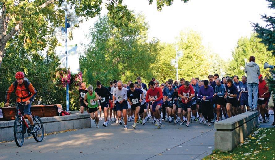
CSPG/CSEG/CAPL Road Race is on September 10th, 2014 5Km and 10 Km distance
Registration is now OPEN on the CSPG website.
To register please go to www.cspg.org
REGISTRATION RATE:
Deadline to register is Thursday September 4th. No late registrations or changes will be accepted.
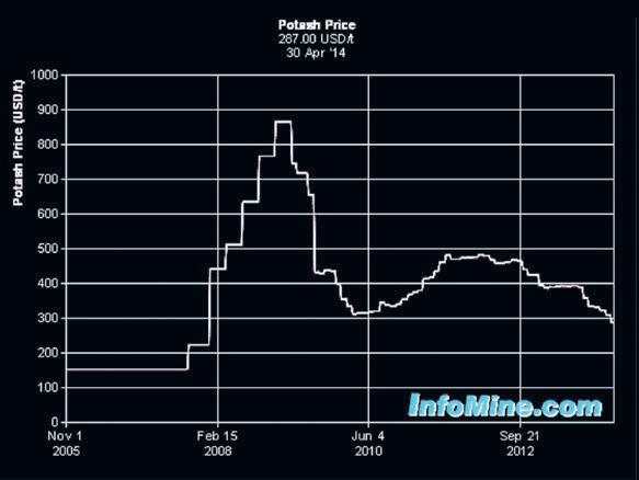
Potash was a hot topic in the early 1960’s when I was a young logging engineer assigned at Lanigan, SK with one operator and a breadwagon (equivalent to today’s “cube-van”). We dripped oil-base mud into the motel and all along the Yellowhead from Saskatoon to Yorkton. Potash price peaks in 2010 encouraged a renewed interest in potash, especially on Indian Reserves and deeper plays where solution mining is more practical than subsurface mining.
The price peak in 2010 has subsided to more rational levels but exploration and development, not to mention talk of acquisitions and mergers, are still active. This level of interest has generated a modest amount of petrophysical analysis, using logs that date from the mid-1960’s to the present.
The major source of potash in the world is the Devonian Prairie Evaporite Formation in Saskatchewan, which provides 11 million
Work on Canadian Discovery and partners’ Duvernay Project is well underway. This study evaluates the Geomechanics, Hydrocarbon Systems and Geological Setting of the Devonian Duvernay Formation in the Kaybob to Willesden Green Area.
Results to date indicate:
» Variable lithology and a well-defined facies/ lithology dependent fracture fabric
» Stratigraphy shows a possible extension to the current play areas
» Geochemistry shows source rock maturity is strongly related to heat flow variations
A geomechanical evaluation, detailed geochemistry, hydrogeology and reservoir mapping will be completed prior to study delivery.
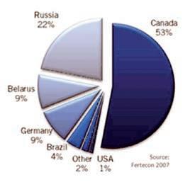
tonnes per year. Russia is second at 6.9 million and the USA (mostly from New Mexico) at 1.2 million tonnes per year. A dozen other countries in Europe, Middle East, and South America produce potash from evaporite deposits.
The main potash salts are sylvite, carnalite, langbeinite, and polyhalite, mixed in varying concentrations with halite (rock salt). The main use of potash is as fertilizer. Sylvinite is the most important ore for the production of potash in North America. Most Canadian operations mine sylvinite with proportions of about 31% KCl and
66% NaCl with the balance being insoluble clays, anhydrite, and in some locations carnallite.
PETROPHYSICAL PROPERTIES OF POTASH MINERALS
Potassium is radioactive so the gamma ray log is used to identify potash bearing zones. Potash minerals have distinctive physical properties on other logs, so conventional multi-mineral models can be used to determine the mineral mixture, just as we do in carbonates in the oil and gas environment.
(...Continued from page 21)
The Vp/Vs ratio for most salts is near 1.90, so shear travel time is about 1.90 times the compressional travel time given above.
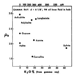
A density versus K20 (or gamma ray) crossplot helps to define which minerals might be present.
Since potassium is radioactive, the K2O content can be derived from gamma ray logs, and this technique has been used since the mid 1960’s (Crain and Anderson, JCPT, 1966).
Most analog oil-field GR logs were nonlinear above about 300 API units due to dead time in the counting circuit. These older logs are still available in the well files. The non-linear relationship is shown below. Digital tools from the 1980’s and onward were more linear. Hole size and mud weight corrections are still needed for both the old and the new versions of the logs.
K2O content was derived from GRc using the lookup table shown at the right. It is linear up to 400 API units and exponential thereafter. Values in the table represent a 6 inch borehole filled with diesel at 7.2 lb/gal. The linear portion of the lookup table is represented by:
3: IF GRc <= 400
4: THEN K2O = 0.05625 * GRc
5: OTHERWISE Use Lookup Table
The slope in the above equation can be determined by correlation to core assay data for other hole sizes or other tool types.
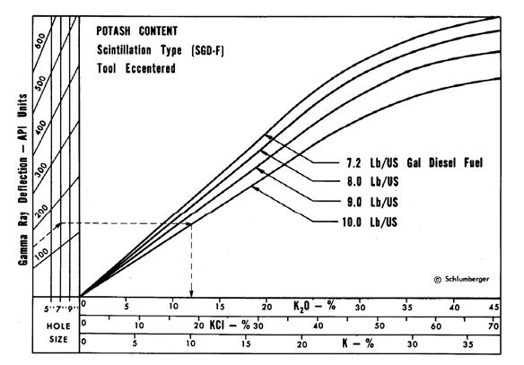
versus Gamma Ray relationship for analog
tools circa 1960 - 1980, run in open hole with oil based mud. Tools from other service companies may differ. Correlation between log and core assay data for specific cases is strongly recommended.
The non-linear relationship must be honoured while analyzing these older logs for potash. The effect is negligible for conventional oil field applications. Modern digital tools are linear up to about 1000 API units so the discussion in this section does not apply.
Many potash exploration wells in the USA and elsewhere were logged with slim hole GR tools intended for uranium work. While they may have been more linear,
they were not usually calibrated to any standard, suffered from larger borehole effects, and were recorded in counts per second (cps). Specific correlations to core assay data on a well by well basis are required. For more on this, see www.spec2000.net/17-specpotash.htm .
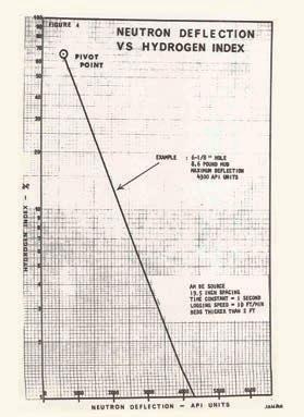
Due to the water of hydration associated with carnallite, the neutron log is very useful for distinguishing between carnallite and sylvite. High neutron count rates mean low hydrogen index, thus sylvite and not carnallite.
To quantify the relative amounts of carnallite and sylvite, the neutron response must be converted to porosity from count rates using the standard semi-logarithmic relationship. A typical transform for a 1960’s era Schlumberger tool is shown at the right. Charts for other tools can be found
in ancient service company chart books. With the advent of the sidewall neutron log in 1969 and later the compensated neutron log, this transform was no longer required.
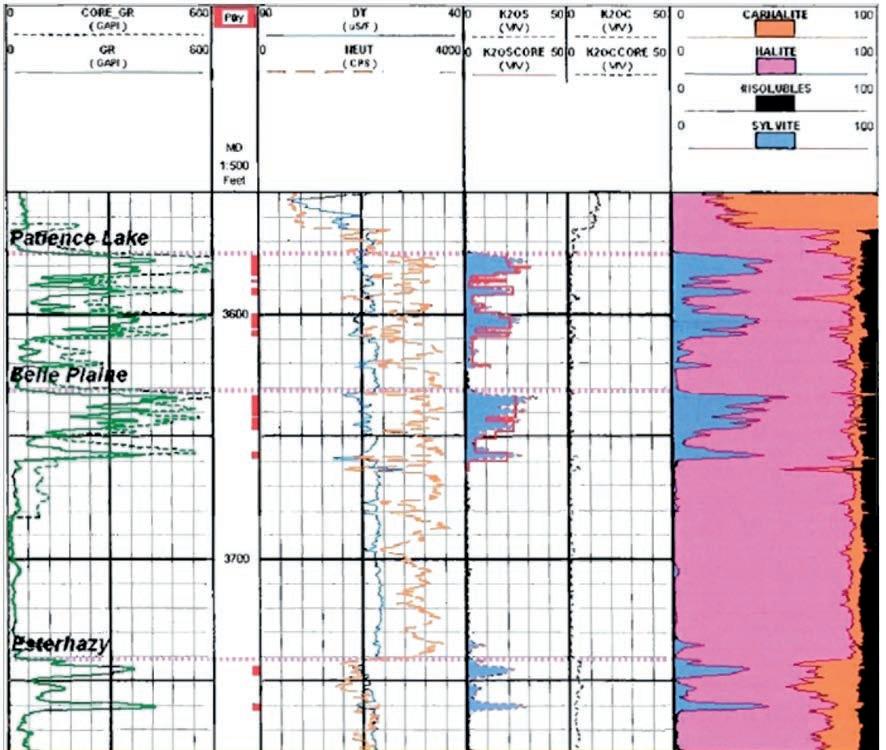
Some older wells were logged with sonic and/or density logs which also could be used quantitatively with the GR and neutron to provide a potash assay. This was important where core was lost or for regional exploration when core data, but not the logs, were proprietary. The logic behind these models is shown below. A later section of this article deals with the use of more modern logs.
The original computer program for potash analysis was written for the IBM 1620 in Regina in 1964. The model was based on four simultaneous equations that define the response of the available logs. Although this seems like a long time ago, nothing has changed except the improved tool accuracy.
Once K2O has been found from the GR, we can set up a set of linear simultaneous equations and solve them. The minerals sought are halite (rock salt), sylvite, carnallite, and insoluble (clay). The only logs available on old wells are resistivity, sonic, neutron, and total gamma ray. The resistivity is not a helpful discriminator, except as a shale bed indicator, so it is not used in the simultaneous solution.
In middle aged wells, the density log is also helpful, and in modern wells the PE curve can be added. Further, the gamma ray response is linear on modern wells so the transform to K2O is not as difficult to obtain.
The linear equations are:
• 1.00 = Vsalt + Vsylv + Vcarn + Vclay
• K20 = 0.00 * Vsalt + 0.63 * Vsylv + 0.17 * Vcarn + 0.05 * Vclay
• PHIN = 0.00 * Vsalt + 0.00 * Vsylv + 0.65 * Vcarn + 0.30 * Vclay
• DELT = 67 * Vsalt + 74 * Vsylv + 78 * Vcarn + 120 * Vclay
(Continued on page 24...)
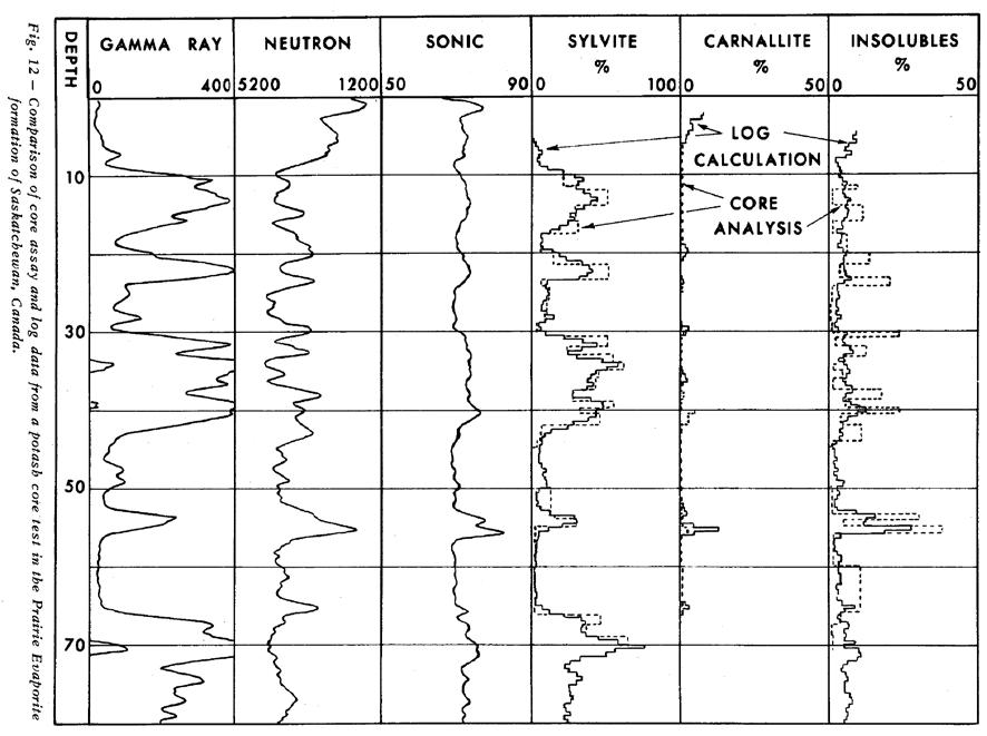
K2O is obtained, after borehole correcting the GR, from the equations and lookup table shown earlier, or from a fresh correlation based on specific data from the wells under study. Note that the chart and table given earlier are in percent K2O and this set of equations expects fractional units for K2O, neutron porosity, and all output volumes. Parameters in the sonic equation are in usec/foot.
When solved by algebraic means, these equations become:
1: Vclay = 0.0207 * DTC - 0.23 * K200.29 * PHIN - 1.3891
2: Vcarn = 1.54 * PHIN - 0.46 * Z
3: Vsylv = 1.59 * K20 - 0.41 * PHIN + 0.04 * Vclay
4: Vsalt = 1.00 - Vclay - Vsylv - Vcarn
These equations were derived with DTC in usec/ft, PHIN and K2O in decimal fraction. All constants will be different if DTC is in us/m.
To convert from mineral fraction to K2O equivalent (K2O equivalent is the way potash ores are rated), the final analysis follows:
5: K2Osylv = 0.63 * Vsylv
6: K2Ocarn = 0.17 * Vcarn
7: K2Ototal = K2Osylv + K2Ocarn
With a modern suite of calibrated logs, we can use conventional multi-mineral models to calculate a potash assay. With GR, neutron, sonic, density, and PE, we
can solve for halite, sylvite, carnallite, clay (insolubles or shale stringers), and water (occluded in many salts as isolated pores). The potassium curve from a spectral gamma ray log might also prove useful, if the detector system is linear and does not saturate.
The mathematical methods are similar to those shown above, except that more log curves can be added to the simultaneous equation set, and constraints for occluded water can be replaced by specific numerical solutions.
If other potash minerals are present, such as polyhalite, these can be added to the equation set if enough log curves are available to maintain an exactly- or over-determined solution. Matrix rock
properties for the minerals were shown earlier in this article. Water is treated as a “mineral” so that it can be segregated from the water of hydration in carnallite.
The first step is to correct the gamma ray for borehole and mud weight effects, using the appropriate service company correction charts. The other logs seldom need much correction as the potash is not especial deep or hot. However, if a water based mud was used, it will have a high salinity, so a salinity correction for the neutron log may be required.
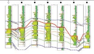
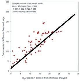
The second step is to confirm the GR to K2O correlation using any available potash core assay data. Since modern GR logs are more linear than older tools, the relationship should be a relatively straight line and can be extended beyond the available core data, as shown in Figure 8.
A sample of computed results from this log analysis model compared to core data is shown below. The GR was borehole corrected but no bed thickness corrections were applied.
E. R. (Ross) Crain, P.Eng. is a Consulting Petrophysicist and a Professional Engineer with over 45 years of experience in reservoir description, petrophysical analysis, and management. He has been a specialist in the integration of well log analysis and petrophysics with geophysical, geological, engineering, and simulation phases of oil and gas exploration and exploitation, with widespread Canadian and Overseas experience.
His textbook, “Crain’s Petrophysical Handbook on CD-ROM” is widely used as a reference to practical log analysis. Mr. Crain is an
Honourary Member and Past President of the Canadian Well Logging Society (CWLS), a Member of Society of Petrophysicists and Well Log Analysts (SPWLA), and a Registered Professional Engineer with Alberta Professional Engineers, Geologists and Geophysicists (APEGGA).


RIGSAT Communications
Apache Canada Ltd.
Advanced Flow Technologies
Crescent Point Energy
Enviro-Tech Surveys Ltd
EV Cam Canada Inc.
Gran Tierra Energy Inc.
Serpa Petroleum Consulting Ltd.
Exova Canada Inc
Sigma Explorations
Pason System
Pulse Seismic Inc
Shea Nerland Calnan LLP
SAExploration
Core Laboratories
Cabra Consulting Ltd.
Compass Directional Services
Cougar Consultants, Inc.
Canacol Energy Ltd.
Fekete
Paramount Resources
Sproule International Limited
Statoil Canada Ltd.
EDGE Technologies
Spectrum
BDO Canada LLP
Birchcliff Energy Ltd.
Cabra Enterprises Ltd.
Datalog Technology Inc.
GeoSpace Technologies
Knowledge Reservoir
Sproule Associates Limited
Geotir
Glacier Exploration Surveys
Matrix Solutions Inc.
McDaniel & Associates Consultants Ltd.
National Oilwell Varco
GeoChemTech Inc.
Cossack Land Services Ltd.
EPI Group
FMQ Southern Exploration
Matrix Geoservices Ltd.
Maxam Seismic Explosives
Petrel Robertson Consulting Ltd.
Statcom Ltd.
Trident Exploration Corp.
Sourcex
Caracal Energy Inc.
Regent Resources
Bankers Petroleum Ltd.
BJV Exploration Partnership
Nickpoint Environmental Services
SOCO International
3e Royalties
Bengal Energy
Bounty Developments Ltd.
Brasoil Corp.
Bukit Energy
Central European Petroleum Ltd
DualEx Energy International
Franconia Geoscience
Korean National Oil Company
Long Reach Resources Ltd.
Lorne LeClerc & Associates
Madison Petrogas Ltd.
Martin Wittstrom
Petroamerica
Serinus Energy
Sherritt International Corporation
Skyhawk Exploration
Tretio Exploration Ltd.
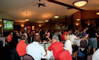
The annual CSPG, CSEG, and CWLS GeoConvention for the oil and gas industry in Canada has come and gone and the General Co-chairs would like to share some thoughts and impressions. Even though the industry in Canada is experiencing some challenges, this year’s GeoConvention was a great success. The mood around the TELUS Convention Centre and the exhibit hall was upbeat and positive, and delegate attendance was up, along with exhibitor participation. This year’s technical program was particularly impressive, with numerous play-specific integrated sessions allowing one to learn about, and keep abreast of, the status and future of the basin. The Canadian industry is fortunate to have regulatory regimes that require the sharing of a great percentage of data and information in the basin. This open sharing of information contributes to outstanding opportunities for the transfer of knowledge resulting in the technical strength that GeoConvention fosters. A great Thank You goes out to all the Session Chairs and presenters, whether oral, poster or core.
This year the organizing committee, in association with industry input and support, was able to try a few new ideas in the technical program. A one-time-event session, a historical perspective and current status celebrating the centenary of the discovery of the Turner Valley field, was very well attended, and not just by ‘grey hairs’ reminiscing. It was great to see a significant number of young professionals in the audience, gaining perspective on how and why the industry developed the way it did in Western Canada. In addition, two sessions were brought forward by the AAPG Student Outreach group. Entitled ‘On-Belay’, they related to students and new members of the profession, and supporting their growth and development in the industry.
A truly unique session, The Best of 2013 powered by Pecha Kucha, was introduced to curious attendees... This session featured a selection of the best talks of 2013 presented in a unique format. Pecha Kucha (pronounced Paw- Chalk-Ahh-Cha)
is a presentation style, developed in Japan (Japanese for Chit-Chat), that offers a concise, fast-paced and engaging method of delivery. Each presenter is allowed 20 slides and each slide is only shown for 20 seconds, for a total time of only 6 minutes, 40 seconds. The presenters were outstanding at distilling their 25 minute talk from 2013 into this new and fun presentation format – maximum content in minimum time. The response was so positive that we are recommending the session be repeated in GeoConvention 2015.
This year we were treated to two fabulous keynote luncheon speakers, Ivo Vegter and Amanda Lang. Both events were very well attended and the speakers’ perspectives, thoughts and ideas were genuinely appreciated by everyone in attendance.
In spite of challenging fiscal environments, the industry was there to support GeoConvention 2014 and the organizing committee would like to extend their thanks to all of our Sponsors and Exhibitors for helping GeoConvention succeed. Of course we also need to express our sincere thanks to all the volunteers, without whom, putting on an event of this size and complexity would not be possible. We were fortunate to have the support of approximately 170 volunteers aiding in keeping the conference running smoothly. But most of all, thanks to all of you for attending and contributing to the success of GeoConvention 2014. With your help, it remains one of the most important venues of the year for our professions and industry.
Each year the CSPG awards the Medal of Merit to authors of the best peer-reviewed paper published during the previous year on a subject related to the petroleum geology of Canada. A sterling silver medal is presented to each of the authors. The list of previous winners can be seen under awards on the CSPG website.
The Medal of Merit Committee searches the literature for potential candidates and selects the best paper, favouring well written and illustrated papers with novel ideas that have relevance to Canadian petroleum geology and/or the broader practice of petroleum geology. The committee will be evaluating papers published during the calendar year 2013 for the 2014 award. In addition to papers from academic journals, papers which form part of a special publication are also eligible. If you know of a 2013 peer-reviewed paper that the committee should consider, please submit the details by July 31, 2014 to: