IHS AccuMap ®
“AccuMap encompasses speed, stability, efficiency and accuracy. As an intuitive and easy-to-use product, AccuMap serves a broad audience, from field users to the CEO.”
Darrel Saik Senior Geological Technologist Paramount Energy Trust
AccuMap is the most widely used and highly trusted oil and gas mapping software touching every segment of E&P, for every professional.


IHS is very proud to announce that it is being recognized as one of the “Best Workplaces in Canada” for 2007.
www.ihs.com/energy
Call toll free 1 877 495 4473


CSPG OFFICE
#600, 640 - 8th Avenue SW Calgary, Alberta, Canada T2P 1G7
Tel: 403-264-5610 Fax: 403-264-5898
Web: www.cspg.org
Office hours: Monday to Friday, 8:30am to 4:00pm
Business Manager: Tim Howard
Email: tim.howard@cspg.org
Membership Services: Pam Drover
Email: pam.drover@cspg.org
Communications & Public Affairs: Heather Tyminski
Email: heather.tyminski@cspg.org
Corporate Relations: Kim MacLean
Email: kim.maclean@cspg.org
Conventions & Conferences: Shauna Carson
Email: shauna.carson@cspg.org
Conventions & Conferences Assistant: Tanya Santry
Email: tanya.santry@cspg.org
Reception: Dayna Rhoads
Email: reception@cspg.org
EDITORS/AUTHORS
Please submit RESERVOIR articles to the CSPG office. Submission deadline is the 23rd day of the month, two months prior to issue date. (e.g., January 23 for the March issue).
To publish an article, the CSPG requires digital copies of the document. Text should be in Microsoft Word format and illustrations should be in TIFF format at 300 dpi., at final size For additional information on manuscript preparation, refer to the Guidelines for Authors published in the CSPG Bulletin or contact the editor.
Technical Editor
Ben McKenzie
Tarheel Exploration
Tel: 403-277-4496, Email: bjmck@telusplanet.net
Coordinating Editor
Heather Tyminski
Comunications and Public Affaris, CSPG
Tel: 403-513-1227, Email: heather.tyminski@cspg.org
ADVERTISING
Kim MacLean
Corporate Relations, CSPG
Tel: 403-513-1229, Email: kim.maclean@cspg.org
Advertising inquiries should be directed to Kim MacLean. The deadline to reserve advertising space is the 23rd day of the month, two months prior to issue date. All advertising artwork should be sent directly to Kim MacLean.
The RESERVOIR is published 11 times per year by the Canadian Society of Petroleum Geologists. This includes a combined issue for the months of July/August.
Advertisements, as well as inserts, mailed with the publication are paid advertisements. No endorsement or sponsorship by the Canadian Society of Petroleum Geologists is implied.
The contents of this publication may not be reproduced either in part or in full without the consent of the publisher.
Design & Layout by Sundog Printing. Printed in Canada by Sundog Printing.
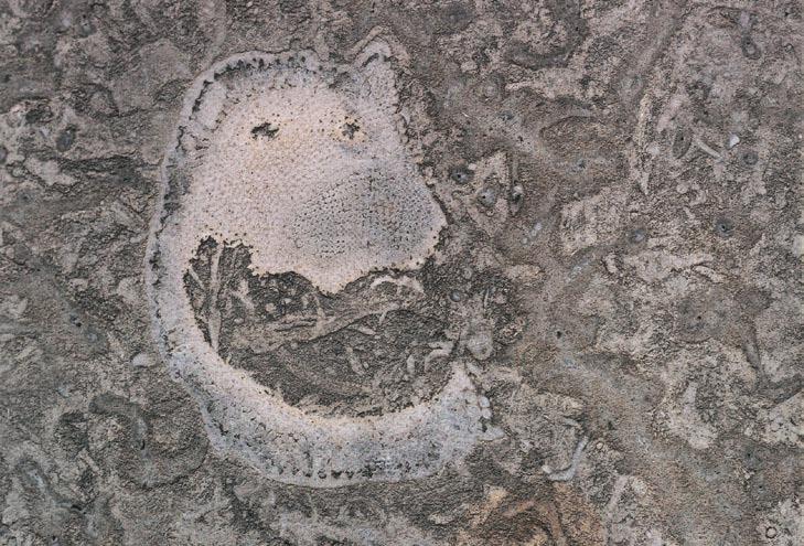
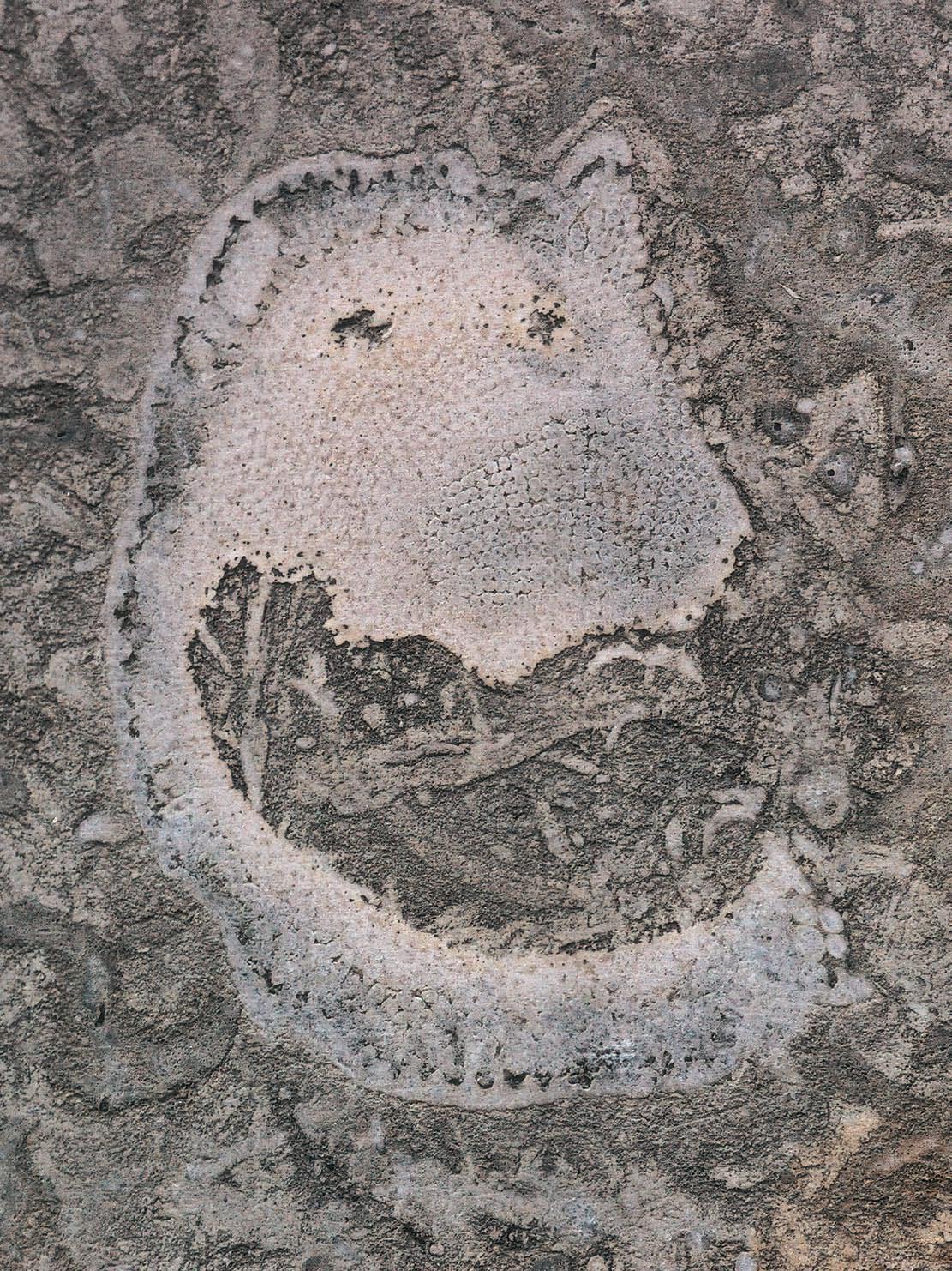
FRONT COVER Calgary, Alberta. Coral in Ordovician Tyndall limestone quarried in Gardon, Manitoba. Photo by Clint Tippett.
Club!
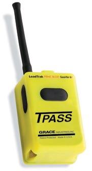
Feel safe and secure with Panic Alert
The CSA certified, intrinsically safe LoadTrak™ Panic Alert device is ideal for oil and gas workers who travel alone or who work in remote or hazardous areas.
• Let Panic Alert help your company address potential liability concerns and help you comply with provincial Lone Worker legislation and guidelines.
• Lone workers have access to a 24/7 monitoring centre at the push of a button or, if the worker is immobile, an automatic alert is sent using the sensor/man-down mode.
• Panic Alert device will not ignite emissions or fumes and has a 300-metre signal radius from an outfitted vehicle.
Take advantage of a limited time offer that includes special Panic Alert device pricing* and competitive monthly rates designed to fit your needs. For more information about Panic Alert, or to locate an authorized LoadTrak dealer near you, visit www.loadtrak.com or call 1-866-LoadTrk


CSPG EXECUTIVE
President
Colin Yeo • EnCana Corporation colin.yeo@encana.com Tel: (403) 645-7724
Vice President
Lisa Griffith • Griffith Consulting lgriffith@griffithgeoconsulting.com Tel: (403) 669-7494
Past President
Jim Reimer • Result Energy Inc. jim@resultenergy.com Tel: (403) 539-5207
Finance director
Peter Harrington • Northrock Resources Ltd. harrington@northrock.ab.ca Tel: (403) 213-7665
assistant Finance director
James Donnelly • ConocoPhillips Canada james.donnelly@conocophillips.com Tel: (403) 260-8000
Program director
Nadya Sandy • Imperial Oil Resources Limited nadya.sandy@esso.ca Tel: (403) 237-3925
assistant Program director
Randy Rice • Suncor Energy Inc. RJRice@suncor.com Tel: (403) 205-6723
serVice director
Dave Newman • McDaniel & Associates Consultants Ltd. dnewman@mcdan.com Tel: (403) 218-1392
assistant serVice director
Jen Vezina • Devon Canada Corporation jen.vezina@devoncanada.com Tel: (403) 232-5079
outreach director
David Middleton • Petro-Canada Oil & Gas middletn@petro-canada.ca Tel: (403) 296-4604
assistant outreach director
Greg Lynch • Shell Canada Limited greg.lynch@shell.com Tel: (403) 691-2052
communications director
Ashton Embry • GSC - Calgary aembry@nrcan.gc.ca Tel: (403) 292-7125
corPorate relations director
Monty Ravlich • GRGO Holdings Ltd. ravlich@telus.net Tel: (403) 560-1701
EXECUTIVE COMMENT
A message from the CSPG Assistant Program Director, Randy Rice
Old and New in Geoscience Education –“rock picks and handhelds”
I have occupied the Assistant Program Director portfolio for only a few months now and I am still very much learning the ropes. Consequently, I postpone pontification on what future directives the society should consider until I understand more about what it currently does - sorta makes sense I think. So, rather than a well researched digression into a subject of current geological relevance (say, sequestration, nukes and the oil sands, or water use), I offer some personal opinions on a subject near and dear to my heart – is geological training deteriorating or is it evolving into a mix of old and new?
As a result of conversations I’ve had over the past month, both with Andrew and Charlene Miall and some of this year’s SIFT students, I’d like to offer comment on what should remain from the old and be integrated with newer subject areas of geoscience training to ensure that our science, and our industry, thrives going forward. It is particularly appropriate to reconsider this since all demographics indicate increasing numbers of young geoscientists will be needed. What a great time to be starting a career! I also do not acknowledge a demarcation ‘twixt petroleum and minerals geology when it comes down to the basics of a geological education. The needed fundamentals are consistent across the disciplines.
I returned to the oil patch only several years ago after a hiatus of ...ouch, 22 years! My professional travels in the interim have exposed me to academic, government and industry styles of geological work and training. Possibly the most rewarding aspect of the bohemian professional lifestyle that I (grudgingly) led for a number of years was the opportunity to tutor young geologists that either I, or the employing institution, hired as my assistant. Without question, the common thread that led all of these individuals into geology is the love of being out there, and the wonder at the scope and
complexity of geological issues. Whether or not an individual geologist remains involved in field work, or chooses to follow a career path that only occasionally takes them to the rocks, is not the essential issue. At the undergraduate level of training, all geology students must always be exposed to instruction that teaches them how to read the lines in the rocks and how to record data that permits an interpretation of the geological history of an area. Whether or not you are searching for precious metals in polydeformed terranes, for hydrocarbons in folded and faulted basinal sequences, determining regional groundwater flowpaths, or involved in environmental remediation of a near surface sequence, an understanding of the geological history is essential. As I learned from recent conversations with a number of this year’s SIFT students, their basic motivation for going into geology has not changed from when I was a first-year student. They want to get out there, look at the rocks, and have some adventures! However, a number of new attitudes, interests, and expectations are now tacked on to the profile of the undergraduate geologist to which both educational and hiring institutions are recognizing and responding. The raw excitement of mineral and hydrocarbon exploration, particularly with a discovery, remains an incredible draw but today’s geology students are not willing to do this at the cost of serious environmental damage. They demand accountability from explorationists. They are also demanding that their education incorporate the latest technologies. Thus, along with the compass is a GPS and along with, or replacing, the notebook is a wireless handheld device that relays data back to a GIS program at the base station. In terms of university curriculums, geoscience departments have responded to the increased student awareness of the negative effects of some old school exploration by offering courses that reflect the fact that earth science is
(Continued on page 15...)
CORPORATE MEMBERS

Abu DHAbI OIL CO., LTD. (JAPAn)
APACHE CAnADA LTD.
bAKER ATLAS
bG CAnADA ExPLORATIOn & PRODuCTIOn, InC
bP CAnADA EnERGy COMPAny
CAnADIAn FOREST OIL LTD.
CAnETIC RESOuRCES TRuST
COnOCOPHILLIPS CAnADA
CORE LAbORATORIES CAnADA LTD
DEVOn CAnADA CORPORATIOn
DOMInIOn ExPLORATIOn CAnADA LTD
DuVERnAy OIL CORP
EnERPLuS RESOuRCES FunD
geoLOGIC systems ltd.
GRIZZLy RESOuRCES LTD.
HunT OIL COMPAny OF CAnADA, InC
HuSKy EnERGy InC.
IHS
IMPERIAL OIL RESOuRCES LIMITED
LARIO OIL & GAS COMPAny
MJ SySTEMS
MuRPHy OIL COMPAny LTD
nExEn InC.
nORTHROCK RESOuRCES LTD.
PEnn WEST PETROLEuM LTD
PETRO-CAnADA OIL AnD GAS
PETROCRAFT PRODuCTS LTD.
PRIMEWEST EnERGy TRuST
PROVIDEnT EnERGy LTD
RPS EnERGy CAnADA LTD.
SHELL CAnADA LIMITED
SPROuLE
SunCOR EnERGy InC
TALISMAn EnERGy InC
TOTAL E&P CAnADA LIMITED
WEATHERFORD CAnADA PARTnERSHIP
AS OF APRIL 24, 2007
Thank You to our Corporate Members
Thank you for taking a leadership role in working with the CSPG to advance the science of petroleum geology. To join these corporate leaders, please contact: Monty Ravlich, CSPG Corporate Relations Chair (403) 269-1420
Kim MacLean, CSPG Corporate Relations Manager (403) 513-1229


Baker Atlas
Abu Dhabi Oil Co., Ltd. (Japan)
technical luncheon CORPORATE TICKET REGISTRATION FORM
CSPG Corporate Ticket Order Registration
It is once again time to plan your ticket orders for the CSPG Technical Luncheons that are scheduled 19 times for the 2007/2008 season.
There are two options available to order tickets for your office:
1) FOR CSPG CORPORATE MEMBERS
CSPG Corporate Members may pre-order a set number of tickets for each Technical Luncheon which will be couriered to you along with an invoice each month. Ticket orders that are less than 10 tickets per luncheon will have a $5 nominal fee added to the invoice to offset the delivery costs.
you must take the same number of tickets for each luncheon and ticket returns are not accepted. The following month’s tickets will be sent out once payment for the previous month’s invoice has been received.
Any changes to your standard ticket order must be made one week prior to technical luncheon date. Additional tickets may be ordered for any luncheon by contacting us at 264-5610.
If you wish to use this ticket order option, you must register by August 31, 2007.
2) FOR THOSE WHO ARE NOT CORPORATE MEMBERS
If you are not a CSPG Corporate Member, you may elect to pre-purchase a set number of tickets for the 19 Technical Luncheon talks in the 2007-2008 season. For orders of less than 10 tickets per luncheon, a $5.00 handling fee needs to be added to
each ticket mailing to cover delivery costs. Returns are not accepted and extra tickets can be purchased from the CSPG office.
If you wish to use this option, you must register with the office by August 31, 2007. Payment is required upon registration for this program.
If you do not wish to use either of these ticket purchase options, tickets can be purchased from the CSPG office, for each talk using cheque, cash, debit, Visa or MasterCard. Technical Luncheon tickets are $36.04 (including GST) each and are available to purchase two months in advance.
Please watch your Reservoir or visit www. cspg.org for Technical Luncheon abstracts. If you have any questions please feel free to contact the CSPG Office at 264-5610 or via email us at reception@cspg.org.
tic K et re Presentati V e registration F orm
COMPAny nAME:
TICKET REPRESE nTATIVE nAME:
ADDRESS (including Postal Code):
PHOnE nu Mb ER: FA x nu Mb ER:
E-MAIL: OPTION 1 – CSPG CORPORATE MEMBERS ONLY
nu Mb ER OF TICKETS FOR EACH LunCHEOn For Ticket Orders of less than 10 tickets per luncheon, a $5/month Handling fee will be added to your invoice.
OPTION 2 – PREPAYMENT
nu Mb ER OF TICKETS FOR EACH LunCHEOn
Prepayment due: Tickets x $36.04 (incl. GST) x 19 (Total # of luncheons) = $ If less than 10 tickets per luncheon ordered, a handling fee of $53.00 ($5.00 plus GST per month) is included in this payment.
TOTAL PREPAYMENT ENCLOSED IS: $ __________ (TICKETS) + $ __________ __ (HAnDLInG FEE) = $ __________ ______
We accept Visa, MasterCard, or cheque as payment. If paying by credit card:
Card #: Expiry Date:
Signature:
Please return your completed form to:
technical luncheons SEPTEMBER LuNCHEON
What banning the light bulb really means
SPEAKER
Peter
Tertzakian
Chief Energy Economist for ARC Financial Corporation and best-selling author of A Thousand b arrels a Second
11:30 am
tuesday, september 11th, 2007 telus convention centre calgary, a lberta
Please note:
the cut-off date for ticket sales is 1:00 pm, Friday, september 7th, 2007. ticket price is $28.00 + gst
Since the industrial revolution in the late 1700s, there have only been a handful of times when our society has meaningfully changed the way that we use, and the way that we are supplied our energy. Today, the events unfolding around us – economic, political and environmental – signal that we are once again entering a period of such radical change, or an energy ‘break point’.
What are the signals? Is the movement to ban the incandescent light bulbs one such signal? How will today’s period of energy transition unfold? What are the challenges? What are the alternatives (you may be surprised)? And importantly, what does it mean to Canada, now a self-proclaimed “Energy Superpower.”
Chief Energy Economist at ARC Financial Corporation, and best-selling author of A Thousand b arrels a Second: The Coming Oil b reakpoint and the Challenges Facing an Energy Dependent World, Peter Tertzakian will explore these big-picture issues and focus them into implications for the upstream Canadian oil and gas industry.
BIOGRAPHY
Best-selling author of A Thousand Barrels a Second, published by McGraw-Hill, Peter Tertzakian is the Chief Energy Economist of ARC Financial Corporation, one of the world’s leading energy investment firms.
Peter’s background in geophysics, economics, and finance, combined with his entrepreneurial spirit, helped him rise from the trenches of hands-on oil exploration fieldwork to become
an internationally recognized, top-ranked expert in energy matters.
Often seen and heard through media outlets around the world, Peter’s been a featured guest on many high-profile radio and television shows including The Daily Show with Jon Stewart. In print, Peter has been featured in US News and World Report and has contributed editorials to widely read publications like The Globe and Mail and Forbes.com. He also writes a weekly column, ARC Energy Charts, and is a soughtafter public speaker.
Peter has an undergraduate degree in Geophysics from the University of Alberta, and a graduate degree in Econometrics from the University of Southampton, U.K. He also holds a Master of Science in Management of Technology from the Sloan School of Management at MIT.
He lives in Calgary, Alberta, one of the world’s leading oil and gas centers, with his wife and two children.

technical luncheons SEPTEMBER LuNCHEON
Ultra-shallow gas, NW Alberta: geological origin and geochemical detection
SPEAKER
H.H. von der Dick
Chemterra International
CO-AUTHORS
P. Bauman
Crew Energy
D.A. Bosman
Chemterra International
11:30 am thursday, september 27th, 2007 telus convention centre calgary calgary, a lberta
Please note: the cut-off date for ticket sales is 1:00 pm, monday, september 24th, 2006
In recent years, several ultra-shallow gas pools in the depth range of 35-300m (100-
900ft) that occur in Pleistocene glaciofluvial deposits have been discovered in nW Alberta and nE british Columbia. Some of these shallow reservoirs, such as the Souza and Rainbow Gas Fields in the High Level area of Alberta represent substantial economic natural gas accumulations, but others also form drilling hazards in the form of blow-outs and artesian flows when encountered unexpectedly. Two blowouts, one with fatal consequences, demonstrate both the exploration opportunities and the hazards of these gas occurrences.
The Pleistocene gravel/sand reservoirs were deposited in valleys formed by the advance of the Laurentide ice sheet into the area, about 10,000 to 43,000 b.p., and sedimentladen melt water eroding local bedrock. The Pleistocene topography eroding into the Cretaceous gas-bearing bluesky Formation appears to play an important part in the occurrence of these gas-filled reservoirs. unconsolidated fine-grain lithic greywacke and mudstones form relatively tight cap rocks, and the Cretaceous Shaftsbury shale is – at least in one case – the lateral seal. Thus, the Pleistocene gas-bearing sand/pebble channels are encased in muddy fine-grained sediments and shales within these channels.
The occurrence of significant amounts of gas in geologically very young sediments poses the question of the origin of the gas. First considerations of faults as migration avenues of deep gas into these strata failed. In addition, with major gas generation ending in the distant past at Eocene times, it is difficult to explain these gases from an active thermal gas generation point of view. On the other side, gas composition, flow, and production characteristics are typical for natural gas derived from a common thermal source.
A key observation on the origin of the shallow Pleistocene gas comes from gas isotope data, showing that both major seep gases in the area and the young reservoir gas are of thermal origin. b ased on the burial history of Eocene thermal gas evolution, gas emplacement in the area and the occurrence of these gases in sediments less than 50,000 years old, the following gas generation / gas emplacement scheme is proposed:
• Gas generation peaked at Eocene times at maximum burial, saturating the entire Cretaceous–Tertiary sediment column, including the pervasive Cretaceous (Continued on page 20...)


Unparalleled geophysics and deep client commitment now let you see what could not be seen.
diVision talKs INTERNATIONAL DIVISION
Deep Purple: perspectives and challenges in deepwater exploration and development
SPEAKER
Trent Rehill
Senior Explorationist, Woodside Energy north Africa
12:00 noon
Wednesday, July 25, 2007 encana amphitheatre 2nd floor, e ast end of the
calgary tower complex 1st street and 9th avenue s.e . calgary, a lberta
Since the mid-1990s deepwater has been and continues to be the premier global exploration play. Many of the world’s largest finds in the last decade have been discovered in three primary deepwater regions: the Gulf of Mexico, offshore b razil, and West Africa. To enter the race, senior/mid-sized independents have focused on under-explored deepwater provinces which include both sides of the n orth Atlantic, Eastern Africa, parts of both the Caribbean and Southeast Asia (Malaysia, Indonesia, and China) and even the Mediterranean rim.
However, there are challenges not only in discovering new fields, but also in commercializing deepwater resources
CALL FOR ARTICLES
One of the goals of the Reservoir is to promote the petroleum industry – and the geosciences in general – by providing a platform for discussion and updates of current research, ideas, and events related to our profession. The Reservoir is continually looking for technical articles that assists in this goal.
The Reservoir will pay an honorarium of $200 for any accepted technical article (minimum 1,500 words). Please see the note to EDITORS/AUTHORS for article guidelines or contact Ben McKenzie (information on page 3).
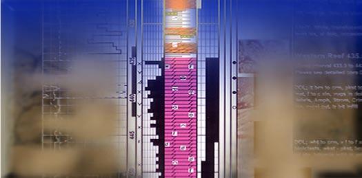
Western Canada Geological Edge Set
For import into AccuMap, geoSCOuT and other applications.
1) Mississippian Subcrops, Devonian Reefs
2) Triassic Halfway, Doig, Charlie Lake
3) Jurassic Rock Creek
4) Cretaceous Glauconitic, Lloyd, Sparky, Colony, bluesky, Dunlevy, Viking
5) CbM - Horseshoe Canyon, Mannville
All edges are formatted as map features for AccuMap and ESRI Shape files for other applications.

that already have been found. What really happens after the huge discovery press release? Success depends on clusters of traps, and an active robust petroleum system. b ut the most critical element is reservoir ...Reservoir …RESERVOIR! A typical deepwater development costs u S$2-3 billion and requires 30 to 40 wells which run between u S$20-30 million each. Deepwater success requires reservoirs that can deliver the high production rates needed for commerciality.
Exploration Success or Commercial Failure?
In this presentation I will outline some key examples and information gained from a few of the global deepwater hot spots. The focus will be on the slope to basin floor transition where a wide range of channel / fan geometries and stacking patterns are preserved in different stages of evolution. These will be demonstrated using a variety of 3D seismic visualization techniques such as amplitude mapping from time slices and horizon slices, coherence, opacity rendering, inversion, surface illumination, and attribute co-rendering using a series of migrated stacked 3D seismic volumes. Select outcrop and analog examples will be used to illustrate the turbidite systems of n W / SE b orneo, n igeria, Angola, and Congo.
BIOGRAPHY
Trent Rehill, P.Geol, received his B.Sc. (Hons) from the University of Manitoba in 1992, and his Ph.D. from Dalhousie University in 1996. Throughout his professional career with Woodside Energy, Murphy Oil, and Chevron he has been interested in combining geology and geophysics. He has worked in West Africa, North Africa, Southeast Asia, the Middle East, and Canada focusing on a multidisciplinary exploration / development approach combining seismic geomorphology, sedimentology, structural geology, well logs, and descriptions of analog outcrops. He can be reached at trent.rehill@woodside-ly.com.
INFORMATION
International Division talks are free and open to anyone. Donuts and muffins are provided by Gore Surveys but feel free to bring your lunch. The facilities for the talks are provided complements of EnCana Corporation. For further information, to volunteer to give a talk, or to list your name on the contact list, please contact Bob Potter at (403) 863-9738 or ropotter@telusplanet.net.


diVision talKs PALAEONTOLOGY DIVISION
Ceratopsian symposium at the Royal Tyrrell Museum, September
22-23, 2007
Ceratopsians (horned dinosaurs) are anatomically unique animals with a 95-million-year evolutionary history extending from the Late Jurassic to the end of the Cretaceous. During the past century, ceratopsians have been the basis for innovative and groundbreaking palaeobiological and evolutionary interpretations that relate to many other dinosaurs. More recently, studies of ceratopsian biomechanics, growth, diversification, biogeography, and other aspects have resulted in an explosion of information about this intriguing group.
On September 22-23, 2007, the Royal Tyrrell Museum in Drumheller, will host the first ever Ceratopsian Symposium. The goal of the symposium is to bring together 200 palaeontologists, geologists, and palaeontological enthusiasts to share the results of their recent research and their interest in ceratopsians. Approximately 75 contributors will offer a variety of oral and poster presentations. Keynote speakers, Peter Dodson, Catherine Forster, David Eberth, and special guest Robin Mackey, will speak on ceratopsian evolution, biology and ecology, and preservation. A published abstract volume and book presenting the results of the symposium will follow. The symposium is being convened by Donald b rinkman, b renda Chinnery-Allgeier, Michael Ryan, David Eberth, and Philip Currie.
The symposium coincides with the opening of a new ceratopsian dinosaur exhibit at the Royal Tyrrell Museum that will feature many new kinds of horned dinosaurs from Alberta. Other significant events associated with the symposium include:
• Ice-breaker, Royal Tyrrell Museum, on the evening of Friday, September 21
• Viewing of new specimens, including Alberta’s newest ceratopsians
• b arbeque at the Royal Tyrrell Museum on Saturday, September 22
• Post-symposium field trip to Dinosaur Provincial Park (Monday, September 24)
INFORMATION
For further information about this event and registration please go to www.tyrellmuseum. com and click on the Horned Dinosaur Symposium Button or contact Don Brinkman at 403-820-6214.
To present a talk at a future Palentology Division event please contact Division Chair Philip Benham at 403-691-3343 or programs@albertapaleo.org. Visit the APS website for confirmation of event times and upcoming speakers: http://www.albertapaleo. org/
not just about minerals and hydrocarbons, but also incorporates a broad spectrum of environmentally related subjects.
The worrisome aspect, at least for me, about this trend which has been progressing for a number of years now is how to incorporate it all into a four-year undergraduate degree. I find most disturbing reports of well-established geoscience departments abandoning core courses in favor of training in the newer aspects of earth science. There needs to be a balance struck between the old and the new that reflects the newly increased breadth of our discipline. The need for replacement mineral and energy resources is increasing and the requirement that environmental considerations be integrated is essential. Training in both areas is required for today’s undergraduate geoscience students.
In our capacity as professional geoscientists, we should be communicating our opinions on these matters back to our training grounds so that they can mold the geoscientists of tomorrow into what is needed by society.
The CSPG can contribute to geological training, at the professional level, by working with organizations such as APEGGA to establish a curriculum of accreditable courses for the professional geoscientist.
In closing, I should like to remind our membership of what is, in my opinion, the most important survey of the geological sciences to come along in many years. As announced in recent issues of the Reservoir and in the CSPG e-newsletter, Drs. Charlene and Andrew Miall are conducting a survey of geoscientists in Canada to get their opinions on where geoscience is heading, where it should be heading, as well as their opinions on climate change and other geological issues. I strongly encourage our membership to access this survey through the CSPG website and take the 30 minutes or so to complete it.
Feedback is always welcome. I can be reached at rjrice@suncor.com .
Randy Rice
Assistant Program Director
Greater confidence. Better results. Faster.
Petrel Geology
Petrel* workflow tools provide a complete seismic-to-simulation toolkit— one solution uniting the subsurface domains of geophysics, geology, and reservoir engineering.
Geologists can use new modeling capabilities to better predict facies distributions, work with geophysicists to analyze structural uncertainties, and work with reservoir engineers to define a well placement strategy.
“It is like having an extra geologist sitting there, it’s telling you things that you didn’t know, it’s testing your theories like you never saw before and helping you come up with new ideas.” DavidHamilton,CEO,SubsurfaceComputerModeling
With Petrel software, all work processes lead to one shared earth model, resulting in faster, better decisions.
sisinfo@slb.com
www.slb.com/petrel
The
IHS delivers on its integration promise
PETRA’s Enerdeq Direct Connect makes it easy to create and refresh projects with the latest IHS data.
IHS Enerdeq Desktop and IHS AccuMap directly export well, production, grid and culture data into PETRA projects.
PETRA has added the ability to quickly and easily query, download and integrate raster images and digital logs from the IHS HUB in Canada.
Download a trial version at ihs.com/energy/petra


JacK Porter VIGNETTES OF CANADIAN PETROLEuM GEOLOGY
J.B. Tyrrell’s introduction to the interior of Canada’s Precambrian Shield
(...Continued from the May issue of the Reservoir)
Following the departure of Dowling’s party to Reindeer Lake by way of Canoe River, Tyrrell’s intrepid nature was once again challenged. Despite the somewhat dispiriting information that he had obtained from the small band of Chipewyan natives camped near the outlet of the Geikie River into n ekweaza b ay, it failed to deter his attempt – along with his three companions – to surmount any difficulties in order to reach the Churchill River. The country to be traversed was unknown to white men, having been avoided by fur traders of the Hudson’s b ay and n orth West Companies, as well as independent pedlars – in all probability based on information they received from Chipewyan hunters of its navigational difficulties.
The shunning of the water course, between the mouth of the Geikie River and the debouchment of Foster River into Churchill River, by traders of the Hudson’s b ay and n orth West Companies is corroborated by the absence of sites of any documented fur-trading establishments along this water route. The network of shallow stream, associated with the upper reaches of the Geikie River would have served to obstruct the progress of intermediatesized freighter canoes employed by traders. These n orth Canoes, with a crew of six or seven voyageurs, had an average length of 25 feet and a loading capacity of 3,000 pounds. b oth the Geikie and Foster Rivers are characteristically shallow with an inordinate number of rapids; including lengthy sequences requiring poling, tracking, or the frequent use of portages; all of which reinforced its impracticality for the transport of freight-laden canoes. However, the Chipewyans’ birchbark canoes, being considerably lighter and less than 20 feet in length, were adaptable to passage on both rivers. Each canoe carried
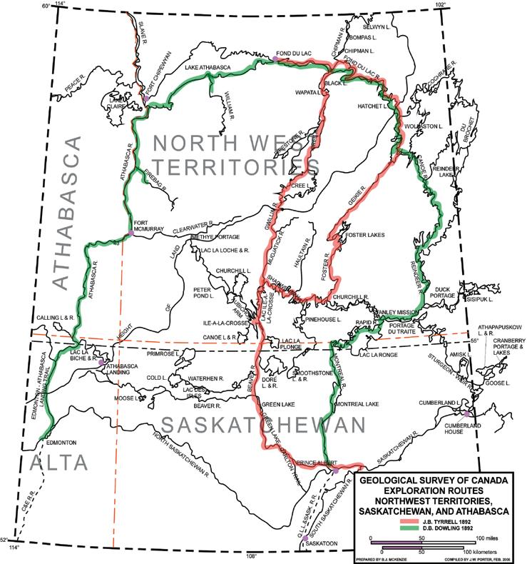
a maximum of five travelers. An inverted canoe was carried across a portage by two natives, its gunwales resting on the padded shoulders of the carriers; one walking beneath the canoe’s bow and the other beneath its stern. In former times, Chipewyan hunting parties, from their settlement at Lac Isle-a-la-Crosse, traveled to the environs of the Geikie and Foster Rivers. They would return home by the same water route where they exchanged their furs for provisions and trade articles at the Hudson’s b ay’s Isle-ala-Crosse depot and trading post.
n one of the Chipewyan natives, whom Tyrrell had a chance meeting with at n ekweaza b ay, admitted they had never traveled up this river. They further informed him, based on hand-me-down information, that from its headwaters, a height of land could be crossed which would enable his party to reach several large lakes, known to them as Whitefish (Tyrrell’s Foster) Lakes, which sourced the
south-flowing Whitefish (Tyrrell’s Foster) River; the latter being a tributary of the Churchill River. They warned Tyrrell that he and his party would encounter obstacles resulting from forest fires, which had occurred subsequent to its former use by their hunters as a water route. The resultant burnt windfall would have blocked any preexisting portages.
On the morning of August 25th 1892, Joseph Tyrrell and his three canoemen commenced their ascent of the Geikie River. Six days later, after journeying 51 miles, they had reached the river’s midway position on arriving at the north end of b ig Sandy Lake. This eleven-milelong narrow lake, being an expansion of the river, varies in width from onequarter to one-half mile. He reported the country to this place is relatively free of drift and where present, consisted of banks and hills of white sand, Outcrops, expressed as rounded hills of red granite and dark-gray biotite gneiss – the latter
interlaminated with intrusions of red pegmatite – occurred intermittently along the course of the river.
During this segment of their journey to b ig Sandy Lake, 13 sets of rapids were confronted, whose passage involved either tracking, poling, or paddling their empty canoe upstream. Eight portages were utilized to transport either the canoes or provisions; the longest portage being 1,800 yards where Tyrrell and his Metis assistant, Pierre Girard, backpacked the party’s cargo. The two Chipewyan natives, Ithingo and Heddery poled the empty canoe upstream through the boulderstrewn heavy rapids.
n oteworthy, is the relatively unswerving alignment of the Geikie River’s course, including its expansions to form elongated lakes. Its trace has a reasonably consistent bearing of n .46°E. Tyrrell observed that b ig Sandy Lake lies along the regional contact of gray biotite gneiss on the lake’s west side and the massive red granite on its east shore; the latter he noted as “...holding a large quantity of titaniferous iron ore.” He attributes its straight course as being determined by the regional grain of the prevailing gneissic complex. Likewise, the northeast-southwest alignment, as expressed by the pattern of the elongated lakes along the river’s southeast rim, appears to reflect, as well, the regional grain of the terrain.
On August 28th, prior to reaching b ig Sandy Lake, Tyrrell had shot a moose; dressing the edible portions and drying such parts overnight. The following morning the somewhat cured meat was placed in a flour sack, to later augment their limited provisions. Four days earlier, while at n ekweaza b ay, Tyrrell had decided to divide his party, instructing Dowling and his four assistants to proceed to Reindeer Lake by way of Canoe River. Tyrrell’s
remaining provisions, amounting to ten days rations per man, were apportioned to the members of both his and Dowling’s parties. It was evident that members of each party had realized that they would have to rely on the land to provide sufficient sustenance, pending completion of their respective surveys.
The greatest concentration of rapids on the Geikie River occurs over a 21-mile stretch of the river immediately below b ig Sandy Lake. The commencement of this chain of rapids begins at White Spruce Rapid. It is here that the downstream drift cover, consisting of ridges and rounded hills of silt and sand, yielded abruptly to a more assorted assemblage of drift debris, comprised of gneissic and granitic boulders, cobble-size stones, and gravel, some of which are embedded in silt and clay. This morainal debris revealed a small boulder of Athabasca sandstone. Tyrrell attributed this change as evidence of a terminal morain whose deposits mark the front of a retreating phase of the Keewatin glacier.
Tyrrell’s party was hindered during his mapping of b ig Sandy Lake due to a fourday storm involving heavy rainfall and accompanying strong wind. He completed his survey of the lake on September 2nd, camping the same evening in a 50foot-deep valley alongside Geikie River. Here, its discharge into b ig Sandy Lake was reduced to a shallow, swift-flowing, 30-foot-wide stream.
A second narrow lake, having a length of eight miles, with a maximum width of three-quarters of a mile; occurs 13 miles above b ig Sandy Lake. Like the latter, it is an expansion of the Geikie River. The islands in this lake and bordering hills, some of which attain heights of 300 feet, are capped with sand and gravel. The country bedrock consists of foliated
CALL FOR VOLUNTEERS
The Reservoir is seeking additions to its editorial committee. We have the opportunity to greatly expand the scope and content of the Society’s news magazine, but need the people to make it happen. We are looking for volunteers that would be interested in coordinating or assisting in developing any of the following departments: Exploration
Please contact Ben McKenzie (bjmck@telusplanet.net) for more information .
gray biotite gneiss, whose surfaces, in part, are scattered with boulders. Glacial grooves on the surfaces of the gneisses, as measured by Tyrrell, were found in the area to have an orientation of S.35°W. The Geikie River, at its entrance to this second lake, is a swift-flowing, crooked stream, having a depth of one foot, after coursing through a broad area of muskeg.
Some seven miles upstream from the aforementioned second lake, the Geikie River splits into two small branches, six to 12 feet in width, which Tyrrell reports as having: “hardly enough water to float the canoe.” b eaver dams had blocked both branches at their junction, requiring Tyrrell and his party to carry their canoe around the obstructions. Selecting the most passable branch, he proceeded with his party a short distance upstream which led to a connecting lake, some three miles in length. After traversing an additional five miles from the intake of this larger lake, two more, rather insignificant, but interconnected lakes, were encountered. The uppermost little lake, secluded against a southern backdrop of high gneissic ridges, marked the incipient source of the Geikie River. It was here, on the little lake’s south bank on the evening of September 5th, that Tyrrell and his party made camp. It had taken him and his three companions twelve days to ascend the Geikie River to its beginning. Prior to his night’s sleep, Tyrrell undoubtedly contemplated the impending task of discovering the traditional canoe route, used by the Chipewyan hunters that would enable his party to cross the height of land; which would lead them to a southflowing stream or river whose waters would drain into the Churchill River.
u nbeknownst to Tyrrell. the intake, across the height of land, to his sought-after southflowing tributary of the Churchill River, lay 16 miles directly south by southwest from his camp at the headwaters of the Geikie River. A network of small lakes, linked together by streams whose waters are collected into three elongated and interconnected large lakes, presented a navigational challenge facing Tyrrell. He and his party would have to locate the most southeasterly positioned of these three large lakes, whose outflow is into the south flowing tributary (Tyrrell’s Foster River) of the Churchill River.
These large lakes (later named by Tyrrell the u pper, Middle, and Lower Foster Lakes) are aligned northeast-southwest en echelon and are 25 miles, 14 miles, and 19
miles, respectively, in length. Tyrrell named them in recognition of the Honourable G. E. Foster, who at the time was the Finance Minister of Canada.
Joseph Tyrrell’s approach to locating the south-flowing tributary of the Churchill River was to be guided by existing portages that the Chipewyan hunting parties had constructed and traditionally used in accessing the aforementioned river. The location of portages or streams connecting a series of unknown lakes required Tyrrell’s party to reconnoiter their respective shorelines to locate drainage outlets, which collectively would eventually lead them to the elusive southflowing river.
On the morning of September 6th, Tyrrell’s party left their previous evening’s campsite at the headwater of the Geikie River, to commence their search for the reported abandoned portage. To quote Tyrrell: “At the east end of the lake we crossed a narrow sandy neck of land beside a brook, and entered another little lake a quarter of a mile in diameter, on the east side of which, after long and careful search, we were delighted to find traces of an old portage route, though it was now blocked and barred by underbrush and much fallen timber. The path was 650 yards long, and when chopped out was a very good one, over hard sandy ground through a thick growth of small spruce and b anksian pine.” The traversing of this restored portage was the key that allowed Tyrrell and his party to cross over the height of land. The next day their canoe route took them in a northeasterly direction which, unbeknownst to Tyrrell, had directed them near the south west end of u pper Foster Lake. From this lake, Tyrrell elected to travel to its southern limit, where, fortuitously, he found a freshly cut portage, some 250 yards in length, cut out by Chipewyan hunters, on returning to their base at Ile-a-la-Crosse.
Tyrrell’s party, pursuing a southern course on September 9th, skirted the northern margin of Daly Lake and by veering east, arrived midway on the west side of Lower Foster Lake, after being guided along five additional portages. While traveling southwest down the lake, Tyrrell’s whereabouts was suddenly assured, having reported that: “when Heddery, one of our Chippewyan (sic) Indians, suddenly recognized a point where he had taken dinner in the previous spring. He at once recalled to mind the geography of the surrounding country, and as he had many
times descended the river flowing from this lake to Churchill River, all uncertainty as to our course was at an end. We were on the regular hunting grounds of the Ile a la Crosse Indians, and the remainder of our course to that trading post was known to both our Chippewyans (sic).” The following evening, being September 10th, found Tyrrell and his party camped at the commencement of Foster (Whitefish) River. It had taken Tyrrell’s party five days, after leaving the headwaters of Geikie

River, to cross the height of land in order to reach this tributary of the Churchill River. Their convoluted course had involved 69 miles of water travel.
The party’s provisions, at this juncture, were essentially depleted but for the remnants of their dried moose meat. Apparently partridge and other game birds were found to be scarce in the region.
To be continued...
b luesky sands, above and adjacent to gasgenerating shales.
• Subsequent tectonic uplift, in particular the partial erosion of the bluesky Formation by advancing ice sheets, led to widespread gas seepage and massive gas loss from the Mesozoic section; locally, the previously gassaturated bluesky Formation was completely barren of gas due to partial erosion.
• Since the thermal gas generation “kitchen” has long ceased, the gas for the Pleistocene sediments can only originate from residual reservoir gas and solution gas / adsorbed gas at depth that survived initial uplift and reservoir breaching: continued breaching due to continued tectonic activity and isostatic rebound is believed to provide the mechanism for secondary gas mobilization/migration and emplacement into the bluesky Formation.
• In places where the b luesky Formation is incised by Pleistocene channels, this second-phase b luesky gas continues to migrate up. It is trapped on an interim basis in Pleistocene channels.
Geochemical surface seep records show, that the shallow Rainbow and Souza gas fields have enormous seep rates to the surface. Thus, we can assume a dynamic gas migration system from the deep subsurface into the bluesky
calendar OF EVENTS
18th Annual CSPG Mixed Golf Tournament
Friday, August 24, 2007
D’Archy Ranch Golf Club
CSPG Member: $80.00 n on-Member/Guest: $120.00
Entry deadline: Friday, August 3, 2007
For more information, contact Brenda Pearson at 515-3410, David Middleton at 296-4604, or David Caldwell at 809-7400.
Upper Devonian Reef Strata and Hydrothermal Dolomitization in the Southern Northwest Territories
September 10-14, 2007
Instructors: Dr. Alex J. MacNeil, Imperial Oil Resources and Dr. Brian Jones, University of Alberta
CSPG Member Earlybird: $2,048+GST/ CSPG Member: $2,275+GST/ non-member: $2,844+GST (The fees include accommodation, ground transportation, lunches, and guide book – airfare not included ) For more information visit www.cspg.org.
Formation, then either into Pleistocene traps (with limited seal capacity and consequently limited gas residence time) or direct seepage to the surface. Where prominent faults dissect into the bluesky Formation, these points develop into regional gas discharge locations. An active, dynamic equilibrium of subsurface gas supply into and seeping out of these young channels appears to be established. A preliminary gas drainage mass balance indicates that the major portion of the Pleistocene gas is derived from conventionally reservoired gas at depth. Previous solution gas and adsorbed gas, now liberated from isostatic rebound, play a minor role in filling the Pleistocene channels.
The high surface seep rates observed over established shallow gas pools provide a convenient and cost-effective way to explore for new pools. using a combination of advanced numerical data processing and isotope data of seep samples as data filters to isolate thermally derived seep gas patterns provides a way to high-grade areas for shallow gas exploration. Thus, these seep surveys discriminate gas-bearing from freshwaterbearing shallow horizons. Once recognized, these geochemical leads may be followed up by more costly exploration tools such as resistivity surveys to confirm the presence of Pleistocene channels at shallow depth. The combined use of geochemical and resistivity surveys can be used to explore for economic
gas reserves in shallow Pleistocene deposits.
BIOGRAPHY
Hans obtained his M.Sc. in geology and Ph.D. in geochemistry from the University of Aachen, Germany. Subsequent to his academic education in Germany Hans joined the Canadian oil industry in 1982 in the capacity of a research geologist, later as group leader of the technology division at Canadian Hunter, Calgary.
In 1991, Hans co-founded ChemTerra International Ltd. (CTI), a service company specializing in exploration and forensic geochemistry. Since 1992 Hans has been involved on a managerial level in projects in numerous countries around the world, both in exploration and environmental studies for the international oil and gas and environmental sectors.
His technical interests are all aspects of geochemical applications to exploration and production, environmental bio-geochemistry, and advanced numerical data analysis of chemical and geochemical data. He has authored and co-authored numerous papers on subjects of oil and gas generation on South Atlantic continental margin, on offshore Eastern Canada oil occurrences, geochemical-petrographic constraints of shale oil production, methods and application of seep data to exploration, and source-related contamination patterns in ground water.
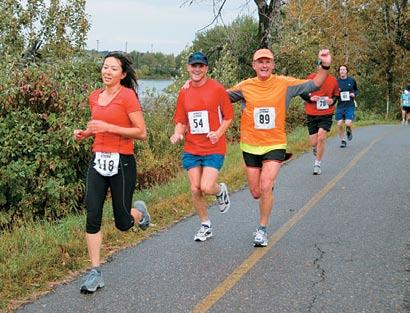
19th Annual CSPG CSEG Road Race and Fun Run
Wednesday, September 12, 2007
– 6pm SHARP
Eau Claire y MCA
CSPG/CSEG/CAPL Members: $35.00 until Wednesday, September 5
CSPG/CSEG/CAPL Members: $45.00 until Tuesday, September 11 n on-Members: $45.00
Entry Deadline: Tuesday, September 11, 2007
For more information, contact Chris Manion at chris@forsaw.ca.
2007 Gussow Geoscience Conference
October 15-17, 2007
b anff Centre – b anff, Ab
CSPG Members: $700.00 until June 30
CSPG Members: $800.00 after June 30
non-Members: $800.00 until June 30
non-Members: $900.00 after June 30
Registration Deadline: Monday, October 8, 2007
For more information, visit www.cspg.org
1st Annual CSPG Education Week October 29th to November 2nd, 2007
Calgar y, Alberta
Join us for a thrilling week of continuing education and a second chance to take the soldout 2007 CSPG Convention Courses:
• Practical Sequence Stratigraphy: Concepts and Applications – Ashton Embry
• Architecture of Fluvial Reservoirs
– Andrew Miall
• Stratigraphic Setting of Lower and Middle Triassic Strata – James Dixon.
Contact Travis.Hobbs@encana.com
RESOURCE ASSESSMENT and GIS
| by Ben McKenzie
This is the fifth of a series of articles discussing oil and gas resource assessment.
GIS IN R ESOURCE A SSESSMENT
Many geographic phenomena have complex, multidimensional attributes that are difficult to summarize and combine using traditional analytical methods. This makes it very difficult to develop a precise formula or rule-set that can unambiguously and accurately classify these features. Some of the ways used to describe spatiotemporal data include: associations, where the emphasis is on the change between the data; generalization, to aggregate the data; clustering, based on characteristic features of sets of objects; evolution rules, to describe the manner in which spatial entities change over time; and meta-rules, where the rule-sets rather than the data are examined for trends and coincidental behavior (Roddick and Lees 2001).
One method that attempts to classify geographic spatial features is geographic
visualization (Gvis). Gvis is the integration of cartography, GIS, and scientific visualization for use in the exploration of geographic data and the communication of geographic information to the user (Miller and Han 2001). Major Gvis tasks are feature identification, feature comparison, and feature interpretation. Geographic visualization is an outgrowth of knowledge discovery from databases (KDD). KDD is a form of data mining that seeks to identify interesting patterns in large datasets. These patterns are non-random properties and relationships that are valid, novel, useful, and ultimately understandable. Valid means that the pattern is general enough to apply to new data. novel means that the pattern is non-trivial and unexpected. useful implies the pattern should lead to some effective action – i.e., that it should assist decision-making and scientific investigation. ultimately understandable means that the pattern is simple enough to be interpretable by humans. KDD encompasses principles and techniques from statistics, machine
learning, pattern recognition, numeric search, and scientific visualization in order to accommodate the new data types and volumes being generated. The KDD process is accomplished through the tasks of clustering (partitioning a database into several sets in such a way that all members of a set are similar according to structural similarity criteria), classification (examining the features and placing them into classes according to meaningful partition criteria, models, or rules), generalization (finding a concise and condensed description for the database), and prediction (defining a future situation or condition). Gvis extends the KDD process by incorporating the spatial aspects of the dataset (Miller and Han 2001; Wachowicz 2001).
The primary focus of Gvis research has been in the role of highly interactive visualization tools to facilitate identification and interpretation of patterns and relationships in spatio-temporal data. Large amounts of (Continued on page 22...)
Divestco’s enhanced Nickle’s Freehold Land and Westcan Formation Tops are now available in GeoVista. The Nickle’s Freehold Land is updated with Alberta SPIN2 which gives you broader access to Alberta Land Titles data. The Westcan Formation Tops data provides you a comprehensive set of confirmed stratigraphy and normalized equivalence codes across the WCSB. Divestco’s GeoVista is easy to use and provides great value in a data browsing and query tool. Call us today at 237.9170 or e-mail sales@divestco.com for more information.
spatio-temporal data have been accumulated in databases, which are used for such studies as pollutant dispersal, forest fragmentation, and land cover monitoring. These observational data sets are often large and have missing values, outliers, errors, inadequate sampling, etc. These characteristics are typical of data used in oil and gas resource assessment.
In geographic visualization, the view of a map as medium for portraying the location of features is replaced by the view of a map as an information visualization medium, which is used to support visual thinking and information processing cognition. Geographic visualization is about the use of visual geospatial displays to explore data and through that exploration to generate hypotheses, develop problem solutions, and construct knowledge. It consists of two components – structural modeling and graphical representation. Structural modeling aims to detect, extract, and simplify the dimensions that characterize a spatio-temporal dataset. The aim of a graphical representation is to transform the initial dataset structure into a graphical one. Analysis in Gvis consists of exploration (search for visual patterns and relationships), confirmation (providing visual proof), synthesis (combining or bringing together data, ideas, etc. into a visual representation), and presentation (using visual representations of information).
Increasingly, attempts are being made to incorporate spatial analysis in resource assessment. That exploration targets are spatial objects and the variables that determine favorable locations are spatial in nature has long been recognized. b ut prior to the advent of GIS, there was no easy, efficient means to incorporate spatial analysis into planning, problemsolving, experimentation, and commercial endeavors. b ecause it involves some of the most spatially oriented disciplines and situations in all of science and engineering, the petroleum industry has perhaps provided one of the most natural environments in which GIS could evolve and flourish.
The true power of GIS is that it presents a new way to analyze databases. GIS enables the analyst to visualize the data spatially. Analysis of the spatial relationships of digital databases can present new pictures of the data that never could be assembled by analyzing tabular representation of data sets. GIS is a particularly effective technology that enables petroleum exploration and exploitation teams to share information and integrate the evaluation process. In
FunCTIOnALITy
Raster calculation using multivariable analysis
Surface generation by interpolation (Krigging, spline, IDW) or contouring
Distance analysis to create a distance surface or determine travel cost
buffering and feature overlay
particular, the application of GIS enables geoscientists from various disciplines to more productively visualize data, examine spatial relationships, and compare and integrate interpretations. Such an approach enhances the overall problem-solving process ( b arrell 2000).
Geologic exploration is inherently spatial. Geologic data are particularly complex because they require two descriptors – the precise location of what is being described and a clear description of its physical characteristics. Much of the history of exploration has been concerned with producing maps that show “what is where”. With an emphasis on accurate location of physical features, these early maps helped in charting unexplored territory. These early maps have evolved from exploratory guides to physical space into scientific and management tools for exploring spatial relationships. This movement has changed the purpose for which maps are used from “what is where” to “so what and why”.
Early applications of GIS in the oil and gas industry focused on management, query, and display of mapped data. Prior to the computerized map, most spatial analyses were severely limited by their manual processing procedures. GIS technology provides the means for both efficient handling of voluminous data and effective spatial analysis capabilities. From the beginnings of geology as a formal science, mapping and map production has been a labor-intensive, manual process. The map drafting process began to be automated in the early 1970s. The obvious advantage to this was the ability to change some portion and then quickly regenerate the entire map. updates that previously could take days could now be done in a few hours. A less obvious, but significantly more important, advantage was the radical change in the format of the mapped data from static analog lines on paper to digital values that could be easily manipulated ( berry 2000).
Pattern recognition; asset classification
Subsurface modeling; volume calculation
Pipeline management, developing fluid flow models or upstream oil/gas distribution networks
Identifying the concentration of hydrocarbons, defining play areas
GIS has been used in the petroleum industry since at least the early 1980s, when Standard Oil of Ohio began work on a system to facilitate its activities in Prudhoe b ay. With the increase in power and accessibility of computers, many of the service providers and data vendors began incorporating GIS concepts into their offerings. Much of this work was done to improve data management functions – inventory tracking, location maps, etc. benefits from the integration of data and diverse disciplines, spatial analysis, and visualization that GIS is uniquely capable of facilitating (Table 1) is still to be fully realized ( yarus and Coburn 2000; Fell, Long et al. 2004).
The nature of GIS applications has evolved from an emphasis on mapping and spatial database management to applications that employ spatial statistics and advanced analytical operations. These can be grouped into three categories – data mining, predictive modeling, and dynamic simulation. Data mining uses GIS to discover relationships among mapped variables. Predictive modeling uses the fact that most geoscientific phenomena exhibit considerable spatial dependency. The modeling solution spatially interpolates the data into maps of any given variable and allows the direct consideration of spatial patterns and coincidence among mapped data to refine geoscience predictions. Dynamic simulation allows the user to interact with the GIS model. by systematically modifying model parameters and tracking the induced changes, the behavior of the model can be investigated ( berry 2000).
GIS-based assessment is a move from the non-spatially oriented statistical analyses and static (non-digital) maps that have typically dominated resource assessments. It refers to an assessment in which GIS is employed as the primary data repository and spatial analysis tool. This method allows for the assessment input parameters to be built into a suite of GIS datasets and spatial joins conducted so as to build a new suite
Table 1. Some benefits from standard GIS capabilities (Urbano 2004).
of composite maps. Many purely statistical assessment techniques (e.g., discovery indexes, extrapolation of historic trends) are one step removed from the exploration map sets. In these techniques, data tables are abstracted from original map sets in one step and then analyzed and revised separately throughout the rest of the assessment process. This process occasionally results in unrealistic assessments and obscures spatial relationships contained within the output results (Hood, South et al. 2000).
One of the more time-consuming aspects of the traditional assessment process has been the creation of maps and the manipulation of map-based information. The manual nature of these processes resulted in:
1) different formats which necessitated data translation between maps and tabular datasets, leading to input and output errors in data entry, data omission, and drafting;
2) data simplification frequently was required to facilitate manual analysis, thereby compromising the maximum resolution;
3) the assessment process was designed to answer a relatively narrow set of questions about the undiscovered potential of predefined areas – adapting assessment results to answer unanticipated questions was potentially cumbersome and often not practical;
4) because the assessment process was time intensive, opportunities to perform the iterations necessary to evaluate sensitivities were limited – sensitivity
cases were largely performed by holding the geologic interpretation static and manipulating only the statistical component of the evaluation (e.g., field size distributions); and
5) decoupling of assessment calculations from the original maps precluded the extrapolation of assessment results into other areas.
GIS allows resource assessment to be carried out in a systematic, quantitative, and internally consistent manner. Some advantages over the manual process are:
1) direct ties between maps and databases;
2) facilitation of the hydrocarbon systems approach – because a GIS can determine spatial relationships among many different maps, geologic analyses can be simplified into basic hydrocarbon system components; sensitivity cases can be evaluated by using alternative digital geologic maps of any of the hydrocarbon system components;
3) better quality control – visual inspection and analysis of maps by knowledgeable geoscientists is inherently more efficient and reliable than scrutinizing records in a tabular database; many assessment input parameters can easily be converted into maps or can be automatically abstracted from maps; and
4) interactive query and analysis of results –the link between the map display and the underlying databases is the most powerful feature of a GIS; all data associated with a map feature are available for recall, display,
and analysis, or can be recombined with other datasets to form a basis for further analysis.
Assessment methodology attempts to determine the number of remaining prospects in an exploration play, including prospects that have not yet been identified, the proportion of those prospects that will ultimately become pools (geologic risk analysis), and the volume of hydrocarbons that will be contained within each new pool. It is important to keep in mind that a risked resource does not represent a volume of hydrocarbons that is actually expected to be found, but rather the probability that any will be found. Feature counts by play are required to determine several assessment input values. To perform feature counts, screening thresholds must be established, e.g., areal size and amount of hydrocarbons contained. To assess the volume of undiscovered hydrocarbons for an exploration play, the sizes of future pools must first be evaluated. The distribution derived from this evaluation will be truncated on the low end by some economic threshold and on the upper end by geologic constraints on maximum pool size.
The assessment process builds on two basic classes of data: the regional play element maps and the closure-specific information. The regional play element maps are used to define the geologic interpretation for each assessment interval based on how mapable variations in geology influence the
(Continued on page 24...)
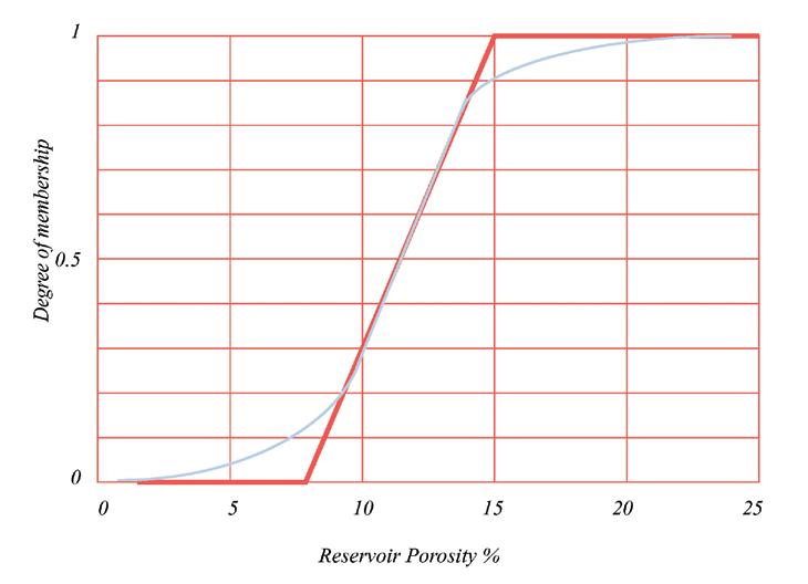
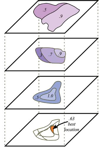
Figure 1. Spatial joining of individual play element probability maps to create a play summary map (after Hood, South et al. 2000).
Figure 2. An example of favorability mapping using fuzzy integration (Chen, Osadetz et al. 2002). Membership boundaries can be defined as sharp (red line) or gradual (blue line).
distribution of hydrocarbons. Play element maps are constructed for each of the major play elements: reservoir, trap, seal, source, maturation, migration, timing, etc. – that represent primary controls on the distribution of hydrocarbons within an exploration play. They may be simplified or sub-divided as appropriate for the local geology and assessment goals. Figure 1 illustrates how spatially combining a variety of play element maps can be used to optimize locations.
Some of the latest assessment methodologies are using probabilistic approaches in conjunction with spatial analysis. One such method is geological favorability mapping. This is a quantitative approach for studying the spatial characteristics of favorable conditions and their relationship to exploration targets. Many of these characteristics are prone to subjectivity and vagueness because of their imprecise nature. Geological favorability mapping uses fuzzy sets to quantify these attributes. This is done using a sliding scale to describe the satisfaction levels associated with each of the essential parameters needed for the formation of hydrocarbon deposits. The evaluation consists of the following six steps:
1) Preparation of favorability diagrams, and membership functions – favorability is a fuzzy set in which degrees of membership are defined for an element that may or may not be completely in or out of the set (see Figure 2 as an example). Defining a membership function is often arbitrary and difficult, with the cut-off points ranging from a distinct yes/no to a gradual, decreasing likelihood of membership.
2) Selection of geological factors and subfactors – these are selected to represent the major geological controls on the spatial occurrence of petroleum deposits such as source, trapping, and reservoir. A geological factor may have several sub-factors, e.g., a reservoir quality factor has porosity, thickness, facies, and permeability. Geological factors may reflect the assessor’s beliefs, the company’s exploration goals, or the availability of data. Factors affecting the formation of hydrocarbons are not necessarily the same as those controlling their spatial distribution.
3) Determining evaluation criteria sets – evaluation criteria must be determined to describe the relationship
between geological evidence and the corresponding favorability levels with respect to hydrocarbon accumulation in the area of interest. The criteria set may vary in different geological settings or exploration environments, depending on the geologists’ beliefs and the company’s risk tolerance or exploration goal.
4) Assessing relative importance of geological factors – some factors may have relative importance over others. This is handled by weighting the factors where the sum of all weights must equal 1. The weights are usually determined subjectively by a group of geologists working in the area and reflect their understanding of the relative importance of the different geological factors with respect to the spatial occurrence.
5) Fuzzy integration computation – fuzzy mapping is used between the observed / inferred geological evidence and the geological favorability level. In the evaluation, the geological factors are divided into necessary factors and preferable factors. For example, the presence of a reservoir is a necessary factor while the presence of a fracture is a preferential factor. The fracture would enhance the reservoir permeability, but its absence does not prevent the accumulation of hydrocarbons. n ecessary factors use a minimum operator with the relative favorable condition being determined by the poorest factor in the hydrocarbon accumulation processes, e.g., if the reservoir is excellent but the source is poor than the favorability is poor. For the preferential factors, the different weights for the various geological factors are multiplied together to obtain a single value. The final result of such an evaluation at a given location is expressed as a fuzzy set, not a single value.
6) Information updating – a geological favorability map based on geoscience observations and subjective judgments using fuzzy integration provides a quantitative measure of relative favorability in a region of interest. This is combined with exploration drilling outcomes and can be expressed as a probability map. Such a map is a convenient measure of risk analysis for exploration planning and prospect ranking.
To be continued…
R EFERENCES
Barrell, K. A. (2000). GIS: The Exploration and Exploitation Tool. Geographic Information Systems in Petroleum Exploration and Development. T. C. Coburn and J. M. Yarus, American Association of Petroleum Geologists. AAPG Computer Applications in Geology, No. 4: p. 237-248.
Berry, J. K. (2000). Geographic Information Systems (GIS) Technology: A Brief History, Trends, and Probable Future. Geographic Information Systems in Petroleum Exploration and Development. T. C. Coburn and J. M. Yarus, American Association of Petroleum Geologists. AAPG Computer Applications in Geology, No. 4: p. 9-16.
Fell, J., K. Long, et al. (2004). GIS Technology in the Petroleum Industry: Current State of Affairs. Dallas, Texas, University of Texas: p. 11.
Hood, K. C., B. C. South, et al. (2000). Use of Geographic Information Systems in Hydrocarbon Resource Assessment and Opportunity Analysis. Geographic Information Systems in Petroleum Exploration and Development. T. C. Coburn and J. M. Yarus, American Association of Petroleum Geologists. AAPG Computer Applications in Geology, No. 4: p. 173-186.
Miller, H. J. and J. Han (2001). Geographic data mining and knowledge discovery: an overview. Geographic data mining and knowledge discovery. H. J. Miller and J. Han. New York, NY, Taylor & Francis Inc.: p. 3-32.
Roddick, J. F. and B. G. Lees (2001). Paradigms for spatial and spatio-temporal data mining. Geographic data mining and knowledge discovery. H. J. Miller and J. Han. New York, NY, Taylor & Francis Inc.: p. 33-49.
Urbano, P. (2004). GIS in the Oil Field Life Cycle. 2004 ESRI Petroleum User Group Conference, Houston, Texas, ESRI.
Wachowicz, M. (2001). GeoInsight - An approach for developing a knowledge construction process based on the integration of GVis and KDD methods. Geographic data mining and knowledge discovery. H. J. Miller and J. Han. New York, NY, Taylor & Francis Inc.: p. 239-259.
Yarus, J. M. and T. C. Coburn (2000). Geographic Information Systems in Petroleum Exploration and Development: An Introductory Essay. Geographic Information Systems in Petroleum Exploration and Development. T. C. Coburn and J. M. Yarus, American Association of Petroleum Geologists. AAPG Computer Applications in Geology, No. 4: p. 3-6


CSPG AWARD
Honorary Membership
Honorary Membership is awarded for distinguished service to the Society. This year, two worthy recipients were presented with their Honourary Memberships at the Long-time Members Reception on May 15th at the Annual CSPG/CSEG Convention.
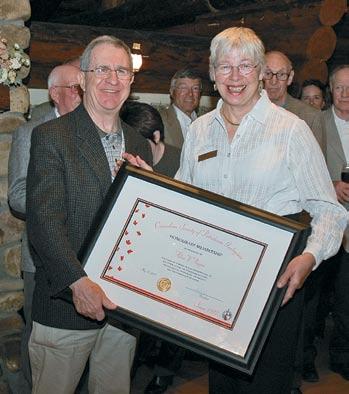
A LICE PAYNE
Alice Payne was born in Edmonton and she spent much of her early years in yellowknife. Her father, Tom, a successful prospector, started Ryan Gold Mines in the nWT and Alice had ample opportunity to experience mineral exploration and mining first hand. Later, Tom Payne successfully explored for oil following the Leduc discoveries. Alice would chronicle these events years later in her book Quin Kola: Tom Payne’s Search for Gold, published in 1990.
Alice started her early education at Havergal College in Toronto. She obtained her b achelor and Master of Science degrees from the u of A in the early sixties. She was the only female geology student in her graduation class at the university of Alberta, where her attendance on field trips required chaperones.
Her M.Sc. thesis, entitled A Reconnaissance: b asic Intrusive Rocks of the Precambrian Shield, Canada, was supervised by Robert E. Folinsbee. Aspects of the thesis work were presented at an International union of Geological Sciences, u pper Mantle Symposium, in new Delhi. In 2000, she received an honourary Doctor of Laws (LL. D) degree from the university of Calgary.
Alice worked for the Geological Survey of Canada in the early sixties, having to settle
for lab work because field work was not an option for a female geologist at that time. After consulting on various projects in the mining industry, she joined Gulf Canada in 1979 as an exploration geologist – this time for oil and gas. Through the next 16 years she advanced through supervisory positions including stints as a Senior Geologist, Supervisor for Southern Alberta, Senior b usiness Planner, and Senior Advisor, Liabilities Management. After retiring from Gulf in 1995, Alice became President of her own company, Arctic Enterprises Limited.
For many years, Alice has been a mentor to co-workers and fellow scientists, through her professional organizations and such organizations as the Association of Women in Engineering and Science, Operation Minerva and the Women’s Science network. Her examples as a role-model and her encouragement for women in science have been outstanding.
As an active CSPG member, Alice has contributed to numerous CSPG committees and served as Society President in 1992, the first woman to hold that position. She has been a dedicated supporter of science in the community. Alice was the founding chairman of the Alberta Science and Technology Leadership Awards Foundation and spent four years as a member of the Premier’s Council for Science and Technology for Alberta. She has served on the Advisory Council to the Chair for Women in Science and Engineering at the university of Calgary, the board of directors of the Calgary Science Centre, and the Council of APEGGA. She is also an active member of the Canadian Institute of Mining, Metallurgy and Petroleum, the AAPG, and a Fellow of the Geological Association of Canada.
Alice has received numerous awards including the Canada 125 Medal in 1992; the Paul Harris Fellowship Award in 1994; the President’s Award, Canadian Society of Petroleum Geologists in 1996; and the Woman of Distinction Award for Science, Technology and Environment, y WCA Calgary in 1998. Fittingly, Alice became a Member of the Order of Canada in 1997. Her citation for the Order of Canada reads: She achieved a lifelong dream of pursuing a career as a geologist in spite of early limitations on women entering the profession. Due to her talent and perseverance, she went on to work as a senior geologist at one of Canada’s major
oil exploration companies and became the first woman to serve as President of the Canadian Society of Petroleum Geologists. She continues to take part in programs aimed at encouraging young women to pursue careers in non-traditional fields.
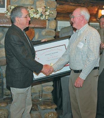
J IM M ACDONALD
Jim MacDonald has enjoyed a long and very successful career as a petroleum explorationist and executive and has well served our profession through his involvement with CSPG and AAPG. He is a very worthy recipient of Honorary Membership.
Jim was born and grew up in Winnipeg, Manitoba. He headed east to St. Francis xavier university in nova Scotia to obtain his b .Sc. in geology and completed his formal geological training at McGill university in Montreal.
Jim’s first job in the industry was with Tidewater Oil in Regina where he learned the basics of petroleum exploration, but eventually decided to seek warmer climes and joined the Venezuelan office of Atlantic Refining Company. This introduced him to a whole new set of petroleum exploration strategies in basins very unlike the WCS b . u nfortunately the political situation in Venezuela became somewhat difficult and much of the Atlantic staff transferred to other offices. Jim came to Calgary and he rose to position of Exploration Vice President with Atlantic Richfield. During his tenure in this position he directed a major exploration effort in the frontier basins of Canada. Due to his success at ARCAn , Jim was brought back to the ARCO head office
Jim MacDonald accepting award from Gordon Williams.
Alice Payne accepting award from Gordon Williams.
in Dallas where he was Manager of Frontier Exploration, a very challenging position which oversaw many offshore projects.
Jim eventually returned to Calgary to take up a senior position with Dome Petroleums which at that time was very active in b eaufort Sea exploration. Following this, Jim formed his own company and he continues to participate in various oil and gas exploration and development projects.
Jim began his volunteer efforts with CSPG over 40 years ago and early on made valuable contributions through his work
ROCK SHOP
on the Helicopter Safety Committee. In 1980 he took on the demanding task of being the General Chair of the 1982 AAPG Convention which was held in Calgary. Thanks to Jim’s dedicated efforts and exceptional managerial skills the convention was smoothly organized and was a huge technical and financial success. In 1991 Jim served on the CSPG Executive as President. Our Society functioned very well during Jim’s stewardship and a number of various new initiatives were launched including the return of the AAPG convention in 1992. After his Executive service, Jim continued his CSPG involvement through the b oard
of Trustees for the Educational Trust Fund. Jim has also contributed to the profession through work with AAPG including being a member of the House of Delegates and (currently) a Trustee Associate.
Jim has been a dedicated explorationist for nearly 50 years and along the way he has always found time to contribute to the profession through selfless volunteerism. Jim is most deserving of Honorary Membership and we welcome him to this new position in our Society.


www.rpsgroup.com/energy

CSPG AWARD 2006 Stanley Slipper Award
The Stanley Slipper Gold Medal, the CSPG’s highest honour, is presented annually to an individual that has made outstanding contributions to petroleum geology in Canada. On May 29th, 2007 the Slipper Medal was presented at the CSPG Technical Luncheon at the Telus Convention Centre, for the first time, to two great scientists, explorers, lifelong friends, and colleagues; John M. Andrichuk and Ralph W. Edie. Regretably, Ralph Edie passed away on April 15th of this year.
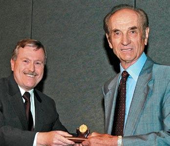
JOHN M. A NDRICHUK
John M. Andrichuk was born at Downing, Alberta. In 1946, John graduated from the university of Alberta with a b.Sc. degree in geology and chemistry. In 1949 he obtained an M.Sc. degree in geology from the university of Alberta. The thesis was under the direction of Charles R. Stelck. The same year he entered graduate school at northwestern university and was awarded a university scholarship for the term 1950–51, receiving a Ph.D. degree in geology at the end of that term. His Ph.D. thesis was under the direction of L. L. Sloss.
John’s professional experience commenced in 1945 with summer field work as a geological assistant for Rio bravo Oil Company in the foothills of northwestern Alberta. In the summer of 1946, he did geological field work on the Canadian Shield for Central Mining Services Limited and in the summer of 1949 he led a field party down the Athabasca River for bear Oil Company. From 1951 to 1954 he was employed by Gulf Oil Corporation, Tulsa, Oklahoma as a research geologist. His work consisted largely of special studies on Paleozoic stratigraphy in the Rocky Mountain region of the united States and Canada. From 1954 to 1956, he was employed by Alex W. McCoy Associates as a petroleum geologist in Calgary. Since 1956, he has been a member of the firm Andrichuk and Edie, Independent Geologists, Calgary.
In 1958, John received the AAPG President’s Award for the most significant paper by an
author under the age of 35 years published in the AAPG bulletin. In 1959, he was awarded the CSPG’s Medal of Merit for the same paper, entitled, “Facies Analysis of upper Devonian Reefs in Leduc, Stettler and Redwater Areas of Alberta”, AAPG bulletin, January 1958. In this paper John demonstrated continuous reef growth from the vicinity of the edge of Cooking Lake Formation shoals or platform buildups upward into Leduc biothermal reefs.
R ALPH W. E DIE
Ralph W. Edie was born at Smoky Lake, Alberta. Ralph entered the university of Alberta in September 1940 and graduated from that institution with a b .Sc. degree in mining engineering in 1945. After two years of geological exploration for gold near yellowknife, north West Territories, he returned to the university of Alberta for an M.Sc. degree in geology, supported by a Shell Oil Fellowship, which he received in 1949. His M.Sc. thesis was under the direction of Robert E. Folinsbee. In September 1949, Ralph entered graduate school at the Massachusetts Institute of Technology and received a Ph.D. degree in geology in 1952.
Ralph’s early geological experience included seven summers of geological field mapping on the Canadian Shield in search of gold, copper, and uranium (1944 – 1951). During the period 1952 – 1954 he was a research geologist in Calgary, first with Texaco Exploration Company and later with Shell Oil Company. In 1955 and early in 1956, he worked as a petroleum geologist for Alex W. McCoy Associates, Calgary.
In 1958, Ralph was an AAPG Distinguished Lecturer speaking across Canada, the united States, and Mexico. The subject of his lecture was “Limestone Facies and Stratigraphic Traps”, which was the main theme in his paper entitled “Mississippian Sedimentation and Oil Fields in Southeastern
Saskatchewan”, published in the AAPG b ulletin, January 1958. In his lecture and paper, he demonstrated that sedimentary facies and pre-Jurassic erosional patterns controlled accumulation of oil in Mississippian strata in the Williston b asin.
In 1992, both John and Ralph were elected as Honourary Members of the Canadian Society of Petroleum Geologists.
During their professional careers, John and Ralph undertook a great deal of stratigraphic research, mostly on their own time and expense. This research formed the basis for their published papers. Individually and jointly, John and Ralph published more than twenty scientific papers.
Their greatest success was during their time with Thunderbird Petroleums Ltd. and Oakland Petroleums Ltd. Together, they drilled more than 200 exploratory prospects and field development wells. The exploratory drilling resulted in discovery and development of a number of stratigraphic trap oil pools or pool extensions at Pinto, northgate, Carnduff, and n .E. Steelman fields in Saskatchewan and at Pierson, Manitoba. In Alberta, several discoveries of Cretaceous Ellerslie meanderbelt oil and gas field extensions were made at Campbelln amao, East Acheson, and Fairydell- b on Accord Fields. The 9¼ square mile extension at Campbell- n amao Field produced 2.4 million barrels of light gravity crude oil and 53.9 b cf of gas. However, the most valuable discovery was the Morinville Leduc D-3b pinnacle reef discovery, which has produced more then ten million barrels of light gravity crude oil.
These two explorers embody the sprit of the Stanley Slipper award. Together, they have spent their lives understanding the science of petroleum geology in the Western Canada Sedimentary b asin and the business and art of petroleum exploration. Their professionalism has also brought them recognition from the worldwide geoscience community though more than six decades of discovery.
Colin yeo, President of the CSPG, presented the Slipper Medals to John Andrichuk and Don Edie, who received Ralph Edie’s Medal on behalf of his grandfather. John thanked the committee and the Society for recognizing his and Ralph’s contributions to the profession and the industry over the years.
John accepting award from CSPG president, Colin Yeo. Ralph Edie accepting the award on behalf of his grandfather, Ralph W. Edie, from Colin Yeo.
CSPG AWARD R.J.W. Douglas Medal
M. E. MC M ECHAN
The R.J.W. Douglas Medal is awarded annually by the Canadian Society of Petroleum Geologists for outstanding contributions to the understanding of sedimentary geology in Canada, commending major contributions to regional tectonics, petroleum, and structural geology. This year’s Medal was presented to Margaret E. (Margot) McMechan on May 10th at the CSPG Technical Luncheon at the Telus Convention Centre for her outstanding contributions to the elucidation of the geological structure, stratigraphy, tectonic evolution, and petroleum geology of the Rocky Mountains of western Alberta and eastern british Columbia.
Margot, like bob Douglas, is first and foremost a very perspicacious and productive field geologist. She has published more than 30 high quality geological maps and numerous carefully balanced cross-sections covering various parts of the Canadian Rocky Mountains between the Crowsnest Pass and the Peace River area. Her more important scientific contributions, most of which are based upon the systematic geological mapping she has done for the Geological Survey of Canada and the b.C. Geological Survey, including her:
• analyses of the nature and significance of stratigraphically controlled lateral variations in structural, style along the deformation front of the Cordilleran foreland thrust and fold belt;
• regional stratigraphic analysis and tectonic assessment of the Mesoproterozoic ( beltPurcell) stratigraphy of the southern Canadian Cordillera and adjacent u.S.A., and also of the neoproterozoic (Windermere) and Cambrian strata of the Canadian Rockies between Mount Robson and Peace River and their bearing on the origin of the Peace River Arch;
• collaborative work with Wolfgang Kalkreuth on coalification patterns in the Foothills and western foreland basin and their implications for petroleum exploration; and
• insightful and enlightening regional stratigraphic, structural, and tectonic review papers that have been published in a number of important books, including the WCSb Atlas and the latest Geology of Canada series.
Most of this was accomplished as Margot worked part-time while raising a family and making important contributions to her community and her profession as a mentor and role model for the participation of women in science.
One highlight of Margot’s achievements in the foreland thrust and fold belt has been a series of 11 high-quality, 1:50,000-scale, GSC A-series maps with balanced structure sections that span the Rockies between the Mount Robson region and Pine Pass region, including four that involved collaboration with R. I. Thomson.
These maps and sections provide an unmatched database for palinspastic reconstruction and analysis of the tectonic evolution of this part of the Cordillera. Margot has used this database, together with her maps and sections of the thrust and fold belt farther north in b.C. to provide an insightful stratigraphic analysis of the late neoproterozoic-early Paleozoic evolution of the western extension of the Peace River arch, and also to elucidate the stratigraphic relationships, regional tectonic significance, and global implications of the remarkable glacial diamictites that occupy the eastern margin of the neoproterozoic Windermere rift basin in the Cordillera adjacent to the Peace River arch. Furthermore, in the Walker Creek area, near the southern Rocky Mountain Trench, she discovered and documented the 2km-wide Walker Lake fault zone, a right-lateral strike-slip fault that is the southern continuation of the northern Rocky Mountain Trench. She showed that it is marked by at least 60 km of right-lateral strike separation, and indicates that oblique convergence in the eastern part of the southcentral Canadian Cordillera was resolved into parallel northwest-striking zones of strike-slip and thrust faulting during the Late Cretaceous to Early Eocene.
Margot’s research collaboration with Wolfgang Kalkreuth on relationships between patterns of regional variation in thermal maturation and the structural evolution of the foreland thrust and fold belt has important implications for petroleum exploration. It has shown that vitrinite reflectance in Cretaceous strata increases from west to east across the Foothills to a maximum in the core of the Alberta syncline and decreases farther east; and that this pattern, which reflects variations in depth and duration of burial in the eastward migrating Late Jurassic to Paleocene foreland basin, indicates a potential for wet-gas or oil preservation in the Foothills.
Margot’s insightful analysis of the nature and significance of variations in structural style along the deformation front of the Cordilleran thrust and fold belt has highlighted the importance of the development of multi-level, low-taper “trianglezone” structures (foreland verging thrust-duplex wedges) in the Foothills of northern Alberta and northeastern british Columbia; moreover, she has documented the critical role of alongstrike changes in the stratigraphic facies (and mechanical properties) of the Phanerozoic supracrustal rocks in the development of the multi-level detachment (décollement) zones that control the formation of these structures. More recently, based partly on her mapping in the southern Alberta Foothills, she was a coauthor of an important paper concerning the importance of mechanical stratigraphy in the development of the “triangle zone” in southwestern Alberta.
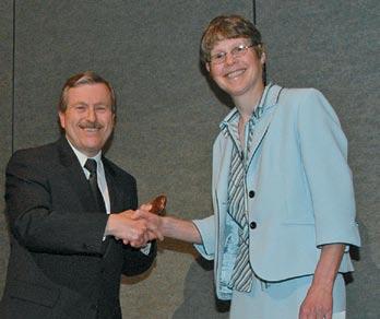
Margot has recently published two excellent and very popular maps of part of the southern Canadian Rockies southwest of Calgary: a 1:50,000 scale map and balanced cross section of Peter Lougheed Provincial Park, mainly based mainly on her own fieldwork, and a 1:100,000 scale map of Kananaskis Country, based on her own mapping together with various graduatestudent thesis maps and older GSC mapping in the Foothills. both are popular with the local geological community and visiting geologists, including some students from Canadian and u.S. universities who use the area as a field teaching laboratory. Her systematic geological mapping associated with this project provided the basis for an important paper in which she describes and analyses the spectacular multiduplex structures in the McConnell thrust sheet in the Elbow River - Sheep River area.
Margot’s grand synthesis of the Mesoproterozoic Purcell ( belt) Supergroup, based on her awardwinning Ph.D. thesis (CSPG, 1981), established her reputation as a leading authority on these rocks. This reputation has been maintained through her participation as author, or coauthor, of a number of regional review articles.
In recent years, Margot McMechan has been a member of a team from the Geological Survey of Canada and the b.C. Department of Energy, Mines and Petroleum Resources that is working on integrated petroleum resource potential and geoscience studies of the bowser and Sustut basins of north-central british Columbia. One outcome of this work is that it has provided the background for a paper on a synthesis of the Jurassic – Cretaceous tectonic evolution of the southern Canadian Cordillera that explores links across the Cordilleran orogen between the Foreland belt and the Intermontane belt.
In receiving the Douglas Medal from Colin yeo, the CSPG President, Margot thanked her family, her colleagues, and the Society for recognizing her efforts over the years.
Margo accepting award from CSPG president, Colin Yeo.
AAPG’s 2nd Annual Fall Education Conference
Houston, September 10-14, 2007
Exploration in Stratigraphic Traps
Courses will include:
• Sequence Stratigraphy for Petroleum Exploration
• Deep-Water Sands—Integrated Stratigraphic Analysis
• Carbonate Depositional Systems, Diagenesis and Porosity Development
• Quick Guide to Carbonate Well Log Analysis
• Seismic Imaging of Carbonate Reservoirs
• Seismic Interpretation in the Exploration Domain
• Understanding Seismic Anisotropy in Exploration and Exploitation
• 3D Seismic Attributes for Prospect Identification and Reservoir Characterization
• AVO/Seismic Lithology
• Evaluating Seals & Pay
• Risk Analysis in Stratigraphic Traps
• Geochemical Exploration for Strat Traps
HOSTED BY THE NORRIS CONFERENCE CENTER 9999 RICHMOND AVE., SUITE 102 HOUSTON, TX 77042
713-780-9300; FAX: 713-780-9490 SPECIAL AAPG GROUP RATES AT NEARBY HOTELS!
Tuition for the week is only $1295 for AAPG Members or $1395 for Non-members* or $325/day for individual courses *(price increases to $1395/1495 respectively after August 13, 2007)
For more info or to register call +1 918 560-2650
email: educate@aapg.org or visit www.aapg.org/fec/ More science than you can shake a pick at.
CANADIAN CENTRE FOR ENERGY INFORMATION Portal Re-Launch
Contributed by Centre for Energy Staff
Energy consumption and the environment are two topics that are top of mind in Canada. Many organizations and individuals are doing their own research to find out how they can reduce energy costs and conserve energy and the environment – but how can Canadians trust that the information available on these subjects is current, credible and balanced?
For five years the Canadian Centre for Energy Information (Centre for Energy) has been the only complete, comprehensive and un-biased information resource on the Canadian energy system for north America. The Centre for Energy hosts an online portal – www.centreforenergy. com – and produces print publications which provide background information on energy sources and use as well as hundreds of energy facts and statistics, consumer tips and answers to frequently asked questions.
ROCK SHOP
until recently, the Centre for Energy’s focus has been on the upstream portion of Canada’s energy mix. On June 11, 2007 the Centre for Energy re-launched its online portal to include new and expanded information on energy end use, providing consumers with the information they need to save energy and money.
The new portal contains a consumer information section with helpful tips, videos, podcasts and links. A new residential section provides an overview on energy consumption related to residential heating and cooling, appliances and lighting and personal transportation.
Given the amount of energy Canadians consume, energy efficiency tips are a focus for the re-launch of the portal. Heating and cooling our homes accounts for approximately 48 per cent of the energy used in our homes, personal transportation accounts for 42 per cent and lighting and appliances account for about 10 per cent.
Most of the tips provided on the Centre for Energy portal are easy to incorporate into
everyday life. Consumers are also able to measure the impact of choosing a greener option using one of the energy calculators listed on the site.
Information and updates on electricity and natural gas rates, ways to cut energy costs and regulations designed to protect consumer interests will be updated frequently to ensure the information provided on the portal is current and comprehensive. Consumers are encouraged to suggest ways to improve the portal in a “Share with us” section – making the Centre for Energy a truly interactive experience.
Energy is a vital part of all Canadians’ lives. The Centre for Energy believes an informed and educated public better understands and supports energy policy and regulatory choices, makes better business decisions related to energy, pursues careers in energy, invests in energy and uses energy more wisely in their personal lives. Visit www.centreforenergy. com to get comprehensive information on energy all in one place.

2007 CSPG CSEG Convention Overview
LET IT FLOW: T HE F LOW OF I DEAS , H YDROCARBONS AND BUSINESS
M AY 14 – 17, 2007
OUR T HANKS
Thank you to presenters, exhibitors, sponsors, and delegates, and especially the Convention volunteers for hosting an outstanding convention this year. The success of the convention can be measured by the hard numbers of attendance and profits, but it is the soft numbers that draw the registrants, like the quality and range of the Technical Programme, the diversity of exhibits, and the staging of congenial social events that mark this event of the year.
F EEDBACK
The feedback we received was overwhelmingly positive and we listened carefully for opportunities to improve. Three things well received were:
• Posters co-located with exhibits and morning poster break;
• Rex Murphy luncheon was widely enjoyed; and
• Registration website, which was easy to use.
Rex Murphy impressed our diverse audience with a sensible commentary on Alberta not only as an economic engine, but also as a social safety valve for Confederation. He also delivered an insightful critique on the lack of critical, and politically incorrect, debate on the motives and tokens behind climate change action by individuals, corporations, and governments.
Three things to improve, rated by numbers of people affected:
• More Exploration and Production company case histories;
• Hall D – Poor sound and light quality and some issues with A/V support; and
• Ensure systematic feedback is collected from delegates, presenters, exhibitors, and sponsors.
The Annual Convention report produced by the Organizing Committee transfers knowledge to incoming committees and lists many addional opportunities to improve delivery of the convention program. The call for more case histories was prevalent among senior delegates. This item is by far the most important challenge for future conventions. Convention committees, which comprise many E&P geo-scientists, have recognized this and to some extent mitigated this trend. However, a systematic and concerted effort is required by the Societies to address root causes and to engage management and geo-science staff of E&P companies on the benefits of technical participation. A number of recommendations are contained in the convention report.
On a lighter note, yes we will have a new lanyard next year that won’t twist and shed reception coupons. Running out of b ig Rock beer at the b eer and b ull reception was rated as a crisis !
HONOURABLE M ENTIONS AND I NNOVATIONS
• Core Meltdown, more than 1,000 guests, on a beautiful spring day– though we’d like to see more geophysicists attend the workshop and following celebration
• ‘3F’ Technical Programme – fractures, foothills, and frontiers
• Flow of business session was enthusiastically embraced by delegates interested in Industry’s role in the economic, social, and environmental landscape.
• Excellent food, service, and music at receptions (Flowdown and b eer & b ull).
• Survey on climate change statement for the CSPG
• Commercial-Technical sessions
• Light up The World Charity Auction – raised $22,000 for a project in new Guinea
• Challenge b owl – Fun, fast-paced knowledge quiz for university teams
• Kids in Science Program – 76 students from Sir John Franklin Junior High thrilled by Earth Sciences
• Complimentary petroleum geo-science course for exhibitors and students
• Fortunately, the transit strike did not materialize
R EVENUES AND E XPENSES
Estimated revenue meets the budget forecast in all major categories (Figure 1) and is on par with revenues generated by the 2006 CSPG / CSEG / CWLS convention (after adjustments for field trips and short courses which are now handled by standing committees). Although preliminary, it
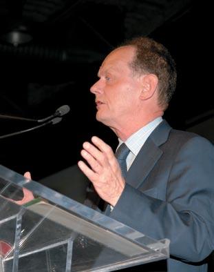
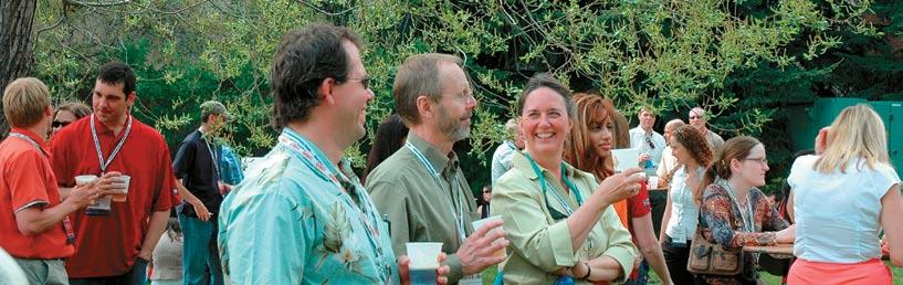
appears that expenses are at or below budget, indicating that the forecast profits will be returned to the societies to cover operating expenses (Figure 2). The final tally is expected to be reported to the CSPG executive in September and will be audited later in the year.
The Exhibits Floor was sold out and the societies successfully met the budgeted exhibits and sponsor revenue. Also, delegate numbers are unchanged from last year, at about 4,600, although we did have slightly fewer technical delegates and more student and exhibitor registrations.
Fees charged to exhibitors, sponsors, and delegates have not changed in the past few years. Registration fees are low at $285 for member ‘early’ bird registration. For comparison, many non-Industry conferences charge between $1,000 and $2,000 for their meetings.
PROGRAM STATISTICS
• 200 talks, 80 poster and core presentations
• 7 simultaneous sessions covering 22 themes over 3 days; 35 half-day sessions
• Over 800 technical contributors, based on an average of 3 authors per paper
• Presention statistics
– university 28%
– Service Industry 23%
– Government (surveys) 14%
– International 11%
– Consultants 9%
– E & P Companies 9%
– External Speakers 6%
• 120 exhibitors, 40 sponsors
W HAT IT TAKES TO PUT T HIS PARTY ON
This convention continues the partnership agreement by the CSPG and CSEG to jointly host this and future conventions. Every second year a third society is invited to cohost the Annual Convention.
• 10 committees, 80 volunteers of which about 50 are session chairs
• 80 student and senior volunteers – on-site and package pick-up
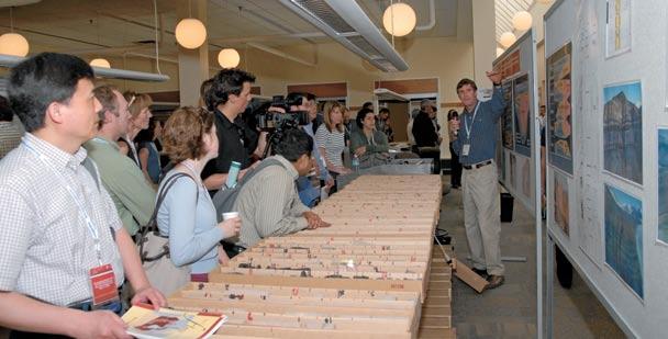

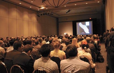
• 4 office staff – conventions and sponsorship / exhibits
• 4,600 delegates – 3,100 technical, 1,000 exhibitor, 500 students & other
I hope that you found the convention a valuable experience. bruce Shultz (2008 CSPG General Co-Chair) and next year’s convention team are looking forward to seeing you as we head ‘ b ack to Exploration’. Please don’t wait until next year to give us your ideas for a stronger program – we would like to hear them now; just contact the CSPG Office. It was a privilege to serve the Society and to deliver the program with an organizing team that was generous with its ideas and humour. They have become valued and trusted colleagues.
John Varsek
2007 CSPG / CSEG General Co-Chair
CSPG technical awards were announced at a post-convention June luncheon and will be published in the September issue, ensuring that presenters are properly notified and recognized by the membership and executive
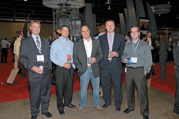
Figure 1. Revenue Forecast
Figure 2. Operating Expenses
THANK YOU to our exhibitors
Thank you for your participation in the 2007 CSPG CSEG Convention; we appreciate your business. We also thank the exhibitors that sponsored the Convention; these companies have logo recognition as shown.
Geomage Ltd.
3dh Geophysical
AAPG
AEROQu EST InTERnATIOnAL LIMITED
AGAT Laboratories Ltd.
Alberta Geological Survey
Alberta Research Council
APEGbC - The Association of Professional Engineers & Geoscientists of bC
Ascend Geo LLC
bAKER ATLAS
bEICIP, InC/IFP
b odycote Testing Group
b oyd PetroSearch
british Columbia, Oil & Gas Division
Calgary Rock & Materials Services Inc.
Canadian Discovery Ltd.
Canadian Society of Exploration
Geophysicists - Partner Society
Canadian Society of Petroleum Geologists - Partner Society
Canadian Well Logging Society
CGGVeritas
Complete Land Services Ltd.
Continental Imaging Products
Continental Labs / CL Consultants
CREWES and FRP, university of Calgary
Datacon Core Imaging
Digital Formation, Inc.
DMI Digital Media Inc.
Downhole Video Canada
EasyCopy Company, The
ESG (Engineering Seismology Group)
ESRI Canada
ffA
FuGRO (Fugro-Jason & Fugro Airborne)
GEDCO
Genetek Earth Research Corporation
GeoKnowledge
Geo-Logic Systems, LLC
Geological Rentals & Services Inc.
GeoMechanics Intl - GMI
Geo-Microbial Technologies (GMT)
Geomodeling Technology Corp.
GEOSEIS Inc.
GEOSySTEM Canada, Inc
Geotech Exploration Services Ltd.
GORE
Government of yukon, Oil & Gas branch
Green’s Rock and Lapidary Ltd.
Halliburton
Horizontal Solutions Int’l
Hotwell Canada Ltd.
Hydrocarbon Data Systems
I/O
Gx Technology
Sensor
InDEL-DAVIS InC.
Industrial Paramedic Services
Isilon Systems
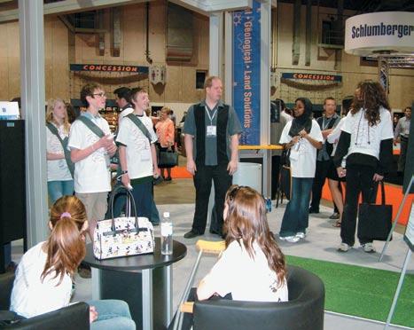

iSys - The Imaging Systems Group Inc.
JE bCO Seismic (Canada) Company
KOMAREVICH ORIGInALS LTD.
LiDAR Services Int’l (LSI)
Little Rock Document Services Ltd.
MacKay Range Development Corporation
Manitoba Science, Technology, Energy and Mines - Minerals Division
MD TotcoTM nOV Wellsight Gas WatchTM
MicroSeismic, Inc.
MTEM
Mustagh Resources Ltd.
n atural Resources Canada, Geological
Survey of Canada
n autilus
neuralog

nikon Canada Inc., Instrument Division
northwest Territories Geoscience Office
Océ-Canada Inc.
OLyMPu S CAnADA InC.
OyO Geo Space Canada, Inc.
Panasas, Inc.
Paradigm
Pason Systems Corp.
PETROSyS CAnADA Inc.
PhotoSat
Pinnacle Technologies, Inc.
Polaris Explorer Ltd.
Printrex, Inc.
Recall
RECOn Petrotechnologies Ltd.
Roxar
Saskatchewan Industry and Resources
Schlumberger Water Services
SDI
Seismic Micro-Technology
Sercel
SHERWIn GEOLOGICAL
SOCIETy OF ExPLORATIOn GEOPHySICISTS
Southern Alberta Institute of Technology
StraTerra Inc.
TELu S
Terraplus Inc.
TOTAL Gas Detection Ltd.
Trango Technologies Inc. (a division of Fugro Data Solutions)
Transform Software and Services
Trivision Geosystems Ltd.
WellSight Systems Inc.
WESTERn DIAZO
Western Explosives/Dyno nobel
Z-Seis Canada Ltd.


RJ W D OUG LAS MEDA L


CA LL FOR NOM I NAT IONS


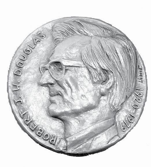


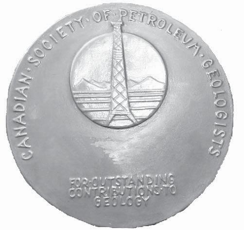


The RJW Douglas Medal is awarded annually by the Canadian Society of Petroleum Geologists for outstanding scientific contributions to the understanding of sedimentary geology in Canada, commending major contributions to regional tectonics, petroleum, and structural geology.
The award is open to all geologists who follow the example of Bob Douglas in contributing to the development of Canadian sedimentary, petroleum, and structural geology.
Nominations for the award of the medal must be endorsed by at least three members of the CSPG. Nominations may be proposed at any time, but to be considered for a particular year, they must be received by the Society before September 1.
The sponsors of a nominee for the award should supply:
A curriculum vitae (outling the nominee’s career and previous honours or distinctions)
A list of publications by the nominee.
A summary of the nominee’s achievements in a form suitable for use as a citation for the award.
An analysis of the nominee’s achievements, highlighting the contributions for which he or she is being recognized, and relating these to the appropriate publications in the bibliography
The last item of information is a key part of the nomination and should convey the magnitude and scope of the nominee’s scientific contributions, with comments on the influence that these contributions have had on others. An example of a submission may be provided on request.
Completed nominations should be sent to:
Graham Davies
CSPG Douglas Medal Committee Chairman, c/o Graham Davies Geological Consultants
Alastair Ross Technology Centre
3553 - 31 Street NW, Calgary, Alberta T2L 2K7
Telephone (403) 289-9156, Fax (403) 289-9156
Email: gdgc@telus.net
THANK YOU to our sponsors
Thank you to the following sponsors for their generous contribution and support of the 2007 CSPG CSEG Convention.

THANK YOU to our volunteers
Thank you to all the volunteers who made the 2007 CSPG CSEG Convention a success! Many thanks.
Organizing Committee
General Co-Chair (CSPG)
John Varsek EnCana Corporation
General Co-Chair (CSEG)
John Townsley Divestco Inc.
Finance Chair
Darren Aldridge b aker Atlas
Sponsorship & Exhibits Co-Chair
Terry McCoy Trafina Energy
Sponsorship & Exhibits Co-Chair
Florence Reynolds nexen Inc.
Exhibits Committee
Stephanie b illenko
Recall
Victor Irwin Divestco Inc.
Publications Chair
Jeannette Watson Schlumberger-Petrel
Special Events Chair
Andrea Hood
geoLOGIC systems ltd.
Volunteer Coordinator
Lyndsey nicholas Divestco Inc.
Technical Prog. Co-Chair (CSPG)
John Cody Paramount Resources
Technical Prog. Co-Chair (CSEG)
Mike Perz Divestco Inc.
Field Trips (CSPG)
Krista Jewett bG Canada
Lori Meyer
Imperial Oil
Meghan Hendren Total
Short Courses (CSPG)
Travis Hobbs EnCana Corporation
Elizabeth O’ neill Canetic Resources
Diego b arrenechea AJM Petroleum
Shaheen Khan bG Canada
Short Courses (CSEG) Kevin Marsh Consultant
Posters
Greg Cave Consultant
Joanne Lanteigne Paradigm
Core Conference
Lisa Griffith
Griffith GeoConsulting Ltd.
Ellie MacInnes ConocoPhillips
Marcia Rempe Mosaic Energy
Joan Tittemore Interpreterra Consulting Ltd.
Suzan Moore ConocoPhillips
n atalie Hachey ConocoPhillips
Judging Graham Carter Hampson-Russell
Logistics
Adam MacDonald EnCana Corporation
Flow of Business
David Mitrovica
World Staffing Solutions
Session Chairs
Paul Anderson
Richard b ale
Dan b oudreault
Sylvstre Charles
Satinder Chopra
Sheila Conner
Martin Dashwood
Jim Davidson
Jeff Deere
Jon Downton
Ken Duckworth
Wayne Elsner
neil Ethier
John Evans
Jeremy Gallop
nilanjan Ganguly
David Garner
Hugh Geiger
Murray Gingras
bill Goodway
Ian Gordon
Chris Haberny
Mike Hall
Anne Halliday
brian Hargreaves
Tim Hartel
Ken Hedlin
Fran Hein
Steve Hubbard
Lee Hunt
Helen Isaac
Dennis Johnston
Sam Kaplan
Malcolm Lamb
Ron Larson
Don Lawton
Scott Leroux
John Logel
Paul MacKay
Kevin Meyer
Cody Muhle
Rachel newrick
Kirk Osadetz
Mike Pacholek
Cindy Riediger
Laurie Ross
Mauricio Sacchi
Mark Smith
Rob Stewart
Joe Stuhec
Rainer Tonn
Juefu Wang
Rick Wierzbicki
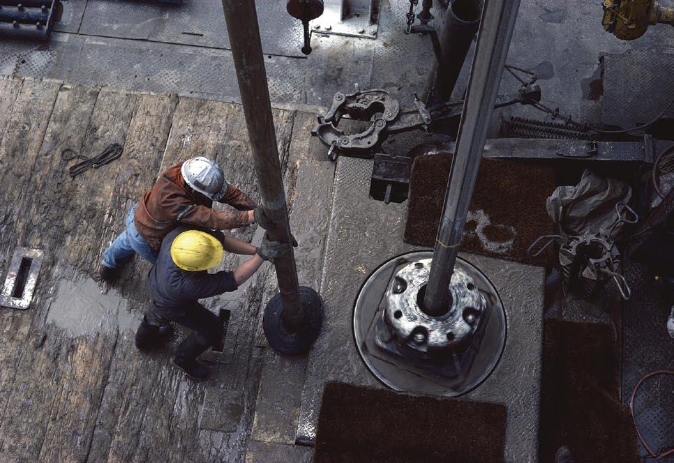


Whether it is fluid contact depths, permeability, faults and fractures or numerical inputs for flow simulation, there is always an element of uncertainty in one’s reservoir operations.
And yet, unlike playing roulette on the casino floor, uncertainty and luck doesn’t have to be inevitable. Roxar is seeing to that.
Through generating multiple scenarios, systematic analysis of the results and incorporating them into a dynamic, simulation environment, Roxar is helping oil and gas operators to better manage and quantify uncertainty within the reservoir.
And, unlike roulette, the end result will be that operators won’t have to rely on chance and luck to succeed but will be able to quantify uncertainty in their reservoir operations and more accurately determine the level of risk – often financial – in their decisions.
For more information on how Roxar is adding uncertainty capabilities to its industry-leading IRAP RMS™ modeling solution, contact us today.