Please submit RESERVOIR articles to the CSPG office.Submission deadline is the 23rd day of the month,two months prior to issue date. (e.g.,January 23 for the March issue).
To publish an article,the CSPG requires digital copies of the document.Text should be in Microsoft Word format and illustrations should be in TIFF format at 300 dpi.For additional information on manuscript preparation,refer to the Guidelines for Authors published in the CSPG Bulletin or contact the editor.
COORDINATING EDITOR & OPERATIONS
Jaimè Croft Larsen
CSPG
Tel:403-264-5610
Fax:403-264-5898
Email:jaime.croftlarsen@cspg.org
TECHNICAL EDITOR
Ben McKenzie
Tarheel Exploration
Tel:403-277-4496
Email:bjmck@telusplanet.net
ADVERTISING
Kim MacLean
Corporate Relations,CSPG
Tel:403-264-5610,Ext 205
Email:kim.maclean@cspg.org
Advertising inquiries should be directed to Kim MacLean.The deadline to reserve advertising space is the 23rd day of the month, two months prior to issue date.All advertising artwork should be sent directly to Kim MacLean.
The RESERVOIR is published 11 times per year by the Canadian Society of Petroleum Geologists. This includes a combined issue for the months of July/August.
Advertisements,as well as inserts,mailed with the publication are paid advertisements.No endorsement or sponsorship by the Canadian Society of Petroleum Geologists is implied.
The CSPG Rock Shop is an attractive and affordable way to target the CSPG readership. Spaces are sold at business card sizes (3.5” wide by 2” high).To reserve space or for more information,please contact Kim MacLean at 403-264-5610,ext.205.
The contents of this publication may not be reproduced either in part or in full without the consent of the publisher.
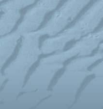
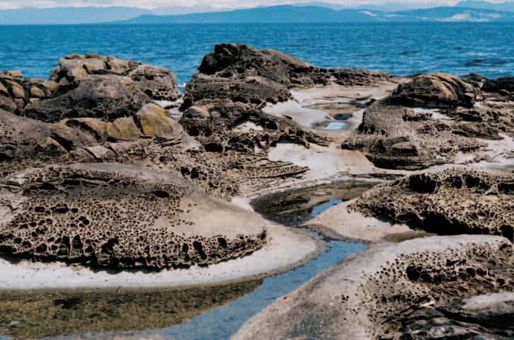
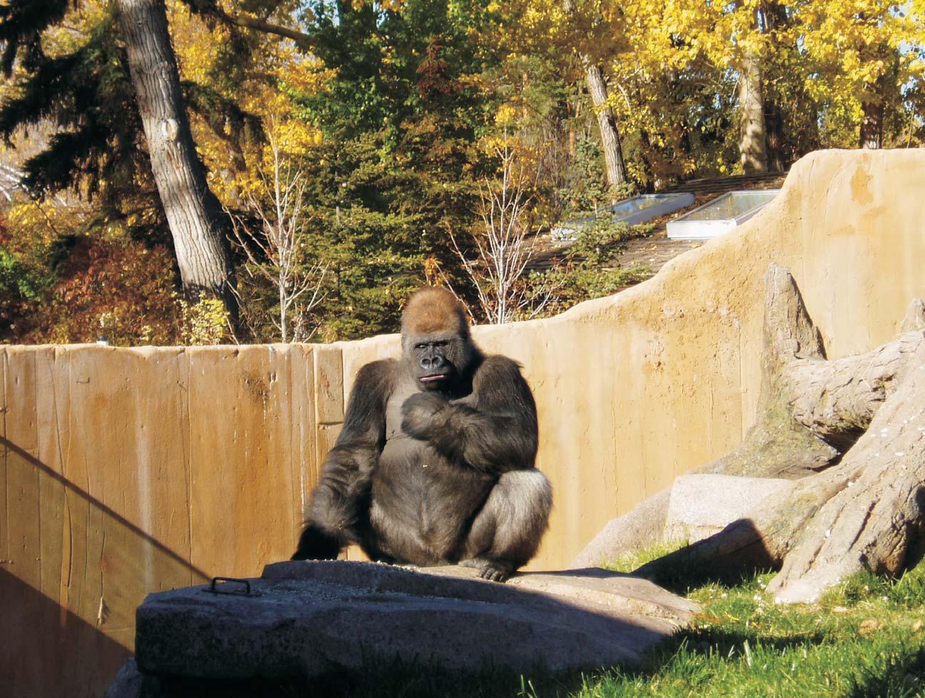
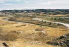
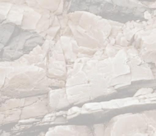
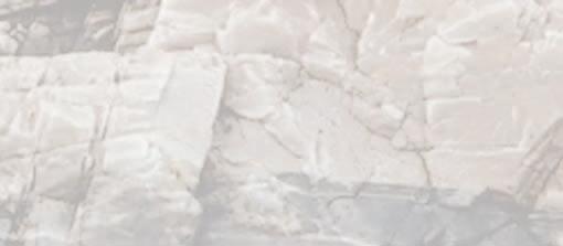
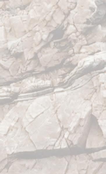
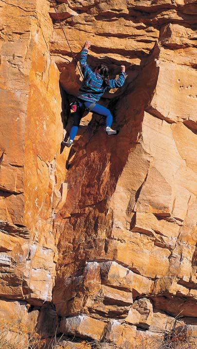
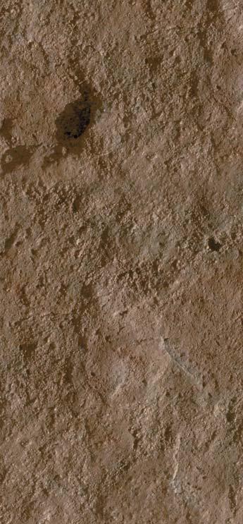
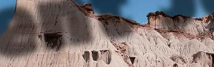
FRONT COVER
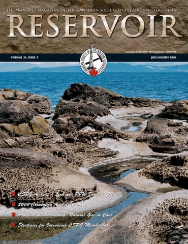
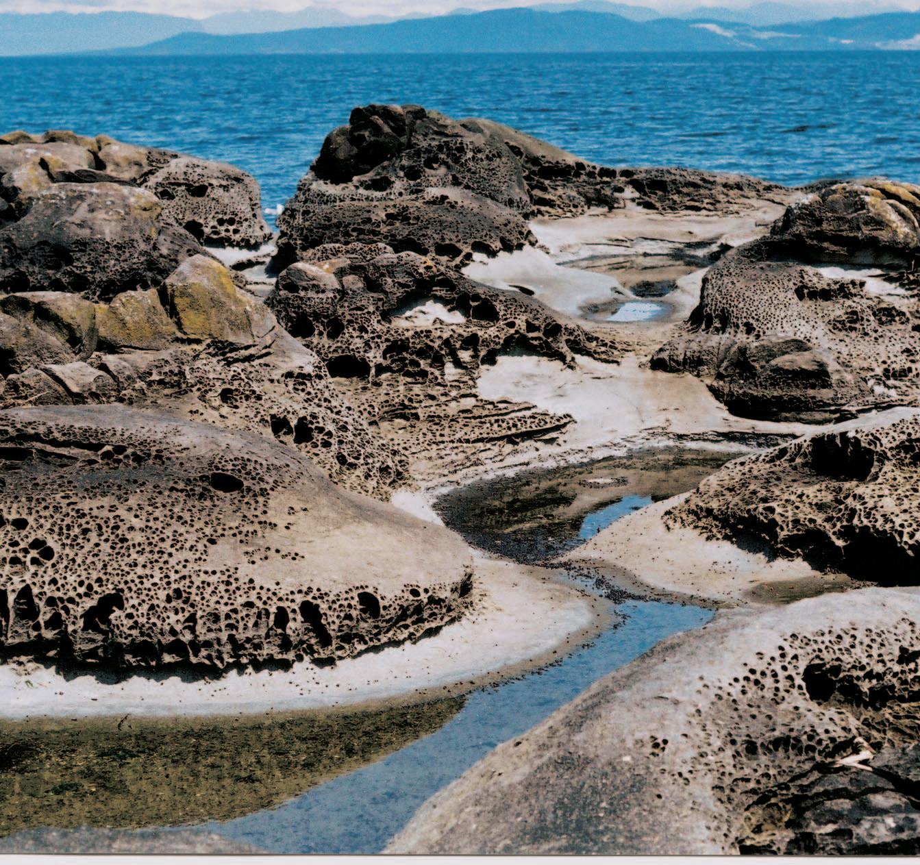
Denman Island, Strait of Georgia, British Columbia. The upper portions of these outcrops of Cretaceous sandstone have been subjected to differential erosion that has accentuated subtle differences in cementation while the lower surfaces have been smoothed by more continuous contact with moving water.
NEW INITIATIVES FROM THE CONTINUING EDUCATION COMMITTEE
The mission statement of the CSPG is “to advance the science of petroleum geology, foster professional development and esprit de corps of members,and promote community awareness of the profession.” As the Assistant Program Director,I work with the Program Director to represent several CSPG committees:the Continuing Education Committee,the Technical Divisions,the Technical Luncheons Committee,and the Convention/ Conference Committees.The Continuing Education Committee has been working hard lately to help foster professional development for CSPG members,and I would like to take this opportunity to tell you about some of the things they have been doing.
The CSPG Continuing Education Committee was revived in May 2003,and over this short time has developed a strong committee that offers a lot to CSPG members.Under the leadership of Godfried Wasser and Dave Russum,the committee has planned over 20 courses and field trips for 2006.This is the first year that the Continuing Education Committee has coordinated the courses and field trips that run in conjunction with the annual CSPG Conference,whereas previously those courses and field trips were coordinated by the Committee on Conventions.This change is of benefit to members for several reasons.First,if a course or field trip is extremely popular and there is a waitlist,the committee can arrange to run a second session at another time during the year.Second,if a field trip needs to be canceled due to weather,it can easily be rescheduled for a few weeks later.Also,by having a separate Continuing Education Committee,courses and field trips can be planned for throughout the year – thus providing a continuous education program that members can take advantage of.
How did they do this? Previously,it was difficult to attract instructors to give their
courses under the CSPG banner.The new Continuing Education Committee has worked hard over the past three years to create an environment where instructors would feel valued and were treated like professionals. One way they did this was by creating a fair compensation structure for instructors,which reflects industry standards.The CSPG also provides insurance and a safety program, mitigating the risks that instructors would have to face by teaching courses on their own. Also,the CSPG provides advertising,takes care of registration for the courses,and takes care of logistics,making it easier for instructors.The Continuing Education Committee has been working to make the CSPG the provider of choice for instructors wanting to offer courses.The Continuing Education Committee’s mandate is to develop education curricula for professional members in various stages of their careers (junior, intermediate,senior,and expert).By offering a wide variety of courses and field trips,offered throughout the year,the Continuing Education Committee can also become the provider of choice for those attending courses.
Why is this important? With the current activity of our industry,petroleum companies are faced with hiring and training increased staff.This is combined with the fact that over the past few years many large companies have reduced their internal training programs.As well,many companies are now working in unconventional or frontier areas, so senior staff may also require training in specific areas.As a technical society,the CSPG can provide this much needed training. Also,there is a need for courses dealing specifically with Canada,and by offering such courses the CSPG can fill a niche that our members require.
What’s next? By the time this is published, the many courses and field trips that are affiliated with the annual convention will have occurred.But coming up this fall,for the first
THE CSPG GRATEFULLY ACKNOWLEDGES ITS CORPORATE MEMBERS:
THE CSPG GRATEFULLY ACKNOWLEDGES ITS CORPORATE MEMBERS:
ABU DHABI OIL CO., LTD. (JAPAN)
APACHE CANADA LTD.
BAKER ATLAS
BG CANADA EXPLORATION & PRODUCTION, INC.
BP CANADA ENERGY COMPANY
BURLINGTON RESOURCES CANADA LTD.
CANADIAN FOREST OIL LTD.
CONOCOPHILLIPS CANADA
CORE LABORATORIES CANADA LTD.
DEVON CANADA CORPORATION
DOMINION EXPLORATION CANADA LTD.
DUVERNAY OIL CORP.
geoLOGICsystems ltd.
GRIZZLY RESOURCES LTD.
HUNT OIL COMPANY OF CANADA, INC.
HUSKY ENERGY INC.
IHS
IMPERIAL OIL RESOURCES LIMITED
LARIO OIL & GAS COMPANY
MJ SYSTEMS
MURPHY OIL COMPANY LTD.
NCE RESOURCES GROUP INC.
NEXEN INC.
NORTHROCK RESOURCES LTD.
PENN WEST PETROLEUM LTD.
PETRO-CANADA OIL AND GAS
PETROCRAFT PRODUCTS LTD.
PRIMEWEST ENERGY TRUST
RPS ENERGY
SHELL CANADA LIMITED
SPROULE ASSOCIATES LIMITED
STARPOINT ENERGY LTD.
SUNCOR ENERGY INC.
TALISMAN ENERGY INC.
TOTAL E&P CANADA LIMITED
WEATHERFORD INTERNATIONAL
time in several years,the Continuing Education Committee is pleased to offer two short courses by Dr.Andrew Miall from the University of Toronto:The Architecture of Fluvial Systems (October 10th-11th) and The Origins of Stratigraphic Sequences (October 17th-18th).The Earlybird registration deadlines are in August!
To find out more....
For those of you who haven’t been there in awhile,the CSPG website has been updated! There is an “Education” drop-down menu at the top of the home page,where you can find all the short courses and field trips that the CSPG has to offer - both in conjunction with the annual CSPG conference and at other times of the year.There is also a feature that tells you how full the course is, so you know how quickly you need to get your registration in! Check it out at: www.cspg.org.
For more information about the CSPG Continuing Education Committee,you can contact Godfried Wasser at Godfried. Wasser@cnrl.com or Dave Russum at russumd@ telusplanet.net.
The CSPG Exec is very impressed with how far the Continuing Education Committee has come in such a short time, and I would like to thank all of the volunteers who have helped develop this wonderful education program.We are looking forward to many more outstanding educational opportunities in future years!
If you have any questions or comments about any of the CSPG Programs,please email me at nadya.sandy@esso.ca.
Nadya Sandy Assistant Program Director
CALENDAR OF EVENTS
DATE: September 20-22,2006
EVENT: CSPG Course – The Belly River Formation in Southern and Central Alberta –Workshop and Field Trip LOCATION: Lethbridge,Alberta INFO: http://www.cspg.org
DATE: October 10-11,2006
EVENT: CSPG Course – The architecture of fluvial systems LOCATION: Calgary,Alberta INFO: http://www.cspg.org
DATE: October 17-18,2006
EVENT: CSPG Course – The origins of stratigraphic sequences
the CSPG will be moving into a combined office with the Canadian Society of Exploration Geophysicists in our new offices in the Western Union Building at: #600,640-8th Avenue S.W. Calgary,AB T2P 1G7
CORPORATE MEMBERS AS OF MAY 24, 2006
Our phone,fax,email and website remain the same. Drop by and pay us a visit. Look for ‘house-warming’ details in the September Reservoir.
depths
CONTOURING
Faulted contours
Isopachs
Volumetrics
Grid operations
New flexing options
CROSS SECTIONS
New Unassigned Tops
Digital and/or Raster
Geocolumn shading
Stratigraphic/Structural
Shade between crossover
Dipmeter data
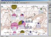
MAPPING OPTIONS
Expanded GIS Functions
Bubble maps
Production charts
Log curves
Posted data
Highlighted Symbols
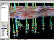
3D VISUALIZATION
Deviated wellbores
Digital logs
Grid surfaces
Tops, Shows and Perfs
Land grid overlay
Map images
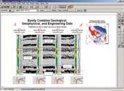
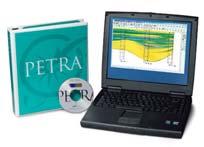
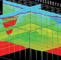
PETRA® delivers the industry’s only easy-to-use and affordable integrated solution for today’s workflows. It provides multi-user access to large projects through geological, petrophysical and engineering analysis tools. The PetraSeis™ option extends PETRA® into 2D/3D seismic interpretation with practical tools such as RasterSeis™ Download a trial version at www.geoplus.com, or call us at 888-738-7265 (Houston: 713-862-9449 / Calgary: 403-264-9523) for more product information.
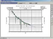
DECLINE CURVES
Compute EUR, RR, etc.
Hyperbolic or exp.
Rate/Time or Cum P/Z
User defined Econ. Limit
User defined Extrap. Time
TECHNICAL LUNCHEONS
TICKET REPRESENTATIVE REGISTRATION
It is once again time to plan for the CSPG bimonthly Technical Luncheons.The CSPG has nineteen luncheons planned for the 2006/2007 Season.There are two methods for having tickets sent directly to a ticket representative in your office:
1) FOR CORPORATE MEMBERS OF CSPG
Corporate Members may order a set number of tickets per luncheon,which will be couriered to you with an invoice.For orders of less than 10 tickets per luncheon, a $5.00 handling fee will be added to the invoice.You must take the same number of tickets for each luncheon and returns are not accepted.The following month’s tickets will be sent out if the previous month’s invoice has been paid.Any changes to your
standard number of tickets must be made well prior to tickets being sent out. Additional tickets may be arranged through the CSPG office.If you wish to use this option,you must register with the office by September 1,2006.
2) FOR THOSE WHO ARE NOT CORPORATE
MEMBERS - PREPAYMENT:
For companies who are not Corporate Members you may elect to pre-purchase a set number of tickets for the 2006-2007 Season’s 19 luncheons.For orders of less than 10 tickets per luncheon,a $5.00 handling fee needs to be added to each mailing to cover courier/mailing/handling costs.Returns are not accepted and extra tickets can be purchased direct from the
CSPG office.If you wish to use this option, you must register with the office by September 1,2006.Payment is required upon registration for this program.
If you do not wish to use either of these options tickets can be purchased directly from the CSPG office,using cheque,cash, debit,Visa or MasterCard.Luncheon tickets are $31.00 plus GST each and go on sale two months in advance.Please watch your Reservoir or visit www.cspg.org for luncheon abstracts.
If you have any questions please feel free to contact me at 264-5610 or via email at jaime.croftlarsen@cspg.org.
TICKET REPRESENTATIVE REGISTRATION FORM
(including Postal
OPTION 1 – CSPG CORPORATE MEMBERS ONLY
OF TICKETS FOR EACH LUNCHEON
For Ticket Orders of less than 10 tickets per luncheon,a $5/month Handling fee will be added to your invoice.
OPTION 2 – PREPAYMENT
NUMBER OF TICKETS FOR EACH LUNCHEON
Prepayment due:________ Tickets x $32.86 (incl.GST) X 19 (Total # of luncheons) = $_____________
If less than 10 tickets per luncheon ordered,a handling fee of $53.00 ($5.00 plus GST per month) is included in this payment.
TOTAL PREPAYMENT ENCLOSED IS: $ _____________ (TICKETS) + $ ___________ (HANDLING FEE) = $ __________________
We accept Visa,MasterCard,or cheque as payment. If paying by credit card: Card #:___________________________________________ Expiry Date:___________
Please return your completed form to: Jaimè Croft Larsen, Communications Manager
SEPTEMBER LUNCHEON
Unconventional shallow gasa geological point of view
SPEAKER
Per Kent Pederson Apache Canada Ltd.
11:30 am
Thursday,September 7,2006
TELUS CONVENTION CENTRE CALGARY, ALBERTA
Please note:
The cut-off date for ticket sales is 1:00 pm,Monday,September 4th. Ticket price is $31.00 each plus GST.
Shallow gas exploration has been in the hot seat for the past few years in the plains,with vast tracts of lands acquired and large number of exploration wells drilled,mainly exploring for unconventional gas accumulations. Numerous models have been put forward to explain the unusual character of these large continuous gas accumulations with poorly defined pool boundaries,with some models claiming these gas accumulations are independent of structural or stratigraphic traps.However,few geological studies have been carried out on these laterally extensive gas accumulations containing huge reserves, although gas production from these shallow reservoirs dates back to 1904.
Models for unconventional shallow gas accumulation can be subdivided into three main groups based on the main defining
criteria:economics,pool size,and geology.The first two are dependent on economic thresholds,with higher natural gas prices and improvements in drilling and completion technology making the previously uneconomic or marginally economic resources viable.Thus, they might no longer be considered unconventional.This paper will focus on geological aspects of unconventional shallow gas accumulation in the plains.
Shallow gas accumulations in the Canadian plains occur at depths between 200-1000m and should be distinguished from the basincentered gas accumulations and models, although they share several similarities.The gas accumulations are commonly laterally extensive,typically covering several townships and are sometimes referred to as laterally continuous shallow gas accumulations.Lack of distinct pool boundaries has led several models to suggest these regionally pervasive gas accumulations are independent of structural or stratigraphic traps,or that sedimentary facies, stratigraphy,and structure only play a minor role in trapping of the gas.In contrast,structure maps clearly demonstrate that unconventional shallow gas accumulations mainly occur in structural highs.Detailed core examination, integrated within a sequence stratigraphic framework of several shallow unconventional gas pools in Saskatchewan show that pool boundaries coincide with either onlap or pinchout of reservoir facies,demonstrating the importance of stratigraphic trapping on these gas accumulations.The lateral continuity of these gas accumulations reflect the fact that the reservoir rock consists of offshore to shelf
deposits,which are characterized by very broad facies belts.Stratigraphic architecture of these deposits is best revealed on regional cross-sections due to the very subtle lateral changes in sedimentary facies and low depositional gradients.
Thus,structure and stratigraphy are very important part of the trapping of the gas in these laterally extensive accumulations.This is similar to conventional gas accumulations,the difference being the reservoir facies the gas is hosted within,such as low permeability sandstones,thin-bedded sandstones (both low and high porosity-permeability beds),and sandstones with high clay matrix content.
BIOGRAPHY
Per Kent Pedersen received his B.S.,Geology,in 1992 and his M.Sc.,Geology,in 1996 followed by his Ph.D.in 1999 from the University of Aarhus, Denmark.
In September 1999,Per became a Postdoctoral Fellow at Carlton University in Ottawa.In August 2001 he was assistant Professor at Brandon University while remaining an Adjunct professor at Carlton.In 2002 Per joined the Petroleum Geology Branch of Saskatchewan Industry and Resources with a focus on shallow gas Cretaceous hydrocarbon systems in Saskatchewan.He also joined the University of Regina as an adjunct Professor in 2003.
Since February 2005,Per has been an exploration geologist with Apache Canada Ltd. in Calgary.
HOSTED BY THE HILTON HOUSTON WESTCHASE HOTEL 9999 WESTHEIMER ROAD
713-974-1000
FAX: 713-974-6866
SPECIAL AAPG GROUP RATES!
Tuition for the week is only $1095 for AAPG Members or $1195 for Non-members* or $275/day for individual courses
*(price increases to $1195/1295 respectively after August 14, 2006)
REGISTRATION AND INFORMATION:
Toll-free (U.S. and Canada) 888-338-3387, or 918-560-2650
Fax: 918-560-2678; e-mail: educate@aapg.org
Download a registration form at http://www.aapg.org/education/fec.cfm
SEPTEMBER LUNCHEON
Internal architecture of basin-floor facies of an ancient, passive margin turbidite system, Upper Kaza Group, Windermere Supergroup, British Columbia
SPEAKER
Lori Meyer Imperial Oil Resources
11:30 am Tuesday,September 19,2006
TELUS CONVENTION CENTRE CALGARY, ALBERTA
Please note:
The cut-off date for ticket sales is 1:00 pm,Thursday,September 14th, 2006.Ticket price is $31.00 plus GST.
Basin-floor facies outboard of continental slopes occur where flow confinement from topography on the slope diminishes or becomes nonexistent.This facies represents a poorly known yet important frontier play as deep water exploration heads beyond the continental slope.
Following the initiation of the Pacific Ocean (~725 Ma),Windermere Supergroup sedimentation took place along the newly formed passive margin of western Canada (Laurentia).Sandstone-rich basin-floor submarine fan deposits have been identified in the Upper Kaza Group of the Windermere Supergroup at Castle Creek, British Columbia and represent the most outboard (least confined) depositional facies of this extensive turbidite system.Regional time slices through the Upper Kaza Group are interpreted as a distal basin-floor setting for the Castle Creek study area with correlative strata becoming more proximal to the continental slope in a southeast direction.A 300 km regional transect through the Upper Kaza Group and equivalent strata from Lake Louise,Alberta to the Castle Creek locality,British Columbia,represents a downdip profile from slope setting to basin-floor fan setting, respectively.Recent glacial retreat at Castle Creek has exposed an area of 800 m x 2000 m where essentially the entire facies
outcrops and thus is an excellent laboratory for examining lateral facies and sub-seismic detail of a sand-rich basin-floor system.Due to the outcrop quality,lateral bed correlations to the sub-meter scale can be determined without having to reconstruct or extrapolate over significant distances. Lateral bed correlations can be done by physically walking out surfaces between measured vertical sections in the study area.
Detailed sedimentology and stratigraphy have identified three stratigraphic intervals in the Castle Creek study area that are interpreted as part of a prograding basinfloor fan depositional setting with evidence of lateral shifts from axis (channelized lobe) to off-axis sedimentation.Bypass associated with local shifts in base level resulted in sculpting and erosion of the top surfaces of channelized lobes.
This presentation will take the audience on a field trip to the Castle Creek locality in northeast British Columbia to view the
vertical stratigraphy,lateral facies correlations,and sub-seismic features providing flow pathways and flow baffles. Integration of this outcrop information with analogue reservoir parameters can then allow the explorationist to simulate, compare,and model potential modern deep-water petroleum reservoirs in the unconfined basin-floor setting.
BIOGRAPHY
Lori Meyer is a geologist with Imperial Oil Resources in Calgary where she has worked on development projects in both the Western Canada Sedimentary Basin and the Arctic/Beaufort Basin.Lori received her B.Sc.at the University of Alberta (1999) and M.Sc.at the University of Calgary (2004). This presentation is based on her M.Sc. research,co-supervised by Dr.G.M.Ross and Dr.C.Riediger,which won the CSPG 2005 M.Sc.Thesis Award.
CALL FOR Ph.D. or
M.Sc.
THESES
Win $2500.00 and a framed certificate; and a one year membership with the CSPG for: the Doctoral thesis that makes the most significant contribution to Canadian sedimentary geology in 2006.
Deadline for submissions is September 15, 2006.
Submitted theses will be returned in late January 2007 after the completion of judging.
Win $2000.00 and a framed certificate; and a one year membership with the CSPG for: the Master’s thesis that makes the most significant contribution to Canadian sedimentary geology in 2006.
Winning thesis topics in recent years have included studies of: Ichnology and neoichnology, detailed studies of Cretaceous (Falher, Basal Colorado) and Carboniferous (Kiskatinaw) reservoirs, modern channel bar sand geometry, epeiric carbonate platform deposition and an integrated sedimentological, ichnological, paleoenvironmental and paleoecological study of submarine fans.
Eligible theses are either produced in a Canadian university, regardless of project location, or deal with a Canadian sedimentary/petroleum geology topic, regardless of the university of origin. Theses entered for the 2006 awards must have been submitted to a recognized university inside or outside Canada, and must have formed part of the requirements for degrees awarded at the Fall 2005 or Spring 2006 convocations. Candidate theses must be well written, clearly and adequately illustrated and properly bound.
THESIS SUBMISSIONS FOR JUDGING TO:
Canadian Society of Petroleum Geologists (CSPG) Graduate Thesis Awards Committee c/o Andre Chow
Proud Sponsor of the CSPG Graduate and Undergraduate Theses Awards.
DIVISION TALKS
STRUCTURAL DIVISION
CSPG Structural Division workshop on lateral structural changes in thrust belts
The Structural Division of the CSPG will host an informal one-day workshop and one-day field trip on September 26 and 27,2006 in Kananaskis Country.The goal of the session is to discuss lateral variability in thrust belts.We view this as one of the ‘next frontiers’ in terms of our understanding of thrust belts, and feel that the time is right to gather a group of structural geologists to share ideas and data.
Topics for discussion may include:
• lateral ramps
• lateral thrust displacement transfer
• lateral terminations of thrust sheets
• thrust ‘swing-backs’ (in map view)
• transverse faults within thrust sheets
• inversion of pre-existing lateral structures
• changes in structural trends and their causes
• relationship of lateral changes to the temporal evolution of thrust structures
• roles of lateral structures in forming structural traps for oil and gas accumulations
This event will be a true workshop,where discussion leaders will introduce topics and then lead a discussion with all participants. Volunteers are invited to lead discussion sessions.Participants with data examples of lateral structural changes are particularly encouraged.Ideas for field stops in the Kananaskis area are also welcome.
Interested participants should contact Elizabeth Atkinson (eatkinso@petrocanada.ca) or Jamie Jamison (jamie@ hef.com) to receive email updates,costs,and final agenda,by August 15.Participation is limited;preference will be given to discussion and field leaders and participants providing data,and otherwise,first come, first served.
CANADIAN SOCIETY OF PETROLEUM GEOLOGISTS CALL FOR NOMINATIONS
2007 EXECUTIVE COMMITTEE
In accordance with Article VI,subparagraph (a) of the By-Laws,the Nominating Committee hereby calls for Nominations to Stand for Election to the 2007 Executive Committee of the Canadian Society of Petroleum Geologists.
Nominations can be made in two ways:
1) Formal Nominations are to be made in writing,signed by at least twenty-five members in good standing and endorsed by the nominee who is consenting to stand for office.Candidates nominated in this fashion will automatically be added to the Nomination Slate.Nominations should be forwarded to the CSPG office by September 15,2006.The slate of candidates will be published in the November Reservoir and the election will take place on November 23,2006.
2) Informal Nominations can be made via email or letter;please confirm that the nominee is willing to stand for the office of choice and send to CSPG Office to the attention of the Past President.Candidates nominated in this fashion will be considered for addition to the Nomination Slate by the Nominations Committee.
The following vacancies exist for 2007:
• Vice President• Assistant Finance Director
• Assistant Program Director• Assistant Services Director
Successful candidates for the Directorships will serve two-year terms and the elected Vice President,a third one-year term as Past President.Interested parties should contact the office for details and general requirements of service on the Executive.
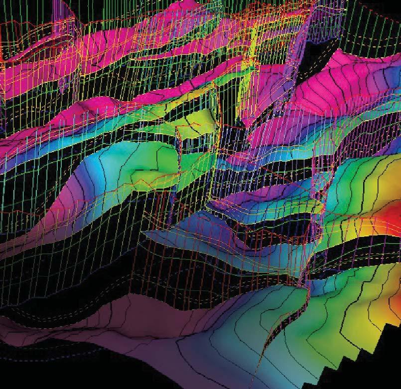
Geology Petrel
Petrel* workflow tools provide a complete seismic-to-simulation toolkit— one solution uniting the subsurface domains of geophysics, geology, and reservoir engineering.
Geologists can use new modeling capabilities to better predict facies distributions, work with geophysicists to analyze structural uncertainties, and work with reservoir engineers to define a well placement strategy.
“It is like having an extra geologist sitting there, it’s telling you things that youdidn’t know, it’s testing your theories like you never saw before and helping you come up with new ideas.” David Hamilton, CEO, Subsurface Computer Modeling
With Petrel software, all work processes lead to one shared earth model, resulting in faster, better decisions.
sisinfo@slb.com www.slb.com/petrel
CORE AND SAMPLE DIVISION
PROUD SPONSORS
Coal and fractured shale sampling requirements in Alberta
12:00 Noon Tuesday,October 3,2006
EUB Core Research Centre, 3545 Research Way NW Calgary, Alberta
A discussion of current needs,EUB regulations,and expected future demand for core and drill cuttings in non-conventional reservoirs.
With the rapidly developing attention on CBM and fractured shale gas exploration and production in Canada,our understanding of these reservoirs from a petrological perspective is advancing,but is dependent on our access to core and drill cutting samples. Obtaining adequate amounts of material, collected in suitable condition,is key to building a good data set of material for our study of these reservoirs.
In our initial meeting,some of the “leading edge” researchers that are working on these reservoirs will share their views on the current situation of core and sample availability,and we will be inviting EUB staff that are involved in formulating regulations for sample requirements to update us on current and future regulations.After hearing from our “experts” we will have an open discussion on current and future issues regarding core and sample submission and availability.If you are unable to attend,but wish to have your opinions brought to the meeting,please email your ideas to:
Doug Hayden,Chair,CSPG Core and Sample Division via haydengeo@telus.net
Check the CSPG website for updates on the group’s activities and projects.If you would like more information on upcoming activities of this group,please contact Doug Hayden via haydengeo@telus.net
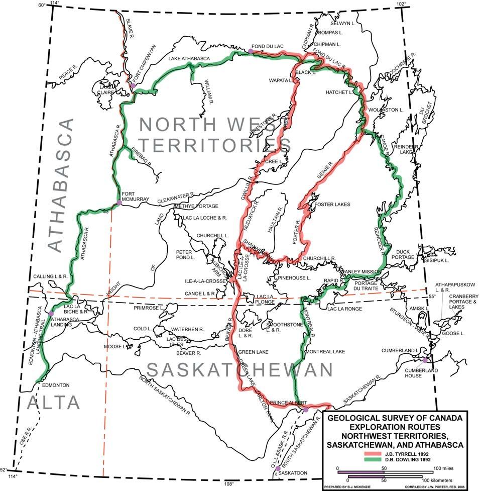
JACK PORTERVIGNETTES OF CANADIAN PETROLEUM GEOLOGY
J.B. TYRRELL’S INTRODUCTION TO
THE INTERIOR OF CANADA’S PRECAMBRIAN
SHIELD
The following morning,being July 1st,1892, Tyrrell and his assistant Herbert Porter and canoemen Pierre Girard,Ithingo,and Heddery,commenced their ascent of the swollen Mudjatick River.Progress was initially slow against the river’s current in their two Peterborough canoes,since the dense willow-strewn banks and eratic course of the river’s channel prevented poling and tracking.However,within a distance of three miles from the river’s mouth,they arrived at an area of granite
hills,some of which attained heights of 100 feet.Tyrrell was exhilarated to realize that he was now on the threshold of the vast expanse of Canada’s Precambrian Shield. After investigating the Mesozoic and Tertiary surface geology of the Western Plains and the Palaeozoics of Manitoba’s Interlake lowlands during the previous nine field seasons,Tyrrell now found himself in unfamiliar terrain faced with the daunting task of unraveling the complexities exhibited by assemblages of igneous and metamorphic rocks.Field specimens of various rock types would be taken and recorded,to be freighted to Ottawa for petrographic analyses during the following winter.
Radiometric age-dating of rocks did not exist during Tyrrell’s career with the Survey.
Sir William Logan,the first director of the Geological Survey of Canada,had introduced in his Report of Progress for 1852 - 1853 the name Laurentian Series for a series of Precambrian granites,gneisses,and crystalline limestones,which had been previously referred to as the Metamorphic Series,He had,since 1843,investigated and described this series of rocks,as well as their potential for metal ores or nonmetallic minerals,in the region between the St.Lawrence and Ottawa Rivers.Subsequently,while investigating the (Continued on Page 18...)
geology of the Lake Timiskaming area northeast of Lake Huron,he recognized another distinct series of Precambrian rocks which differed from his Laurentian Series, inasmuch as they were metamorphosed sediments consisting of slates,quartzites,and conglomerates.Logan,in 1857,gave the name Huronian Series to this assemblage of rocks. He believed that this series of rocks were younger than those he had previously described as they contained pebbles of granite and gneiss which he recognized as being derived from his Laurentian Series.He also observed that the interface of his superimposed Huronian Series (Lower Proterozoic) on his older Laurentian Series (Archaeozoic) was marked by a pronounced unconformity (1933,Moore,Raymond C.: Historical Geology,pub,McGraw - Hill,New York & London,pp,62,63).To quote Morris Zaslow in his reference to Sir William Logan’s contribution to the science of geology:“far less notice was taken of Logan’s more fruitful and permanent contribution of dividing these oldest rocks,the Fundamental Gneiss,into two great groups,Laurentian and Huronian – the first major victory in the long battle to unravel the mysteries of the Precambrian.” (1975, Zaslow,Morris:The Story Of The Geological Survey Of Canada 1842-1972,pub.The
Macmillian Company of Canada Limited, Toronto,in association with the Department of Energy,Resources and Information Canada, Ottawa,p.39).
Logan’s Precambrian terms,namely:Laurentian Series and Huronian Series were used by Tyrrell in differentiating Precambrian rocks during his field season of 1892.His usage is revealed both in his Geological Survey of Canada report released in 1896,titled:“Report On The Country Between Athabasca Lake And Churchill River”,as well as in the legend of the report’s accompanying map,as prepared by Dowling and titled:“Map Of The Country Between Lake Athabasca And Churchill River; scale 25 miles to 1 inch.”
The geological reconnaissance or track surveys conducted by Tyrrell and his contemporaries across Precambrian terrain was understandably dictated during the field season by accessible courses of rivers and adjoining lakes.Consequently;the geology mapped in traversing the canoe routes represented a series of restricted profiles of the region’s surface geology.Nevertheless,the synthesis of such strips revealed much of the region’s geological setting.
CORRECTION
Dr.Gordon Williams –Honorary Membership
The Reservoir Committee would like to extend our sincere apologies to Dr.Williams for the incorrect spelling of his name in the June issue. We would also like to extend our further congratulations on his becoming an Honorary Member of our Society.
In the course of his survey,Joseph Tyrrell employed several instruments and devices to record his bearings,distances,stationary positions,elevations,soundings,and water temperatures.He used a prismatic compass for taking his bearings,as well as determining the direction of glacial striations.A combined hand level and clinometer was used for measuring the attitude of inclined rock and for obtaining the heights of prominent features. Distances travelled on calm surfaces of lakes were resolved by the use of a Massey floating boat-log.More often,distances travelled over water were based on the elapsed time to paddle from one point to another.Tyrrell used a telescopic device known as a Rochon micrometer for precise measurements in determining the dimensions of lakes and the length of long portages.His observations to determine the latitude of a particular site,was taken daily,weather permitting,with a sextant of eight-inch radius.
When crossing most portages,a pedometer was used to measure their distances. According to Tyrrell,“2000 paces being counted for each statute mile.” An aneroid barometer was utilized to determine the surface elevation of larger lakes and prominent landmarks.Soundings to determine the depths of water at various points on a lake were measured by a line and lead.
The Mudjatick River,a south-flowing tributary of the Churchill,is sourced by several small
lakes flanking the south slope of the Height of Land separating the drainage basin of the Mackenzie River from that of the Churchill.Its meandering course,some 80 miles in length,is restricted to a broad depression,which is bordered on either side by rounded hills and ridges formed of Archaen granites and gneisses.Rapids and accompanying portages are not uncommon.The rapids result from boulders in the river’s bed which are the remnants of morainic deposits left by a receding continental ice sheet.The confluence of the Gwillim and Mudjatick Rivers is located some 60 miles upstream from the mouth of the latter river.Here,the Mudjatick River’s course is directed to the northeast.Joseph Tyrrell and his party chose to ascend the north-trending Gwillim River through its interconnection with Gwillim and Solitude Lakes as the most accessible route to Cree Lake.After an additional three miles of river travel,he and his party abandoned the Gwillim River and commenced to cross the Height of Land.It involved two portages and the crossing of two small lakes.The most northerly of the two lakes drained into the Brustad River by way of a short feeder stream.On arriving at the Brustad,Tyrrell’s party headed downstream some six miles to its discharge into Cree Lake.Thirteen days had elapsed since his party commenced its ascent of the Mudjatick River.
While traversing the narrow north-southaligned Gwillim Lake,Tyrrell reported sighting the ruins of an abandoned Hudson’s Bay trading post located at a mid-point on the lake’s eastern bank.It was probably operative for several years,some time during the period 1790 - 1805.
No exposures of Laurentian granites or gneisses were observed by Tyrrell in crossing the Height of Land.However,hills of gneiss were exposed on both sides of a narrow strait which opened into a large bay at the southern extremity of Cree Lake.
On July 14th,Tyrrell’s party passed through the gneiss hills flanking the strait and proceeded northwest through numerous islands lying off Cree Lake’s west shore.It was here that the country was underlain by the Athabasca sandstone.One onshore exposure examined by Tyrrell was a 21-foot cliff of horizontally stratified,well sorted,pink to red quartzose sandstone.The homogenous,compacted sand grains were well rounded to subangular and moderately silica-cemented.
Proceeding further northwest,he observed a hill,150 feet in height,at a midpoint on the lake’s northwest shore.The hill’s central portion consisted of a light green-colored, diabase dyke whose intrusion into the
Athabasca sandstone had greatly altered the adjacent host rock;its effect diminishing across a 20-foot width on both sides.
The Athabasca sandstone was initially considered to be Cambrian in age by R.G. McConnell (Report on a portion of the District of Athabasca;Geological Survey of Canada,Annual Report 1890 - 1891,Part D), However,based on its likeness to sandstone associated with the Keweenawan Series (Neohelikian) of the Lake Superior region; Tyrrell inferred the Athabasca sandstone to be Keweenawan.Subsequently,radiometric age dating of the Athabasca sandstone has identified its age to be Palaeohelikian.
Joseph Tyrrell had been a keen observer of glacial-related geomorphic features and rock striations.In respect to the latter,which he encountered while making his river and lake traverses,he reported that they:“were made by the south-western extension of the great glacier centring (sic) west of the northern part of Hudson Bay,and for which I have proposed the name Keewatin glacier.” During his traverses,he took 85 measurements of the true bearing of glacial grooves and striae, which had been etched by the scouring of rock debris associated with the advancing ice sheet. According to Tyrrell:“They indicate that this
last great glacier flowed between S.S.W.and S.W.across the greater portion of the area, being diverted westward in the valley of Lake Athabasca.”
In respect to till cover,Tyrrell observed that in the region of Archean rock it is for the most part absent with meagre cover in low lying areas.In contrast,the relatively flat surface of Palaeozoic rock accommodates much larger deposits of till.
Tyrrell reported the occurrences of drumlins, particularly in the valley of the Mudjatick River, with kames being present in morainic areas. He futher observed that eskers,paralleling the direction of strias,were present in the region of Hatchet and Wollaston Lakes,as well as the upper area of the Fond du Lac and Geikie Rivers.Undoubtedly,his most astute observation was his recognition of unique hills of glacial drift which occur in the vicinity of Cree Lake,Black Lake,and along Stone River. Tyrrell describes their physical dimensions, their habitat,and mode of formation as follows:“They are steep,narrow ridges,parallel to the direction of glaciation,with sides joining in a crest that may be less than a yard in width. They average from a quartet of a mile to one mile in length,– and vary from 70 to 250 feet in height,the average being about 120 feet.–
they are not composed of assorted material, but rather of unassorted rock-flour mixed with boulders.– the summit is not rounded off from side to side,but rather from the crest downward,they descend in as steep a slope as the material will stand at.Further,they all lie in the basins of large post-glacial lakes,the principal ones examined being in Hyper-Cree and Hyper Black lakes.As they seem to differ from any drift hills that have been definitely described,I would suggest for them the name ispatinow,the Cree word for conspicuous hill. Their shape,and the character of their material,with their position,induce one to believe that they were formed in narrow gorges in the ice-sheet,when the front of the glacier was bounded by a deep lake.Streams flowing on or near the surface plunged into those ice-bound gorges and carried their load of detritus into the quiet water at the bottom of the gorge.In some such way as this these narrow ispatinows might have been formed of loose unassorted material,and as the icy walls receded or melted away and the lake was drained,the sides would assume a slope as steep as possible.” Interestingly,the largest island in Cree Lake,located in the west-central part of the lake,is named Ispatinow Island.
To be continued...
Oil Sands Maps For Sale
Divestco's GIS Mapping has detailed Alberta & Saskatchewan Oil Sands maps that are dynamic and reflect land updates every two weeks.Customized mapping also available!
Detailed Map Series:
Four maps make up the Oil Sands Detailed Map Series.Each map includes the operator(s) and their interest,$/ha, sale & expiry dates,and is plotted at a larger scale for easier reading.
Regional Map Series:
The Regional Map Series showcases the location of the heavy oil,oil sands project locations and company land positions.Ideal for reports and presentations!
All Maps Include Current: Grid
Oil sands boundary Culture
Wells
Pipelines
GPS transportation
Oil sands deposits
Oil sands land leases
Upcoming oil sands land sales
Oil sands recovery method
Be a part of the Athabasca Oil Sands development. Call Kevin Olson today at 219-7261 to purchase your Oil Sands maps or to custom order other mapping solutions!
CSPG Trust
CSPG AWARDS – LINK AWARD
Jim Letourneau
The CSPG Link Award is given for the best oral presentation at one of the Society’s Technical Luncheon meetings.Topics of the presentations must be either geological or a related technical subject,and must be presented in Calgary by a CSPG member.
This recipient of the Link Award for 2005 is Jim Letourneau.The Link Award Committee deemed his paper,“Regional Underpressure and Gas Saturation in the Upper Cretaceous and Tertiary of Central Alberta,” presented March 24th,2005 to be the best of an excellent group of talks presented in 2005.
Jim Letourneau graduated in 1985 with a B.Sc.in Geology from the University of Alberta.He was the Vice President –Corporate Development of Hydro Petroleum Canada before taking a sabbatical to undertake graduate level coursework at the University of Alberta. He currently is the publisher of The Big Picture Speculator and the president of Big Picture Geoscience Inc.,a consultancy in petroleum hydrogeology and geochemistry.
He received a Canadian Society of Petroleum Geologists Tracks Award in 1996.He has chaired and presented at research conferences devoted to petroleum hydrogeology and geochemistry. Jim has his ATM-Bronze designation from Toastmasters International and has spoken on subjects as diverse as the California power shortage,personal growth,market speculation,carbon isotope geochemistry of natural gas seeps,and basin-centered gas accumulations.
Jim is a member of the Canadian Society of Petroleum Geologists;the American Society of Petroleum Geologists;the Alberta Professional Engineers,Geologists and Geophysicists;and Toastmasters International.
RENAME THE JOINT CONVENTION CONTEST
Vote on a new name for the CSPG,CSEG and CWLS Joint Conventions
To find a new name for the Joint Conventions of the CSPG,CSEG and CWLS,the societies are running a contest and the submissions are in.
Voting is now open through a link on each society’s website. Voting will be tabulated by August 31,2006 and the new name will be used for all future joint conventions.
The winner of a new 30GB Apple iPod will be announced along with the new name in September.
Working alone?
The LoadTrak™ Panic Alert device is intrinsically safe and CSA approved and is perfect for workers travelling alone or working in remote or hazardous areas. It’s especially suited to workers in the oil and gas industry, as it will not ignite emissions or fumes. In the event of an emergency, lone workers have access to a 24/7 monitoring centre at the push of a button or by choosing the sensor/man-down mode.
From May 1 to October 31, take advantage of a limited time offer that includes special Panic Alert device pricing and new lower monthly rates!
For more information or to locate an authorized LoadTrak dealer near you, visit www.loadtrak.com or call 1-866-LoadTrk (1-866-562-3875).
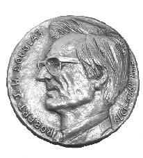
RJW DOUGLAS MEDAL CALL FOR NOMINATIONS
The RJW Douglas Medal is awarded annually by the Canadian Society of Petroleum Geologists for outstanding scientific contributions to the understanding of sedimentary geology in Canada, commending major contributions to regional tectonics, petroleum and structural geology.
The award is open to all geologists who follow the example of Bob Douglas in contributing to the development of Canadian sedimentary, petroleum and structural geology.
Nominations for the award of the medal must be endorsed by at least three members of the CSPG. Nominations may be proposed at any time, but to be considered for a particular year, they must be received by the Society before September 1.
The sponsors of a nominee for the award should supply:
1. A curriculum vitae (outling the nominee’s career and previous honours or distinctions).
2. A list of publications by the nominee.
3. A summary of the nominee’s achievements in a form suitable for use as a citation for the award.
4. An analysis of the nominee’s achievements, highlighting the contributions for which he or she is being recognized, and relating these to the appropriate publications in the bibliography.
The last item of information is a key part of the nomination and should convey the magnitude and scope of the nominee’s scientific contributions, with comments on the influence that these contributions have had on others. An example of a submission may be provided on request.
Completed nominations should be sent to: Graham Davies, CSPG Douglas Medal Committee Chairman, C/o Alastair Ross Technology Centre 3553 - 31 Street NW, Calgary, Alberta T2L 2K7
Telephone (403) 289-9156, Fax (403) 289-9156
Email: gdgc@telus.net
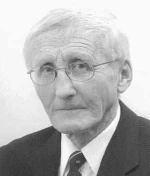
CSPG AWARDS – R.J.W. DOUGLAS MEDAL
The Douglas Medal is presented annually to a geoscientist who has made an outstanding contribution to the understanding of sedimentary geology in Canada.The award is named in honour of Bob Douglas,editor of the famous book “Geology and Economic Minerals of Canada”.
For 2005,the very deserving nominee is Dr.Alan Carson Grant.
Dr.Grant is currently Emeritus Scientist with the Atlantic Geoscience Centre of the Geological Survey of Canada,based at the Bedford Institute of Oceanography in Halifax.
Dr.Grant began his distinguished career in 1955,following graduation from Acadia University.He earned a Master’s degree from the University of New Brunswick in 1965, where he studied the modern marine sediments of Baffin Bay.This was followed by a Ph.D.in 1971 from Dalhousie University, based on work relating to the continental shelf margin of Labrador and Eastern Newfoundland.
During this period,he published 17 papers relating to the offshore geology of Canada’s east coast.He was also chosen to be the chief compiler for a series of GSC map sheets depicting seismic basement,basement character,and sediment thickness covering the continental margin stretching from Newfoundland to the Nares Strait - all of which became an integral part of the Hydrocarbon Inventory Program of the National Energy Policy in the early eighties.
A major review paper,co-authored with McAlpine and Wade,entitled “The Continental Margin of Eastern CanadaGeological Framework and Petroleum Potential”,became a landmark paper and was
published in AAPG Memoir # 40 - “Future Petroleum Provinces of the World”.
But Dr.Grant did not focus exclusively on Canada’s continental margins.His contributions also include work on the Hudson Bay Lowlands,the Anticosti Basin, and the Magdalen Basin.In addition,Dr.Grant is an accomplished geophysicist,having worked on various shoots with Mobil Oil in Northern Alberta,with the Geological Survey in both northern and southwestern Ontario, and aboard the seismic cruise ship ‘MV Theta’ off northeastern Newfoundland.In his 39 years with the Atlantic Geoscience Centre, Dr.Grant has had the opportunity to interpret virtually every vintage of analogue and digital seismic data on the east coast.
Dr.Grant has authored 200 scientific communications,of which 57 have been peerreviewed.His papers have appeared in a wide array of journals such as the Canadian Journal of Earth Sciences,the Journal of Geophysical Research,Tectonophysics,Nature,Geotimes, and many others,including various C.S.P.G. memoirs.
Although Dr.Grant is presently “retired” he continues to be scientifically active.Most recently,he has been a co-compiler of various map sheets,including “Tectonic Assemblages, Atlantic Region,Canada” and the “Ordovician System in the Southeast Arctic Platform, Nunavut”.Currently in preparation,is a map concerning the “Geology and Structural Trends - St.Lawrence Estuary,Quebec”.
Dr.Grant has previously been honoured with the A.I.Levorsen award from theAAPG,the M.J.Keen medal from the Geological Association of Canada,and the Gesner medal from the Atlantic Geoscience Society.He has also volunteered with our Society,as Associate Editor of the Bulletin from 19741982 and from 1994-1996.
To quote from his nomination letter,this award honours Dr.Alan Carson Grant “not only for his outstanding scientific contributions to understanding the sedimentary geology of eastern offshore Canada,but also to give explicit commendation to his personality and spirit”.
Western Canada Geological Edge Set 2006 Version
Now available for import into ACCUMAP, GEOSCOUT and other applications
1) Mississippian Subcrops and Devonian Reef Edges - AB, NE BC, NT and SK
Congratulations to the following speakers and presenters who received awards at the 2006 CSPG CSEG CWLS Joint Convention:
CSPG BEST GEOLOGICAL PAPER:
Gareth Jones and Yitian Xiao: Predicting Dolomite Geobodies:Exploitable Insights from Reactive Transport Models
CSPG BEST GEOLOGICAL POSTER:
Warren Walsh,Cassandra Lee,Ben Kerr and Joseph Korol: Quantifying shale gas potential of the Triassic Montney and Doig formations,northeastern British Columbia.
CWLS BEST PAPER:
Magnetic Resonance Imaging of Petroleum Cores Presented by Bruce Balcom
CWLS BEST STUDENT PAPER:
Petrophysical Evaluation of Carbonates from the Weyburn Oil Field using Synchrotron Xray Computed Microtomography Presented by Chad Glemser
CSEG BEST GEOPHYSICAL PAPER:
Rob Pinnegar: Time-Frequency Polarization Analysis and Filtering
Honorable mention:
Eric Forgues,Julien Meunier,Christian Hubans and Rick Edwards: Steam Injection Seismic Monitoring Experiment
Honorable mention:
Keith Hirsche and Francis Ma: Reducing Uncertainty in Time-lapse Seismic Interpretation for Thermal Applications
CSEG BEST GEOPHYSICAL POSTER:
Todd Mojesky,David LeMeur and Ali Karagul: Near surface anomalies and solutions
Best Student Paper (geol or geophys):
Renee Burton-Ferguson,Michael Enachescu and Richard Hiscott:
Preliminary seismic interpretation and maps for the Paleogene-Neogene (Tertiary) succession,Orphan Basin.
A MESSAGE FROM THE EDITORS
With the start of another season,Jaimè and I would like to recognize the efforts of all the Reservoir’s contributors and,in particular, those who have been part of the Reservoir Editorial Committee over the past year:
• Marc Boulet
• Donna Burden
• Penny Colton
• Shaheen Khan
• Kim MacLean
• Wasim Paracha
• Ashley Sinke
• Jianbo Zhang
The Reservoir is meant to be a publication for and by the CSPG’s membership and we are constantly on the lookout for articles that may be of interest to our readers.We urge anyone interested in working with the Reservoir Editorial Committee - or simply wishing to submit an article - to contact us. Below are some general guidelines for the Reservoir:
The Reservoir is not a peer-reviewed publication.This is mainly because of the relatively short timeframe we deal with in the production schedule.What we try to do is ensure that the information is readable, consistent,and has no obvious errors.
Articles could deal with,for example, preview/review articles on conferences;status of ongoing research;condensed versions of student theses,research papers,etc.;articles on significant events at the various universities, e.g.,the start of a new department,major project,or industry funding;or even book reviews.Generally,the main caveat would be that the article should have some tie to sedimentary/petroleum geology.
Articles need to be submitted by the 23rd of the month,two months prior to publication date (e.g.,articles for the September issue have to be submitted by July 23rd).With leadtime,we can target a particular issue month (earlier is always nicer than later).
BEST STUDENT POSTER (GEOL OR GEOPHYS):
Mark Radomski,Charles Henderson,Tom Moslow and Jon-Paul Zonneveld: Sedimentology,biostratigraphy and petrology of marine firm/hardgrounds:Middle Triassic Halfway Formation,west-central Alberta.
BEST CORE:
Kimberlite Volcanism on the Margin of the Lower Cretaceous Moosebar-Clearwater Seaway:Sedimentology and Volcanology of the Star Kimberlite
J.P.Zonneveld,Bruce Kjarsgaard,Larry Heaman, David McNeil & Kirsten Marcia
BEST STUDENT CORE:
Lateral Variability Within the Cadotte Shoreline Complex (Elmworth Gas Field): Breaking Out Depositional Packages Within an Extensive Sandstone-Conglomerate Body Curtis Lettley
Technical article size should be about 1-4 pages in length (text and illustrations).Two pages are a good length.However,if the subject warrants it,the article could be continued over several issues.
Text should be provided as plain text or in Microsoft Word format.A full page of text is about 1,000 words,however,we try not to have just text on a page.So,a 2-4 page article with illustrations will probably be about 5001,500 words.Formatting and page layout are done by our printer.
Illustrations are encouraged and should be submitted as 300 dpi tiffs.
If there are any specific questions,please feel free to contact us:
Technical Editor - Ben McKenzie (403) 277-4496,bjmck@telusplanet.net
This article is reprinted with permission from the Prospect Saskatchewan Informational Brochure series. The series is intended to highlight prospective areas in order to further develop the oil and natural gas resources of Saskatchewan.Further information may be obtained by emailing:prospectsask@ir.gov.sk.ca.
Demand for natural gas is projected to have the highest growth among all fossil fuels.At the same time,conventional gas sources are becoming increasingly difficult to find.As natural gas is an important commodity for Saskatchewan,the province is assessing the economic potential of developing nonconventional gas sources like Natural Gas in Coal (NGC,also known as Coal Bed Methane).In 2003,Saskatchewan Industry and Resources (SIR) initiated a series of preliminary assessments focused on mapping the geographic distribution of coals in the Upper Cretaceous Belly River Formation and Lower Cretaceous Mannville Group.This issue summarizes geological work done to date.The petrophysical characteristics of the Belly River and Mannville coals in Saskatchewan are,as yet,poorly understood so NGC-production capabilities for Saskatchewan coals are currently uncertain. The increasing demand and price of natural
BY STAFF GEOLOGISTS, PETROLEUM BRANCH, SASKATCHEWAN INDUSTRY AND RESOURCES
gas are motivating industry to examine the potential of NGC in Saskatchewan’s coalbearing strata.
COALS IN SASKATCHEWAN
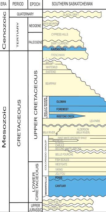
There are three main coal-bearing units in Saskatchewan:the Tertiary Ravenscrag Formation,the Upper Cretaceous Belly River Formation,and the Lower Cretaceous Mannville Group (Figure 1).Both the Mannville Group and the Belly River Formation in Saskatchewan are successions of sandstones,shales,and coals intercalated with and encased in marine shales.Each of these intervals contains numerous coal seams having ranks primarily in the subbituminous A to sub-bituminous C range.
Coals of the Ravenscrag Formation are mined at surface in southeastern Saskatchewan and rarely exceed depths of 150 m.The lignite coal in the Ravenscrag is currently not considered a viable target for production of NGC.
BELLY RIVER COALS
The Upper Cretaceous Belly River Formation of southwestern Saskatchewan contains numerous coal seams that have potential for the production of NGC.The Belly River
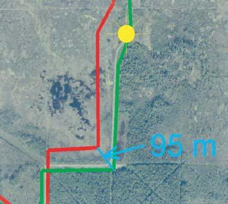
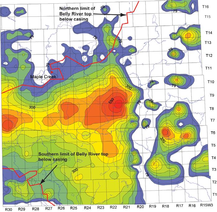
Formation is an eastward-thinning wedge of clastics that is present primarily within the western half of the province (McLean,1971). Initial investigation of the Belly River Formation in southwest Saskatchewan identified coals in an area south of T15 and west of R20W3,with seams mainly concentrated in the upper part of the formation.Coals in the Belly River are deepest,at around 550 m,along an east-west trend within T7,8,and 9 (Figure 2).
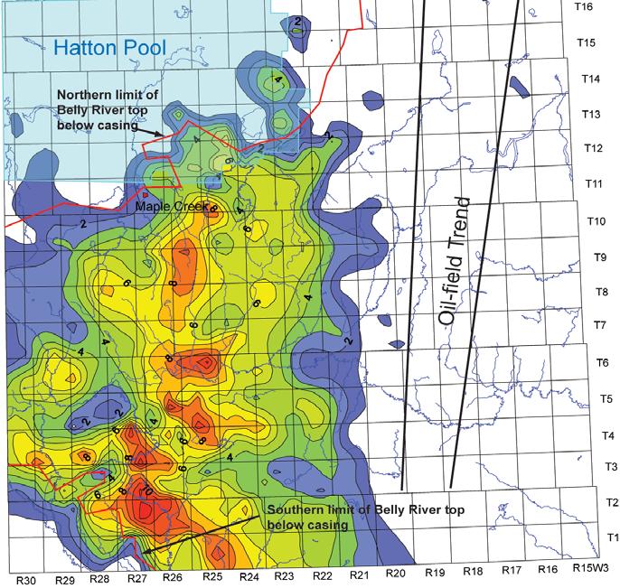
In the northwest and southwest corners of the Figure 2 map,it is possible that the shallowest coal seams are hidden behind surface casing and,therefore,cannot be identified.Within the main southwestern coalbearing area,up to 20 coal seams are present, ranging in thickness from 0.1 to 3.3 m (Figure 3).The number of seams decreases eastward in conjunction with an overall thinning of the Belly River Formation.The net coal isopach map (Figure 4) shows that net coal thicknesses greater than 2 m are largely confined to the area south of T15 and west of R20W3.This area lies immediately south of the Hatton Gas Pool,and west of the southwest Saskatchewan oil-field trend.The net coal isopach exhibits a northerly trend,with the thickest net coal
Figure 1 - Stratigraphy of southern Saskatchewan; coal-bearing strata are shown in blue.
Figure 2 - Isopach map of interval from KB to top of uppermost identified Belly River coal;contour interval 50 m (from Frank,2005).
interval between R25W3 and 27W3.Net coal thicknesses along this trend are around 5 to 9 m,but locally reach 12 m.It should be noted that no data for coal are available in four townships (T11 R23,T9 R24,T9 R23,T8 R24) on the northern part of this trend line so that the actual net coal thickness in these areas is unknown.The apparent thinning of the net coal isopach in the far southwest corner of the study area coincides with a group of wells in which the Belly River top occurs above the
casing.Thus,the isopach values in this area should be considered as minimum values only.
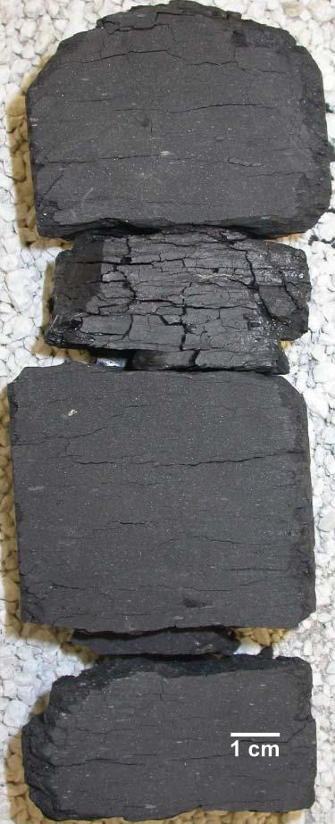
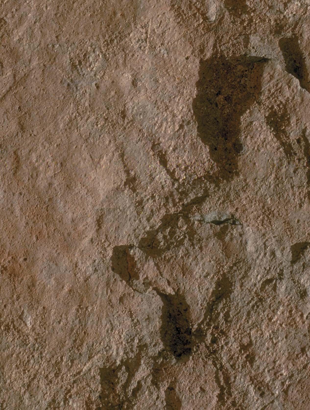
In core,the Belly River coal displays a wide spectrum of lithotypes,from carbonaceous shale to bright-banded,well-cleated coal (Figure 5).The few cores available have been extensively sampled for desorption experiments and so a true representation of the lithotypes is unavailable.Measured gas contents from desorption studies of Belly River coals for Nexen Battle Creek West 72-4-27W3 and Nexen Vidora 6-4-5-25W3 (Coal Gas Technology Ltd.,2004a,2004b) indicate a mean gas content of 0.97 m3 of gas per m3 of coal.Gas composition tests indicate average methane content of 95%, carbon dioxide from 1 to 5%,and minor amounts of ethane and propane.Hydrogen sulphide was not detected.
MANNVILLE COALS
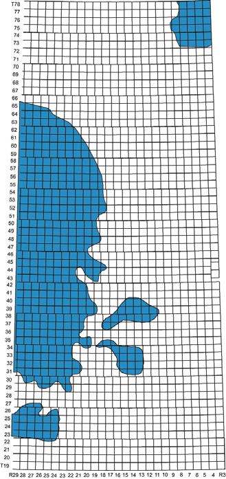
In general,the sub-bituminous coals of the Lower Cretaceous Mannville Group in Saskatchewan form seams of variable thickness and lateral extent that are spread over a wide geographical area (Figure 6). Mannville coals range in depth from near surface in the northeast corner of Figure 6 to 850 m in the west.Within the Mannville,there are two types of coal occurrence:thin regional paralic coals generally less than 2 m thick,and thicker coal bodies within paleovalleys and
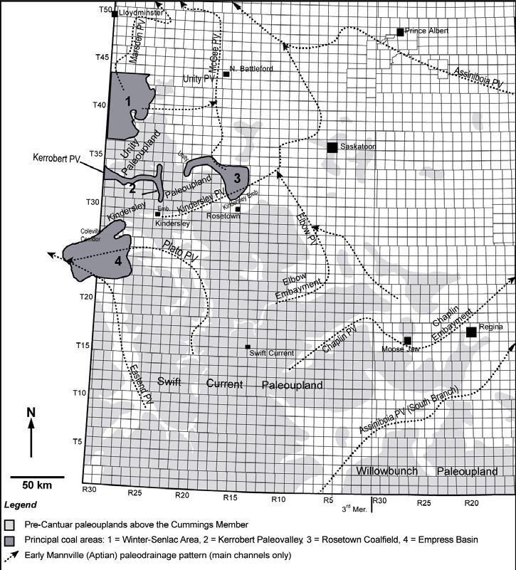
embayments that occur along the margins of the Unity,Kindersley,and Swift Current paleouplands (Figure 7).The most significant coals in these areas lie in the lower part of the stratigraphic interval (Figure 8) where individual coal seams can be more than 5 m thick,such as near Kindersley and the eastern Kerrobert Paleovalley.Some thick coal units may have resulted from deposition in paleotopographic lows related to subsidence associated with dissolution of underlying salt beds.These thickened coal beds,more lacustrine than paralic in nature (Christopher, 2003),escaped the limitation on thickness imposed by simple fluctuations in sea level.In 1987,Luscar studied four coalfields in the Kerrobert Paleovalley to assess the feasibility of mining these underground coal resources (SIR Assessment File 72N-001).The report estimated coal tonnage within the four coalfields at 1,715 million tonnes in place. Preliminary studies have also identified the Winter-Senlac area and the Empress Coal Basin as sites of laterally continuous coal (Bend and Frank,2004).
Coal lithotypes of the Mannville Group are similar to Belly River coals in that they range from carbonaceous shale to bright banded coal.Petrographic analyses for coals within the Rosetown Coalfield indicate bright coals are high in vitrinite content,whereas dull coal is dominated by mineral matter and
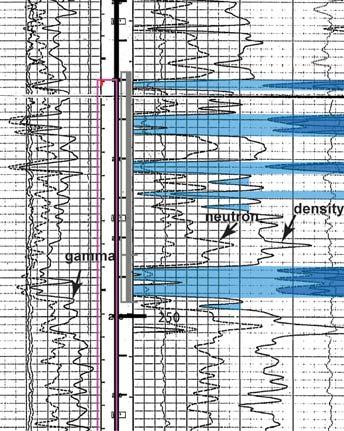
Figure 3 - Neutron-density log for Belly River Renaissance Senate 10-10-2-27W3. Coal shaded in blue.
Figure 4 - Net coal isopach map (from Frank,2005);2 m contour interval.In the northwest and southwest corners of the map area,the Belly River top occurs above surface casing;thus in these areas isopach values represent minimum values only.
Figure 5 - Core from Nexen Battle Creek 7-2-427W3;Belly River coal;depth 235.2 to 235.4 m.
Figure 6 - Approximate known geographic location of Mannville coals in western Saskatchewan (from Christopher,2003;Bend and Frank,2004).
Map covers area from T19 to 78,R3 to 29W3.
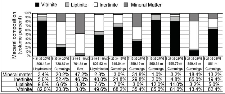
macerals from the inertinite group (Bend and Frank,2004).Figure 9 shows the relative proportions of macerals from wells in the Rosetown and Kerrobert areas.
The Geological Survey of Canada is currently undertaking a study to more clearly define the geographic distribution the Mannville coals along the western edge of the province.Release of this information is anticipated in early 2006.
THE NGC WORKING GROUP
A Saskatchewan government interdepartmental Natural Gas in Coal (NGC) Working Group was formed in March 2005, with a mandate to encourage industry to explore for potential NGC resources in Saskatchewan under terms that are fair and effective for industry,government,local stakeholders,and the general public.
The goals of the group are threefold:
1) To improve geological knowledge regarding potential NGC-producing beds. This brochure presents an overview of the latest geological findings by the group. More detailed information will be published as an SIR Open File 2005-33.
2) To study NGC from a regulatory
Figure 7 - Map outlining locations of four principal coal areas and their relationships to paleovalleys (PV), paleouplands,and paleoembayments (modified from Bend and Frank,2004).
standpoint.An investigation of The Petroleum and Natural Gas Regulations, 1969 has shown that the province is prepared for this new industry from a legal standpoint.The current regulations are sufficient to guide the potential new NGC industry.
3) To keep the public informed as to the nature of the NGC industry.A public-awareness campaign,which includes a website and information sheets,has been undertaken. The goal is to educate and inform the public proactively so that effective consultation processes can take place.
SUMMARY
• Mannville and Belly River coals have the highest potential for the production of NGC.Coals rank from sub-bituminous A to sub-bituminous C.
• Belly River coals are well developed in the southwestern corner of the province,and have tested mean gas contents of 0.97 m3 of gas per m3 of coal.
• Mannville coals are broadly distributed,but have not been tested for gas content. Preliminary mapping indicates four major areas of thick coal deposits.
• The current regulations are sufficient to guide the emerging NGC industry.
REFERENCES:
Bend,S.L.and Frank,M.C.(2004): CO2 sequestration and coalbed-methane potential of lower Mannville Group (Lower Cretaceous) coals,southern Saskatchewan - preliminary investigations;in Summary of Investigations 2004,Volume 1, Saskatchewan Geological Survey,Sask.Industry Resources,Misc.Rep.2004-4.1,CD-ROM, Paper A-12,17p.
Christopher,J.E.(2003):Jura-Cretaceous Success Formation and Lower Cretaceous Mannville Group of Saskatchewan;Sask. Industry Resources,Rep.223,CD-ROM.
Coal Gas Technology Ltd.(2004a):Battle Creek West 07-02-004-27W3 Coal Gas Desorption Final Report;Coal Gas
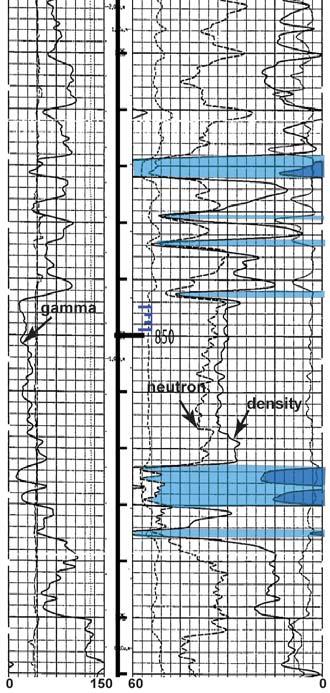
Figure 8- Neutron-density log for Baytex Prairiedale West A3-31-32-26W3.Coal shaded in blue.
Technology Ltd.,internal rep.prepared for Nexen Canada Ltd.,27 Jan 2004.
Coal Gas Technology Ltd.(2004b):Vidora 0604-005-25W3M Coal Core Gas Desorption Final Report,internal rep.prepared for Nexen Canada Ltd.,Calgary,30 Jan 2004.
Frank,M.C.(2005):Coal distribution in the Belly River Group (Upper Cretaceous) of southwest Saskatchewan;in Saskatchewan Geological Society Core Workshop,April 2005,Spec.Publ.No.17,p89-106.
McLean,J.R.(1971):Stratigraphy of the Upper Cretaceous Judith River Formation in the Canadian Great Plains;Sask.Resear. Counc.,Geol.Div.,Rep.No.11,96p.
To download these and other documents related to hydrocarbon resources of Saskatchewan,visit:http://www.ir.gov.sk.ca/ Default.aspx?DN=3442,3440,3385,2936, Documents or email:prospectsask @ir.gov.sk.ca
Figure 9 - Maceral analyses for select boreholes from the Rosetown Coalfield and Kerrobert Paleovalley.Each bar graph shows the relative proportion of mineral matter and of macerals from the three maceral groups.The accompanying table gives the sample depth,associated stratigraphic unit,and the corresponding analytical data (Bend and Frank,2004).
General Co-Chair, CSPG John Varsek john.varsek@encana.com
Technical Co-Chair, CSPG John Cody john_cody@eogresources.com
General Co-Chair, CSEG John Townsley john.townsley@divestco.com
Flow of Ideas, Hydrocarbons and Business
Technical Co-Chair, CSEG Mike Perz perzm@geo-x.com
Convention Manager
Lori Humphrey Clements lori.humphreyclements@cspg.org 403-264-5610 ext. 202 www.GEOconvention.org
STRATEGIES FOR INCREASING CSPG MEMBERSHIP
The world’s undeniable appetite for energy has left Canada in an extremely enviable position with regards to natural resources.The good fortune of the western provinces,where geography has met geology,leaves us poised to take advantage of rapidly growing economies.
In contrast to the supply-curve price shocks in the late 1980s,current commodity prices are being driven by upward momentum on the demand curve.In a 1999 speech made by Dick Cheney (while still the CEO of Halliburton),
BY AYAZ GULAMHUSSEIN, MEMBERSHIP COMMITTEE CHAIR
Cheney stated:“By some estimates,there will be an average of two-percent annual growth in global oil demand over the years ahead,along with,conservatively,a three-percent natural decline in production from existing reserves. That means by 2010 we will need on the order of an additional 50 million barrels a day.”
Unfortunately,energy supplies are not the only thing in short supply.Demand for “energy finders” has also skyrocketed,as the oil and gas industry continues to operate at a feverish
pace.In 1927,the Alberta Society of Petroleum Geologists (which became the Canadian Society of Petroleum Geologists in 1973) had a membership consisting of 13 individuals.This eventually blossomed to 4,491 individuals in 1986.Unfortunately,current CSPG membership stands at 30% less than when it peaked.For the last decade,the membership of the Society has remained relatively unchanged,hovering around the 3,000 level. There are a number of factors that may see the number of members decline further if proactive measures are not taken.
Unparalleled volunteer support has always proven to be the cornerstone of success for the Canadian Society of Petroleum Geologists. Each year,dedicated volunteers spend countless hours organizing a mosaic of programs and services that are offered to members.These programs and services reinforce excellence profession-wide,in addition to promoting relevant information to a rapidly evolving industry.Unfortunately,two major trends are combining to create one of the greatest problems the Society will ever face:the leading edge of the ‘baby-boomer’ retirement may now be beginning and the historic failure of the energy sector to plan strategically may now be exposed.With energy companies focused on short-sighted quarterly returns;the long-term issue of training skilled professionals is being overlooked.The Canadian energy sector will likely experience a drought of talent over the next 10-15 years,resulting in companies either having to pay massive premiums to retain talent or recruit geoscientists internationally.
Membership with the Canadian Society of Petroleum Geologists has always offered both tangible and intangible benefits.Affiliating or identifying oneself with a prestigious professional organization,having access to multi-disciplinary technical information, creating opportunities for peer networking, and the opportunity to participate in conferences at member reduced rates.The CSPG membership committee will discuss various facets of membership development focusing on the “4R’s”:retention,renewal, recovery,and recruitment.
RETENTION
It is the responsibility of every member to keep current members active and involved with the society.The CSPG will have no problems retaining members if it remains well organized, financially stable,and,most importantly,displays a sense of direction and purpose.It is also critical that the CSPG leadership consider the input of
Geoscience Professional Development Centre On Campus - at the U. of C. Plans for a fall field trip are in progress. Call (403) 264-0173 or judith.lentin@thementors.com
• SAGD/Horizontal
• Coring Programs
Conventional Wells
• Horizontal/Directional
• Gas Detection
Email: afran@telusplanet.net Heavy Oil Specialists
C. Alex Francoeur, P.Geol. President
Tel/Fax: (403) 281-6694
Cell: (403) 861-6753
CSPG BOOKSTORE SUMMER SPECIALS!
Memoir 19Carboniferous and Permian of the World,XIV International Congress on the Carboniferous and Permian
This memoir highlights a 100 million year interval during which the supercontinent Pangea was assembled,addressing issues of sedimentology, stratigraphy,resources,and palaeontology.Memoir 19 contains 56 refereed papers representing the selected proceedings of the XIV International Congress on the Carboniferous and Permian held at the University of Calgary in August 1999.This publication is valuable to geoscientists interested in Carboniferous and Permian geology,not only in Western Canada,but also around the world.Topics covered include:
• Belloy Formation sequences and paleogeography in the Peace River Basin
• Seven papers on Cyclothems from Western Canada, USA,and Spain
• Coal Resources and a North Sea gas play
• U-Pb geochronology,sedimentology and stratigraphy of tuff in the Exshaw Formation
• Carboniferous palynology and megaflora
• Carboniferous sedimentology and stratigraphy of eastern North America
• Paleontological correlations of the Carboniferous and Permian
• Discussions on Global Stratotype Sections and Points for Carboniferous and Permian stages.
Edited by Len V.Hills,Charles M.Henderson,and E.Wayne Bamber,2002,hard cover,947 pages,ISBN 0-920230008,Code M19
SUMMER SPECIAL - $50.00!
List Price - $75.00
Shipping in Canada - $10.00 • Shipping to the U.S. - $15.00
The Lexicon series is back! Now you can own Volumes 1,2 and 6 - together on one CDROM.This very popular - and long out of print series - is finally available once again.Volume 1 deals with the stratigraphy of Canada’s Arctic Islands within the District of Franklin,NWT.Volume 2 concerns the stratigraphy of the Yukon Territory and the District of MacKenzie,in the NWT.Volume 6 deals with the stratigraphic names of the four eastern provinces:Newfoundland,Nova Scotia,Prince Edward Island and New Brunswick and their contiguous offshore basins.These popular publications are now being presented in CD-ROM form,compatible with Windows 3.1,Windows 95/98 and Windows NT.Operated using Adobe Acrobat with the following features:interactive table of contents (click on a formation name to view its
entry),fully indexed,searchable,copy & paste feature and printable. Code L126
SUMMER SPECIALL126 & L4 - 2 for $50.00!
List Price - $50.00
Shipping in Canada - $7.50 • Shipping to the U.S. - $10.00
Lexicon 4Western Canada on CD-Rom
This volume contains 1,178 alphabetically ordered,informal and formal entries ranging in age from Precambrian to Recent.The lexicon is intended to provide an initial reference for those seeking information on specific stratigraphic units.The extensive bibliography should provide further information if needed.This popular publication is now being presented in CD-ROM form,compatible with Windows 3.1, Windows 95 and Windows NT.Operated using Adobe Acrobat with the following features:interactive table of contents (click on a formation name to view its entry), fully indexed,searchable,copy & paste feature and printable. Code L4
SUMMER SPECIALL126 & L4 - 2 for $50.00!
List Price - $50.00
Shipping in Canada - $7.50 • Shipping to the U.S. - $10.00
Map - Geological Highway Map of Alberta
It’s back – and its better! The revised highway map is based on the new,recently published Geological map of Alberta produced by the Alberta Geological Survey. Material for the map has also been provided by the Geological Survey of Newfoundland and the Provincial Museum of Alberta.
What’s more,it works hand in hand with the very popular A Traveller’s Guide to Geological Wonders of Alberta - highlighting a number of the sites detailed in the book.The new highway map includes sections on:
• basic geological concepts such as the geological cycle, plate tectonics and glaciation
• the impact of resource industries on the Alberta economy
• detailed maps of the highway routes through the Rockies
• detailed stratigraphic columns
• a map of basement tectonic elements
• cross-sections of the geology
• photographs and diagrams of key geological features with brief explanations
This map will be of interest to CSPG members, students,professional geoscientists,tourists and the general public! Code Hwy 1
SUMMER SPECIAL - $5.00!
Travel GuideHow Old is That Mountain?
How Old is That Mountain? is about the Rockies.More specifically, it’s about the Rocky Mountains of Banff and Yoho National parks and adjacent areas.In non-technical terms and highly-readable prose this book answers many of the questions that are raised about the spectacular topography of this area. How Oil is That Mountain? is also an excellent field guide,affording the traveller a new window in the past and present of this popular tourist region.Taking the reader along the Trans-Canada Highway from the Mountain Front to the Rocky Mountain Trench and from Lake Louise to the Columbia Icefields,How Old is That Mountain? offers a fresh and intriguing look into the geology of this incredible region. 1997,soft cover,146 pages,1-55143-070-3,Code Con 16
SUMMER SPECIAL - $10.00!
List Price - $18.95
Shipping in Canada - $7.50 • Shipping to the U.S. - $10.00
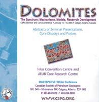
S63 - CD ROMDolomites:The Spectrum: Mechanisms, Models,Reservoir Development
Abstracts of Seminar Presentations,Core Displays and Posters
On Jan 13th through 15th 2004,the CSPG staged a very successful and informative conference entitled “Dolomites - The Spectrum:Mechanisms,Models and Reservoir Development.Out of the one day seminar and the following two days of core conference,there has emerged an extremely useful collection of papers.The proceedings compact disc volume comprises 40 abstracts and short papers.Of these,27 are short papers (averaging 20 pages each) that represent fully illustrated case histories of dolomitized subsurface reservoirs,mostly from the Western Canada Sedimentary Basin.The subsurface case histories follow a standard format to facilitate easy cross-referencing and subject searching.They range from the Silurian Interlake to the Triassic Baldonnel and include such major fields as Ladyfern, Dunvegan,Clarke Lake,Crossfield,and Simonette. The remainder of the papers deal with basic models and constraints,specific dolomitization mechanisms, outcrop examples,reaction-transport modelling, and petrographic techniques.Prior to purchasing you may view both the Core Conference Abstracts and the Seminar Abstracts.
Various Authors,2004,CD-ROM,Code S63
SUMMER SPECIAL - $15.00!
List Price - $25.00
Shipping in Canada - $7.50 • Shipping to the U.S. - $10.00
BOOK STORE ORDER FORM
Method Payment:
■ Cheque - Canadian Funds only ■ Visa (13 or 16 numbers) ■ Mastercard (16 numbers)
If ordering more than one book,use greatest as base shipping price and add $3 for each add’l book
Please allow 4-6 weeks for delivery to Canada and the U.S. Canadian Society of Petroleum Geologists (www.cspg.org) 160,540 - 5th Avenue SW,Calgary,Alberta Canada T2P 0M2 • Phone:(403) 264-5610 • Fax (403) 264-5898 • Email:jaime.croftlarsen@cspg.org
(...Continued from Page 32)
members in Society decisions and provide recognition for members’ efforts.Members will continue to stay with the CSPG if there is a recognized return on investment.Effective levels of personal communication,receiving pertinent information,and active involvement in volunteer activities encourage membership retention.The CSPG must avoid detrimental activities that would discourage retention.Damaging politics, lack of strategic direction,and lack of professional administration are all factors that would hinder retention.
RENEWAL
Although the concepts of retention and renewal may appear to be the same,they are slightly different.Retention refers to keeping members during their membership period, while renewal refers to keeping members after their subscription has expired.Continually adding new programs and new member advantages will allow us to encourage renewal since the last time the individual subscribed.
RECOVERY
There are numerous issues that may cause a
person to give up their societal membership. Rather than speculate on what these issues might be,it is important that we contact past members and ask them directly.After understanding the issues that have contributed to their displeasure,it is up to the Society to address their concerns in hopes of attracting them back.
RECRUITMENT
If there is a secret to membership recruitment,it is to be methodical.Clearly defining what membership means,and what the community represents are critical to attracting new members.Groups like the CSPG organize around certain issues and interests.A potential member is not just ‘anyone,’ but rather a person that fits into a set of clearly defined interests.
Significantly increasing the Society’s membership is a daunting task,but not one that is impossible.As Chair of the membership committee,it is my responsibility to encourage and increase the Society’s membership.The growth of the CSPG membership should
closely track the growth of the profession. Over the next few months,I will be organizing a committee which will formulate a campaign aimed at recruiting new members.
My primary objective is to “even-out” the current bimodal age distribution identified in the 2004 CSPG survey.Promoting new graduate and student membership is essential to getting industry newcomers to affiliate themselves with the Society.For those members who are already a part of the Society,I aim to increase their benefits.There are many benefits offered by the CSPG that overlap with benefits offered by other societies.It is important that we have access to unique benefits that are specifically geared towards our profession.
More strategies for increasing the CSPG’s membership will be unveiled as they are developed by the new committee.Since the membership committee is dedicated to serving the membership,any suggestions from members (or potential members) would be greatly appreciated.
Athletic Waver: In consideration of you accepting this entry: I hereby, for myself and my heirs, executors and administrators, waive and release any and all rights or claim to damages I may have against the organizers holding this race, their agents, contractors, representatives, successors and assigns, the race sponsors for any and all injuries I may sustain during the course of the event. Waiver also extends to any incidental photographic capture for the event records
18TH ANNUAL CSPG-CSEG 10KM ROADRACE AND FUN RUN
BY FIONA KATAY, 2006 RACE CHAIR
It’s that time of year again to start thinking about running in the 18th annual CSPGCSEG 10km Roadrace and FUN RUN! The event features a 10km run followed by a post-race social,with pizza and refreshments as the main attraction.Whether you’re a seasoned runner,or have never participated in a race before and are looking to start a running program this summer,this event has something for everyone.
The run will take place on Wednesday, September 13,2006 beginning at 6:00pm at the Eau Claire YMCA.The route will take you on an out-and-return route along the beautiful Bow River pathways,finishing back at the Eau Claire YMCA.Following the race, all racers,volunteers,and guests are invited to gather for awards,draw prizes, refreshments,and some friendly camaraderie.
The race is open to all members of the CSPG, CSEG,CAPL,and the general public,and is a good way to get out and meet with old friends,as well as make new ones within the industry.Registration forms can be downloaded from the CSPG website at www.cspg.org/events/events-social-funrun.cfm
Gord Hobbins of Gord’s Running Store has developed a 10km race training guide for novice runners.Try it out and benefit from some expert advice,you may be surprised how easy it can be to gently get yourself in condition for your first race.
Gord’s 12-Week Training Guide for Runners
June 26-July 2-10-15
July 3-9-10-15 min-10-15
July 10-16-10-20 min0-10 min10-20 min--25
July 17-23-10-20 min0-10 min10-20 min--30 min
July 24-30-10-20 min0-10 min10-20 min0-10 min-25 min
July 31-Aug 6-10-20 min0-10 min10-20 min0-10 min-35 min
Aug 7-13-15-25 min0-10 min15-20 min0-10 min-25 min
Aug 14-20-15-25 min0-10 min15-20 min0-10 min-40 min
Aug 21-29-15-25 min0-10 min15-25 min0-10 min-25 min
Aug 30-Sept 3-15-25 min0-10 min15-25 min0-10 min-45 min
Sept 4-10-20-30 min0-10 min15-25 min0-10 min-25 min
Sept 11-13-Rest10 KM RUN
GUIDANCE/TIPS:
For novice runners who wish a do-it-yourself program at your leisure.
• Run for short durations between 3 and 5 times per week according to schedule,with your long-run days being the key to your training program.
• If your running shoes are giving you some problems,get some which fit and match your gait.
• Guide allows for a gradual increase to a comfortable load;your legs may need some conditioning at first.
• Yes,times are in minutes.The secret is be
regular and not beat yourself up.
• Wear a hat and cool shades.Keep well hydrated.It really helps.
• Gently stretch those calves and quads afterwards.
• Take along a friend and convince them to sign for CSPG,CSEG,and the RoadRace as well.
• There are many running/training groups in town if interested in more.
Many thanks go out to our sponsors and volunteers who make this event possible each year! We hope to see you there!
2006 SQUASH TOURNAMENT WINNERS
MENS
Mens A:John Cox
Mens A Runner-up:Richard Burrage
Mens A Cons:Harry Issler
Mens B:Brian Rutherford
Mens B Runner-up:Dave Clements
Mens B Cons:Kevin Collins
Mens C:Domi Diaz
Mens C Runner-up:Brett Norris
Mens C Cons:Darren Tisdale
Mens D:Dave Lleroux
Mens D Runner-up:Leif Snethun
Mens D Cons:Ken Broadhurst
Mens E:Alessandro Deminco
Mens E Runner-up:Adrian Karolko
Mens E Cons:Trevor Reschy
WOMENS
Womens A:Alison Mcpherson
Womens A Runner-up:Solana Jear
Womens B:Ann Burrage
Womens B Runner-up:Tina Chow
Womens C:Karin Yip
Womens C Runner-up:Cathy Orban
Womens D:Megan Huckvale
Womens D Runner-up:Marie Diaz
Womens E:Brenda Pearson
Womens E Runner-up:Dawn Issler
Womens E Cons:Sam Etherington
TEAMS
Morgan Bint
David Carins
Aaron Grimeau
Angela Vanouck
James Newsome
Maximum reservoir performance
Want to make the most of your valuable oil and gas reserves?
Roxar’s integrated technology solutions and services help companies of all sizes realize the full economic potential of their oil and gas resources.
• Innovative modeling and simulation software
• Downhole monitoring and control systems
• Reservoir production multiphase metering
• Reservoir and production consultancy
Roxar’s leading-edge technology solutions from reservoir interpretation through to production & process meet the changing needs of users in managing the entire reservoir lifecycle.