
14 Practical Sequence Stratigraphy XIV: Correlation
21 Climate Change VII: The Spin Cycle
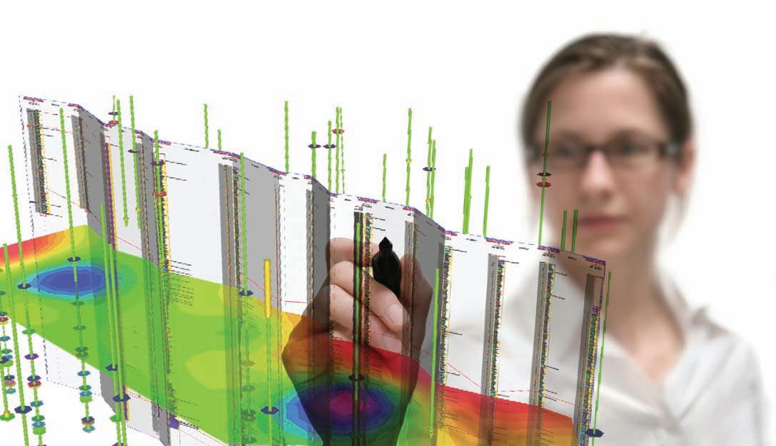
27 Halliburton: Connecting the Reservoir to the Pipeline
33 Wanted: Ideas for Technical Sessions for GeoCanada 2010 Convention
36 2009 Awards Reception


14 Practical Sequence Stratigraphy XIV: Correlation
21 Climate Change VII: The Spin Cycle
27 Halliburton: Connecting the Reservoir to the Pipeline
33 Wanted: Ideas for Technical Sessions for GeoCanada 2010 Convention
36 2009 Awards Reception
Looking to maximize opportunities in today’s volatile market?
Combine the power of PETRA® and IHS Critical Information including well and log data to define reservoir parameters and determine new opportunities faster and more cost effectively.
Let IHS information solutions improve your decision-making and reduce your risk.
For more information on PETRA visit us at www.ihs.com/reservoirsolutions


#600, 640 - 8th Avenue SW
Calgary, Alberta, Canada T2P 1G7
Tel: 403-264-5610 Fax: 403-264-5898
Web: www.cspg.org
Office hours: Monday to Friday, 8:30am to 4:00pm
Executive Director: Lis Bjeld
Email: lis.bjeld@cspg.org
Advertising & Sponsorship Coordinator: Alyssa Middleton
Email: alyssa.middleton@cspg.org
Communications Coordinator: Heather Tyminski
Email: heather.tyminski@cspg.org
Member Services Coordinator: Kasandra Klein
Email: kasandra.klein@cspg.org
Registration Coordinator: Dayna Rhoads
Email: dayna.rhoads@cspg.org
Joint Annual Convention Committee
Convention Manager: Shauna Carson
Email: scarson@geoconvention.org
Convention Coordinator: Tanya Santry
Email: tsantry@geoconvention.org
EDITORS/AUTHORS
Please submit RESERVOIR articles to the CSPG office. Submission deadline is the 23rd day of the month, two months prior to issue date. (e.g., January 23 for the March issue).
To publish an article, the CSPG requires digital copies of the document. Text should be in Microsoft Word format and illustrations should be in TIFF format at 300 dpi., at final size. For additional information on manuscript preparation, refer to the Guidelines for Authors published in the CSPG Bulletin or contact the editor.
Technical Editors
Ben McKenzie Colin Yeo (Assistant Tech. Editor) Tarheel Exploration EnCana Corporation Tel: 403-277-4496 Tel: 403-645-7724 Email: bjmck@telusplanet.net Email: colin.yeo@encana.com
Coordinating Editor
Heather Tyminski
Comunications and Public Affairs, CSPG Tel: 403-513-1227, Email: heather.tyminski@cspg.org
ADVERTISING
Advertising inquiries should be directed to Alyssa Middleton, Tel: 403-513-1233, email: alyssa.middleton@cspg.org. The deadline to reserve advertising space is the 23rd day of the month, two months prior to issue date.
The RESERVOIR is published 11 times per year by the Canadian Society of Petroleum Geologists. This includes a combined issue for the months of July and August. The purpose of the RESERVOIR is to publicize the Society’s many activities and to promote the geosciences. We look for both technical and non-technical material to publish. The RESERVOIR is not intended to be a formal, peer-reviewed publication. Additional information on the RESERVOIR’s guidelines can be found in the May 2008
Alberta’s Professional Geoscientists and Engineers provide Albertans with many of the essentials of daily living. The work that they do allows all of us to enjoy warmth, light, power, water and the ability to travel and communicate over distance.
Since 1920, Members of APEGGA, The Association of Professional Engineers, Geologists and Geophysicists of Alberta, have made a difference in the daily lives of millions of Albertans by bringing science and innovation to life.
The P.Geol., P.Geoph., P.Eng., and R.P.T. professional designations represent the highest standards of quality, professionalism and ethics in geoscience and engineering. APEGGA Members can take pride in the role they play and the contribution they make to Alberta.
APEGGA and its over 55,000 Members are committed to public safety and well-being through the self-regulation of the geoscience and engineering professions in Alberta.
Visit www.apegga.org for more information.

Geologists Geophysicists Engineers
CSPG EXECUTIVE
President
Graeme Bloy • Canada Capital Energy Corporation gbloy@capitalenergy.ca Tel: (403) 975-5784
Vice President
John Varsek • EnCana Corporation john.varsek@encana.com Tel: (403) 645-2000
Past President
Lisa Griffith • Griffith Geoconsulting lgriffith@griffithgeoconsulting.com Tel: (403) 669-7494
Finance director
David Garner • Chevron Canada Resources davidgarner@chevron.com Tel: (403) 234-5875
assistant Finance director
Greg Lynch • Shell Canada Ltd. greg.lynch@shell.com Tel: (403) 691-3111
Program director
Randy Rice • Suncor Energy Inc. rjrice@suncor.com Tel: (403) 205-6723
assistant Program director
Scott Leroux • EnCana Corporation scott.leroux@EnCana.com Tel: (403) 645-2000
serVices director
Ayaz Gulamhussein • NuVista Energy Ltd. ayaz.gulamhussein@nuvistaenergy.com Tel: (403) 538-8510
assistant serVice director
Penny Colton • Geophysical Service Inc. pcolton@geophysicalservice.com Tel: (403) 514-6267
outreach director
Mike DesRoches • Talisman Energy Inc. mdesroches@talisman-energy.com Tel: (403) 513-6843
communications director
Peggy Hodgkins • CGGVeritas peggy.hodgkins@cggveritas.com Tel: (403) 266-3225
A message from the CSPG Assistant Programs Director, Scott Leroux
With another CSPG/CSEG/CWLS joint convention in the books, the latest meeting of the three societies was quite successful despite the economic challenges it faced. As most of you are well aware, the annual joint convention is a large income component for CSPG on an annual basis and has been a “C3-Geo” joint convention since the AAPG was last here in 2005. Previously, the CSPG combined efforts with our sister societies on numerous occasions, dating back to at least the early eighties.
This comment is a look back at the Joint Convention, and my own view of how the technical program has changed over the last few decades. How may we learn from the past as we move forward into the future?
The idea of joint conventions is nothing new; bringing together various geological societies happens all the time. The northsouth alignment of the CSPG with the US-based AAPG and SEPM in 1970, 1982, 1992, and 2005, the east-west culmination of the more national CSPG/CSEG/CWLS/ GAC/MAC/CGU for GeoCanada 2000 and the 20+ societies in the upcoming GeoCanada 2010 have brought forth diverse technical programs, networking, and a varied multidisciplinary audience. It has also allowed exhibitors and sponsors the convenience of “one-stop-shopping” at a single event. The success of the earlier joint conventions and the need for multiyear planning and operational efficiencies led to the commitment of the Executives to have joint conventions as the norm beginning in 2006. This relationship was formalized by the Joint Annual Convention Committee (JACC) in 2008 which is chaired today by Tony Cadrin and consists of representatives from CSPG, CSEG, and CWLS, as well as two full-time staff members. Its mandate is to “improve both the technical and operational aspects of our convention programs.” The three societies
are committed to joint conventions until 2015.
Over the past few years I have felt there has been a growing perception that the technical program is growing stale (losing technical and business relevancy to issues facing our members). Although this is difficult to quantify (the 2009 CSPG Membership Survey may help) we can analyze some of the trends with respect to technical program submissions over the years and highlight some of the challenges we face with the annual convention.
For most CSPG members, the backbone of the conference is the technical program (including Core Conference) and as the 2008 CSPG Technical Program Co-Chair I know first-hand how difficult it is to put together a quality program that is not only cutting edge, but relevant and popular with the diverse membership interests at any one time. The 2009 program had a total of 286 abstracts accepted (Oral, Poster, and Core); 58% were submitted by CSPG members, 36% by CSEG members, 2% by CWLS members, and the remaining 4% were by non-members, a trend, with some variance, that holds true for most joint conventions. Admittedly, some people hold more than one membership so the numbers are not absolute.
As part of a larger study of primarily CSPG/CSEG and more recently CSPG/ CSEG/CWLS joint conventions, a number have been analyzed for data (1984, 1994, 1998, 2006-2009) in detail. The goal of this study is to get an anecdotal understanding of abstract submission sources (Academia, Industry E&P, Government, Service Companies, Consultants, Research Bodies, and Other – often business). As you can see from Table 1, there have been some noteworthy shifts over the years. A full reporting of this analysis is beyond the scope of this column however, some (Continued on page 7...)
www.cspg.org
FRIDAY, AUGUST 28, 2009 - LYNX RIDGE
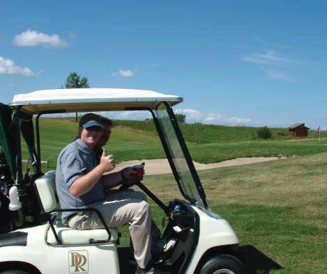
Format: Modied Texas Scramble, shotgun start at 8:00 am. Teams will be assigned according to handicap or average score. This is a fun tournament open to both men and women. Registration includes a continental breakfast, dinner, green fees and power carts.
Registration Deadline August 7, 2009 (Priority will be given to CSPG Members).
Name:
Company:
Address:
Phone (daytime):
Email:
CSPG Members: Register online at http://www.cspg.org/events/events-social-golf.cfm. Non-Members and Guests: Mail or fax your form to CSPG’s ofce (contact information below).
CSPG - Member #
� Non Member
Phone / Cell (evening):
� Male � Female
Club Handicap or average 18 hole score:
Guest Name: (One guest allowed per CSPG Member)
� Male � Female
Club Handicap or average 18 hole score:
Please note: A waiver must be signed by EACH participant five business days prior to the Mixed Golf Tournament. A waiver form will be distributed to you once your registration form has been processed. If a waiver is not signed prior to the tournament, your registration will be removed from the tournament. All registrations must be accompanied by full payment. All cancellations or Phone requests will not be accepted. The cancellation or amendment must be received by 4:00 pm on August 14, 2009. A 15%
amendments to registrations must be received in writing via email to Dick Willott at dickw@boypetro.com. cancellation and administration fee will apply. ,
For more information, contact Dick Willott at 403-543-5387, Brenda Pearson at 403-206-3339, or David Caldwell at 403-852-5571.
$ 85.00 Member
$ 125.00 Non-Member / Guest
$ 25.00 Extra Meal Ticket (Non-playing guests. Maximum 10 spots; rst-come, rst served.)
$ TOTAL (GST Included. GST # 118836295)
� VISA � MC � Cheque/Money Order (Payable to CSPG)
Card Number: Expiry:
Name of Cardholder:

Signature:
Registrations to be sent to: Canadian Society of Petroleum Geologists Attn: Mixed Golf Tournament 600, 640 – 8 Avenue SW Calgary, Alberta T2P 1G7
Phone: 403.264.5610 Fax: 403.264.5898
APACHE CANADA LTD.
BAKER ATLAS
CONOCOPHILLIPS CANADA LIMITED
DEVON CANADA CORPORATION
ENERPLUS RESOURCES TRUST
geoLOGIC systems ltd.
GEOMODELING TECHNOLOGY CORP.
HUNT OIL COMPANY OF CANADA
HUSKY ENERGY INC.
IHS
IMPERIAL OIL RESOURCES
LARIO OIL & GAS COMPANY
LITTLE ROCK DOCUMENT SERVICES
MJ SYSTEMS
MURPHY OIL COMPANY
NEXEN INC.
PENN WEST PETROLEUM LTD.
PETRO-CANADA OIL AND GAS
PETROCRAFT PRODUCTS LTD.
PROVIDENT ENERGY LTD
RPS ENERGY CANADA LTD.
SHELL CANADA LIMITED
SPROULE ASSOCIATES LIMITED
SUNCOR ENERGY INC
TALISMAN ENERGY INC.
TECK COMINCO LIMITED
TOTAL E&P CANADA LIMITED
TOURMALINE OIL CORP.
interesting preliminary trends are worth mentioning.
One of the most encouraging trends is the consistent and strong number of contributions from academia. A deeper look shows that students from Canadian universities dominate and was apparent again this year with an excellent student line-up. On the other side is the slow decline of participation by consultants as well as the more noticeable decline of Industry E&P participation in the Technical Program over the years. Once supplying up to 25% of the Technical Program, Industry E&P submissions have decreased to only 13% of the 2009 program (first authors).
2009
Suggestions or comments can be sent to JACC through Shauna Carson (scarson@ geoconvention.org) or any member of the executive listed on our website (http://www.cspg.org/contact/contactcommittees-executive.cfm). (...Continued from
Since a large proportion of the CSPG membership falls into this category (myself included) we need to ask ourselves, why is this happening? Is it the attitude of the companies on publishing (real or perceived)? Is it because it is too time consuming? Has our material become more confidential? Is it because many of us work in a mature basin where exploration and frontier activity is on the decline? Or could it be that we are victims of our own success. The CSPG runs 12 successful Technical Divisions, many of which provide high quality talks monthly. Add to this the heavily attended Technical Luncheon program (both CSPG and CSEG) and you can see that there are several straws draining the same pool. Participation from the government sector seems to parallel times when major projects have come to fruition. It also underlines the strong and consistent contribution from the GSC, which we are fortunate to have based here in Calgary.
Whatever the reason may be, it is one thing to criticize, but another to do something that will improve what is essentially your event. The annual convention will remain an integral part of our Society’s structure, reducing the frequency does not appear to be an option so how do we create the program that you want? We are a technical society who wants to see great technical presentations, but have seemingly become more reluctant to “step up to the plate”. I encourage the entire CSPG membership to think about the future direction of the joint convention and think of ways to encourage more participation. We are always looking for new blood and new ideas and we need your help. How do we encourage people to share their great ideas and make it worth their while? Do we need to change the model? Do we need to invite additional and different societies to participate by running special sessions? Or is there a way to encourage the oil and gas industry to come back to the podium, possibly by showcasing technical prospects that are non-confidential (or For Sale). The Technical program at the annual convention is very good, but can always be improved. We welcome your suggestions.
SPEAKER
B. J. Rostron
Department of Earth and Atmospheric Sciences, University of Alberta
11:30 am
tuesday, september 15, 2009 telus convention centre calgary, alberta
Please note:
the cut-off date for ticket sales is 1:00 pm, thursday, september 10, 2009. csPg member ticket Price: $38.00 + gst. non- member ticket Price: $45.00 + gst.
Due to the recent popularity of talks, we strongly suggest purchasing tickets early, as we cannot guarantee seats will be available on the cut-off date.
Did you know that you can book a table for the Technical Luncheon? To book your table, or to buy individual tickets, visit www.cspg.org or call CSPG’s office at (403) 264-5610.
During petroleum exploration and production operations the question often arises “Is the fluid recovered during well testing pure formation water or contaminated with drilling fluid?” A variety of water chemical techniques (e.g., Stiff diagrams) have historically been used to answer this question. However, standard chemical fingerprinting techniques can be problematic or ambiguous, especially when
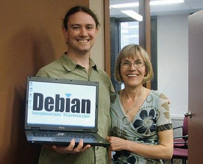
CSPG held a laptop draw at our booth at the CSPG CSEG CWLS Convention in May 2009 for CSPG members. We would like to congratulate Simon Haynes for winning the DellTM VostraTM 1510 laptop, generously donated by Debian Information Technology. Thank you to all those who participated in the draw.
working in environments with evaporites (hence brine formation-water), or in shallow (fresh formation-water) settings. A new fingerprinting technique using stable isotopes of hydrogen, oxygen, and strontium in formation waters has been developed that overcomes many of the problems with previous methods.
An ongoing sampling program has collected several thousand samples from producing wells and drillstem tests, initially in the Williston Basin (Canada-USA) and more recently in the Alberta Basin. These data have lead to the creation of an isotopic database of formation waters that has enabled the use of isotopic fingerprinting techniques in a variety of exploration and production operations, including:
1) During drillstem testing and swabbing operations to determine if the recovered fluid is formation water, and hence the validity of collected fluid sample(s).
2) As a production monitoring tool, to determine if produced fluids are originating in the perforated zone (versus ‘leaking’ into the wellbore from other formations). Repairing wells producing “out of zone” water can extend their life.
3) As an aid to exploration, by enhancing understanding of reservoir continuity.
These techniques are relatively fast and inexpensive, and have proven very useful to the petroleum industry.
Ben Rostron is an Associate Professor in the Department of Earth and Atmospheric Sciences at the University of Alberta. He has a B.Sc. in Geological Engineering (Waterloo), and an M.Sc. and Ph.D. in Geology (Alberta). His research is focused on mapping and numerical simulation, of the large-scale movement of subsurface fluids (oil, gas, water) in geologic basins.
Rostron is a member of CSPG, AAPG, and GSA and is registered as a P.Eng. / P.Geol. with APEGGA and APEGS.
Thank you for taking a leadership role in working with the CSPG to advance the science of petroleum geology.


LittLe Rock Document Services


Dr. John Harper Harper Consulting International Inc.
11:30 am
t hursday, s eptember 24, 2009 telus convention centre c algary, a lberta
Please note:
the cut-off date for ticket sales is 1:00 pm, monday, september 21, 2009. csPg member ticket Price: $38.00 + gst. non-member ticket Price: $45.00 + gst.
Due to the recent popularity of talks, we strongly suggest purchasing tickets early, as we cannot guarantee seats will be available on the cut-off date.
Did you know that you can book a table for the Technical Luncheons? To book your company’s table, or to buy individual tickets, visit www.cspg.org or call CSPG’s office at (403) 264-5610.
Avalanches! The word conjures up images quite familiar to Canadians in winter, especially those in mountainous regions, although avalanches occur wherever snow can build up an accumulation. In reality – in geologic terms – avalanches are turbidity currents, and their deposits are snow turbidites. Avalanches are all about the instability of snow sediment overload. Instability occurs as a result of snow overloading on steepened slopes on which there occur defined slide surfaces. Sediment overload is the result of heavy snowfall, or wind loading (cornices are generally in evidence). Slope angles corresponding to instability range from about 30° to 50°. At higher angles it is difficult for the snow to accumulate and hold. At lower angles the snow stabilises very rapidly and holds in place. Interestingly, a slope angle of 18° is considered steep by most skiers. Doubleblack runs tend to be in the high 20°s and steeper. Defined slide detachment surfaces result from extended periods of freeze and thaw, or rain and freeze, or sun melt and freeze.
Comparisons with modern deep-sea slides and slumps are presented which identify identical avalanche morphologies of fracture lines, slide scars, flow valleys, and run-out fans. The main difference is scale. Whereas avalanches tend to run less than a kilometre, but occasionally can go much further, deep-sea slumps set off huge gravity mass flows that, in the case of the Bengal Fan, can run as far as 2,000 km. The end products are similar in many cases; being debris flows, slab avalanches or slides, sluffs, channelized deposits, leveed margins, distal fans, meandering channels, and spillover lobes. Water content variations in avalanche deposits can result in significantly different surface character to the deposits which can be likewise identified in the deep marine. Inner bend and the thicker, major outer bend deposits occur in like fashion between modern turbidity currents and avalanches.
To watch an avalanche is to see a flume study in motion. The huge plume reacts in air as it does in flume water studies. The internal motion of the plume is identical to that seen in the water versions. The slide initiates at an uppermost fracture line of varying height depending on how much of the sediment load is involved, whether it is only a surface slide or it fractures to the underlying ground. In the latter case significant volumes of rock can become incorporated – so much so that geologic studies have tried to characterize the fabric, texture, and bed stacking relationships of the sediments.
Almost instantaneously, after the fracture line initiates, a huge area downslope of the fracture detaches and the deposit begins to move as a mass of snow blocks of all sizes, loose snow, maybe rocks, and trees, and too often humans and their skis or snowmobiles, down the chutes and bowls, over the rock cliffs, and channelized around bends. The front of the flow begins to mix with the air, thereby creating the plume. Flow lobes race and spurt out in front of the main flow, picking up and incorporating downslope snow in the avalanche’s body. Velocities can reach as high as 200 km/hour. Outer bends, base of slope fans, and accumulation lows are where the bodies commonly are deposited. As the flow begins to slow, it fans into its proximal and distal portions which are commonly defined by channels and levees just as are the marine equivalents.
Once caught in the mass flow, unless trapped at the margin, there is absolutely no chance of escaping other than trying to keep as near
to the surface as possible by swimming with the current. Mouth and nose become filled with snow in an instant – almost before the individual is aware of what has happened. Every attempt has to be made to retain one’s senses, to hold one’s breath, keep one’s mouth closed, protect the face, and to preserve an air pocket once the avalanche “quick phases,” whereby it essentially converts to a rigid immoveable mass as the finer-grained snow metamorphoses and freezes. Once having been entombed, the trapped individual suffocates in either the packed snow or the subsequent ice mask which forms as exhaled air melts the surface of the pocket and then freezes.
Recognition of conditions and potential dangers (risk analysis is something to which we are accustomed) can be addressed at many levels from Google imagery, to use of Canadian Avalanche Association area reports, to Alberta Environment snowfall (snow pillow) records, to use of the “Avaluator,” to awareness of local conditions, and to analysis of snow pits. Training courses and the purchase of appropriate rescue equipment is imperative. Of course, once it is necessary for you to have to use the equipment it almost too late anyway. So the best advice is to exercise restraint in exuberant situations and not become a victim. In a risk sense the equipment is necessary “once you get on the curve.” The trick is to avoid getting on the curve!
We are fast approaching a new winter season. Snow has already begun to accumulate. Please let this be a reminder to renew your training, practice your skills, evaluate the degree of risk you are willing to accept, and if necessary make sure your will is up to date.
I would like to extend my thanks to the producers of the avalanche film “The Fine Line” which won awards at the Banff film festival, and for which they gave permission for use of the leader I used to introduce this talk. The film, which is a superb training tool, can be purchased at Mountain Equipment Co-op in Calgary, Alberta for nominal cost, as can the “Avaluator.”
John D. Harper, Ph.D., P. Geol., FGSA, FGAC: previously Senior Geological Advisor, ConocoPhillips Canada Ltd.; Retired Full Professor, Petroleum Geology, and the first Director of the Centre for Earth Resources Research at Memorial University of Newfoundland to January 1, 1998, and (Continued on page 45...)
Analyze your reservoir using the most advanced software and consulting services. Software for inversion, AVO, 4D, multicomponent and rock properties. Consulting services include the mapping of fracture density and orientation, stochastic inversion, pre-stack simultaneous inversion and Lambda Mu Rho. Count on Hampson-Russell to help you understand your reservoir.
Contact:

origin for the Hampshire Basin, and its effect on the petroleum system of the Wytch Farm and other oilfields in Southern England
SPEAKER
Peter B. Jones International Tectonic Consultants Ltd.
CO-AUTHOR
David Clark
12:00 noon
Wednesday, september 16, 2009 conocoPhillips a mphitheatre, 3rd Floor West end of g ulf canada square 401 – 9th avenue s.W. calgary, alberta
The Hampshire Basin is a topographic depression in southern England, some 3,500 km2 in area. It extends about 140 km from west to east and up to 40 km from north to south. Geologically it is a half-graben, with normal faulting along its north edge and the Purbeck monocline forming a hanging wall rollover fold along the south edge. Starting in the nineteenth century, the structural history of the region had been described in terms of mid-Cretaceous rifting followed by Tertiary (Alpine) compression. The 1973 discovery of the Wytch Farm oilfield in Mesozoic sediments provided well and seismic data leading to a new model for the evolution of the area through the mechanism of inversion tectonics. That model postulated Cretaceous rifting with normal faults that became inverted during the Tertiary to form supposedly Alpine-related folds and reverse and thrust faults.
Our study supports neither the original interpretation nor the inversion tectonic model. There is no evidence for compressive folding and repetition in the shallow basin section, nor evidence that Cretaceous normal faults in the deeper reservoir section became reactivated and inverted in the Tertiary to form “Alpine” compressional structures in the shallow section. Instead, we propose that the present-day structure is a result of large-scale sub-horizontal southward movements along blind beddingplane detachments in over-pressured and mobile Upper Cretaceous and Jurassic clays and Triassic salt, with emphasis on the vital role of the Upper Cretaceous Gault Clay as a lubricant for large-scale beddingplane slippage. This mechanism is consistent with a structural model of Miocene or later extension, driven by southward gravity collapse along blind detachment faults, a process proved through marine seismic profiles of large-scale gravity collapse structures along the continental margins edges of the equatorial Atlantic Ocean.
Removal of “Alpine” deformation implicit in older versions of the structural evolution of the Hampshire basin suggests that its development can be related to the catastrophic opening of the English Channel, some 450,000 years ago. The conclusions of
this study radically alter earlier views of the Wytch Farm and regional petroleum system, suggesting the need for detailed review of burial history, hydrocarbon maturation, and migration, which will lead to renewed exploration.
Peter Jones (B.Sc., F. G. S., FGSA, P. Geol., Academician of Russian Academy of Natural Sciences) is a consulting geologist, specializing in petroleum exploration in areas of complex structures and deformed belts.
Jones formed International Tectonic Consultants Ltd. in 1980 to specialize in petroleum exploration in areas of complex structures, primarily associated with thrust and fold belts. He has worked all over the world including the U.S.A., UK, Former Soviet Union, China, the Far East, and South America.
Jones has published numerous papers and achieved international recognition for his work on the frontal margins of deformed belts in a 1982 paper described by Ian Vann (VP technology of BP) as the “most important breakthrough in structural geology in a decade.” That paper was also described as “the biggest advance in 50 years” by Dr. Richard Powers of the USGS.
In 1997 he was awarded the Douglas Medal of the Canadian Society of Petroleum geologists, for “having contributed enormously to our understanding and evolution of deformed belts in general and the Canadian Rocky Mountain fold and thrust belt in particular.”
INFORMATION
There is no charge. Please bring your lunch. The facilities for the talk are provided complimentary of ConocoPhillips Canada and refreshments by Geochemtech Inc.
Structural Division i nformation
If you are interested in joining the Structural Division e-mail listing which currently provides luncheon reminders and a few other notices of interest to the structural community, if you care to suggest a technical topic or present a talk to the division, or if you have a field trip idea, please contact Darcie Greggs at (403) 691-3111 or darcie.greggs@shell.com.
i nternational Division
For further information or if you would like to give a talk, please contact Bob Potter at (403) 8639738 or ropotter@telusplanet.net or Trent Rehill at (403) 606-6717 or trehill@kulczykoil.ca.
C. w illem Langenberg Long Mountain Research
Tijmen (Tim) Hartel
Suncor Energy Inc.
saturday, september 26, 2009 the rise and Fall of turtle mountain southern a lberta Foothills
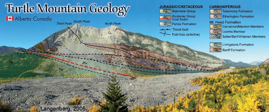
The Turtle Mountain Anticline is a modified fault-propagation fold, formed by folding and thrusting, which resulted in an east-verging anticline with an overturned forelimb of competent Paleozoic carbonates, with softer Mesozoic shales, sandstone, and coal below and in front of it. Subsequent uplift and differential erosion created a very steep slope which eventually collapsed in April 1903. The resulting rock slide destroyed the southern edge of the town of Frank; hence its name: “The Frank Slide.” Many combinations of factors have been proposed as a possible trigger for the Frank Slide: slope angles with respect to bedding and/or joint surfaces, the weather, footwall erosion, earthquakes, and coal mining.
The main destination will be a short but steep hike halfway up to “North Peak” to a splay of the Turtle Mountain Thrust. Participants will have to be in good physical condition and willing to get wet feet (river crossing involved – bring old sneakers and dry socks!). Furthermore we will visit a reference section of the Mount Head formation and the Frank Slide boulder field, which contains Mississippian carbonates with layer-parallel chert bands, offset by centimeter-scale ‘normal faults’ (see photo above).
The group will leave Calgary on the evening of Friday September 25, and overnight in Blairmore (~210km drive). We will have a full day in the field on Saturday September 26, and return to Calgary that evening. Participants only have to cover their own food (breakfast / lunch) and the hotel cost on Friday night. The group will be limited to 25 CSPG members. If you would like to participate in this field trip, please e-mail Jean Chatellier at JChatellier@talismanenergy.com.
| by Ashton Embry
In previous articles in this series, I have described the various types of sequence stratigraphic surfaces that have been recognized, as well as the different types of sequence stratigraphic units that have been defined on the basis of those surfaces. However, it must be emphasized that the primary contribution of sequence stratigraphy to petroleum geology is that it provides an excellent methodology for correlating strata and this topic is addressed herein.
Stratigraphic correlation is accomplished by matching distinct stratigraphic surfaces or horizons recognized in a stratigraphic succession at one locality to their equivalent counterparts in a succession at another locality. This allows the extension of recognized stratigraphic units and surfaces into new geographic areas and potentially to areas around the world.
One of the main goals of correlation is to establish an approximate time-stratigraphic correlation framework so as to allow facies relationships to be determined and predictions of facies occurrences to be made. Interpretations of depositional history and paleogeographic evolution also depend upon such a framework built by the
correlation of stratigraphic surfaces that have a low diachroneity or are time barriers. Low diachroneity surfaces are often delineated in biostratigraphy, magnetostratigraphy, and chemostratigraphy but such methods are often not available for subsurface studies. Furthermore they can be very costly and time consuming.
Sequence stratigraphy is very useful for constructing an approximate time-stratigraphic framework because, as previously described, a number of the surfaces of sequence stratigraphy are either time barriers or have low diachroneity. Most importantly, sequence stratigraphy is readily applicable to subsurface studies and can be done with seismic, well log, and / or core databases. In this article, the use of sequence stratigraphy for correlation is discussed and a number of examples of correlations using sequence stratigraphy with well logs are provided.
As discussed in previous articles, sequence stratigraphic surfaces are those that represent breaks in the stratigraphic record or changes in depositional trend. Six, materialbased surfaces have been defined and their
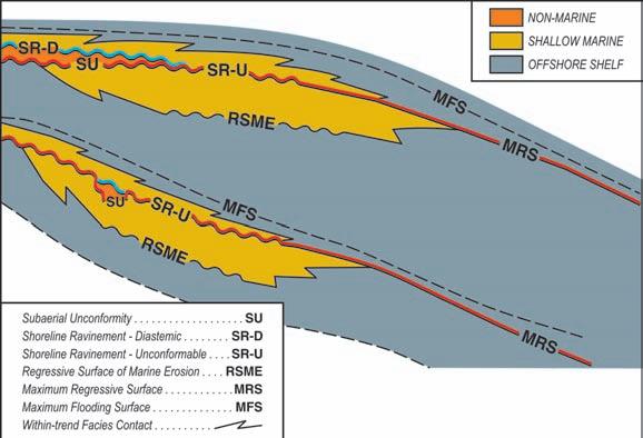
Figure 1. Sequence stratigraphic model for a siliciclastic ramp setting (Embry, 2008d). Note that the SR-U, MRS, and MFS all occur in shallow marine strata and these surfaces are excellent for correlation in such strata. Towards the basin margin, nonmarine strata become intercalated with the shallow marine strata and an SU and SR-D can also be delineated and correlated.
relationships to time were discussed in Embry 2008a, b, and c. The material-based surfaces of sequence stratigraphy that are either time barriers or have low diachroneity, and are thus useful for establishing a correlation framework, are:
• Subaerial unconformity (SU) (time barrier)
• Unconformable shoreline ravinement (SR-U) (time barrier)
• Slope onlap surface (SOS) (time barrier)
• Maximum regressive surface (MRS) (low diachroneity)
• Maximum flooding surface (MFS) (low diachroneity)
The material-based surfaces of sequence stratigraphy that are not useful for constructing an approximate time correlation framework are those that are very diachronous. These are the regressive surface of marine erosion (RSME) and the diastemic portion of a shoreline ravinement (SR-D) (Embry, 2008a, b). However, it is useful to correlate such surfaces as part of the delineation of facies distributions within the correlation framework.
As discussed in Embry (2009), two, timebased surfaces have also been defined as part of sequence stratigraphy although a reasonable argument can be made that such surfaces are much better assigned to chronostratigraphy rather than sequence stratigraphy. These time-based surfaces are the basal surface of forced regression (BSFR), which equals the time surface at the start of regional base level fall, and the correlative conformity (CC), which represents the time surface at the start of regional base level rise. Like all time-based surfaces, these surfaces have no defining physical characteristics and thus their use for correlation is very limited. This assessment is supported by the lack of any publications that have used such surfaces for correlation of well log sections.
The sequence stratigraphic model for siliciclastics in a ramp setting (Embry, 2008d) is illustrated in Figure 1 and shows the three surfaces of sequence stratigraphy that are useful for the correlation of shallow marine strata. These are the unconformable shoreline ravinement, the maximum regressive surface, and the maximum flooding surface. As shown
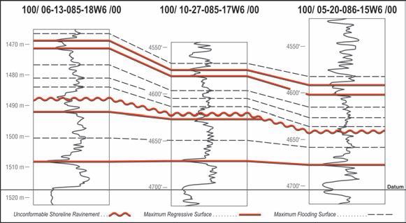
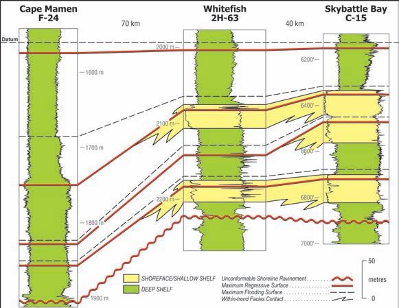
Figure 2. Stratigraphic cross-section of lower portion of Charlie Lake Formation, northwest, Alberta. The datum is the base of the Charlie Lake, a lithostratigraphic surface. Maximum regressive surfaces, maximum flooding surfaces, and one unconformable shoreline ravinement have been correlated. The SR-U truncates strata eastwards and very minor onlap occurs above it. Data courtesy of J. Dixon.
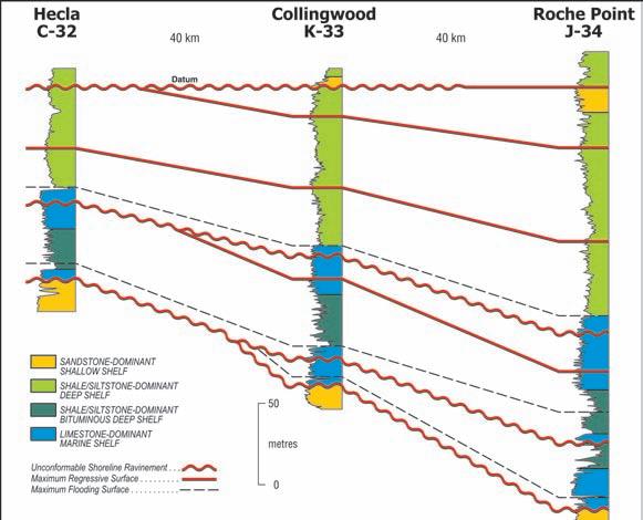
Figure 3. Stratigraphic cross-section of Upper Triassic (Carnian) strata on the southwest flank of the Sverdrup Basin, Melville Island, Arctic Canada. Only large-magnitude sequence stratigraphic surfaces have been correlated and a prominent SR-U that caps the Carnian succession is used as the datum. An SR-U forms the base of the succession and two SR-Us occur within. MRSs and MFSs are truncated by the SR-Us and the lowermost Carnian sequence is absent in the well on the basin edge (Hecla-C-32).
on the model (Figure 1), the maximum flooding surface is often very widespread and it is usually the easiest surface to recognize and correlate. As discussed in Embry (2008c), the MFS represents the change from a finingupward trend to a coarsening-upward one, and on gamma logs is best placed at the highest gamma horizon unless higher resolution data (e.g., core) support a different placement.
Between every two MFSs in shallow marine strata, there will be either an MRS or an SR-
U. The maximum regressive surface marks the change from a coarsening-upward trend to a fining-upward one and on gamma logs it is best placed at the lowest gamma horizon (Embry, 2008b) unless, once again, more detailed data indicate a different placement. As seen on Figure 1, the MRS correlates laterally to an unconformable shoreline ravinement (SR-U) and, in combination, these two surfaces allow the delineation of a widespread correlative horizon. On gamma logs, an SR-U is often marked by an abrupt contact, overlain by a
fining-upward (increasing gamma) succession (Figure 8 in Embry 2008b). Confirmation of the existence of an SR-U requires the demonstration of truncated strata below it.
Figure 2 is a three-well, gamma-ray crosssection of the lower Charlie Lake Formation (Upper Triassic) in northwestern Alberta and the data were kindly supplied by my colleague, Jim Dixon. The Charlie Lake Formation consists mainly of interbedded shale, siltstone, and sandstone with less common limestone and anhydrite. The depositional setting was a shallow, restricted seaway and individual units can be correlated over large areas (J. Dixon, pers. comm., 2007).
The datum for this cross-section is a lithostratigraphic one, the base of the Charlie Lake Formation, which is marked by a unit of anhydrite overlying a sandstone unit at the top of the Halfway Formation. A lithostratigraphic contact is usually not the best choice for a datum because of the potential high diachroneity of such a surface but it is certainly objective. In this case, this contact appears to have low diachroneity as demonstrated by its near parallelism with an easily correlatable MRS about 10 m above. I have correlated this cross-section mainly with MRSs and MFSs delineated on the basis of gamma ray signature.
In most cases, where control is very close and a cross-section is not long, the MFSs and MRSs will parallel each other because differences in subsidence rates tend to be very small over short distances. The presence of an unconformity is suspected when two different sets of parallel MRSs and MFSs are present and are at any angle to each other. On this basis, I have interpreted the occurrence of an unconformable shoreline ravinement (SR-U) beneath a sharp-based, fining-upward, limestone unit (informally called the “A marker”) (Figure 2). This interpretation is supported by the truncation of an MRS and the progressive eastward thinning of the section between the “A marker” and the first correlatable MRS above the datum. All the correlated surfaces above the SR-U nearly parallel it and minor, eastward onlap is expressed as a slight thinning of the section between the SR-U and the overlying MFS.
Figure 3 illustrates a stratigraphic cross-section of Upper Triassic, shallow marine strata on the southern flank of the Sverdrup Basin in the Melville Island area of Arctic Canada. In this case, the wells are much farther apart than the previous example and more section is present (300 m versus 50 m). Because of this, only large-magnitude surfaces have been correlated, although there are opportunities (Continued on page 16...)
for correlating smaller-scale surfaces. The datum is a prominent unconformable shoreline ravinement (SR-U) near the top of the succession and it passes basinward into a readily recognizable MRS that separates two distinctly different depositional regimes (2nd order boundary). Because this surface was essentially horizontal when it was formed (shoreface erosion at sea level), it makes a very good datum.
Once again, MRSs and MFSs are correlated on the basis of gamma ray signature and sample descriptions. Unconformable shoreline ravinements are delineated where truncation can be demonstrated. Some minor depositional thickening for individual units is visible downdip, but notably, most changes in thickness are due to the effects of marginward truncation beneath the unconformities. This indicates that the unconformities were generated by tectonic movements rather than by eustasy. This topic will be more fully explored in the next article.
Figure 4 also illustrates shallow marine strata in a ramp setting (Lower Jurassic, western Sverdrup Basin) and in this case, there is a large distance between the control points and the line of section is close to the direction of depositional dip. In sections parallel to depositional strike or those which extend only a short distance down dip (e.g., Figures 2, 3), depositional dip has little to no effect on stratal geometry of the larger magnitude surfaces. However, in this case, depositional dip is a significant factor in the geometry of the correlated surfaces.
The succession portrayed in Figure 4 is conformable with the only unconformity present being an SR-U at the base of the succession. A prominent maximum flooding surface (3rd order) is used as a datum for lack of a better one. It must be kept in mind that this MFS datum was not a horizontal horizon at the time of formation but sloped basinward, approximating the sea floor dip. Using an originally sloping surface as a horizontal datum will distort original stratal geometries somewhat.
The larger-magnitude MRSs and MFSs are correlated on Figure 4 and any smaller-scale correlation is precluded by the large distances between control points. The correlatable surfaces approximate the dipping sea floor at the time of their formation and thus diverge from the datum because of the greater water depths to the west. The sandstones that underlie the MRSs in the east change facies to shale and siltstone basinward as water depth increased. The first MFS below the datum is well characterized on the
the southwestern
Basin. The datum is a prominent MRS near the top of the Lower Jurassic (late Toarcian). The cross-section is dip oriented and extends for over 100 km. Large-magnitude MRSs and MFSs have been correlated and they all dip basinward, approximating the original sea floor dip. Sandstone units found in the eastern two wells “shale-out” basinward beneath the MRSs.
sonic log by a very slow travel time (high clay content). This surface can be readily recognized throughout the basin and marks the height of a major transgression in the early Toarcian (a global event).
In summary, maximum flooding surfaces, maximum regressive surfaces and unconformable shoreline ravinement surfaces are ideal surfaces for correlation in shallow marine strata. Various orders of these surfaces are usually present and the loworder, high-magnitude surfaces are the easiest to correlate. High-order, low-magnitude surfaces can be correlated if reasonably close control is available.
CORRELATING INTERBEDDED
NONMARINE AND SHALLOw M ARINE STRATA
As shown of Figure 1, when nonmarine strata are intercalated with shallow marine strata on the basin margins, the potential for the recognition of subaerial unconformities (SU) and diastemic shoreline ravinements (SR-D) exists. The reason for this is that the occurrence of nonmarine strata either directly above (SU) or directly below (SR-D) is one of the defining characteristics of these surfaces. If nonmarine strata are not present in a succession, then SUs and SR-Ds cannot be delineated.
Figure 5 is a cross-section of an interval of Lower Cretaceous, interbedded marine and
non-marine strata of the lower portion of the Isachsen Formation on Eglinton Island, Arctic Canada (Sverdrup Basin). Prominent subaerial unconformities are delineated beneath very coarse-grained, fluvial channel deposits and the basal one is used as the datum. This SU overlies offshore marine strata and is a major 1st order boundary in the basin. The SU’s allow the lower Isachsen Formation to be subdivided into two depositional sequences (Figure 5).
MFSs can be delineated and correlated in the marine interval of each sequence and these surfaces subdivide each sequence into a lower transgressive systems tract (TST) and an upper regressive systems tract (RST). The contact between nonmarine strata below and marine strata above occurs within the TST of each sequence and is a diastemic shoreline ravinement. The highly diachronous nature of such a SR-D is well illustrated by the upper one which climbs stratigraphically upward (i.e., becomes younger) towards the more marginal well on the left (Figure 5). Note that the correlated MFSs essentially parallel the datum and each other (i.e., very low diachroneity) and no depositional dip is discernable for the MFSs on this short section.
Figure 6 illustrates the correlatable surfaces associated with an incised valley deposit that can be considered as a plum of nonmarine strata in a pudding of shallow marine
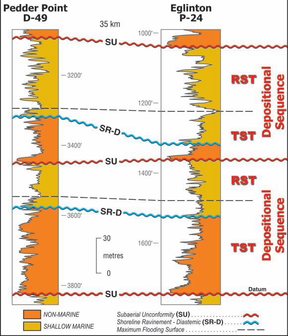
Figure 5. Stratigraphic cross-section of Lower Cretaceous strata (lower Isachsen Fm) from the southwestern flank of the Sverdrup Basin, Eglinton Island, Arctic Canada. The succession consists of intercalated nonmarine and shallow marine strata. A 1st order SU at the base of the succession is used as the datum. The delineation of two other SUs allows two depositional sequences to be defined. The correlation of an MFS within the marine strata of each sequence allows each sequence to be subdivided into a transgressive systems tract (TST) and a regressive systems tract (RST). A diastemic shoreline ravinement (SR-D) occurs within each TST at the boundary between the nonmarine strata and overlying marine strata. Because of the highly diachronous nature of the SR-Ds (climbs stratigraphically), such surfaces are not used as part of the time correlation framework or as a system tract boundary.
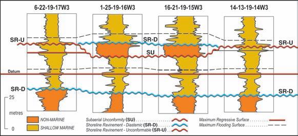
deposits. The cross-section consists of four, reasonably close wells in southern Saskatchewan and includes the transition from the nonmarine Mannville Group at the base to the deep shelf, marine shales of the Lower Colorado Group at the top (logs and facies interpretation from O. Catuneanu). These strata are mainly shallow marine sandstone, siltstone, and shale but an interval of fluvial sandstone occurs in two wells. A prominent MRS has been chosen as the datum and it is overlain by an easily picked MFS. The surface at the top of the nonmarine Mannville strata is a diastemic shoreline ravinement (contact of marine strata overlying nonmarine strata).
The presence of the isolated pod of nonmarine sandstone complicates an otherwise standard correlation of MRSs and MRSs. A subaerial unconformity (SU) must be placed at base of the nonmarine strata to explain their isolated occurrence. A diastemic shoreline ravinement (SR-D) once again occurs at the contact between the fluvial strata and the overlying marine strata. Because a shoreline ravinement is usually not an isolated surface, it is reasonable, if not mandatory, to extend the SR that occurs on top of the fluvial strata into the adjacent marine strata. The SR in the marine strata would be a significant unconformity (SR-U) (SU eroded) as opposed to being a minor diastem as it is when it overlies the fluvial strata. Its placement in the marine strata is guided by the constraints that it should be at approximately the same stratigraphic level as the SR-D (SR is close to a horizontal surface) and it should occur at the base of a fining-upward succession.
As shown on Figure 6, the SR-U in the marine strata might have otherwise been interpreted as an MRS if the control points with the fluvial strata and the accompanying SR-D were not available. Conversely, if an SR-U is interpreted to occur in a section of shallow marine strata (e.g., Figures 2, 3, and 4), then the occurrence of incised valley, nonmarine deposits, which stratigraphically hang down from the SR, is a potential exploration target for that area. Finally, it is worth noting that the stratigraphic interval between the SR and the overlying MFS is thicker and sandier where it overlies the incised valley strata where supply was greater.
Correlation with sequence stratigraphy in successions of fluvial strata that have no marine intercalations can be difficult. The only sequence stratigraphic surface that is common is the subaerial unconformity that occurs at the base of channel deposits
Figure 6. Stratigraphic cross-section of Lower Cretaceous strata from southern Saskatchewan. The nonmarine strata of the Mannville Group are overlain by a succession of shallow marine strata that overall deepenupward to offshore shale and siltstone of the Lower Colorado Group. A prominent MRS is used as the datum. Fluvial strata occur in two wells and an SU is delineated below these strata with an SR-D above. The shoreline ravinement is correlated into the adjacent marine strata as an SR-U. The SU is cut off by the SR-U, forming the flanks of an incised valley. Data courtesy of O. Catuneanu. (Continued on page 18...)
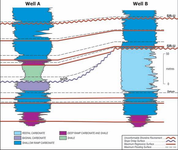
Figure 7. Stratigraphic cross-section of Upper Devonian carbonate strata in the west Pembina area of western Alberta. Carbonate ramp strata, in which MRSs and MFSs are readily correlated, occur below and above a reef / off-reef interval. An unconformable shoreline ravinement (SR-U) caps the reefal strata and correlates with a prominent slope onlap surface (SOS) on the reef flank. Siliciclastic shale and siltstone, deposited during base level fall, onlap the SOS and are overlain by prograding ramp carbonates deposited during the subsequent base level rise. Data courtesy of J. Wendte.
(...Continued from page 17)
or at the top of paleosols. It is difficult to correlate such subaerial unconformities with confidence and it is often even harder to establish a hierarchy of surfaces. It is also important to distinguish between subaerial unconformities that are regional truncation surfaces and subaerial diastems (channel scours) that are the product of river migration during rising base level.
A subaerial unconformity at the base of an incised valley represents a regional base level fall and is likely a large-scale sequence boundary. It must correlate with a soil horizon in the interfluve areas although it is usually very difficult to establish such a correlation without excellent control. A good example of such work is McCarthy and Plint (1998) who correlated subaerial unconformities in a well exposed succession of channel deposits and overbank strata with soil horizons. Their work demonstrates the need for very close control for such correlations.
It is important to try to recognize and correlate the large-scale subaerial unconformities that may be present. These are sometimes associated with a significant change in grain composition and / or clast size. Other stratigraphic data such as chemostratigraphic and magnetostratigra-
phic data can be integrated to help identify SUs. Zaitlin et al. (2002) and Ratcliffe et al. (2004) provide a solid example of identifying regional SUs in a fluvial succession through the use of changes in mineralogical and chemical composition.
Maximum flooding surfaces can sometimes be tentatively determined in fluvial strata and may be represented by a horizon that exhibits a marine influence (e.g., brackish water facies). In absence of any indication of a marine influence, an MFS in fluvial strata can be delineated with reasonable objectivity within the interval with the highest ratio of overbank fines to channel sandstone (i.e., the change from fining-upward to coarsening-upward). This interval also tends to be associated with the thickest and most common coal seams. Overall, widespread MFSs do not appear to be common in fluvial strata and this is supported by the general lack of regionally correlatable seismic reflectors in such strata.
In summary, SUs are the main sequence stratigraphic surfaces available for correlation in fluvial strata. However, it is usually very difficult to delineate and correlate such surfaces and close control and data from other stratigraphic disciplines are often required.
Sequence analysis in deep-water siliciclastics also presents substantial challenges. The sequence stratigraphic surfaces that can be expected in this environment are the slope onlap surface (SOS), maximum regressive surface (MRS), and the maximum flooding surface (MFS). In an interval of stacked submarine fan deposits, an MRS can be drawn on top of the units of coarsening-upward, turbiditic fan deposits (e.g., Johannessen and Steel, 2005; Hodgson et al., 2006). Such a horizon may occur near the top or well within the package of turbidites.
In the same succession, the MFS can be drawn at the horizon of the finest sediment, usually within a shale unit that separates thick intervals of turbidites (Sixsmith et al., 2004). Identification of an SOS in siliciclastics is difficult and is best done on seismic sections where the stratal geometry inside the thick, shale-dominant slope succession can be determined. Some workers have interpreted the base of the first turbidite as a correlatable sequence stratigraphic surface (e.g., Posamentier et al., 1988; Van Wagoner et al., 1990). However, in many cases such a surface is simply a scoured, within-trend facies contact (a diastem within a coarsening upward, regressive succession) and is not a surface of sequence stratigraphy. In general, the base of a turbidite package is very gradational and is diachronous both down dip and laterally (Hodgson et al., 2006). In some instances, where turbidites onlap the slope, the base of the turbidite succession, where it onlaps, coincides with an SOS.
CORRELATING C ARBONATE STRATA
Sequence analysis for carbonate strata is in many respects very similar as that for siliciclastic strata although some differences do occur. These differences are due mainly to differences in how carbonate sedimentation responds to base level change as compared to siliciclastic sedimentation. For example, during times of falling base level, rates of siliciclastic sedimentation in marine areas are often enhanced due to increased delivery of sediment to a basin. However, carbonate sedimentation in a shelf / slope / basin setting, often significantly decreases with base level fall because much of the carbonate shelf (the carbonate sediment factory) is exposed. However, the same types of surfaces of sequence stratigraphy that are recognized in siliciclastic strata occur in carbonate strata. They can have a few different attributes in carbonates than they do in siliciclastics. Notably the SOS is often very well expressed and can be readily delineated when present.
For shallow marine carbonates, these include
a maximum regressive surface, maximum flooding surface, shoreline ravinement, and regressive surface of marine erosion. Subaerial unconformities form during times of base level fall but most become modified by subsequent marine erosion and are thus unconformable shoreline ravinements.
The determination of MRSs and MFSs depends on facies analysis and the determination of sediment supply trends in the carbonate strata. These are often not as clearly expressed on mechanical logs as they are in siliciclastic rocks. They can often be more easily delineated on logs when fine-grained clastic sediment is part of the depositional system (see Wendte and Uyeno, 2005). For reefs and carbonate banks, one or more SOSs are almost always present on the slopes.
Figure 7 illustrates a sequence correlation for a carbonate-dominant succession that contains carbonate ramp deposits that lie both below (Nisku Fm) and above (Wolf Lake, Blue Ridge mbrs) an interval of reef (Zeta Lake Mbr) and off-reef strata (Cynthia Mbr). These data were supplied by Jack Wendte and are from the West Pembina area of Alberta (see Wendte et al., 1995).
MRSs and MFSs are readily correlated in the carbonate ramp deposits below the reef (Figure 7). A slope onlap surface has been delineated on the flank of the reef and is marked by a high gamma (starved interval) in the off-reef well. The SOS joins with an SR-U on top of the reef and both these surfaces formed when base level fell such that most of the reef was exposed (SR-U) and the slope was starved of sediment (SOS). During the later stage of base level fall, argillaceous siliciclastic sediment prograded into the area and onlapped the SOS (Figure 7).
With base level rise and transgression, carbonate sediment production greatly increased and siliciclastic sediment input ceased. Carbonate ramps then built out over the siliciclastics which had filled in the deep, inter-reef areas. MRSs and MFSs are readily correlated in these post-reef ramp strata. This example shows how the delineation and correlation of sequences stratigraphic surfaces helps to elucidate the depositional history of a succession.
Sequence stratigraphy provides an excellent methodology for constructing an approximate time-stratigraphic framework through the delineation and correlation of sequence stratigraphic surfaces which have low diachroneity (maximum regressive surface, maximum flooding surface) or are time barriers (subaerial unconformity, unconformable
shoreline ravinement, slope onlap surface). Such a framework is essential for predicting facies development away from control points and for reconstructing depositional history and paleogeographic evolution.
Each general depositional environment has at least one type of sequence stratigraphic unit that is useful for correlation. In successions with intercalated nonmarine and shallow marine, siliciclastic strata, four surface types are often present (SU, SR-U, MRS, MFS). In deep marine, siliciclastic settings, correlatable surfaces include MRS, MFS, and SOS, with the SOS often being hard to delineate.
In carbonate strata, subaerial unconformities (SU) are very rare and unconformity surfaces on the basin flanks are almost always unconformable shoreline ravinements (SRU). Slope onlap surfaces are common in carbonate platform / slope / basin and reef settings and are usually readily delineated and correlated.
Correlation from basin edge to basin centre is best accomplished with maximum flooding surfaces. A combined maximum regressive surface and unconformable shoreline ravinement is also useful for such regional correlations.
R EFERENCES
Embry, A. F. 2008a. Practical Sequence Stratigraphy IV: The Material-based Surfaces of Sequence Stratigraphy, Part 1: Subaerial Unconformity and Regressive Surface of Marine Erosion. Canadian Society of Petroleum Geologists. The Reservoir, v. 35, issue 8, p. 37-41.
Embry, A. F. 2008b. Practical Sequence Stratigraphy V: The Material-based Surfaces of Sequence Stratigraphy, Part 2: Shoreline ravinement and Maximum Regressive Surface. Canadian Society of Petroleum Geologists. The Reservoir, v. 35, issue 9, p. 32-39.
Embry, A. F. 2008c. Practical Sequence Stratigraphy VI: The Material-based Surfaces of Sequence Stratigraphy, Part 3: Maximum Flooding Surface and Slope Onlap Surface. Canadian Society of Petroleum Geologists. The Reservoir, v. 35, issue 10, p. 36-41.
Embry, A. F. 2008d. Practical Sequence Stratigraphy VII: The base level change model for material-based sequence stratigraphic surfaces. Canadian Society of Petroleum Geologists. The Reservoir, v. 35, issue 11, p. 31-37.
Embry, A. F. 2009. Practical Sequence Stratigraphy VIII: The Time-based Surfaces of Sequence Stratigraphy. Canadian Society of Petroleum Geologists. The Reservoir, v. 36, issue 1, p. 27-33.
Hodgson, D., Flint, S., Hodgetts, D., Drinkwater, N., Johannessen, E., and Luthi, S. 2006. Stratigraphic Evolution of Fine-Grained Submarine Fan Systems, Tanqua Depocenter, Karoo Basin, South Africa. Journal of Sedimentary Research, v. 76, p. 20-40.
Johannessen, E. J. and Steel, R. J. 2005. Shelfmargin clinoforms and prediction of deep water sands. Basin Research, v. 17, p. 521-550.
McCarthy, P. J. and Plint, A. G. 1998. Recognition of interfluve sequence boundaries: integrating paleopedology and sequence stratigraphy. Geology, v. 26, p. 387-390.
Posamentier, H., Jervey, M., and Vail, P. 1988. Eustatic controls on clastic deposition I-conceptual framework, In: Sea level changes: an integrated approach. C. Wilgus, B. S. Hastings, C. G. Kendall, H. W. Posamentier, C. A. Ross, and J. C. Van Wagoner (eds.). Society of Economic Paleontologists and Mineralogists, Special Publication 42, p. 109-124.
Ratcliffe, K., Wright, A., Hallsworth, C., Morton, A., Zaitlin, B., Potocki, D., and Wray, D. 2004. An example of alternative correlation techniques in a low accommodation setting, nonmarine hydrocarbon setting: the (Lower Cretaceous) Mannville Basal Quartz succession of southern Alberta. AAPG Bulletin, v. 88, p. 1419-1432.
Sixsmith, P., Flint, S., Wickens, H., and Johnson, S. 2004. Anatomy and stratigraphic development of a basin floor turbidite system in the Lainsburg Formation, Main Karoo Basin, South Africa Journal Sedimentary Research, v. 74, p. 239-254.
Van Wagoner, J. C., Mitchum, R. M., Campion, K. M., and Rahmanian, V. D. 1990. Siliciclastic sequence stratigraphy in well logs, cores and outcrops: AAPG Methods in Exploration, no. 7, 55 p.
Wendte, J., Bosman, M., Stoakes, F., and Bernstein, L. 1995. Genetic and stratigraphic significance of the Upper Devonian Frasnian Z marker, west-central Alberta. Bulletin Canadian Petroleum Geology, v. 43, p. 393-406.
Wendte, J. and Uyeno, T. 2005. Sequence stratigraphy and evolution of Middle to Upper Devonian Beaverhill Lake strata, south-central Alberta. Bulletin Canadian Petroleum Geology, v. 53, p. 250-354.
Zaitlin, B. A., Warren, M. J., Potocki, D., Rosenthal, L., and Boyd, R. 2002. Depositional styles in a low accommodation foreland basin setting: an example from the Basal Quartz (Lower Cretaceous), south-central Alberta. Bulletin Canadian Petroleum Geology, v. 50, p. 31-72.
Tel: 403.294.6414
Fax: 403.264.7705
cecil.keeping@sigmaex.com www.canstrat.com
26 Years of exploration, development, acquisition and divestiture expertise and knowledge in the Canadian oil and gas business.
Call (403) 510-4461 or Email rmusial@telus.net


| by Neil Hutton
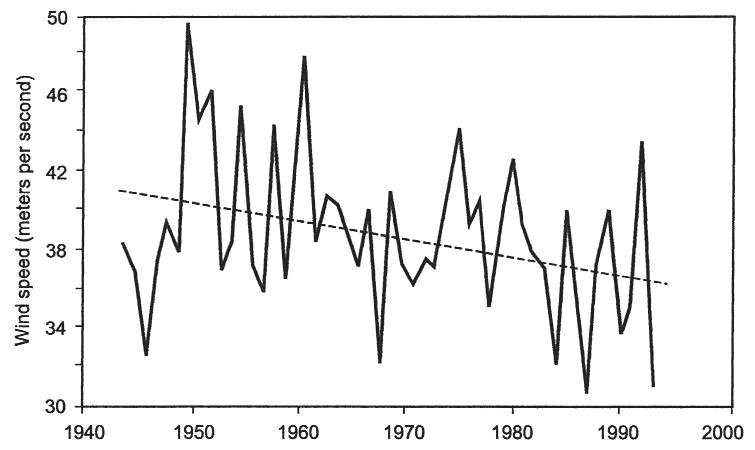
Figure 1. Mean Annual Wind Speed in Atlantic Hurricanes. Contrary to the alarmist claims, the maximum wind velocity for hurricanes between 1940-1993 has decreased by five km/hour (approximately 12%). The dotted line shows the best fit linear trend. Source: C.W. Landsea, et al. 1996.
It was not possible to correct the totality of misinformation on Climate Change in one article so – in reality – this is a continuation of “Fearmongering” in which I endeavor to cover the most outstanding issues. The Spin Cycle I refer to is not related to laundry but to the wildly exaggerated claims that global warming is responsible for an increase in cyclonic storms –that is to say, hurricanes, tornadoes, typhoons, and other tropical cyclones as well as other extreme weather events.
Here are the facts: in none of the IPCC assessments was it ever claimed that global warming would result in the development of more violent cyclonic storms. On the contrary, the reports indicated that no global warming signal could be detected in the hurricane record. Dr. Christopher Landsea, a contributing author for IPCC, and an expert on cyclonic activity has stated clearly that, “If global warming is influencing hurricane activity, than we should be seeing a global change in the number and strength of the storms. Yet, there is no evidence of a global increase in the strength and frequency of hurricanes, typhoons, and tropical cyclones over the past several years.” In Figure 1, the measured wind strength for hurricanes is shown from 1940-2000; in the Atlantic Basin, the trend is clearly downward.
Nevertheless, leading members in IPCC, principally Kevin Trenberth, (head of the Climate Analysis section at the National Climate Research Center and lead author of the 2007 IPCC report) could not resist the opportunity to use the 2004 hurricane
season to engender the dangers of global warming, whether there was any evidence or not. In a press conference, which Landsea had attempted to prevent, Trenbeth argued that, “Human activities are changing the composition of the atmosphere and global warming is happening as a result. Global warming is manifested in many ways, some unexpected… (especially for Dr Landsea). The environment in which hurricanes form is changing. The result was a hurricane off the
coast of Brazil; the first and only hurricane in that region (a highly improbable assumption which could be readily refuted by examination of Portuguese navigators’ logs in the region). Several factors go into forming hurricanes and where they track. But the evidence, (none was ever cited because there are no studies supporting this statement) strongly suggests more intense storms and risk of greater flooding events, so that the North Atlantic hurricane season of 2004 may be a harbinger of the future.” (E-mail: Landsea to Trenberth, from Solomon, 2008, p. 38)
The press went wild with this story and it echoed round the world. Trenbeth was looking good after Katrina in 2005 but in subsequent seasons hurricane frequency and violence have continued to decline (Figure 2). Landsea was sufficiently incensed that he wrote to IPCC officials asking, “Where is the science, the refereed publications that substantiate these pronouncements? What studies are being alluded to that have shown a connection between observed warming trends on the Earth and long term trends in tropical cyclone activity?” The IPCC officials ignored Landsea’s questions and even defended Trenbeth. As a result, Landsea resigned as a contributing author to the IPCC 2007 Fourth Assessment. Here is a prime example of the political nature of IPCC and their lack of scientific integrity. (http://chge.med.harvard. edu/media/releases/hurricanepress.html)
(Continued on page 22...)
Figure 2. The diagram presents the annual number of hurricanes making landfall in the United States from 19002008. It is clear that hurricane activity was much higher prior to the 1950s than it has been subsequently. This is a pattern that also appears in measures of storminess, hail, and thunderstorms and is exactly the opposite of what has been claimed by the global warming activists. Furthermore, it is apparent that storms are largely a function of the periodicity of major oceanic oscillations, not changes in atmospheric temperature.

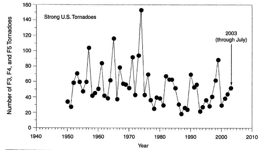
3. The diagram demonstrates the annual increase in observed tornadoes in the continental United States. There is a very clear increase from 1950-2000 but the increase is actually related to improved ability to identify a tornado’s signature with Doppler radar. The early warning provided has saved many lives. Figure 4 shows that severe tornadoes have actually decreased.
(...Continued from page 21)
Hurricane Katrina was too good an opportunity to miss, and so, Kerry Emmanuel of MIT argued that global warming is producing more powerful and more destructive hurricanes. The press had another field day. In the meantime Landsea (2005) published evidence that hurricane activity demonstrates natural swings from highs to lows over periodicities of 25 to 40 years. The evidence is records which extend back for 150 years, beyond the decades where global warming can be implicated. Much has been made of rising sea surface temperature as a causative factor but this was thoroughly debunked by Klotzbach (2006) who concluded that sea surface temperature change correlated only marginally with hurricane formation in the Atlantic Basin.
The most telling evidence against rising sea surface temperature as a cause for increasing frequency and intensity of hurricanes, comes from records of the British Navy, which because of commercial interests in the Caribbean, kept careful records of the
storms. These records indicate that during the Little Ice Age the region had nearly three times as many major hurricanes than in the warming decades from 1950 to 1998. Contrary to the warming theory, it is contrasts in temperature and pressure which produce the most violent storms. The bigger the temperature differences between the equator and the poles, the more power is provided to the winds, waves, currents, and to the cyclones. As indicated by Figure 1, warming is actually reducing the wind speed of hurricanes.
The story on tornadoes is similar. It is claimed that they are increasing in frequency and strength, but the reality is quite different. Certainly, many more tornadoes are observed because of the introduction of Doppler radar, which has excellent ability to capture the signal of a tornado (Figure 3). Radar is the backbone of early warning systems that have been instrumental in reducing deaths – the expectation would be that deaths should have increased as a
result of population increase and increased urbanization in tornado-prone areas.
Although the recorded tornadoes have increased significantly, it is very clear in Figure 4 that, as far as the major category storms, (F3, F4, and F5 on the Fujita scale – a scale based on the damage caused to manmade structures), there is no evidence of an increase in major tornadoes. As is the case with hurricanes, the assumption that warming will cause more tornadoes is false. The midwest United States is tornado-prone because there is essentially no topographic separation between the tropical Gulf of Mexico and the cold of the Arctic. If warming resulted in tornadoes, the summer months June, July, and August would be the tornado season. This is not the case as the season peaks in May when the jet stream shifts north for the summer. Interaction of strong easterly flow of cool air from the jet stream interacts with the warmed air in thunderstorms. The resulting rotation triggers the twisters. Like hurricanes, larger temperature contrasts cause more violent storms. Therefore, warming should cause the jet stream to remain in northern latitudes longer, reducing the number of violent tornadoes.
Finally on cyclonic storms, what about Asian typhoons? Certainly the perception has been created that typhoons will increase with global warming but significant recent studies show otherwise. Wang et al. (2008) report that of 1,845 typhoons occurring in the northwestern Pacific region between 1951 and 2004 there has been a steady decline of approximately 1 typhoon every decade, but the greatest decline has occurred in the last ten years! The largest drop is recorded in the super typhoons (equivalent to categories F4 or F5 hurricanes).
Wang and his colleagues demonstrate that there is a link between typhoons and sea surface temperature (SST), but not as a result of global warming. Rather, fluctuations in SST caused by the Pacific Decadal Oscillation (PDO) and the El Nino Southern Oscillation (ENSO) affect the number of typhoons generated. When ENSO is in the cold phase with La Nina years, there will be more typhoons; when ENSO is in the warm phase in El Nino years there are fewer typhoons. Here note that, as we found with hurricanes, the cold phase induces more frequent and more violent tropical storms, completely contrary to global warming theory. Chan (2000) has also shown that tropical cyclone activities – in frequency, intensity, and track – are unrelated to global warming. Furthermore with Wang, he attributes the patterns of typhoon activity to decadal and multi-decadal oscillations and variations in ocean temperature. In Figure 5, the number of tropical cyclones making landfall in Japan is shown with no trend linked to warming, but with very strong activity in 2004, paralleling
the very active hurricane season in the Atlantic Basin (see Figure 2).
According to the IPCC in 1996, “Most climate models produce more rainfall over South Asia in a warmer climate with increased CO2 .” In its 2001 report, the IPCC said, “It is likely that the warming associated with increasing greenhouse gas concentrations will cause an increase in Asian summer monsoon variability and changes in monsoon strength. Again we are dealing with models and not reality. Kripalani et al. (2003) studied the variability of India’s monsoons as the earth has warmed since the Little Ice Age and found that the IPCC models were wrong. As in many other climate systems there is a distinct oscillation, over a period of 3-10 years, during which rainfall fluctuates between higher than average and lower than average conditions. There is no evidence that this is related to rising temperatures. Moreover during the 1990s –which IPCC claim to be the warmest decade of the millennium – Indian monsoon variability declined sharply. Wang et al. in their 2008 study indicated that the frequency of typhoons is closely linked to the summer monsoons in East Asia, and not related to global warming.
Notwithstanding the well documented errors in the Gore documentary, An Inconvenient Truth, it continues to be aired by CBC. Not only that, it is introduced by a scientifically unwarranted introduction on the website as follows: “Humanity is sitting on a ticking time bomb. If the vast majority of the world’s scientists are right, we have just ten years to avert a major catastrophe that could send the entire planet into a tailspin of epic destruction involving extreme weather, floods, droughts, epidemic and killer heat waves beyond anything we have ever experienced.” This statement is nothing more than climate evangelism threatening climate Armageddon completely unsupported by any scientific study. It is doubtful if any scientist, even those who support human-caused climate change, would agree with this apocalyptical statement. As we will see, there is in fact no published evidence to support such claims. For a start, although there has been little change in the increase in CO2 entering the atmosphere, there has been no warming during the 21st century. What does the peer-reviewed literature really say? The journal, “Natural Hazards” published a special issue on extreme weather events and global warming. None of the published articles indicated increased storminess due to increases in temperature or CO2 .
Balling and Cerveny (2003), writing in the Natural Hazards special issue, observed that the public is three times more likely to see an article on severe weather today than only thirty years ago: this despite the lack of any increase in storminess. One might argue that the media is a greater problem than global warming. As discussed above there has been no increase in hurricanes, tornadoes, typhoons, or tropical cyclones, but what about
Figure 5. The annual frequency of tropical cyclones making landfall in Japan. There is no clear trend associated with warming. In fact the most active typhoon seasons are associated with the La Nina cold phase of the ENSO cycle. Note the very active cycle in 2004, which corresponds with a similar period in the Atlantic basin as shown in Figure 2 (from Chan, 2000).
thunderstorms or other severe weather? Changnon and Changnon (2001), by checking “thunder days” from 300 US weather stations, demonstrated that from 1896 to 1955 thunder days increased but have shown a moderate decrease since that date. In similar fashion these authors found an increase in hailstorms from 1916 until 1955 after which there was a general decline in hail activity. Similarly in Canada, Khandekar, (2002) reports that there has been no increase in extreme weather

events (heat waves, floods, winter blizzards, thunderstorms, hail, or tornadoes) anywhere in Canada. Extreme weather events have been on the decline for the last 40 years. Khandekar noted that the hottest summers were actually during the dust bowl years of the 1920s and 1930s, not in the 1990s. In other words, contrary to the hype, warming has actually produced fewer extreme weather events.
(Continued on page 24...)
Light Up The World (LUTW) would like to express its gratitude to everyone who participated in the Silent Auction at the Frontiers Innovation: 2009 CSPG CSEG CWLS Convention. Your support raised $9,000!
To date, this partnership has raised over $75,000 to help us provide affordable, safe, healthy, efficient and environmentally responsible lighting technologies to people in developing countries.

On behalf of all who benefit from your generosity, our profound thanks. +


Many claims are made that floods and droughts will be more extreme, sometimes simultaneously! This no doubt derives from the rather extraordinary statement of IPCC, Summary for Policymakers, Climate Change, 1995, “Warmer temperature will lead to prospects for more severe droughts and/ or floods in some places and less severe droughts and/or floods in other places.” In effect, any anomalous occurrence in moisture, positive or negative, can be attributed to global warming. Warming in theory should increase rainfall since it will increase the water vapour taken up by the atmosphere. This is supported by the fact that rainfall has increased gradually since the 1980s (Figure 6), but not to the extent to produce any hazards. On the contrary, it has clearly been a benefit in improved hydrological conditions on agricultural lands. There have been significant droughts in Africa and the southwestern United States but here the evidence suggests that the control of precipitation is more directly attributable to the major oceanic cycles such as the Pacific Decadal Oscillation (PDO), and El Nino Southern Oscillation (ENSO). Fouchereau (2003) has shown that African droughts are more sensitive to the ENSO cycles rather than temperature variation. In the years from 1979 to 1988, the four driest years coincided with peaks of the ENSO cycle.
Similarly when we consider available data for the Prairie regions of North America, droughts of varying intensity and duration have occurred for many centuries long before instrument records were available. Tree ring data suggest that some of the worst droughts occurred during the thirteenth and sixteenth centuries. Droughts have occurred throughout the 20th Century with some of the severest droughts occurring during the 1920s and 1930s, the so-called dustbowl years. Recent droughts of the 1980s and 1990s are comparable to those of the dust bowl years. According to Khandekar largescale atmospheric circulation patterns over the central equatorial Pacific as well as over the central and eastern north Pacific, appear to be the main drought-driving forces. The cold La Nina phase of the ENSO cycle over the equatorial Pacific, and its continued presence, appears to be the most important precursor for drought occurrence. The warm El Nino phase of the ENSO cycle is usually associated with surplus precipitation during the grain-growing season. Khandekar concludes that there does not appear to be any linkage between recent droughts and warming of the Earth’s atmosphere.
With droughts come fire and, of course, the usual media claims of a fiery apocalypse driven by global warming (Herbert, 2002 New York Times). By now it should be no surprise that the statistics show otherwise, at least for the United States. Figure 7, shows
Figure 6. Average US average rainfall per decade. There has been a gradual increase of about 10% in precipitation in the 20th century but there is no clear correlation between temperature and precipitation. The increase in precipitation in latter decades results from an increase in light rains not storm events.
Figure 7. The average acreage burned annually in the United States by decade. Contrary to the press, there has been a distinct decline with stability through the last four decades.
that the average acreage burned in the United States has decreased and essentially remained stable for the last forty years. No doubt more sophisticated fire suppression techniques have played a role. On the other hand, it is argued that, fire suppression has been counterproductive, resulting in denser undergrowth and deadfall providing fuel for uncontrollable wild fires. In fact the climateinfluencing droughts and rainfall are more intimately associated with major oceanic cycles such as PDO, ENSO, and the cyclonic oscillations in the Atlantic Basin. The role of warming in itself can not be detected in regional climate variations.
We find no basis for the claims of an increase in extreme weather events, but what of claims, such as those of CBC and others, that warming will result in species extinction, epidemics, and killer heat waves. Suffice to say that the basis for these claims is also based on poor research, lack of historical perspective, and poor analysis and statistical treatment of results. It would be beyond the scope of this article to provide a full treatment of the issues but excellent
coverage is provided in the following texts:
Meltdown, The Predictable Distortion of GLOBAL WARMING by Scientists, Politicians, and the Media. Patrick J. Michaels, 2004, Cato Institute, Washington, DC, p. 73-109, and 179-194.
Unstoppable Global Warming, S. Fred Singer and Denis Avery, 2007, revised 2008, Rowman and Littlefield Publishers, Chapter 9, p. 163-185 and Chapter 12, p. 213-219.
Both of these books are highly recommended for anyone who wishes to filter the hype out of Global Warming, especially that by the Media.
There is no doubt that the IPCC have very skillfully manipulated the platform provided by their UN mandate, with the very able assistance of the media. As each major IPCC Conference rolls around the press releases become more extreme: The Associated Press, March 12, 2009, “Hundreds of Scientists warned today that global warming is accelerating beyond the worst predictions
and threatening to trigger “irreversible” climate shifts on the planet.” There is not one single piece of evidence to justify such claims. None of the IPCC climate scenarios have ever matched the climate data even at the low end. There has been no warming this century; the climate feedbacks assumed in Global Climate Models are incorrect; and satellite microwave measurements of the troposphere have never observed the warming predicted by the IPCC Climate Models. Finally the Sun is in a quiescent mode with 620 sunspotfree days versus an average of 336 days in the recent 20th Century. A minimum of this scale has not been observed since the 19th Century. Indeed, we may experience an “irreversible” climate shift but entirely in the opposite direction from the bold statements of the hundreds of scientists in Copenhagen.
REFERENCES
Balling, R. C., Jr. and Cerveny R. S. 2003. Compilation and Discussion of Trends in Severe Storms in the United States: Popular Perception or Climate Reality? Natural Hazards v. 29, no. 2, p. 103-112.
Chan, J. C. L. 2000. Frequency of Typhoon Landfall in Guangdong Province of China during the period 1470-1931. International Journal of Climatology, v. 20 no. 2, p. 183-190.
Changnon, S. and Changnon, D. 2001. Long-Term Fluctuations in Thunderstorm Activity in the United States. Climatic Change, v. 50, p. 489-583.
Changnon, S. and Changnon D. 2000. Long-Term Fluctuations in Hail Incidences in the United States. Journal of Climate, v. 13, p. 658-664.
Emmanuel, K. 2005. Increasing Destructiveness of Tropical Cyclones over the past 30 Years. Nature, v. 436, p. 686-688.
Fauchereau, N., et al. 2003. Rainfall Variability and Changes in Southern Africa during the 20th Century in the Global Warming Context. Natural Hazards v. 29, p. 139-154.
Herbert, R. 2002. New York Times, June 24th issue.
Khandekar, M. L. 2004. Canadian Prairie Drought, a Climatological Assessment. Alberta Environment, http://www.gov.ab.ca/env/.
Khandekar, M. L. 2002. Comment on (world Meteorological Organization) Statement on Extreme Weather Events. EOS Transactions, American Geophysical Union, v. 84, p. 428.
Klotsbach, P. J. 2006. Trends in global cyclone activity over the past twenty years (1986-2005).
Geophysical Research Letters, v. 33, L010805, doi:10. 1029/2006GL025757.
Kripilani, R.H., et al. Indian Monsoon Variability in a Global Warming Scenario. Natural Hazards v. 29, p. 189-206.
Landsea, C. 2005. Hurricanes and Global Warming. Nature, 438, December.
Landsea, C., et al. 1996. Downward Trends in the Frequency of Intense Atlantic Hurricanes in the Last Five Decades. Geographical Research Letters v. 23, no. 13, p. 1697-1700.
Michaels, Patrick J. 2004. The Predictable Distortion of GLOBAL WARMING by Scientists, Politicians, and the Media. Cato Institute, Washington, DC.
Singer, S. Fred, and Avery, Dennis T. 2007. Unstoppable Global Warming. Rowman and Littlefield Publishers, Lanham, Maryland, revised 2008.
Wang, Y. Li, C. Ren, F., And Wang X. 2008. Study on Climatic Characteristics of China-Influencing Typhoons and the Interrelations between them and their Environmental Factor. Journal of Tropical Meteorology v. 14, no. 1 p. 24-27.


WWW.CSPG.ORG
www.cspg.org/education/education-trips.cfm

Contrasting the Reservoirs of Braided vs. Meandering Depositional Systems
Instructor: Jon Noad
Location: Sandy Point, 100 km North of Medicine Hat, Eastern Alberta
The tight gas-bearing Nikanassin, Cadomin, Gething, and Falher Formations comprise Cretaceous fluvial deposits, with the Nikanassin in particular showing a transition from a meandering to a braided fluvial system. Similar sediments of Campanian (Upper Creataceous) age outcrop around 80 km North of Medicine Hat, along the South Saskatchewan River. Here the underlying Oldman Formation, dominated by braided fluvial deposits, passes up into the overlying Dinosaur Park Formation, which is made up of meandering river deposits. As a bonus the South Saskatchewan River itself provides a modern analogue for braided depositional systems.
Instructor: David Kisilevsky
Location: Turner Valley and Area (Beginning and ending in Calgary)
Maximum Number of Participants: 15
This one-day field trip will beginning in Calgary and will head to Hell’s Half Acre where there will be a discussion of the history of Turner Valley Field, and a brief description of its structure. The field trip will visit a number of locations in the Turner Valley vicinity to observe the foothills/triangle-zone structure, and to observe the stratigraphy of the Alberta Group and Blairmore Group.
Shales and Sandstones of the Upper Cretaceous in the Southern Alberta Foothills
Instructor: Karsten Nielsen
Location: Foothills (approximately two-hour drive from Calgary)
Maximum Number of Participants: TBA
This field trip will establish a sedimentological description of some of the major shale and sandstone intervals of southern Alberta, mainly the Upper Colorado Group and the Milk River Group. The trip will walk some of the classic river outcrops of southern Alberta and discuss the depositional environments and the organic geochemistry of some of the shale intervals. There will be discussions about topics from lithology, facies, and interpretation of the possible paleo-environments and paleogeographies. In addition, key surfaces will be examined and tied to the subsurface of the Alberta Basin.
Instructors: Paul MacKay and Malcolm Lamb
Location: From Calgary, through Black Diamond, Turner Valley, to Hailstone Butte and Beaver Creek
Maximum Number of Participants: TBA
This one-day field trip will focus on the structural style of the southern Canadian Foothills with discussions on the frontal wedge (Triangle Zone), a comparison of deformation in the Paleozoic vs. Mesozoic section, the shape of folds and associated fracture patterns, and seismic imaging.
Instructors: Derald Smith, Peter Putnam, and David Eberth
Location: Dinosaur Provincial Park
Maximum Number of Participants: 30 Price: $300 Date: July 24th, 2009
This one-day field trip will examine outcrop facies and contacts of several different depositional elements of an ancient (76.5-75 ma), low gradient, meandering river system exposed in the Upper Cretaceous Dinosaur Park Formation of Dinosaur Provincial park (Steveville Badlands, northwest sector of the Park) near Brooks, Alberta, 175 Km east of Calgary. The depostional elements to be examined include the following: 1. Sandstone-dominant point bar deposits, 2. Siltstone-dominant counter point bar deposits, 3. IHS siltstone/sandstone point bar deposits ending at a mudstone oxbow lake-fill (similar to lithofacies in the McMurray mine sites), 4. Deformed stratigraphy of IHS deposits, likely caused by Laramide earthquakes during the formation of the Rocky Mountains, and 5. Overbank mudstone and lignite coal deposits capping the stratigraphic unit.
Dates and Prices TBA, for additional information please see: www.cspg.org/education/education-trips.cfm or contact: Debbie Legaspi at Debbie.Legaspi@EnCana.com
Alexei Belonogov at ABelonogov@ajmpc.com
Travis Hobbs at Travis.Hobbs@EnCana.com
| by Will Gardner
The life cycle of a resource play involves coordinating many complex and diverse disciplines – evaluating the reservoir, drilling, completion, reservoir stimulation, and optimizing production. Success hinges on the seamless integration of all of them. Halliburton helps link these events together through a combination of technological advances and time-tested services.
As geology describes the chronological history of our planet, it seems fitting to discuss Halliburton’s Wireline and Perforating services chronologically through the life of a wellbore. We will introduce wireline technologies and services as they connect the significant events in the life of the well from formation evaluation to production assessment, and we will focus on the technologies that have the greatest impact in Canada’s resource plays – especially our unconventional reservoirs.
Unconventional resources need to be matched with unconventional thinking. At Halliburton Wireline and Perforating, we refer to it not as thinking outside the box, but rather “thinking inside the wellbore.”
Wireline services are wellbore interventions whereby a variety of down-hole tools are deployed by a conductive cable to perform essential services. These services often include remediation of wellbore problems, formation evaluation, production assessment, inspection to determine wellbore integrity, and creating conductivity between the wellbore and reservoir. It is this variety of tasks which makes wireline service an integral part of the life cycle of the well.
Wireline services are initiated when drilling is completed. The comprehensive understanding of the reservoir and the formation acquired through wireline logging are crucial to the well’s production and profitability.
Openhole wireline services are commonly used in the newly drilled wellbore to understand lithology, identify payzones, and determine rock mechanics – all of which help optimize completion and fracture strategy.
After the well is cased and cemented,
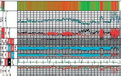
In the Canadian Montney, cased hole logging to obtain a brittleness analysis like that shown above is highly beneficial. RMT’s elemental capture data and processing through using Halliburton’s proprietary ShaleLOG software with RMT’s elemental capture and data enables measurement of formation brittleness; indicated on a color scale of green to red. Areas of increased brittleness (red) can be interpreted as areas where optimized completion strategies and reduced frac screen-outs can be realized.
operators deploy a different set of wireline logging technologies, such as Halliburton’s Reservoir Monitoring Tool Elite (RMTTM Elite) system. The RMT Elite tool can obtain reliable formation evaluation through the casing, and thereby help eliminate the high cost of maintaining a drilling rig onsite during logging.
The RMT Elite tool is a slim-hole pulsed neutron logging tool for managing and monitoring reserves. Using a high-density Bismuth Germanium Oxide (BGO) detector, it represents the industry’s most accurate and repeatable through-tubing / casing carbon / oxygen logging system. The RMT Elite tool helps enable identification of pay-zones, elemental yields, porosity, water saturation, and water / hydrocarbon contacts. Through the CHI Modeling ® service, Halliburton can then provide effective analysis to produce a pseudo triple combo log – a process praised in papers such as SPE 94716: Application of Chi Modeling Using Pulsed Neutron to Create Pseudo-Open Hole Logs (Reed et al.).
After openhole logging in a nearby training well, RMT Elite tool specialists program the results into a neural network, which is then applied to the RMT Elite tool data. In the rest of the field, RMT Elite logging tool is deployed to provide an effective pseudoopenhole replacement.
The RMT Elite tool also provides additional formation evaluation via spectral gamma ray to determine Potassium (K), Uranium (U), and Thorium (Th) radioactivity surrounding a borehole. KUTh analysis effectively provides a more detailed stratigraphic evaluation and depth correlation than that typically provided by conventional through-tubing gamma-ray tools. SPE 90709 Cased-Hole KUTh Logging Using a PNS Tool (Reed, Jacobson, Durbin) describes how this innovation accurately identifies the type and volume of clay contained in a logged interval.
The Montney resource play and tight shale gas environments present tremendous opportunities to effectively optimize fracture techniques and completion strategy. Understanding the KUTh of a logged interval enables operators to use this technology in horizontal wells to determine the ideal fracture. By focusing on the more brittle intervals in a horizontal zone, then correlating this data with known rock mechanics and openhole logs within the field, fracture treatment can be optimized to provide significant cost savings and increased production.
OPTIMI z ED STIMULATION: E XPLOSIVE T ECHNOLOGY
After openhole logging in nearby wells
(Continued on page 28...)
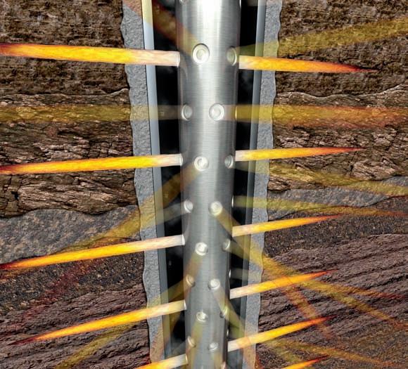
(...Continued from page 27)
establishes the properties and parameters of the field, cased-hole logging can provide the accurate reservoir understanding needed for completion and stimulation design and set the stage for the next step – perforating the casing.
Wireline perforation is used to provide an opening for fracture stimulation. In the basic perforating operation, an explosive charge creates a high-pressure jet that penetrates the casing at a targeted interval. To assure that the ensuing fracture treatment is effectively targeted, these operations are modeled so
the fracture will optimize production over the interval. Perforating parameters include depth of formation penetration, density and orientation of the perforation tunnels, size of entry hole, and interval length.
Halliburton’s Intelligent Firing Systems (IFS) represents the industry’s leading technology for perforating services. IFS allows the perforating operation to be completed in one wireline run rather than two. Traditional perforating involves setting a bridge plug, then deploying the perforating gun on a separate wireline run – an operation that consumes extra rig time.
With IFS, the wireline sets a bridge plug below the zone of interest and provides isolation within the wellbore. During the same run, the perforating gun is sent on the wireline to the desired perforating depth to safely detonate the charges. These charges create conductivity between the reservoir and the wellbore. The IFS technology controls the plug setting and perforating gun operation through a series of electronic switches; it also provides realtime monitoring of these complex events at surface by verifying detonation through down-hole accelerometers.
Wellsite efficiencies are important, but Halliburton’s primary focus is safety. Halliburton’s IFS technology and RED ® (Rig Environment Detonators) provide the industry’s leading technology for explosive safety.
Halliburton has enjoyed tremendous success with multi-shoot technology in Canada. In the tight-gas and shale formations, hundreds of deployments have been completed involving the setting of a bridge plug and detonation of multiple perforating guns in a single run. With a success rate of 97 percent, Halliburton leads the industry. In the Montney resource play, horizontal deployment has been achieved through a variety of methodologies each suited to the unique condition of each wellbore. These solutions include deployment by coiled tubing, wireline tractor, and pump-down conveyance.
Perforating operations require effective understanding of rock mechanics and modeling to determine charge performance in wellbore conditions, including the extent of near-wellbore damage, crush zone, permeability anisotropy, compressive strength, effective stress, and under- or overbalanced perforating conditions.
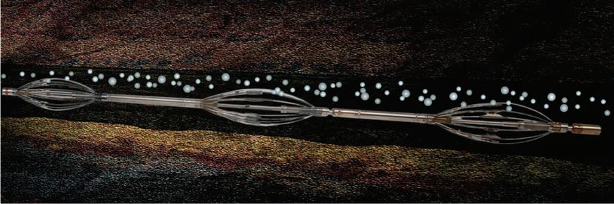
HOw MUCH PRODUCTION AND wHERE IS I T COMING FROM?
After optimizing production enhancement, wireline’s role is again critical in the next stage of the well’s life – production evaluation of the life of the well.
Production logging is the process of using a variety of sensors to evaluate and quantify production on a zone-by-zone basis throughout the wellbore. Traditionally, deviated, horizontal, and multi-phase flow environments posed significant production logging challenges to operators. Now, Halliburton’s Production Array Logging Suite (PALS) provides the most accurate solution available by positioning sensors radially through the internal circumference of the well bore.
The first PALS component is the Capacitance Array Tool (CAT™) device, which measures the dielectric properties of the reservoir fluid and enables differentiation between water, hydrocarbons, and gas. The second component, the Resistance Array Tool (RAT™) device, provides further clarification by enabling the detection of gas bubbles that are produced in a water-dominated environment or are moving within the fluid phase. The Spinner Array Tool (SAT™) device is the final PALS component; it features micro turbines radially positioned
to measure fluid velocities across the multiphase flow commonly found in horizontal wellbores.
Recently, Canadian Montney operators used PALS following the fracture treatments of their horizontal wells. PALS logs revealed varying levels of gas and water production throughout the hole. Halliburton’s log analysts correlated the observed bottomhole rates to the surface production during logging to determine the zone-by-zone contribution. This data, in addition to providing effective evaluation of zonal production, also increases wellbore understanding to help optimize production of the logged well and completions in the remainder of the field. As a further benefit, excessive water-cut recorded across distinct intervals can be reduced through a variety of remediation techniques, including bridge plugs and casing patches.
Halliburton’s Wireline services can play a significant role in the life cycle of a well. From evaluating the formation, engineering the completion, production assessment, and ultimately well abandonment, wireline provides the links between these diverse operations. Logging technology plays a key role in optimizing production and controlling costs; this will become increasingly important as reservoirs become more complex and economic conditions are ever more
competitive. Halliburton continues to invest in this technology to enhance our conventional services and serve the unconventional needs of the future.
Wireline is especially relevant to unconventional resource plays, which are produced with tight economic returns. Operators are using more sophisticated and more costly technologies to make them pay, such as deviated and horizontal wellbores. Halliburton Wireline and Perforating has tailored its services to provide the urgently needed solutions in these environments –greater reservoir understanding, horizontal deployment solutions for perforating, and advanced production logging.
Will Gardner is a graduate of Eastern Oregon University. His industry career began with Downhole Video services and Expro Wireline Intervention before joining the Halliburton team. Currently he provides wireline solutions to Canadian operators as part of Halliburton Wireline and Perforating.
This article was contributed by Halliburton. CSPG thanks Halliburton for the contribution.
| by Mike Cardell
And they’re off!
Runners get ready! Once again, the CSPGCSEG will be running its annual Road Race and Fun Run in September 2009. Building on last year’s new format, the event promises to be better than ever.
We will be offering both a ten-kilometre and a five-kilometre race. We have secured Winning Time to provide chip timing and Events On-line will provide easy on-line registration.
The run will take place on Wednesday, September 16, 2009 beginning at 6:00pm at the Eau Claire YMCA in Calgary, Alberta. The route will take you on an out-and-
back course along the beautiful Bow River pathways, finishing at the Eau Claire YMCA. Following the race, all racers, volunteers, and guests are invited to gather at a yet- tobe-named venue for awards, draw prizes, refreshments, and some friendly camaraderie. So if you are looking for a competitive race or just want to have fun, come join us!
The race is open to all members of CSPG, CSEG, and CAPL, and the general public; however, space is limited to 200 participants. Register early to avoid disappointment! There will be NO race day registration. For more information or to register, visit our website www.cspg.org.
July 27-Aug 2–10-20 min0-10 min10-20 min0-10 min–25 min
Aug 3-9 –10-20 min0-10 min10-20 min0-10 min–35 min
Aug 10-16–15-25 min0-10 min15-20 min0-10 min–25
Aug
Aug 17-23–15-25 min0-10 min15-25 min0-10 min–25 min
Aug 24-30–15-25 min0-10 min15-25 min0-10 min–45 min
Aug 31-Sept 6–20-30 min0-10 min15-25 min0-10 min–25 min
Sept 7-13–Rest10 KM RuN
To help you, Gord Hobbins of Gord’s Running Store has developed a 10km race training guide for novice runners. Try it out and benefit from some expert advice. You may be surprised how easy it can be to gently get yourself in condition for your first race.
G ORD’S 12 wEEK T RAINING GUIDE FOR NOVICE RUNNERS
Guidance/Tips: For novice runners who wish a do-it-yourself program at your leisure.
• Run for short durations between 3 – 5 times per week according to schedule, with your long run days being the key to your training program.
• If your running shoes are giving you some problems, get some that fit and match your gait.
• The guide allows for a gradual increase to a comfortable load; your legs may need some conditioning at first.
• Yes, times are in minutes. The secret is to be regular and not beat yourself up.
• Wear a hat and cool shades. Keep well hydrated. It really helps.
• Gently stretch those calves and quads afterwards.
• Take along a friend and convince them to sign up for CSPG, CSEG, and the Road Race as well.
• There are many running/training groups in town if interested in more.
Many thanks go out to our sponsors and volunteers who make this event possible each year.
We hope to see you there!
Annual Education Week
October 26 - October 30, 2009
www.cspg.org/education/education-week.cfm

Instructor: Dr. Basim Faraj, Unconventional Gas Specialist at Talisman Energy
Description: This one-day course will introduce the fundamental differences between conventional hybrid and shale gas plays. Source and reservoir rock attributes of shale gas plays will be discussed as well as GIP calculations, water, oil and gas saturations, essential laboratory analysis, and optimum geochemical and mineralogical parameters. Slickwater completion lessons learned from the US will be detailed. Canadian plays will be highlighted and discussed.
Instructor: Ashton Embry, Geological Survey of Canada
Description: This 3-day course presents the concepts and practical applications of sequence stratigraphy for petroleum exploration. Workshop exercises will emphasize the recognition and correlation of sequence stratigraphic surfaces on well log cross-sections. Following the course, participants will have a clear understanding of the use of sequence stratigraphy for predicting facies types and geometries away from control points.
Instructor: Dr. James Dixon, Geological Survey of Canada
Description: The objective of this half-day course is to help explorationists understand the regional stratigraphic setting of Triassic rocks and how this can be used in a more local exploration program. The course consists of two lectures, some correlation exercises, and an examination of several cores that illustrate various facies types and/or significant stratigraphic surfaces.
Instructor: Dr. Kerrie Bann, Ichnofacies Analysis Inc. and Dr. Stuart Tye
Description: This short course has been designed to teach the basics of logging core clastic intervals, with the inclusion of fundamental introductory ichnological techniques. Identification of facies through the integration of sedimentology and ichnology is crucial in building better stratigraphic and palaeogeographic models of reservoirs.
Instructor: Dr. Octavian Catuneanu, Professor in the Dept. of Earth and Atmospheric Sciences, University of Alberta
Description: This workshop presents the concepts and practical applications of sequence stratigraphy for petroleum exploration and production. All concepts are illustrated with field examples of seismic, well-log, core, and outcrop data. In-class exercises emphasize the recognition of sequence stratigraphy surfaces and systems tracts on well-log cross-sections, seismic lines, and outcrop profiles.
Instructor: Godfried Wasser, M.Sc., Eucalyptus Consulting Inc.
Description: This 4-day course discusses both conventional (Oil and Gas) and tight gas reservoirs with case histories from the Belly River, Glauconitic, Cardium, and the Nikanassin/Minnes. Also shown is a systematic approach to a reservoir geological evaluation starting with the rock (core and cuttings workshops) and reviewing petrophysics, thin-section analysis (capillary pressures and relative permeability), and some other aspects or reservoir engineering.
Instructor: Hugh Reid, Hugh W. Reid and Associates
Description: This 2-day course will give students the skills to identify potential missed pay by examining DST charts and results, using numerous case histories of wells with poor DSTs, which were later completed commercially. The Course is designed for those who have already taken a basic DST course, or are familiar with DST charts, not for absolute beginners.
For a full course description & registration, see: www.cspg.org/education/education-week.cfm
For additional information, contact Tina Donkers at or Travis Hobbs at
tinadave@telusplanet.net Travis.Hobbs@EnCana.com


First Iraqi company providing logging services for:
• Open hole services
• Cased hole services
• Perforations
• VSP
• PLT
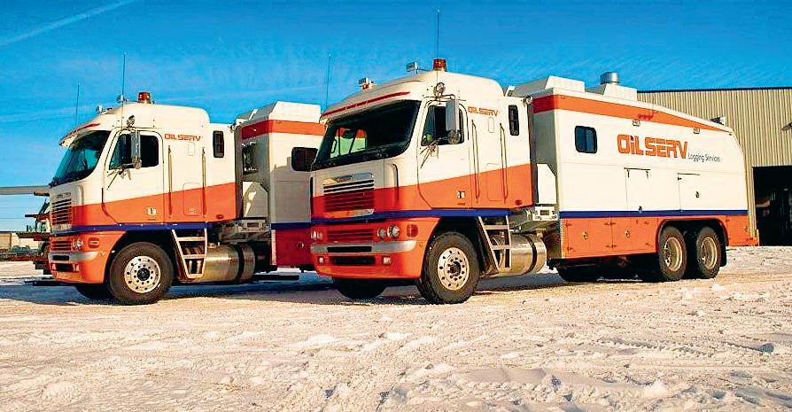
Unique system, Decades of tools performance and accuracy

| by Regan Palsgrove
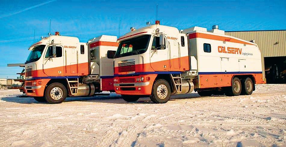
I’m CSPG’s representative on the technical committee for next year’s convention, which is the big one (10+ societies): GeoCanada 2010. Some of you may remember the last one that was held, GeoCanada 2000, at the University of Calgary. My job is to ensure that CSPG has adequate representation in the planning of the technical program for GeoCanada 2010. In other words, my job is to ensure that we are delivering enough relevant technical content at the convention to make our members happy. We want a strong technical program that integrates the knowledge each society has to offer.
We need to: a) define technical sessions of interest to CSPG members and b) assign session chairs, who then assemble speakers – often through their own personal contacts, but with help from the convention technical committee. Alternatively, we can find a good session chair, and have them design and arrange a technical session of their choice.
Now is the time to plan next year’s convention so that we, the members, get the technical content we are looking for. Anyone who attended this year’s convention probably has an opinion about the technical program. What did you like? What did you want to see more of? What was there not enough of? What topics were not covered? Or, perhaps you have specific ideas about possible session titles
and chairpersons, or would like to arrange your dream technical session. Regardless, we want to hear from you. So please,
e-mail your technical session opinions and ideas to rpalsgrove@talisman-energy.com. Hope to hear from you!
• AVO / LMR Analysis
• Neural Network Analysis
• PP & PS Registration
• Joint PP & PS Inversion
• Fracture Detection Analysis using Azimuthal AVO
• Spectral Decomposition Time Lapse Analysis
Carmen Dumitrescu
P.Geoph., M.Sc., Manager, Reservoir Geophysics
Direct: 403-260-6588 Main: 403-237-7711
www.sensorgeo.com
| by Regan Palsgrove
Well, we’ve had another successful Longtime Members Reception. This event grows in popularity every year. It was held on Tuesday, May 5, 2009, in the charming Rotary House on the Stampede Grounds. This invitation-only event, which was first held in 2001, is intended to be a celebration of the contribution of our senior members. It is a reunion of old acquaintances, and many friendships are renewed at this function. Invitations are extended to all members (in good standing) who have been members of the CSPG for 30+ years. Every year we give out an award to the member in attendance with the earliest start-date. Ned Gilbert (1945) usually wins this, but this year he brought some competition in the form of his friend Oscar Erdman,
a close contender (1946). As this was Oscar’s first appearance at the Reception, we gave the award to him.
However, this year we honored all our most senior members by giving out special certificates to all those with over SIXTY years of membership.
We also presented the 2008 Honorary Award Memberships at the Reception. This year, the Honorary Memberships went to Donald G. Cook and David G. Smith. It was a pleasure to hear their citations, and see their proud families as they accepted these awards.
We also had something different at the
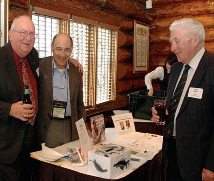
Reception this year: Big Rock Brewery’s Shale Ale! This was a special beer brewed for the convention this year in honour of the 100th anniversary of the discovery of the Burgess Shale by Charles Walcott. Ed Klovan (a Long-time Member) and Randle Robertson, both involved with the Burgess Shale Foundation’s Centennial celebrations, brought over and set-up part of the booth they had displayed at the convention. The Burgess Shale Foundation kindly donated a guided hike for two to the Burgess Shale, and it was won in a draw by Murray Frame.
Next year we will invite all members with a start date of 1980 or earlier (30+ years of membership) to the Long-time Members
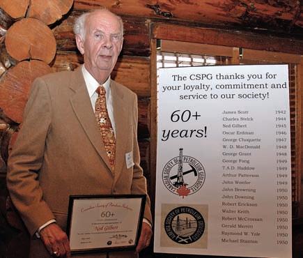
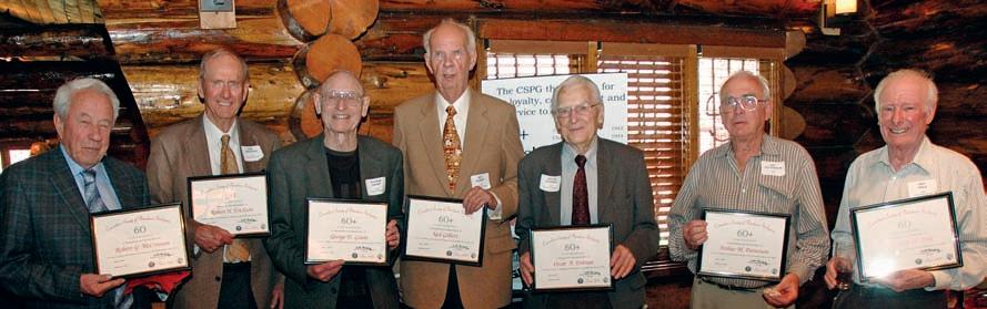
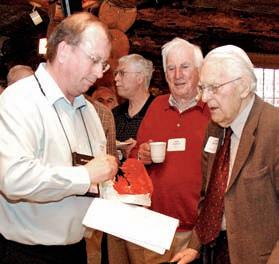


Reception. If you, or someone you know, feel you should have been invited this year, but were missed, please phone the CSPG office. Your start date and membership status can be verified in order to ensure that you are invited next year. Invitations are sent out in late April or early May.
Due to the popularity of this event, we would like to continue running it in the same format and scale as in previous years. However, costs have risen dramatically, and as a result, we are looking for a sponsor to help us fund next year’s Reception. Please
contact Lis Bjeld, the Executive Director of the CSPG, at (403) 264-5610 (ext. 228) for more information on sponsoring this event.
Also, if you are interested in helping organize this event next year, please call Regan Palsgrove at (403) 237-1423. In addition, we are always looking for feedback, and would love to hear from you. I look forward to seeing everyone again next year!
October 5 – 7, 2009
Banff, Alberta, Canada
Please join us October 5 – 7, 2009 at the Banff Centre for the Gussow Geoscience Conference.
The Gussow Geoscience Conference is delivered by world-renowned specialists and will focus on the energy environment interface yielding a better understanding of the complex impact of geological heterogeneity in bitumen reservoirs on feasible routes to sustainable energy recovery from heavy oil and bitumen reservoirs.
Register online at: http://www.cspg.org/conventions/Gussow2009/
$800 registration fee includes conference sessions, accommodation, meals and parking.
Register now to guarantee a room at the world-renowned Banff Centre!
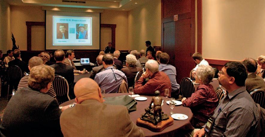
The Canadian Society of Petroleum Geologists annually presents a variety of awards to recognize technical achievements and excellence in volunteerism. In the past, CSPG has presented these awards at the beginning of Technical Luncheons. However, it was felt that there was another method of announcing the more prestigious awards rather than over the din of people networking and eating. Hence, the first Awards Reception was created.
The 2009 Awards Reception, organized by Penny Colton, CSPG’s Assistant Services Director, and Kasandra Klein, CSPG’s Member Services Coordinator, was held Wednesday, May 6th in the Quarter Horse Room of the Calgary Roundup Centre during the Annual CSPG CSEG CWLS Convention. Various members of the CSPG Executive Committee, selected 2008 CSPG Award recipients with guests, and CSPG Award Committee Chairs met for some hors d’oeurves, beverages, and of course the award presentations.
The 2008 awards that were presented were the President’s Award, the Medal of Merit, the H.M. Hunter Award, and the President’s Special Recognition Award. The President’s Award was presented to Bruce Shultz, Tooney Fink, and Brian Glover. The Medal of Merit was presented to Bogdan Varban, Guy Plint, Bruce Hart
(not in attendance), and Kurt Marfurt (not in attendance). The H.M. Hunter Award was presented to Gerry Reinson and Kirk Osadetz (not in attendance). The President’s Special Recognition Award was presented to Ian McIlreath. The reception also honoured and recognized recipients of CSPG awards which were already presented at Technical Luncheons or other events. These awards include the Link Award, received by Benoit Beauchamp, the Tracks Award, received by Glen Stockmal, the Honourary Membership, received by David G. Smith and Donald G. Cook, and the 33 Service and 136 Volunteer Awards.
The intimate and quiet setting allowed
the recipients to be properly recognized amongst their peers. Ayaz Gulamhussein, CSPG’s Services Director and the event host especially appreciated the event, saying that “the event was a definite hit; the venue chosen was fantastic, and the food was great!”
We look forward to the next awards reception in 2010, which will honour some of the 2009 CSPG awards recipients.
of
November 2nd - 6th, 2009 Calgary, Alberta
PROCESSING
1 Processing, Inversion and Reconstruction of Seismic Data
Mauricio Sacchi November 2-3
2 Seismic Processing Fundamentals
Gary Margrave November 4-6
3 Parallel Computing - Cluster computing using MPI/OpenMP in Fortran/C
Phil Bording November 5-6
4 Seismic Expression of Devonian Carbonates
Geoffrey Fraser / Norm Kohlhammer November 4
5 Seismic Interpretation in the Exploration Domain
Tim Smith / Don Herron November 2-3
6 3D Seismic Attributes for Prospect Identification and Reservoir Characterization
Kurt J. Marfurt / Satinder Chopra November 5-6
7 Shallow EM Methods Applied to Oil Sands Investigations
Ted Glenn November 4
8 Structural Geology for Geophysical Interpreters Marian Warren / Mark Cooper November 2-4
9 Seismic Geo-morphology Henry Posamentier
10 Inversion Boot Camp John Pendrel / Dave Timko
DEVELOPMENT GEOPHYSICS
16
4-6
4-5
2-3 19 Hydraulic Fracturing and Microseismic
5-6
11 Rock Physics for Geophysical Reservoir Characterization and Recovery Monitoring Gary Mavko
12 Understanding Seismic Anisotropy, Hands On Leon Thomsen November 3-4
13 3D Seismology for Non-geophysicists
14 Seismic Data Basics - Level I
15 Seismic Data Basics - Level 2
2-3
2-3

Win $2500.00 and a framed certificate; and a one year membership with the CSPG for: the Doctoral thesis that makes the most significant contribution to Canadian sedimentary geology in 2009.
Win $2000.00 and a framed certificate; and a one year membership with the CSPG for: the Master’s thesis that makes the most significant contribution to Canadian sedimentary geology in 2009. Winning thesis topics in recent years have included: detailed integrated studies of the Falher, Paddy and Dunvegan, structural re-interpretation
of the Livingston Range anticlinorium, a stratigraphic re-interpretation of the Alexandra Reef Complex which has lead to new insights into the nature of Devonian reefs, new thoughts about the classic Carboniferous section at Joggins, Nova Scotia and a detailed sedimentologic study on the Upper Kaza group of the Windermere Supergroup.
Deadline for submissions is September 18, 2009
Submitted theses will be returned in late January 2010 after the completion of judging.

Eligible theses are either produced in a Canadian university, regardless of project location, or deal with a Canadian sedimentary/petroleum geology topic, regardless of the university of origin. Theses entered for the 2009 awards must have been submitted to a recognized university inside or outside Canada, and must have formed part of the requirements for degrees awarded at the Fall 2008 or Spring 2009 convocations. Candidate theses must be well written, clearly and adequately illustrated, and properly bound.
TheSiS SubmiSSionS for juDging To:
Canadian Society of Petroleum Geologists (CSPG) Graduate Thesis Awards Committee
c/o Andre Chow Pengrowth Corporation 2100, 222 – 3rd Avenue SW Calgary, AB T2P 0S4
Phone: (403) 213-3713 • Fax: (403) 234-6886
Email: Andre.Chow@pengrowth.com
Proud Sponsor of the CSPG Graduate and Undergraduate Theses Awards.
The Medal of Merit is awarded annually by CSPG for the best paper published during the previous year on a subject related to the petroleum geology of Canada. More specifically, the Medal of Merit Committee favours papers which are broad in scope and are clearly written, well presented, and illustrated with novel ideas, thorough data collection, and linkage of data to interpretations and conclusions.
The 2008 Medal of Merit is awarded to Bruce S. Hart, Bogdan L. Varban, Kurt J. Marfurt, and A. Guy Plint for their paper “Blind thrusts and fault-related folds in the Upper Cretaceous Alberta Group, deep basin, west-central Alberta: implications for fractured reservoirs,” which was published in the June 2007 Bulletin of Canadian Petroleum Geology, v. 55, p. 125-137.
The paper describes how the authors used well logs and 3-D seismic data to identify and map blind thrusts and associated fault-related folds in the Upper Cretaceous Kaskapau, Cardium, and overlying formations in the Deep Basin south and southwest of Grande Prairie, Alberta. The paper also utilized work previously published by the various authors on regional subsurface and outcrop mapping and seismic processing methodologies. Enhanced post-stack processing including noise reduction, coherency processing, and volumetric dip analysis was used to improve the quality of the 3-D seismic over the shallow stratigraphic intervals.
The described structures extend 50 km to the east of the nearest exposed thrusts
mapped in the foothills. The faults generally form thrust systems rather than individual thrusts in the lower muddier part of the Kaskapau, with resulting thickening of tens of metres over distances of three to five kilometres. Low-relief folds in the form of asymmetrical anticlines formed above the anomalously thickened areas and trend southwest to northeast with five to eight kilometre wavelength. Fracture modelling indicates that three types of fractures are expected to develop in the folds.
The paper has clear applications for the exploration and development of fractured low-permeability reservoirs in western Canada and elsewhere. With the steadily increasing focus on low-permeability reservoirs the described structures may be useful analogues where links exist between stratigraphy, structure, fracture development, and producibility. The study also demonstrated the value of making detailed stratigraphic correlations in shale units. In addition, the paper is well written and illustrated and effectively integrates data from multiple sources.
The full Medal of Merit citation appears in the March 2009 issue of the CSPG Bulletin of Canadian Petroleum Geology. Guy Plint and Bogdan Varban were presented with their awards at the 2009 CSPG Awards Reception held on May 6th, 2009 at the Calgary Roundup Centre. Bruce Hart and Kurt Marfurt could not be in attendance.
David a llen from Vice President of Exploration with a lberta Clipper Energy i nc. to
Director of Exploration and Development with na L Resources dallen@nal.ca
The H.M. Hunter Award was created to recognize those individuals who have served the Society in a variety of capacities over many years. It is named in honour of Harry M. Hunter, the Society’s 12th President, who served in 1939. The 2008 recipients of the H.M Hunter Award are Gerry Reinson and Kirk Osadetz. The award was presented at the 2009 CSPG Awards Reception on Wednesday May 6th at the Calgary Roundup Centre, then later recognized at the May 21st Technical Luncheon at the TELUS Convention Centre.
Gerry Reinson has been an active member of CSPG for over 35 years, and first joined as a student member in 1967. His volunteer service to the Society started in the mid1970s and continues today. Reinson’s earliest contributions were focused on the organization of, and participation in Core Conference Committees and field trips. Subsequent committee service included various award committees (Graduate Thesis, Tracks, Service, Volunteer), the Education Advisory Committee, the National Liaison Committee, and as CSPG representative to the Canadian Geoscience Council. He has also been a member of several annual Conference Organizing Committees, most recently chairing the 75th Diamond Jubilee Conference in 2002, and co-chairing the Gussow Conference in 2007.
In addition to volunteering on many
CSPG initiatives and committees, Reinson has provided leadership to the Society through his tenure on the Executive as VicePresident, President, and Past President from 1995 to 1997.
Reinson has contributed substantially to furthering the technical knowledge of our members through his service as Associate Editor of the Bulletin of Canadian Petroleum Geology, his chairing and editing of two Core Conference publications in 1977, and the joint AAPG-CSPG Core Symposium in 2005. He has presented numerous oral, poster, and core presentations at CSPG sponsored events, including three technical luncheon presentations. Reinson has also been a major contributor to CSPG Bulletins, Memoirs, and the Geological Atlas of the Western Canada Sedimentary Basin.
This award recognizes Reinson’s significant dedication and service to the Society, in a number of roles over the past 35 years.
Kirk Osadetz has been volunteering with CSPG for over 20 years. During that period he has spent considerable time contributing to the development and dissemination of technical knowledge for and to the membership. Osadetz was a contributing author to the Sedimentology Division’s publication on Basin Analysis in the Western Canada Sedimentary Basin. Since then, he has been a speaker and poster contributor
at numerous Technical Luncheons, Gussow Research Conferences, CSPG Division meetings, and Annual Conventions and has authored several papers in the Bulletin. He, along with three other colleagues, has led numerous southern Alberta Foothills Field Trips for CSPG and Joint AAPG-CSPG Conventions and Field Schools and the CSPG Structure Division. He was also a lecturer in the CSPG Advantage educational program.
In addition to his personal technical contributions, Osadetz has contributed to the Society as a Director on the Executive (Assistant Treasurer and Treasurer), CoChair of the Technical Luncheon/Program Committee, a member of several Convention Committees (Technical Program Co-Chair, Technical Program Committee Member, and Session Chairperson), and Associate Editor of the Bulletin of Canadian Petroleum Geology (two terms).
Osadetz has previously received two Tracks Awards, as well as Service and Volunteer awards for his Committee and Editorial contributions and this award recognizes his continued and varied contributions for over 20 years.
The H.M Hunter Award citation for Gerry Reinson and Kirk Osadetz appears in the March 2008 issue of the CSPG Bulletin of Canadian Petroleum Geology.
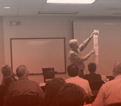


• Risk Analysis & Decision Making in E&P
• Petroleum Resources & Reserves: An Overview of Recommended Geological Practices
• Decision Methods and LNG Value Chain
• Creativity in Exploration
• Knowledge Transfer in the Multi-Generational Workplace
• Keys to Complex Well Economic Success
• Think on Your Feet—The Importance of Clarity, Brevity and Impact™
• The Energy Industry from the Investor’s Perspective: How will the new policies affect investment strategies?
• Exploration Success and Failures from Pore Pressure Assumptions
• Farm-ins and Farm-outs for Explorationists
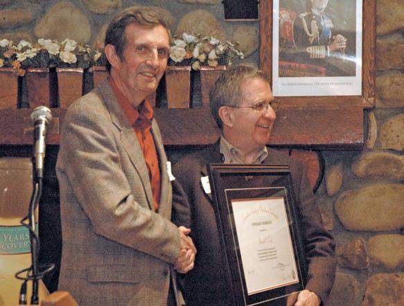
Honourary Membership is awarded for distinguished service to the Canadian Society of Petroleum Geologists. This year, two worthy recipients were presented with their Honourary Memberships at the Long-time Members Reception on May 5th, 2009 held during the Joint Annual Convention (previously recognized at the April 27th Technical Luncheon at the TELUS Convention Centre).
Donald Cook is a nationally and internationally recognised scientist who has made significant contributions to the Canadian Society of Petroleum Geologists, to the general geosciences community, and to our understanding of the geology of Canada, in terms of his personal research, his scientific leadership, and his role as a mentor to young scientists.
Cook hails from Dryden, Ontario where he still spends his summers fishing and swatting mosquitoes. Cook attended Queens University and he obtained his B.Sc. (Eng) in 1962, his M.Sc. in 1965 and his Ph.D. in 1967. At Queens he was strongly influenced by the legendary Ray Price and Cook did his Ph.D. research on an analysis of structural style controlled by the Cambrian shale-out near Mount Stephen in the southern Rockies. Following graduation, Cook joined the Geological
Survey of Canada where he had previously worked in the summers as a mapper on Operation Bow-Athabasca. Cook’s arrival at GSC coincided with the opening of the Institute of Sedimentary and Petroleum Geology (ISPG) in northwest Calgary.
Cook has spent almost his entire career with the Geological Survey of Canada mapping in northwestern Canada, both surface and subsurface, and pioneering concepts in structural geology. He was one of the leaders in the mapping of twelve 1:250,000 and 1:500,000 scale geological maps of the Mackenzie and Franklin mountains, and adjacent Interior Plains (>12,000 sq. km.), as well as preparation of regional reports on the Mesozoic of a large part of the Northern Interior Plains. He provided the initial definition of the multiphase paleotectonic high, the Keele Arch. He recognized similarities and differences between the northern Franklin Mountains and the Wyoming Foreland structural provinces, and proposed a treatment of the Franklins as a scale model of Wyoming structures. As an outgrowth of his interest in the Wyoming Foreland he developed a method of balancing basement-cored folds.
In 1980 Cook took on an administrative role with GSC as Head of the Regional Geology Subdivision at ISPG. In this capacity, he led
a large group of mappers and stratigraphers and, under his guidance, many major stratigraphic and mapping projects from southern Alberta to the Arctic Islands were completed. Cook was the ideal manager, having great foresight and a thorough understanding of the science being done. He is also a very thoughtful and kind person and is very highly regarded by all those who have worked for him or with him.
In 1989 Cook went back to the bench and was involved in the compilation, correlation, and interpretation of seismic data across a large part of the Northern Interior Plains. This massive project led to unravelling a complex history of Proterozoic deformation and development of correlations between the sub-surface strata and Proterozoic rocks outcropping on Coppermine Homocline. Cook retired from GSC in 1998 but continues to work as an emeritus scientist.
Cook has published more than 100 articles and maps, and has given numerous talks at local CSPG forums and at GSA and AAPG conventions. In recognition of his geological accomplishments, he was awarded the CSPG’s R.J.W. Douglas Medal in 1999. Cook is also proud of the fact that a Proterozoic microfossil, Gemmuloides doncookii, was named in his honour to recognize his contributions to the Proterozoic of the Northwest Territories.
Throughout his career Cook has supported our Society. He represented the CSPG for a number of years on the North American Commission on Stratigraphic Nomenclature, and served a term as Chairman of the commission. He first joined the CSPG Executive as a Director in 1980, the height of the oil boom when CSPG membership exceeded 4,000. His leadership abilities shone through when he served as Vice President, President, and Past President, in the years 1985-1987 when the oil price and membership both plummeted. Cook led an important restructuring of the Executive and ensured the Society remained financially strong in those turbulent years. Cook has always encouraged his colleagues and subdivision members to become active in CSPG.
For his significant contributions to the geology of Canada and his strong support of the Canadian Society of Petroleum Geologists, we welcome Donald G. Cook as an Honourary Member of the Society.
DAVID G. SMITH
David Smith has successfully explored for hydrocarbons for over 40 years and in doing so developed a through understanding of the plays he pursued. Through his numerous publications, courses, and direct supervision he has positively influenced a generation of Earth Scientists. The CSPG proudly recognizes his achievements and welcomes him as an Honourary Member.
Born in Ontario in 1940, Smith was, from an early age, intrigued by the earth. As a child, he developed a collection of “lucky stones” (Devonian Brachiopods) gathered on childhood expeditions to the creeks and coulees of Southwestern Ontario. He enrolled in Engineering at the University of Western Ontario in 1958. One of the courses in the first year was An Introduction to Geology. Smith was immediately spellbound, and switched to a Geology Major in his second year. His summers were spent with the Geological Survey of Canada and included trekking over the Muskox Complex in the NWT with Charlie Smith and mapping Devonian reefs in the Canadian Rockies with Warren Mackenzie.
From 1962 to 1967, Smith was a Junior Geologist with HBOG. Working with Jack Pullen, a company geophysicist, the two defined a salt-collapse structure and drilled a well at Hummingbird, Saskatchewan where on drillstem test, light sweet crude flowed to surface. This successful exploration play was published in the Bulletin of Canadian Petroleum Geology in 1967.
Smith left HBOG in 1967 to join Amax Petroleum Corp. Unfortunately they left Canada five months later and he was on the street again. After a brief sojourn with Western Decalta Petroleum Ltd., Smith answered an advertisement for a Geologist by Kerr McGee of Canada Ltd. There in 1969, he met John Masters and Jim Gray for the first time. Their enthusiasm was contagious. He hired on and stayed until 1973 when they left KM to form Canadian Hunter Exploration Ltd. Invited to go along, Smith, being cautious, held back for four months until the company received funding from Noranda Mines.
Apart from a brief foray on his own in 1980, which the National Energy Program quickly quashed, Smith spent the rest of his career with Hunter and their successor, Burlington Resources Ltd until his retirement in May, 2004.
From 1973 to 1980, Smith was Chief Geologist for Hunter, and along with Hunter staff, was deeply involved in the development of the Elmworth Gas Field. During the 1980s and early 1990s, Smith’s role at Hunter was Senior Geological Advisor where, working with the Geoscience staff he had exposure to almost every oil and gas play in Western Canada. During those years Hunter allowed Smith to share information gained with industry through teaching a course with Larry Meckel; author or coauthor several papers, including a classic paleogeography paper on the Lower Cretaceous of northwest Alberta and northeast British Columbia in AAPG Memoir 38; three chapters in AAPG Memoir 55; a paper in CSPG Memoir 15; and a chapter in the 1994 edition of the Geological Atlas of the Western Canada Sedimentary Basin.
Smith has also contributed substantially to the CSPG through his numerous papers at CSPG luncheons and CSPG annual conventions. He was honoured to represent the CSPG as a Distinguished Lecturer in 1985. His beautifully illustrated talk “The Paleogeography of the Western Canada Sedimentary Basin” captivated audiences at five Universities across eastern and central Canada.
In 1998 Smith assumed the position of
Geological Manager of Deep Basin Exploration at Hunter. He enjoyed directing the continued development of Hunter’s Deep Basin acreage, focusing more and more on the development of unconventional natural gas reserves.
At the beginning of 2002, Hunter was acquired by Burlington. His expertise and abilities were recognized in the new organization and Smith continued as Deep Basin Geological Manager until his retirement in May, 2004.
For many years the slogan “Chance favours the Prepared Mind” was prominently displayed on Smith’s desk. If Smith had a mantra, that quote would be it, as Smith always believed (and subsequently impressing upon his coworkers) that knowledge and preparedness coupled with boldness were the keys to success in the risky business of oil and gas exploration.
It is with great pleasure that we welcome David Smith as Honourary Members of the Canadian Society of Petroleum Geologists.
The Honourary Membership citations for Donald G. Cook and David G. Smith appear in the March 2008 issue of the CSPG Bulletin of Canadian Petroleum Geology.
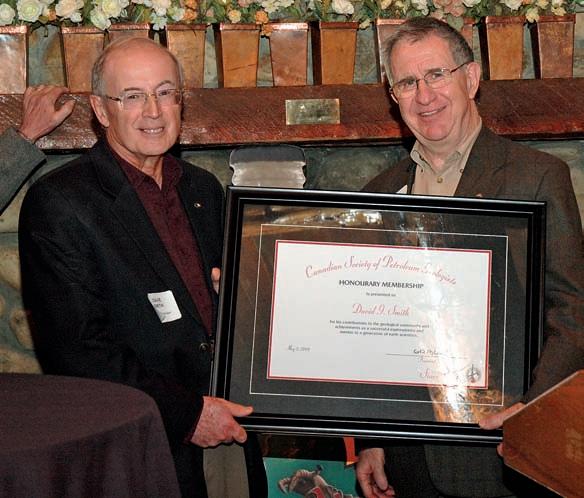
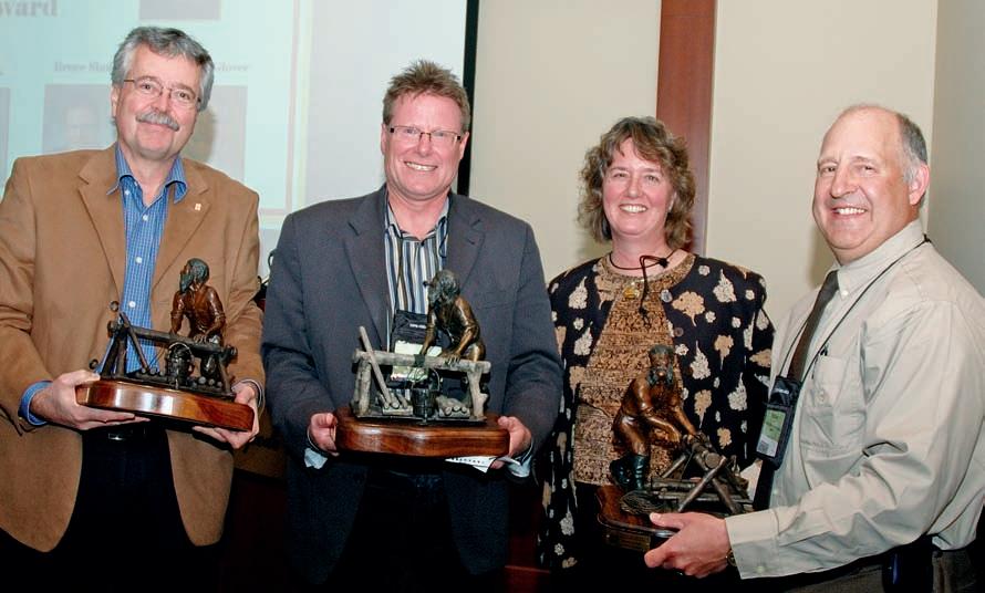
The CSPG President’s Award is our Society’s highest service award. It is generally bestowed on one or more individuals for the critical role they have played in staging a hallmark event. During 2008, that hallmark event was the CSPG CSEG CWLS Joint Annual Convention. CSPG thanks all Convention committee members for their contributions; however we extend special recognition to General Co-Chairs Bruce Shultz, Brian Glover, and Tooney Fink. They brought together an excellent team, and provided the inspiration and guidance that is being especially acknowledged by this award. Therefore, in recognition of the outstanding leadership provided to the 2008 Joint Annual Convention by the general co-chairs, CSPG is very proud to present the 2008 President’s Award to Bruce Shultz, Brian Glover, and Tooney Fink. The award was presented at the CSPG Awards Reception held on Wednesday May 6, 2009 at the Calgary Roundup Centre and later recognized at the Technical Luncheon held on May 21st, 2009 at the TELUS Convention Centre.
Bruce Shultz was the CSPG Co-Chair for the 2008 Convention. He is currently
President and Chief Executive Officer of Huron Energy Corporation, a privately held oil and gas company. Huron has focused operations in British Columbia, southwest of Dawson Creek. The company has made significant natural gas discoveries in the Doig and Montney exploration fairways, and it is currently involved in developing these successes.
Shultz has been involved in the Canadian oil and gas business for 28 years. He graduated from the University of Waterloo in 1979 with a B.Sc. (Honours) in Earth Science. In his early career, Shultz was employed in various roles at Gulf Canada Resources and Pan Canadian Petroleum Ltd. After learning the business, Shultz moved to Jordan Petroleum Ltd. in 1995 as Vice President of Exploration. Jordon grew to 18,000 BOEpd and was eventually sold in 1997. Shultz “CROSSED HIS RUBICON” in 1998, founding Rubicon Energy Corporation with two partners from Jordan Petroleum. Over the next five years, Rubicon Energy Corporation (a private company) grew from an initial acquisition of 300 BOEs to finally exit in 2003 at 3,400 BOEpd, providing a 47% annualized growth rate per share to shareholders. The most notable discovery
made by Rubicon was an extension of the prolific Nisku shelf margin at Pembina. This initial work has been much publicized and successfully followed up by Highpine Oil and Gas, West Energy, and others. Rubicon’s Nisku discovery at Pembina was world class and initiated a new phase of exploration for industry. The initial well, Pembina Nisku GG Pool 02/06-33 tested 21 barrels of oil and 26 mmcf of gas per day at a bottom hole flowing pressure of 15 mPa.
Brian Glover was the Canadian Well Logging Society Co-Chair for the 2008 Convention. He graduated with a M.Sc. from the University of Alberta and began his career in the coal mining industry, working as a field geologist on a variety of mining projects extending from southeastern Saskatchewan to northwestern British Columbia. He moved into the oil and gas sector in 1985 when he joined Chevron Canada Resources. His initial assignment was in Development Geology, where he worked on a wide variety of carbonate and clastic prospects throughout the Western Canada Sedimentary Basin before moving into the Petrophysics group and eventually into Geologic Operations. He moved to
Amerada Hess and subsequently joined Petro-Canada as a Senior Petrophysicist in 1996, providing petrophysical support throughout Western Canada. In 1998 he became the petrophysicist to the Offshore East Coast Project team, evaluating a number of prospects offshore Newfoundland, often travelling to St John’s to oversee logging operations offshore and eventually moving to St. John’s where he spent two years as Project Petrophysicist on the Terra Nova Offshore Development team.
He returned to Calgary in 2002, and is currently the petrophysicist for PetroCanada’s continental USA operations group based in Denver, Co. Glover is a participating member of both the CSPG and CWLS. In 2006, he also served on the 2006 Convention Technical Committee as the CWLS Short Course organizer.
A.R. “T OONEY ” F INK
Tooney Fink was the CSEG Co-Chair for the 2008 convention. He currently works for ConocoPhillips Canada in the capacity of Chief Geophysicist - Canada. He started in the oil industry in 1974, after graduating from UBC with a B.Sc. (combined honours)
in Geology and Geophysics. Fink started his career with Gulf Canada and filled many roles including geophysical acquisition, seismic processing, geophysical interpretation, and management roles involving assets in WCSB, Canadian Frontiers, and various international basins. He was actively involved in exploration, development, and production leadership, as well as evaluating many acquisition targets for Gulf Canada. When Conoco acquired Gulf Canada in 2001, Fink took the role of Chief Geophysicist –Canada. He has remained in this position, excepting a stint in New Ventures. Fink enjoys the excitement of the ‘oil patch’ and the close personal relationships he has developed over the years, epitomized by attendance and ‘networking’ at the annual CSEG Doodlespiel.
The full President’s Award citation for Bruce Shultz, Brian Glover, and Tooney Fink appears in the March 2008 issue of the CSPG Bulletin of Canadian Petroleum Geology.
Adjunct Professor to 2002; formerly with Shell Development, Shell Oil, Shell Canada, and Trend Exploration. He has operational, management, and research credentials over the past 38 years in reservoir characterization and basin analysis for Canadian, US, and International onshore and offshore basins. His most recent activities have been in the Canadian Arctic, Mackenzie Delta - Beaufort, the Scotian Shelf and Deep Water, Labrador and Grand Banks, and the West Coast of Newfoundland.
For 40 years Harper was a member of the Canadian Ski Patrol System and related organizations (National Ski Patrol System, Ventura County Sheriff’s Search and Rescue, Rhode Island Civil Air Patrol rescue training) holding a variety of positions from Patroller to Instructor to National VP - Training. He has held courses in Winter Survival for the Newfoundland and Labrador Junior Forest Ranger Instructors. In the last 10 years he has been involved with presentation of avalanche awareness programmes in Calgary schools and in ConocoPhilllips Canada in the hope that a little bit of information can have a large impact.

The Canadian Society of Petroleum Geologists President’s Special Recognition Award is the Society’s highest recognition award and is presented to individuals, institutions or organizations whose sustained efforts have brought great honour and distinction to the Society and the geoscience community or have provided significant, outstanding, and sustained contributions to Canadian petroleum geology. The Award has only been granted four times in the history of the Society and only to one individual previously.
The Canadian Society of Petroleum Geologists was pleased to present this prestigious award to Dr. Ian A. McIlreath on Wednesday, May 6 at the 2009 Awards Reception, in recognition of his many contributions to the Society, the Canadian geoscience community, and the Canadian petroleum industry.
Dr. McIlreath has spent over 32 years serving on many Executives, chairing and leading numerous major committees, and has been an active member on many more, including international organizations. He has been the recipient of a number of major national service and technical excellence awards from earth science societies, including the H.M. Hunter Award from the CSPG and the J. Willis Ambrose Medal from the Geological Association of Canada, for distinguished service to earth sciences in Canada. He is an Honorary Member of CSPG and a Distinguished Fellow of the Geological Association of Canada (GAC). Most recently, he received the prestigious L. C. Charlesworth Professional Service Award from the Association of Professional Engineers, Geologists and Geophysicists of Alberta (APEGGA). His illustrious volunteer career includes sitting as the CSPG’s youngest president in 1983 and
president of the Geological Association of Canada in 1992.
Dr. McIlreath has also served the broader community, having sat as a board member on the Alberta Science and Technology Leadership Awards Foundation, the Burgess Shale Foundation, and the University of Calgary Senate. He currently sits on the Board of Trustees of the Canadian Science and Technology Museum Corporation in Ottawa. He is also the current APEGGA Director to the Canadian Council of Professional Geoscientists (CCPG).
He has authored or co-authored more than 60 scientific publications, talks, and public presentations and has had a long and varied career in industry within Canada and internationally.
Dr. McIlreath has made significant contributions and performed outstanding work as Chairman of GeoCanada 2000, the Committee on Conventions, the Joint Annual Convention Committee, and now GeoCanada 2010. And if this was not enough, he delivered three important reports to the CSPG Executive within a two-year period on awards, office management, and strategic planning. He has selflessly shared his time providing guidance, counsel, and advice to several Executive Committees.
It is with great pleasure that the Canadian Society of Petroleum Geologists bestows the President’s Special Recognition Award on Dr. Ian A. McIlreath for his sustained and outstanding contributions to the CSPG and to Canadian petroleum geology.

If you want easy-to-use decision-making tools – there’s only one direction to go
industry-leading customer service
easy & efficient migration of existing data helping clients increase productivity

geoSCOUT™ uses a Windows-based platform that makes it easy for you to get the oil and gas data you need to make smarter decisions faster and to maximize the return on your oilfield investments. And, our solution provides you with a complete package that all your departments can use.
Thousands of landmen, engineers & geologists use geoSCOUT oil and gas mapping and analysis software every day, to make more efficient, informed decisions. Give us an hour for a demo – we know you’ll see the value. Call 403.262.1992 Email info@geoscout.com | Online www.geoscout.com/demo
Another powerful suite of tools from


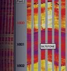

Whether you need formation evaluation, imaging, testing, fluid sampling, acoustics/rock mechanics, NMR, hostile/slim hole, sidewall coring or any other open-hole service—Halliburton has exactly what you need, when you need it. For more information, call 1-888-775-6447. Or visit us at www.halliburton.com/wireline. Right When You Need
Open for business 24/7, Halliburton has the right open-hole technology—backed by our legendary reliability and service excellence—right now.