


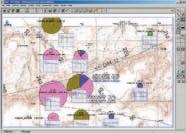
“AccuMap encompasses speed, stability, efficiency and accuracy. As an intuitive and easy-to-use product, AccuMap serves a broad audience, from field users to the CEO.”
Darrel Saik Senior Geological Technologist Paramount Energy Trust
AccuMap is the most widely used and highly trusted oil and gas mapping software touching every segment of E&P, for every professional.

CSPG CSEG 2007 Convention
May 14 - 17
Booth # 321
www.ihs.com/energy
Call toll free 1 877 495 4473


#600, 640 - 8th Avenue SW
Calgary, Alberta, Canada T2P 1G7
Tel: 403-264-5610 Fax: 403-264-5898
Web: www.cspg.org
Office hours: Monday to Friday, 8:30am to 4:00pm
Business Manager: Tim Howard
Email: tim.howard@cspg.org
Membership Services: Sarah Barton
Email: sarah.barton@cspg.org
Communications & Public Affairs: Jaimè Croft Larsen
Email: jaime.croftlarsen@cspg.org
Corporate Relations: Kim MacLean
Email: kim.maclean@cspg.org
Corporate Relations Assistant: Heather Tyminski
Email: heather.tyminski@cspg.org
Conventions & Conferences: Shauna Carson
Email: shauna.carson@cspg.org
Conventions & Conferences Assistant: Tanya Santry
Email: tanya.santry@cspg.org
Reception: Dayna Rhoads
Email: reception@cspg.org
EDITORS/AUTHORS
Please submit RESERVOIR articles to the CSPG office. Submission deadline is the 23rd day of the month, two months prior to issue date. (e.g., January 23 for the March issue).
To publish an article, the CSPG requires digital copies of the document. Text should be in Microsoft Word format and illustrations should be in TIFF format at 300 dpi., at final size For additional information on manuscript preparation, refer to the Guidelines for Authors published in the CSPG Bulletin or contact the editor.
Coordinating Editor & Operations
Jaimè Croft Larsen, CSPG
Tel: 403-513-1227 Fax: 403-264-5898
Email: jaime.croftlarsen@cspg.org
Technical Editor
Ben McKenzie
Tarheel Exploration
Tel: 403-277-4496, Email: bjmck@telusplanet.net
ADVERTISING
Kim MacLean
Corporate Relations, CSPG
Tel: 403-513-1229, Email: kim.maclean@cspg.org
Advertising inquiries should be directed to Kim MacLean. The deadline to reserve advertising space is the 23rd day of the month, two months prior to issue date. All advertising artwork should be sent directly to Kim MacLean.
The RESERVOIR is published 11 times per year by the Canadian Society of Petroleum Geologists. This includes a combined issue for the months of July/August.
Advertisements, as well as inserts, mailed with the publication are paid advertisements. No endorsement or sponsorship by the Canadian Society of Petroleum Geologists is implied.
The contents of this publication may not be reproduced either in part or in full without the consent of the publisher.
& Layout by Sundog
Additional copies of the RESERVOIR are available at the CSPG office for $3.00.


CONTOURING
Faultedcontours
Isopachs
Volumetrics
Gridoperations
Newflexingoptions
CROSS SECTIONS
NewUnassignedTops
Digitaland/orRaster
Geocolumnshading
Stratigraphic/Structural
Shadebetweencrossover
Dipmeterdata
MAPPING OPTIONS
ExpandedGISFunctions
Bubblemaps
Productioncharts
Logcurves
Posteddata
HighlightedSymbols
3D VISUALIZATION
Deviatedwellbores
Digitallogs
Gridsurfaces
Tops,ShowsandPerfs
Landgridoverlay
Mapimages

DECLINE CURVES
ComputeEUR,RR,etc.
Hyperbolicorexp.
Rate/TimeorCumP/Z
UserdefinedEcon.Limit
User defined Extrap.Time
How our vision supports yours
PETRA: Pioneer of easy, affordable PC solutions for today’s workflows.
IHS: The industry’s leading choice of E&P data and delivery systems to populate PETRA projects. The combination: Fast, confident prospect analysis for you.
Download a trial version at www.ihs.com/energy/petra, or call us at 888-738-7265 for more information. And stay tuned for more on our vision of streamlined data flows for prospect studies.


CSPG EXECUTIVE
PRESIDENT
Colin Yeo • EnCana Corporation colin.yeo@encana.com Tel: (403) 645-7724
VICE PRESIDENT
Lisa Griffith • Griffith Consulting lgriffith@griffithgeoconsulting.com Tel: (403) 669-7494
PAST PRESIDENT
Jim Reimer • Result Energy Inc. jim@resultenergy.com Tel: (403) 539-5207
FINANCE DIRECTOR
Peter Harrington • Northrock Resources Ltd. harrington@northrock.ab.ca Tel: (403) 213-7665
ASSISTANT FINANCE DIRECTOR
James Donnelly • ConocoPhillips Canada james.donelly@conocophillips.com Tel: (403) 260-8000
PROGRAM DIRECTOR
Nadya Sandy • Esso Imperial Oil Resources Limited nadya.sandy@esso.ca Tel: (403) 237-3925
ASSISTANT PROGRAM DIRECTOR
Randy Rice • Suncor Energy Inc. RJRice@suncor.com Tel: (403) 205-6723
SERVICE DIRECTOR
Dave Newman • McDaniel & Associates Consultants Ltd. dnewman@mcdan.com Tel: (403) 218-1392
ASSISTANT SERVICE DIRECTOR
Jen Vezina • Devon Canada Corporation jen.vezina@devoncanada.com Tel: (403) 232-5079
OUTREACH DIRECTOR
David Middleton • Petro-Canada Oil & Gas middletn@petro-canada.ca Tel: (403) 296-4604
ASSISTANT OUTREACH DIRECTOR
Greg Lynch • Shell Canada Limited greg.lynch@shell.com Tel: (403) 691-2052
COMMUNICATIONS DIRECTOR
Ashton Embry • GSC - Calgary aembry@nrcan.gc.ca Tel: (403) 292-7125
CORPORATE RELATIONS DIRECTOR
Monty Ravlich • GRGO Holdings Ltd. ravlich@telus.net Tel: (403) 560-1701
A message from the CSPG Service Director, David Newman
Since it’s been almost three months since I assumed my role as the CSPG Services Director, I thought I’d share some of the current aspects of the role(s) Services play within the Society and how we’re trying to improve these roles for the benefit of our membership. As our new president, Colin Yeo pointed out in February’s Reservoir, it’s time for us to deliver the goods! Colin, along with the rest of your executive, has committed to creating a future direction for our society and we intend to make sure that happens.
I don’t mean to state the obvious, but as with any not-for–profit society such as ours, membership is key, not just renewals and retentions, but recruitment. As I stated in my last executive comment (Reservoir, October 2006), a vast percentage of our current membership are expected to retire within the next five to ten years. As a result of this, recruitment has become more important than ever. Our membership chair, Ayaz Gulamhussein, is doing an outstanding job, but he could always use some help from our members.
By the time this article is published, the yearly migration to Calgary of recent earth science graduates and summer students will have taken place. While some of them may have knowledge of the CSPG though our student chapters, undoubtedly there will be some who don’t. When I first started working in Calgary, one of the first things I was asked by a colleague was whether I was a member of the CSPG, and if I wasn’t, then why not! As the majority of supervisors for these summer student are CSPG members, I ask them to help in our recruitment drive and put this question to all new geoscientists – encourage your charges to become members. The benefits of membership are numerous and continually improving, for both them and their company.
As always, our social events continue to be extremely successful based largely on the efforts of our volunteers. The golf and squash tourneys are great opportunities to mingle with colleagues and let out some pent-up frustration on those little balls (although I hear most golf balls can add to one’s
frustration), whereas the 10K Road Race is more of an occasion to get away from certain colleagues and stay fit…oh, and then eat pizza! The only rain on our social parade is the lack of available ice times needed to run the annual hockey tournament, but rest assured we’ll keep trying.
As Services Director, and as a keen fan of any social event, even though I can’t hit a golf ball to save my life, it is part of my mandate to ensure these events continue and stay successful for the benefit of our entire membership. With the efforts of our social committee volunteers, I have no doubt they will.
Awards are perhaps the most important and most difficult aspect of Services to manage. The ability of the CSPG to recognize and honour our approximately 400 volunteers and various other members is paramount, as our society would not function without them. We are currently in the process of reorganizing and possibly revamping the awards process to ensure proper recognition of our volunteers and members who have contributed to the success of the CSPG. This may be in the form of new awards or in possibly changing the criteria for certain awards. We feel this is necessary as the complexity of the CSPG grows and more demands are placed on some of our volunteers.
In closing, I would just like to reiterate the importance of recruitment of new CSPG members. If we wish to keep our society vibrant and progressive then we must take ownership of the fact that it is our responsibility to ‘pass the torch’. We must be proactive and take every opportunity to convey the merits of CSPG membership to new geoscientists, thus helping them to progress their careers and ultimately our profession.
If you have any questions or feedback about Services or if you have any ideas on how we can improve our services to CSPG members, please contact me. I welcome the opportunity for open dialogue with any member and would listen to all ideas anyone may have.
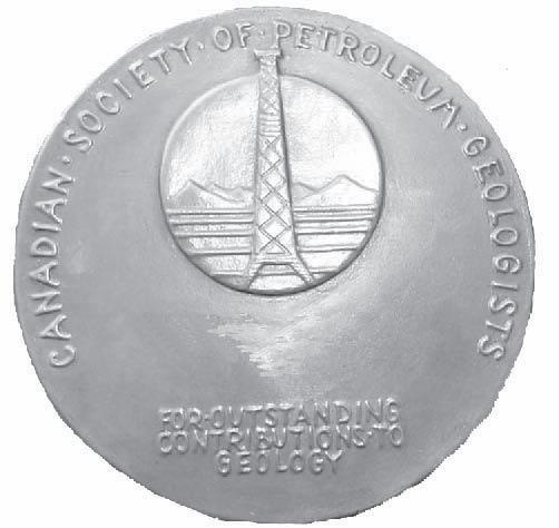
The RJW Douglas Medal is awarded annually by the Canadian Society of Petroleum Geologists for outstanding scientific contributions to the understanding of sedimentary geology in Canada, commending major contributions to regional tectonics, petroleum, and structural geology.
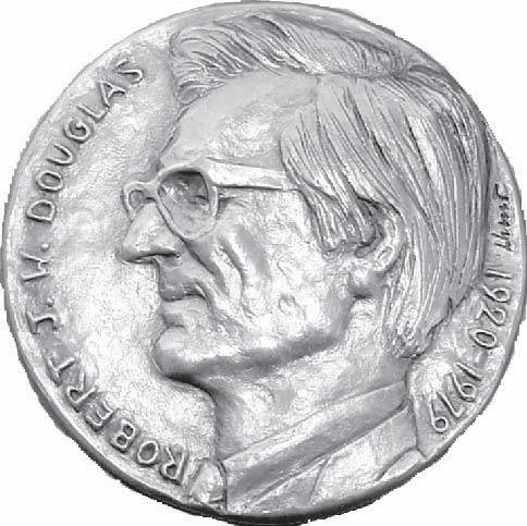


The award is open to all geologists who follow the example of Bob Douglas in contributing to the development of Canadian sedimentary, petroleum, and structural geology.
Nominations for the award of the medal must be endorsed by at least three members of the CSPG. Nominations may be proposed at any time, but to be considered for a particular year, they must be received by the Society before September 1.
The sponsors of a nominee for the award should supply:
A curriculum vitae (outling the nominee’s career and previous honours or distinctions).
A list of publications by the nominee.
A summary of the nominee’s achievements in a form suitable for use as a citation for the award.


An analysis of the nominee’s achievements, highlighting the contributions for which he or she is being recognized, and relating these to the appropriate publications in the bibliography.
The last item of information is a key part of the nomination and should convey the magnitude and scope of the nominee’s scientific contributions, with comments on the influence that these contributions have had on others. An example of a submission may be provided on request.
Completed nominations should be sent to:
Graham Davies
CSPG Douglas Medal Committee Chairman, c/o Graham Davies Geological Consultants
Alastair Ross Technology Centre
3553 - 31 Street NW, Calgary, Alberta T2L 2K7
Telephone (403) 289-9156, Fax (403) 289-9156
Email: gdgc@telus.net


ABU DHABI OIL CO., LTD. (JAPAN)
APACHE CANADA LTD.
BAKER ATLAS
BG CANADA EXPLORATION & PRODUCTION, INC.
BP CANADA ENERGY COMPANY
CANADIAN FOREST OIL LTD.
CANETIC RESOURCES TRUST
CONOCOPHILLIPS CANADA
CORE LABORATORIES CANADA LTD.
DEVON CANADA CORPORATION
DOMINION EXPLORATION CANADA LTD.
DUVERNAY OIL CORP.
ENERPLUS RESOURCES FUND
geoLOGIC systems ltd.
GRIZZLY RESOURCES LTD.
HUNT OIL COMPANY OF CANADA, INC.
HUSKY ENERGY INC.
IHS
IMPERIAL OIL RESOURCES LIMITED
LARIO OIL & GAS COMPANY
MJ SYSTEMS
MURPHY OIL COMPANY LTD.
NEXEN INC.
NORTHROCK RESOURCES LTD.
PENN WEST PETROLEUM LTD.
PETRO-CANADA OIL AND GAS
PETROCRAFT PRODUCTS LTD.
PRIMEWEST ENERGY TRUST
PROVIDENT ENERGY LTD.
RPS ENERGY
SHELL CANADA LIMITED
SPROULE
SUNCOR ENERGY INC.
TALISMAN ENERGY INC.
TOTAL E&P CANADA LIMITED
WEATHERFORD CANADA
AS OF MARCH 24, 2007

We are going to miss
Jaimè Croft Larsen joined the CSPG in early 1995 and, after 12 years with the Society, has elected to move on to the Petroleum Human Resources Council of Canada, where she assumes the mantle of Manager, Marketing and Communications. Jaimè has evolved dramatically in her years with the CSPG, moving from Office Assistant to her role today of administering virtually all of the Society’s communications, public affairs, and technical luncheon logistics, plus a myriad of ‘additional duties’.
On her watch, the Reservoir has moved from its modest monograph format to a full-colour magazine reflecting the breadth of the Society’s activities. To quote Ben Mckenzie, the Reservoir Editor: “The Reservoir has undergone many changes through the years and it is obvious that the Society can be proud of the quality of the publication as it stands today. Much of the credit for this over the past twelve years can be attributed to the efforts of the multi-faceted Jaimè Croft Larsen. In addition to her work as CSPG’s Manager of Communications, she has also done an outstanding job as Coordinating Editor and head of Operations in overseeing the monthly task of producing the Reservoir.”
Additionally, our website has become a truly inter-active and comprehensive information source for members, industry, and the general public; similarly, our Geological Calendar is now a wealth of information on Society activities wrapped in a great package of photos sourced from the membership; the vast majority of our entire publications archive is now readily available on both AAPG Datapages and GeoScienceWorld; our publications inventory is an eclectic blend of resources from across the geological spectrum; and, whether at our annual convention or at other meetings, the CSPG booth has gone from a modest pile of books to a dramatic presentation that speaks
to the professionalism and mosaic of our membership and the Society that represents them. Most recently, Jaimè was the architect of our new e-Newsletter that has undergone some innovative and dramatic changes over the past couple of months. She has also been instrumental in keeping the digital Geological Atlas project moving forward.
If you have ever attended a CSPG Technical Luncheon, then it was because of her efforts on the ticket sales and logistical side of the house; she coordinated the facility contracting, scheduling, catering, registration, AV resources, and speaker recognition gifts.
Behind the scenes, Jaimè has been instrumental in elevating the standard of delivery and quality of publications sales and management. She has been the hub of the Communications Committee for the better part of the last decade and has backstopped all of the committees that make up this important function.
When Jaimè isn’t elbow-deep in print proofs and html, she is trying to stay ahead of the Calgary real estate game with her husband, Kevin, serving as gymnastics mom for her son Julian, and helping her daughter Sam get through pre-adolescence. We wish her well in her new career and look forward to having an ‘in’ with the PHRCC.
Tim Howard
With regret, I have to announce that this will be the last issue to benefit from Jaimè’s work. I am sure the PHRCC will benefit from her ability and professionalism as the CSPG has.
Good luck, Jaimè, in your new endeavours and thanks for all the help you provided over the years.
Ben McKenzie Reservoir Technical Editor
SPEAKER
Henry Lyatsky
Lyatsky Geoscience Research and Consulting Ltd.
11:30 am
Thursday, May 10, 2007
Telus Convention Centre
Calgary, Alberta
The cut-off date for ticket sales is 1:00 pm, Monday, May 7th.* Tickets are $31.00 plus GST.
*Please note: Due to the recent popularity of talks, we strongly suggest purchasing tickets early, as we cannot guarantee seats will be available on the cut-off date.
Renewed interest in western Canada shelf basins results from widespread expectations that the long-standing government moratorium on offshore exploration there may soon be lifted. The best oil prospects seem to exist in Cretaceous reservoirs in the southwestern part of the Queen Charlotte Basin, in western Queen Charlotte Sound.
With widespread oil seeps from rocks of all ages, two dozen wells were drilled in the Queen Charlotte and Tofino areas before the 1970s. Many land areas were mapped in the 1980s and 1990s, largely by the Geological Survey of Canada. However, Vancouver and Queen Charlotte islands mostly lack caprock, Hecate Strait seems to lack adequate source and reservoir rocks, and the offshore wells did not significantly test the Mesozoic horizons. Rocks on the mainland are crystalline. The Tofino, Winona, Georgia, and Juan de Fuca basins lack significant known source rocks. By contrast, the southwestern part of the Queen Charlotte Basin seems to contain a stack of source, reservoir, and caprock strata, largely at oil-window burial depths, as well as large block-fault traps.
Economic basement in the Queen Charlotte
area is massive, thick Upper Triassic flood basalts, underlain onshore by partly metamorphosed older rocks. Above, highquality source rocks exist in the ~1,000m-thick Upper Triassic-Lower Jurassic assemblage, with oil-prone Type I and II kerogen and TOC (total organic carbon) up to 11%. Geochemical evidence suggests these rocks provided most of this area’s oil, and a major pulse of oil generation and migration was in the Tertiary. The overlying Upper Jurassic-Upper Cretaceous clastic succession, ~3,000 m thick, has negligible source potential but contains high-quality reservoirs with largely secondary porosity of ~15% or more. Above, mostly offshore, lie Tertiary mudstone, sandstone, and volcanic deposits, up to ~6,000 m thick in some faultbounded depocenters.
The Tertiary deposits have gas-prone Type III and II kerogen, with up to 2.5% TOC locally. However, clay products of feldspar decomposition greatly degrade their permeability, especially at basal levels. Reservoir-quality sandstone facies are found largely near the top of this unit, where migration routes from below and the seal above may be inadequate. The Tertiary
deposits thus seem to be predominantly caprock, perhaps with some secondary exploration targets.
Stratigraphic and sedimentological studies indicate the Triassic-Jurassic source rocks were deposited in a broad shelfal basin encompassing this entire region and beyond. However, the Cretaceous basin was confined to western Queen Charlotte Islands and northwestern Vancouver Island, with uplands to the east shedding detritus. Western Queen Charlotte Sound was probably part of the same Cretaceous basin, while eastern Queen Charlotte Sound and Hecate Strait largely lost their pre-existing source rocks and received few, non-marine Cretaceous deposits. Tertiary caprock, with thickness variable block to block, then blanketed Hecate Strait and Queen Charlotte Sound.
Western Queen Charlotte Sound should thus contain a favorable source-reservoirseal stack. Gravity data also indicate a great thickness of undrilled low-density (sedimentary?) rocks is present beneath western Queen Charlotte Sound but not elsewhere in the Queen Charlotte Basin.
Caprock-breaching faults are sparser in Queen Charlotte Sound than in northern parts of the basin, and the basin is not overpressured. Regional geological and geophysical correlations suggest that major Mesozoic block-fault networks were reactivated in the Cenozoic; kinematic indicators and cross-cutting relationships of faults and dated igneous rocks rule out significant strike-slip movements in the Neogene. Seismic and gravity data show the fault-bounded Tertiary depocenters and raised blocks to be comparatively broad in western Queen Charlotte Sound.
The caveats are several. Cretaceous rocks, deposited near their provenance areas, tend to be petrologically immature, and secondary porosity in them may be hard to predict. Buried source rocks beneath the deepest Tertiary depocenters may be thermally overmature. Some traps may be breached by Neogene faults: one offshore well encountered oil staining, suggesting oil passed through these Tertiary rocks and escaped. A major local influence on hydrocarbonmaturation levels on Queen Charlotte Islands is proximity to the mostly Jurassic and Tertiary igneous plutons. Similar potentialfield anomalies suggest massive igneous bodies may be present beneath eastern Queen Charlotte Sound, and correlations with mainland igneous suites put their age at Miocene. The pluton-related(?) magnetic anomalies do not seem to significantly extend into western Queen Charlotte Sound.
Henry Lyatsky is a Calgary-based consultant who has worked across western and northern Canada and internationally in hydrocarbon and mineral exploration. He was born in St. Petersburg, Russia and moved to Calgary as a teenager. He holds a B.Sc. in geology and geophysics (1985, University of Calgary), an M.Sc. in geophysics (1988, University of Calgary) and a Ph.D. in geology (1992, University of British Columbia). Henry is the first or sole author of three books (Springer-Verlag) and two atlases (EUB/Alberta Geological Survey) on the regional geology and geophysics of western Canada, as well as many papers. He is a member of CSEG, EAGE, AGU, MEG, and APEGGA.
Henry volunteers as President of the Calgary Mineral Exploration Group, whose annual Mining Forum conference he chaired in 2005. He has also held a number of campaign-management and constituency-executive positions with the Conservative Party of Canada and the Alberta PC Party.
To avoid the downtown rat-race and congestion, Henry works from home, enjoys the open space of the Alberta outdoors, and loves nothing better than an in-depth history book after a good hike in the mountains. He can be reached at www. telusplanet.net/public/lyatskyh or lyatskyh@ telus.net.
COMPLETED 1994 - 2004
COLD LAKE OIL SANDS
BALDONNEL - CHARLIE LAKE
MONTNEY (6 PHASES)
TURNER VALLEY
BANFF-PEKISKO
ALSO
WORSLEY COMPILATION
MONTNEY SPECIAL CORE ANALYSIS
MONTNEY CORE WORKSHOP
HTD SEMINAR, CORE WORKSHOP
DOLOMITE FIELD TRIPS
HTD MAP WCSB
NOTE: DEBOLT, BALDONNEL-PARDONET
PROJECTS IN NE BC DELETED
SPEAKER
Mark Cooper Encana Corporation.
11:30 am
Tuesday, May 29, 2007
Telus Convention Centre Calgary, Alberta
The cut-off date for ticket sales is 1:00 pm, Thursday, May 24th.* Tickets are $31.00 plus GST.
*Please note: Due to the recent popularity of talks, we strongly suggest purchasing tickets early, as we cannot guarantee seats will be available on the cut-off date.
A statistical analysis of reserves in fold and thrust belts, grouped by their geological attributes, indicates which of the world’s fold and thrust belts are the most prolifi c hydrocarbon provinces. The Zagros Fold Belt contains 49% of reserves in fold and thrust belts and has been isolated during the analysis to avoid bias. Excluding the Zagros Fold Belt most of the reserves are in thin-skinned fold and thrust belts that have no salt detachment or salt seal, are partially buried by syn- or post-orogenic sediments, are sourced by Cretaceous source rocks and underwent their last phase of deformation during the Tertiary. A signifi cant observation is that the six most richly endowed fold and thrust belts have no common set of geological attributes, implying that these fold belts all have different structural characteristics. The implication is that deformation style

is a not critical factor for the hydrocarbon endowment of fold and thrust belts; other elements of the petroleum system must be more signifi cant. Other fold and thrust belts may share the structural attributes but the resource-rich fold belts overwhelmingly dominate the total reserves in that group of fold belts. There is nothing intrinsic in fold and thrust belts that differentiates them from other oil and gas rich provinces other than the prolifi c development of potential hydrocarbon traps. Many of the prolifi c, proven fold and thrust belts still have signifi cant remaining exploration potential as a result of politically challenging access and remote locations.


Mark Cooper graduated with a B.Sc. geology degree from Imperial College, London in 1974 and with a Ph.D. from Bristol University in 1977. He taught geology at University College Cork prior to joining BP in 1985 to work on structurally complex basins based in London. Mark was assigned to BP Canada in 1988 where he worked on exploration in the foothills including the successful SukunkaBullmoose play in NE British Columbia. Mark also worked for BP in Colombia on the team that drilled the discovery wells on the Cupiagua, Volcanera, and Florena Fields. In 1994 he joined PanCanadian and worked on the BC foothills, western Newfoundland, Quebec, the Gulf of Mexico, the Scotian Shelf, and various international projects. He worked on frontier and international projects through the formation of EnCana in 2002 and currently manages the Middle East and Global New Ventures groups for EnCana. He has published over 50 papers and co-edited a book on Inversion Tectonics. He served as an AAPG Distinguished Lecturer for 1999-2000 and was a co-winner of the AAPG Matson Award in 2002. Mark has been heavily involved with both the Canadian Society of Petroleum Geologists and the AAPG serving on committees in both organizations over the last 10 years.


SPEAKER
Marian J. Warren EnCana Corporation
11:30 am
Tuesday, June 5, 2007
Telus Convention Centre Calgary, Alberta
The cut-off date for ticket sales is 1:00 pm, Thursday, May 31st.* Tickets are $31.00 plus GST.
*Please note: Due to the recent popularity of talks, we strongly suggest purchasing tickets early, as we cannot guarantee seats will be available on the cut-off date.
EnCana’s 2001 gas discovery at Ferrier, Alberta in the lower Mississippian Banff Formation was a significant new pool discovery in a long-active, competitive part of a maturing basin. Subsequent development of the pool has produced > 50 Bcf equivalent gas + condensate, at gross production rates of up to 100 mmcfe/day. The gas has been produced from dolomitized crinoidal grainstone reservoir, with up to 30% porosity and several hundred mD to several Darcies permeability.
Most drilling east of the foothills in western Canada pursues stratigraphic plays. Earlier drilling in the Ferrier area focussed on subcrop plays in younger Mississippian carbonates, and on overlying Mesozoic clastic plays. A few deepened wells encountered dolomite porosity in the Banff formation, significantly down-dip from its subcrop edge, culminating in local development of three 20-30 Bcf pools in the 1990s. Further exploration drilling encountered only wet porosity or tight limestone.
We used a regional, interdisciplinary exploration approach to high-grade the most prospective play fairways. EnCana’s discovery, the largest pool in this new play,
was significantly down-dip from known wet porous trends. Our strategy focused on defining regional stratigraphic, structural and diagenetic fairways, in order to locate 3-D seismic surveys to best image the Banff porosity. Conventional amplitude and AVO analysis, coupled with a regional sequence stratigraphic model, have been critical in distinguishing Banff Formation shales from reservoir, and thus dramatically reducing the initially high reservoir risk on this play. We adjusted our exploration approach and business strategy as our understanding of other play risks, reserve distribution, and play fairway evolved.
BIOGRAPHY:
Education :
1997: Ph.D. – Queen’s University, Ontario
1990: M.S. – University of Vermont, Burlington, Vermont
1984: B.A. – Williams College, Williamstown, Massachusetts
Experience:
2002-06: Geologist, EnCana Corporation (Projects in France, Chad, and Alberta foreland basin)
1997-2002: Geologist, PanCanadian Petroleum (Projects in Quebec, Alberta foreland basin, Alberta foothills)
Publications and Awards:
2002: Co-recipient of the CSPG’s Medal of Merit 2004: AAPG Matson Award
Publications
• Depositional styles in a low accommodation foreland basin setting: an example from the Basal Quartz (Lower Cretaceous), southern Alberta; B. A. Zaitlin, M. J. Warren, D. Potocki, L. Rosenthal, R. Boyd; Bulletin of Canadian Petroleum Geology, 2002 (CSPG Medal of Merit, 2002)
• The Selkirk fan structure of the southeastern Canadian Cordillera: tectonic thickening in response to inherited basement structure; M. Colpron, M. J. Warren, R. A. Price; Geological Society of America Bulletin, 1998 (Continued on page 23...)

nearly impossible
The Calgary Chamber of Commerce… to lead and serve the business community, valuing diversity
SPEAKER
Heather Douglas President & CEO, The Calgary Chamber of Commerce
11:30 am Tuesday, June 19, 2007 Telus Convention Centre Calgary, Alberta
The cut-off date for ticket sales is 1:00 pm, Thursday, June 14th.* Tickets are $31.00 plus GST.
Back in 1965, the majority of baby boomers
sponsored by
were looking for work for the fi rst time, Calgary’s population was hovering around 300,000, and the thought of $72/barrel oil was a pipedream. What a difference four decades makes. Today, the boomers are leaving the workforce at an alarming pace. Ironically, just as Canada’s fastest growing city nears one million people. While it’s anyone’s guess what oil futures might be in six months, I’d bet money on the predictions that our future labour challenges will loom larger than today.
According to Canadian Association of Petroleum Producers (CAPP) statistics,

the average demographic of the today’s oilpatch is white, male, and 54. By 2011, a wave of senior executives, seasoned technical support, and savvy field supervisors will retire. By 2015, estimates predict that 65% to 75% of the oilpatch will be gone. Who’s going to do the work as Generation X and Y currently represent only 25-35% of Alberta’s labour pool?
The Small Explorers and Producers Association’s (SEPAC) situation is marginally better than CAPP’s. While the demographic is somewhat younger, the juniors continue to battle with the challenge of little technical, regulatory, and community relations support available at competitive costs. Every accounting fi rm, reserves estimating and classifi cation organization, property appraisal company, and securities advisor faces the same scarcity of talent – with much of it also departing within the decade.
Many SEPAC executives are confi dent they can sell their companies to royalty trusts, now and in the future. Agreed. However, as the trust companies are now discovering, the capital markets have begun to examine not only the board of directors and executive team, now the analysts also look for solid engineering, geophysical, geological, environmental, fi nancial, and land negotiation talent embedded within to mitigate risk. No technical support? Expect the analysts to discount the share value.
What’s the solution? It’s multi-layered and needs time to take hold. It involves a longterm vision and formidable leadership. The Calgary Chamber of Commerce has embarked on a multi-pronged advocacy effort to ensure this city’s economy and the energy industry doesn’t stall:
• Action from government on issues they can do to streamline the process to bring in new immigrants, recognize their foreign credentials, and deal with the tax issues (e.g., change the Canada Pension Plan Act to allow seniors to work and not be penalized);
• Leadership from the oilpatch to train and mentor their Generation X and Y technical staff, recognize and hire the pools of untapped labour, and recognize international credentials;
• Long-term planning to establish the kind of future environment that creates, attracts, and retains the workers we need; and
• Articulate a stewardship vision that
refl ects the balance between conservation and future resource development.
As the boomers retire, good help isn’t hard to fi nd – it’s nearly impossible. The boomers must concentrate on grooming the next wave of innovative, young talent, hire and inspire immigrants, and ride out the on-going oil and natural gas commodity cycles.
Heather Douglas was appointed to the position of President and CEO of The Calgary Chamber of Commerce as of October 1, 2005.
Prior to joining The Chamber, Heather Douglas was the Founder and President of Strategic Public Affairs (SPA), a worldwide combination of external and internal affairs and communications professionals. She has more than 20 years experience in journalism and public affairs, has directed media, government, and shareholder relations, crisis communications, and image and reputation management for three major Canadian companies (one a Fortune 500 affiliate).
Douglas is the former Manager, Public and
Government Affairs for Mobil Oil Canada where she successfully directed several of Canada’s largest public consultation programs – including the Hibernia offshore oil and the Sable natural gas projects. Mobil sent her to run Mobil’s Public and Government Affairs Department in the United Kingdom and Norway, assigned her to special projects in the Far East, and brought her to Washington D.C. to work with several Asian embassies.
Douglas has also served as Vice President, Public Affairs and Government Relations with Atomic Energy of Canada (AECL), her duties included building relationships with foreign governments on behalf of the Crown Corporation. She also headed their worldwide media relations, stakeholder relations, crisis communications, and public consultation programs. She was an officer of the Corporation and a member of its Executive Council.
Douglas has co-authored two books and has spoken at numerous seminars and conferences. Her topics range from energy and communications to negotiation strategies. Douglas is currently working toward her doctorate in political science.
settings for shallow coalbed methane exploration areas in southeastern British Columbia and the westcentral plains of Alberta –
SPEAKER
Shane Harrison SH Consulting Services
12:00 Noon Thursday, May 24, 2007
ConocoPhillips Auditorium
3rd Floor – (west side of building)
401-9th Avenue SW (Gulf Canada Square) Calgary, Alberta
Numerous studies show that carbon and hydrogen isotope data, methane gas, and formation water chemistry derived from organic-rich facies can be reliable indicators of in-situ generation of methane and carbon dioxide through methanogenesis. The methanogenic process and its effect on water chemistry has been illustrated and described in the San Juan, Powder River, and Michigan basins of the United States. A particularly widely known example of microbial gas charging in coal basins is in the Powder River Basin in which relatively immature coals predominate and groundwater has also been shown to participate in real-time addition of migrated gas or in active generation of gas near anticlinal structures.
The Elk Valley coalfi eld and the Ardley coals (in part) of the Alberta Plains are


among coalbed methane exploration areas in western Canada which appear to show similar trends. The basins, although each in a unique physical and hydrogeological setting, share some characteristics - particularly in formation water chemistry and the isotopic compositions of gases, which appear to be, in part, controlled by microbial activity (i.e., methanogenesis). Among the more important of these characteristics are:
• anomalous concentrations of HCO3 (bicarbonate or DIC) enriched in 13C,
• CH4 depleted in 13C, and
• formation and, in many instances, localand basin-scale hydrodynamics.
Permeability, water chemistry (including stable isotope compositions), and the carbon geochemistry of gases will be compared and contrasted in each area. The data show that relatively active groundwater fl ow can be recognized based on one or more of formation pressures, groundwater chemistry, and oxygen and hydrogen ( 2H and 3H) isotopes. Exploration and production / development scenarios will be examined within the context of these data and the hydrogeological setting.
Shane is a professionally registered geologist in Alberta with a well rounded background in earth sciences applied in compiling, assessing, analyzing, synthesizing, and reporting information for hydrogeological assessments. His experience is varied and includes CBM / shallow gas resource evaluation / development in Saskatchewan, Alberta, and British Columbia. His work has included 3-D flow modeling; isotopic studies of groundwater and dissolved gases; hydrodynamics and inorganic/organic geochemistry of groundwaters used in prospect characterization, evaluation, exploration, producibilty, and water management studies. Work areas have included central Alberta (Ardley and Mannville), southwestern Saskatchewan, and southeastern British Columbia (Mist Mountain).
EPRD noon-hour talks are free and do not require registration. Non-CSPG members are also welcome to attend. Please bring your lunch. If you would like to join our email distribution list, suggest a topic, or volunteer to present a talk, please send a message to Michelle.Hawke@bp.com. Division talks are sponsored by IHS (http://www.ihs.com)
SPEAKER
Gordon Graham
SOCO International plc
12:00 Noon
Monday, May 28, 2007
Encana Amphitheatre, 2nd floor, East end of the Calgary Tower Complex 1st Street and 9th Avenue S.E. Calgary, Alberta
SOCO has been actively exploring in the Cuu Long Basin since 2000 with interests in Blocks 161 and 9-2 straddling the central part of the basin adjacent to the giant Bach Ho field. During that time we have discovered two significant oil fields and expect initial production to begin in 2008. The talk will review the geology of the Blocks and the exploration results.
The Cuu Long is a Tertiary rift basin, elongate to the northeast, approximately 250 km long by 100 km wide. It is Vietnam’s richest oil-producing basin with the bulk of the production coming from fractured granitic basement reservoirs, generally considered an unconventional reservoir. There is secondary production from sands overlying and flanking the basement fields. The basin was restricted through the Oligocene resulting in deposition of rich lacustrine oil source rocks that charged the adjacent fractured basement reservoirs and the overlying sandstone reservoirs. There was an increasing marine influence in the basin from the end of the Oligocene.
After an initial drilling campaign resulting in one significant basement discovery, SOCO developed a new play and discovered oil in continental to marginal marine Lower Miocene sands deposited in the basin depocenter and unrelated to basement production.
Exploration on Block 9-2 began with a 3D seismic program followed in 2002 by the Ca Ngu Vang 1X discovery well that flowed 3,100 bopd of 44°API oil and 7.9 mmcf/d of gas from fractured Basement. A vertical appraisal well, CNV 2X, encountered a 1000m oil column within the fractured basement but failed to flow oil to surface. The well was sidetracked to the northeast and, although oil shows were encountered over a 1400m section of
fractured basement, the 2XST also failed to flow oil on test. The rig was then released and drilling suspended to allow evaluation of the well results and reprocessing of the seismic to better identify fracture zones in the granite.
In 2005 the CNV 3X appraisal well was drilled to a TD of 6,100m with a maximum deviation of 80 degrees to test seismically identified fault zones within basement. The well flowed 9,010 bopd and 22.6 mmcf/d. The field was declared commercial and first production is targeted for 2008.
On Block 16-1 the initial evaluation began in the western part of the Block where the basement was shallower. 3D seismic acquisition was followed by a three-well drilling program. Two of the wells encountered oil-saturated basement fractures; however, the fractures were poorly developed and only a small amount of oil was recovered. The lack of fracturing is attributed to the low relief of the structures. The third well flowed 3,846 b/d of 42° API oil from Oligocene sands although the field was small because the top seal was poorly developed.
The focus of exploration then shifted to the sedimentary section and additional 3D seismic was acquired in the eastern part of the Block where the section is thicker and greater intra-formational
sealing capacity was predicted. In 2005 the Te Giac Trang 1X discovery well flowed 8,566 bopd of 37° API oil and 4.86 mmcf/d from the Lower Miocene Bach Ho Formation sands. The trap is formed by drape over a deep-seated basement high modified by later faulting. Four successful appraisal wells have been drilled confirming oil pay in four of five fault blocks extending over 15km in a north-south trend. The declaration of commerciality is being prepared and development plans are underway.
Currently the Exploration Manager for SOCO International plc. Received a B.Sc. in Applied Geology from the University of Strathclyde in Glasgow in 1975 and an M.Sc. in Geology from the University of Calgary in 1977. Has worked for Amoco, Canadian Occidental, and SOCO in Canada, Africa, the Middle East, and Southeast Asia.
The International Division talks are free and open to anyone. Donuts and muffins are provided by Gore Surveys but feel free to bring your lunch. The facilities for the talks are provided complements of EnCana Corporation. For further information, to volunteer to give a talk or to list your name on the contact list, please contact Bob Potter at (403) 863-9738 or ropotter@telusplanet.net.
SPEAKER
Karen Hoffman
Roxar
12:00 Noon
Wednesday, May 30, 2007
ConocoPhillips Auditorium
3rd Floor- above Plus 15+ level
401 9th Avenue SW
Calgary, Alberta
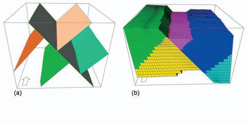
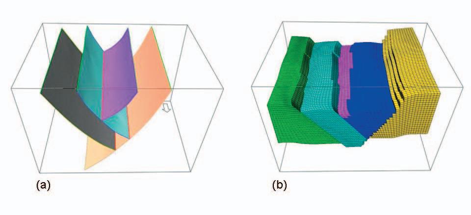
Exploration and production of hydrocarbons today increasingly require more and more sophisticated techniques throughout the entire process. On the upstream side, the economics of deepwater exploration and production require that risk be reduced as much as possible, and a large part of that risk lies in understanding the structural complexity of the reservoir. At the other end of the spectrum, brownfield development requires detailed knowledge of the reservoir in order to extract the maximum amount of hydrocarbons possible, and a large part of that knowledge again lies in understanding the structural complexity of the reservoir. Without static models that accurately represent the subsurface, it is difficult to make the correct reservoir management decisions. Static model building has been in existence for at least twenty years, and yet the accuracy of the models has not kept pace with the demands of exploration and production activity. Creating a model often requires compromising the structure – moving faults, simplifying the framework – in order to fit the constraints of the modeling software. This can lead to inaccuracies in reserve calculations, flow simulations, and well placement – ultimately resulting in poor reservoir management.
The fused fault block approach to static model building is not just a new method of creating a fault framework, but also applies to the creation of the geologic model and the reservoir grid. This process involves three steps – creating the fault framework, creating the geologic model, and creating a reservoir grid – which are not all that different in principle from other approaches, but which are quite different in application. This method does not require compromises or simplification in types of faults, numbers of faults, or types of intersections; does not require compromises or simplifications in horizon modeling of complex shapes such (Continued on page 25...)
Don’t just learn it, live it. With a unique, hands-on experience through the AAPG. Choose from over 50 exciting field seminars and short courses all designed with the goal of helping you explore and better understand your industry. For complete details on any of the field seminars and short courses listed below, call +1 918 560-2650 or visit http://www.aapg.org/july/
Predicting Clastic Reservoirs Using Applied Sequence Stratigraphy: Understanding The Fundamental Drivers Of Basin Fill Architecture • June 9-16, 2007 Begins and ends in Salt Lake City, Utah. $2,000 per person ($100 more after 5/11/07)
Folding, Thrusting And Syntectonic Sedimentation: Perspectives From Classic Localities Of The Central Pyrenees • June 11-15, 2007 Begins and ends in Barcelona, Spain. $1,750 per person ($100 more after 4/30/07)
Seismic Interpretation of Compressive Structures • June 21-27, 2007 Begins and ends in Calgary, Alberta, Canada. $2,750 per person ($100 more after 6/22/07)
Interpretation Of Old DST’s To Find Additional Oil And Gas Potential • June 4-8, 2007 $1,195 for AAPG members. $1,295 for non-members ($100 more after 5/20/07)
Basic Well Log Analysis • July 24-27, 2007 $1,095 for AAPG members. $1,195 for non-members ($100 more after 6/26/07) Held in Austin, Texas.
Application of Structural Geology in Prospecting in Thrusted and Extensional Terrain • August 6-10, 2007 $1,195 for AAPG members. $1,295 for non-members ($100 more after 5/20/07) Held in Jackson Hole, Wyoming.
Basic Petroleum Geology for the Non-Geologist • August 28-30, 2007 $1,195 ($100 more after 8/28/07) Held at the University of Tulsa, Tulsa, Oklahoma.
Practical Salt Tectonics • August 20-22, 2007 $895 for AAPG members. $995 for non-members ($100 more after 6/11/07) Held in Houston, Texas.
For more info or to enroll call +1 918 560-2650
(…Continued from the January, 2007 issue of the Reservoir)
On the morning of August 25th 1892, near the outpouring of the Geikie River into Wollaston Lake’s Nekweaza Bay, the two parties separated. Both Joseph Tyrrell’s and Donaldson Dowling’s return to civilization was predetermined to be Prince Albert, the northern rail terminus in the District of Saskatchewan. From there, contingent on the completion dates of their respective surveys, they would, either together or alone, return to their headquarters at the Geological Survey of Canada in Ottawa.
Dowling, utilizing two canoes to be manned by four boatmen, namely: Gwillim, Porter, Collins, and one unnamed, who “was familiar with rapids on the Athabasca River”; had previously been directed by Tyrrell to access Reindeer Lake by either the Cochrane River or the Canoe River. Dowling chose the latter route. By doing so, Dowling would retrace David Thompson’s passageway between Wollaston (Manito) Lake and Reindeer Lake, which the latter had navigated 96 years earlier. The object of his journey was to discover a shorter canoe route to Lake Athabasca, such that his employer, the Hudson’s Bay Company, could expedite the freighting of trade goods to and furs from the region.
The axis of the height of land in the region of Canoe River trends northeast - southwest and, after expressing itself above the upper reaches of this river, veers north to be masked beneath Wollaston Lake. The rocky terrain of its northwest flank is characterized by several elongated muskeg-fringed lakes paralleling the axis of the divide, whose waters collectively flow northwest into Compulsion Bay, located on the southeast margin of Wollaston (Manito) Lake. Dowling’s party, in traversing these lakes and portaging around some of the interconnecting muskeg areas, was able to reach the headwaters of Canoe River after crossing the height of land, located at a distance of 15 miles southeast of Wollaston (Manito) Lake.
The Canoe River is principally sourced by the Middle, Cairns, Mullin, and Swan Lakes, all of which are located on the southeast flank of the divide that separates the Mackenzie River drainage basin from that of the Churchill River.
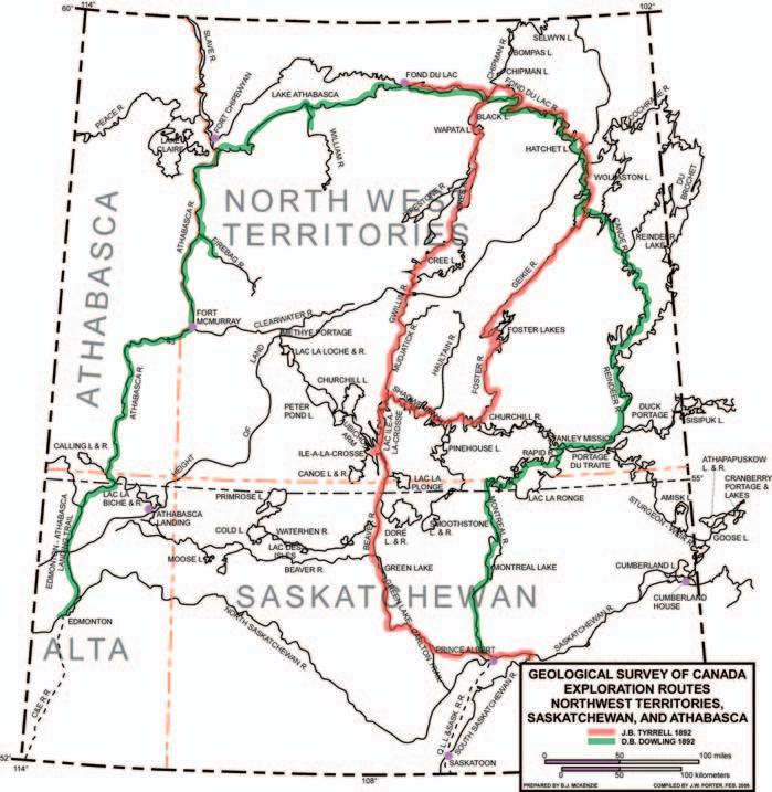
The waters from these lakes are collected by creek-size tributaries of the Canoe River, which, after a 30-mile watercourse, discharges its runoff into Reindeer Lake’s west-central margin. Dowling succinctly describes Canoe River by noting: “This stream proved so shallow that all our efforts were needed in getting down …” (1893, Selwyn, A.R.C.: Summary Report of the Geological Survey Department for the year 1892, in part A, p. 23A). During his party’s descent of Canoe River, Dowling recorded nine portages in all; three along the northwest flank of the height of land between lakes and six along the southeast flank; the latter portages involving lakes drained by connecting creeks to Canoe River. His traverse from Wollaston (Manito) Lake to Reindeer lake, by way of the Canoe River route, took place between August 27th and September 2nd, 1892.; whereas Thompson’s initial crossing from Reindeer Lake to Wollaston (Manito) Lake appears to have occurred from June 16th to June 20th, 1796. Creek and lake levels were undoubtedly higher during Thompson’s passage.
Dowling reported that the upper part of the Canoe River had incised a valley floored by a wide sandy plain. The sand deposit had, for the most part, masked the subjacent Archean terrain, with the exception of a few granite
ridges. After leaving the sandy country, the mid-section of the Canoe River meanders through a flat muskeg terrain to where it enters Swan Lake. Here, exposures of fine reddish gneiss occur on the lake’s east side. Below Swan Lake, ledges of dark hornblende gneiss are exposed at the Canoe River’s second-most lowest rapids, below which a thick mantle of glacial debris is present to the river’s mouth, concealing any bedrock.
David Thompson had managed to traverse the Canoe River route, Lake, linking Wollaston (Manito) Lake with Reindeer in a small canoe with the help of his two young Chipewyan boatmen: Kozdaw and Paddy. By doing so he had demonstrated a much shorter passageway to Lake Athabasca than the established longer route, by way of the North Saskatchewan River / Lac Ile-a-la-Crosse / Methy Portage/ Clearwater River/ Athabasca River. However, the Canoe River segment of Thompson’s eastern canoe route, as a conduit for the inland transport of personnel, provisions, trading articles, and furs in large freighter canoes, was later found to be impractical.
To quote from David Thompson’s Narrative, concerning his mid-June, 1796 traverse from Reindeer Lake to Wollaston (Manito) Lake, (Continued on page 22...)
he states: “We Proceeded up the Rivulet (Canoe River) which we found shoal, with many rapids, and soon led us to Ponds and Brooks, with several Carrying Places, which connected them together for fifty miles, the last of which placed us on the banks of the Manito (Wollaston) Lake (latitude 57°47’38”N, longitude 103°17’12”W). The whole of this route can be passed in the open season only by small Canoes; the country as usual poor and rocky;” (Ibid.: 1962, Glover, Richard, ed. c. intro.; David Thompson’s Narrative 17841812; pub. The Champlain Society XL; p. 111).
During David Thompson’s journey to Lake Athabasca in June, 1796, he had inquired from local Chipewyan natives regarding the accessibility of Canoe River to accommodate freighter canoes, notwithstanding his own negative opinion as to it being viable. The natives’ deferential answers, in not wishing to displease Thompson, advised him that one of the tributaries at the headwaters of the Canoe River was consistently found to be deeper in the autumn than in the summer. Thompson accepted their remarks as valid, rationalizing that the river could facilitate the passage of freighter canoes during the late summer and early autumn to reach the lakes draining into Compulsion Bay.
Malcolm Ross, as David Thompson’s superior – as well as being a veteran with 22 years of service with the Hudson’s Bay Company – had a serious misgiving concerning the natives’ inexplicable advice to Thompson, Ross countered their claim by reporting: “the Reverse of what I have ever as yet seen. Even the largest of Rivers that is falen (my observation) Ender Falls off towards the fall of the year.” (Ibid.: David Thompson’s Narrative 1784 - 1812 ---intro., p.xxxiii).
Malcolm Ross had left Fairford House on May 29th, 1796 for York Factory, taking with him the furs that David Thompson and he had received by bartering with the Chipewyan natives during the preceding winter. He had returned to Fairford House, situated near the confluence of the Reindeer and Churchill Rivers, on August 26th with four large canoes carrying a brigade of 14 indentured white labourers and two native women. Each canoe also contained 600 pounds of trading articles and provisions. Ross’ intention was to continue his journey to Lake Athabasca in order to fulfill his mandate by establishing a Hudson’s Bay trading post at Lake Athabasca before freeze-up.
Although justifiably skeptical of the practicality of David Thompson’s Canoe River route he, nevertheless, reluctantly acquiesced to Thompson’s persuasion to retrace the latter’s recently completed route to the east end of Lake Athabasca. He
would have preferred the longer, but reliable, Ile-a-la-Crosse route to the west end of Lake Athabasca.
Malcolm Ross had previously been introduced to the Lake Athabasca region, having led, as master of the expedition, a journey of discovery, during the period 1790 - 1792. It was the Hudson’s Bay Company’s first visit to the region. His party included: Philip Turnor, as surveyor; Peter Fidler, as Turnor’s assistant; Hugh Leask, steersman; and boatmen Robert Garrock and Malcolm Grott, including the latter’s children. Ross was also accompanied by his native partner and their two children. According to Peter Fidler, the object of the expedition was to survey the route in order to resolve suspected inaccuracies in maps drawn by Samuel Hearne and Peter Pond, whose positioning of major geographic features were felt to be too far westward (1966, MacGregor, J. G.: Peter Fidler: Canada’s Forgotten Survetor 1769 - 1822, pub. McClelland and Stewart Ltd., Toronto, p. 27). Turnor and Fidler had extended their reconnaissance survey to the east end of Lake Athabasca.
Peter Fidler, in 1791, while surveying the lower reaches of the Christina River, a northwestflowing tributary of the Clearwater River reported: “Several curious kinds of shells, some in the middle of solid stone and several in bare earth, the exact figure remaining and some appeared as if they had been petrified to a solid stone, such as cockles, muscles and other kinds of shells frequently found in the interior parts of this country.”
While continuing his survey along the valley of the Athabasca River; Fidler noted in his journal that he had: “Found great quanities of bitumen a kind of liquid tar oozing out of the banks on both sides of the river in many places, which has a very sulphurous smell and quite black like real tar and in my opinion would be a good substitute for that useful mineral.” (Ibid.: 1966, MacGregor, J. G.---- pp. 32,33). Peter Fidler’s description of the bitumen occurrence associated with the McMurray Formation exposed along the banks of the Athabasca River, as well as alluding to its potential exploitable value in its raw state attests to his astuteness.
On August 29th, 1796, some three days following his return to Fairford House, Malcolm Ross, having included David Thompson, as well as a new Chipewyan guide in his party, resumed their journey up the Reindeer River in their four large canoes. Arriving at Thompson’s “Point of tolerable Pines” located on the westcentral margin of Reindeer Lake, Ross decided to utilize the site for an intermediary trading settlement, which would serve as a link with the post he hoped to build at Lake Athabasca. The exact location of the Reindeer Lake post has yet to be established, but is presumed to
have been built at Vermilion Point, marking the headland expressed on the south side of the mouth of Vermilion (Pink) River. The entrance to Canoe River lies 11.5 miles northby-northwest of Vermilion Point. Two large canoes, as well as a group of labourers with the necessary provisions, were left at the latter site. The men were assigned to construct mud huts to accommodate themselves pending the return of Ross’ advanced party.
After ascending the Canoe River to its most accessible creek, Ross and Thompson found it necessary to lighten the loads in their large canoes. Finally this uppermost headwater creek petered out in a network of muskeg, which resulted in an impasse. According to Ross, Thompson’s route led to: “nowhere to be supplied from but Swamps (muskeg) which I am doubtful will be but a poor supply at this season of the year’.”. Thompson regretfully admitted that there was insufficient water to “lead a small canoe” (Ibid.: David Thompson’s Narrative 1784 1812 intro., pp.xxxiii, xxxiv). He realized, at this juncture, that his enthusiasm for his Canoe River route had taken precedence over common sense in placing so much credence in the natives’ implausible concoction.
Disenchanted, Ross’ advanced party retreated to Vermilion Point to rejoin their teammates. He regretted not having taken the Ile-a-la-Crosse route where there would be more game and fish for their survival, as well as more returns in fur trafficking. To quote historian, Arthur Morton: “The country was little frequented by moose or caribou and wellnigh untrodden by man. The fishery provided no more than a bare existence.” Nevertheless, the 18-member settlement survived the bitterly cold winter in their improvised, grass-reinforced mud huts, on half-rations meted out to each member. A rough log house, measuring 26 feet by 20 feet, was constructed by the labourers to serve as trading quarters and accommodation for Malcolm Ross and David Thompson. Its ironic name, Bedford House, belied its habitat. It was from here, on May 23, 1797, that David Thompson, considering himself a “freeman”, deserted the Hudson’s Bay Company, after 13 years in their service. Taking his survey instruments, he walked to the Nor’Wester’s post at the south end of Reindeer Lake to offer his services to the North West Company. He was to replace Malcolm Ross, whose retirement in August, 1797, had been approved by the resident Governor and Committee at York Factory. They had designated David Thompson to replace him and assume his title, “Master to the Northward”. Malcolm Ross, out of deference to the Hudson’s Bay Company, postponed his retirement. (Ibid.: 1939, --- p.448) Morton, Arthur S.:A History of the Canadian West to 1870-71.
(To be continued…)
External Publications at EnCana:
• A High-impact Gas Discovery in a Maturing Basin (Western Canada); M. Warren, A. Lowe, and M. Gilhooly (AAPG Best Paper Award, 2004)
• Extensional faulting, paleodrainage patterns and impact on hydrocarbon reservoir quality and distribution during foreland basin subsidence: A case study from the Lower Mannville of south-central Alberta; M. J. Warren
• Everything you ever wanted to know about the Chevron construction but were afraid to ask; M. Cooper and M. Warren (structural technique talk)
• Tectonic inversion of the Laurentian rifted margin in southwestern Canada; M. J. Warren and R. A. Price
• A regional “break-up” unconformity within the Neoproterozoic(?) to Lower Cambrian Hamill Group, S.E. Canadian Cordillera, and implications for syn- and post-rift basin configuration and regional paleogeography; M.J. Warren and R. A. Price
• Thick-skinned reactivation of Early Paleozoic basement “highs” and along-strike variations in Taconic structural style, Vermont and southern Quebec (Appalachian Humber Zone); M. Warren and M. Colpron
• Thin- versus thick-skinned thrusting and tectono-stratigraphic relationships in the Humber Zone of Quebec and Newfoundland: M. Cooper, M. Warren, J. Porter-Chaudhry
Professional Memberships:
• American Association of Petroleum Geologists
• Canadian Society of Petroleum Geologists
Professional Interests:
• Developing and testing exploration plays
• Basin evolution and petroleum systems
• Tectonics and sedimentation in varied tectonic settings
• Structural geology and rock mechanics
• Presenting training courses for petroleum geoscientists
• Going in the field!
*Dr. Marian Warren has been selected by the AAPG to perform a series of lectures throughout North America as a part of there distinguished lecturer program. The AAPG Distinguished Lecture Series was developed to offer outstanding speakers on current research and applicable geology. (...Continued

IN SEISMIC ACQUISITION
IN SEISMIC ACQUISITION
Boyd PetroSearch helps evaluate new territory.
Exploring? Boyd PetroSearch offers a comprehensive Project Management service to provide high quality, cost-effective options for seismic exploration. We manage every stage of your exploration program – from preplanning through recording. Our experience in approvals, mapping, permitting and HSE is unbeatable.


Find out how we can reduce your risk in acquiring seismic data by ensuring that your projects are completed safely, on time and on budget.
Please call:
Kevin Bowman 403.543.5357
Larry Herd 403.543.5362 or visit www.boydpetro.com Boyd Exploration Consultants Ltd.
as repeat section; and does not require compromises or simplifications in creating the reservoir grid, such as limiting the types of intersections that can be made. This methodology has also been optimized for usability (allowing an asset team to build a model, and not just an expert modeler) and for speed (reducing the cycle time of creating and updating the model).
This paper will be presented at the EAGE Conference in London, June 2007.
Karen Hoffman is a geomodeler for Roxar in Houston. She has worked on the design and implementation of structural framework building software for over 20 years, and has applied this technology to fields around the world. She holds a B.A. degree in geology from Carleton College and a M.Sc. degree in geology from the University of Michigan.
INFORMATION
There is no charge. Non-members of the CSPG are also welcome. Please bring your lunch. For details or to present a talk in the future, please contact David Garner at 403-234-5875, e-mail: DavidGarner@ Chevron.com or Rob Chelak at 403-290-0551, email: Robert.Chelak@Roxar.com.
15th Williston Basin Petroleum Conference and Prospect Expo
April 29-May 1, 2007
Delta Regina Hotel – Saskatchewan Trade & Convention Centre www.wbpc.ca
Geological Association of Canada / Mineralogical Association of Canada Annual Meeting
May 23-27, 2007 Yellowknife, NWT http://www.nwtgeoscience.ca/ yellowknife2007/index.html
2007 CSPG CSEG Annual Convention
May 14-17, 2007 Calgary, AB www.GEOconvention.org
CSPG Field Trip
June 20, 2007
Exploration Targets in the Canadian Rocky Mountain Foothills: Calgary to Moose Mountain, a Helicopter Supported Field Trip. Instructor(s): Andrew C. Newson, B.Sc., P.Geol. and Deborah Sanderson, M.Sc., P.Geol. www.cspg.org

PETREL* SEISMIC-TO-SIMULATION SOFTWARE AMPLIFIES THE IMPACT OF E&P TEAMS. Optimize reservoir performance with a single solution. Unite the subsurface domains of geophysics, geology, and reservoir engineering to evaluate reservoir quality away from well control while honoring geologic features that impact reservoir performance.
“Being able to run multiple simulations with multiple scenarios really helped bracket the uncertainty, especially with limited well control in the deepwater environment. Faster, more accurate answers with a greater range of uncertainties can be covered in a very short time.” SubsurfaceLead,MurphyOil
Schlumberger Information Solutions—reducing risk for better business results.
www.slb.com/petrel
*Mark of Schlumberger©


(...Continued from page 29) size and historical data by way of a discovery model. Risk is more likely to be assessed separately in a play analysis than it would be for areal or volumetric yield studies.
Geologic assessment based on play analysis assumes that the geologic characteristics within a play are significantly correlated and that these characteristics show substantially less correlation between plays. This method tends to be more locally focused, as opposed to the regional scale of the areal

and volumetric methods. The play approach divides the geologic characteristics of a potential deposit into three categories – play specific, prospect specific, and reservoir specific.
Play specific characteristics are those common to the play as a unit and include hydrocarbon source, timing, migration, reservoir rock, and the number of prospects. The occurrence of these attributes is a necessary but not sufficient condition for the existence of oil and gas deposit in the play. Prospect specific
attributes are the geologic characteristics common to the individual prospects within the play and include the existence of a trapping mechanism, minimum effective porosity, and hydrocarbon accumulation. Reservoir specific attributes are the reservoir characteristics of an individual deposit of oil or gas in the play and include such things as the area of closure, reservoir thickness, effective porosity, trap fill, reservoir depth, water saturation, and hydrocarbon type. Experts familiar with the geology of the area of interest develop probability judgments concerning each of these sets of characteristics.
The play analysis approach appears to simplify the task in evaluating the resource of an area by providing a fixed format of the variables to evaluate and because the actual resource assessment is determined by means of a mathematical computation using a computer model. However, such computerized procedures do not mean that the accuracy has been increased over those assessments made by means of other appraisal methods. Some of the causes for this concern are:
• The assumptions and mathematical manipulations within the computer system are frequently designed by technical personnel who are not familiar with the basic concepts regarding petroleum geology – one such weakness is the assumption that all the variables assessed in each play are independent, as used in the Monte Carlo simulation whereas many of the geologic and reservoir variables are directly correlated;
• Play analysis techniques are applied to frontier areas where limited data are available and where subjective evaluations are based on comparative analogs. Because the subsurface geology in frontier areas may be poorly known and highly speculative, identifying analogs to use for comparison is difficult. The resulting assessment is only as good as the match is to the analogs selected.
• When the play analysis method is used in a frontier basin, all potential plays are assumed to have been identified and adequately described. However, many unanticipated resources in unidentified plays may be found as the area is explored.
This method uses historical records to relate discovery data to either time or some measure of exploratory effort. Typical data used includes discovery rates, drilling rates, productivity rates, field size distributions, etc.
(Continued on page 35...)
At IHS, we believe in delivering data quality and coverage, just the way you want it.
Quality Assurance – All raster logs are scanned from the original source documents at 400 dpi, ensuring you the best print quality.
Depth Registration – All logs are scanned from the original paper form and depth registered prior to loading into the raster database.
Matrix – All logs are marked for their segments (including headers, scales, main passes and repeat sections) and any matrix the log may have (Limestone, Sandstone and Dolomite).
Comprehensive Coverage – IHS obtains original paper forms from the government weekly. We then scan the data, perform depth registration and quality checks, and upload new data nightly into the IHS database.
See for yourself. Call your Account Executive at 403 770 4646 for more information.
See further. See opportunity. See clearly.


IHS has grown and so has the diversity of our Culture.
Culture graphically provides a real-life point of reference to interpret geospatial data in its entire context for better decision making.
IHS is combining multiple data sources to create the IHS Integrated Culture datasets, enhancing data quality, precision, breadth and depth. These evolving datasets bring together IHS historical offerings like IHS Enhanced Grid with new data layers like the IHS Transportation Infrastructure Data.
IHS strives to provide you the most trusted, comprehensive and high-quality datasets. IHS Integrated Culture continues this tradition as we maintain, update and add new datasets to create the ultimate Culture offering.
See for yourself. Call your Account Executive at 403 770 4646 for more information.
See further. See opportunity. See clearly. 403 770 4646 www.ihs.com/energy

Historical data are fitted into logistic or growth curves by various mathematical derivations that extrapolate past performances into the future. Most studies base projections of estimated resources primarily on statistical studies of the historical data and generally include little or no geologic information. This is due largely to the very large sample areas that are generally evaluated by these methods. However, geologic constraints are implicit in the data. Finding rates and field size distributions are directly related to the geologic settings that control the formation of the hydrocarbon accumulations (assuming that the dataset population is chosen properly!). Individual methods vary in quality according to what time or effort measure is used. An important aspect of assessment methods that focus on reservoir performance is that historical production and development patterns serve only as a starting point for the assessment forecast. Input parameters need to reflect perceived impacts of future change, as well as avoid representing known “sweet spots” as characteristic of future development. These methods are not suitable for unexplored or non-producing areas. Also, they do not allow for any surprises from new areas or zones where production has not been found previously, nor do they allow for improvements in technology or economics.
8) POOL SIZE ANALYSIS: One way to use pool-size data is to assume a distribution (e.g., lognormal) and then use the sizes of discovered pools to calculate the expected sizes of undiscovered pools that might exist in a play. This is feasible only when the sample size of discovered pools is sufficiently large enough so that the shape of its frequency distribution can be taken to mimic at least some part of that of the combined discovered and undiscovered pool population. If the population standard deviation is unknown, a valid confidence interval using normal distribution can only be computed when the sample size is relatively large – i.e., over 30 (Sanders 2001) A simple form of this method is to multiply the number of prospects expected in an area by an assumed success ratio to estimate the number of potential pools and then multiply this by the potential average pool size in ultimately recoverable barrels-of-oil-equivalent to reach a single value for the assessment.
An advanced form of this method uses a range of values for both prospect numbers and field sizes, which are then combined in a Monte Carlo simulation to produce the assessment. The ranges help emphasis the uncertainties inherent to assessments. Ideally, a play should be assessed by aggregating all the individual
prospect assessments. The requirements for this are 1) estimates of potentially recoverable amounts with specified minimum and maximum cutoffs in likely pool-size distributions; 2) the numbers of potential pools, based on counts of undrilled prospects considered along with postulated field success ratios; and 3) the chance of the play’s existence, i.e., the chance of at least one pool of minimum size. It is critical that the play is defined properly – the prospects should form a homogenous group. If there is a significant variation in any of the defining parameters, it is often best to define a new play. However, it is possible that plays differing geologically might still have virtually identical pool-size distributions.
Pool-size distributions can be constructed in at least three ways – 1) a look-alike mature play can be selected and its pools plotted; 2) representative prospects in the play can be assessed, and the mean assessments plotted; or 3) the distributions of prospect areas, reservoir parameters, etc. can be combined in Monte Carlo simulations to produce a distribution of possible pool sizes. The ultimate key to selecting any distribution is that is should be tied to the largest pool anticipated in the play. This is important because nature ultimately truncates all distributions by limiting effective closure space or source rock capacity. Any patterns found in pool-size distributions may assist in determining the limits to a basin’s resource potential.
Discovery process models estimate play potential and pool-size distributions by modeling the interaction between the natural processes leading to hydrocarbon accumulation and the results of exploration drilling. This generally consists of a quantification of the relationship between pool size and the order or sequence in which discoveries are made. Identification and definition of the underlying quantitative curve reflecting the discovery process is extremely difficult because of the dynamic changes in the discovery process due to economics, technology, politics, etc. The exploration success ratio for an area will decrease with time as a result of the limits imposed by the finite population of pools and resources. While generally declining, there may be erratic fluctuations and non-linear success ratios trends, which can cause problems in resource assessments. Estimates of resources are extremely sensitive to the nature of the curve used and large differences can occur depending on the model used. Discovery process models include Arps-Roberts, nonparametric finite population, successive sampling, anchored, and geo-anchored.
Kaufman’s anchored method takes the discovery sequence and anchors on the total
number of pools, N, to estimate the total resource, R, or vice versa (Kaufman 1986). The method is useful for testing geological concepts given N or R, particularly where geologists wish to know how many pools are required to make up a given resource inferred by expert judgment.
Chen and Sinding-Larsen’s geo-anchored method (Chen and Sinding-Larsen 1999) takes the discovery sequence and estimates the number of undiscovered pool sizes for each size class, provided an exploration efficiency (reserves discovered per well) is given. Estimates are conditional on the total resource, number of fields, and the exploration efficiency. The geo-anchored method can predict expected size of the next discovery and forecast the number of discoveries as a function of additional wells required.
Arps and Roberts developed one of the earliest discovery process methodologies in 1958 while working the Denver-Julesburg Basin of Colorado and Nebraska (Arps and Roberts 1958). They predicted the number and size of undiscovered oil fields based on the ratio of the area of the discovered fields in each class size compared to the area of the basin and the number of exploratory wells that had been drilled. This relationship is described by the following negative exponential equation:
FK(∞) = FK(w) / (1-e-x)
Where:
FK(∞) = ultimate number of fields (pools) in size class K
FK(w) = cumulative number of discoveries recognized in size class K after drilling w wells
x = CAKw/B
B = area of the study area
AK = average areal extent of the fields (pools) in size class K
w = cumulative number of exploratory wells drilled in the study area
C = efficiency of exploration
The average area of the fields in a class and the number of recognized discoveries are controlling variables in this equation. An efficiency factor based on the success ratio of exploration wells drilled in the U.S. over the period 1944-1956 was derived from statistical drilling data compiled by the American Association of Petroleum Geologists. Their statistics indicated that the success ratio of exploratory drilling based on technical advice was 2.75 times higher than that based on non-technical reasons. Arps and Roberts used a factor of 2 in their estimates based on their experience in the area (random drilling would have a factor of 1).
A key (and erroneous) assumption in the Arps-Roberts method is that exploratory drilling in an exploration play area is uniformly distributed throughout the area. This is rarely the case and to the extent that it is not, there is a tendency to underestimate the undiscovered potential. This could lead to the size of the largest undiscovered pools being underestimated. Another shortcoming of the method is related to economic truncation of the distribution curve. As a result, the number of discovered fields below the modal class of the play tends to be underestimated. A way to correct for this is by using a log-geometric relationship to estimate the number of pools below the mode of the sample. The Arps-Roberts equation can be used to predict the number of pools per class above the mode. The ratio of the number of pools in adjacent class sizes above the mode of the sample is then applied below the mode to predict the number of fields per class.
Lee and Wang of the Geological Survey of Canada (GSC) formalized a method that combined discovery process modeling with pool-size distribution with their creation of the Petroleum Resources Information Management and Evaluation System (PETRIMES)(Lee and Wang 1993). PETRIMES is based on the assumptions that the pool size is distributed lognormally, that the chance of discovery is proportional to pool size, and that the discoveries are based on sampling without replacement. To assess a play, a play model is created by integrating geological, geophysical, and engineering data to describe a natural geologic population. Three variables are required to be estimated: µ (sample mean of the natural logarithm of the discovered pool sizes), 2 (variance of the natural logarithm of the discovered pool sizes), and N (sample size). As well, an exploration coefficient (ß) is determined from the discovery sequence used, the probability distribution assumed, and the existing number of discoveries.
Distribution of pool size by rank is computed from the distribution of the order statistics of a sample of N pools from the pool size distribution. The size of the largest pool increases as the number of pools increases and the amount of that increase will depend on the magnitude of and 2 . Both and N can be thought of as indicators of the richness of the play, whereas 2 together with N can be considered as indicators of the proneness toward outliers in the geologic model. For each play, there is a unique set of , 2 , and N associated with the model that produced the play. If a play has a pool size distribution
with a large 2 then the major portion of the play’s resources will be made up by the first few largest pools.
Estimated values for pool size based on variations of , 2 , and N are matched to the discovered pool sizes. The matching process is a combination of geologic interpretations and trial-and-error procedures. N is modified and a set of hypothetical pool-size distributions is obtained and compared to the reserves of the play. After each match, the following questions need to be answered: 1) has the largest pool been discovered, 2) what are the sizes of the remaining largest pools, 3) what is the potential of the remaining undiscovered pools, and 4) how do recent discoveries, which are not included in the analysis, fit into the prediction picture?
Once the best match has been obtained, the remaining hydrocarbon potential of the play can be estimated. The estimation of pool sizes constrained to a discovery record serves not only to estimate remaining resources but also to reduce uncertainty for the estimates. The advantages of PETRIMES are: 1) discoveries can be used to reveal the play resource under current economic conditions with a minimum of statistical assumptions, 2) geological judgment can be incorporated into assessments by choosing a point estimate within the prediction interval derived for the lognormal method, 3) it allows users to choose various probability distributions to represent a pool-size superpopulation, and 4) the number of pools, pool-size distribution, and beta value are estimated simultaneously using identical statistical assumptions.
Early versions of PETRIMES had some serious limitations that restricted its usability. For example, the total input number of pools per play was restricted to 1,000. In western Canada, some the Cretaceous plays have many times that number of pools. Also, PETRIMES was designed to assess a single commodity play, i.e., either oil or natural gas. In many cases, plays may contain oil, gassy oil, and natural gas pools, all of which have to be assessed for an accurate resource determination. As well, the original program had fairly high computational requirements and did not work well on the early windowsbased computers. Over time, the PETRIMES software has been modified by various groups such as the United States Minerals Management Service (GRASP), TransCanada Pipelines (TDPM), and even the GSC itself in order to address some of its shortcomings. PETRIMES was very useful in its day, and in some cases, is still applicable.
Ken Logan of TransCanada Pipelines (TCPL)
attempted to address PETRIMES’ limitations and developed an Excel-based program called TDPM (truncated discovery process model). This program follows the same assumptions as PETRIMES but has several improvements. The most prominent change is that instead of solving equations using all of the pools in a play, it uses the log mean and variance of each class size. Working with class sizes avoids undue influence by economic or arbitrary truncation at the extremes of pool-size distribution.
One issue that is of increasing concern in maturing basins is the treatment of small pools in the resource assessments. Most of these accumulations are far too small to be economically developed. As a result, they tend to be excluded from the typical lognormal distributions. The distribution of these pools is important as an increasing percentage of undiscovered resources are contained in them. Typically, an arbitrary lower limit was selected for the pool-size cut-off such that it was smaller than any discovered pool and deemed to be below foreseeable economic cut-offs. The TDPM methodology was designed to capture the full range of pool sizes appropriate to any given play. As a result, a very large number of pools are generated, many of which are too small to effectively map or develop.
: Historical trends in reserve growth are sometimes calculated by aggregating pool reserves for large areas. The most commonly used method of reserves determination (at least, in Canada) is the deterministic method. This calculates a value based on assumed true values for the necessary parameters. However, as there are always uncertainties in the data, the parameters typically use a “best estimate” and probability distributions are not formally considered. In areas where the uncertainty is high, a more probabilistic method is used. Frequency distributions are established for each of the variables and a Monte Carlo or similar method is used to estimate a value for variables. This process is repeated numerous times to ultimately create a frequency distribution curve that describes the range of reserve estimates and the probabilities of achieving them.
This includes statistical methods used to make further inferences based on resource assessment. They are mainly used to aggregate estimates for smaller areas into estimates for larger areas or to disaggregate estimates for larger areas into estimates for smaller areas. Included in this category are some basic probabilistic techniques such as Monte Carlo simulation, which is also used in other methods.
METHODS: Resource assessments in this category make estimates based on some combination of the other methods. It can be useful in defining specific areas but can be quite expensive and time-consuming and requires a complex mix of skilled personnel. The substantial amount of data required limits it to local applications.
In estimating resources, the estimator should make a conscientious effort to review the data used as input, to define the limits of the study, and to consider the end purpose of the resource assessment and the nature of the output prior to the selection of the resource assessment method to be used in the study. Some of the key issues that should be addressed and tasks to be accomplished include:
1) What are the short- and long-term purposes of the resource assessment,
2) What is the area to be assessed,
3) What is the level of knowledge relative to the area, e.g., stage of exploration, availability of geologic data, well data, production and reservoir data, etc.,
4) All basic assumptions should be defined and used consistently throughout the study,
5) Determine the resource appraisal methods that best fit the available data,
6) Determine the resource appraisal methods that best meet the assessment purposes,
7) Determine the resource appraisal methods that are feasible given any time, money, and personnel limitations,
8) Determine what compromises are needed to fit all the assessment parameters, and 9) Document everything.
Not only does the estimator need to be aware of these issues, it is just as important for the users interpreting the results of an assessment to be aware of the criteria, limitations, and purposes that influenced the assessment methodology. There is a strong need for thorough and clear documentation of the methodology in order to eliminate misinterpretation and misuse of the resource estimates.
To be continued…
REFERENCES:
Arps, J. J. and T. G. Roberts (1958). “Economics of drilling for Cretaceous oil on east flank of the DenverJulesburg basin.” AAPG Bulletin 42(11): p. 2549-2566.
Baker, R. A., H. M. Gehman, et al. (1986). Geologic Field Number and Size Assessments of Oil and Gas Plays. Oil and Gas Assessments - Methods and Applications. D. D. Rice. Tulsa, Oklahoma, American Association of Petroleum Geologists. AAPG Studies in Geology #21: 267 p.
Canadian Gas Potential Committee (2001). Natural Gas Potential in Canada - 2001. Calgary.
Charpentier, R. R. and J. S. Wesley (1986). Annotated Bibliography of Methodology for Assessment of Undiscovered Oil and Gas Resources. Oil and Gas Assessments - Methods and Applications. D. D. Rice. Tulsa, Oklahoma, American Association of Petroleum Geologists. AAPG Studies in Geology #21: pp. 247-263.
Chen, Z., K. G. Osadetz, et al. (2000). Bridging discovery process model and volumetric approach; the use of the Multivariate discovery process model in hydrocarbon resource assessment of the western Sverdrup Basin, Canadian Arctic Islands. GeoCanada 2000 - The Millennium Geoscience Summit.
Chen, Z. and R. Sinding-Larsen (1999). “ Estimating Petroleum Resources Using Geo-Anchored Method—A Sensitivity Study.” Natural Resources Research 8(1): p. 49-58.
Cheng, Y. C., P. J. Lee, et al. (2000). “Estimating Exploration Success Ratio by Fractal Geometry.” Bulletin of Canadian Petroleum Geology 48(2): 116-122.
Committee on Natural Resources (1994). Economic and Social Development Needs in the Mineral Sector: Regional Mineral Resource Assessment Programmes - Review of regional mineral resource assessment programmes and resource needs, United Nations Economic and Social Council: 23 p.
Curtis, J. B. and S. L. Montgomery (2002). “Recoverable natural gas resource of the United States: Summary of
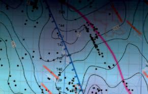
recent estimates.” AAPG Bulletin 86(10): 1671-1678.
DeSorcy, G. J., G. A. Warne, et al. (1993). Definitions and Guidelines for Classification of Oil and Gas Reserves, The Petroleum Society of the Canadian Institute of Mining, Metallurgy and Petroleum: 27 p.
Divi, R. S. (2004). “Probabilistic methods in petroleum resource assessment, with some examples using data from the Arabian region.” Journal of Petroleum Science and Engineering 42: 95-106.
Dutton-Marion, K. E. (1988). Principles of Interpolation Procedures in the Display and Analysis of Spatial Data: A Comparative Analysis of Conceptual and Computer Contouring. Dept. of Geography. Calgary, Alberta, University of Calgary: 219 p.
Kaufman, G. M. (1986). Finite Population Sampling Methods for Oil and Gas Resource Estimation. Oil and Gas Assessments - Methods and Applications. D. D. Rice. Tulsa, Oklahoma, American Association of Petroleum Geologists. AAPG Studies in Geology #21: pp. 43-53.
Klemme, H. D. (1986). Field Size Distribution Related to Basin Characteristics. Oil and Gas Assessments - Methods and Applications. D. D. Rice. Tulsa, Oklahoma, American Association of Petroleum Geologists. AAPG Studies in Geology #21: pp. 85-99.
Klett, T. R. and R. R. Charpentier (2003). FORSPAN Model Users Guide, U.S. Geological Survey: 37 p.
Klett, T. R. and J. W. Schmoker (2003). U.S. Geological Survey Input-Data Form and Operational
(Continued on page 40...)


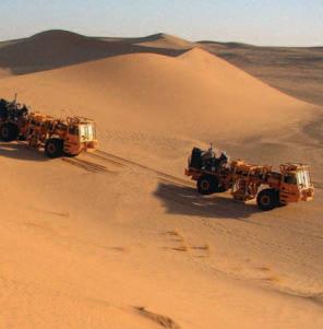
■■ Conventional Wellsite Geology
■■ Horizontal / Directional
■■ SAGD / Horizonal Heavy Oil
■■ Oilsands Core Logging Programs
■■ Coal Bed Methane
■■ International Offshore/Onshore
Additional Energy Services
■■ Geological Operations Management
■■ Seismic Operations Management
■■ Acquisition / Processing QC
■■ Site Investigation and Survey
■■ Safety,Integrity & Risk Management
■■ Petroleum Engineering Consultancy
roften UniackeHouse,3rd Floor,5348 Morris Street,Halifax,Nova Scotia B3J 1BA 902-425-1622

Procedure for the Assessment of Continuous Petroleum Accumulations. Petroleum Systems and Geologic Assessment of Oil and Gas in the Uinta-Piceance Province, Utah and Colorado. U. S. Geological Survey Uinta-Piceance Assessment Team. Washington, D.C., U.S. Geological Survey. Chapter 18: 11 p.
LaTourrette, T., M. Bernstein, et al. (2002). A New Approach to Assessing Gas and Oil Resources in the Intermountain West, RAND: 8 p.
Lee, P. J. and D. Gill (1999). “Comparison of Discovery Process Methods for Estimating Undiscovered Resources.” Bulletin of Canadian Petroleum Geology 47(1): 19-30.
Lee, P. J. and P. C. C. Wang (1986). Evaluation of Petroleum Resources from Pool Size Distributions. Oil and Gas Assessments - Methods and Applications. D. D. Rice. Tulsa, Oklahoma, American Association of Petroleum Geologists. AAPG Studies in Geology #21: pp. 33-42.
Lee, P. J. and P. C. C. Wang (1993). The Petroleum Exploration and Resource Evaluation System (PETRIMES). Calgary, Alberta, Geological Survey of Canada: 108 p.
Lore, G. L., D. A. Marin, et al. (2001). 2000 Assessment of Conventionally Recoverable Hydrocarbon Resources of the Gulf of Mexico and Atlantic Outer Continental Shelf as of January 1, 1999. New Orleans, Minerals Management Service: p15-25.
Mare-Jones, B. V. (2004). Quantifying undiscovered oil and gas in the Taranaki Basin. 2004 New Zealand Petroleum Conference Proceedings, Wellington, New Zealand, Ministry of Economic Development.
Meneley, R. A., A. E. Calverley, et al. (2003). “Resource assessment methodologies: Current status and future direction.” AAPG Bulletin 87(4): 535540.
Miller, B. M. (1986). Oil and Gas AssessmentMethods and Applications. AAPG Studies in Geology #21. D. D. Rice, American Association of Petroleum Geologists: 1-23.
Ramsey, F. L., Daniel W. Schafer (2002). The Statistical Sleuth: A Course in Data Analysis. USA, Duxbury.
Random House Inc. (2000). The Mavens’ Word of the Day, Random House Inc. 2005.
Rostirolla, S. P., A. C. Mattana, et al. (2003). “Bayesian assessment of favorability for oil and gas prospects over the Reconcavo basin, Brazil.” AAPG Bulletin 87(4): 647-666.
Sanders, D. H., Smidt, Robert K., Adatia, Aminmohamed, and Larson, Glenn A. (2001). Statistics: A First Course. Toronto, Ontario, McGrawHIll Ryerson Limited.
Shanley, K. W., R. M. Cluff, et al. (2004). “Factors controlling prolific gas production from lowpwermeability sandstone reservoirs: Implications for resource assessment, prospect development, and risk analysis.” AAPG Bulletin 88(8): 1083-1121.
Surowiecki, J. (2004). The Wisdom of Crowds. New York, NY, Doubleday, 296 p.
U.S. Geological Survey National Oil and Gas Resource Assessment Team (1995). 1995 National assessment of United States Oil and Gas Resources. Washington, D.C., U.S. Geological Survey: 20 p.
White, L. P. (1986). A Play Approach to Hydrocarbon Resource Assessment and Evaluation. Oil and Gas Assessments - Methods and Applications. D. D. Rice. Tulsa, Oklahoma, American Association of Petroleum Geologists. AAPG Studies in Geology #21: pp. 125-132.
14 – 17, 2007
Avoid the Monday morning on-site registration rush...REGISTER BY APRIL 27! On-line registration is available through www.GEOconvention.org using VISA or MC.
Registrations may also be mailed, faxed or dropped off at the Convention Department c/o CSPG office, #600, 640 – 8th Avenue SW, Calgary, Alberta T2P 1G7 Please make cheques or money orders payable to 2007 CSPG CSEG Convention.
Registrations received after 6:00pm (MST) Friday, April 27th 2007 will be held and processed on site. On-site registration fees will be applied.
Registration fees for this year’s convention are as follows: (Please note prices do not include GST) Regular Registration Deadline: April 27, 2007 (cutoff time is 6:00pm MST)
Pass – Exhibition Hall Only$50/day
Tickets$50 each Flowdown Reception tickets (addl. tickets may be purchased for guests of Convention Delegates)
* Students must produce a current id card from their educational institution when picking up their registration package.
Delegates who register on or before April 27, 2007 may pick up their registration packages during the following times: Wednesday, May 9: 11:30am – 3:30pm Thursday, May 10: 11:30am – 3:30pm
Location: CSPG Office, 600, 640 8th Avenue SW
Delegate packages not claimed during the above times, can be picked up at the Registration Desk located at the Roundup Centre, Stampede Park on Monday, May 14.
Roundup Centre, Stampede Park EUB Core Research Centre
Monday May 14: 7:30am – 6:30pm
Wednesday May 16: 12:00pm – 3:30pm
Tuesday May 15: 7:30am – 4:00pm Thursday May 17: 8:00am – 3:30pm
Wednesday May 16: 7:30am – 12:00pm
Monday May 14 & Tuesday May 15
8:00 am – 10:00 am
Exhibit Floor – Halls A & B
Sponsored by: Saudi Aramco
Get a chance to wander through the exhibits and enjoy a complimentary continental breakfast and coffee.
Guest Speaker: Rex Murphy
Monday May 14
11:30am – 1:00pm
Roundup Centre Hall C
Sponsored by: Arcis
Broadcaster and essayist Rex Murphy will bring his distinctive viewpoints to the 2007 Convention luncheon.
Monday May 14
4:00 pm – 7:00 pm
Exhibit Floor – Halls A & B
Sponsored by: Devon Canada Corporation
Join your colleagues for some great food and conversation while browsing the many exhibits at this year’s CSPG CSEG Conference
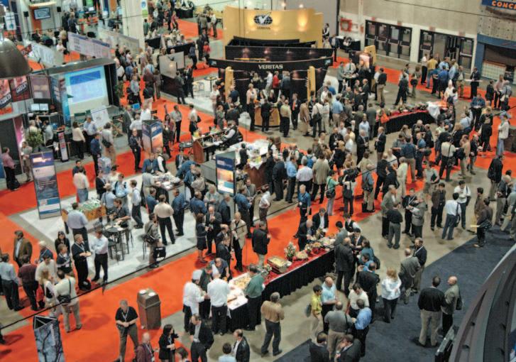
Tuesday May 15 3:30 pm – 4:30 pm
Exhibit Floor – Hall A
Are you a previous winner of a Convention Award? Will you be a delegate at the 2007 Convention? Call the CSPG office today at 264-5610 and make sure you are registered
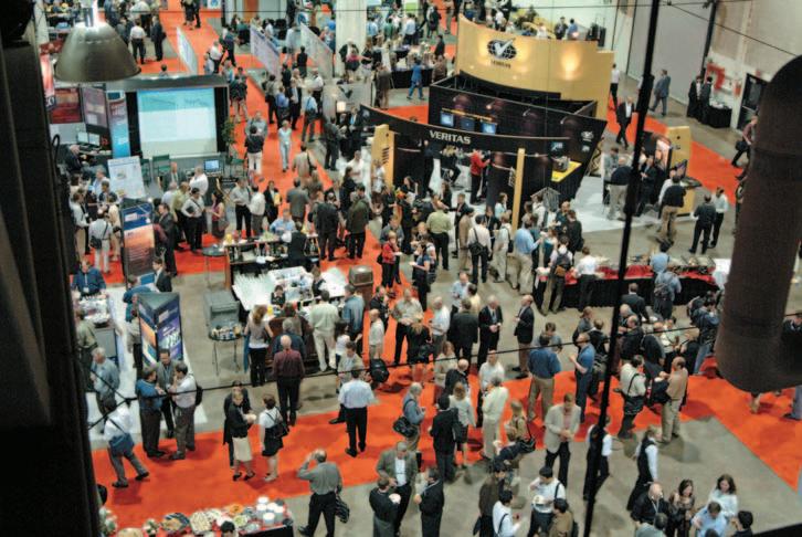
to attend the Past Award Winners Reception where honourees will have the chance to meet and mingle with complimentary beverages and hors d’oeuvres before the Beer & Bull begins!
Tuesday May 15 4:00 pm – 6:00 pm
Exhibit Floor – Halls A & B Sponsored by: Divestco Inc.
Enjoy the final hours of the Exhibition with a drink and appetizers as you network with colleagues.
Tuesday May 15 4:00 pm – 6:00 pm Rotary House
Have you been a member of the CSPG for 30+ years? If so, this event is for you! In appreciation for their long commitment to the Society, the CSPG will host the 7th Annual Long Time Members Reception, a complimentary cocktail party for our more senior members.
» Customized interpretations adding scope and depth to assessments » Arsenal of cutting-edge tools such as GEDCO’s unique MaFIC Cube technology
& BROKERAGE » High Resolution AeroMagnetic (HRAM) data over much of the WCSB » Customized data areas » Merged and re-leveled surveys to minimize seams


of Canada's most respected, privately-owned geophysical software and consulting firms Centuries of collective geophysical knowledge Clients located in over 50 countries worldwide
» » » Comprehensive Potential Field project management from concept, through design and to interpretation

Wednesday May 16 & Thursday May 17
11:30 am – 1:00 pm
Tents behind the EUB Core Research Centre
Sponsored by: Hycal Energy Research Laboratories Ltd.
Take a break from the Core Conference to enjoy the excellent BBQ lunch provided by Hycal Energy Research Laboratories.
Wednesday May 15 4:00 pm – 6:00 pm Westin Hotel
Sponsored by: Earth Signal Processing Ltd., Nexen Inc., Suncor Energy Inc., Zokero Inc. (Seisware)
Meet the energetic minds of tomorrow, as graduates have the opportunity to meet industry representatives from the companies that will employ them. We hope that this casual event can strike up new relationships.
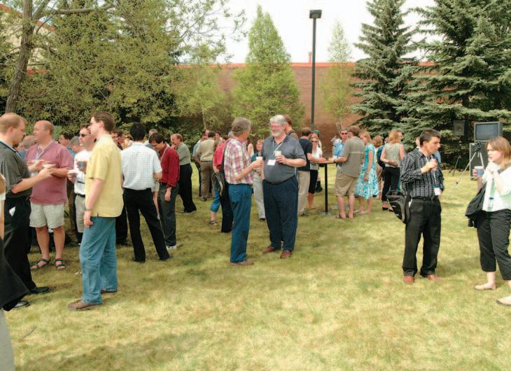
Wednesday May 15 4:00 pm – 6:00 pm Westin Hotel
Students - win an expenses-paid trip to San Antonio next September! Teams of two will compete to answer a range of geophysical and geological questions, the winning team will be sent to the SEG Annual Meeting to participate in the 2nd Annual SEG Challenge Bowl!
Thursday May 17
3:30 pm – 7:00 pm
Tents behind the EUB Core Research Centre
Sponsored by: IHS
Celebrate another successful convention at the popular Core Meltdown event. Join the CSPG CSEG Organizing committee and all your fellow convention delegates for some food and beverages.
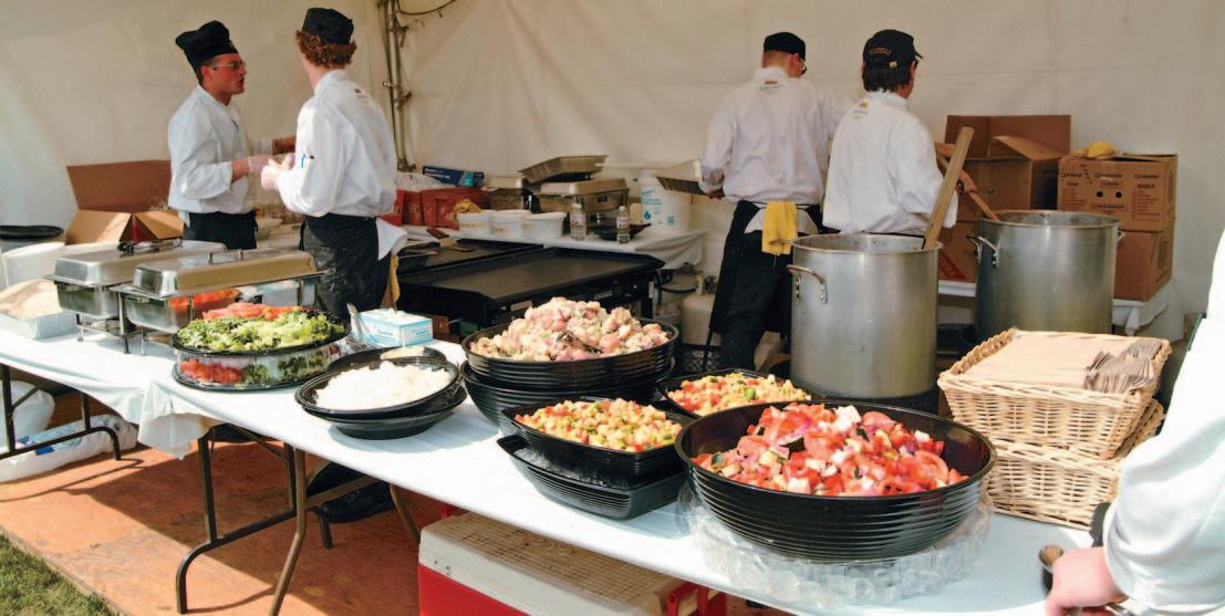


2007 CSPG CSEG Convention
Exhibitor Booth Listing by Company March 20, 2007
Company Name Booth Number
AAPG 931
AGAT Laboratories Ltd. 433
Alberta Geological Survey
. 340
Alberta Research Council 537
APEGBC - The Association of Professional Engineers & Geoscientists of BC 934
ARAM Systems Ltd. 513
Canadian Seismic Rentals, Inc. Texas Seismic Rentals, Ltd.
Ascend Geo LLC 812
Association of Professional Engineers, Geologists and Geophysicists of Alberta, The 935
BAKER ATLAS 1131
BEICIP, IN/IFP. 135
Bodycote Testing Group .
. 441
Boyd PetroSearch 928
British Columbia, Oil & Gas Division 342
Calgary Rock & Materials Services Inc. 124
Calgary Scientific Inc. 334
Canadian Discovery Ltd. 742
Canadian Society of Exploration Geophysicists - Partner Society . . . . . 1237
Canadian Society of Petroleum Geologists - Partner Society 1249
Canadian Well Logging Society 1015
CGGVeritas 221
Complete Land Services Ltd. 915
Continental Imaging Products 914
Continental Labs / CL Consultants . . . . . 738
Core Laboratories Canada Ltd. 802
CREWES and FRP, University of Calgary 930
Datacon Core Imaging 819
Digital Formation, Inc. 921
Divestco Inc. 413
DMI Digital Media Inc. 121
Downhole Video Canada 920
EasyCopy Company, The 431
ESG (Engineering Seismology Group) 1009
ESRI Canada 432
ffA 800
FUGRO (Fugro-Jason & Fugro Airborne) 911
GEDCO 331
Genetek Earth Research Corporation 830
GeoKnowledge 118
geoLOGIC systems ltd. 505
Geo-Logic Systems, LLC 125
Geological Rentals & Services Inc. 739
Geomage
837
GeoMechanics Intl - GMI 227
Geo-Microbial Technologies (GMT) 1003
Geomodeling Technology Corp. 1120
GEOSEIS Inc. 339
GEOSYSTEM Canada, Inc 130 GORE 540
Government of Yukon, Oil & Gas Branch 148
Green’s Rock and Lapidary Ltd. 440
Halliburton 904
Horizontal Solutions Int’l 139
Hotwell Canada Ltd. 126
Hydrocarbon Data Systems .
430 I/O 813
GX Technology
INDEL-DAVIS INC. 137
Isilon Systems .
436
iSys - The Imaging Systems Group Inc. 801
JEBCO Seismic (Canada) Company 831
Kelman Technologies Inc. 419
KOMAREVICH ORIGINALS LTD. 1013
LiDAR Services Int’l (LSI) 804
Little Rock Document Services Ltd. 127
MacKay Range Development Corporation 929
Manitoba Science, Technology, Energy and Mines - Minerals Division 336
MD TotcoTM NOV Wellsight Gas WatchTM 810
MicroSeismic, Inc. 1001
Minerals and Petroleum Division for Economic Development & Transportation, Government of Nunavut 146
MJ Systems 918
MTEM 335
Mustagh Resources Ltd. 120
Natural Resources Canada, Geological Survey of Canada
Sponsored by:
Rex Murphy was born and raised in St. John’s, Newfoundland, where he graduated from Memorial University. A Rhodes Scholar, he attended Oxford University (along with U.S. President Bill Clinton) When he returned to Newfoundland he was soon established as a quick-witted and accomplished writer, broadcaster and teacher. His nightly television tussles on the supper hour show Here and Now, with prominent politicians including Premier Joey Smallwood, became required viewing for a huge audience.
Murphy’s primary interest is in language and English literature, but he also has a strong link with politics. He is noted throughout Canada for his biting comments on the political scene. Murphy gained an insider’s view of the political world when he worked as executive assistant to the Newfoundland Liberal Party leader. To get an even closer taste of politics, Murphy ran twice as a
Liberal candidate in the provincial elections.
Murphy contributes extensively to CBC on many current affairs issues. For The National Magazine he created a number of documentaries from Newfoundland, including the highly acclaimed “Unpeopled Shores,” about the tragedy of the disappearing cod, and human interest pieces on writer Annie Proulx, World War II, and scientist Hubert Reeves.
He contributes a regular essay to The National Magazine , dealing with topics as diverse as the Royal Family, smoking, and Quebec politics and writes a weekly column for the Globe and Mail. Murphy is also the author of the book, Points of View, a collection of his best writing spanning 30 years. The selection includes an assortment of topics, from his hard-hitting political commentaries, book reviews, and hilarious satires, to warm memories of Newfoundland.
An award-winning broadcaster, Murphy is the regular host of CBC Radio’s Cross Country Checkup and commentator on the CBC Radio show Definitely Not the Opera

He has also contributed to Morningside, Land and Sea, The Journal, Midday, and Sunday Report
Murphy divides his week between Toronto and Montreal with frequent forays to St. John’s.


If you rely on conventional surface seismic, you’re missing part of the picture.
But with Z-Seis Crosswell Seismic, you get the whole story. Crosswell Seismic delivers up to 100 times the resolution of surface seismic, providing unmatched reservoir detail for tight gas, shale gas, and SAGD. Increase production. Decrease drilling and completion costs. See more detail. Get the whole, high-def image with Z-Seis.
As many of you are aware, the CSPG currently offers no official statement or position on the issue of climate change. A previous statement, presented in early 2003, was removed from our website last year because your Executive believed that it was somewhat dated and perhaps did not address the evolving realities of the climate change discussion.
The question, of course, is: “Should our Society have a position on this issue?”
Unfortunately, the answer is not straightforward, due to the many and varying (personal) viewpoints on this subject. Notwithstanding this diversity of opinion, your Executive believes that the CSPG should offer a climate change statement for two key reasons:
1) As a group of learned geoscientists,
we provide a valuable perspective on the global history of climate change, and we have an obligation to Society to communicate this knowledge.
2) We have (and continue to build) an active outreach program, designed to encourage our youth to study and perhaps take up a career in the earth sciences. Our youth want to know that we have a perspective on climate change and they want to understand that we are being proactive in a positive manner.
Therefore, your executive, with input from the Environmental subdivision, has embarked on a process to renew our Society’s commentary regarding climate change. It attempts to present a neutral stance, focusing on the scientific perspectives that
our members bring to the discussion. We do not advocate for or against any particular political or economic measures.
This draft commentary appears in this month’s issue of the Reservoir. By way of this article, we are seeking members’ input. You will also have the opportunity to submit comments at the annual convention. Our plan is to collect this feedback and provide you with the results later this year. We will then determine if and what our climate change statement should be.
As usual, your input is welcomed. You can reach the Executive through me at: jim@ resultenergy.com
On behalf of your 2007 Executive, Jim Reimer, Past-President


The world’s geoscientists, including petroleum geologists, offer a valuable perspective on the historical patterns of global climate change, as deduced from our intensive study of rock, fossil, and ice records. Based on this evidence, we have concluded that:
• Global climates have changed naturally and frequently throughout geologic time;
• The rate of climate change has been variable;
• The pattern and severity of climate change has varied by region; and
• Climate change continues today.
Temperature and geographic data indicate that the earth is currently experiencing an overall warming phase – a trend that is both expected and consistent with our emergence from the most recent glacial period beginning approximately ten thousand years ago. However, there is a strong opinion among some of the scientific and political community that the present-day warming has been accelerated as a direct consequence of anthropogenic activity, specifically rising concentrations of atmospheric CO2 , due to man’s widespread extraction and combustion of hydrocarbon fuels. Although a correlation has been drawn between the recent rise in atmospheric CO2 levels and average global temperatures, certain scientists continue to question this correlation and its cause-effect relationship.
A second and equally important element of the climate change discussion concerns the potential geographic and biologic consequences of a warming earth. While many observers are predicting catastrophic impacts, it is important to note that the fossil record provides many examples of ancient species that either suffered or benefited due to previous climate change.
The mechanisms contributing to climate change are numerous, involving cyclical inputs of both long and short duration. Climate behavior models are exceedingly complex, possess significant error uncertainty, and remain highly imprecise. As a learned technical society, the CSPG encourages continued scientific inquiry into all aspects of climate change, including possible anthropogenic effects. We are committed to supporting such research and its publication and dissemination.
Hydrocarbon fuels will likely serve as one of man’s primary energy sources for the foreseeable future. As petroleum geologists, we are keenly aware of the earth’s finite endowment of these resources and the need to use them wisely. CSPG members continuously strive to reduce our collective carbon footprint, by improving the efficiency
of finding, extracting and processing these fuels. Our geoscientists are also expected to be leading edge contributors towards the development of greenhouse gas sequestration technologies.
1st impressions are made in 3 seconds

| by Ashton Embry, Chair, Stratigraphic Nomenclature Committee.
Sequence stratigraphy re-entered the mainstream of stratigraphic practice in 1977 and over the past 30 years a number of proposals for methodology and unit definition have been published. The existence of different methodologies and accompanying terminology has led to considerable confusion over how best to conduct a sequence analysis and what to call the delineated units and correlation lines. Given the importance of sequence stratigraphy for providing an excellent quasi-chronostratigraphic framework for facies analysis and paleogeographic reconstructions, it would be helpful to the petroleum industry if such problems could be resolved.
Both the International Subcommission on Stratigraphic Nomenclature (ISSC) and the North America Commission on Stratigraphic Nomenclature (NACSN) have expressed a desire to try to include a
standardized methodology and terminology for sequence stratigraphy in their respective International Stratigraphic Guide (ISG) and Stratigraphic Code. ISSC set up a Task Group to provide recommendations on sequence stratigraphy that could be included in the next edition of the ISG.
Last year Octavian Catuneanu of the University of Alberta independently set up his own working group on sequence stratigraphy and called it the International Working Group on Sequence Stratigraphy. He did this because he anticipated the ISSC TG would favour an empirical, databased methodology/terminology for sequence stratigraphy. Such an approach sharply contrasts with his preferred, more theoretically based approach which was the foundation for the methods and terminology in his recent textbook.
The ISSC TG began circulating the first draft of its report in February of this year and
requested suggestions for improvement from all interested stratigraphers. Dr. Catuneanu had previously prepared a position paper on his recommended approach and distribution was limited to his WG. These two documents allow the two different approaches and resulting methods and units to be understood and compared. Dr. Chris Kendall of the University of South Carolina has set up a webpage on his large sequence stratigraphy website which allows access to both the ISSC TG Report and to Dr. Catuneanu’s position paper. Importantly, the website provides the opportunity for any interested party to post comments on any aspect of sequence stratigraphy. The URL is http://strata.geol. sc.edu/SeqStratForm.html
In actuality, the differences in approach between Dr. Catuneanu and the ISSC Task Group can be simply boiled down to the acceptance or the rejection of the use of two time surfaces (paleoseafloors in Dr. Catuneanu’s terminology); one at the start of base level fall and one at the start of base level rise. The ISSC TG has concluded that such “surfaces” have no empirical support and cannot be objectively recognized in well exposed strata in most geological settings. Consequently the TG Report rejects the use of both such “surfaces” and the units which are defined by them in sequence stratigraphy. In contrast, Dr. Catuneanu concludes that such surfaces are “real” and can be used to delineate units in sequence stratigraphy.
I invite anyone interested in this subject to visit the “Debating Methods, Surfaces, Units and Terminology of Sequence Stratigraphy” webpage, to peruse the documents available and to make your opinions known on this topic.
Ashton Embry Chair, ISSC TG on Sequence Stratigraphy


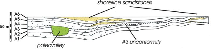
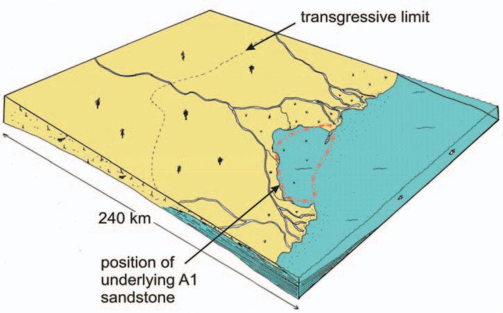
eustacy during the Cretaceous Period.
Detailed mapping of lowstand sandstones revealed a steady progression from riverdominated to wave-dominated delta morphology, probably reflecting clastic starvation of the delta front, as sediment became trapped in a flexural moat to the NW. Each shoreline also appears to have ‘felt’ the presence of the previous lowstand sandstone, with local accommodation being influenced by differential sediment compaction.
Michael’s paleogeographic maps and detailed stratigraphy constitute a predictive framework which can be used to delineate reservoir sandstones in allomembers A & B, some of which produce economic quantities of oil and gas.
Shellie-Ann Jober received an Honourable Mention for her M.Sc. thesis, “Structural Controls of Pb/Zn Mineralization on Northeast Cornwallis Island”, supervised by Dr. Joseph C. White in the Department of Geology at the University of New Brunswick, and co-supervised by Dr. Keith Dewing in the Geological Survey of Canada at Calgary.
Since graduating from the University of Alberta in 1996, Jober has worked in various parts of the Yukon, Northwest Territories, Nunavut, and Alberta as an exploration geologist. Prior to joining Diamonds / Uranium North Resources Ltd. in Vancouver (where she currently works), she was employed with Talisman Energy for one year (primarily within the Southern Foothills District) and subsequently with Elk Valley Coal in southeastern British Columbia.
In 2000 the Canada-Nunavut Geoscience Office and the GSC-Calgary initiated a threeyear multi-disciplinary geological mapping/ sampling project within the Cornwallis PbZn district. It is under this initiative that fieldwork for this thesis was undertaken on northeastern Cornwallis Island during 2000 and 2001. Funding and support for this project was from NSERC, Geological Survey of Canada-Calgary, Canada-Nunavut Geoscience Office, Polar Continental Shelf Project, DIAND – Yellowknife, and the Northern Training Scholarship Fund.
The thesis examines the structural geology of northeastern Cornwallis Island (Figure 3 A), and determines the geometrical setting of several small Pb-Zn showings hosted within unmetamorphosed lower Paleozoic carbonate rocks. The most significant result from the thesis is the recognition of bedding-parallel thrust faulting and superposed folding to which mineralized sites have specific associations (Figure 3 B).
The specific contributions of this thesis are:
1. The recognition that thrusts and thrustrelated folds are the dominant structural elements of the Late Silurian to Middle Devonian ‘Boothia’ deformation on NE Cornwallis Island;
2. The identification of two generations of deformation (F1, F2) within the Boothia deformation event;
3. The recognition that Boothia deformation was much longer lasting than previously reported (late Middle Devonian);
4. The preservation and possible initial occurrence of Devonian rocks is controlled by folding;
5. First- and second- generation structures (F1, F2) were refolded by a third deformational event, producing westerlyeasterly trending folds, (F3), correlated with the Late Devonian Ellesmerian Orogeny;
6. Structural evidence of a final folding event (F4) is correlated to a Palaeogene deformational event, previously unrecognized on Cornwallis Island; and
7. The majority of Zn/Pb showings are associated with reactivated first and second generation thrusts and backthrusts, and F3 fold axes. Mineralization post-dates F3 Folding.
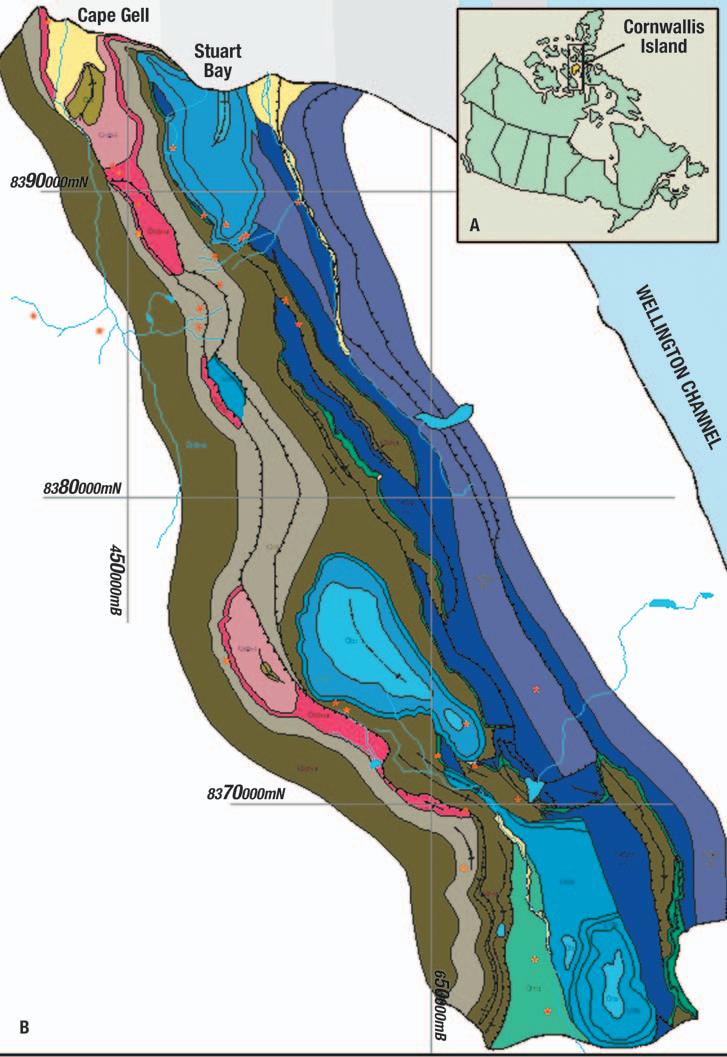
The CSPG Link Award is given for the best oral presentation at one of the Society’s Technical Luncheon meetings. Topics of the presentations must be either geological or a related technical subject, and must be presented in Calgary by a CSPG member.
This recipient of the Link Award for 2006 was Dave Eberth and he was presented his award, a hand-crafted pewter mug, as the CSPG Technical Luncheon held on February 20th, 2007 at the Telus Convention Centre. The Link Award Committee deemed his paper, “CSI Dinosaur Provincial Park”, presented January 10th, 2006 to be the best of an excellent group of talks presented in 2006.
David A. Eberth is a Senior Research Scientist and Curator of Geology at the Royal Tyrrell Museum in Drumheller, Alberta, where he has worked for the past 22 years. He received his B.Sc. in Zoology from the University of Massachusetts in 1977, an M.A. in paleontology from the University of California, Berkeley, in 1981, and a Ph.D. in Geology from the University of Toronto in 1987. His primary research interests include dinosaur taphonomy,
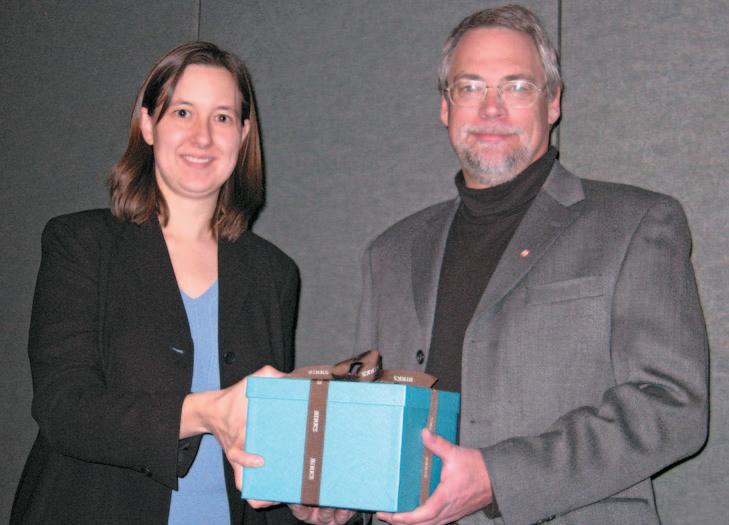
bonebeds, and nonmarine stratigraphy and paleoenvironments. He has authored or contributed to more than 50 peer reviewed scientific papers, and has conducted field
The Reservoir is seeking additions to its editorial committee. We have the opportunity to greatly expand the scope and content of the Society’s news magazine, but need the people to make it happen. We are looking for volunteers that would be interested in coordinating or assisting in developing any of the following departments:
• Exploration geology
• Development geology
• Geophysics
• Petrophysics
• Government liaison
• University liaison
• Current publications
Please contact Ben McKenzie (bjmck@telusplanet.net) for more information.
research in Canada, Argentina, Germany, China, Mexico, Mongolia and the USA. He is currently engaged in National Science Foundation and National Geographic funded studies in northern China, Mongolia and Mexico, and continues to run Upper Cretaceous field trips in southern Alberta for the hydrocarbon industry.
Dave is an avid guitar player and has recorded a CD of kids’ dinosaur songs. His rock, rhythm, and blues band, Band-o-Coots, enjoys ongoing popularity in the Drumheller area and can be booked for weddings, divorces, barmitzvahs, and funerals. He is enjoying the ongoing interest in Alberta’s dinosaurs and Upper Cretaceous gasbearing formations.
Dave’s formal citation can be seen in the March 2007 issue of the CSPG Bulletin of Canadian Petroleum Geology.
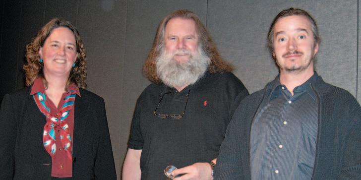
The Medal of Merit is “awarded annually by the CSPG for the best paper published during the previous year on a subject related to the petroleum geology of Canada”. More specifically, the Medal of Merit Committee favours papers which are broad in scope and are clearly written, well presented and illustrated with novel ideas, thorough data collection and linkage of data to interpretations and conclusions. A clear relevance to Canadian petroleum geology and the practice of petroleum geology is greatly preferred if not essential.
This year the 2006 Medal of Merit was awarded to George Pemberton and Murray Gingras of the University of Alberta for their paper: “Classification and characterizations of biogenically enhanced permeability” which was published in the November 2005 AAPG Bulletin. The presentation took place at the CSPG Technical Luncheon held on March 6th, 2007 at the Telus Convention Centre.
The paper was chosen because it demonstrates how important bioturbation is in enhancing permeability and the potential significance for production geology, reserves calculation and reservoir performance and modelling in hydrocarbon-bearing basins worldwide. In the paper the authors present a well-documented classification scheme for biogenically enhanced permeability and demonstrate the five different classifications through case studies in western Canada, the United States, and internationally. The settings, ichnofacies, physical processes, and nature of the permeability enhancement which are typical for each of the five scenarios are described as well as thickness and areal extent range estimates.
Although the paper certainly does not focus exclusively on Canadian geology, it is thought-provoking, timely, and has potential wide applicability to Canadian basins and reservoirs. In addition, it is well-written, well-organised, and displays wide datagathering.
Planning is currently underway to schedule a luncheon presentation by the authors during 2008.
George Pemberton received his Ph.D. degree from McMaster University, Hamilton, Ontario in 1979. He is currently a Canada Research Chair in Petroleum Geology in the Department of Earth and Atmospheric Sciences at the University of Alberta. The
For import into AccuMap, geoSCOUT and other applications.
1) Mississippian Subcrops, Devonian Reefs
2) Triassic Halfway, Doig, Charlie Lake
3) Jurassic Rock Creek
4) Cretaceous Glauconitic, Lloyd, Sparky, Colony, Bluesky, Dunlevy, Viking
5) CBM - Horseshoe Canyon, Mannville
All edges are formatted as map features for AccuMap and ESRI Shape files for other applications.
main thrust of his research pertains to the application of ichnology to petroleum exploration and exploitation and its use in sequence stratigraphy. Recent work has been done on the application of ichnology to the flow of fluids through the reservoir in both clastic and carbonate settings. His work has been recognized by a number of awards including: the GAC Past President’s Medal, Fellow of the Royal Society of Canada, and the Society for Sedimentary Research R. C. Moore Medal for Excellence in Paleontology.
Murray Gingras received his diploma in mechanical engineering technology from the Northern Alberta Institute of Technology in 1987, his B.Sc. degree from the University of Alberta in 1995, and his Ph.D. from the University of Alberta in 1999. Murray has worked professionally in the hydrocarbon industry at the Northern Alberta Institute of Technology and as an assistant professor at the University of New Brunswick. He is presently tenured at the University of Alberta. Murray’s research focuses on applying sedimentology and ichnology to sedimentary rock successions, as a paleoecological tool, a reservoir-development tool, and in process sedimentology.
The full Medal of Merit citation for Dr. Pemberton and Dr. Gingras is presented in the March 2007 issue of the CSPG Bulletin of Canadian Petroleum Geology.
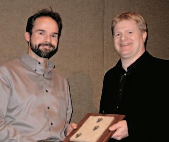
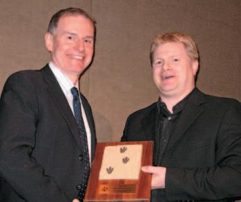
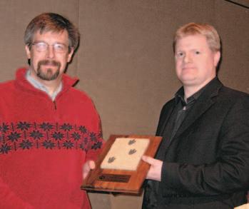


Alberta’s Professional Geoscientists and Engineers provide Albertans with many of the essentials of daily living. The work that they do allows all of us to enjoy warmth, light, power, water and the ability to travel and communicate over distance.
Since 1920, Members of APEGGA, The Association of Professional Engineers, Geologists and Geophysicists of Alberta, have made a difference in the daily lives of millions of Albertans by bringing science and innovation to life.
The P.Geol., P.Geoph., P.Eng., and R.P.T. professional designations represent the highest standards of quality, professionalism and ethics in geoscience and engineering. APEGGA Members can take pride in the role they play and the contribution they make to Alberta. APEGGA and its over 47,000 Members are committed to public safety and wellbeing through the self-regulation of the geoscience and engineering professions in Alberta.
Visit www.apegga.org for more information.
Geologists Geophysicists Engineers


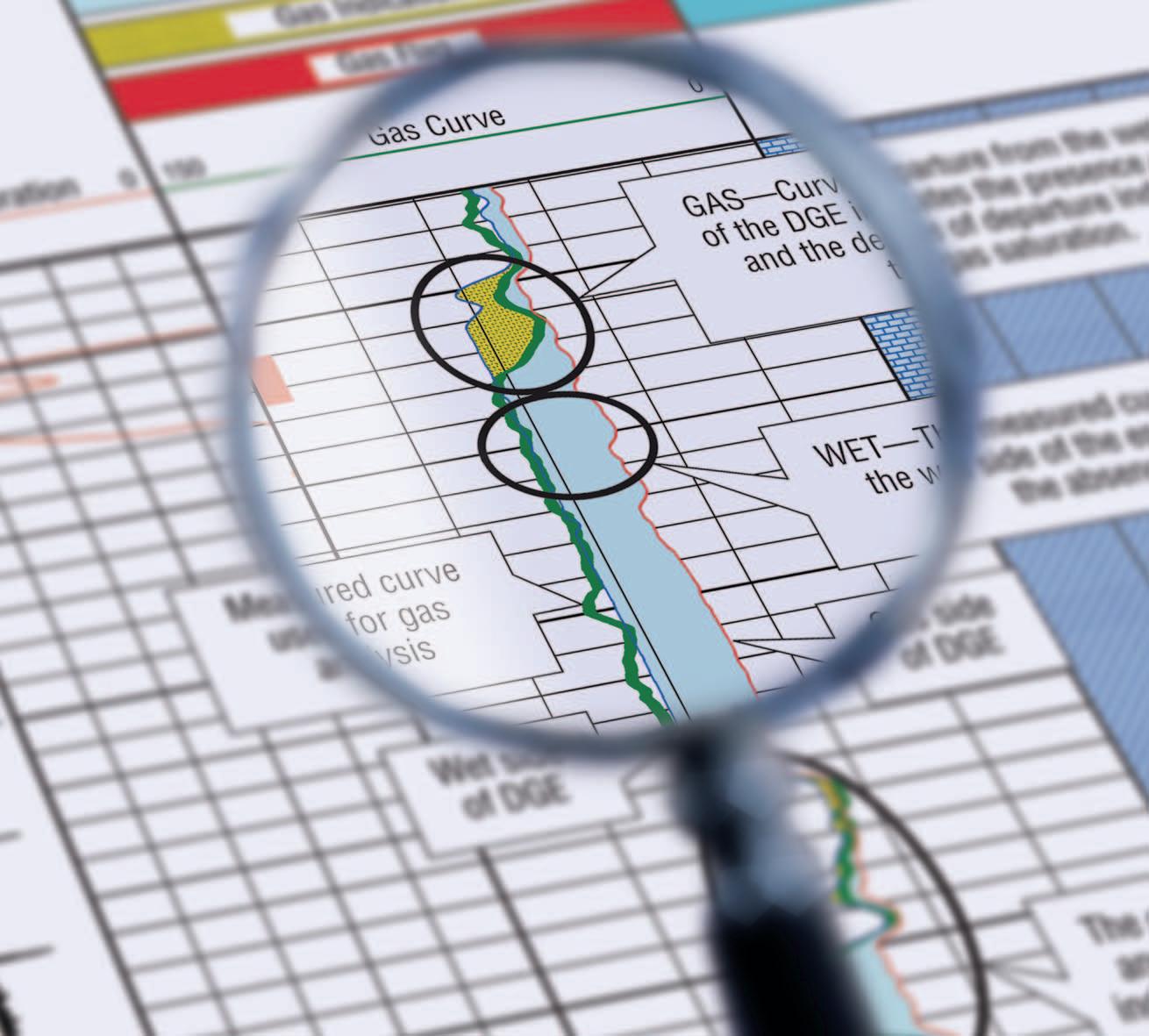
Now there is a better method for identifying gas and measuring gas saturation in cased holes. Baker Atlas is proud to introduce the GasViewSM service, a high-resolution measurementand analysis service that produces an exceptionally clear picture of reservoir gas.
Using Baker Atlas’ RPMSM pulsed neutron system, the GasView service can be used to measure reservoir gas in virtually any well. Applications range from identifying by-passed pay in wells nearing abandonment to openhole log replacement for new wells.
Contact your Baker Atlas representative today to learn how the GasView service can help you produce more gas with greater efficiency.