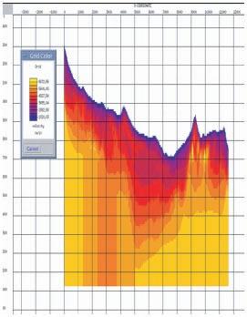
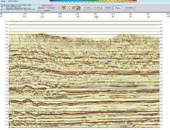
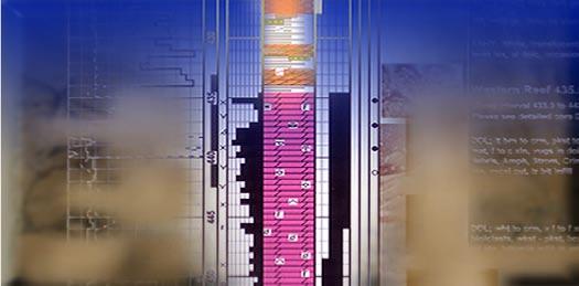
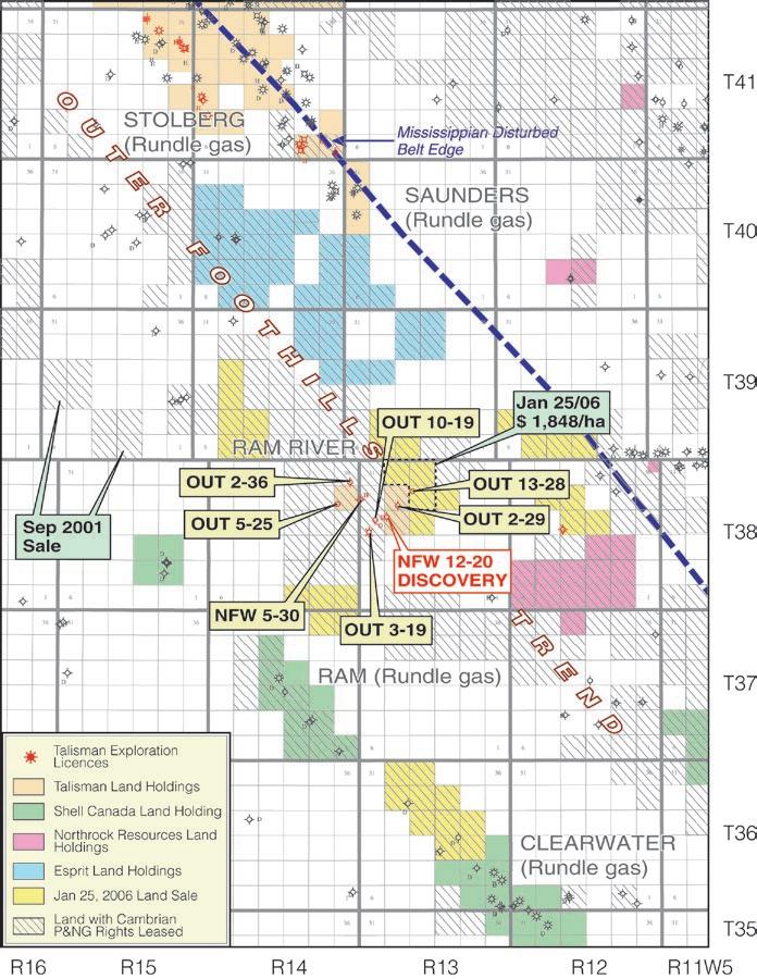
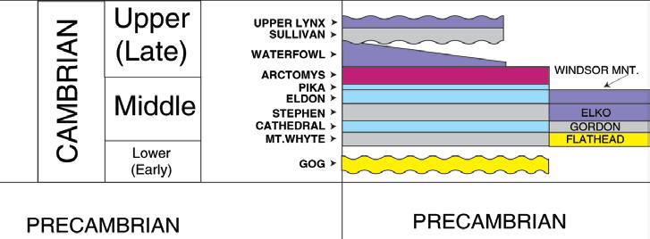
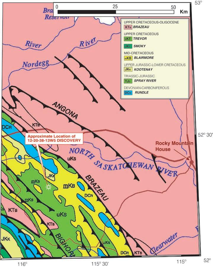
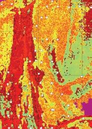
37 Ram River, Cambrian and other Paleozoic Discoveries Alberta T38, R13W5
40 2007 CSPG CSEG Convention: Special Events
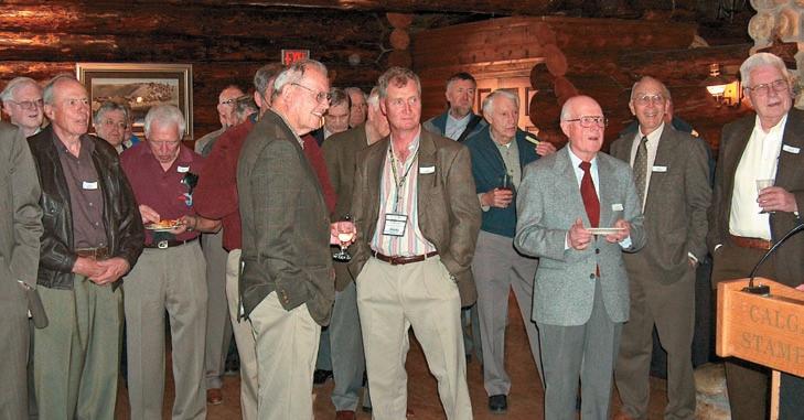
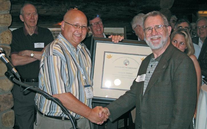
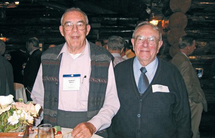
42 2007 CSPG CSEG Convention: Longtime Members Reception
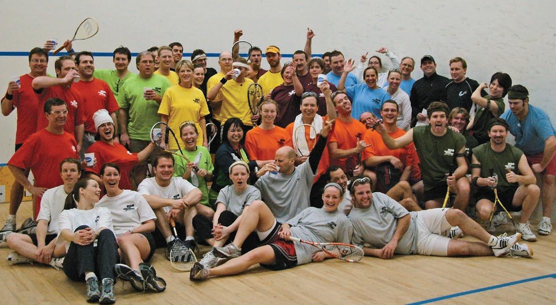
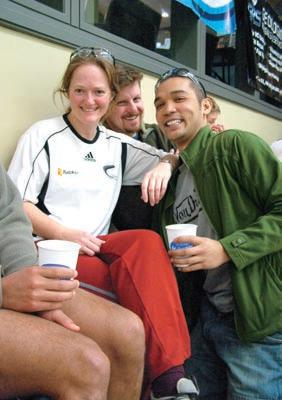
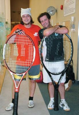
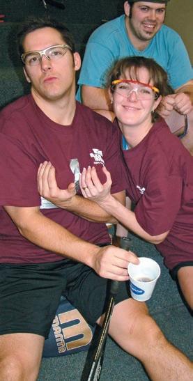
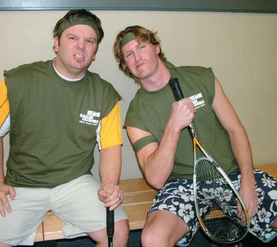
43 Let the Games Begin
46 Announcement: Canada-wide survey of Earth Scientists
IHS AccuMap ®
“AccuMap encompasses speed, stability, efficiency and accuracy. As an intuitive and easy-to-use product, AccuMap serves a broad audience, from field users to the CEO.”
Darrel Saik Senior Geological Technologist Paramount Energy Trust
AccuMap is the most widely used and highly trusted oil and gas mapping software touching every segment of E&P, for every professional.
www.ihs.com/energy
Call toll free 1 877 495 4473
#600, 640 - 8th Avenue SW
Calgary, Alberta, Canada T2P 1G7
Tel: 403-264-5610 Fax: 403-264-5898
Web: www.cspg.org
Office hours: Monday to Friday, 8:30am to 4:00pm
Business Manager: Tim Howard
Email: tim.howard@cspg.org
Membership Services: Sarah Barton
Email: sarah.barton@cspg.org
Communications & Public Affairs: Jaimè Croft Larsen
Email: jaime.croftlarsen@cspg.org
Corporate Relations: Kim MacLean
Email: kim.maclean@cspg.org
Corporate Relations Assistant: Heather Tyminski
Email: heather.tyminski@cspg.org
Conventions & Conferences: Shauna Carson
Email: shauna.carson@cspg.org
Conventions & Conferences Assistant: Tanya Santry
Email: tanya.santry@cspg.org
Reception: Dayna Rhoads
Email: reception@cspg.org
EDITORS/AUTHORS
Please submit RESERVOIR articles to the CSPG office. Submission deadline is the 23rd day of the month, two months prior to issue date. (e.g., January 23 for the March issue).
To publish an article, the CSPG requires digital copies of the document. Text should be in Microsoft Word format and illustrations should be in TIFF format at 300 dpi., at final size For additional information on manuscript preparation, refer to the Guidelines for Authors published in the CSPG Bulletin or contact the editor.
Coordinating Editor & Operations
Jaimè Croft Larsen, CSPG
Tel: 403-513-1227 Fax: 403-264-5898
Email: jaime.croftlarsen@cspg.org
Technical Editor
Ben McKenzie
Tarheel Exploration
Tel: 403-277-4496, Email: bjmck@telusplanet.net
ADVERTISING
Kim MacLean
Corporate Relations, CSPG
Tel: 403-513-1229, Email: kim.maclean@cspg.org
Advertising inquiries should be directed to Kim MacLean. The deadline to reserve advertising space is the 23rd day of the month, two months prior to issue date. All advertising artwork should be sent directly to Kim MacLean.
The RESERVOIR is published 11 times per year by the Canadian Society of Petroleum Geologists. This includes a combined issue for the months of July/August.
Advertisements, as well as inserts, mailed with the publication are paid advertisements. No endorsement or sponsorship by the Canadian Society of Petroleum Geologists is implied.
The contents of this publication may not be reproduced either in part or in full without the consent of the publisher.
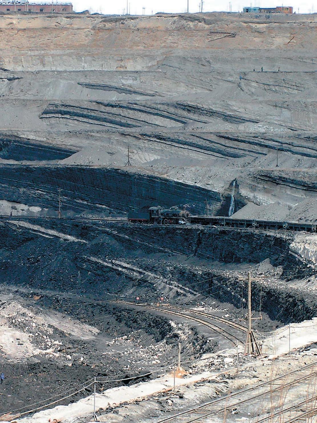
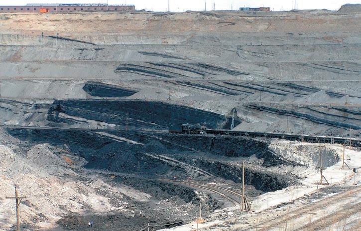
FRONT COVER
Coal Seam, Zhalainur, Inner Mongolia, Peoples
A
CSPG
EXECUTIVE
President Colin Yeo • EnCana Corporation colin.yeo@encana.com Tel: (403) 645-7724
Vice President
Lisa Griffith • Griffith Consulting lgriffith@griffithgeoconsulting.com Tel: (403) 669-7494
Past President
Jim Reimer • Result Energy Inc. jim@resultenergy.com Tel: (403) 539-5207
Finance director
Peter Harrington • Northrock Resources Ltd. harrington@northrock.ab.ca Tel: (403) 213-7665
assistant Finance director
James Donnelly • ConocoPhillips Canada james.donelly@conocophillips.com Tel: (403) 260-8000
A message from the CSPG Programs Director, Nadya Sandy
What’s new with CSPG programs? What is the future?
I’m happy to be in my second year on the CSPG Executive – looking after the Programs portfolio, with the new Assistant Programs Director Randy Rice. CSPG Programs include the Continuing Education Committee, the Technical Divisions, the Technical Luncheons Committee, and the Convention Committees. These committees provide many important benefits to CSPG members, and will continue to do so in the future!
Part of the CSPG’s mission is to advance the science of petroleum geology and to foster professional development amongst its members. Our programs help to do this, and there are a few areas that we hope to expand to provide even more benefits to our members.
TECHNICAL LUNCHEONS
The Technical Luncheons Committee has been running very well for some time now, and our CSPG luncheons are very well attended, and have even been selling out well in advance of the ticket sales cutoff date! These luncheons provide a way for all members to learn about a wide variety of geoscience topics. The Technical Luncheons Committee has plans to bring in some very interesting speakers this year!
TECHNICAL DIVISONS
The 11 CSPG Technical Divisions provide a way for CSPG members to interact with others who share similar interests. These divisions have been running very well lately, although many of the technical division Chairs tell me that with increased industry activity, they have been having trouble finding speakers for their lunchtime or evening talks. I would encourage any of you who do have the time to get involved with one of the technical divisions, and perhaps give a talk! We are currently looking at ways of better advertising the events of the technical divisions - you
may have noticed that technical division lunchtime talk titles were recently added to the CSPG’s e-newsletter.
COMMITTEE ON CONVENTIONS
The Committee on Conventions has been working hard planning out future conventions. Many of you may not know that they start to plan conventions many years in advance. In addition to planning the annual CSPG conventions three years in advance (often with CSEG and CWLS), they are planning annual themed Gussow conferences for the next several years. This year’s Gussow conference will focus on Arctic Energy Exploration and will be held in October in Banff in keeping with the Polar Year celebrations. The Committee is also investigating a possible joint Gussow-like conference with the GAC on Climate Change for next year - the year of Planet Earth. They are also presently starting to plan for “GeoCanada 2” in 2010. This will bring many of Canada’s geoscience groups to Calgary, and provide an excellent opportunity for all of us to interact with each other.
CONTINUING EDUCATION COMMITTEE
The Continuing Education Committee has been greatly expanded recently, and they have many future plans. The short courses and field trips that the CSPG offers are a great benefit to CSPG members and the Committee is working on increasing the number and variety of courses offered. Plans are in the works for a fall “education week” similar to the CSEG’s Doodletrain. The intent is to start with a few courses this year, and perhaps expand the program in following years.
The Continuing Education Committee also plans to evaluate the types of short courses that are offered. Naturally, Geology courses are the priority, but
(Continued on page 7...)
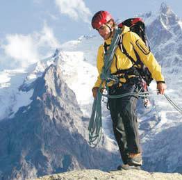
Mike chose Saudi Aramco for the world-class exploration opportunities.
Like his trip to the Alps. Simply indescribable.
A lifestyle that lets you see the world. Side-by-side with exploration careers using the most advanced technology. Believe it. Don’t miss your chance to interview and see how you can have the life you always wanted.
SAUDI ARAMCO
JOBFAIR
Saturday, May 12, 2007 9am to 4pm
May 14 –15, 2007 CSPG CSEG JOINTCONVENTION
Sheraton Eau Claire Hotel
255 Barclay Parade SW Calgary, Alberta, Canada
Roundup Center, Stampede Park Calgary, Alberta, Canada Booth 710
Exploration Geophysicists • Geologists
To learn more, to apply online, or for advance consideration, visit us at www.aramco.jobs/fair3
Work. Play. Live. Like you always wanted.
CORPORATE MEMBERS
ABU DhABI OIL CO., LTD. (JAPAN)
APAChE CANADA LTD.
BAKER ATLAS
BG CANADA ExPLORATION & PRODUCTION, INC
BP CANADA ENERGY COMPANY
CANADIAN FOREST OIL LTD.
CANETIC RESOURCES TRUST
CONOCOPhILLIPS CANADA
CORE LABORATORIES CANADA LTD
DEvON CANADA CORPORATION
DOMINION ExPLORATION CANADA LTD
DUvERNAY OIL CORP
ENERPLUS RESOURCES FUND
geoLOGIC systems ltd.
GRIZZLY RESOURCES LTD.
hUNT OIL COMPANY OF CANADA, INC
hUSKY ENERGY INC.
IhS
IMPERIAL OIL RESOURCES LIMITED
LARIO OIL & GAS COMPANY
MJ SYSTEMS
MURPhY OIL COMPANY LTD
NExEN INC.
NORThROCK RESOURCES LTD.
PENN WEST PETROLEUM LTD
PETRO-CANADA OIL AND GAS
PETROCRAFT PRODUCTS LTD.
PRIMEWEST ENERGY TRUST
PROvIDENT ENERGY LTD
RPS ENERGY
ShELL CANADA LIMITED
SPROULE
SUNCOR ENERGY INC
TALISMAN ENERGY INC
TOTAL E&P CANADA LIMITED
WEAThERFORD CANADA
AS OF FEBRUARY 24, 2007
(...Continued from page 5)
perhaps we should also offer courses in such things as Geophysics, Reservoir Engineering, Petroleum Economics, Surface and Mineral Land, Land Administration and Joint Interest, Drilling and Completions, Production Engineering, Facilities Engineering, Reserve Assessments, and/or Production and Revenue Accounting. As the petroleum industry in western Canada becomes more and more mature, it will become important for geologists to know more about topics outside of geology. Should the CSPG play a role in providing such education?
The Continuing Education Committee is also planning to work with APEGGA to make it more straightforward to count CSPG courses towards APEGGA professional development requirements, by assigning Continuing Education Units (CEUs) to all CSPG short courses and field trips.
The major oil and gas companies are hiring fewer new graduates than in the past, so more and more geologists are starting their careers with junior and intermediate
companies. Many of these companies do not have a formalized training program. The CSPG is looking at developing a syllabus of recommended training for geologists, particularly for the early stages of their careers. Many of the courses on that list could be offered by the CSPG, or we could direct people to other training providers.
Contact information for all of these Programs can be found on the CSPG website at www.cspg.org. If you have any questions or comments about any of the CSPG Programs, please contact me at (403) 237-3925 or nadya.sandy@esso.ca.
Nadya Sandy CSPG Programs Director
Annual Luncheon Event
“The Sun as the Primary Driver of Climate Change?”
R. Tim Patterson, PhD
Professor and Director, Ottawa-Carleton Geoscience Centre Carleton University, Ottawa, Ontario
Thursday, May 17, 2007 at 11:30 am Metropolitan Conference Centre 333, 4th Avenue SW, Calgary, Alberta
Sponsored by the Friends of Science
Advocates of Climate Change Debate
$50 per ticket www.friendsofscience.org
Tickets can be obtained by phone or email (Visa/MC accepted): (403) 236-4203 fos@telus.net
Payment can also be made by cheque to: Friends of Science PO Box 23167 Connaught P.O., Calgary, AB T2S 3B1
IHS + PETRA®… shared
CONTOURING
Faulted contours
Isopachs
Volumetrics
Grid operations
New flexing options
CROSS SECTIONS
New Unassigned Tops
Digital and/or Raster
Geocolumn shading
Stratigraphic/Structural
Shade between crossover
Dipmeter data
MAPPING OPTIONS
Expanded GIS Functions
Bubble maps
Production charts
Log curves
Posted data
Highlighted Symbols
3D VISUALIZATION
Deviated wellbores
Digital logs
Grid surfaces
Tops, Shows and Perfs
Land grid overlay
Map images
DECLINE CURVES
Compute EUR, RR, etc.
Hyperbolic or exp.
Rate/Time or Cum P/Z
User defined Econ. Limit
User defined Extrap. Time
How our vision supports yours
PETRA: Pioneer of easy, affordable PC solutions for today’s workflows.
IHS: The industry’s leading choice of E&P data and delivery systems to populate PETRA projects. The combination: Fast, confident prospect analysis for you.
Download a trial version at www.ihs.com/energy/petra, or call us at 888-738-7265 for more information. And stay tuned for more on our vision of streamlined data flows for prospect studies.
technical luncheons APRIL LuNCHEON
You can’t always get what you want
SPEAKER
Matt Dymond
Alberta Department of Energy
11:30 am tuesday, a pril 10, 2007 telus c onvention c entre c algary, a lberta
Please note:
t he cut-off date for ticket sales is 1:00 pm, t hursday, a pril 5th.* t icket price is $31.00 plus gst.
*Please note: Due to the recent popularity of talks, we strongly suggest purchasing tickets early, as we cannot guarantee seats will be available on the cut-off date.
The continuation of Crown P&NG rights following a successful exploration play is one of the necessary steps that have to be done when doing business within Alberta. When a geoscientist might rather be dealing with the upcoming drilling plan, the near-term budget, or a variety of other tasks, he or she is often required to prove what he or she already believes to be true to the Crown. Transferring that knowledge, information, and confidence to the Department of Energy is, however,
crucial to protecting your company’s investment in your play.
The Technical Guideline provided by the Department of Energy (as distinct from the AEUB) provides the framework for the technical requirements that accompany an application to continue leased rights beyond their primary term. The Guideline facilitates the understanding and clarity between geoscientists supplying data for an application and the geoscientists reviewing the file for the Department.
Some elements of the Guideline hopefully are common sense to experienced geoscientists; however crucial gaps in information occur frequently in the technical submissions. This may result in unsatisfactory responses from the Crown for technical applications that otherwise appear to have technical merit. For industry, eliminating these gaps in advance may reduce time and effort for geoscientists and companies seeking timely continuation of their P&NG rights. Some elements of the Guideline are subtle in their application; although their consequences can be considerable to the oil and gas industry. This subtlety and the ‘conventionality’ of the Guideline in using concepts, such as ‘pools’, presents potential difficulties when dealing with unconventional resources. Economic plays such as shallow dry coals and deep wet coals (CBM), ‘tight’ gas, ‘basin-centred’ gas, extensive commingling of multiple zones, and the creation of Development
Entities by the AEUB complicate the application of the Guideline.
h ow the Guideline is used by the Department in these unconventional plays will be illustrated. h opefully this presentation will provide some sense of reasonable expectation at the points of application to – and response from – the Department concerning continuation of P&NG rights.
BIOGRAPHY
Matt Dymond graduated from the University of Windsor with an Honours B.Sc. (Geology) in 1980. His professional career began with Shell Canada Resources in Calgary and continued through a succession of exploration and development companies through 1998. His experience ranged widely from southeast Saskatchewan through northeast British Columbia, but primarily in central and northern Alberta. In 1999 Matt joined the Alberta Department of Energy in Edmonton where he is currently employed. His current duties include the geotechnical review of applications for Tenure (Continuations, Land Sales), Crown Equity (Offsets, Units, Trespass), and Oil Sands (Minimum Level of Evaluation).
technical luncheons APRIL
Turbidite sedimentology and stratigraphic architecture
in a gas-prone foreland basin
SPEAKER
Stephen M. Hubbard
Consortia for Applied Basin Studies, University of Calgary
CO-AUTHORS
Menno J. de Ruig
Shell International E & P, The Netherlands Ralph Hinsch
Rohölaufsuchungs A.G., Austria
11:30 am tuesday, april 24, 2007 telus convention centre calgary, alberta
HUGH REID’S SPRING COURSES
16 WAYS TO IDENTIFY BYPASSED PAY FROM DST DATA (More advanced, for those “comfortable” with DST charts) Apr. 26-27, 2007
the cut-off date for ticket sales is 1:00 pm, thursday, april 19th.* ticket price is $31.00 + gst.
*Please note: Due to the recent popularity of talks, we strongly suggest purchasing tickets early, as we cannot guarantee seats will be available on the cut-off date.
Deep-water gravity-flow deposits dominate the stratigraphic successions of numerous foreland basins around the world. In the eastern Molasse foreland basin of southwestern Germany and Upper Austria, natural gas has been produced from Oligocene-Miocene turbidites for over half a century. An extensive collection of core, wireline log, reservoir, and seismic (2D and 3D) data represents the foundation of the work presented. An immense basin axial channel belt (> 100 km long) was largely responsible for the distribution of coarse-grained, gravity-flow deposits in the productive units of interest. Elements of this depositional system, recognized in regional 3D seismic attribute maps calibrated by nearly 350 wells, include channel-belt thalweg, mass-transport complexes, overbank wedge, overbank lobe, and tributary channel. As the Molasse Basin is mature, this newly developed depositional model has provided a fresh outlook for explorationists looking for more subtle traps.
Sedimentation in the three-to-six km-wide channel belt was commonly focused within smaller channel elements, one-to-two km in width. These elements consist of upward fining and thinning gravity-flow deposit successions, which record the waning of flows in the channel setting. Chaotically bedded fine-grained units, including debris flow deposits, slumped material, and rafted sediment blocks are common in the channel belt locally. Overbank sedimentation, from flows that spilled over the margin of the smaller channel elements, was common within the confines of the axial channel belt. A significant amount of fine-grained material overtopped the margin of the axial channel belt, lapping onto the confining foredeep slopes and ultimately accumulating in sediment wedges up to 200-300 m thick. These overbank wedges are commonly incised by tributary channels oriented perpendicular to the axial channel belt. Local breaching of channel levees resulted in the deposition of sandy material in an overbank setting (akin to crevasse splay deposits).
Confinement of the depositional system within the narrow Molasse Basin foredeep
had a profound effect on the distribution of sediment in the deep-water setting. Lateral migration of the axial channel belt was limited, and as a result, coarse-grained channelbelt material aggraded nearly vertically for approximately 8 m.y. (deposition of up to 1,500 m of sediment). Widespread mudstone beds are often not preserved in the sequence as a result of erosion processes in the channel belt. Consequently, stratigraphically trapped gas accumulations are difficult to predict due to amalgamation of reservoir bodies and variably eroded seal facies.
Most producing reservoirs in the basin are associated with a combination of both stratigraphic and structural trapping; historically, exploration success had been closely linked to the recognition of subtle structural highs in 2-D seismic data. With most of the structural highs already drilled, future discoveries are likely to be associated with stratigraphic traps. Depositional elements characterized by significant reservoirs include massive sandstone and conglomerate of channel thalweg affinity, with more modest reservoirs present in thin–bedded turbiditic overbank units dominated by Bouma sequences (crevasse splay lobes and tributary channels). Channel abandonment and migration are two processes known to result in a stratigraphic architecture conducive to reservoir development in the basin.
BIOGRAPHY
Stephen Hubbard received his B.Sc. and M.Sc. degrees in geology from the University of Alberta. His M.Sc. thesis focused on the sedimentology, ichnology, and petroleum geology of the Peace River Oil Sands deposit, and following completion of his thesis he joined Shell Canada where he worked as a development geologist on the deposit for two additional years. He completed his Ph.D. at Stanford University on the stratigraphic architecture of deep-water depositional systems in the subsurface (Austrian Molasse Basin) and in outcrop (Chilean Magallanes Basin). He recently joined the faculty in the Department of Geology and Geophysics at the University of Calgary in an assistant professor role. He teaches classes to undergraduate students enrolled in the new petroleum concentration program, and is working on research projects in the Western Canada Sedimentary Basin and abroad. He is a co-director of the Consortia for Applied Basin Studies (CABS), a new research group at the University of Calgary designed to work on international and national (WCSB and Arctic Canada) project-based studies in close collaboration with sponsoring oil and gas companies.
technical luncheons MAY LuNCHEON
Sedimentary basins offshore Western Canada and
their petroleum prospects
SPEAKER
Henry Lyatsky
Lyatsky Geoscience Research and Consulting Ltd.
11:30 am
t hursday, m ay 10, 2007 telus convention centre c algary, a lberta
t he cut-off date for ticket sales is 1:00 pm, m onday, m ay 7th.* t ickets are $31.00 plus gst
*Please note: Due to the recent popularity of talks, we strongly suggest purchasing tickets early, as we cannot guarantee seats will be available on the cut-off date.
Renewed interest in western Canada shelf basins results from widespread expectations that the long-standing government moratorium on offshore exploration there may soon be lifted. The best oil prospects seem to exist in Cretaceous reservoirs in the southwestern part of the Queen Charlotte Basin, in western Queen Charlotte Sound.
With widespread oil seeps from rocks of all ages, two dozen wells were drilled in the Queen Charlotte and Tofino areas before the 1970s. Many land areas were mapped in the 1980s and 1990s, largely by the Geological Survey of Canada. h owever, vancouver and Queen Charlotte islands mostly lack caprock, hecate Strait seems to lack adequate source and reservoir rocks, and the offshore wells did not significantly test the Mesozoic horizons. Rocks on the mainland are crystalline. The Tofino, Winona, Georgia, and Juan de Fuca basins lack significant known source rocks. By contrast, the southwestern part of the Queen Charlotte Basin seems to contain a stack of source, reservoir, and caprock strata, largely at oil-window burial depths, as well as large block-fault traps.
Economic basement in the Queen Charlotte area is massive, thick Upper Triassic flood basalts, underlain onshore by partly metamorphosed older rocks. Above, highquality source rocks exist in the ~1,000m-thick Upper Triassic-Lower Jurassic assemblage, with oil-prone Type I and II kerogen and TOC (total organic carbon) up to 11%. Geochemical evidence suggests these rocks provided most of this area’s oil, and a major pulse of oil generation and migration was in the Tertiary. The overlying Upper Jurassic-Upper Cretaceous clastic succession, ~3,000 m thick, has negligible source potential but contains high-quality reservoirs with largely secondary porosity of ~15% or more. Above, mostly offshore, lie Tertiary mudstone, sandstone, and volcanic deposits, up to ~6,000 m thick in some fault-bounded depocenters.
The Tertiary deposits have gas-prone Type III and II kerogen, with up to 2.5% TOC locally. h owever, clay products of feldspar decomposition greatly degrade their permeability, especially at basal levels. Reservoir-quality sandstone facies are
found largely near the top of this unit, where migration routes from below and the seal above may be inadequate. The Tertiary deposits thus seem to be predominantly caprock, perhaps with some secondary exploration targets.
Stratigraphic and sedimentological studies indicate the Triassic-Jurassic source rocks were deposited in a broad shelfal basin encompassing this entire region and beyond. h owever, the Cretaceous basin was confined to western Queen Charlotte Islands and northwestern vancouver Island, with uplands to the east shedding detritus. Western Queen Charlotte Sound was probably part of the same Cretaceous basin, while eastern Queen Charlotte Sound and hecate Strait largely lost their pre-existing source rocks and received few, non-marine Cretaceous deposits. Tertiary caprock, with thickness variable block to block, then blanketed hecate Strait and Queen Charlotte Sound.
Western Queen Charlotte Sound should (Continued on page 15...)
technical luncheons MAY LuNCHEON
Structural style and hydrocarbon prospectivity in fold and thrust belts: a global review
SPEAKER
Mark Cooper Encana Corporation.
11:30 am tuesday, may 29, 2007 telus convention centre calgary, alberta
the cut-off date for ticket sales is 1:00 pm, thursday, may 24th.* tickets are $31.00 plus gst
*Please note: Due to the recent popularity of talks, we strongly suggest purchasing tickets early, as we cannot guarantee seats will be available on the cut-off date.
A statistical analysis of reserves in fold and thrust belts, grouped by their geological attributes,
indicates which of the world’s fold and thrust belts are the most prolific hydrocarbon provinces. The Zagros Fold Belt contains 49% of reserves in fold and thrust belts and has been isolated during the analysis to avoid bias. Excluding the Zagros Fold Belt most of the reserves are in thin-skinned fold and thrust belts that have no salt detachment or salt seal, are partially buried by syn- or post-orogenic sediments, are sourced by Cretaceous source rocks and underwent their last phase of deformation during the Tertiary. A significant observation is that the six most richly endowed fold and thrust belts have no common set of geological attributes, implying that these fold belts all have different structural characteristics. The implication is that deformation style is a not critical factor for the hydrocarbon endowment of fold and thrust belts; other elements of the petroleum system must be more significant. Other fold and thrust belts may share the structural attributes but the resource-rich fold belts overwhelmingly dominate the total reserves in that group of fold belts. There is nothing intrinsic in fold and thrust belts that differentiates them from other oil and gas rich provinces other than the prolific development of potential hydrocarbon traps. Many of the prolific, proven fold and thrust belts still have significant remaining exploration
potential as a result of politically challenging access and remote locations.
BIOGRAPHY
Mark Cooper graduated with a B.Sc. geology degree from Imperial College, London in 1974 and with a Ph.D. from Bristol University in 1977. He taught geology at University College Cork prior to joining BP in 1985 to work on structurally complex basins based in London. Mark was assigned to BP Canada in 1988 where he worked on exploration in the foothills including the successful Sukunka-Bullmoose play in NE British Columbia. Mark also worked for BP in Colombia on the team that drilled the discovery wells on the Cupiagua, Volcanera, and Florena Fields. In 1994 he joined PanCanadian and worked on the BC foothills, western Newfoundland, Quebec, the Gulf of Mexico, the Scotian Shelf, and various international projects. He worked on frontier and international projects through the formation of EnCana in 2002 and is currently manages the Middle East and Global New Ventures groups for EnCana. He has published over 50 papers and co-edited a book on Inversion Tectonics. He served as an AAPG Distinguished Lecturer for 1999-2000 and was a co-winner of the AAPG Matson Award in 2002. Mark has been heavily involved with both the Canadian Society of Petroleum Geologists and the AAPG serving on committees in both organizations over the last 10 years.
thus contain a favorable source-reservoirseal stack. Gravity data also indicate a great thickness of undrilled low-density (sedimentary?) rocks is present beneath western Queen Charlotte Sound but not elsewhere in the Queen Charlotte Basin.
Caprock-breaching faults are sparser in Queen Charlotte Sound than in northern parts of the basin, and the basin is not overpressured. Regional geological and geophysical correlations suggest that major Mesozoic block-fault networks were reactivated in the Cenozoic; kinematic indicators and cross-cutting relationships of faults and dated igneous rocks rule out significant strike-slip movements in the Neogene. Seismic and gravity data show the fault-bounded Tertiary depocenters and raised blocks to be comparatively broad in western Queen Charlotte Sound.
The caveats are several. Cretaceous rocks, deposited near their provenance areas, tend to be petrologically immature, and secondary porosity in them may be hard to predict. Buried source rocks beneath the deepest Tertiary depocenters may be thermally overmature. Some traps may be breached by Neogene faults: one offshore well encountered oil staining, suggesting oil passed through these Tertiary rocks and escaped. A major local influence on hydrocarbon-maturation levels on Queen Charlotte Islands is proximity to the mostly Jurassic and Tertiary igneous plutons. Similar potential-field anomalies suggest massive igneous bodies may be present beneath eastern Queen Charlotte Sound, and correlations with mainland igneous suites put their age at Miocene. The pluton-related(?) magnetic anomalies do not seem to significantly extend into western Queen Charlotte Sound.
BIOGRAPHY
Henry Lyatsky is a Calgary-based consultant who has worked across western and northern Canada and internationally in hydrocarbon and mineral exploration. He was born in St. Petersburg, Russia and moved to Calgary as a teenager. He holds a B.Sc. in geology and geophysics (1985, University of Calgary), an M.Sc. in geophysics (1988, University of Calgary) and a Ph.D. in geology (1992, University of British Columbia). Henry is the first or sole author of three books (SpringerVerlag) and two atlases (EUB/Alberta Geological Survey) on the regional geology and geophysics of western Canada, as well as many papers. He is a member of CSEG, EAGE, AGU, MEG, and APEGGA.
Henry volunteers as President of the Calgary Mineral Exploration Group, whose annual Mining Forum conference he chaired in 2005. He has also held a number of campaignmanagement and constituency-executive positions with the Conservative Party of Canada and the Alberta PC Party.
Western Canada Geological Edge Set
For import into AccuMap, geoSCOUT and other applications.
All edges are formatted as map features for AccuMap and ESRI Shape files for other applications.
To avoid the downtown rat-race and congestion, Henry works from home, enjoys the open space of the Alberta outdoors, and loves nothing better than an in-depth history book after a good hike in the mountains. He can be reached at www.telusplanet.net/ public/lyatskyh or lyatskyh@telus.net
Also now available: US Rockies-Williston Geological Edge Set Montana, North Dakota, Wyoming, Colorado, Utah
Evaluation of hydrocarbon Potential of the Dead Sea Basin, Israel
SPEAKER
Dr. Zeev Berger
Image Interpretation Technologies, Calgary
CO-AUTHOR
Dr. Eli Tannenbaum
(Ginko Oil Exploration, Israel)
12:00 n oon
Wednesday, a pril 4, 2007
e ncana a mphitheatre 2nd floor, e ast end the c algary tower c omplex 1st street & 9th avenue s . e . c algary, a lberta
The Dead Sea petroleum system contains all the components necessary for significant hydrocarbon accumulations. It includes gas fields and various oil occurrences as well as a tar belt that is characteristic of many prolific petroleum provinces. The source rock (Upper Cretaceous “oil shales”) is a world-class, organic-rich rock that upon deep burial has generated large quantities of hydrocarbon, in excess of 20BBOE. The system is still active at the present and it is characterized by short-range migration distances. Other important systems components are high quality reservoir rocks in the basin and on its margins, regional seals, and attractive traps.
A comprehensive evaluation of this area has been recently carried out by Ginko Oil Exploration of Israel and Image Interpretation Technologies of Calgary. This study focuses primarily on detailed mapping of potential traps in the basin. New potential hydrocarbon traps have been identified by reprocessing old seismic data as well as through the use of high resolution gravity, magnetic, and remotesensing data that were acquired for this project.
The talk will demonstrate how a systematic integration of regional datasets can generate new ideas and revive interest in a region that was dormant for exploration for several decades.
The geochemical and isotopic composition of NGC production fluids from the Horseshoe Canyon Formation/Belly River Group and Mannville Group in Alberta
SPEAKER
Patrick Klassen
ARC Resources Ltd.
12:00 noon
Wednesday, a pril 11, 2007 conocoPhillips auditorium
(3rd Floor – west side of building) 401-9th ave sW ( g ulf canada square)
With the rapid development of the NGC (Natural Gas from Coal) industry in Alberta has come concern over potential impacts on groundwater in the vicinity of NGC operations.
To help address these concerns it is important to understand the nature of the fluids being produced from NGC wells in Alberta. Forty-six production fluid samples from the h orseshoe Canyon/Belly River Group ( h SC/BR) coals were found to range between Na- h CO3 to Na-Cl type waters with an average total dissolved solid (TDS) content of 5,427 mg/l. Twenty-four Mannville Group (MN v L) production fluid samples from coals were all Na-Cl type water with an average TDS of 74,490 mg/ l. Geochemical and isotopic parameters suggest that both the h SC/BR and MN v L fluid compositions are indicative of mixing between meteoric water and a higher total dissolved solids end member.
Isotope analyses on dissolved methane, ethane, and propane in the produced fluids revealed that these carbon isotope ratios in the h SC/BR and the MN v L fluids are rather distinct and different from carbon isotope ratios of methane and ethane in many shallow groundwaters in the vicinity of NGC development. This suggests that carbon isotope ratios may be in many cases suitable to differentiate between NGC gases and biogenic gases in shallow aquifers in Alberta. In addition, Mannville Group NGC composition suggests an increasingly thermogenic gas signature with depth.
This presentation is a summary of results from a recent study by the Applied Geochemistry Group, Department of Geology and Geophysics at the University of Calgary. The project was sponsored by ARC Resources, Burlington Resources, Enerplus, Environment Canada, Nexen Inc., and Quicksilver Resources (MGv Energy).
BIOGRAPHY
Patrick Klassen received his B.Sc. from the University of Alberta (2001) and M.Sc. (2007) from the University of Calgary (thesis title: The geochemical and isotopic composition of NGC production fluids from the Horseshoe Canyon Formation/Belly River Group and Mannville Group in Alberta). Patrick is currently working as an unconventional gas geologist with ARC Resources Ltd.
INFORMATION
EPRD noon-hour talks are free and do not require registration. Non-CSPG members are also welcome to attend. Please bring your lunch. If you would like to join our email distribution list, suggest a topic, or volunteer to present a talk, please send a message to Michelle.Hawke@bp.com. Division talks are sponsored by IHS (http://www.ihs.com).
diVision talKs BASIN ANALYSIS DIVISION
Geology and production performance from Suncor’s Oil Sands In-Situ project in Northeastern Alberta, Canada
SPEAKER
Eugene A. Dembicki Suncor Energy Inc.
12:00 noon thursday, april 5, 2007 encana amphitheatre, 2nd Floor east end of the calgary tower complex 1st street and 9th avenue se calgary, alberta
Suncor has produced bitumen from the Lower Cretaceous McMurray Formation since 1967 by mining the shallow oil sands deposit adjacent to the Athabasca River and upgrading the bitumen into refinery feedstock and diesel fuel in northeastern Alberta, Canada. In January 2006, Suncor produced 1 billion barrels of oil sands crude and Suncor’s reserve base consists of 5 billion barrels of mineable synthetic crude oil and 9 billion barrels of in-situ synthetic crude oil.
Today, Suncor’s production capacity stands at 260,000 barrels per day, with plans in place to expand to 500,000 barrels per day by 2012.
In 2003, Suncor began to exploit its in-situ reserves at a lease called Firebag using the Steam Assisted Gravity Drainage (SAGD) process. SAGD utilizes a pair of stacked horizontal wells that are positioned near the base of the reservoir. Steam is injected into the upper horizontal well and hot bitumen and water flow into the lower horizontal well. A typical well pair is spaced vertically 56 m apart with a horizontal length of 1000 m. The true vertical depth (T vD) is 320 m.
At Firebag, the McMurray Formation is subdivided into four informal units: continental, estuarine channel complex (which is the bitumen reservoir unit), estuarine tidal flat, and shoreface. The continental unit occurs at the base of the McMurray Formation and it is usually present in paleotopographic lows on the eroded Devonian surface. It is a heterogeneous unit and consists of narrow sandy fluvial channels, shaly overbank deposits, and thin argillaceous coal seams. Above the continental unit is the estuarine channel complex and in places it can be up to 70 m thick. This is the primary reservoir target and it is comprised of bitumen-saturated, stacked channel bar sands, abandoned channel-fill shales, and interbedded sand and shale sequences. Capping the estuarine channel complex is the shale-dominated estuarine tidal flat complex and it is expected to form an internal seal
within the McMurray Formation for the recovery of bitumen from the underlying estuarine channel complex. The uppermost unit within the McMurray Formation is the shoreface and it consists of lower to upper shoreface sands.
Steam was first injected in October 2003 and the first barrel of bitumen was processed in January 2004. Production is continuing to ramp-up and some wells have produced more than 2,500 barrels/day. Cumulative bitumen production to the end of 2006 is 23,000,000 barrels.
BIOGRAPHY
Eugene Dembicki is the Manager of Firebag Geology and Geophysics for Suncor Energy Inc. and he is responsible for the discovery and delineation of Suncor’s in-situ heavy oil properties. Prior to joining Suncor in 1998, he worked as a consultant, well site geologist, and mining exploration geologist. He obtained his B.Sc. (1988) and M.Sc. (1994) degrees in Geology from the University of Alberta.
INFORMATION
BASS Division talks are free. Please bring your lunch. For further information about the division, joining our mailing list, a list of upcoming talks, or if you wish to present a talk or lead a field trip, please contact either Steve Donaldson at 403645-5534, email: Steve.Donaldson@encana. com or Mark Caplan at 403-691-3843, email: Mark.Caplan@shell.com or visit our web page at www.cspg.org/events/divisions/basin-analysissequence-strat.cfm.
diVision talKs STRuCT uRAL DIVISION
Expression, mechanism and importance of alternate fault activity at oil field and basin scale
SPEAKER
Jean-Yves Chatellier
Tecto Sedi Integrated Inc.
12:00 n oon
t hursday, a pril 12, 2007 Petro- c anada
West tower, room 17B/ c (17th floor) 150 – 6th avenue s W c algary, a lberta
Alternate fault activity is a very common phenomenon that can be vital in understanding fault geometries and timing of fault activity, their importance in controlling sedimentation and the location of the next structural closure to be drilled. Evidence of such alternate fault activity will be shown at oil field and basin scale; analogy and mechanism will be evidenced from outcrop exposures and from seismicity pattern through time.
The oil field example will review the sedimentation of the Brent Group in the Tern Field and the faults that are controlling, in an alternating sequence, the deposition of these sediments. Similarity will be drawn to the structural evolution of the Baram delta between the Jerudong and Baram faults (Brunei/Sarawak) and to the Maracaibo and Norte Monagas Basin evolution during the Cenozoic.
Observations from two outcrop analogues (Ecuador and Sarawak) will outline alternate motion between vertical faults and horizontal detachments. These will be complemented by a 4D view of the earthquakes associated with the Tsunami of December 26th 2004 when three main fault systems were sequentially active.
The last series of examples will focus on the New Madrid Seismic Zone (US) with a 4D view of the recent alternate fault activity (earthquakes) and the major shift of sedimentation every 400 years, linked to switching between the two dominant fault systems.
Some western Canadian analogues will be mentioned. All cases invoke a direction of maximum stress oblique to the preexisting fault system. Creation of new faults seems to coincide with the time of switch between active fault systems.
BIOGRAPHY
Jean-Yves Chatellier obtained “licence” and “maitrise” in geology from Lille University (France), a further graduate degree in structural geology and a Ph.D. in tectonics from University Pierre et Marie Curie in Paris. While being in the French military service he got a Masters degree in sedimentology from University of Calgary. Throughout his academic and professional career he has been interested in combining sedimentology and structural geology. He worked on basins and oil fields from every continent, most of it while working for Elf, Petroconsultants, Shell International, and Petroleos de Venezuela. In the last fifteen years he has focused on multidisciplinary integration, combining sedimentology, structural geology, geochemistry, reservoir engineering, and 4D visualization.
diVision talKs GEOFL uIDS DIVISION
Impact of formation water chemistry on biodegraded oil in Southern Alberta and SE Saskatchewan
SPEAKER
Mathew Fay and Steve Larter
Petroleum Reservoir Group University of Calgary.
12:00 noon thursday, april 19, 2007 conocoPhillips auditorium
3rd Floor (above +15 l evel)
401 – 9th avenue sW calgary, alberta
Determining the major flow directions of groundwater systems is an important aspect of petroleum systems analysis, especially for biodegraded oil reservoirs. In the Western Canada Sedimentary Basin (WCSB), petroleum and trapped brines are generally believed to have flowed updip from organic rich source rocks in the west during the Columbian and Laramide orogenies. Over time, the interface between meteoric water in-flow and deep formation water updipflow at the margin of the basin changed due to local influences of topographicdrive and compaction-drive. Current patterns of formation water chemistry are record paleo-fluid flow patterns in the basin, which have influenced petroleum alteration processes in this dynamic system. The extent of meteoric water recharge into Paleozoic and Mesozoic reservoirs is controlled by various factors including the regional surface topography, thickness of shale or impermeable interbeds, location of outcrop, and Pleistocene glaciation
patterns. Water chemistry data can be used to determine ages of waters and fluid flow directions in a basin, particularly where meteoric recharge occurs. Further interpretations can be made using conservative mixing diagrams for major cations and anions, as well as oxygen and deuterium isotopes. Publicly available groundwater chemistry data and recently sampled formation water from the Border Plains Region in southern Alberta and Saskatchewan will be presented. Flow patterns in this area and examples from bordering regions will be discussed in the context of petroleum alteration patterns.
diVision talKs PALAEONTOLOGY DIVISION
Bite Me: skull structure and strength in carnivorous dinosaurs
SPEAKER
Dr.
Donald Henderson Royal Tyrrell Museum of Palaeontology
7:30 pm
Friday, april 20, 2007
mount royal college room B108
4825 mount royal g ate sW calgary, alberta
The skulls, jaws, and teeth of large, carnivorous theropod dinosaurs are perhaps their most impressive aspect. The rigid, ‘box-like’ construction of theropod skulls, a simple jaw-closing mechanism, and single rows of uniform teeth make theropod skulls very amenable to analysis with simple biomechanical models. These models can help us to understand the function and the feeding habits of these extinct predators. This talk will present the findings of two research projects that looked at the mechanics of the skulls of these animals.
The amount of bone used in the construction of a skull, and the configurations of the bony elements, can suggest what sorts of forces a skull could resist. The size and shape of the eye socket in theropods are good indicators of skull strength and bite force across a range of theropods, and different groups of theropods have independently evolved similar skull adaptations.
A distinguishing feature of tyrannosaurid dinosaurs is the fusion of the left and right members of the nasal bones, and this fusion is seen in even the earliest member of the group. These bones lie along the top of the snout, and are in a ‘strategic’ position to brace the snout against both the compressive and torsional stresses associated with a strong bite and struggling prey.
BIOGRAPHY
Donald Henderson earned a B.Sc. in geology and physics from the University of Toronto in 1992. After working for a year, he decided geophysics wasn’t for him, and he returned to
Figure: Schematic side (back panel) and top (lower panel) views of the skull of the tyrannosaurid Albertosaurus libratus, along with a 3D “wire-frame” representation of the skull derived from the two 2D views. The geometric data defining the 3D representation can be further processed to determine biomechanical properties of the skull – such as the area of the hatched cross-sectional slice shown.
his early interests in zoology and palaeontology. He studied for two years at the University of Calgary, and then went to the University of Bristol where he was awarded a Ph.D. in dinosaur biomechanics in 1999. He spent two years at the Johns Hopkins Medical School in Baltimore, Maryland on an NSERC post-doc, and then returned to U.Calgary in 2001 as a post-doc and sessional instructor in the Department of Biological Sciences. In 2006, he was appointed curator of dinosaurs at the Tyrrell Musuem.
I NFORMATION:
This event is jointly presented by the Alberta Palaeontological Society, Mount Royal College, and the CSPG Palaeontology Division. For information or to present a talk in the future please contact CSPG Paleo Division Chair Philip Benham at 403-691-3343 or programs@albertapaleo.org. Visit the APS website for confirmation of event times and upcoming speakers: http://www. albertapaleo.org/
KeePing TRACK
Sudhir Jain was a well known member of the exploration community in Calgary for 25 years. After retiring from the rigors of geophysics, his life-long passion for literature and music took over and he started writing short stories and essays covering a wide spectrum of topics.
A collection of his stories is being published by Bayeux Arts in April. The book is called Isolde’s Dream and Other Stories. The title story is about the love affair between composer Richard Wagner and Mathilde, young wife of his patron Otto Wesendonck. Other stories are based on observations during his life in five countries and illustrate a unique sense of self-deprecating wit and pathos. More details are available at www. Bayeux.com.
diVision talKs GEOMODELING DIVISION
Intuition in the Geosciences
SPEAKER
Matt Hall
ConocoPhillips Canada
12:00 n oon
Wednesday, a pril 25, 2007 c onocoPhillips a uditorium
3rd Floor- above Plus 15+ level 401 9th avenue s W c algary, a lberta
h uman geologists, geophysicists, and engineers are prone to certain errors in judgment, perception, logic, and mathematics. We can’t help it, and most of the time we are not even aware of them. But knowing about the kinds of errors we are susceptible to, and how to spot them, can help us avoid some of them at least some of the time.
calendar OF EVENTS
15th Williston Basin Petroleum Conference and Prospect Expo
April 29-May 1, 2007
Delta Regina hotel – Saskatchewan Trade & Convention Centre www.wbpc.ca
Geological Association of Canada / Mineralogical Association of Canada Annual Meeting
May 23-27, 2007 Yellowknife, NWT http://www.nwtgeoscience.ca/ yellowknife2007/index.html
2007 CSPG CSEG Annual Convention
May 14-17, 2007 Calgary, AB www.GEOconvention.org
CSPG Field Trip
June 20, 2007
Exploration Targets in the Canadian Rocky Mountain Foothills: Calgary to Moose Mountain, a Helicopter Supported Field Trip.
Instructor(s): Andrew C. Newson, B.Sc., P.Geol. and Deborah Sanderson, M.Sc., P.Geol. www.cspg.org
Figure 1. Which hand will win most often at Texas Hold ‘Em? Intuition serves us well in certain situations, but when it comes to probabilities, large numbers, and randomness, it often lets us down. As geoscientists, we deal with these phenomena on a daily basis. It may pay to understand some of the common pitfalls of trusting our intuition.
Using some straightforward puzzles and paradoxes, I will present examples of four categories of error: big number errors, randomness errors, probability errors, and sampling errors. I will also share how I think we can avoid falling into these traps: attempt to disprove your hypothesis, not just prove it; practise Fermi problems, but calculate results; check your work,
and have others check it; expect to see patterns, even when there are none; test different hypotheses, especially ones you don’t like; when considering probabilities, be sure to consider all the possible outcomes.
h ere’s a puzzle that traps most people with a big number error: how many ways can I walk to work? I walk six blocks east and five blocks south. There’s only one way to get to Louise Bridge, I can only walk east or south, and I can walk down either sidewalk along every road. h ow many unique routes can I take? Try thinking about this for a minute and coming up with an answer based on intuition or experience. Then work it out on a piece of paper. I guarantee you will be surprised by the answer.
B IOGRAPHY
2007 Convention
May 14 - 17, 2007
Calgary, Alberta, Canada
Matt Hall, P.Geol, P.Geoph, read Geology at the University of Durham and graduated with a Ph.D. in sedimentology from the University of Manchester in 1997. He spent three years at Statoil in Stavanger, working the Norwegian shelf in general and the South Viking Graben in particular, before moving to Canada in 2000. Matt joined Landmark in Calgary and moved from consulting to technical sales, and then back to consulting as an independent contractor in 2004. Since 2005, Matt has been working as a geophysicist in the Oil Sands division at ConocoPhillips Canada. He can be reached at hallmt@conocophillips. com.
I NFORMATION
: There is no charge. Non-members of the CSPG are also welcome. Please bring your lunch. For details or to present a talk in the future, please contact David Garner at 403234-5875, e-mail: DavidGarner@Chevron. com or Rob Chelak at 403-290-0551, email: Robert.Chelak@Roxar.com.
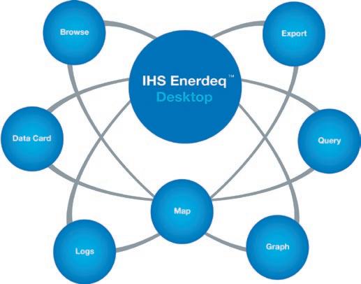
IHS Enerdeq ™ Desktop
“Enerdeq Desktop is more robust than other programs in the market, enabling our company to become more efficient. What used to take hours, now can take under fifteen minutes with Enerdeq’s ease in exporting data.”
Betty Comperen Project Manager, Process Engineering Ltd.
Enerdeq is the next generation AccuMap® designed to integrate proprietary and public data sets, improve workflow, and increase productivity.
www.ihs.com/energy
Call toll free 1 877 495 4473
NAD83
“You can rely on the NAD83 Consulting Services at IHS to manage your data conversion needs with expert ability from start to finish.”
IHS, GDM and Veritas DGC Inc. are an established team of trusted, experienced and knowledgeable industry resources providing a NAD27 to NAD83 data conversion solution.
www.ihs.com/energy Call toll free 1 877 495 4473
RESOURCE ASSESSMENT and GIS
| by Ben McKenzie
This is the second of a series of articles discussing oil and gas resource assessment and the use of GIS.
B ASICS OF PETROLEUM GEOLOGY
The formation of hydrocarbons is a field of study unto itself and volumes have been written concerning it (e.g., Cluff and Barrows 1982; Creaney, Allan et al. 1994). Generally, hydrocarbons are considered to be of organic origin, although there has long been support for an inorganic origin as well (Batchelor and Gutmanis 2002; Kenney, Kutcherov et al. 2002). The conversion of original material – be it organic or inorganic – occurs at the molecular level and as a result, hydrocarbons may exist in widely dispersed, extremely low concentrations. According to a generally accepted definition of resources, an accumulation of hydrocarbons in any amount constitutes part of the total resource.
At any given time, a finite volume of hydrocarbons exists in the rocks of the
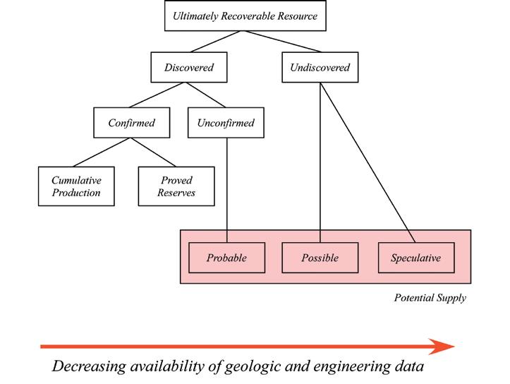
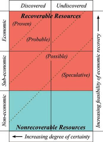
Figure 1. Classification of resources (after Kent and Herrington, 1986, Figure 1, p. 145).
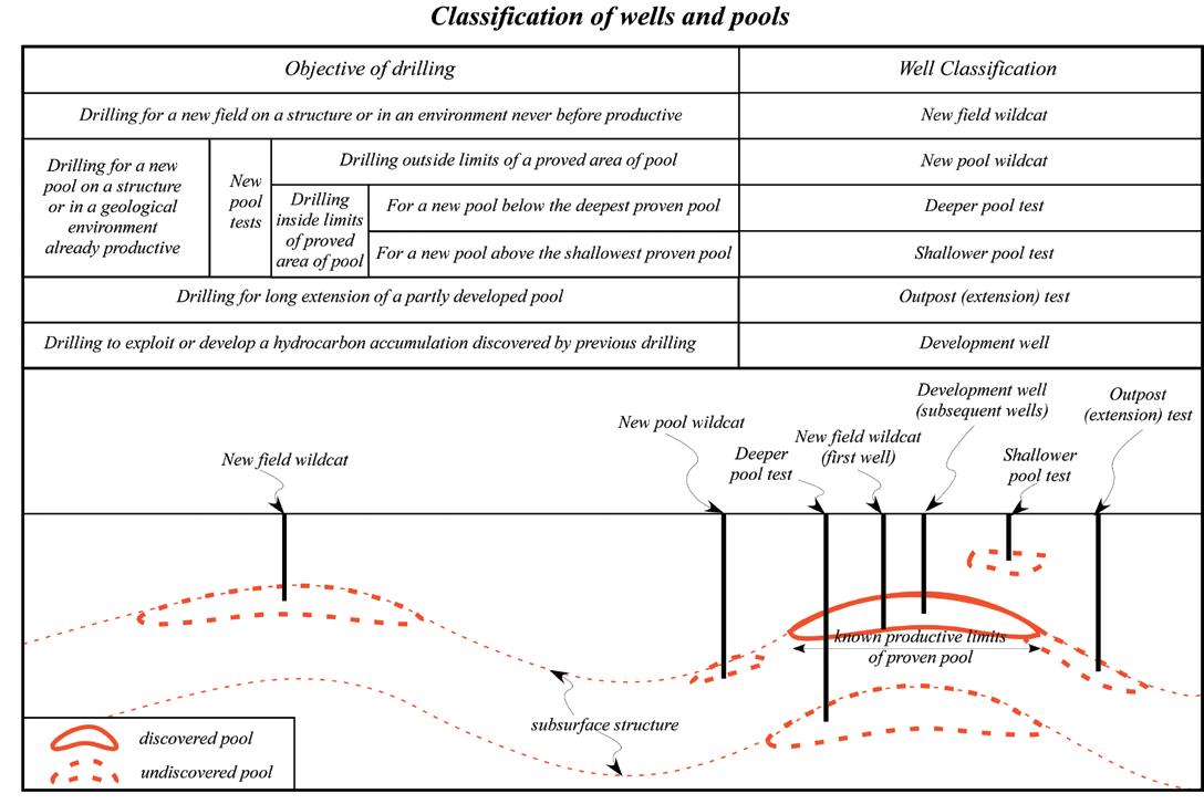
Figure 2. Classification of wells and pools (after Office of Technology Assessment, 1983, Figure 6, p. 24). (Continued on
ROCK SHOP
(...Continued from page 27)
earth’s crust. This finite volume is the total resource. A major part of this resource is dispersed in such minute accumulations or under such conditions that it cannot be extracted with existing or foreseeable technology in an economic manner. In other words, the cost of extracting it would outweigh the benefits of the energy it could provide (Kent and herrington 1986).
That part of the resource that may be discovered and produced using current or foreseeable technology and under the condition that the price-to-cost ratio is favorable is referred to as the ultimately recoverable resource (and also as the estimated ultimate recovery or as the ultimate potential). The ultimately recoverable resource is composed of both the discovered and undiscovered natural resources (Figure 1). Discovered resources include that amount of oil and gas already produced as well as that which is expected to be produced from complete development of known pools and reservoirs. Undiscovered resources are those remaining in undiscovered pools and reservoirs within known fields and those that may be discovered in new fields and reservoirs (Figure 2).
All assessments are dependent on the definition of the population being assessed. For the purposes of this discussion, the concept of a total petroleum system is used. In this context, petroleum is defined as a compound that contains high concentrations
of thermally or biogenetically generated hydrocarbon gas, gas hydrates, condensates, crude oils, and / or natural bitumen. A system includes, at a minimum, the source rock, reservoir rock, and seal rock as well as the processes of hydrocarbon generation, migration, and accumulation. Both discovered and undiscovered (but predicted) accumulations are part of the assessment in the total petroleum system (U.S. Geological Survey National Oil and Gas Resource Assessment Team 1995; Magoon and Beaumont 1999).
The system and processes mentioned above have to work together in order for a petroleum accumulation to occur. Thus, petroleum systems are constrained by time and space. This means that each petroleum system can be defined spatially by its geographic and stratigraphic extent by evaluating three independent variables – petroleum charge, trap formation, and timing. Petroleum charge is the volume and characteristics of the hydrocarbons produced by the source rock. Trap formation refers to the stratigraphic and structural events acting on the reservoir and seal rocks. Timing requires simply that the trap be in place prior to hydrocarbons passing through the reservoir rock.
By definition, all accumulations are part of the total resource. For practical purposes, however, there is always some economic limit below which the resources are not accessible. It should be noted that this economic limit is not static and can change rapidly depending on politics and technology. Figure 3 illustrates the relationship between economics and the
various categories of resources shown in Figure 1. It classifies hydrocarbon accumulations based on degree of certainty and feasibility of economic recovery. For example, an accumulation may be well defined, but below an economic threshold based on size or ease of recovery so that it does not qualify as a recoverable resource. Alternatively, an (undiscovered) accumulation could have a high degree of uncertainty but be of a size that would guarantee its development if and when it is discovered.
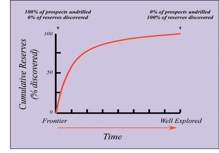
Figure 4 illustrates in an idealized manner the development of a petroleum system through time as it proceeds from a frontier status (undrilled) to well explored (intensely drilled). The percentage of undrilled prospects decreases with drilling, while the percentage of discovered fields increases. At some point in time, all the prospects will be drilled and, as a result, all the fields will have been discovered.
Of the total resources in a petroleum system, those accumulations that are best defined and most economic are termed reserves. Typically, in a newly developing area, larger accumulations are drilled first in order to recoup as quickly as possible some of the sunk costs of exploration. These “finding” costs are relatively high compared to the costs incurred during development. This relationship is illustrated in Figure 4 in that, as exploration proceeds, much of the recoverable resources are discovered relatively early on. As time proceeds, the incremental additions to the total reserves become smaller.
(Continued on page 31...)
Figure 3. Modified McKelvey Box illustrating resource categories (after Office of Technology Assessment, 1983, Figure 8, p. 30). The various resource categories compose a continuous spectrum from speculative, undiscovered, non-economic to proven, discovered, economic. The division is highly dependent on economics and technology at any given time.
Figure 4. Exploration results versus time (after Magoon and Beaumont, 1999, Figure 3-20, p. 3-30).
The Golf Committee would like to thank the following sponsors:
AGAT Laboratories
Baker Atlas Wireline
Belloy Petroleum Consulting
Canadian Society of Petroleum Geologists
Devon Canada Corporation
Canaccord Enermarket Ltd.
geoLOGIC systems ltd.
GeoStrata Resources Inc.
GLJ Petroleum Consultants
IHS
Innova Exploration Ltd.
M J Systems
MD Totco Nov. Wellsite Gas Watch
Aguila Exploration Consultants Ltd.
AON Reed Stenhouse
Beaver Drilling Ltd.
Burlington Resources Canada Energy Ltd.
Canadian Discovery Ltd.
Continental Laboratories Ltd.
Datamaxx Oilfield Corp
Divestco Inc.
Fekete Associates Inc.
Fugro Airborne Surveys
Genesis Executive Corporation
Global Energy Ser vices
Greystone Resources Ltd.
Grizzly Resources Ltd.
Halliburton Geographix
IEXCO Canada Inc.
Arcis
Core Laboratories Canada Ltd.
Fairsky Resources Ltd.
Focus Energy Trust
Gabel Energy Inc.
Gullywumper Resources Ltd.
Hycal Energy Research
Hydro-Fax Resources Ltd.
Meloche Monnex
MI Casa Rentals Inc.
Natural Rocknobs
Nordin Resource Consultants
Oleum Exploration Ltd.
Bow Valley Energy Ltd.
Canadian Stratigraphic Ser vices Ltd.
Crow River Resources
Heather Oil Ltd.
P2 Energy Solutions
Pajak Engineering Ltd.
Pason Systems Corp
Polaris Explorer ltd.
Recall
RECON Petrotechnologies Ltd.
Schlumberger
Sproule
Tristone Capital Advisors
Tucker Wireline Ser vices Canada Ltd.
Weatherford Canada Patnership
West Canadian Wildcat Scouting Ser vices (1991) Ltd.
Ireland’s Field Scouting Ser vices
Jimel Oilfield Scouting Ser vices Ltd.
Paradigm Geophysical Canada Ltd
Paramount Resources Ltd.
Petrocraft Products Ltd.
Pro Geo Consultants
Regent Resources Ltd.
RGS Consultants Ltd.
Rigsat Communications
Ryan Energy Technologies
Scope Wellsite Security Ltd.
Solid State Geophysical
Tectonic Energy Consulting Inc.
Total E&P Canada Ltd.
TOTAL Gas Detection
Varidata Surveys
Petro Tech Printing
Polaris Resources Ltd.
Quality Trophies and Engraving Ltd.
R E Newman Exploration Consultants Ltd.
Rana Resources Ltd.
Scotia Waterous
Spirit Energy Inc.
SunOcean Energy Ltd.
Townsend Field Scouting Ser vices Ltd.
Trivision Geosystems
Wild Rose Geological Ser vices
Len. T. Wong & Associates
San Dago Resources Ltd.
Seismic Brokerage Ser vices Ltd
Sensor Geophysical
NAME:
SPOUSE’S NAME:
COMPANY:
ADDRESS (Bus.):
POSTAL CODE:
TELEPHONE: CELL PHONE:
E-Mail:
SHIRT SIZE: S M L XL XXL
All contestants are required to have a photo (any will do) in the Golfer’s Photo Roster New applicants or former contestants who do not meet this request are considered to have submitted an incomplete entr y. Former contestants who have submitted a photo in the past need not do so again.
Handicap / Golf Index __________________ or
Average of best three 18-hole scores in past 2 years:______________
If Index is less than 9.0, please provide your Club and Membership Number
Entry Fee: Includes three rounds of golf with power cart; Paid driving range; Door prize draws; Skill prizes; BBQ (at Elbow Springs) and Awards Banquet (Calgar y Winter Club) both for you and your guest.
Cost: $375.00 Tournament Fee
*The course requires all golfers in a tournament of this size to use a po wer cart. The $18.00/day per golfer cart fee is included in the cost.
GST: 828579367RT0001
To assist the Entertainment Committee with budgeting, please indicate if you plan to attend the two major social events of the tournament: Wednesday Barbecue: Self: Yes No Guest: Yes No Friday Awards Banquet: Self: Yes No Guest: Yes No
Make Cheques Payable To: Canadian Petroleum Geologists Open
Send Entries To: Canadian Petroleum Geologists Open or CPGO c/o Grizzly Resources Ltd 1000, 324 - 8th Avenue S.W Calgar y, AB, T2P 2Z2 Attention: Craig Boland
For more information call Craig Boland: 218-3221 E-mail: cboland@grizzlyresources.com
Entries must be received on or before MAY 4, 2007
* Please photocopy your entry form and cheque before mailing. No receipts issued.
The course requires 176 confirmed players 1 month before the Tournament date in order to book all 27 holes. Get your registration in early to confirm your spot and help the Golf Organizing Committee. This event has over twenty flights catering to all levels of player from Beginner to the Scratch player. New Golfers are welcome, with all new entries ranked chronologically.
(...Continued from page 29)
Most hydrocarbon accumulations occur in sedimentary rocks. This is because the processes that lead to sedimentary deposition can result in voids within the rock (porosity), which can be filled with hydrocarbons. As a result, understanding the depositional environments in which the rocks formed is important in order to predict where rocks with sufficient organic matter content to be able to generate hydrocarbons (i.e., source rock) occur, their relationship to rocks with suitable porosity to store the hydrocarbons, as well as sufficient permeability to allow the hydrocarbons to be recovered (i.e., reservoir rock), and the relationship of the reservoir to rocks with low porosity and/or permeability which prevents the hydrocarbons from escaping from the reservoir (i.e., seal rock).
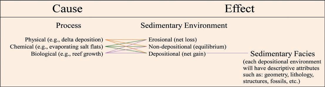
Sedimentary rocks form through three principal processes (Figure 5), which produce distinct rock units based on attributes associated with particular depositional environments (Figure 6). Depositional environments are geographical entities, which have horizontal and vertical expression and may form potential hydrocarbon accumulation sites given the right combination of location
(Continued on page 32...)
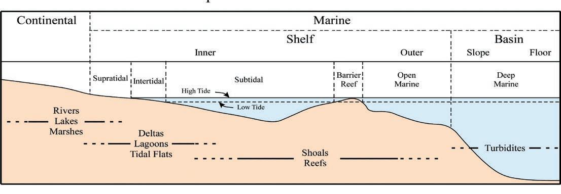
Figure 6: Distribution of sedimentary depositional environments (after Reeckmann 1982, Figure 1-1, p. 2).
Figure 5. Relationship between sedimentary processes and facies (after Selley 1970, Table 1.1, p. 2).
and timing. Through time, the depositional environments evolve as a result of natural processes such as shoreline movement caused by changes in sea level, deltaic subsidence due to compaction, shoaling related to currents, etc. As the environment changes, so does the type and location of potential reservoirs (Advanced Resources International Inc. 2001).
TOTAL PETROLEUM SYSTEM
The total petroleum system (TPS) encompasses the source, reservoir, and seal rocks, as well as the processes of trap formation and hydrocarbon generation, migration, and accumulation. A total petroleum system can be subdivided into assessment units (generally known as plays), which are defined as accumulations that are sufficiently homogeneous in terms of geology, exploration strategy, and risk characteristics so as to constitute a single population suitable for statistical analysis. Apparent pool heterogeneity within an assessment unit may result where parts of the unit are relatively less explored. There may also be political or physical reasons (e.g., extreme water depth) for apparent heterogeneity or it might be a result of incomplete databases. Assessment units can be classified as established (many
discoveries), frontier (a few discoveries), or hypothetical (no discoveries) (Klett, Charpentier et al. 2000; Magoon and Schmoker 2000; henry and Finn 2003).
In addition to the discovered pools, the total petroleum system and its subordinate assessment units, includes all the undiscovered pools. The number and size of the undiscovered pools can be estimated by a variety of methods. however, they are generally dependent on the geologic elements and fundamental processes of generation, migration, entrapment, and preservation within the TPS. Distributions of both the number and size of undiscovered pools change through time as exploration proceeds. The largest pools are generally found early in the exploration cycle and, unless a new exploration concept is developed or there is a significant change in technology or economics, discovered pool sizes tend to decrease through time. This is an important concept in hydrocarbon exploration – i.e., the discovery sequence is non-random – and it affects the statistical analysis of the resource assessment process.
In exploration, a variety of data must be evaluated in order to locate the hydrocarbon
accumulations and identify the potentially recoverable resources. This includes such things as using the geological and geophysical control to map the: 1) extent of the effective hydrocarbon source rock, along with the known hydrocarbon production and shows that are attributed to that source; 2) known or expected migration pathways; and 3) reservoir and seal rocks. As well, tests from various stratigraphic horizons must be evaluated and the reservoir parameters of stratigraphic intervals that are, or have been, producing need to be quantified (Carr 1978; henry and Finn 2003). The information derived from this evaluation is used for two main purposes – one is to determine whether a particular prospect merits testing with an exploratory well and the other is whether the resources discovered or anticipated merit the effort required for development, production, transportation, and distribution to market (White 1986).
There are two major categories of hydrocarbon accumulations based on geology – conventional and continuous (Schmoker 2002; Cook 2003; Klett and Charpentier 2003; Schmoker and Klett 2003). Conventional accumulations are discrete fields or pools associated with structural or stratigraphic traps and are commonly bounded by a down-
dip water contact, reflecting the relative buoyancy of oil or natural gas in water.
Unconventional (continuous) accumulations are areally extensive reservoirs with indistinct boundaries that are not necessarily related to structural or stratigraphic traps. Typically, continuous accumulations lack a well-defined hydrocarbon / water contact, are closely associated with source rocks, and – although having potentially large volumes of hydrocarbons in place – have low recovery rates. Also, because of the generally poorer reservoir quality, which affects relative permeabilities, the recoverable resources are more likely to be gas rather than oil since gas can be produced at lower permeabilities than can oil.
The term “unconventional” has been used to characterize accumulations marked by low permeability, difficulty of access (e.g., deep water), special regulatory status, or the need for unusual (at the time) engineering techniques. All these criteria are subject to change as the petroleum industry evolves. In an effort to develop a less arbitrary and more geologically based differentiation between conventional and unconventional systems, the term “continuous accumulations” was introduced by the USGS in their 1995 assessment (U.S. Geological Survey National Oil and Gas Resource Assessment Team 1995).
Conventional accumulations, because their defining parameters (e.g., area, thickness, porosity, etc.) can be relatively well quantified, have been the easiest to assess statistically. The resources contained in them can be easily calculated by a variety of methods. The USGS currently uses two Monte Carlo simulation programs for assessing conventional resources
– EMCEE (for Energy Monte Carlo) and Emc2 (for Energy Monte Carlo program 2). EMCEE and Emc2 forecast undiscovered resources by simulating the sizes and numbers of undiscovered fields. The user provides distributions for several variables, such as ratios of gas to oil and liquids to gas; probabilities for types of fluids and rocks and for timing; and minimum pool size, and the program samples from these distributions to calculate a forecast of undiscovered resources (Charpentier and Klett 2000).
Continuous accumulations, because of their immense size, indistinct boundaries, and large volumes of hard-to-recover, in-place hydrocarbons, cannot be assessed by the same methods. Instead, the region is best regarded as a collection of gas-charged cells. Each cell is capable of producing at least some gas, but the production characteristics of the cells can vary significantly (Curtis, Kumar et al. 2001; Schmoker 2002).
Although conventional and continuous accumulations are significantly different, many of the questions asked during an assessment are the same for both categories:
• What uncertainty exists for the factors that define the assessment unit?
• What is the drilling history?
• What factors influenced the drilling history, e.g., geologic, lease availability, economics, etc.?
• has a particular stratigraphic interval been drilled and evaluated in the areas where it potentially could contain hydrocarbons?
• What constitutes a successful test or completion?
To be continued…
A Message from the Editors
| by Ben McKenzie
hopefully, everyone will have noticed the Reservoir’s new look this year by now. What might not be as obvious is the ongoing struggle to find technical content that is of interest to the membership.
Admittedly, even a short article can require a significant amount of time to research and write. however, it should be noted that the Reservoir is not intended to compete with the more rigorous, peer-reviewed technical publications. Besides being a main source for information on the Society’s news and events, the Reservoir attempts to promote the petroleum industry – and the geosciences in general – by providing
a platform for discussion and updates of current research, ideas, and events. Given the thousands of students and current employees in the industry, as well as the ever-increasing numbers of retirees, lack of interesting topics should not be an issue. All that is needed are those discussions and updates.
In an experiment to increase submissions to the Reservoir, we are initiating payment of an honorarium for technical articles. The Reservoir will offer a payment of $200 (feel free to donate it back to your favourite Society committee) for any accepted technical article (minimum 1,500 words).
R EFERENCES:
Advanced Resources International Inc. (2001). Federal Lands Analysis Natural Gas Assessment Southern Wyoming and Northwestern Colorado. Washington, D.C., U.S. Department of Energy, Office of Fossil Energy: 94 p.
Batchelor, T. and J. Gutmanis (2002). Hydrocarbon Production from Fractured Basement formations, GeoScience Limited: 32 p.
Carr, W. G. (1978). Section potential maps; an exploration tool. Seminar on applied exploration mapping methods. P. J. Lee and S. Carroll. Calgary, AB, Canada, Canadian Society of Petroleum Geologists. Bulletin of Canadian Petroleum Geology 29: pp. 241-249.
Charpentier, R. R. and T. R. Klett (2000). Monte Carlo Simulation Method. U.S. Geological Survey World Petroleum Assessment 2000. USGS World Energy Assessment Team, U.S. Geological Survey. U.S. Geological Survey Digital Data Series 60: 15 p.
Cluff, R. M. and M. H. Barrows, Eds. (1982). Hydrocarbon generation and source rock evaluation : origin of petroleum III : selected papers reprinted from the AAPG Bulletin. Tulsa, Oklahoma, American Association of Petroleum Geologists.
Cook, T. (2003). “Calculation of Estimated Ultimate Recovery for wells in continuous-type oil and gas accumulations of the Uinta-Piceance Province.” International Journal of Coal Geology 56: 39-44.
Creaney, S., J. Allan, et al. (1994). Petroleum generation and migration in the Western Canada sedimentary basin. Geological Atlas of the Western Canada Sedimentary Basin. G. D. Mossop and I. Shetsen. Calgary, Alberta, Canadian Society of Petroleum Geologists and Alberta Research Council: p. 455-468.
(Continued on page 34...)
While we can’t assist with the lack of time people may have, perhaps this small token of our appreciation of the effort required will help take the sting out of putting pen to paper (or more appropriately, finger to keyboard). I urge everyone with research they want to publicize, a theory they want to plug, or a project that is near and dear to their hearts to write it up and send it in.
For those of you that might be interested in submitting an article, please see the note to EDITORS/AUThORS for guidelines or contact either Jaimè Croft Larsen or Ben McKenzie (information on page 3).
Curtis, J., N. Kumar, et al. (2001). American Association of Petroleum Geologists Committee on Resource Evaluation (CORE) Subcommittee to Review the United States Onshore Continuous (Unconventional Gas Assessment Methodology Used by the USGS, American Association of Petroleum Geologists: 20 p.
Henry, M. E. and T. M. Finn (2003). “Evaluation of undiscovered natural gas in the Upper Cretaceous Ferron Coal/Wasatch Plateau Total Petroleum System, Wasatch Plateau and Castle Valley, Utah.” International Journal of Coal Geology 56: 3-37.
Kenney, J. F., V. A. Kutcherov, et al. (2002). “The evolution of multicomponent systems at high pressures: VI. The thermodynamic stability of the hydrogen–carbon system: The genesis of hydrocarbons and the origin of petroleum.” Proceedings of the National Academy of Sciences 99(17): p. 10976-10981.
Kent, H. C. and J. C. Herrington (1986). Estimation of Potential Gas Resources - Methodology of the Potential Gas Committee. Oil and Gas Assessments - Methods and Applications. D. D. Rice. Tulsa, Oklahoma, American Association of Petroleum Geologists. AAPG Studies in Geology #21: pp. 143-149.
Klett, T. R., R. R. Charpentier, et al. (2000). Assessment Operational Procedures. U.S. Geological Survey World Petroleum Assessment 2000. U. W. E. A. Team, U.S. Geological Survey. U.S. Geological Survey Digital Data Series 60: 25 p.
Klett, T. R. and R. R. Charpentier (2003). FORSPAN Model Users Guide, U.S. Geological Survey: 37 p.
Magoon, L. B. and E. A. Beaumont (1999). Petroleum Systems. in Exploring for Oil and Gas Traps. E. A. Beaumont and N. H. Foster, (eds). Treatise of Petroleum Geology, Handbook of Petroleum Geology: chapter 3, 34 p.
Magoon, L. B. and J. W. Schmoker (2000). The Total Petroleum System - The Natural Fluid Network That Constrains The Assessment Unit. U.S. Geological Survey World Petroleum Assessment 2000. USGS World Energy Assessment Team, U.S. Geological Survey. U.S. Geological Survey Digital Data Series 60: 30 p.
McKenzie, B. J. (2006). Enhancing Oil and Gas Resource Assessment Through the Use of Geographic Information Systems. Department of Geography. Calgary, University of Calgary: 208 p.
Reeckmann, A., Friedman, Gerald M., (1982). Exploration for Carbonate Petroleum Reservoirs. New York, John Wiley & Sons 213 p.
Schmoker, J. W. (2002). “Resource-assessment perspectives for unconventional gas systems.” AAPG Bulletin 86(11): 1993-1999.
Schmoker, J. W. and T. R. Klett (2003). U.S. Geological Survey Assessment Concepts for Conventional Petroleum Accumulations. Petroleum Systems and Geologic Assessment of Oil and Gas in the Uinta-Piceance Province, Utah and Colorado. U. S. Geological Survey Uinta-Piceance Assessment Team. Washington, D.C., U.S. Geological Survey. Chapter 19: 9 p.
Selley, R. C. (1970). Ancient Sedimentary Environments. Ithaca, New York, Cornell University Press, 237 p.
U.S. Geological Survey National Oil and Gas Resource Assessment Team (1995). 1995 National assessment of United States Oil and Gas Resources--Results, methodology, and supporting data. Washington, D.C., U.S. Geological Survey: one CD ROM.
U.S. Geological Survey National Oil and Gas Resource Assessment Team (1995). 1995 National assessment of United States Oil and Gas Resources. Washington, D.C., U.S. Geological Survey: 20 p.
White, L. P. (1986). A Play Approach to Hydrocarbon Resource Assessment and Evaluation. Oil and Gas Assessments - Methods and Applications. D. D. Rice. Tulsa, Oklahoma, American Association of Petroleum Geologists. AAPG Studies in Geology #21: pp. 125-132.
More science than you can shake a pick at.
Geological Tour Through Alaska: A Trans-Alaskan Transect – Gulf of Alaska to Prudhoe Bay on the Arctic Ocean
June 2-11, 2007
This AAPG Field Trip is a scenic and geologically fascinating South to North transect of Alaska across three mountain ranges to the Arctic Ocean and the Prudhoe Bay oil field –the largest oil field in North America. This trip will appeal to geologists and nature-lovers alike, as you will see parts of three national parks, active glaciers, wildlife, wilderness, the Prudhoe Bay field, and end with an aerial crossing of the Brooks Range by light two-engine aircraft.
Begins in Anchorage and ends in Fairbanks, Alaska
$3,295 per person (increases to $3,395 after 4/20/06). Includes lodging (double occupancy), six lunches, bus transportation throughout trip, park entry fees, two cruises, Prudhoe Bay field tour, flight from Deadhorse to Fairbanks, and Dalton Highway guidebook
Interpretation of Old DST’s to Find Additional Oil & Gas Potential
June 4-8, 2007
Geologists, engineers & technicians who encounter or utilize DST results and reports in their exploration & production decisions will benefit from this AAPG Short Course. As will any professional who needs to make more sense of the numerous old DSTs which are present in so many wells. Particularly appropriate for those prospecting for bypassed pay using logs and geology, who may wish to verify their conclusions from the DST or for regional geologists using show maps of DST results. Also for those evaluating farmins or their own acreage where old wells with DSTs exist.
$1,195, AAPG members; $1,295, non-members (increases to $1295/1395 after 5/7/07), includes course notes and refreshments
Predicting Clastic Reservoirs Using Applied Sequence Stratigraphy: Understanding the Fundamental Drivers of Basin Fill Architecture
June 9-16, 2007
Geologists and Geophysicists of all experience levels. Begins and ends in Salt Lake City, Utah
$2,000 (increases to $2,100 after 5/11/07), includes ground transportation, guidebooks, some meals
Folding,
Thrusting and
Syntectonic
Sedimentation: Perspectives from Classic Localities of the Central Pyrenees
June 11-15, 2007
Exploration and development geologists and geophysicists interested in thrust-fold structures and tectonics-sedimentation interactions in compressional belts will benefit from this AAPG Short Course.
Begins and ends in Barcelona, Spain
$1,750 USD (increases to $1,850 after 4/30/07), includes guidebook and course materials, internal and roundtrip transportation from Barcelona, lodging, and all meals.
Sequence
Stratigraphy and Reservoir Distribution in a Modern Carbonate Platform, Bahamas
June 11-16, 2007
This AAPG Short Course is beneficial to petroleum geologists, geophysicists and reservoir engineers who are working in carbonates and need to understand facies heterogeneities and porosity distribution on exploration and production scales. Begins and ends in Miami, Florida. Four days are spent on a chartered boat in the Bahamas.
$3,600 (increases to $3,700 after 5/14/07), includes flights to and from the Bahamas to Miami, boat, accommodation in the Bahamas and all meals
Ancient
Clastics: Book Cliffs and Canyonlands, Utah
June 11-19, 2007
For exploration and production geologists, geophysicists, log analysts, engineers, and exploration and development managers who want a thorough working knowledge of clastic depositional systems directly associated with energy resources.
Begins and ends in Moab, Utah
$2,100 (increases to $2,200 after 5/14/07), includes 4-wheeldrive transportation and course notes on CD
CEU’s awarded for each successfully completed AAPG short course or field seminar. Space is limited and pricing is subject to change.
For further information, please contact the AAPG Education Department Phone: (918) 560-2650; Fax (918) 560-2678; email: educate@aapg.org or visit http://www.aagp.org/education/
SIFT introduces bright young geoscience students from 31 Canadian universities to a unique immersion into the petroleum industry in Calgary.
Students are available from mid-May to late August. If you are interested in hiring a student, or if you would like more information please contact: Roger Baker Neo Exploration Inc. Telephone: (403) 264-3730 Email: roger.baker@neoexploration.com We would like to thank the following companies for hiring a SIFT student in 2006:
R AM R IVER , C AMBRIAN AND OTHER PALEOz OIC DISCOVERIES
Alberta T38, R13W5
| by Canadian
Discovery Ltd.
Operator of Note: Talisman Energy
Play:
Cambrian Gas from Alberta Foothills
Test of Note: Talisman’s recently announced Cambrian gas discovery at NFW 12-20-38-13W5 is an Alberta first. These strata and overlying Devonian and possibly Mississippian carbonates in that well have flowed at a combined rate of 17 mmcf/d. At least three follow-up wells have been successful, flowing gas from several zones.
This article is reprinted with permission from Canadian Discovery’s CEO map series (2ndQ 2006).
S IGNIFICANT DISCOVERY
On November 9, 100% operator Talisman Energy announced a significant multi-zone gas discovery at 12-20-38-13W5, which was rig released on March 15, 2005, in a virtually undrilled area of the northern Foothills of Alberta called Ram River (Figure 1). The company reported testing gas from three zones in that well at a combined rate of 17 mmcf.
The 12-20 discovery perforation-tested several horizons (Mississippian Pekisko, Devonian Wabamun and Cooking Lake/ Leduc, and Cambrian strata) in what appears to be a single thrust sheet. From analysis of available completion information, the Pekisko and parts of the Cooking Lake/Leduc are recorded as having been perforated and then cemented off. The Wabamun and other parts of the Cooking Lake/Leduc, as well as the Cambrian, were perforated, acidized, and have not been cement squeezed. These strata are believed to be discoveries. The Cambrian discovery has been made in the porous dolomitized Middle (?) to Upper Cambrian Waterfowl Formation (Figure 2), at a relatively shallow depth of less than 2,000m. Other than opening up a
(Continued on page 38...)
Figure 1. Activity Map.
Figure 2. Cambrian Stratigraphy.
(...Continued from page 37)
new play area, the significance of the 12-20 discovery is that one of the successfully tested reservoirs is Cambrian in age, the first such discovery in Alberta (some minor Upper Cambrian gas had been tested in 1953 by Richland at NFW 2/82-37-11W5, on land presently leased by Shell Canada [75%] and Mancal Energy [25%]). The Cambrian reservoir is very likely enhanced by natural fracturing.
Since the 12-20 NFW discovery, seven exploratory wells (six Outposts and one NFW) were licensed between December 2005 and October 2006 at Ram River to depths ranging from 2,230m to 2,700m. Three of these exploration locations are Wabamun tests while the rest are Cambrian tests. As of November 24 2006, five of these wells have been drilled. Only one is dry (NFW 5-30-3813W5, RR July 29) while the remaining four are standing (Outposts 3-19, 10-19, and 2-29-38-13W5, and 2-36-38-14W5). These successful follow-up wells have potential in one or more zones. The November 9th press release mentions three successful wells (in addition to the 12-20 discovery), which together tested at more than 20 mmcf/d gross raw gas. The company gives an early estimate of 200 and 300 bcf of contingent and prospective natural gas under its Ram acreage. Talisman is planning to drill eight more wells in 2007. The company is expecting to spend $100 million on that drilling, and on infrastructure and equipment needed to get the gas to market. First production from Ram is expected in 3Q 2007 at potential exit rates of 30-50 mmcf/d.
The Ram River (also called Ram) area is typical of the Outer Foothills challenging terrain that operators must face (Figure 3)
T ALISMAN E NERGY
Talisman Energy is an independent upstream oil and gas company formed in 1992, with 42% of its 2006 production coming from the company’s North American core area. Three-quarters of that production is natural gas, with the vast majority of that gas coming from Canada. Talisman is focused on the larger opportunities, such as deep gas deposits in Western Canada for which the company is the leading explorer. So it is not surprising that the company would be seeking and finding new high impact play areas, such as the significant Ram River discovery announced on November 9, 2006.
Figure 3. Ram River Falls, T38, R12W5.
Figure 4. Regional Tectonic Assemblage Map.
Talisman is Western Canada’s dominant thrust and fold belt (Foothills) player, from Monkman (Sukunka-Bullmoose) in northeastern British Columbia to the southern Alberta Foothills. The company reported that it has built a substantial land position in the Outer Foothills Ram River play region of west central Alberta (Figure 4), stating that it has over 19,426 ha or 76 sections of 100% working interest there. Canadian Discovery has calculated, from available public information, that Talisman has interests (likely 100%) in about 104 sections of land between T36 and 39, R12 to 15W5. All of these sections have rights that include P&NG in the Cambrian, and over 80% have all P&NG from surface to basement, allowing for much up-section potential in a region that is almost undrilled. Only three of these sections were bought by Talisman under its own name. That parcel is a three-section, five-year license (T38, R13-14W5) that was obtained, all P&NG, in June 2003 for $358/ha (Figure 1). The rest of Talisman’s extensive land holdings were acquired patiently, in groupings of one to eight sections, through several land agents. That acquisition started in September 2001 with the purchase of two four-section licenses in T39, R15W5, with subsequent deep rights purchases in 2003 (eight parcels including the one aforementioned parcel by Talisman), 2004 (eight parcels), 2005 (two parcels), and especially 2006 at the January 25 sale. At that sale, 13 parcels totaling 34 sections ranging from $26/ha to a high of $1,848/ha (for a three-section license offsetting the 12-20 discovery and on which Talisman licensed a Cambrian Outpost on October 11, 2006, at 13-28-38-13W5) were bought through agents for Talisman.
Other deep operators in the Ram River area include Shell Canada, Northrock Resources, and a partnership of Esprit Exploration and Alberta Clipper Energy (Figure 1).
For information on products offered by CDL, please visit www.canadiandiscovery.com or call 269-3644.
IMPROVE YOUR STRATEGY FOR PINPOINTING NEW TARGETS
IMPROVE YOUR STRATEGY FOR PINPOINTING NEW TARGETS
As leaders in geophysical interpretation for over 25 years, Boyd PetroSearch helps you make decisions with far greater accuracy and confidence than ever before.
Find out how we can improve your ability to drill on target by revealing complex interrelated geological features and reservoir patterns with unprecedented resolution and detail.
Come visit us at the CSPG/CSEG convention in May. Booth 928.
Please call: Kevin Bowman 403.543.5357 Larry Herd 403.543.5362 or visit www.boydpetro.com
Cretaceous Channel
2007 CONVENTION Special Events
May
14 – 17, 2007 Calgary,
Alberta, Canada
MONDAY MAY 14TH
BREAKFAST WITH EXHIBITORS
8:00 am – 10:00 am
Exhibit Floor – Halls A & B
Get a chance to wander through the exhibits and enjoy a complimentary continental breakfast and coffee.
FLOWDOWN RECEPTION
4:00 pm – 7:00 pm
Exhibit Floor – Halls A & B
Join your colleagues for some great food and conversation while browsing the many exhibits at this year’s CSPG CSEG Conference
TUESDAY MAY 15TH
BREAKFAST WITH EXHIBITORS
8:00 am – 10:00 am
Exhibit Floor – Halls A & B
Get a chance to wander through the exhibits and enjoy a complimentary continental breakfast and coffee.
NEW THIS YEAR! PAST AWARD WINNERS RECEPTION
3:30 pm – 4:30 pm
Exhibit Floor – Halls A
Are you a previous winner of a Convention Award? Will you be a delegate at the 2007 Convention? Call the CSPG office today at 264-5610 and make sure you are registered to attend the Past Award Winners Reception where honourees will have the chance to meet and mingle with complimentary beverages and hors d’oeuvres before the Beer & Bull begins!
BEER & BULL
4:00 pm – 6:00 pm
Exhibit Floor Halls A & B
Enjoy the final hours of the Exhibition with a drink and appetizers as you network with colleagues.
LONG TIME MEMBERS RECEPTION
4:00 pm – 6:00 pm Rotary House
have you been a member of the CSPG for 30+ years? If so, this event is for you! In appreciation for their long commitment to the Society, the CSPG will host the 7th Annual Long Time Members Reception, a complimentary cocktail party for our more senior members.
WEDNESDAY MAY 16TH
CONVENTION BBQ LUNCH 11:30 am – 1:00 am
Tents behind the EUB Core Research Centre
Sponsored by: Hycal Energy Research Laboratories Ltd.
Take a break from the Core Conference to enjoy the excellent BBQ lunch provided by hycal Energy Research Laboratories.
STUDENT/INDUSTRY
RECEPTION
4:00 pm – 6:00 pm
Location: TBA
Meet the energetic minds of tomorrow, as graduates have the opportunity to meet industry representatives from the companies that will employ them.
NEW THIS YEAR! 2007 CSEG CHALLENGE BOWL 4:00 pm – 6:00 pm
Location: TBA
Students - win an expenses-paid trip to San Antonio next September! Teams of two will compete to answer a range of geophysical and geological questions, the winning team will be sent to the SEG Annual Meeting to participate in the 2nd Annual SEG Challenge
Bowl! For more information please contact Brian Russell: brian.russel@cggveritas.com.
THURSDAY MAY 17 TH
CONVENTION BBQ LUNCH
11:30 am – 1:00 am
Tents behind the EUB Core Research Centre
Sponsored by: Hycal Energy Research Laboratories Ltd.
Take a break from the Core Conference to enjoy the excellent BBQ lunch provided by hycal Energy Research Laboratories.
CORE MELTDOWN
3:30 pm – 7:00 pm
Tents behind the EUB Core Research Centre
Sponsored by: IHS
Celebrate another successful convention at the popular Core Meltdown event. Join the CSPG CSEG Organizing committee and all your fellow convention delegates for some food and beverages.
For more information please contact: Andrea Hood Special Events chair Direct 444-1609 Ahood@geologic.com
Greater confidence. Better results. Faster.
Petrel Geology
Petrel* workflow tools provide a complete seismic-to-simulation toolkit— one solution uniting the subsurface domains of geophysics, geology, and reservoir engineering.
Geologists can use new modeling capabilities to better predict facies distributions, work with geophysicists to analyze structural uncertainties, and work with reservoir engineers to define a well placement strategy.
“It is like having an extra geologist sitting there, it’s telling you things that you didn’t know, it’s testing your theories like you never saw before and helping you come up with new ideas.” DavidHamilton,CEO,SubsurfaceComputerModeling
With Petrel software, all work processes lead to one shared earth model, resulting in faster, better decisions.
sisinfo@slb.com
www.slb.com/petrel
LONG-TIME MEMBERS Reception
TIME TO START THINKING ABOUT THE 7th ANNUAL LONGTIME MEMBERS RECEPTION!
TUESDAY, MAY 15/2007
Have you been a member of the CSPG for 30+ years (since at least 1977)?
If so, keep an eye open for your invitation to the 6th Annual Long-Time Member’s Reception. The very popular event is a complimentary cocktail party organized exclusively for our more senior members, in appreciation of their long commitment to the Society. Attendance is by invitation only.
This year the reception will take place on Tuesday, May 15 from 4:00 to 6:30 P.M.; and will be held, once again, at the lovely Rotary house on the Stampede Grounds. It will be held in conjunction with the CSPG Annual Convention, but you need not be registered for the Convention in order to attend the Long-Time Members Reception. Invitations will be sent out in mid to late April. If you are a long-time member (30+ years) in good-standing, and have not received an invitation by May 1, please call Pam Drover at the CSPG office (403) 513-1230. She can verify your start-date, and make sure your name is included on the invitation list. Included with the invitation will be a list of all other invitees – you can look for your friend’s names and help us make sure no one is omitted. It also makes a great “cheat sheet” for the reception when you run into all those old acquaintances!
This event is highly anticipated, and every year more people attend. We have lots of tasty hors d’oeuvres, a couple of a complimentary drink tickets, a cash bar, and door prizes for the members (in attendance) with the earliest start-dates. Last year, about 170 people attended. We have a short, informal agenda, which includes presentation of the honourary Awards. This year the recipients will be Mr. James MacDonald and Ms. Alice Payne.
hope you can make it to this year’s LongTime Members Reception! For more information regarding this event, please contact Regan Palsgrove at Talisman Energy; phone (Tues. to Thurs.) 237-1423 or e-mail rpalsgrove@talisman-energy.com.
Long-time Members Robert Mason and John Patton pose for the camera.
Ian Mcllreath presenting Gordon Williams with his Honourary Membership Certificate.
Long-time members enjoying the 2005 Reception, held at the Rotary House at Stampede Park.
LET THE GAMES begin!
| by David Caldwell, Squash Committee Co-chair
Just when you thought you had worked off all of that holiday cheer, along came the 24th Annual CSPG Squash Tournament at the World health Club in Edgemont. Despite the abundance of food and fun there was a great squash tournament that occurred February 8 through 10th . Some people might remember Pasta Night, the marathon Teams Tourney, and the Giant Squash Racquet match, but others will remember a fantastic banquet, great squash matches, and lots of sore muscles. There were fantastic Finals again this year. All of the playoff matches were intense. A few new twists were also added to the Teams Tourney to make it more fun.
Other highlights included the Men’s B, C, and D Finals that included Squash Committee members Ryan Barnett, Chris May, Randy Smith, and Mark Dzikowski. Although only two of four took home bragging rights, it was good to show people that our large squash committee does more than just look pretty and put on a good tournament. honorable mention should go to Morgan Bint in the Men’s B division. Morgan is typically one of the most intense competitors. Although he lost in the Men’s Consolation B Final while playing with a torn muscle, he was still keen enough to join into the Teams Tourney for an hour or so just before his Finals match.
A big thanks goes out to Tucker who once again stepped up as the 24th Annual CSPG Squash Tournament sponsor. Not only did they contribute large amounts of sponsorship dollars, Tucker also graciously hosted two practice nights for the many “squash keeners” at the Bow valley Club leading up to the tourney. The new tournament shirts were also a big hit with the 125 participants. There are a few extras on back-order for some people who were not able to make it out to the Registration Night. Warren Dublonko at Tucker is looking after those people.
Trophies were not the only things being won this year. Everyone who played in the tournament had their name automatically entered into a draw for a variety of door prizes generously provided by our sponsors. The prize line-up included top-of-the-line Black Knight squash racquets, Calgary Flames tickets, Kananaskis golf certificates, travel certificates, and other corporate donated prizes. For those of us who felt lucky, playing cards were sold for $20 to be entered into the annual CSPG Trust fundraiser draw. When it was all done but the cryin’, John Cox took home the top prize of a weekend getaway for two to Panorama (thanks DC!). Other prizes included a camcorder, racquets, and satellite radio for a year.
Several other notable sponsors were Baker hughes who sponsored the Teams Tournament, Belloy Petroleum Consulting, Divestco, Oyo Geospace, and Weatherford. Thanks to our newest sponsor, GeoTir, who provided Taxi vouchers to get people home safely from the squash tourney. Apart from the sponsors already mentioned, there were 20 Gold level sponsors and another dozen Silver sponsors. Without our many sponsors that contribute each year, this tournament would not be the huge success that it continues to be each and every year. With this kind of great support, we know that we can make next year’s special 25th Anniversary CSPG Squash Tournament one to remember forever.
Lastly, let’s not forget the tireless efforts of our great committee members. Without these guys volunteering countless hours to put this tourney together and help run it, this may not be the longest running squash tournament in Calgary. A big thanks to committee members: Ryan Barnett, Travis Brookson, David Caldwell, Warren Dublonko, Mark Dzikowski, Megan huckvale, Kris Jewett, Kim Maclean, Chris May, Jessie Mitton, Al Rutherford, Randy Smith, Colin Thiessen, and Jolene Wood.
TEAMS TOURNAMENT
M ENS A: DAv E SAFTON
MENS A RUNNER- UP : JOhN COx
MENS A CONS : B RIAN F YKE
M ENS B: DOMI D IAZ
MENS B RUNNER- UP RYAN BARNETT
MENS B CONS : ED ChOW
M ENS C: C HRIS M AY
MENS C RUNNER- UP : R ANDY S MITh
MENS C CONS : TERRY MACC ALLUM
M ENS D: M ARK DZIKOWSKI
MENS D RUNNER- UP : STE vE GLAvAC
MENS D CONS : MARK ShAW
M ENS E: TOM S MITH
MENS E RUNNER- UP : LEIGh M UIR
MENS E CONS : SAIED POS hTChAMAN
WOMENS A: S OLANA J EAR
WOMENS A RUNNER- UP : ALISON MCPhERSON
WOMENS B: C HRISTIE H OWE
WOMENS B RUNNER- UP : TINA ChOW
WOMENS C: C ATHERINE BARRETT
WOMENS C RUNNER- UP : FLO RENYOLDS
WOMENS D: SAM E THERINGTON
WOMENS D RUNNER- UP R AChAEL NEWRICK
TEAMS AL RUThERFORD
ROBYN BENNER
RIChARD GUNN
JESSICA MAY
DWAYNE SPARKS
Thank You
The 24th Annual CSPG Squash Tournament raised $4000 from the generosity of participants for the CSPG Trust.
Playing cards were sold at $20 per card for a chance to win 5 prizes.
Thank you to everyone who took their chances in support of the CSPG Trust.
*The CSPG Trust is a trade-mark of the *CSPG Educational Trust Fund. *
TOURNAMENT S PONSOR
P REMIER S PONSORS Baker Atlas
P LATINUM S PONSORS
Belloy Petroleum Consulting Ltd.
Divestco Inc.
GeoTir Inc.
GOLD S PONSORS
Aguila
BEHR Energy Services Ltd.
Black Knight
Blue Castle
Bodycote Norwest
Datalog Technology Inc.
DeGolyer and MacNaughton Canada Limited
EnCana Corporation
Galleon Energy Inc.
geoLOGIC systems ltd.
Geological Rental Services
Hycal Energy Research Laboratories
Irelands Field Scouting
MD TOTCO NOv
NorthStar Drillstem Testers
OYO Geo Space Canada, Inc
Pajak Engineering
Pason Energy Systems
RigSat Communications Inc
RPS Energy Canada
TOTAL Gas Detection
S ILVER S PONSORS
AGAT Laboratories
Carbon Copy
Continental Laboratories Ltd.
Core Laboratories Canada Ltd.
fma insurance
Genesis Corporate Search
Hef Petrophysical Consulting Inc.
Kelman Seismic Processing
Meloche Monnex
Sensor Geophysical Ltd.
Sproule
Stoakes Consulting Group Ltd.
P RI zE S PONSORS
Keitech Wellsite
Canadian Discovery Ltd.
Chinook Consulting
ANNOUNCEMENT: Canada-wide survey of Earth Scientists
| by Dr. Andrew Miall
A survey by Dr. Andrew Miall, a geologist at the University of Toronto, and Dr. Charlene Miall, a social psychologist at McMaster University, is being undertaken to examine Canadian earth scientists’ perspectives on their discipline, their profession, and the role of earth science in addressing public issues like climate change. The survey is intended for all members of the Geological Association of Canada and the Canadian Society of Petroleum Geologists. The research is being supported through grants from the Social Sciences and humanities Research Council of Canada and the McMaster University Arts Research Board.
In order to develop the survey, the researchers have carried out 64 indepth, unstructured interviews with earth scientists in 14 cities across Canada. Those interviewed include earth scientists working in universities across the country; in the various offices of the Geological Survey
of Canada; and in the fossil fuel industry – including earth scientists working in major corporations, small independent companies, and consulting firms. Further, the researchers have interviewed a sizeable number of earth scientists working on resource-based research and on environmental research, including climate change science. Lasting from one to four hours, these interviews have helped identify a number of issues which make up the survey and are summarized below:
• First, the survey explores earth scientists’ views on earth science as a discipline, whether it is in the process of changing, and the impact this may or may not be having on the development of university programs, undergraduate student recruitment, industry recruitment and training, and professional certification. The survey also seeks insights from earth
scientists about the future direction of earth sciences in general, and resource industries in particular.
• Second, the survey explores professional earth scientists’ views on the relevance of their discipline for public problems like climate change, their familiarity with climate change science, and their assessments of public understandings of climate change, media representations of climate change, and social policy initiatives to address this issue.
It is important to also note that this research has been given ethics approval under SS hRC guidelines through the McMaster University Research Ethics Board. Therefore, there is no deception involved in this research, nor do the researchers seek any particular outcome. Further, those completing the survey will be guaranteed confidentiality and results will be tabulated and presented in a non-identifying manner. A final report of the results of the survey will also be made available to the GAC and CSPG executives and membership.
This timely research provides an opportunity for earth scientists to share their views on these important professional and public issues in an inclusive and collegial way. For this reason, your Executive strongly endorses this survey and encourages all members to thoughtfully complete it. This information will help the Executive understand members’ concerns and views on several important matters facing the earth sciences now and in the future.
The electronic survey, available in English and in French, will commence at the beginning of April, 2007 on a secure webpage at McMaster University. CSPG Members will receive an announcement in the eNewsletter, providing them with a link to the survey website and instructions for participating.
Whether it is fluid contact depths, permeability, faults and fractures or numerical inputs for flow simulation, there is always an element of uncertainty in one’s reservoir operations.
And yet, unlike playing roulette on the casino floor, uncertainty and luck doesn’t have to be inevitable. Roxar is seeing to that.
Through generating multiple scenarios, systematic analysis of the results and incorporating them into a dynamic, simulation environment, Roxar is helping oil and gas operators to better manage and quantify uncertainty within the reservoir.
And, unlike roulette, the end result will be that operators won’t have to rely on chance and luck to succeed but will be able to quantify uncertainty in their reservoir operations and more accurately determine the level of risk – often financial – in their decisions.
For more information on how Roxar is adding uncertainty capabilities to its industry-leading IRAP RMS™ modeling solution, contact us today.