


18 Geomechanics For Everyone, Part 3: What is Fracability? Understanding the Effects of Geomechanical and Structural Factors on Fracturing in Unconventional Reservoirs 22 Go Take a Hike 26 GeoConvention 2014: Focus $10.00 NOVEMBER 2013 VOLUME 40, ISSUE 10 Canadian Publication Mail Contract – 40070050


IHS AccuMap®
A MORE POWERFUL & INTUITIVE INTERPRETATION
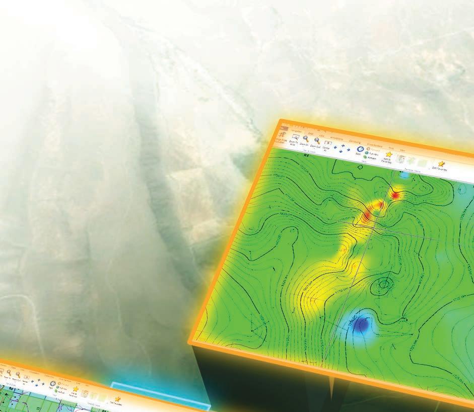

Developed with extensive industry feedback, a complete user interface refresh enables easy navigation with the addition of the Microsoft® Office Ribbon and mouse-driven pan and zoom functionality. Mapping and plotting are now enhanced with editable contours, flexible postings, and transparency for all layers, including Land. Expanded engineering capability increases reservoir knowledge with both the Classic Production Graph and the new Material Balance Graph.
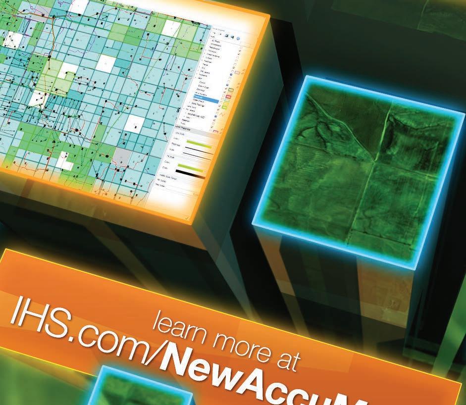


by industry & powered by the breadth and depth of IHS IHS.com/ NewAccuMap AVAILABLE NOW IHS AccuMap®
Shaped
SOLUTION NOW AVAILABLE
CSPG OFFICE
#110, 333 – 5th Avenue SW Calgary, Alberta, Canada T2P 3B6
Tel: 403-264-5610
Web: www.cspg.org
Office hours: Monday to Friday, 8:30am to 4:00pm
Executive Director: Lis Bjeld
Tel: 403-513-1235, Email: lis.bjeld@cspg.org
Event Coordinator: Kristy Casebeer
Tel: 403-513-1226, Email: kristy.casebeer@cspg.org
Geoscience Coordinator: Kelsey Green
Tel: 403-513-1225, Email: kelsey.green@cspg.org
Member Services:
Tel: 403-264-5610, Email: membership@cspg.org
Publications and Website: Emma MacPherson
Email: emma.macpherson@cspg.org, Tel: 403-513-1230
Co-Manager, GeoConvention 2014: Aileen Lozie
Tel: 403-513-1227, Email: aileen.lozie@cspg.org
Database Administrator and Accounting: Kasandra Amaro
Maternity leave until January 2014
Corporate Sponsorship: Lis Bjeld
Tel: 403-513-1235, Email: lis.bjeld@cspg.org
Controller: Eric Tang
Tel: 403-513-1232, Email: eric.tang@cspg.org
EDITORS/AUTHORS
Please submit RESERVOIR articles to the CSPG office. Submission deadline is the 23rd day of the month, two months prior to issue date. (e.g., January 23 for the March issue).
To publish an article, the CSPG requires digital copies of the document. Text should be in Microsoft Word format and illustrations should be in TIFF format at 300 dpi., at final size. For additional information on manuscript preparation, refer to the Guidelines for Authors published in the CSPG Bulletin or contact the editor.
Technical Editors
Hugh S. Mosher Colin Yeo (Assistant Tech. Editor) Nunaga Resources Ltd. Encana Corporation M.: 403-809-9997 Tel: 403-645-7724
Email: hsmosher@telus.net Email: colin.yeo@encana.com
Coordinating Editor
Emma MacPherson, Publications Coordinator, CSPG Tel: 403-513-1230, emma.macpherson@cspg.org,
ADVERTISING
Advertising inquiries should be directed to Emma MacPherson, Tel: 403-513-1230 email: emma.macpherson@cspg.org. The deadline to reserve advertising space is the 23rd day of the month, two months prior to issue date.
RESERVOIR ISSUE 10 • NOVEMBER 2013 3 NOVEMBER 2013 – VOLUME 40, ISSUE 10 ARTICLES 2013 – “Let the Sun Shine” for the CSPG Mixed Golf Tournament ............................... 16 Geomechanics For Everyone, Part 3: What is Fracability? Understanding the Effects of Geomechanical and Structural Factors on Fracturing in Unconventional Reservoirs 18 2014 CSPG Geological Calendar Wrap-up ............................................................................ 21 Go Take A Hike ............................................................................................................................. 22 GeoConvention 2014: Focus ..................................................................................................... 26 DEPARTMENTS Executive Comment 5 Technical Luncheons 8 Division Talks 15 Rock Shop ...................................................................................................................... 7, 11, 17
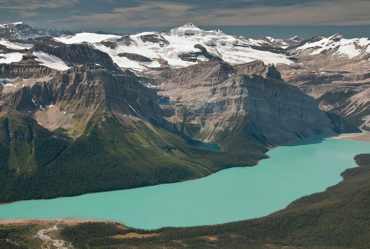
FRONT COVER
Hector Lake, Banff National Park, Alberta. Looking west across Hector Lake to the Continental Divide and Mt. Balfour. Photo by Peggy Hodgkins.
The RESERVOIR is published 11 times per year by the Canadian Society of Petroleum Geologists. This includes a combined issue for the months of July and August. The purpose of the RESERVOIR is to publicize the Society’s many activities and to promote the geosciences. We look for both technical and non-technical material to publish. Additional information on the RESERVOIR’s submission guidelines can be found at http://www.cspg. org/publications/pubs-reservoir-submissions.cfm. The contents of this publication may not be reproduced either in part or in full without the consent of the publisher. Additional copies of the RESERVOIR are available at the CSPG office. No official endorsement or sponsorship by the CSPG is implied for any advertisement, insert, or article that appears in the Reservoir unless otherwise noted. All submitted materials are reviewed by the editor. We reserve the right to edit all submissions, including letters to the Editor. Submissions must include your name, address, and membership number (if applicable). The material contained in this publication is intended for informational use only. While reasonable care has been taken, authors and the CSPG make no guarantees that any of the equations, schematics, or devices discussed will perform as expected or that they will give the desired results. Some information contained herein may be inaccurate or may vary from standard measurements. The CSPG expressly disclaims any and all liability for the acts, omissions, or conduct of any third-party user of information contained in this publication. Under no circumstances shall the CSPG and its officers, directors, employees, and agents be liable for any injury, loss, damage, or expense arising in any manner whatsoever from the acts, omissions, or conduct of any third-party user. Designed and Printed by The Data Group of Companies, Calgary, Alberta.
(You may never return to the o ce)

Now, get geoLOGIC’s value-added data almost any place, any time, any way you want it. Available through gDCweb on your tablet, smartphone or computer.
With 30 years of data experience behind it, gDC is the source for high quality, value-added well and land data from across Western Canada and the Northern United States. Another plus – our data is accessible through an expanding range of industry software utilizing our own easy-to-use gDC GIS and our geoSCOUT software.
View, search, import and export well, land and production data, documents, logs and more from almost anywhere. For more information visit our website at www.geoLOGIC.com
Leading the way with customer-driven data, integrated software and services for your upstream decision-making needs. geoSCOUT | gDC | petroCUBE at www.geoLOGIC.com
Warning:
mobile
Our data has gone


CSPG EXECUTIVE
PRESIDENT
Paul MacKay • Shale Petroleum Ltd. paul.mackay@shalepetroleum.com Tel: 403.457.3930
PRESIDENT ELECT
Dale Leckie • Nexen Inc. daleleckie@nexeninc.com Tel: 403.613.0458
PAST PRESIDENT
Robin Mann • AJM Deloitte rcmann@deloitte.ca Tel: 403.648.3210
FINANCE DIRECTOR
Samantha Etherington • Barrick Energy SEtherington@barrick-energy.com Tel: 403.386.6459
FINANCE DIRECTOR ELECT
Gord Stabb • Durando Resources Corp. gstabb@durando.ca Tel: 403.819.8778
DIRECTOR
Dave Russum • AJM Deloitte drussum@deloitte.ca Tel: 403.648.3228
DIRECTOR
Alexis Anastas • Nexen Inc. alexis_anastas@nexeninc.com Tel: 403.699.4965
DIRECTOR
Mike Seifert • Canadian Discovery mseifert@canadiandiscovery.com Tel: 403.269.3644
DIRECTOR
Weishan Ren • Statoil Canada Ltd. wren@statoil.com Tel: 403.724.0325
DIRECTOR
Curtis Evans • ERCB curtis.evans@ercb.ca Tel: 403.297.8386
DIRECTOR
Dawn Hodgins • Imperial Oil Resources dawn.hodgins@exxonmobil.com Tel: 403.232.5931
DIRECTOR
Andrew Fox • MEG Energy Corp. andrew.fox@megenergy.com Tel: 403.770.5345
EXECUTIVE DIRECTOR
Lis Bjeld • CSPG lis.bjeld@cspg.org Tel: 403.513.1235
EXECUTIVE COMMENT
A message from 2013 Past President, Robin Mann
Three Years of Quiet Progress
Last year at this time I looked back on what had been accomplished by the Society and where we had come during 2012. As 2013 comes to a close, this will be my last comment as part of the CSPG Executive (my Past President term will be completed in January). I would therefore like to give a perspective on the major events of the last three years and my hopes for the future.
When I was asked to run for the position of President Elect, the CSPG had gone for a number of years without holding elections. There were those within the Society felt that to have a proper democratic process that an election should be held each and every year. This is not to say that the people that were letting their name stand and being acclaimed were not quality candidates, volunteers and ultimately members of the Executive but rather the Membership should have a choice of candidates that hopefully bring a diverse set of ideas and skills.
The argument has always been that if we have elections then we potentially lose good volunteers to the process in a time when volunteers are so very hard to find. I cannot disagree with this discussion; however the Society benefits more from our Members being involved in the democratic process with elections than without. After two years where we were fortunate to find two candidates for both the President Elect and the Finance portfolios, we have again struggled to find multiple candidates for these positions over the last two years. The Society however has been blessed by the fact that the people that have stepped forward for all positions on the Executive have been top notch and have and are doing a fantastic job in steering the CSPG into the future.
Hats off to those in 2010 that reinstated elections within the CSPG; I am proud that I was elected to the position of President by the Membership and my hope is that we
can again return to having elections each year. I would suggest that at a minimum, the Finance Director and the President Elect should be elected each year, as the process only makes the CSPG stronger. Outside of the Finance Director and President Elect we have changed the election process slightly, such that candidates run as “Directors at Large” and not for individual portfolios. This gives the candidates the ability and flexibility to work in areas that they are passionate about if they are acclaimed or elected to the Board.
Over the past three years we have also seen a significant change in the CSPG Educational Trust Fund (ETF). The fund was started in 1992 and has been an avenue where our Membership and friends of the CSPG can donate funds to help promote education and programs of the CSPG. The original founders of the ETF had both vision and commitment to have an avenue where monies could be raised in a tax effective manner to better the outreach programs of the CSPG. After many years of tireless commitment, they brought the ETF from nothing to fund of $1.5 million. Their dedication to both the ETF and the CSPG should be applauded by all and I personally would like to thank them for leaving the CSPG this legacy to grow and expand into the future.
Due to retirements, volunteer burnout and other commitments, the Board of the ETF has changed over the past three years. There are a new group of Directors with a fresh and different look on how the ETF will move forward in the next few years. With the solid base developed by its founders, great stewardship over the past 21 years and the enthusiasm of the current Board, we all should be proud of what we have within the ETF and should all become involved in any way we can.
The most important technical and financial (Continued on page 7...)
RESERVOIR ISSUE 10 • NOVEMBER 2013 5

CORPORATE SPONSORS
SAMARIUM
geoLOGIC systems ltd.
TITANIUM
APEGA
Shell Canada Limited
PLATINUM
AGAT Laboratories
Cenovus Energy Inc.
ConocoPhilips
IHS
Imperial Oil Resources
Nexen Inc.
GOLD
Devon Energy Corp
Enerplus Corporation
MEG Energy Corp.
Tourmaline
Schlumberger Canada Limited
Statoil Canada
SILVER
Athabasca Oil Corporation
Baker Hughes
Canadian Natural Resources Ltd.
CGG Services (Canada) Inc.
Encana Corporation
Husky Energy Inc.
ION GeoPhysical
Loring Tarcore Labs Ltd.
MJ Systems
Petrosys
Suncor Energy
BRONZE
Arc Financial Corporation
Arcis Seismic Solutions
Belloy Petroleum Consulting
Earth Signal Processing Ltd.
Exova Canada Inc.
Hunt Oil
Olympic Seismic Ltd.
PGS
Pro Geo Consultants
Roke Technologies Ltd.
Saudi Aramco
Seisware
Sensor Geophysical Ltd.
Talisman Energy
Tesla
TGS
As
event each year for the CSPG is the annual convention and exhibition we hold jointly with the CSEG and the CWLS. Over the past three years all three Societies have been not only been spending considerable time and effort in improving the convention, but also making it run smoother and more consistent year after year.
As you can imagine putting something like GeoConvention on each year with a dedicated group of volunteers is a monumental task. To help the volunteers and also to reduce the burden on any one Society, we have all agreed to form the Geoconvention Partnership, which is owned 45% each by both the CSPG and CSEG and 10% by the CWLS. This organization will have Board representation from each Society and will act as the operator for convention each year. Geoconvention Partnership will only look after the operational features of convention with the technical aspects continuing in the hands of the Technical Chairs and their volunteer committees. All three societies see this as a beneficial move that will help to increase the profile of GeoConvention every year. This move also frees the volunteers to focus on the technical aspects of convention while at the same time increasing financial benefits that will improve their own internal programs to their Membership.
Before I close, I would like to thank on behalf of the Membership, the Executive and the ETF the continued support of the CSPG office staff. We as Members and volunteers, rely on Lis Bjeld (CSPG Executive Director) and all of the staff to get everything done. Without a super dedicated office staff it would be significantly
more difficult to get our programs up and running if they would ever happen at all. Each year, we as volunteers rely on all of these individuals to help us get the job done and make the volunteer experience as great as it can be There are times when things don’t seem to be work as well as we would like, but the continued efforts of the CSPG office always come through to make it happen for the overall betterment of the CSPG Membership.
Finally, I would like to make the same statement that I did at the end of my commentary last year. Thank you to all those who volunteer for the CSPG, for all of your hard work, dedication, and commitment makes the Society stronger and truly defines who we are. Without our volunteers, we would not be at the level we are and would not be able to offer most of the programs we do. The tireless hours that go into getting everything done, the personal time that is given by the volunteers is absolutely amazing. To be part of such an organization has been a true privilege and to have been on the Executive of this organization for the past three years has been an honor. As the CSPG moves into the future I ask you all to become involved with events, programs, committees, the ETF and hopefully also the Executive. There are many great ideas out there within our Membership; bring them to the table, as they are what makes and will continue to make the CSPG a world class organization.

RESERVOIR ISSUE 10 • NOVEMBER 2013 7
2013 A Special Thanks to Geologic Systems Ltd., CSPG’s Top Sponsor of the Month (...Continued
CanRock Geo Inc. Log Analyst & Wellsite Geologist www.CanRockGeo.com info@CanRockGeo.com 1.403.813.0947 Onsite & Remote Geo-Steering Conventional Vertical & HZ Wells Oil Sands & Heavy Oil Core & Cuttings Analysis Project Supervision Horizontal / SAGD ROCK SHOP
of October
from page 5)
TECHNICAL LUNCHEONS
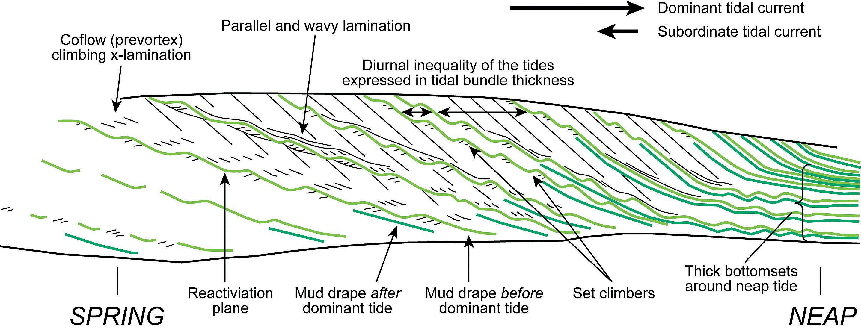
Holocene sediments of the Rhine-MeuseScheldt estuaries as aids to interpret tidal and fluvial-tidal deposits in outcrop and core
SPEAKER
Dr. Allard W. Martinius Statoil Canada Ltd., Calgary
11:30 am
Tuesday, November 05, 2013 Calgary, TELUS Convention Centre Macleod Hall C/D Calgary, Alberta

Expertise in Integrated Subsurface Solutions
DATA ROOM SERVICES


Please note: The cut-off date for ticket sales is October 31st, 2013 at 1:00 pm, three business days before event. CSPG Member Ticket Price: $45.00 + GST. Non-Member Ticket Price: $47.50 + GST.
Each CSPG Technical Luncheon is 1 APEGA PDH credit. Tickets may be purchased online at https://www.cspg.org/eSeries/source/Events/ index.cfm.
Despite enormous technological and statistical advances, the building of subsurface static and dynamic models at various scales, and for various purposes, will always be demanding. Moreover, it is imperative that uncertainty is handled appropriately, especially as remaining reserves are increasingly found in smaller and/or more complicated reservoirs and undrained compartments.
Contact

One way of reducing information loss is to incorporate complementary data into the interpretation of subsurface core data sets and then build geomodels based on this information. To achieve this, geologists must continue to study modern and ancient analogues archiving their findings in a systematized ‘library’ (qualitative, quantitative and conceptual). Such a library should capture the natural variability of environments,
8 RESERVOIR ISSUE 10 • NOVEMBER 2013
NOVEMBER LUNCHEON Webcasts sponsored by GEO-RESERVOIRSOLUTIONS.COM A division of Geo-Reservoir Solutions Ltd.
data
Your data will be carefully managed on secure workstation and made available to reviewers in one of our spacious, private and comfortably appointed
rooms. If you desire to establish a data room on your own site, we can supply a dedicated workstation with working software license to you on a rental basis, which we will manage and maintain.
us for further information and pricing.
seismic workstation. storage support convenience comfort
We offer seismic project preparation, data presentation on Seisware, Kingdom or WinPics
403.777.0008 info@geo-reservoirsolutions.com Featuring one of our many technical services offering world class geophysical data support ... RESERVOIR_GEORes_third_Dataroom_08_2013.indd 1 2013-08-22 1:25 PM
and include methodologies for estimating and reducing subsurface uncertainty. More generally, such documentation will aid the development of conceptual depositional models, (sequence) stratigraphic correlation methods, and the construction of quantitative subsurface 3D models suitable for reservoir simulation. As such, it contributes to the reservoir characterization work flow. This collective understanding and information can
also be used for training purposes.
This presentation will address three issues in particular surrounding the aforementioned discussion:
1. The often inadequately addressed links between sedimentary structures, the depositional processes that generated them, and the environmental conditions in which they were deposited;
GEOEDGES INC.
2. The uncertainty attached to the application of modern and ancient analogues to hydrocarbon-related core studies;
3. The role of outcrop analogue studies in reservoir characterization, geomodeling, and the dynamic behavior of small-scale heterogeneities. The primary aim of this presentation is to
(Continued on page 10...)
Detailed and accurate geology at your fingertips in Petra, GeoGraphix, ArcGIS, AccuMap, GeoScout and other applications for information contact: Joel Harding at 403 870 8122 email joelharding@geoedges.com www.geoedges.com
Western Canada: Slave Point, Swan Hills, Leduc, Grosmont, Jean Marie, Horn River Shales, Elkton, Shunda, Pekisko, Banff, Mississippian subcrops and anhydrite barriers in SE Sask., Bakken, Three Forks, Montney, Halfway, Charlie Lake, Rock Creek, Shaunavon, BQ/Gething, Bluesky, Glauconitic, Lloyd, Sparky, Colony, Viking, Cardium, Horseshoe Canyon and Mannville CBM, Oilsands Areas, Outcrops
Northern US Rockies & Williston Basin Geological Edge Set
Western Canada Geological Edge Set
North American Shales Geological Edge Set
Eastern US / Appalachian Basin Geological Edge Set
US Rockies & Williston: Red River, Mississippian subcrops & anhydrite barriers (Bluell, Sherwood, Rival, etc), Bakken, Three Forks, Cutbank, Sunburst, Tyler, Heath, Muddy, Dakota, Sussex, Shannon, Parkman, Almond, Lewis, Frontier, Niobrara, Mesaverde shorelines, Minnelusa, Gothic, Hovenweep, Ismay, Desert Creek, Field Outlines, Outcrops
Texas & Midcontinent: Permian Basin paleogeography (Wolfcampian, Leonardian, Guadalupian), Granite Wash, Mississippian Horizontal Play, Chat, Red Fork, Morrow, Sligo/Edwards Reefs, Salt Basins, Frio, Yegua, Wilcox, Eagleford, Tuscaloosa, Haynesville, Fayeteville-Caney, Woodford, Field Outlines, Outcrops, Structures
North American Shales: Shale plays characterized by O&G fields, formation limit, outcrop, subcrop, structure, isopach, maturity, stratigraphic cross-sections. Includes: Marcellus, Rhinestreet, Huron, New Albany, Antrim, Utica-Collingwood, Barnett, Eagleford, Niobrara, Gothic, Hovenweep, Mowry, Bakken, Three Forks, Monterey, Montney, Horn River, Colorado
Eastern US / Appalachia: PreCambrian, Trenton, Utica-Collingwood, Medina-Clinton, Tuscarora, Marcellus, Onondaga Structure, Geneseo, Huron, Antrim, New Albny, Rhinestreet, Sonyea, Cleveland, Venango, Bradford, Elk, Berea, Weir, Big Injun, Formation limits, Outcrops, Allegheny Thrust, Cincinatti Arch, Field outlines
Deliverables include:
-Shapefiles and AccuMap map features
-hard copy maps, manual, pdf cross-sections
-Petra Thematic Map projects, GeoGraphix projects, ArcView map and layers files
-bi-annual updates and additions to mapping
-technical support
RESERVOIR ISSUE 10 • NOVEMBER 2013 9
Texas & Midcontinent US Geological Edge Set
establish a way of seamlessly transferring information from modern depositional systems to analogous depositional systems revealed in outcrop to analogous subsurface systems revealed only in core.
In the second half of the last century a number of pits were made in the estuaries of the southwestern Netherlands for the construction of large engineering works. These temporary pits opened up a unique opportunity to study subtidal deposits in considerable detail and link them to their well-known hydrographic background. These exposures revealed a variety of exceptionally well-preserved fluvial, tidal and transitional fluvial-tidal sediments. Their interpretation was facilitated by the environmental background of the Holocene deposits, which has been reconstructed from historical and recent hydrographic maps and measurements of river flow and tides (some of the records go back several centuries).
A number of examples are given of characteristic (and in some cases diagnostic) sedimentary structures. The examples come from inshore tidal environments and tidallyinfluenced river channels subject to micro-
to mesotidal conditions and comparable to known Pliocene to Modern examples taken from the Rhine-Meuse-Scheldt coastal plain. Subsequently, the Rhine-Meuse-Scheldt system was used as a standard of reference and a comparator for worldwide ancient outcrop analogues believed to cover a similar range of natural variability. The information obtained from the recent exposures and, to some extent, the outcrop analogues was finally applied to the interpretation and modeling of subsurface core data from the Norwegian Continental Shelf to illustrate a variety of analogous and comparable tidal facies and sedimentary structures encountered in prospective Late Triassic to Jurassic sedimentary systems.
One of the most striking and possibly humbling revelations to emerge from this work is that only a small proportion of information on modern systems and ancient outcrop analogues is useful for interpreting subsurface core data. The reason for this is that the recognition of many criteria requires a much larger surface area than that afforded by cores whose average diameters are about 10-12 cm.
The case studies provide sedimentologists and reservoir geologists with criteria,
static and dynamic models and a library of examples which can be used to understand better the spatial distribution and character of reservoir heterogeneities. Key challenges in reservoir modeling are to simulate reservoir behavior as accurately as possible while minimizing associated uncertainties. In combination with other tools, small-scale heterogeneity modeling can help to quantify reservoir uncertainty and mitigate geologic and economic risk.
BIOGRAPHY
The main expertise of Allard Martinius is in clastic facies analysis, sedimentology and sequence stratigraphy of fluvial and shallow marine deposits, as well as in clastic reservoir characterisation and geomodelling. He participated in and led long-term research projects at Statoil’s research centre. Martinius has experience from the Norwegian continental shelf, heavy oil development projects in the Faja Petrolifera del Orinoco and the Canadian oil sands, and enjoys running field courses. He has been involved in numerous projects at appraisal, develop¬ment, and production scales in Norway as well as internationally.
10 RESERVOIR ISSUE 10 • NOVEMBER 2013
(...Continued from page 9)
ROCK SHOP


RESERVOIR ISSUE 10 • NOVEMBER 2013 11
*Domestic & International Supervision 906, 505 6 St. SW Calgary, AB T2P-1X5 Jocelyn Lampron, P. Geol. President & CEO Wellsite Geological Supervision *Conventional Wells-Heavy Oil/SAGD *Coal Bed Methane Wells www.hopewellpetroleum.com info@hopewellpetroleum.com section ph: 403.266.3132 cell: 403.818.8549 *On & Offshore Geological Supervision www.rpsgroup.com/energy (403)263-0449 17084 Global Leaders in Wellsite Geology Serving the petroleum industry for over 25 years ■■ Conventional Vertical / Horizontal Wells ■■ Unconventional Heavy Oil / CBM Wells ■■ International WSG / Operations Geology (The name that says it all!!!) Bus 403.234.7625 800, 555 - 4 th Avenue SW, Calgary, AB, T2P 3E7 info@WellsiteGeologists.com www.WellsiteGeologists.com • Domestic and International wellsite supervision • Conventional and Unconventional wells • Extensive Hz experience • Customized corporate solutions available (403) 250-3982 sales@clconsultants.ca www.clconsultants.ca 1602 – 5th St N.E. Calgary, AB. T2E 7W3 Phone: 403-233-7729 www.tihconsulting.com e-mail: tih@shaw.ca T.I.H. Ltd. Geologic Well-Site Supervision Opus Training Group 403 720-9810 www.opustraininggroup.com Geology Training for the Petroleum Industry Wellsite 101 Reinson Consultants Ltd. GERRY REINSON, Ph.D., P.Geol. Regional and Reservoir Mapping, Core Studies, Field and Lab Courses greinson@telus.net www.reinsonconsultants.com TEL: (403) 861-8346
TECHNICAL LUNCHEONS DECEMBER LUNCHEON
A geoscientist in Antarctica:
Following in Shackleton’s footsteps one hundred years later
SPEAKER
Susan R. Eaton, P. Geol., P. Geoph., M.Sc., B.J. (Journalism) Hon. President, SR ECO Consultants Inc.
11:30 am Tuesday, December 10, 2013 Telus Convention Centre, Macleod Hall A/B/C Calgary, Alberta
Please note: The cut-off date for ticket sales is 1:00 pm, three business days before event. (Thursday, October 17th, 2013). CSPG Member Ticket Price: $45.00 + GST. Non-Member Ticket Price: $47.50 + GST.
Each CSPG Technical Luncheon is 1 APEGA PDH credit. Tickets may be purchased online at https:// www.cspg.org/eSeries/source/Events/index.cfm.
ABSTRACT
Geology field schools can be tough – and sometimes they can be hazardous. During a recent geology field school in Antarctica, I became adept at running the gauntlet of lunging fur seals and lumbering elephant seals, their oversized proboscises flared outwards, exposing shiny pink gums and sizeable teeth...
The old adage, “their bark is worse than their bite,” doesn’t ring true in Antarctica. Our seasoned guides cautioned us that a bite from a fur seal or an elephant seal would require the immediate administration of intravenous antibiotics...
Bitten by the polar bug, I returned to the Bottom of the World, participating in my third science-based expedition in three years. From December 29, 2012, to January 19, 2013, I joined an expedition sponsored by the Geological Society of America (“GSA”) and entitled “Antarctica, South Georgia and the Falkland Islands: Scotia Arc Tectonics, Climate and Life.” Led by earth scientists from Pennsylvania State,

Webcasts sponsored by
the Jackson School of Geosciences (University of Texas at Austin), Stanford University and the Federal University of Rio de Janeiro, the expedition investigated the interplay of solid earth systems, plate tectonics, glaciology, oceanography, climate and life.
I traveled to the Southern Ocean with an intrepid group of 100 explorers from 15 nations – fifty percent of the group was female – aboard the MV Akademik Ioffee, a 117-meterlong, Russian ice-strengthened vessel. The GSA-sponsored group of explorers included 70 earth scientists (ranging in age from early twenties to late seventies) representing more than twenty specializations. In fact, there were enough Ph.D. geologists on the expedition to staff four or five university earth science departments!
A century ago, Sir Ernest Shackleton’s scientific teams were comprised of geologists and geophysicists who explored Antarctica because it was there, and because it was unclaimed by any nation.
During the heroic age of Antarctic exploration, geoscientists discovered volcanoes, mountain ranges, fossils, coal and minerals in this

12 RESERVOIR ISSUE 10 • NOVEMBER 2013
uncharted continent. And, in 1909, geoscientists in Shackleton’s Nimrod Expedition planted the British flag at the Magnetic South Pole.
Today, earth scientists travel to Antarctica – the world’s last remaining wilderness –to research planetary processes, including the impacts of climate change and ocean change. During the past fifty years, the Western Antarctic Peninsula has warmed 3 degrees Celsius, triggering a cascading series of geological and biological changes in this fragile ecosystem which have global implications.
Blogging from the Bottom of the World, I’ve conveyed the excitement of these extraordinary voyages of exploration and discovery.
During the past three years, I’ve experienced numerous Serengeti moments, witnessing some of the largest concentrations of wildlife on the planet. Snorkeling in brash ice, I’ve come face-to-mask with 1,400-pound leopard seals, jaws agape – so close, that I could count the freckles on their upper palates and inspect their tri-serrated teeth which can dispatch 40-pound penguins in mere seconds. And, I’ve completed the “Leadership on the Edge Program,” an Antarctic Outward Bound-like school led by British polar explorer Robert Swan, OBE.


Translating lessons from Antarctica, I’ve reached out to thousands of K-12 students, university students and the general public, empowering them to formulate scientificallydriven global solutions for today’s social, economic, energy and global sustainability challenges.
BIOGRAPHY
Susan a geologist, geophysicist, journalist and ‘extreme’ snorkeler. She has a B.Sc. Honours in Geology and Biology from Dalhousie University, a B.J. (Journalism) Honours from Carleton University, and a M.Sc. in Petroleum Geology (Geophysics Specialization) from Imperial College, University of London.
She is the Antarctic-Explorer-in-Residence for the American Association of Petroleum Geologists (“AAPG”) and the Houston Geological Society (“HGS”). Susan was the keynote speaker for the HGS Guest Night 2012, and one of two co-presenters at the 2010 Canadian Society of Petroleum Geologists’ Honorary Address, entitled “The Next Generation of Cool Science.”
Susan has developed a successful career in the Canadian energy sector, attaining the position of vice president of exploration in several junior oil and gas companies. Through her wholly owned consultancy, SR ECO Consultants Inc., Susan consults to the Canadian, American and
international petroleum and financial sectors, on oil and gas exploration and production, acquisitions and divestitures, environmental risk assessments and media relations.
Susan began her journalism career as a television news reporter with CBC-TV. Today, she reports on science and technology, business, oil and gas, renewable energy, the environment, ecotourism and extreme snorkeling. Her articles and photographs have been published in Alberta Oil Magazine, New Technology Magazine, Popular Mechanics, the Calgary Herald, the Edmonton Journal, the Vancouver Sun, the Financial Post, ALERT Diver, DIVER Magazine, Business Edge News Magazine, Water Canada, AAPG’s EXPLORER Magazine and APEGA’s The PEG.
Active in several Canadian and American oil and gas industry associations, Susan is a recipient of the Geological Society of America’s Distinguished Mentor Certificate of Appreciation and the AAPG’s Public Outreach Award. She is a speaker with the Association for Women Geoscientists’ Distinguished Lecturer Program.
For additional information, including Susan’s dispatches from the Bottom of the World, videos and related magazine articles please go to: http://susanreaton.com/, https://twitter.com/ SusanREaton_Geo, http://www.youtube.com/ user/srecoconsultants.


and qualify for cwright@canadiandiscovery.com
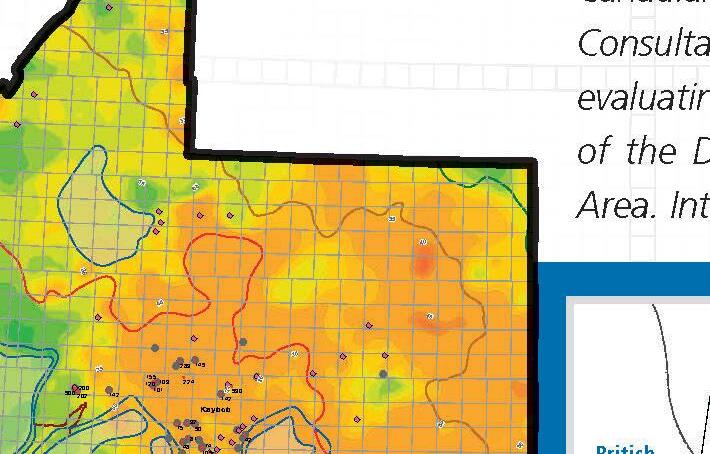
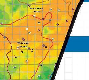
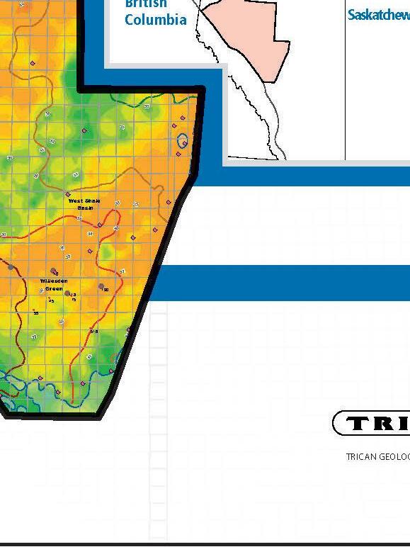
The Duvernay Project


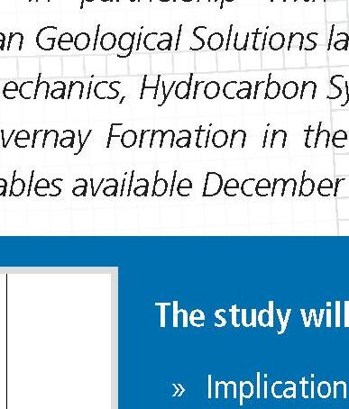


Canadian Discovery in partnership with Graham Davies Geological Consultants and Trican Geological Solutions launch a new multi-client study evaluating the Geomechanics, Hydrocarbon Systems and Geological Setting the Devonian Duvernay Formation in the Kaybob to Willesden Green Area. Interim deliverables available December 2013.

The study will include:
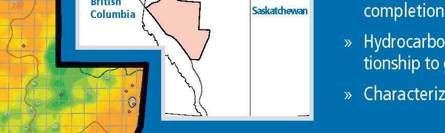


Implications of stress regime on drilling, completions and productivity
Hydrocarbon phase distribution and the relato geochemistry and thermal history
Characterization of the Duvernay reservoir


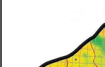
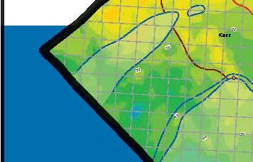
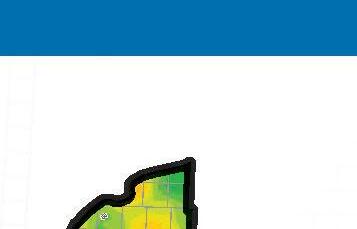
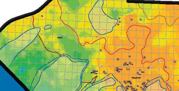
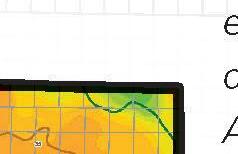
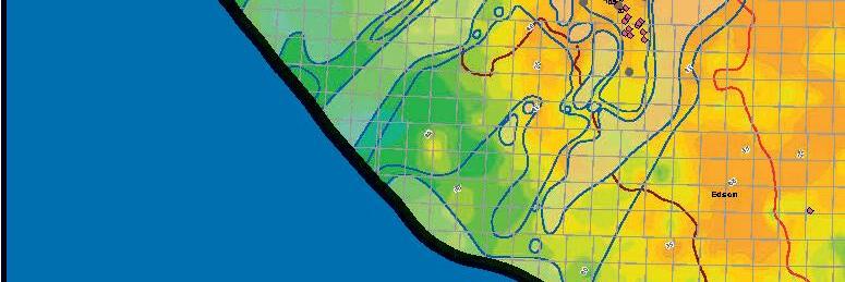
RESERVOIR ISSUE 10 • NOVEMBER 2013 13 ! " " 30 35 105 1:600,000 010203040 Data Units) Edges 1994) Duvernay Gradient Ltd. R15 R10 British
GEOLOGICAL SOLUTIONS Canadian DAVIES CONSULTANTS GEOLOGICAL GDGC now
Image Left: Geothermal Gradient (All Units)
DIVISION TALKS INTERNATIONAL DIVISION
Tight gas development within Thrace Basin, NW Turkey
SPEAKER
Rob Sadownyk
Manager Geosciences, Valeura Energy Inc.
12:00 Noon
Wednesday November 13th, 2013 Nexen Plus 15 Conference Centre Nexen Annex Building 7th Ave. & 7th Street SW Calgary, Alberta
ABSTRACT
A majority of Turkey’s hydrocarbons originate from two petroleum basins. Gas production in the Thrace Basin is predominantly from Tertiary sandstones. The oil prone SE Anatolian Basin, an extension of the Zagros Thrust and Fold Belt, produces from fractured Cretaceous carbonates and Ordovician sandstones. Average production in Turkey is 44,000 bopd and 50 mmcf/d of gas, which is less than ten percent of domestic consumption. As in many regions throughout the world, there has been renewed interest in exploiting Turkey’s unconventional resources.
Turkey is a democracy with a moderate Islamic ruling party and is considered to be a secular state. Unlike other Islamic countries in the region, Turkey’s revolution of 1923 resulted in both political and cultural
ROCK SHOTS
Bhe “tufa” of the Loire Valley: Etymology, geology, archaeology and oenology.
SPEAKER Geoff Rait Statoil
(SAME TIME AND LOCATION AS INTERNATIONAL DIVISION TALK, NOVEMBER 13TH, 2013)
westernization. Over the past decade, Turkey has had one of the most rapidly expanding economies in the world. At the crossroads of Europe and Asia, Turkey is strategically situated and is becoming an important energy transportation corridor for both oil and natural gas.
For the petroleum sector, an attractive royalty (12.5%) and corporate tax regime (20%) exists. Recently, a new petroleum law has passed and is considered to be positive for E&P companies. An exploration license has a maximum term of 11 years and leases may subsequently be granted for a period of up to 40 years. The national oil company, TPAO, competes against all other bidders when new land parcels are gazetted. Under the new law, there are no maximum acreage limits which allows for larger land positions to be established by unconventional players.
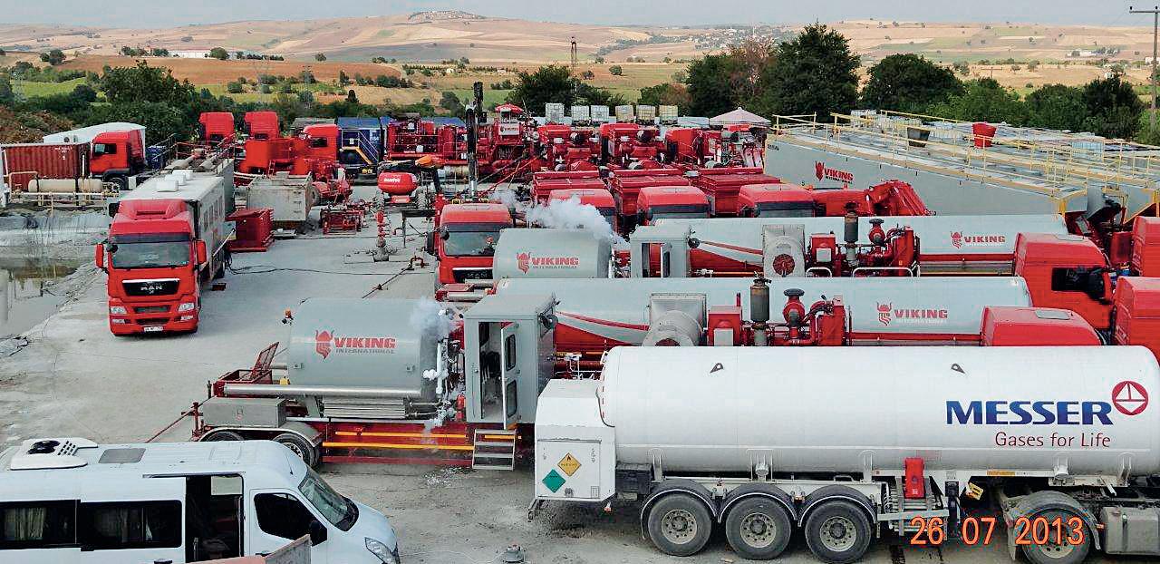
Valeura Energy Inc. has assets in both Thrace and SE Anatolian Basins and is primarily focused on tight gas exploitation within the Thrace Basin. The Thrace Basin in northwestern Turkey contains up to 9,000 meters of Tertiary clastic sediments. To date over 400 BCF of gas have been produced from conventional reservoirs. Within the southern portion of the basin, below approximately 1,000 meters depth, calcite cementation and compaction have severely reduced permeability within feldspathic litharenite sandstones. These tight gas sands require hydraulic stimulation for economic production. Valeura Energy Inc. (“Valeura”) has been active in the Thrace Basin since mid-2011 and currently holds interests in 0.9 million gross acres (0.4 million net acres). Valeura and its partners have pursued a phased proof-of-concept strategy to exploit structurally controlled tight gas reservoirs followed by pursuit of unconventional off structure pervasive gas.
Within the past two years, approximately 400 km2 of 3D seismic has been acquired and more than 50 fracs have been executed in the southern Thrace Basin targeting middle Eocene to Oligocene turbidite and prodelta deposits of the Kesan Group, Mezardere Formation and Teslimkoy Member. Phases of the program included re-entering existing well bores and performing single stage fracs, performing multistage fracs in vertical well bores and the drilling of horizontal wells with up to ten frac stages. Initial production rates have ranged from 0.5mmcf/d to 5.0mmcf/d with varying amounts of water production.
Regional geological and geophysical mapping as well as geochemical and pressure data suggest the possibility of an unconventional gas accumulation within the basin center. Within the Mezardere Formation, stacked slope fan complexes juxtapose both reservoir and source in an active hydrocarbon kitchen. The next phase of tight gas development in the Thrace Basin will be to evaluate this unconventional play concept.
Tight gas development has the potential to yield several TCF of natural gas and provide meaningful domestic supply to Turkey, which is heavily dependent on natural gas imports.
BIOGRAPHY
Rob Sadownyk is a geologist with 25 years of experience predominantly related to tight gas exploration and development. A graduate of University of Calgary (BSc Honours) and NAIT (CET), he spent the first part of his career at Canadian Hunter, working the Deep Basin and regional carbonate plays. At Vermilion Resources, Rob was primarily responsible for developing new area opportunities within W5 and southern foothills of Alberta. As a cofounder of Berland Exploration, he was VP Exploration until it sale to Berens Energy. Since Valeura Energy’s inception in 2010, Rob has been Manager Geosciences.
14 RESERVOIR ISSUE 10 • NOVEMBER 2013
Sponsored by
Multistage Frac in DTD-19H
DIVISION TALKS PALAEONTOLOGY DIVISION
Gaps in the fossil record of vertebrates
SPEAKER
Dr. Jason Anderson
The University of Calgary
7:30 PM
Friday, November 15th, 2013
Mount Royal University, Room B108
ABSTRACT
Our view of the history of vertebrate life on earth is inextricably entwined with the quality of the fossil record. Fossilization removes information we have accessible in modern animals, making fossil species of a higher taxonomic level than modern species, since figuring out “cryptic species” is impossible. We cluster groups of species based upon the shared derived characters they possess, but when gaps in the fossil record are present, groups can artificially cluster based on the methods we use rather than being precise reflections of biologic reality. Furthermore, large scale gaps in the fossil record can suggest macroevolutionary processes at play artificially. I will examine two such gaps in the fossil record, using the famous Romer’s Gap and the Lepospondyli as case studies for the misleading nature of gaps. In both cases, new data are suggesting that phenomena are actually artifacts upon closer scrutiny.
BIOGRAPHY
Jason Anderson is an Associate Professor of Anatomy in the Department of Comparative Biology and Experimental Medicine, an Adjunct Associate Professor in the Department of Biological Sciences, and a founding member of the Faculty of Veterinary Medicine at the University of Calgary. He received his BSc from the University of Michigan, and his PhD in Vertebrate Paleontology at McGill University. After holding an NSERC Postdoctoral Fellowship at the University of Toronto, he joined the new College of Veterinary Medicine at Western University of Health Sciences in Pomona, California, prior to taking his position in Calgary. He specializes in early amphibian anatomy and phylogeny, with particular emphases on three dimensional morphology and the question of the evolutionary origins of modern amphibians. He has published over 50 scientific articles, edited several volumes
including Major Transitions in Vertebrate Evolution from Indiana University Press, and currently sits on several journal editorial boards, including the Journal of Vertebrate Paleontology.
INFORMATION
This event is jointly presented by the Alberta Palaeontological Society, Mount Royal University Earth Science Department, the CSPG Palaeontology Division and Cenovus Energy. For details or to present a talk in the
Sponsored by
future please contact CSPG Paleo Division Chair Philip Benham at 403-691-3343 or APS Coordinator Harold Whittaker at 403-286-0349 or contact programs1@ albertapaleo.org. Visit the APS website for confirmation of event times and upcoming speakers: http://www.albertapaleo.org/.


RESERVOIR ISSUE 10 • NOVEMBER 2013 15
2013 – “LET THE SUN SHINE” for the CSPG Mixed Golf Tournament
| By David Middleton and Brenda Pearson, 2013 co-chairs, CSPG Mixed Golf Committee
The 24th Annual CSPG Mixed Golf tournament enjoyed a reprieve from last years’ deluge, and the torrential rain and flooding that caused so much chaos and devastation to the city in June. Lynx Ridge Golf course’s location on the hills above the Bow River spared the course any damage so evident in many previously superb courses, but given the resilient and dedicated nature of the province’s golfers, we hope to see many of the courses reopening soon.
The CSPG members, sponsors and guests teed off at 8:00 am in the sun, and the warm conditions continued through the round. The Lynx Ridge course was in great shape and the best ball tournament concluded in a little over 5 hours.
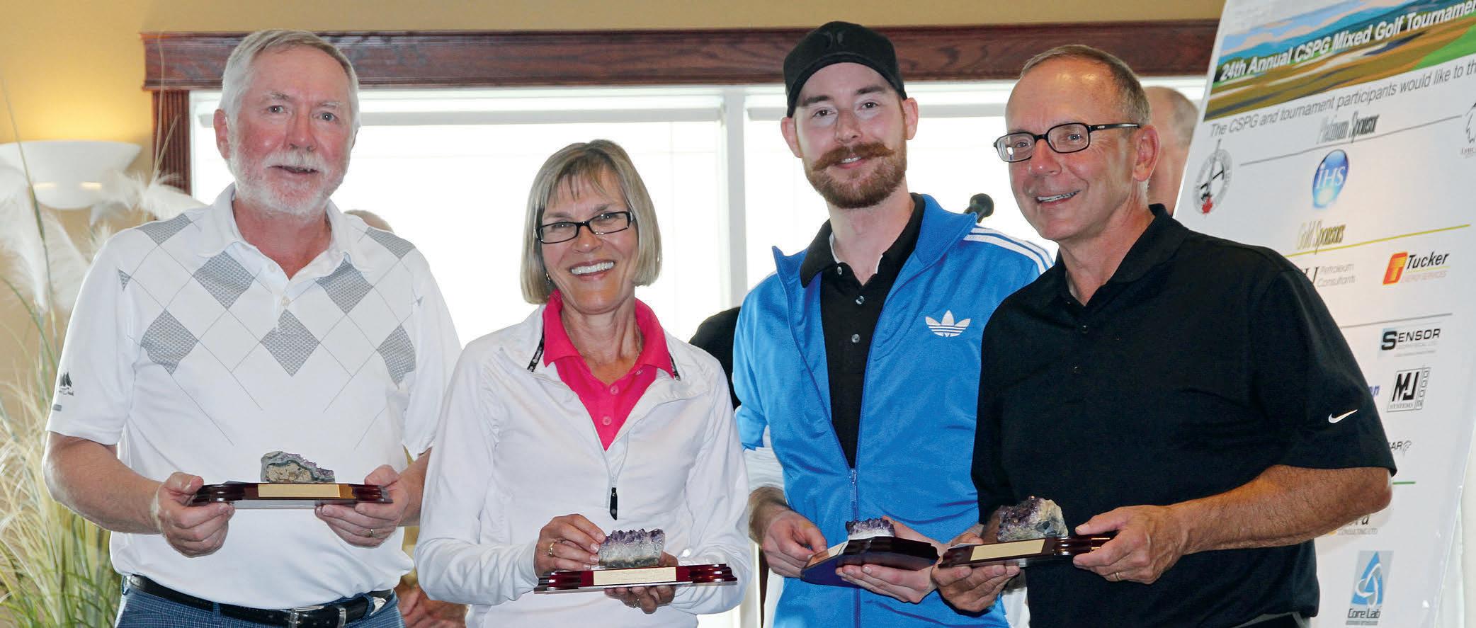
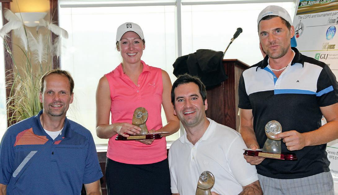
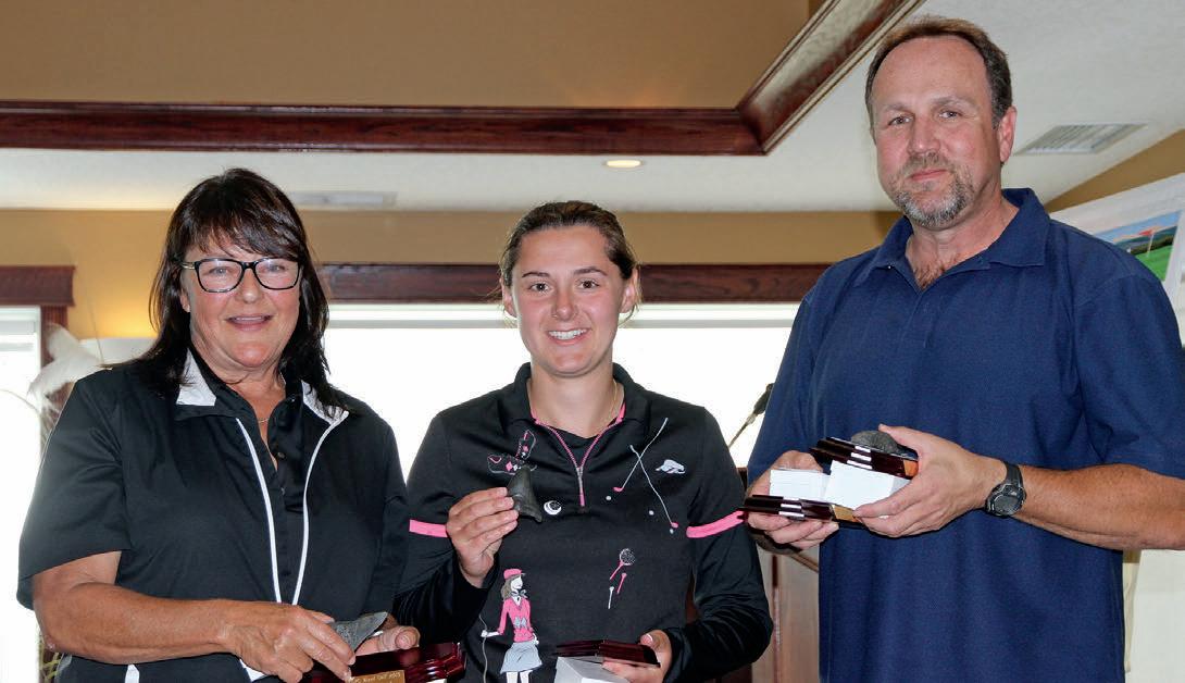
The team low net trophy and tournament winners was the team captained by Curtis Chmilar, and consisted of Joerg Wittenberg, Brad Jardine and Brittany Muys with a net score of 53. The low gross score trophy was taken by the team of Connie Craig, Nolan Gustafson, Deno Adams and Madeline Erskine with a score of 63, and the Spirit Award “fossil coprolite” trophy went to the most honest team of Kirk Osadetz, Earl Hawkes, Jeff Henderson and Lis Bjeld with a score of 78.
The 23rd annual tournament was sponsored by our Platinum level sponsor, IHS, as well as numerous other sponsors. All teams enjoyed a hot breakfast provided by Exova, used golf carts sponsored by CL Consultants, and visited hospitality tents and skill/ challenge contests provided by IHS, Cougar Consultants/Roke Technologies, BrokerLink, Sensor Geophysical, Energy Navigator, AGAT Laboratories and. Prize holes were additionally sponsored by Belloy Petroleum Consulting, RPS Energy, Sproule Associates, Core Laboratories, ProGeo Consultants, MJ Systems, Birchcliff Energy, and BDO
Canada LLP. The on-course beverage cart was sponsored by geoLOGIC Systems, who provided much appreciated drinks and food through the course. At the tournament finish, golfers participated in the Tucker Energy Services Putting contest, where the winner, took home a new LED flatscreen TV.
The delicious banquet steak dinner was sponsored by GLJ Petroleum Consultants while golfers watched for their team scores and photos on the scoring system sponsored by Schlumberger. Dinner was followed with the awarding of team trophies for Low Net, Low Gross and High Gross and the announcement of draw prizes. A lucky Foon Der took home a $500 travel visa card from the Mulligan draw, while Kristy Casebeer was the beneficiary of the 50/50 draw. The NOV Barbeque, courtesy of Nolan Gustafeson, was given to Jeremy Thompson (after Nolan’s name was drawn – unfortunately he had left already). Belloy Petroleum’s (Brian Fyke) weekend survival kit of a cooler filled with beer was won by Justin Friesen. Skill prizes were awarded to golfers, and with the prize donations from Typhoon Energy, RBC Securities, McLeay Geological, Exova, RPS Energy, RigSat/PetroCraft and Genesis
Executive, many of the golfers went home with a nice prize.
In the end, the members, guests, sponsor players and representatives enjoyed a great day catching up with colleagues, making new friends, bragging about the missed putts and closest to the pin opportunities, and succeeded in raising over $6000 to support the educational and outreach activities of the CSPG.
I would like to thank the many sponsors, golfers, and the greens-keeping, pro shop and catering team at Lynx Ridge Golf course and especially the fine organizing committee of co-chair Brenda Pearson (registration), Darin Brazel (sponsorship), Norm Hopkins (trophies), Jeff Boissonneault (signage) and our CSPG office support from Kristy Casebeer.
We look forward to your attendance at next year’s tournament on Friday, 22 August 2014 as we celebrate the 25th Annual tournament – a quarter century of golf, fun and fellowship. Please watch the CSPG Website for more pictures and results and remember to register early for this special celebration in April of 2014.
16 RESERVOIR ISSUE 10 • NOVEMBER 2013
2013 Low Net Team 2013 Low Gross Team
2013 High Gross Team
ROCK SHOP

3300, 205 - 5th Ave SW Calgary, AB T2P 2V7
Tel 403 726 0666 Fax403 264 1262 Cell403 819 2516
farhat@sableconsultants.com SABLECONSULTANTS.COM


RESERVOIR ISSUE 10 • NOVEMBER 2013 17
Strip Log Strip Log Horizontal Log Horizontal Log Mud Log Mud Log Log Viewer Log Viewer Log Manager Log Manager Log Analysis Log Analysis Suite 102, 7370 Sierra Morena Blvd SW, Calgary, AB T3H 4H9 info@WellSight.com 1-800-447-1534 (403) 237-9189 petrographical & sedimentological descriptions for samples (thin section - fluid inclusion studies) conventional vertical/horizontal wells operations geology SPECIALIZED IN GEOLOGICAL WELLSITE SUPERVISION AND CORE ANALYSIS RockWell
our best friend and most valuable partner is our client Stephan C. Dragomir president www.geok2.com - phone: 403.831.9941 - sdragomir@geok2.com 210, 237 – 8th Ave. S.E. Calgary, AB T2G 5C3 Phone: 403.263.5440 Fax: 403.263.2331 m.sahota1@shaw.ca 742 Memorial Drive NW Calgary, Alberta T2N 3C7 P: 403 242 1522 F: 403 242 8223 E: office@chinookconsulting.ca www.chinookconsulting.ca SERVICES • Wellsite geological supervision • Core and cuttings petrographic studies • Operations geology • Remote geo-steering and remote geological supervision • Project management
LOG
For Engineers, Geologists, Geophysicists, and Technicians Practical Quantitative Log Analysis: 15 – 17 Oct 2013 Analysis of Unconventional Reservoirs: 18 Oct 2013 Details and Registration at: www.spec2000.net/00-coursedates.htm In-House and Multi-Media Narrated Self-Study Courses Also Available === Instructor: E. R.
P.Eng. 1-403-845-2527 ross@spec2000.net === – 50 Years Worldwide Experience – Analysis, Training, Mentoring, Forensic Reviews –=== Conventional Vertical and Horizontal Wells Oil Sands - SAGD/Coring Programs Shale Gas/Oil Shales Coal Bed Methane Project Supervision Email: progeo@telus.net Tel: (403) 262-9229 Fax: (403) 265-0377 Website: www.progeoconsultants.com SABLEPETROLEUM CONSULTANTSINC. WELLSITE GEOLOGICAL SUPERVISION
CEO
Consulting
PRACTICAL
ANALYSIS COURSES
(Ross) Crain.
FARHAT HYDERI,P.Geol. President /
Heavy Oil/Oil Sands
Bed
SAGD Horizontal Project Supervision
Conventional Wells Coring Programs
Coal
Methane
GEOMECHANICS FOR EVERYONE
Part 3: What is Fracability? Understanding the Effects of Geomechanical and Structural Factors on Fracturing in Unconventional Reservoirs
| By Vahid Mostafavi, Talisman Energy and Keri Yule, Calfrac Well Services.
INTRODUCTION TO THE ARTICLE BY AMY FOX, CANADIAN DISCOVERY
This next article in our geomechanics series is essentially the first of two parts about factors critical to success in “tight” oil and gas plays. These resource plays generally have certain tendencies:
• They are mostly self-sourcing, with little to no migration from other source rocks to


the reservoir
• They are overpressured relative to a regional hydrostatic gradient
• They have low porosity and permeability relative to conventional plays
• They are often described as providing storage but having no capability of providing flow to the wellbore without the presence of fractures (natural or


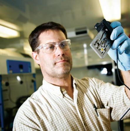
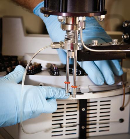
Whether you’re exploring a basin, producing a well or completing a shale play, time is money. That’s why Weatherford Laboratories brings a suite of formation evaluation technologies right to the wellsite. Utilizing mud gas and cuttings, these technologies provide detailed data on gas composition, organic richness, mineralogy and chemostratigraphy in near real time. As a result, operators now have an invaluable tool to assist with sweet spot identification, wellbore positioning, completion design and hydraulic fracturing. We call it Science At the Wellsite. You’ll call it money well spent.
SCIENCE AT THE WELLSITE ™
hydraulically induced)
• Those in regions with lower effective stress seem to have fewer drilling and completion problems and higher production rates and Estimated Ultimate Recoveries (EURs)
Accepting all that, the fact remains that there is heterogeneity within a single reservoir, and we have yet to understand what, from a geological and/or operational viewpoint, differentiates a productive well from a disappointing well. It seems that many are hoping to find that one key factor that makes the difference, but it’s probably not that simple. The answer is likely to be a combination of factors, and that combination may change from reservoir to reservoir or even within a single play.
This article addresses one particular issue that tends to be oversimplified – fracability, a term which may not be in the Oxford English Dictionary but is certainly in the vernacular of anyone working in unconventionals. It provides my new favorite definition for brittleness: an attempt “to reduce the geomechanical complexity to a single all-encompassing value.” It lays out in a wonderfully straightforward way the myriad factors that contribute to a rock’s fracability and highlights their importance in unconventional plays.
INTRODUCTION
Unconventional tight “shale” gas formations have historically been looked upon as cap rocks or source rocks for conventional higher permeability reservoirs. Over the last two decades tight shale gas formations have been developed as major reservoirs on their own merits. The technology for developing these reservoirs has been so successful that a glut of gas has depressed the North American gas price, making natural gas attractive to the energy consumer. Resource rocks typically have very low permeability and without stimulation are not able to produce at economic levels. Advancements in drilling technology have led to the drilling of long stable lateral wellbores. Fracture stimulation creates a network of induced fractures and also increases the flow potential of pre-existing natural fractures. This results in a net permeability
18 RESERVOIR ISSUE 10 • NOVEMBER 2013
When time is money, Wellsite Geoscience is money well spent. www.weatherfordlabs.com ©2013 Weatherford. All rights reserved Formation Evaluation ┃Well Construction ┃Completion ┃Production WELLSITE GEOSCIENCE SERVICES
increase and access to more reservoir rock. Development of these tight rocks, where matrix permeability can be as low as 50 nD under in-situ stress conditions, is mainly premised on the success in breaking the rock efficiently and creating a so-called stimulated reservoir volume (SRV). Fracability refers to the possibility of generation of large SRVs as a result of hydraulic fracturing. Field microseismic measurements show this process is highly complex and varies significantly in different formations. The development of the SRV is a function of several variables including rock mechanical properties, in-situ stresses, pore pressure, natural fractures spacing and orientations, presence of structural events, composition
of the rocks, bedding planes strength, etc. The volume of stimulated rock can also vary with operation changes such as proppant concentration, pumping pressure and fluid leak off properties, but this discussion will focus on the natural fractures and rock properties. Operational considerations will be the focus of the next article in the series.
WHAT AFFECTS THE ROCK’S FRACABILITY?
The breakdown and propagating pressures during hydraulic fracturing operations depends on reservoir and geomechanical properties and operational parameters (fluid rheology, proppants and perforation geometry). Geomechanical properties play a
significant role in determining the fracability of a formation.
Rock brittleness indices have been used in the past two decades to assess the capability of unconventional reservoirs to accommodate a network of natural and induced fractures1,2 . The purpose is to reduce the geomechanical complexity to a single all-encompassing value. Several brittleness indices have been introduced based on mechanical properties of the rock. Halliburton’s brittleness index is an average of normalized Young’s modulus and Poisson’s ratio and is further calibrated to the porosity of the rock. It was originally
(Continued on page 20...)
RESERVOIR ISSUE 10 • NOVEMBER 2013 19
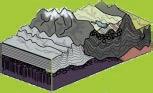
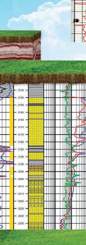
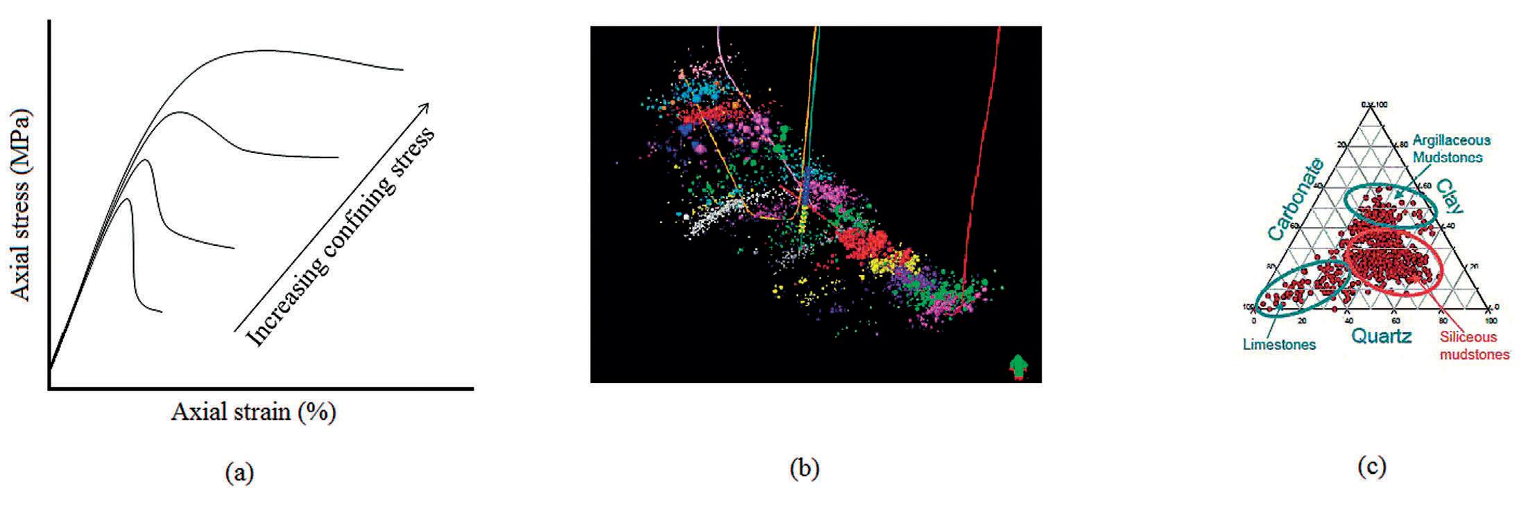
Figure 1: a) Schematic illustration of effect of confining stress on ductility of the rock during a triaxial compression test. b) 3D view of microseismic data around three wells in the Montney Formation. c) XRD results from cuttings and core plugs in the Duvernay Formation
(...Continued from page 19 )
developed for the Barnett formation, and is therefore best for high Young’s modulus rocks. This needs to be further adjusted when used for other shale plays3. Although this index has been widely used in the industry due to the availability of sonic logs and seismic derived velocities, the physical justification of this index is not clear. The use of stress and strain brittleness indices is another independent approach. They are based on triaxial compression tests. Stress brittleness is the percentage of strength loss after shear failure in a sample. Ductile materials tend to lose less strength and release less energy once they fail. Strain
brittleness is the ratio of the elastic portion of deformation to total deformation at the point of shear failure. Brittleness of a rock varies with effective confining stress. This needs to be accounted for when comparing results for different formations.
In addition to rock mechanics based brittleness measures; the mineralogical composition of the rock has been used to determine how the rock responds to stimulation4,5. Several equations have been proposed in the literature, based upon the percentages of certain elements and compounds in the rock. Mineralogy of the rock can be obtained by testing the
cuttings, core plugs, sidewall plugs and reviewing the well logs. Although the rock composition tends to vary at smaller scales, hydraulic fracturing occurs at larger scales. Significant mineralogical variations at larger scales should be considered in the overall analysis. Almost all other rock properties including its mechanical characteristics also depend on scale. Figure 1 shows how the brittleness definition can vary from different viewpoints.
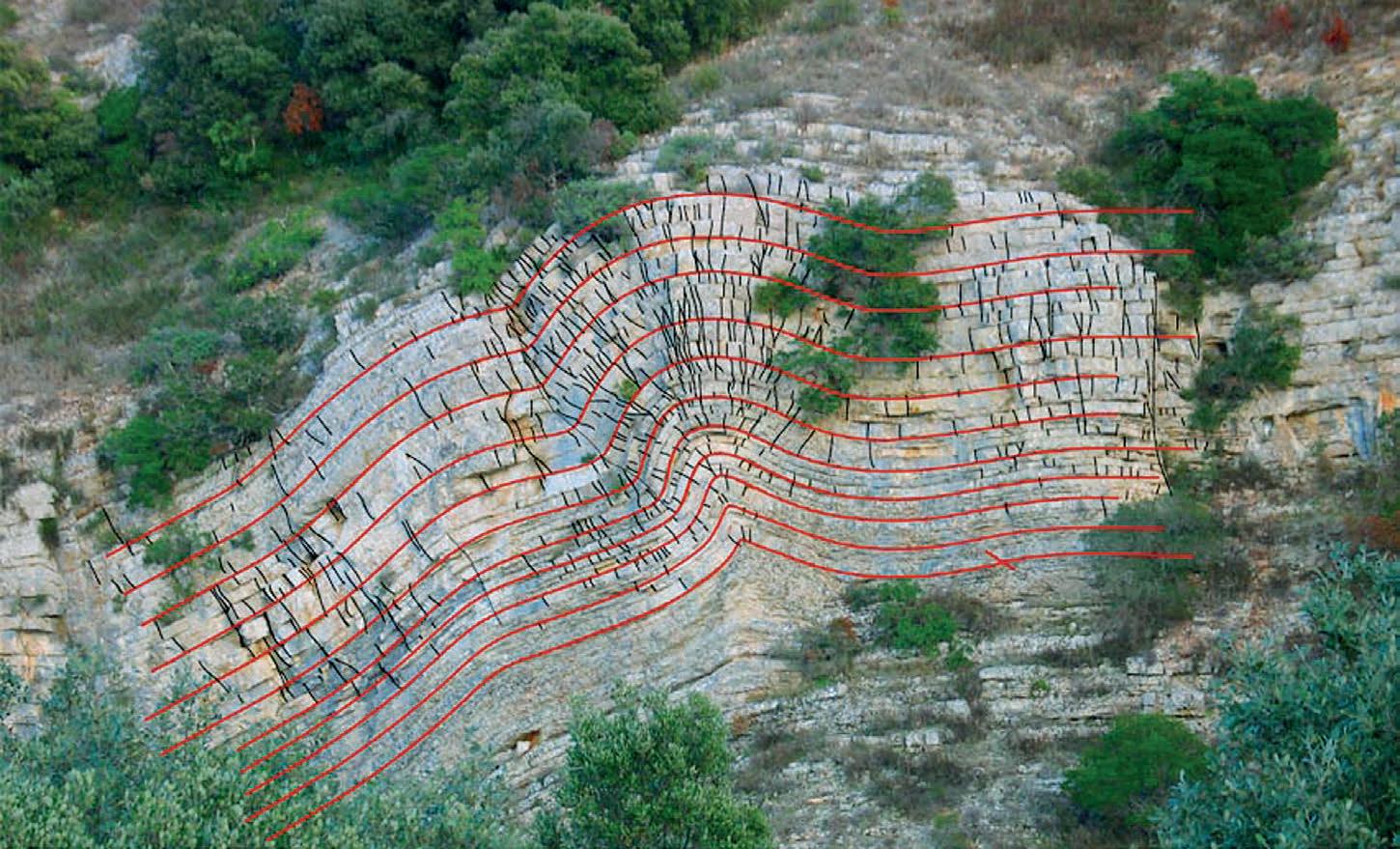
Fracability of a rock can be affected by many other parameters which may not be measureable or seen white testing small plugs. In-situ stresses, pore pressure, and structural features of the reservoir can have a more significant effect on how fracture networks develop during stimulation operations. One of the most important geological factors that significantly influence the SRV is the presence of large scale structural deformations. Faults and folds are usually associated with a higher intensity of small discontinuities as shown in Figure 2. These natural fractures, their orientations and friction coefficients can determine the growth of the SRV. Depending on the geomechanical properties of the formation and the pumping pressure, natural factures can open in tension or shear. Faults and folds can also lead to localized stress rotation and thus reorientation of hydraulic fractures and possibly increased tortuosity close to the wellbore.
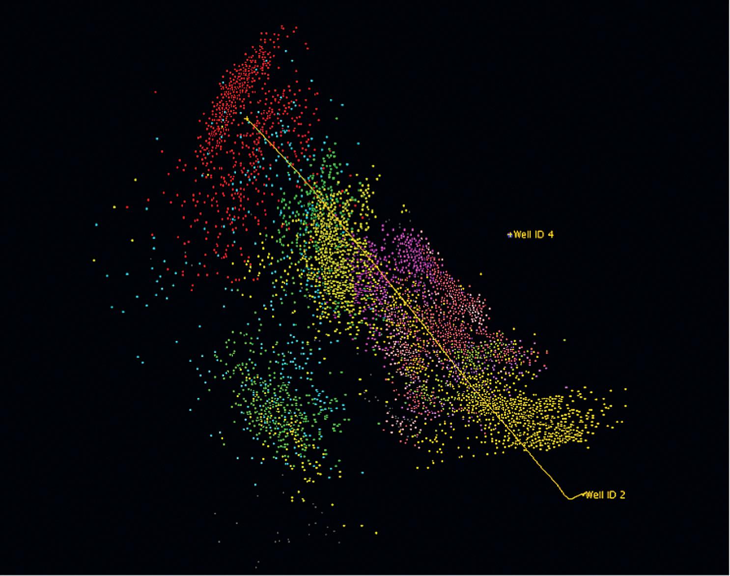
Passive monitoring of microseismic events has become an industry standard in select wells in a field. Data can be gathered from downhole locations or from surface seismic arrays. This is the closest measurement of the overall stimulated rock that is available. It is recognized that not all seismic events are necessarily related to fracture propagation or shear displacement. Microseismic interpretations have been used extensively in reservoir and fracture modeling work. Microseismic attributes put realistic bounds on the hydraulic fracture geometry and its associated SRV. SRVs are represented in reservoir models by regions of higher permeability or by more complicated discrete fracture networks.
Attempts are often made to associate microseismic clouds to brittleness indices6. Microseismic activity also depends on structural features, rock fabric, geomechanical parameters, location of the receivers and the applied technology. Figure 3 shows an example of microseismic activity during hydraulic fracturing. While bi-wing fractures seem to have developed in some
20 RESERVOIR ISSUE 10 • NOVEMBER 2013
Figure 2: Variation of natural fractures intensity due to rock deformation6
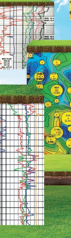
Figure 3: An example of recorded microseismic events during hydraulic a fracturing operation.
parts, the effect of structural features near the wellbore can be seen in other stages. There appears to be a definitive SRV in the central region of the well.
FRACABILITY AND HYDRAULIC FRACTURING
Brittleness and fracability terms have been used interchangeably in the literature, as a means of describing the likelihood of the creation of complex fracture networks or SRVs. Brittleness indices have been mainly used to evaluate and compare various shale plays, formations, and layers. Creating complex fracture networks during a fracture stimulation treatment requires more than brittle rocks. Simply, the presence of planes of weakness, and brittle rock does not mean that a complex fracture network will be created. Stimulation design parameters play a key role. The perception is that slick water fracturing with higher pumping rates can lead to better SRV development. This has certainly has been the case in the Barnett shale.
CONCLUSIONS
In this article, a brief description of fracability was presented and the most wellknown brittleness indices were introduced. Although important, there are many other parameters related to the stimulation design and operation which need to be considered
when stimulating a well. The next article in this series will focus on operational issues.
REFERENCES
1. Holt, R. M., Fjaer, E., Nes, O. M., and Allasi, H. T. 2011. A Shaly Look at Brittleness. Presented at the 45th US Rock Mechanics / Geomechanics Symposium held in San Francisco, CA, June 26–29, 2011.
2. Yang, Y., Sone, H., Hows A. and Zoback, M. D. 2013. Comparison of Brittleness Indices in Organic-rich Shale Formations. Presented at the 47th US Rock Mechanics / Geomechanics Symposium held in San Francisco, CA, USA, 23-26 June 2013.
3. Rickman, R., Mullen, M., Petre, E., Grieser, B., and Kundert, D. 2008. A Practical Use of Shale Petrophysics for Stimulation Design Optimization: All Shale plays Are Not Clones to the Barnett Shale. Presented at the 2008 SPE Annual Conference and Exhibition held in Denver, Colorado, USA, 21-24 September 2008.
4. Jarvie, D. M., Hill, R. J., Ruble, T. E. and Pollastro, R. M. 2007. Unconventional shalegas systems: the Mississippian Barnett Shale of North-Central Texas as one model for thermogenic shale-gas assessment: AAPG Bulletin, 91, 475 - 499.Lans Taylor.
5. Wang, F.P., and J. F. W. Gale. 2009. Screening Criteria for Shale-Gas Systems. GCAGS Transactions, 59, 779 - 793.
6. Warpinski, N. R., Mayerhofer, M. J., and Agarwal, K., 2013. Hydraulic-Fracture Geomechanics and Microseismic-Source Mechanisms. SPE Journal. 18(4), 766-780. SPE 158935-PA.
BIOGRAPHY
Vahid Mostafavi is currently a geomechanics specialist in the Integrated Subsurface Solutions (ISS) team at Talisman Energy. He has been involved in rock mechanical characterization of the Duvernay and the Montney as well international shale plays such as the Berkine field in Algeria. His responsibilities also include in-situ stress estimation, w ellbore geomechanics, hydraulic fracturing modeling and design. In the past he has managed international collaborations between research institutes and universities in Norway and Canada on the topic of wellbore stability, circulation loss and wellbore strengthening. Vahid has a BSc degree in drilling engineering from the Petroleum University of Technology (PUT) in Iran, a MEng in reservoir engineering and a PhD in petroleum engineering from the University of Calgary in Canada.
2014 CSPG GEOLOGICAL CALENDAR WRAP-UP
| By Markus Ebner
Included in this month’s issue of the Reservoir, you will find the 2014 CSPG Geological Calendar. This annual favorite is a collection of 12 amazing geological images from around the globe that have been contributed from our society’s members. This year we had a total of 111 photographs submitted, so you can imagine that it was no easy task to select the finalists.
Some highlights from next year’s calendar include James Woods’ Ichthyosaur jaw fragment, intersected in a core sample taken from the Montney Formation from a depth of 3.7 km – an interesting perspective and something the committee has never seen before. Filippo Ferri captured the large scale structures within the Toad and Liard Formations from an aerial view in the northern Rocky Mountains, which also took the $200 prize for Best Photograph. Dave Robinson and Gerard Thompson both submitted atypical shots of the striking geological landscapes from the Grand Canyon and the snow covered
Hoodoos of Bryce National Park, respectively. On a macro scale, Danielle Kondla submitted her apparent non-Andersonian deformation in the Trail Pluton, adjacent to the Columbia River.
The photographs in next year’s calendar display a broad range of great geology and photographic techniques, making the calendar really shine. The 2014 calendar has three images of Canadian content, one of which is also the cover shot. This is a fantastic image of spherical sandstone concretions in the badlands at Red Rock Coulee near Medicine Hat and it perfectly captures the essence of the geology on the Prairies in the winter. This year’s winner of the $200 subcategory prize of Best International Photo was taken by Dave Hills’, with his shot of Carboniferous Distal Fan deposits of the Ross Formation at Ballybunnion, Ireland.
I would like to thank my partners in this project, Emma MacPherson, our Publications
Coordinator and Donna Elkow-Nash, our calendar graphic designer. Additionally, I would like to thank the troupe of judges that assembled and helped to rank all of the submitted photographs, including: Mike Crawford, Hailey Doney, Bill Marshall, Darin McBeath, Erik Parker and Mark Taylor.
We would like to thank the continued support of our society’s members submitting such great photos for the competition – even if they did not make it into the calendar, you will be seeing some of these photos as “Photos of the Month” in upcoming Reservoir issues. Here’s hoping that your 2014 CSPG Geological Calendar gives you a small sense of geological wonderment as the months pass by.
RESERVOIR ISSUE 10 • NOVEMBER 2013 21
GO TAKE A HIKE
Fish Creek Provincial Park, Alberta
| ByPhilip Benham, Cathy Ryan, Yingchun Guan and Jim Dolph


Trailhead: There are multiple access points Fish Creek Park but for purposes of this excursion use Bebo Grove parking lot. This can be accessed south down 24 ST SW from Anderson Road.


Fish Creek Provincial Park is one of the largest urban parks in Canada, stretching about 20 km along the creek from its western boundary with the Tsuu Tina First Nation Lands to the Bow River in the east. Because of its size one can truly feel that you are out of the city, if you don’t consider the crowds of outdoor enthusiasts doing the same. Fish Creek is one of the few Bow River tributaries that has headwaters in the Rocky Mountains. It was formed at the end of the last ice age when
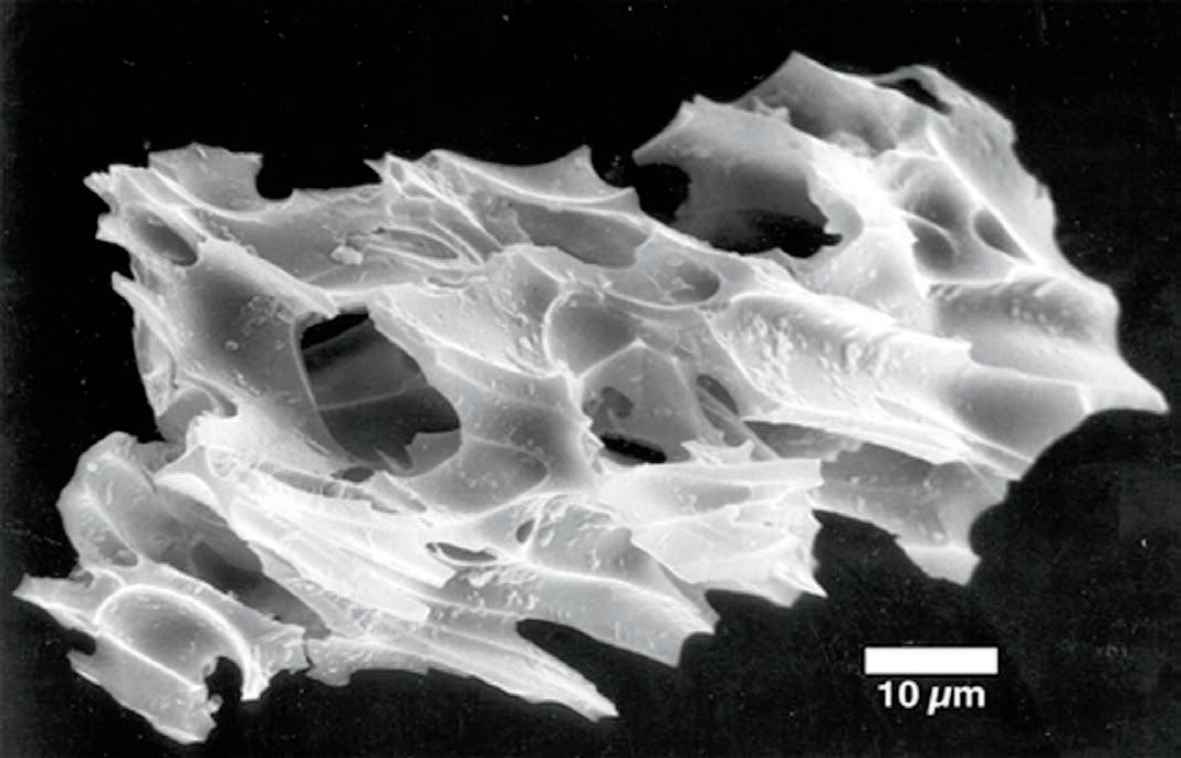
Scanning electron micrograph of a glassy
of volcanic ash from
Note the numerous small holes (vesicles) in the glass that give it low particle density and the ability to be carried for thousands of kilometres by tradewinds or even stay aloft in the atmosphere for years. The vesicles also are evidence of the explosive nature of the eruption. Volcanic glass occurs when lava cools so rapidly there is no time for crystals to form in the matrix. It tends to be unstable and over time weathers into clay minerals such as allophane, imogolite, and iron hydroxide minerals such as ferrihydrite. (Photo courtesy of Dr. Paul McDaniel, University of Idaho) For more information about the volcano sourced soils visit http://www.cals.uidaho.edu/soilorders/andisols_06.htm.
Distance: There are many kilometres of trails that may be walked or biked. The main targets of this trip can be reached in about 2 km of walking (return) and less than 50m elevation gain. Please respect other park users and be aware of abundant wildlife including deer in the park. A detailed park map and updated conditions can be found for Fish Creek at http://www. albertaparks.ca
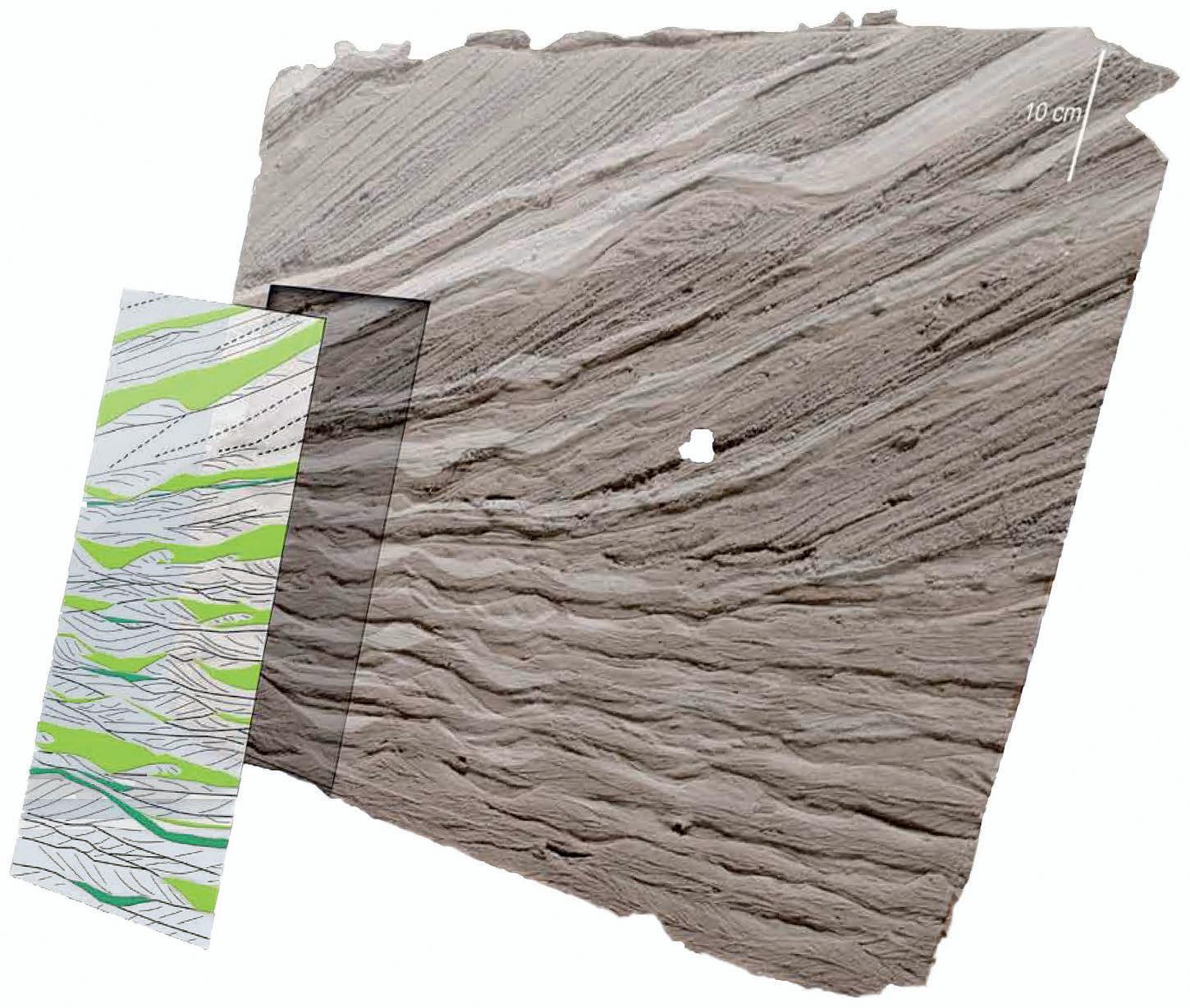
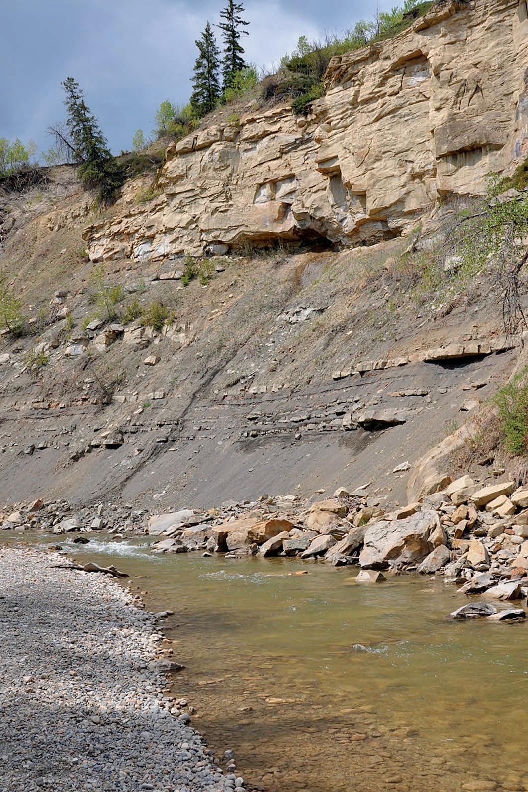
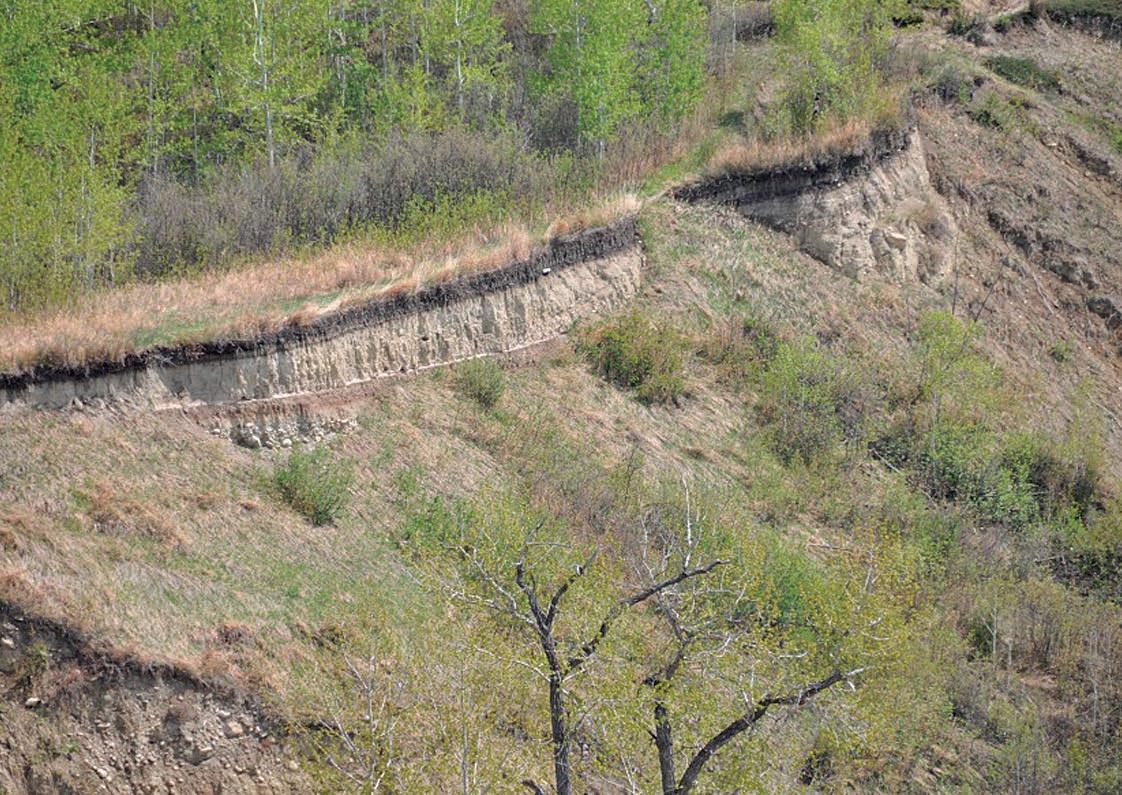
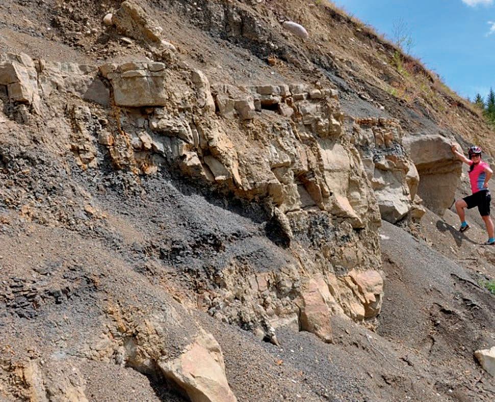
retreating glacier meltwaters carved valleys in the bedrock. If you look at the size of the creek flowing today it is clear that a stream of this power could not have created this wide valley. These kind of “misfit” streams” are common in Alberta, a testament to the force and volume of the glacier meltwater. The flat-lying sands and gravels deposited by Fish Creek over the subsequent centuries form a permeable, creekconnected alluvial aquifer. Bedrock exposed on either side consists of the lower Paleocene aged Willow Creek Formation. It outcrops most dramatically at Raven Rocks, whose steep slopes should be admired from a distance (they are also off limits as an ecological reserve). Calgary is at the transition of the approximately age equivalent Paskapoo and Willow Creek Formations, causing much confusion and incorrect usage by geologists. To the south is the Porcupine Hills Formation, deposited in seasonally dry conditions and thus containing caliche nodules and lacking coals. Paskapoo Formation rocks west and north of Calgary were deposited in a more humid setting, containing tell-tale coals (Lerbekmo and Sweet, 2000). To complicate matters the, Porcupine Hills Formation is partly correlative to the upper Scollard Formation and lower Paskapoo Formations (Lerbekmo and Sweet, 2000). The gradational nature of the formations makes vertical and lateral assignments of formation names in the lower Paleocene strata somewhat arbitrary in Calgary, leading to continued debate amongst geologists.
Fish Creek Valley is narrow and steep walled in the west. The shade and associated cooler temperatures and retained moisture result in white spruce, shrubs and mossy understory dominating over the open meadows of grasses, and clusters of poplar and aspen trees in the wider, eastern portion of the valley. The creek’s position as a green corridor within the city is increasingly compromised by stormwater drainage (including road salts), and the upstream introduction of fertilizers, animal waste and some sewage influx. A tenfold increase in chloride concentration has occurred between 1975 and 2008, and Escherichia coliform commonly exceeds the allowable limits for recreational water use (Leung, 2009). A number of stormwater ponds have been recently constructed to try and ameliorate the water quality degradation. On the whole the aquatic ecosystem, while affected somewhat, is generally healthy and reasonably diverse.
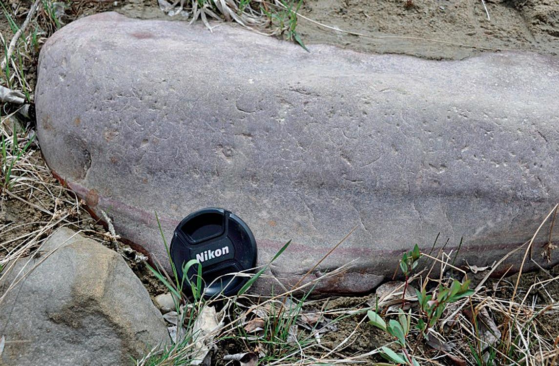
Between the #5 and 6 bridges in the park there is a distinctive white horizon visible to the east on a on a low bluff. The thin layer is evidence of a catastrophic volcanic explosion that occurred over a thousand km away in Oregon. What you see are the remains of Mount Mazama, now perhaps more famously known as Crater Lake (National Park). Mount Mazama was part of a complex of overlapping shield and composite volcanos that began
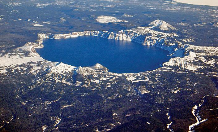
Above Centre: 2005 USGS aerial photograph of Crater Lake, taken in winter of 2005, by Mike Doukas. The small cinder cone of Wizard Island can be seen on near side of lake. It is evidence of the post-cataclysm volcanic activity that was restricted to the caldera.
22 RESERVOIR ISSUE 10 • NOVEMBER 2013
Above:
shard
Mount Mazama.

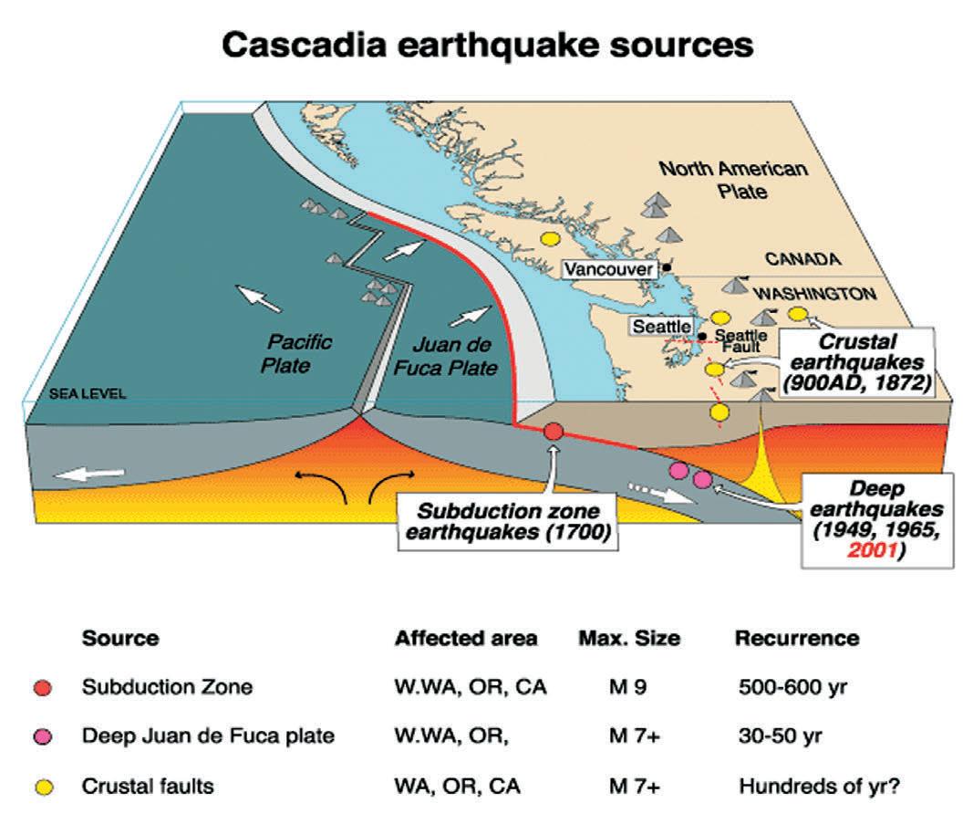
Image Source USGS. Image shows subduction of oceanic plates underneath North American plate. Earthquakes occur at three positions; shallow and deep within the subduction plane and in the crust related to flexure and injection of rising magma. The grey cones on the diagram represent the northern extent of the Cascade Volcanic Arc. White arrows indicate spreading direction of oceanic ridge (which is being consumed north of Vancouver Island). Note the dates, size and frequency of earthquakes in the various zones.
forming perhaps 400,000 years ago. They are part of the Cascade Volcanic Arc, which stretches from California to British Columbia and includes Mt. St. Helens in Washington and Mounts Meagher and Garibaldi in BC. The Cascades originate in the eastwards subduction of the Pacific, Juan de Fuca and Kula Ocean plates underneath the North American plate (and subsequent melting and rise to the surface of the magma).
At Mount Mazama, the erupted magma was initially andesitic in composition. As the volcanic complex evolved, its composition changed to more explosive silicic magmas (dacite and rhyodacite), setting the stage at Mount Mazama for a final cataclysmic eruption about 7700 years ago. During that final phase the caldera collapsed in on itself, creating an unbearable load that was released in one of the largest volcanic explosions recorded in recent history.
The eruption generated pyroclastic flows that extended as much as 60 km along each river valley radiating from the volcano. Also, about 116 km3 of tephra (volcanic rocks and ash particles) were ejected into the atmosphere by the blast (Bacon, 1983). By comparison the May 18, 1980, Mount St. Helens eruption only produced about 1.1 km3 of tephra (SarnaWojcicki et al., 1981).
The Mazama ash layer has been mapped over a 1.7 million km2 area of the Pacific Northwest carried primarily to the north and east by the prevailing wind directions at the time. Besides several spots in Calgary, the ash can be observed along Highway 1A near Lac Des Arcs, Saskatchewan Crossing, Jasper National Park and even along the banks of the North Saskatchewan River in Edmonton. The fine particulate matter ejected by the explosion likely remained in the atmosphere for up to 3 years and depressed the temperature of the Northern Hemisphere by over 0.5° C (Zdanowicz,1999). Raised atmospheric sulphate levels (typically associated with volcanism in pre-industrial times), along with shards of volcanic glass are preserved in a Greenland ice-core and has been attributed to the Mazama eruption. The ash interval in the ice core has been dated by geochemical methods to be approximately 7625 years BP (5677 BC) (Zdanowicz, 1999). Carbon 14 methods from plant remains in the vicinity of the volcano indicate 6,845 +/- 50 C14 years B.P (this is approximately 7700 calendar years)(Bacon, 1983). The eruption and subsequent ash fallout of this scale would have had profound impact on the landscape, wildlife, vegetation and the early people living there. The
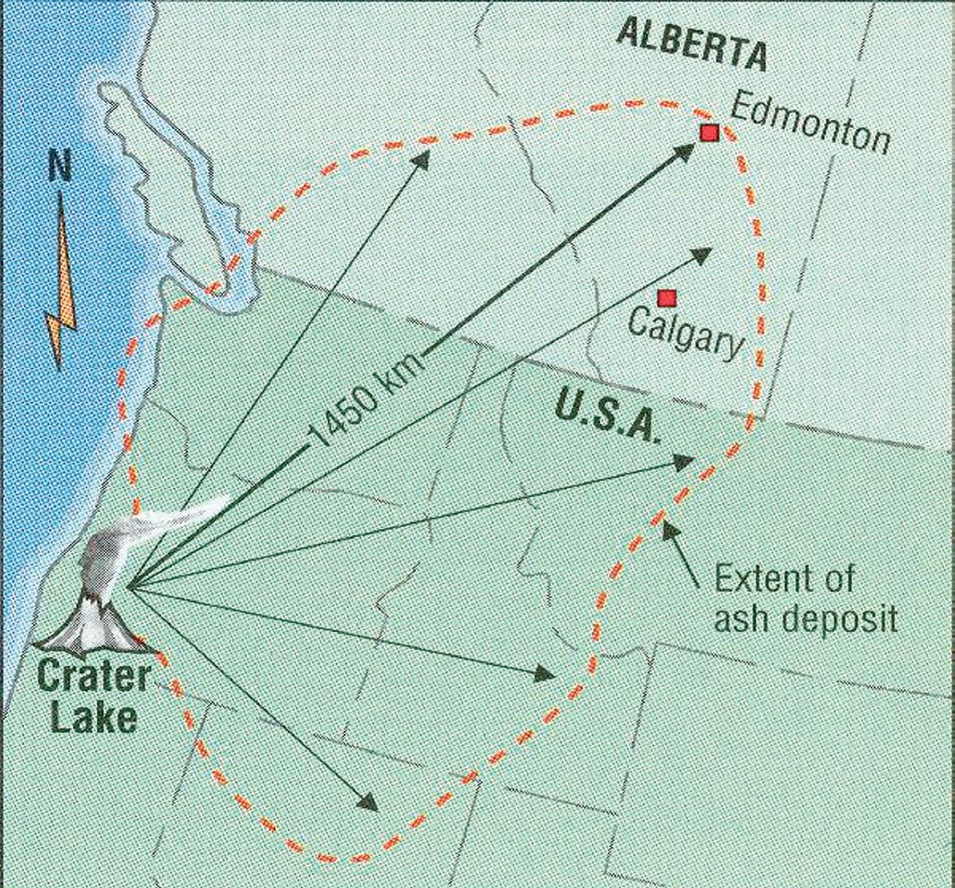
Map showing the extent of the Mazama ash deposit. The ash horizon overlaps with ash layers from other volcanic events of different ages in Yukon, BC and USA but it has a distinctive chemical signature and can be distinguished from the other horizons.
Klamath tribe, local to Mount Mazama, have an oral history of the event. They tell of a battle between two chiefs (Llao of the Below World and Skell of the Above World) that lead to the destruction of Llao’s home. In historic times Klamath shamans forbid their people from viewing the lake, and never told pioneers about it, leading it its “late” discovery in 1853 by John Wesley Hillman who was actually hunting for the infamous “Lost Cabin Mine.”
In the months and possibly years that follow the ash would have hindered plant growth and caused ruminant animals to become sick and die. First Nations peoples relying on those food sources would themselves suffered hardship, starvation and possible displacement. Because of the relative continuity, extent and easily identifiable nature of the layer it has proven useful to archaeologists as a stratigraphic marker. Archaeological sites below this horizon are extremely rare and thus important to our understanding of the peopling of North America in the few thousand years post-Ice Age.
REFERENCES:
Bacon, Charles R., 1983, Eruptive History of Mount Mazama and Crater Lake Caldera, Cascade Range, U.S.A. Journal of Volcanology and Geothermal Research, v.18, p.57-115
Lerbekmo, J.F., and Sweet, A.R., 2000. Magnetostratigraphy and biostratigraphy of the continental Paleocene in the Calgary area, southwestern Alberta, BCPG, December 2000 v. 48 no. 4 p. 285-306
Leung, Cindy, 2009. Water Quality and Invertebrate Study of Fish Creek in Calgary, Alberta, Canada. ENSC505 Project. Supervised by DR Cathy Ryan. http://wsow.brbc.ab.ca/reports/FishCreekStudy.pdf
Sarna-Wojcicki, A. M., S. Shipley, R. B. Waitt Jr., D. Dzurisin, S. H. Wood, P.W. Lipman, and D. R. Mullineaux (1981), Areal distribution, thickness, mass, volume, and grain size of air-fall ash from the six major eruptions of 1980, in The 1980 Eruptions of Mount St. Helens, Washington, edited by P. W. Lipman and D. R. Mullineaux, U.S. Geol. Surv. Prof. Pap.,1250, 577–600.
Zdanowicz, C. M.; Zielinski, G. A.; Germani, M. S. (1999). “Mount Mazama eruption; calendrical age verified and atmospheric impact assessed”. Geology 27 (7): 621–624.
RESERVOIR ISSUE 10 • NOVEMBER 2013 23
on page 24...)
(Continued
Present day soil profile
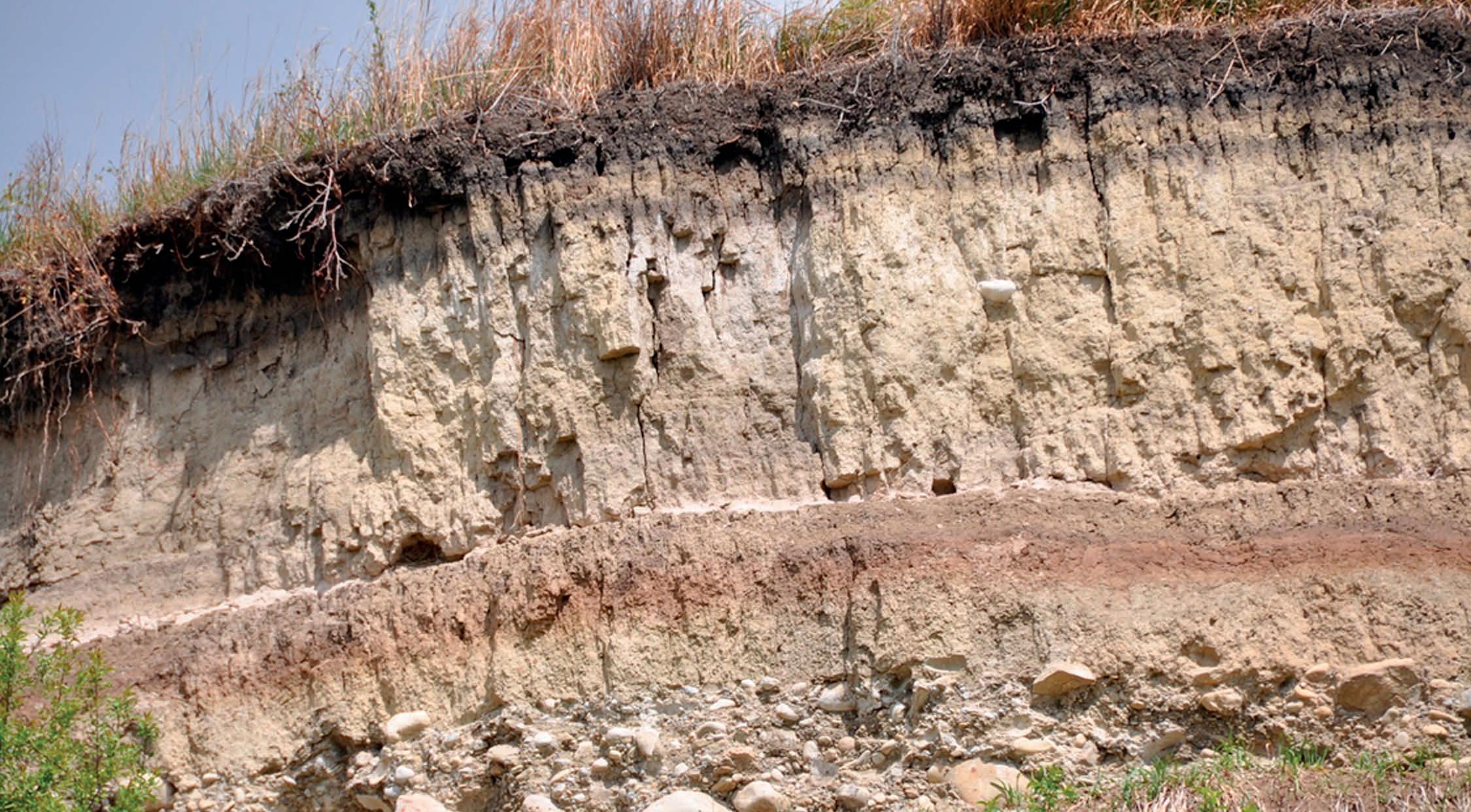


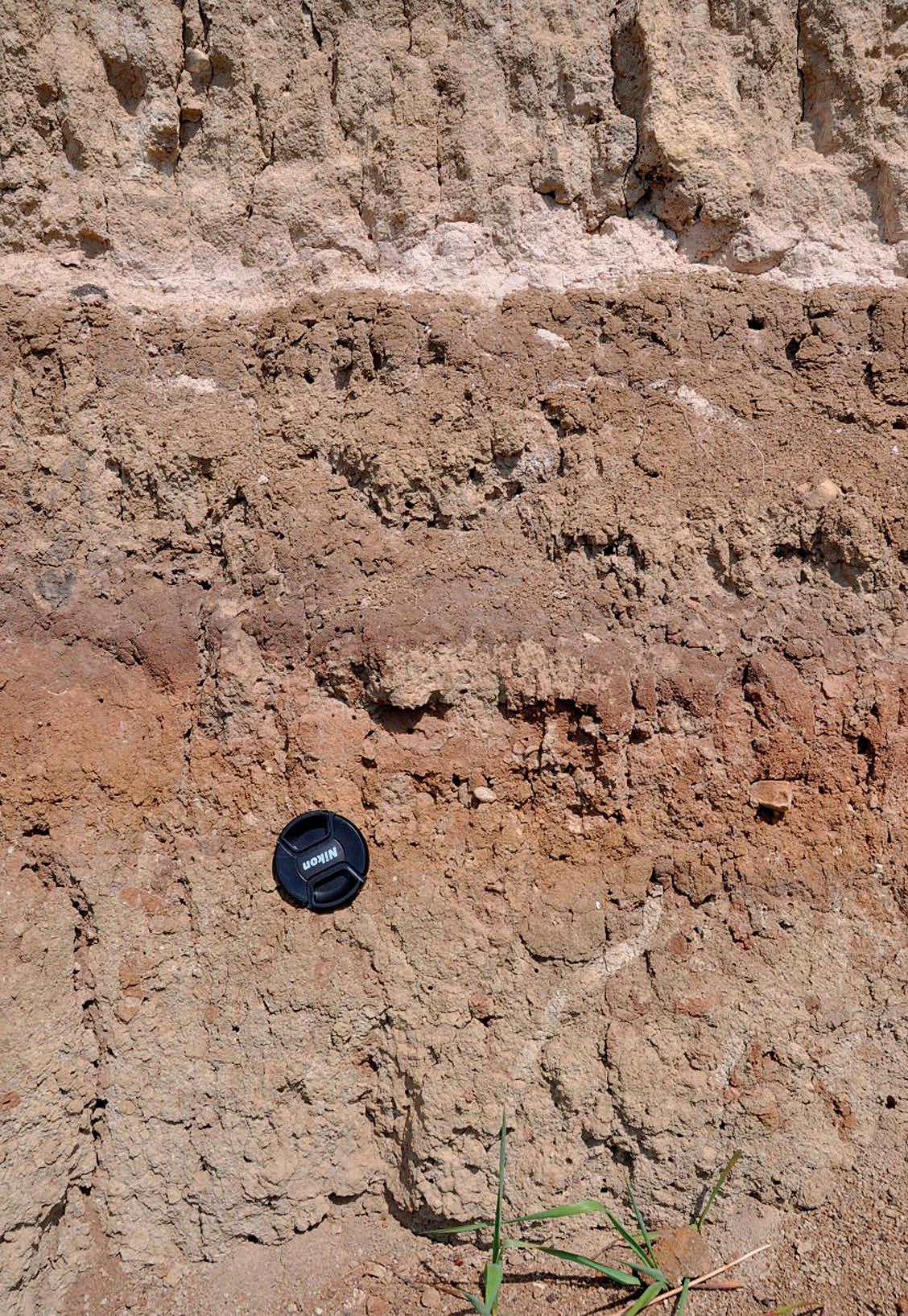
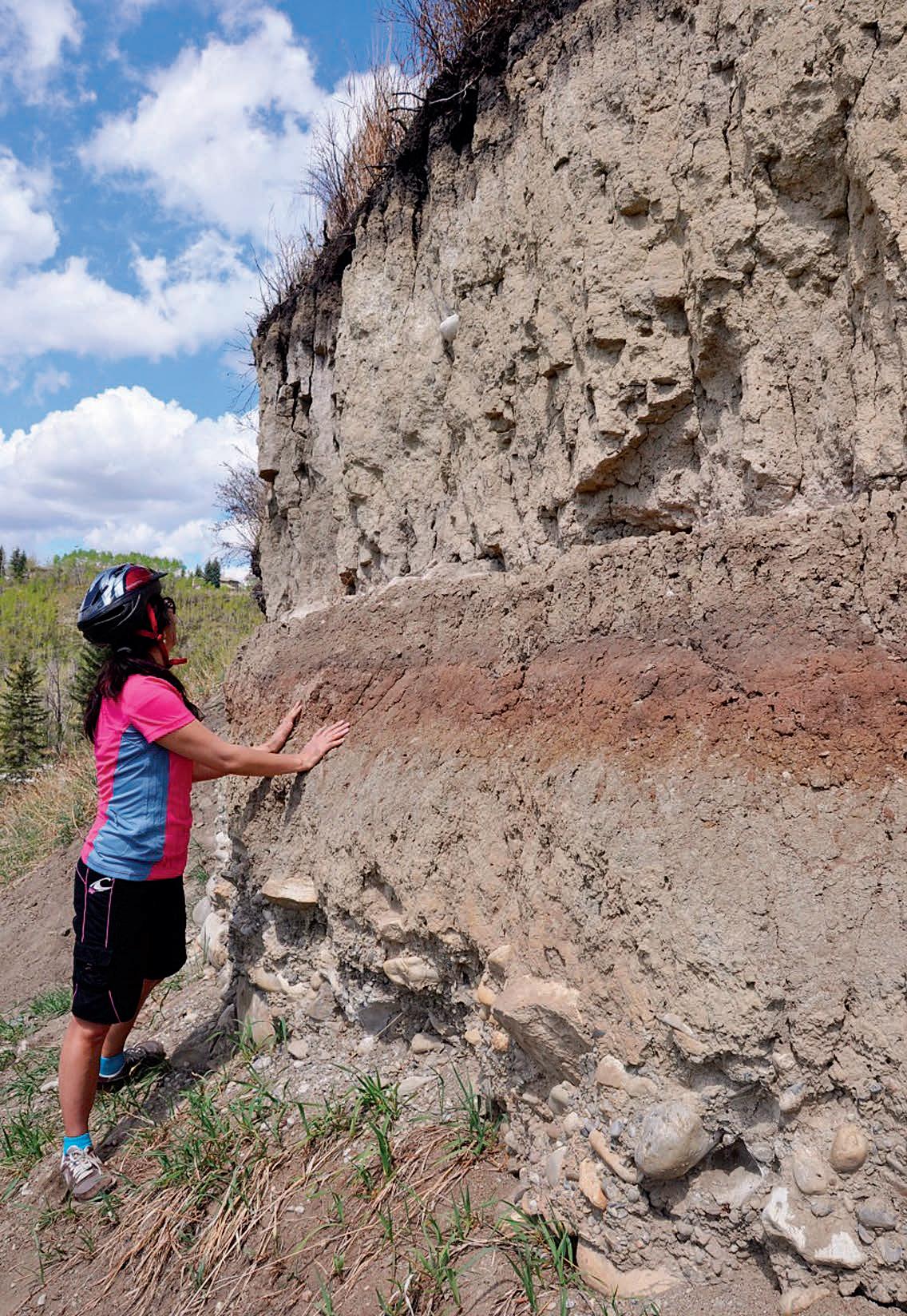
Fluvially reworked glacial till


 Closeup of ash layer and paleosol. Note the mottled appearance of the ancient soil. Its upper layers are burrows and possible root casts which hasve infilled with ash (white arrow), while deeper down the holes have filled with different sediments (blue arrow)..
Angled view of ash layer and paleosol.
The ash layer rests on a paleosol, which itself rests on fluvial cobbles reworked from glacial deposits. The cobbles are mostly composed of quartzite but are weakly cemented with calcite. The angle of the sun casts shadows that highlight the vertical joint sets that have developed in the finer grained fluvial strata and soils.
Closeup of ash layer and paleosol. Note the mottled appearance of the ancient soil. Its upper layers are burrows and possible root casts which hasve infilled with ash (white arrow), while deeper down the holes have filled with different sediments (blue arrow)..
Angled view of ash layer and paleosol.
The ash layer rests on a paleosol, which itself rests on fluvial cobbles reworked from glacial deposits. The cobbles are mostly composed of quartzite but are weakly cemented with calcite. The angle of the sun casts shadows that highlight the vertical joint sets that have developed in the finer grained fluvial strata and soils.
Paleo-sol
Mazama Ash
24 RESERVOIR ISSUE 10 • NOVEMBER 2013


The Reservoir Committee welcomes contributions from our readership to this series. If you wish to offer a submission to Go Take a Hike on your favourite hike of geological interest, email the Reservoir at Emma.MacPherson@cspg.org for more information.
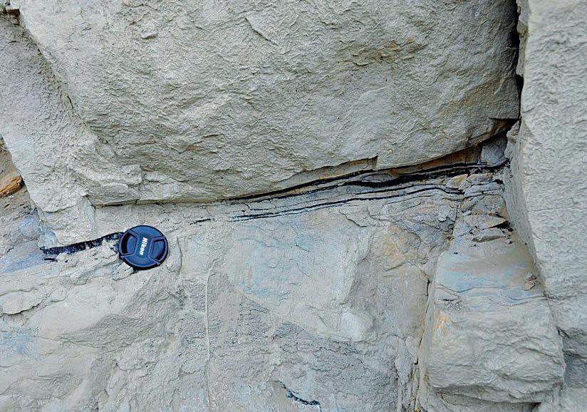
 The distinctive white ash bed is easily visible on the trail between bridge #5 and 6 and also at a distance from an adjacent bluff.
Just underlying the bluff containing the ash deposit are fine grained floodplain deposits (containing Metasequoia and deciduous leaf fragments) and a sandstone filled channel (incision point marked by the dotted line). These strata also belong to the Willow Creek Formation.
View of Raven Rocks. The outcrop belongs to the Paleocene Willow Creek Formation. In this photo, stacked channel sandstones sit on thinly bedded floodplain shale, siltstone and minor sandstone.
Boulder of probable Gog Group quartzite in the stream bed below the ash layer. It is covered in concentric grooves known as chatter marks. These indentations are typically made as boulders and bedrock and impacting during movement of glacial ice. The Gog boulders are almost certainly part of the Foothills Erratics Train and may have been subsequently reworked by Fish Creek over a period of thousands of years.
The Willow Creek channel sands below the ash contain several logs which have subsequently carbonized.
The distinctive white ash bed is easily visible on the trail between bridge #5 and 6 and also at a distance from an adjacent bluff.
Just underlying the bluff containing the ash deposit are fine grained floodplain deposits (containing Metasequoia and deciduous leaf fragments) and a sandstone filled channel (incision point marked by the dotted line). These strata also belong to the Willow Creek Formation.
View of Raven Rocks. The outcrop belongs to the Paleocene Willow Creek Formation. In this photo, stacked channel sandstones sit on thinly bedded floodplain shale, siltstone and minor sandstone.
Boulder of probable Gog Group quartzite in the stream bed below the ash layer. It is covered in concentric grooves known as chatter marks. These indentations are typically made as boulders and bedrock and impacting during movement of glacial ice. The Gog boulders are almost certainly part of the Foothills Erratics Train and may have been subsequently reworked by Fish Creek over a period of thousands of years.
The Willow Creek channel sands below the ash contain several logs which have subsequently carbonized.
RESERVOIR ISSUE 10 • NOVEMBER 2013 25
CORPORATE SUPPORTERS
Apache Canada Ltd.
Apoterra Seismic Processing Ltd.
BDO Canada LLP
Birchcliff Energy Ltd.
BJV Exploration Partnership
Cabra Consulting Ltd.
Cabra Enterprises Ltd.
Casey & Associates
Canada Brokerlink Inc.
CL Consultants
Compass Directional Services
Continental Laboratories (1985) Ltd.
Core Laboratories
Core Laboratories Canada
Cougar Consultants, Inc.
Datalog Technology Inc.
EDGE Technologies
Energy Navigator
EV Cam Canada Inc.
Explor
Fekete
Geotir
GLJ Petroleum Consultants Ltd.
GranTierra Energy Inc.
Little Rock Document Services
Matrix Geoservices Ltd.
Matrix Solutions Inc.
McDaniel & Associates Consultants Ltd.
Mcleay Geological Consultants Ltd.
National Oilwell Varco
Nickpoint Environmental Services
Paradigm Geophysical (Canada) Corp.
Pason Systems Corp.
Pulse Seismic Inc.
Regent Resources
RIGSAT Communications
RPS Energy Canada Ltd.
SAExploration
Shea Nerland Calnan LLP
Sigma Explorations
Statcom Ltd.
Sproule Associates Limited
Sourcex
Total Gas Detection Ltd.
Tucker Energy Services Canada
Tucker Wireline Services Canada Inc.
AS OF OCTOBER 10, 2013
CSPG
GEOCONVENTION 2014: FOCUS
May 12 - 16, 2014 www.geoconvention.com
| By Eric Street, CSPG Technical Co-Chair, Ken Gray, CSEG Technical Co-Chair, Jon Bryan, CWLS Technical Co-Chair
The FOCUS 2014 GeoConvention is being designed to provide our membership with the knowledge required to adapt to change, provide the tools necessary to refine their workflows and the processes required to sustain the continuing evolution of technology in all areas of the oil and gas industry.
GeoConvention 2014 will feature integrated sessions attracting multi-discipline submissions from industry professionals, academics and subject matter experts from across North America and the world – but also industry specific talks for those looking for something a little more niche. All conveniently located and showcasing one of the Canadian centres of the energy business.
The GeoConvention 2014 Call for Abstracts will open November 4, 2013. Your participation in this year’s convention is crucial to
its success, and we urge you to consider ‘putting your work out there’ for review and consideration by your peers and colleagues. For more information regarding the proposed technical sessions and how you can participate please visit www.geoconvention.com.
FOCUS ON CORE
The GeoConvention 2014 Core Conference will be held May 15 & 16, 2014 at the AER Core Research Facility (formerly the ERCB Core Research Facility). In addition to the technical program, social events and exhibition floor, the core conference is a great opportunity to round out your convention experience.
A special core session will be dedicated to celebrating the 100th anniversary of the discovery of the Turner Valley field – the beginning of the oil & gas industry in Western Canada.
If you are interested in submitting an abstract for a core presentation, please visit www. geoconvention.com for more information.


welcomes our 2013 Corporate Supporters! The benefits of being a corporate member include: • Recognition in the monthly Reservoir and quarterly Bulletin • One associate membership
Reserved tables at the technical luncheons with your company logo
One free pass to the CSPG Core Conference …and more! Contact Kasandra Klein at kasandra.klein@cspg.org to be a corporate member today! 26 RESERVOIR ISSUE 10 • NOVEMBER 2013
•
•
APEGA’s Continuing Professional Development Program offers a wide variety of options
All Professional Geoscientists and Licensees must take professional development and report their Professional Development Hours (PDHs) annually. Ongoing professional development ensures members stay current with industry and technology trends, as well as develop leadership and project management skills.
Members can take their PDHs in at least three of six categories suiting a variety of interests:
• professional practice: Practice or influence the practice of the professions.
• formal activity: Take professional development programs, courses or seminars in a classroom or online offered by an educational institution or technical society.
• informal activity: Attend professional conferences, tradeshows, workshops, luncheons or brown-bag noon hour presentations by technical experts, or engage in self-directed study.
• participation: Mentor, serve on public bodies, volunteer in the community or for APEGA outreach.
• presentations: Present technical or professional material at conferences, seminars or workshops.
• contributions to knowledge: Patent, edit, review or publish technical work, or publish a thesis at a graduate level.
For more information on CPD, visit www.apega.ca, click on Regulatory Affairs, then CPD
Professionals in Geoscience
www.apega.ca
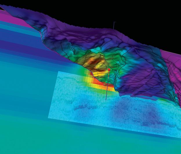


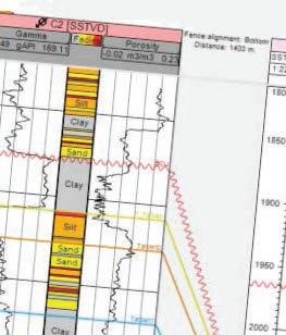


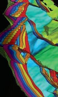


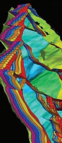


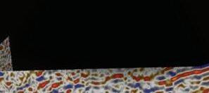


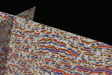


Blueback Reservoir the preferred and chosen GeoScience Solutions Partner Try something new. Find something better. Blueback Rock Physics plug-in for Petrel* Bridging the gap between geology and geophysics The complete suite of rock physics tools for quantitative interpretation across multiple domains within Petrel. Blueback Reservoir blueback-reservoir.com E sales@blueback-reservoir.com | T +1 403 538 4821 blueback-reservoir.com/rockphysics *Mark of Schlumberger 13000 Vol shl=0.2 Reservoir Properties Seismic
Wells Petrel
