Innovations In GNSS And GPS Systems
Sustainable Development and Land Use
Transforming Landscapes with Precision: Skymap Africa’s Pioneering Role in Drone Surveying Across Africa
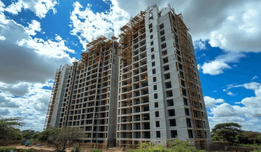
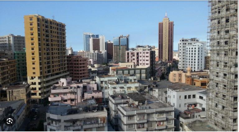
A housing crisis meets strained infrastructure. As the city’s population surges, high-rise apartments rise—but at what cost?


EXECUTIVE EDITOR
Prof. Gordon Wayumba
HEAD OF CONTENT
William Kiarie
CONTRIBUTING EDITORS
Gerald Nyanjua Amolo
David K. Njoroge
Patricia Sila
Keith Angana
Mary Muthee
The magazine and related website provide topical overviews and reports on the latest news, trends and developments in geomatics all around the world. Afrospatial is orientated towards a professional and managerial readership, those leading decision making, and has a worldwide circulation.
Afrospatial is available six times per year on a subscription basis. Geospatial professionals can subscribe at any time via https://www.afrospatial.com/subs
Subscriptions will be automatically renewed upon expiry, unless Afrospatial receives written notification of cancellation at least 60 days before expiry date.
Advertisements
Information about advertising and deadlines are available in the Media Kit. For more information please contact our marketing advisor: marketing@afrospatial.com
No material may be reproduced in whole or in part without written permission of Afrospatial.
Copyright © 2024,
Sectional Property in Kenya - Pg 4
Innovations In GNSS And GPS Systems - Pg 6
Sustainable Development and Land Use- Pg 10
Vector and Raster Data Models for Real-world Representation- Pg16
Pg20
Applications of AI/ML in GIS: Transforming Geospatial AnalysisPg 30
Transforming Landscapes with Precision: Skymap Africa’s Pioneering Role in Drone Surveying Across Africa - Pg 34
Careers- Pg 32
By Patricia Sila
In the recent past, the obsession with land ownership has steadily decreased owing to the availability of more investment options. Rather than buying land and waiting for its appreciation, financial portfolios like stocks and bonds have become popular as people continue to find innovative ways of creating and multiplying wealth.
At the same time, most people strive to own a space and become rent-free. Some prefer to own homes in rural areas with abundant space, surrounded by nature, while others prefer to settle near the city and enjoy the fast life. However, the city has limited land, with most residential areas developing apartments.
Land is a fixed resource; it cannot be increased or decreased, making it a scarce commodity. You can only alter the shape, area or elements on the land. With this in mind, we can understand why traditional bungalows spanning large acres of land are starting to take a back seat. Especially in urban areas, developers are economical with land because it is limited, owing to numerous apartments, office complexes, and malls that accommodate thousands of houses and businesses.

A single house vs. an apartment on the same piece of land
In most multilevel establishments, systems have been set up to accommodate the tenants, including having a caretaker, security to guard people’s belongings, and even signing in and out as a precautionary measure. But what if someone wanted to own an individual unit in such an establishment?
Sectional Property allows you to own a unit in a multilevel development, including receiving a title deed. This concept is gaining traction because it allows for a building to have various legitimate
owners, a brilliant way for people to own homes and offices in a convenient location. Initially, the developer owned the land and building. He/she would form a management company through the Companies Act and ‘sell’ the units as sub-leases.
The unit members had certificates and shares in the management company, making them ‘owners’ of the property with a Mother Title for the entire development.
Many issues arose from this arrangement, including the developer retaining the Mother Title and not giving shares to the unit ‘owners’, leaving him/ her with ultimate control over the property. The developer could also refuse to exit the company after selling all the units and charge service fees to the unit members.
Other times, the developer would not include a renewal clause for the unit members since the units were ‘sold’ as leases under the Mother Title. This arrangement was risky for the unit members because they had no real property ownership.
To achieve Sectional Property ownership, we must describe the development as a 3D space. When we look at it this way, it is easy to see where one person’s ‘space’ ends and another’s begins.

In Sectional Property, each member entirely owns their unit while all members jointly own common areas like the garden and driveway. Each member gets a Strata Title as proof of ownership and the Mother Tile becomes void.

Some of the requirements for Sectional Property include a corporate body, not under the Companies Act, responsible for common areas, a detailed plan of each unit to be submitted as a sectional plan, approved building plans, and a copy of the Mother Title. Sectional Property titles are processed through a Licensed Surveyor.

The legal framework for Sectional Property is outlined in the Sectional Properties Act 2020, which also provides dispute resolution guidelines if any between unit owners. Sectional Property is valid for both leasehold and freehold land.
While some developers prefer to rent apartments and complexes for long-term income, others have embraced the new reality and are developing multilevel establishments purposefully for sale. Sectional Property is most suitable for areas with high demand and limited land.
Despite the relief that Sectional Property gives unit owners, owning property in such an arrangement has its downsides, the main one being the lack of privacy. Even so, the advent of Sectional Property is a solid step towards sustainable land management and maximizing the limited resources we have. Maybe someday, we will slowly relinquish the ingrained concept of soil ownership and embrace space ownership.
By David K. Njoroge
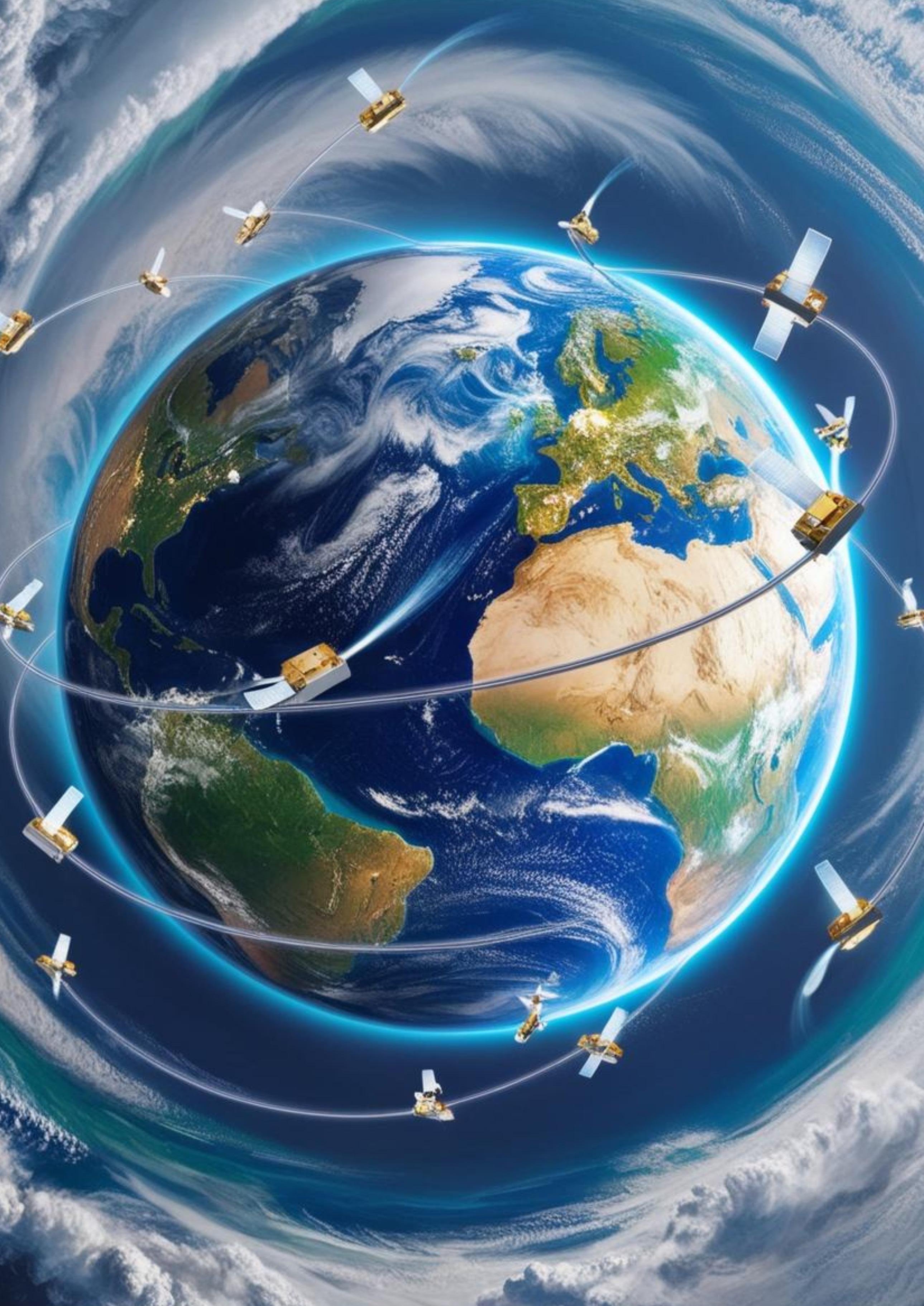
Global Navigation Satellite Systems (GNSS) and Global Positioning Systems (GPS) have become indispensable tools across industries, from everyday navigation to critical applications in transportation, logistics, and disaster management. Recent innovations in GNSS and GPS systems are transforming their capabilities, offering unprecedented accuracy, reliability, and adaptability. This article explores breakthroughs in multi-constellation support, advanced signal processing, and enhanced performance in challenging environments like urban areas, while highlighting their farreaching implications.
Modern GNSS systems leverage multiple satellite constellations to enhance positioning accuracy and reliability. In addition to the U.S. GPS, other constellations such as Russia’s GLONASS, Europe’s Galileo, and China’s BeiDou are now integrated into multi-constellation receivers. This integration reduces signal degradation due to environmental obstructions and improves coverage, particularly in areas where a single constellation might struggle.
The adoption of multi-constellation receivers has accelerated in sectors like aviation, maritime navigation, and autonomous vehicles. For instance, combining data from multiple constellations allows drones and self-driving cars to maintain precise positioning, even in complex urban environments with limited sky visibility.
Innovations in signal processing have addressed long-standing issues such as multipath interference—where satellite signals are reflected off surfaces like buildings and trees, causing inaccuracies. New algorithms and advanced chip designs enable better filtering of erroneous signals, allowing devices to distinguish between direct and reflected signals more effectively. These advancements also improve signal reacquisition times, ensuring seamless navigation even in environments with frequent signal obstructions, such as tunnels or heavily wooded areas.
In urban canyons and densely built environments, dual-frequency receivers have emerged as gamechangers. These receivers utilize signals on two separate frequencies, compensating for ionospheric delays and further enhancing accuracy. Additionally, they provide improved resilience to jamming and interference, which is critical for applications
in densely populated or high-risk regions. Such advancements are crucial for applications requiring sub-meter or even centimeter-level precision, such as construction surveying, precision agriculture, and automated machinery. Enhanced signal processing technologies also pave the way for the development of next-generation GNSS systems capable of meeting the growing demand for highaccuracy location services in real-time.
Urban environments present unique challenges for GNSS systems due to tall buildings and narrow streets. To overcome these obstacles, researchers and manufacturers have introduced solutions such as Real-Time Kinematics (RTK) and Precise Point Positioning (PPP) technologies. RTK uses groundbased reference stations to provide real-time corrections, achieving centimeter-level accuracy. PPP, on the other hand, combines satellite corrections with sophisticated models to deliver high precision globally without relying on local infrastructure.
Emerging solutions also include GNSS augmentation systems, such as Satellite-Based Augmentation Systems (SBAS), which improve reliability and accuracy by providing additional correction data. These advancements have paved the way for applications like geofencing, asset tracking, and urban planning.
The transportation industry benefits from these innovations through improved fleet management and route optimization. Multi-constellation support ensures uninterrupted navigation for delivery vehicles and cargo ships, while high-accuracy
positioning enhances traffic management systems and reduces congestion.
2. Disaster Response
During natural disasters, GNSS systems play a pivotal role in search-and-rescue operations and resource deployment. Enhanced accuracy and reliability mean responders can navigate through debris-filled or flooded areas with confidence. Additionally, GNSS-supported mapping technologies aid in assessing damage and planning reconstruction efforts.
3. Autonomous Systems
Self-driving cars and drones rely heavily on GNSS systems for navigation and situational awareness. With multi-constellation receivers and dualfrequency signals, these systems can operate seamlessly even in GPS-deprived areas, ensuring safety and efficiency in autonomous operations.
4. Global Connectivity
Advancements in GNSS technology are not limited to urban areas. They also extend to remote and underserved regions, enabling global connectivity. For instance, improved accuracy supports rural broadband initiatives by assisting in antenna alignment and infrastructure placement.
Future Prospects: Integrating GNSS with Emerging Technologies
The future of Global Navigation Satellite Systems (GNSS) is inextricably linked to its convergence with cutting-edge technologies like Artificial Intelligence (AI), Machine Learning (ML), the Internet of Things (IoT), and Quantum Technologies. These integrations are poised to push GNSS capabilities beyond current boundaries, offering unprecedented accuracy, reliability, and adaptability for a rapidly evolving world.
Artificial Intelligence (AI) and Machine Learning (ML)
AI and ML have already demonstrated transformative impacts across various industries, and their application in GNSS is no exception. By harnessing their predictive and analytical capabilities, GNSS systems can overcome traditional limitations and offer advanced functionality.
1.
AI algorithms analyze historical and real-time data to anticipate disruptions caused by atmospheric conditions, multipath interference, or physical obstructions like buildings and trees.
Predictive capabilities allow GNSS systems to adapt dynamically, rerouting signals or selecting alternative satellite constellations to maintain uninterrupted service.
2. Pattern Recognition in Geospatial Data:
ML models process vast geospatial datasets to detect patterns and anomalies that human analysts might miss.
For instance, ML can identify areas prone to urban sprawl or predict traffic congestion patterns, aiding urban planners in making informed decisions.
3. Enhancing Autonomous Systems:
AI enables GNSS systems to interpret complex environments, such as urban canyons, by integrating data from sensors, cameras, and satellite signals.
Autonomous vehicles benefit from this fusion, improving safety and navigation accuracy.
4. Disaster Management:
ML algorithms assess geospatial data from GNSS systems to predict natural disasters like floods or landslides, enhancing early warning systems.
AI-powered mapping tools guide emergency responders in efficiently allocating resources and planning evacuation routes.
The Internet of Things is a network of interconnected devices that share data to enable smarter operations. The integration of GNSS into IoT ecosystems is creating a new paradigm of location-aware technologies that optimize processes in real-time.
1. Smart Cities:
GNSS provides precise location data for IoT devices managing urban infrastructure, such as traffic lights, public transportation systems, and waste management services.
For example, GPS-enabled sensors in parking meters can guide drivers to available parking spaces, reducing traffic congestion and emissions.
2. Supply Chain Management:
IoT devices equipped with GNSS track shipments in real-time, offering insights into location, condition, and estimated delivery times.
This transparency improves logistics efficiency and reduces delays caused by lost or misrouted cargo.
3. Environmental Monitoring:
IoT sensors combined with GNSS monitor environmental factors like air quality, water levels, and deforestation.
These systems provide actionable data to policymakers, enabling targeted interventions for sustainability.
4. Agriculture:
Smart farming applications use GNSS-integrated IoT devices for tasks such as soil monitoring, automated irrigation, and precision planting.
These innovations reduce resource wastage and maximize crop yields.
Quantum Technologies
Quantum computing and sensing represent a groundbreaking frontier in GNSS technology, offering solutions to long-standing challenges like signal interference and positioning accuracy.
Applications in GNSS
1. Quantum Computing:
Quantum algorithms process and analyze massive geospatial datasets far more efficiently than classical computers, enabling faster and more accurate GNSS corrections.
These advancements can enhance global systems like PPP, providing sub-centimeter accuracy across vast regions without requiring dense ground infrastructure.
2. Quantum Sensing:
Quantum sensors measure gravitational anomalies and Earth’s magnetic field with extreme precision, offering alternative positioning methods that complement GNSS.
These technologies are particularly useful in environments where GNSS signals are weak or unavailable, such as underground tunnels, dense forests, or deep-sea locations.
3. Resilience Against Interference:
Quantum cryptography can secure GNSS signals against jamming and spoofing attacks, which are growing concerns in critical applications like defense and aviation.
By using unbreakable encryption, quantum-secured GNSS ensures reliable positioning even in hostile or high-risk environments.
Synergistic Benefits of Integration
The integration of these technologies amplifies the capabilities of GNSS, creating a synergistic effect that benefits industries and societies at large:
Real-Time Decision-Making: AI-powered GNSS systems integrated with IoT devices enable instant data analysis and response, transforming industries like logistics and emergency services.
Sustainability Goals: IoT and quantum sensing contribute to monitoring and managing natural resources, aligning GNSS applications with global sustainability objectives.
Enhanced Global Connectivity: GNSS integration with emerging technologies ensures consistent, reliable location-based services in remote or underserved regions.
Challenges and Opportunities
While the integration of GNSS with AI, IoT, and quantum technologies presents immense potential, challenges such as high implementation costs, data privacy concerns, and technical complexities remain. Addressing these issues requires collaboration among governments, industries, and researchers.
However, the opportunities far outweigh the challenges. As these technologies mature, they will redefine the possibilities of GNSS, driving innovation in areas like autonomous mobility, smart infrastructure, and climate resilience.
By Gerald Nyajua
Sustainable development refers to the approach in which resource utilization should satisfy the current generation’s needs with spiritual regard toward the ability of the other generations to satisfy their needs. At the core of this vision is the efficiency of the land, a scarce but strong resource in human endeavor. Landscape architecture and urban planning act as fundamentals in planning and managing sustainable land use systems for an enhanced environmental balance, social justice, and economic welfare.
Land that everyone in one way or another uses relies on for housing, food security, and economic activities, and supports wide and complex ecological processes. However, natural resources and especially land limits remain constrained because of uncontrolled urbanization, deforestation, and poor management of resources.
Urbanization is on the rise with many city expansions taking place through tearing down forests and other natural habitats reducing the spaces available for holding diverse forms of life and regulating the atmosphere. All these challenges point to the need to adopt sound and responsible systems for managing land.
The issues in question are all best solved by a
simultaneous application of design and planning skills, which are the specialty of landscape architects and urban planners. They are important for bridging ecological science, architectural design, and technological advances in developing spaces that factor in human growth and conservation of the environment.
New approaches to architecture and infrastructure, landscape management, and rational use of territories represent the basis of sustainable strategies. These approaches are geared towards developing ways of managing ever ever-expanding population, minimizing or avoiding negative impacts, and promoting active living health, and prosperity.
In addition, the practice of green infrastructure and ecosystem services in cities has created a new image of the interaction between cities and nature. Landscape architects guarantee that land is constructive, useful, and sustainable to human and ecological advantage. The subsequent sections concern the primary approaches and ideas that landscape architects use to implement environmentally friendly land use, such as smart urbanism, regenerative landscapes, and sensible conservation.
People’s Interactions, Smart Urban Design, and Sustainable Urban Expansion
Cities’ expansion remains an unexampled process that brings real possibilities for development but sometimes becomes a question of the sustainable existence of countries or regions. Sustainable urban planning offers strategies that help in addition to a city’s growth to reduce the harm done to the environment.
Infrastructure
Green infrastructure characterizes the foundation of sustainable urban territories. Landscape architects and planners proactively address ecological issues inherent to the urban built environment by incorporating natural elements like parks, green roofs, permeable pavements, and urban forests into the built landscapes to support vital ecosystem functions such as water purification, air filtration, and moderation of temperatures. They do not only respond to environmental issues but also positively affect the quality of life of dwellers.
Climate-Resilient Cities
Climate resilience plays a significant role in current urban planning. Hence, Landscape Architects and Planners are using natural solutions to mitigate problems such as floods, heat, and landslides. For example, urban wetlands and bio-swales prevent water surcharge, and greenery planted systematically decreases the urban heat island phenomenon. Climate change has made it necessary for cities to ensure that they spend on climate-friendly infrastructure to make the city habitable regardless of the prevailing climate change.
Regenerative Landscapes: Balancing Ecology and Development
The application of regenerative landscapes is different from the conventional means of land use and management. Instead of just seeking to reduce harm to the environment, these goals are intended to heal and enrich an environment that has been negatively impacted over time and mainly because of human activities such as land development for other uses such as agriculture, and expansion of cities among others that have led to deforestation. These landscapes concentrate on putting into practice the healing of the ecosystems to harmonize human operations with nature.
Ecological restoration is at the center of regenerative landscapes. It includes the process of replanting local species of vegetation, enhancing the quality of the earth’s topsoil, and changing closed water systems, thereby increasing the stock of bio-diversity and delivery of ecosystem services. In addition to providing a healthier environment, regenerative landscapes improve ecosystem conditions that in turn affect the resilience of the landscape to climate change and ultimately reinstate natural habitats.
Besides ecological points, regenerative landscapes involve sustainable land utilization as well. These landscapes sustain human needs for food for both animals and human beings, recreation facilities, and even the provision of habitat for people and all intensive uses of the landscape in the minimum impact approach. These landscapes then include concepts of regenerative design including the use of renewable sources, energy-efficient construction and farming, and other features that can improve the balance of man and his environment.
Regenerative landscapes present a globally feasible approach and a set of tools to prevent and reverse the above-mentioned difficulties interrelated with the environment, bio-diversity, and climate, as well as to support human settlements and enhance their quality as close to nature as possible and, therefore, sustainable. Taking lots of time to listen and consult and embracing longterm ecological stewardship, regenerative landscapes provide a picture of the future in the present.
Case Study: Multiple uses of landscape in urban environments
The motivating practice regarding regenerative design is the revitalization of abandoned and formerly barren city areas into diverse-use landscaped areas. This change has become apparent in many cities like Singapore and Copenhagen where some of the ruined industrial regions and other areas of blight have been transformed into socially, ecologically, and recreationally relevant urban greening. These projects are an ecological kind of urban development that offers the solution to issues of unsound urbanization, pollution, and destruction of ecosystems.
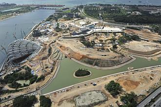
A real-life project concerning this approach is ‘The Gardens by the Bay project in Singapore.’ This large-scale city revitalization plan created the world’s largest contemporary environmentally sustainable ecological landscape and communitycultural undertaking on 101 hectares of land reclamation. It was planned to solve several issues that many urbanized states have – lack of open areas in a concentrated territory, the project needed to solve several issues that many urbanized states face, the main goal was to help Singapore become a “City in a Garden.”
The Gardens by the Bay project, completed in 2012, consists of three main areas: These subdivisions include Bay South Garden, Bay East Garden, and Bay Central Garden. Nonetheless, this project offers a fair uniqueness because it focuses on the multifunctionality and sustainability of the product. The built space was planned to carry out numerous tasks— ecological, social, recreational, and esthetic while integrating nature and the city.
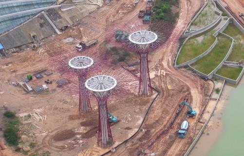
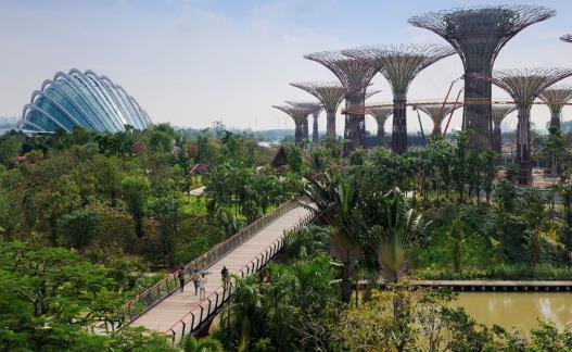
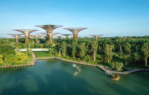
One might refer to the Gardens by the Bay project as a clear example of how islands of greenery in mega cities can perform ecological functions. In the gardens, there are more than 1,5 million plants, and there are many species from different countries. Besides setting gentle nature homes for plants and animals, gardens featured some recognized facilities such as Super Tree Grove, the stunning tent-like giant columns implemented themselves as expressive symbols of the park and at the same time efficient energy sources. These Super trees have been fitted with solar power to provide electricity to the gardens while the
gardens collect rainwater to use in the gardens.
There are an increasing number of social and recreational activities which people prefer to engage in. Gardens by the Bay was also developed to improve the standard of living of the people and tourists that pay a visit to the place. The gardens are accessible to the public and have numerous opportunities for recreation and leisure activities the tours of the gardens to walkways, gazebos, lawns, play areas, and event spaces or concert grounds. This design is suitable for such activities as jogging, cycling, and openair bids making it easy for people to conduct themselves in the middle of the city and see green landscape.
In addition, the project is growing into a major social and cultural venue, due to its location near important areas such as the Marina Bay Sands and the Marina Bay Financial Centre. This public space welcomes the residents as well as visitors, and hosts community, education, and cultural events. The green systems, which are developed in the context of the city, afford the residents a chance to engage in social interactions and cultural interchange as well as to foster their sense of belonging.
Elements of urban green are well documented to enhance the quality of air with less noise and offer opportunities for nature encounters. It has been proven to have therapeutic benefits on the mind; it relieves stress and anxiety and boosts well-being. People live in congested environments thus the establishment of Gardens by the Bay serves as a source of comfort in the middle of the urban density. Through Gardens by the Bay, we get to learn how integrated green spaces in different functionalities help shape the lives of urbanites.
From an economic perspective, they have assumed tremendous importance in the tourism sector of Singapore’s economy. Having millions of visitors each year, the project helps to produce more revenue to contribute to the economy in Singapore and establish Singapore as the world’s leading country in the field of sustainability and innovations. In addition to the
tourism industry, the gardens are shown to have a significant part in improving property values of the adjacent locations, and in addition to that, create opportunities for business ventures and organizations in the community.
In terms of culture, the Gardens by the Bay project represents the promise of Singapore’s sustainability of incorporating gardens into the city developments. However, it has a knowledge function and is designed to raise awareness of the audience with such issues as saving energy,preserving vegetation, and supporting the variety of species. The gardens are used in hosting cultural activities such as flower festivals, art exhibitions, and environmental activities thus playing a massive role in boosting the cultural importance of the community.
Conclusion:
Gardens by the Bay is an ideal way to showcase how regenerative landscape works best in providing ecological restoration recreation social gatherings, and sustainable practice in an urban environment. This project has been of great help in scaling up an abandoned piece of land and putting it into several productive and communal uses, within the natural realm. By converting an empty plot of ground into a green area, Singapore has made the way for other cities around the globe.
With the increasing areas of concrete jungles, Gardens by the Bay is a great example that given enough vision, dedication, and sustainable thinking, it is possible to build cities that can incorporate the strongest points of the gardens while rejecting the negative ones. Such projects make it possible to strive for cities fit for living and at the same time can help nature renew itself and become a home to people.
Sustainable land use includes the conservation and utilization of natural resources. Landscape Architects and Planners are crucial concerning sustainability conservation and managing the impacts of the development of the natural environment.
From the site data, Landscape Architects and Planners can create ways to protect the various habitats, especially in zones considered vulnerable to urbanization such as wildlife connectors, transitional areas, and green wedges to accommodate human settlements and development while observing the presence of wildlife.
While the integration of sustainable practices into land use planning is promising, it’s not without challenges:
- Population Growth and Urban Pressures: There is a tendency for rising land, housing, and infrastructure demands which when met can negatively influence ecosystems and contribute to lethal development.
- Policy Gaps: This makes sustainable land use a slow process because of the varied and sometimes rigid policies and regulations involved.
- Resource Competition: Aspirations that combat the dominance of the land are agriculture, industry, and environmental conservation all present a challenge.
However, opportunities abound through:
- Technology-Driven Solutions: Today, Land use planning research involves the use of tools such as Geographic Information Systems (GIS), remote sensing, and Artificial intelligence.
- Community Involvement: Stakeholder and people’s participation helps to achieve balanced development that complies with both ecological and social needs.
- Policy Innovations: Today’s governments are continuously using programs that promote green infrastructure, conservation, and climate proofing for planning .
In today's marketplace for geospatial technology, the traditional display advertising options we offer still hold value. However, for products and services that require a deeper understanding, content marketing and storytelling have emerged as essential tools to articulate benefits through relatable examples and case studies. That's where our partner content options come in. With two to three pages in print and/or an online case study dedicated to your content, you can engage our targeted audience of geospatial professionals with your brand's stories.


Publication of your article or case study on our website, plus one month of promotion across our digital channels Your content gains exposure and credibility, reaching a specialized audience interested in geospatial technology.
Your content published in a print issue of your choice and on our website. Choose between a 2 or 3-page article. One month of promotion across our digital channels Optimal reach through both print and digital platforms, targeting professionals who value in-depth content in the geospatial sector.
Maximized visibility and engagement for your event, video or webinar, reaching a targeted audience of geospatial professionals with a spotlight on our homepage, a dedicated event, video or webinar page, and a promoted listing in our overviews. Plus, one month of promotion across our digital channels.

By Patricia Sila
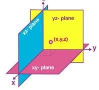
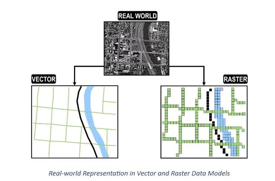
Earth is such a vast domain, spanning miles and miles far beyond what we can see and reach. When we look at the real world, it is too big and complex to analyze with our eyes. We cannot see all the buildings in a city or the start and end of a river at just one glance. To understand various phenomena, we need to scale down the earth and represent it in a way that is easy to understand. We need to visualize it in a geographical space that is closer and more tangible to us.
As we scale it down, we represent the earth using standard methods to ensure we don’t lose the spatial and characteristic aspects of features. Therefore, we implore data models to represent reality digitally. This way, we can see an entire city at the glance of a screen. In the digital space, the possibilities are endless. We can perform geospatial analyses such as determining areas and detecting changes. Moreover, we can store the data in a Geographic Information System (GIS) that manages spatially referenced data (data in its precise location), crucial in various sectors including transportation, health services, and land management systems.
We use two primary data models to represent the real world in a digital space: The Vector and Raster Models.
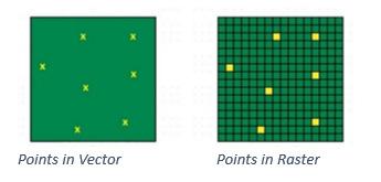
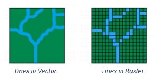
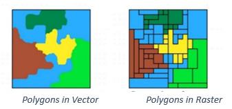
The Vector Model is characterized by points, lines and polygons to represent real-world phenomena.
The Raster Model is characterized by regular grid cells, where pixel values represent real-world phenomena.
The Vector Data Model represents the earth’s features in 3 geometrical primitives; points, lines and polygons.
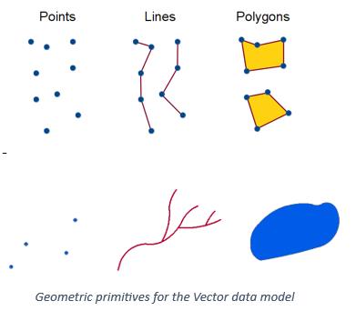
Points are zero-dimensional. They have a single pair of coordinates, representing singular discrete features like trees.
Lines are one-dimensional, consisting of multiple connected points. They represent linear features such as roads and rivers.
Polygons are two-dimensional, consisting of multiple lines that loop back together to form an enclosed feature. They represent features with areas and perimeters like lakes and cities.
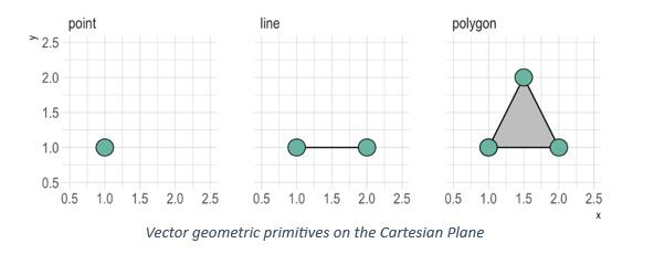
The Vector Data Model utilizes the Cartesian Coordinate System (x, y) to store shapes.
From Mathematics, we can infer that a vector is a geometrical structure with a specific shape, length and direction. Therefore, these primitive features are not just shapes. They are precise and accurately represent the real world. If a river is 30 m long, we can represent it with a 3 cm line (using a scale of 1 cm rep 1000 cm) following its direction in the real world.
The level of representation depends on the details needed, which defines the scale. For example, buildings in a large area can be represented on a small scale by points if they are not the focus of the study. In other cases, the buildings can be represented as polygons at a larger scale if we need to see the extent of each building.
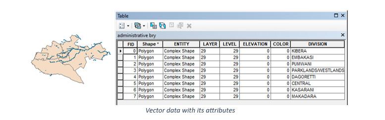
The Vector Model is mostly used in GIS for information storage in a database management system. Each feature has a unique identification number and attributes (more information on the feature). We can easily click on a feature and regularly update it and its attributes when changes occur, such as the reduction of a lake or the construction of more buildings. Vector data is mostly stored in the Shapefile format.
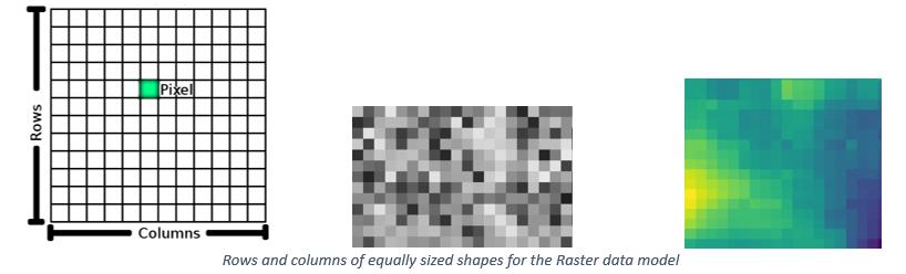
The Raster Model consists of a grid-based system of tiny equally sized shapes called pixels, arranged in rows and columns and connected to form an image. The model is oh-so-familiar, similar to regular digital photos. When you zoom into a digital image, notice the array of tiny squares that make up the image. The small shapes are pixels that combine to form a compact image. Most pixels are squares because they are the simplest to work with. However, we also have triangular pixels, octagons, and other shapes. The pixels form the building blocks to represent features in the geographical space.
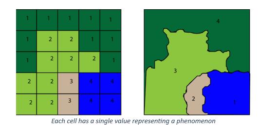
Each cell has a single value representing a phenomenon. If there is no data in a pixel, it is assigned a value of 0. Every pixel has a value.
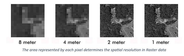
A major factor when it comes to Raster data is the Spatial Resolution. Spatial Resolution is the number of pixels used to construct an image. An image’s accuracy and spatial resolution are lower when more area is covered per pixel. Many, small pixels capture more detail and make an image look sharper than a few, larger ones.
Each pixel represents a portion of the earth. A 10-meter image resolution means that each pixel represents 10m by 10m on the ground (100m2), which is a high resolution. We can also have 1km by 1km (1km2 on the ground per pixel), which is a low resolution that will lead to loss of some information.
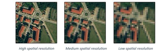
Raster data comes at the cost of more storage space and processing time. Low-resolution images require less storage and can be quickly processed while high-resolution images require robust software and hardware capabilities. Just like normal digital images, very sharp and clear images will generally take longer to download and occupy more space than low-quality ones. For Geospatial Analysis, a good image would be somewhere in between; pixels small enough to capture finer details and large enough for reasonable
processing time and space requirements. The purpose of a study and the kind of analysis needed will determine the most suitable resolution. To get a general idea of an area, a low-resolution image would suffice while delineating the width of a river would require a high-resolution image.
Raster data is captured using an aerial camera or satellites. The image has to be georeferenced into its exact location in a virtual geographical space using various geospatial software like ArcGIS. Beyond GIS, the Raster Data Model is commonly used for earth observation such as monitoring ocean tides and forest degradation. The data is mostly stored in the Tiff or Jpeg formats.
various sources and processes them online.
Complexity: Raster data tends to be less complex than Vector, especially when storing information. With Vector data, each aspect of the shape must be explicitly stored, including any vertex. Raster data is stored wholesomely since it comes with metadata from the data source.
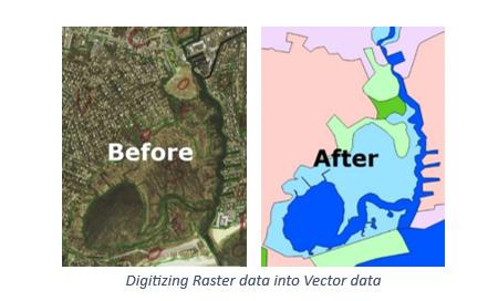
We can convert Raster data (an image) into Vector data (shapes) through digitizing. This involves loading the Raster data into geospatial software and ‘drawing’ out the features into either points, lines, or polygons.
Vector and Raster Data Models are essential for analyzing and understanding our environment. They allow us to convert the complex world into a simpler form. We can examine the earth and see the relationships between various features, both natural and man-made.
We can also know the extent of forests and oceans, and monitor the growth and sprawling of cities. This analysis is done in geospatial software such as ERDAS Imagine and AutoCAD which provide a geographic space with coordinates, similar to the real world.
Representation of the earth: Vector data tends to be a simpler representation of the real world because of the precision and accuracy of the discrete primitive shapes (points, lines, polygons). Even as beauty lies in the eye of the beholder, the model is more aesthetically pleasing and easier to understand than Raster data. The use of simple shapes makes it look clean, almost hand-drawn.
Storage: Vector data requires less space and computational power than Raster data. This challenge from the Raster Data Model has been countered by the advent of Google Earth Engine, a cloud-based platform that retrieves images from

At the end of this century, Kenya will have a population of about 35 million people, 78% more than lived in Kenya in 1984. That population will include a work force of 14 million people, 6.5 million more than in 1984. These future workers have already been born. To accommodate that workforce without a rise in the rate of unemployment, it will be necessary in the next 15 years almost to double the number of jobs in Kenya. Moreover, at current trends, the urban population will reach 9 to 10 million by 2000, over one fourth of the total population, compared to only 3 million (15%) in 1984. Unless new workers can be attracted in large numbers to jobs in smaller urban centres and on prosperous farms, it will be necessary to build at least six cities the size of present-day Nairobi, or to watch Mombasa and Nairobi expand into cities of two to four million each. And, unless those working on farms and in rural towns continue to raise their productivity, the rural population will be plagued by uneconomic subdivision of the land, migration into marginal areas, falling average incomes, and food shortages.
‘‘ ‘‘
By Keith Angana
Quoted above is the first paragraph of the first chapter of the Sessional Paper no 1 of 1986: Economic Management for Renewed Growth. The Chapter itself is titled ‘Kenya in 2000’. Following the economic crises of the 70s and the early 80s, experts saw the need to look much further ahead, towards the end of the century to determine what kind of an economy Kenya is going to have then and how it is going to get there. Thus, they birthed this document.
We’ll focus on the statements that make reference to the population of Nairobi. The condition was that workers be attracted in large numbers to jobs in smaller urban centres and on prosperous farms. But unfortunately, that did not happen. Nairobi, then grew into a city of two to four million. All without the necessary infrastructure to accommodate them.
The population in Nairobi has ballooned ever since the turn of the century. As the paper above
predicted, more and more people have made their way to the city in search of employment opportunities. Whether or not they have succeeded in doing so is neither here nor there. What pertains to us today is the matter of their housing.
For purposes of convenience, the working class usually prefers to live closer to their place of work. In the case of Nairobi then, the main commercial areas include the Central Business District, Westlands and Upper Hill. To satisfy the housing

demands of these people then, there has been a correspondent surge in the supply of houses in areas in close proximity.
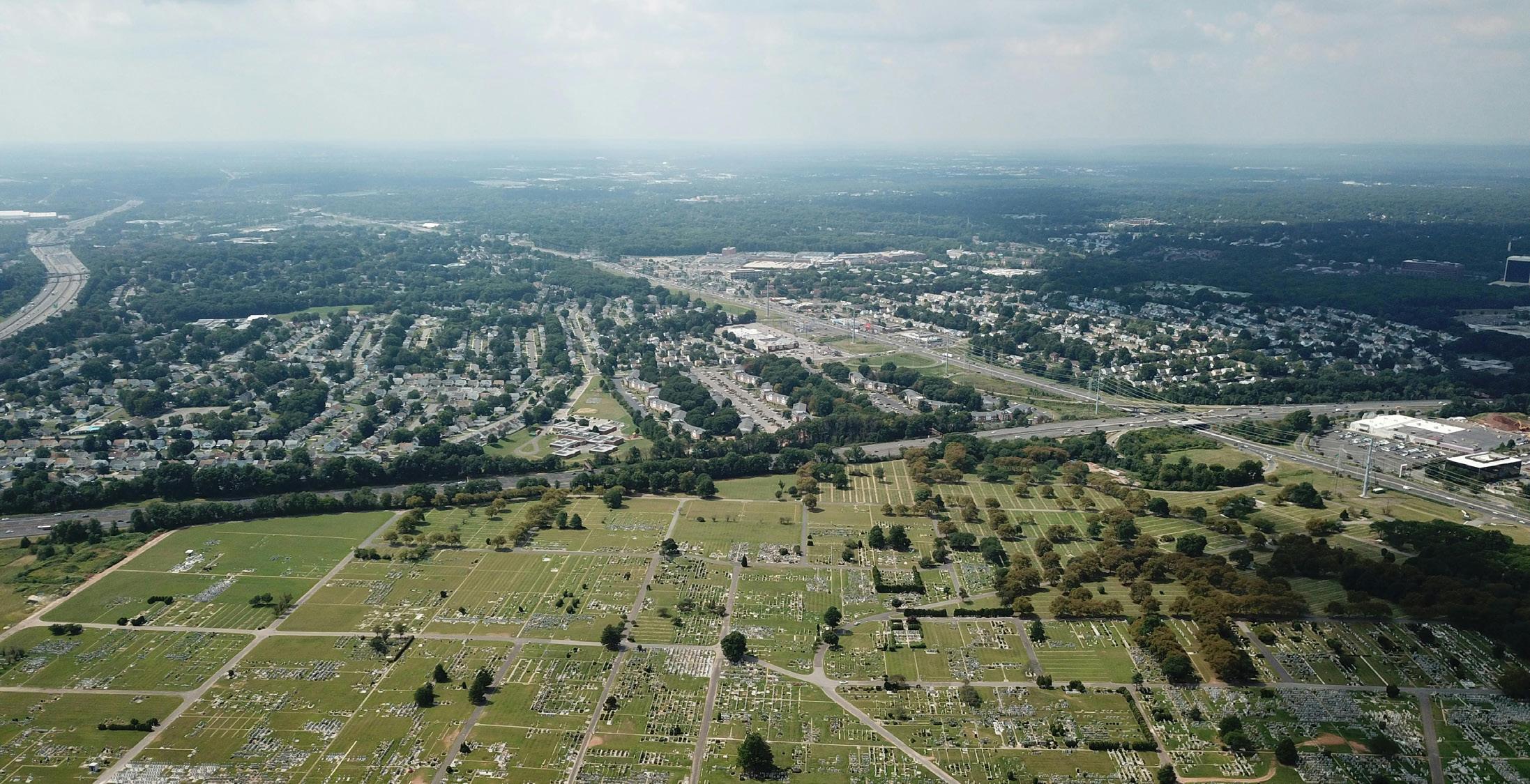
We have witnessed construction of high-rise apartments in Parklands, Kileleshwa, Kilimani and along Ngong Road. While we understand the purpose they are meant to serve, what most people do not approve is the conditions under which they are being constructed.
It is important to note that most, if not all, of these residential areas were designed during the colonial era. Therefore, the roads as well as the drainage and sewerage systems were designed to serve the meagre population of the time.
But now, we have a huge increase in the number of residential units per plot with no correspondent increase in the drainage and sewerage systems. What we witness, then, is an increase in traffic jam in those areas. This is, for example, evident in 1st to 6th Parklands Avenue.
The areas also experience prone flooding when it rains since most of the drainage pipes have been blocked during construction. At the beginning of the year, the whole stretch of Wood Avenue, from its intersection with Argwings Kodhek Road to its intersection with Kindaruma Road, was a
construction site. As a bon mot, it even earned the nickname ‘Pipeline ya mababi’ to mean that it was just like Pipeline, but for wealthier folks. All contractors would use the sidewalks as their storage for materials on site, thus leaving soil which ended up blocking the drainage lines. When it rained, the water had nowhere to go, thus ended up flooding on the road.
The environmental issues don’t even end there, seeing that huge tree cover has to be cut down in order to provide room for the apartments. Jerotich Seii came out guns blazing recently to protest the construction of a high-rise apartment along Nyeri Road because of how the contractor aimlessly cut all trees that were nearby. If the west of Uhuru Highway – the only part of the city that has tree cover – is being torn down, then how would Nairobi truly maintain its tag as ‘The Green City under the Sun’?
The last opposition to these high-rise apartments are people we’d refer to as NIMBYs (Not In My Back Yard). This is real estate jargon to mean those residents who are opposed to developments/ construction happening close to their homes, for the sole reason that these developments cause harm to them in one way or the other.
The areas in context here also have NIMBYs, who state that they bought property in that area because there were zoning laws that provided height restrictions for buildings.
The high-rise apartments, then, infringe this law, and additionally, infringe on the privacy of the older residents since the tenants of the apartments will be at a vantage position to peek over the older residents’ houses at all times. An influx of high-rise apartments in the area will also lead to a decline in the value of land and property in that area.
Therefore, with all these factors mentioned above in mind, is it possible to solve them all and find a way to build more high-rise apartments in close proximity to the CBD (without making Nairobi looking like a town in the USSR) in order to satisfy this demand? Or should we focus on the other alternative – building far away and ensuring ease of movement to the CBD?
ADVANCED GIS MAPPING AND SPATIAL ANALYSIS TRAINING 2025
Date: February 10-14, 2025
Venue: Nairobi, Kenya
Theme : Training on advanced aspects of the management, manipulation, and analysis of spatial data.
INTERNATIONAL CONFERENCE ON ENVIRONMENT AND LIFE SCIENCE (ICELS)
Date: February 13, 2025
Venue: Kisumu, Kenya
Theme : Current research on the environment and life sciences and GIS.
INTERNATIONAL CONFERENCE ON ENVIRONMENT AND LIFE SCIENCE (ICELS)
Date: January 21, 2025
Venue: Abuja, Nigeria
Theme : Research and development in the field of environment and life sciences and GIS
4: INTERNATIONAL CONFERENCE ON GEOGRAPHIC INFORMATION SYSTEMS (ICGIS)
Date: January 10, 2025
Place: Nampula, Mozambique
Theme : Emphasize on the recent achievements and research in Geographic Information Systems.
5: INTERNATIONAL CONFERENCE ON GIS AND REMOTE SENSING USERS CONFERENCE
Date: February 21–22, 2025
Place: Ghana
Theme : The developments and applications in new GIS and remote sensing technologies.
6: INTERNATIONAL CONFERENCE ON REMOTE SENSING AND GEOGRAPHIC INFORMATION (ICRSG)
Date: February 14, 2025Venue: Marrakesh, Morocco
Event : Remote sensing and geographic information systems with the latest developments and applications in the field of GIS.
7: INTERNATIONAL CONFERENCE ON GEOGRAPHIC INFORMATION SYSTEMS (ICGIS)
Date: February 17, 2025
Venue: Cape Town, South Africa
Event : Dedication of ICGIS to the latest developments in GIS, including spatial data analysis,geospatial technologies, and their applications across various sectors.
8: INTERNATIONAL CONFERENCE ON REMOTE SENSING, SURVEYING, AND MAPPING (ICRSSM)
Date: January 10, 2025
Venue: Johannesburg, South Africa
Event : ICRSSM covers topics related to remote sensing, surveying, and mapping, with a significant emphasis on GIS technologies.
9: GIS DEVELOPMENT TRAINING IN LOME
Dates: Flexible dates
Location: Lome, Togo Event: Training on GIS developments
10: ARCGIS ONLINE FUNDAMENTALS
Date: February 3–23, 2025
Location: Online-Togo Event: An online course to introduce the basic ideas about ArcGIS Online


The Municipal council has implemented tremendous improvements in its Geographical Information System to increase revenue collection from 6.0 billion TZS to 60 billion TZS annually.
INTRODUCES CROP MONITORING THROUGH REMOTE SENSING
The National Food Security Division has implemented a project entitled “Spurring Transformation for Agriculture” through Remote Sensing- STARS, in collaboration with Sokoine University of Agriculture and the University of Maryland. Through this project, it has intended to monitor the conditions of crops through advanced methods of remote sensing.
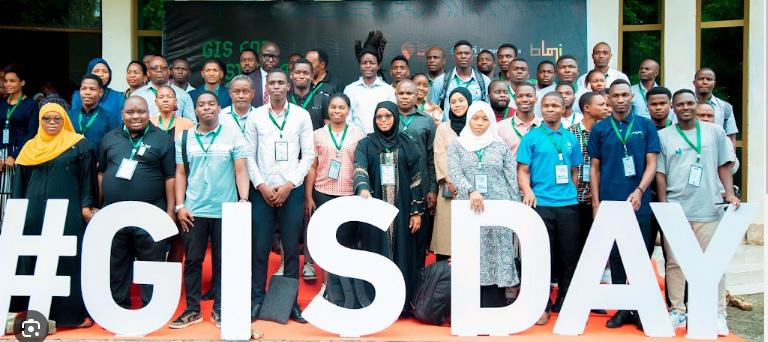
Recently, Esri Eastern Africa has celebrated GIS Day across various universities and institutions in Tanzania, showcasing the contributions of professionals working with GIS.

Intermap Technologies has been awarded contracts to provide digital terrain models that will aid the government of Colombia in managing its natural resources. This is part of developing the national spatial data infrastructure to improve land management, particularly in environmentally protected areas.
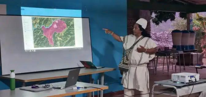
In northern Colombia, indigenous communities are mapping their boundaries and sacred sites with the help of GIS tools. This project is supported by the Dutch Kadaster to help empower indigenous communities and facilitate land administration. This will also help indigenous communities to claim and protect their ancestral lands.
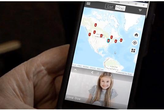
The Missing Children Society of Canada has launched GIS technology to ensure that more missing children are brought home faster. It helps them increase their efficiency in finding a missing child through location-based technology
November 2024 News Roundup from Esri Canada brings a number of updates on the Living Atlas of the World, water utilities powering their operations with GIS technology, and more in the latest episode of the “Geographical Thinking” podcast. It also talks about the use of GIS in residential building construction and the identification of solar farm locations.
The Living Atlas of the World
CANADA LAUNCHES GIS TECHNOLOGY FOR IDENTIFICATION OF SOLAR FARM LOCATION
Canada has launched GIS technology to support the search for ideal locations for solar farms in finding suitable areas for the installation of solar panels.
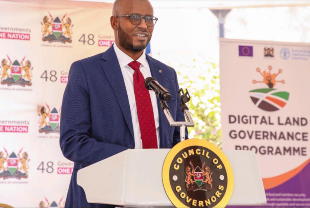
The Government of Kenya, in collaboration with the Food and Agriculture Organization (FAO) and the European Union (EU), has launched a GIS initiative that will help modernize land governance. This includes the provision of GIS equipment, County GIS-Based Database Systems Implementation Guidelines, and training on GIS and Remote Sensing. The aim is to contribute to improved land governance for increased sustainable development and food and nutrition security.
DEPARTMENT OF GEOSPATIAL AND SPACE
TECHNOLOGY AT THE UNIVERSITY OF NAIROBI
They are engaging in mobile map application development for nature conservation among others. Recently, the Department organized a summer school in cognitive geomatics, aside from exhibiting projects using the Geographic Information System, GIS during GIS World Day.
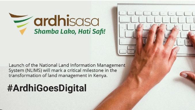
Kenya remains committed to digitizing all its land records under NLIMS, popularly referred to as Ardhisasa, incorporating GIS technologies to rationalize land registration, property boundaries, and dispute resolution. Its aim is to enhance transparency and effectiveness in land administration.
KENYA EXPANDS GEOSPATIAL TRAINING PROGRAMS
Kenyan institutions are expanding geospatial training programs at all levels to meet the ever-increasing demand for skilled personnel.
This is in tandem with the global trend for increased adoption of geospatial technologies in various sectors of disaster management and environmental conservation.
UGANDA LAUNCHES NEW GEOGRAPHICAL INDICATIONS SYSTEM TECHNIQUES FOR EXPORTS
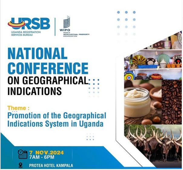
The Uganda Registration Services Bureau (URSB) and the World Intellectual Property Organisation (WIPO) hosted a National Conference on Geographical Indications Systems in Uganda. This conference aimed to promote the use of geographical indications to add value to Ugandan products and create new markets. Products like Rwenzori Mountains of the Moon Coffee have already received GIS certification.
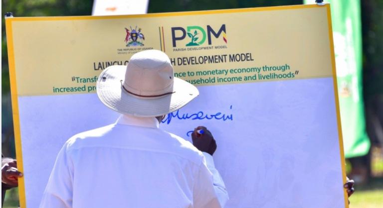
UGANDA INTRODUCES PARISH DEVELOPMENT MODEL (PDM) THROUGH GIS
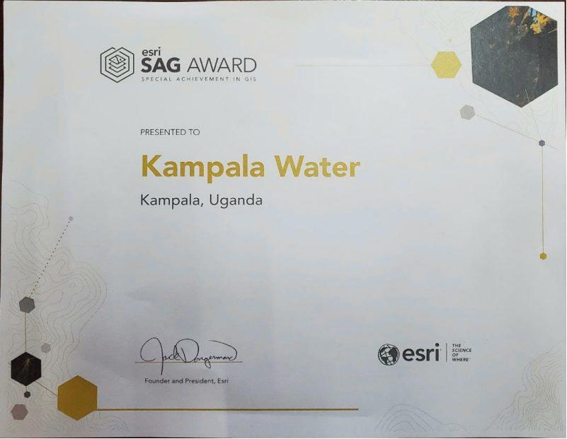
The Uganda Bureau of Statistics (UBOS) has won the Special Achievement in GIS - SAG Award during the Esri User Conference in San Diego. The award recognizes UBOS’s work in providing a seamless solution for statistics using the technology of GIS.
The Directorate of Science, Technology, and Innovation has launched an Integrated GIS Portal supported by the Bill & Melinda Gates Foundation. This portal collects, labels, and models data for real-time decision-making by the government and development partners. It focuses on improvement in services such as maternal health care through low-cost technological solutions.
MALI INTRODUCES GIS TRAINING FOR THE MILITARY CHALLENGES

The United Nations Multidimensional Integrated Stabilization Mission in Mali and the European
Union Training Mission in Mali have introduced training courses on the use of geographic information systems to the Malian Armed Forces. This will help increase military capacity in data collection and management of geospatial information, which is crucial for planning and executing missions within the increasingly complex security landscape in Mali.
LESOTHO WINS THE LAND ADMINISTRATION AUTHORITY (LAA) GIS AWARD
Land Administration Authority in Lesotho has been awarded the Special Achievement in Geographic Information Systems award for its innovative use of technology in land records and cadastre management. This award, presented by Esri, recognizes organizations that have demonstrated ground-breaking possibilities of GIS software.
LESOTHO LAUNCHES A WORLD FOOD PROGRAMME, (WFP)-POWERED GIS PLATFORM
The Government of Lesotho in collaboration with The World Food Programme has developed a GIS-powered platform that would help farmers and families anticipate and prepare for extreme events. It involved training and resourcing up to 3,000 farmers on planning, cropping, and overall production cycles.

By Gerald Nyanjua
Artificial Intelligence (AI) and Machine Learning (ML) application in GIS is the novel fountain of geospatial analysis in the present world. Technologies previously seen as belonging to isolated spheres now complement each other in addressing many of the challenges facing the world today, making it possible to view spatial data in new ways. From enhancing the quality of land use classification to disaster forecasting to aiding in the rollout of cities to observing environmental changes, AI/MLpowered GIS has proven the field as a dynamic, predictive, and solution-oriented one. The article below is a detailed elaboration of how these technologies are used in GIS or geography and the impact they yield for future development, collaboration, and effective resolution of issues. The advancements contained in this article delineate the incorporation of AI and ML and the development of GIS.
Geographic Information Systems have conventionally been concerned with the acquisition, storage, and analysis of geographic data. The new kinds of media analytics, such as AI and ML, solve the dilemma by focusing on predictive and intelligent analysis. The huge volumes of geospatial data are also easy to feed to the ML algorithms—something conventional procedures fail to perform efficiently. Today, GIS has greatly advanced using artificial intelligence, where automation, precision, and brilliance are much more than the normal reliance on human input.
Modern GIS tools improve with the introduction of advanced tools such as computer vision as well as NLP. For example, computer vision enables the assessment of satellite images without the need for human intervention; NLP enables the analysis of text-only geospatial information such as text data generated in social media to map events in real-time such as disasters or diseases. The advancements have expanded GIS applications to multiple fields such as; agriculture, urban development, disaster management, and conservation.
The application of AI and ML in the classification of land uses
Currently, one of the most common uses of AI/ML in GIS is the classification of land use. This activity entails the classification of land cover classes including built-up areas, forests, agriculture, and water bodies among others using geographically referenced data. In the past, this task was done
either manually by interpretation or through simple algorithms, which are both slow and inaccurate.
As deep learning models, such as Convolutional Neural Network (CNN) become efficient in highspeed high accuracy classification, AI/ML models help in land cover classification. These models work to interpret satellite and aerial photographs, which look for small changes in ground
makeup, offering detailed descriptions of land use throughout progressive years on the same ground. For example, AI systems can identify the spread of cities or the governing grid of such scenes to enhance the policy and planning strategies undertaken by various countries that adopt farmland or whatever.
This technology has also been used to track vices as the encroachment of protected areas or unauthorized mining. Higher-resolution satellite imagery has increased the merits of AI/MLpowered GIS in the management and planning of the land.
Natural disasters by definition include floods, earthquakes, hurricanes, and wildfires, and are considered threats to life and property. AI/ML models refine the statistical forecasting properties of the GIS, enabling the authorities to respond to catastrophes better.
Through access to historical data, GIS data, and real-time sensors, the use of Machine Learning algorithms makes a very accurate prediction of possible disasters.
For instance, in flood prediction where models apply rainfall information, river flow characteristics, and maps to model and predict risks. Likewise, AI-based GIS applications in wildfire management work with remote sensing data and machine learning algorithms to estimate fire potential by categories of vegetation cover, wind orientation, and temperature respectively.
In disaster response, AI-integrated GIS systems cause pinpointing of areas that need intervention. For example, these systems can not only locate most of the areas impacted by hurricanes but also estimate the number of people who may have been displaced and the best way to evacuate them. Categorizing land cover types—such as urban areas, forests, agricultural fields, and water bodies—based on geospatial imagery. Traditionally, this task required manual interpretation or basic algorithms, which were both time-consuming and prone to errors.
AI/ML models, and profound learning algorithms like Convolutional Neural Networks (CNNs), now enable high-speed, high-accuracy land cover classification. These models analyze satellite and aerial imagery to identify subtle patterns in the landscape, providing granular insights into land use changes over time. For instance, AI systems can detect urban sprawl or agricultural expansion, helping policymakers and planners make informed decisions.
This technology has also been applied to monitor illegal activities like encroachments on protected land or unregulated mining. With the growing availability of high-resolution satellite imagery, AI/ ML-powered GIS is becoming indispensable in land management and planning.
Natural disasters—such as floods, earthquakes, hurricanes, and wildfires—pose significant threats to human life and infrastructure. AI/ML models enhance the predictive capabilities of
GIS, allowing authorities to prepare and respond to disasters more effectively. By analyzing historical data, geospatial patterns, and real-time sensor
inputs, ML models can forecast potential disasters with remarkable accuracy.
For example, flood prediction models use rainfall data, river flow patterns, and topographical maps to simulate and anticipate areas at risk. Similarly, AIdriven GIS applications in wildfire management use remote sensing data and ML algorithms to predict fire spread based on vegetation density, wind direction, and temperature.
In disaster response, AI-powered GIS systems help identify critical areas requiring immediate attention. For instance, during a hurricane, these systems can map the most affected areas, estimate population displacement, and optimize evacuation routes. Such applications not only save lives but also reduce the extent of material losses because resources are better directed.
The image below summarizes the components of smart urban planning and development as the basis of smart cities.
Source:(https://www.researchgate.net/ publication/331183631_Identification_of_ significant_metrics_and _indicators_for_ smart_mobility/citation/download?_tp=ey Jjb250ZXh0Ijp7ImZpcnN0UGFnZSI6Il9kaXJl Y3QiLCJwYWdlIjoiX2RpcmVjdCJ9fQ )
GIS application has always drawn its strengths from urban planning. Nevertheless, the existence of AI and ML has affected the planning and management of cities. When these technologies are incorporated, urban planners are capable of developing growth models to predict future arrangements, adjust infrastructures, solving issues of traffic, housing deficits, as well as ecological problems.
AI/ML integrated GIS application deciphers population density, land usage, mobility aspect, and environmental factors that facilitate the formation of efficient and effective urban landscapes. For example, traffic flow prediction can be done through machine learning models to recognize zones densely occupied by cars and recommend a change in the road layout. Likewise, AI is applied to enhance other managed services based on the public domain such as waste management, and energy distribution resulting in intelligent cities.
The smart cities concept centers on connecting Internet of Things (IoT) gadgets with AI /ML in GIS. Such systems collect current information from
multiple sensors set in a city to control traffic flow, air and water conditions, garbage disposal, etc.
This information is used to make responsive decisions such as changing traffic signal setup or to dedicate more resources to lessserved communities.
Understanding the Features of the Environment: Monitoring and Conservation.
Another area where GIS with the assistance of AI/ ML has been advanced extensively is environmental monitoring. It can real-time tracking of environmental changes and con influence problems like deforestation, pollution, and climate challenges.
Since RS is coupled with ML algorithms, ecosystems’ subtle changes are easy to identify. For example, it can predict that vegetation in a certain area has lost its vigor and needs attention from pests or water shortage by using spectral data in a satellite image. Likewise, the ML models are employed for tracking air and water pollution and making signals for high-risk levels that would be dangerous to health.
These established aspects have also been beneficial to conservation measures. GIS tools backed with AI/ML capabilities enable the study of population demographics, migratory pathways, and high-risk habitats in wildlife populations. These are essential for designing specific measures of conservation and for minimizing the adversarial relations between humans and wildlife.
Case Study: Forest Watch Global and Artificial Intelligence in Monitoring Deforestation Background
Global Forest Watch (GFW), an initiative of the World Resource Institute Organization (WRI) is an example of using real-time artificial intelligence and satellite images to watch deforestation. GFW enables governments, conservation agencies, or companies to get details required to mitigate forests and get essential information about forests, how to control loss, and promote replanting of trees.
Technology Used
- Satellite Imagery: These satellites include Landsat, Sentinel, and MODIS to get all relevant data needed.
- Machine Learning: These images are analyzed by models to look for variations in vegetation cover.
- Google Earth Engine: Use for the high throughput and graphical analysis of deforestation information.
Amazon region is a recognized hot spot of biodiversity; however, it has undergone severe deforestation instigated by logging, agriculture, and guano mining. The GFW used AI and ML to identify lost forests and to forecast vulnerable regions.
- Deforestation Alerts:
GFW’s system provides Global Land Analysis and Discovery, or GLAD alerts, pointing toward forest loss in near real-time. They enable the local authority to promptly take measures against forbidden actions.
- Example: Specifically, in 2020, via satellite observation, what it called GFW noted increased human activities such as deforestation in the Pará region of Brazil. This information was used by the authorities in the fight against illegitimacy in the exercise of their duties such as raiding sites involved in the exercise of illegal logging.
- Prediction Models:
The ML models identify areas most likely to face future deforestation to optimize the focus of monitoring investments used in previous deforestation activities.
AI-powered tools are also employed to guide reforestation efforts:
In Colombia, GFW collaborated with local NGOs and selected areas with land that had low capacity to support vegetation cover, using data on soil type, rainfall regime, and terrain elevation.
Reforestation projects that were funded by these instruments aimed at achieving the highest levels of biodiversity regeneration and carbon storage.
- Increased Accountability: Those organizations that are using materials from deforested places can be given a label to enhance an appropriate practice.
- Empowering Local Communities: Indigenous and local peoples rely on the generated information of GFW for lobbying their forests.
- Policy Formulation: Both Indonesian and Brazilian governments have cited GFW data in enhancing measures formulated on the protection of forests.
GFW captured more than a million 437 hectares of tree cover lost globally from 2001 up to 2023, bringing awareness about deforestation patterns around the world. Such measures after analyzing data from GFW have seen most regions’ deforestation rates reduced. Global Forest
Watch shows how AI/ML is used to track and prevent deforestation. Thus, by linking technology with collaborative action on the ground, it delivers a template for implementing SFM globally.
Problems, and Ethical Concerns.
Nevertheless, there are several challenges associated with the integration of AI/ML in GIS, where it has the potential to revolutionize. Several challenges exist including data privacy, data ownership, licensing, and cost of data for geospatial data collection. This factor hinders the greater implementation of AI/ML-developed GIS technologies especially in the developing world.
Since the application of Geographical Information Systems involves the use of artificial intelligence, ethical factors also form part of the application of the technique. Aspects like privacy, explanations about algorithms used, and responsibility must be resolved to make better and fair decisions. In particular, the prejudices can be translated into discrimination instances, such as unequal distribution of resources, and insidious misrepresentation of specific populations.
Much has to be done to overcome such obstacles, including creating ethical standards and open data programs. It is necessary to have appropriate governmental and non-governmental organization cooperation with socially interactive and responsible use of AI/MLGIS.
AI and or/ML in GIS: A Future Perspective.
The integration of AI/ML and GIS can truly grow to be a force of global challenge solutions in the future. Indeed, as the solutions improve, corresponding technologies emerge providing and enhancing
further capabilities for addressing geospatial issues.
New fronts of AI/ML usage include the development of AI/ML technologies for agriculture, autonomous navigation, and climate change. These technologies also provide capabilities for improving interdisciplinary coupling where technologies from such areas as urban planning, environmental science, and public health may intersect.
Moreover, the evolution of edge computing in combination with cloud GIS technologies is gradually bringing AI / ML geospatial computing to the masses. AI Technologies and Innovation will allow various organizations – big and small, to use ‘intelligent’ solutions to address local and global disparities and difficulties.
AI and ML have an impact on GIS, expanding the usage of geospatial analysis as a predictive, as well as analytical, tool. Starting from land usage differentiation, passing through disaster prognosis, and finishing with environment controlling those technologies open the perspectives for effective utilization of the development, as well as in the problem-solving processes. Nevertheless, the implementation of AI/ML in GIS still possesses many barriers, which means that we are closer to “a future GIS-centric world where the geospatial science approaches them all with precision, innovation, and collective problem-solving.
As integration deepens, AI and GIS hold even more potential for the future of every field that aspires toward sustainable development .
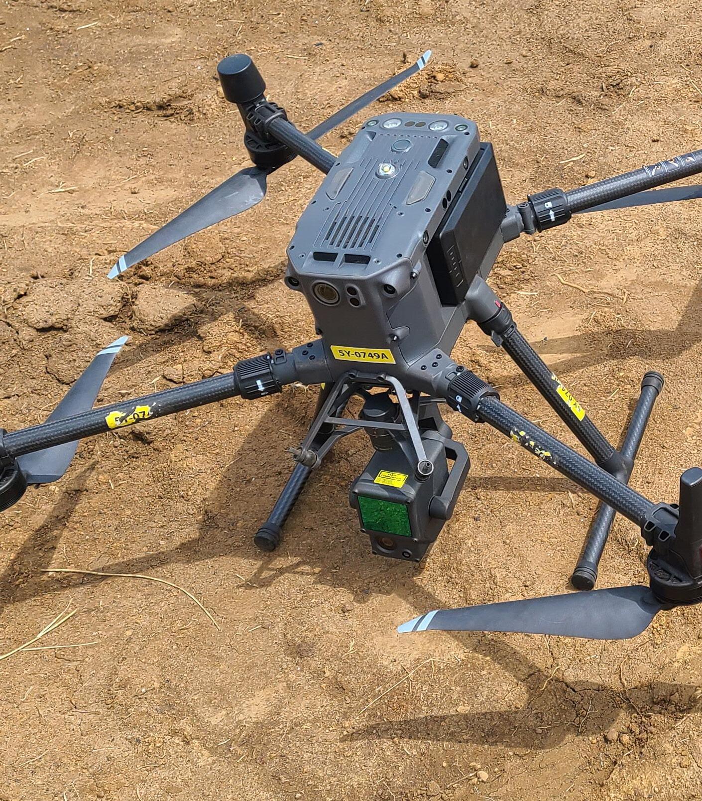
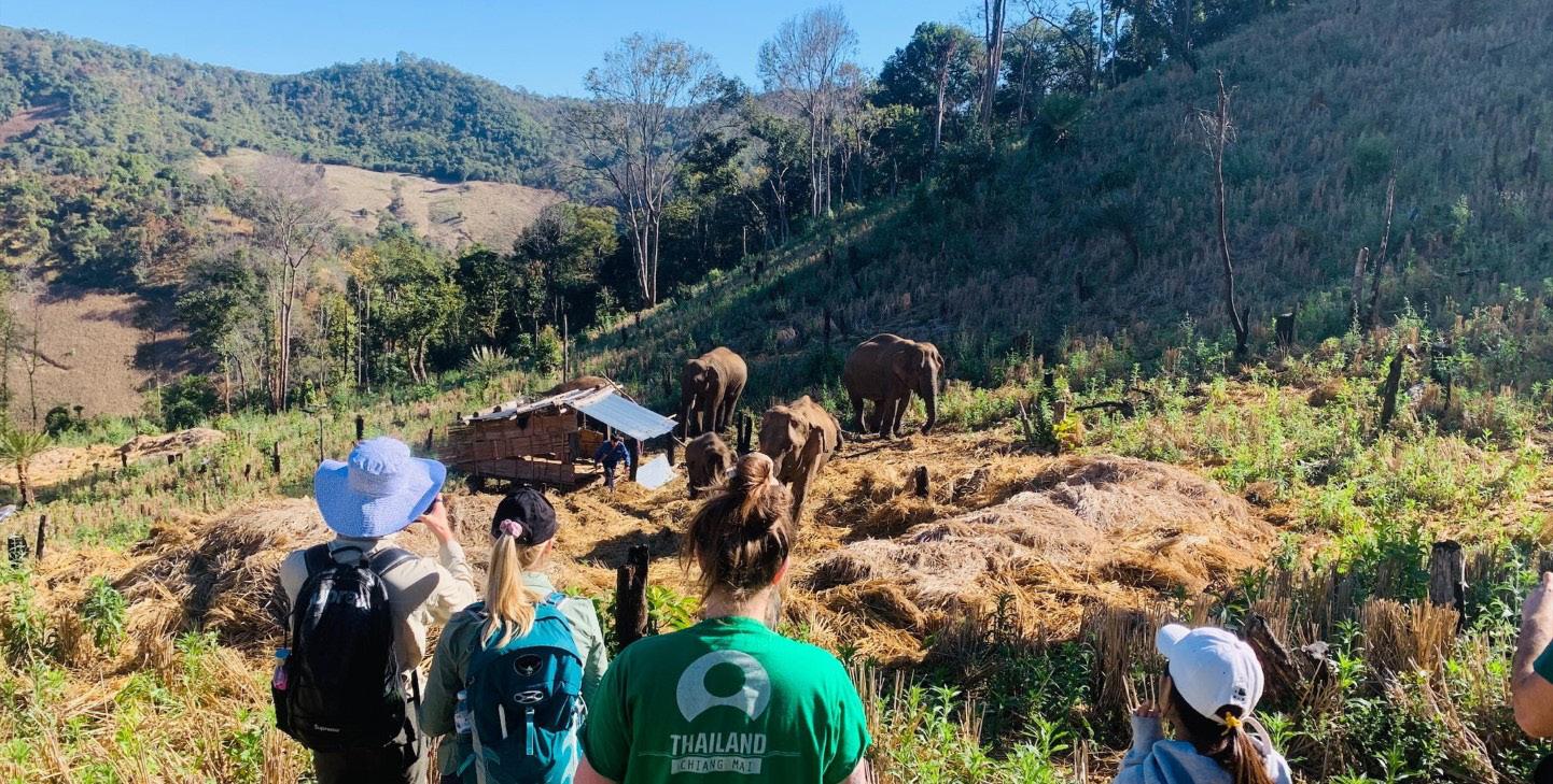
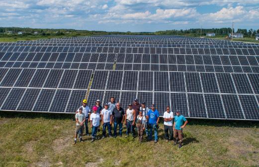
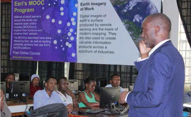
Afrospatial is driving a new era of innovation, reshaping how we understand and interact with the environment. At the forefront of this revolution is Skymap Africa, a trailblazer in delivering cuttingedge drone surveying solutions across the African continent. Through their expertise in topographical and bathymetric surveys, Skymap Africa is laying the foundation for sustainable development in energy, infrastructure, and beyond.
In a recent project spanning September to October 2024, Skymap Africa utilized state-of-the-art drone and LiDAR technology to survey three key sites in Gabon: Egoumbi, Irouba, and Boukondzo. The challenges of working in heavily forested terrains with dense undergrowth and thick canopies were no match for Skymap Africa’s innovative approach.
Employing LiDAR-equipped drones and Real-Time Kinematic (RTK) GNSS systems, the team captured highly accurate topographic and bathymetric data. These technologies enabled them to create detailed orthomosaics, digital terrain models (DTMs), and precise river cross-sections. Such data are vital for supporting small hydropower plant projects spearheaded by Hydroneo Engineering, an independent producer of clean energy in sub-Saharan Africa.
Skymap Africa’s staff implementing drone technology to capture data in the dense forests of Gabon.
Innovating African Infrastructure and Energy
The data collected by Skymap Africa is revolutionizing infrastructure planning and design. By providing actionable insights, the company empowers clients to make informed decisions. This Gabon project highlighted the company’s ability to operate efficiently in challenging conditions while maintaining unmatched precision.
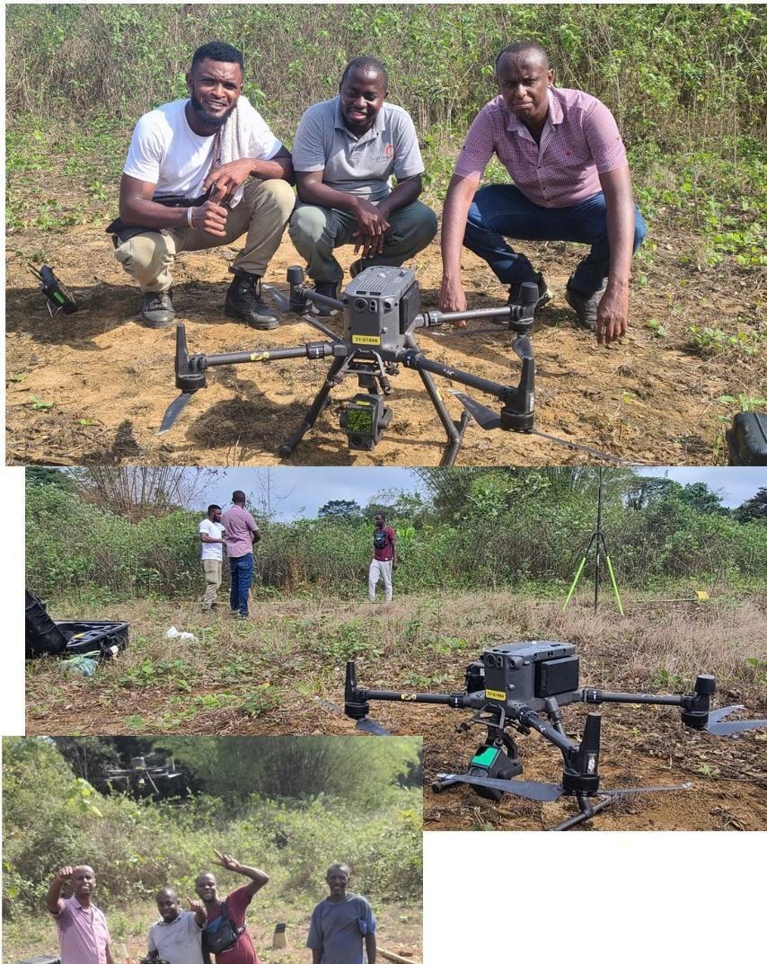
Key achievements of the project included the establishment of six geospatial benchmarks across the three sites, each calibrated with meticulous care using RTK/GNSS technology. These benchmarks ensure data consistency and accuracy for future engineering applications.
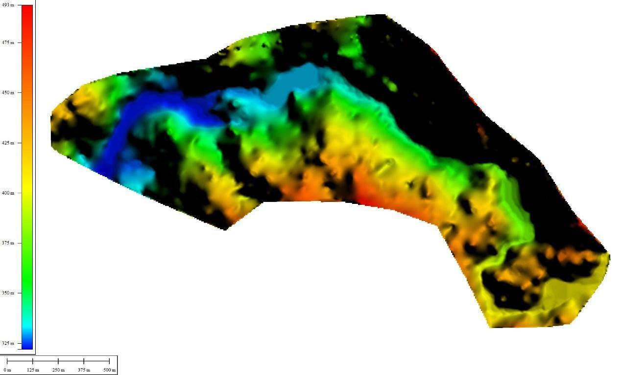
Digital Terrain Model generated from LiDAR data at Egoumbi site.
With a clear commitment to sustainability and innovation, Skymap Africa is not only a service provider but a catalyst for progress. The company’s
approach to drone surveying embodies its philosophy of proactive, effective, and efficient delivery.
From large-scale infrastructure to precision environmental mapping, Skymap Africa stands as a partner of choice for ambitious projects across Africa. Their solutions not only meet immediate client needs but also contribute to long-term environmental stewardship and economic growth.
As a leading drone surveying firm, Skymap Africa continues to set the gold standard in geospatial services. By harnessing advanced technologies and an unwavering dedication to quality, they transform complex geospatial challenges into practical, actionable solutions.
Contact Us Today
Roasters, Garden Estate -Thika Road, Nairobi, Kenya
Tel: +254 735 931 370
Email: info@skymap-geo.com
Visit: www.skymap-geo.com
I am a Geoinformatics graduate from the Technical University of Kenya, having completed my studies in November 2024. Over the years, I have gained hands-on experience in both the private sector and NGOs, with roles at GeoPsy Research, FAOUN, and the Kenya Red Cross Society.
My work spans several sectors, including humanitarian response, agriculture, biodiversity, disaster management, and environmental monitoring. In these roles, I have contributed to GIS and remote sensing projects that focus on creating actionable insights for pressing global challenges. Whether assessing flood risks, mapping agricultural systems, or supporting biodiversity initiatives, I have developed a strong expertise in leveraging geospatial technologies to drive informed decision-making.
I am also passionate about mentoring and empowering others. Through my involvement with YouthMappers, I have actively supported the growth and development of emerging GIS professionals by offering training and guidance. Sharing my knowledge and experiences with others has been one of the most rewarding aspects of my career, and I am committed to helping others grow in the geospatial field.
Driven by a deep interest in learning and contributing to sustainable development, I aim to continue applying my skills in ways that positively impact communities.
1. What sparked your interest in GIS, and how did you find your way into this field?
My journey into the geospatial field is quite an interesting story! After completing high school, I, like many others, wasn’t entirely sure what career path I wanted to follow. As kids, we dream about becoming doctors, civil engineers, lawyers, or pilots - roles that are often encouraged. However, no one ever mentioned the exciting possibilities within the geospatial field.
What I did know was my deep love for geography. I knew I wanted to pursue something connected to the earth or space. While selecting my course, a friend of mine— who was already at university—introduced me to GIS. He said, “There’s a course called GIS if you want to work with geography.” At the time, I didn’t fully understand what GIS entailed, but I was intrigued. I chose Geoinformatics at the Technical University of Kenya as part of my first selections, and luckily, I got in.
My passion for GIS truly ignited in my first year during the third semester, fueled by curiosity and mentorship. That mentorship, combined with my growing understanding of the endless possibilities GIS offers, from mapping and analysis to its impact in various industries—pushed me to dive deeper into the field. Looking back, I feel incredibly fortunate to have discovered a path that perfectly aligns with my love for geography and technology.
2. What’s been the most defining moment of your career so far?
For me, the most defining moment of my career has been the mentorship I’ve received, particularly from Dr. Francis Oloo, CEO of GeoPsy Research. He has been my mentor since my first year in university, and his guidance has significantly shaped my career trajectory.
Through his mentorship, I’ve had numerous defining experiences. In my second year, he allowed me to spend time at GeoPsy offices, where I was entrusted with tasks that built my technical skills and professional confidence. I learned to create maps, explored geospatial coding, and was introduced to tools like QGIS, R, and Google Earth Engine—skills that continue to be invaluable in my career.
This mentorship not only gave me technical expertise but also exposed me to the professional world early on. It opened doors for impactful projects with organizations like the Food and Agriculture Organization of the United Nations and the Kenya Red Cross Society.
Mentorship has been a cornerstone of my journey, transforming my passion for geospatial technology into meaningful contributions and reaffirming my commitment to mentoring others as I grow in this field.
3.If you could give one piece of advice to your younger self just starting out in GIS, what would it be?
I would tell my younger self, “Passion is everything. Once you identify what you truly want to do, you become unstoppable.” GIS is a dynamic and ever evolving field and having a clear sense of purpose will give you the drive to overcome any challenges that come your way.
Don’t be afraid to seek out new opportunities and take risks. Surround yourself with people who inspire you and from whom you can learn— mentors, colleagues, and peers who will challenge and encourage you to grow.
Be open to learning and embrace change, especially as technology advances. The tools and techniques in GIS evolve rapidly and staying curious and adaptable will keep you ahead. Whether it’s mastering new software, exploring coding, or applying GIS to emerging fields, always be willing to push your
Finally, remember that growth is a journey, and every small step counts. Celebrate your milestones, no matter how small, and always keep your passion alive. With determination and a willingness to learn, there’s nothing you can’t achieve in this field.
4. What does a typical day look like for you in your current role?
A typical day for me involves a lot of time in front of my laptop screen, switching between various platforms and tools. I start my day by checking emails and reviewing client feedback, which often helps me prioritize tasks and improve the output I’m working on. I spend a lot of time bouncing between Google Earth Engine, Google Drive, QGIS, and R— whether I’m analyzing spatial data, debugging code, or creating maps.
I’m constantly problem-solving and refining my work, especially when I’m troubleshooting code or adjusting a map to better align with client needs. I also have video conferences with clients to understand their requirements more deeply, gather feedback, and discuss ways to improve the results.
Throughout the day, there’s always room for learning, whether it’s trying out new techniques, discovering better ways to approach problems, or improving my coding skills. Each day brings a mix of technical challenges, collaboration, and continuous growth.
1. How do you see the role of GIS evolving in addressing global challenges such as climate change and urbanization?
The role of GIS in addressing global challenges like climate change and urbanization is rapidly evolving, and I believe it will continue to play a crucial role in shaping how we understand and respond to these issues.
In the context of climate change, GIS provides powerful tools for monitoring environmental changes over time, assessing vulnerability, and modeling future scenarios. The ability to analyze and visualize spatial data—whether it’s from satellite imagery, climate models, or ground observations— allows us to track critical factors like temperature changes, sea level rise, and deforestation. GIS helps identify areas most at risk, supporting more
effective disaster planning, mitigation efforts, and adaptation strategies. As technology continues to advance, the integration of real-time data, such as climate monitoring sensors and remote sensing, will further enhance the precision and timeliness of climate-related decisions.
Urbanization, on the other hand, presents challenges around land use, infrastructure, and resource management. GIS enables better planning and management of urban growth by offering tools for spatial analysis, zoning, and optimizing infrastructure development. With urbanization often leading to the depletion of natural resources and increased pollution, GIS helps planners design sustainable cities by mapping green spaces, managing waste, and ensuring efficient public services.
As both of these global challenges continue to evolve, GIS will become even more integrated with other technologies such as artificial intelligence, machine learning, and the Internet of Things (IoT). These integrations will allow for more predictive modeling, real-time analysis, and smarter decisionmaking.
Overall, the role of GIS will only grow in importance, not only as a tool for understanding these global challenges but also as a foundation for proactive solutions and policy-making that will help shape a more sustainable and resilient future.
2. What do you think are the must-have skills for someone looking to thrive in the GIS industry?
To succeed in the GIS industry, one must go beyond traditional GIS tools and embrace the skills that set professionals apart, especially as the field continues to evolve. Some of these skills include:
Coding Skills : With more professionals in fields like environmental science, urban planning, and education being able to use traditional GIS software, coding skills have become a gamechanger. Proficiency in languages like Python or R is essential for automating tasks, manipulating large datasets, and performing more advanced spatial analyses. Learning to code allows GIS professionals to customize tools, integrate multiple datasets, and streamline workflows, making them more efficient and adaptable in an increasingly data-driven world.
Adaptability and Continuous Learning : Given how quickly GIS technologies and methodologies evolve, professionals must stay committed to learning and adapting. Keeping up with new tools, coding libraries, and technological trends will ensure that GIS experts remain at the cutting edge of the industry.
Effective Communication : Being able to communicate complex GIS analyses in a way that’s clear and actionable for non-technical stakeholders is a crucial skill. GIS professionals need to create visualizations and reports that can inform decisionmaking across different sectors.
3. Can you share a GIS project you’ve worked on that had a significant real-world impact?
One of the most impactful GIS projects I have worked on was during the 2024 March-AprilMay long rainy seasons, when devastating floods affected most parts of Kenya, as well as many regions globally. Under the supervision of Boneya Hassan, the GIS officer at Kenya Red Cross, I contributed to flood assessments during the long rainy seasons in Kenya. My role involved producing real-time flood extent maps and statistics, which were shared on social media platforms like Twitter to keep the public updated on the ongoing flood situation.
Using remote sensing data, particularly Sentinel-2 imagery, we were able to identify flood-prone areas and assess the severity of flooding in Garissa, Kisumu, and Kilifi Counties among others.
These maps were not only important for public awareness but also for coordinating emergency response efforts. Additionally, I created dashboards that provided insights into the flood impacts, enabling decision-makers and stakeholders to take informed actions.
This project highlighted the power of GIS in disaster response and its ability to support both real-time communication and long-term planning. It was incredibly rewarding to see how GIS can have a tangible impact on people’s lives, especially in terms of safety and preparedness during natural disasters.
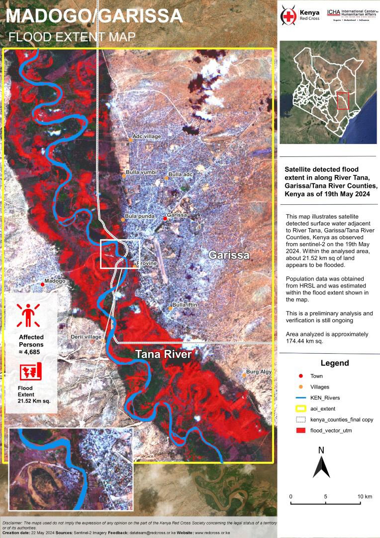
4. In your opinion, what’s the most exciting innovation happening in the GIS world right now?
One of the most exciting innovations in GIS is the integration of Big Data with Machine Learning. With cloud computing, we can now store and analyze vast datasets for predictive modeling, pattern recognition, and real-time decision-making.
For example, combining historical flooding data with machine learning can accurately predict future flood risks, aiding disaster management.
Another groundbreaking development is the use of Virtual Reality (VR) and Augmented Reality (AR). VR enables immersive 3D environments for urban planning and infrastructure management, while AR overlays digital information on physical environments, enhancing real-world interactions in sectors like construction, navigation, and tourism. These technologies—Big Data, Machine Learning,
VR, and AR—are revolutionizing GIS, creating more interactive, real-time, and predictive systems for addressing global challenges.
1.What drew you to work with OpenStreetMap, and what has been your favorite part of the journey so far?
What drew me to OpenStreetMap (OSM) was my involvement with YouthMappers, where I discovered the power of community involvement, open mapping, and crowdsourced data. I was fascinated by how OSM enables individuals to contribute to mapping efforts, making valuable geospatial information accessible to all.
My favorite part of the journey has been offering training on OSM to students. I had the privilege of leading the first-ever OSM training at the Technical University of Kenya in collaboration with Laura Mugeha and conducted the first mapathon at Dedan Kimathi University. Being part of empowering others with mapping skills and seeing their enthusiasm for OSM has been incredibly fulfilling.
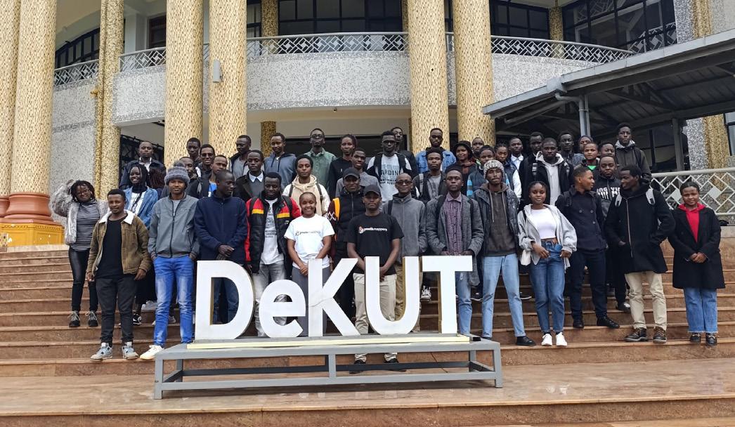
2. How does OSM enable collaboration across such a diverse and global community?
OpenStreetMap (OSM) enables collaboration across a diverse and global community by providing an open, accessible platform where anyone, anywhere, can contribute to mapping efforts. Its open data model allows users to edit and update maps freely, ensuring that the information remains current and relevant. The collaborative nature of OSM fosters connections between mappers from different regions, backgrounds, and expertise, encouraging
knowledge-sharing and collective problem-solving. This global community-driven approach helps address a wide range of issues, from disaster response and humanitarian aid to urban planning and environmental monitoring, making geospatial data more accessible and impactful for everyone.
3. What’s the most rewarding project you’ve been a part of at OSM?
County would provide valuable data to support flood risk management, humanitarian efforts, and sustainable development in this underserved area.
It could also empower local communities and decision-makers to plan and implement strategies that would help mitigate the devastating effects of floods.
1. Paper maps or digital maps?
Digital maps
2. Favorite GIS tool or software? Desktop software- QGIS Language- R Cloud based platform- Google Earth Engine
3. Your go-to snack while working late on a mapping project?
Chocolate and sweets
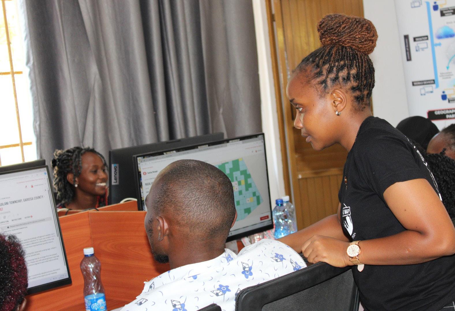
The most rewarding project I’ve been a part of at OSM was training students from Garissa University through the OSM Kenya Community partnership with Mercy Corps. It was fascinating to train students from diverse backgrounds, such as Actuarial Science, Education, HR, and Computer Science, who had no prior geospatial knowledge. Their enthusiasm and willingness to learn about OSM were incredibly encouraging, and seeing their interest grow throughout the training was truly rewarding. It highlighted the power of open mapping and how it can engage individuals from various fields to contribute to important geospatial initiatives.
4. Dream place to travel for a mapping expedition? I would love to go back to Thailand
5. One word to describe your work with OSM? Passion
6. Favorite time of day to work: morning, afternoon, or late night? Late night
4. If you had the chance to map a completely untouched region, where would it be, and why?
If I had the chance to map a completely untouched region in Kenya, I would choose Garissa County. Having been involved in flood assessments there, I saw firsthand how vulnerable the area is to frequent floods, which have a significant impact on the local population. The region is marginalized, with limited access to crucial data, making it difficult to address these challenges effectively. Comprehensive mapping of Garissa
L O B A L P O S I T I O N I N G S Y S T E M R N T F N F W D P I X E L S N D S P A T I A L L G Z U T P J M M Y U A X X V F E
global positioning system data manipulation data intergration thermatic layers satellite image remote sensing georeferencing buffer zone
Across
2 Longitude – The East/West component of a location on the Earth's surface
Resolution
Attributes buffering spheroid polygon overlay feature Spatial raster vector pixels point node line data
3 Base Map – A map containing geographic features used for reference (e g , roads)
4 Vector Data – Data type represented as x-y coordinates in the form of points, lines, or polygons
5 Spatial Analysis – The process of identifying a question, modeling, interpreting, and making recommendations
6 Latitude – The North/South component of a location on the surface of an ellipsoid
7 Geodetic Datum – A set of parameters used to define the Earth's three-dimensional shape
Create your own puzzle at WordMint.com or print one of our 500,000+ pre-made word searches, crosswords, and more.
8 Geocoding – The process of identifying coordinates based on an address
Down
1 Metadata – Data about the content, quality, and characteristics of data
2 Equator – The parallel of reference at 0° North or South
3 Attribute – A characteristic of a feature in a GIS
4 Azimuth – The horizontal direction of a vector, measured clockwise in degrees
5 Feature – A physical object or location of an event in GIS (e g , points, lines, or areas)
6 Landsat – A series of satellites that produce images of the Earth
7 Raster – A cellular data structure composed of rows and columns for storing images

Advertise with us!
Dont have a ready ad, worry not we will design your ad cost free!
Elevate your brand to new heights by aligning with Afrospatial Magazine, your gateway to the pulse of geomatics innovation worldwide! We are offering special advertising packages designed to boost your company’s visibility. Act now to unlock unique opportunities and connect with the global geospatial community. Contact us today! +254 741 609234 or email us on marketing@afrospatial.com