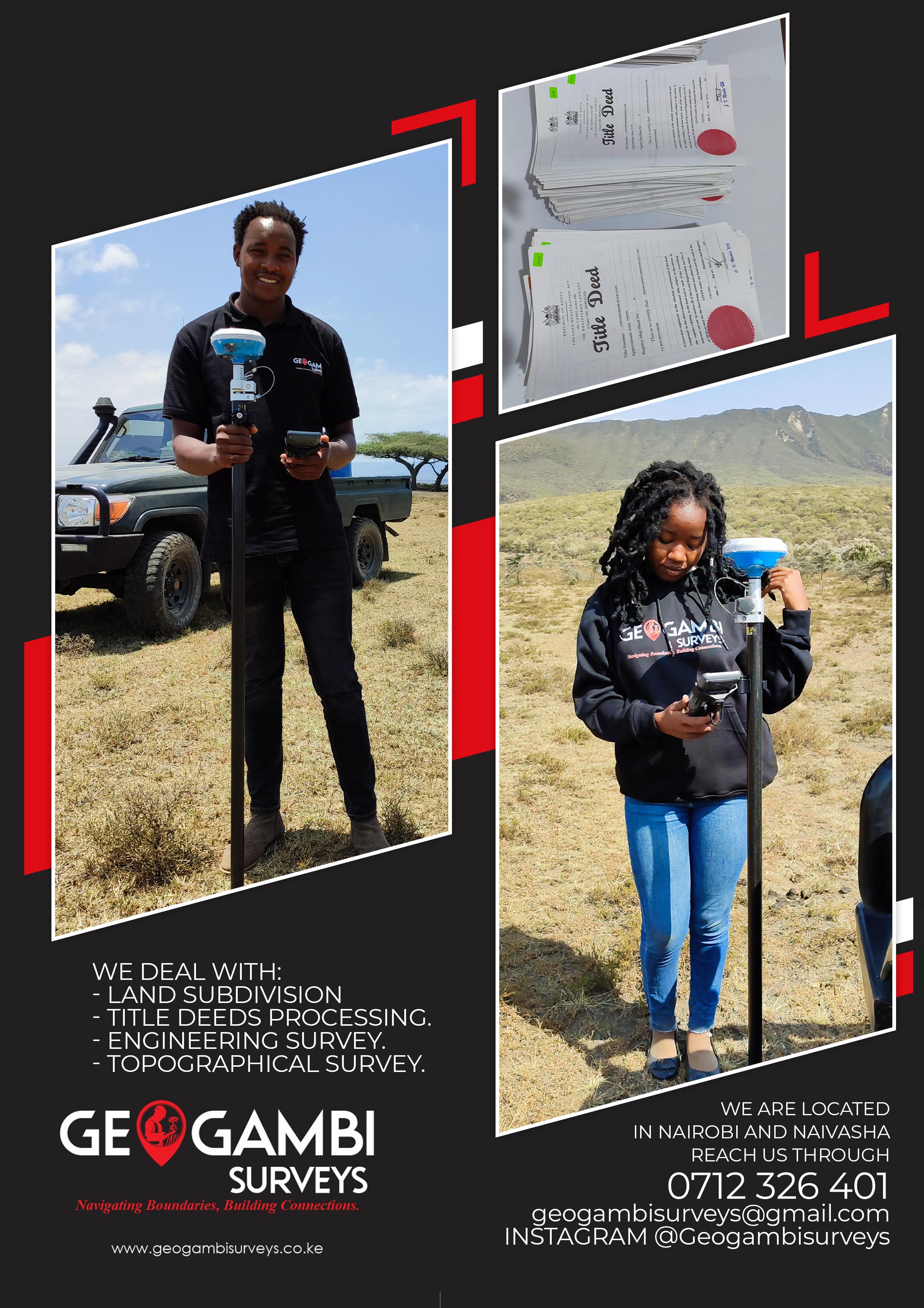
Features
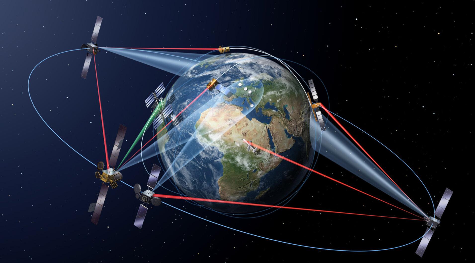
LiDAR Data Acquisition: Comparing DroneBased and Aerial LiDAR Technologies
Harnessing AI and Machine Learning in GIS for Illegal Logging Detection


LiDAR Data Acquisition: Comparing DroneBased and Aerial LiDAR Technologies
Harnessing AI and Machine Learning in GIS for Illegal Logging Detection
The Ethical Dilemmas of Remote Sensing: Privacy, Security, and Accessibility Pg18
Pg19


EXECUTIVE EDITOR
Prof. Gordon Wayumba
HEAD OF CONTENT
William Kiarie
CONTRIBUTING EDITORS
Sharon Kivuva
Patricia Sila
Karen Muchiri
Grace Njeri
Gerald Nyanjua
The magazine and related website provide topical overviews and reports on the latest news, trends and developments in geomatics all around the world. Afrospatial is orientated towards a professional and managerial readership, those leading decision making, and has a worldwide circulation.
Subscriptions
Afrospatial is available six times per year on a subscription basis. Geospatial professionals can subscribe at any time via https://www.afrospatial.com/subs
Subscriptions will be automatically renewed upon expiry, unless Afrospatial receives written notification of cancellation at least 60 days before expiry date.
Advertisements
Information about advertising and deadlines are available in the Media Kit. For more information please contact our marketing advisor: marketing@afrospatial.com
No material may be reproduced in whole or in part without written permission of Afrospatial.
Copyright © 2024,
LiDAR Data Acquisition: Comparing Drone-Based and Aerial LiDAR Technologies - Pg 4
Earth Observation in Managing Natural Resources: Sustainable Resource Management in Africa Pg 7
Harnessing AI and Machine Learning in GIS for Illegal Logging Detection- Pg 11
Geo YouthMappers Supporting Marginalized Refugee Communities Through Mapping of WASH Facilities Pg 14
Welcome to the latest edition of AfroSpatial Magazine, where we continue to explore the everevolving world of geospatial science, urban development, and innovation. This issue brings together a diverse range of stories, insights, and expert analyses, reflecting the dynamic nature of our industry.
Our feature article, The Missing Balconies: A Critique of Kenya’s Affordable Housing Projects, takes a deep dive into the challenges of sustainable development in urban planning.
The Ethical Dilemmas of Remote Sensing: Privacy, Security, and Accessibility- Pg 18
The Missing Balconies: A Critique of Kenya’s Affordable Housing Projects Pg 19
Thematic Area: 3D Mapping and Virtual Tours: Transforming Spatial Understanding Pg 25
Spatial Data Infrastructures (SDI) for an Integrated System Pg 33
Latest News In GIS Pg 35
Careers Pg 38
Beyond this, we bring you the latest news shaping the geospatial landscape, indepth interviews with industry experts, and thought-provoking discussions on topics such as land surveying, remote sensing, and GIS applications. Whether you’re a professional in the field, a policymaker, or simply someone passionate about the intersection of technology and development, there’s something for you in this issue.
As governments and developers push forward with largescale housing initiatives, the question of sustainabilityboth environmental and social - remains critical. This piece examines the gaps in current projects and proposes ways to create more livable, inclusive, and future-proof urban spaces.
As always, we invite you to engage with us, share your thoughts, and even contribute to future editions. The geospatial field thrives on collaboration and shared knowledge, and AfroSpatial Magazine remains committed to being a platform for these conversations.
Happy reading!

By Sharon Kivuva
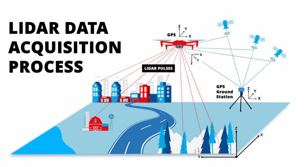
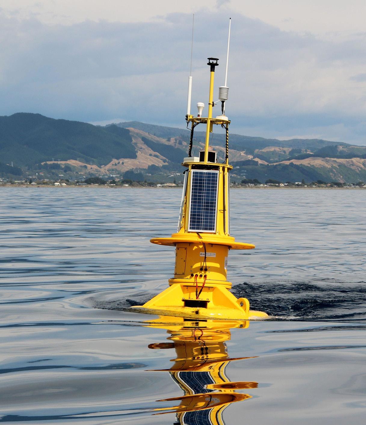
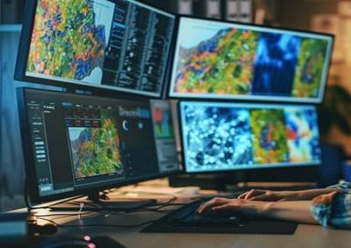
Light Detection and Ranging (LiDAR) has revolutionized geospatial data acquisition by enabling the creation of high-resolution topographic models. This paper compares drone-based and aerial LiDAR technologies, focusing on their technical processes, point cloud data characteristics, and efficiency in surveying a 1000-acre land area. This study evaluates the time, manpower, processing requirements, and cost-effectiveness of both approaches. Ramani Geosystems’ expertise in LiDAR applications highlights the best solutions for different project scales, showcasing its advanced drone and aerial LiDAR capabilities.
LiDAR is a remote sensing technology that uses laser pulses to measure distances and generate precise 3D models of terrain and structures. As the demand for accurate geospatial data grows, two primary platforms have emerged: dronebased LiDAR and aerial LiDAR (manned aircraft). While both methods offer unique advantages, selecting the right technology depends on project size, accuracy requirements, cost, and operational constraints.
Technical Process: Drone-Based vs. Aerial LiDAR
Drones equipped with LiDAR sensors fly at low altitudes, capturing highly detailed terrain features with superior ground point density. The process involves:
Flight Planning: Optimized flight paths ensure complete coverage with minimal gaps.
LiDAR Scanning: A high-frequency laser sensor emits pulses and measures their return time for precise elevation mapping.
GNSS/IMU Integration: Ensures accurate georeferencing and positional accuracy.
Post-Processing: Data undergoes noise filtering, classification, and Digital Terrain Model (DTM) generation. Advanced software refines point clouds for highly accurate deliverables.
Ramani Geosystems employs the DJI L1 for LiDAR and imagery mapping, mounted on the DJI Matrice 300 RTK, which ensures precision through its dedicated DRTK system. The Matrice 300 RTK offers stability, extended flight time, and high payload capacity, making it an excellent platform for capturing high-density point cloud data in complex terrains. Additionally, Ramani Geosystems is in the process of acquiring the latest DJI Matrice 350 RTK to further enhance operational efficiency and accuracy.
maps, and vegetation analysis.
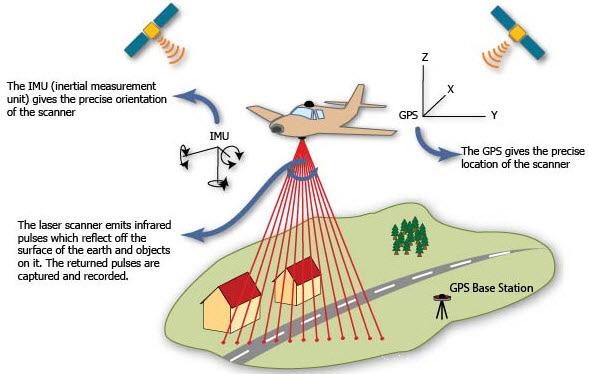
Ramani Geosystems’ Air Operations division carries out all data acquisition through aerial photography and LiDAR surveys. Ramani owns and operate the Cessna 182 which has high endurance and is specially adapted for aerial survey operations. Operating under its own Air Operators Certificate (AOC), Ramani ensures compliance with international aviation requirements and maintains strict maintenance schedules for our aircraft. The aerial team consists of two full-time pilots and two sensor operators, ensuring smooth and efficient data collection.
To undertake aerial photography surveys, Ramani operates a variety of high-end sensors, including the Ultra Cam X and Phase One aerial cameras. Additionally, the integrated Leica ALS60 and RCD30 system allow Ramani to collect high-quality photography and airborne LiDAR simultaneously, streamlining workflows and enhancing data accuracy.
Manned aircraft-mounted LiDAR covers vast areas efficiently, making it ideal for large-scale projects. The workflow includes:
Pre-Survey Planning : Determines flight altitude, speed, and sensor parameters based on project requirements.
Data Acquisition : High-altitude scanning ensures comprehensive regional coverage while maintaining accuracy.
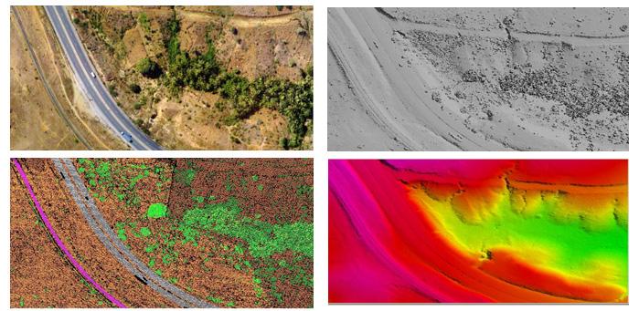
Point Cloud Processing : Generates classified outputs like Digital Elevation Models (DEM), contour
Figure 1: Ramani Road Mapping Using Aerial Photography and Lidar - Aerial Image, Classified LiDAR Points, Digital Surface Model (DSM) & Digital Terrain Model (DTM)
Drone LiDAR generates high-density point clouds, capturing fine details such as vegetation penetration, small structural features, and highprecision ground elevation models. Aerial LiDAR, though less dense, excels in covering large expanses efficiently, making it suitable for broad-scale mapping applications, such as hydrological studies, transportation planning, and regional topographic modelling.
Case Study: 1000-Acre Land Survey
Drone LiDAR Analysis
Time Required : 3-5 days (including flight and processing).
Manpower : 3-5 operators, including UAV pilots and data analysts.
Processing : High-resolution point clouds require intensive computation but yield detailed Digital Surface Models (DSMs) and DTMs.
Cost: More economical for small-to-medium projects with high-detail requirements.
Best Suited For: Detailed terrain analysis, vegetation mapping, and construction site monitoring.
Time Required : 1 day for data collection, 3-4 days for processing.
Manpower : Pilot, sensor operator, and analysts.
Processing : Lower point density but highly efficient
for large-scale mapping.
Cost: Higher due to aircraft operation expenses but more effective for expansive surveys.
Best Suited For: Regional planning, infrastructure development, and floodplain analysis.
Conclusion: Choosing the Right LiDAR Solution
For high-detail, small-area surveys, drone LiDAR is ideal. For large-scale, rapid data acquisition, aerial LiDAR is more efficient. Ramani Geosystems leverages both technologies, ensuring precise, scalable, and cost-effective mapping solutions. By integrating the latest LiDAR sensors, advanced processing techniques, and a highly skilled team, Ramani Geosystems continues to set new benchmarks in geospatial data acquisition, delivering customized solutions tailored to diverse industry needs.
By Patricia Sila
Earth Observation (E.O.) is a vital remote sensing technology whose potential has yet to be fully harnessed in Africa. For decades now, we have appreciated the convenience of capturing moments with a single camera snapshot and preserving images to reminisce on in the future.
Similarly, Earth Observation (E.O.) involves ‘taking photos’ of the earth to gather and store information about the earth’s surface, water, and atmosphere. E.O. might be the key to addressing many of Africa’s challenges, including managing natural resources like forests, oceans and mineral sites. E.O. provides reliable and relevant data for informed decision-making that will impact our present and future generations.
Satellites in space are the primary tools for E.O. They are equipped with sensors (cameras) that capture all that is on land. Satellite images are rich in data which is translated into information through appropriate analysis. The data can be complex and requires ample and robust storage and computational capabilities, which have been eased by Cloud technology.
Satellite data is encrypted with metadata such as the satellite source, date captured, and
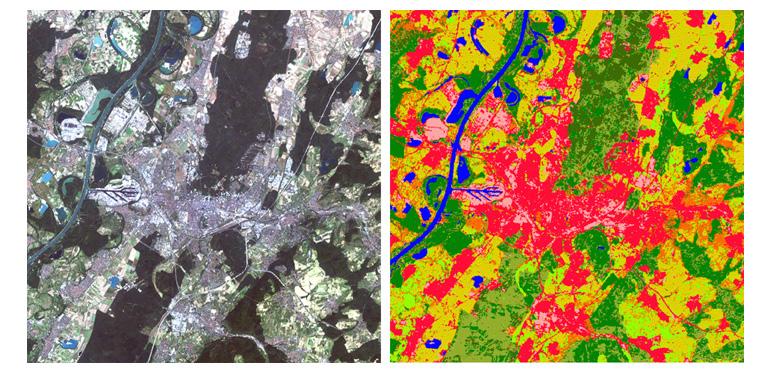
cloud cover. Most images are preprocessed and corrected for atmospheric conditions like haze for efficient processing. One component of the imagery that makes analysis possible is their band characteristic. Spectral bands are the various wavelength ranges that the sensor captures from the land, water and atmosphere.
There are black-and-white (panchromatic) images or multi-coloured (multi or hyper-spectral), depending on the intended purpose. The data is also captured in intervals, making it ideal for creating time series for comparisons. This property makes E.O. suitable to accurately track changes in our forests, water bodies, and land use.
Looking at forest conservation and management, we can highlight forested areas by combining specific band combinations. This is made possible
by surface reflectance, whereby the light bouncing off a forested area differs from that of water. The image pixel values vary due to the electromagnetic radiation captured from different surfaces and their unique spectral signatures. It is crucial to know where all the forests are. Keeping an eye on the extent of forest cover over time will establish if forests are declining and the plausible causes like human settlement.
Furthermore, the analysis can distinguish between healthy and distressed vegetation. This technology also applies in agriculture to nurture crops towards achieving food security.
E.O is the most efficient way to monitor oceans, rivers and other water bodies. With the sprawling of urban areas, people are moving closer to river banks and encroaching on natural habitats. We can compare present and past satellite images to establish how much our water bodies have reduced in size. The water quality can also be analysed to determine its safety and establish contributing factors since we can see everything on the image.
We can utilize E.O. for water security by detecting potential water reserves, incorporating it with geology and hydrological surveys. Various computer
algorithms are used for image classification, change detection and other analysis to get quantitative data such as supervised classification. E.O is integrated with data science for analysis and visualization, as well as Big Data and Machine Learning to process and analyse large datasets.
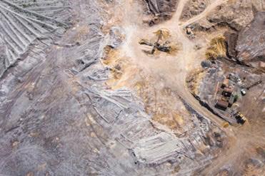
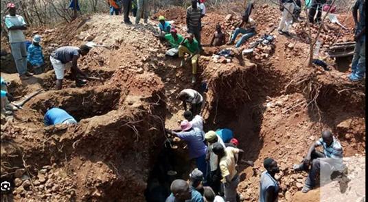
Mineral sites can be managed and regulated using E.O by utilizing time-series satellite images to observe mining activities and how they affect the environment. Unregulated mining causes severe damage to the land and environment from the blasting, explosions, and chemical emissions.
E.O can detect illegal mines, which can be investigated for unsafe working conditions and potential human exploitation. Indiscriminate mining leads to habitat loss for other species and loss of agricultural land, forests, and water bodies. Water pollution by mining waste and heavy metals as well as air pollution attributed to chemical gases have dire consequences to the surrounding community such as respiratory infections. Nevertheless, E.O. is an indispensable resource for mineral explorations and the discovery of potential mining sites.
Africa is rich in biodiversity and has an abundance of natural resources. We must protect and manage these resources through dealing with urban sprawls, deforestation, water contamination. This will curve a path towards sustainable development as Africa blossoms into a developed continent. It is the right time to preserve our environment before urbanization and unregulated industrialization takes over natural spaces.
E.O also contributes to achieving the Sustainable Development Goals (SDGs)
such as Zero hunger, Clean water and sanitation, Life below water and Life on land. To reach the true potential of E.O, there has to be funding and support from the government as well as collaborations with NGOs and private consultants.
Earth observation (E.O.) is the future for efficient resource management. Its capability to capture tracts of land at a go, with properties that enable geospatial analysis is an invaluable asset. Currently, we have infrastructures such as Digital Earth Africa (DEA) that provide Africa’s satellite data and computing capacity to analyse and get information from the datasets.
The Open Data Cube (ODC) technology employed by DEA is revolutionary, providing geospatial data with cloud computing and an open-source concept that makes the data readily available. This means that one can apply their algorithms to generate relevant information, trends, and findings from that data.
However, we also need to build our human capacity of geospatial analysts who can analyse and extract valuable insights. We need to strengthen our satellite imagery repository to have sufficient, up to date, and high-quality data that provides insights for effective land and water management.
By Grace Njeri
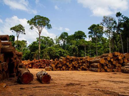
Illegal logging poses a serious threat to global biodiversity, climate stability, and economic development. In Kenya, deforestation leads to severe soil erosion, loss of wildlife habitats, and reduced carbon sequestration capacity. Traditional methods of monitoring forest degradation, such as manual patrols and aerial surveys, are often costly and inefficient.
The integration of Artificial Intelligence (AI) and Machine Learning (ML) in Geographic Information Systems (GIS) has revolutionized forest conservation. These technologies utilize satellite imagery, drone surveillance, and predictive analytics to enhance real-time monitoring and detection of illegal logging activities.
By leveraging AI-driven GIS solutions, enforcement agencies can swiftly identify deforestation hotspots, take immediate action, and implement sustainable forest management practices.
How AI and ML Enhance Geographic Information
AI and ML models process vast geospatial data from satellites, drones, and ground sensors. These algorithms classify land cover changes, detect human activities in protected areas, and differentiate between legal and illegal deforestation. Deep learning techniques, such as convolutional neural networks (CNNs), enhance detection accuracy by identifying patterns in forest degradation.
Satellite imagery offers a broad perspective on forest conditions, while drones capture highresolution images of logging sites. Remote sensing technologies, such as Light Detection and Ranging (LiDAR) and Synthetic Aperture Radar (SAR), improve monitoring by detecting changes in forest density and canopy structure. AI models analyze these datasets, predict logging activities,
and generate real-time alerts for conservation authorities.
AI models analyze historical data to forecast potential illegal logging hotspots. By assessing environmental variables such as road networks, land ownership, and economic factors, ML algorithms predict where deforestation is most likely to occur. This proactive approach enables policymakers to implement preventive measures and allocate resources effectively.
Global Forest Watch (GFW) is an AI-powered remote sensing platform that provides real-time forest cover monitoring worldwide. It integrates NASA’s satellite data with cloud computing and AI algorithms to detect locations of recent tree cover loss.
GFW has identified deforestation hotspots in the Amazon, Southeast Asia, and Africa. By providing open-access geospatial data, it has helped governments, NGOs, and researchers to manage and conserve forest landscapes.
2. Rainforest Connection (Amazon Rainforest, Brazil)
Rainforest Connection (RFC) utilizes acoustic monitoring devices and AI to detect chainsaw sounds in protected forest areas. These solar-

powered devices transmit real-time data to cloudbased AI models, which analyze audio signals and generate alerts for enforcement agencies.
RFC has reduced illegal logging in the Amazon by enabling rapid intervention. Its success has led to its adoption in other tropical forests worldwide.
3. SMART (Spatial Monitoring and Reporting Tool) (Southeast Asia and Africa)
SMART is a GIS-based conservation tool that uses AI-driven analytics for patrol planning and illegal activity mapping. It integrates satellite imagery, field data, and predictive models to improve enforcement efficiency.
By analyzing ranger patrol data, SMART has enhanced forest protection efforts in Indonesia, Cameroon, and the Democratic Republic of the Congo. The AI-driven system has contributed to a measurable decline in illegal logging incidents.
4. M-Situ AI Forest Watch (Kenya)
M-Situ AI Forest Watch is a Kenyan initiative founded in 2023 by Joseph Nguthiru and Sam Okemwa. The system was piloted in Ngong Forest, where the AI-powered devices were strategically
placed to monitor high-risk areas. It employs solarpowered sensors mounted on trees to collect realtime data on environmental parameters like noise, gases, temperature, and humidity.
The sensor data is transmitted to the cloud where powerful AI algorithms analyze it for anomalies. These algorithms are pre-trained to identify distinct signatures of environmental threats, including wildfire gases indicative of potential fire outbreaks, chainsaw noises associated with illegal logging activities, and unique patterns linked to charcoal production.
Upon detecting a threat, the AI sends real-time alerts the to Kenya Forest Service(KFS) rangers via SMS and M-Situ’s web portal, enabling rapid response to illegal logging incidents. The SMS notifications contain noise intensity levels and the probability percentage of a forest fire or logging event. The web portal notification provides the exact coordinates of the threat.
The M-Situ platform also provides conservation authorities, such as park rangers and environmental agencies with access to a real-time dashboard and historical data analysis. This empowers them with insights for long-term planning and targeted deployment of resources.
The deployment of M-Situ AI Forest Watch significantly reduced illegal logging activities in Ngong Forest. With faster response times, enforcement teams arrested offenders and confiscated illegally harvested timber. The system also enhanced community engagement by providing real-time deforestation data.
Many AI models require high-resolution satellite images and extensive ground truth data. However, access to such datasets is often limited due to costs and restrictive policies.
AI algorithms may produce false positives or miss subtle deforestation activities. Continuous model training and validation are necessary to improve accuracy and reliability.
Implementing AI-driven GIS solutions requires significant investment in infrastructure and skilled personnel. Many developing countries lack the technical expertise to implement and maintain these systems.
The use of AI and GIS in forest conservation must align with legal frameworks and land tenure policies. In some cases, unclear regulations hinders the adoption of these technologies.
New deep learning models, such as Generative Adversarial Networks (GANs) and Transformerbased AI, are improving deforestation detection. These innovations will further enhance real-time monitoring accuracy.
AI-driven GIS solutions are expanding globally. More countries are adopting these technologies to strengthen forest governance.
Strengthening Collaboration Between Governments, NGOs, and Tech Companies
Public-private partnerships play a key role in developing cost-effective AI solutions for forest conservation. Collaboration with international organizations will help bridge technological and financial gaps.
AI and GIS integration is transforming illegal logging detection by providing real-time, datadriven insights. Case studies such as Global Forest Watch, Rainforest Connection, SMART, and M-Situ AI Forest Watch demonstrate the effectiveness of AI-powered solutions in forest conservation.
Despite challenges such as data accessibility, model accuracy, and policy constraints, AI and ML continue to enhance forest monitoring. Collaboration between governments, NGOs, and technology firms will be crucial in expanding these solutions worldwide.
Adopting AI-driven GIS technologies offers a sustainable path for preserving forests, combating climate change, and ensuring ecological integrity for future generations.
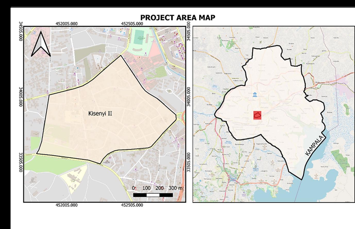
Access to safe drinking water and sanitation is a necessity, and thus a human right essential to everyone’s dignity and safety. Safe drinking water, adequate sanitation, and basic hygiene can improve health, lower mortality rates, and increase work and educational achievements. As part of their fieldwork program, YouthMappers provided micro-grants to their chapters to help communities.
In line with this, the Makerere University Chapter of Geo YouthMappers completed a project titled “Innovative Field Mapping of Health Vulnerability in Marginalized Kampala Refugee Communities - Reproducing Ramani Huria Field Data Model in Water and Sanitation Mapping.” The goal of this project was to increase the availability of high-quality data and analytical resources to help with future planning and prioritization of water, sanitation, and poverty reduction efforts. This was accomplished by employing mobile GIS techniques to collect and modify OpenStreetMap data with a focus on WASH facilities. The project was carried out in Kisenyi II Parish, which is located in Kampala’s Central Business District
and is considered one of the city’s largest refugee settlements, populated primarily by Somalis and a few Karamojong’s.
Throughout the project’s six (6) month duration, 40 students—20 males and 20 females—were trained in topics such as WASH systems, mobile GIS techniques, particularly Kobo Collect, and the use of OSM in humanitarian efforts, among others, from which a WASH data model was produced and used for subsequent works.

Nampeera Lynn Ephrance, a project participant and a Land Surveying and Geomatics student at Makerere University, shared her experience: “Previously, before leaving for the fieldwork, we had training by the project organizers in collaboration with the YouthMappers. We were shown how to create a questionnaire with the Kobo toolbox and how to collect and upload data with it. We were also
briefed on what would happen throughout the day during the mapping exercise.”
A field mapping exercise was carried out across the ten (10) zones that comprise Kisenyi II with approvals from the Kampala Capital City Authority (KCCA), Uganda Slum Dwellers’ Federation, and area Local Councils. These included Mengo Hill, Lubiri Triangle, Church Area, Kakajjo, School View, Kiganda, Mbiro, Kasaato, Market View, and Kibwa.
The 40 students were paired into groups of eight (8) in each of the ten zones. Each group received two local leaders to act as their guides and security during the exercise. For the project, there were a total of two (2) mapping supervisors. All data collectors and supervisors were required to wear or have access to branded visibility material (Swagg T-Shirts) with the YouthMappers and Geo YouthMappers logos at all times as a sign of security and practical identification within their fields of responsibility.

“My group was assigned zones of Kasaato, Kakajjo, and Kiganda. We began in the Kasaato zone. Before leaving, we were introduced to the zone’s chairman, Mr. Ssande Nkoyoyo. He counseled us as students on a variety of topics, including respecting and loving our parents and listening when important issues are communicated. He also urged us to be intelligent, humble, and not to despise our jobs.
He also told us that we should enjoy working together.” Nampeera recounts.
The main objectives of the field mapping were to locate and collect physical water points, toilets, and water contamination points. Smartphones with the Kobo Collect App installed and a field data questionnaire hosted on them served as the primary tools for storing the points that were gathered.
Community Engagements: By the end of the exercise, nearly 700 points of interest had been collected. The team interacted with community members to better understand the modalities of the WASH facilities in the area.
In a conversation with Mr. Kakande Godfrey, LC1 chairperson of Kakajjo Zone, he mentioned that the majority of his residents use public toilets rather than private toilets. He went on to say that these are few in comparison to the area’s population and that efforts to increase their number have been futile due to the nature of the land tenure system in the area, which has made it difficult for the government to acquire land for this purpose.
“We came across several open drainages. People dumped waste in them because they were open, causing them to stink. The stench spread throughout the surrounding workplaces, making everyone extremely uncomfortable.” Nampeera observed.
A concerned resident in charge of one of the community water taps in Kasaato zone bemoaned her neighbors’ poor hygiene practices, which included leaving their sewage tanks open during rainy days, allowing sewage to flow down the hill and contaminate their water, posing a high risk of water-borne diseases.
Mr. Ahmed Ismael, chairman of the Uganda Somali Community, spoke about the inequalities that refugees face when it comes to access to WASH facilities. He claims that their water and toilet fees are always doubled when compared to other residents.
Residents of Mengo Hill, Lubiri Triangle, Church Area, and Kasaato appreciated the efforts of the National Water and Sewerage Corporation in providing consistent and moderately priced clean water through Public Stand Posts that require tokens of about 20,000 Ugandan Shillings. Although there were concerns that these taps would soon be phased out, they were widely distributed in the areas where we moved.
According to Nampeera, “There were no public damping points, so people had to collect their trash somewhere and hand it over to the city council trucks that passed through on a weekly basis. Some people I spoke with suggested that having the council truck come through more frequently to collect trash would improve waste management and reduce garbage accumulation. Drainages must also be covered so that people are not tempted to dump garbage in them.”
Nevertheless, during the fieldwork process, some community members withheld information, citing security issues, while others did not provide an explanation. This restricted the amount of data we could gather.
Later, the team went through a validation and cleaning process with the data they had collected. All required attributes of the data were given OSM tags, and the data was then uploaded to OpenStreetMap for use by the general public. To assist the project’s beneficiaries in evaluating and improving the WASH facilities in the project area, static maps that visualize the data collected were created using QGIS. This data has the potential for further analysis and can benefit a variety of stakeholders, including the Prime Minister’s Office, which is in charge of refugees in Uganda, the Ministry of Water and Environment, KCCA, NGOs, local leaders, and the entire community.
Credits: Wamala Fawaz
By Karen Muchiri
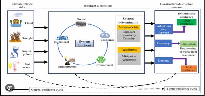
Remote sensing, the science of collecting data about the Earth’s surface without direct contact, has revolutionized the agriculture and disaster management industries. Satellites, drones, and aircraft which are equipped with advanced sensors, capture detailed images and data, offering invaluable insights into environmental changes and urban growth. However, as this technology advances, so do the ethical concerns surrounding its use.
The ability to observe and analyze locations remotely raises pressing questions about data privacy, security, and accessibility. Who owns the images captured from space? Who has the right to access them? How can governments, corporations, and private individuals misuse this powerful technology?
This article explores the ethical dilemmas that arise from remote sensing and its impact on personal privacy, national security, and global accessibility.
Remote sensing involves the use of sensors mounted on satellites, aircraft, or drones to detect and measure reflected or emitted radiation from the Earth’s surface. These sensors operate across various spectral bands, including visible, infrared, and microwave, allowing for the detection of objects, terrain variations, and even heat emissions.
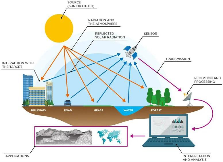
The systematic approach that follows of acquiring data, processing it, analyzing it, and making sound decisions from the information obtained makes remote sensing a powerful tool, but it also introduces vulnerabilities, particularly concerning privacy and security.
One of the most significant ethical dilemmas of remote sensing is its impact on personal privacy. The finest of details such as the license plate of a car or activities in a private backyard are easily captured by the use of high-resolution satellite imagery and drone surveillance. This capability raises serious concerns to the crowd on how their data is utilized by the higher authorities. Unlike traditional surveillance methods, which require warrants or legal oversight, satellite-based remote sensing often operates in a legal gray area, making it difficult for individuals to challenge unauthorized observation.
The accessibility of remote sensing data presents national security risks. Although governments heavily rely on satellite reconnaissance for intelligence gathering and defense operations, the democratization of satellite imagery has introduced new challenges such as possible space pollution, potential exploitation of the imagery by terrorists, and even the susceptibility of this recorded data to hacking. With more private companies launching satellites, the risk of sensitive data falling into the wrong hands increases, making cybersecurity an urgent concern in remote sensing ethics.
Remote sensing data is a valuable resource, but not all countries and organizations have equal access to it. Wealthier nations and large corporations dominate the satellite industry, leading to concerns regarding data monopolization and information control. If it is to be assumed that most private satellite companies prioritize profits over value, then this critical information would be limited in access to charitable and insightful works which would be done by researchers, journalists, and some small organizations.
This ends up raising ethical concerns about fairness, as the power to observe and analyze the world remains concentrated in the hands of a few entities.
To address these challenges, policymakers, scientists, and legal experts must work together to establish guidelines for responsible remote sensing. They could establish stronger, clearer regulations on data collection and distribution to avoid misuse, facilitate easy access of the relevant information to countries and smaller corporations to ensure fairness and transparency, and lastly, ensure that cybersecurity enhancements are put into effect to ensure that data is protected from hacking and unauthorized access.
Remote sensing is an incredible technological advancement with immense potential to improve disaster response, environmental monitoring, and urban planning. However, without ethical considerations, it can also become a tool for privacy invasion, security breaches, and data monopolization.
By Gerald Nyanjua
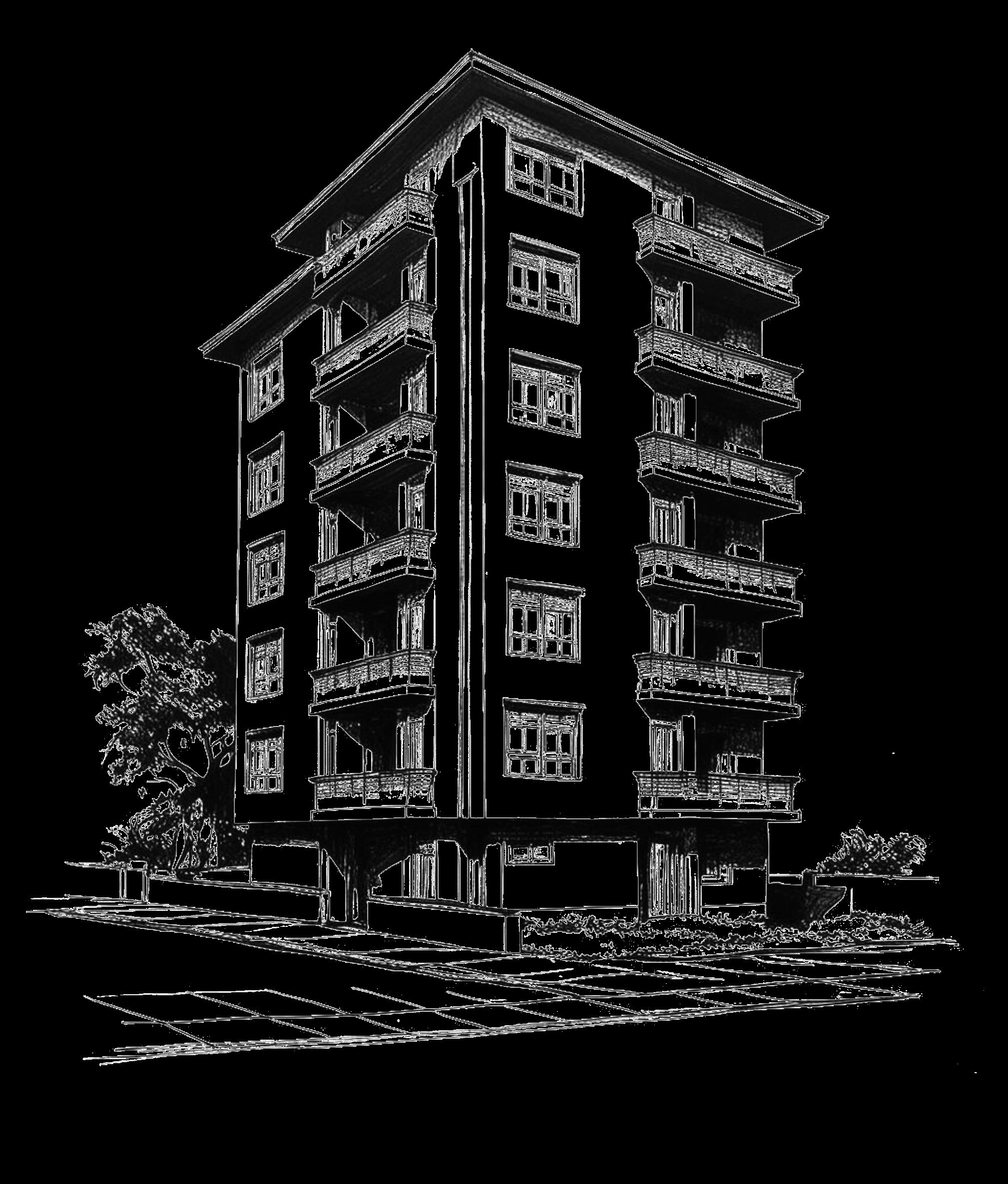
As one of the key elements within their Big Four Agenda government officials recognize Kenyan Affordable Housing as an important project, which seeks to resolve the national deficit of available homes. The housing program began operations in 2017 through collaborative agreements between private developers and financial institutions to build 500,000 new housing units to sort the country’s housing deficit.
Real estate builders create these properties to serve residents with various incomes who can pursue ownership through tenant purchase programs and home loans (Mortgages). The program combines contemporary building technologies with sustainable urban planning as its central focus.
However, as these structures rise across urban centers, one design element—or the lack thereof—has sparked widespread debate: the ‘absence of balconies’ in most designs.
Public spaces are insufficient in these “affordable and sustainable” housing developments, while the lack of balconies generates important questions about the residents’ quality of life together with the functional and sustainable elements of the homes.
The affordable housing initiative was envisioned as a solution to the country’s growing urban housing crisis. The population living in Kenyan cities has been growing fast yet places such as Nairobi, Mombasa, and Kisumu experience massive shortfalls of both comfortable and inexpensive housing options. Large sections of urban populations live in overcrowded and inadequately designed settlements that lack necessary utilities.
The government worked to establish economic residential accommodations through its Big Four Agenda framework. The program targets different income brackets through three main tiers: The housing initiative includes three components namely low-cost housing alongside mortgagegap housing and social housing. Through its partnerships with private developers together with tax, incentive schemes the government works toward cost-efficient construction alongside affordable prices at the end-user level.
The push toward affordability in housing projects sometimes creates design trade-offs and reduced functional capabilities according to critics. The balcony dispute together with inadequate public space provisions demonstrates how price-saving logic clashes with resident’s needs for proper standards of living.
Through their extensive history, balconies demonstrate their necessary role in both building design and human habitation. Throughout ancient Greece and Rome, balconies served as public platforms where inhabitants delivered speeches and staged performances along with carrying out communal events. The structure expanded to become building elements that united attractive design with practical requirements.
During medieval times, balconies emerged as primary features of Gothic and Renaissance architecture and builders decorated them extensively. Open balconies offered essential viewing perspectives from which people could watch public gatherings along with processional religious rituals and festivities. The Mediterranean climate required balconies as essential outdoor spaces, which residential populations used to find relief from heat while enjoying fresh outdoor moments.

Urban society today depends heavily on balconies as fundamental elements that thrive particularly within compact metropolitan areas. Living spaces offer both personal isolation and functionality
through private exterior zones suitable for laundry drying and plant growth together with outdoor observation. Human settlements maintain balconies as enduring functional and symbolic spaces because they have evolved throughout history.
For many decades, urban homes have incorporated balconies that serve multiple domestic functions. The spaces allow people to unwind inside without leaving while they refresh clothes and cultivate plants or get a quick refresh from the outdoor air. The architecture of balconies represents a tiny fundamental aspect that extends homeownership within various cultures.
Penalizing balcony placement in affordable Kenyan housing becomes a necessity because developers need to cut costs. Development costs for balconies raise project expenses while eating up construction areas, which results in fewer housing units per building plot. The developers know they can improve project financial performance by creating additiona l units while making housing accessible to multiple families.
From an economic standpoint, this argument holds merit yet its impact on human-friendly design features of these projects remains in question. Do the cost reductions justify diminishing residential quality? The selection method reveals crucial ramifications on the long-term overall well-being of those who reside in these areas.
In these development projects, public spaces fall short of meeting essential requirements, which represents another major problem. The essential nature of parks, playgrounds, and communal courtyards allows neighborhood interaction while enhancing both mental health and recreational access in public spaces.
with others. The development and play needs of children require access to public areas and adults use these areas for rest, physical exercises, and enjoyable social time. In areas with high population densities, public spaces take on additional importance because they provide relief during the constant activity of urban districts.
Since Kenyan affordable housing developments, feature insufficient public amenity space residents must use damaged or inconvenient public amenities. The resulting overcrowding in existing recreation areas often becomes worse still when residential areas become fully devoid of any recreation facilities. When residents lack balconies and appropriate public spaces, they become solely limited to indoor living, which threatens their wellness.
Social consequences will extend outward because of a total lack of balconies. Standard access to private outdoor spaces throughout dense urban areas stands as a necessity for maintaining both mental health along emotional stability. Balcony access provides social separation between residents and crowded city life when limited resources or distance restricts resident access to parks and open public spaces. The absence of balconies traps residents inside their homes until such time that enclosed rooms become unmanageable.
Research evidence demonstrates that exposure to open public parks mostly yields multiple health advantages for physical welfare together with mental wellness benefits. Public spaces decrease anxiety levels while enhancing physical movement and give residents opportunities to meet up
The external areas of balconies provide platforms for citizens to engage with each other in highrise residential communities. These architectural designs have unintentionally stripped away the sense of neighborhood bonds by limiting social interaction between neighbors who communicate
across balconies and observe children playing on nearby balustrades. Without balconies, residents feel more socially distant from each other as informal outside communication decreases, which hinders community connection.
Balcony exclusions block residents from practicing cultural traditions as they usually would. Traditional Kenyan families use outdoor spaces both for clothes drying and for the preparation of customary meals. When buildings lack balconies, their residents need to create inventive but irksome arrangements to meet their needs.
Urban living requires sustainable development, which benefits from both balconies and public areas. Guests maintain their leafy vegetables in vertical gardens situated on their balconies.
Urban food security increases while urban temperature control declines because balconies make the skyline greener. Balconies operate naturally to circulate air inside residences with a cooling effect that makes building owners less dependent on expensive air conditioning systems.
Public spaces work as sustainable elements because they help build city biodiversity and serve as ecological homes for bird species and insect populations. Through urban development that integrates vegetation, the impact of urban heat islands can be diminished and air quality is improved. When cities lack public green spaces they experience increased environmental decay coupled with heightened heat-related stress.
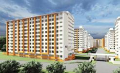
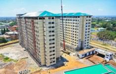
The affordable housing programs of foreign nations provide Kenya with useful strategies and approaches. Standard features in Singapore’s public housing consist of balconies plus communal outdoor spaces. The approach addresses the essential need for outdoor spaces for residents’ health and effectively applies it to affordable housing.
Brazil and Mexico deliver affordable housing through joint outdoor amenities, which include rooftop gardens and communal courtyard spaces in their residential developments. Qualified community areas within such projects create
social meeting points that strengthen community bonds between residents. These housing projects successfully integrate affordable design components to solve both considerations, which Kenya could replicate.
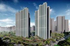
(Fig 2.0 Singapore’s affordable housing development) (Fig 2.1 Singapore’s affordable housing development)

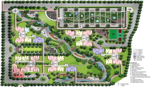
(Fig 2.2 Site Plan for Singapore’s Affordable Housing Development)
The issues of cost and limited space requirements create difficulties but do not prove impossible to overcome. City planners together with architects must investigate contemporary balcony design models that maintain cost-efficiency. Tripartite balcony setups that combine free spaces or staggered layouts ought to become architectural features that enable residents to access shared outdoor zones.
Multi-use communal terraces located on rooftops, or between residential floors represent viable outdoor spaces for all building occupants to share. Developer incentives backed by policy support would enable affordable housing developments to prioritize residential quality together with affordability. Design specifications from the government that require outdoor facilities in all new affordable housing projects should be a required feature.
Modular construction presents a possible answer by creating flexible design parameters. Builders utilizing modular construction approaches produce adaptable housing units containing balconies and semi-private garden spaces while maintaining reasonable prices.
Each stage of affordable housing design and construction requires involvement from stakeholders to achieve proper fulfillment of its intended user needs. Residents and urban planners should collaborate with architects and policymakers to create solutions that optimize livability without causing excessive financial strain for residents.
Public community-based consultations enable researchers to understand what residents want and need. The incorporation of future occupants during design development allows developers to construct housing units, which match user requirements effectively. Through partnerships with NGOs along with international agencies builders gain access to specialized expertise and funding which helps develop novel housing approaches.
Kenya makes marked progress toward national housing affordability through its present development initiative. Affordability demands a broader interpretation that integrates both reasonable prices with residential quality as well as ecological sustainability measures.
Construction without balconies and insufficient public spaces create dwellings that operate as shelters instead of living spaces where families can thrive.
The officials developing this initiative must actively seek input from future homeowners because their feedback remains fundamental to project success. Natural affordable housing initiatives must protect fundamental quality-of-life aspects during their development. The time has come to construct family residences instead of limited dwelling structures.
Innovation in design combined with stakeholder inclusion and international housing excellence research will help Kenya build housing at affordable prices that address specific population requirements. The discussion about balconies combined with insufficient public areas demonstrates that housing measures exceed simple numerical concerns since they should generate genuine living environments for individuals to flourish.


By Gerald Nyanjua
Remote sensing combined with digital modeling technologies has undergone rapid advancement resulting in historic changes to our understanding of spatial environments and their resulting exploration and control. Innovative applications unite digital simulat ion outputs with real-world datasets to redefine spatial intelligence while improving precision efficiency and user engagement.
3D mapping and virtual tours represent leading transformative advances in this field through their data-intensive approach to spatial visualization. Captured detailed geographic and structural information from these technologies improves our perception of the world while providing important
functionalities to urban planning, heritage conservation, disaster management, real estate, and tourism sectors.
Both public sector institutions and private sector organizations now benefit from digital models
that duplicate reality in immersive detail along with interactive capabilities. This advances their decision-making capabilities. Planning of infrastructure projects occurs virtually in advance of full implementation steps.
At the same time, conservationists can manage the digital protection of historical sites, and emergency responders benefit from precise disaster zone analyses through digital means. Immersive virtual products that deliver enhanced accessibility help tourism alongside real estate industries to improve user engagement.
The multiplication of these tools guarantees fresh answers to spatial problems, enhanced equitable resource distribution, and enriched user interactions. The expanded capabilities of GIS result from their current integration with artificial intelligence (AI), machine learning, and cloud computing which leads to real-time simulations combined with automated spatial analysis and predictive modeling capabilities.
Despite facing hurdles with data privacy alongside high implementation costs and digital accessibility barriers 3D mapping and virtual tours will reshape how we navigate and plan our built and natural landscapes over the next decade.
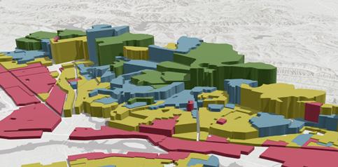
The field of urban planning together with architecture depends on 3D mapping combined with virtual tours to design detailed threedimensional city representations. Before construction begins designers and engineers together with policymakers, use these tools to achieve advanced precision in project visualization, which results in better decision-making.
Combining digital simulation with real-world data enables city planners to examine infrastructure relationships between roads and buildings and utilities and green spaces, which results in more optimized land use decisions and higher functional urban environments.
3D mapping’s strongest feature remains its ability to emulate real situations which enables planners to understand how new constructs modify traffic
patterns, environmental management, and urban system operation. Building platforms for virtual tours enables stakeholders to generate accessible predictions about problems like congestion and drainage or resource management complications which otherwise develop into major costs.
City planners obtain valuable insights into planned development through realistic visualization, which helps them understand how to meet local needs as expressed by stakeholders and residents.
Modern construction monitoring extensively utilizes 3D mapping technologies to verify that active building projects obey safety codes and adhere to zoning rules including environmental requirements. The combination of real-time spatial data helps authorities see construction advances while identifying structural mistakes before they create serious risks through Drone surveys and LiDAR data collectio n and GIS mapping software leads to enhanced site control capabilities by minimizing construction delays and cost fluctuations.
3D mapping and virtual tour adoption help maintain sustainable development in cities as they expand by improving urban environmental efficiency and resilience. The combination of these modern tools enables precise project management through more effective planning and brings communities into active roles in designing future urban environments.
Various forces threaten heritage sites and cultural landmarks by attacking them through environmental degradation alongside natural disasters while urban developments along with human vandalism and neglect create additional
problems. Historical monuments together with artworks and architectural wonders face imminent risk from various factors that diminish their cultural and historical value.
The traditional methods used to preserve heritage sites have difficulties keeping pace with the accelerating speed at which these sites are breaking down. The development of 3D mapping alongside virtual tour technologies gives researchers powerful methods to document preserve and share historical sites, which future generations will appreciate.
Modern preservation methods manage to duplicate heritage architecture with high-definition digital models to document all details surface structures and dimensional information. Through digital preservation methods, researchers maintain accurate virtual records to study and potentially restore original locations, which later face damage from erosion and destruction. Through 3D mapping restoration, teams discover structural weaknesses that guide their implementation of protective measures to defend heritage structures from deterioration.
Virtual tours function as essential tools because they extend access to global cultural heritage resources across the world. Thanks to emerging digital technology, people who would otherwise never have access to historic locations due to geographic factors or limited resources can now experience these sites remotely.
Users experience a fully interactive exploration of ancient ruins and sacred landmarks alongside museums and castles, all from the convenience of being in their location. Virtual access to cultural heritage allows increased appreciation of world traditions and supports green heritage tourism by limiting travel volumes at legacy sites.
The digital archives derived from 3D mapping provide educational institutions with invaluable learning opportunities. Educational institutions should use virtual models integrated with their curricula to allow students studying subjects like history, archaeology, and cultural studies to acquire more enriched knowledge about historical sites.
Students who benefit from augmented reality experiences alongside virtual reality technology can directly touch artifacts while exploring ancient
cities at various historical moments and study structures with remarkable accuracy and lifelike precision.
3D mapping with virtual tours becomes essential for disaster response planning as well as emergency response and recovery operations in risk areas. Emergency response teams boost operational efficiency through the monitoring of live spatial data so they can evaluate areas under effect and create evacuation preparations with optimized resource distribution.
The technologies enable better evaluation of risks and documentation of disaster damage while promoting collaborative crisis management at higher levels of efficiency. Through virtual tour simulation, capabilities emergency personnel can learn critical skills to address real-world disasters better.
Predictive models driven by AI enable sophisticated simulations to detect hazards, which can stop major disasters before they occur.
Virtual tours have changed the travel industry through their capability to deliver detailed destination previews for visitors before arrival. Travelers utilize online resources to see virtual hotel views along with historical landmarks and natural sights thereby facilitating their choice of destinations before they travel. Through digital innovation, people can engage with different worldwide cultural traditions from their location for global cultural appreciation purposes.
Interactive travel guides generated through 3D mapping systems deliver live direction services along with detailed cultural information about environments visited by modern tourists. Planning tools cut down the environmentally harmful effects of traveling to destinations through their dual function of minimizing earth damage and sustaining tourism links worldwide.

(Fig.1.1 Virtual tourism)
The real estate industry has greatly benefited from 3D mapping and virtual tours, as these advanced technologies have transformed the way properties are showcased, marketed, and managed. Traditionally, potential buyers and tenants had to rely on static images, floor plans, and physical visits to evaluate properties. However, with the introduction of immersive 3D mapping and virtual tours, they can now explore properties remotely, experiencing a highly interactiveand realistic representation of spaces from anywhere in the world. This innovation has increased convenience, accessibility, and efficie ncy in the real estate sector.
Real estate developers and agents leverage these technologies to create engaging virtual walkthroughs that provide a comprehensive view of properties, including interior layouts, architectural details, and surrounding neighborhoods. Unlike standard photographs or videos, 3D virtual tours allow users to navigate through a property at their own pace, zoom in on specific features, and get a true sense of scale and spatial relationships. This capability is particularly beneficial for overseas investors, out-of-town buyers, or busy professionals who may not have time to visit multiple properties in person. By offering an immersive online experience, agents can attract a wider pool of potential clients, increase engagement, and expedite the decisionmaking process.
The 3D mapping technology used in real estate promotes client transparency and builds trust within transactions between homebuyers and sellers and between buyers and agents alike.
Virtual tours display properties accurately to protect potential buyers against deceptive promotions thus allowing them to confirm their expectations before becoming customers. The approach generates superior satisfaction results
and decreases the odds that purchase agreements will be canceled at the final minute because of unmet expectations.
Property management operations benefited from 3D mapping adoption yet beyond marketing capabilities. Property managers use virtual inspections to both evaluate maintenance requirements and structural conditions instead of on-hand site checks. The system proves valuable when owners manage extensive residential properties commercial buildings and multiple rental properties situated in different locations. These tools maximize space effectiveness through their performance in delivering accurate dimension data and property layout views that support decision- making for designers and owners to plan design changes and space utilization.
3D mapping systems with augmented reality (AR) and virtual reality (VR) technologies revolutionize real estate by creating customized interactions with properties. The visualization tools enable future customers to view renovation possibilities together with design explorations and furniture arrangement simulations preceding their buying decisions. Through detailed customization, buyers engage more with the process while enjoying a tailored purchasing journey, which boosts the probability of successful deals.
Real estate technology development will be enhanced by AI analytics integration into 3D mapping which will result in improved industry management. The analysis of spatial data through predictive modeling enables agents and developers to recognize market directions and determine property values by making evidencebased investment choices. The combination of innovative enhancements with virtual tours will continue reshaping property marketing and transaction dynamics, which together create a more efficient, and transparent real estate environment that improves user experiences.

The effectiveness of these spatial visualization tools depends on advanced technologies such as:
LiDAR (Light Detection and Ranging): Its recorded data delivers the highest possible levels of precise 3D measurements that cities need for topographic mapping and urban modeling purposes.
GIS (Geographic Information Systems): Spatial information serves as a tool for urban planning authorities and disaster managers so they can make better decisions.
VR (Virtual Reality) and AR (Augmented Reality): Improve virtual tours through digital systems that deliver users both informative and fully interactive environments.
Drones and Satellite Imaging: The platform enables extensive 3D mapping operations through precise high-definition data collection.
AI and Machine Learning: Spatial analysis receives enhancements through the automation of mapping workflows and provides predictive analysis based on data trends.
Cloud Computing: Smooth storage and data sharing capabilities enable integral stakeholders to access complete 3D maps and virtual tour information.
The partnership between artificial intelligence (AI) and machine learning with 3D mapping and virtual tours holds promising potential to transform spatial analytics, automation,_ and personalization transactions at a scale never before witnessed. AI algorithms demonstrate exceptional capabilities through fast efficient processing of extensive spatial data to generate precise dynamic mapping information.
The monitoring system uses intelligent technology, which develops spatial patterns along with anomaly detection while optimizing space layout design for various applications including emergency response and urban planning. Artificial intelligence systems, which power virtual tours, can use user data to generate
personalized content for visitors based on their specified interests. The use of real-time behaviorresponsive interactive content would boost user participation in real estate tourism and educational sectors through customized adaptive solutions.
AI-driven 3D mapping and virtual tours deliver multiple significant advantages but organizations need to resolve numerous implementation barriers before achieving full-scale adoption. Data privacy emerges as a chief problem because these technologies collect extensive information including geospatial data along with personal location details and biometric information that exposes users to misuse risks. Data protection measures together with encryption protocols serve as essential requirements to protect confidential information while earning public confidence.
The high expense required to establish and distribute advanced 3D mapping alongside virtual tour technology represents a major implementation hurdle. High-end imagery along with LiDAR scanners cloud structures and AIbased software applications demand major financial resources for their acquisition.
Access to technology becomes limited because small enterprises alongside educational institutions from developing nations face difficulties entering these markets. The availability of open-source technologies, public-private alignment, and scalable cloud solutions will help eliminate barriers to widespread access to transformative mapping systems.
The deployment of AI-integrated 3D mapping systems requires skilled professionals who understand both data science together with geospatial engineering, computer vision, and machine learning. Opening these technologies to their full potential until now has been limited by the existing skills deficit in these specific areas. The effective adoption of AI-driven spatial technologies requires strategic investments targeting workforce training, interdisciplinary education, and collaborative research programs, which will develop new professionals who can maximize AI capabilities.
Point-of-entry principles together with welcoming standards remain vital when designing virtual environments. These game-changing 3D mapping
systems coupled with virtual tours generate unprecedented educational and planning powers but their design must work for users of all abilities with disabilities included.
The accessibility of virtual encounters for users with diverse impairments including visual, auditory, and motor function issues stands as a core essential for achieving genuine platform universality. Digital spatial exploration becomes more inclusive through features, which support voice-guided navigation together with interface customization options and assistive technology compatibility.
Real-time rendering along with interactive AIdriven experiences will establish new methods for interacting with spatial data according to predictions for future advancements. Digital real estate development along with urban planning stands to transform through AI-based generative design technologies, which enable autonomous system-generated architectural models and optimized urban plans.
Advanced technology integration of live environmental data with augmented reality (AR) and virtual reality (VR) systems allows users to experience dynamic 3D maps in ways that go beyond modern understanding and create expanded simulation environments for educational development, remote working solutions, and city administration capabilities.
The future development of 3D mapping along with virtual tours will depend heavily on ongoing advancements in regulations. To properly govern data collection storage and usage governments and industry stakeholders need to create extensive policies, which prioritize ethical considerations. After striking, a balance between innovation and privacy protection the accommodation of trust needs with public reception will result. Laws must tackle matters covering intellectual property rights alongside protection against cybersecurity risks and the ethical aspects of AI-generated spatial elements.
Surveillance ethics along with digital rights and environmental implications need to be prioritized during the widespread adoption of these technological advances because these factors will gain growing importance. Detailed 3D spatial mapping technologies across public and private
territory create privacy risks because these explore areas are not accessible to public surveillance.
To prevent potential misuse or abuse of these tools the responsible and transparent usage of such tools will remain a necessity. Large-scale 3D mapping data processing with associated energyintensive AI computations demands sustainable computing strategies and environmentally friendly technologies to minimize its environmental impact.
3D mapping and virtual tours supported by AI show great potential to improve spatial intelligence but their future success will depend on methods, which combine technological innovations with ethical compliance along with controlled policy protocols. Through effective solutions to existing challenges together with new possibilities, these technologies may transform our visual understanding and management of space into more efficient, inclusive, and ethical systems.
The innovation of 3D mapping together with virtual tours presents a complete technological solution, that transforms spatial understanding for multiple sectors through virtual data-rich interactive and immersive experiences. These technological advances help improve decisionmaking capabilities while enhancing disaster response operations and transforming cultural heritage encounters and tourism encounters. These tools will mark a path toward our interaction with environmental development together with management while fostering global evolutionary steps through spatial data leadership. These technological advancements simultaneously improve sector productivity while unlocking fresh frontiers for human discovery education in worldwide interactions.
Rearrange the letters to reveal the correct geospatial terms:
1. SARETR
2. PAM
3. TACROHOGRYPA
4. REOTVC
5. EGNOFECING
6. OPISITNOING
7. DRALI
8. VEIYRNGSU
9. TTEISLAL
10. NAOTDIIOCNR

1. global positioning system
2. data manipulation
3. data intergration
4. thermatic layers
5. satellite image
6. remote sensing
7. Georeferencing
8. buffer zone
9. Resolution
10. Attributes
11. buffering
12. spheroid
13. polygon
14. overlay
15. feature
16. Spatial
17. raster
18. vector
19. pixels
20. point
21. node
22. line
23. data
8TH ECHO EAST AFRICA BIENNIAL SYMPOSIUM ON GIS AND RELATED SOFTWARE
Date: February 25–27, 2025
Venue: King’s Conference Center (KCC), Bujumbura, Burundi
Theme: Sustainable agriculture and appropriate technologies.
AISA GLOBAL ISSUES SERVICE SUMMIT (AISA-GISS)
Date: February 13–15, 2025
Venue: International School of Uganda, Kampala, Uganda
Theme: “Kola Kati” – a Swahili word which translates into Act Now; and this call will focus the delegations to act now within community service projects in GIS and drone technologies
GIS AND DRONE APPLICATIONS IN AGRICULTURE CONFERENCE
Date: February 25, 2025
Venue: JKUAT Main Campus, Juja
Theme: Deliberating on how GIS technology and drone innovations are transforming agriculture. Key areas of focus will include precision farming, crop health monitoring, efficient irrigation, and soil analysis.
GIS IN WATER, SANITATION, AND HYGIENE TRAINING
Date: 3–7 March 2025
Venue: Machakos
Theme: The 5-day course on the application of GIS in WASH projects covers the use of spatial analysis in water resource management and sanitation planning.
MONITORING AND EVALUATION USING GIS TRAINING
Date: 3 - 7th March 2025
Location: Nairobi
Theme: 5-Day Course on the Use of GIS in M&E processes; focusing on Spatial Data Analysis for Program Assessment
INTERNATIONAL CONFERENCE ON UTILIZATION OF GIS TECHNOLOGIES IN PROCUREMENT, LOGISTICS AND SUPPLY CHAIN MANAGEMENT (ICPLSCM)
Date: 25th March 2025
Venue: Addis Ababa, Ethiopia
Theme: Embracing the usage of GIS in procurement, logistics, and supply chain management.
INTERNATIONAL CONFERENCE ON THE RECENT GIS ADVANCEMENTS AND DRONE TECHNOLOGY
Date: 26th March 2025
Venue: Vacoas, Mauritius
Theme: Explore the recent advancements in GIS and Drone Technology
INTERNATIONAL SCIENCE, RESEARCH AND INNOVATION CONFERENCE ON IMPLEMENTATION OF GIS IN WASTE-WATER MANAGEMENT.
Dates: 18–19 March 2025
Venue: University of Seychelles
Theme: GIS Technology in management of sewages and waste water
GISTAM 2025 – 11TH INTERNATIONAL CONFERENCE ON GEOGRAPHICAL INFORMATION SYSTEMS THEORY, APPLICATIONS AND MANAGEMENT
Dates: 1–3 April 2025
Venue: Nairobi- Kenya
Theme: Advances in GIS theory, applications, and management
MOBILE DATA COLLECTION FOR M&E USING ODK AND KOBO TOOLBOX
Date: March 10–14, 2025
Venue: Dar es Salaam, Tanzania.
Theme: Training on the use of mobile data collection techniques for monitoring and evaluation purposes.
By Patricial Sila
A Spatial Data Infrastructure (SDI) is an information framework that stores and manages geographic data for all sectors of the economy. This structure allows data to be shared across sectors for compact data management. It is an organized way of streamlining data to avoid duplication, which takes up unnecessary space and time when searching for information.

SDIs integrate and link various spatial data to enable efficient access and use for planning, insights and informed decision-making. The information gathered should also be accessible to the citizens for ease of services and for public awareness about their region. The system can be set up to various levels; national, regional, or global. Cross- border SDI (regional and global) is a system that spans several countries, creating a large pool of fundamental data all managed under one system.
Setting up an SDI is bound to be an intensive enterprise. The most crucial elements to achieve this system include:
Data is the foundation of an SDI. We need to acquire accurate data, which will be fed into the system and relied on to make decisions and
policies. The data includes the fundamentals such as administrative boundaries, Digital Earth Models (DEMs) and geographical names. More data aligning with respective sectors such as transportation networks will be necessary, as well as applicable data like the location of amenities and hotspots for crimes. All the datasets should also include metadata to give more information about the data e.g. the source and date acquired.
An SDI requires robust computers to analyse and process large datasets. The hardware has to meet a certain criterion to enable networking with other computers. The computer systems have to be scalable, portable, and interoperable. The system will also need reliable software that can efficiently analyse spatial data. The software must be compatible with the hardware’s operating system. Other requirements include web services and

geoportals for access of geospatial information, internet and the use of Cloud technology to ease the storage and computational demands.
The SDI will rely on human power to operate and manage the infrastructure. This will contribute to building a geo-literate population. The professionals will need to be certified to some standard to ascertain that they have the proper qualifications to manage an SDI since it will hold crucial data.
For the infrastructure to function, we must set a specific standard for all the data in the system. The data formats, image resolutions, symbology and organization must be consistent so that the
data can seamlessly integrate with other similar datasets. We also need policies on how to manage and use this data, how the public should access the data, how much data to provide, commercialization of some of the data, intellectual property rights through licenses or copyright, and data security. The SDI should be reviewed regularly to examine whether it is effective and serves its purpose.
Setting up an SDI is an expensive affair that needs ample funding for its realization. The funding could come from the government or collaboration with other agencies. A cost-benefit analysis has to be considered to evaluate whether the benefits of the system outweigh the financial investment.
An SDI is a complex project that may take decades to be achieved. Most governments, especially in developing countries, have more pressing matters such as food security and disaster management to spend funding on. However, an SDI would be a game-changer and solve majority of Africa’s challenges. In Kenya, we are on our way there with the Kenya National Spatial Data Infrastructure (KNSDI). Even though it is still in the inception stages, it is a step in the right direction. We could be optimistic that the system could someday span East Africa, Africa, and the entire world.

ALGERIA IMPLEMENTS THE SPECIAL INTERVENTION GROUP IN ALGERIA IN THE GIS SECTOR.
The Algerian government has implemented a special group called Special Intervention Group also known as Groupe d’Intervention Spécial that consists of a well-trained special forces unit responsible for counterterrorism, hostage rescue, and other special operations. In recent news, the GIS received a visit from Admiral Rob Bauer, Chair of the NATO Military Committee.
THE CENTRAL AFRICAN REPUBLIC INTRODUCES THE USE OF GEOSPATIAL DATA TO ASSESS THE IMPACTS OF CLIMATE CHANGE.
This is according to the new report by the World Bank that emphasizes on the role of geospatial data in better understanding the vulnerabilities to climate change and informing related adaptation strategies.This has been taken keenly into consideration by the GIS experts here.

AFRIPI (INTELLECTUAL PROPERTY RIGHTS AND INNOVATION IN AFRICA) COLLABORATES WITH AFRICAN INTELLECTUAL PROPERTY ORGANIZATION (OAPI) IN CHAD
These two groups organized a workshop in N’Djamena in Chad with a view to promoting and protecting Geographical Indications of the country. The workshop identified spirulina or, more correctly, the blue-green algae and gum Arabic as two of the most important candidates for GI protection. The seminar brought together actors who discussed the next steps toward promoting the products and their sustainable development.
Djibouti is among the African nations that have started to take climate change seriously through the application of GIS technology. The country invests extensively in infrastructure improvement, renewable energy access, and natural resource management reforms in efforts to combat extreme heat, droughts, and floods. Recent strategic planning training by IDEP, INAP, and the Ministry of Economy and Finance strengthens the capacity of active government agents for better planning and adaptation against such challenges.
TUNISIA
Tunisia has embarked on Geographic Information System mapping to transform its public health. The effort, supported by the Africa CDC, will result in detailed visual mappings of laboratory capacities and capabilities across the country, thereby fostering identification of critical gaps, improvement planning, and optimization of laboratory networks.
The World Health Organization, WHO, opens for the first time a Geographic Information System - GIS Centre in the WHO country office in Mogadishu, Somalia, to make use of geospatial data in exposing spatial patterns and giving critical insights to decision-makers for strengthening public health systems.
Rwanda has strengthened its capacity in the field of geographic information systems. Through the Urban Economic Development Initiative, UEDI, in collaboration with the Ministry of Infrastructure and the Rwanda Housing Authority, is conducting training for district staff in Musanze, Rubavu, and Rwamagana1. The training is in the use of digital inspection tools, web-based GIS, and engineering software to enhance urban planning and economic development.
The GIS team in Cote d’Ivoire has implemented the utilization of geospatial technologies for conservation efforts, particularly in areas like the Comoé National Park, with organizations like the Global Green Growth Institute (GGGI) actively supporting these projects by facilitating workshops and collaborations with local stakeholders to assess training needs related to climate change issues.

SCGIS-Madagascar has been actively developing its capacity in geographic information systems since 2001. It has been conducting different activities to provide technical support, GIS training, and meetings for information and experience exchange, together with its members, for using GIS to advance the causes of conservation and development in Madagascar.
The Central Water Authority, Mauritius, has integrated the technology of Esri GIS in mapping assets to modernize the water distribution system. This initiative will ensure a sustainable water supply and contribute to the economic development of the country. The GIS technology helps in real-time data collection, accurate mapping of water assets, and efficient customer service operations.

Mauritius is working on strengthening cooperation ties with Bangladesh, focusing on various sec-
tors including GIS. This collaboration aims to share knowledge and resources to improve GIS applications in both countries.
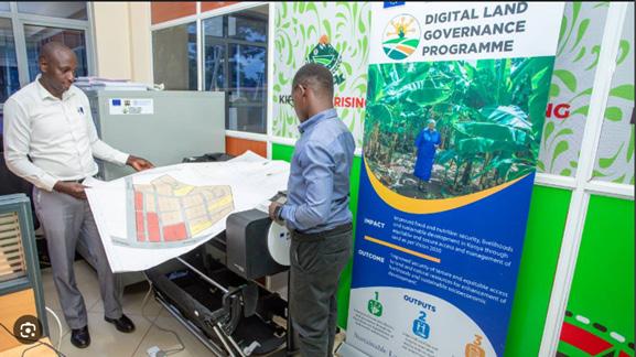
Governor Anne Waiguru has established a GIS lab in partnership with the FAO to make processes of land governance modern and ensure land development that is sustainable. This lab will digitize land records, enhance operations and improve customer experience, transparency, and accuracy. This will help in doing away with fraud and land grabbing, while also improving service delivery in the county lands department.
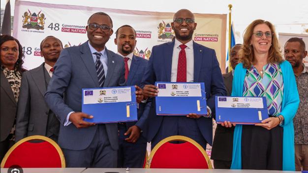
The government of Kenya, in partnership with the EU and the Food and Agriculture Organization, has launched Sh300 million worth of the GIS equipment, envisioned to digitise land governance and greatly enhance urban planning and decisionmaking in 30 more counties. The package includes guidelines for the implementation of GIS and a training manual in order to introduce counties to tools that are based on data.

Transition to GIS: How did your background in petroleum exploration lead you to a career in GIS?
GIS is widely used in petroleum exploration studies for various applications, including exploration, drilling, and more. During my attachment at the State Department of Mining, I gained proficiency in these skills, where I was actively involved in surveys, drilling projects, and cartography. This hands-on experience strengthened my expertise in GIS, equipping me to apply it across diverse fields and adapt to various industry demands.
Skill Development: What steps have you taken to enhance your GIS proficiency since graduating?
I have completed a couple of short courses in GIS that have enhanced my skills and helped me better understand it. I have also worked on some projects with gurus in the field. They have taught me and challenged me to dig deeper to understand all that encompasses GIS.
Industry Applications: Can you discuss a specific instance where GIS made a significant impact on a project you worked on?
I am currently working on several projects that require GIS expertise. One project that stands out is the Kengen project. Our team needed to incorporate spatial analysis, cartography, remote sensing, and data modelling skills. The team’s diverse skills, including data analysis, environmental science, and proficiency in GIS tools like ArcGIS and QGIS, facilitated comprehensive problem-solving.
This variety of perspectives and expertise fostered innovative solutions to complex GIS challenges, ensuring the project met all technical requirements. Some of the main challenges we faced included integrating various data sources and formats, ensuring data accuracy, and managing tight deadlines while maintaining high-quality standards. Effective communication with stakeholders was also vital to clarify project requirements and expectations, preventing misunderstandings that could impact the project’s progress.
Challenges Faced: What obstacles have you encountered as a woman in the GIS and petroleum sectors, and how have you overcome them?
As a woman working in the GIS and petroleum sectors, I have faced several challenges, including gender bias, limited representation, and the need to prove my technical expertise in traditionally male-dominated industries. I often had to work harder in fieldwork and decision-making roles to receive the same recognition as my male colleagues.
I pursued various certifications to bolster my credibility and expertise, including a Diploma in Cartography and GIS and geology and reservoir engineering training. These qualifications enhanced my skills and increased my professional standing.
I also took on leadership roles, such as project management positions, which allowed me to showcase my abilities and gain visibility within my organisation. These experiences were crucial for advancing my career.
I attended industry conferences and engaged on platforms like LinkedIn to expand my professional network. There, I connected with other professionals and sought mentorship from individuals whose work I admired. This proactive approach helped me establish essential relationships in the field, ultimately leading to recognition comparable to that of my male counterparts.
Mentorship Experience: Have you had the opportunity to mentor others in the field? If so, what advice do you commonly offer?
I have had the rewarding experience of mentoring many young professionals and students passionate about Geographic Information Systems (GIS) and petroleum engineering. My primary goal is to help them cultivate essential technical skills, advance their careers, and successfully navigate the challenges in these dynamic fields.
Here’s the advice I often share:
A solid grasp of the core concepts in GIS and petroleum engineering is non-negotiable. Focus on mastering the essential tools and software. Are you eager to dive into the fascinating worlds of GIS and petroleum engineering? Great choice! The key software tools for mastering GIS include ArcGIS, QGIS, and Google Earth Engine.
These platforms will empower you to visualise and analyse geographic data like a pro! Meanwhile, familiarity with essential tools such as Petrel, Eclipse, and MATLAB is vital in petroleum engineering. Additionally, having a
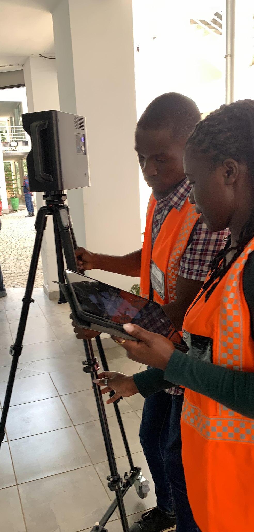
grasp of database management systems and programming languages like Python can give you a significant edge.
Now, let’s talk mentors — they’re invaluable in your journey! Begin by seeking out professionals through networking events, LinkedIn, or university alum groups. When you reach out, respect their time, show genuine enthusiasm for their work, and don’t hesitate to ask for specific advice. A thoughtful message outlining your aspirations can boost your chances of getting a reply.
Lastly, to stay ahead in your fields, look for continuous education opportunities on platforms like Coursera, edX, ALX and LinkedIn Learning. Industry conferences, webinars, and journals like the Journal of Petroleum Technology and GIScience & Remote Sensing will keep you at the forefront of the latest trends and research. Embrace the journey, and let your passion guide you! Critical to success in these fields.
Technological Advancements: How do you stay updated with the latest developments in GIS and related technologies?
I stay updated with the latest developments in GIS and related technologies and remain at the forefront of GIS and related technologies through continuous learning, professional networking, and hands-on practice. Here’s how:
Online Courses – I use platforms like Coursera and Esri Academy to sharpen my skills and master new GIS tools.
Networking and Conferences: I engage with GIS professionals on LinkedIn and attend key industry events to learn from experts and build connections.
Hands-on Projects – I apply my knowledge through real-world GIS projects, experimenting with tools and integrating GIS in various industries, such as petroleum exploration.
GIS Communities– I actively participate in online
communities like GIS & Petroleum Whatsapp groups and GitHub to discuss trends and collaborate with enthusiasts worldwide.
Future Aspirations: Where do you see yourself in the next five years within the GIS industry?
In the next five years, I am excited to step into a leadership role in the Energy industry, focusing on geospatial analytics and remote sensing. I am passionate about harnessing these innovative technologies to tackle significant energy, environmental management, and infrastructure development challenges. My goal is to leverage GIS to create impactful solutions, especially in the petroleum sector, renewable energy projects, and the advancement of smart cities. I can’t wait to make a positive difference in these areas!
Advice to Students: What guidance would you give current students pursuing a GIS or petroleum exploration career?
If you’re aiming for a successful career in GIS or petroleum exploration, consider these key steps:
1. Build a Strong Technical Foundation: Master the essential skills and concepts critical for your field.
2. Seek Hands-on Experience: Use internships and projects to apply your knowledge practically.
3. Stay Informed on Industry Trends: Keep up with the latest developments to remain competitive.
4. Network and Find Mentors: Connect with industry professionals for guidance and insights.
5. Develop Soft Skills: Enhance communication, collaboration, and problem-solving abilities.
6. Embrace Lifelong Learning and Resilience: Adapt and grow through challenges to thrive in your career.
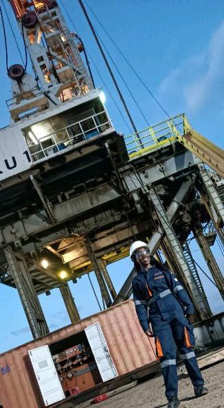
Unexpected Talent: If you weren’t in GIS or petroleum exploration, what unconventional career would you pursue?
If I weren’t in GIS or the exciting world of petroleum exploration, I’d dive into unconventional aviation or wildlife conservation! My passion for flight and aerodynamics is strong, and the thought of becoming a pilot—whether in commercial aviation or flying drones—fills me with excitement for the adventures that await!
Superpower Wish: If you could instantly acquire any skill or superpower related to your field, what would it be?
If I could magically gain any skill to boost my work, it would be the ability to process and analyse geospatial data effortlessly! Imagine the incredible impact of crafting sophisticated GIS scripts and
automation tools with precision in real time! This fantastic skill would transform our work and empower us to make better decisions. Exciting times ahead!
Dream Project: What’s a wild, out-of-the-box project you’d love to tackle in your career?
Imagine a groundbreaking project that could revolutionise how we manage Africa’s natural resources and infrastructure—creating a real-time, AI-powered 3D digital twin of the continent. This ambitious geospatial model would continuously evolve, integrating data from satellites, drones, and IoT devices to provide upto-the-minute insights.
We could transform resource management by monitoring key factors like oil and gas reserves, geothermal potential, water resources, forests, and urban development. Utilising AI and predictive analytics, this digital twin would forecast environmental changes, optimise resource usage, and proactively mitigate disasters. Let’s harness technology for a sustainable future!
Tech Time Travel: Which would you choose if you could witness any historical event in geospatial history?
If I could witness any historical event in geospatial history, I would choose the launch of the first Landsat satellite in 1972. Being in the NASA control room during that launch would give me goosebumps.
Fieldwork Fantasy: What’s the most adventurous location you’d like to conduct a GIS survey in?
I’m excited about conducting a GIS survey of Antarctica’s ice sheets and subglacial lakes. These spots are such adventurous places to explore. I want to map this incredible frozen wilderness using drones, satellite images, and AI-powered GIS models. It would be awesome to be part of something crucial in geospatial studies!