MAY, 2021
SPOKANE DOWNTOWN PLAN SPOKANE DOWNTOWN PLAN

ACKNOWLEDGMENTS ACKNOWLEDGMENTS
MAYOR
NADINE WOODWARD
CITY COUNCIL
BREEAN BEGGS, COUNCIL PRESIDENT
KATE BURKE, DISTRICT 1
MICHAEL CATHCART, DISTRICT 1
BETSY WILKERSON, DISTRICT 2
LORI KINNEAR, DISTRICT 2
CANDACE MUMM, DISTRICT 3
KAREN STRATTON, DISTRICT 3
PLAN COMMISSION
CAROLE SHOOK
DIANA PAINTER
GREG FRANCIS, VICE PRESIDENT
JOHN DIETZMAN
MICHAEL BAKER
SYLVIA ST. CLAIR
CLIFFORD WINGER
JO ANNE WRIGHT
THOMAS SANDERSON
TODD BEYREUTHER, PRESIDENT
LOUIS MEULER, SECRETARY
JACKIE CHURCHILL, STAFF
CITY OF SPOKANE STAFF
LOUIS MUELER, INTERIM PLANNING DIRECTOR
NATHAN GWINN, ASSISTANT PLANNER
KIRSTIN DAVIS, COMMUNICATIONS MANAGER
DOWNTOWN SPOKANE PARTNERSHIP STAFF
MARK RICHARD, PRESIDENT + CEO
ANDREW ROLWES, VICE PRESIDENT OF PUBLIC POLICY + PARKING
ELISABETH HOOKER, MARKETING + PROGRAMMING DIRECTOR
DOWNTOWN SPOKANE PARTNERSHIP BOARD
ROY KOEGEN, CHAIR/LEGAL
DAVID BLACK, PAST CHAIR
LARRY STONE, VICE CHAIR
SUSAN HORTON, TREASURER
STEPHANIE CURRAN, SECRETARY
CHRIS BATTEN, AT LARGE
GORDON HESTER, AT LARGE
CONSULTANT TEAM
JEFF ARANGO, FRAMEWORK
LESLEY BAIN, FRAMEWORK
DANIEL HARRIS, FRAMEWORK
MONICA TAYLOR, FRAMEWORK
YUANSI BOBO CAI, FRAMEWORK
GUANZHOU JI, FRAMEWORK
STEPHANIE WRIGHT, NELSON NYGAARD
LAUREN SQUIRES, NELSON NYGAARD

FIGURES FIGURES
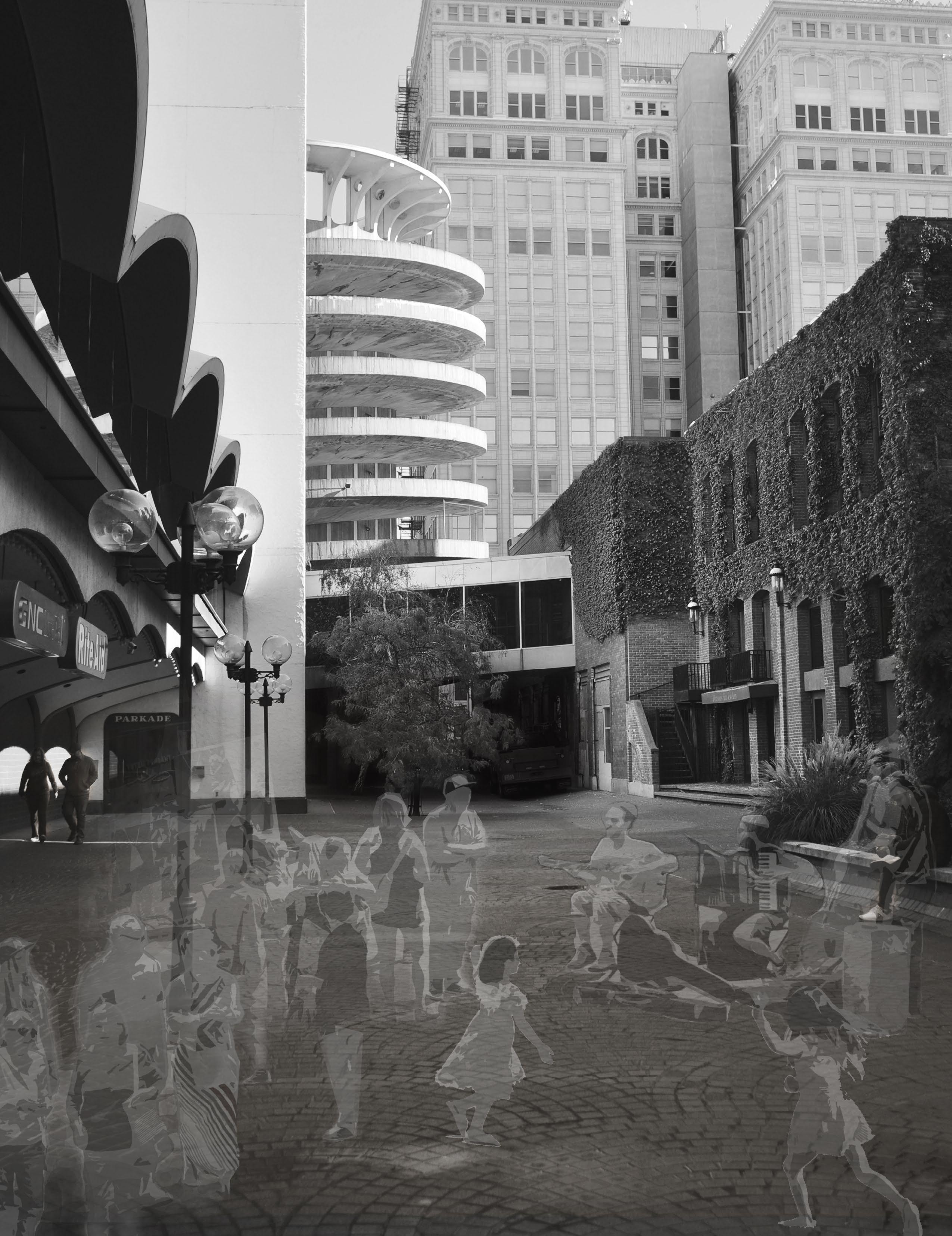
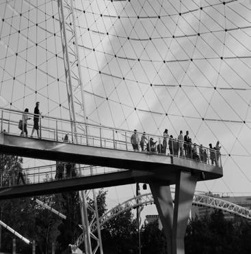
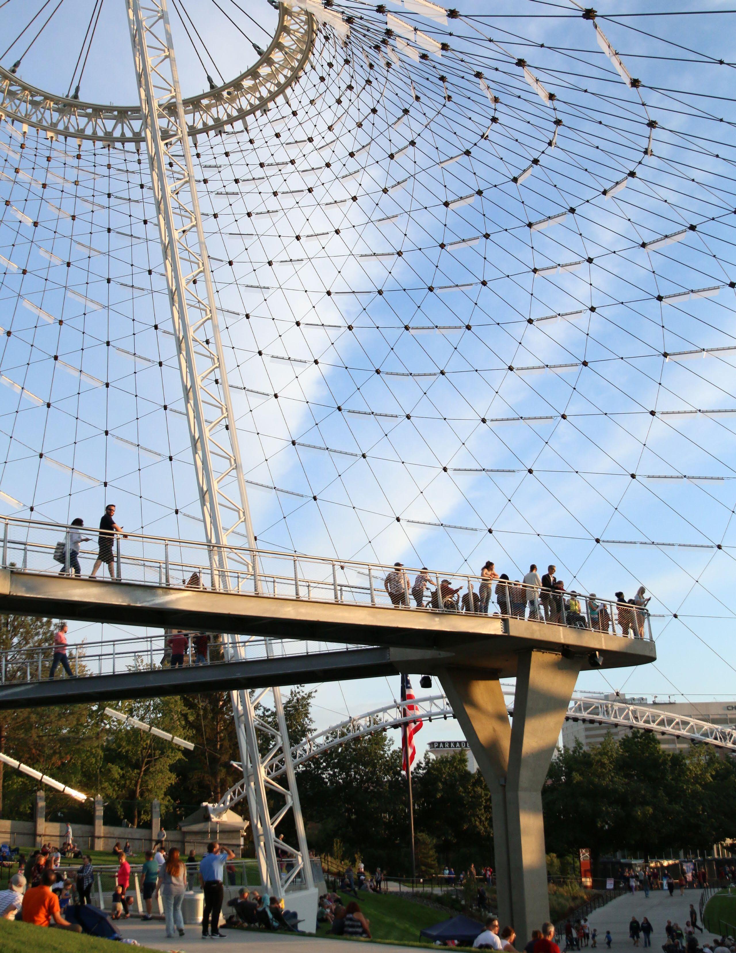
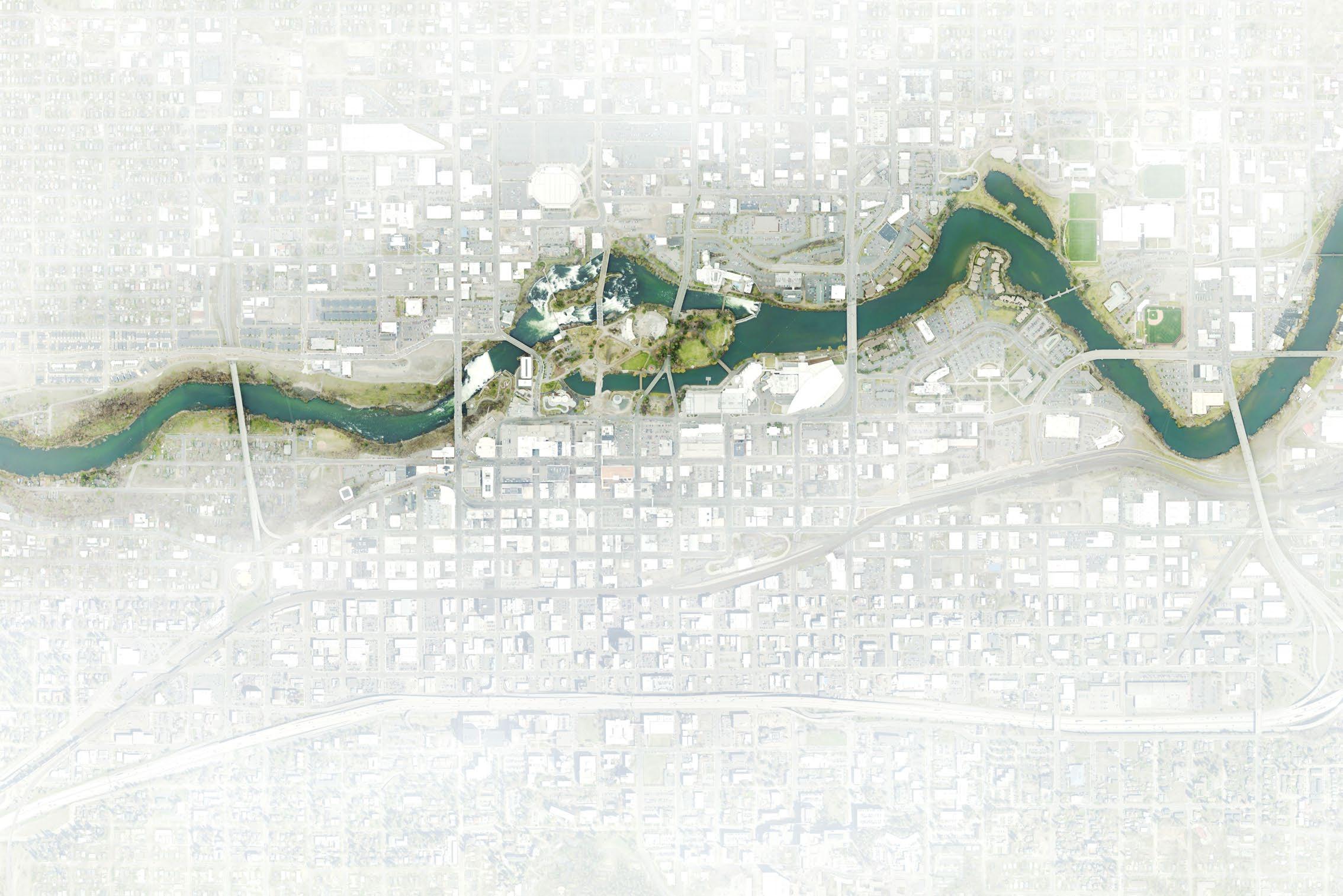
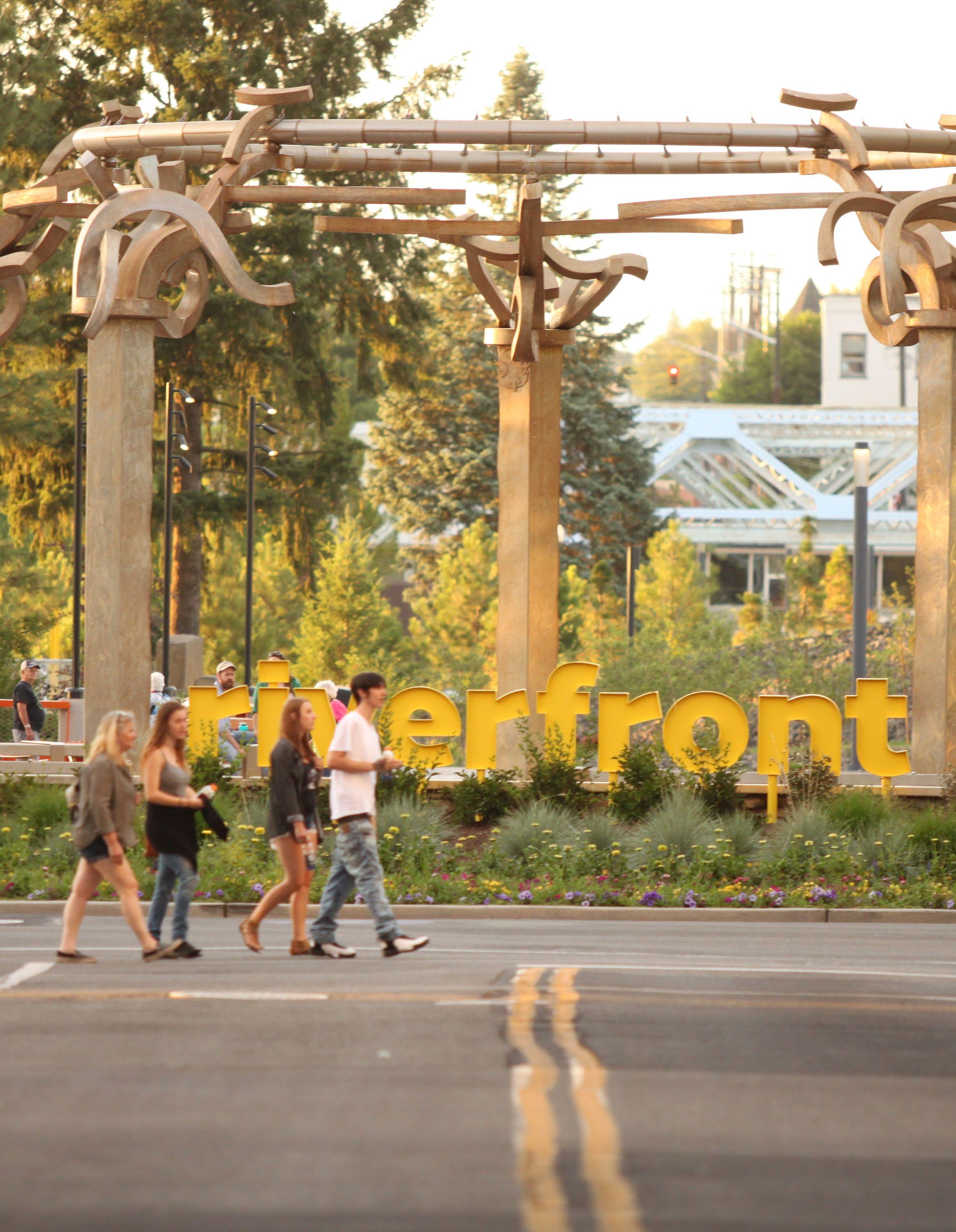
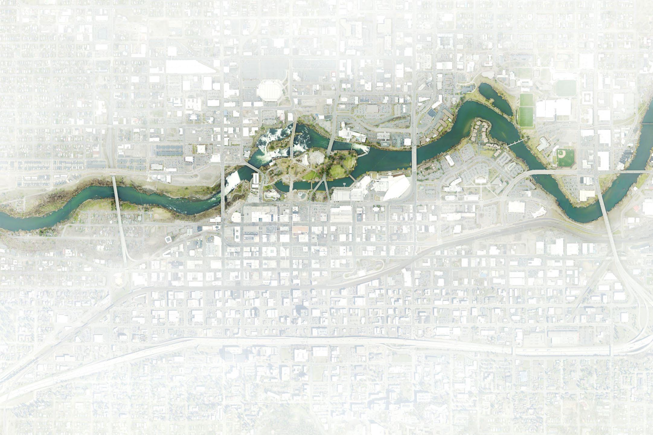
Figure 1 A redeveloped Riverfront Park is at the center of a greener, more active Downtown
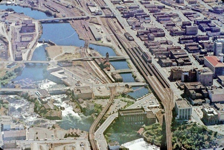
Figure 2 Railroads built facilities along and over the Spokane River in the early years of the twentieth century
Figure 3 Historic maps of Spokane river front
Figure 4 Downtown Planning Area
Figure 5 2008 Opportunity Sites
Figure 6 Downtown Context
Figure 7 Traffic Volumes
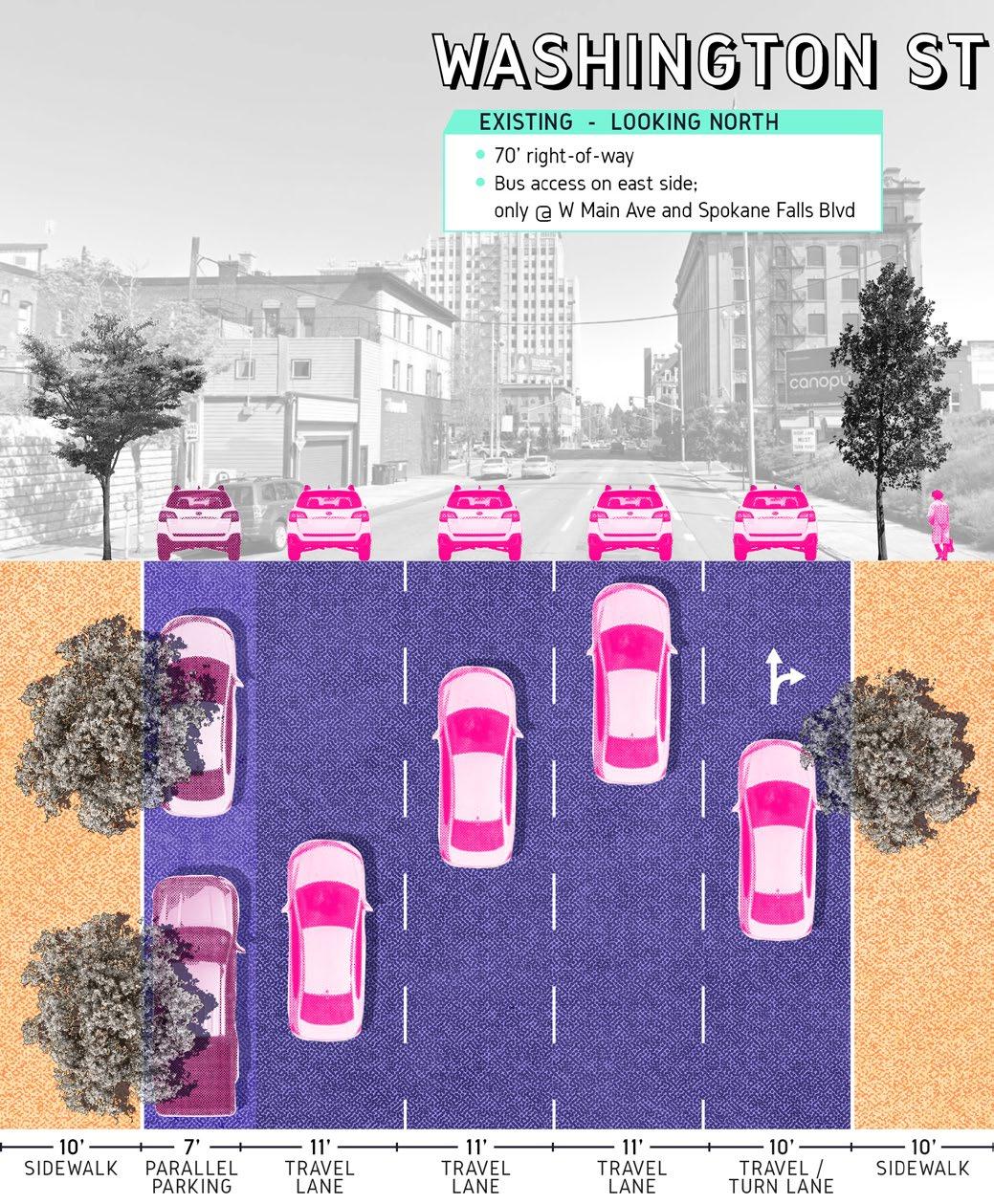
Figure 8 Existing cross-section of Washington St
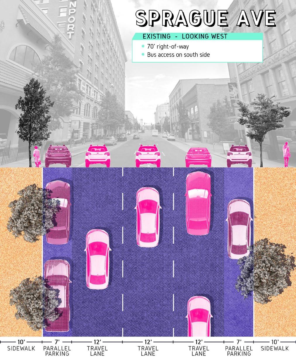
Figure 9 Sprague Ave existing cross-section between Wall St and Bernard St and between Post St and Riverside Ave
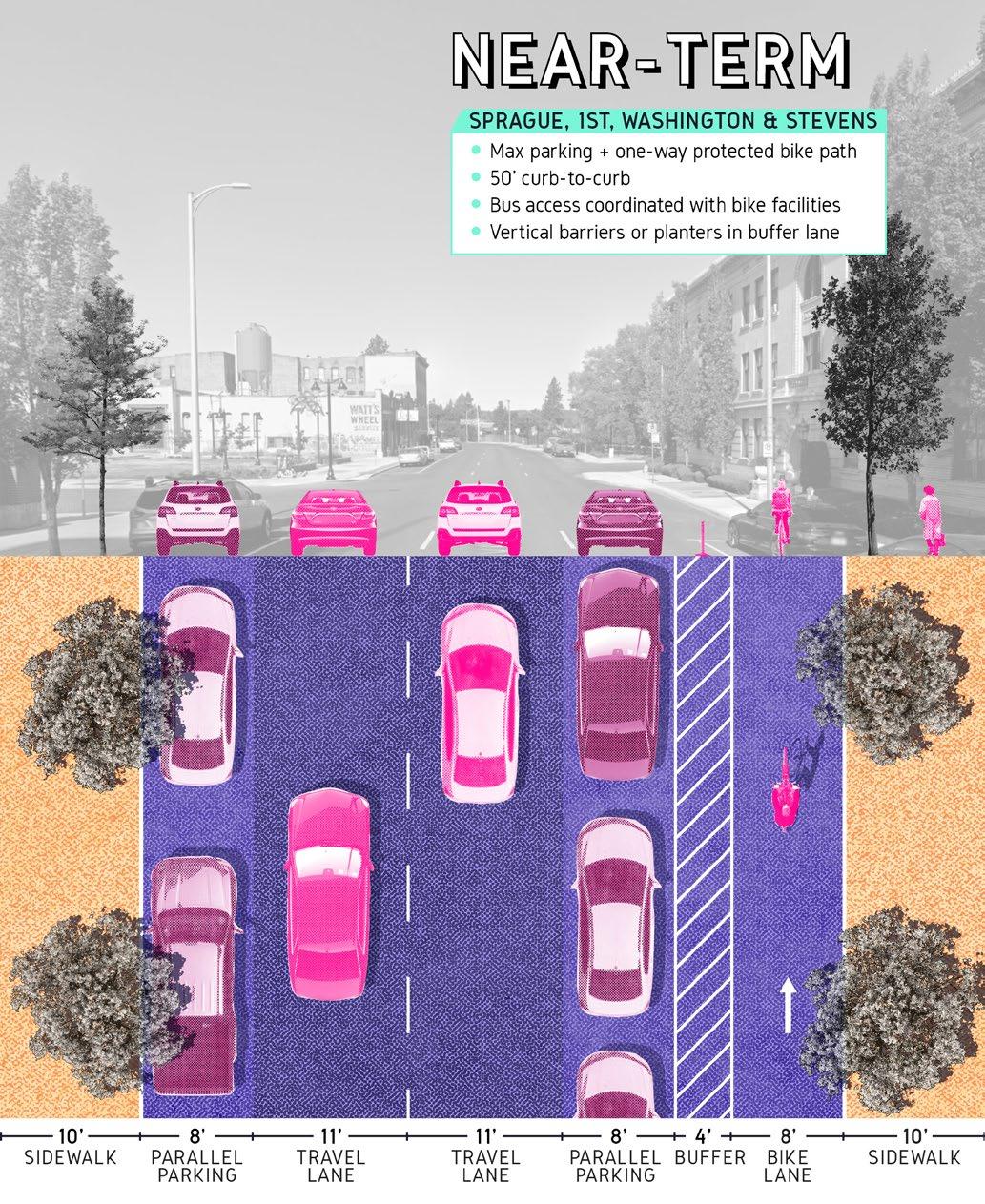
Figure 10 Cross-section of potential near term corridor improvements for Sprague Ave (West of Lincoln), 1st Avenue, and Washington and Stevens Streets
Figure 11 Cross-section of the long-term vision for Sprague and 1st Avenues prioritizing active transportation and public space
Figure 12 Visualization of potential low-cost improvements to the alley between W Main Ave and W Riverside Ave
Figure 13 Howard St existing cross-section and concept for potential improvements
Figure 14 Bird's-eye view of current conditions along Howard Street
Figure 15 Barrier
and
Figure 16 Complete Street
Figure 17 Surface Parking
Figure 18 Diagram of preferred parking location for Downtown Street Types
Figure 19 Context of the Rookery Block
Figure 20 Parking in the vicinity of the Rookery Block
Figure 21 Potential development concept for the Rookery Block
Figure 22 Cultural Sites
Figure 23 Visualization of potential projection across from the Fox Theater
Figure 24 Public Spaces
Figure 25 Visualization of Parkade Plaza
Figure 26 Concept for improvements to the alley between W Main Ave and W Riverside Ave
Figure 27 Visualization of potential development on the Rookery Block
Figure 28 Opportunity Sites
11
EXECUTIVE EXECUTIVE SUMMARY SUMMARY
EXECUTIVE EXECUTIVE SUMMARY SUMMARY
PREFACE
Spokane's Downtown Plan update is being published at a time that is very different from when we began the process. Through the experience of the COVID-19 public health crisis, economic impacts of business closures, and examining long-standing inequities in society, the City recognizes rebuilding our economy will need to provide inclusive opportunity for everyone to prosper.
The Downtown Plan has a ten-year horizon, and the beginning of that timeframe will focus on economic recovery from the aftermath of the pandemic. The intent of this plan is to set a framework for decision-making with a focus on diversity, equity, and inclusion so that as Spokane regathers its strength, Downtown will come back stronger, more resilient, and more welcoming and nurturing to all.
What downtown plans do best
Downtown plans synthesize many related efforts to find the gaps and synergies between them. Spokane has been working on targeted plans for infrastructure, transportation, public safety, diversity and inclusion, zoning and land use regulations, subarea planning, branding and marketing, and arts and culture. The role of the Downtown Plan is not to redo existing plans or social service policy, but to look for areas of agreement and ways that the multiple targeted efforts can work together in better ways. The Downtown Plan is an opportunity to highlight various efforts the City and its partners are working toward, and to bring people to a level of agreement on priorities and actions.
A Downtown Master Plan for this time and place
Spokane's Downtown Plan strategies will seek out areas of mutual agreement from the strong input received during the process. The recommendations of this Plan are based less on major capital improvements and more toward testing that can further consensus around permanent improvements in the future. The Plan actions are focused on next steps that will have the most impact on bringing activity back into Downtown and a roadmap for future planning.
This Downtown Plan identifies ways to support the people who live, work and play in Downtown, and uses this opportunity to test ideas that may not be new, but may achieve broad enough support to eventually be realized. This Plan can help Downtown stakeholders move past areas of disagreement, building consensus with three overarching principles:
Focus on areas of agreement
Focus on people and activity
Test and evaluate new ideas
Areas of Agreement: Energize Downtown
The idea that Downtown should be energized has agreement from all the input received for the Downtown Plan.
To that end, this Plan looks for ways to support businesses and organizations that activate Downtown, foster arts and cultural activities, and make it as easy as possible for people to create activity in public and private spaces. It encourages proactive public-private partnerships for near-term and long-term projects that benefit Downtown. The Plan recognizes that Downtown has space that can be harnessed as active space and options for using that space should be actively explored and tested to cultivate a sense of community. The City, Downtown Spokane Partnership and their partners should make every effort to highlight Downtown's assets, including historic buildings, private and civic activities, and its unique natural setting along the Spokane River and Falls. Finally, Downtown should draw on its own successful existing models, ranging from events like Hoopfest to new neighborhood parks and public spaces like A Place of Truths Plaza, and improved use of space in the street.
Focus on People
Making Downtown a place where people love to spend time means offering a variety of places that feel safe and comfortable, with things to see and do.
This Plan supports working together as a compassionate community toward short and longterm solutions for homelessness and substance abuse. Physical changes in public space that can help with comfort at all times of day include improvements to lighting, seating and plantings.
Focusing on people means encouraging and supporting entrepreneurs and artists who bring vibrancy to Downtown. It means making sure that people of all abilities can get to and around Downtown by multiple safe and convenient modes. And it means making Downtown an attractive environment for people to live, work, and play Downtown.
Test and Evaluate New Ideas
With the need to reignite activity in Downtown, it is a time to focus less on permanent changes (beyond those already planned) and more on testing actions that support people and activities Downtown.
Where street reconfiguration supports people's comfort, mobility and interest in Downtown, those changes can be tried in simple ways to see how they meet the goals of supporting people and activity. The City can use pilot programs to test new ideas by making them as easy as possible from a regulatory standpoint. The City and community leaders can engage property owners, businesses and organizations to find ways they would like to be involved in public space activation, looking especially for ways that such activity can benefit local businesses, entrepreneurs and artists. The Downtown Plan highly encourages monitoring and evaluation of the public space tests to understand what lessons can be learned, and use that evaluation to pursue permanent installation of successful temporary actions.
EXECUTIVE SUMMARY
Spokane's Downtown Plan is a strategic, actionoriented document that outlines the community's vision of Downtown for the next ten years. This plan aims not only to articulate a vision for Downtown where there is agreement, but also to define actions to achieve that vision and build consensus around the challenges Downtown faces. This Plan is organized in five sections that touch on the progress the City has made in the past decade, the planning process including what we heard from Downtown stakeholders, and more specific goals and strategies that work toward that vision.
Introduction and Background
The City has made great strides Downtown with significant public and private investment, but new challenges have presented themselves since 2008, when the City adopted its last Downtown Plan. The 2008 Downtown Plan highlighted where private development or public improvements could catalyze Downtown reinvestment. With redevelopment complete or underway at a majority of those sites, several of which were part of the ongoing redevelopment of Riverfront Park, the time is ripe for an update to the Downtown Plan. After the adoption of the last Downtown Plan, the City made great effort to advance the goals of the plan through new policy, regulation, and public projects. Downtown faces some new and enduring challenges such as homelessness and concerns around public safety, but there is growing vitality and energy.
Planning Process
The City and Downtown Spokane Partnership began the process to update the Downtown Plan in 2018. The resources allocated to the plan update and the scope of work are significantly less than for the 2008 plan. Therefore, some of the bigger ideas that were developed during this effort will require further planning and public process.
The existing conditions report formed the basis of preliminary ideas, and best practices that were presented to the public at the initial public meeting in October 2019. A survey, released before the public meeting offered more opportunity for input on existing conditions, challenges and assets. These broader ideas were refined into a draft framework and specific set of goals, which were presented at a second public meeting in February 2020. A second public survey conducted at roughly the same time collected input on the draft framework and goals. The results of these engagements form the basis of this Plan. The City, Downtown Spokane Partnership and planning consultants held several meetings with a steering committee representing stakeholder groups throughout the process as well as a meeting with the Downtown Spokane Partnership board.
Plan Framework
The plan framework outlines overarching goals to guide Downtown Spokane as it continues to grow and evolve. These five goals represent vital parts of a vibrant Downtown that attracts and serves local visitors:
A connected and walkable Downtown;
Thriving arts, culture and historic places;
A great place to live, work, and play;
Welcoming and engaging public spaces for all; and
A well-organized Downtown.
PRIORITY ACTIONS
Based on goals and vision in the plan, and the value of projects in the past ten years (outside of Riverfront Park), the following 15 priority actions will be possible within the next ten years Downtown:
Transform low traffic streets that are oversized for projected traffic by converting vehicle travel lanes to other uses in target locations such as highquality bike facilities, expanded public spaces, and on-street parking.
Develop a transportation plan specific to Downtown that considers multiple modes and addresses facility designs, locations, priorities, and funding.
Make sidewalks active and vibrant places through continued efforts to streamline design requirements, and developing new pilot projects in partnership with local businesses downtown.
Protect use of alleys for service access and improve certain alleys as pedestrian spaces, where improvements add to connections and active spaces Downtown.
Actively pursue redevelopment of surface lots.
Improve pedestrian experience and safety at undercrossings beneath the rail viaduct and I-90 with targeted interventions.
Improve and activate the streetscape and public realm to support cultural venues.
Identify sites Downtown for infill development that can help foster small businesses, local start-ups, and arts and culture uses and organizations.
Develop a thorough understanding of onsite conditions and update market demand studies around opportunity sites.
Create an integrated network of small parks and public spaces outside of Riverfront Park.
Pursue redevelopment of the existing surface parking lots in the DTC-100 Zone along Spokane Falls Boulevard.
Implement Transportation Demand Management (TDM) strategies.
Strategically program and activate public spaces Downtown
Develop the organizational capacity and partnerships to actively manage and program public spaces.
Connect sponsors with organizations that host events Downtown.
INTRODUCTION INTRODUCTION
+ BACKGROUND + BACKGROUND
The Downtown Plan is a strategic and actionoriented plan to achieve the community's vision for Downtown over the next 10 years. Through the public process the community identified challenges and opportunities to address as priorities during the planning period. Challenges such as homelessness and concerns around public safety have increasingly become issues for the public. But the public recognizes the growing vitality of downtown, expressing enthusiasm about making Downtown more connected and walkable, enhancing arts and culture, strengthening community partnerships to manage the Downtown, in order to make Downtown an even more attractive place to live, work, and play.
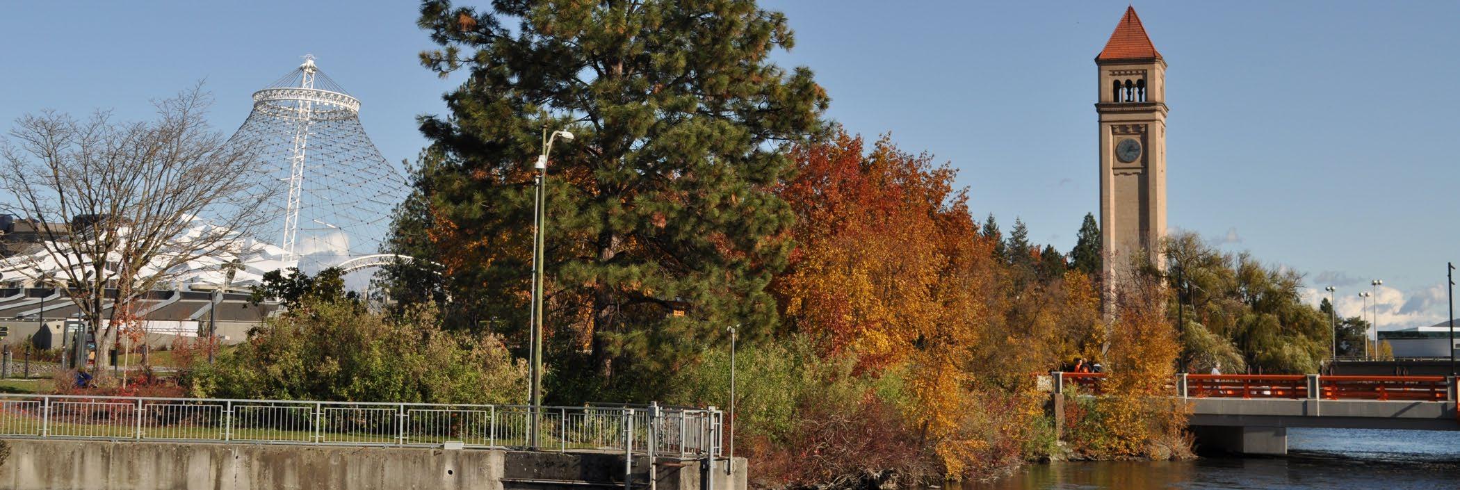
Community input showed a perception that Downtown is as strong as it has ever been and much of that success is attributed to the last five years. Several big moves have brought positive changes: the redevelopment of the crown jewel of Riverfront Park, growing residential neighborhoods such as Kendall Yards, and a growing presence of higher education in the University District.
At the same time, the community is also aware of new challenges that have emerged and need to be addressed through focused and collaborative effort. It is this collaborative and community-based approach that must drive the implementation of the plan and stewardship of Downtown by the City and everyone with a stake in the future of Downtown. Spokane is poised to capitalize on the success of Downtown and address challenges over the next 10-years to ensure Downtown Spokane remains a powerful asset for the City and the region.
HISTORY OF DEVELOPMENT
Sp'q'n'i ʔ and the Spokane River
Before European settlement in the 19th Century, the Spokane Falls were the center of fishing and trade for the Spokane Tribe. Since time immemorial, the Spokane Tribe fished the Spokane Falls in the heart of what is today Downtown. The tribe would fish every year for 120 days from late May through September.
Each day, on average, they would harvest 1,000 fish with an average weight of 30 lbs. Some fish, known as the "June Hogs," weighed an astonishing 110 lbs each. Some of these fish were nearly 6 ft in length.
By the end of the summer, the tribe would have harvested approximately 120,000 fish, weighing in conservatively at 3.6 million pounds. The salmon were not only the tribe's main source of protein but they were also the foundation of the tribe's monetary system.
For thousands of years, people from all around would gather at the Spokane River to fish the falls. All were welcomed and all who helped with the harvest were given a generous bounty. All the fishing from the falls of the Spokane River were overseen by the Salmon Chief. The Salmon Chief ensured that not all the fish were taken and plenty were allowed to continue upstream for spawning, assuring a plentiful harvest for future generations.
Historians believe it became unsafe to drink water directly from the river after 1878 due to impacts from agriculture, mining, other industries, urban development, and receipt of untreated wastewater. Later, construction of hydroelectric dams, located downstream, stopped the salmon from returning to the Spokane River. As a result, to this day, there are no longer salmon in the Spokane River.
The Spokane Tribe are river people, to them the Spokane River is sacred and has been the heart of their sustenance. The tribe has a celebrated and ongoing relationship with the river.
That's why in 2003 the Spokane Tribe set in motion the actions to create the highest water quality standards in the country for the Spokane River. By applying for and receiving "treatment as a state," through the Environmental Protection Agency and the Clean Water Act, the tribe is helping to ensure these standards will continue to guide the future stewardship of this precious resource. The Spokane Indian reservation sits about 35 miles downstream from the city of Spokane; therefore, all water that comes downstream from the city has to be treated in order to meet these strict standards.
The tribe's commitment to a clean river and healthy ecosystem helps to ensure clean water for generations and an unparalleled quality of life that can only be found in the Inland Northwest.
-Jeff Ferguson, Artist & Spokane Tribal Member, 2019
Early Urban Growth
The first permanent settlement of Spokane Falls was founded by James N. Glover in 1873, and incorporated in 1881, the same year the Northern Pacific Railway reached Spokane. Spokane experienced its first boom in the 1880s. With its critical position on the Northern Pacific transcontinental railway, the city quickly established itself as the commercial center of north Idaho mines, and the Inland Empire. After the catastrophic Great Fire of 1889, Spokane was rebuilt with the grand brick and stone buildings its residents still take pride in today.
Spokane's population surged in the first decade of the 20th Century, from 36,848 in 1900 to 104,402 in 1910. A booming natural resource economy drove this growth, attracting thousands of workers employed in temporary, labor-intensive work such as mining, logging, railroad, and farm work across the region. Like other large Northwest cities, seasonal lodging and businesses catering to single men working in these industries became concentrated in Spokane on the northern and eastern fringes of the Downtown Core, near railroad depots, rail yards, and other employment opportunities. By 1910 the East End included 97 saloons, 61 lodging houses, 50 clothing stores, 31 employment agencies, 31 barber shops, and five steam baths. At the heart of this bustling district, Spokane's "Chinatown" developed in a three-block area, with Chinese and Japanese residents and small businesses concentrated along a series of alleys and courtyards between Main Avenue and Front Avenue, later called Trent Avenue and now Spokane Falls Boulevard.
Olmsted Report
In 1906, the Spokane Parks Board hired the nationally-renowned Olmsted Brothers, who had just finished park system plans for Portland and Seattle. In Spokane, the Parks Board oversaw a ten-fold increase in the city's park land, including the Olmsteds' plans for Liberty Park, Cannon Hill Park, and a redesigned Manito Park. The Olmsteds were disappointed at the failure of the young city to capitalize on one key park site in Spokane, its natural state lost to a corridor of rail lines and industrial development stretching several miles along the river:
"Nothing is so firmly impressed on the mind of the visitor to Spokane, as regards to appearance, as the great gorge into which the river falls near the center of the city."
Postwar Changes
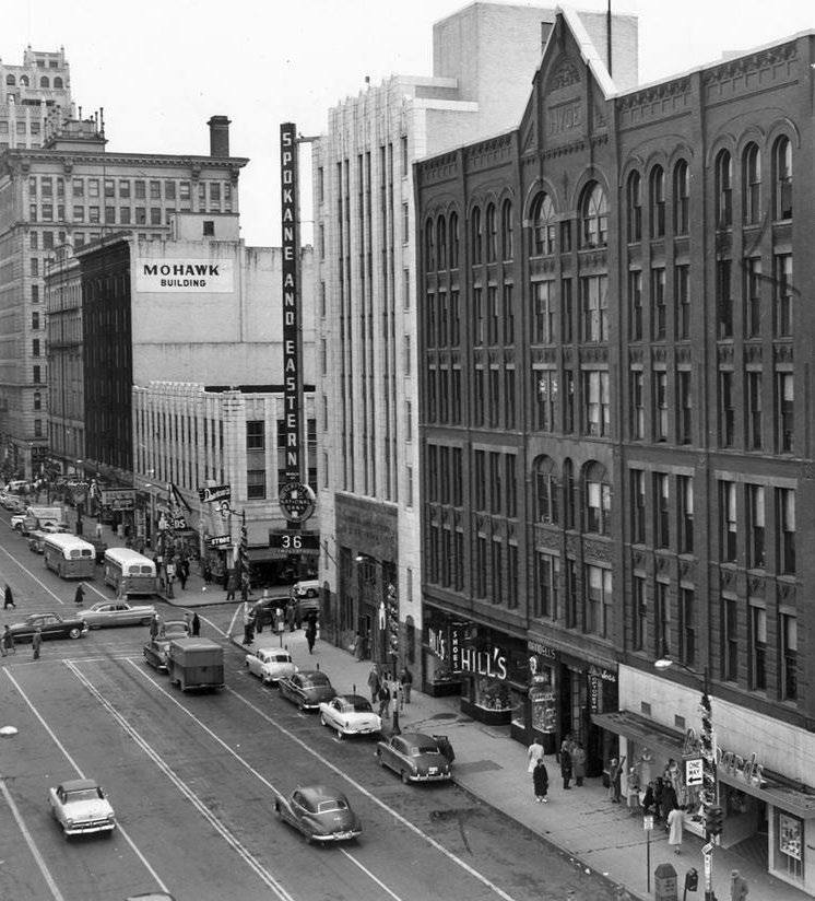
Downtown continued to flourish as a commercial and cultural center for the region through the Great Depression and World War II while growth in the Spokane region slowed considerably. However, local leaders of the 1950s saw troubling signs that Downtown's commercial activity was following new housing development outward to new suburban areas springing up at the city's periphery; downtown's share of retail sales within the trade area fell from 55% in 1948 to 40% in 1960. Meanwhile, areas such as the East End bore the signs of decades of wear and tear, crowded living conditions, and changing economic patterns. Depletion of local resources and mechanization reduced the labor force of industries like logging and mining that had once filled the residential, retail, and entertainment spaces of the East End over winters.
Olmsted Parks Plan
Plan
Davenport Hotel closes
Northern Pacific Railway reaches Spokane
City of Spokane Falls incorporated (later changed to Spokane)
Spokane becomes the County seat 1889
The Great Fire destroys 32 city blocks
Spokane becomes the largest city west of Minneapolis
Spokane World's Fair and riverfront redevelopment
Downtown Spokane Development Plan 1999
River Park Square opens Charting the Future Plan
University District Strategic Master Plan
Fast Forward Spokane Plan 1881
Davenport Hotel reopens
Riverfront Park Development Begins
Fox Theater reopens
Ebasco Plan
In 1959, a group of downtown business leaders called Spokane Unlimited hired Ebasco Services, Inc., a New York-based consulting firm, to prepare a plan for "major corrective surgery" on the heart of the city. Completed in 1961, the Ebasco Report for Downtown Spokane featured variations on the recommendations found in many of the 700 downtown plans adopted by American cities facing similar circumstances during the 1950s, inspired by elements of shopping malls that had recently begun to open in the suburbs.
Downtown Spokane realized part of this plan by establishing an "inner loop system" of one-way streets defining the core area's perimeter to improve vehicular movement. Some of the plan's other proposals (closing a downtown street to cars, developing a skywalk system, creating a centralized parking garage) were adopted many years later, and not to the extent envisioned by Ebasco. The centerpiece project in the Ebasco Report was a new Civic Center, which would have cleared the East End and created a modernist campus of "superblocks" harboring federal, state, county, and city governmental buildings, using federal urban renewal dollars. However, voters rejected funding for the Civic Center proposal twice, and Downtown leaders went back to the drawing board.
Expo '74 and Riverfront Park
Spokane Unlimited then hired a planner from California named King Cole to revive the effort to implement the Downtown revitalization program. Cole discovered that plans for a park on Havermale Island and both banks of the Spokane River held a special importance for those both inside and outside of Downtown. A dedicated group of planners and civic, business, and political leaders joined Cole in spending the next decade advocating for a transformative project along the Downtown riverfront.
These efforts ultimately led Spokane in 1974 to become the smallest city at the time to host a World's Fair, Expo'74, which was attended by more than 5.1 million visitors. In less than a decade following the failed ballot initiatives in the East End, the tangle of tracks and trestles along the river was transformed into a world's fairgrounds, celebrating humankind's newfound appreciation for the natural environment. The result was an enormous success for the city with a residual 100acre park and convention center site remaining at the fairgrounds, reclaiming access to Downtown's waterfront marveled by the Olmsted Brothers, and resembling the vision for riverfront parks and cultural uses proposed in the Ebasco Report.
Potential for Growth
Reflecting extensive citizen involvement, the local decision to pivot away from federal urban renewal funds, and toward state and federal sponsorships of the World's Fair, was responsible for Downtown revitalization in the long run. Transformation of Spokane's rail yards continued east of Riverfront Park with the Health Sciences university campus (formerly Riverpoint) beginning in the 1990s, and to the park's west, the Kendall Yards mixed residential, commercial, and office development, beginning in the 2000s. Today, both developments are substantially, but only partly, built out.
While revitalization occurring since the Ebasco Plan allowed some historic structures to be saved, many original buildings fell victim to a variety of factors, including a decline in railroad- based industry, difficulty adapting to safety codes and amenities featured in newer buildings, and speculation fueled by Expo '74. Several surface parking lots remain near Riverfront Park, in the East End, and elsewhere Downtown, on sites that formerly housed thousands of residents in single room occupancy and apartment dwellings, with street-level shops serving Downtown residents and visitors from far away; these sites represent potential for that vibrancy to return.
- The History of Development section contains text adapted from an Eastern Washington University research project by Christopher Green. He is now a planner with the City of Spokane.
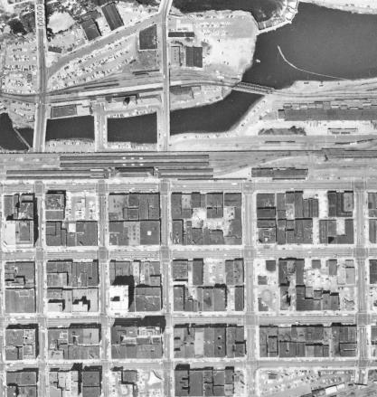
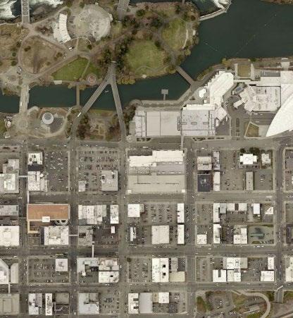
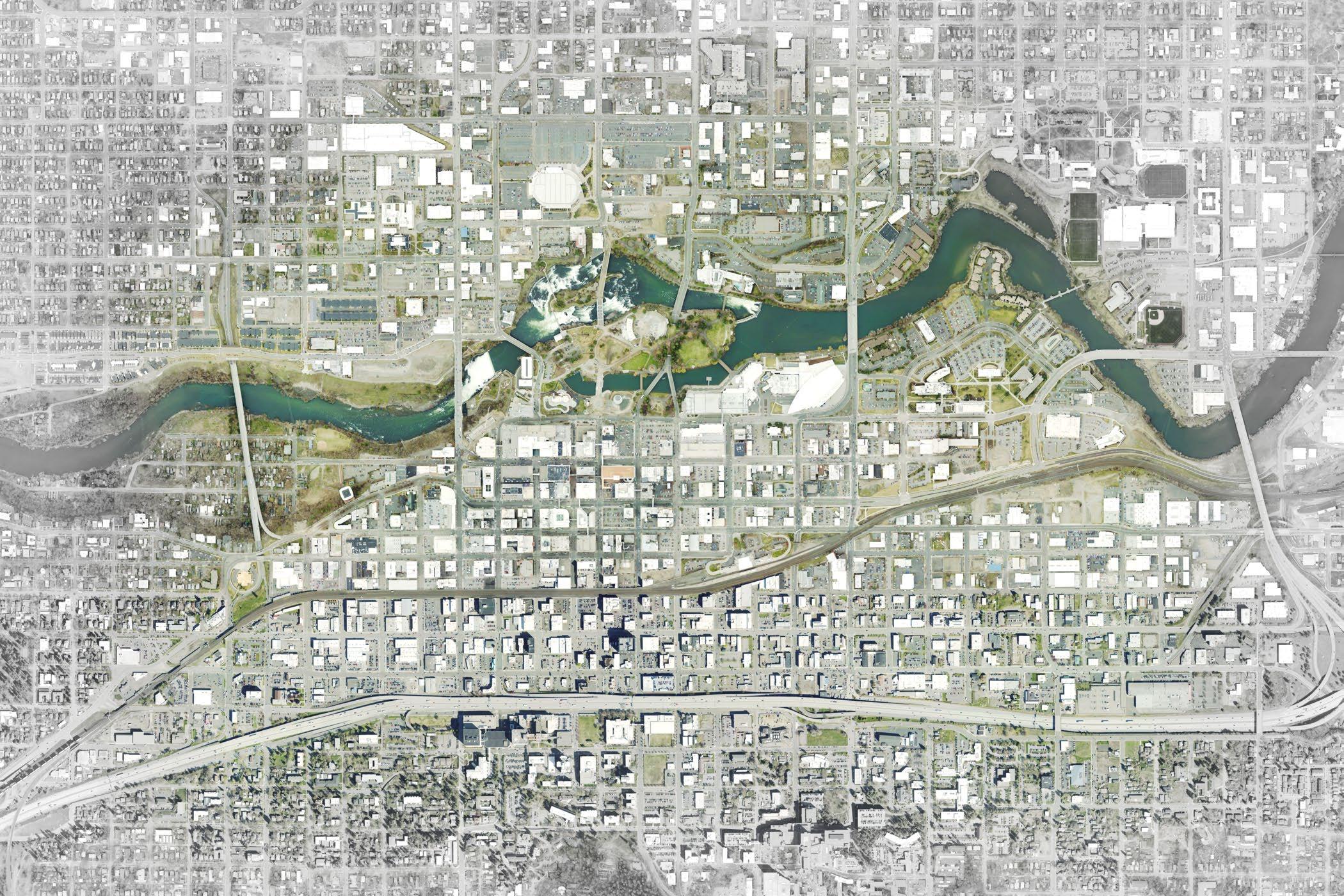
3: Along the Spokane River, extensive railroad infrastructure and related activities later evolved into the Convention Center and Riverfront Park. Nearby in the Downtown Core and East End, buildings were removed on nearly every block over time. The parking lots that remain harbor potential for additional development.
ACCOMPLISHMENTS
Related Planning Documents
DOWNTOWN PLANNING AREA
DOWNTOWN PLANNING AREA
IN THE PAST 10 YEARS
In the course of developing this Downtown Plan, the team gave careful consideration to the City's prior and ongoing planning efforts Downtown. One of the chief purposes of the Downtown Plan is to bring these projects together so that their work is aligned and integrated.
Spokane Municipal Code
2019 Downtown Parking Study
2010 Downtown Design Guidelines
2019 Browne's Addition Historic Guidelines
2020-2025 Strategic Plan to Prevent and End Homelessness
2014 Riverfront Park Master Plan
2014 Washington State University Health Sciences Master Plan Update
2015 Division Street Gateway Study
2017 Shaping Spokane Comprehensive Plan Periodic Update
2017 Main Avenue Visioning Study
North Bank Subarea Plan, Ongoing
2020 South University District Subarea Plan,
2016 Market Factors in Urban Growth Area Planning Analysis
2016 STA Moving Forward Plan and Central City Line Design and Planning
Public Projects
After the adoption of the 2008 Plan, the City built several public projects in addition to the opportunity sites summarized later in this section. In 2013, the City adopted Architectural Guidelines and kit of parts to improve entrances into Downtown from I-90. To date, three gateway entrance improvements have been completed (Division in 2015, Lincoln in 2017, and Phase 1 of Maple in 2019). Major combined sewer overflow facilities including tanks and other infrastructure were installed between 2016 and 2019. The CSO tanks at 1st Avenue and Adams Street and adjacent to the Downtown library are each capped with public plazas.
In the University District, the WSU Health Sciences campus continued expansion and the City extended Martin Luther King Blvd to the east, connecting in 2018 with Erie Street and Trent Avenue. The City also reconstructed a portion of Sprague Ave east of Division. The completion of the University District Gateway bicycle and pedestrian bridge stimulated development near its south landing, including the 2020 construction of Avista's Catalyst and Hub Buildings, and the Sherman Street pedestrian plaza.
Other notable street projects included new bike lanes for Main and Spokane Falls Blvd, reconstruction of Lincoln and Monroe Streets, and a pilot for lane reconfiguration on Main Ave to support additional parking along high-quality retail blocks. The City joined regional partners in developing the Wayfinding Project in 2016. This project described different levels of wayfinding signs for pedestrians and vehicles. The City continues to work toward implementation of the project with community partners.
Downtown Spokane Partnership recently founded the Downtown Spokane Community Investment Group (DCIG), a Community Development Corporation (CDC) that can partner with the City on public projects. The DCIG can access public bond market funding for projects that will eventually be under public ownership.
Policies, Regulations
In 2010, in response to the 2008 Plan, the city revised Downtown zoning design standards, reorganized zones, and introduced a new requirement within a portion of central Downtown for commercial parking to be located within a parking structure. The City separately and simultaneously adopted Downtown Design Guidelines, character area considerations, and reorganized the design review process and Design Review Board in 2010. These new guidelines drew heavily on the City of Seattle's Downtown Design Guidelines and did not include prior design guidelines for several types of projects, such as skywalks, bridges, and some types of public projects. The City of Spokane is currently working with a consultant to address those omissions.
Amendments to historic preservation regulations in 2018 expanded the review of demolitions by the Historic Landmarks Commission.
Opportunity Sites
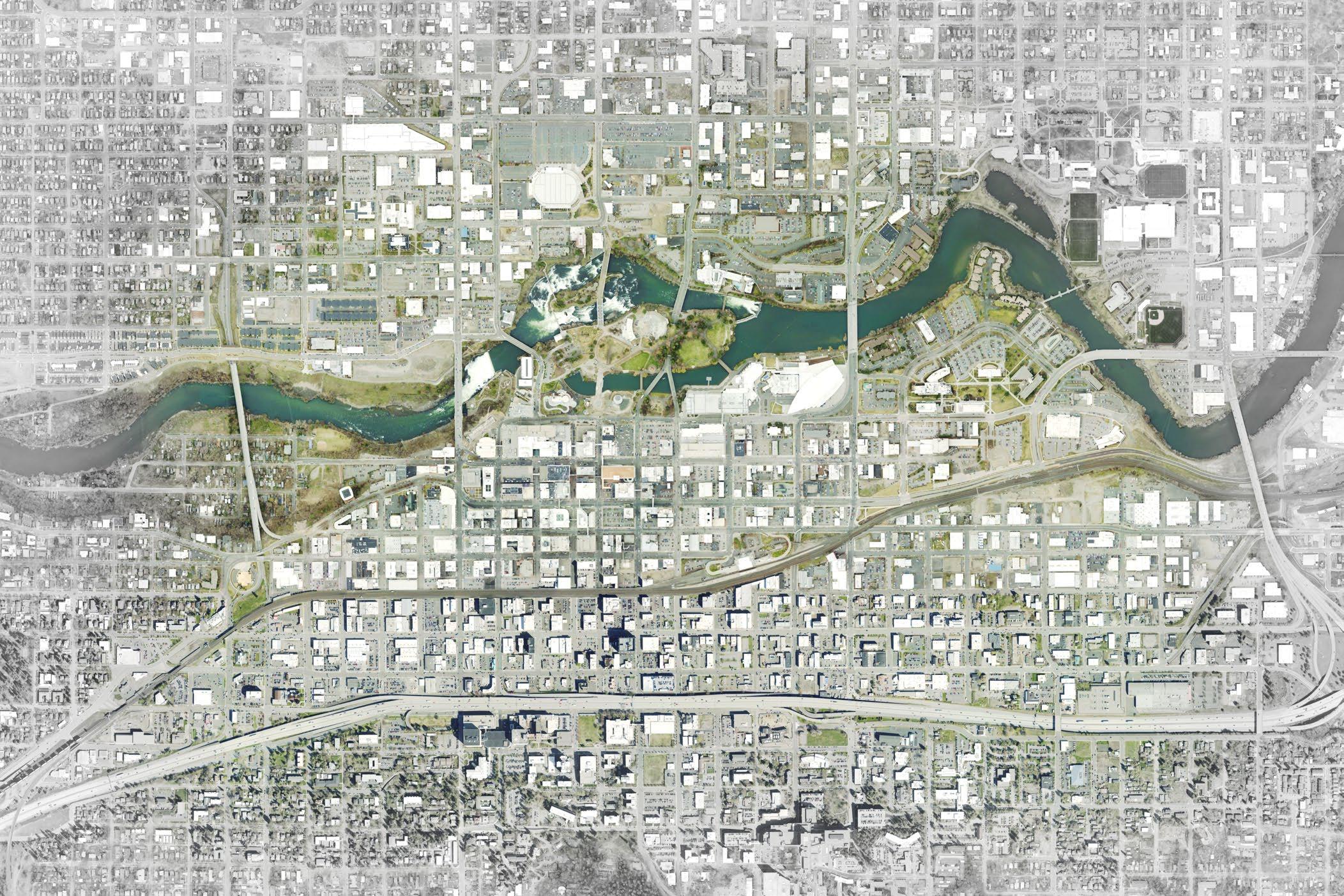
The 2008 Downtown Plan highlighted thirteen private opportunity sites and six public opportunity sites where development or public improvements could catalyze reinvestment in Downtown. Redevelopment is complete or is underway at seven of the thirteen private opportunity sites, and projects in five out of six of the public opportunity sites have been completed or are underway. The location and status of each of these sites in shown in Figure 3 on the following page.
Convention Center Expansion
Major Downtown Site A
Completed 2014: 91,000 SF expansion, new connected hotel and garage
Awaiting redevelopment, adjacent Bennett Block renovated in 2014
Major Downtown Site B Not redeveloped
STA Plaza
Macy's Building Site
New Mobius Site
Bridge St Site (Summit Pkwy)
Completed 2017: redesign with focus on street level activity
Completed 2018: 60,00 SF retail and 114 apartments
Redevelopment underway as part of North Bank Playground
Incomplete: CSO constructed with nonresidential development potential
Pine St Development Site Not redeveloped, in use by University
YMCA Site
Converted to a conservation area within Riverfront Park
Old Greyhound Station Not redeveloped
Intermodal Center Not redeveloped
Kendall Yards
South U District
Redevelopment underway, with initial phases complete
Subarea planning completed 2020 PUBLIC OPPORTUNITY SITES
Post St Bridge
Howard St Bridge
Riverfront Park
Anticipated 2021 completion
South span replaced, middle span restored for pedestrian use
Anticipated 2021 completion
Gateway Bridge Completed 2018
Maple St Bridge Ped/Bike Addition Not
PUBLIC
SAFETY
In 2020, the Spokane Police Department reestablished its Downtown Precinct in the core. As it continues to add police officers following passage of a citywide public safety levy in 2019, the Precinct builds on foundational, neighborhoodbased operations, an overall decreasing crime trend, and existing partnerships including collaborative outreach between agencies in the immediate vicinity.
The new highly visible Precinct location in the heart of Downtown positions police and partner organizations to enable increased community policing practices appropriate to improve the neighborhood's safety, such as police and ambassador patrols throughout Downtown on foot, bicycle, and other multimodal options, and engaging with and developing trusted relationships among the community to improve actual and perceived safety.
The Spokane Police Department continues these community policing efforts, meets regularly with Downtown Spokane Partnership staff to discuss policing strategies Downtown, and participates on Downtown's Business Improvement District board. These cooperative efforts, combined with many other community resources and the vision and goals in the Plan Framework of this document, contribute to a clean and safe Downtown for all of Spokane's residents and visitors to enjoy.
HUMAN SERVICES
Downtown Spokane serves as a central location for many support services for homeless individuals and families in the city and surrounding area. In recent years, the City of Spokane and Spokane County have led a regional approach to end homelessness, providing services and solutions for those experiencing homelessness. This new approach acknowledges that connecting individuals with services in their own communities leads to better outcomes, and increased stability than sending individuals to other locations they are not familiar with to access services.
According to the 2019 annual Point-in-Time Count of people experiencing homelessness, required by the U.S. Department of Housing and Urban Development and the State of Washington Homelessness Housing and Assistance Act, there are approximately 1,309 homeless individuals which make up 1,070 homeless households in Spokane County. This was up from 1,245 homeless individuals counted in January 2018. The Point-inTime Count has been conducted for 12 years. The boundaries of the study expanded to include all of Spokane County in 2018, making it problematic to compare numbers in previous years. The Count can be accessed at the City's website here or obtained at the City of Spokane, 808 W. Spokane Falls Blvd., Spokane, WA.
The City of Spokane is working to address homelessness through a combination of programs aimed at providing sustainable solutions to support people on a path to permanent housing, including programs that assist with substance abuse, mental health and improved job skills and training. The Spokane City and County Continuum of Care Board, a regional decision-making body adopted a 5-Year Strategic Plan to Prevent and End Homelessness for 2020-2025.
The 5-Year Plan outlines a range of strategies to reduce homelessness and extend support to those living unsheltered in Spokane County including emergency shelters, transitional housing, rapid rehousing and permanent supportive housing. Ongoing efforts in the County to centralize resources, address quality of life issues stemming from homelessness, and prevent at-risk families from falling into homelessness were pioneered by the City of Spokane in the past decade. Current efforts include:
The Spokane Resource Center, a HUD EnVision Center launched in 2019 to provide wrap-around support to help people achieve economic security.
Community Court , a Downtown intervention, is designed to address quality-of-life offenses with a therapeutic judicial alternative with support services. Individuals participating in the program have lower rates of recidivism than those who went through the traditional judicial system.
Increased use of "By-Name Lists" to evaluate, by priority population, (e.g. veterans, youth, families, etc.), the number of people actively experiencing homeless, the rate at which people become homeless, and the rate at which people experiencing homelessness are housed. This method is currently utilized for veterans, a group for which City efforts have had great success in reducing homelessness, and proposed for youth, which the City has a goal of functional zero homelessness by 2022 .
The City's Comprehensive Plan calls for regional sharing of services and housing solutions, while encouraging support and coordination among the partners involved to make that happen. It provides for dispersion of facilities and services across the city (Chapter 6, Section 6.2, Values; and Chapter 10, Policy SH 2.2 Special Needs Temporary Housing). The Comprehensive Plan also emphasizes a need for cooperation between public and private agencies to avoid duplication of services in developing a regionally equitable service delivery system (Chapter 10, Policy SH 5.1 Coordination of Human Services).
EXISTING CONDITIONS + TRENDS
Downtown Spokane's population is fairly small compared to the City's population overall and has not experienced the rapid downtown growth of similar peer cities in the U.S. Downtown has, however, seen some residential growth since the 2008 Plan, with a population increase of 4% between 2010 and 2018. By comparison, Spokane overall grew by nearly 6% and the County by almost 13% during the same period. As of 2018, Downtown Spokane's estimated employee population was 50,498, putting employment density Downtown at 4,675 per square mile. Over 41% of Spokane County residents, or 209,527 people, live within 5 miles of Downtown.
Employment and population growth in the Inland Northwest in recent years has outperformed the U.S. as a whole. In 2018, employment in the Spokane Kootenai Metro Area grew at 2% compared to 1.6% nationally, with the strongest growth in construction, manufacturing, healthcare, leisure and hospitality and professional services. While the office market in Downtown Spokane has been fairly active, vacancy rates for office space in the Central Business District (16.4%) have grown slightly higher than those in suburbs and outlying areas (15.6%). This may point to new opportunities to build upon the recent success in Downtown to enhance business attraction and retention.
Findings
The following are the key findings from the Existing Conditions Report in Appendix A.
Downtown has achieved measurable success: Significant public and private investment has helped reinvigorate Downtown.
Many streets in Downtown are auto dominated and oversized for vehicle capacity: Opportunities exist to energize streets by expanding space for pedestrians, cyclists, and other forms of micro-mobility.
Community members desire continued progress on two significant issues facing Downtown: providing services and solutions for those experiencing homelessness, followed by improved public safety. People consistently expressed concern for public safety. Even so, police statistics show that crime decreased Downtown in 2019. Annual point-in-time counts of homeless people suggest increasing numbers for certain populations, but that is likely due to an expanded geographic area for counts starting in 2017.
Activity centers are disconnected: While areas of Downtown have successful concentrations of activity, they are disconnected both physically and visually from the core of Downtown. Enhancing connections through street and mobility improvements, wayfinding, and infill development will help connect the City and the many amenities in Downtown.
The parking system lacks cohesion and provides a poor user experience: A substantial effort is underway to improve parking Downtown through improved onstreet management, technology, shared parking, and branding and wayfinding to better manage existing parking resources.
Riverfront Park improvements can be a catalyst: The $65 million invested in the redevelopment of Riverfront Park will impact the future of Downtown, providing additional opportunities to catalyze future development efforts. The new energy from investment in Riverfront Park can extend throughout Downtown, with the Park as the heart of Downtown rather than its edge.
Entries and connections into Downtown should feel safe, welcoming, and distinct: Major streets that are entrances to and exits from Downtown merit improvements as city-defining gateways. Other natural gateways like undercrossings can help offer a better experience and image of Downtown.
PLANNING PLANNING PROCESS PROCESS 3 3
PLANNING PLANNING PROCESS PROCESS
KEY THEMES
Several common themes emerged from stakeholder and public input gathered throughout the planning and engagement process.
1. There is strong support to improve streets, alleys, and public spaces.
2. Parking is inconsistent, with too many surface lots, and a lack of well-designed and managed employee parking Downtown.
3. Homelessness and public safety are pressing concerns from the public. There are divergent opinions about how to effectively address homelessness through centralized or decentralized services.
4. Greater access to viable alternatives to driving Downtown.
5. There is support for preserving vehicle access on major routes into and out of Downtown.
PUBLIC MEETINGS
DSP, City Staff and the consultant team hosted two public workshops over the course of the plan update. The first workshop on the evening of October 22, 2019 focused primarily on existing conditions Downtown, peer cities, and best practices. The second workshop on the evening of February 5, 2020 addressed the draft goals and strategies developed early in the process.
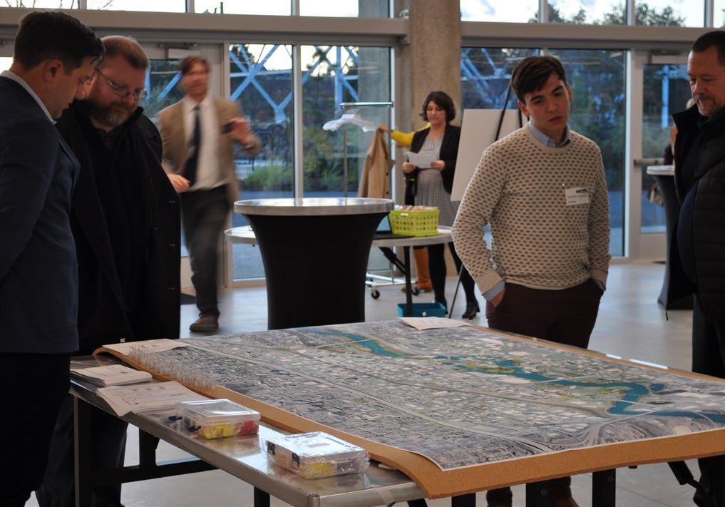
Public Workshop #1
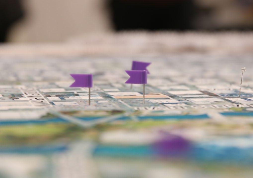
The first public workshop at the Pavilion in Riverfront Park ran for over two hours and drew some fifty-five attendees. Community members were invited to comment on preliminary findings and existing conditions and map opportunities and challenges related to buildings, streets and public spaces, and public safety. The consultant team briefly presented an existing conditions analysis and opened the floor to feedback with live polling and a moderated question-and-answer session.
Comments from the public were largely supportive of broad ideas for the future of Downtown listed below.
Creating a safe and well-maintained network of bike routes
Improving the experience of people walking through better maintenance and strengthening walkable connections Downtown
Improving and co-locating homeless services
Creating new smaller-scale public spaces and activating existing public spaces
Preserving historic buildings Downtown
Supporting activities and investment in Riverfront Park
Improving access to and use of transit and making modes other than driving more viable
Public Workshop #2
The second public workshop at the Wonder Spokane, located on Post Street on the North Bank, brought out eighty-four participants. The planning team presented the goals and strategies they developed to serve as the framework for the plan update in an open house format. Participants could mark boards to indicate whether they liked or disliked specific strategies and offer detailed comments on specific strategies and locations Downtown. In all, public input was largely positive, and there was clear consensus around the following:
Improving multi-modal access with new pedestrian and bike friendly connections
Encouraging new residential development and enhancing residential amenities downtown
Potential development of a cultural and historical trail
SUMMARY OF COMMENTS FROM WORKSHOP #1
SUMMARY OF COMMENTS FROM WORKSHOP #1
A network of safe, protected bike facilities
A safe and vibrant
family destination with new attractions
Wayfinding and signage particularly for pedestrian and transit routes
Better regional rail access with more convenient departure times
Alleys with yearround activation
Dense, mixed use development
More conveniently located grocery stores Downtown
Improved homeless services with public hygiene facilities
More green and open space with wildlife habitat
No surface parking lots
Affordable housing and equitable development
Fewer cars downtown
Better sidewalks, and a safer, more comfortable pedestrian realm
Improved transit service and infrastructure
health sciences campus
Focus Areas
Distinct downtown areas that could be strengthened with targeted investment
Infill Opportunities
Potential development sites (e.g. surface parking lots)
City Line
Planned bus rapid transit line through Downtown
Potential Cultural + Historic Trail
A trail to highlight historic and cultural uses and connect focus areas
SURVEYS
Through two separate surveys, the Downtown Plan team engaged stakeholders between public meetings and gathered input on priorities for the plan. The first survey focused on existing conditions, challenges, and assets. Participants were invited to submit peer cities and images for Downtown Spokane. The second survey covered the framework, goals, and strategies that form the basis of this Plan.
Among the 590 responses to the first survey, from October 14 to November 4, 2019, there was broad agreement on Downtown's greatest assets and challenges, for each of which participants could select up to 3 responses. The Spokane River and Falls (83.2%) and Riverfront Park (74%) are widely considered to be Downtown Spokane's greatest assets, while Downtown's greatest challenges according to respondents were homelessness (66.3%) followed by public safety (57.1%). Common peer cities respondents listed were Portland, Boise, Denver and Austin.
The second survey from January 14 to February 17, 2020, with 647 responses, was accompanied by a rough plan framework and a reference map of Downtown Spokane showing landmarks, major projects, and focus areas to be incorporated into the plan. Participants ranked the five goals in the Plan Framework section of this document from most to least important, with the most important goals being a connected and walkable downtown, followed by welcoming and engaging public spaces. Average rankings for each goal are shown in the graphic below. Responses were generally favorable to the goals identified by the Downtown Plan team, 62% rating them a 4 or 5 out of 5.
DOWNTOWN'S
FOCUS GROUPS
Two focus groups were held in Downtown on September 23rd and 24th, 2019, with a mix of Downtown stakeholders. The first focus group covered parking, transportation, and public safety. The emphasis of the second group was on economic development, urban design, and the Downtown experience. The stakeholder interviews and focus groups were opportunities for targeted engagement with representatives of specific groups such as Downtown residents, business owners, developers, and community groups. The perceptions expressed in these sessions were not necessarily reflective of the community in its entirety.
Input at each of these events revolved around several key themes, summarized below:
The redeveloped Riverfront Park is a tremendous asset that is shifting the center of gravity of Downtown;
Spokane is great at planning and hosting successful major events that should be leveraged to bring more people Downtown;
Homelessness and public safety are the biggest challenges facing Downtown;
Parking is inconsistent, with too many surface lots, and a lack of employee parking Downtown;
There is a need for more housing, and more diverse housing options Downtown;
The pedestrian and retail experience Downtown are fragmented with voids between active uses, and lively areas; and
Maintenance and activation are critical to the success of Downtown's parks and public spaces.
STEERING COMMITTEE
The City, DSP and the consultant team held three steering committee meetings between January 8 and February 28, 2020. Members of the steering committee represented various City boards, local agencies, and organizations, including:
Business and property owners
Hospitality Association
Developers/Builders
Spokane City Council
Residents and employees
Plan Commission
Arts Organizations
Downtown Spokane Partnership
Visit Spokane
Avista Utilities
Spokane Public Facilities District
University District
Washington State Department of Transportation
Common themes for improving Downtown Spokane from the stakeholder meetings included:
Better connections to and from surrounding neighborhoods and different districts across downtown
A broader range of prices and sizes for housing development
Encouraging street vibrancy and economic development with more uses and activities in public areas at different times of the day
Implementation of strategies that will make streets more navigable for visitors and walkable for everyone
Demand and supply approaches to reduce the prevalence of surface parking lots
44 FRAMEWORK FRAMEWORK PLAN PLAN
PLAN FRAMEWORK PLAN FRAMEWORK
INTRODUCTION
This plan framework outlines a series of overarching goals to guide Downtown Spokane in its continued growth and revitalization. It reflects current conditions, opportunities, and public input received during the project building upon Downtown's successes over the past decade. The framework sets forth strategies to achieve that vision for Downtown, putting community goals first. A detailed discussion of these strategies in the following section integrates them into a set of physical, regulatory and programmatic improvements that will help build a more welcoming, better connected, livelier, and culturally rich Downtown.
VISION
Downtown Spokane is the cultural and economic heart of the Inland Northwest, drawing people from the region, the nation, and around the world. Centered on the Spokane River, the spectacular falls, and the signature Riverfront Park, the urban fabric is walkable and full of interest and distinctive character. Downtown feels safe, comfortable, and welcoming for people of all communities and backgrounds. The history of Spokane shines through in its irreplaceable architecture and the stories of railroads and industry. Downtown Spokane continues to draw new residents and businesses with opportunities for education, recreation and cultural activities. As everyone's neighborhood, Downtown Spokane is a great source of pride and is poised to capture the opportunities of the future.
GOALS
A CONNECTED + WALKABLE DOWNTOWN
CW1 Energize streets and Alleys Downtown as active pedestrian- and bike-friendly connections
CW2 Capitalize on the City Line and support the transit network with coordinated investments that improve access to transit
CW3 Reduce impacts from surface parking
CW4 Implement a wayfinding program for Downtown
THRIVING ARTS, CULTURE + HISTORIC PLACES
ACH1 Highlight Downtown's history to build awareness of local culture and support the arts
ACH2
ACH3
LWP1
LWP2
LWP3
LWP4
LWP5
Bring arts and culture into the public realm Downtown and develop an Arts Plan to support arts and cultural uses with a focus on Downtown
Create space for art-focused and culturally-oriented small business and organizations, targeting those that cannot afford to locate Downtown
A GREAT PLACE TO LIVE, WORK + PLAY A WELL-ORGANIZED DOWNTOWN
Encourage residential and mixed-use development with a variety in housing types and sizes that are affordable to a range of income levels
Enhance residential amenities like public spaces, services, and cultural uses Downtown
Apply zoning changes and other tools to sustain and enhance mixed-use development with active street-level uses
Improve transit access, commute options and parking management for Downtown residents and employees
Support environmentally sustainable growth Downtown and responsible stewardship of the Spokane River and Falls
WELCOMING + ENGAGING PUBLIC SPACES FOR ALL
PS1
PS2
Program and activate public spaces Downtown
Protect, expand, and improve public space in strategic locations
WO1
Cultivate leadership, strengthen community partnerships, and expand organizational capacity for Downtown management
WO2 Leverage parking management to improve Downtown and enhance the Paid Parking Zone
WO2 Develop new promotions and marketing campaign to attract businesses
55 THE THE PLAN PLAN
THE THE PLAN PLAN
The vision for the future of Downtown Spokane was formed around five goals that came out of input from focus groups, public meetings, and survey results. Each of these goals represents a vital piece of an aspirational Downtown, attracting and serving local communities and visitors. The Plan includes broad goals with specific strategies and actions for each goal, bringing together and building on the City's planning, policy, and design projects to move Downtown Spokane toward an ambitious vision.
GOAL: CONNECTED AND WALKABLE
A well connected and walkable fabric recognizes that the right-of-way is actually public space, and the allocation between modes of travel, parking and places for people and commerce can be adjusted to best serve the city's needs. Downtown's streets and public spaces contribute to the image of an attractive downtown and provide the setting for public life and community activities. Spokane's historic development pattern provide an opportunity for a rich pedestrian environment, but street improvements should be modified so they could better support movement, commerce, and activity throughout the day, into the evening, and throughout the year, while still balancing the needs of all street users.
The intent of strategies in this section is to:
Prioritize space for people in the design of streets while accommodating vehicle access.
Improve connections that link Downtown and surrounding neighborhoods.
Support more active streets with integrated public spaces, public art and wayfinding along with more active retail, dining and cultural uses.
Increase access to transit for people of all economic status in adjacent neighborhoods and throughout Spokane.
Streets comprise more than 80% of public spaces in cities, but they often fail to provide their surrounding communities with a space where people can safely walk, bicycle, drive, take transit, and socialize.
- National Association of City Transportation Officials (NACTO) Urban Street Design Guide, 2013
CW1
STRATEGY: Energize streets and alleys Downtown as active pedestrian- and bike-friendly connections
Several streets in Downtown are designed to carry much more motor vehicle traffic compared to current or projected lower volumes, remaining under-utilized as public space (see Figure 7, Traffic Volumes). Maintaining convenient vehicle access Downtown, creating a friendlier environment for people walking and biking are both key to energizing Downtown streets. There are opportunities to create or improve bicycle, scooter, and pedestrian infrastructure, and potentially on-street parking where there is more vehicle capacity than is needed now or anticipated in the future. These specific, following Actions include initial low-barrier changes to test how the improvements function and to inform potential long-term capital projects, and priority investments in the City's multimodal network that link Downtown and surrounding neighborhoods.
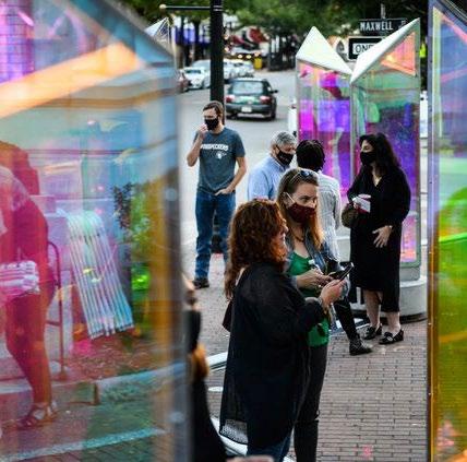
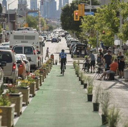
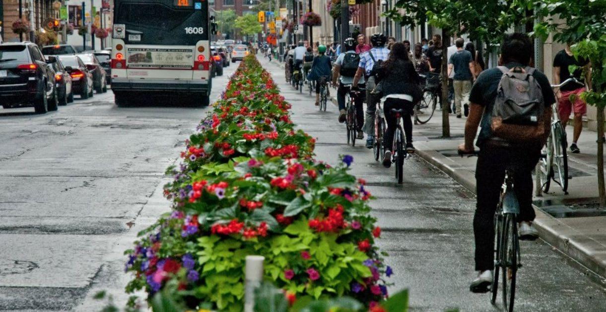
and bike improvements on Toronto, ON Danforth Avenue create spaces for people to walk, bike and enjoy safely
Throughout the process, people have expressed the desire for better wayfinding. One of the ways to help people navigate is to have more distinct characters to each street and more wayfinding strategies are further discussed in section CW4. In Downtown Spokane, it is easy to tell when you are on Spokane Falls Boulevard because of the adjacency of the park. By clarifying and boosting the particular positive characteristics of the other streets, each street benefits and people are more aware of their location. A high-level description of key streets is on the following page and several of these streets will become part of the new City Line Bus Rapid Transit (BRT) line.
SPOKANE FALLS BOULEVARD is distinct as the edge of Riverfront Park. The south side of Spokane Falls Boulevard can benefit from adjacency to the park and provide compatible uses, such as restaurants and cafes. It is also important for through traffic, with the highest volumes of the east- west retail corridors.
MAIN AVENUE, between Lincoln and Howard and immediately west of Division, has the strongest retail character. Main also has areas with excellent pedestrian-scale streetscape that can serve as a model.
RIVERSIDE AVENUE / MLK JR WAY has the only two-way configuration of the east-west streets, and it has good connectivity to the east and the west. It is central to the five major east-west retail corridors of Downtown. All of these characteristics make it ideal for multi-modal and transit use.
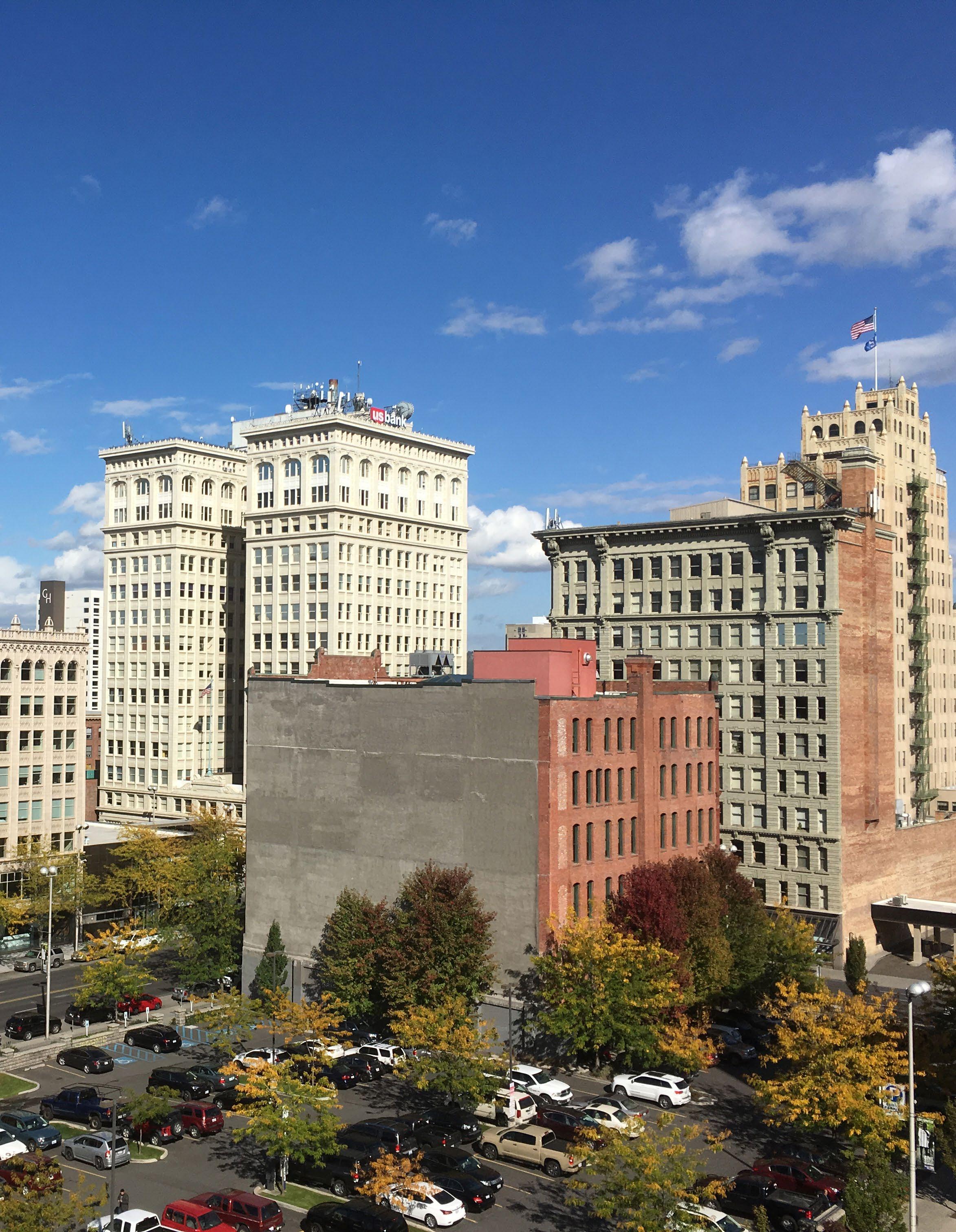
SPRAGUE AVENUE has lower traffic volumes along with a high concentration of historic buildings and cultural uses, including the Davenport, the Knitting Factory and the Fox. Sprague has the potential to highlight some of Downtown Spokane's unique architecture and cultural venues.
FIRST AVENUE is farther from the river and one block from the elevated rail tracks, retaining some of the working feel of old Spokane. Along with Railroad Alley, it benefits from a mix of uses and a less refined aesthetic.
HOWARD STREET has been identified in previous plans and used as a key pedestrian street because of its connection through Riverfront Park. This plan also recognizes Howard as an important pedestrian and bicycle route and retail street through the Downtown Core.
STEVENS STREET is a one-way connector southbound from the North Bank through Downtown to neighborhoods to the south. There is an opportunity to add on-street parking and bike facilities in the Downtown core.
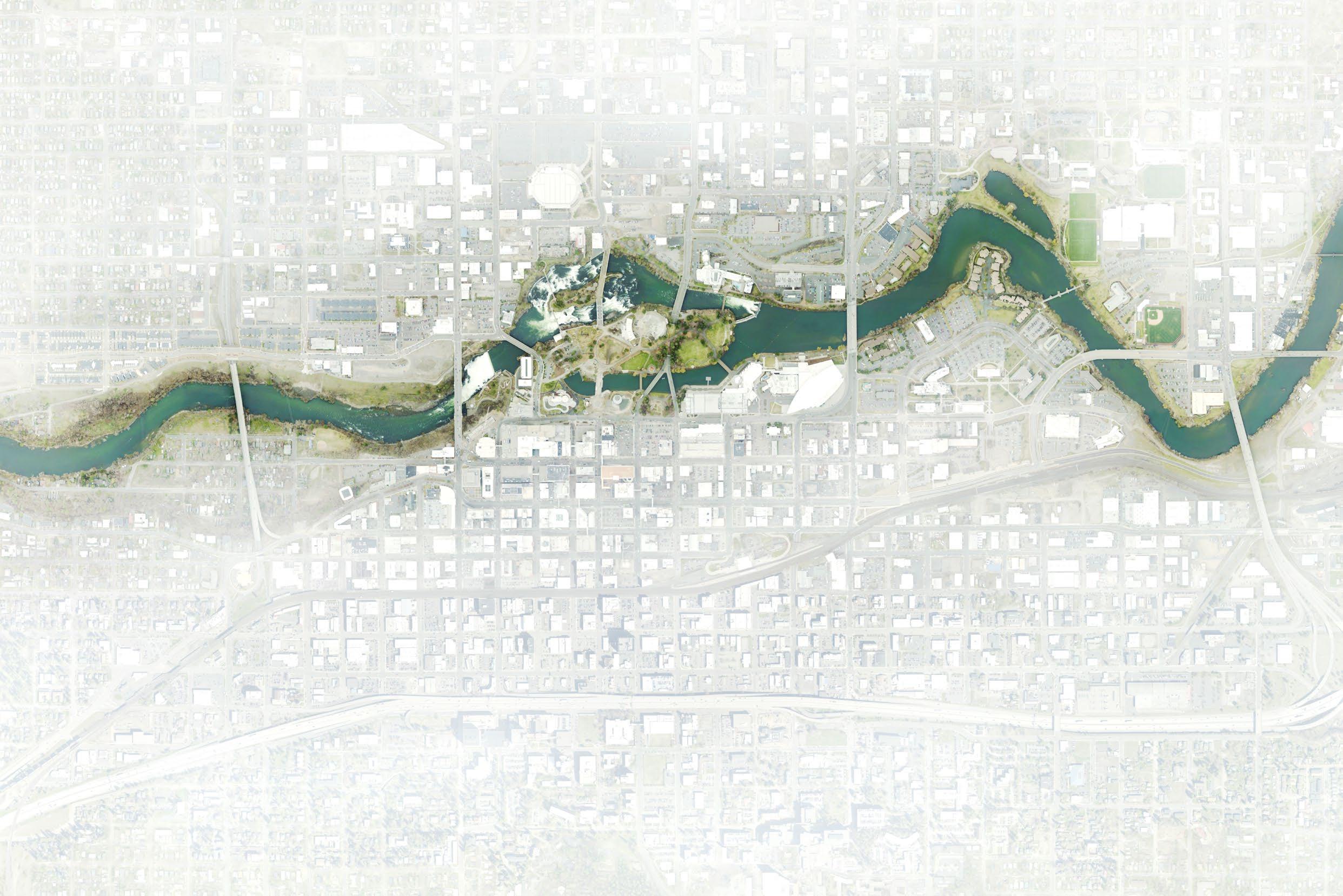
TRAFFIC VOLUMES TRAFFIC VOLUMES
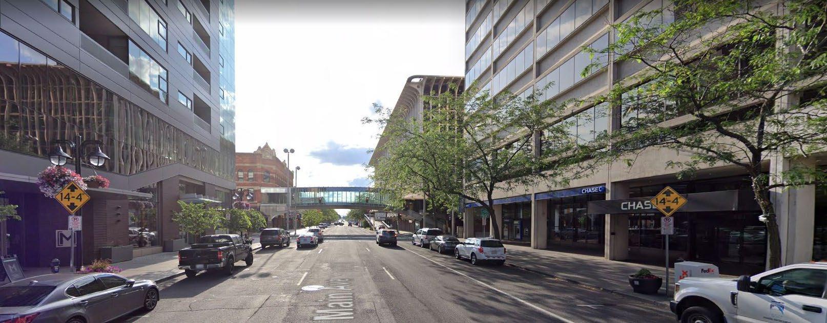
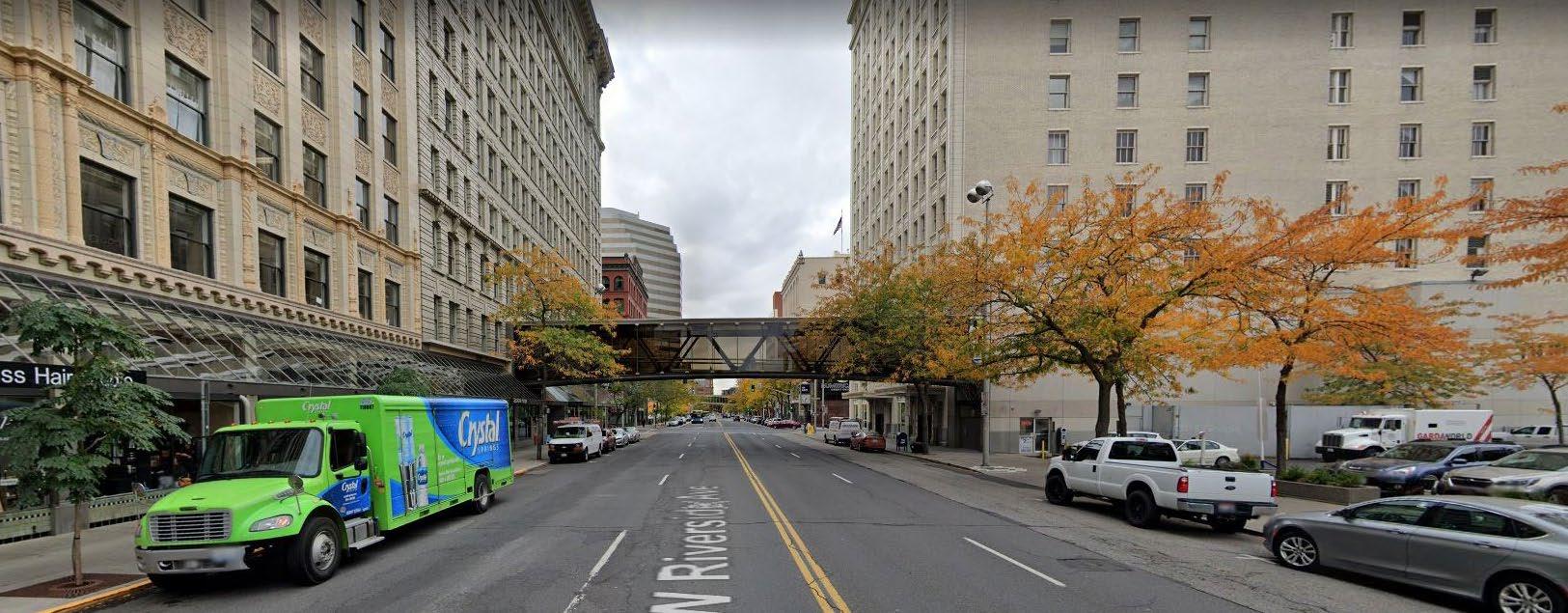
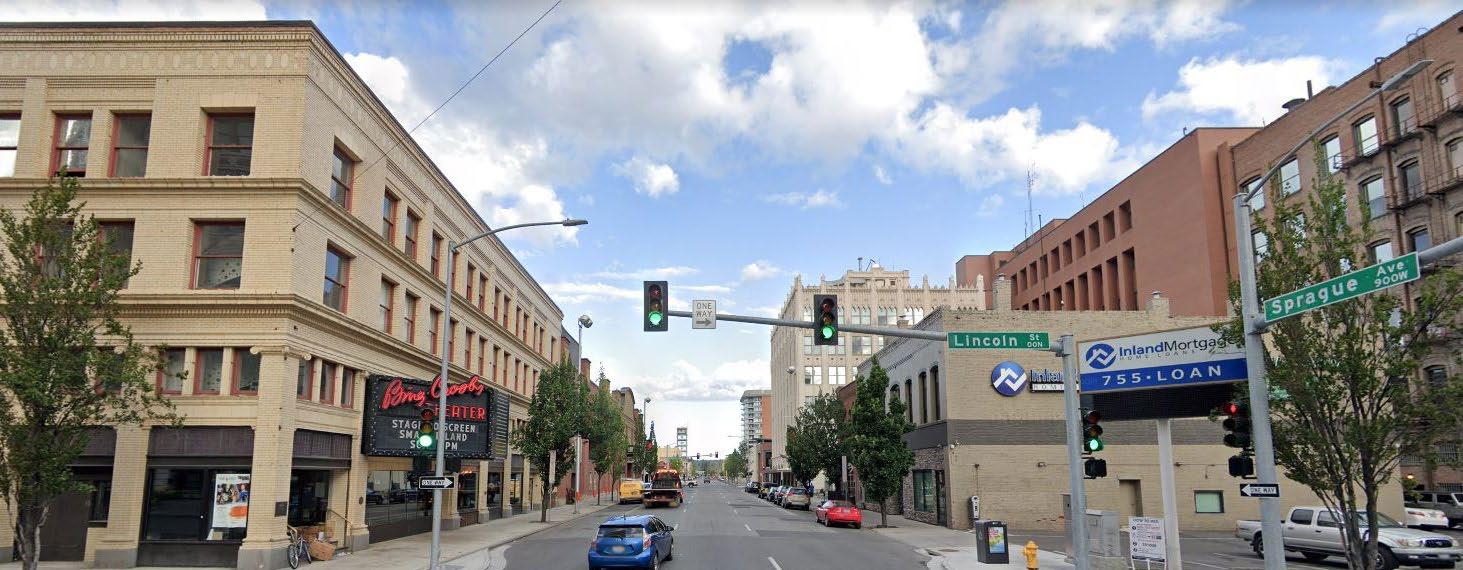
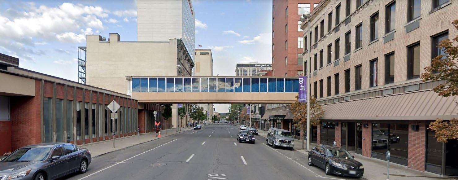
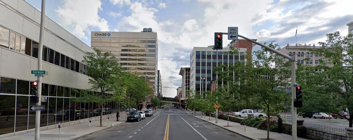
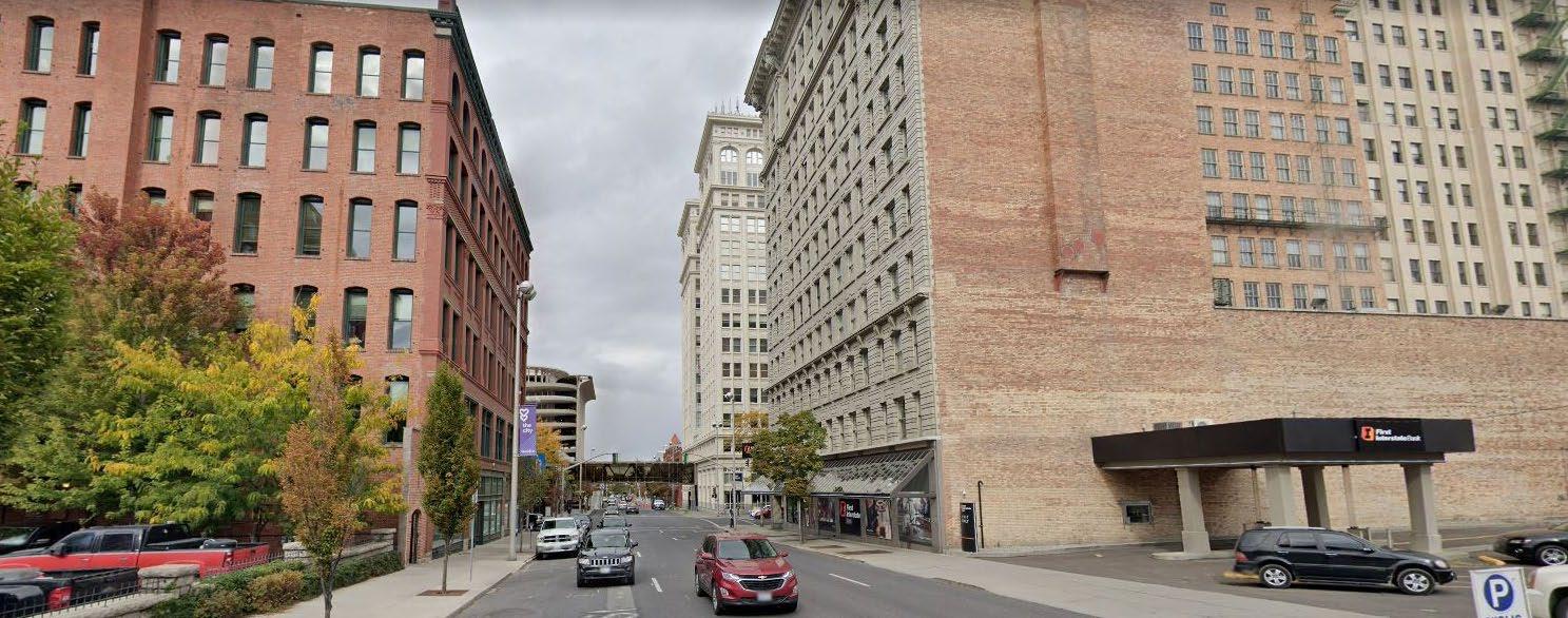

Downtown's system of one-way streets provide convenient access to Downtown for vehicles from all directions. However, some streets have lower traffic than they were designed for and could be energized through street improvements such as Parklet or oudoor patio/sidewalk café space that create a better experience for people walking or biking through Downtown. Sprague and First Avenues, and Washington and Stevens Streets, in particular have traffic volumes that are far lower than their design capacity.

Each of these streets is an opportunity to create a more complete bicycle network and a more comfortable environment for people walking and rolling.
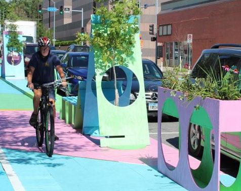
ACTION: Transform low traffic streets that are oversized for projected traffic by converting vehicle travel lanes to other uses in target locations such as high-quality bike facilities, expanded public spaces, and on-street parking.
Space for an active public realm can be created by converting individual lanes of general-purpose travel to bike/ scooter lanes and offer locations or expanded pedestrian spaces where they are in excess of projected traffic needs. Pedestrian space can be prioritized near active and cultural uses with landscaping, outdoor seating and dining, and space for passive recreation and an opportunity to integrate public and civic art along major corridors.
Both 1st and Sprague Avenues carry low traffic volumes but are designed for vehicle capacity well in excess of existing or projected traffic, and each have a concentration of active uses at ground level. These streets in particular are great opportunities to create distinct corridors Downtown with an energized public realm. The City Line, a new six-mile, corridor-based bus rapid transit route, will be an important part of the future streetscape in Downtown and there will be opportunities for enlivening the street in coordination with the transit. Any future street reconfiguration will need to address hotel and entertainment needs for loading and operations, as well as the City Line operations in the left-hand lane west of Post St, since stations are not designed to accommodate bicycle movement. Paired one-way bicycle facilities on both streets or a two-way facility on one of these two streets would help complete the bicycle network Downtown, consistent with the City's Bicycle Master Plan (BMP). To bridge barriers like I-90 and the Spokane River, and reduce stress on bicyclists and pedestrians, north-south connections with bicycle facilities should be prioritized to connect Downtown with surrounding neighborhoods. Washington and Stevens Streets are a key opportunity to complete Spokane's Downtown bike network, connecting both sides of the rail tracks on the east side of Downtown. North-south bike facilities under the rail viaduct on Washington and Stevens could connect with a potential greenway along Pacific Ave with the improvements slated for Riverside Ave, and eventually extend a low-stress bike facility into the South Hill. This facility can use space from one of the four travel lanes on each street with minimal impact on traffic and parking Downtown.
Most conflicts between cyclists and motorists happen at intersections, and intersection treatments are as important as the facilities themselves along these corridors. Bicycle crossing markings should be considered as a treatment at all intersections along protected facilities, with bike boxes at signalized intersections and two-stage bike turn boxes for left-hand turns onto connecting bike facilities. NACTO provides a more complete guide of safe intersection treatments for bicycle facilities along different roadway configurations in the Urban Bikeway Design Guide available here. The bicycle projects should follow current best practice design guidelines as defined by NACTO and the Federal Highway Administration.
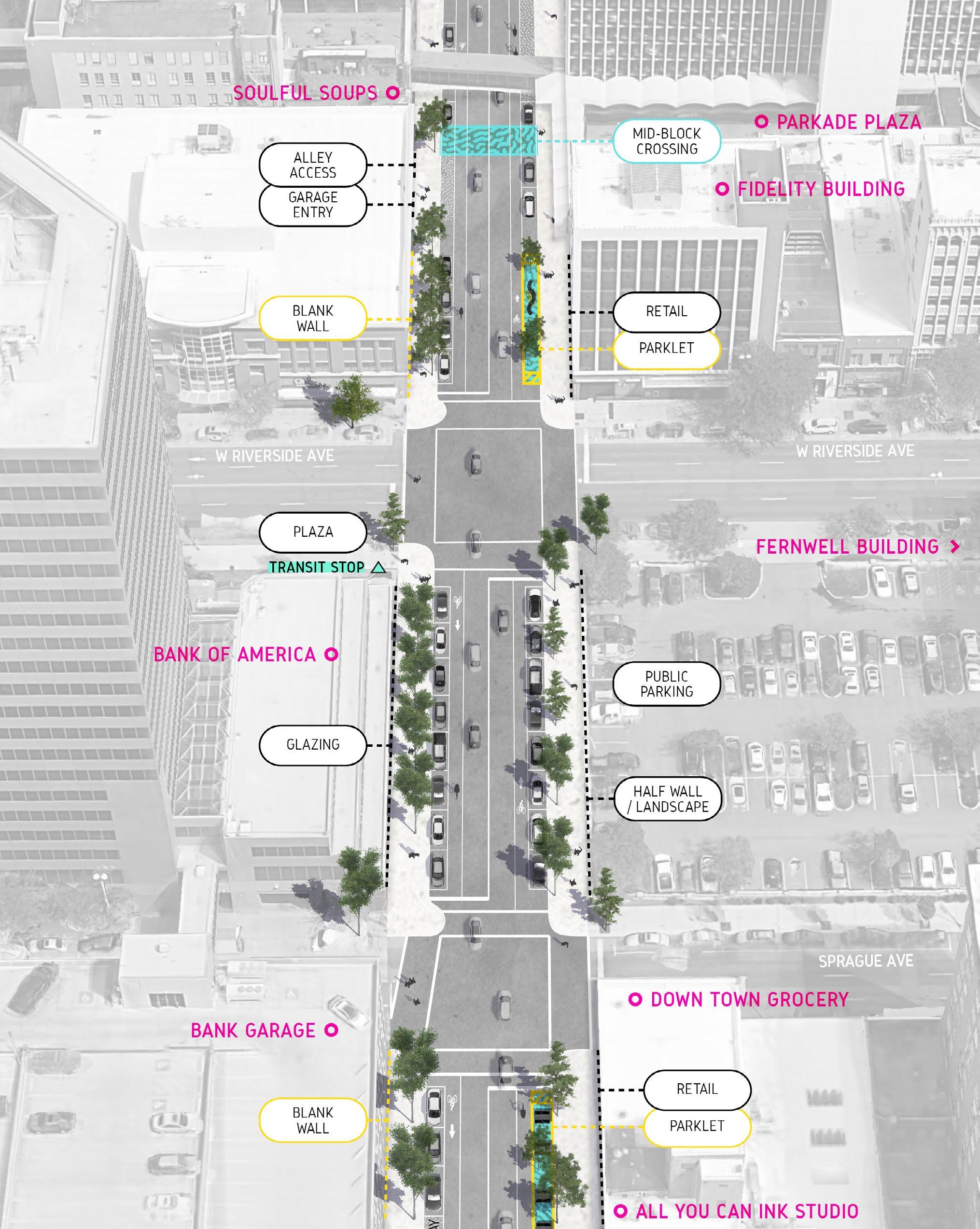
This street design concept integrates bicycle facilities in the existing curb-to-curb space on Sprague and 1st Avenues between Maple St and Bernard St and on Washington and Stevens Streets between I-90 and Riverside. The cross-section on the right shows a near term option for separate bike lane on all four roadways, and could be adapted for an additional travel lane along Washington and Stevens Streets instead of on-street parking along both sides of the street, pending additional traffic analysis.
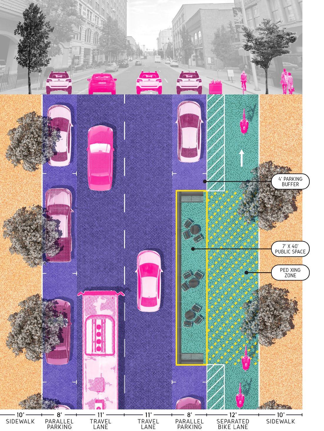
This design concept shows a longer term vision for Sprague and 1st Avenues and shows how public spaces could be integrated with various facilities at specific points along the street, such as landscaping, bike parking, angled parking and a transit stop. These improvements could connect Spokane's concentration of theater venues and arts uses. These improvements can be accommodated with the same space as one of the existing travel lanes on Sprague and 1st, with small public spaces within the parking lane. Transit stations would need to be integrated with bike facilities running along the north side of Sprague, with specific design solutions for bus operations between Post St and Howard St.
CW1.2
ACTION: Develop a transportation plan specific to Downtown that considers multiple modes and addresses facility designs, locations, priorities, and funding.
The City's Bicycle Master Plan identifies planned bike facilities on most streets in Downtown but does not include specifics on the types of facilities planned on certain streets. The City Line will enhance Downtown accessibility and the transportation plan for Downtown developed under this Action can help integrate all modes, including walking and cycling, with transit. The City and community would benefit from a clearer set of priorities for improvements for bikes and other transportation modes Downtown with an emphasis on high-quality and safe facilities in strategic locations to create a balanced and holistic network. Streets that have excess vehicle capacity but are not a priority for bike improvements could incorporate other features within the City's Downtown Streetscape Improvement Plan to energize the street such as parklets and streateries, public art, landscape elements, lighting and electrical service, and other active uses. In the Downtown core, much of the lighting is about 50 years old and electrical service infrastructure is antiquated and may need replacement as part of the improvements.
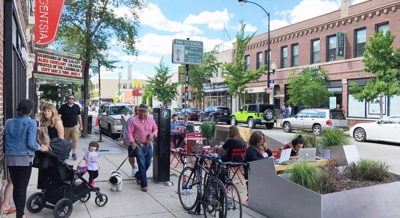
ACTION: Make sidewalks active and vibrant places through continued efforts to streamline design requirements, and developing new pilot projects in partnership with local businesses downtown.
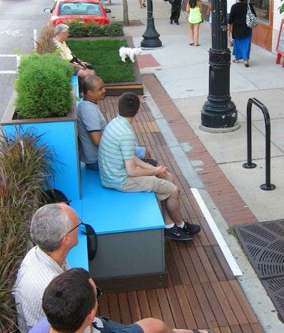
The City can streamline process and design requirements for uses near and within sidewalks and pilot other improvements, such as seasonal bicycle and scooter corrals in focus areas such as Sprague Avenue or Howard Street. Further, the City should consider expanding the Parklet program with design guidance and standards for Parklets, Streateries, and bike and scooter corrals in angled on-street parking spaces and spaces in surface parking lots.
CW1.4
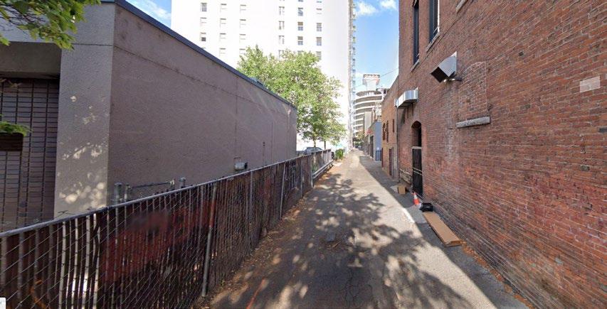
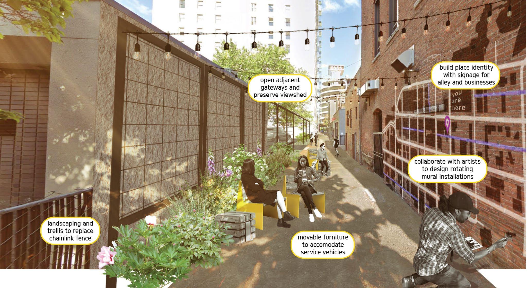
ACTION: Protect use of alleys for service access and improve certain alleys as pedestrian spaces, where improvements add to connections and active spaces Downtown.
Downtown has a well-connected network of alleys that are not being used as spaces for people. Alleys provide an opportunity for greater connectivity and creative design interventions to draw people in and create a memorable experience. Alleys also provide dedicated access away from busier streets for garbage collection, delivery and service access and access to parking garages and surface lots.
The City would benefit from developing policy language that protects continued public ownership of desired alleys and rights-of-way. Existing code provisions listing alleys under the Downtown Complete Street Designations, together with vacation criteria, should be reviewed and included in that policy. Where alleys are being activated, redesigned, or used as shared streets, the City and neighbors should invite cooperation of property owners adjacent to the alley. At such activated alleys and other mid-block pedestrian connections, the City should consider implementing painted mid- block crossings to connect these pedestrian links. Placemaking furniture, landscaping, and lighting must consider and adequately accommodate other alley uses.
Three alleys present the best opportunities for pedestrian improvements and activation as part of an active shared alley concept and can be used as a model for future Downtown alley improvements.
Railroad Alley, particularly in the West End (Monroe St to Adams St);
Downtown alley between Main Ave and Riverside Ave, coordinating public alley improvements to the east and west of Parkade Plaza from Howard to Stevens Streets;
Steam Plant Alley between the railroad and W 2nd Ave, just south of the Downtown Core, from Post St to Lincoln St.
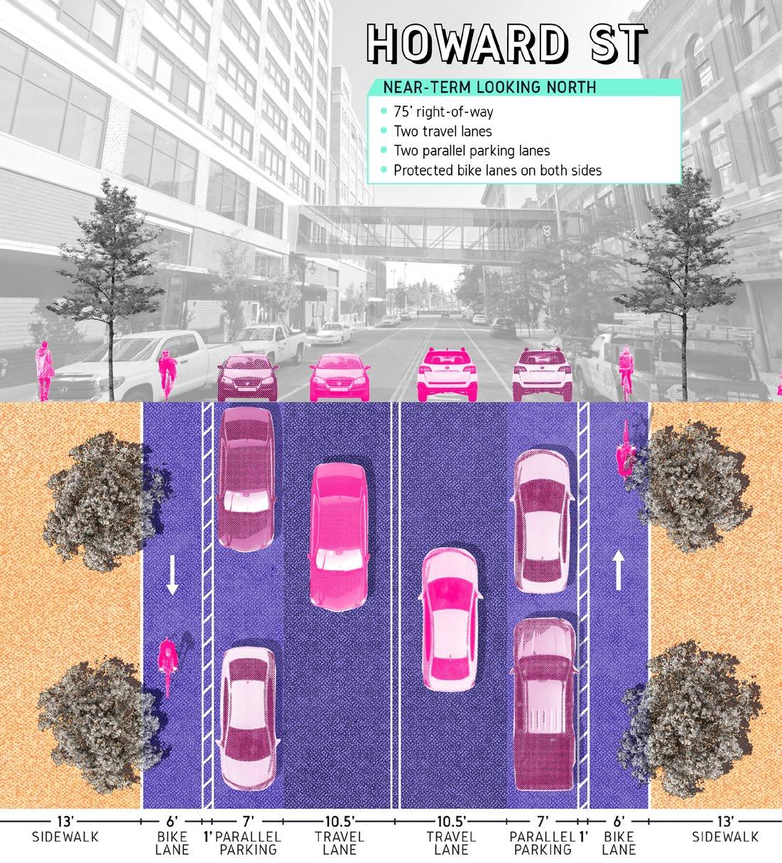
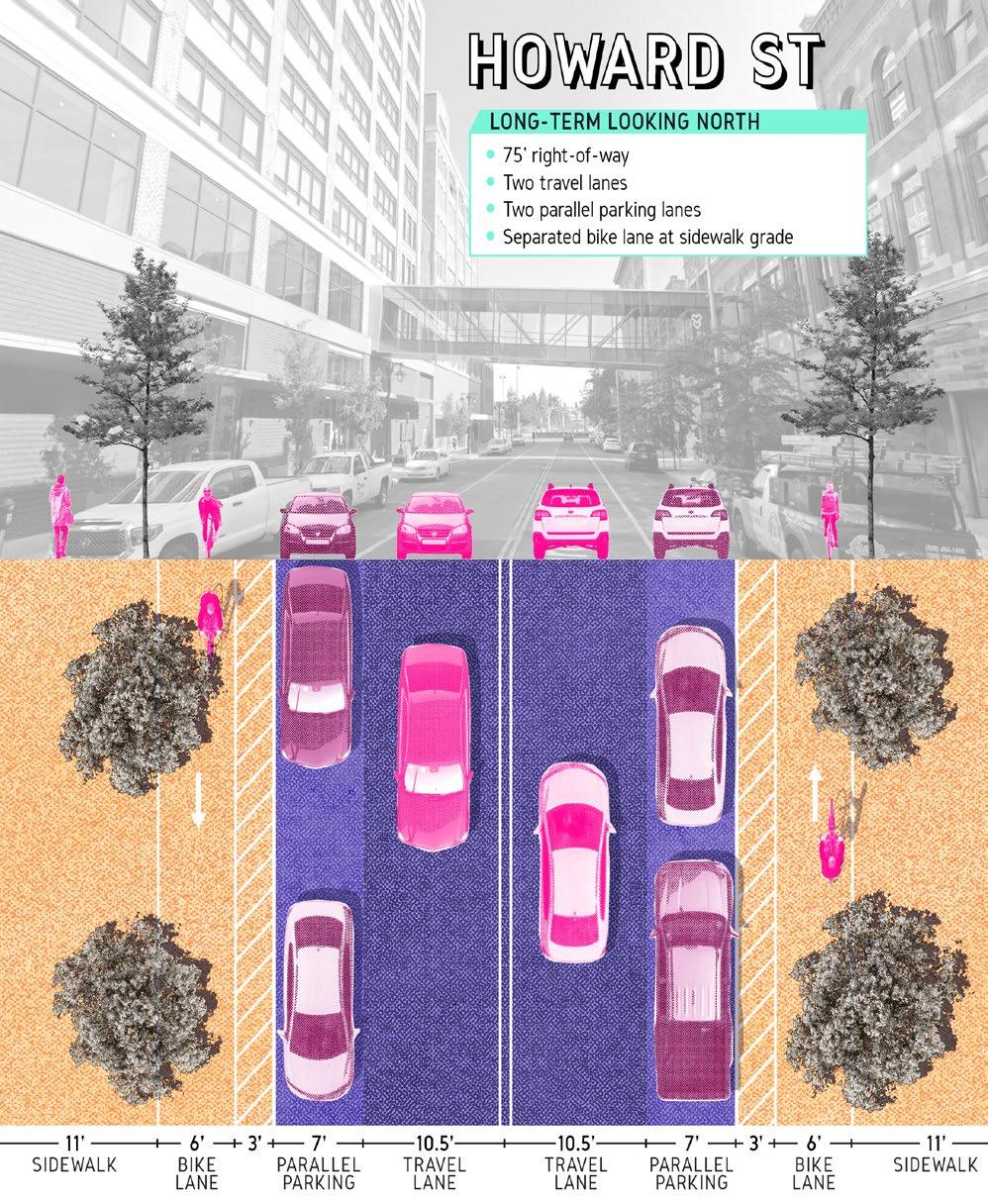
ACTION: Implement streetscape improvements in this Plan on the Howard Street Corridor, with elements of public art and wayfinding, in coordination with infill development.
The Howard Street corridor is featured prominently in the 2008 plan and provides a connection to and is partially aligned with the City Line. Howard Street is an important link between Downtown and the North Bank through Riverfront Park, where the Howard Street Promenade was improved as part of the park renovation. However, the portions of Howard Street in the core of Downtown south to Lewis & Clark High School, and on the North Bank near the Arena, have not fulfilled their potential as an active street with space for people. Future improvements of the Howard Street corridor should convert the existing bike lanes to protected bike lanes, which would cause removal of some on-street parking, but could increase area for bicyclists and pedestrians. Additional streetscape elements such as public art, wayfinding, lighting, furniture, landscaping, and space for Parklets and mobile food vendors would further improve the experience on the street.
ACTION: Build a more complete tree canopy along Downtown corridors and continue work to bury utilities.
Landscaping and street trees in particular are an important aspect of a pleasant and welcoming pedestrian environment. The City and utility providers should work to bury power and other utility lines in locations which do not impact or prohibit street tree plantings throughout Downtown Spokane to maximize tree canopy, allowing for street trees Class II or III from the City s approved street tree list. New plantings should be irrigated and require limited maintenance as they are maintained by adjacent property owners.
ACTION: Study ramping and access to the Maple Street Bridge and surrounding intersections for potential reconfiguration and design that reconnects Browne's Addition to Downtown, creates a safe environment for people walking and biking, and continues the planned cultural trail on First Ave west.
The West End near Maple Street has a complicated network of streets that feels confusing and unsafe for pedestrians, bicyclists and scooter riders. In the near term, add bike lanes on designated routes, and study the improvements and effect of City Line operation. Bike facilities should have clear and distinct markings for a more intuitive connection. The intersections in this area also act as a barrier to connections with Browne's Addition to the west. Following the City Line improvements to nearby intersections, the City should study and develop plans to reconfigure intersections to further improve safety and connectivity. Improved pedestrian and bike connections over the Maple Street Bridge were a priority in the past plan and remains an important part of creating a more complete and comfortable bicycle and pedestrian network Downtown. The City should continue to pursue long-term improvements to the bridge to help connect Browne's Addition and the western portion of Downtown to the neighborhoods on the north side of the river.
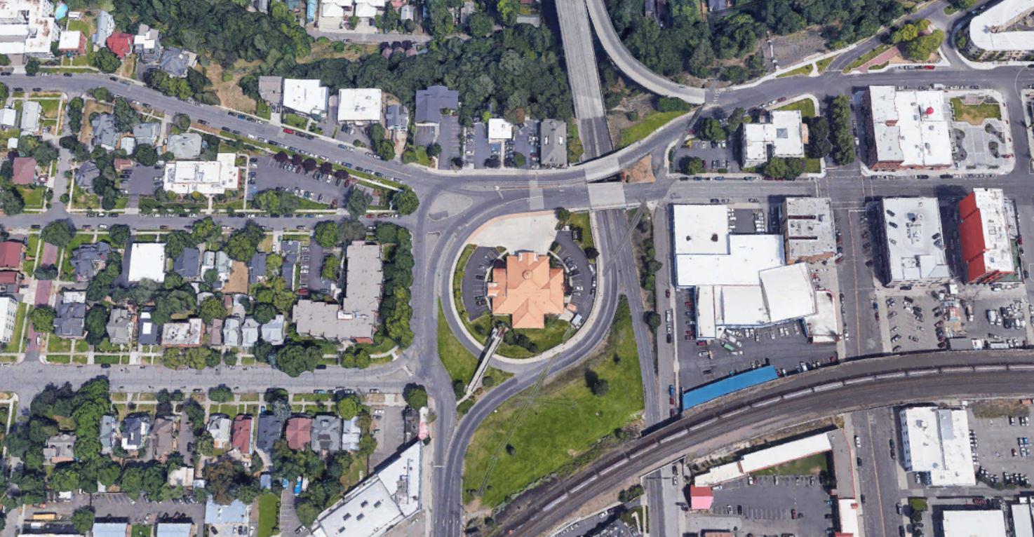
Riverside Ave, Sprague Ave, Maple St, Walnut St and Pacific Ave converge with ramping to the Maple St bridge, creating a barrier between Browne's Addition and the western portion of Downtown. There are only two paths for pedestrians to cross through the ramp configuration, one of which is ADA accessible, and very few marked crosswalks at surrounding intersections before City Line
15
CW1.8
ACTION: Reconfigure one-way streets with low traffic volume that do not tie into a Downtown freeway interchange to two-way streets as part of long-term changes to the transportation network Downtown and avoid further conversions to one-way street couplets.
The City and STA have been and are continuing to improve in Downtown's east-west streets as part of the City Line, and new bike facilities. Future infrastructure projects should not preclude the possibility of reconfiguring those streets in the future. This conversion is suggested because two-way streets tend to reduce travel speeds, increase visibility of retail uses, and make pedestrians more comfortable and more likely to shop and enjoy Downtown. Any further conversion of existing two-way streets Downtown to one-way operation should be avoided, as there are already limited two-way connections Downtown.
CW1.9
ACTION: Integrate bike parking into Downtown streets and parking facilities.
Bike parking, particularly secure and covered bike parking, can be difficult to find Downtown. Bicycle parking should be part of new street improvements, particularly near civic uses, cultural venues, workplaces and active street-level uses. The City and DSP should work to integrate bike parking and storage into existing surface and structured parking facilities Downtown. The City should develop and adopt bike parking and storage requirements in all new surface and structured parking facilities Downtown, in addition to design standards and an approval process for on-street bike/scooter parking or corrals.
CW1.10
ACTION: Improve the street lighting system Downtown, filling gaps and replacing aging fixtures with pedestrian-scale and roadway lighting that create a safer nighttime environment Downtown.
Downtown's aging system of streetlights has a variety of fixtures that create inconsistent lighting conditions with gaps, particularly in areas that are less pedestrian-oriented. The City should work to incrementally replace the aging "frog-eye" luminaires and poles from the 1970s, owned by the City, with fixtures that are more appropriate for an urban context and offer more uniform light levels along both the roadway and sidewalk. These and other elements should be pursued with a targeted capital improvement campaign that more aggressively implements the existing Downtown Lighting Plan. Pedestrian scale lighting is an important part of creating a nighttime environment that feels safe and has been integrated into new public spaces and streets but does not have a uniform application Downtown.
ACTION: Enhance the skywalk system's connections to the street and concentrate skywalks in the Downtown Core, limiting expansion, particularly along important view corridors.
Downtown Spokane's extensive skywalk system is a distinctive feature that connects workplaces and parking structures, but can detract from an active Downtown streetscape, where they are not clearly oriented toward the street. Enhancing skywalks that serve as links between buildings Downtown and improving connections to the street level can improve the system's functionality for shoppers and other users. Ensuring clear and easy access from skywalks to the street level can also help bring activity onto Downtown streets that would otherwise be confined to building interiors served by skywalks. Any new skywalks should be carefully considered in terms of access to the street and connections to the existing network, with expansions limited to those that provide direct, legible, and accessible connections to the street. The City should consider evaluating existing skywalks and work with property owners to improve access to street level.
ACTION: Update development standards for Downtown Complete Street Designations to support and sustain active street edges.
The City has a Complete Streets Program that provides engineering criteria to accommodate the needs of all users of the public right-of-way. A separate set of Downtown Complete Street Designations included typologies that are primarily used for regulating development along the street edge. The Downtown Complete Street classification system should be retitled to avoid confusion with the engineering criteria. The current Downtown street typologies do not require active ground floor uses and the City should

STRATEGY: Capitalize on the City Line and support the transit network with coordinated investments that improve access to transit
The City Line is a planned high-performance transit line to and through Downtown. Its introduction will enhance passenger experience in the broader transit system and can reduce short vehicle trips in the Downtown during the workday. Related improvements such as bike facilities will enhance the experience for transit users, providing first- and last-mile connections to the transit system. Improving transit access in areas surrounding City Line stations and the experience Downtown for transit riders, pedestrians, and bicyclists can better serve new and existing transit riders, provide better options to residents, visitors, and employees, while helping encourage new investment.
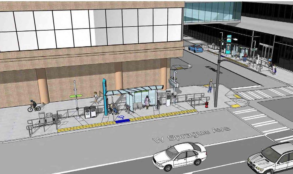
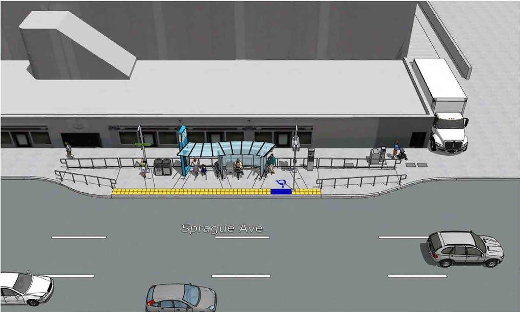
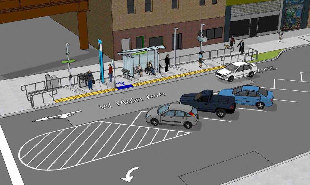
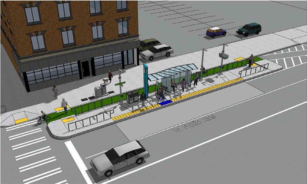
ACTION: Integrate City Line transit stations and the STA Plaza into plans for street improvements and other active transportation investments Downtown.
The City Line will bring several new stations to Downtown. Transit-related improvements are proposed for streets where the City Line will run, and these amenities should be integrated into the streetscape. For example, the concepts for improvements on Sprague Avenue should be integrated with the design for City Line stations such as bicycle station crossings. Several stations will have left side boarding on one-way streets which will affect streetscape design.
ACTION: Improve bike connections Downtown with improved facilities connecting to the City Line together with new pedestrian amenities.
First Avenue and Sprague Avenue function as an east/west couplet in the core of Downtown but both streets carry much lower traffic than their vehicle capacity. A lane of travel on each street could be converted to bike and/or scooter facilities, or parklets and other pedestrian amenities to better connect Downtown while preserving enough vehicle capacity to meet current and future needs (Figure 11). The City has plans to add protected bicycle lanes on both sides of Riverside Avenue with related pedestrian and crossing improvements such as bulb-outs which will be important for providing better access to the City Line stations and other transit stops.
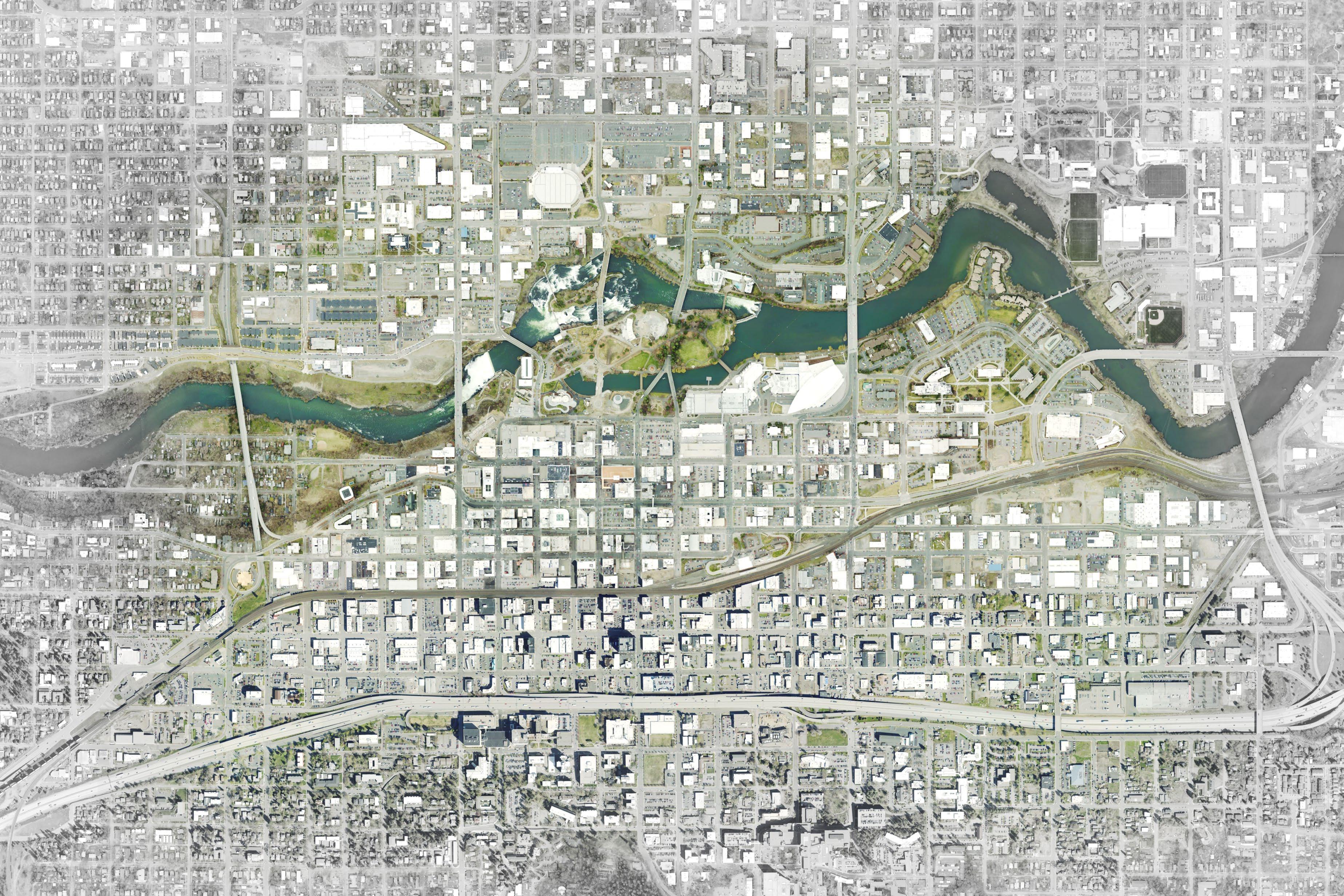
SURFACE PARKING
SURFACE PARKING
Surface lots in the Downtown Core
Source: Framework, City of Spokane, Downtown Spokane Partnership, 2020
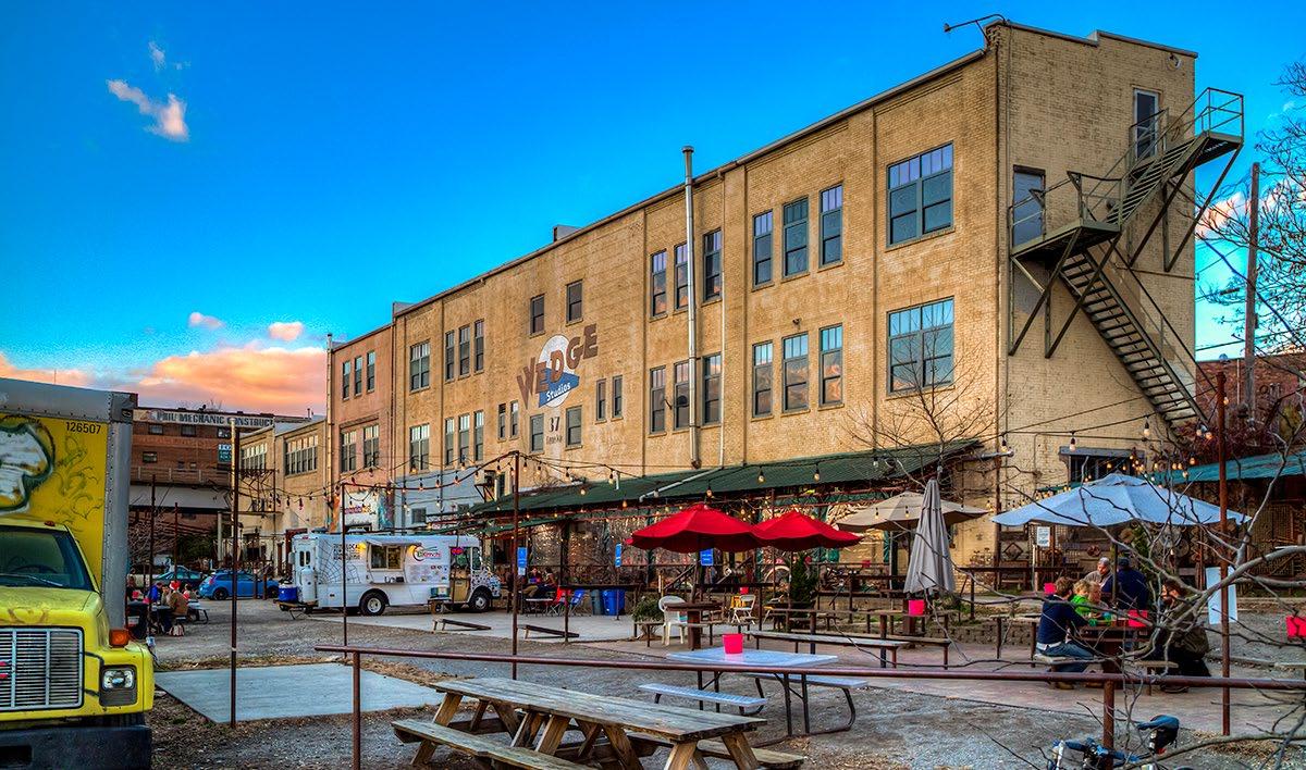
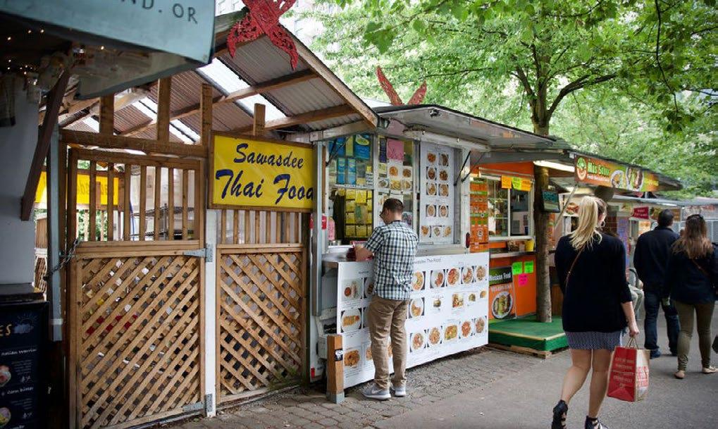
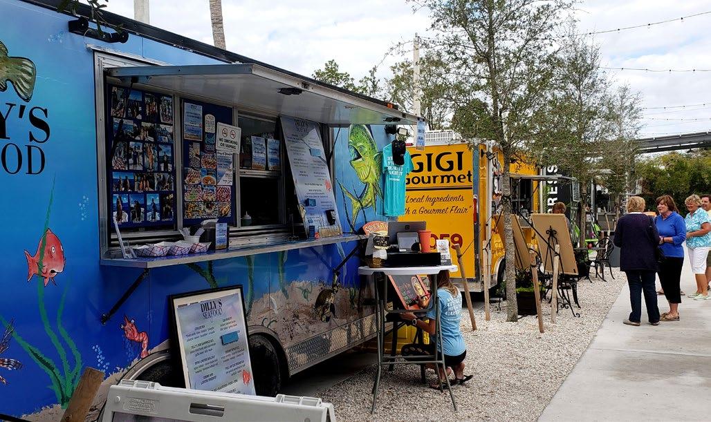
ACTION: Develop a program to use the edges of surface parking lots for active uses, programming, and events such as food trucks, vendors, and farmers markets.
Edges of surface parking lots dominate the frontages along many streets in Downtown and detract from the experience for people walking. Ideally surface parking lots would be redeveloped with active uses along the street but as a temporary solution uses such as food trucks, food standards, farmer's markets, arts markets, and other similar uses could occupy the first row of parking on the street edge to add activity to the street in the warmer months.
CW3.2
ACTION: Prohibit new surface parking lots in the Downtown Core, East End and West End.
The City should consider prohibiting new surface parking lots in the core of Downtown, East End, and West End, as shown on pages 34-35. New standalone surface commercial parking lots, as a primary use, are currently prohibited in this area, but surface parking lots accessory to new development are permitted.
South Downtown is currently planned for auto-oriented and highway-oriented development through existing plans, policies, zoning, and development standards. Restrictions on surface parking in South Downtown would conflict with existing plans, policies and regulations, but it is unlikely that South Downtown would become a sending area for new surface parking lots to meet the parking demand for the Downtown core. Downtown appears to have sufficient parking resources in the near term based on the results of the Downtown Parking Study. However, to reduce surface parking and support redevelopment efforts new structured parking may be necessary to accommodate new development and replace lost surface parking. There will likely remain better parking and transportation options in the Downtown core than parking in South Downtown and walking into the core.
CW3.3
ACTION: Discourage surface parking lots along the frontage of Type III and Type IV Complete Streets between the building and street throughout the Downtown.
Currently, surface parking must not be located between the building and the street edge on Type I and II Complete Streets, with certain exceptions for slope. The City should consider measures to discourage surface parking along the street in Type III and IV Complete Streets to minimize its impacts to the pedestrian environment along the street. An exemption along specific streets or for specific uses such as auto dealerships may be provided.
CW3.4 ACTION: Actively pursue redevelopment of surface lots.
Most of the surface parking in Downtown is privately owned and managed and not in the control of the City or other public agency. The City and DSP should prioritize an effort to actively pursue commercial and residential mixed-use development on surface parking lots through policy strategies and public/ private partnerships. Policy strategies may include fees for surface parking through the Business Improvement District, changes to property tax structures, tax incentives for office uses that may incentivize redevelopment, and property tax deferrals on new improvements.
Public/private partnerships for redevelopment, through partnership with a community investment organization, should also be pursued with a focus on redevelopment of surface parking lots.
Redevelopment plans may include public uses such as civic and arts and cultural uses along with public parking to address the loss of parking from surface lots. New public parking could be managed under the shared parking program recommended under strategies for a Well Organized Downtown.
Figure 20 shows a redevelopment program and concept for the Rookery Block that complements the adjacent, historic Fernwell Building (1890), adds a major Downtown public plaza, opportunities for public uses at the ground level, public parking, and the option for a mix of residential and office uses in the upper floors. The redevelopment of the Rookery Block would also be a major step towards activating Howard Street as a primary pedestrian street from I-90 through Riverfront Park.
To assure long-term viability of any redevelopment as a public/private partnership that includes a parking structure, any portion of the building devoted to parking should meet design standards that preserve opportunities for adaptive reuse. Such considerations include minimum floor load bearing capacities in the parking structure to accommodate potential future reuse, such as for retail or corridors for an apartment reuse; deck-to-deck height minimums; horizontal parking decks; external speedramp(s) or drop out speed-ramp sections; and full perimeter Retail/Office/Housing/Civic uses.
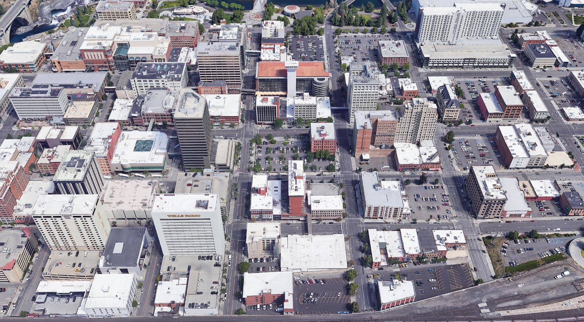
19 Context of the Rookery Block with bicycle and pedestrian street improvements, transit investments, and public spaces that could be activated shown
ROOKERY BLOCK BIKE IMPROVEMENTS CITY LINE PUBLIC SPACES
ROOKERY BLOCK SURFACE LOT PARKING GARAGE
MIXED USE TOWER Note: additional floors possible
PARKING GARAGE
Note: additional floors or underground parking possible
PARKING RAMP
OUTDOOR PLAZA
LOBBY PUBLIC MARKET
RETAIL
WSPRAGUEAVE MARKET
FIGURE 21 Potential development concept for the Rookery Block, one of the opportunity sites identified in this plan for redevelopment that can accommodate more intense development with public amenities.
CW4
STRATEGY: Implement a Wayfinding Program
A wayfinding program consisting of signage and other elements is intended to help pedestrians and bicyclists navigate the City and better connect Downtown's districts and landmarks, and the neighborhoods adjacent to Downtown. A unified wayfinding system could improve the pedestrian experience and make it easier for people to access amenities Downtown. The wayfinding program should include distinct signage materials, color palette, and other elements that build on Riverfront Park's wayfinding and are appropriate for different modes of transportation. Targeted design interventions at undercrossings beneath the rail viaduct and I-90 including lighting art and other investments in pedestrian and bicycle facilities can help bridge barriers both within Downtown and between Downtown and surrounding neighborhoods. The City has invested in attractive and distinct gateways at major I-90 access point Downtown, has introduced murals and security lighting to undercrossings, and has proposed additional lighting improvements for railroad undercrossings. Public art installations like these are important parts of an intuitive wayfinding system, and the City should look to enhance these transitions between different parts of downtown.
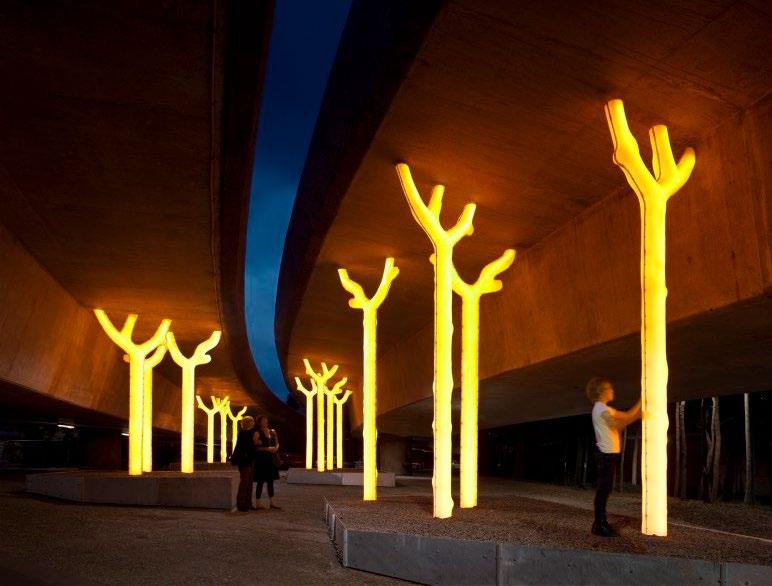
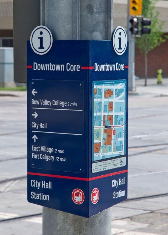
ACTION: Develop a wayfinding plan for Downtown with priority locations and signage elements that ties into the County's Wayfinding Project and elements of the cultural trail.
The City and its partners should develop a wayfinding plan with signage and gateway elements unique to Downtown focused on bicyclists and pedestrians that helps highlight Spokane's unique history, culture, and identity and better connect parts of Downtown. Wayfinding was implemented as part of the Riverfront Park renovations and complementary elements could be brought to other parts of Downtown with distinct visual identity, and Spokane Transit has programmed wayfinding elements into City Line stations. Spokane County's Wayfinding Project has taken steps to identify appropriate signage for drivers and pedestrians as part of unified system for the entire County, but there is room for unique Downtown wayfinding that ties into this system and ideas for the cultural trail. (see Arts, Culture, History section of this Plan). In some locations, including along the cultural trail alignment, street name signs only face oncoming vehicle traffic, and should face both directions to include wayfinding needs of pedestrians
A wayfinding plan for Downtown should consider gateway treatments along major corridors and at undercrossings, signage elements from relevant projects Downtown, and decision points where signage is a priority. Signage for Downtown should include elements that can be mounted into existing poles Downtown, which will make the plan easier to implement, reduce sidewalk obstructions, and limit visual clutter from posts.
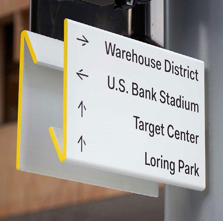
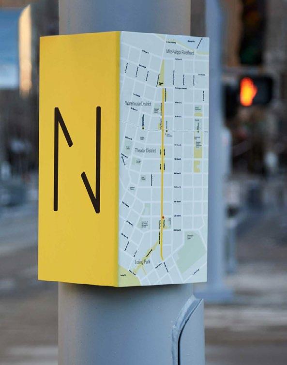
The wayfinding system for the Nicolett Ave corridor in Minneapolis, MN includes both full kiosks, and smaller elements that can be installed on poles for existing street lights, and traffic and pedestrian signals
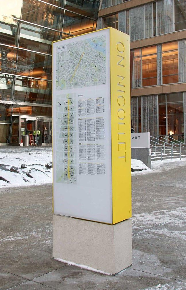
ACTION: Improve pedestrian experience and safety at undercrossings beneath the rail viaduct and I-90 with targeted interventions.
The railroad viaduct is a strong physical barrier in Downtown, and the undercrossings play an important role in defining the entries and exits to the Downtown core as a clear gateway. These spaces can feel uncomfortable and would benefit from continued enhancements such as lighting, public art, and wayfinding. Some of the most successful treatments for undercrossings combine lighting and art to create an environment with visual interest while addressing public safety concerns.
Although the City and DSP have worked with BNSF and WSDOT to improve undercrossing lighting, perceptions of safety around Downtown undercrossings remain a challenge. The City's and WSDOT's mutually formulated I-90 Architectural Guidelines (also called "Kit of Parts") resulted in process improvements to both organizations.
For the railroad undercrossings, the City should work with BNSF to draft a similar set of guidelines as it did with WSDOT. Surface and structured parking tends to dominate the north and south sides of the rail viaduct, which can make the space under the viaducts feel more separated from Downtown. Active uses at street level in vacant spaces that are part of existing buildings or along the edges of parking structures and surface lots on either side of the viaduct can help bring more foot traffic through undercrossings and create a sense of natural surveillance. Where the traditional development patterns of Downtown span the rail viaduct, particularly along Monroe, Lincoln Post, and Howard Streets there are opportunities to build on existing activity to help bridge the gap created by the viaduct.
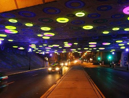
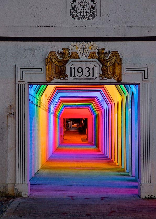
GOAL: THRIVING ARTS, CULTURE, AND HISTORIC PLACES
Downtowns are historically centers of commerce, civic life, arts and culture. At a time where retail has shifted from "bricks and mortar" toward online sales, the civic and cultural components of downtowns have increased in importance. Historic downtowns, like Spokane, have the irreplaceable assets of architectural fabric, human-scale and the stories of multiple generations.
The intent of strategies in this section is to:
Support arts and cultural uses as activators of Downtown and nurture artists and organizations that bring creative uses, especially as the city recovers from the effects of COVID-related shutdowns.
Use arts, culture and history to highlight the unique aspects of Downtown Spokane, making it attractive to people who live, work and visit Downtown.
Dedicate resources to arts planning and marketing and develop reliable funding streams for the arts in Spokane and make sure that creative uses are encouraged by City policies and procedures.
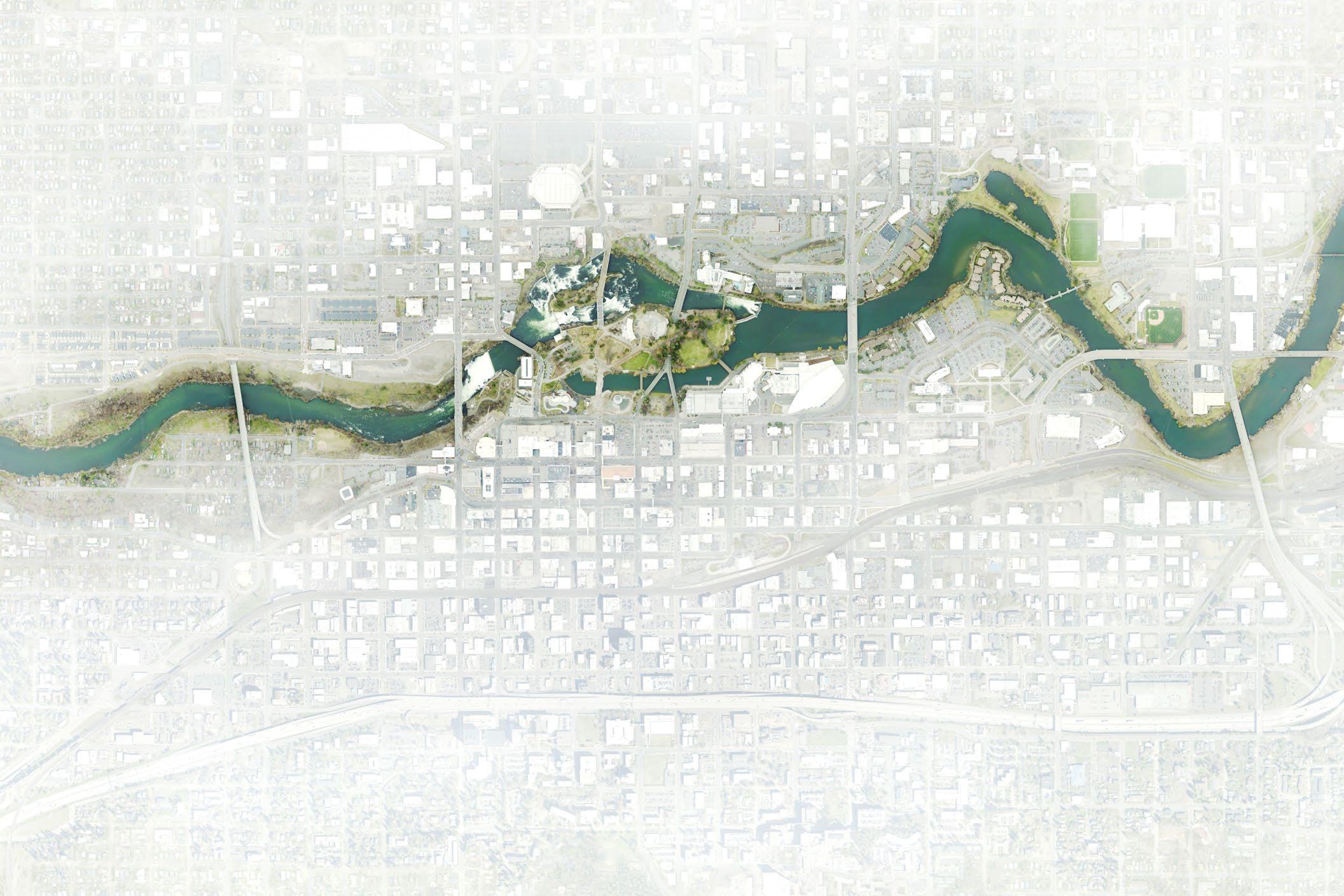
CULTURAL SITES
CULTURAL SITES
Historic and cultural sites, historic districts and character areas Downtown
Source: Framework City of Spokane, DSP, 2020
STRATEGY: Highlight Downtown's history to build awareness of local culture and support the arts
A variety of methods will bring the architectural richness and historic interest of Downtown to life, such as plaques, lighting, murals, photo opportunities, public art and streetscape elements. Partner with the local experts and history-focused organizations, Native American tribes, artists, and educational institutions to develop creative story-telling methods to convey the unique history of Spokane. Look forward as well, bringing attention to the current places and activities that define Spokane's culture.
ACH1.1
ACTION: Tell stories about Spokane's local history and architecture using creative methods.
Downtown Spokane is fortunate to have a rich and fascinating history. Making those stories visible and engaging deepens the unique sense of place in the city and fosters respect for our own place in history. There are many examples of how this has been done in other cities that can inspire ways of celebrating Downtown's history that are most appropriate for Spokane, and the city has many people and organizations that are resources for revealing city history. Highlighting history should be a Downtownwide effort, rather than a district-based approach used in the prior 2008 Downtown Plan, and should bring together Downtown's historic character areas.
ACH1.2
ACTION: Preserve historic structures and bridges and incentivize adaptive reuse of older structures that contribute to Downtown's historic character.
Spokane's Special Tax Valuation for historic properties is the City's primary incentive for the rehabilitation of older buildings on the historic register, many of which are Downtown. As Downtown sees further reinvestment, the City should ensure Spokane's historic sites are treated in a manner consistent with the Secretary of the Interior's guidelines for the treatment of historic properties and standards for rehabilitation, restoration, and reconstruction. Maintaining historic bridges, not only as pieces of critical infrastructure, but also as signature architectural elements Downtown should a priority as the City invests in connections across the river. In considering adaptive reuse, active and sustainable uses should be encouraged, such as street level cultural uses or residential units at the exterior of buildings.
ACH1.3
ACTION: Develop design guidelines for downtown that help create a good fit between new development and Downtown's historic structures.
Develop expanded Downtown Design Guidelines for new development Downtown that emphasize the importance of the Downtown's historical context, and help new development draw on and complement Downtown Spokane's historic structures.
ACTION: Pursue the idea of a cultural trail that links signature sites and activates streets with the intent of drawing visitors and investment.
Downtown Spokane's historic architecture and cultural uses make for distinctive corridors and a cultural trail can define one of the strongest corridors through Downtown. A cultural trail connecting and directing people to historical sites and destinations Downtown can help tell local stories and highlight Downtown Spokane's historical and cultural gems. This pedestrian-focused connection can act as a draw for tourists, bringing foot traffic to destinations throughout Downtown and connecting surrounding neighborhoods in all directions. The vision for the cultural trail includes streetscape elements and artistic interventions that can help draw people along the length of the trail and create and interactive learning experience. A successful cultural trail can help demonstrate the power of public-private partnerships to help catalyze investment for public benefit and economic development Downtown.
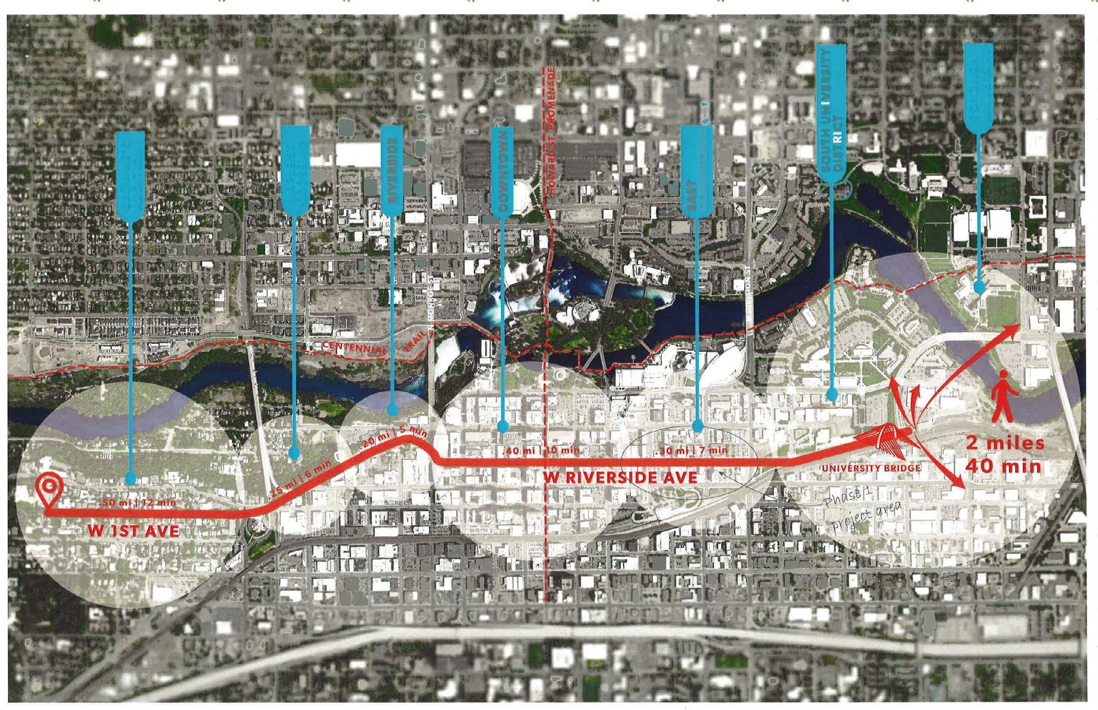
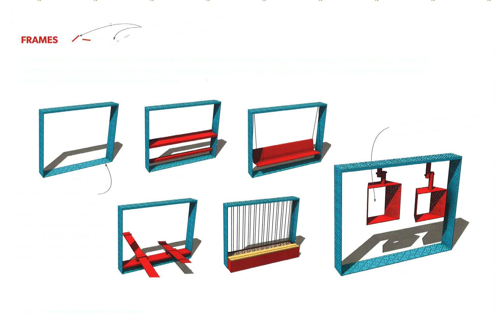
Conceptual Design for fixtures along Spokane's planned cultural trail designed to frame architectural details of historic buildings along the trail.
STRATEGY: Bring arts and culture into the public realm Downtown and develop an Arts Plan to support arts and cultural uses with a focus on Downtown
Downtown Spokane is the cultural hub of the Inland Empire and the quality of its public realm should rise to meet regional expectations. The City, its partner organizations, and the broader community should work together to foster a thriving cultural sector. This includes nurturing culture spaces, uses and activities, as well as related uses are mutually supportive with cultural venues, contribute to thriving restaurants and night life, and support Spokane's local economy. Public spaces can go a long way in bringing arts and culture and these complementary uses out onto the street and make them more of a visible presence and feature of Downtown Spokane.
WHAT IS THE PUBLIC REALM?
The Comprehensive Plan defines the public realm as public or private areas where people interact with their surroundings or other people (Ch. 3).
An arts and culture plan that brings together a spectrum of organizations and individuals, and offers targeted strategies and concepts to support arts and culture could be of great benefit to Spokane. The City's municipal arts plan, adopted in 2004 and amended in 2007, defines a process for funding, selection, maintenance and removal of public art through the municipal code (chapter 07.06 SMC, Article VII Municipal Art Policy). The City should engage in an intentional process to develop a robust arts and culture plan with a particular attention to Downtown, which would be a strong forum to address how the City and partner organizations can support cultural expression and vet mechanisms to preserve and encourage new cultural uses both citywide and Downtown. We suggest broadening the scope to include both arts and culture. The exact scope of cultural uses can be explored in the plan, but it can include things of importance to the overall culture of Spokane, such as its annual events and its well-loved small businesses, and include the expressions of Spokane's diverse communities through foods, festivals, and holiday traditions. An arts and culture plan should address the needs of the full spectrum of people in the community, offering opportunities for multicultural organizations, and making sure that there are ways for people of all incomes to enjoy free and low-cost activities.
The actions that are part of this strategy are intended to enrich public spaces with support for their civic functions and a broader range of art and cultural activities in the short time, and elements to consider as part of a broader art and culture plan, building on the Comprehensive Plan's Arts and Cultural Enrichment Policies that address public art a form of infrastructure.
ACTION: Improve and activate the streetscape and public realm to support cultural venues. Spokane boasts a collection of significant performing arts venues and a range of excellent productions. The historic Fox Theater was renovated in 2007 and is the home of the Spokane Symphony. The Knitting Factory and the Bing Crosby Theater bring crowds for concerts of all kinds. The public space surrounding these extraordinary venues should be as high quality as the events inside. One place that would clearly benefit from improved streetscape is the area around the cluster of these venues. This area could be highlighted and supported with pedestrian spaces, restaurants and nightlife that offer places for arts patrons to enjoy. Such activity would give people a reason to extend their stays before and after performances rather than simply moving from the parking garage to the theater and back. The graphic below shows streetscape treatment with Art Deco patterns related to the Fox; a functional and elegant "red carpet" drop-off, street dining, and projected art on the walls along the street (Figure 22). Note that paint on the street will need to be compliant with the Manual for Uniform Traffic Control Devices and should identify a revenue source for maintenance.
The galleries, clubs and other cultural spaces throughout Downtown can benefit from a supportive public realm that increases visibility and vitality. This may mean art and lighting outside of cultural space, seating or temporary "pop-up" installations encouraged and supported by the City and the Downtown Spokane Partnership.
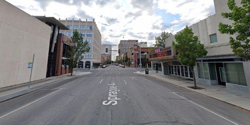
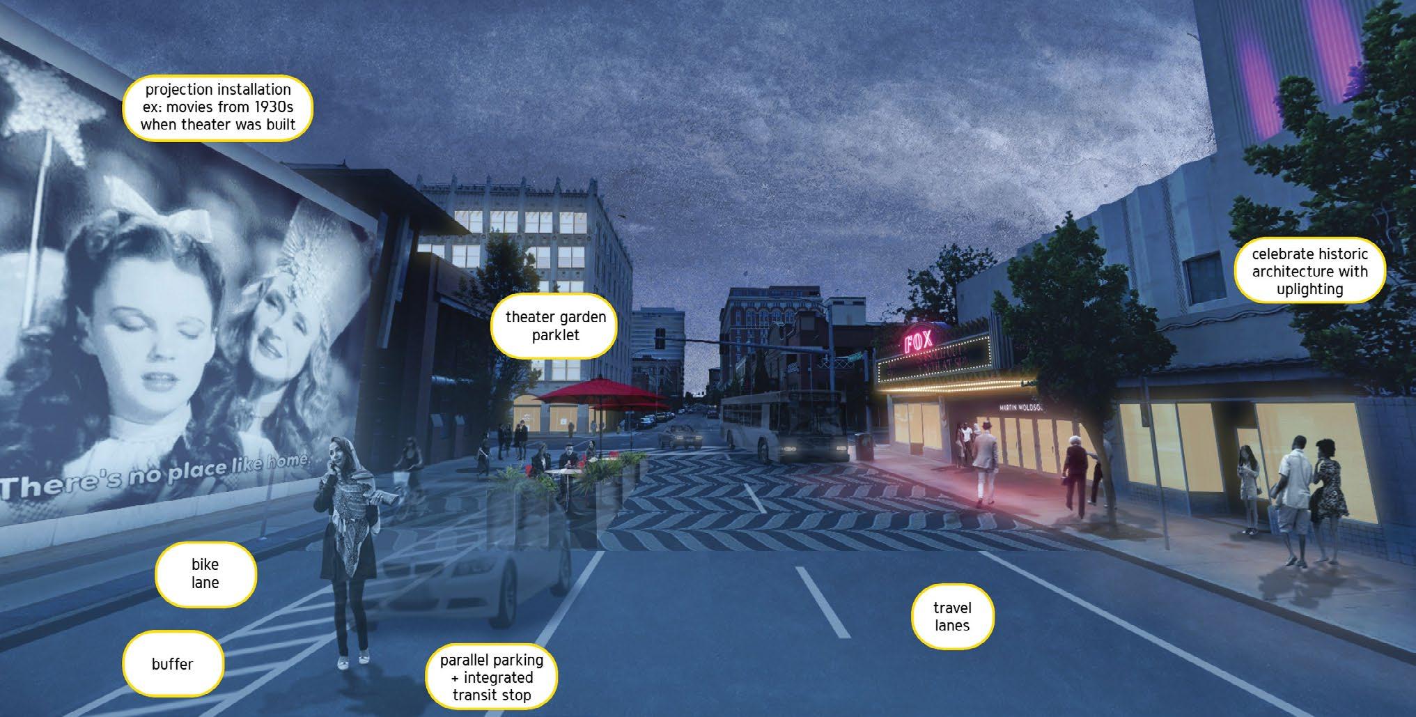
ACTION: Work with artists and local property owners to create and maintain temporary art installation and facilitate activation of cultural spaces to energize Downtown and support artists.
Light projections and murals are relatively easy ways to energize the public space, especially where there are blank walls that can be turned into assets. Spokane has already been doing this and can build on these successes. An advantage of projections and other transitory installations, events, or performances is that they can tailored to events and seasons and can be changed or scheduled regularly. These shortlived transformations of public space can add to Downtown's vibrancy and activity and help it feel like a safe place for patrons to enjoy, both day and night.
Art installations can be used to fill some of the gaps in Downtown's fabric, in a similar way to parklets. The City should make these kinds of installations as easy as possible from a regulatory standpoint. Art "markers" could be part of a strategy to bring attention to the smaller venues and galleries with highly visible art or installations.
Some of the space in new and existing development adjacent to and within the right-of-way can host a variety of art forms, bringing activity to the street, attracting pedestrian traffic, and supporting a positive social atmosphere. Current installations and programs should be made a part of the public art component of the arts plan. Where brick and mortar spaces are not available, space in the right-of-way may be considered for outdoor seating, dining, and performances in warmer months. ACH2.2
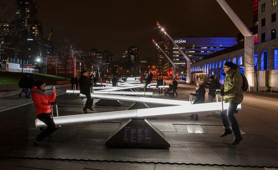
ACTION: Explore incentives for preserving cultural space and creating new space for arts and cultural uses Downtown.
The City and its partners in the development of an Arts Plan should look for ideas to preserve cultural space, protect spaces of cultural and historical significance, and encourage the creation of new cultural space. A key part of the process will be understanding what incentives would have the greatest community impact in Spokane, and how those incentives can be best implemented in Spokane. Some of the ideas that a plan should examine closely are:
Creating pathways for funding and technical assistance to encourage the adaptive re-use of older buildings, and the inclusion of cultural space in renovated buildings
Including City parks and library projects as eligible for the 1% for the arts policy and explore the expansion of the program for private development.
Creating mechanisms to encourage or require cultural space in new development, especially larger scale developments, public projects or development that displaces existing cultural space.
Roles for staff within partner organizations to encourage and support space for arts and culture, including possible designations for a point person for Downtown public art, or a cultural space liaison who could connect the creative sector and property owners, and be part of the entitlement project.
Roles of the City Arts Commission in best supporting the arts, including the space needed for cultural uses and the use of public space for the arts.
ACTION: Evaluate how the City's development regulations and permitting process can support cultural space and public art.
An Arts Plan should take a careful look at how permit requirements apply to cultural uses, and which requirements in particular can be burdensome for artists or organizations trying to create cultural space. The review process may also be an opportunity to help ensure new development contributes to arts and culture particularly Downtown where development is tends to be larger scale. The following aspects of permitting and review should be considered in the Arts Plan process:
Encourage, incentivize, and at the appropriate level, require public art and cultural uses to be part of the development process.
Inviting representatives from the City Arts Commission and/or relevant local arts organizations to pre-application meetings for projects of a certain scale.
Streamlining the permit review process for cultural space and the potential for permit fee waivers for the creation of cultural space.
Temporary occupancy permits for artists and arts organizations.
ACH2.5
ACTION: Identify and reduce barriers for cultural events Downtown.
Cultural events and activities draw both tourists and residents Downtown. Downtown Spokane is known for hosting remarkable special events, with signature events like Bloomsday, Hoopfest, Terrain, and the Lilac Parade drawing people from throughout the Inland Northwest and beyond. Community partners involved in hosting cultural events Downtown, however, should examine issues, including requirements and cost. The City should continually review procedures for special event permits and look for ways to reduce permit requirements, and potentially costs incurred, while preserving necessary assurances and safety requirements.
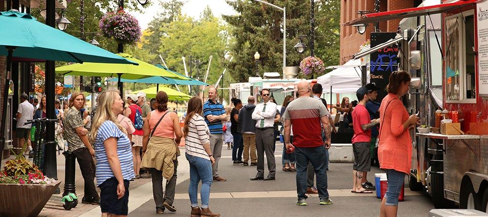
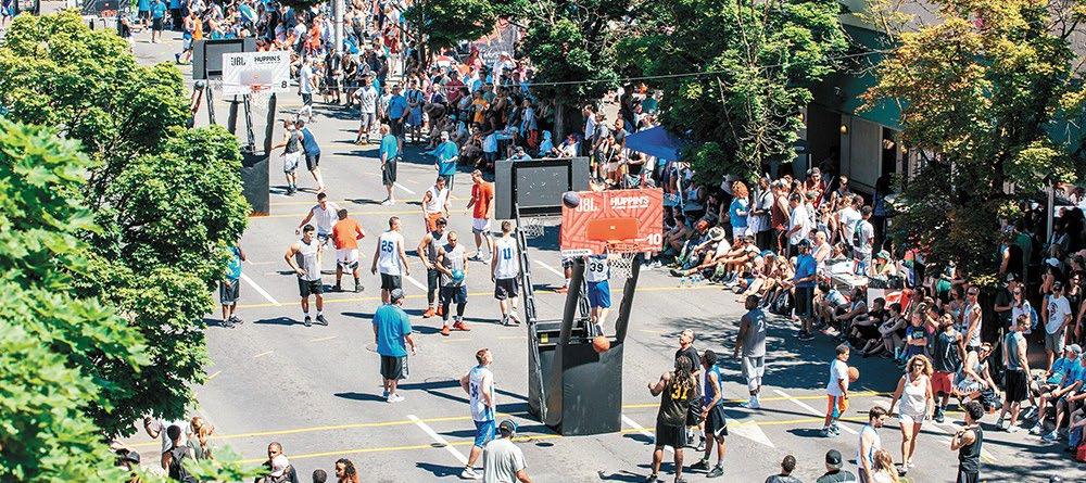
STRATEGY: Create space for art-focused and culturally-oriented small businesses and organizations, targeting those that cannot afford to locate Downtown
Arts and cultural uses and small businesses are vulnerable to economic shifts and a real estate market with rising rents. Cultural space can have a quantifiable benefit for Downtown, driving economic development, and attracting both visitors and local residents Downtown. One of the best ways to ensure these uses can access space Downtown is to provide affordable space for businesses and organizations that may not be able to afford market-rate space.
A number of non-profit organizations have driven the production of more affordable cultural spaces, or affordable live/work spaces for artists around the country, such as Artspace, which creates, fosters, and preserves affordable and sustainable space for artists, and arts organizations across the United States. There are excellent precedents for a public or semi-public organization like a public development authority (PDA) to create affordable cultural space. For example, the Town of Twisp, WA chartered a PDA to acquire and redevelop a decommissioned forest service ranger station using a combination of public and private funds, and created TwispWorks which supports artists, craftspeople, and small businesses in the Methow Valley.
ACH3.1
ACTION: Identify sites Downtown for infill development that can help foster small businesses, local start-ups, and arts and culture uses and organizations.
The Rookery Block between Riverside Ave and Sprague Ave to the north and south and N Stevens St and N Howard St to the east and west is an example of an ideal location for infill development with a centralized affordable space for arts and culture and small businesses. Many successful examples of small, affordable spaces for entrepreneurs, in the tradition of historic public markets, exist throughout the country. These entrepreneurial incubator spaces can contribute to an active and engaging street level, which is particularly important for a site such as the Rookery Block, which is central in the Downtown Core, with frontage on significant pedestrian streets Howard, Sprague and Riverside. Opportunity sites on Spokane Falls Boulevard would also be appropriate for active ground floor cultural uses and businesses because of their proximity to Riverfront Park.
ACH3.2
ACTION: Identify underutilized properties that could serve as affordable workspaces for organizations that are less reliant on foot traffic.
The 2008 Plan called attention to the Intermodal Center as an opportunity site, and this Plan supports retaining this site as an opportunity to create work and/or office space for organizations that support community needs like non-profit and cultural organizations that may require below-market rate rents. The space may be able to serve as a shared office or co-working space, or be subdivided into discrete spaces for businesses with a mixture of market rate and affordable tenants. River City Kitchen in the Intermodal Center currently offers rental space in their commercial kitchen on the second story of the Intermodal Center, as a culinary incubator, and the City can support similar ventures with shared and/or affordable workspace in areas with less pedestrian activity Downtown.
GOAL: A GREAT PLACE TO LIVE, WORK AND PLAY
Downtown Spokane is the economic and cultural engine of the Inland Northwest, drawing residents from the County and region for work, dining, and recreation. Downtown is also a great place to live with workplaces, services, cultural and educational institutions all close by. While Downtown has seen modest growth, it is not widely recognized as a great neighborhood to live in and could benefit from mixed-use development with a diverse range of housing options together with new or enhanced residential amenities. Similarly, there are opportunities to strengthen Downtown Spokane as the economic driver for the region by enhancing amenities to attract and maintain businesses in Downtown.
The strategies in this section are intended to:
Develop Downtown as a complete, walkable neighborhood with safe and convenient access to goods and services necessary for daily life within walking distance.
Promote residential infill and rehabilitation projects with diverse housing options affordable to households of different means.
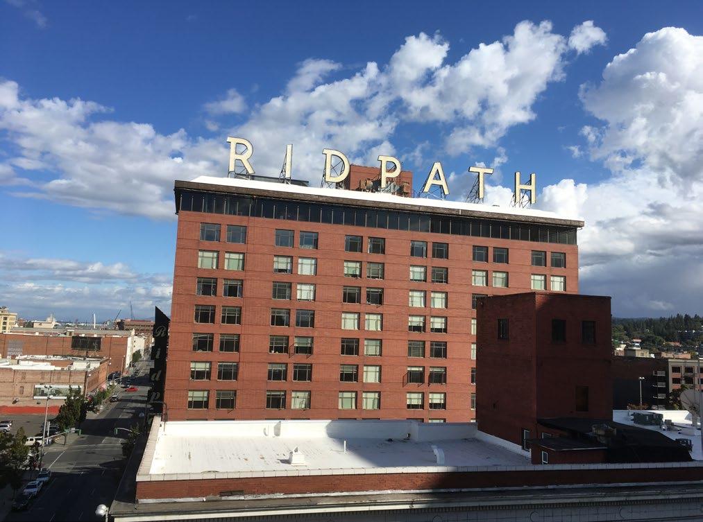
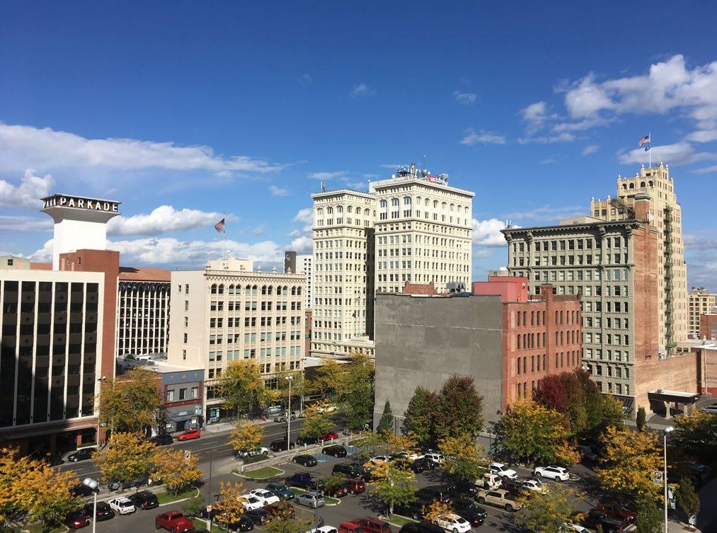
LWP1
STRATEGY: Encourage residential and mixed-use development with a variety in housing types and sizes that are affordable to a range of income levels
A healthy Downtown residential population is important not only for the success of Downtown businesses, but also for a Downtown that feels safe and active throughout the day. Residential density in and around Downtown contributes to the local customer base of businesses and services, particularly those which rely on foot traffic. While Downtown Spokane has seen some modest growth in residential and mixed-use development, there are tremendous opportunities for infill development that integrates housing and residential services that meet the needs of people and families with a range of incomes.
ACTION: Develop a thorough understanding of on-site conditions and update market demand studies around opportunity sites.
The Downtown Plan team identified opportunity sites Downtown where infill development and new public spaces would have a transformative and catalytic effect on Downtown. Redevelopment on these sites should prioritize a mixture of active ground floor uses and public spaces along key pedestrian corridors and upper story residential, or office uses that help build a more complete neighborhood. Future redevelopment on these sites is also an opportunity to address longstanding needs for structured employee parking, that will help downtown remain a viable and competitive destination for new businesses.
The City of Spokane and DSP could support redevelopment on these opportunity sites with market demand and pro-forma analysis, and site analysis that help landowners understand the potential for development that each site holds. DSP can partner with Downtown property owners to adapt to shifts in economic conditions and assess buildings for rehabilitation or redevelopment. Collaboration between property owners, DSP, and the City early in the development process is crucial to ensuring that redevelopment on these sites aligns with community needs, goals and aspirations.
ACTION: Develop public/private partnerships, potentially with the assistance of a public development authority, to acquire and assemble property to support redevelopment Downtown. Public-private partnerships could be an effective tool to spur redevelopment that creates meaningful, positive change Downtown. These partnerships can take many forms, but in Washington the statutory authority for public bodies to serve economic development activities is weak. Governments can only acquire property for public purposes, including affordable housing, and Washington State law interprets public purposes narrowly. The City of Spokane and DSP should identify a public or quasi-public partner to work with private developers on key infill sites, where there is a clear public benefit. Depending on the nature of these redevelopment projects, and each project's ownership and funding models, PDAs can offer distinct advantages in that they can receive funds from ongoing ventures and private donations and more flexibly transfer property where public bodies may not be able to, yet are held accountable with strict transparency requirements. Similarly, a non-profit corporation could access the public bond market to develop projects that would eventually be owned by the City or another public entity.
ACTION: Build site-based partnerships with affordable housing developers and transitional housing providers into public projects and infill development and engage these organizations in economic analyses of how an affordable housing program can be implemented in Spokane's real estate and development market.
Affordable housing developers play an important role in providing housing for families and individuals with a range of incomes and personal circumstances. Downtown has seen significant investment in new affordable and transitional housing, and while opinions of these developments and services for residents downtown vary widely, the sponsor organizations can be valuable partners in infill development Downtown. These developers have built a mix of residential projects Downtown including new permanent supportive housing, relying primarily on private financing. Redevelopment of underutilized properties Downtown can use funds and organizational capacity from a public/private partnership to complement efforts to produce new market-rate multi-family housing with an affordable or supportive housing component. As the City and DSP work to assess the feasibility of development on targeted sites Downtown, real estate analysis should examine how Downtown's regional share of affordable housing fits into potential development.
As housing costs in Spokane have risen, the City's need for housing affordable to low- and moderateincome households has become more acute. The City has an opportunity work toward a comprehensive housing strategy before real estate costs become more of an obstacle, and should engage affordable housing organizations in the process to determine how the City can help effectively address housing needs in a tightening market. A first step in that process would be to study the economics of multi-family development in Spokane to ensure the City's work to advance affordable housing is grounded in sound real estate analysis and is balanced with market rate multi-family development Downtown. This housing strategy should address housing for both low- and moderate-income residents Downtown, and spur residential development in between the higher end and affordable and supportive housing development that Downtown has seen in recent years.
ACTION: Explore ideas to strengthen incentives for multi-family development and rehabilitation of historic structures Downtown.
The City of Spokane offers tax-based incentives that have been critical to investment Downtown, including the Multi-Family Tax Exemption (MFTE) and Special Tax Valuation for historic properties. The MFTE Program helps make multifamily residential development Downtown feasible, and the Special Tax Valuation helps defray the costs of rehabilitating structures on Spokane's local historic register. Maintaining both incentive programs is important to the long-term success of Downtown, and the City should explore ways to complement them with zoning and permitting incentives or other programs, like design review that could support multi- family development, affordable housing, and restoration of historic buildings and sites Downtown.
Downtown Spokane can support multifamily development, but the MFTE Program has proven an important component of how these projects are structured financially, and the most effective incentive for higher intensity residential development the City offers. If the City pursues changes to the MFTE as part of an affordable housing strategy, these changes should be subject to thorough economic and real estate analysis to ensure that they do not stall multi-family development Downtown.
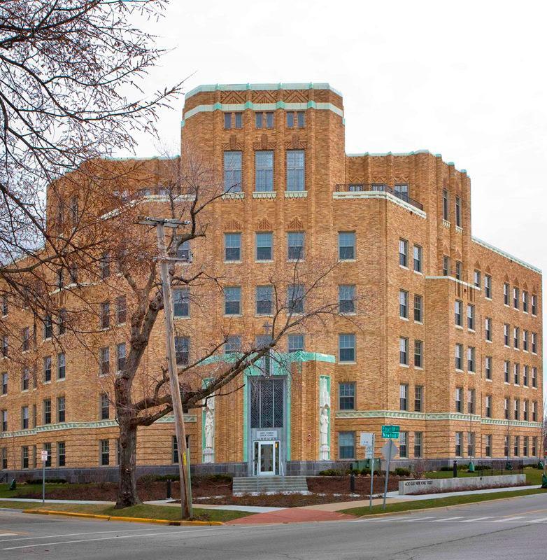
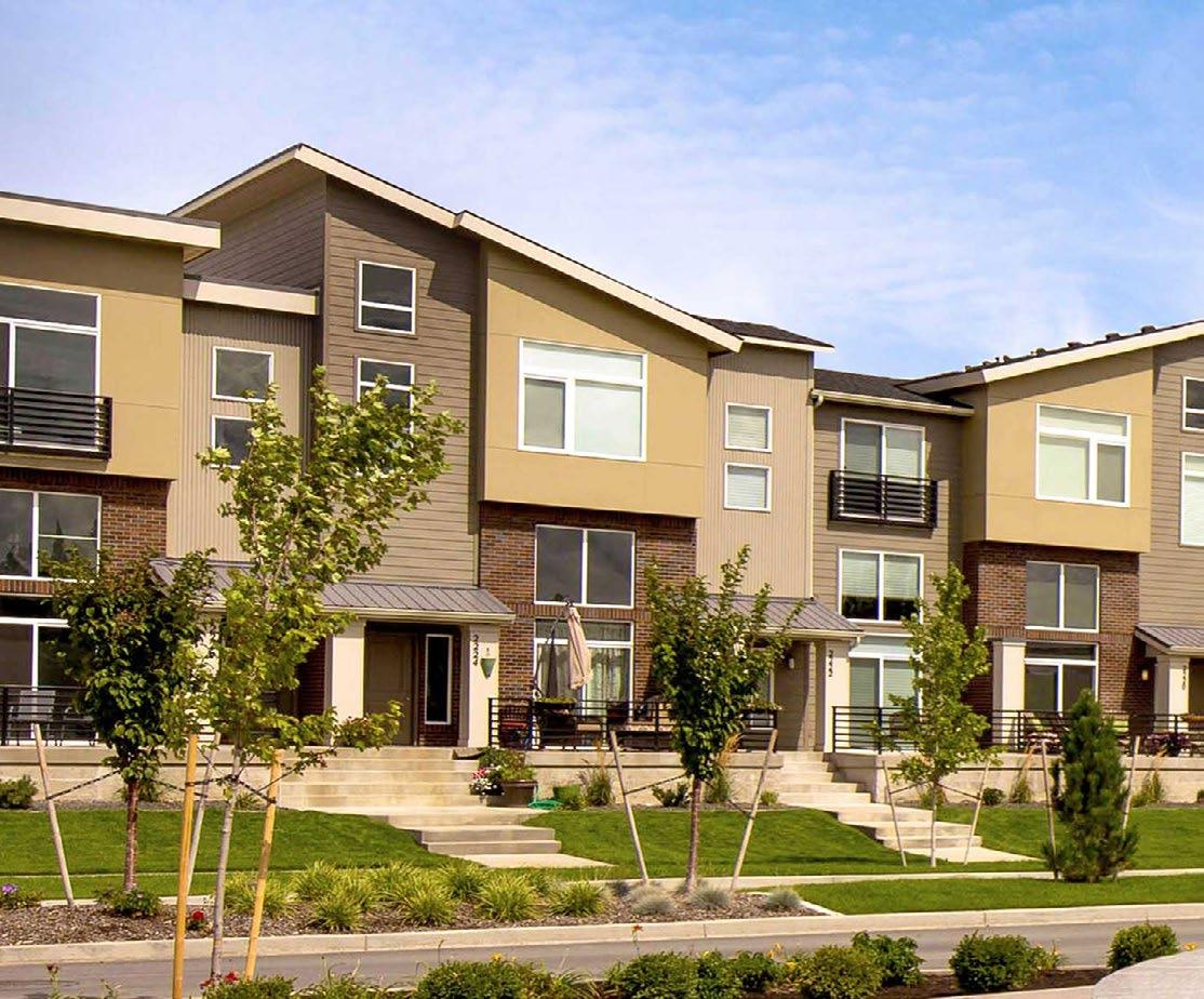
STRATEGY: Enhance residential amenities like public spaces, services, and cultural uses Downtown
Downtown Spokane is a great place to live, and recent development has begun to draw new residents Downtown. There is room for investment in local, neighborhood-scale amenities Downtown that would benefit long-term Downtown residents and newcomers, but also make Downtown more welcoming to visitors and commuters. It is the access to services, necessities, and recreational opportunities that help people see Downtown as not only a place to work or visit, but as a great place to live or raise a family.
ACTION: Develop ground floor standards for residential, retail, office, live/work, and civic uses.
The design of street level uses shapes how residents and visitors experience Downtown. Design of the ground floor can reflect the human scale and contribute to a vibrant public realm, but it is unreasonable to expect ground-floor retail sales and service uses to be successful in every location Downtown.. Current development standards include requirements for setbacks (SMC 17C.124.230) and windows (SMC 17C.124.510) on the ground floor but offer little guidance on how to design spaces at street level that work for different uses. For retail uses this may mean visual transparency at eye level, higher ceilings, and on-grade entries, but design for residential uses is somewhat different, including distinct protected entries, and visual and/or physical separation from the street. A set of specific standards that regulate design at street level can accommodate different uses in way that is sensitive to the context of surrounding development and historic reconfigurations of storefronts, and flexible to accommodate changing tenants and owners. These standards can prioritize active uses or specific design practices along specific corridors where the pedestrian environment is a priority to better align with desired design characteristics.
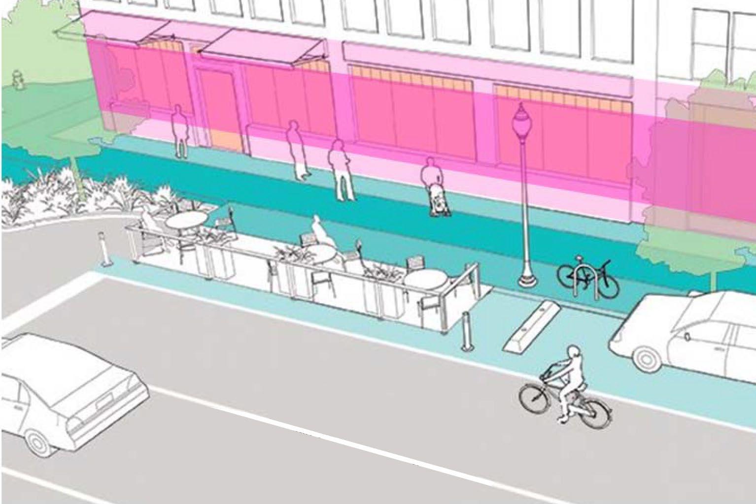
Suggested heights give context to allow for flexible uses. Examples shown are subject to refinement based on land use and street designation. Diagram is adapted from Urban StreetDesignGuide , National Association of City Transportation Officials.
Lower floor window/transparency: Encourage visual transparency and avoid black walls on the facade of lower floor near the street
Ground-floor celling height: Minimum distance from finish floor to underside of celling, dequate to encourage active uses and flexible for future changes of use
Eye-level windows/transparency: On portions of the ground-floor facade adequate for visual transparency at eye level to encourage active streetlevel uses and to avoid blank walls
Pedestrian Realm
Flexible Area
ACTION: Create an integrated network of small parks and public spaces outside of Riverfront Park.
Riverfront Park is Downtown's signature open space, drawing locals and visitors from around the country and connecting to a regional network of trails. Outside of Riverfront Park, and the City's new open spaces along the River, Downtown lacks the parks and public spaces that would help form a complete network of recreational space. While Spokane's riverfront will continue to be a focal point of recreation in Downtown life, pocket parks, and public spaces are important for everyday passive recreation and public life. Within a 5-minute walk of a given location, there should be open spaces that meet the needs of residents and visitors. A Downtown Open Space Plan should be developed to create an integrated network of small parks and public spaces that builds on current requirements to construct landscaped open space in the Downtown zones. Provision of such public spaces should be coordinated via the open space plan, with private developers being able to opt-in to assist in these projects, even if they are off-site for the developer, as a means to acquire certain development advantages for their own projects. Extending a network of small public spaces through Downtown that connects to Riverfront Park, together with strategies in the Public Spaces and Well Organized sections of this Plan, will help promote active streets and bring communities together.
ACTION: Support existing businesses Downtown and build upon emerging activity centers with complementary retail and active uses.
Downtown retail, restaurant, and cultural establishments are particularly vulnerable to shifts in the local and national economy. While the lasting economic impact of the COVID crisis remains unclear, Downtown businesses will need support to survive and adapt to changes in dining, shopping, gathering and commuting. City support of existing and heritage businesses Downtown is crucial for their survival, and the City should consider grant and commercial tenant assistance programs as options to retain businesses Downtown. The post-COVID recovery may present opportunities for growth in Downtown's emerging centers of activity, but those efforts will hinge on key businesses that anchor Downtown districts.
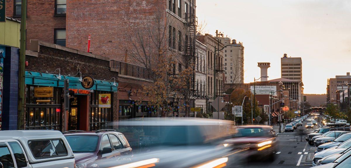
STRATEGY: Apply zoning changes and other tools to sustain and enhance mixeduse development with active street-level uses
Downtown zoning provides a lot of flexibility for mixed-use development particularly in the Downtown Core which has no building height limit. The Downtown General Zone is very flexible in terms of allowed land uses and has building height (number of stories) and floor-to-area restrictions unless certain incentives or conditions are met. The Downtown General Zone encourages the development of housing including affordable housing. The North Bank and South University District Subarea Plans propose certain land use changes for those districts. The Downtown South Zone is unique in that it allows and encourages more auto-oriented land uses and development including highway-oriented signage.
ACTION: Maintain and apply zoning designations based on criteria that address the surrounding context and desired land uses with a focus on street level uses.
Existing zoning designations in Downtown are applied based on the surrounding context and desired future development including land uses and building form. The City should apply zoning designations based on the feasibility of development and community desires for infill or redevelopment. For example, if development under the DTC-100 zone is determined to not be feasible with the 100-foot height restriction then the City should consider the trade-offs between maintaining the existing surface parking and the impacts of allowing increased height. The City should formalize criteria for considering zoning changes in Downtown including any modification of zoning district boundaries.
ACTION: Ensure signage standards are consistent with land use context and corridor character.
The City of Spokane currently regulates new billboards and electronic message center signs Downtown and should continue to prohibit forms of signage that are intended for a highway or auto-oriented context. The City should continue to prohibit billboards and auto-focused signage outside of South Downtown and should encourage preservation of Downtown Spokane's painted signs.
ACTION: Ensure redevelopment projects contribute to streetscapes and good urban design.
Redevelopment that changes uses of existing buildings, and results in modified facades and sidewalks, should contribute to the goals of this plan and the community's desired Downtown.
ACTION: Pursue redevelopment of the existing surface parking lots in the DTC-100 Zone along Spokane Falls Boulevard.
The surface parking lots along Spokane Falls Boulevard in the core of Downtown, identified as opportunity sites in the 2008 plan, are maintained as opportunity sites in this plan update. The properties are subject to a height restriction beginning at 100-feet along the north property line, increasing in height farther south, unlike other properties in the adjacent Downtown Core Zone. These height limits are in place to minimize shadows and other potential impacts on Riverfront Park. There is also a perception that the height restriction on these parcels has adversely impacted the economic feasibility of redevelopment , but a detailed real estate analysis has not been conducted.
The City and DSP have conducted multiple shadow and massing studies as part of a lengthy process to reconsider the height restrictions. In 2018, at the completion of the public process the City Plan Commission unanimously recommended the City Council increase building height limits in the DTC-100 Zone along with additional requirements for building massing to minimize shadows on the park, active ground floor uses, and high-quality materials. However, the recommended code amendments have not been adopted. The City should explore performance-based design solutions that enhance the public realm, as alternatives specific to each parcel, if the 2018 recommendations are reconsidered.
The City and DSP should include these opportunity sites in the detailed economic analysis to assess market demand for residential and non-residential uses, and should be partners in a site-specific residual land value and pro-forma analysis of these properties. These real estate and financial analyses should capture public benefits and value of public spaces and other public amenities that could be integrated into a project on these sites. This offers a clear pathway for the community and decision-makers understand the tradeoffs between allowing additional height and potential impacts of shading.
As these are prime opportunity sites, the City, DSP, and partners should determine how best to facilitate redevelopment that contributes to a more active and vibrant Downtown. LWP3.4
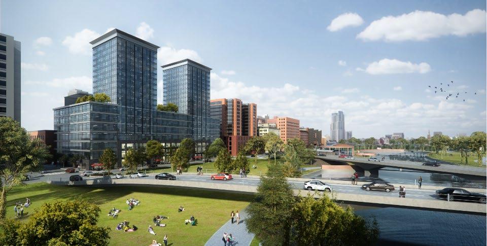
STRATEGY: Improve transit access, commute options, and parking management for Downtown residents and employees
Downtown Spokane is a regional employment center, with a range of growing industries and businesses interested in remaining and investing in Downtown. In locating Downtown, businesses balance their employees' access to the place of work and the proximity of amenities that are attractive to a workforce that is increasingly composed of millennials, now 50% of the U.S. labor force. The City and STA are making great strides in improving transit and active transportation Downtown, and new development should integrate with those investments. Access to longer-term employee parking continues to be an important consideration for commuters and Downtown businesses, and there are programmatic opportunities that could be explored to alleviate some of the pressure felt by Downtown businesses to locate where they can find dedicated employee parking, which often takes them outside of Downtown. Transportation Demand Management tools should be implemented, including establishment of a Transportation Management Association (TMA), together with efforts to transform surface parking, develop new parking facilities, and improve conditions along streets for commute alternatives, as envisioned in the Connected and Walkable and Public Spaces sections of this Plan.
LWP4.1
ACTION: Integrate new development Downtown with transit facilities and promote transit supportive development around high-capacity transit.
New development in Downtown Spokane should help support transit facilities in terms of intensity, composition of uses, and design. Spokane's new City Line, which is expected to begin service through Downtown in 2022 will include major investments in station areas and facilities. Development should successfully integrate transit stations in site and building design practices that can be built into zoning incentives or design guidelines. These can include enhanced pedestrian amenities and active uses oriented toward transit stations, and consideration of transit facilities should be incorporated into ground-floor development standards and/or guidelines for Downtown.
LWP4.2
ACTION: Reduce regulatory barriers to shared parking including expanding off-site parking shed limits.
Spokane currently allows shared parking through project permitting by joint-use parking documentation (SMC 17C.230.110), but Downtown would benefit from a shared parking system that leverages redevelopment and the construction of new structured parking to meet a range of parking needs. This can substantially reduce the need for dedicated parking and offer the flexibility to meet the needs of long- and short-term parking for a range of users at different times of day.
Off-site parking regulations currently limit the maximum parking shed to within 400 feet of the site (SMC 17C.230.100), which can be too restrictive for certain users. Commuters in particular may be willing to walk farther from secure long-term parking during the day. The 2019 Downtown Parking Study recommends changing this maximum distance to one quarter mile or 1,320 feet.
ACTION: Implement Transportation Demand Management (TDM) strategies.
TDM tools Downtown would reduce vehicle trips and demand for parking, thereby freeing parking space for visitors and customers, and opening up land area for other uses. The 2019 Downtown Parking Study recognized these actions would have a catalytic impact on new development in Downtown, particularly in alleviating growth demands on the parking supply and in support of revitalizing existing underutilized surface parking lots. A broad range of strategies were identified, encompassing partnerships with agencies to create or change programs that promote use of alternatives to driving; changes to the design of public right-of-way such as those proposed in this Plan to better serve all street users; and examining the feasibility of establishing a transportation management association (TMA) for Downtown or specific districts to encourage non single occupancy vehicle trips. The TMA would provide support and invite all Downtown employers to examine, and encourage their employees to consider, strategies for commuting other than driving alone.
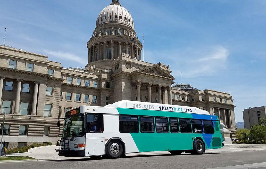
Founded in 2018 as the Transportation Management Association (TMA) for downtown Boise, City Go is made up of public and private partnerships that bring businesses, developers, property managers and owners, and government entities together to address local transportation issues and shape the future of mobility.
STRATEGY: Support environmentally sustainable growth Downtown and responsible stewardship of the Spokane
River and Falls
Compact growth downtown is an important part of a greener future for Spokane as a whole. As Downtown continues to grow and evolve, the City and DSP should strive to protect and enhance the natural environment Downtown, and the Spokane River and Falls in particular.
ACTION: Integrate Green Stormwater Infrastructure (GSI) into public street and building projects and encourage green stormwater strategies to retain and treat runoff on-site as part of private development.
Spokane has over 300 miles of separated storm sewer lines that discharge untreated stormwater in the Spokane River and over 400 miles of combined storm- and wastewater sewer lines that overflow from heavy rainfall and snowmelt and discharge sewage into the River. Investment downtown in the form of new public spaces, or redesigned streets can help reduce the flow from these systems and treat or retain stormwater. For new public projects the city should set concrete goals for on-site stormwater management and seize opportunities to capture and treat stormwater as part of street, trails, parks and public space projects. The City should explore practical incentives for integrating GSI into new development like discounted stormwater utility fees commensurate with the capacity of on-site systems to hold and treat stormwater.
ACTION: Promote energy efficiency in new construction and rehabilitation of historic buildings.
Residential and commercial buildings in Washington consume about 41.2% of energy for the entire State, which contributes substantially to greenhouse gas emissions. Spokane's power utility, Avista, has a relatively clean generation resource mix, which is 57% renewable. Downtown buildings can be a model of environmentally responsible and resource efficient building practices, and the City should support sustainable design and construction Downtown. Simple design considerations like access to natural light and ventilation in living and working spaces can make these spaces more comfortable and reduce energy consumption. Managing direct sunlight with solar control and shading devices can be integrated into the design of new buildings.
The City currently permits solar power installation and waives permit fees related to the permitting and construction of solar energy systems. The City should explore extending this waiver to the installation of sustainable heating and cooling systems and consider offering rebates or similar financial incentives to new construction that incorporates efficient heating and cooling or solar power so that this incentive includes to new construction or rehabilitation that integrate these systems into their design.
ACTION: Mitigate the urban heat island effect Downtown in order to reduce vulnerability to extreme heat events.
Urban centers are particularly vulnerable to extreme heat events because they are already warmer than surrounding non-urbanized areas. The City can take steps to make Downtown and Spokane as a whole more resilient to heat and adapt existing buildings to more extreme heat by integrating cool pavement with higher solar reflectance or coatings that reduce heat absorption into long term planning and capital projects. The City should work to create a more complete tree canopy Downtown, filling gaps in the network of street trees to shade paved areas from the sun.
For private development the City should explore requirements and incentives for cool roof design materials with lower solar absorption and incentives for Eco roofs or vegetated roofs. Surface parking areas contribute disproportionately to warming in urban environments, and the City should evaluate its current parking standards for opportunities to incorporate cool paving materials and additional landscaping and shade trees with surface parking in and around Downtown.
ACTION: Support a healthy local food system, with readily available fresh food and locally produced food.
The City and DSP should continue to support efforts to locate new grocers Downtown and develop groundfloor spaces for grocery stores that provide access to locally produced food. The City should consider working with market organizers and vendors to find a more central Downtown location for the Spokane farmer's market to expand access to locally produced foods.
GOAL: WELCOMING AND ENGAGING PUBLIC SPACES
The value of quality public spaces in attracting people to come and to stay in downtowns is clear. Spokane has shown this with the success of the redeveloped Riverfront Park, and with the takeover of the streets for Hoopfest every year. Successful public spaces are well stewarded, whether by City staff, non-profit or community groups, or by neighboring property owners. This Downtown Plan considers the current open spaces and the opportunities to create the variety of successful open spaces that will make Downtown Spokane an attractive place to spend time for people who live and work in the city, and for those who come to visit with an emphasis on natural surveillance.
The strategies in this section are intended to:
Create a more complete network of public spaces, including right-of-way and expand public spaces that enhance existing centers of activity Downtown.
Develop the organizational capacity to actively program and manage public spaces Downtown and ensure that these spaces feel safe, comfortable, and usable at different times of day.
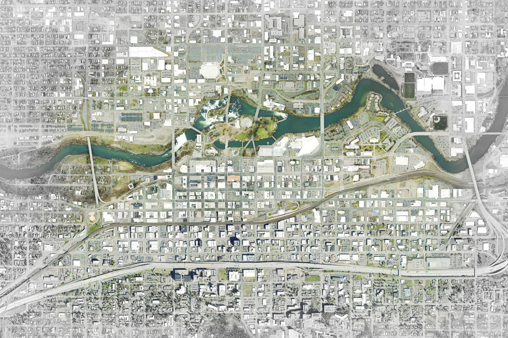
PUBLIC SPACES
PUBLIC SPACES
PS1
STRATEGY: Program and Activate Public Spaces Downtown
Downtown's public spaces include the streets and sidewalks, the regional and neighborhood parks, and the plazas that may be publicly or privately owned, but accessible to the public. Ideally, there is a variety in the size and character of open spaces, and pleasant connections between them. Ideally, Downtown's public spaces include a variety of characters quiet spaces for conversation, a comfortable place to eat lunch, safe places to wait for the bus, interesting streets for strolling, green spaces to enjoy nature, and active places for shopping or playing.
The key to successful public spaces of all types is stewardship. Public space needs first to feel safe. They thrive when there are positive things to do, whether passive or more active. Private owners or businesses can be stewards of adjacent spaces, and successful public space often is "naturally activated" by cafes, shops, restaurants and other vendors. In other cases, public spaces can be managed by the public sector or organizations from the community or businesses. Partnerships between cities and main street or downtown associations have been successful in downtowns nationally. Whichever model is most appropriate, stewardship and activation need to be thoughtfully considered, on-going, and provided with resources.
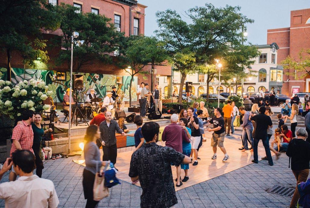
Through an active programming effort Congress Square Park in Portland, ME has been transformed into a fun and lively public space with a variety of activities and events.
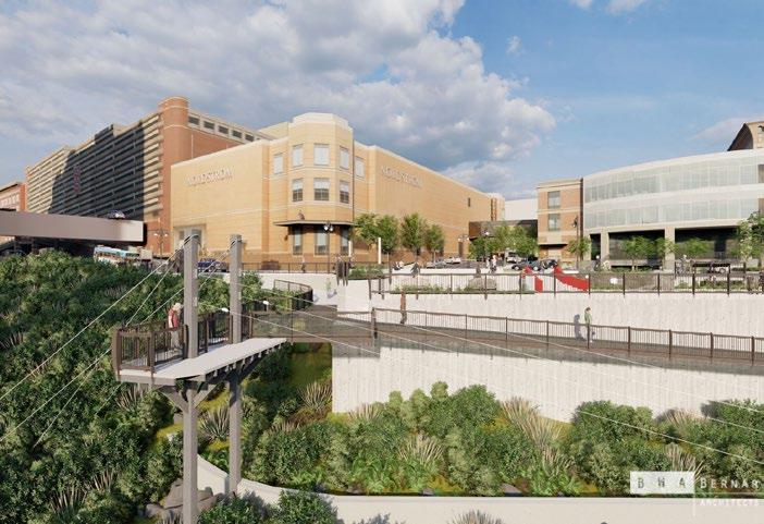
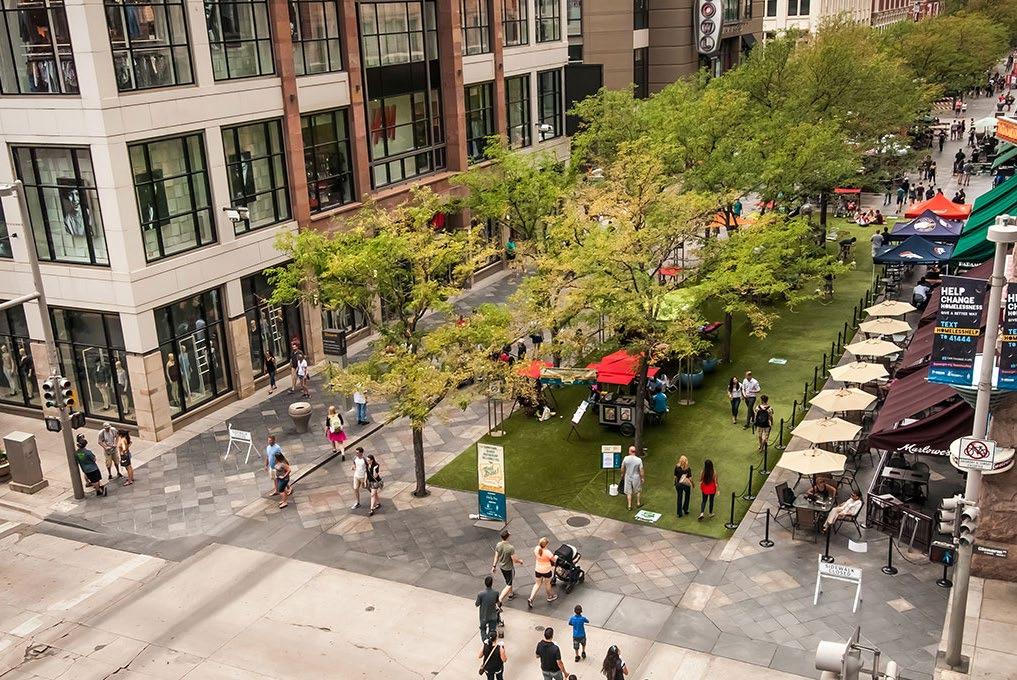
The 16th Street Mall in Denver, CO was transformed into a Downtown destination primarily through programming and activation.
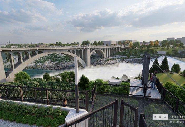
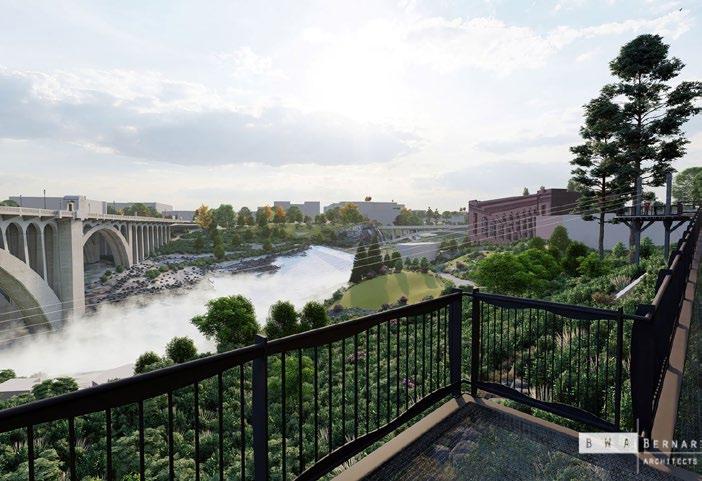
The proposed zipline project along the river in downtown Spokane is designed to activate Riverfront Park, Redband Park and downtown. It is also expected to build economic strength for downtown and the region. The above renderings show the urban zipline platform hanging over the Spokane River downtown.
ACTION: Strategically program and activate public spaces Downtown.
The City and DSP should coordinate and expand on DSP's existing program for enlivening Downtown's public space with additional events and locations. Spokane has shown that it can throw major events that use Downtown's public space and draw participants nationwide. There is no doubt the ability to have smaller scale, ongoing activity that will attract people from the city and the region to enjoy Downtown on a regular basis. Funding these activities in other cities comes from both public funds and corporate donations and should be considered here.
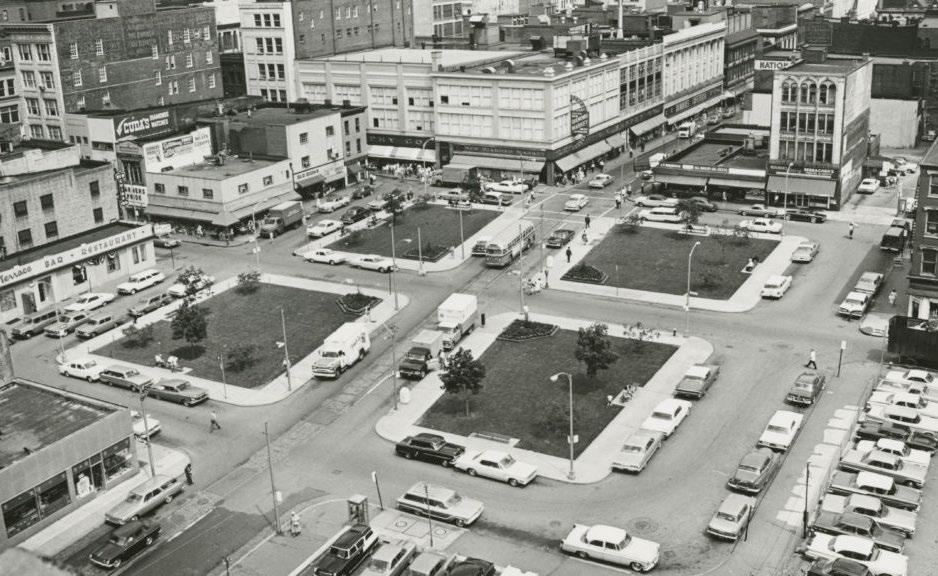
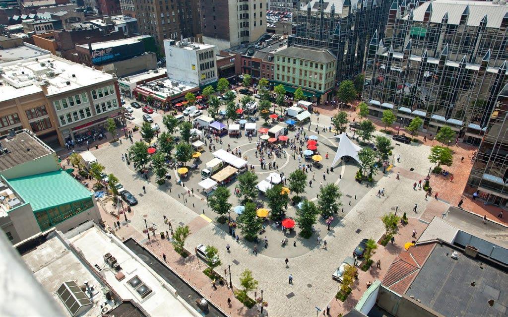
ACTION: Create new active uses on streets and in storefronts.
While good design of storefronts and public realm is important, the best indicator of an energized downtown is the successful mix of business sizes that activate urban streets. The support of those businesses has never been more important, and calls for an understanding on the part of the City and DSP around what these businesses need in terms of support. Some existing organizations like Window Dressing can help by coordinating exhibits at participating display windows. The Downtown Spokane Community Investment Group (DCIG) may be able to master lease space to provide small, affordable spaces for start-up businesses, possibly but not exclusively in the shared workspaces or market spaces, proposed as part of redevelopment of surface parking lots under the Connected and Walkable and Live Work Play sections of this Plan. Business workshops have been helpful to support artists as small businesses through organizations such as Seattle-based Artists Trust. Ease in permitting for street use can also help entrepreneurs who bring activity to public spaces, as recommended in the Connected and Walkable section of this Plan.
ACTION: Continue the presence of a fully staffed, centralized downtown precinct.
The City should continue to encourage officer visibility and outreach downtown to further the implementation of community-oriented policing. Implementing neighborhood and community-oriented policing is a value established in Chapter 10 of the City of Spokane's Comprehensive Plan. Continuing to maintain an accessible downtown precinct is key to successful implementation of this Comprehensive Plan value.
STRATEGY:
Downtown
Protect, expand, and improve public space in strategic locations
The core of Downtown and areas south of the railroad viaduct have gaps in the network of public spaces, and untapped opportunities to increase the quality and quantity of public space that would result in a more attractive Downtown. Frequent gaps between active areas Downtown include stretches of surface parking and blank walls that do not contribute to an active streetscape. Increasing the amount of pedestrian space and amenities within existing street right of way would improve the quality of the pedestrian environment not only along those gaps, but the perception of Downtown overall. Investment in and active management of new public spaces would benefit centers of activity Downtown, like the newly constructed plaza at 10 S Adams St, which has created a centerpiece for an emerging residential neighborhood.
Alleys were mentioned consistently by the public as valued spaces and opportunities for use as public space. The scale of alleys is conducive to human-scale spaces, and often they have character as "back doors" that feels authentic. Revitalized alleys are good fit with nearby active uses or as needed connections. The City should have a defined policy on alley vacation or acquisition and a formalized set of criteria from which to evaluate public benefit, service access, and multimodal connections. As the City sees growing demand for larger scale development, these decisions warrant cautious consideration to assess potential public benefits; evaluate the current and long-term impacts caused by relocated services to parking, active uses, and the pedestrian environment on street edges; and understand ramifications for future connectivity if intact alley corridors are severed.
ACTION: Create protections to retain public spaces, ensure existing and new public spaces are well used and maintained, and develop a specific set of criteria to evaluate alley vacation or acquisition based on public benefit and access.
Coordinate efforts such as active programming and dedicated maintenance funds to ensure public spaces are well-used and maintained, including privately owned plazas with street frontage, with the plan for a network of small parks and public spaces identified in the Live Work and Play section of this Plan. Develop a policy stance on the network of alleys, including those between the railroad and I-90, which are currently listed as a type of Downtown Complete Street. Approvals of alley vacations are subject to criteria including finding such a vacation is needed in order to accommodate a public use. Create policy statements regarding the circumstances, if any, that alleys may be sold by the City to private entities, and what public benefit would be required with the sale.
ACTION: Revitalize Parkade Plaza as the active place it was in a previous era, with its distinctive style of architecture and surrounding active uses.
The Parkade is a unique icon of Spokane, with 950 parking spaces, ground level retail and a plaza that was once one of Downtown's social hubs. This well-located plaza also connects between Howard and Stevens Streets.
The garage and the plaza are important features of Downtown, and the Plan proposes the revitalization of the plaza, showcasing the 1960's architecture, and supporting the restaurants lining the plaza. The graphic illustrates a ground plane treatment that is a colorful "thread" indicating the route through to Stevens Street as a way to make the space feel safer, without being a dead end. New plantings can refresh the appearance, and lighting can enliven the plaza in the evening. The north side of the plaza has weather protection that can serve pop-up types of uses. Materials and landscape can bring the plaza out to the west to the curb, capturing the sidewalk space and inviting people into the plaza.
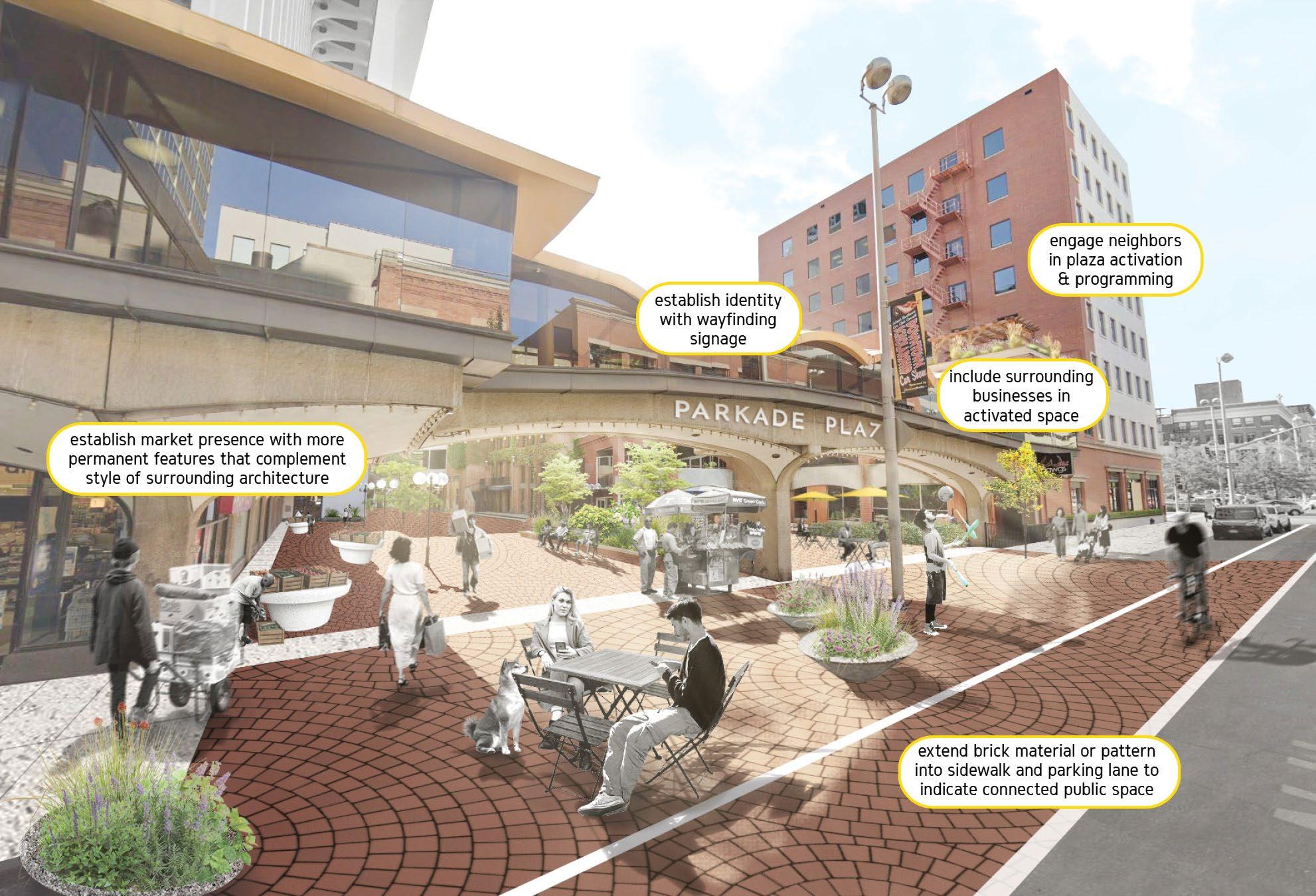
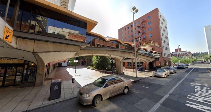
PS2.3
ACTION: Rename and improve the alley between W Main Ave and W Riverside Ave to transform a neglected space into a distinctive pedestrian space. This alley renovation can be a model for other alleys Downtown.
Giving names to alleys is a low-cost action that is a prerequisite to placemaking. As shown in the graphic, ways to improve alleys include ground plane treatment, art, and narrow landscape treatments. Uses along the alley are the best way to create a feeling of safety and stewardship. The City should encourage property owners to open up the back doors where possible.
Alleys or through routes can be encouraged or required with new development to break down building scale. This would be highly recommended for Major Downtown Site A and B (Figure 28), extending the delightful space at the rear of Atticus Coffee and Gifts.
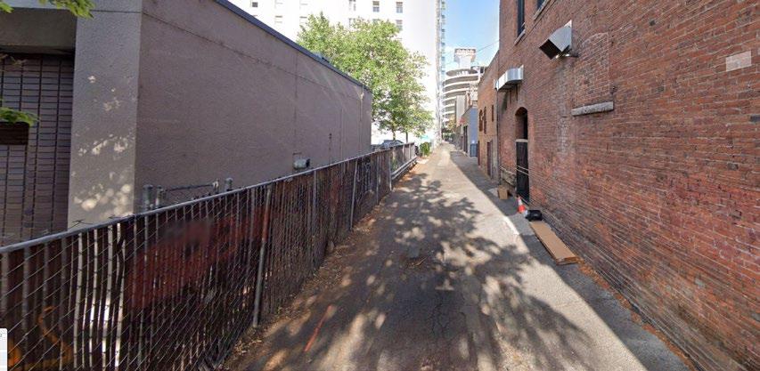
EXISTING
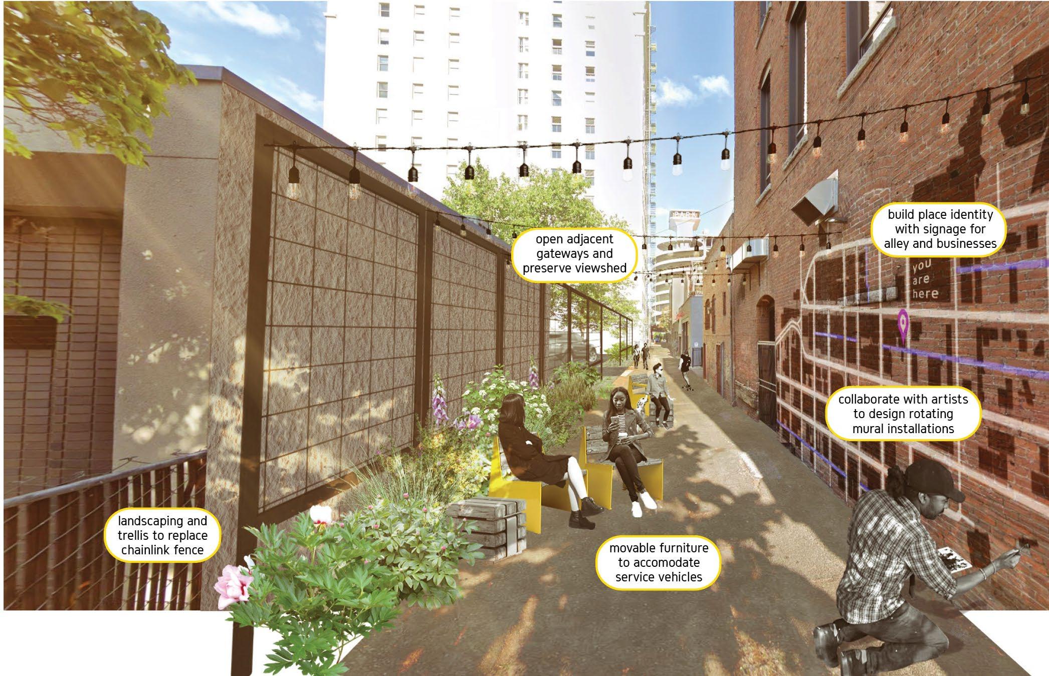
ACTION: With the redesign of Wall Street for transit use, retain the pedestrian scale of the street and focus on bringing active uses to the street level.
Wall Street has been identified as an important pedestrian street in Downtown, with design treatments meant to favor pedestrians. While the streetscape design was attractive, the uses along the street did not provide the activity that made a successful pedestrian street. Wall Street will again be changing with the implementation of the City Line. The Plan recommends retaining the pedestrian scale of the street, but thinking creatively about activation.
ACTION: Pursue a public plaza space in the East End of Downtown.
The East End of the Downtown core along W Main Avenue is one of the most active pedestrian areas with small scaled buildings and active storefronts, restaurants, and an attractive streetscape. The W Main Ave frontages are active but much of the blocks in that area is currently surface parking and the area would benefit from a public plaza like the new plaza in the West End. Since public plazas surrounded on two sides by busy arterials have difficulty generating the necessary critical mass of activity to function well, the site offered for this plaza should have an anchoring building with pedestrian-scaled frontages if it borders Browne St, Division St, Spokane Falls Blvd, or Riverside Ave.
ACTION: Pursue a public/private partnership to develop sites such as the Rookery Block, shown below, with public spaces in conjunction with new development.
The Rookery Block is ideally located for a major public space incorporating both indoor and outdoor space. The graphic illustrates a concept that includes a high-ceiling public market space at grade, parking levels above, accessed off Stevens Street, and a tower for residential and/or office. An alternative access on Riverside would provide ingress/egress from a two-way arterial and preserve windows, exits, and ground-level activation on the Fernwell Building's south facade. Plaza space is shown along Howard and Sprague in conjunction with the highly active street level, ideally with operable doors opening to the public market in good weather. Plaza space on the south east corner retains a view of the historic Fernwell Building on the northeast corner and avoids blocking windows of the building.
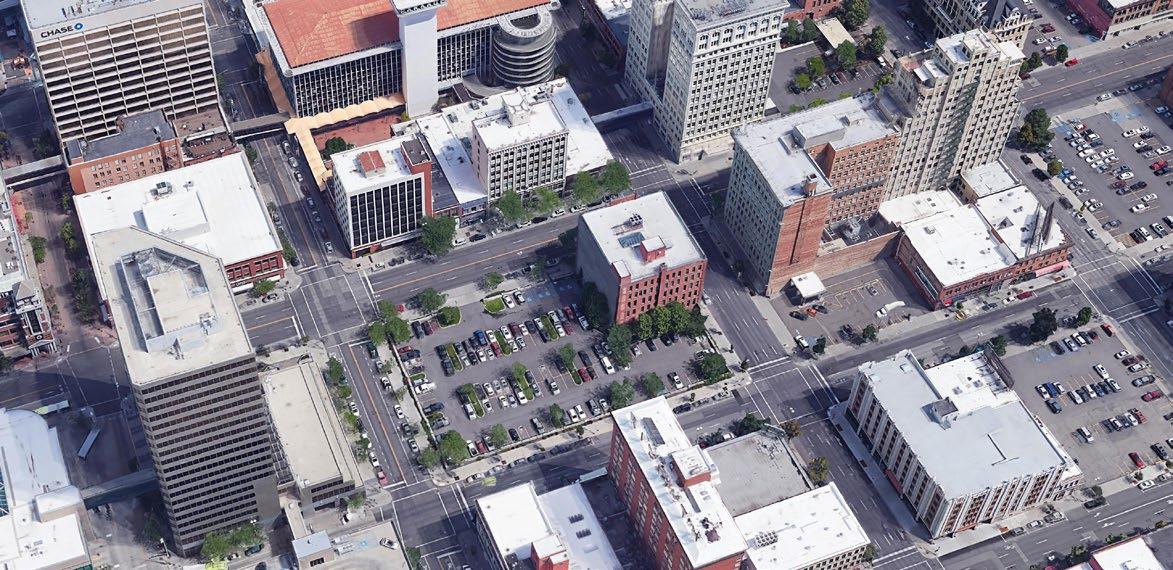
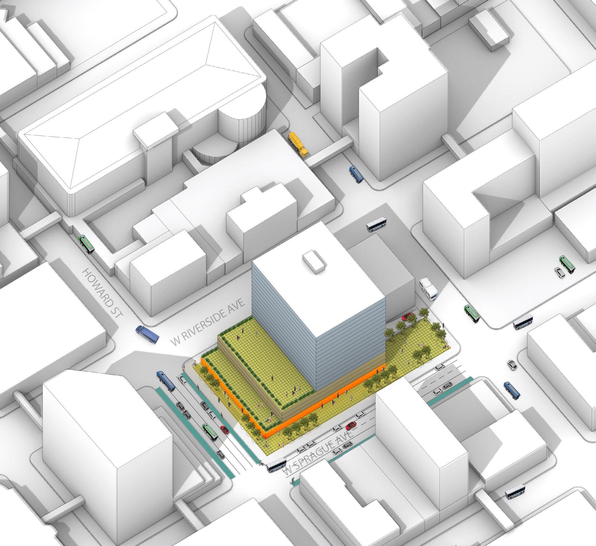
ACTION: Design public spaces for accessibility that meets or exceeds ADA requirements.
All Downtown public spaces should be accessible to people of different abilities. While the City maintains standards for accessibility as part of new public spaces, both DSP and the City should seek to retrofit public spaces that fall short of accessibility requirements, and work with ownership of privately-held public space to improve accessibility.
ACTION: Consider Crime Prevention Through Environmental Design (CPTED) in future public and private development Downtown and implement CPTED principles as a partnership between the City and DSP.
DSP and the City should work to raise awareness of CPTED principles among property owners Downtown and identify and/or help secure public and private funding sources for CPTED improvements that encourage activity and create opportunities for natural surveillance. To address perceptions of safety and security Downtown, the City should consider CPTED assessment for public spaces, and for developments of a certain size.
GOAL: A WELL-ORGANIZED DOWNTOWN
Well-organized Downtowns are the result of the collective efforts of public, private and community organizations to address all the ingredients in a successful Downtown. Successful Downtown management addresses issues such as design, promotions and marketing, business diversity, community events, and organizational development. Spokane is currently well served by the organizations involved in Downtown management and the plan should continue to strengthen management functions to implement the plan. Some of the recommended strategies and actions will require a greater capacity for management such as programming and activation of major public spaces, the cultural trail, and a Downtown public market.
Organizations such as the Downtown Spokane Partnership and the City of Spokane have significant but different roles to play in the management of Downtown. For example, the City is responsible for major capital projects, but DSP has a role in managing and programming public spaces in Downtown through the efforts of the Clean Team and programming staff. There are opportunities to strengthen existing partnerships, create new organizations, and support the organizational development of existing entities to expand the capacity to manage Downtown Spokane.
The Downtown Spokane Partnership recently established the Downtown Spokane Community Investment Group (DCIG) which is a Community Development Corporation (CDC) that can partner with the City. The DCIG can access public bond market funding for projects that will be publicly owned, such as investment in parking or other public facilities. Other organizations such as a Public Development Authority (PDA) should be considered to implement the Downtown Plan's objectives to accelerate infill development, expand structured parking to reduce existing surface parking, and manage public spaces.
The City led a parking study for Downtown in 2019, which offers an analysis of the Downtown parking system and recommendations for improving on-street parking management. Implementation of the Downtown Parking Study Plan should remain a priority, and this section is meant to supplement those recommendations and build on that analysis.
The strategies in this section are intended to:
Effectively manage parking, activation and programming of public space while implementing certain aspects of the Downtown Plan.
Promote Downtown Spokane through marketing campaigns that attract new businesses, residents, and visitors, and through programs that retain and support existing businesses Downtown.
Encourage new public/private partnerships and community participation in the activation of public spaces in a way that works for Downtown residents.
Strategy: Cultivate leadership, strengthen community partnerships, and expand organizational capacity for Downtown management
The Downtown Plan is ambitious, and its goals cannot be achieved without strong leadership and partnerships. Everyone has a stake and role in Downtown, but leadership and partnerships play a unique role in the success of Downtowns. This Plan can only be successful as the related plans that reinforce it, and leaders will continue to rely on their partners region-wide for implementation, such as continued support of the regional model in the Continuum of Care Board's strategic plan to end homelessness. Fortunately, the City and community already have a strong commitment to Downtown as demonstrated by many successful projects and achievements in Downtown. Further efforts to cultivate leadership will help with coordination of Downtown projects, communications, public engagement, and ensuring Downtown initiatives are kept at the forefront.
ACTION: Develop the organizational capacity and partnerships to actively manage and program public spaces.
Programming public spaces requires a commitment of resources that is often beyond the City's capacity. Organizations such as DSP can often lead such efforts in partnership with the City and private entities. A programming and activation plan should be developed for key public spaces outlined in this Plan to be implemented by DSP with the support from other entities. The plan should address programming, amenities, staffing, a budget that anticipates public investment as well as private/corporate giving, costsharing, and operations and maintenance.
ACTION: Provide adequate staffing resources and establish an interdepartmental team to lead coordination and implementation of the Downtown Plan and future planning efforts.
Implementing the Downtown Plan will require a high level of leadership, coordination, and continued public outreach. The City should provide adequate staffing and consider designating an interdepartmental team to coordinate implementation of the plan. This action would give renewed focus to Downtown and help launch the plan.
ACTION: Enhance the role of the new Downtown Spokane Community Investment Group (DCIG).
Through the DSP a new Downtown Spokane Community Investment Group was recently established. This action includes additional planning to better define the role of the DCIG and other tasks for which only the non-profit organization (rather than the general public) is responsible to oversee and fund, including developing a logo and branding, to start to build an identity. The DCIG could play a role in implementing several of the strategies and actions in this Plan.
ACTION: Explore the feasibility of establishing a Transportation Management Association (TMA).
Establishing a TMA requires extensive partnerships between the City and downtown employers, organizations, and transit agencies and a strong fiscal strategy. The Downtown Parking Study recommended exploring the feasibility of establishing a TMA in partnership with major employers and organizations in Downtown. The City and partner agencies should explore the support and feasibility of establishing a TMA in Downtown to support the plans goals for improved mobility options and transit access.
ACTION: Monitor housing and shelter for low-income residents and residents experiencing homelessness.
Encouraging housing for the low-income and homeless throughout the entire city is a value established in Chapter 6 of the City of Spokane's Comprehensive Plan. To implement this value downtown, the City and the DSP should coordinate with public and private agencies and other appropriate entities to evaluate existing needs, facilities, and programs relative to health and human services downtown.
STRATEGY: Leverage parking management to improve Downtown and enhance the Paid Parking Zone
The City has a Paid Parking Zone for Downtown where all net on-street parking revenue is allocated for investments in Downtown such as streetscape or parking improvements. This strategy would enhance the program through implementing strategies in the Downtown Parking Plan, using additional funds when available to continue streetscape improvements and implement other components of the Downtown Plan.
ACTION: Use the existing Downtown Spokane Community Investment Group (DCIG) Community Development Corporation, or a Public Development Authority to develop structured parking and manage existing facilities.
Off-street parking is mostly privately owned and managed. The result is a fragmented and inefficient system with a user experience that is often poor. With portions of the Downtown dominated by surface parking lots, the walk to destinations can be uncomfortable and result in a higher demand for wellmanaged parking where users feel safe and secure. The goal of the PDA or DCIG would be to reduce surface parking Downtown, create new structured parking that is well-managed, safe, adaptable to future reuse, and secure, and actively manage off-street parking under a shared parking system, including parking wayfinding and user-oriented tools that help people find available parking. Structured parking should minimize the impact of parking on the pedestrian realm with ground-floor uses, design of vehicular access, adaptive strategies, and facade treatments that make for a more engaging, pedestrianoriented structure while preserving the capacity to convert such a facility to a higher and better use for the Downtown in the future.
ACTION: Work with the property owners to proactively address the future of the Parkade building and site.
The Parkade is an icon in Downtown and provides a significant amount of off-street structured parking with over 900 parking stalls that serve Downtown employees, customer, and visitors. The structure, at over 50 years old, is eligible for historic designation locally and through the National Register of Historic Places. The structure is in nearing the end of its functional life and without major renovations and structural improvements it will not be functional. The owners, the City, the DSP, and other partners should pursue the renovation of the Parkade as a cultural and architectural icon. Options for preservation may include preserving the existing parking, adaptive reuse or potentially redevelopment that would likely include a parking component.
ACTION: Develop and maintain parking revenue scenarios for on-street parking to effectively implement parking demand management and new technologies in the Paid Parking Zone.
The Downtown Parking Study recommended strategies to adjust rates for on-street parking to improvement management, diversify parking revenue, invest in new technology, and enhance net meter revenue to support parking, public space, and mobility improvements in Downtown. Rates should be adjusted based on managing demand and aligning with off-street rates while allowing for investments in the parking system to improve the user experience in Downtown.
WO2.4
The City of Spokane does not currently have a major role in owning or managing public off-street parking in Downtown. The majority of off-street parking is privately owned and maintained resulting in a fragmented system and poor user experience at some facilities. The City is planning technology improvements for the on-street system that should be accessible to off-street parking facility owners and operators to create a unified shared parking program. The City and DSP should also consider development of a shared parking brand for Downtown that can be used for communications, marketing, and wayfinding to improve awareness and access to off-street parking. WO2.2
ACTION: Leverage City investments in parking technology to facilitate a dynamic and flexible offstreet shared parking program.
STRATEGY: Develop new promotions and marketing campaign to attract downtown businesses
The Spokane region has a strong marketing campaign for tourism that includes Downtown but is focused more broadly. Downtown would benefit from a new marketing and promotions plan to attract businesses and employers to Downtown by highlighting the many amenities, easy access, parking options, proximity to Riverfront Park, and plans for Downtown.
WO3.1
ACTION: Develop a Downtown specific promotions and marketing campaign led by DSP, in partnership with other organizations that have a presence Downtown.
The DSP should lead a collaborative effort to promote Downtown to businesses and major employers both in the region and around the country by highlighting the many assets and opportunities in Downtown. Downtown Spokane enjoys relative affordability, amazing access to the outdoors, a strong sports, arts, and culture scene, historic architecture, and many great surrounding neighborhoods. This should include cooperative marketing with Greater Spokane Incorporated (GSI), the City, Visit Spokane, the Downtown Spokane Partnership (DSP) and Business Improvement District (BID), Health Sciences Campus, and Univ. District that connects with regional branding efforts.
Calgary, AB has an active campaign to attract employers and talent to the City.
The VisitOKC site for Oklahoma City, OK is more focused on the City and Downtown than the surrounding region.
ACTION: Enhance funding for Downtown programming, wayfinding and promotions through partnerships.
A source of funding for programming, wayfinding, and promotions is currently a challenge in Downtown. The City, DSP, and other partners should pursue additional funding sources such as net parking meter revenue, grants, private sector partnerships, and revenue from events to support these efforts in the future.
ACTION: Connect sponsors with organizations that host events Downtown.
DSP is uniquely positioned to connect local businesses and organizations who may be interested in hosting events Downtown as well as supporting those events directly. Additional festivals and community celebrations may be possible through better funding and addressing the needs of public safety at events. Organizations that host events may need support resuming large-scale public gatherings Downtown through the COVID-19 economic recovery and beyond.
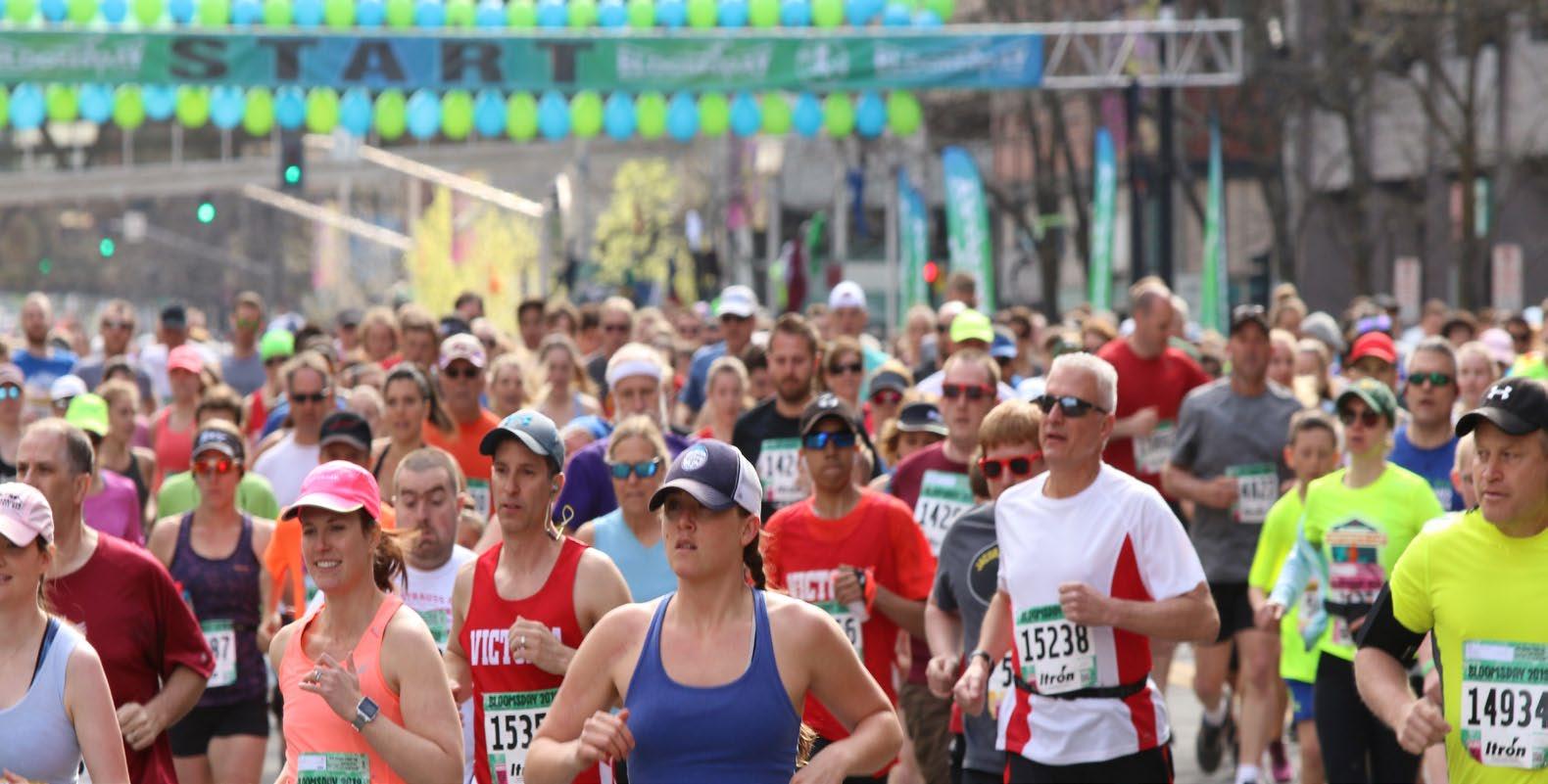
The Inland Northwest
The annual Bloomsday run through Downtown and nearby neighborhoods in May
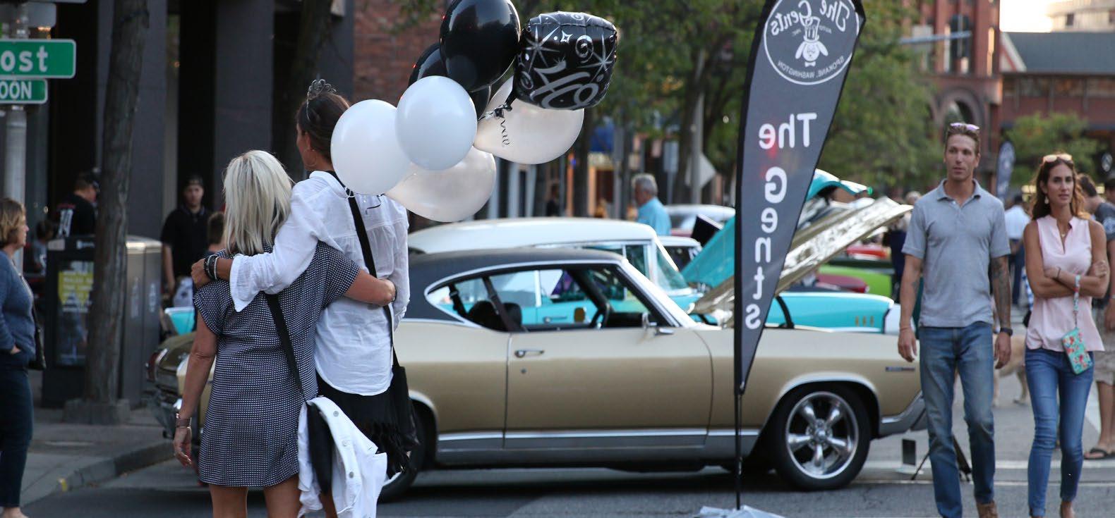
The strategies and actions in the previous sections reference various opportunity sites in Downtown Spokane. The 12 opportunity sites designated in the plan have retained some sites from the past plan which may still serve as long term goals, and new sites that are vacant, underutilized, or in use as surface parking. Each of these sites has the potential to serve the community in different ways - as public space, mixed use development that integrates public uses and benefits, and affordable space for local businesses and organizations. These sites are shown in the map below and summarized in the following pages.
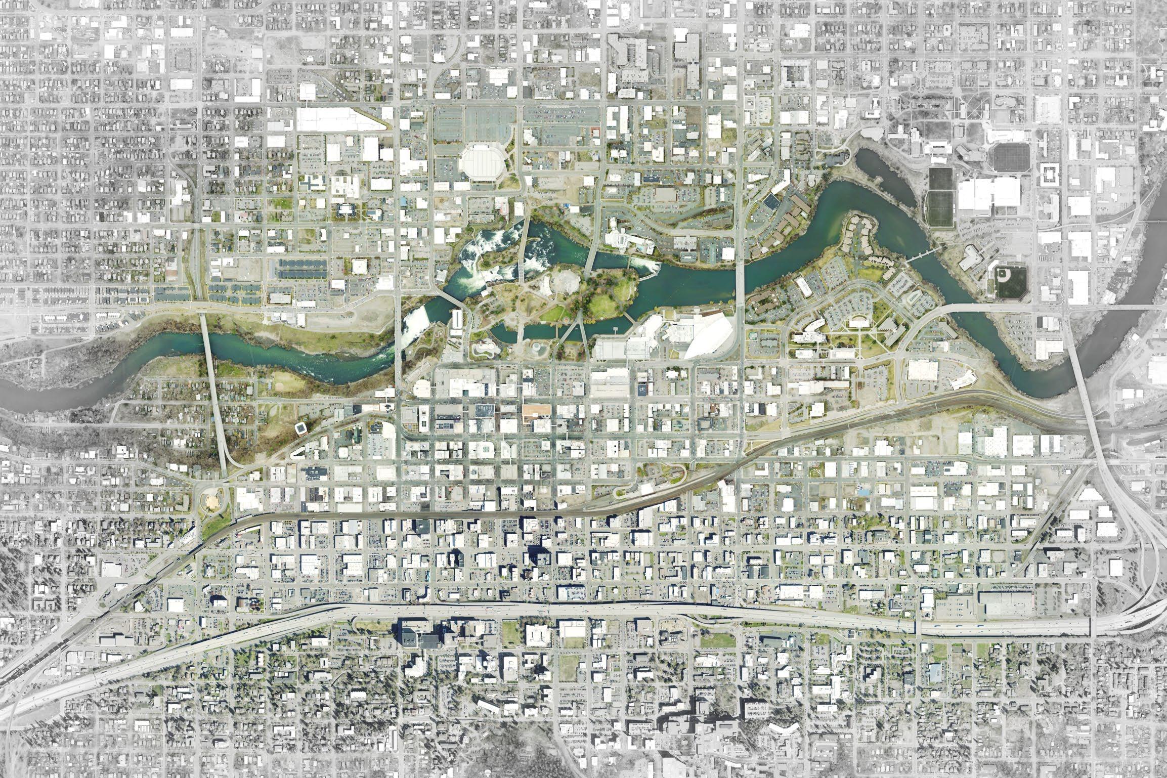
East End Public Space: Downtown's East End has a number of active uses along W Main Ave that could benefit from and help activate a public space. A substantial public space with adjacent active uses should be a priority, as any plans for new development or redevelopment move forward in the four blocks to the north and south of Main Ave between Bernard and Division Streets.
Intermodal Center: The Intermodal Center is an opportunity for the City to help create and preserve workspace that can act as an incubator for small businesses or organizations that may not be able to afford their own space Downtown. Unused spaces in the Intermodal Center could be converted to co-working or individual business spaces, for organizations that rely less on foot traffic in partnership with organizations that help fledging businesses in and around Downtown like Terrain and DSP.
Major Downtown Sites A + B: These two surface parking lots with mixed ownership are in an ideal location for infill development that could help energize the edge along Riverfront Park and two central blocks of Main Avenue. The City and DSP can support infill development with an economic and pro forma analysis to determine what development programs could work on the site from a financial perspective, and whether existing development regulations are an impediment to development. The City can also play an active role in redevelopment through a public/private partnership.
Parkade + Parkade Plaza: The Parkade is an important reservoir of structured parking Downtown and an architectural landmark. DSP should work to preserve the structure with over 900 parking spaces and reinvigorate the Parkade Plaza that connects to the alley running through the center of Downtown. The design of the structure's street level is key to activating both the Parkade Plaza and surrounding streets, and the rehabilitation of the Parkade structure should consider the design of ground level spaces to create more of a relationship with the Plaza and pedestrian space along W Main Ave.
Rookery Block: The Rookery Block is another centrally located surface parking lot, surrounded by larger office buildings in Spokane's Downtown Core. The City and DSP can support infill of the site with economic and financial analysis and can help effectuated development of this and other priority sites with public/private partnerships. This site is an opportunity to support a more active Downtown with space for ground-floor retail and cultural uses.
Bosch Lot: The Bosch Lot is Spokane Parks Department property currently in use as a surface parking lot over a combined sewer overflow facility recently constructed by the City and is a site of tribal significance for the Spokane people. This lot is subject to Washington State Department of Conservation restrictions in terms of use, with limited potential for non-residential redevelopment. The City should work in consultation with the Spokane Tribe of Indians to develop a master plan for the site that honors its significance to the Tribe.
Chancery Building: The Chancery Building is a historic three-story building on Riverside Ave that was once home to the Roman Catholic Diocese of Spokane and is now vacant. The building is an opportunity for restoration and adaptive reuse of the structure or redevelopment that is respectful of the historic building and its context.
Greyhound Terminal: Spokane's former Greyhound Terminal between Sprague and 1st is an excellent opportunity to link the West End and the Downtown Core with redevelopment that supports nearby cultural uses and can complement the developing district in the West End. The site is large enough to support small public spaces on 1st or Sprague that can meet neighborhood needs for open space within a few blocks of the site, and can help connect the Fox Theater and venues in the core of Downtown to the West End. Like the Parkade, this site is eligible for local and national register listing and could take advantage of tax incentives if rehabilitated or as an adaptive reuse.
Steam Plant Parking Lot: The existing surface parking lot fronting Railroad Alley Avenue between Post and Lincoln Streets lies near hotels and entertainment venues on the north side of the railroad, an ideal location for correlated and supporting development including mixed office, retail, and/or residential development and privately or publicly owned public space. This half block adjoins the two railroad undercrossings at Post and Lincoln, offering a critical pedestrian connection to the Downtown Core from the neighborhoods to the south and restaurants and other attractions in the South Side.
Steam Plant Substation: Avista Utilities intends to relocate its existing substation south of the railroad, opening up the lot directly east of Steam Plant Square for potential development fronting S Post St and Steam Plant Alley. This is an opportunity to enliven the Post St frontage and complement anchoring nearby restaurants and entertainment uses.
New Avista Substation: Downtown's South Side will continue to grow and see both opportunity and demand for active public spaces and/or cultural spaces to be integrated with new development and investment. The planned substation at the northeast corner of W Third Ave and S Post street could integrate public space, cultural space or other amenities as part of development. These placemaking elements can help bring enliven this part the South Side near an area with more intact Downtown buildings with some active dining retail and service uses.
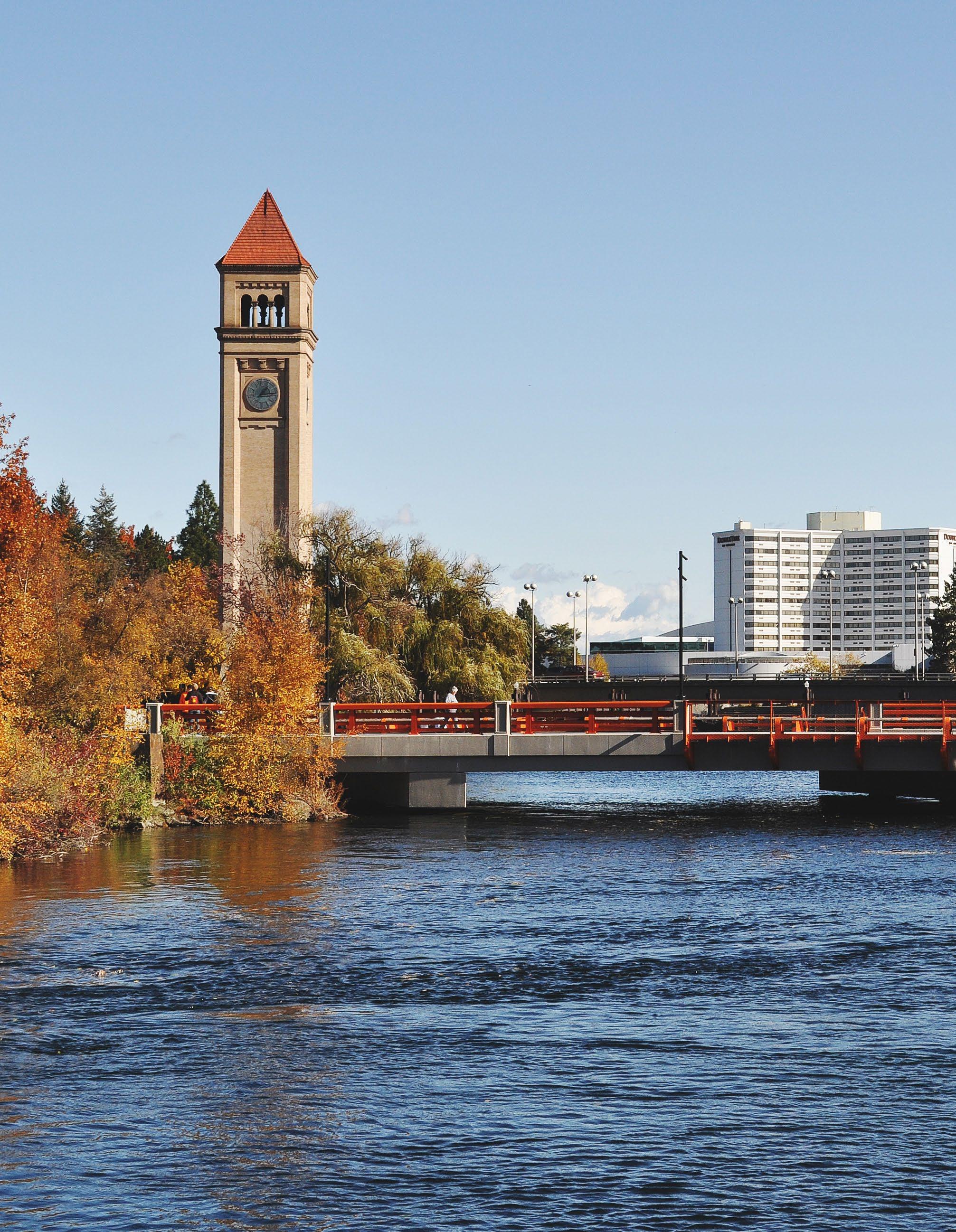
66 ACTION ACTION PLAN PLAN
ACTION ACTION PLAN PLAN
IMPLEMENTATION + ACTION PLAN
Based on the goals and vision in the plan, and the value of projects in the past ten years (outside of Riverfront Park), the following 15 priority actions will be possible within the next ten years
FUNDING SOURCES
Transportation Improvement Program (TIP):
The City's TIP is the primary mechanism for prioritizing transportation projects for funding. Projects may be funded by a combination of local and outside funding sources, but all major transportation capital projects must be listed on the TIP to be in the queue for funding. As the regions Metropolitan Planning Organization (MPO) and the Spokane Regional Transportation Council receives and administers federal transportation funds through its Transportation Improvement Program (TIP). Cities and public agencies may apply to have their projects be included in the TIP or other grants as federal funds are available.
Business Improvement District (BID): The BID is managed by the Downtown Spokane Partnerships and provides funding through an additional property tax on Downtown properties to fund downtown management activities.
Downtown based on the cost of implementation: $ = up to $50k, $$ - $50k to $500k, $$$ = Greater than $500k
Downtown Spokane Community Investment Group (DCIG): The newly formed DCIG has access to the public bond market to fund projects that include a public component. The DCIG is focused on economic related activities in Downtown such as real estate development and parking.
Washington Transportation Improvement Board (TIB) Complete Streets Program (CS): The TIB has a complete streets program to fund local complete streets projects including planning, design, and construction. To be eligible cities must have an adopted complete streets ordinance. Program funding was suspended in 2020 due to COVID-19 but may be reauthorized again in 2021.
Community Economic Revitalization Board (CERB): The CERB provides funding for economic development related projects including planning studies and investments in infrastructure to support job creation.
Capital Improvement Program (CIP): The City's CIP can support a wide range of potential capital projects such as land acquisition, parks and open space improvements, lighting improvements, and others. The general CIP has less constraints on the types of projects that can be funded compared to utility enterprise funds that are restricted to utility projects.
Parking and Business Improvement Area (PBIA):
The PBIA receives funding from on-street parking revenue consisting of approximately $250k annually that could be used to support implementation of the Downtown Plan.
Parking Revenue (PR): City parking revenue, primarily for on-street facilities, could be used to fund downtown improvements and other planning studies such as exploration of a Transportation Management Association (TMA) as was recommended in the Downtown Parking Study. Approximately $250k is currently provided annually to the Parking and Business Improvement Area.
STGB Set Aside (formerly TAP) (STGB): The STP Set Aside program uses federal funds to provide funding for on- off-road facilities for pedestrians and bicyclists, traffic calming measures, and projects that comply with the Americans with Disabilities Act (ADA). Funds are administered through the Spokane Regional Transportation Council (SRTC).
Washington Public Works Trust Fund (PWT): The public works trust fund provides low interest loans to cities and public agencies for capital projects. The funding is subject to authorization by the legislature and therefore funding levels are subject to changes over time.
Councilmanic Bond (CB): Councilmanic bonds utilize existing revenues, typically in the general fund, to finance major investments such as capital
projects without requiring an increasing in local taxes.
Project Funding (PF): The City's project funds have the ability, depending on available resources, to fund a wide array of downtown planning activities including staff time, planning projects, design, and public outreach.
Utility Funds (UF): City of Spokane utility funds can support the utility portions of major capital projects such as utilities associated with a major street reconstruction.
Transportation Improvement Board (TIB) Urban Programs (TIB-UP): The WA TIB provides grants through it's Urban Program including urban arterials, sidewalk programs, arterial preservation program, and Relight Washington focused on energy efficient lighting.
ArtPlace (AP): Artplace is a national non-profit committed to supporting arts, culture, and creative placemaking. ArtPlace provides targeted grant programs on specific topics and while no grant programs appear active at this time future funding could provide an opportunity for the City of Spokane.
WA Department of Commerce Grants (DC): The WA Department of Commerce provides grants periodically on a range of topics such as the recent grant program for housing action plans to increase the availability of housing in the state. The City of Spokane should monitor future grant opportunities to support implementation of the Downtown Plan.
ACTION: Transform low traffic streets that are oversized for projected traffic by converting vehicle travel lanes to other uses in target locations such as high-quality bike facilities, expanded public spaces, and on-street parking.
AGENCIES: City, Spokane Transit Authority
FUNDING SOURCES: CS, AP, STGP, PF
ACTION: Develop a transportation plan specific to Downtown that considers multiple modes and addresses facility designs, locations, priorities, and funding.
AGENCIES: City, Spokane Transit Authority
FUNDING SOURCES: PF, TIP
ACTION: Make sidewalks active and vibrant places through continued efforts to streamline design requirements, and developing new pilot projects in partnership with local businesses downtown.
AGENCIES: City, DSP
FUNDING SOURCES: PF, TIP, BID
ACTION: Protect use of alleys for service access and improve certain alleys as pedestrian spaces, where improvements add to connections and active spaces Downtown.
AGENCIES: City
FUNDING SOURCES: PF
ACTION: Actively pursue redevelopment of surface lots.
AGENCIES: City, DSP
FUNDING SOURCES: CERB, PF, PBIA, DCIG
ACTION: Improve pedestrian experience and safety at undercrossings beneath the rail viaduct and I-90 with targeted interventions.
AGENCIES: City
FUNDING SOURCES: TIP, AP, PBIA, CS
ACTION: Improve and activate the streetscape and public realm to support cultural venues.
AGENCIES: City, DSP
FUNDING SOURCES: PR, PF, PBIA, BID
ACTION: Identify sites Downtown for infill development that can help foster small businesses, local start-ups, and arts and culture uses and organizations.
AGENCIES: City, Spokane Arts, Terrain
FUNDING SOURCES: PF
ACTION: Develop a thorough understanding of on-site conditions and update market demand studies around opportunity sites.
AGENCIES: City, DSP
FUNDING SOURCES: CERB, GF, BID
ACTION: Create an integrated network of small parks and public spaces outside of Riverfront Park.
AGENCIES: City, DSP
FUNDING SOURCES: CIP, GF, PBIA, PR, BID
ACTION: Pursue redevelopment of the existing surface parking lots in the DTC-100 Zone along Spokane Falls Boulevard.
AGENCIES: City, DSP
FUNDING SOURCES: PF, CERB, BID
ACTION: Implement Transportation Demand Management (TDM) strategies.
AGENCIES: City, DSP, Spokane Transit Authority, Spokane County Commute Trip Reduction Program
FUNDING SOURCES: PR, PF, PBIA
ACTION: Strategically program and activate public spaces Downtown
AGENCIES: City, DSP
FUNDING SOURCES: PBIA, PR, PF, BID
ACTION: Develop the organizational capacity and partnerships to actively manage and program public spaces.
AGENCIES: City, DSP
FUNDING SOURCES: PF, PBIA, BID
ACTION: Connect sponsors with organizations that host events Downtown.
AGENCIES: DSP
FUNDING SOURCES: PBIA, BID
CW1.1 (Priority)
CW1.2 (Priority)
Transform low traffic streets that are oversized for projected traffic by converting vehicle travel lanes to other uses in target locations such as high-quality bike facilities, expanded public spaces, and on-street parking.
Connected and Walkable City, STA
CW1.3 (Priority)
Develop a transportation plan specific to Downtown that considers multiple modes and addresses facility designs, locations, priorities, and funding.
Make sidewalks active and vibrant places through continued efforts to streamline design requirements, and developing new pilot projects in partnership with local businesses downtown.
CW1.4 (Priority)
CW1.5
Connected and Walkable City, STA
Connected and Walkable City, DSP
Protect use of alleys for service access and improve certain alleys as pedestrian spaces, where improvements add to connections and active spaces Downtown. Connected and Walkable
Implement streetscape improvements in this Plan on the Howard Street Corridor, with elements of public art and wayfinding, in coordination with infill development.
CW1.6
and
Build a more complete tree canopy along Downtown corridors and continue work to bury utilities. Connected and Walkable Avista, City
CW1.7
CW1.8
Study ramping and access to the Maple Street Bridge and surrounding intersections for potential reconfiguration and design that reconnects Browne's Addition to Downtown, creates a safe environment for people walking and biking, and continues the planned cultural trail on First Ave west.
Reconfigure one-way streets with low traffic volume that do not tie into a Downtown freeway interchange as part of long-term changes to the transportation network Downtown and avoid further conversions to one-way street couplets.
Connected and Walkable City, Spokane Transit Staff Time, Possible consultant support
CW1.9
CW1.10
Integrate bike parking into Downtown streets and parking facilities.
Improve the street lighting system Downtown, filling gaps and replacing aging fixtures with pedestrian-scale and roadway lighting that create a safer nighttime environment Downtown.
and Walkable
CW1.11
CW1.12
Enhance the skywalk system's connections to the street and concentrate skywalks in the Downtown Core, limiting expansion, particularly along important view corridors.
Update development standards for Downtown Complete Street Designations can support and sustain active street edges.
and
CW2.1
CW2.2
Integrate City Line transit stations and the STA Plaza into plans for street improvements and other active transportation investments Downtown.
Improve bike connections Downtown with improved facilities connecting to the City Line together with new pedestrian amenities.
and Walkable
CW3.1
CW3.2
Develop a program to use the edges of surface parking lots for active uses, programming, and events such as food trucks, vendors, and farmers markets.
Connected and Walkable City, Spokane Transit
CW3.3
CW3.4 (Priority)
CW4.1
CW4.2 (Priority)
ACH1.1
Connected and Walkable City
Prohibit new surface parking lots in the Downtown Core, East End and West End. Connected and Walkable City
Discourage surface parking lots along the frontage of Type III and Type IV Complete Streets between the building and street throughout the Downtown.
Actively pursue the redevelopment of surface parking lots.
Develop a wayfinding plan for Downtown with priority locations and signage elements that ties into the County's Wayfinding Project and elements of the cultural trail.
Connected and Walkable City
Connected and Walkable
Improve pedestrian experience and safety at undercrossings beneath the rail viaduct and I-90 with targeted interventions. Connected and Walkable City
Tell stories about Spokane's local history and architecture using creative methods. Thriving Arts, Culture, and Historic Places City, Spokane Arts
NUMBER
ACH1.2
ACH1.3
Preserve historic structures and bridges and incentivize adaptive reuse of older structures that contribute to Downtown's historic character.
Develop design guidelines for downtown that help create a good fit between new development and Downtown's historic structures.
ACH1.4
ACH2.1 (Priority)
ACH2.2
Pursue the idea of a cultural trail that links signature sites and activates streets with the intent of drawing visitors and investment.
Improve and activate the streetscape and public realm to support cultural venues.
Work with artists and local property owners to create and maintain temporary art installation and facilitate activation of cultural spaces to energize Downtown and support artists.
ACH2.3
ACH2.4
Explore incentives for preserving cultural space and creating new space for arts and cultural uses Downtown.
Evaluate how the City's development regulations and permitting process can support cultural space and public art.
ACH2.5
ACH3.1 (Priority)
Identify and reduce barriers for cultural events Downtown.
Identify sites Downtown for infill development that can help foster small businesses, local start-ups, and arts and culture uses and organizations.
Thriving Arts, Culture, and Historic Places
Thriving Arts, Culture, and Historic Places
Thriving Arts, Culture, and Historic Places
Thriving Arts, Culture, and Historic Places
Thriving Arts, Culture, and Historic Places
DSP, Spokane Arts $ to $$$
Thriving Arts, Culture, and Historic Places
Thriving Arts, Culture, and Historic Places
Thriving Arts, Culture, and Historic Places
Thriving Arts, Culture, and Historic Places
DSP, Spokane Arts $
Spokane Arts, Terrain
ACH3.2
LWP1.1 (Priority)
Identify underutilized properties that could serve as affordable workspaces for organizations that are less reliant on foot traffic.
Develop a thorough understanding of on-site conditions and update market demand studies around opportunity sites.
Thriving Arts, Culture, and Historic Places City, Spokane Arts, Terrain Staff Time
Great Place to Live, Work, and Play City, DSP
LWP1.2
LWP1.3
Develop public/private partnerships, potentially with the assistance of a public development authority, to acquire and assemble property to support redevelopment Downtown.
Build site-based partnerships with affordable housing developers and transitional housing providers into public projects and infill development and engage these organizations in economic analyses of how an affordable housing program can be implemented in Spokane's real estate and development market. A Great Place to Live, Work, and Play City, DSP
LWP1.4
LWP2.1
LWP2.2 (Priority)
LWP2.3
Explore ideas to strengthen incentives for multi-family development and rehabilitation of historic structures Downtown
Develop ground floor standards for residential, retail, office, live/work, and civic uses.
Create an integrated network of small parks and public spaces outside of Riverfront Park..
Great Place to Live, Work, and Play City
Great Place to Live, Work, and Play City
Great Place to Live, Work, and Play City, DSP
Support existing businesses Downtown and build upon emerging activity centers with complementary retail and active uses. A Great Place to Live, Work, and Play City, DSP
LWP3.1
LWP3.2
Maintain and apply zoning designations based on criteria that address the surrounding context and desired land uses with a focus on street level uses.
Ensure signage standards are consistent with land use context and corridor character.
LWP3.3
LWP3.4 (Priority)
LWP4.1
LWP4.2
A Great Place to Live, Work, and Play City
A Great Place to Live, Work, and Play City
Ensure redevelopment projects contribute to streetscapes and good urban design. A Great Place to Live, Work, and Play City
Pursue redevelopment of the existing surface parking lots in the DTC-100 Zone along Spokane Falls Boulevard.
A Great Place to Live, Work, and Play City, DSP
Integrate new development Downtown with transit facilities and promote transit supportive development around high-capacity transit. A Great Place to Live, Work, and Play City
Reduce regulatory barriers to shared parking including expanding off-site parking shed limits.
LWP4.3 (Priority) Implement Transportation Demand Management (TDM) strategies.
A Great Place to Live, Work, and Play City
Time,
LWP5.1
LWP5.2
Integrate Green Stormwater Infrastructure (GSI) into public street and building projects and encourage green stormwater strategies to retain and treat runoff on-site as part of private development.
Promote energy efficiency in new construction and rehabilitation of historic buildings.
A Great Place to Live, Work, and Play City, Spokane Transit, DSP, Spokane County Commute Trip Reduction program $$
A Great Place to Live, Work, and Play City
A Great Place to Live, Work, and Play City
NUMBER ACTION GOAL AGENCY
LWP5.3
LWP5.4
PS1.1 (Priority)
PS1.2
Mitigate the urban heat island effect Downtown in order to reduce vulnerability to extreme heat events. A Great Place to Live, Work, and Play City Staff Time
Support a healthy local food system, with readily available fresh food and locally produced food. A Great Place to Live, Work, and Play City
Strategically program and activate public spaces Downtown.
Create new active uses on streets and in storefronts.
PS1.3
PS2.1
Continue the presence of a fully staffed, centralized downtown precinct.
Create protections to retain public spaces, ensure existing and new public spaces are well used and maintained, and develop a specific set of criteria to evaluate alley vacation or acquisition based on public benefit and access.
PS2.2
Welcome and Engaging
Welcome and Engaging Public Space City
Welcome and Engaging Public Space City Staff time
Welcome and Engaging Public Space City
Revitalize Parkade Plaza as the active place it was in a previous era, with its distinctive style of architecture and surrounding active uses. Welcome and
Space
PS2.3
PS2.4
Rename and improve the alley between W Main Ave and W Riverside Ave to transform a neglected space into a distinctive pedestrian space. This alley renovation can be a model for other alleys Downtown.
With the redesign of Wall Street for transit use, retain the pedestrian scale of the street and focus on bringing active uses to the street level.
Welcome and Engaging Public Space City Staff Time
Welcome and Engaging Public Space City, Spokane Transit Staff Time
PS2.5
PS2.6
PS2.7
Pursue a public plaza space in the East End of Downtown.
PS2.8
WO1.1 (Priority)
WO1.2
WO1.3
WO1.4
and Engaging Public Space City $$
Pursue a public/private partnership to develop sites such as the Rookery Block with public spaces in conjunction with new development. Welcome and Engaging Public Space City, DSP
Design public spaces for accessibility that meets or exceeds ADA requirements. Welcome and Engaging Public Space City
Consider Crime Prevention Through Environmental Design (CPTED) in future public and private development Downtown and implement CPTED principles as a partnership between the City and DSP.
Develop the organizational capacity and partnerships to actively manage and program public spaces.
Provide adequate staffing resources and establish an interdepartmental team to lead coordination and implementation of the Downtown Plan and future planning efforts.
Enhance the role of the new Downtown Spokane Community Investment Group (DCIG).
and Engaging Public Space City
A WellOrganized Downtown for All DSP, City
A WellOrganized Downtown for All City
A WellOrganized Downtown for All DSP
Explore the feasibility of establishing a Transportation Management Association (TMA).
A WellOrganized Downtown for All City, DSP, STA $$
NUMBER
W01.5
WO2.1
Monitor housing and shelter for low-income residents and residents experiencing homelessness. A WellOrganized Downtown for All City, DSP Staff time, Potential for consultant support
Use the existing Downtown Spokane Community Investment Group (DCIG) Community Development Corporation, or a Public Development Authority to develop structured parking and manage existing facilities. A WellOrganized Downtown for All
WO2.2
WO2.3
Work with the property owners to proactively address the future of the Parkade building and site. A WellOrganized Downtown for All DSP
Develop and maintain parking revenue scenarios for on-street parking to effectively implement parking demand management and new technologies in the Paid Parking Zone. A WellOrganized Downtown for All City Staff time
WO2.4
Leverage City investments in parking technology to facilitate a dynamic and flexible off- street shared parking program. A WellOrganized Downtown for All City, DSP
WO3.1
WO3.3 (Priority)
Develop a Downtown specific promotions and marketing campaign led by DSP, in partnership with other organizations that have a presence Downtown. A WellOrganized
Enhance funding for Downtown programming, wayfinding and promotions through partnerships. A WellOrganized Downtown for All DSP
Connect sponsors with organizations that host events Downtown. A WellOrganized Downtown for All DSP
MEASURES OF SUCCESS
The success of the Downtown Plan depends on the ability to implement the plan, track progress, and adapt as needed to fulfill the goals of the plan. The measures of success defined below relate to the plan goals and are indicators of how effectively the plan is being implemented. These indicators reflect how strategies such as activating and expanding public space, adding lowstreet bike facilities, new street trees, safe street lighting, and a thriving economy are working.
MEASURE
# of New Lowand Moderate Income (80% AMI) Affordable Housing Units
# of Residential Units
Office Vacancy Rate
New Commercial Space
Retail Vacancy Rate
The measures of success should be tracked and included in an annual check-in on plan progress that is communicated to the public. Other communication approaches such as the use of social media, a video, a survey, or other method should be considered to boost awareness of the plan and progress in Downtown.
SUMMARY RELATED STRATEGIES HOW IT'S MEASURED
New rental and for-sale affordable housing developed within the Downtown boundary.
New residential units within the Downtown boundary.
Office vacancies have been high in recent years and this would track progress towards decreasing office vacancy and tracking trends related to impacts from COVID.
LWP1
LWP1
# of new units available for occupancy annually
# of new units available for occupancy annually
LWP3, WO3 % of vacant offices
Commercial space for office, retail, industrial and other similar uses, excluding civic and public uses.
The amount of vacant retail square footage Downtown can help provide an understanding how retail have weathered the COVID crisis, and how the retail market is responding to preexisting trends like growth in online retail, and pressure from rising rents.
LWP3, WO3
LWP3, WO3
Gross SF of new commercial space
% of vacant retail square footage
MEASURE SUMMARY
Acres of Surface Parking Redeveloped
The Downtown plan aims to promote the redevelopment of surface parking lots and this metric would track progress on that goal.
RELATED STRATEGIES HOW IT'S MEASURED
CW3
New Downtown Public Art Projects
Public art projects may include murals, sculptures, temporary installations, lighting, projection, and other media in the public realm. A simple count of new public art projects can help track progress in integrating these projects into public spaces.
ACH1-3
Acres of surface parking redeveloped into other uses
Miles of New Low-Stress Bike Facilities
Low stress bike facilities include some measure of protection such as buffers, markers, parked vehicles, planters, and off-street trails. These facilities should be suitable for most adults classified as "interested but concerned" or for all ages and abilities, targeting a level of traffic stress of 1-2. Level of traffic stress criteria can be found here: http:// www.northeastern.edu/peter.furth/ research/level-of-traffic-stress/
CW1, CW2
Number of new public art projects
Historic Buildings Renovated or Rehabilitated
Federal Historic Tax Credit
This includes buildings that have a current use or were previously vacant. A minimum investment of 25% of the assessed value of the structure, excluding land, prior to rehabilitation will qualify.
20% dollar for dollar credit back to the investor in a historic project within the downtown.
ACH1
Miles (including both side of the street) of new protected or other highquality bike facilities.
Acres of Public Space Activated
The plan calls for the creation of an ongoing programming and activation effort in public spaces Downtown. To qualify spaces must be activated a minimum of 150 days per year.
ACH1
PS1-2
Number of buildings listed or eligible for listing on the local or national register that have been substantially renovated or rehabilitated.
Dollars credited to investors with historic projects in Downtown
Acres of public space that has been active on a regular basis. Excludes ontime or short-term events.
MEASURE SUMMARY
Street Trees Planted
Hotel/Motel Tax Receipts in Downtown
Due to sidewalk vaults and other challenges some areas of Downtown do not have street trees. This metric will track the progress on creating a more complete network of street trees.
Hotel and Motel tax receipts track stays in Downtown and funds may be used to support economic development and tourism activities including promotions.
RELATED STRATEGIES HOW IT'S MEASURED
CW1, LWP5
LWP3, WO3
Number of new street trees, excluding those that have been replaced.
New Parklets
Total Amount of Capital Investments in Downtown
Some areas of Downtown lack public space and the need for outdoor space has increased due to COVID. This metric will track the total number of new parklets and parklets would also qualify as new public space under that metric.
Capital investments are a common metric to track public investment in Downtown. Projects such as the Riverfront Park renovation, the University District Gateway Bridge, and the upcoming Riverside Improvements would be included.
PS1-2
CW1-2, LWP2, PS1, WO2
Gross Hotel/Motel Tax Receipts
Downtown Events
Spokane has many successful Downtown events such as Hoopfest, the Lilac Festival, and many others. This metric will track the number of events held annually in Downtown.
WO1, LWP2, PS1-2
Number of new parklets installed Downtown.
Happiness Factor
Acres of New Public Space
This qualitative metric addresses how people feel in public space in Downtown and the overall urban experience. This metric builds off the content discussed in the book Happy City.
Some areas of Downtown are lacking in smaller scale public spaces like, plazas, parklets, pocket parks, and other spaces. This metric will track progress toward expanding public space, including privately owned public space, and new pedestrian spaces in the right of way.
ACH1-2, PS2
Total gross spending on capital projects in the planning area.
Total number of Downtown events on an annual basis
Annual intercept survey of people in Downtown
PS1
Total gross acres of new public space
MEASURE SUMMARY
Parking and Business Improvement Area (PBIA) OnStreet Parking
Net Revenue
Acres of Green Stormwater Infrastructure
The PBIA receives net meter revenue for on-street parking. Net meter revenues above the costs to maintain and operate the parking system. Funds may be used to improve Downtown related to parking and mobility and this metric will track trends in revenue on an annual basis.
Opportunities for green stormwater infrastructure may be limited in Downtown but opportunities could arise for integration with new development, as part of new infrastructure projects, or incorporated into new public spaces.
RELATED STRATEGIES HOW IT'S MEASURED
WO2
Public OffStreet Shared Parking Supply
Downtown would benefit from a shared parking program with common branding, technology, and management as called for the Downtown Parking Study. This metric will track the number of public parking stalls that participate in the program once it's launched.
LWP5
Net revenues collected by the PBIA from on-street parking meters.
Downtown Crime Statistics
Crime statistics are already tracked by the Spokane Police Department for Downtown and this would incorporate the quarterly or annual data into the Downtown Plan Annual Check-In.
WO2, LWP4
Total acres of new green stormwater infrastructure such as rain gardens and similar elements
New public parking stalls on an annual basis
LWP1, LWP2, WO2, WO1
Number and types of crimes on an annual basis to monitor trends
New or Improved Street Lights
Some areas of Downtown lack adequate lighting and need either new or replaced streetlights using modern energy efficient fixtures. This metric will track the number of new or replaced streetlights in Downtown by location.
LWP2, CW2
New or replaced streetlights in Downtown
MEASURE
SUMMARY
Mode Share for Downtown Commuters
Spokane's transportation agencies have worked to shift mode share for commuters in the City and region away from single-occupancy vehicles. The share of people commuting Downtown by alternative modes is an indicator of how successful transit, walking and biking investments have been helping commuters consider other modes of travel.
RELATED STRATEGIES HOW IT'S MEASURED
LWP3, LWP5
Self-administered Survey
Number of Multicultural Events
Admission Cost and Number of Free and LowCost Events
New Businesses Owned by People of Color Located Downtown
Multicultural events would be those organized by groups predominantly run by people of color, or events where people from a particular ethnic group or culture share through the arts, food, storytelling or other means. Sharing through events should strengthen the various communities themselves, and the broader Spokane community.
Everyone should be able to participate in arts and cultural events regardless of income. Low-cost events could include those for $10 and under per family.
New businesses include retail and other businesses with office space Downtown. A healthy Downtown will include a diverse set of business owners, and encourage that diverse ownership with support as needed.
ACH2, WO3
Number of events
ACH3, LWP1, WO3
Number of free events, number of low cost events
LWP1, WO3
Number of new businesses owned by people of color
PHOTO CREDITS
Photographer or firm listed by page and position to be completed when images are finalized.
PAGE: SECTION POSITION: SOURCE
COVER Framework
SECTION 2: INTRODUCTION + BACKGROUND
PG 12: SECTION 2 Framework
SECTION 3: PLANNING PROCESS
PG23: SECTION 3 Top Right: DSP
PG23: SECTION 3 Bottom Right: Framework
PG24: SECTION 3 Framework
PG25: SECTION 3 Framework
PG26&27: SECTION 3 Framework
SECTION 4: PLAN FRAMEWORK
PG34&35: SECTION 4 Framework
SECTION 5: THE PLAN
PG38: SECTION 5 Left: Andrew Craft, The Fayetteville Observer
PG41: SECTION 5 Top: Google, 2020
Bottom: Google, 2020
PG42: SECTION 5 Top: Google, 2020
Bottom: Google, 2020
PG43: SECTION 5 Left: CityClock.org
PG45: SECTION 5 Left: John Greenfield
PG52: SECTION 5 Top Left: Spokane Transit
Bottom Left: Spokane Transit
PG55: SECTION 5 Top: 45asheland.com
POSITION: SOURCE
Bottom Left: Framework
Right: J.P. Moczulski, The globe and Mail
Middle: Google, 2020
Middle: Google, 2020
Right: AARP.org
Right: WikiMedia Commons
Top Right: Spokane Transit
Bottom Right: Spokane Transit
Bottom Left: Mark Graves, The Oregonian Bottom Right: WikiMedia Commons
PG60: SECTION 5 Left: Warren Langley
PG61: SECTION 5 Left: Pentagram
Middle: Pentagram
PG62: SECTION 5 Left: Dan Corson
PG65: SECTION 5 Top: DSP
Right: Corbin Design
Right: Pentagram
Right: WikiMedia Commons
Bottom: DSP
PAGE: SECTION POSITION: SOURCE
PG68: SECTION 5 Left: Lateral Office, CS Design
PG70: SECTION 5 Top: DSP
PG71: SECTION 5 John Ston Architects
PG73: SECTION 5 Top: DSP
Bottom: DSP
PG74: SECTION 5 Jeff Gritchen
PG76: SECTION 5 Left: Leslie Schwartz
PG77: SECTION 5 NATCO
PG78: SECTION 5 Landscouncil.org
PG80: SECTION 5 Bottom: NAC Architecture, DSP
PG82: SECTION 5 Top: CityGoBoise.com
PG86: SECTION 5 Left: PPS.org
Bottom: Bernardo Wills Architects
PG87: SECTION 5 Left: Courtesy of Heniz History Center
PG91: SECTION 5 Rostislav Glinsky
PG96: SECTION 5 Left: parkBOI.com
PG98: SECTION 5 Top: visitokc.com
PG99: SECTION 5 Top: DSP
POSITION:
SOURCE
Right: WikiMedia Commons
Bottom: Erick Doxey
Middle: DSP
Right: City of Spokane
Bottom: CityGoBoise.com
Right: WikiMedia Commons
Right: PPS.org
Right: parkBOI.com
Bottom: visitcalgary.com
Bottom: DSP
