

Shanna Styron Sherrell
CITY COUNCIL
Steve Whitaker
Bruce White
Steve Peretti
Tim Ceder
Dave Strader
Frances Hall
Bob Whalen
PLANNING COMMISSION
Tom Boyle
Jacquelyn Whalen
Alan Sweat
Sabbatha Elmstedt
Susan Johnson
April Elliott
Dana Ohler
Michaela Zaro
CITY STAFF
Angelie Stahlnecker
Dustin Madden
CONSULTANT TEAM
Framework Cultural Placemaking
Transpo Group
Welcome to Milton’s 2044 Comprehensive Plan Update! This is the plan that will shape how Milton grows and develops over the course of the next 20 years. The primary objective of the Comprehensive Plan is to blend the desires of Milton residents in 2024 with state, regional, and county plans to ensure that Milton contributes to making Washington a wonderful place to live. The comprehensive planning process is one of the largest undertakings that cities across Washington State make and requires significant coordination to align competing goals and investments. In this plan, you will find background on the planning process, context and strategies for future growth, goals and policies to govern city priorities, implementation actions, and finally the research that supports these planning decisions.
The plan is split into two volumes – this is Volume I.
Volume I: The purpose of Volume I is to provide an approachable “trail map” to the future of Milton. It is organized around Milton’s community vision which, along with state and regional policies, informs the Future Land Use Map as well as the goals and policies for all plan elements: Land Use, Housing, Transportation, Parks & Recreation, Capital Facilities, and Utilities. Volume I includes a list of implementation actions to help achieve the community vision and state and regional mandates.
Volume II includes supporting research and documentation activities for each plan Element, including existing conditions, that inform the goals, policies, and actions in Volume I. It provides much of the quantitative and qualitative research that the Plan rests on.
This Plan is the result of a significant community and City effort that has engaged many Milton resident through a wide variety of activities. These included school outreach, focus groups, a community visioning workshop, collaboration with the City of Milton Planning Commission, and the parks board and several community surveys.
Staff spent the day at Fife High School and Columbia Middle School to solicit feedback on community maps, and to get a sense of youth priorities. Key themes included a desire for more programmed park space and facilities, more planned community events, improved sidewalks, better bike infrastructure and street connectivity, more gathering places and services including restaurants, and more facilities and opportunities for work and recreation for youth in Milton.
Staff administered a survey focusing on Milton’s Parks and Recreation programming to better understand how Milton’s parks and open space assets are currently used, and what the community hopes for the future of Milton’s parks and open space. Eighty people responded to the survey, including sixty five Milton residents. Forty percent of respondents said that they use Milton park facilities weekly. When asked to rank the importance of different park qualities, respondents indicated that providing passive recreation opportunities like trails and open lawn was the most important priority, followed by preserving or enhancing environmentally sensitive areas. Sustainable design was also a priority. When asked about gaps in Milton’s park programming, respondents indicated that they would like an off-leash dog area, more community restrooms, and an outdoor event spaces that can host concerts, festivals, and other events.
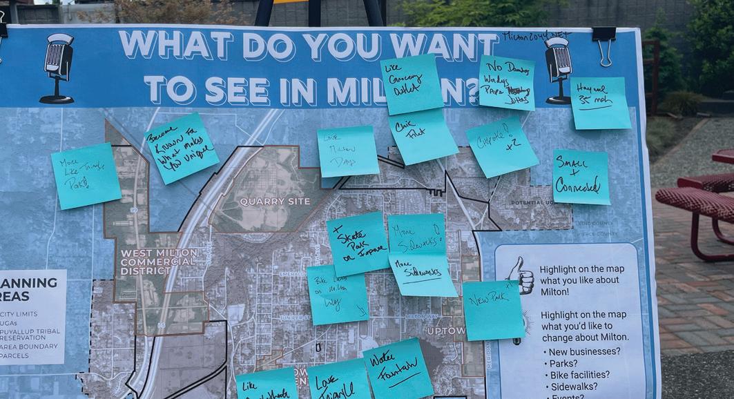
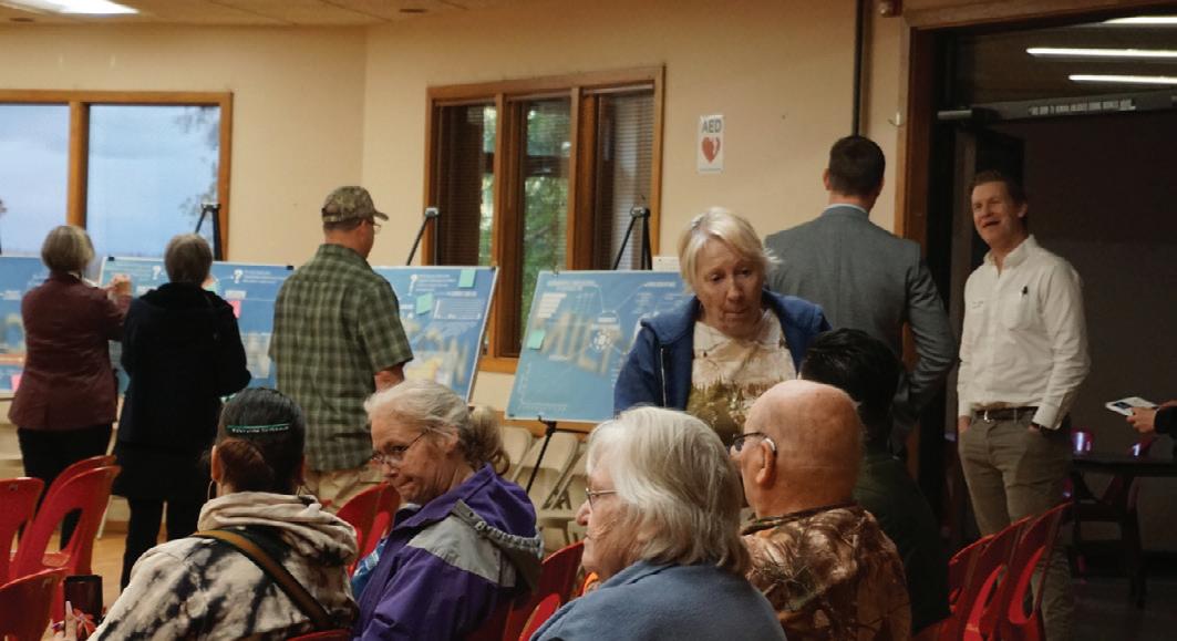
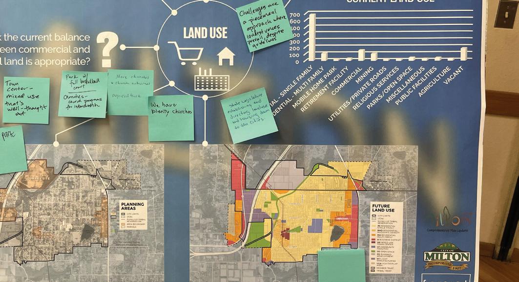
The project team convened a meeting of community members and City staff to explore priorities for different comprehensive plan elements, and to contribute to an understanding of the community’s existing conditions including service and infrastructure gaps and opportunities. Community members annotated maps of the city and responded to questions pertaining to specific comprehensive plan elements. In conjunction with other community outreach, this event informed the community vision articulated in the next chapter.
from the community visioning workshop:
1. People want Milton to be a safe, inclusive, and welcoming community.
2. State-mandated growth requirements are a concern.
3. People are concerned about increased traffic brought on by new development along the Interstate 5 Corridor.
4. Parks and green spaces are highly valued and there is a desire to expand the parks system.
5. The community wants more sidewalks and bike facilities.
Through community engagement eff orts several key themes came to light which informed the development of the community vision and each of the Comprehensive Plan Elements with special emphasis on the Land Use, Housing, and Parks and Recreation Elements.
1. Residents want Milton to be a safe, inclusive, and welcoming community.
2. The community is concerned about accommodating jobs and housing as the region’s population grows while retaining the city’s small town character.
3. Parks and green spaces are highly valued and there is a desire to expand the parks system.
4. Residents want a more walkable and bikeable city.
5. Residents are concerned about worsening traffic impacts from the major highways that bisect the community as the region grows.
6. Residents want greater access to amenities and services.

Comprehensive planning is a fundamental method for calibrating state, regional, county, and municipal goals and objectives and linking them to strategic policies and actions to guide the City over a twenty-year planning period. Comprehensive plans are updated every twenty years with periodic updates every ten to ensure that the city is growing and changing in alignment with the Plan. Each planning effort is based upon significant community engagement, as well as coordination and participation between city agencies, boards, and elected officials. Comprehensive planning is a rare opportunity for collaboration across departments and across the community that can result in positive and coordinated growth that respects and enhances community character, preserves existing community assets, and identifies opportunities for improvement.
Although prepared and approved by the City, Milton is guided by Washington State planning requirements that are contained in state legal codes and the Growth Management Act (GMA), which is codified in the Revised Code of Washington (RCW) Chapter 36.70A and in other related and amended sections of the RCW. As the name indicates, the Growth Management Act was adopted in 1990 to ensure strategic growth in the state that preserves resource lands and coordinates density in jobs and housing within existing regional centers. This is based on the logic that strategic density reduces infrastructure and other costs and resource consumption while preserving Washington’s environmental assets.
The purpose of the Comprehensive Plan, as articulated by state legislation, is to create a policy framework that guides subsequent planning efforts within city agencies, development regulations, and daily actions of the city. It is intended to be a central resource linking goals and objectives, municipal policies, local standards, and implementation actions. Importantly, State legislation includes a requirement that zoning, capital expenditures and development regulations conform to the Goals, Policies, and Actions articulated in the Comprehensive Plan.
In advance of planning efforts, the Office of Financial Management (OFM) provides a range of population projections for Washington Counties so that the Counties can plan appropriately to accommodate anticipated growth. For large metropolitan regions such as Puget Sound, a
Offi ce of Financial Management (OFM) produces county growth projections. Counties and other member organizations within Puget Sound Regional Council collectively decide on regional growth target within OFM-projected population range.
PSRC allocates growth to Counties.
King and Pierce Counties work with constituent cities to allocate county job and housing growth.
Milton allocates jobs and housing within the city based on existing land capacity (how much land is vacant or redevelopable).
regional body acts as an intermediary for these growth allocations. In Puget Sound, members of Puget Sound Regional Council (PSRC) including Snohomish, Kitsap, King, and Pierce Counties as well as the region’s tribes, cities, transit agencies, and port districts work together to set a regional growth target and then allocate growth to the respective counties. This ensures that large transit and other regional infrastructure investments are coordinated with growth in employment and housing. Finally, the counties work with their constituent cities to allocate jobs and housing, and each city allocates growth within its urban growth area.
The GMA triggers Comprehensive Plans at the regional, county and city levels. Countywide Planning Policies must be consistent with the Regional Comprehensive Plan, and City Comprehensive Plans must be consistent with both Regional and County Plans. For Milton, this means that this Comprehensive Plan must conform to state requirements, PSRC’s Vision 2050, and Pierce and King Countywide Planning Policies. In the last several years, major amendments to the Growth Management Act, Vision 2050 and Countywide Planning Policies include provisions to address defi cits in aff ordable housing, climate adaptation and mitigation, and racially disparate impact.
For more context on the Growth Management Act, Vision 2050 and other regulations that inform the Comprehensive Plan, please refer to the Existing Conditions report in Volume II.
Figure PF-2 Diagram of Governing Documents infl uencing the Comprehensive Plan
Framework, 2023
The Milton Comprehensive Plan Volume I includes seven chapters. The plan starts with a Community Vision, which articulates what community residents want the city to become over the planning period. The Community Vision guides priorities across the Comprehensive Plan. After the Community Vision, the Plan moves through the Comprehensive Plan elements which are Land Use, Housing, Transportation, Parks & Open Space, and Capital Facilities & Utilities. The Land Use Element includes the Future Land Use Map (FLUM), a key policy tool in accomplishing the mandates of the Growth Management Act. Each plan element includes a series of Goals and Policies. Finally, Volume I concludes with a section on plan implementation includes concrete actions the city can take to advance the Goals and Policies.
For the purposes of this document, the terms "Goal," and "Policy”are defined as follows:
1. Goal – Goals are broad statements indicating a general aim or purpose to be achieved. A goal is a direction setter: an ideal future end, condition, or state related to the public health, safety, or general welfare toward which planning and implementation measures are directed.
2. Policy – Policies are topic-specific statements designed to address a specific objective, providing guidelines for current and future decision-making to make progress towards achieving that objective. A policy indicates a clear commitment of the local legislative body. A policy is an extension of a plan’s goals, reflecting topical nuance as well as an assessment of conditions.
All Goals and Policies are written to achieve compliance with the Growth Management Act (RCW 36.70A.070(1)), PSRC Vision 2050, King County Planning Policies, and Pierce County Planning Policies while furthering the vision articulated by community members found in the following chapter.

The Milton 2044 Vision is a synthesis of community aspirations and feedback gathered from multiple sources. This process started in 2021 and included many of the activities mentioned in the introduction.
In 2044, Milton is successful by retaining its best qualities while adapting to growth and change through thoughtful planning. People love living in Milton because it has the heart of a small town with a mix of urban and rural character. New and long-time residents feel socially connected to their friends and neighbors and feel that their roots and belonging in the community are secure. Milton is seen as a hidden gem that offers a great quality of life, an excellent place to raise a family, housing options, easy access to goods and services, and a connection to nature. The Milton Town Center attracts locals and visitors to meet friends and neighbors, shopping, community events, restaurants, and recreation.
A well-planned semi-urban town
1. Retain semi-urban residential areas
2. Plan and design complete neighborhoods
3. Expand multi-generational housing options
4. Preserve and enhance relaxing & high-performing open space
5. Preserve and invest in a system of parks, trails, and open spaces
6. Retain and enhance tree canopy and other environmental amenities
High-quality and accessible transportation and community infrastructure
7. Retain semi-urban residential areas
8. Coordinate with WSDOT to mitigate traffic impacts
9. Invest in infrastructure
Accessible, attractive, and amenity-rich Town Center and commercial areas
10. Develop the Town Center as the heart of Milton
11. Support the local business community
12. Support robust social programming
In 2044, Milton is successful by retaining its best qualities while adapting to growth and change with thoughtful planning. People love living in Milton because it has the heart of a small town with a mix of urban and rural character. New and long-time residents feel socially connected to their friends and neighbors and feel that their roots and belonging in the community are secure. Milton is seen as a hidden gem that offers a great quality of life, an excellent place to raise a family, housing options, easy access to goods and services, and a connection to nature. The Milton Town Center attracts locals and visitors to meet friends and neighbors, shopping, community events, restaurants, and recreation.
A WELL-PLANNED SEMIURBAN CITY
ACCESSIBLE, ATTRACTIVE, AND AMENITY-RICH TOWN CENTER AND COMMERCIAL
HIGH-QUALITY AND ACCESSIBLE TRANSPORTATION AND COMMUNITY INFRASTRUCTURE
1 Retain semi-urban residential areas by supporting growth in missing middle housing, and low-rise density that fi ts within the existing character of residential neighborhoods.
2 Plan and design complete neighborhoods that provide a variety of housing types, connect people safely and effi ciently to the goods and services they need, and ensure that access to basic amenities is provided equitably.
3 Expand multi-generational housing options so that people can stay in Milton as their housing needs may change.
4 Preserve and enhance open space to ensure all residents have access to quiet, relaxing, and high-performing green space.
5 Preserve and invest in the system of parks, trails and open space to support an active and engaged recreation community.
6 Retain and enhance existing environmental amenities such as tree canopy and well-functioning riparian and wetland areas.
7 Make Milton safer for walking and biking by reducing traffi c impacts and providing safe and connected infrastructure that helps all people to get around their community with ease.
8 Coordinate with WSDOT to mitigate traffic impacts from major highways on our community.
9 Invest in the infrastructure needed to accommodate growth and maintain a high quality of life in Milton.
10 Develop the Town Center as the heart of Milton with a mix of housing, jobs, parks, civic space, and retail and cultural amenities. The Town Center is where Milton comes together as a community.
11 Support the local business community by increasing the proximity of housing to commercial areas with high-quality walking and biking connections.
12 Support robust social programming that brings our community together.
1 Retain semi-urban residential areas by supporting growth in missing middle housing, and low-rise density that fits within the existing character of residential neighborhoods.
2 Plan and design complete neighborhoods that provide a variety of housing types, connect people safely and efficiently to the goods and services they need, and ensure that access to basic amenities is provided equitably
3 Expand multi-generational housing options so that people can stay in Milton as their housing needs may change.
4 Preserve and enhance open space to ensure all residents have access to quiet, relaxing, and high-performing green space.
5 Preserve and invest in the parks, trails and open space system to support an active and engaged recreation community.
6 Retain and enhance existing environmental amenities such as tree canopy and well functioning riparian and wetland areas.
7 Make Milton safer for walking and biking by reducing traffic impacts and providing safe and connected infrastructure that helps all people to get around their community with ease.
8 Coordinate with WSDOT to mitigate traffic impacts from major highways on our community.
9 Invest in the infrastructure needed to accommodate growth and maintain a high quality of life in Milton.
ACCESSIBLE, ATTRACTIVE, AND AMENITY-RICH
AND COMMERCIAL AREAS
10 Develop the Town Center as the heart of Milton with a mix of housing, jobs, parks, civic space, and retail and cultural amenities. The Town Center is where Milton comes together as a community.
11 Support the local business community by increasing the proximity of housing to commercial areas with high-quality walking and biking connections.
12 Support robust social programming that brings our community together.
Milton’s Land Use Element is a key tool for meeting the community’s vision in 2044. Many planning goals start with the Land Use Element because one of the Land Use Element’s chief goals is to coordinate the plan’s other elements. Milton’s updated Land Use Element provides opportunities for expanded housing choices, and improved access to services within neighborhoods. The new Land Use Element enables the creation of more walkable neighborhoods in Uptown, Town Center, and in various Neighborhood Centers. Additionally, it addresses climate change and sustainability, ensures access to jobs, and determines locations for parks. This Comprehensive Plan Update includes the creation of Neighborhood Centers – a new land use designation for smaller neighborhood-service commercial areas. Currently, Milton applies a uniform commercial zone across different areas of the city, many of which would benefit from a more tailored approach to serve local needs. To this end, the Town Center and new Neighborhood Centers will be redesignated to better support the community.
1. New Future Land Use Map categories to provide greater flexibility as a planning tool
2. Addition of Neighborhood Centers
3. Addition of Uptown Mixed-Use District
4. Updates to residential designations in proximity to Uptown, Town Center, and Neighborhood Centers
This is Volume I of the Land Use Element. Volume II includes supporting documentation and background information such as State mandates and the capacity estimates and development assumptions that establish the 2044 growth strategy.
The Land Use Element influences all the other elements within the Comprehensive Plan. Land use goals and policies help to determine the distribution of different land use types within the city, as well as to coordinate the other elements in the plan; most of the goals and policies within this chapter concern multiple elements simultaneously. For example, land use goals and policies work to establish a development pattern that collocates multi-modal transportation with higher density housing and amenities. This impacts Housing, Transportation, Capital Facilities and Utilities Elements. Similarly, the land use goals work to establish a lower-density development pattern close to environmentally critical areas including environmental hazard zones. This impacts the Housing Element as well as the Climate Resilience sub-element.
The goals and policies found at the end of the Land Use Element are foundational to the plan. Key themes derived from both state mandates and from the community are addressed through the goals and policies. Each of the takeaways below stem from local and regional planning efforts and implicate multiple plan elements.
1. Ensure that people of all income levels have access to opportunity including employment, transportation, services, and amenities (influenced elements: Housing, Capital Facilities, Parks and Recreation, Utilities, Transportation).
2. Prioritize approaches that increase physical activity and community health and wellbeing (Housing, Capital Facilities, Parks and Recreation, Transportation).
3. Use land efficiently to protect and preserve the environment and environmental amenities, such as clean water, while providing for the housing and employment needs of the community and reducing exposure to environmental hazards (Parks and Recreation, Housing).
4. Increase service administration efficiency by focusing growth in areas served by high volume infrastructure including, transportation infrastructure (Housing, Capital Facilities, Utilities, Transportation).
5. Address racially disparate impact and racial exclusion through land use planning (Housing, Transportation, Capital Facilities, Parks and Recreation).
The current land use pattern in Milton includes suburban residential neighborhoods with limited mixed-use, commercial areas, and industrial areas. Residential subdivisions with single-family detached homes predominate the city’s landscape. Commercial uses primarily exist along Highway 99 to the west and along Meridian Ave E., the city limit boundary with Edgewood. Meridian is dominated by a variety of lower-density strip-style developments, gas stations, retail, restaurants, services, and dispersed civic and institutional buildings. Development along Highway 99 and Interstate 5 consists primarily of warehousing, contractor yards, self-storage, and other dispersed, low density uses. Figure LU-2 breaks down the city’s existing land uses based on King County and Pierce County parcel data from 2023.
Figure LU-1 Existing Land Uses by Area, 2022
Figure LU-2 Existing Land Uses, 2022
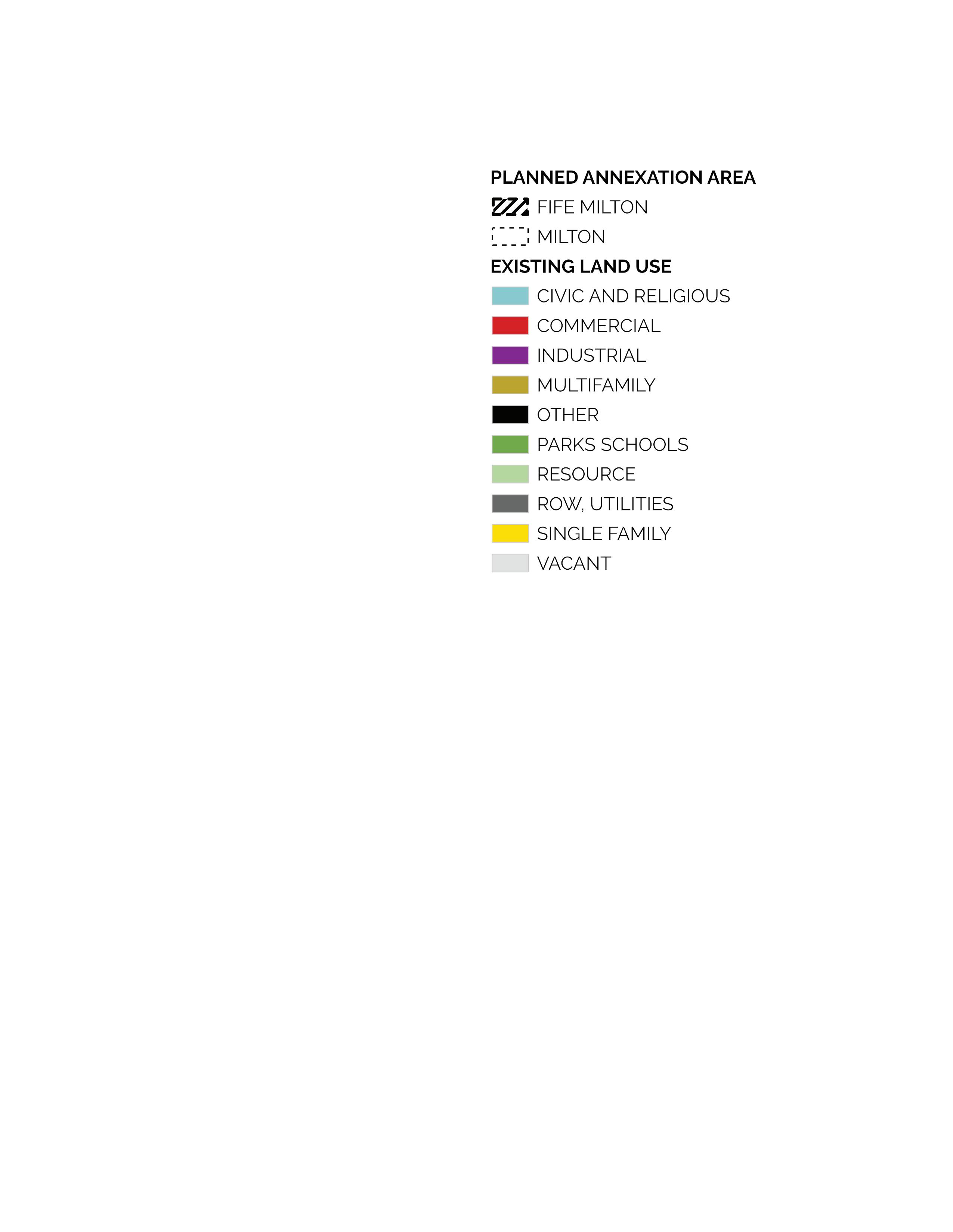


City of Milton; King County; Pierce County; Framework, 2022
Note: This figure sums parcel acres by current land use activities as defined in county assessment data. It includes some parcels identified as “street” or “public right-of-way.”
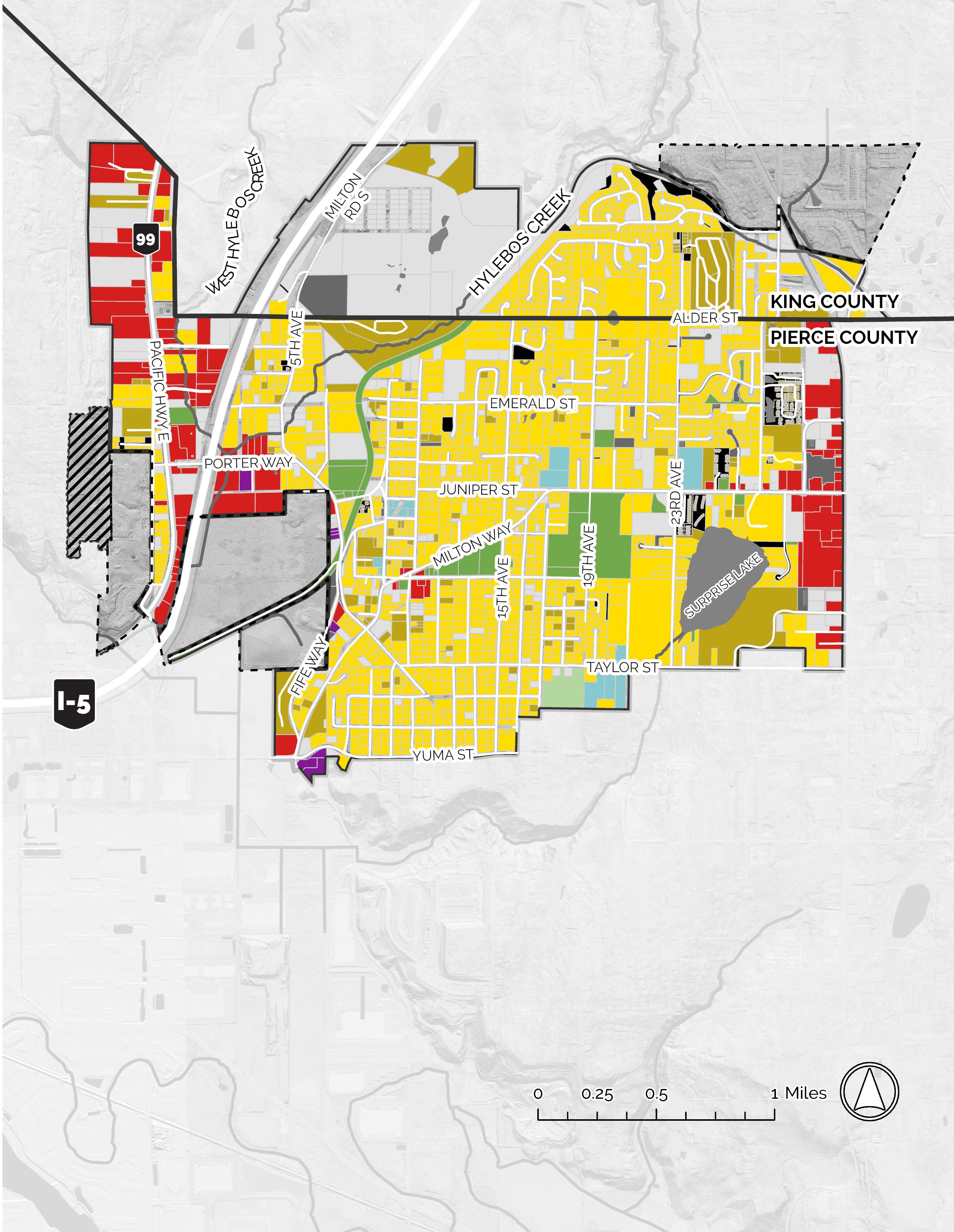
Multifamily includes all housing that is greater than a single unit on a lot (including duplexes), however properties with ADUs are not disaggregated in this Assessor data. The purpose is to highlight the high prevalence of single family as an existing use - around 46% of Milton’s land.
Figure LU-3 2044 Population Projection
Projection Based on Pierce & King County Growth Targets
Figure LU-4 Combined Estimated Population, Housing, and Jobs; 2023 and projected growth (2044) for Pierce and King Counties Populations within Milton
WA Office of Financial Management, 2023; PSRC, 2022
*Note: Milton had an estimated 2,114 jobs in 2022. Job data for 2023 is not yet available.
Pierce County, King County Growth Allocations, 2023
*Permanent Supportive Housing (PSH). Housing allocations are disaggregated by Area Median Income (AMI) to ensure the production of more affordable housing in Washington State.
Milton is bisected not only by Interstate 5, but also by Hylebos Creek, which forms a long, almost uninterrupted, wilderness corridor. The Interurban Trail, a bike trail on a historic rail bed, follows this natural green belt. Trail advocates and local governments continue to expand the Interurban Trail and auxiliary trails across lower King and Pierce Counties.
Much of the land along both forks of Hylebos Creek is wetland-impacted and some parts run adjacent to heavy vehicular traffi c on Interstate 5 and Highway 99, as well as the industrial and commercial land that abuts these major thoroughfares. The Creek also forms a buff er between these uses in the west and Milton’s predominantly residential areas to the east. Unfortunately, there are currently only weak walking and biking connections between the Hylebos Creek Watershed, Interurban Trail, and the majority of Milton.
Since the inception of this planning effort in 2021, a signifi cant warehousing project has been permitted in the historic quarry site in northwestern Milton. The City has a continued challenge of balancing protection and access for its many environmental amenities, supporting friendly residential neighborhoods and promoting economic growth made possible by its major thoroughfares and proximity to bustling Tacoma.
In the next 20 years, Milton is anticipated to grow by around 1,000 residents from 8,715 to 9,427. This growth will be supported by an additional 295 housing units and 1,341 jobs.
Land use was at the center of many public engagement activities including extensive communication with Milton’s Planning Commission. Milton residents emphasized the importance of preserving green space and environmentally sensitive areas including the Hylebos Creek watershed, providing more economic opportunities, retaining Milton’s residential character, and creating mechanisms to ensure that commercial and retail activities close to primarily residential areas are serving local need and minimizing adverse impacts such as noise and pollution.
The City of Milton has been issued a 2044 growth target of 295 new housing units (245 in Pierce County and 50 in King County) and 1341 new jobs (441 in Pierce County and 900 in King County). Figure LU-4 estimates population growth based on the average Pierce County household size of 2.63 people per household; Milton is expected to grow to 9,427 people by 2044.
The FLUM establishes sufficient development capacity for the City to fulfill not only its growth target, but the housing types necessary to support the affordable housing need. This need will be addressed in the Housing Element. More information on the 2044 growth strategy, capacity estimates, and development assumptions can also be found in Volume II. king county guidance allows milton to aggregate growth targets, meaning that not all of the city’s king county allocation needs to occur within the portion of the city that falls in king county. this is helpful, because it allows the city to create more contiguous density in strategic locations.
Milton’s largest land use designation by area is single-family residential. Milton has a large amount of zoned capacity for housing. However, since the last periodic update, Washington State has passed new legislation (HB 1220) that requires that cities provide enough zoned capacity to accommodate affordable housing. These new requirements are highlighted in the Housing Element, but also form the basis for many of the changes in the Future Land Use Map including significant updates to the land use designation of Uptown.
Milton has enough zoned capacity to accommodate employment allocations from Pierce and King County. However, Milton’s current zoning uses one blanket zoning designation for business which encompasses a wide variety of uses, many of which are most appropriate along main thoroughfares because of their high intensity, space requirements, and disassociation with local service and retail needs. The Future Land Use Map breaks down the “Business” category into more locally serving uses in Town Center and Neighborhood Centers and creates a mixed-use area in Uptown to encourage more walkable and neighborly development.
The Future Land Use Map shrinks existing manufacturing areas in response to community desires. Manufacturing is focused along Highway 99 and I-5 to ensure good freight access and to mitigate traffic impacts on residents in residential areas.
Figure LU-6 the land use planning process
non-conforming use
former industrial/ manufacturing zone
former residential zone
LAND USE AFTER COMP. PLAN UPDATE & REZONE

changing needs over time
Key comprehensive plan update & rezone
industrial
commercial
mixed use
mixed use
single family residential
multifamily residential
new mixed use designation, e.g. Neighborhood Center
infi ll development
new mixed use zone e.g. NC1
new residential zone e.g. UR2
Land Use planning is a cyclical process. With each plan update, land use will be adjusted to better fit the changing needs of the community while still respecting the exisitng uses in an area. It is important to note that the land use designations specified in this document are not zones, rather, these designations are used to guide subsequent rezones. For more information, see the Future Land Use Map.
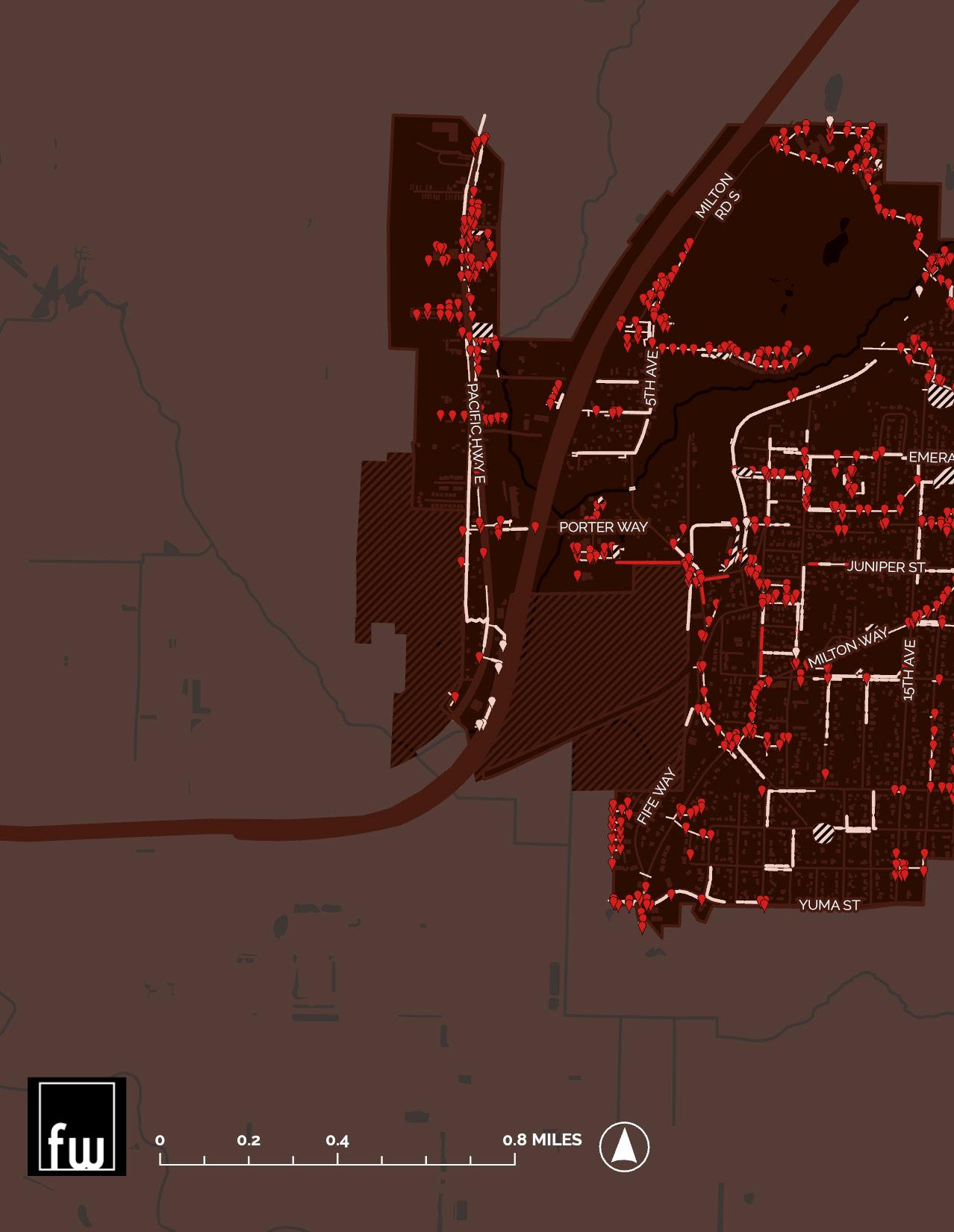
Milton’s open space and parks system includes a key habitat corridor along Hylebos Creek, the Interurban Trail and a series of park properties. The Land Use Element seeks to limit the impact of development on critical areas, and to protect and preserve environmental amenities to decrease the risk of fl ooding, mitigate urban heat island eff ect, and protect water quality. Moving forward, land use and transportation policies in this plan will work to ensure that Milton’s Park and Open Space network are accessible and connected with trails, bike paths, and sidewalks. As the map on the facing page shows, there are currently signifi cant infrastructure gaps between the majority of Milton Residents and pedestrian access to the Hylebos Creek watershed.
Much of West Milton falls within the boundary of the Puyallup Tribal Reservation including several large properties that are held in member trusts. All of Milton’s potential annexation areas in Pierce County fall within reservation boundaries. Policy LU 11.1 addresses coordination between the City and the Puyallup Tribe.
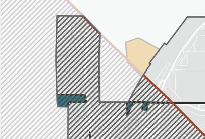

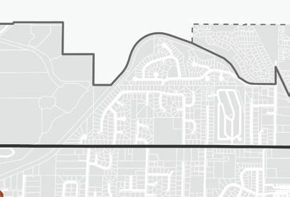


Figure LU-8 Parks, Open Space, and Active Transportation Network Map

USGS “The National Map” landcover, US Fish and Wildlife, National Wetland Inventory.

Washington Department of Ecology Framework, 2024

PAA HIGHLY WETLAND IMPACTED
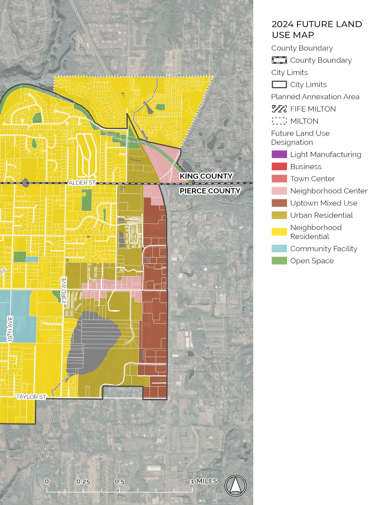
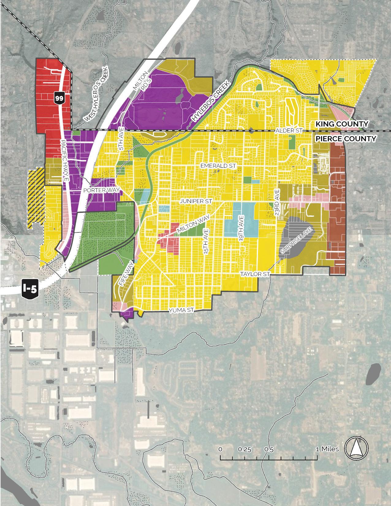
The Future Land Use Map (FLUM) shown on the facing page is a planning tool that guides where the City focuses growth in jobs, housing and related capital facilities, open space, utilities, other infrastructure that supports that growth, and where the City retains green and open space. To that end, the FLUM fl ows from the goals and policies articulated in this Plan, while addressing the growth targets allocated by Pierce and King Counties and by other state, regional, and county planning priorities. Eff orts have been made toward a growth plan that supports Milton’s neighborly atmosphere and promotes more compatible uses between community centers and primarily residential areas. The FLUM was developed in collaboration with the City’s Planning Commission, City Council, and relevant City Departments.
The map is divided into land use designations within industrial, commercial, mixed use, residential, and open space types. The FLUM should not be read as a zoning map – within each of the listed land use designations, diff erent types of zoning can occur so long as they fi t under the umbrella of the designation. For instance, there may be multiple types of residential zoning within “Urban Residential,” but density requirements and allowances within “Urban Residential” will be higher than in “Neighborhood Residential.” The FLUM is meant to create some fl exibility in zoning decisions made by the City but should be the basis for zoning updates. The FLUM is designed to ensure that there is enough employment capacity and housing capacity across diff erent income brackets allocated by Pierce and King Counties.
Figure LU-9 Future Land Use Map 2024

1. The FLUM pairs higher density uses like multifamily housing and locally serving commercial to create walkable community centers dispersed throughout the city.
2. To fulfill the City’s affordable housing allocation, some of the city must allow mid-rise apartment buildings. The FLUM accommodates that housing in Uptown because this area has the greatest access to transit, schools, services, and amenities. Similarly, there are higher-density residential and commercial areas along Milton Way.
3. The FLUM focuses industrial and high-traffic commercial land use designations along Highway 99 to ensure good freight access and to mitigate the impact of high-volume traffic on lower-capacity roads.
4. The FLUM shows current and proposed open space including significant open space areas along Hylebos Creek. Where possible, low-density residential abuts the watershed, to limit development near environmentally critical areas including wildlife habitat.
5. The FLUM is designed to further the community desires. The diagrams in the following pages show how clustering certain types of land uses can help to orchestrate the community vision.
Framework, 2024


NEIGHBORHOOD CENTER
TOWN CENTER
UPTOWN MX DISTRICT


Figure LU-10 Proposed Subareas for future tailored planning eff orts.

Certain parts of Milton present unique opportunites. The FLUM takes these areas into consideration with the organization of the different land use designations. Subarea plans will be used to further refine the vision for these areas through a more fine-grained approach.


Figure LU-11 Land Use Comparison of 2015 Future Land Use Map and 2024 Future Land Use Map

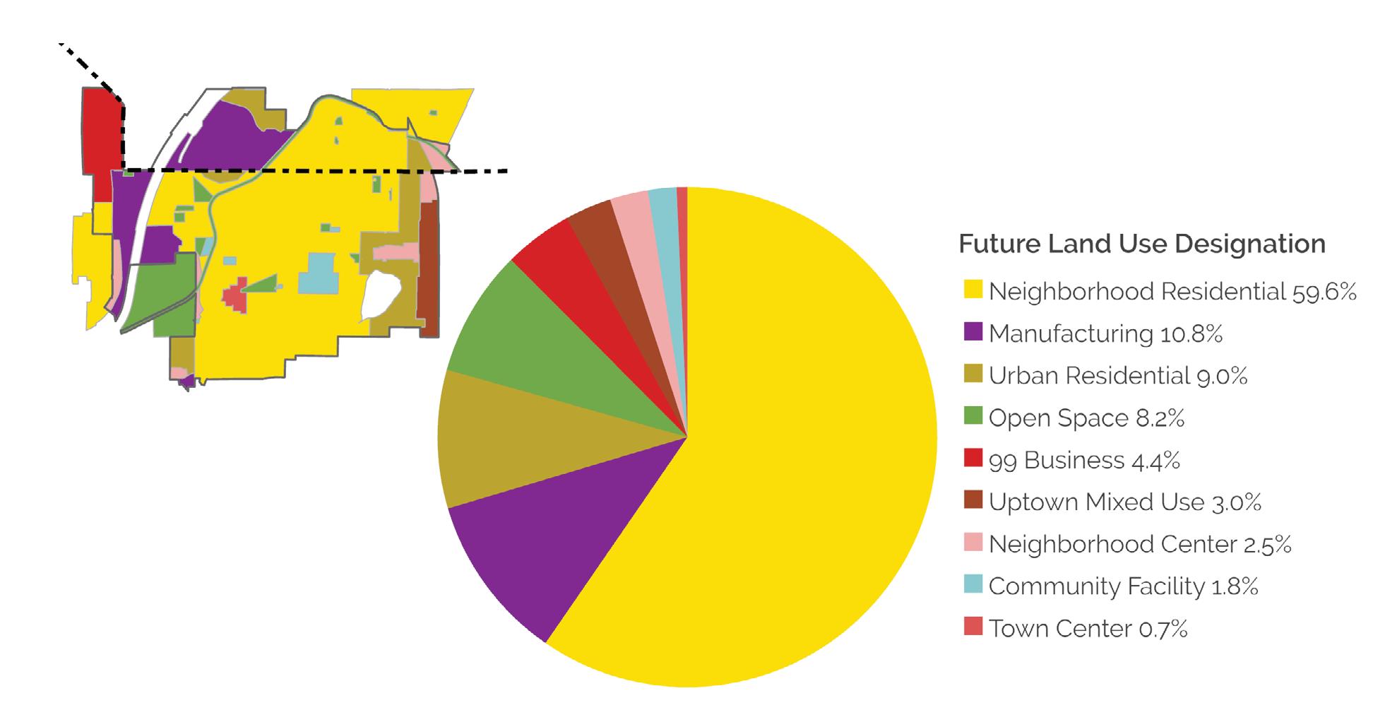
City of Milton, Framework, 2022
The land use designations below are broader than zoning defi nitions to allow the city more fl exibility in establishing its land use code. However, intended density windows are indicated below to ensure that the city provides enough capacity for its housing and jobs allocations.
As the diagram shows, Uptown is slated for the most dense development while parks and neighborhood residential have low land use intensity.
Density: 30-40
dwelling units per acre
8 Jobs per Acre
Typical building typology: Mid-rise apartment
Density: 12-18
dwelling units per acre
Typical building typology: Low rise multifamily, middle housing
Most similar to current RM zone (residential multifamily)
Density: 0
dwelling units per acre
Includes parks, open space, trail network
Density: 0-20
dwelling units per acre
8 jobs per acre
Typical building typology: Ground fl oor commercial uses, some second story residential
Most similar to current MX zoning (Town Center mixed use)
Density: 0-10
dwelling units per acre
8 jobs per acre
Typical building typology: Ground fl oor commercial uses, some second story residential
Most similar to current MX zoning (Town Center mixed use)
Density: No residential
9 jobs per acre
Typical building typology: Warehousing
Most similar to current M-1 zone (industrial and manufacturing)
Density: 10-12
dwelling units per acre
Typical building typology:
Single family and lower density middle housing
Most similar to current RMD and RS zones (Residential moderate density and residential single family respectively)
Density: No Residential
20 jobs per acre
Typical building typology: Single story commercial including big box and offi ce
Most similar to current B zone (business)
The diagram below shows how the Future Land Use Map furthers the community vision by locating supporting land uses next to each other. For instance, vision statement two directs Milton to: “Plan and design complete neighborhoods that provide a variety of housing types, connect people safely and effi ciently to the goods and services they need, and ensure that access to basic amenities is provided equitably.” This goal can be achieved in a number of locations in the city by creating a gradient of commercial, higher density housing, green space and lower density housing.
UPTOWN MIXED USE
NEIGHBORHOOD RESIDENTIAL PARKS AND OPEN SPACE
Expand multi-generational housing options so that people can stay in Milton as their housing needs may change.
Retain semi-urban residential areas by supporting growth in missing middle housing, and low-rise density that fi ts within the existing character of residential neighborhoods.
*This diagram is for the purposes of showing general land use relationships. It does not show exact intensities or densities, nor does it show the exact proportion of different types of land uses.
** Land use Intensity is meant to signify either density of use, or potential for land uses to cause nuisance. For instance, Uptown has the highest proposed density, while the manufacturing designation is likely to be most disruptive to adjoining uses.
Preserve and enhance open space to ensure all residents have access to quiet, relaxing, and highperforming green space.
NEIGHBORHOOD CENTER
UPTOWN MX DISTRICT
NEIGHBORHOOD CENTER
Retain and enhance existing environmental amenities such as tree canopy and well-functioning riparian and wetland areas. 2 6
Plan and design complete neighborhoods that provide a variety of housing types, connect people safely and effi ciently to the goods and services they need, and ensure that access to basic amenities is provided equitably
To support high-quality and accessible transportation and community infrastructure the Future Land Use Map collocates density with existing infrastructure. Generally speaking it is more effi cient to add volume to existing infrastructure than to create lower-volume, diff use infrastructure. For instance, to most effi ciently use community resources while serving the most people, multi-modal transportation should be concentrated in high-density areas, supplemented by selective routes to and from lower-density areas.
UPTOWN MIXED USE
Make Milton safer for walking and biking by reducing traffi c impacts and providing safe and connected infrastructure that helps all people to get around their community with ease.
Note: creating denser areas increases the positive impact of sidewalks and other infrastructure and allows co-location of transit, jobs and housing within an accessible area.
NEIGHBORHOOD CENTER
UPTOWN MX DISTRICT
Coordinate with WSDOT to mitigate traffi c impacts from major highways on our community.
Invest in the infrastructure needed to accommodate growth and maintain a high quality of life in Milton.
To support this vision, the Future Land Use Map creates urban clusters where housing can support local businesses and services. Urban clusters should prioritize the co-location of housing, park space, and community space and facilities with retail, amenities, and services to shrink the distance residents need to go to meet their day-to-day needs. The intensity curve below shows which land uses are co-located - for instance, parks are spread throughout the city and dense housing is prioritized close to community facilities, retail, and services.
Support the local business community by increasing the proximity of housing to commercial areas with high-quality walking and biking connections.
Support robust social programming that brings our community together.
NEIGHBORHOOD CENTER
UPTOWN MX DISTRICT
TOWN CENTER
NEIGHBORHOOD CENTER MANUFACTURING BUSINESS
Develop the Town Center as the heart of Milton with a mix of housing, jobs, parks, civic space, and retail and cultural amenities. The Town Center is where Milton comes together as a community.
LU 1 USE LAND USE PLANNING AND DESIGN OF THE BUILT ENVIRONMENT TO FACILITATE POSITIVE AND EQUITABLE PUBLIC HEALTH OUTCOMES THAT SUPPORT PHYSICAL, SOCIAL, AND MENTAL WELLBEING.
LU 1.1 Encourage physical activity by strategically maintaining and expanding walking and biking infrastructure to provide greater accessibility to key community services and amenities including open space and parks, schools, and commercial and mixed use areas.
LU 1.2 Expand access to local, healthy food by supporting initiatives like farmers markets and community gardens.
LU 1.3 Adopt land use strategies that promote public health, and address racially and environmentally disparate health outcomes, and promote access to opportunity. Focus on residents with the highest needs in providing and enhancing opportunities for employment, safe and convenient daily physical activity, social connectivity, protection from exposure to harmful substances and environments, and housing in high-opportunity areas.
LU 1.4 Encourage construction of healthy buildings and facilities (Healthy buildings minimize indoor air pollution, and may also include features that promote wellbeing such as on-site exercise facilities and healthy food).
LU 2 ESTABLISH A DEVELOPMENT PATTERN THAT STRATEGICALLY USES POCKETS OF DENSER DEVELOPMENT TO CREATE AMENITY-RICH CENTERS THAT PROVIDE ACCESSIBLE JOBS, SERVICES, AND AMENITIES THAT ENHANCE MILTON'S NEIGHBORLY AND COMMUNITY-ORIENTED CHARACTER
LU 2.1 Encourage high-quality, compact development in the Town Center, Uptown, and neighborhood centers in order to create vibrant community hubs; encourage walking, bicycling, and transit use, employment opportunities, and provide for mixed uses and choices in housing types. Pursue strategies to make Town Center the heart of the community.
LU 2.2 Through zoning, development standards, and similar strategies, use residential, commercial, and manufacturing land efficiently within the city to create healthy, vibrant, and equitable communities with a full range of urban services, while protecting and enhancing green spaces and semiurban qualities of value to the community. Efficient use can be achieved by encouraging compact and infill development particularly focused in areas with existing amenities and services.
LU 2.3 Focus growth of high intensity business and industrial uses to areas with greater freight mobility access adjacent to the Interstate 5 and Highway 99 corridors in order to limit conflict with residential and community-oriented uses.
LU 2.4 Design public buildings and public spaces that contribute to the unique sense of community and a sense of place.
LU 2.5 Minimize the visual impact of parking in new developments such as placing parking behind buildings, utilizing alleys and shared access, adding tree planting requirements for parking lots, permeable surfaces, and other similar strategies.
LU 2.6 Land use decisions and regulations should promote proximity and walkability between commercial and residential areas, integration of public and private spaces in new development, and integration of landscape and green infrastructure into new development.
LU 2.7 The Future Land Use Map, adopted in this plan, indicates the intended distribution, extent, and location of generalized land uses including areas where the City intends to focus growth.
LU 2.8 Pursue subarea planning for mixed use and commercial areas designated in the Future Land Use Map including the West Milton Subarea along Highway-99. Ensure that the subarea planning process includes concerted public engagement to mitigate displacement of vulnerable, low, very-low, and extremely-low income residents.
LU 2.9 Work with Pierce County to designate Town Center and the Uptown Planning District as Centers of Local Importance.
LU 2.10 Periodically monitor the efficancy of comprehensive plan policies and development regulations using indicators that include added jobs, housing units, and average density by zoning district. Adjust
LU 3 WHERE FEASIBLE, LIMIT DEVELOPMENT AND HIGH INTENSITY LAND USES IN ENVIRONMENTALLY SENSITIVE AND CRITICAL AREAS; WHEN DEVELOPMENT DOES OCCUR IN OR NEAR THESE AREAS, REQUIRE THE USE OF LOW-IMPACT DEVELOPMENT AND GREEN INFRASTRUCTURE TO MITIGATE ENVIRONMENTAL IMPACTS.
LU 3.1 Identify and protect wetlands, river and stream banks, ravines, and other areas that provide essential habitat for sensitive and locally important plant or wildlife species and that play an important role in mitigating the impacts of stormwater.
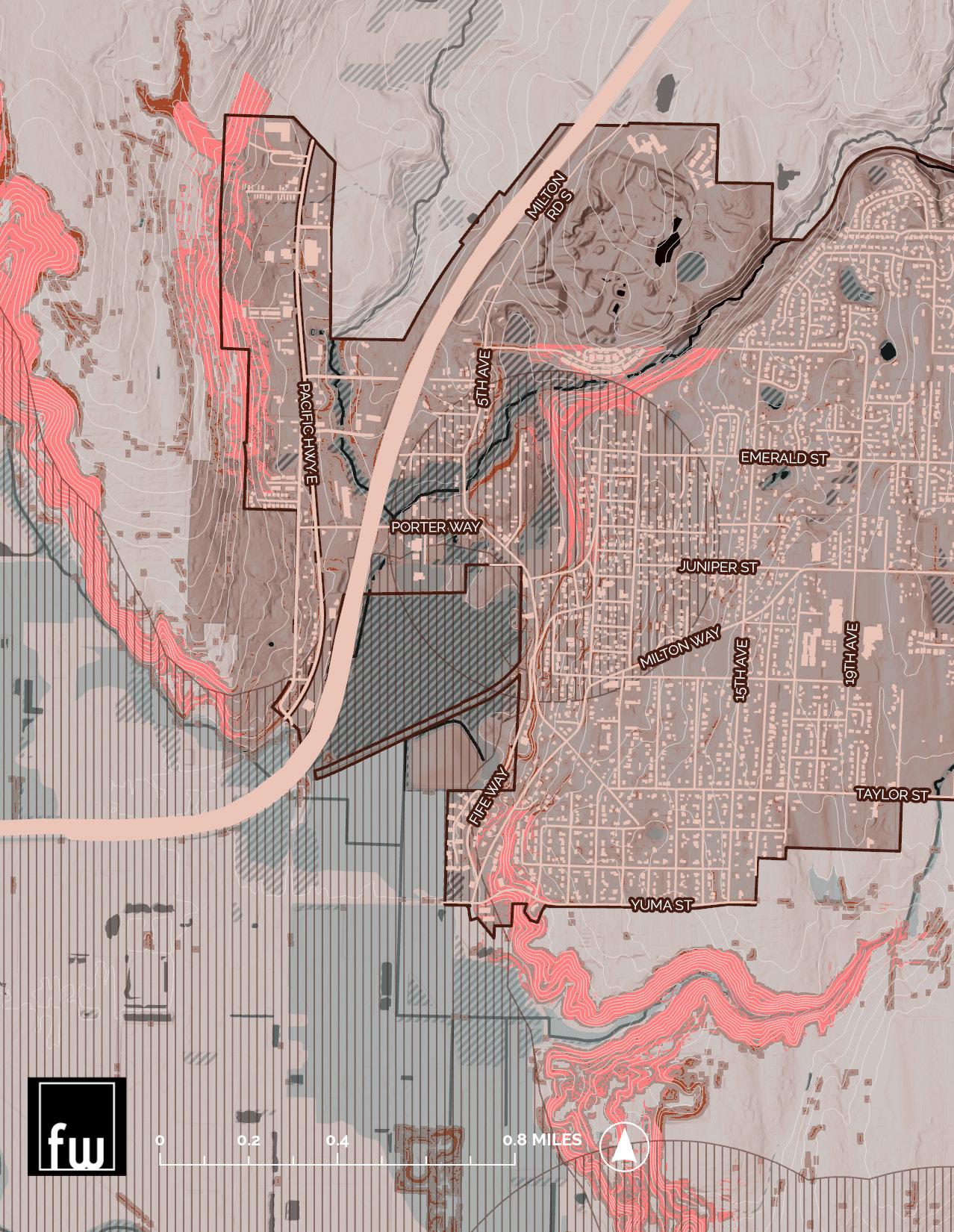
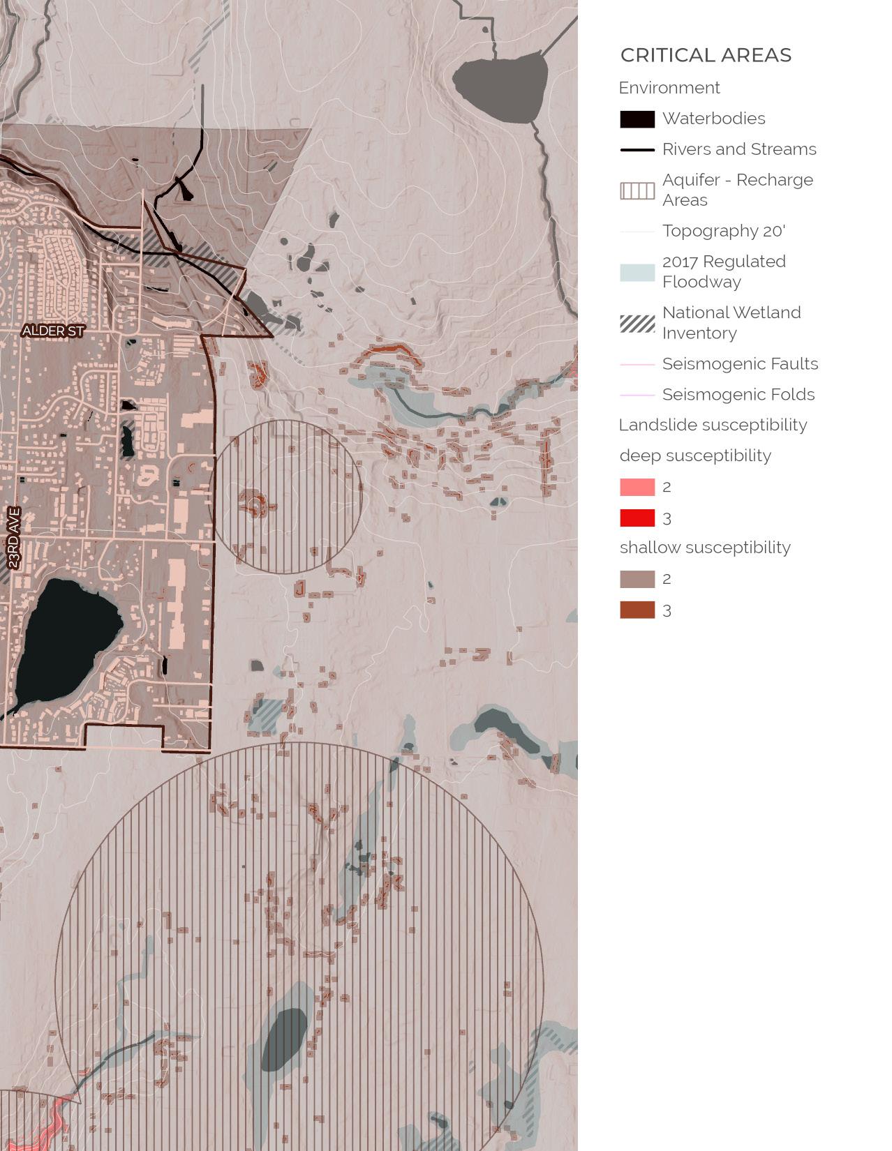
LU 3.2 In alignment with existing critical area designations including wetlands, fish and wildlife habitat protection areas, frequently flooded areas, critical aquifer recharge areas, and geologically hazardous areas, all development activities including infrastructure expansion must minimize disturbance of and adverse impacts to critical areas. In particular, fish and wildlife resources, including spawning, nesting, rearing and habitat areas, and migratory routes must be protected using Best Available Science (BAS).
LU 3.3 Manage development in erosion hazard areas using best management practices to promote soil stability and control erosion and sedimentation techniques including minimizing changes to site grading, retaining or
replanting site vegetation, and utilizing natural drainage systems. (Best Management Practices [BMP] are physical, structural, and managerial practices that prevent or reduce water pollution.)
LU 3.4 Create standards for onsite stormwater detention including reducing impervious surface lot coverage.
LU 4 REDUCE GREENHOUSE GAS EMISSIONS THROUGH LAND USE AND DEVELOPMENT STRATEGIES.
LU 4.1 Promote a mix of housing, employment, and services at densities sufficient to encourage walking, bicycling, transit use, and other alternatives to auto travel and that promote energy efficiency and the strategic use of renewable energy installations.
LU 4.2 Focus growth in Neighborhood Centers, Town Center, and Uptown Mixed Use district to create walkable, bikable, and transit-oriented development that supports vehicle trip reduction.
LU 5 DESIGN CENTERS, NEIGHBORHOODS, AND INDIVIDUAL DEVELOPMENTS USING TECHNIQUES THAT REDUCE HEAT ABSORPTION, MITIGATE STORMWATER, AND MINIMIZE OTHER CLIMATE-RELATED IMPACTS.
LU 5.1 Design centers, neighborhoods, and individual developments using strategies that limit greenhouse gas emissions by reducing embodied carbon, increasing energy efficiency, and strategically promoting renewable energy.
LU 5.2 Plan denser development in parts of the city least likely to be impacted by climate-related hazards such as flooding, and preserve and enhance open spaces that receive and detain floodwaters.
LU 5.3 Maintain and strategically expand the city's urban tree canopy so that it equitably reduces the impact of urban heat island effect.
LU 6 PROTECT THE CITY’S WATER SUPPLY FROM POTENTIAL CONTAMINATION HAZARDS.
LU 6.1 Enforce water quality mitigation measures where planned development will impact water resources including critical aquifer recharge areas, wetlands, riparian zones, streams, and rivers.
LU 7 PROVIDE ADEQUATE SPACE FOR PUBLIC PURPOSES SUCH AS UTILITY CORRIDORS, TRANSPORTATION CORRIDORS, SEWAGE TREATMENT FACILITIES AND STORMWATER MANAGEMENT FACILITIES, RECREATION,
SCHOOLS, AND OTHER PUBLIC USES. ENSURE THAT THESE FACILITIES ARE SITED TO EFFICIENTLY PROVIDE SERVICES WHILE MITIGATING ADVERSE IMPACTS ON THE SURROUNDING AREA.
LU 7.1 Efficiently use existing corridors and right of ways to collocate compatible infrastructure such as trails, transportation, utilities, and green infrastructure.
LU 7.2 Encourage infill and higher-density development in areas already serviced by existing utilities and services.
LU 7.3 Strive to site public facilities so that they balance the often-competing concerns of efficiently administering services and minimizing impacts on adjacent properties and the natural environment.
LU 7.4 To the extent possible, site public facilities where adjacent land uses are compatible. In cases where this is not feasible, the City should encourage buffers and other mitigation measures.
LU 7.5 To the extent feasible, public facilities should avoid designated resource lands, critical areas, or other areas where the siting of such facilities would degrade the natural environment.
LU 8 MAINTAIN AND ENHANCE A SYSTEM OF PARKS AND OPEN SPACES THAT ACCOMMODATE A WIDE VARIETY OF ACTIVITIES AND POSITIVE ENVIRONMENTAL OUTCOMES, AND THAT ARE EQUITABLY DISTRIBUTED AND ACCESSIBLE THROUGHOUT THE CITY.
LU 8.1 Proactively protect Hylebos Creek, Surprise Lake, and adjoining wetland and riparian habitat as one of the city's key habitat and trail corridors.
LU 8.2 Strategically invest in sidewalks, crosswalks, trails, and other pedestrian and active transporation infrastructure to facilitate access to parks, green space, and open space.
LU 8.3 Study potential property acquisition in parts of the city lacking in existing parks and open space, with a particular focus on areas intended for mixed use and dense residential development.
LU 9 EVALUATE PLANNING IN AREAS FOR POTENTIAL RESIDENTIAL AND COMMERCIAL DISPLACEMENT, AND USE A RANGE OF STRATEGIES TO MITIGATE DISPLACEMENT IMPACTS.
LU 9.1 Support inclusive engagement to ensure land use decisions do not negatively impact historically marginalized communities.
LU 9.2 Evaluate the potential physical, economic, and cultural displacement of residents and businesses within the city, particularly for Black, Indigenous, and other communities of color; immigrants and refugees, low-income
populations; disabled communities; and other communities at greatest risk of displacement. Use a range of strategies to mitigate identified displacement impacts.
LU 10 PROTECT LOCAL HISTORIC, ARCHAEOLOGICAL, AND CULTURAL SITES AND STRUCTURES THROUGH DESIGNATION AND INCENTIVES FOR PRESERVATION.
LU 10.1 Create a protocol for identifying and protecting significant historic, visual, archaeological, cultural, architectural, artistic, and environmental features, especially where growth could place these resources at risk.
LU 10.2 Support cultural resources and institutions that reflect the diversity of the community. Where appropriate, designate individual features or areas for protection or restoration.
LU 10.3 Encourage land use patterns and adopt regulations that protect historic resources and sustain historic community character while allowing for equitable growth and development.
LU 11.1 Coordinate and partner with the Puyallup Tribe of Indians to ensure efficient development, especially in parts of the city that are within the Puyallup Indian Reservation.
LU 11.2 For areas in the Potential Annexation Area (PAA) that are not currently under the City’s jurisdiction, the City should conduct cooperative land use planning with appropriate county, municipal, and tribal governments.
LU 11.3 Work with the City of Fife and other applicable agencies to determine which jurisdiction will annex the UGA Overlap Area of the PAA, consistent with applicable County-wide Planning Policies.
LU 11.4 In cases of direct petition for annexation, the City of Milton should work with affected jurisdictions to make a determination, consistent with the countywide planning policies. Factors that may be taken into account include site access, common ownership, and the City’s service area for utilities.
LU 11.5 Promote development of an interconnected system of sidewalks and trails in cooperation with regional partners.
LU 11.6 Where possible, ensure that mixed use development in Uptown along Meridian Ave. compliments development patterns in adjoining areas of Edgewood.
LU 11.7 Coordinate with WSDOT to mitigate the impact of major highways on the community brought on by increased regional traffic volumes.
LU 11.8 Work with King County to incorporate the South Trout Lake Gap Planned Annexation Area into the City of Milton.
The matrix below connects the land use goals articulated in this chapter to the community vision statements in chapter 2, highlighting which goals are helping to accomplish different community desires.
well planned semi-urban town
1. Retain semi-urban residential areas by supporting growth in missing middle housing, and low-rise density that fits within the existing character of residential neighborhoods.
2. Plan and design complete neighborhoods that provide a variety of housing types, connect people safely and efficiently to the goods and services they need, and ensure that access to basic amenities is provided equitably
3. Expand multi-generational housing options so that people can stay in Milton as their housing needs may change.
4. Preserve and enhance open space to ensure all residents have access to quiet, relaxing, and high-performing green space.
5. Preserve and invest in the parks, trails and open space system to support an active and engaged recreation community.
6. Retain and enhance existing environmental amenities such as tree canopy and well functioning riparian and wetland areas.
High quality and accessible transportation and community infrastructure
7. Make Milton safer for walking and biking by reducing traffic impacts and providing safe and connected infrastructure that helps all people to get around their community with ease.
8. Coordinate with WSDOT to mitigate traffic impacts from major highways on our community.
9. Invest in the infrastructure needed to accommodate growth and maintain a high quality of life in Milton.
Accessible, attractive and amenity-rich Town Center and commercial areas
10. Develop the Town Center as the heart of Milton with a mix of housing, jobs, parks, civic space, and retail and cultural amenities. The Town Center is where Milton comes together as a community.
11. Support the local business community by increasing the proximity of housing to commercial areas with high-quality walking and biking connections.
12. Support robust social programming that brings our community together.
LU 1 Use land use planning and design of the built environment to facilitate positive and equitable public health outcomes that support physical, social, and mental wellbeing.
LU 2 Establish a development pattern that strategically uses pockets of denser development to create amenity-rich centers that provide accessible jobs, services and amenities that enhance Milton's neighborly and community-oriented character.
LU 3 Where feasible, limit development and high intensity land uses in environmentally sensitive and critical areas; when development does occur in or near these areas, require the use of low-impact development and green infrastructure to mitigate environmental impacts.
LU 4 Reduce greenhouse gas emissions through land use and development strategies.
LU 5 Design centers, neighborhoods, and individual developments using techniques that reduce heat absorption, mitigate stormwater, and other climaterelated impacts.
LU 6 Protect the City’s water supply from potential contamination hazards.
LU 7 Provide adequate space for public purposes such as utility corridors, transportation corridors, sewage treatment facilities and stormwater management facilities, recreation, schools, and other public uses. Ensure that these facilities are sited to efficiently provide services while mitigating adverse impacts on the surrounding area.
LU 8 Maintain and enhance a system of parks and open spaces that accommodate a wide variety of activities and positive environmental outcomes, and that are equitably distributed and accessible throughout the city.
LU 9 Evaluate planning in areas for potential residential and commercial displacement and use a range of strategies to mitigate displacement impacts.
LU 10 Protect local historic, archaeological, and cultural sites and structures through designation and incentives for preservation.
LU 11 Where possible, pursue cross-jurisdictional coordination to ensure that land use decisions compliment and augment efforts made in adjoining areas.
The purpose of the Housing Element is to create policies that support the development of housing in accordance with local needs and anticipated growth. Of course, merely providing enough housing does not ensure affordability, accessibility, or attractiveness – all of which are essential components of a successful community. The Washington State Growth Management Act (GMA) recognizes this, as reflected in the following GMA goal for housing that was updated in 2022:
“Plan for and accommodate housing affordable to all economic segments of the population of this state, promote a variety of residential densities and housing types, and encourage preservation of existing housing stock.”
Washington State, and the Puget Sound Region particularly, faces a catastrophic housing shortage. Milton’s proximity to Tacoma, a major employment center, creates significant demand for housing. To ensure that present and future Milton residents can affordably live in the community, the City should reduce barriers to denser housing. This includes allowing more middle housing in accordance with HB 1110.
The goals and policies in this chapter are meant to support expanded access to housing across all economic segments and housing needs. Historically, Milton has produced relatively homogeneous housing stock; community outreach efforts and the demographic analysis found in Volume II indicate that this stock cannot fully accommodate a diversity of ages, household types, and local desires. The goals and policies in this element seek to address housing access while retaining what makes the community a neighborly and comfortable place to live.
1. Ensure that people of all income levels have access to housing close to opportunities including employment, transportation, recreation, services, and amenities.
2. Support missing middle housing that contributes to neighborhood character.
3. Ensure that a diversity of people can afford to live and stay in Milton for the long term.
4. Maintain and support high-quality and attractive housing that contributes to Milton’s vitality.
5. Ensure that housing development does not have a deleterious impact on the environment.
This is Volume I of the Housing Element Volume II includes supporting documentation and background information on Milton’s housing including a report produced by the SSHA3P Middle Housing Project addressing Racially Disparate Impact (RDI).
During the last Comprehensive Plan Update, the City of Milton’s Future Land Use Map (FLUM) devoted around 47% of city land to single family residential and around 21 percent to multifamily housing. The City’s current zoning policy is an almost exact replica of the FLUM. Although Milton has a large amount of zoned capacity for residential uses, the affordability mandate associated with HB 1220 means that Milton’s new FLUM needs to allow higherdensity residential development in certain areas of the city than is currently allowed.
To cohere with HB 1220, Milton’s housing allocations from Pierce and King Counties are divided into five different income brackets tied to Area Median Income (AMI). To determine these allocations, the counties worked with Puget Sound Regional Council (PSRC) to distribute growth across their constituent cities, with higher allocations focused around employment centers like Tacoma, and regional transit corridors. Depending on the income bracket, different types of housing are needed to feasibly hit affordability targets. In the Future Land Use Map, the City provides land use designations that will allow for all affordable housing types primarily in Neighborhood Residential, Urban Residential, and Uptown MixedUse areas.
Because of the high cost of both land and housing construction, state guidance indicates that housing for extremely low, and very low income households (0-30,30-50% AMI respectively) can most feasibly be provided by apartment buildings. To accomplish this, some of the city needs to allow increased density to accommodate low- and mid-rise apartment buildings. Puget Sound Regional Council and the GMA also indicate the importance of collocating affordable housing with amenities, transit, and other services. To this end, the FLUM focuses growth in Uptown along Meridian Ave to create capacity for high-density and affordable units. In addition, HB 1220 distinguishes between Permanent Supportive Housing (PSH) and NonPermanent Supporting Housing (Non-PSH). Permanent Supportive Housing (PSH) combines low-barrier affordable housing, health care, and supportive or “wrap around” services to help individuals and families lead more stable lives. Milton is responsible for providing land capacity to accommodate 43 PSH units.
In addition, HB 1220 and HB 1110 created statewide mandates to allow middle housing in all primarily residentially zoned areas. This means that residential lots in Milton must allow at least two units based on Milton’s size and proximity to Tacoma. Middle housing includes housing with multiple units like duplexes, triplexes, fourplexes, fiveplexes, sixplexes, courtyard apartments, cottage clusters, townhomes, and ADUs. Milton is not required to allow all these housing types across all residential zones. These will primarily be located in urban residential and neighborhood residential areas.
Figure HO-1 City of Milton Housing Growth Targets by income bracket and county and housing density.
State guidance indicates that residents with incomes over 100% median income can afford single family housing. However, even those with more income flexibility desire a wider range of housing types to accommodate them in different stages of life. The future land use map seeks to align housing options more closely with the needs of current and future residents.
Required: 25 Beds
Emergency Housing requirements are discussed in Volume II.
The Housing Element interacts with many other elements within the Comprehensive Plan. Housing goals, policies, and strategies guide the composition of residential neighborhoods because affordability is considered broadly, including living and transportation costs. This ensures that many aspects of this chapter inherently concern other elements simultaneously. For example, housing goals and policies strive to provide safe, connected, and affordable living opportunities for households earning a range of incomes. In addition, residential buildings and energy consumption are two of the largest contributors to greenhouse gas emissions in Milton. This element impacts Land Use, Transportation, Parks & Recreation, Economic Development, Capital Facilities, and Climate Change & Resilience.
The following pages show the types of housing that will be allowed in each land use area at the maximum density The development regulations that flow from this plan will help to ensure that the aesthetic and spatial qualities of new housing will conform with community values.
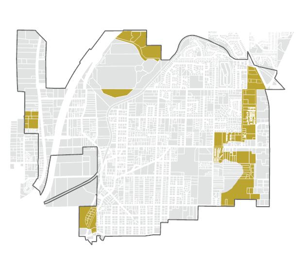
The graphic below shows Milton’s existing housing stock in both Pierce and King Counties compared to each county’s growth allocation (what needs to be built by 2044). Growth allocation and existing housing stock is divided into income brackets. The housing allocation is further broken down by the housing typology that can most feasibly deliver that type of affordability. For instance, for households earning between 0-50% Area Median Income, apartment buildings are the most financially viable form of housing. Areas on the map are color coded according to where the city intends to accommodate the majority of these different types of housing.
HO-2 City of Milton Housing Growth Targets by income bracket and county with comparison to existing housing stock
County
Pierce County 2044 Allocation
Supportive Housing (PSH).
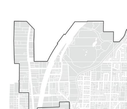

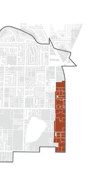
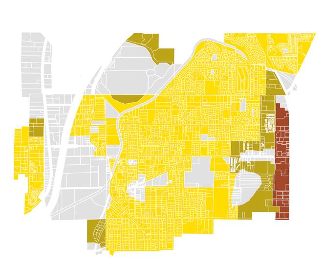
30-40 DU/acre
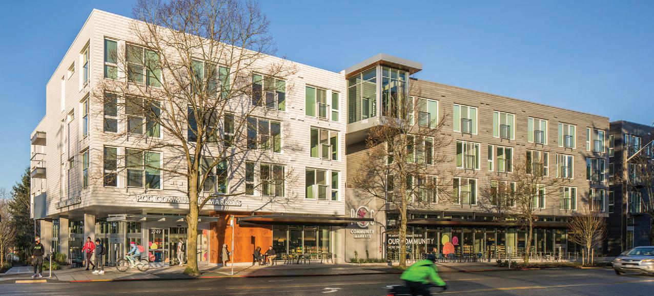
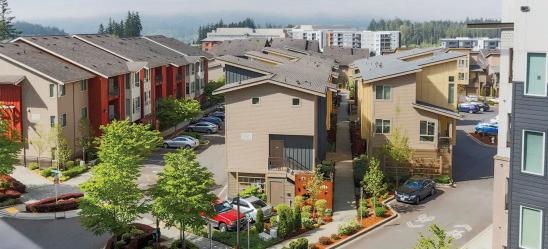
This area is where the bulk of Milton’s affordable housing allocation will go. Zoning will allow low and mid-rise apartment housing. This area was chosen because of its adjacency to existing transit, services, and amenities.
HOUSING DENSITY:
0-20 DU/acre, 0-10 DU/acre respectively
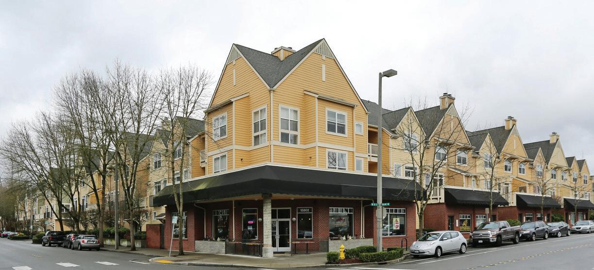
These areas are slated for primarily commercial purposes. These areas include Milton’s small scale commercial and neighborhood serving uses; in order to support local businesses. Some second story residential may be allowed.


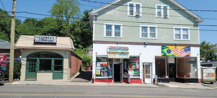
HOUSING DENSITY:
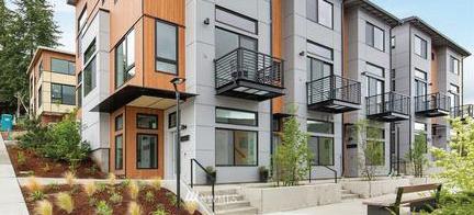
12-18 DU/acre
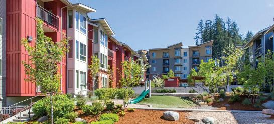
This area is primarily where higher-density middle housing and some lower density apartments will go. This will help achieve affordability targets between 50 and 100% AMI



HOUSING DENSITY:
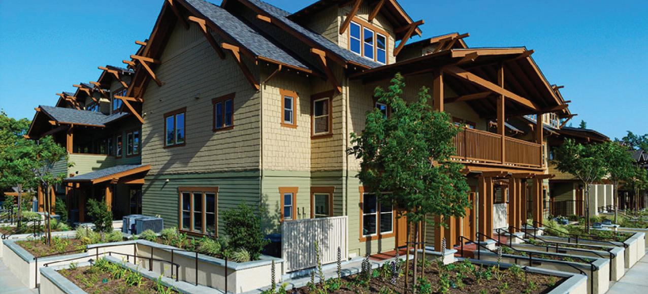
10-12 DU/acre
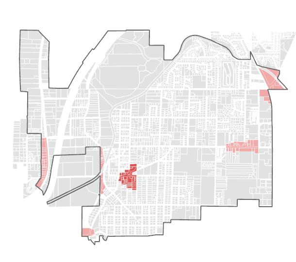
This area will primarily support single family housing, however, with the passage of HB 1110, this area must now allow at least two dwelling units per parcel.
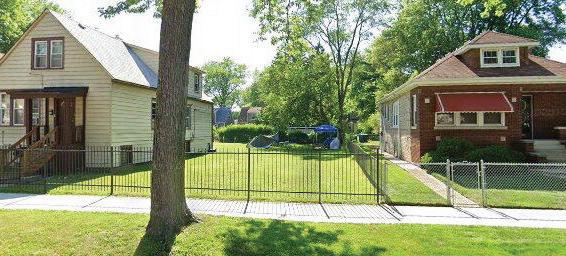
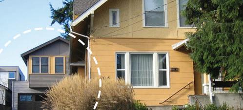
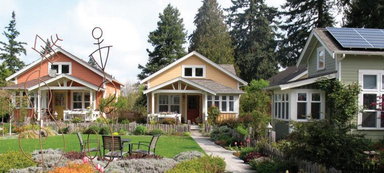
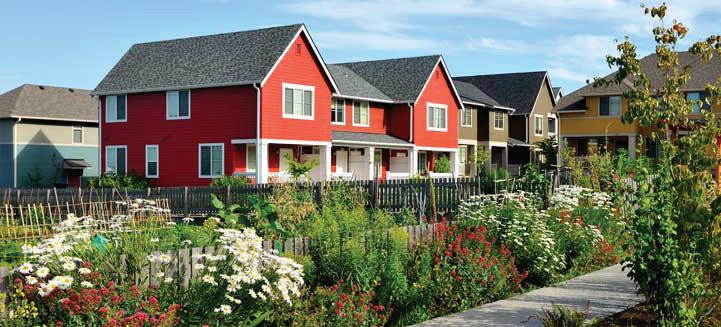
HO 1 ENCOURAGE THE PROVISION OF A VARIETY OF QUALITY HOUSING TYPES, DENSITIES, AND LEVELS OF AFFORDABILITY TO MEET THE DIVERSE NEEDS OF RESIDENTS, AND TO ADDRESS MILTON'S AFFORDABILITY GAP.
HO 1.1 Consistent with the Regional Growth Strategy and HB 1110, the City will update regulations and strategies to reduce barriers to the development and preservation of mid-density housing, such as duplexes, multiplexes, townhomes, and cottage courts, in all residential areas, to address the need for housing between single family and intensive multifamily, and to encourage a higher residential density still in keeping with Milton's existing fabric.
HO 1.2 Strive to set the conditions, including providing adequate public facilities and utilities, to encourage the development of a variety of housing types and densities, including middle housing.
HO 1.3 The City shall provide for accessory dwelling units in residential zones for low to moderate income, small family, single persons, or seasonal occupants, as long as the unit maintains the appropriate residential character and quality living environment.
HO 2 ENSURE ADEQUATE AND AFFORDABLE HOUSING FOR ALL ECONOMIC SEGMENTS OF THE COMMUNITY FOR
HO 2.1 Explore methods to encourage more intentional, predictable development in Milton, at a range of affordability levels, in order to preserve the architectural, spatial, and cultural characteristics that contribute to the city's identity.
HO 2.2 Identify and explore opportunities to reutilize and redevelop existing parcels where rehabilitation of the building is not cost-effective, while maintaining consistency with county-wide policy on historic, archaeological, and cultural preservation, and with Pierce County Policy AH-8 regarding displacement
HO 2.3 Consistent with King County policy H-13 and Pierce County policy AH4.2, the City should explore strategies to encourage affordable housing development, including participation in county-wide efforts to pursue state legislative changes to give the City authority to provide tax relief to developers of affordable housing
HO 2.4 Study and implement strategies to overcome cost barriers to housing affordability and encourage affordable residential development through the creation of a Housing Action Plan. This plan will create a framework and series of strategies to:
a. Maintain Milton’s existing affordable housing stock.
b. Encourage middle housing in residential neighborhoods.
c. Retain a sense of identity through strategies to encourage contextual conformity in architecture and design.
d. Allow manufactured housing within residential neighborhoods.
e. Utilize inclusionary or incentive zoning techniques.
f. Encourage multi-family housing development in proximity to urban services to create dense, walkable, urban nodes.
g. Utilize available means to support the retention of Milton's existing affordable housing as high-quality living environments, including through code enforcement, grant opportunities, funding and rehabilitation programs, discouraging the conversion of housing to inappropriate nonresidential uses, and require appropriate zoning.
h. Reduce barriers for affordable housing developers and low-income families seeking affordable housing, by acting as a resource hub.
HO 2.5 Allow manufactured homes within all residential areas and ensure that regulations are not more stringent for manufactured homes than for other residential building types.
HO 3.1 The City shall implement non-discriminatory zoning regulations for group homes, consistent with the Federal Fair Housing Act.
HO 3.2 Explore partnerships with United Way and other non-profit or religious entities to assist in providing extremely low-income, very low-income and low-income housing, permanent supportive housing, and emergency housing.
HO 3.3 The City should plan to accommodate an adequate and reasonable supply of permanent supportive housing as defined in RCW 36.70A.030 (16), foster care housing, and those requiring special needs housing (i.e., the elderly, developmentally disabled, chronically mentally ill, physically disabled, homeless, persons participating in substance abuse programs, persons with AIDS, and victims of domestic violence) that is equitably and rationally distributed within the city.
HO 3.4 The City will adopt and implement policies that protect housing stability for renter households, and expand protections and supports for extremely low-income, very low-income and low-income renters and renters with disabilities. The City’s development regulations should not unnecessarily add to housing costs.
HO 4 THE CITY WILL INCREASE HOUSING CHOICES FOR ALL INCOME BRACKETS—PARTICULARLY THOSE EARNING LOWER WAGES—THAT IS ACCESSIBLE TO EMPLOYMENT CENTERS.
HO 4.1 Seek to provide a diversity of dense housing options within walking
distance of transit, services, and jobs in order to reduce the need for single occupancy vehicles. Ensure there are zoning, development standards, and incentives in place to encourage housing production at affordability levels that allow people to live and work in Milton.
HO 5 WORK TO UNDO RACIALLY DISPARATE IMPACTS, DISPLACEMENT, AND EXCLUSION IN HOUSING CAUSED BY HISTORIC POLICIES, PLANS, AND ACTIONS.
HO 5.1 Prior to the periodic update, the City should evaluate the success or failure of existing policies and development code on racially disparate impacts including exclusion.
HO 6 THE CITY SHOULD ESTABLISH ANTI-DISPLACEMENT POLICIES, WITH CONSIDERATION GIVEN TO THE PRESERVATION OF HISTORIC AND CULTURAL COMMUNITIES.
HO 6.1 Identify and monitor potential physical, economic, and cultural displacement of low-income households and marginalized populations that may result from planning, public investments, private redevelopment, zoning changes, and market pressures. Use a range of strategies to prevent and minimize cultural and physical displacement and mitigate its impacts to the extent feasible.
HO 6.2 Address the need for housing affordable to low-, very- and extremely low-income households, recognizing that these critical needs will require significant public intervention through funding, collaboration, and City action. Strategies should include:
a. Providing a summary of dedicated resources to meet housing needs in the Housing Needs Analysis.
b. Prioritizing the use of local and regional resources such as funds or surplus property for income-restricted housing.
c. Prioritizing projects that promote access to opportunity, antidisplacement, and wealth-building for Black, Indigenous, (and) People of Color (BIPOC) communities
d. Supporting Pierce County efforts to establish a county-wide housing affordability program.
e. Collaborating with surrounding jurisdictions to maximize available funding opportunities and leverage private resources in the development of affordable housing.
f. Explore opportunities to dedicate revenues from sales of publicly owned properties, including tax title sales, to affordable housing projects.
HO 6.3 The City should consider inclusionary or incentive zoning measures as a condition of major rezones and development.
HO 6.4 The City should utilize available means, including grant opportunities, to maintain its existing housing stock as high-quality living environments and to explore redevelopment of poorly utilized parcels.
The matrix below connects the housing goals articulated in this chapter to the community vision statements in chapter 2, highlighting which goals are helping to accomplish different community desires.
well planned semi-urban town
1. Retain semi-urban residential areas by supporting growth in missing middle housing, and low-rise density that fits within the existing character of residential neighborhoods.
2. Plan and design complete neighborhoods that provide a variety of housing types, connect people safely and efficiently to the goods and services they need, and ensure that access to basic amenities is provided equitably
3. Expand multi-generational housing options so that people can stay in Milton as their housing needs may change.
4. Preserve and enhance open space to ensure all residents have access to quiet, relaxing, and high-performing green space.
5. Preserve and invest in the parks, trails and open space system to support an active and engaged recreation community.
6. Retain and enhance existing environmental amenities such as tree canopy and well functioning riparian and wetland areas.
High quality and accessible transportation and community infrastructure
7. Make Milton safer for walking and biking by reducing traffic impacts and providing safe and connected infrastructure that helps all people to get around their community with ease.
8. Coordinate with WSDOT to mitigate traffic impacts from major highways on our community.
9. Invest in the infrastructure needed to accommodate growth and maintain a high quality of life in Milton.
Accessible, attractive and amenity-rich Town Center and commercial areas
10. Develop the Town Center as the heart of Milton with a mix of housing, jobs, parks, civic space, and retail and cultural amenities. The Town Center is where Milton comes together as a community.
11. Support the local business community by increasing the proximity of housing to commercial areas with high-quality walking and biking connections.
12. Support robust social programming that brings our community together.
HO 1 Encourage the provision of a variety of quality housing types, densities, and levels of affordability to meet the diverse needs of residents, and to address Milton’s affordability gap.
HO 2 Ensure adequate and affordable housing for all economic segments of the community for current and projected residents of Milton.
HO 3 Prior to the periodic update, evaluate whether housing policies and the Development Code are resulting in the affordable housing and housing diversity goals outlined in the plan.
HO 4 The City will increase housing choices for all income brackets—particularly those earning lower wages— that is accessible to employment centers.
HO 5 Work to undo racially disparate impacts, displacement, and exclusion in housing caused by historic policies, plans, and actions.
HO 6 The city should establish anti-displacement policies, with consideration given to the preservation of historic and cultural communities.
This element will cover issues related to transportation in the City of Milton. This includes a review of the existing transportation system, analysis of transportation needs, and an identification of future transportation system improvements. The Transportation Element includes all modes of travel auto, truck, bicycle, bus, and pedestrian.
In 2015, the City completed its most recent update to the Transportation Element, which covered the 2015-2035 planning horizon. This update to the Transportation Element documents the changes that have occurred since 2015 and updates the analysis to create a transportation plan for City growth over the next 20 years (2024-2044). This update analyzes the existing operation of the transportation systems, forecasts future travel demand, and identifies the transportation improvements needed to address safety and accommodate future growth, and to create a transportation system that meets the needs and expectations of the community.
The Transportation Element is a required element under the State’s Growth Management Act (GMA). The GMA outlines specific requirements for the Transportation Element of a city’s Comprehensive Plan. It calls for a balanced approach to land use and transportation planning to ensure that a city’s transportation system can support expected growth and development. In addition, it mandates that capital facilities funds be adequate to pay for any necessary improvements to the transportation system. Finally, the City must adopt specific standards for the acceptable levels of transportation system performance on its streets; these standards are called level of service (LOS) standards.
Other legislative requirements addressed by the Transportation Element include the Pierce County and King County Countywide Planning Policies, the 1991 Commute Trip Reduction Act, the Americans with Disabilities Act (ADA), and the 1990 federal Clean Air Act Amendments. Each of these laws emphasizes closer coordination between a jurisdiction’s land use planning and its approach to transportation planning.
Consistent with Milton’s vision to be an equitable and sustainable community, the strategies and policies within the Transportation Element are crafted to promote environmental sustainability in both the design and operation of City facilities and services.
The transportation goals and policies direct the development of the transportation system by establishing the transportation vision for Milton, identifying the priority of transportation improvements, providing guidance for decision-making, and ensuring consistency with regional planning goals.
This is Volume I of the Transportation Element. Volume II includes supporting documentation and background information that support the goals, policies, and strategies below.
Implement the Regional Transportation Plan
TR 1 COORDINATE WITH REGIONAL AGENCIES TO ENSURE MAXIMUM MULTIMODAL TRANSPORTATION CONNECTIVITY, NEEDS, AND INTERESTS BETWEEN ADJACENT COMMUNITIES, REGIONAL TRANSPORTATION SYSTEMS, AND THE CITY OF MILTON.
TR 1.1 The City shall coordinate land use planning with the development of transportation facilities and services. The City shall adopt procedures that encourage the use of the Land Use Element of this Plan and the PSRC Regional Growth Strategy in planning future facilities.
TR 1.2 The City shall identify and evaluate unsafe traffic conditions, and work to improve traffic safety for users of all ages and abilities through installation of appropriate street improvements.
TR 1.3 Whenever the City contemplates reconstruction or major maintenance work on a City street lacking ADA and active transportation facilities, the ability to provide these facilities at that time should be fully explored.
TR 1.4 The City shall explore ways to encourage vanpooling, carpooling, public transit use, and other alternatives, strategies, and investments to reduce single-occupant vehicle travel. The City shall work with developers in establishing Transportation Demand strategies, where possible, to alleviate and reduce traffic congestion.
TR 1.5 Increase the resilience of the transportation system against disaster, develop prevention and recovery strategies, and plan for coordinated responses with state, regional, and local agencies.
TR 1.6 Prepare for emerging trends and technologies (Intelligent Transportation System (ITS), electric charging stations, automated and connected vehicles, on-demand smart signals, etc.) to enhance the efficiency of the City's transportation system.
Support the Regional Growth Strategy
TR 2 THE CITY SHALL ACTIVELY INFLUENCE ITS FUTURE CHARACTER BY MANAGING LAND USE CHANGE AND BY DEVELOPING CITY FACILITIES AND SERVICES IN A MANNER THAT DIRECTS AND CONTROLS LAND USE PATTERNS AND INTENSITIES, CONSISTENT WITH THE PSRC REGIONAL GROWTH STRATEGY.
TR 2.1 The City shall evaluate the impact of land use decisions that promote urban centers on the transportation system. Likewise, transportation improvements should be designed to support existing and proposed land use context and densities.
TR 2.2 The City shall encourage the implementation of measures that will relieve pressures on the existing transportation infrastructure, including:
a. multimodal transportation alternatives to capacity expansion for single occupant vehicles;
b. land use-transportation coordination;
c. prioritized improvements in urban and transit centers;
d. transit park-and-ride lots.
TR 2.3 The City shall work with local and regional transit agencies to provide transit service that links Milton with surrounding communities, regional rail transit, and major employment, commercial, and transit centers in the region.
TR 2.4 The City shall minimize potential conflicts between people walking, biking, and rolling and automobile traffic by providing signage, signals, and other appropriate treatments at the intersections of bicycle trails and roadways.
TR 2.5 The City shall provide and promote the development of a comprehensive network of pedestrian and bicycle facilities that links neighborhoods with activity centers (e.g. schools, parks, transit, trails, and commercial uses) and adjacent jurisdictions.
TR 2.6 The City’s Street Design Standards should facilitate the development of a multi-modal transportation system on city streets. Future revisions to these standards should support the development of pedestrian and bicycle facilities.
TR 2.7 Developers shall also be required to construct frontage improvements including street widening landscape buffers, sidewalks, and bicycle facilities as defined by the City’s Comprehensive Plan. Developers will be required to conduct transportation studies to determine the impacts of their developments on mobility in the City and to pay a fair-share fee for specific off-site multimodal transportation improvements needed to mitigate the impacts of their development.
TR 3 THE CITY SHALL STRIVE TO DEVELOP, MAINTAIN, AND OPERATE A BALANCED, FLEXIBLE, SAFE, AND EFFICIENT MULTI-MODAL TRANSPORTATION SYSTEM TO SERVE ALL PERSONS, SPECIAL NEEDS POPULATIONS, AND ACTIVITIES IN THE COMMUNITY.
TR 3.1 Incorporate racial and social equity in planning for transportation improvements, programs, and services in historically under served neighborhoods and vulnerable populations.
TR 3.2 The City should recognize pedestrian movement as a basic means of circulation and assure adequate ADA accommodation for pedestrians and people with special mobility needs in all transportation policies and facilities.
TR 3.3 The City should support the improvement of paratransit services for the elderly, youth, low-income, and people with audio, visual, and physical mobility challenges.
TR 4 THE CITY SHALL ENCOURAGE THE INTEGRATION, COORDINATION, AND LINKAGE OF REGIONAL CONNECTIONS AND TRANSFER POINTS BETWEEN ALL MODES OF TRANSPORTATION TO SUPPORT ECONOMIC DEVELOPMENT.
TR 4.1 The City will coordinate with the appropriate agencies to ensure the efficient movement of freight and goods to serve local and regional markets.
TR 4.2 The City will support transportation improvements that connect the region to major transportation hubs such as ports, airports, and designated freight routes
TR 4.3 The City will work with the State, King and Pierce counties, Tribes, port authorities, transit agencies, and railroads to support commercial aviation, shipping, and rail transport.
TR 4.4 The City shall ensure adequate parking in commercial areas in order to support economic growth, while maintaining consistency with roadway design and pedestrian circulation goals.
TR 5 MAINTAIN AN ENVIRONMENTALLY SUSTAINABLE TRANSPORTATION SYSTEM THAT PRESERVES SENSITIVE HABITAT, PROTECTS NATURAL RESOURCES, AND MEETS AIR QUALITY REQUIREMENTS.
TR 5.1 The City shall design its transportation facilities to meet air quality goals, reduce greenhouse gas emissions, promote energy-efficiency, and support clean transportation technologies.
TR 5.2 New transportation facilities should be designed in a manner that minimizes impacts on natural drainage patterns, streams, fish passage, wetlands, and soil profiles.
TR 5.3 Transportation facilities and services should be sited, designed, and buffered (through extensive screening and/or landscaping) to fit in harmoniously with their surroundings. When sited within or adjacent to residential areas, special attention should be given to minimizing environmental, noise, light, and glare impacts.
TR 5.4 Ensure that the City's transportation system preserves existing habitats and requires enhancement of disrupted habitats.
TR 6 THE CITY SHALL ENSURE THAT TRANSPORTATION FACILITIES AND SERVICES, NEEDED TO SUPPORT DEVELOPMENT, ARE AVAILABLE CONCURRENTLY WITH THE IMPACTS OF SUCH DEVELOPMENT, IN ORDER TO PROTECT INVESTMENTS IN EXISTING TRANSPORTATION FACILITIES AND SERVICES, MAXIMIZE THE USE OF THE FACILITIES AND SERVICES, AND PROMOTE ORDERLY COMPACT GROWTH.
TR 6.1 Provide mapped inventories of all major transportation networks, including automobile, transit, freight, sidewalks, bikeways, multiuse trails, airports, and railroads in the Transportation Plan.
TR 6.2 The City shall follow WSDOT’s level of service (LOS) D standards for SR 99 and I-5 facilities as per RCW 47.06.140(2), and shall coordinate with Pierce and King Counties and adjacent Cities regarding vehicle (LOS) standards.
TR 6.3 To maintain its existing rural and small-town character and to maintain the performance of arterial and transit routes, Milton shall adopt a Level of Service D standard for intersections inside the City.
TR 6.4 Implement adopted Active Transportation LOS Standards, as listed below:
a. Green = Complete Network Link, meets City standards
b. Orange = Incomplete Network Link, doesn't meet City standards
c. Red = Missing Network Link, doesn't meet City standards
TR 6.5 Adopt Transit-Supportive LOS Standards based on regional transit agency long-range plans.
TR 6.6 New development shall be allowed only when and where all transportation facilities are adequate at the time of development, or unless a financial commitment is in place to complete the necessary improvements that will mitigate the development’s impacts within six years.
TR 6.7 Work with Pierce County and PSRC to identify transportation system improvements deemed necessary to accommodate growth while improving safety and human health.
TR 6.8 The City shall prioritize the funding of maintenance and safety improvements for existing streets and the completion of the existing multimodal transportation system above the creation of new roads.
TR 7 THE CITY SHALL PRODUCE A FINANCIALLY FEASIBLE PLAN IN THE CAPITAL FACILITIES ELEMENT DEMONSTRATING ITS ABILITY TO ACHIEVE AND MAINTAIN ADOPTED LEVELS OF SERVICE. THE CITY SHALL ADOPT ITS SIX-YEAR TRANSPORTATION IMPROVEMENT PROGRAM (TIP) AS A PART OF THIS PLAN AND ANNUALLY UPDATE IT IN ACCORDANCE WITH THE POLICIES OF THIS PLAN AND GMA.
TR 7.1 The City shall not issue development permits where the project requires transportation improvements beyond the scope of the City’s 6-year Transportation Improvement Plan to maintain the adopted level of service standards. A developer may provide for needed improvements in transportation facilities and/or services. A developer may also provide strategies to mitigate impacts of their development provided that these strategies are consistent with the City’s goals and objectives.
TR 7.2 Explore the feasibility of alternative and innovative transportation financing methods to support ongoing maintenance, preservation, and operation of the City’s transportation system.
TR 7.3 The City shall coordinate land use and public works planning activities with an ongoing program of 20-year long-range financial planning, in order to conserve the fiscal resources available to implement the TIP.
TR 7.4 The City shall implement a level of service reassessment strategy in the event of a funding shortfall. This strategy will (in the following order):
a. seek additional methods of funding,
b. explore alternative, lower-cost methods to meet level-of-service standards (e.g., transportation demand management, public transit or another project),
c. reduce the types or size of development, and
d. reevaluate the established LOS standards to determine how they might be adjusted.
TR 7.5 The City should actively solicit action by the State and Pierce and King Counties to program and construct those improvements to State and County arterial systems that are needed to maintain the level of service standards adopted by the City of Milton.
TR 8.1 On-street parking shall be encouraged in the Town Center, consistent with the City Vision, in order to form a buffer between pedestrians and street traffic, reduce the speed of traffic, and provide for short-term parking needs.
TR 8.2 The City will explore alternative methods to ensure the presence of adequate parking for new and existing commercial and residential development in the Town Center Special Planning Area, while seeking to reduce the amount of parking provided by individual developments. This includes a mix of on-street and shared parking areas and the designation of short-term and long-term parking controls that support adjacent development.
TR 8.3 The Uptown District should emphasize parking behind storefronts, onstreet parking, and landscaped buffering, consistent with the City’s vision.
TR 9.1 The City, consistent with its Municipal Code, shall apply a functional street classification system to its entire roadway network. The classification system should reflect federal, state, and regional classification system designations as appropriate.
TR 9.2 The City’s Street Design Standards should be revised to establish and designate appropriate street sections consistent with the Comprehensive Plan, Uptown District Design Standards and Guidelines, the City Vision, and other planning documents.
TR 10.1 The City should encourage all major employers to implement programs to reduce the number of employees commuting by single occupancy vehicles through transportation demand management strategies including but not limited to preferential parking for carpools/vanpools, alternative work hours, bicycle parking, and distribution of transit and ride sharing information.
TR 11.1 The City shall encourage the location of bicycle racks at appropriate destination points, such as outside of commercial businesses, City Hall, parks, schools, and transit facilities.
TR 11.2 The City shall coordinate the development of its non-motorized facilities with adjacent jurisdictions to ensure an efficient, continuous, regional network.
TR 11.3 The City shall include the need to accommodate safe transportation by bicycles in its management and design of the City street network, including designating bicycle routes throughout the city.
TR 11.4 The City shall support coordination with King County and Pierce County for the continued development, enhancement, and completion of the Interurban Trail.
TR 11.5 The City shall support coordination with transit agencies such as Pierce Transit, Sound Transit, and King County Metro in developing connecting and complementary transit service.
TR 11.6 The City should support the development of non-motorized connections and marked roadways that link the Interurban Trail with the City’s other resources such as schools and commercial areas.
TR 11.7 Milton Way should be designed and developed to create an east-west bike/pedestrian corridor and draw traffic into the Town Center Subarea.
TR 11.8 The City shall establish distinct gateways along Milton Way, Meridian Avenue E, and Pacific Highway E.
TR 11.9 The City shall require developers to include pedestrian sidewalks, and encourage walking trails and paths, in new plats either by constructing the improvements, or by paying a fee-in lieu when construction of frontage improvements are not practical at time of development.
TR 11.10 The City shall strive to improve pedestrian facilities along high-priority pedestrian routes. Efforts should include additional or improved sidewalks and pedestrian paths where appropriate and feasible.
TR 11.11 The City shall establish public facilities and amenities such as sidewalks, trails, and streetlights to provide a safe and healthy family environment within the community.
TR 11.12 The City will improve pedestrian amenities through public improvements, street standards, and development standards. Within the Uptown District, this includes the development of a district-wide integrated walking system that provides frontage improvements, through-block connections, and pedestrian walkways meeting the Uptown Design Standards and Guidelines.
TR 11.13 The design and management of the street network shall seek to improve the appearance and safety of existing street corridors and shall incorporate high standards of design when developing new streets, including the construction of sidewalks. Where appropriate, landscape measures should be implemented to enhance the appearance of city street corridors.
The matrix below connects the transportation goals articulated in this chapter to the community vision statements in chapter 2, highlighting which goals are helping to accomplish different community desires.
A well planned semi-urban town
1. Retain semi-urban residential areas by supporting growth in missing middle housing, and low-rise density that fits within the existing character of residential neighborhoods.
2. Plan and design complete neighborhoods that provide a variety of housing types, connect people safely and efficiently to the goods and services they need, and ensure that access to basic amenities is provided equitably
3. Expand multi-generational housing options so that people can stay in Milton as their housing needs may change.
4. Preserve and enhance open space to ensure all residents have access to quiet, relaxing, and high-performing green space.
5. Preserve and invest in the parks, trails and open space system to support an active and engaged recreation community.
6. Retain and enhance existing environmental amenities such as tree canopy and well functioning riparian and wetland areas.
High quality and accessible transportation and community infrastructure
7. Make Milton safer for walking and biking by reducing traffic impacts and providing safe and connected infrastructure that helps all people to get around their community with ease.
8. Coordinate with WSDOT to mitigate traffic impacts from major highways on our community.
9. Invest in the infrastructure needed to accommodate growth and maintain a high quality of life in Milton.
Accessible, attractive and amenity-rich Town Center and commercial areas
10. Develop the Town Center as the heart of Milton with a mix of housing, jobs, parks, civic space, and retail and cultural amenities. The Town Center is where Milton comes together as a community.
11. Support the local business community by increasing the proximity of housing to commercial areas with high-quality walking and biking connections.
12. Support robust social programming that brings our community together.
Community Vision Statements
T 1 Coordinate with regional agencies to ensure maximum multimodal transportation connectivity, needs, and interests between adjacent communities, regional transportation systems, and the City of Milton.
T 2 The City shall actively influence its future character by managing land use change, and by developing City facilities and services in a manner that directs and controls land use patterns and intensities, consistent with the PSRC Regional Growth Strategy.
T 3 The City shall strive to develop, maintain, and operate a balanced, flexible, safe, and efficient multi-modal transportation system to serve all persons, special needs populations and activities in the community.
T 4 Goal T-4: The City shall encourage the integration, coordination, and linkage of regional connections and transfer points between all modes of transportation to support economic development.
T 5 Maintain an environmentally sustainable transportation system that preserves sensitive habitat, protects natural resources and meets air quality requirements.
T 6 The City shall ensure that transportation facilities and services, needed to support development, are available concurrently with the impacts of such development in order to protect investments in existing transportation facilities and services, maximize the use of the facilities and services, and promote orderly, compact growth.
T 7 The City shall produce a financially feasible plan in the Capital Facilities Element demonstrating its ability to achieve and maintain adopted LOS. The City shall adopt its Six-Year Transportation Improvement Program (TIP) as a part of this plan and annually update it in accordance with the policies of this plan and the GMA.

Parks and recreation contribute to quality of life in Milton by providing people with spaces for exercise, gathering, and respite through a network of parks, trails, open spaces, and indoor facilities. People use parks in many diff erent ways, from socializing at events, walking a trail together, playing organized sports, or surrounding themselves in greenery after a long day spent inside. Parks and open spaces with trees, vegetation, and permeable surfaces also contribute to environmental and ecological health by cleaning the air and water, and providing wildlife habitat.
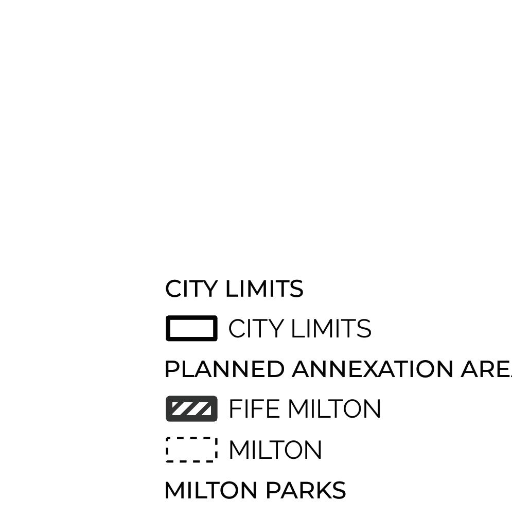


The Parks Element serves as guidance for the development of Milton’s parks, trails, and open spaces to best meet the needs of its constituents. The feedback received as part of the public engagement eff ort was thus key in determining the goals and policies, capital projects, and Level of Service metric for this plan. In addition to meeting local desire for recreation amenities, classes and events, and access to nature, the development of Milton’s park system can also be an economic asset, drawing in visitors, increasing property values, and even off setting costs associated with fl ood risks or other environmental hazards.
Figure PR-1 Parks and Open Space Properties by Type


The Parks Element is based on the Parks, Recreation, and Open Space (PROS) Plan, which was adopted in April of 2024. This plan established the Capital Facilities Project list, Level of Service (LOS) Metric and Capital Projects List that can be found later in this document.


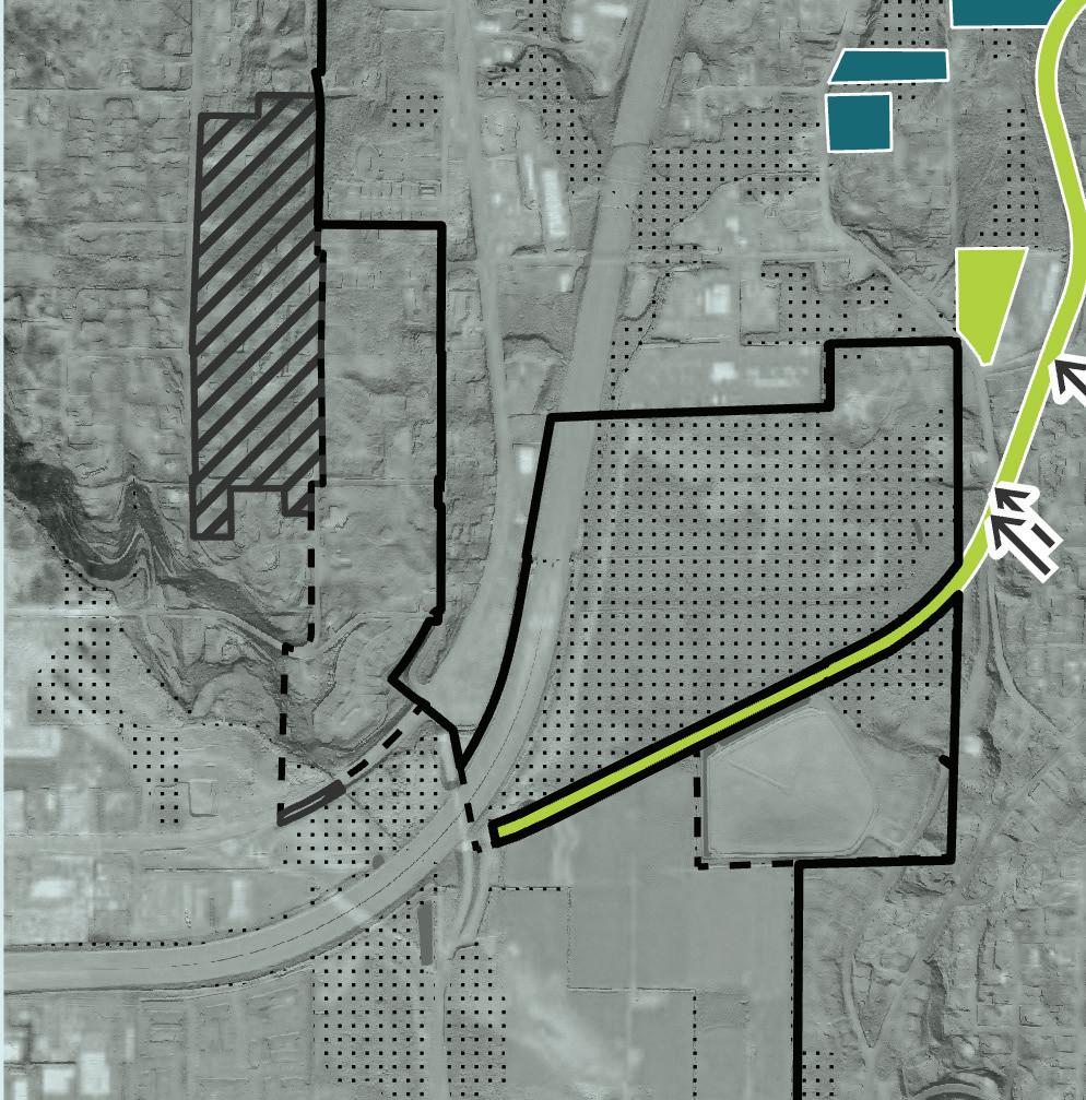
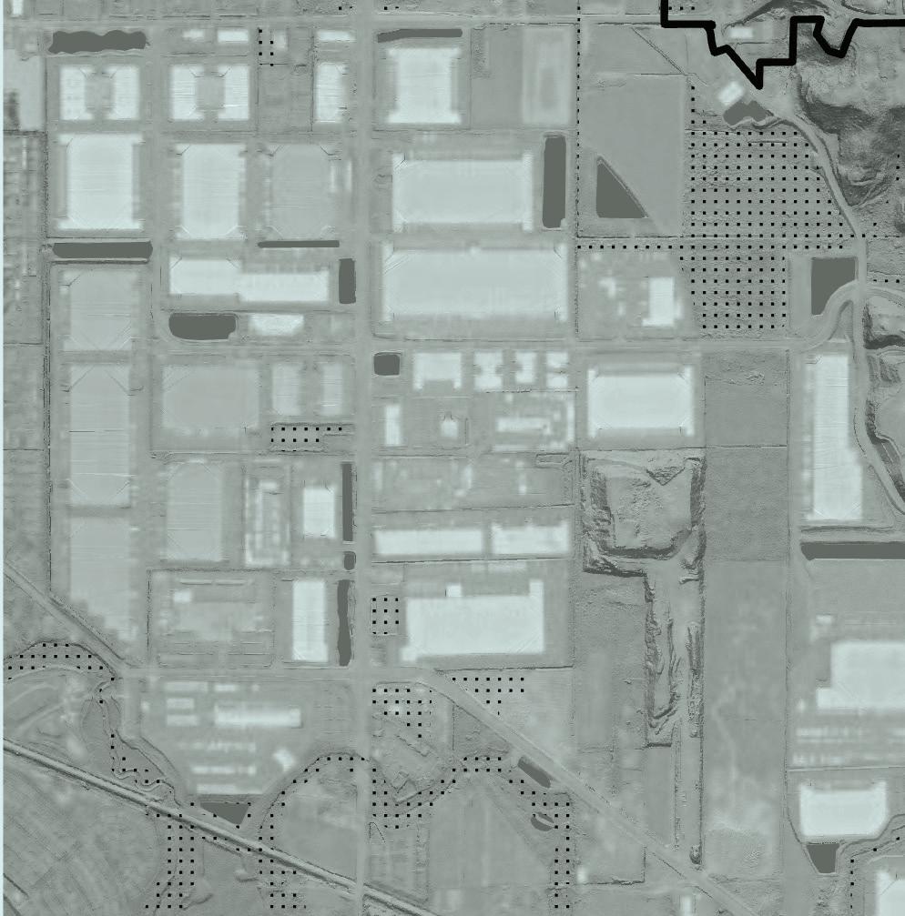
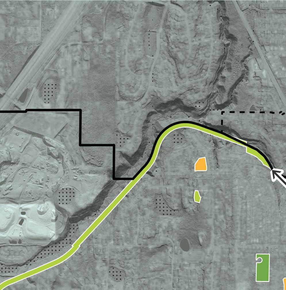
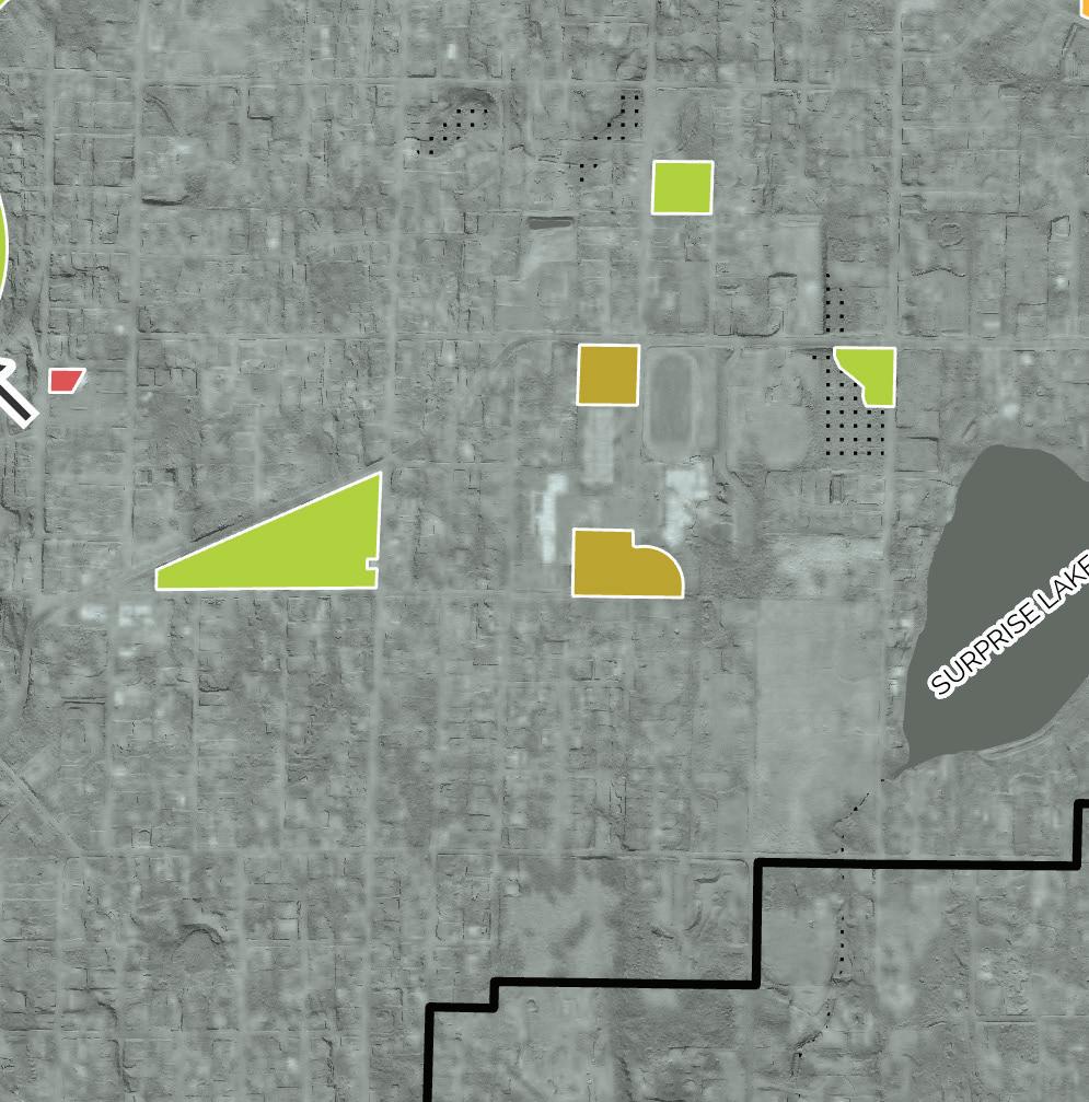
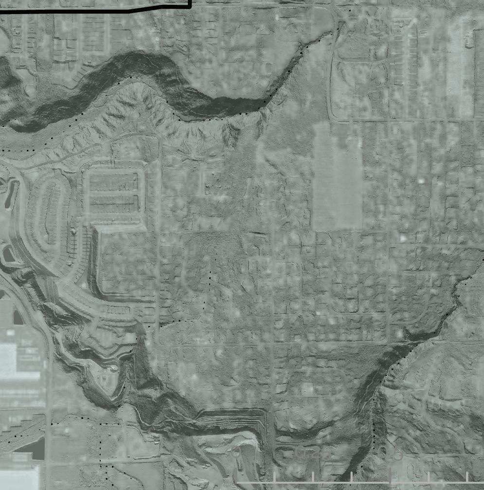


At the core of Milton’s parks and recreation system are developed parks and trails that are owned and operated by the City. These parks, which are designated as Community Parks or Neighborhood Parks, provide amenities such as benches, playgrounds, sports facilities, and areas for gathering. Milton currently operates 5 parks totaling 16.81 acres, the largest of these being Milton Community Park, or Triangle Park (10 acres).
In this plan, Neighborhood Parks are those that offer passive and active amenities, which allow for recreation, relaxation, and socializing. They should provide basic facilities that allow for daily use by nearby residents, such as a playground, a sports facility, open lawn or plaza space, shade trees or a structure, plantings, and benches and/or picnic tables. The idea is that everyone who lives nearby can enjoy these parks.
What distinguishes a Community Park is its ability to draw residents from various neighborhoods due to its size and breadth of facility, or because it offers something that is not available elsewhere in the park system. For example, Milton Skate Park is used by people in many neighborhoods because it offers a unique array of equipment for skateboarders. Community Parks can be ideal places for community gatherings such as markets, concerts, or events like Milton Days festival, which is held annually in Milton Community Park. Milton Community Park Park
Milton Community Park 10 Community Park + Neighborhood Park
Milton Skate Park 1.31 Community Park
West Milton Park 3 Community Park
Hill Tower Park 2 Neighborhood Park
Olympic View Park .5 Neighborhood Park
Hylebos Park Expansion
West Milton Nature Preserve
Green space & natural corridors
Green space & natural corridors
Interurban Trail 38 Green space & natural corridors
Woodlands Park .36 Parks Outside of Milton
Lake Middle School
Activity Center 3 Indoor Facilities
Park 1.1 Private Park
Heights .43 Private Park
Alder Street Park 9.07 Private Park Christy’s Crossing HOA Parks 1.44 Private Park
Meadow Glen Windmill .52 Private Park
simultaneously serves as a Community and Neighborhood Park due to its size and programming.
Milton contains a 2.8 mile portion of the regional Interurban Trail, a growing network of trails which spans Pierce and King Counties along the historic railway. Milton’s portion of trail is surrounded by 38 acres of undeveloped right-of-way, which serves as an ecological buffer and provides shade and respite from the urban environment for trail users. Once completed, the trail will connect from Tacoma to Everett, allowing for connections between several cities and to other regional trails.
Green Spaces and Natural Corridors are also included within the parks system, but are not developed with amenities. These undeveloped areas can act as wildlife corridors, wetland buffers, or simply wild
spaces that cater to wildlife and exploratory humans. The right-of-way surrounding Milton’s Interurban Trail contributes the most acreage to this category, and there are additional parcels of green space bordering Hylebos Creek that contribute 11.32 additional acres.
Sports fields within the Fife School District also contribute to recreation in Milton, hosting sports leagues throughout the year. While these acres are not considered in the Level of Service metric, the fields and courts are taken into consideration when evaluating demand and needs for facilities.
Finally, there are several private parks in Milton that residents in some neighborhoods have access to. Mapping these parks and quantifying the facilities they offer helps to shape not only the assessment of demands and needs for certain amenities, but also

contributes to our understanding of where there is the greatest need for additional parks in Milton.
Striving to create a park system that everyone in Milton can use means considering how people access parks. The further people are from a park that suits their needs, the more barriers they will face accessing it. This is especially pertinent for non-drivers, those who use mobility aids, and parents of young children, but everyone uses parks more when they can easily access them.


The accepted small town accessibility standard for towns like Milton is to have a Neighborhood Park within 1/2 mile of each household. This means that ideally, every resident would be within a ten-minute walk from a park that provides opportunities for rest, play, and socializing. While there are also accepted standards for distance to a Community Park, this is less pertinent in Milton, where the overall extent of the city is small.
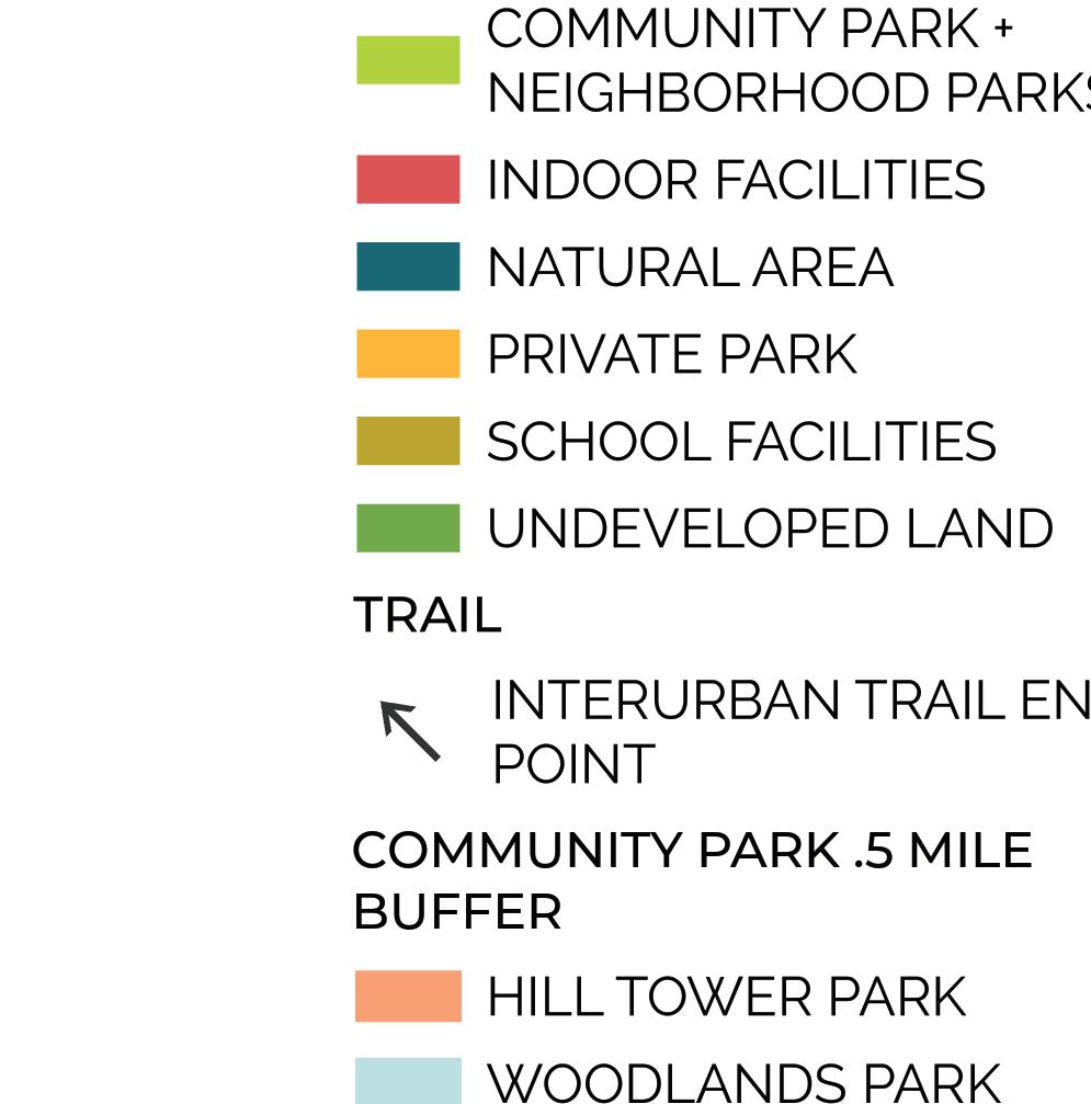
The map on the following page shows a 1/2 mile radius around Milton’s two Neighborhood Parks, as well as Edgewood’s Woodlands Park, whose service area extends into the southwest portion of Milton. The largest gap in service is seen in the west side of Milton, which encompasses the area within the Puyallup Off -Reservation Trust area. Closing this gap should be considered a high priority, and will help to achieve a more equitable distribution of park services throughout Milton. The City should work with residents who might access the park in order to determine how to best program it to meet
Figure PR-2 Areas within a half mile of a Community Park their needs.

The northeast end of Milton is also outside of the half mile radius of a Neighborhood Park, though several neighborhoods have access to private parks, as shown in Figure PR-2.
The development of the newly dedicated Olaff son Estate Area, which is designated to become Olson Park in 2030, could help to fi ll the gap in Neighborhood Park service on the north side of Milton. When developed, it


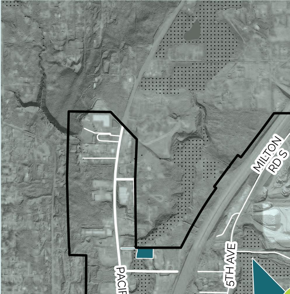

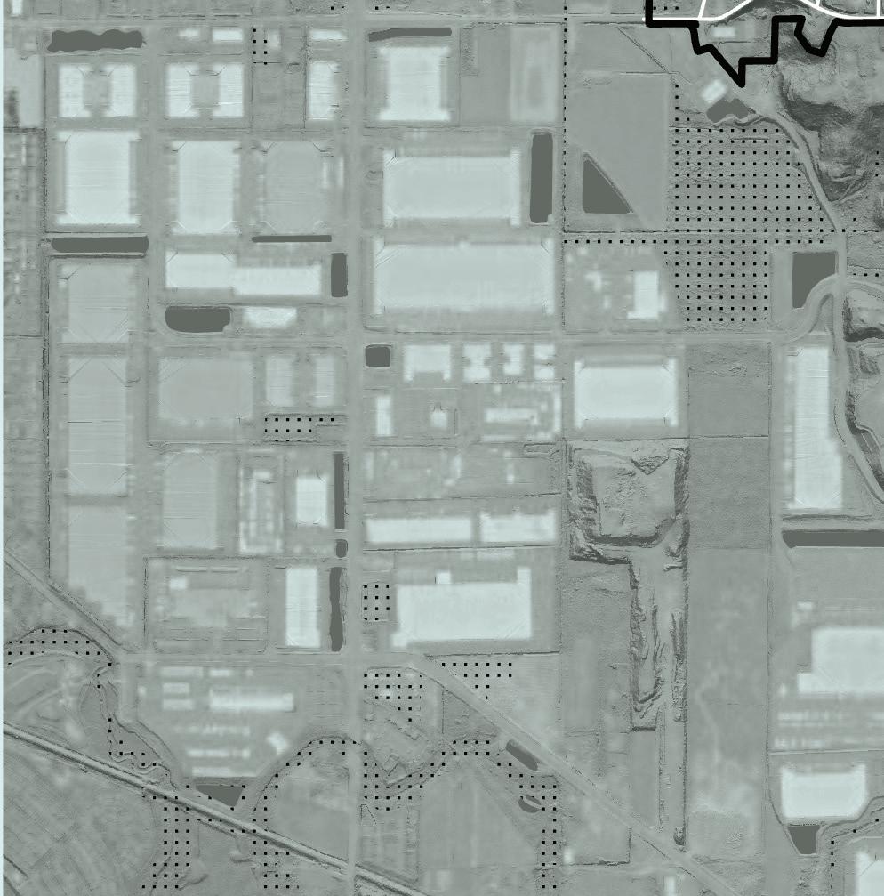
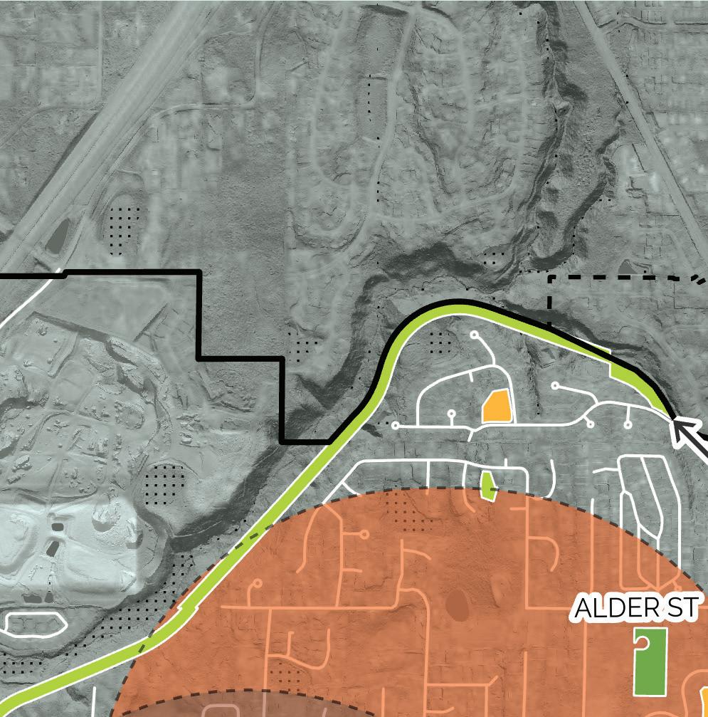
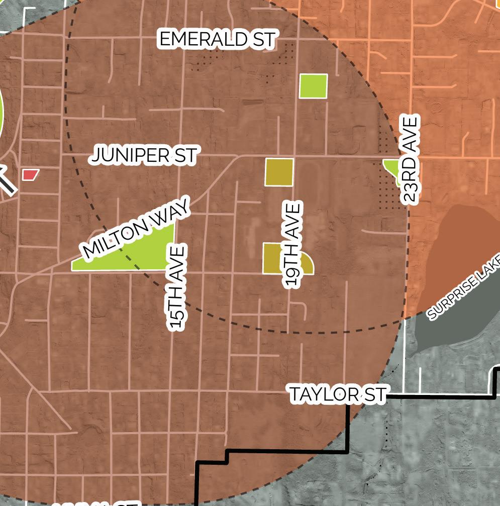


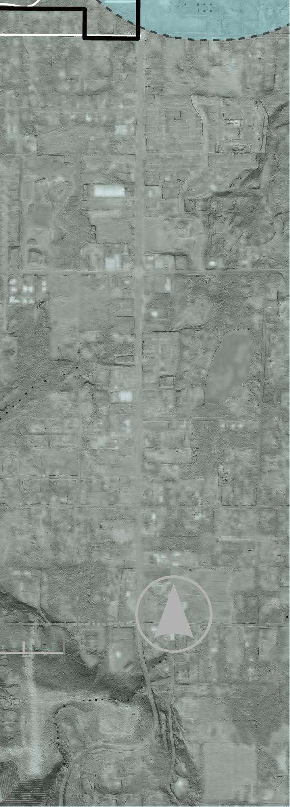
will serve three senior living facilities, as well as Heather Hills Mobile Home Park. These groups should be consulted and considered to inform park design and programming.
In May of 2022, the City invited residents to share their thoughts and experiences with Milton Parks in an online survey. Of the 80 respondents, 20% said they visit parks or trails in Milton daily, with 45% reporting weekly use. People shared their appreciation for the Interurban Trail and advocated for more access points, as well as amenities such as garbage cans and dog waste bags along the trail. They shared their love of “Triangle Park” (Milton Community Park) and appreciation for the recent addition of Pickleball courts, but lamented the lack of shade at the playground, the need for more parking, and desire for more park programming.
When asked what is missing from the parks and trails in Milton, the stand-out answers were access to Surprise Lake and an offleash dog area. Other features reported missing or desired are summarized below.
Feedback was also gathered at Milton Days, the City’s annual festival. Visitors were invited to provide feedback on a conceptual design for Hill Tower Park and “voted” for the amenities they would most like to see if the park were to be redeveloped. While the young visitors and their parents expressed emphatic support for updated play features
such as a zipline, splash pad, or rope-based play structure, there was also ample support for a porch swing-type installment, picnic area, shade structure, and food trucks.
Level of Service is a measure of the status of an entire park and recreation system to inform future need. Often a park system’s level of service is calculated as acres per 1,000 residents, thus as the city grows in population, additional park land must be acquired or developed in order to maintain that LOS.
In Milton, some of the park system needs are related to land acquisition. For example, there is currently no public access to Surprise Lake, thus, fulfilling that demand will require that the City acquire lake-adjacent property should it become available. Other needs relate more to park programming, such as the desire for a splash pad, which can be added to an existing park. Other needs present the question of which strategy to take, such as the need for a Neighborhood Park to serve the west portion of Milton. Should the City develop an existing parcel of land within the Hylebos Creek area, improve West Milton Park so that it qualifies as a Neighborhood Park, or acquire a new parcel of land?
This plan uses a strategy of “Land, Access, Programming” to frame the Level of Service Metric:
Land: Acquiring land to meet the parks, recreation, and open space needs of a growing population.
Access: Striving to provide a park within 1/2 mile of each home in Milton that people can get to in a car, on wheels, or by foot.
Programming: Providing park amenities that meet the needs of all Milton residents.
Using this framework, the following Level of Service was established:
In this Level of Service system, parks can occupy multiple categories simultaneously. For example, Milton Community Park, a park that offers a variety of passive and active amenities
PR-3 Current & future Levels of Service
PR-4 Acres needed to maintain adopted LOS standard
*Acres per 1,000 residents
(Neighborhood Park), is centrally located, relatively large, and contains elements not available elsewhere in the city (such as pickleball courts, bocce ball, and the Veterans Memorial), counts as both a Neighborhood Park and a Community Park.
If Hill Tower Park were to be updated with amenities that would draw people from all parts of Milon (such as a splash pad), it could quality as a Community Park and thus be counted into that acreage. Thinking in reverse, if West Milton Park were to be updated with passive amenities such as benches, trees, a garden, or pathway (which would all be difficult given its current size constraints), it could quality as a Neighborhood Park.
In addition to reflecting potential improvements to existing parks, this LOS contains two new categories: Natural Areas and Greenspace Corridors as well as Waterfront Access. The former reflects survey responses and sentiments from Council members, who want to see open space preserved in Milton. This category encompasses both undeveloped, vegetated land, and that which has low-impact improvements such as a trail, overlook, or interpretive signage.
Finally, the Waterfront Access category creates a new park typology that reflects the desire for access to Surprise Lake. This local waterway is currently surrounded by private land, meaning that most residents in Milton cannot access it. While the availability of land surrounding the lake is not under the City’s control, the designation of this park category solidifies the City’s intent to purpose lakefront property should it become available.
Figure PR-5 Acres needed to maintain adopted LOS standard
Park Project
Neighborhood Park on west side of Milton
Milton Community Park
Acquisition of land or development of a portion of Hylebos Creek area
Addition of parking spaces and pedestrian facilities on Oak Street, including sidewalks, planters, street trees, crosswalks, bike racks, and lighting. Medium
Addition of loop path and plantings on Lower Field
Hill Tower Park Park redesign including spray park
Purchase of north, adjacent parcel High
Expansion of park into north parcel
Olson Park Park design and construction including dog park and trails Medium
Interurban Trail
Additional connection point
Design and construction of new park adjacent to completed trail section
Water Access
Purchase of land bordering Surprise Lake
Development of waterfront park
Disc Golf
City Gateways/ Wayfinding*
Addition of Disc Golf facilities 6 years
Gateway sign and wayfinding to key city locations 6 years
*From 2020-2025 Capital Improvements Projects
• RCO - Land & Water Conservation Fund
• WWRP - Local Parks
• Consider drawing from Transportation or other budgets.
• RCO - Land & Water Conservation Fund
• WWRP - Local Parks
• RCO - Land & Water Conservation Fund
• WWRP - Local Parks
• WWRP - Local Parks
• RCO - Land & Water Conservation Fund
• WWRP - Local Parks
• RCO - Land & Water Conservation Fund
• WWRP - Local Parks
• RCO - Land & Water Conservation Fund
• WWRP - Local Parks
• RCO - Land & Water Conservation Fund
• WWRP - Local Parks
• WWRP - Local Parks
• WWRP - Water Access
• RCO -Land & Water Conservation Fund
• WWRP - Local Parks
• WWRP - Water Access
• $20,000
• Consider drawing from Transportation or other budgets.
Given community feedback, City goals, and accessibility analysis, the following project goals have been identified as priorities:
Project Priorities:
● Dog Park
● Splash Pad
● Park for west side of town
● Access to Surprise Lake
● Expansion of Interurban Trail to connect to Edgewood and to provide an additional access point within Milton
The Capital Facilities list on the following page reflects these priorities, while also considering project costs and what is feasible for the next 6-year funding cycle versus what will be planned for further in the future.
jurisdictions <20,000*)
*Based on data from the NRPA for jurisdictions of less than 20,000 people
**Based on 2020 population of 8,211
***Based on 66.38, which includes the Interurban Trail, West Milton Nature Preserve, and Hylebos Park Expansion, as well as Neighborhood and Community Parks.
PR 1 THE CITY SHOULD PROVIDE A COMPREHENSIVE AND CONNECTED SYSTEM OF PARKS, TRAILS, AND OPEN SPACES THAT PROVIDES OPPORTUNITIES FOR RECREATION, RESPITE, AND GATHERING, WHILE PRESERVING MILTON’S CULTURAL AND ENVIRONMENTAL ASSETS.
PR 1.1 Due to their central locations, Milton Community Park (aka Triangle Park) should continue to be developed as key community facilities in the city’s park and recreational planning efforts.
PR 1.2 The City should prioritize the ecological health of Hylebos Creek and its associated wetland and floodplain when considering the development, acquisition, and maintenance of parks and open spaces.
PR 1.3 The City should strive to provide a Neighborhood Park accessible within 1/2 mile of all residents in Milton.
PR 1.4 Where feasible, the City should acquire land adjacent to existing parks, trails, and open spaces to enhance the potential uses of those facilities and to improve linkages between the facilities.
PR 1.5 The City should strive to provide public waterfront access to Surprise Lake.
PR 1.6 The City should plan Milton’s parks, trails, open space, and recreation program needs based on population projections, citizen input, best practices, and guidance from the Parks Board.
PR 1.7 Pursue partnerships with the Fife School District, Tribal governments, state agencies, businesses, developers, user groups such as youth sports leagues, and neighborhood groups in order to provide and manage parks, trails, and open spaces.
PR 2 THE CITY SHOULD RECOGNIZE THE IMPORTANT RECREATIONAL, HEALTH AND TRANSPORTATION ROLES PLAYED BY BICYCLE, WALKING, AND NON-MOTORIZED TRAIL SYSTEMS, AND SHOULD SUPPORT THE CONTINUED DEVELOPMENT OF THE INTERURBAN TRAIL AS A BENEFIT TO THE CITIZENS OF MILTON AND AS A PART OF A REGIONAL TRAIL SYSTEM.
PR 2.1 The City should strive to provide safe and convenient access to the Interurban Trail for all Milton residents by maintaining trailheads that are well-connected to residential areas by pedestrian and bicycle networks.
PR 2.2 The City should maximize the benefits of the Interurban Trail as a regional trail connection by completing the trail section to connect to Edgewood, seeking opportunities for trail-adjacent parks, and providing wayfinding to connect regional trail users to destinations throughout Milton.
PR 2.3 Provide a safe, comfortable, and enriching trail experience through amenities such as interpretive signage, benches, and water bottle-filling stations along the Interurban Trail.
PR 2.4 The City should encourage bicycle access to parks, by providing bicycle racks in parks and coordinating park planning efforts to align with planned bicycle facilities.
PR 3 MILTON’S PARKS, TRAILS, AND OPEN SPACES, AS WELL AS RECREATIONAL PROGRAMS, SHALL BE PLANNED AND DESIGNED FOR PEOPLE OF ALL AGES, BACKROUNDS, AND ABILITIES WITH YEAR-ROUND OPPORTUNITIES FOR RECREATION, RELAXATION, AND GATHERING.
PR 3.1 Neighborhood Parks should be designed to serve all age groups and provide amenities for both active and passive recreation.
PR 3.2 The City should provide ample opportunity for public feedback on park planning and design through online surveys, in-person events, and small focus groups in order to encourage participation from as many residents and other park users as possible.
PR 3.3 Special consideration should be given to low-income residents, youth at risk, the elderly, people with disabilities, and any and all marginalized groups when making decisions about park, trail, and open space design and planning.
PR 3.4 Offer a wide variety of parks and recreation programs to meet the community’s diverse needs for exercise, play, gathering, and relaxation.
PR 3.5 Design, construct, and retrofit parks to offer universal accessibilty for people of all physical abilities, meeting and exceeding Americans with Disabilities Act (ADA) Standards for Accessible Design.
PR 3.6 Ensure that Milton’s parks, trails, and open spaces are safe, well managed, and provide an inclusive atmosphere.
PR 4 PLANNING, DESIGN, AND MAINTENANCE OF PARK LANDS SHOULD CONSIDER THE HEALTH OF THE SURROUNDING NATURAL ENVIRONMENT IN ORDER TO BALANCE THE NEED FOR RECREATION USES WITH ENVIRONMENTAL PROTECTION AND CLIMATE CHANGE MITIGATION.
PR 4.1 The City should seek to improve ecological health through strategic preservation of open space, habitat restoration efforts, and sustainable design of parks and trails.
PR 4.2 Park, trail, and open space design should help to mitigate impacts of the urban environment through the preservation of large trees, the use of rain gardens and other low impact storm mitigation strategies, and other sustainable design strategies where appropriate.
PR 4.3 Park design should showcase and support local ecology through the use of
native plants and plants with low water and fertilizer needs.
PR 5 THE CITY SHALL PLAN STRATEGICALLY TO USE TAX DOLLARS, LOCAL AND REGIONAL RESOURCES TO ENSURE THE LONGEVITY OF ITS PARKS, TRAILS, AND OPEN SPACES.
PR 5.1 Pursue and maintain partnerships with the Fife School District, Tribal governments, state agencies, businesses, developers, user groups such as youth sports leagues, and neighborhood groups in order to provide and manage parks, trails, and open spaces.
PR 5.2 Developers shall mitigate impacts of their development by providing parks, trails, and open spaces, or fees in lieu of such, through the SEPA Environmental Review process and/or through development fees. Parks, trails, or open spaces provided should support the goals put forth by the most recent Parks, Recreation, and Open Space Plan.
PR 5.3 In commercial areas of the City, developers shall mitigate the impacts of their developments by providing public spaces and facilities such as plazas, courtyards, and pedestrian connections, through the SEPA Environmental Review process and/or design standards, as appropriate.
PR 5.4 The City should participate in regional park, trail, and open space planning to ensure that Milton residents benefit from tax revenues intended to fund regional open space needs.
PR 5.5 The City should identify and pursue grant opportunities to further the City’s parks, trails, recreational, and open space planning efforts.
PR 5.6 The City should promote the use of property tax reductions and encourage and support the participation of community-based non-profit organizations, offering options and alternatives to development, in the interest of preserving desirable lands as a public benefit.
The matrix below connects the parks, recreation, and open space goals articulated in this chapter to the community vision statements in chapter 2, highlighting which goals are helping to accomplish different community desires.
A well planned semi-urban town
1. Retain semi-urban residential areas by supporting growth in missing middle housing, and low-rise density that fits within the existing character of residential neighborhoods.
2. Plan and design complete neighborhoods that provide a variety of housing types, connect people safely and efficiently to the goods and services they need, and ensure that access to basic amenities is provided equitably
3. Expand multi-generational housing options so that people can stay in Milton as their housing needs may change.
4. Preserve and enhance open space to ensure all residents have access to quiet, relaxing, and high-performing green space.
5. Preserve and invest in the parks, trails and open space system to support an active and engaged recreation community.
6. Retain and enhance existing environmental amenities such as tree canopy and well functioning riparian and wetland areas.
High quality and accessible transportation and community infrastructure
7. Make Milton safer for walking and biking by reducing traffic impacts and providing safe and connected infrastructure that helps all people to get around their community with ease.
8. Coordinate with WSDOT to mitigate traffic impacts from major highways on our community.
9. Invest in the infrastructure needed to accommodate growth and maintain a high quality of life in Milton.
Accessible, attractive and amenity-rich Town Center and commercial areas
10. Develop the Town Center as the heart of Milton with a mix of housing, jobs, parks, civic space, and retail and cultural amenities. The Town Center is where Milton comes together as a community.
11. Support the local business community by increasing the proximity of housing to commercial areas with high-quality walking and biking connections.
12. Support robust social programming that brings our community together.
Community Vision Statements
PR 1 The City should provide a comprehensive and connected system of parks, trails, and open spaces that provide opportunities for recreation, respite, and gathering, while preserving Milton’s cultural and environmental assets.
PR 2 The City should recognize the important recreational, health and transportation roles played by bicycle, walking, and non-motorized trail systems, and support the continued development of the Interurban Trail as a benefit to the citizens of Milton and as a part of a regional trail system.
PR 3 Milton’s parks, trails, and open spaces, as well as recreational programs, shall be planned and designed for people of all ages, backrounds, and abilities with year-round opportunities for recreation, relaxation, and gathering.
PR 4 Planning, design, and maintenance of park lands should consider the health of the surrounding natural environment in order to balance the need for recreation uses with environmental protection and climate change mitigation.
PR 8 The City shall plan strategically to use tax dollars and local and regional resources to ensure the longevity of its parks, trails, and open spaces.
The Capital Facilities and Utilities Elements together represent the vital municipal services that support the city of Milton. Capital facilities make up a broad spectrum of public infrastructure and amenities, including streets, parks, schools, libraries, stormwater, public safety, and government services. The Utilities Element covers electricity and energy usage, water and sewer service, telecommunications, and waste services.
Collectively, this combined Capital Facilities and Utilities Element helps to ensure that necessary services are strategically placed to support the city’s developmental goals as outlined in this Plan Update. They include goals, policies, and strategies to provide sufficient facilities for new development, address past deficiencies, and maintain the City’s established Level of Service (LOS). Level of Service (LOS) is a measure of the quality and effectiveness of a municipal service or facility, gauging how well it meets the needs of the population. LOS can be tailored to specific contexts and can vary in its criteria and measurement methods, but the core idea remains the same: assessing and ensuring the quality of service delivered to Milton residents.
Consistent with Milton’s vision to be an equitable and sustainable community, the strategies and policies within the Capital Facilities and Utilities Element are crafted to promote environmental sustainability in both the design and operation of city facilities and services. They also highlight the necessity to address and correct any existing disparities within the community.
1. Residents are served by a balance of municipal and special district capital facilities - Milton provides public facilities and capital facility planning for municipal buildings, police services, electric, stormwater, and water. Special district providers serve Milton with fire, emergency services, libraries, sewer, and school services.
2. Population growth and public services needs have initiated the expansion of Milton’s municipal buildings. A municipal complex expansion is expected to take place between 2026 and 2040.
3. Schools and facilities for fire and emergency services are expanding to accommodate the growth of Milton and surrounding areas. East Pierce County Fire is constructing a new facility in Edgewood (Station 118) and has plans to replace the Milton Fire Station (Station 124). The Fife School District recently opened Fife Elementary School to address increasing student enrollment.
4. Deficiencies in Milton’s stormwater, transportation, electric, water, and sewer facilities exist. Capacity and maintenance enhancements are being addressed in ongoing efforts under the City’s capital improvement plan and will be monitored during the 2024 Comprehensive Plan update.
This is Volume I of the Capital Facilities and Utilities Element. Volume II includes supporting documentation and background information that support the goals, policies, and Levels of Service outlined below.
CF 1 DEVELOP A SIX-YEAR PLAN (AT LEAST) THAT WILL FINANCE CAPITAL FACILITIES WITHIN PROJECTED FUNDING CAPACITIES AND IDENTIFY SOURCES OF PUBLIC MONEY TO FINANCE PLANNED CAPITAL FACILITIES. FINANCE NECESSARY CAPITAL FACILITIES IN AS ECONOMIC, EFFICIENT, AND EQUITABLE A MANNER AS POSSIBLE.
CF 8.1 Any City capital activity shall be required to identify maintenance costs.
CF 8.2 When capital improvements are intended to serve a specific property or geographic area, the burden for financing those improvements should be borne by the primary beneficiaries of the facility. System extensions associated with new development should be the responsibility of those desiring service. New development may fulfill its responsibility through mitigations pursuant to SEPA, impact fees pursuant to GMA, dedication or donation of land, payments-in-lieu of land dedications, utility system development charges, improvements made by new development, or a combination of these methods.
CF 8.3 General fund revenues should be used only to fund capital projects when the project serves the broader community.
CF 8.4 Long-term borrowing for capital facilities should be considered an appropriate method of financing large facilities that benefit more than one generation of users.
CF 8.5 Where possible, special assessment, revenue, and other self-supporting bonds should be used instead of tax-supported general obligation bonds.
CF 8.6 If projected funding is inadequate to finance needed public facilities, then the City could reassess the Land Use Element or take other actions such as lowering Level of Service standards or securing additional funding for capital facility improvements.
CF 8.7 If impact fees are collected, the City must identify the public facilities on which money is to be spent to ensure that the intended facilities are serving the new development at a level commensurate with volume increases.
CF 2 THE CITY WILL MAINTAIN AN UP-TO-DATE INVENTORY OF EXISTING FACILITIES AND THEIR CAPACITY.
CF 3 DEVELOP CITY FACILITIES IN A MANNER THAT DIRECTS AND CONTROLS LAND USE PATTERNS AND INTENSITIES CONSISTENT WITH THE COMPREHENSIVE PLAN BASED ON THE POPULATION FORECAST ADOPTED IN THIS PLAN, AND ENSURE THAT THOSE CAPITAL IMPROVEMENTS ARE DELIVERED CONCURRENT TO DEVELOPMENT.
CF 8.8 Capital projects shall be evaluated by means of the comprehensive planning process to determine if they are consistent with the Comprehensive Plan prior to their inclusion into the City’s annual budget.
CF 8.9 Locate community facilities and services, including civic places like parks, schools, and other public spaces in centers, and near transit, with consideration for climate change, economic, social and health impacts in accordance with the goals of the Comprehensive Plan.
CF 8.10 Development shall be allowed only when and where all essential public facilities are adequate (i.e. water, sewer, stormwater, transportation, fire, police, parks, and schools) as determined by Level of Service standards.
CF 8.11 If adequate facilities are currently unavailable and public funds are not committed to provide such facilities, developers must provide such facilities at their own expense in accordance with the rules and regulations of the City.
CF 8.12 The City’s management of capital facilities should emphasize the following concepts:
• providing preventive maintenance and cost-effective replacement of aging capital facilities;
• the orderly extension and upgrade of capital systems;
• inspecting systems to ensure conformance with design standards; and,
• effective fiscal management that supports fair and equitable rate structures.
CF 8.13 The City shall coordinate with public utilities, as well as private service providers, to assure that utilities and public services can provide commensurate capacity with development. Where appropriate, the City should require development to assure the infrastructure needed to provide these utilities and services are in place.
CF 4 THE FOLLOWING LEVEL OF SERVICE STANDARDS SHOULD BE USED TO EVALUATE WHETHER EXISTING PUBLIC FACILITIES ARE ADEQUATE TO ACCOMMODATE THE DEMANDS OF NEW DEVELOPMENT. SOME OF THESE STANDARDS ALSO APPEAR IN OTHER ELEMENTS OF THE COMPREHENSIVE PLAN, AND ARE LISTED HERE TO COMPILE ALL SUCH STANDARDS IN ONE LOCATION:
CF 8.14 Water LOS:
• Source Capacity and Reliability LOS: The total source capacity in millions of gallons per day (MGD) should equal or exceed the design maximum demand rate plus the rate necessary to replace within 48 hours the amount of stored water for fire protection.
• Water Quality LOS: The water system quality shall be in compliance with Washington Administrative Code requirements for water quality.
CF 8.15 Sewer LOS: The City adopts the level of service standards for sewer services of the Pierce County Public Works and Utilities and the Lakehaven Utility District for their respective service areas.
CF 8.16 Stormwater LOS: Stormwater facilities shall meet the current Washington State Department of Ecology Stormwater Manual.
CF 8.17 Fire LOS: Fire flow shall be in compliance with state law, King County regulations, and Pierce County regulations.
CF 8.18 Transportation LOS: Level of Service D for intersections inside the City.
CF 8.19 Schools LOS: The City adopts the Fife School District’s Level of Service standards for school services.
CF 8.20 Strive to achieve the following service goals for police and fire services and parks facilities. These goals are not Level of Service standards, but are encouraged.
• Fire Rating: Maintain an insurance rating of 6 or lower.
• Fire Response Time: Maintain a maximum average response time of seven minutes.
• Parks LOS: A combined 7.37 acres of developed neighborhood and community parkland per 1,000 residents.
• Neighborhood Parks: All Milton residents should have a neighborhood park within one-half mile.
• Community Parks: All Milton residents should have a community park within 1.5 miles.
• Combined Community & Neighborhood Parks: A combined 9.5 acres of developed neighborhood and community parkland per 1,000 residents.
• Police LOS: Maintain a maximum average police response time for emergency calls of three minutes.
CF 5 DEVELOP A CRITERIA AND PROCESS FOR SITING FACILITIES THAT CONSIDERS IMPACTS ON THE ENVIRONMENT, EFFICIENT SERVICE DISTRIBUTION, AND POTENTIAL IMPACTS ON HISTORICALLY MARGINALIZED COMMUNITIES.
CF 8.21 New or expanded capital facilities should balance compatibility with surrounding land uses with the need for efficient service distribution.
CF 8.22 Locate capital facilities in locations where they are unlikely to be subject to climate hazards and impacts.
CF 8.23 In siting public facilities create a public engagement process to minimize impacts on historically marginalized communities.
CF 6 IN COORDINATION WITH PIERCE AND KING COUNTIES, ESTABLISH A CRITERIA FOR SITING ESSENTIAL PUBLIC FACILITIES (EPFS) REQUIRED TO MEET REGIONAL AND STATEWIDE SERVICE NEEDS.
UT 1 MINIMIZE IMPACTS ASSOCIATED WITH THE SITING, DEVELOPMENT, AND OPERATION OF UTILITY SERVICES AND FACILITIES ON ADJACENT PROPERTIES AND THE NATURAL ENVIRONMENT ANY CITY CAPITAL ACTIVITY SHALL BE REQUIRED TO IDENTIFY MAINTENANCE COSTS.
UT 1.1 Utilities should be sited, designed, and buffered (through extensive screening and/or landscaping) to fit in harmoniously with their surroundings. When sited within or adjacent to residential areas, special attention should be given to minimizing noise, light, and glare impacts. Visual and land use impacts resulting from system upgrades shall also be mitigated.
UT 1.2 The City shall encourage or require implementation of resource conservation practices and best management practices according to the U.S. Department of Agriculture’s Natural Resources Conservation Service during the construction, operation, and maintenance of utility structures and improvements.
UT 2 ENSURE THAT THE ELECTRICAL, WATER, SEWER, TELECOMMUNICATIONS, SOLID WASTE AND STORM DRAINAGE FACILITIES AND SERVICES NEEDED TO SUPPORT CURRENT AND FUTURE DEVELOPMENT WITHIN THE CITY AND ITS URBAN GROWTH AREA ARE AVAILABLE WHEN THEY ARE NEEDED.
UT 2.1 The City utility plans and policies should be kept up to date and utilize the projected population and employment growth in the Land Use Element as a basis for future demand on each utility. Furthermore, the City’s utility plans and policies shall be consistent with the Pierce and King County countywide planning policies as appropriate.
UT 2.2 Process permits and approvals for all utility facilities in a fair and timely manner, and in accordance with development regulations that ensure predictability and the utility’s ability to provide service when required.
UT 3 THE CITY SHALL STRIVE TO PROVIDE THE MOST COST-EFFECTIVE AND EFFICIENT WATER SERVICE TO RESIDENTS WITHIN THE CITY’S URBAN GROWTH AREA WHILE BALANCING ENVIRONMENTAL IMPACTS.
UT 3.1 The Water System Comprehensive Plan and future updates shall establish strategies for the protection of aquifers and the recharge of aquifers.
UT 3.2 The City adopts the following Levels of Service (LOS) Standards for the City’s Water System:
UT 3.3 The total source capacity in MGD should equal or exceed the design maximum demand rate plus the rate necessary to replace within 48 hours the amount of stored water for fire protection.
UT 3.4 The water system quality shall be in compliance with Washington Administrative Code requirements for water quality and requirements
from other applicable agencies such as the Department of Health and Environmental Protection Agency (EPA)."
UT 3.5 The City shall provide an adequate water supply and distribution system for domestic use, fire flow, and fire protection at all times.
UT 3.6 The City shall implement a Wellhead Protection Program as required under the Clean Water Act for wells located within the City’s corporate limits and UGA belonging to the City or adjacent water purveyors.
UT 3.7 The City shall designate wellhead protection areas as critical areas.
UT 4.1 The City shall pursue options for the development of additional water sources, including the potential for joint source development with adjacent water purveyors.
UT 4.2 Development shall be designed and constructed to minimize disruption and/or degradation of natural vegetation and drainage systems, both during and after construction. Development design should minimize impermeable surface coverage by maximizing the exposure of natural surfaces.
UT 4.3 The City shall promote voluntary conservation and encourage development of conservation devices and programs.
UT 4.4 Using BAS, design storm drainage regulations to protect threatened or endangered species, including but not limited to salmonid species.
UT 4.5 The City should maintain a comprehensive storm drainage plan which: 1) identifies existing and potential problems at the drainage basin level; 2) proposes solutions to those problems; 3) recognizes the importance of natural systems and receiving waters and their preservation and protection; 4) sets design and development guidelines; 5) provides a strategy for implementation and funding; and 6) encourages the use of Low Impact Development (LID) techniques where appropriate.
UT 4.6 Where appropriate for the drainage basin, the City should encourage regional approaches to managing stormwater to provide maintenance and cost efficiency. Where appropriate, regional facilities should be considered as a multi-functional community resource which provide other public benefits such as recreational, habitat, cultural, educational, open space, and aesthetic opportunities.
UT 4.7 The City shall require new development to provide on-site storm drainage facilities and all off-site improvements necessary to avoid adverse downstream impacts.
UT 4.8 The City shall comply with the requirements of the Phase II Western Washington Municipal Stormwater Permit.
UT 4.9 Where appropriate and feasible, infiltration of stormwater is preferred over surface discharge to downstream systems. The return of precipitation to the soil at natural rates near where it falls should be encouraged through the use of infiltration and bio-retention facilities, rain gardens, and other LID techniques. Where possible, non potable water should be retained and reused for appropriate applications such as irrigation.
UT 5 TO COORDINATE WITH TELECOMMUNICATION PROVIDERS TO MAINTAIN AND ENHANCE THE DEVELOPMENT AND OPERATION OF A QUALITY TELECOMMUNICATION SYSTEM THAT WILL MEET THE NEEDS OF THE CITY OF MILTON AND ITS URBAN GROWTH AREA. PRIORITIZE INVESTMENTS IN HISTORICALLY UNDERSERVED AREAS.
UT 5.1 The City shall advocate for the development and maintenance of telecommunications facilities (including telephone, cellular telephone, cable television, wireless facilities, and new communication technologies) necessary to equitably provide services to accommodate population growth and advancements in technology. For wireless data networks, the City will work with providers to maintain and enhance the range of the regional service area.
UT 6 TO COORDINATE WITH PUBLIC AND PRIVATE ELECTRICAL SERVICE PROVIDERS TO MAINTAIN AND ENHANCE THE DEVELOPMENT AND OPERATION OF A QUALITY ELECTRICAL SERVICE THAT IS RESILIENT TO CLIMATE THREATS.
UT 6.1 Work with electricity provider to maintain a competitive rate structure for Milton residents.
UT 6.2 Where practical and desired by local property owners or developers, locate existing or proposed power distribution lines underground to reduce possible storm damage and aesthetic clutter.
UT 6.3 The City currently maintains the distribution system for electricity within the city. The City shall coordinate land use and electrical facility planning to allow for siting and construction of transmission and distribution facilities that provide sufficient amounts of electrical power with minimal periods of service interruption.
UT 6.4 Discourage the extension of existing natural gas lines to new developments and where possible decommission lines no longer in use. Work with natural gas purveyor to ensure that residents who live along transmission lines do not face adverse impacts.
UT 7 REDUCE THE RATE OF ENERGY CONSUMPTION THROUGH EFFICIENCY AND CONSERVATION AS A MEANS TO LOWER ENERGY COSTS AND MITIGATE ENVIRONMENTAL IMPACTS ASSOCIATED WITH TRADITIONAL ENERGY SUPPLIES.
UT 7.1 The City shall promote energy conservation measures in building codes in accordance with Washington State guidelines.
UT 7.2 The City shall continue a policy of encouraging energy conservation by its customers in coordination with electricity providers.
UT 8 PROVIDE REGULAR, COST-EFFICIENT SOLID WASTE SERVICES, INCLUDING RECYCLING AND YARD WASTE PICKUP, ON A REGULAR BASIS TO CITY OF MILTON RESIDENTS IN ORDER TO MAKE EFFICIENT USE OF NATURAL RESOURCES AND PROTECT PUBLIC HEALTH.
UT 8.1 The City shall continue to work with the provider of solid waste services to ensure regular service that is consistent with federal and state laws and regulations.
UT 8.2 The City shall work with the service provider, Pierce and King Counties to encourage household recycling of various materials in order to make more efficient use of resources and reduce the waste stream to landfills.
UT 8.3 The City shall work with Pierce and King Counties to provide educational materials to residents of Milton regarding the proper disposal of household wastes including hazardous wastes.
UT 9 ENSURE THAT THE SEWER SYSTEM SERVES ALL DEVELOPMENT IN MILTON.
UT 9.1 Expansion of sewer service shall be coordinated among the City of Milton, the Lakehaven Utility District and Pierce County, and shall give priority to infill within the City limits and existing urbanized unincorporated areas within the urban growth area.
UT 9.2 The phasing of sewer expansion shall be coordinated with the City’s land use plan to ensure efficient and cost-effective additions to the system to ensure equitable service throughout Milton.
UT 9.3 The City shall require sewer connections for all new development, including single-family plats, unless otherwise approved by the City and consistent with the King and Pierce countywide planning policies.
UT 9.4 In situations where septic systems are allowed for new development, the City shall require the installation of dry-line sewers, together with a requirement that the property owners covenant to participate in the cost of future sewer extensions necessary to achieve connection.
The matrix below connects the capital facilities goals articulated in this chapter to the community vision statements in chapter 2, highlighting which goals are helping to accomplish different community desires.
well planned semi-urban town
1. Retain semi-urban residential areas by supporting growth in missing middle housing, and low-rise density that fits within the existing character of residential neighborhoods.
2. Plan and design complete neighborhoods that provide a variety of housing types, connect people safely and efficiently to the goods and services they need, and ensure that access to basic amenities is provided equitably
3. Expand multi-generational housing options so that people can stay in Milton as their housing needs may change.
4. Preserve and enhance open space to ensure all residents have access to quiet, relaxing, and high-performing green space.
5. Preserve and invest in the parks, trails and open space system to support an active and engaged recreation community.
6. Retain and enhance existing environmental amenities such as tree canopy and well functioning riparian and wetland areas.
High quality and accessible transportation and community infrastructure
7. Make Milton safer for walking and biking by reducing traffic impacts and providing safe and connected infrastructure that helps all people to get around their community with ease.
8. Coordinate with WSDOT to mitigate traffic impacts from major highways on our community.
9. Invest in the infrastructure needed to accommodate growth and maintain a high quality of life in Milton.
Accessible, attractive and amenity-rich Town Center and commercial areas
10. Develop the Town Center as the heart of Milton with a mix of housing, jobs, parks, civic space, and retail and cultural amenities. The Town Center is where Milton comes together as a community.
11. Support the local business community by increasing the proximity of housing to commercial areas with high-quality walking and biking connections.
12. Support robust social programming that brings our community together.
CF 9 Develop a six-year plan (at least) that will finance capital facilities within projected funding capacities and identify sources of public money to finance planned capital facilities. Finance necessary capital facilities in as economic, efficient, and equitable, manner as possible.
CF 10 The City will maintain an up-to-date inventory of existing facilities and their capacity
CF 11 Develop City Facilities in a manner that directs and controls land use patterns and intensities consistent with the Comprehensive Plan based on the population forecast adopted in this plan and ensure that those capital improvements are delivered concurrent to development.
CF 12 The following Level of Service standards should be used to evaluate whether existing public facilities are adequate to accommodate the demands of new development.
CF 13 Develop a criteria and process for siting facilities that considers impacts on the environment, efficient service distribution, and potential impacts on historically marginalized communities.
CF 14 In coordination with Pierce and King Counties, establish a criteria for siting Essential Public Facilities (EPFs) required to meet regional and statewide service needs.
The matrix below connects the Utilities goals articulated in this chapter to the community vision statements in chapter 2, highlighting which goals are helping to accomplish different community desires.
A well planned semi-urban town
1. Retain semi-urban residential areas by supporting growth in missing middle housing, and low-rise density that fits within the existing character of residential neighborhoods.
2. Plan and design complete neighborhoods that provide a variety of housing types, connect people safely and efficiently to the goods and services they need, and ensure that access to basic amenities is provided equitably
3. Expand multi-generational housing options so that people can stay in Milton as their housing needs may change.
4. Preserve and enhance open space to ensure all residents have access to quiet, relaxing, and high-performing green space.
5. Preserve and invest in the parks, trails and open space system to support an active and engaged recreation community.
6. Retain and enhance existing environmental amenities such as tree canopy and well functioning riparian and wetland areas.
High quality and accessible transportation and community infrastructure
7. Make Milton safer for walking and biking by reducing traffic impacts and providing safe and connected infrastructure that helps all people to get around their community with ease.
8. Coordinate with WSDOT to mitigate traffic impacts from major highways on our community.
9. Invest in the infrastructure needed to accommodate growth and maintain a high quality of life in Milton.
Accessible, attractive and amenity-rich Town Center and commercial areas
10. Develop the Town Center as the heart of Milton with a mix of housing, jobs, parks, civic space, and retail and cultural amenities. The Town Center is where Milton comes together as a community.
11. Support the local business community by increasing the proximity of housing to commercial areas with high-quality walking and biking connections.
12. Support robust social programming that brings our community together.
UT 15 Minimize impacts associated with the siting, development, and operation of utility services and facilities on adjacent properties and the natural environment.
UT 16 Ensure that the electrical, water, sewer, telecommunications, solid waste and storm drainage facilities, and services needed to support current and future development within the City and its urban growth area are available when they are needed.
UT 17 The City shall strive to provide the most costeffective and efficient water service to residents within the City’s urban growth area while balancing environmental impacts.
UT 18 Appropriately manage stormwater to mitigate adverse impacts on critical areas (especially fish and wildlife habitat), prevent flooding of development, protect water quality and detain on site pollution.
UT 19 To coordinate with telecommunication providers to maintain and enhance the development and operation of a quality telecommunication system that will meet the needs of the City of Milton and its urban growth area. Prioritize investments in historically underserved areas.
UT 20 To coordinate with public and private electrical service providers to maintain and enhance the development and operation of a quality electrical service that is resilient to climate threats.
UT 21 Reduce the rate of energy consumption through efficiency and conservation as a means to lower energy costs and mitigate environmental impacts associated with traditional energy supplies.
UT 22 Provide regular, cost-efficient solid waste services, including recycling and yard waste pickup, on a regular basis to City of Milton residents in order to make efficient use of natural resources and protect public health.
UT 23 Ensure that the sewer system serves all development in Milton.
12 Figure PF-1 Growth Allocation Methodology
13 Figure PF-2 Diagram of Governing Documents influencing the Comprehensive Plan
30 Figure LU-1 Existing Land Uses by Area, 2022
30 Figure LU-2 Existing Land Uses, 2022
32 Figure LU-3 2044 Population Projection
32 Figure LU-4 Combined Estimated Population, Housing, and Jobs; 2023 and projected growth (2044) for Pierce and King Counties Populations within Milton
33 Figure LU-5 Housing and Employment Targets by County
35 Figure LU-6 the land use planning process
36 Figure LU-7 Puyallup Tribal Reservation
36 Figure LU-8 Parks, Open Space, and Active Transportation Network Map
38 Figure LU-9 Future Land Use Map 2024
40 Figure LU-10 Proposed Subareas for future tailored planning efforts.
41 Figure LU-11 Land Use Comparison of 2015 Future Land Use Map and 2024 Future Land Use Map
63 Figure HO-1 City of Milton Housing Growth Targets by income bracket and county and housing density.
64 Figure HO-2 City of Milton Housing Growth Targets by income bracket and county with comparison to existing housing stock
90 Figure PR-1 Parks and Open Space Properties by Type
94 Figure PR-2 Areas within a half mile of a Community Park
97 Figure PR-3 Current & future Levels of Service
97 Figure PR-4 Acres needed to maintain adopted LOS standard
99 Figure PR-5 Acres needed to maintain adopted LOS standard
100 Figure PR-6 Comparing staff & budget to national medians
Glossary Term Definition
Active Transportation
Accessory Dwelling
Refers to any form of human-powered transportation—walking, cycling, using a wheelchair, in-line skating or skateboarding.
“Accessory unit” means a second dwelling unit either in or added to an existing single-family detached dwelling, or in a separate accessory structure on the same lot as the main dwelling, for use as a complete, independent living facility with provision within the accessory apartment for cooking, eating, sanitation and sleeping. Such a dwelling is an accessory use to the main dwelling. Accessory units are also commonly known as “mother-in-law” units or “carriage houses.”
Area Median Income (AMI)
Best Management Practices
As opposed to the average income, AMI is the median of an income range in an area; half of the households make more than this, and half make less. Using a median rather than an average reduces the influence of small numbers of outliers, e.g. a few people making significantly more or less money than the general population.
These are defined by the Washington State Department of Ecology as physical, structural and/or managerial practices that, when used singly, or in combination, prevent or reduce pollution of water. The types of BMPs include source control, runoff treatment and stream -bank erosion control.
Character Community character is sum of all the attributes and assets that make a community unique, and that establish a sense of place for its residents. Factors that contribute to community character include parking and transportation, building design, natural features, other similar features.
City Pertains to the entirety of the city, emphasizing the population and activities within the city's geographical boundaries.
Climate adaptation refers to the process of adjusting infrastructure, policy, processes, and other systems to the new stresses and changing conditions induced by climate change. Mitigation refers to adjustments in our systems made with the intent to limit or avoid further emisions.
Clustering A development design technique that concentrates buildings or lots in specific areas on a site to allow remaining land to be used for recreation, common open space, or the preservation of historically or environmentally sensitive areas features.
Community Refers to the full group of residents, workers, civil servants, and others who contribute to the city. Community is characterized by shared spaces, resources, and common goals that promote the well-being and development of the group. The Plan aims to create a supportive and collaborative community where everyone feels valued and included, and where everyone has access to opportunities and services that foster their participation and growth.
Compatible
Land use compatibility means that uses can coexist in proximity to each other without resulting in undue negative impacts on either use. For example, an automobile assembly plant would be unlikely to be compatible with residential uses. Residential uses at varying densities, however, could be compatible with each other as could some residential and commercial uses. The standard for what is and is not compatible is determined by a number of factors, including the type of uses, the community’s historic development pattern and expectations and local development and design standards.
A detailed document guiding the future actions of a community, covering land use, development, and infrastructure. The GMA establishes the comprehensive plan as the centerpiece of local long-range planning, which contains a vision, goals, policies, and strategies that are intended to guide day-to-day decisions by elected officials and local government staff. Each Washington city and county must periodically review and, if needed, revise its comprehensive plan and development regulations every 10 years.
Concurrency
Congestion
Concurrency is a land use planning and implementation tool, introduced in the Washington State Growth Management Act (GMA), which is designed to ensure that necessary public facilities and services to support new development are available and adequate (based on adopted Level of Service standards) at the time of development.
Congestion results when traffic demand approaches or exceeds the available capacity of the system. While this is a simple concept, it is not constant. Traffic demands vary significantly depending on the season of the year, the day of the week and even the time of day. Also, the capacity, often mistaken as constant, can change because of weather, work zones, traffic incidents, or other nonrecurring events.
Connectivity
Cottage Housing
Critical Areas
Erosion Hazard Areas
The state or extent of being connected or interconnected for all modes of transportation.
Detached bungalow scale houses clustered around a common open space and/or private spaces aggregated together in a commons arrangement.
Include the following areas and ecosystems: (a) Wetlands; (b) areas with a critical recharging effect on aquifers used for potable water; (c) fish and wildlife habitat conservation areas; (d) frequently flooded areas; and (e) geologically hazardous areas (RCW 36.70A.030(5)).
Density averaging, also known as lot size averaging, allows the size of individual lots within a development to vary from the zoned maximum density, provided that the average density in the development as a whole meets that maximum.
Erosion hazard areas means those areas in the City underlain by soils that are subject to severe erosion when disturbed. Such soils include, but are not limited to, those classified as having a severe or very severe erosion hazard according to the USDA Soil Conservation Service, the 1973 King County Soils Survey or any subsequent revisions or addition by or to these sources.
Floodplain
Functional Plans
Fair Housing is the ability for all people to choose where they live without discrimination based on race, color, national origin, sex, family status, or disability—these are the “protected classes” under state and federal law. (Some places also protect age, sexual orientation, or having a Section 8 voucher). Cities may not make zoning or land use decisions or implement policies that exclude or otherwise discriminate against protected persons, including individuals with disabilities.
Floodplain means the total area subject to inundation by the base flood, i.e., a flood having a one percent chance of being equaled or exceeded in any given year, often referred to as the 100- year flood.
“Functional plans” are detailed plans for facilities and services and action plans for other governmental activities such as parks, surface water, streets, etc. Functional plans should be consistent with the Comprehensive Plan.
Growth Management Act (GMA)
Areas that because of their susceptibility to erosion, sliding, earthquake, or other geological events, are not suited to the siting of commercial, residential, or industrial development consistent with public health or safety concerns (RCW 36.70A.030(9)).
"The “Growth Management Act” (GMA) is the legislative act enacted by the Washington State legislature in 1990 and codified in RCW 36.70A. It requires certain counties and cities in the State to perform detailed and coordinated planning efforts to deal with rapid population growth and concerns with suburban sprawl, environmental protection, quality of life and related issues. “
Goal A general statement expressing a desired result consistent with the vision and towards which policies and objectives aim.
An ecological or environmental area that is inhabited by a particular species of animal or plant. A place where a living thing lives is its habitat. It is a place where it can find food, shelter, protection and mates for reproduction.
HB 1110
HB 1220
Human Scale
Infill
Intersection Transportation Level of Service
This bill was adopted into law in 2023 by the Washington State Legislature. The goal of the bill is to allow middle housing development in residential areas across the state, by right. In short, smaller cities (25,000 - 75,000 people) are required to allow up to two or four units units on all lots zoned as primarily residential, depending on proximity to transit and affordability; and larger citys (at least 75,000 people) are required to allow up to four or six units on all residential lots, depending on proximity to transit and the affordability of the units.
This bill was adopted in 2021 by the Washington State Legislature. The bill mandates that cities plan for adaquate housing for all incomes when updating their comprehensive plans and other regulatory frameworks, and that cities strive to identify and undo disciminatory policies that have or could lead to displacement. Cities must designate sufficient land capacity for the required number of housing units at each income level, as determined by the Department of Commerse, rather than generic, unspecified units, as was previousely required.
Human scale means that the size of the building relates to the approximate dimensions of the human body.
Urban infill is defined as new development that is sited on vacant or undeveloped land within an existing community, and that is enclosed by other types of development. The term “urban infill” itself implies that existing land is mostly built-out and what is being built is in effect “filling in” the gaps. The term most commonly refers to building single-family homes in existing neighborhoods but may also be used to describe new development in commercial, office or mixed-use areas.
Level of Service (LOS) measures average peak hour delay for vehicles at key intersections. LOS is expressed qualitatively using letters A through F, with A representing very good operations and F representing undesirable operations.
Landslide Hazard Areas
Local Government Operations (LGO)
Areas potentially subject to risk of mass movement due to a combination of geologic, topographic and hydrologic factors. These areas are typically susceptible to landslides because of a combination of factors including: bedrock, soil, slope gradient, slope aspect, geologic structure, groundwater, or other factors.
Refers to facilities, staff, and programs under the direct control of the municipal government. While often synonymous with actions taken by the City, specific references like "City Staff" or "City Facilities" might still be used where appropriate.
Location-efficient housing refers to homes that have easy or inexpensive access to workplaces, schools, shopping and other necessary destinations. Housing locations are efficient to the most people when the ways to these destinations are easily walkable, don’t require the resident to own an automobile and can be reached in 20 minutes or less.
Low Impact Development
"Design concepts including a variety of strategies and techniques to address the negative impacts associated with stormwater runoff, such as, but not limited to
• Reduce the street width and road network within a development.
• Replace impervious roadways, driveways and sidewalks with more pervious materials where feasible.
• Reduce lot size and setbacks/frontage requirements through cluster designs.
• Increase retention of forested open space and better protect critical areas.
• Direct stormwater runoff to vegetated bioretention areas where shallow storage is used to promote infiltration and evaporation.
• Eliminate conventional pipe and catch basins to increase time of concentration by promoting sheet and shallow concentrated flow.
• Enhance soil conditions on site by preservation of existing topsoil structure, soil amendments and protection from compaction during construction.
• Reuse of runoff for non-potable application onsite."
Manufactured Home
A type of prefabricated housing that is largely assembled in factories and then transported to sites of use. Manufactured homes are built as dwelling units of at least 320 square feet in size with a permanent chassis to assure the initial and continued transportability of the home. The requirement to have a wheeled chassis permanently attached differentiates “manufactured housing” from other types of prefabricated homes, such as modular homes.
May When “may” is used in a policy, such language indicates the City has the option to take steps to accomplish the purpose of the policy.
Multifamily Dwelling; Dwelling, Attached
Flat
"...a range of house-scale buildings with multiple units—compatible in scale and form with detached single-family homes—located in a walkable neighborhood." - Opticos Design. This typically includes multiplexes, townhomes, cottage housing, and small apartment buildings of three to five floors.
A one-family dwelling attached to one or more one-family dwellings by common roofs, walls, or floors.
A residential building containing two (2) or more dwelling units which are attached at one or more common roofs, walls, or floors. Typically, the unit’s habitable area is provided on a single level. Unit entrances may or may not be provided from a common corridor.
Townhouse A one-family, ground-related dwelling attached to one or more such units in which each unit has its own exterior, ground-level access to the outside, no unit is located over another unit and each unit is separated from any other unit by one or more vertical common walls. Typically the units are multi-story.
Natural Area
Natural areas are characterized as undeveloped landscapes containing vegetation, slopes, streams, lakes, pollinator habitat and other features that have developed through natural growth and evolution rather than planned development or construction.
Objective
Passive Recreation
Policy
Priority Species
A statement establishing a measurable target or specific task to be accomplished for the purpose of achieving a goal’s desired result.
Outdoor recreational activities, such as nature observation, hiking and canoeing or kayaking, that require a minimum of facilities or development and that have minimal environmental impact on the recreational site.
A statement giving guidance to decision makers for the purpose of achieving a goal’s desired result.
Those species considered to be priorities for conservation and management and identified in the Washington Department of Fish and Wildlife Priority Habitat and Species (PHS) List.
Salmonid
Sensitive Lake
Shall
A fish of the salmon family.
Sensitive lakes are those lakes particularly prone to eutrophication from increased phosphorus loading, which can occur due to a combination of water quality characteristics and watershed land development. Eutrophication of a lake can result in increased vegetation and algae growth, depletion of oxygen in bottom waters, decreased visibility in the water and some impairment of recreational use. Taken to the extreme, hypereutrophic lakes are characterized by high algal productivity and intense algae blooms, fish kills due to oxygen depletion and frequent impairment of recreational uses. Land development and use contributes to increased phosphorus loadings to downstream water resources in several ways. Erosion of disturbed areas on construction sites can result in sediment transport to surface waters, which can cause algal blooms. Over-application of fertilizers and the discharge of detergents containing phosphates to the storm drainage system can also increase watershed loading of phosphorus.
When “shall” is used in a policy, such language requires that the City take steps to accomplish the purpose of the policy.
Should When “should” is used in a policy, such language indicates the City has the option to take steps to accomplish the purpose of the policy.
A building containing one dwelling unit which is not attached to any other dwelling by any means except fences, has a permanent foundation and is surrounded by open space or yards.
Stormwater
Sustainable Community
Special needs housing in this plan includes homes suitable for and occupied by people with one or more self-help limitations, such as physical or mental disability, long-term illness, or alcohol or drug issues. The housing may or may not incorporate supportive services, and may be permanent or transitional. Examples include adult family homes, assisted living facilities and group homes for people with developmental disabilities.
Water from rainfall and snow that runs off surfaces such as rooftops, paved streets, highways, and parking lots and flows into surface water including drainage facilities, rivers, streams, lakes, or Puget Sound. Stormwater can also come from hard grassy surfaces like lawns, play fields, and from graveled roads.
Water found above the land, including oceans, estuaries, lakes, rivers, streams, and ponds.
In a sustainable community, resource consumption is balanced by resources assimilated by the ecosystem. The sustainability of a community is determined by the availability of resources and by the ability of natural systems to process its wastes. A community is unsustainable if it consumes resources faster than they can be renewed, produces more wastes than natural systems can process or relies upon distant sources for its basic needs.
Transfer of Development Rights (TDR) means the transfer of the right to develop or build from sending sites to receiving sites. The sending site is the parcel of land from which development rights will be transferred. After transferring the development rights from the sending parcel, future development is limited. Receiving sites are sites to which development rights are transferred. Typically, these are parcels of land in urban areas where the existing services and infrastructure can accommodate additional growth. Development rights that are “sent” off of a sending site are placed on a receiving site.
Universal Design
Vision
Transit-oriented development (TOD) describes a mix of housing, office, retail and amenities integrated into a walkable neighborhood and anchored by high quality public transit.
A Total Maximum Daily Load (TMDL) is a regulatory term in the U.S. Clean Water Act, describing a value of the maximum amount of a pollutant that a body of water can receive while still meeting water quality standards
Universal Design refers to a broad spectrum of ideas meant to produce products, buildings, or other built environments that are usable to the greatest extent possible by everyone, regardless of their age, ability, or status in life. Wheelchair ramps, essential for people in wheelchairs but also used by all, are a common example. There are also cabinets with pull-out shelves, kitchen counters at several heights to accommodate different tasks and postures and low-floor buses that “kneel” (bring their front end to ground level, rather than on-board lifts).
A description of the community as desired. It serves as the keystone upon which goals, policies and objectives are based.
Volume to Capacity (V/C)
VISION 2050 is the region’s plan to provide an exceptional quality of life, opportunity for all, connected communities, a spectacular natural environment, and an innovative, thriving economy. Developed by the Puget Sound Regional Council, VISION 2050’s multicounty planning policies, actions, and regional growth strategy guide how and where the Puget Sound grows through 2050. The plan informs updates to the Regional Transportation Plan and Regional Economic Strategy. VISION 2050 also sets the stage for updates to countywide planning policies and local comprehensive plans done by cities and counties.
The rate of comparison of roadway demand (vehicle volumes) with roadway supply (carrying capacity).
Areas that are inundated or saturated by surface water or ground water at a frequency and duration sufficient to support, and that under normal circumstances do support, a prevalence of vegetation typically adapted for life in saturated soil conditions. Wetlands generally include swamps, marshes, bogs and similar areas. Wetlands do not include those artificial wetlands intentionally created from nonwetland sites, including, but not limited to, irrigation and drainage ditches, grass-lined swales, canals, detention facilities, wastewater treatment facilities, farm ponds and landscape amenities, or those wetlands created after July 1, 1990, that were unintentionally created as a result of the construction of a road, street, or highway. Wetlands may include those artificial wetlands intentionally created from nonwetland areas created to mitigate conversion of wetlands (RCW 36.70A.030(20)).
Park system
Parking, offstreet
“Park system” means the combined facilities and properties in the city that are dedicated to park, open space and recreational purposes.
“Off-street parking” means any space, specifically allotted to the parking of motor vehicles not located in a dedicated right-of-way, a travel lane, a service drive, nor any easement for public ingress or egress so as to block access.
Permitted use
Planned unit development
“Permitted use” means any land use authorized in a specific zone and subject to the limitations of the regulation of such zone.
“Planned Unit Development” (PUD) means a zoning mechanism which allows for flexibility in the grouping, placement, size and use of structures on a fairly large tract of land. A PUD is developed as a single entity, using a public process which incorporates design review.
Planting strip A “planting strip” is a continuous or intermittent strip of land located between the curb and the sidewalk, so that visual separation between pedestrians and vehicles is provided.
Plat
“Plat” means a map or representation of a subdivision showing the division of a tract or parcel of land into lots, blocks, streets and alleys or other divisions and dedications.
Policy A “policy” is a definite course or method of action, which guides and determines present and future decision-making.
Preservation “Preservation” means to keep in perfect or unaltered condition; maintain unchanged or intact.
Principal arterial
Priority species
“Principle arterials” primarily function to expedite through traffic between major traffic generators. Traffic generators include central business districts, regional shopping centers, cities, freeways and lower arterial systems.
“Priority species” are species that require protective measures for their perpetuation due to their population status, sensitivity to habitat alteration, and/or recreational, commercial, or tribal importance. Priority species include State Endangered, Threatened, Sensitive, and Candidate species; animal aggregations considered vulnerable; and those species of recreational, commercial, or tribal importance that are vulnerable.
Public benefit features
Public services
“Public benefit features” mean amenities, uses, and other features of benefit to the public, which are provided by a developer and which sometimes qualify for an increases in density. Examples include public open space, pedestrian improvements, housing, and provision of human services.
“Public services” include fire protection and suppression, law enforcement, public health, education, recreation, environmental protection, and other governmental services.
Resource lands
Restoration
Right-of-way
“Resource lands” are lands primarily devoted to the commercial production of agricultural, timber, or mineral products.
“Restoration” means a human activity that returns a wetland or former wetland from a disturbed or altered condition with lesser acreage or functions to a previous condition with greater wetland acreage or functions.
“Right-of-way” means the land held by the public for road and utility purposes. It usually refers to the land required for the traffic lanes plus the shoulders and drainage structures on both sides of highways, roadways, bikeways and alleys.
Riparian corridors
Row house
Rural
Screening
Shall, will, must
“Riparian corridors” include land located on the banks of rivers and streams that supports riparian vegetation and wildlife and performs important watershed functions.
“Row house” means one of a row of identical houses situated side by side and sharing common walls
“Rural” means sparsely settled or agricultural land.
“Screening” means effectively obscuring the view of unsightly uses from the public right-of-way or private lots.
When a goal, objective or policy states that the City “shall” or “will” do something, such language requires that the City take measurable steps to accomplish the purpose of the original policy.
Should, may, encourage
Through lot
When a goal, objective or policy states that the City “should”, “may”, or “encourage” to do something, such language requires that the City make an effort to accomplish the purpose of the original policy.
“Through lot” means a lot other than a corner lot with frontage on more than one street. Through lots abutting two streets may be referred to as double frontage lots.
Townhouse “Townhouse” means a type of attached multifamily dwelling in a row of at least three in which each unit has its own front and rear access to the outside, no unit is located over another unit, and each unit is separated from any other unit by one or more vertical common fire-resistant walls.
Transit-oriented development
“Transit oriented development” means moderate to higher density development, located within an easy walk of a major transit stop, generally with a mix of residential, employment, and shopping opportunities designed for pedestrians without excluding the auto.
“Urban design” is architecture at the city scale; it considers the way buildings, streets, and the spaces between them relate to one another with the goal of creating vibrant, welcoming urban environments.
Urban forest
“Urban forest” refers to land in urban areas that is managed for its production or for preservation of its forest characteristic.
“Urban growth” refers to growth that makes intensive use of land for the location of buildings, structures, and impermeable surfaces to such a degree as to be incompatible with the primary use of land for the production of food, other agricultural products, or fiber, or the extraction of mineral resources, rural uses, rural development, and natural resource lands designated pursuant to RCW 36.70A.170.
“Urban growth areas” (UGAs) are those areas designated by a county in which urban growth is directed. “Urban growth should be located first in areas already characterized by urban growth that have adequate existing public facility and service capacities to serve such development, second in areas already characterized by urban growth that will be served adequately by a combination of both existing public facilities and services and any additional needed public facilities and services that are provided by either public or private sources, and third in the remaining portions of the urban growth areas.” RCW 36.70A.110
Way-finding
Wildlife habitat
“Way-finding” means a coordinated system of off-premises directional signs incorporating general public information.
“Wildlife habitat” means the specific areas or environments in which a particular type of plant or animal lives. An organism’s primary and secondary habitat provides all the basic requirements for life of the organism.
Wildlife (habitat) corridor
Zero lot line
Zoning map
Zoning ordinance
“Wildlife (habitat) corridor” means the linear wildlife habitat area that allows for free movement of species through a geographic area.
“Zero lot line” means the positioning of a structure on a lot so that one side rests directly on the lot’s boundary line.
“Zoning map” means the map which illustrates the boundary lines of the particular zones within the City.
The “zoning ordinance” is that body of law which regulates the structure and use of buildings. Within each zone different development standards are applied to protect the health, safety and welfare of the community.
1. Future Land Use Map
2. Critical Areas Map
3. Stormwater infrastructure
4. Utilities overview
5. Electricity
6. Water
7. Sewer

