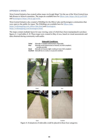
APPENDIX K: MAPS West Central Initiative has created online maps via Google Maps© for the use of the West Central Area Safe Routes to School committee. The maps are available here for Elbow Lake: https://bit.ly/3wFVAlS and Kensington: https://bit.ly/3gCw0Yd. West Central Initiative also created a WikiMap for the Elbow Lake and Kensington communities that were open to the public for input. The WikiMaps are available here for Elbow Lake: https://wikimapping.com /elbow-lake.html and Kensington: https://wikimapping.com/kensington.html. The maps contain multiple layers for easy viewing, some of which have been manipulated to produce figures A –I and tables A -B. These maps were created in May of 2021, based on visual assessments and data obtained during community walk audits.
Figure A: Evaluations of sidewalks could be placed in these four categories.
88