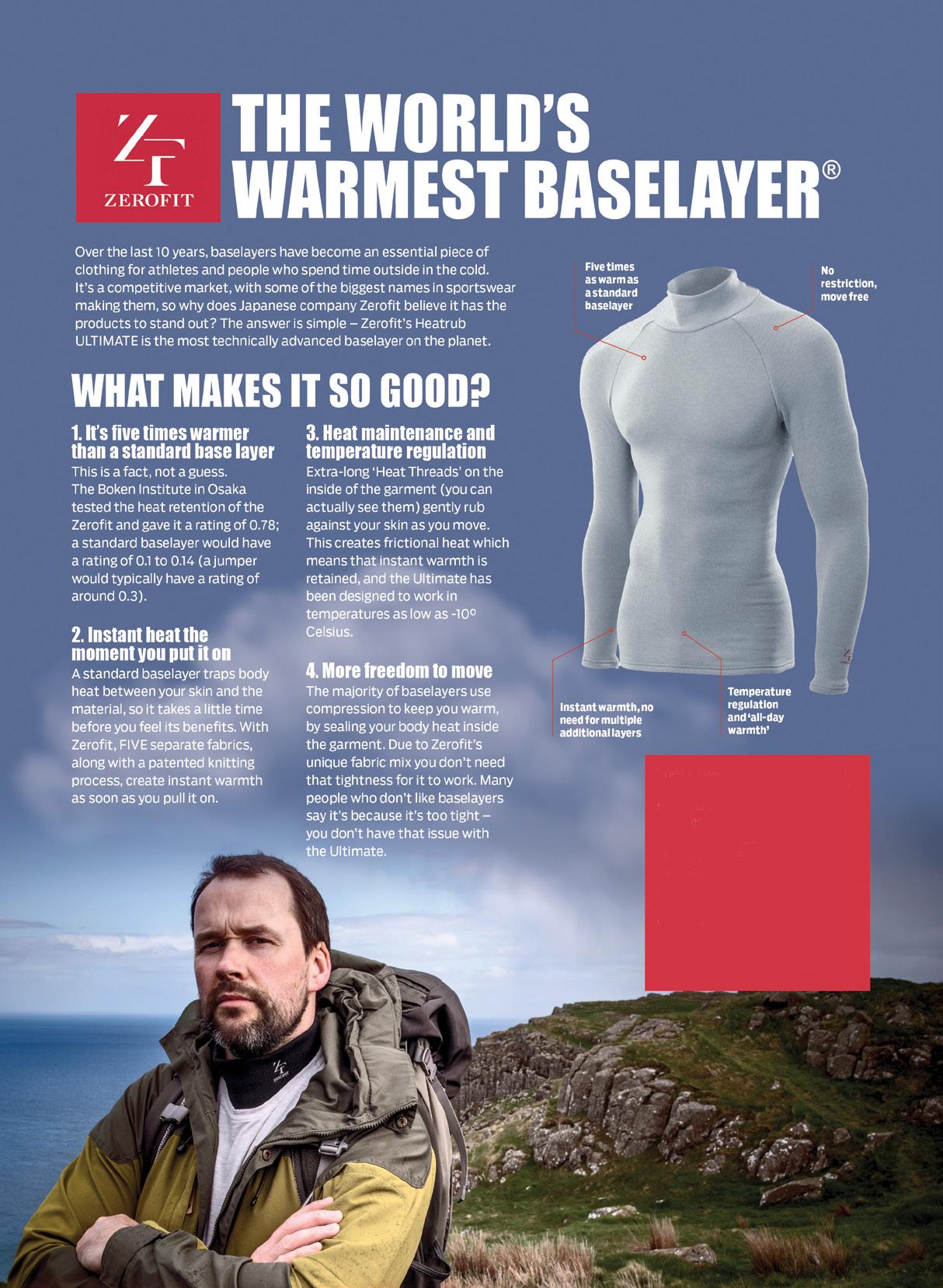
The ULTIMATE is Zerofit’s flagship product and perfect for hiking, golf, sailing or any outdoor activities when it’s cold. But if you are more active it is complemented by the Heatrub MOVE.
Twice as warm as a standard base layer, the material regulates tempertures as you move, so you won’t suffer from cold sweat, if your are running or cycling.
Please visit the Walking New Zealand Shop: https://walkingnewzealand.co.nz/productcategory/apparel/ for more details and to order.
Viewpoint: Reinstate the competitive walking sec tion: Why Auckland Marathon must listen to walkers
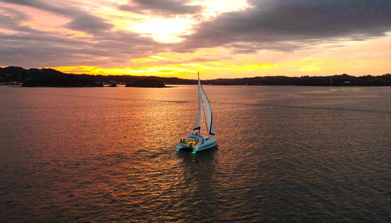
Zealand Walking Festival: Bay of Islands
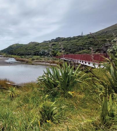
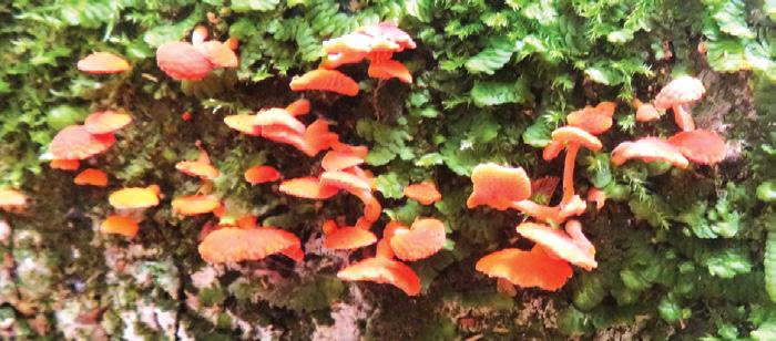
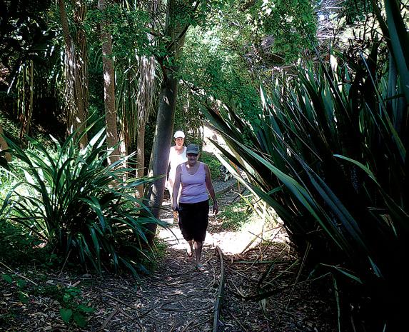
Achiever: Northland engineer wins Outdoor Access Champions Award 30 New Zealand Walk: Hinehopu Bluffs for lots of native trees and birdlife
33 New Zealand Walk: The Terrace Walk at Franz Josef 34 New Zealand Walk: Karituwhenua Stream Walk a short family walk
36 New Zealand Walk: Omarama’s Clay Cliffs has an unique landscape
39 Auckland Walk: A walk or bike ride through Logan Park Reserve:
52 Taupo Marathon
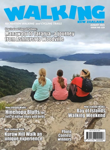
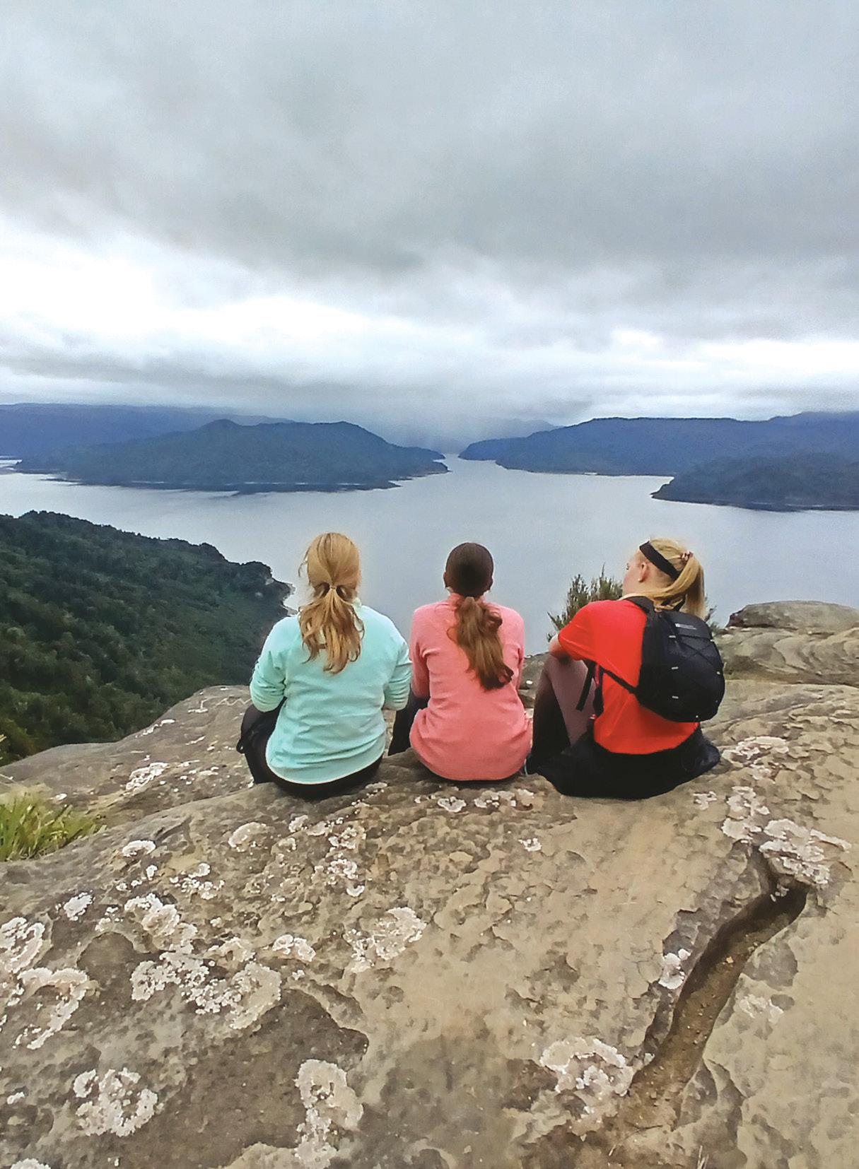
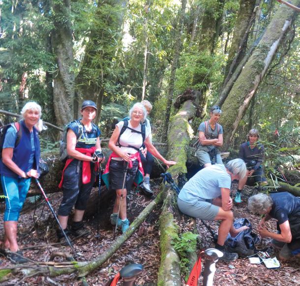
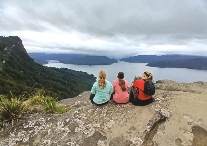
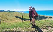
Cover imasge: We went on a day trip return to Panekire Hut from Oneputu Trail end at Lake Waikaremoana. The kids also did enjoy it, particularily because of the spectacular views towards the lake and the mountainous scenery. The chance to catch some breath with a memorable view. Photo by Martin Kostrewa Hamurana,
PUBLISHER/EDITOR: Frank Goldingham: Phone 06-358-6863, 027-274-0726
CONTRIBUTORS: Brent Bartlett, Ren Taylor, Marlene Lynam, Ken Ring, Steph Godsiff, Phillip O’Donnell, Barbz Lowther, Dr Chris Teo Sherrell,and Catherine Tooher
ADVERTISING MANAGER: Frank Goldingham - 0800 walking (925-546) 027-274-0726
Email: walkingnz@xtra.co.nz
COMING EVENTS ADVERTISING: Frank Goldingham 0800-walking (925-546)
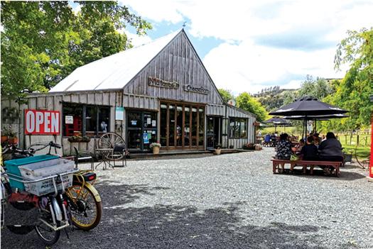
Cyclists on the grade 1, flat Hauraki Rail Trail will find towns, and coffee,always within easy reach.
That’s according to Olivia Robinson, trail sales and marketing support, who joined The Great Rides Central North Island stand at eXplore.
Divided into five sections, the 197kmtrail officially starts in Kaiaua in the north, winding its way along the Firth of Thames to Thames, then Paeroa.
Cyclists can choose a side trip through the Karangahake Gorge to Waihi, before heading back to Paeroa, then Te Aroha and finally Matamata.
Suiting ‘bite-sized’ cycling or multiday journeys the trail takes in coastal wetlands, maritime and goldmining history, railway tunnels, farmland, waterfalls and Hobbiton.
Robinson says local knowledge and collaboration between operators is strong. The trail has 80 official partners, meaning tour operators can be confident of solid logistics support for their clients.
‘For example, Sue and Pete from Biking Hire Shuttles are well connected. They do a lot of one-way bike business, can carry luggage and will transfer rental cars from A to B.
Celebrating 100 years of walking
The Auckland Natural History Walking Club is celebrating 100 years of walking on 20th July. The club was founded in 1925 by celebrated botanist, artist and author Marguerite Crookes. A tree commemorating Marguerite and her life is to be planted at Auckland University on Tuesday 22nd July. The club meets on alternative Sundays to explore and enjoy the forests, lakes rivers and coastlines of the Auckland region and the trees, plants and birdlife we find in these places. Membership currently stands at 120.
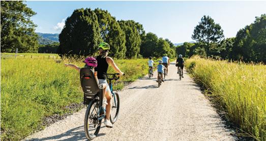
Biking the Gold Coast hinterland
Gold Coast’s Better by Bike is promoting Northern Rivers Rail Trail, a 24km adventure through rainforests, hinterland, glow worm tunnels and country villages. Better by Bike offers premium e-bikes, rugged fat tyre beasts, or e-trikes. For the family market it has infant seats, tow-behind bikes, and chariots for children explorers and pets. The rail trail is an easy grade ride for all ages, especially on an e-bike.
Cyclists can start from Better By Bike’s Murwillumbah Railway Station shop or get picked up from their accommodation. Riders can pedal one way and be met by the team at the end, or bike the full return trip. The gear clients need, instructions, trail tips and recommendations are provided. Better By Bike offers luxury van pickup service from the Gold Coast, as well as day packages combining Tropical Fruit World and Husk Distillery nearby.
Don’t fence us out - anatomy of a public access fail
Trampers and hunters have been unable to access Ferny Gair via the Teme River in Marlborough for many years despite an unformed legal road and a marginal strip providing legal access. this year, the Sunday Star Times published an important investigation into the issue and its broader implications for NZ.
Legal public access between Avon Valley Road and Ferny Gair Conservation Area clearly exists, and we can demonstrate it on maps and legal documents. The intent of that unformed legal road and marginal strip is clear –to provide unimpeded, free public access to Ferny Gair.
Your favourite walk/cycle trail could win you a free subscription
We are looking for readers’ favourite New Zealand walks/cycling. Many of us go out regularly walking on a route which we class as our favourite, for a number of reasons. Perhaps because for it’s scenery, it’s safe, it’s challenging, it’s flat, it’s hilly, it’s varied, or for whatever reason.
We would like you to tell us in your own words what is you favourite walk and why. Email us a story from say 250 up to 1200 words including a photo or photos.
We will now give you a FREE subscription (six months or more, depending on the article), or extension to Walking New Zealand magazine for walks published.
You can also post an article to Walking New Zealand, 47 Lincoln Terrace Hokowhitu, Palmerston North, or email walkingnz@xtra.co.nz
If sending a photo by email please make sure photos are in high resolution.
Our email address is: walkingnz@xtra.co.nz.
Please put “My Favourite Walk” in the subject line and include your name and postal address.
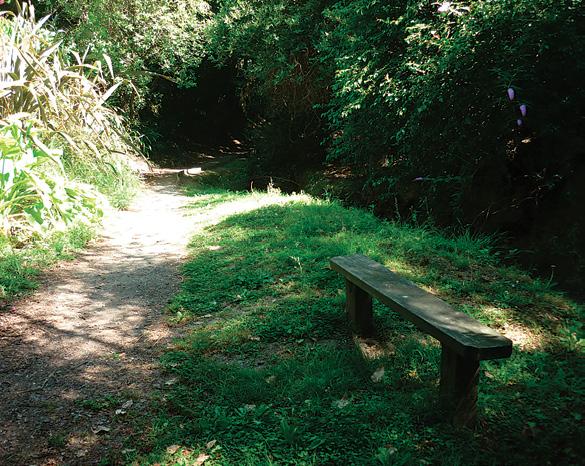
Walk talk
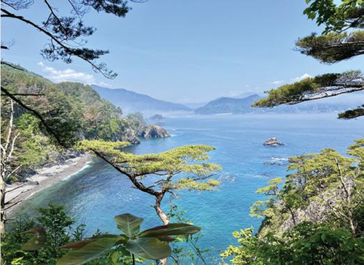
New walking trail along Japan’s ‘crowd-free’ coast
There is now a new self-guided walking experience along the remote and rugged Michinoku Coastal Trail, Japan. The seven-day journey offers experienced travellers an opportunity to explore Japan’s wild northeast – a part of the country still largely untouched by mass tourism.
The Michinoku Coastal Trail, stretching over 1,000 kilometres through the scenic Tohoku region, was developed as part of Japan’s reconstruction efforts following the 2011 earthquake and tsunami. The trail now stands as a symbol of renewal and resilience.
The trail’s most spectacular sections are through coastal shrines, remote fishing villages, forested headlands and hidden bays between Hachinohe and the cliffs of Kitayamazaki.
There is accommodation in locally run inns and small hotels.
The trail offers travellers the chance to connect deeply with nature and local traditions while enjoying the freedom of independent exploration.
‘The initiative supports sustainable tourism by directing vital income to communities along the trail. By choosing this walk, travellers contribute directly to the revitalisation of these coastal towns.’
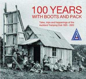
Auckland Tramping Club to celebrate
The Auckland Tramping Club is to celebrate 100 years since its inception from 1925 to 2025 on October 18 and 19 2025.. On October 18 they willl celebrate the occassion with an afternoon tea, formal proceedings and a buffet sit-down dinner. For more info: www. aucktramping.org.nz/
50th group joins trailmaker map
Friends of Wairoa Stream became the 50th community trailmaker group to join the outdoor Access Commission’s national map of trailmakers.
Friends of Wairoa Stream have formed a 4km public walkway and wildlife corridor along the Wairoa Stream and two tributary streams at Kerikeri. So far, they have planted about 24,500 native plants of about 60 species to link bush remnants as far as possible to achieve continuous forest along the track and the stream bank. This has enabled public access to a formerly hidden waterfall named Te Wairere that had become inaccessible and lost in a wilderness of weeds.
The new VeryFitPro ID205L Intelligent Activity Tracker
The new VeryFitPro ID205L is an intelligent smart looking Sports Watch and activity tracker that ticks all the boxes.
* Strong and durable 3cm clear glass touch screen display
* Skin friendly soft and comfortable wristband strap
* Nine exercise modes walking, running, hiking, cycling, treadmill, fitness, mountain climbing, spinning bike and yoga
* Many functions: step monitoring function, heart rate monitoring, sleep monitoring, calorie monitoring, call reminder, message reminder, sedentary reminder, alarm reminder, stopwatch, timer, music control, looking at mobile phone, breathing training, time and date display, multi-sport mode (step, calories, speed, distance, active time), daily goal
* Raise your hand and the screen will light up.
* Customize the face of your Smart Watch to fit your needs.
* IP68 Deep Waterproof
* Magnetic charging with USB charging cable takes about 2.5 hours for around 10 days usage.
* Uses VeryFitPro app Compatible with smart phones that use IOS 8.0/Android OS 4.4 or later, and Bluetooth 4.0 or later
* Colours available: Black
Only $115.00 plus $8.00 P&P
Walking New Zealand Shop
47 Lincoln Terrace, Palmerston North - Phone 0800-925-546
Walking New Zealand magazine has gone digital on our own website. Viewers can read through the lastest issue for only $3.95 an issue, paid by credit card before viewing.
Go to www. walkingnewzealand.co.nz and mouse over Shop and Subscribe and then click on Latest Issue - Digital. Enjoy!
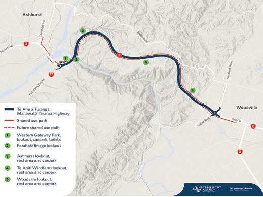
Te Ahu aTuranga
Manawatū toTararua a journey from Woodville
Tby Frank Goldingham
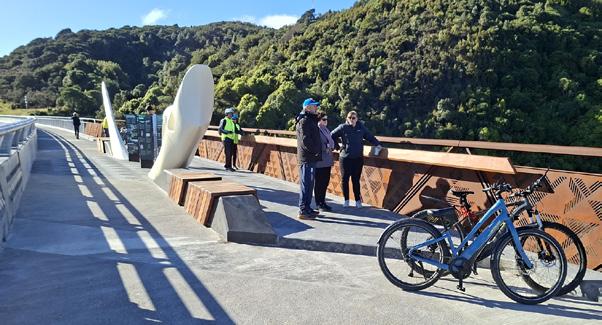
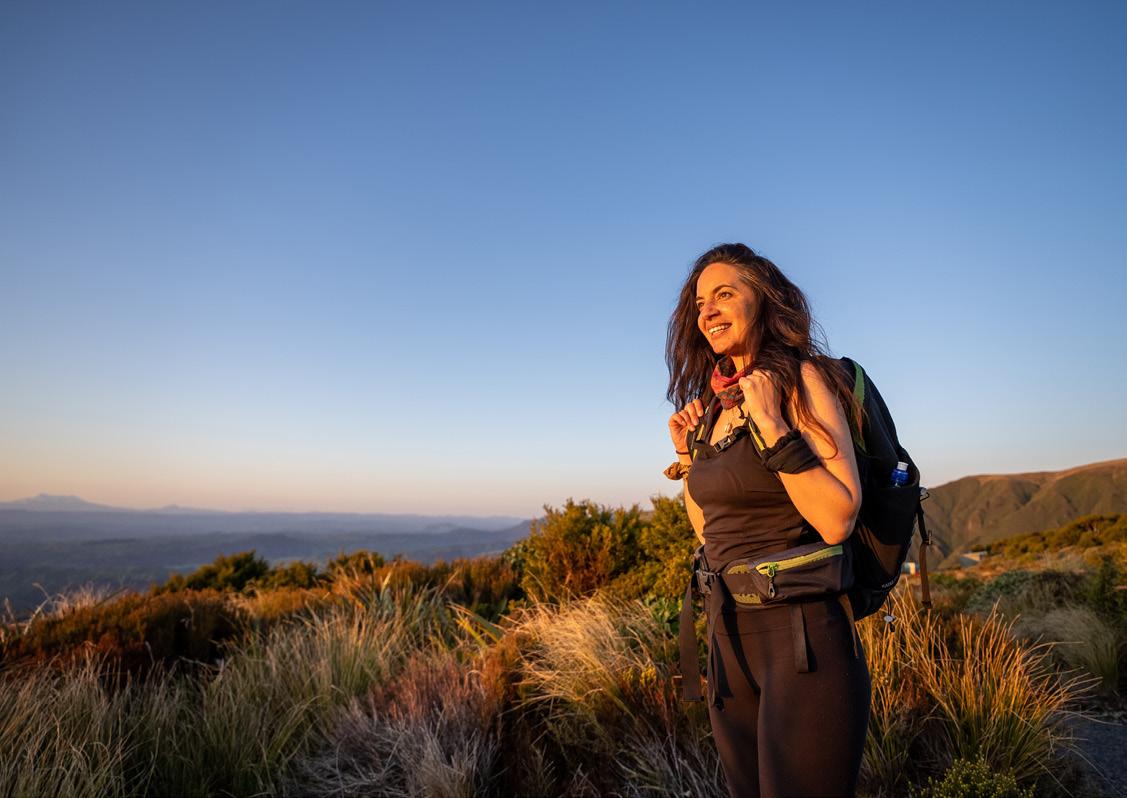
here’s a special thrill in being among the first to experience something new, and on a crisp, sunny morning, I found myself on my ebike at the gateway of the justopened Manawatū Tararua, Te Ahu a Turanga shared pathway.
.Stretching some 11 kilometres from Ashhurst to Woodville, this trail promised not only a scenic ride but also a journey through some of the region’s most captivating landscapes.
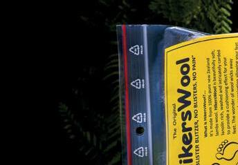
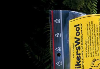
Ouch! Sore feet while walking?
Hikers Wool is 100% New Zealand wool. Cushion your feet to prevent pain, rubbing and blisters.
Buy online or at selected stockists For more info visit www.hikerswool.co.nz
As I set out, I quickly discovered that this pathway is more than just a link between two towns—it’s a showcase of community spirit, natural beauty, and thoughtful design.
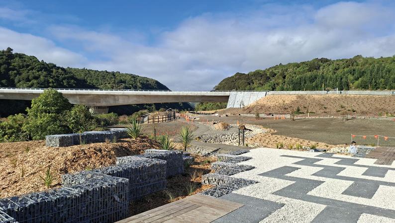
My adventure began at the Ashhurst end, where a spacious new parking area sits conveniently beside the impressive new bridge. The morning air was cold
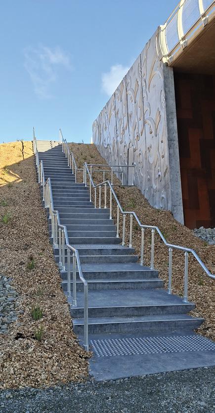
Above top: Looking back towards the bridge near the start of the uphill section.
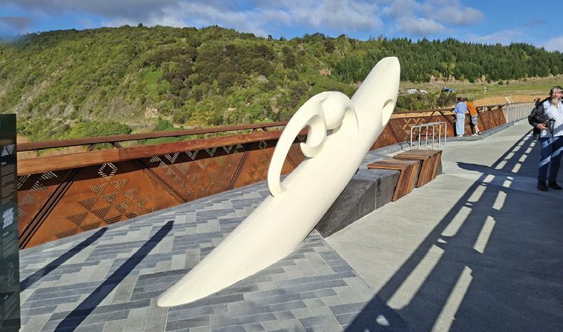
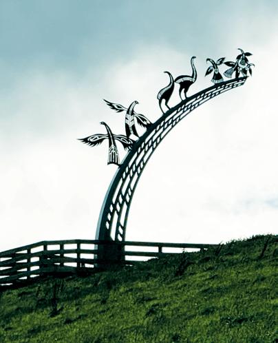
Above left: The sculpture on the pathway on Parahaki Bridge called Tuia Te Maunga, symbolises the drawing of the two mountain ranges, Ruahine and Tararua together, divided by the Manawatu River.
Ashhurst to
enough to make me grateful for my cycling gloves, but the sun was shining brightly, casting a golden glow over the landscape.
The first thing that struck me was the sheer number of native plantings—thousands of young trees and shrubs lining the start of the trail and continuing along its length. These plantings, still small but full of promise, are destined to transform the pathway into a lush, green corridor in years to come.
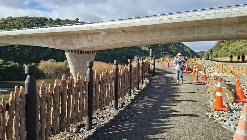
The trail’s design is immediately engaging. It begins by leading you under the bridge, a clever way to keep cyclists and walkers safely separated from traffic.
Emerging from the underpass, the path gently winds its way upward, hugging the right side of the bridge. The climb is steady but manageable, and before long, I found myself on a dedicated pathway that runs alongside the bridge itself.
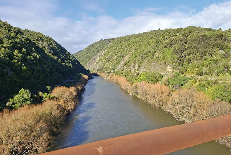
Midway across the bridge, the designers have included a viewing platform—a perfect spot to pause and take in the dramatic scenery. From here, the Manawatū River Gorge stretches out in both directions, its waters sparkling in the morning sun. Information signs provide insights into the area’s history and ecology, while a striking sculpture adds a touch of local culture. There’s also seating, inviting you to linger and soak up the panoramic views, not just of the river but also of the trail’s next challenge: the climb ahead.
Leaving the bridge behind, the path transitions into a smooth, sealed surface that runs parallel to the highway for about three kilometres. This section is a 10% gradient climb, and as I pedaled upward, I was rewarded with ever-expanding views back over the Manawatū region.
The farmland and hills rolled out beneath a sky so clear it felt as if I could see forever. The highway, now relatively flat, seemed almost an afterthought compared to the winding, undulating path I was following.
What makes this stretch especially enjoyable is the way the trail meanders around the hills, offering a variety of perspectives and a sense of discovery with every turn. The occasional bench provides a welcome excuse to pause, catch your breath, and simply appreciate the landscape.
Artist Warren Warbrick has three Maori works along the route. Tura Te Tangata is one such scupture that
Above right: The Manawatu River, with the railway line on the left and the old gorge road on the right.
Below left: Sandy Adsetts’s extinctbirds sculpture on the Woodville Lookout depicting a hokioi, moa and hui on top of a rainbow. Photo Brent Barrett
Below right: The steps up to the gorge bridge crosssing the Manawatu River.
Te Ahu a Turanga
Manawatū to Tararua a journey from Ashhurst to Woodville
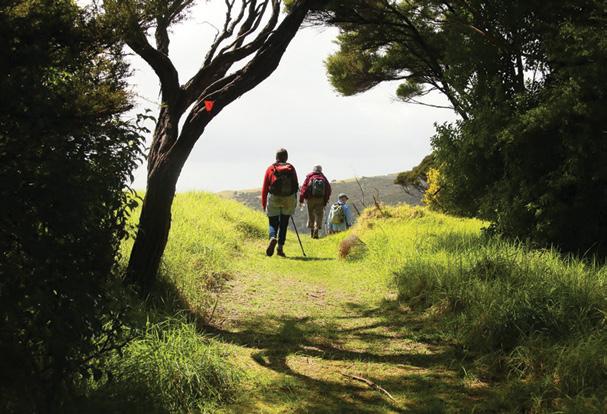
Above top: Two walkers at the Woodville end of the trail. Middle left: The Western Gateway Park at the Ashhurst end has lots of young plantings. Below left: The fenced pathway to the start under the bridge at the Ashhurst end. Below right: One of a number of imformation boards on the bridge pathway.,
symbolizes heru or combs a shared history between Rangitane and Ngatai Kauwhatu tribes.
At around the four-kilometre mark, the trail dips under the highway in a well-constructed underpass. Emerging on the other side, I found myself looking out over the Wairarapa and towards Woodville.
The change in scenery is dramatic— suddenly, the hills give way to broader vistas, and the sense of journey intensifies.
From here, the path going down takes on a 8.5% gradient. A white line down the middle separates those going up with those going down giving it the look and feel of a miniature main road. The surface is smooth and wide, making for easy riding. The final stretch is mostly flat, allowing for a relaxed cruise into Woodville.
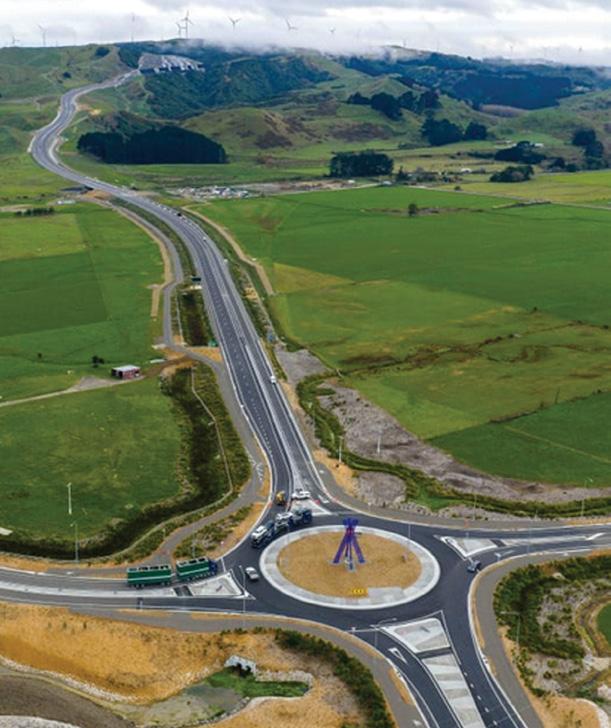
The trail concludes at a roundabout, and if you head straight ahead, you’ll find yourself on Vogel Street—the heart of Woodville. Here, a cluster of inviting cafés awaits, perfect for a celebratory coffee or a well-earned snack. As I sat outside with a hot drink, watching other cyclists and walkers arrive, I couldn’t help but feel a sense of camaraderie. This pathway isn’t just a route; it’s a meeting place, a community asset, and a testament to what can be achieved when vision and effort come together.
Looking back on my ride, several things stand out. First, the sheer quality of the infrastructure. From the safe underpasses to the thoughtfully placed
seating and signage, it’s clear that the pathway was designed with both utility and enjoyment in mind. The separation from the highway is particularly welcome, making the ride feel safe and accessible for all ages and abilities.
Second, the landscape itself is nothing short of spectacular. The Manawatū River Gorge, the rolling hills, the distant mountains—all combine to create a visual feast that changes with every kilometre. The native plantings, though still young, hint at a future where the pathway will be even more beautiful, a ribbon of green connecting two vibrant communities.
Finally, there’s the sense of connection. Not just between Ashhurst and Woodville, but between people and place. Every cyclist, walker, and runner I passed greeted me with a smile or a wave. There’s a shared sense of pride in this new asset, a feeling that it belongs to everyone who uses it.
If you’re considering cycling the Manawatū Tararua shared pathway, here are a few tips to make the most of your experience:
The weather can change quickly, and even on a sunny day, the wind can be chilly, especially on the exposed sections.
There’s no need to rush. The views are
LACE UP YOUR BOOTS.
worth savoring, and the seating areas are perfectly placed for rest stops.
You’ll want to capture the scenery, especially from the bridge and the higher sections of the trail.
Finish your ride with a visit to one of Woodville’s cafés. It’s a great way to relax and support the local community . Remember that the trail is shared with walkers and runners. Keep left, signal when passing, and enjoy the shared spirit of the journey.
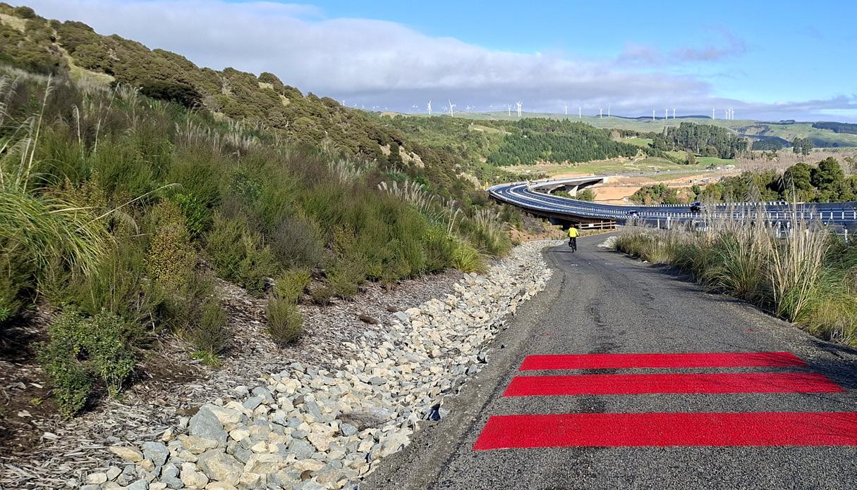
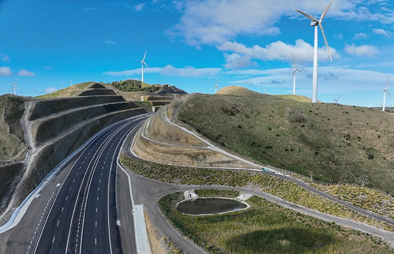
Above right: An aerial view showing the main highway on the left and the shared pathway on the right.
Fact file
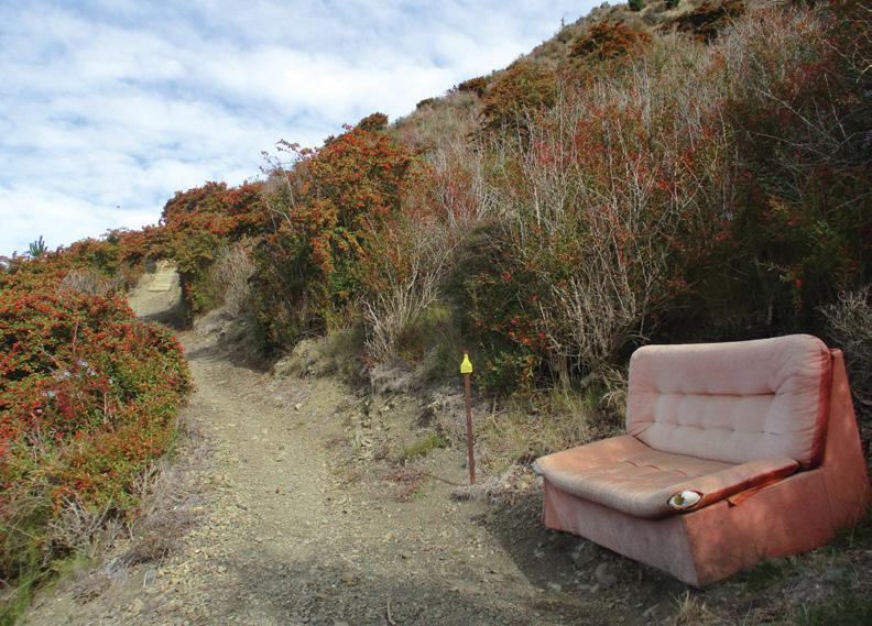
How to get there: Ashhurst is 16km north wast of Palmerston North. Parking and toilets available at start of highway. Track length about 12km.
Track sealed There is a steep climb at both ends for about 3km at the Ashhurst end with a 10% gradient. At the Tararua side it is 8.5% gradient.
Manawatū to Tararua a
journey from Ashhurst to Woodville
ing car at the end of the ride, I felt a deep sense of satisfaction. The Manawatū Tararua shared pathway is more than just a new piece of infrastructure—it’s a gift to the region, a celebration of its landscapes, and a promise of more adventures to come. Whether you’re a seasoned cyclist, a casual walker, or someone looking for a new way to connect with nature and community, this trail offers something for everyone.
In the years ahead, as the native plantings grow and more people discover its charms, I have no doubt that the pathway will become a beloved part of the Manawatū and Tararua experience. For now, though, it remains a fresh and exciting journey—one I feel privileged to have experienced on such a beautiful, sunny, and cold day. If you’re looking for your next cycling adventure, look no further than the Manawatū Tararua shared pathway. You won’t be disappointed.
By Cr Brent Bartlett
Success has many parents, so the saying goes. This is proving to be the case with the new walking and biking shared path linking Ashhurst with Woodville.
While still awaiting the stage two bridge for walkers to safely cross the Manawatū River from Ashhurst to Te Apiti, the new 11 km shared path from Te Apiti up and over into Woodville is fantastic, and already getting good use.
While NZTA eventually agreed to the shared path, they were dead against it at the start.
So how did we even get the path? Grassroots hard yards, effort by community members who were unhappy when the initial NZTA proposal came out with no safe space for walkers or people on bikes to make the east-west crossing in one of the few places it could be provided in the lower North Island.
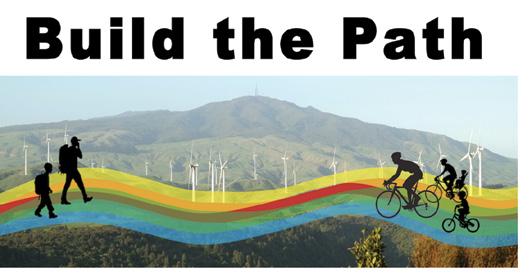
A group called Build the Path was formed, gathering over 1,800 signatures from community members calling for this safety and access flaw to be corrected before signing of the design.
Soon sprung up a chorus of mayors, councillors and such, all calling for the path. A hearing was held to finalise the overall road proposal. The outcome was the community got NZTA to commit to a shared path.
From there on it NZTA were big fans, and even Jacinda Ardern at the project commencement in Woodville spoke in glowing terms of the shared path being a highlight of the project.
And from such humble beginnings, here it is!
The new path is sealed all the way, looks fabulous and is a huge credit to NZTA and the team who built it. A great space for people to walk and bike and enjoy sweeping views and art and the smell of hot engines and hot brakes.
The next challenge is to restore legal access for walking on the old Gorge Road through the Manawatū Gorge. There are already lots of people ignoring the posted legal threat and exploiting the gap in the fence to make the journey through, all emerging with smiles on their faces. The sooner we can remove the threats, get the fence down, proper safety signage up and invite people to walk and bike the old road, the better!
Cr Brent Barrett
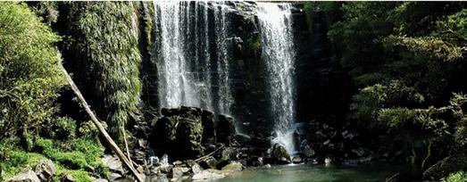
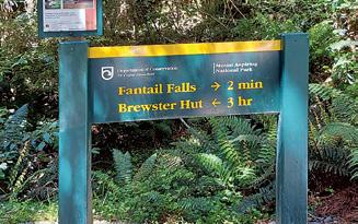
Fantail Falls worth a stop for a short walk
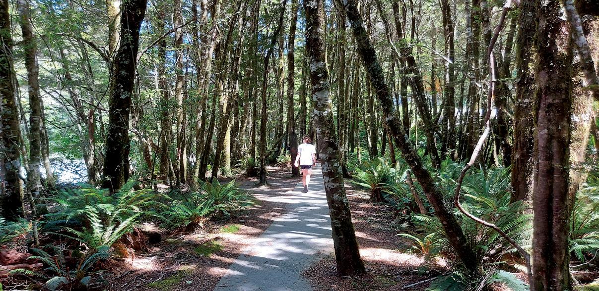
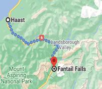
Fantail Falls Walk is a popular picturesque spot and is a must stop when driving from Wanaka to Haast.
The 23-meter high waterfalllocated in, Fantail Falls in Mt Aspiring National Park, along Haast Highway, SH 6 is 85kms or under an hour’s drive north from Wanaka. .The road is ealed and on the right there is a sign “Fantail Falls” and a car park. There are no facilities there.
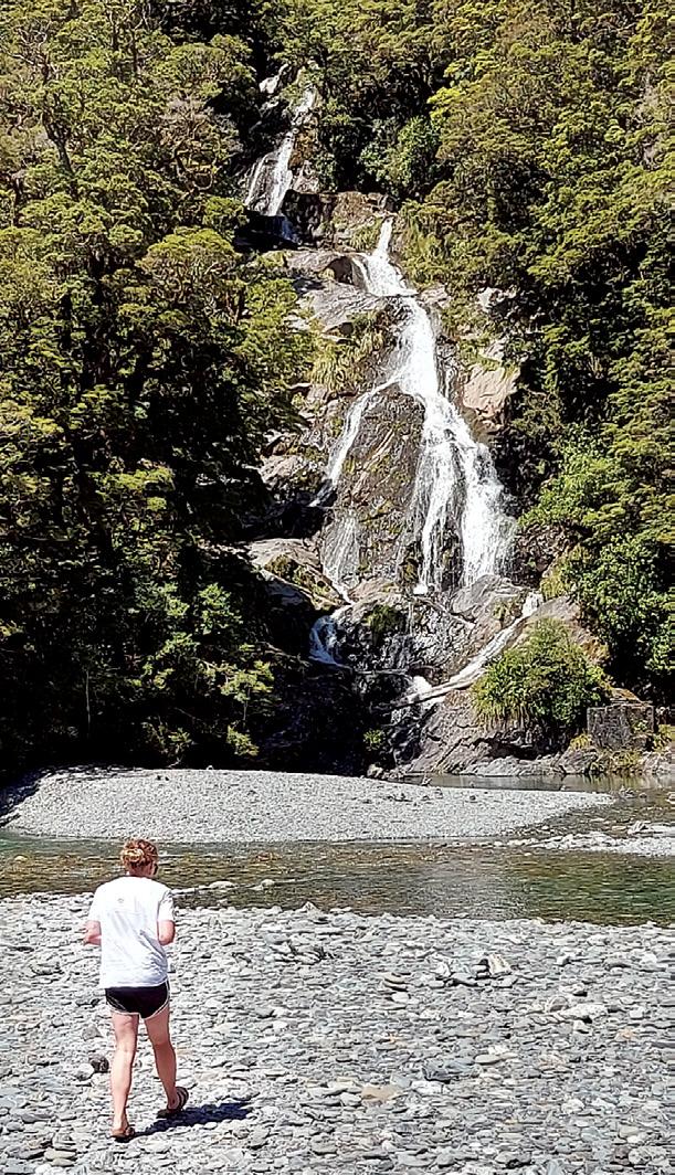
The Fantail Falls Walk is an easy 10 minutes return walk that starts from the carpark and leads to the waterfall’s lookout by a well formed flat track through picturesque forest. The track is suitable for people of all abilities.
This is a beautiful and easily accessible fan-shaped waterfall, that drops into the crystal clear blue Haast River.
The waterfall is located on the opposite side of the river, but you don’t require to cross the river, because the waterfall is fully visible from the lookout. It can be incredibly impressive, photogenic, and peaceful if there is a lot of water coming down.
If you wish, you can, with great care, cross the river and walk up to the waterfall’s base.
Above:: The pictuesque walk through a forest.
Below right: The Fantail Falls makes a picturesque sight even when there is low water flow.
Fact File
Getting there: Fantail Falls is 85kms or just over an hour from Wanaka, and 47kms or just under an hour from Haast on SH6. There are no facilities there.
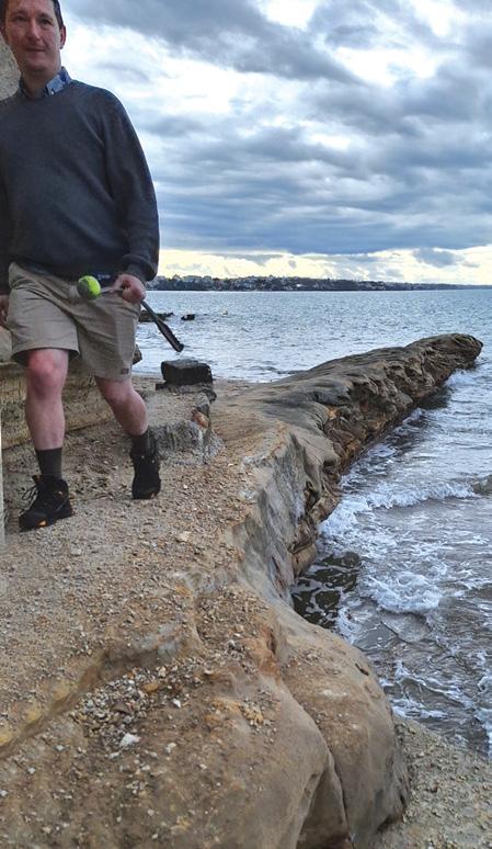
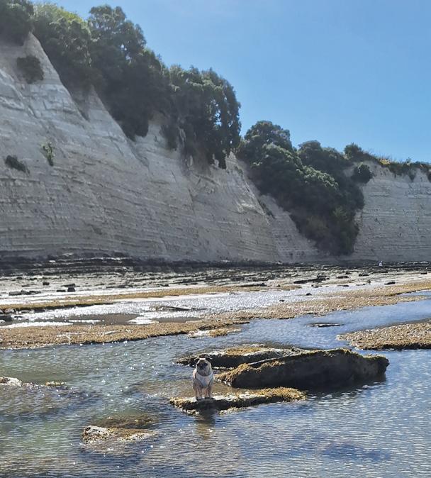
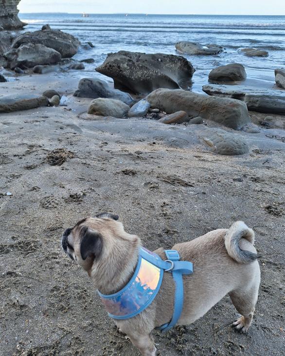
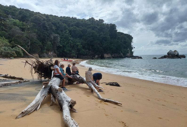
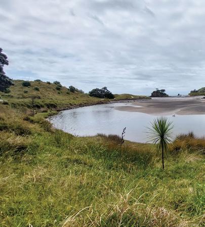
St Leonard’s Beach dog friendly
by Ren Taylor
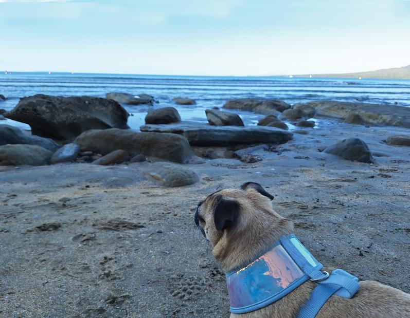
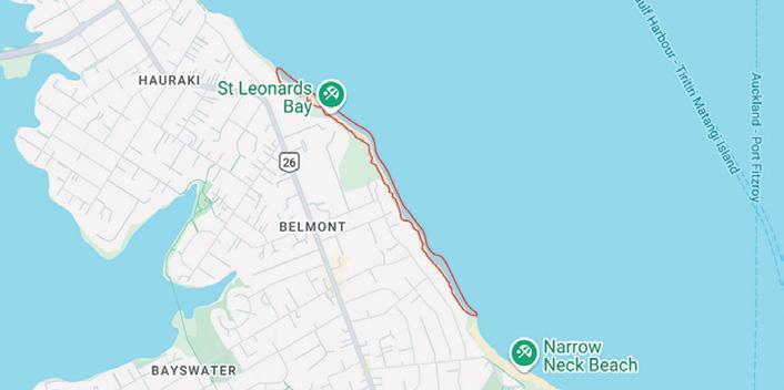
One of my favorite places to take the dog for a proper run off leach is St Leonard’s Beach on Auckland’s North Shore. This is a popular beach in summer, it’s hard to find a car park on the cul-de-sac at the entry to the beach.
There are very steep concrete steps almost vertical that go directly down to the beach. Just don’t think about getting back up those stairs as easily on your return.
When you finally make it down, the harbour opens before you with Rangitoto right within reaching distance and all the scattered boats of the harbour.
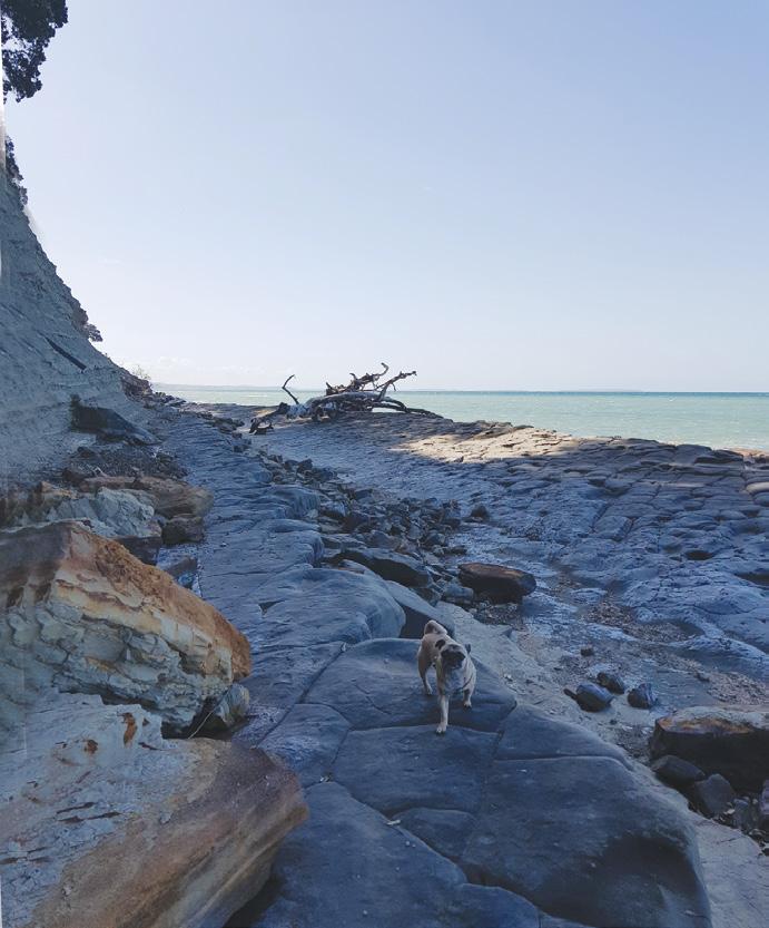
There is a rocky breakwater extending out and a stone wall lining the base of the cliff that is falling away. Walking around the rocks is great for the step count as walking on the uneven rocks and flat sand is excellent for fitness.
I once went for a swim off the east
Above left: Where to next? Below left: A bit rough here! Below right: Good he has my ball!
facing rocks where the current chops up the swell against a wall of smooth natural stone. I like to pretend it’s a concrete swimming pool. If we were in New South Wales there would be an ocean pool built on the southeastern side.
Until I get Elon Musk or Wayne Brown to build one for the City of Auckland, one will just have to make do with lovely little natural indentations like little basins all over the rocks. Sun warmed bowls in the stone. It looks like God got an ice cream scoop and reached down to scoop out little pools for toddlers. Once I saw a labrador languishing in one like Cleopatra in his own private bath, a picture of relaxation.
On this gentle beach, the wildlife seems to be at a minimum. There are few seagulls and I’ve never seen a fish. Apparently, the water quality of the Waitemata is not good, but it looks clean enough, so that’s something. Sometimes I have to help my dog get down and over the rocks depending on the tide. He’s a little chap and a much better climber than I give him credit for. I would recommend low tide as high tide cuts off access around to each of the surrounding beaches and the water comes right up to the
steps.
The beach is white sand with pink shells and an usually high amount of sea glass to collect. The Waitemata Harbour feels empty of wildlife, a marine biologist once told me that marine life is at 1% or precolonial norms in this area, a fact we choose to willfully ignore. I would say it’s even less.
There are high vertical cliffs of clay with mansions perched precariously above awaiting the next downpour. The landscape looks like romantic era and impressionist landscapes of Monet at Pourville or Delaoix at Etretat, displaying the same bright clay tones.
Some mansions on high have private wooden walkways built down to the beach but have been mangled, picked up and planted down the beach in
the storms Auckland has had over the years. Testaments to the power of the weather, although its hard to see this beach as anything other than a calm sunny safe beach with rockpools and little caves.
As it is considered a dog permitted beach there are often other dogs playing and kids swimming, oblivious to the chilly water.
At low tide its only a few minutes walk around the cliffs to Takapuna Beach, ambling over high rocks and around the edge of the cliff base, and if you go in the other direction it is about 45 minutes to Narrowneck Beach around the rocks. Were you to reach Narrowneck you could see Bean Rock lighthouse in the distance.
Every day the beach has a completely different mood depending the weather conditions, you will always see container ships trundling back and forth as well as sailing craft of all shapes and sizes flying around the harbour.
Above left: Now how do I get out of here? Above right: Where to next?
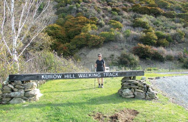
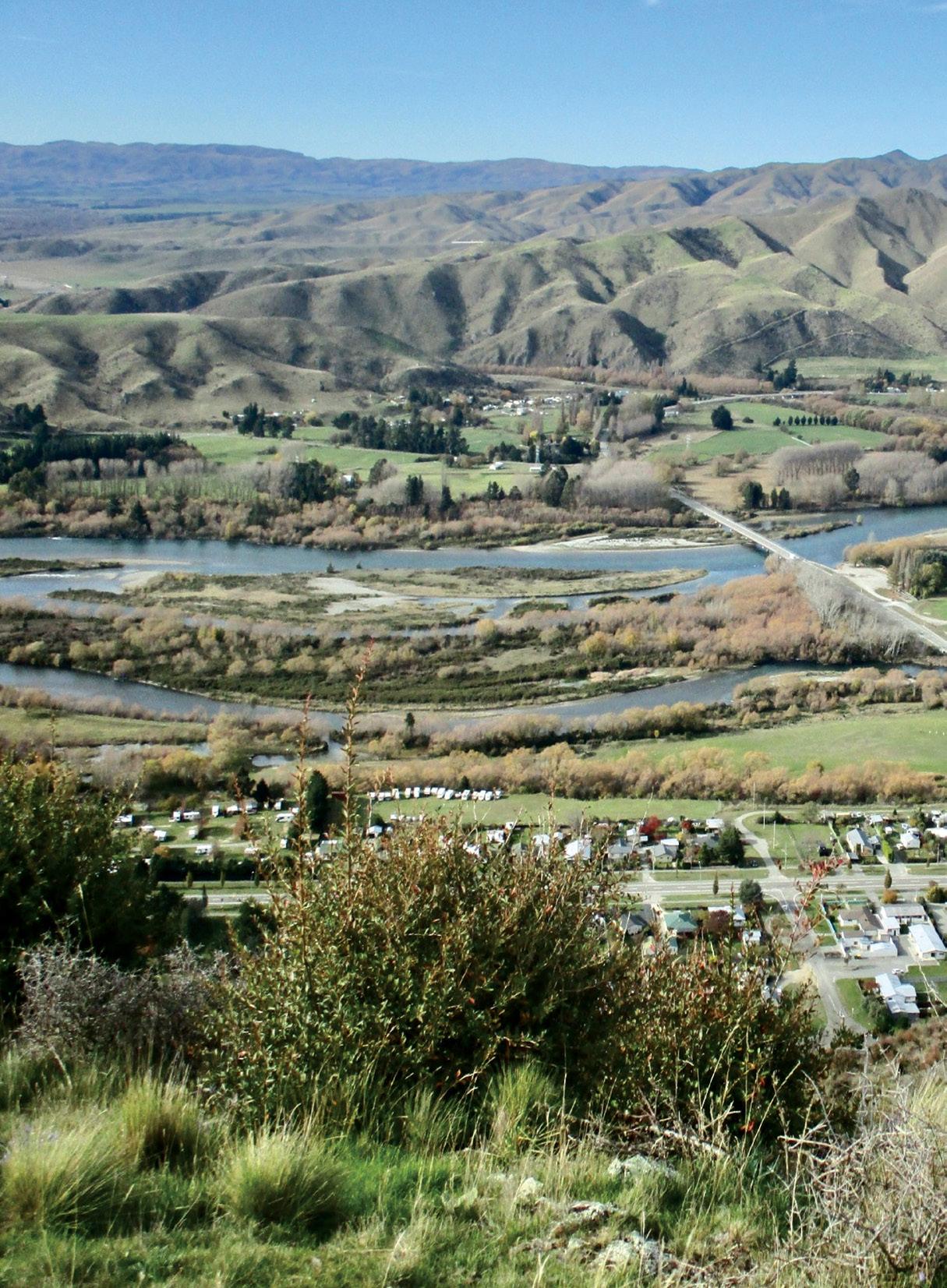
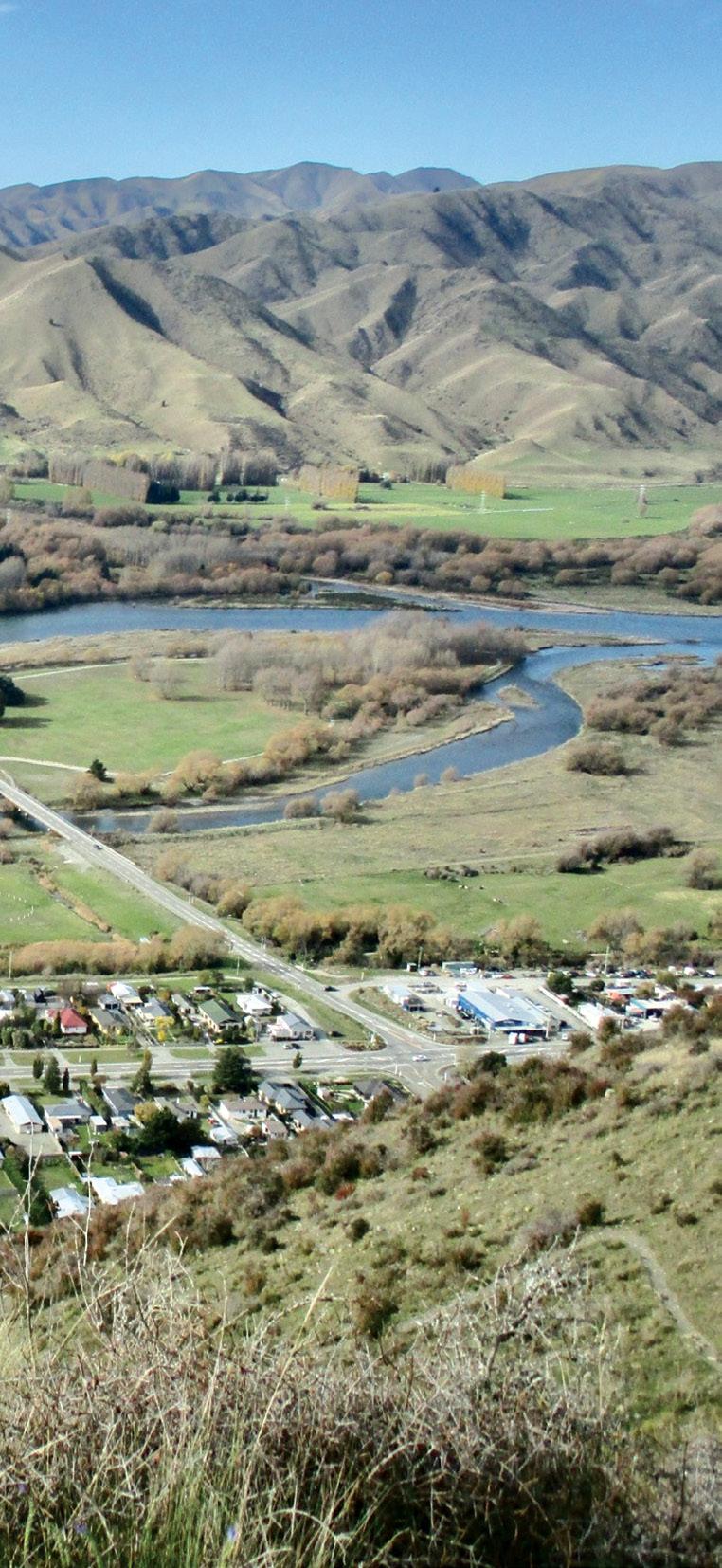
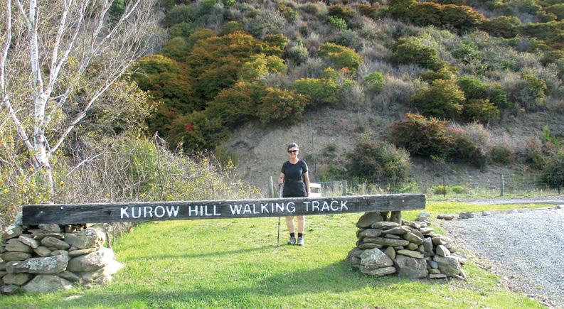
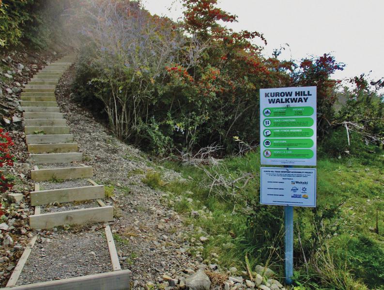
Kurow Hill Walk an unique experience
by Marlene Lynam
On a fine warm sunny May day, I arrived in Kurow in the Waitaki District of the South Island to walk up Kurow Hill.
Kurow is well known as the home town of rugby legend Richie McCaw. The Kurow Hill Walking Track is an easement across Awakino Station hill pasture.
The track was built in 1989 and is maintained by volunteers of the Kurow Trails Committee. It is accessed from the end of Grey Street where there is ample parking or you can park anywhere in the township and it’s a short walk to the track start.
Once through the gate, a short level walk leads to a track sign before a flight of steps, upgraded in January 2024, and then follows a rather steep climb which zigzags its way up the face of the hill.
The mostly dirt track, narrow in places, has a distance marker for every 100 metres for the 1.1 km climb. It seemed to take a long time to reach the half way point, also marked by a sign ‘You are Halfway to the Top’, with regular pauses to catch my breath.
Of special note, this unique track has armchairs, yes comfy armchairs, strategically placed at many of the switchbacks for one to sit in comfort
Left: The climb was well worth the view with the township of Kurow in the foreground.
Kurow Hill Walk experience
and rest whilst taking in the views. I did not avail myself of this opportunity and instead continued with the relentless climb.
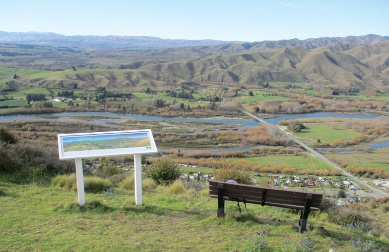
After 45 minutes, I reached the top of the hill, a reasonably flat area, at 365m where I was rewarded with magnificent views overlooking the Hakataramea Valley with its rolling hills, the braided Waitaki River and valley, and Kurow township below.
Thankfully there was a bench seat here where I was able to rest and recover, a good photo stop.
After about 15 minutes of soaking in these magnificent views and a wee wander, I was ready to descend on the same track. It was much quicker coming down, with no huffing and puffing, but be a bit wary of some of the steeper loose shingle parts of the track.
Overall time was 1.5 hours return and approximately 2.2 kms walked. Total ascent was approximately 250 metres. The low lying vegetation on the hillside is sparse in the dry and exposed location and consists of low scrubby plants including,
barberry,
Self Guided Private Walking Track
* Choose between 3 or 2 day options.
* Lodge style accommodation with fully serviced kitchens, BBQ, hot showers, comfortable bunkbeds and pillows.
* Dogs welcome, kennels available at lodgings.
* Pack transport each day makes for a stress free adventure.
Above left: The start of the walking track. Above right: A colourfull tree in flower. Below left: Steep steps at the start
Walk an unique
rosehips and tussock with farmland at the top. Therefore the views are continuous.
This is a ‘must do’ walk if you are in the area. But do take your time to regularly stop and admire the views as it is a strenuous climb and you will need to have a good level of fitness. It is also worth staying a day or two in Kurow to explore other tracks, the Kurow Wetland Walk and a section of the Alps to Ocean Cycle Trail which passes through Kurow. The Kurow Wetlands is a short easy flat walk alongside the Waitaki River. The wetlands have been restored and preserved by a group of local volunteers.
Fact file
Kurow Hill (Te Kohurau; 593m) is west of the village of Kurow, in South Island’s Waitaki Valley. The peak is not publicly accessible. The Kurow Hill Walkway is an easement leading from the west side of the village up to a viewpoint and bench at around 365m, making for a very short hike. Track climb 250m.
Time: Allow 90 mintes return trip
Above right: A walker on the climb. Middle right: A comfortable seat to break the climb. A sign and a seat near the top for a panoramic view.
Weather prediction for August
(Weather, like medicine, is an inexact science,. Dates given are to be regarded as focus points. Please allow 3-4 days leeway for all forecasts)
AUGUST 2025
1st Wet front crosses the North Island bringing further widespread rain, heavy at times in the Waikato to the Bay of Plenty.
3rd Misty for a time in Christchurch.
5th Unusually mild day in Christchurch.
6th-7th Patches of fog possible in the Auckland region.
inland parts of south Canterbury with Marlborough, north Canterbury, and eastern parts of Otago around 10% sunnier. In contrast, the Manawatu can expect to be cloudier than usual and all other parts of the country likely to see average sunshine hours.
8th-10th Depression crosses the country in a fresh easterly flow bringing widespread rain throughout most of the country. Chance of heavy rain during this period that may cause localised flooding in some parts of south Canterbury and Otago and in some southern parts of Northland to the Coromandel and Tauranga. Light misty drizzles likely in the Christchurch area.
by Ken Ring
Temperatures may vary from the average about half a degree over most of the South Island, while above average by up to a degree in the North Island and across the Cook Strait into central Marlborough and Nelson.
13th-14th Chance of thunderstorms in the Waikato to Auckland regions, accompanying heavy rain at times.
15th Depression crosses the country.
15th-16th Chance of misty patches and shallow fog in Christchurch. Outbreaks of heavy rain likely in the West Coast, Nelson-Marlborough districts and into parts of Canterbury.
Kiwi on the Camino
by Vivianne Flintoff
900kms along an ancient pilgrimage trail in Northern Spain
Available from independent book sellers or directly from author E-mail : vivianneflintoffbooks@gmail.com
Web: http://www.vivianneflintoffbooks.com/
10th Chance of funnel formation winds developing in the Taranaki region, while patches of fog possible in the Auckland region.
11th Over the next four weeks, anticyclonic systems may move through the Tasman Sea before crossing through central New Zealand, while depressions track further to the south of the country. As such, an unsettled southwesterly flow prevails for much of the next four weeks, especially over the east of the country, and around three depressions are regularly expected about every ten days. Rainfall amounts are close to normal or slightly above, along the western coasts, but below average in the north and east. Unusually drier than normal in parts of the South Island, and parts of Marlborough, Banks Peninsula and inland parts of Otago may only see around a third of average and soil moisture levels may be below the norm. Eastern districts from the southern parts of the Wairarapa to Otago, as well as into the Nelson district may only see around half their usual amount of rainfall. Northland, the Waikato, Manawatu, Wanganui districts and the western parts of Southland can expect around 25% more rainfall than normal.
Sunshine levels may be up to 20% more over this outlook period compared to the norm in Wellington, Nelson, and
18th-19th Mixed spell in Christchurch with morning fog and strong blustery winds by the next day.
19th-22nd Very strong northwest winds, at first affecting Northland before moving down through central and southern parts of the country. Winds may reach gale force in places with the chance of causing some damage to infrastructure, particularly in the Otago region.
20th-22nd Strong northwest winds around the Wairarapa to Wellington may bring disruptions to ferry services. 22nd Heavy rain in Southland including in the Milford Sounds area.
25th Severe frosts in the Mt Cook Village area.
26th-27th Depression crosses the country. Heavy rain in Northland with the chance of localised flooding from Kerikeri to Warkworth.
30th Very cold in the Hanmer district with chance of sub-zero frosts. Extracted from 372page 2025 New Zealand Weather Almanac.
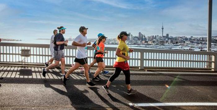
Reinstate the competitive walking section: Why Auckland Marathon must listen to walkers
By Frank Goldingham MNZM
The Auckland Marathon has long been a celebration of endurance, community, and inclusion. It is not just a race for the fastest runners but a festival for all who wish to test themselves, whether they run, jog, or walk.
Recently Mike Wagg a 60 year old ex runner contacted Auckland Marathon about not having a walking catagory and his reply from them was “We no longer have a specific competitive walking category at this event. Due to the large number of participants on course, it’s not possible to reliably verify whether those registered as walkers complete the entire event walking. As a result, separate walker results may not accurately reflect actual performances.”
That’s why the recent decision to discontinue the competitive walking section is so disappointing—and why it must be reconsidered.
For years, the Auckland Marathon has welcomed a diverse field, with nearly 18,000 participants in 2024, including both runners and walkers
The event’s own messaging has always emphasised that there is “a distance for everyone,” from seasoned runners to those who “love a leisurely dawdle”
Removing the competitive walking section contradicts this spirit of inclusivity and sends a message that walkers—many of whom train as rigorously as runners—are no longer valued as unique competitors.
Organisers cite the growing number of walkers as a reason for the change, arguing that it is now too difficult to verify that all walkers complete the course without breaking into a run. But this reasoning is flawed. The increase in walkers should be celebrated, not penalised.
Other New Zealand events, such as the Rotorua, Taupo, Wellington, and Christchurch marathons and others, continue to offer competitive walking categories, as do international events like the Sydney and New York marathons.
These events have found ways to manage and celebrate their walking communities—so can Auckland. Concerns about rule enforcement are not unique to Auckland. Many events use a combination of self-policing, spot checks, and community accountability to ensure fair competition. For example, the Waterfront Half Marathon and other Aucklandbased events offer a “Competitive Walk” category, with clear rules and separate results, and have managed to maintain integrity and enjoyment for all participants
Walkers are required to start separately and are monitored for compliance, with the vast majority respect-
ing the spirit of the event. Auckland Marathon could adopt similar measures, such as dedicated marshals or random checks, rather than eliminating the category altogether.
Most genuine walkers do not want to compete against runners. The difference in biomechanics and pacing is significant, and ranking walkers alongside runners is both unfair and discouraging. Walkers want to compete against like-minded entrants, striving for personal bests and podium finishes within their discipline. By removing the walking section, organisers are forcing walkers to either compete on unequal terms or not participate at all—a loss for the event and for Auckland’s active community.
The walking community is passionate, supportive, and growing. Their participation brings friends, family, and supporters to the event, boosting its profile and economic impact. Walkers are often among the most dedicated fundraisers, as seen in the KidsCan initiative, which encourages walkers and runners alike to support children in need
Removing their category risks alienating a vibrant and valuable part of the Auckland Marathon family.
It’s not too late for the Auckland Marathon organisers to reconsider. By reinstating the competitive walking section, they can reaffirm their commitment to inclusion, community, and fair competition.
The solutions are clear: adopt best practices from other events, communicate expectations clearly, and trust in the integrity of the walking community. Let the Auckland Marathon remain a true celebration of every step—run or walked—across our city.
Bring back the competitive walking section for 2025. Auckland’s walkers are ready, willing, and eager to take their place on the start line. Let’s not leave them behind.
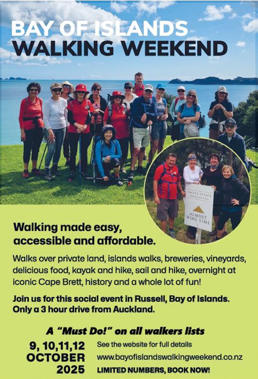
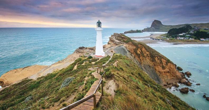
Bay of Islands Walking Weekend
Experience nature, islands, culture, and culinary delights
Get ready for an unforgettable adventure through the stunning landscapes, rich history, and vibrant culture of the Bay of Islands.
The Bay of Islands Walking Weekend from 9, 10, 11, 12 October 2025 offers a diverse line-up of guided walks suitable for all fitness levels, from coastal strolls to challenging hikes, vineyard tours to historic journeys, and everything in between.
Whether you’re a nature enthusiast, foodie, history buff, or simply love exploring new places, there’s a walk for you. Here’s a taste of what’s on offer:
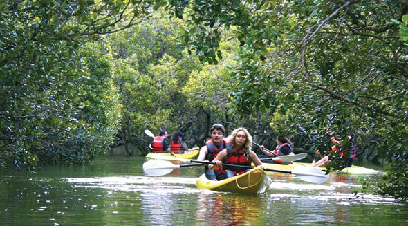
Kayak & Walk Adventures
Haruru Falls via Waitangi River : Combine walking and kayaking with local wildlife, Māori legends, and stunning views. Kayaking up the Waitangi River, exploring the mangroves on the way to the scenic horse shoe shaped Haruru Falls, then walk back along the river.
Scenic Coastal Loops
The Full Circle – Russell to Russell via Paihia: A rewarding full-day trek that includes ferry rides, boardwalks, native bush, and coastal trails.
Whangamumu Whaling Station :
Above left: A group at the Haruru Falls.
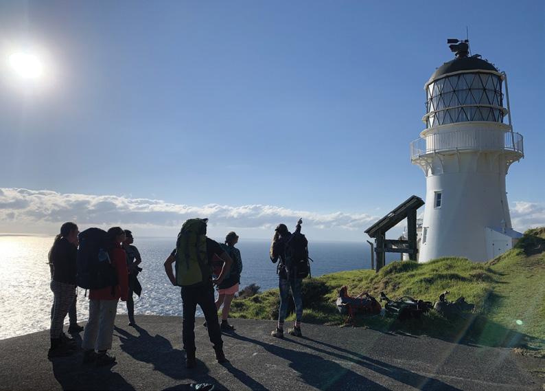
Middle left: The lighthouse on the Cape Brett walk.
Below left: A beautiful Bay of Island sunset.
Leading through wetlands, and then a decent hill climb you descend into the harbour itself and follow a path that whalers used to take in the early 20th century to one of New Zealand’s last remaining shore-based whaling stations. Fantastic history and scenery!
Island Escapes
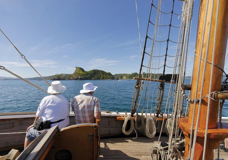
Moturua Island : Accessible by launch or the tall ship R. Tucker Thompson, this island walk features abundant birdlife, historical sites, bush and views.
Urupukapuka Island Ultimate Loop: Explore the largest island in the Bay with its archaeological treasures, pristine bays and regenerating forests.
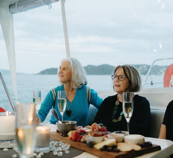
Cruise & Dine Experiences
Darryl’s Lunch Cruise: Walk from Paihia to Okiato or Opua before boarding a scenic lunch cruise back
to Russell. Savour a delicious lunch featuring your choice of New Zealand venison, lamb, or fresh fish. An unforgettable blend of adventure and relaxation!
Sunset Sail on Serenity: Sail to Motuarohia Island for a short walk to a stunning lookout and then bubbles and canapes at sunset as you cruise
Above left: A couple on the R Tucker Thompson, a tall ship.
Below left: On the Silverware Sunset Cruise.
home.
History & Heritage Walks
Mana, Missionaries & Mayhem : Discover the colourful past of Russell with visits to key historic sites and top it off with a relaxing drink at the iconic Duke of Marlborough Hotel.
The Club Walk: A humorous, guided exploration of Russell’s beloved clubs and local stories. Become a local for a day!
Challenging Treks
Cape Brett Overnight Walk: One of NZ’s top hikes with jaw-dropping views, lighthouse history, and an overnight stay in a DOC hut.
Four Walks in One (21km): A fullday challenge incorporating forest trails, lookouts, and coastal paths.
Unique & Private Access Walks
Kotikoti Walk: Only open during the event, this private land walk offers sweeping views and regenerating forest.
Garden Safari – Te Wahapu Style: Curious about exploring stunning homes and gardens? From garden features to sea views – you won’t be
Bay of Islands Walking Weekend
dissappointed.
Sunday Meanders: Choose a short or longer walk to a scenic picnic spot with fun stops and storytelling along the way.
Culinary, vineyard & brewery
Experiences
PhatHouse Brewery & River Walk: A mix of nature and craft beer with a stunning guided walk along the Waitangi River to Haruru Falls. Then you head to our local brewery for a tour including tastings and shared platters.
Paihia Lookout & Charlotte’s Kitchen: A short lookout bushwalk followed by a relaxed lunch at one of Paihia’s favourite waterfront spots.
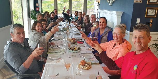
Pāroa Bay Vineyard Walks: Explore private land with panoramic views, and a Māori pā site, before enjoying fine wine with a gourmet lunch or dinner at Sage Restaurant.
Omata Estate Walk: Hike through bush and coastline to this Frenchinspired vineyard for wine tasting and wood-fired pizza.
Whether you’re walking for the views, the history, the food, or just for fun, the Bay of Islands Walking Weekend is the perfect way to explore one of New Zealand’s most beautiful regions.
The walking weekend makes walking accessible and affordable. Walking groups are kept to a size of 20, and walks are all guided. We have a fun social Head Quarters at the Russell Bowling Club.
Bookings are essential – visit the website for more information. Be sure to check the grading for each walk. www.bayofislandswalkingweekend.co.nz
Above left: Kayaking on the Waitangi River Walk.
Above right: Walking on Whangamumu walk to the Whaling Station.
Middle left: Lunch at Parao Bay Vineyard.
Below left: The R Tucker Thompson part of an island walk.
Do you do this?
By Dr. Chris Teo-Sherrell Living Streets Aotearoa
You’re driving along when all of a sudden there’s a truck blocking the road. It’s not clear what’s happening. Nobody’s there to explain what’s going on or to direct you safely around the truck or asking you to use a detour. You were already pushed for time and now you’ll be late. What a pain!
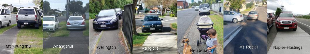
The above photo is the sort of thing pedestrians face every day with vehicles parked over footpaths. And it’s getting worse.
It’s bad enough having signs, e-scooters and rubbish bins left on footpaths but vehicles are an even greater obstacle. It’s really inconsiderate.
For able-bodied people it’s inconvenient having to go around a parked vehicle. For less able-bodied people it can prevent them from independently reaching where they wanted to go.
Sometimes, the only way to get around the vehicle is to go onto the roadway which is dangerous for children, visually-impaired people and those who have difficulty crossing the kerb. And people walking along the roadway is not something drivers want to encounter.
Some drivers seem to try to be considerate by parking with just two wheels on the footpath. But even that can block people pushing prams or using wheelchairs or mobility scooters.
Many of these are too heavy or have wheels unsuited to going on the adjacent grass, especially when the ground is wet which can be at any time of year. And it makes it more difficult for blind people too as it’s an obstacle that may be there one day but not the next so they can’t predict the timing or location of it.
Other people seem to think their driveway goes all the way to the kerb but it doesn’t. Driveways stop at the
boundary of private property. The space between there and the kerb is public property intended for the placement of utilities and street trees and for pedestrians to use - not for parking vehicles.
Some people park over the footpath when picking somebody up, thinking they’ll ‘just be a minute’. But they may have to wait longer than expected and a pedestrian may come around the corner and be blocked by the vehicle.
If the driver isn’t in the car the pedestrian will be inconvenienced or endangered or prevented from proceeding. That’s pretty inconsiderate. So even if you think you’re just going to be a minute, please don’t park on the footpath. Park on the roadway or go right onto the private property instead.
Besides being inconsiderate, parking on footpaths is actually illegal. This applies even to parking ‘just a little bit’ or for ‘just a minute’ on the footpath. It also applies even when parking is not available or allowed on the roadway. And it applies all the time. There’s no excuse.
The fine for breaking this rule is $70. Most councils have parking wardens who can issue fines for parking over footpaths. So if you encounter vehicles parked on the footpath you should phone your council immediately, giving it the property number and street name, the colour of the car and its registration number. The sooner the illegal parking is reported the sooner it can be dealt with. Phoning is the quickest way to get action but you could also take photos showing the vehicle parked over the footpath and its number plate and send those to your council afterwards. Most have ways to report a problem on their website or you can use the phone apps SnapSendSolve or Antenno, but these all take longer to get action than phoning. Finally, Living Streets’ yellow feet can be put on windshields of vehicles parked on footpaths as gentle reminders to drivers.
People can request small numbers of these yellow feet by emailing accounts@ livingstreets.org.nz
We are looking for the best digital photos each month depicting walking
Now the time to get your digital camera out or look through your digital images and enter the
Walking New Zealand
Digital Photo Contest
Above right An engaging urban winter walk along the Te Ara Otakaro Avon River Trail from Cambridge Green in the city to New Brighton. My intention was to walk a section, then return. I ended up completing the 11 km walk through the Red Zone and along the banks of the Avon River (and catching a bus back). Photo by Marie-Therese, Papanui, Christchurch
Above: we went on a day trip return to Panekire Hut from Oneputu Trail end at Lake Waikaremoana. The kids also did enjoy it, particularily because of the spectacular views towards the lake and the mountainous scenery. The chance to catch some breath with a memorable view. Photo by Martin Kostrewa Hamurana, Rotorua
Ouch! Sore feet while walking?
Hikers Wool is 100% New Zealand wool. Cushion your feet to prevent pain, rubbing and blisters.
Buy online or at selected stockists For more info visit www.hikerswool.co.nz
Above left: Hikers coming out of the bush after visiting the goldmining relics at Te Oneroa in Fiordland National Park.
Above right: Crossing the Waingakia river, on a hīkoi thrugh the Raukumara Conservation Park.
PHOTO CONTEST
Below right: My husband & Barney on a walk in Cheviot Hills Reserve while on holiday.
Photo by Claire Woodhall, Pandora, Napier.
Photo by Celia Wade-Brown, Wairarapa
Photo by Dianne Cable, Feilding
By Phillip Donnell
What’s in the mix for 2026
It’s not too early to work towards some great walking opportunities next year!
Aforward plan is tactical planning that helps identify, schedule and prioritise actions to achieve specific objectives over a defined period. Forward planning is crucial for proactive decision-making, clarity of goals, and adaptability in the face of change, both for individuals and organisations.
It allows for better resource allocation, risk mitigation, and the ability to seize opportunities, ultimately leading to greater success. Without forward planning, vague thoughts stream shapelessly through our minds like long sad vapours through the twilight sky, and little progress is made.
One of the areas for which forward planning is almost a necessity is travel. Before any trip, you need to consider various factors. These may include health checkups, travel medication, finances (budget, currency exchange, payments), ensuring your passport is valid, understanding visa requirements, obtaining travel insurance, researching your destination, securing the home base, emergency contacts, connectivity, communication, and packing.
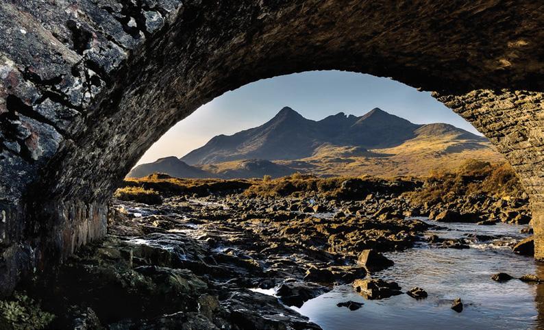
Below left top: Split Apple Rock and the golden sands in Abel Tasman National Park. Above Sligachan Bridge, Scotland. Below left: Basalt columns at Ohira Bay, Chatham Islands.
It all takes time and energy, so the earlier you begin the better. Footsteps Walking and Travel Club understands this, so does its utmost to formulate and disseminate trip information as far in advance as possible. Accordingly the scheduled walking trips for 2026, both within New Zealand and overseas, are already downloadable form the “Activities” section of the website (www.footstepswakingclub.com). Footsteps exists to serve walking clubs.
So what’s in the mix for 2026? There are seven excursions within New Zealand, and four overseas, each of them akin to an iridescent bubble fresh-blown from the lips of fancy. You are bound to find at least one that fits your needs and aspirations, like the fitting of an old glove to a hand.
Winsome Wairarapa (1-7 February) will take you to the largest mainland gannet colony in the world (Cape Kidnappers); NZ’s second largest pa (Otatara); a tiny town with no less than 11 registered historic buildings (Ongaonga); the longest place name in New Zealand and the world (at Porangahau); Included is the historic lighthouse sitting high above a spectacular coastline (Castlepoint); the most extensive “Badland” or hoodoos formations in NZ (Putangirua); and a rail crossing that was globally unique (Remutaka).
Capital Kapiti (8-14 February) introduces you to the walks of Wellington, the Kapiti Coast, Horowhenua, Manawatu and Whanganui.
You will enjoy the wild seascapes, seals and geology of Cook Strait; “Lord of the Rings” locations along the Hutt River; the impressive cityscapes, harbour views and regional parks of our capital city; steep escarpments as mountains hug beaches along the Kapiti coastal strip; the Zealandia, Kapiti Island and Bushy
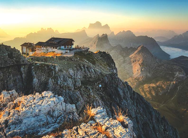
Above top left: Estuary at Medlands Beach, Great Barrier Island. Above top right: Castlepont lighthouse, Wairarapa. Above right: The famous Ruahumoko tarn, Pouakai Range, Taranaki. Below right: Rifugio Lagazuoi, in the Dolomites.
What’s in the mix for 2026
Park eco-sanctuaries, with their bevy of rare native birds; plus a river that cuts through a mountain chain, carving an impressive gorge (Manawatu).
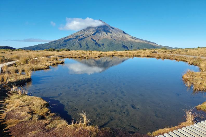
Tantalising Taranaki (22-28 February) was voted by “Lonely Planet” (in 2017) as the 2nd best region in the world to visit. The magnet, of course, is the astounding volcanic landscape of New Zealand’s very own “Mount Fuji”, after which the region is named. Highlights include New Plymouth’s spectacular coastal walkway and Rewarewa Bridge; the highest waterfall in the North Island (Damper Falls); the wild west littoral at Tongaporutu: rolling surf, black sand, white cliffs; and the historic origin of peaceful protest at Parihaka.
The Top of the South offers two glorious diversions, one traversing Marlborough and the other exploring Nelson/Golden Bay. On the Marvellous Marlborough excursion (15-21 March), you can imbibe picturesque Picton, the gateway to the Sounds and to the South Island and the stunning seascapes and walkways of the Marlborough Sounds. Included are the unrivalled juxtaposition of mountains and valleys in Nelson Lakes; the magnificent tussock and tarns of Rainbow Station; the relaxing hot springs and gentle forest walks of a true spa town (Hanmer); and the grandeur of the Kaikoura mountain ranges plunging down to the coast.
Registering for Noteworthy Nelson and Gob-smacking Golden Bay (22-28 March) will expose you to the so-called geographical centre of New Zealand and renowned boulder bank (Nelson); the pristine golden sands and sparkling waters of Abel Tasman National Park. Included is an intriguing story of romance and isolation in the backcountry (Asbestos Cottage); NZ’s clearest and most beautiful natural spring (Te Waikoropupu); spectacular cliffs, arches, caves, pillars, stacks and spits in Golden Bay. The ingenious rock shelters of the Flora
Valley and Mount Arthur; and even the Tolkien-like scenery of weathered marble on the Mount Owen massif are not to be missed.
Building on the success of our very popular Hauraki Gulf Islands excursions, our offshore islands are again squarely represented, with week-long sorties to Great Barrier Island (31 October-7 November) and the Chatham Islands (21-28 November).Tryphena, Claris, Whangaparapara, Port Fitzroy, and Mount Hobson are key localities on our fourth biggest island, which includes the awesome Aotea Conservation Park covering 12000ha.
Some 800km east, and 45 minutes ahead, of Christchurch lie the cows, quad bikes, and crayfish cages of the latter, on the fringes of which — the cliffs, beaches, swamps and hills — you can find day walks with never-ending views that feel truly untamed.
For those with a penchant to head overseas, America, Italy, the UK and Australia beckon. If you have never been to Glacier National Park, Yellowstone,
Custer’s Last Stand, Mount Rushmore, or the Badlands, the Grand Central USA trip (17 May-7 June) is the one for you. Astrid Brauksiepe, will capably lead you through the spiky spires and towering turrets of the eastern and western Dolomites (29 June-14 July).
You can follow up your attendance at the Edinburgh Tattoo by visiting the lochs, glens, tors and munros of bonnie Scotland (8-29 August).
The hinterlands of the Gold and Sunshine Coasts in sunny Southeast Queensland (4-18 October).will offer remarkable rambles, such as the Glass House Mountains.
Overall, there’s a mass of mesmerising meanders to choose from. Go to the Footsteps website for details or contact them (021 172 3244, footstepsanz@gmail. com). Select your preferred roaming necklace cord on which the memorable moments will be strung like pearls, and make your first move…
Above left; The bridge on the Te Araroa Trail Escarpment at Paekakariki. Above right: Mt Ngungun, Glasshouse Mountains, Sunshine Coast.
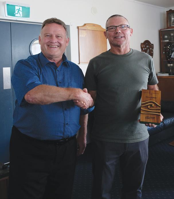
Northland engineer wins Outdoor Access Champions Award
Steve Gwilliam, a dedicated advocate for cycling in Tai Tokerau, will receive an Outdoor Access Champion Award this month. the Outdoor Access Commission Herenga ā Nuku Aotearoa, presents the award each year to people who have made significant and lasting contributions to public outdoor access in New Zealand.
Gwilliam has worked for more than a decade building trails and promoting public access to the outdoors.
Gwilliam has helped design and construct over 20 projects that comprise more than 130km of Northland’s trail network. These trails have an asset value of over $50 million. These projects include the Hatea Loop, Old Ngunguru Coach Trail, McLeod Bay to Parua Bay trail, One Tree Point to Waipu Cove cycle trail, Waipu Cove Walk/Cycle Trail, Bream Bay Trail, Limeburner’s Creek trail, the recent Kaipara’s Kaihu Valley Trail, Bay Of lslands’ Pou Herenga Tai and the Whangarei District Councils flagship project Kamo Shared Path.
In addition to his engineering contributions, Gwilliam often volunteers his time and resources to construct new trails and provides trail planning information to many groups building community trails.
The Northland Regional Trails (NRT) Project Team nominated Gwilliam for the award.
Amanda Bennett from NRT believes Gwilliam’s passion for cycling tracks makes him a local hero.
“He’s unwavering in his commitment to enhance outdoor experiences for everyone,” says Bennett. “When Kaihu Valley Trail had its opening day in June 2023, Steve didn’t like the look of a shed and the weeds right where the opening ceremony was taking place. So he took over his weed eater and a tin of paint from Whangarei to brighten up the area the day before the opening.”
Phil Culling, the deputy chief executive of Outdoor Access Commission, says Gwilliam has sparked his community’s desire to build and link trails around Tai Tokerau. “The trails Steve Gwilliam has contributed to will significantly improve Northland’s health, wellbeing and economic development. He has had a remarkable impact on Tai Tokerau.”
“Steve is someone who leads from the back by doing. He’s almost never in the limelight. Steve’s comfortable providing advice or designs or perhaps working at the site. This event is about shining the light on a quiet, unassuming advocate who has done and is still doing much for walking and cycling in Te Tai Tokerau”
Above right: Phil Culling from the Outdoor Access Commission presents Steve Gwilliam with his Outdoor Access Champion Award for his work on Northland’s cycle trails.
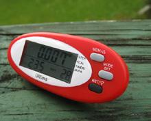
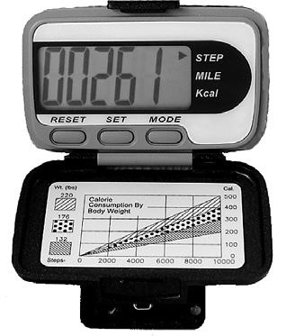
The new VeryFitPro ID205L Intelligent Activity Tracker
The new VeryFitPro ID205L is an intelligent smart looking Sports Watch and activity tracker that ticks all the boxes.
* Strong and durable 3cm clear glass touch screen display
* Skin friendly soft and comfortable wristband strap
* Nine exercise modes walking, running, hiking, cycling, treadmill, fitness, mountain climbing, spinning bike and yoga
* Many functions: step monitoring function, heart rate monitoring, sleep monitoring, calorie monitoring, call reminder, message reminder, sedentary reminder, alarm reminder, stopwatch, timer, music control, looking at mobile phone, breathing training, time and date display, multi-sport mode (step, calories, speed, distance, active time), daily goal
* Raise your hand and the screen will light up.
* Customize the face of your Smart Watch to fit your needs.
* IP68 Deep Waterproof
* Magnetic charging with USB charging cable takes about 2.5 hours for around 10 days usage.
* Uses VeryFitPro app Compatible with smart phones that use IOS 8.0/Android OS 4.4 or later, and Bluetooth 4.0 or later
* Colours available: Black
Only $115.00 plus $8.00 P&P Walking New Zealand Shop
47 Lincoln Terrace, Palmerston North - Phone 027-274-0726
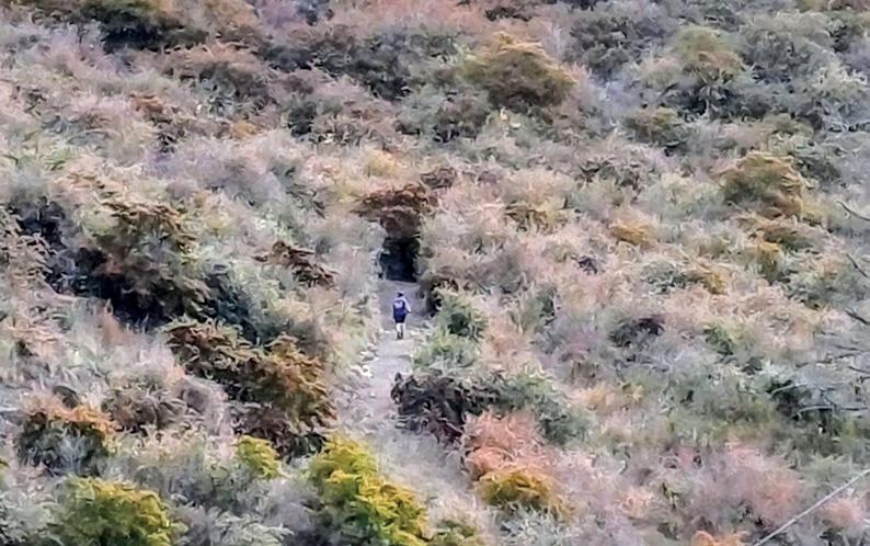
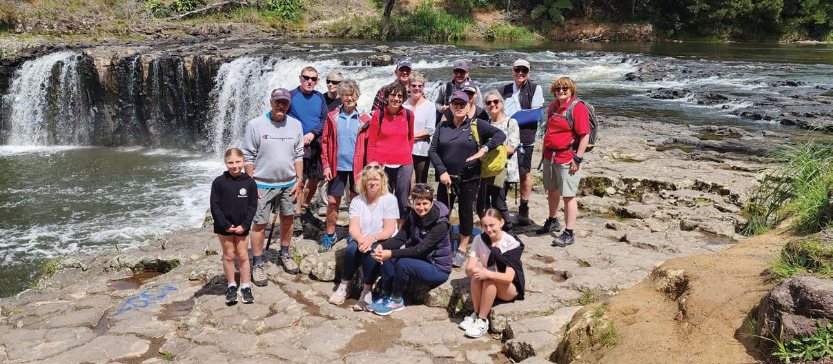
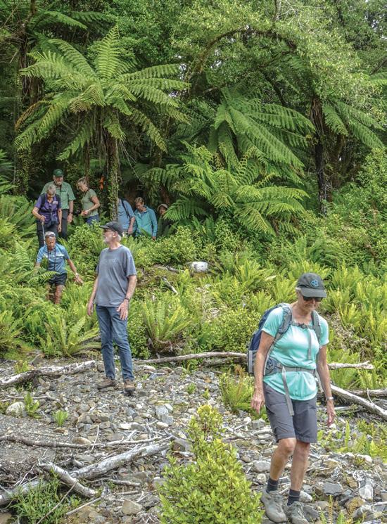
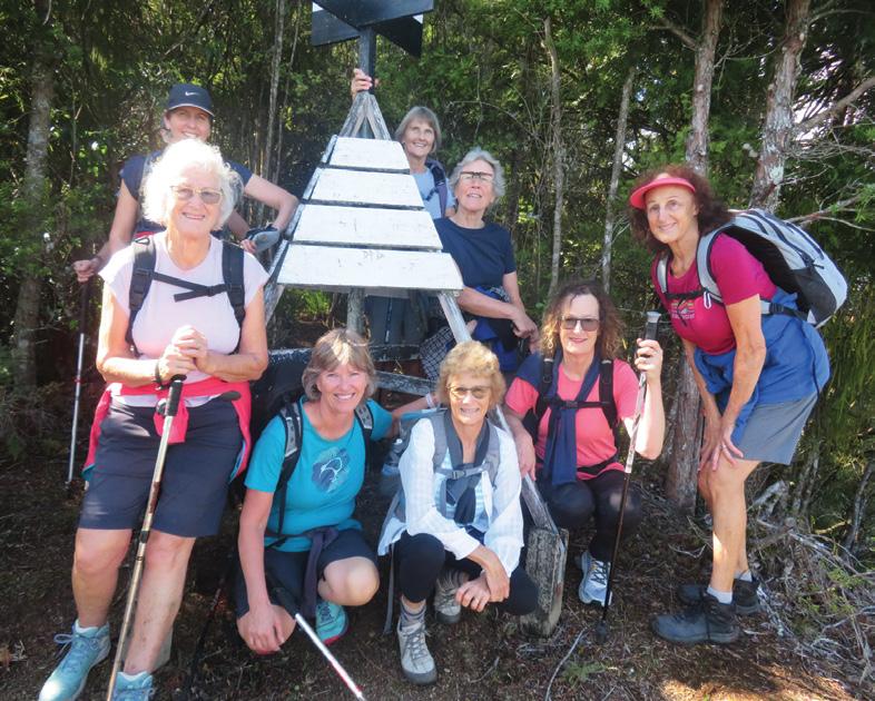
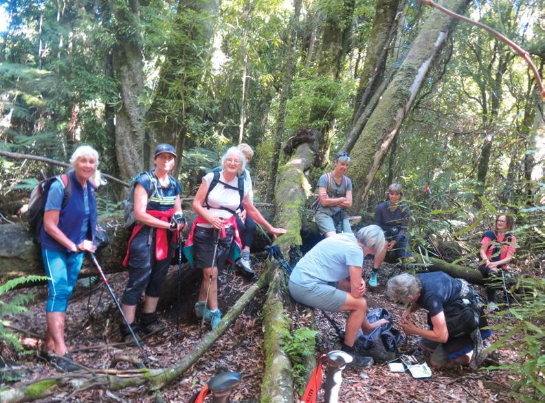
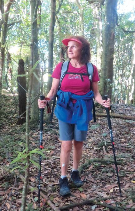
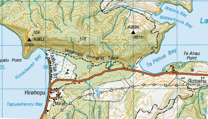
About 20kms north east of Rotorua, on the side of SH30 , you can see a large matai tree – ‘ ‘Hinehopu’s Wishing Tree’.
By Barbz Lowther
Legend has it that Hinehopu , a prominent Te Arawa woman, was hidden in the root cavity as a baby to protect her from raiding parties, and later met her husband in the same spot .
From here a short walk ( Hongis Track) leads through mature native trees to Lake Rotoiti. This is the route that Hongi Hika used to drag canoes overland to mount a surprise raid on the Arawa people on Mokoia
Above left: Bluffs by Lake Rotoehu. Above right: The view across the lake. Below left: The trig overlooking Lake
Rotoiti.
and birdlife
Island . It is now a popular walking track.
Not far from here, is a sign marking Lake Rotoehu, and room for three or four cars to park. Starting from here, we followed a flat gravel road between Lake Rotoehu, and high bluffs.
Turning left we walked 10 minutes up a dirt road to the start of the trail to the trig, marked by an orange ribbon. This is not a DOC marked track, so you need to keep an eye out for coloured ribbons – orange, yellow, pink or red. Many different groups have left their own mark
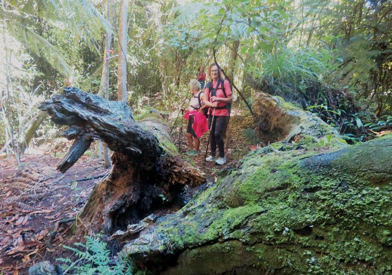
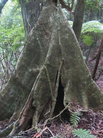
The trail begins quite steeply, but soon levels out to an undulating leaf strewn track going gradually uphill following the ridge line. There are lovely old rimu, tawa, rewarewa and pukatea with its buttress roots.
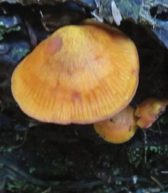
Rata clings and twists around many of these giants, and punga, ferns, young trees, mosses and fungi
Above right: Sore feet being attended to en route. Middle right: One of the many windfalls.. Below left: Fungi along the route.
Hinehopu Bluffs for lots of native trees and birdlife
flourish underneath. Supplejack with its tangles forms a barrier in some places so watch for ribbons to lead you through.
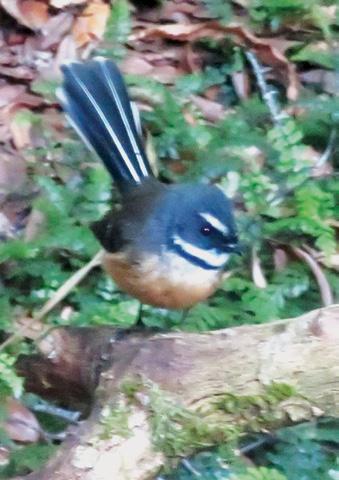
After a few stops to admire fungi, fantails, robins, and tuis, we reached the trig in a tiny clearing above Lake Rotoiti in two hours 10 minutes. The views here were stunning – over the lake, and as far as Otanewainuku in the Kaimais.
After a lunch break, enjoying the view and the bird song we re-traced our steps. The return was easier, because we were walking gradually downhill.
About half an hour before the road, another trail led off to the left.
We took this 10 min diversion, to a smaller trig overlooking Lake Rotoehu. Returning to the ridge track we were soon back to the lakeside, and reached the cars in under five hours.
This is an interesting walk, with beautiful big trees, magnificent views, lovely bird song, and easy access. Care should be taken after rain, because it can be slippery.
Above left: Walking along the ridge.
Middle left: A little fantail followed us most of the way.
.Below left: There were lots of interesting buttress roots.
Below right: There was fungi along the walk growing on a tree trunk.
Ouch! Sore feet while walking?
Hikers Wool is 100% New Zealand wool. Cushion your feet to prevent pain, rubbing and blisters.
Buy online or at selected stockists For more info visit www.hikerswool.co.nz
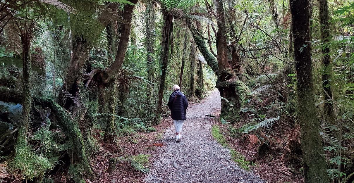
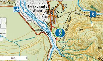
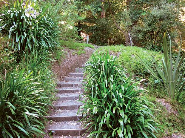
The Terrace Walk at Franz Josef .
The Terrace Walk at Franz Josef provides a good introduction to the rainforest of the Glacier Region of the West Coast as well and an opportunity to see glow worms after dark - it’s a great option with children.
This easy walk winds a short way along the bush-clad terraces at the south end of the village. The trail is relatively flat until the last few meters, when it winds uphill and becomes somewhat rocky.
This walk leads you through a flat section of Wild West Coast podocarp forest before you start a gradual ascent up a line of gold mining tailings. You will be able to see the remains of flumes and water pipes just before the small wooden bridge that crosses a creek
There is no access beyond the bridge due to a slip and you will need to return the way you came.
Take a torch and explore this walk at night to see glow-worms in the forest, especially under and around large fallen trees alongside the track.
The walk starts off State Highway 6, at the southern end of Franz Josef village near the ‘Our Lady of the Alps’ church on the left hand side of the road heading south towards Fox Glacier. The track entrance has a very small parking area, but there is plenty of parking in town just a short walk away. No dogs are allowed.
The distance is 1.8km return via the same track. It is classed as an easy 30 minute short walk.
Above: The gravel track is mostly flat for the first part. Below right: As the track climbs it gets very stoney.
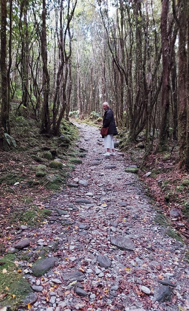
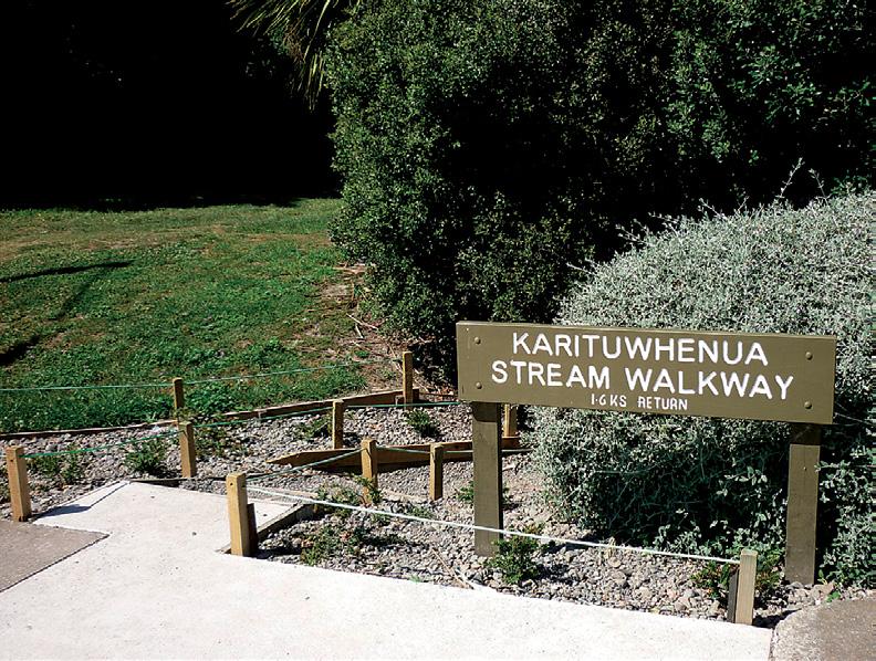
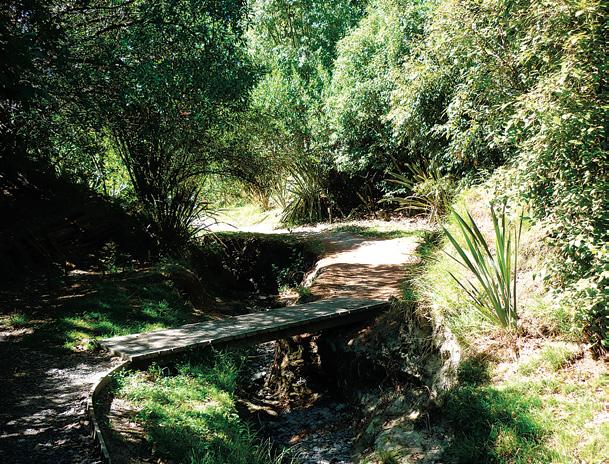
Karituwhenua Stream Walk a short
The Karituwhenua Stream Walkway is a lovely, mostly flat loop track of approximately 1.6 kilometers that takes less than an hour to complete, making it a perfect casual or brisk walk for families.
The walkway offers a shaded path through native bush, providing a cool respite on sunny days, which sounds ideal for your recent walk on a lovely sunny but cool day.
Along the track, you can enjoy various features such as picnic tables for resting or a family snack, and named tree species that offer an educational element as you walk.
The walkway is well maintained with cute bridges crossing the stream, although the stream itself
can be quite dry in summer and more flowing in wetter seasons. Birdlife is abundant, including the distinctive tui, adding to the peaceful natural atmosphere.
The track is dog-friendly, though there are some cautions about water quality and horticultural poisons, so it’s best to keep an eye on pets
The walkway is located in Havelock North, and to get there from the town centre, you would head towards Te Mata Road, where the entrance is near 176 Te Mata Road
It is easily accessible from Havelock North, making it a convenient outdoor activity for locals and visitors alike.
In summary, the Karituwhenua Stream Walkway is a short, easy, and
shaded 1.6 km loop walk that takes under an hour, featuring native bush, picnic spots, and birdlife, with easy access from Havelock North via Te Mata Road.
This makes it a delightful family outing to enjoy nature, learn about local flora, and relax in a peaceful setting.
During your visit to the Karituwhenua Stream Walkway, you should look out for a variety of native trees and wildlife that thrive in New Zealand’s bush environments. Native New Zealand bush includes trees such as kahikatea, totara, rimu, and various ferns, which support diverse birdlife.
Birds to watch for include the tui, known for its distinctive song,
family walk
and other native forest birds that find shelter and food in the native trees and shrubs along the stream. The stream and surrounding bush provide habitat for insects and native birds, enhancing the natural experience.
Above left: The start of the walkway. Above middle: The track beside the stream. Above right: An interesting little foot bridge. Below right: Could be a place for a picnic!
Below far left: A foot bridge. Below far right: A seat to sit down and rest. Below left: A walk through a shaded area. Below right: A few steps to make the walk interesting.
By Catherine Tooher
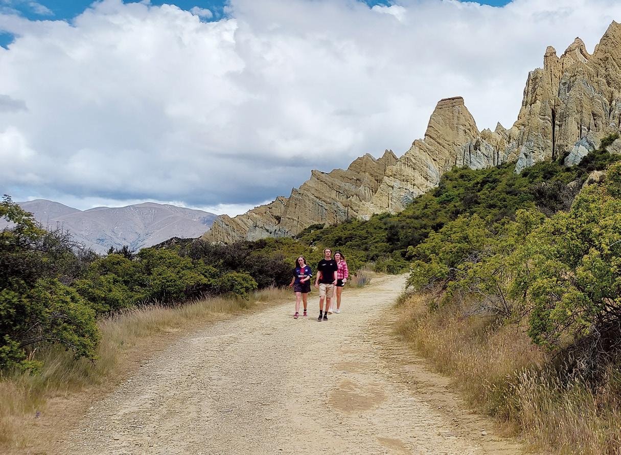
Omarama’s Clay Cliffs
In the heart of New Zealand’s South Island, the Omarama Clay Cliffs rise unexpectedly from the flat Waitaki landscape, their jagged spires and narrow ravines creating a scene that feels more at home on another planet than in rural Canterbury.
Having just walked these remarkable formations, I’m excited to share what makes the Omarama Clay Cliffs such a memorable destination—how to get there, what to expect on the walk, the history behind these geological wonders, and why they attract visitors from all over the world.
The Omarama Clay Cliffs are located about 10 kilometres west of the small town of Omarama, making them a convenient stop for anyone road-tripping between
Above left: A group walking back to the carpark from viewing the Clay Cliffs..
has an unique landscape
Christchurch, Tekapo, Twizel, Wanaka, or Queenstown.
The drive itself is part of the adventure: after turning off State Highway 8 onto Quailburn Road, you’ll soon find yourself on Henburn Road, a gravel track that winds through farmland for about 8–10 kilometres. The road is generally well-graded, but it’s wise to drive slowly, especially after rain, as conditions can become slippery.
Entry to the cliffs is on private land, with a $5 per car fee payable via an honesty box at the gate.
The funds help maintain the access road, so be sure to bring cash.
From the car park, the approach to the cliffs is straightforward and accessible. The main path runs for about 500–650 metres each way (1–1.5 kilometres round trip), making it an easy walk suitable for most
ages and fitness levels.
The initial track is wide, relatively flat, and in good condition, offering spectacular views of the cliffs as you approach.
Expect the walk from the car park to the base of the cliffs to take around 10–15 minutes each way, with most visitors spending 30 minutes to an hour exploring, depending on how much you linger for photos and to soak in the views.
For those feeling adventurous, the real magic happens when you venture off the main track and into the cliffs themselves. Here, there’s no set path—just a network of narrow, winding trails that lead you deeper into the maze of pinnacles and ravines.
The terrain becomes rockier and steeper, with loose scree underfoot, so sturdy footwear is recommended.
While the climb up into the cliffs isn’t overly difficult, it does require some care, especially on the descent, which can be slippery after rain.
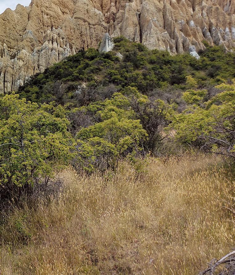
Standing at the base of the Omarama Clay Cliffs, you’re immediately struck by their scale and otherworldly beauty. The cliffs soar up to 30 metres high, their sharp, angular spires separated by narrow slot canyons that invite exploration
The colours shift from pale gray to ochre and gold, especially striking in the changing light of morning or late afternoon.
Walking among the cliffs, you’ll find yourself surrounded by towering walls, the silence broken only by the wind and the crunch of gravel underfoot. There’s a sense of discovery around every corner—hidden alcoves, dramatic viewpoints, and the ever-present feeling of being dwarfed by nature’s handiwork.
In spring, the surrounding fields bloom with wild lupins, adding a splash of color to the already dramatic scene.
The walk is short and manageable for most people, but conditions can vary with the weather. The main track is generally dry and stable, but the side trails into the cliffs can be slippery, especially after rain.
Good shoes are essential, and it’s best to avoid the cliffs in wet weather, as water can race down the canyons and make footing treacherous.
There are no facilities at the site— no toilets, no shops, and no shelter— so come prepared with water, snacks, and sun protection. The remote setting adds to the sense of adventure, but also means you should take care and watch your step, especially if exploring with children.
The Omarama Clay Cliffs are a striking example of New Zealand’s dynamic geological history. Formed around two million years ago during the last ice age, the cliffs are made up of layers of silt and gravel deposited by ancient rivers and lakes.
Over time, tectonic activity pushed these sediments upward, and relentless erosion by wind and water sculpted them into the dramatic pinnacles and ravines seen today
This process, known as badlands
Omarama’s Clay Cliffs has an unique landscape
erosion, is rare in New Zealand and gives the cliffs their unique, almost alien appearance. The formations are part of the Hawkdun Group of sediments and are similar in origin to the Putangirua Pinnacles in the North Island.
Some of the tallest spires reach up to 30 metres, and the vivid layering in the rock tells a story of ancient landscapes transformed by the forces of nature.
Despite their remote location, the Omarama Clay Cliffs have
become one of the South Island’s must-see natural attractions. Their otherworldly beauty makes them a favourite stop for photographers, hikers, and anyone seeking a unique experience off the beaten path.
The cliffs are especially popular with road-trippers travelling between Christchurch and Queenstown, as they offer a convenient and rewarding detour from the main highway
The sense of discovery—turning off the highway, driving down a gravel road, and suddenly encountering this surreal landscape—adds
to the appeal. The cliffs are also accessible enough for families and casual walkers, yet wild enough to satisfy adventurous spirits who want to explore deeper into the canyons.
On my visit, I was struck by how many people were there, yet how easy it was to find a quiet spot among the spires and feel completely immersed in the landscape.
The ever-changing light, the play of shadows on the cliffs, and the sheer scale of the formations make every visit unique.
Walking the Omarama Clay Cliffs is an experience that lingers long after you leave. The combination of accessibility, geological wonder, and sheer visual impact makes this a highlight of any South Island journey. Whether you’re a keen photographer, a geology enthusiast, or simply someone who loves to explore New Zealand’s wild places, the Omarama Clay Cliffs are a must-see—an unexpected marvel that captures the imagination and inspires awe at the power of nature.
If you find yourself in the Waitaki region, take the detour. Wander among the spires, lose yourself in the canyons, and let the ancient landscape remind you of the everchanging story of our planet.
Above left: The Omarama Clay Cliffs a popular attraction.
Below left: The information kiosk at the carpark.
Fact file
The physical address is Henburn Road, Omarama. The cliffs are on private land, there is an honesty box at the gate where you can pay an entry fee of $5 per car. The easy hiking trail takes you right into the slot canyon and after a short stroll you are right inside the cliffs.
There are no bathroom facilities at this site and the access road can sometimes be affected by scouring following heavy rain. The trail around the Clay Cliffs area is not suitable for people with mobility issues.
To get to the cliffs, head north from Omarama for 3km on SH8, turn left onto Quailburn Rd, and then turn left after 3km onto unsealed Henburn Road (the route is well signposted).
A walk or bike ride through Logan Park Reserve
An enjoyable Auckland walk or cycle is through Logan Park Reserve, linking Kilkenny Drive to Botany Town Centre.
.It’s a great route to get from A to B, go for a lunchtime walk, or just to spend time with the kids outdoors.
The walk is suitable for all levels of fitness. Bring the pram, kids bikes and scooters.
The path passes lush bush and crosses a stream that provides important habitat for a range of aquatic fish and invertebrate species.
The paved pathway is well maintained, even though the park itself can get quite muddy. There is one section where you have to cross Kilkenny Drive, a busy road with no pedestrian crossing.
At Kilkenny Drive, there’s a colourful kids playground and some seating for caregivers under the shady trees. You’ll also find outdoor gym equipment for a fun open-air workout in the fresh air.
The suggested starting point is on Chapel Road, across the road from Botany Town Centre (where you’ll find connecting bus routes).
You can also join the path at Kilkenny Drive or from different access points along the route. Kilkenny Drive and most quieter streets have some limited off-street parking.
You can continue onto Point View Drive via the connecting path. If you decide to start the path at Point View Drive, there’s no sign marking the entrance.
Food for thought!
If the refrigerator and television weren’t so far apart, some of us wouldn’t get any walking. Unknown
Above right: The route starts at 585 Chapel Road, Botany;
Walking Clubs Groups
NORTH ISLAND
NORTHLAND
BAY OF ISLANDS
BAY OF ISLANDS WALKERS: Saturday (AM), Jacqui Watson 022-6019741, Roz Whittaker 021-063-1455
DARGAVILLE
DARGAVILLE TRAMPING GROUP: Last Sunday of month (AM), Lynley Thompson 021-102-3974, colvilleestate1@gmail.com
WHANGAREI
CARDIAC CARE WALKING GROUP: Wednesday (AM or PM), Jo or Hugh Knight 09-438-7976
MT ALBERT Y’s WALKING GROUP: Tuesday Friday, (AM), 09-846-0788 MT ROSKILL COMMUNITY HOUSE: Theresa McDonald, 09-624-3281 OUTDOOR ACTIVITIES CLUB AUCKLAND: midweek, weekends (BIA), walks, tramps, www.oacnz.org, OutdoorActivitiesAuck@outlook.com
ST HELIERS HIKERS: First/Third Wednesdays (all day), Glenn 09528-9726
STEP OUT WALKING GROUP: Thursday (AM), Olivia 09-555-5164
WOMENS OUTDOOR PURSUITS INC: Tuesday, Thursday, Sunday, Donna Sheppard, info@wops.co.nz, 09-535-8239, www.wops.co.nz WEST AUCKLAND
BLUE TOP WALKERS: Henderson, Tuesday, Thursday (AM), Terry Wilson 09-814-9523 or 021-266-1071, terryandsheena@gmail.com, www. bluetopwalkers.weebly.com
FIA OLA WOMEN’S DEVELOPMEMT WALK GROUP: Monday to Saturday, Anne, 09-813-0021
FIT4LIFE: Glenfield, Monday (PM), Friday (AM), Sarah 021 534 649
TE ATAU PENINSULA WALKERS: Monday, Friday (AM), Wednesday (PM), Mary Jones 09-834-6989
TE ATATU SOUTH ACTIVE 35+ WALKING GROUP: Te Atatu South, Wednesday, Edna, 09-834-1401
THE HAPPY WANDERERS WALKING GROUP: Wednesday (AM), Joy Williams 09-817-2464 or 027-353-3434
TITIRANGI TWILIGHT WALKERS: Tuesdays, Thursday, (PM) Titirangi Library, Wednesday (PM) Glovers Real Estate Green Bay, Louise 021437-547, louisenicholson@xtra.co.nz
TITIRANGI WALKERS: Sundays (AM), John Harris 09-627-0099, jeanah@ihug.co.nz
Fitness levels: “B” beginner, ”I” intermediate, “A” advanced. (AM) denotes morning walk, (PM) denotes an afternoon or evening walk. Group co-ordinators are asked to please advise us of any updates by fax 06-358-6864 or email walkingnz@xtra.co.nz.
WALKERS & TALKERS: Campbells Bay, Wednesday (AM), Brenda Gray 09-410-4019, Dorothy Ensor 09-478-6702
Fitness levels: “B” beginner, ”I” intermediate, “A” advanced. (AM) denotes morning walk, (PM) denotes an afternoon or evening walk. Group co-ordinators are asked to please advise us of any updates by fax 06-358-6864 or email walkingnz@xtra.co.nz.
PIONEER TRAMPERS:Thursday (AM) (IA),4-5 hour tramps in Banks Peninsula and the hills and lower mountains from Mt Hutt to Mt Grey, pioneertrampers@gmail.com
Available from independent book sellers or directly from author E-mail : vivianneflintoffbooks@gmail.com 900kms along an ancient pilgrimage trail in Northern Spain Web: http://www.vivianneflintoffbooks.com/
Gilbert 03-308-5894
KIWISENIORS WALKING GROUPS: for the over 50’s, Wednesday (AM), (BI), two groups, Janice Cochrane, Sport Mid-Canterbury, 03-307-0475
ASHBURTON STROLLERS CLUB: 1st Sunday and 2nd Wednesday of month, (AM), Diane Milne 03- 303-6250
METHVEN & DISTRICTS TRAMPING CLUB: David Wilson 027-431-3240 methvenADTC@gmail.com
60’S UP WALK GROUP: Monday (AM), Olive Swain 03-214-4802
YMCA WOMEN’S WALKING GROUP: Tuesday (AM), Joan Tuffery, 03-216-7377
ACTIVE WALKERS KIWI SENIORS: Thursday, Sport Southland 03-2112150, e:kiwiseniors@sportsouthland.co.nz, www.sportsouthland. co.nz
GORE
GORE DISTRICT WALKERS: Tuesday (AM), NgaireEvans 03-208-4744 or Maureen Jones 03-208-7322, maway50@gmail.com
HOKONUI TRAMPING CLUB: Margaret Hughes 03-208-7053
NORTHERN SOUTHLAND
NORTHERN SOUTHLAND WALKERS: 2nd and 4th Thursdays, Mossburn.: Jo Muir, 03-248-6474, Balfour: Christine MacLean 03-201-6390, Riversdale: Margaret McLennan, 03-202-5868
Notice to clubs and walking groups
If you notice there that the times, names or contact numbers etc on the list of Walking Grroups in the Directory on these pages needs updating please email us at walkingnz@xtra.co.nz. These are are free listing.
Coming Events
NEW ZEALAND
JULY 2025
2 Hātea Run Night Series: Mair Park Whareora Vale Trifecta, Whangarei
27 Cole Murray Cape Kidnappers Trail Run, Te Awanga, Hawkes Bay
27 Marina 2 Marina, London Quay, Picton
27 The Awa Adventure Run, Whanganui
27-28 Brighton Backyard Ultra, Brighton, Dunedin
28 Sri Chinmoy Spring Half Marathon, 10K & Kids 2.5K, Hagley Park North, Christchurch
29 to October 5 NZ 6 Day Ultra Marathon, Hagley Park, Christchurch
30 Fergus 5 Fun Run & Walk, Rototuna North, Hamilton
OCTOBER 2025
4 Rakiura Challenge Trail Run, Stewart Island
5 4 Paws Marathon, Bottle Lake Forest, Christchurch
5 Devonport Half Marathon, Devonport, Auckland
9-12 Bay of Islands Walking Weekend, Bay of Islands
11 Greymouth Harriers 2 or 4 Person
The H2-32G Sensor pedometer -
A great little Pedometer that you can carry in your bag or pocket or clip on a belt!
Three function Pedometer with a hi-tech system that you can carry in your bag, pocket, clip on a belt, or as an arm band, and accurately records your activity through its G Sensor technology.
* Step - Counts steps up to 999,999 steps
* Total Steps - It can cumulative number of steps of each activity
* Exercise time - The effective time will be accumulated as the walking is kept going
* Comes with a lanyard if you want it to hang it around your neck, and an additional clip if you want to attach it to a belt!
Only $59.95 plus shipping $6.00
Available now from: Walking New Zealand Shop 47 Lincoln Terrace, Palmerston North - Phone 0800-925-546 or email walkingnz@xtra.co.nz. www.walkingnewzealand.co.nz
Relay, Kumara, West Coast
11 Cromwell Half Marathon & 10K, Cromwell
11 Taupō Ultramarathon, Whakaipo, Taupo
11 Vineyard Vista Trail, Church Road Vineyard, Hawkes Bay
12 Butterfly Fun Run, The Groynes, Christchurch
12 Edridge Contracting Teetotal Traverse, St Arnaud, Nelson Lakes
18 Sprig & Fern 10K: Māpua, Mapua
18 Trek the Forest, Blue Lake, Rotorua
19 Crater Rim Ultra, Hansen Park, Christchurch
19 Gizzy Trail Run Series: Eastwood Hill Arboretum, Gisborne
19 Harcourts Cooper & Co Run Orewa, Millwater, Hibiscus Coast
19 Orokonui Challenge, Waitati, Dunedin
19 The Honest 10 Fun Run, Oriental Bay, Wellington
19 Wairarapa Half Marathon, 14K & 7K, Masterton
25 Kaikōura Mountains to the Sea, Kaikoura
25 River-Run Backyard Ultra, Waipukurau, Hawkes Bay
30 Breast Cancer Research Trust Pink Walk & Run, Innes Common, Hamilton Lake, Hamilton
31 IRON MĀORI Kaumātua, Ahuriri, Napier
NOVEMBER 2025
4 Silverstream Spin, Silverstream Val-
ley Road, Dunedin
5 Sri Chinmoy Auckland Series 2025: Race 8, Mt Roskill, Auckland
8 County Fayre Downhill Walk, Pohangina, Manawatu
14-23 Wairarapa Walking Festival South Wairarapa
15 Coastal Five, Coastal Half, Lake Mangamahoe 4.5km, New Plymouth
15 Trail Challenge, Waihi
16 Coastal Five, Pukerua Park 5km, Pukeiti climb 10km, Raceway Mile 1.6km, New Plymouth
APRIL 2026
20 London Marathon, London, England
AUSTRALIA
JULY 2025
1 Bravehearts 777 Marathon: Adelaide, SA
1 Mt Ainslie Run Up and Power Walk, Canberra, Act
2 Bravehearts 777 Marathon: Melbourne,Vic
3 Bravehearts 777 Marathon: Hobart, Tas
4 Bravehearts 777 Marathon: Sydney, NSW
5 Bravehearts 777 Marathon: Canberra, Act
5 Gold Coast Marathon, Southport, Qld
5 Lakes Trail Festival, Hawks Nest NSW
5 Raffertys Coastal Run, Lake Macquarie, NSW
5 Sydney Trail Half Marathon, Paramatta Lake, NSW
6 Bravehearts 777 Marathon: Gold Coast, Qld
6 Mt Baranduda Trail Run, Baranduda, Vic
12 Newcastle Cross Country: Caves Beach, Caves Beach, NSW
13 Run Melbourne, Vic
13 The Georges River Festival of the Feet, Sydney, NSW
18 Coastrek Sunshine Coast, Niisa, NSW
20 Alice Springs Running Festival, Alice Springs, NT
20 Burralow Bush Run, Bilpin, NSW
20 Darwin Runners & Walkers Half Marathon, Darwin NT
20 Goldfields Pipeline Marathon, Kalgoorlie, WA
20 Gratitude Walk and Fun Run, Gympie, Qld
20 Shelley Loop Run, Riverton, WA
20 Weipa Running Festival, Weipa, Qld
20 Winery Running Festival, Hunter Vally, NSW
20 You Yangs King of the Mountain 10km, You Yangs, Vic
26 Australian Outback Marathon, Yulare, NT
26 Clare Valley Trail Run, Clare Valley, SA
26 Newcastle Cross Country: Hunter Wetlands, NSW
26 South Townsville Run, South Townsvilloe, Qld
26 Sydney Ultra Marathon, Mona Vale, Sydney, NSW
27 City to Surf Karratha, WA
27 Hills to Henley River Run, Adelaide, SA
view and enjoy on the 1st of the
27 King & Queen of the Mountain, Netherdale, Qld
27 Mad Max Marathon Festival, Broken Hill, NSW
27 Real Insurance Harbour 10 & Harbour 5, Sydney, NSW
27 Run Goulburn Run, Goulburn, NSW
REST OF WORLD
JULY 2025
3-6 International Walking Festival, Castlebar, Ireland
15-18 International Walking Festival, Nijmegen, Netherlands
AUGUST 2025
2-3 Lithuanian Marching Festival, Kaunas, Lithuanian
8-10 International Walking Festival,, Vassa, Finland
22-24 International Walking Festival, Duuchcov, Czek
30-31 International Walking Festival, Verday, Norway
SEPTEMBER 2025
6-7 International Walking Festival, Gospic, Croatia
13-14 International Walking Festival, Beijing, China
19-21 International Walking Festival, Seefeld, Austria
21 In Flinders Fields Marathon, Diksmuide, Belgium
27-28 International Walking Festival, , Brno, Czeck Republic
OCTOBER 2025
4-5 International Walking Festival, Fulda, Germany18-19
10-12 International Walking Festival,
Ottawa, Canada
NOVEMBER 2025
2 New York Marathon New York, USA
6-7 International Walking Festival, Arlington, Virginia, USA
25-26 International Walking Festival, Wonju, Korea
DECEMBER 2025
1-3 International Walking Festival, Higashimatsuyama, Japan
8-9 International Walking Festival, Taipei, Taiwan
15-16 International Walking Festival, Yogjakarta, Indonesia
Waiheke Retreat
Waiheke Island, Palm Beach
* 3 bedroom house, sleeps up to 8, with spectacular views of the Hauraki
* Fully self contained including linen and towels, cooking facilities and bbq.
* Ideal for families and mature groups.
*
*
* Finish your day with a wine on the deck overlooking beautiful Palm Beach. Contact Carol for availability, nightly rates and specials: 027
Having trouble finding Walking New Zealand magazine in your favourite newsagent or supermarket?
Did you know you can now buy the latest copy of Walking New Zealand magazine posted to you at the retail price of $12.50 pus $3.00 postage or you can subscribe and SAVE.
You can buy a copy by:
* Visit www.walkingnewzealand.co.nz/magazine
* Email to walkingnz@xtra.co.nz with your postal address and credit card details
* Ring Freephone 0800 walking, and have your postal address and credit card details handy.
You can now view and enjoy the latest issue of Walking New Zealand magazine online for only $3.95 at http://www.walkingnewzealand.co.nz
6
3
CONTENTS for previous 15 issues
forestry walkway re-opened
20 Shared Pathway: Hauraki Rail Trail - Thames to Matatoki
23 Book: Hiking the Hexa - a journey on France’s newest through hike
24 Walking New Zealand Monthly Photo Contest
26 Overseas Walks: Trekking to Machu Picchu by the Salkantay Trek
30 Auckland Walks: Great Auckland spots for walking your dog
34 Overseas Walks: Colorado for thousands of hiking trails
39 New Zealand Walk: New footpath bridge opened in Wellsford
40 Directory of New Zealand Walking Groups
42 Coming Events: New Zealand
45 Coming Events: Australia
45 Coming Events: Rest of World
48 New Zealand Country Breaks
50 Index of previous 15 issues
51 Walking New Zealand Shop
52 Pak A Roo Jackets
APRIL 325 2025
3 Contents
4 Walk Talk
32
36
40
42
3
6
on Waiheke enjoying bird song
11 New Zealand Walks: Unveiling the beauty and history of the Nydia Track, Marlborough Sounds
14 New Zealand Walks: Wandering through wonder a walk in the Hamilton Gardens
17 Australian Walks: Outstanding odyssey in Oz with some great walks in South Australia
20 New Zealand Walk: Scotts Beach & Nikau Walk, Karamea
23 Te Araroa Trail: A day walk on the Te Araroa Trail
24 Walking New Zealand Monthly Photo Contest
26 Shared Pathway: Cycling the Kapiti Coast: an Autumn adventure
30 New Zealand Walk: Taieri River Scenic Reserve an interesting walk
32 New Zealand Walk: Te Henui Walkway Extension a little known walk
34 New Zealand Event: Run Tekapo walks with breathtaking views
36 New Zealand Walks: From forest to skyline Walking the Wilds of Puhi Peaks
39 Subscription page
40 Directory of New Zealand Walking Groups
42 Coming Events: New Zealand
45 Coming Events: Rest of World
48 New Zealand Country Breaks
50 Index of previous 15 issues
51 Walking New Zealand Shop
52 Pak A Roo Jackets MAY 326 2025
3 Contents
4 Walk Talk
6 New Zealand Walk: Lake Rotorangi Hydro Walkway a little gem
9 New Zealand Walk: Six top Kapiti walks - coastal, scenic and bush worth exploring
12 Waitomo Cycle Trails: Waitomo - a bike walk adventure
14 New Zealand Trail: Ruakuri Scenic Reserve
16 New Zealand Walk: Washpen Falls Walk - Canterbury’s secret canyon walk
19 New Zealand Walk: Walk through a canyon in an ancient volcano
19 New Zealand Walk: Whangarei
48 New Zealand Country Breaks
51 Walking New Zealand Shop
52 Pak A Roo Jackets
FEBRUARY 323 2025
3 Contents 4 Walk Talk
6 New Zealand Walk: Discovering Castlepoint: the Deliverence Track
8 New Zealand Walk: Linklater Walkway
9 New Zealand Walks: Historic Whitianga Rock Maori Pa site walk
10 New Zealand Walk: Westmere Lake Loop Walk
12 Overseas Walks: Magnificent midwinter meanders in Europe
14 New Zealand Walk: Swingbridge Loop Track offers an immersive experience
16 Expository Essay: Learning to Walk
18 Manawatu Walking Festival
19 Walking Festival; The 2025 Manawatu Walking Festival beckons adventure seekers
20 New Zealand Walk: Matiatia to the Vineyards Coastal Walk on Waiheke Island
6 New Zealand Walk: Lake Rotorangi Hydro Walkway a little gem
9 New Zealand Walk: Six top Kapiti walks - coastal, scenic and bush worth exploring
12 Waitomo Cycle Trails: Waitomo - a bike walk adventure
14 New Zealand Trail: Ruakuri Scenic Reserve
16 New Zealand Walk: Washpen Falls Walk - Canterbury’s secret canyon walk
19 New Zealand Walk: Walk through a canyon in an ancient volcano
19 New Zealand Walk: Whangarei forestry walkway re-opened
20 Shared Pathway: Hauraki Rail Trail - Thames to Matatoki
23 Book: Hiking the Hexa - a journey on France’s newest through hike
24 Walking New Zealand Monthly Photo Contest
26 Overseas Walks: Trekking to Machu Picchu by the Salkantay Trek
30 Auckland Walks: Great Auckland spots for walking your dog
34 Overseas Walks: Colorado for thousands of hiking trails
39 New Zealand Walk: New footpath bridge opened in Wellsford
40 Directory of New Zealand Walking Groups
42 Coming Events: New Zealand
45 Coming Events: Australia
45 Coming Events: Rest of World
48 New Zealand Country Breaks
50 Index of previous 15 issues
51 Walking New Zealand Shop
52 Pak A Roo Jackets MARCH 324 2025
3 Contents
4 Walk Talk
6 New Zealand Walk: Taranaki Falls Loop walk a capti]vating experience
8 New Zealand Walk: Cathedral Cove attracts visitors from throughoutthe waorld
10 New Zealand Walk: Sandymount to Sandfly Bay walk a chance to see lions and seals
12 Auckland Cycle Trails: The best family friendly bike rides in Auckland
14 New Zealand Trail: The Greytown to Woodside Trail and beyond
17 New Zealand Trail: Trail accessible to all ages and abilities
18 New Zealand Walks: Many walks to explore in Pirongia Forest Park
20 Walking Festival: 45 guided walks in ECHO Walkng Festival
22 New Zealand Walk: Whangamata Stream Trail through a beautiful forest