The ULTIMATE is Zerofit’s flagship product and perfect for hiking, golf, sailing or any outdoor activities when it’s cold. But if you are more active it is complemented by the Heatrub MOVE.
Twice as warm as a standard base layer, the material regulates tempertures as you move, so you won’t suffer from cold sweat, if your are running or cycling.
Please visit the Walking New Zealand Shop: https://walkingnewzealand.co.nz/productcategory/apparel/ for more details and to order.
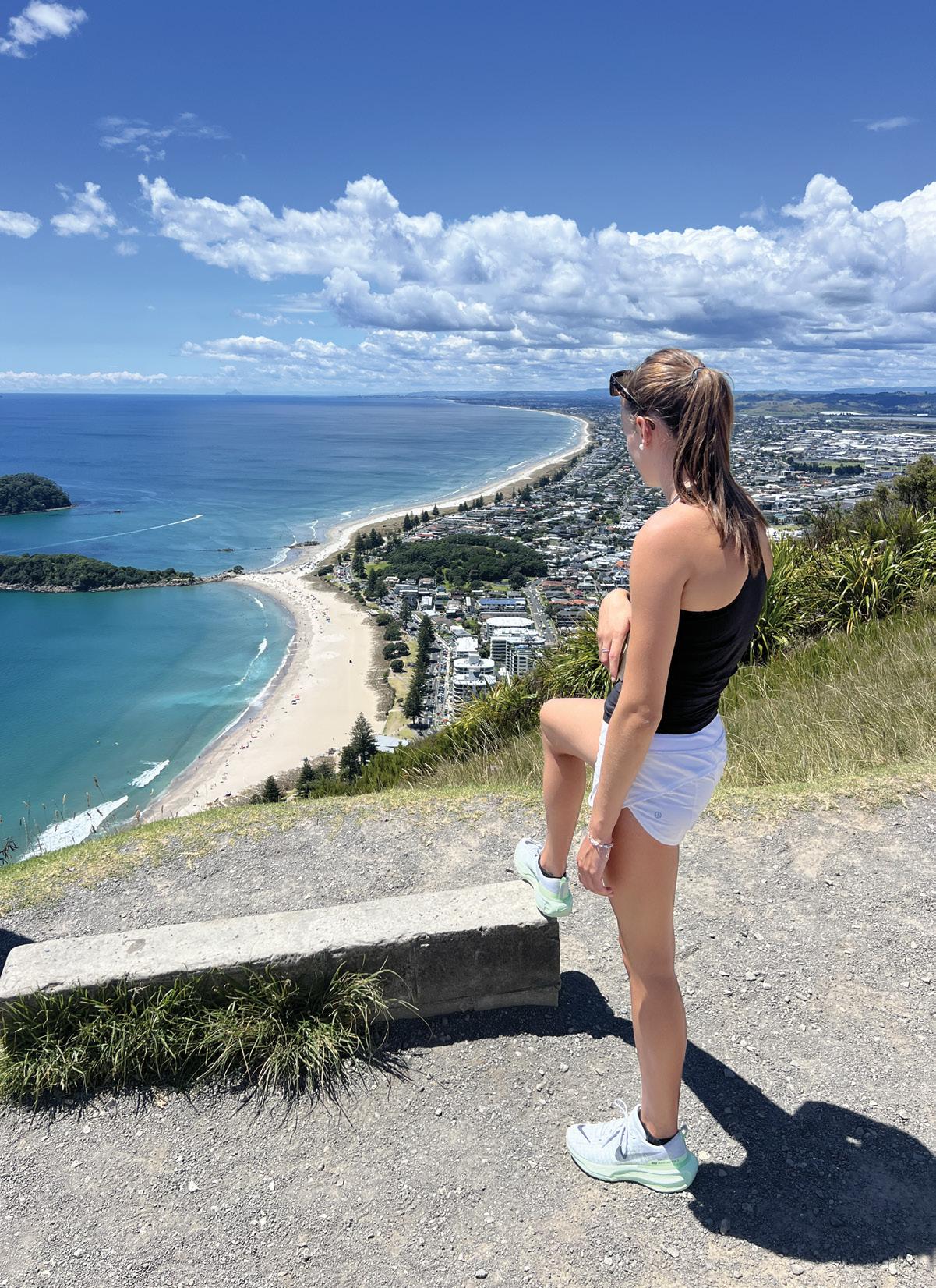
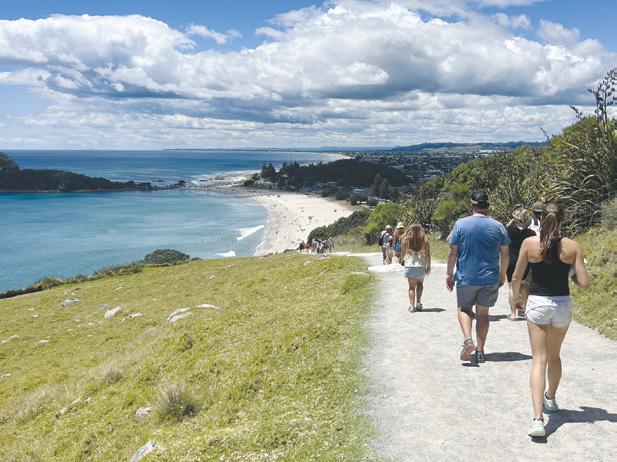
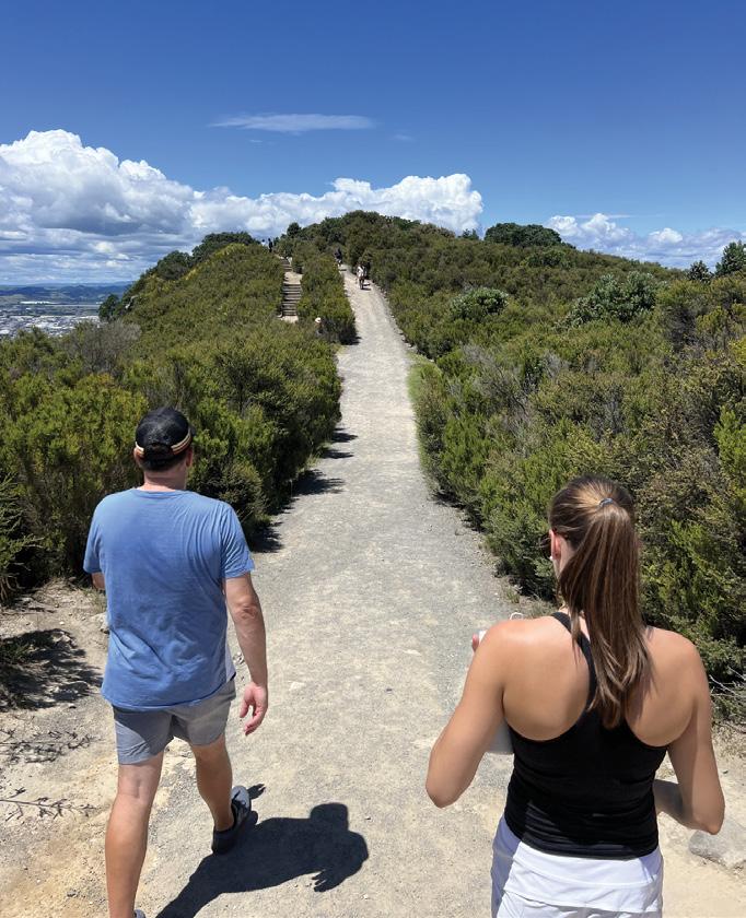
Cover:T ayler Trow Looking down from the summit of Mt Maunganui with Mt Maunganui Beach and Moturiki Island to the left. Photo by Lisa Trow
PUBLISHER/EDITOR: Frank Goldingham: Phone 06-358-6863, 027-274-0726
The Department of Conservation (DOC) and the Backcountry Trust (BCT) are partnering on 30 recreational hut projects this summer – great news for lovers of New Zealand’s backcountry and those looking to volunteer outdoors, says DOC.
DOC has received $4.2m from the International Visitor Conservation and Tourism Levy (IVL) to work with others to maintain highly-valued huts and tracks, over four years.
Dubbed the ‘Community Hut Programme’, this money allows DOC and BCT to work in partnership on DOC huts and tracks valued by the hunters, fishers, trampers and others who use them.
“The Community Hut Programme is critical to the Backcountry Trust and DOC being able to deliver extra value to the backcountry community,” says Rob Brown BCT’s National Operations Manager.
“Interested groups or individuals should contact the BCT to discuss projects they have in mind.”
Rob Brown thanks the generosity of the many volunteers and sponsors who are also critical in supporting the work.
The Department has a huge job, says DOC Director of Heritage and Visitors, Catherine Wilson.
“The Community Hut Programme will support others to maintain huts and tracks on public conservation land through volunteer work and donated materials.
“With a third of the country to manage, including thousands of species, huts, tracks, heritage sites and marine areas, we need communities behind us.
“Many DOC experiences are in high demand from Kiwis and international visitors. This popularity, combined with remote locations and increasing climate change pressures, puts strain on the visitor network and creates high maintenance costs.
“We want to deliver a shared backcountry network that connects people to nature through recreation and builds a collective commitment to the backcountry for future generations.”
Walking New Zealand digital edition
Walking New Zealand magazine has gone digital on our own website. Viewers can read through the lastest issue for only $3.95 an issue, paid by credit card before viewing.
Go to www. walkingnewzealand.co.nz and mouse over Shop and Subscribe and then click on Latest Issue - Digital. Enjoy!
Walk talk
New Bryon Bay Lighthouse Loop tour
NSW Indigenous tour operator Delta Kay has launched a new walking tour that provides an Aboriginal perspective of the coastline around the Byron Bay Lighthouse.
The two-and-a-half-hour circular tour covers the 3.7 km Walgun Cape Byron Lighthouse Loop Trail, requiring moderate fitness.
Beginning at Clarkes Beach, the tour heads up the Tallow Ridge Walking Track through coastal rainforests before reaching the Cape Byron Lighthouse, with panoramic views of the region.
The tour then follows the Cape Byron Walking Track past Australia’s most easterly point, Wategos Beach, The Pass and then returns to Clarkes Beach.
During the tour, Kay shares Dreaming stories, offering insights into the cultural and spiritual significance of New Byron Bay Aboriginal walking tour the surrounding landscapes.
Guests also learn about native bush foods and natural medicine and sometimes spot native wildlife like dolphins, koalas, sea eagles and wallabies.
Kay’s company Explore Byron Bay has been offering indigenous-themed tours of Walgun (Cape Byron), Bangalow, and Broken Head for five years.
‘The lighthouse, of course, is such a European symbol, and the fact that we can infuse the Aboriginal narrative into the experience provides a viewpoint that will give visitors a much richer perspective of the Byron region.’
The small-group tours operate on Friday and Sunday evenings and depart at 5pm during summer to take advantage of the mild tropical evenings and spectacular sunsets. The cost is A$99 per person.
www.explorebyronbay.com
You can now view and enjoy the latest issue of Walking New Zealand magazine online for only $3.95 at http://www.walkingnewzealand.co.nz
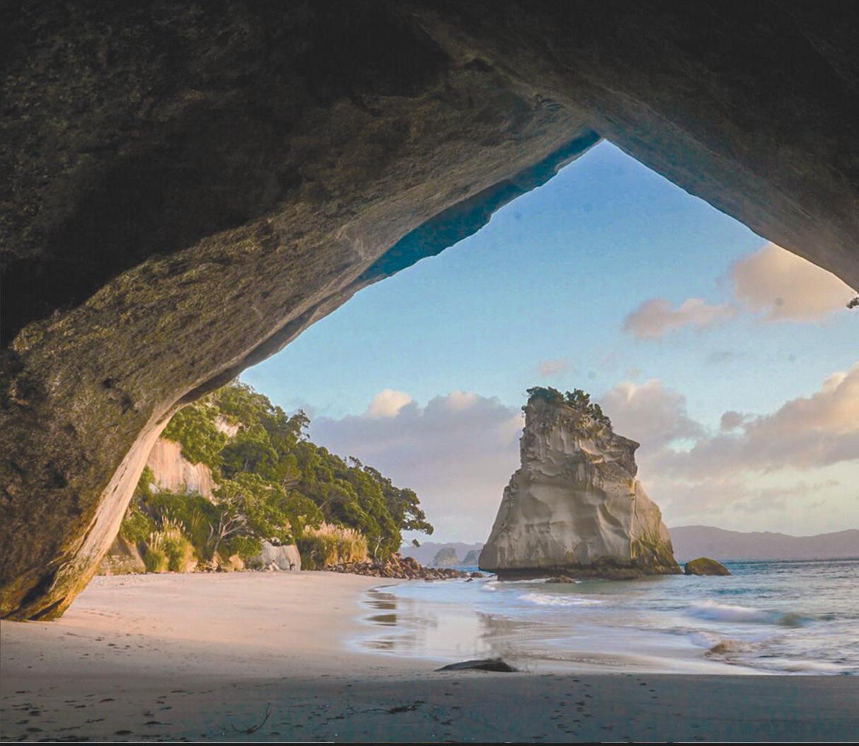
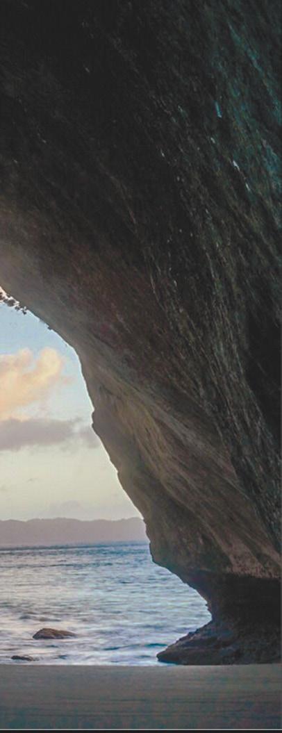
Visitors flock back to Cathedral Cove again
Hundreds of people a day are visiting Cathedral Cove’s famous beach following the reinstatement of walking access to the popular Coromandel location.
In December, DOC reopened the main walking track to Cathedral Cove (Mautohe) after an extended closure due to damage caused by Cyclone Gabrielle, and concerns about visitor safety at a site with known risks. Funding from the International Visitor Conservation and Tourism Levy delivered reinstatement of walking access through a temporary re-route of the damaged track.
Tinaka Mearns, DOC’s Hauraki Waikato Taranaki Regional Director, says staff are pleased to see visitors enjoying the cove again.
“We have been manually recording the number of visitors on the Cathedral Cove beach since 19 December, including Boxing Day and January 2 when visitor numbers peaked at more than 800 people.”
“The Coromandel DOC team says visitor levels at Cathedral Cove are returning to pre-COVID levels, which indicates high demand for the experience offered at this picturesque site,” Tinaka says.
“The number of people enjoying the beach demonstrates the value of the investment in reinstating walking access - and the hard work of the staff, iwi, and contractors whose efforts ensured we could open it for this summer.”
Visitors to Mautohe Cathedral Cove are reminded there are no toilets on the beach, people should not linger under the archway or near the cliff faces, and anyone visiting the beach should take their waste with them when they leave. Toilets are provided near the Lees Road entrance. An ideal time to visit is during low tide, which provides more space on the beach including distance from the risk of rock fall from the cliff face. Meanwhile, DOC has implemented a new process to manage weather and landslide-related risk at Cathedral Cove.
The Trigger Action Response Plan (TARP) for natural hazard risk management at Cathedral Cove establishes criteria for inspecting the site to manage public safety regarding landslide, rockfall, and treefall hazards. DOC staff will monitor weather (particularly heavy rain) and seismic information, and if one of four triggers occurs, staff will inspect the track to decide necessary actions to minimise the risk to visitors. If a worst-case scenario were to emerge, any decisions on track closure will be communicated through DOC’s website and directly to stakeholders.
Walk talk
NZ Great Walk now one of the world’s top hiking destinations
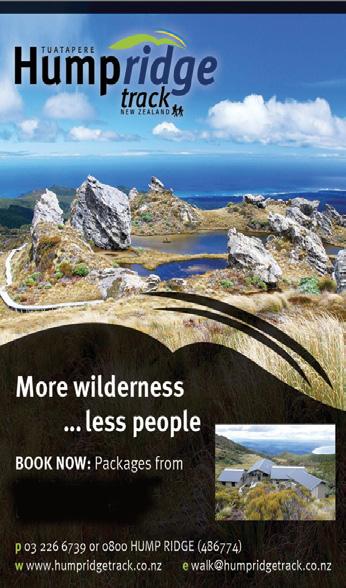
Southland’s Hump Ridge Track has been recognized as one of the world’s top hiking destinations, making AllTrails’ prestigious list of 25 walks to explore in 2025. This remarkable achievement comes in the same year the track officially became a Great Walk, marking a significant milestone for this stunning trail in southern Fiordland.
The Hump Ridge Track is more than just a hiking route - it’s a lifeline for the tiny town of Tuatapere. After years of struggle, the track is now transforming the local community’s economic prospects.
From being visited by just 1,000 people annually, the track saw over 3,000 walkers during the 20232024 season, with visitors now coming from as far as California
Spanning 61 kilometres, this three-day loop track offers a diverse and challenging hiking experience. Hikers traverse sub-alpine mountains, rugged coastlines, and historic heritage tramways.
Unlike other Great Walks, the Hump Ridge Track provides a unique journey through regenerating bush and historical landscapes, including some of the longest wooden viaducts in the southern hemisphere.
The track is a community-owned initiative that has required significant investment and dedication. The Department of Conservation invested NZD$7.9 million to upgrade the trail, working in consultation with local Ngāi Tahu iwi. Local businesses are already seeing the benefits, with cafes and tour operators experiencing increased activity.
AllTrails reviewed 450,000 trails worldwide before selecting just 25 for their 2025 list. The Hump Ridge Track is the only walk from the Pacific region to make this prestigious selection.
AllTrails CEO Ron Schneidermann, emphasized that they looked beyond popularity, focusing on trails that are “truly special”.
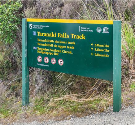
Taranaki Falls Loop walk a captivating experience
By Chris MacDonald
Embarking on the Taranaki Falls Loop Walk in Tongariro National Park is a captivating walk through diverse landscapes and natural wonders.
This 6-kilometre loop track offers a perfect blend of scenic beauty and manageable terrain, making it an ideal choice for hikers of various skill levels.
As I set out on the trail from Whakapapa Village, I’m immediately struck by the ever-changing scenery. The track begins by winding through alpine grasslands, offering breathtaking views of the iconic volcanoes that define Tongariro National Park.
Mount Ruapehu and Mount Tongariro loom in the distance, their majestic silhouettes a constant companion throughout the walk. The first part of the track traverses open tussock and alpine shrublands, reminiscent of a desert-like tundra. This section provides an excellent opportunity to appreciate the unique volcanic landscape shaped by eruptions thousands of years ago.
On a clear day, I’m treated to a spectacular view of Mount Ngauruhoe’s perfectly symmetrical cone, instantly recognizable as
“Mount Doom” from The Lord of the Rings films.
As I continue along the wellmaintained path, I notice sections that were once part of an old horse track, making for easy walking.
The trail then descends into a lush beech forest, offering a stark contrast to the open landscapes I’ve just passed through. The shade of the forest canopy provides a welcome respite, and the air is filled with the
melodious songs of native birds.
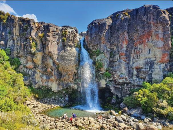
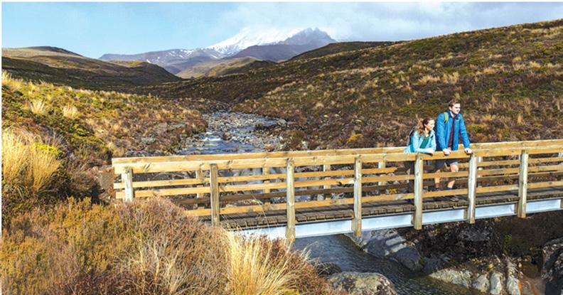
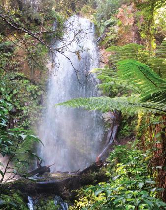
Approximately halfway through the loop, after about an hour of walking, I reach the highlight of the track – Taranaki Falls.
The anticipation builds as the sound of rushing water grows louder, and suddenly, the falls come into view. It’s a breathtaking sight: a 20-metre cascade of water tumbling over the edge of an ancient lava flow, formed by a Ruapehu eruption 15,000 years ago.
The falls plunge dramatically into a boulder-ringed pool, creating a mesmerizing display of nature’s power and beauty. I take some time to explore the area, carefully making my way behind the waterfall for a unique perspective. The mist from the falls provides a refreshing
Above: The majestic Taranaki Falls in flow.
Below left: Stopping to admire the view from the bridge on the track.
coolness, and the turquoise pool at the base offers a tempting spot for a picnic or even a quick dip for the more adventurous.
After enjoying the falls, I continue along the track, which now follows the pretty Wairere Stream. This section of the walk features several bridged river crossings and smaller cascades, adding to the diverse water features of the trail.
The path winds through narrow gorges, showcasing the waterworn rock formations and offering glimpses of the stream’s crystal-clear waters.
As I near the end of the loop, the track emerges from the forest and opens up once again, providing final views of the surrounding volcanic landscape before returning to Whakapapa Village.
The entire loop takes me about two hours to complete, which aligns with the Department of Conservation’s recommended time. However, I find
myself taking a bit longer, pausing frequently to capture photos and simply soak in the stunning scenery. For those pressed for time, fit adults could potentially complete the walk more quickly, but I’d recommend allowing the full two hours to truly appreciate all the track has to offer.
.Throughout the walk, I’m impressed by how well-maintained and clearly marked the track is. It’s easy to follow, making it an excellent choice for families or those new to hiking in the area. The trail does have some elevation changes, with about 120 metres of elevation gain, but these are generally gradual and manageable for most fitness levels.
As I complete the loop and return to the starting point, I reflect on the incredible variety of landscapes I’ve experienced in just a short walk. From the open volcanic terrain to the lush beech forest, from the magnificent Taranaki Falls to the serene Wairere Stream, this track offers a perfect snapshot of the natural wonders that make Tongariro National Park so special.
The Taranaki Falls Loop Walk is
truly a gem within the park, offering a taste of the longer Tongariro Crossing without the same level of difficulty or time commitment. It’s an ideal way to experience the beauty of the area, especially for those who may not have the time or inclination for longer, more challenging hikes.
As I leave the track, I’m already planning my next visit. The changing seasons would undoubtedly bring new perspectives to this beautiful walk, and I’m eager to see how the landscape transforms throughout the year. The Taranaki Falls Loop Walk has left me with a deep appreciation for the natural wonders of Tongariro National Park and a desire to explore more of New Zealand’s stunning landscapes.
The world famous Cathedral Cove
Cathedral Cove Walk attracts throughout the world
By Patrick Quinn
The Coromandel Peninsula has long been a jewel in New Zealand’s crown, a place where rugged coastlines meet pristine beaches, and lush forests give way to breathtaking vistas.
For years, Cathedral Cove has been one of its most iconic destinations, drawing visitors from around the world to marvel at its natural archway, golden sands, and crystal-clear waters. However, after
significant storm damage in recent years, the beloved Cathedral Cove Walkway was closed, leaving many of us longing for the day we could once again tread its path. That day finally arrived with the reopening of the walkway, and my partner and I eagerly set out to experience it for ourselves.
We arrived at the Hahei visitor parking area early in the morning, eager to beat the crowds and make the most of the day. The walkway officially reopened just a few weeks
prior, and the excitement among fellow hikers was palpable.
After a quick stop at the information board to check the route and safety tips, we set off on the 2.5-kilometre (one-way) trail, which promised to take us through a mix of native bush, rolling farmland, and coastal cliffs before culminating at the iconic Cathedral Cove.
The first section of the walk was a gentle climb through regenerating native forest. The air was fresh, filled with the scent of manuka and the melodic calls of tui and fantails. The Department of Conservation (DOC)
visitors from
had clearly put in a lot of effort to restore the track, with new boardwalks, steps, and drainage systems ensuring a safe and enjoyable experience. We were impressed by how well-maintained everything was, especially considering the challenges posed by the region’s unpredictable weather.
As we continued, the trail opened up to reveal stunning views of the coastline below. The turquoise waters of the Pacific Ocean sparkled in the sunlight, and we could see the outlines of nearby islands dotting the horizon. The path wound its way
through open farmland, where sheep grazed lazily, seemingly unbothered by the occasional hiker passing by. This section of the walk felt like a step back in time, a reminder of the Coromandel’s rural charm.
About halfway through, we reached a lookout point that offered our first glimpse of Cathedral Cove in the distance. The sight was nothing short of spectacular. The cove’s famous archway, carved by centuries of wind and waves, stood proudly against the backdrop of the ocean. We paused here for a few minutes to take photos and soak in the view, feeling a sense of anticipation for what lay ahead.
The last part of the walk was a gradual descent toward the beach. The trail here was a mix of gravel paths and wooden steps, with occasional handrails to assist on steeper sections. As we drew closer, the sound of waves crashing against the rocks grew louder, and the scent of saltwater filled the air. Finally, we emerged onto the golden sands of Cathedral Cove, greeted by the sight of the majestic archway towering above us.
The beach was as beautiful as we remembered, with its soft sand, clear waters, and dramatic rock formations. Despite the early hour, a handful of other visitors were already there, exploring the caves, swimming in the shallows, or simply basking in the sun. We spent about an hour at the cove, taking photos, dipping our toes in the water, and marvelling at the natural beauty surrounding us. It was a moment of pure tranquility, a reminder of why this place holds such a special place in the hearts of so many.
After reluctantly tearing ourselves away from the cove, we began the walk back to Hahei. The return journey took us a little less time, as we were more familiar with the trail and eager to refuel with a well-deserved coffee.
In total, the round trip took us about two and a half hours, including our time spent at the cove. While the walk is rated as moderate in difficulty, we found it to be manageable for most fitness levels, with plenty of
opportunities to rest and take in the views along the way.
Walking the reopened Cathedral Cove Walkway was a truly rewarding experience. Not only did it allow us to reconnect with one of New Zealand’s most iconic natural landmarks, but it also highlighted the resilience of both the environment and the community. The restoration work carried out by DOC and local volunteers is a testament to the importance of preserving such treasures for future generations.
For anyone planning to visit, we’d recommend starting early to avoid the midday crowds and heat, wearing sturdy footwear, and bringing plenty of water and sunscreen. While the walk is relatively short, the terrain can be uneven in places, so it’s important to take your time and enjoy the journey as much as the destination.
As we drove away from Hahei, we felt a deep sense of gratitude—for the opportunity to experience Cathedral Cove once again, for the efforts of those who made its reopening possible, and for the enduring beauty of the Coromandel Peninsula. It’s a place that reminds us of the power of nature to inspire, heal, and bring people together. And for that, we’ll always be thankful.
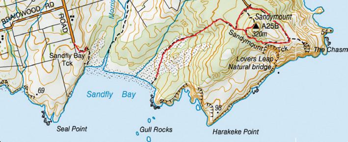
Sandymount to Sandfly Bay walk -
lions and seals
Catherine Tooher
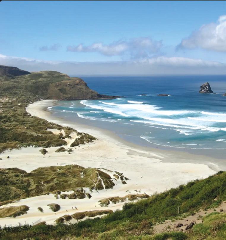
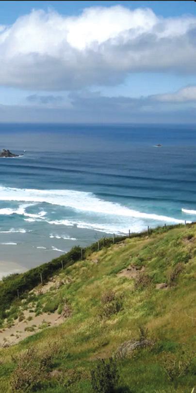
Located on the stunning Otago Peninsula, the Sandymount to Sandfly Bay Track offers an exhilarating coastal adventure just a stone’s throw from Dunedin.
This captivating walk showcases the raw beauty of the South Island, combining dramatic landscapes with the chance to observe unique wildlife in their natural habitat.
To reach the trailhead from Dunedin, head east along Portobello Road, which hugs the picturesque Otago Harbour. As you approach the peninsula, turn onto Highcliff Road and then onto Sandymount Road.
The journey takes about 45 minutes, winding through rolling hills and offering breathtaking vistas of the surrounding coastline.
Be prepared for a narrow, winding gravel road as you near the end of Sandymount Road, where you’ll
find the carpark that marks the start of your adventure6
The Sandymount to Sandfly Bay Track is a challenging but rewarding just over two -kilometre journey that typically takes around one hour and 10 minutes one way.
As you embark on this walk, you’ll soon find yourself immersed in a landscape that seems almost otherworldly.
The track transforms into a sandy slalom, guiding you through eroded sand dunes that create a lunar-like aesthetic.
The descent to Sandfly Bay is steep in sections, particularly near the top, before transitioning to a gentler gradient as you approach the beach. Orange markers guide your way through the sand dunes, ensuring you stay on track even when the path becomes less distinct.
The surrounding scenery is noth-
Above: The rocky foreshore of Sandfly Bay.
ing short of spectacular, with clear views of rugged cliffs and the expansive Sandfly Bay stretching out before you.
One of the highlights of this walk is the opportunity to observe local wildlife. Sandfly Bay is home to sea lions and seals, often spotted lounging on the beach or in the nearby dunes. It’s crucial to maintain a respectful distance from these magnificent creatures, ideally staying at least 20 meters away from sea lions when they’re awake and 10 metres when they’re asleep.
While the allure of Sandfly Bay’s waters might be tempting, it’s important to note that swimming can be dangerous due to strong winds and currents.
Always prioritize safety and be aware of your surroundings. Additionally, the return journey involves a steep climb back up the sand dunes, which can be physically demanding. For those seeking an easier alternative, the Ridge Road Track offers a
less strenuous route back.
After your exhilarating hike, you might want to explore more of what the Otago Peninsula has to offer.
The nearby Sandymount Track provides additional hiking opportunities, including a loop track with side trips to geological features like The Chasm and Lovers Leap. These walks offer more breathtaking views of the peninsula and its diverse landscapes.
.While there aren’t cafes immediately adjacent to the track, the charming village of Portobello, situated along the harbour, makes for a perfect post-hike stop. Here, you can refuel at the 1908 Bar and Café, known for its fantastic food at reasonable prices, or grab a coffee at the cozy Penguin Café.
These eateries provide a welcome respite and a chance to soak in the local atmosphere. For those willing to venture a bit further, Dunedin itself offers a plethora of dining options. The Corner Store on Stuart Street comes highly recommended for a delicious brunch, serving up creative, hipster-inspired dishes in a cool, inviting atmosphere.
The Sandymount to Sandfly Bay track encapsulates the essence of our natural beauty. It challenges hikers with its terrain while rewarding them with unparalleled views and unique wildlife encounters.
As you stand on the vast expanse of Sandfly Bay, watching sea lions bask in the sun and feeling the brisk ocean breeze, you’ll understand why this walk is a must-do for nature
enthusiasts and adventure seekers alike.
Remember to respect the environment and wildlife, leave no trace, and be prepared for changing weather conditions.
The Otago Peninsula’s beauty is preserved through the conscientious efforts of its visitors, ensuring that future generations can continue to enjoy this remarkable coastal gem.
Whether you’re a local looking for a weekend escape or a traveller exploring the South Island, the Sandymount to Sandfly Bay track offers an unforgettable journey through one of New Zealand’s most captivating landscapes.
It’s a testament to the raw, untamed beauty that makes this corner of the world so special, inviting those who walk its paths to connect with nature in its purest form.
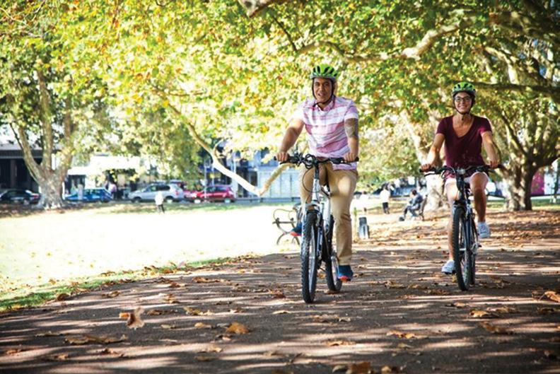
The best family-friendly bike rides in
Get the whole family active on one of Auckland’s fantastic bike paths.
Scenic routes wind through tranquil neighbourhoods and
reserves and meander along coastal areas and past playgrounds, with plenty of places to stop and picnic or play. These paths are gentle and picturesque, suitable for kids and first-time cyclists.
Explore Ambury Farm and Māngere Foreshore
Stop for a mid-bike breather at Ambury Regional Park (also known as Ambury Farm) and enjoy seeing a city farm in action with cows, chickens, pigs and more. Start your ride at the beginning of Kiwi Esplanade Reserve near the new Ngā Hau Māngere Bridge and weave your way around the waterfront to Ambury Regional Park.
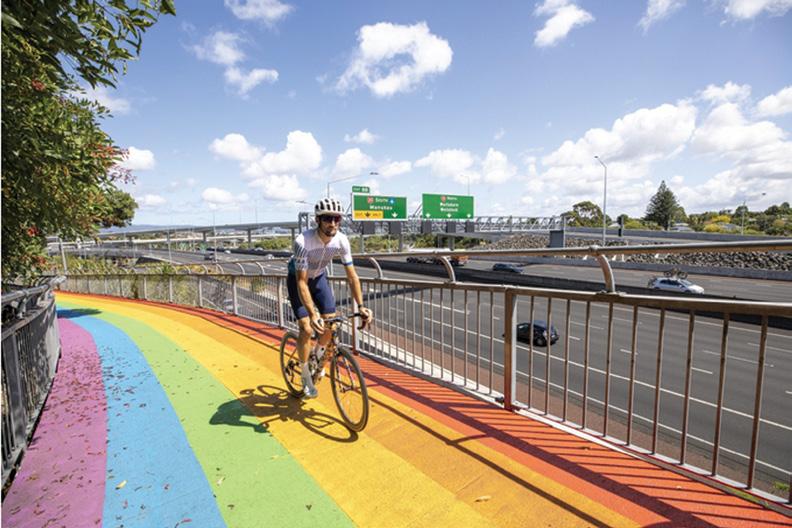
Above left: This path is all about the gold at the end of the rainbow! The Grey Lynn cycle path to Waterview is a vibrant path that sidelines the motorway.
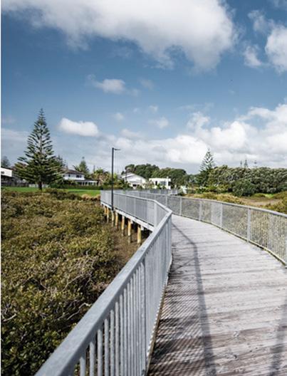
Above middle right: This pathway for walkers and cyclists goes around the beautiful Ōrewa estuary, connecting Hibiscus Coast beaches, community facilities and the Ōrewa township.
Above right: Cyclists along the Victoria Park cycle path. Start at the corner of Victoria Street West and Hasley Street, or anywhere along the park. Follow the flat path around the perimeter of the park.
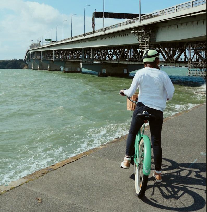
Below left: Westhaven cycling path offers seaside views by the Auckland Harbour Bridge, and portside locations to enjoy as well.
Auckland
Once you’re in the farm you can begin the Māngere Foreshore Path, this isn’t a loop so you will need to make your way back the way you came. For a fun detour you can veer off to Māngere Lagoon Path for a short trip around the lagoon.
Ambury Regional Park has toilets, picnic tables and places to fill up your water bottles, so it is well worth making this stunning spot your big pit stop of the day. All our regional parks are rubbish free, so make sure to take all rubbish and recycling with you when you leave.
Narrow Neck to Devonport Path
Enjoy a family day out on this path from Narrow Neck Beach to Devonport village.
The shared path swoops past beaches and reserves, and has excellent views of Rangitoto Island and Maungauika (North Head). At Narrow Neck Beach there is a great playground, and Cheltenham Beach is another worthwhile stop where you can enjoy a refreshing swim or rest under a pōhutukawa tree. Waterview Path
Following Te Auaunga/Oakley Creek, the wide, sealed Waterview Path is more than just a cycle ride; it offers a range of things to see and do along the way. Kids will love zoom-
ing across the colourful bridges and stopping to inspect the playgrounds and skate parks.
You can also take the Grey Lynn to Waterview path, follow the rainbow road and it will guide you to Waterview Reserve. The path goes under the motorway where you can loop onto the wide and relatively flat Northwestern cycleway which gives you a flat ride all the way to Great North Road.
See the city on the Westhaven Path
Weave your way around our beautiful city centre waterfront on Westhaven Path. Start your ride along Curran Street in Herne Bay. You’ll find street parking here, or good nearby public transport. Cross under Auckland Harbour Bridge and onto the new boardwalks along Westhaven Promenade where you can enjoy stunning harbour views.
Head left up Beaumont Street onto Te Wero Walkway where you can enjoy the nearby Daldy Street Park equipped with a basketball court, playground, water play area and 7.5m slide.
Carry on along the waterfront and dip your toes in the water at Karanga Plaza and admire the city view.
If the kids still have energy left to burn it is worth continuing over Te Wero bridge to see Te Wānanga, located on the seaward side of Quay Street. It’s an architectural take on a rocky tidal shelf, with openings like rock pools and steel balustrades like
giant kina shells. Enjoy a breather under the shade of beautiful pōhutukawa.
Te Ara Tahuna/Ōrewa Estuary Path
Cycle the Te Ara Tahuna around the edge of the Ōrewa Estuary, through bush and parks. The route is a gentle loop with lovely views across the water and interesting features such as Māori carvings which celebrate the area’s history as an abundant food source. The flat and sealed path is perfect for children on bikes.
Pakuranga Rotary Path
Get views of Maungarei (Mount Wellington) and the sweeping Tāmaki Estuary on this flat bike ride along the Tāmaki River, from Farm Cove to the Panmure Bridge.
A highlight of the path is the snakes and ladders park in Farm Cove, where the kids can stop and enjoy some fun with a view. There are also other scenic picnic spots near the water, where you can pause and watch boats gliding by.
Auckland Cycle Trails
By Marlene Lynam
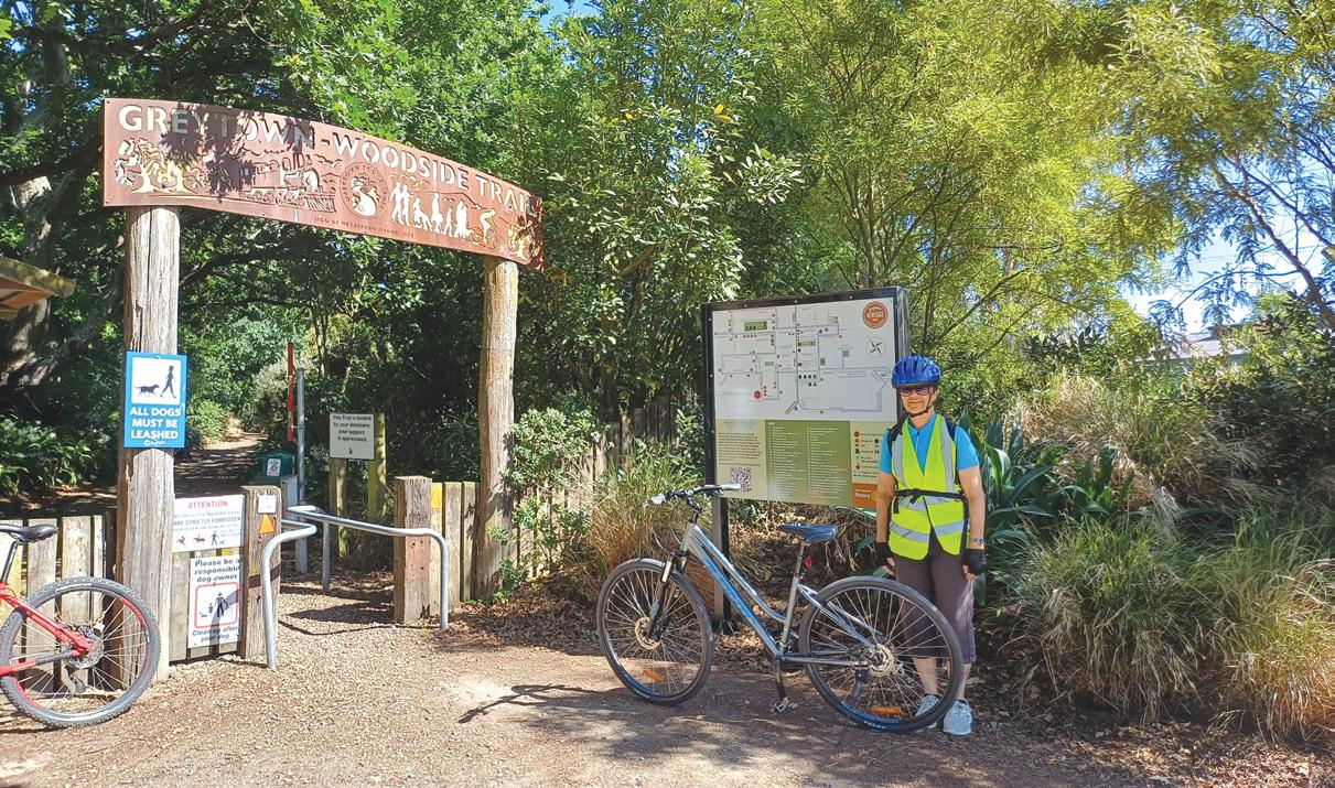
The Greytown to Woodside Trail and beyond
There are lots of opportunities for cycle rides around New Zealand and the Wairarapa region is no exception.
We were delighted to see that there was a rail trail in Greytown so we decided to spend a few days
exploring the area.
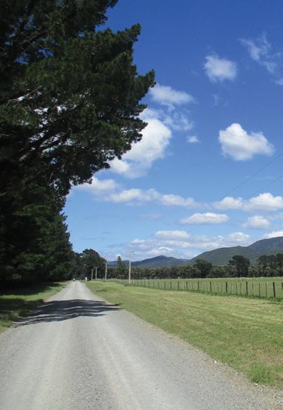
The Greytown to Woodside Trail is a scenic 5 km walking and cycling track connecting Greytown to the nearest train station at Woodside.
This branch railway line had been disused since the 1950s, but in 2010 it
was turned into a walking, running and cycling track.
The well signposted trail entrance starts in Cotter Street, Greytown. The wide limestone trail follows the original Greytown to Woodside rail-
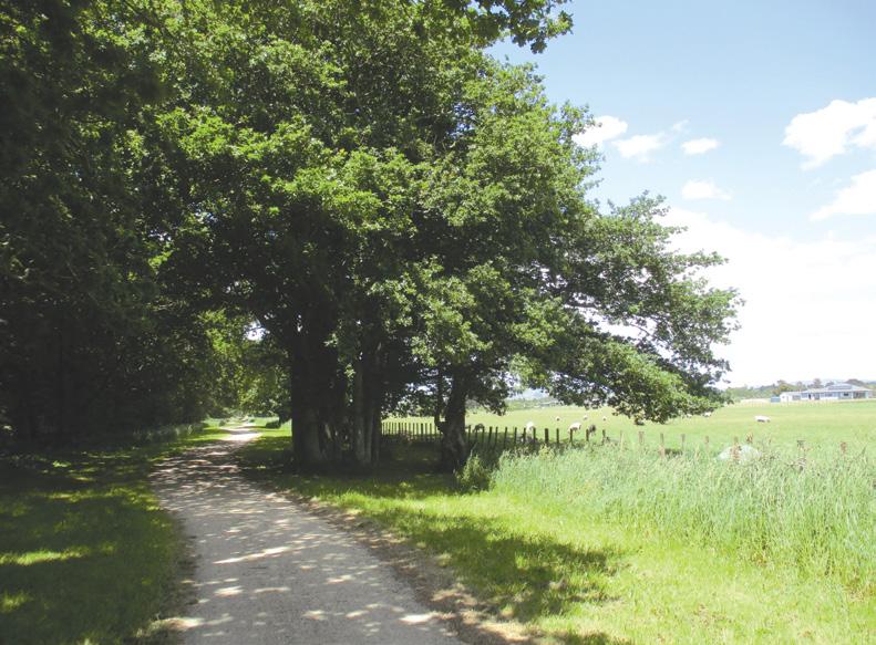
Above: The start of the Trail at Greytown.
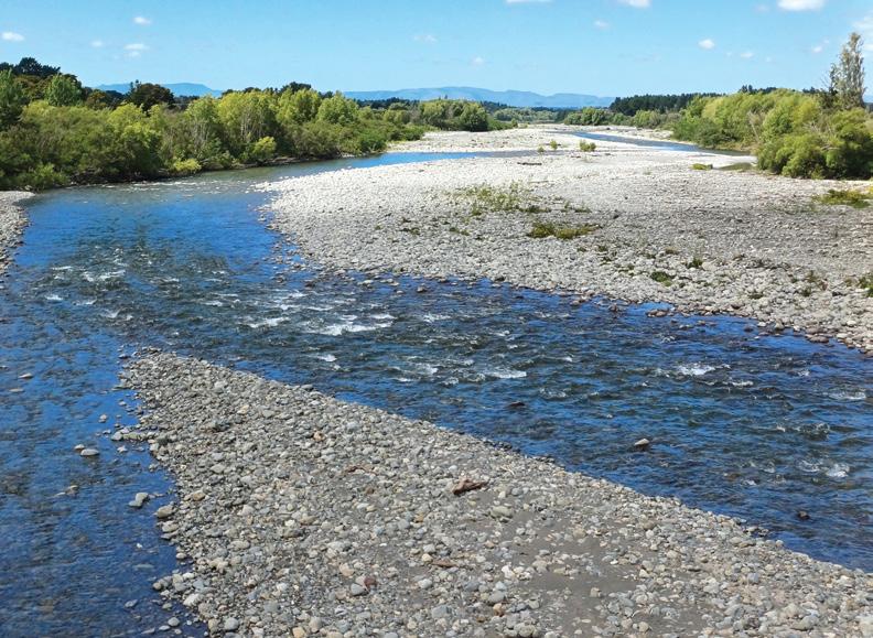
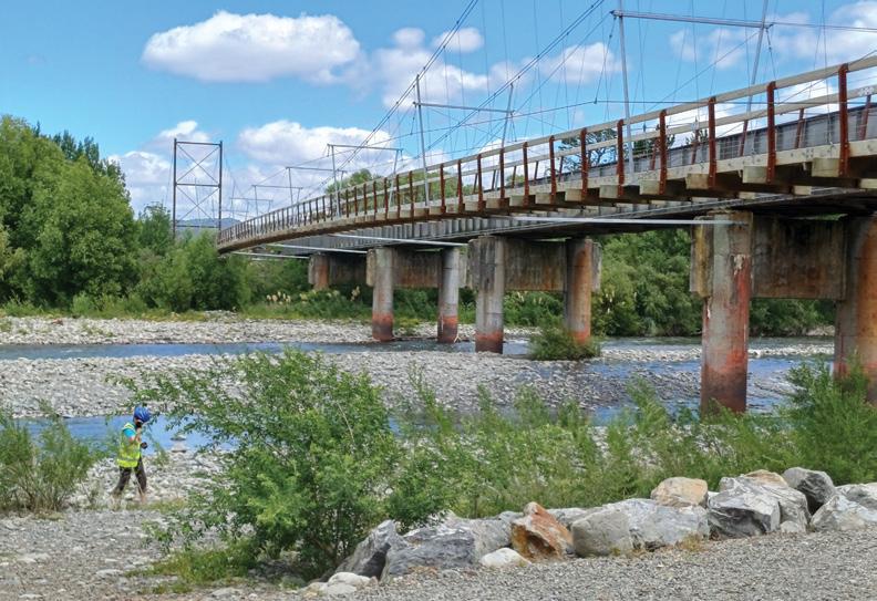
Below left: The Tauwharenikau River.
way line with views of the Tararua Range and Gladstone Hills.
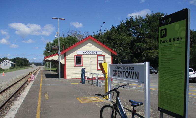
There is a regular train service on the Wairarapa Line from Wellington through to Masterton with a stop at the historic Woodside Station, still functioning today.
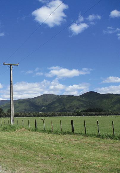
The trail weaves its way through a delightful avenue of oak trees and other shady trees in places, otherwise the trail passes through open farmland. Alpacas were spotted in a field near the start of the trail, curiously watching us as we cycled by.
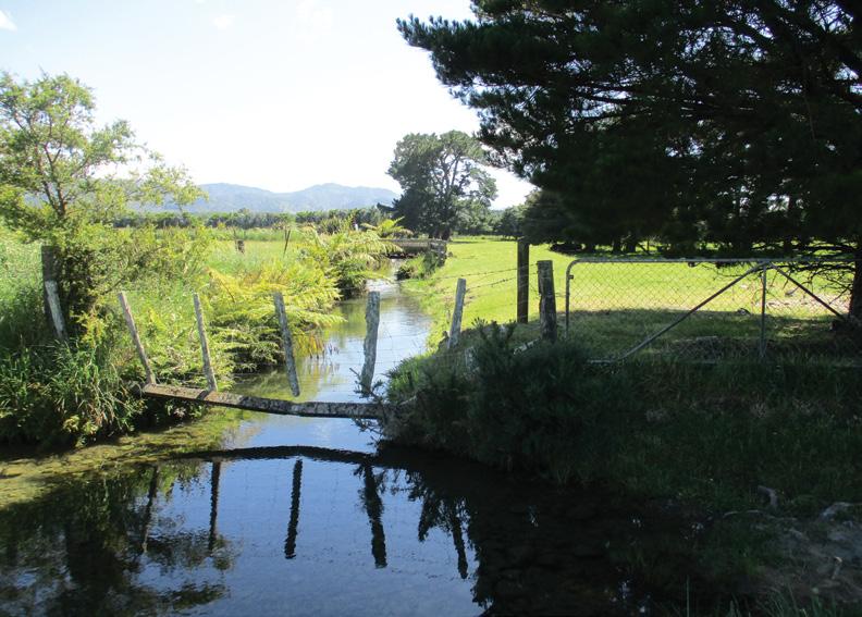
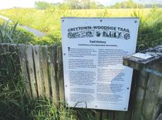
There are bridges crossing a couple of small streams along the trail, one stream being a water race. The Moroa water race scheme, completed in 1900, is still used today for stock watering purposes in the area. There are several information boards along the way to explain the history of the trail.
After an easy ride, we arrived at Woodside Station where a family was waiting to catch the train to Wellington. It was late, but we decided to continue on the next part of the trail, the Tauwharenikau Trail which leads to Featherston.
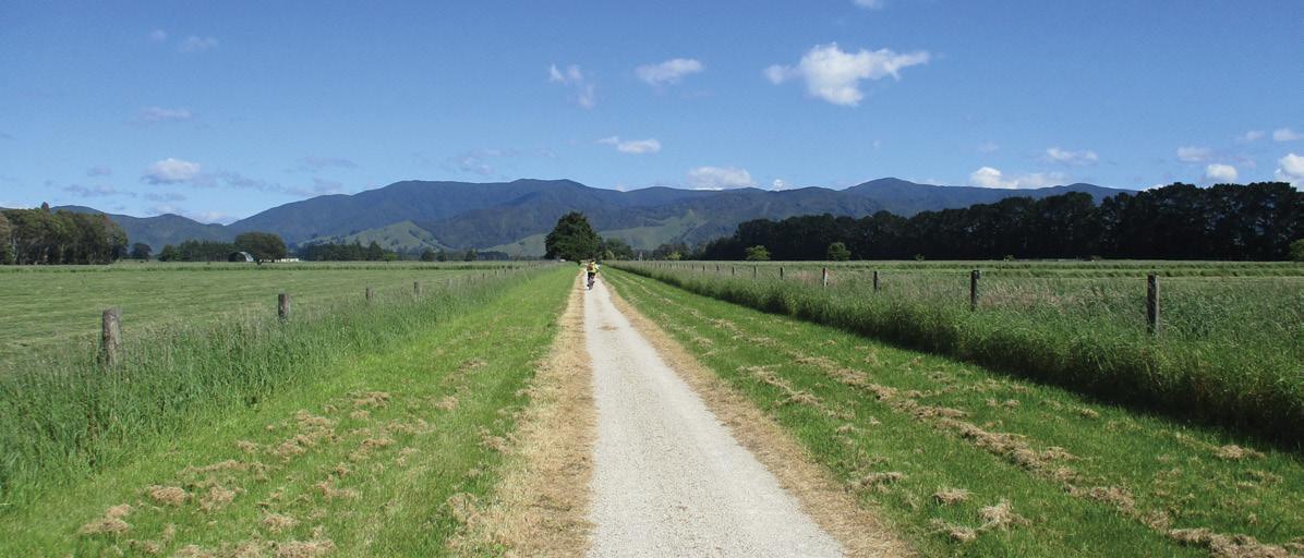
We cycled along the quiet gravel Underhill Road, a no exit back road
Above right: The Woodside Railway Station.
Middle right: A small stream to cross.
Below right: The oak trees provide shade.
Below left: In the wide open spaces.
The Greytown to Woodside Trail and beyond
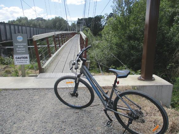
surrounded by farmland, and then an off road link trail to reach the Tauwharenikau River, crossing it on one of the longest cycle path suspension bridges in the country.
We admired the river views from the bridge. The source of the Tauwharenikau River is on the slopes of Mt Hector in the Tararua Forest Park and it flows into Lake Wairarapa. The 166m suspension bridge is right alongside a large rail bridge, and we soon heard and saw the late train crossing it.
Interesting to note that the suspension bridge is braced to the rail bridge as it is located in a high wind zone. The new Tauwharenikau section was completed at the end of 2022. Its length is 11.1 km from Woodside to Featherston.
We did not continue on our cycle ride to Featherston but enjoyed a lunch break at a picnic area beside the suspension bridge, before returning by the same route to Greytown.
Today there were a few walkers and cyclists out enjoying the trails. Approximate distance cycled was 20 kms return.
Above: A long stretch on the trail.
Below left: The railway bridge across the Tauwharenikau River.
Above: left: The cycle bridge beside the rail bridge across the Tauwhare-nikau River.
Below left: The history of the trail.
The Wairarapa Five Towns Trail is a project to develop almost 200 kms of recreational trails for walking and cycling linking Martinborough, Featherston, Greytown, Carterton and Masterton, taking up to 10 years to complete.
Getting there: The Greytown end of the trail starts on Cotter Street. The Woodside end of the trail starts from the Woodside Railway Station.
There are regular train services from Wellington to Woodside. Timetables are available from the Metlink website.
The H215 Professional 4 Function Pedometer
The H-215, 4-function pedometer is a superb, reasonably priced pedometer that counts steps, calculates distance, calories burned and has a 12/24 hour clock. This is the model that has sold over a quarter of a million worldwide. It has the largest display of any pedometer we tested and is very accurate.
Dimensions: (L) 5.6 * (W) 3.7 * (t) 2.7 cm
Price only $36.95 plus $6.00 P&P
Phone 0800-925-546 for bulk prices
Available now from: Walking New Zealand Shop 47 Lincoln Terrace, Palmerston North - Phone 0800-925-546 or email walkingnz@xtra.co.nz. www.walkingnewzealand.co.nz
www.walkingnewzealand.co.nz
Trail accessible to all ages and abilities
The Greytown Rail Trail is accessible to people of all ages and abilities. The surfaces are well-maintained and suitable for a range of mobility aids, including wheelchairs and strollers. The trails have gentle gradients, making them easily manageable for people with limited mobility or fitness levels.
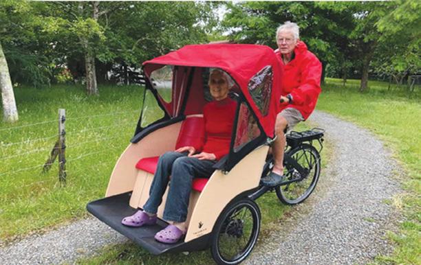
The off road sections of the Tauwharenikau Trail are also accessible to everyone and are wheelchair friendly. However the sections using public roads are not suitable. Greytown Cycling Without Age is a fantastic initiative that provides an opportunity for elderly and less-abled members of the community to enjoy the Greytown Rail Trail on a trishaw.
Volunteer pilots take passengers on a slow and gentle ride, allowing them to experience the beautiful scenery and fresh air. This initiative promotes social inclusion and encourages inter-generational connections. The Greytown Rail Trail provides a safe and enjoyable experience for all members of the community, and initiatives like this make it accessible to even more people.
DIRECTORY of GUIDED WALKS
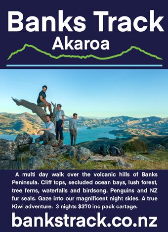
BANKS TRACK Akaroa
A multi-day walk over the hills at Akaroa 03-304-7612 bankstrack@xtra.co.nz www.bankstrack.co.nz
HUMPRIDGE TRACK Tuatapere 3 Day Loop Walk in Fiordland 03-226-6739 walk@humpridgetrack.co.nz www.humpridgetrack.co.nz
ISLAND HILLS STATION Nth Canterbury
Private track, self guided, multi-day walk 022-464-0140 Shaun@islandhillsstation.co.nz www.islandhillsstation.com
NORTHLAND EXPERIENCES Northland E-Bike tours and walking groups 027-203-8416 hello@northland experiences.co.nz www.northlandexperiences.co.nz
PAPAROA GUIDED WALKS Greymouth
All-inclusive guided tours along the Paparoa Track, Marlborough and Tasman regions 027-527-2762
TOTALLY TARAWERA Rotorua Your nature connection 07-362-8080
info@totallytarawerea.com www.totallytarawera.com
WILSONS ABEL TASMAN Marlborough Escape - Revive - Reconnect 03-528-2027
info@abeltasman.co.nz www.abeltasman.co.nz
KAHURANGI GUIDED WALKS Takaka Single and Multi-day hikes in Abel Tasman and Kahurangi National Parks 022-657-8869 kahurangiwalks@gmail.com www.kahurangiwalks.co.nz
SIDETRACKS -WOMEN NZ
Women - only hiking and cycling adventures 021-228-3912 info@sidetracks.co.nz https://www.sidetrackswomen.co.nz
KAIKOURA COAST TRACK Nth Canterbury NZ’ Finest 2 Day Private Walk 021-073-4726 sally@kaikouratrack.co.nz www.kaikouratrack.co.nz
This is a free listing service for guided walks/accomodation etc You can add this service to the list by contacting us at walkingnz@xtra.co.nz
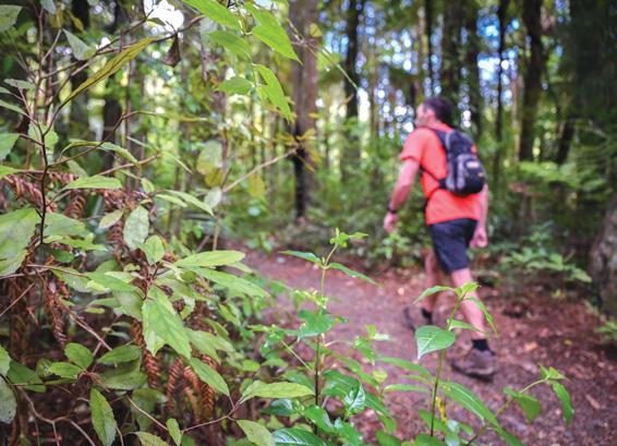
Many walks to explore in Pirongia Forest Park
By Ceana Priest
Head west to walk the flanks of the largest maunga in the Waikato, which dominates the western horizon yet is only a 30-minute drive from Hamilton. Beneath its dense ancient forest canopy, there’s plenty to explore on foot.
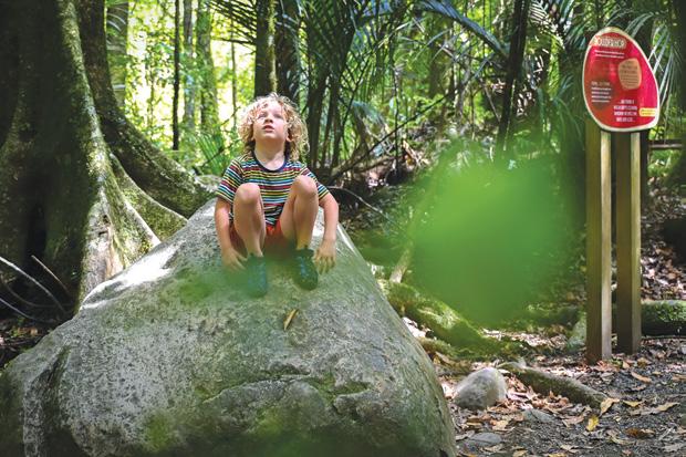
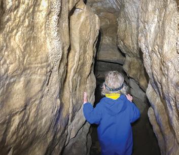
The Mangakara Nature Walk is a good starting point for leisurely strolling, while folks keen to head into the challenging interior of this forest park should prepare themselves for gut-busting climbs towards its 959-metre-high peak. Listen out for the haunting birdsong of the at-risk reintroduced kōkako. Kāniwhaniwha Caves & Nikau Walk
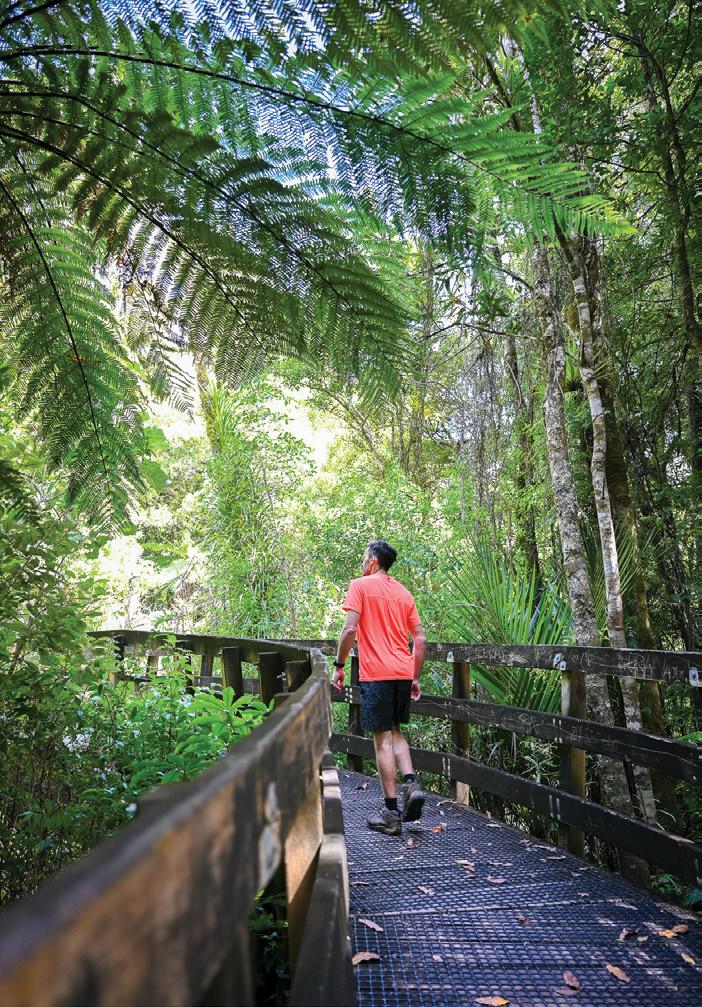
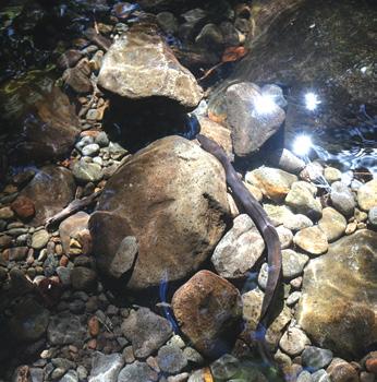
This outing ticks all the boxes if you aren’t squeamish about underground caves or unnervingly close cave wētā encounters. The trail follows the Kāniwhaniwha Stream along a pleasant flat 4WD route be-
Above left: On the Mangakaraka Walk. Photo Outdoor Kid
Below left: On the Kaniwhaniwha Caves and Nikau Walk. Photo Outdoor Kid
Below right: Look what’s in the stream on the Kaniwhaniwha Walk.
Photo Outdoor Kid
fore entering the forest towards the 20-metre-long limestone cave.
Some parts of the cave reach 7.5 metres high, although there are a couple of relatively tight corners to navigate. A torch will make this adventure safer and illuminate any ocean-dwelling fossils trapped for millions of years in the limestone rock.
On your return, follow the Nikau Walk signs, which lead to a grassy campsite with toilets and is perfect for picnics.
Information: Allow about 150 minutes to complete the loop and explore the cave. The car park is off Limeworks Loop Road near Te Pahū. Buggy-friendly on the 4WD track to the Nikau campsite. No dogs allowed.
Ruapane Lookout | Tirohanga Track
If you don’t mind clambering up the side of a volcano across tangled tree roots and steep rock formations, then your bucket list just got longer. But despite it being a grunt feast to the exposed rocky outcrop with its
trig, the views across the Waikato from the 723-metre-high vantage spot are worth it. Avoid it during winter or after heavy rain, as it can become a boggy mess.
Location: End of Corcoran Road near Te Pahū. Allow 60 minutes one way to the lookout. Only suitable for walking. No dogs allowed. Toilet available.
Mangakara Nature Walk
Tucked along the fringes of Pirongia Forest Park, this trail loops around magnificent stands of podocarp trees and across forest-shaded shallow streams with resident eels. Keep an eye out for the intriguing, large grey boulder, which has perplexed plenty of boffins who debate whether a volcano ejected it or, perhaps because of its round surface, it may have tumbled down a river. Either way, you won’t miss it on your stroll. The interpretative signs provide a healthy dose of education along the way, with the numbered posts matching a downloadable Department of Conservation factsheet.
Location: At Te Pahū turn onto Hodgson Road, then Grey Road. Allow 60 minutes return. Toilets available. Only suitable for walking. No dogs allowed.
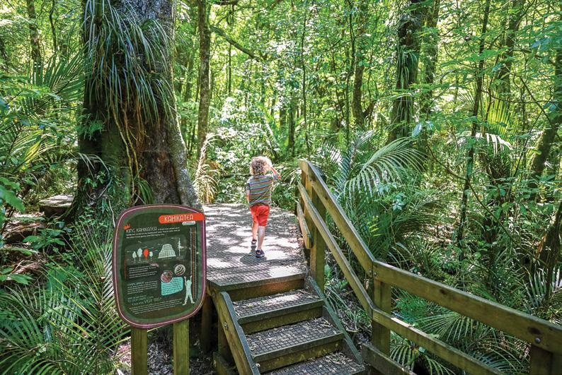
Kāniwhaniwha Kahikatea Tree
There’s some dispute about this kahikatea’s height; some folks are
keen to see it recorded as the tallest recorded native tree in New Zealand, while others are a little sceptical. It is at least 55 metres tall, which is still impressive either way. This track follows the well-maintained Nikau and Kāniwhaniwha Caves trails before heading off across more undulating terrain, with some muddier sections underfoot. Continue past the swing bridge to get a neck kick with this fine specimen.
Location: The car park is off Limeworks Loop Road near Te Pahū. Allow four to six hours to complete. Only suitable for walking. No dogs allowed.
Mt Pirongia Summit Tracks
If you have ticked off all the shorter bushwalks, set your sights on the summit of this magnificent maunga. Multiple routes ascend its flanks; some day-hikes are meandering, while others offer more strenuous outings. All options require a reasonable standard of fitness and tramping experience. Or, split the trip by staying near the summit at the bookable 20-bunk Pāhautea Hut.
Ceana Priest is the author of Outdoor Kid guidebooks available at Paper Plus stores.
Above left: On the Mangakaraka Walk. Photo Outdoor Kid
Above right: A hiker on the Kaniwhaniwha Caves and Nikau Walk. Photo Outdoor Kid
Below left: In the cave on the Kaniwhaniwha Caves and Nikau Walk. Photo Outdoor Kid
New Zealand Walks
45 guided walks in ECHO Walking Festival
By Hollie Procter
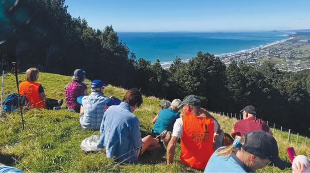
There’s nothing quite like walking to connect you with the land Whether it’s the crunch of leaves beneath your boots, the misty hush of a dense forest, or the thrill of reaching a summit and seeing the world stretch out before you, walking is an adventure in its purest form.
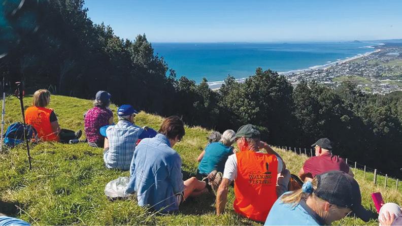
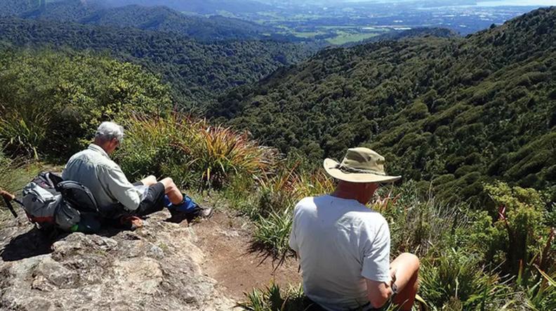
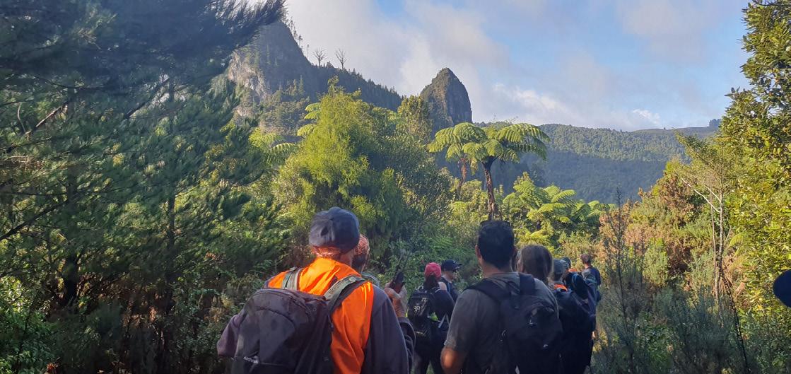
From 1st to 22nd April, the ECHO Walking Festival returns, offering over 45 guided walks across some of the most breathtaking landscapes from the Kaimais to the Coromandel. From family-friendly nature trails to tough climbs that will test even the most seasoned trampers, this festival is about getting outdoors, learning about the land, and enjoying the journey.
For those looking for a serious adventure, the festival features some
of the most rewarding hikes in the North Island.
● Tuahu Track (Kaimai Ranges)
– This challenging point-to-point hike takes trampers from Te Aroha to Katikati, following the Tuahu Track across the rugged Kaimai Range The walk weaves through pine forest, climbs steep terrain to the NorthSouth Track, and offers breathtaking summit views over the eastern and western sides of the ranges.
Walkers will cross the Te Rereatukahia stream, pass mature kauri trees, and finish on Hot Springs Road.
● Wairere Falls to Te Tuhi Track (Kaimai Ranges) – This iconic tramp begins at the Wairere Falls carpark, with a steep climb to the lookout, revealing the 153m two-stage drop of Wairere Falls The track then con-
tinues to the summit of the falls, offering spectacular views of the Waikato and Hauraki Plains. From here, the journey follows the NorthSouth Track before descending along the Te Tuhi Track, where trampers emerge from the bush to expansive southern views.
● Waiotahi – Karaka Loop (Thames) – This challenging circuit, led by the Kauaeranga Tramping Club, starts at the Karaka Rd DOC carpark and climbs steeply through regenerating bush before levelling out into hills with stunning views over the Firth of Thames.
The Red Rocks Bluff section offers impressive valley views, and along the way, you’ll pass reminders of Thames’ gold-mining past, including old shafts and access roads once used to reach gold seams hidden in the hills.
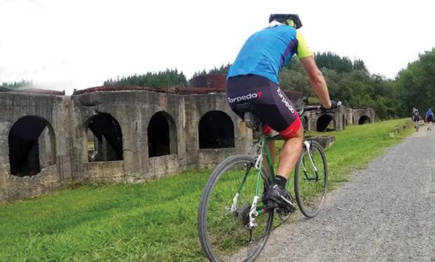
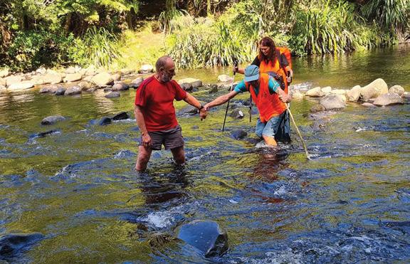
Above left: Time for a lunch break. Below left: There is even a bike ride in the festival.
Below right: Two give a helping hand crossing a stream.
The ECHO Walking Festival isn’t just about long-haul treks and summit climbs though, there are plenty of family-friendly options that make the outdoors accessible to all ages and abilities.
● Waitekohekohe Kids Educational Walk – Designed for young explorers, this interactive nature walk introduces kids to the wonders of the forest, from birdsong identification to spotting hidden insects.
● The Fungi Walk – A gentle bush stroll that uncovers the fascinating world of fungi, perfect for families or those with an interest in biodiversity and conservation.
● Luck at Last Goldmine Walk –A light-hearted historical adventure, where walkers can explore the remains of old mining operations, spot relics from the gold rush days, and
even step inside the Number 1 and Number 2 mine drives.
One of the best things about the ECHO Walking Festival is that all walks are guided. That means: no getting lost - just turn up and follow the lead. Guides will take you to places you might not find on your own and you can learn about the area’s history, ecology, and cultural significance from expert as you walk.
It is a safe way to push your limits - whether you’re hiking solo or bringing the whole family, guided walks
make exploring new terrain feel easy and fun.
With over 45 walks available, there’s something for every level of walker, whether you want to challenge yourself with a full-day tramp or enjoy a relaxed morning stroll through native bush.
Walks must be booked online, so head to www.echowalkfest.org.nz to secure your spot. Lace up your boots, gather your whānau or tramping mates, and step into an adventure that’s waiting for you with ECHO.
2024 First place: Alan Campbell
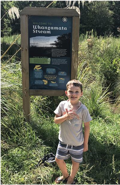
Whangamata Stream Trail through a beautiful forest
The Whangamata Stream Trail, located near Kinloch, offers a picturesque journey through beautiful forest scenery.
The trail runs from Lake Taupo up to Whangamata Road, providing visitors with a serene walking or biking experience.
The Whangamata Stream Trail is about 4 km long, making it an accessible option for various fitness levels. It’s a dual-use track, suitable for both walking and biking, allowing visitors to choose their preferred mode of exploration.
While the trail is generally considered moderate in difficulty, it offers a pleasant forest walk with some variations in terrain. The path follows the Whangamata Stream, providing a mix of flat areas and gentle inclines.
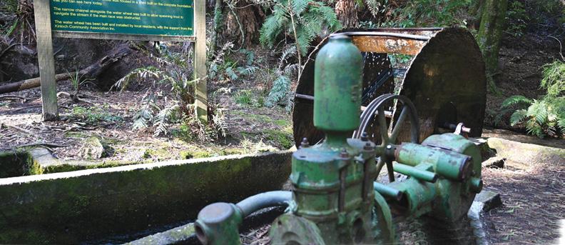
One of the highlights along the trail is the historic Kinloch waterwheel. This feature adds a touch of local history to your journey, offering a glimpse into the area’s past.
The trail’s namesake, the Whangamata Stream, is a clear-flowing waterway that serves as a spawning stream for trout. Visitors might be
WALKING WAINWRIGHT’S COAST TO COAST 22 nights I 28 August - 19 September 2025
Take on Englands’ premiere long- distance walk through the Lake District, Yorkshire Dales, and the North York Moors for stunning scenery, cozy inns, pubs and a real sense of achievement. 0800 853 276 I calderandlawsontours.co.nz
lucky enough to spot trout hiding under the banks, adding an element of wildlife observation to the experience.
The trail winds through beautiful forest areas, providing a refreshing and immersive nature experience. The lush greenery and native flora create a peaceful atmosphere for walkers and cyclists alike.
The Trail is part of a network of walking and cycling tracks centered around Kinloch and the area has been developed with conservation and recreation in mind. The trail and surrounding area are protected, with strict rules against activities like trout poaching.
The trail starts near Kinloch, a small village that serves as a hub for outdoor activities in the area that includes a general store.
Kinloch is also the heart of the Great Lake Trail, a larger network of mountain biking and hiking tracks. After exploring the Whangamata Stream Trail, visitors can extend their adventure by connecting to other parts of this extensive trail system.
The lakefront area of Kinloch,
Above left: Two people stop for a minute on the trail
Below right: The information sign.
including its marina, is connected by walking trails
This provides additional opportunities for scenic walks and relaxation after completing the Whangamata Stream Trail.
The Whangamata Stream Trail offers a delightful 3 km journey through the picturesque landscape near Kinloch. Whether you’re interested in a leisurely walk, a bike ride, or simply enjoying nature, this trail provides a perfect opportunity to experience the beauty of the Taupo region.
With its historic waterwheel, clear-flowing stream, and lush forest scenery, the trail offers something for nature enthusiasts, history buffs, and casual visitors alike. Its proximity to Kinloch village and connection to the larger Great Lake Trail network make it an excellent starting point for exploring the broader area.
As you plan your visit, remember to respect the environment, keep an eye out for local wildlife, and take the time to appreciate the natural beauty that the Whangamata Stream Trail has to offer.
Whangamata Stream Trail Committee chair John Crowley says looking at the walkway today, you would have no clue that blackberry, broom and Japanese honeysuckle once strangled the walkway sides and stream bank.
Over the years, a team of up to 40 volunteers connected to the Whangamata Stream Trail Committee, cleared the weeds and slowly replaced them with thousands of native plants, including flaxes, mānuka, kōwhai and beech trees. They have also progressively improved the trail so it is now suitable for biking and walking.
The work has been carried out with the help of funding and advice from Waikato Regional Council
John says they have used some of those funds for more clearing in areas along the stream that still needed work, and planting beech trees at the northern end of the trail. The balance
is being used for more riparian planting in the same area.
“We have planted around 500 mānuka over the last few years and thousands of other plants.”
“We had about 22 volunteers here with weed eaters just the other weekend helping to clear areas ready for planting. We like to clear them and then get the plants in as soon as possible because once the plants are in, they help to close out the weeds regrowing.”
The project started when a local farmer vested the land on either side of the stream into Department of Conservation (DOC) ownership. The Kinloch Community Association then took over managing it and eventually the Whangatamata Stream Trail Committee was formed to do the labour.
The stream itself is an important trout spawning area and if you visit during spawning season you will see trout milling about in the clear water.
“It’s a wonderful environment and it’s used so much by the local
community and holidaymakers to the area,” says John, who has lived near Kinloch for 30 years.
He says the regional council has also helped with advice on what to plant where: flaxes planted closer to the stream edges, natives to fill the riparian area and larger trees like beech on the perimeter.
“It’s been a real learning process for all of us and the knowledge shared by council staff has been really helpful.”
The most recent goal is to get the trail to wheelchair and stroller access standard.
The group also have a strong pest control focus and want the trail to become a bird corridor from the hills behind the trail down to the lake.
“We already have a lot of tūi and bellbirds, but we’d like to attract wood pigeons and kākā. We’ve been carefully choosing trees that will be a food source for the birds and a nesting opportunity for them as well.”
Above right: The historic water wheel.
Above left: This isn’t a Great Walks-type walk, but a great walk nonetheless, all within quarter of an hour of my home in Nelson, taking in the quiet and shady trails through the bush of the Grampians ridges and valleys. Although I’m sure the trails are well-used I rarely meet anyone else. I hope my photo conveys the feeling of peace and the company of the bush that I am lucky to have so close at hand. Photo by Martin Hucklesby, Nelson.
PHOTO CONTEST
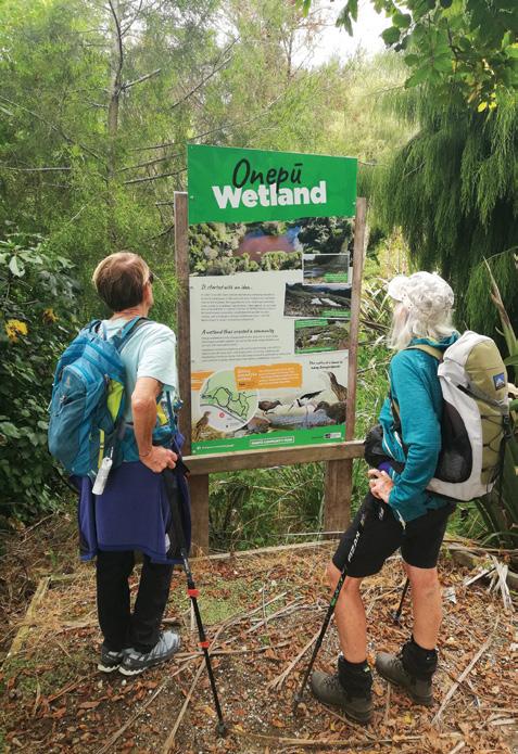
Above right: Marg and Irene studying an information board at the Onepu Wetlands. These wetlands and the adjacent reserve area have a network of walking and cycling tracks and can be found on SH30 not far west of Kawerau. Photo by John MacDonald, Te Puke.
Walking New Zealand Digital Photo Contest
Email your entries to: walkingnz@xtra.co.nz with subject line “Walking New Zealand Photo Contest”Only EMAILED entries will be accepted. We are looking for the best digital photos each month depicting walking Now the time to get your digital camera out or look through your digital images and enter the
The image could be a scenic scene, a walk on the beach with the dog, a bush walk, a street walk or anything walking that takes your fancy.
The rules are simply: there must be a person or persons walking in the picture either front, side or back on, and can be in the distance. We require an emailed image in high resolution mode, in jpeg format as an attachment, and NOT embedded in Word or in the email, and NOT a link to a website to be downloaded.
The subject line must have the words “Walking New Zealand Photo Contest” and the email must include the NAME, POSTAL ADDRESS and phone number of the person who took the photo and a detailed caption saying where it was taken and any other interesting details.
In this contest only ONE emailed photo accepted per month. Entry in the contest automatically allows us to print the image. The person who has their photo published will receive a six month subscription or a renewal to Walking New Zealand magazine of six months. If a picture is chosen for the cover page the person will receive a 12 month subscription or renewal.
You can now view and enjoy the latest issue of Walking New Zealand magazine online for only $2.50 at http://www.walkingnewzealand.co.nz
Above right: Members of the Upper Hutt Walking & Tramping Club stopping for lunch and to enjoy the views at the Brooklyn Gun Emplacements located in George Denton Park and Waimapihi Reserve.
by Judith O’Leary, Upper Hutt.
Above left: Family down from Auckland and Tauranga so on went the walking boots. Here Jean is pointing to the map, will it be Mt Oxford or Ryde Falls. Photo taken by Heather Winter - Oxford
Below right: A
Photo by Vicky Ross, Red Beach.
Photo
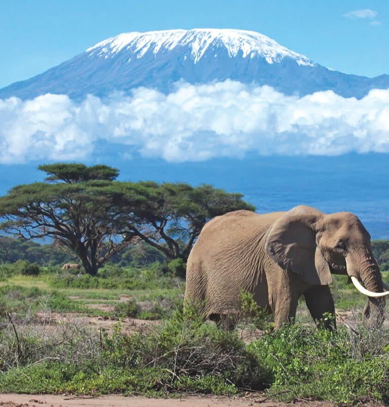
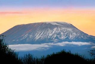
Climbing Mt Kilimanjaro the worlds tallest free standing mountain
In July-August this year, Footsteps Walking Club is sponsoring a trip to Mount Kilimanjaro, which is located on the border between Tanzania and Kenya. We will be utilising the services of an agency which provides experienced guides and all the things necessary for a successful expedition.
This article contains valuable information for all those who see this challenge as a definite future prospect.
Kilimanjaro is not only Africa’s tallest peak, but also the world’s tallest free-standing mountain. The summit, named Uhuru Point, is 5,895m above sea level. It is on the equator. Three volcanic cones created it. It is not extinct, but dormant. Its summit icecap is fast disappearing. It takes five to nine days in to reach the Mount Kilimanjaro Summit and then descend to the finishing point. The more days spent on Mount Kilimanjaro, the more likely you will successfully summit, as you will become more acclimatised to the altitude and will be less fatigued.
The most common factor that prevents many climbers from reaching the summit at Uhuru Peak is not the trekking, but altitude sickness (the inability to acclimatise to the high altitude). Altitude sickness is caused by reduced air pressure and lower oxygen levels at high altitudes.
The faster you climb, the more likely you will get acute mountain sickness (AMS). It is not only the height that causes AMS, it is also the rate of ascent. Therefore, the best safety precaution you can take for your Kilimanjaro climb is to allow plenty of time to become properly acclimatised to high altitude. A sleeping elevation no more than 400m higher than the previous night is recommended.
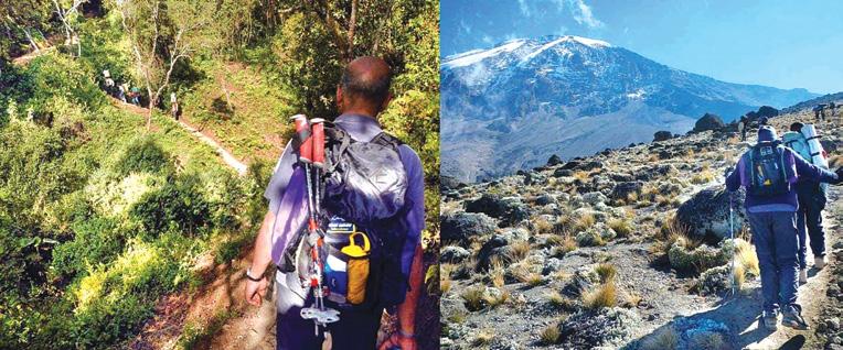
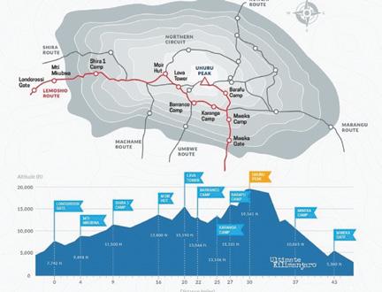
There are eight established Kilimanjaro routes: Marangu, Machame, Lemosho, Shira, Rongai, Northern Circuit, Umbwe and The Western Breach. The Lemosho is our pre -
By Phillip Donnell
ferred route because it offers a balance of low traffic, spectacular views and high summit success rate. It includes strategic acclimatisation days, which will help your body adjust to the high altitude.
The Lemosho route is considered one of the easiest routes on Kilimanjaro. The exact trekking distance for the Lemosho Route is 71 km. It’s possible to trek the Lemosho route in six days, however we recommend a longer itinerary of eight days in total, including the summit day and descent. The longer ascent allows additional time to get accustomed to high altitudes, increasing your chance
of reaching the summit. However, hikers will still need to ascend the Barranco Wall and climb steeply on summit night. No technical climbing is required but a good level of fitness is highly recommended.
An 8-day undertaking of the Lemosho route looks like this: DAY 1 – Londorossi Gate to Mti Mkubwa
Elevation: 2560m to 2895m
Hiking Time: three to four hours
Distance: 6 km
Habitat: Rain Forest
We depart Moshi for Londorossi Gate, which takes about four hours, where you will complete entry formalities. Then drive to the Lemosho trailhead. Upon arrival at
the trailhead, we begin hiking through undisturbed forest which winds to the first camp site.
DAY 2 – Mti Mkubwa to Shira 1 Camp
Elevation: 2895m to 3505m
Hiking Time: five to six hours
Distance: 8 km
Habitat: Heath
We continue on the trail leading out of the rain forest and into a savannah of tall grasses, heather and volcanic rock draped with lichen beards. As we ascend through the lush rolling hills and cross several streams, we reach the Shira Ridge before dropping gently down to Shira 1 Camp. Here we catch our first glimpse of Kibo peak across the plateau.
DAY 3 – Shira 1 Camp to Moir Hut
Elevation: 3505m to 4205m
Hiking Time: five to seven hours
Distance: 11 km
Habitat: Heath
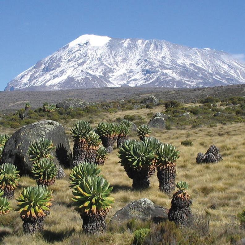
We explore the Shira Plateau for a full day. It is a gentle walk east on moorland meadows towards Shira 2 Camp. Then we divert from the main trail to Moir Hut, a little used site on the base of Lent Hills. A variety of walks are available on Lent Hills making this an excellent acclimatization opportunity. Shira Plateau is one of the highest plateaus on earth.
DAY 4 – Moir Hut to Lava Tower to Barranco Camp
Moir Hut to Lava Tower
Elevation: 4205m to 4630m
Hiking Time: four to five hours
Distance: 7 km
Habitat: Alpine Desert
Lava Tower to Barranco Camp
Elevation: 4630m to 3975m
Hiking Time: two to three hours
Distance: 3 km
Habitat: Alpine Desert
We begin the day climbing up a ridge and then head southeast towards the Lava Tower – a 100m tall volcanic rock formation. We descend down to Barranco Camp through the strange but beautiful Senecio Forest to an altitude of just below 4000m. Although you begin and end the day at the same elevation, the time spent at higher altitude is very beneficial for acclimatization.
DAY 5 – Barranco Camp to Karanga Camp
Elevation: 3975m to 3995m
Hiking Time: four to five hours
Distance: 5 km
Habitat: Alpine Desert
We begin the day by descending into a ravine to the base of the Great Barranco Wall. Then we climb the non-technical but steep, nearly 275m cliff. From the top of the Barranco Wall we cross a series of hills and valleys until we descend sharply into Karanga Valley. One more steep climb leads us to Karanga Camp. This is a shorter day meant for acclimatisation.
DAY 6 – Karanga Camp to Barafu Camp
Elevation: 3995m to 4675m
Hiking Time: four to five hours
Distance: 4 km
Above left: A elephant under Mt Kilimanjaro.
Above right: Unusual growth in front of Mt Kilimanjaro
Below left: on the Lemoso Raoute to Mt Kilimanjaro.
Climbing Mt Kilimanjaro the worlds tallest free standing mountain
Habitat: Alpine Desert
We leave Karanga and hit the junction which connects with the Mweka Trail. We continue up the rocky section to Barafu Hut. At this point, you have completed the Southern Circuit, which offers views of the summit from many different angles. Here we make camp, rest and enjoy an early dinner to prepare for the summit day. The two peaks of Mawenzi and Kibo are viewable from this position.
DAY 7 – Barafu Camp to Uhuru Peak to Mweka Camp
Barafu Camp to Uhuru Peak
Elevation: 4675m to 5895m
Hiking Time: seven to eight hours
Distance: 5 km
Habitat: Arctic
Uhuru Peak to Mweka Camp
Elevation: 5895m to 3065m
Hiking Time: four to six hours
Distance: 12 km
Habitat: Rain Forest
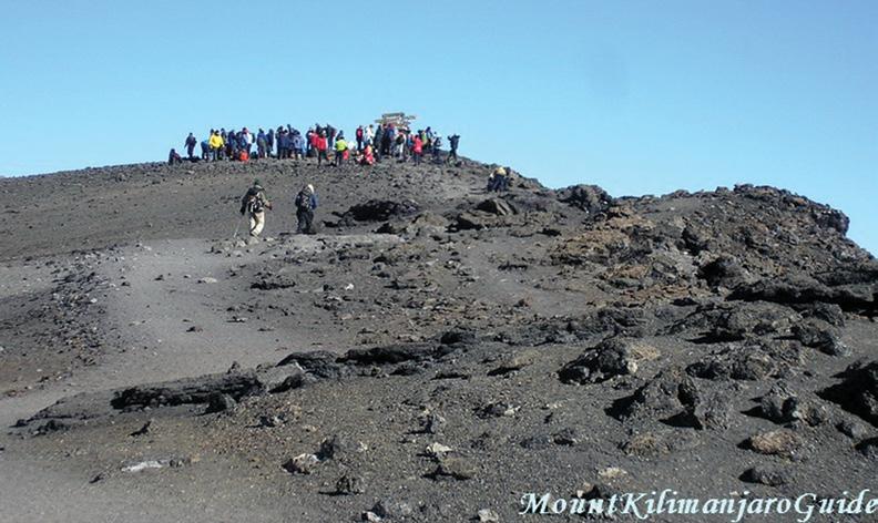
Very early in the morning (around midnight), we begin our push to the summit. This is the most mentally and physically challenging portion of the trek. The wind and cold at this elevation and time of day can be extreme. We ascend in the darkness for several hours while taking frequent, but short, breaks. Near Stella Point (5760m), you will be rewarded with the most magnificent sunrise you are ever
likely to see, coming over Mawenzi Peak. Finally, we arrive at Uhuru Peak– the highest point on Mount Kilimanjaro and the continent of Africa.
From the summit, we now make our descent down to the Mweka Hut camp site, stopping at Barafu for lunch. The trail is very rocky and can be quite hard on the knees; trekking poles are helpful. Mweka Camp is situated in the upper forest and mist or rain can be expected in the late afternoon. Later in the evening, we enjoy our last dinner on the mountain and a well-earned sleep.
DAY 8 – Mweka Camp to Mweka Gate
Elevation: 3065m to 1640m
Hiking Time: three to four hours
Distance: 10 km
Habitat: Rain Forest
On our last day, we continue the descent to Mweka Gate and collect the summit certificates. At lower elevations, it can be wet and muddy. From the gate, we continue another hour to Mweka Village. A vehicle will meet us at Mweka Village to drive us back to the hotel in Moshi.
Those who reach the summit of Kilimanjaro experience a strange exhilaration. They are moved by a deep sense of achievement, half-breathless moments of amazement and incredulity. They are also overcome by the profound and chilly solitude of the spot.
The golden haze of pensive light at sunrise, the sense of infinite peace brooding over the place, and the silent, sacred, stately seclusion, all foster what feels like a veritable spring-cleaning of the soul.
Registrations for this trip are being received until 1 April. For details please contact Footsteps (021 172 3244, footstepsanz@gmail.com ) or visit their website (www.footstepswalkingclub.com). They welcome your enquiry, but do not delay!
Conquering
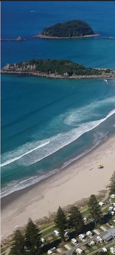
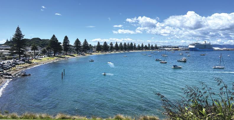
A aerial view of the Mt Maunganui are including the ocean beach to the left: Photo by
Below Right: One of the signs along the way.
Above left; Approaching Uhuru Peak.
Above:
Explore Tauranga
Words by Patrick Quinn
Photos by Lisa Trow
the summit of Mount Maunganui
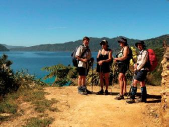
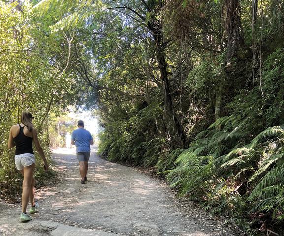
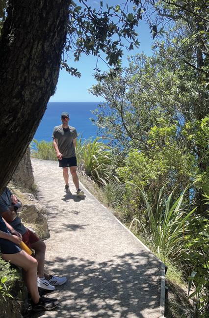
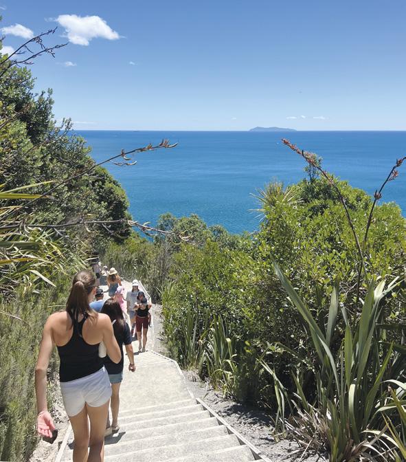
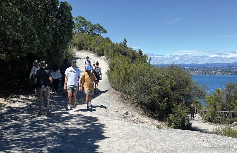
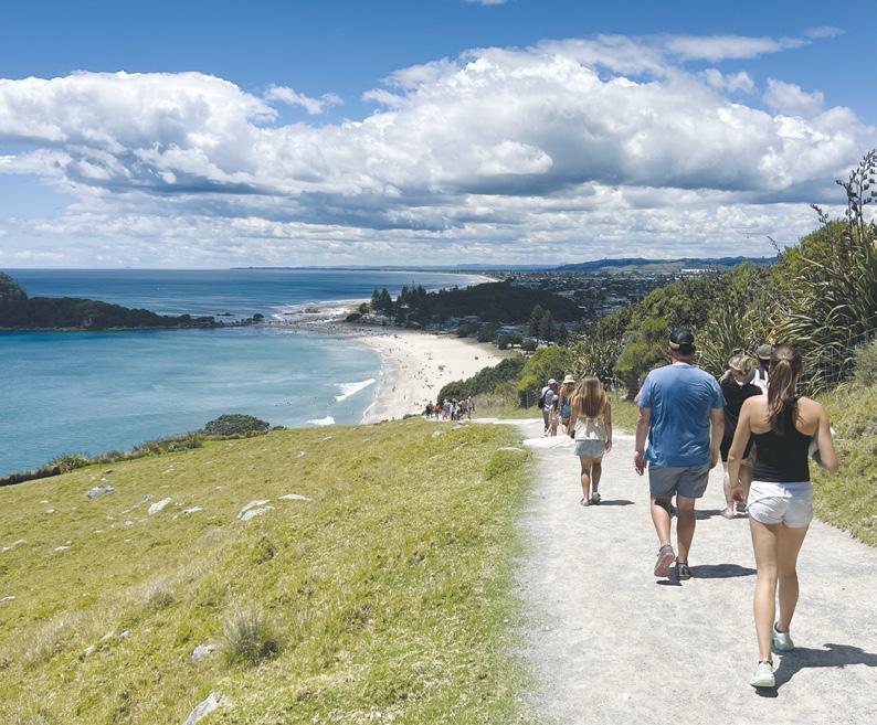
As I stood at the base of Mount Maunganui, gazing up at its imposing 232-metre peak, I felt a mix of excitement and anticipation. The iconic mountain, known locally as Mauao, has long been a symbol of the Bay of Plenty region, and today I would finally tackle its famous summit track.
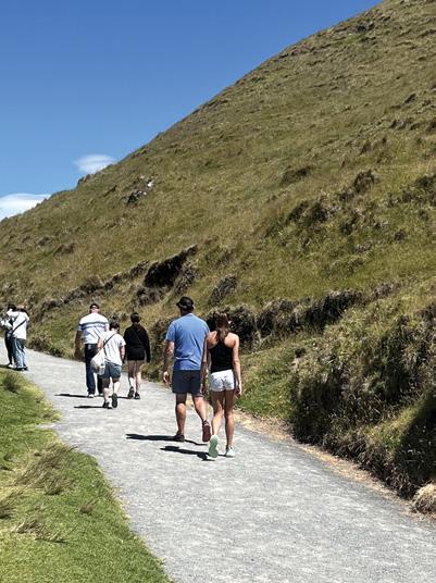
Setting off from the main beach, I joined the steady stream of hikers making their way up the well-worn path. The track started with a series of steep steps, immediately getting my heart pumping. As I climbed higher, the lush native forest enveloped me, providing welcome shade from the morning sun.
The trail was busy, even early in the day. I encountered people of all ages and fitness levels, from young families to elderly couples, all united in their goal to reach the summit. Many locals use the track
Conquering the summit of Mount Maunganui
as their daily workout, and I watched in awe as a few runners effortlessly bounded up the steep incline.
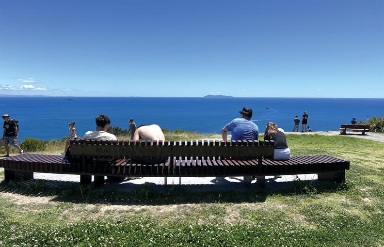
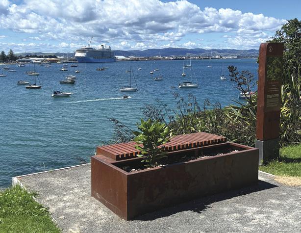
About halfway up, I paused at one of the thoughtfully placed benches to catch my breath and take in the expanding views. The city of Tauranga sprawled out below, while the golden sands of Mount Maunganui Beach stretched as far as the eye could see. In the distance, I could make out the outline of Matakana Island.
As I continued upward, the forest began to thin, revealing more of the spectacular panorama. I chatted briefly with a friendly couple with their daughter from Palmerston North who were visiting Tauranga for a few days, who were impressed with all the views along the way.
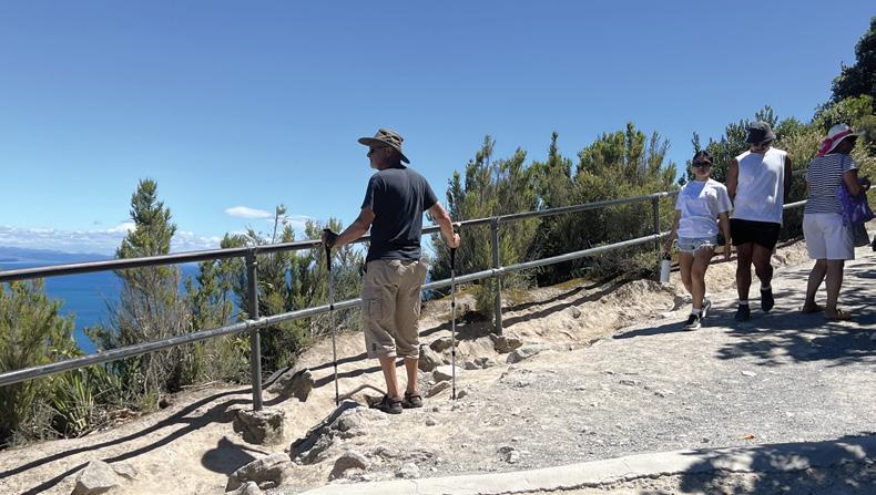
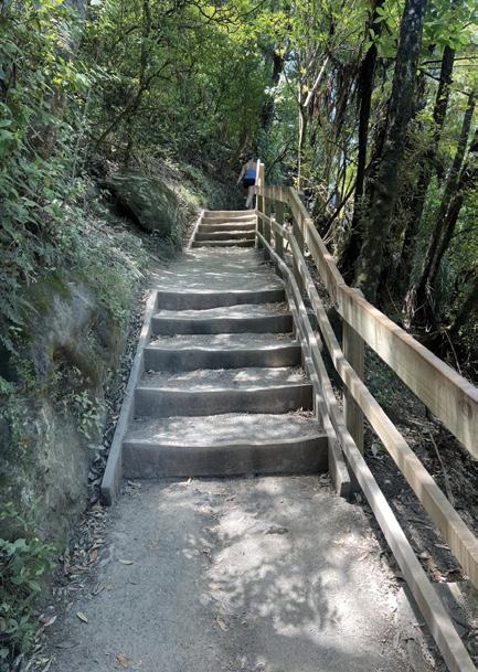
The last section of the climb was the most challenging, with steep gravel paths and some rocky sections. However, the anticipation of reaching the top spurred me on. Fellow hikers offered words of encouragement as we passed each other, creating a sense of camaraderie.
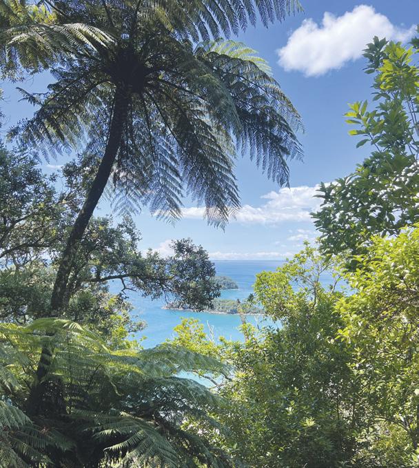
After about 45 minutes of steady climbing, I finally reached the summit. The 360-degree views were nothing short of breathtaking. To the east, the vast expanse of the Pacific Ocean stretched to the horizon. To the west, the harbour of Tauranga glittered in the sunlight. The neighbouring islands dotted
Above left and above right: It can be a busy time on the trail on holiday time.
Middle left: Looking out into the iner harbour towards the post of Tauranga.
Below left: Stoopping here fora brreak before making the final asscent.
the seascape, and on this clear day, I could see far into the distance.
I spent a good half hour at the top, soaking in the views and chatting with other hikers. A group of international students were excitedly taking selfies, while a local man pointed out landmarks to his grandchildren. The summit had a festive atmosphere, with everyone celebrating their achievement and marvelling at the beauty surrounding us.
For the return journey, I chose to take the steeper Waikorere Track. This route offered a different perspective of the mountain and some challenging downhill sections. The descent was quicker than the climb, taking about 35 minutes, but it required careful footing on the loose gravel.
Overall, my round trip to the summit took about one hour and 20 minutes, not including the time
spent at the top. The track itself is well-maintained and clearly marked, making it accessible for most reasonably fit individuals. However, the steep sections and uneven terrain mean it’s not suitable for those with mobility issues or very young children.
The summit track offers a perfect blend of natural beauty, physical challenge, and rewarding views. It’s easy to see why it’s such a popular activity for both locals and tourists. The sense of accomplishment upon reaching the top is unmatched, and the panoramic vistas make every step worthwhile.
As I descended from the summit,
Above right and below right: : A place to stop and watch ships entering the harbour.
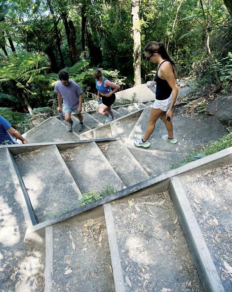
Middle right: Steps in a shaded area.
Below left: A nice shaded path.
Conquering the summit of Mount Maunganui
Above left: Looking out through the trees into the Pacific.
Above right: Going down the steps with a great ocean view.
Below left: A narrow part of the trail.
Below Right On the way down from the summit.
my thoughts turned to a planned walk around the base of Mount Maunganui in a few days time . This easier track promises a different but equally enjoyable experience, and I’m eager to explore it.
The Mount Maunganui Base Track is a gentler alternative to the summit climb, offering a 3.4-kilometre loop around the mountain’s base. It typically takes about 45 minutes to complete and is suitable for walkers of all fitness levels.
I’m looking forward to experiencing the diverse coastal scenery, from rocky shores to sandy beaches. The track is known for
its excellent views of the harbour, Matakana Island, and the open ocean. I’ll be keeping an eye out for evidence of the mountain’s rich Māori history, such as ancient shell middens and the remnants of pā sites.
The base track is mostly flat with some gentle inclines, making it accessible for strollers and those with limited mobility. I plan to take advantage of the numerous benches along the way to pause and soak in the views.
Based on my research, I’ll be sure to bring a water bottle, sunscreen, and a camera to capture the scenic vistas. I’m also planning to start early
to avoid the midday heat and crowds. With no rubbish bins on the track, I’ll make sure to carry out any litter.
I’m particularly excited about the opportunity to explore the beaches and rock formations along the base. The clear waters might even offer a chance to spot some marine life, although I’ll be cautious of the surf, especially in areas without lifeguards.
My ascent of Mount Maunganui’s summit track was an exhilarating experience that combined physical challenge with natural beauty. The diverse group of people I encountered, from fitness enthusiasts to families, all shared in the joy of reaching the top and witnessing the stunning views.
As I look forward to the base track walk, I’m reminded of the varied experiences Mount Maunganui offers. Whether you’re seeking a vigorous hike or a leisurely stroll, this iconic landmark has something for everyone.
The summit and base tracks showcase different aspects of the mountain’s beauty, and I feel fortunate to have the opportunity to explore both.
Mount Maunganui stands as a testament to the natural wonders of the Bay of Plenty region. Its tracks not only provide exercise and scenic views
but also foster a sense of community among those who walk them. As I rest and prepare for the next adventure, I’m grateful for the memories made today and excited for what the base track will reveal.
Above right: the final stretch to the summit.
Above left: Steps and steps and more steps.
Below right: On the way down to Mt Maunganui Beach.
New Zealand Walks
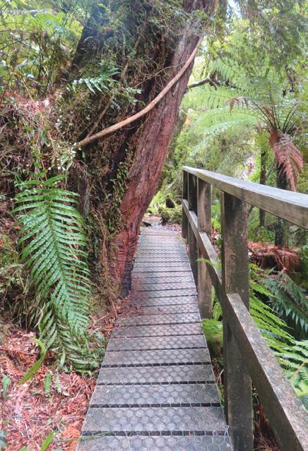
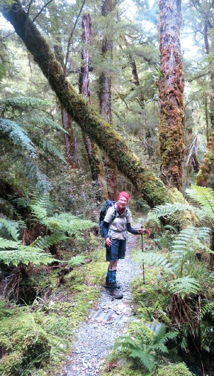
Four fascinating days in Fiordland
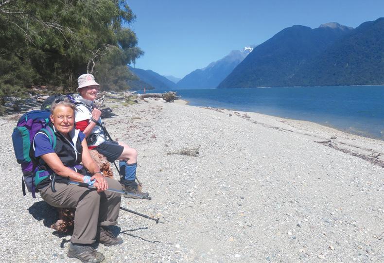
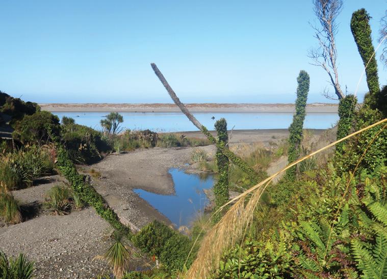
Last Summer we made walking the Hollyford Valley our goal. The Hollyford River in Fiordland, flows through a very deep U-shaped glacial valley from the Darran Ranges in the Southern Alps to the Tasman Sea at Martins Bay.
Maori lived here from 1650 to 1800, because there was good access to food, timber and pounamu, which was treasured for tools, ornaments and weapons . Europeans
By Barbz Lowther
Above left: On the shore of lake McKerrow, near Jamestown – a settlement in the 1800’s but later abandoned due to isolation. All that remains, is a few old relics and a plaque.
Below left: Rata twined around tall natives.
discovered the area much later.
In the 1860’s Captain Alabaster, a whaler, explored the valley, meeting Chief Tutoko at Martins Bay. At the same time, Hector, a geologist from Otago, named the hills above the bay after Tutokos daughters, and suggested a road to Queenstown. George Gunn and Mckellar while exploring, noticed the valley from key Summit. Caples also spent a lot of time prospecting for gold in this area, making very accurate maps. He was the first European to follow the valley to Martins Bay.
An area was surveyed for settlement on the shores of Lake McKer-
Ouch! Sore feet while walking?
Hikers Wool is 100% New Zealand wool. Cushion your feet to prevent pain, rubbing and blisters.
Buy online or at selected stockists For more info visit www.hikerswool.co.nz
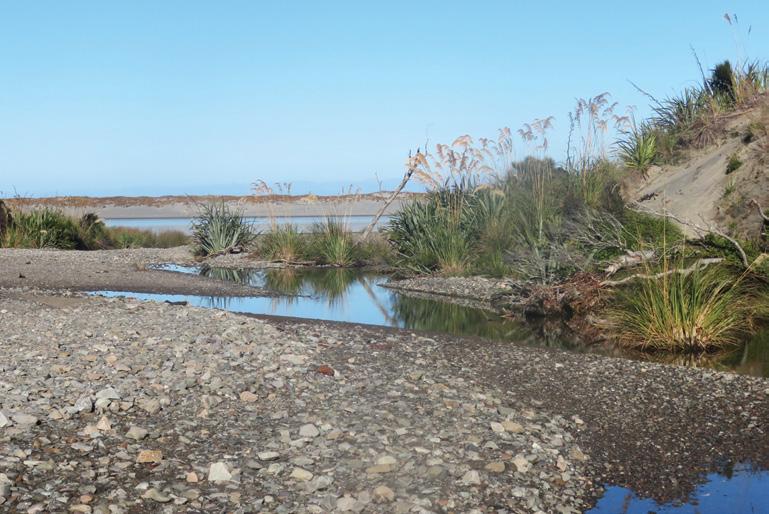
row (Whakatipu Waitui)in the late 1800’s.This lake was originally a fiord, until piles of sedimentary rock at Martins Bay, blocked it from the sea. The river mouth has changed again in recent years.
The attempt to build a settlement at Jamestown failed. It proved just too isolated and difficult, and the sandbar at Martins Bay hindered supply delivery. Now there is only a plaque, a cemetery and a few old relics. One family did remain farming in the area, and they sold out to Davey Gunn in 1926 .In the 1930’s he began guiding guests through the valley as part of the cattle muster.
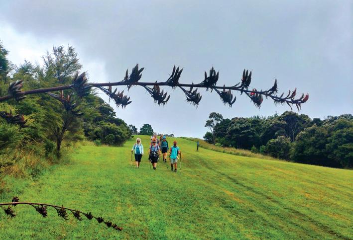
Now the Hollyford Track, following the river, is accessible for many people. Most of the trail is well marked and flat. Those who want a real challenge can walk the loop to the coast and back via the Pyke River route. This is rugged and only suitable for experienced trampers. Then there is the main track, from the road end to Martins Bay, staying in three or four huts on the way. This includes the Demons Trail, which
Above left; Early morn views from Martins Bay hut Below right: Lichen and moss dripping from the trees.
New Zealand Walk
Four fascinating days in Fiordland ■
can be quite tough, depending on weather conditions, and the state of bridges and side streams.
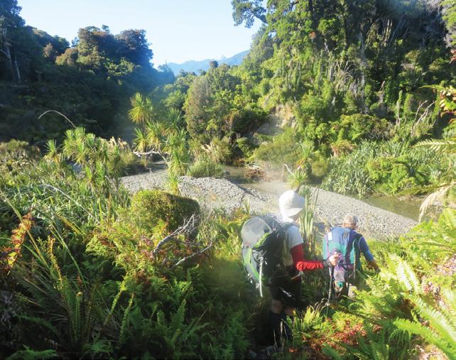
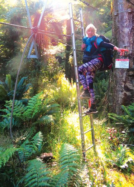
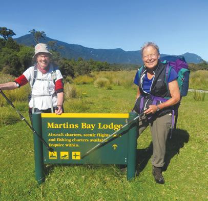
For those wanting easier options, there is a Guided Walk run by Ngai Tahu, where you are totally looked after, gear carried, lovely accommodation provided, and meals served. Then there is the choice we made – a mix of the two. We Freedom walked, but took advantage of the helicopter to fly in, and the jet boat to avoid the challenging Demons Trail.
Above left: The coastline south of Martins Bay Hut.
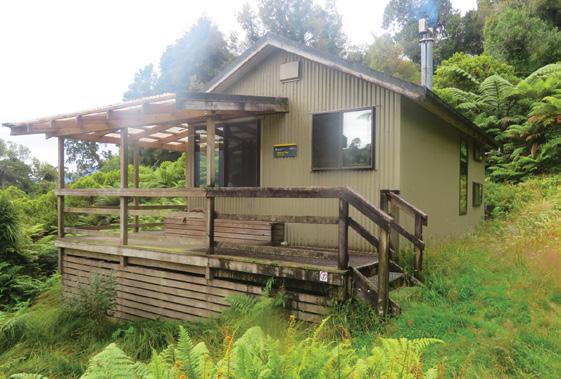
Above right: Hokuru Hut.
Middle left: A tight squeeze – either crawl under or remove your pack.
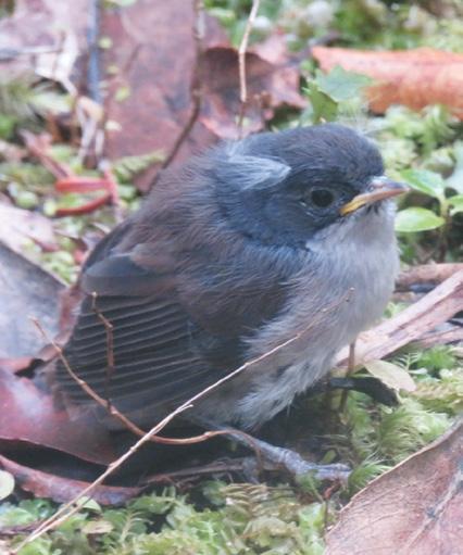
Below left: A little brown creeper.
Below right: Jerusalem Creek between Martins Bay and the lodge.
We began our adventure with a helicopter flight over Milford Sound, with its many waterfalls; and on up the wild west coast to Martins Bay, landing right beside the DOC hut. It was clean and welcoming, with enough wood to get the fire going. Although it was February, the nights were cool.
After gathering more firewood, we walked north, to visit the seals at Long Point. They were delightful. Lots of pups were playing on the rocks, as their mums basked in the late afternoon sun. Although the mums barked a warning, the little ones were totally unconcerned.
Next morning we walked north over lots of boulders towards Big Bay. It was an interesting, wet, mucky, windswept, but well marked
trail, bordered by huge flaxes. There were awesome views of enormous waves crashing onto the rocks on the shore. Stopping at a little sunny clearing for a drink, we retraced our steps.
The afternoon was spent exploring the coastline south of the hut. Here again, were huge boulders and logs,
Above: The wild west coast, just north of Martins Bay Hut.
Middle right Hidden Falls – a five minute detour from the track.
Below left: Walking down to Jerusalem creek, where a huge flood wiped out a section of Forest. Below right: Sunset at Martins Bay.
loads of driftwood and really interesting sedimentary rocks. Back at the hut we sat enjoying a golden sunset followed by millions of stars. It was truly beautiful.
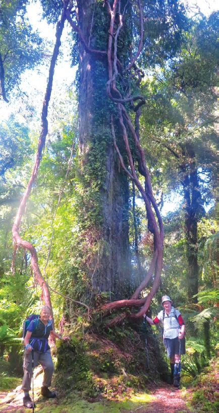
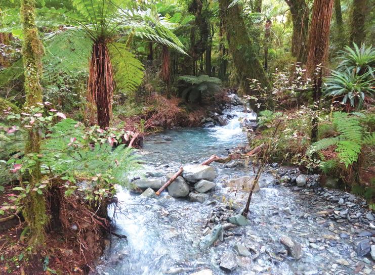
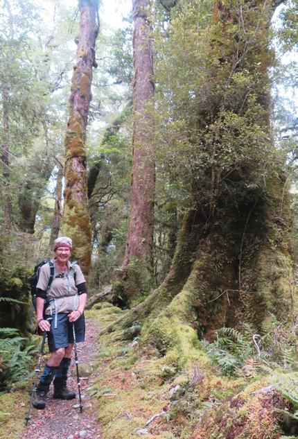
The following morning we set off towards Martins Bay Lodge, The bush was lovely and green with lots of huge ferns – some of the biggest and oldest in the world. There were lots of mosses, lichen and epiphytes on tall beech, matai, rimu and kahikatea.
Bird song became progressively louder and louder as we approached Jerusalem Creek. We spotted tuis, kereru, fantails, robins, brown creep-
Four fascinating days in Fiordland
ers, tomtits and silver eye, but heard so many that we couldn’t see. Both D.O.C and Hollyford Conservation Trust have been setting bait traps in this area, and it has certainly made a difference. We wandered through two blocks of bush, split by an area where flooding from Jerusalem Creek wiped out a large section of trees In an hour we reached the airstrip by Martins Bay
Lodge.
After wandering over the nice flat green grass, we entered another stand of bush, where, young rimu and beech grew in piles of river gravel, but the trail soon became leafy and damp with much taller trees. It wasn’t long until we reached the shores of Lake Mc Kerrow - beautiful scenery and total tranquillity.
All you could hear was the water lapping on the pebbles. We wandered along here for just over an hour before stopping for lunch. We were so close to Hokuri Hut, but not far past here, we had to cross Hokuri Stream. The water was running high, and very fast, so we opted to walk up stream to the 3-wire bridge. This wasn’t as easy as is seemed. Storms and rain had caused havoc in this area, and there were loads of tree falls. The 25 minutes stated on the sign turned out to be 55 minutes as we clambered over, under and around obstacles.
To make it more challenging, one of our party injured her knee, so we had to relay packs. Luckily
Below left: Climbing onto the 3 wire bridge to cross Hokuri Stream.
Below right: A young couple from the Czech Republic, taking a year off to explore New Zealand bush
Above left: Forest of predominantly Silver beech, Kamahi, Matai, Rimu and Kahikatea with lots of moss and fern underneath.
Above right: On the way to the Little Homer Falls.
the bridge was fun, the track on the other side was well marked, and we reached Hokuri Hut, 30 minutes from the stream, just before dark. It was set in a little clearing three minutes from the lake.
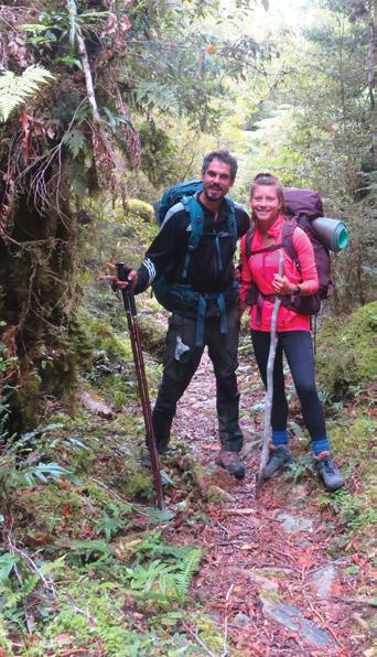
Two lovely girls from Nelson, having just walked the Demons Trail, came to help carry the extra pack for the last 15 minutes. It made so much difference. Kiwi Trampers are amazing !
On the final day, staff from Martins Bay Lodge collected our injured friend by jet boat, to take her back to the airstrip, while the rest got the jet boat to Pyke confluence.
On the way we were so lucky to see three hectors dolphins. The skipper drove in long slow circles, allowing the dolphins to play in the wake. It was magic
From Pyke confluence there was an easy, well graded trail all
the way to the road end. Silver beech and a mix of podocarps towered above, with horopito, punga, coprosma and fuchsia below adding a splash of colour below. Loads of ferns and moss bordered the path, and lichen drooped from the branches. All boggy areas had boardwalk, and all side streams were bridged. We were free to enjoy the birds and take photos.
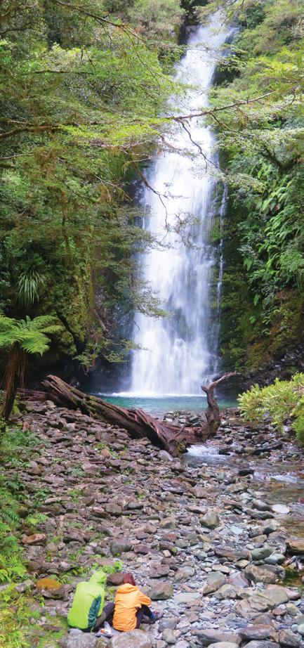
The only up- hill was Homer Saddle, with the scenery was so beautiful we didn’t notice the climb. We had glimpses of Mt Madeline, and Mt Tutoko (Fiordlands highest mountain -2,746m) We passed two waterfalls – lLttle Homer and Hidden Falls –three minutes off the track.
We reached Hidden Falls Hut in three hours and stopped for a break . It’s a lovely hut in a pretty setting. The turn off to the falls is just over the bridge nearby.. Both are worth a look if you’re walking past.
We continued along easy trail, enjoying the birds, the trees and shrubs, the numerous bridges and glimpses of the Darran Range, and reached the shuttle at the end of the road in less than three hours.
It was a beautiful adventure.
Above: left: Jerusalem Creek and the Hollyford River – between Martins Bay & the Lodge
Above right: In the forest of silver beech, kamahi, matai, rimu and Kahikatea.
Below left: Martins Bay Airstrip.
Walking Clubs Groups
NORTH ISLAND
NORTHLAND
BAY OF ISLANDS
BAY OF ISLANDS WALKERS: Saturday (AM), Jacqui Watson 022-6019741, Roz Whittaker 021-063-1455
DARGAVILLE
DARGAVILLE TRAMPING GROUP: Last Sunday of month (AM), Lynley Thompson 021-102-3974, colvilleestate1@gmail.com
WHANGAREI
CARDIAC CARE WALKING GROUP: Wednesday (AM or PM), Jo or Hugh Knight 09-438-7976
BLUE TOP WALKERS: Henderson, Tuesday, Thursday (AM), Terry Wilson 09-814-9523 or 021-266-1071, terryandsheena@gmail.com, www. bluetopwalkers.weebly.com
FIA OLA WOMEN’S DEVELOPMEMT WALK GROUP: Monday to Saturday, Anne, 09-813-0021
FIT4LIFE: Glenfield, Monday (PM), Friday (AM), Sarah 021 534 649
TE ATAU PENINSULA WALKERS: Monday, Friday (AM), Wednesday (PM), Mary Jones 09-834-6989
TE ATATU SOUTH ACTIVE 35+ WALKING GROUP: Te Atatu South, Wednesday, Edna, 09-834-1401
THE HAPPY WANDERERS WALKING GROUP: Wednesday (AM), Joy Williams 09-817-2464 or 027-353-3434
TITIRANGI TWILIGHT WALKERS: Tuesdays, Thursday, (PM) Titirangi Library, Wednesday (PM) Glovers Real Estate Green Bay, Louise 021437-547, louisenicholson@xtra.co.nz
TITIRANGI WALKERS: Sundays (AM), John Harris 09-627-0099, jeanah@ihug.co.nz
WALKERS & TALKERS: Campbells Bay, Wednesday (AM), Brenda Gray 09-410-4019, Dorothy Ensor 09-478-6702
WOMENS OUTDOOR PURSUITS INC: Tuesday, Thursday, Sunday, Donna
LEGEND
Fitness levels: “B” beginner, ”I” intermediate, “A” advanced. (AM) denotes morning walk, (PM) denotes an afternoon or evening walk. Group co-ordinators are asked to please advise us of any updates by fax 06-358-6864 or email walkingnz@xtra.co.nz.
COROMANDEL TOWN WALKERS: Tuesday, Thursday (AM) 07-8667101or 07-866-8560
KATIKATI
KATIKATI TRAMPING CLUB: fortnightly weekends (AM), Maddy Pyle 07-552-0215
KAWERAU
KAWERAU WALKERS: Kawerau, Thursday (AM), (B), Sport Bay of Plenty, 07-308-8304
HARRIERS WALKERS: Kawerau Thursday (PM), (A), Sport Bay of Plenty, 07-308-8304
ROTORUA
CROSS COUNTRY WALKERS: Tuesday, Thursday, (AM), (A), Sue Jenkins 07-332-5929 or 027-332-2692, suzwjay48gmail.com LAKE CITY ATHLETIC CLUB WALKERS GROUP: Tueday, Thursday (PM), Sunday (AM), Rob Colledge 07-348-7768, info@lakecity.co.nz, www. lakecity.co.nz
GREEN PRESCRIPTION WALKING GROUP: TMonday and Thursday (AM), (B), Melissa Gordon 07-348-4125
HEART SUPPORT WALK GROUP: Tueday (AM), Wally Walford 07347-6173
MOKOIA COMMUNITY CENTRE WALKERS: Wednesday (AM), (B), Melissa Gordon 07 348 4125
SPRINGFIELD STROLLERS: Wednesday (AM), (BIA), Glenys Searancke 07-348-4243
MANAWATU STRIDERS: Tuesday, Thursday, (PM); Hockey Manawatu Pavillion, Manawaroa Street, (BIA), Bob 027-208-3719 or Kate 027-567-3896/
Fitness levels: “B” beginner, ”I” intermediate, “A” advanced. (AM) denotes morning walk, (PM) denotes an afternoon or evening walk. Group co-ordinators are asked to please advise us of any updates by fax 06-358-6864 or email walkingnz@xtra.co.nz.
MANAWATU STRIDERS: Sunday (AM); Manawatu Striders Clubrooms, Manawaroa Park, (behind the Esplanade Cafe), (BIA), Bob 027-2083719 or Ross 021-708-733
GOLDEN BAY ALPINE AND TRAMPING CLUB: Regular day and overnight tramps, Gaylene Wilkinson, Club President , beachgums@gmail.com
WEDNESDAY WALKERS GROUP: Weekly day walks, Richard English 03-525-6179 rsenglish@xtra.co.nz
CANTERBURY
CHRISTCHURCH
ACTIVE CHRISTCHURCH SUNDAY WALK: Sunday (AM) (BI), 03-9418999
AVONSIDE KIWI SENIORS: Wednesday (AM), (BI), Jan 03-389-2755
AVONHEAD KIWISENIORS: Friday (AM), (BI), Bess 03-342-7647 AFTER WORK WALKING CLUBS: around Christchurch, (BI), for all ages and fitness levels, recreation clerk, CCC 03-371-1778.
PIONEER TRAMPERS:Thursday (AM) (IA),4-5 hour tramps in Banks Peninsula and the hills and lower mountains from Mt Hutt to Mt Grey, pioneertrampers@gmail.com
60’S UP WALK GROUP: Monday (AM), Olive Swain 03-214-4802
YMCA WOMEN’S WALKING GROUP: Tuesday (AM), Joan Tuffery, 03-216-7377
ACTIVE WALKERS KIWI SENIORS: Thursday, Sport Southland 03-2112150, e:kiwiseniors@sportsouthland.co.nz, www.sportsouthland. co.nz
GORE
GORE DISTRICT WALKERS: Tuesday (AM), NgaireEvans 03-208-4744 or Maureen Jones 03-208-7322, maway50@gmail.com
HOKONUI TRAMPING CLUB: Margaret Hughes 03-208-7053
NORTHERN SOUTHLAND
NORTHERN SOUTHLAND WALKERS: 2nd and 4th Thursdays, Mossburn.: Jo Muir, 03-248-6474, Balfour: Christine MacLean 03-201-6390, Riversdale: Margaret McLennan, 03-202-5868
Notice to clubs and walking groups
If you notice there that the times, names or contact numbers etc on the list of Walking Grroups in the Directory on these pages needs updating please email us at walkingnz@xtra.co.nz. These are are free listing.
NEW ZEALAND
FEBRUARY 2025
2 Southern Cross Round the Bays, Christchurch
2 Clevedon Country Half Marathon, Clevedon Auckland
2 Nexans Fun Run/Walk Eltham, Rawhitiroa
4 Manawatu Striders Super Seven Series, Palmerston North
4 Shoe Clinic Asics 5K Series 4, North Hagley Park, Christchurch
5 Sharland Cycles 5K Fun Run/Walk Series, Richmond
5 Taupō Harriers Summer 5K Series 2, Taupo
7 Coast to Coast Mountain Run, Aickens, Canterbury
8 Buller Gorge Marathon, Half Marathon & Team Relay, Buller to Westport
16 Southern Cross Round the Bays, Wellington
8 Sun to Surf Run & Walk, Ohope Beach
Walking Festival, Rolleston, Canterbury
16 Sri Chinmoy Auckland Series 2025: Race 2, Mt Roskill, Auckland
18 Manawatu Striders Super Seven Series, Palmerston North
18 The Cook 5km Summer Series Run/ Wal, The Cook, Hamilton East
23 Forest Hill Trail Run, Forest Hill, Southland
25 Manawatu Striders Super Seven Series, Palmerston North
9 Coatesville Half Marathon, Coatsville, Auckland
10 Kāpiti 5K Fun Run/Walk Series 9, Raumati Beach
11 Manawatu Striders Super Seven Series, Palmerston North
11 The Cook 5km Summer Series Run/Walk, The Cook, Hamilton East
12 Sharland Cycles 5K Fun Run/Walk Series, Richmond
13 Trout Fly Summer Series, Rotorua
14 Ben Lomond Vertical Kilometre, Ben Lomond Station, Queenstown
15 Cargo Plus Coastal Challenge, Whangaparaoa to Devonport, Auckland
12 Mackenzie Half Marathon, Fairlie, South Canterbury
(from early
13 Cape Egmont Half Marathon, Cape Egmont
AUGUST 2025
2 Taupō Marathon,Taupo
3 South Island Half Marathon, Lake Hood, Ashburton
NOVEMBER 2025
8 County Fayre Downhill Walk, Pohangina, Manawatu
AUSTRALIA
MARCH 2025
8 Great Illawarra Walk, Shellharbour, NSW
22 Lake High - Great Victorian Walk for Autism, Mansfield, Vic
29-230 Aussie Peace Walk, Lake Burley Griffin Canberra, ACT
REST OF WORLD
FEBRUARY 2025
15-16 IML Walking Festival, San Antonio, USA
MARCH 2025
1-3 IML Walking Festival, Yatsushiro, Japan
23 -24 IML Walking Festival, Canberrra, ACT, Australia
APRIL 2025
14 Paris Marathm, Paris, France
27 London Marathon, London, England
MAY 2025
3-4 The Two Day Walk, Blankernberge, Belgium
10-11 International Waendel Walk, Wellingborough, United Kingdam 17-18 International Walking Festival, Dalian, China
29-31 International Walking Festival, Chantonnay, France
JUNE 2025
14-15 Marche Internationale de Diekirch, Diekirch, Luxembourg
28-29 International Walking Festival, Viborg, Denmark
JULY 2025
3-6 International Walking Festival, Castlebar, Ireland
15-18 International Walking Festival, Nijmegen, Netherlands
AUGUST 2025
2-3 Lithuanian Marching Festival, Kaunas, Lithuanian
8-10 International Walking Festival,, Vassa, Finland
22-24 International Walking Festival, Duuchcov, Czek
30-31 International Walking Festival, Verday, Norway
SEPTEMBER 2025
6-7 International Walking Festival, Gospic, Croatia
13-14 International Walking Festival, Beijing, China
19-21 International Walking Festival, Seefeld, Austria
27-28 International Walking Festival, , Brno, Czeck Republic
OCTOBER 2025
4-5 International Walking Festival, Fulda, Germany18-19
NOVEMBER 2025
6-7 International Walking Festival, Arlington, Virginia, USA
25-26 International Walking Festival, Wonju, Korea
WAIHEKE ISLAND
Waiheke Retreat
Waiheke Island, Palm Beach
* 3 bedroom house, sleeps up to 8, with spectacular views of the Hauraki Gulf.
* Fully self contained including linen and towels, cooking facilities and bbq.
* Ideal for families and mature groups.
* Walk our amazing coastal, bush and Te Ara Hura Tracks.
* Take in our stunning vistas and visit our world renowned vineyards.
* Finish your day with a wine on the deck overlooking beautiful Palm Beach. Contact Carol for availability, nightly rates and specials: 027 292 9374
New Zealand magazine, two issues back from the latest, FREE at : http://issuu.com/walkingnewzealand.
Having trouble finding Walking New Zealand magazine in your favourite newsagent or supermarket?
Did you know you can now buy the latest copy of Walking New Zealand magazine posted to you at the retail price of $12.50 pus $3.00 postage or you can subscribe and SAVE.
You can buy a copy by:
* Visit www.walkingnewzealand.co.nz/magazine
* Email to walkingnz@xtra.co.nz with your postal address and credit card details
* Ring Freephone 0800 walking, and have your postal address and credit card details handy.
You can now view and enjoy the latest issue of Walking New Zealand magazine online for only $3.95 at http://www.walkingnewzealand.co.nz
CONTENTS for previous 15 issues
FEBRUARY 323 2025
3 Contents
4 Walk Talk
6 New Zealand Walk: Discovering Castlepoint: the Deliverence Track
8 New Zealand Walk: Linklater Walkway
9 New Zealand Walks: Historic Whitianga Rock Maori Pa site walk
10 New Zealand Walk: Westmere Lake Loop Walk
12 Overseas Walks: Magnificent midwinter meanders in Europe
14 New Zealand Walk: Swingbridge Loop Track offers an immersive experience 16 Expository Essay: Learning to Walk
18 Manawatu Walking Festival
19 Walking Festival; The 2025 Manawatu Walking Festival beckons adventure seekers
20 New Zealand Walk: Matiatia to the Vineyards Coastal Walk on Waiheke Island
24 Walking New Zealand Monthly Photo Contest
26 New Zealand Walk: Waikanae River Trail Walk popular with locals
28 New Zealand Walks: Two walks to explore on Mt Te Aroha
30 New Zealand Walk: Cooks Cove Walkway captivating journey through history
34 New Zealand Walks: Kawau Island for great day trips for walkers
38 Kauri Forest Challenge
39 New Zealand Walk: Moria Gate Loop and Mirror Tarn - a 4km West Coast Walk
40 Directory of New Zealand Walking Groups
42 Coming Events: New Zealand
45 Coming Events: Australia
45 Coming Events: Rest of World
48 New Zealand Country Breaks
50 Index of previous 15 issues
52 Pak A Roo Jackets JANUARY 322 2025
3 Contents
4 Walk Talk
6 New Zealand Walk: Mt Pukeatua - a forest filled with native flora and fauna
9 New Zealand Walk: Climbing Mt Pukeatua in Maungatautari Scenic Reserve
10 New Zealand Walks: Rotoroa Island -Auckland’s best kept secret
13 New Zealand Great Walk: Sommes Island reopns in time for tourist season
14 Overseas Walks: Get the taste of the Spanish Caminos in just 17 days
16 New Zealand Walk: Two walks in the Hakarimata Scenic Reserve
17 New Zealand Walk: Te Henga Walkway reopens to viewing point
19 New Zealand Walk: Puketi Forest Kauri Challenge classed as one of the best day walks
22 New Zealand Walk: Travis Wetlands Walk - a family friendly frestwater wetlands walk
24 Walking New Zealand Monthly Photo Contest
26 Overseas Walks: Fiji has a huge area to explore
32 New Zealand Walk:Waipu Coastal Walkway - a hidden gem in Northland
34 New Zealand Walks: Five water loving walks to escape to this summer
36 New Zealand Walks: Undertake some walking adventuresmake it a new year resolution
38 New Zealand Walks: Two lesser known Auckland parks to explore
42 Coming Events: New Zealand
48 New Zealand Country Breaks
51 Walking New Zealand Shop
52 Pak A Roo Jackets DECEMBER 321 2024
4 Walk Talk
6 New Zealand Walk: Paekakariki Escarpment Track offers an exhilating experience
10 New Zealand Walk: Fensham Reserve - a p;opular local native bush walk
12 New Zealand Great Walk: Tuatapere Humpridge Track now New Zealand’s 11th Great Walk
13 New Zealand Walk: Humpridge Ridge Track a 3 day loop walk
14 New Zealand Walk: Plans for a Wainui Bay Forest Walkway
15 New Zealand Walk: Maraetotara Falls Walk popular with the locals
16 New Zealand Walk: Tarawera Trail Story now comes to life as you walk
18 New Zealand Walk: Step into Christchurch’s past with new walking guide
20 New Zealand Walk: Walking through Fort Stony Batter tunnels on Waiheke Island
21 New Zealand Walk: Stony Batter an historic gem on Waiheke Island
23 Overseas Tour: Wainwright’s Coast to Coast Walk with ever changing views
24 Walking New Zealand Monthly Photo Contest
26 New Zealand Walks: Exploring the Great South
30 Books: Backyard Bird Watching
30 New Zealand Walks: A week of short walks in Golden Bay
34 Overseas Walks: Canyon Cornucopia: Palm Springs, California
38 New Zealand Walk: Mt Victo riaLookout Walk great for local and visitors
42 Coming Events: New Zealand
48 New Zealand Country Breaks
51 Walking New Zealand Shop
52 Pak A Roo Jackets NOVEMBER 320 2024
3 Contents 4 Walk Talk
6 New Zealand Walks: 10 best short walks on the West Coast
10 New Zealand Walk: Mercer Bay Loop track
12 New Zealand Trail: Exploring the Rimutaka Rail Trail a journey from the Hutt Valley to Wairarapa
16 New Zealand Walk: Walking to the Hurunui Hut in the Kaimai Mamaku Forest Park
18 New Zealand Walk: Exploring Gabriel’s Gully - a walk through history and nature
20 New Zealand Walk: Walking through the Piriharakeke Walkway where the Manawatu River once flowed
24 Walking New Zealand Monthly Photo Contest
26 Australian Walks: Queensland’s best short walks under two hours
29 New Zealand Walk: The Estuary Edge Walk - where the Avon River meets the sea
31 New Zealand Walk: Walking up Rangitoto Island for a taste of adventure
36 New Zealand Walks: An on-foot odyssey in Outstanding Otago
40 Directory of New Zealand Walking Groups
42 Coming Events: New Zealand
48 New Zealand Country Breaks
51 Walking New Zealand Shop
52 Pak A Roo Jackets
OCTOBER 319 2024
3 Contents 4 Walk Talk
6 AustralianWalks: On the trails through national parks in the Northern Territory
11 New Zealand Walks: Okitu Bush Scenic Reserve Walk
12 New Zealand Walk: Pureora Timber Trail in a recovering native forest
16 Overseas Cycling Trail: Trans Dinarica Trail a long ride through nine countries
20 Australian Walk Tour: Active seniors experience Tasmanian wilderness
22 New Zealand Walks: 20 walks at Bay of Islands Weekend
Photo Contest
26 New Zealand Walk: Cape Wanbrow Track now part of Oamaru’s Skyline Walk
30 New Zealand Walk: Wright’s Hill Lookout Loop Walk around an historic hill fortress
32 Overseas Guided Tour: Super Saunters on the islands of Samoa
36 New Zealand Walks: Kuirau Park walks in a geothermal area
38 Event: Toi’s Challenge a challenging trail in Whakatane
44 Coming Events: New Zealand
45 Coming Events: Australia
48 New Zealand Country Breaks
51 Walking New Zealand Shop
52 Pak A Roo Jackets SEPTEMBER 318 2024
3 Contents 4 Walk Talk
6 New Zealand Walks: Karangahake Gorge with lots of walks to explore
10 New Zealand Walks: The Grampians - home to a network of walking tracks
14 New Zealand Walks: Pipinui and Waihi - two waterfalls that are well worth the short walks
16 News: Winners of Golden Foot Walking Awards 2024 announced
18 New Zealand Walks: A footstepping foray into fabulous Fiordland
22 New Zealand Walks: Five easy walks in the Greymouth Region
24 Walking New Zealand Monthly Photo Contest
26 Overseas Walks: Snow, Skull Rock and the HIdden Valley: Trekking Joshua Tree National Park
29 New Zealand Event; Martinborough Round The Vines
30 New Zealand Walk: Mangawhero Forest Walk through dense native forest
31 New Zealand Walk: Kaitoke Walkway - Raglan
32 New Zealand Walk: Mt St John Walk incredible views of the MacKenzie Basin
34 Books: Guide to Ferns and lycophytes
36 New Zealand Walks: Walking through Cascade Kauri Forest
44 Coming Events: New Zealand
48 New Zealand Country Breaks
52 Pak A Roo Jackets AUGUST 317 2024
3 Contents 4 Walk Talk
6 New Zealand Walks: Five Fantastic Auckland board walks to visit this winter
8 New Zealand Walk: Maitai Cave - highlight of walks in the valley area
10 New Zealand Walks: Breath taking and unique walks in the Bay of Plenty
16 Overseas Walk: Exploring the Appalachian Trail - a walk in the woods
23 New Trail: Work to start on Christchurch’s City to Sea Path
24 Walking New Zealand Monthly Photo Contest
26 New Zealand Walks: Driving along the earth’s heated underbellyRotorua to Taupo
28 New Zealand Trail: Tuki Tuki TrailWaipawa to Waipukurau
31 New Zealand Walk: Pukemokemoke Loop Bush Track
32 New Zealand Walk: Sutton Salt Lake - NZ’s only inland salt lake
34 News: New 100m suspension bridge opened on Taranaki Crossing
36 New Zealand Walk: Lyttelton’s Bridal Path for great harbour views
44 Coming Events: New Zealand
48 New Zealand Country Breaks
52 Pak A Roo Jackets
JULY 316 2024
3 Contents
4 Walk Talk
6 New Zealand Walks: Three different and interesting Marlborough walks near Picton
8 Overseas Walk: Peddlars Way a young long distance walk in England
tramway path
12 New Zealand Walk: Discovery Mine at Waihi Beach
15 High Achievers: Whangawehi group wins award for Te Aratia Walkway
16 New Zealand Walks: Exploring Queenstown with five day walks
24 Walking New Zealand Monthly Photo Contest
26 Australian Walk: Tomaree Coastal Walk - a new 27km hike
27 New Zealand Walks: Two walks in the Hakarimata Scenic Reserve
28 New Zealand Walk: Okere Falls Waterfall a local gem
30 New Zealand Walk: Lake McGregor Loop Walk an autumn oasis walk
33 New Zealand Walks: Hidden gems of the Coro-del
36 New Zealand Walk: Kakamatua Inlet One of the best dog walking beaches
37 New Zealand Walk: Kakamatua Inlet - Auckland’s premier dog-friendly beach destination
42 Coming Events: New Zealand
47 Award: Golden Foot Awards nominations now open
48 New Zealand Country Breaks
52 Pak A Roo Jackets
JUNE 315 2024
4 Walk Talk
6 New Zealand Walks: Aongatete Loop Track a wander in the bush
8 New Zealand Shared Trail: Exciting new walkways and cycle ways in historic Cutters Bay
10 New Zealand Trail: The magic of the Twin - Opua to Horeke
16 New Zealand Shared Pathway: New Plymouth Coastal Walkway for stunning coastal views
20 Auckland Short Walks: 10 parks to explore in Auckland’s city centre
22 The role and aims of the Outdoor Access Commision
23 Overseas Walks: Kielder Water & Forest Park has miles of beautiful trails
24 Walking New Zealand Monthly Photo Contest
26 New Zealand Trail: Northland Trails Project will create unique two-coast loop
27 Overseas Walks: Unveiling uniquely Australian experieneces by Sydney hotel
28 New Zealand Walks: Four easy trails with native flora
31 Overseas Walks: Perambulations in Patagonia
35 Books: The Tramp to the Blue Range Hut
35 New Zealand Walk: Mataihuka Walkway part of Raumati Escarpment Reserve
36 New Zealand Walk: A bush walk in Kuratau
42 Coming Events: New Zealand
48 New Zealand Country Breaks
52 Pak A Roo Jackets
MAY 314 2024
3 Contents
4 Walk Talk
6 New Zealand Walks: Kauri Glenwalk among tall kauri trees
8 New Zealand Walks: Stewart Island a fascinating place to walk
13 New Zealand Walk: Glory Track - a moderate challenge
14 New Zealand Walk: Bexley Wetland Walk - with lots ot of diversity and interest
17 Australian Walk:Tomaree Coastal Walk -a new NSW Great Walk
20 New Zealand Walk: Wandering the islands of the Gulf
24 Walking New Zealand Monthly Photo Contest
26 New Zealand Walk: A stroll through nature’s tapestry - Exploring Point Elizabeth Walkway
28 New Zealand Walk: Exploring the Ashhurst to Ruakawa Road Pathway
30 New Zealand Walk: A walk among the Vines in Martinborough
32 News: New esplanade reserve along Kaputone Creek Walkway
34 News: Magazine publisher wins award for promoting walking
36 New Zealand Walk: Te Whare Okioki - the newest hut in the Kaimais
37 Great Walks: DOC is increasing the price of Great Walk fascilities
38 Directory of Walking Groups
42 Coming Events: New Zealand
48 New Zealand Country Breaks
52 Pak A Roo Jackets APRIL 313 2024
4 Walk Talk
6 New Zealand Walks: Hemi Matenga Reserve - walks with sweeping views
10 New Zealand Walks: Five adventure walks around Rotorua
15 New Zealand Walk: Wrights Hill Loop walk a look back at history
16 New Zealand Walk:Tumanako Loop Track a great walk for children
16 Overseas Walks: Experience the more remote trails of Fiji
20 New Zealand Walk: Quarry Rim Track with stunning views of the Alps
21 New Zealand Walks: Eastwoodhill with over 25km of walking tracks
22 Overseas Walk: Walk the Alps - observe the area with all its wonders
23 New Zealand Walking Festival: ECHO Walking Festival in its 21st year
24 Walking New Zealand Monthly Photo Contest
26 New Zealand Trails: Opotiki’s spectacular trails improved with extensive plantings and pestcon-trol
31 New Zealand Walk:Lake Panorama Walk in a peaceful setting
32 New Zealand Walk: Kaikoura Peninsula Walk for breath-taking scenery
37 New Zealand Event: Hundreds walk highway from Manawatu to Tararua
38 New Zealand Walk: Immerse yourself in nature: ex-plore the Redwood Bush Loop
41 Event: Christchurch rising to its marathon
42 Coming Events: New Zealand
48 New Zealand Country Breaks
52 Queen Charlotte Track MARCH 312 2024
4 Walk Talk
4 New Zealand Walk: Dalys Hut an easy three hour loop walk
11 New Zealand Walk: Walk to the crystal clear waters of Te Waikoropupu
12 New Zealand Walks: Walk, run or bike on the Sulphur Flats
14 New Zealand Walk: Balls Clear ing Reserve, Hawkes Bay
16 New Zealand Walk: Otaki River Track - a meander beside the river
18 Overseas Walks: Goldrush Autumn in New England
22 New Zealand Walk: Ngatoro Loop Track walk through a goblin area
24 Walking New Zealand Monthly Photo Contest
26 Australian Walk: Mt Coolumwalk over ancient rocks
28 New Zealand Walk:Reservoir Creek Walkway enhanced with new amenities
28 New Zealand Walk: Kettleholes Easement
30 New Zealand Walks: 10 short walks with Squawks
34 New Zealand Walk: Harry Ell Walkway - a walk for the whole family
35 New Zealand Walk: The Abel Tasman Coastal Track the Autumn option
38 New Zealand Walk: Lake Waikaremoana - a Great Walk through pristine rainforest with rivers and waterfalls
38 News: Lake Waikaremoana Walk is now open again
41 News: Real benefits by Nordic Walking for those with hip osteoarthritis
42 Coming Events: New Zealand
48 New Zealand Country Breaks
52 Queen Charlotte Track FEBRUARY 311 2024
4 Walk Talk
6 New Zealand Walks: Auckland’s North Shore Coastal Walk
10 New Zealand Walks: Otari Wilton’s Bush offers a mixture of walking esperiences
13 New Zealand Walks: Two unforgetable walks on Mt Karioi, Raglan
14 New Zealand Walk: Walk Ahuriri with rich cultural heritage